
Kameron
-
Posts
193 -
Joined
-
Last visited
-
Days Won
9
Content Type
Profiles
Forums
Events
Posts posted by Kameron
-
-
Great photo of that spot. Did you go in from the MF Nooksack road?
-
What an epic! Way to persevere through lots of gnar.
-
That's a great persepective on the E ridge!
-
Thanks, all!
-
Before the warmup, there was pow: https://cascadeclimbers.com/forum/topic/106270-kloke-peak-n-face-ski-traverse/
I've been chilling in town since then!
-
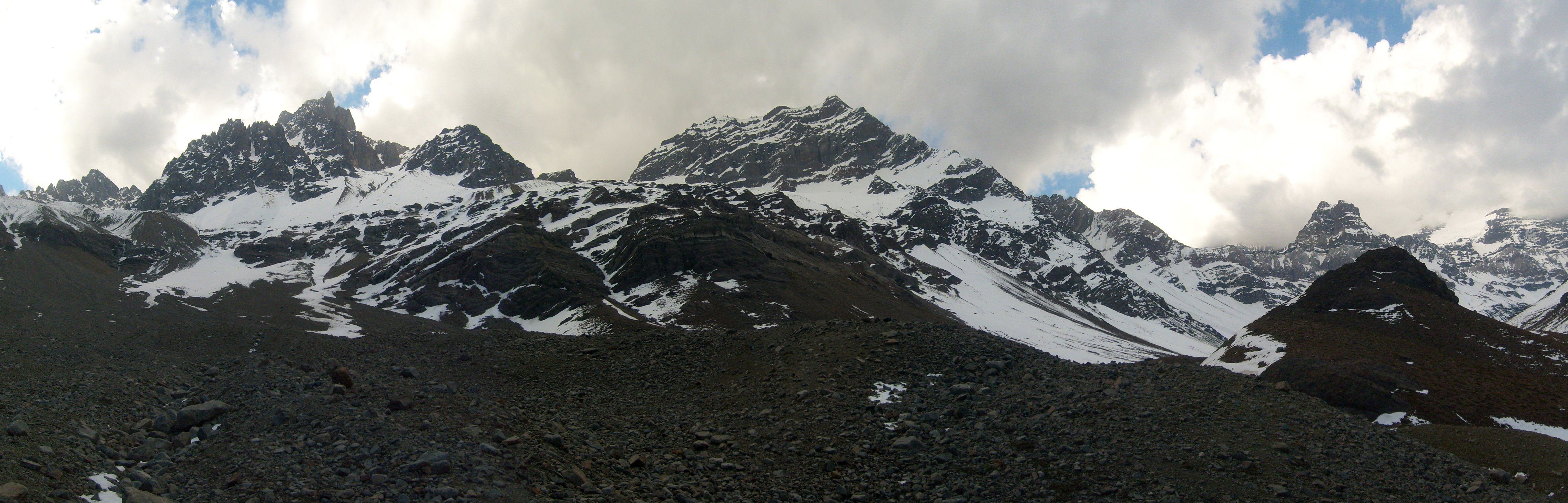
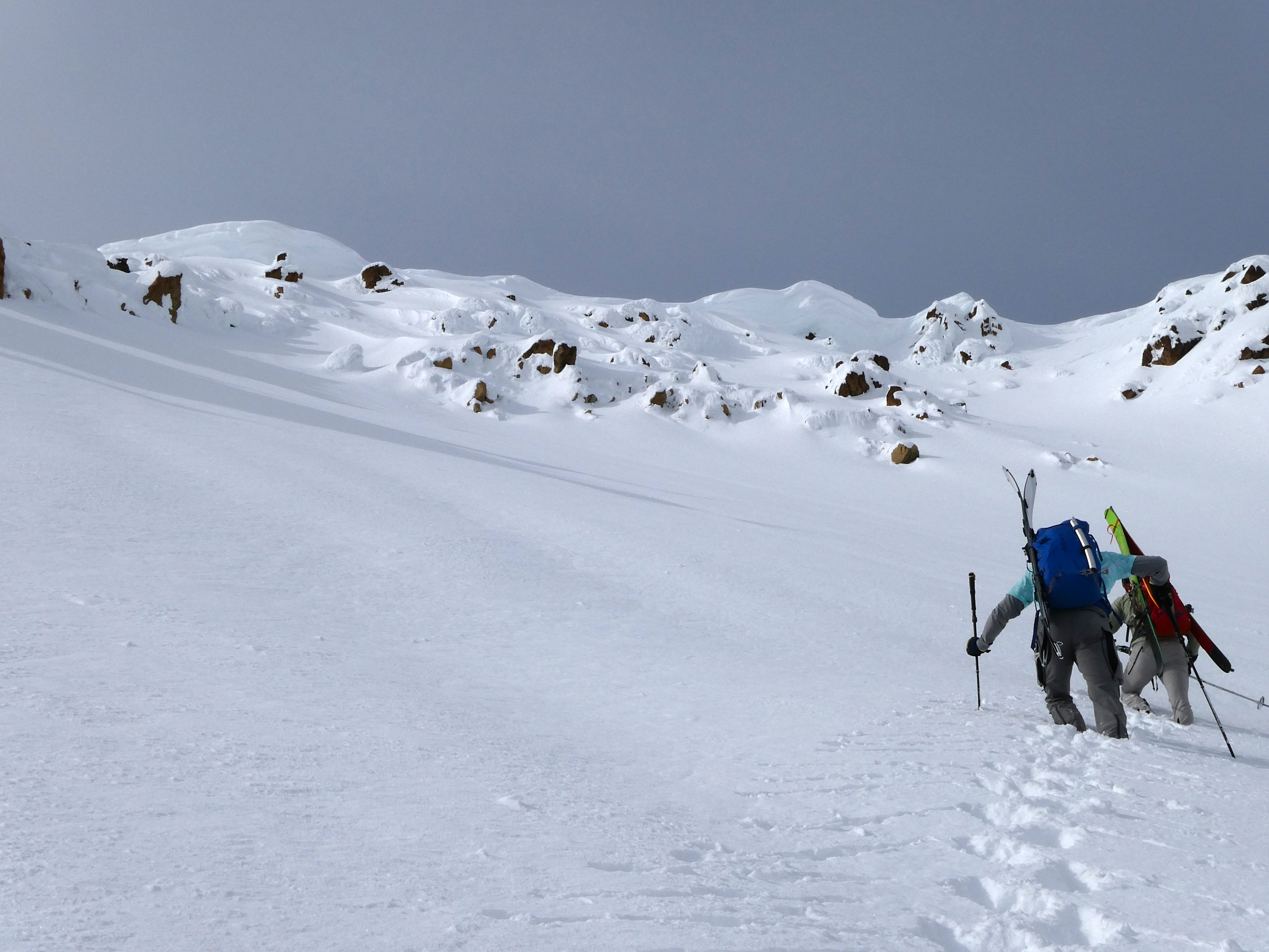
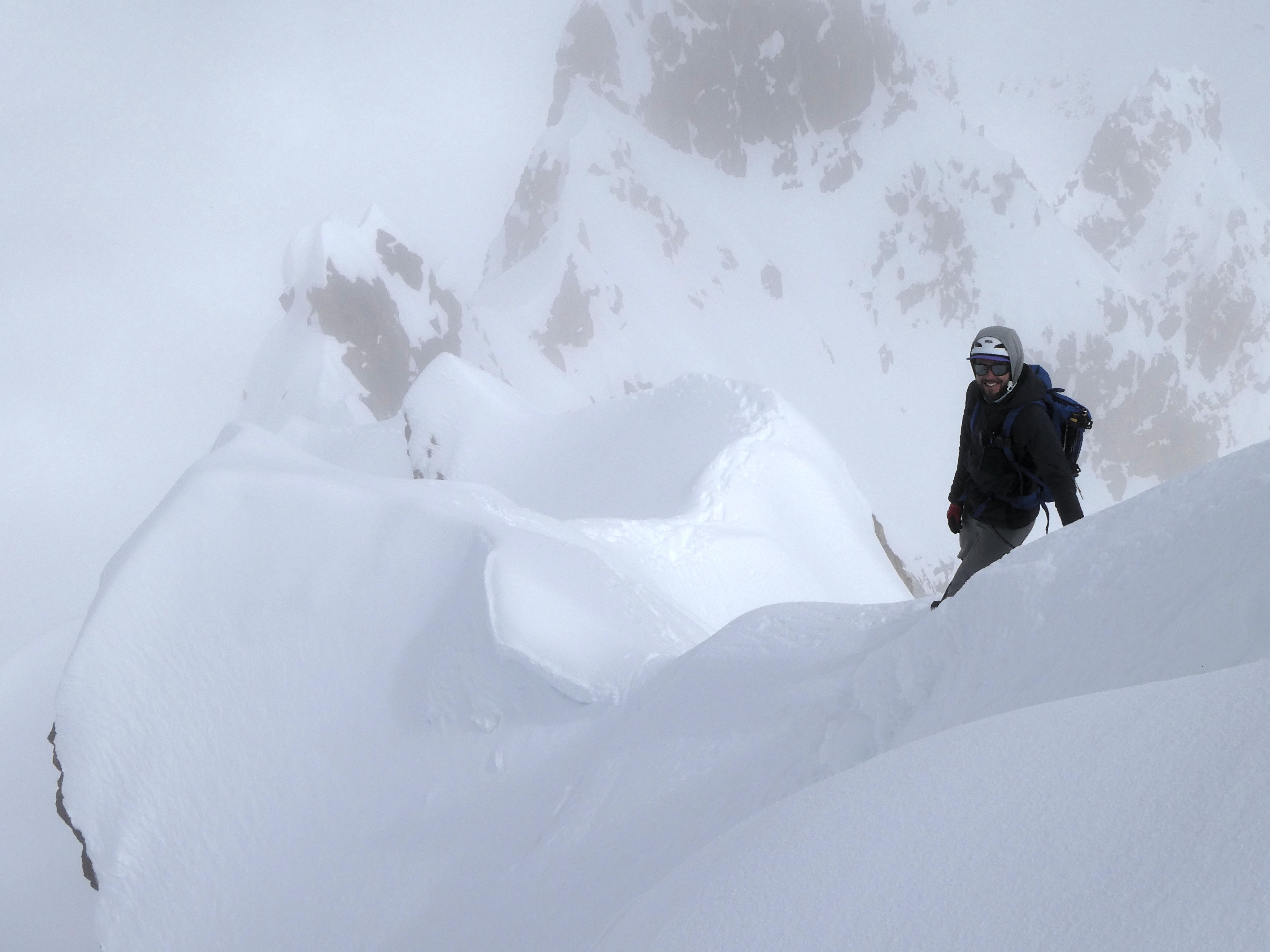
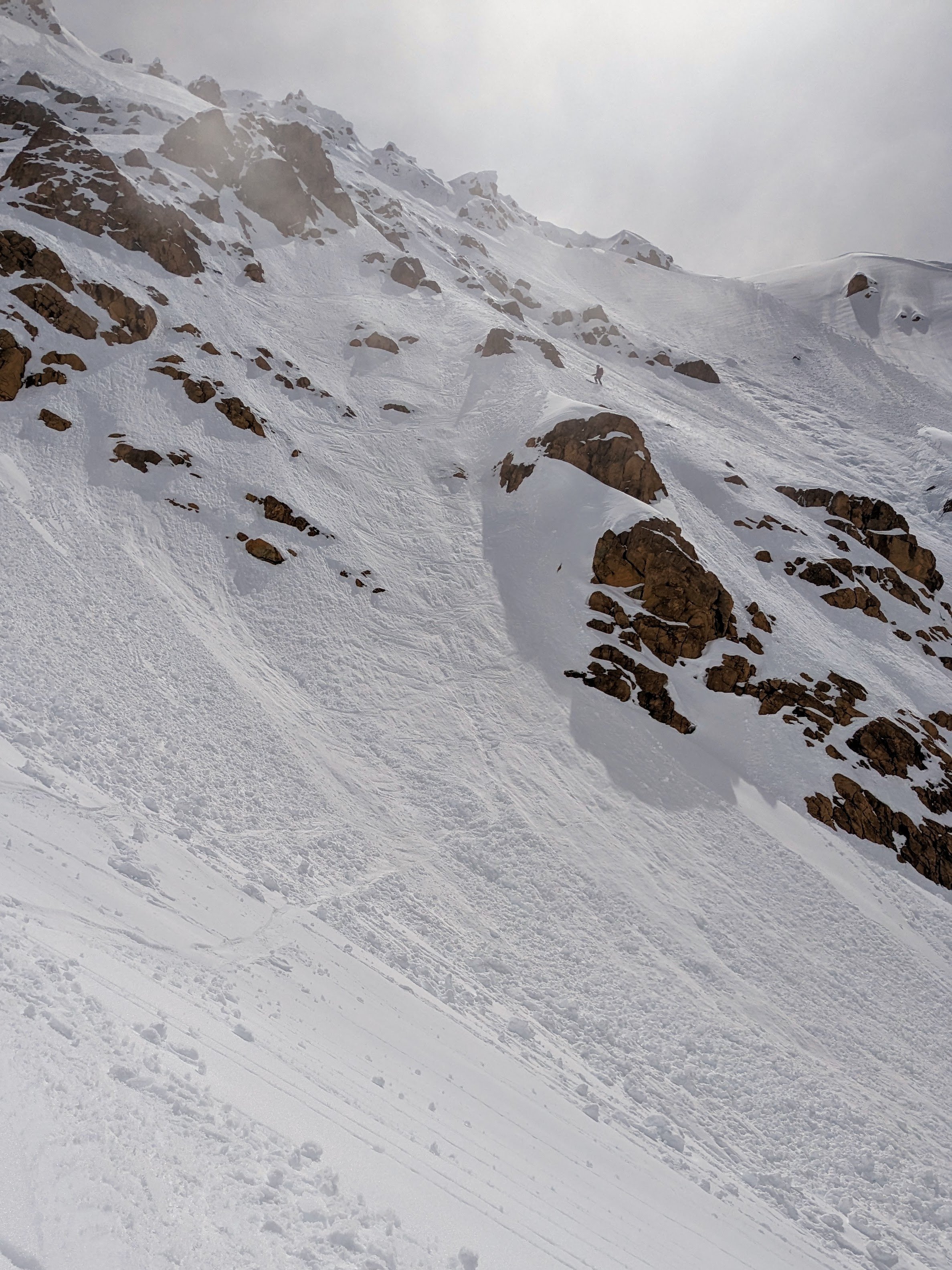
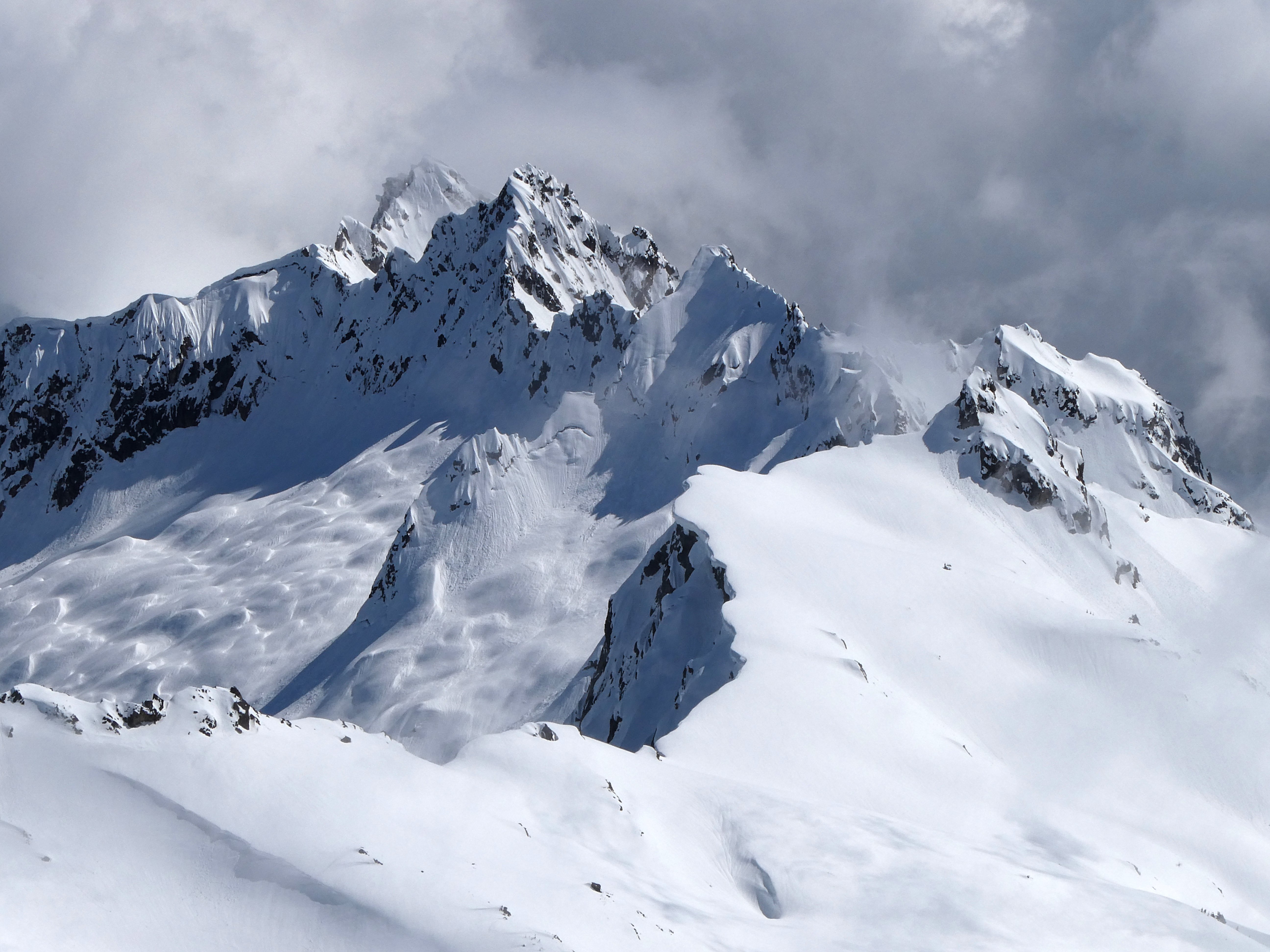
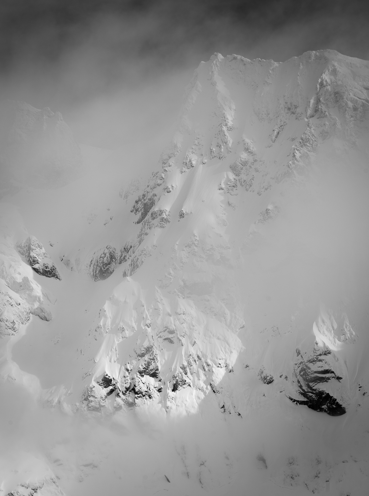
On 4/25, together with @lunger @thedylan and Mike Elges, I was finally able to complete a ski descent of Kloke peak (formerly called Hayden and recently renamed) in the Twin Sisters range. This area was apparently first referred to as Kwik-Kwek Smanik or Land of Orange Rock.
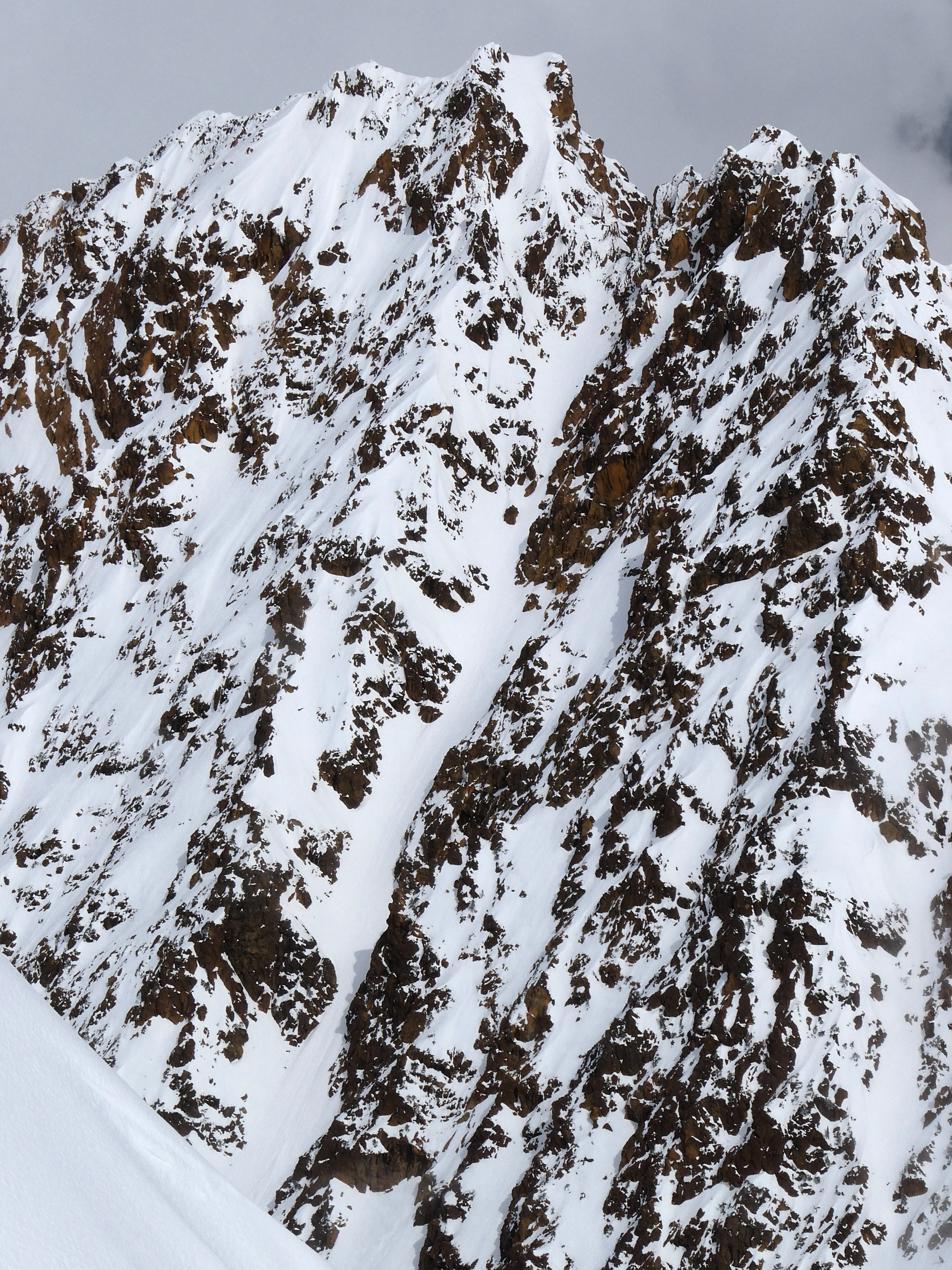
Kloke first caught my eye two years ago when perusing old TRs from the area and seeing the amazing picture in this report from 2012: https://www.famousinternetskiers.com/trip-reports/11-12/twin-sisters-traverse/4/. With Wehrly and Gregg Oliveri, we skied the N faces of S and N Twin in a day a few years back and I got a look. Last season I made two attempts on Hayden, both via Green Creek -> Cinderella col -> basins West of the crest. On the first try (4/17/22 with Eric, Scarlett, and Jesse) we had deep, blower powder conditions but tough travel through the approach forest. We got onto the line but found ice on the mid-face wind feature that would have been puckering to ski. Bailing from part-way up, we still had a great ski and amazing knee-deep blower down the Green ck glacier at sunset. The second try (6/15/22 with Dylan and Mike G) was just too late in the season with mushy conditions. We looked at the face and turned around, then I got caught in a small wet loose on a steep kick turn while exiting and took a small ride. The time we skied over the Mythic wall was actually another attempt but rerouted midway because my partners didn't like the cornices above the NE face of S Twin.
The stage was set over the past few weeks. A couple of trips into the area showed that faces were very filled in, and we had some incredible powder skiing on 4/19 on N Twin. (These adventures will get their own TRs.) The road has been plowed to ~1 mile from the trailhead most of the season for logging, and some friends happen to pay for key access to the area. We were just able to stash a car at the Elbow lk TH with the end of the road blocked by snow. The nice log crossing is still in place.
A more elegant route to Kloke seemed like an actual traverse up and over S Twin then out Green ck. This would make the approach travel easier due to higher starting elevation and an established non-bushwacky route. The Green ck exit would prove to still involve some thrashing, but all the options to loop back to N Twin seemed like they would have either too much wet slide hazard by afternoon or an unknown bushwack and likely sufferfest through Fish ck... no thanks!
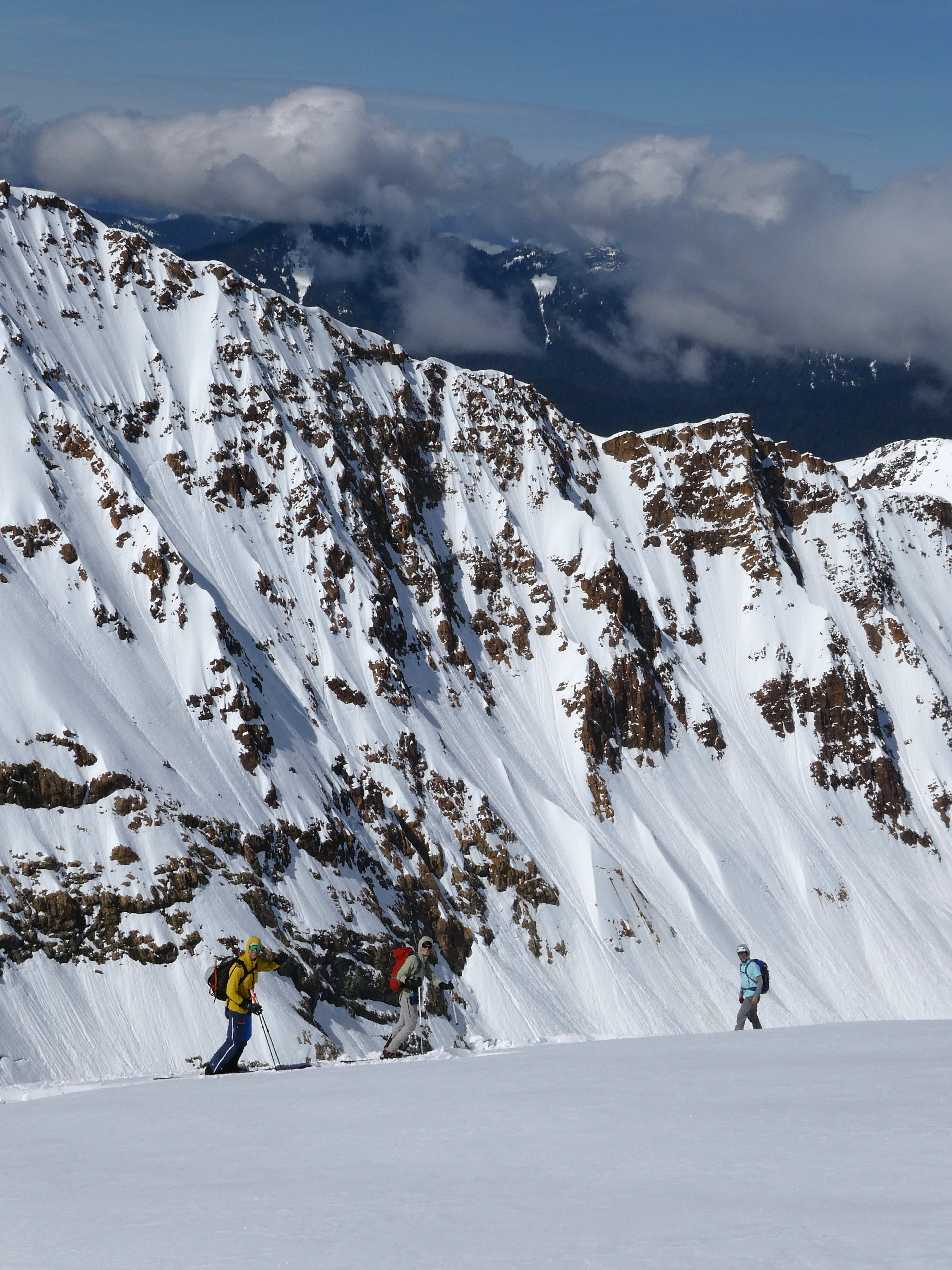
So we started really early from town, did the car shuttle, and were putting on boots around 6 am when some friends showed up at the trailhead. Funnily enough, they were also headed towards the basin between the Twins to ski the "Twisted Sister" (S couloir on N Twin). We followed their skintrack onto the W ridge of N Twin, climbed up a ways, then did a diagonal descent into that basin. Snow conditions there were hardpack, rain crusted, and entirely stripped of any new snow. I was pessimistic that we would find any soft snow except in the sun later at this point.
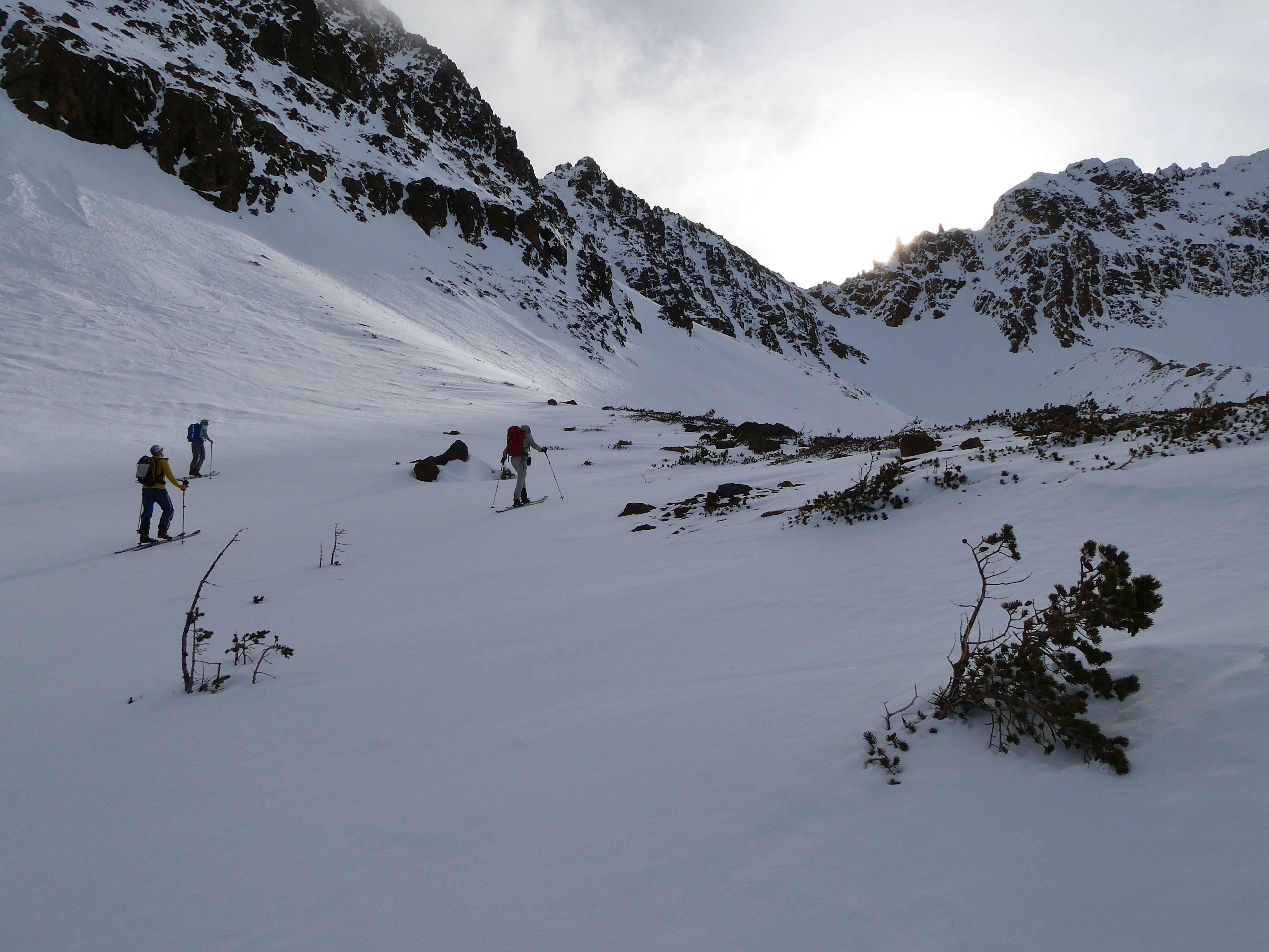
Ingmar and Jake booting up the Twisted Sister:
However, crossing the notch onto the Sisters glacier, the snow suddenly got deeper. We foolishly avoided transitioning to skins and trudged up the flat glacier, postholing more and more as we went but too stubborn at that point to add two more transitions. The NE face of S Twin was really nice powder. Cornices loomed. We moved fast in the steps of Dylan and Mike.
E$
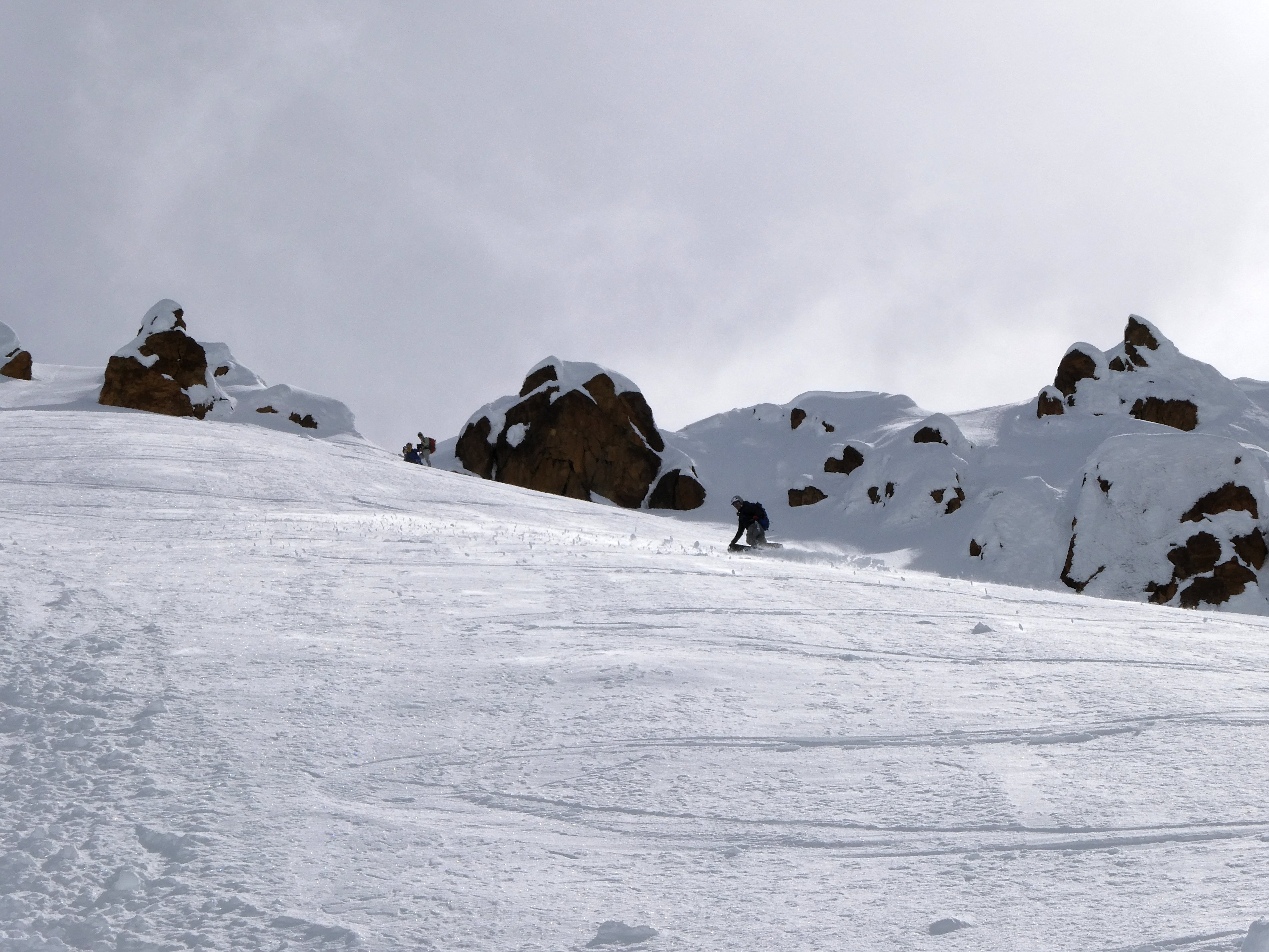
Good perspective on the Twisted Sister
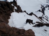
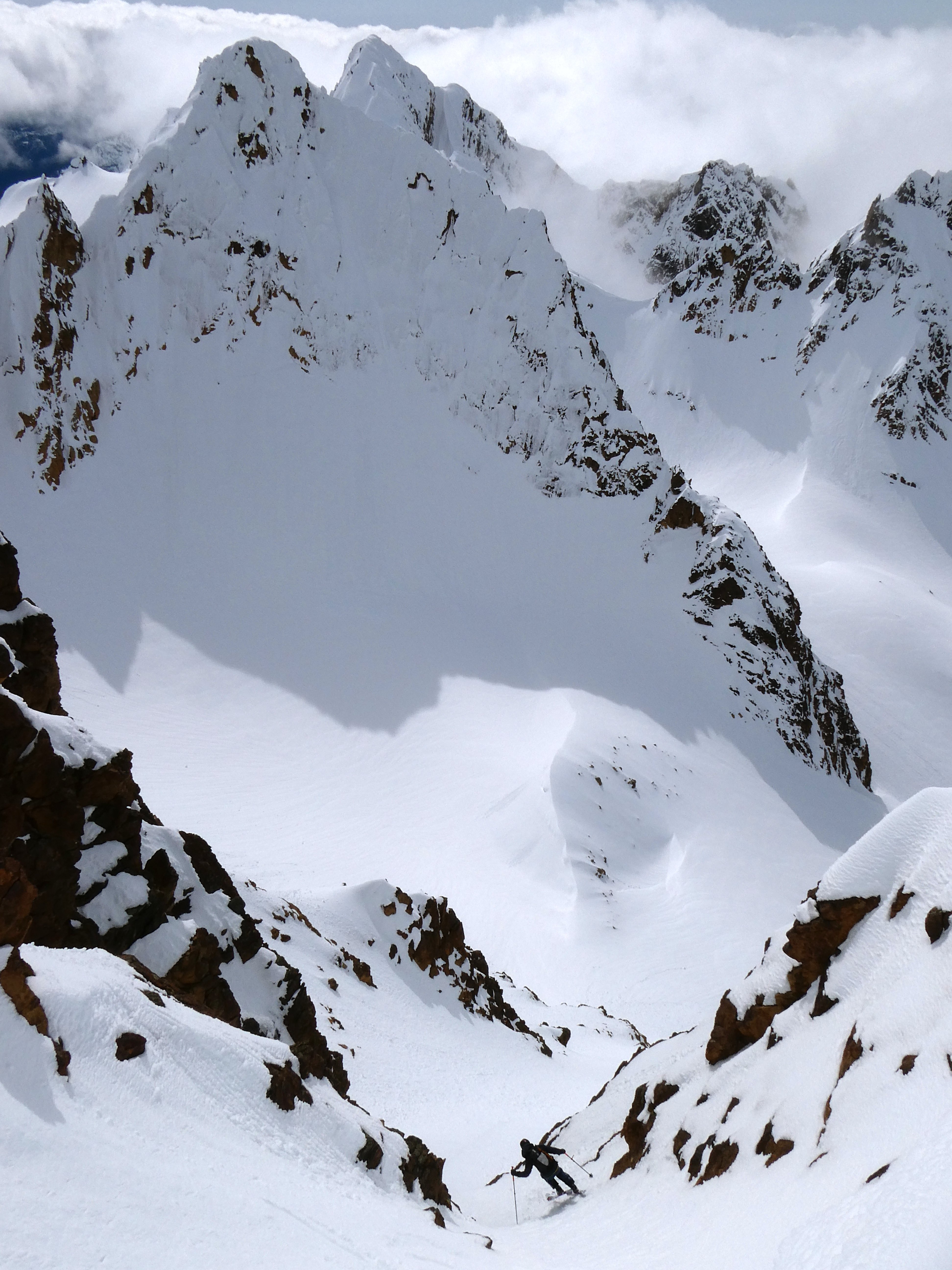
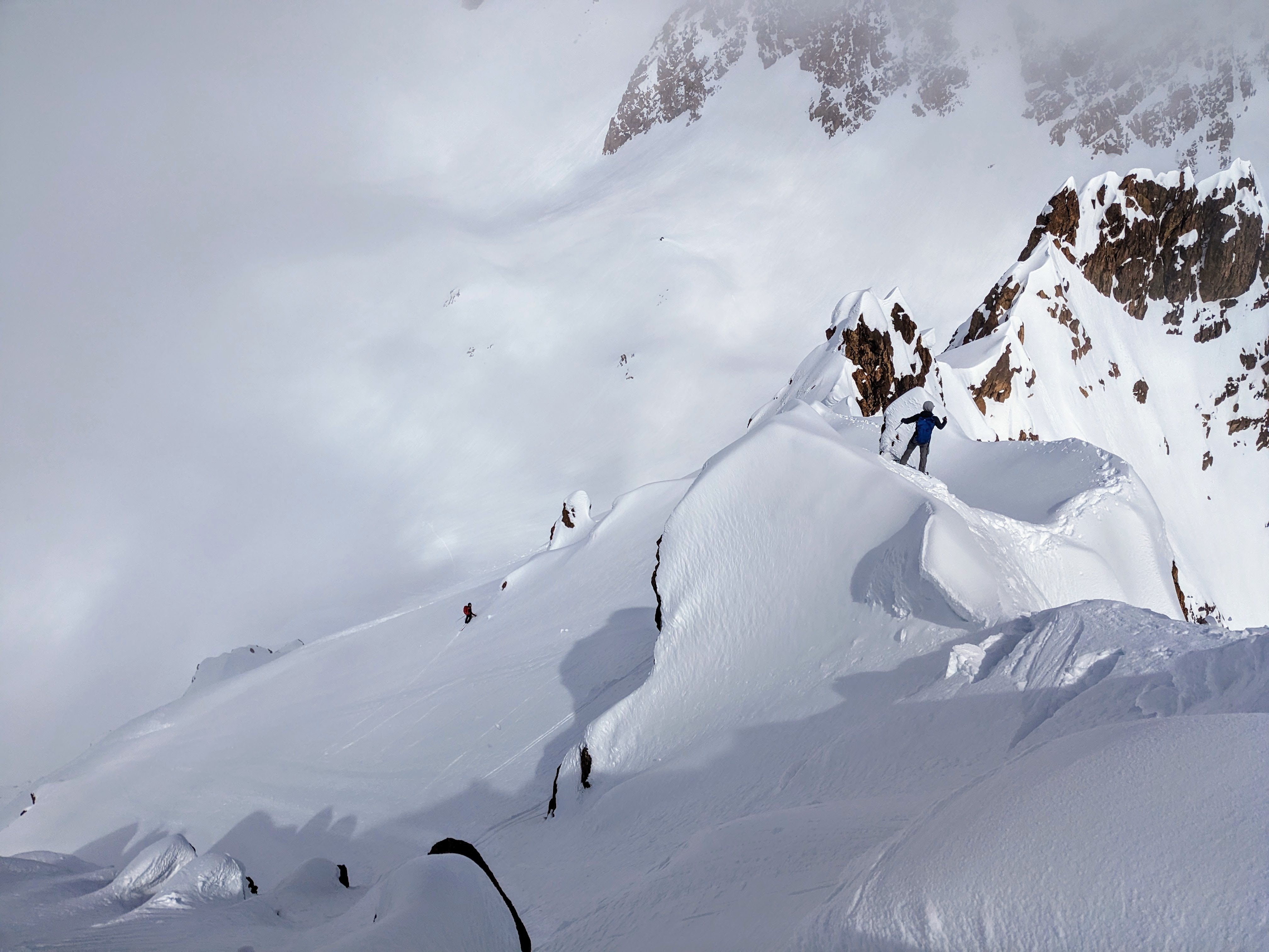
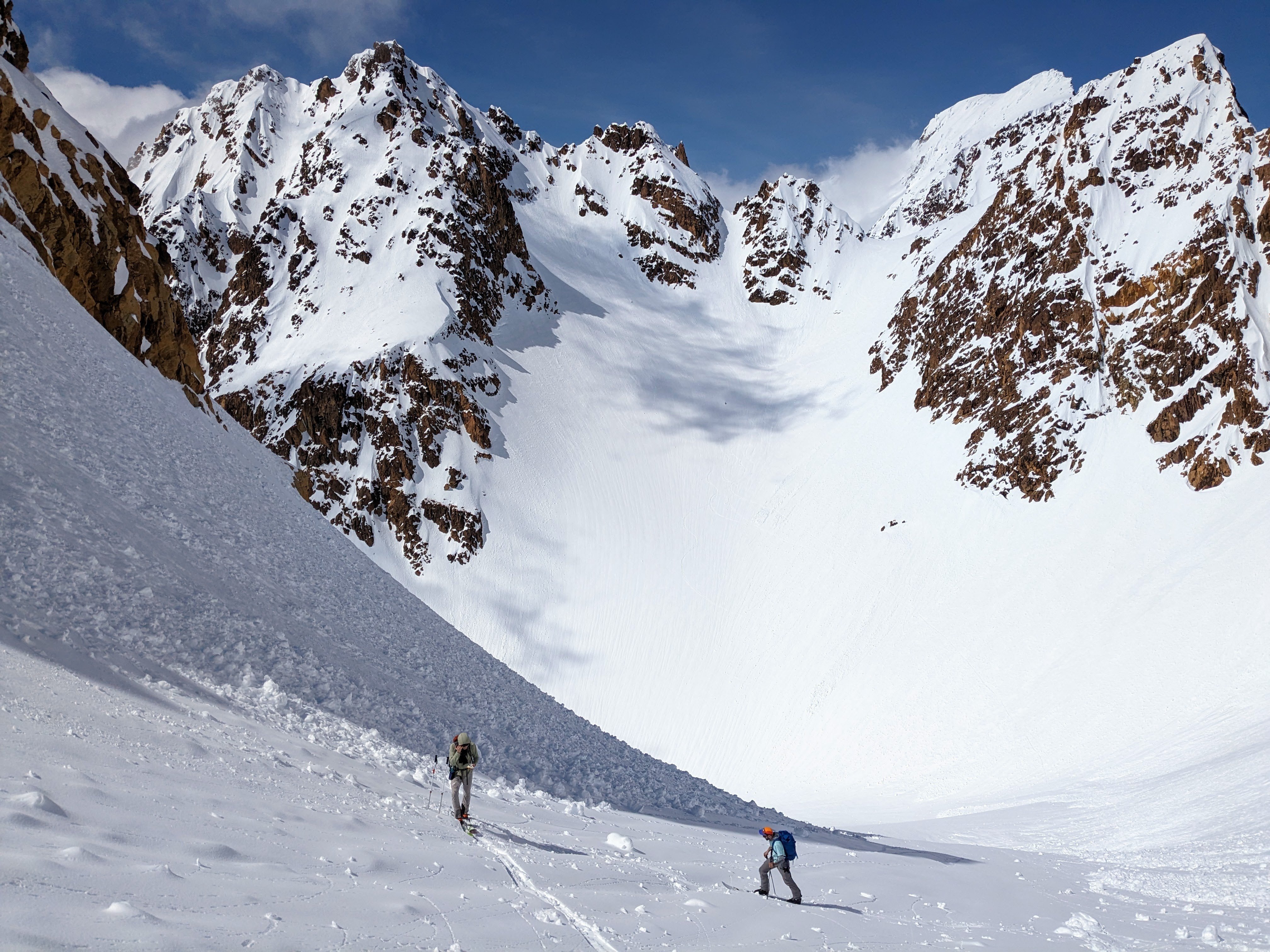
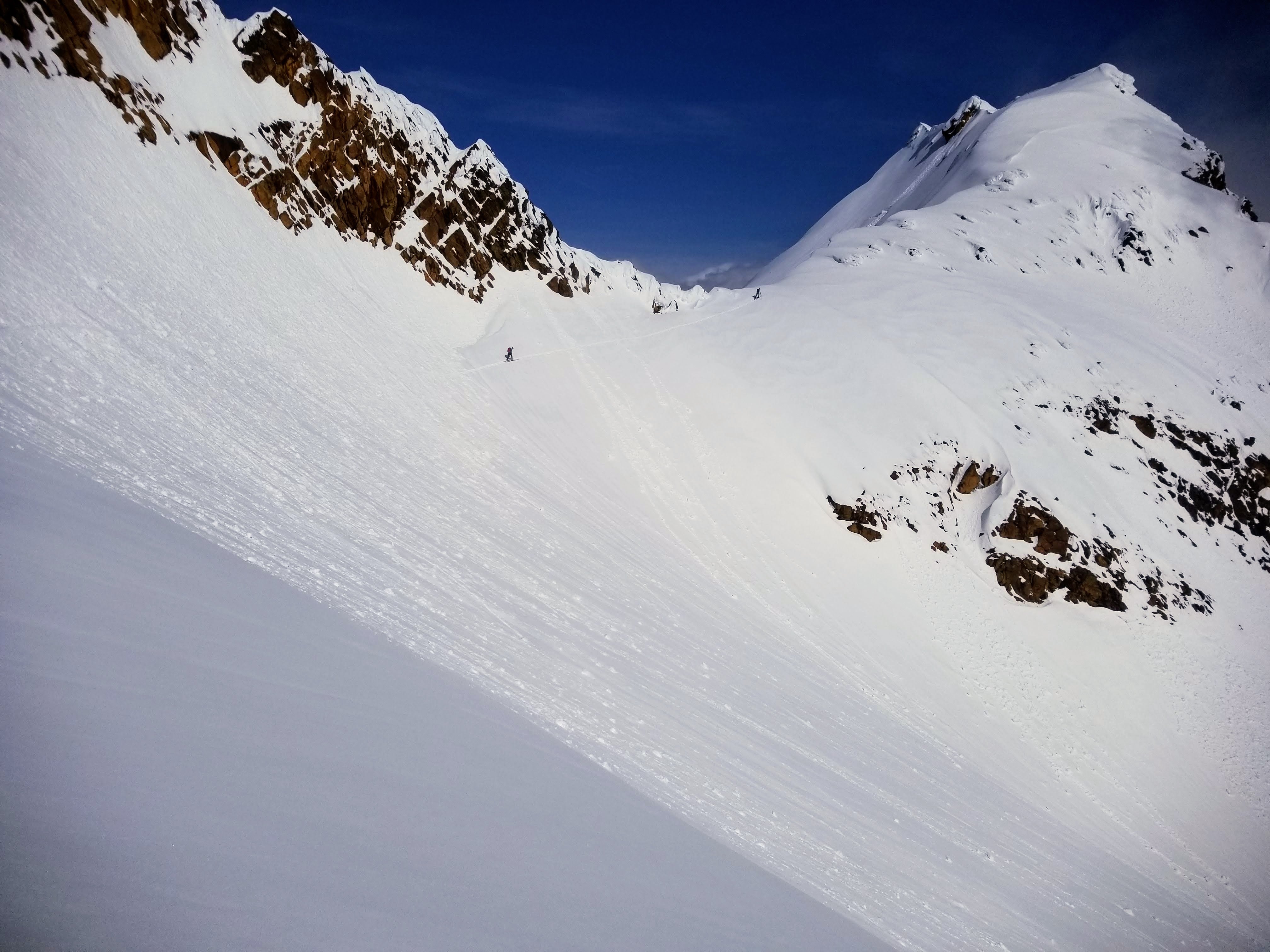
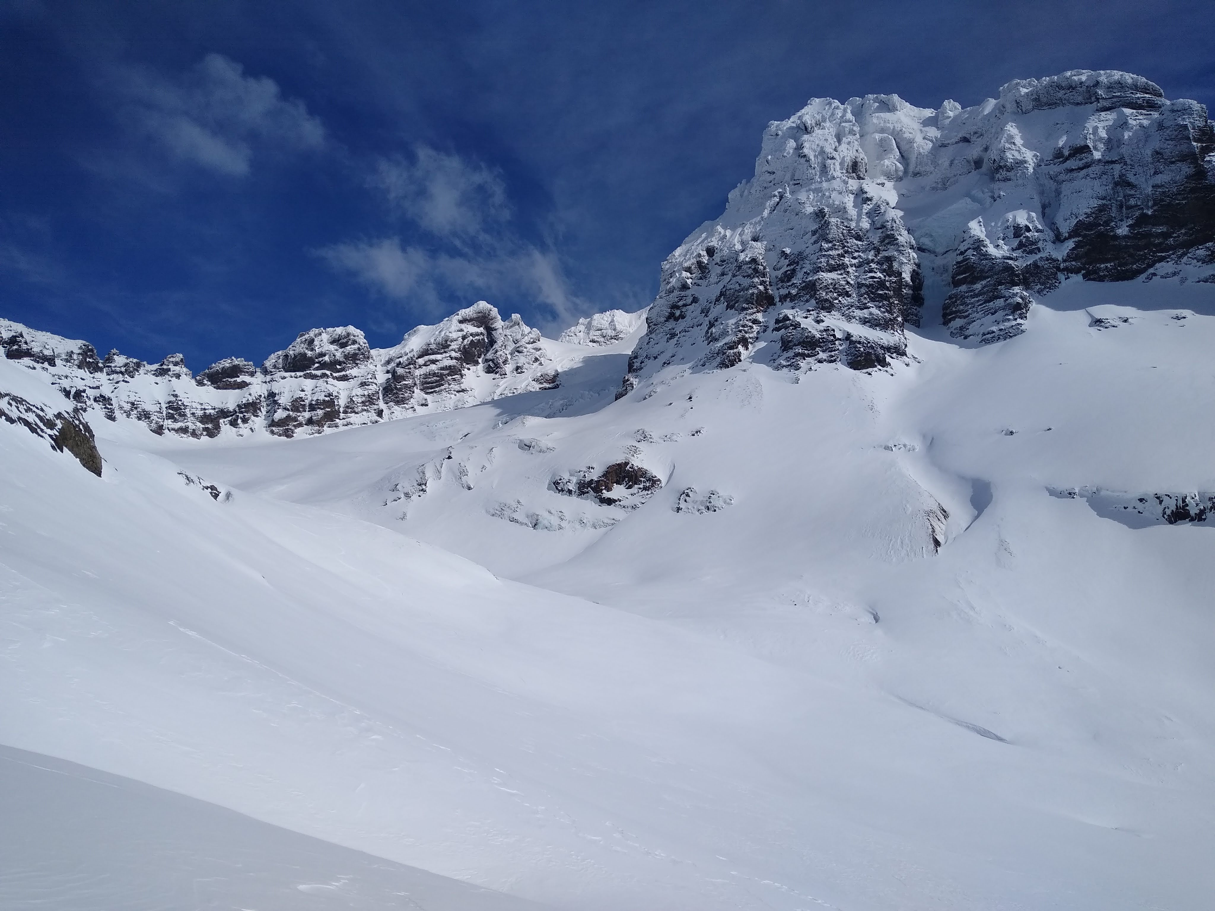
On top of South, we had to decide whether to commit to the traverse or ski the known quantity/quality powder back onto the glacier and maybe do some kind of linkup from there. Kloke didn't look very clean from this point. There were some slides that had ran on the lower part of the face, but the upper part looked smooth. I am grateful that my partners wanted to continue. Dylan dropped first and skied down to the main gully that spits you towards Skookum basin. Eric and Mike had pulled off earlier, having spotted an alternate gully leading into the same area. We shouted with Dylan and he dropped down, leaving the 3 of us to ski this nice mini line with a steep entrance.
On top of South with Kloke to the left of Dylan
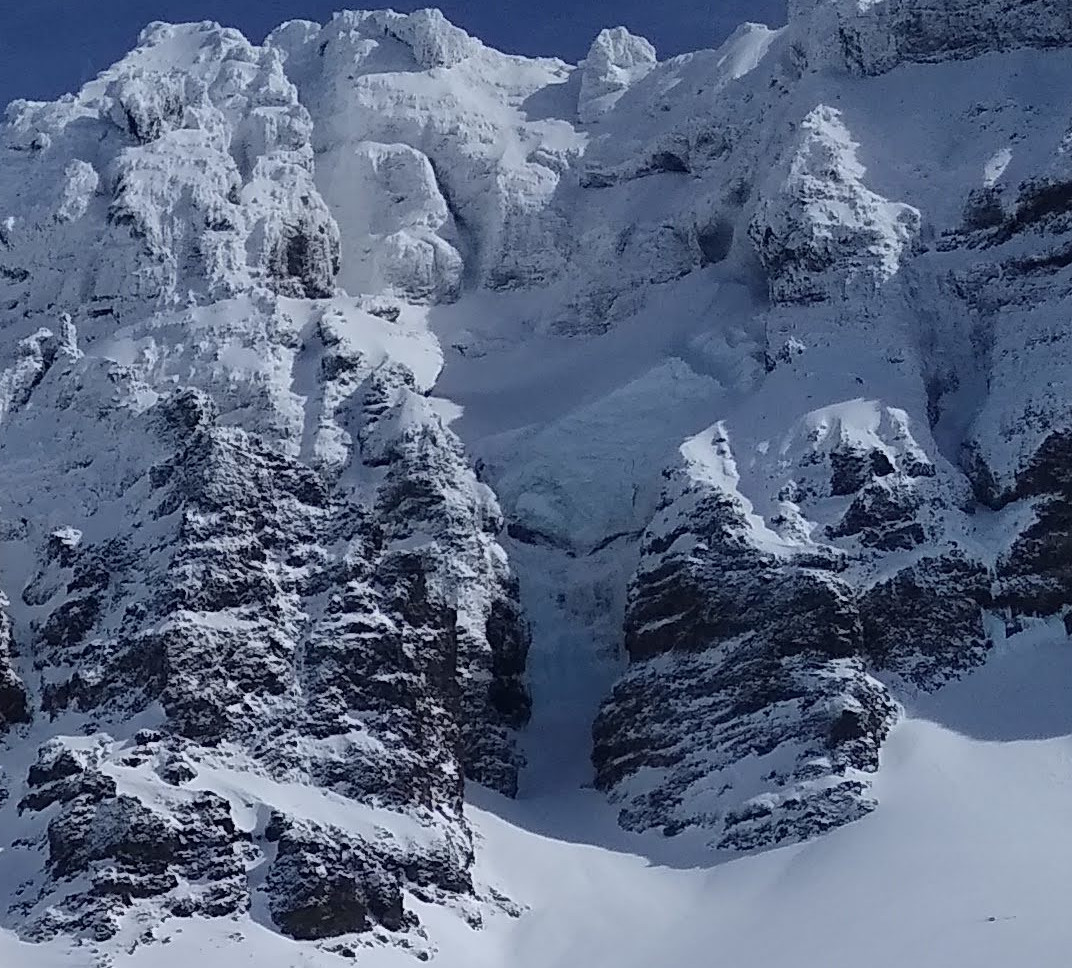
Eric opening up his line after passing through the narrow choke
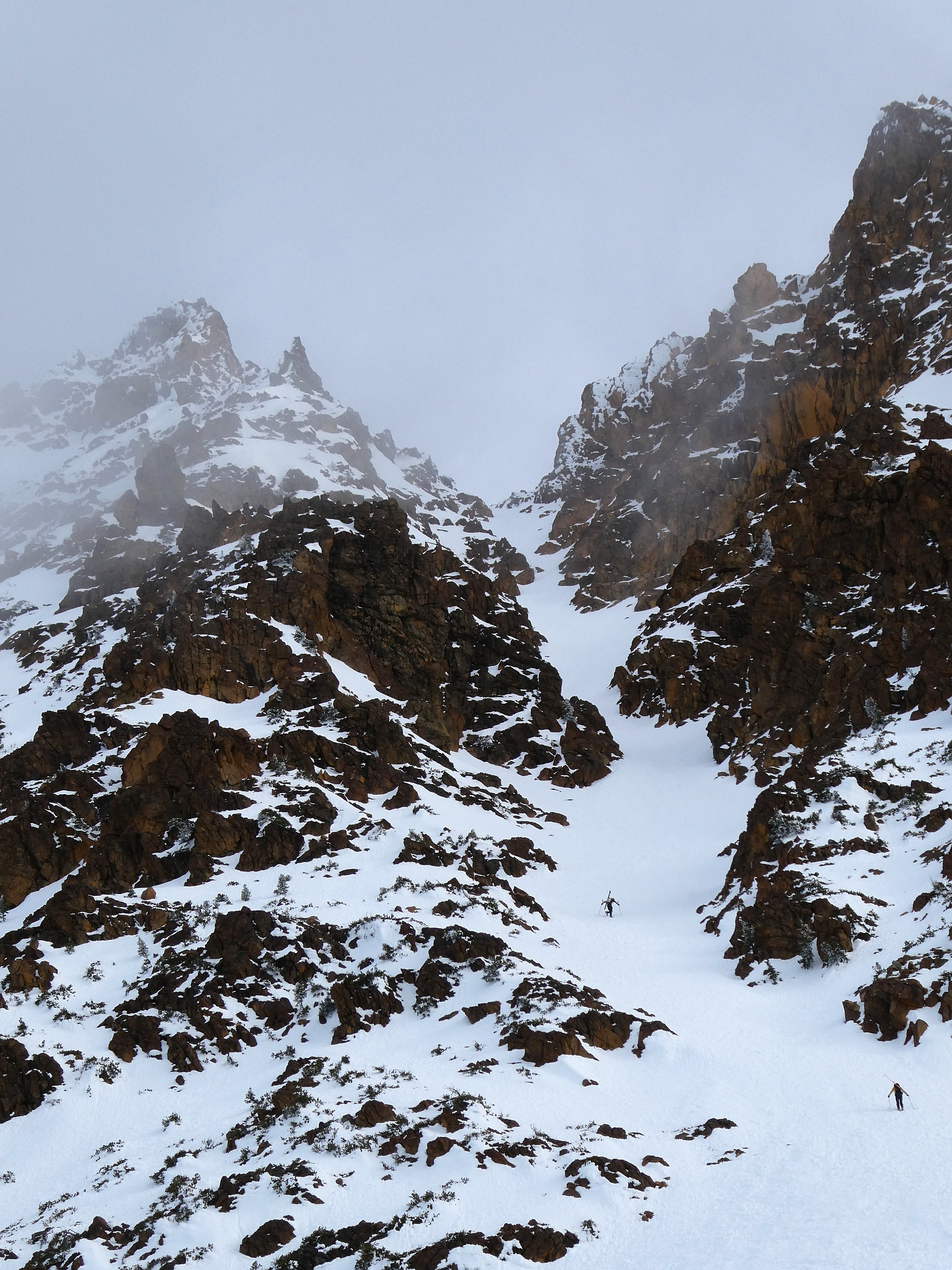
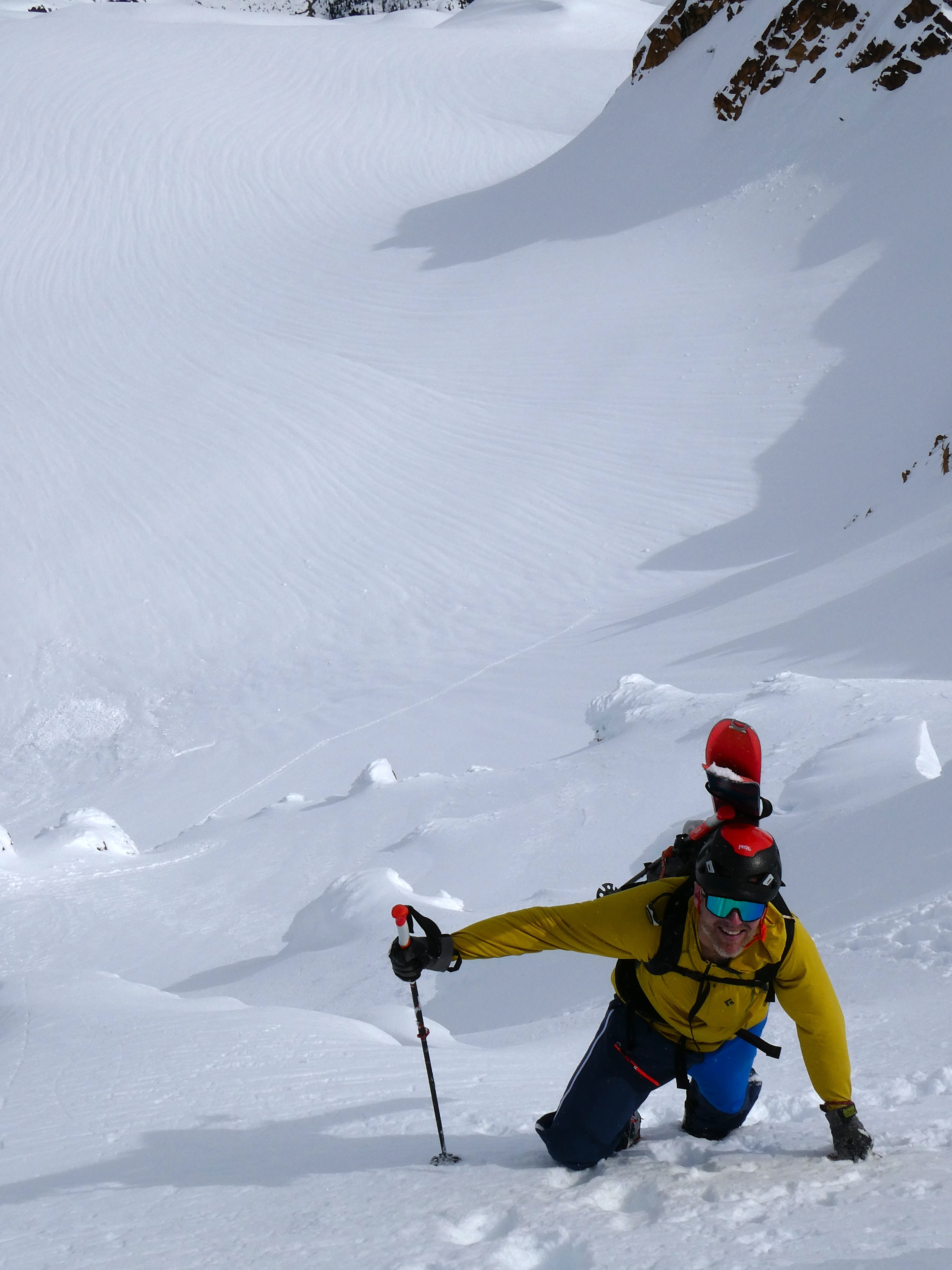
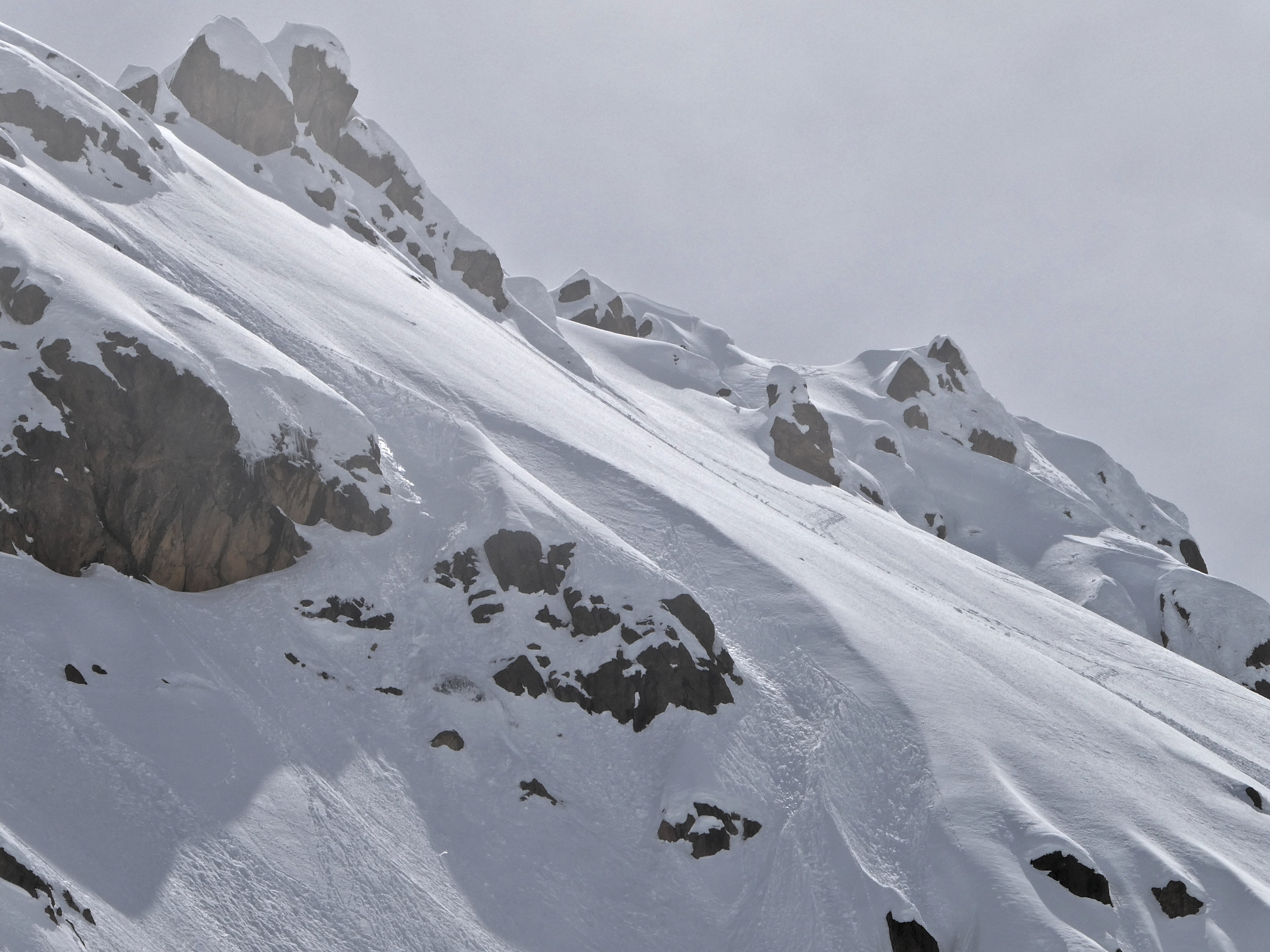
We reconvened below Skookum and Kloke, all smiles. The snow had been smooth where firm and starting to corn up in areas with an E tilt. After a long break, we started up Kloke to see what we would find. Mike and Dylan again did all the bootpacking, crushers! The avy debris was firm but the other parts were set-up powder that was well-pasted onto the slope. It would ski like breakable, supportive, but grippy crust.
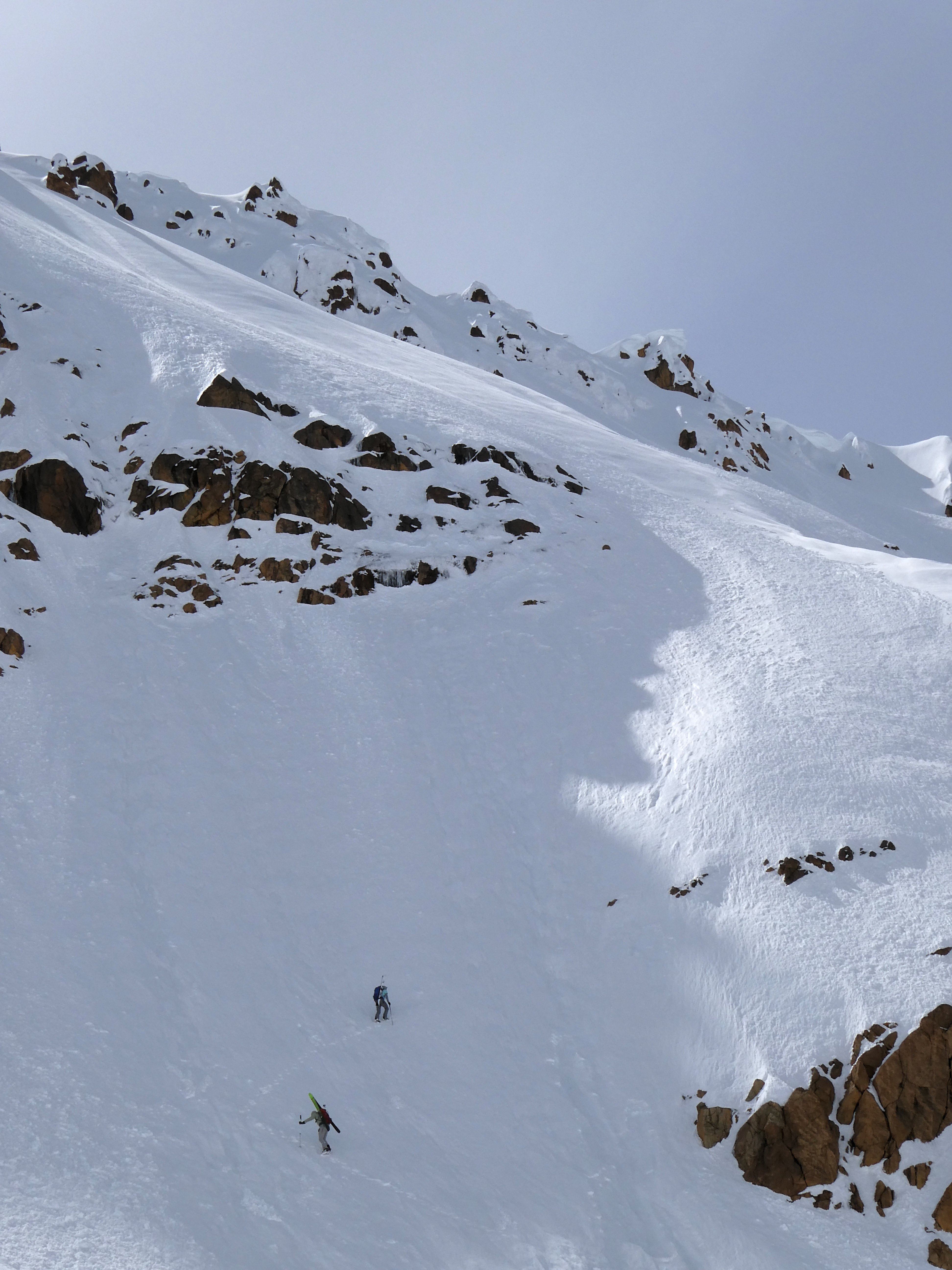
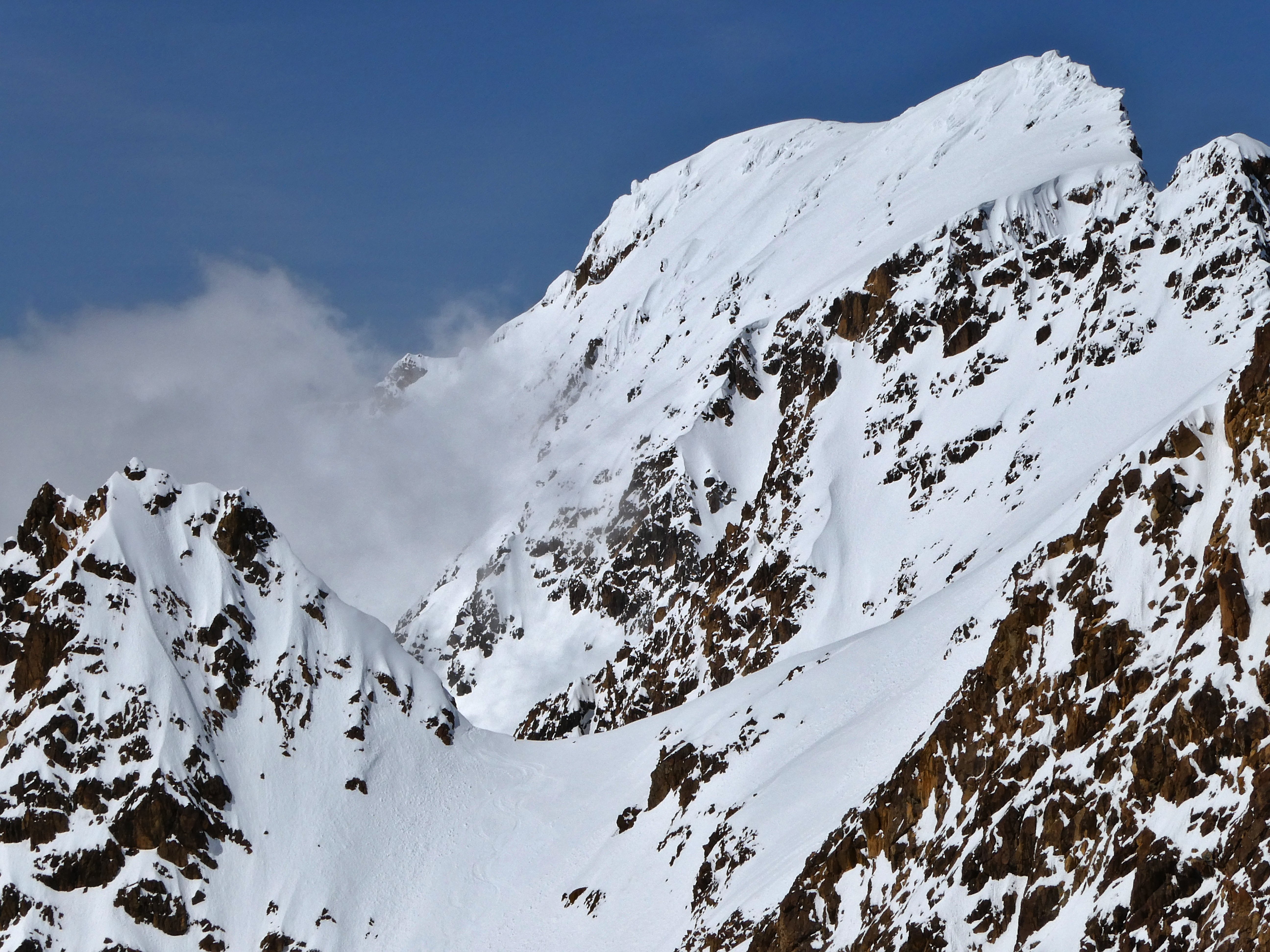
The climb finished with an esthetic ridge
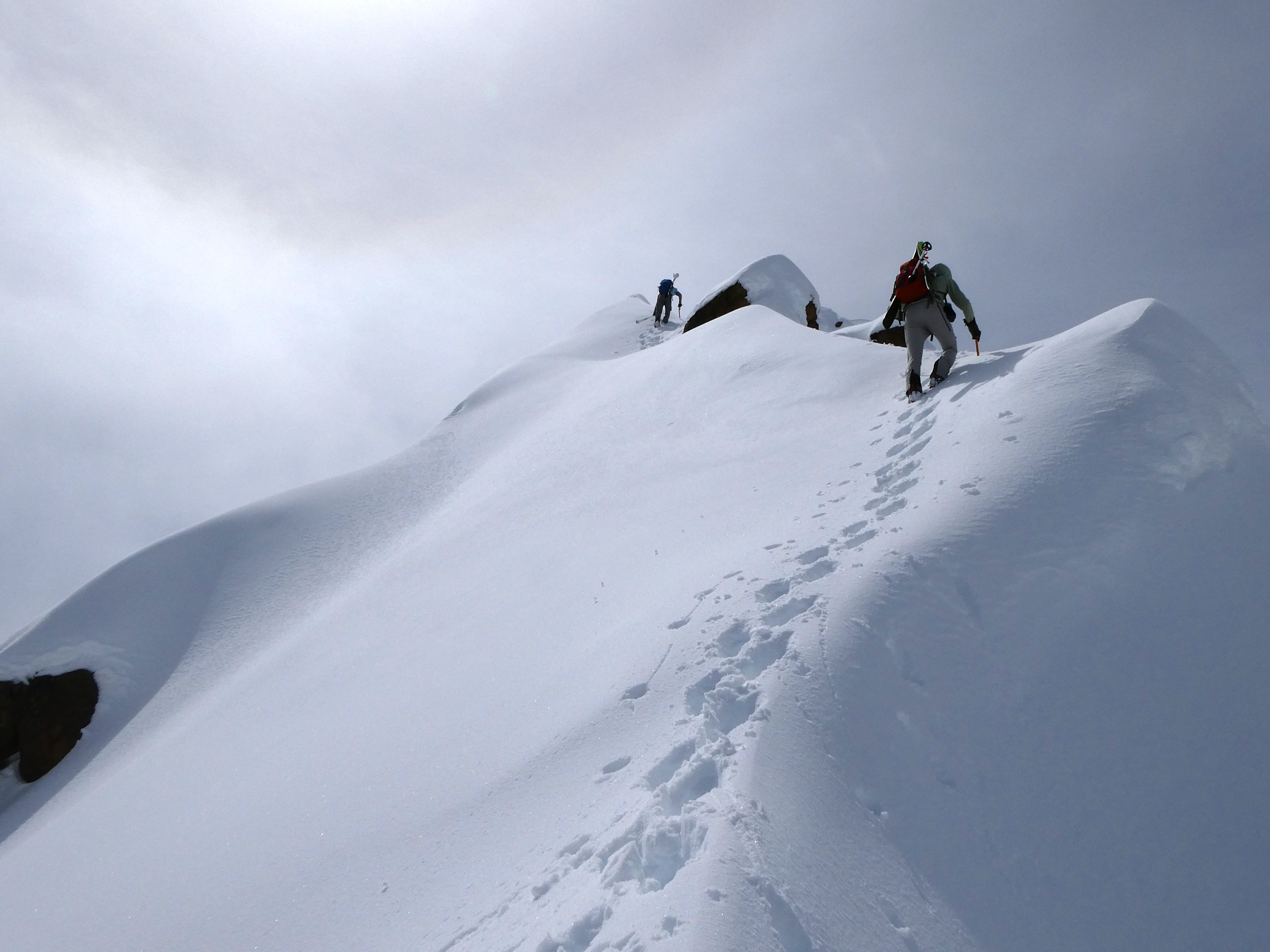
Looking back towards S Twin, you can see the main line at left that Dylan took and the other couloir dropping from higher.
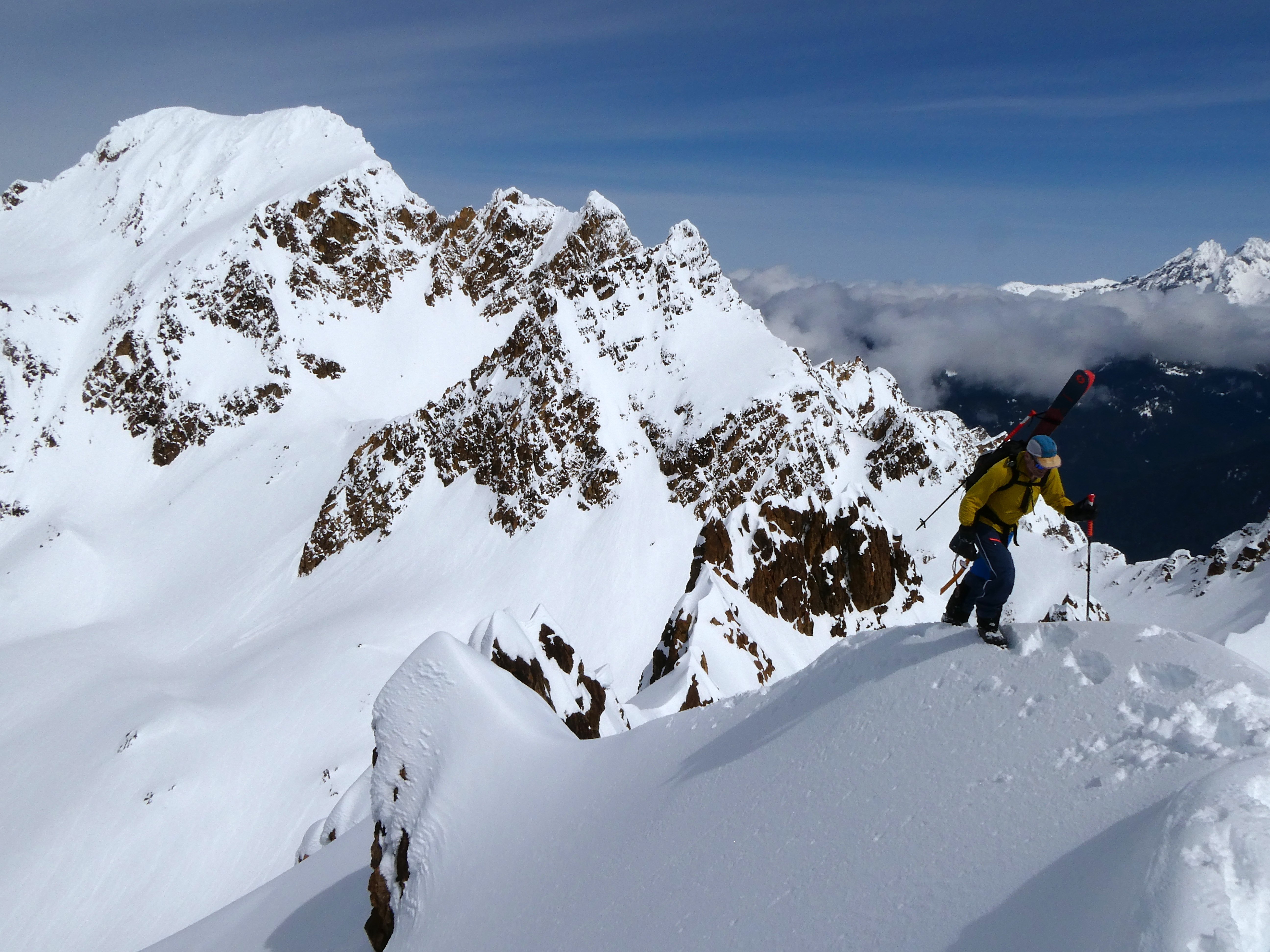
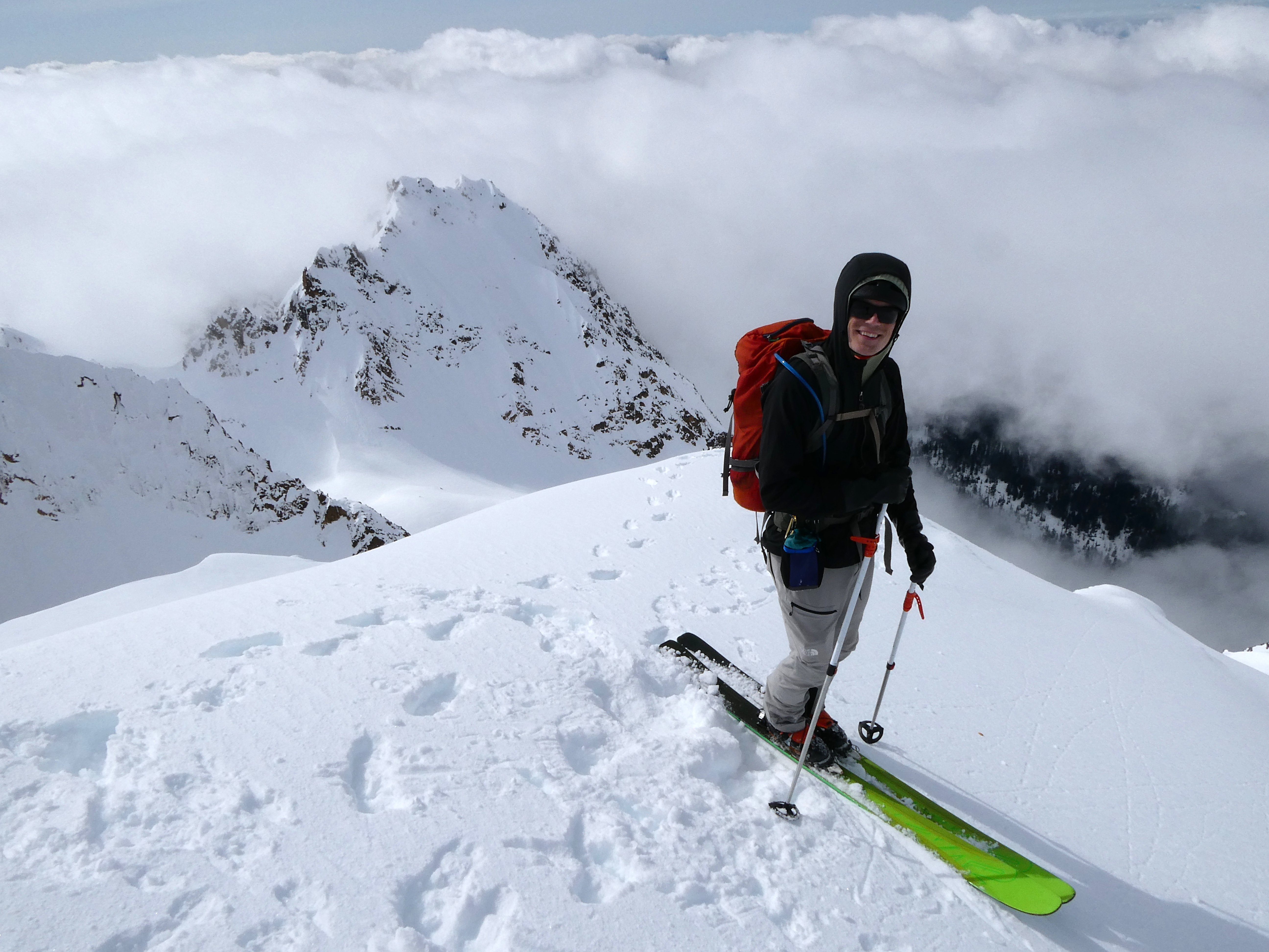
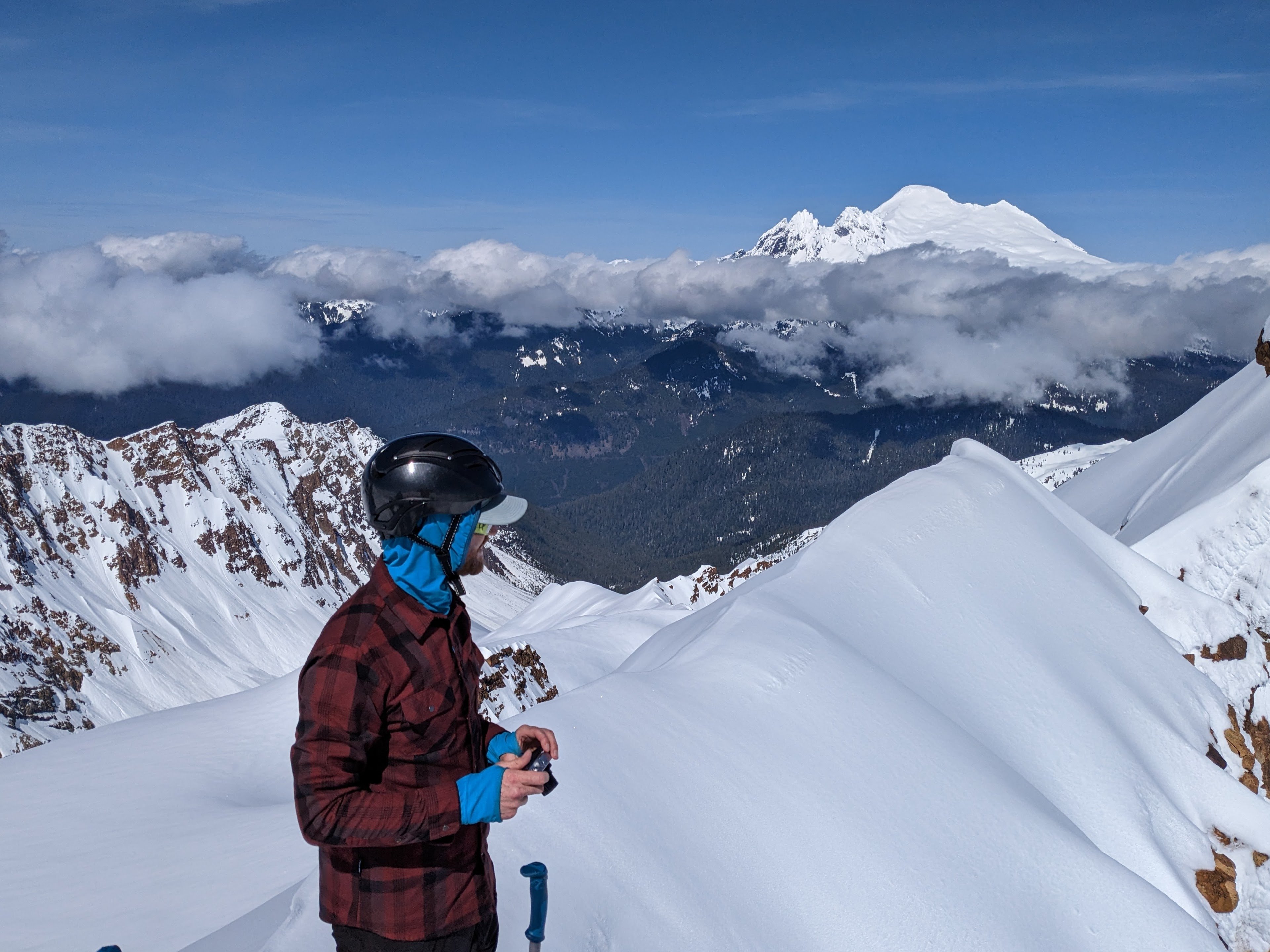
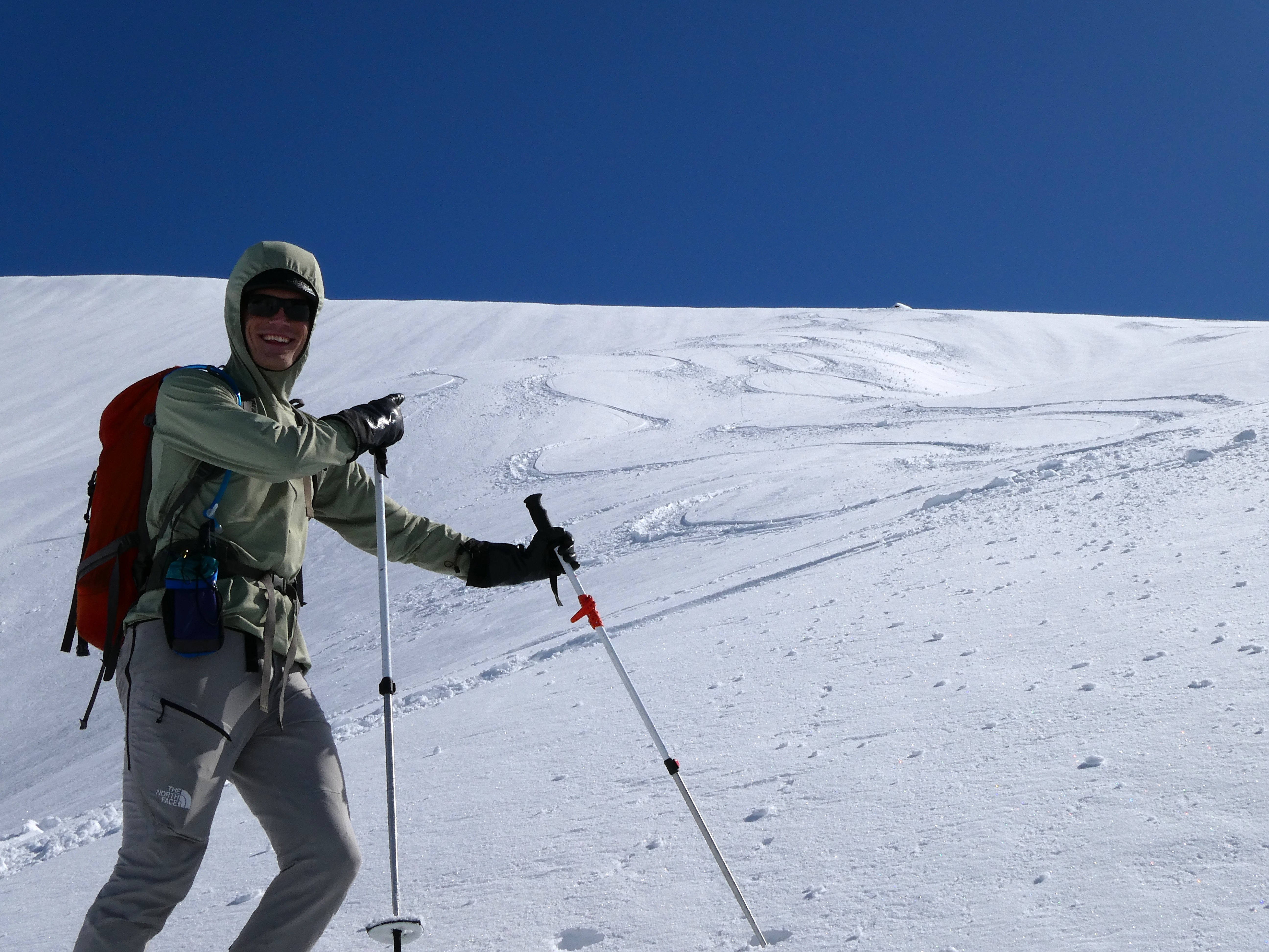
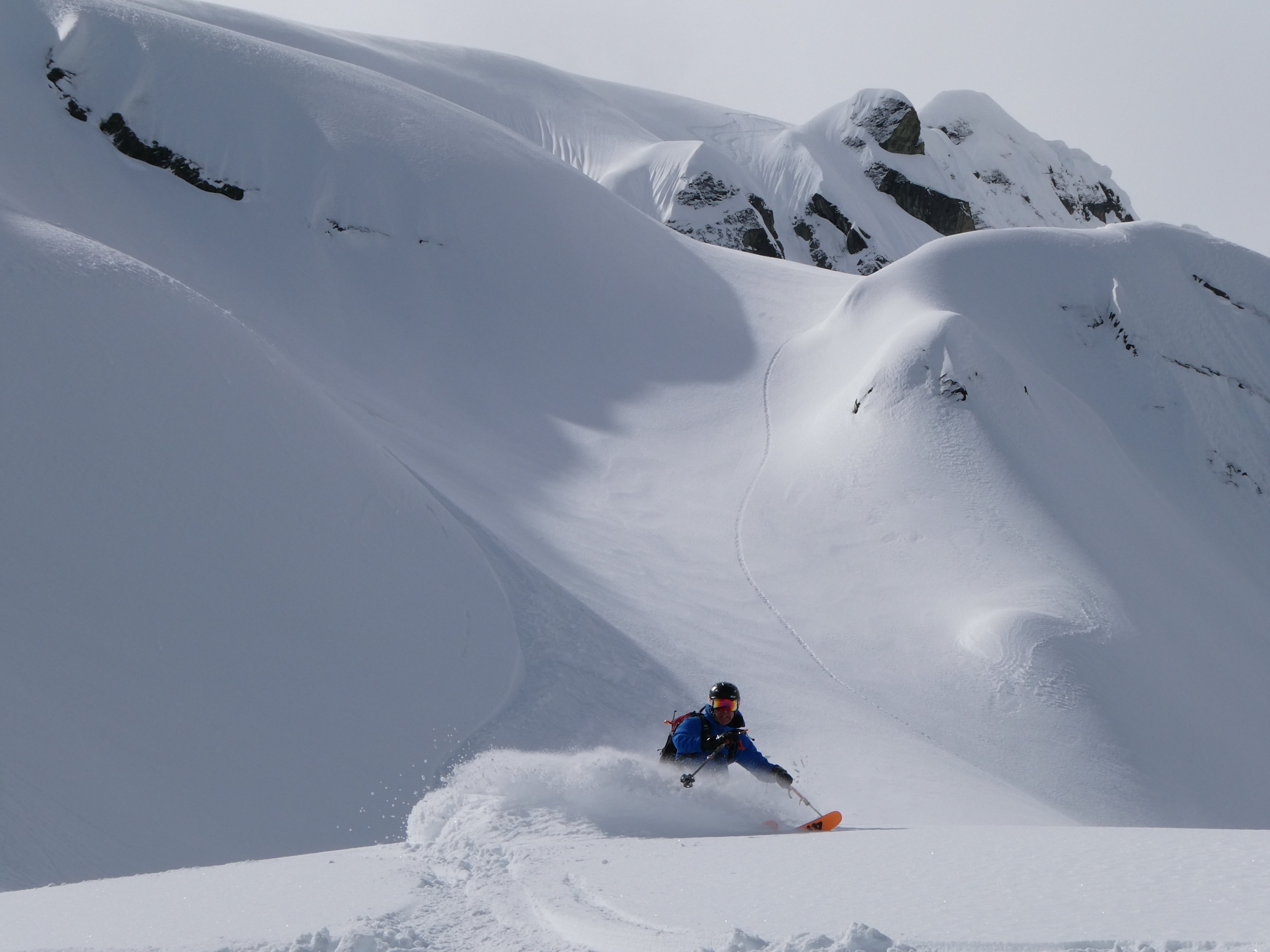
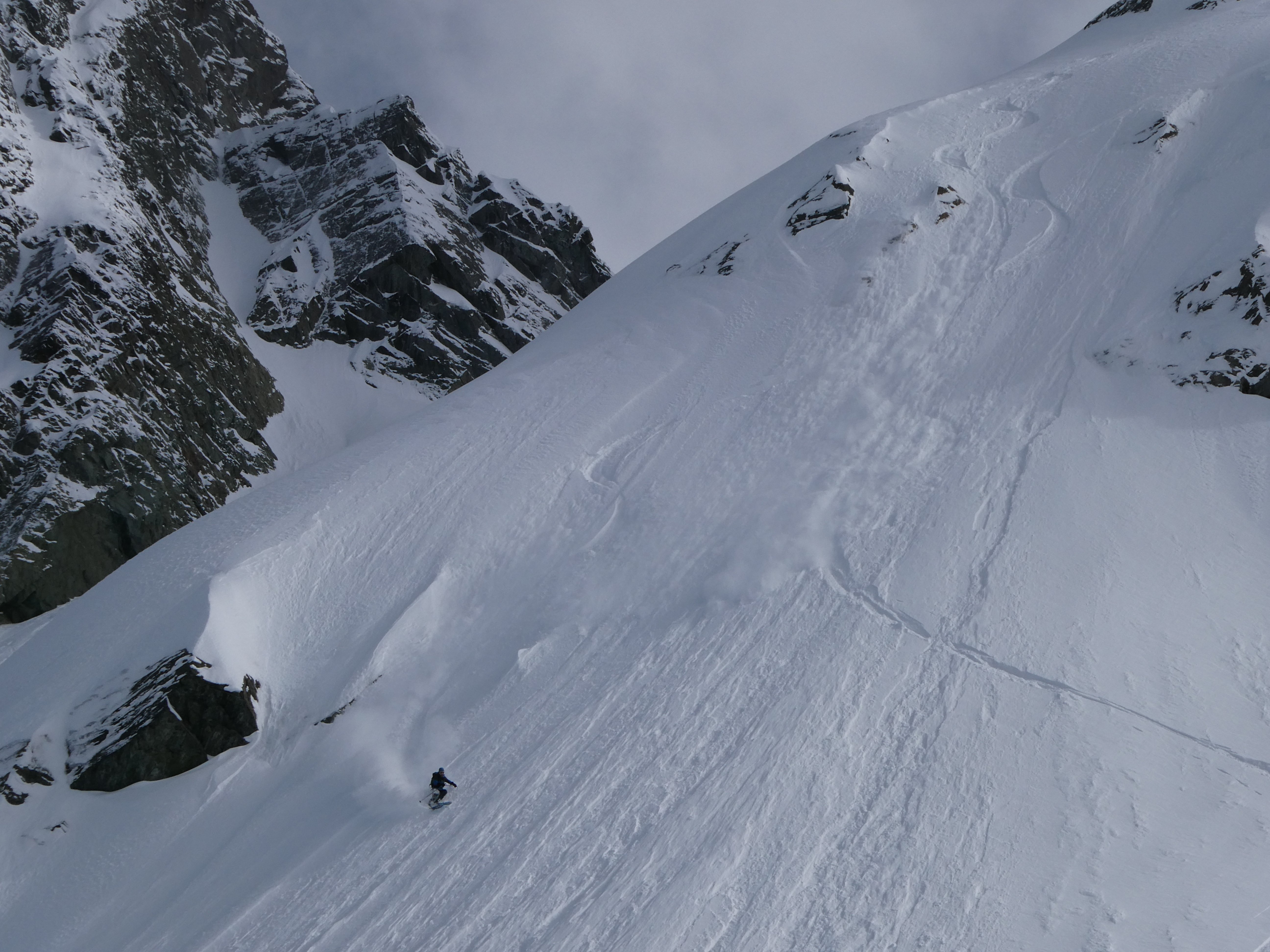
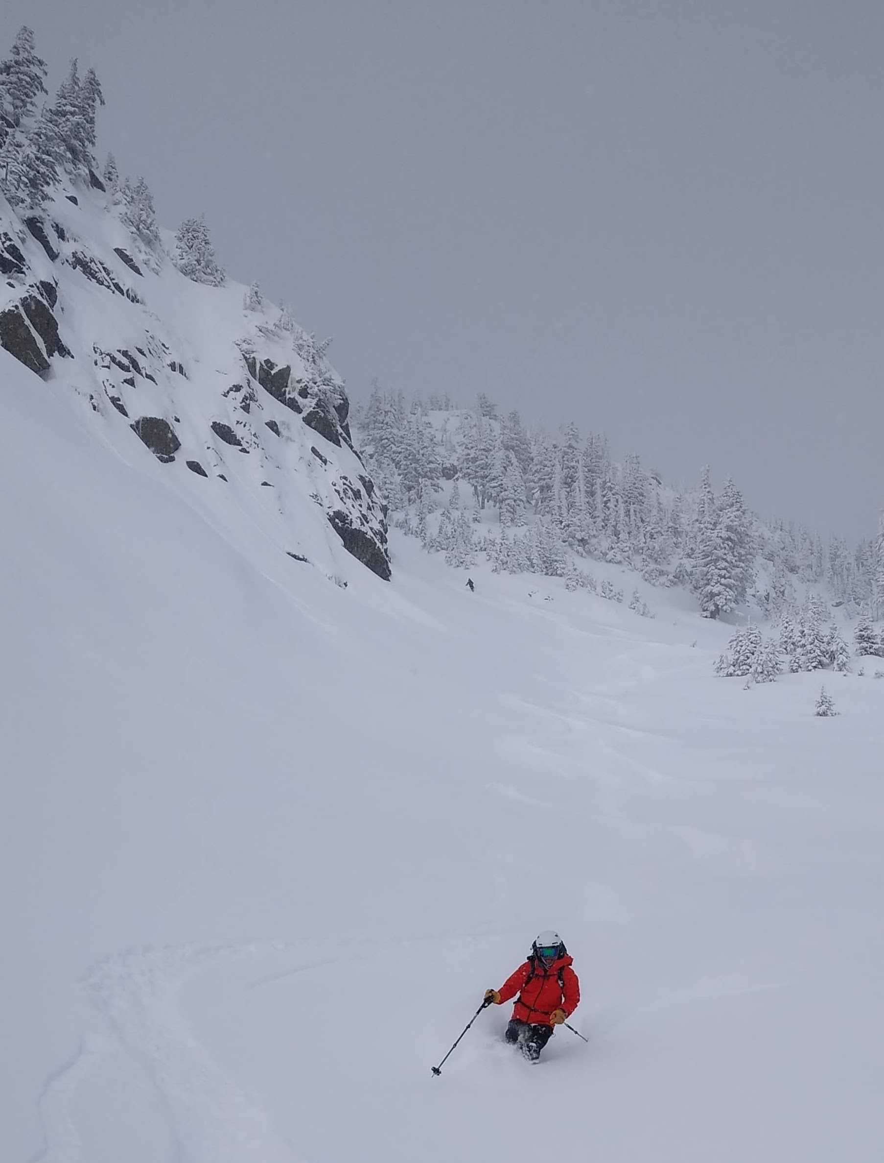
We put on boards on the summit proper. Some clouds started swirling around, so we waited a minute for them to open, and I scratched my wait through a constricted entrance. Wehrly also came this way, and Mike and Dylan rode down the ridge a touch to a more open entrance. The snow was slightly grabby but the edges held very well, pretty perfect for steep skiing.
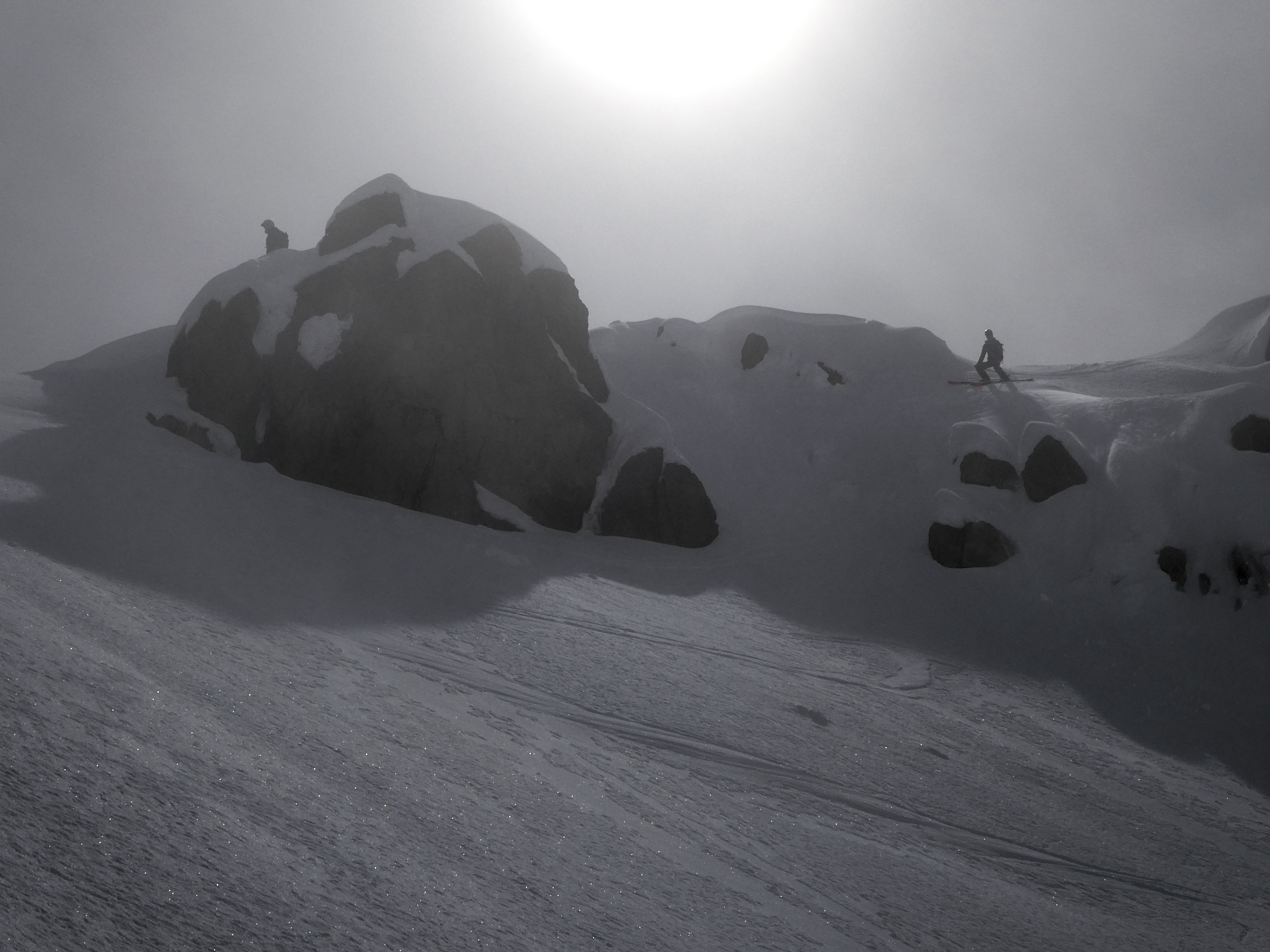
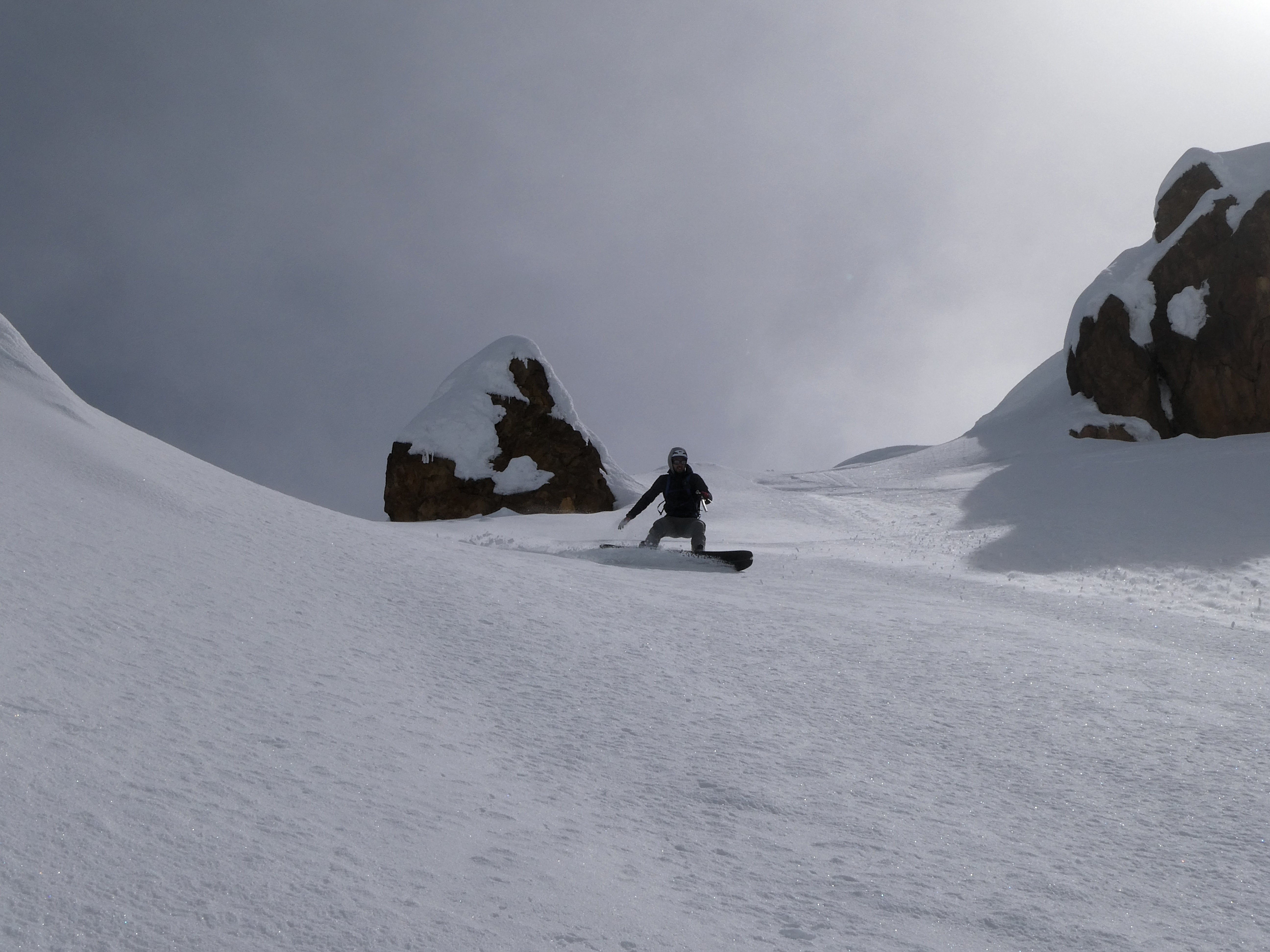
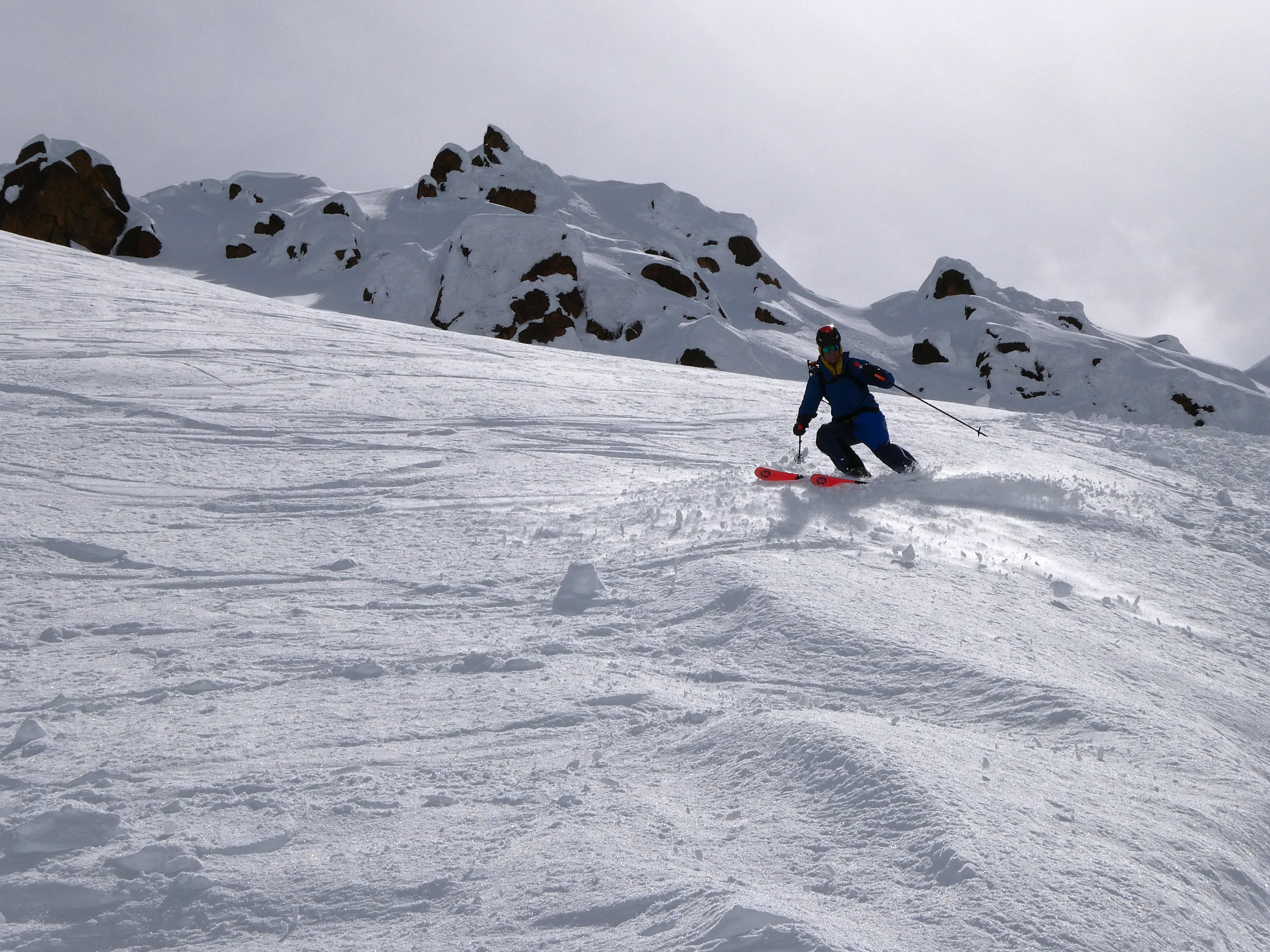
We hemmed and hawed but decided to ski the lower, rockier face. There was some icier snow but still quite edgeable with caution. Mike opened up that section.
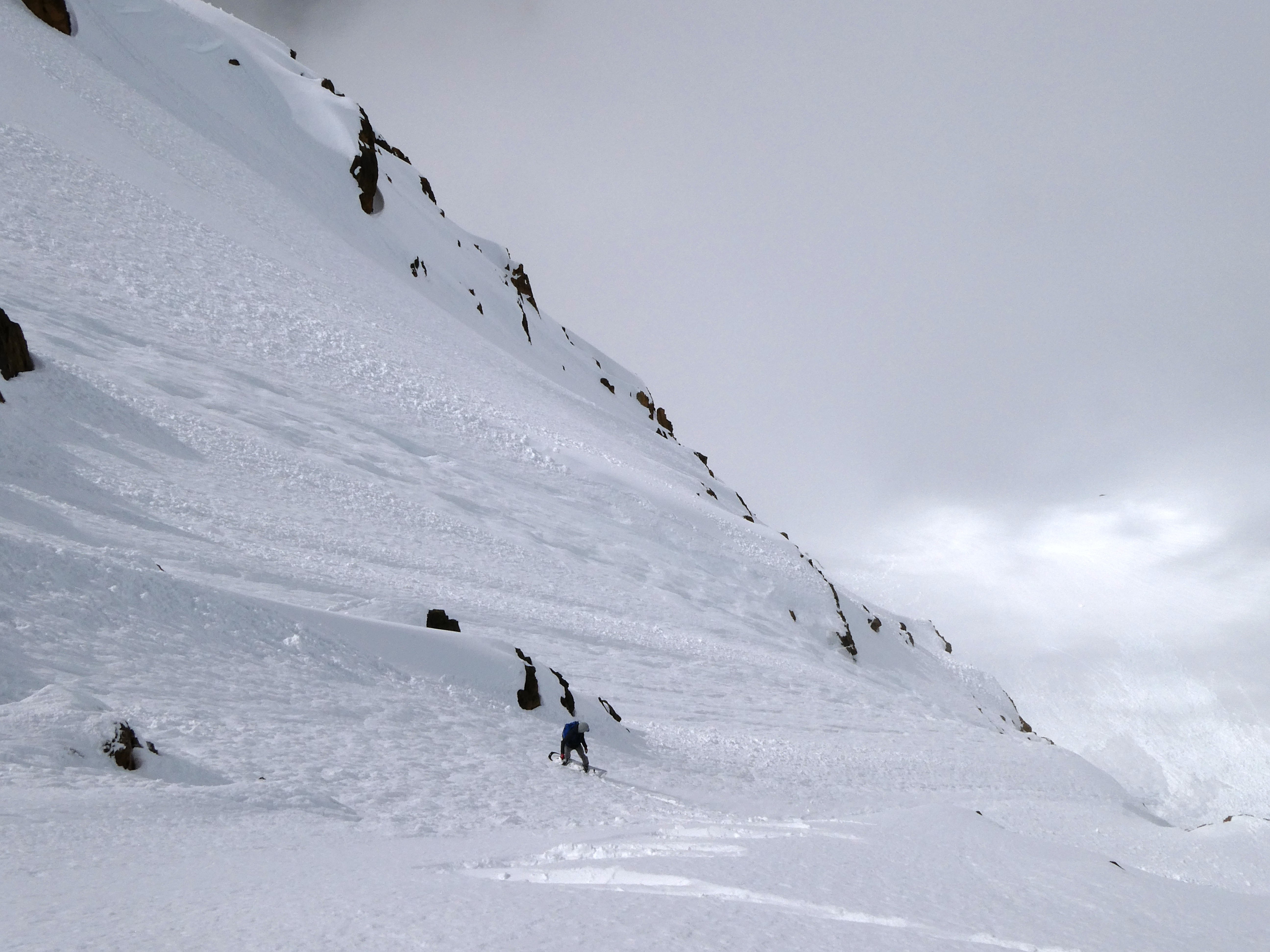
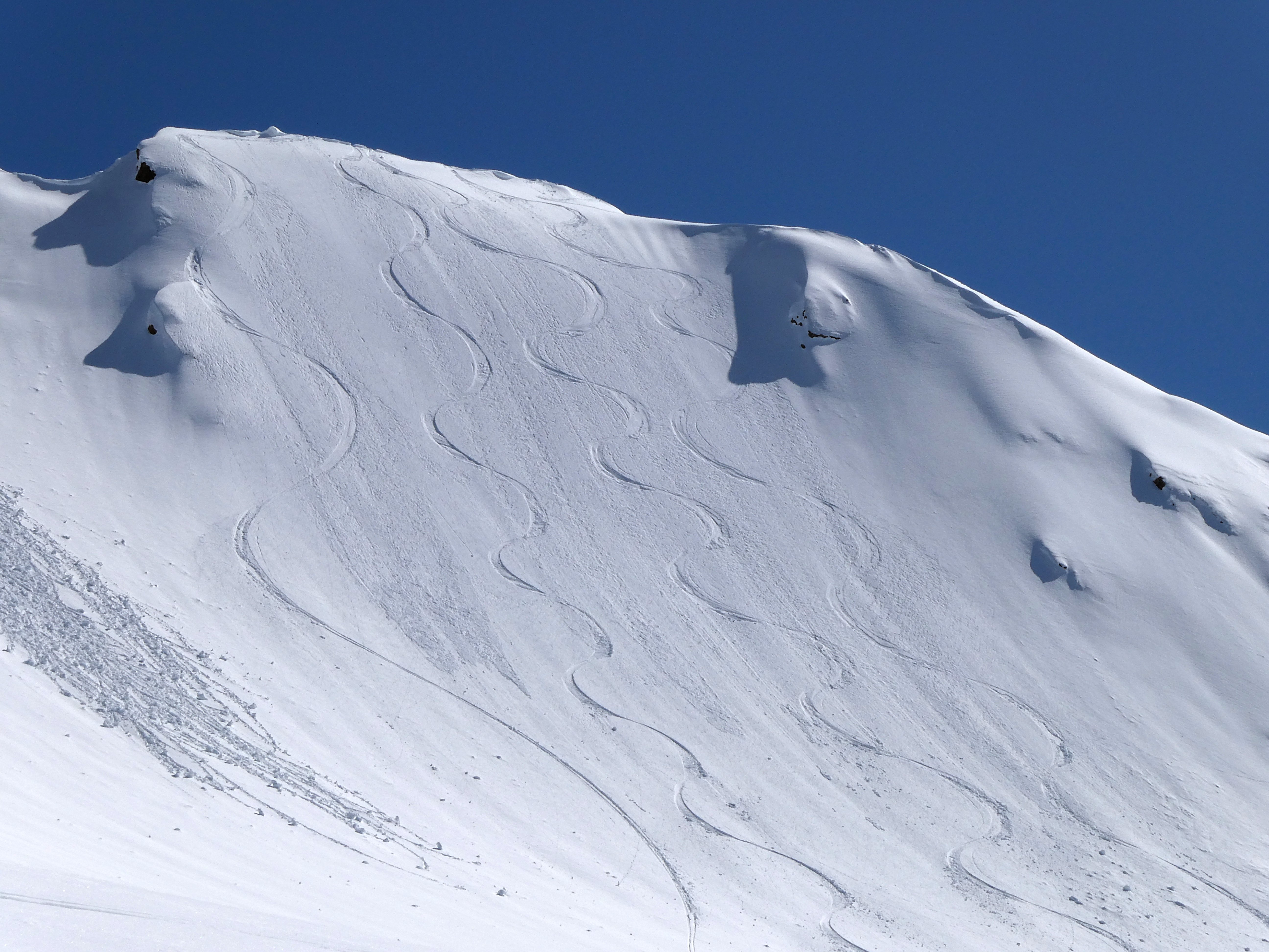
Our bootpack and turns off the summit
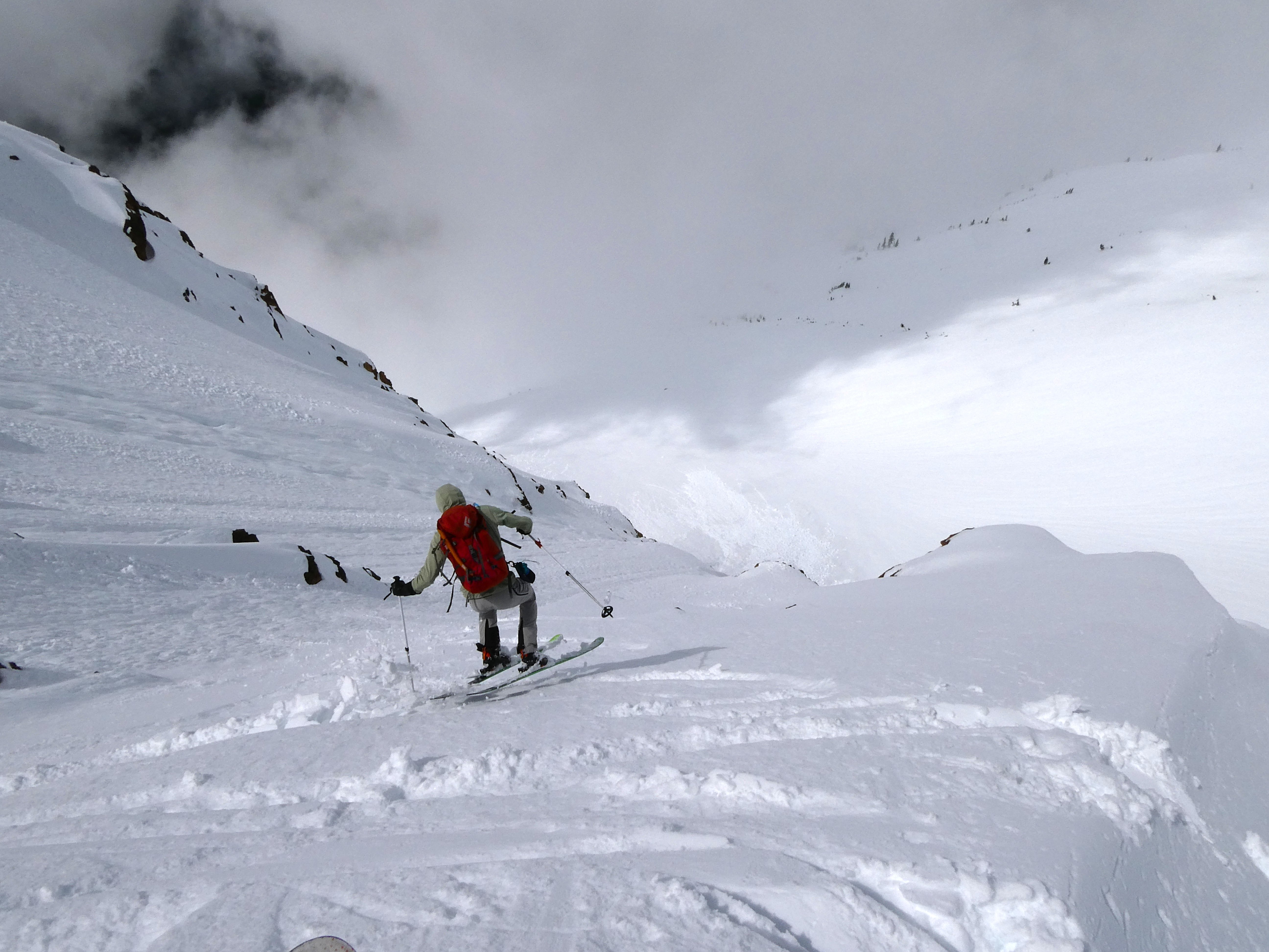
Happily reunited at the bottom, libations were enjoyed, and then we kept boogieing for the long ski out. We skinned to a col, descended towards Little Sister, then climbed again wary of the cornices and wet slide potential that was ramping up. I took a digger on basically the flattest terrain of the entire day when a tip dove in some mushier snow. The legs were feeling tired.
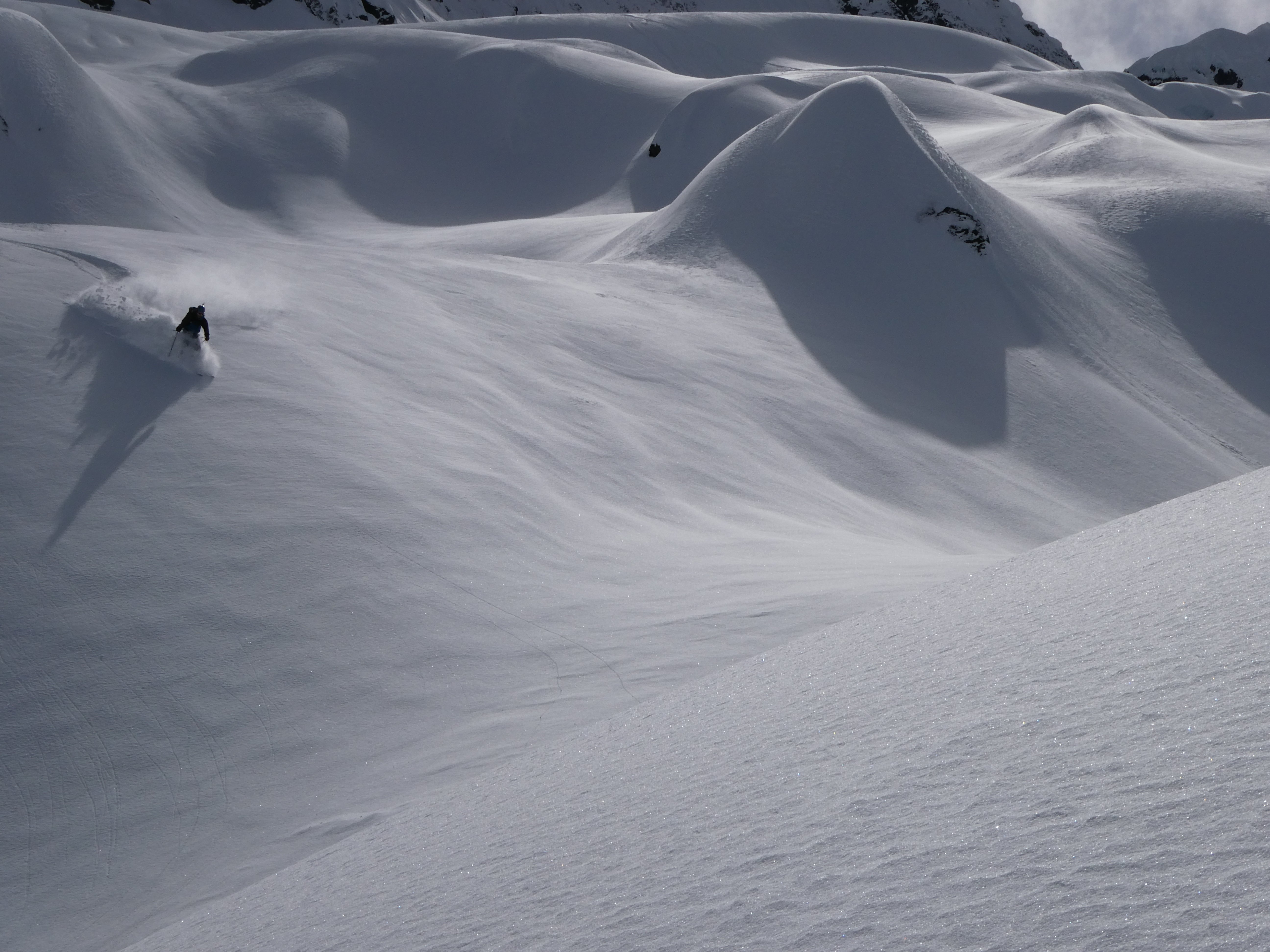
I took a good turn breaking trail but Mike brought us to the ridge of Cinderella. Incredibly, the N aspect was still POW. We took in the views to all directions and then ripped turns down onto the glacier. The pow led on and on and eventually turned to mush, but that was fine. We traversed rightwards away from the steep lower roll and down to the impressive avalanche debris under the Mythic wall, skiing until we hit the creek near the usual summer crossing. From there we skinned down hill through the forest until it didn't make sense any more. We booted, postholed, found the Elbow lk trail, crossed some blowdowns, and slogging out hit the river crossing and our car.
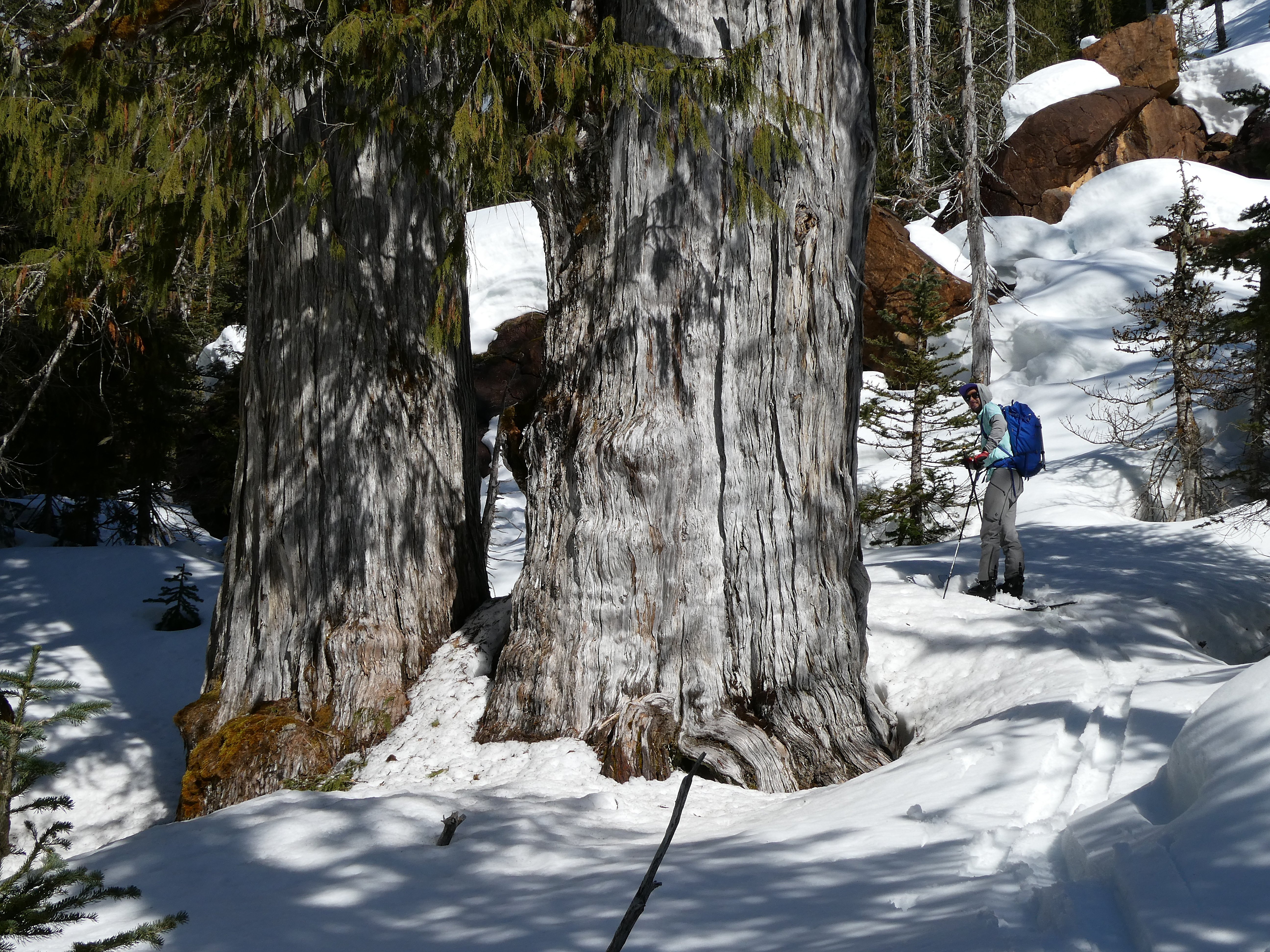
We paid our respects to these grandmothers. I wish the summer trail here kept more distance from their roots.
It was an epic tour and definitely one I would recommend! Such great country out there. The N face of Kloke is about 1000' and maxes out around 50 degrees but probably averages somewhere in the 45 range.
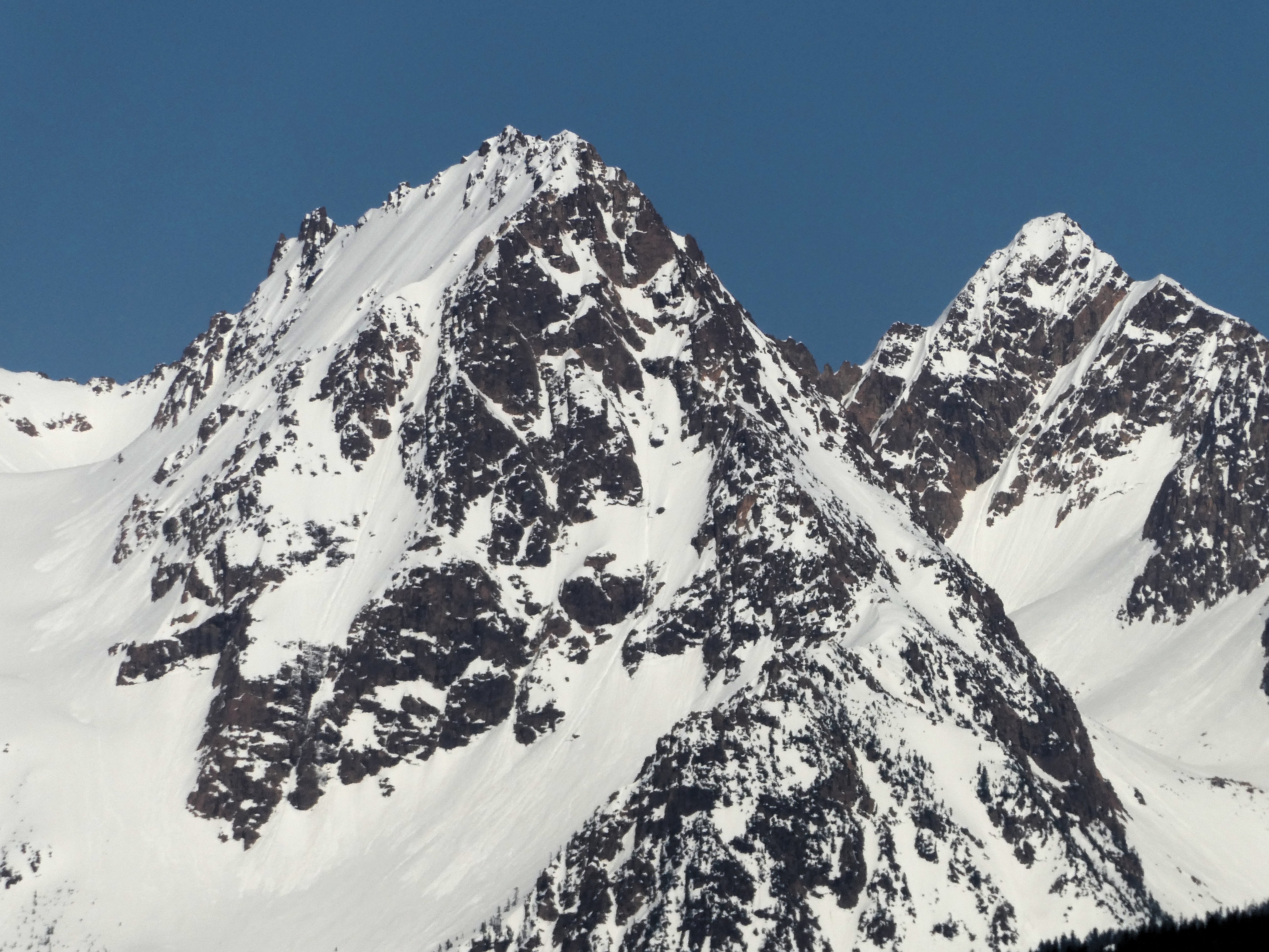
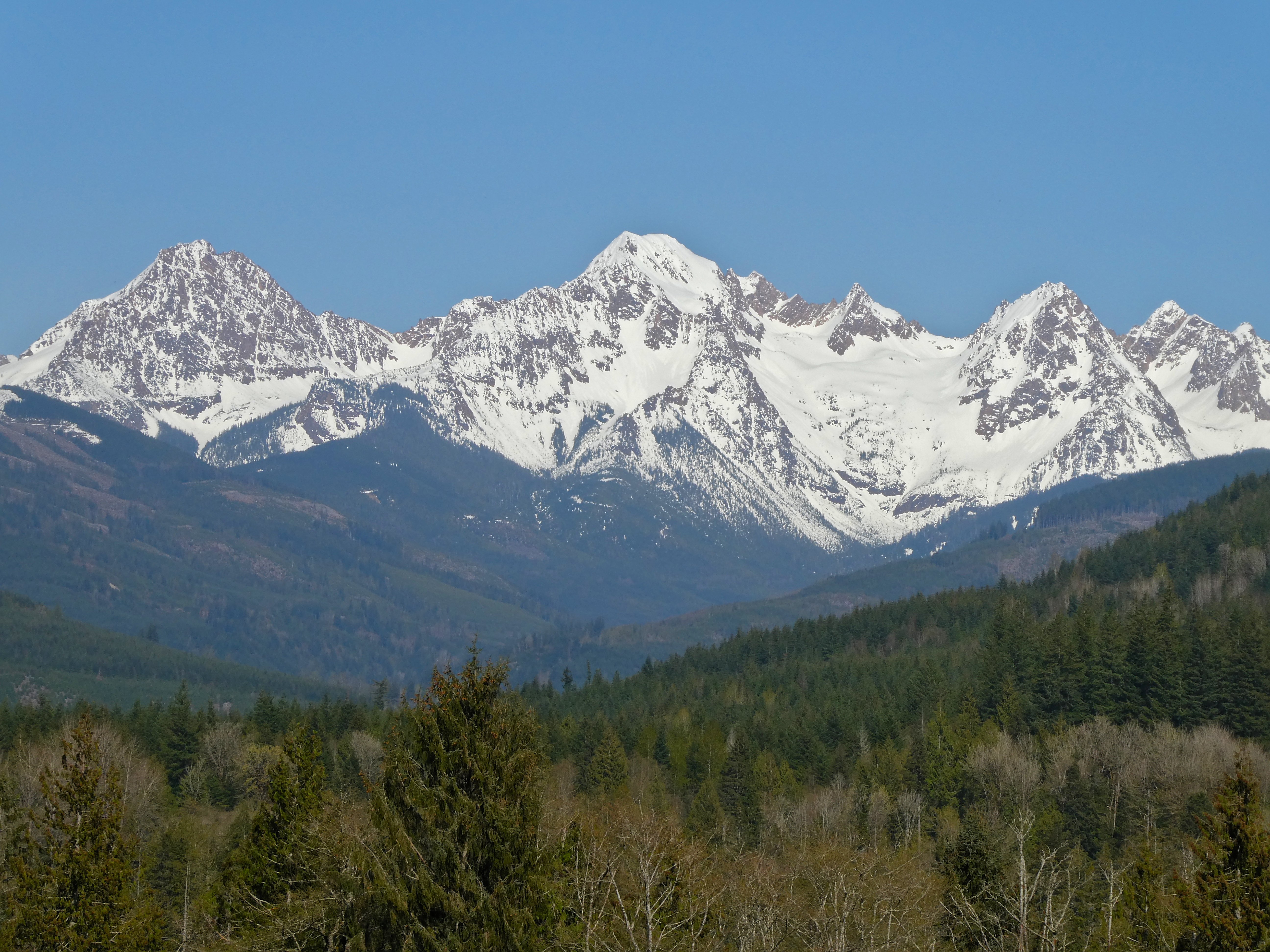
I went back and got some photos from Hwy 9 after some tulip touristing on Friday.
-
 1
1
-
 4
4
-
-
What a great zone up there! You all scored
-
It's been a pow-pow-filled year, eh!
From last week:
And some older ones
-
 1
1
-
-
On 2/14/2023 at 8:32 PM, JasonG said:
My goodness, downright seductive those curves....
-
1
-
-
(in no way does this look like a wise spot to go climbing, but I think it looks cool)
-
1
-
-
Skied the Thunder glacier last week (very nice powder, sled approach). This ice cliff line under Assassin Spire was looking pretty fat. My photo is shitty, but the ice underneath the serac looked thick.
-
Pretty sick out there yesterday. From NWAC, I take it you were the one who warned us about the slab @dberdinka?
-
On 12/18/2022 at 3:23 PM, manninjo said:
Put in a snowshoe track to access this buttress at the head of seymour creek under north face of north twin sister, this zone is pretty legit. Ice was better than average for washington. Approach took longer than expected and we only did a couple lines on the lower tier at wi3 and wi4. Whole thing probably goes at wi4, maybe 70m tall? Somebody should get out there while they don't have to break fresh trail! 2.5-3 hrs with a trail in place from the gate closure. 4-5 hrs if breaking trail. Looked like decent snow camping next to the creek under the crag.
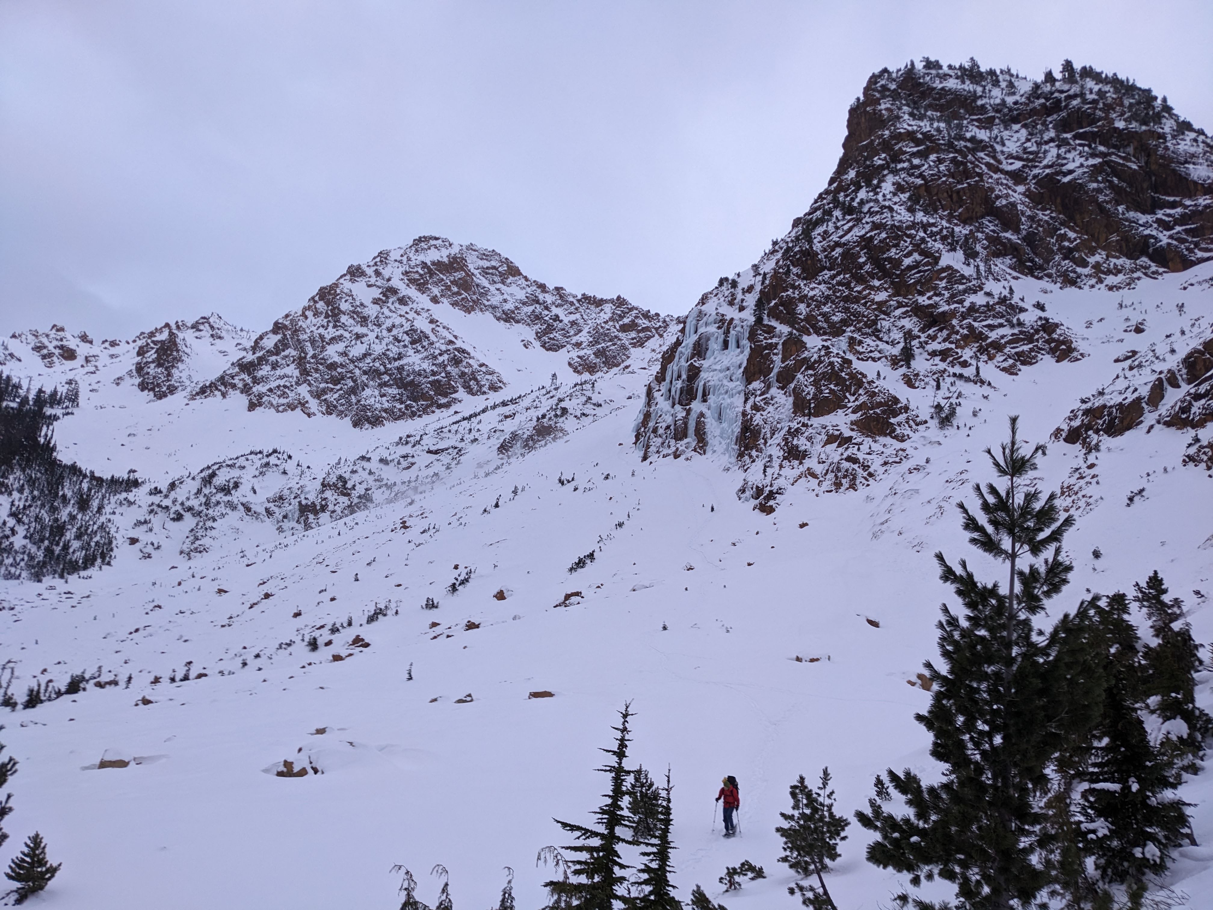
Nice work!
I've skied underneath that buttress and never noticed water ice. Maybe kind of rare conditions?
This is the drainage that leads down to the Olivine mine. I would imagine that approaching with skis via the normal N Twin winter (ski) route would be most efficient albeit more vert than going straight up from the mine. The travel is generally easy. One would ascend to the bench above this buttress then ski down to access the ice, then return the same way.
In typical winter conditions the small flow in your 3rd pic is completely covered in snow and a nice short ski run.-
 1
1
-
-
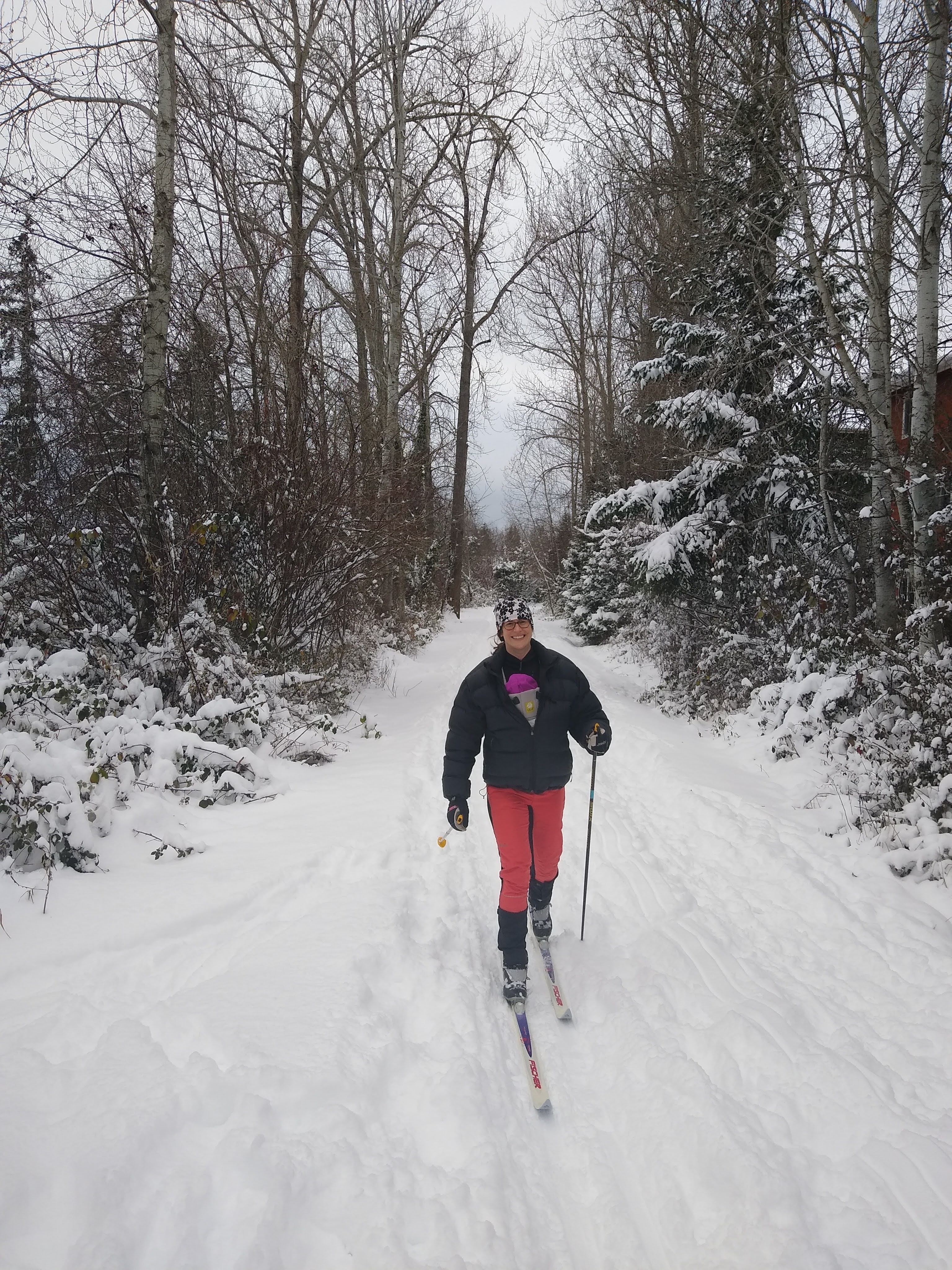
Ran into JasonG in the parking lot on Monday. Really nice snow that day! I gave my new skis a slight stone grind too.
The town trails have been enjoyable since then.
-
1
-
-
On 5/31/2022 at 5:50 PM, chris said:
Glacier Creek Road is closed about a half-mile upstream of the bridge for the foreseeable future. The north side of Mt Baker (Heliotrope Ridge, Colman Glacier, the North Ridge) are now 5.5 miles further away from the car.
E-bike or sled terrain
-
Interested in the puffy pants. What size inseam & waist are you? Thanks
-
I want to try these trick Sportiva shoes, but they max out at euro 47.5 (and run small), so no dice for my size 13-14 hobbit feet.
-
Can it be called corn if it's 8" deep?
Looks like a nice slope!
-
I could see it from Goat more than a month ago now (ski trip), and it already looked pretty messed up. But I'm not hardcore.
-
SW rib of South early winter spire is a nice 5.8
-
There's a much nicer log crossing about 100 yards downstream of the parking area last I checked (about a month ago)
The blazes are sparse for most of the trail, maybe a few too many near the junction with the real trail
-
1
-
-
Good shit, I didn't see this TR until now, but I was there with some friends skiing around in the north bowls last week. It was pretty nice, despite the growing suncups. We did a little linkup of E & W Goat along with Twin Lakes Peak.
-
Awesome report, this route is high on my list. Score
-
1
-
-
Cool zone! I think the @hedonaut has sniffed around thereabouts.
[TR] Mt. Jefferson - West Rib 05/22/2023
in Oregon Cascades
Posted
Fun looking ski hill, one of these years I'll have to schralp it