

Tom_Sjolseth
-
Posts
541 -
Joined
-
Last visited
-
Days Won
2
Content Type
Profiles
Forums
Events
Posts posted by Tom_Sjolseth
-
-
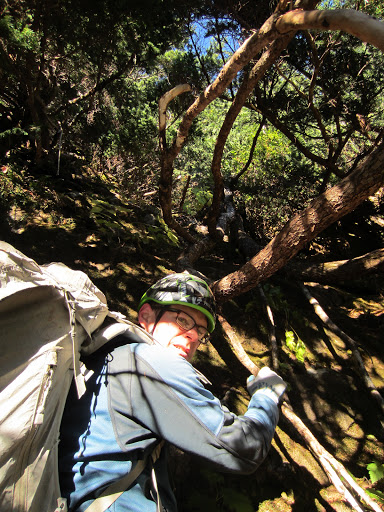
Maybe it was you that we saw up there Sunday morning? We wound up getting up four pitches and going too far left. Hard climbing ensued and time was running low due to the late start after the rainy/snowy morning. We should have gone right at the bottom of pitch 3, instead we went left and climbed into the "General area of Bad Assedness" as described in this thread. We bailed below a blank wall after climbing 1 hard pitch of overhanging hands followed by a rotten flake.
-
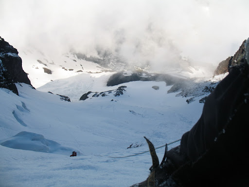
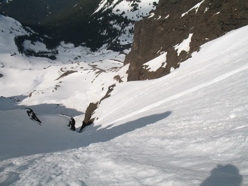
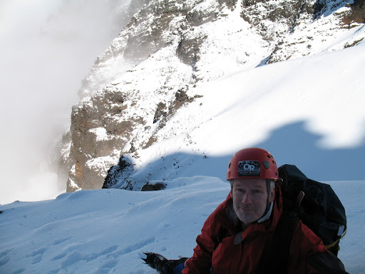
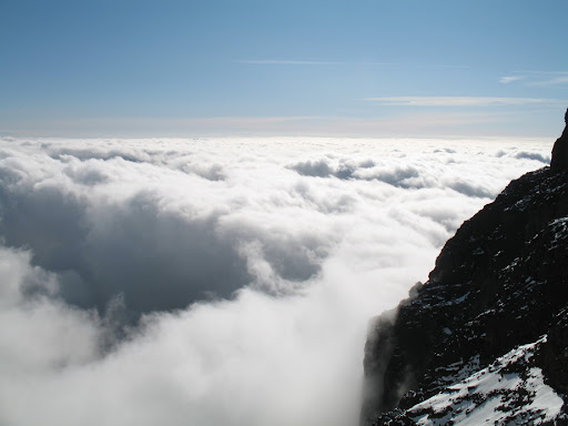
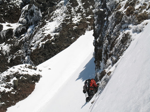
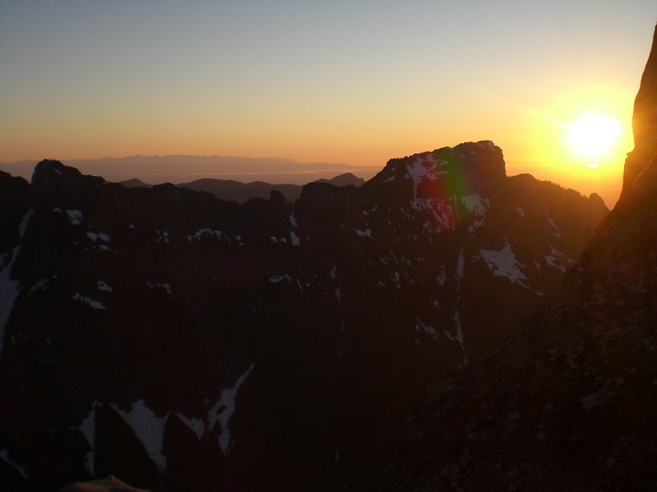
Nice. This route is definitely conditions-dependent and varies a lot in difficulty depending on whether it's covered with rime (difficult), snow and rock (moderate), or just plain rock (least difficult) on the West Ridge portion of the climb. I definitely considered the couloir pretty much just part of the approach.
We climbed it in rimed up conditions in a near whiteout and 25+ MPH sustained winds and wound up only being able to place 7 or 8 pieces of pro on the whole route. A lot of the climbing was difficult and exposed.
-
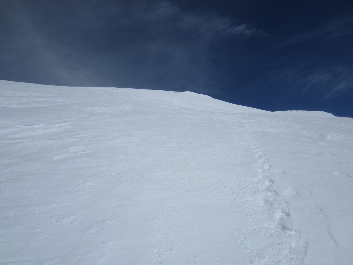
kevino.. I would bet with this cold weather that the Sherpa Gl will be decent (skiable) for another two weeks or so.
stewart.. I can't speak for Aaron, but I personally thought the boulderfield path was easier than the "trail" that parallels the creek. We went in the boulderfield and out the "trail".
-
Sorry no this was yesterday and we returned at 6:15PM. 2:15 RT would be some feat!
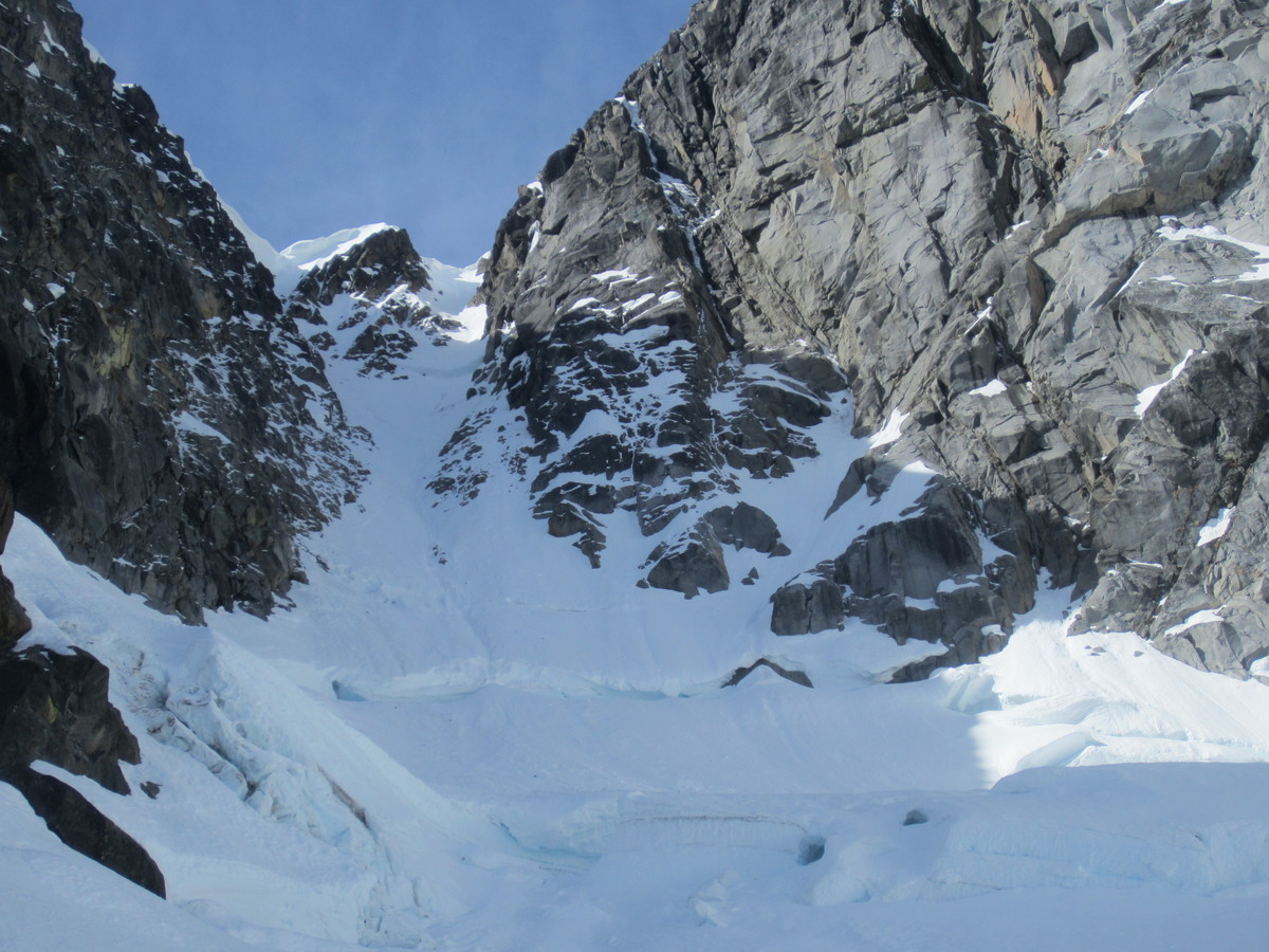
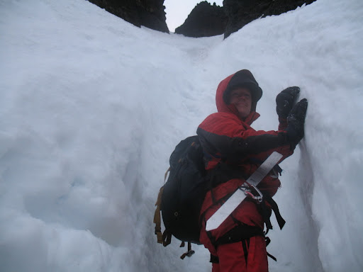
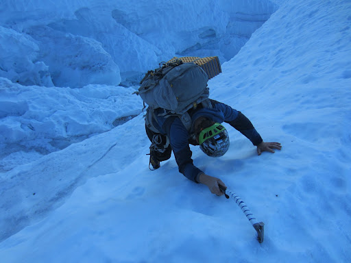
KK.. we crossed on the left side of the 'schrund. The main problem on this route was getting past the schrund. There was a rock section that I started up but backed off because my skis kept on hitting the rock above me. Without skis, that would have been the logical way to go but instead I excavated with an ice axe for 25 minutes.
-
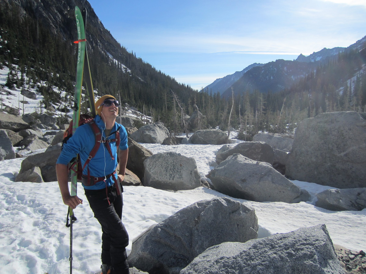
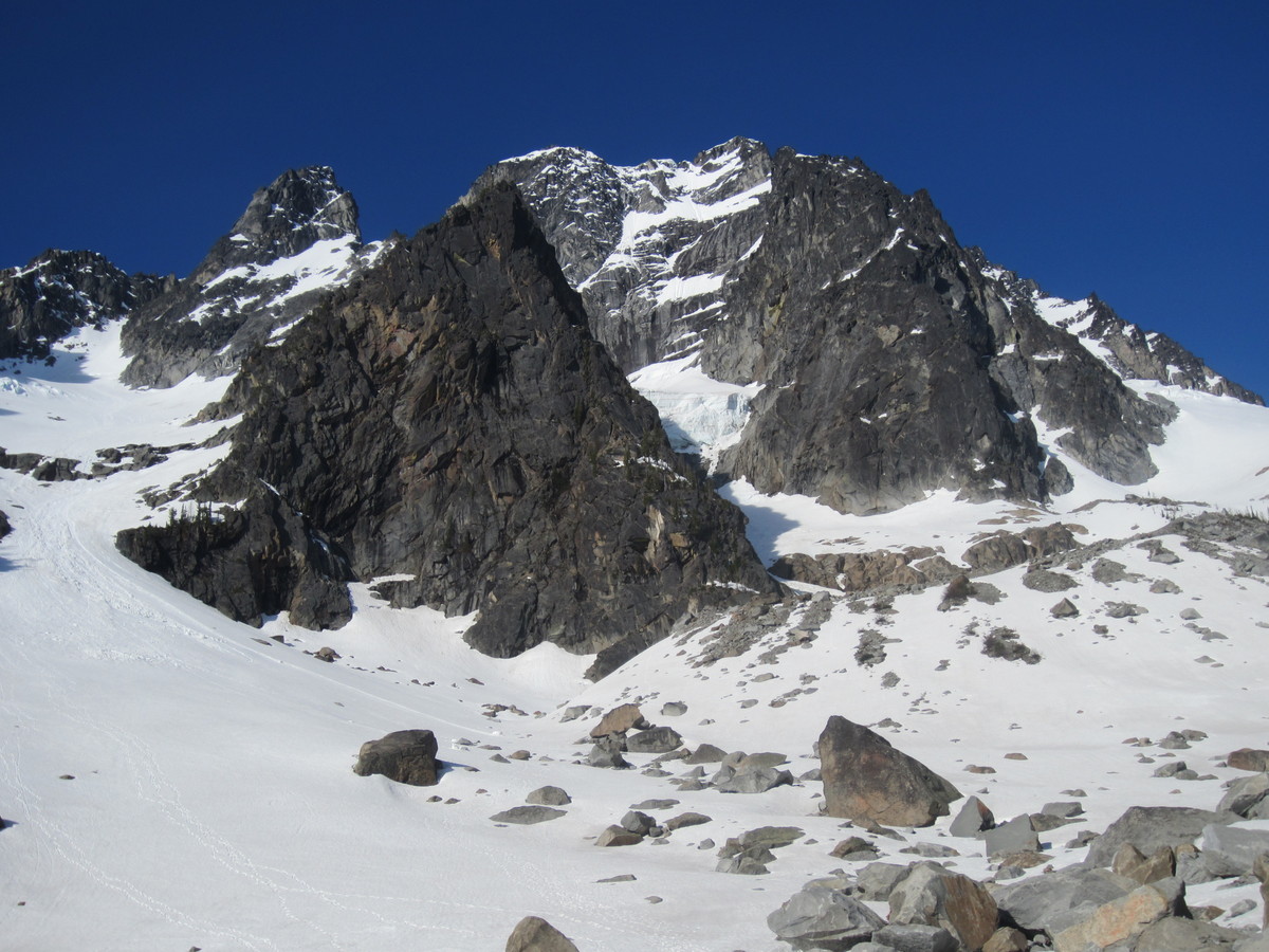
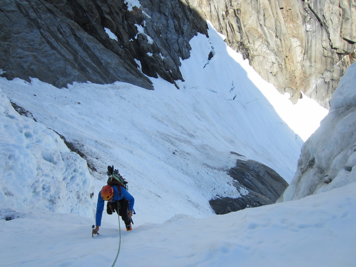
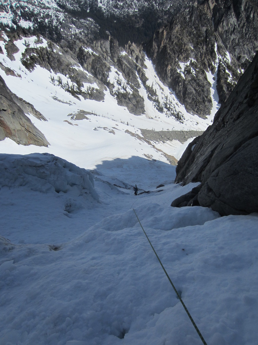
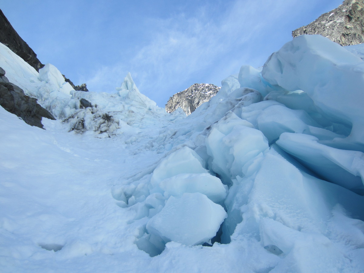
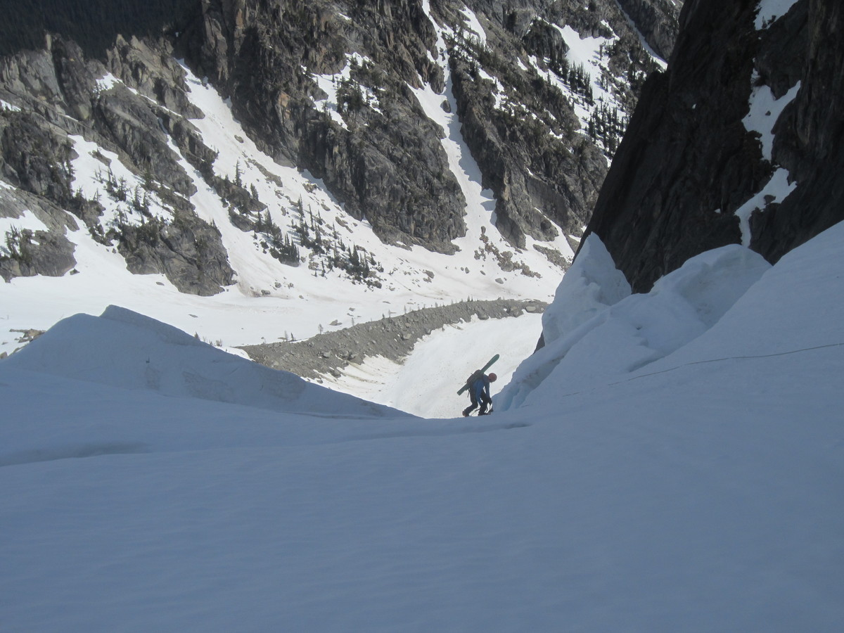
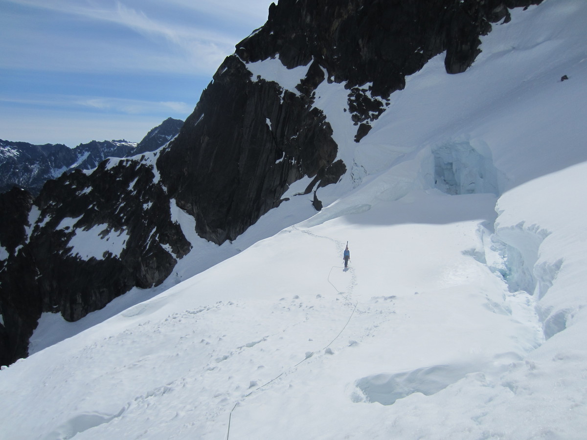
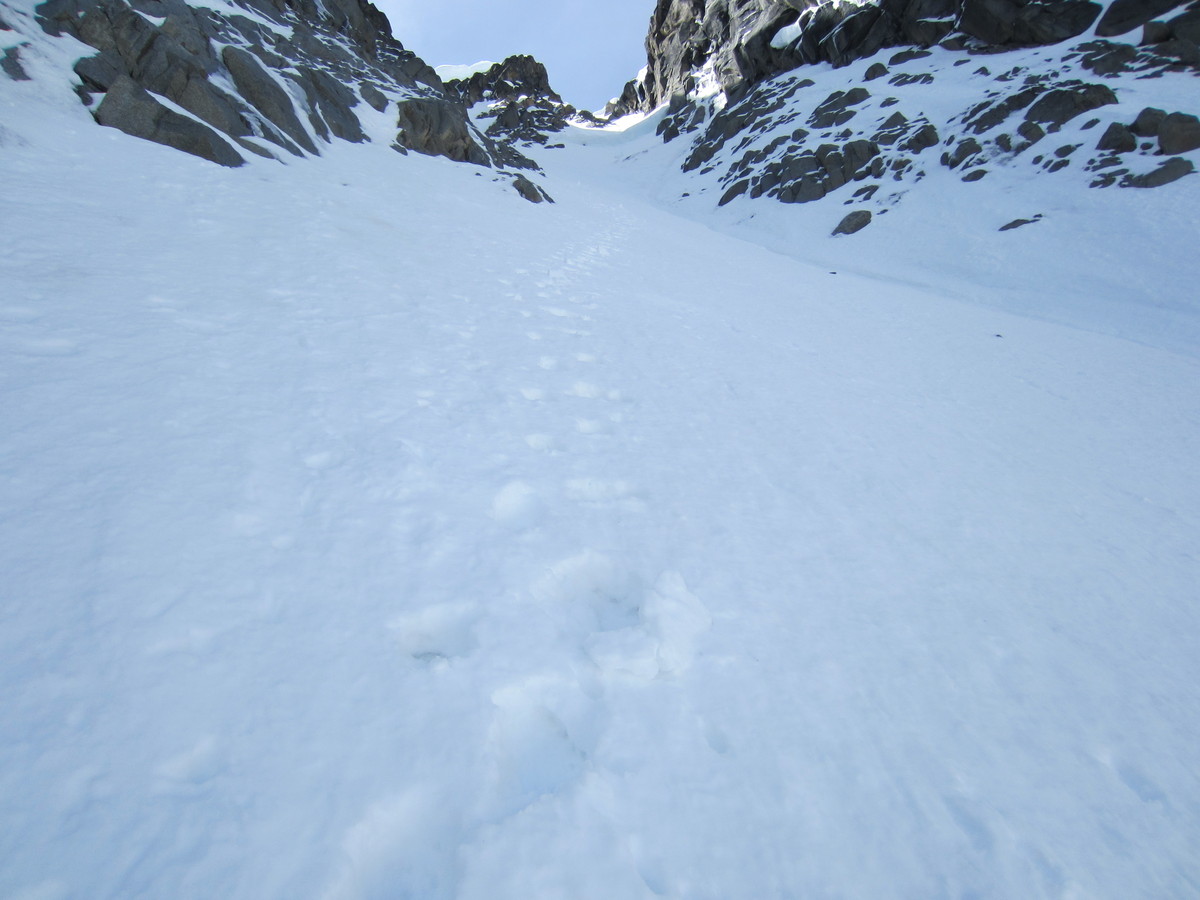
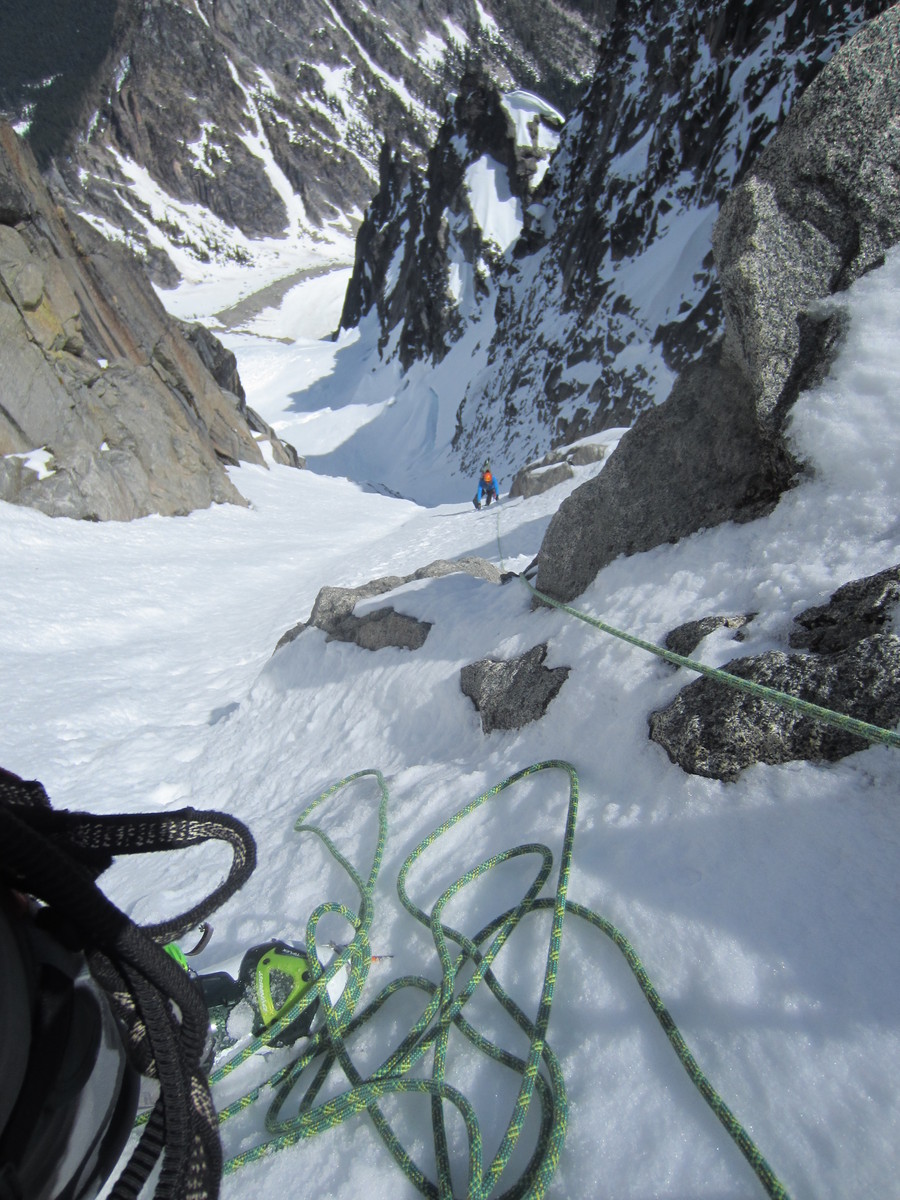
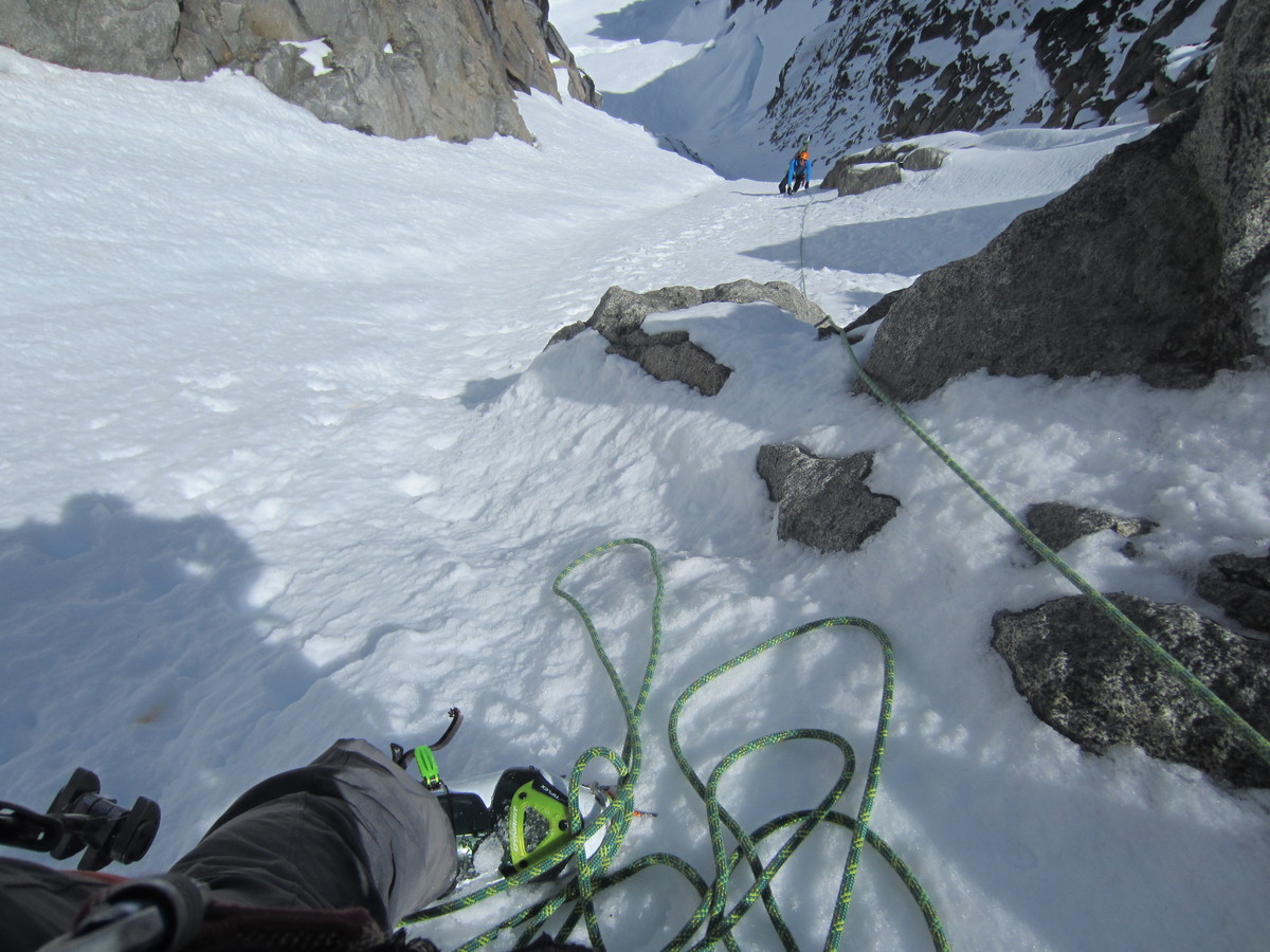
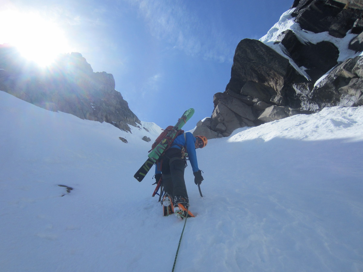
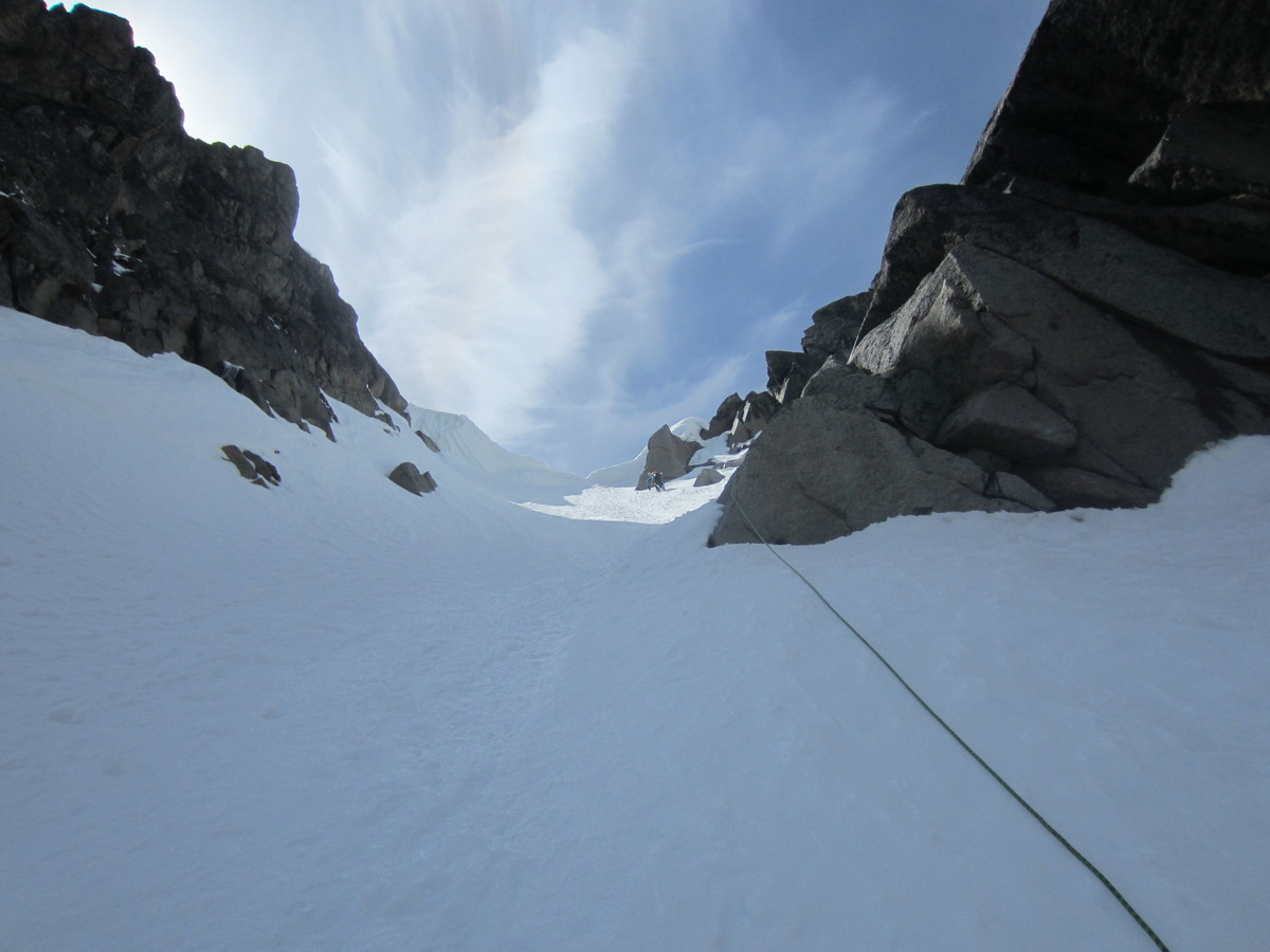
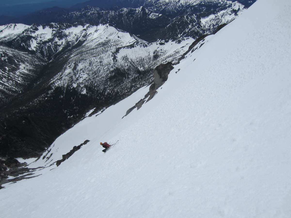
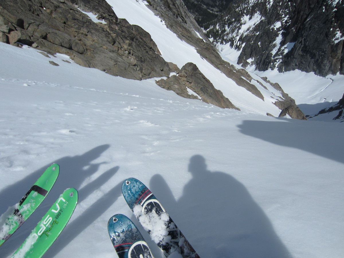
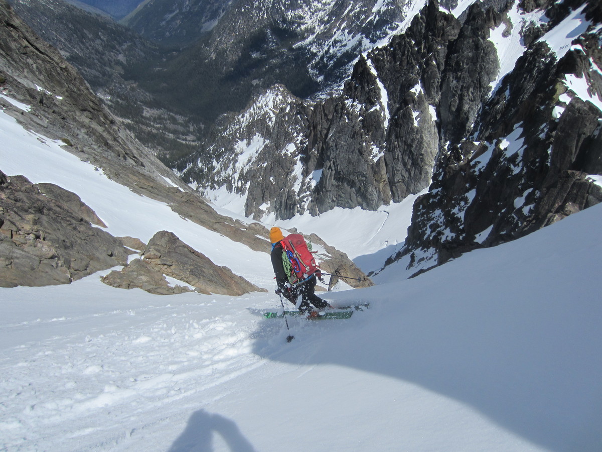
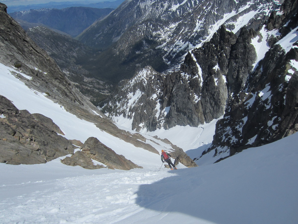
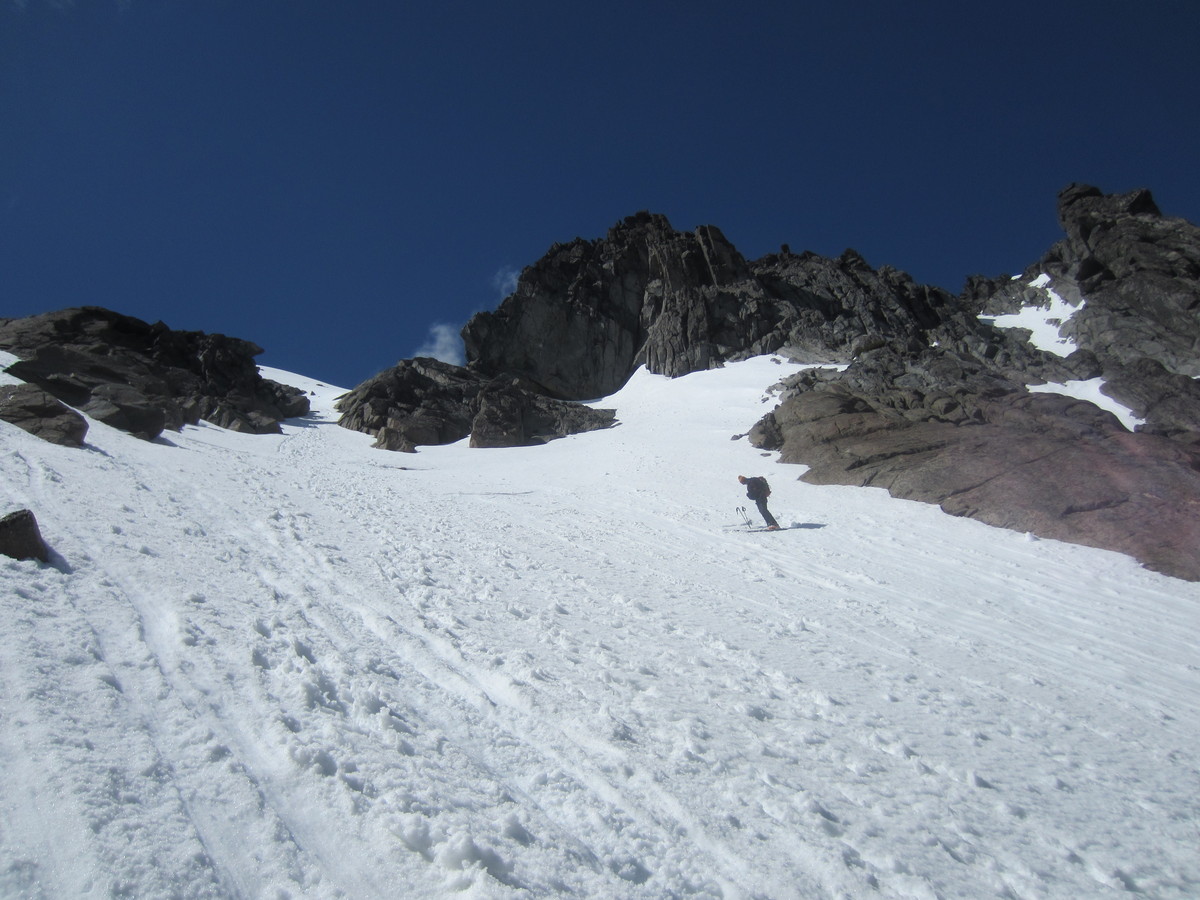
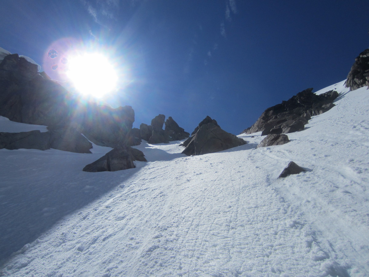
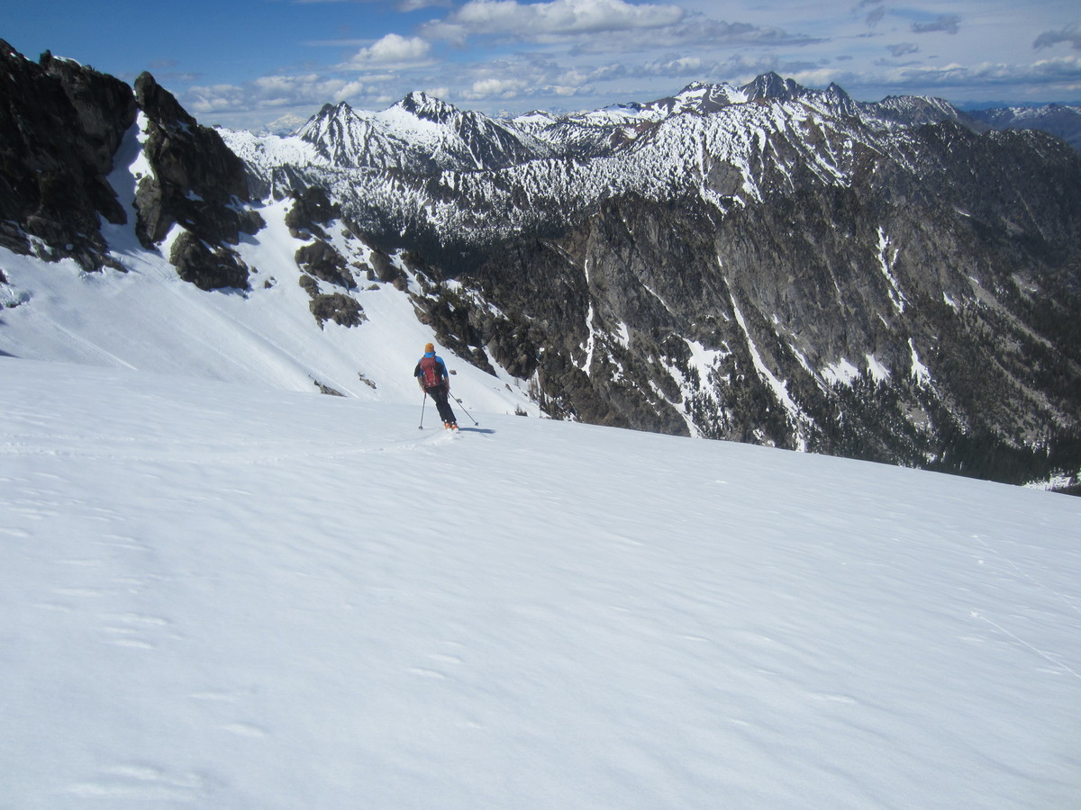
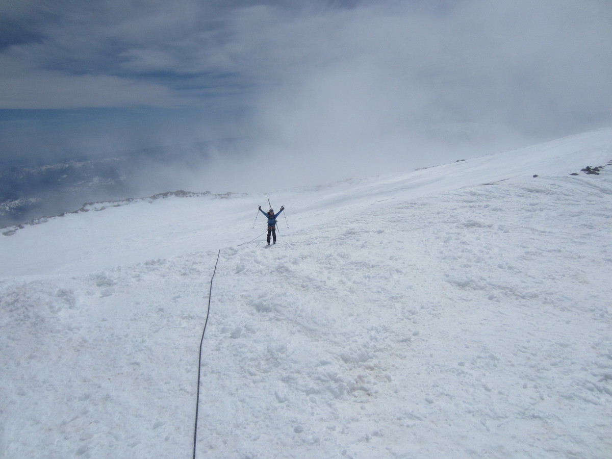
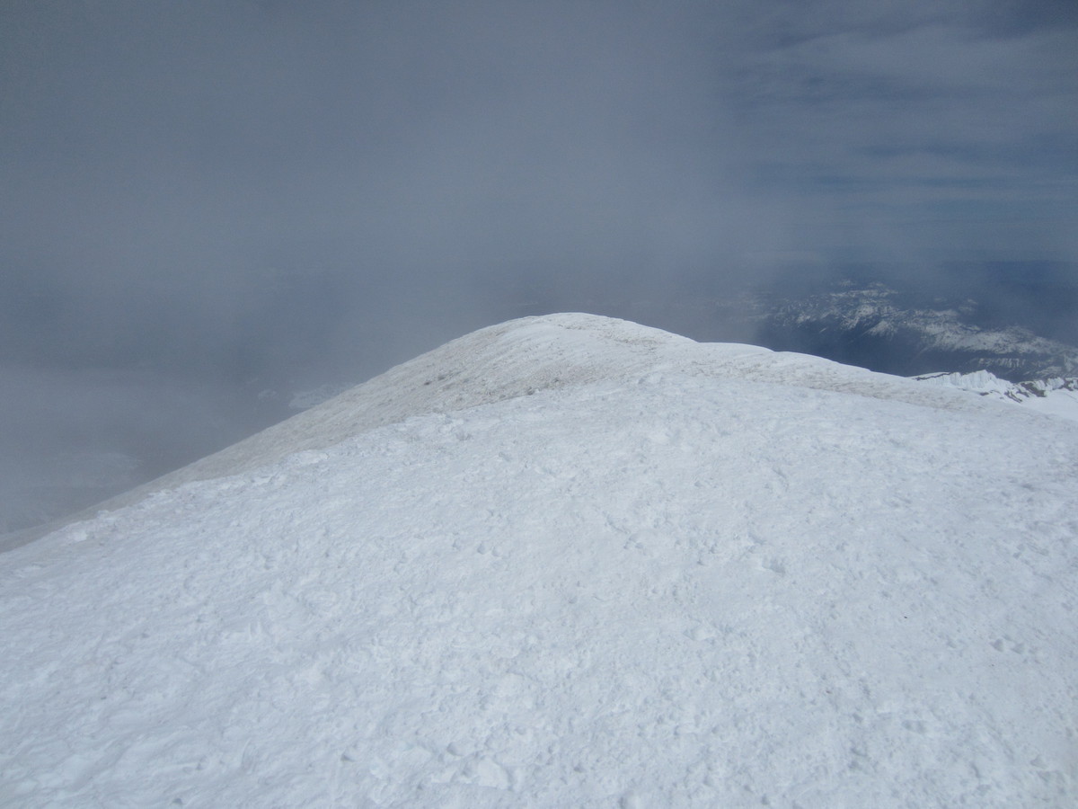
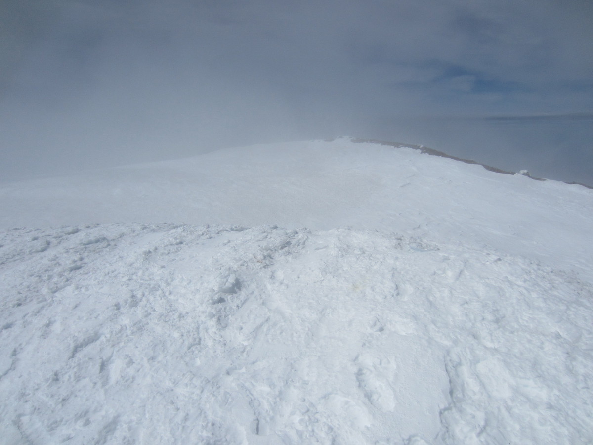
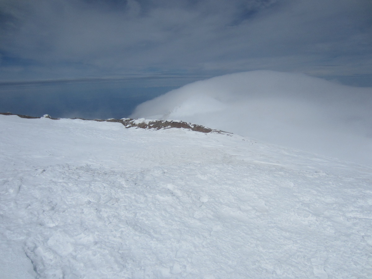
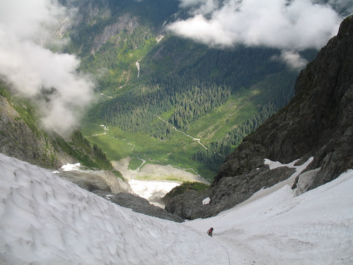
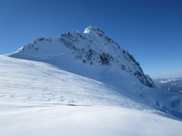
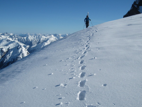
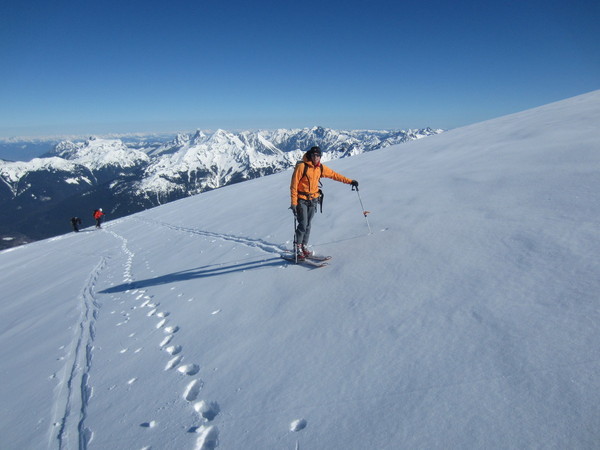
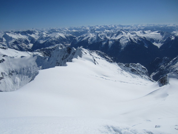
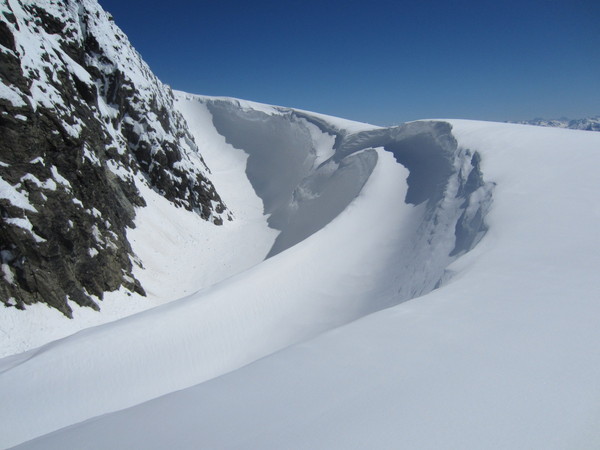
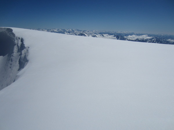
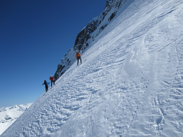
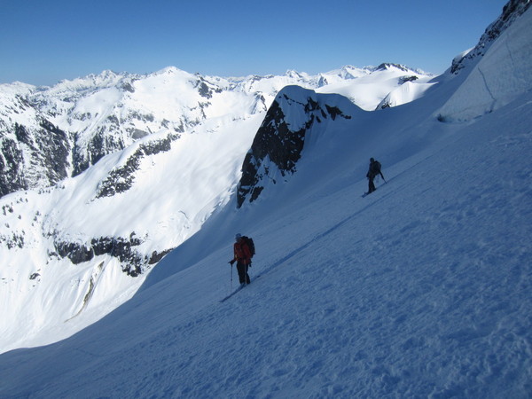
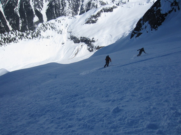
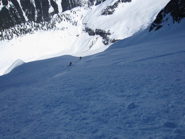
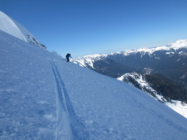
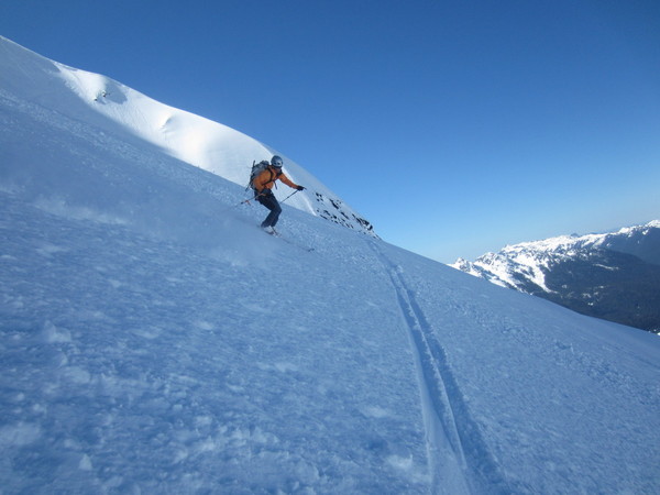
Trip: Mount Stuart - Ice Cliff Glacier w/ Sherpa Glacier ski descent
Date: 5/20/2013
Trip Report:
Aaron S and I linked up for a great trip up Mt. Stuart today.
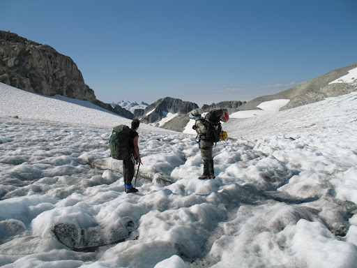
We left the parking lot at a touch before 4AM and made decent time on dry trail up to the first switchback heading up to Stuart Lake. From there, we dropped to the creek and crossed and then followed the cairned boulderfield trail up into the basin below the N Face of Stuart.
Climbing conditions on the Ice Cliff were just about perfect. Firm snow on the ascent, and only a slight groan from the Ice Cliff the entire time. We topped out in the sun then proceeded to lounge around on the false summit for a good while before making our way up the final 800' or so to the true summit.
The ski down the Sherpa Glacier was on good corn.
We botched the deproach a bit and wound up following the creek for a little ways. It would have been better to find our up route, but we didn't lose that much time.
Back to the parking lot at 6:15. An excellent day out!


-
Thanks mountainsloth.
What's on the horizon now is finishing school and gaining solid employment. I've had a good run, it's time to put climbing on the back burner for a while.
-
Roy, it's always been a pleasure of mine to climb with you and the other old timers. I always learn a lot from you guys and admire and respect your drive at 80+ years old! I can only hope I can function in the same capacity when I'm your age. We've shared a lot of great memories and I hope to share many more.
Pup_On_The_Mountain - Talk to JasonG to track down an actual copy of the Repulsive 69. I don't have a hard copy of the list, I've only seen it but I do remember quite a few peaks on it.
-
The clarity of your photos is impressive. Nice work!
-
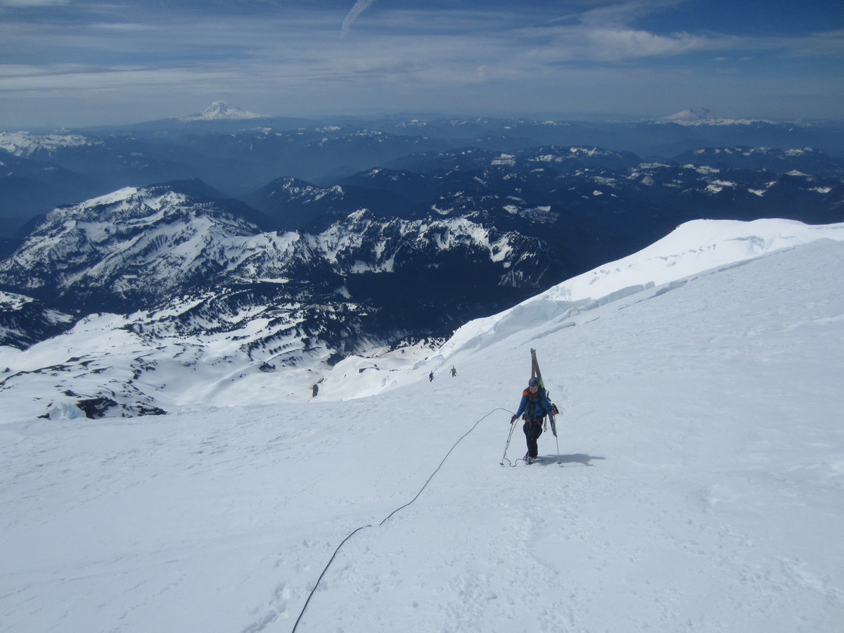
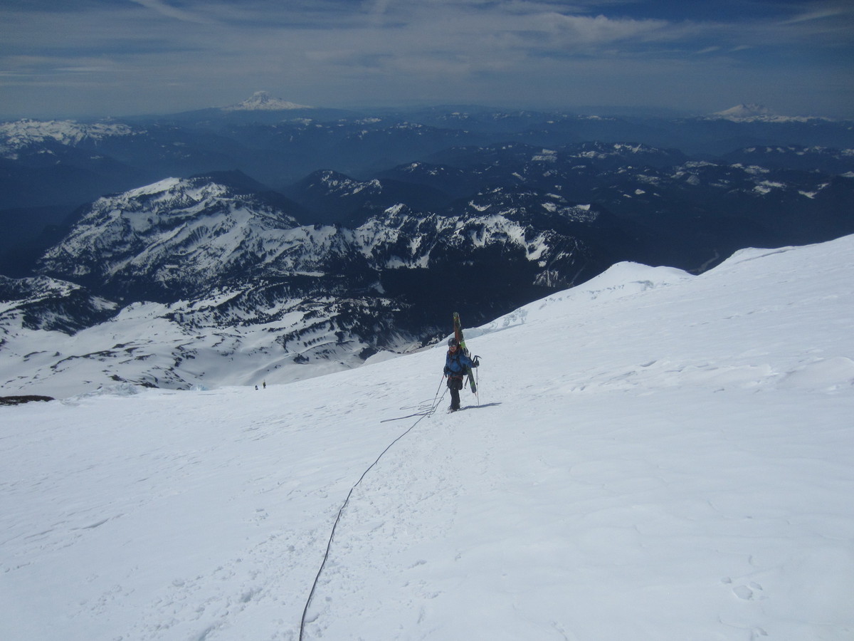
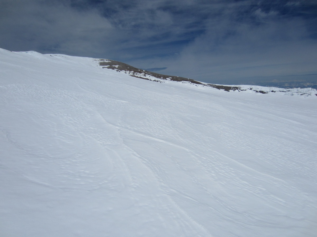
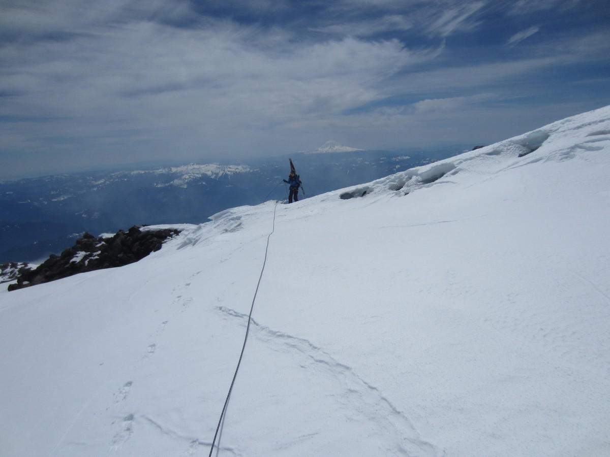
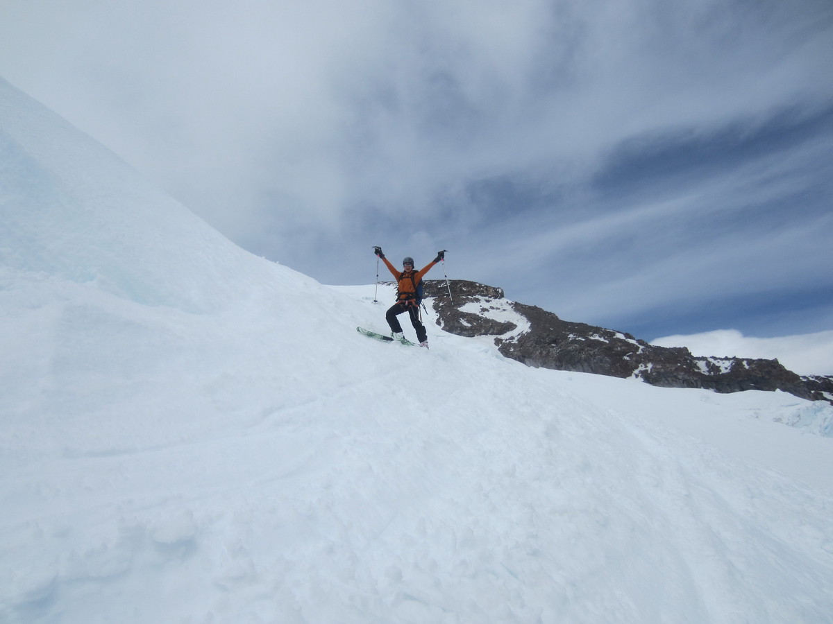
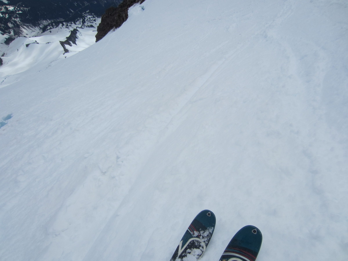
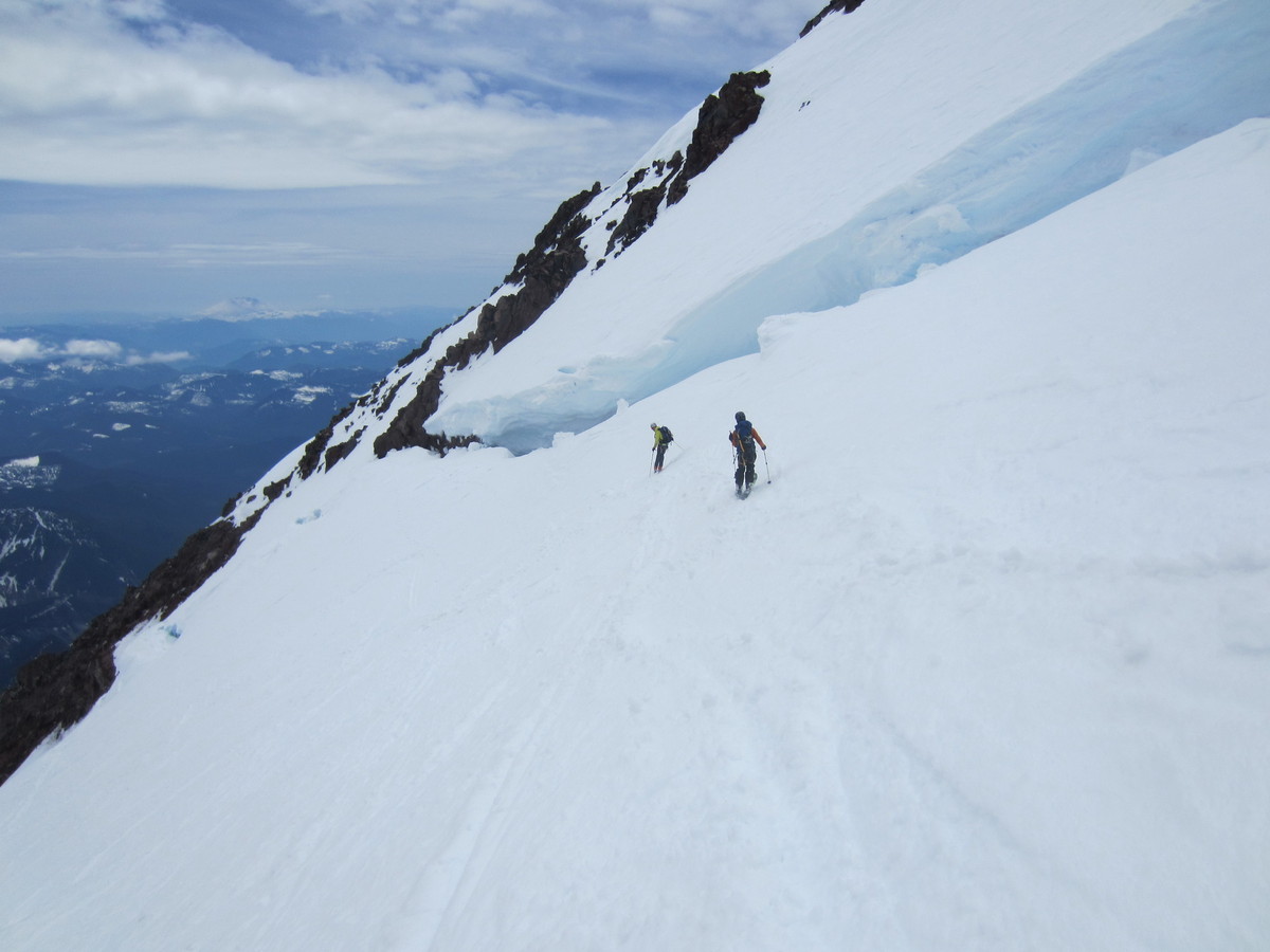
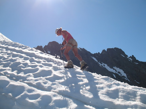
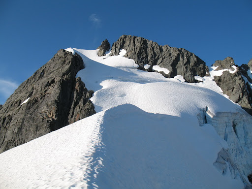
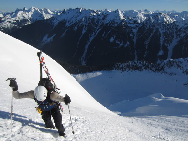
Trip: Mt. Rainier - Fuhrer Finger - Daytrip w/ Ski Descent
Date: 5/11/2013
Trip Report:
Juya and I linked up yesterday for a perfectly planned and executed day trip up Mt. Rainier. I have made numerous attempts at a single day push on Mt. Rainier (always Winter or Spring), but have never succeeded until yesterday.
We left the Paradise parking lot at 2:30AM and enjoyed skinning in calm, partly cloudy conditions. By sunrise, after only one minor routefinding issue in the dark, we were at the base of the Fuhrer Finger, where two teams were already climbing. Booting up the Finger was sort of a pain in the soft snow.. most of the time we were postholing, only occasionally could we crampon on the surface (I didn't even put crampons on until 12,000'). After catching up with the lower team, I realized I knew one of them - Doug Hutchinson. Small world. Juya and I joined forces with Doug and his partner Paresh for the remainder of the journey to the summit. Around 12,000', we ran into the higher party who were just beginning their descent after deciding to turn around. They informed us that their tracks ended in a maze of crevasses and they weren't sure if there was a way through. After about 45 minutes of fuddling we found a route through on a sketchy snow bridge among teetering seracs.
Continuing on, the final 2500' was a bit slower-paced, but eventually we made the summit, 9 hours and 45 minutes after leaving the car. A lenticular cloud enveloped us and winds were steady at about 50MPH. Visibility was low and waning. After a few photos, we put on our skis and headed down. The skiing through the finger was phenomenal.. near-perfect corn all the way down to the Wilson Glacier. After saying goodbye to Doug and Paresh, we parted ways and made our way slowly back to the full parking lot in the baking sun, arriving at 3:30.
Thanks to Juya for being a great and strong partner. This was her second time in three days climbing Fuhrer Finger (she was stopped at 12,500' on Thursday after her partner fatigued) and her acclimatization was apparent!
Trip Stats:
9600' Gain
11 Miles
9:45 Car-to-Summit
15 Minutes Summit Time
3 Hours Descent (with routefinding snafu)
13 Hours RT
Photos:
Summit Video:
[video:vimeo]
-
Thanks Tom for such a comprehensive and detailed report of the "Terrible Ten". Your perseverance and suffer ability is admirable to say the least. The fact that you have repeated several of these test pieces multiple times gives you true Cascadian Hard Man status and Honorary membership in the Choss Dog Millionaires. Hell I am just a choss puppy by these standards you have set!
The fact that I am only half way through the list, and no summers in state anymore means I may never get a chance to complete it, but your write up has certainly inspired me to want too!(I think).
Dallas would for sure be proud of your accomplishment and recognition of his 10 Most Difficult Peaks list.
Do you know of others who have competed this list?
Can the Holy Grail completion of the Repulsive 69 be within your sights?
Thanks again for this TR, truly inspiring!!
Thanks for your kind comments, Scott. I have no doubt if you just had the time you'd finish the list as well.
I don't know of anyone else who has finished the list. I do know some people who are interested in it. I think Don Goodman has climbed all but one (Nooksack Tower).
The Repulsive 69 is not within reach for me for at least five more years due to responsibilities, but a lot of them are peaks I already have on my to do list. I look forward to the day I have more time to pursue it!
-
This is an article I wrote a while back about climbing the most difficult peaks in Washington State. Whether or not you agree with the peaks on this list, I hope you all get some satisfaction out of reading the article. I'd be interested in hearing your feedback, good or bad.
A couple of years back, I read an article written by prolific local climber Jim Brisbine which, among other topics, briefly mentioned a list of difficult peaks that the late Dallas Kloke had communicated to him. The Difficult 10 (as Mr. Brisbine would later coin it), is a list of major peaks in Washington whose summits are the hardest to reach by the easiest route. An intriguing list to the aspiring peakbagger, this one is particularly so because of the fact that its criteria is so subjective - a concept that is a bit foreign to number-crunching listbaggers. After all, just what exactly constitutes a “major peak”, and what do we consider “difficult”? It would take someone who had climbed most or all of the major peaks to be able to accurately verify that the peaks were, in fact, the most difficult in the state. Dallas Kloke - a highly respected, experienced, and accomplished local climber - had already done just that. By the time I first saw the list, I had climbed a few of the peaks on it - some of them had already been on my radar. Some of the other peaks were objectives that I hadn’t previously considered, but their inclusion on the list became the incentive for me to climb them. The Difficult 10 seemed like a unique and ambitious accomplishment to shoot for, and its appeal to me was undeniable. Over the next few years, I made it a goal to finish the list.
That quest culminated this past weekend when I climbed the last peak on the list, Burgundy Spire. Looking back, climbing all the peaks on the list has been quite the adventure. Some of the most scenic & spiritual, yet difficult moments of my entire life, were experienced while climbing the peaks on this list. I’ve had fun times, encountered rare wildlife, found myself lost among fields of wildflowers, witnessed the beauty and raw fury of nature, challenged my body, mind, & spirit, spent quality times with good friends, and forged bonds and created powerful memories that I will have and be able to reflect on for the rest of my life. I’d like to take some time to share a few of those moments from each climb here, and to look back on an exciting and fulfilling time in my life.
The original article on the list (and others) can be found here. The link will look like an error at first, but wait for about 10 seconds and it will redirect you to the correct page.
The Difficult 10 (by Dallas Kloke) – Washington’s Most Difficult Major Peaks to Climb by their Easiest Route
As there is no order to Kloke’s original list (as far as I can tell), I’m going to order them by difficulty here - as I rate them - from least difficult to most difficult.
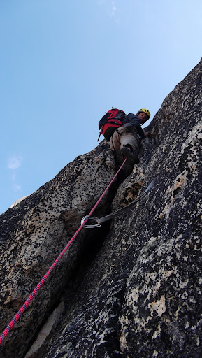
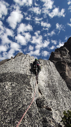
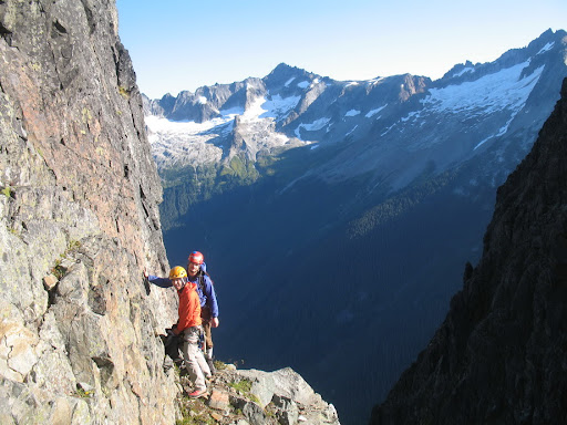
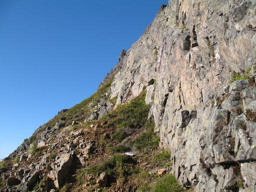
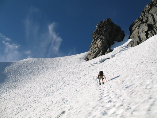
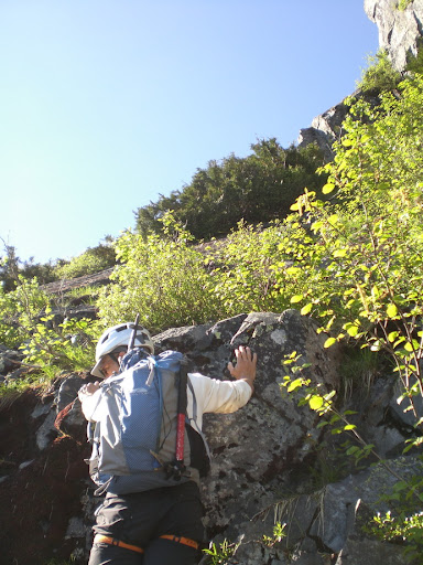
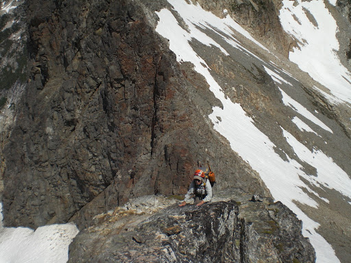
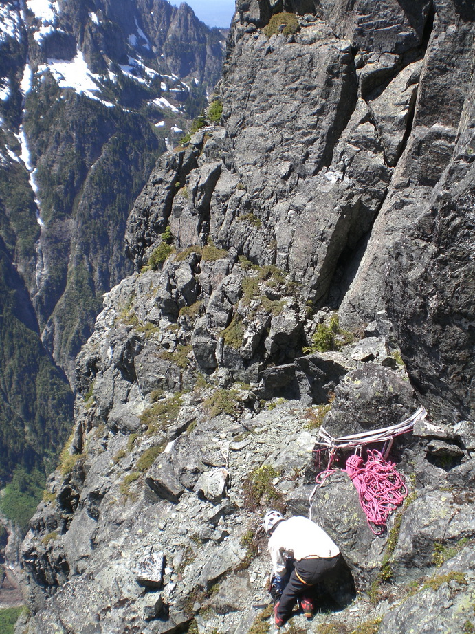
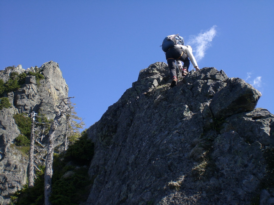
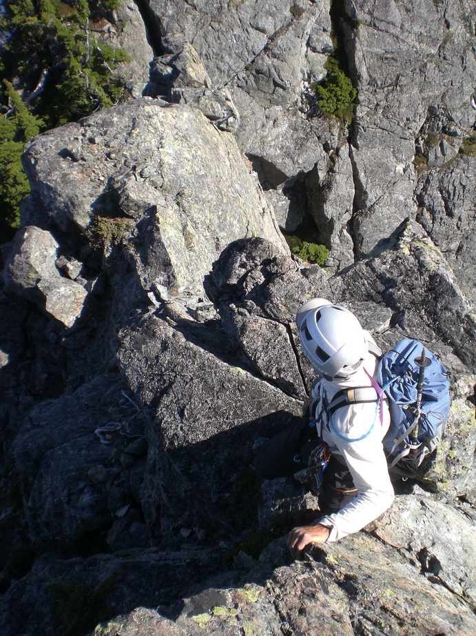
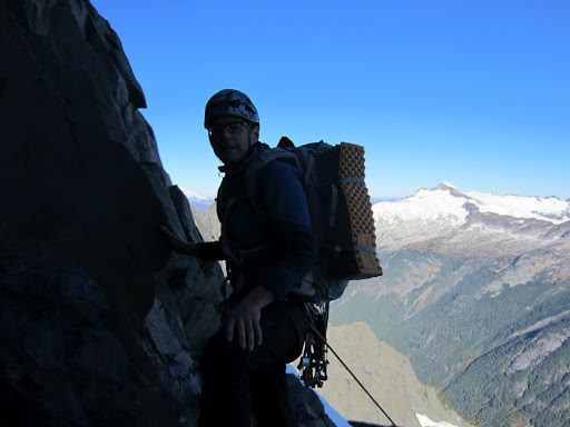
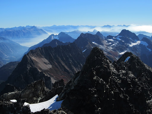
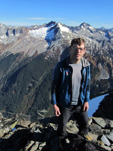
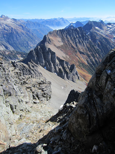
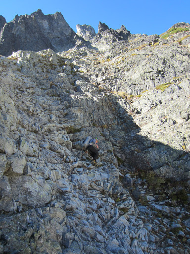
#10) Burgundy Spire – Paisano Pinnacle W Ridge to the N Face of Burgundy Spire (IV, 5.9, 10p)
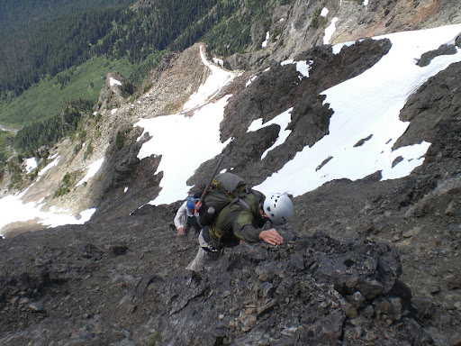
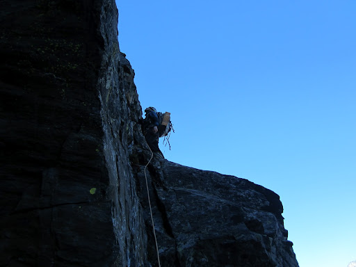
The tenth most difficult peak in Washington, Burgundy Spire is really an outlier of the Silver Star massif situated among the Wine Spires, just S of Burgundy Col. This peak is an anomaly on the list in that it is the only peak with a crag-like approach and it’s also the only peak that requires 5.8 rock climbing to reach its summit. Nevertheless, Burgundy Spire is an important peak, and its inclusion on the Difficult 10 list is definitely justified. We wanted to add on Paisano Pinnacle to our agenda - supposedly the best long, moderate, alpine rock route at Washington Pass. It wound up being a full, but stellar day of climbing for Sergio, Daniel, and I.
Starting up the first pitch.
Daniel enjoying the fun (but short) twin cracks on pitch 5.
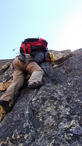
Me topping out above the cracks.
The fun 6th pitch of Paisano Pinnacle.
Topping out on Paisano.
Me near the top of Paisano.
Looking down from the belay just below Paisano's summit.
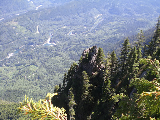
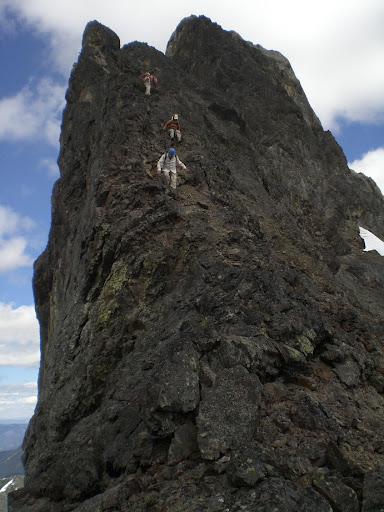
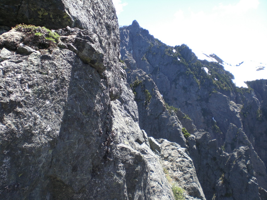
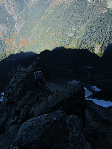
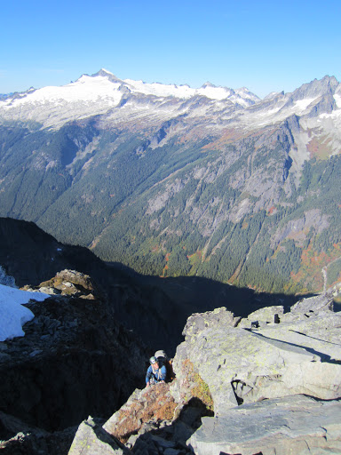
Looking down the N Face of Burgundy Spire, about two pitches below the summit. Burgundy Col below.
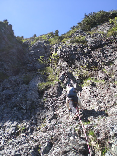
Enjoyable climbing on Burgundy Spire.
The fun (but short) crux off-width pitch on Burgundy Spire's N Face.
The giant chockstone tunnel on the traverse.
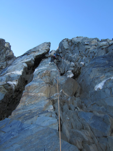
The 6th pitch of the N Face of Burgundy Spire. This was the 10th pitch of climbing on the day for us between Paisano and Burgundy.
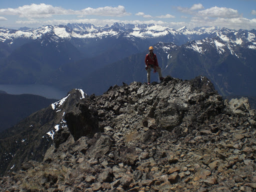
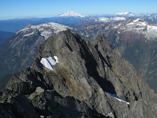
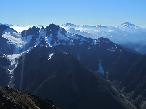
The view towards Chianti Spire and Silver Moon (T200) from the summit of Burgundy Spire.
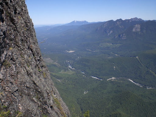
Silver Star from the summit.
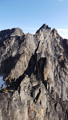
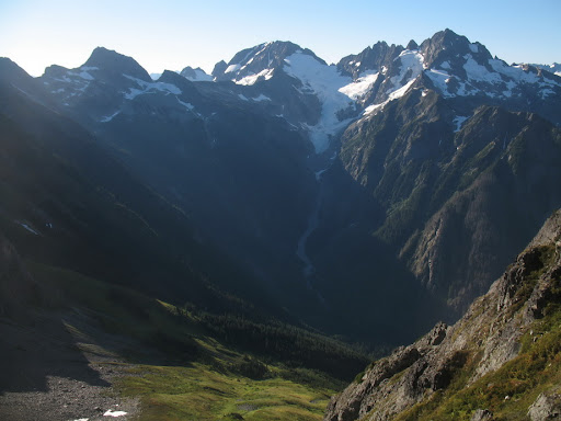
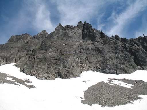
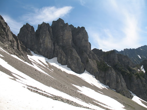
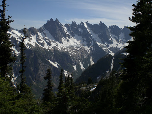
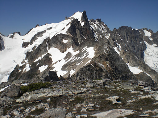
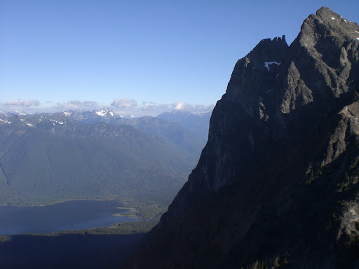
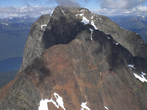
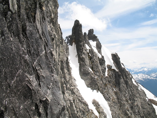
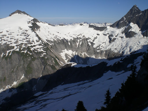
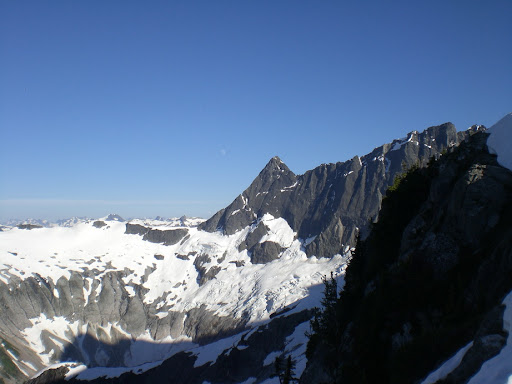
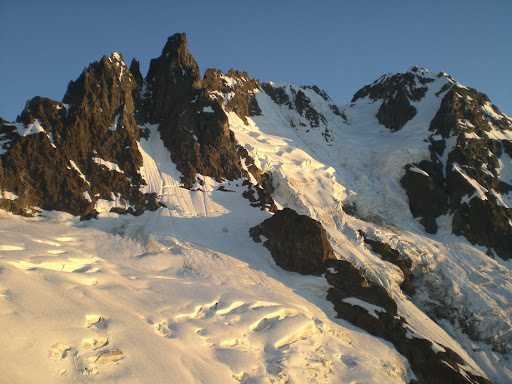
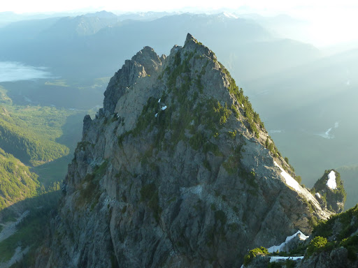
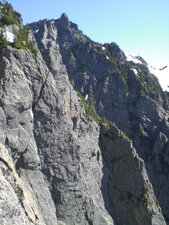
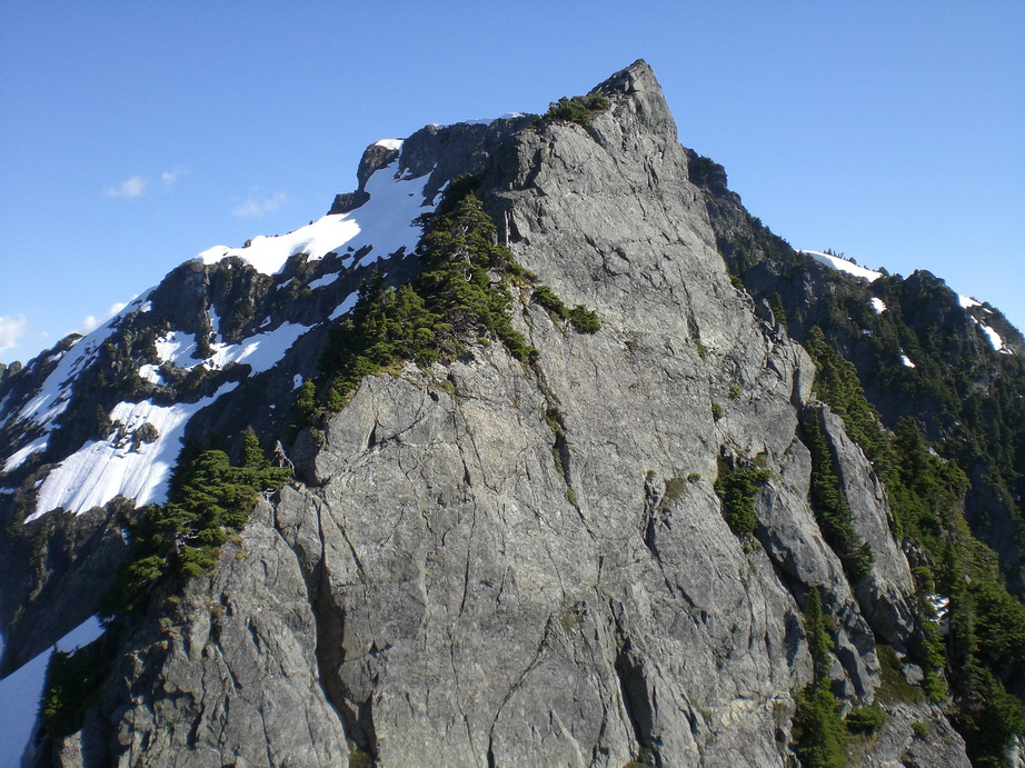
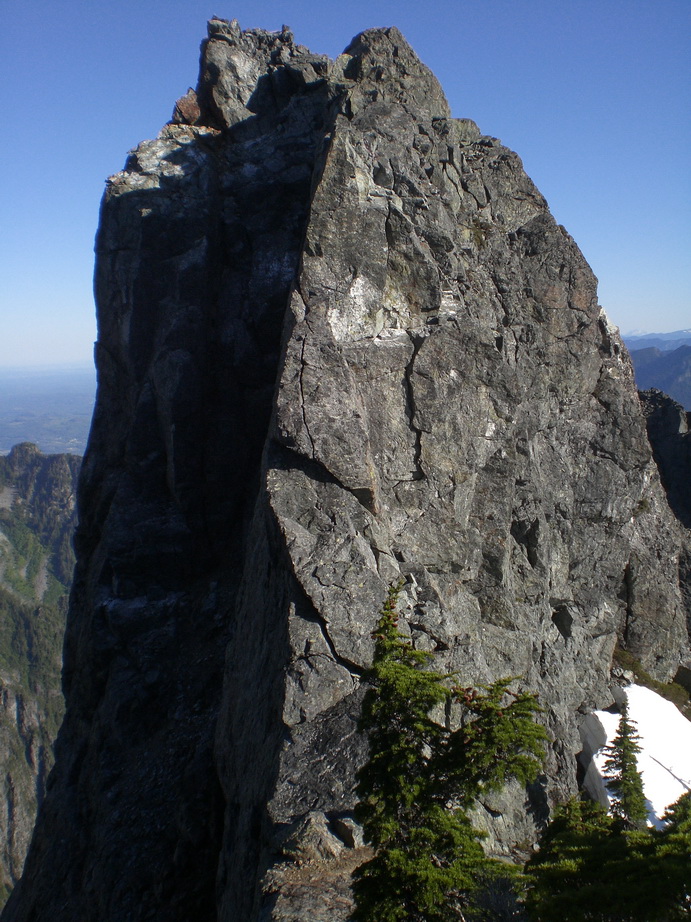
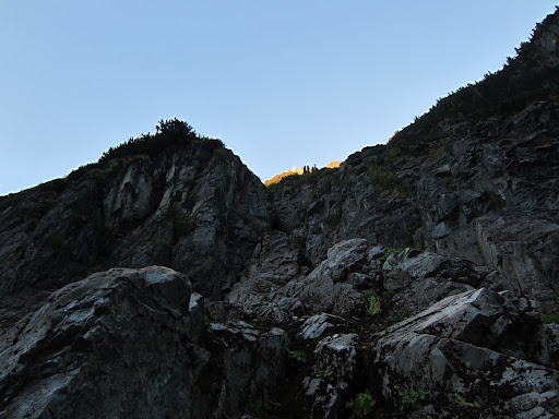
#9) Johannesburg Mountain – NE Rib (1951) (V, 5.7, 40 degrees)
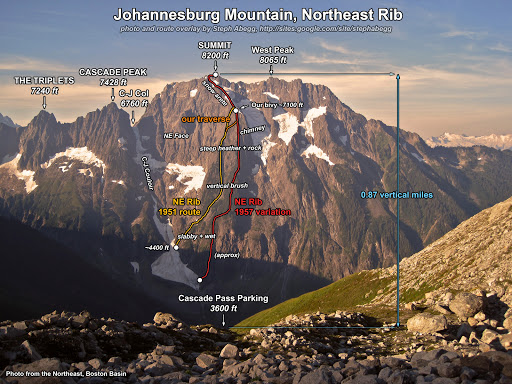
The Triplets, Cascade Peak, and Johannesburg Mtn. Photo courtesy of Steph Abegg.
Coming in at #9, Johannesburg Mountain harbors one of the most impressive and accessible faces in the state. Its hanging glaciers and precipitous rock walls intimidate visitors to the Cascade Pass area. According to an unknown source, the 7.5-minute quadrangle for Johannesburg is one of the steepest in the lower-48 states. It is a serious mountain, one that requires excellent route finding and a blatant disregard for continual exposure to reach its summit. The easiest route to the summit is the E Ridge (III, 5.5).
I have summited Johannesburg four times, once by the C-J Couloir, and three times by the 1951 NE Rib.
Trip reports:
1) C-J Couloir with Rob McDaniel and David Malkin.
2) NE Rib (1951) with Steph Abegg (Steph's report).
3) NE Rib (1951) with Wayne Wallace and Sergio Verdina.
4) NE Rib (1951) with Daniel Jeffrey.
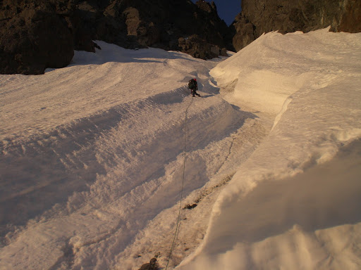
We came up the CJ Couloir through wisps of low clouds on this ascent.
Chunks of ice threatened.
But we kept climbing.
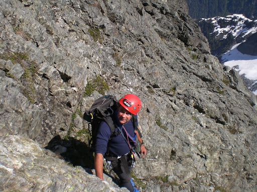
Rob and David enjoying the sunshine and views.
Typical terrain on the lower E Ridge of Johannesburg.
The Middle Cascade River valley and Mt. Formidable.
Rob approaching the false summit of Johannesburg Mtn.
Down climbing the E Ridge.
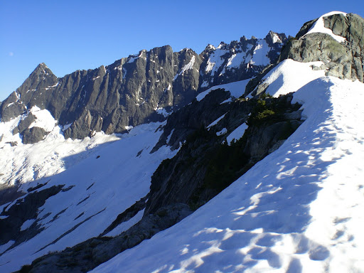
Spider and Formidable.
Art's Knoll and Spider Mtn.
Hurry-Up, Spider and Mix-Up.
Magic, Hurry-Up, and Spider.
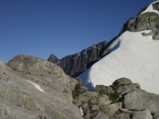
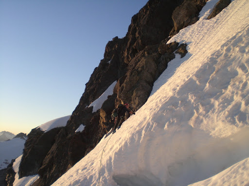
Steph climbing the snow arete on the NE Rib.
The snow arete.
Steph ascending the final snowfield below the summit of Johannesburg on the NE Rib.
Cascade Peak.
The Triplets.
Sergio and Wayne climbing the snow arete on my third ascent of Johannesburg.
Sergio climbing steep snow below the summit.
Wayne climbing steep snow.
Sergio and Wayne scrambling below the summit.
Looking towards Hidden Lake Peaks.
#8) Mt. Index (North Peak) – North Face (IV, 5.7)

Mt. Index in Winter. Photo courtesy of John Scurlock.
Mt. Index is definitely one of the most rugged peaks in the state, despite its low elevation. It's also a unique peak for the purposes of our discussion, because two of its summits are on The Difficult 10 (North Peak, and Middle Peak). Viewed from US2, Mt. Index is a striking massif of vertical walls and dizzying relief. Its North and Middle Peaks seem improbable at a glance, but there are routes for those who are prepared to give it a try. Have your ‘A’ game on this peak.
Trip report:
1) Index Traverse with Wayne Wallace.
Wayne scrambling low on the N Face.
Looking down from halfway up the N Face of N Index.
US2 sits far below.
Wayne in the amphitheater.
I'm not sure how Wayne got that black eye.
Wayne climbing the incredible N rib.
Wayne topping out below the false summit of N Index.
Looking up to the summit of N Index.
N Index in the background, as seen from Middle Peak.
#7) Mox Peak (SE Spire) – via the Ridge of Gendarmes (III, 5.6)

Mox Peaks. John Scurlock photo.
Having gained notoriety as the hardest peak on the Bulger Top 100 list, SE Mox Peak (AKA “Hard Mox”) is a steep, exposed mass of loose gneiss in the Chilliwack range just S of the Canadian border. Its summit tower is imposing, and route finding is less than straightforward. Nevertheless, the views from this lonely summit are impressive. SE Mox is the only peak on the Bulger Top 100 that is also on The Difficult 10.
Trip report:
1) SE Mox via the Col of the Wild and the Ridge of Gendarmes with Don Beavon, Mike Collins, Don Duncan, and Roy McMurtrey.
The impressive Depot Creek Headwall.
Again.
Don Duncan and Roy McMurtrey at Ouzel Lake.
Don Beavon and Mike Collins on the Redoubt Glacier.
Bear Mountain.
Looking up towards Redoubt from the Redoubt Glacier.
Mox Peaks and the Ridge of Gendarmes.
The "Col of the Wild".
NW Peak as seen from the Col of the Wild.
Perry Glacier.
Don Duncan climbing on SE Mox.
Looking down from high on SE Mox.
Roy about to begin climbing.
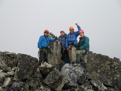
Summit shot!
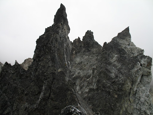
Gendarmes.
Don Beavon.
The summit tower as seen from the notch in the Ridge of Gendarmes.
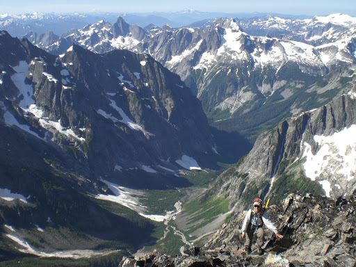
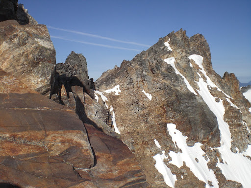
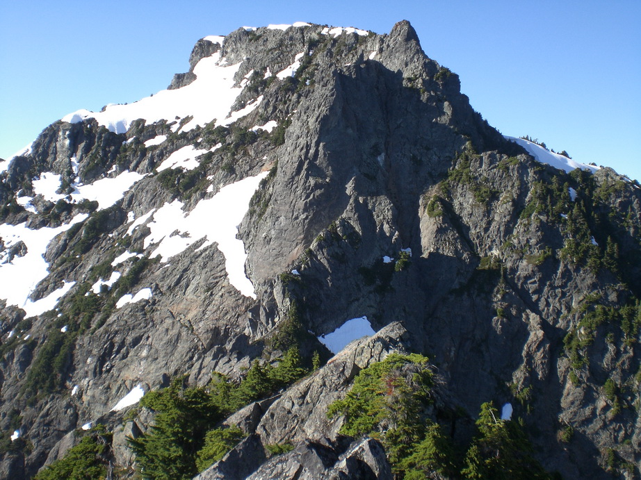
#6) Mt. Fury (W Peak) – E Ridge via E Fury (IV, 5.6)
Mt. Fury as seen from Luna-Fury Col.
Mt. Fury is a relatively well-known, but infrequently climbed and legendary peak in the rugged Pickets Range. The E summit is the usual objective for those venturing up, but the more remote W Peak is the true summit of Mt. Fury (by a matter of mere feet). Mt. Fury involves a long & arduous approach, complex route finding, and miles of scrambling. The easiest route up is probably from Pickell Pass (according to the late Roger Jung, who has climbed every established route on the peak). Fay Pullen and I climbed W Fury after bivvying on the summit of E Fury the previous night. We had a wonderful time all alone in one of the most remote spots in the lower 48 states, and were elated to stand atop this rarely visited summit.
Trip report:
1) Traverse from E Fury to W with Fay Pullen.
Fay and I at Luna Camp.
Luna Peak as seen from Access Creek.
The S Pickets from the approach to Luna-Fury Col.
Mt. Fury.
E Fury.
Fay climbing below E Fury.
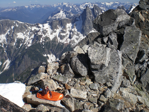
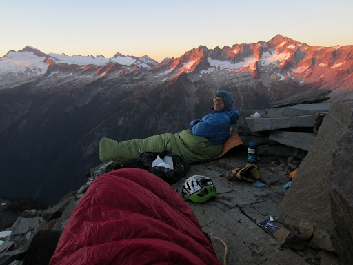
Fay's bivy spot on the summit of E Fury. This was one of the most scenic spots I've ever spent the night.
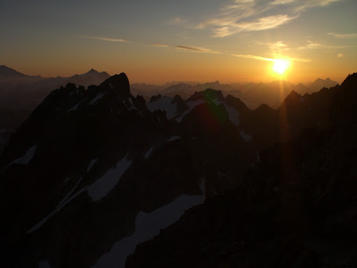
Sunset from E Fury.
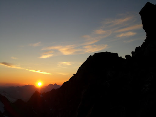
More sunset.
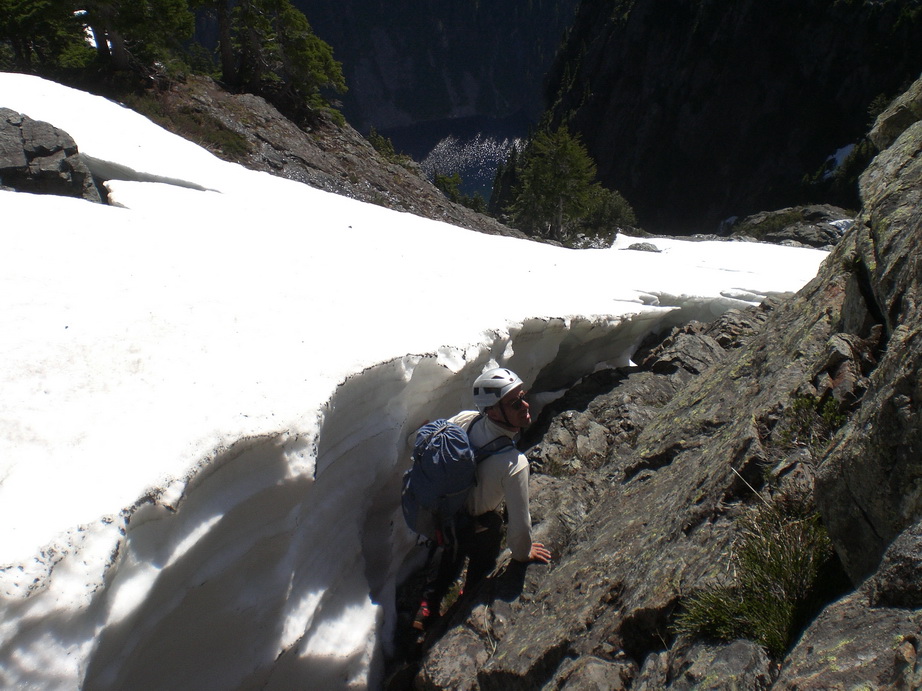
Fay traversing steep, icy snow on the way to W Fury.
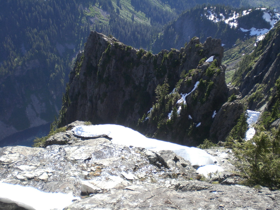
On the ridge crest.
Challenger.
Lousy and Luna Lakes far below.
Fay scrambling above Upper Goodell Creek Valley.
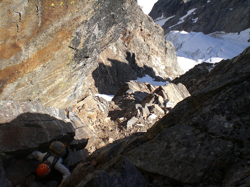
Steep rock on the ridge leading to W Fury.
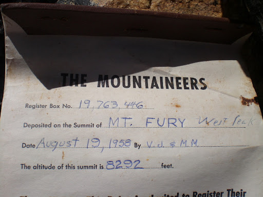
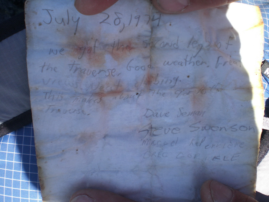
The summit register. It was placed in 1958.
Looking back on the return to E Fury.
Fay - all smiles - with the S Pickets behind.
#5) Hozomeen Mountain (South Peak) – SW Face (IV, 5.6)

An unbelievable shot of Hozomeen Mountain's rugged South Peak. Photo courtesy of John Scurlock.
Hozomeen Mountain is a unique and very rugged double-hump summit on the N end of Ross Lake, on the western edge of the Pasayten Wilderness. Some of the largest walls in the range reside on Hozomeen. The S Peak is steep and exposed, and the rock is of dubious quality. Any ascent of Hozomeen requires excellent route finding and an experienced party comfortable with loose rock and continual exposure. Some attempts have been made on the huge walls of N Hozomeen's W Face (the largest unclimbed wall in the range), but they have thus far fallen short due to poor, hard-to-protect rock and very difficult climbing.
Trip report:
1) Southwest Face with Carla Schauble, Franklin Bradshaw, and Jeff Hancock.
Ross Lake.
The SW Peak of Hozomeen.
N Hozomeen.
Ross Lake and N Hozomeen.
Franklin on the ascent.
Typical terrain on route.
Franklin and Carla scrambling high on S Hozomeen.
Carla reaches for a hold.
The traverse to N Peak.
Franklin poses on the summit.
The gang down climbing the summit block.
Franklin, Carla, and Jeff.
The low-angle slabs near the base of the route.
#4) Inspiration Peak – S Face (IV, 5.8)
The sheer S Face of Inspiration Peak.
Inspiration Peak is an important, attractive summit in the S Pickets. Its easiest route, the W Ridge, involves ascending a sketchy gully followed by multiple pitches of class 4 and low to mid-fifth. Wayne and I climbed the S Face, an improbable route on a vertical to overhanging wall. The climbing on the S Face was some of the sketchiest rock climbing I’ve ever done. Wayne figured he’d add another element of difficulty to the climb by having us leave the rock shoes at home in the interest of saving weight. Great idea, Wayne – you’re always thinking!
Trip report:
1) S Face with Wayne Wallace.
Wayne having a cup.
Ominous clouds over the Southern Pickets.
Interesting cloud patterns above the Terror Glacier.
The sheer (and wet) S Face of Inspiration.
S Face.
Looking towards the McMillan Spires.
Wayne on route.
Wayne coming up to the top of the ramp pitch.
Looking up the ramp.
Looking E.
Wayne in the alcove at the base of the last chimney pitch.
Rappelling the W Ridge.
Still rappelling.
#3) Nooksack Tower – Beckey/Schmidtke (IV, 5.6)
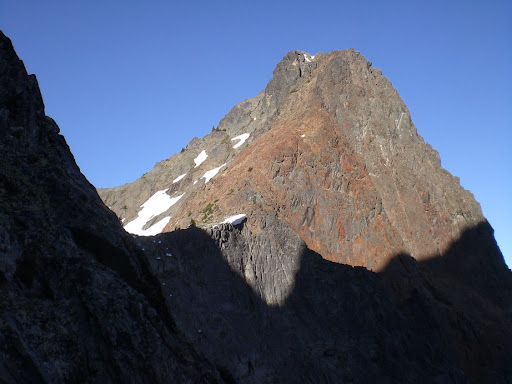
Our route up Nooksack Tower.
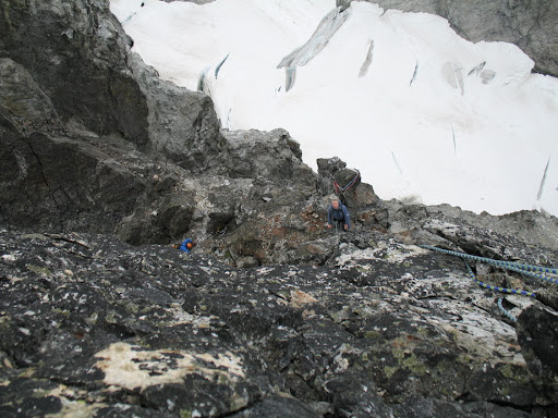
Nooksack Tower, although having very little prominence to set it apart from Mt. Shuksan, merits its own spot on the list because of the lack of easy ways to reach its summit. Climbing the easiest route on Nooksack Tower involves climbing very steep snow (60+ degrees) in a sluff-prone couloir, followed by multiple pitches of loose, exposed third to mid-fifth class climbing. I enjoyed the company of Don "Peak Junkie" Beavon on this climb. Don Beavon summited Mt. Everest in 1998, and made it to 8000m on K2 (without supplemental oxygen) at the tender young age of 50. In the interest of safety, Don Beavon and I climbed a majority of the loose route unroped, and Don nearly bought the farm after breaking off a hold near the top of the route.
Trip report:
1) Beckey/Schmidtke Route with Don Beavon.
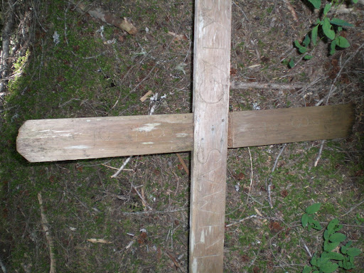
A memorial to a fallen climber (Rimas Gylys) on the approach.
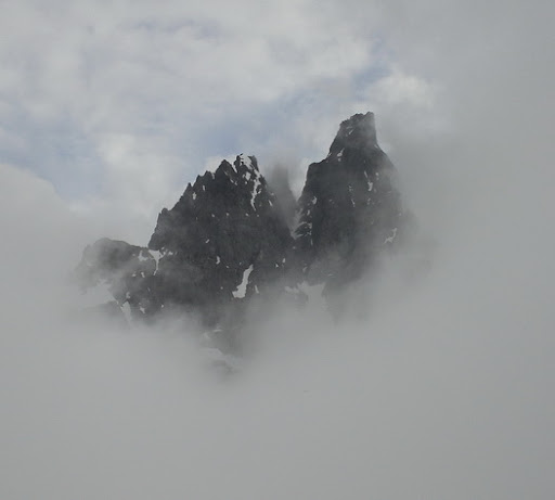
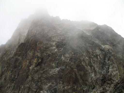
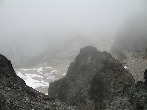
Nooksack Tower peers through the fog.
Nooksack.
Ruth and Seahpo.
Seahpo Peak and Jagged Ridge.
Closer.
Views from around camp.
Nooksack Tower, the Price Glacier, and Mt. Shuksan in waning light.

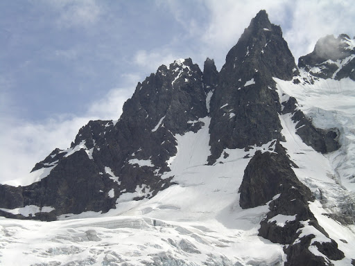
Nooksack Tower.
Don begins the ascent up the couloir.
Don climbs steep snow in the snow couloir.
Don on route.
Don just below the summit of Nooksack Tower.
One of many traverses high on Nooksack Tower.
#2) Lincoln Peak – X-Couloir (IV, steep snow & ice)

Lincoln Peak's X-Couloir (SW Face). Photo courtesy of John Scurlock.
Deserving of the #2 spot at the time of its inclusion, but probably now ousted by the FA of Assassin Spire, Lincoln Peak is one difficult summit to reach. One of the intimidating Black Buttes on the flanks of Mt. Baker, Lincoln Peak’s climbing window is short. In summer, it is a loose, dangerous, wildly steep mass of crumbling volcanic conglomerate. The best time to climb it is when it is covered in snow, but with the route being south-facing, it is threatened by a constant barrage of ice and rockfall from above once the sun comes out. Over the course of three attempts (only one of which was successful), I had two very close calls on this peak. The best time to summit Lincoln is on a cloudy day that follows a cool, clear night. There’s a reason why very few people have ever climbed this peak – it’s dangerous.
Trip reports:
1) X-Couloir (SW Face) with Fay Pullen, Mike Collins, and Paul Klenke.
2) X-Couloir (SW Face) with Mike Collins and Sean Martin.
3) X-Couloir (SW Face) with Paul Klenke, Fay Pullen, and Sean Martin.
4) X-Couloir (SW Face) with Franklin Bradshaw, Don Beavon, and Don Brooks.
Beautiful light on Twin Sisters Range.
A look up at the summit block of Lincoln Peak on our first attempt.
Looking down, just above the bergschrund.
A little higher.
Mike takes a quick break on our first attempt.
Above the clouds.
Paul and Fay begin the first traverse.
Paul and Fay concentrating.
Coming up the first snow arete.
Paul excavating ice for pro.
Paul taking a barrage of ice from above.
Sean traversing across the first bowl on our second attempt.
Looking up the crux gully. It's still awaiting its first ski descent.
Mike in a 12' deep avalanche runnel.
Group summit shot. Success!
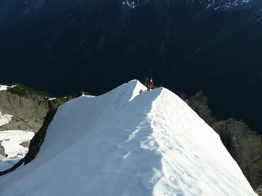
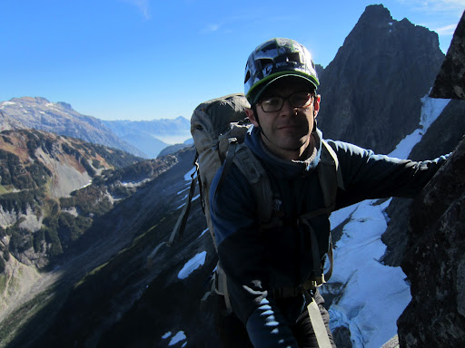
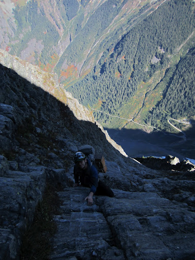
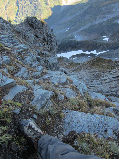
#1) Mt. Index (Middle Peak) – Index Traverse (V, 5.9, 30+ pitches)
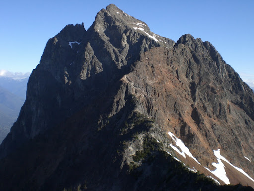
The towering North and Middle Peaks of Index as seen from the Main Peak.
When you get to #1 on the list, you wind up here, at Mt. Index's Middle Peak, staring at the most difficult summit to reach in the state of Washington. The Middle Peak of Index is not the tallest of the three Index peaks - in fact, along with N Index, it is among the two shortest peaks on this list. But what Middle Index lacks in stature, it makes up for in bite. The summit is nestled in snugly among sheer drops of up to 4500’ to the valley floor. There is no easy way to the summit, and its level of difficulty is well above anything else on the list. A successful ascent of the Middle Peak of Mt. Index will require every skill you’ve ever learned as a mountaineer, and you will be required to perform those skills at a high level. I made two ascents of Middle Index, one via the complete N to S traverse, and one via the Main Peak and back again. Both routes involve considerable climbing, extremely complicated and daunting route finding, and constant exposure and threat of rockfall. There is no retreat from this climb, and the commitment factor is off the charts as far as Washington peaks go. You will want to bring your ‘A’ game on this peak and have an equally strong and experienced partner. The crux pitch on the traverse was one of the sketchiest pitches of rock I’ve ever climbed (5.9 - we took the most difficult crux variation possible thanks to Wayne's unwavering spirit of adventure - by comparison, the most technically difficult pitch of rock I've ever climbed was 5.10d). Oh yeah, we did it in boots again in the interest of going light.
Trip reports:
1) Index Traverse with Wayne Wallace (Wayne's report).
2) Main to Middle and back with Franklin Bradshaw, Fay Pullen, and Mike Collins.

Looking down more than 4000’ to the valley below.
Wayne readying the rappel. Notice the old tat behind. None of it was fresher than 5 years old.
Steep traversing.
Wayne rappeling on the way to Middle Peak.
More downclimbing.
Gorgeous.
Views along the traverse from N to Middle Peak.
Relief
...
A long way down.
A view of the Middle Peak from the traverse.
Wayne on the ridge crest.
Good grief, more relief!
Wayne.
Middle to Main.
Sunset from our bivy spot.
The view to the N from our Bivy.
Routefinding our way to the Middle Summit.
Wayne approaching the summit of Middle Index.
Steve who?
The Main Peak as seen from Middle Index.
A little moat crawling between Middle and Main.
Running water below Middle and Main.
Wayne on solid rock.
Wow!

Lake Serene framed through the gap.
In the end, was it worth risking life and limb for ten measly summits? The fact is, I wouldn’t give these experiences up for any price, and what I learned about myself through working on the list has given me skills that I can use in everyday life – not merely in my future mountaineering adventures.
More importantly, each of these climbs strengthened the bonds I already had with my climbing partners. Climbing, making important decisions together, putting our lives in each others' hands, and sometimes even sharing a sleeping bag with each other (yes, in the interest of saving weight) creates the types of friendships that other facets of life just can't. These experiences will be impossible to duplicate, but they are forever vivid memories that I will have the pleasure to reflect on in the years ahead. There’s no question that these experiences have enriched my life, and I am a better man because of them.
Finishing the list is bittersweet as we mark the 1st year of Dallas' passing on the day I finished his list (September 25, 2011). I never got to meet him, but respected and admired him merely from what I had read and heard. Dallas was an accomplished Cascades mountaineer, and played a huge role in the development of the Mt. Erie climbing area. According to close friends, Dallas was also an excellent family man and well-loved by anyone who ever met him - by all accounts, someone everyone can look up to. Cheers, Dallas.

-
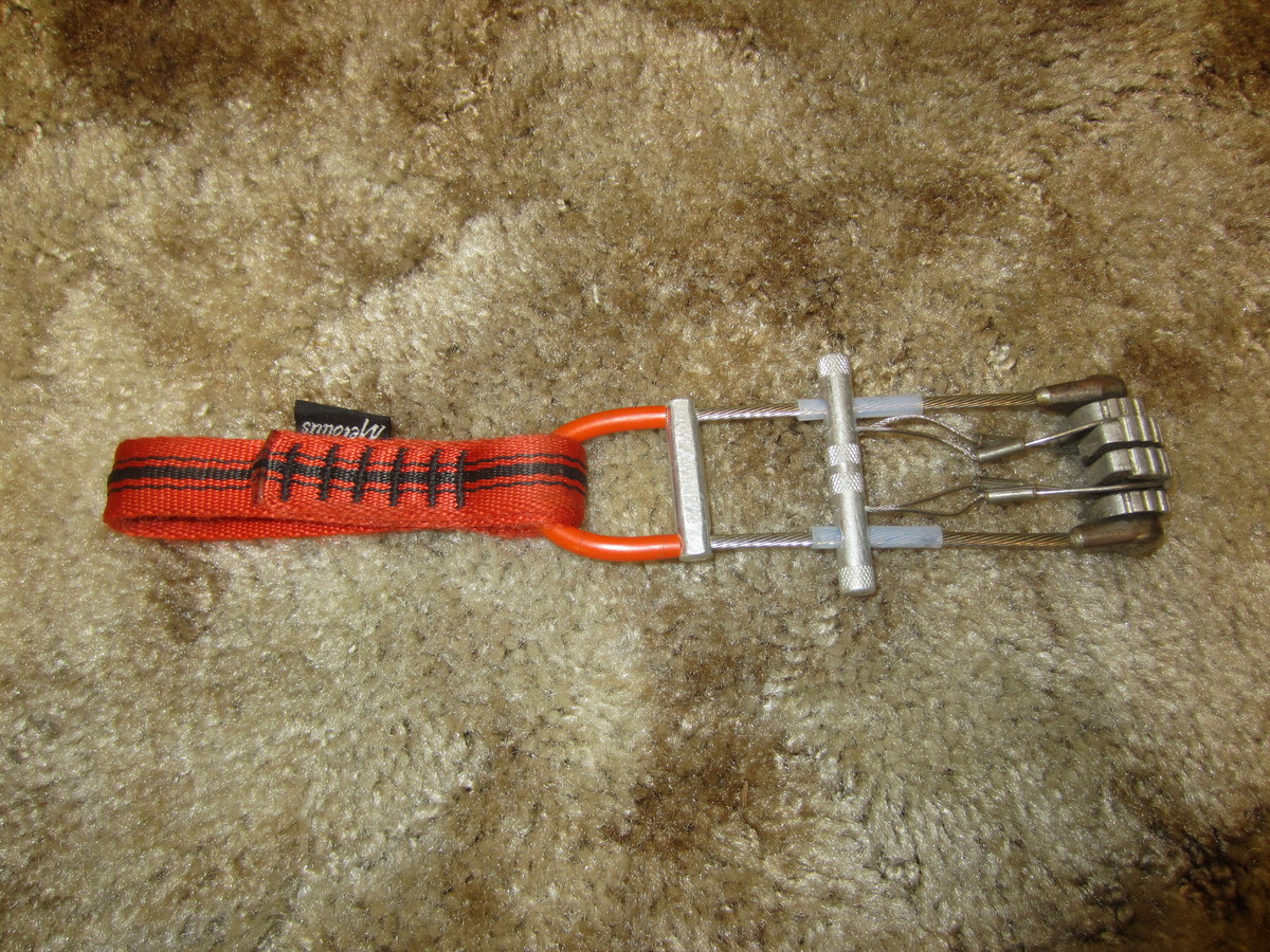
Selling my last Metolius Power Cam (Orange #3) in good condition with no falls. $30.
-
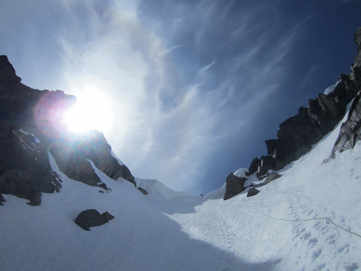
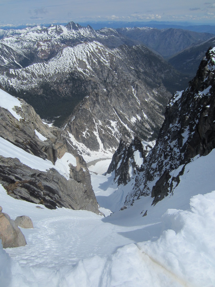
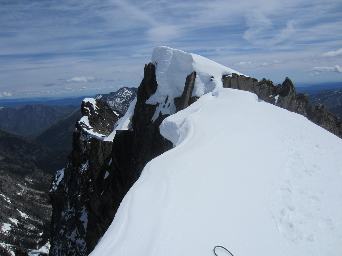
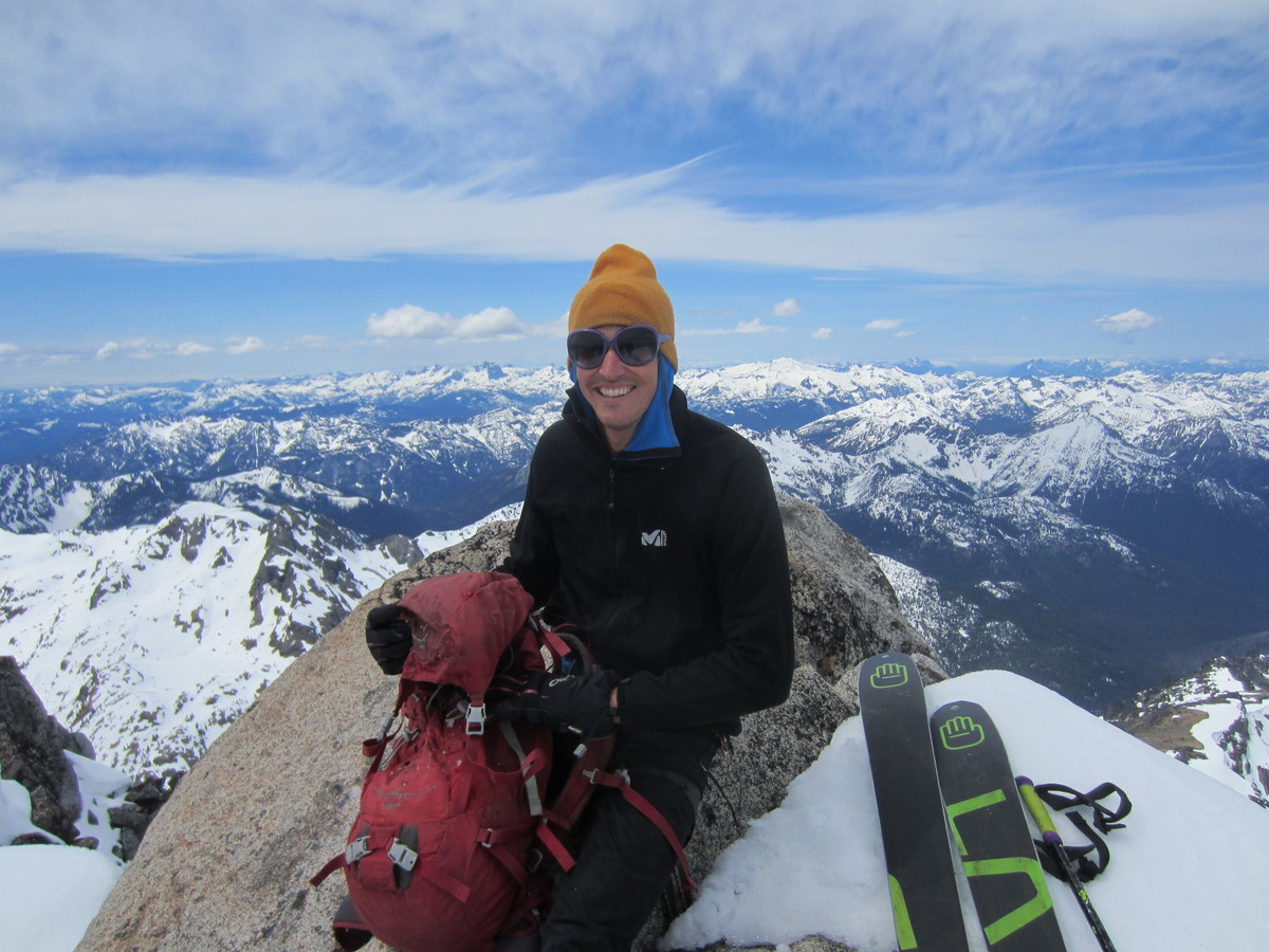
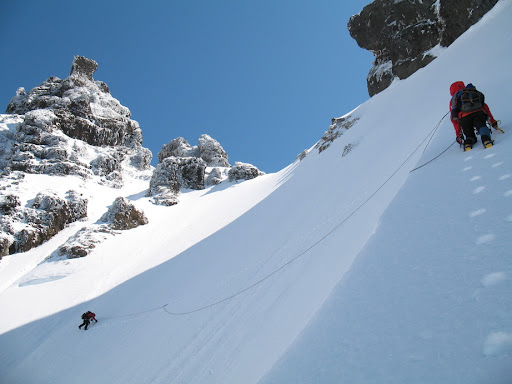
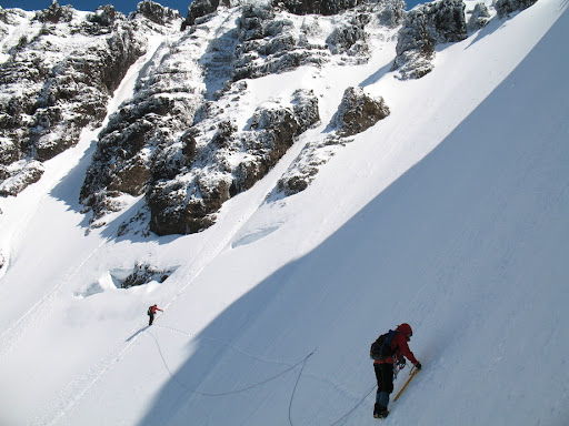
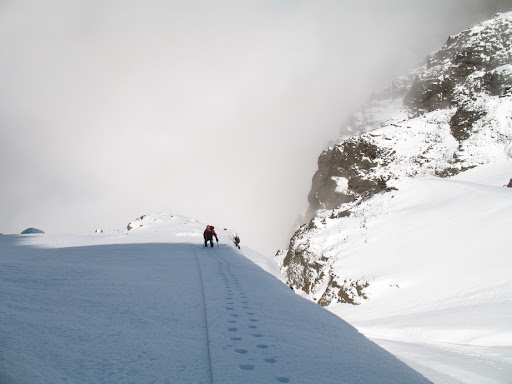
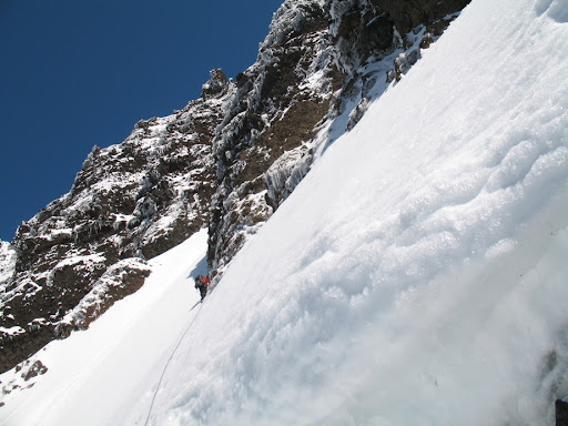
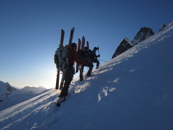
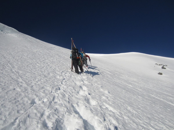
Trip: Mt. Shuksan - North Face (Climb and Ski Descent)
Date: 3/31/2013
Trip Report:
Our party of five climbed and skied the North Face of Mt. Shuksan this past weekend under perfect conditions (perfect for skiing). We took two days for it and enjoyed some unbelievable lap skiing on S-facing slopes above camp on Saturday afternoon. A few 1200' descents off Pt 5527 on smooth butter corn gave us a pleasant taste of the great skiing we would encounter on Sunday.
Booting up the N Face was a task, but we were on the summit by 11AM just as things began to really heat up. The pyramid was inconsistent ice/corn/sun-baked, but that didn't stop three of our party of five from "skiing" it. We began our descent at 1PM and conditions on the N Face were perfect - chalky powder in the shade and smooth corn in the sun. After a quick stop at camp to pack up, we were back in the parking lot at 4:30 enjoying beers and warm temps. A perfect Easter weekend.


The following photos courtesy of Jonathan Crabtree:


Gear Notes:
Skis and poles.
Approach Notes:
Access road from White Salmon Lodge, traverse at the same elevation or slightly down into White Salmon Creek.
-
Excellent! I briefly considered doing a variation of this traverse this past week, but didn't pull the trigger due to uncertainty about conditions. Way to pull a great trip off in a really neat area!
-
I've got some time this Winter if you want to make it happen..
-
Yeah, we couldn't find the magic thread that Steph and I spotted. I have it figured out now.. we needed to gain the crest about 200' lower.
-
I took the photo on a ski trip of Torment's NW Glacier. The traverse definitely looked doable, but you would need just the right conditions to make it worthwhile. In good ski conditions (how we found it), it took us about 30 minutes to wallow 150' up the summit pyramid from its base. Firm , icy conditions would be required. I don't think it would be easier in Winter than it is in Summer FWIW.
-
Thanks guys.
@Marko.. I thought about it in Winter, but remembered yours and Colin's TR from several years back (2001?).. one of the most inspiring trip reports I've ever read. It would take some pretty bomber conditions. I would entertain the thought if solid conditions and partners materialized.
-
This is what you'd be looking at:
 .
. -
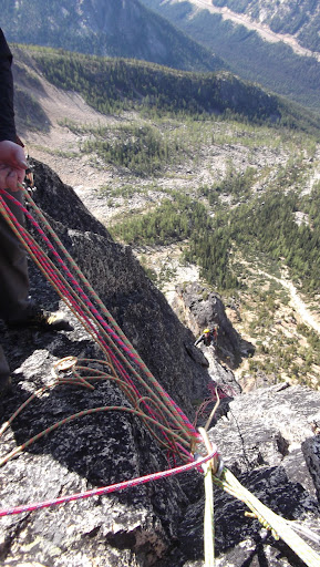
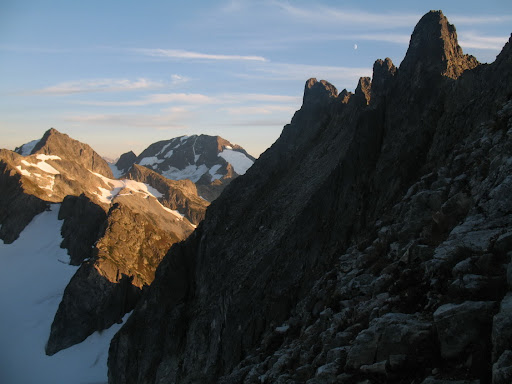
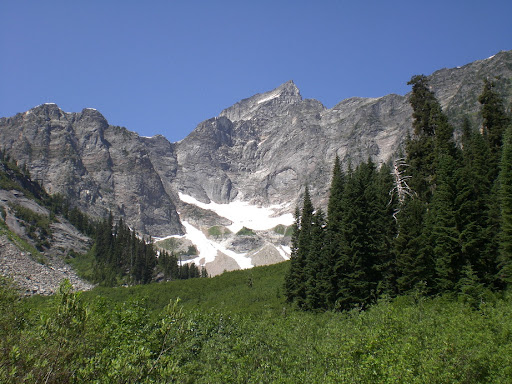
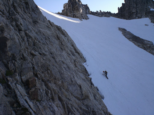
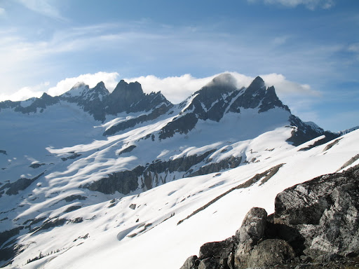
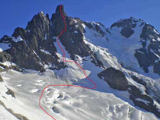
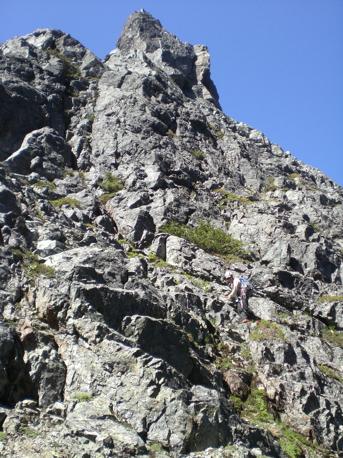
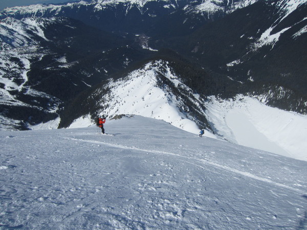
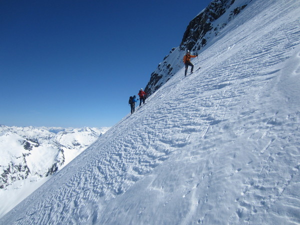
Trip: Johannesburg Mountain - NE Buttress
Date: 10/7/2012
Trip Report:
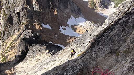
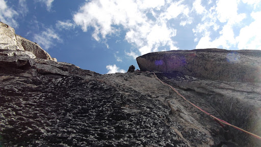
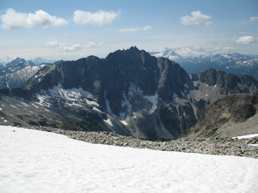
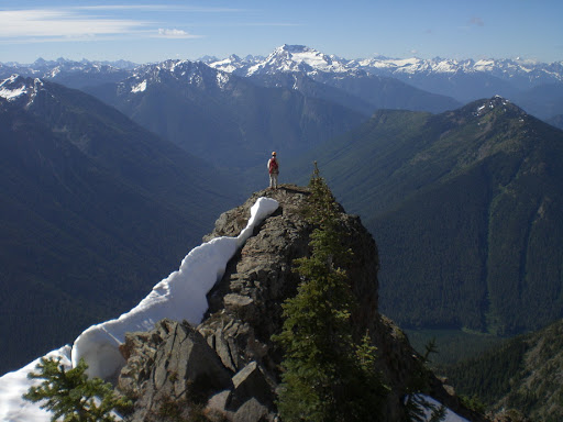
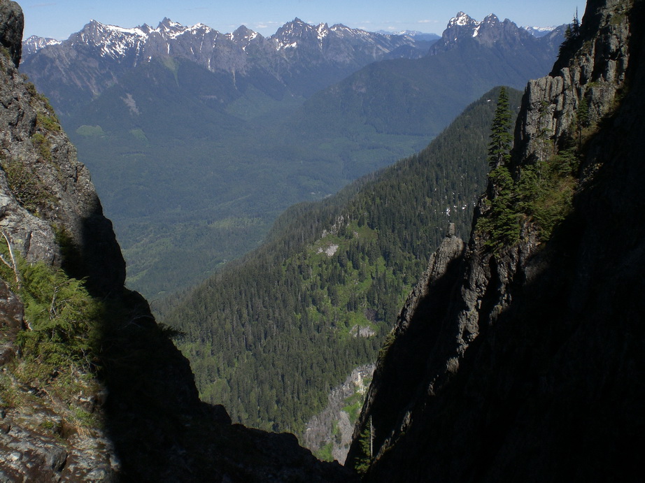
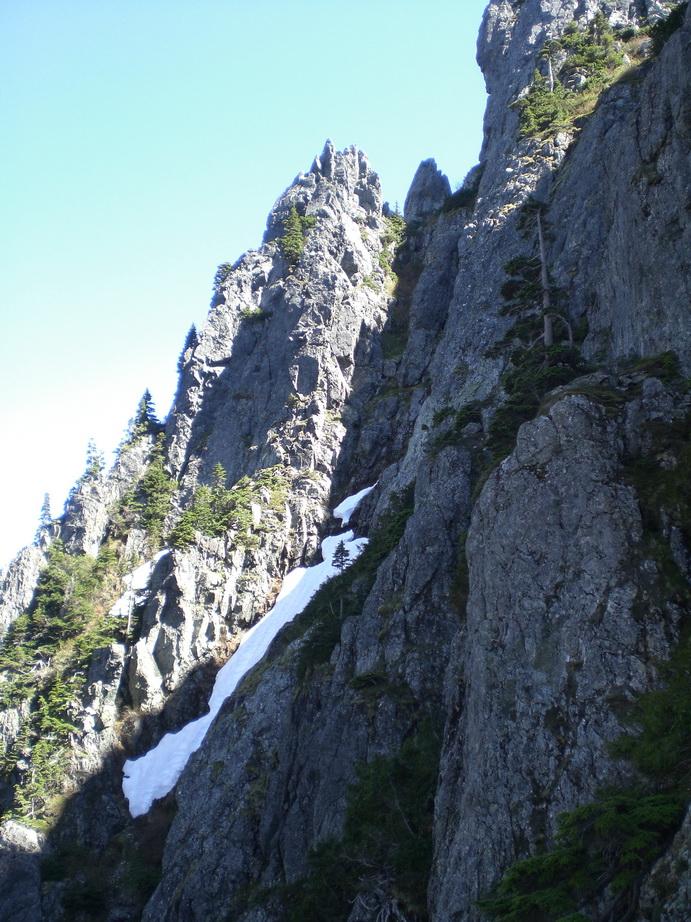
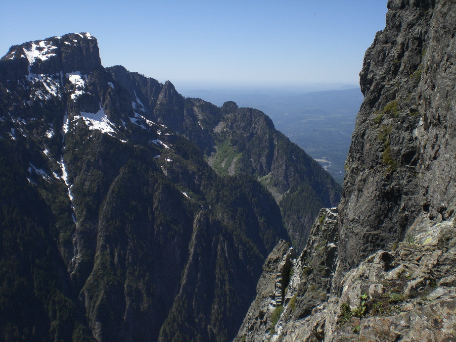
Everyone has a special place they’re particularly fond of, one that they return to time and time again. One such place for me is Johannesburg Mountain. For some reason, despite the hazards, I keep returning to this majestic and rugged place to bask in its beauty, and revel in the sights and sounds of a quintessential North Cascades alpine environment. For the North Cascades enthusiast, Johannesburg is a smorgasbord of rugged terrain, scenic beauty, and alpine challenge that has few rivals.
With the forecast this October weekend of 60 degree temperatures at pass level, there was no question a trip to the N Cascades was in order. It didn’t take long for me to persuade Daniel to join me on a climb of Johannesburg’s NE Rib, a climb I had done twice before. I talked it up to him on a ski trip up Mt Torment (directly across the valley) a couple of years ago, and he had wanted to climb it ever since.
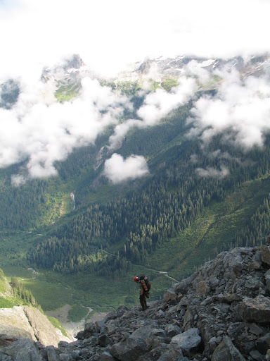
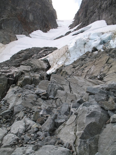
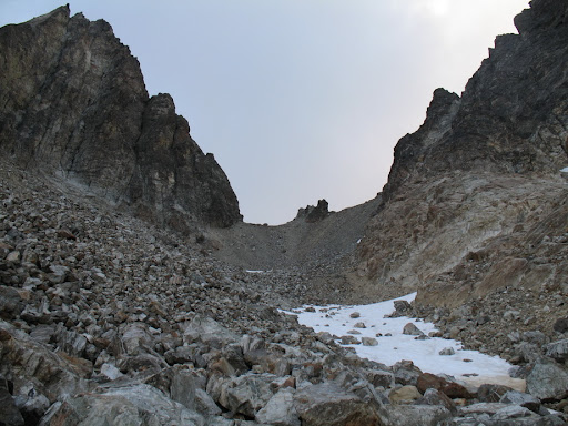
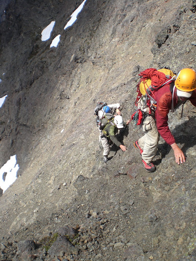
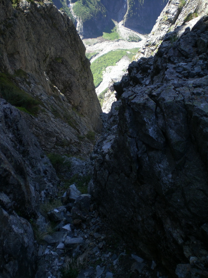
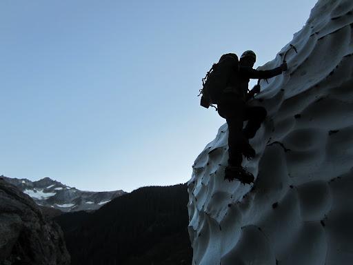
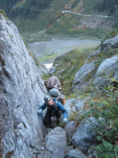
Departing Seattle at 4AM, we wanted to time it so we got to the Cascade Pass parking lot just as the sun was rising. We were leaving the parking lot at 7AM, just before sunrise. Unique to North Cascades peaks that can be considered rugged, the approach to Johannesburg takes all of 25 minutes. Descend from the parking lot, cross the mouth of the Cascade River, and ascend a talus slope to the base of the C-J Couloir. The snow was rock-solid and we were glad to have aggressive steel crampons, especially for the exposed upper portion of the arête. Upon transitioning to rock, the moat was enormous. After a bit of searching, we found the most reasonable spot to get onto the rock which involved downclimbing a 20 ft vertical step.
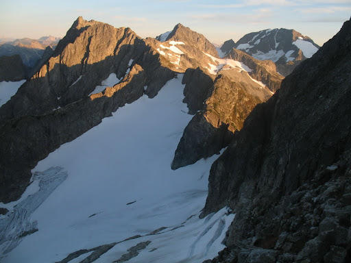
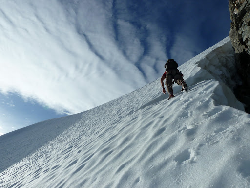
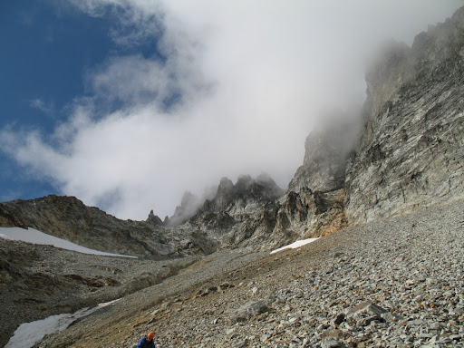
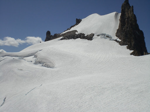
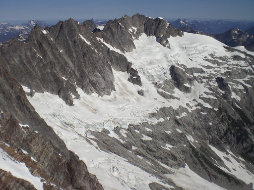
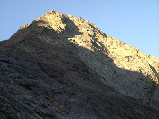
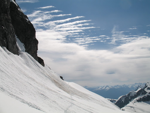
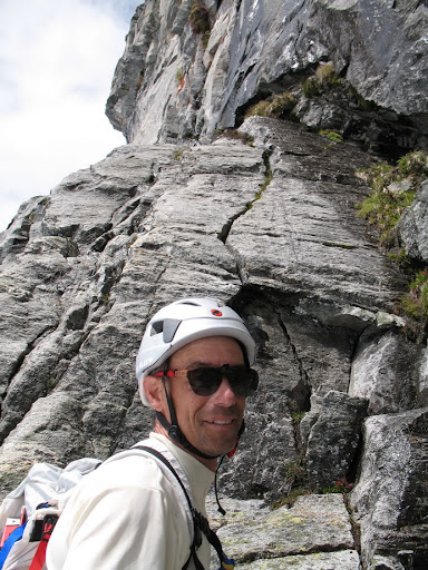
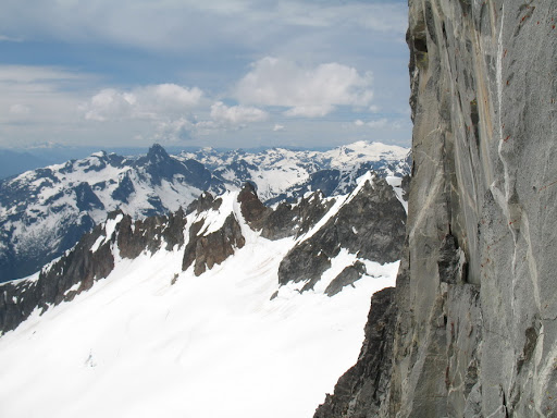
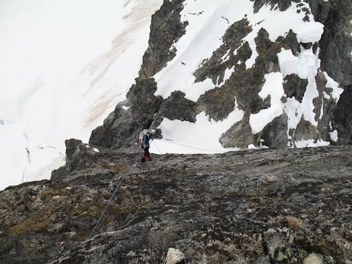
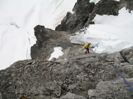
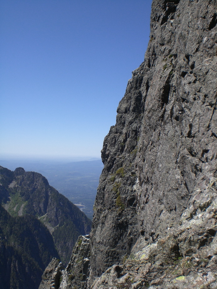
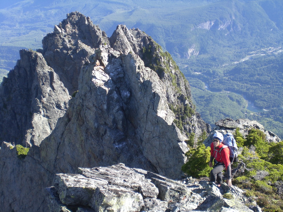
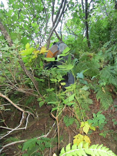
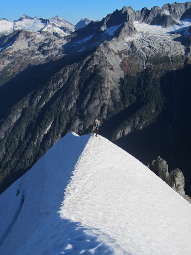
The NE Rib consists of ~2500’ of steep to vertical bushwhacking, followed by 1200’ of steep rock, then a final 1000’ of steep glacier to the summit involving a knife-edge snow arête with nearly 5000’ of exposure. The challenge on the lower portion of the route is to find a thread that involves minimal bushwhacking, because the potential for epic bushwhacking is real. There is sort of a path (if you can call it one) where it is obvious people have been there, but staying on it is not easy. Daniel and I managed to find the path of least resistance, and we both enjoyed swinging from branch to branch and making relatively quick progress up the lower portion of the NE Buttress. Soon, steep bushwhacking leads to steep heather and eventually rock as you break out above tree line. We paused frequently to enjoy the views.. the vivid colors of October in the N Cascades were everywhere around us, and to be able to witness them amid comfortable 60 degree temperatures was a real treat.
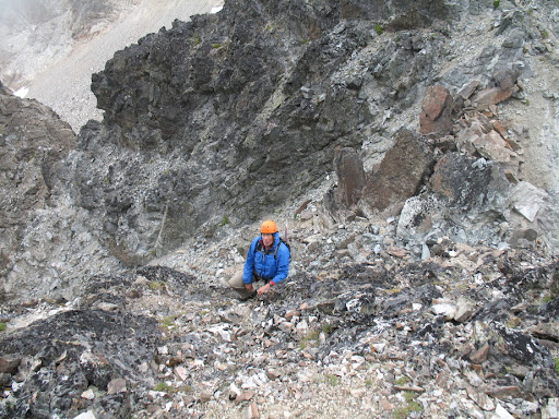
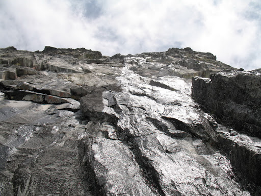
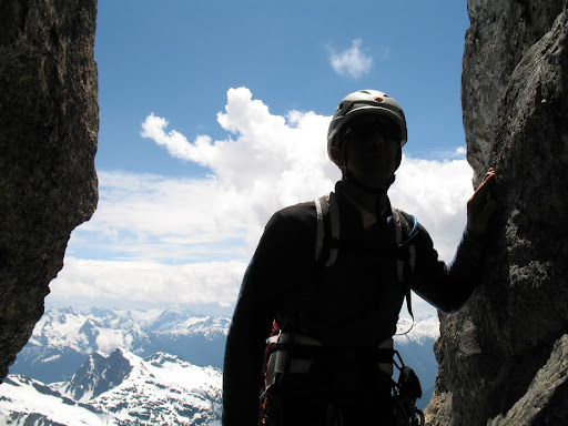
Finally we reached the steep rock headwall just below the bivy spot. The first time I climbed the NE Buttress with Steph, we found a route through the upper headwall that required only low 5th class. The second time I climbed it with Wayne and Sergio, we ran into 5.8 rock. This time, Daniel and I found ourselves in the exact same spot Wayne, Sergio, and I wound up.. staring up at ~100’ pitch of loose 5.8. Daniel drew the short straw, and led the pitch. There were some tenuous moments when Daniel got to a particularly loose section. Holds that he needed to use were barely glued into the mountain with dirt and gravel. I reminded him that I was right below him, so he was very careful not to release any rocks. He did a great job, and we were both happy with how things had gone up to this point.
We reached the bivy site 10 minutes later, and set up for the night. There was no running water, so we chopped away at the icy snow with our ice axes and collected a garbage bag full of ice chunks to melt for water. We both shared a pint of whisky, and watched the sun set over Eldorado Peak and Boston Basin. I took time to reflect on a memorable climbing season, and knew this would be the last climb of the “Summer” season.
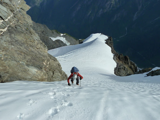
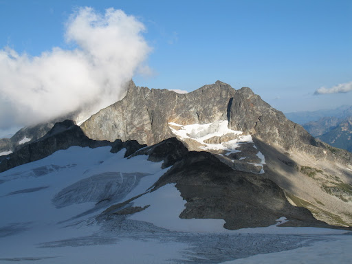
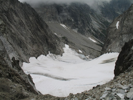
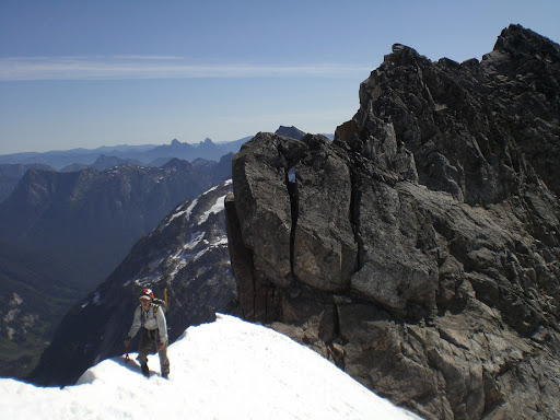
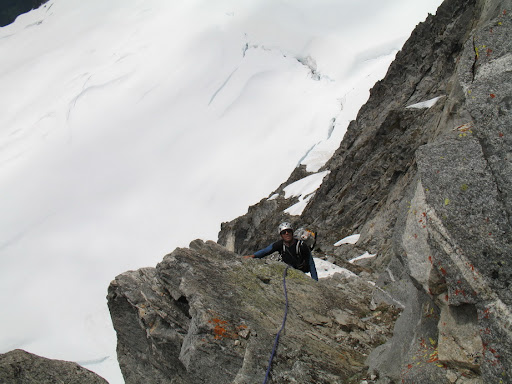
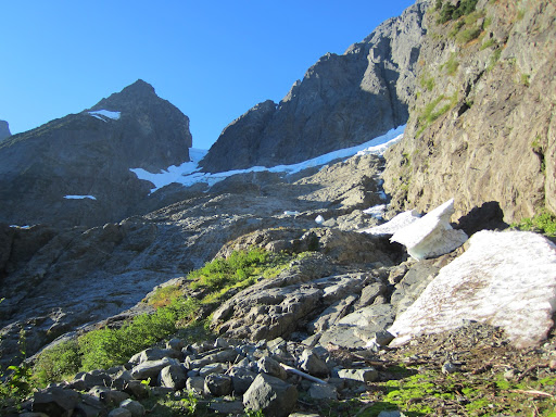
The next morning we awoke with the sunrise (now around 7:15), and packed up for the final summit climb and subsequent descent back to the parking lot. The snow, again, was rock-solid.. luckily, though, the glacier hadn’t yet melted down to bare ice. We took our time ascending the precarious knife-edge arête. The arête was sharper than on my two previous ascents, and the snow much firmer. This bumped up the seriousness quite a bit. The exposure on the arête is wild.. thousands of feet down to either side, and a magnificent position with stellar views to the surrounding peaks of Cascade Pass. I was worried about bergschrund issues, and those worries became reality when we got to the schrund. A huge crack spanned nearly the entire width of the glacier, with really only one feasible weakness. We only had three ice screws with us, so climbing the 100’ vertical ice wall was out of the question. We ultimately decided to cross via a committing jump to solid ice, then a ramp through the remainder of the ‘schrund to safer ground above.
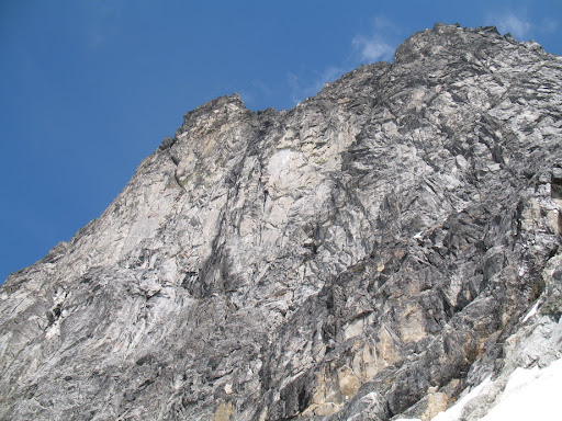
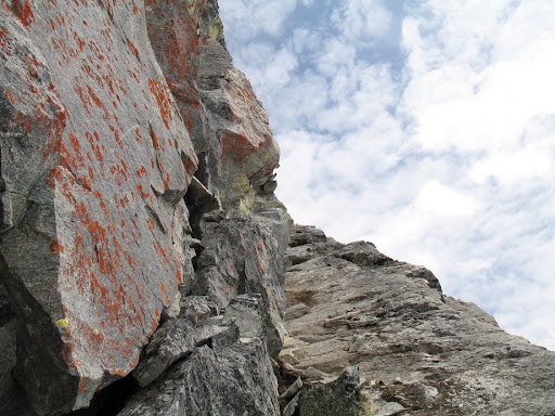
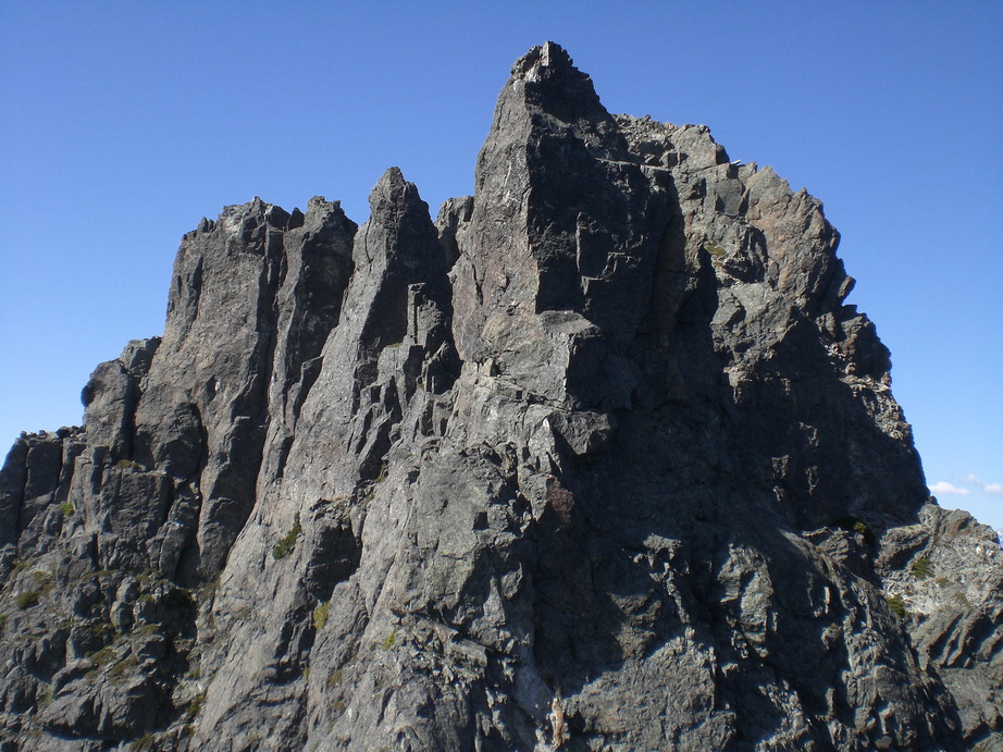
Above us was the final snow slope to the summit. It is very exposed, and the hard snow made it feel pretty serious. The consistency of the snow made it such that ice screws wouldn’t hold.. it might have held vertical pickets, but we didn’t have any. Looking up, we saw some pretty solid-looking rock on the summit tower. We decided to check it out, and I’m glad we did. Two low to mid-fifth solid rock pitches allowed us to bypass the exposed, icy snow-shield finish.
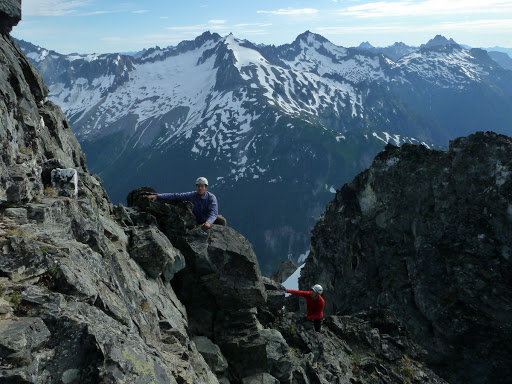
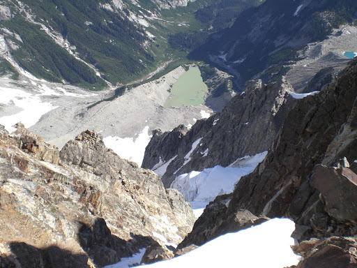
Standing on the summit for the fourth time was just like standing on it for the first time. The views never get ordinary or mundane. Daniel was pretty stoked as well. The smoke from the wildfires filled the valleys with a haze that made for some pretty great photography. We enjoyed the views and t-shirt weather (in October??) for about an hour, before finally deciding to begin the long, arduous descent to the parking lot. We got back to CJ Col in a little less than 2 hours from the summit, then made the long ascent to Doug’s direct. We took our time descending back to the pass, and eventually the parking lot, and savored every last bit of daylight this October Sunday could muster up. We arrived back at the parking lot around 6PM, staring up at Johannesburg in amazement. I am happy to have had the opportunity to bond with this special place again, and for the good times my friend Daniel and I were able to share.
Downclimbing into the moat at the base of the NE Buttress.
Looking up ahead.
Daniel climbing on the lower buttress.
Vertical brush.
Looking up towards Cascade Peak and the C-J Col.
Welcome to the jungle.
Daniel around mid-buttress.
Daniel high on the NE Buttress. That is the Cascade Pass parking lot down there.
Typical scrambling on the upper buttress.
Daniel on the 5.8 pitch.
Daniel coiling the rope after the 5.8 pitch.
Approaching the bivy site.
The bivy at sunset.
Good morning!
Eldorado at dawn.
Hidden Lake Peaks and Mt. Baker.
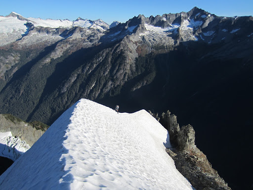
Beginning the ascent of the snow arete.
On the arete.
Daniel enjoying the views.
The upper Sill Glacier.
Towards Cascade Pass.
Just below the bergschrund.
Looking back at the arete.
Daniel and the giant bergschrund.
Jumping into the 'schrund.
Climbing out of the 'schrund.
Looking over towards the final snow shield.
Forbidden, Boston, Sahale, Buckner.
Daniel at the base of the summit tower.
Starting up the last two pitches.
The first of the final two pitches.
On the summit.
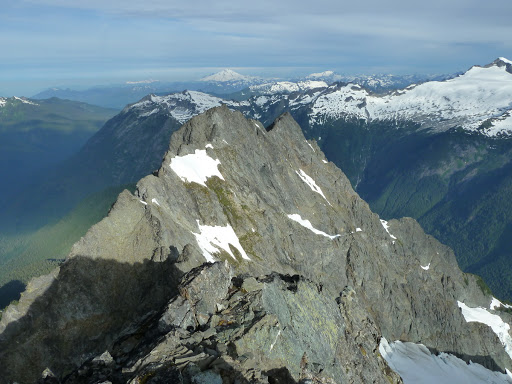
Formidable, Dome, Glacier.
Looking east.
Daniel on the summit of Johannesburg.
Starting the descent.
Typical scrambling on the descent.
Spider, Formidable, and the Middle Cascade Glacier.
Daniel enjoying the views.
Looking back at Johannesburg from the top of Doug's Direct.
Pelton, Magic, and Hurry-Up.
-
 1
1
-
-
Black, XL. Worn twice. No rips, stains, or tears. They look and function as new. Too big for me (6'1", 195#, 35W).
These are great ski pants and retail for $400 new. Gore-Tex 3-Layer soft shell.
$175.

-
Ditto what Layton said. Nice work.
-
Indeed, the route could have been longer, but the climbing was a lot of fun. I have no idea what is considered a "classic".
The line-up was for the East Face of Liberty Bell - Liberty Crack?? I was thinking of the Direct East Buttress of SEWS when I said DEB.
-
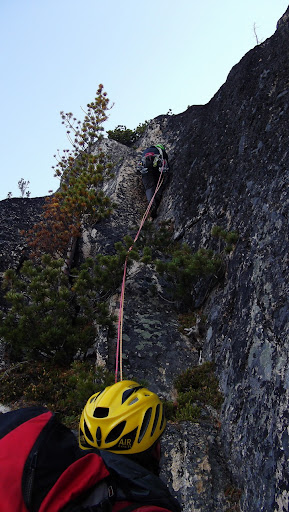
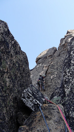
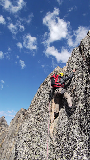
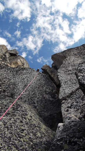
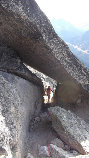
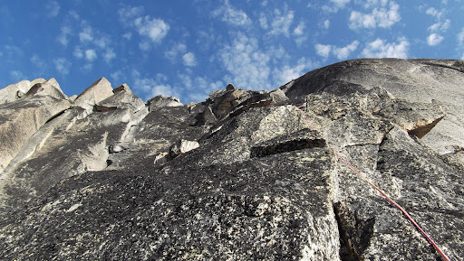
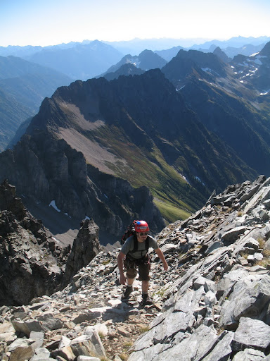
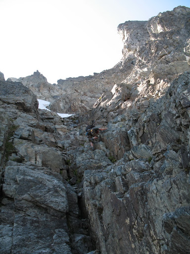
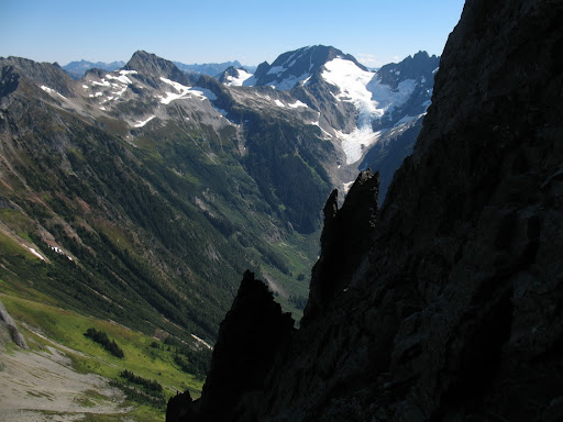
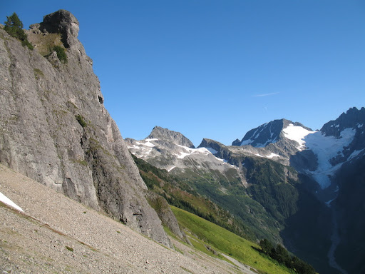
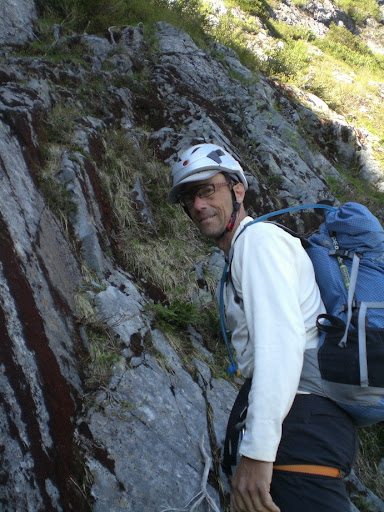
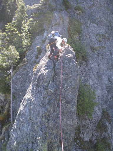
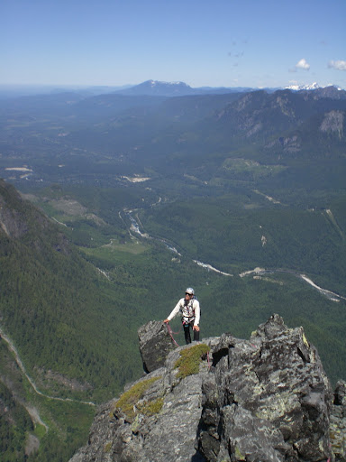
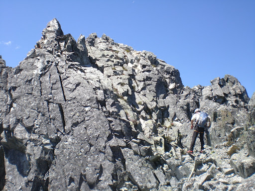
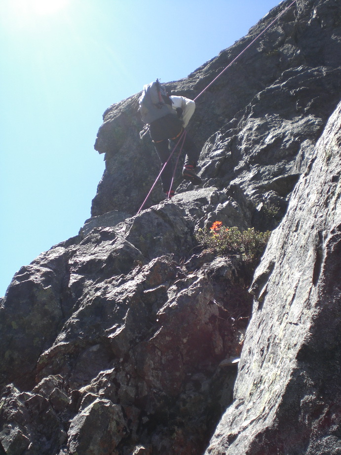
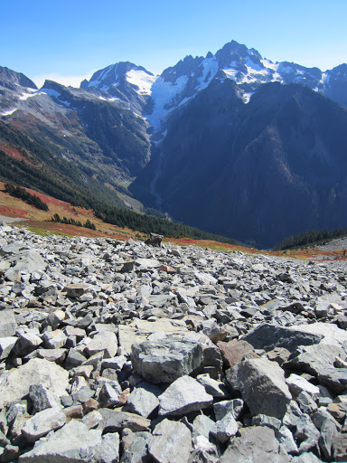
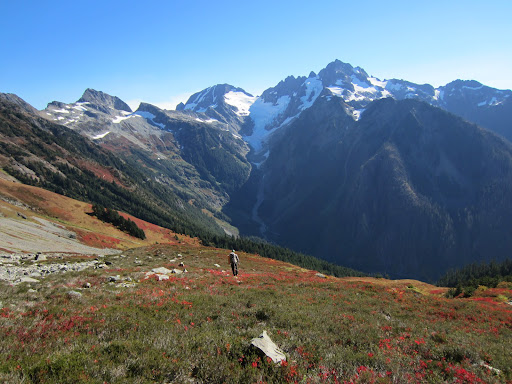
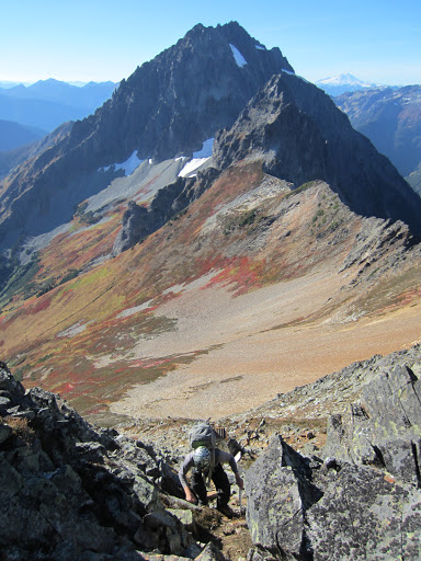
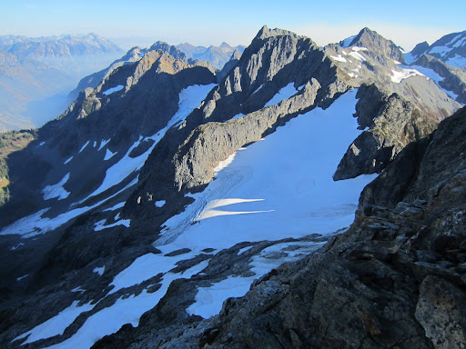
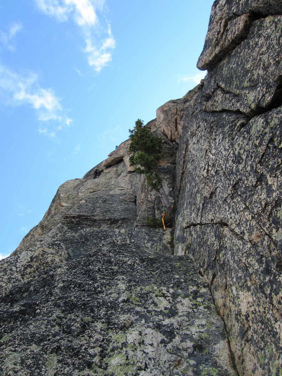
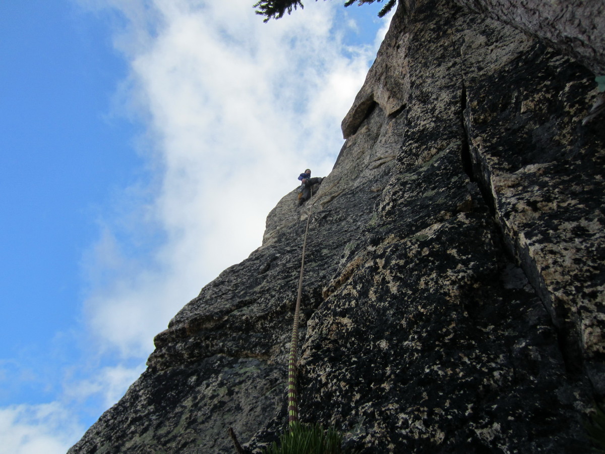
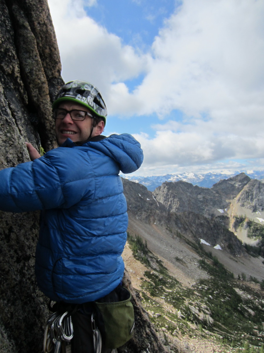
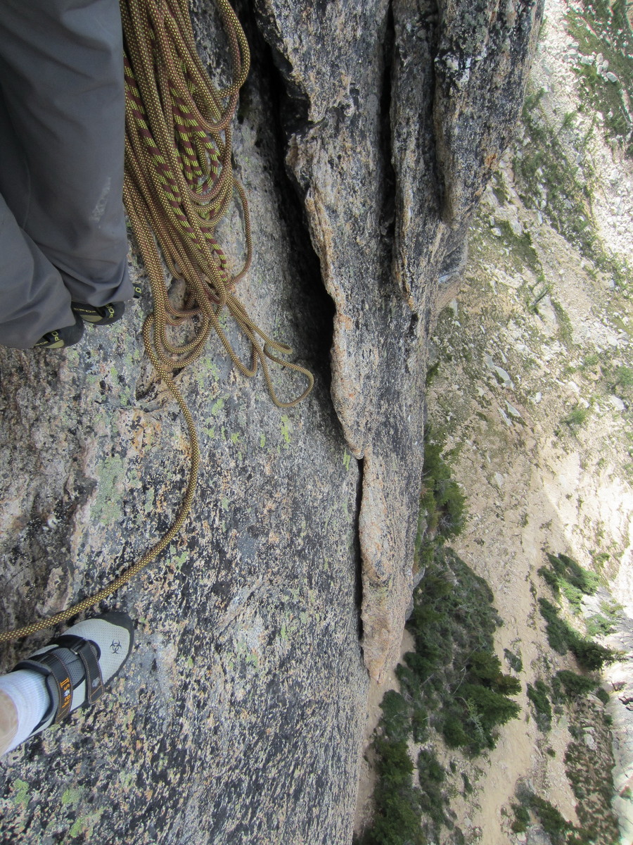
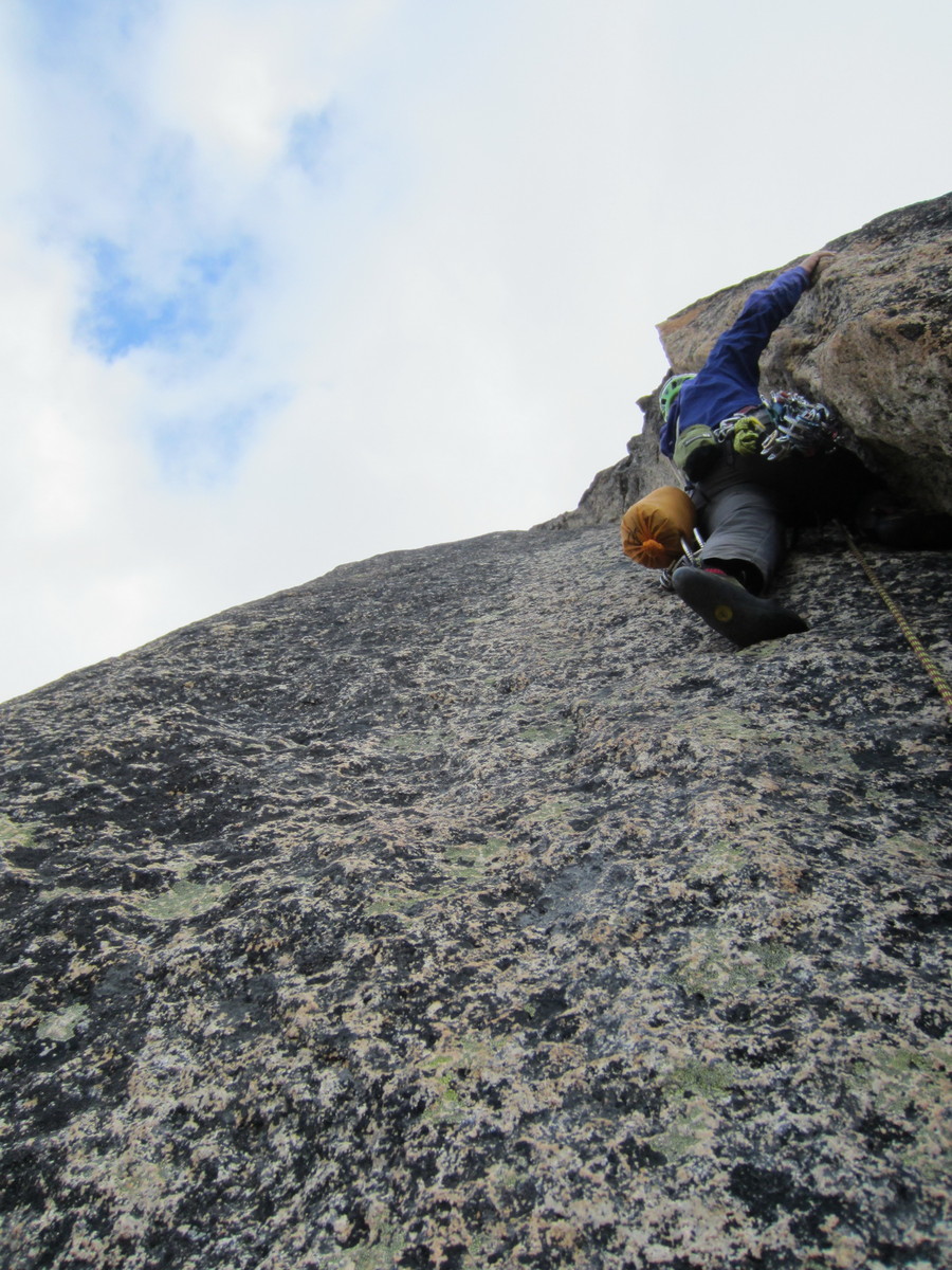
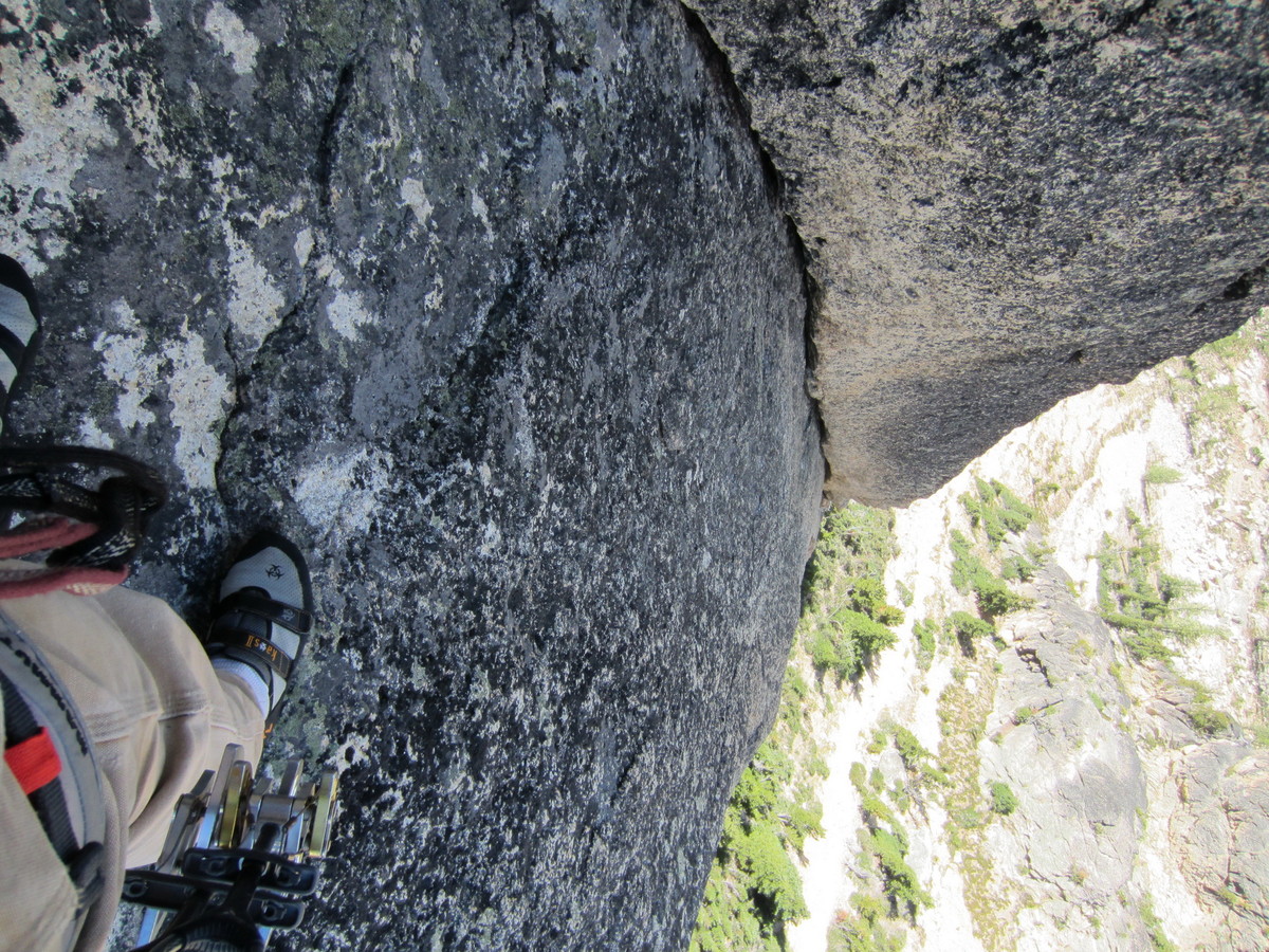
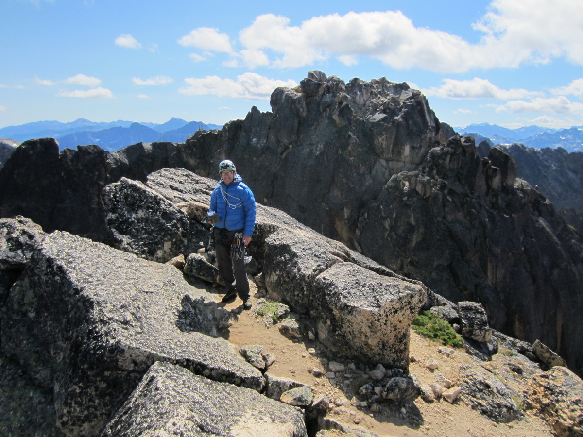
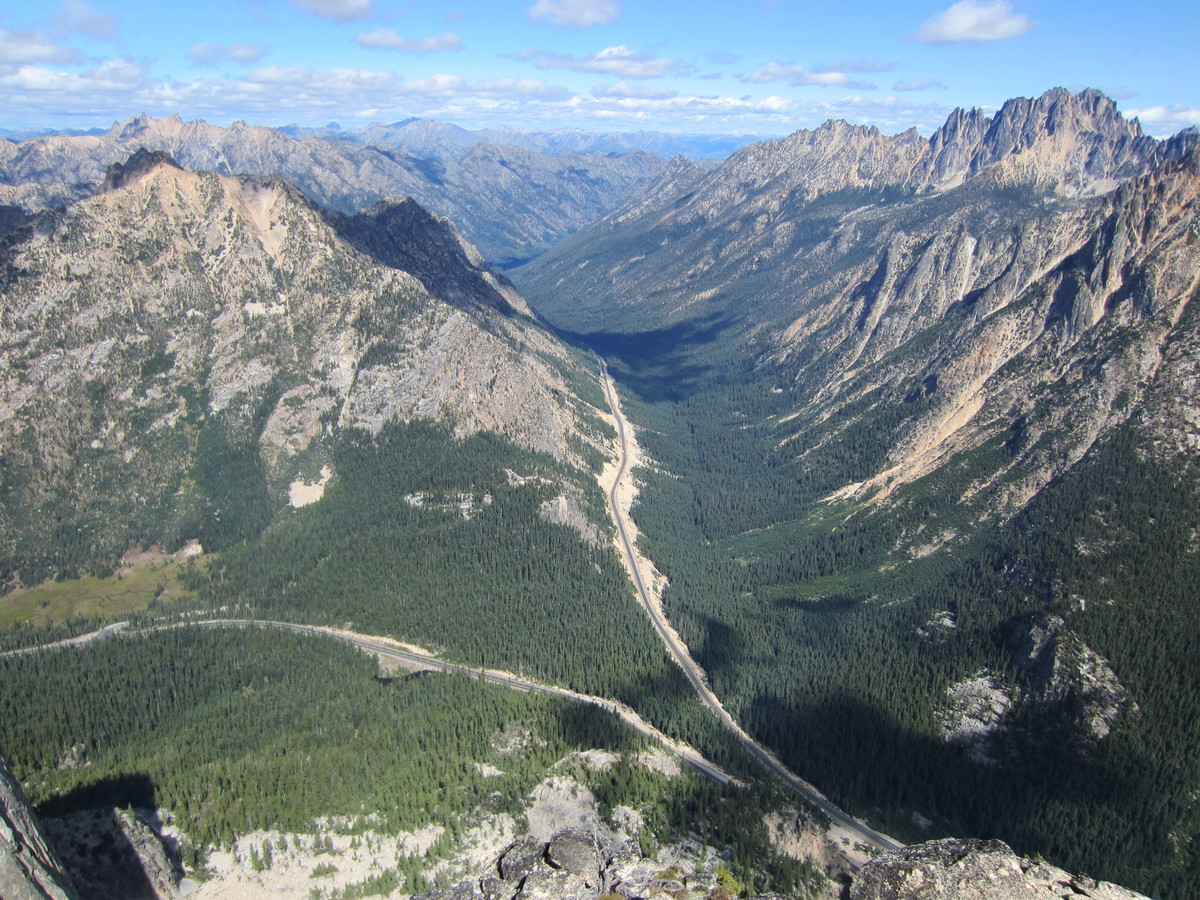
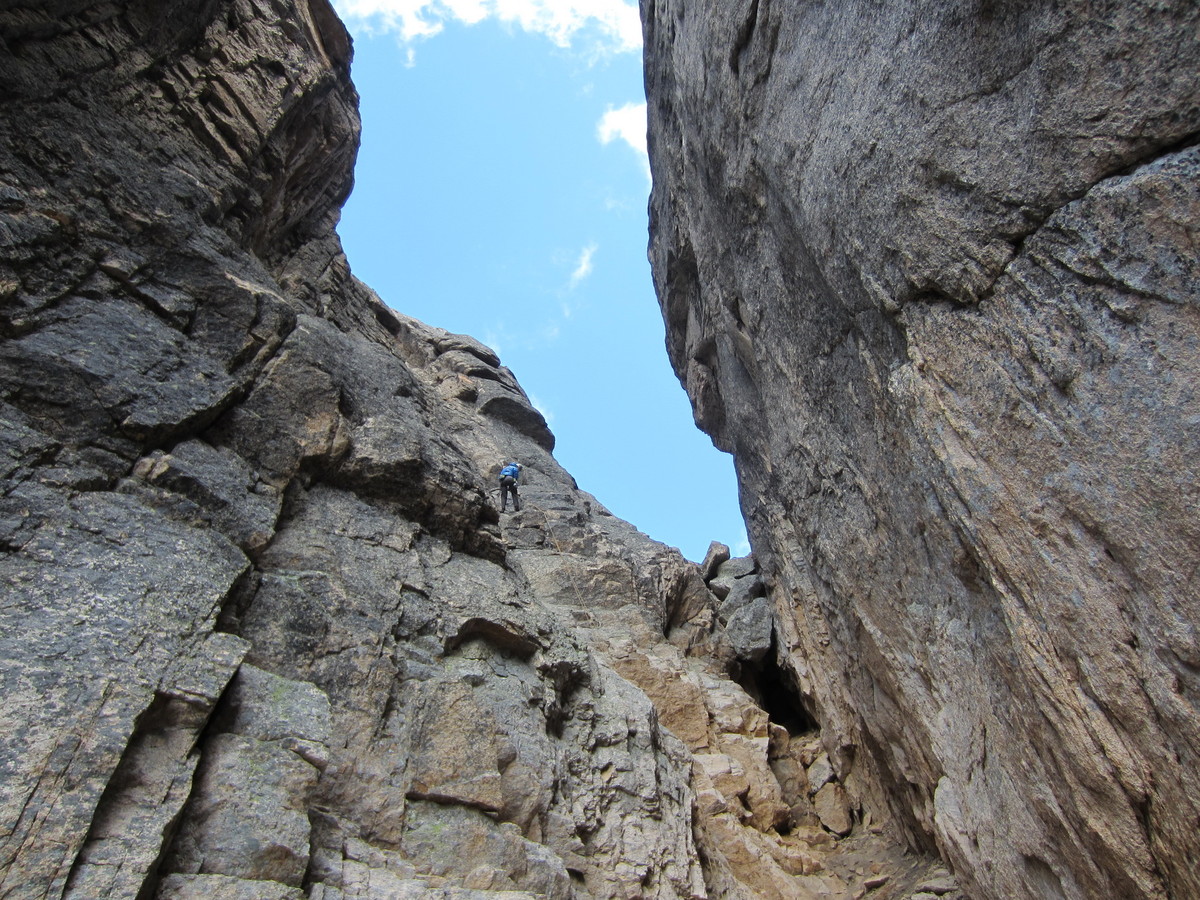
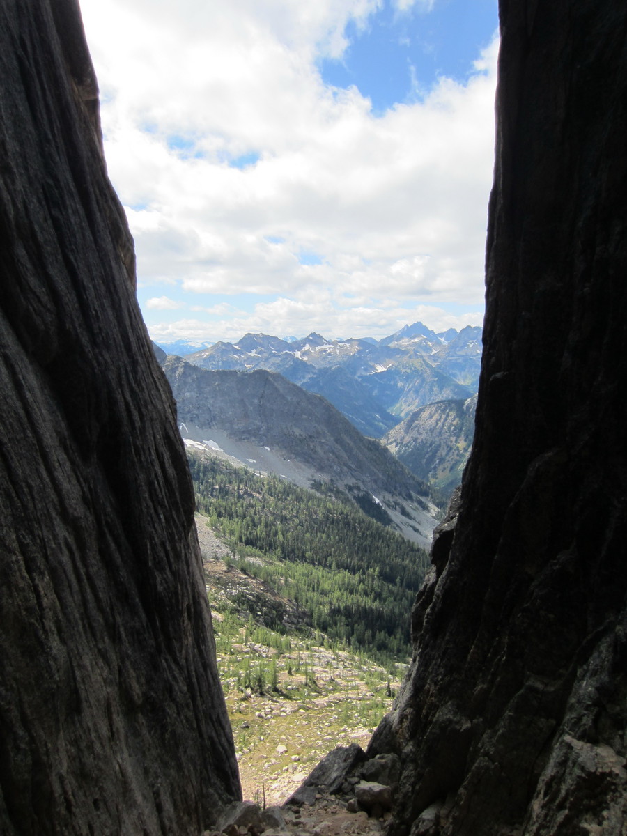
Trip: North Early Winters Spire - NW Corner (III, 5.9)
Date: 9/1/2012
Trip Report:
Daniel Jeffrey and I climbed this superb route on Saturday. We found the climbing and the quality of rock to be pretty great - fun and sustained on excellent granite. We just wished the route were longer.
Being Labor Day weekend, there were dozens of people climbing on the Liberty Bell group - I believe 4 teams climbed the NW Corner of NEWS. The line-up for the DEB of Liberty Bell was almost comical.
Gear Notes:
Doubles to 2", singles 3-5". We could have left the #5 at home and brought an extra #4 for the off-width.
Approach Notes:
55 minutes to the base of the route on easy trail.
Descent is easy.. three rappels into the notch between SEWS and NEWS, then two more in the gully below. 60m rope will work, 70m works better. Rappel anchors have recently been rebolted.
Partner Sat-Mon. N Cascades
in Climbing Partners
Posted
Partner found.