Leaderboard

Popular Content
Showing content with the highest reputation on 08/07/20 in all areas
-
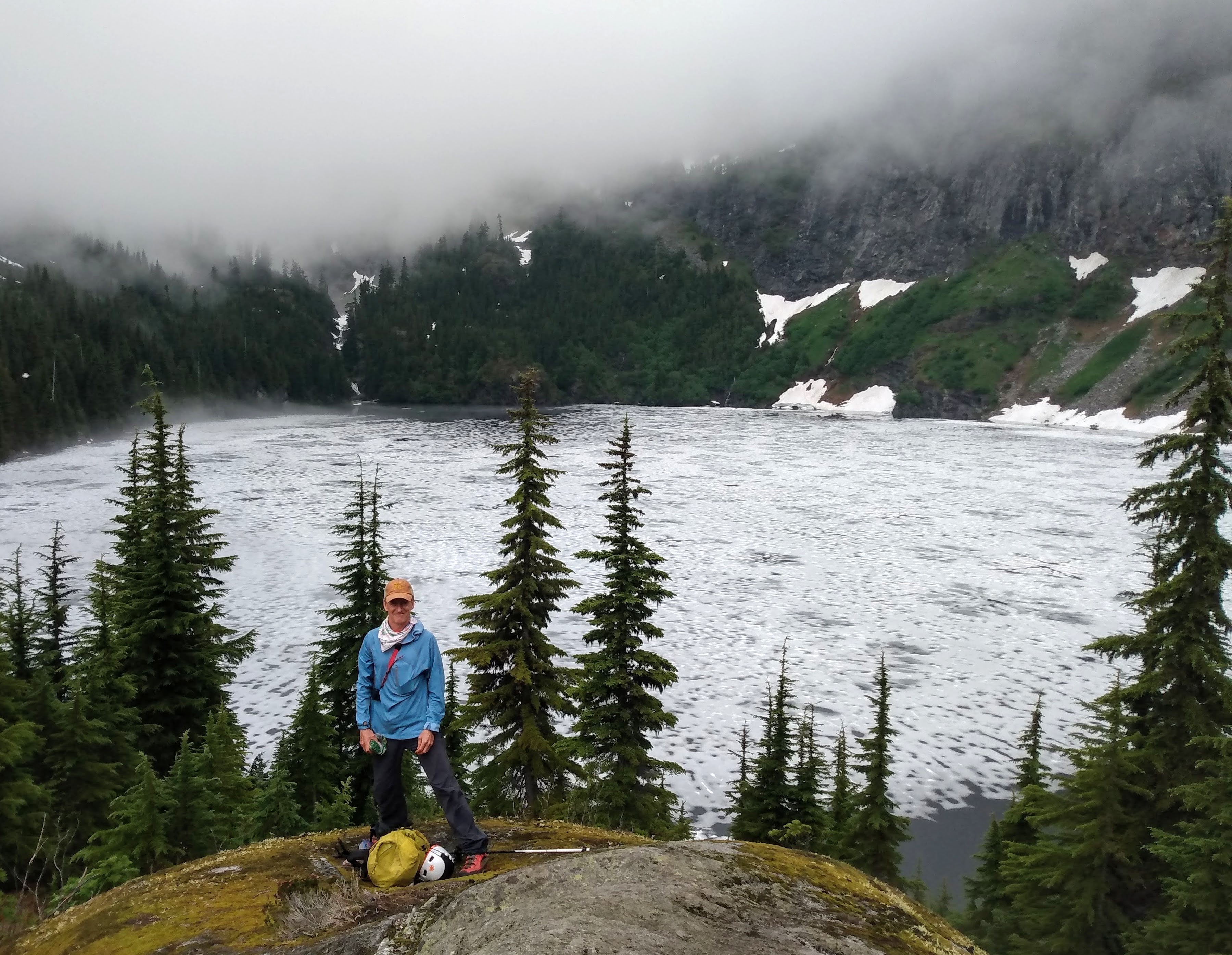
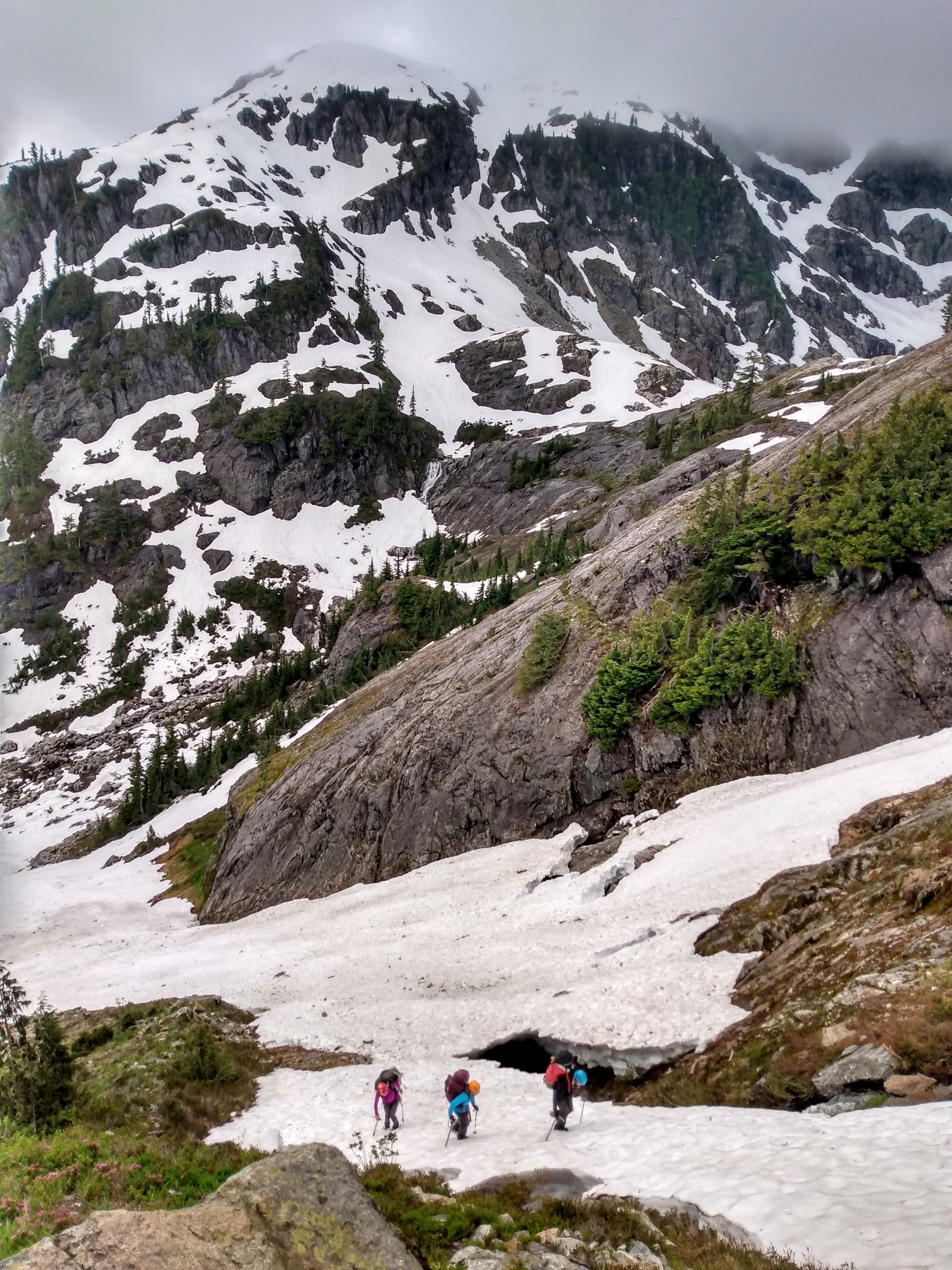
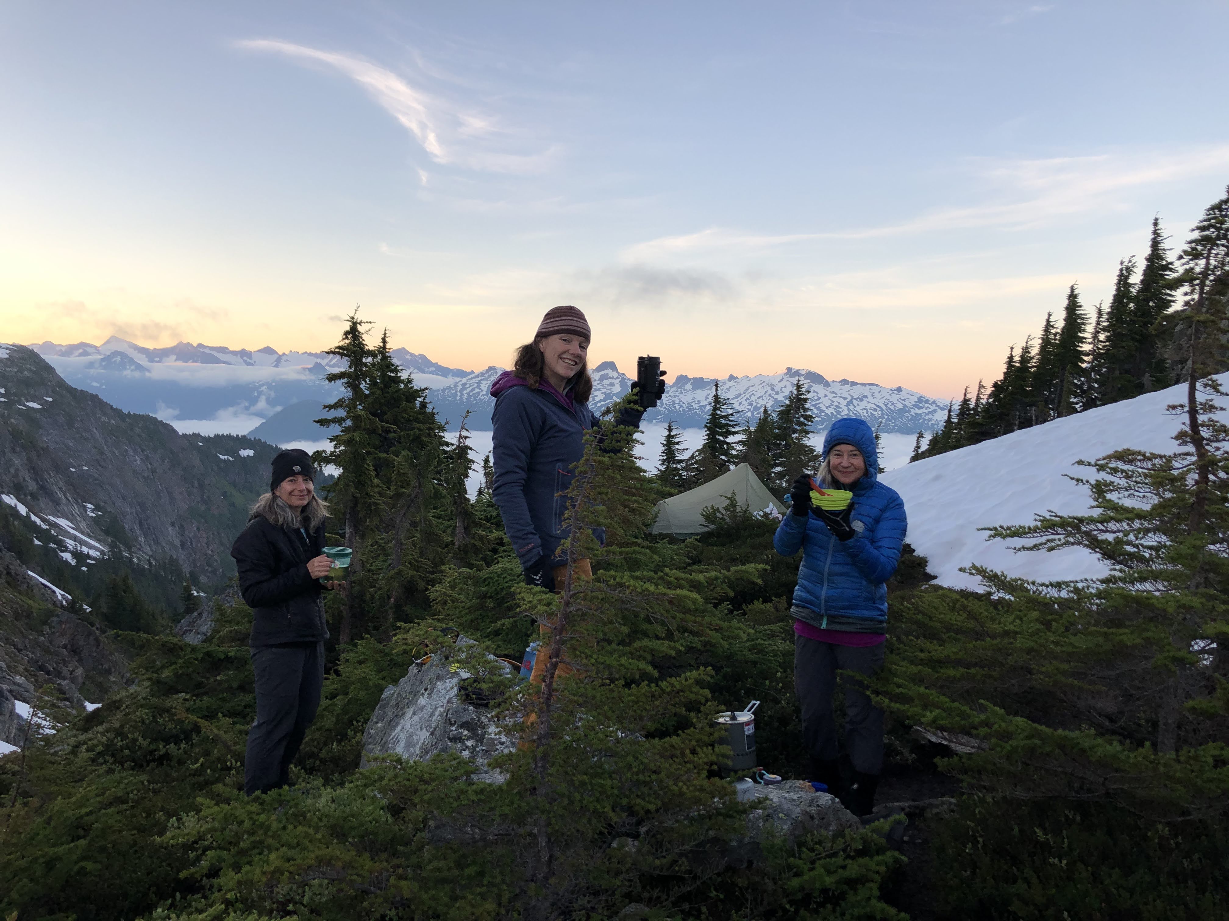
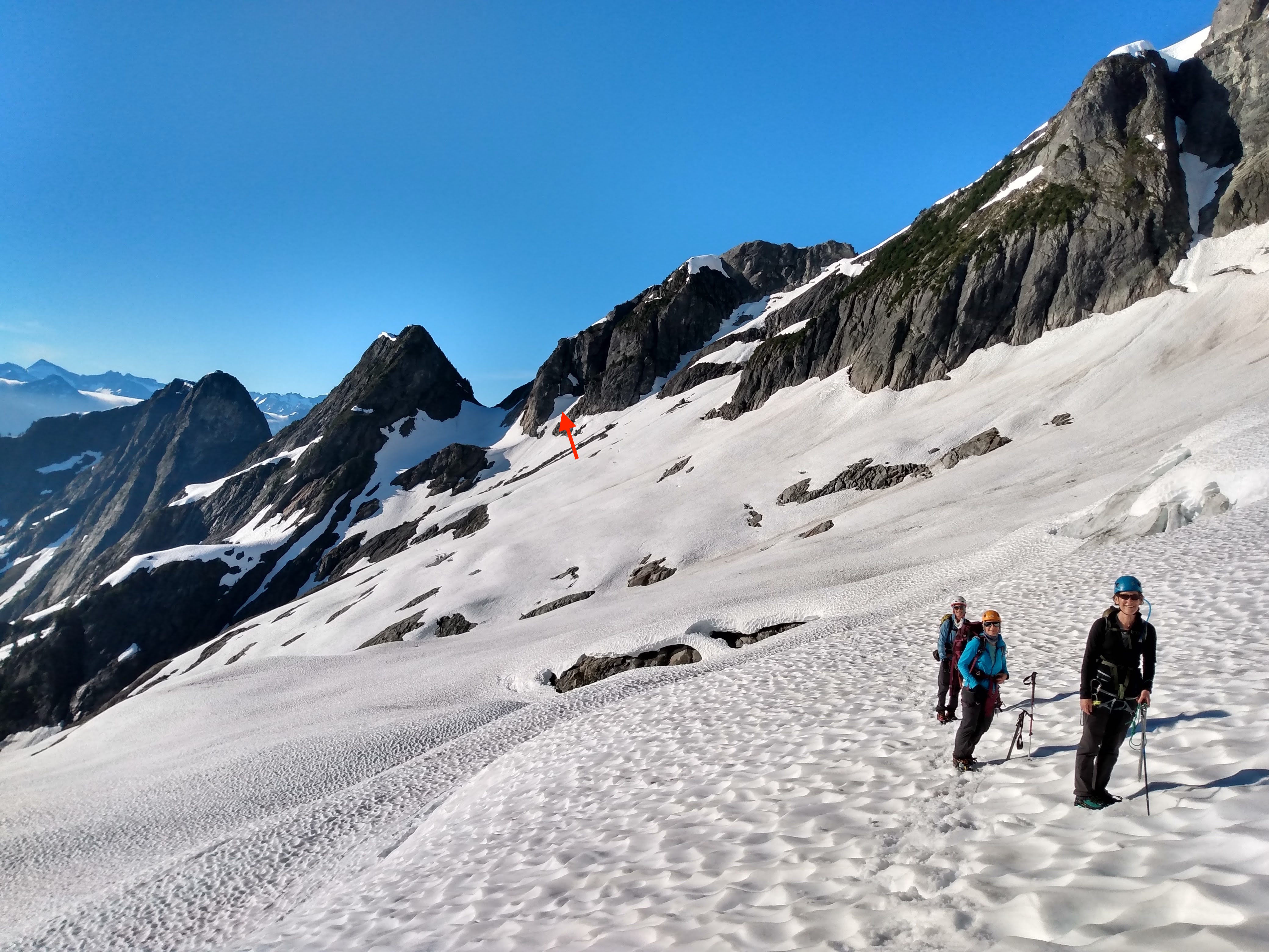
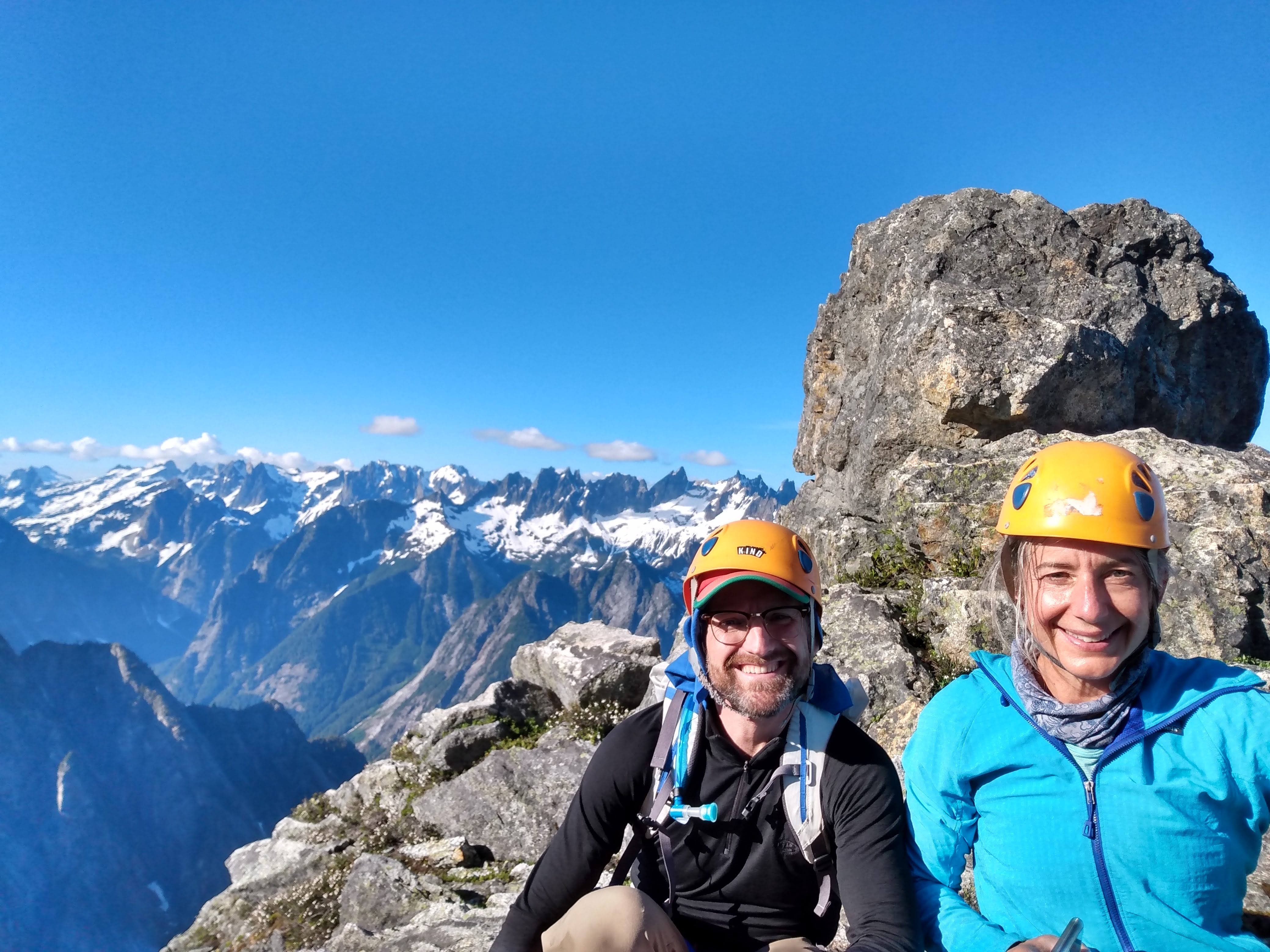
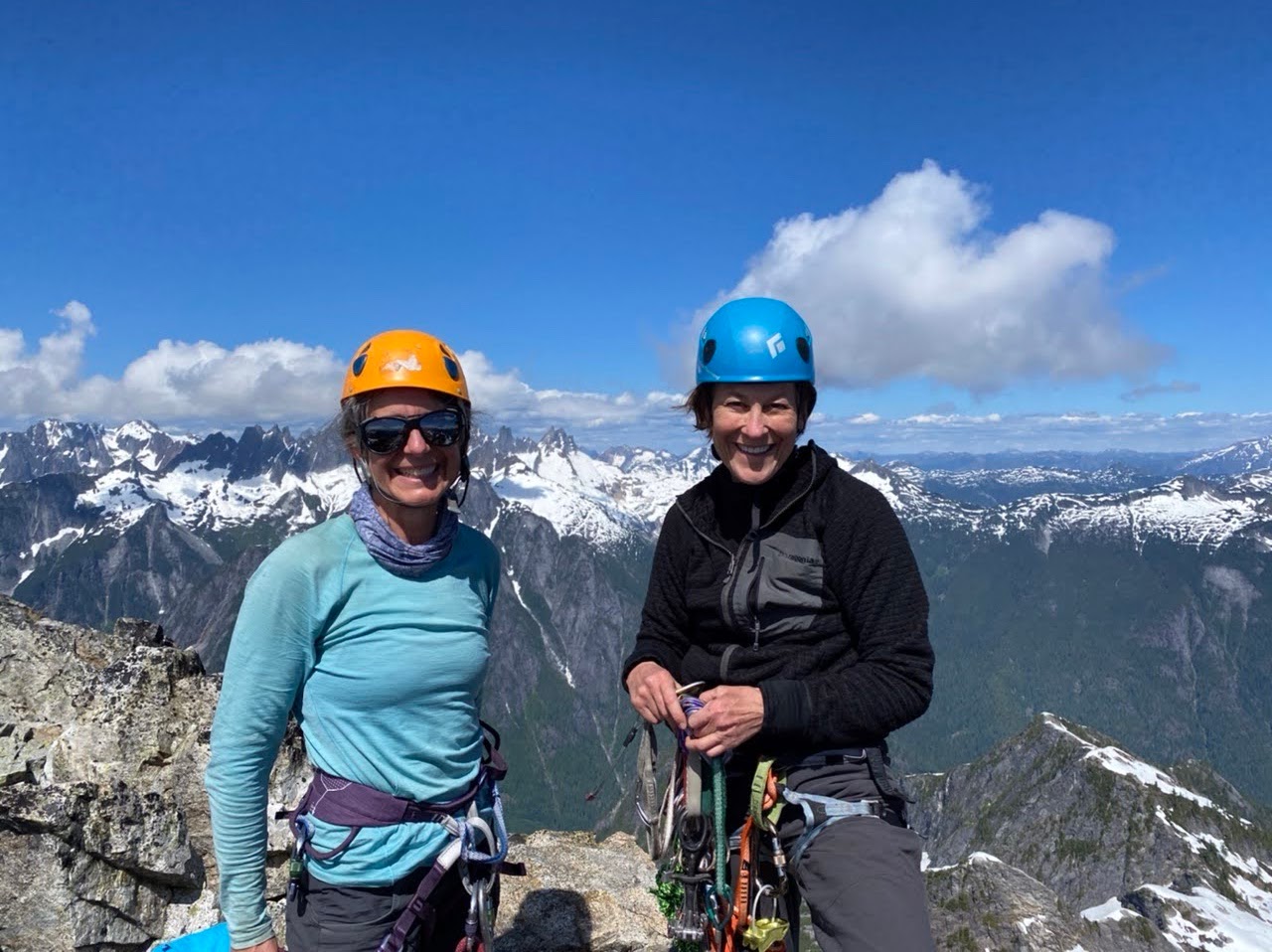
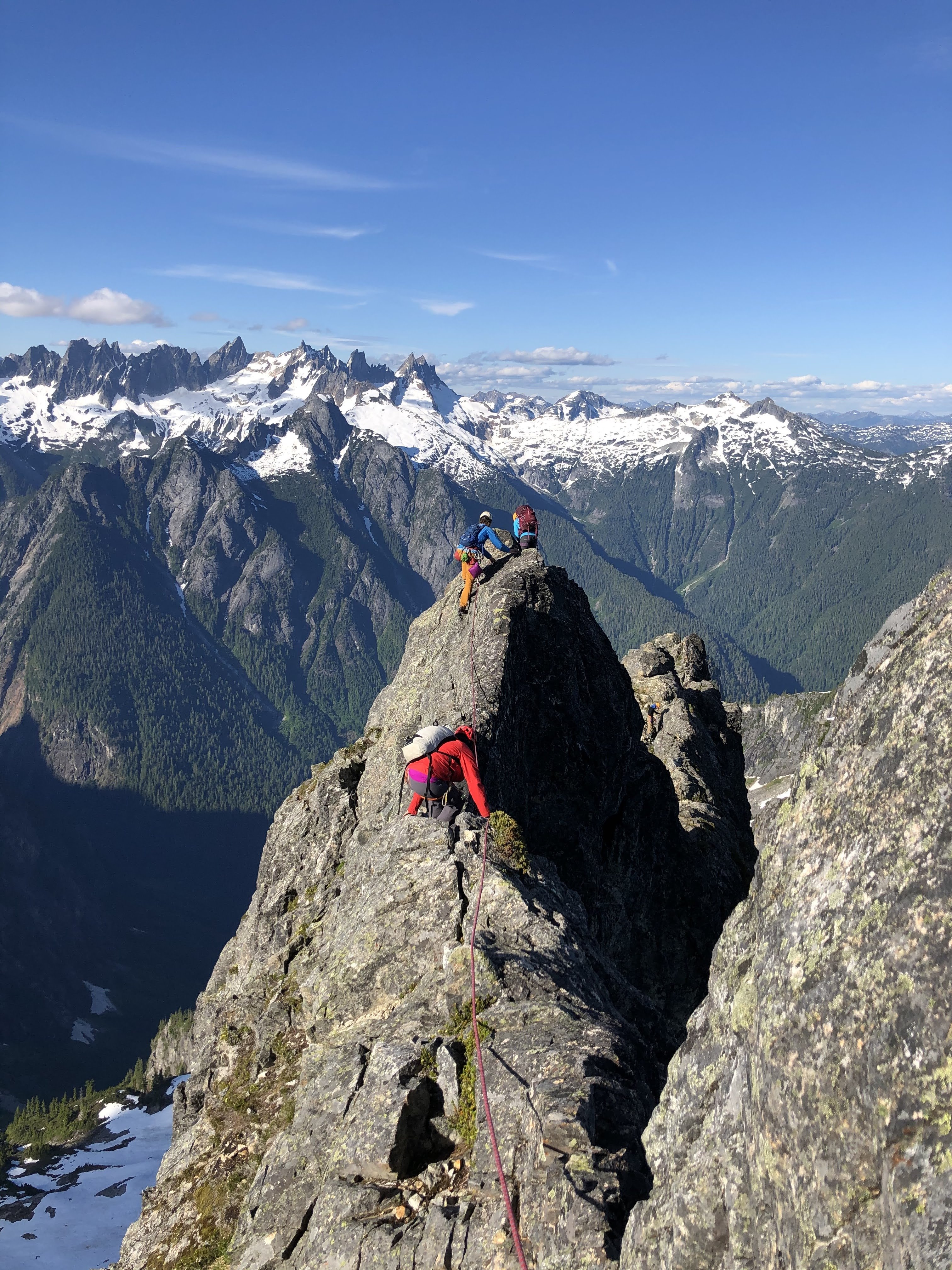
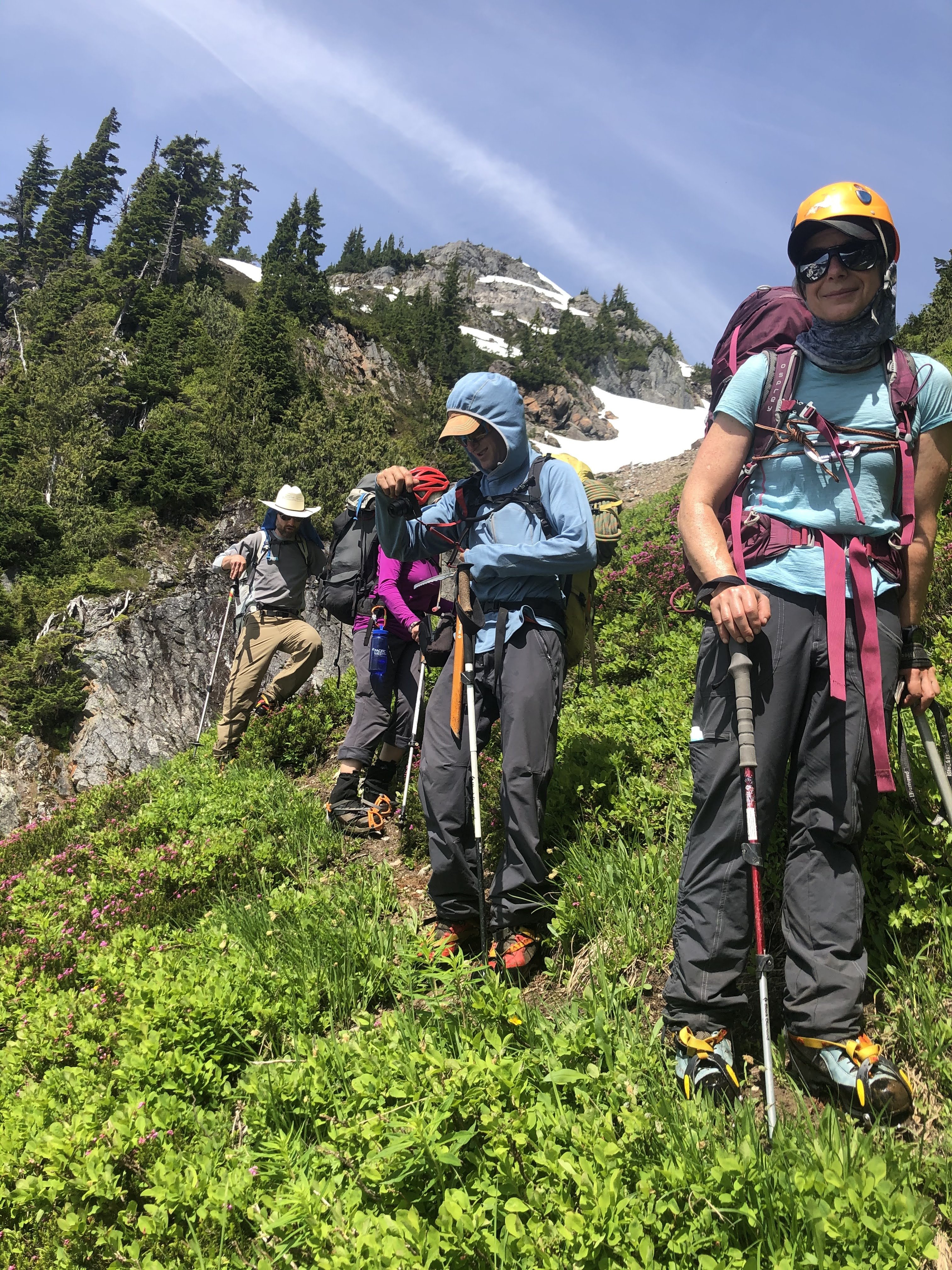
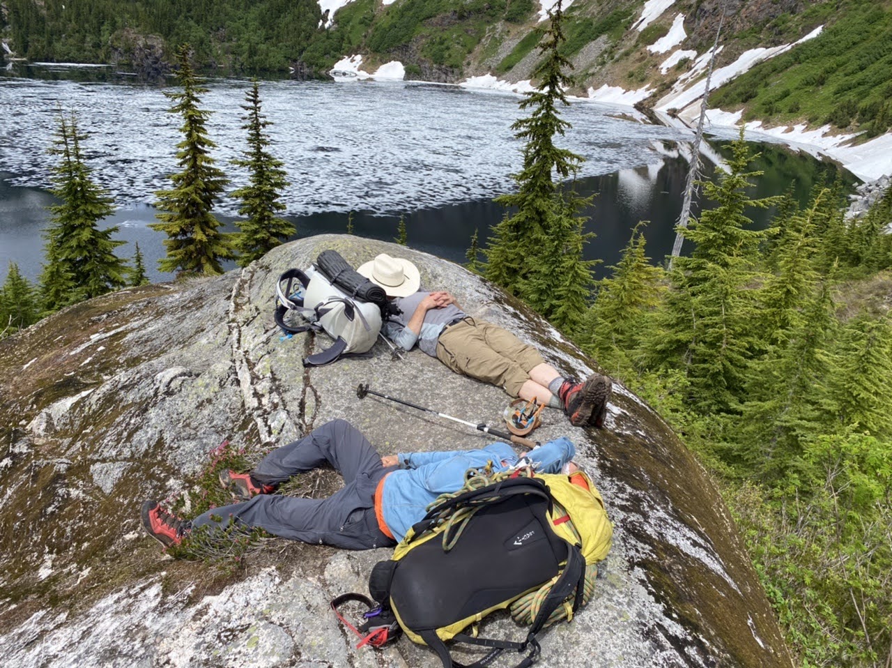
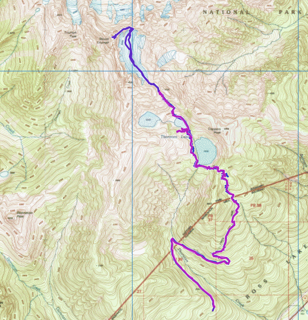
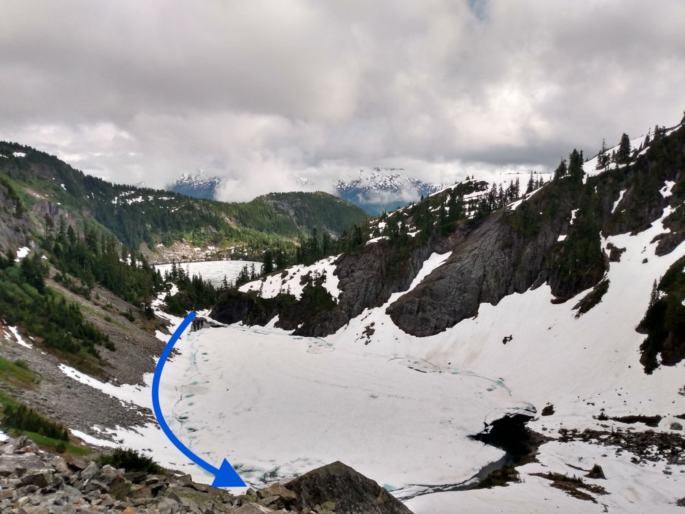
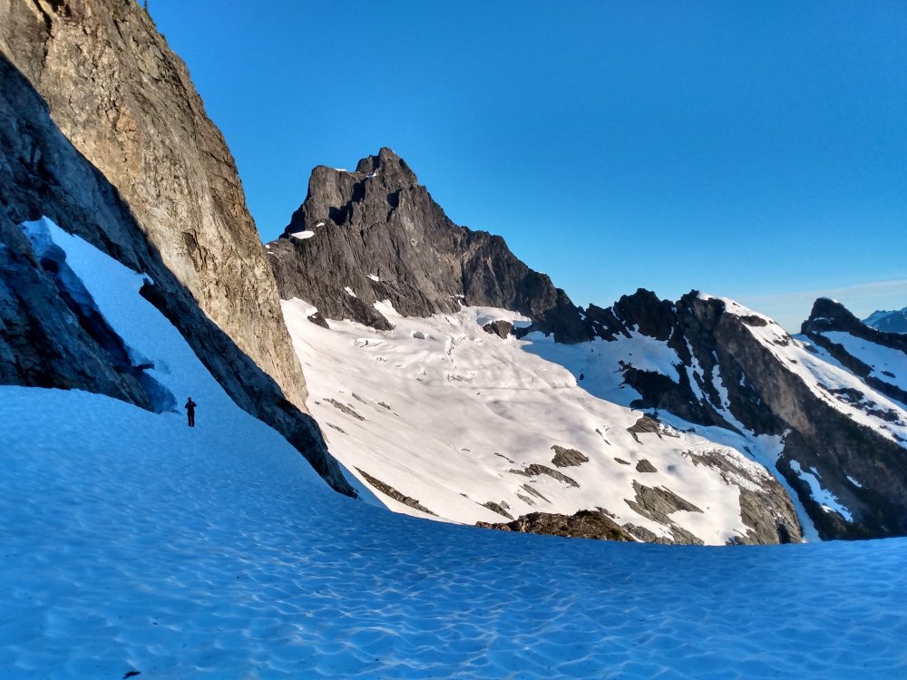
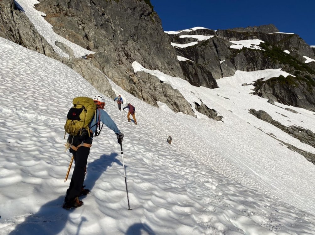
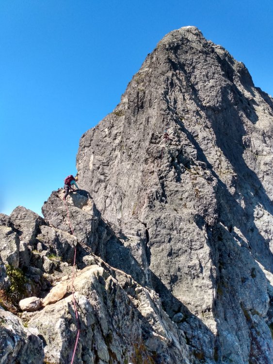
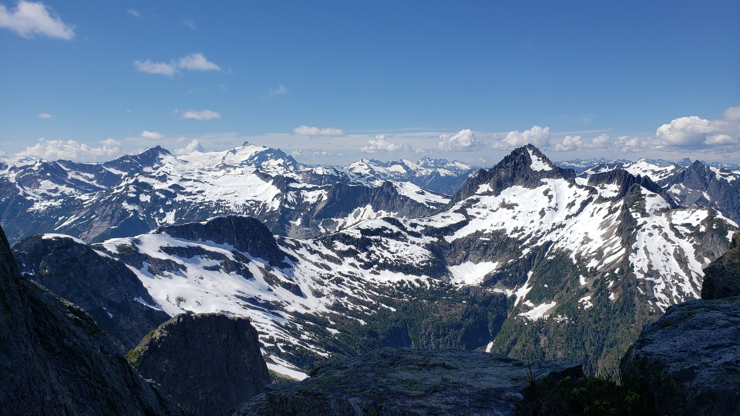
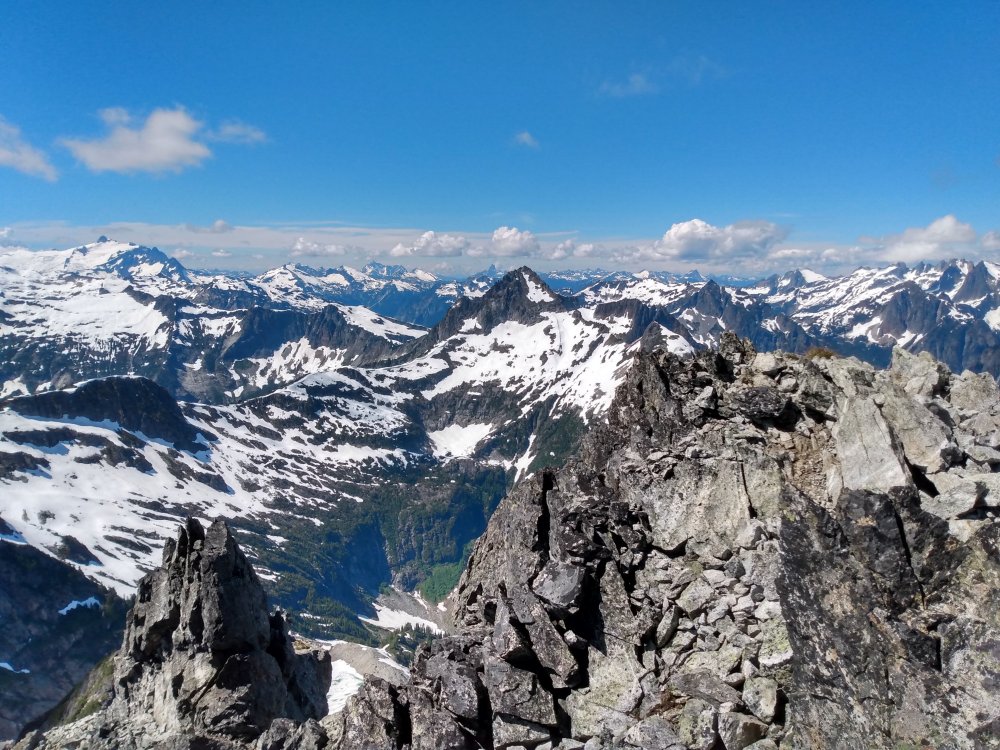
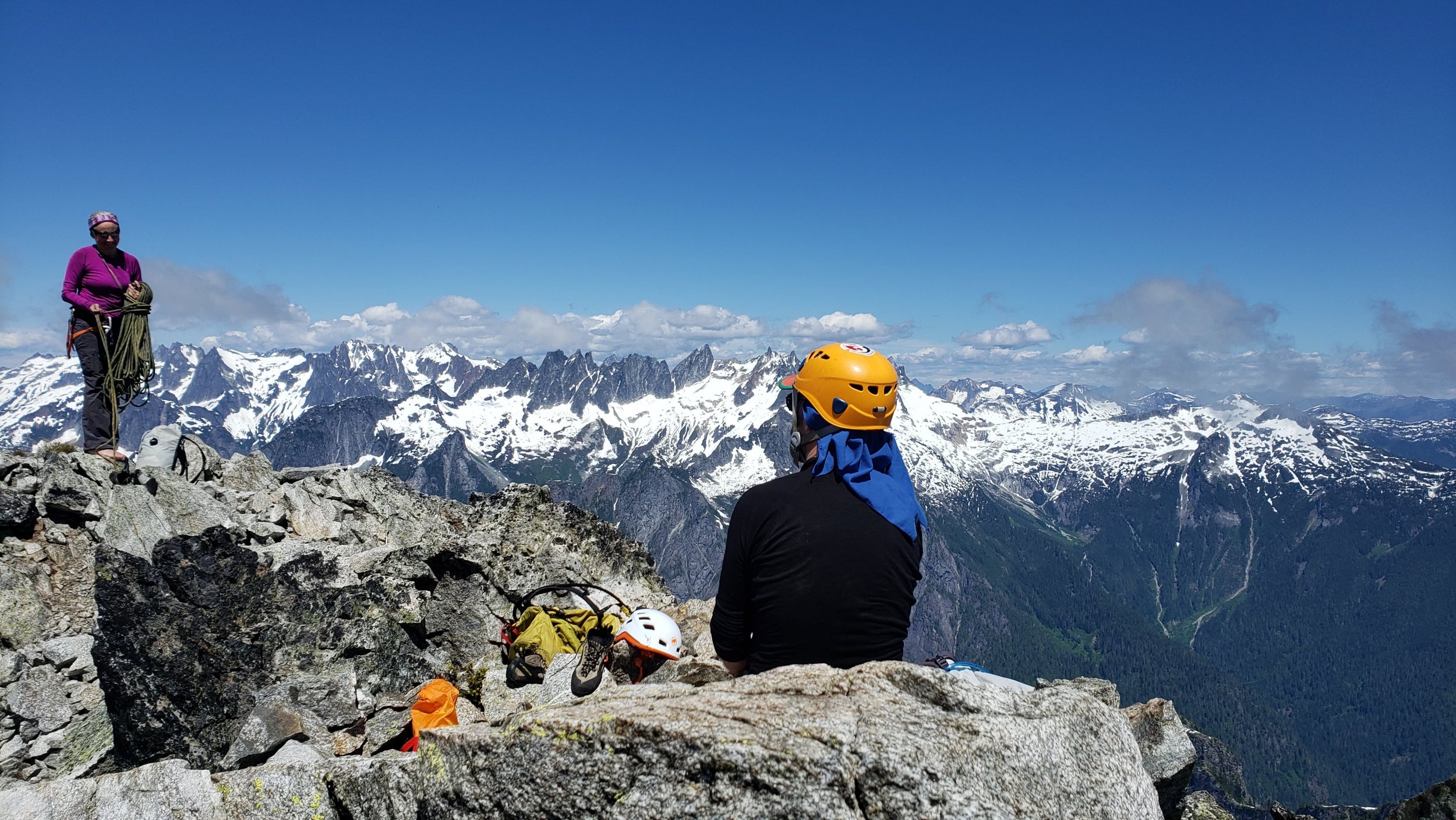
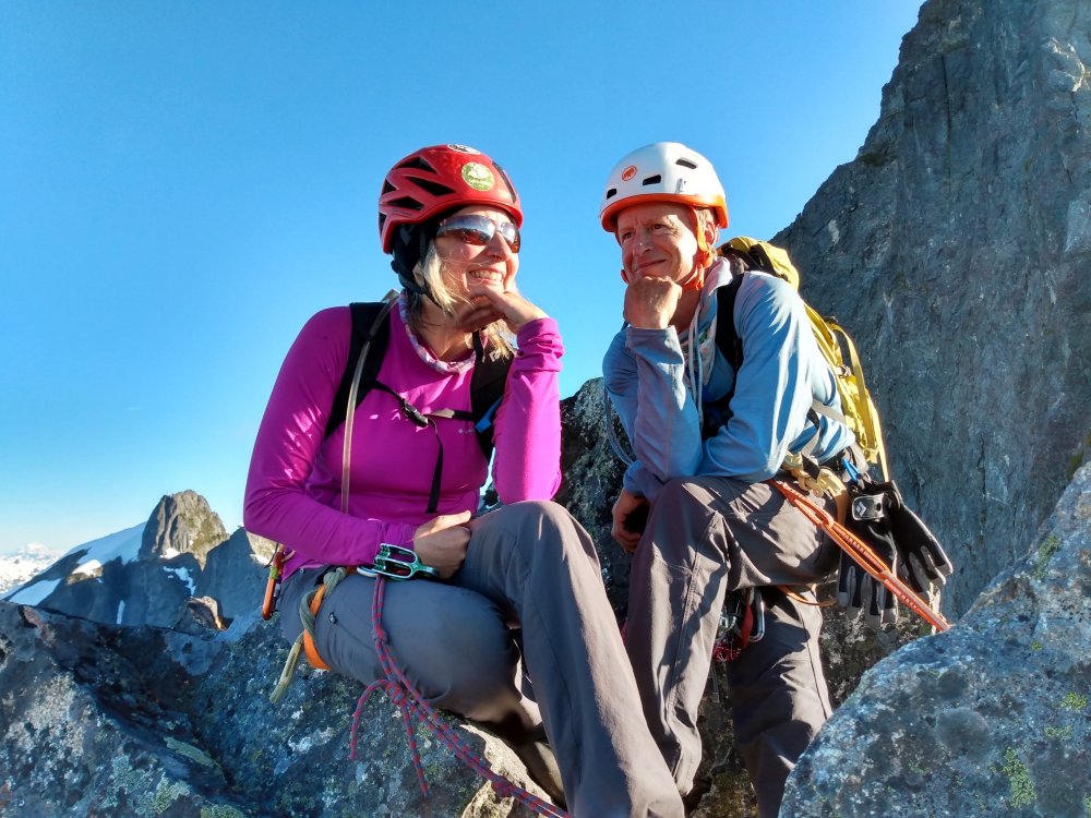
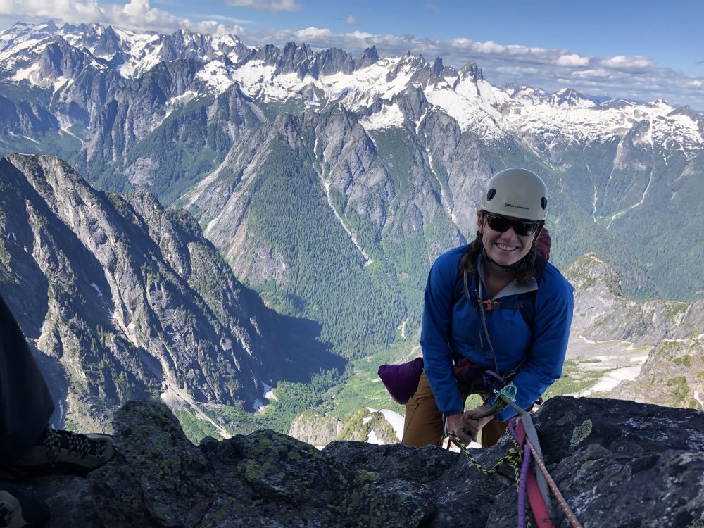
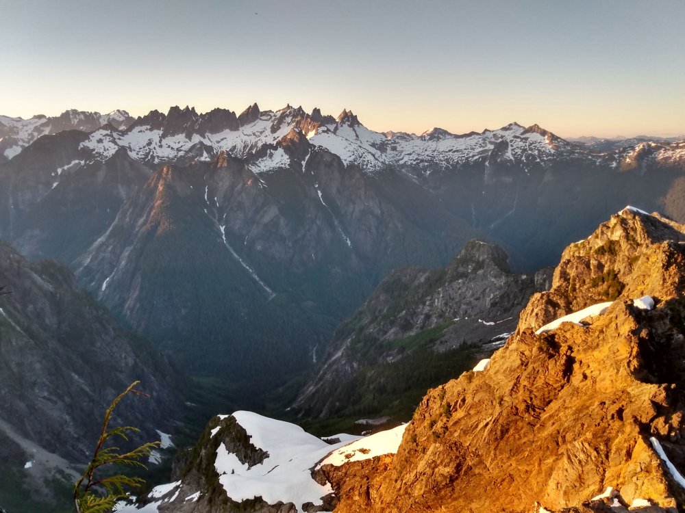
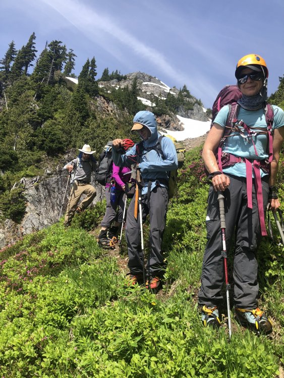
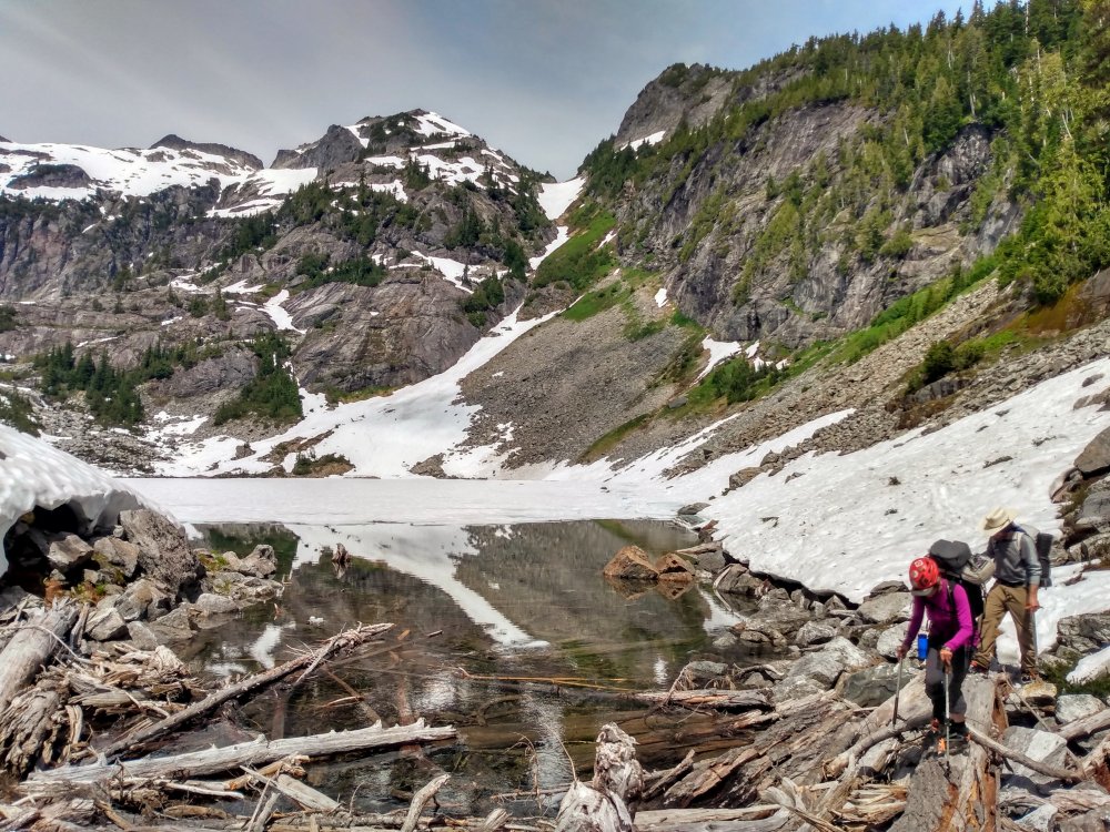
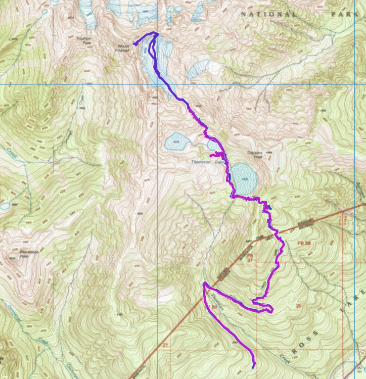
Mt Triumph, NE Ridge (5.7), North Cascades July 17-19, 2020 Back in February, I emailed Nancy, Kari, and Karen a list of Cascade climbs to consider for the summer. But as the months went by and COVID-19 numbers increased, a summer climbing trip started to feel harder to pull off. We wanted to climb, so decided to choose something moderate that could be done ‘off the couch,’ so chose the NE Ridge of Mt Triumph. Preston and Chris joined in and soon there were six of us excited to get out and climb. But as we all knew, climbing ‘off the couch’ in the North Cascades can still be a lot of work! There was some bushwhacking, criss-crossing steep slopes of heather, walking across floating logs in crampons, and route-finding challenges… and that was just Day 1. DAY 1: Thornton Lakes Trailhead (2,700 ft) Col (5,700 ft) The first part of the trip is a straightforward 5.3 mile (2,200 ft) hike from the trailhead to Thornton Lake. From lower Thornton Lake, it is 1.5 miles to the Col, but as another trip report put it, “it feels like 3 miles.” And it does. You follow a vague climber’s trail—that is really easy to lose in the snow—on the left (west) side of the lake, which then leads to the next lake (Middle Thornton lake). Though it was late July, the middle lake was mostly covered in ice. Our first delicate moves were walking across the loose logs in crampons at the outlet of the lake. Chris at lake Line shows route along east side of Middle Thornton lake and lower Thornton lake below. We walked along the right (east) side of the lake, which took us to the base of a steep slope, where it was a combo of climbing up snow, talus, and heather, which eventually gets you to the Col. (Jen: “thanks Nancy for that extra trekking pole!”). The Col has beautiful views in both directions, but limited bivy sites. We barely managed to find spots for 3 tents. However, we did have a bubbling brook running through the heather, pretty perfect for good nearby water. Hiking up to the Col. Sunset at the bivy. The morning views of Triumph from the Col weren’t too bad DAY 2: Col (5,700 ft) climb Mt. Triumph (7,240 ft.) Col (5,700 ft) After the requisite coffee, we left the Col at 6:30am and began traversing across the glacier to get to the base of the NE ridge (6,080 ft). It took us about an hour and a half to get there. The temps had warmed up considerably overnight and the snow was pretty soft. Crossing the glacier Red arrow is where the serac collapsed. At the rocky toe of the ridge, we stashed crampons and ice axes. A little higher up, we changed into climbing shoes. Nancy opted to do the route in approach shoes, good for comfort but not so good for climbing slabs or traverses. We simul-climbed the route as two groups of 3, which saved us weight and gave us two ropes for rapping. Lots of easy ridge climbing Preston & Kari Views were pretty great! The climb is easy and fun, with ample places for gear. We did pitch out the 5.7 “off-width,” but it’s easy, short, and has a fixed piece of gear you can use. After the 5.7 pitch, you go past the “grassy bivy” into the notch between the ridge and the steeper final section of the route. The Beckey variation goes left of the notch (with better-quality rock) though there’s another option right (from the notch, descend 30 feet and go around right). Chris, Preston, and Karen went left, going up a mellow wildflower-laden scramble to the summit, with Preston singing Tom Petty’s “Wildflower” song. Sounds lovely. Jen, Kari, and Nancy went right, which was easy enough climbing but more plant vegetation than pro. Going right sucked up time, as the first group waited over an hour for us on the summit (sorry!). We all were descending by 3pm. Karen & Preston on the summit Kari & Nancy Descent The descent is a combo of rappelling (single and double rope raps) and downclimbing. If you had one rope, you would have to do a bit more downclimbing and you could downclimb more of the route if you felt comfortable. There’s plenty of rap stations, with lots of webbing, but because it’s a ridge climb with features to get around, the descent takes more time than the ascent! While the quality of the rock was decent, there were a few places with loose rocks, so be careful pulling your ropes (Karen & Kari gingerly pulled the rope near a large loose block that’s just about to go). We did the last rap as it was getting dark, so with headlamps on we scrambled down to our boots, ice axe, and crampons. Karen & Chris guessing how long the descent will take How many raps have we done? Traverse, downclimb, rap. Repeat. Great view of the Pickets....next time While it’s never ideal to be descending in the dark, you do get to see the stars. And lucky for us, we also got to see the Neowise comet, which will not be coming back to Earth for another 6,500 years! (Thanks Chris for taking pictures!) Tired and happy, we began to walk across the glacier (at 11:30pm) back to the Col. The snow had certainly softened up in the warm weather. We were most of the way across the glacier when there was a loud CRACK! BOOM! as a huge serac broke right in front of us, sending down ice blocks that were the size of cars. Kari was leading and the ice chunks were probably about 70-100 feet in front of her. It was terrifying. Some of us were silent, and some of us were saying things like “shit shit shit” or “oh my god, that would have killed us.” After the ice chunks blew down, there was still some ice hanging precariously. And we still had to cross below it, as there was no way we could climb above. We decided to cross—one person at a time—and all of us moved as quickly as we could, thrusting the ice axe into the now sheared snow with hearts pounding. Once we made it back to the Col, we turned off our headlamps to take in the clear night sky—stars, planets, a comet, and the Milky Way—all shining down on us. As Karen put it: it was a full-value day in the North Cascades! DAY 3: Col (5,700 ft)àTrailhead (2,700 ft) We woke up to a sunny day and encountered some other climbers on their way in. Packing up, the descent down the snow slope and heather was fairly quick but we somehow missed the ‘climber’s trail’ along the lower Thornton lake so had to bushwhack and avoid snowy tree wells. Crampons on heather, scree, and snow Look how much snow melted from Day 1! Perfect afternoon nap Eventually, we were back on a wonderful trail, heading back to the trailhead. Celebrating the climb the way we often do—sprawling on the pavement, with mountaineering boots off, eating chips and drinking beer. Decadent. The trip was great—it’s a fun climb, Cascade views are gorgeous, and we had great teamwork. Most importantly, the collapsing serac didn’t kill us! We learned an important lesson about being extra careful with warm weather softening up the snow so quickly. It was great to be back in the mountains again! Gear Notes: Small rack: cams .4-#3; small set of nuts; 10-12 slings; Trekking pole, ice axe, crampons Conditions: Because of the pandemic, there was no recent trip report on Triumph and little info available on recent conditions. There was much more snow than anticipated, which meant that you definitely needed crampons and an ice axe. Another party with microspikes made it to the Col but turned around when they saw the amount of snow. Approach: Hike 5.3 mile (2,200 ft) hike from the trailhead to (lower) Thornton Lake. Follow the climber’s trail on the left (west) side of the lower lake, which then leads to the next lake (Middle Thornton lake). Try to stay on the climber's trail, you'll be happier if you do! Then go around the right (east) side of the middle lake, climb up the snow/heather/scree slope to the Col (bivy). Approach the climb by traversing the glacier to the toe of the ridge, where you'll start climbing.


 2 points
 -
Trip: Attempt on Stuart Ridge Traverse - SRT Trip Date: 08/04/2020 Trip Report: I'm writing this down so people attempting this might have a bit more info as it seems that info (or lack thereof) is the crux. We didn't complete it for a multitude of reasons but maybe I learned something that will help others succeed. Approached from Stuart Lake Trailhead and hiked to a bivy just shy of the base of the NR. This is a nice plan as you don't have to find your way into the climb in the dark, all the while watching the clock tick. You have the same weight you'd normally have plus one dinner. That said, sleep was impossible as mosquitoes swarmed all night and we had no shelter other than the stewy warmth of our sleeping bags. Water is easy to find below the climb. We climbed the NR then descended quite a lot to get to the col below Sherpa's WR. Climbed that, it's not 5.4. It's by no means difficult, but I'd expect some 5.6ish stuff for sure. Maybe I was just tired. We did Sherpa in two leads. Now the difficulty begins. Getting to the Sherpa Argonaut Col is a pain and takes some time. If you've done this section without rapping down the S gullies and hiking around and through all the rock ribs and shrubs and trees and scree and sand, to the Col, please chime in. I saw a rap that went to Sherpa's N but I couldn't tell if it "went" or not, after the rap, we opted not to roll the dice. I have a suspicion this is the better route. Aug 4-5, 2020, no water available en route. We found a patch of snow lower on the NR and then the snow on the Cascadian descent, but no drips. We heard running water in some of the gullies near Sherpa but they all seemed to low and too far and maybe the water wasn't even accessible. We bivied at the Sherpa Argonaut Col and ran out of fuel melting snow for water and dinner. Plus Argo looks like a peak wrought with difficult travel along that West Ridge. We bailed and found water in 20 minutes. This would be an option for intrepid climbers hell bent on continuing. Could easily drop down and refill on water, then continue. The descent from the col was pretty chill. I'd say the bivy at the col is comfortable enough for sure. You're out in the open, just hoping the wind will keep the bigs at bay. Long and short of it, gotta move move move, and find water. If you bivy, bring some netting to keep bugs off or you won't sleep. Leave the filter as all the water you access up high is safe (my opinion). Parking lot to bivy: 3 hours Bivy to base: 10 minutes Base to Stuart summit 6.5 hours Stuart summit to base of Sherpa 1.5 hours Didn't keep track of time after this but we climbed WR Sherpa quickly and contemplated our fates on the summit. Found a FF down jacket that mice and rodents were pilfering for their homes. Also some delicious Shot Blocks and Honey Stingers. If only we had found a gallon of water! It's out there, it's hard, go get it! Gear Notes: Rack .3-3 with double of .4-2, nuts, 12 slings and 2 double length (this could be trimmed a bit if needed but I used it all twice on long simul sections) 60m 8.5mm rope (this was better than doubling a half as we could simul with the grigri) Stiff approach shoes are confidence inspiring on the snow and the N stuff was firming up by early evening. Poles were nice in a variety of sections and an ax would have been dead weight but we likely would have wanted it descending Argo. Approach Notes: Stuart Lake Trailhead1 point
-
What you're mentioning sounds like an option for skirting Sherpa, is that correct? I liked climbing Sherpa, just wish there were a better way to the col between Sherpa and Argonaut.1 point