Leaderboard


Popular Content
Showing content with the highest reputation on 04/14/22 in all areas
-
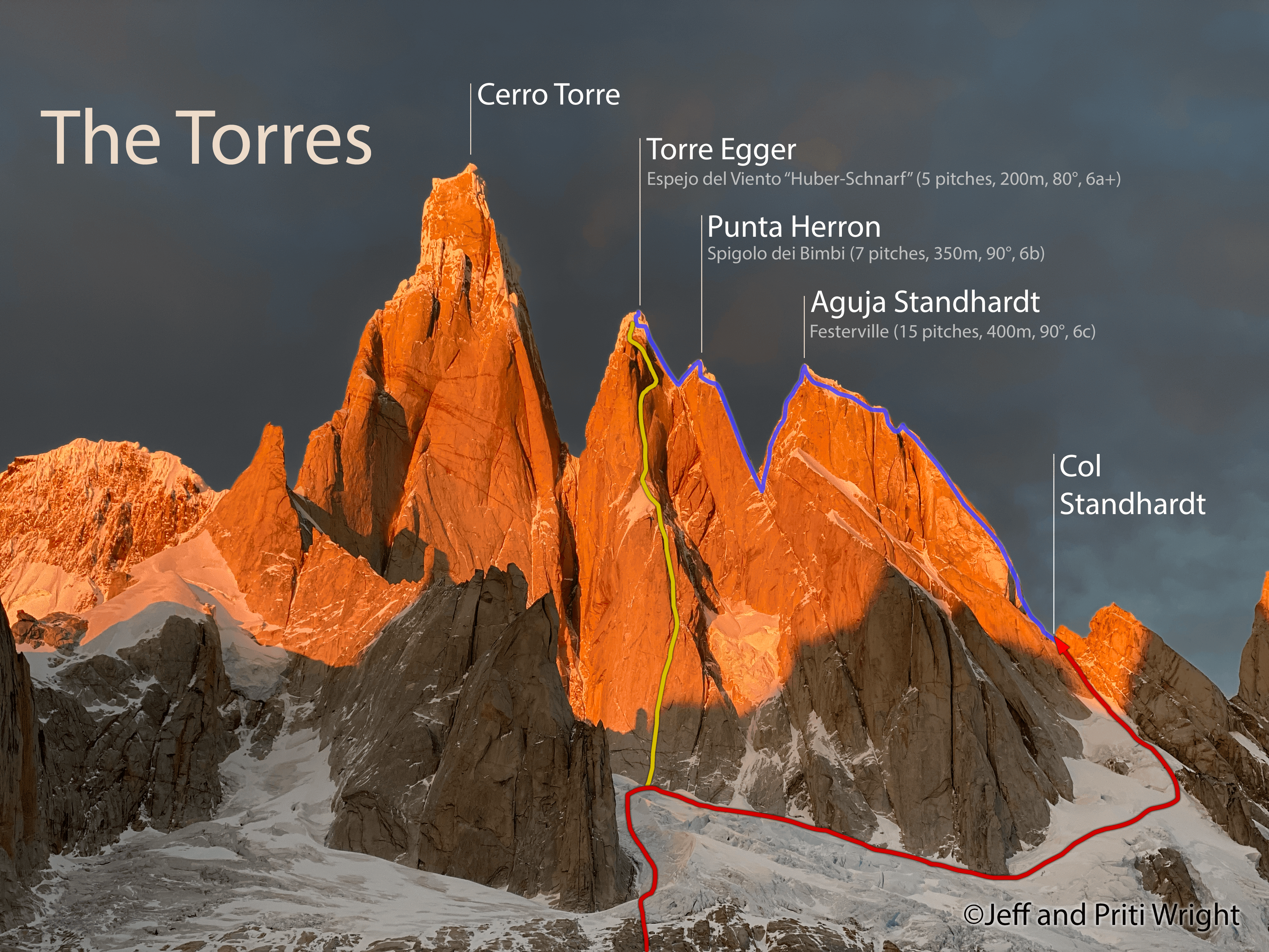
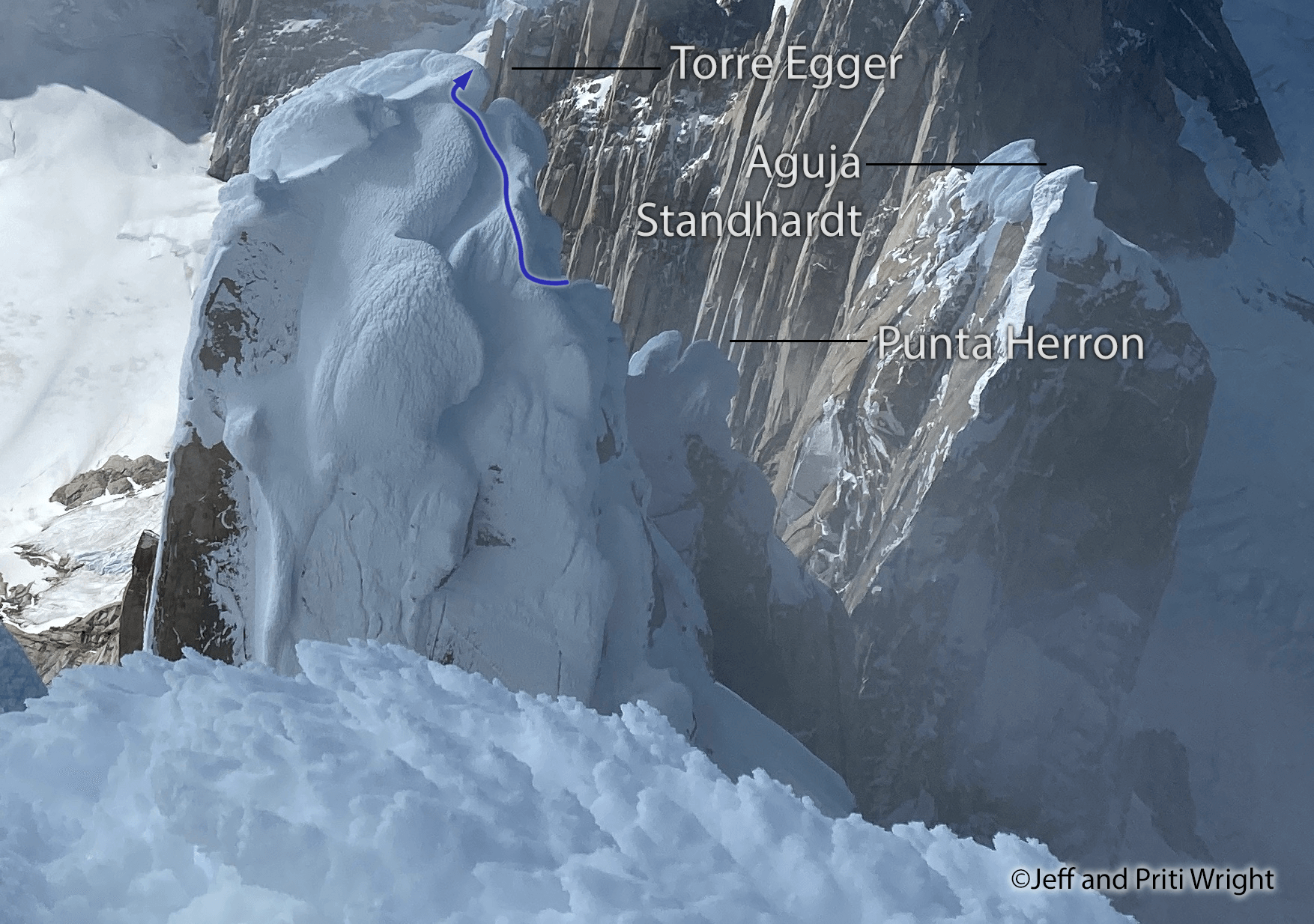
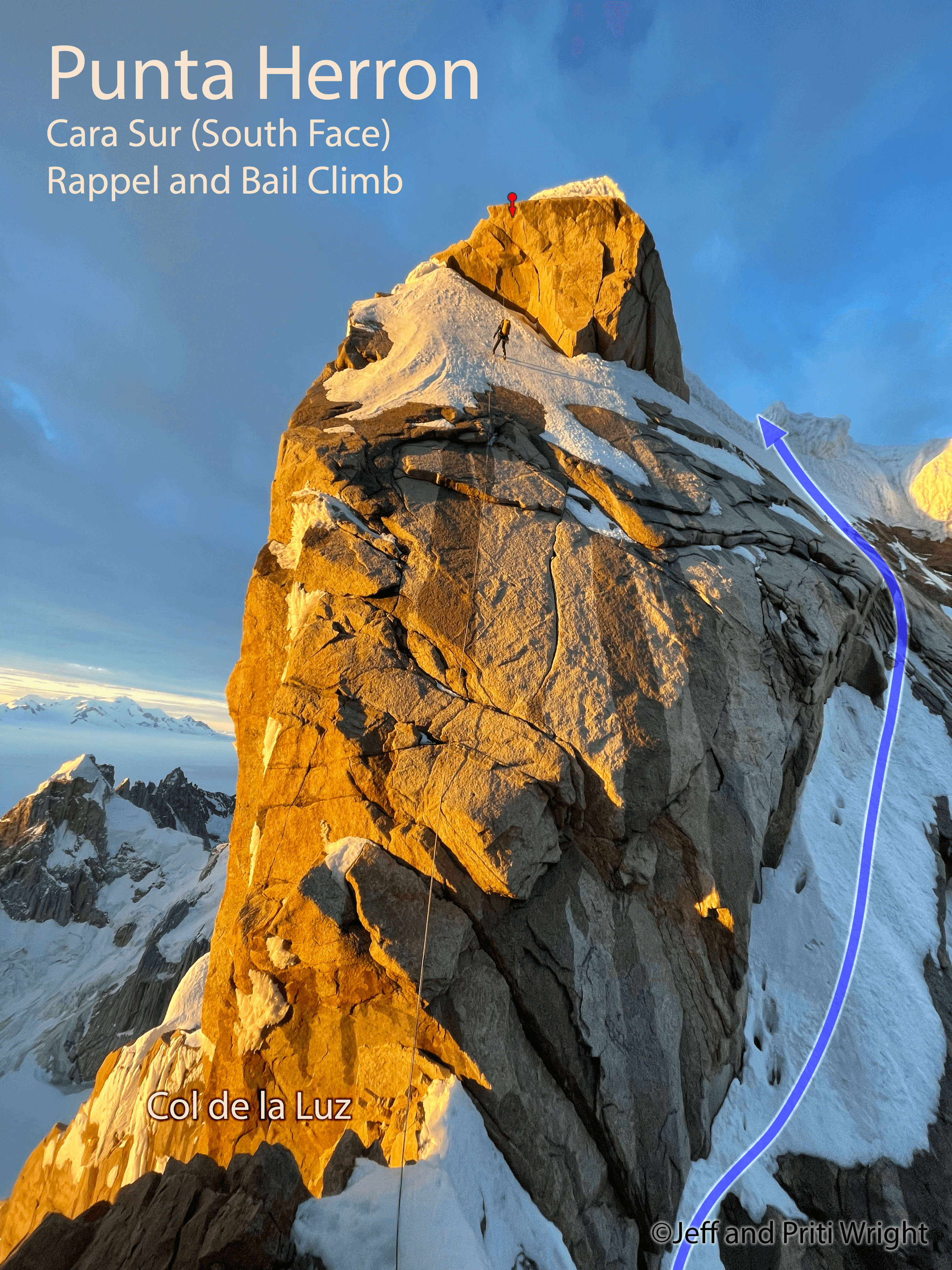
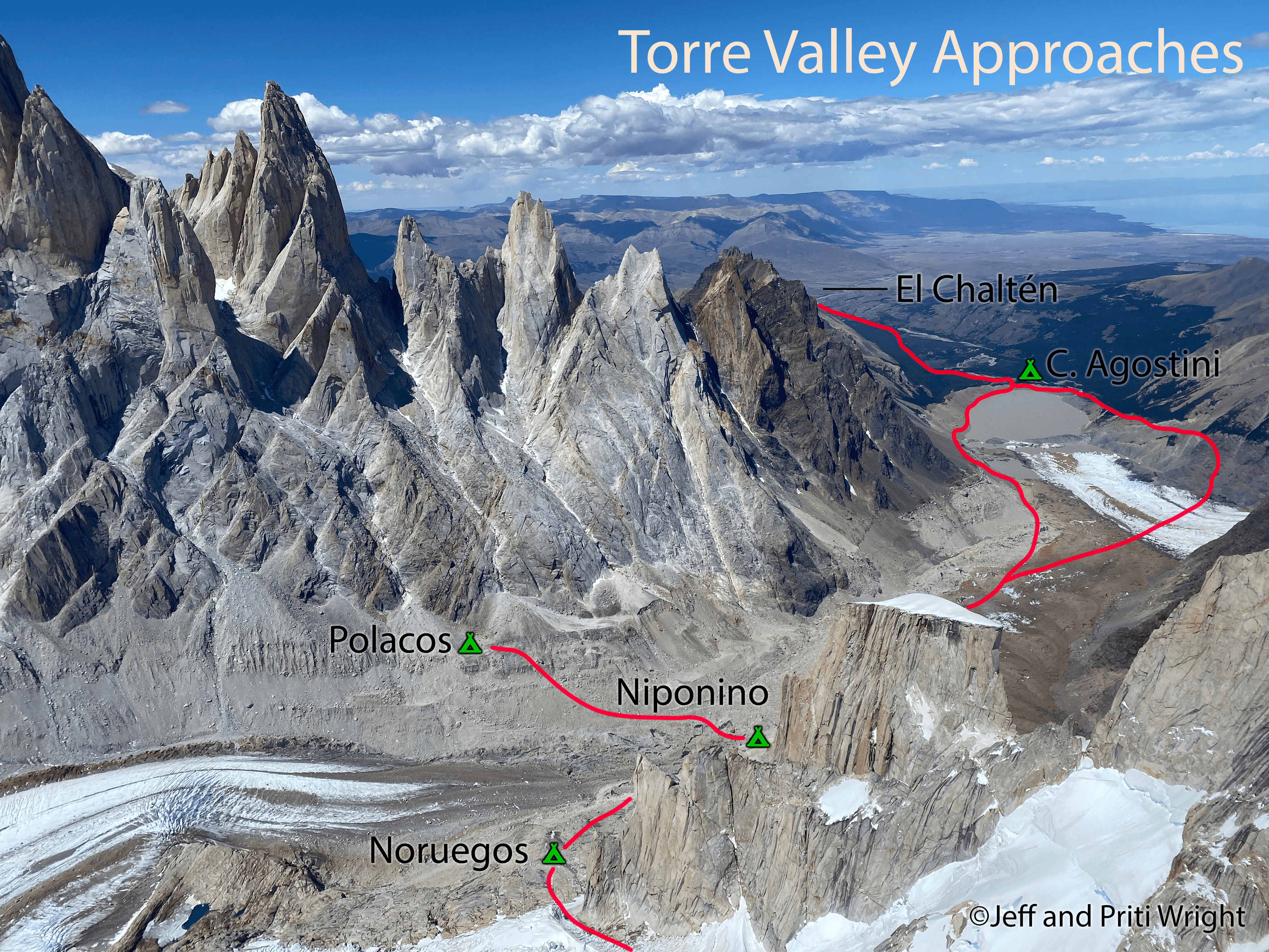
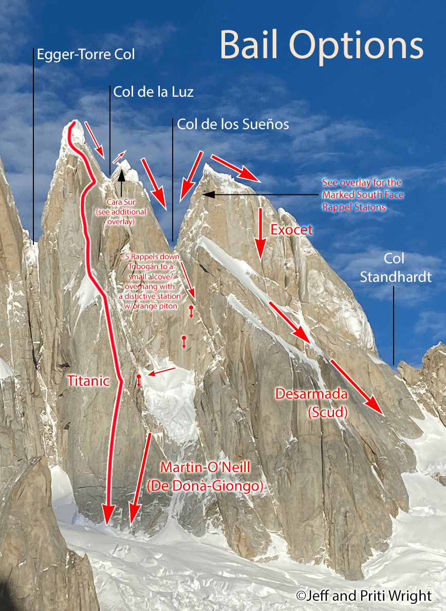
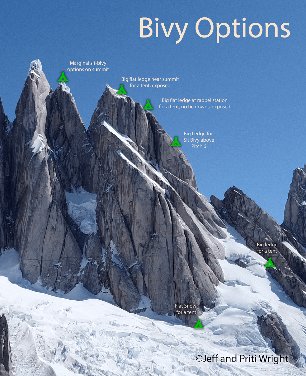
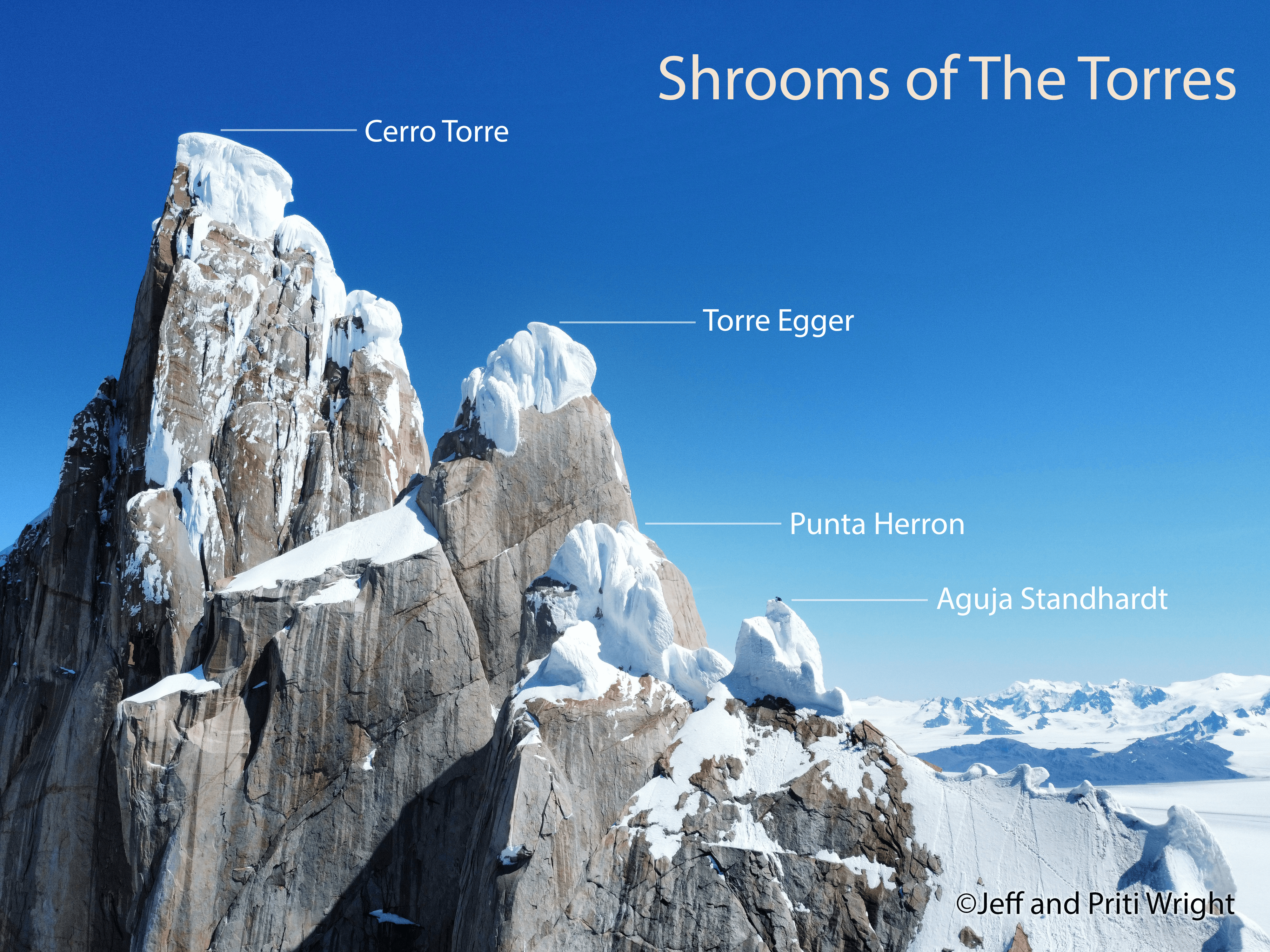
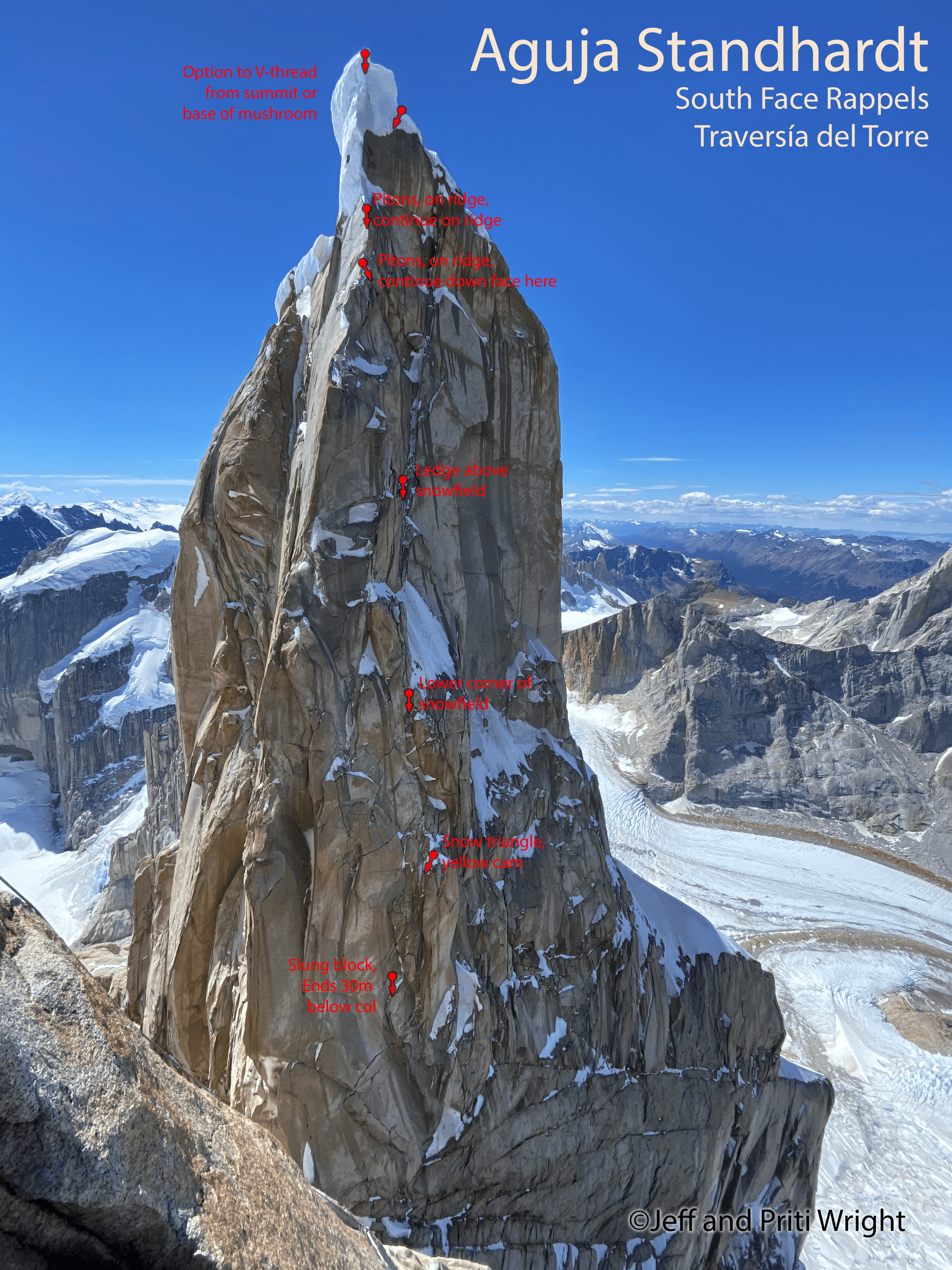
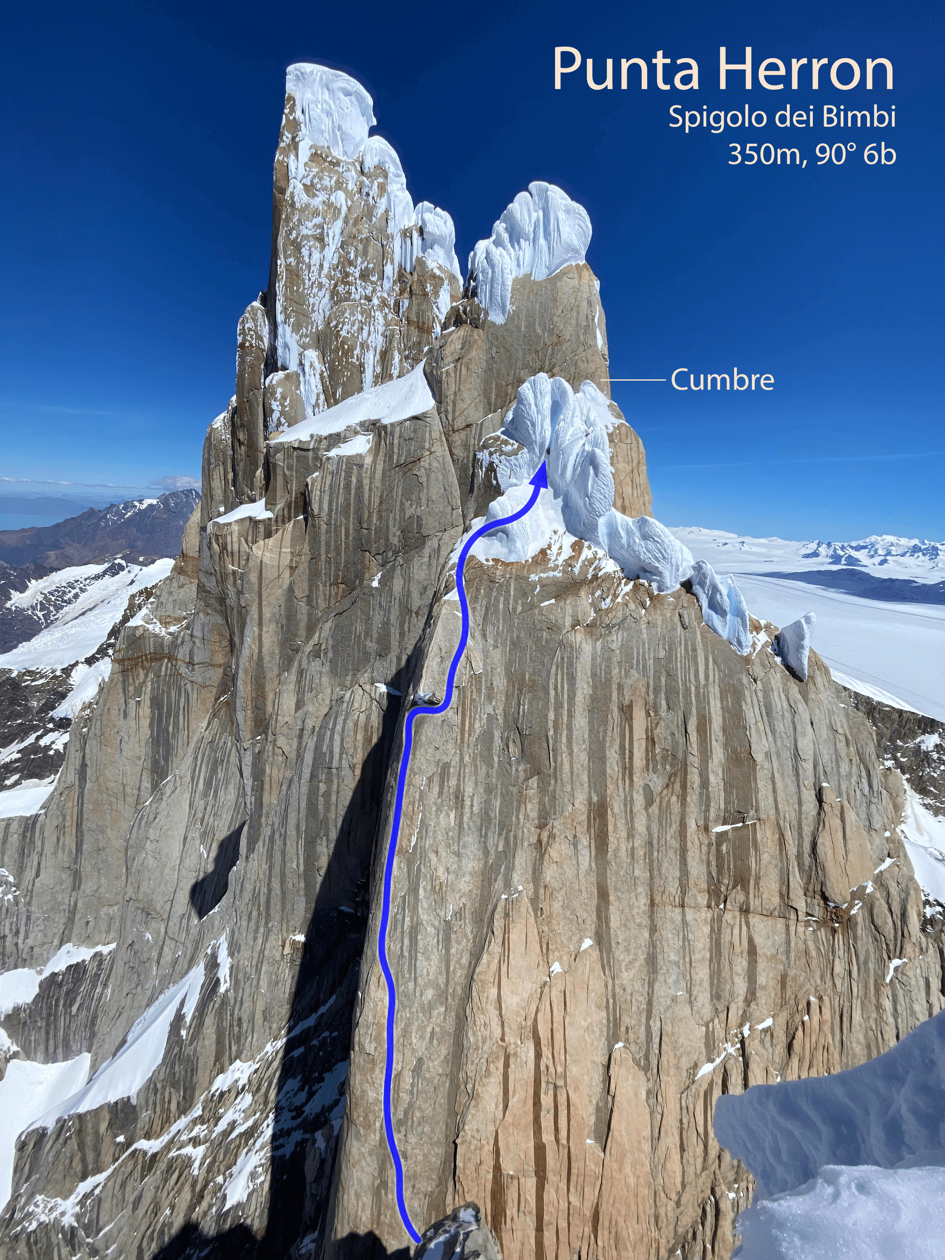
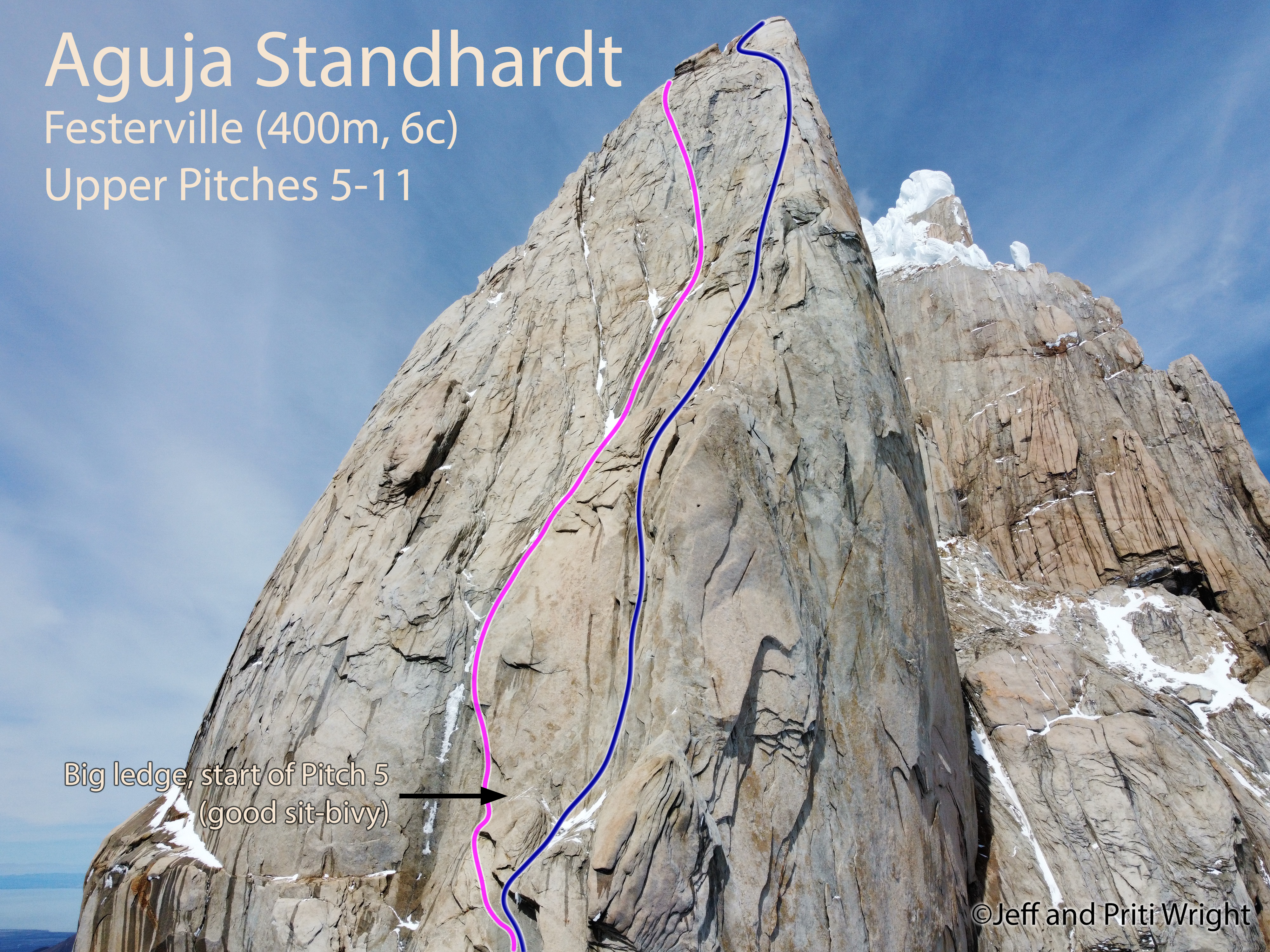
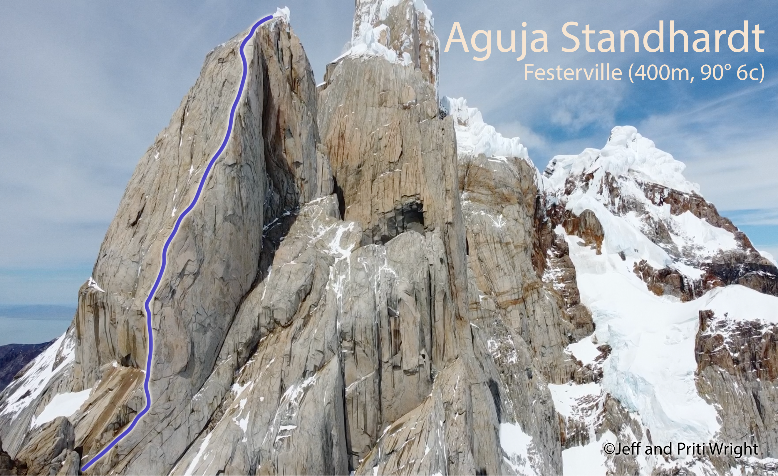
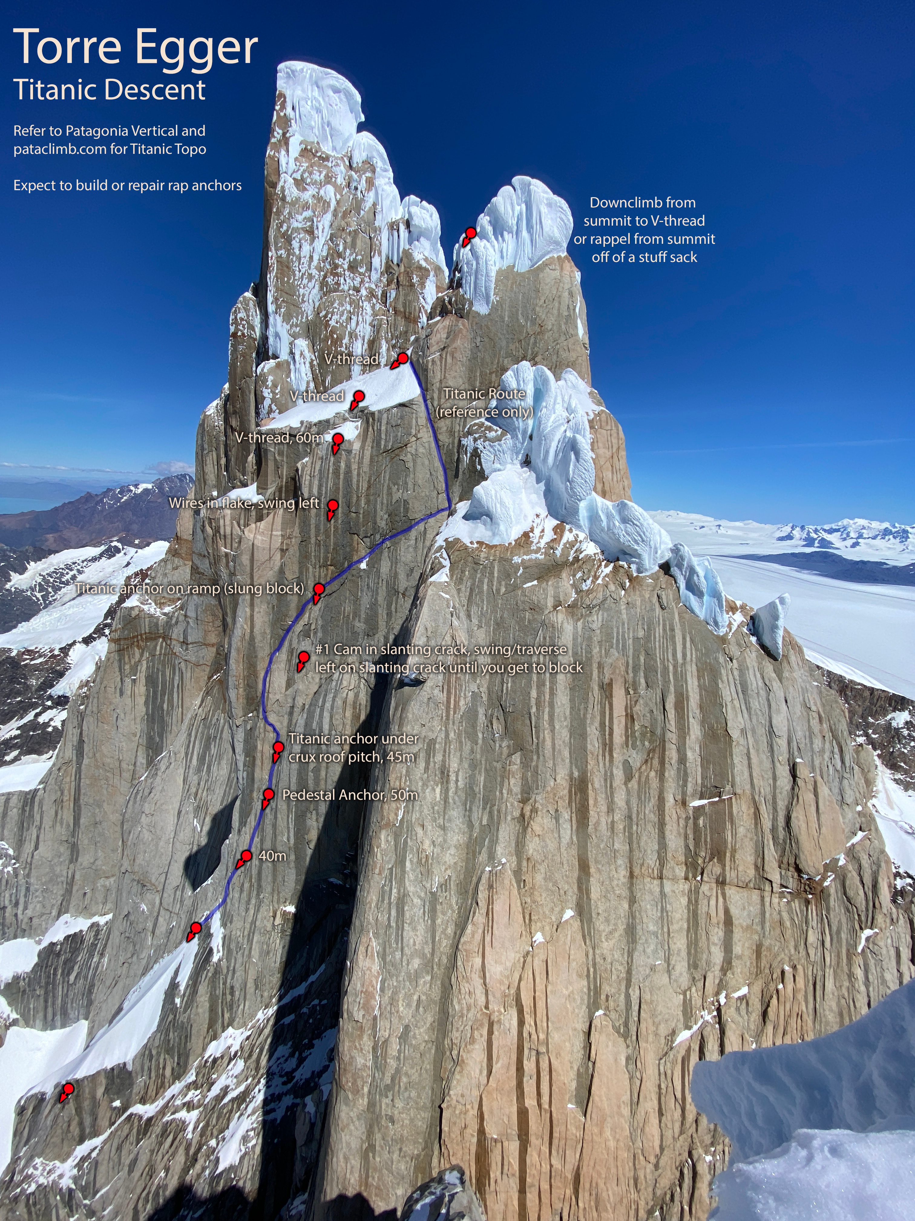
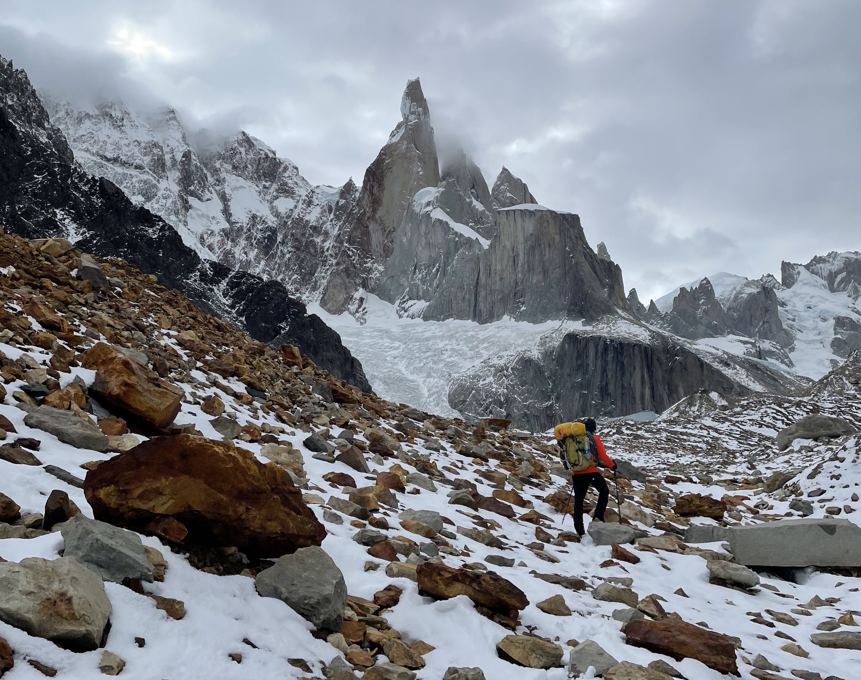
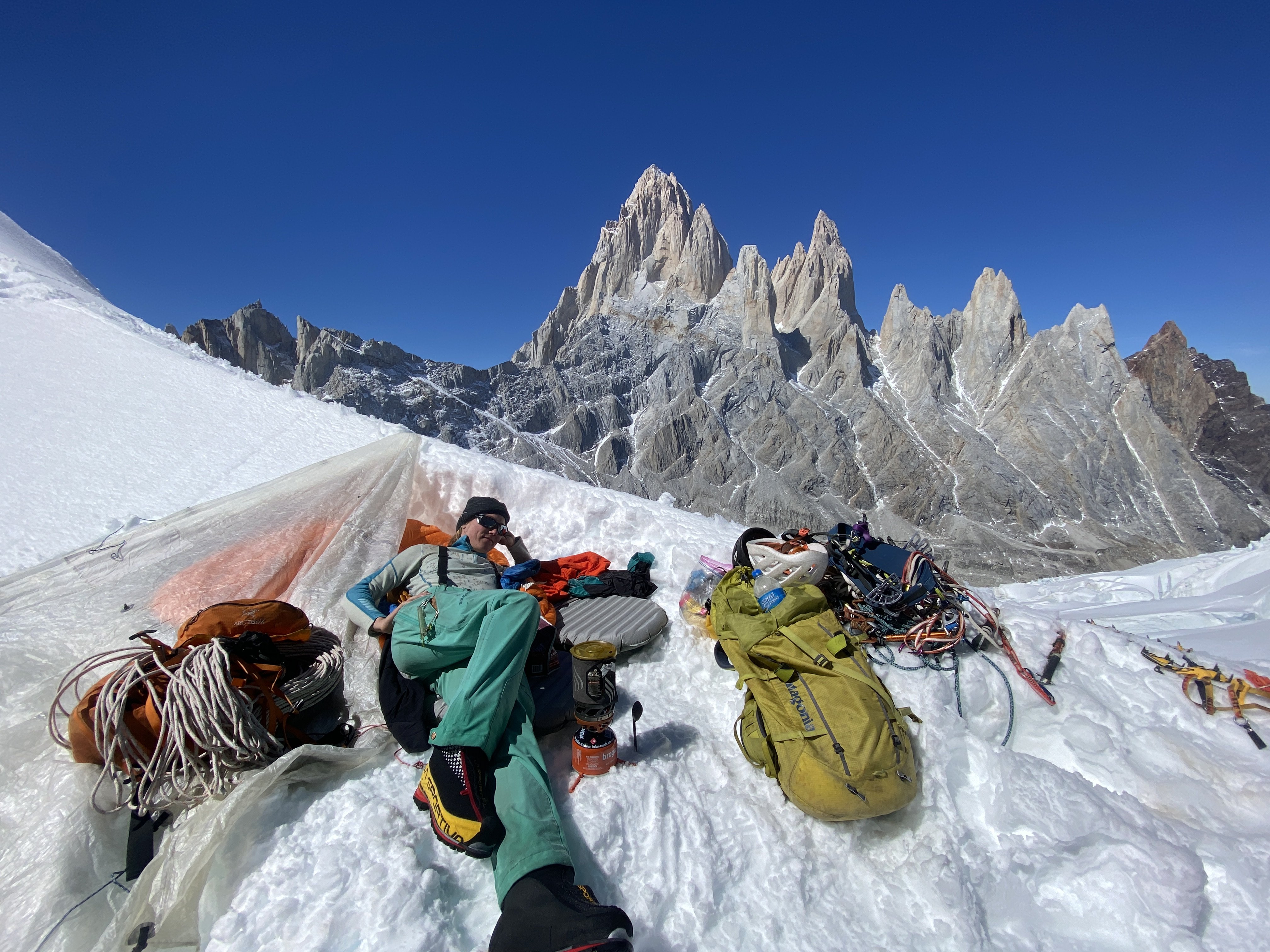
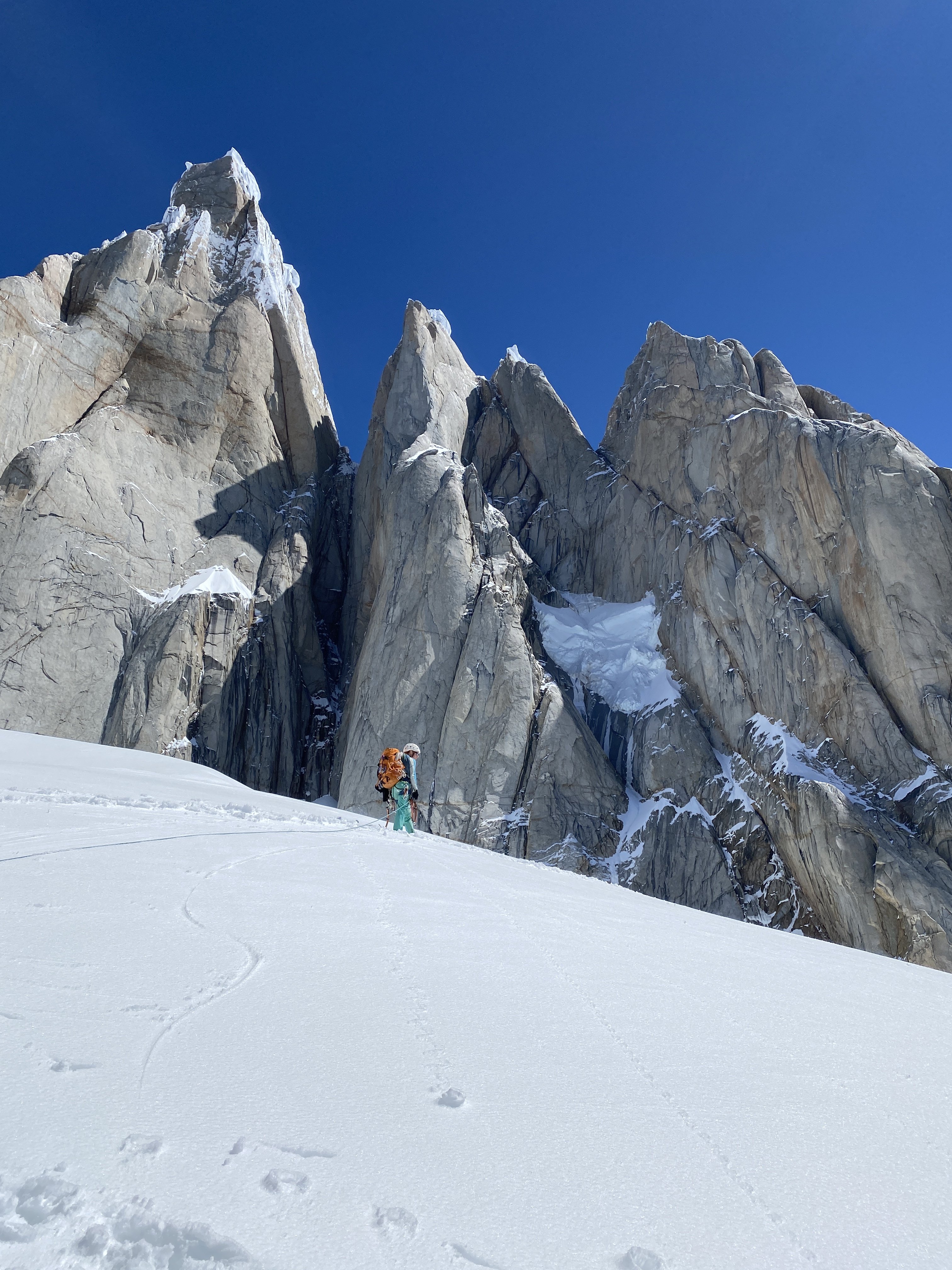
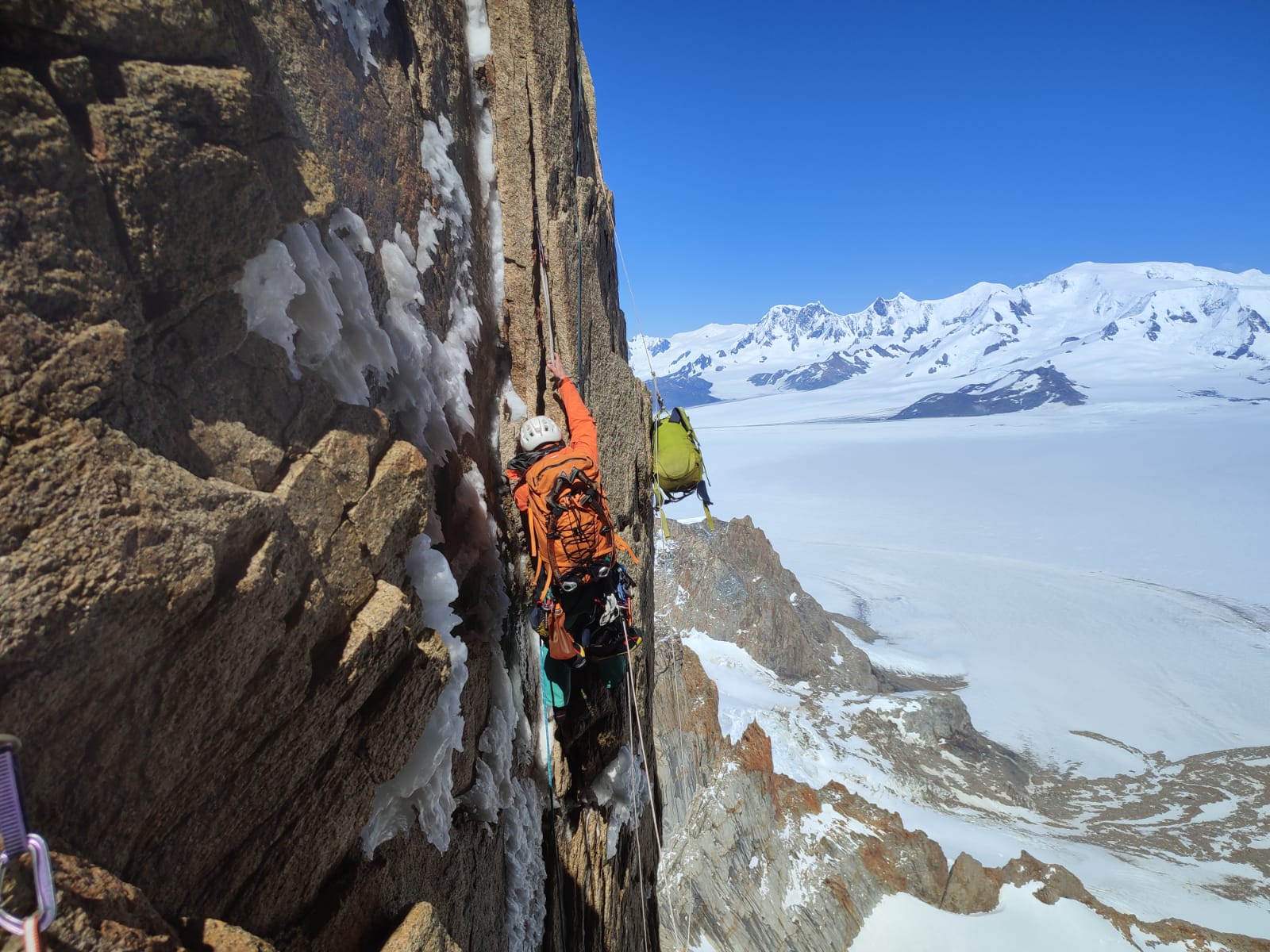
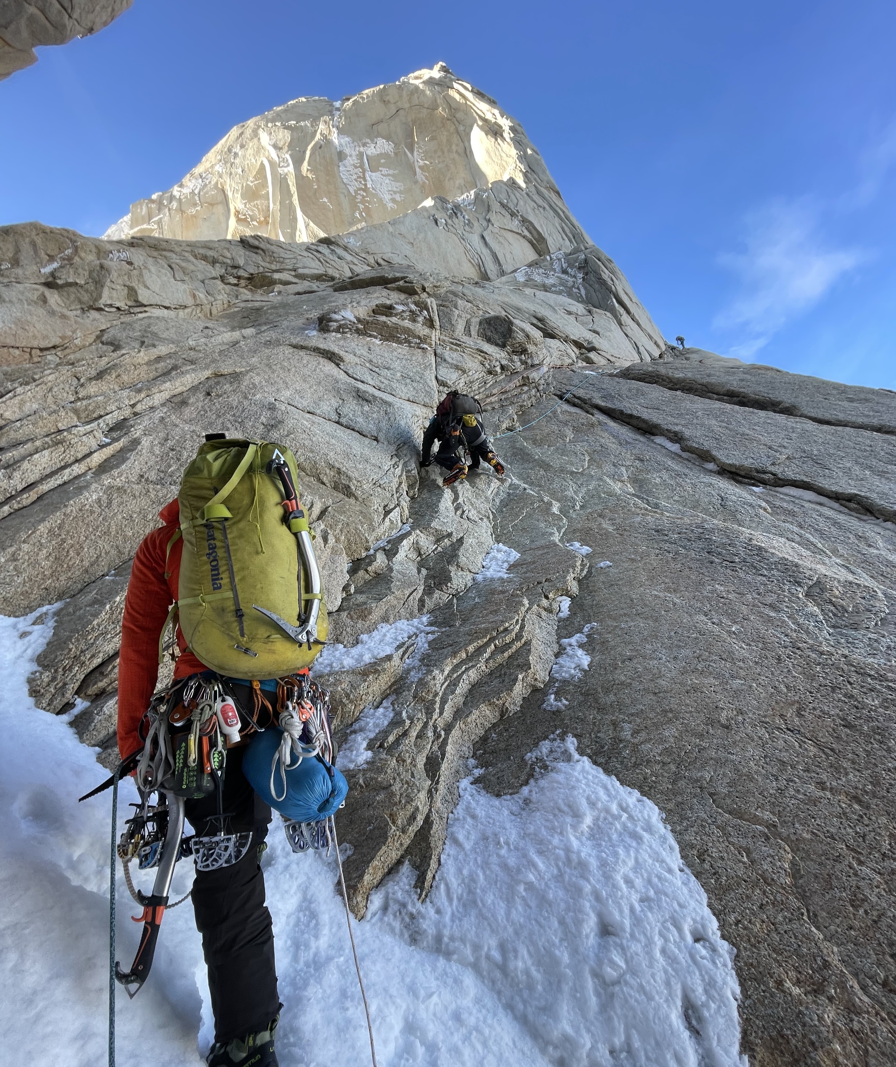
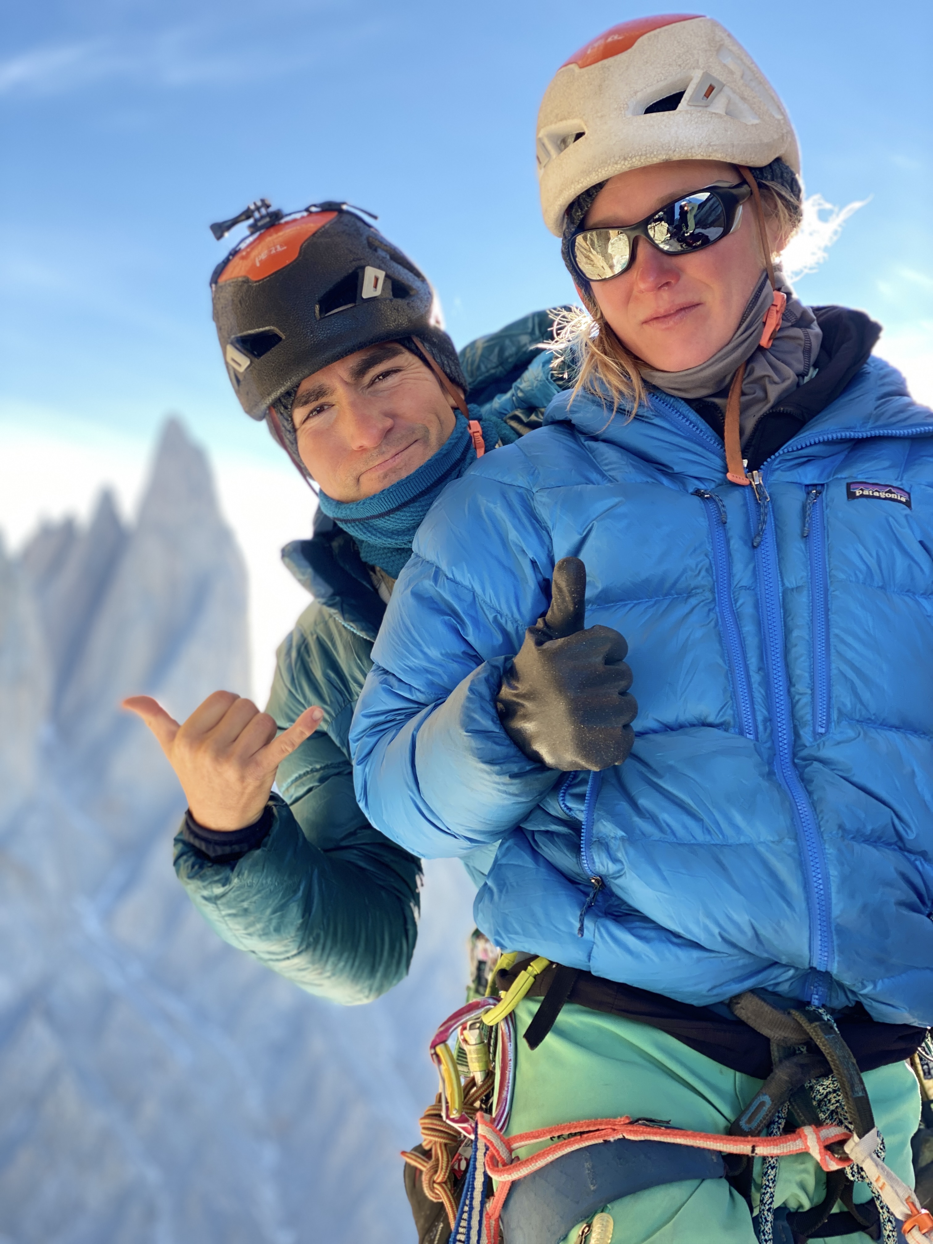
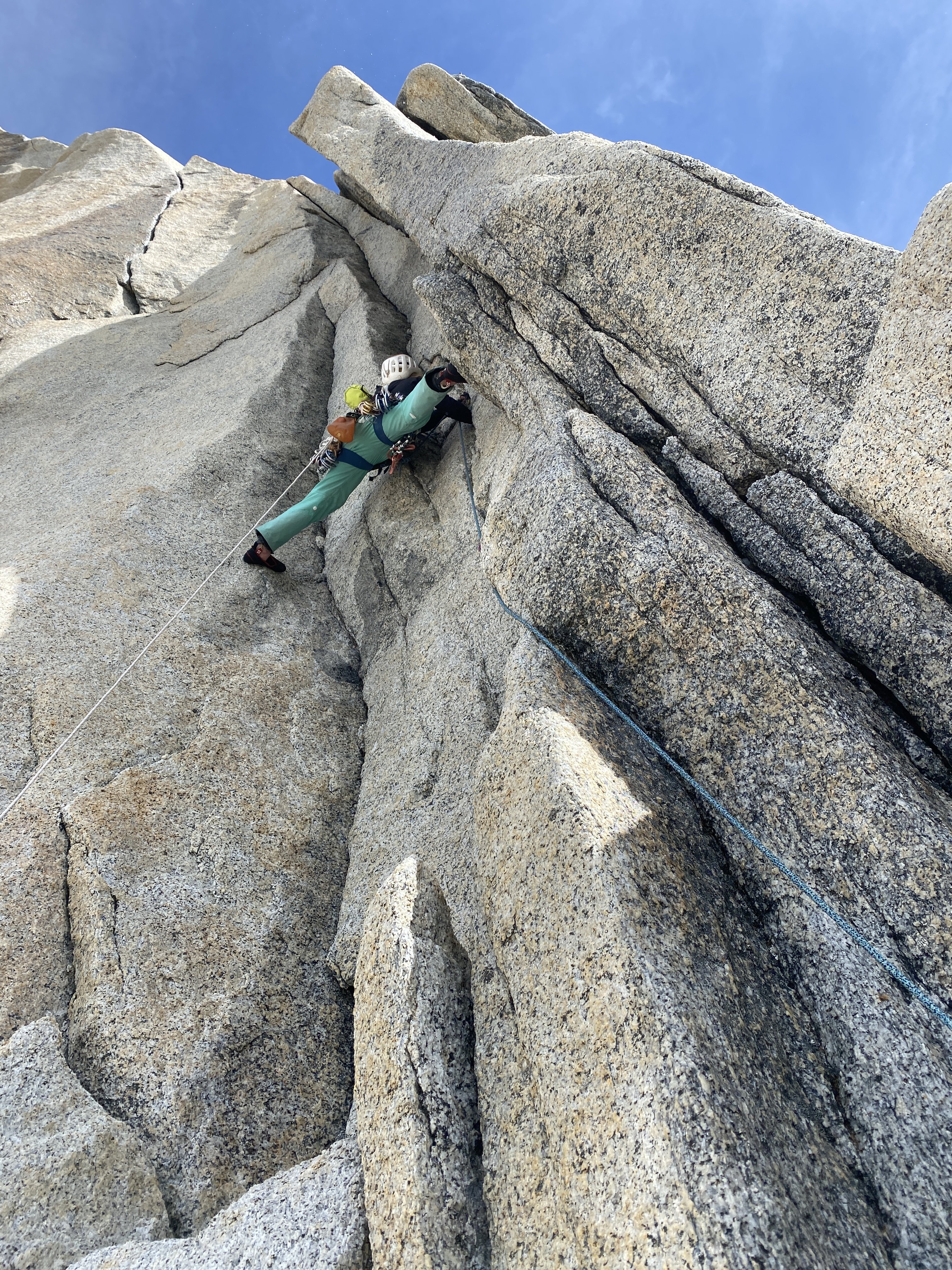
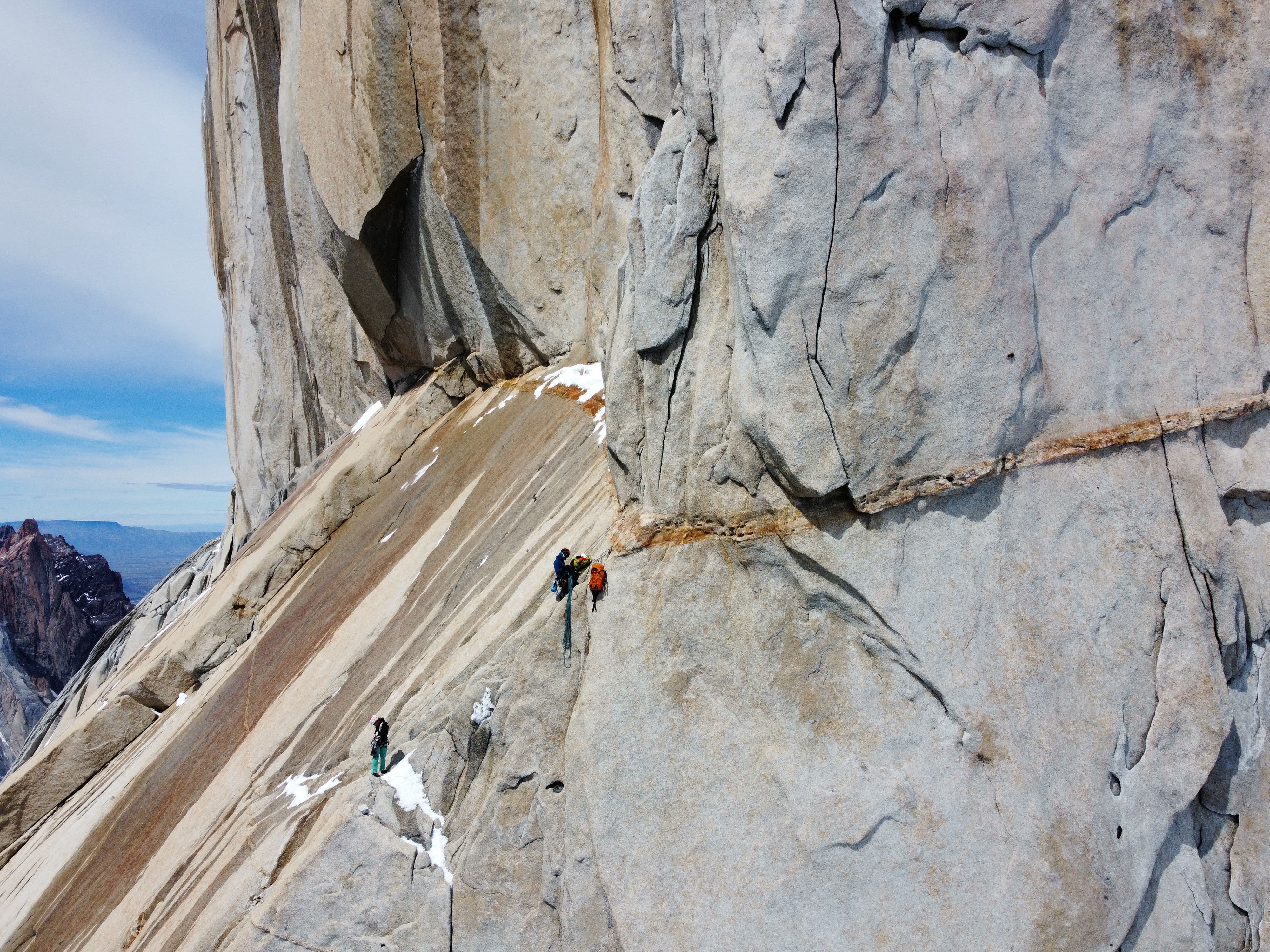
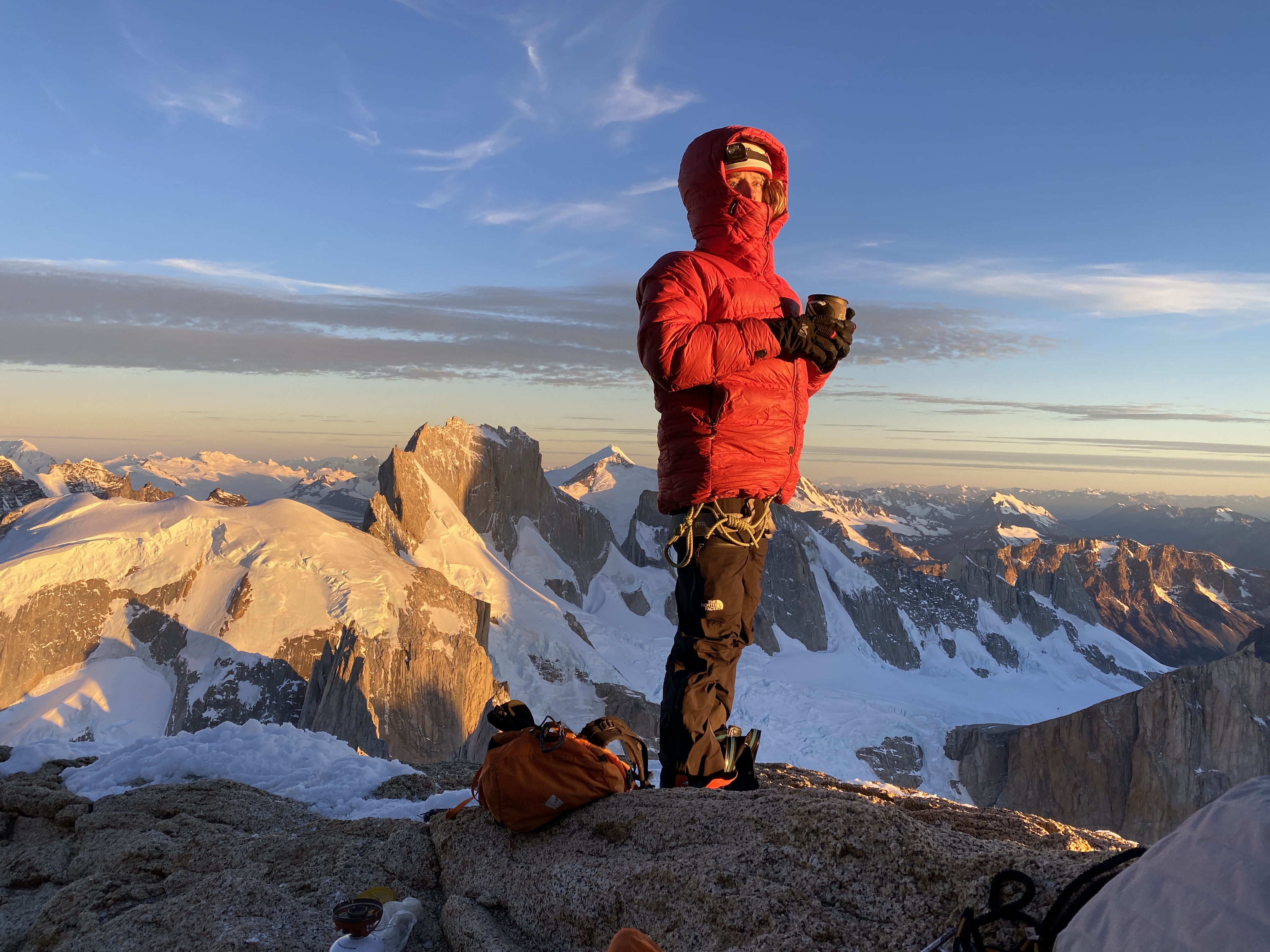
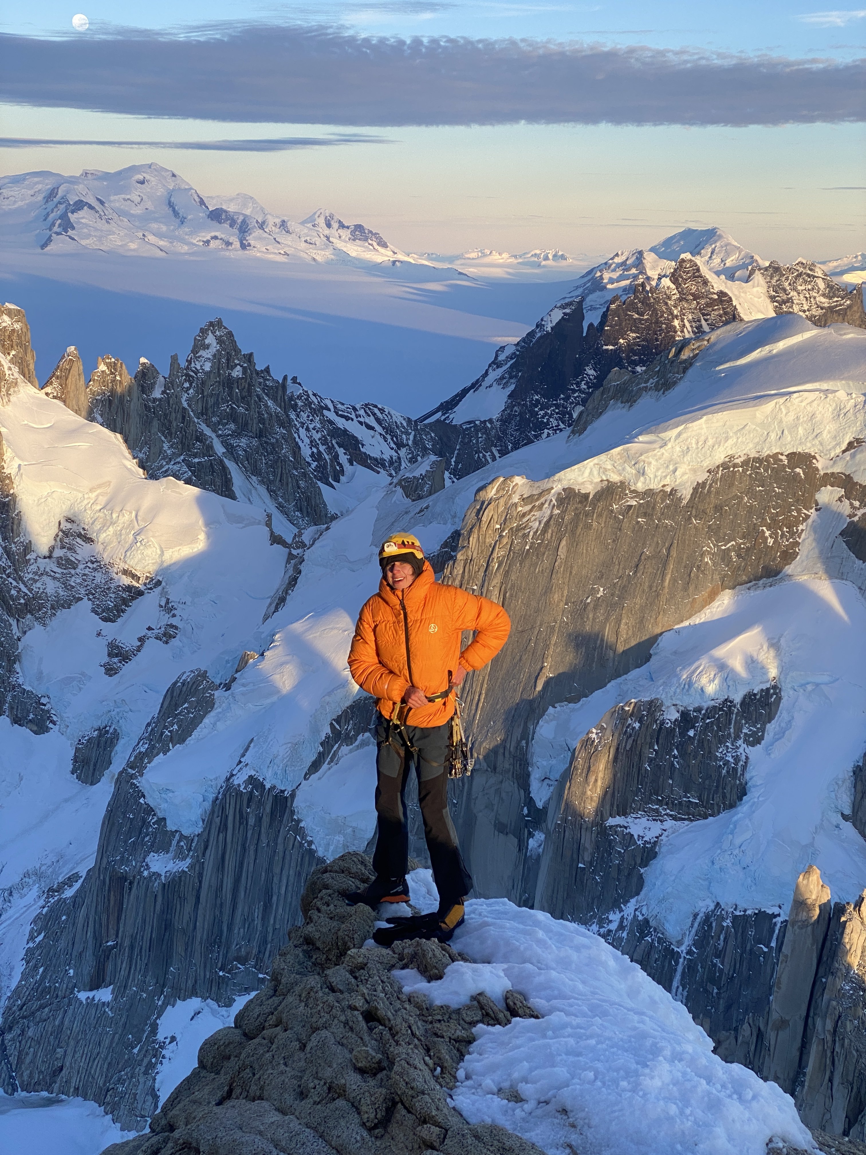
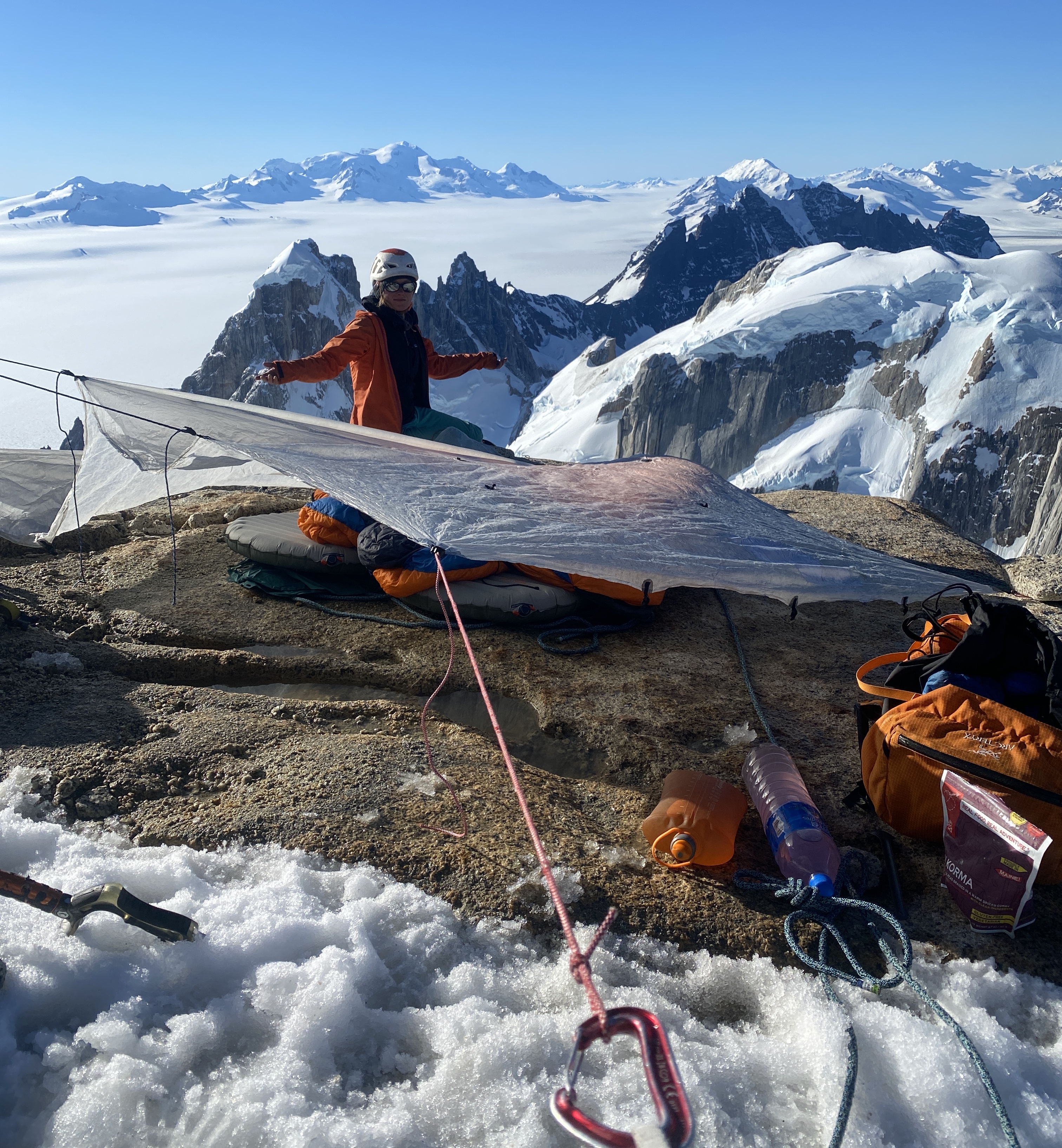
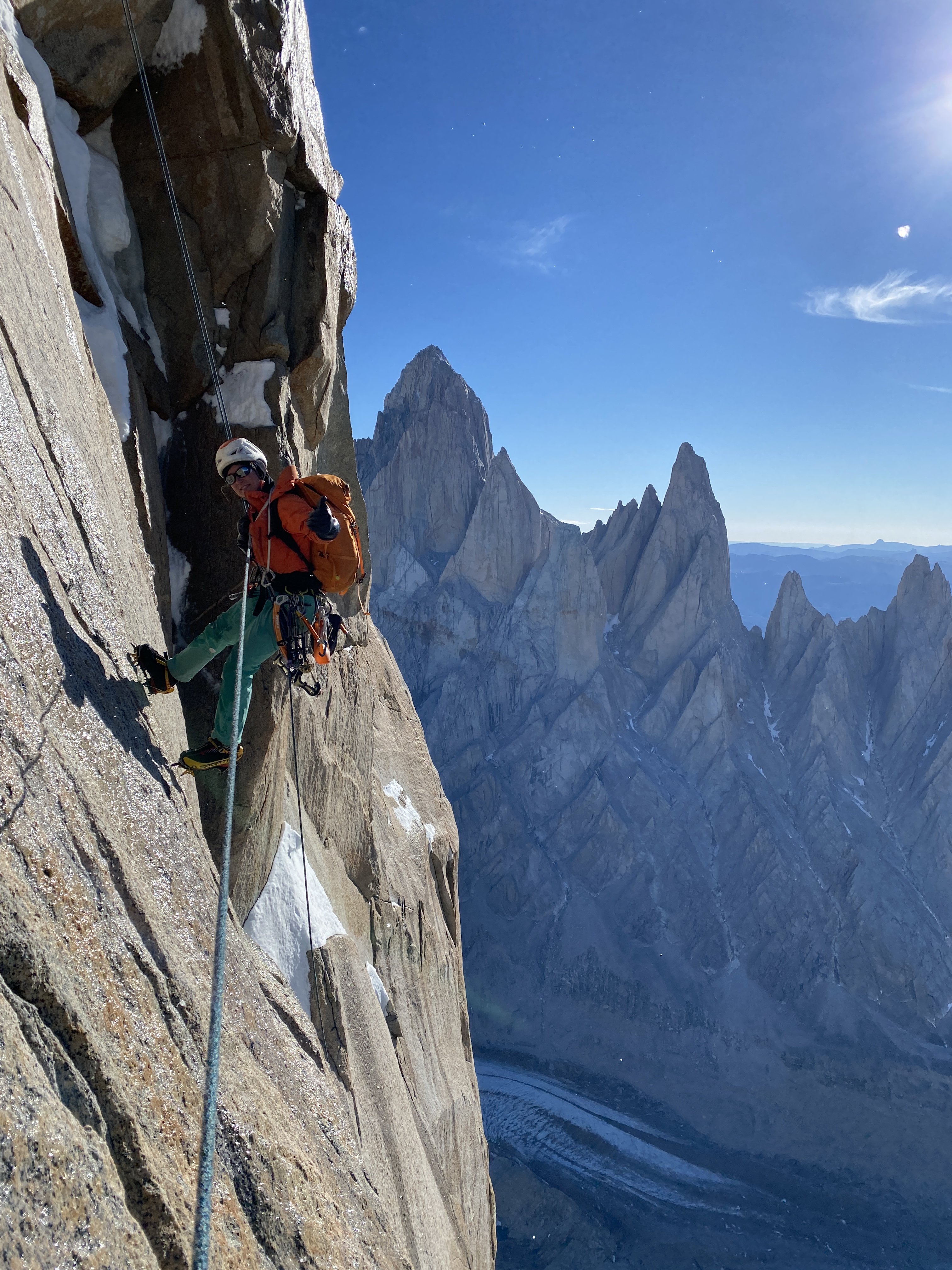
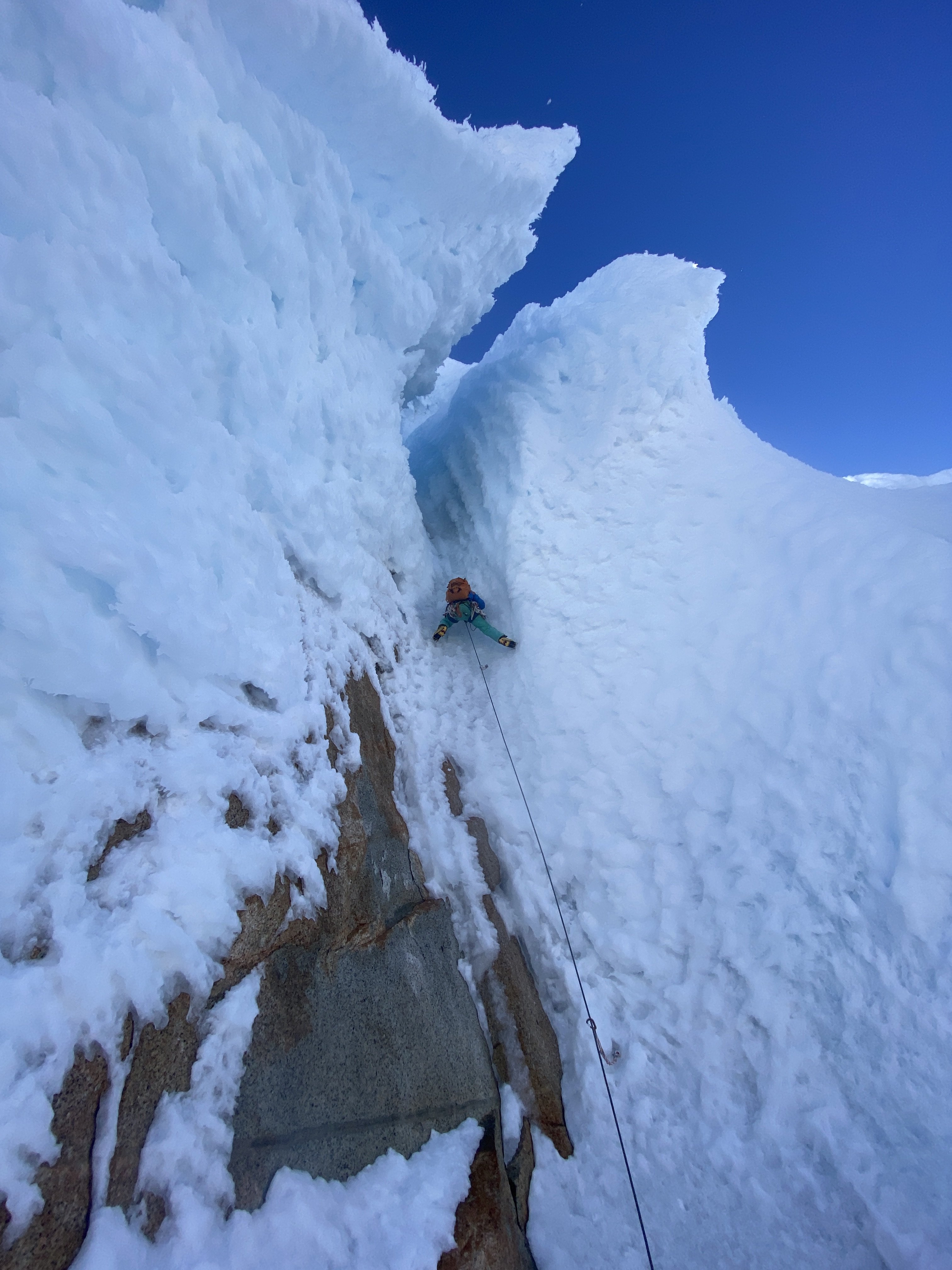
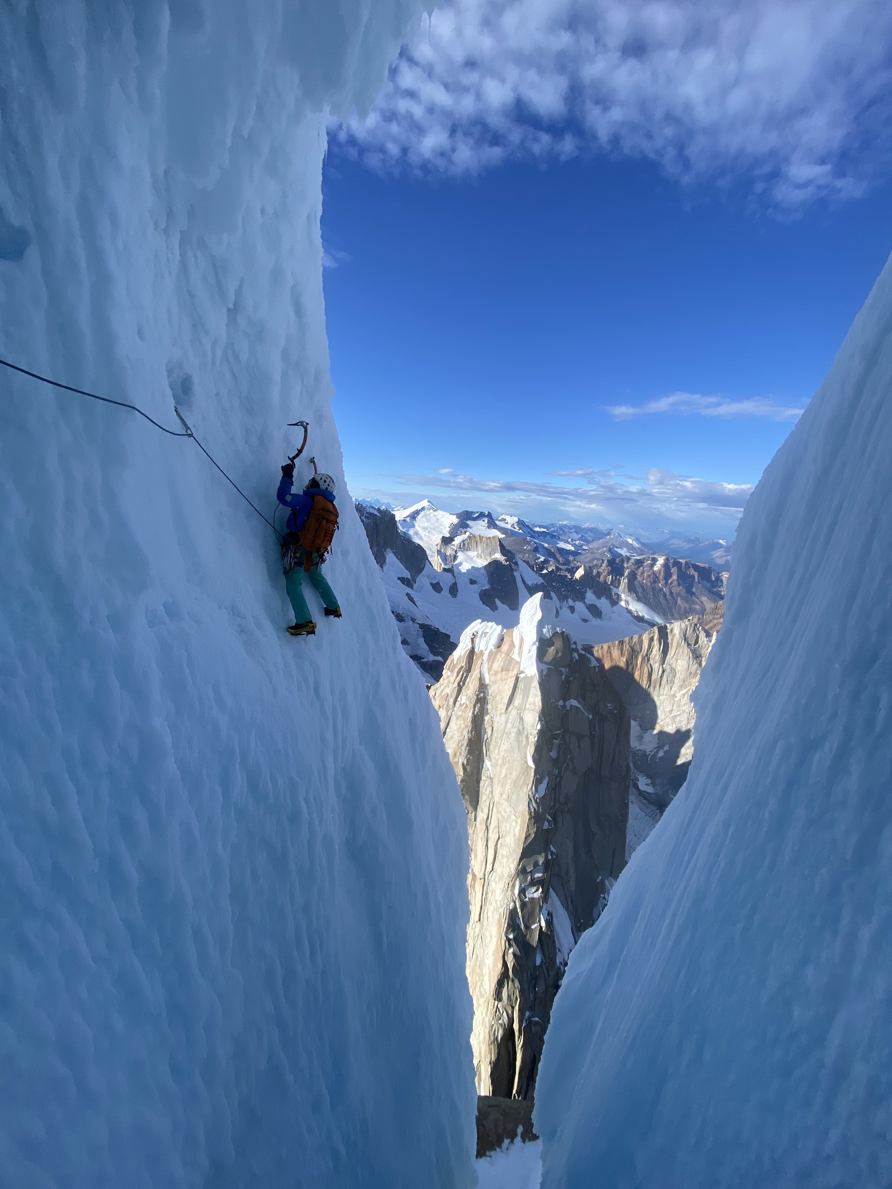
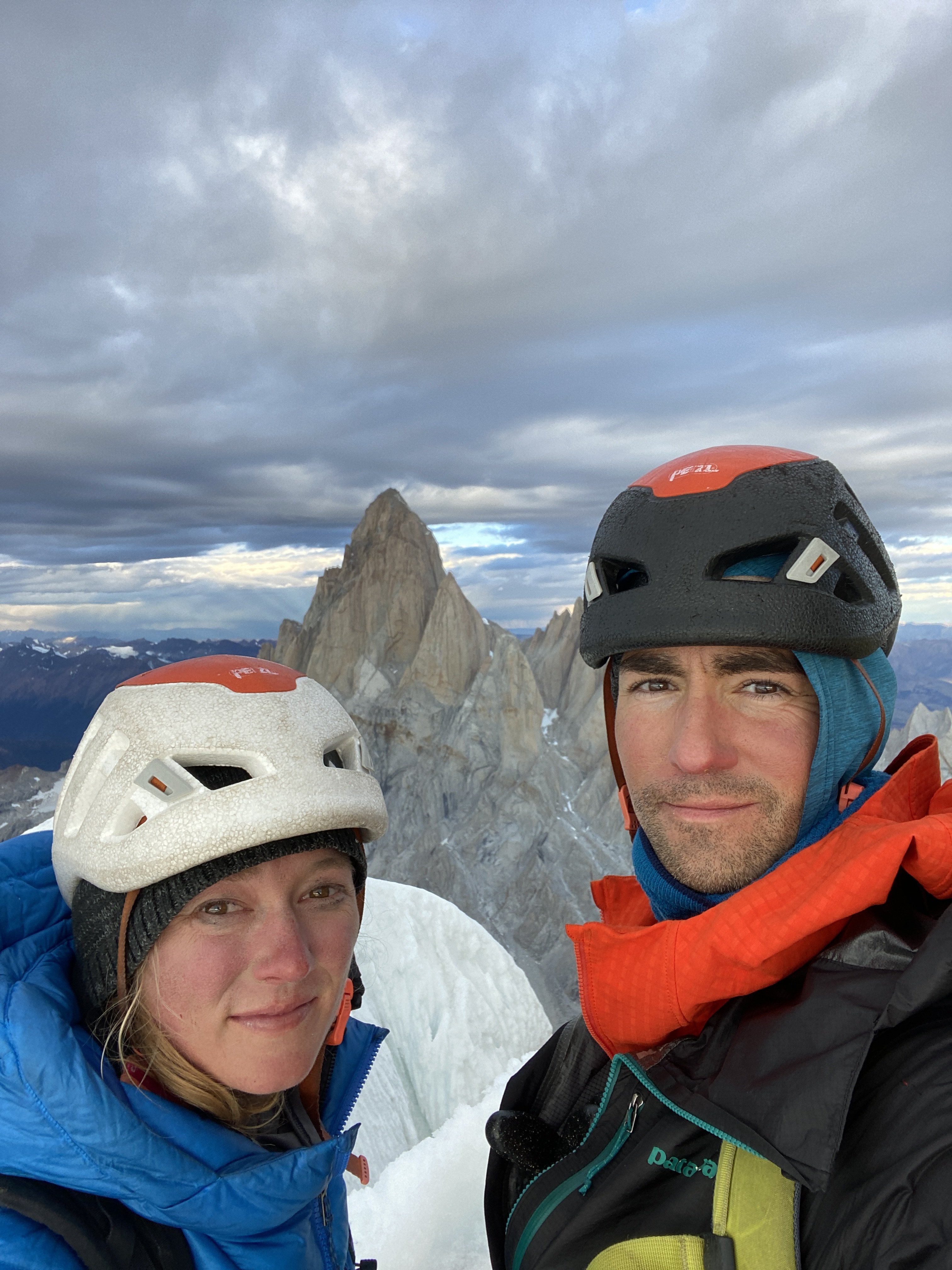
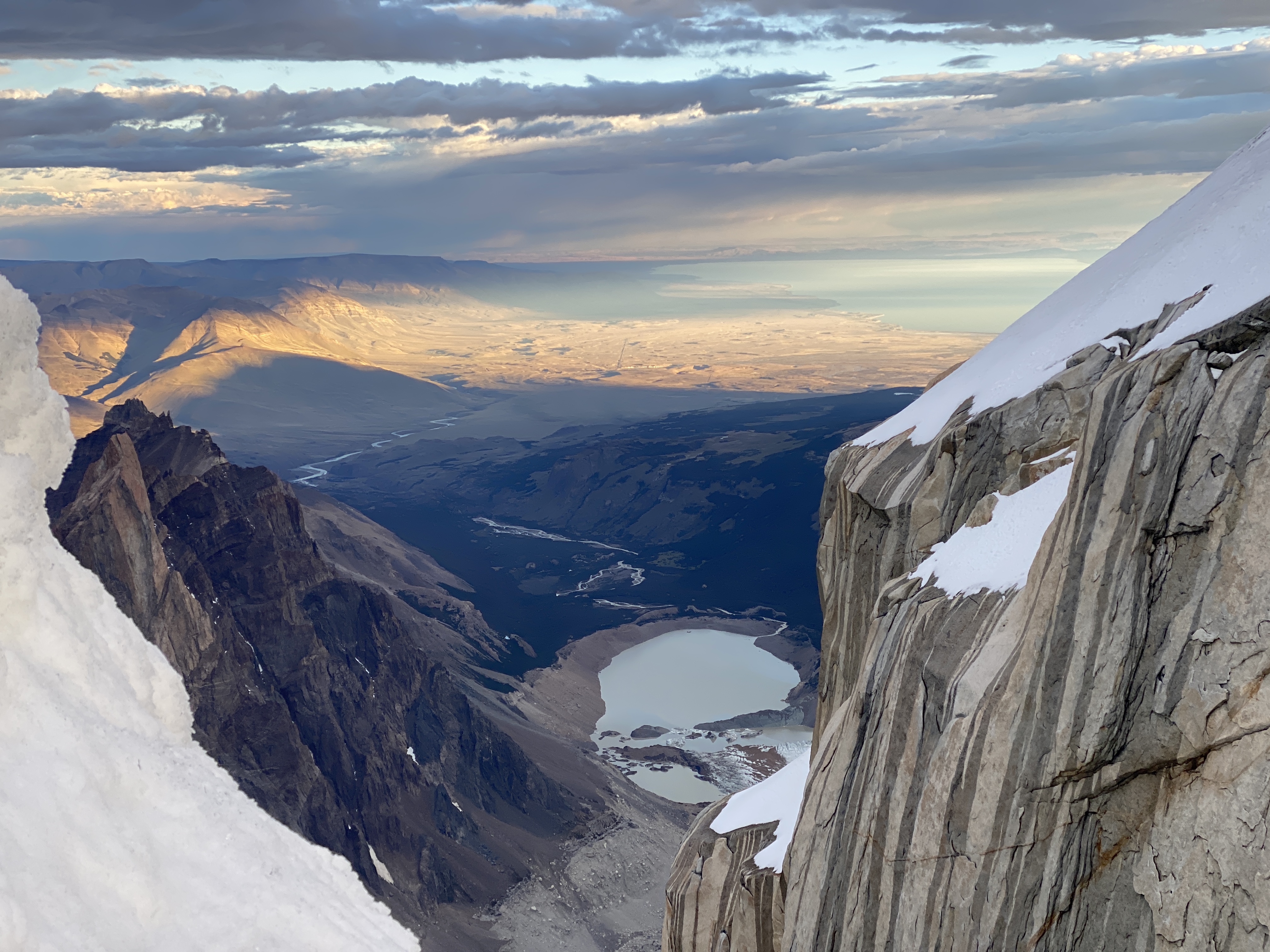
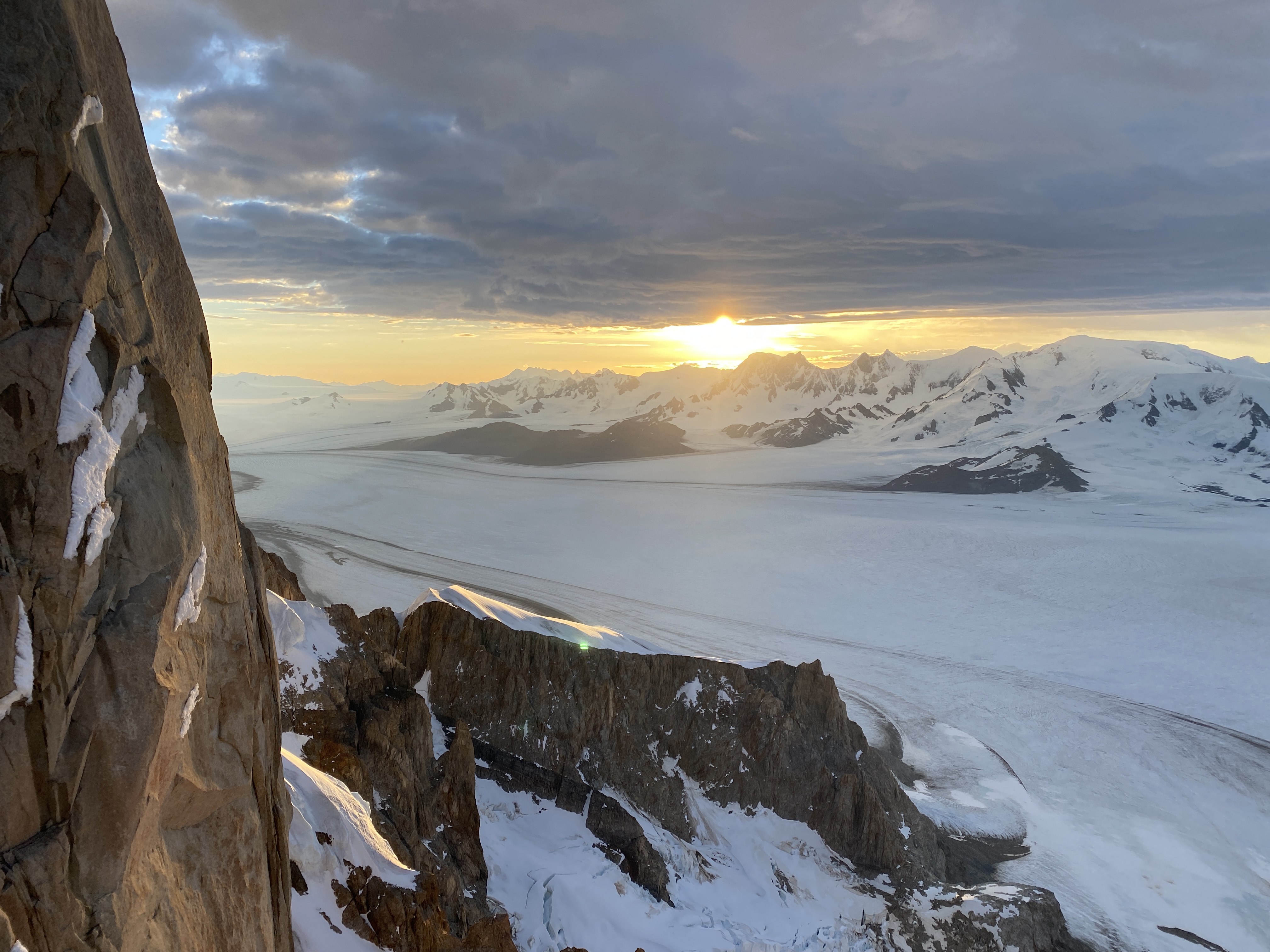
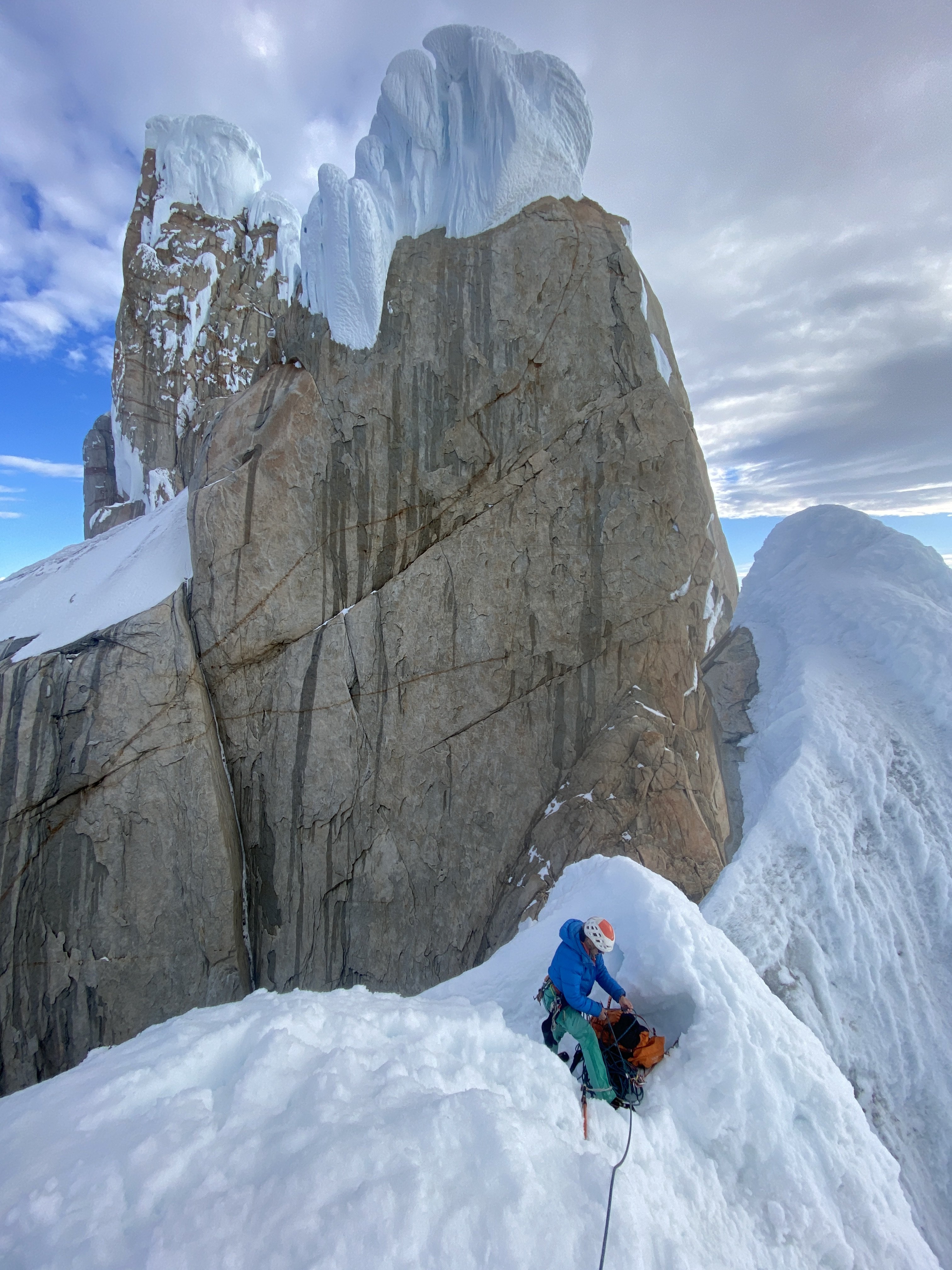
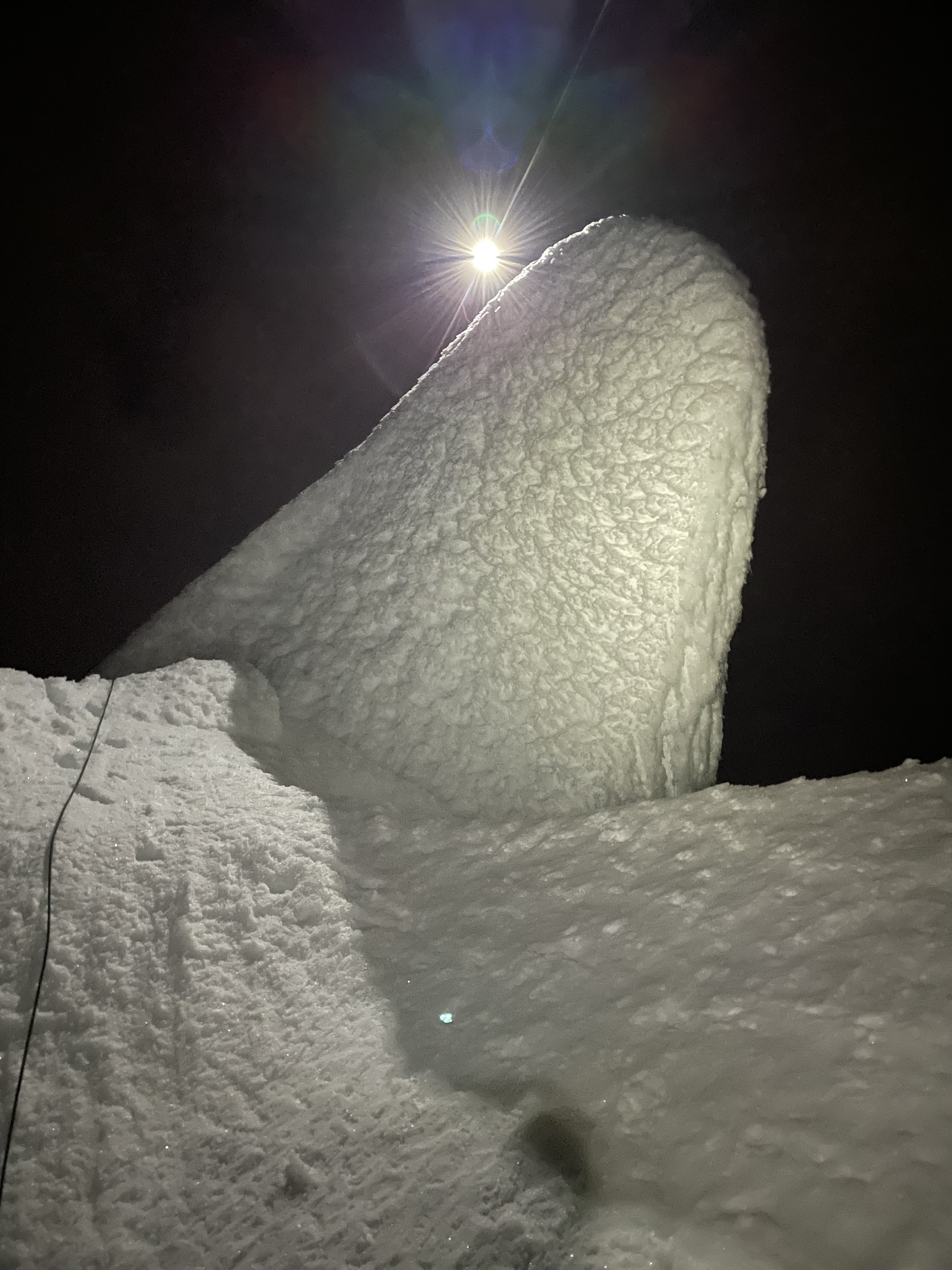
Trip: Patagonia - Torre Egger Smash 'n Grab - Huber-Schnarf Trip Date: 01/21/2022 Trip Report: Climbers: Jeff and Priti Wright Location: Patagonia - Chaltén Massif - El Chaltén, Argentina Traverse of 3 peaks: Aguja Standhardt - Punta Herron - Torre Egger Climb Date: January 18, 2022 - January 21, 2022 Full Trip Report: https://alpinevagabonds.com/torre-egger-traverse-a-smash-n-grab-story/ Climbs/Rappels Aguja Standhardt Climb via the North Ridge route Festerville (400m 90° 6c) in 15 pitches (14 pitches of rock and 1 pitch of rime ice) from Col Standhardt Aguja Stanhardt Rappel via South Face (7 Rappels) Punta Herron Climb via North Face route Spigolo dei Bimbi (350m 90° 6b) in 9 pitches (5 pitches of rock and 4 pitches of snow+ice+rime ice) Punta Herron Rappel via South Face (1 Rappel) Torre Egger Climb via North Face route Espejo del Viento (200m 80° 6a+, often referred to as the “Huber-Schnarf” route) in 5 pitches (3 pitches of rock and 2 pitches of snow+rime ice) Torre Egger Rappel via Titanic (countless Rappels, two downclimbing snowfields, and one 30m downclimb from the summit) In January of 2022, we completed another Patagonian “Smash ‘n Grab”, summiting three of the four peaks in the Torre Range via previously established routes (11 days Seattle-to-Seattle): Aguja Standhardt, Punta Herron, and Torre Egger. Including our ascent of Cerro Torre in 2020, we have now climbed all four summits of the Cerro Torre skyline, making Priti the first female to summit all four peaks. 2022 marked our fifth climbing trip to El Chaltén. In 2019, we completed a 10 day Smash ‘n Grab of Cerro Chaltén (Fitz Roy). In 2020, we spent two months in El Chaltén, during which time we climbed Cerro Torre on the route Via dei Ragni. Urgency and several parties in line behind compelled us to accept a top-rope on the final pitch of the summit mushroom of Cerro Torre, joining the conga line. Pink: The accidental line we took on wet, grimey terrain....oops (not recommended); Blue: the original route Festerville on golden granite Their 2022 traverse from Aguja Standhardt to Torre Egger enchained three distinct climbing routes (all established by different parties), climbing for four days and three nights, bivying twice on Standhardt and climbing through the third night up-and-over Torre Egger. After arriving in El Chaltén, we cached a tent at the standard Niponino Base Camp, carrying a tarp and a double sleeping bag for the traverse. We started on the route Festerville (400m 90° 6c) which follows the spine of the North Ridge of Aguja Standhardt for approximately 13 rock pitches. Another team of two (Michał Czech from Poland and Agustín de la Cerda from Chile) started up the route ahead of us and the four effectively joined forces, climbing symbiotically, each team helping the other along the way. After summiting Cerro Standhardt via 30 meters of 90° ice and rime, Michał and Agustín rappelled the Exocet route back to Base Camp while we (Jeff and Priti) made seven rappels down the South Face of Cerro Standhardt, continuing the traverse. The South Face rappels end 30 meters below the Col de los Sueños (the col between Standhardt and Punta Herron), requiring climbing the final 30m of the route Tobogán to reach the col. The traverse continued up to Punta Herron via the route Spigolo dei Bimbi (350m 90° 6b) climbing 5 pitches of rock and another two pitches of beautiful, vertical ice and rime to the summit. A single rappel from the summit of Punta Herron led down to Col de la Luz under the North Face of Torre Egger. Spigolo dei Bimbi included some of the most fantastic rock climbing that we have ever climbed in Patagonia! From Col de la Luz, we continued up the route Espejo del Viento (200m 80° 6a+, often referred to as the “Huber-Schnarf” route) in the dark of night for three rock pitches which ends in a long, run-out, wet, technical slab traverse under Torre Egger’s overhanging summit mushroom. We continued through the night, climbing two more moderate pitches up the mushroom on easier 70 degree snow and ice to the summit of Torre Egger at 2:00AM, the most difficult summit in the Chaltén massif. We continued through the night without a bivouac, descending 27 rappels and down-climbing along the route Titanic which follows the East Pillar of Torre Egger. Upon reaching the tent at Niponino in the Torre Valley after 44 hours of constant movement, we collapsed in the tent realizing we were too late to catch their planned flight home. Unfortunately, we neglected to notify anyone that we were missing our early-morning airport taxi. When the taxi arrived at our hostel Aylen-Aike, the driver woke up Korra Pesce who was sleeping in the room where we had previously slept. Korra notified the hostel owner Seba and Rolando “Rolo” Garibotti who were all quite worried and proceeded to notify rescue teams. Later that morning, Rolo successfully contacted us on our inReach before any rescue efforts began, teaching us a valuable lesson: let people know if you're going to be late! A week later, a team of bold volunteers attempted an unsuccessful rescue of Korra Pesce, the legendary French-Italian Alpinist, on the North Face of Cerro Torre who will be sorely missed by his friends, family, companions, and fans. Being back at home in the US by the time the accident occurred, we wished that we had been present to aid the operations. The 2021/2022 Patagonia season was marked by several notable deaths and rescues in the mountains as well as several celebrated new climbs. Patagonia continually demands of its visitors the humility that this place deserves. We really want to thank Rolando Garibotti and Colin Haley for their beta, support, and encouragement; Agustín and Michał for being a great team to partner with as we shared the same objective on Cerro Standhardt; Aylen-Aike for putting us up at the last minute in El Chaltén; Hector Tito Soto Nieto and Andrew Reed for loaning us your cams (we decided what route to do while on the airplane); our bosses and work colleagues for letting us go for a week with hardly any notice; Ilia Slobodov for the awesome weather updates while on route; and Kelly Cordes for the rad Patagonia gear. Priti on the summit of Torre Egger, 2:00AM. Time to rappel. Gear Notes: 2x Camalots to #1, 2x TCUs, 1x Camalots to #3, 6 ice-screws, a set of stoppers, and deadman stuff sack (substitute a jacket instead?) to rappel off of Torre Egger (or a retrievable ice tool anchor or downclimb) Approach Notes: Approach as for Col Standhardt

 3 points
 -
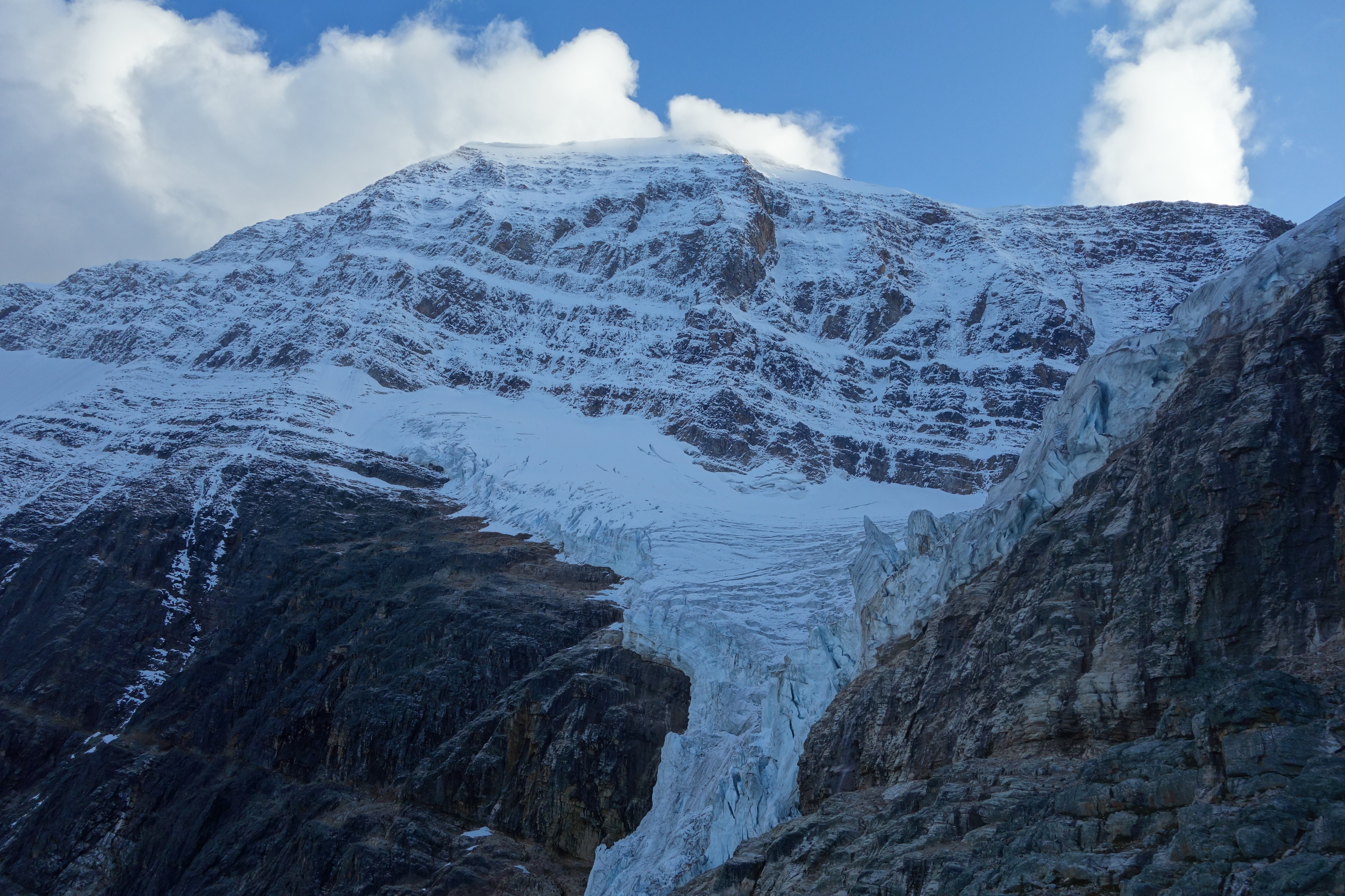
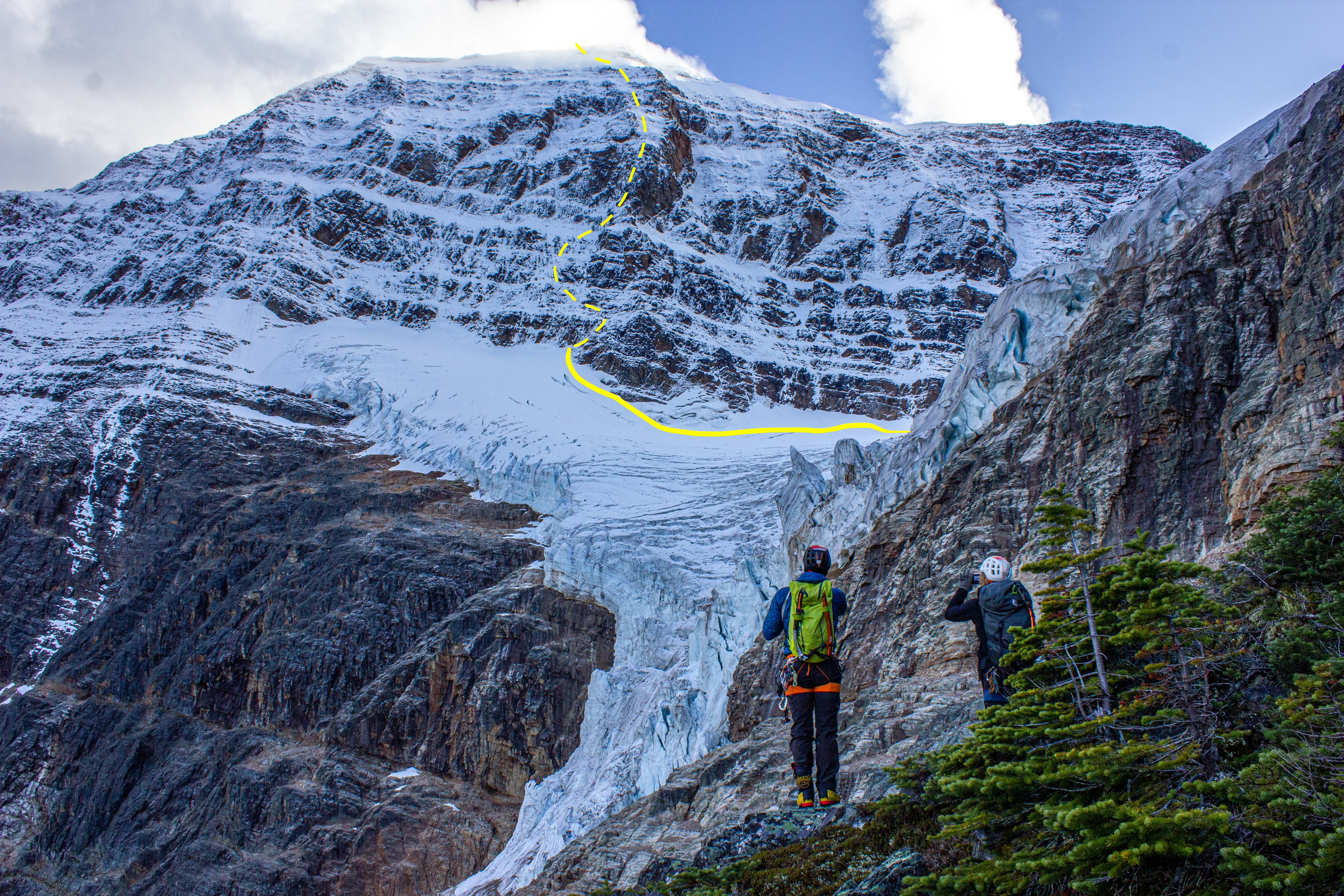
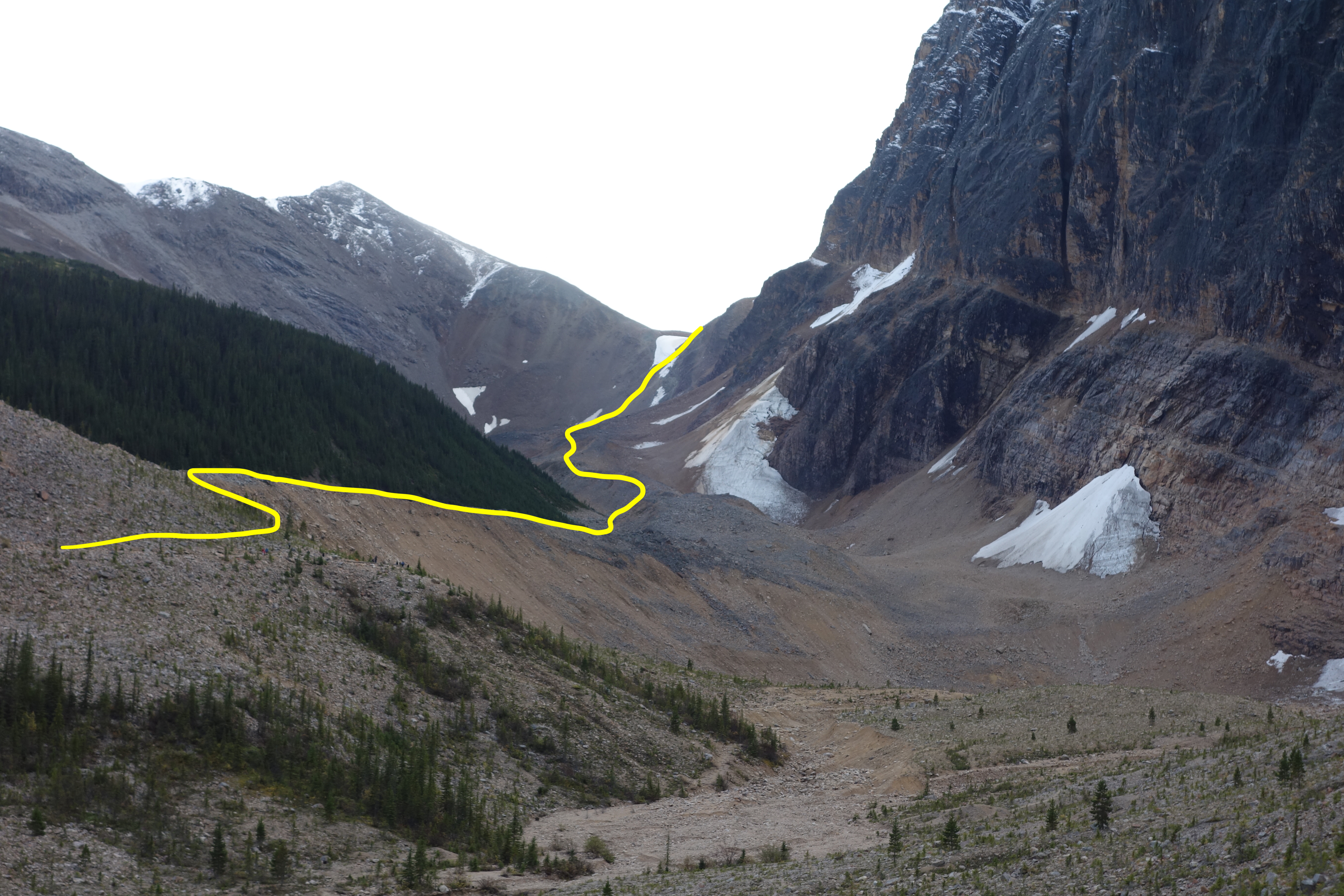
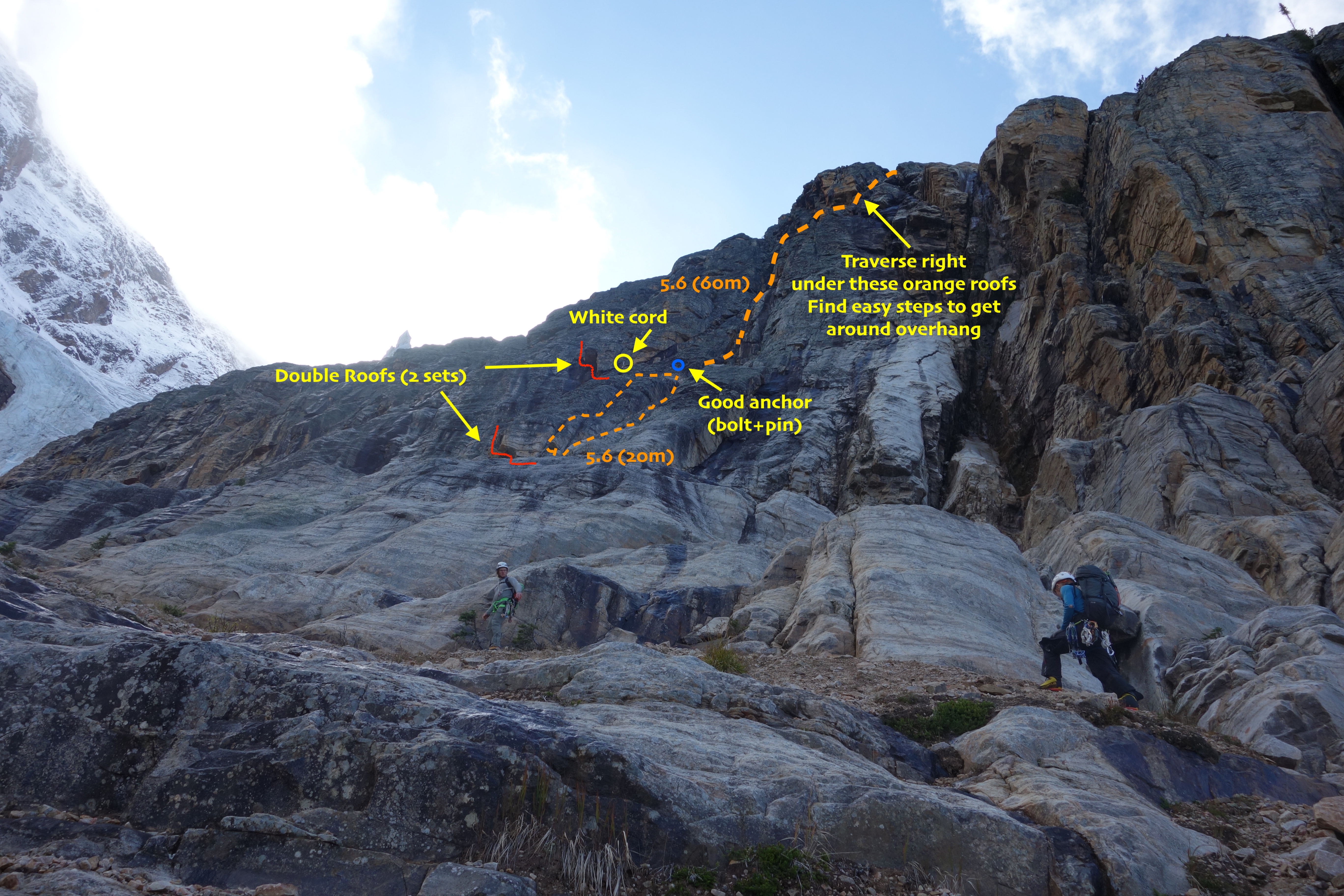
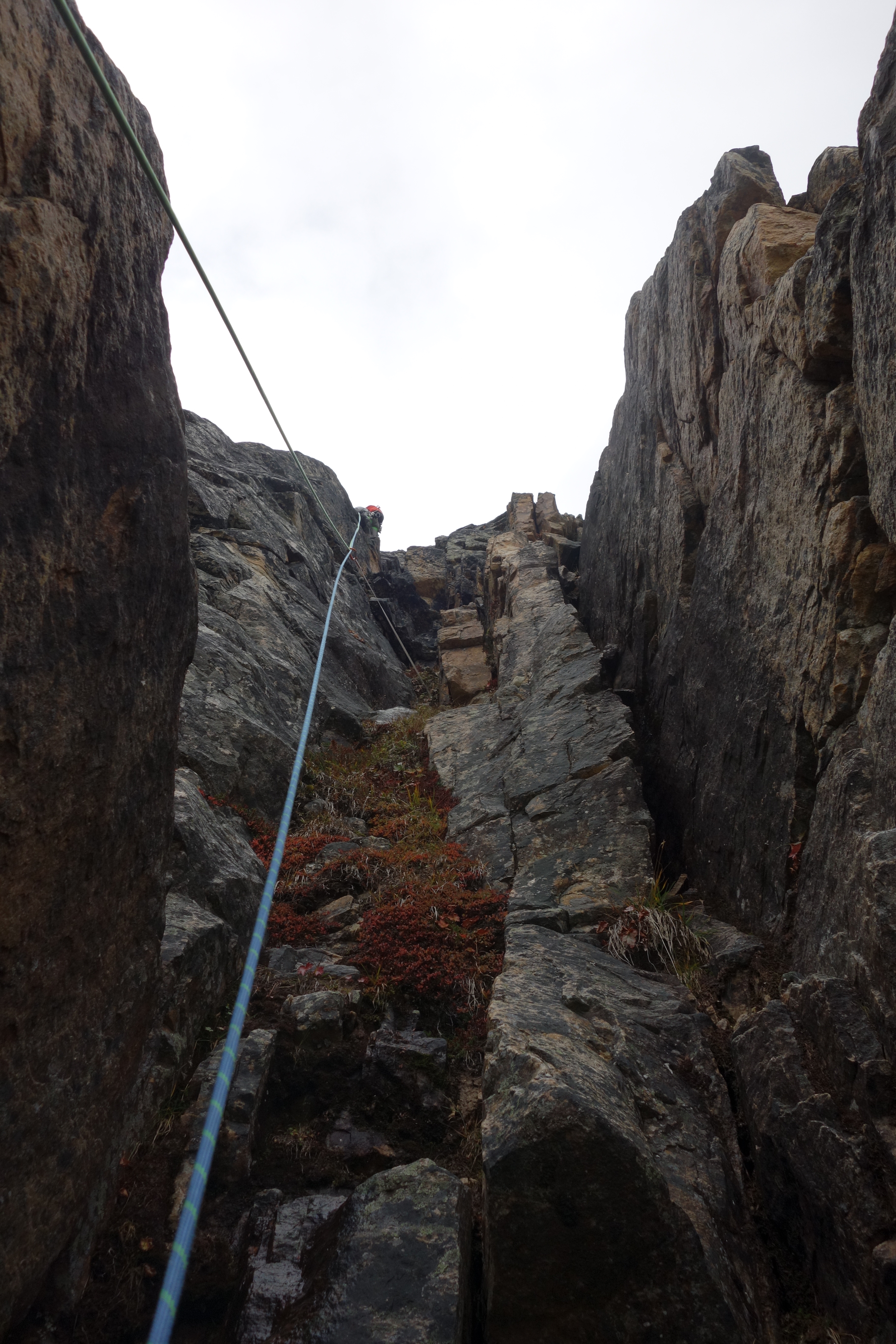
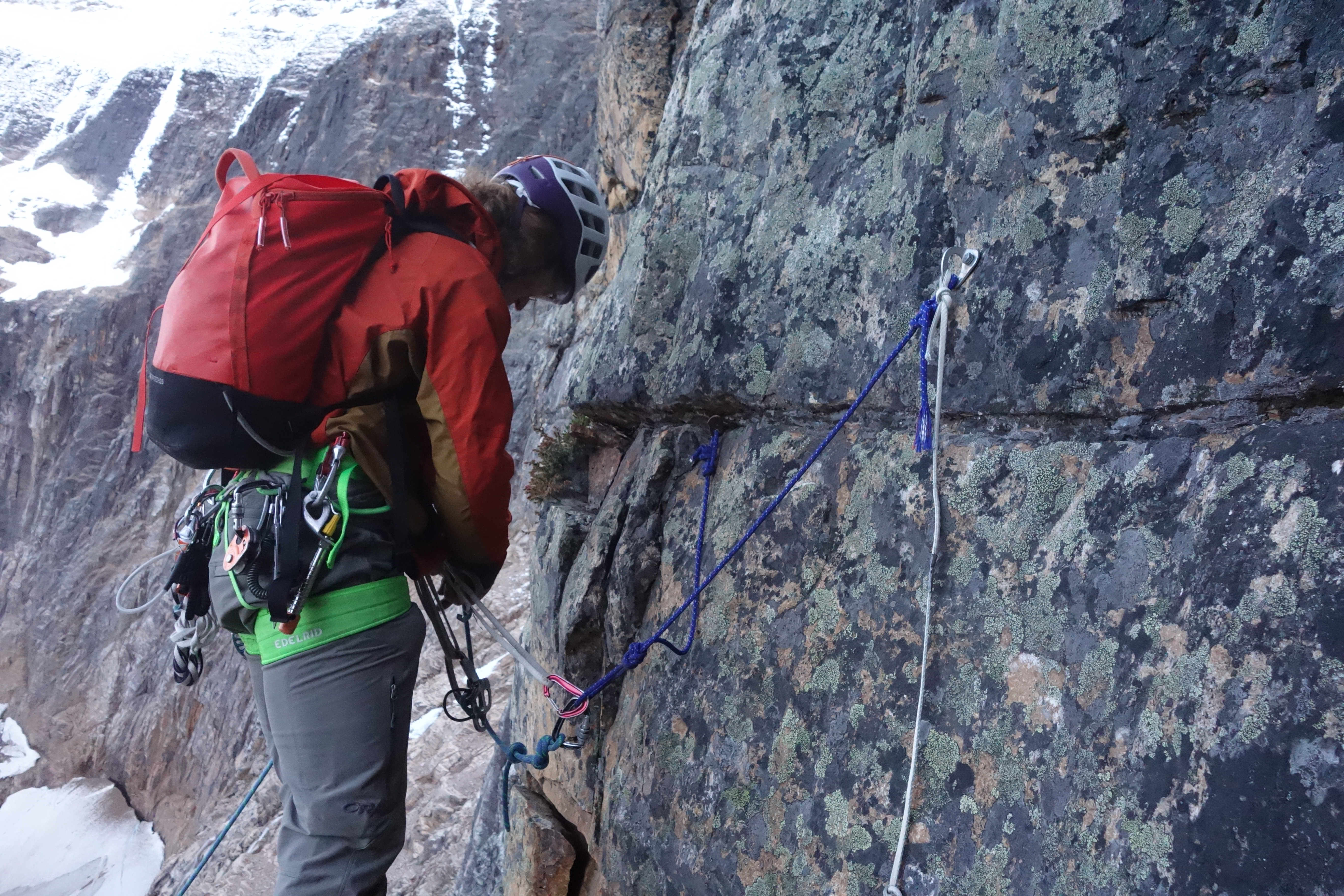
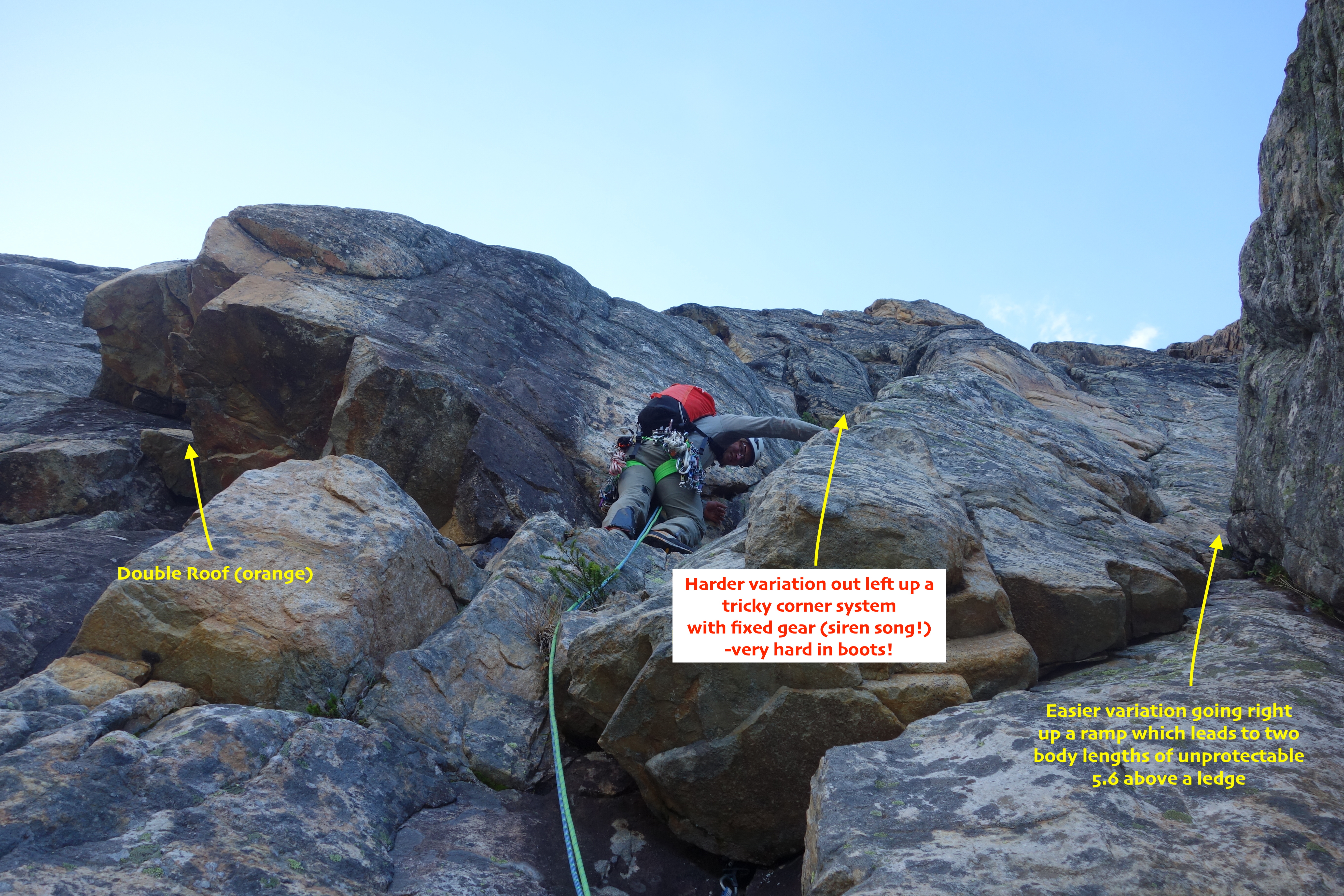
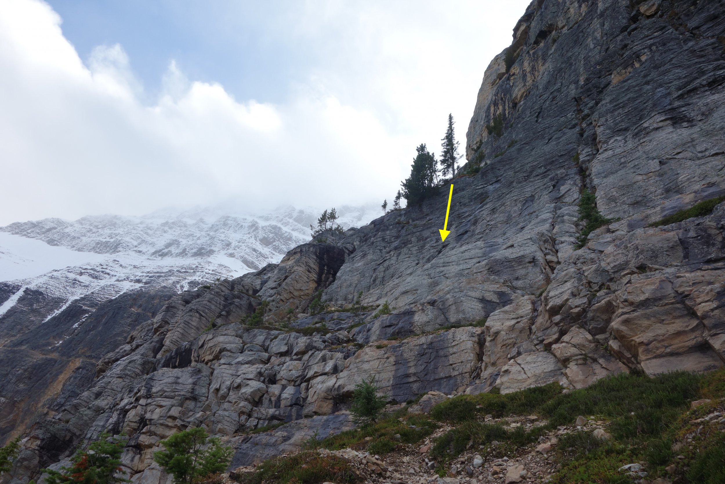
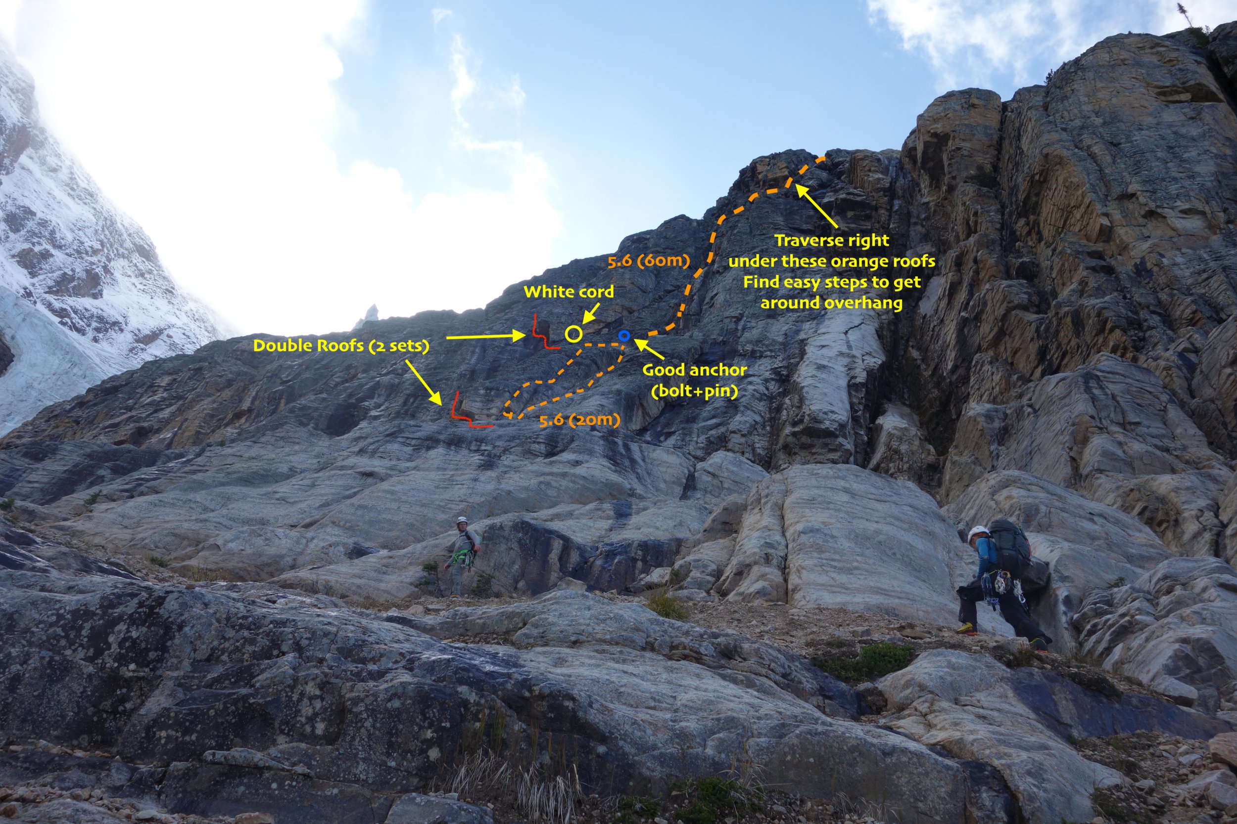
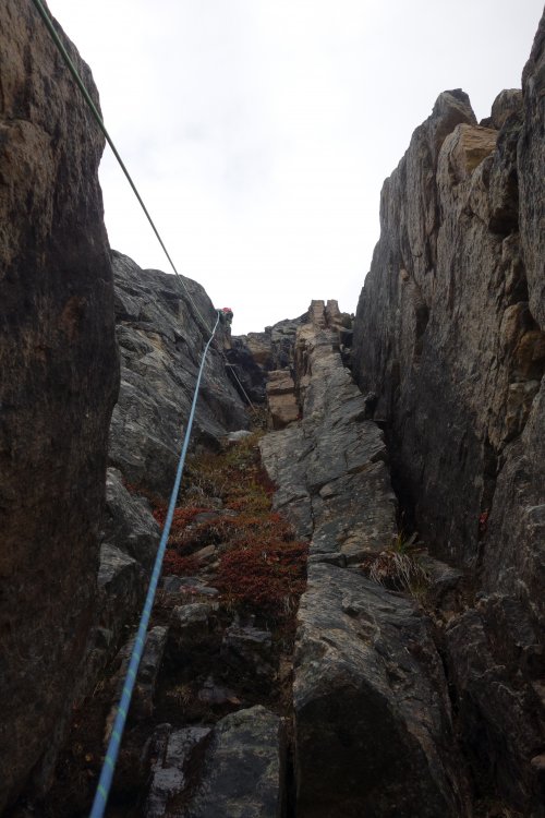
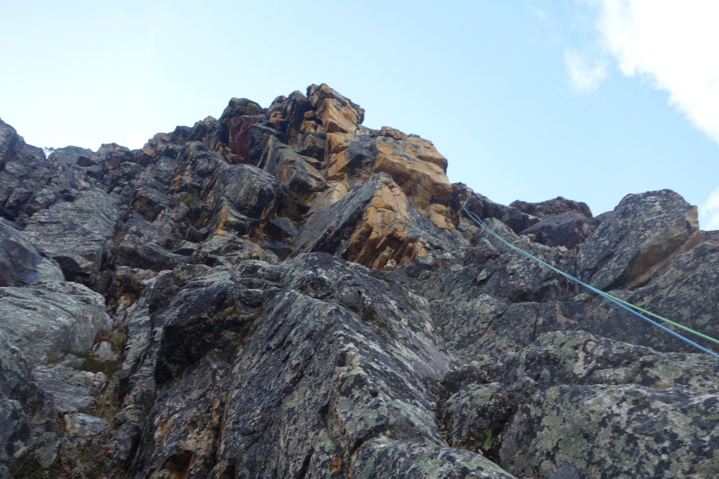
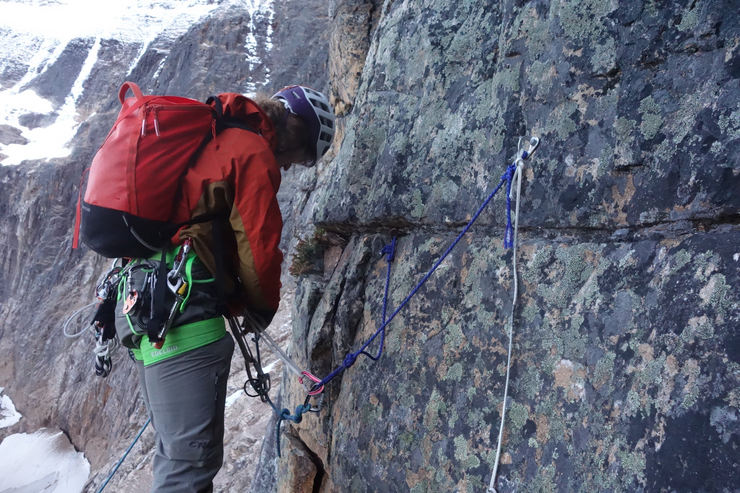
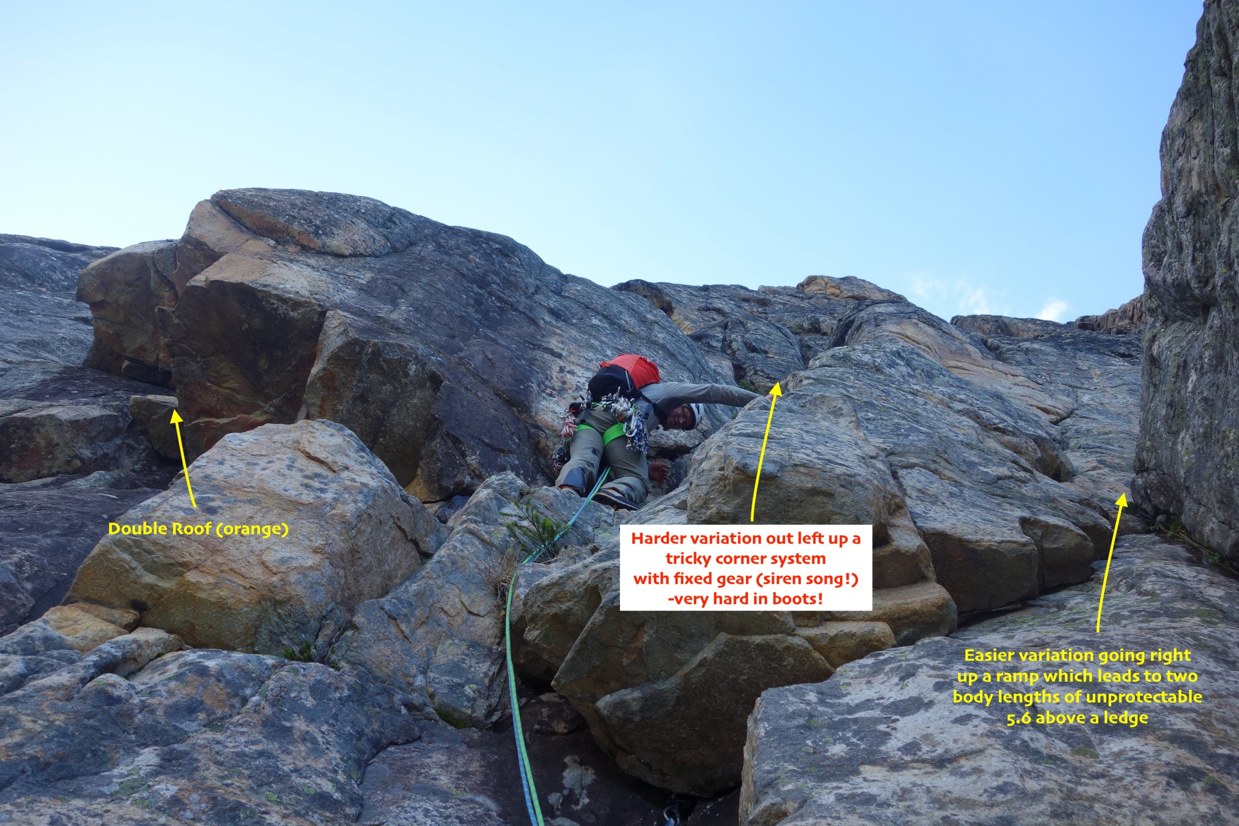
Trip: Mount Edith Cavell - North Face (Chouinard/Beckey/Doody) - Attempt Trip Date: 09/22/2019 Trip Report: Climbers: Jeff and Priti Wright, and Dane! High Point: Bergshrund at the base of the wall, above the Angel Glacier One of North America’s great mountain faces. The original North Face route on Mount Edith Cavell (near Jasper, Canada) takes the central line up the face to the summit. This was a Smash n Grab attempt from Seattle after watching weather and conditions for a month. I think we nailed it on both counts, which alone was a good lesson. We were joined by our friend Dane who has been climbing in the area for a month long trip and whom we met while climbing All Along the Watchtower this August. We got up to the base of the wall above the Angel Glacier bergshrund and were forced to turn around due to a crampon toe bail failure. None of us had brought spare crampon toe bails (lesson!). We're stoked to come back and try it again, now that we have the approach beta dialed. It was still a grand adventure! The typical style (which we followed) is to do the approach in a few hours by daylight to practice the routefinding on the complex 5.6 rock route up to the Angel Glacier to get around the hanging seracs. Then, come back to the car, sleep, and start over again at O-dark thirty to go for a car-to-car push in a day. This avoids bringing bivy gear up the wall. It was humbling and awesome just to get up to the base of the wall, stand on its bergshrund, and look up into the dimly moonlit vertical darkness with packs full of metal and desire. On the attempt in the dark, it took 4.5hrs to get from the car to the bergshrund. We had left two fixed ropes and top rope solo'd to avoid re-leading it. If I came back with a single rope, I would fix the 60m single rope from above the chimney (leave an anchor) to get all the way to the bottom of the 5th class start, then re-lead the final 25m again in the dark. The route is commonly climbed in July and August, which brings two hazards: 1) rock fall, and 2) a band of exposed, loose, unprotectable shale near the summit ridge. By waiting until late August-October, the rock is more stable, and the band of shale is covered in snow and/or ice. The downside is that snow on route makes the climbing mixed, and icy cracks can make it difficult to find protection. By late September, the approach is still dry, 5.6 rock climbing (which we did in boots). The wall, however, was all snow-over-rock, which makes the 5.7 rock on the wall a mixed experience in crampons and ice tools (instead of rock climbing with rock shoes in the summertime) . This TR only describes the approach. The original route took 3rd class terrain to the left of the Angel Glacier ice flow. But hanging seracs now threaten much of the wall, and a new 5.6 approach route goes way right of the ice flow to gain the Angel Glacier. This route is totally safe and stays well away from the hanging seracs. The picture above is our high point along the Angel Glacier to the bergshrund, and the approximate North Face route is a dashed line (which we didn't get to do). We followed the hand-drawn topo on Mountain Project, and it was REALLY useful! https://www.mountainproject.com/photo/107268014 From the parking lot, cross the small stream and immediately gain the lateral moraine (shown above) which eventually leads up to the wall. As you approach, take note of 25m tree rappel (above your head) shown in the topo which is an alternate descent to down climbing the 3rd/4th class approach. Continue traversing on a 3rd class path for quite a ways, step across one stream from a waterfall, and continue until it forces you to start ascending up and right to a large ledge (shown in the topo). This is the same ledge which leads to the optional tree rappel descent (this tree is easy to find and is all the way climber's right along this ledge). The approach is left of a small waterfall and right of the larger waterfall (as shown in topo). Below is a picture of the tree from which you can make a 25m rappel, if descending. From the large ledge, continue up 3rd/4th class terrain (unroped) and look up for two sets of double roofs. The lower set is orange and you belay just below this. The upper is black, and has and a white cord hanging from a pin just to the right of it. This white cord is a crummy anchor, or (more likely) a redirect to the better anchor further right (one pin, one bolt). There are two options for the start, if you take the easier option (right), you won't pass by this white cord at all. Two pitches gain the upper 3rd/4th scramble. Recommend making the 1st pitch a short, 20m pitch and stopping at the bolt anchor to avoid an awkward belay further up in the chimney. The second pitch goes up a chimney (no actual chimney moves, nice feet and hands abound), and is a 60m rope stretcher with a short overhang section. Both pitches are just left of the corner waterfall shown in the picture below. The picture below also shows Priti and Dane on the big ledge (the same ledge where the tree rappel is). We had twin ropes and fixed one long 60m rope from the top of pitch 2, then fixed a short 20m rappel from the bolt anchor. This allowed us to top rope solo the route in the dark the next day with a micro traxion and skip having to re-lead it in the dark. Watch out for snafflehounds in the summer! The picture above is looking up from where you first rope up. Above is the bolt/piton anchor above the first pitch on a good ledge. If you take the right variation on the first pitch, it leads directly (and obviously) to this anchor. The second pitch looks a little different than what the topo describes (beware). Start up a chimney (shown above) for 20m to a scrambling section. Then cross right on easy terrain under large orange roofs (don't keep going up a ramp straight up, shown above). Then a short overhanging move with good feet and hands (5.6) to a large ledge with a 2-pin anchor (may require a few meters of simul-climbing to reach this anchor). You can add in a good black Totem to this anchor to back it up. From this ledge, you can unrope. You are not yet on the large ledge shown in the topo which crosses the waterfall; this is still above you. Continue straight up from the anchor on easy 4th/low-5th until you find the large ledge. Cross back right across the waterfall and continue to a large left-facing corner. Easy ledges take you well up the corner system until you can exit right on easy 3rd class steps. Don't leave the corner too early! Pass through a patch of small trees, then across a grassy patch to look up and see a large, obvious notch (easy to pick out in moonlight). Continue up scree slopes to this notch. Once at the notch, the topo recommends descending 15m, then ascending a gully. We did this, and we do not recommend!!! Loose, hard, and scary. Instead continue up a right-facing corner straight up from the notch; this looks difficult, but there are good feet to stem. Once above the corner, traverse way left to get onto the Angel Glacier. Whew! Water plan: Here you will find an optional bivy site and running water. Allegedly there is also running water at the East Ridge col. You can start from the car with just half a liter of water, fill up a couple liters at the bivy site, then fill again at the East Ridge notch (maybe). The Angel Glacier is heavily crevassed near the seracs (obviously) so you can make a wide sweep to get away from the edge. It gets a little steep when you approach the wall, but not too bad. Some reports mention that it gets tricky to cross the bergshrund in summertime. The East Ridge (recommended) is way shorter and takes you straight back to your car. This is the descent recommended to us by the Smileys. The West Ridge is much longer, with complex routefinding on easy 3rd class terrain, and forces you to walk back up the road to get back to your car. The East Ridge is mostly 3rd/4th but stays mainly on the ridgeline (shouldn't be too hard to find your way in the dark) and has a crux 5.2/5.3 section that some parties rappel. This 5.2/5.3 section is located just above the shoulder, halfway up the ridge. Below is the easy descent from the East Ridge col which takes you along the lateral moraine to a trail and back to the trailhead. Gear Notes: Pickets for the summit snow field, 4 screws (various sizes), rack to #3, nuts, 2 KB's, 2 ice tools each Approach Notes: Read above


 1 point
 -
Phil Powers describes watching Dan Culver fall near the bottleneck after summiting K2 in 1993 and attributes his death to not reflexively arresting fast enough (then letting go of his axe). Phil was a long term NOLS instructor (and later director of NOLS) and practiced self-arrest every season, all season long, with beginning mountaineering students so to Phil, his self-arrest skills were well honed and frequently practiced, ensuring they were hard wired into his reflexive muscle memory. He felt that many climbers view self-arrest as a beginner skill and once you learn it, very few continue to practice it on a regular basis. I can say from my own NOLS experience that the instructors drilled into us practicing arrest in a variety of conditions and positions (upside down head first etc), even how to arrest when you've lost your axe. It's a skill that can get rusty if one takes it for granted, and I have been surprised at times while glissading how long it can take in different snow conditions to fully arrest when I've switched over to a self-arrest position. I'm not saying this was a factor here in this specific accident, after all, he could have had a medical emergency (syncope, heart attack, stroke) that caused his fall. A simple trip on 4th class terrain can be fatal.1 point