
Leaderboard


Popular Content
Showing content with the highest reputation on 09/26/19 in Posts
-
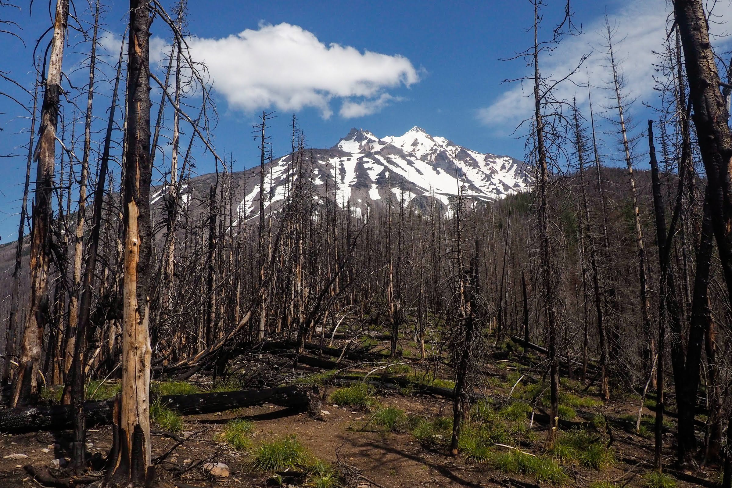
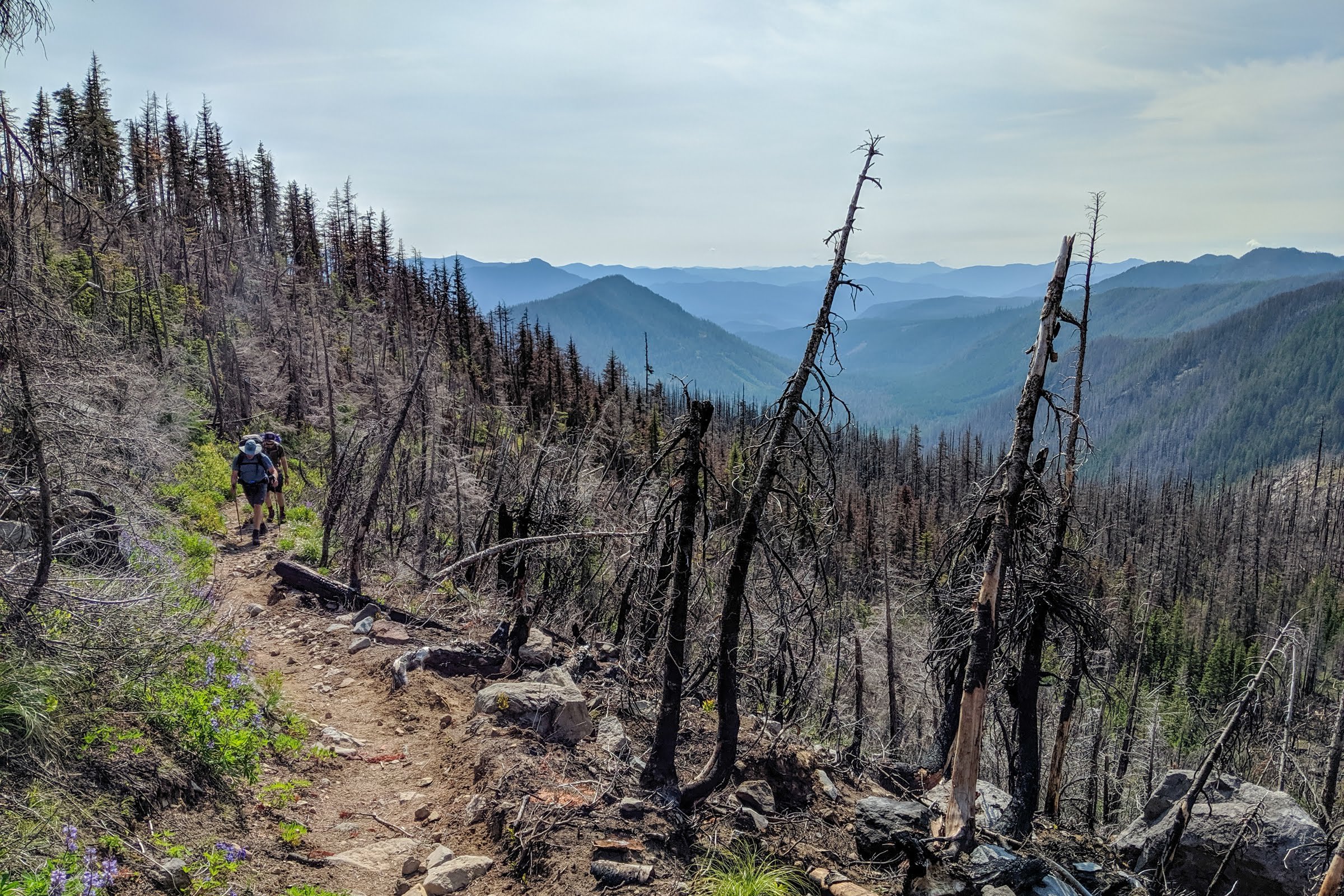
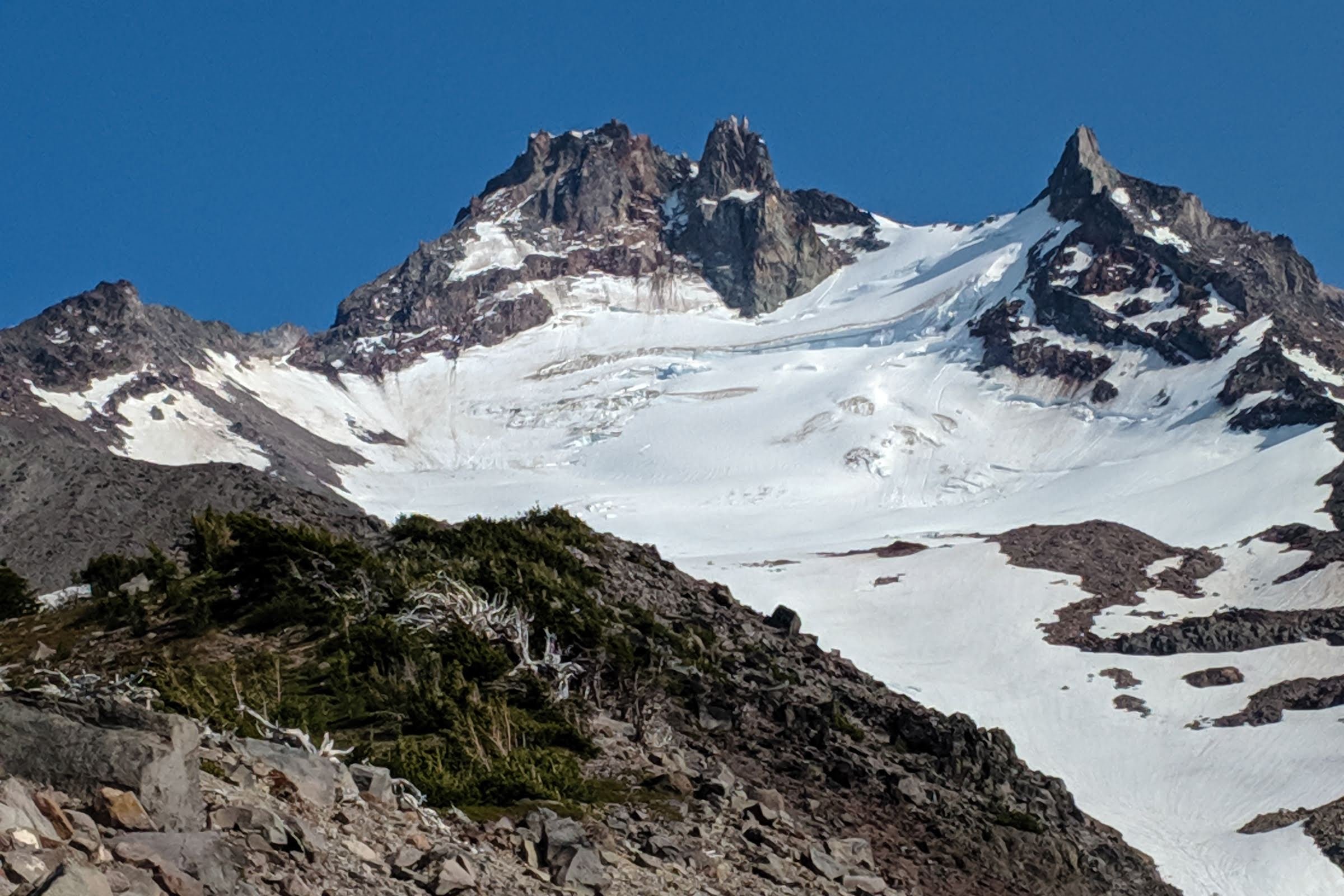
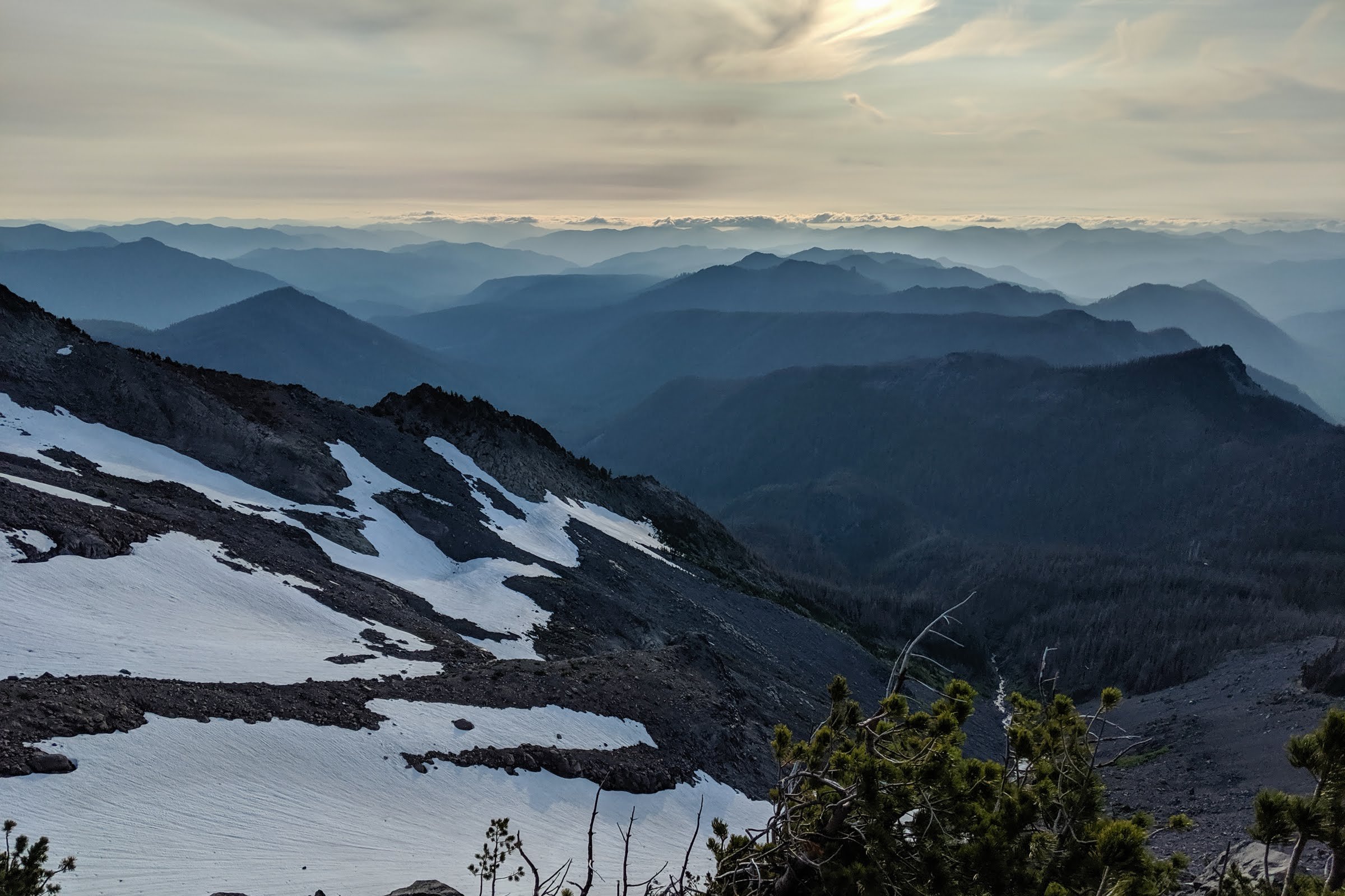
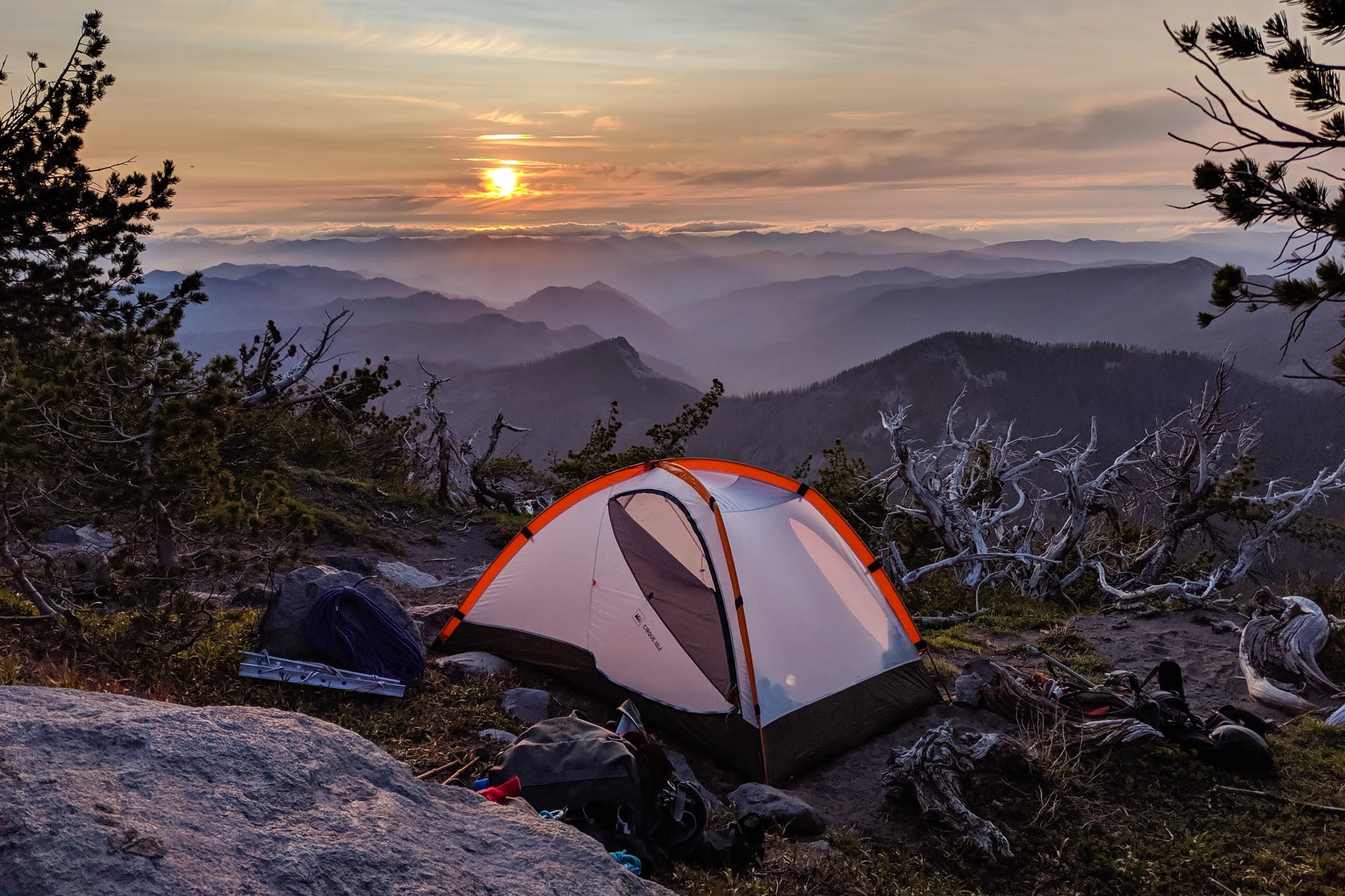
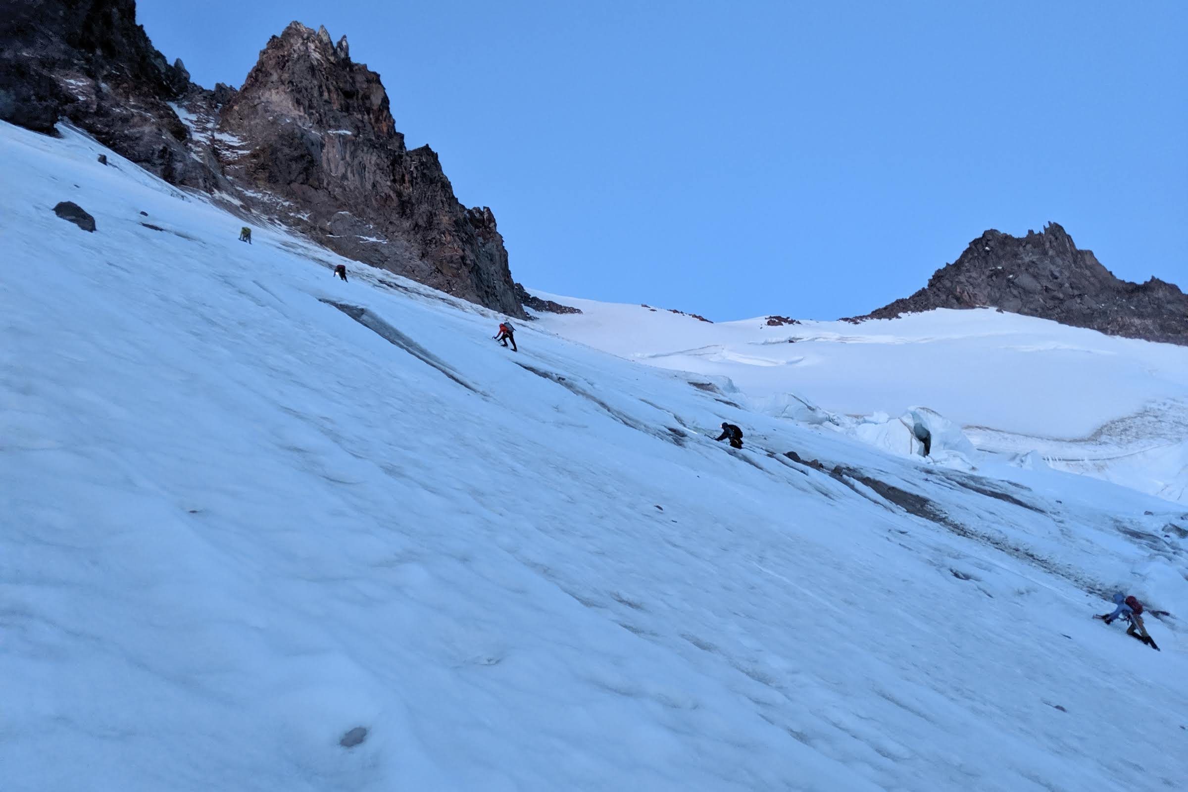
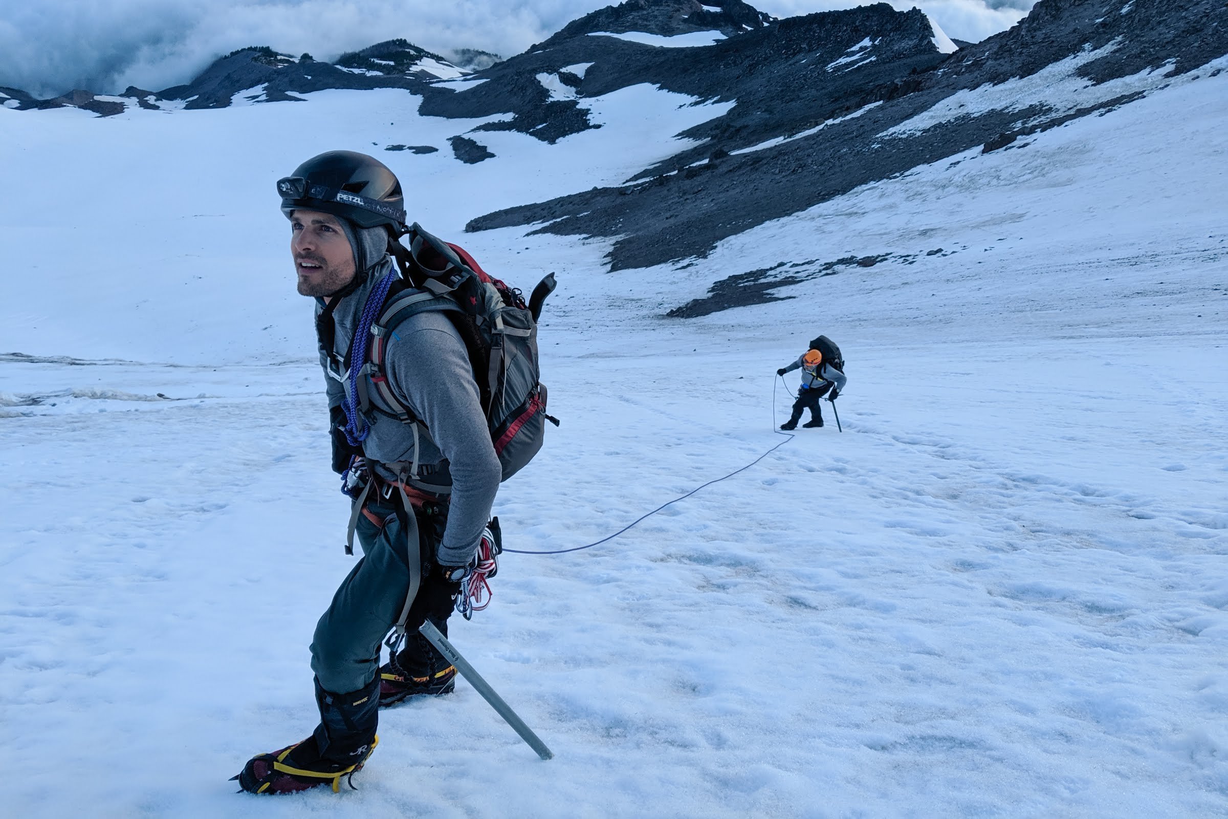
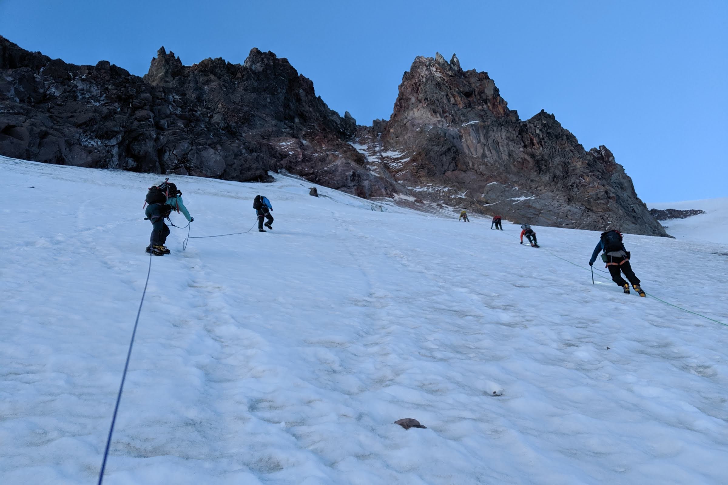
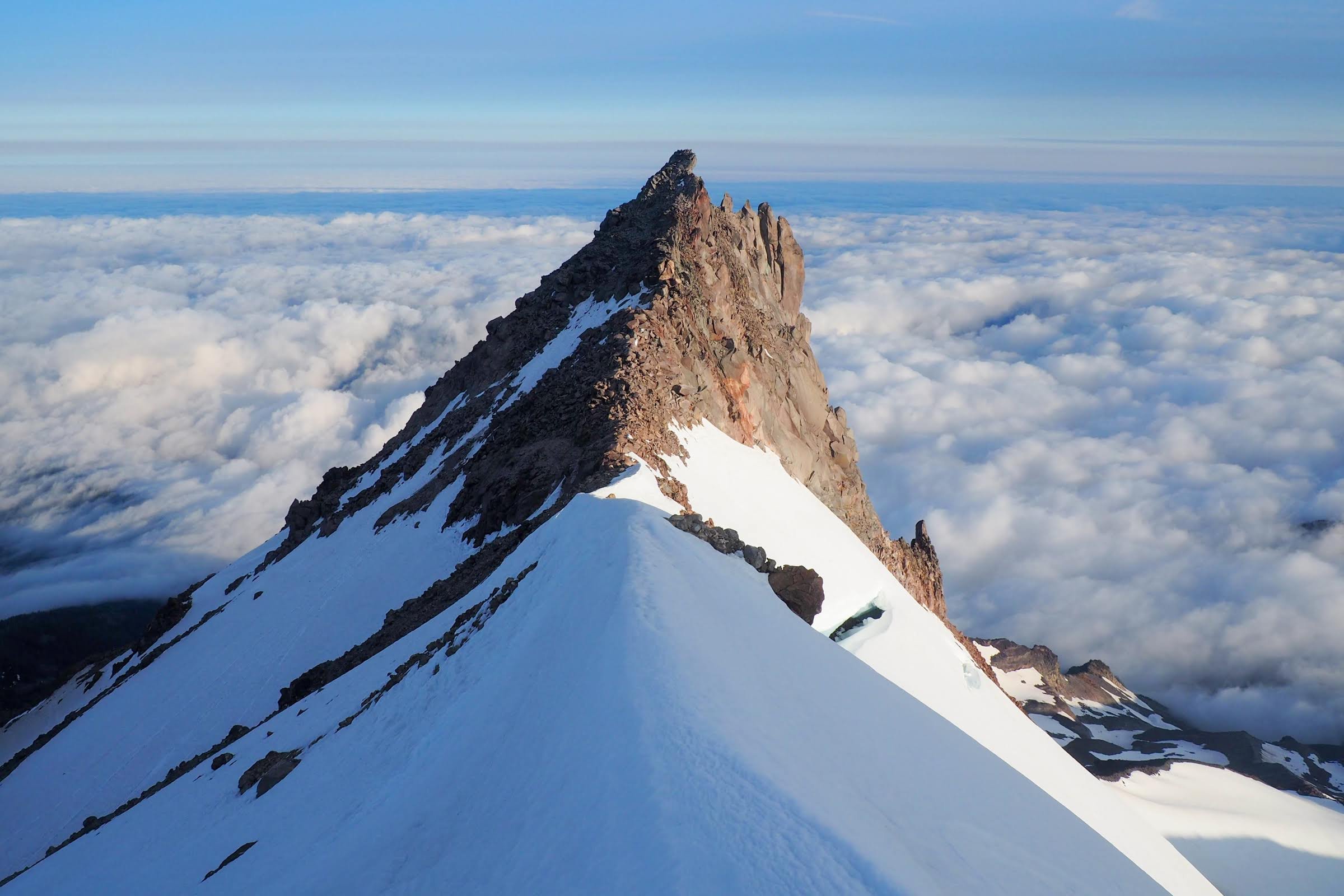
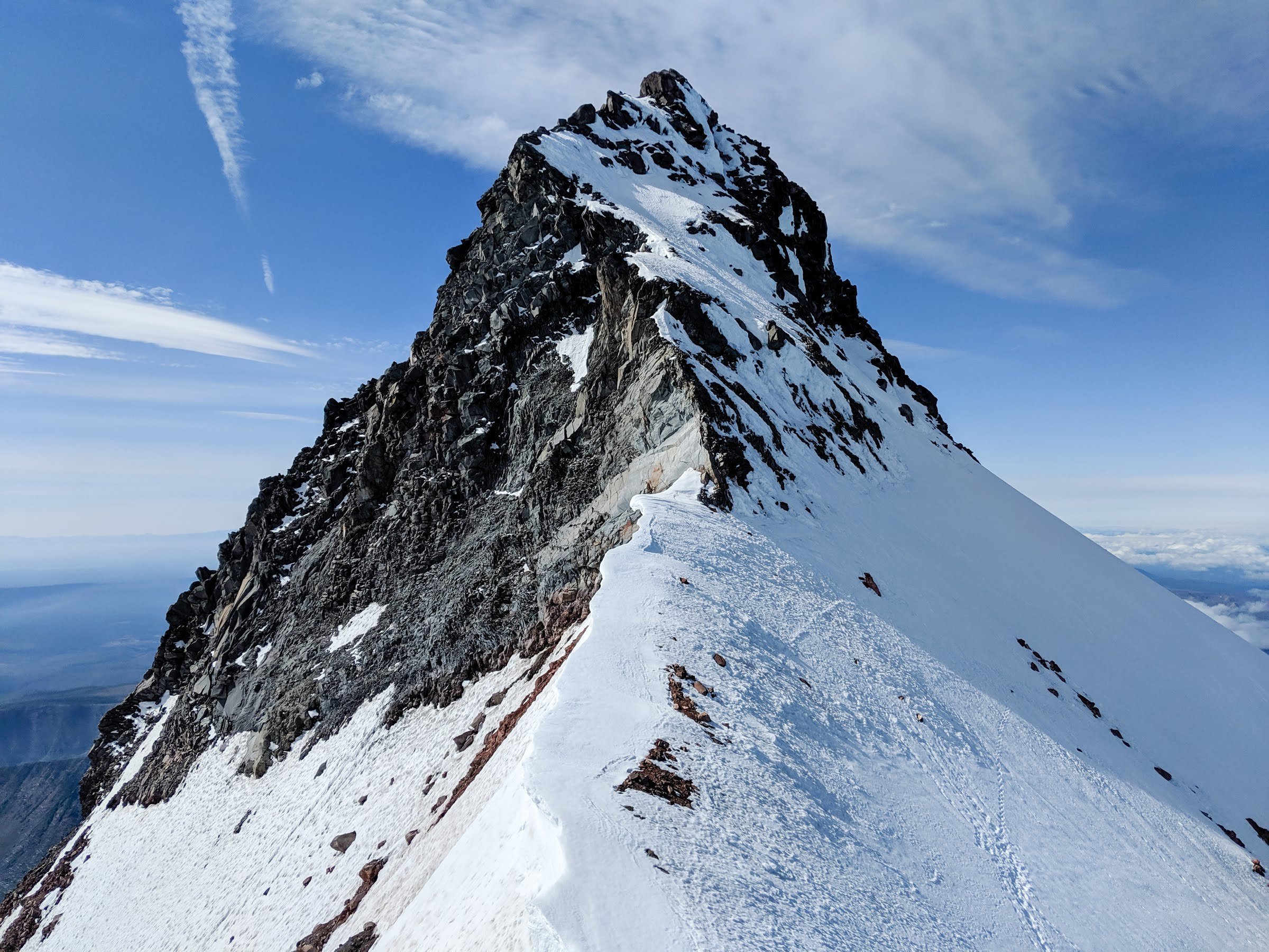
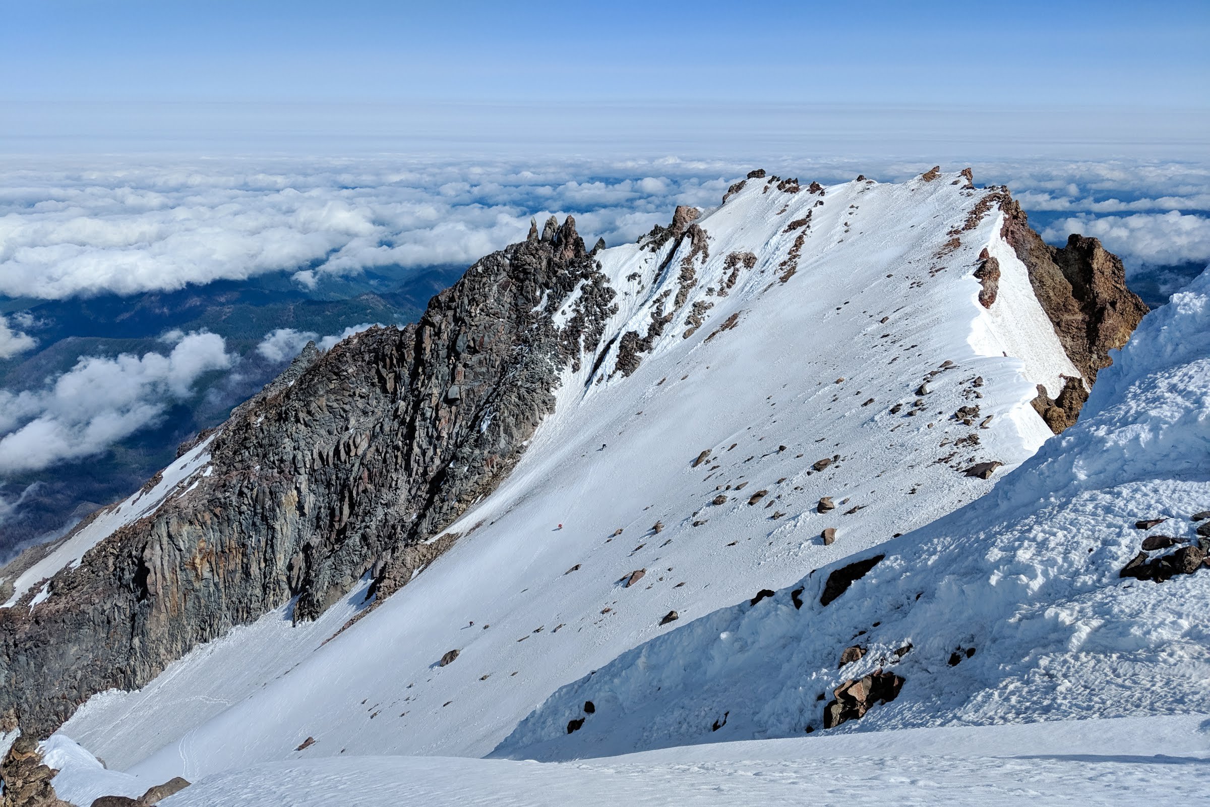
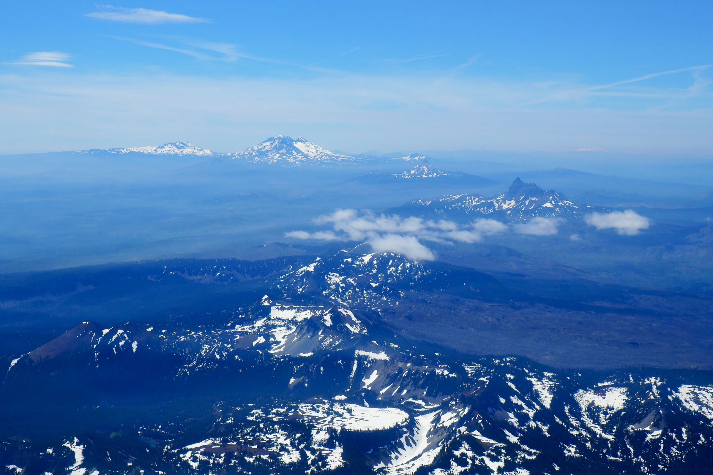
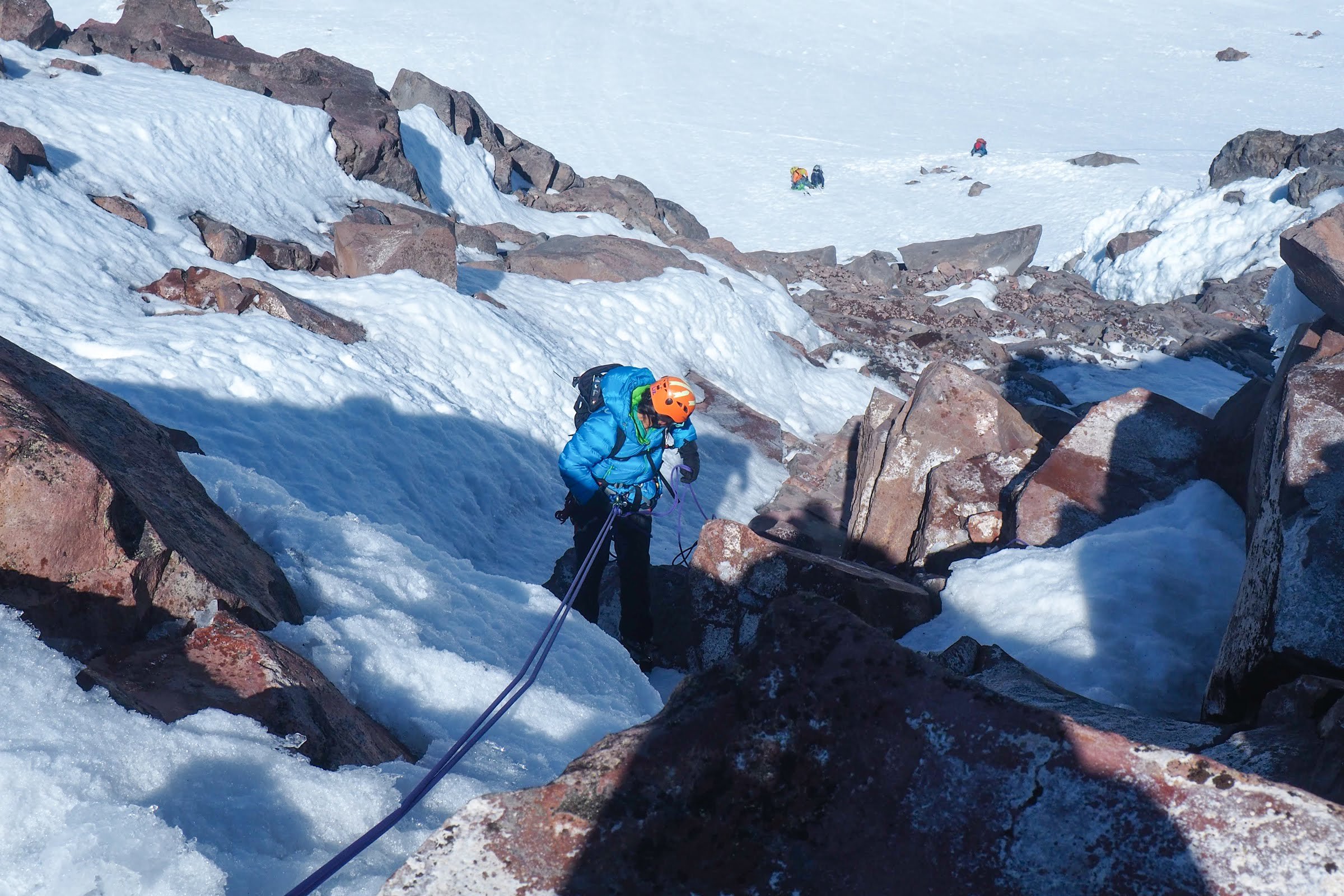
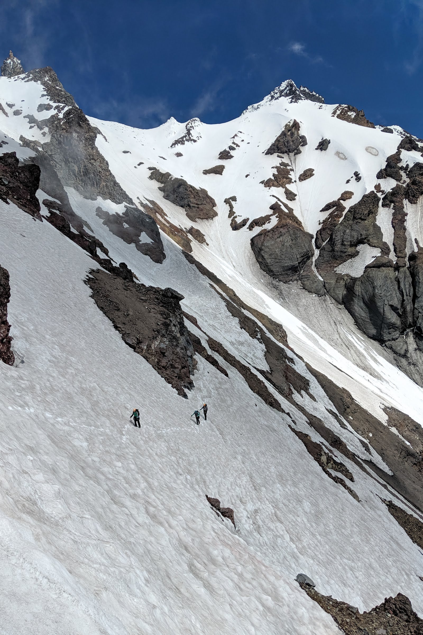
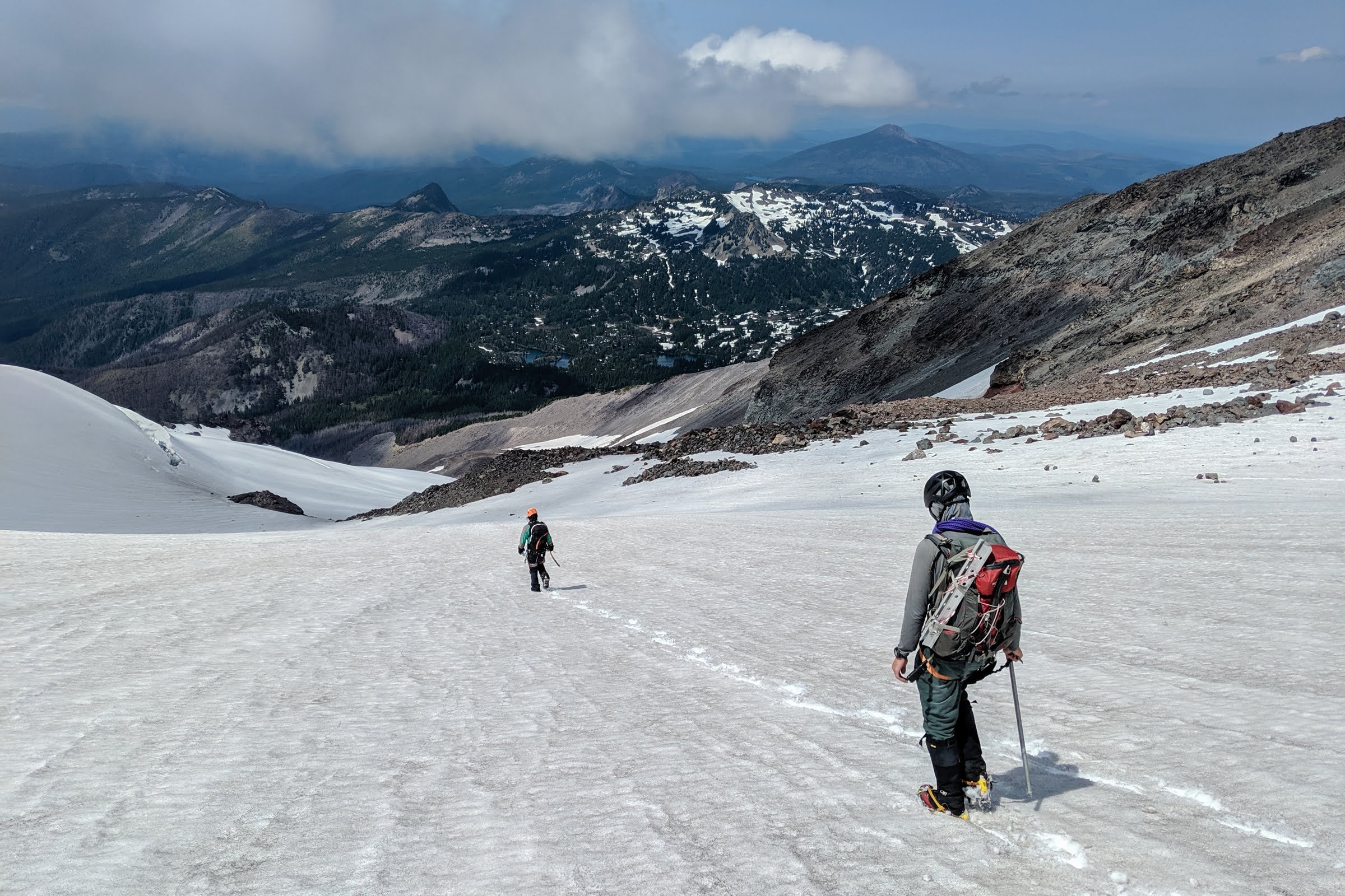
Trip: Mount Jefferson - Jefferson Park Glacier Trip Date: 07/05/2019 Trip Report: Jefferson Park Glacier was in our sights, but warm weather in the forecast made us a bit wary. The freezing level was around 13k with overnight temps on the summit in the low 40s. Glacier Peak was also on our list, so we opted to play it safe and plan for that instead. However, as the weekend approached the weather forecast was improving slightly for Jefferson and turning poor for Glacier Peak. Jefferson it is! I was excited since this would be my first climb in Oregon. On Friday afternoon, five of us met up at the Woodpecker Ridge trailhead. On the drive in we took note of conditions on the north ridge and the summit block. The ridge looked completely covered and the northwest face of the summit pyramid was a mix of snow and rock. Now the question was what the Jeff Park Glacier looked like and what we would find on the narrow ridge connecting the top of Jeff Park Glacier and the north ridge. At around 14:45 we took off on the trail in the direction of Jefferson Park. We considered camping at Jefferson Park, but discussed knocking off another 1000' and camping higher on the ridge so we could get a better look at the glacier in daylight. The skies were clear with the occasional cloud and the absence of trees on the trail made for a warm approach. Shortly after reaching the Whitewater Trail junction, we turned uphill for the ridge that sits east of Russell Creek and leads up to the toe of Jefferson Park Glacier. It seemed like 6800' was a common area to camp so that's what we aimed for, though there were also accounts of camping at 7400'. At this point we were still unsure of our descent route (Russell or Whitewater), so we planned to camp lower to avoid any unnecessary climbing back up to camp if we returned too low on the ridge. There was the occasional patch of snow on the way up the ridge and eventually we found a good spot around 6900'. It seemed like we were the only group up on the ridge. The lower shrund was long and extended well east under the active rockfall area, but looked easily passable. It was hard to tell what the upper shrund looked like so we would have to until morning to find out. With warm weather still in the forecast, we planned for a 0200 departure time so we could start getting some daylight as we approached the cracks on the glacier. The forecast also called for some breezy conditions the next day which we were beginning to experience at camp. After melting some snow we retreated to our tents with alarms set for 0100. It was 50°F when we woke up with clear skies and a light breeze. We gathered our gear and at 0200 were off, heading up the ridge. Shortly after, we passed a small bivy site at 7400' and then were standing on the glacier where we geared up as a team of 2 and 3. Still all by ourselves, we picked a direction and started uphill in the dark. Not too long after, we saw headlamps appear on the ridge to our left. A team of 5 was moving along the ridge and I thought they were heading up the north ridge route, but eventually they descended and joined us on the glacier at nearly the same elevation. We found out later they were camping in Jeff Park. They were moving pretty quick and passed by. The snow was in great shape, not too soft and not too hard which made for easy steps and good purchase with the crampons. There was a thick enough crust that you wouldn't punch through but it was still possible to drive your axe shaft all the way in to self belay as the grade steepened. As the other group reached the crevassed area below the shrund with a hint of daylight, they roped up and began placing pickets and simul climbing. This slowed their progress a little bit and we climbed to their left to avoid any ice debris from them, but unfortunately we didn't give them a wide enough berth. A large dinner plate sized chunk of crust released from their party and started falling between the two groups. We tracked it in the low light and at first it looked like it would miss us like some smaller ice pieces that fell before, but this chunk moved differently. The piece whizzed by me (2nd to last) less than 10' away and struck the last person in our party. He saw it coming and was able to somewhat shield himself where it hit his chest and arm, but it still took him off his feet and knocked the wind out of him. After a short rest and assessment, he just had a sore arm and ribs and nothing appeared to be broken. It could have been a lot worse... We continued towards the lower shrund, moving a bit further climber's left to avoid another incident while keeping an eye out for rocks above. The grade steepened to about 35° as we skirted around the lower shrund, but with the great snow conditions we felt very comfortable. The 2nd tools remained stowed and we didn't place any pro. Once we were above the lower shrund and traversed under Mohler Tooth we finally got a good look at the upper shrund to find a small crack that was easy to cross. Here we took a break while we waited for the other party to climb this section since it would have been a little crowded. After the other group was clear, we crossed the shrund and cruised up to the saddle between Smith Rock and Mohler Tooth. It was around 0700 at this point. The ridge looked to be snow free, so we stowed our crampons and waited for the group to get out in front of us so we weren't right on their heels. The ridge climbed nicely. Our lead did place a few cams and slung a few rocks along the way since we brought them, but it really didn't feel entirely necessary if you're comfortable with scrambling. I feel like I've climbed more exposed terrain that was classified as 4th class. The last part of the ridge before joining the north ridge was still covered in snow/ice, so maybe that portion is the low 5th class climbing I read about once it melts out. We put our crampons back on and finished the ridge to reach the north ridge. The group in front of us decided to descend down a snow gully to the glacier instead of finishing the snowy part of ridge, so we were finally able to get past. Now on the north ridge, we started the trek south to the summit pyramid. The snow was still firm and there was an old boot pack, so we made quick work of the ridge. The summit pyramid was a mix of snow, ice, and rock like we saw the previous day from the drive and it looked like the route to the summit was all snow/ice. At this point we grabbed our 2nd tools and the group of 3 lead the way. The first portion was a fairly steep (~60°?) mix of snow and ice, but we were able to make good purchase with the tools and crampons. A couple cams were placed and there was good ice for a screw. This first portion topped out at a rappel station at the base of the large snow patch, about a third of the way up the summit block. This was probably the toughest section to climb, but looking back at the pictures we likely could have made things easier by traversing a short ways under the summit block before heading up. But it was still fun climbing nonetheless! We then hiked up the snow and began a traverse south, underneath and to the west of the summit. The route would continue south and eventually turn east to wrap around the south side of the summit. This was the second portion of steep climbing, albeit easier than the first. Once again we protected this with a couple cams and a screw before reaching the plethora of slings at the summit. We made it! The summit was just big enough for the five of us to hang out and take in the views. From here we contemplated our descent route. The Whitewater Glacier was our default and there looked to be a nice rappel off the south of the summit down to snow which could then be easily downclimbed to the Whitewater (compared to making the traverse underneath and to the west of the summit pyramid to Red Saddle). The Russell Glacier was also an option, and with the still firm snow conditions and a good bootpack heading down the Mill Creek Glacier, we decided to give that option a go. We rapped off the west side of the summit, down to the snowy traverse section, and then downclimbed to the rappel station we first encountered on our way up. At this point the other party was beginning their climb up the summit pyramid. Another rappel and we were off the summit pyramid and heading down the Mill Creek Glacier. We followed the tracks and had a rough idea where we were heading based on views from the summit and a GPS route, but soon the tracks disappeared and we were left just making the steep snow traverse toward the Russell. We took the path of least resistance and soon found ourselves crossing a scree field before eventually reaching the Russell at 8600'. I think we took a pretty good route to the Russell. Perhaps earlier in the season with more snow one could traverse higher and enter the glacier at a higher point, but with the current conditions we found ourselves at a good spot on the Russell. Higher up there was a lot of exposed scree and the rockfall was very active. The next challenge was to descend the Russell and find a good traverse back to camp to avoid hitting the ridge too low and having to climb back up. Scree was the theme of this portion. We descended the Russell on snow, but soon had to start traversing which led to plenty of scree fields separated by snow patches. Again, we took the path of least resistance while aiming high. Eventually we found ourselves to the west of our ridge with only about a 300' climb back up to camp. Not ideal, but I think we took the best route we could all things considered. If we did it over again this time of year, I think we would opt for the Whitewater descent. I think the Russell earlier in the season with more snow coverage would be a good option, but once the scree starts to show it makes it a bit of a pain especially since most of it is a traverse. After a rest at camp, we packed up and headed down the ridge and out to the trailhead. It was a long day but a great day! A good mix of glacier, rock, and ice. Excellent weather and stellar conditions. I'm happy to put down Jefferson as my first Oregon volcano! Time Stats: DAY 1: (time, duration, split time, elev, total gain, leg gain) 14:45, 00:00, 00:00, 4500', +0', +0', Woodpecker TH Start 18:10, 03:25, 03:25, 6900', +2400', +2400', Arrive Camp Day 1 Splits: 03:25, TH to Camp Day 1 Total: 03:25 ----- DAY 2: 02:00, 00:00, 00:00, 6900', +2400', +0', Leave Camp 02:30, 00:30, 00:30, 7450', +2950', +550', Start Jeff Park Glacier 06:50, 04:50, 04:20, 9950', +5450', +2500', Top of Jeff Park Glacier 09:05, 07:05, 02:15, 10180', +5680', +230', Gained North Ridge 11:00, 09:00, 01:55, 10495', +5995', +315', Summit 14:50, 12:50, 03:50, 8580', +4080', -1915', Gained Russell Glacier 17:00, 15:00, 02:10, 6900', +2400', -1680', Arrive Camp 21:00, 19:00, 04:00, 4500', +0000', -2400', Woodpecker TH End Day 2 Splits: 09:00, Camp to Summit 06:00, Summit to Camp 04:00, Camp to TH Day 2 Total: 19:00 Day 2 Splits (excluding major breaks/waits) 06:20, Camp to Summit 05:00, Summit to Camp 03:00, Camp to TH GPS Route/Track: Our route can be seen and exported from here: https://caltopo.com/m/GB6S Photos: Woodpecker trail approach: Jeff Park Glacier: View from camp: Other party ascending Jeff Park Glacier (below lower shrund): Skirting lower shrund (Mohler Tooth to the right): Upper shrund (Smith Rock to the right): Smith Rock: North ridge and summit: Summit pyramid: Looking back (north) at the north ridge: First pitch on the summit pyramid: View from summit: First rappel: Traverse to Russell: Heading down the Russell: Gear Notes: Glacier gear, 2nd tool, light rock rack and a few screws. We had one 60m rope and one 30m rope. The 60m was nice to have for the rappels. Approach Notes: Woodpecker Ridge Trail


 1 point
 -
Thanks for the inspiration. I did a lite version of this yesterday with the standard route on Guye, only E summit of Snoqualmie, and no Kendall. Great way to climb some peaks which I have tried (and failed) while skiing in the area. Felt pretty maxed out in my trail runners and wished that I had brought approach shoes.1 point
-
Awesome! Nice photos!1 point
-
Wild, that looks like some full-on scrambling1 point
-
Trip: Mount Jefferson - Jefferson Park Glacier Date: 7/4/2016 Trip Report: I suppose Steve and I shouldn't have been surprised. By now we've both climbed enough routes out of Alan Kearney's "Classic Climbs of the Northwest" to know that the man knows what he is talking about. Still, after topping out on the Jefferson Park Glacier route on the 4th, we were impressed. A pleasant approach, comfortable camp (~6800' below the glacier- no water except snow), interesting glacier travel (including a deceptive 'schrund crossing), a spectacular knife edge, and excellent steep snow and rime on the summit tower made for a memorable ascent. Even more so since we had the entire route and mountain to ourselves on a holiday weekend! Initially we were a little disappointed that our first choice in the North Cascades was weathered out, but we shouldn't have been. Besides a long drive, there weren't really any drawbacks to the trip. I especially like the wilderness nature of Jefferson, more akin to Glacier Peak than many of the Cascade volcanoes that have roads high on their flanks. However, I can see how this mountain has a relatively narrow window for when it is in the best condition. I think we managed to hit it perfectly- snow-free hike to camp, the 'schrund was passable, the knife edge ridge mostly snow-free, summit pyramid mostly snow and ice (until the last bit on the east side of the north ridge), and descent down the Whitewater straightforward. A few weeks earlier or later and it likely isn't nearly as pleasant as we found it. Mount Jefferson is amazingly steep for how impressively chossy it is, and I have no doubt it could be terrible when it is in poor condition. We dubbed it "Chosso Torre". The only slight SNAFU was on the descent off the summit. We rapped blindly off the established station right on the summit and couldn't find the second one we had heard was there (likely covered in rime). We made a new station with a nut and tri-cam and did another short rappel to reach easy snow. Steep now traversing to Red Col led to easy slopes and the Whitewater. For being the easiest route on the mountain I was a bit surprised. It certainly gets your attention. I can see why some say it is the hardest of the major Oregon summits to climb. From the register it looks like 15-30 parties sign in each year, much fewer than I expected. As an aside.......We had planned ahead and left beer in the truck, but a kind, older gentleman at the TH walked over in his camo pants with two ice cold Coors in his hands (it was 10am). "I was wondering if you boys could use an ice cold beer?" pointing at the Stone IPAs in our hands, he continued "My Daughter says I need to drink real beer, but these are real enough for me!" We thanked him for the Coors and he happily sauntered off on his hike, after finishing his beer. It was the highlight of our final day in Oregon. Looking down from the summit on the upper part of the route, you basically run the ridge: Chosso Torre: Gear Notes: Helmet, second tool, steel crampons, half rope, light rack to 2", long runners. Approach Notes: Whitewater TH to Jefferson Park. We left the trail just before the major stream crossing on the west side of Jeff Park and headed up to the glacier1 point
