All Activity
- Past hour
-
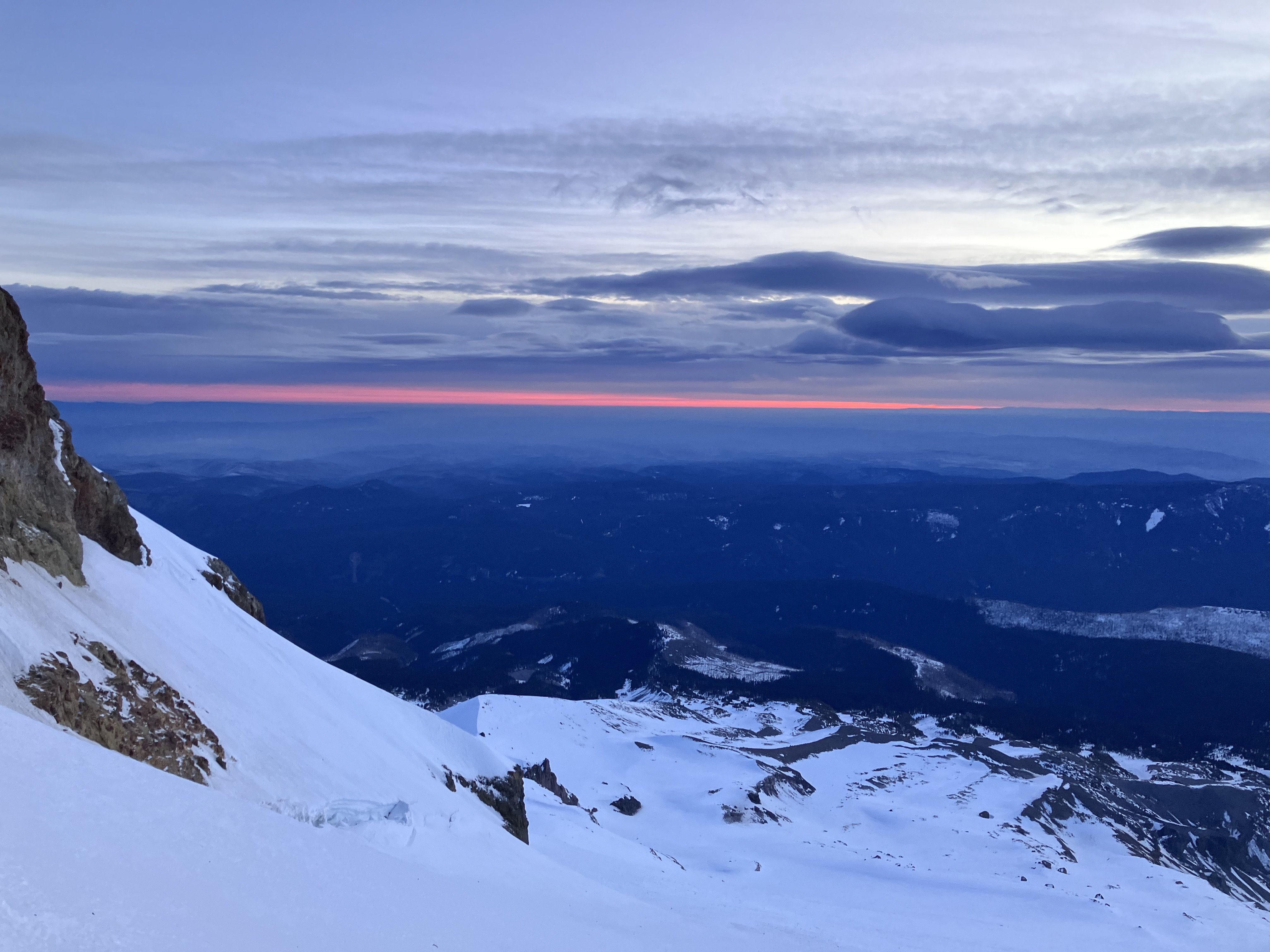
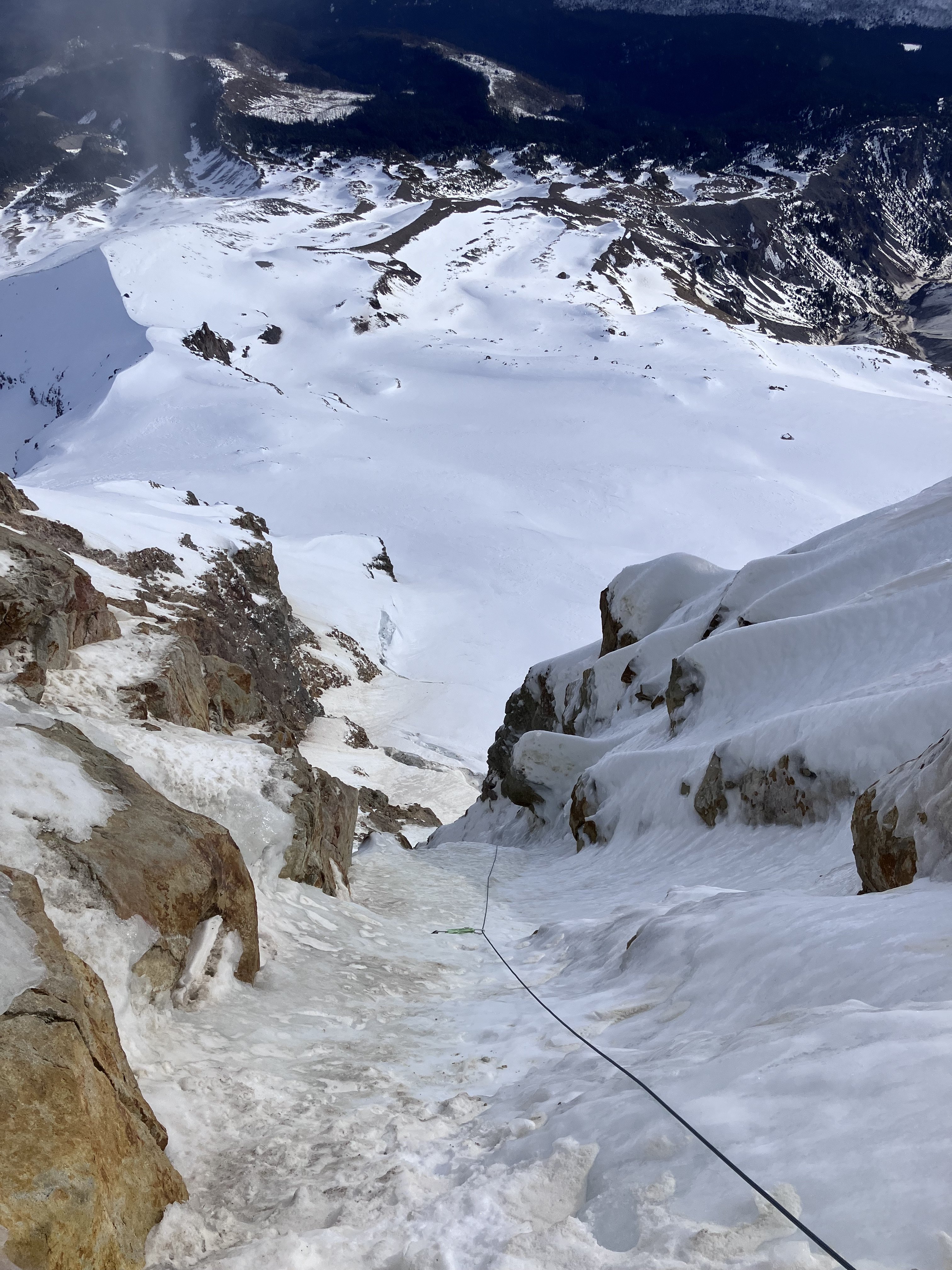
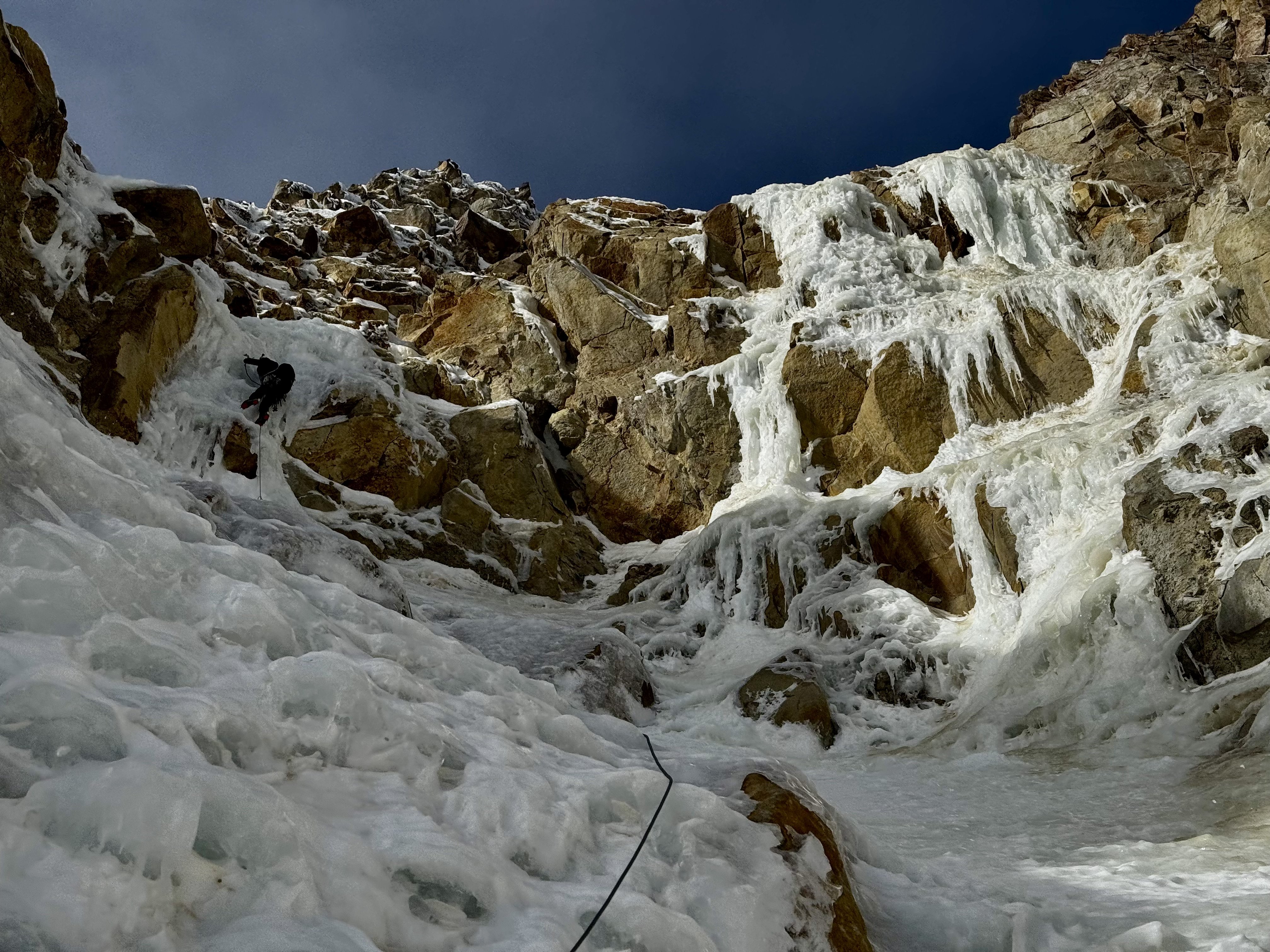
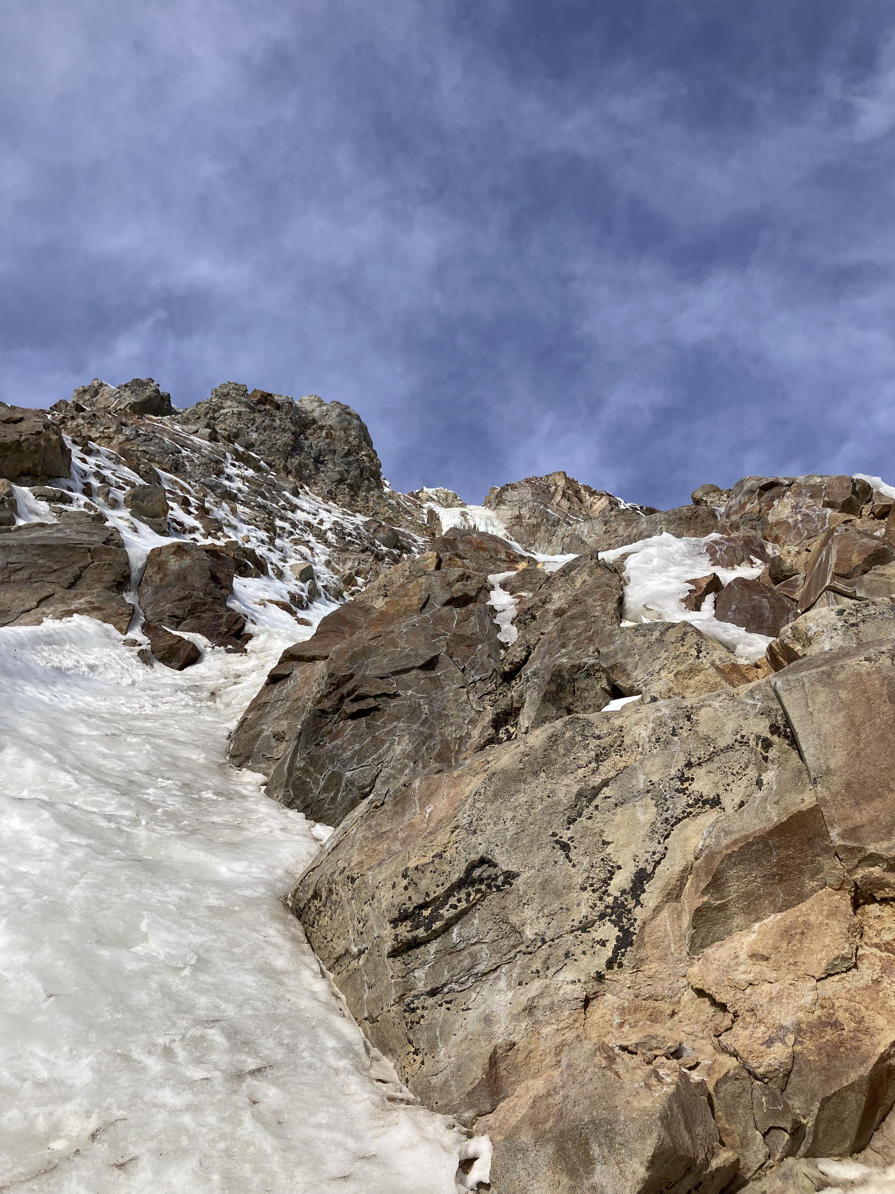
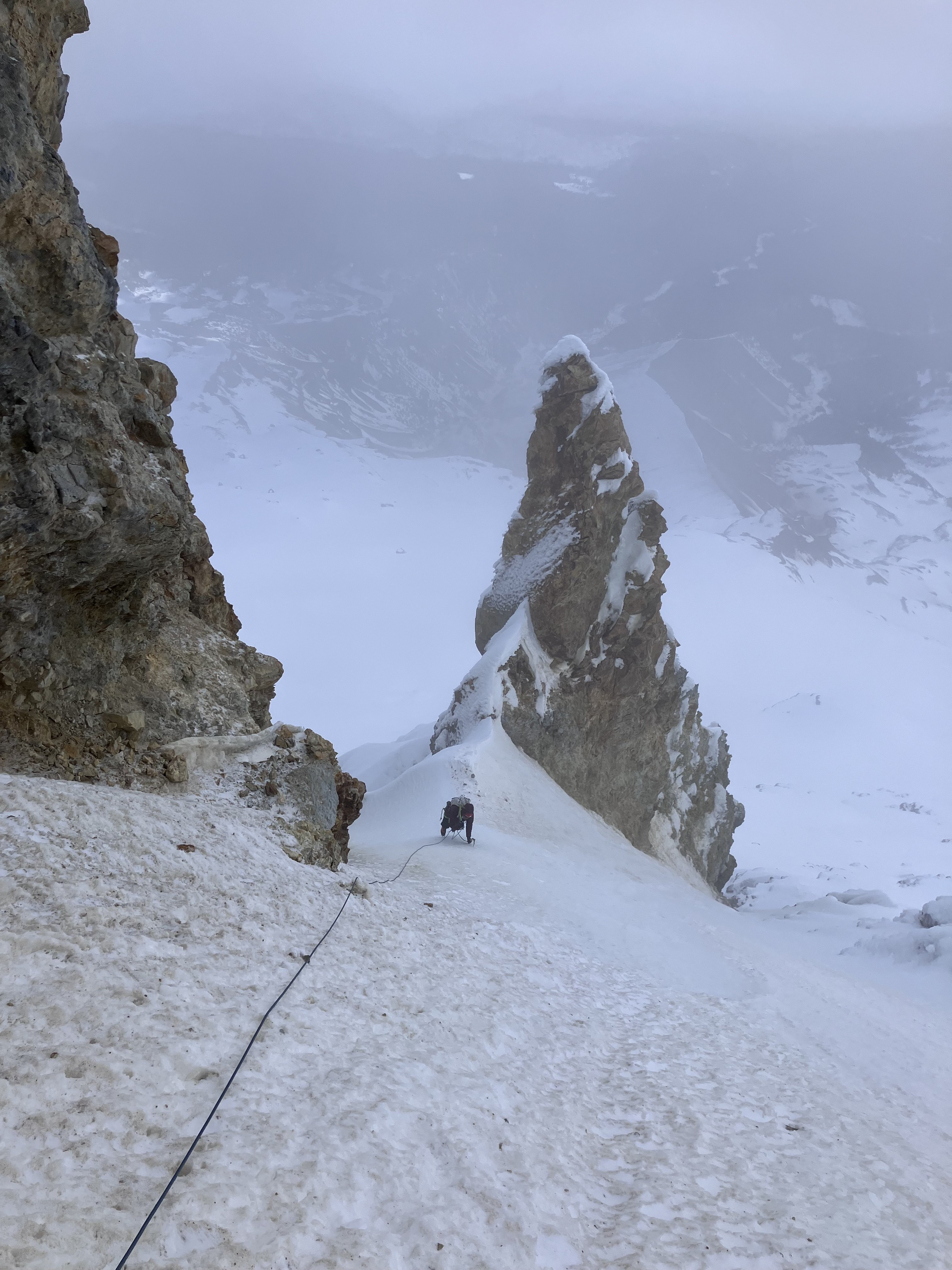
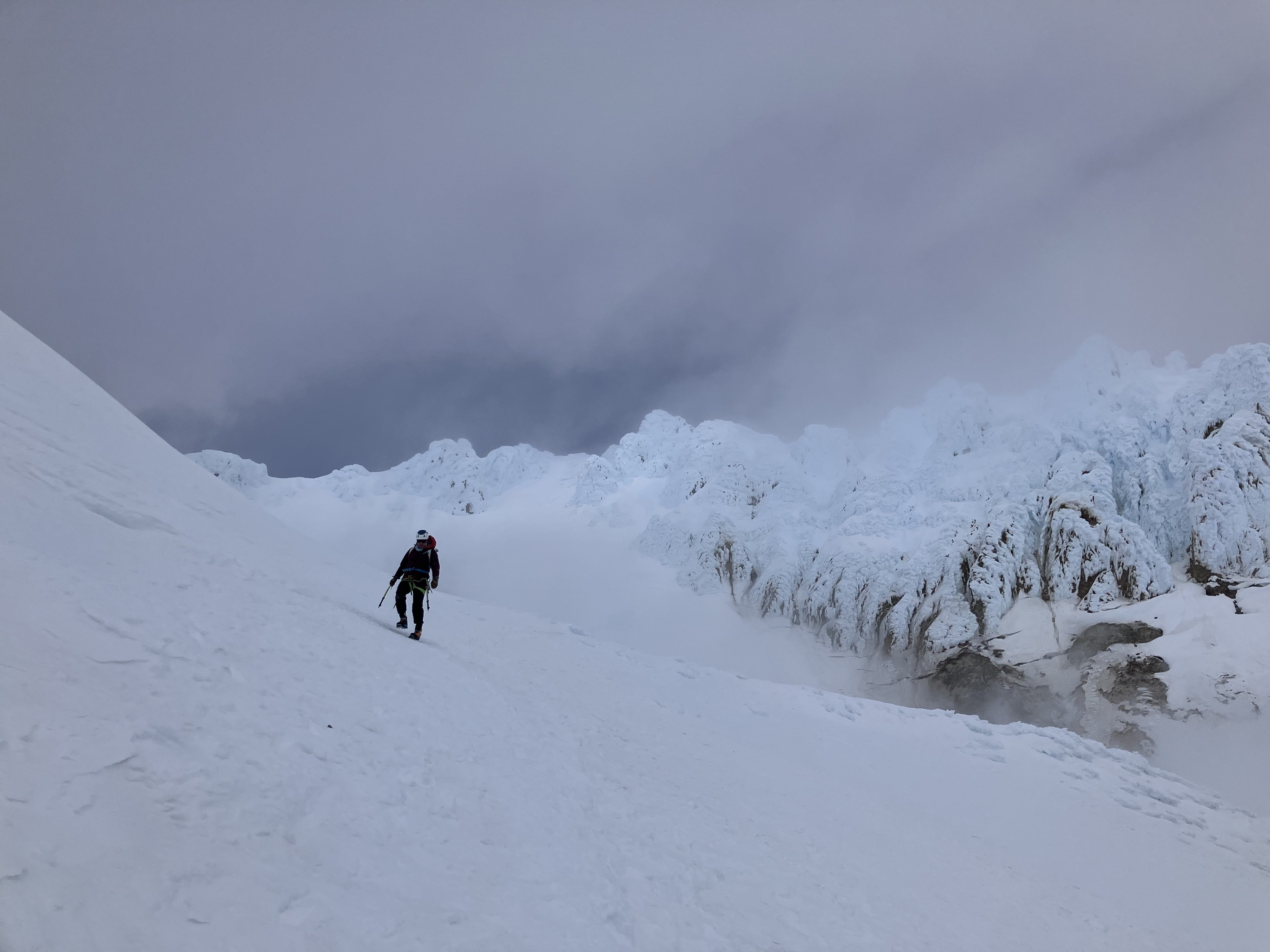
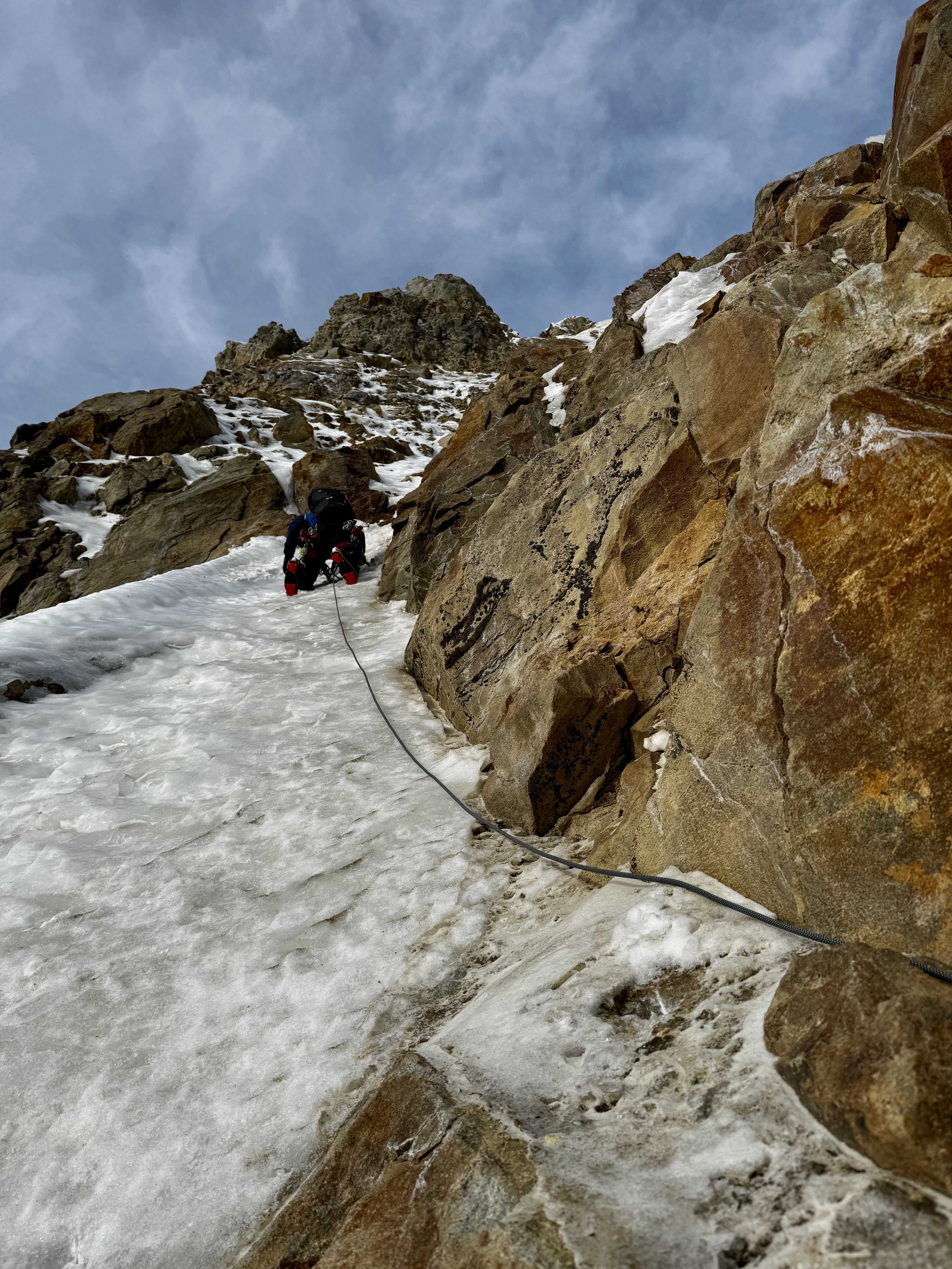
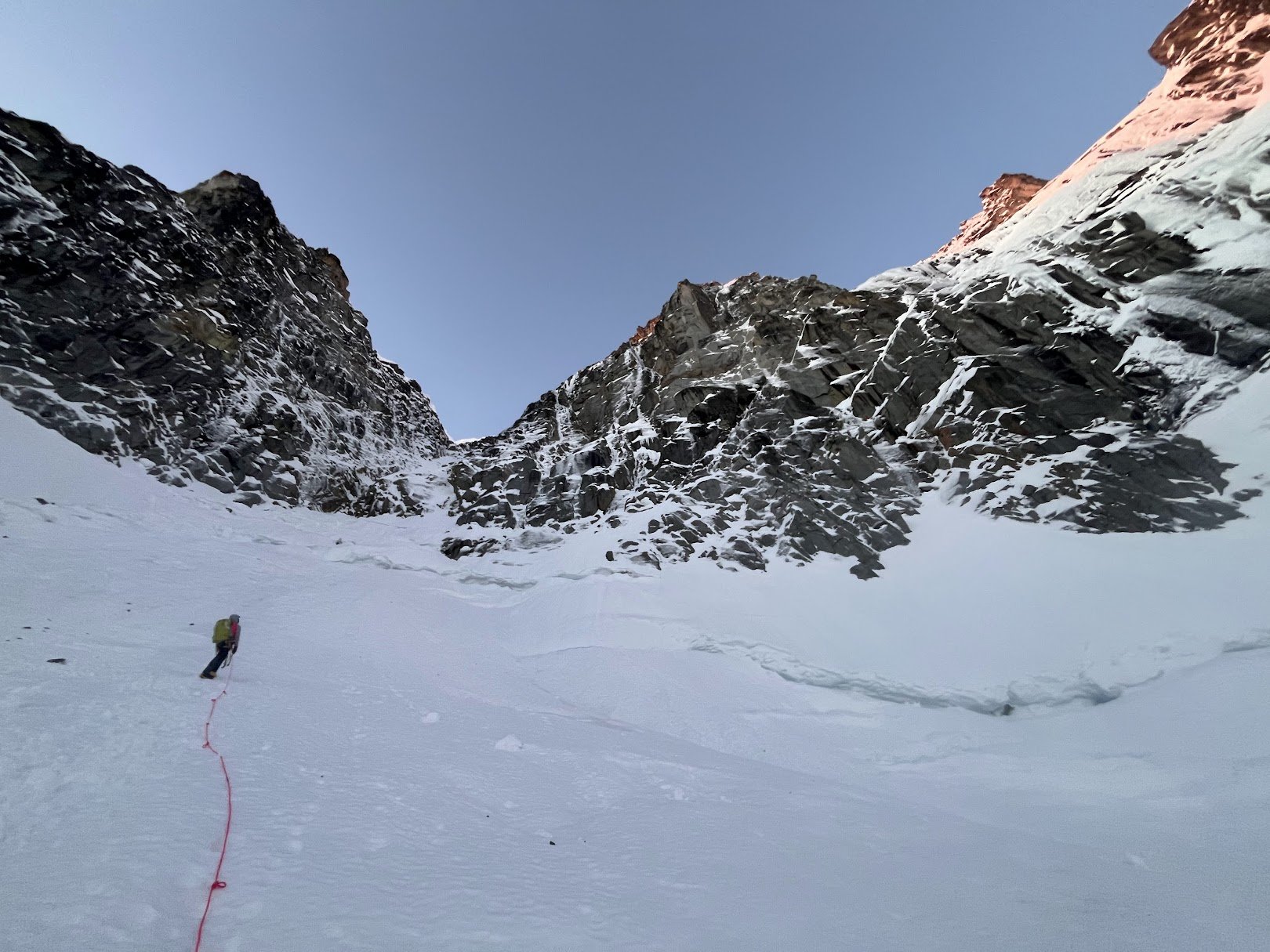
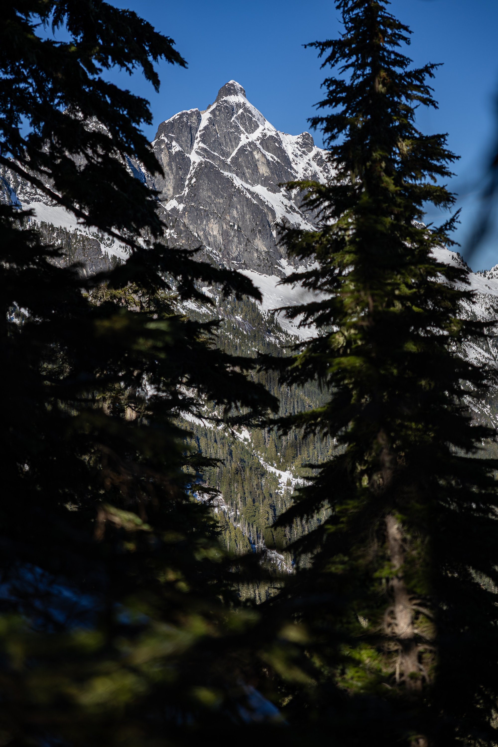
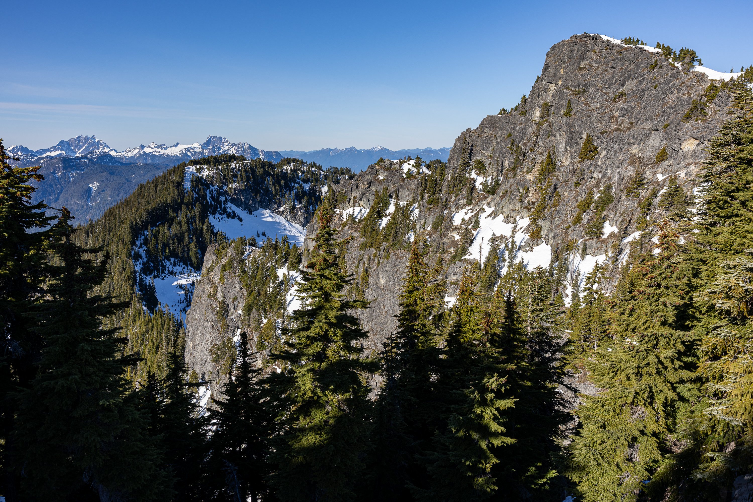
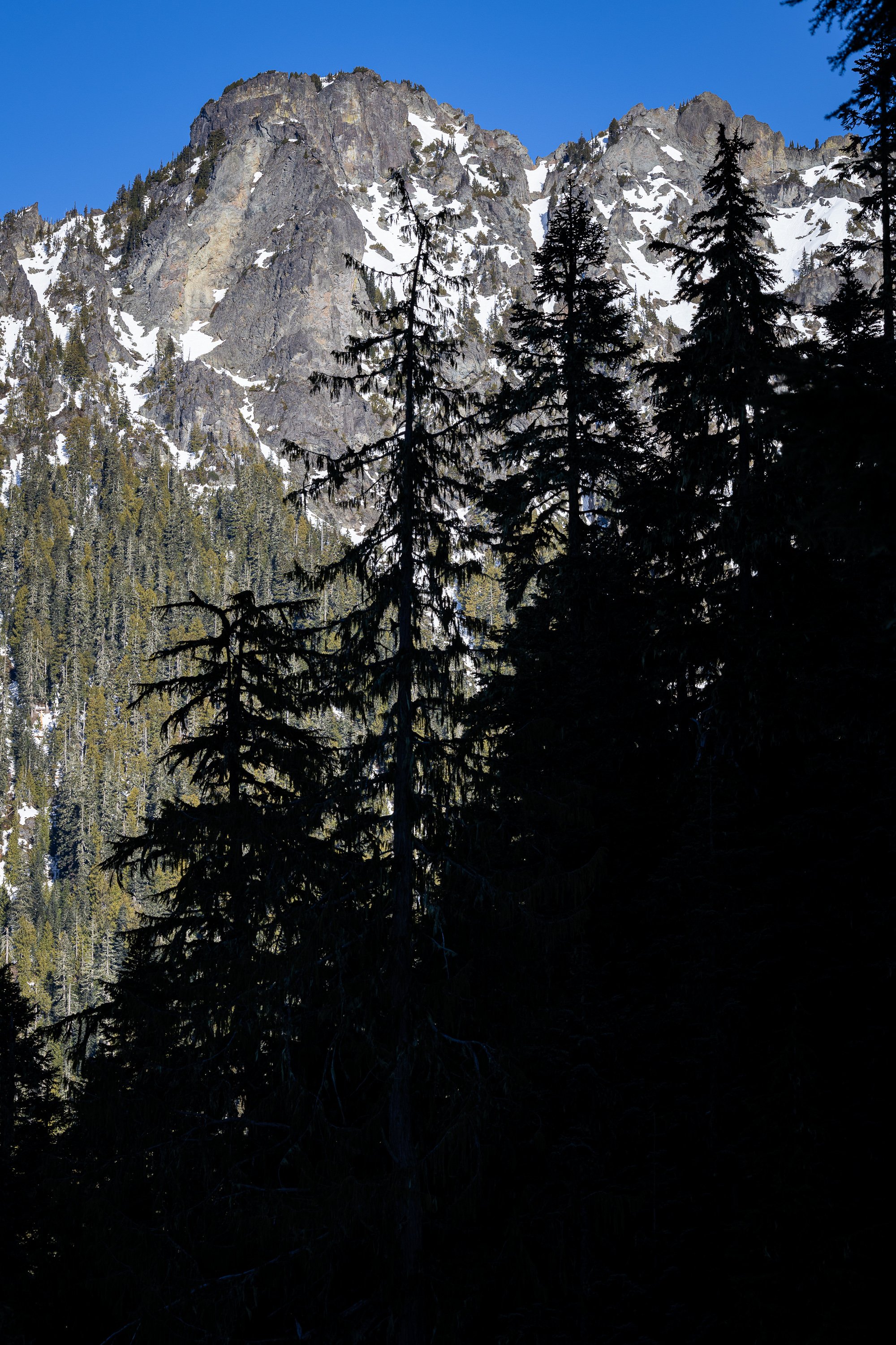
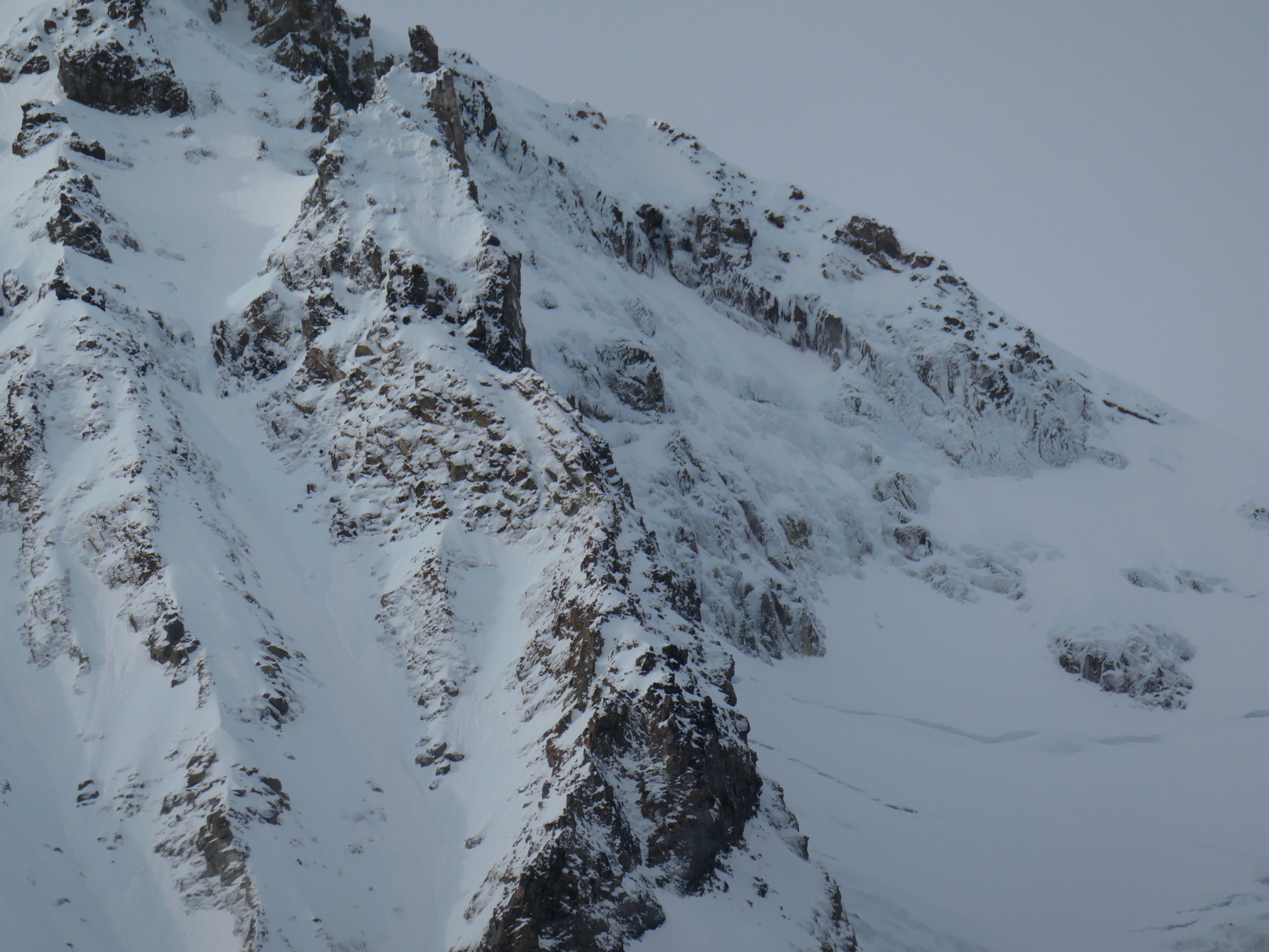
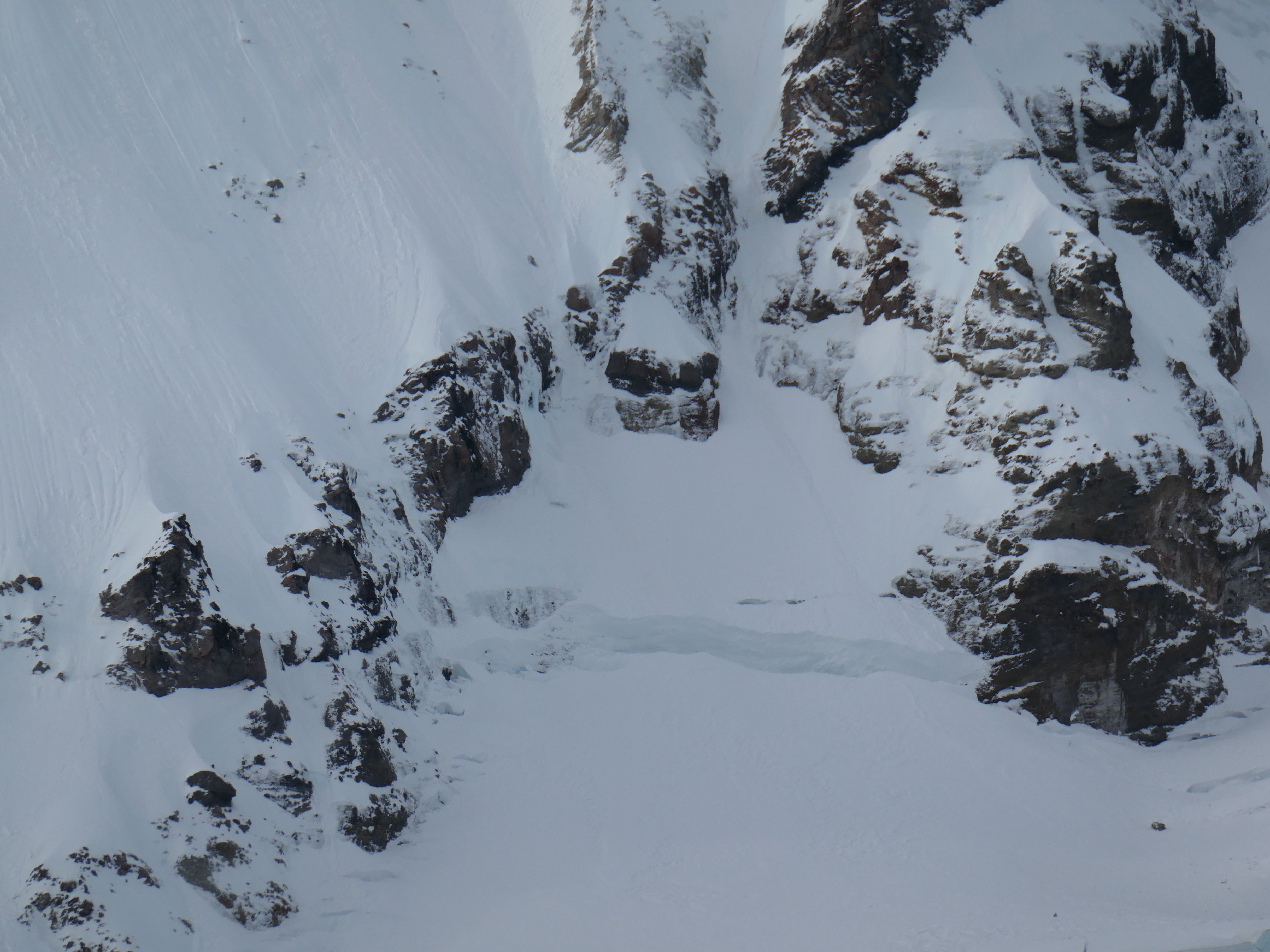
 Trip: Black Spider - Wy'east - Arachnophobia Trip Date: 01/31/2026 Trip Report: Climbed Arachnophobia the other day. Good ice, a little brittle first thing. Snow is very icy which makes for some tiring front pointing. Not as sun baked as it might appear. Five long pitches does it. L side of schrund went easily. Thanks to G for being a great partner, and Kyle and Matt for going up the route first so I didn't need to leave the family just to have a look-see. Pictures... Luckily sunrise had some cloud cover. Starting up the ice-looking bits, after some snow-looking bits that were still icy Snow-looking icy bits on P2 Starting up P2 Leading P3 Looking down P3 Coming up to the final belay at a rock anchor Descending S Side Hoping we get some snow this winter. But while we wait the sticks are quite good. If you need more beta, please feel free to DM me. -Sam Gear Notes: Single rock rack (small cams and nuts useful, nothing bigger than 0.5), pins, 10 screws Approach Notes: S Side and traverse over White River and around.
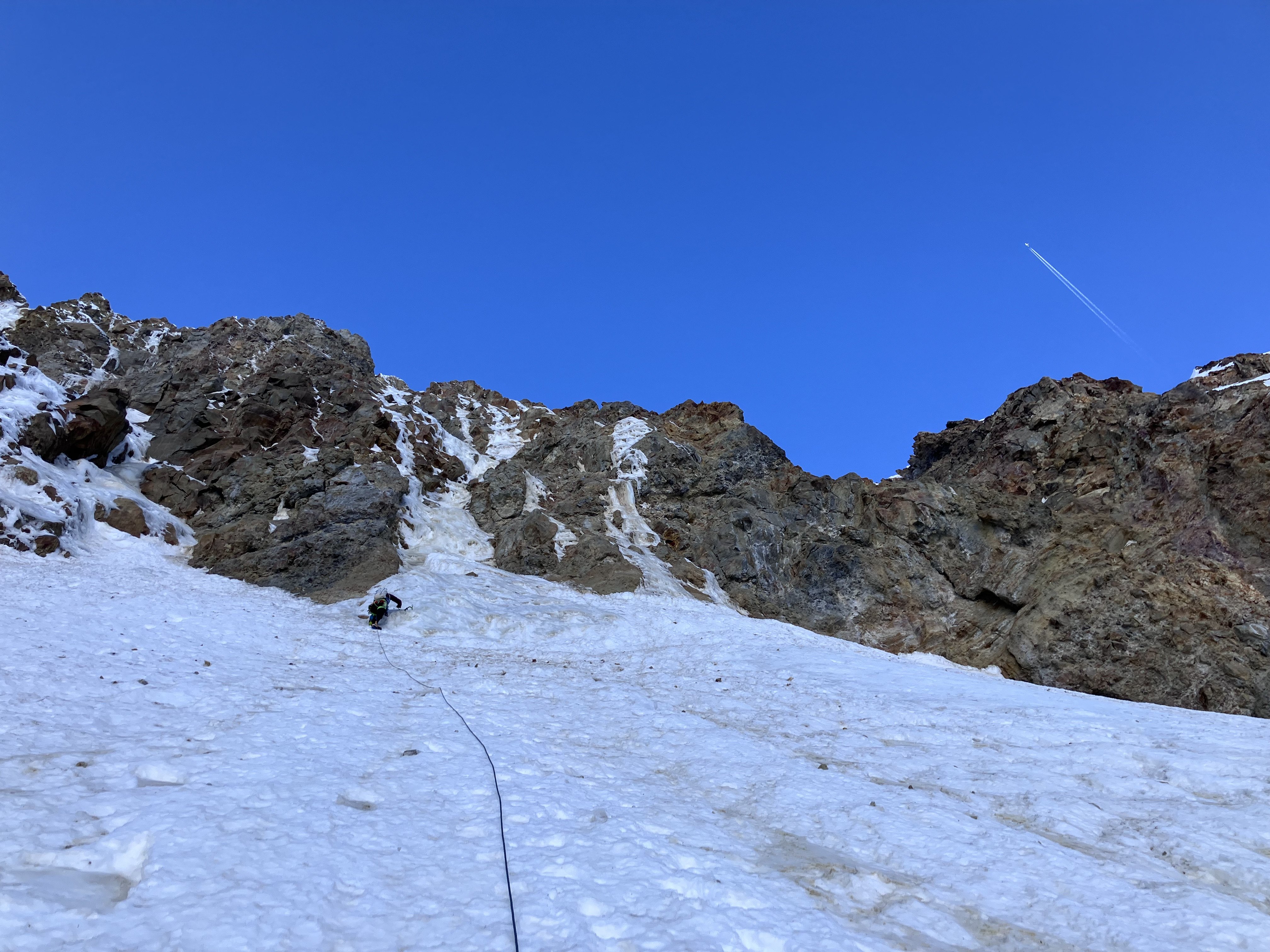
- Today
-

idea MYOG - Gear mod's and personal creations.
Lucas Ng replied to kmfoerster's topic in The Gear Critic
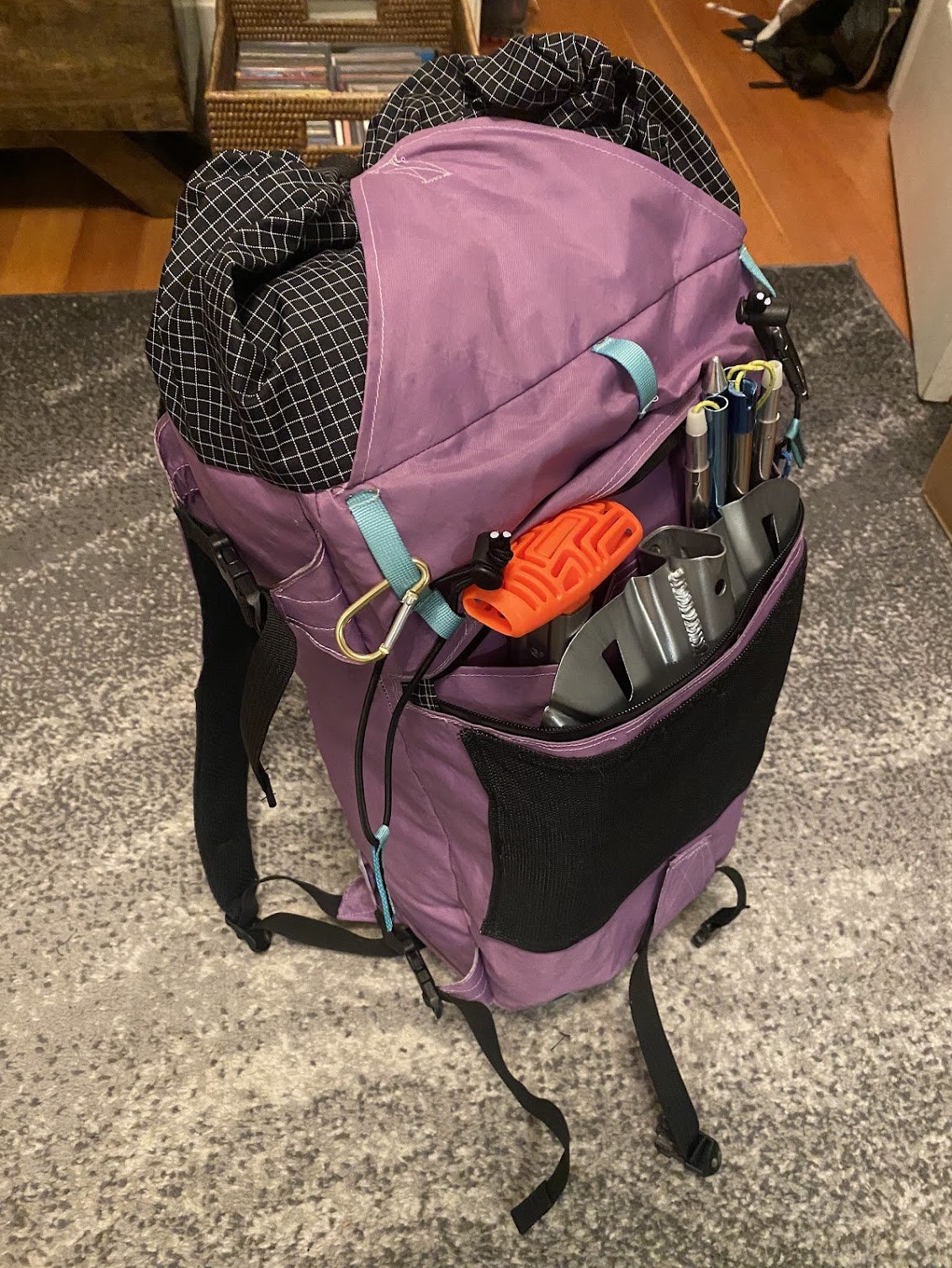
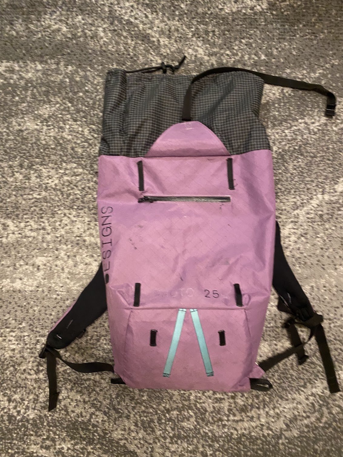
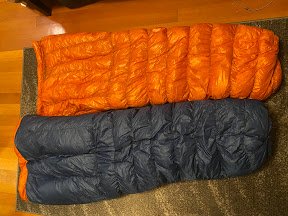
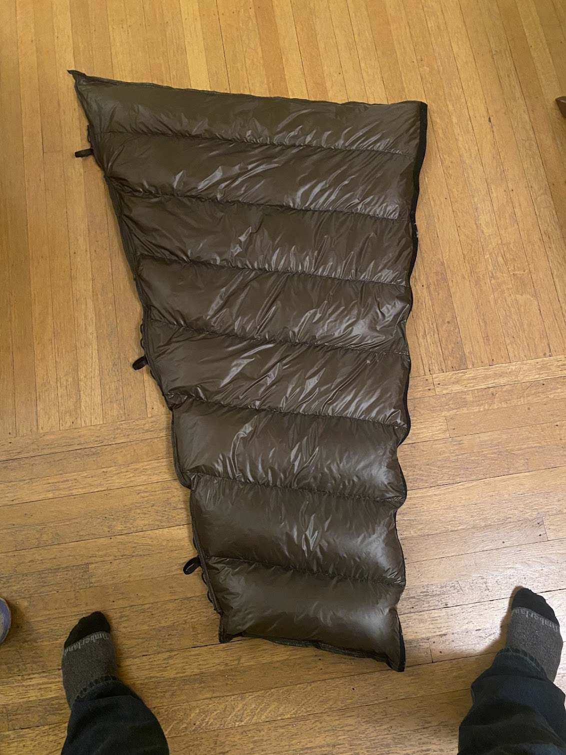
Some backpacks and sleeping bags I've done in the past couple years. Have also built an ice screw roll, bike bags, and more. Great rainy day activity for the gearheads among us. Also including a quilt extension commission that I just finished up. Open to small projects and have reasonable prices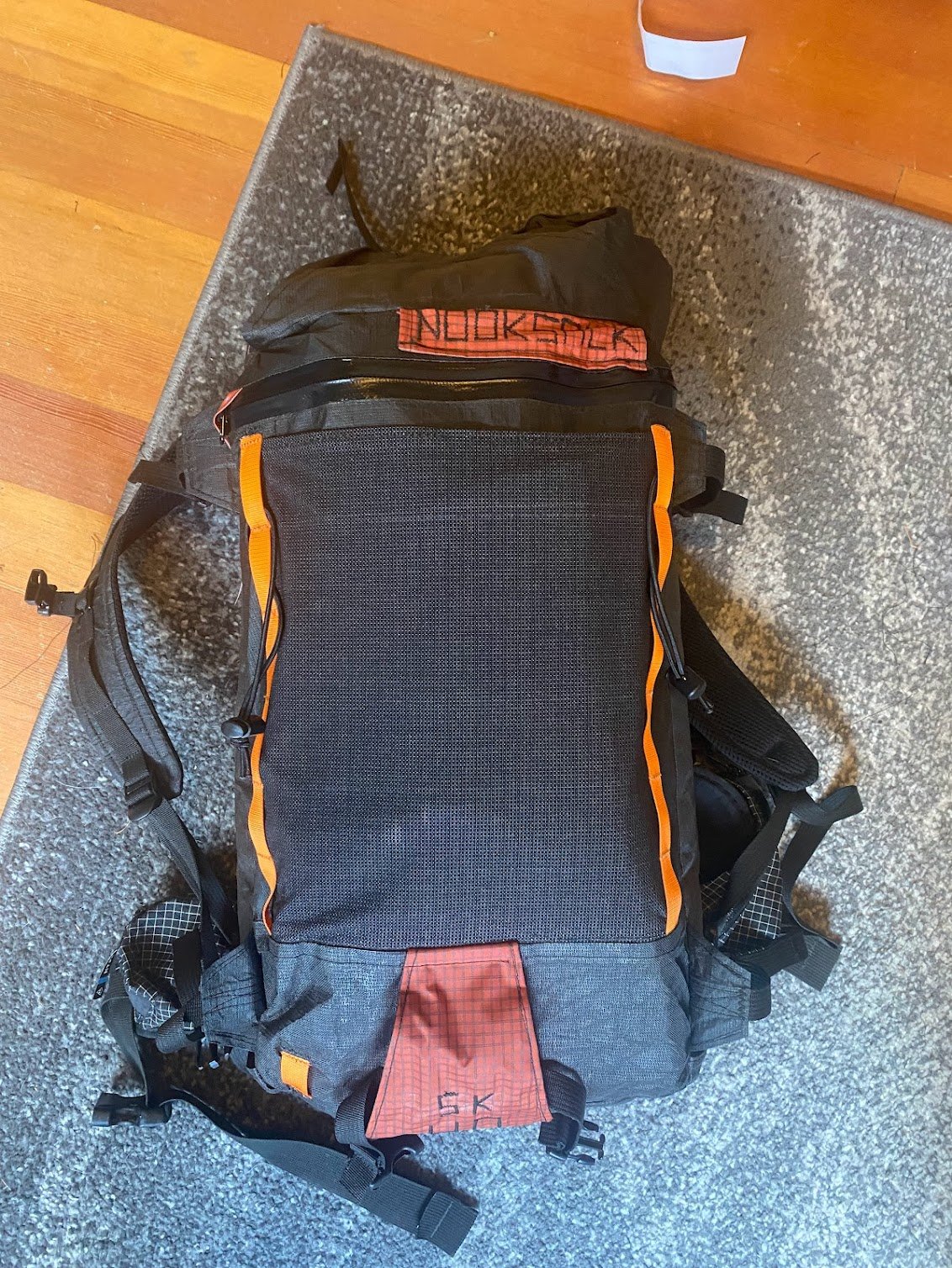
-
 dlinquist joined the community
 -
I may have known Jiri years ago from the Mountaineers. If this is the same guy, I remember him as being super strong and full of Stoke.
-
Thank you @mtngrl. I never climbed with Jiri but he certainly seemed like someone I would have enjoyed getting out with. I am very sorry for your loss and I hope that you can find some comfort in the memories of the numerous adventures you were able to share with him.
-
 And we are going to get a huge ridge next week so get yer tools sharpened folks!
 -
DAMN, we need that TR!!
-
 Yeah pretty much all the info I can find is for the right side too. Thanks for looking. @Tucker_Merrill and I climbed a variation of the line I drew last weekend and are trying to figure out if what we climbed is an existing route or not. Regardless it was super fun and recommend others go take a look if we get another weather window this season. I'll be writing a trip report for it at some point unless Tucker beats me to it.
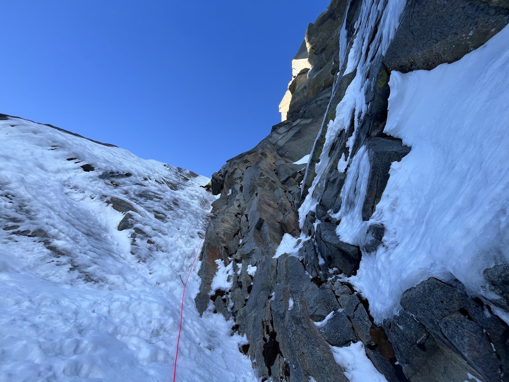
-
Hello all, Please join in celebrating the life of Jiří Richter. A memorial service will be held Saturday, February 7th from 12pm-4:00pm at the Ballard Elks Lodge, 6411 Seaview Avenue NW, Seattle, WA. Thank you all so much for the love and support. Olga, Lenka and Eileen Photos can be uploaded here to be shared at the memorial. https://photos.app.goo.gl/AtmgiCW2BAArBERh7
-
The roll of screws went (via the big auction site) to some dude in North Bend. Everything else is still available, and the prices are very negotiable.
-
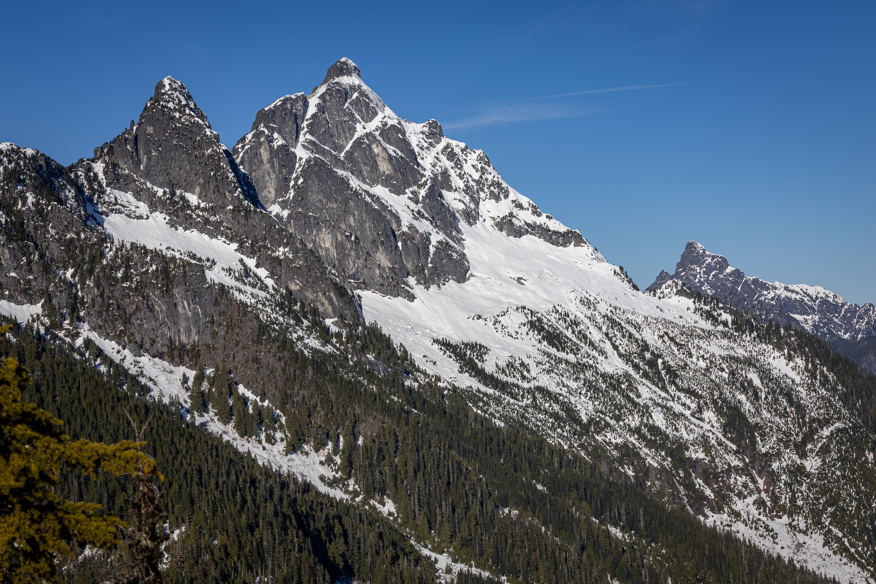
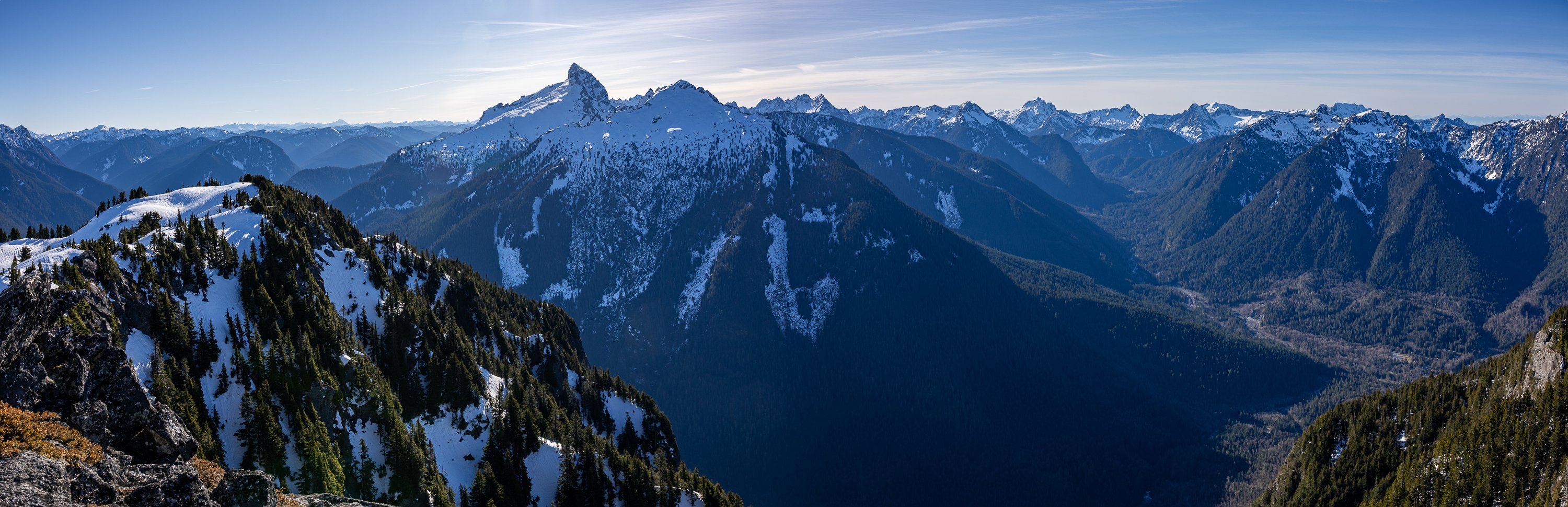
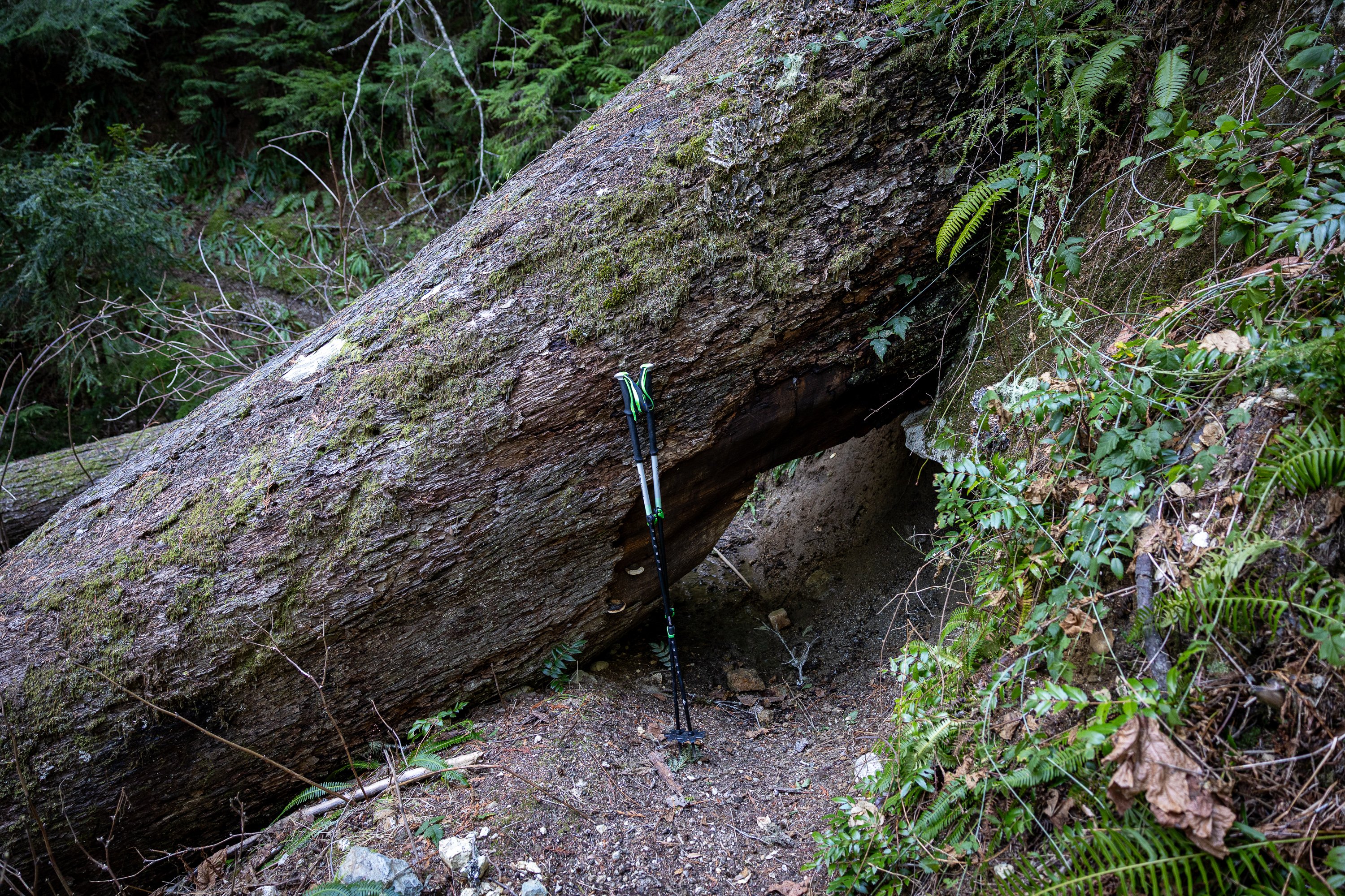
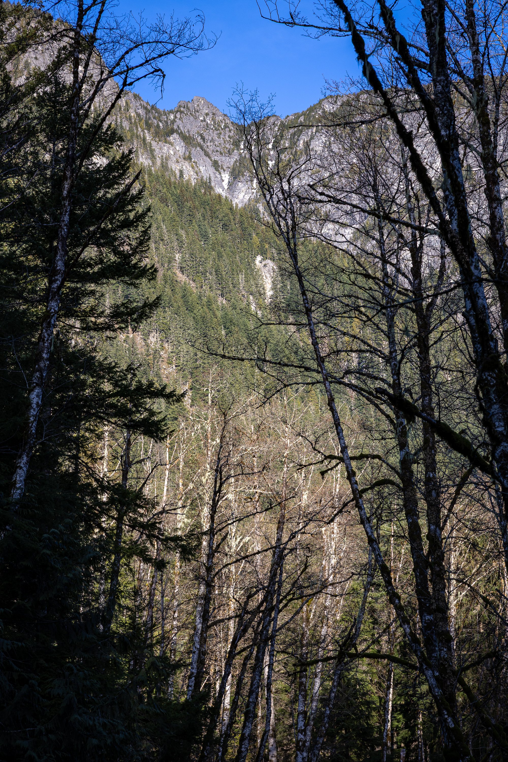
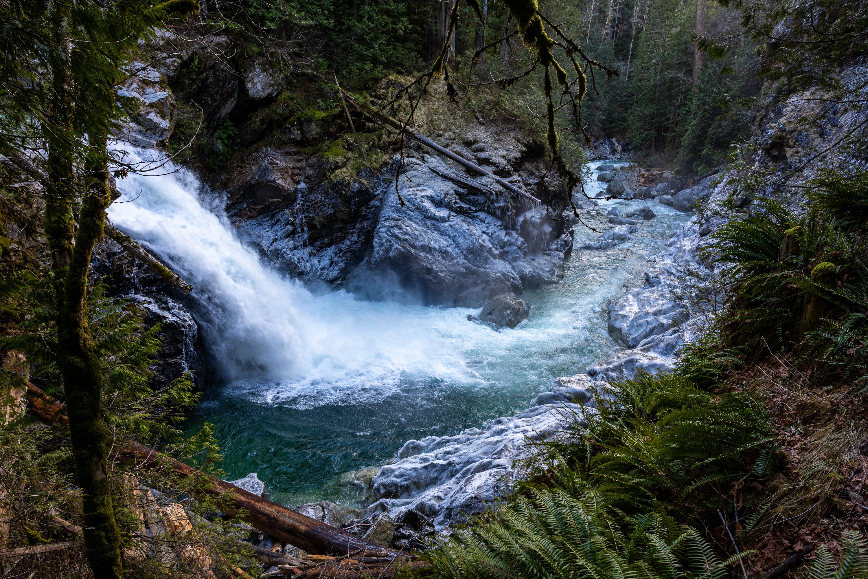
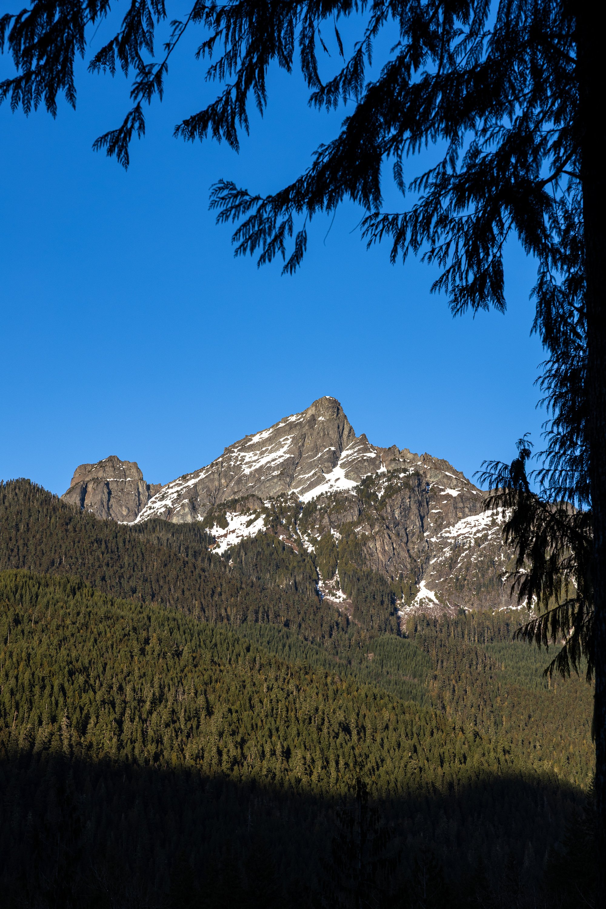
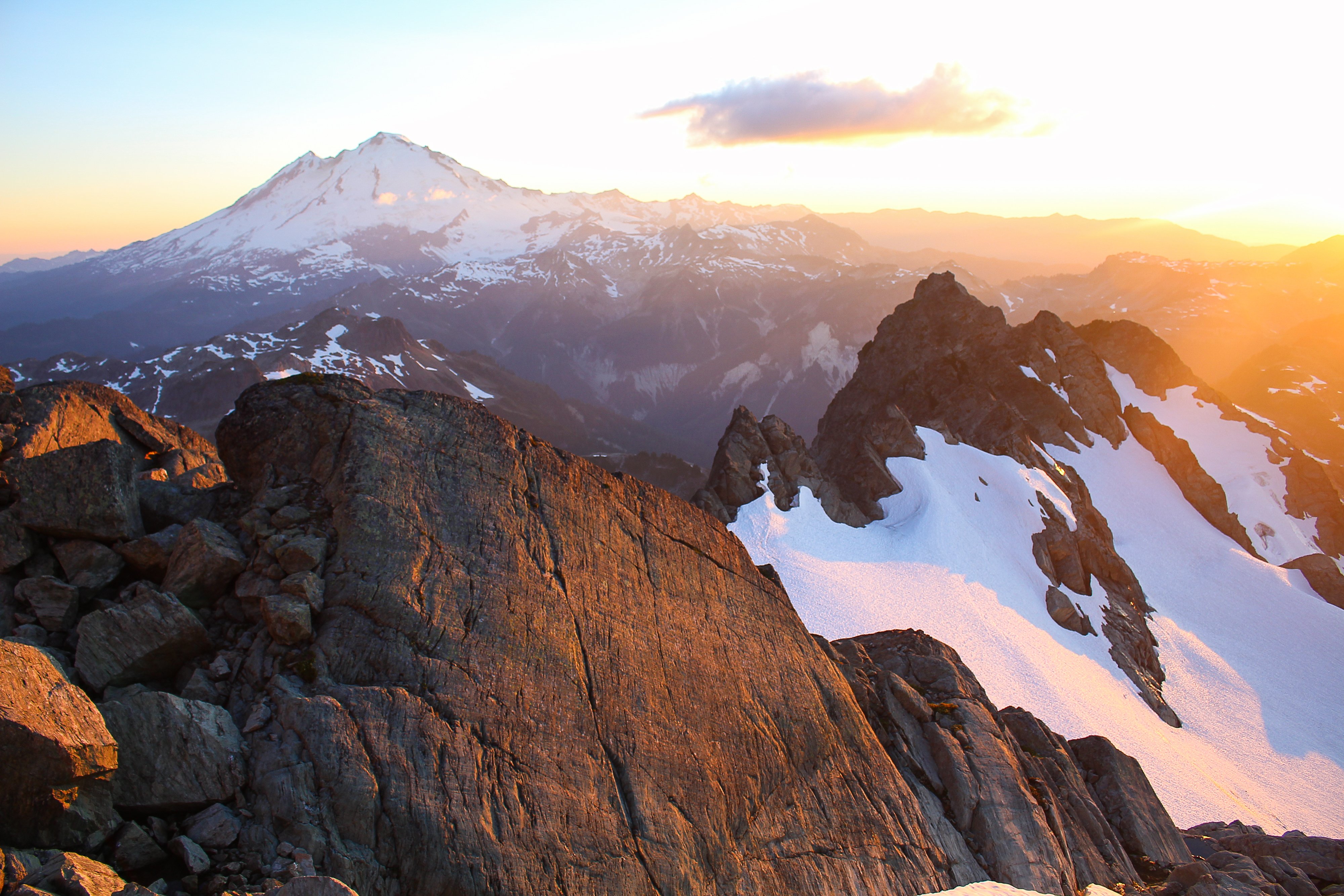
Trip: (Ira) Spring Mountain - East Ridge Trip Date: 01/25/2026 Trip Report: This long stretch of grim ski conditions had me casting about for other ideas in the North Cascades and Olympics (Ellinor, maybe I'll do a TR) these past few weeks. This past Sunday I cast off solo up the mountain loop highway from Darrington, aiming to get to the Lost Creek Ridge Trailhead. Surprisingly the MBSNF had a current report that you could drive all the way to the TH and indeed you could. Everything was in great shape, including to the turnoff for Pugh (not sure about the road up, however). 2wd would get you to the LCR trailhead at this time, which was somewhat surprising given the apocalyptic nature of this past December. Unsurprisingly, I was alone at the TH, and set off up the dry trail. It was generally in good shape, though with a good bit of blowdown in the first half mile or so. It had been 29 years since I'd hiked the trail and I had forgotten what large trees there are in this section of the Sauk. Of course, when they fall down, I wish they were a little smaller: Within a couple hours I found myself at Bingley Gap (hitting snow about 500' below gap), where I put on crampons, got out the axe and started up the steepening ridge. Views of Pugh and Sloan teased through the trees as I gained elevation: Within a few hundred feet above the Gap, the east ridge of Spring Mountain narrowed and steepened dramatically and I found myself doing some spicy scrambling in crampons sans helmet. Oops. (Don't worry, I found an easier way down to the north and below the ridge itself). Soon, Dakobed came into view: And then, not long after that, the summit of Spring, which was smaller and more noble than I was expecting: The view from the summit was sublime (about 3.5 hours from the car), extending across Sloan and the Monte Cristo peaks to the Olympics and up north past Darrington into the heart of the North Cascades. It was just me and a lone raven up above, croaking as it rode higher on the thermals. It was a beautiful day in the North Cascades. Out to Hall Peak and the Olympics: I stayed on the summit for about an hour (3 bars 5G service FYI), flinging digital poo at those that couldn't make it out with me that day. But I was a bit uncertain about the descent, since I didn't want to descend the way I had come up and left early enough to give myself some time to figure things out. Impressive views of the east side of Pugh slowed my pace on the way down. I had brought my new telephoto, which came in handy: Breccia Mountain: But I needn't have worried. Straightforward snow slopes (though steep-some facing in) were fairly easily followed from the summit all the way back to Bingley Gap. No sketchy scambling with crampons was required and within an hour I was on the trail bombing back to the car. I arrived early enough for a stop at the NF Sauk Falls (highly recommended), where a nice view of Spring Mountain was also had (summit is that middle rock): I hadn't seen anyone all day, nor a car, since leaving the pavement a bit south of Darrington. This was somewhat surprising to me, given that it was a beautiful Sunday, but then I remembered that there was a Seahawks game on. Too bad for those folks, I guess. I sat for a bit along the road as the sun sank west, admiring Whitechuck Mountain. I never get tired of a good day in the North Cascades. Gear Notes: axe, crampons, helmet Approach Notes: Lost Creek ridge trail to Bingley Gap. The east ridge can be followed, more or less to the summit from the Gap, though it can get spicy in places. An easier route drops a couple hundred feet on the north side of the Gap and then up and left through avy paths to the summit.

-
- 3
-

-

-
Glad to hear folks were getting after it on the black spider! I kind of assumed there would be plenty of ice but the inversion/warm temps at upper elevations kind of scared me off anything. I guess I was too cautious this time! Also the lack of enjoyable skiing lol. I’d like to get up the right gully if we get a nice day. Seems in fun condition if accessible past the schrund.
-
Sloan and Bedal this past Sunday:
-
Thanks for the report, that is a fun route!
-
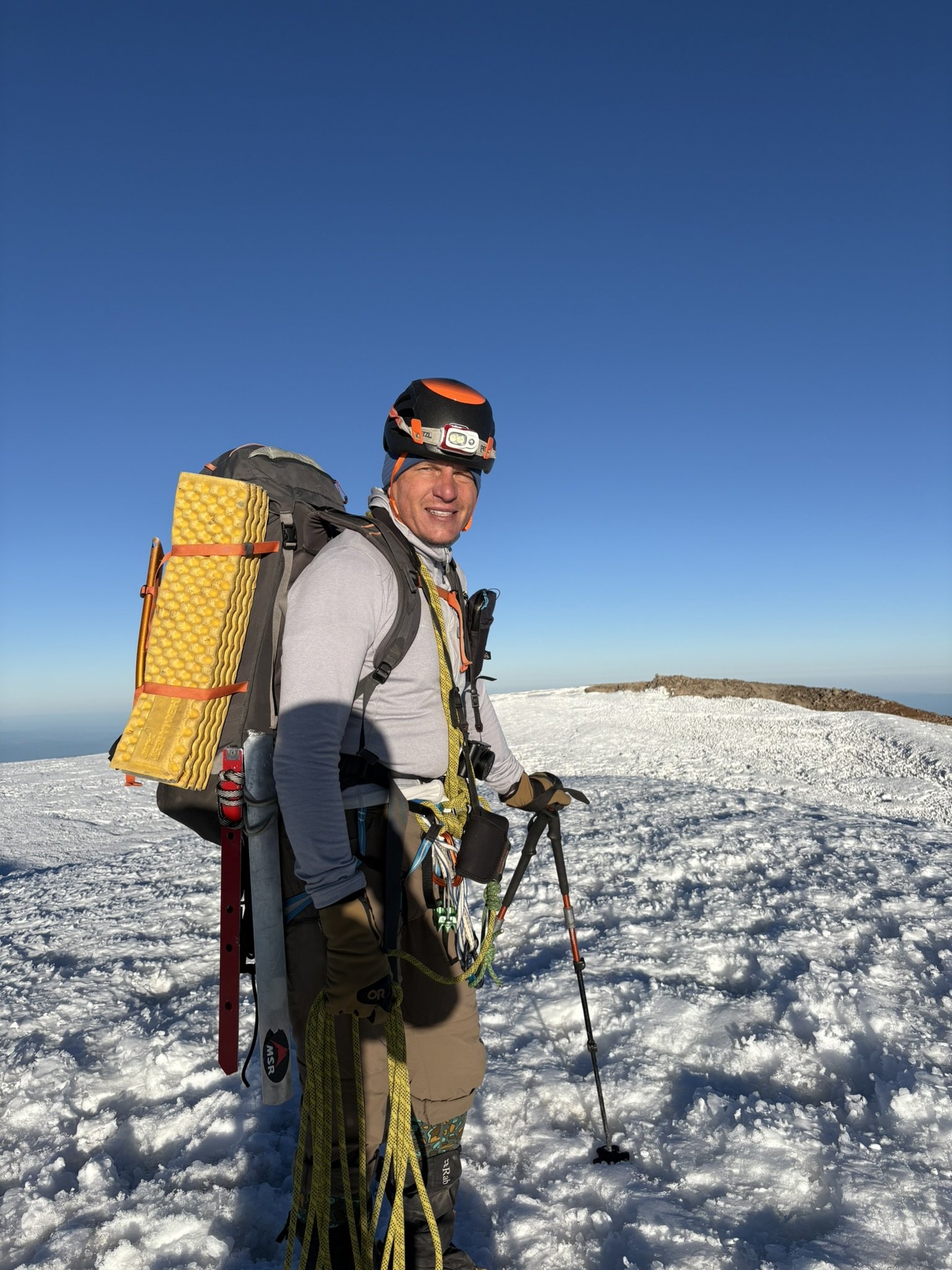
Trip: Guye Peak - South Gully Trip Date: 01/22/2026 Trip Report: My friend Vraj and I climbed the South Gully of Guye Peak during the strong inversion layer on 1/22/26. This was both of our first times up to the peak and we were rewarded with some great views above the low hanging clouds. We left Seattle later than intended due to the usually busy traffic on a Thursday and ended up parking at Summit West Lot W3 right around 0900. We asked one of the Summit employees about the parking and were pleasantly surprised when we learned you do not need a pass to park there on a weekday (non holiday). We then worked our way to the base of the South Gully moving pretty slowly and finally roped up around 11 AM. The conditions at this point were ~32F and cloudy as we were very much still in the inversion. Mixed climbing between loose Class 4 and snow for about 7-8 total pitches. The going was slow as it was both our first time in this type of terrain and found the protection to be limited. We were pleasantly surprised with how much snow remained in the gully due to our own pessimism on the south facing route. We were also looking forward to our friends who had told us to go find snow somewhere else! Some fun climbing through the chock stones (which were completely bare) led us up and out of the gully turning left prior to the end. Vraj took the lead on the last pitch before we decided to unrope and scramble the rest of the way to the south summit. This was ~1630 and the light was starting to fade. We wanted to make it up to the north summit before dark so we had to hustle. After reaching the south summit we traversed to the middle summit easily on a snow band. We were looking around for about five minutes before spotting the correct rappel station off a tree below the summit. We made it to the final ramp up to the north summit which contained the best snow of the trip. Topped out on the north summit at 1750 to a fantastic view of the backlit cascades. Downed some much needed calories we made our way back to the parking lot off the north side and through the Commonwealth getting back around 2000. Gear Notes: 60m rope 1x 0.5 - 3, nuts 2x pickets (did not even think of using) 2x ice screws (why) Approach Notes: Standard South Gully approach (MTN Project)
- 1 reply
-
- 2
-
-
 HKuszmaul joined the community
 - Yesterday
-
2025-2026 Mt Hood Speculation Thread
bedellympian replied to Albert_Pynstardt's topic in Oregon Cascades
Also, N Face Cleaver FWA!? Look at those ice steps! Never seen them in before. -
2025-2026 Mt Hood Speculation Thread
bedellympian replied to Albert_Pynstardt's topic in Oregon Cascades
The snow is bullet ice from the freeze thaw right now. Black Spider has been climbed multiple times by multiple routes in the past week. If that ice is not all rotten and sun baked, and the "snow" patches are hard ice, then you can bet N facing routes are also in good nick. Re the schrund, I think it will probably go on the L side, but if not you can climb one of the snow fingers on the Lhand buttress and traverse in on the snow ledge or go all the way up and then rap/downclimb that snow finger onto the snow above the schrund. -
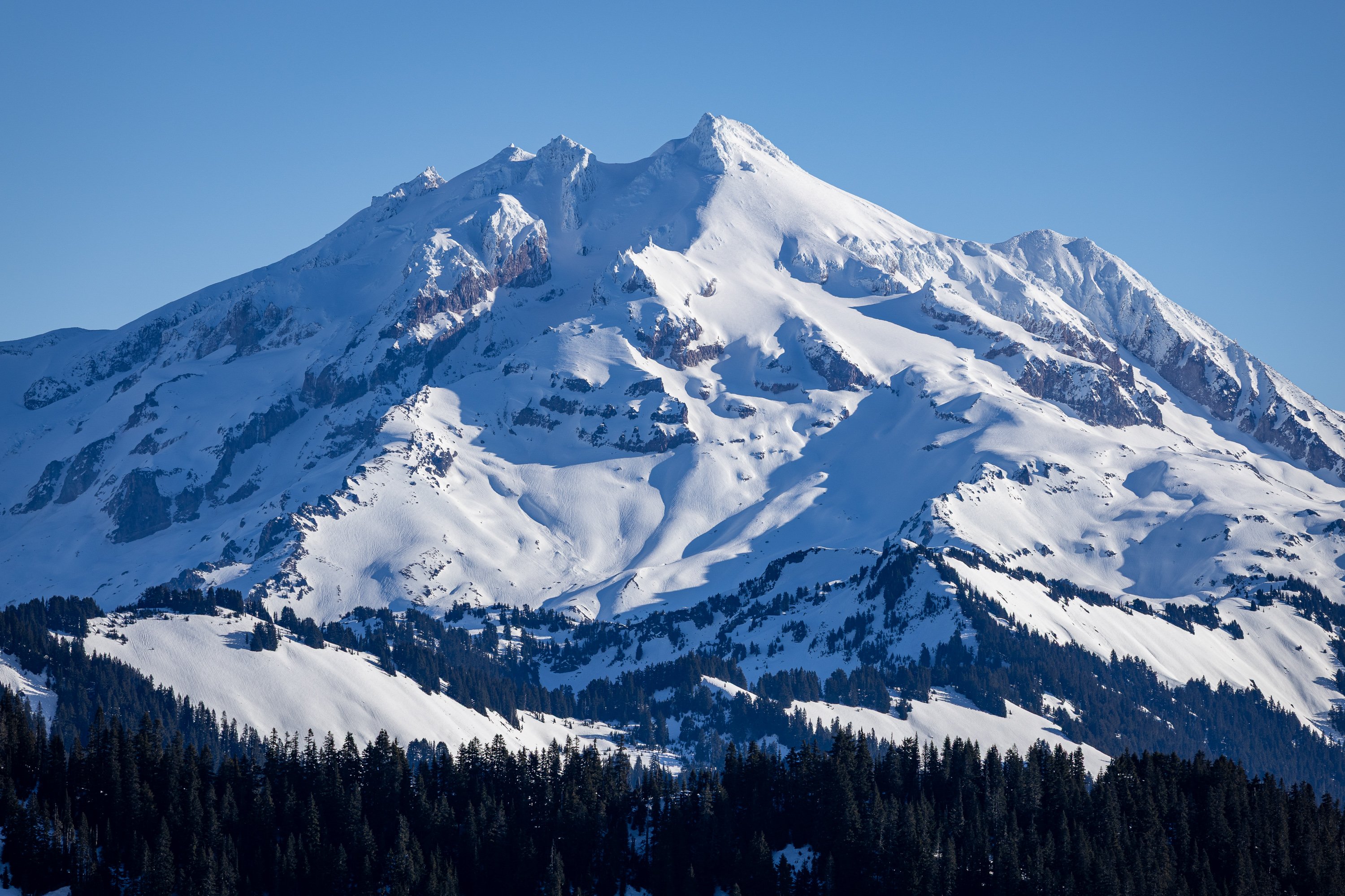
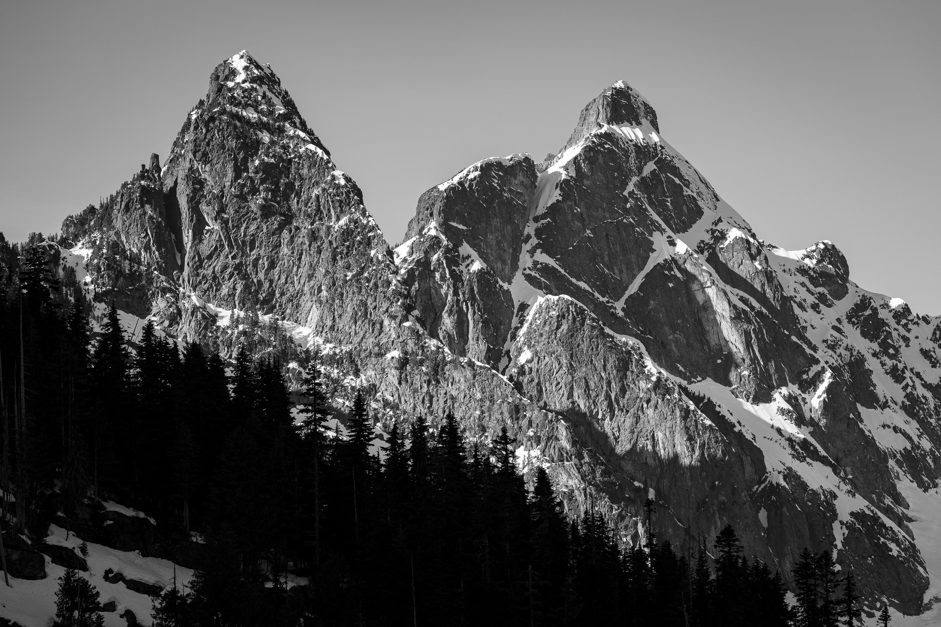
Dakobed from Helmet Butte:
- Last week
-
 Bikash joined the community
 -
Sunset from bivy below Winnie's Slide
-
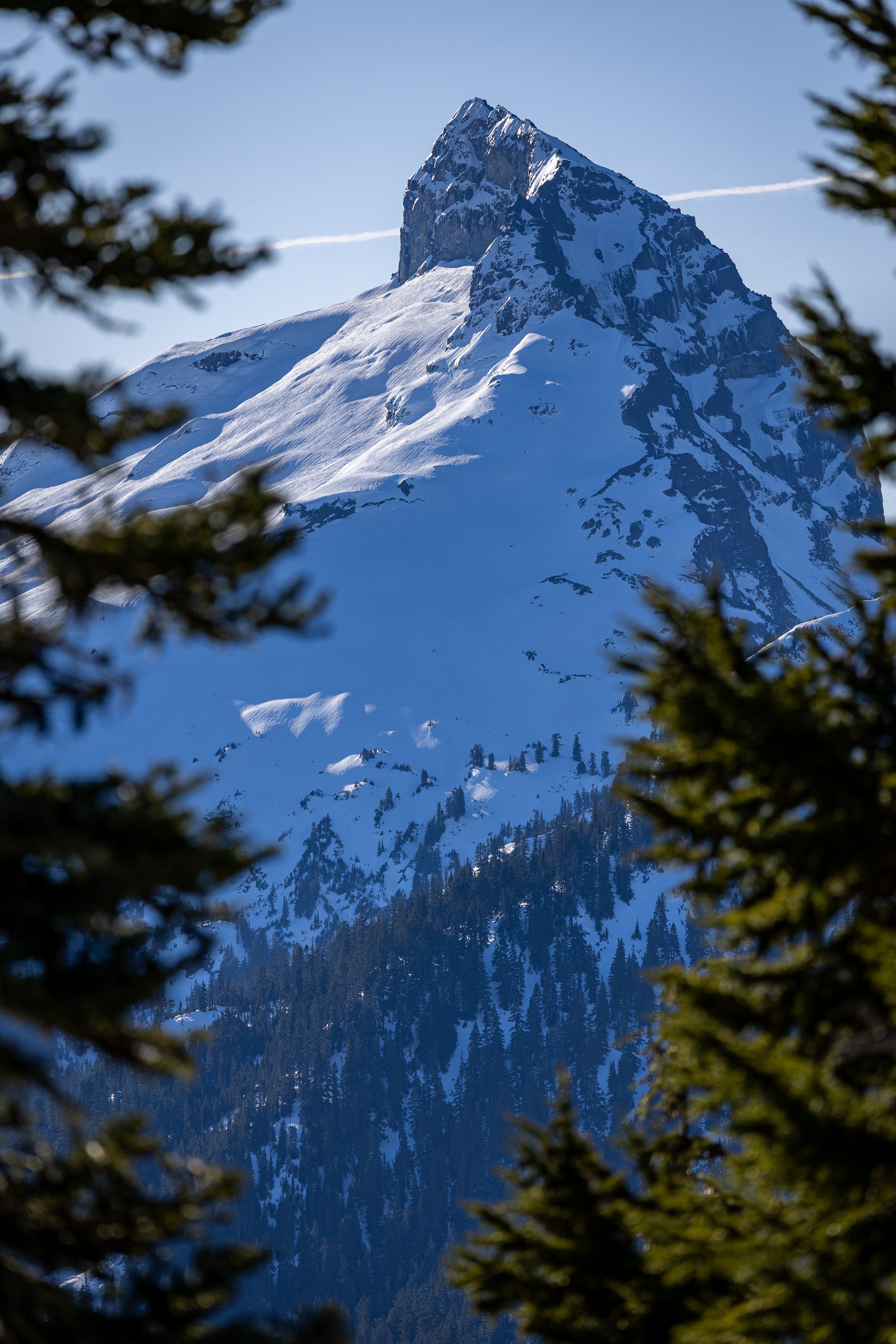
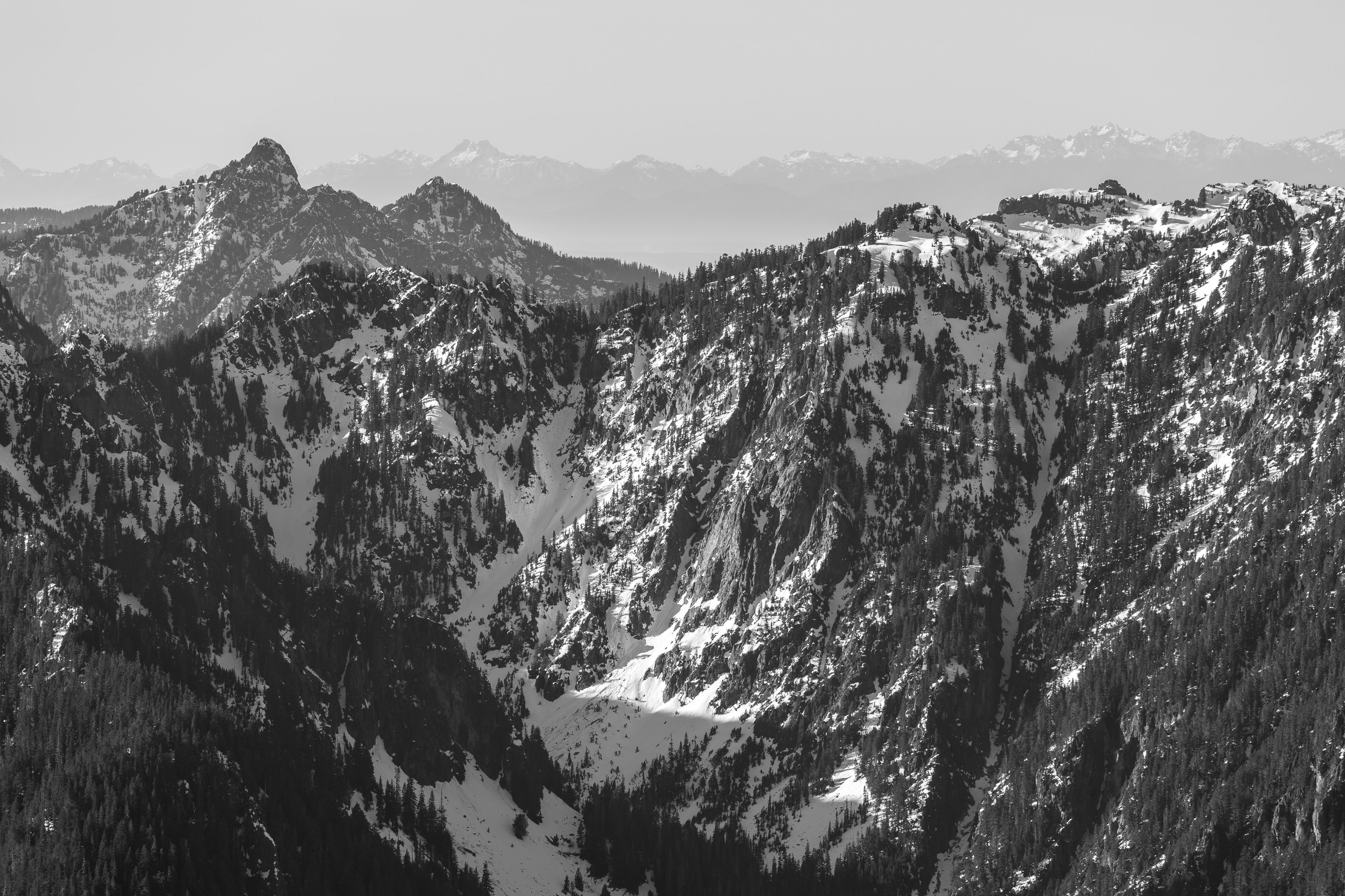
East side of Mt. Pugh two days ago.

-
 ClimbvHigh joined the community
 -
i want to be stoked
-

2025-2026 Mt Hood Speculation Thread
conrad_c replied to Albert_Pynstardt's topic in Oregon Cascades
Yeah, I think that there's a thin rimey layer over a lot of the rocks. I think they got like that during one of the high-elevation rain storms, but I'm not totally sure. I haven't been carefully monitoring over there so that's just based on memory. Upper ice step in the right gully looks really good! These are really great photos, you must have a nice camera. -
Thanks very much for the photo! I just went up by TJ this morning to take a look for myself. Based on my photos, the Eliot HW looked pretty damn good!... but now looking at yours, I'm not so sure. What I thought was blue water ice is maybe just plastered ice/rime...? The upper ice step on the right n face gully looked good too. But both gullies seem very protected by the bergschrund. Hard to say if easily passable.
-
 andy47 joined the community
 -
Oh man, thank you for postín these pics of Jiri. It's been a long time since we climbed together. I'll always remember him as a beast (in the best way)... charging through feet of snow seeking whichever goal we were after that day. We tried to ski a couloir in the tatoosh and it was snowplow the whole way. Jiri Led it all. To Jiri's family... sorrow and many hugs. We are grateful for our time with him. I didn't know Ben, but blessings to his family.
-
 MtMike joined the community
 -
I only knew Ben through work, and I hadn't climbed or skied with him. I could tell right away from his Zoom backgrounds that he was a climber and skier, so we struck up that conversation. He was instantly likeable: smart, strong and good looking - He was a pleasure to work with. I was looking forward to downloading some Olympics beta to him some time. I am so sorry for his family! He will be missed!
-
Some great discussion here, if you haven't read it, but not probably that helpful since I think all right side talk?