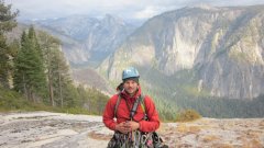
Riley81 Posted June 28, 2011 Share Posted June 28, 2011 Trip: Mt. Daniel/Cathedral Pass - Southeast ridge Date: 6/26/2011 Trip Report: I took my girlfriend and dog out on a backpacking/climbing trip this weekend on what I thought could be an easy climb up a good sized peak. It turned out that what Beckey describes as merely a hike along a ridge is not a hike along a ridge for someone with little experience on snow. For me it was a lesson in plausible vs. possible. Needless to say the sketchiest part of the trip was the traverse along the west side of Cathedral Rock which was composed of slushy snow in the afternoon and bulletproof snow in the morning. After approaching via the cathedral pass trail and attempting the traverse to peggy's pond my girlfriend found it to be above her paygrade with a loaded pack and did not want to head onward. We decided to camp at the pass for the night and I headed up the Southeast ridge at 6:30 AM the following morning. Made short work of the ridge under bluebird skies and hit the summit at 8:30. The only sketchy part was cutting under some large overhanging cornices along the upper part of the ridge. The trip down was fast easily glissading over 1500 feet of the route while skirting the along the north side of the Hyas creek glacier and following the path of a couple of ski mountaineers who had rode off the summit the previous day. Got pack to cathedral pass at 10:00 AM with my girlfirend pleasently suprised that I was back over an hour early. Great to get a summit in, but next time she gets to choose the destination. BTW there is an assload of snow up there right now. 2-4 feet at Cathedral pass. Cathedral Rock from the trailhead. Panorama of Hinman, Daniel and Cathedral from the pass. Sunrise on Cathedral Rock. Looking along the Southeast ridge. I traversed below the upper rock band on the ridge at 7200 ft. Glacier Peak. Mt. Ranier, Venus and Spade Lakes. Mt. Stuart. Another of Stuart cause the view of the North ridge is badass. Cute little pond below the Hyas Creek Glacier on the way back down. Gear Notes: Ultra light Shit to make the slog in bearable. Approach Notes: Green Beckey book. Constant snow started on the trail at 4400 feet where the slope breaks. A few downed trees on the trail. Quote Link to comment Share on other sites More sharing options...
Alex Posted June 28, 2011 Share Posted June 28, 2011 Never getting over the epic amounts of snow up there! I did this route once Memorial Day weekend back in the mid-90s and it had way less snow than this year. Quote Link to comment Share on other sites More sharing options...
mountainsloth Posted June 28, 2011 Share Posted June 28, 2011 I did this trip with my girl friend during Memorial day weekend 3 or 4 years ago and that ridge was snow free. Didn't make the summit due to weather and a not-so-psyched lady. Quote Link to comment Share on other sites More sharing options...
pete_a Posted June 29, 2011 Share Posted June 29, 2011 did you need a high-clearance vehicle to get over the Scatter Creek water crossing on the road? Just wondering if a regular ol' car can make it to the trailhead right now. thanks. Quote Link to comment Share on other sites More sharing options...
Riley81 Posted June 29, 2011 Author Share Posted June 29, 2011 I was able to get across with my 06 outback, but water was coming over the hood for a short period. I didn't see the usual quantity of people camping past the creek, but there were some light trucks that made it past. I would not attempt it in a sedan. The water level is definetly higher this year now then it was last year a month previous when I was out there. Quote Link to comment Share on other sites More sharing options...
pete_a Posted June 29, 2011 Share Posted June 29, 2011 thanks! guess i'm packing the sneakers for a bit of road walking Quote Link to comment Share on other sites More sharing options...


Recommended Posts
Join the conversation
You can post now and register later. If you have an account, sign in now to post with your account.