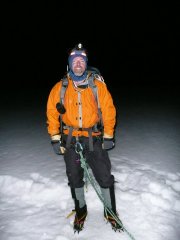
Le Piston Posted August 24, 2009 Share Posted August 24, 2009 Trip: Woolley and Diadem, Icefields Parkway (attempt) - Standard Date: 8/17/2009 Trip Report: My friend Rod and I had planned to climb the Kain Face of Robson, but a foot of fresh snow foiled the plans. So, after finding out that our second choice Columbia was out of shape, we opted for Mount Woolley and Diadem. The next door neighbors are 11,000 footers and both can be done in a long day...just my kind of peak bagging. The first obstacle was finding the trailhead, as there are no signs. You must drive about 12 km north of the Icefields Center and find a pullout on the right side of the road opposite of Woolley Creek. After crossing the frigid Sunwapta River, you head north not far from the treeline on a faint trail to a cairn near where Woolley Creek joins the Sunwapta.The trail ascends to the left of the creek past a falls.The trail stays to the left of the creek all the way to a basin at the base of Woolley and Diadem.There are several nice rock walled sites with water close by.On the approach hike, my friend fell and injured his right hand bad enough to make climbing impossible...I don't care for one handed belays and such. The route goes from the toe of the glacier to the rock ledges on the southeast face of Diadem. Once on the glacier you ascend the South ridge of Diadem and return and ascend the North ridge of Woolley (or vice versa).It was a nice hike in, but discouraging to drive all that way and leave without a couple summits. Anyone looking for a nice moderate climb in the Icefields with a short approach when other peaks are out of condition...this is for you. Gear Notes: We took standard glacier gear. The snow/ice ramps looked lean and possibly might require 2 tools. My friend thought a small rock rack would be nice, but we never got on the ledges to see if that would be needed. Approach Notes: As described above. The main thing is stay near and left of Woolley Creek on the way in. There were cairns leading up a moraine towards Mt. Alberta that could be confusing. The Sunwapta river was pretty low and braided and with careful scoping never got above knee level. Quote Link to comment Share on other sites More sharing options...
trainwreck Posted August 25, 2009 Share Posted August 25, 2009 i wondered if you guys made it up, too bad about the injury though. i was the parks guy who sent you there. Quote Link to comment Share on other sites More sharing options...
John Frieh Posted August 25, 2009 Share Posted August 25, 2009 i was the parks guy who sent you there. Is that you Graham? Quote Link to comment Share on other sites More sharing options...
Le Piston Posted August 25, 2009 Author Share Posted August 25, 2009 Thanks so much for the suggestion and beta. It would have been perfect except for the injury. My friend wanted to head home and attend to his hand, so sorry for not stopping in and filling out a trail report. I hope to come back another time and try again. Cheers! Quote Link to comment Share on other sites More sharing options...
trainwreck Posted August 25, 2009 Share Posted August 25, 2009 i was the parks guy who sent you there. Is that you Graham? Grant, but yeah, it's me! Quote Link to comment Share on other sites More sharing options...
Buckaroo Posted August 26, 2009 Share Posted August 26, 2009 If you're going to go this far you might as well go over Wolly Shoulder to the Alberta hut. The best views in the Rockies IMHO. Mt Alberta and N Twin Quote Link to comment Share on other sites More sharing options...
Le Piston Posted August 26, 2009 Author Share Posted August 26, 2009 I actually hiked up by myself to the base of the Woolley Shoulder to scope out Woolley and Diadem. I considered going up there, especially as Grant said the views were awesome of Alberta and North Twin, but the clouds and wind were picking up...maybe next time. Thanks for the suggestion. Quote Link to comment Share on other sites More sharing options...
leighmc Posted August 16, 2010 Share Posted August 16, 2010 What do people find the best way of getting up Woolley Shoulder generally is? We tried up to looker's left but the rock was extremely loose, and then started running out of light before we could give looker's right a go. Ended up heading back to the bivvy site for the night. Quote Link to comment Share on other sites More sharing options...
Le Piston Posted August 24, 2010 Author Share Posted August 24, 2010 I wish I could tell you. I had discussed going up there last week with my partner after hearing how great the views were. He convinced me that they would be just as good or better from the summits of Woolley and Diadem, so we didn't go up there. Sorry! Quote Link to comment Share on other sites More sharing options...


Recommended Posts
Join the conversation
You can post now and register later. If you have an account, sign in now to post with your account.