

brad
-
Posts
54 -
Joined
-
Last visited
Everything posted by brad
-
Hi, Dave, I sent you a pm with my contact info. If you are still interested, I have several quality images of the F89's crash site on the Salish divide. Not saying you shouldn't try, but good luck with Chris(crazedmaniac)... He's, shall we say, quite recalcitrant.
-
Hey Jim, thanks for the hard work and fun new routes. Don't worry, I only used the painted holds and climbed fast!
-
Thanks, Nevtrik. Message sent.
-
Bummer..., Chelan County Search and Rescue personnel this (wed) morning recovered the body of a 37 year old Canadian woman who fell to her death yesterday (tue) evening near Leavenworth. Sergeant Kent Sisson says Amy R. Stein of Squamish, British Columbia fell off a ledge and into a steep ravine while attempting to avoid a large rock falling from above her head. Sisson says the other four members of the hiking-climbing party advised they had descended from the Orb route of the Snow Creek Wall earlier in the afternoon and were hiking down from the base. Stein was the lead hiker on the descent when a large rock broke free above her. Sisson says she fell an estimated 70 to 100 feet and was pronounced deceased as rescuers arrived on the scene.
-
Hi Nate, That would be "Shazzam" 5.9, gear to 3.5 FA: Brad Metz, Danielle Szabo You should have seen it before the scrubdown, FILTHY! Still could use a little love,but being so short, I never really made it a priority. I'm surprised you didn't notice the two Madrock hangers set back from the top of the crack. Nice send dude!
-
Danielle on the approach up the Aquarius Valley, Gates of the Arctic NP
-
Arrigetch Peaks and Valley, Gates of the Arctic NP
-
John V getting into the crux on Exasperator, Squamish, BC
-
Pause, rest, rehydrate... Leavenworth
-
I'm not one much for posting, but i have to call BS on this post. I also live in Leavenworth and have been out climbing ice regularly this season in both canyons. I watched a few thousand pounds of ice and snow come down over Pearly slabs (which are not in "normal historic dimensions" as of 3pm today) while i was climbing rock in the sun today at around 1:30pm. A fat, 140 foot pitch of ice that a partner and i climbed on sunday in the Icicle above 8mile rock is almost completely gone. You would be a fool to get on the Funnel or Drury right now. Montypiton, did you climb any of the routes that are 'merely in historic dimensions' today? It is access to the Smear that prompted me to respond, as it is the most important false statement in this post. For years, i have had discussions with people regarding how to approach the Smear, and none of us seems to really know the property issues, it's all just rumors and speculation. At this point, it seems to be pretty common knowledge among the climbing community in Leavenworth and the greater Wenatchee River valley that the property owners along Canal Rd DO NOT want people crossing their property, which extends across the road, increasing in elevation as you approach the climb and reach the roads end. The confusion seems to lie in where the Okanogan Wenatchee National Forest boundary lies and what is private property, or not. I decided to spend some time to try and talk to some people and get some concrete answers. The obvious first step was to look at quadrangles and maps online. The best i found were on http://www.fs.fed.us/locatormap/ and http://www.co.chelan.wa.us/assessor/ I then contacted a Ranger at the Wenatchee River Ranger District (509-548-2550) here in town, but he really couldn't help me and directed me to the Okanogan Wenatchee National Forest headquarters(509-664-9200). I then spoke with Carol, who was quite sure that the boundaries were accurate on the maps that i was looking at. To be sure, she then referred me to the OWNF Land Zone Team Leader, Scott Lynn. My call went to voicemail and Scott called me back within 30 minutes. We discussed the location of the climb, which he was familiar with, and talked about different maps and where they specifically denote National Forest. Again, he was confident, but not definitive and said he thought it was owned by the county PUD. He said he would look into it and shoot me an email. It is worth noting that at this point there was no confusion as to whether or not the CLIMB ITSELF lands on private property...it does. 15 minutes later, i have a satellite pic with property boundary overlay, including the name of the property owners that OWN THE SMEAR. The national Forest boundary doesn't start for at least 400 vertical feet above the Wenatchee River. The overlay also marks other private plots that would require trespass even from the red bridge, which, by the way, would be a miserable approach (next time you drive out of town,take a look). In other words, you can look at it from your boat in the river but the second you step above the high water mark (public easement) you are trespassing. I'm not posting this in an attempt to tell anyone what to do, I'm just trying to arm people with factual information before they make a decision for themselves. Go poach it if you desire, just remember that you are a spectacle to every person driving on one of the busiest roads in the state, on a climb that is a sharp point of contention with more than one land owner that lives very close to the climb. You just might make us all look like fools...
-
Just an FYI in case you were planning on coming this weekend. Highway 2 is currently closed because of a wildfire from Cole's corner to Leavenworth. You can still access the Icicle, but you have to detour through Plain. Were it not for the fire, you could still access said free camping just north of the bridge. I heard on the radio about an hour ago that it is not expected to open tomorrow. Also of note is that there is no take out available for boaters at the Hwy. 2 bridge over the Wenatchee. Not sure when that will be worked out, but you can still take out river left along the highway before getting into the hard rapids. I know this is about climbing, but i know alot of climbers spend time on the river. Hope this helps.
-

Massive development in the middle of Red Rocks!!
brad replied to ericandlucie's topic in Access Issues
Uh, yeah, that's comparable.... Careful Dave, you used the word BOMB in an internet forum, now you are also a terrorist combatant and may possibly be accused of conspiring with me! Better distance yourself and your cause! Hahaha! Welcome to hell I'm still free by the way!!!!!! Super heinous escape from the authorities today at Bear Cave Rock!! I can't wait for the royalties to come rolling in off of this fugitive epic!!! Movie at 11... and get this... there's rappelling in it!!! -
Massive development in the middle of Red Rocks!!
brad replied to ericandlucie's topic in Access Issues
Hilarious!! Yeah i'm sure as soon as i posted on this website several anti terrorist govt. organizations mobilized to take me out! What do you think? DEA, ATF, FBI? Possibly a Joint Task Force???? What would be really flattering is if they sent Seal Team 6 or Delta! I make one flippant comment and you've got me pegged as the next Tim McVeigh. Quit watching Fox news bro, I'd say you are a little more than paranoid! You should seriously consider a career with the Dept of Homeland Security. I'm going climbing today, i hope i don't secretly get abducted by men in black ski masks in Icicle Canyon!! LOL!!!!!! -
Massive development in the middle of Red Rocks!!
brad replied to ericandlucie's topic in Access Issues
I'm sure a lot of folks care a great deal--myself included--but I'm not sure who would want to be associated with this type of nonsense: You should do your best to distance yourself and your cause from this type of idiot. Ha! Dude, Fairweather, sorry i offended you. I mean geez, are you really that thin skinned and literal?! You must be a load of fun to hang out with! By the way, i sent an email to every person on the list. Guess i'm an idiot Thank you ericandlucie! -
Massive development in the middle of Red Rocks!!
brad replied to ericandlucie's topic in Access Issues
Wow! Count me in. Are you sending emails to all these folks or is one contact going to have more effect than the others. Personally... I think a .308 is the way to go. -
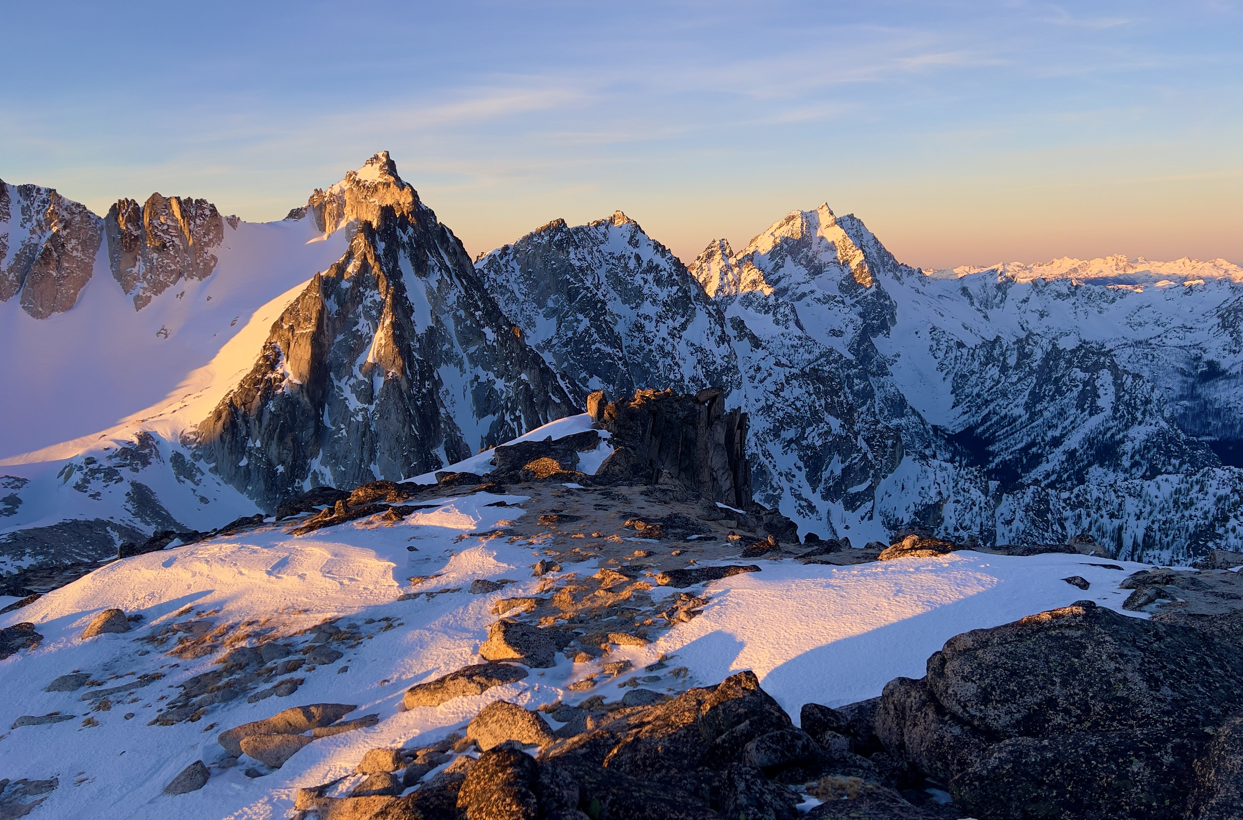
Nice pics people!!! Very inspiring stuff, here's a couple of mine Cragging, Exasperator Alpine, Mt Triumph Ice, E face Three Fingers Scenic, Stuart Range Bouldering, Olmstead Humor, what to do when it starts raining
-
You didn't misread anything. He said "the route below oval orifice, jug or not". And i fully agree that leaving draws on a 10b that has anchors that are accessible from a 5.9 is a sure way to lose your draws. so you're back to hero status!!!!!
-
Although it was more exciting to think it was a rattlesnake i must agree on the gopher snake ID. This one was NOT a gopher snake
-
I believe it is a Western Pacific Rattlesnake. This was at the power tower. I have seen no less than 5 snakes already this season in the tumwater. especially the last couple of weeks. I almost put my hand on an adult last thursday. Scared the shit out of me. That combined with two black bear encounters in two weeks has me feeling a little on edge lately, especially off trail.
-
Look at this little guy!
-
Wow Dave, you and i have quite a knack for posting at exactly the same time!! Funny!
-
So much for that. Looks like they just cleared out the campground. I hope this doesn't drag on TOO long.
-
Rayfield showed up about an hour ago with equipment.
-
Right?!! If it takes that long i'm going to stop paying my taxes!
-
jinx