


philfort
-
Posts
1163 -
Joined
-
Last visited
Content Type
Profiles
Forums
Events
Posts posted by philfort
-
-
Clearly you are just trying to make your trip sound more impressive than it was... 'cause face it - it just WASN'T IMPRESSIVE ENOUGH!

Folks on tay might fall for lies about the height of the north face, but here on cc.com, no way boy...
-
We simulclimbed about 5 100m pitches.
I call BS!!!

5 * 100m = 500m = 1640ft.
So... you guys roped up at Source Lake or something??
-
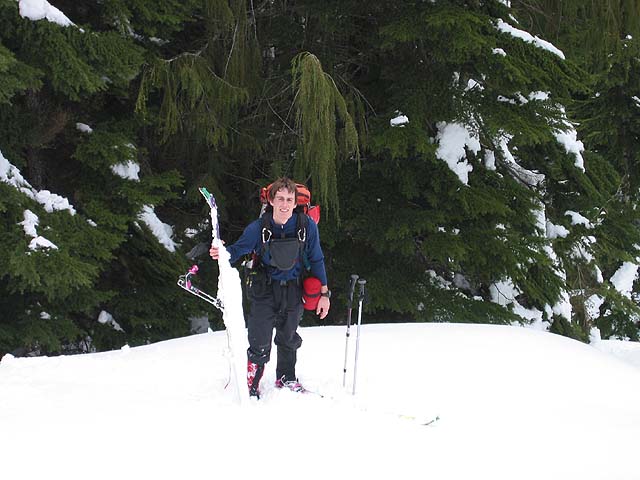
You gotta watch out for those snow monsters, they can get you.

(photo pbelitz)
-
The big ones to the right of Baker are Whitehorse and 3 Fingers.
Big 4 and Vesper are the other prominent ones, between 3 Fingers and Glacier Peak's obvious cone.
So, I think it goes:
Baker, Whitehorse, Three Fingers, Big 4, Vesper, Glacier Peak.
-
I wonder what this couloir looks like from the air in the winter:
Here's a photo of the top of it, from the ground, in December a few years back when there was (nearly) no snow yet:

Looks like a wicked convex roll there (and actually if you look closely, you can see a fracture line in this photo)
-
At least it wasn't as bad as this poor dude:
(not from last wknd)
-
Paul, I thought this photo of yours was also very sexy too:

-
was this shot taken from the top of rex? Man..it was beautiful on Sat too!
I don't know what rex is... it was taken from the top of the peak north of Bullion Basin. I think people call it "east peak"?
First sunny ski day for me in over a month - it was unsettling...

-
Here's more to rub it in:
Breezy ridgetop


And bonus one from Snoqualmie Pass on Saturday:

-
Sorry to say this, but it was powder and bluebird near Crystal yesterday


-
Wow, this is crazy. Timberline is up to 138 inches. Neck and neck with Paradise, and more than Baker...
But Chinook Pass is the undisputed king, with 172 inches.
Still just a relatively "normal" year so far though, nothing special... (or it soon will be, as the extended forecast is trending towards drier weather again)
-
We got kicked off the hill for doing that last month... so I don't think they would appreciate it.
Just stop in and check with them, or avoid the ski area altogether and just skin up towards Source Lake.
-
Sounds like you're asking for easy backcountry slopes... unfortunately, there isn't too much of that that is easy-access in washington, since things tend to be densely treed near the bottom.
Paradise would have the best "green/blue" bc terrain I can think of around here. There are plenty of gentle open slopes in Paradise valley.
You might find some easy terrain in the bowls across from Crystal Mtn, but getting to and from there would be a chore if all you can handle are resort blues.
Skyline Ridge across from Stevens would be another choice, but it's steeper and more treed than stuff you'd find at Paradise.
Or go to Hyak on one of the days it's closed (but after it's had a dump) and skin up the runs.
A few years ago I made the transition from skiing to boarding. I tried going full on in the backcountry right away - it was fun, but I flailed a little too much and felt bad about slowing down my partners. So I imposed upon myself a "backcountry boarding moratorium" for a couple of months, until I'd honed my skills at the resorts. It was a good idea.
ps: Yodelin is just east of Stevens Pass, on the south side of the highway. Pick up one of the backcountry skiing guidebooks, it should be in there.
-
if they're buried more than SIX FEET .... it's probably gonna take so damn long to dig them out that it's doubtful whether they'll live anyway.
-
Oops, sorry for stealing your thread, haha...
As often is the case, epic days means hardly any pics or footage (probably has something to do your thread title
 )
) -
Stevens Pass BC was superb today (and yesterday) above ~4500ft. Pretty stable snowpack (loaded slopes near ridgetops though). Skied slopes to 40 degrees, good visiblity, lots of faceshots, etc....

Best skiing of the year!
Something like this:

-
Is there no way to get from those large flats and ridgeland onto the gentle south slops of Big Jim without significant avalanche slope exposure?
I've haven't been that far, I was just guessing.

Just made it to Pt.6296 during a high-avy-danger day last season, then turned around due to a friend with tired dogs. It was just nice unusual-for-the-Cascades terrain up there. Open woods and glades.
Thought maybe you could follow the ridgeline itself to Big Jim, but I didn't get a good look at it.
-
Quick! Where's Dru? Someone is needed to explain the difference between the Coast Range and the Coast Mountains!
-
You'll be on avalanche slopes as soon as you climb above Colchuck Lake, just getting to either of those routes.
-
Expect snow or rain. The roads will be bare and wet, or slushy, or snowy.
-
You want something even closer than Snoq pass?

You could save a few miles of driving by going somewhere just west of the pass, but you'll make up for it by much more "approach". The pass is the quickest bet.
-
I bet the approach would be snow-free until at least 3500ft right now (found almost no snow on Baker at that elevation last wknd). Might make for quick hiking. Doable as a day trip?
-
I haven't, but in that same area, Hatchery Creek makes a nice "ridge" tour with lots of elev. gain. Nice open forest up high, and safe from avies until you get close to Big Jim mtn.
-
Sam, you didn't burn enough skis.

Conditions and Images
in Mount Rainier NP
Posted
N. Icefall looks smooth