zaworotiuk
Members-
Posts
24 -
Joined
-
Last visited
-
Days Won
10
zaworotiuk last won the day on May 5 2024
zaworotiuk had the most liked content!
About zaworotiuk
- Birthday 12/14/1989
Converted
-
Location
Portland, Oregon
Recent Profile Visitors
The recent visitors block is disabled and is not being shown to other users.
zaworotiuk's Achievements
-
Black Spider is not in. Mt Hood ice scene is pretty sad currently.
-
zaworotiuk started following Mt Hood - Black Spider - Shelob's Lair (WI4, 2 pitches) - FA?
-
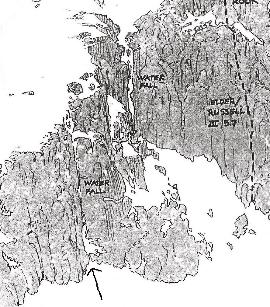
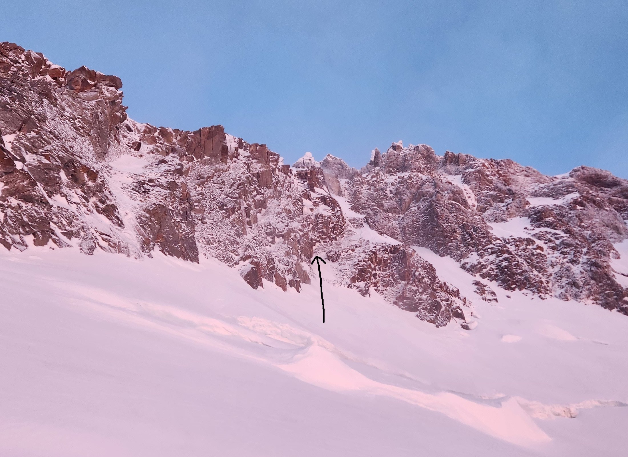
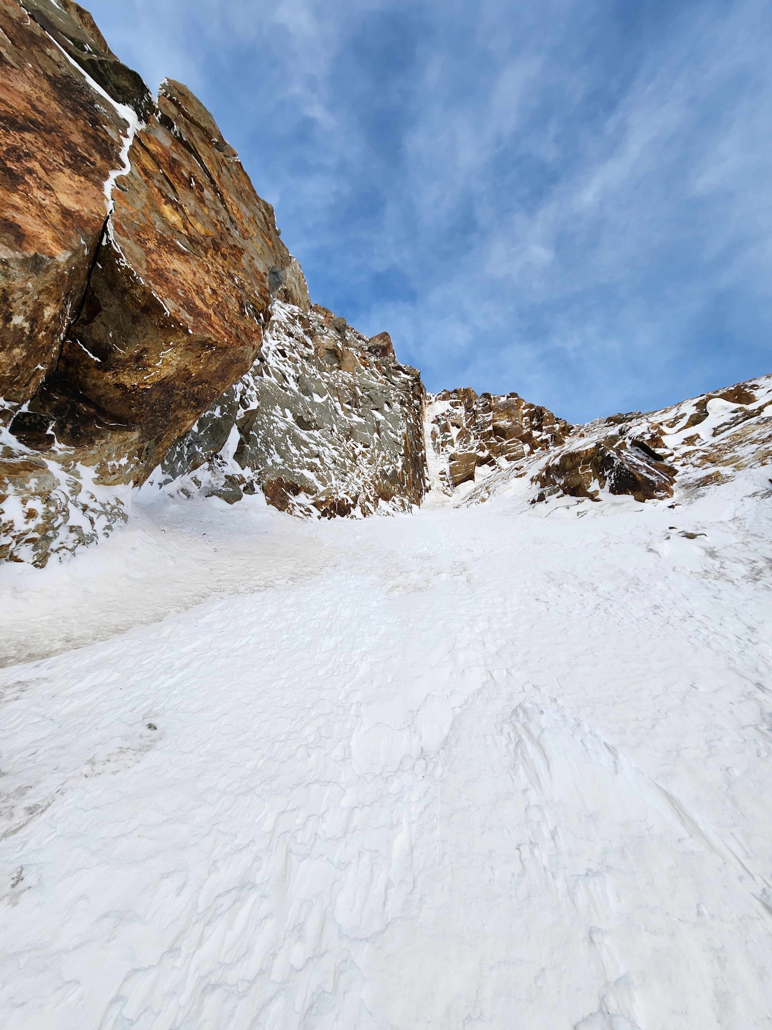
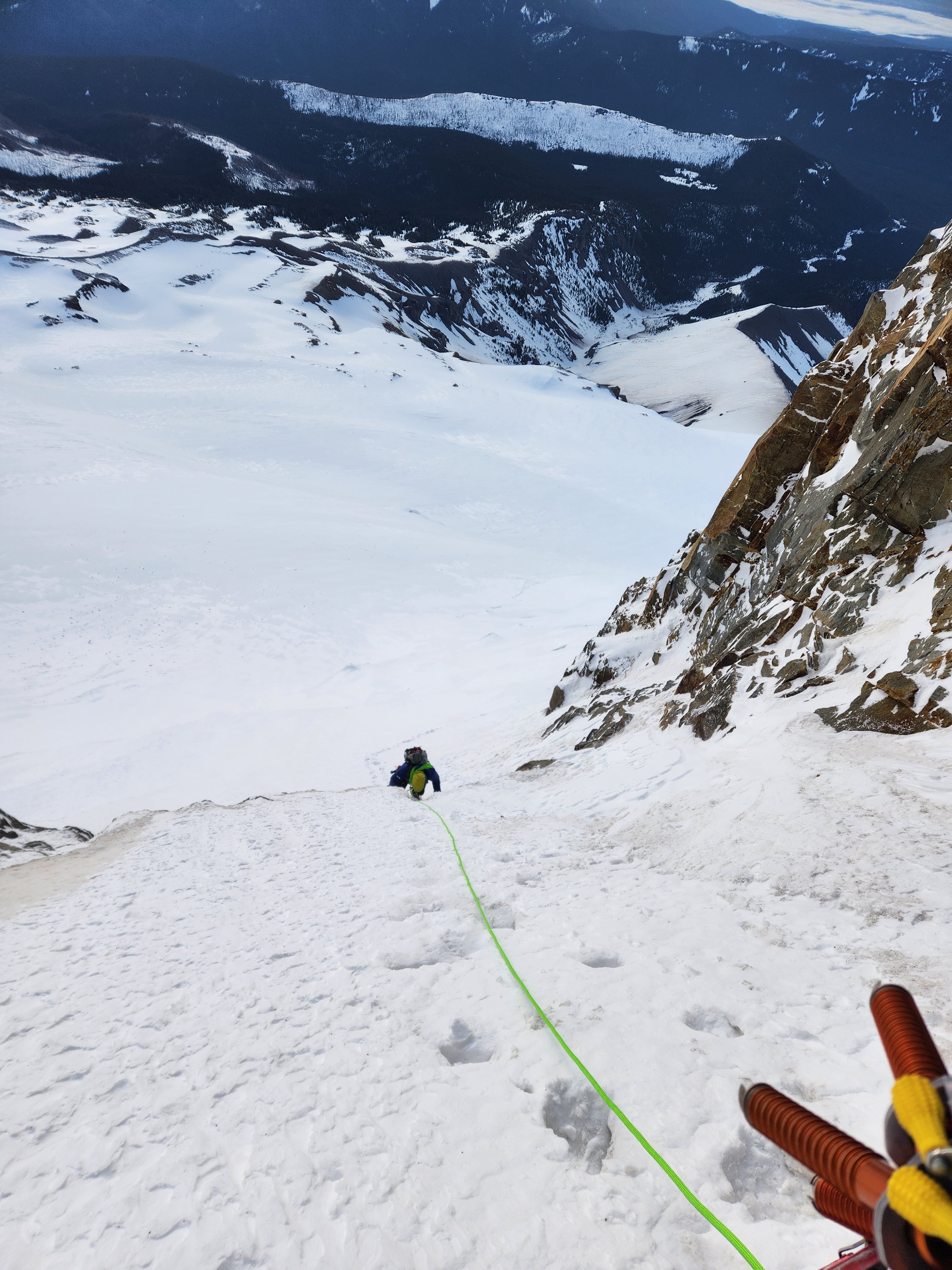
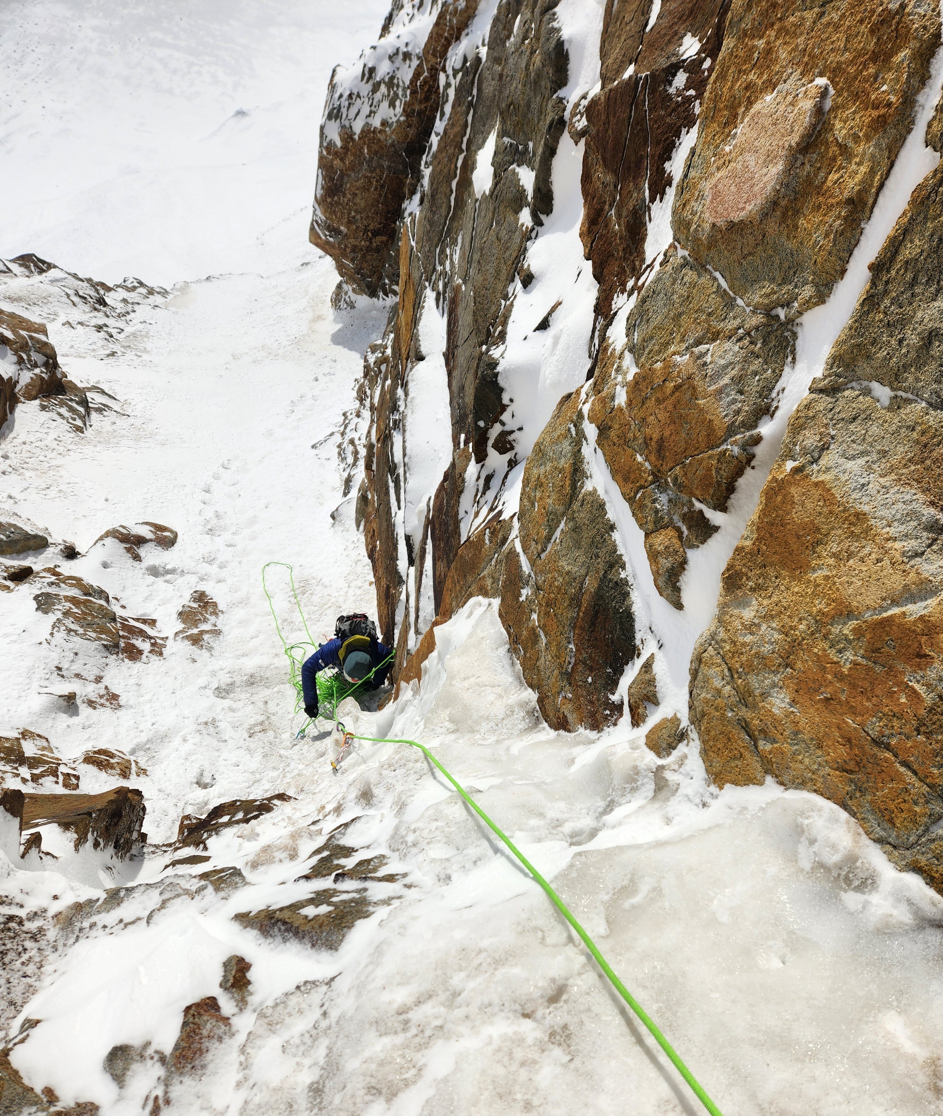
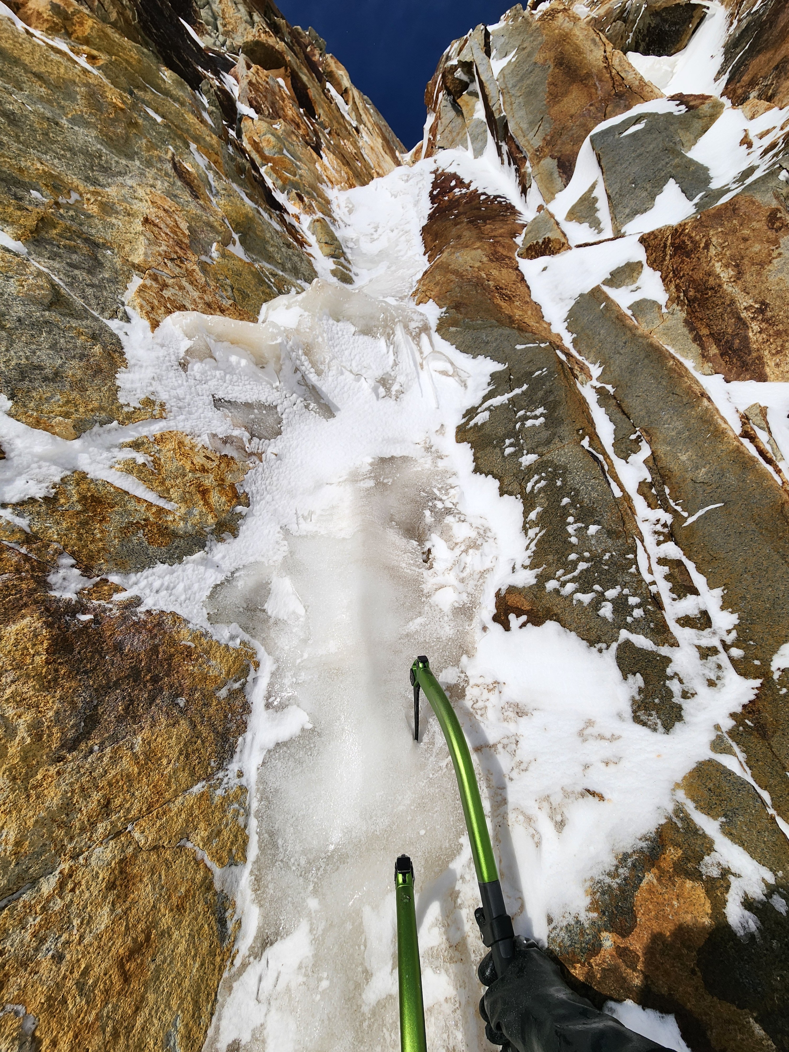
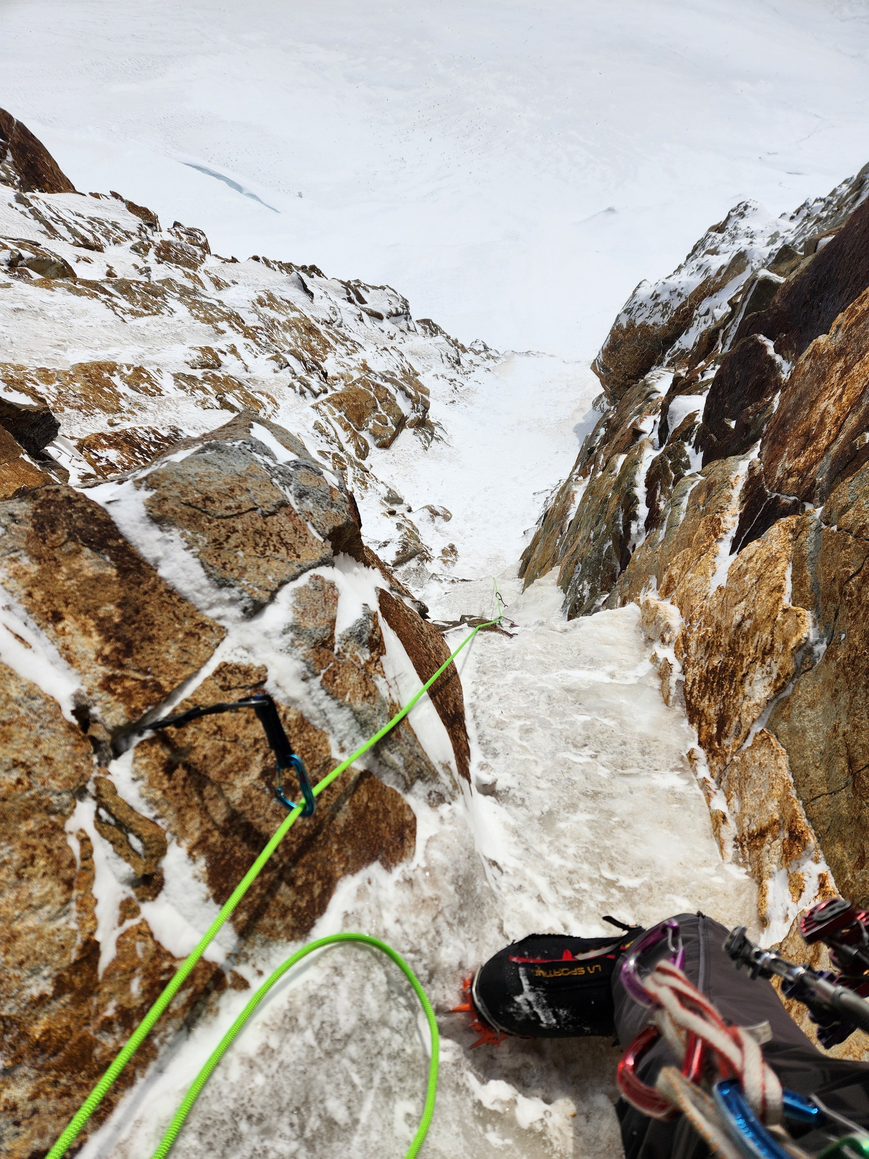
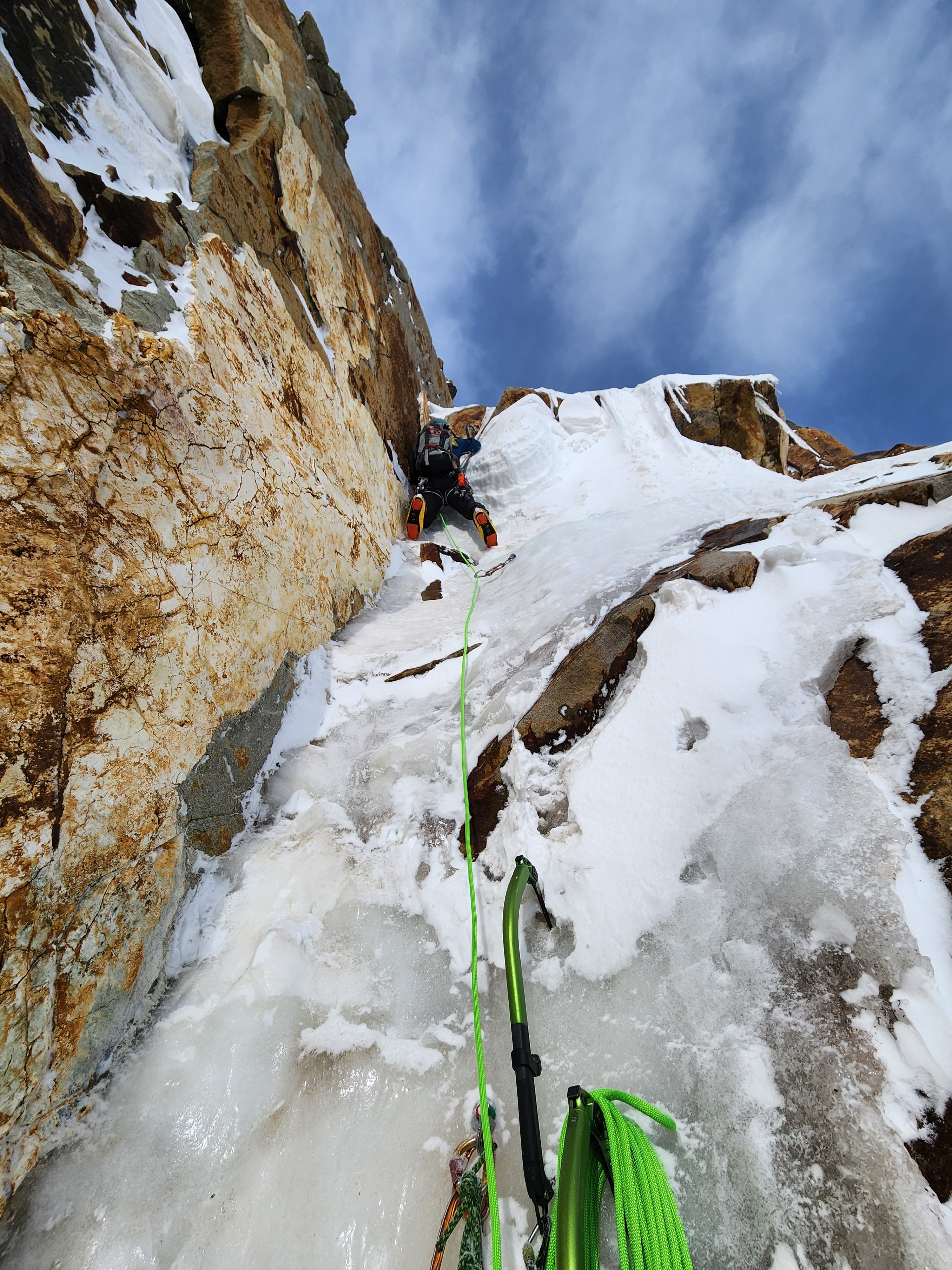
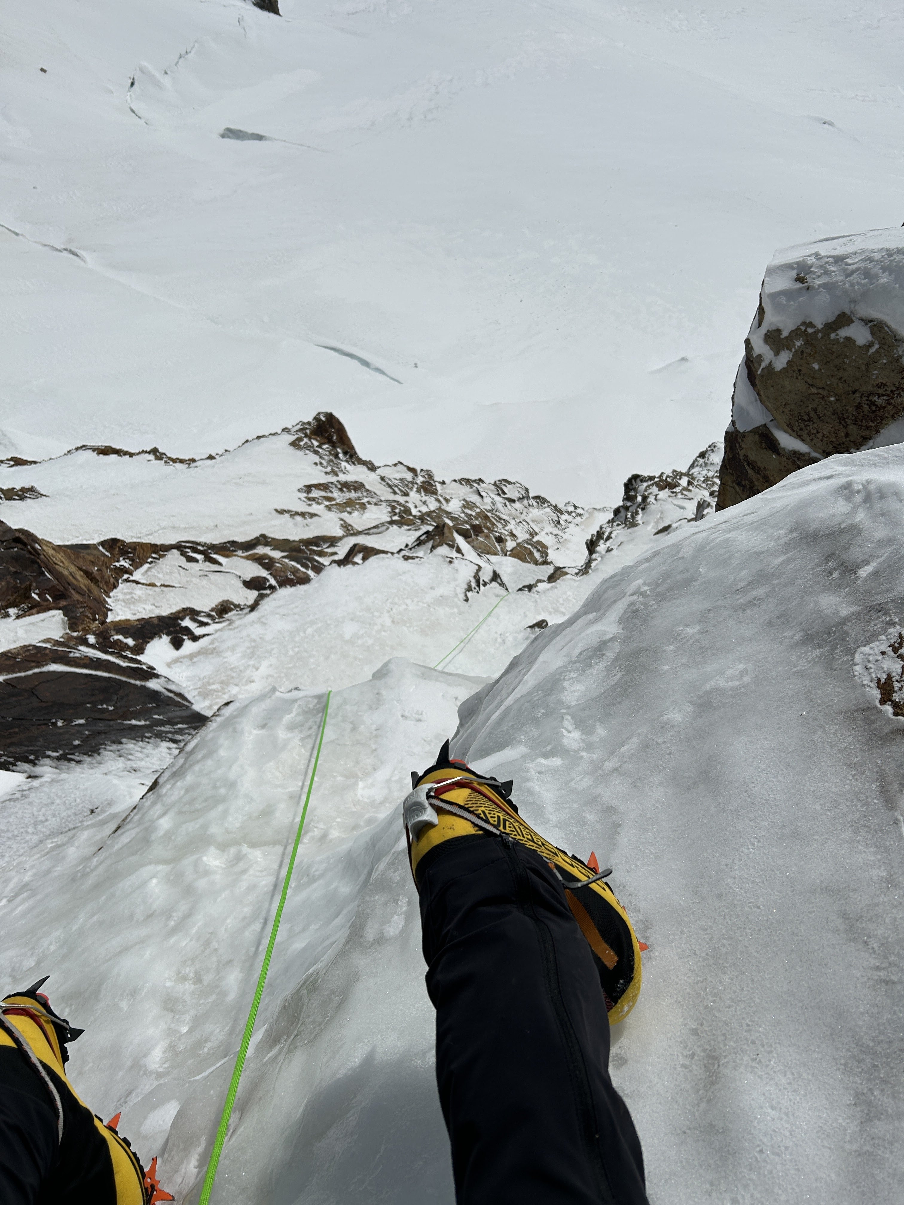
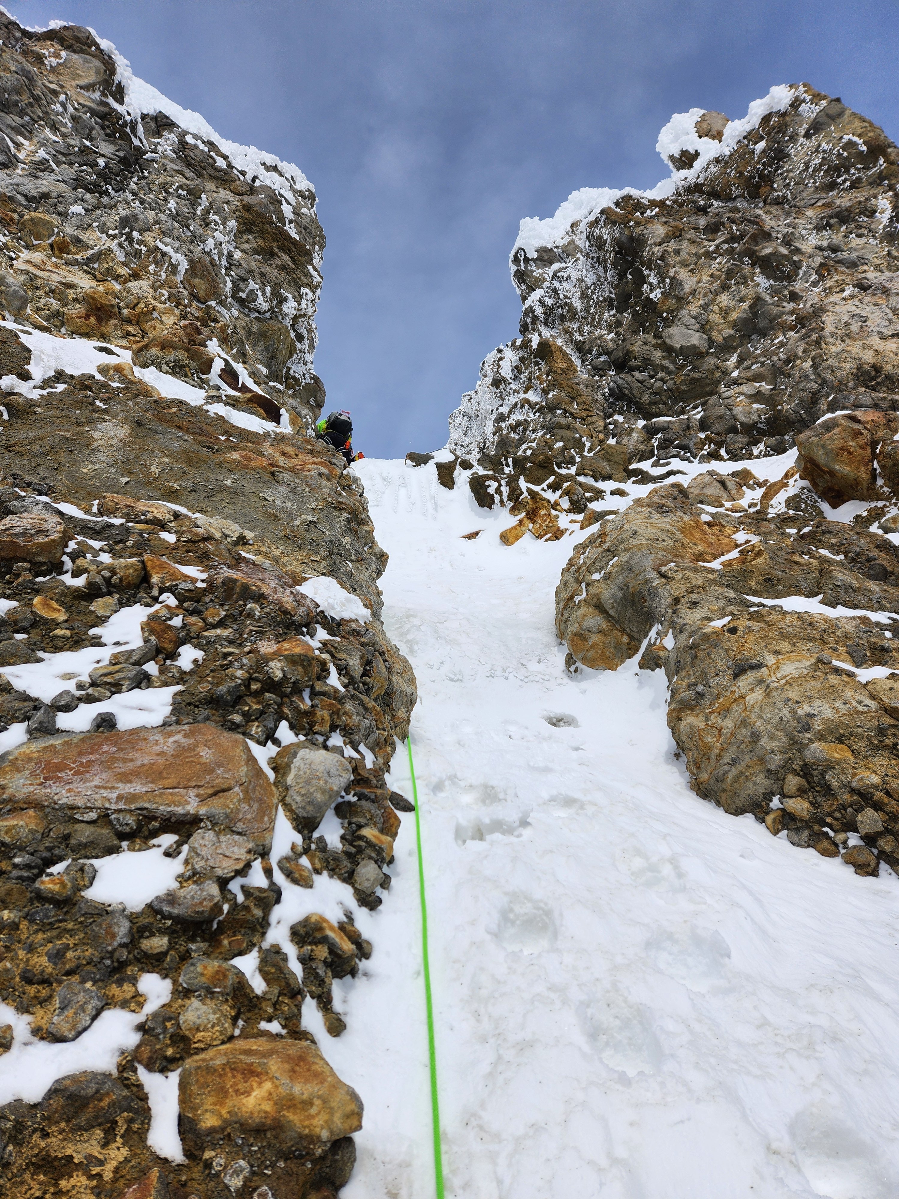
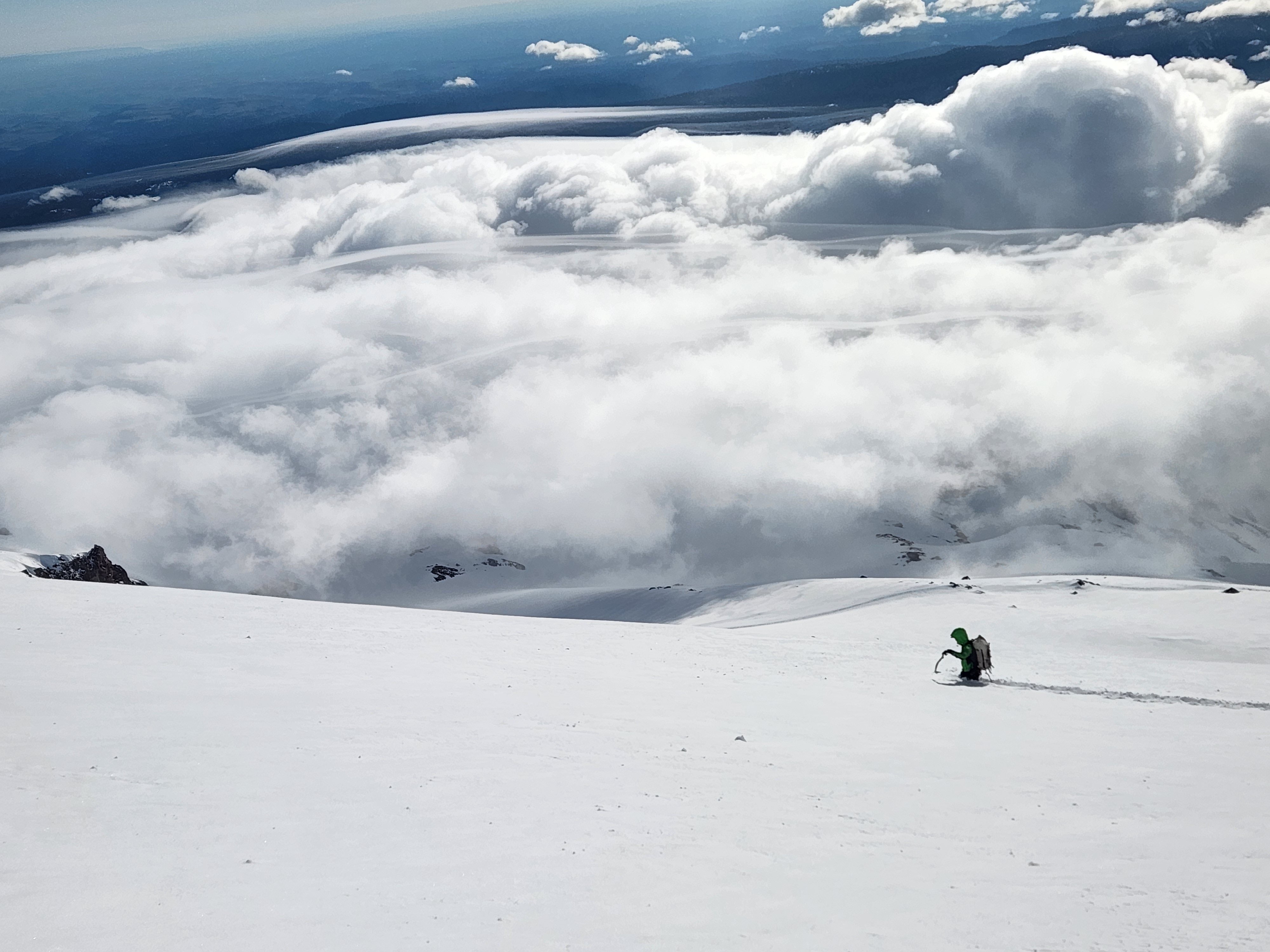
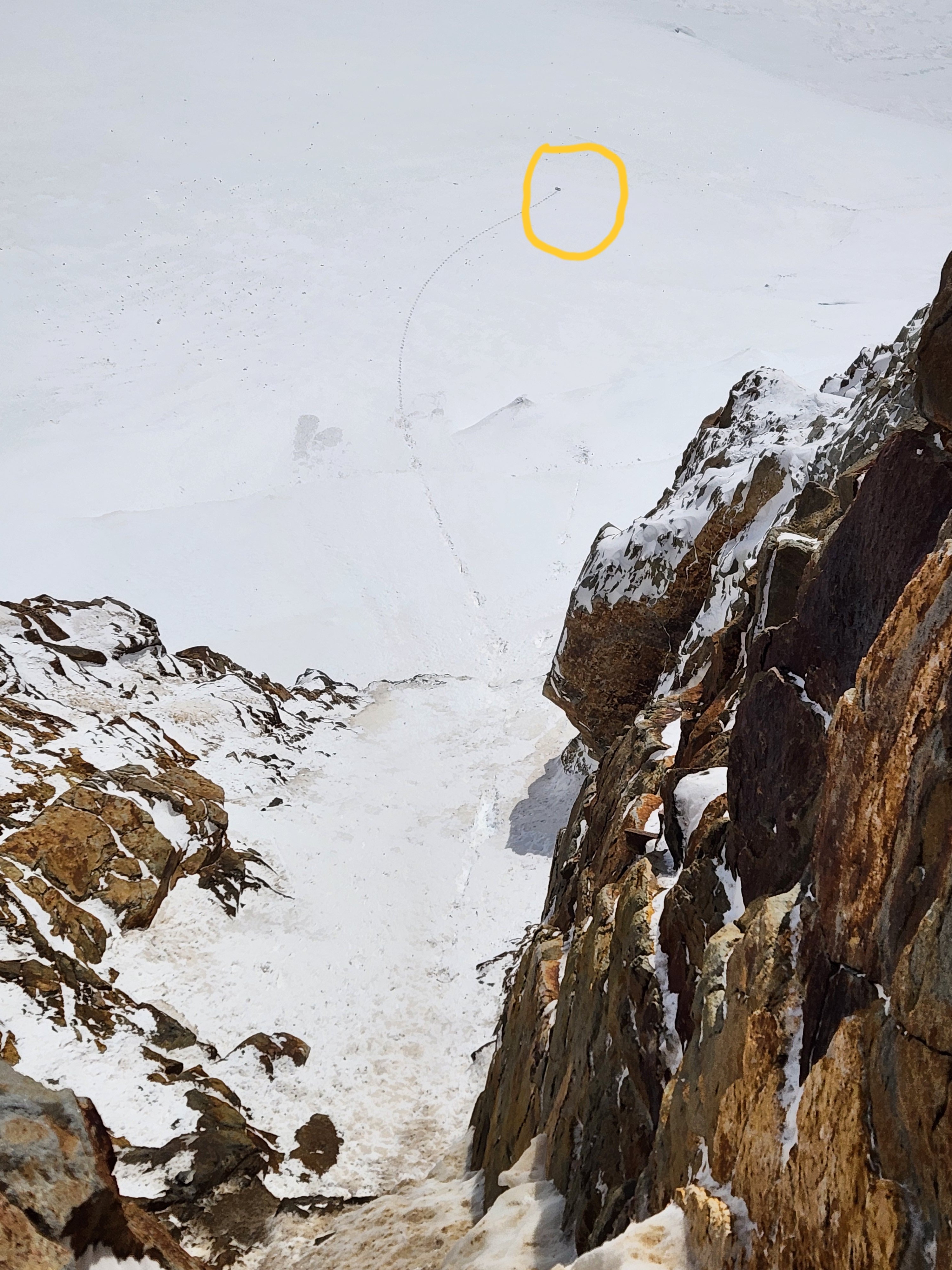
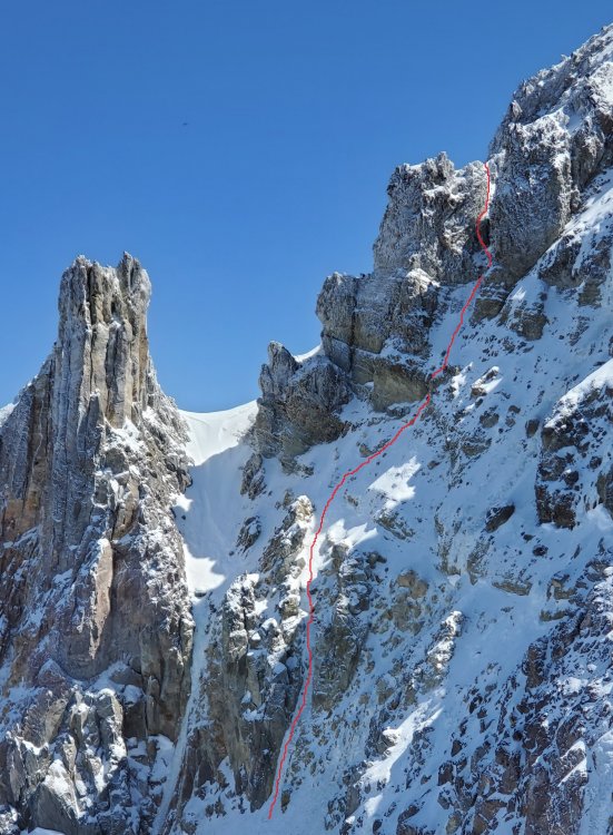
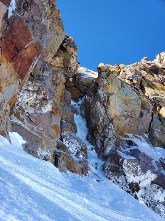
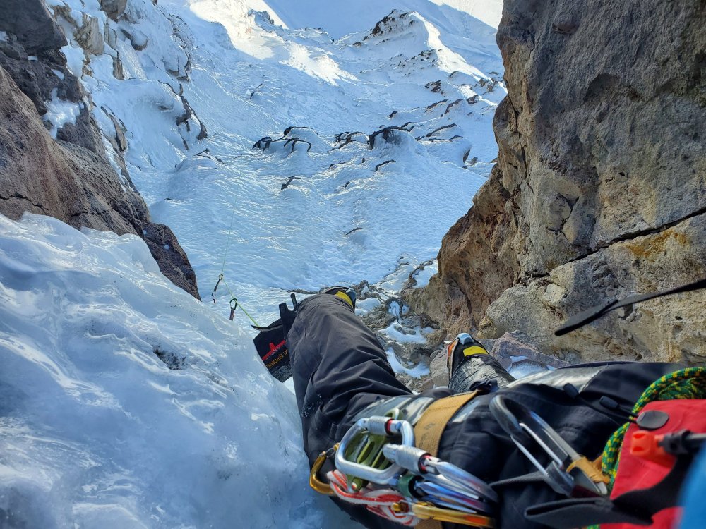
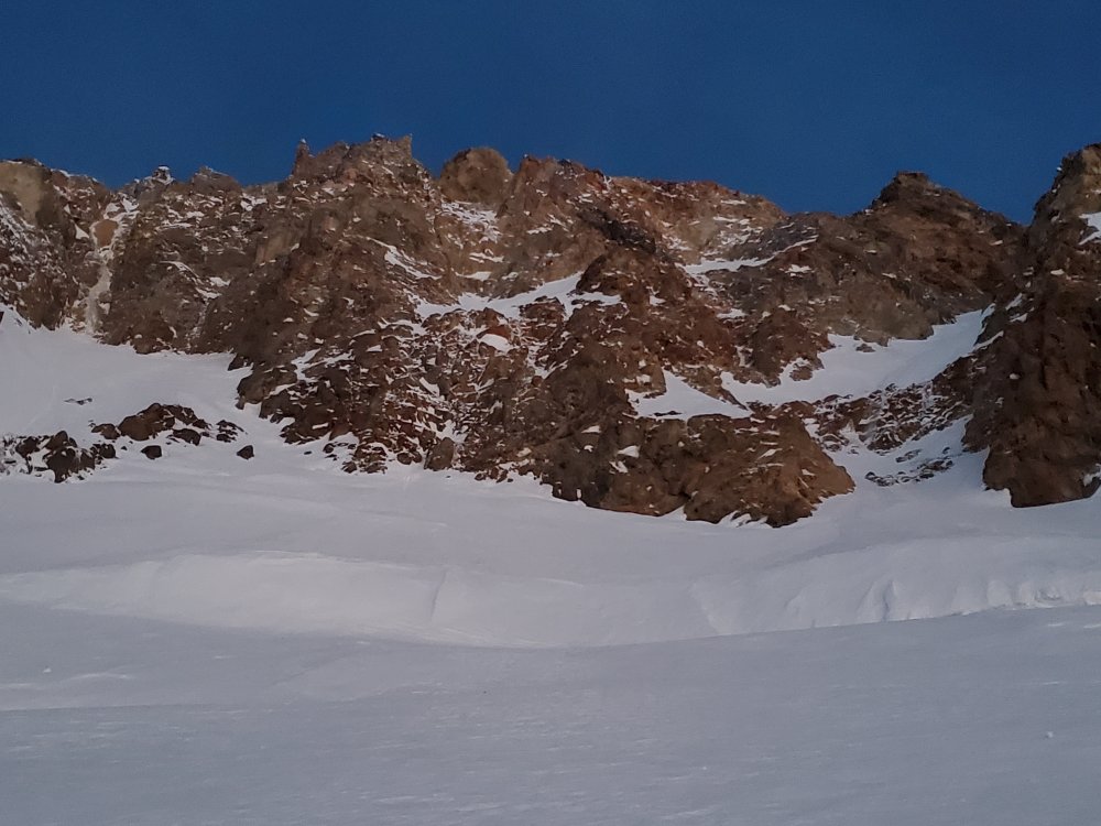
On April 13th Koby Y and I climbed what we believe is a first ascent on the far-left side of the Black Spider. We humbly submit this report for the historical record and for review by the fine netizens of cascadeclimbers. If you know of this line being climbed before, please let me know and I'll PRINT this trip report and then EAT IT (and appropriately redact our claims here). This route is labeled "waterfall" on the hand-drawn topo, left of the "waterfall" that later became the Fric-Amos route: Here's the route from the side, photo taken from the base of Cooper Spur in December (side note: despite looking fat in this photo, Fric-Amos was 100% unprotectable snice): This is a bit of a "lite"/"diet" Black Spider route, not tackling the entire face but rather topping out onto the Newton Clark Headwall about halfway up. Despite this, we did about as much technical climbing as on the neighboring Fric-Amos route and found it surprisingly engaging. It's a bit tough to grade as the ice was quite thin but we'd say it goes around WI4 with a couple M3-4 moves thrown in. I assume that like other routes on the Spider it could become easier and perhaps go entirely at WI3 in fatter conditions. On to some photos of the climb. Here is the face from below with the Arachnophobia second cliff band looking quite fat for April. Our route (which you can't really see as it's tucked in the corner) above the arrow: Next photo, approaching the route. There's currently a LOT of snow over there so the first steep bit visible in the side view above was totally buried. We just walked up into the little snowfield though there were a couple patches of low-angle water ice. Koby coming up into the snowfield: At the top of the snowfield we built an anchor and pitched out the rest of the climb. Here's looking down after the initial steep bit (WI4-ish?) of pitch 1: A couple photos from higher on pitch 1 below. Somewhat tricky climbing up a series of brief vertical steps with some thin/snicey/delaminating sections: I only led about 25 meters before building an anchor, as there was a patch of fat blue ice, a decent pin placement, and I guess I had already used all but one of my screws, sewing it up out of fear in my typical style. Here's Koby leading out above the anchor, about to do perhaps the hardest move on the route involving a brief torque in a horizontal crack to reach the good ice up above: Above this was mostly mellower, typical Mt Hood WI3-ish: Pitch 2 ended up being about 35 meters before joining the Newton Clark Headwall. In reality, we may have been able to squeeze all of our serious climbing into 1 60m pitch, though in more typical conditions (less snow) it looks like gaining the snowfield could require a bit of ice climbing, so it seems reasonable to expect to do at least 2 pitches. We simuled up the rest of the headwall, climbing one last short bit of WI2 between two gendarmes to join the upper Wy'East route to the summit: A couple final notes: First, thanks to Zach and Artem for trying to get this done with me the week prior. The wallowing was, unfortunately, insurmountable: Second, we did have one scary rockfall encounter that I feel obligated to mention. While belaying Koby on our second pitch, shortly after he topped out, a microwave-sized block spontaneously detached in the bowl above me and narrowly missed my head (I ducked), instead hitting my pack and ripping out the picket I had racked in the side pocket. A good reminder that climbing on the Spider sucks and to put the belays in more sheltered spots. This is really my fault for putting the anchor right in the fall line, I thought that we were much closer to the top of the route than we were in reality and that there wasn't that much overhead hazard. Thankful to emerge unscathed. Picture of the rock below: Thanks for reading.
-
Always a lot of good rime adventure climbing up in the crater!
-
[TR] Mt. Hood - Cathedral Ridge - Summer Climb 07/18/2021
zaworotiuk replied to mrkittles13's topic in Oregon Cascades
I tried to do this last weekend and it was too scary for me. I was expecting the rock to be trash but somehow it's even worse than I imagined! -
[TR] Mt Hood - Elliot Cirque, Variation 05/02/2021
zaworotiuk replied to ACosta's topic in Oregon Cascades
Thanks @Cliffordsa for the photos and info! Looks like the exit pitch was pretty dry for you as well? There's a random photo on mountain project that shows ice flowing down each side of the chockstone but I never saw it form in my many trips over there this year. @Cptn_Sprayhab I don't see a problem here. @ACosta originally said that the line may have been climbed before and promptly retracted the FA claims when we found out it had been. I find the pervasive "every square foot of Hood has been climbed" belief interesting. No one (so far) has taken issue with our Cathedral Ramp FA claim from a month ago. No one disputed Three Little Monkeys in 2018 or the Pencil in 2017. Other Black Spider routes were put up as recently as 2010 and no one complained about those either. Either all those lines were in fact unclimbed or the true first ascensionists have advanced into a Zen state of truly not caring at all. It's easy to assume some near mythical figure like the aforementioned Steve House would've done everything on Hood, but apparently when asked "what's the best alpine route in Oregon?" he settled on Jeff Park, which probably barely registers as "real climbing" to most of the people in this thread. So it's reasonable to think his Hood resume might not be that extensive. Of course there have been a lot of hard people who have done a lot of hard things on Hood, and some of them have undoubtedly kept quiet about it. It wouldn't surprise me if any number of the routes I mentioned above had been previously climbed. But if people are going to be purposefully secretive or reclusive then they're willingly removing their own voices from the conversation and there's not much the rest of us can do about it. Preserving "ground up adventure climbing" is an interesting topic of discussion but if that's a style of climbing you'd like to pursue shouldn't you just, I don't know, avoid spending time on climbing information websites like this one? -
[TR] Mt Hood - Elliot Cirque, Variation 05/02/2021
zaworotiuk replied to ACosta's topic in Oregon Cascades
Nope, not me! -
[TR] Mt Hood - Elliot Cirque, Variation 05/02/2021
zaworotiuk replied to ACosta's topic in Oregon Cascades
Thanks for getting out and for writing this up! I checked with the normal sources (Wayne, Anastasia) and they don't know of any previous ascents, though of course it's hard to be certain. One day a few weeks ago @nkimmes and I talked about doing this line but I was in a rush to get back for work and pitching out the bulletproof WI2 traverse ate up an embarrassing amount of time. We were also pretty intimidated looking up at the exit chimney. From the glacier you can see the huge chockstone and the overhanging cracks on the right. The way @ACosta led around to the left is not really visible or obvious until you're in the small bowl directly underneath. And it was still maybe the hardest 40 feet of climbing I've done on Hood! Here's the full line: @DET The right Eliot Headwall line (McJury-Leuthold according to the one random topo linked above) still has good ice in the exit chimney, as does Center Cirque Direct (as of Tuesday). Things are getting a bit thinner but I think we're also getting some more thaw/freeze cycles so it could all be here for a while! -
[TR] Mt Hood - Cathedral Ramp - FA 04/17/2021
zaworotiuk replied to zaworotiuk's topic in Oregon Cascades
Here's the "right" exit chimney on the Eliot HW. This one is a bit less steep/physical though there are still a couple tricky moves getting around the exposed rock. Super fun climbing! I think the line Ktarry/Nolan took climbs more ice lower on the face, getting up here involves more steep snow. But everything is close enough you can basically traverse wherever you want without too much trouble. -
Trip: Mt Hood - Cathedral Ramp - FA Trip Date: 04/17/2021 Trip Report: Today a group of us (@Nolan E Arson, @ktarry, @The Real Nick Sweeney) did what we believe is the first ascent of Cathedral Ramp off of the Eliot glacier. Of course I’m half-expecting someone to show up and post photos of a previous climb of the route, but we don’t have any reason to think it’s been done before and it’s listed as unclimbed in Mullee’s guidebook. We approached by racing the hoards up the South Side. @Nolan E Arson and I simul soloed DKHW 1, which is becoming quite mixed, to reach the summit, and then dropped down to the Queen’s Chair, with @ktarry and @The Real Nick Sweeney close behind. We continued down to near the top of Horseshoe Rock and traversed across, staying underneath the large bergschrund at the top of the glacier. The whole Eliot Headwall area, with lots of ice and lots of footprints from the last couple weeks: @Nolan E Arson and I approached the lower left ice flow that leads up and right to near the bottom of the upper snow ramp (orange line in photo below). @ktarry and @The Real Nick Sweeney approached the slightly higher streak of ice that forms a straight line with the upper ramp (yellow line). Perhaps one of them can chime in here to describe their first pitch. We started by doing a little mini pitch, still in our glacier travel setup, to get above the frighteningly undercut/moated area right up against the rock: From here we could see that there was ice leading all the way to the upper ramp. @Nolan E Arson led a nice fun pitch of WI3 (photo below), eventually meeting up with @ktarry who had traversed in from our right. While following I got a good view of @The Real Nick Sweeney coming up the other line: I started up the snow ramp, which is easy at first and then progresses to a few steeper mixed moves: Above this was the big unknown part of the climb. Some random photos we’d found online seemed to show easy, fairly flat snow wrapping around from the top of Cathedral Ramp to meet up with the top of the Pencil. Every time I’d looked across from the Queen’s Chair recently, however, the top out looked dry and steep and kind of scary. After the brief section of mixed climbing I reached a ledge where I could see that I was around 10-15 meters from the top of the Pencil. Of course I’d hoped to see an easy way across, but instead I was confronted with a few meters of climbing on absolutely atrocious, crumbling rock, up on to a previously invisible little ridge: Thankfully things weren’t that steep and I proceeded through this section without too much trouble. The rock was so loose and shitty that I didn’t even consider placing any gear, though I think perhaps @The Real Nick Sweeney found a decent cam placement on his way through? From on top of the little ridge there was a clear way to traverse, mostly on ice, to gain the main part of the North Face Cleaver, near the top out of the Pencil. I was hoping to climb the additional ice pitch to the top of Cathedral spire from the Pencil trip report, but at this time it’s completely melted. Maybe it's only there in the winter? Instead, @Nolan E Arson led around to the left on a series of icy ramps and snowy ledges: We were eventually deposited in the North Face right gully directly above the upper ice pitch. From here we unroped and soloed back to the summit. I'll add some concluding thoughts at a later time, once I've slept! Gear Notes: Took a lot of stuff. Mostly used screws with just an occasional piece of rock pro. Approach Notes: South Side
-
[TR] Mt Hood - DKH- Elliot HW linkup 04/03/2021
zaworotiuk replied to ACosta's topic in Oregon Cascades
My friend and I recreated your climb (sort of) this morning. We simuled DKHW then dropped over and followed your tracks across the upper Eliot. This was an impressive solo, that last little smear was not trivial. I was happy to have a belayer, and it was easier for me reusing a bunch of your pick placements! Though I did manage to take this picture on lead using one hand to hold the phone and my tongue to operate the touch screen: -
[TR] Mt Hood - DKH- Elliot HW linkup 04/03/2021
zaworotiuk replied to ACosta's topic in Oregon Cascades
Sick. Thanks for this. I've only approached (i.e. traversed in) the Eliot Headwall once, and we didn't climb it. It's a bit intimidating from below not knowing what the upper cliff band is like. Seeing your photo of the little ice flow definitely makes me eager to try it soon! Also I feel like the "leftmost exit" you mention always looks like complete shit. -
[TR] Mt Hood - Devil's Kitchen Headwall (DKH) 04/02/2021
zaworotiuk replied to chrisc88's topic in Oregon Cascades
I'm glad someone else "enjoyed" our "useless variation" at the top I also did the "right" exit above the crux that you mention last weekend. I'd never gone that way but recalled the book mentioning it. It was... weird. Not totally clear where to go and we ended up belaying a short section of traversing downclimbing to get onto the finish of the Wy'east route. -
[TR] Mt Hood - Black Spider - Center Drip 03/17/2021
zaworotiuk replied to zaworotiuk's topic in Oregon Cascades
-
Trip: Mt Hood - Black Spider - Center Drip Trip Date: 03/17/2021 Trip Report: @Nolan E Arson and I climbed Center Drip on Wednesday. I usually write overly detailed trip reports but am going to keep this brief and possibly vague because 1) I'm busy/tired, and 2) I feel it's important to preserve the mystique of this route. Here's the quick Cliff Notes version with some pictures. - We started stupidly early because the forecast looked warm and I had a work meeting at 3 (you can guess how that worked out). - We reached the top of Palmer 1:12 after leaving Timberline. I compared our packs when we stopped and mine was about 20 pounds lighter. Sorry dude! - Traversed the White River around 9000' where the big ramp always is and tried to maintain this elevation across the Newton Clark. Uneventful. - From below the face looks barren, dry, uninspiring and crumbly: - But the following very zoomed-in aerial photo had me fantasizing about a vein of climbable ice on the upper mountain: - There's some serious bergschrund action at the bottom. We delicately tiptoed between two massive cracks and then almost stumbled into a third (really, who expects there to be 3???): - First rock band at the base of the couloir = covered with snow. Walked over it. - Second rock band is exposed, we belayed a short pitch. There's a smear of ice that's maybe not actually ice, thankfully it's not that steep because the anchors were probably not actually anchors either. - Below is a picture of the (very thin) ice that matches the line drawn on Wayne's original topo. We did not climb this but instead continued up the couloir to the right maybe 30 meters, for a variety of mundane reasons. - We pulled out of the couloir on this short curtain which basically follows the line on the Mullee topo. Not sure why Mullee's line doesn't quite match Wayne's but they eventually intersect part way between the couloir and the upper snowfield. - Above that there was a bunch of fun, moderate ice climbing! It was a bit hard to believe but I was beginning to think the whole idea wasn't totally stupid. - @Nolan E Arson led into the snow field and somehow recognized one of the rocks or something (??????) from Wayne's trip report. The ice was super thin and I wasn't convinced that this was actually the line, but eventually I traversed out and committed since there weren't any more appealing options. It's not really visible in the pictures but there was a consistent 1-2' wide smear of protectable ice weaving its way up through the rocks. - A ways up I lost the thread and I think took a wrong turn when the ice disappeared under some snow. I climbed a few meters of improbably steep, unsupportive snow, and then did a couple traversing mixed moves to get back on the route, while being ferociously blasted in the face with spindrift of course. I placed a decent cam and a really bomber nut. - Looking down on the upper pitch: - @Nolan E Arson led the last short but very mixed pitch up to the summit snowfield. Delightful crampon-on-slab action: Other notes and thoughts: - I found this route quite stressful simply because we were never really sure what we'd find or if we'd be able to finish it. Rapping off always would have been possible but a giant pain in the ass. The ice on the upper pitch, seen in the aerial photo, is not easily visible from below. - But overall it was pretty reasonable, I'd hesitantly say "safe," even in these thin conditions. There were ample opportunities to place short screws and the anchors were actually pretty confidence inspiring above the first pitch. There was seemingly decent rock pro in the two spots where it was needed. And the climbing was never hard. - I agree with the WI3 grade, though of course it's a bit weird and funky. We had to do a small amount of mixed climbing but it was never very steep, just balancy. - It took us a long time to climb the route but thankfully it remained very cold and there was no rock or icefall. I stayed in my belay parka the entire time. - Fric-Amos is still icy. The lower pitch from the previous trip report is totally buried and ramp-like. Gear Notes: Many screws, 1 picket, a few cams and nuts, a few pitons (not used). Approach Notes: Started from Timberline.
-
[TR] MT HOOD - Sandy Glacier HW 03/13/2021
zaworotiuk replied to kadyakerbob's topic in Oregon Cascades
Nice. See any interesting ice climbing variations?

