
geosean
-
Posts
190 -
Joined
-
Last visited
-
Days Won
39
Content Type
Profiles
Forums
Events
Posts posted by geosean
-
-
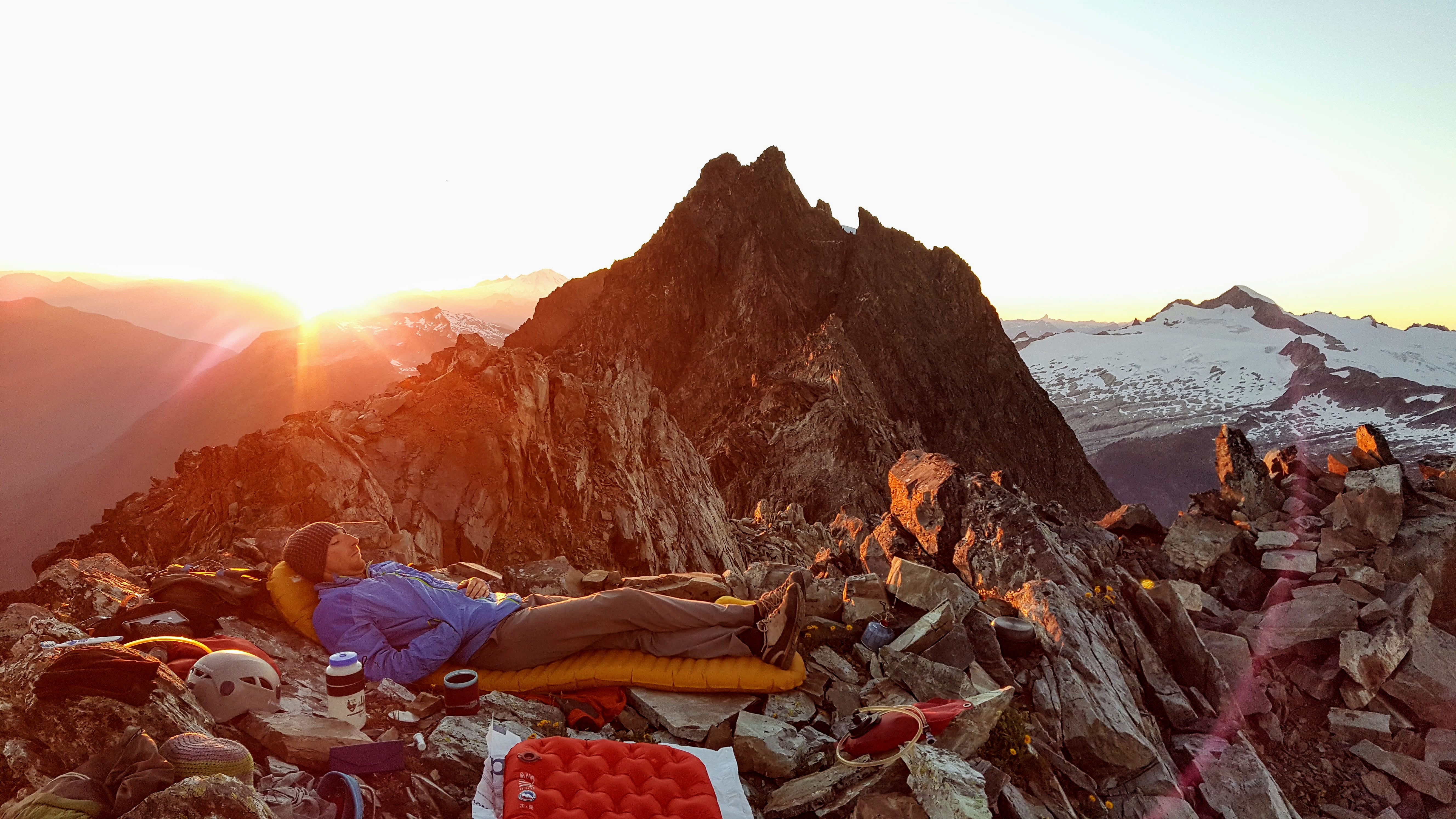
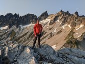
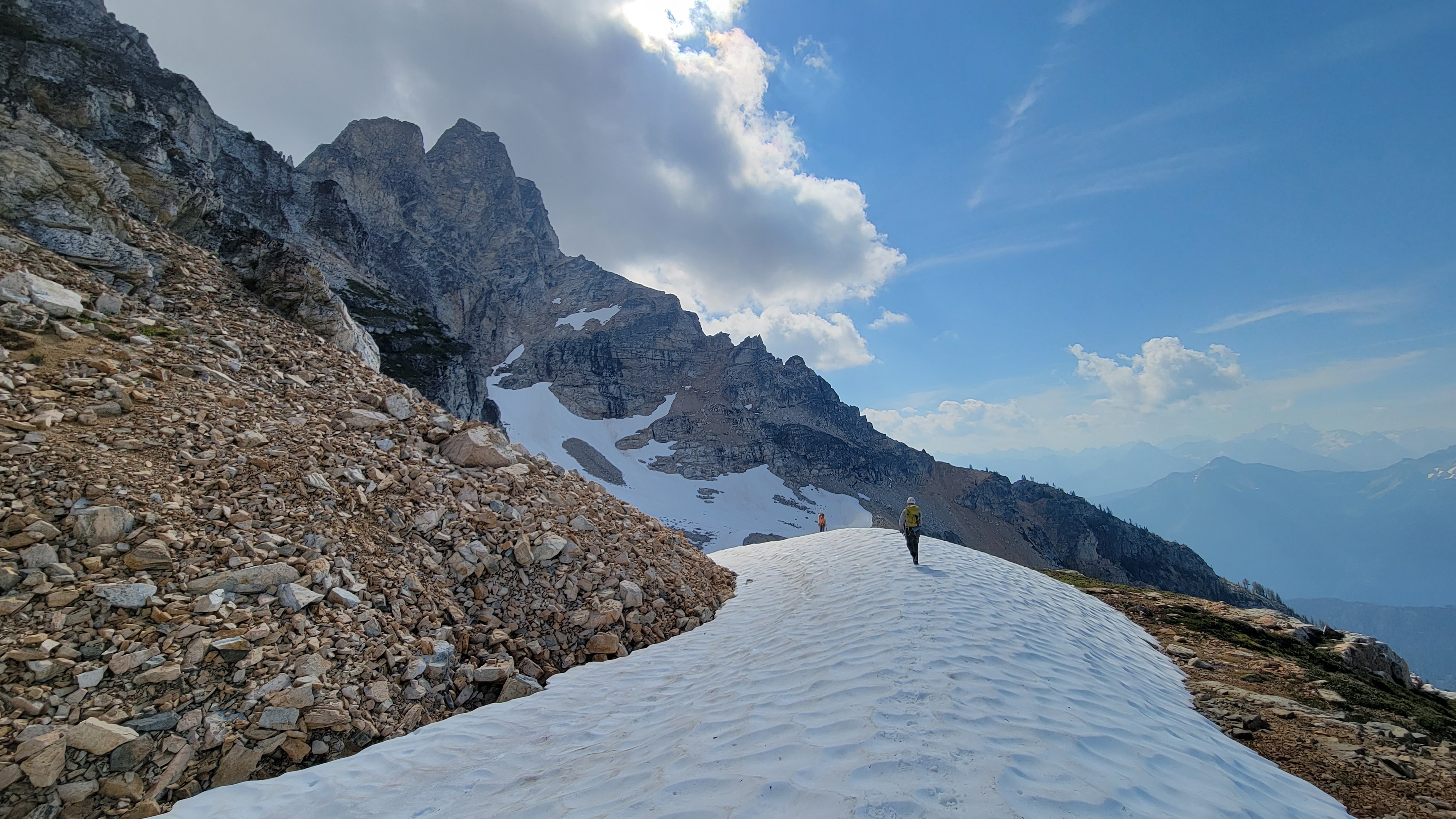
Trip: Canadian Border Peak (CBP) - NW Route
Trip Date: 10/15/2022
Trip Report:
Me and the boys, @Albuquerque Fred and Mike G, were at it again, this time we headed to the Great White North to climb Canadian Border Peak, on a record hot October day.
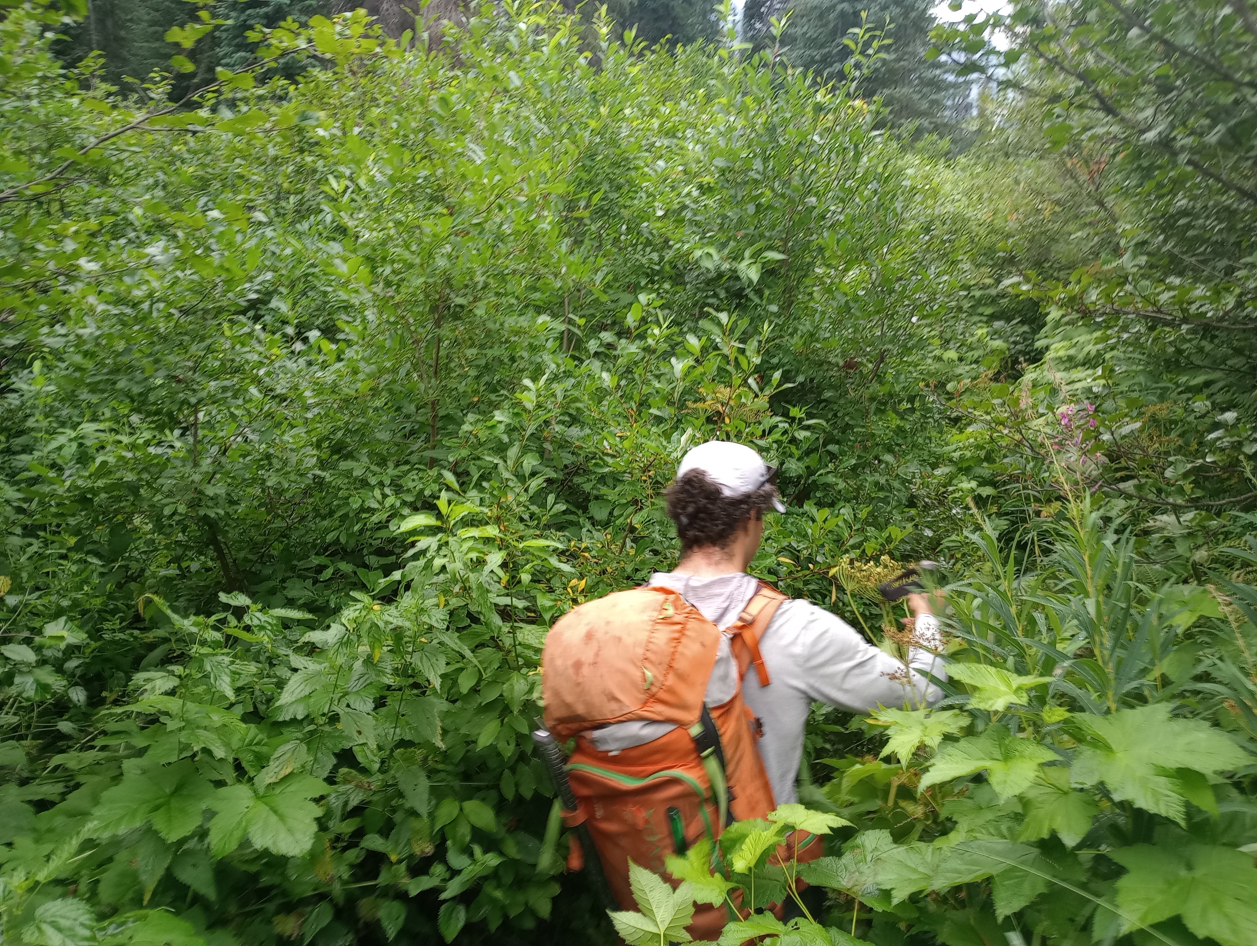
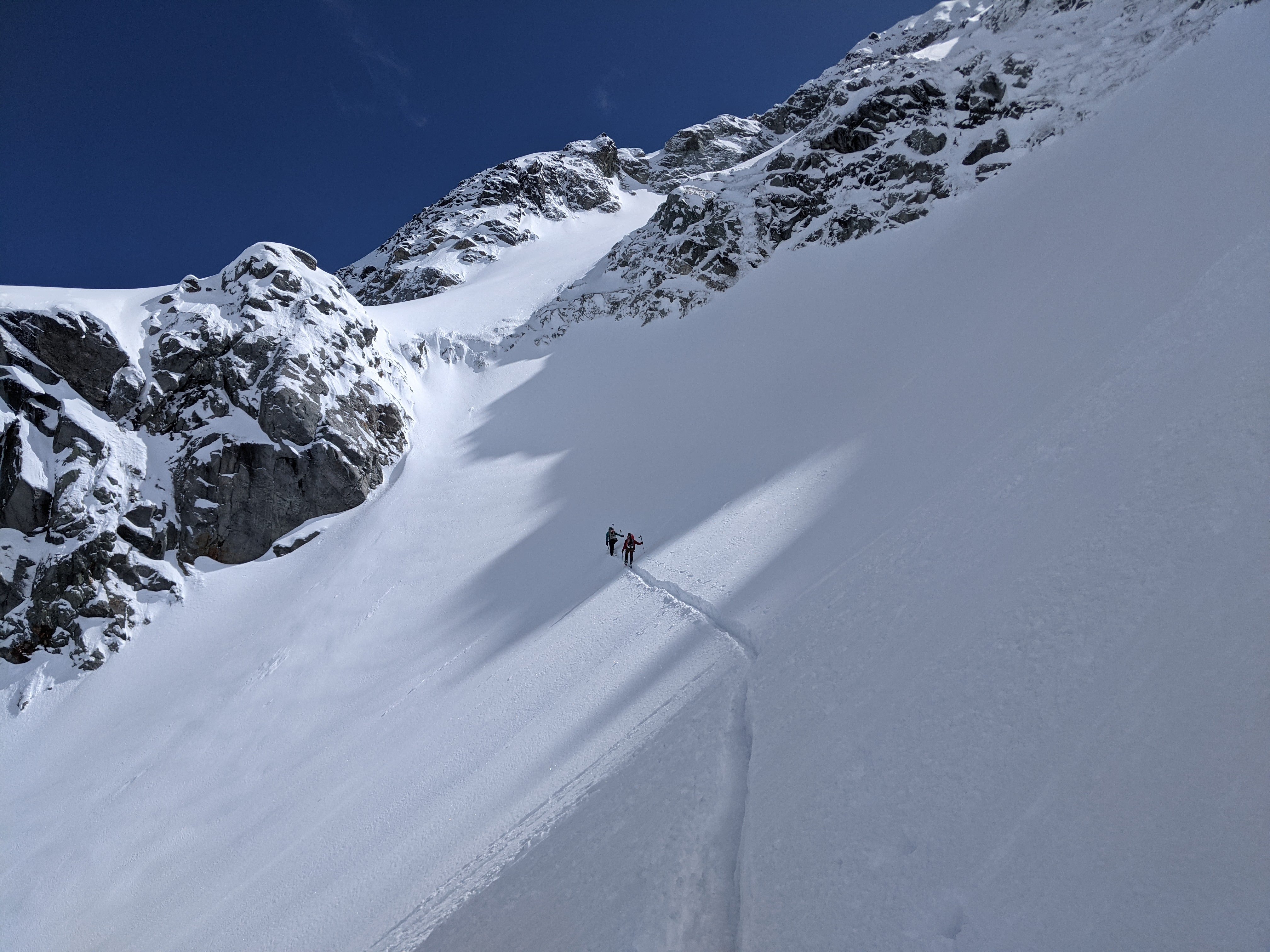
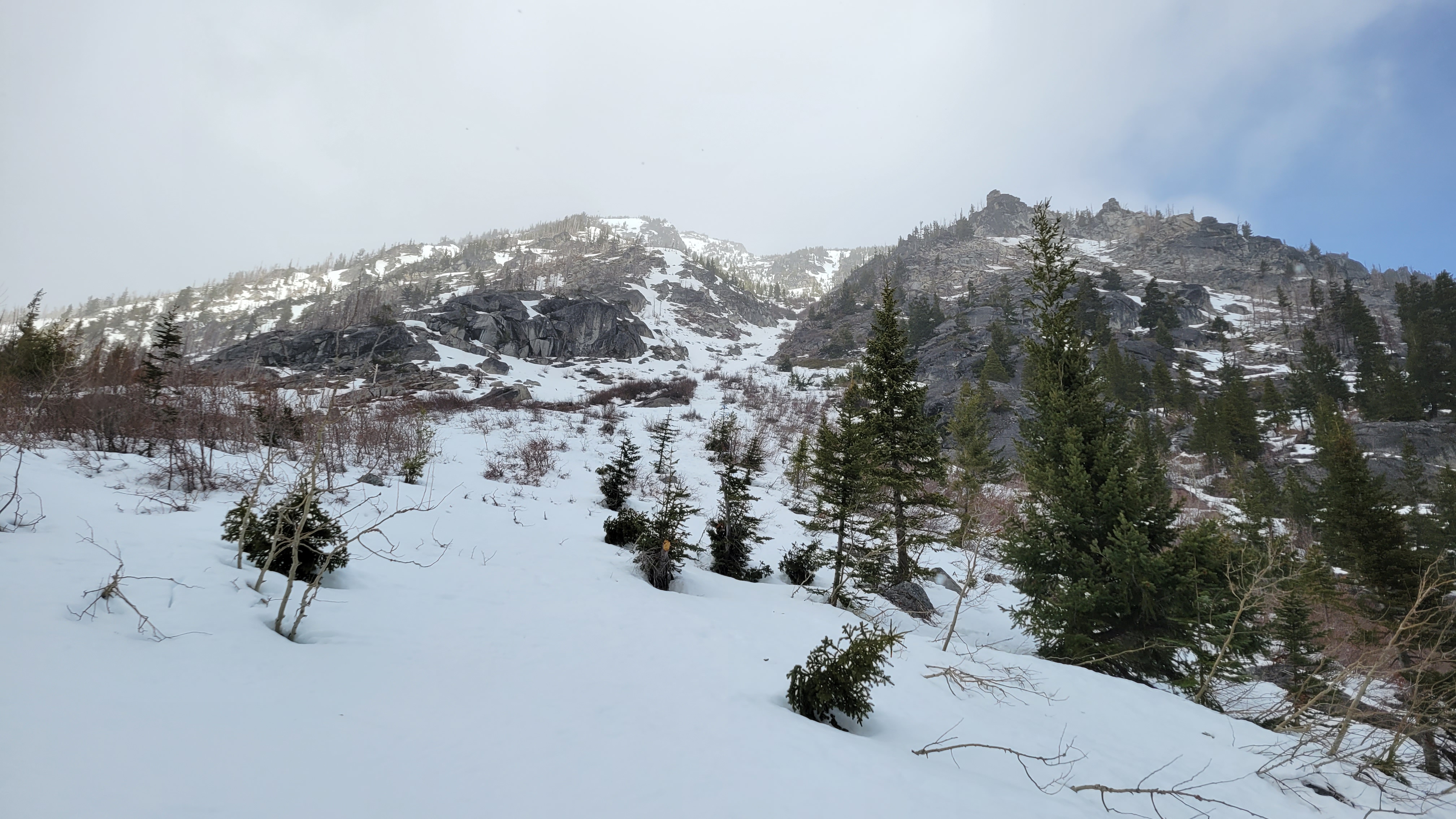
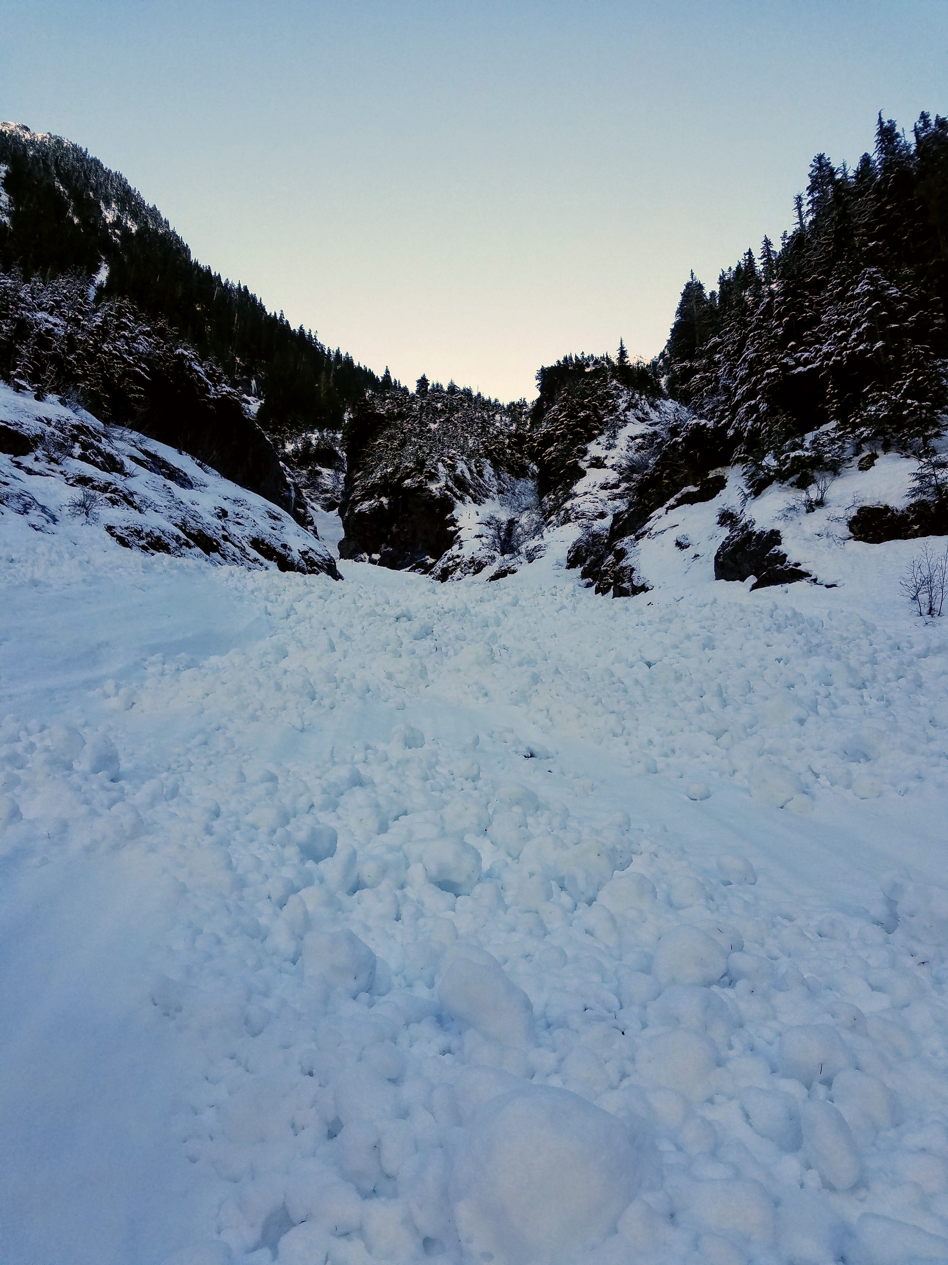
We took Tamihi Creek Road to the drive able end at 2760' and began the hike up the road in the unseasonable heat and thick smoke from fires over in the upper Chilliwack valley. We hiked the road past 8 switchbacks to the distinct and at 5250', then plunged into the brush straight up to the ridge crest at 5700'.
The brush wasn't as bad as we expected, but I could see if the blueberries and fireweed were wet it could be unpleasant; about half of it is brushy and the other half is reasonable forest.
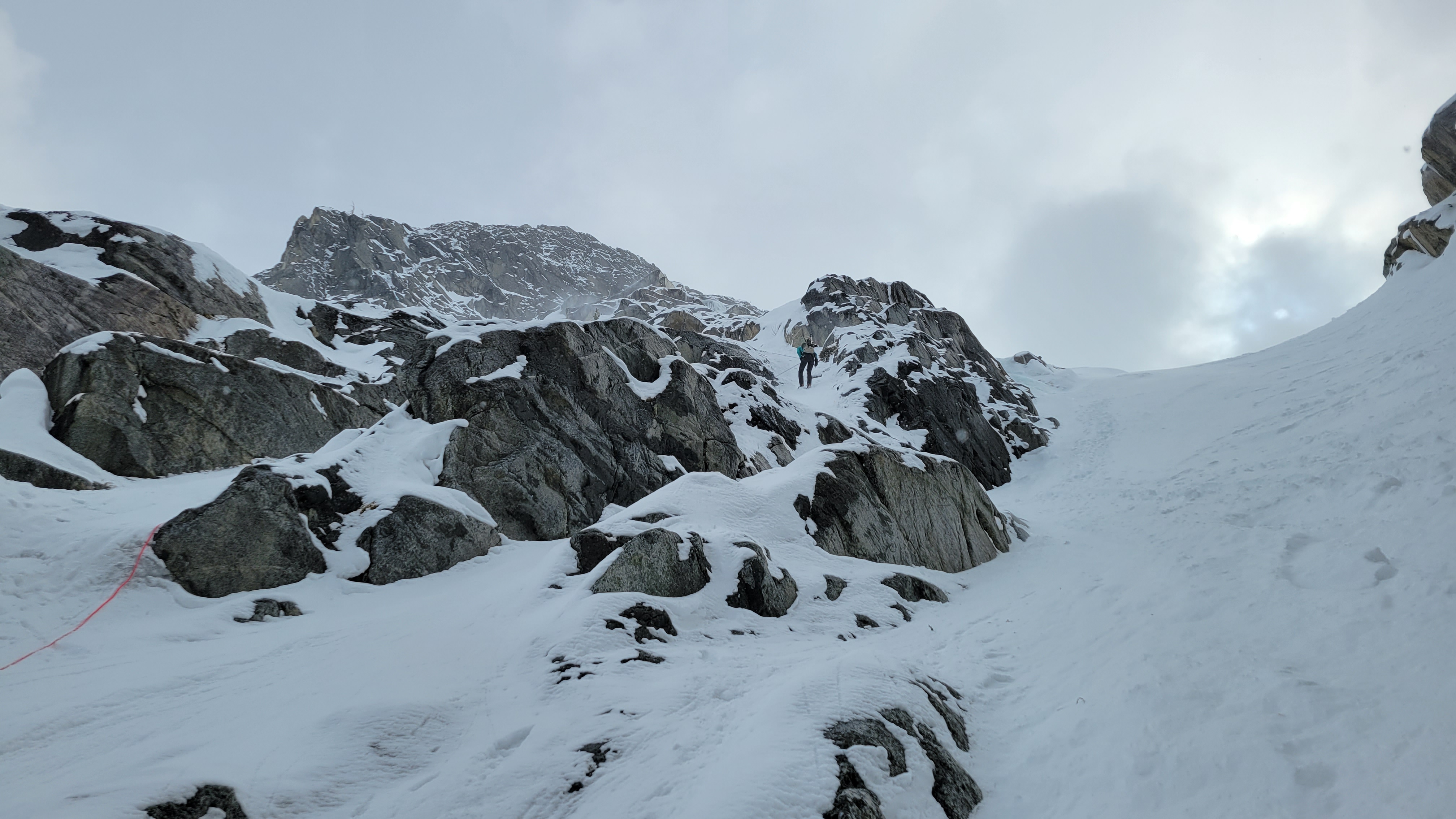
From the ridge crest we followed the ridge on a heather walk with a short scramble over a knob to the distinct NW shoulder of the peak. From this point the only beta we could find, Beckey, is pretty confusing. Even now rereading it I can't make any sense of his direction.
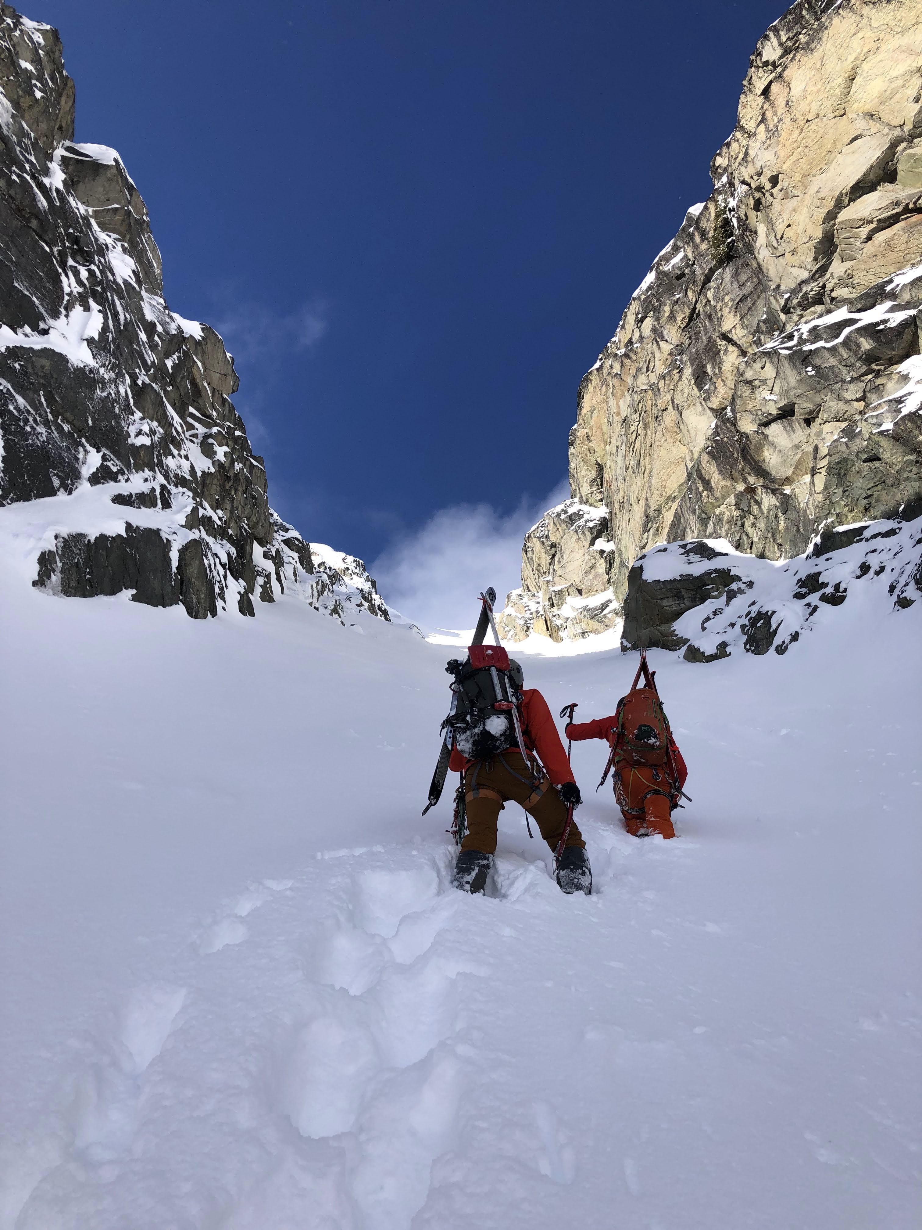
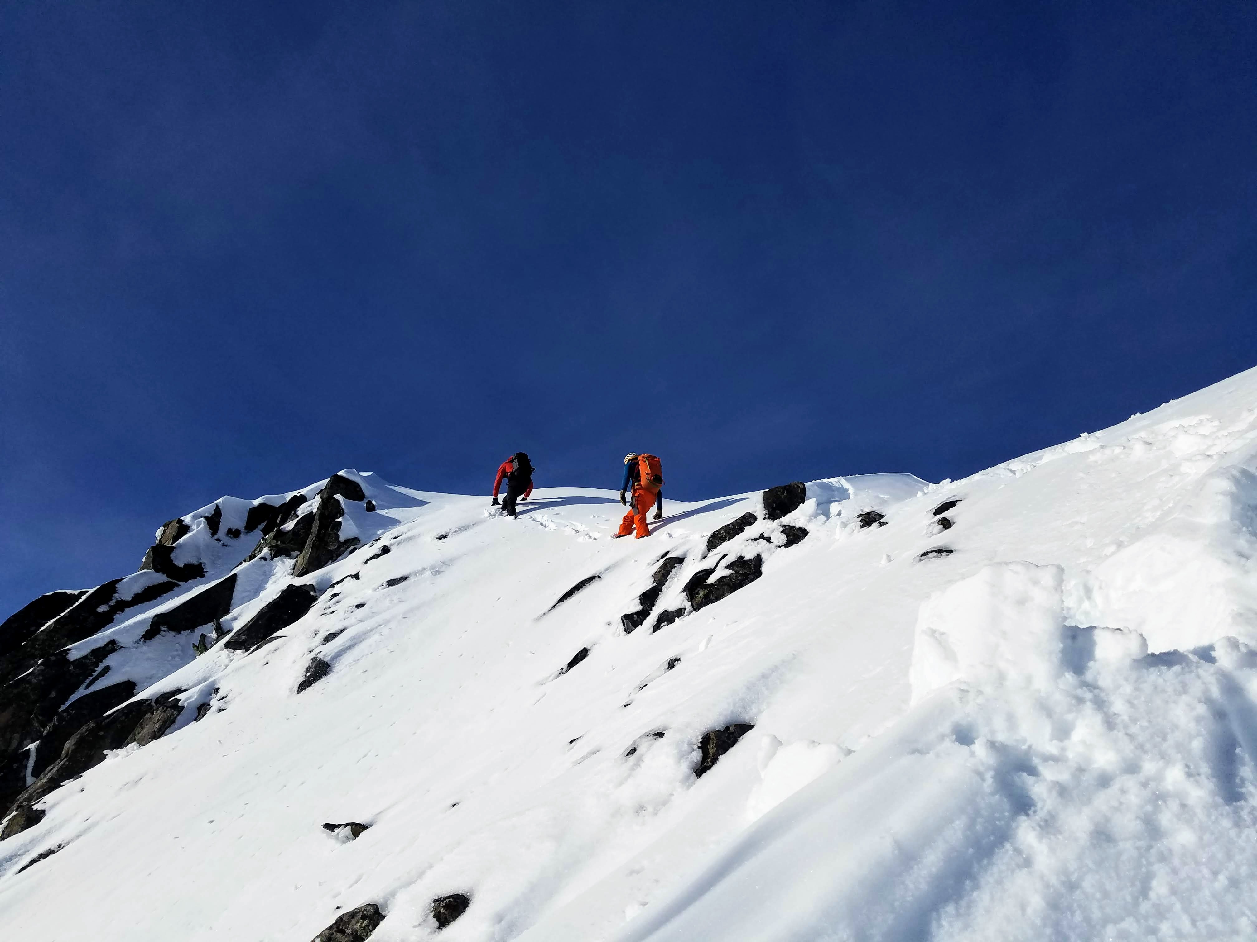
Nonetheless, the route finding is actually very straightforward; go up gullies, trending right into different gullies when necessary, until there is a major buttress to your right and your looking up an intimidatingly steep gully with slabs and a huge dihedral making the left side. We scrambled up this on 3rd and 4th class terrain with loose rubble on top of everything, the rock is mostly sound, just covered in debris.
Just below a flat spot in the NW shoulder (your left) you enter a boulder field with precarious rocks, we continued up this where the NW buttress basically merges into the rest of the mountain.
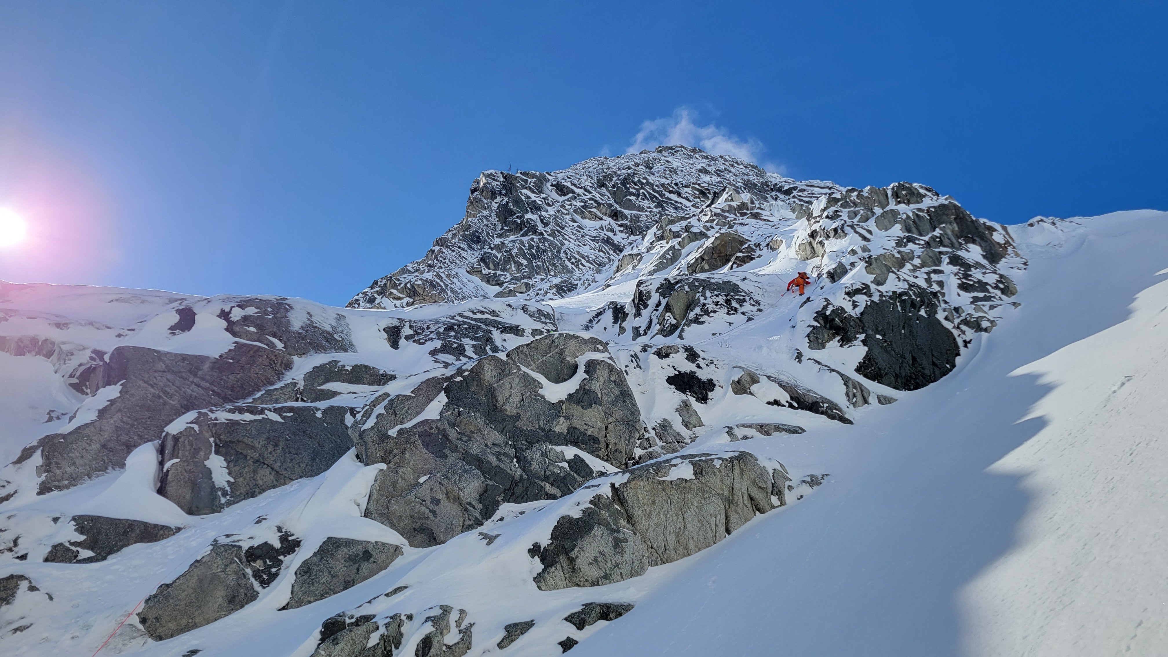
Here is the crux pitch, a slab with wandering shallow cracks left of a bulgey off width layback/dihedral. It has been reported at 5.6. We scrambled (soloed) up broken ground about 50' to the right on blocks and good cracks. I call it 5.4 but with lots of holds and variations. Go up about 60', then work left on a slabby ledge into the gully where the crux pitch tops out at another buttress shoulder.
From here it's up another gully with a step out to the right. This looked way more intimidating than it was and we weren't sure it would go, but there are ample holds to keep it fourth class. Up from there is an easy boulder field to the summit.
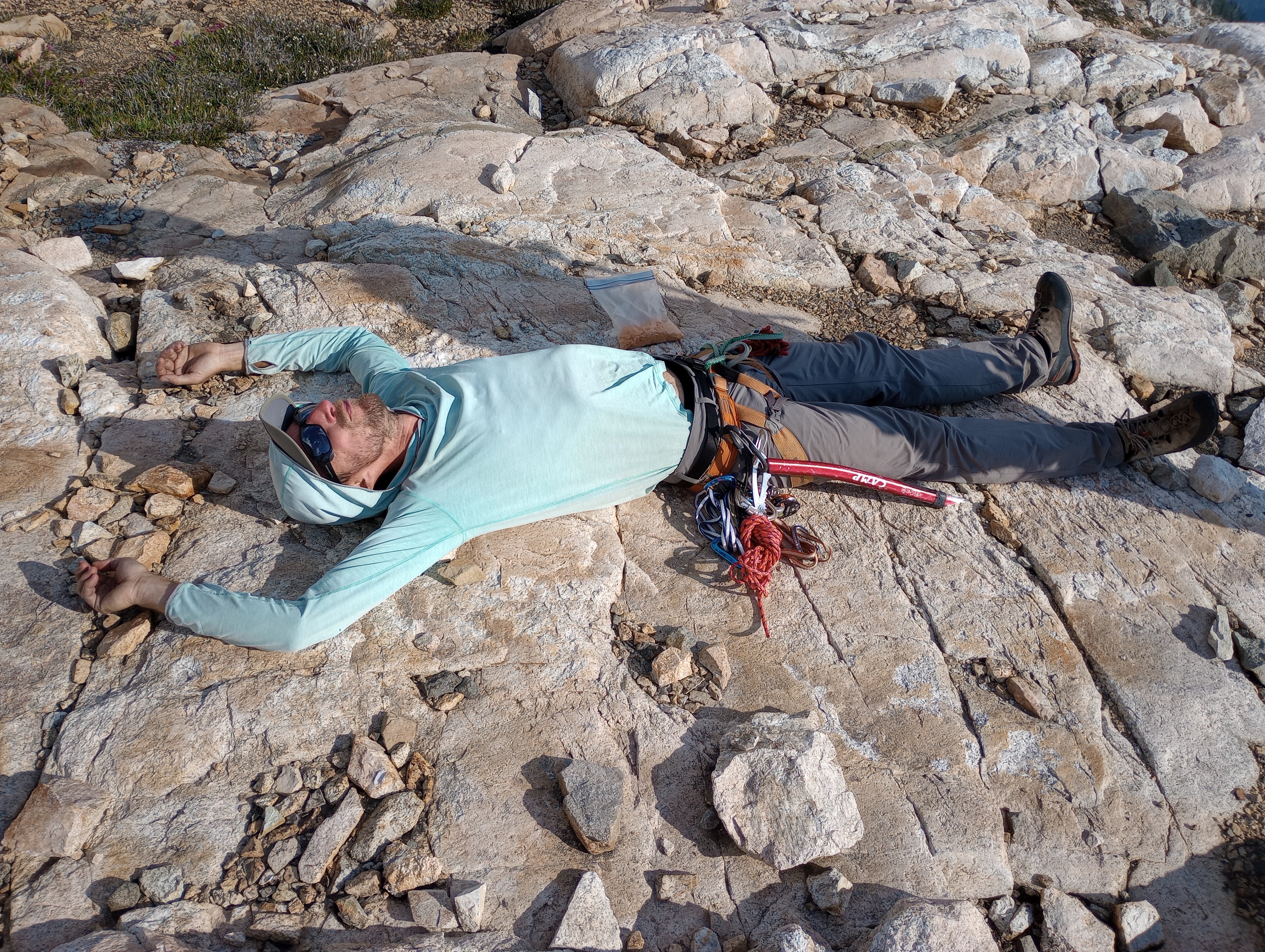
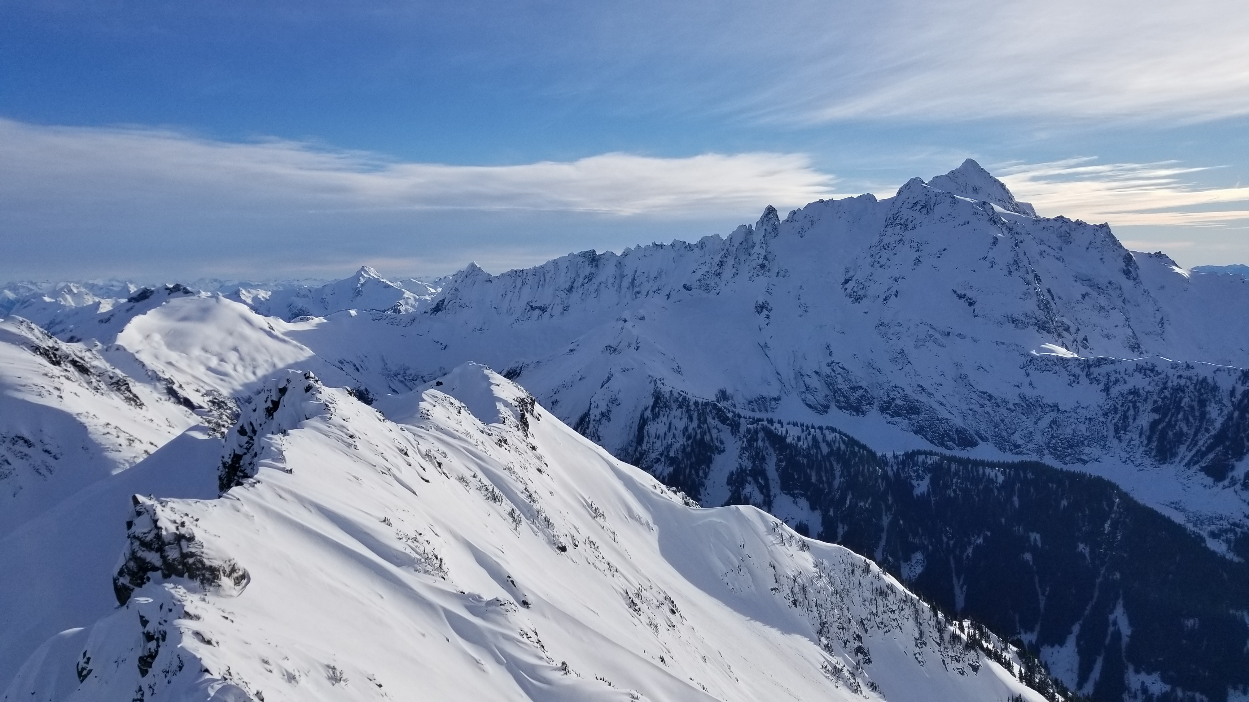
We hung out on the summit watching the smoke gradually envelop the nearby peaks until we decided it was better to get down.
From the base of the summit boulder field we made one 30m rap to the shoulder at the top of the crux pitch, then another ~20m rap to the boulder field below the crux.
From here it was all careful down climbing and staying out of each other's fall line back to the easy heather ridge.
On the way out we met lots of friendly dirt bikers that were clearing the brush from the sides of the old road, by now it's probably even more chill than the way up.
All in all it wasn't nearly as bad as advertised, glad to have done it, probably won't go back. Incidentally, this climb was way better than American Border Peak. (This is not editorializing on politics or society).
8 hours car to car.
9 miles, about 4500' gain.
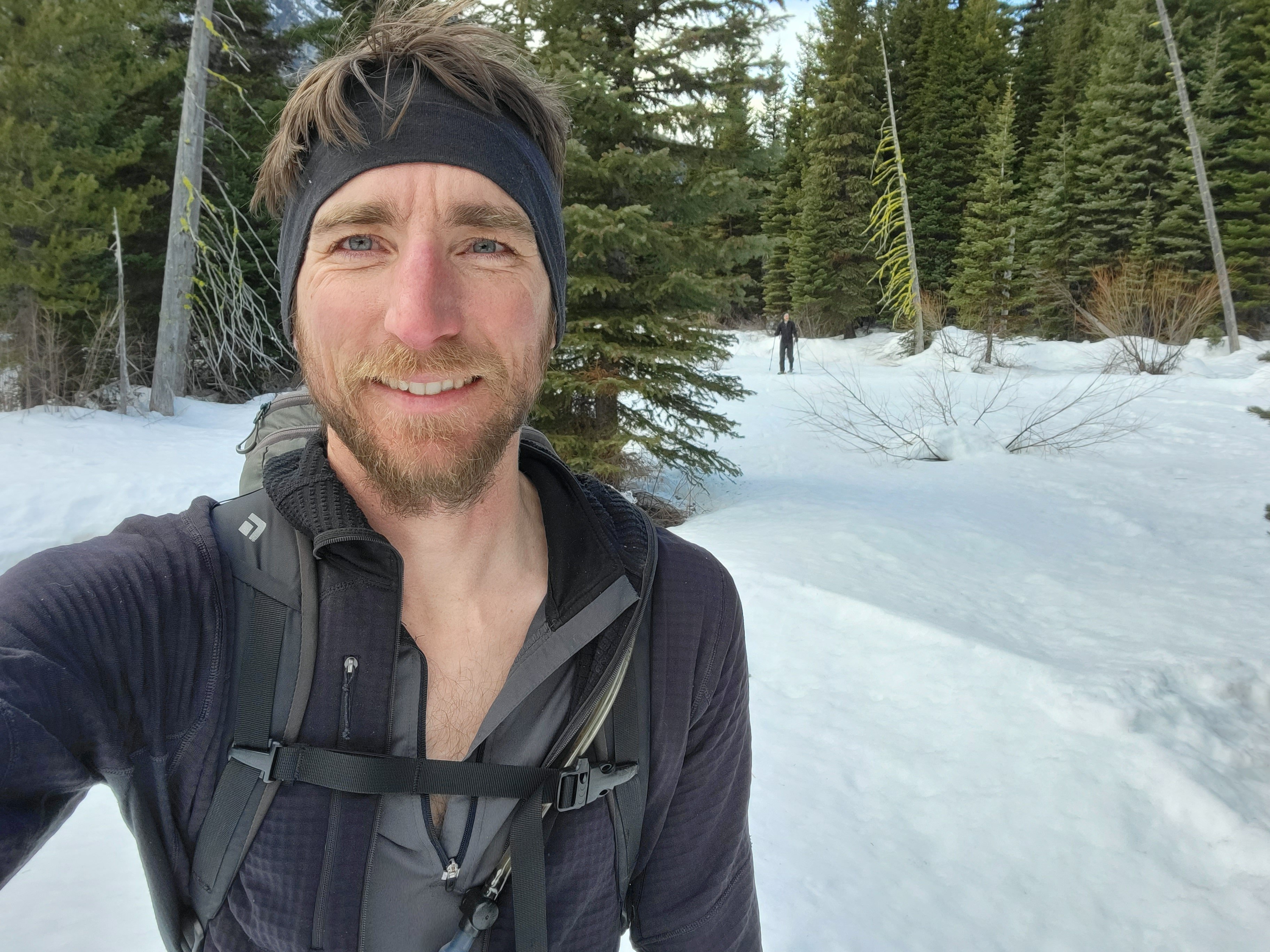
Fred on approach, it's the one on the left:

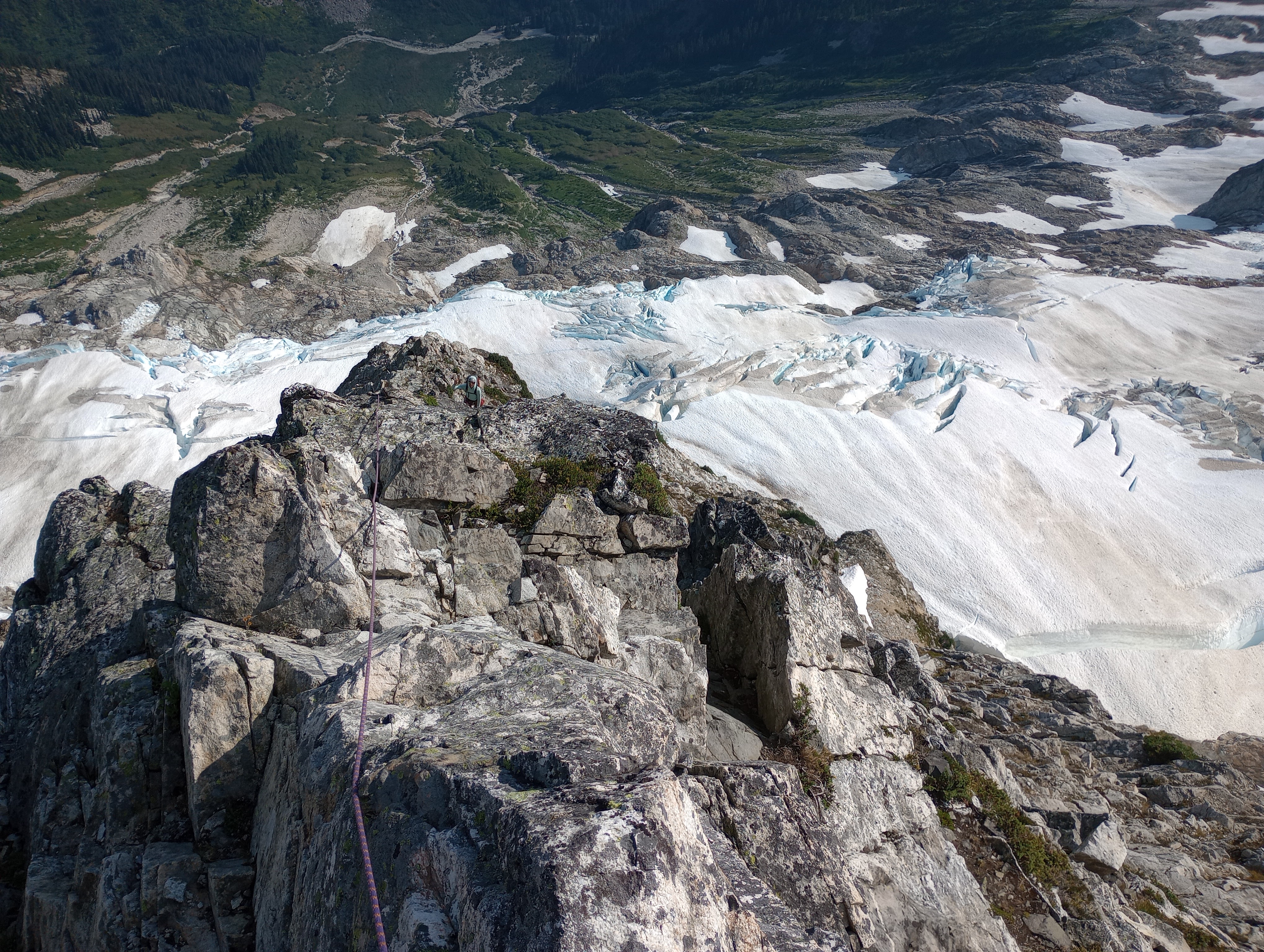
Mike scrambling slabs with debris:
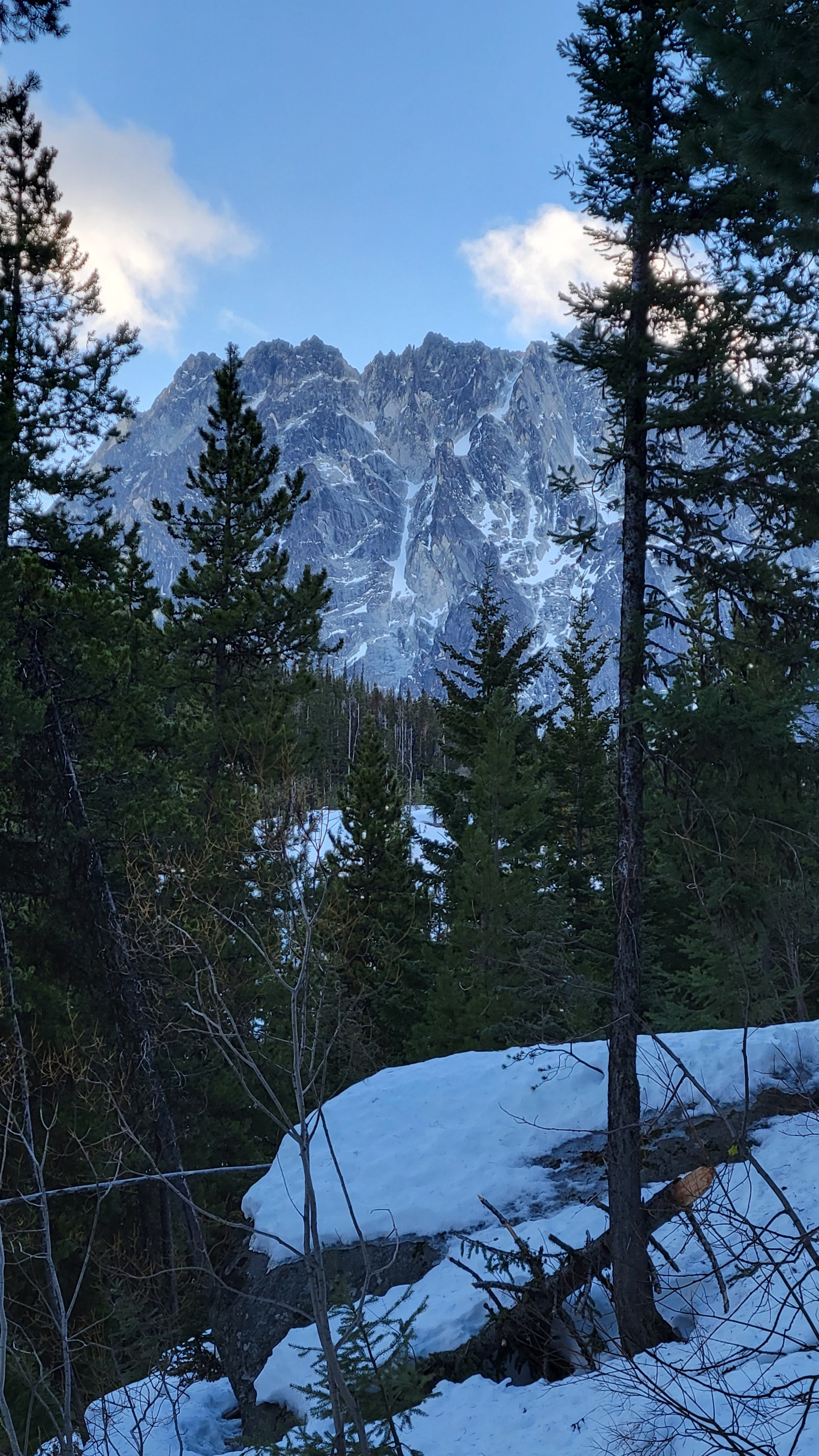
The crux is the dihedral just left of center, we soloed through the light rock to below the crack at center:
The major gulley with huge dihedral on climber's left:
Gear Notes: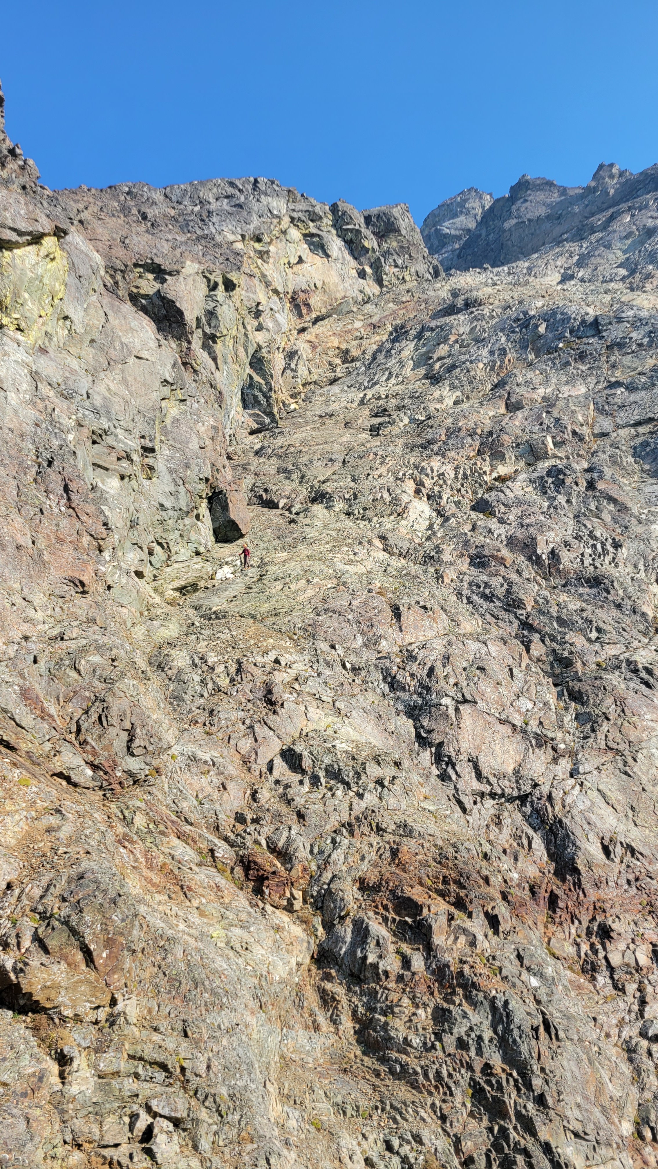
2 30m ropes. Helmets!
Approach Notes:
The road is all brushed out and easy.-
 1
1
-
 1
1
-
 2
2
-
-
17 hours ago, Juan Sharp said:
Did you happen to see two young guys who turned back at the Cool Glacier?
Several parties turned back when they saw the exposed ice. We did briefly talk to some guys meeting that description about 3 miles from the car. We got high 5's as we ran by, trying hard to not stop and walk until we were out of sight.
-
 1
1
-
-
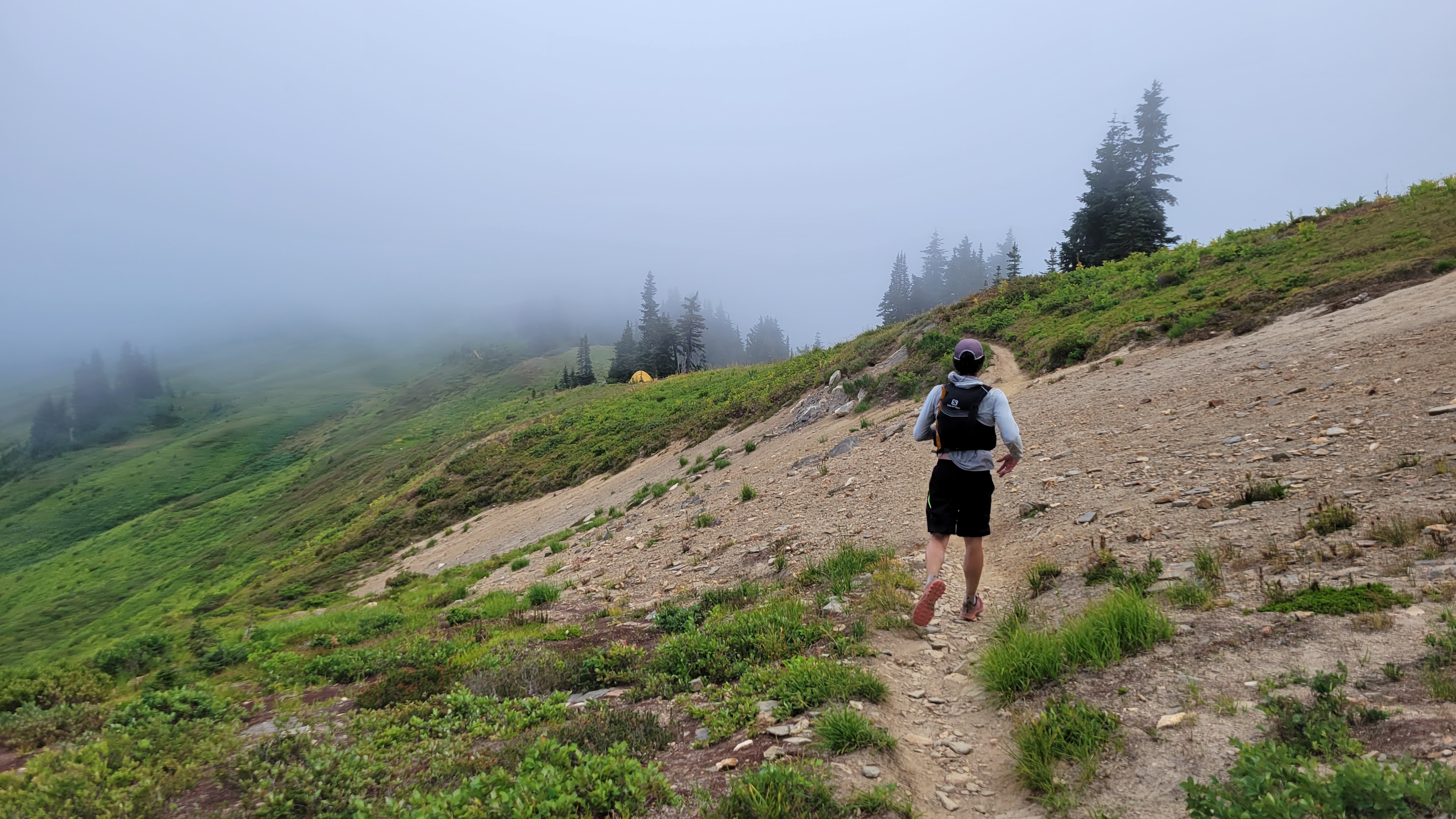
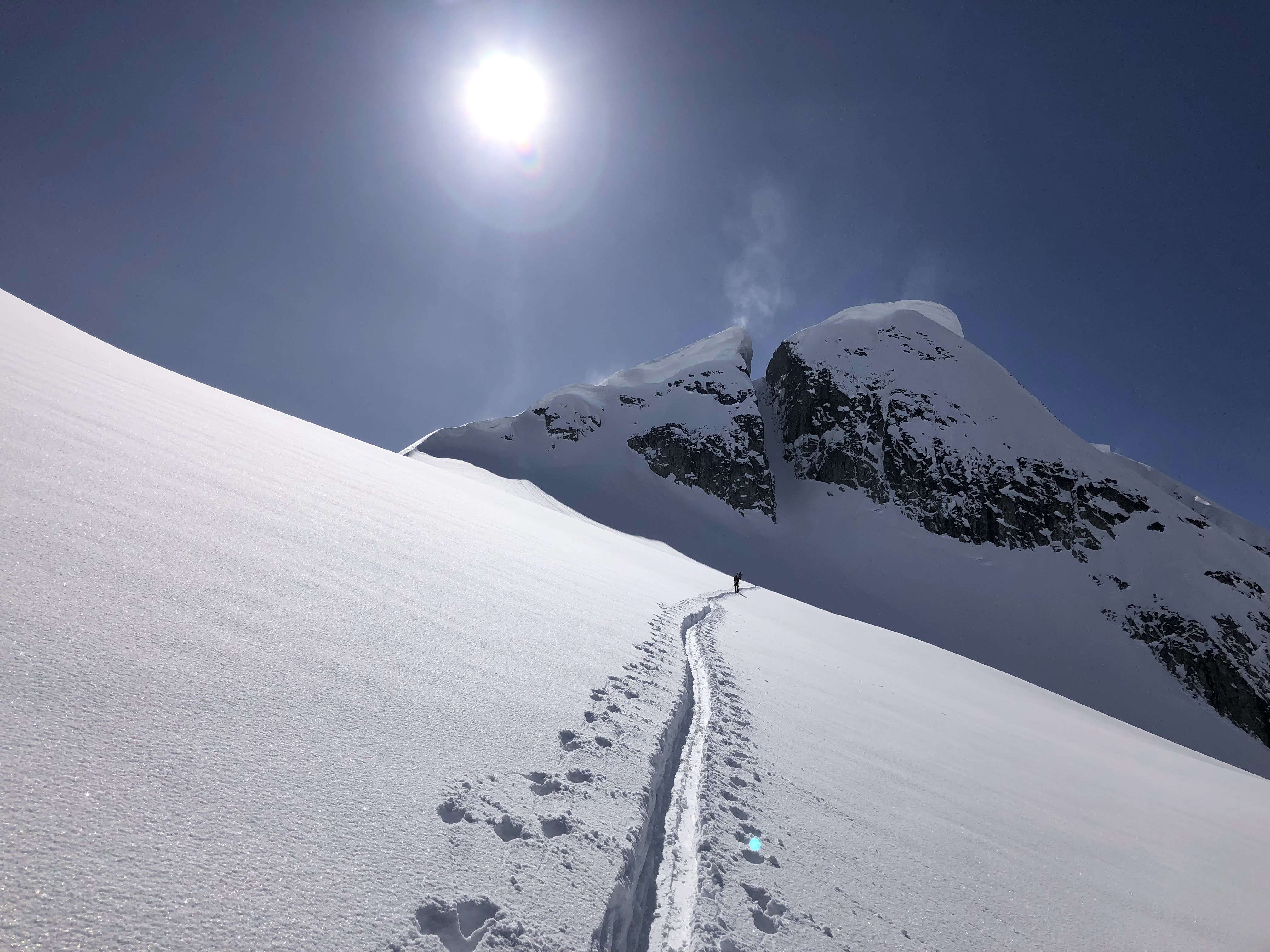
Trip: Glacier Peak - Cool Glacier
Trip Date: 09/03/2022
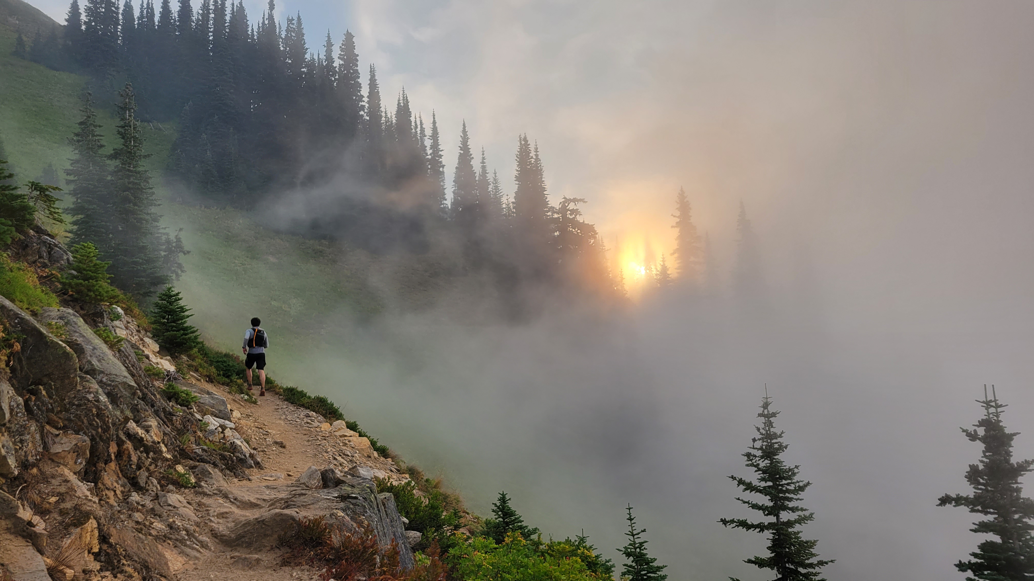
Trip Report:Me and @MGraw and figuratively everyone else did Glacier Peak over the long weekend. To avoid most of the crowds we did it on Saturday as a run. We started at 4:50am, summited at 12:30, and hit the TH again at about 6:45 for a c2c of just under 14 hours. We thought that was pretty good but it's 2.4 times the FKT.
More importantly for those interested... The conditions update!:
The trail has ample water sources everywhere until about .5 miles past glacier gap, then none except on the ice of the glacier if you want to hunt for it.
The trail is in excellent shape, recently brushed and re-graded to White Pass.
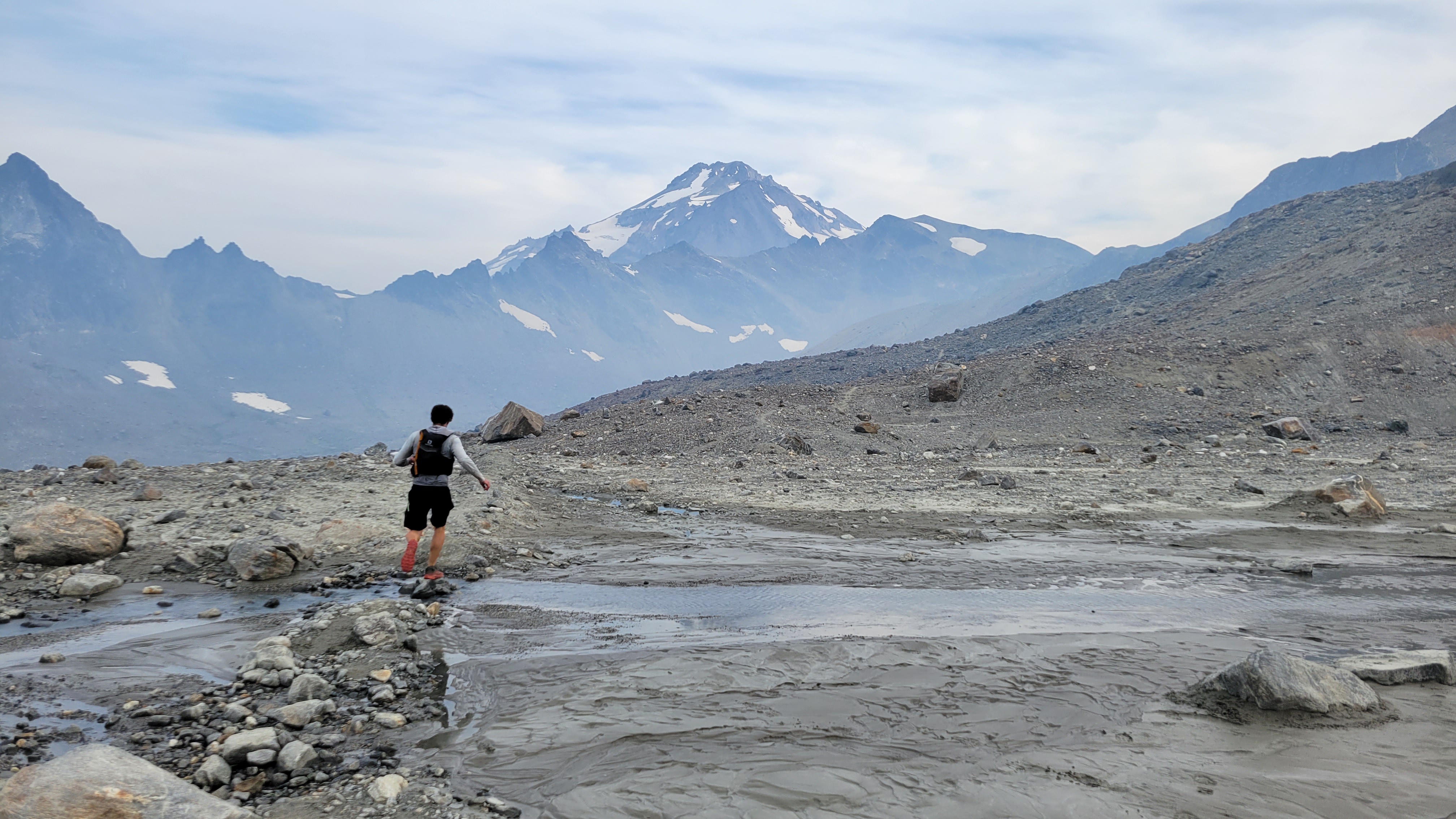
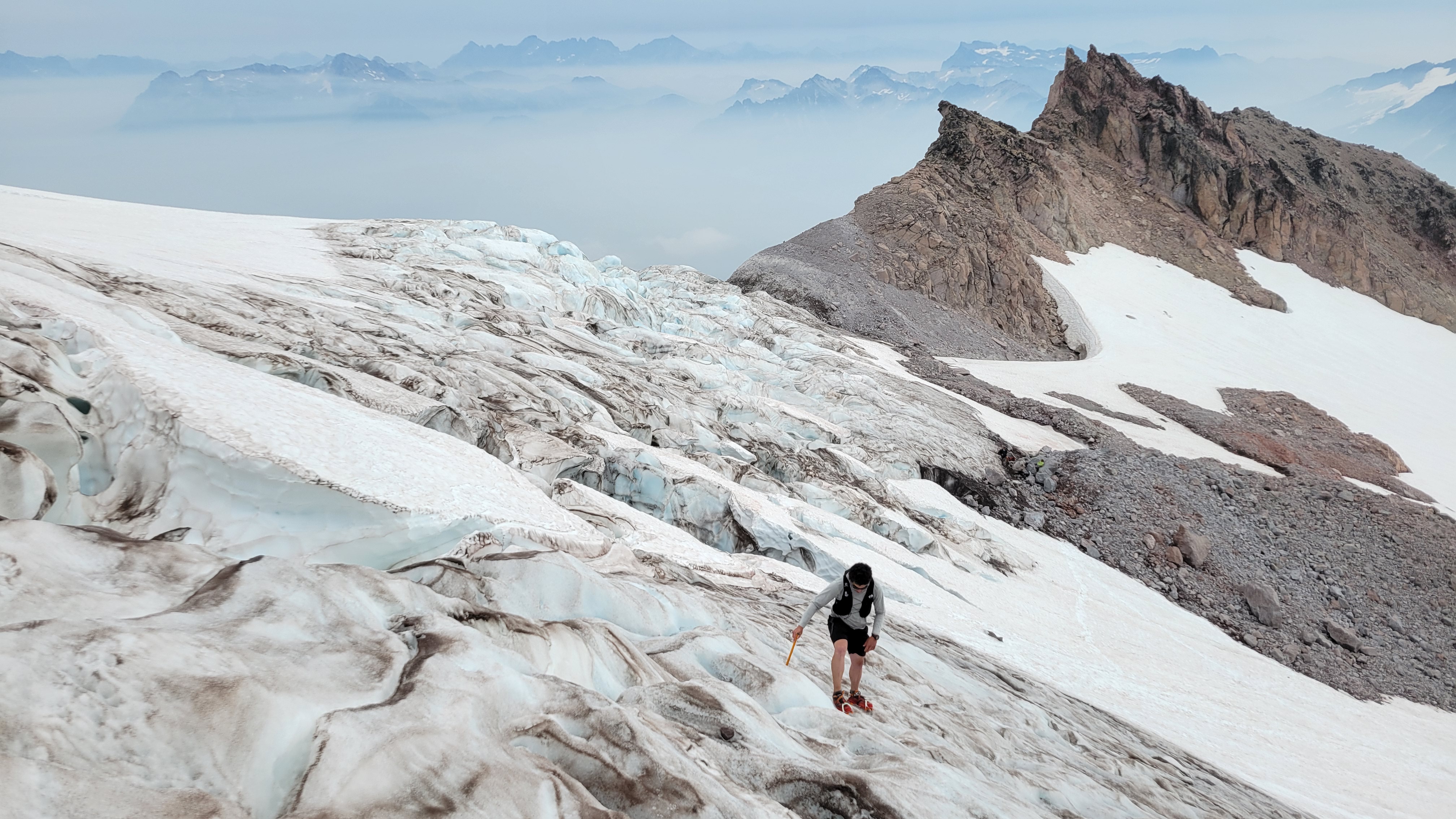
The Cool Glacier has a tough entry with some blue ice walking through a serac field. It's low tech (no overhead hazard, you're on top of the seracs). But not really protectable and probably best avoided if you've never walked on solid ice. Several parties turned abck at the look of it. We found it very doable in runners and aluminum crampons. After that there are some bridges, but it's grade 1 glacier wlaking. Personally I thought the boot pack was kind of unnecessary sketchy, crossing very close to exposed ends of cracks where, from a different angle, you could see it was overhung.
We took the far climbers left edge of the glacier immediately next to the rocks of the east ridge of Disappointment Peak. It was quite safe.
The whole route is really pretty with great meadows, straightforward route finding, and a nice summit. A good time was had by all.
Now my legs hurt.
The boot pack goes from the farthest point of rocks about halfway from Mike's head to the ridgeline angling up left:
Gear Notes:
Aluminum crampons and axes, sneakers, Salomon advanced skin 12 packs.
Approach Notes:
Good water access all over, great trail, beautiful.-
2
-
3
-
-
Haha, I saw 'The Triad' and was like: who goes there... Oh yeah, Jason.
Thanks for the report, I've wanted to go there for years.
-
 1
1
-
-
Trip: Good and Storm King - NE Butt, SW Route
Trip Date: 08/19/2022
Trip Report:
Me, @MGraw and Dave did the NE buttress on Goode Mountain and the SW route on Storm King over four days from August 19 to 22. BTW, that’s “gud”, not “gu·dee”, I don’t know what mountain some of you are climbing. Its named for Richard U Goode of the USGS, and the mountain is pronounced like the name.
I’m just writing a quick report to get the info out there. We used beta from Steph Abegg, Climber Kyle, and occasionally Fred Beckey and it went great, so I wont post too much of that. The route finding was generally very straight forward the whole trip.
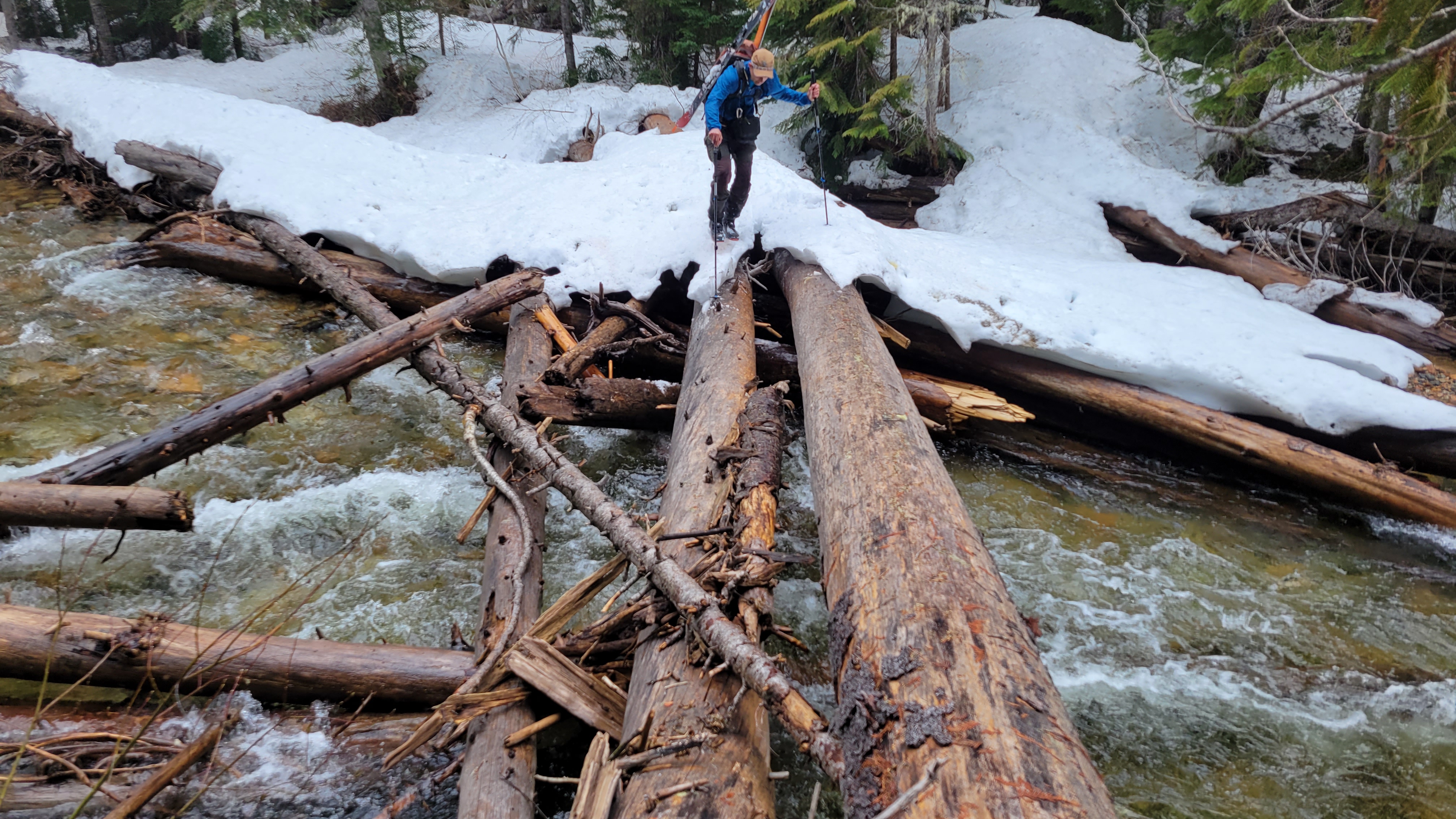
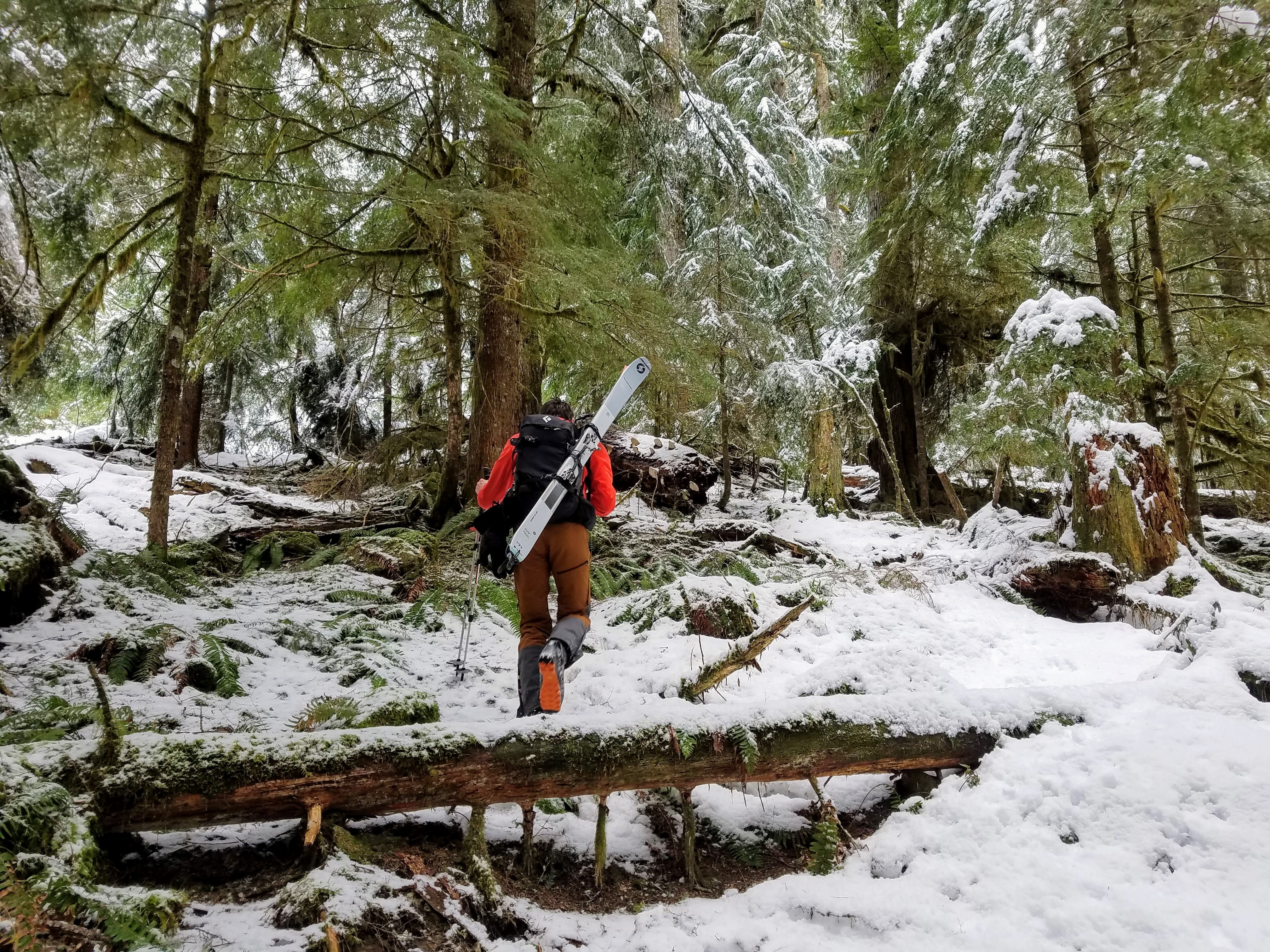
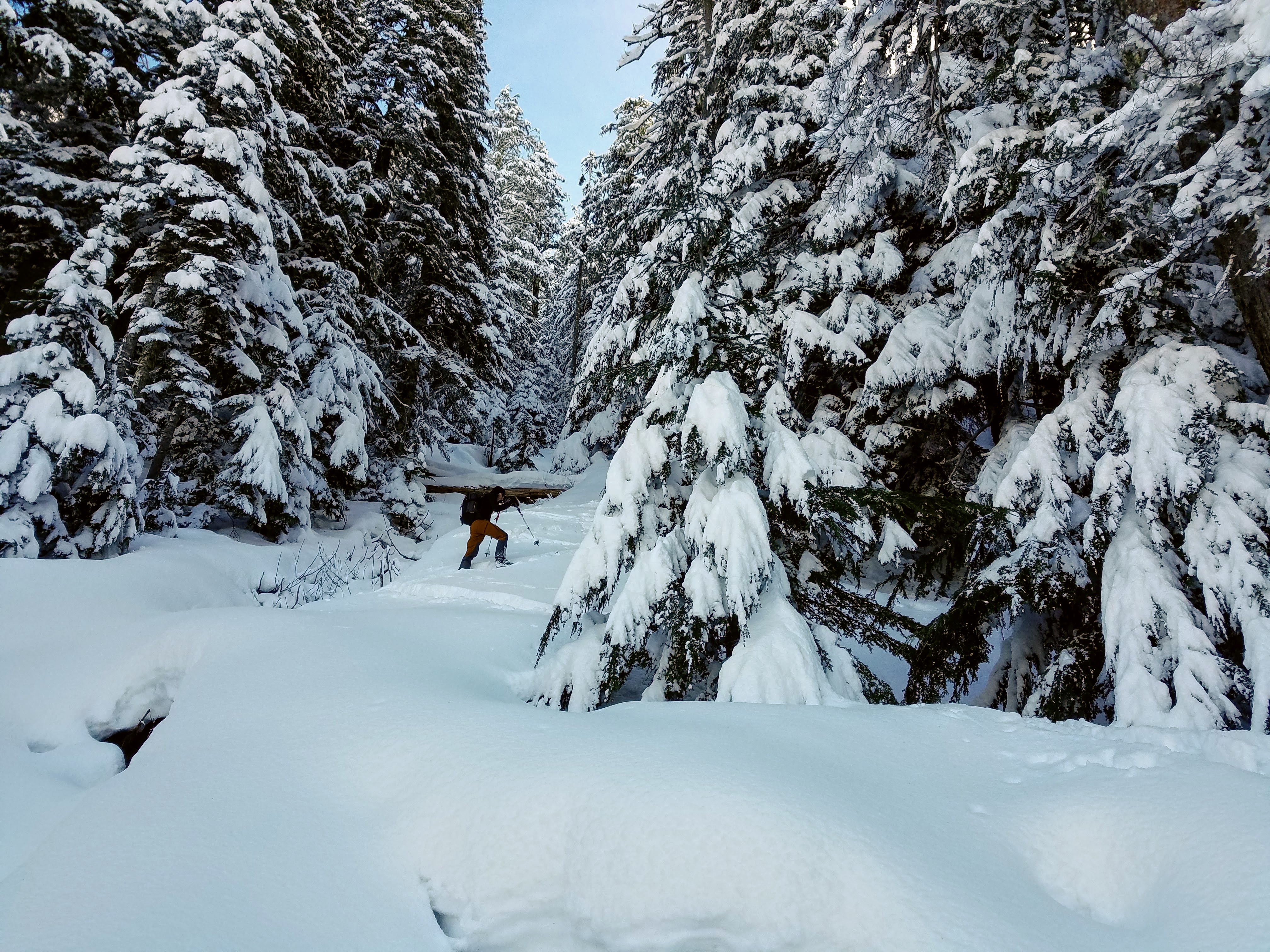
We started out at the permit line. It was waaaay better than in years past, but still long. Then we cheated and drove to the Bridge Creek Trailhead for the hike in. I used trail runners to the junction with North Fork Bridge Creek Trail to save my feet 20 mile of hiking in approach shoes… worth it!
Trail after Grizzly Creek (short):
The creek crossing of North Fork Bridge Creek was easy but cold, then straight up from there per Kyle worked amazing. Literally NO brush to get out of the valley bottom. Wow.
Approach From North Fork, just go up:
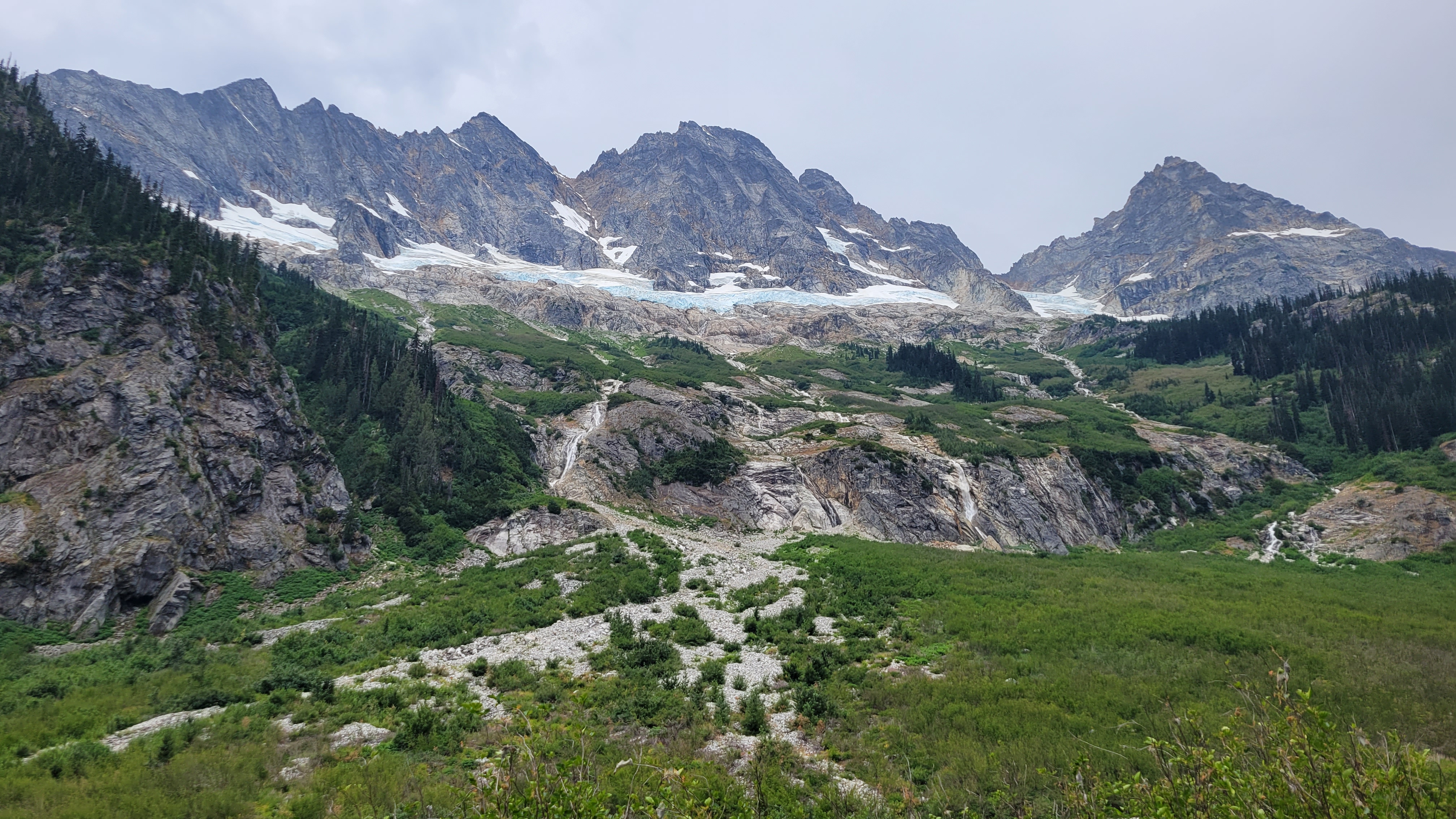
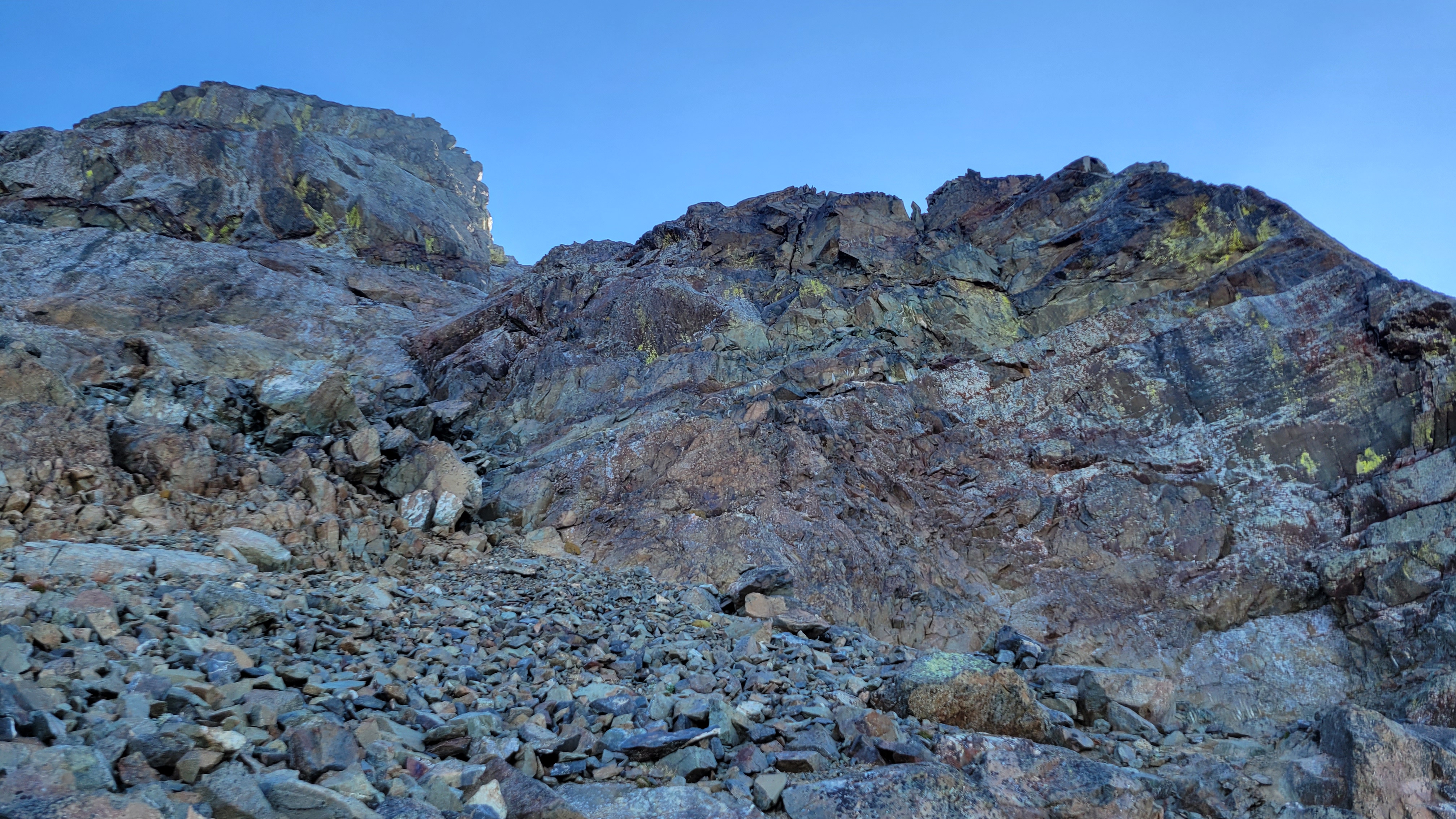
We took the wrong buttress up the last portion of the approach and missed the two established bivy spots. The “5400’” bivy at 5500’ or so was occupied, but I looked down and saw the 5700’ site from above. We made a new spot on a slab and gravel at 5970 on a different rib. For next time, you have to scramble up the obviously easiest rib two or three left of the prow that the path leads you up to. This was our only real route finding hiccup on the trip with somewhat minimal research. All of Goode is amazingly complicated sounding, but is really just follow your instinct from North Fork Bridge Creek to the summit. It took us 8.5 hours car to camp I think.
Just up from camp:
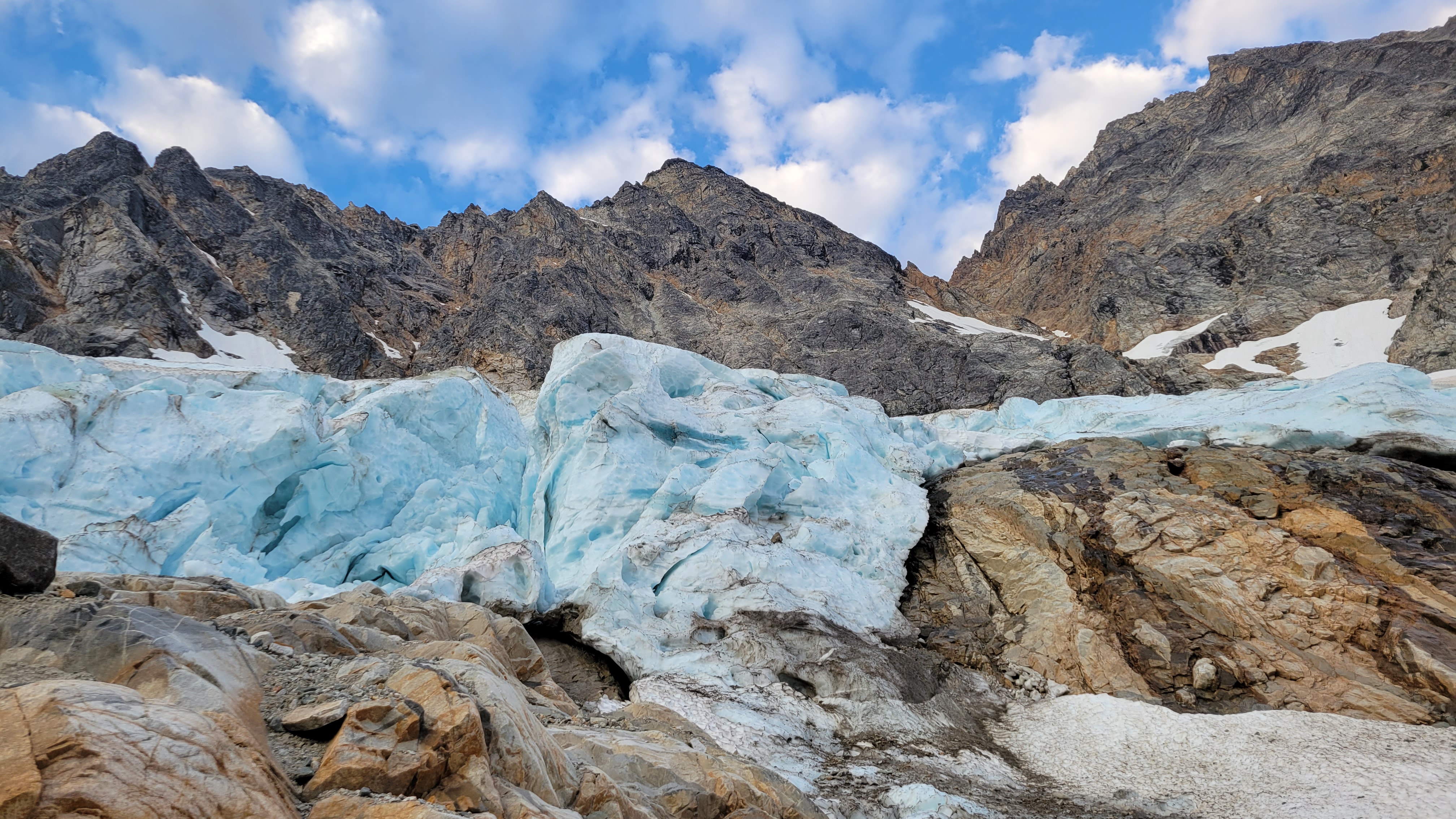
The next morning we walked like 100’ up to the glacier were we easily walked on on low angle firm snow. We had only snow the whole way, no proper ice. The glacier was pretty easy to navigate from there, one big zig zag to get above the cracks at 6700’. The feared moat was just a couple of steps down on blocks to 3rd class rock. We got lucky hear I guess. I think this wat at 6730’.
On route:
We scrambled a 3rd class ramp to near the crest, then started simul climbing. Mike lead out and lead a 1200’ simul pitch to a 5th class step where Dave took over. Dave missed a move to the right of the ridge and lead up a tough 5.7 spot with no pro (except our now fixed nut above the difficulty). Stout lead in hiking boots dude! Me and Mike followed in approach shoes, wondering the whole way why he didn’t move off the ridge crest, it was aesthetic though. As much as its tempting to lead the crest, any time it gets tough you can break off.
The climbing was great the whole way, never hard (except that one spot) but interesting always, all the way to the summit. I clipped my last sling to the summit rap station to finish my simul block.
It was hazy so we didn’t stay too long. 3 raps to some shenanigans to the notch (I’m not sure if there is a good way to do the last rap, but it involved a quick belay for us from the bottom of the rap). Then 2 more raps in the gulley. Skiers right side of the gulley was much better than down the gut, not bad at all.
Soon we were in camp on an awesome slab amongst heather at 7600’ just left of the rib. I highly recommend this spot, the slab was perfect for victory lounging. 10ish hours this day.
Camp:
Brief shower in the evening:
The next day we traversed to Storm King and followed the standard beta to the notch. Scree slog, up the gulley to the right of the one with the obvious horn. The one with the horn had a rope that appeared to be fixed for a rap. I’m not sure why you would do this unless you just didn’t want to carry it out. Please don’t do this, it’s just trash now that no one want to take out. Descend your ascent route and take everything home with you. I really hope there was some extenuating circumstance here, but I can’t think of what.
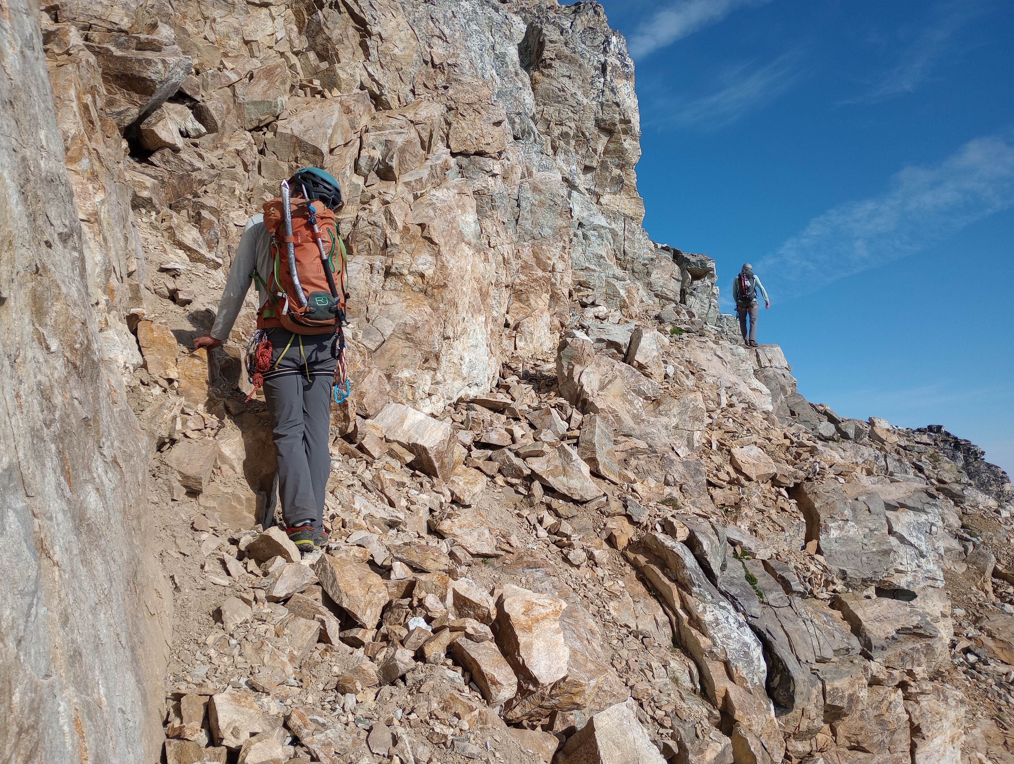
We scramble traversed the obvious ledge from the notch for 200’ – 300’ horizontal then scrambled up 3rd -4th class to the summit. The beta here was complicated but the route very simple.
Ledge:
Reversing the traverse to Storm King, Goode behind:
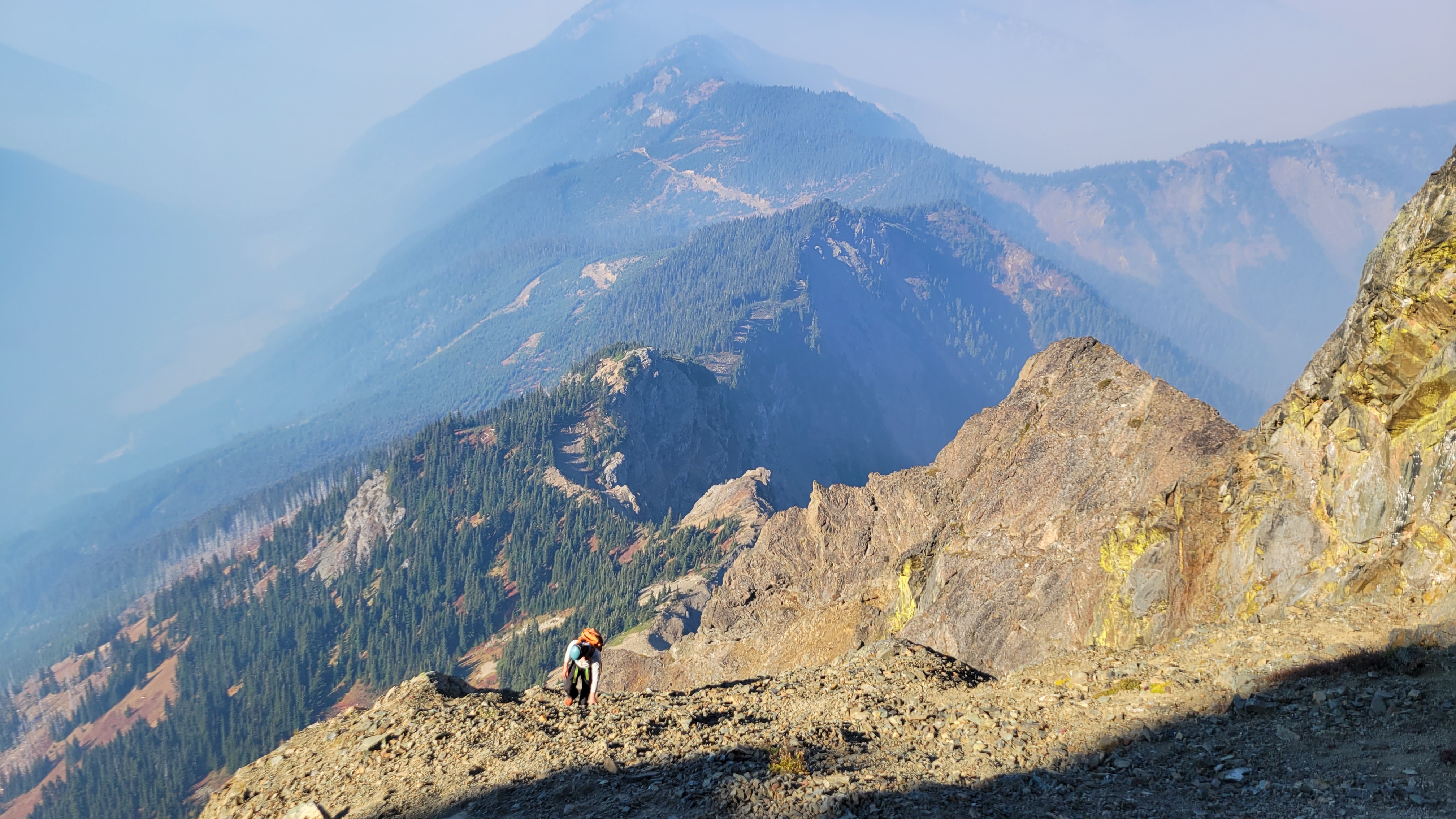
Then down, down, down. There is a path from the little 7440’ knob just SW of Goode leading down the rib to the valley bottom, it comes in and out, but just stick on the crest next to the creek. We hiked out to Park Creek Camp for about 9 hours on the move.
Up very early the next morning to beat the heat for 6ish hours to cover the 15 miles to the car and beer that was still as cold as the Rockies! Wow!
An amazing trip with way more down time than I am used to. Glad I had good friends to share it with! A classic for sure, though not enough brush for it to be truly a Cascade classic in my book. Nor enough loose rock.
OK, so not so quick a report, but it was a really great trip.
Gear Notes:
2 30m rope, aluminum snow gear, approach shoes, single rack 0 metolius to #2 C4, like 15 slings
Approach Notes:
Long but easy. The trail was brushed out except for a little bit after Grizzly Creek.-
2
-
1
-
3
-
-
Wow, excellent! What was your total time camp to camp?
-
Cool, thanks for posting. I've wanted to go out that way but never made the effort, nice work.
-
Wow, Mongo Ridge is getting crowded! Amazing work!!!
-
Simply amazing. Thanks for the great write up!

-
Wow, nice. I was supposed to do this in 2020, haven't planned a revenge trip yet. Awaiting a full TR. Thanks for the great beta photo.
-
It was great getting out with you Jason. Thanks for all the awesome pics of me. Here are some cell phone snapshots of you.
-
2
-
-
WOW, amazing. There is zero chance of me doing this route but I still really enjoyed reading the beta. Nice TR!
-
1 hour ago, JasonG said:
Wow! That is an amazing trip, thanks for the beta!
Just so I am clear, you only needed the fixed rope to access Torment and not to descend the couloir?
And, is there any reason you didn't use the torment basin route?
Thats correct, the couloir would be an easy-ish 2 day trip with a camp at the lake with no technical gear required (assuming you could boot the couloir). Our original plan was to exit a la the Forbidden Tour, but the couloir was pretty bootable.
As for Torment Basin, we figured with the snow up high it would be easier to take the Eldo trail and do an easy traverse at ~6k to access Torment Col.
-
Oh yeah, beta photos for the Forbidden Tour. The Forbidden glacier looked good down the gut:
The exit was looking a bit thin already, but very doable:
-
2
-
1
-
-
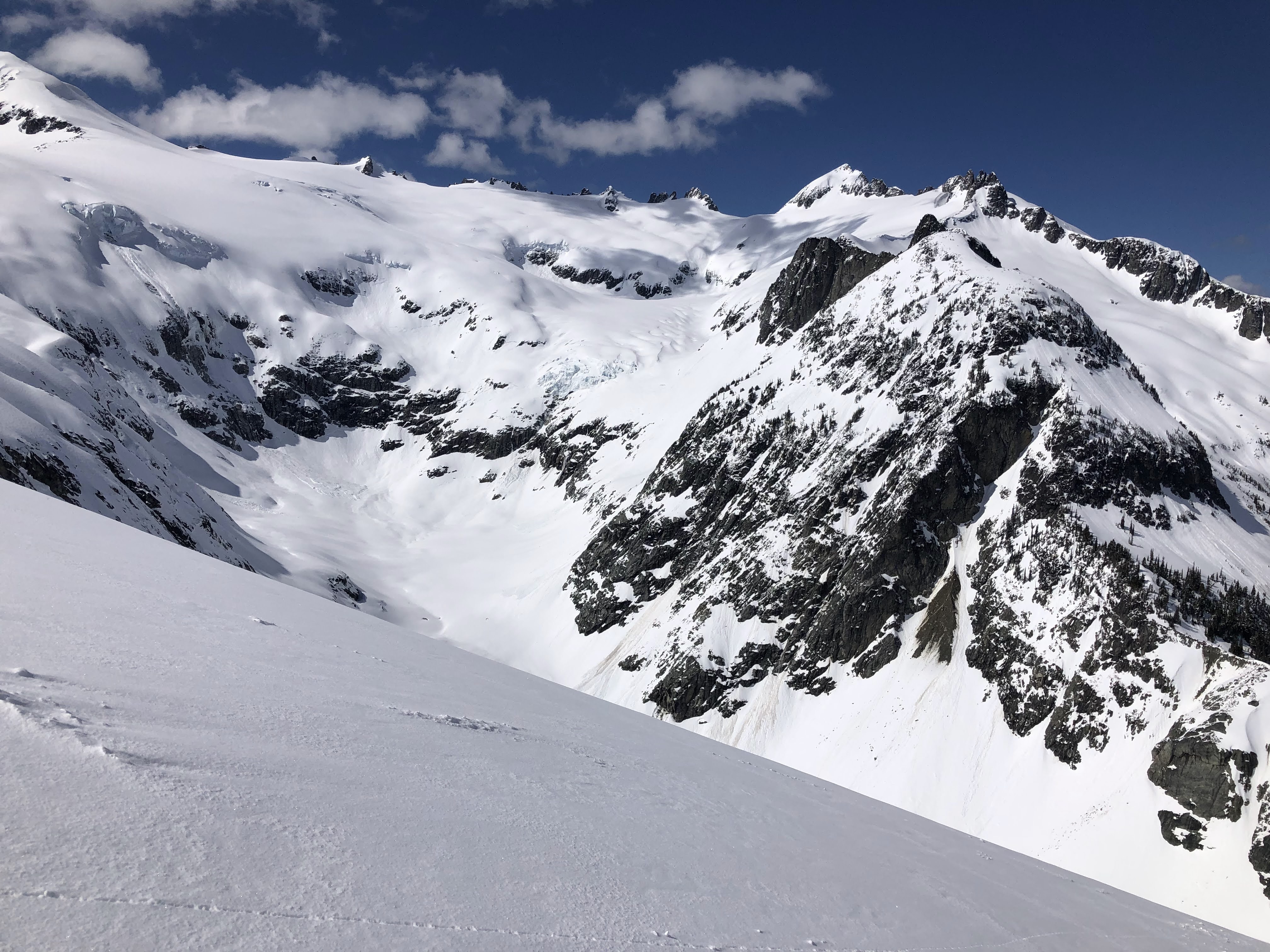
Trip: Mount Torment - Moraine Lake Couloir, NW Glacier
Trip Date: 04/16/2022
Trip Report:
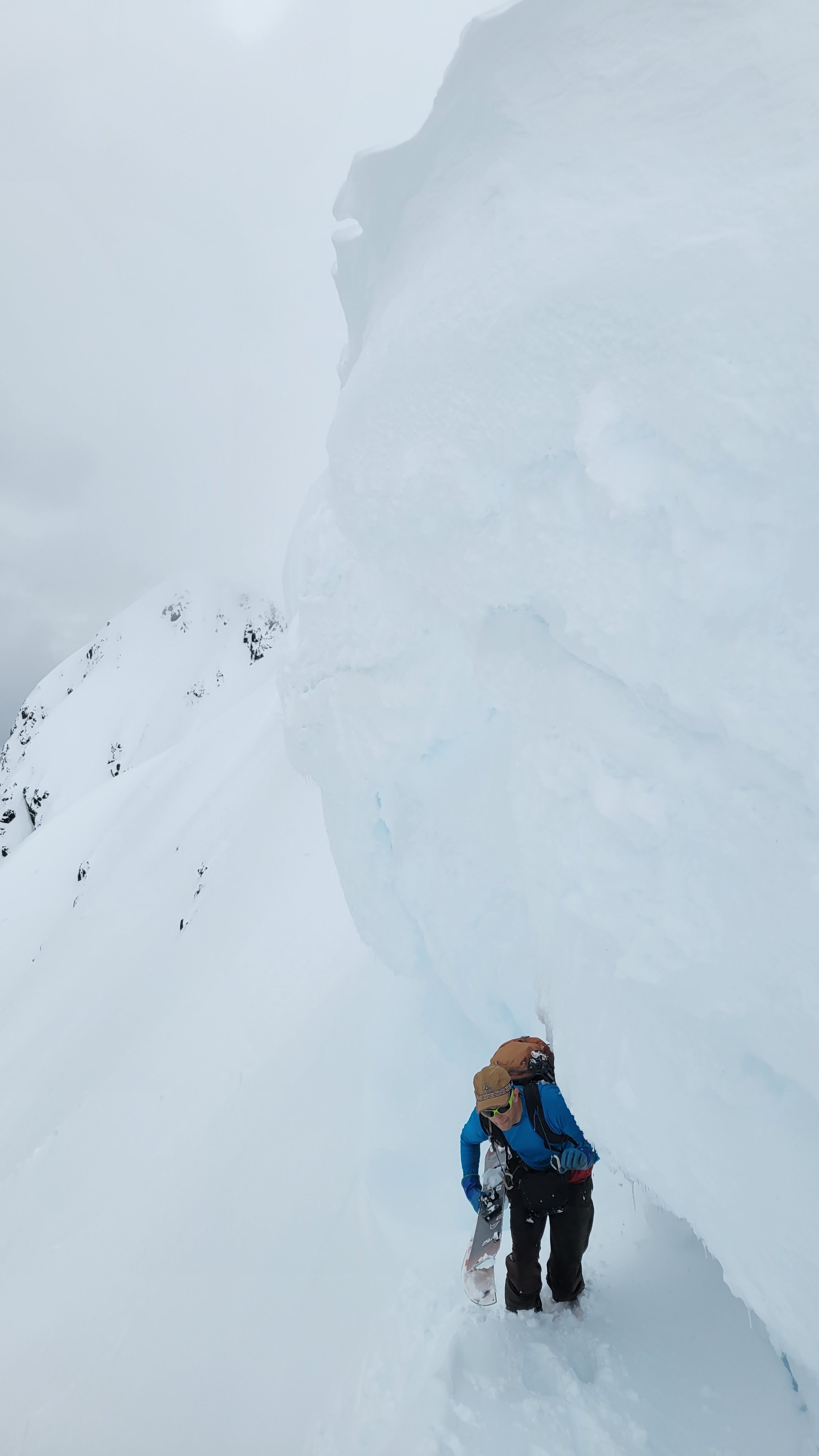
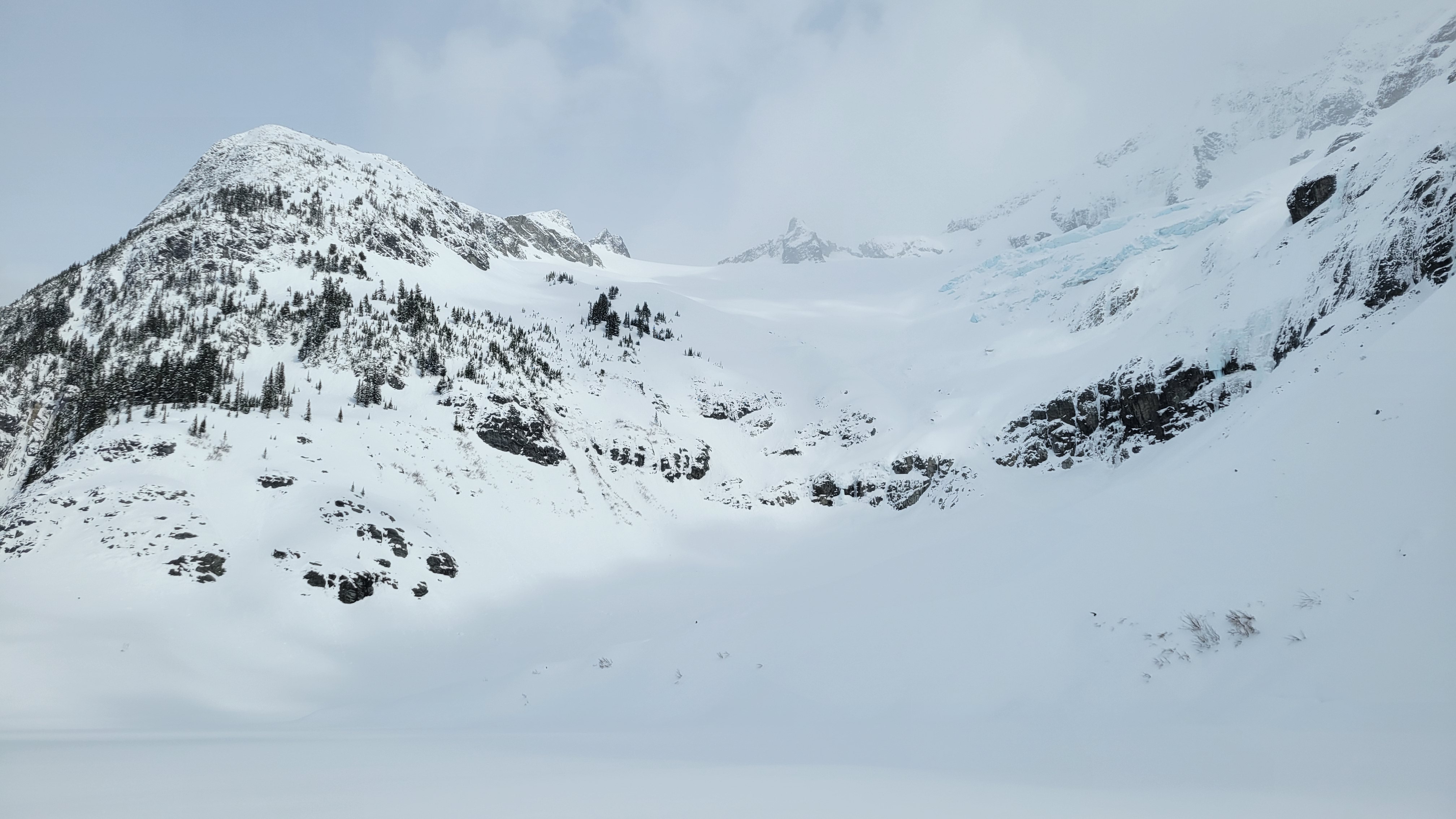
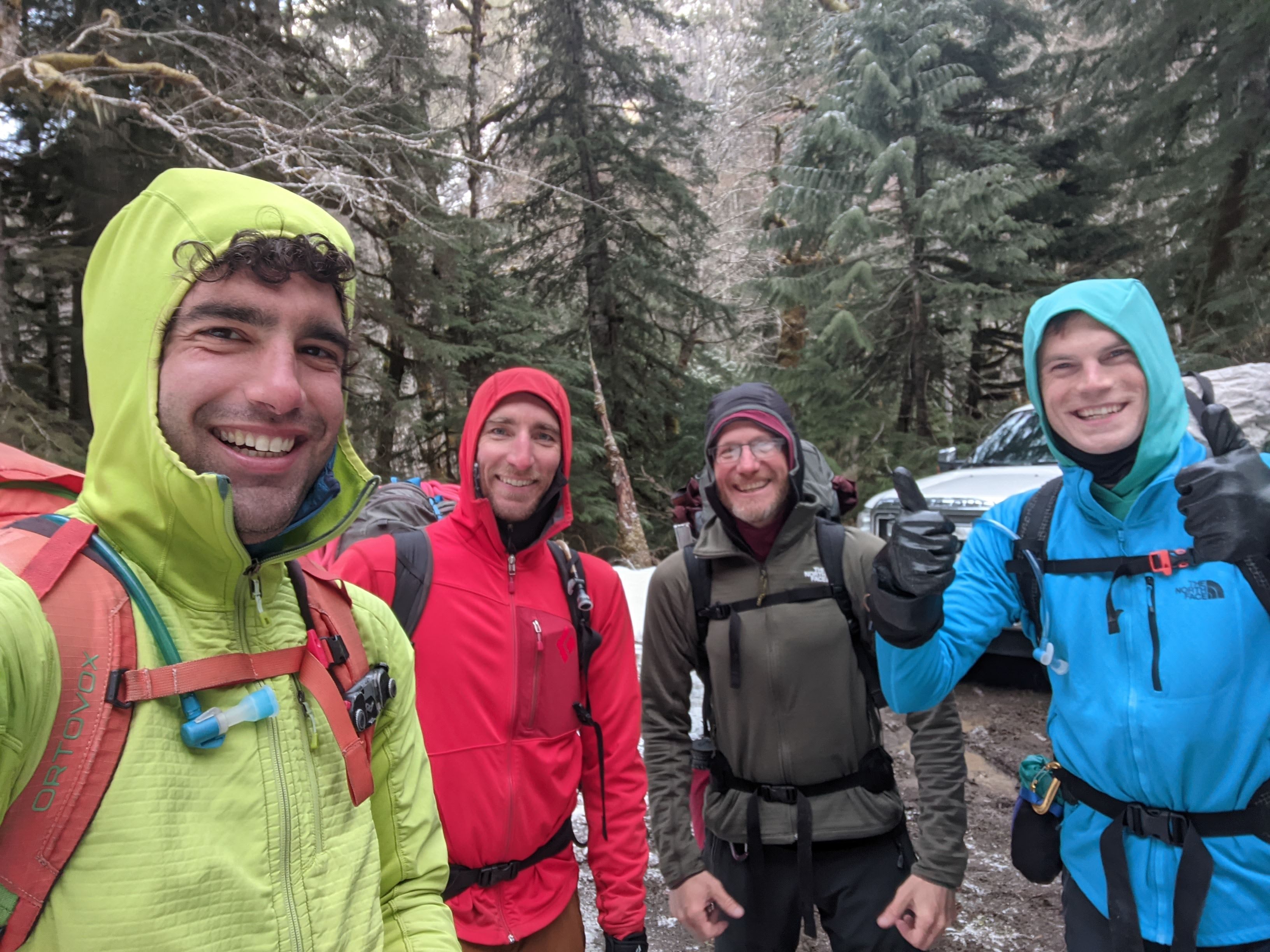
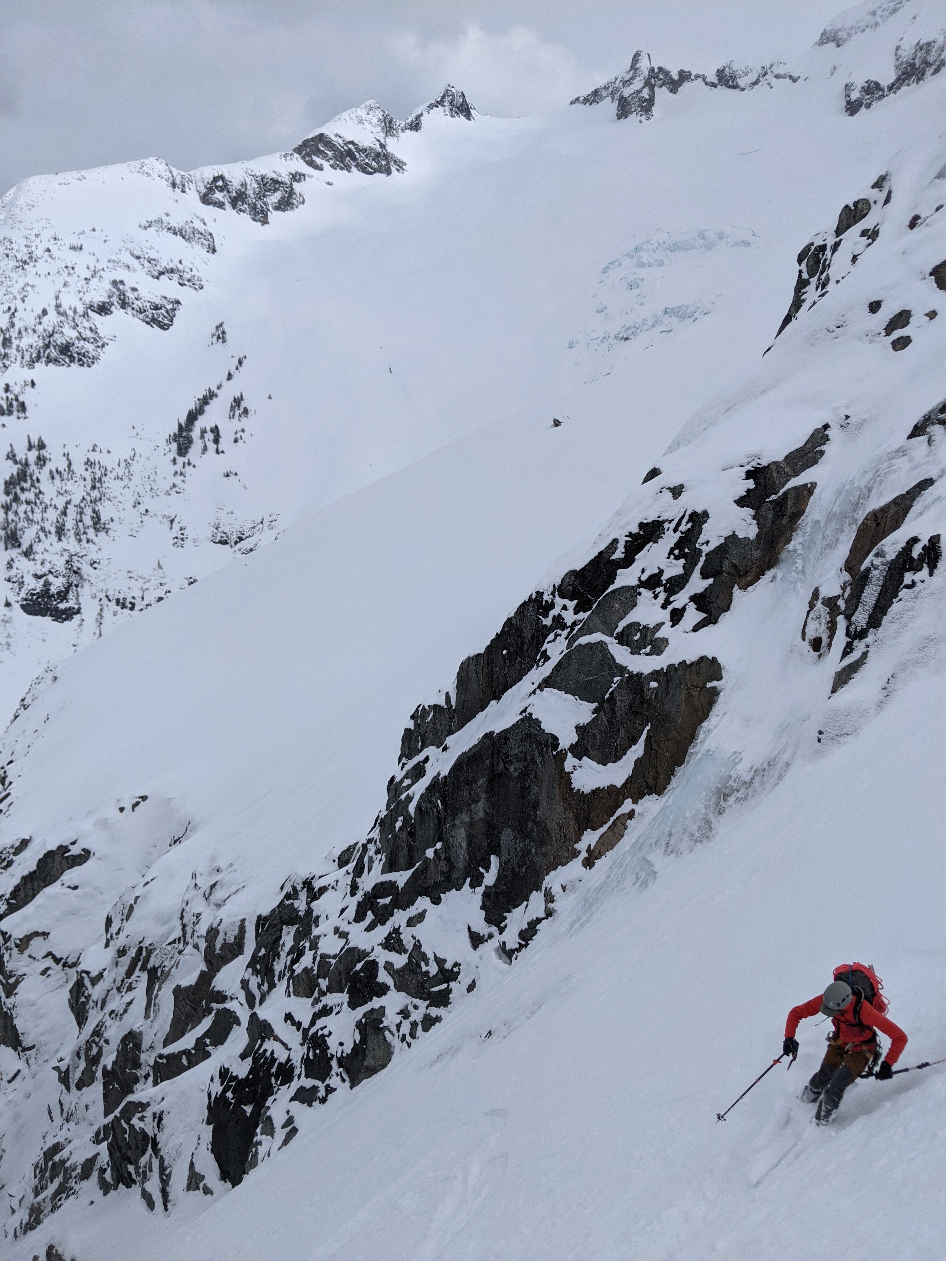
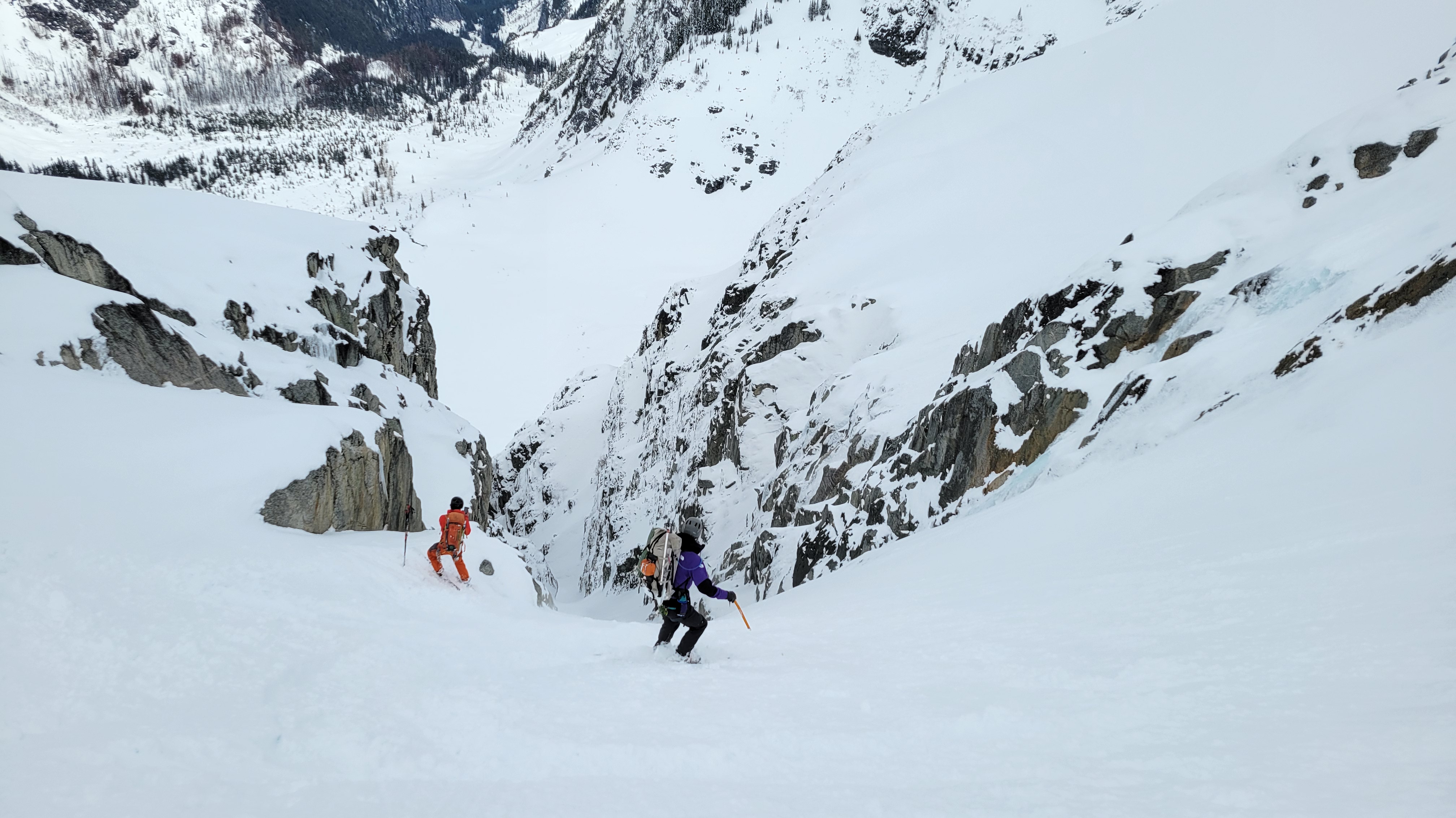
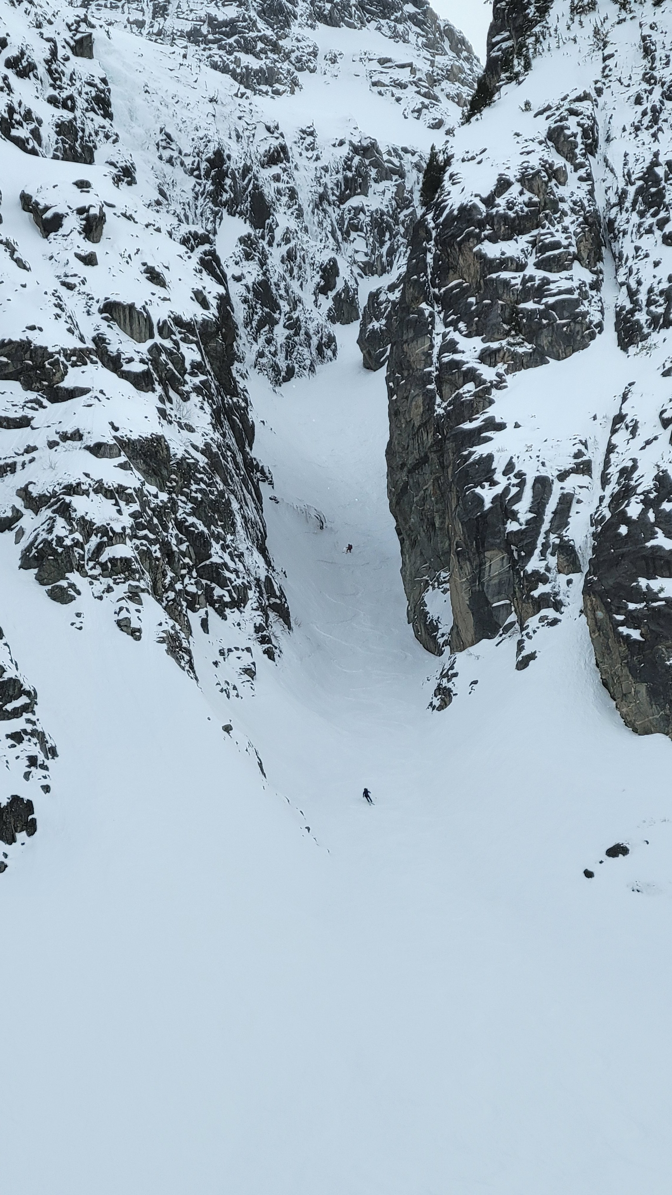
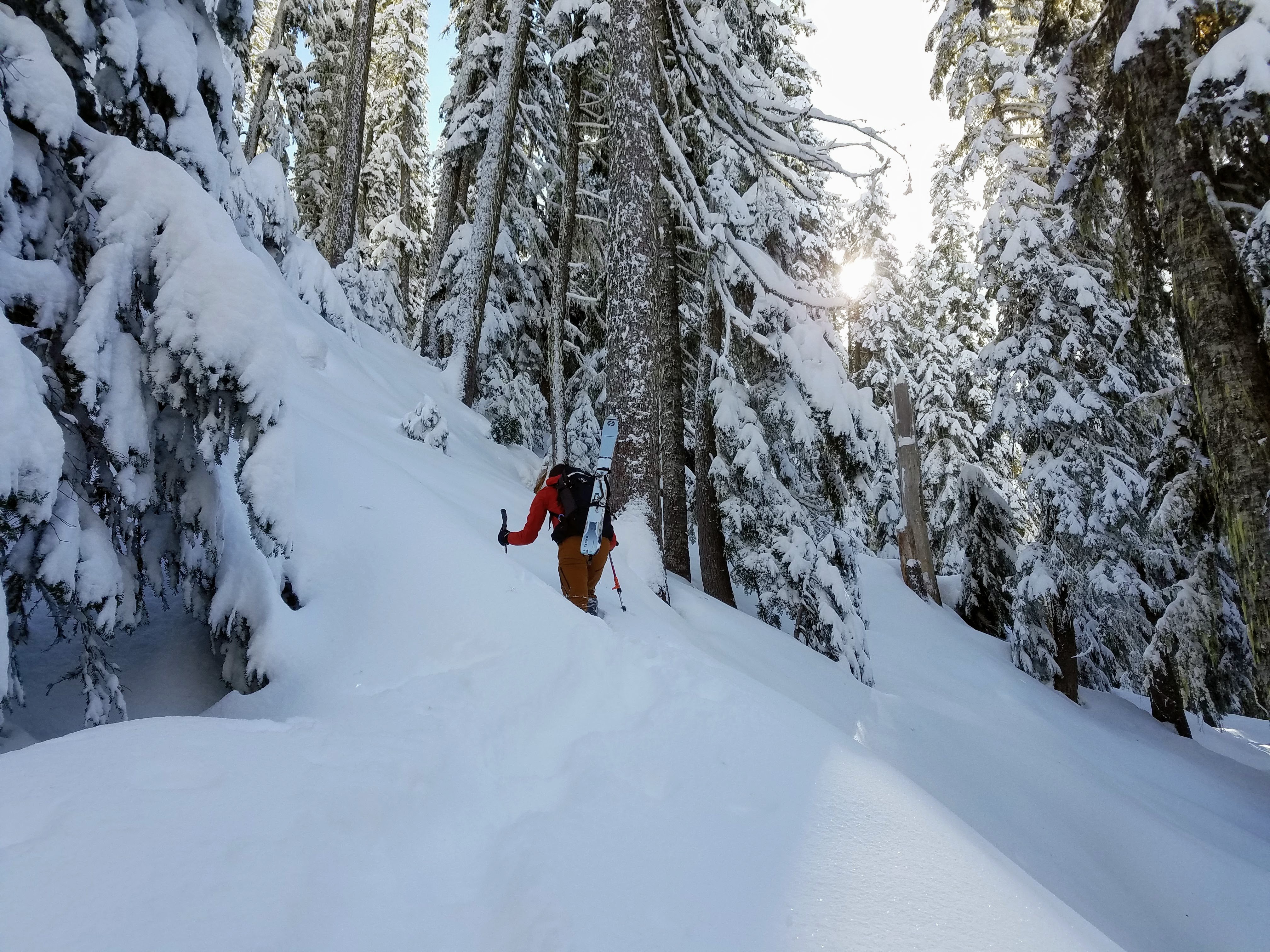
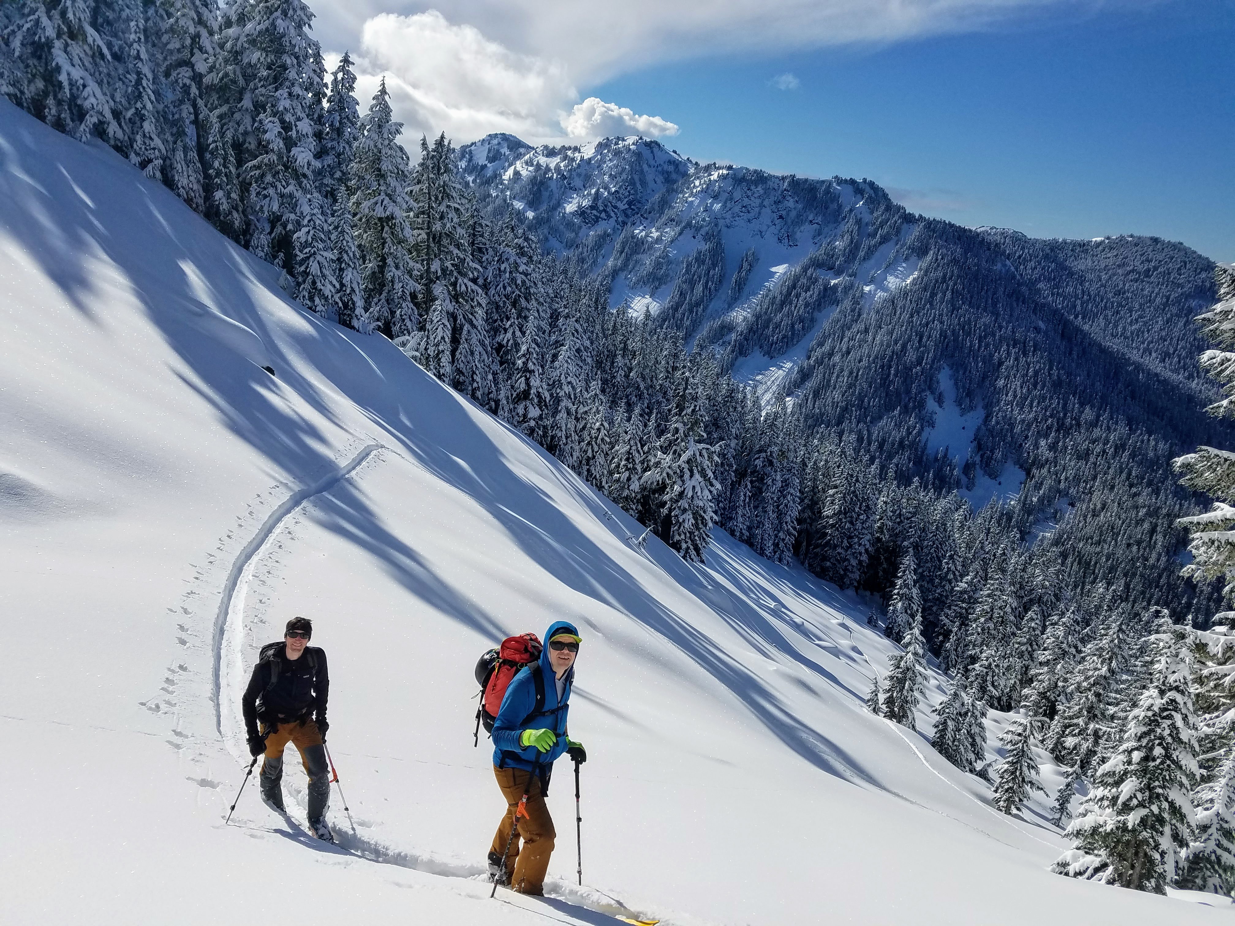
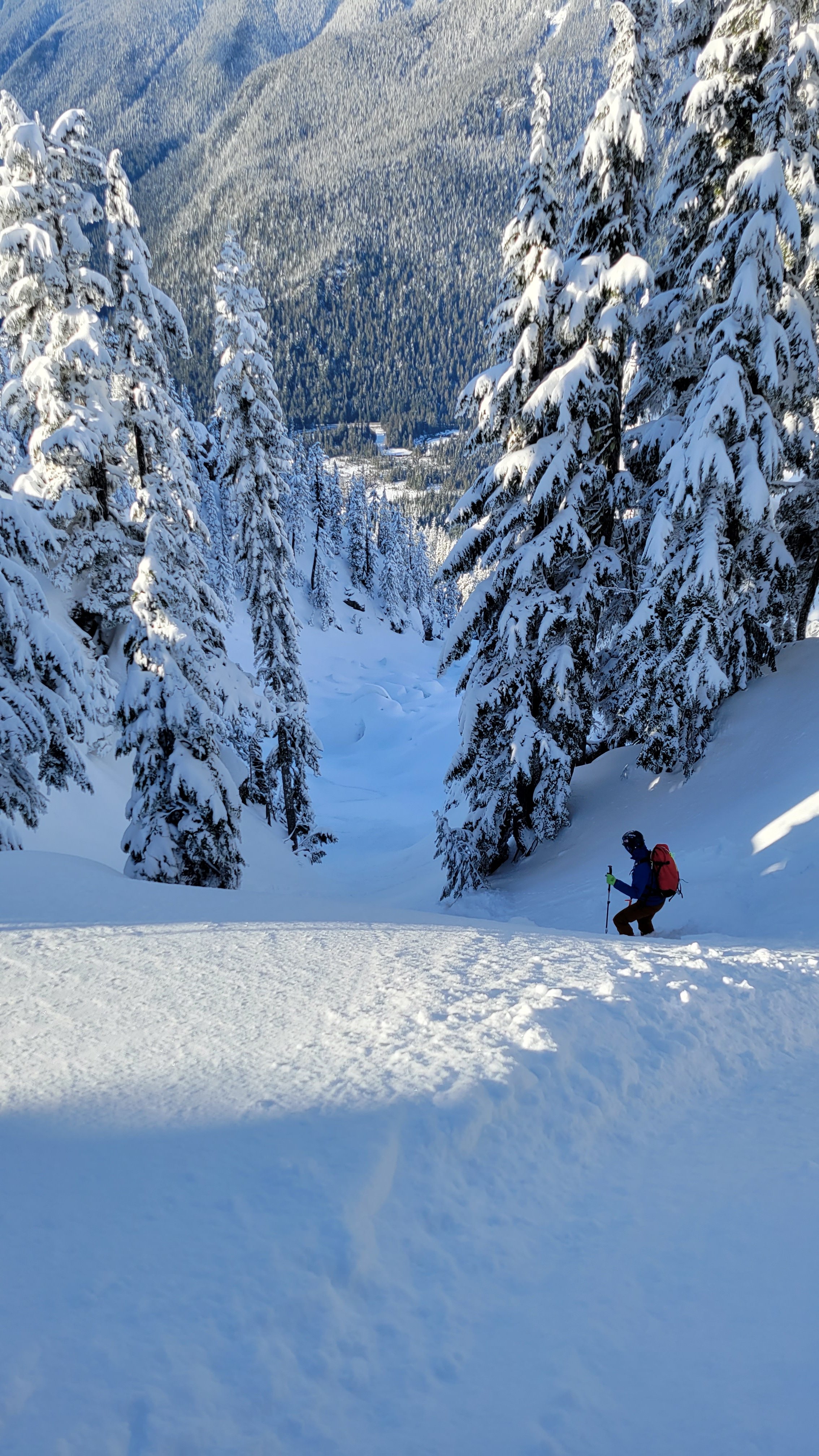
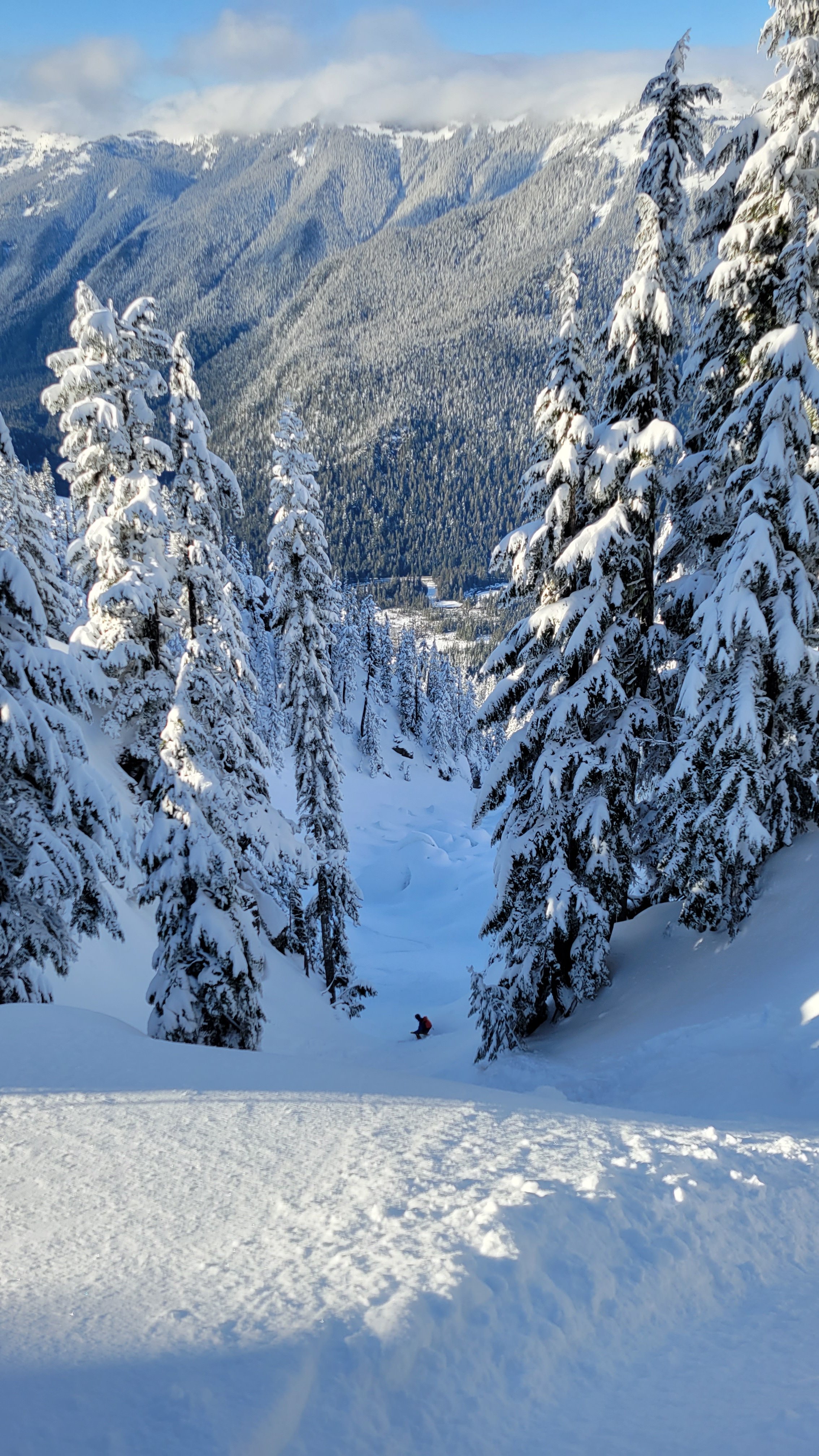
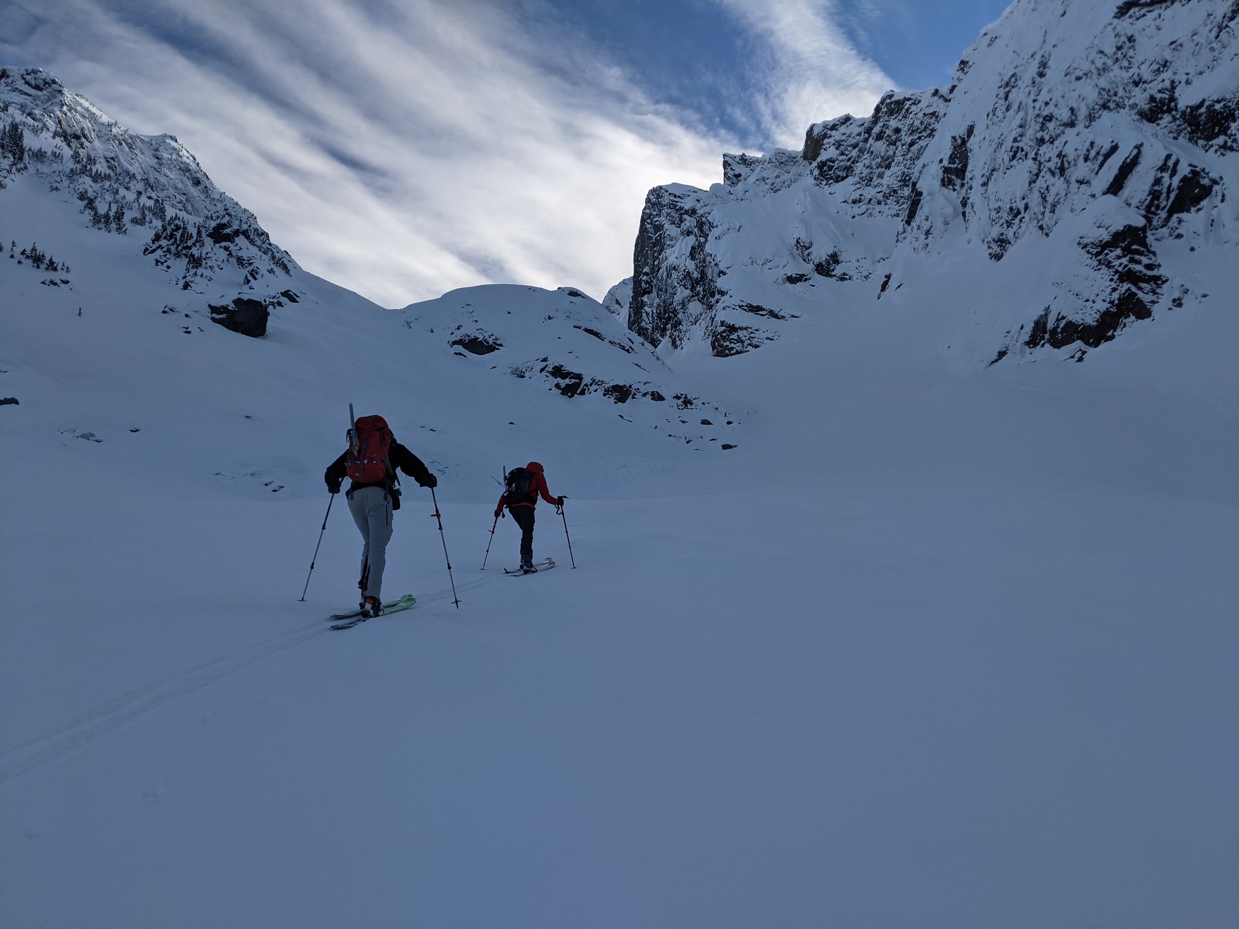
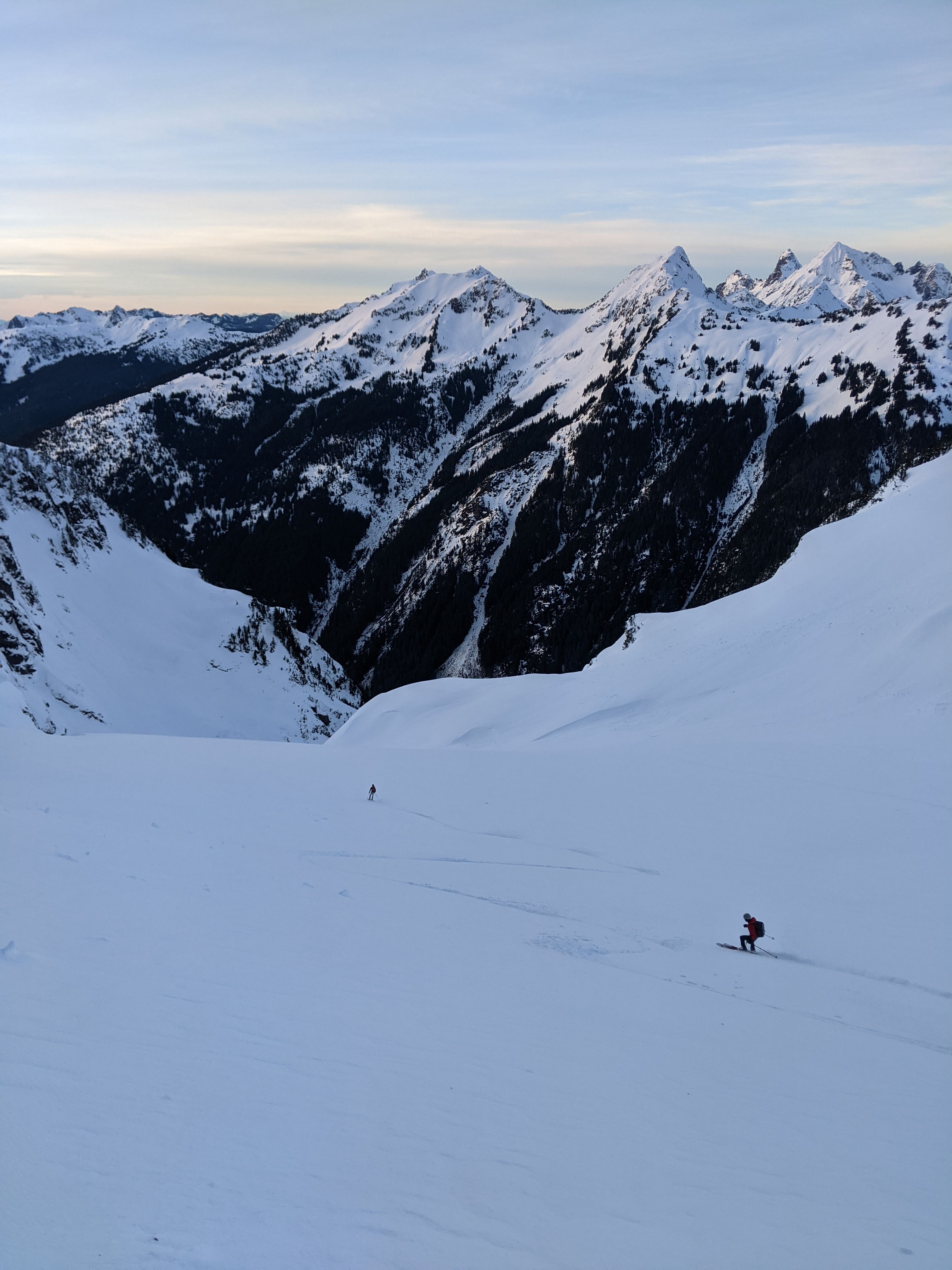
Me and the boys (@Albuquerque Fred, @thedylan, @MGraw) had a great time in the sun for the chilly weekend of April 16-17 on Mount Torment. We skied the Moraine Lake Couloir and most of the NW Glacier on Mount Torment.
We were able to drive to .5 miles past the gate at the park boundary on Cascade River Road before we hit snow. We booted for about a half mile past that, then skinned to the Eldorado Trailhead. We again booted to the boulderfield at 4k as per usual, then we skinned up, crossing the ridge into Torment Basin, and to Torment Col (west of Torment).
The skiing down from there was good but I was too interested in what was to come to really think much about it. The plan was to climb Torment, then ski the couloir to Moraine Lake and camp. When we got to the entrance to the couloir though the exit onto the glacier looked tough. Dylan gamely started to lead with only pickets for pro, 1 aluminum axe, and aluminum crampons, plus skis and overnight gear on his back. Just out of the belay we realized we would never have time to climb all this and make camp at a reasonable hour so Mike suggested a new plan
, we would fix the line and finish the route tomorrow. Dylan got the rope up, rapped, and we skied the AMAZING couloir down to the lake. As in most features like this, the snow being good wasn't the most important part. The setting, the purity of the line, the adventure was made it rock. But the skiing was also good.
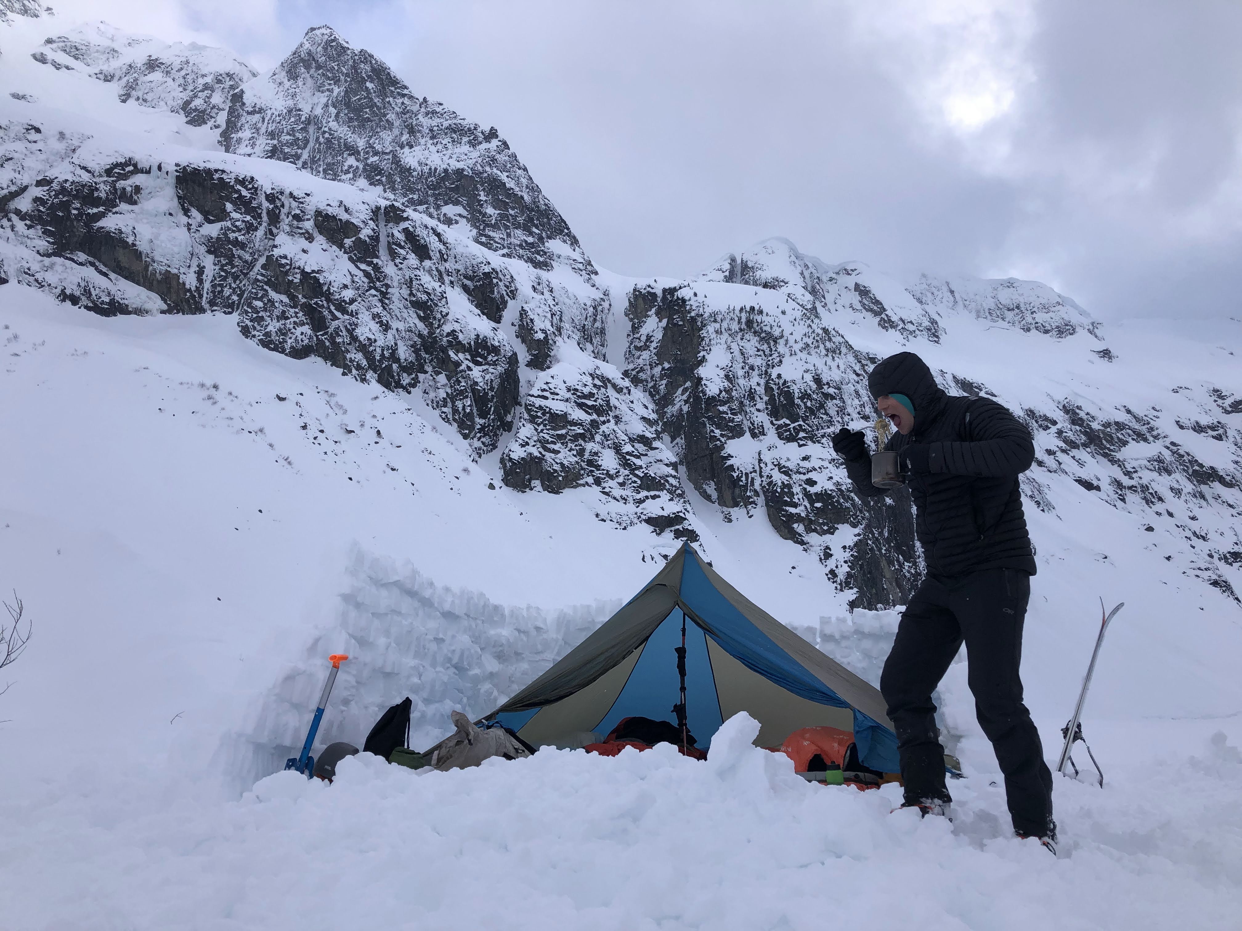
Making camp at like 4pm in April was full on cushy, plenty of time to build a monster wall around the tent, drink whisky, and lounge.
The next morning we booted the couloir, climbed the fixed line, and ascended the NW Glacier on Torment. We had limited beta on this but Tom Sjolseth's report said "we skinned to within 50' of the summit", easy right. Well, not so much. We ran into another short rock step, which, though easy would involve another two transitions to get past. We figured it would be after 10pm by the time we got to the car, so we bailed at 7300'.
The ski was epic. Top 5 ski runs ever for sure.
We will be back for the summit.
The crew:
Thanks for the shot Mike:
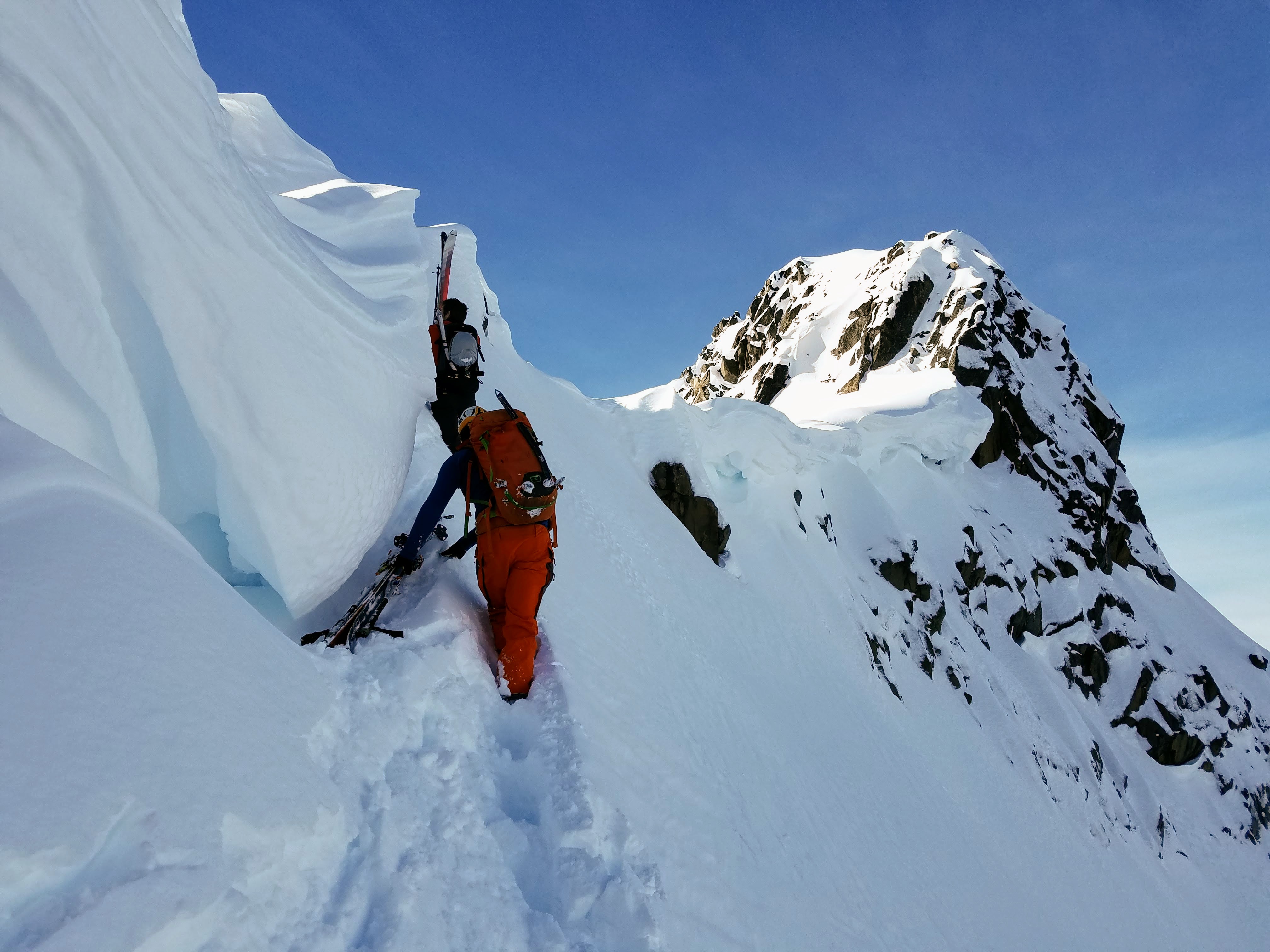
Dylan scouted the scary roll over:
Dylan rapping after the lead:
I'm sure Fred didn't just fall:

Mike and Dylan working the lower couloir:
The whole thing:
Dylan slays it, even in camp:
If you have to boot it might as well be into the sunshine:
Mike following the fixed rope:
Topping out:
This sucked:
We should have lapped this one.
Classic Cascdes:
Gear Notes: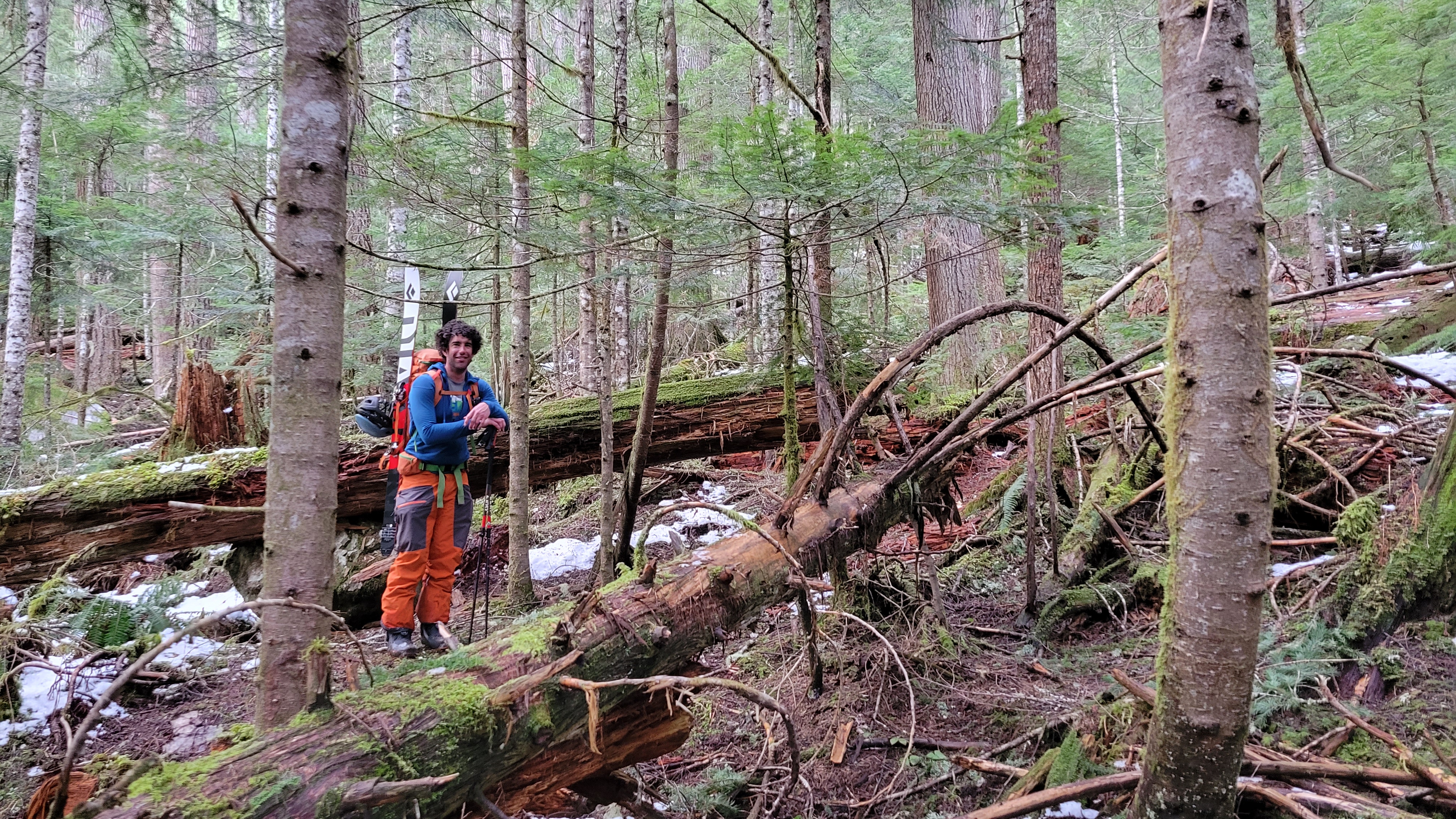
1 axe, crampons, glacier gear, avy gear, camping gear. not enough.
Approach Notes:
Eldo worked well, I've done Torment Basin and didn't want to do it with skis on my back.-
5
-
1
-
4
-
-
On 2/23/2022 at 6:01 AM, genepires said:
nice. thanks for the TR.
what are the dotted blue lines in that map representing? ski routes or creeks?
The blue lines are from the topo, all I added is the red line. Dotted usually represents seasonal, or ephemeral, streams and solid are perennial streams.
-
Yeah, everything was sooo bony. The woods were dry along Icicle Creek.
-
Trip: Slate Peak - Clean Slate Couloir
Trip Date: 02/21/2022
Trip Report:
@thedylan and Dave Duyee and I skied the Clean Slate Couloir off of the N ridge of the N Peak of Slate Peak. Dylan wanted it to be a climb also, but it was just a point on the ridge... I wanted a peak too Dylan, but it wasn't to be. We parked ... wait, first I called in sick... then we parked at the White Salmon Snow Park and skinned briefly up Anderson Creek Road. Dylan had graciously scouted the trip the day before and even put in some skin track.
There was some of this:
Ans this:
And this:
But finally there was this:
And then even some of all this:
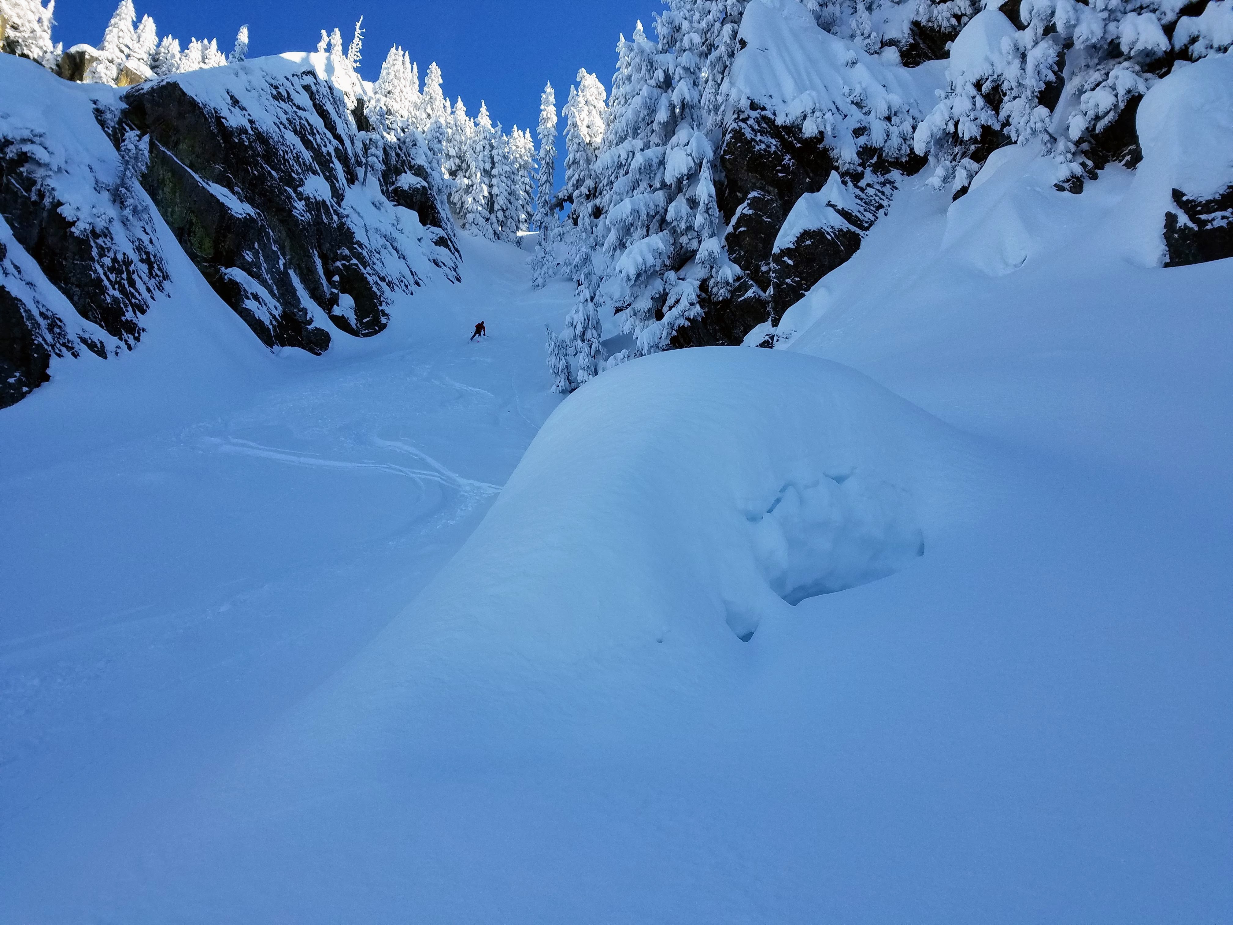
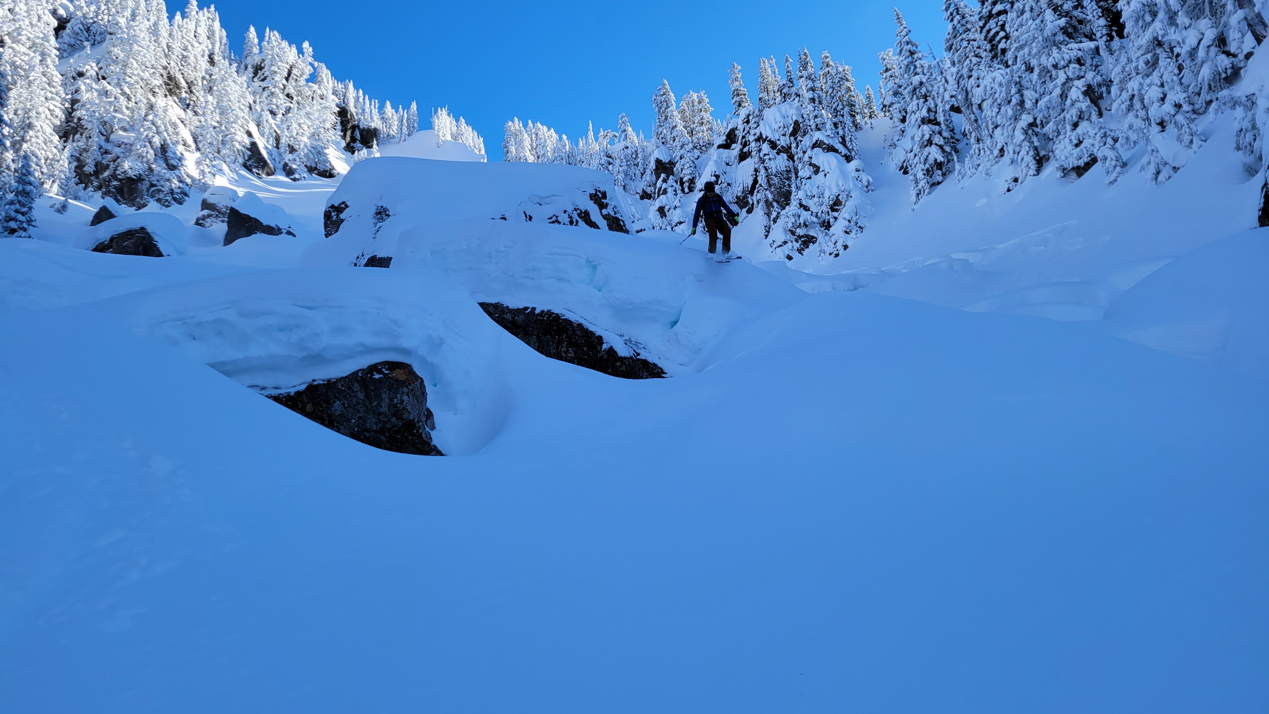
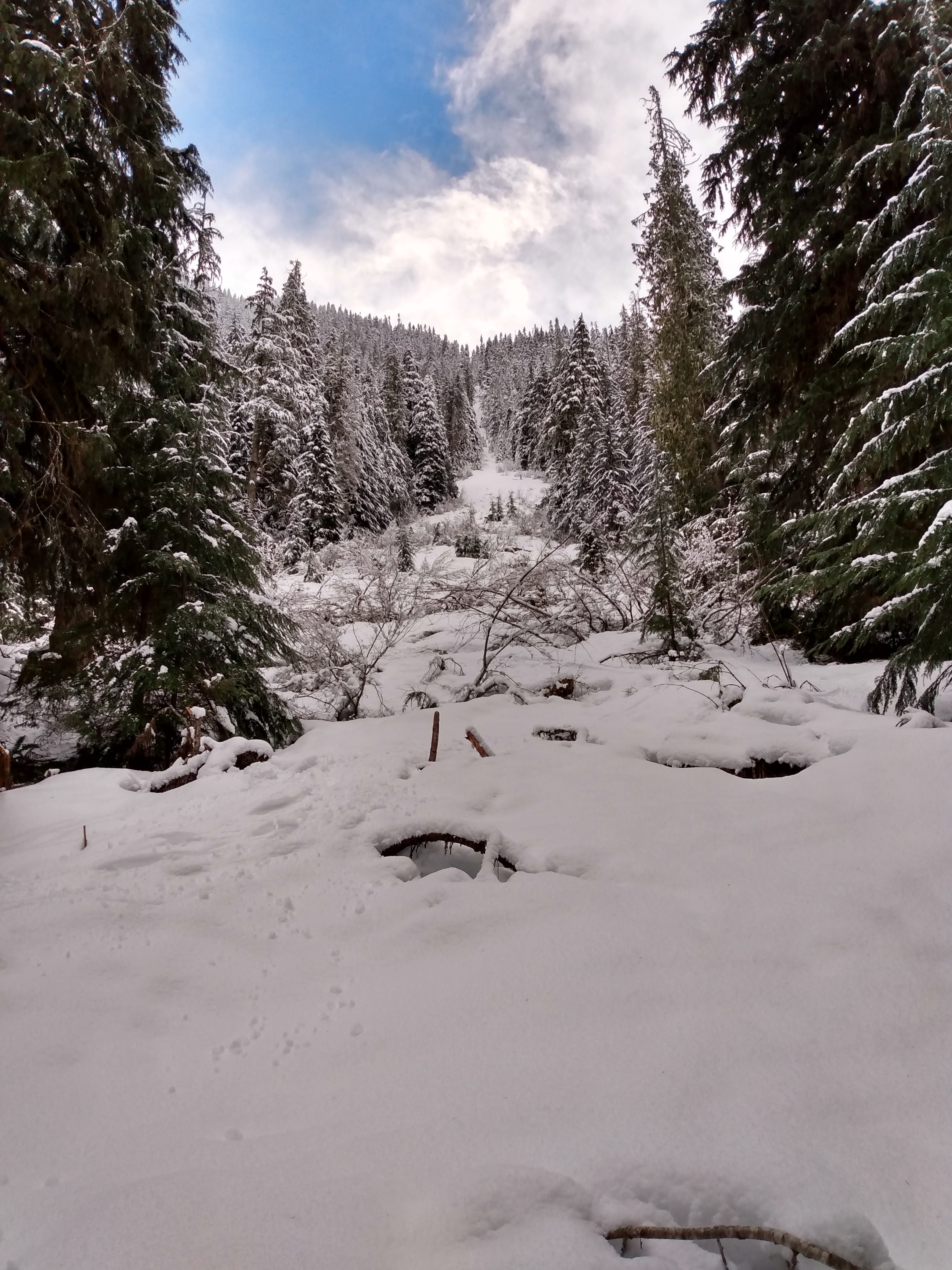
The snow was amazing and the fresh went down to about 2500' where we entered the woods. Thanks to Dylan for scouting it! If you don't know this one, it looks something like this:
Gear Notes: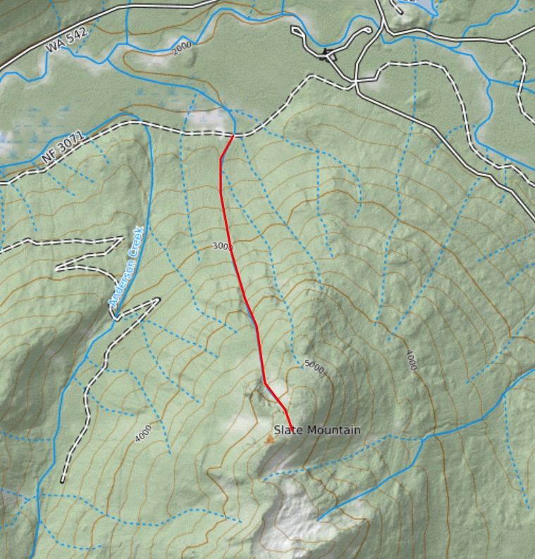
skis, booze
Approach Notes:
Short, but Cascadian.-
1
-
1
-
-
Trip: Axis Peak - South Gully
Trip Date: 02/19/2022
Trip Report:
@Albuquerque Fred and I were at it again. We really felt the need to climb Axis Peak this time, it just calls to you from every vantage... note the sarcasm. I was foolish enough to say "I'm up for anything". Fred thinks is cool to climb lists, I don't; but then I'm not opposed to it on principle either. So off we went on Friday night to TH bivy on Icicle Creek Road at the gated and snowed in 8-Mile road. Fortunately, Eminem was not present.
We were up early but it was stupid warm in the morning (tomorrow would bring a fast moving cold front). We knew we had to get out early as a big storm was moving in and we didn't want to be in the mountains, plus we still had the drive back west over the pass.
The road went easy but the Bellevue crowd had been slacking as the trail was super not packed out (I assume it is Instagram that causes the normal luge chute and not Leavenworth locals, correct me if I'm wrong, I don't travel here often). We skinned ice crust with occasional post holes and snowshoe crampon scratches to within 1/4 mile of Lake Stuart, then ascended the fan up the gully on the south side of Axis peak. I had a bad experience the previous weekend with ice crust skiing so I was adamant that skis were only for that approach today and we left them at the fan at around 5300'. It was super icy here with about half a dusting of snow from throughout the morning.
The gully was a dream, perfect secure cramponing on moderate slopes with some dirt and moss to remind you that you're in the cascades. The gully actually served to focus the sun and block the wind as well so it was amazingly pleasant. The weather called for intense ridgecrest winds. We tagged the summit, signed in, and bailed down a couple hundred feet out of the gale to eat lunch.
The descent was amazing, but firm enough the I was still glad we ditched the skis. I got to try out my new skis on frozen avy debris, and sun crust, plus dirty, thin forest on the way out, so that's a plus. We only skied down to 4660' then skinned again, all the way to the road. At least I did, Fred insisted on shuffling in walk mode with no skins despite it obviously being slower and sketchier. Oh well, at least I was proven right.
Photos:
Oh yeah, in case you are not aware, Axis Peak is the next ridge north of Stuart.
Before you ask... North side of Dragontail.
Approach skinning:
Argonaut:
Not the best coverage out there these days:
Up the gully, it's better than it looks:
There is no summit photo that doesn't look cheezy is there?
Gear Notes: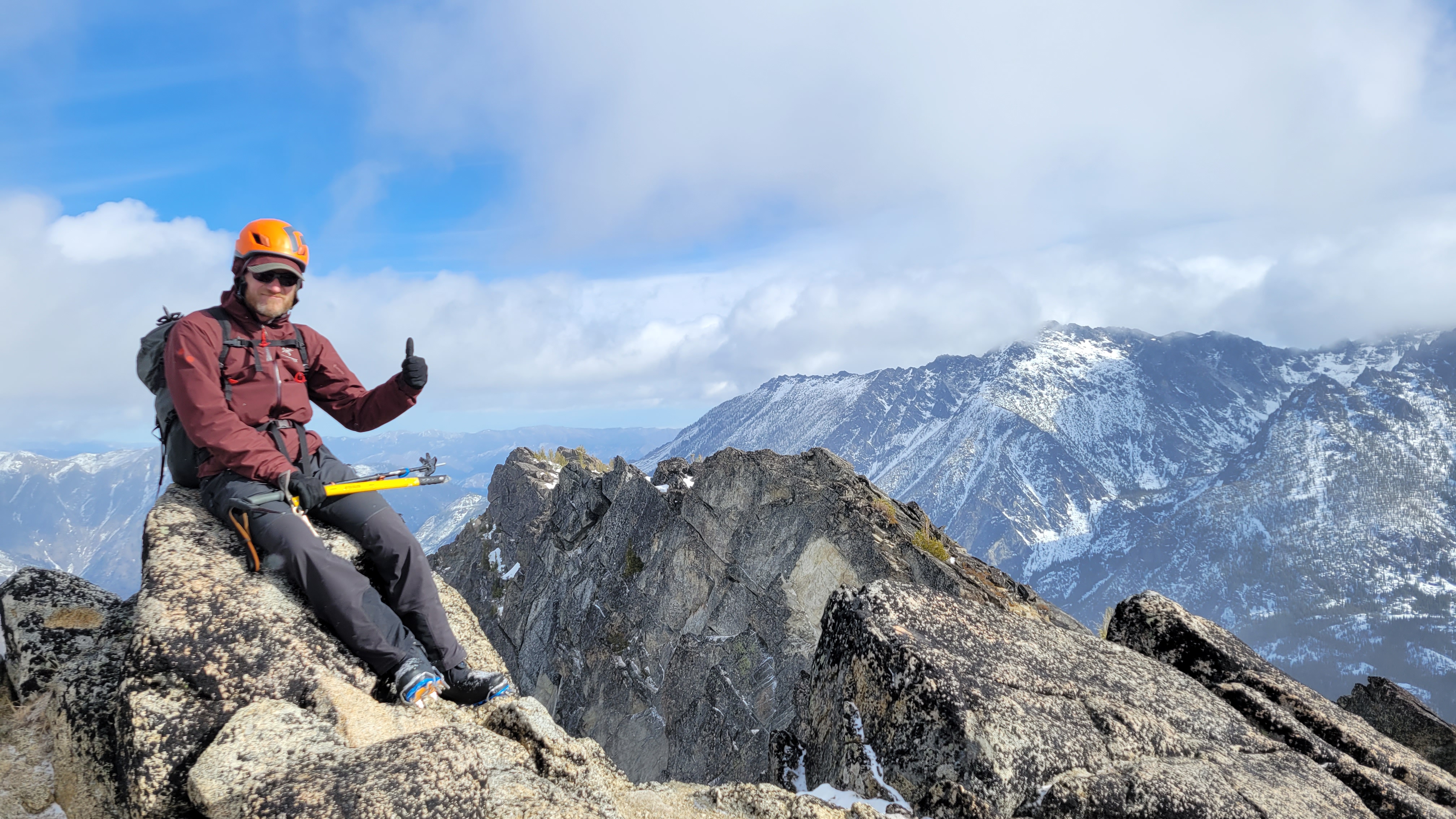
Axe, crampons, helmet, skis for the approach.
Approach Notes:
Road was easy, trail was terrible.-
4
-
1
-
-
That's sweet! We were talking about that while we're up there but I didn't think the coverage was good enough to ski.
-
Wow, amazing. Thank you so much for sharing all the details! My heart was pounding while reading the ridge section!
-
Trip: Mount Sefrit - NW Route - Wall Street Couloir
Trip Date: 01/22/2022
Trip Report:I've been eyeing Sefrit for years, really looking to ski the NW route and the "Wall Street" couloir. I did the peak on my first try from the NE and the Bloody Head Couloir (colorful names on this peak), but I've failed more times than I care to remember due to various snow condition excuses.
This time we had an outrageous skunking the weekend before which effectively served as a scouting trip.
Me, @MGraw, and @thedylan skied in on the super frozen crusty road bed knowing the ski conditions would suck but that the cramponing in the couloir would be all the better for it (this was the plan). We eventually found the log after some awful wallowing in the barely covered brush and began cramponing up the avalanche debris on the couloir fan. I have tried most different types of conditions on this route and this is the only way I can see to make it work safely except for the very rare low snow dump with great stability. One is very vulnerable in the couloir with tons of hanging slabs over your head and 1000' couloir to feed into you.
We made quick work to 5000' and last year's high point at the bottom of the upper basin. From here we skinned on crust with occasional thin powder patches all the way to the summit ridge at ~7000'. We took a look into the upper couloir on the NW flank of the summit pyramid, but we had set our hopes on fast and light, so didn't bring climbing gear. It looked too sketchy to try with no rope and only one axe apiece. Sadly this means we have to come back.
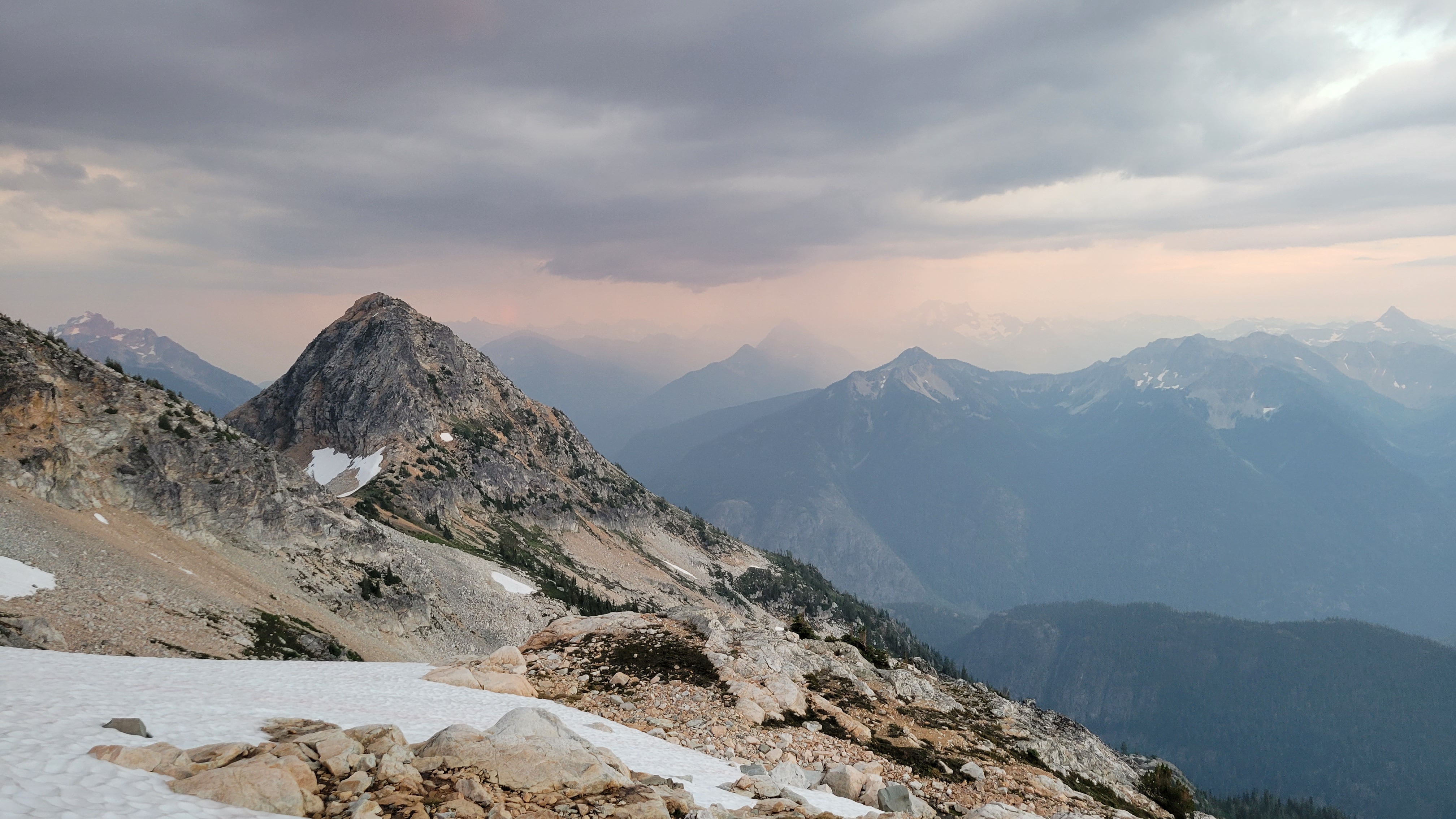
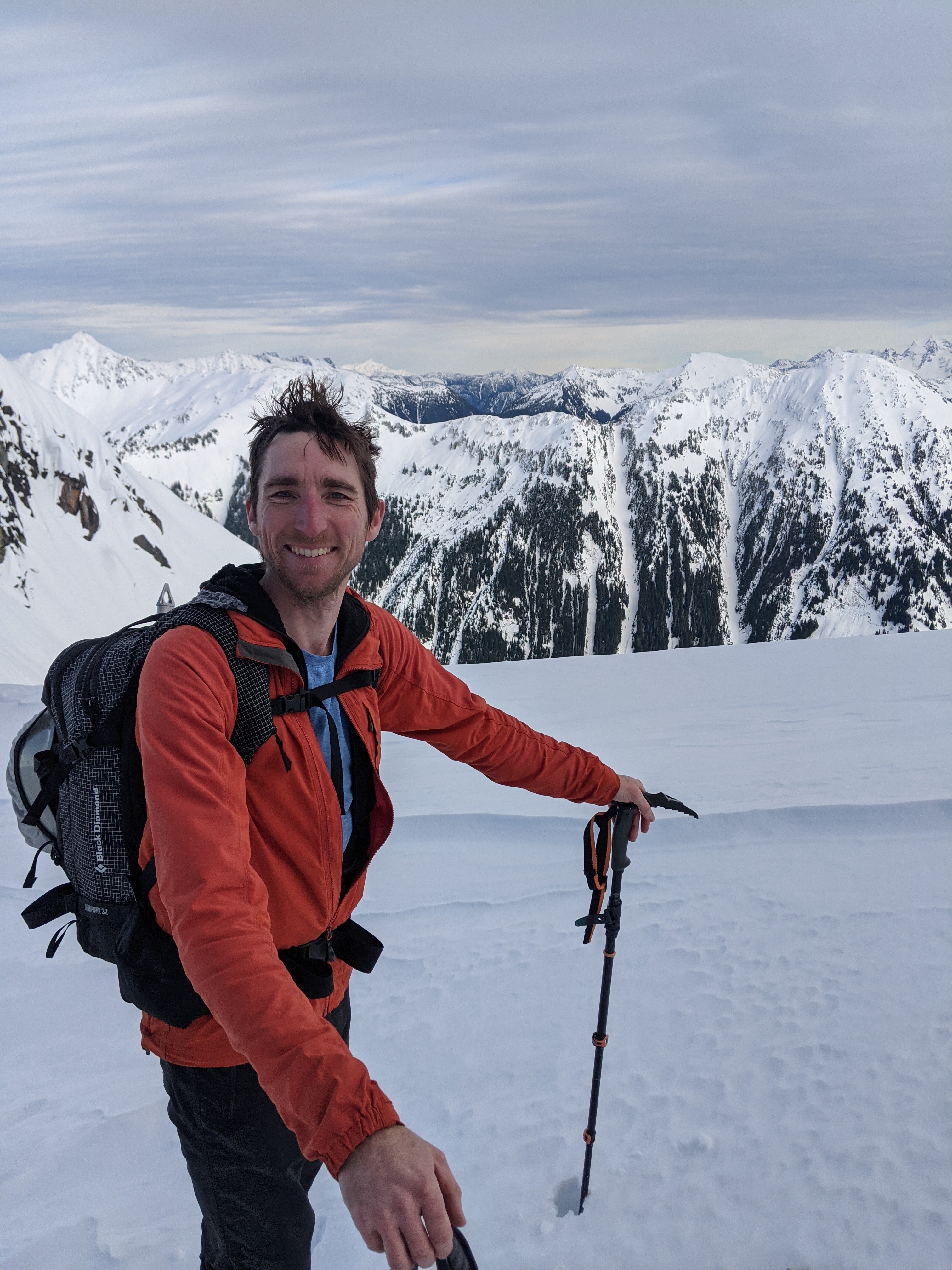
We ditched the skis at 7000' on the ridge in the amazing warm sun after climbing in the shade all day. At this point it was already pretty late and we were worried (not Dylan). Then we hit a dead end on a tower on the summit ridge and had to backtrack. We climbed on the south side below the crest on mostly steep snow with a couple of rocky moves thrown in. I was worried we would run out of time with so minimal daylight. We persevered however and with Dylan leading some just barely solo-able moves on snowy rock and lots of step kicking we made the summit. I spent all of 30 seconds enjoying the efforts and accumulated knowledge of like 8 failed trips, then turned tail and headed down. The views are great, but the best was toward Shuksan's north side which we had been seeing all the way up from the ridge.
Getting down to the skis was surprisingly easier than the way up. The snow was already re-freezing by about 3pm. We skied down, enjoying some of it anyway, booted the couloir, cramponed across the frosty log over Ruth Creek, then back to the skis for a super fast icy ski and skate down the road.
19 miles, about 5800' in 12.5 hours.
I think this is the best way to get the route since it is super hard to find powder in a couloir at 3000' and stable conditions.
Typical fun getting through the woods, sorry Mike:
Ruth Creek:
Fun conditions in the lower couloir, easy cramponing though:
Upper basin skinning:
Loving the alpine:
Probably time to ditch the skis. Mike skied off this for his first turns of the year; nice work:
Working up the ridge:
Shuksan:
Let's get out before dark. 10' off the summit:
So worth it for the turns... I wanted to die. It never felt so good to take skis off and walk:
Gear Notes:
skis, helmet, axe, crampons, Bison Grass Vodka for the skate out.
Approach Notes:
ski from the highway-
2
-
1
-
2
-
-
Nice work! Thanks for the info.
-
I did easy ridge both ways one year over Labor Day because the trail still hadn't been brushed out by trail crews. Many mile of brushy trail sounded lousy compared to alpine meadow walking.
Also early season when there is still snow on the trail makes this a good choice.
I have heard many people say the N ridge of Whatcom is sketchy, but mostly people with multi-day packs.
[TR] Canadian Border Peak (CBP) - NW Route 10/15/2022
in British Columbia/Canada
Posted
Are you insane! I mean I like challenging blue collar climbing, but wow. The approach/deproach to ABP was brutal.