
geosean
-
Posts
190 -
Joined
-
Last visited
-
Days Won
39
Content Type
Profiles
Forums
Events
Posts posted by geosean
-
-
Thanks for sharing Fred. Well done.
-
2 hours ago, JasonG said:
That's a huge effort in three days! Nicely done.
Praise from Caesar, thank you.
-
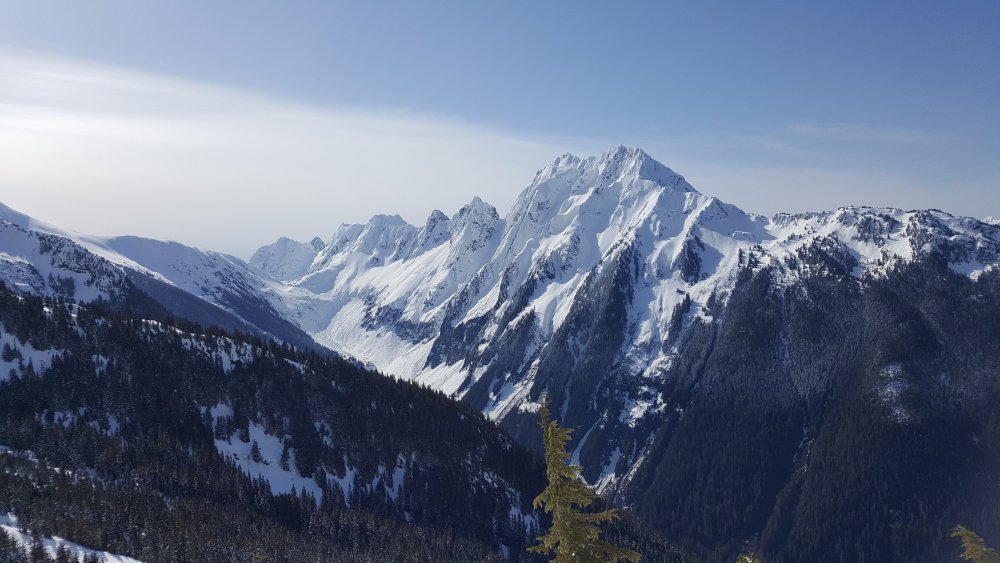
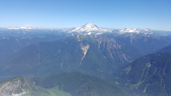
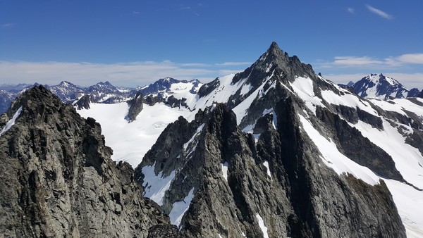
Trip: Jack Mountain & Crater Mountain - NohokOmeen Headwall & South Ridge
Trip Date: 05/26/2018
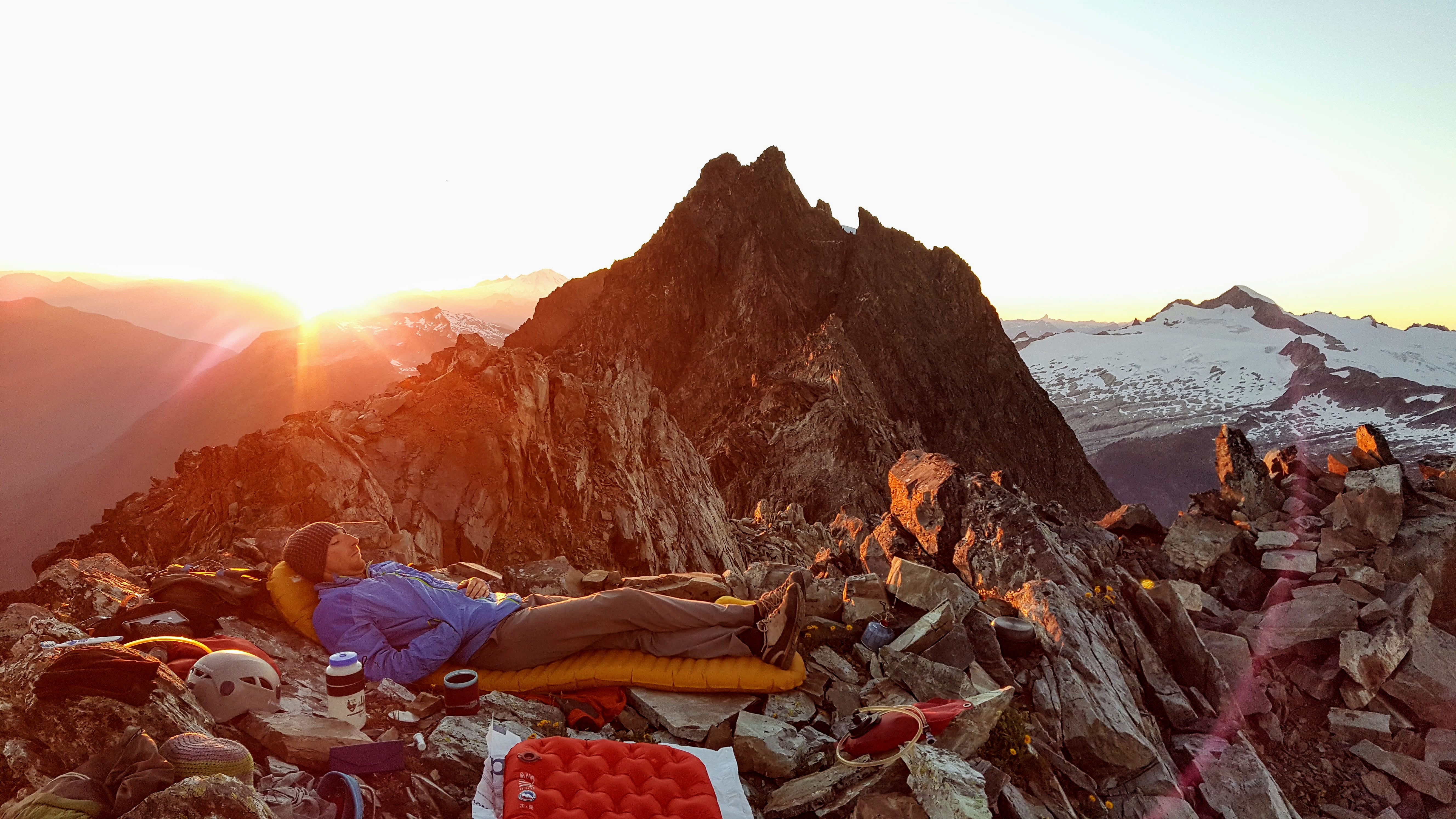
Trip Report:Fred and I had amazing plans for a (for us) heroic trip... The Great Jack Off. Along the East Bank Trail, up the Nohokomeen Headwall of Jack, down the south face, with Crater to boot. The trip reports we read from the party on the Nohokomeen on the 12th helped with the scant beta a lot, thanks! This route isn't even in Beckey if you can believe it!
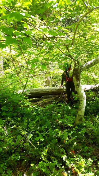
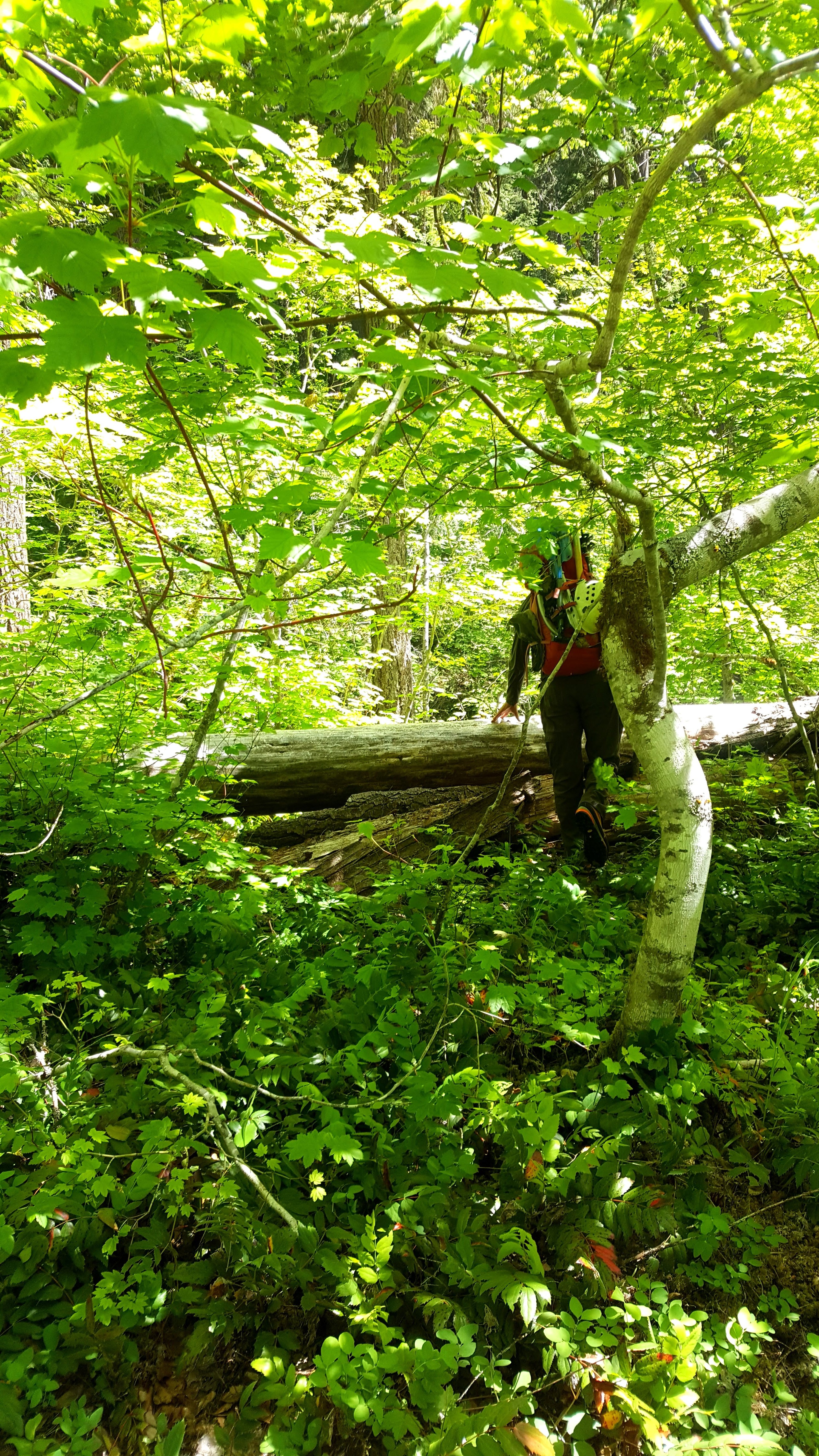
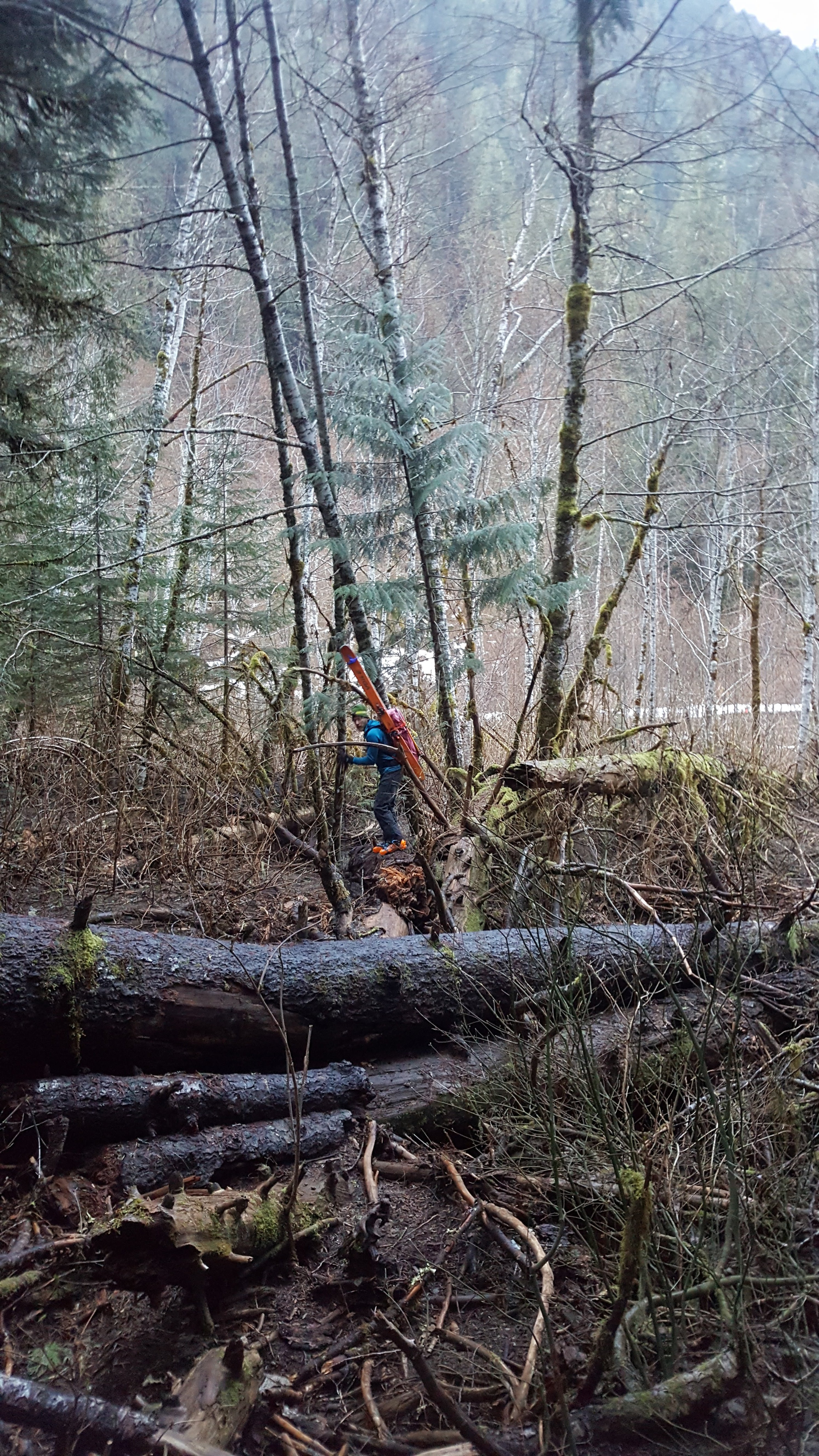
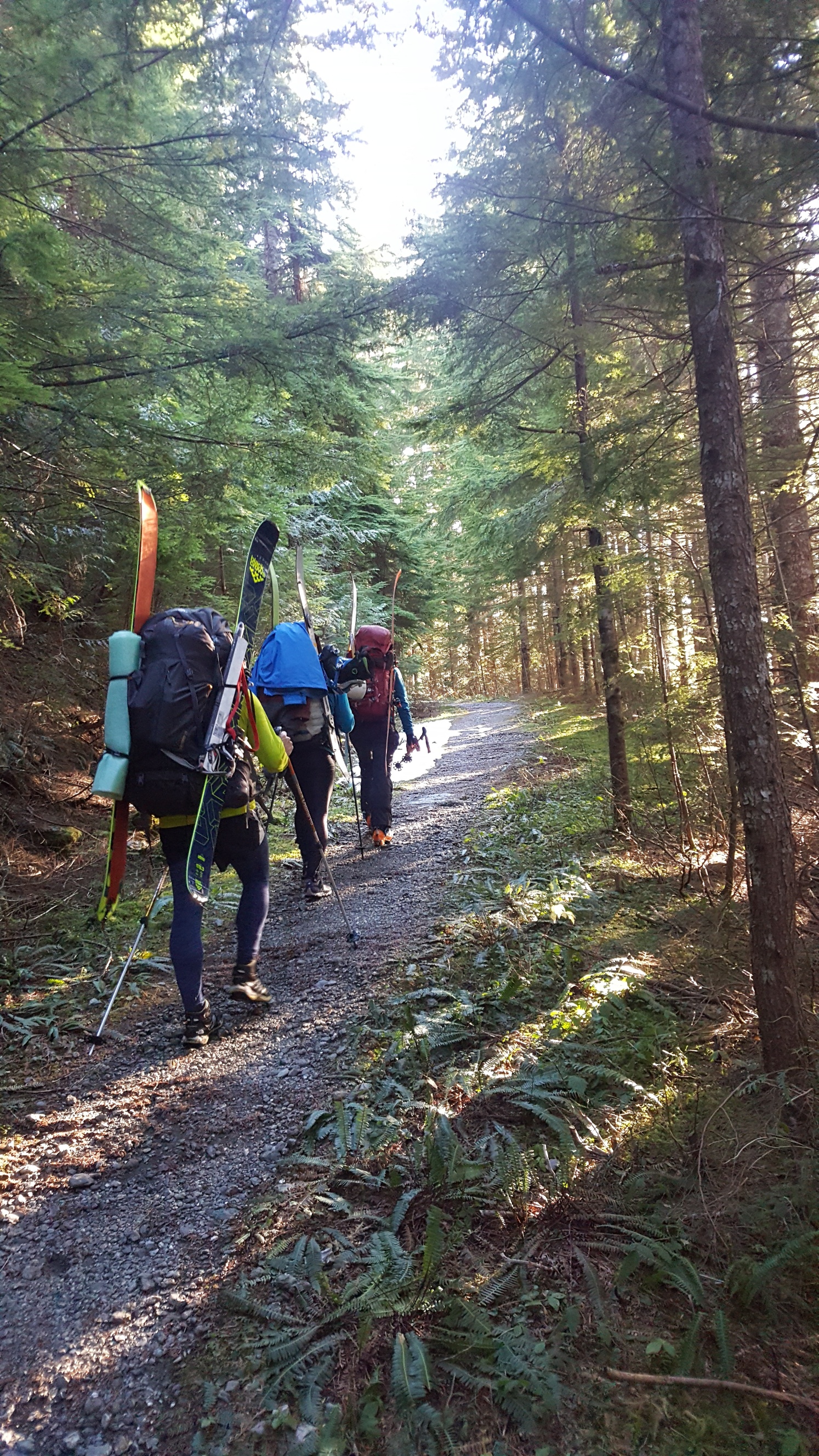
For purity of the trip we hiked car-to-car the loop starting from the East Bank Trailhead at Panther Creek. Other reports have enough info on the approach I figure so I'll keep it to the basics. Not much brush - none really by Cascades standards; the hillside to gain the May Creek Basin was brutal though. We pushed on and camped at about 7600' on the Nohokomeen Glacier. This made it about 12 miles and 7100' vert of gain on day 1... whew!
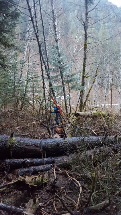
Forest uphill from the East Bank Trail:
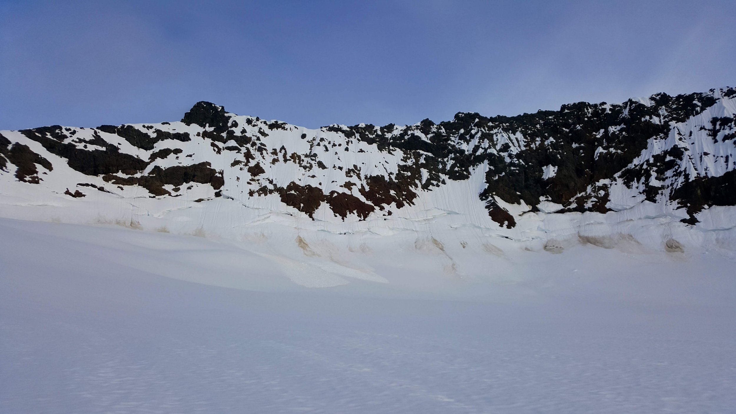
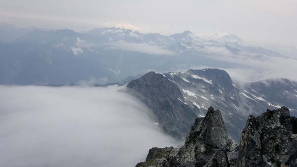
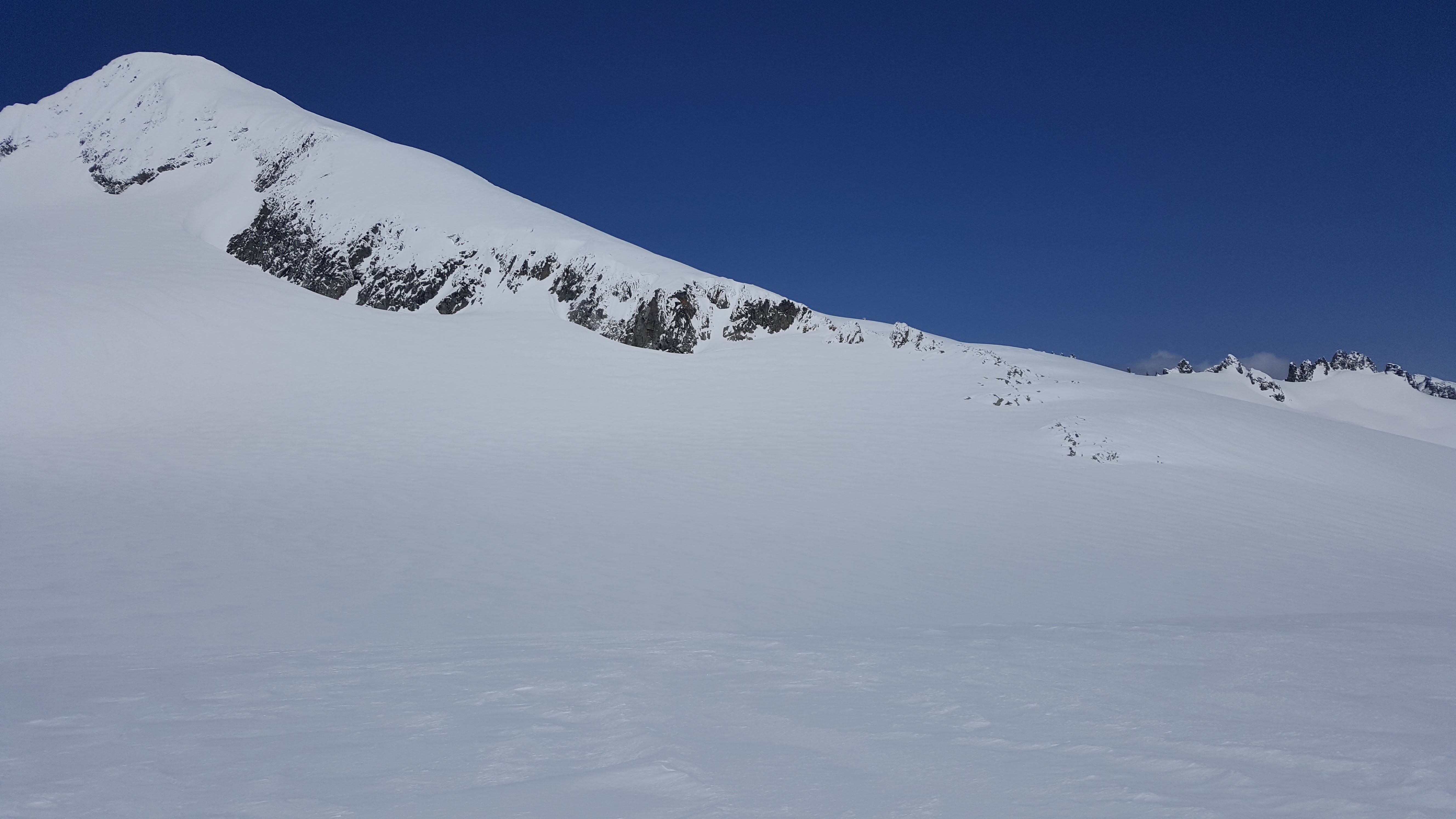
Our first view of the headwall from near the toe of the glacier was not encouraging, but we knew we had to take a look at least.
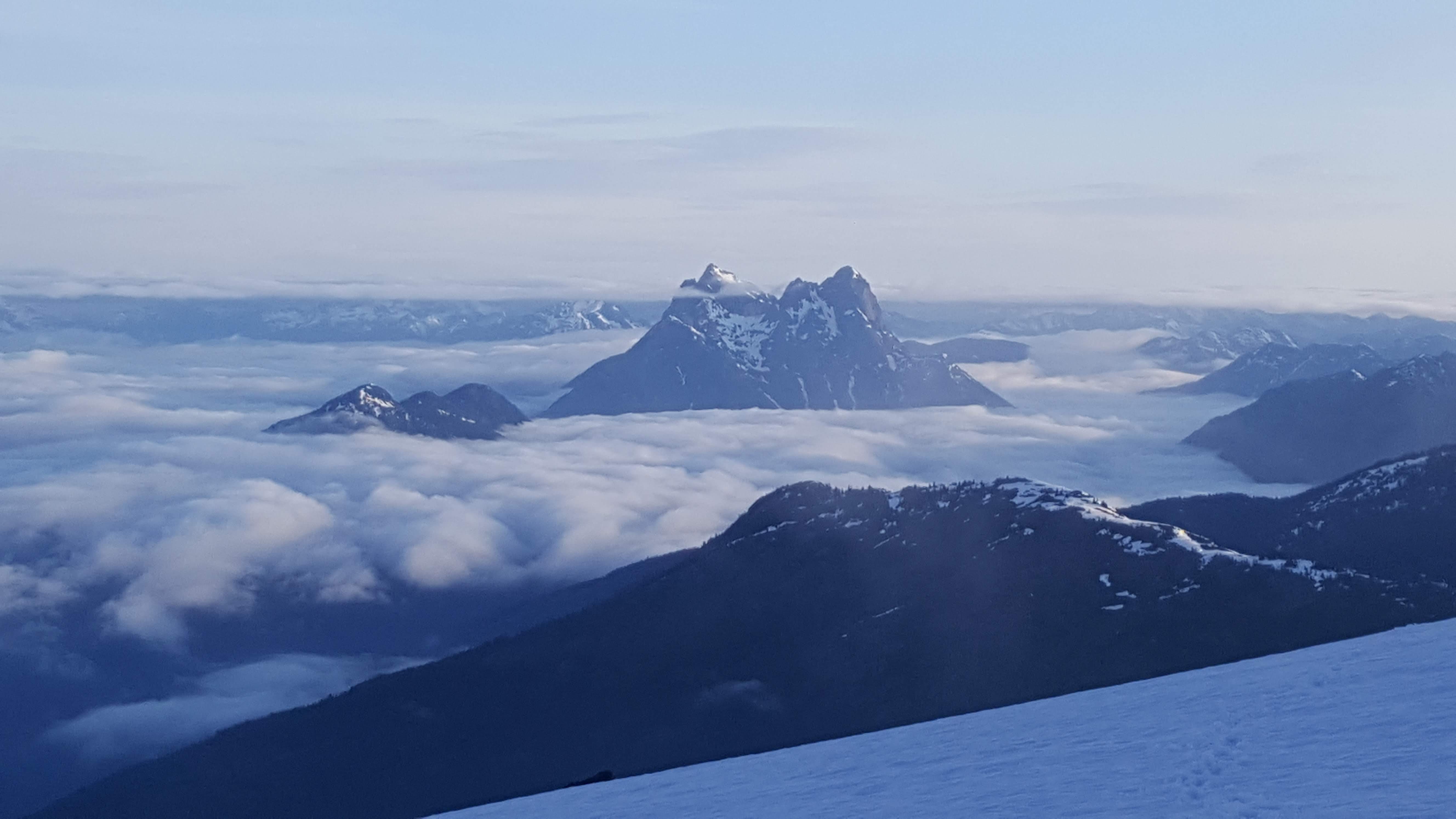
Headwall from camp:
Hozomeen from camp:

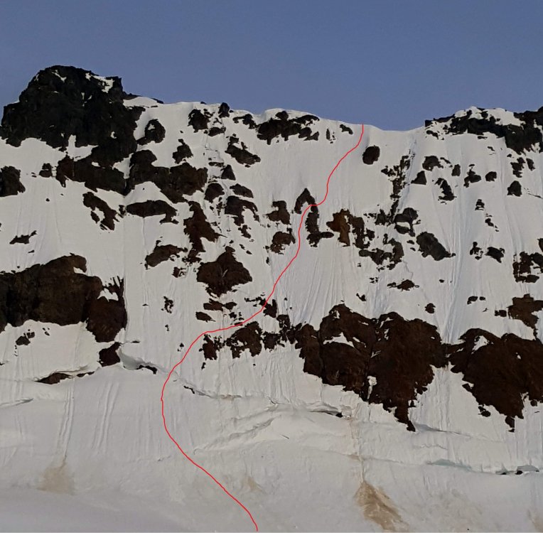
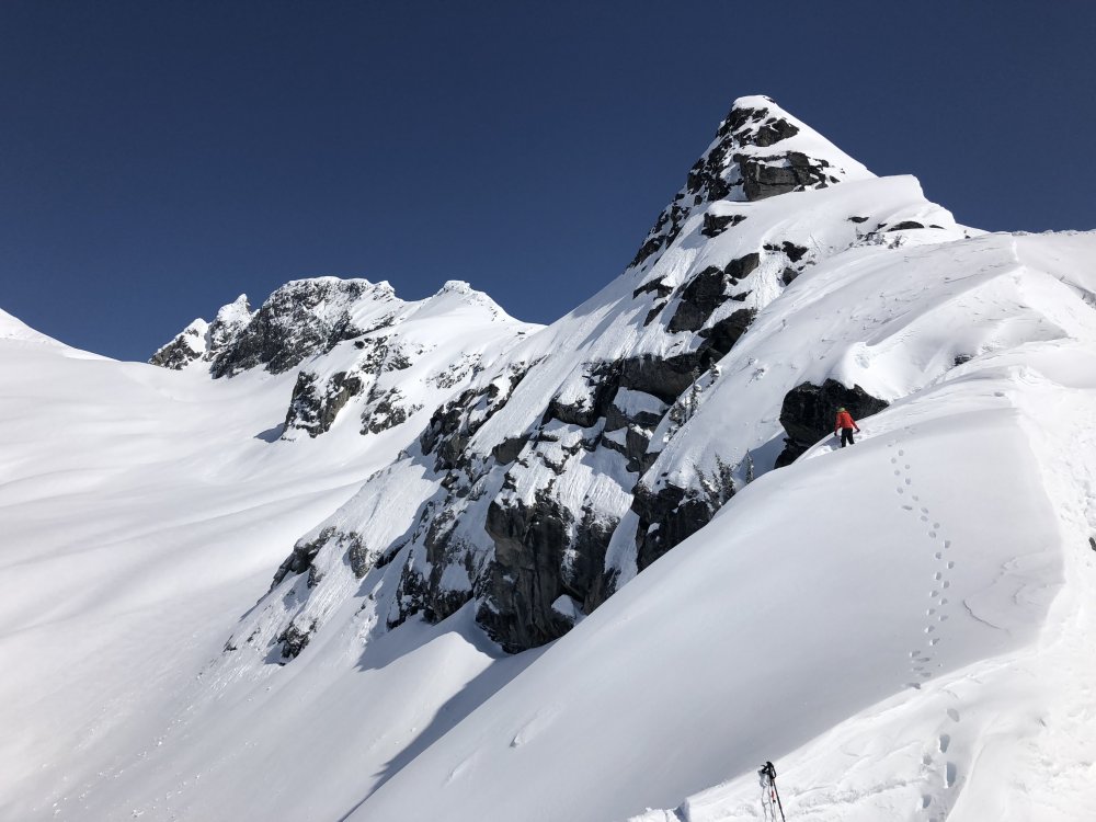
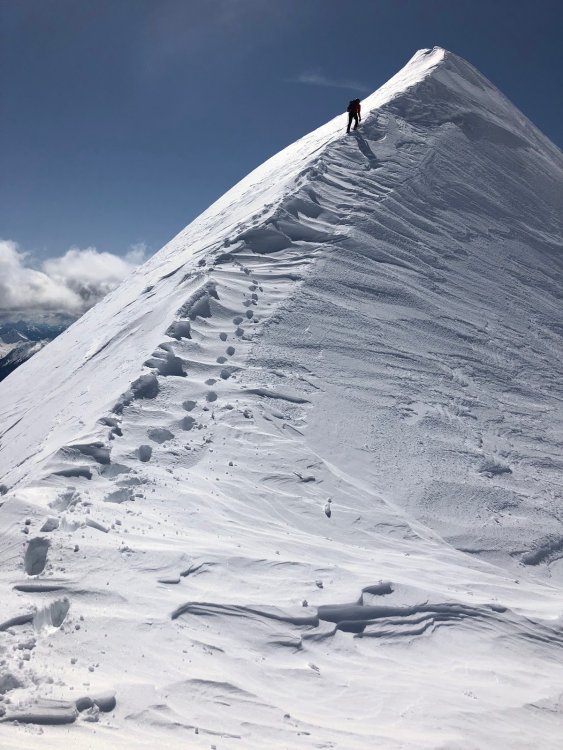
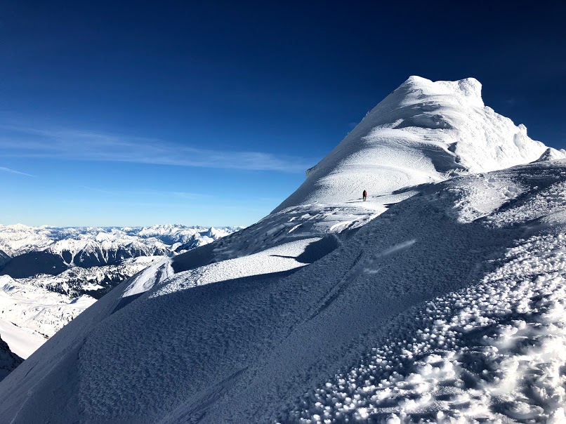
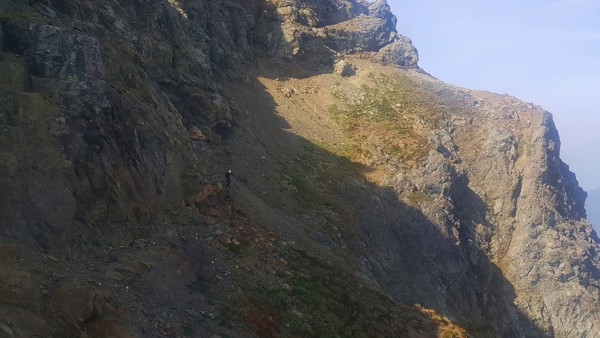
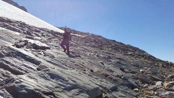
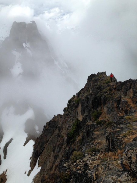
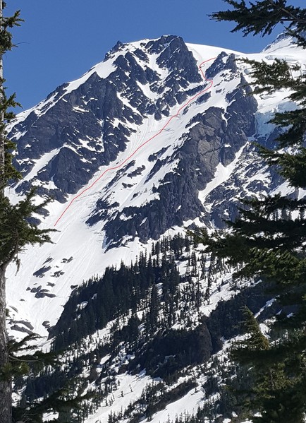
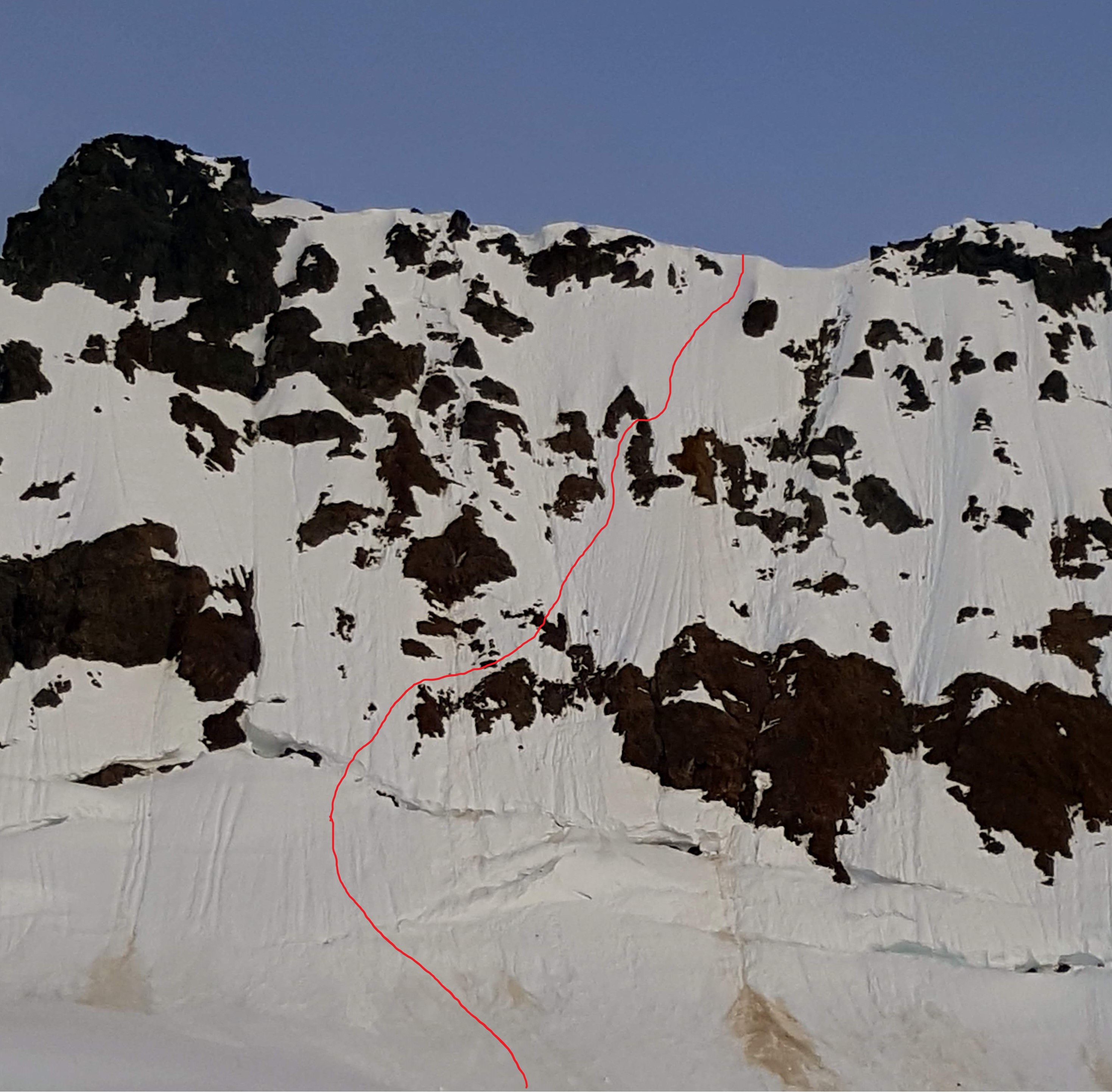
It got cold that night, there was frost on the tent and the snow was very solid. We left camp at 0600 and had only a short walk to the base of the wall. We found a route up, over a bridge in the 'schrund and through the manky rocks. My calves were killing me so Fred led the whole wall both of us soloing. It felt steep! It's amazing how the slope changes when the snow is frozen and you can only get front points or an inch of boot at the most. It was definitely about 600' of "don't look down" terrain for me. Softer snow would have mage it a lot more secure and easier, but we made it.
Approximate route, it looks like a lot more traversing than it felt like. Maybe it's just perspective:
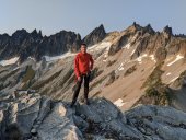
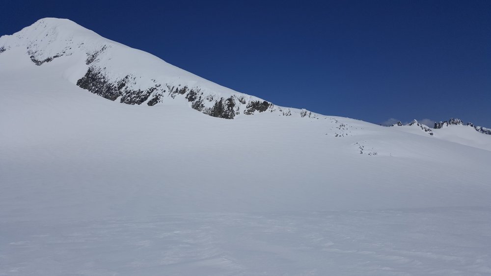
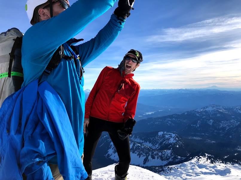
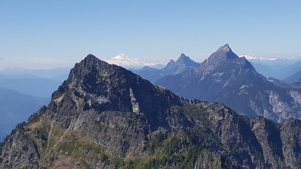
We were on the summit by 0800 I think. It was breezy but not bad. We were worried the downclimb on the south face would be too solid so we waited around for a while identifying peaks and enjoying being off our feet.
Down climbing the much softer snow on the south face was a piece of cake after the Nohokomeen; until we got to the cliff band at about 8000'. We didn't know the route and had only a 30m rope so it took some looking but we nailed it. We did two 15m rappels off a crappy loose boulder with like 10 pieces of tat on it down onto snow again where we could traverse out to easy ground on the SE ridge. We took a loooong lunch break and rested our brains in the warm sun.
Basically all the ground from there until 4800' on the Crater Mountain Trail was snow covered with the exception of the Crater scramble section. We camped at Jerry Lakes early on day two and had a leisurely afternoon. Day three was a tame snow walk and easy 3rd class scramble up Crater and a slog out down the trail and along Ruby Creek to the car. We could have hitchhiked the last 3 miles or so but we are purist and completed the loop - my shoulders were pissed.
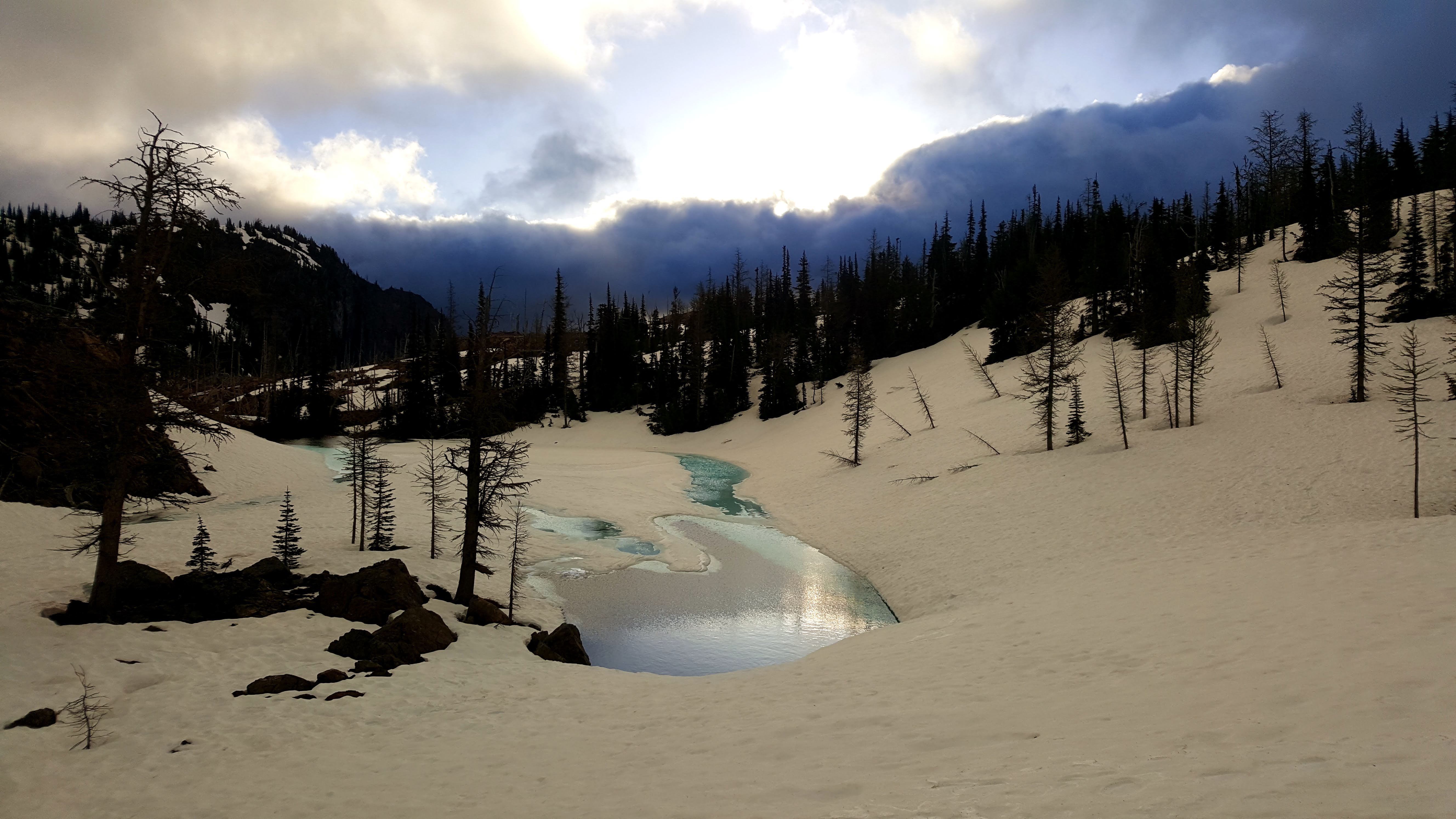
Tarn near Jerry Lakes camp:

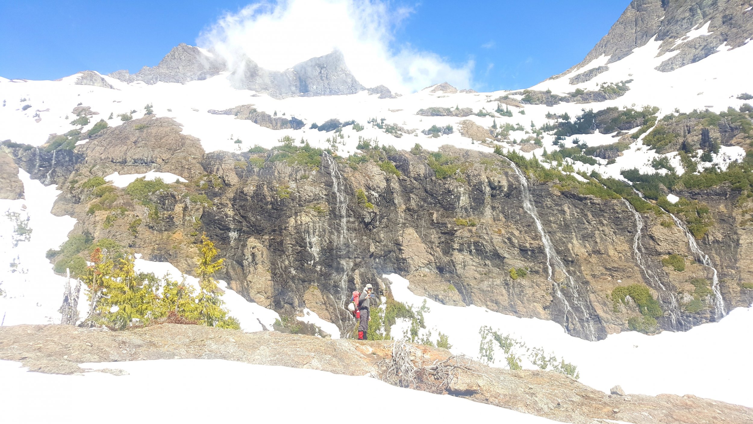
Lake and waterfalls below Crater Mountain. We gained the trail shortly after here:
Maybe Fred will post some more photos, he was a lot better about taking them than I was.
Gear Notes:
30m rope glacier gear 2 axes aluminum crampons trail shoes celebratory brandy
Approach Notes:
All the trails in the lowland were in good shape, a bit of blowdown on the Crater Mountain trail. Lots of creek crossings, all dry on the East Bank Trail, one ford on the Crater Mountain Trail. Crews were out working on the trail near Granite Creek.-
 1
1
-
 1
1
-
 2
2
-
-
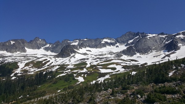
Trip: Eldorado Peak - East Ridge
Trip Date: 04/22/2018
Trip Report:
It's a bit late but me and Fred skied Eldorado on Sunday 4-22-18.
We did a TH bivy in the car Saturday night (after helping dig a guy out of the snow 100' from the parking lot). There was a tiny bit of snow lingering in the shade at the lot, but none in the woods.
The log crossing wasn't nearly as bad as I had heard (though the water was low). Pretty typical Cascade stuff:
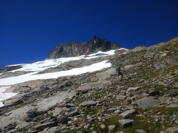
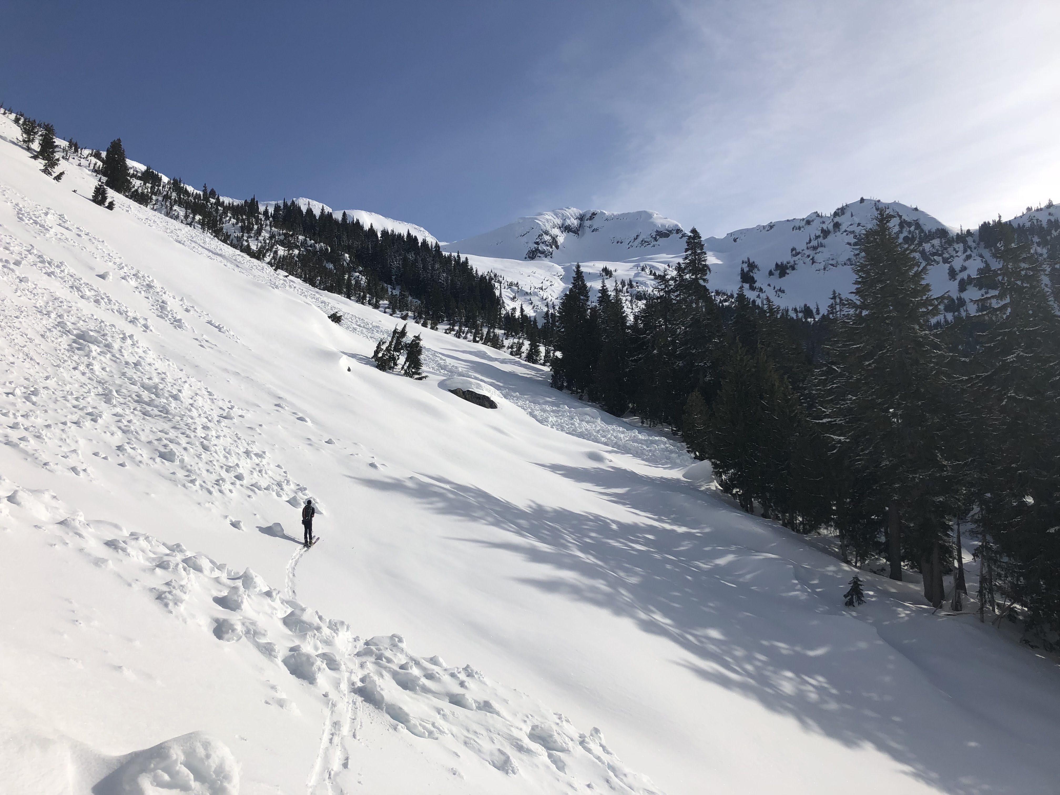
We were off at 0600 carrying skis wearing ski boots for about 2100', man is it nice to start under sunny skies and not with headlamps. At the start of the boulder field there was enough snow to skin but not by all that much. The snow was pretty variable, wind affected, but it went pretty fast. We crossed into the Roush Creek drainage at 6200' after a brief attempt to do so at 6500' (there is a cliff there). The drop down was only about 70' of easy plunge stepping until we put skis back on. Skinning to our lunch spot at 7500' went smoothly from there.
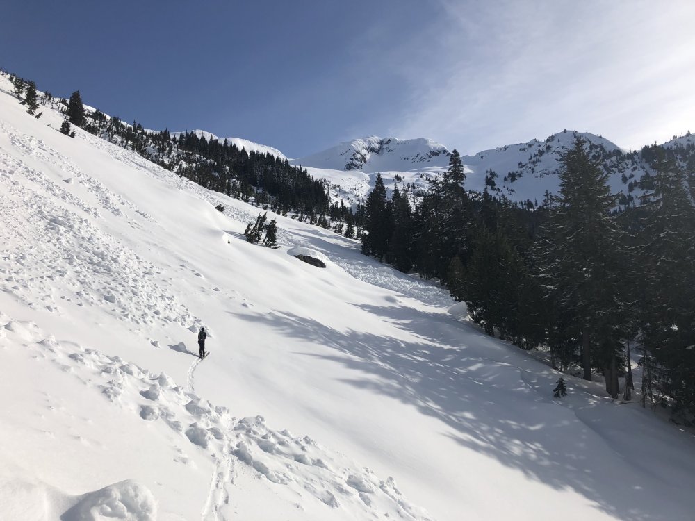
Skinning the boulder field:
Shitty views towards Cascade Pass:
Crossing the creek divide, this was 6500', too high:
Lunch spot:
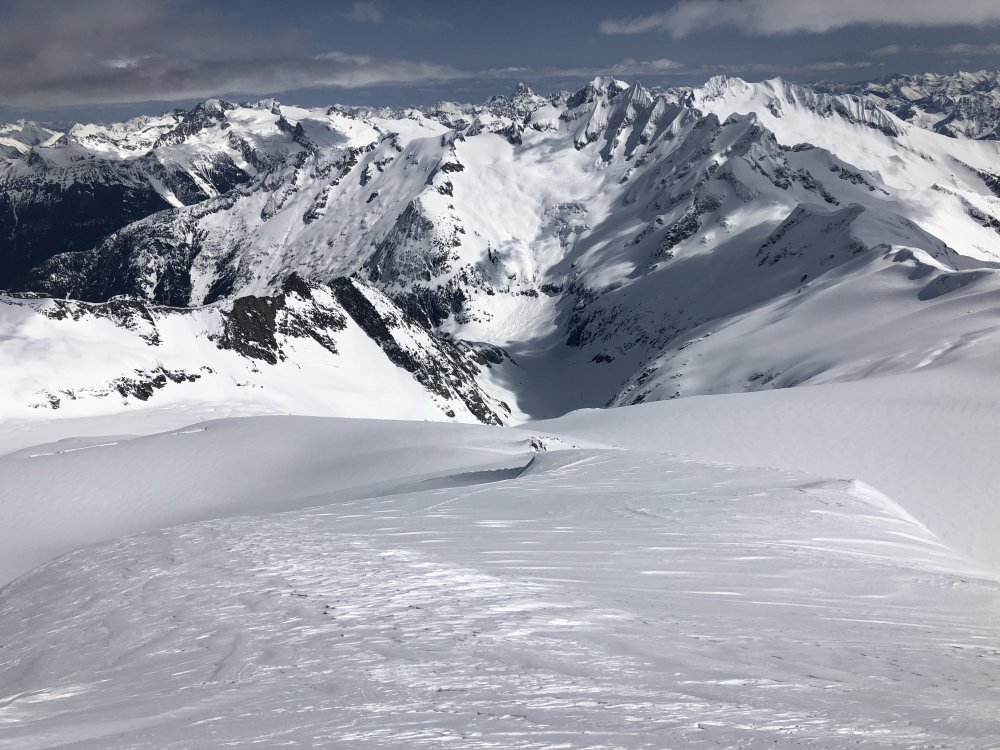
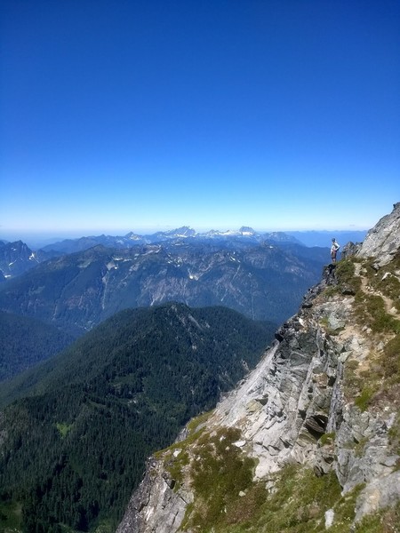
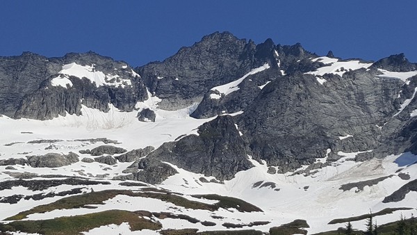
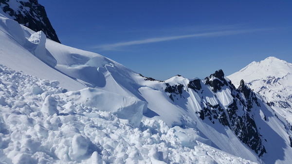
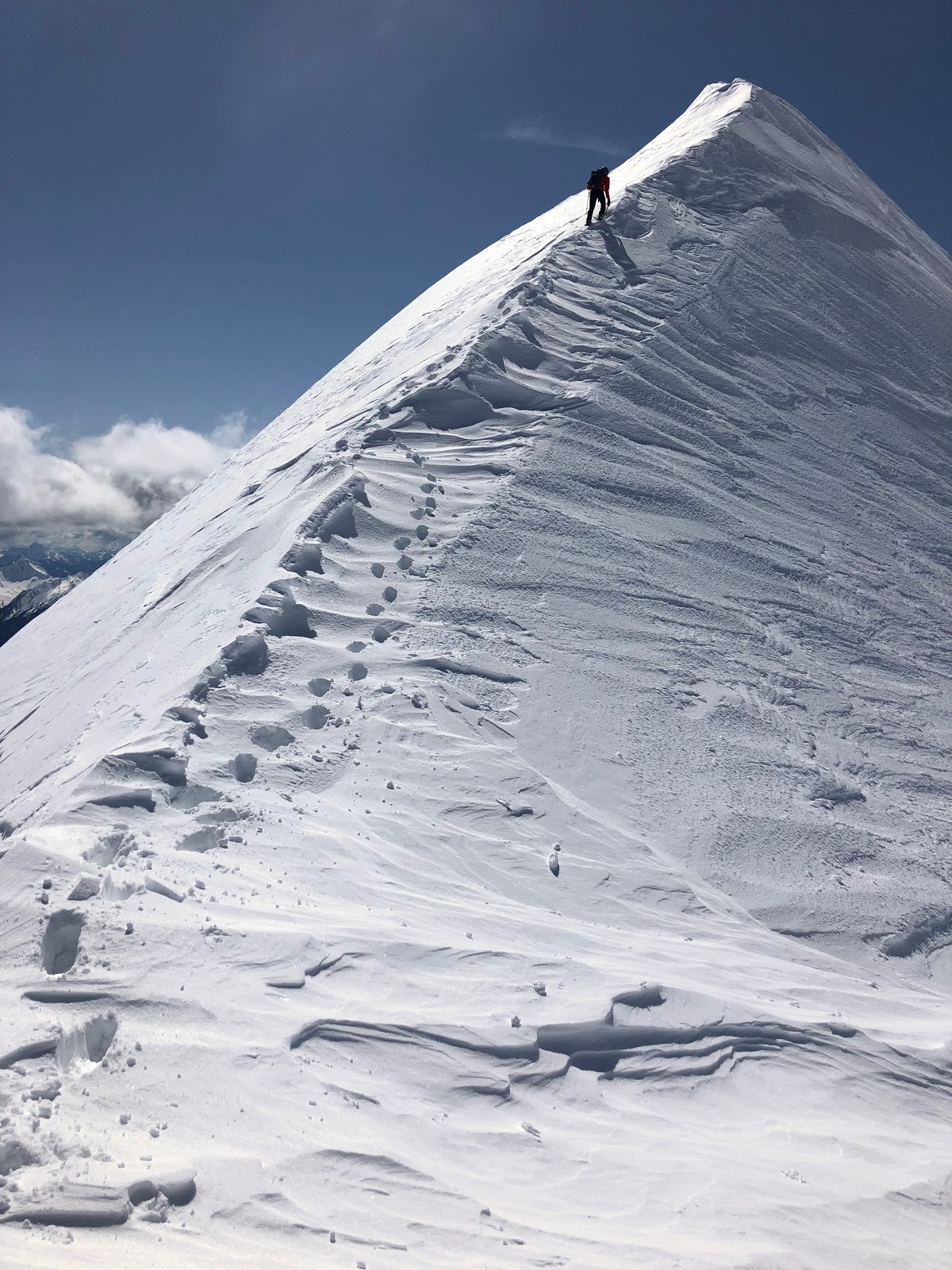
I think it was around noon when we took a long break to melt snow and have lunch at the plateau. Sun-screened up we headed up again. On the ridge the snow was firm and wind affected, it didn't warm up at all despite the hot sun and pretty warm air. We skinned to within about 150' of the summit where we switched to booting with crampons and axes. The ridge was a piece of cake, wind packed snow made for bomber steps and solid cramponing. After obligatory ridge photos we took some time to identify peaks and enjoy the clear spring views, planning future trips, then back to the skis.
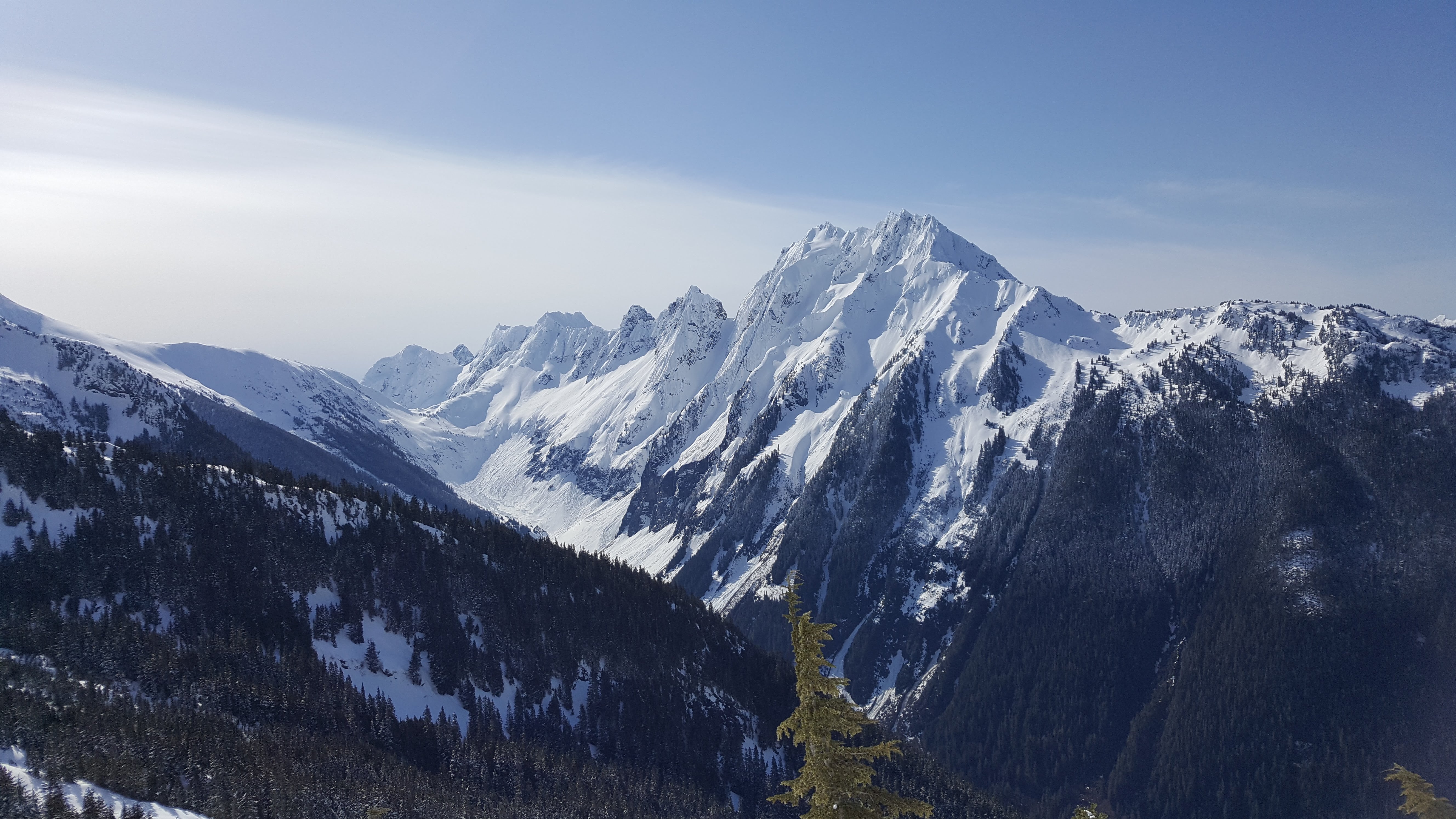
Looking east toward Forbidden, Goode, etc.
Summit ridge:
.thumb.jpg.c14e27d4c7c0beec0e64e92f02830f5b.jpg)
I had thought that the snow on the ridge would be a horrid ski but it was more powdery than anticipated and was actually lots of fun. We shot as far across the snowfield as we could, then shuffled and boot packed a little over the hump. The ski down from about 7000' was horrid sticky sludge, but views and silence were pretty amazing. We spoke to another group that was headed for the NW Couloir at the divide ridge. How did it go?
From there more horridly awesome sludge down to the boulder field where the steeper angle made for suuuuper sketchy traversing causing the entire slope to slough off as wet slides. Way dangerous, though its probably all sloughed off to firmer stuff now. From there we hiked out for a round trip of 9.2 miles, 7100' in 12 hours.
Gear Notes:
Axe, crampons, helmet, ski touring gear. Didn't take a rope, glad of it.
Approach Notes:
Hiked about 2100' in ski boots from the TH.-
2
-
1
-
2
-
-
Trip: Sherman Peak - Squak Glacier
Trip Date: 01/14/2018
Trip Report:
It's a little late for a conditions report but me Fred and Joel climbed Sherman Peak (the one on Baker) with skis/splitboard on 1-14-18.
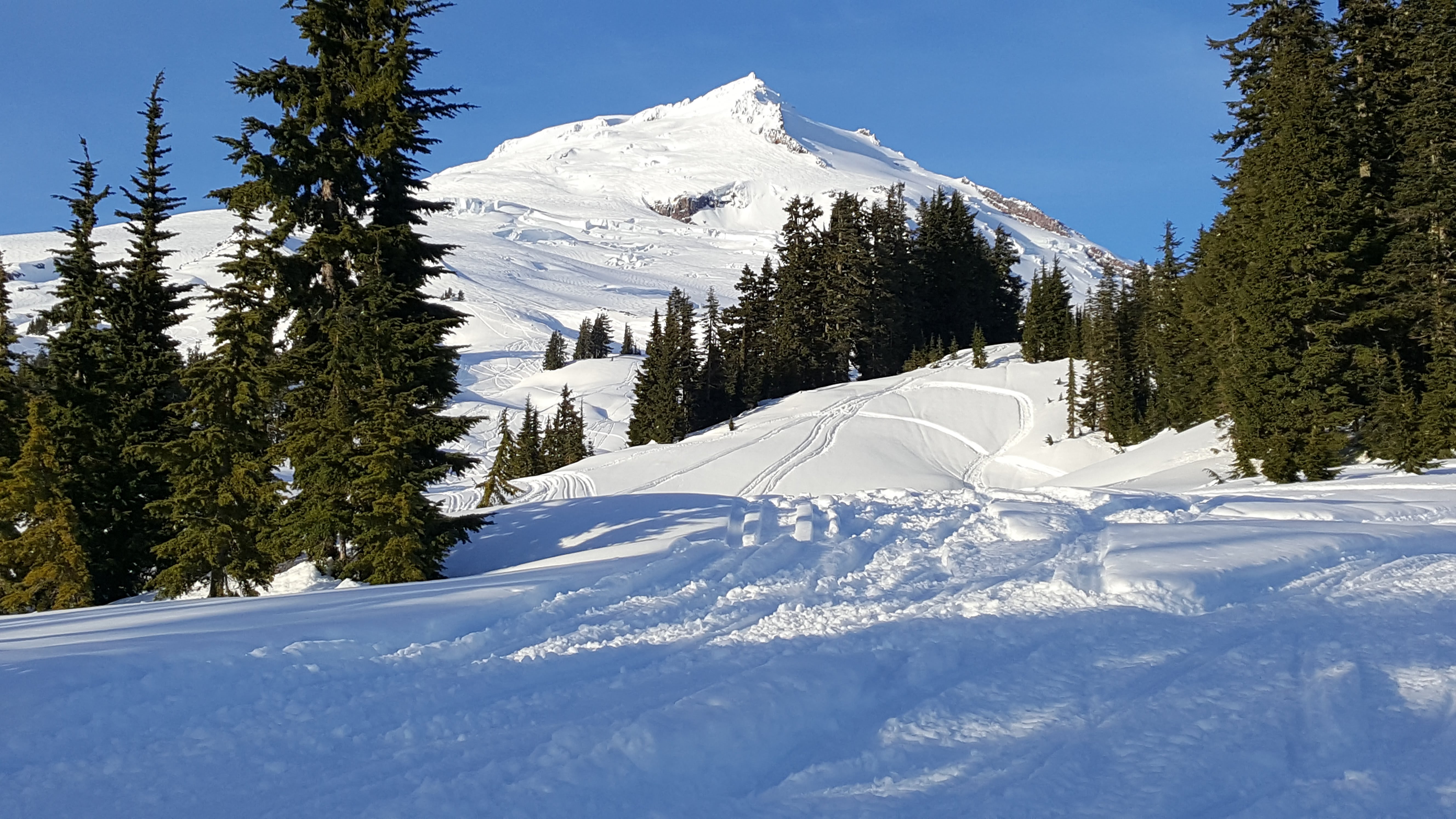
It took 15 hours with the 3+ miles of road skinning both directions. Conditions were actually really great except in the morning the sun/rain crust made for some hairy skinning until we got above around 6500'.
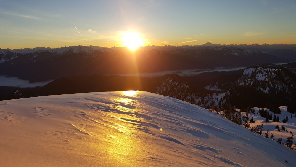
Rain crust reflecting the sunrise:
Skinning with ski crampons on, Joel decided to snowshoe the icy spots:
We skinned more or less north up the ridge from the summer trailhead, using snow machine tracks where it helped with the trail breaking. Above tree line there was a solid crust, sometimes icy, but we never had to break trail again. By the time we were headed off the summit, about 2pm, everything had softened up nicely and even the wind affected areas were decent. We got back to the summer trailhead just about dusk for a blistering (literally) skin back to the truck. 6300 vertical feet of skiing total, plus some downhill skiing and some hiking.
Sherman summit from the 9800' saddle at the crater rim:

Looking back to the ski down on the way out:

Gear Notes:
skis, ski crampons, crampons, axe
Approach Notes:
3.1 miles of road skinning from the sno-park closure. Good coverage from the TH to the summit.-
1
-
1
-
3
-
-
Just posted a report on Millennium Wall near Leavenworth:
-
 2
2
-
-
Trip: Millennium Wall Ice - Leavenworth - Various TR
Trip Date: 12/30/2017
Trip Report:
Millennium Wall was in but wet on Saturday. We did a few top rope laps. There were some areas that were leadable with good hard ice under the slush.
It was tough breaking trail basically the whole way through Cascade Concrete, so go do it soon and keep the boot pack clear!
Gear Notes:
Usual
Approach Notes:
Skis, snowshoes, boot pack, tried it all... nothing worked great.-
1
-
-
Nice, that looks awesome! Thanks for posting and fueling the imagination.
-
BTW the new website makes writing trip reports waaaaaay easier! Loved it.
Now everyone else write one! I don't believe that no one is out there climbing!!
-
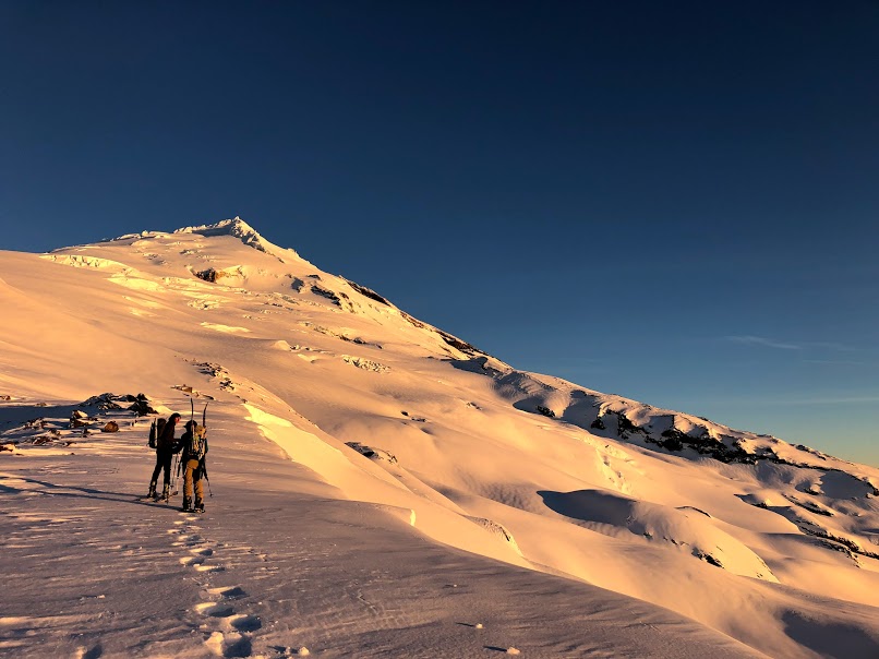
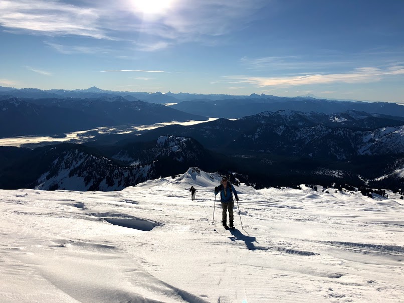
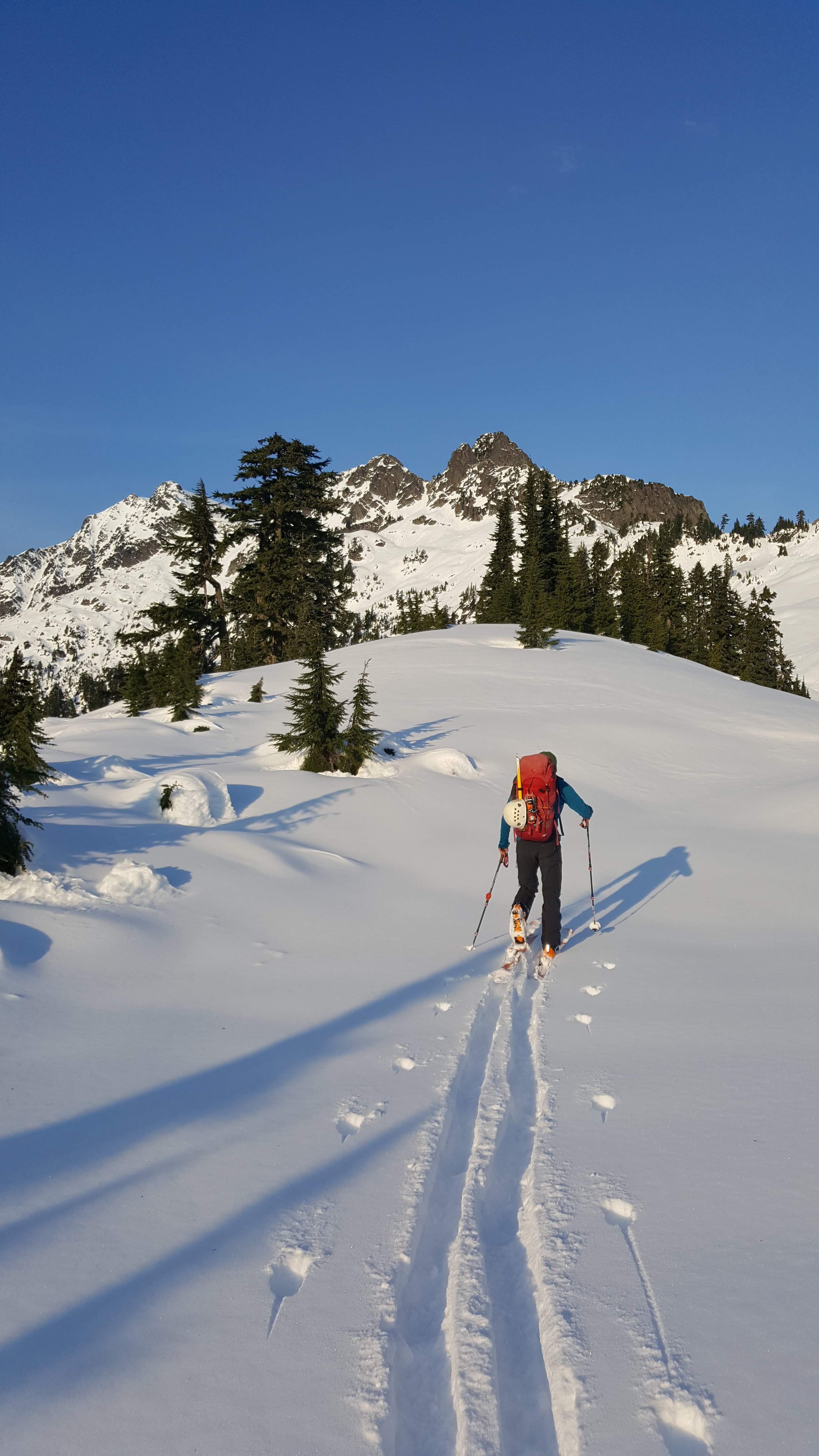
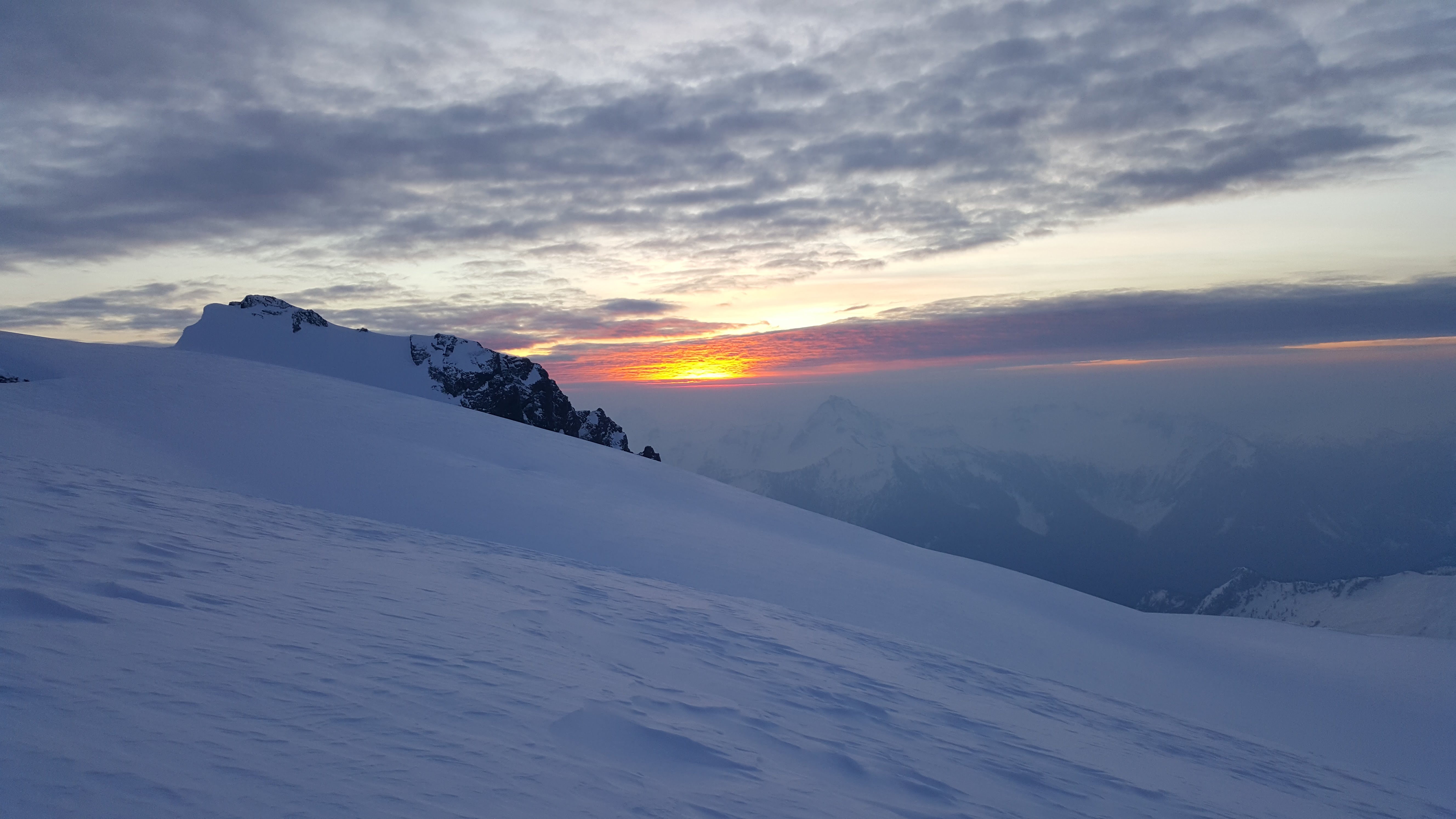
Me, Andy, Joel and Fred climbed Shuksan via the Sulphide Glacier route the weekend of the 9th-10th. We took skis (and a split board) to within a few hundred feet of the summit, carrying them for only the first 2 miles of trail walking. It was strange to travel up into such warmer weather with the inversion going on. It was winter at Baker Lake, the lower parts of the mountain were spring like, and the summit was wintry again.
We camped at the normal glacier camp on Saturday after getting an alpine start of 10:45 am from the TH. With the winter darkness setting in I think we went to bed about 6 or 7 pm, it was sweet to sleep for so long. Up at 5, moving at 6 we skinned up wind crust and crud to maybe a third of the way up the summit pyramid before switching to crampons and axes. Fred led the booting all the way to the top through wind crust on top of pow on top of verglas. The summit was amazing, quiet, lonely, and calm!
After a somewhat mediocre upper portion the bottom half of the Sulphide was pretty good skiing due to the sun having warmed the wind crud. My light mountaineering skis were sub par in the crud, but everyone had fun. Back at camp at 11:30 for lunch and water in t-shirts.
We did a combination of strategies on the descent, but two of us skied all the way to the dirt on the trail traverse below 3000' before booting it to the car.
I think it is safe to say a good time was had by all! It was amazing to have the mountain to ourselves for like 28 hours. Views were fantastic and weather/conditions darn good. I was particularly glad to make it since I was 0-2 on ski attempts on this route.
Hiking in wearing long underwear:

Skinning up the ridge:

Sunrise:

Summit gully:

Summit views:

-
2
-
1
-
-
Thanks for posting!
-
Thanks a lot for the work. One thing I really liked before was the ability to see all new trip reports at a glance. I like to read them all and don't necessarily click on each region.
Thanks again for all the effort, maybe TRs participation will pick up!!!
")
-
2
-
1
-
-
That's awesome. Nice work pushing through.
-
Trip: American Border Peak - ABP - SE Route
Date: 9/16/2017
Trip Report:
Fred and I climbed American Border Peak via the standard route (Beckey's SE Face). It was a piece of cake, go get it! Well, maybe not sooo easy. Wear boots for ankle support, and bring poles, thats all I can say.
You cant really beat Klenke's beta on Summitpost, although I though there was a bit more beta than necessary on the climbing portion; it was the easiest part of the whole trip and only 40m; 5.3 as advertised. I led the pitch from the base of the chimney through the keyhole placing only 1 piece. There is a piton, and a slung chockstone to clip, then I slung two more chockstones to get to the rap webbing at the top of the keyhole.
13.5 hours car to car with about an hour on the summit.
9.9 miles
5100' vertical
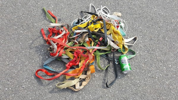
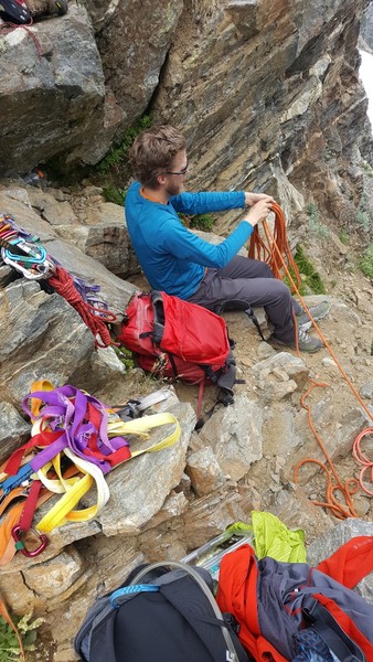
If you are rapping and there are 7 pieces of webbing is it necessary to add another? If so please remove 6 or 7. This is the tat I removed from 4 rap stations. There were literally 8 pieces on one chockstone. We left sufficient webbing at each rap. (Beer can for scale).
Fred on one of the traverses up high:
Canadian Border Peak from the summit. The views make it all worth while, well... maybe not this time:
Fred on ONE of the talus basins you traverse on the approach:
Gear Notes:
poles
set of nuts (used 2 for a belay anchor at the bottom of the chimney)
4 cams (used 1)
slings
pocket knife
Approach Notes:
Slow more than long.
-
Thanks for posting here, its nice to have the Rangers as members of the climbing community!
-
Trip: Mt Triumph - NE Ridge
Date: 8/12/2017
Trip Report:
Me, Fred, and Max climbed the NE Ridge on Triumph in a day on Saturday. It was fantastic! Though smoky.
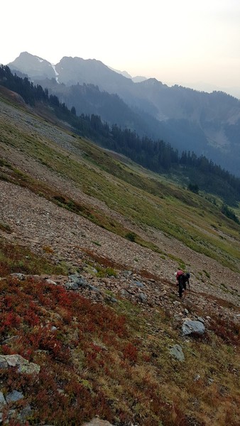
We TH bivied for a couple of hours on Friday night and were on the trail at 2:30 am. We reached the saddle on the trail above the lakes in 2 hours, the col in 2 more. I think it was about 2 more to the notch in the ridge. Summited at 11:30 am, back to the trailhead at 9:30 pm.
Navigating after the campground at the first lake was tough in the mostly dark, we took a few wrong turns. The snow was firm both directions so crampons are advised (as Max learned the hard way). We took a ramp on the right hand side of the gully to reach the notch in the ridge. This was really easy, third class at the worst spot. We simul-climbed the entire ridge except the crux crack, which I followed in approach shoes without doing a single crack technique move - because I suck at those.
We rapped I think 5 times on the way down, near the crux and at the bottom mostly. We found two places where it was more than a 30m rap to the next station... Not sure what that is all about since everyone says a single 60m works. It worked, but was kind of dumb belaying out like 10 feet to the next station. Just make sure the first person to rap has the rack.
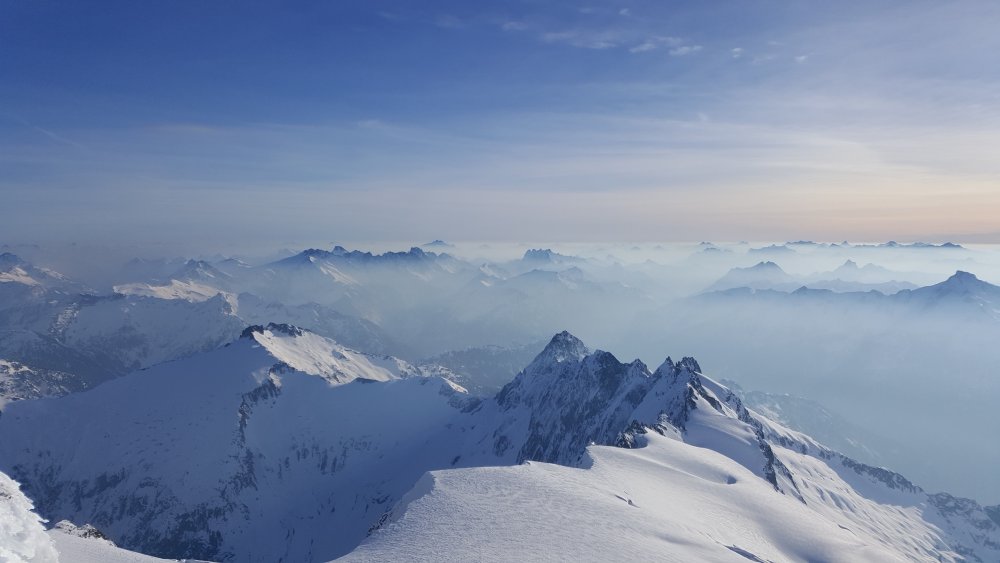
The views the entire time from the col were great although there was still a lit of smoke - thanks a lot Canada!
All in all a great day out! We were all pretty wiped by the time we hit the car again, and I was a bit bummed to miss out on the bivy, but the weather called for rain on Sunday. I would say it is moderately reasonable as a single day trip if you are comfortable simul-climbing or soloing low 5th class.
Fred posturing on the summit while the Pickets and Max look on:
Some cool clouds spilling over the ridge between Triumph and Despair (no joke intended):
A colorful moment in the mountains (literally):
Gear Notes:
2 30m ropes
approach shoes
6 cams to 3"
set of nuts
13 runners
axe
crampons
Approach Notes:
Doing it in the light would be good, at least until the second lake.
-
Well expressed and a good assessment of the issues involved. I have been almost killed by rappelling parties as well. BE CAREFUL out there, please, everyone. And try to avoid knocking stuff down while raping.
Glad you ended up OK.
-
Trip: Sloan Peak - Corkscrew
Date: 7/29/2017
Trip Report:
Me and Chris climbed Sloan Peak on Saturday from the N Sloan Trailhead off N Fork Sauk River Road. It was a good long day, but due to light packs totally doable. We spent 12.5 hours car-to-car I believe. It was 11.5 miles and 6100' vertical gain.
The scrambling was pretty easy, route finding very easy. The glacier was getting pretty broken up though. It will be passable for weeks yet, but a little sketchy. Maybe take a couple of pickets to set as running pro as there was some tight zig-zagging on snow bridges.
We wore approach shoes for the trip but did end up with wet feet due to the snow walking; we did try to stick to snow as much as possible on the way out though. Crampons are recommended as much of the snow was icy even in the afternoon.
First views of the summit:
A fantastic section of the "scramble":
Glacier Peak from the summit:
Baker, White Chuck, Pugh and Bedal from the summit:
Glacier-polished slabs on the descent:
Gear Notes:
30m rope, axe, crampons, helmets.
Approach Notes:
Sloan Peak Trail was a bit brush and wet (due to dew) in the morning but easy to follow.
Snow begins at about 5000' but can be avoided all the way to the glacier if you want.
-
Wow, awesome work. And a great write up. Thanks.
-
Yeah, there was lots of snow everywhere for the time of year. The North faces and N. Ridge of Forbidden seemed to be holding a lot still.
-
Trip: Mt. Torment - South Ridge
Date: 6/25/2017
Trip Report:
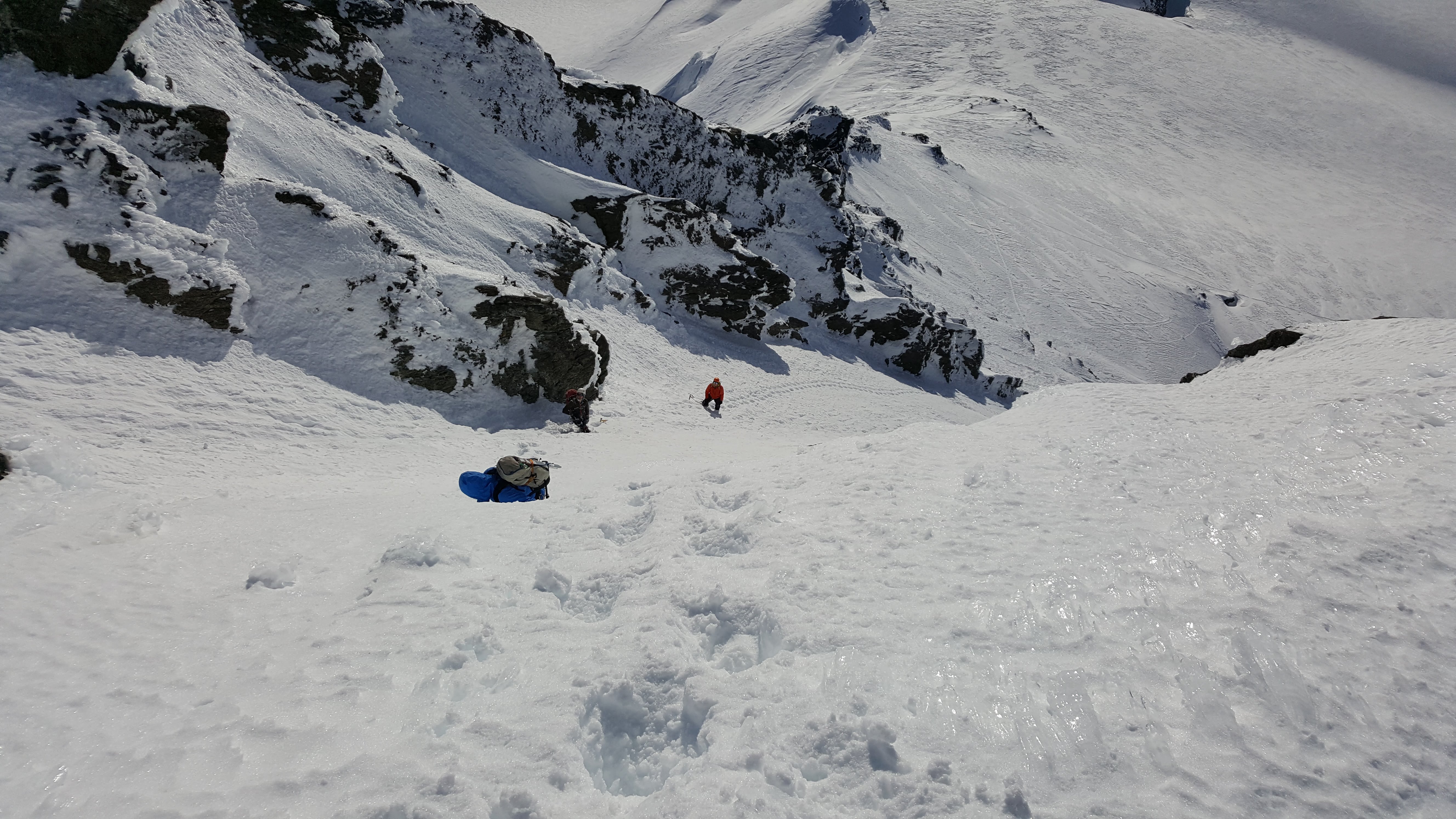
Me and Tristan climbed Torment by the South Ridge Route on Sunday. We had planned to do the Torment-Forbidden Traverse but the rigors of the approach and climbing with backpacks (despite going pretty light) were too much and we gave it up after just Torment. It was still a good trip in the mountains with great weather and we did climb a big mountain.
We started Saturday midday from the Torment Basin "trail". The rangers were of no help with a description or conditions of the route. We went this way due to permits and the fact that the road was closed just beyond so Boston Basin was a lot longer approach than normal. To do it over I still might go from Torment, even if the road was open - the BB trail was actually worse than I remember it being last year.
Beckey was actually spot on and only slightly vague with his approach description. When it gets crappy and brushy stay close to the cliffs, I think. We camped at the 6600' saddle on the south ridge of Torment, it took about 6 hours with several long breaks and a fairly moderate pace... plus some off route bush whacking.
The next morning we packed up and climbed the south ridge, the notch was an easy walk on snow to reach, actually we skipped some class 4 described in Nelson & Potterfield and just walked right into the first dihedral. We ended up pitching out basically the whole route to the high notch not on purpose but because every time we were ready to simul the rope drag made the leader stop and belay. I recommend no more then 30m of rope between you.
Climbing with an overnight backpack on is tough apparently, plus it was hot, so at the high S ridge notch we decided we better not attempt the traverse. We ditched packs and scrambled up the last bit, placing a few pieces.
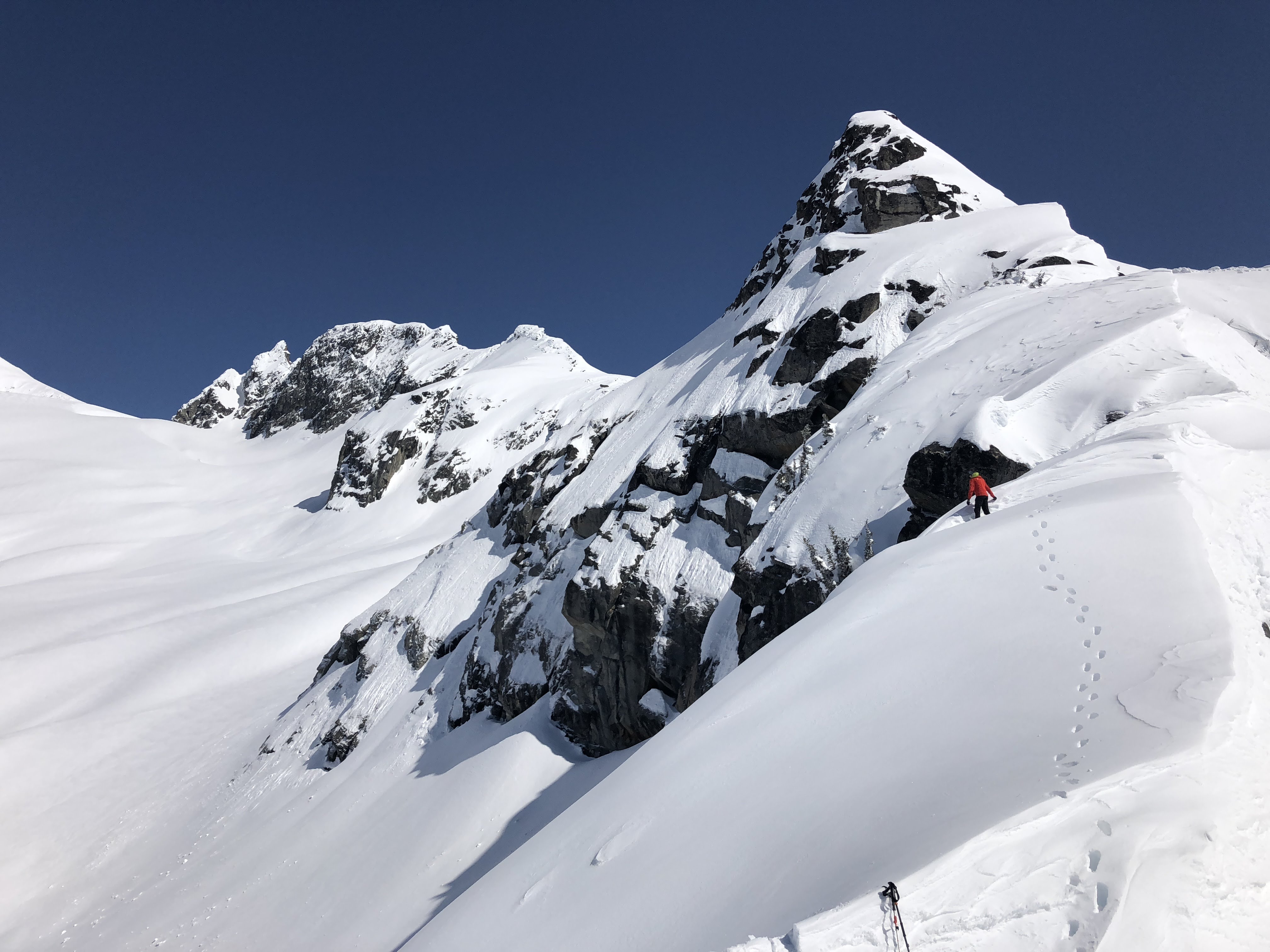
Looking out toward Sahale from the upper notch:
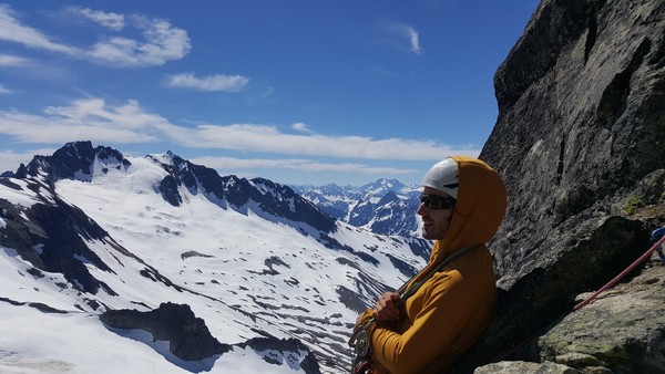
Photo of the traverse from the summit:
We used Nelson & Potterfield for the route beta and it worked well, plus just follow the tat, there is tons. Please keep your knife handy on the descent and clean some of it.
We rapped off and down the gully onto the Taboo Glacier, then hiked down to the upper bivys in BB. There was just one melted out and dry. We had a leisurely evenining and morning, then hoofed it back to the car. I think the BB trail is worse than last year, more deadfall and more brush.
The traverse from BB:
Close up of Forbidden:
Gear Notes:
Approach shoes were great, just a little wet on the approach due to snow.
60m rope
7 cams up to #2
set of nuts
rap webbing
aluminum axe and crampons
trekking poles would have been nice on the snowfields and approach
Approach Notes:
Beckey or Nelson & Potterfield both nailed it, just listen to them and not your brain like we did. Near the top of the forest we went too far left into the trees hoping for relief from brush but it didn't work well. Stay right of all major creeks.
-
I didn't see any snow on the south butt. The only snow we touched on the ridge was on the north side, so I would guess it is all clear. The gullies to approach the buttress looked tricky though, kind of shoulder season stuff:
Easy section of the ridge with weather behind (it was dry all day, just cloudy):
Also why do some of the pics rotate? It doesn't display that way anywhere else.
-
Trip: Cutthroat Peak - West Ridge
Date: 6/11/2017
Trip Report:
With a somewhat iffy weather forecast we opted for an easier climb. We went into it pretty casually... so much so that we didn't really read any beta before hand. More on that later. We did have cell phone pics of the Beckey description.
We didn't know where to cross the creek but found a way. We stayed dry (or at least no one admitted to getting wet). There was a perfect amount of snow for accessing the ridge. We wore boots which was probably good because even with cool temps the snow was pretty wet.
The first pitch (Beckey 5.2) was quite scary - very chossy and lots of loose holds. We simuled up it and along the crest to the summit block where we pitched out three short pitches to avoid rope drag. We also put on rock shoes at this point.
After lounging on the summit in surprisingly warm and calm weather for quite a while we headed down. We totally botched the descent - if you go the way we went you will understand why people say to rap the S. Buttress. I believe there is a way to make it easy, but we already had all the training weight of extra clothing, so why take the easy way down. What you should do is rap skiers right from the summit chains (I think). We went skiers left and ended up below the south side of the ridge following tat nests for 5 raps (I think) until we hit snow again in the bowl.
It would have been fun to down-climb the ridge, but at least we know the way not to go now.
It took us 10.5 hours, leisurely with lots of time on top.
Gear Notes:
Single rack, single rope, axes, rock shoes (not really needed but nice) and boots.
Lots more in the packs all day.
Approach Notes:
Super cruiser snow. S. Buttress gullies are melting out though.
-
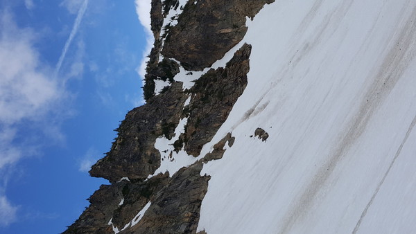
Trip: Shuksan (no summit) - NW Couloir
Date: 5/27/2017
Trip Report:
I climbed the NW Couloir on Shuksan on Saturday. The snow was fantastic for steep climbing, consolidated and crusty. There were some delicate moat crossings, but I could have end run them instead. The top portion, above, below and including the traverse were snice/ice that was front pointing only. This made the traverse quite spicy given the cliff below and the exposure.
Me standing at a moat possibly 2/3 of the way up:
Top out on the Hanging/Curtis Glacier:
It took about 2.5 hours to climb the whole thing, I topped out on the Curtis Glacier at about 10:30. The Curtis was still mostly frozen, only occasional post holing; then I cruised down the White Salmon glissading most of the way.
I had wanted to go for the summit but my buddy bailed in the valley due to not feeling well. Met back up with him at the bottom of the White Salmon about 12:30, after a short nap at the WS-Curtis divide bivy site.
Gear Notes:
Carried a bunch of stuff; used axe, tool, crampons.
Approach Notes:
Did the traverse, it was pretty decent, mostly snow but not skin-able. I would carry skis from the car to where you break out of the trees on the traverse if I were to go back today.


.jpg.6b717ff7700841cc6db018ad834d474a.jpg)


[TR] Half Moon - North Ridge 06/23/2018
in North Cascades
Posted
Trip Date: 06/23/2018
Trip Report:
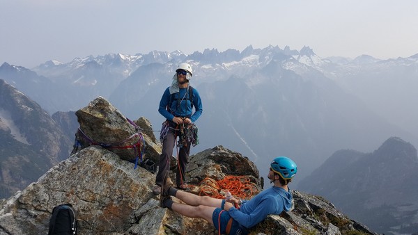
Me, Fred, and Dave climbed the north ridge of Half Moon (part of Kangaroo Ridge) on June 23. We went in knowing almost nothing: it is 5.7 and you climb up from the notch, that's it. There wasn't hardly even a reference to the route on the internet, a somewhat vague Summitpost page written about a climb many years ago (before I was born), and a short paragraph in Beckey.
We made short work of the approach gully due to some steps kicked seemingly that morning... did someone else climb to the notch that day? Maybe they went down the other side to access the east side of Big Kangaroo?
It was super cold and windy at the notch, I think we were all wearing pretty much everything we brought. Fred lead out on really roughly textured granite with lots of features... unfortunately most of the features turned out to be hollow flakes. Fred lead two pitches up a featured face to a large sandy bench passing two bolted rap stations (one was good, the other pretty old and manky with home made hangers).
I took the next lead up what looked like a great lie back corner but turned out to be decomposed granite with crystals popping out and hollow flakes. I placed a few pieces for about 40' then the pro and rock quality deteriorated and it felt safer to just run it out. At the top was a large semi-detached flake/pinnacle about body sized or larger that I had to put my entire body on at one point... I was pretty glad it held, and a bit surprised honestly. I thought it was fun but I don't know that my partners shared my enthusiasm for this part. At least it got me warmed up after the cold belay at the notch!
We walked left on a sandy bench for about a rope length then I lead up again basically straight up the arete. The rock was better here and the climbing easier. One lead got me on to walking terrain; I belayed my partners up and we scrambled another rope length to the summit. The summit was nice and flat, large, sunny, calm, warm. Beautiful.
We laid around for about 45 min cloud-bathing and trying to identify peaks in the low ceiling to the west.
Then we rapped and downclimbed the route. We had double ropes for climbing with three so we did a couple of double rope rappels. You could do the route with a single 60m but we wanted to avoid rapping off the crappy old bolts. We did remove and replace a lot of old webbing so aside from the old bolts the raps should be pretty good. This has become a bit of a thing for me lately, there is so much trash laying around the mountains in the form of rap tat. If you add a piece, please take one home with you as well.
On the ascent in the valley:
Easy snow travel:
Looking back on descent, the route is more or less the skyline:
Dave about to wipe out while boot skiing:
Sorry I didn't get any pics while on route, I'm trying to get better about that.
Gear Notes:single rack to 3" aluminum axe for the ascent, not really needed but habbit
Approach Notes:
Easy due to snow on the slope, will be crappier later as it melts and turns to loose scree.