RobUSA
-
Posts
14 -
Joined
-
Last visited
-
Days Won
2
Content Type
Profiles
Forums
Events
Everything posted by RobUSA
-
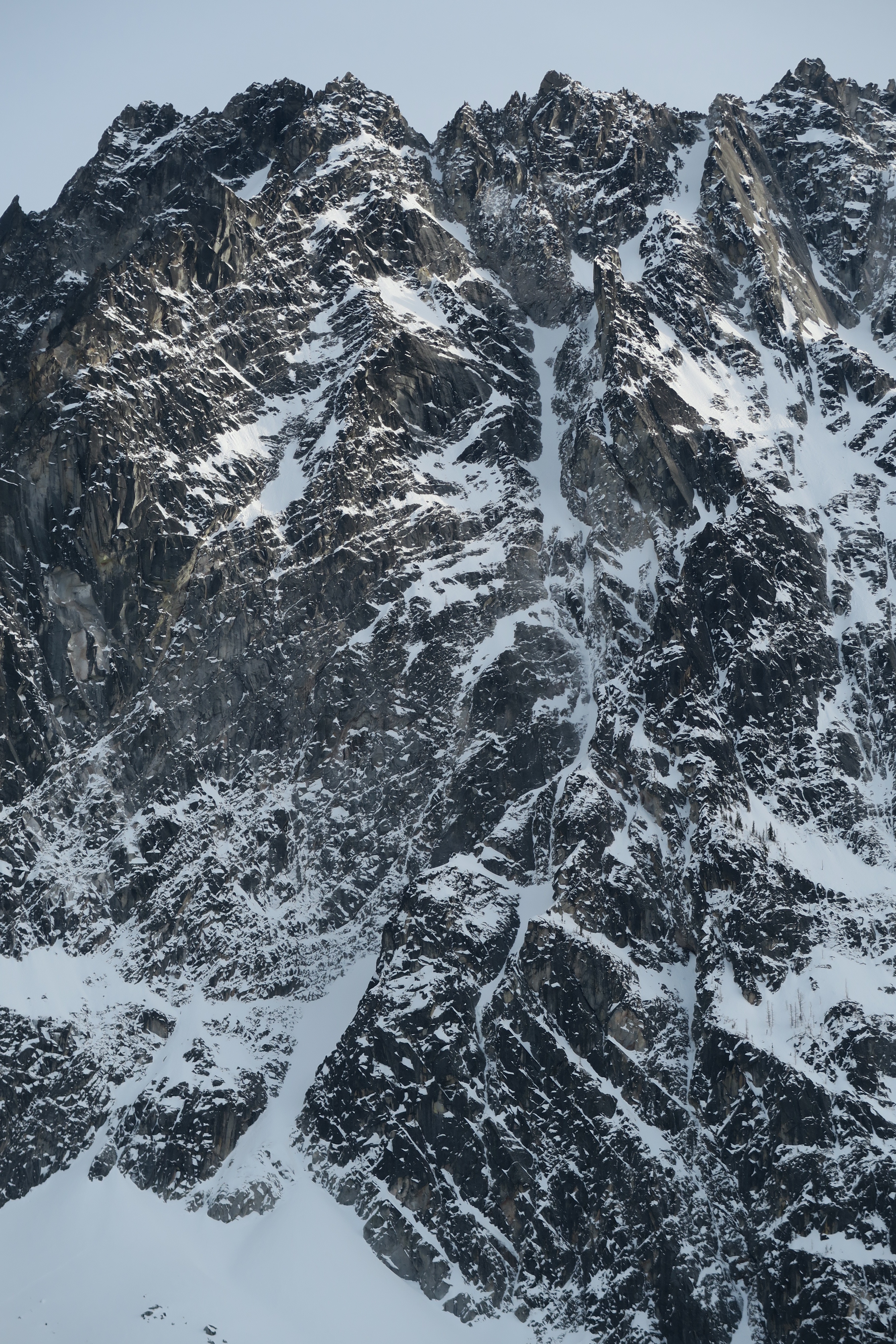
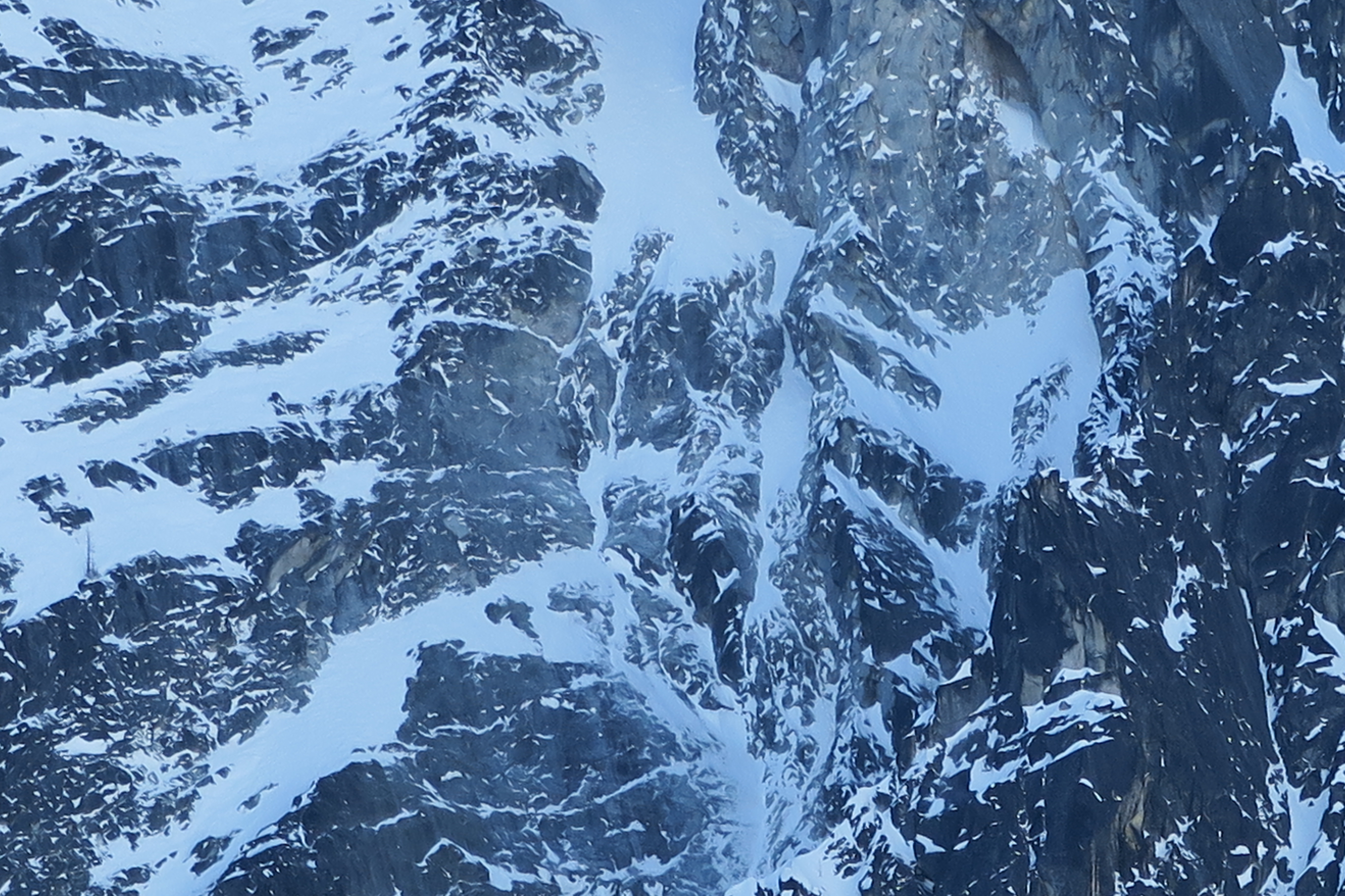
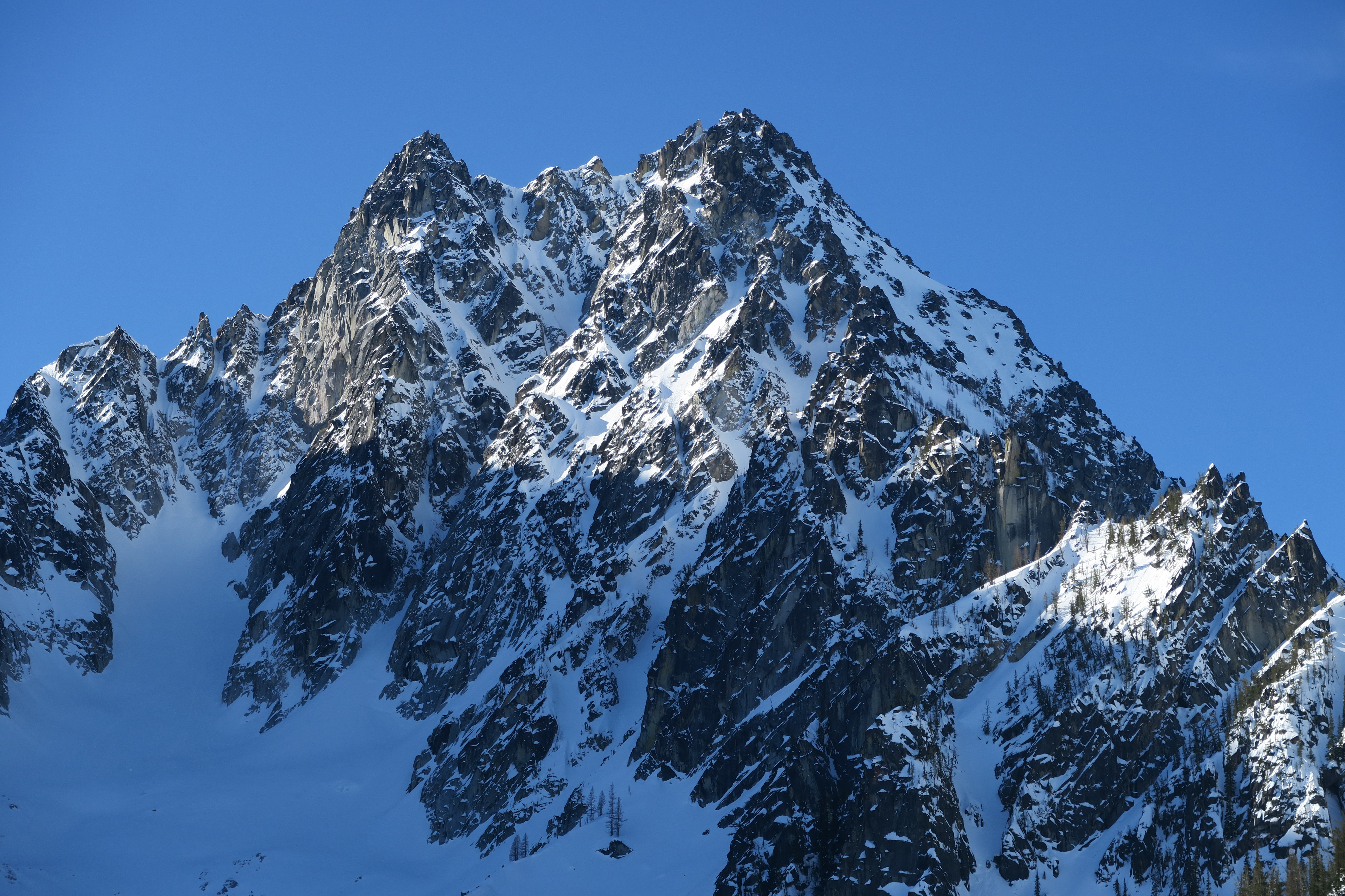
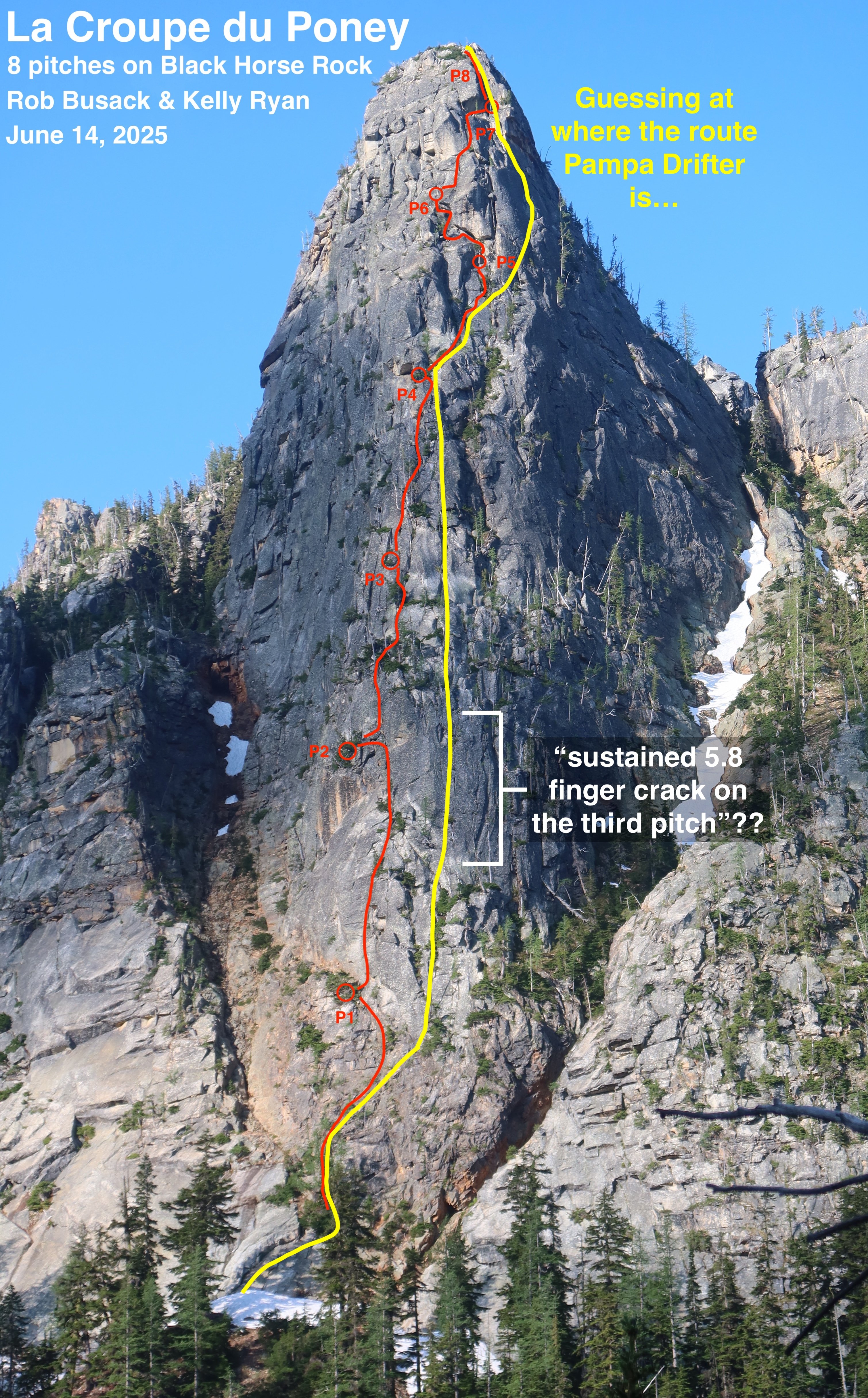
After having thought about this more (and having gone and climbed La Croupe du Poney a second time to make it a little more "ready" for other climbers,) this is, to the best of my understanding, my best guess about where the route Pampas Drifter is relative to La Croupe du Poney: I think Pampas Drifter made a direct-start from the toe of the buttress, starting climbing about 100' lower than La Croupe du Poney (whereas we started La Croupe by scrambling up the easier right side of the buttress to a big larch.) The bottom of the drawn line in the guidebook has a rightward-arching shape that appears to match the shape of a rightward-arch on the friction slab at the very bottom of the buttress. So Pampas Drifter's first pitch starts lower than La Croupe du Poney's first pitch starts, which leads to pitch numbers being half-offset the remainder of the way up. Shared segment: Although the 1st pitches of the two routes start in different spots, likely the majority of the middle of those first pitches are the same. A divergence: Pampas Drifter describes "a long, sustained 5.8 finger crack on the third pitch". Wherever that is, it is definitely unique from La Croupe du Poney. My best guess as to where that "long, sustained 5.8 finger crack" could possibly be is a clean section of rock with a number of vertical cracks that's 50ish feet to the right of La Croupe du Poney, and in terms of height, lines up with La Croupe's upper-half of our 2nd pitch plus the lower-half of our 3rd pitch. Since Pitch 3 of Pampas Drifter is definitely unique from La Croupe du Poney, it somewhat suggests that Pampas Drifter's pitch 2 and pitch 4 are also unique from La Croupe du Poney, since Pampas Drifter's route diagram doesn't show any sudden jogs to get to or from it's pitch 3; the route diagram implies that the pitches before & after pitch 3 are roughly vertically in line. Coming back together: I believe that La Croupe du Poney's pitches 3 & 4 and Pampas Drifter's pitches 4 & 5 are close neighbors, which slowly come back together and probably eventually share the same line at some point; most likely near the end of La Croupe's P4 and Pampas Drifter's P5. It's quite plausible that those pitches end at the same belay location. Shared segment: I guess the corner system marked in Pampas Drifter's diagram on their P6 has to be the same as the small right-facing-corners that La Croupe du Poney's P5 climbs through. So La Croupe's P5 and Pampas Drifter's P6 are mostly the same thing. A divergence again: Depending on where exactly Pampas Drifter's "dramatic turn on the right" is, it's likely the routes diverge again near the end of La Croupe's P5 & Pampas Drifter's P6. It's unclear to me if Pampas Drifter the huge chimney with a giant chockstone that's directly above Shish Kabob Tree, or if the "dramatic turn" is indeed further right, since further right does indeed look more likely to "lead to easier ground" out there. In either case though, it's clear that Pampas Drifter's P7 goes somewhere very different, and La Croupe du Poney's P6 & P7 are definitely new and unique. Another coming back together: Unfortunately, Pampas Drifter gives effectively no information at all about where its pitch 8 happens to be. If it had been my brain planning the route for Pampas Drifter back in the 1990's, I know I would have chosen to go for the "Incredible Dihedral" that's also La Croupe du Poney's pitch 8. So I'm guessing they made that decision?? But I'm surprised they didn't make at least some even small note at all about this striking last dihedral in their route diagram or description. It seems like if they had climbed it, they would have made at least a little mention of such a striking feature, so maybe they didn't climb it and went some other way?? But I'm going to assume they did climb it, even though they didn't say so, just because it is a probable way they might have gone. Based on that assumption, that would make pitch 8 of both La Croupe du Poney and Pampas Drifter the same. In summary: These two eight-pitch-routes would appear to have three pitches that overlap (some of the P1, some of La Croupe's P5 is the same as Pampas Drifter's P6, and to make an assumption: all of P8,) leaving each route with its other 5 pitches of climbing being unique and separate from the other. Considering that: The routes have more pitches that are separate than they do that are shared… And that I went out and climbed La Croupe du Poney as if it were a first ascent, with no beta at all except some of my own photos I had taken a few weeks prior, as there wasn't a single shred of information available about other routes on this buttress at the time that I climbed it… And that these older routes seem like they had been forgotten to time long before I got here… (I can't find any internet-evidence of anyone having climbed Pampas Drifter at all in the last 25 years) …the combination of all those things (especially point #1) makes me feel pretty good about saying "La Croupe du Poney is indeed a new first ascent" here! I've posted La Croupe du Poney to Mountian Project: https://www.mountainproject.com/route/201307606/la-croupe-du-poney If anyone has more-conclusive information / better beta about those historic routes, Archer and Pampas Drifter, it would be cool if you posted those to Mountain Project too, so that they aren't totally lost to time!
-
Ah, fantastic, thank you so much for sharing these pictures of that book!! I've been so curious, and I'm really glad to finally see it!! I really appreciate you sharing this!! Okay, so, Pampas Drifter. Now that I know of it, I'm trying to make sense of how much our recent line does vs does-not overlap Pampas Drifter. It's a route close to the prow of the buttress, and our route is pretty close to the prow of the buttress, so the chances for overlap do indeed seem probable. Some initial thoughts: I'm so glad to see the pages of that book! The book's detail is indeed a little sparse. Man, where exactly the line of "Pampas Drifter" is relative to landmark features on the actual rock is still pretty darn vague. "Corner system" and "white headwall" quite ambiguously could refer to a lot of different possible specific-locations on that buttress. Wow, there's even less out there on the internet when I google for more information on "Pampas Drifter" than there is about Black Horse Rock or Archer. No wonder I was having a hard time finding information. It looks like there is not a single internet trip report at all about that route. The "white headwall" --> Maybe that refers to the intimidating-large headwall with the leftward-arching clamshell crack/chimney that our pitch 6 goes left to get around. Or maybe that refers to the next imposing white headwall that our pitch 7 easily skirted on the right. If it is either, I somewhat think our pitch 7 is the more likely match, since there we indeed experienced that "a dramatic turn to the right of that feature led to easier ground." But it also could be some completely other third white headwall elsewhere. The text description in the book says "eventually angling right to a dihedral below the obvious white headwall." Neither our pitch 6 or pitch 7 involved a dihedral below their respective headwalls. Our pitch 8 did involve an obvious dihedral, but well above any white headwalls. So I'm not quite able to make sense of where the specific "white headwall" in the Pampas Drifter diagram is. The "corner system" on Pampas Drifter's pitch 6 --> Our pitch 5 moves to the right and crosses a corner system. Those things do rather feel like a match. So was our pitch 5 the same as Pampas Drifter's pitch 6? Maybe and I'm tempted to say yes… but since I can't make sense of where the "white headwall" above is, and my best-guess is that it's white headwall along our pitch 7, making Pampas Drifter's pitch 7 and our pitch 7 the same pitch-number, then things don't add up with the corner system being diagramed as right below that as Pampas Drifter's pitch 6, yet being the same terrain as our pitch 5, with no accounting for the terrain that our pitch 6 represents. Either the "white headwall" doesn't match, or the "corner system" doesn't match, but I don't know which. The "sustained 5.8 finger crack on rib" --> Oooo interesting!! Well, I can say for sure that Pampas Drifter's pitch 3 is different than anything we climbed, since we were never on a sustained 5.8 finger crack. Not that that gives us much information about how much overlap there may or may not be between the route on other pitches, it only conclusively tells me that pitch 3 is different. But now I also want to go find this "sustained 5.8 finger crack", that sounds like it would be a really fun pitch to climb! Eh, so I'm still left with open questions about how much or how little the two routes overlap. Maybe what we climbed is the majority of Pampas Drifter?? But with quite a few details not quite adding up, maybe the routes are mostly separate and distinct after all? I'm still trying to figure this out. If anyone has more information on Pampas Drifter & its specifics (especially a link to an old trip report, or photos taken while actually on route,) I'd love to see it. In any case though, clearly our pitch 6 (our crux pitch) is new and unique, at least! Thanks again for sharing the photos of the book. That really helps!!
-
Ah, thanks so much for pointing me in the direction of someone specific to reach out to, I'll send them a message! Someone's gotta have a copy of that Bryan Burdo book somewhere, I'm looking forward to when one eventually turns up!
-
Ha!! Yeah, I have sent Bryan himself message, but quite recently though, so I'll give him some time to reply
-
Thanks! Yeah, I am already aware that a 1997 out-of-print guidebook mentions the overall buttress. I have been able to find that one of the routes in it was named "Archer", and that route is completely distinct from what we climbed. What I haven't been able to find are any specifics about what those other lines were. Further details of my search so far are here: https://rocknropenw.com/2025/06/17/la-croupe-du-poney/#further-efforts-to-determine-first-ascent-history It certainly feels more likely than not that the prow of the buttress (what we climbed,) would be seen as the most likely line, and therefore is likely to have been climbed before. What I'm having trouble with is getting past vague generalities and "probablies." Does anyone have a copy of that book that I could see? Can anyone share a link to prior trip reports so that I could compare the details of the lines? I'm doing my best to uncover some concrete details here.
-
Yeah, I've been trying to track down a copy of exactly that book. I went to the Seattle Mountaineers Program Center in hopes that their library would be the best-bet, but the staff there does not know where the keys are kept to unlock their own glass covers over the bookcases, so I'm at a bit of a dead end there. Does anyone here have a copy of that book?
-
Thanks so much!! Yeah, I intend to post it on Mountain Project in the near future. I was initially holding off on doing so for a little while, partially to see if the route had history so that I could report it accurately, and also partially in case I get a chance to go re-climb it myself to make sure it's really ready-to-recommend before I start advertising it more broadly. (Doing one more lap myself would give me a chance to get a second take on the difficulty ratings, see if there's anything loose enough that should be trundled preemptively in case there were ever more than one party on route, maybe even add a bolt to the friction-slab section of the sixth pitch.) It's unclear if I'll find the time re-climb it in the next few weeks though, so maybe I'll post it on Mountain Project before doing so after all. I'll add it on Mountain Project within a month either way
-
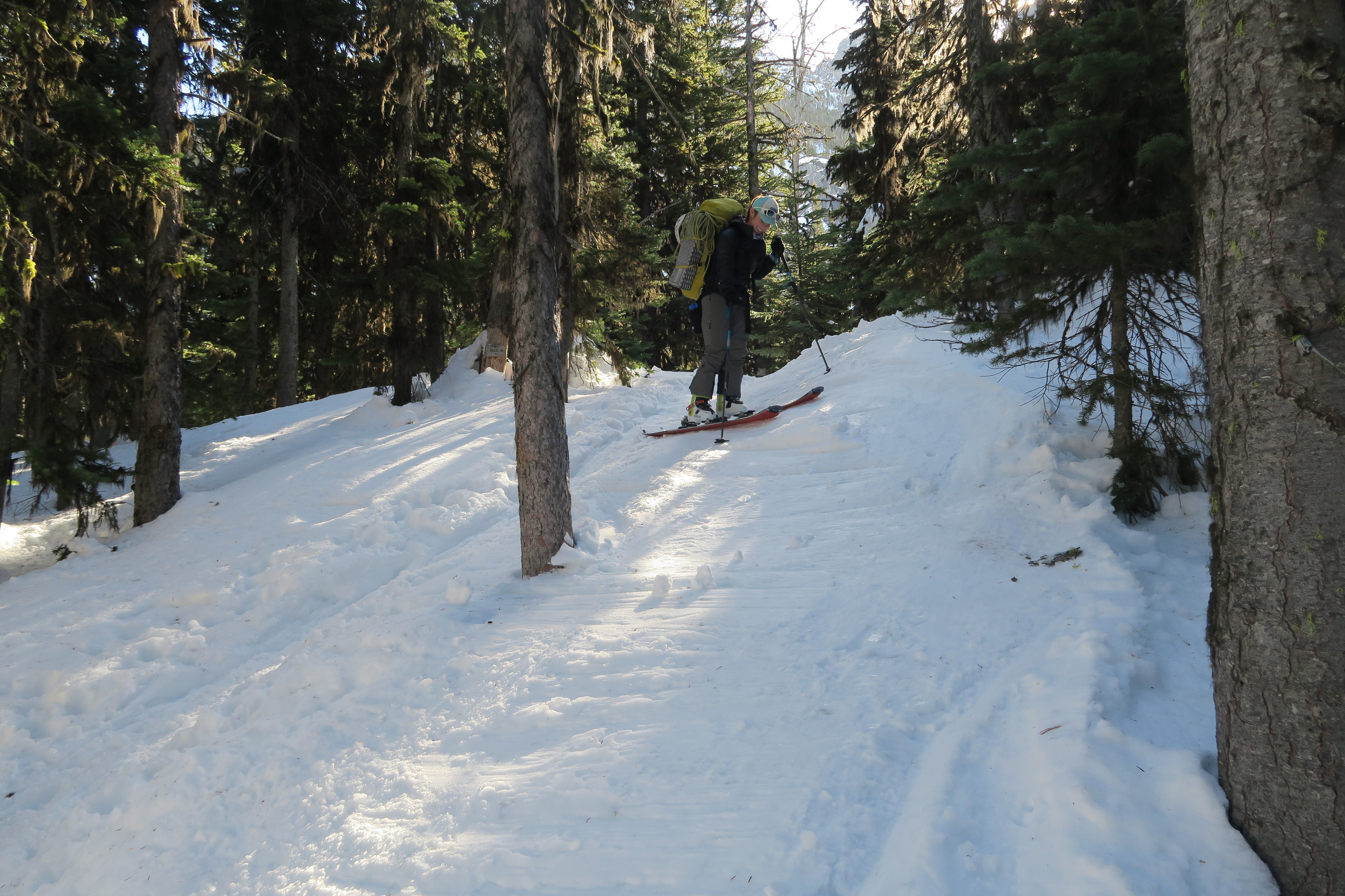
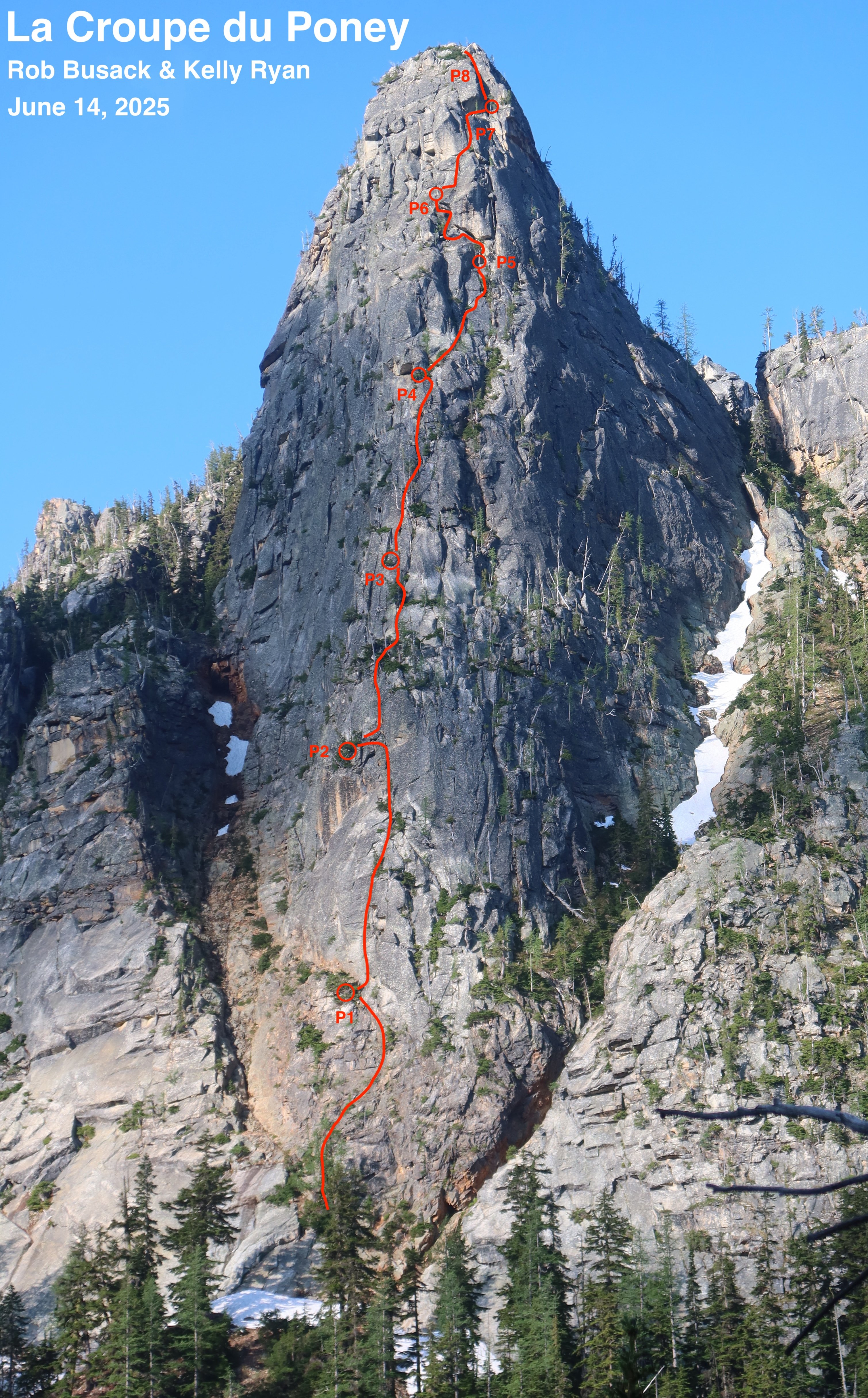
On Saturday, June 14th, Kelly Ryan and I climbed a rock buttress in the Washington Pass area, based only on photographs I had taken of that rock buttress a couple of weeks prior. It has 1000′ of mostly moderate and enjoyable granite climbing, with trees available for almost every belay station. The route is solidly Grade III in size. We swung leads for eight long pitches, where I led the odds and Kelly led the evens. We estimate that maybe one pitch was 5.9, and a number of others were 5.7 / 5.8, but there certainly were factors that could have led us to over-estimating difficulties at the time, so it's possible those difficulties will get downgraded upon the arrival of more opinions. There is a walk-off from the top, which returns to the route’s base. We took a lot of extra time dealing with the details of the unknown here, but with the beta now known, I imagine par for the course could be 12 to 13 hours car-to-car for this moderate route. It's hard to know if this is a new first ascent or not. We definitely climbed it in the style of a first ascent; and despite a lot of searching, I've yet to find conclusive proof that the particular line we climbed has been previously climbed in its entirety. Whatever the case may be, I'm rather proud of our little effort here! More details in this write-up: https://rocknropenw.com/2025/06/17/la-croupe-du-poney/
-
Hello! My best guess is that weather & conditions actually look pretty favorable for an edge-season scramble of Mt St Helens this week. The light glazing of snow might not even be there. What I'm seeing in the weather is that our region did indeed get a few inches of snow in the mountains last week, falling through Thursday, the 28th. That snow seemed to stick down to maybe 5000' elevation, then all the days since then (except Monday) have had clear skies where likely most or all of that has melted away in places the sun has been able to touch. (And I somewhat doubt Monday added any snow, the precip amounts were small, and it may have even been warm enough to fall as rain instead of snow, and if it was warm-rain it would actually speed up the melt of any lingering snow.) Since the weather forecast for the next few days to come looks mostly clear & dry, there's a reasonable chance the route itself will be nicely clear & dry by your Oct. 6th date. The aspect that a slope faces relative to the sun makes a huge difference too. Since that Mt St Helens route is entirely south-facing, then sun is going to help clear snow & dry it much much faster, whereas if you went somewhere else and were on a north-facing-aspect, you'd probably find bits of snow, frost, and re-frozen ice still hanging on. Some data sources that go into my thought-process for making guesses like that: The weather forecast: https://www.meteoblue.com/en/weather/week/mount-saint-helens_united-states_5809218 Webcams at Crystal ski resort, particularly the Ridgeline Cam at 6872' and Chair 6 top at 7002', looking to see if snow is present on the ground there. It's not an exact indicator of what things could look like at 8300' on St Helens, but it helps make an educated guess. https://www.crystalmountainresort.com/the-mountain/mountain-report-and-webcams/webcams NWAC Telemetry sites data. It's a bit of an art looking through the list of all those weather stations and selecting one that is close-enough in distance and also close-enough in elevation and has sensor-type that's useful to you (e.g. snow depth.) Probably the White Pass Upper site is the best rough-indicator to suggest what might be going on at St Helens. I prefer to tap the buttons to view as "Graphs" and over "7 days", my brain just finds it easier to make sense of the data that way. https://nwac.us/weatherdata/map/#/station-table/39 https://nwac.us/data-portal/graph/12/ I think we're still early enough relative to the winter-season that you don't yet need a SnoPark permit for your car. Yeah, looks like that starts Nov. 1st, so you don't need one yet: https://www.parks.wa.gov/134/Sno-Park-non-motorized-Permits Though obviously, go prepared for some shallow snow potentially being there nonetheless. If shallow snow is present, the route is probably still do-able if you have the right experience & right gear. Some Kahtoola Microspikes are likely the perfect tool for the job on Mt St Helens Worm Flows route. If it were me, I'd also bring an ice axe at this point in the year, or at least poles. Likely the snow is too shallow for any ice-axe-arrest to make sense, but when there's a little snow on the ground, a mountaineering axe is still my favorite version of a walking-stick to give me an extra point of contact with the ground while making any step that might be slippery. Keep in mind that we are just random strangers talking over the internet, so I don't have any knowledge of what your outdoor and mountaineering background & experience is so far, which makes it hard for me to right-size the advice I should give. I'm assuming you're someone who already has a lot of experience with off-trail travel, snow travel, navigating above treeline, etc. So you probably already know these things, but you know I gotta say them anyway just to cover the bases 🙂 Really take the "10 Essentials" seriously on this. Make sure you have redundant ways of finding your way back. An app like Gaia GPS on a smartphone with GPX tracks loaded and offline-maps pre-downloaded is a great start, but have at least one more something as a backup in your group too, whether that's some other second GPS device, or a paper map & compass that you know how to use, or at very least a partner with a second smartphone who also has it covered. Remember that navigating up volcanoes is easy, navigating down volcanoes is the hard part. Only go if there's not going to be a whiteout. You're going to want a fairly cloud-free day in that weather forecast, because on a volcano, if there are clouds in the sky, there's a good chance that you're traveling to a high enough elevation to be in them rather than simply below them. Bring snow-appropriate boots, and gaiters, so you don't get snow in the tops. (Wet socks & cold temps are no fun.) At this time of year I'm usually using some 3-season mountaineering boots, or some sturdy leather hiking boots that have been treated with Atsko SnoSeal wax. Bring enough layers that you can stay warm even if you're forced to stop somewhere. Although rare, there's always a slim chance of badly twisting an ankle or getting lost or something else that limits your ability to keep moving. Be hyper-aware of what time dawn's first-light and dusk's last-light are. Plan your timing so that you get back to your car with at least a few hours to spare before dusk arrives, so that you have a safety margin. If need be, make a pre-dawn start, it's infinitely better to wear a headlamp at the beginning of an alpine day than at the end of one. If you find you're getting into fresh snow that's deeper than about 10 inches, at least start to think about avalanche potential. If you're not already AIARE Level 1 certified (and thus know the importance of the holy trinity of beacon/probe/shovel when the fresh snow starts to pile up,) then don't keep going forward, just turn around before there's any possibility of risk at all. (Also: if you're not already AIARE Level 1 certified, I highly recommend finding a course and signing up! The human-factors and group-dynamics topics are awesome to learn about even if you think you'll never do anything where avalanches are possible.) Don't go alone. Don't get yourself into trouble. Make cautious decisions, especially during shoulder-seasons like this when temps are chilly, walking is slippery, and daylight hours are short; margins are overall smaller right now. It's okay to turn-around if things aren't quite right, it was surely still a beautiful day out for a hike even if you don't summit 🙂 Be safe & have fun!! - Rob
-
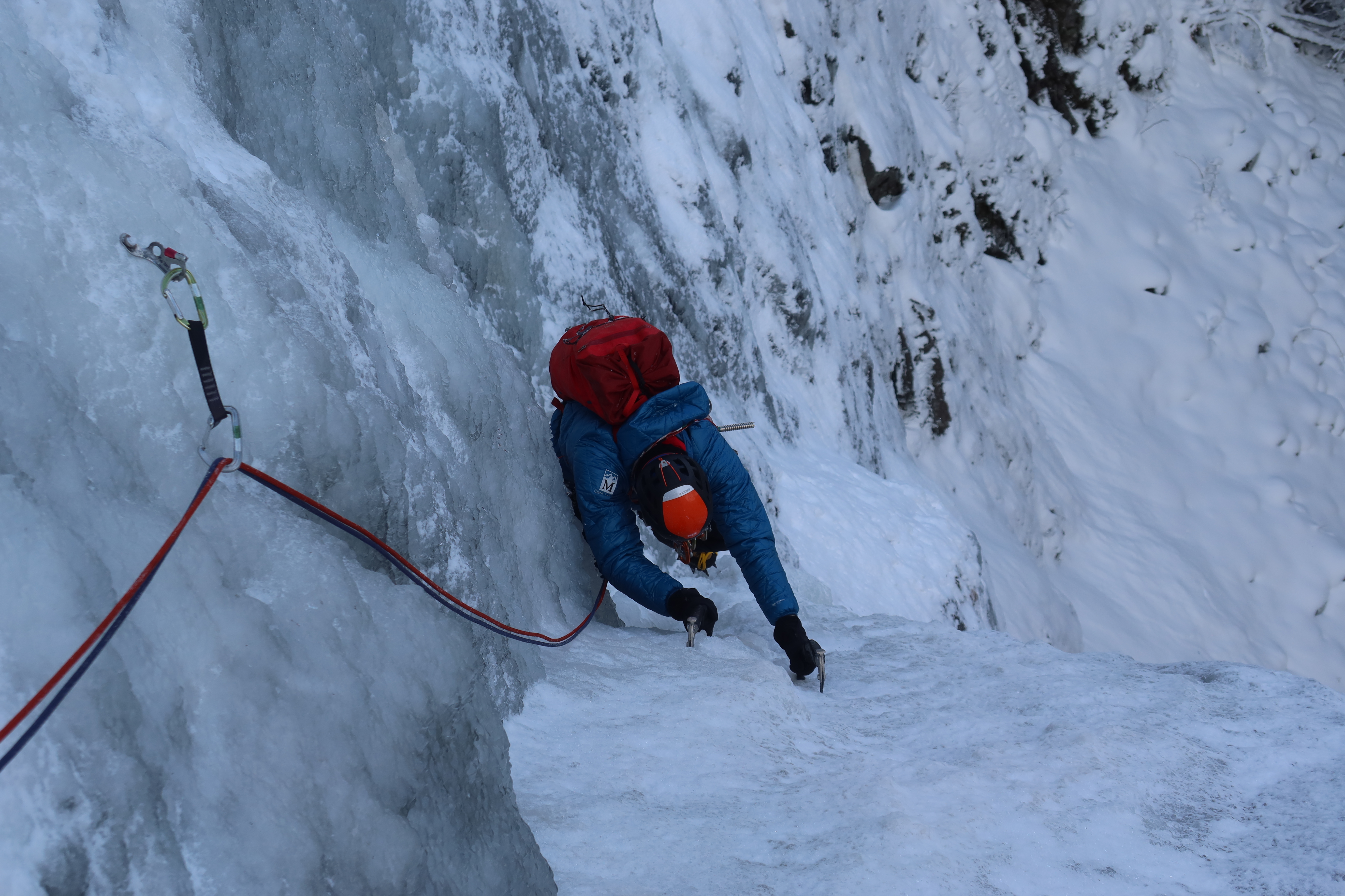
 Trip: Skookum Falls - Far Right Wall - center, then left Trip Date: 12/29/2021 Trip Report: I managed to get out and climb Skookum Falls with my friend Chris on Wednesday, Dec. 29th. Full details here: https://rocknropenw.com/2021/12/30/skookum-falls/ Gear Notes: 4x 16cm screws - used the most 2x 13cm screws - useful, could have used more 1x 10cm screw - really could have used more 7x longer screws - used occasionally, wished half of them had been shorter Approach Notes: 2 miles of flat easy trail from the Skookum Flats North Trailhead on Forest Road 73
-
I'm crossing my fingers that this issue of missing pictures in older trip reports is something that eventually gets fixed. CascadeClimbers has been such a great resource for looking up pictures of routes, and a picture really is worth a thousand words. There's an incredible amount of knowledge stored in so many trip reports from years past, and it would be a shame to lose it. Another one of many, many examples on here that have been immensely valuable to me in the past: Thanks for all the work you are doing maintaining CascadeClimbers!!
-
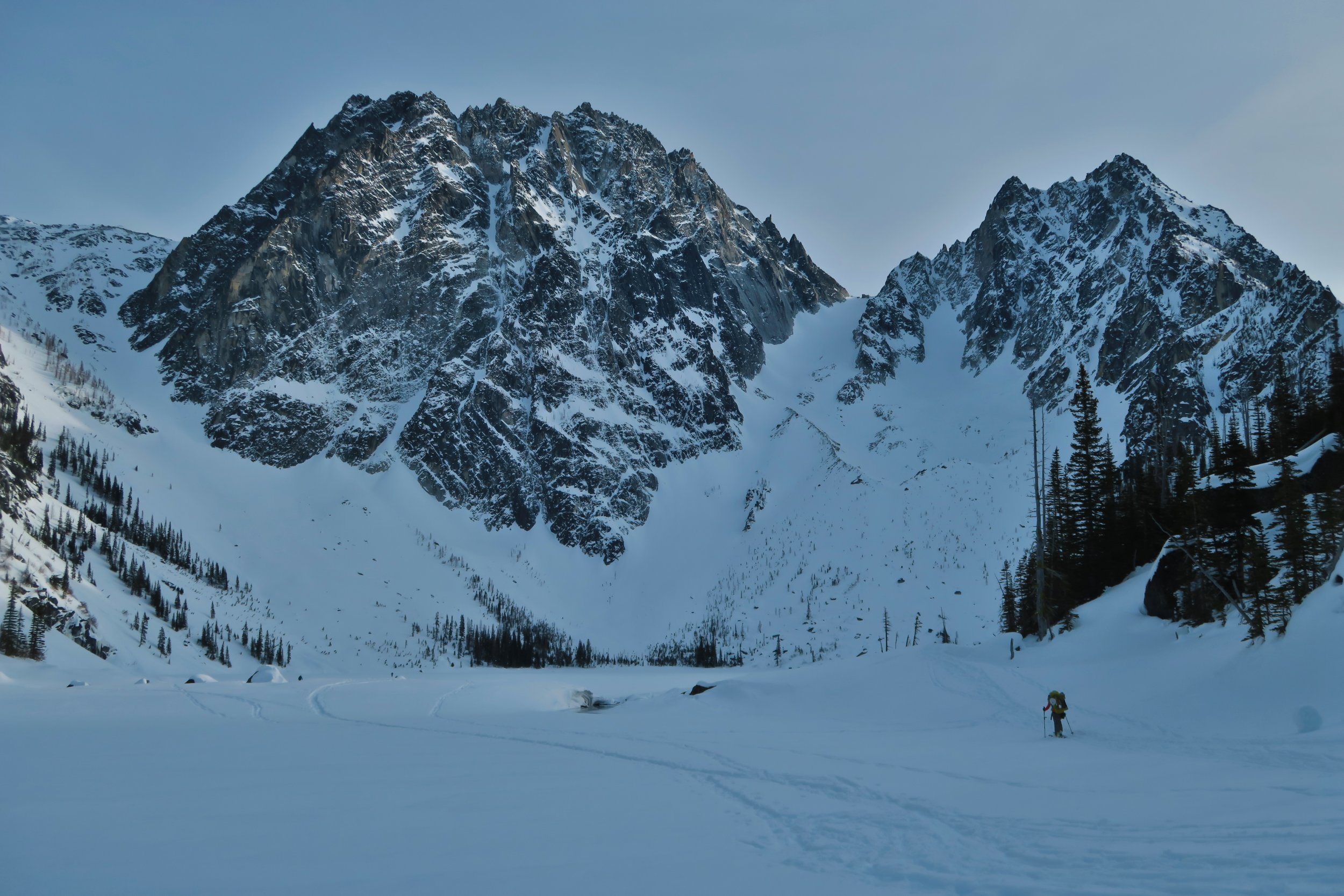
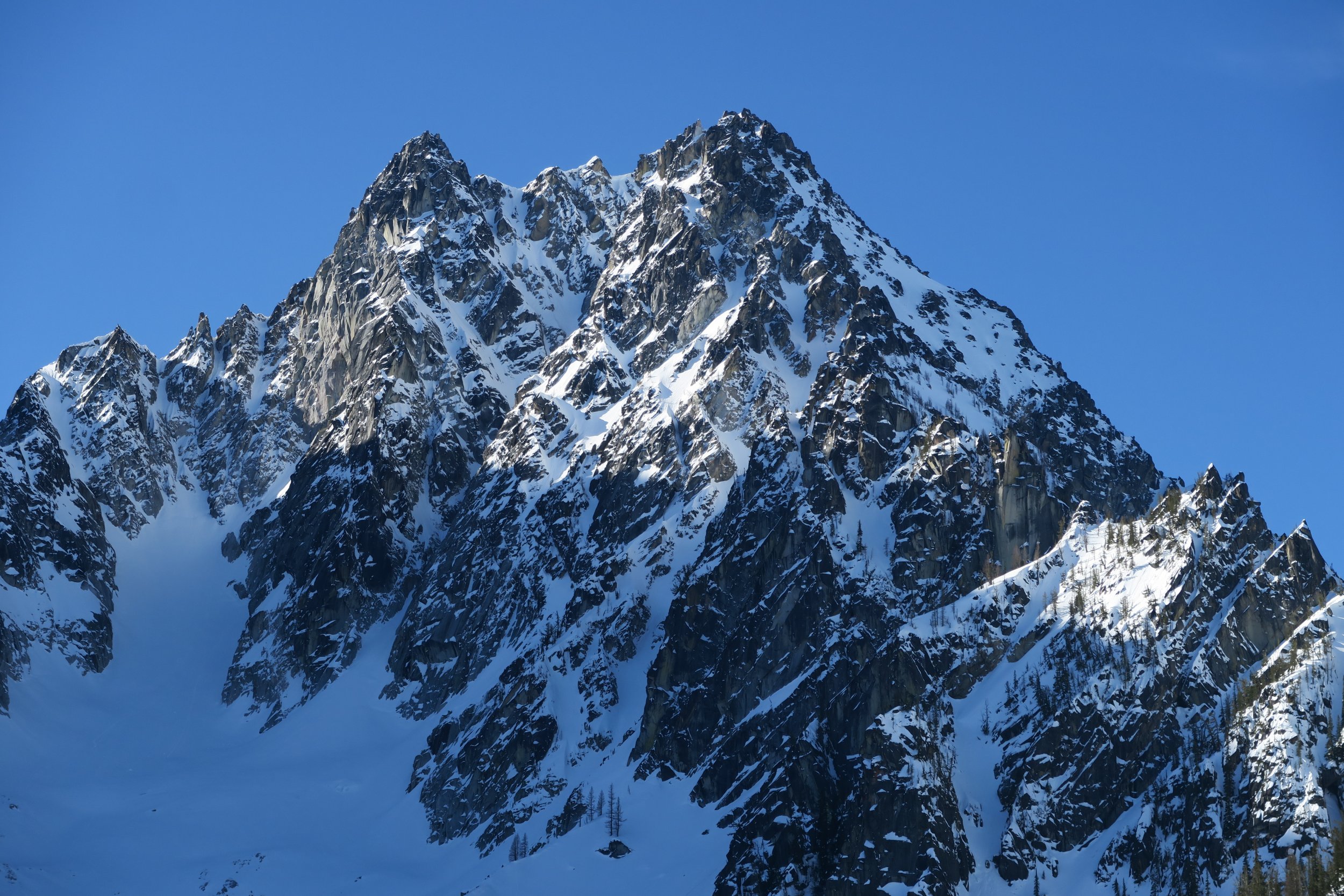
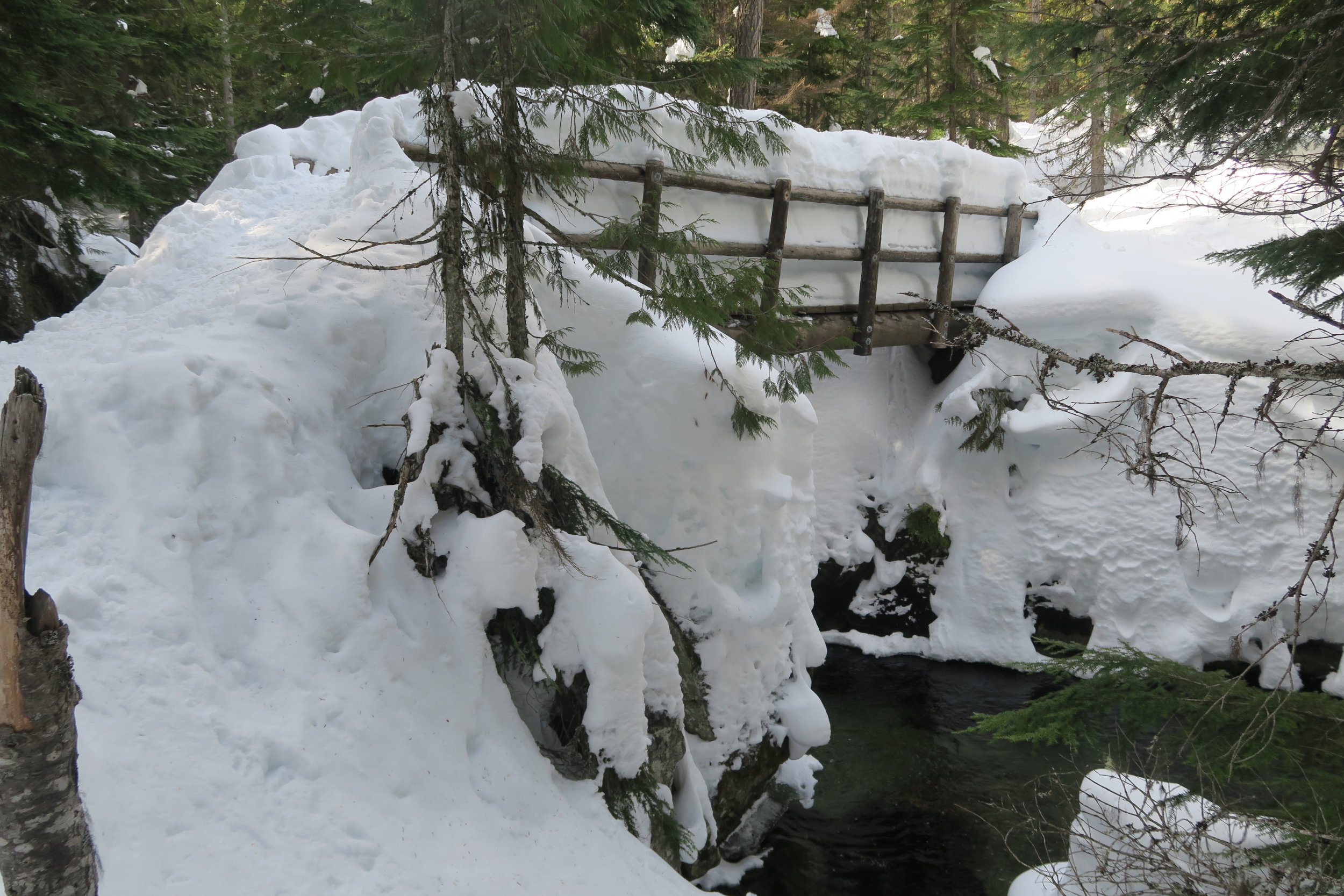
Trip: Colchuck Lake area - conditions Trip Date: 03/16/2019 Trip Report: Given the spectacular weather this past weekend, (March 16th-17th) I considered making an attempt on Colchuck’s North Buttress Couloir on skis. But due to a lack of mental realism about how out of shape I’ve gotten and just how much longer approaches take during winter conditions, plans evolved into just a nice camping trip next to Colchuck Lake with about 10 lbs of pro/pickets/crampons/ice tools along for the ride as bonus training weight. Everything is well snow-covered, we were able to skin right from the car. Snow on the gated Eightmile Road has almost every kind of human tracks you can imagine on it: snowshoes, skis, split boards, snowmobiles, it was even packed enough to be bootable with only a few inches of boot penetration, but I’d still recommend floatation of some kind. At the normal summer trailhead, snow looks to be about 4 feet deep right now. The trail up to Colchuck Lake has a well-packed snowshoe track the whole way up. Skinning up was fine (though it took me longer than I’d like to admit) with only one occasion where a fallen tree forced us to take skis off to hop over. Without skis, the packed path was supportive to boots for 9 out of 10 steps, but when postholes did happen they were waist deep. When we reached the lake, there were probably half dozen other parties in sight, most camping. We briefly talked to a group of 3 who had made an attempt at Triple Couloirs, but found the runnels to be way too thin right now and were forced to turn back there. We just camped and went no further than the lake. Just for the sake of curiosity, my avy probe went 7 feet deep in the snow by the lake before hitting what felt like ground. Skiing back out along the trail the next day was quite challenging, the most difficult tree-skiing I’ve ever done. We kept skins on to help keep speed down with all the sudden maneuvering required. My girlfriend soon opted to just A-frame the skis on the pack and walk instead. I stubbornly kept skis on the whole way, but with all the shenanigans that “skiing” there required, I progressed at exactly the same pace as her walking downhill. It is unclear which mode of travel was actually more effort. We observed a wet natural avalanche let loose on the distant side of the Mountaineers Creek valley, around noon on a very sun-soaked southeastern aspect slope, fortunately comfortably far away from us and coming to a stop well before reaching the trail’s elevation below. Finally, at the lower of the two places you cross Mountaineers Creek (the bridge at 4000’) the skis finally felt efficient again, with some worthwhile stretches of gliding down the path. And of course, once back on Eightmile Rd, the gliding on the skis was heavenly, with only two significant spots that required some skating for some otherwise non-obvious uphills. Triple Couloirs up close The Runnels on Triple Couloirs with maximum camera zoom Colchuck Ski shenanigans coming down from Colchuck Lake The bridge across Mountaineers Creek at 4000' Gear Notes: a 50lb climbing/skiing/winter/overnight pack Approach Notes: solid snow cover all the way from Icicle Creek Rd


-
Trip: Cascade River Rd - conditions Trip Date: 03/02/2019 Trip Report: With ambitious hopes of finding winter alpine climbing and maybe also a certain Spanish-rumored City of Gold, I found myself out on the Cascade River Rd this past Saturday (March 2nd.) Although my plans were ultimately thwarted and uninteresting, I figured I should at least share a report on the current state of the road. Indeed, as the park service reports, the Cascade River Rd is gated at milepost 18; but right now that’s a pretty moot point, because it’s unlikely you’ll drive even that far until things warm up and the snow melts back a bit. Patchy snow began about 4 or 5 miles away from Marblemount. Around milepost 10, it got thick and swimmy enough that my car (a 2017 Subaru Forester with average tires,) required chains to keep going. At milepost 16, right by the entrance to Mineral Park Campground, the only car ahead of us had parked (a Subaru Outback.) We tried driving forward on the unbroken road beyond that, but my car was having none of it, we were forced to park at milepost 16 as well. From there, the road had 1 to 2 feet of snow depth on it, ideal for skinning if you’re skiing. Also packed enough you could walk it in just boots, but still without a doubt more tiring than if the road had been melted down to bare gravel. I hope all the rest of you did something more satisfying with that glorious weather weekend than all the lame road walking I ended up doing! Gear Notes: Approach Notes:
-
I was on February Buttress on Sunday. Conditions were beautiful, the south-facing rock is getting a lot of sun. It looks like this coming weekend is shaping up to be just as nice there too. February Buttress is half-visible from the 76 gas station, it's the dry rock gently sloping from the right. This is where the 1st pitch of Ground Hog Day starts: Ground Hog Day, viewed from the side This is where Aquarius starts. Notice the bolt on the face? Neither did I at the time. To start Aquarius, stand where our rope touches the ground here: