

bedellympian
-
Posts
432 -
Joined
-
Last visited
-
Days Won
43
Content Type
Profiles
Forums
Events
Posts posted by bedellympian
-
-
Trip: S. Pickets - West Mac y Inspiracion all alone
Date: 8/11/2015
Trip Report:
Last week I drove up North by myself, unable to wrangle a partner for the whole week. I had a range of possible objectives, but after a day scrambling up Liberty Bell and SEWS (someone recently said its not climbing if you wear approach shoes), I realized that the forest fire situation demanded something further west to be enjoyable. So I headed to the Pickets for the first time.
I slept at Goodell Creek TH that night and started hiking at the bright and early... sometime around 10am

The approach was actually not as bad as I had imagined. The trail is fairly well established and not too bad, at least compared to what I had read. There were a ton of invisible spider webs across the trail that kept getting in my mouth and eyes, so I quickly adopted the use of a thick 14" long stick I christened "The Dong" and started waving it in front of my face as I walked, chanting horrible off key versions of various songs from the Lion King.
I must say that I felt an amazing amount of gratitude and respect following that trail for the climbers who went before me. I can only imagine what it must have been like before the trail was established as well as it is now. Even in the relatively well traveled state it is in now it felt very remote and adventure-y. The approach reminded me of stories my dad used to read me from National Geographic, especially the one about Hiram Bingham finding Machu Pichu. I almost expected to stumble upon lost ruins or be waylaid by an undiscovered tribe, but in reality what I found was even cooler... The Pickets.
When the climbers trail turns off the Goodell Creek Trail it begins to ascend quite steeply for about 3600'. If you have ever hiked the steepest trails in the Chuckanuts, this is steeper and more overgrown for triple the elevation gain. Another comparison people on here might be more familiar with is if you were to hike from The Country to the Upper Town Wall at Index, imagine doing that ten times without stopping but a bit more overgrown... so not that bad

Anyway, I finally popped out on the "heather benches" and found it to be full-on Huckleberry season. This was quite nice as I was almost out of water at this point (I hadn't started with much, the less weight the better). I gorged myself resulting in a minor stomach ache and continued at a slower pace towards Terror Basin.
The whole approach was definitely longer than anticipated, by a little bit. It just keeps coming but around 4o'clock I had a camp setup on a rocky bench near the outflow from the glacial lake. I then decided that I could just scramble up West MacMillan Spire via it's easy 3rd class W Ridge before it got dark. This was pretty straight forward.
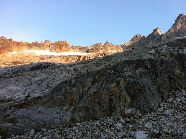
looking up the glacier
At this point there is nothing more than a minor snow field leading to the climb and the approach gully is dry. However, this means that there is quite a bit of loose rock left exposed and made for an "interesting" 30m segment of 3rd classing.
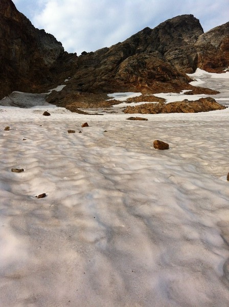
snowless approach gully
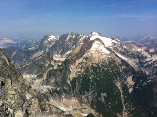
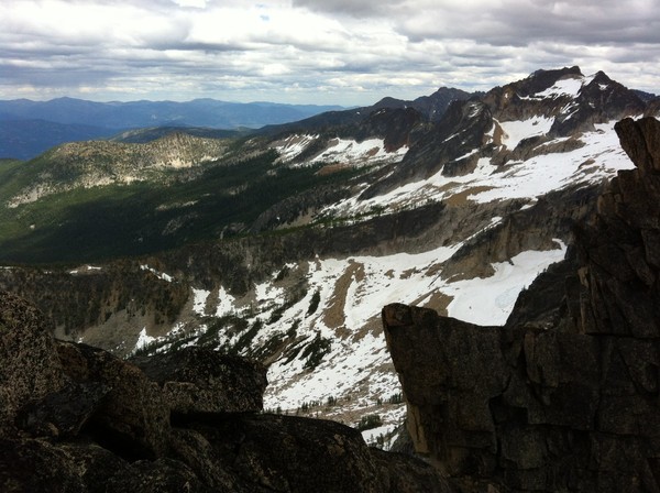
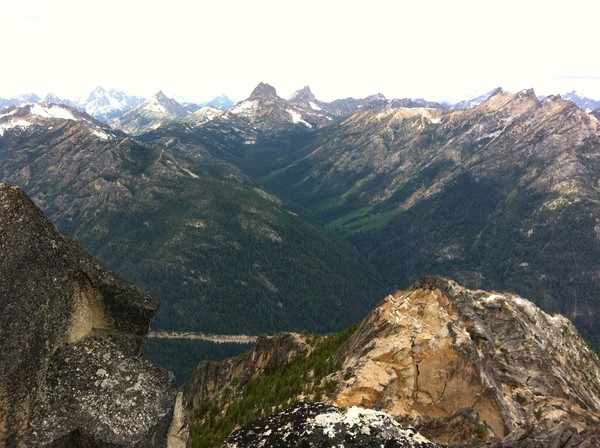
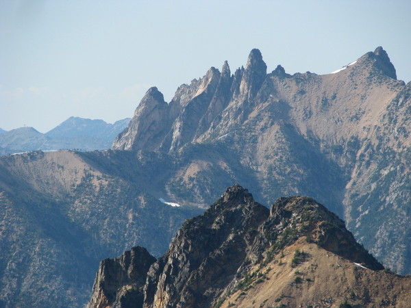
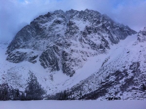
The view from the top was awesome. My first view of the Northern Pickets, so remote. And then I noticed the Mongo Ridge and shat my pants... not literally but almost. I AM NOT WORTHY!!! But one day maybe I shall be
 ...
... 

From the summit I looked out at the glacier in Terror Basin and was disturbed, but not surprised (thanks to Nastia's recent TR), about the condition of things. I had thought a solo of Inspiration's W Ridge might be attainable but it sure did not look accessible given my personal gear/partner situation and the crevasse maze laid out below me. I descended to camp and ate peanut butter and honey sandwiches while wondering whether or not there were any other humans out here.

alone in the tent
mt. triumph
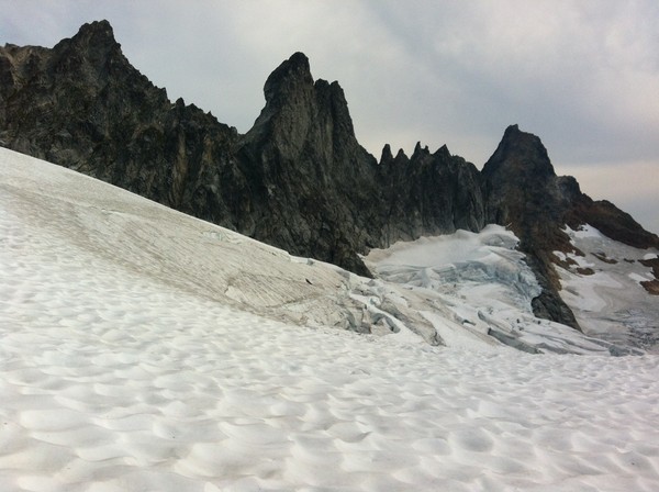
In the morning I decided to head for the Barrier instead of Inspiration. The glacier was too fawk'd and I thought that maybe I could find an easier way over the barrier than through the heavily crevassed upper cirque. Then I could just summit Terror via its' W Ridge (also just 3rd class) and call it a trip. Also, there were dark storm clouds obviously raining to the south and I did not want to be caught in a storm on technical rock.
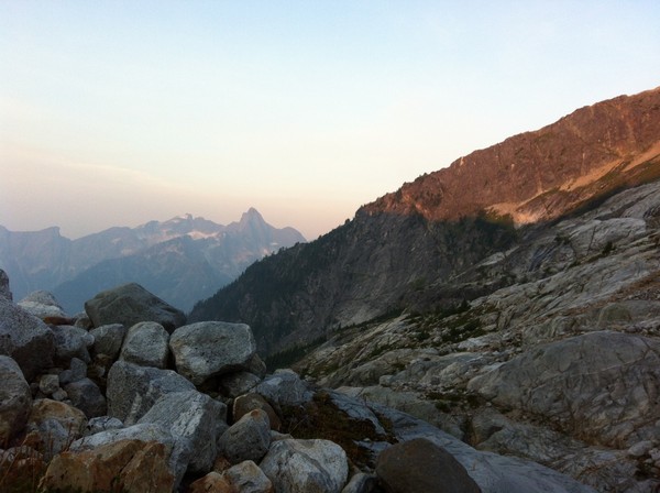
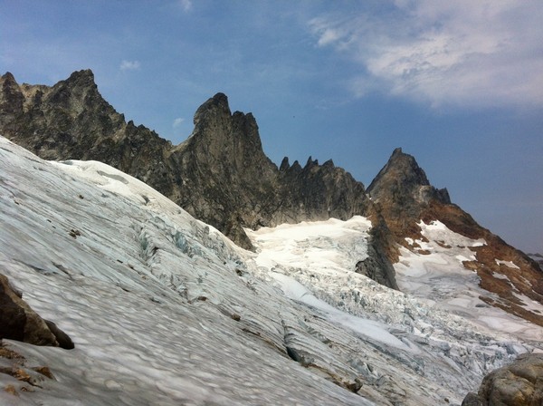
clear skies on the Pickets approaching the Barrier
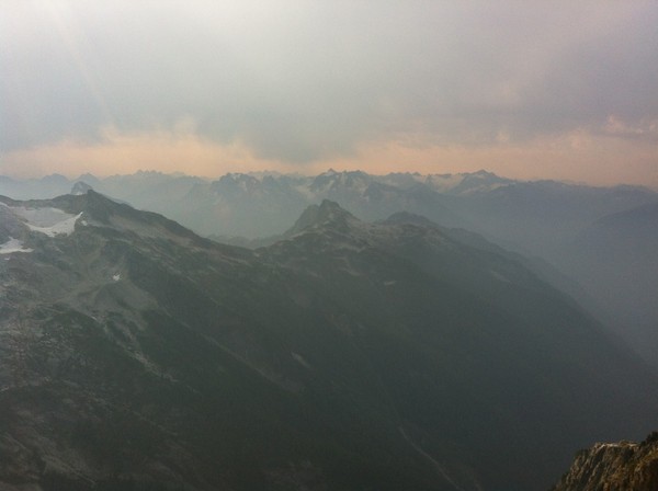
rain to the south
I found an easy way onto the barrier quite low on the left side of the glacier and climbed an arete between two gullys, roughly 4th class, but what I would term X-RATED DEATH CHOSS
 . How is 4th class x-rated you ask? Well, kind of like how when you can't trust any gear rock climbing its x-rated, when you can't trust any holds on 4th class its kinda the same schtick. I reached the top of the barrier and looked down into the next basin. Two things were quickly apparent, travel over there would be on an unpleasant amount of scree, and getting there would involve multiple rappels on fairly suspect rock.
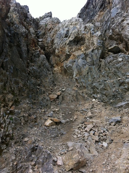
looking up the death choss from the glacier
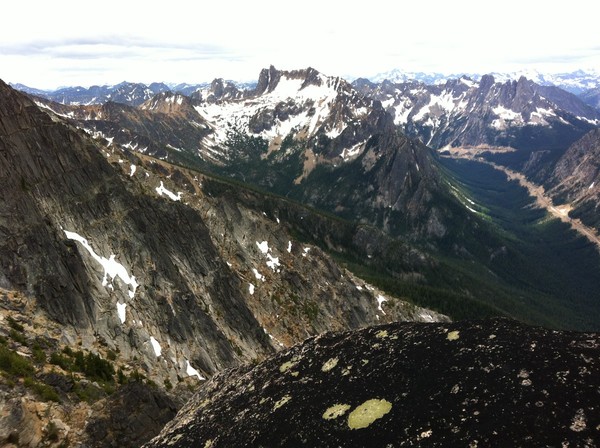
looking over at mt. terror
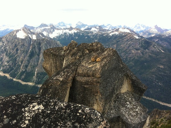
So as a consolation I decided climb to the top of a short spire next to me on the barrier via what looked like a mid 5th corner. The corner wasn't hard but getting out of the corner involved more X-RATED DEATH CHOSS
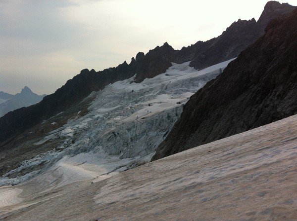
this time in the 5th class category. I got to the top of my little Aiguille and realized that the entire upper ten feet were composed of detached blocks. I took several minutes to gingerly locate a position from which I could remove my pack and shoot some pictures before reversing my moves to the notch and back to the glacier... a tad terrifying, which is only fitting for Terror Basin. At this point it was only 10am and the clouds were still all to the south while the Pickets stood in a little circle of blue-sky and sunshine. So I decided that I could at least wander up glacier and scope the crevasse situation. From this far side (climber's left) of the glacier things didn't look too bad. 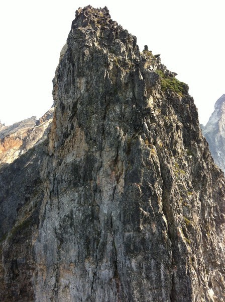
adjascent choss pinacle from my mini summit
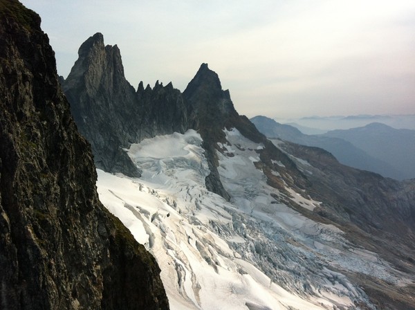
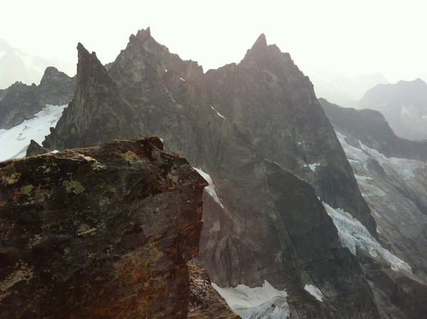
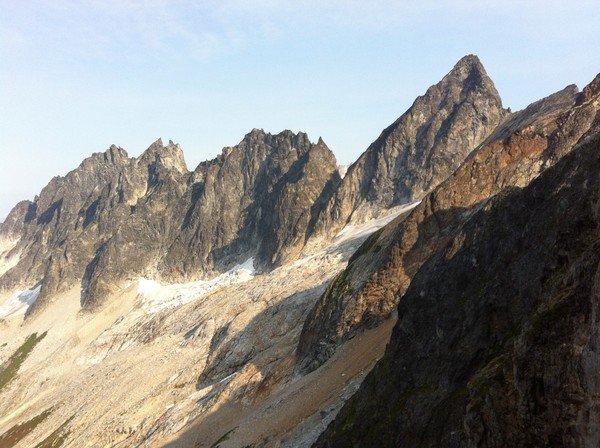
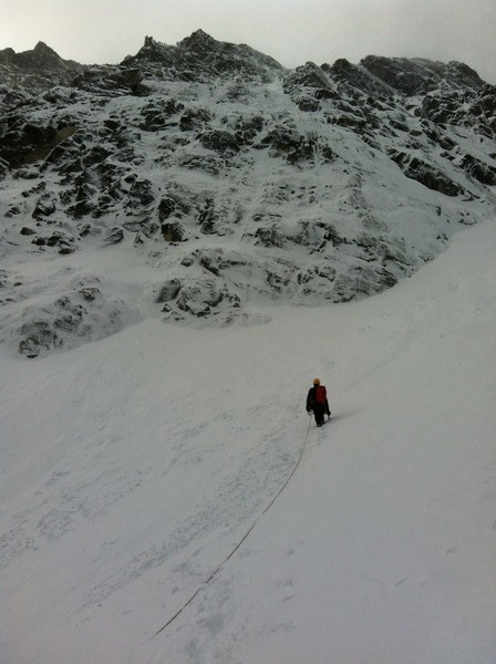
looking up the glacier, Inspiration at left and West Mac on the right
After crossing some hidden crevasses, which once passed I realized were thinly covered and large enough to swallow a sizable truck, I was close enough to Inspiration to see a way I might be able to approach it. The standard gully to the notch was blocked by crevasse and moat, but a collapsed section of the moat gave me access to what looked like a 4th class slab and gully system next to it. I figured I would give it a go and see where I got.
the access tbuttress to Inspriation and the glacier approaching it:
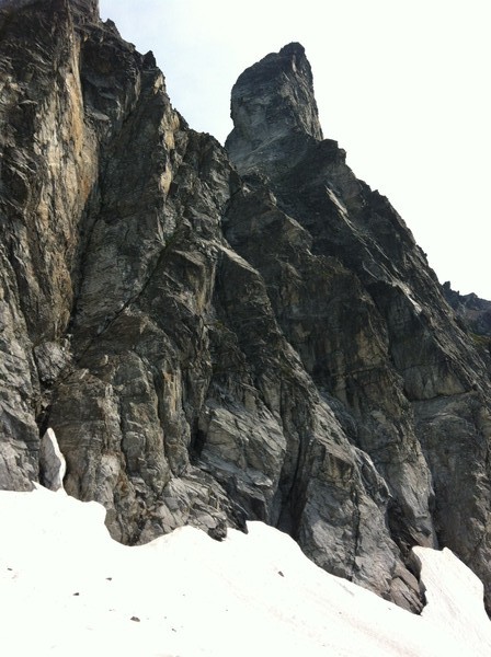
4th class X-RATED DEATH CHOSS
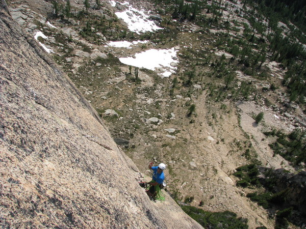
quickly escalated to low 5th. After some shenanigans I found myself in a chimney that seemed to be composed more of sand than rock. I climbed past several loose blocks, careful not to weight any. Once past a very dirty chockstone I gingerly touched it with my foot and watched the whole microwave-sized chunk drop away into space before the ensuing cacophony as it scoured the face below. After more shenanigans I reached the ridge and downclimbed some thin face features and improbable little turrets (improbable because apparently the only thing supporting them were the fingers of the Angel Iseult, guardian of North Cascades imbeciles such as myself) to reach the notch below the West Ridge of Inspiration. Looking up I realized that the rest of this would be a breeze, relatively speaking. In fact the "3.5 ropelengths of 5.7" to the summit went in under 20 minutes and never felt harder than 5.5 (quite disappointing for a Beckey route really). I reversed without rappelling and then began the careful process of downclimbing the X-RATED DEATH CHOSS to the glacier.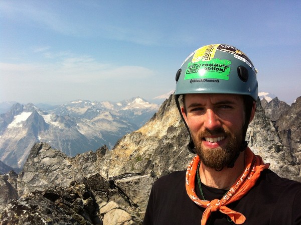
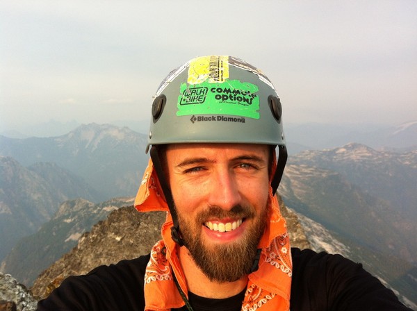
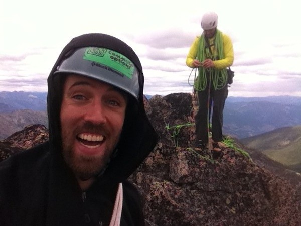
summit selfie, not stoked for the descent
Northern Pickets from the summit

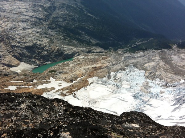
looking down at Terror Basin and the lake where I was camped
I quickly realized that due to the steepness of the buttress I was unable to identify my path of ascent from above... stupid is as stupid does, that was one of many new lessons for the day. I quickly ended up off-route on a parallel buttress. After downclimbing and reclimbing several times I ended up on the right arete but the easy climbing I had taken was on slabs down and around the other side. Instead of reverse again I committed to downclimbing overhanging loose flakes on the arete itself with full exposure. I carefully weighted each flake, only four out of ten foot holds stayed in place, the rest plummeted away disturbing some birds nesting below me. Thanks to the juggy nature of the flakes that was all I needed to lower myself to the ramp below and continue my descent (felt like 5.7/8ish).
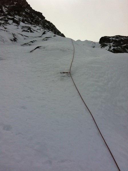
A few hundred feet lower I was finally near the end of the climbing. The collapsed moat section that I could use to access the glacier was ten feet down and right. I was climbing past a v-groove stacked with loose blocks the approximate dimensions of truck tires and I let out a sigh of relief. I was basically done. As I moved over the blocks they rotated in complete silence. I faced away finding sloping handholds when I felt a sharp pain in my left heel and heard the crunch of rock. I looked over my shoulder and saw that the blocks had shifted and the bottom one had com down and pinned my left foot against the rock. A quick glance told me that if all moved at once they would take me with them down into the black, bottomless moat beneath me. If I let go with both hands I would be unsupported in my half-turned position and would pivot around my foot, probably smacking my dumb head before pulling the assemblage down on to me. I thought maybe I could pull my leg out from under the block so I set my free right foot and pulled as hard as I could. There was no movement, not even a little shift. That was when I started to get a little concerned. I was still in my mental soloing bubble so my emotions weren't manifesting physically but I did think that I might actually be at the end of the line for a second. I took a few deep breaths to calm myself and summoned my logical fix-it mind, determined to try every possibility. I let go with one hand so that I could look over my shoulder properly and saw that the block pinning my foot had another block atop it that was acting like a cam and forcing the other block down. That explained the lack of movement. I realized that I could probably roll this block off without taking other stuff down with it. However, to do so would bring it dangerously close to my foot. If I crushed a foot bones out here I'd still be in a bad boat. With my left hand I carefully applied pressure to the camming block to see which way it could roll. Satisfied that there was a 90% chance of not screwing myself I gave it a big heave and watched it miss my toes by 2" as it rumbled down into the black moat. Now the block pinning my foot was a little looser. I gave it prod and realized that luckily it had just gotten the rubber heel rand of my shoes pinned. It had smacked my heel but was not bearing weight on my actual body. I gave the block a shove and then quickly spun in place and stepped up and out of the way in case the whole assemblage now went down into the black chasm of doom. It shifted a few inches and then settled with several blocks rocking back and forth in precarious positions. After observing that all movement had stopped I carefully avoided the blocks and climbed those last ten feet down and over to the snow. This whole process probably took less than two minutes. I took some deep breaths as the adrenaline pumped its way out of my system.
This was definitely the closest call I've had in the mountains and obviously I am not proud of it. Writing about it here feels like it offers some catharsis but no doubt several of you will want to take me down a peg or three for poor judgement. Do as you will. I can't recommend my path of ascent to the notch, even to competent roped parties, and will probably be avoiding such features in the future, as well as bringing partners to the Pickets for future excursions.

Lessons learned include:
-be more observant about your path of ascent to better facilitate down climbing/rappelling
-be 100% focused 100% of the time when in these situations, even once the exposure has lessened
-rappelling though dangerous may be safer for getting off of choss piles
-random shit happens, control what you can but know that you also can't, and accept that in full knowledge when going alone, including the ultimate consequences
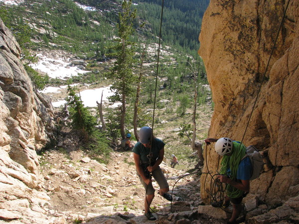
After getting out on the glacier I noticed dark clouds finally coming over the ridge. I got back to my tent around 2pm and waited to see what the weather would do. After a snack I took down the tent, which of course precipitated immediate rain fall. Luckily it did not last long and I was soon back in huckleberry shangri-la. Crossing a rocky gully I recognized the place where I had left my trusty spider stick (aka The Dong) I began calling out "la sticka!?! donde esta la sticka?! como esta la sticka? todo bien?"... yes I know la sticka is not spanish for "the stick" okay? I had a castaway moment so leave me be. The rest of descent went quickly once I had my trusty Dong in hand and I was back at the car by 7:30. I took a "shower" under the spicket in the National Park campground and fell asleep. The next day I iced my stiff legs in Diablo Lake and drove to Winthrop for a proper shower and bed at the North Cascades Mountain Hostel (holler at my brother Paul who is da man and runs a sweet place, I highly recommend!). On Friday my buddy Nick drove up from Bend and we went climbing at WA Pass (solid rock thank god!!!), but that needs another TR.
looking back up glacier
dark storm clouds a coming, taken from the campsite
Overall, I would encourage people to get into the Southern Pickets. The access is better than the horror stories led me to believe and it is truly a beautiful and inspiring place. In under 35hrs I had a full-on adventure and really enjoyed myself for the most part (minus the X-RATED DEATH CHOSS
). Just remember that there are some sections of quite terrible rock and the glacier is fairly broken up right now. Bring a partner and a range of gear. Expect some shenanigans but also expect to learn something. Be safe and have fun.
-Sam Bedell
Gear Notes:
-HELMET!
-I used guide tennies w/ strap-on pons which worked fine for what I did but may make crossing moats more difficult, I also only had one axe which again was fine for what I did but may limit you on other routes
-I brought a BD Couloir Harness, w/ 100'x7mm rap line and a selection of old nuts/slings/cord in case of rappels (used none)
Approach Notes:
Goodell Creek TH, climbers trail to Terror Basin is very obvious right now. Minimal bushwhacking and easy route finding. No water on the heather benches until you drop down towards Terror Basin. Glacier is a shit show.
-
I have a bone spur on my left foot (medial cuneiform) and when I have long days hiking in my Nepal Evos it irritates the heck out of it for a couple days afterwards. Obviously I can start wearing alternate approach shoes and just climb in the Evos where possible, and I could try other boots but otherwise these fit me pretty darn well.
Anyone out there with similar issues or ideas to try? I currently use the factory insoles and am considering getting something more supportive that might stop the irritation. Thoughts?
-
Thanks Taywen, I had them all figured out except for Mcgregor.
Dome, Mcgregor, Bonanza, Needles, Dome again, Goode...
Can someone confirm that that is the Gunsight Range and Sinister Peak on the left of Dome?
-
Trip: WA Pass - Clean Break, NEWS WF, Da Bell NWF
Date: 6/27/2015
Trip Report:
Over the last two weeks I've made two trips up to the WA Pass area while visiting my friend Ryan who recently moved to Leavenworth. While these routes are fairly popular I figured folks would appreciate some disambiguation and encouragement to get after it.
The first trip (6/18) Ryan and I climbed Clean Break on Juno Tower in 13 hrs car-car and 6 hrs on route despite getting lost and spending some time in slide alder purgatory.
Ryan has the Supertopo guide and we noticed several inaccuracies: first the climbers trail starts on the left side of Silver Star Creek not the right, and the route topos were fairly disproportionate (something that held true for all the routes we climbed), and lastly the description says to stay right of the crest at the top of the route but we found the left side to be consistently easier and more solid.
We also consulted Steph Abegg's TR and found her beta to be pretty spot on... Steph's TR
Two places on the approach that we screwed up:
1. waiting too late to cross Silver Star Creek (you can cross pretty soon after the valley levels out and then head straight up the hillside and traverse around to Clean Break, thus avoiding the slide alder creek beds)
2. not traversing far enough over to reach Bench Camp and the Burgundy Col trail on the descent (we had never climbed in this area before and did not realize how far skiers left you need to traverse, so we traversed back right to find the trail we thought we'd missed, crossing more slide alder creeks and finally just following some game trails straight down to the road)
Besides that the route is fantastic (great rock, great climbing, great belay ledges and awesome position) and much less sustained than the pitch break down would suggest. GO GET IT!
Pics:
Pitch 1, with lots of snow next to it.
mellow climbing
Ryan psyched for sunshine
Top-out stoke!
Looking up toward Silver Star's N Cirque
West facing pics L-R from summit.
The second trip our friend James came up from Bend and Ryan's friend Megan came along so we could do 2 rope teams. We initially planned on an enjoyable stroll along the Torment-Forbidden ridge line but with weather looking no bueno for Sunday/Sat-night, the excessive heat, and a potential lack of permits, we decided to just enjoy some alpine cragging on the Liberty Group.
Saturday we drove up late in the morning and spent the afternoon OD'ing on vitamin D while being stuck at hanging belays behind two ladies on the West Face of NEWS (the bottom of the route was more crowded than morning glory wall on the first saturday of spring break!
). Just in case you are super stoked on doing this route... it is OK... that's right, I said just OK. Others may disagree but the pitches are generally very short (Supertopo says 60' for the crux 11a pitch but I would be surprised if it is over 20', basically a slab boulder problem on sharp finger locks). On top of this several of the belays are not that comfy, especially when the sun is on you. Maybe a cooler day where we could have burned it off in a couple hours would have swayed my opinion, it is certainly a good route, just not a 5-star classic as some people have suggested... my 0.02, end of complaints. It is worth noting that we managed to totally sink a brand-new nut on the crux pitch. It is a totally bomber fixed piece above the crux and none of us could extract it, funkness style, nut tool or otherwise. Finally, there is a new bolted rap line climbers right of the West Face route that goes straight down the face, it is very nice, but I have not done the other rap line into the gully so can't compare.
Pics:
simul rapping the WF
Ryan at an exposed belay stance on WF
Wine Spires looking attractive
Sunday we woke up somewhat tired and dehydrated from the day before and opted to do a mellow adventure route before heading out. We settled on the NW Face of Liberty Bell to avoid crowds and the heat, although with rain in the forecast and overcast skies we could have probably climbed anywhere. The approach is pretty straightforward once you know it. The Supertopo guide says go up a step of low 5th 75 feet below a cave. There are three potential caves in the approach gully, we went up below the highest one and it worked fine but we had to hike down and around some slabs, it looks like the next cave down would have been more direct but we didn't climb up there so I can't guarantee it goes easy.
The Supertopo says that you follow a ledge system above this step to its end and the base of the route. The "ledge system" you follow is really a big hill side covered in trees, we were unsure if the ledges ended above these trees and the slabs but you just keep hiking down and around and back up and you will see that where it ends is a really big drop-off. Everything in the route topo is pretty accurate except the length of pitches 2 and 3 are flip-flopped: pitch 2 is actually the long one and you want to stop on pitch 3 before going into the dihedral (P4) because you can't link them with a 70m rope and will end up in an awkward hanging stance (believe me I know). I thought this route was fantastic and tons of fun, but the flakes on P3 are definitely hollow down low and some of the moves in the P4 dihedral are awkwardly difficult, not everyone in our party agreed with me. Compared to the W Face of NEWS the pitches are long and interesting and the position is pretty wild feeling, things I really like in a route.
Pics:
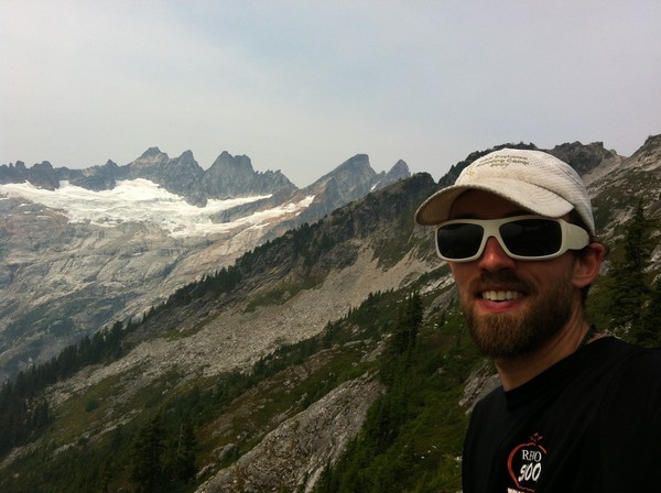
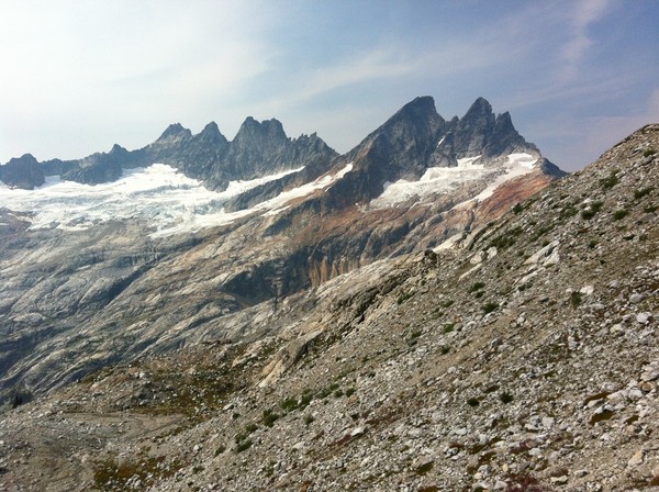
Ryan topping out the NW sub-summit of Lib Bell

Summit shenanigans... I was too hot in that t-shirt and its color had the unfortunate quality of attracting several wasps while leading the crux pitches
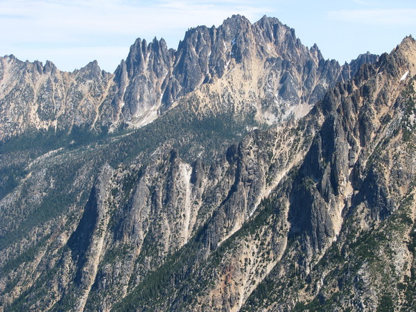
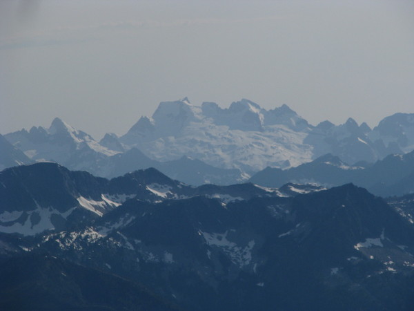
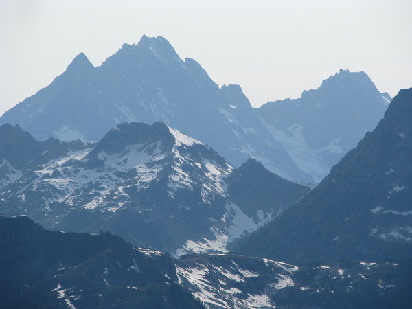
Conditions pics as seen from summit of NEWS 6/27, I would love it if someone could help me identify all of these:
Gear Notes:
We found the supertopo gear lists to be right on, this past weekend sunscreen was more important than a windbreaker, I never used another layer, climbed in shorts and took my shirt off whenever possible, especially in the shade... climate change sucks.
Approach Notes:
See above, avoid slide alder, keep moving to avoid mosquitoes.
-
I'll be in the Leavenworth area and want to pop over the hill to Index too. If anyone wants to team up or mentor me on a little aid let me know.
-Sam
-
I'll be there. I have trad, aid, sport, mountaineer gear. I'd love to climb at Index as I've never been there before and would like to try some aid, but really I'm down for just about anything. PM me if you're interested in teaming up.
-Sam
-
Also thinking about doing a quick run up Adams south side to ski a lap next week. Any more recent updates?
-
Ivan, what's Abraxas rated as an aid climb? Does it go clean?
I've looked at it numerous times and always wanted to go climb Tombstone Crack at the top but the 5.12 choss lower on the route is a little over my head right now. (Yes, I know you can rap in and climb out but it seems like a lot of shenanigans for 1.5 pitches of climbing! Would be way cooler to go ground up IMHO.)
-
Good point on the tri-cams, I have a set but rarely use them. Might have to start bringing them out to practice aid, would probably make me more comfortable using them free-climbing. And yes I have some off-set nuts. After reading several reviews I think I'm going to go with some Metolius 4-step aiders. Sounds like they are comfy but light and should be fine for everything I'm interested in.
Regarding solo-aid... I was thinking about just using a clove hitch system. Is this significantly more dangerous than a modified gri-gri? Any general advice on this?
-
Hey guys, thanks for all the input, I didn't expect all the responses.
Buckaroo, it sounds like you really like the sliders and they work great for you but I will be sticking with something more simplistic since I'm really just looking to transfer these skills to the alpine where they will only be used for a couple pitches per route. Light and simple with easy transitions between free and aid.
The videos Gene directed me to were great. And the ideas for Smith Aid have me psyched. I think I will begin doing some solo aid practice soon on single pitch and I heard it enough times that West Face of Monkey is now on my to do list.
-
Disclaimer: This is not a page for aid haters, if you'd rather free climb get off your lazy butt and go do it.
I have been alpine and free climbing for a few years now but would really like to get some experience aid climbing and either do Liberty Crack or some other grade V this year. I have tried aiding a 5.9 crack with a friend's aid setup once. I have done plenty of french-free and random stand on a sling BS, just screwing around at the crag and in the alpine. Really I want this experience just so that I can have another tool to push my alpine climbing.
Questions I have for those who might know...
1. I know I need etriers and theoretically two daisies... is there any other MANDATORY gear I should get for C1? I have plenty of gear for trad climbing, lockers, etc.
2. Smith is my local crag so I have done plenty of A0 and avoided the A4 shit shows that seem to be everything else. If I was going to go do an intro multi-pitch aid climb, where should I go? Index? Anywhere closer to Central Oregon?
3. Anyone want to do a little mentoring in late June or July weekends?
Thanks in advance...
-
I think you'll find that 99% of climbs on the west side of the mountain get approached from Timberline. I would check the USGS and other topos... http://caltopo.com/map.html#ll=45.37743,-121.7184&z=14&b=t
My guess would be that you can just pick a trail or ridge-line and follow it most of the way. Not sure where the Top Spur TH is but if something stops you from there then it would stop you from Timberline too.
-
I would check craigslist and also look in Redmond and Terrebonne. Bend is way over-priced and it is farther from smith and trout.
-
Yeah, the Sierra/s are on my radar (grew up in Reno where most people say Sierras, but met plenty of sticklers for s-less Sierra too). Got plenty of alpine rock objectives (Winds, Bugs, Tetons, Sierras, Cascades, Sawtooths, etc.), probably too many given how short life is, but alpine rock is only climbable a few months each year and I'd rather go alpine than crag... thus the request for alpine routes to progress past this last ice/mixed alpine climb.
-
Yeah Marc, I would love to get on Slesse but it is an 8+ hour drive for me through Seattle area traffic

I will definitely get on Slesse one summer at the very least, and keep that South Ridge in mind for a future Wadd trip! Sounds sick!
Kurt, I've already done a bunch on Hood, including an I-rock route, N Face, DKH, etc. It's definitely the best alpine crag in OR and I'll keep going back. And yeah, I live in Bend so I spend plenty of time at Smith and the other areas you mentioned (Jeff Park is a sweet route).
I appreciate the nod to Snoqualmie routes since I always pass them by for the Stuart Range, I've always thought about NY Gully as this hard test piece but after last week it sounds really reasonable, and Stuart Glacier Couloir will be a good one too with the mixed ridge and more complex descent.
Thanks guys!
-
Thanks for the suggestions guys! Several of those were already on my list but a bunch weren't so now I have some research to do.
Ivan, I appreciate the nod to some aid/wall routes, that is an area I could use some practice that I'm sure would pay dividends.
keenwesh and christoph, thanks for the push to get on an expedition. Unfortunately the Ruth is probably not going to work out as I work in schools and April/May is not really an option with that job... unless I substitute next year
...I have been thinking that routes in the Canadian Rockies, Waddington, Cordillera Blanca, and Denali (higher altitude routes) in the next few summers would be good goals but I feel like I need a few more stepping stones to prepare for that sort of trip... or maybe I just need to train my ass off and go big like keenwesh
-
P.P.S. I'm in grad school right now and probably won't be able to get on anything big again until May, so please don't tempt my homework-ridden self with climbs that are in condition "right now." This is more for me to think about potential goals and objectives for next winter and beyond. Thanks.
-
I just climbed the Gerber-Sink on Dragontail this week (see the TR if you want). It was definitely a level-up from what I've climbed previously in winter.
My question is, what other routes should I consider to challenge myself and expand my abilities/experience?
I know I need some more ice and mixed cragging experience, but what are some bigger alpine routes I might build toward? Both the Black Spider and Yocum Ridge are on my radar already but are highly conditions dependent. Living in Bend it's hard for me to access some of the more remote stuff in North Cascades due to time limits and variable conditions, so please consider the added drive time.
P.S. I know that there are plenty of great moderate routes out there and I don't need to always be pushing my limits, etc. etc. I do intend to enjoy easier routes and this is not about me pushing myself in some mad desire to become a high-level alpinist, but goals and progress are nice and I feel a little unsure of what to target after this climb. Thanks for the suggestions.
-Sam
-
Yeah that makes sense. We were definitely in the third couloir once we got out of the gully.
Gotta love Dragontail... there are just so many possibilities up there.
-
Thanks Alex!
Yeah I looked at a bunch of TRs for G-S and was noticing that most people actually start it almost the same way we did, instead of how Beckey shows it in CAG. I have a hard time believing there are reasonable variations that haven't been done given the number of ascents and caliber of climbers who have taken their turn on the route.
To clarify though, the gully I'm talking about is NOT the final couloir in Triple Coulis. The gully was tucked right next to the side of the fin and popped us out into the couloir about half way up. After looking at pictures in other TRs, it looks like people usually go further left and enter the couloir earlier.
This TR shows it better.
Here is a picture from that TR that I put some arrows on...
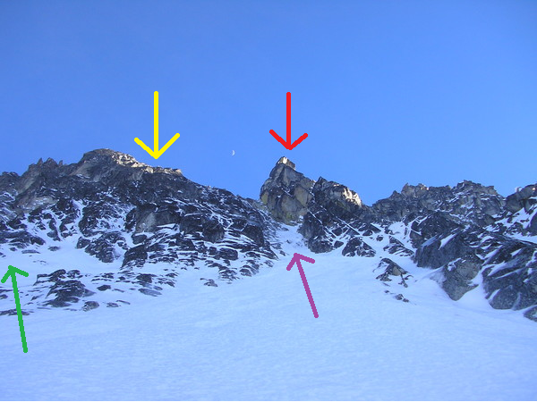
red = fin
yellow = rock feature Beckey shows the route going up in CAG
purple = the "gully" we climbed
green = the pitch most winter TRs show people using to access the last couloir in the Triple
Anyway, now I've sprayed beta all over the dam place. Hopefully I didn't ruin anyone elses adventures
-
Crazy. Well maybe Alex could comment and let us know if that was what he bailed off of. The two nuts and sling were all spread out, the lower nut had a bail biner on it, the second nut did not, the sling was tied off and hard to tell how old in that environment but still slightly green colored.
If anyone knows anything about this behind-the-fin variation let's hear about it. It's a cool section and I think could actually be straight forward ice runnels in the right conditions. Definitely worth investigating if you want to avoid some more snow slogging.
-
Okay so maybe those pitches haven't been done in winter before? You'd think with a peak like Dtail it would have been climbed at some point. Edward said he felt the pitch was maybe around M5, at first he thought maybe even M6 but I guess he got a glove stuck in a handjam and had to pull it out. I've never really climbed M-graded stuff before so I really have nothing to compare it to. It felt kinda like old-school 5.9 when I followed it, a little committing and awkward but all there once you go for it.
DPS- Did Alex make a TR? Can you link it?
-
Trip: Dragontail - Gerber-Sink variation?
Date: 3/24/2015
Trip Report:
Edward and I both had time off in the middle of this week so we drove up to Leavenworth from Bend to take our turn on Triple Couloirs. We hiked in to Colchuck Lake Monday night and went to sleep dreaming of a cruiser climb up steep snow. That night it started snowing. We woke up at 4am and it was still snowing so we went back to sleep. At 5am it was still snowing, and finally at 6am it stopped. We expected an inch or two but soon found out it had snowed about 6". We got out of bed and looked at the clearing face to see constant, large spindrift avalanches coming down, many dumping into the hidden couloir and blasting snow out the bottom. We sat around for an hour wondering what to do and finally decided to check out the white streaks right of the center buttress. I knew that the Gerber-Sink was in this vicinity and that it had been climbed as an ice route, but did not know where it went.
The white streaks had not gotten dumped on by spindrift for maybe 30 minutes so we got to the base and Edward started to try climb a mixed pitch left of the main streak. He tried two separate starting pitches, both had no pro and as soon as he got into the business it started coming down again. At one point I couldn't see my tools in the snow two feet from my face. The sloughs were constant and unrelenting. After backing off from both attempts we presumed the trip was a bust but I wanted to try one more mellow ramp pitch further left where there was less spindrift coming down. I climbed up some stubby trees on top of a ramp and accessed a snow ledge above where I could build an anchor.
Edward came up and it was already around 10am. We discussed bailing but a runnel led up and right and Edward said we might as well do another pitch just to see where it went. Up the runnel we traversed right on steep snow and popped out a pitch up the white streaks which were now obviously perfect steep neve. Unable to resist I led the next pitch up perfect sticks with a couple screws and ended up on more steep neve above and no decent anchor. Edward came up and with no anchor and more perfect neve seeming to continue forever we committed to the face.
A couple simul pitches later we emerged from beautiful runnels to a steep snow field. We thought we could see the bypass entrance to the third couloir but there was another couloir up and right tucked behind the Fin from the Backbone route. We wallowed up that way thinking it would be an easy top-out, but soon found thin ice and mixed climbing forcing us to break out the rope again. One pitch later Edward worked up the crux of the route, a verglassed slab-layback with gloved hand jams. It was pretty committing but had obviously been climbed before due to the two fixed nuts and faded sling we found on the pitch. One more short mixed step above this deposited us a couple rope lengths from the top of the third couloir. We slogged up through deep snow and tagged the summit around 6pm before heading straight back down Asgard to the Lake.
We had both told people that we would be back in Bend that night but it was now almost 8pm. We packed up and hiked out making it to the car just after 11pm. We drove into town to get cell reception and then took the first available forest service pullout and slept for a few hours before being awoken before 6am by the cold damp that comes from sleet falling on the tent.
After looking at the Beckey guide, I can say that our route was not the Gerber-Sink because it started on the right side of the buttress and followed the ice runnels and neve streaks which at some point probably shared several pitches with the G-S. Then instead of climbing the rock buttress at the top we climbed the gully behind the fin. I'm sure all of this has been done before by other parties, except maybe a couple of our starting pitches to avoid the spindrift might be slightly different. Regardless of what route it is, it is fantastic and I enjoyed it immensely.
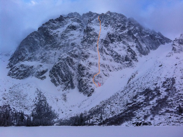
Here is our route with the false starts marked in red.
Here is the picture sans route.
Gear Notes:
60m rope, 4 screws (1x stub, 3x med), single rack, tools/pons, and a deep water-proof hood for spindrift
Approach Notes:
boots of even guide tennies, trekking poles help with the slick trail but its not too bad
-
Bought these Nagos, size 39, cause the shop didn't have 40s and I needed shoes. Too tight for sure, not gonna stretch nearly enough. I used them once to climb one pitch at Smith. They are in new condition and sell for $99 usually. I was hoping to get around $70 for them plus shipping. I live in Bend OR if you want to pick them up. PM me if interested.
-Sam
[TR] S. Pickets - West Mac y Inspiracion all alone 8/11/2015
in North Cascades
Posted
for purely illustrative purposes here is a rough topo of my movement on inspiration...
red is line of ascent, orange shows variation on arete during descent, red circle is where is was pinned by blocks, route used only because moat gave easy access, not recommended