

bedellympian
-
Posts
432 -
Joined
-
Last visited
-
Days Won
43
Content Type
Profiles
Forums
Events
Posts posted by bedellympian
-
-
@Yttrium Thanks for the recommendations!
The East Buttress is different from the East Face... it's in Oregon High. East face sounds horrific. East Butt actually looks somewhat appealing.
SE Spur would be a good one. Per the Bold and Cold I was trying to do different faces or features for most of the routes and SE Spur and E Butt felt similar, but I think we work with what we have.
Given that the shortest route in Bold and cold is a 7 pitch/1000 ft route on Yamnuska I was also trying trying to keep routes somewhat long... though again we have to work with what we've got.
-
Definitely jumping the gun a bit, but my 2 year old daughter keeps saying "I wanna climb a Mountain with Dada!" This summer she hiked up Tumalo Peak outside of Bend under her own power, no carrying... 2 miles and 1300' up. She also tries to climb all the rocks at the bouldering area where I take her. I got her a full body Edelrid harness and she loves swinging around in it. We're going to go TR some mellow (3rd/4th class featured) slabs this weekend. I know it won't be enough and she will just cry when we are done. I have some small summits that have easy (3rd/4th class) scrambles up the backside at Smith that I will take her on for the next step, but I am thinking about something more for next summer and down the road. Anyone got ideas for very mellow but also very safe summits I could get her up? Thinking mellow hike approach, minimal objective hazard, 1-2 "pitches" with big ledges and good anchors. I plan to do the Leo Houlding method where you lead the pitch, fix the line, rap and TR solo with your kid so she doesn't have to deal with any gear. Ideally it would be less crowded so we don't have yahoos trying to go around us. Ideas? Yes, I'm crazy!
-
I think some titans might be Southern Pickets Traverse, Mongo Ridge, Megalodon Ridge, Wayne's Logan Ridge, Hard Mox's big face, Silverstar Traverse... any other contenders?
I think two of the big roadside routes would be Thin Red Line or Liberty Crack and Goat's Beard for ice.
Other big routes that should probably be in there would be things like Bear N Butt, Slesse NE Butt, Terror Stoddard/N Butt, Stuart N Ridge, one of the routes on that big butt of Bonanza.
Some winter routes that should be on the list IMO... Index N Face, Watusi Rodeo?, Buck Mountain N face, Polish on Colfax?, maybe something on N face of Snoqualmie?
-
 1
1
-
-
FYI --- No one goes over there because it is a reservation for the Confederated Warm Springs Tribes and you need permission to do so.
-
Seems like you should just wait for winter at this point. I recommend Wy'east or one of the Devil's Kitchen Headwall gullies on Mt. Hood, but if you're further north that might not make sense.
-
I think the season will just change. Most of these routes will become spring routes with less reliable weather. You'll just have to get better at climbing in weather and cold to send. I think the broken up glaciers will make them more challenging still. You'll need to be a more solid ice climber to get through schrunds and what-not but they will still go.
-
3 hours ago, geosean said:
This is a rad idea!! but since Washington's better than Oregon I've never done any of these routes.
I'm joking, kind of, but seriously keep it up this sounds really cool!
Well you're not wrong.
-
I've been reading The Bold and Cold by Pullan after my Rockies trip and it got me thinking about what a similar list would look like for my home range... the Oregon Cascades. For those that don't know, the Bold and Cold is 25 climbs, 5 groups of 5 routes, in the Canadian Rockies. Each group is supposed to be training for the next tier. The list was developed by famous climbs Urs Kallen and Dave Cheesmond. The five categories in the book are: Shakedown Routes, Maiden Routes, Middle Earth Routes, Galdiator Routes, Titans. All the routes are quite serious and the categories progress in commitment, length and remoteness. The crux pitch grade seems to have little to do with it.
I think it would be fun to make a similar list for Washignton or the North Cascades... I think the routes would be more diverse there and the "Titans" category would actually be a bit more legit. Though still no where near what the Rockies offer. Curious to see other folks routes. Maybe for other ranges too.
Here is my incomplete list. It is grouped more by category as that seemed to make more sense for this range.
The Dumb and Chossy: Routes in the Oregon Cascades
Crag Routes: (could include some from Smith, Beacon etc. here but wanted them to actually be in the range, once you add those two the list is kinda endless, any other multi-pitch adventure routes in the Oregon Cascades that form a decent challenge?)
Exploring the Axis, Cougar Crag
Dod Route, Turkey Monster
Barad Dur, Wolf Rock(mostly) Snow Routes:
Reid Headwall, Hood
Thayer Headwall, North Sister
High Noon, Broken Top
Jeff Park Glacier, Jefferson
Right Gully, HoodTechnical Mountain Routes: (need one more, but Oregon is pretty lacking is this dept unless you have suicidal tendencies)
West Ridge, Illumination
Skylight, Illumination
West Ridge, Washington
East Buttress, WashingtonIce Adventures:
Eliot Headwall, Hood
Center Gully, Hood
Full Richardson, Broken Top
Fric/Amos, Hood
Emde/Ablao, Middle SisterBig Lines:
Yocum Ridge, Hood
Complete East Buttress, North Sister
Arachnophobia, Hood
Brainless Child, Thielsen
After Image, Strawberries (not technically in the Oregon Cascades or in character with the others but I wanted a 5th and this is head and shoulders above other routes in sustained technical difficulty, and more remote)-
2
-
 1
1
-
 1
1
-
-
Trip: Canadian Rockies - Feeling down? Like you're in a Black Hole? I've got a solution for you: Go on an Athabasca Bar Crawl!
Trip Date: 08/14/2023
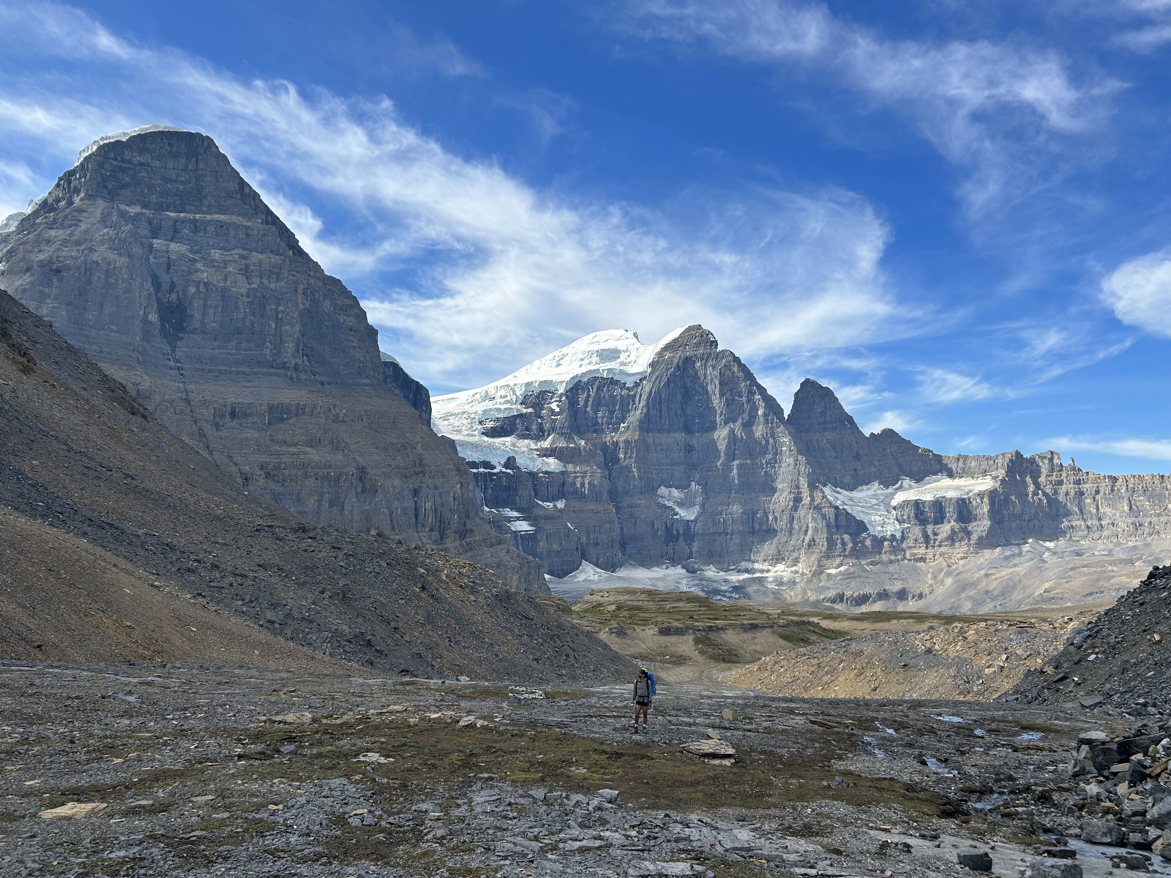
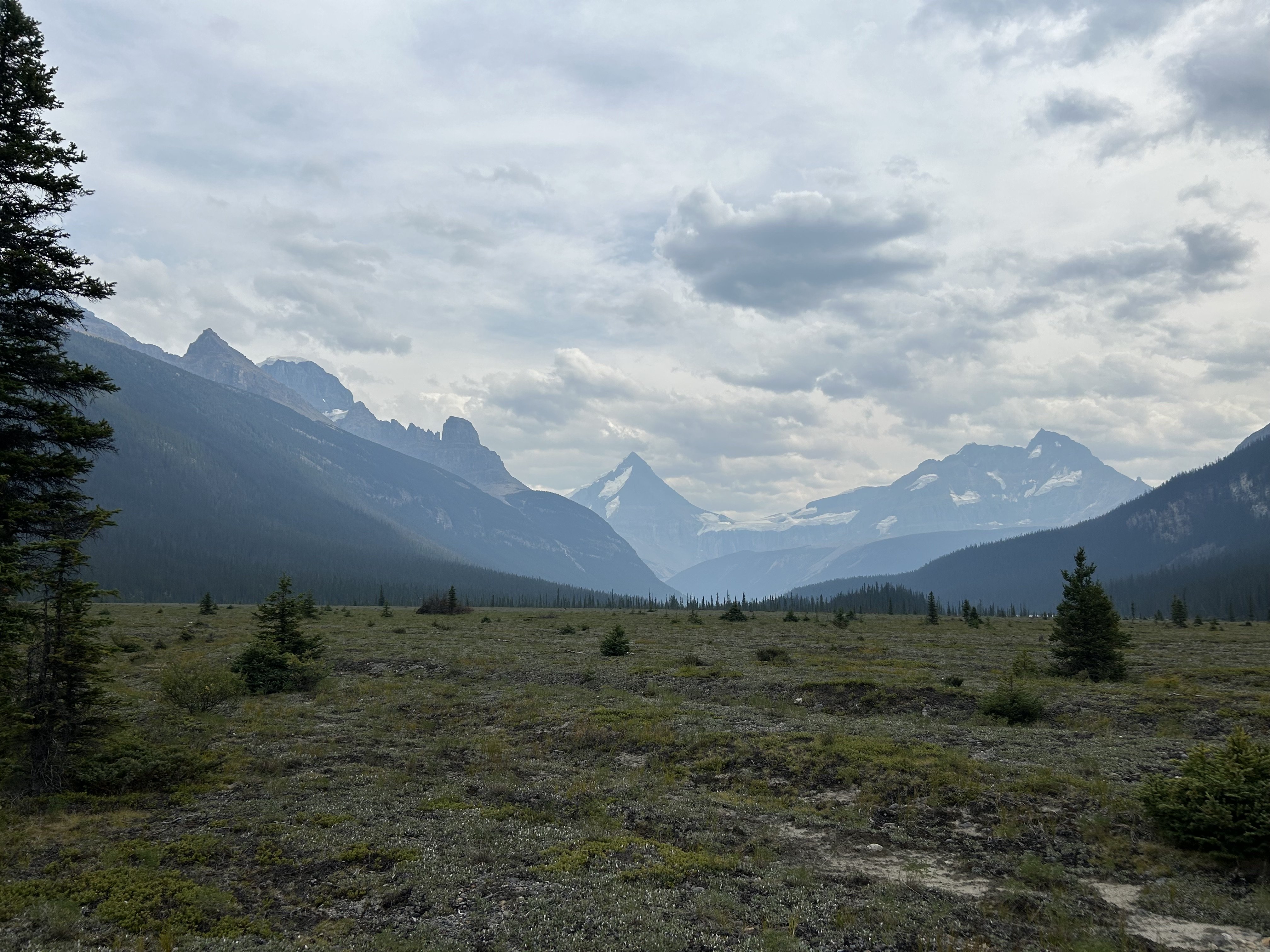
Trip Report:Dallin Carey and I took the gear to go see about the North Ridge of Mt. Columbia. We were attempting to repeat this itinerary by Colin and Ian, albeit in much warmer/drier weather.
Long story short, everything took longer than anticipated, there was much less snow/ice than anticipated, and we ended up doing the coolest backpacking trip of my life around some of the most incredible mountains on the continent. It was awful, but in a really good way.
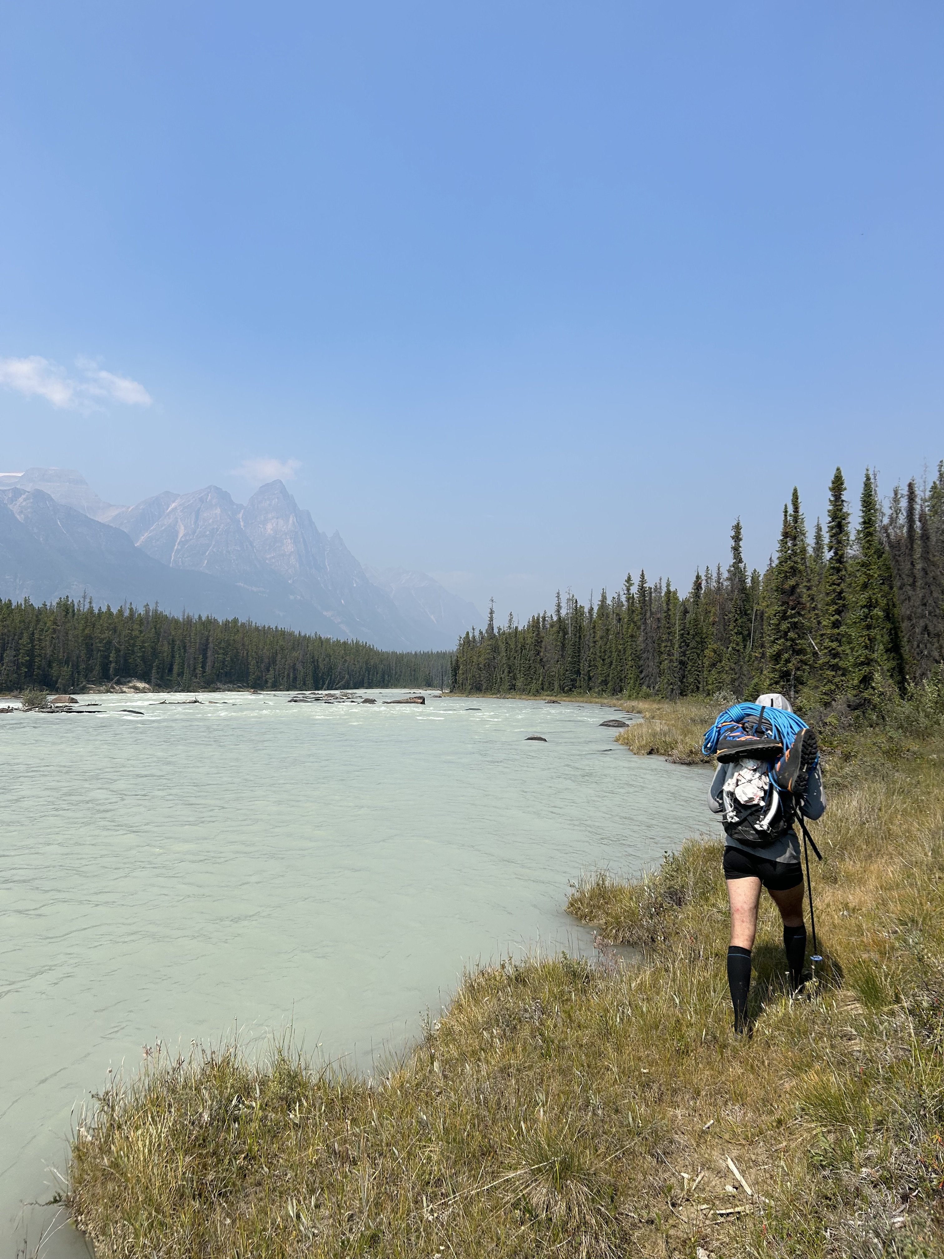
Day 1 - We got a later than anticipated start and hiked up and over Wooley Shoulder. Pretty much every source from climbers we could find just says "go up and over" with no mention of the shenanigans involved. This is only 5ish miles... It's also 4.5k' vert, involves wading a very cold Sunwapta River at the start, traveling over multiple glacial moraines and up some steep and exposed scree. We thought it would take us 3-4 hrs, but it took us 6 and involved some harrowing traversing on atrocious scree by headlamp. We didn't sleep until after midnight.
Day 2 - We figured we had plenty of time to get to and up onto the N Ridge. Colin made it sound easy; how hard could it be? We started by traipsing through Sound of Music-esque meadows towards the North Face of North Twin. The topo maps were not revealing of the topography below and Colin's TR didn't mention this... maybe it didn't seem like a big deal since he was just hanging with a super-loc/guide who'd been that way before. Anyway, the meadows ended with a cliff of choss and a whole bunch of f*&%ery dropping thousands of feet down scree and forest to the raging torrent through more old glacial moraines that is Habel Creek... this is the actual Black Hole of legend.
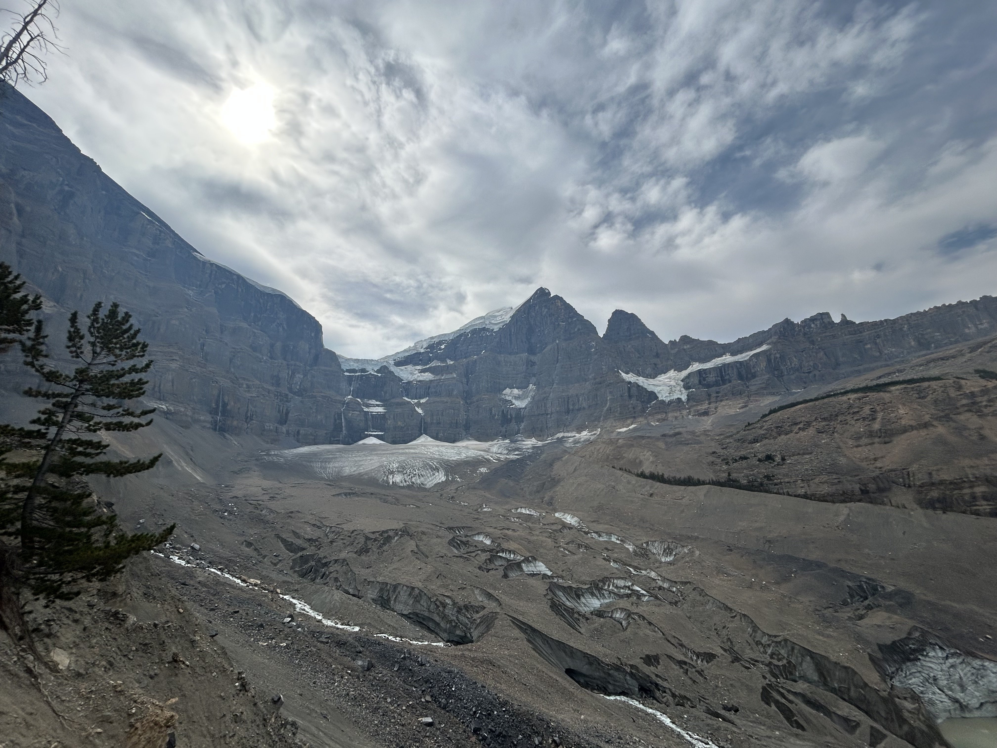
We wasted a good while figuring all this out and after down climbing, shwacking, and scree sliding we emerged creekside where the water pours out of the glaciers. Now we only had to wade the cold water, climb over more glacial moraines, and bushwhack out the creek, dropping another 2k' vert to the Athabasca River. This 4.5 mile section from our campsite to the Athabasca, which was entirely down hill, took us almost 6 hrs. I think I could shave an hour or two off this time with perfect beta, no more. As we emerged into the Athabasca River Valley, Habel Creek spread out over its alluvial fan creating swamps deep into the forest. We were wading through ice cold water filled with silt and simultaneously bush whacking. Breaks on gravel bars finally showed our route... no snow in the lower snow gully, bare ice on the lower snow field, massive black schrunds guarding the top, no ice or snow in the Scottish gully, big icy seracs overhead, and no snow at all on the ridge: climate change sucks a big one. It did not inspire confidence.
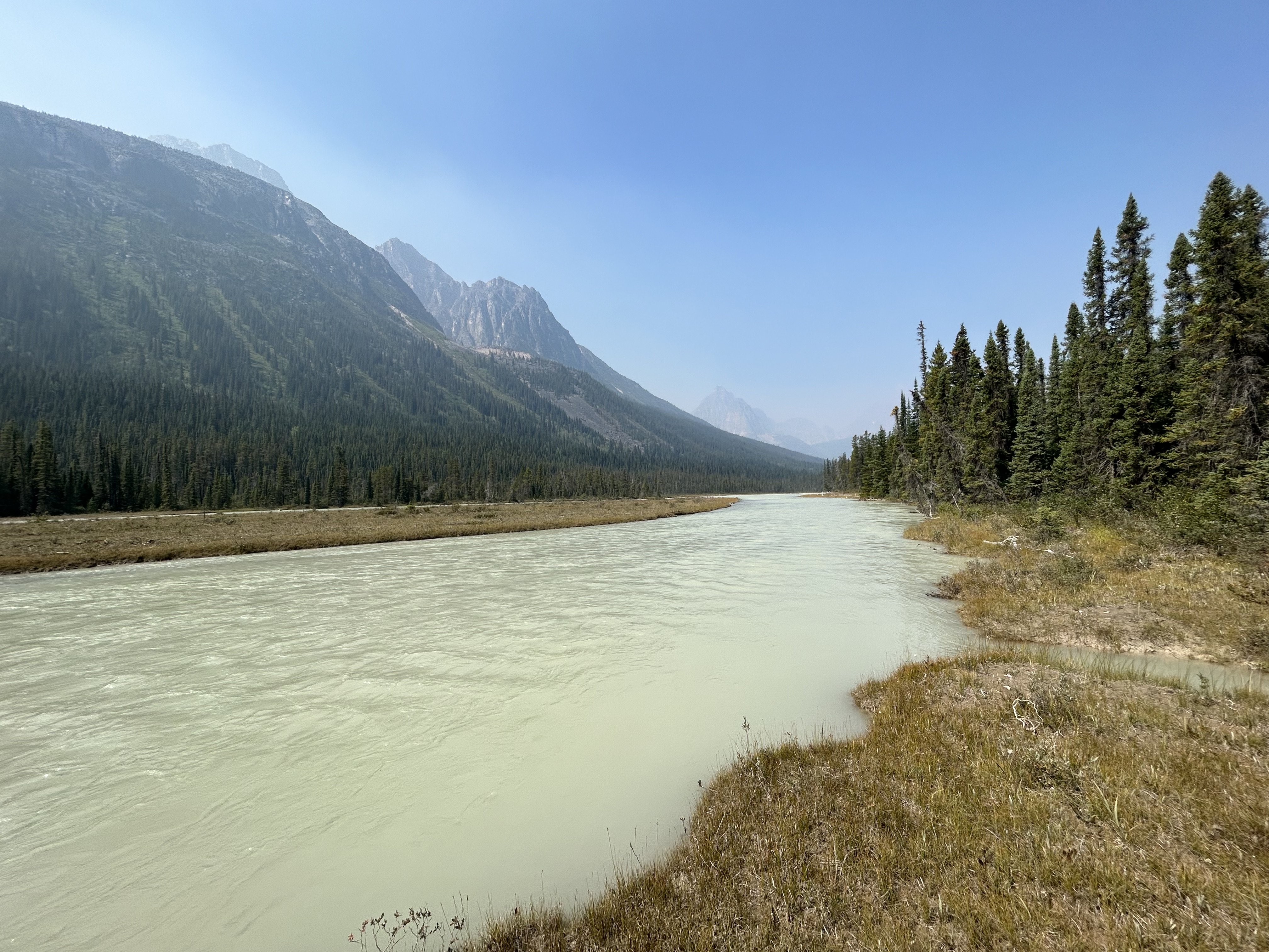
Finally, while shwacking through more icy swamp water and having made 400m of progress in the last 30 minutes we decided to pull the plug. The N Ridge is probably the easiest(???) exit from the upper Athabasca to get over the Columbia Icefield and back to the car, we were well behind schedule and the likelihood of getting up the route was looking somewhere between Certain Death and Russian Roulette. We really didn't want to go back over Wooley Shoulder for a variety of reasons so Dallin suggested we could just follow the Athabasca River all the way out to the road... It's only 20+ miles of river walking, mostly with no trail. That sounded lovely, which gives you an idea of how totally F'd the other stuff was. We started wading back across Habel Swamp (as we had dubbed it), emerging on to gravel bars and made decent progress, walking/wading/schwacking in a much more leisurely manner until it was almost dark and we found a nice campsite on a gravel bar in the river.
Day 3 - This day was delightful and felt like a pleasure cruise... If you consider constant glacial river wading up to your waist, swamp wading, moose/bear track following, and bushwhacking to be easy while carrying an alpine climbing pack and being swarmed by mosquitoes and horse flies. The average American would probably just lay down and die; a PCT thru hiker would probably declare us insane and never go back... but we did genuinely enjoy ourselves... though I still might not ever go back willingly. We finally stumbled out of the brush onto the so-called Chaba Cabin Trail and had a mere 12km of rolling single track to hike back to the Sunwapta Falls TH. A delightful young woman named Pam let us cram in the back of her live-in van (despite our stench and grime) for the 20 miles back down the Parkway to Dallin's truck. We then had to wade the Sunwapta twice at 8:30pm to retrieve our running shoes from the first day, which left us mildly hypothermic, and then the adventure was truly over. We cooked dinner at 9pm in the Ice Fields Visitor Center parking lot and watched rich old people sip their zina on the balcony of the $40 entree restaurant as the alpenglow faded over the Athabasca Glacier, which we had envisioned ourselves triumphantly descending after our rad send. Such is the roller coaster of life.
Gear Notes:
Light-weight running shoes for hiking were clutch. We did not use the tools, pons, rope, pins, cams, nuts, slings, or screws in any way. The boots were on my pack for all but the few miles up and over Wooley. In Colin's TR he hiked in his underwear as I understand he does from time to time to save weight. I cannot recommend this strategy in this terrain due to the sea of scabbed-over scratches that now forms the front of my legs, and the sea of massive red insect bite-induced welts that covers the back of them. Let's just say this may well be the first and last annual undies hiking trip for me. And also, screw you Colin! But maybe also thanks, for inspiring an awesome adventure.
Approach Notes:
Don't trust topo maps, don't trust Colin's TR, don't trust the rock, the scree or the dead trees. Definitely don't trust the deep holes between roots covered in 6" of moss that are totally hidden. Basically, don't trust anything you can touch, they will all betray you. Just become a wild animal, cease all higher levels of thought, and simply exist. This is the way.Pictures:
These are mostly taken by Dallin, cause !!NEWS FLASH!! undies don't have pockets. Actually, we discussed in detail how Patagonia should make Colin Haley Limited Edition Approach Undies with pockets. But I probably wouldn't buy them. Well, maybe.
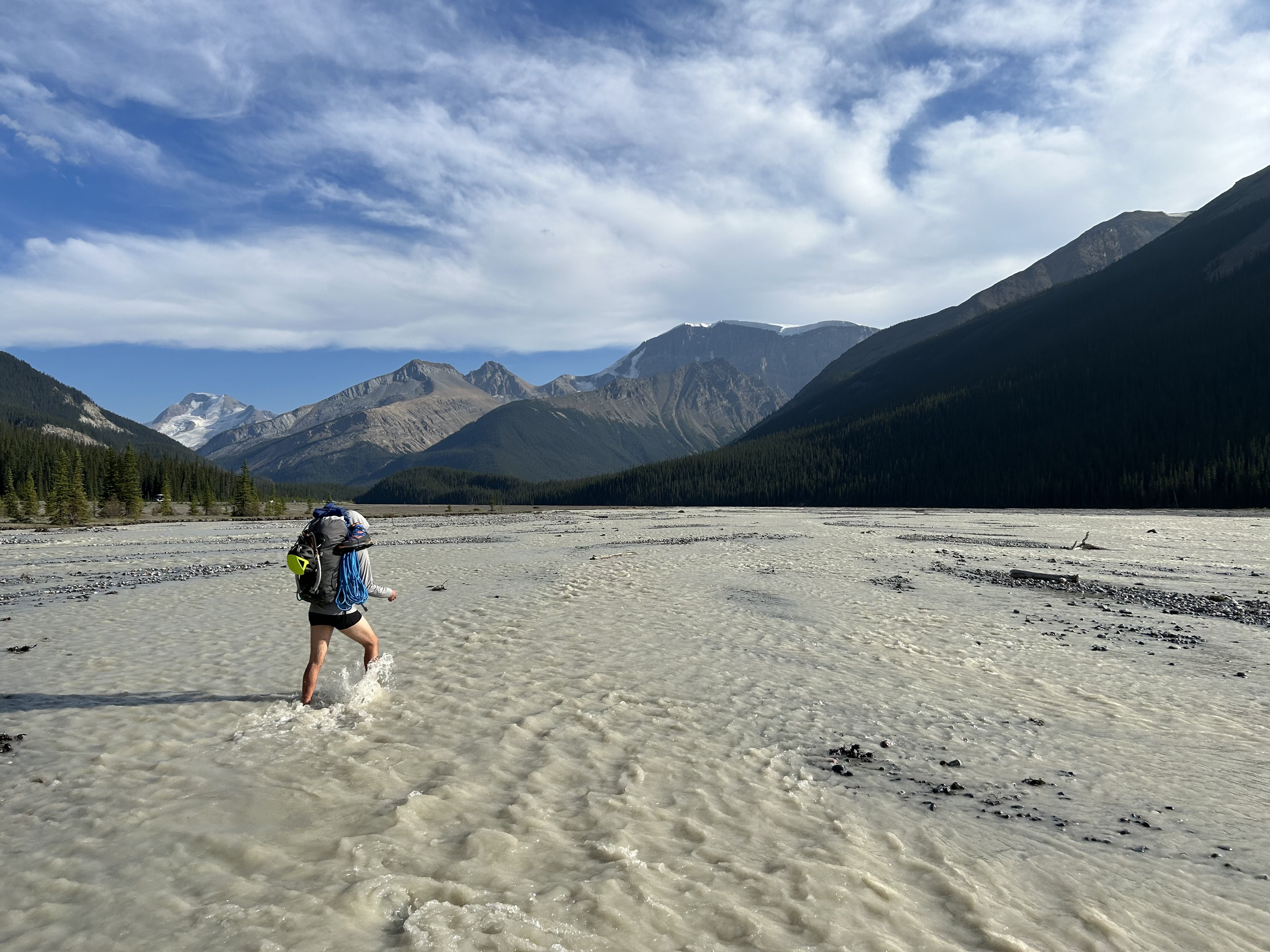
Yours truly wading the Sunwapta. Screaming barfies for the feet. Yay.
Yours truly approaching Wooley shoulder, Wooley peak behind.
Yours truly walking down towards the Black Hole and the North Face of the North Twin. Looks easy, just go over there. Too bad you can't see the massive chasm of glacial, torrential, choss gnar that splits the ground just after the lovely marmot meadows.
Almost down into the Black Hole. The moraine in the left foreground gives an idea of what the last bit down to Habel Creek was like.
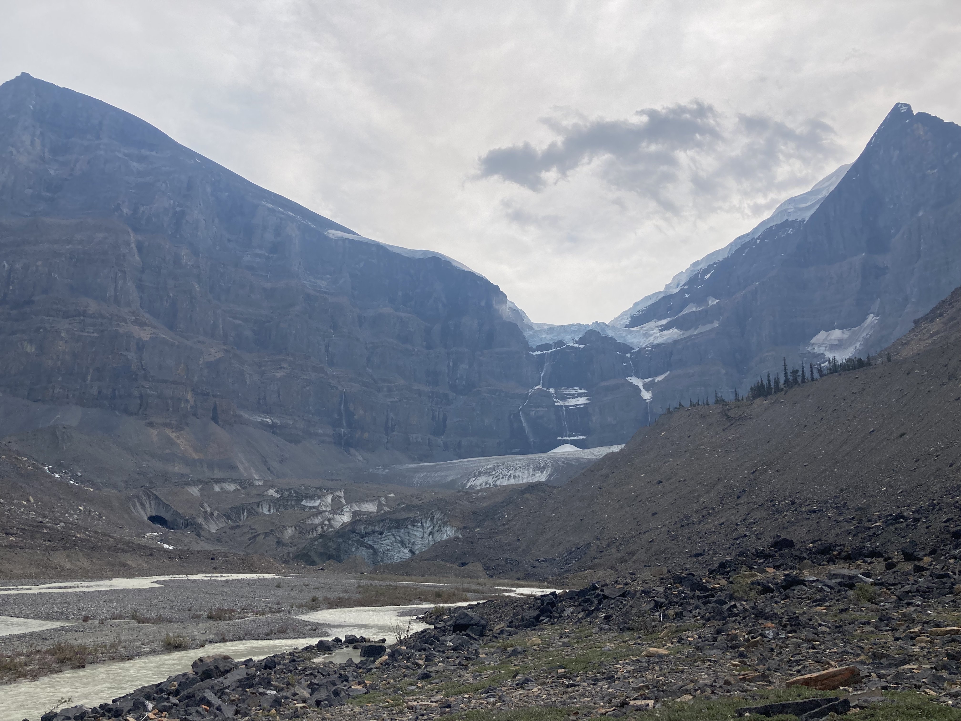
In the Black Hole after fording Habel Creek. Note the thousand foot waterfall getting blown sideways as it falls off the Ice Field.
Finally getting views of Columbia. Phones take crap photos but very little snow, lots of exposed ice, more exposed rock. Blah, blah, blah. We are chickens. I have dishonored you Dave Cheesmond. We are unworthy. Forgive us.
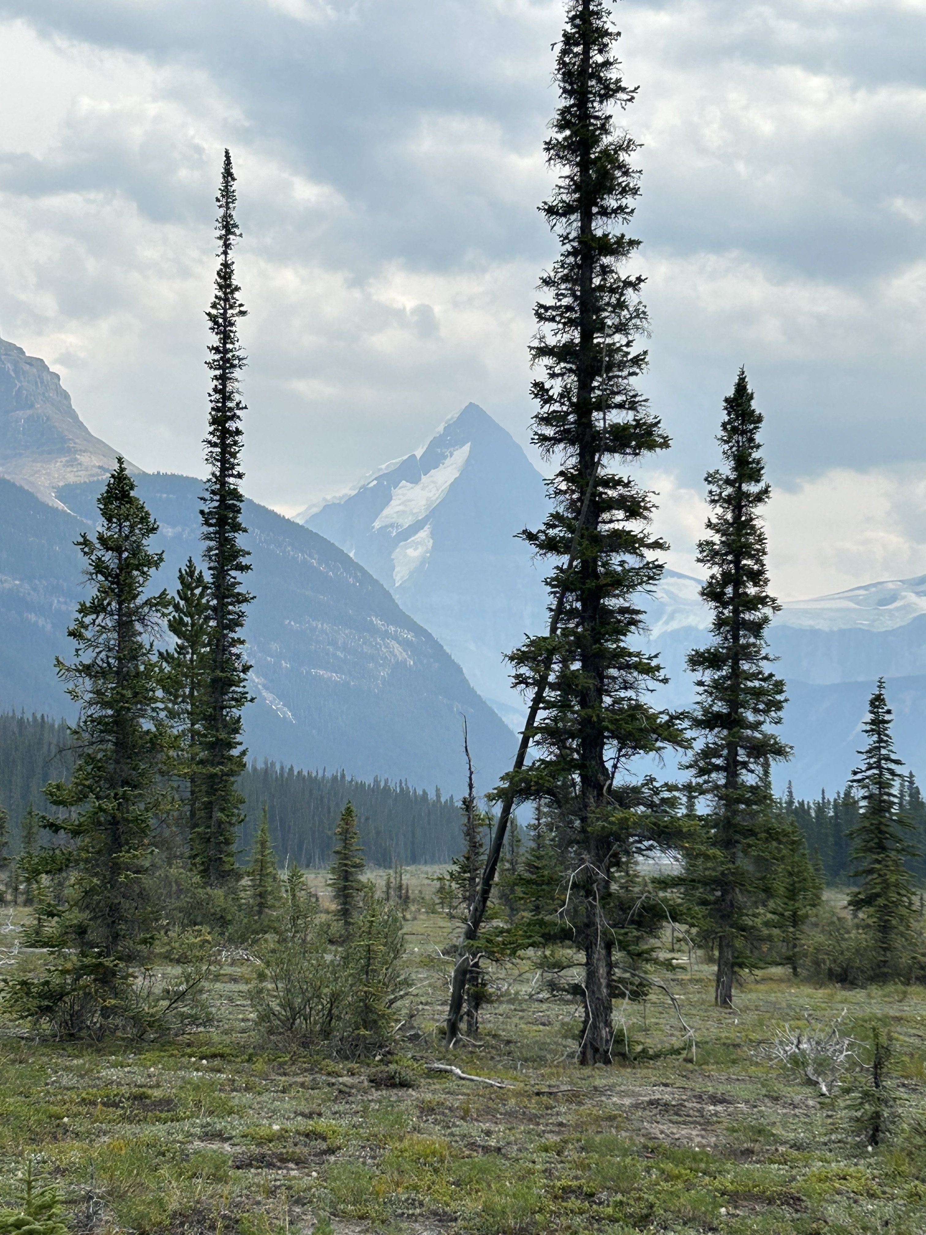
Let the scenic river cruise begin... The Athabasca Bar Crawl!
Miles later this is still the alluvial fan coming out of Habel Creek and the Black Hole. We thought the whole thing was going to be connecting stuff like this.
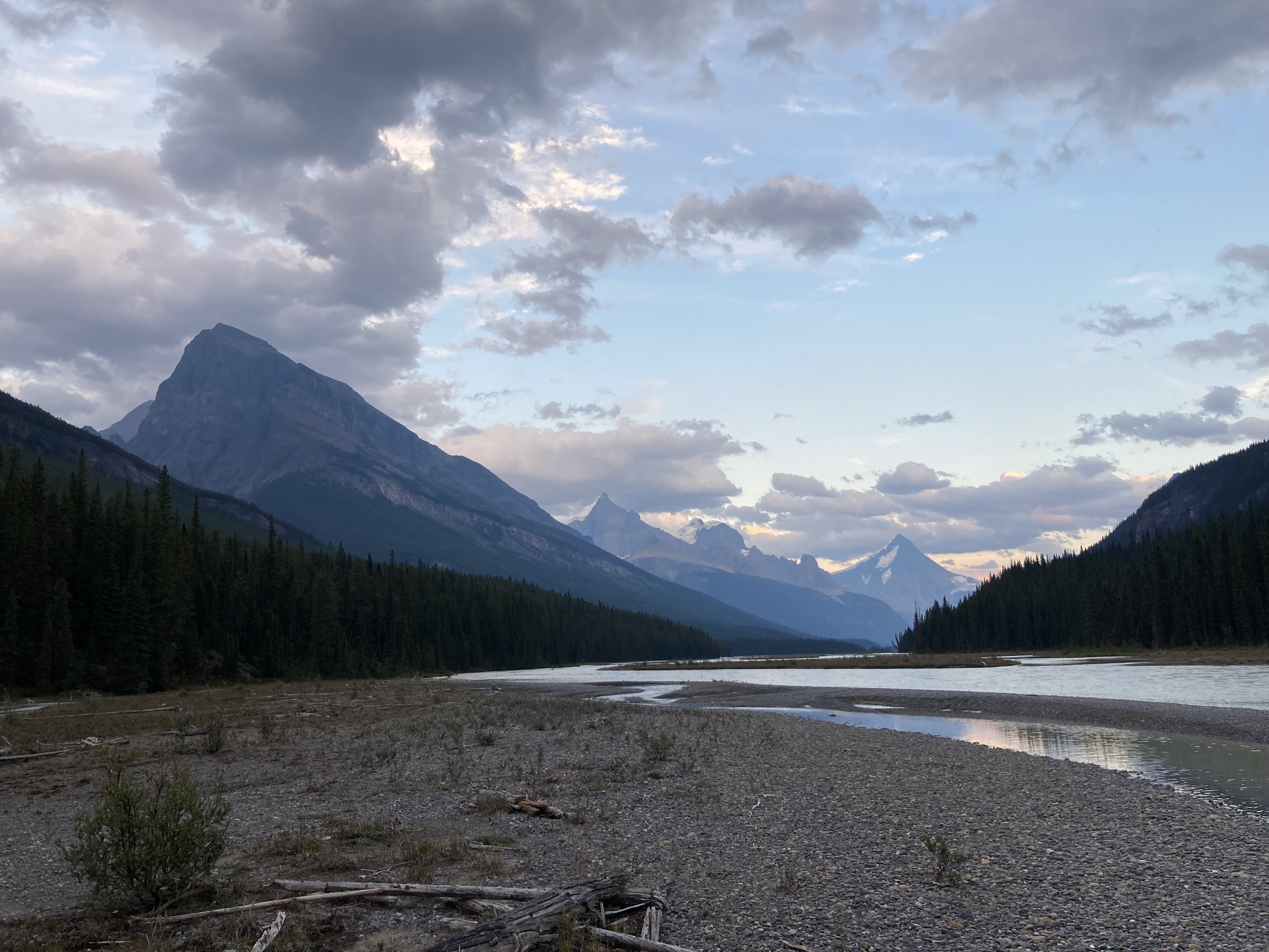
River views back towards Columbia.
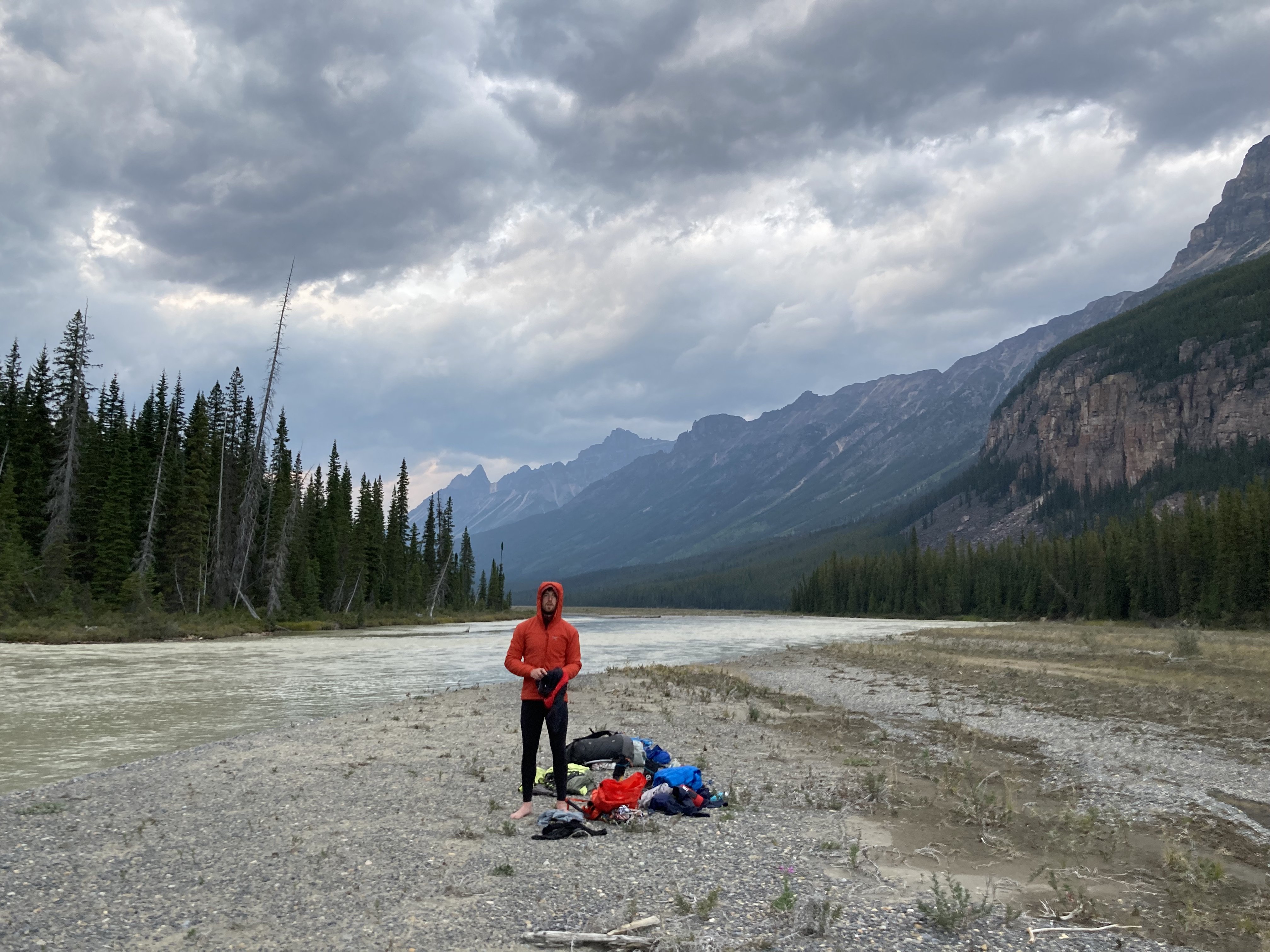
Dallin avoiding mosquitoes at our camp location for the night. He's wearing full alpine winter kit despite the fact that it's like 70F.
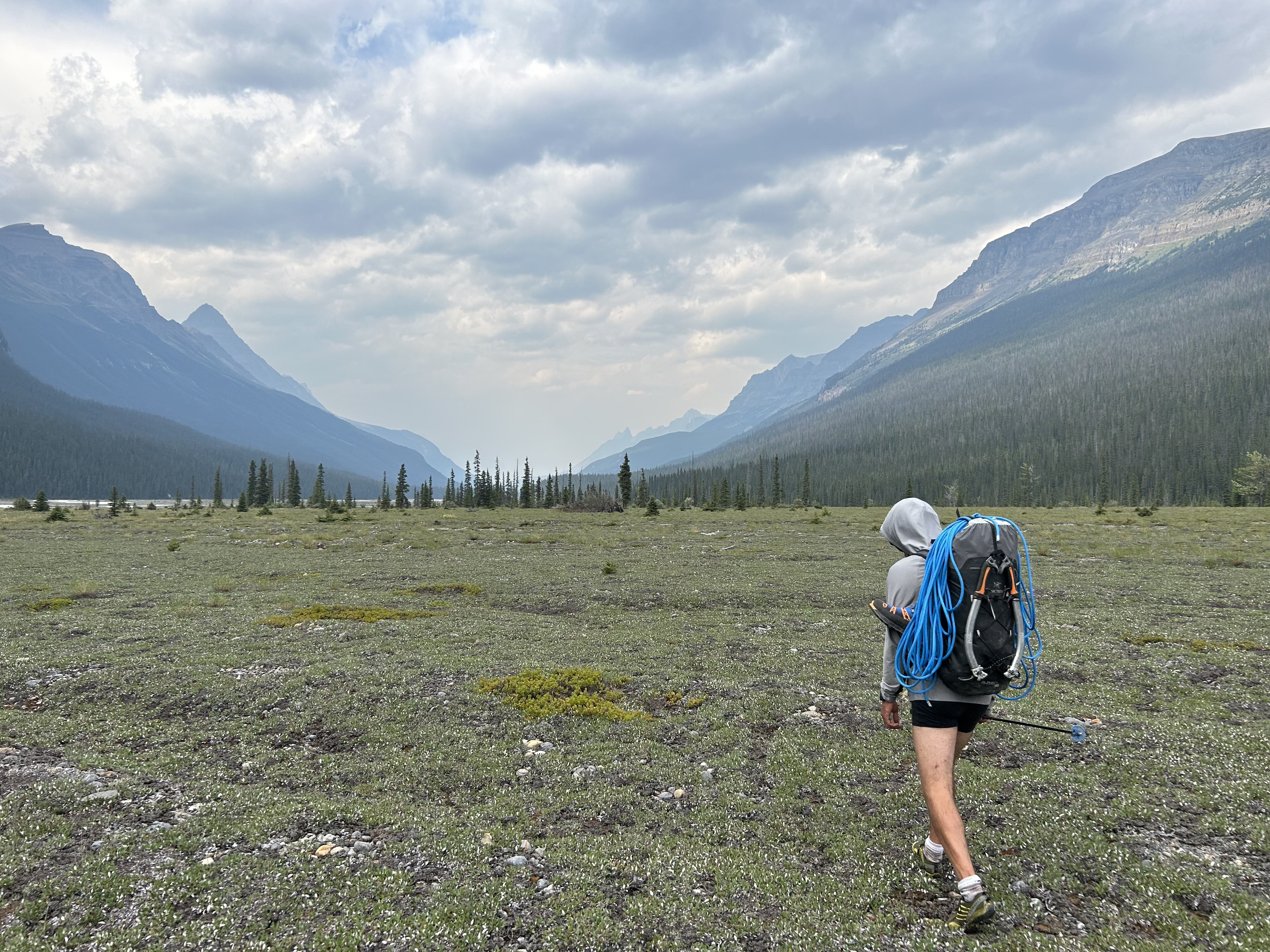
Following what we called the Moose Highway. There were clearly many moose. Also bears. We did not see them, thankfully. But their tracks were numerous. Dallin almost stepped on a porcupine the size of a golden retriever. I may be exaggerating that last bit, but it was huge.
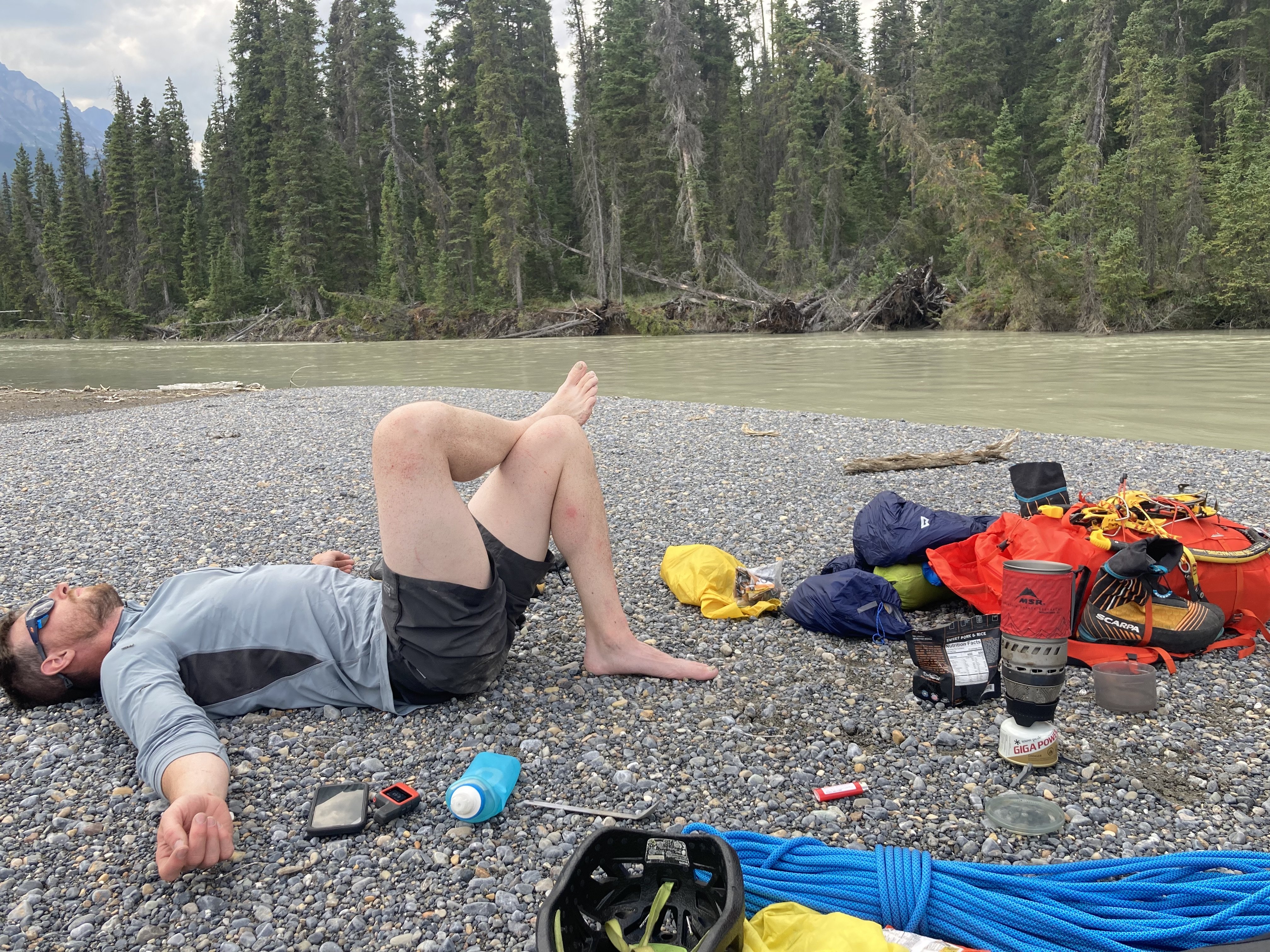
Dallin at a rest stop on a gravel bar. Kinda speaks for itself.
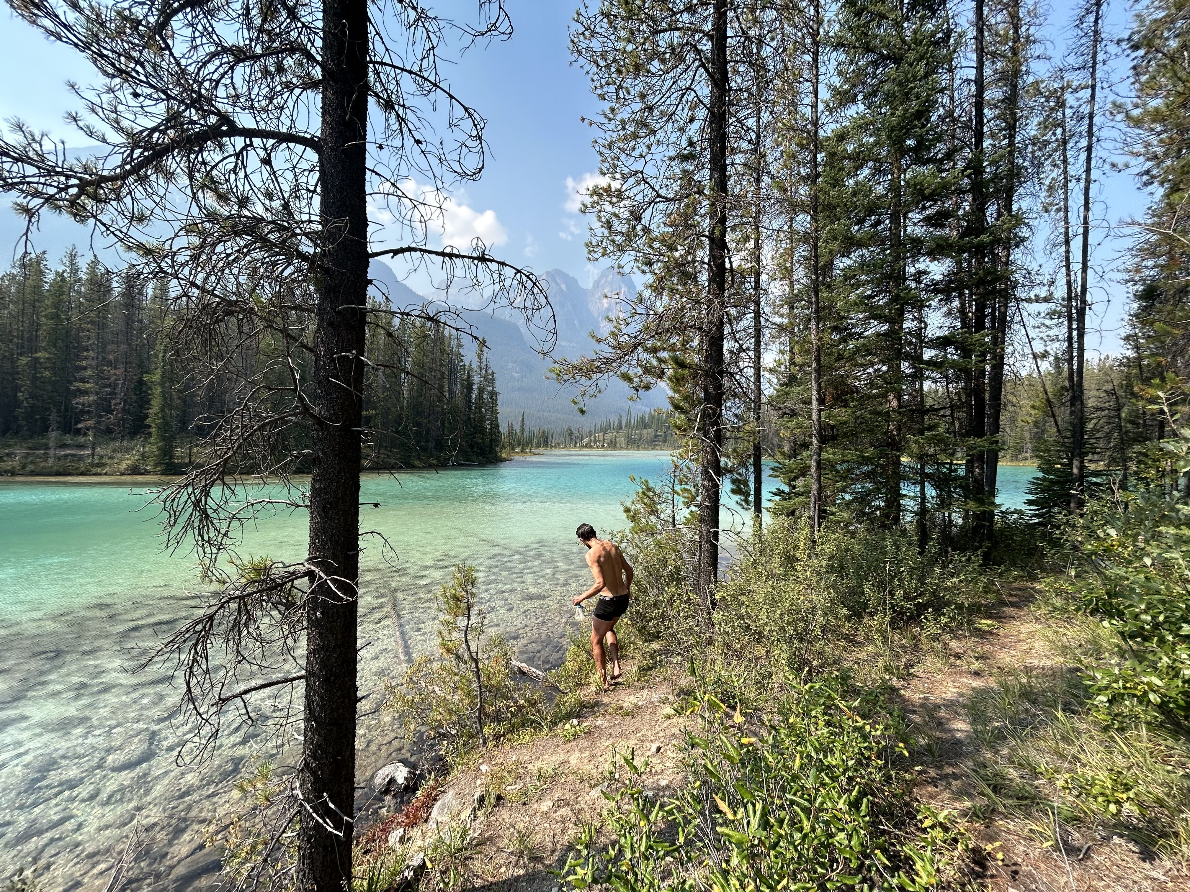
Swimming at a cold lake shortly after hitting the trail. Glory, glory, we are free at last!
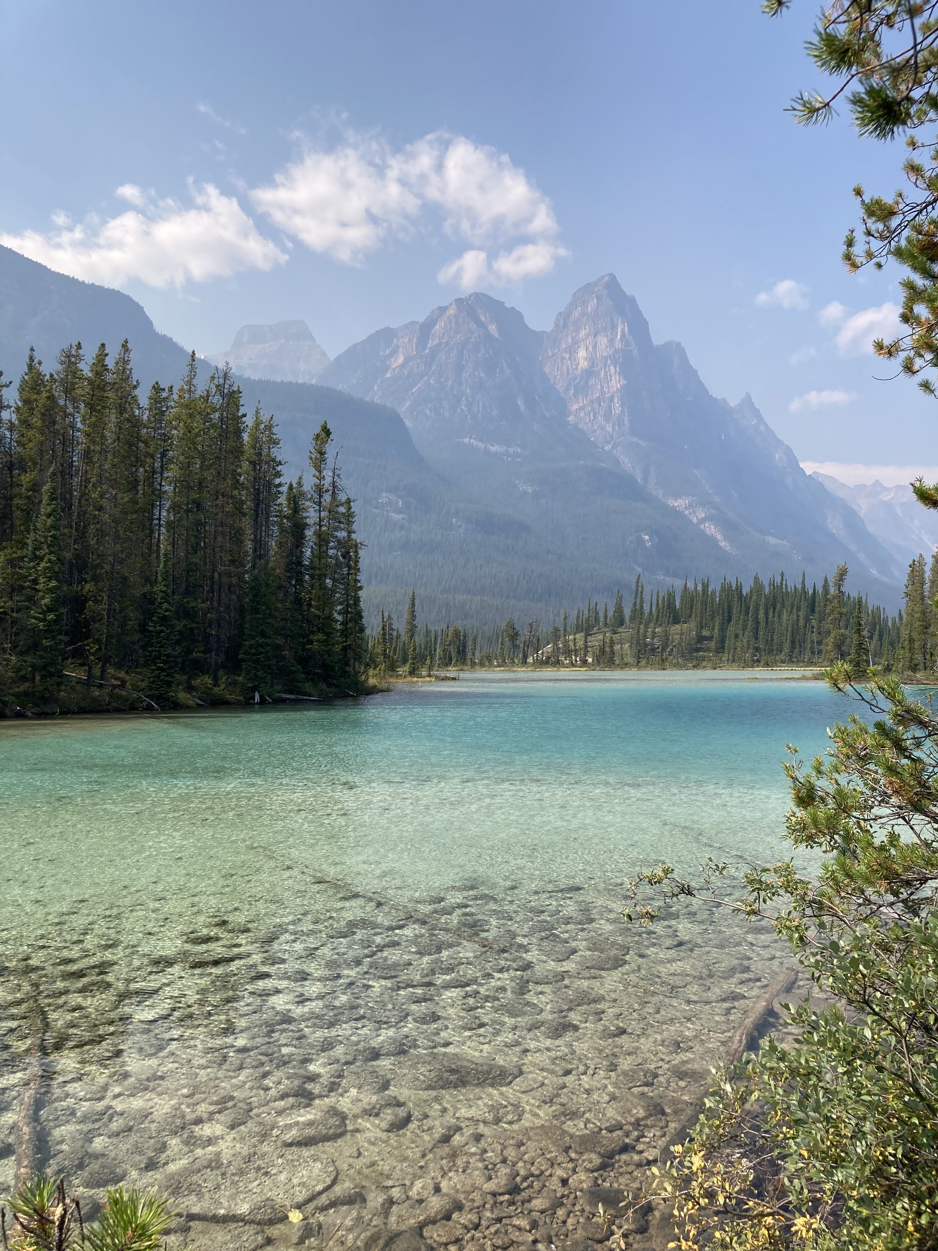
The lake was pretty. Then we walked a bunch more. Then it was over and we didn't die. The end.
-
2
-
3
-
2
-
-
It's so good. One of my favs in the Cascades for sure.
-
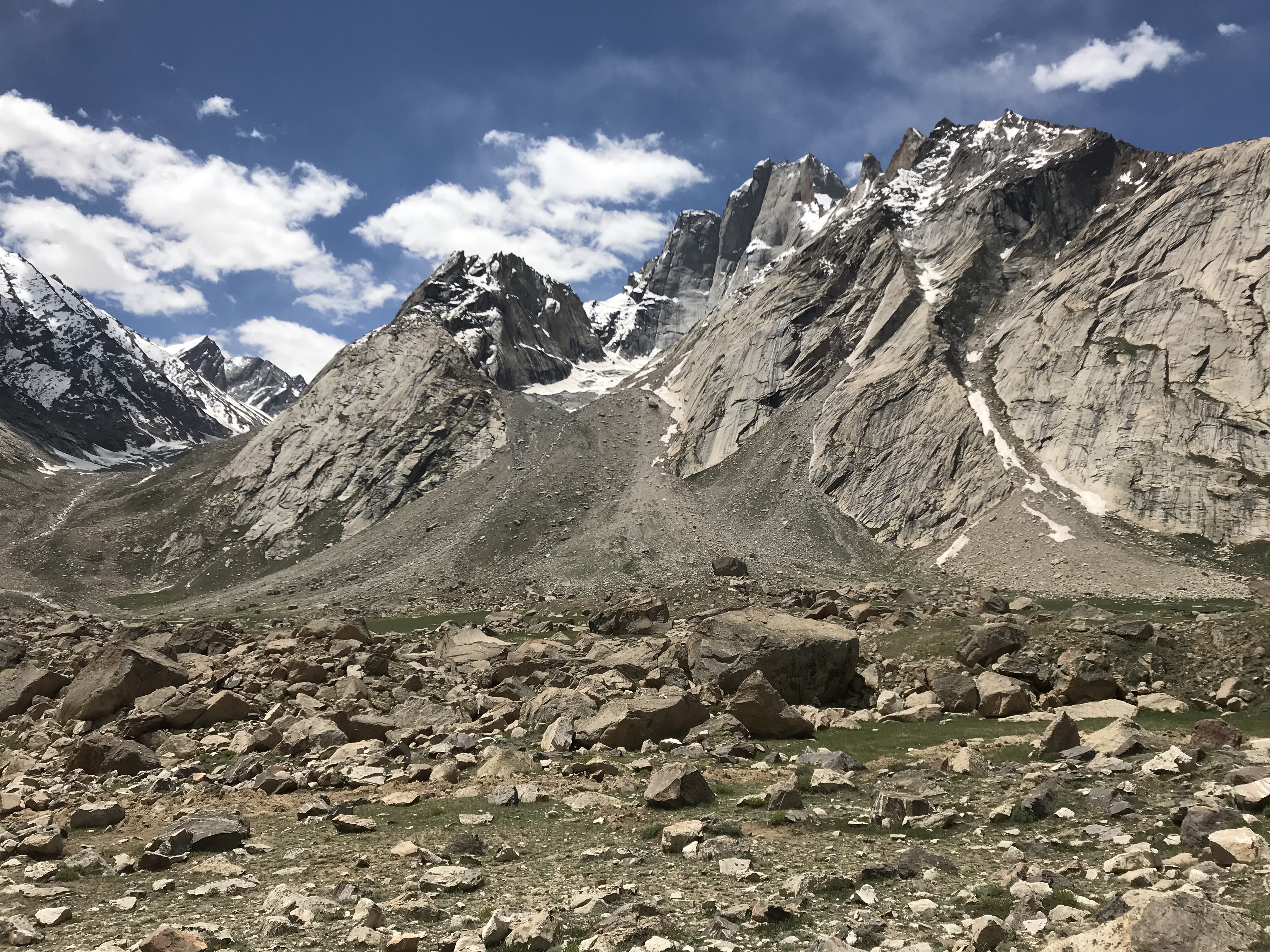
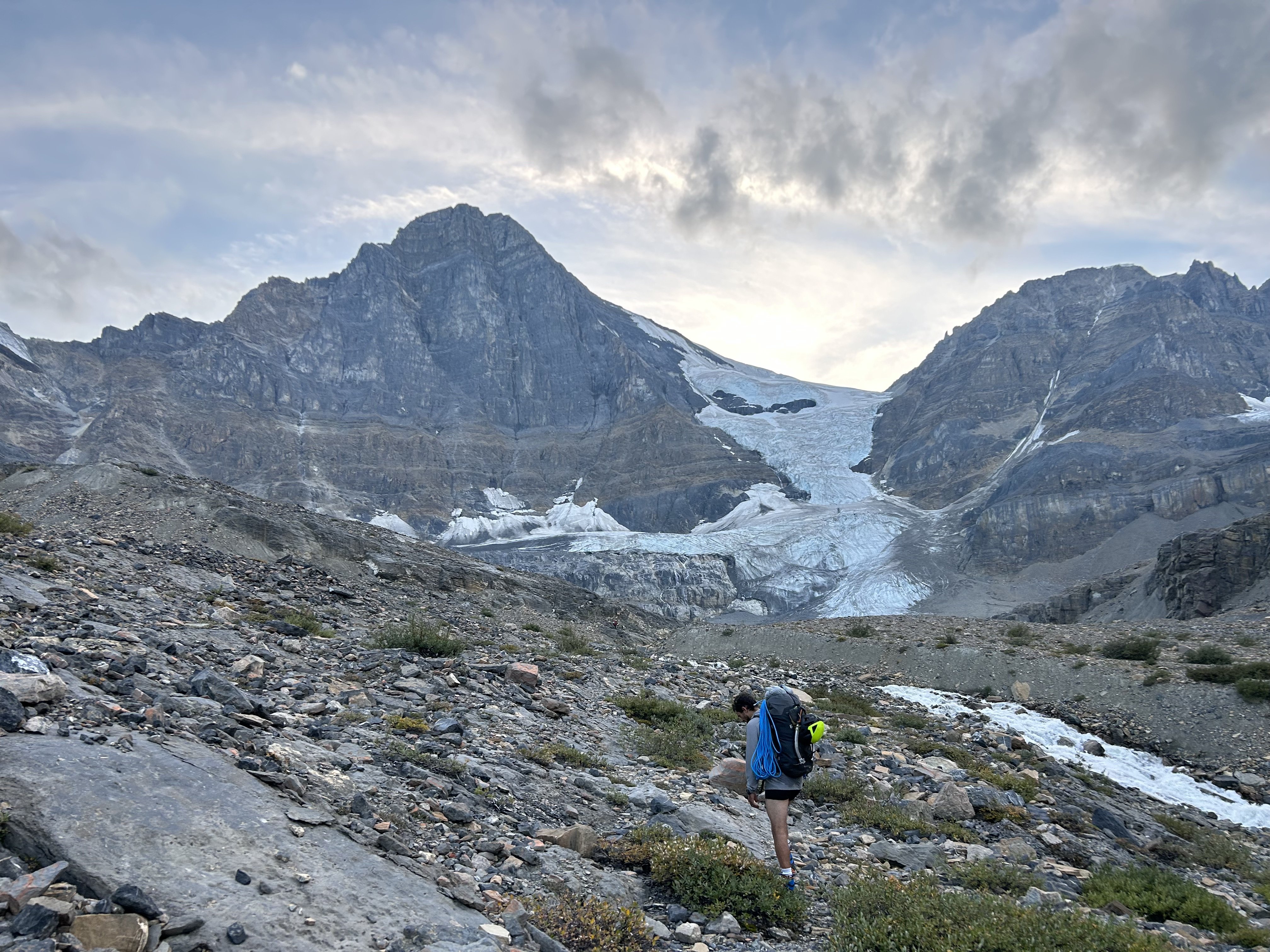
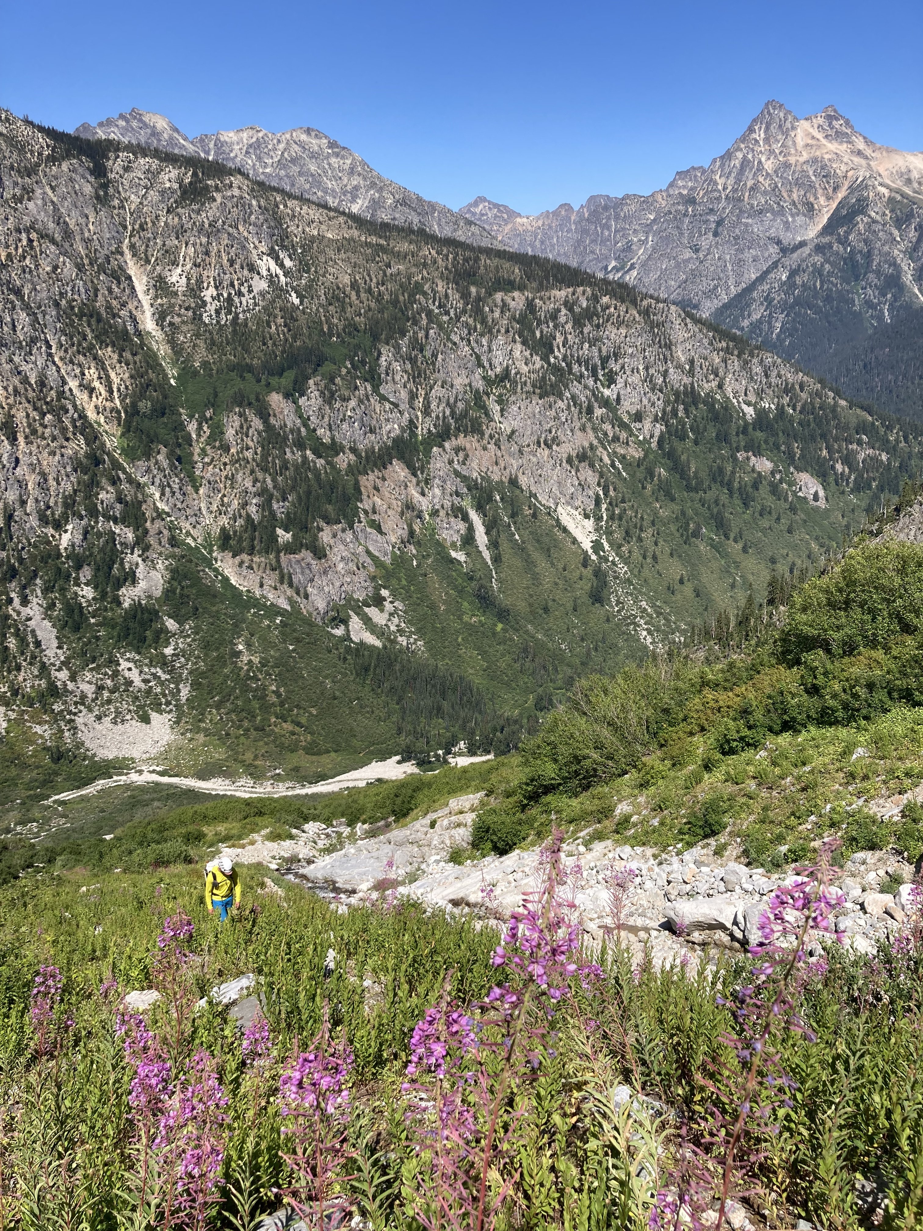
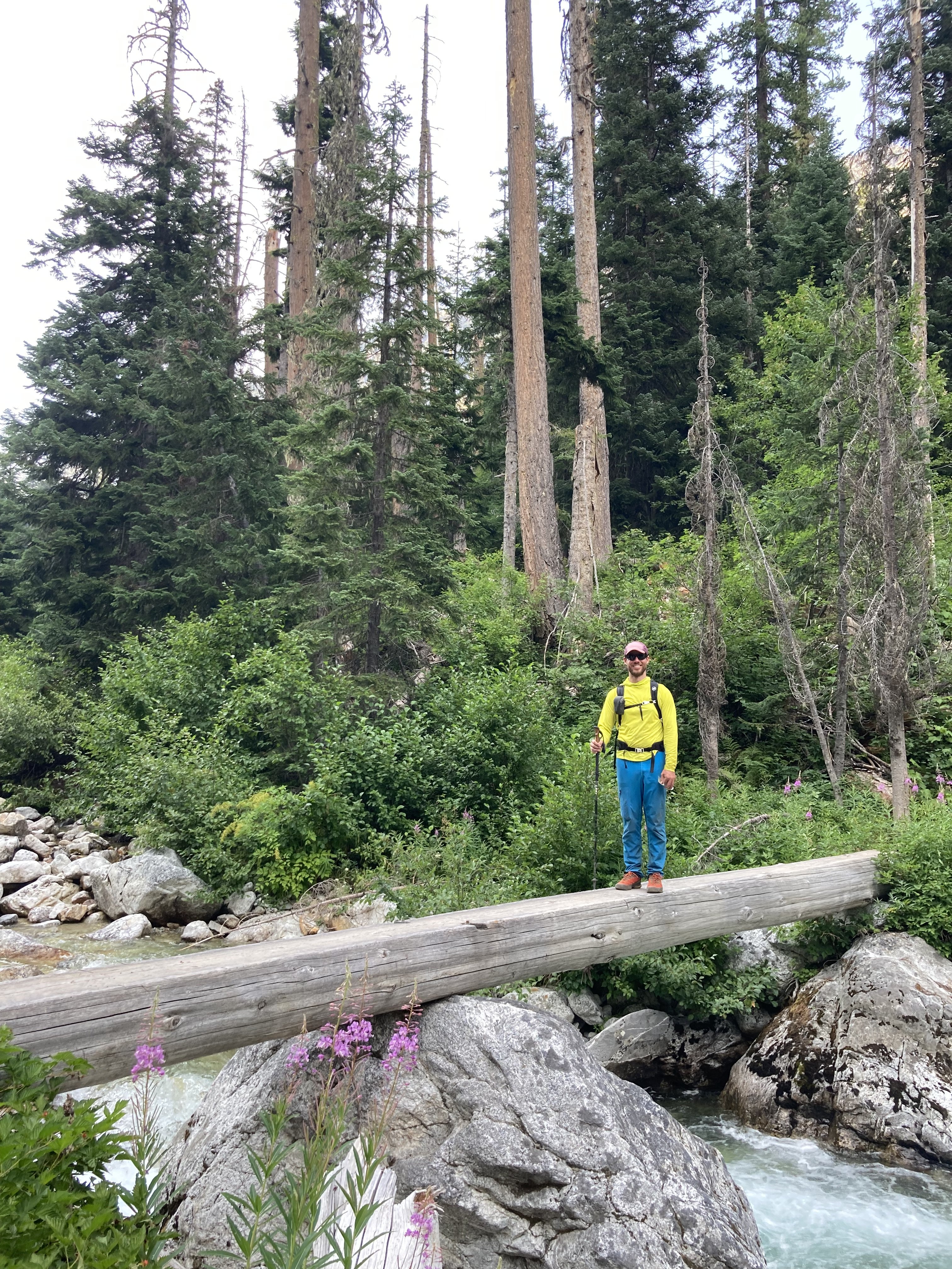
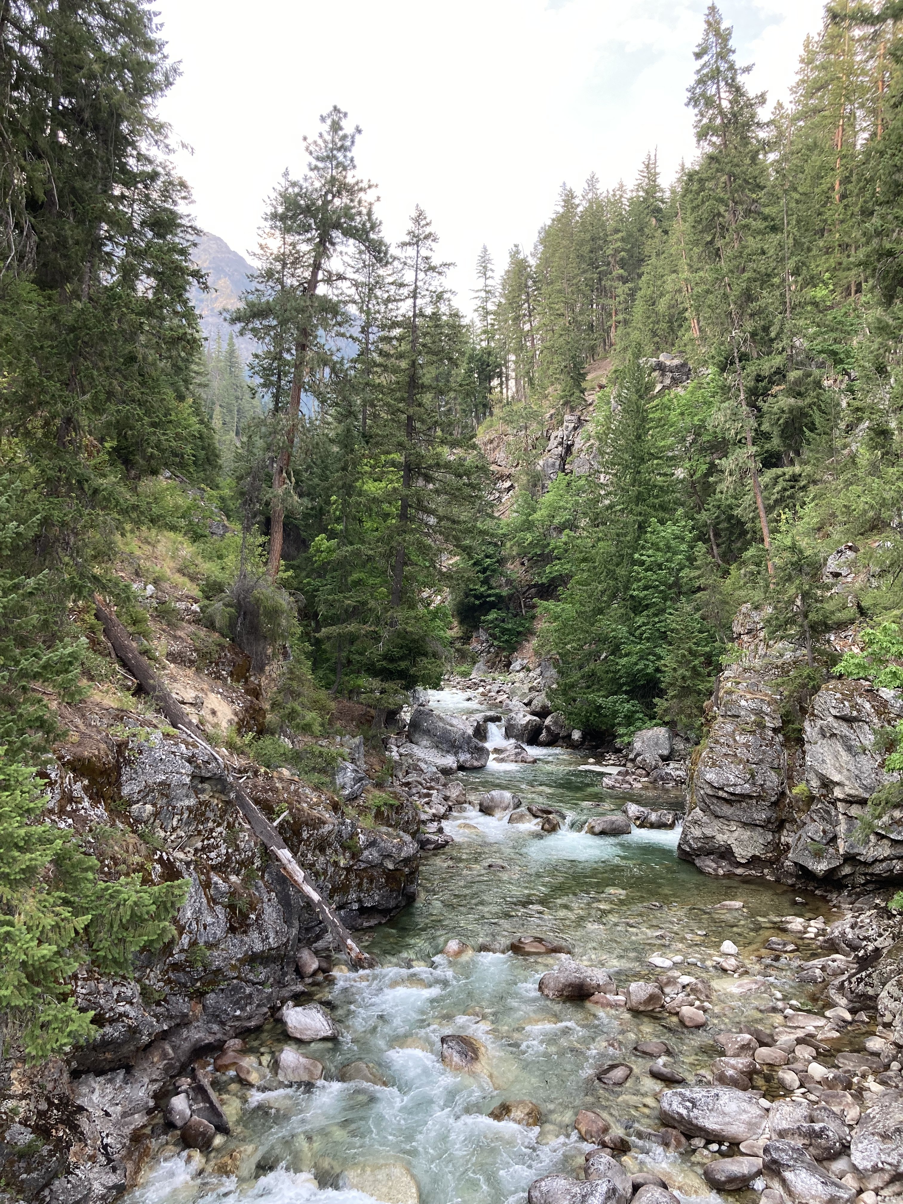
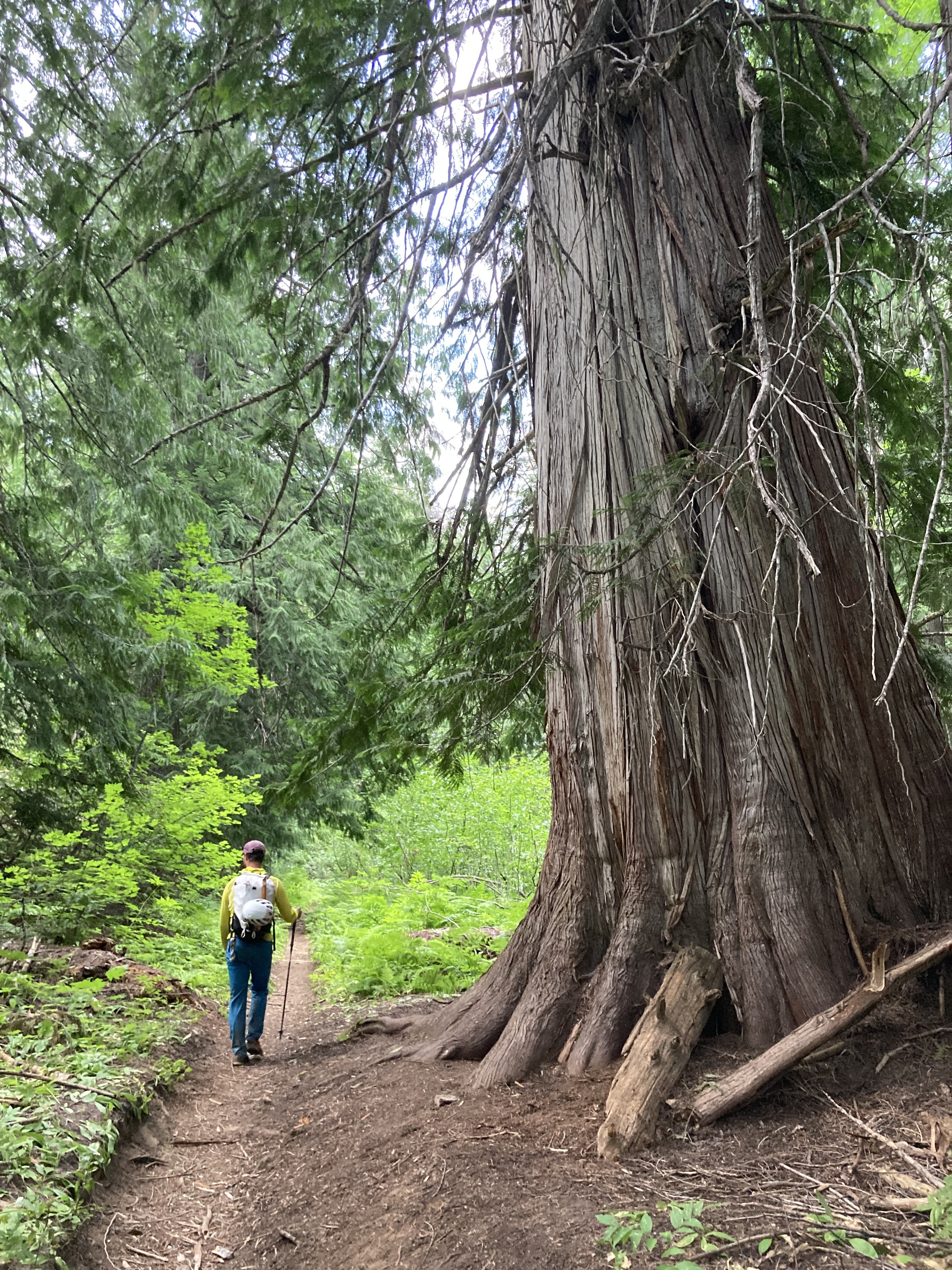
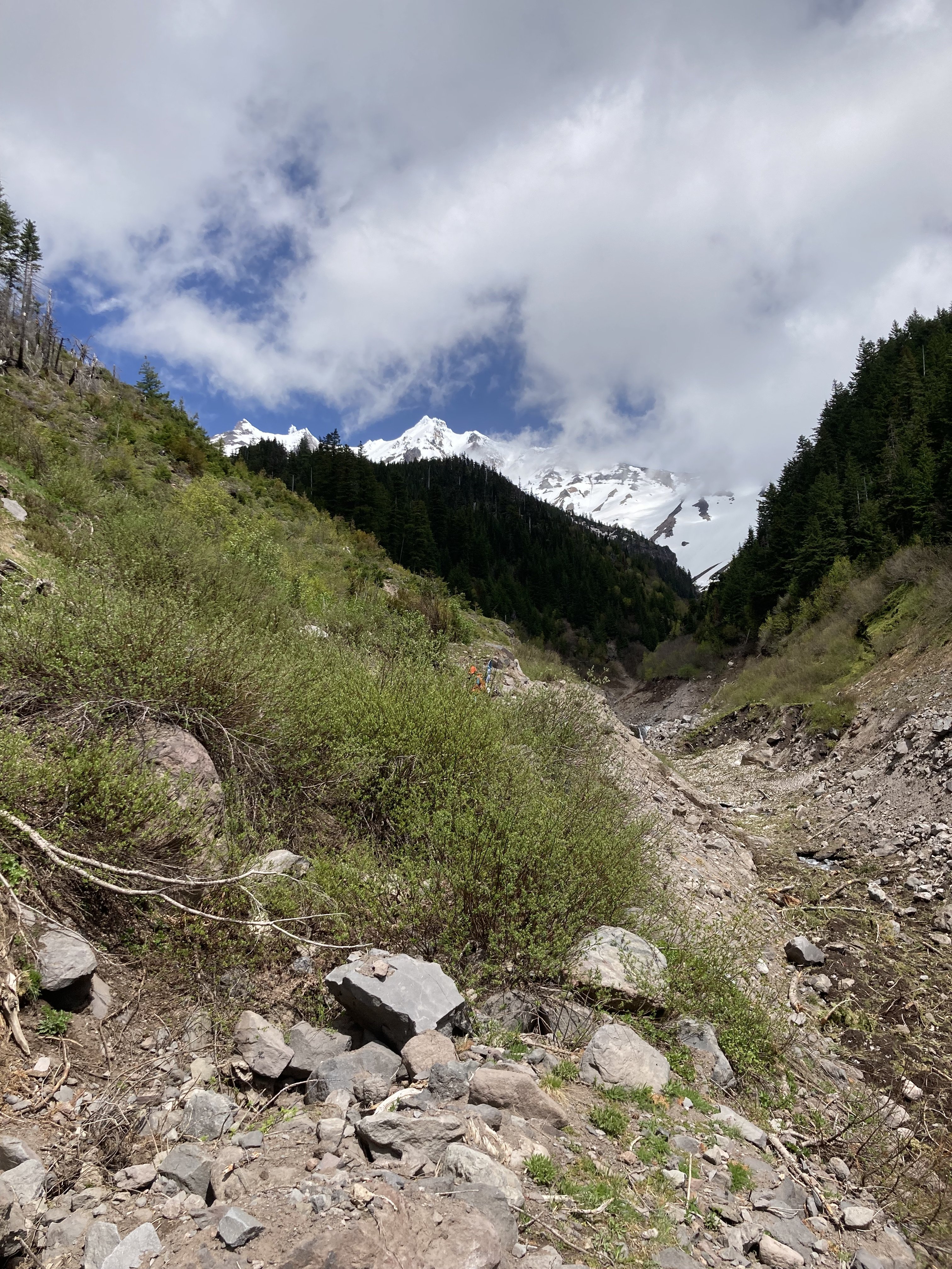
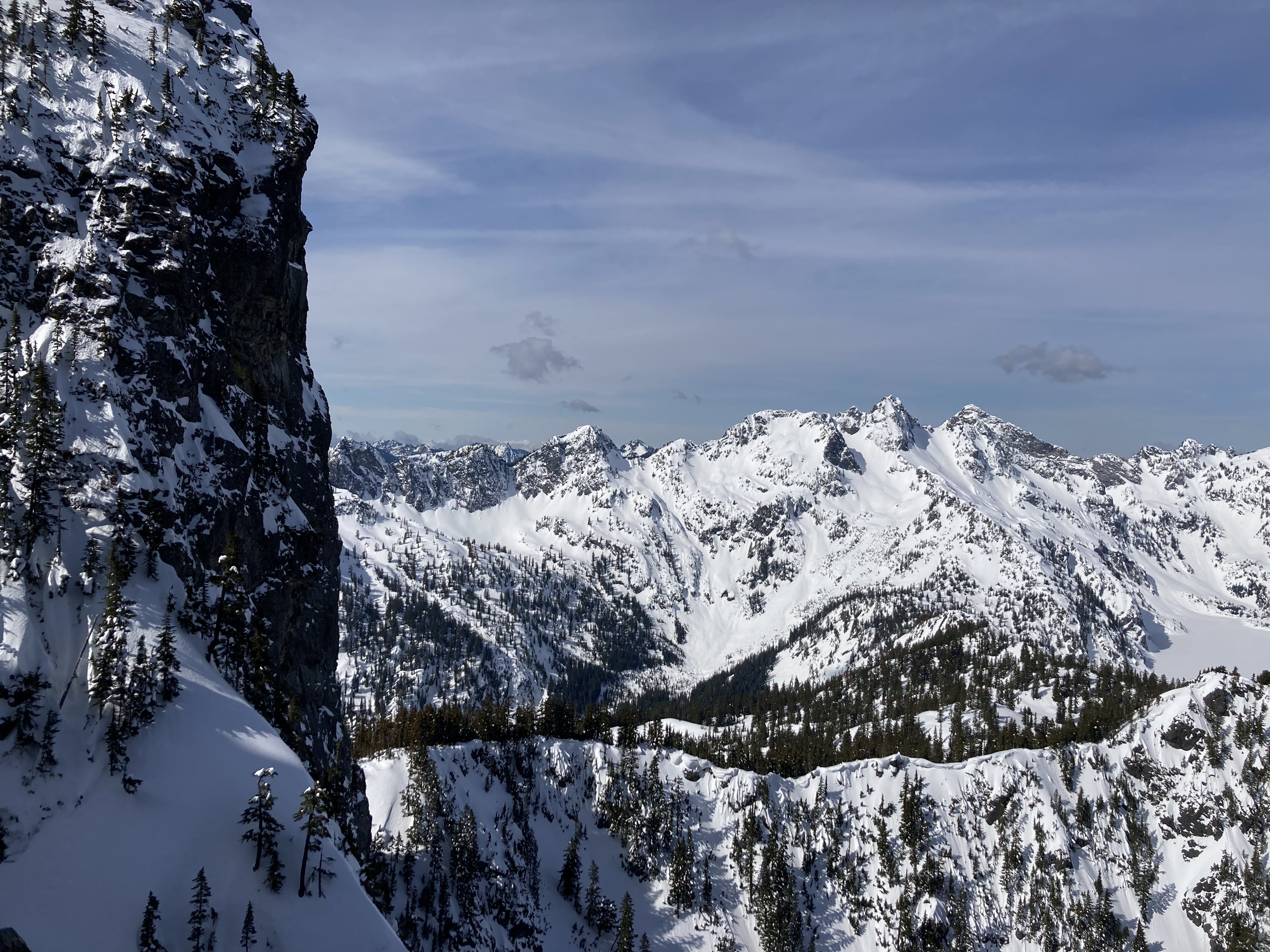
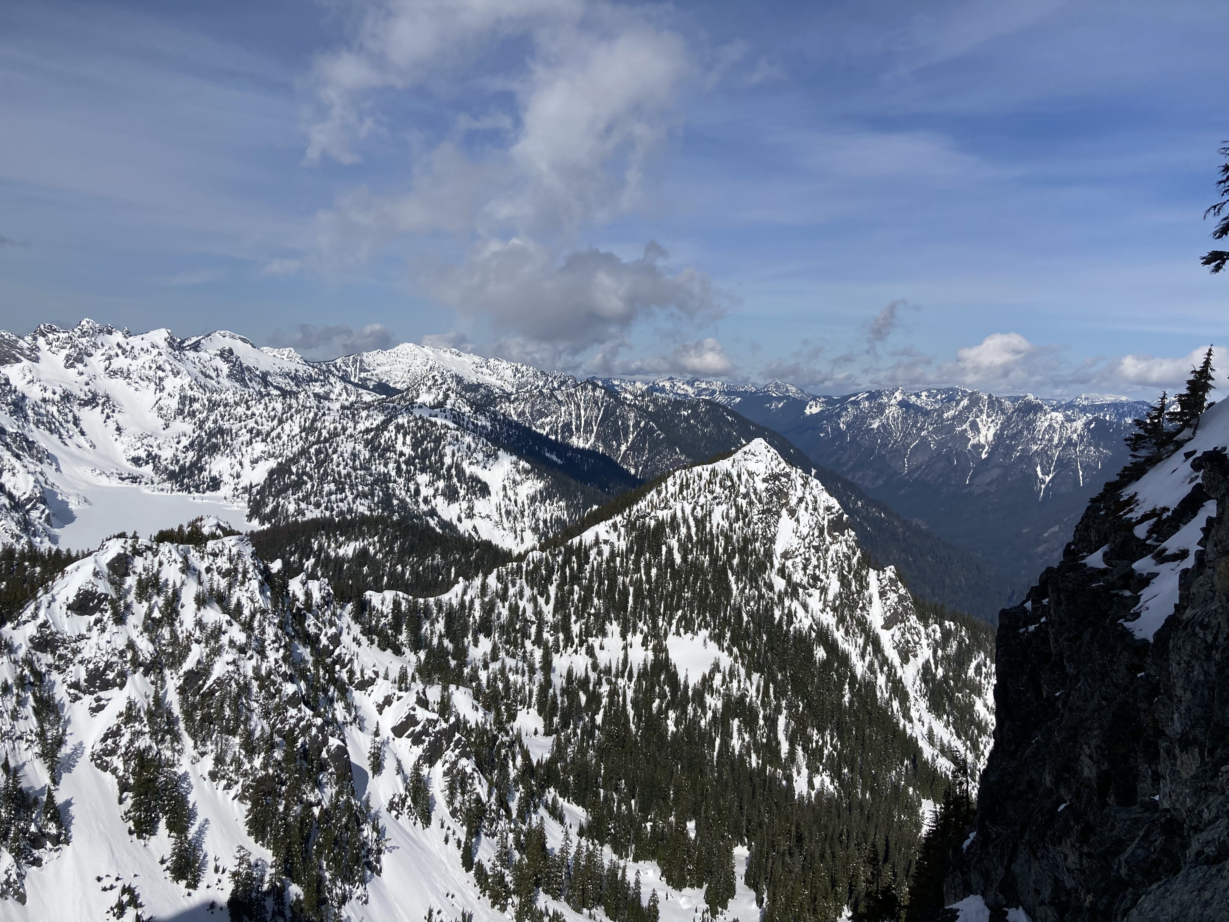
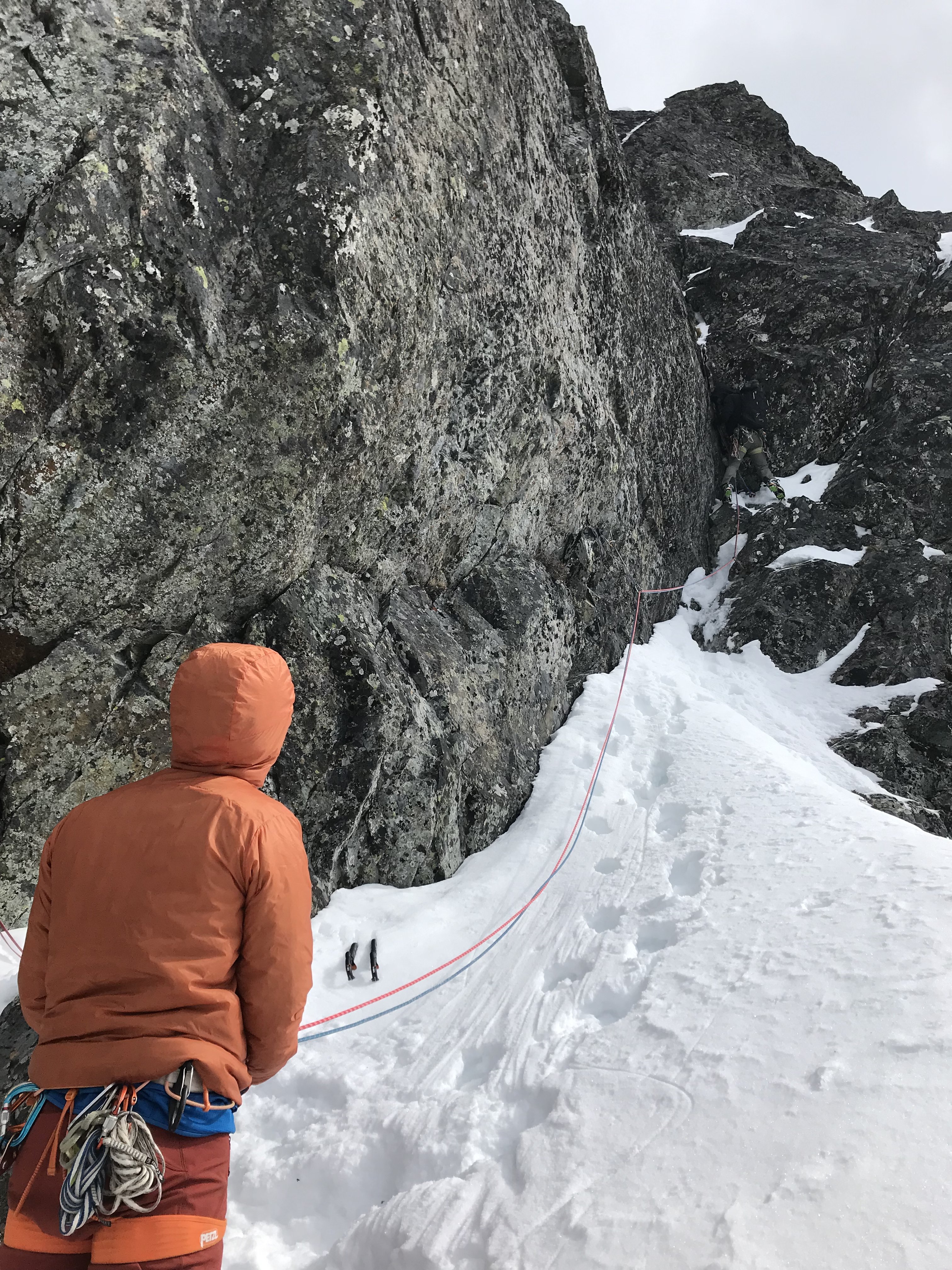
Trip: Goode - NE Butt
Trip Date: 08/03/2023
Trip Report:Kyle Tarry and I climbed this peak in two days from Rainy Pass Aug 3-4.
Day 1: Hike to bivy sites below the glacier and scope the glacial approach.
Day 2: Climb the route (6x simul pitches), descend to Park Creek and hike back to Rainy Pass, arriving at 1am... should have probably just stopped to sleep somewhere.
Pictures:
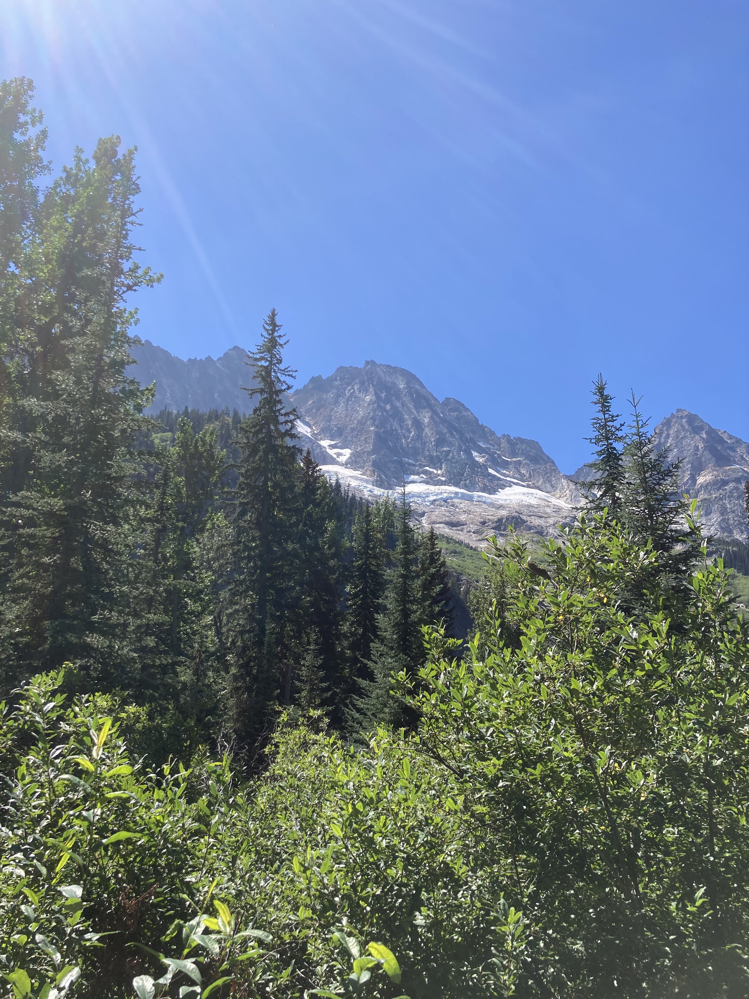
Goode from North Fork
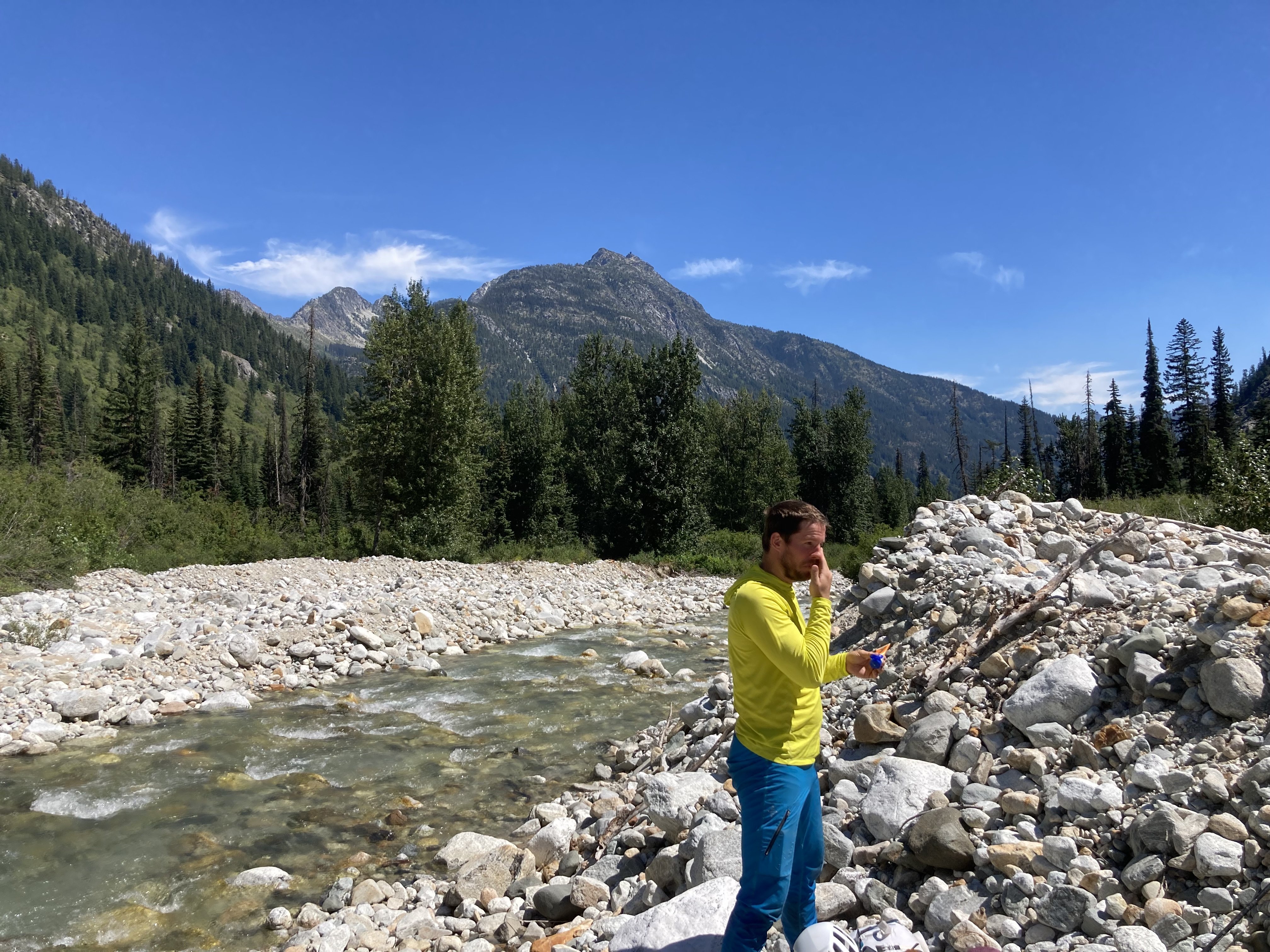
Kyle at the NF creek crossing.
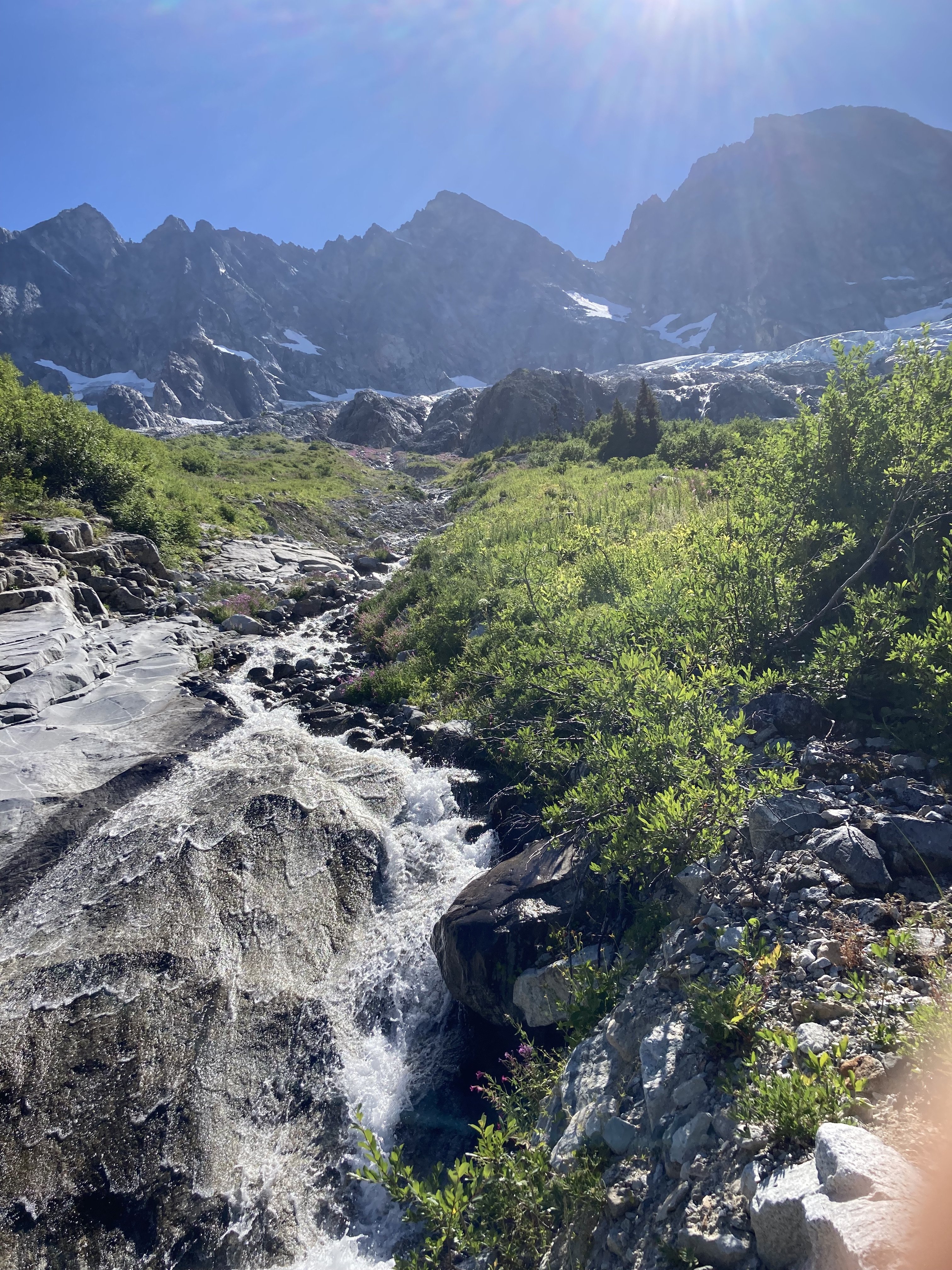
Hiking up to the bivies, surprisingly chill trail through the slide alder.
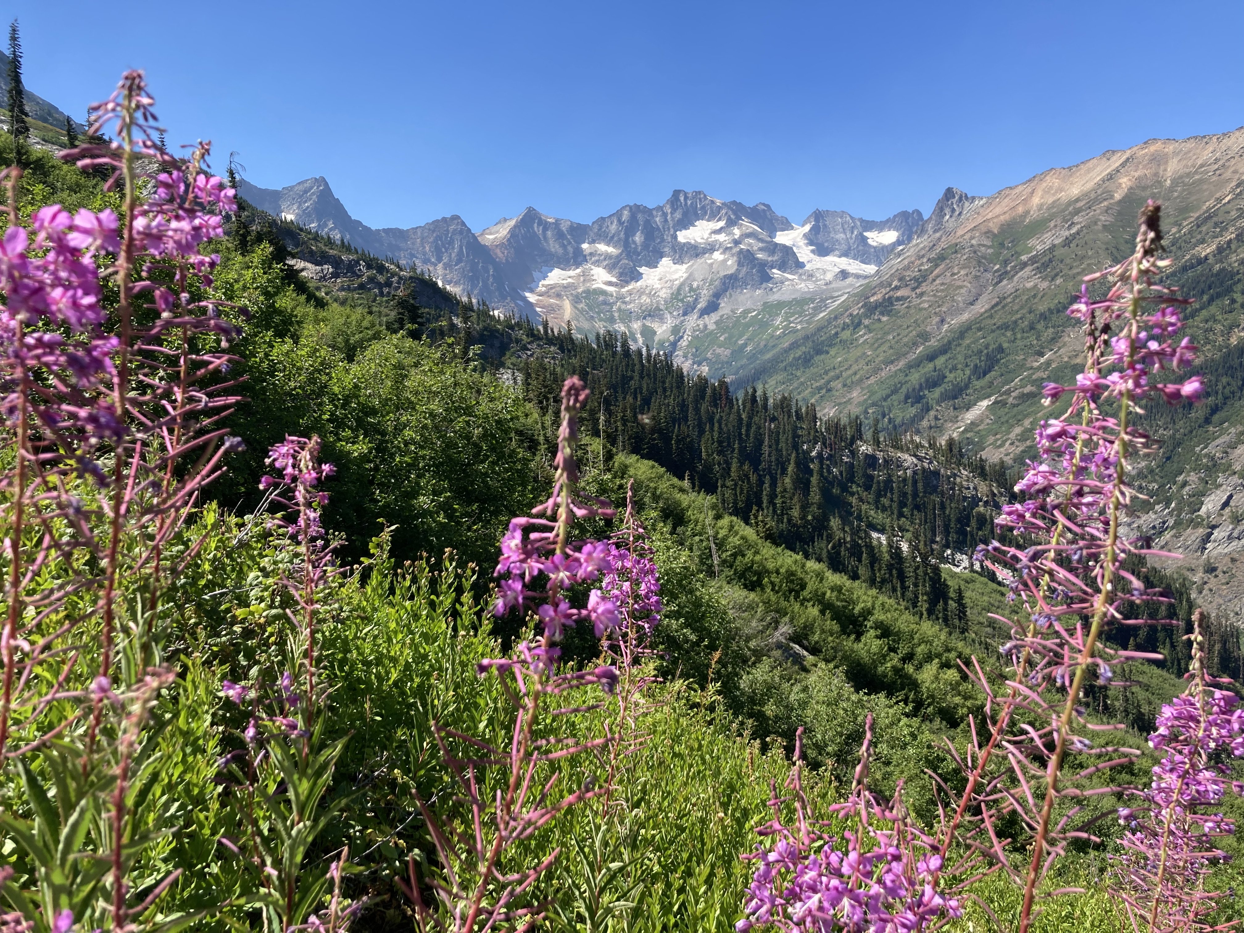
Logan and Fireweed
Kyle slogging in the heat. Minimal schwackage though.
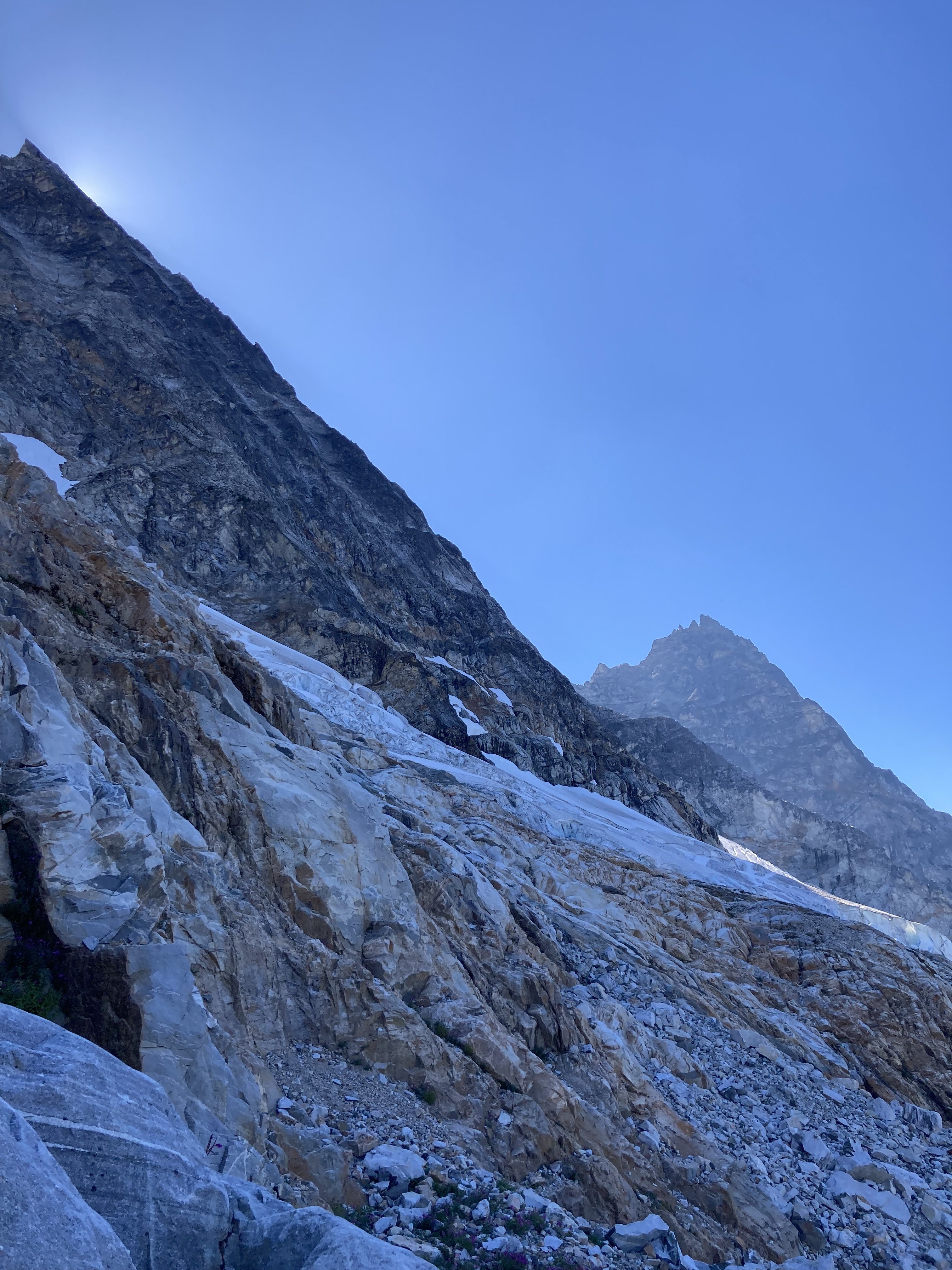
Scoping the glacier and lower route.
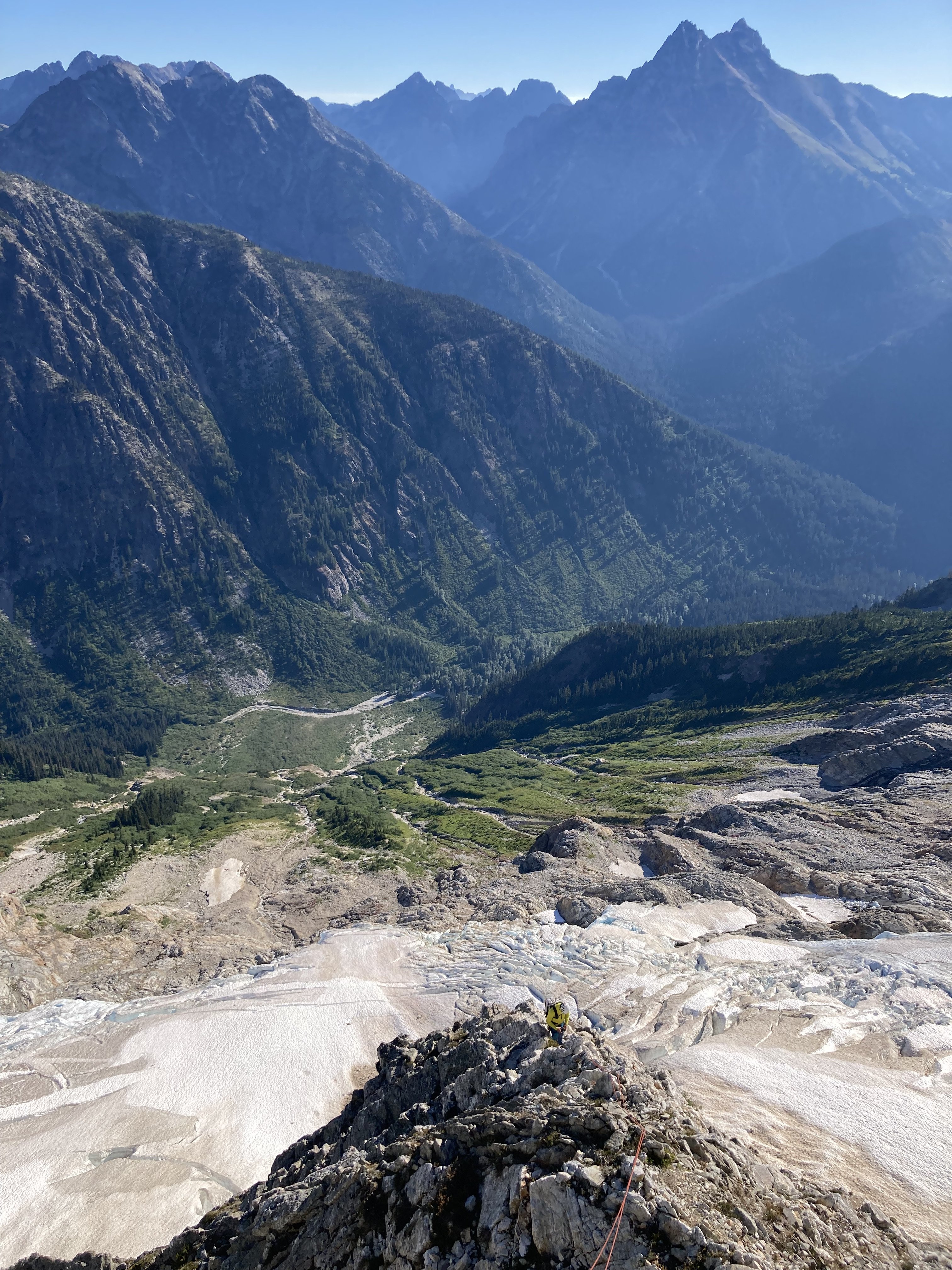
Kyle low on route, 2nd simul pitch next morning.
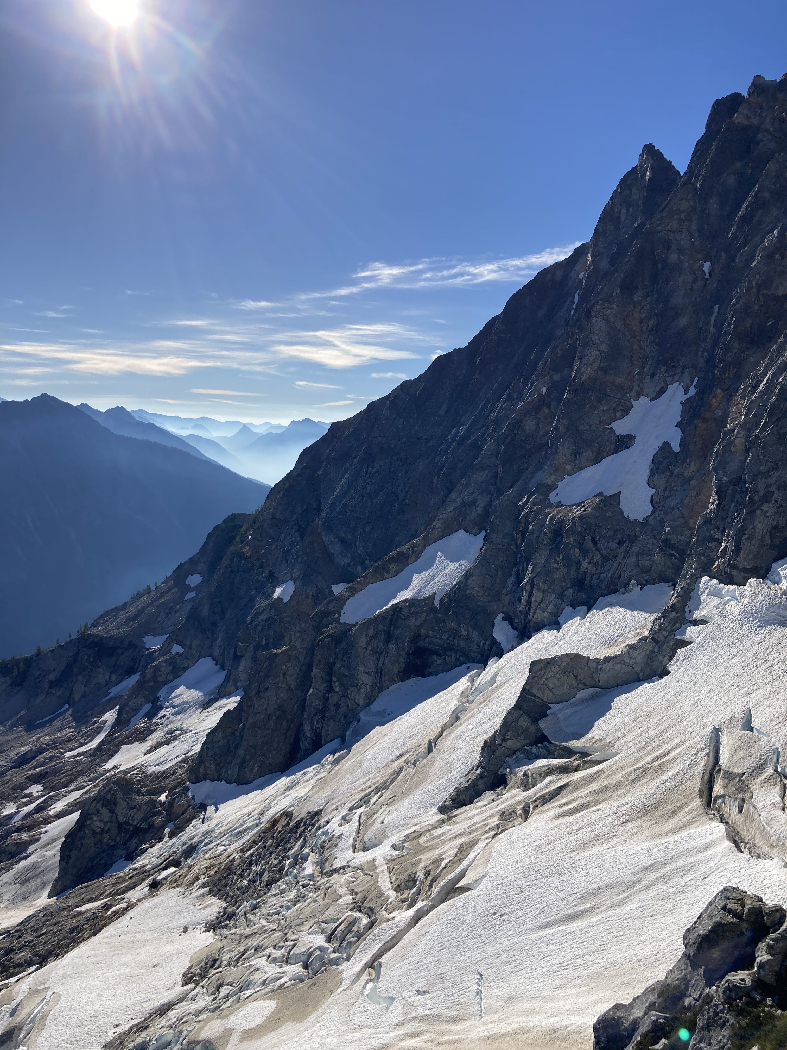
View E off ridge.
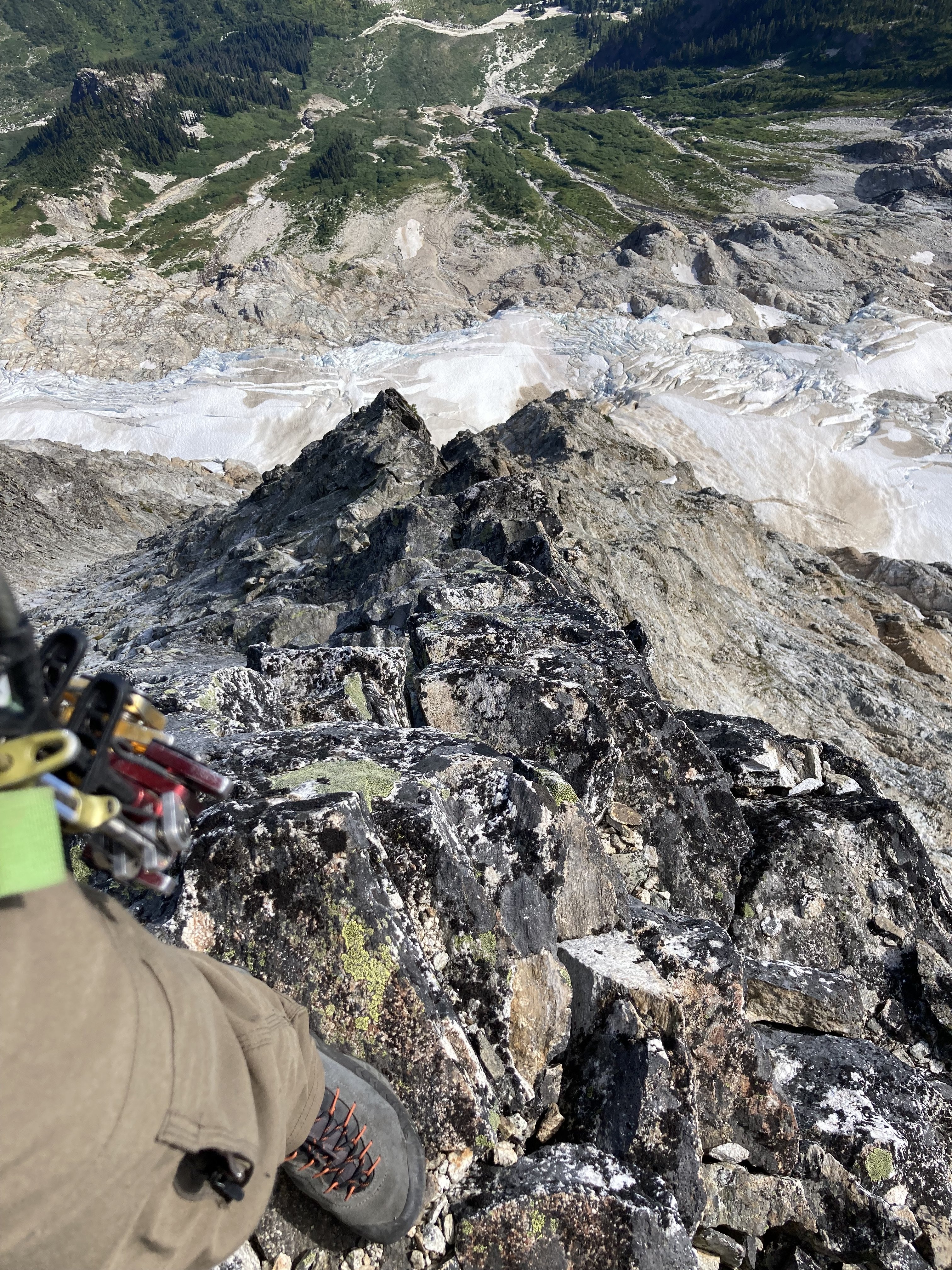
More scrambling with the rope on.
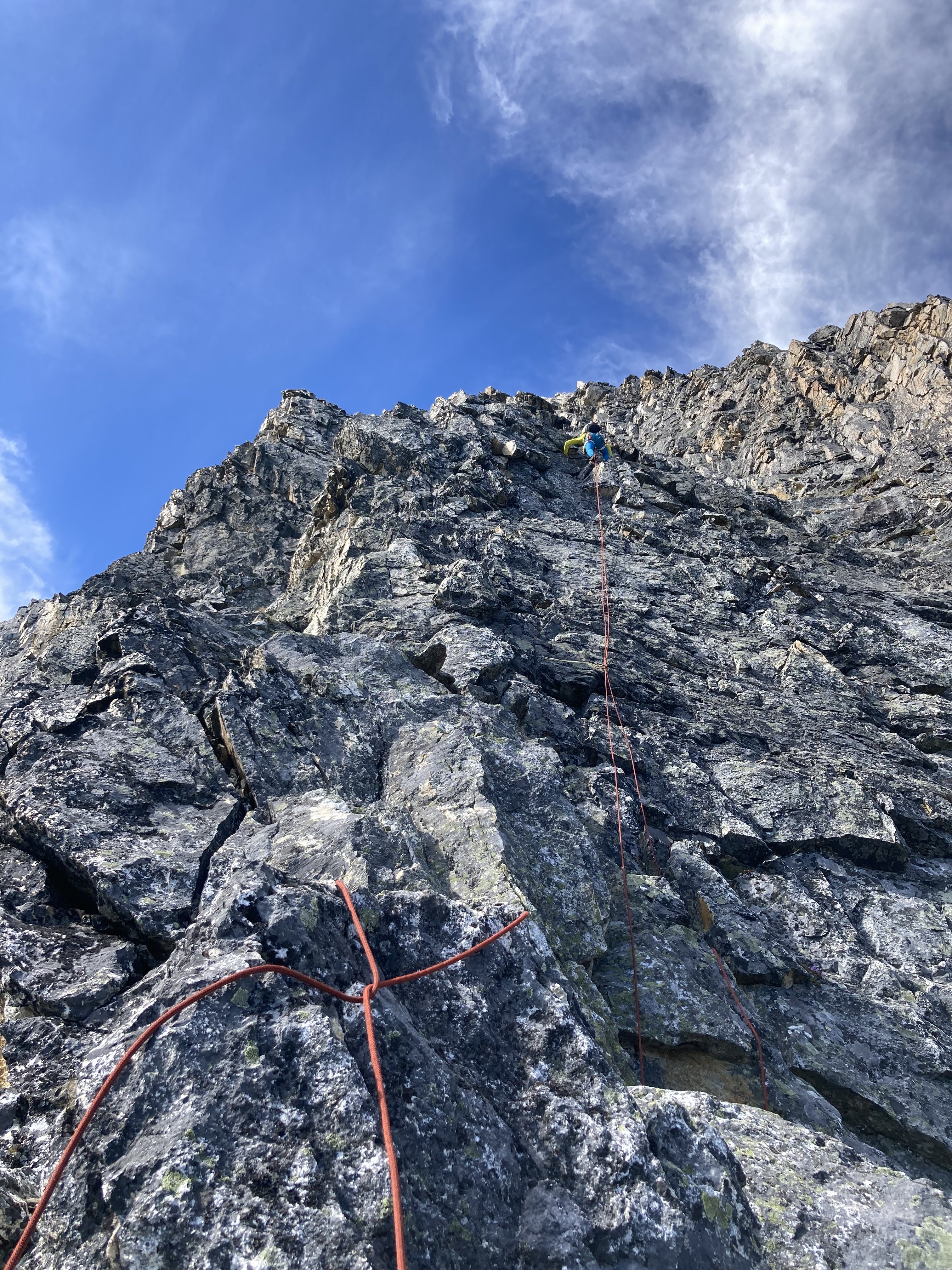
Kyle romping... rope is less jengis than it appears.
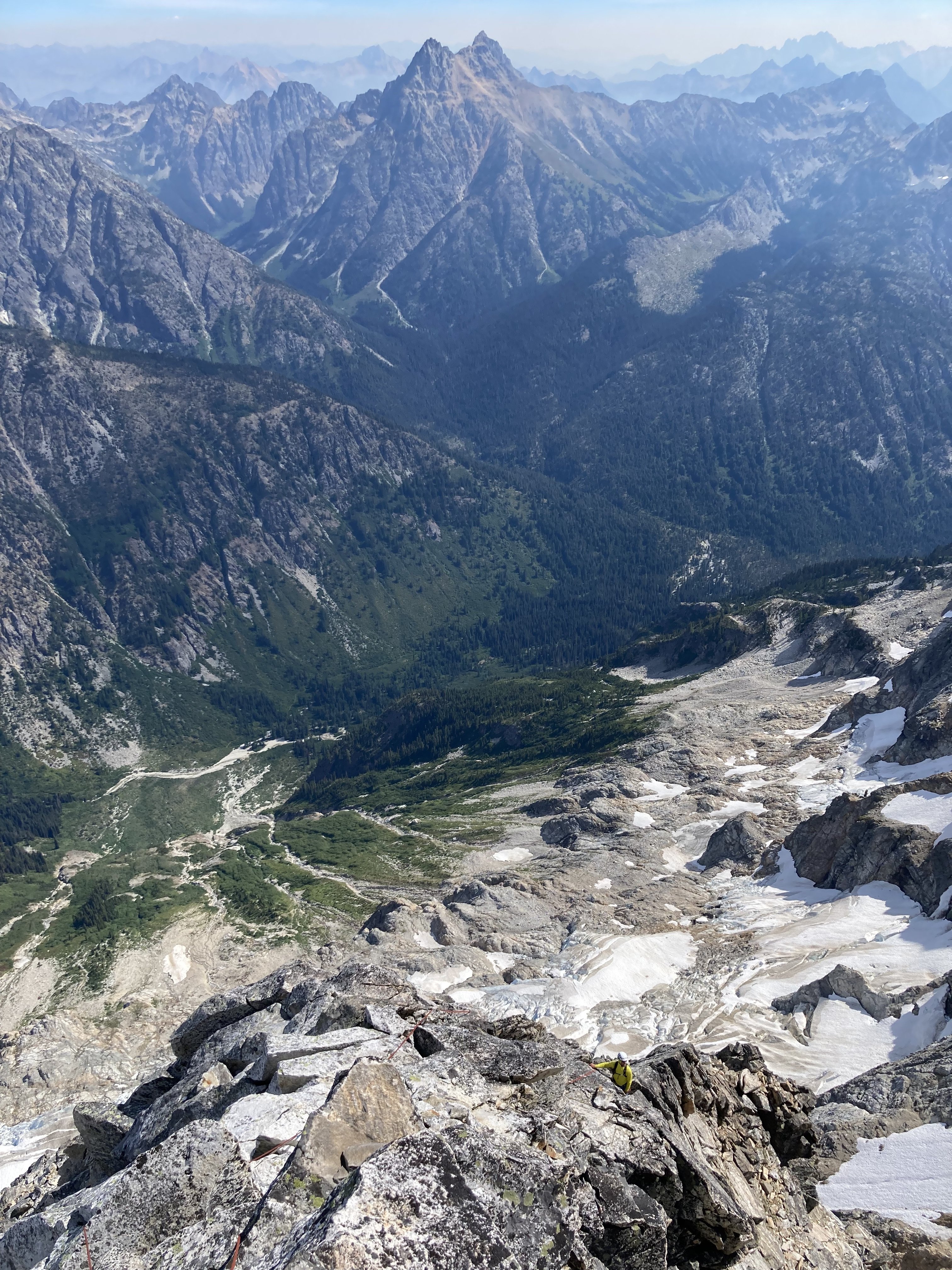
Even more scrambles.
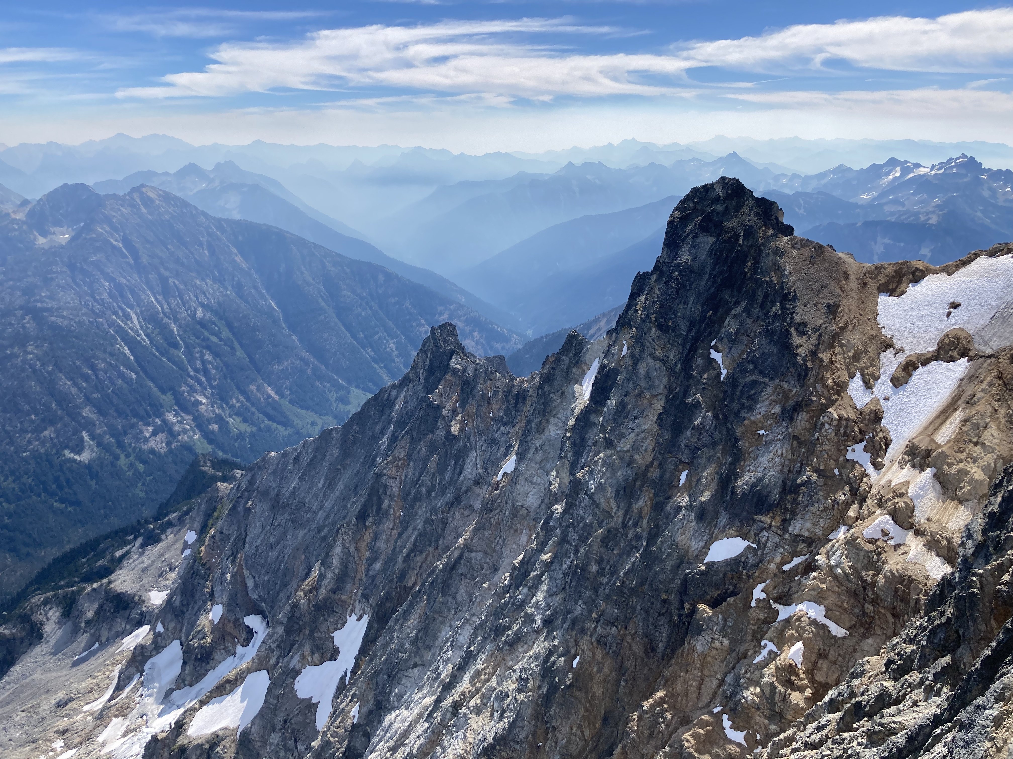
Choss f*$&ery on what I assume is upper Megalodon?
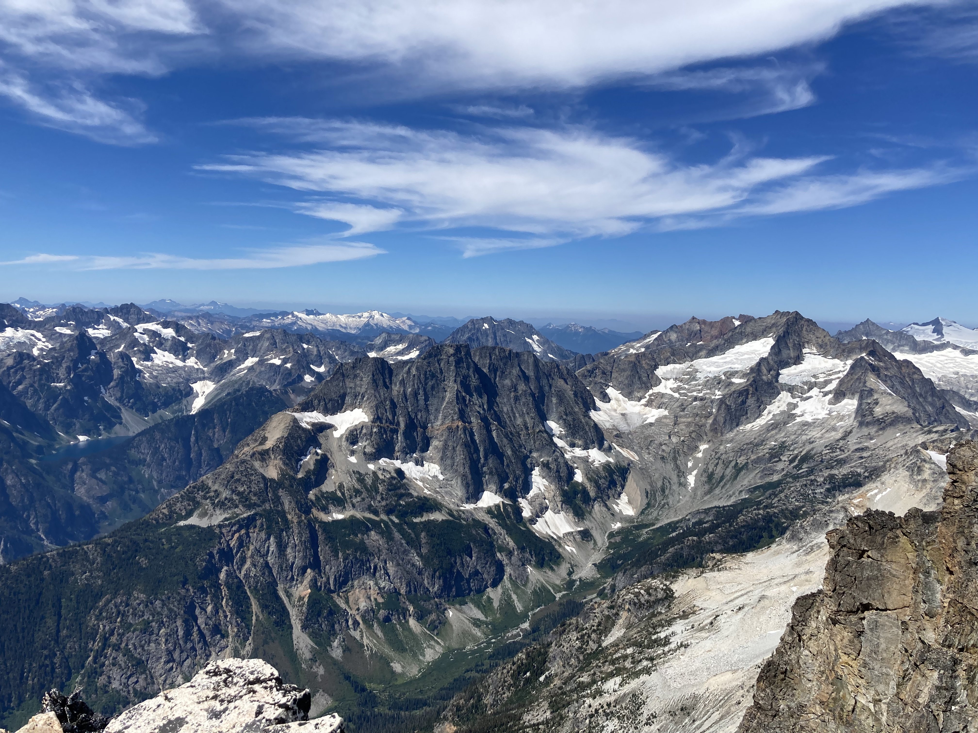
Eldorado (far R), Forbidden, Buckner, Booker, Trapper Lake, looking to the W.
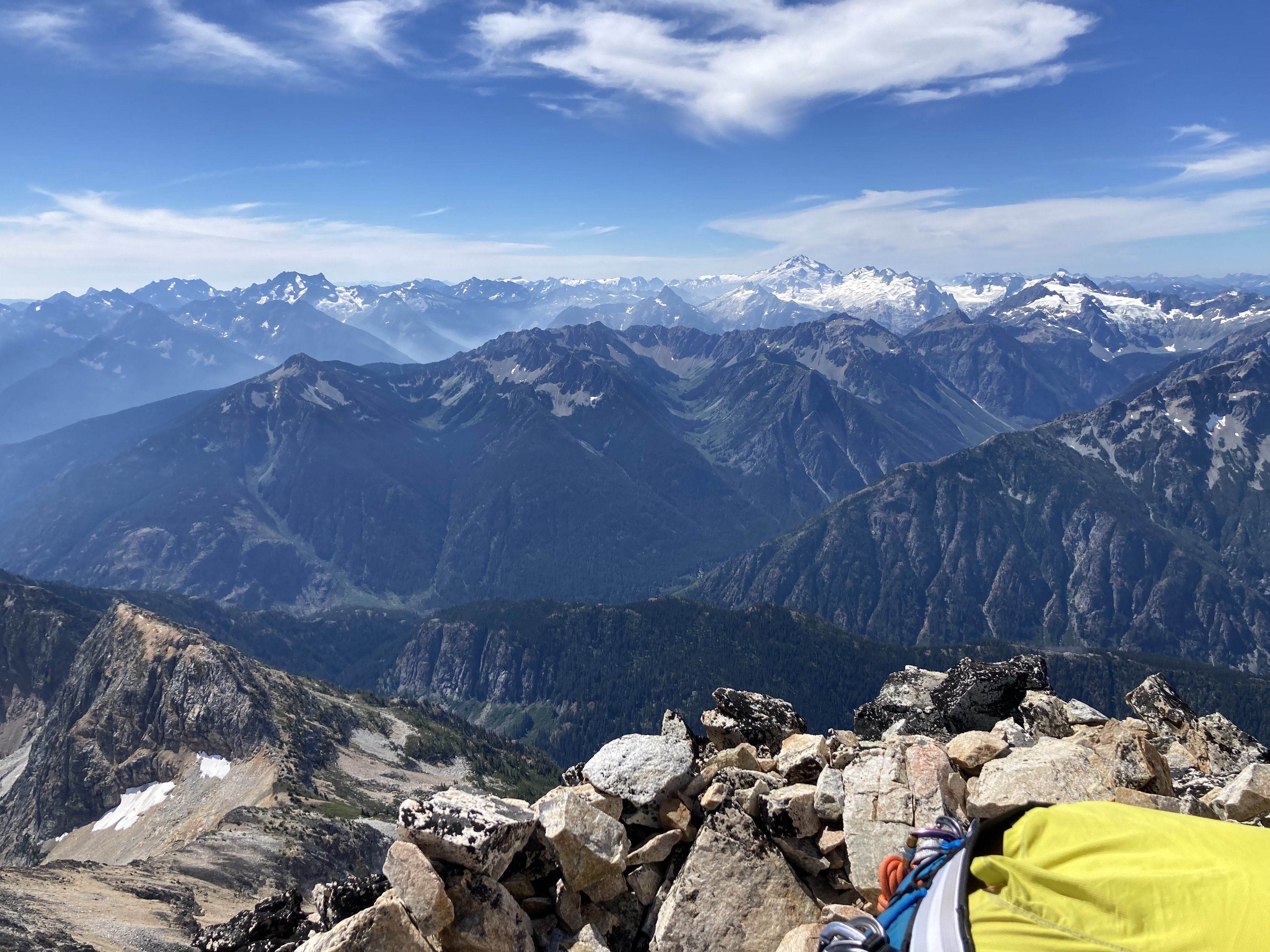
Glacier Peak, Dome and friends to the S.
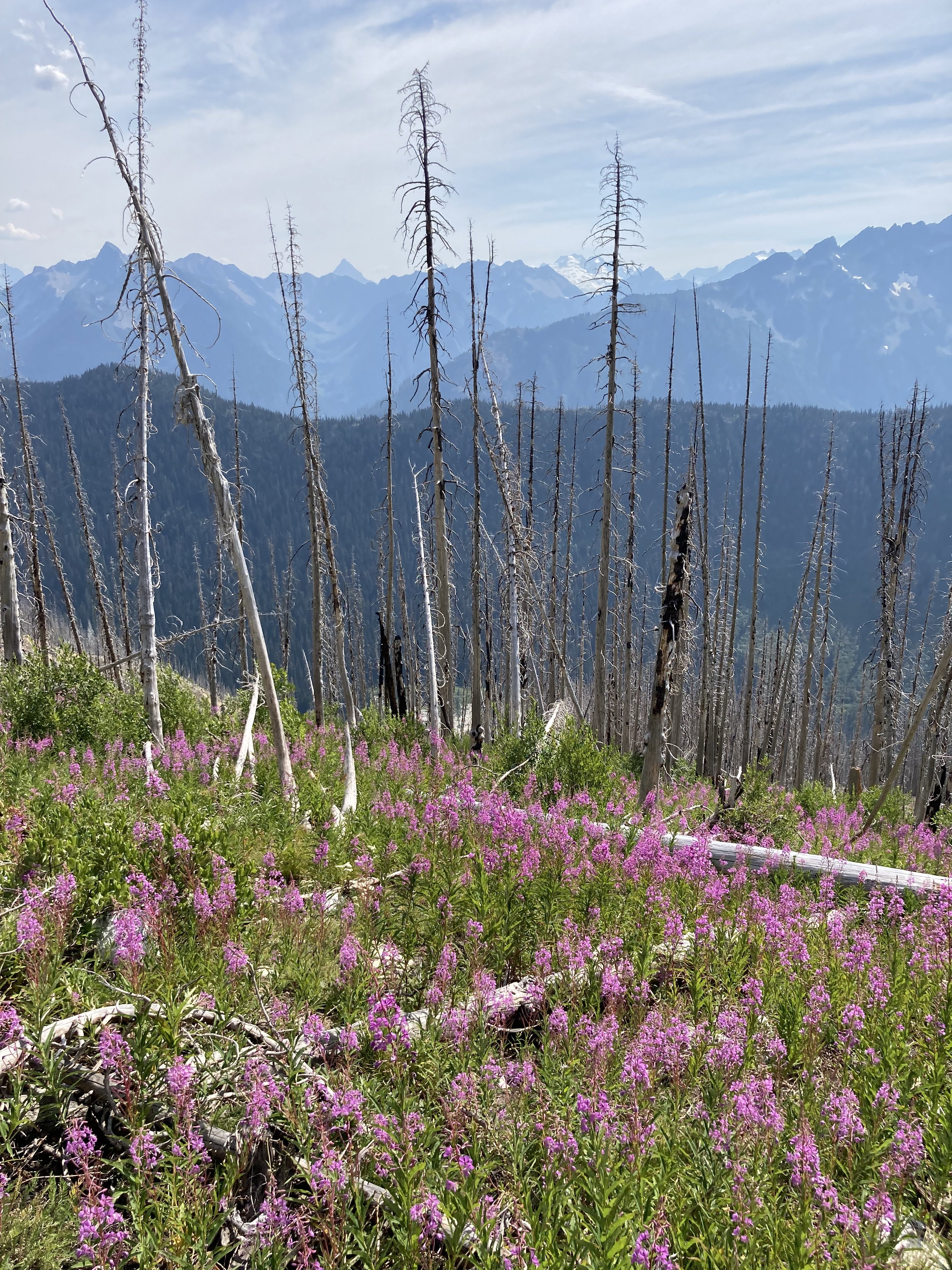
Descent in the burn. Pretty, not too hard but dusty on this section.
Purdy bits from the long walk out. 👇
Gear Notes:
approach shoes are fine, 60m double rope folded over for simuling, single rack to #2
Approach Notes:
There is a significant climbers trail from North Fork to the cliff below the glacier. We were both surprised at how easy the "bushwhack" was for NCNP. We were able to sneak onto the glacier and access the L side of the buttress above some crevasses with no serious difficulty. It looked uncertain from below but went fine.-
4
-
1
-
 1
1
-
-
I also like UW's atmos site but prefer the time-height forecast. Basically any forecast more than three days out is unlikely to be reliable beyond obvious stuff like "it's summer so it will probably stay nice" or "it's been super sunny and there is a lot of cloud building out to sea so it will probably rain at some point".
Here is a link to a previous thread where I gave details on the time-height forecast...
-
I would just do the southern zone and do the standard approach to terror basin/glacier (not below the mountain Terror, which is accessed from the next basin W, confusing). You can get in there in one day which allows you to climb a couple routes. I would climb the E ridge of Inspiration for one of your routes. Maybe something on the MacMillan Spires for the other one.
-
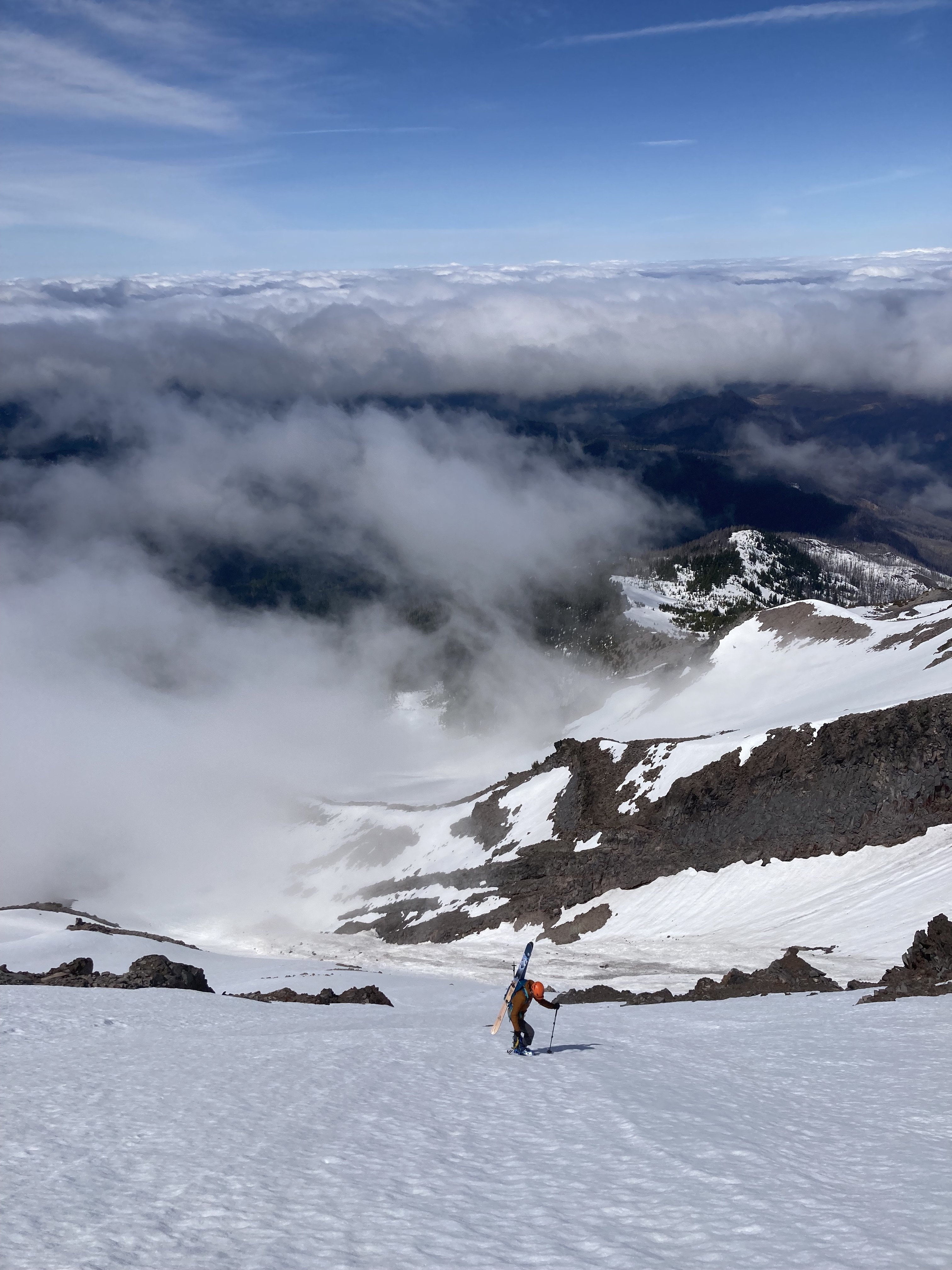
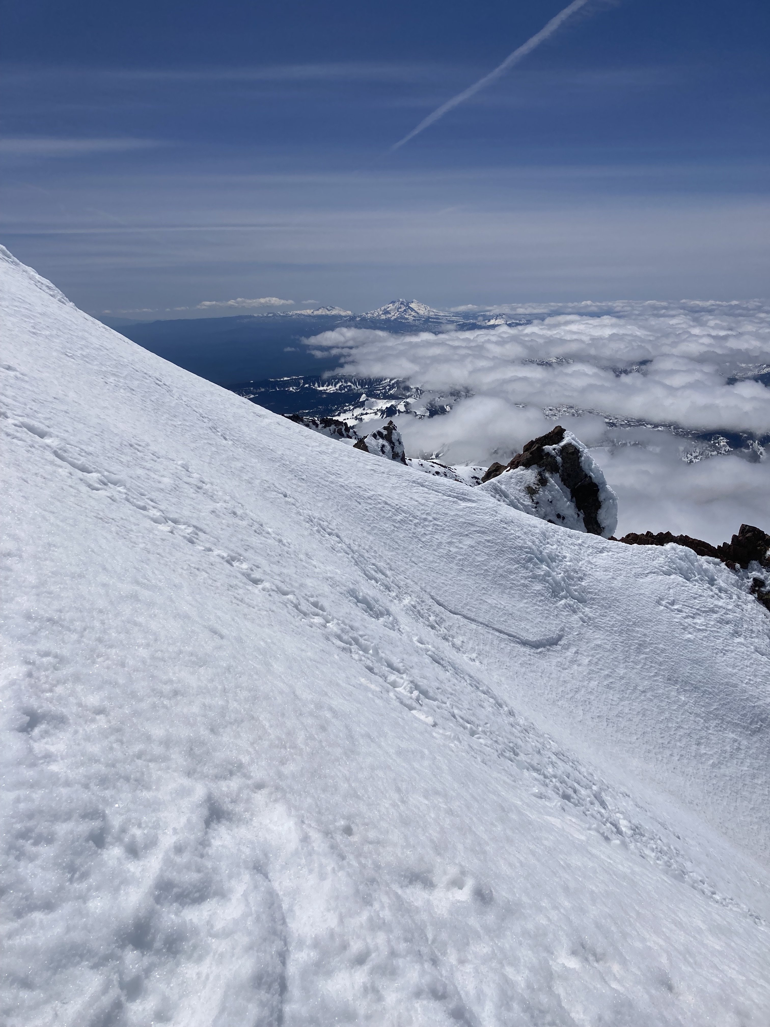
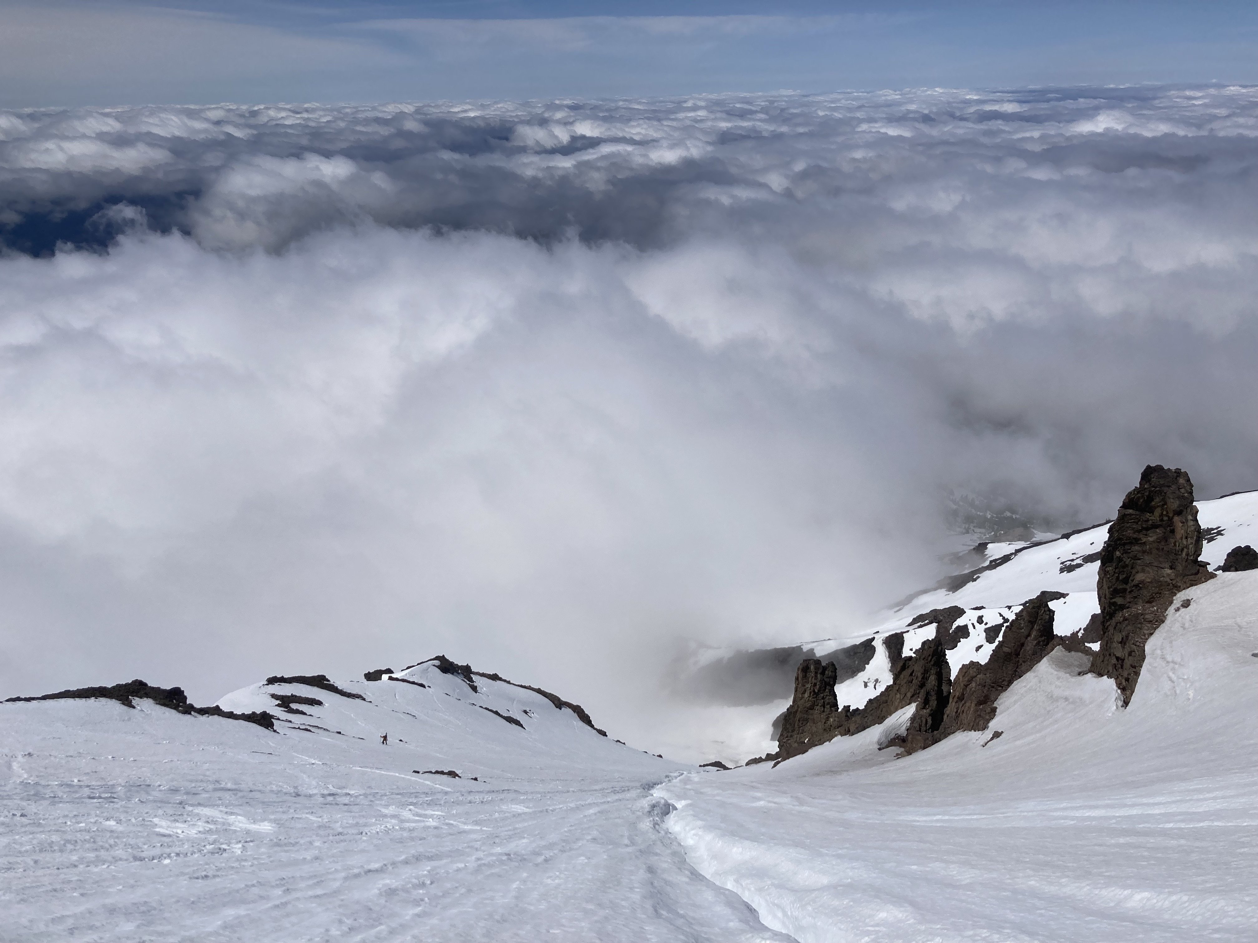
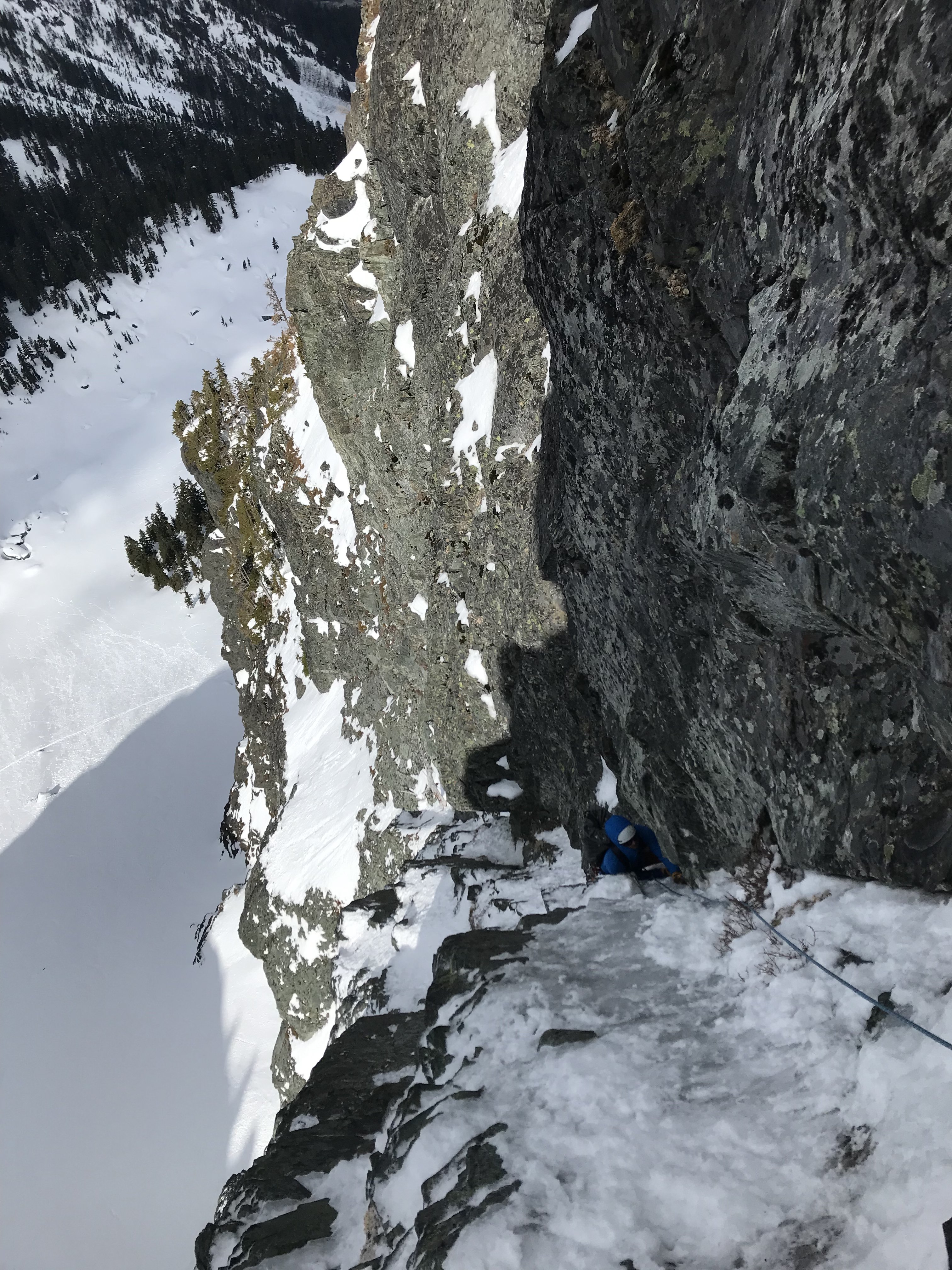
Trip: Mt. Jefferson - West Rib
Trip Date: 05/22/2023
Trip Report:Went to ski the W Rib on El Jeffe with Kellen. Pretty melted out and some big slide debris/runnels. We skied the aspect down towards N Milk Creek instead of staying on the ridge all the way down. Top 1k' was icy but then it got good. Probably tail end of the season for this already with the warm weather and rain.
Pictures:
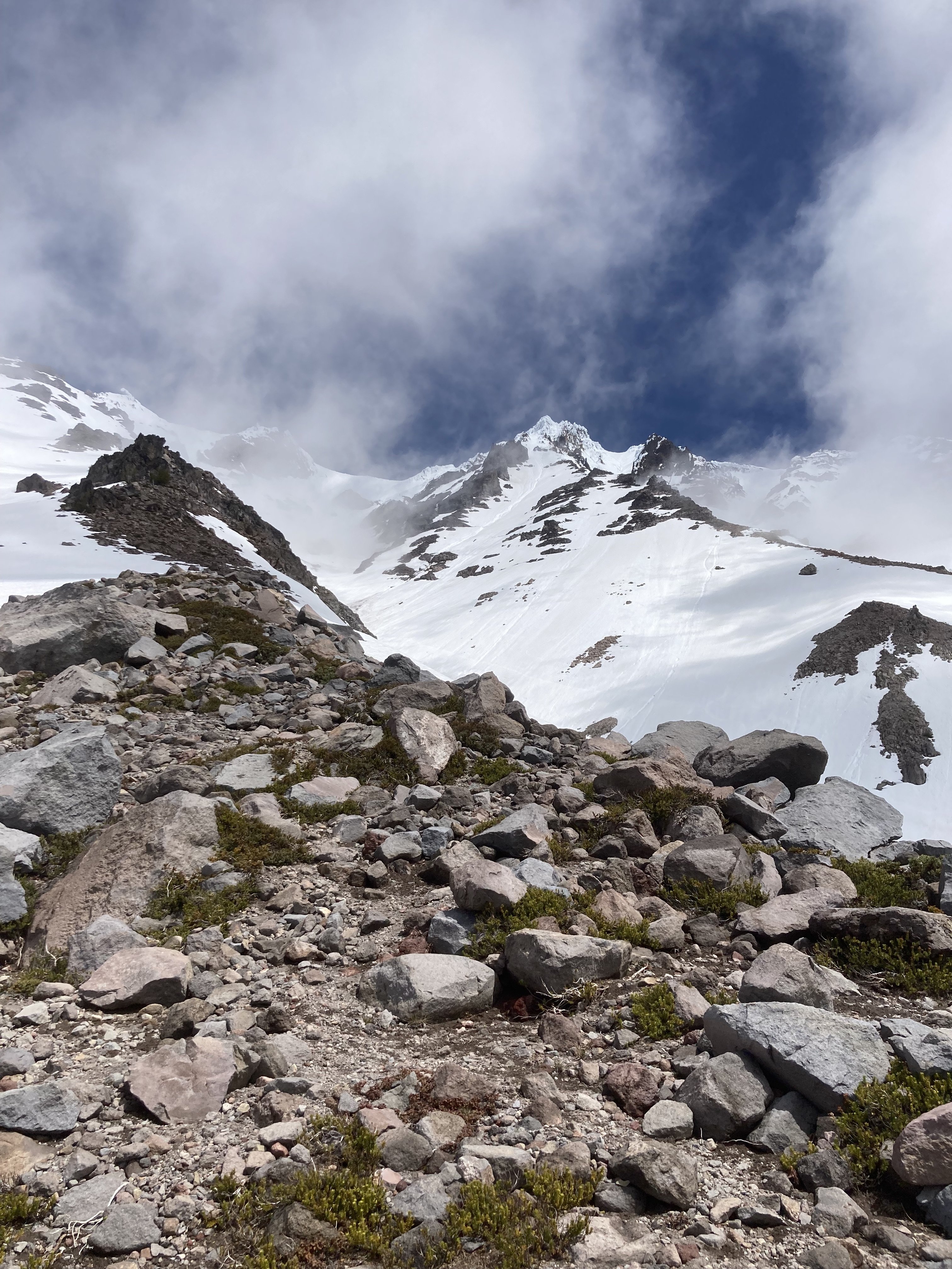
Overview pic. We dropped the gully with the big runnel in it that appears to extend directly below the summit pinnacle.
Hiking up
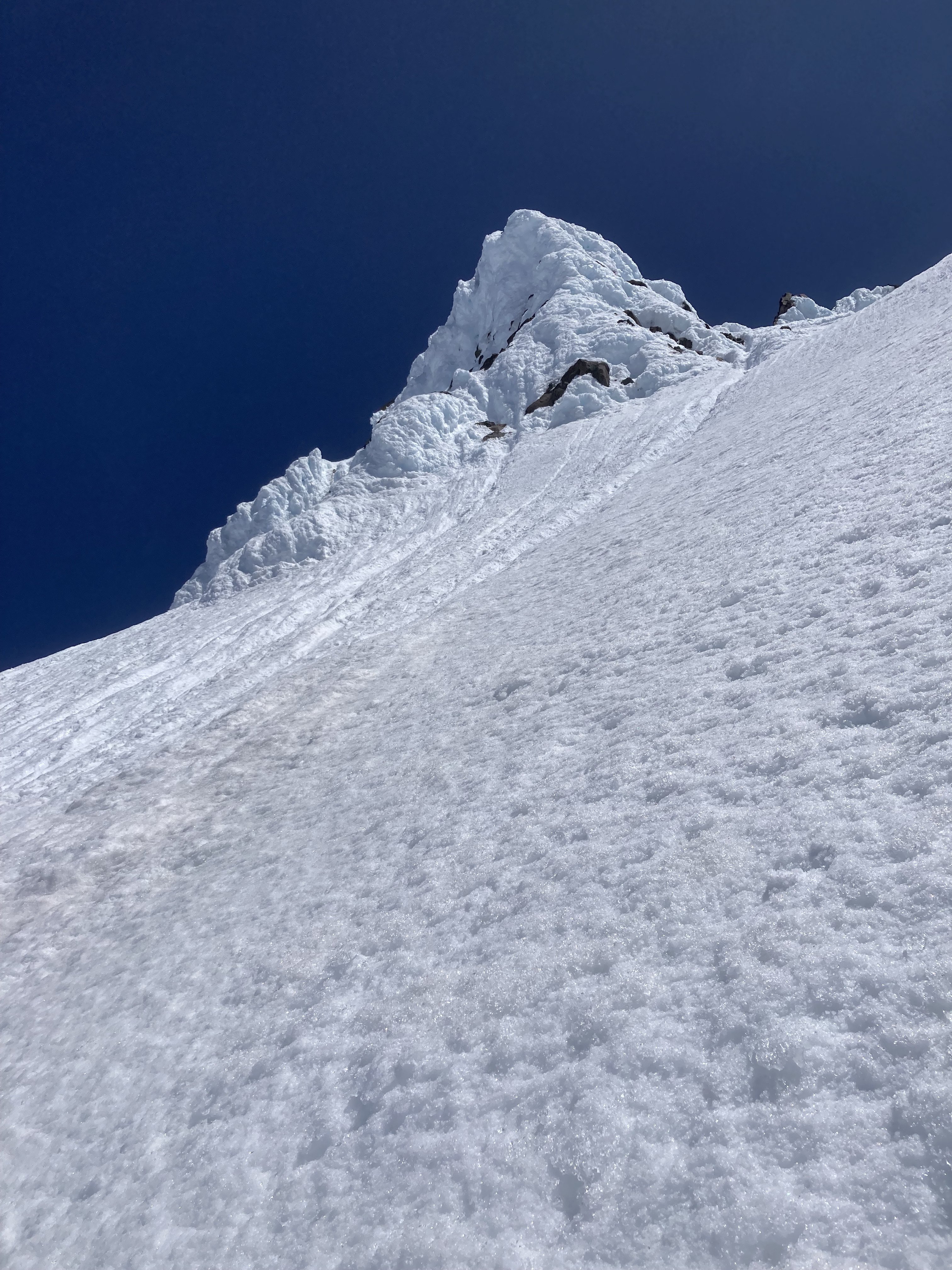
Summit Pinnacle
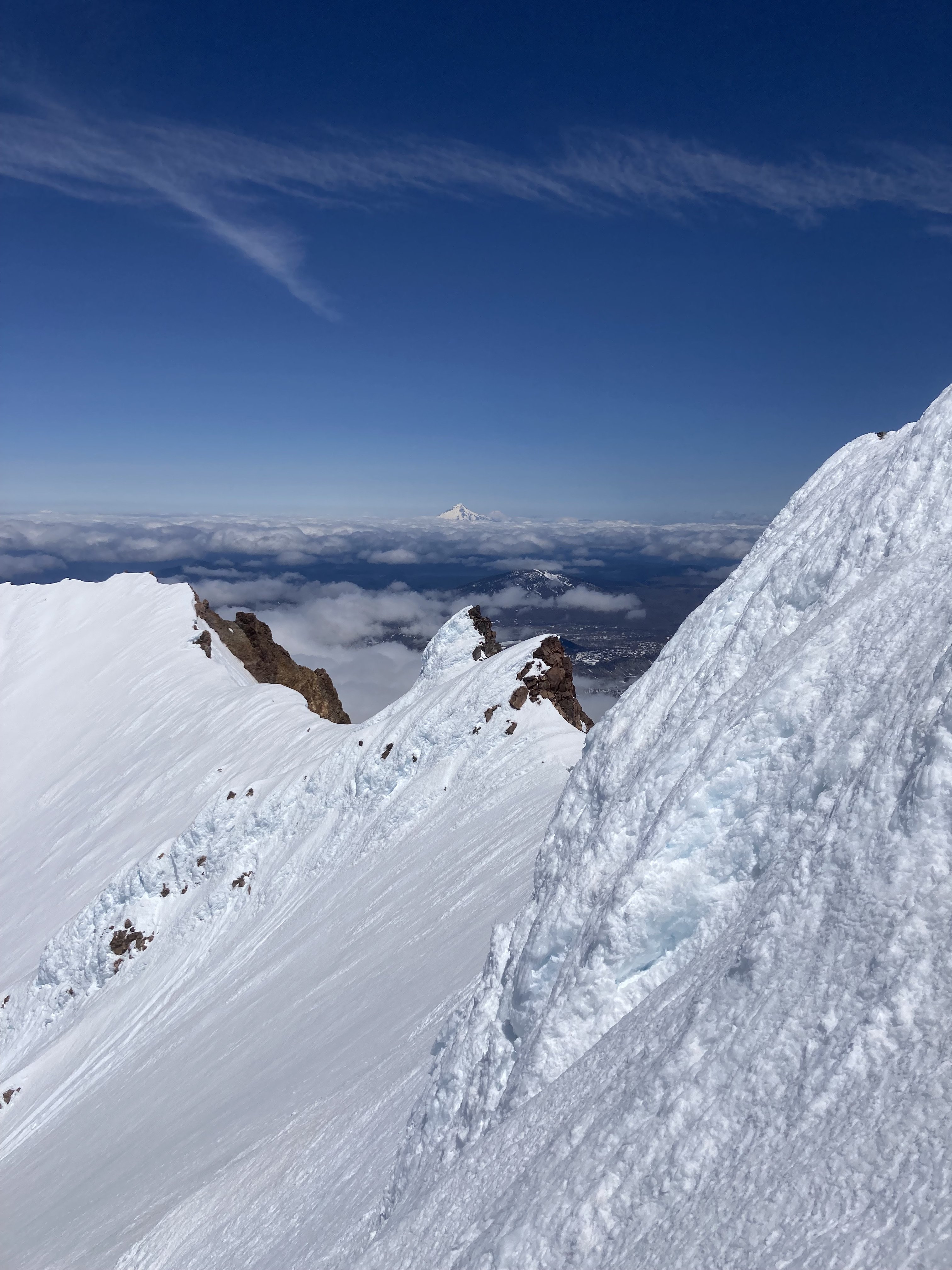
Hood to the North
Sisters to the South
Skiing down
Final slide alder down to Milk Creek.
Gear Notes:
Standard volcano spring skiing kit.
Approach Notes:
Trail to Milk Creek is pretty clear. Easiest way we found was up Milk Creek and then up and left per Oregon High overlay. Minimal shwack/scrambling to reach snow.-
 2
2
-
1
-
-
26 minutes ago, olyclimber said:
That was all on Wordpress. John make have a backup of all that, but I had to nuke it as it was super compromised by hackers.
Can our sponsor, AAI, offer these hackers a free trip up Hard Mox... one way?
-
-
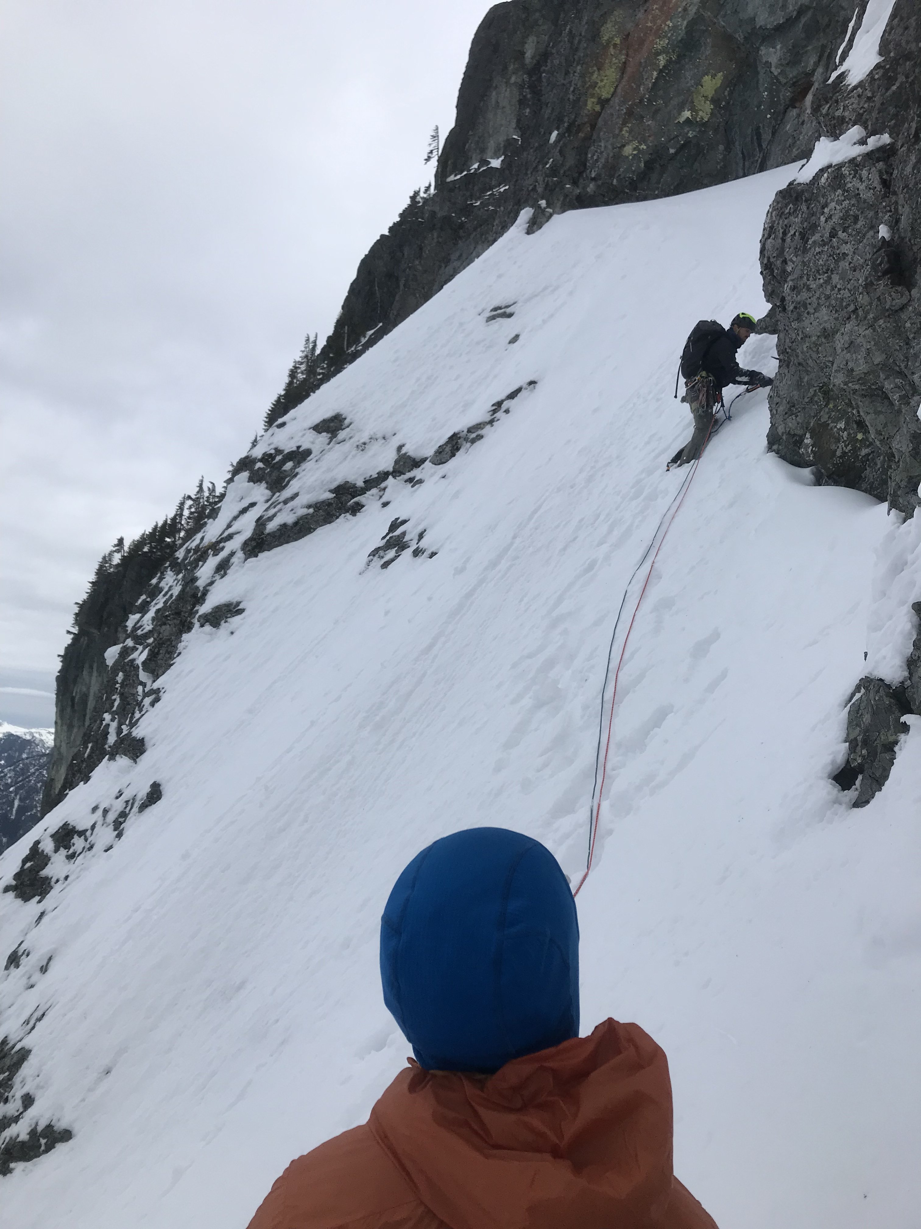
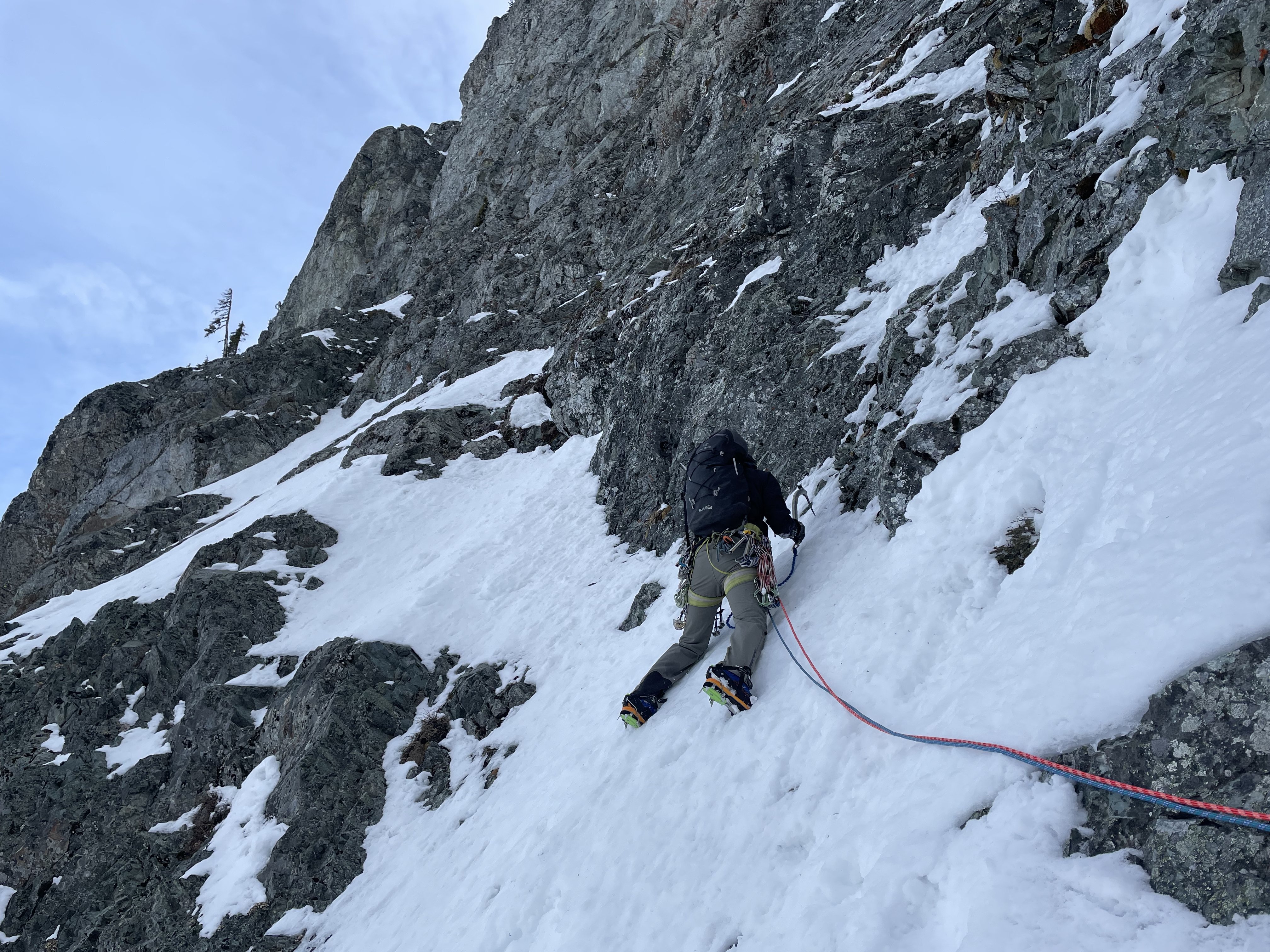
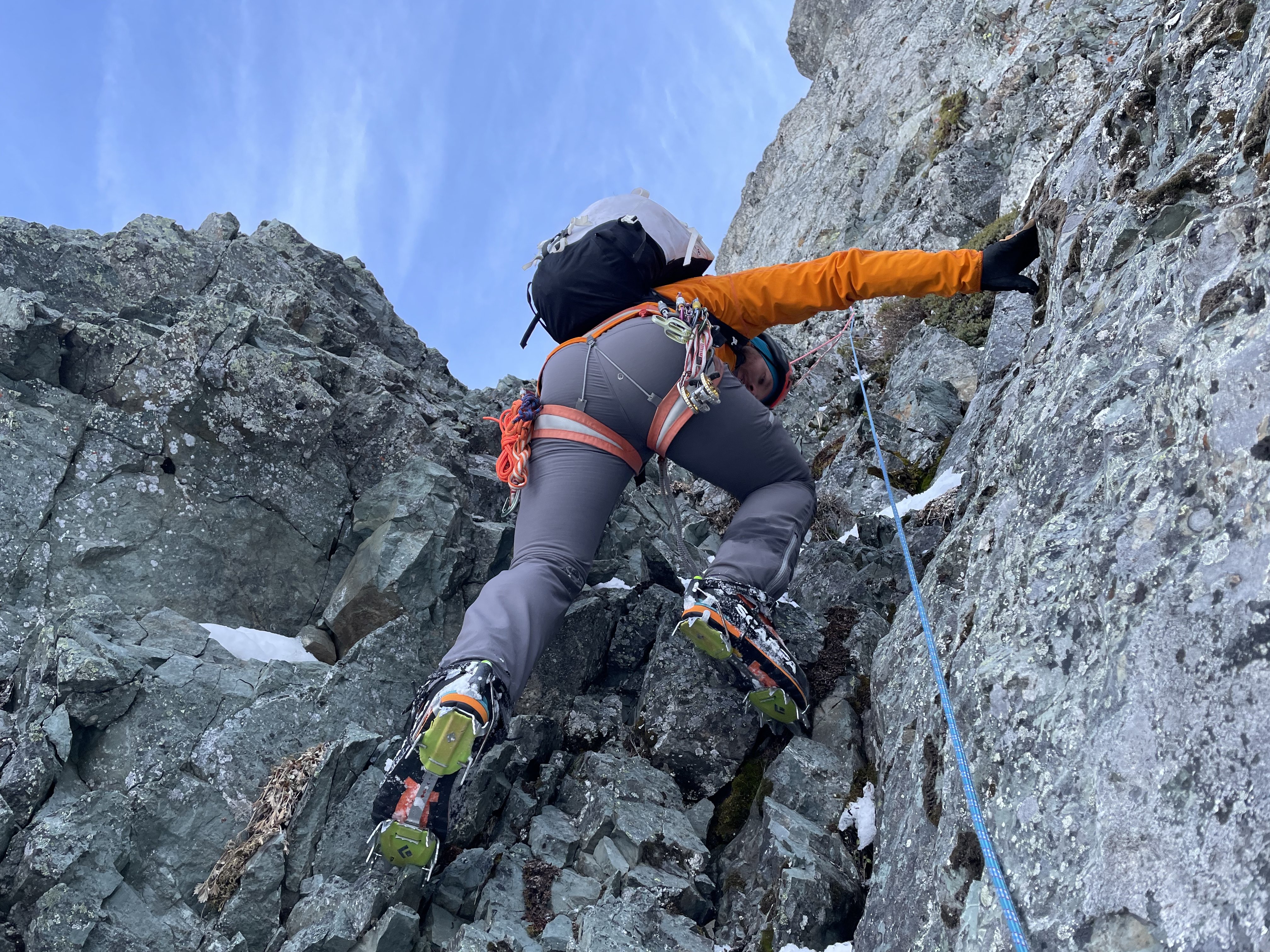
Trip: Snoqualmie - NY Gully
Trip Date: 03/30/2023
Trip Report:Kyle Tarry and Andy Traylor joined me for NY Gully Thursday 3/30. Enough has been written about the route over the years so I'll just say it was a fun time with good guys and share some conditions...
Skinning up from Alpental was a little icy in the AM but the old swiped out tracks were nice for the descent in the PM.
Fair bit of snow on route, especially the first two pitches and the exit pitches. Snow had a crust and was not supporting weight super well though we made it work. Made digging for pro a little difficult.
There was ice but it was thin. We tried to place two stubbies all route and they both bottomed out. Turf was mostly good to swing into.
Crux is mostly ice free.
We did not do any rappelling but did two exposed snow traverse pitches to get off from the top of the crux pitch.
Now what you all wanted... Photos!
Pitch 1, snow on rock
Pitch 2, more snow on rock

Andy follows P2
Kyle on P2 chimney
Views
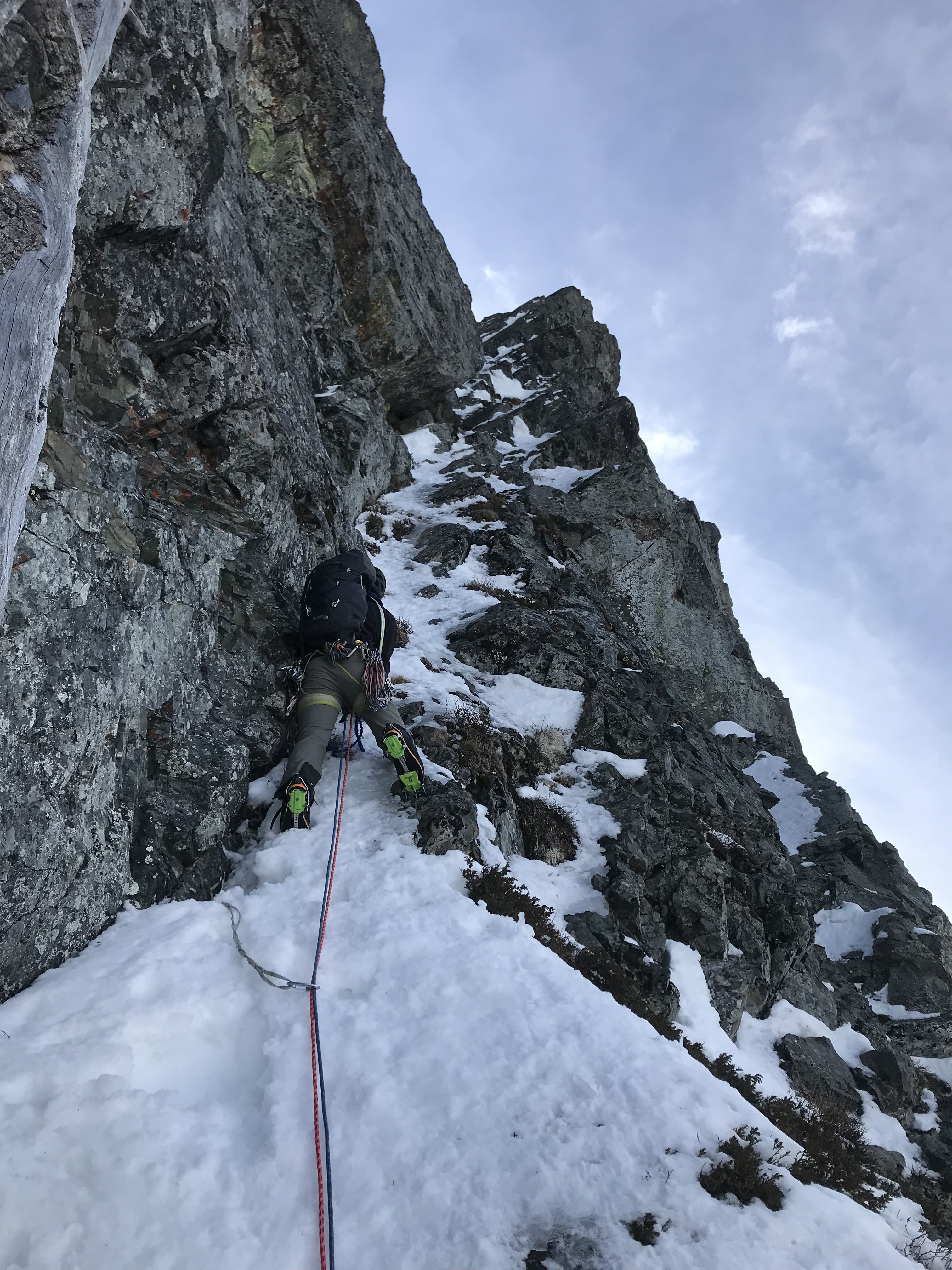
Start of P3 "box gully"
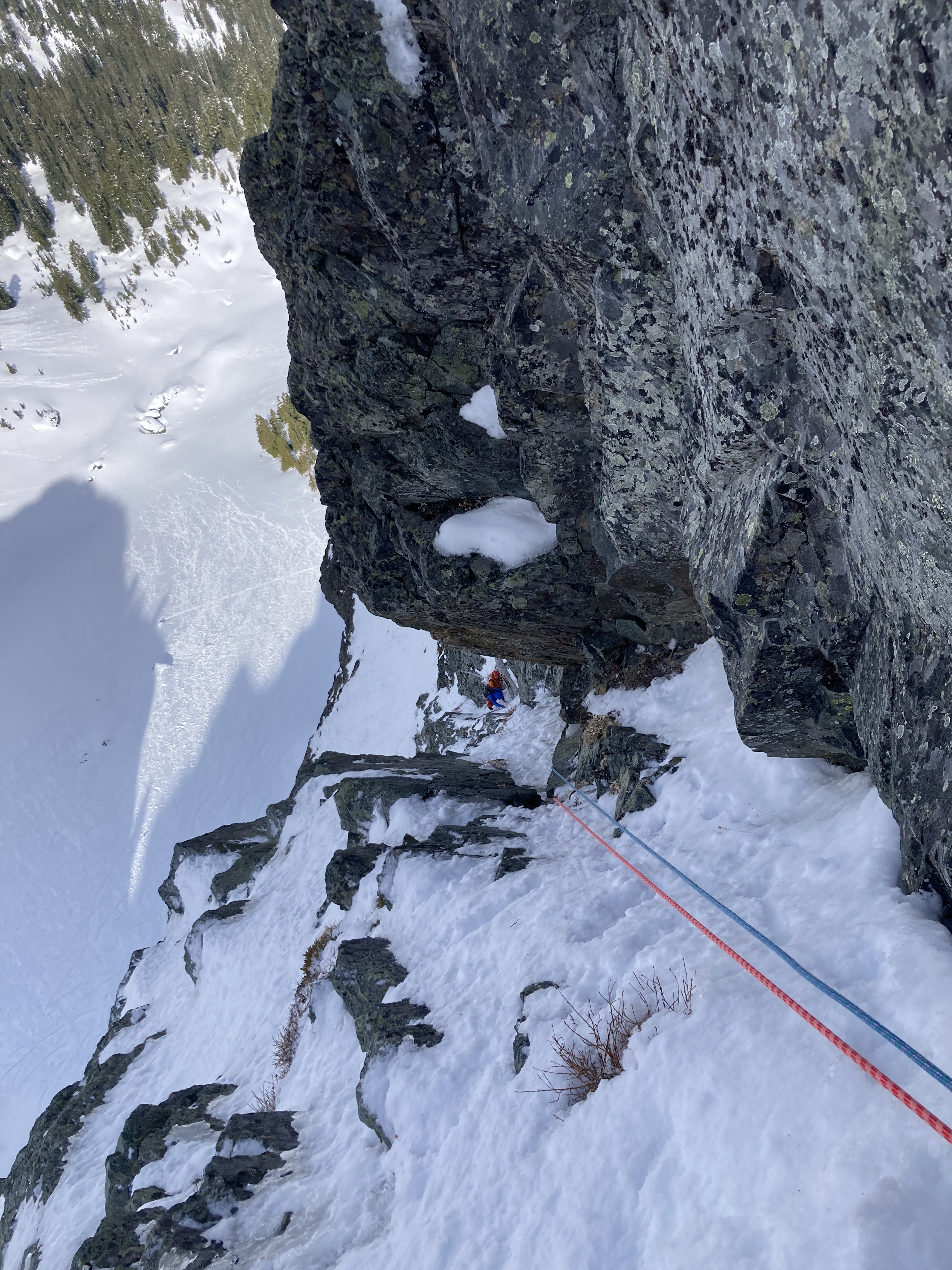
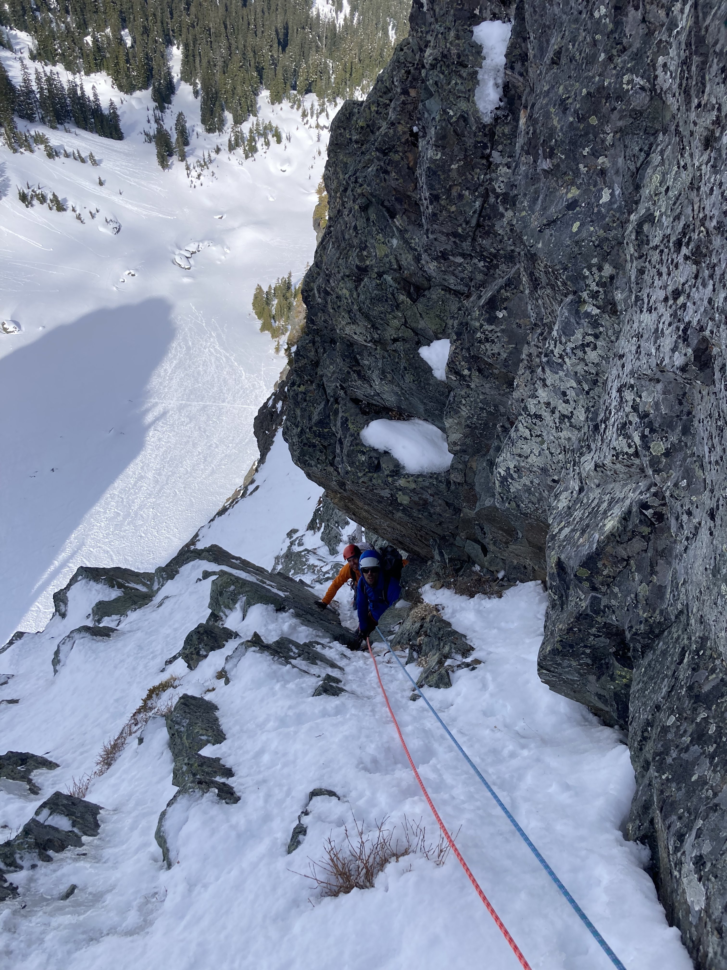
Andy and Kyle following box gully/P3
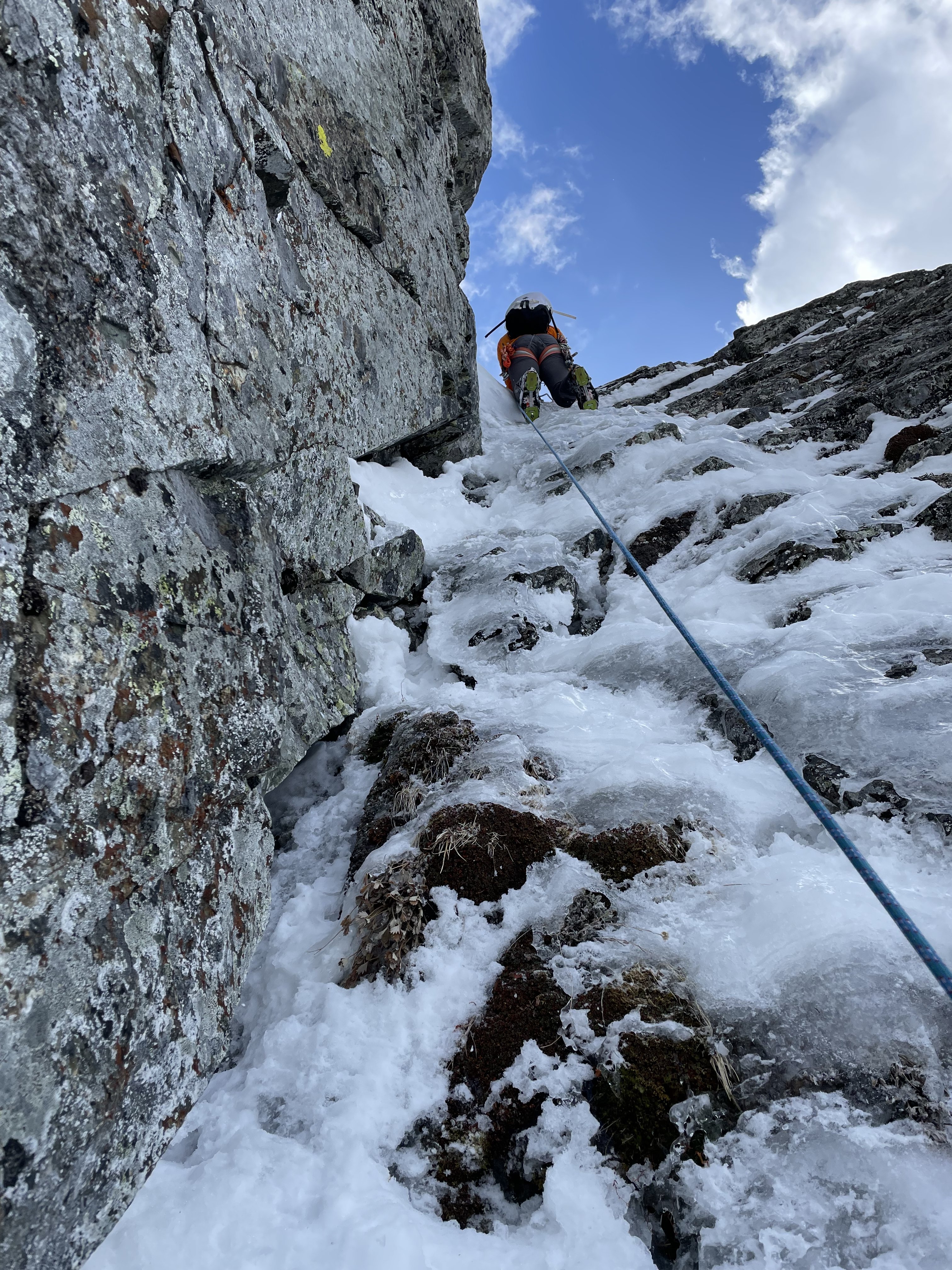
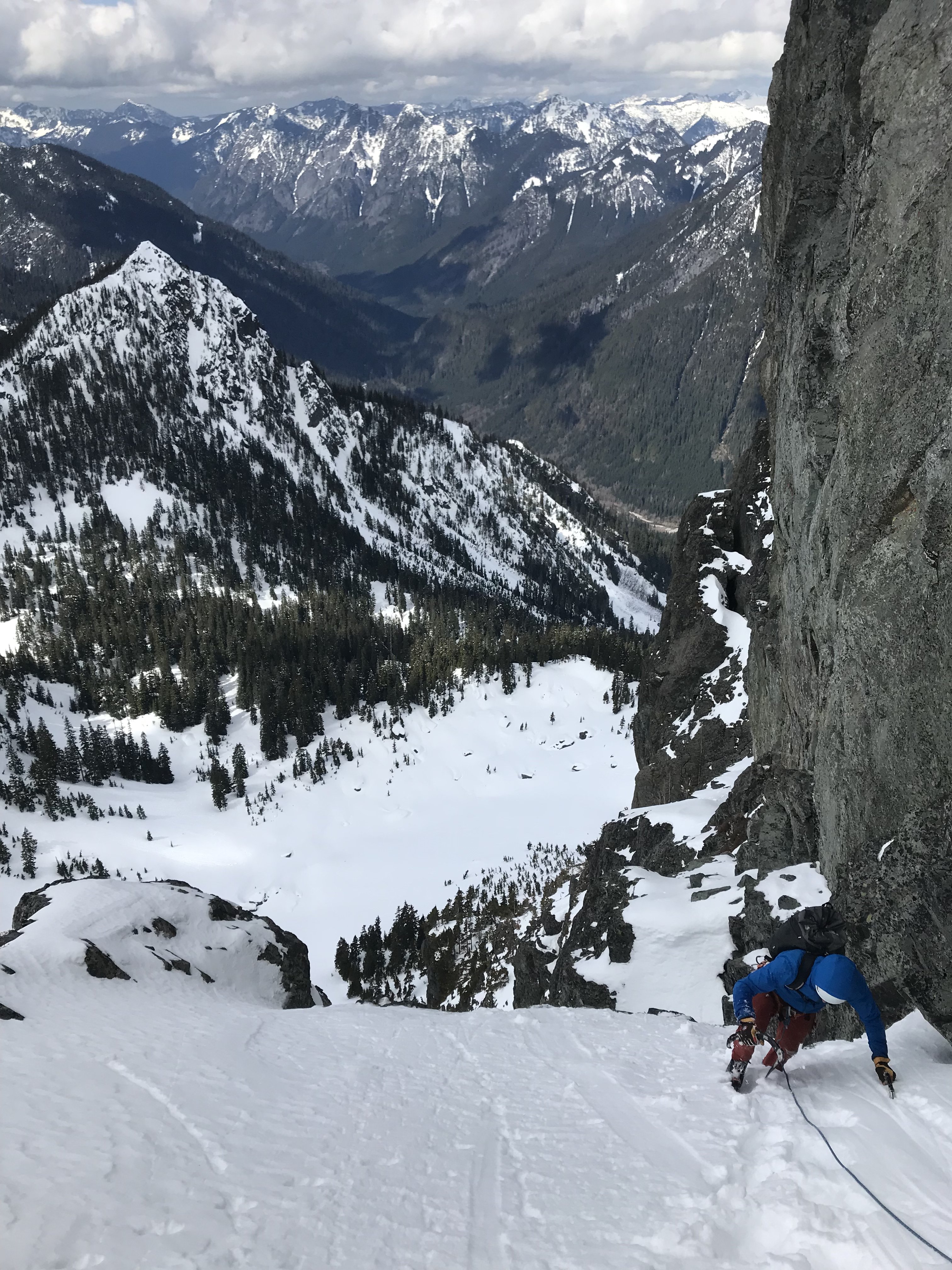
P4 pictures, long 60m rope stretcher to base of crux, runout in places, snow covered slab at the end.
Crux pitch - P5
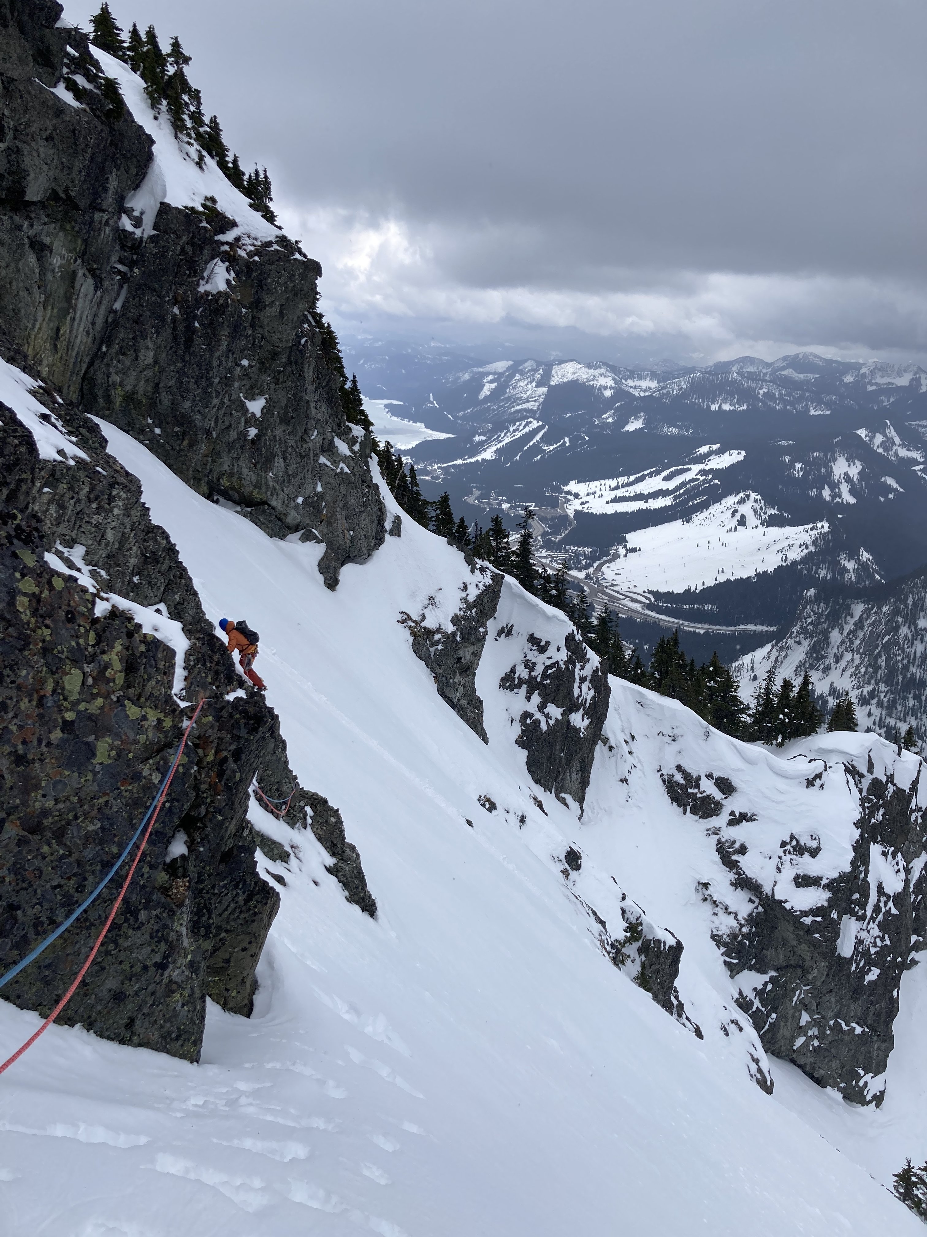
Andy is actually on snow here, last of two traverse pitches to get off, traversed right over and up into trees.
Gear Notes:
Lots of beta on the interwebs, all seems to be about right. Definitely can't sew it up except for the crux which takes great gear.
Approach Notes:
Skis-
4
-
1
-
2
-
-
On 3/5/2023 at 5:11 PM, mthorman said:
Look into Granite Lake ice climbing in the Cabinets Mts of Montana. It is a fat year this year and typically the end of March is pretty good in there (baring we don't get a crazy warm up in the next couple weeks).
@mthorman How's the avy hazard been in there?
On 3/5/2023 at 8:07 PM, JasonG said:I'd say keep it loose and go where the weather and conditions look good....for whatever. Seems like the storm track will be north or south but not both. Please post a TR with whatever you get up to!
That's a great time to up up on the Wapta or Bow-Yoho ski tours...but that might be too pedestrian.
Sounds delightful TBH. Maybe that's what I'll do if nothing else comes up.
On 3/6/2023 at 12:03 PM, manninjo said:Consider going for the second (?) ascent of any these routes in the Cascades? Access seems like a pain for most of these (especially without a sled), and obviously conditions are king, but the time of year you're looking at seems about right.
Yeah I was looking at Buck and Summit Chief... long approaches indeed. I'll check those other options.
-
Okay, so have some dates off from work and can go play at least 4 days (must be consecutive) between 3/25 and 4/2. I was planning to go to Yosemite and get on the Captain with friends but there is currently a lot of snow in the valley and there will still be snow melting off the top in 3 weeks (barring an act of god). Started look at other options...
I do all the things: ice, mixed, alpine, ski tour, rock, aid, etc, etc, etc. Ideas that popped into my head were: ice routes and alpine cragging in the Candaian Rockies, skiing big lines in the Tetons or Sierra, North Cascades skiing and/or alpine ice, Purcell/Sekkirks ski touring exploring, exploring closer to home in Eastern Oregon.
There is some persistent slab and other problems making things tricky most places in the Rockies, though it could settle significantly in a few weeks, still probably won't get rid of the low probability persistent problem though. Lots of snow everywhere. Dry rock seems far away. Cascades don't have persistent problems by the look of it. Any other problems to consider?
Bottom line, maximum 1 day drive each way and 4 days to play, what are some ideas (specific or not) that are worth my consideration?
-
Looks like a fun adventure! Always nice to see stuff in Canada... so much to do but we hear little about it state-side.
-
On 1/23/2023 at 10:06 PM, Geoff M said:
Nice! I've heard murmurs of some routes up that way and just saw Artem's post earlier today on FB.
You guys have a chance to check out anything on Broken Top yet?
Haven't been out to BT but based on N Sister I would say the N side of BT is probably fat.
-
For those with a high clearance 4WD, you can currently drive to Pole Creek TH in the Sisters (OR) and a 2 hr ski gets you to numerous N facing flows off the E buttress of North Sister.
-
2
-
1
-
-
Eldorado from Primus... $200
Jason, can you hold on to this for a couple months if I get this? I'm down in Oregon and can't guarantee when I'll get up there.
-
Too cold and dry here in Central Oregon. We had some stuff start to form and then it sublimated or fell down.
Anyone taken a look at Mt. Index? Seems like potentially favorable conditions to me but I'm no local.
Kid Friendly "Alpinism"
in Kids
Posted
Some inspiriation for those of you with kids; Leo and his wife took their 3 and 7 yr olds up the Piz Badile (3000ft 5.7) among many other long moderate routes...
https://www.bbc.com/news/uk-england-cumbria-53652968
https://thenuggetclimbing.com/episodes/leo-houlding