

Tom_Sjolseth
-
Posts
541 -
Joined
-
Last visited
-
Days Won
3
Content Type
Profiles
Forums
Events
Posts posted by Tom_Sjolseth
-
-
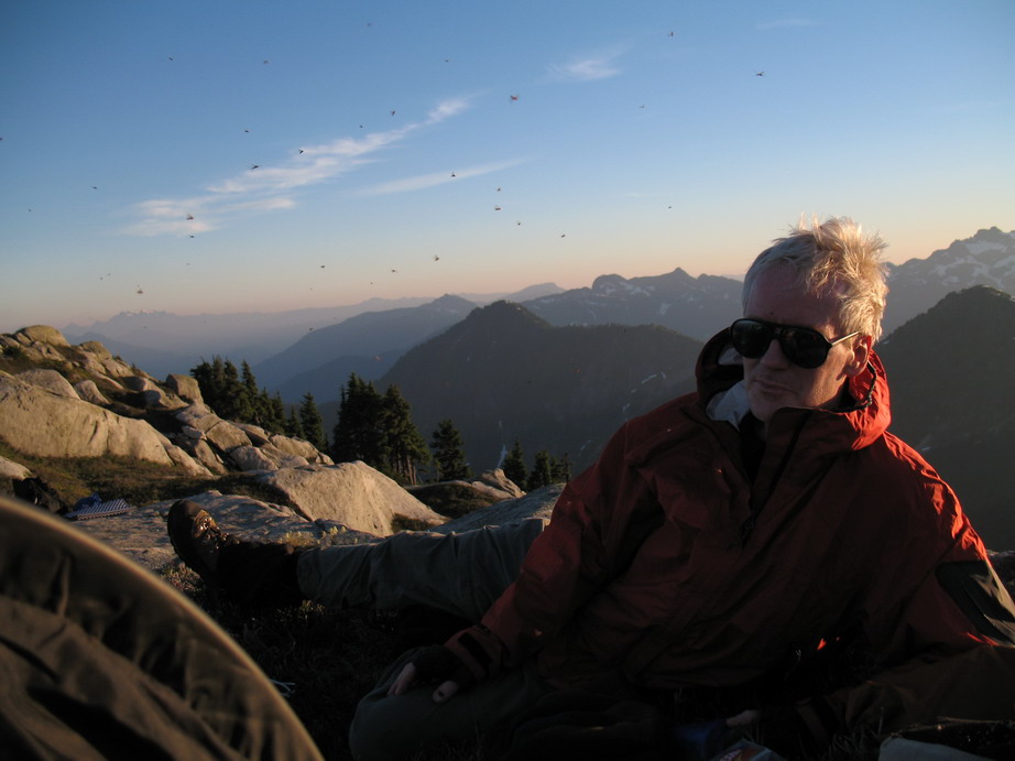
CBS- yeah the mosquitos were pretty thick, but weren't biting very much. More of a nuisance by flying into your eyes and nose. They were much worse, though, on Hozomeen a couple of weeks back.
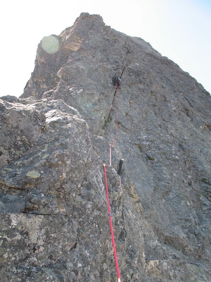
As for the quality of the rock, Goatboy hit it right on with his assessment of the route.
-
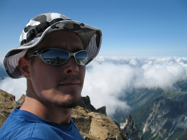
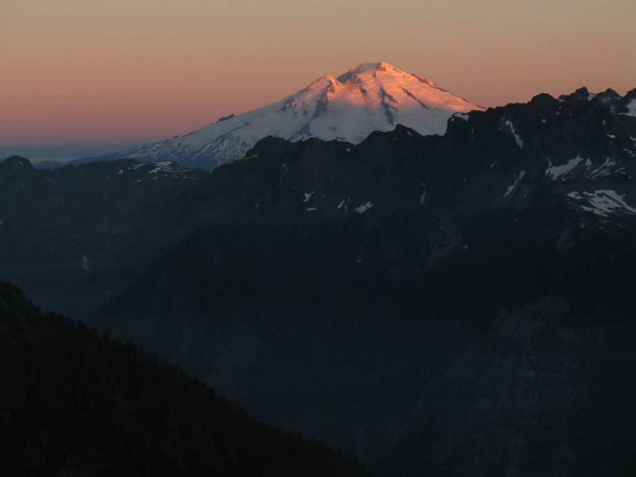
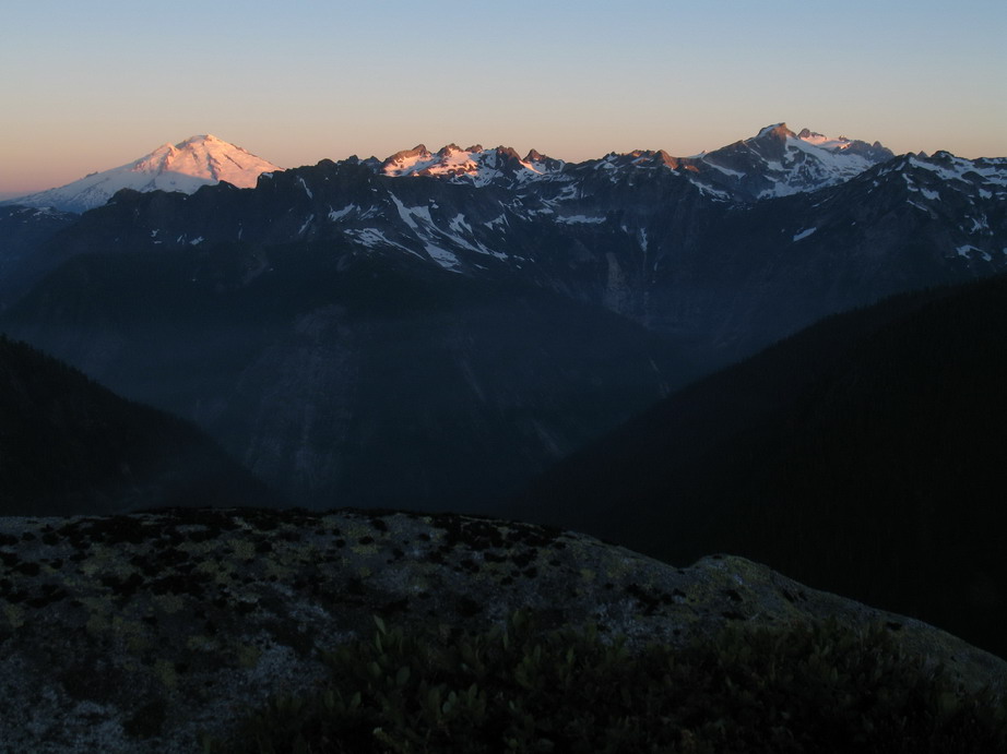
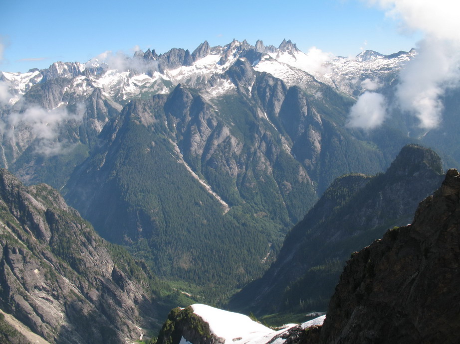
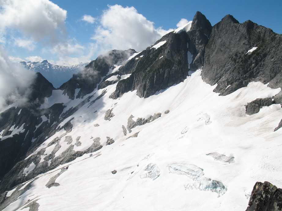
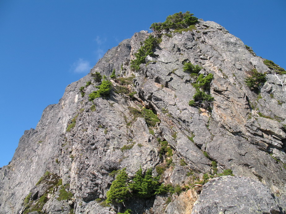
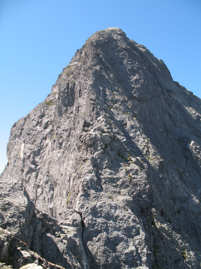
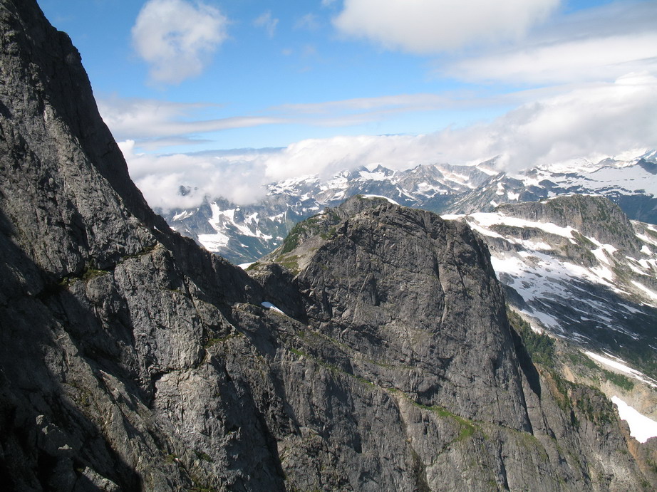
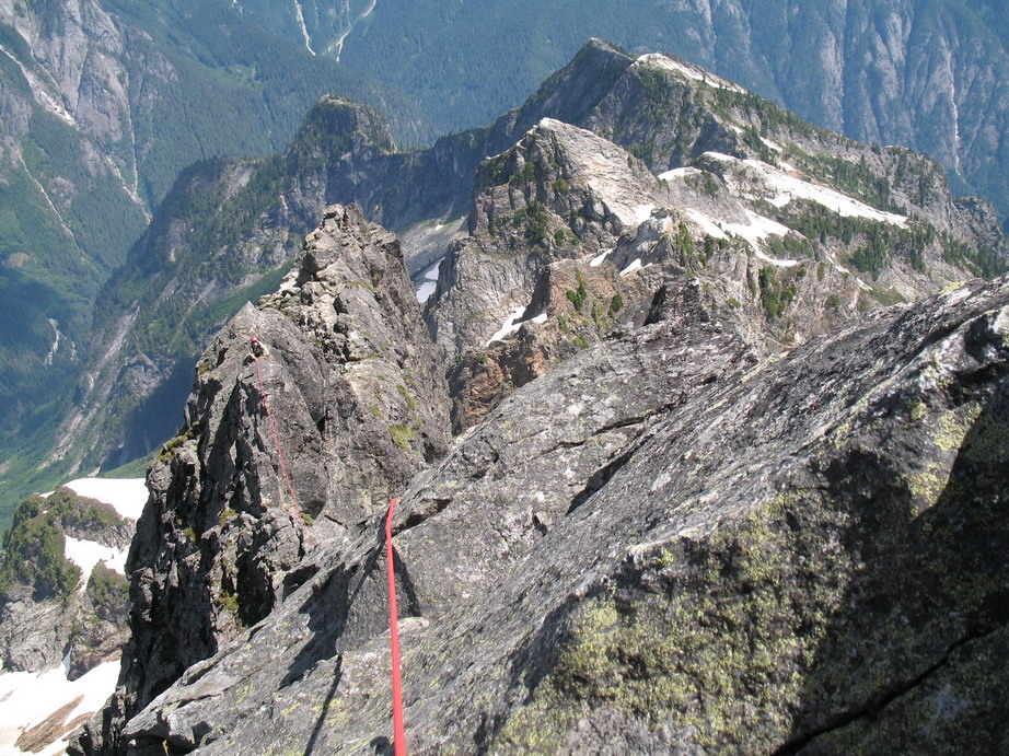
Trip: Mt Triumph - NE Ridge
Date: 7/29/2007
Trip Report:
Pictures...

-
Goatboy, how is it a conspiracy? The link that now shows up as a red "X" in my previous post, displays the route topo in this very thread. The link is exactly the same. The route topo on the old thread was there for about a week (if you don't believe me, ask others who saw it - like Blake) when Blake PM'd me to take it down. I totally ignored Blake's request, and a few days later the route topo showed up as a red "X". It doesn't take a rocket scientist to solve the caper. With computers it is what it is. There is no in between.
But at any rate, the route topo is there now so I'm happy. It would be great if it could stay there this time, as I know others will find it useful.
The link isn't the same. Your link wasn't erased, it's still there, but the picture you're linking it to either got erased or moved somehow. Since moderators, let alone blake, can do neither of those, I'm having trouble seeing how there is conspiracy against you.
Alrighty, well whatever happened, the topo is there now so that's great.
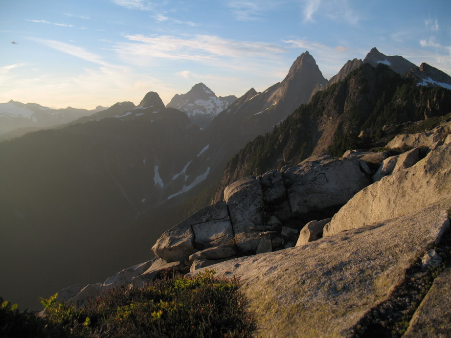
RE: slide alder. The slide alder on the approach is almost entirely avoidable, so my advice would be to not worry about following the red line exactly, and rely more on your routefinding skills. I don't own a GPS so the topo is approximate, but I'd say it's pretty darn close.
-
Goatboy, how is it a conspiracy? The link that now shows up as a red "X" in my previous post, displays the route topo in this very thread. The link is exactly the same. The route topo on the old thread was there for about a week (if you don't believe me, ask others who saw it - like Blake) when Blake PM'd me to take it down. I totally ignored Blake's request, and a few days later the route topo showed up as a red "X". It doesn't take a rocket scientist to solve the caper. With computers it is what it is. There is no in between.
But at any rate, the route topo is there now so I'm happy. It would be great if it could stay there this time, as I know others will find it useful.
-
I'm not sure why the link disappeared either, but nevertheless it did. I just find it ironic that you PM'd me to remove the route topo and a little while later it mysteriously disappeared.
As for me being eager to "wear at the moderators", I'm not wearing at the moderators, I'm only calling out the one who clearly edited out the link in my original post. They know who they are, and like I said, it was a chicken-shit move to remove it without so much as an explanation (or a valid reason). A link doesn't just disappear by "accident". The link was there for a week or so after I posted it, then it wasn't. Maybe the bits and bytes got garbled, heh?
The thing that rubs me the wrong way is people trying to tell me what I can and can't share with the climbing community. You didn't find the area, you didn't settle it, it belongs to everyone, so what was your motivation in asking me to take the route topo down?
Kudos to you for going into Gunsight and tackling big routes on nice rock. I also think others should have the same opportunity to experience what you and Dan and many others have, and by sharing info on the approach I hope I'm helping people to do just that. In this case, someone was asking about the Ptarmigan Traverse, and I offered some suggestions on exiting the traverse via an untraditional route. I'm sure that's what this forum is for, to share thoughts and info on climbing routes in the Cascades. Or is it?
[Forest Gump]And that's all I have to say about that[/Forest Gump].
Tom: I'm replying here so you can see what it looks like when a moderator edits your post. If one of us had deleted your link it would be tagged at the bottom, just like this reply: "edited by off white" I'm not aware of any moderation requests related to this approach. It's entirely likely this is the result of one of those mysteries, like how a knot sometimes just appears in the middle of your rope. Best, Off
-
Here's a route topo for the deproach out Agnes Creek, originally posted in the aforementioned link by Mikester, which Blake asked me to take down via private message. I ignored Blake's request but, ironically, someone edited the link out of my original post!! Considering this info is widely available in books on the market right now, it's no big secret. I'm not sure who edited the link out of my original post or what their motivations were for doing so, but for the record, I think it was a chicken-shit move.
Funny thing too, because I specifically remember Blake private messaging me asking for beta on the approach up Agnes Creek after I posted my TR - 7 Days in Agnes Creek. Now, all of a sudden he's an expert on the area who "knows this area of the Cascades more than pretty much anyone". My how things change in one year.
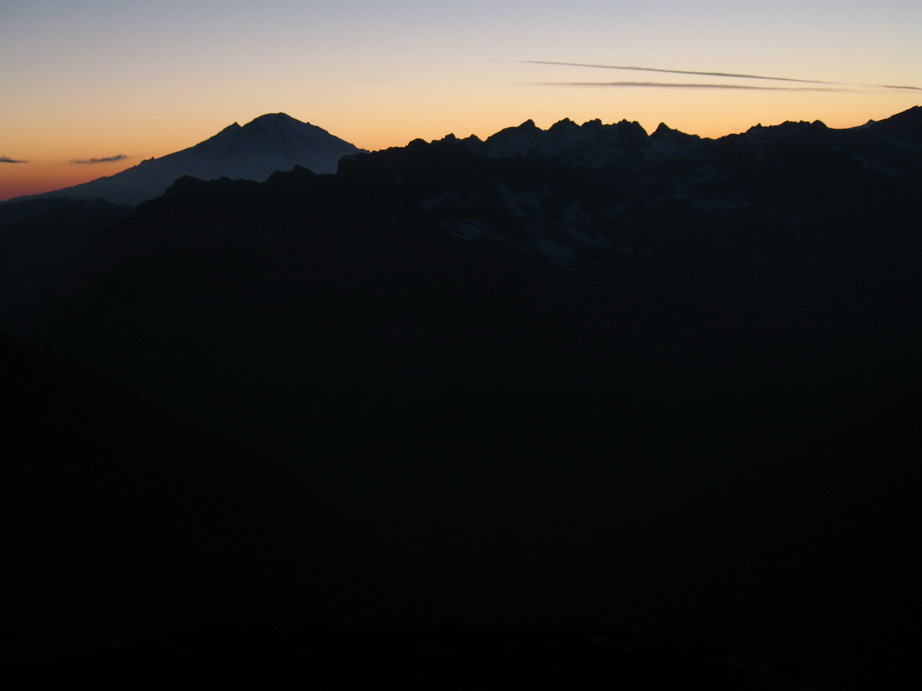
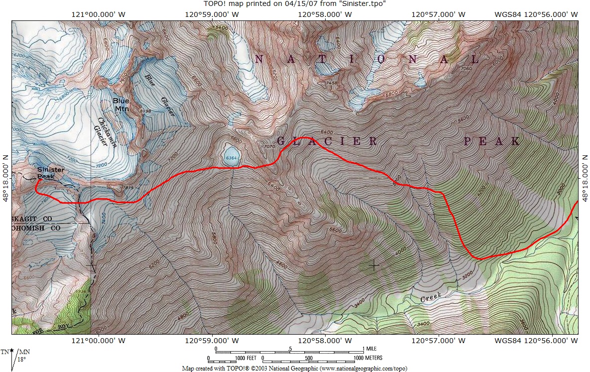
By the way, this is an excellent approach for Gunsight Peak which, on the USGS (and this map), is mislabeled Blue Mountain.
-
Love the shot of the climber ascending the wind scoop.
It's easy to get suckered into that E. Face... a couple of years ago we went up that way thinking it would be quicker since we were coming back via the ledge from NW Dumbell (AKA Greenwood). We ran into downward sloping ledges topped with peagravel followed by a mid fifth slab near the summit. Not recommended without a rope!
-
That's a damned good article. Thanks to a determined Don Duncan for lobbying folks to get something done out there in Stehekin, and to Scott Sandsberry for writing this piece.
-
I, too, would like to extend my congratulations to Silas for finishing the T100P400. WILD!
Oh, and welcome back Mr. K.
-
Whoa! Glad to not be a part of this one..
-
I just got back from a failed "attempt" on the Leuthold's Couloir, Sunday AM. Winds were atrocious! I would estimate they were 40MPH sustained at the top of the lifts at 5AM, and 60MPH sustained at 9500' with gusts to 80MPH (no shit). Not to mention the complete whiteout and driving ice pellets up high. The ambient air temperature was above freezing until about 8500', but the wind made it feel like it was in the teens. We went to plan B, thinking we could manage the punter route, but with the winds and whiteout, we bagged that too. Crazy weather on Hood Sunday.
EDIT: just found some telemetry data which confirms my estimations at the top of the lifts.
http://www.nwac.us/~nwac/products/OSOTIM
5-6-2007
Northwest Weather and Avalanche Center
Top of The Magic Mile chair, Timberline, Oregon
7000 ft wind not heating and may be rimed
MM/DD Hour Temp Wind Wind Wind Wind
PST F Min Avg Max Dir
7000' 7000' 7000' 7000' 7000'
------------------------------------------
5 5 1500 41 11 18 23 333
5 5 1600 36 15 24 32 333
5 5 1700 39 16 26 34 340
5 5 1800 38 18 25 35 339
5 5 1900 37 19 26 35 340
5 5 2000 38 14 24 35 338
5 5 2100 40 21 29 41 341
5 5 2200 40 23 33 50 344
5 5 2300 39 23 31 41 347
5 6 0 39 24 34 43 345
5 6 100 39 27 36 44 341
5 6 200 41 26 37 45 342
5 6 300 41 22 31 43 350
5 6 400 40 26 36 47 349
5 6 500 41 27 34 43 347
5 6 600 41 21 31 44 339
5 6 700 42 23 33 45 338
5 6 800 43 20 31 42 336
5 6 900 45 19 27 40 332
5 6 1000 46 17 26 36 338
5 6 1100 48 18 26 36 336
5 6 1200 48 18 25 40 330
5 6 1300 47 14 22 31 331
5 6 1400 45 11 20 28 331
-
Nice job, fellas.
Cool pics too.
-
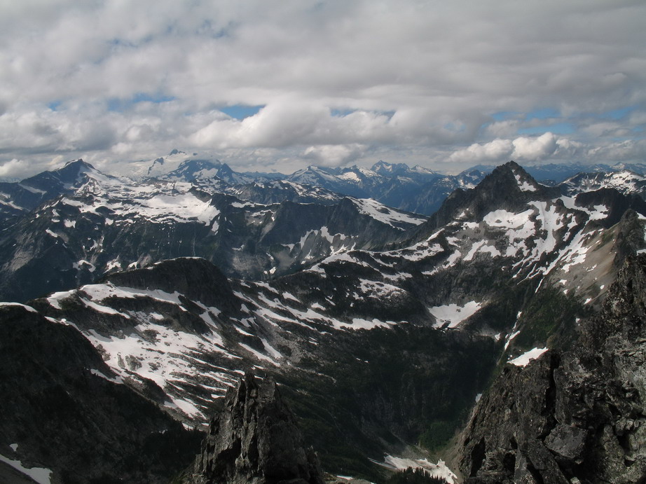
One possibility is to descend Sinister to the South (a class 3 gully takes you down to the glacier from ~8000' on Sinister's East Ridge), then make a descending traverse to the East on the Blue Glacier headed for Blue Lake (NOTE: Blue Glacier and Blue Mtn are mislabeled on the USGS) . Gain about 400'-500' to the ridge above Blue Lake and contour through the adjacent basin that lies to its East, crossing several gullies and ribs while making a slow, descending traverse to about 4600', about 1/2 mile before the intersection of Spruce and Agnes Creeks. From here, find a forested rib and head straight down to Spruce Creek (some slide alder patches here). Follow Spruce Creek to just past the confluence and find one of two easy log crossings (about 300 yards North of the confluence). Swamp Creek (roughly 9 miles from Stehekin River Road), is a nice place to camp. Expect it to take ~5 hours from the summit of Sinister to reach Swamp Creek Camp.

-
In my opinion, routefinding out Spruce/Agnes Creeks is rather straightforward, and if you're bent on doing the PT this summer, it's seems like a more aesthetic completion than a 15+ mile road hike. Also, I would think that most parties qualified to do the PT would be prepared to do a little added routefinding.
-
A viable alternative would be to exit via Agnes Creek, especially if you plan on climbing Sinister as part of your traverse.
-
Nice shots! That photo with Baker framed between Degenhardt and Terror is sweet. Good on ya for getting after it, like always.
-
Nice photo, Beefhide!
And welcome, Pops.
-
I need 2 St. Helens permits for any day in September. Please e-mail me or send me a PM.
tsjolseth AT hotmail DOT com
-
$135 from $150.
-
I think you're right on. Maybe tack on an hour on the approach.
-
BTT - Winter is coming.
-
Post deleted by Tom_Sjolseth
-
First reported is first ascended - publish or perish

In this same fashion, I must claim 23rd ascent party.

Not that it matters a whole lot to me. I was more impressed that we had the two oldest gentlemen ever to stand on the summit (who signed in).
-
Don B. and I had planned to go over and check it out, but time constraints held us back. I do not believe it has yet seen a first ascent. It looks a lot easier to get to it than to get back...
Roy has 2 left, Don has 1. Looks like there will be a few finishers this year.

Found nuts on North Ridge of Stuart
in Lost and Found
Posted
Found an assortment of nuts on the North Ridge of Stuart over the weekend. If they're yours, PM me with specifics.