


Rad
-
Posts
2925 -
Joined
-
Days Won
25
Content Type
Profiles
Forums
Events
Posts posted by Rad
-
-
i did my part by rating it 1-star, that brought it down to 3
you can help out by one-starring it too!
I didn't realize starring was democratic.
I voted

-
If a non-moderator had posted this would it have three stars?

Discuss.
-
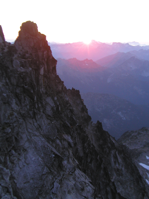
Ah, the range of light.
The last shot looks like the back of halfdome in the background with the Snake dike on the left skyline.
Good memories...
-
I'm in 4 Thursday. We can talk about destinations at the QFC lot. There are good arguments both ways.
R
-
Last year I buddy and I went up there with a single 50m rope, instead of a 60m rope, in an effort to save weight on the trip. We came up short on several raps and had to set intermediate anchors and do unroped downclimbing to reach rap stations.
I'd recommend you take a single 60m rope.
Have fun.
Rad
-
Nice job.
Bummer about the moat pucker factor.
Your report confirmed my suspicions about the gully.
We went up the buttress to the right, and the rock was good and protectable where needed.
-
Thank you for commenting on the Environmental Assessment regarding the Upper Stehekin Valley Road from Car Wash Falls (MP 12.9) to Cottonwood Camp (MP 22.8) in North Cascades National Park.
The Environmental Assessment for this proposal considered four alternatives:
A. No Action
B. Permanently close the Stehekin Valley Road above Car Wash Falls
C. Reconstruct the Stehekin Valley Road from Car Wash Falls (Mile Post 12.9) to Glory (Mile Post 20.1)
D. Reroute the Stehekin Valley Road from Car Wash Falls to Bridge Creek and from Glory to Cottonwood Camp (road end)
The decision documented in the Finding of No Significant Impact is to implement alternative B. You may obtain an electronic version of this document, including Errata and a Public Comment and Response Report at the NPS Planning, Environmental and Public Comment (PEPC) website:
http://parkplanning.nps.gov/noca.
Should you wish to receive a hard copy of the document, you may reply to this e-mail, call the park (360.856.5700 ext. 351) or send a written request to:
Superintendent
North Cascades NPS Complex
810 State Route 20
Sedro-Woolley, WA 98284
Sincerely,
William F. Paleck
Superintendent
-
Yep. The ones in the distance. The trail runs right across the top of them. The slabs are South facing just East (right in your photo) of Red mtn (Red Mtn is, you know, the red one).
Just to be clear, I have never climbed on them myself, just looked down them on the way to and from Thompson. There are numerous ledges, and they are fairly low angle, but they are quite tall - perhaps more than 60m? - and the rock looks decent. Someone MUST have climbed them before, given the thousands that walk past.
Let us know what you find!
-
Great trip report Allison!

Rad
-
Throw a toprope down the slabs at the Kendall Katwalk? They look low angle but maybe they'd be fun.
There are also some fins of rock on the S end of Red Mtn right off the trail that might be fun to scramble.
-
The big detractor for the Beckey route is the gully. If you go make sure you're the first one up it so you don't have people knocking rocks on your noggin.
-
Something tells me this thread is headed for potty humor.
You crap on the glacier and then drink melt water at the base. Or vice versa. It's a litle wheel of fortune for the intestinal fauna.Blue bags would've been better.
Iodine breaks the cycle.
-
I hope you dispatched your Thai food leftovers off the side of the ridge rather than leaving them on ledges?
Yep. See that rock platter at Weekend's feet? It didn't stay there!
-
Climb: Mount Stuart-Full North Ridge - Epic or adventure?
Date of Climb: 8/12/2006
Trip Report:
Heinous epic or awesome adventure? You decide:
Weekend Climberz and I set out to climb the full North Ridge of Stuart in a day by going super light, in via Mtneer Creek and out via Teanaway.
That would allow us to avoid setting foot on snow and leave the boots, crampons, axe, sleeping bags, sleeping pads, and bivy sacks at home.
To save more weight, I ditched my Petzl Duo in favor of my newest toy: a 1 LED light source the size of a quarter that can clip onto a helmet.
Foolish or smart? Perhaps both.
Weekend was hoping to leave Seattle by 3pm, but had to stay at work until 5pm. No worries, I said, I’ll pick up Thai food to go….
We powered down the spicy food and rice, dropped the getaway car at Teanaway, slept for a few hours in the Icicle, and started up the Mountaineer Creek Trail just after 3:30am.
The stars were out and the moon was bright.
We didn’t see any flagging at the switchback described in Nelson, but found an easy way across the creek.
The thrash toward the Ice Cliff Glacier basin was only mildly annoying.
We met Dirty Harry and his partner in the rocks below the basin.
Only a few words were exchanged but it was clear the race was on.

As we arrived below the route the sun’s first rays splashed the North Ridge.
We topped off our water vessels at a snowmelt creek just a few hundred feet from the start of the route.
Dirty Harry sat on a nearby boulder, waiting for his partner, as Weekend and I passed him and scrambled the 4th class rock to the start.

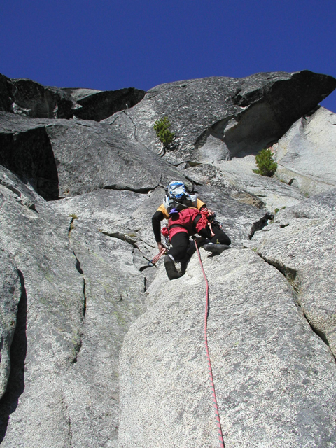
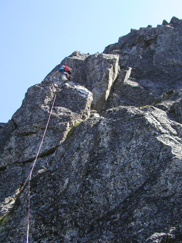
Weekend quickly fired off the first 60m, including a 5.8 squeezeless “squeeze” that didn’t require pack removal.
We stepped aside at the first belay as DH and his partner simulclimbed past. We never saw anyone else all day.
Then I lead the second pitch, following Marko’s advice: “Green means go. Blue means back the hell up and go up green!”
In terms of moves, it was the best pitch of the day, with a fun finger crack to a mantle at the start, some jamming in a perfect dihedral, a sustained lieback, a funky high-step above a small roof, and a slightly insecure exit mantle. I’d call it sustained Yosemite 5.9 on granite that rivals anything in the Valley. Definitely the hardest pitch of the day. It was easily protected with a standard rack.

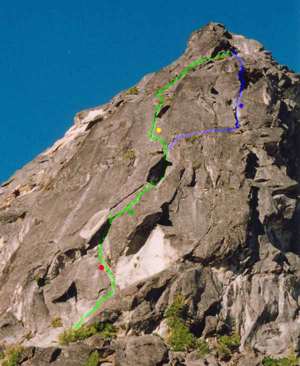
Side note: with a 60m rope go all the way to the ledge below the yellow dot on P1.
Then climb to the spot where the two routes join for P2.
Then we started simulclimbing. Weekend let the first batch.
As we got higher the Thai food started to churn.
Soon Weekend started feeling like shit......so he did.
I few pitches later I followed suit.
After the tissues were exhausted we moved on to the route photos I'd printed.

Droppin trow on the prow.

Unfortunately, Weekend’s discomfort increased.
Although he’s too stoic to complain, it was clear he was feeling pretty crappy, so to speak.
Still, there was no talk of bailing so we continued.
It seemed my evil Thai plan had worked: I got to lead all the rest of the pitches!

However, several non-Thai factors contributed to our slow pace.
We had both simulclimbed before, but not together. It took us a while to find our rhythm.
Also, I found the route-finding a bit confusing in a few places on the lower buttress. At one point, I climbed left up a 30ft clean face to gain the ridgecrest, only to find steep lichen-encrusted cracks above. I downclimbed, climbed another face, up and around into another crack system, and then was looking at two cracks that ran through separate roofs/overlaps. Both were totally lichen-encrusted. What the F%!? I brought Weekend up, looked around, and found the way: ascend the left crack dihedral until just below the roof, climb a flake on the left wall to gain a crack in a hidden dihedral crack. Neither this hidden crack, nor the small roof it pierced, were visible from below.
 Sorry, no photos.
We climbed and climbed and climbed and climbed.
The climbing was never harder than low or mid-fifth class, but this is a damn long route.
The afternoon sun lit the ridge behind us.
The exposure on the upper ridge was awesome.
Finally, we crested a small tower and saw the upper slabs and gendarme depicted on the cover of Climbing Sept 2005 (the Epics issue
).
I was bent on getting up and over the summit, preferably before dark, but damned if I was going to come all this way and bypass the gendarme.
The first pitch was not too bad: great liebacking in a spectacular position.
Weekend decided to prussik to save enough juice to get to the summit.
He tied in on a bight so I could belay and then prussiked the line through the pieces.
The sun was sinking to the horizon as I led the second gendarme pitch.
It’s much friendlier than people have suggested. A convenient rock wedged down low provides a chock to sling and a handy foothold, a small finger pocket provides a nice positive edge, the crack accepts a few key fist jams, and a few layback moves get you past the crux. Our #4 camalot was great, but we would have been fine with the #3.5 or even the #3.
Between the drama of the late hour, the huge exposure, the awesome moves, and the sheer wall bathed in alpenglow it was stunning climbing.
I was super stoked to have led those two pitches onsight.
The sun set as Weekend prussiked that OW section.
The air was calm and still as if the mountain were holding its breath to let us pass.
As the light waned, we pressed on as fast as possible.
First, I wanted to make the summit before dark.
Then I wanted to get off the upper 5.9 pitch before dark.
Then I wanted to at least SEE the 5.9 pitch before total darkness enveloped us.
We simulclimbed above the gendarme to a short headwall, arriving just as the cobalt blue sky gave way to blackness.
There it was, looming in the darkness, the final sting in the tail of a long, long, route. Three cracks led up the vertical wall.
I chose the middle one: a nice hand crack used in opposition with a wide crack. I set off with Weekend’s 3 LED light, he wore my 1 LED light, and we fired it off.
Now we faced the final bid for the summit in the dark.
Everything on this route is farther than you think, and we finally topped out at 10pm.
About that time the moon rose out of the Eastern plains, thick and red, and bathed us in its soft light.
A shooting star flashed across the sky.
I swallowed my last sip of water.
Our climb was over. Or was it?
or ?The car at Teanaway, with sleeping bags and beers, was still a long way away.
The forecast was for freezing levels around 10,000 to 11,000 feet.
Even my tired mind knew that with Stuart at about 9500 we’d be pretty darn cold without sleeping bags or pads.
We had space bags to crawl into, but my extra clothing consisted of one hat and the wool socks I wore on the approach.
I remembered getting nerve damage in my big toes in the Pickets in 2003 from similar nights out.
I lobbied to descend the Cascadian by moonlight.
Weekend thought we should bivy and descend in the morning.
I insisted, and we started down to cross the upper basin.
After a few hundred feet we ended up getting cliffed out over a small snow patch.
At that point I relented, and Weekend generously offered me his extra wind pants, gortex shell, and headsock.
..........................
THE STUART SNAFFLE:
Our bivy site had a few stacked stones and a generous sprinking of snaffle scat.
Expecting night visitors, we put our remaining bars in a helmet under a rock.
I lay on the rope and my small pack while Weekend squeezed onto his larger pack.
We unfolded our space blanket bivy bags and crawled in for a cold night.
I pulled my hat over my eyes and tucked, turtle-like, into my crinkly bivy bag.
The moon was bright and all was peaceful, if cold, for a few hours.....

Sometime later I felt a rustling by my feet and then a big THUMP!

A rock fell off our wall onto my leg and something was thrashing into me! It was frigging ginormous!
I knew it: the roid-raged snaffle had finally come to claim its victims and their clif bars!
I kicked the beast vigorously but that only made it mad.
I shouted to alert Weekend and grabbed my light to finally see the intruder.

It scowled at me, with our prized bars already tucked into its gaping maw.....
"Whoa, dude!" it said "Are you OK?"
I felt a little sheepish
 .
.Weekend fell back asleepish
.My toe throbbed from kicking the granite blocks at our feet, and my emergency space bivy now had several emergency exits.
A gentle breeze began to filter through these.

It was only about 2am. To stay semi-warm, I had to lie on my back with my legs bent and clamp my knees together to hold the tattered foil in place.

The next four hours passed slowly, but the nerves in my toes remained unharmed.
At dawn we scrambled back to the summit and worked our way down the correct path.
In the upper Cascadian we went left where we should have stayed right, and we ended up on deer trails in a nameless ditch.
No matter. We headed down. We were safe.
Next time we'll stay right and go straight down.
After re-hydrating, we trudged up over Long’s pass, meeting at least half a dozen other climbers headed back to their cars.
They all had much heavier packs and rolled their eyes at our open bivy on the summit.
Back at the car the beer and the creek were cold.

The North Ridge of Stuart has been on my list since I moved here seven years ago.
I’d say the route exceeded my high expectations, providing an excellent outing all around.

I’m definitely glad we did the Full North Ridge because the best pitch of the climb, IMHO, was pitch 2.
Next time we’ll go faster because we’ll know the route better and will have a more efficient simulclimbing plan.
The car shuttle worked great. The weather was perfect. We had just about the right amount of gear.
If we'd carried heavier gear I suspect we wouldn't have made it to the summit before having to bivy.
Special thanks to Russ, Jerm, Marko, Yngve, and others who provided some helpful beta through the morass that is CC.
Gear Notes:
Gas money!
Standard rack with one #3.5 or #4 camalot for the upper Gendarme pitch.
Lots of slings for horns.
A space blanket bag only weighs about an ounce and it works great if you don't kick holes in it.
Approach Notes:
Car shuttle: in Mountaineers Creek and out Teanaway.
-
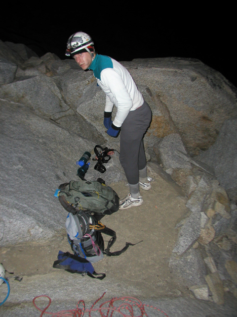
Was attacked by ginormous snaffle atop Stuart. Details to follow.
-
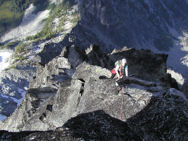
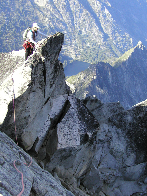
I climbed a line that's not in the photo above.
It starts 5-10 feet left of the crest of the ridge that leads out to the Unicorn horn. There were a few moves straight up and then some fun moves left past a slanting overlap/corner. It was probably 5.6ish, protected with a few nuts or cams in the 1/2 to 3/2 inch range.
It was cool because it drops off fairly steeply on that side of the pinnacle so you feel higher up than you actually are. I'd guess there was only 40 feet of climbing.
Take a 30m rope and just a few pieces in the 0.5 to 1.5 inch range to save on weight.
Go for the ambience, not the rock moves, because it's a long hike for 40 feet of easy climbing.
Have fun.
-
You probably need a 50m rope to rap past some rock between the upper shelf and lower shelf. That would probably be a 5th class downclimb.
We didn't walk all the way down to the end of the lower shelf, but I bet you'd be fine. There is a bit of a moat so you have to drop to the snow in the right spot.
The lower shelf is almost completely snow-free right now, and the remaining snow is melting fast and calving off.
As we were hiking out we ran into a party of 3 planning to ascend and descend the lower shelf route. They didn't bring a rope. They would know for sure how you'd fare.
Good luck!
-
Don't skip the lower buttress. There are some fun moves and great exposure.
-
At a steady old-man plodding pace:
Left car 6:30am.
Base of main W Face at 8am.
Roped up at the ridge above a little after 9am.
Unroped by 1pm.
On top by 2pm after some wandering around.
Saw about a dozen climbers who'd come up the Corkscrew route on a picture perfect day in the alpine.
Back at the bivy site on the S ridge by 4pm.
Car at 6:30pm.
-
The Bedal Creek approach trail is in great shape thanks to recent trail work. Water is available all the way to the climb.
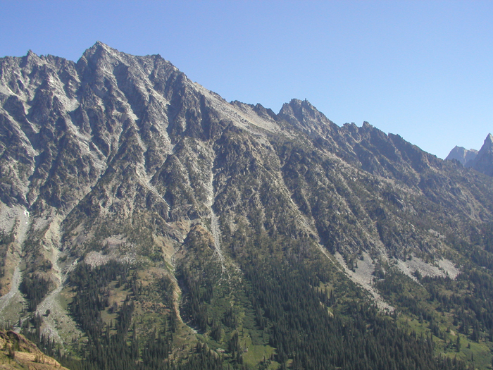
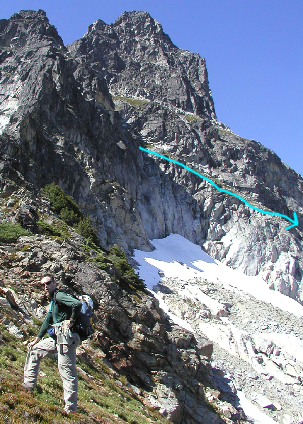
We headed up to the right skyline in the photo below.
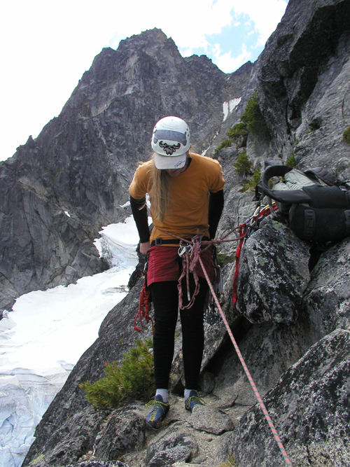
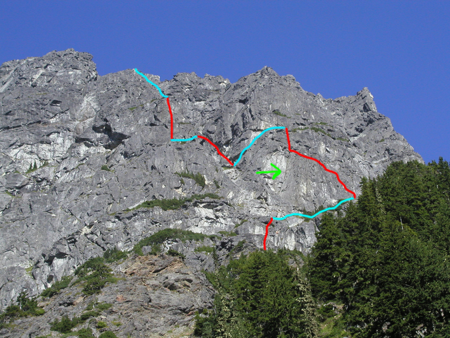
We simul-climbed up the ridgecrest to a heather bench, and then hiked right on heather ledges. Alex led a pitch up undulating solid rock to a belay at a block. I got the next pitch, which turned out to be the best of the day (5.7ish). It started with an airy traverse into a dihedral, went up the dihedral to a pod at a small bulge, gained the upper dihedral, and topped out on a large ledge with loose rock. This is the top 1/3 of the large dihedral indicated in the arrow below. (Red was roped. Blue was heather hiking. Green arrow is the prominent dihedral.)
We looked around and decided to head left for a buttress. To get there, we scrambled down a heather slope, bouldered up a short rock step, and hiked further left on more heather (perhaps a pattern emerging?). Alex led a long moderate pitch straight up solid rock coated in lichen.
I led another pitch as the buttress narrowed to a nice ridge and the angle kicked back. We stopped at an enormous heather ledge and unroped.
After hiking around a bit looking for the corkscrew trail, we scrambled up a gully another several hundred feet and found the superhighway.
There we ditched our packs, scrambled to the summit, soaked in the sun, and wondered if our descent was going to be harrowing. Turned out it was very straightforward.
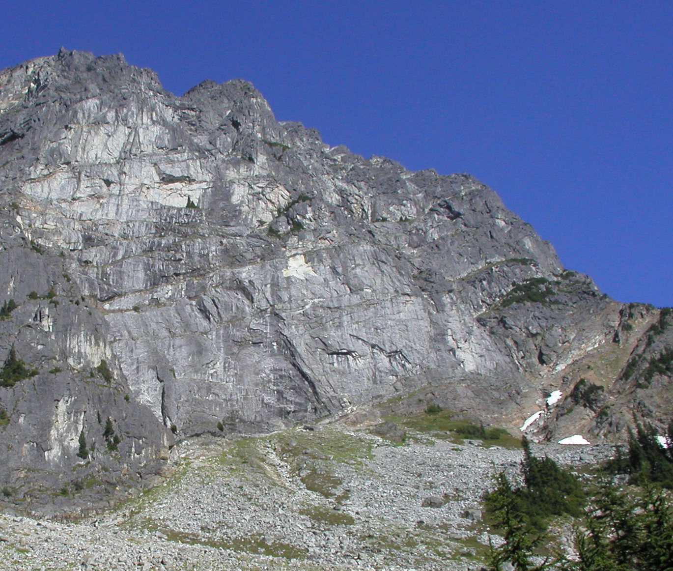
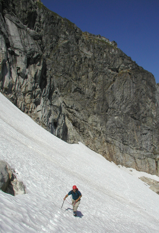
Hike the superhighway to a point on the South Face. Scramble down heather about a hundred feet to a red cord anchor on a rock. Rap 30m (or 25m to a crappy intermediate anchor) to more ledges. Hike down the lower shelf to within 30m of the snow (blue line below).
Rap down to the snow and hike across snow and rock to an amazing bivy and the saddle lowest saddle along the S ridge.
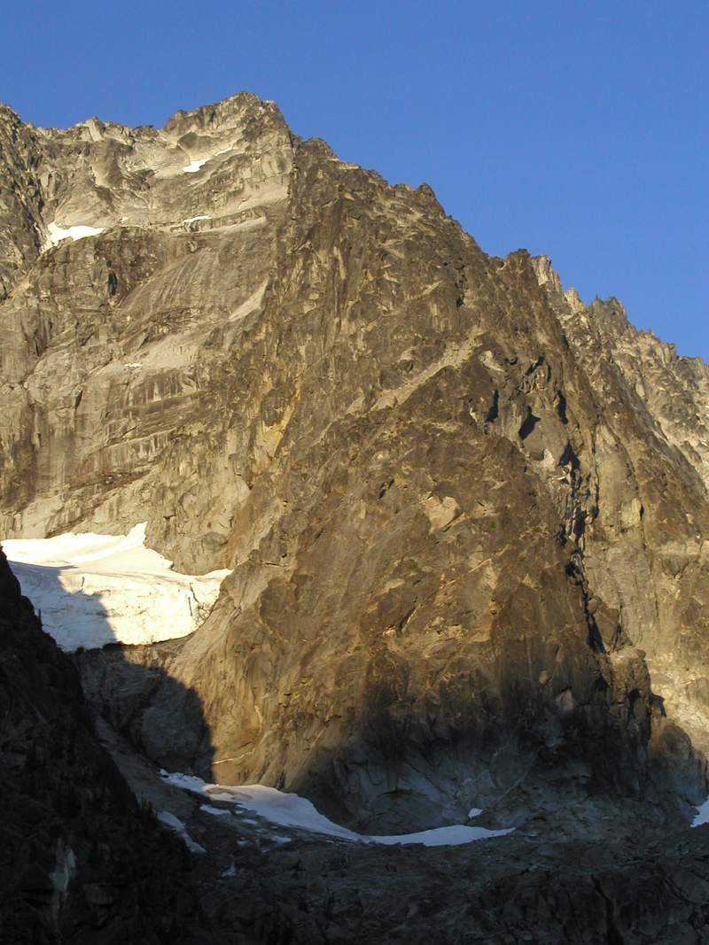
Soak in the ambience:
Admire the amazing route potential of the 400 foot vertical walls of the SW face:
-
Climb: Sloan-West face variation
Date of Climb: 8/5/2006
Trip Report:
Alex and I climbed a variation of the West Face of Sloan.
For some reason, CC would not let me edit photos in the TR so I put them in a reply down below. Text only version:
...
The Bedal Creek approach trail is in great shape thanks to recent trail work. Water is available all the way to the climb.
We headed up to the right skyline in the photo below.
We simul-climbed up the ridgecrest to a heather bench, and then hiked right on heather ledges. Alex led a pitch up undulating solid rock to a belay at a block.
I got the next pitch, which turned out to be the best of the day (5.7ish). It started with an airy traverse into a dihedral, went up the dihedral to a pod at a small bulge, gained the upper dihedral, and topped out on a large ledge with loose rock. This is the top 1/3 of the large dihedral indicated in the arrow below.
We looked around and decided to head left for a buttress. To get there, we scrambled down a heather slope, bouldered up a short rock step, and hiked further left on more heather (perhaps a pattern emerging?). Alex led a long moderate pitch straight up solid rock coated in lichen.
I led another pitch as the buttress narrowed to a nice ridge and the angle kicked back. We stopped at an enormous heather ledge and unroped.
After hiking around a bit looking for the corkscrew trail, we scrambled up a gully another several hundred feet and found the superhighway.
There we ditched our packs, scrambled to the summit, soaked in the sun, and wondered if our descent was going to be harrowing. Turned out it was very straightforward.
Hike the superhighway to a point on the South Face. Scramble down heather about a hundred feet to a red cord anchor on a rock. Rap 30m (or 25m to a crappy intermediate anchor) to more ledges. Hike down the lower shelf to within 30m of the snow. Rap down to the snow.
Hike across snow and rock to an amazing bivy and saddle
Gear Notes:
#2 and #3 camalots very useful on dihedral. Took crampons but didn't need them.
Approach Notes:
Drive via Darrington, not Barlow Pass!
Bedal creek trail is in great condition.
Descent via lower shelf is easy.
Water available to within a few hundred yards of the route.
-
Rack?
Poons or not?
Decent?
Water?
Assuming you mean the N face route...
Yes, yes, easy walk-off, plentiful on the approach and descent.
See thread:
-
You say potayto, and I say potahto
You say tomayto, I say tomahto
potayto, potahto
tomayto, tomahto
Let's call the whole thing off!
...
(and don't forget GWB says tomatoe!)
-
Here's a problem: parking permits for long day trips.
Example: Climbers plan to climb Backbone ridge on Dragontail in a long day. They park their car at Mountaineer Creek trailhead and start down the trail at 4:30am. The ranger cruises the lot at 6am looking for cars of illegal/permitless campers, finds the climber car with no overnight permit, and issues a ticket for $200.
$200!
The climbers return to their car at 7pm after a long day only to find this ticket. Because the ticket is handled by federal district court it is nearly impossible to contest, and not paying it is a federal crime. Of course the climbers never camped in the area as they were moving all day.
THIS is a problem that needs to be addressed.
[TR] The Mythical Bellingham Big Wall- 7/21/2005
in North Cascades
Posted
Hey Blake,
Maybe I'll see you in Stehekin in the next week...
Darin and I climbed a line up the E face of Skookum almost a year ago. There were two nice pitches down low and two up high. In between was choss hiking and scambling:
look after Stovepipe in the TR
There may be more sustained lines on the face right of where we went. If Darin posts a closer photo of the face I'd trace our line. I don't have the pics.
Rad