


Rad
-
Posts
2925 -
Joined
-
Days Won
25
Content Type
Profiles
Forums
Events
Posts posted by Rad
-
-
I wish the injured climber a speedy and full recovery.
I wish to thank everyone who took time and effort to assist in rescue/evac.
I wish the rest of you good luck in rationalizing to yourselves that something like this will never happen to you because you're too (choose one or more: smart/sober/experienced/young/old/hairy).
-
I don't buy the bullshit contractive narrative so popular in this country. If you've suffered a debilitating injury or illness, that's one thing. Barring that, one should be able to expand the depth and meaning of one's experience regardless of age.
Amen. Life is what you make it. Nothing more. Nothing less.
-
32 is tough, I've only jumped on routes up to 12- there (because I'm a wanker) but I felt like the grades were a lot more spot on than a little ways up the road.
I disagree. There are soft 10s at both 32 (Mambo Jambo) and 38 (the two you mentioned).
The 11s are pretty consistent between 32 and 38:
At 11a: Primus or Overture or Architect Rally (38) vs Disincarnate (32).
At 11b: Negatherion or Tea Time (38) versus Gold Rush or Little Hitler or Situation Room (32),
At 11c: Canine Patrol (38) and Godflesh (32) are both soft. Giant and the 11c next to Tea Time at Gun Show (38) are more on the mark.
At 11d: I haven't climbed lines at this grade at 32 so won't comment.
At 12a: Culture Shock (38) doesn't feel easier than Bust the Move, Rainy Day Women, or Lay of the Land (an excellent line that deserves more attention) at 32, but that may say more about my lack of stamina than the ratings.
But more disturbing to me is that this elitist attitude keeps strong climbers from going to 38. Many crags at 38 have better rock than 32 and there are plenty of hard lines up to mid-12. Don't believe me? Let me take you on a tour or PM me for beta and a list of routes to hit. I'm biased because friends and I have invested effort in developing some of the newer lines and want to see them get more traffic.
What bothers me is the implication that softly graded routes are somehow lower quality than ones graded harder. Or that sandbags must be good. That's a load of crap. Whether I call a route 5.9 or 10c doesn't change its quality and it doesn't make me more or less of a badass.
The quality of a route doesn't have anything to do with its rating.
The only purpose of ratings is to give the onsight leader a sense of what they're getting into and provide some benchmarks to measure our personal progress.
Sorry for the rant. You hit a hot button.
-
38 is a fun places to get a bunch of routes in, but whooo-eeee is it soft! endless bliss is rated 10a, but is barely 5.8. Theres some 10a above it, ellies sweet kiss or something, can't be more than 5.7. I've gotten onto "10b" terrain after going the wrong way on criss crossing boltlines when i thought I was doing a 5.8. Fun place to climb, but I kinda ignore grades there, at least at the moderate level, as they really don't mean anything.
Come out to Shangri-La crag at X38 Far Side sometime. You'll find about a dozen high quality routes (yes, I'm biased) in the 5.10-12 range that are more in line with Index LTW than the rest of X38. PM for info and/or tours. I'll work on getting it on Mountainproject this winter.
-
Ratings are subjective, but Mountainproject allows climbers to post ratings and so develop an average. This should help smooth out the softies and the sandbags.
-
Great TR. Love the Wind Puke name and your adventurous spirit of exploration.
-
Severity will depend on the nature of the solvent, the concentration to which gear was exposed, and the duration of exposure. Sounds like your diligence minimized the latter two. When Dru tells you to send you his gear for testing, you know you're OK.
-
you forgot to mention the Kodiak brown bear which is distinct from mainland grizzlies.
From Wikipedia: "Taxonomist C.H. Merriam was the first to recognize Kodiak bears as unique and he named the species "Ursus middendorffi" in honor of the celebrated Baltic naturalist Dr. A. Th. von Middendorff.[4] Subsequent taxonomic revisions merged most North American brown bears into a single subspecies (Ursus arctos horribilis), but Kodiak bears are still considered to be a unique subspecies (Ursus arctos middendorffi). Recent investigations of genetic samples from bears on Kodiak have shown that they are closely related to brown bears on the Alaska Peninsula and Kamchatka, Russia. It appears that Kodiak bears have been genetically isolated since at least the last ice age (10,000 to 12,000 years ago) and there is very little genetic diversity within the population.[5]"
-
I just don't have that physical and mental talent to onsight at or above my limit....
Nobody does. No matter what your level, you ought to be able to succeed on projects at least two letters harder than your best onsight. The fun and crazy thing is that your "limit" is just your "current limit", and this is mostly in your mind. Break on through to the other side....
-
Nice. Onsight is great, but there's a different sense of satisfaction that comes from becoming intimately familiar with a route, finding a solution that is uniquely suited to your abilities, and then honing those abilities to meet the challenge. While onsight is given the highest regard, in some ways it's the least involved type of climbing: walk up to a route and lead it and walk away. Projecting a route takes hard work and perseverance that can make success more sweet. I've got my own obsession to complete before the rain flies. Nice work getting yours done.
-
Thanks. This route is a prime example of a long outing for a bunch of moderate alpine rock, but the position and ambience are first rate.
I'd encourage other parties looking for some good rock pitches to follow the variations we did. It'll add three nice pitches that are right on or just left of the crest.
Hard men and women should take a look at the South Face again, perhaps starting near the base of the bypass ramp. The granite is impeccable for 1500 to 2000 feet and there's only one reported line, which is on the left side of the basin.
-
If there is, say a three pitch route and you onsight P1, come back later and onsight P2, come back again and onsight P3, then you have onsighted all the pitches.
Yes, but not a 3 pitch route, which is exactly my point. If they said, they OS all the pitches, not the route, then it would be a correct statement. Calling a route OS is bullshit.
That's what they are saying. You are just a dump Polack. Try reading this in English. They climbed all the pitches onsight, and except for one 30m pitch aid pitch, all free. Pretty obvious. If you had less sand in your vagina and got laid more often you wouldn't be so worried about this.

Canada 1, Poland 0.
BTW, it's not the climbers making any claims, it's the media outlet who put together that website.
-
Since you left we have three new gyms in the Seattle area that are all excellent.
A completely new VW Seattle
A new Stone Gardens in Belevue
And SBP
-
Trip: Slesse - NE Buttress (bypass)
Date: 9/15/2012
Trip Report:
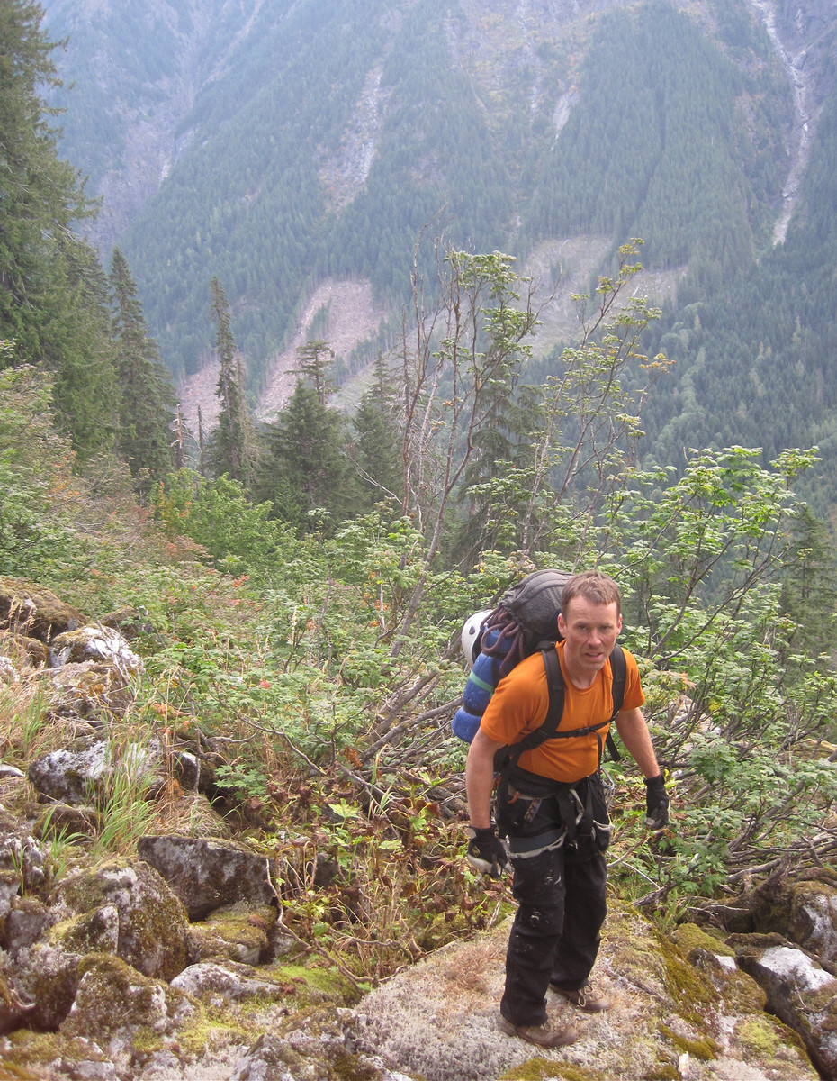
After a good day on Roan wall and Salish Peak earlier in the summer, David and I were psyched to get on something bigger. We set our sights on Slesse.
I tried to sabotage our trip by leaving critical gear in Seattle and not noticing its absence until a gas station just south of Bellingham, but David patiently turned around and my wife drove north with the gear so we could meet in the middle. After a two hour delay we were back in Bellingham and headed across the border.
The NE Buttress of Slesse has been on my list for years, but the treacherous Pocket Glacier has kept me away. Some years there was only a week between the time it slid off the slabs and the onset of our fall deluge. The past two years, it didn’t slide off at all. The warm, sunny August this year did the trick. Nonetheless, descriptions of the N Rib suggested a longer, more sustained route that might have less glacier hazards than the NE Buttress route. We hoped to do the N Rib but were willing to change plans on the fly if necessary. Change plans we did.
David’s GPS led us right to the proper parking spot, 5.6km up the road per McLane. There are nasty water bars on the road, but we passed them in David's trusty Toyota. Unfortunately, he hit a bison in Wyoming late at night a few weeks prior. Sleep-deprived, David pulled over to assess the damage.
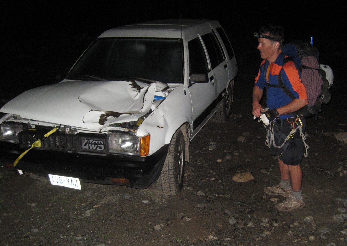
Surprisingly, everything worked, but David worried that the beast might be dying in the bush, so he set out to euthanize it with his 3 inch utility knife. Fortunately for everyone, it was completely unhurt and ambled off into the night.
At 2:30am we arrived at the parking spot for Slesse, but we couldn’t find the trail. A side road to a campsite seemed right, but it wasn’t far enough from the parking spot and there was no trail or log leading across the river. We hiked back down the road in case we’d gone too far. We trampled around in the forest a bit and debated what to do. At 3:30am we left the car for good and crossed the creek near the campsite. This was the site of an old bridge, and we hoped there would be an overgrown logging road on the far side we could follow. Wrong.
We bushwhacked through dense, unfriendly greenery up the side of the mountain well into the night.
Bushwhacking is something many of us experience but few write about, perhaps because we’re eager to put those prickly memories out of our ever-optimistic minds. A few questions may assess the ugliness of the endeavor. Can you see the ground beneath your feet or are you surfing on greenery? Are there prickers? Is it dark? Are you lost? Are there high consequences if you fall? Is there rain or other inclement weather? Are you carrying a heavy pack with an iceax or other items that catch on the shrubbery? Are you traveling downhill (best), uphill (worse), or sidehill (worst)? How far can you see? There are a few grading scales, but the reality is that we compare each new experience to past sufferfests.
...............Begin Alaska tangent..................
My worst experience was on Chichagoff Island in southeast Alaska, where it took us five hours to cover a single kilometer between Kook Lake and Basket Bay. The area had been clearcut a few years prior, and a tsunami of prickers had risen up to 15 feet high over trash logs, holes, boulders, and a tumbling creek. For hours, we clung to prickers while sliding across slippery thin logs we couldn’t see above gaps of unknown depth and character. It was mentally and physically exhausting, but there was another way: 4ft high by 2ft wide bear tunnels worn by large Alaskan Brown (not black) bears. We hesitated, then hunched over and entered, singing at the top of our lungs to warn any oncoming bears of our presence. At one point, we emerged from a tunnel into a 30ft diameter clearing around a large stump. Like a hedge maze out of Edward Gory, there were just two ways to leave this space: through the tunnel we’d taken or through a similar one on the opposite side. We stopped singing to catch our breath and drank the last of our water. At that moment, a 1200 pound Alaskan brown bear emerged from the tunnel we’d been about to enter. He was twenty feet away from us with a dense wall of green prickers all around us. It was a roman lion/slave cage match, and we were the slaves.
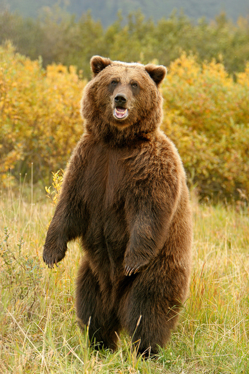
This is a stock photo that belongs to Alaska Freeze Frame, but you get the idea.
This male, who looks about 8ft tall, is about the same size as the one we encountered.
In North America we have three species of bears. Polar bears (Ursus maritimus) live close to the Arctic Circle and grow to 1500 pounds. They are true carnivores that hunt seals and have been known to hunt and eat people when given the chance. Black bears (Ursus americanus) live in much of the US and Canada and grow up to 350 pounds. They are opportunistic omnivores who eat almost anything they can find, including berries and human foods scored from campers, cars, and landfills. Grizzly bears (Ursus arctos) live in parts of the Northwestern US and Canada and grow to about 500 pounds. Brown bears (also Ursus arctos) are closely related to grizzlies, but they live in the wet coastal areas of Alaska and British Columbia and grow to 1500 pounds, fueled by a protein-rich diet of salmon.
We faced a large, beautiful Alaskan brown bear with black and brown markings like a Doberman. We shouted and hopped up onto the stump, adrenaline pumping. The bear, just twenty feet away, stood on its hind legs to get a better view and whiff of its next meal. Despite scary bear tales you may have read, the vast majority of brown, black, or grizzly bears are left-leaning hippy pacifists who only attack humans when defending their cubs, truly starving, or suffering serious mental derangement. This fine fellow had an abundance of berries and was eagerly awaiting the arrival of spawning salmon. Content we weren’t a threat, he dropped to all fours and ambled unhurriedly into the tunnel from which we’d just emerged. We were alone again, but we were faced with a question: should we A - enter the tunnel where the bear emerged, B - enter the one he’d just entered, or C - schwack straight through the wall of heinous prickers? We chose A and encountered four more brown bears on the way to Basket Bay. None were quite as close or exhilarating as that first encounter. On the return, we found an old logging road and got back to our boat on Kook Lake in about fifteen minutes.
...............End Alaska tangent and return to Slesse report..................
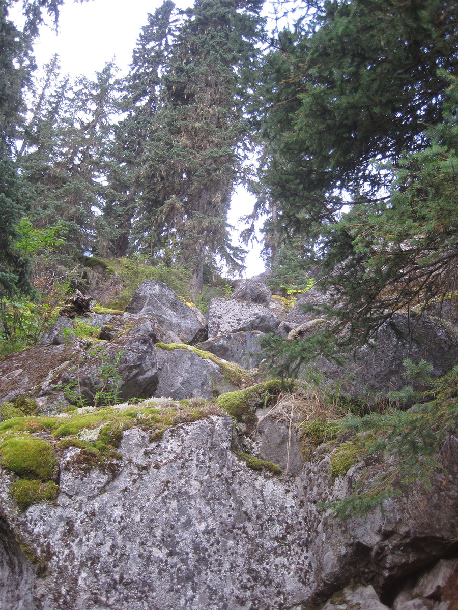
Our Slesse night bushwhack is now in the number 2 spot. A few snippets: Sidehill slide alder surfing with an overnight pack is two parts Yoga and one part CrossFit. The can of tomato juice I planned to stash at the memorial for our return trip was crushed in my pack. Drip, drip. Compared to the stinging prickers we encountered, Devil’s Club is downright friendly. I’ve already erased all other memories of those hours. At 6:45am, daylight revealed that we were still not anywhere near where we needed to be. We reluctantly decided to bail and began heading down. A few minutes later, we came to the most open terrain we had found yet: a talus field with dense lichen.
It was a welcome reprieve, so we paused to rest a few minutes.
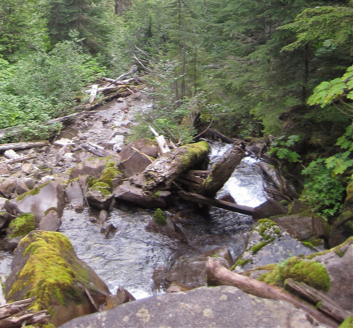
I could hear a decent sized creek in a canyon to the South, and we thought it might be one shown on a map in our McLane guide. The map suggested the approach trail should be on the other side. I convinced David we should traverse through prickers, cross the creek, and look for the trail.
We weaved our way through nasty brush to a narrow slot of waterfalls.
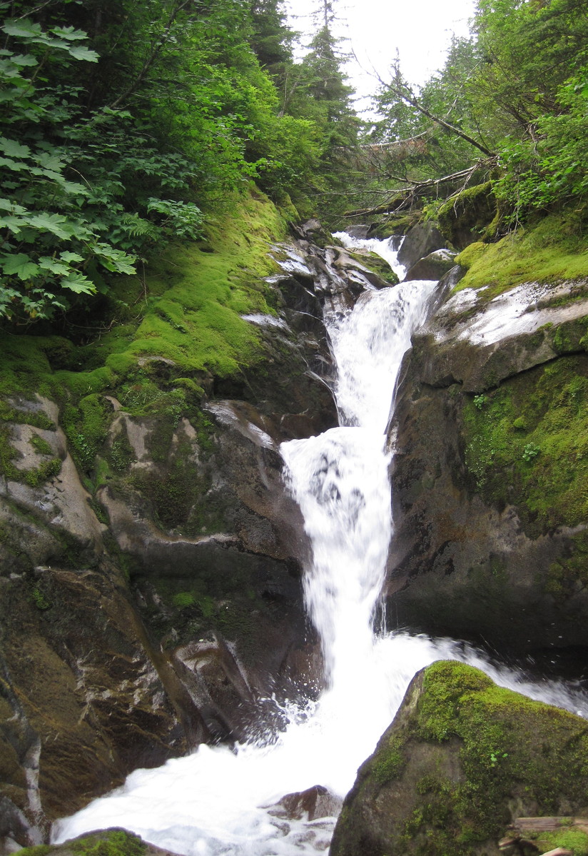
We scrambled down some very slippery rocks.
And crossed on a small log over another set of falls.
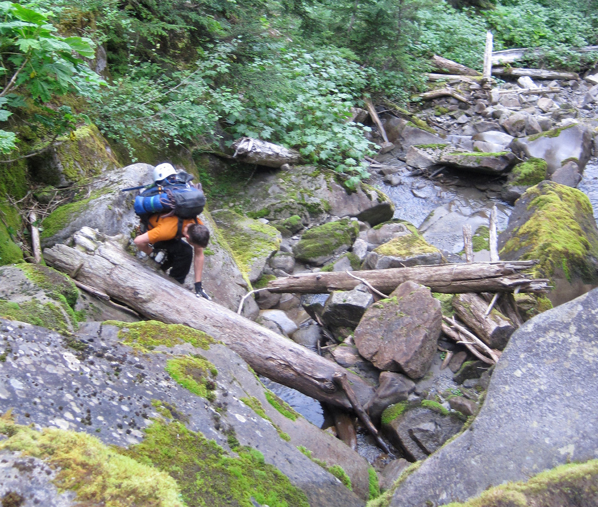
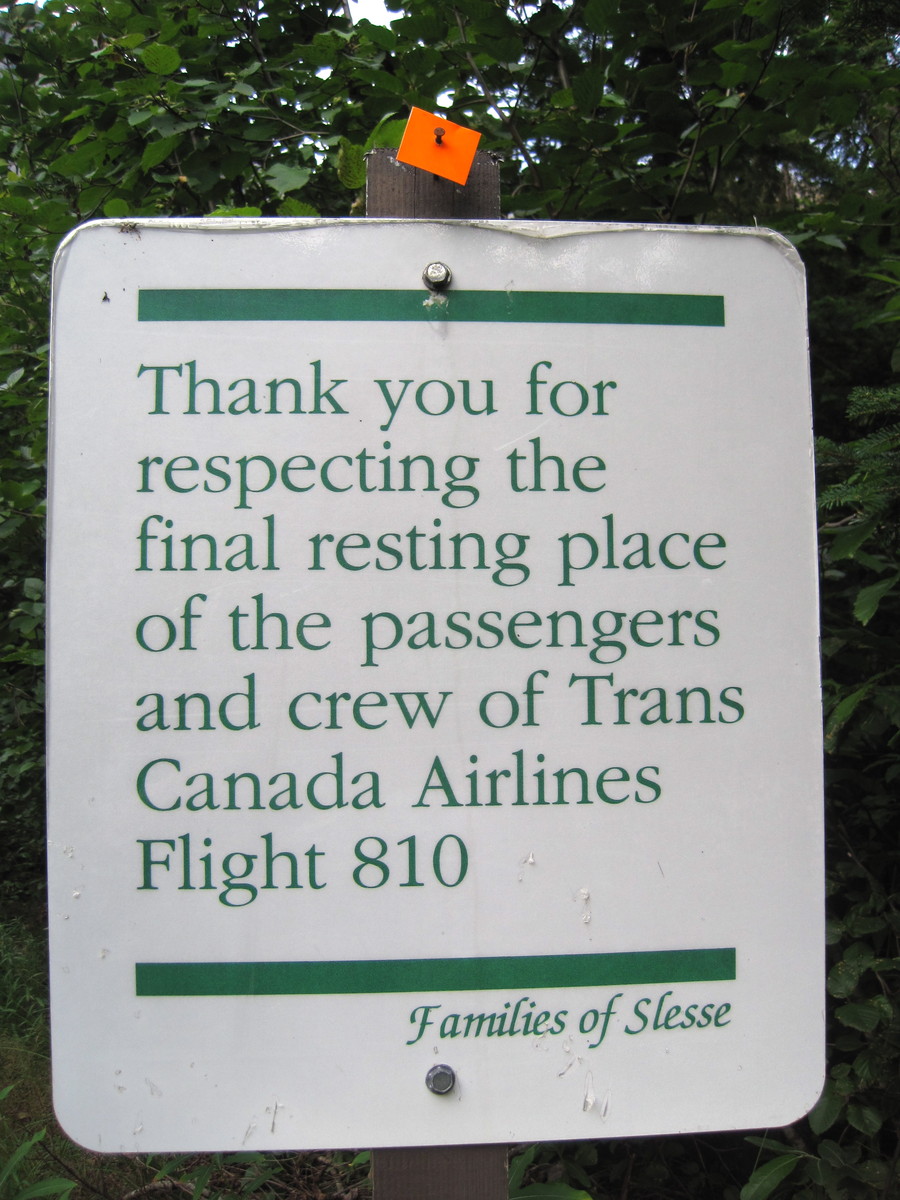
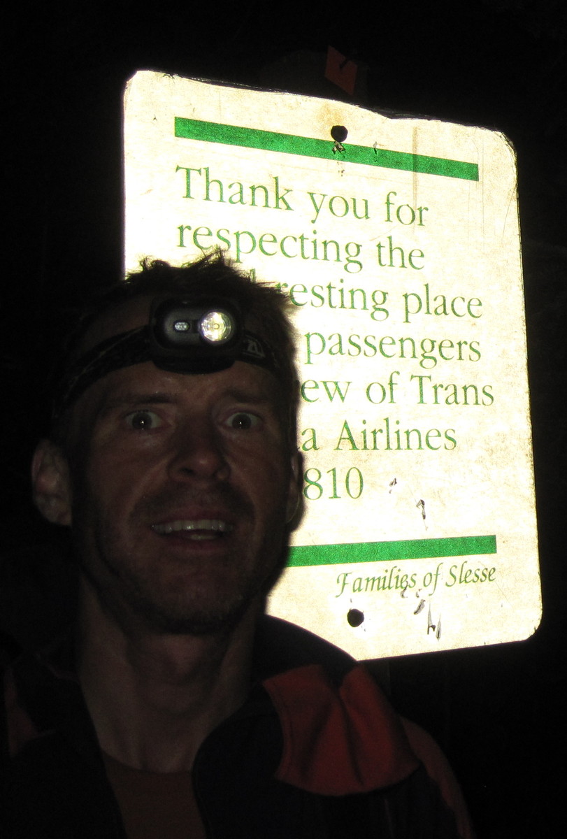
We entered the stubbly forest on the other side and at 8:30am, five hours after leaving the car, we reached the real trail right at the sign marking the Slesse memorial site.
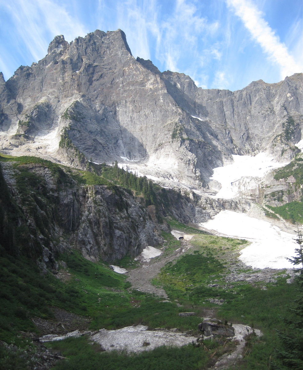
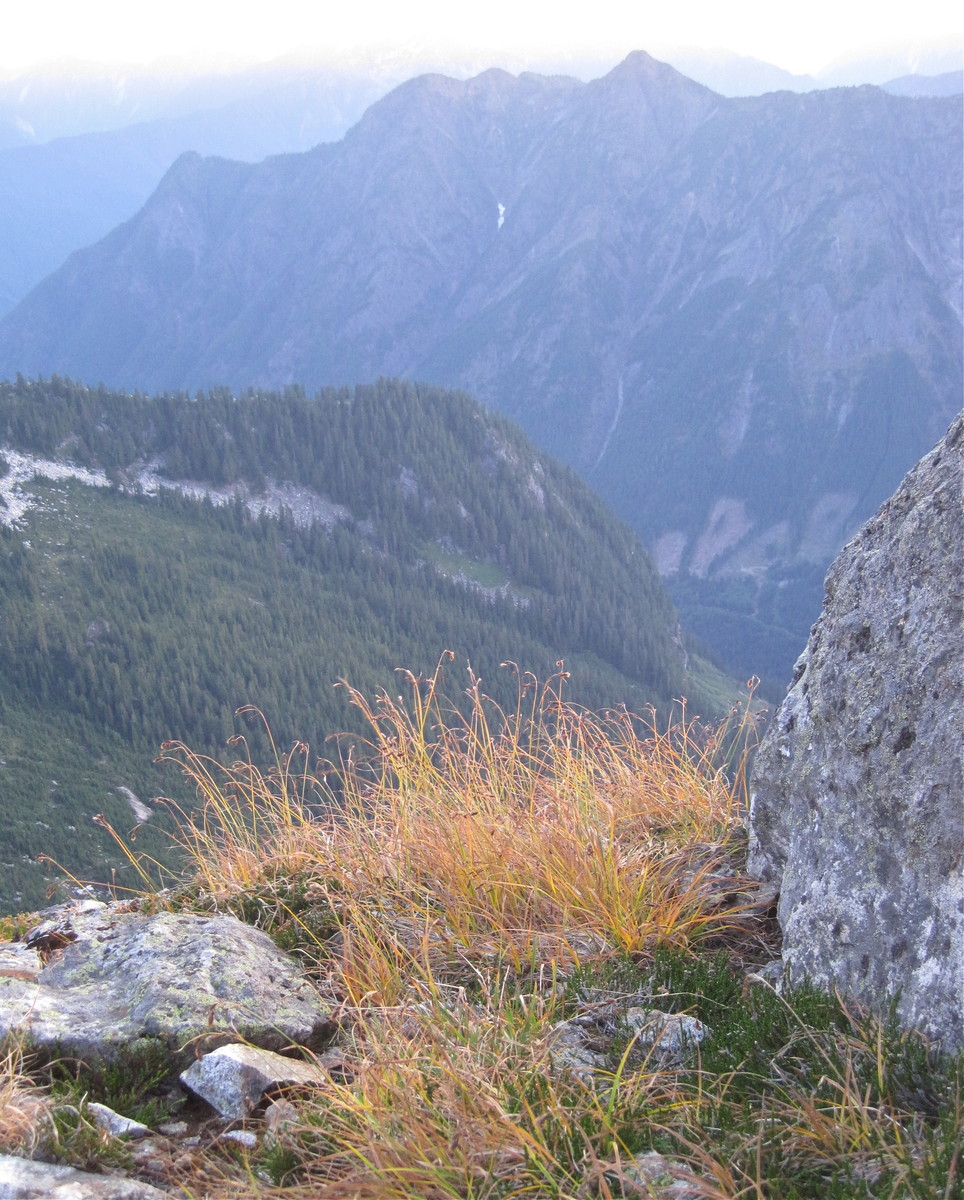
This felt like a huge victory. The sun came out, the air was still, and the immense East Face of Slesse loomed above us.
The sun was shining. Our outlook had changed from dim to bright.
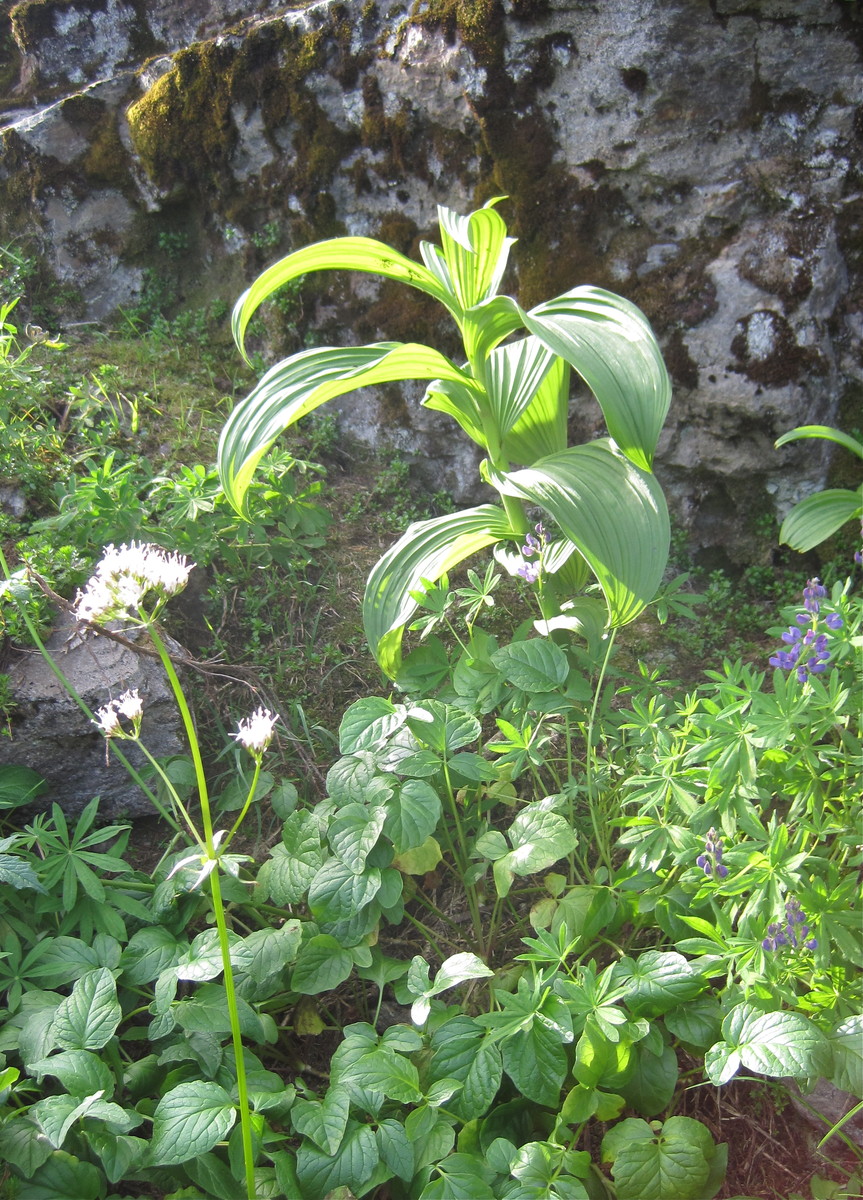
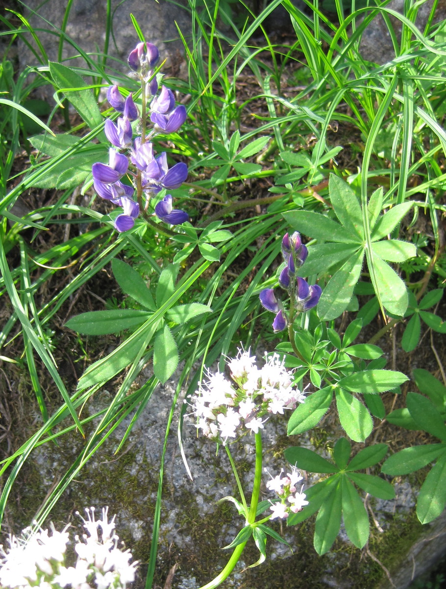
Wildflowers were blooming.
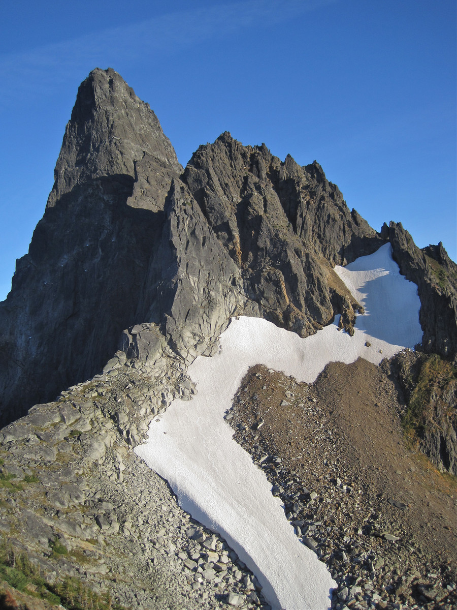
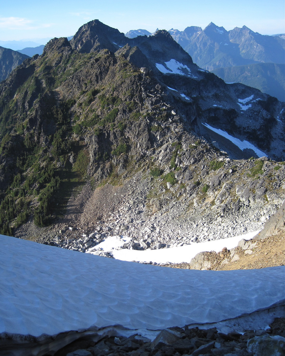
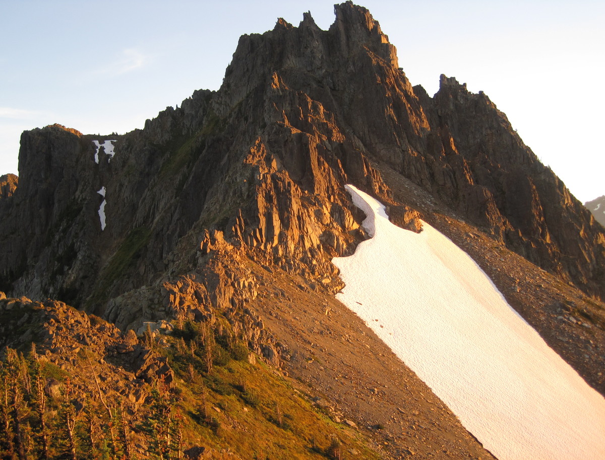
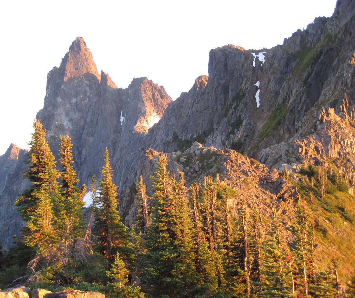
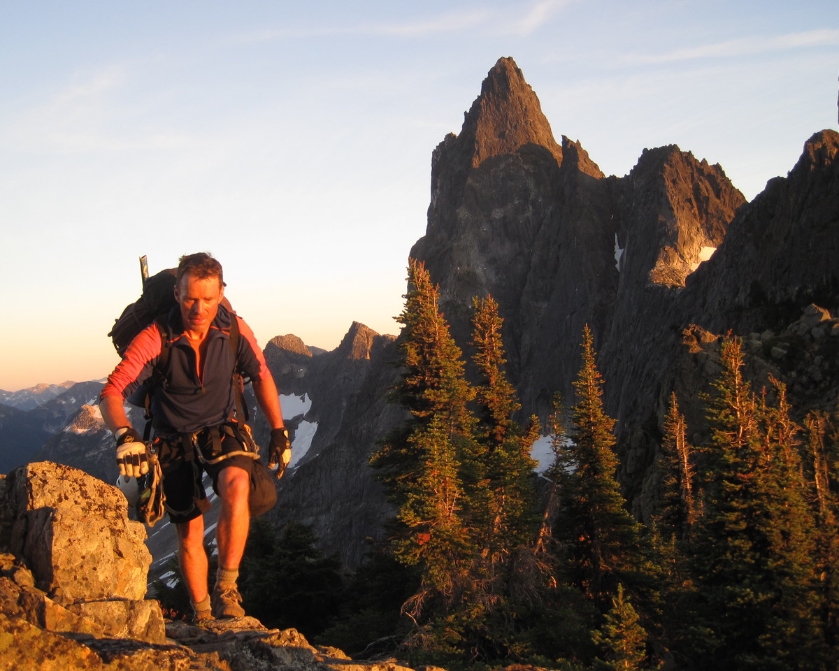
We decided not to go for the N Rib given the late hour, so we made our way up to the propeller cairn.
It was after 10am so we decided to shoot for the NE Buttress bypass.
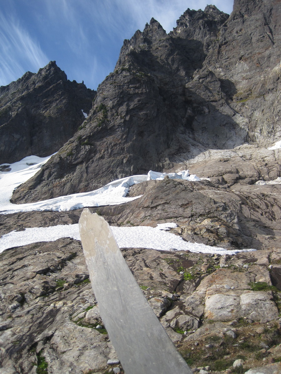
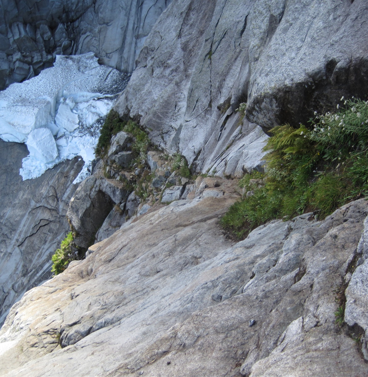
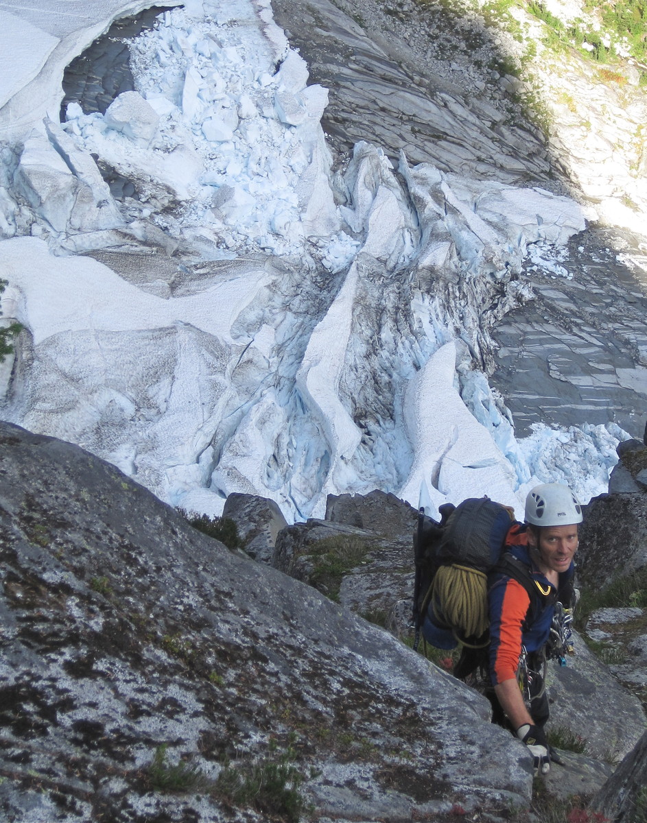
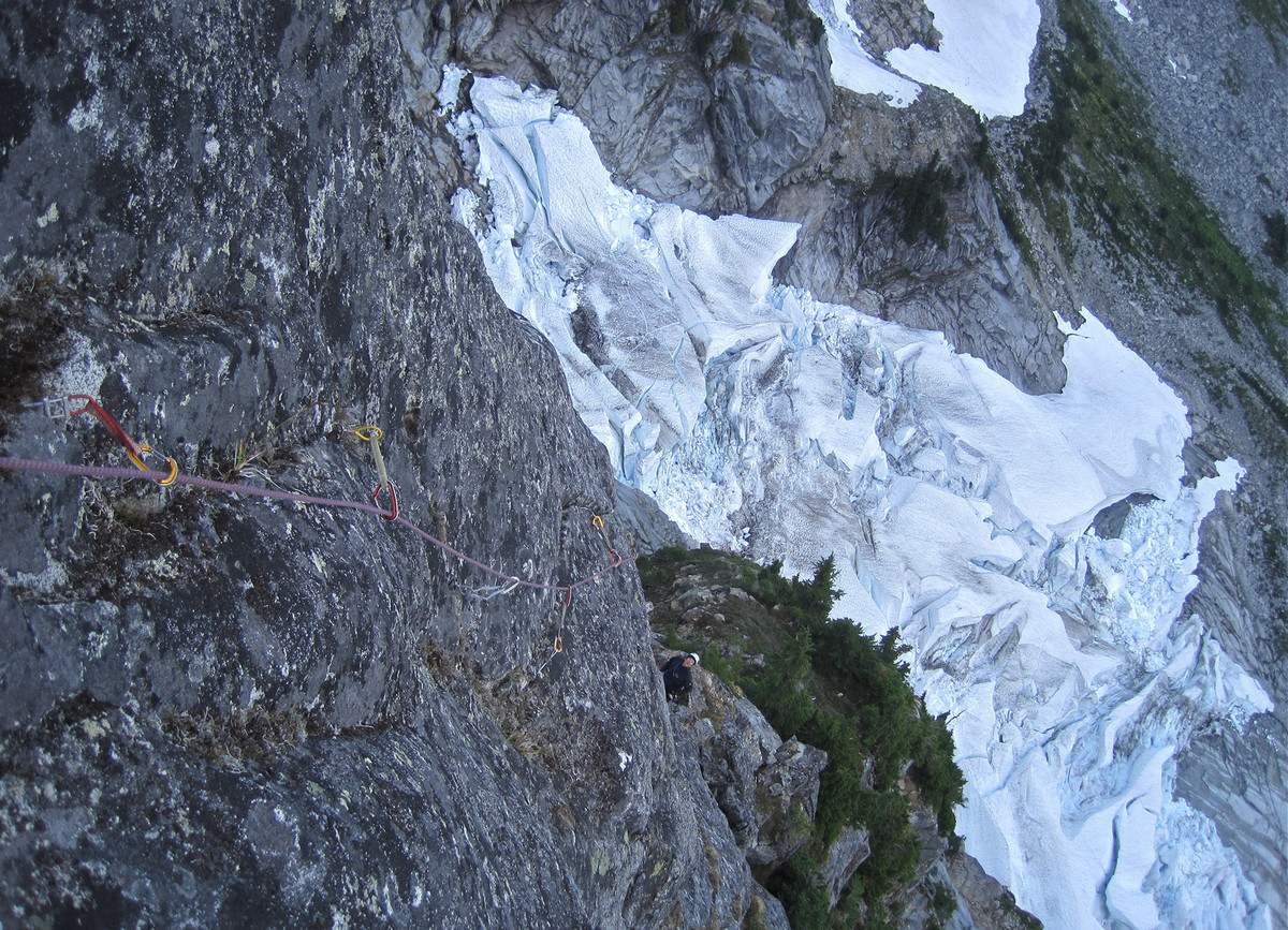
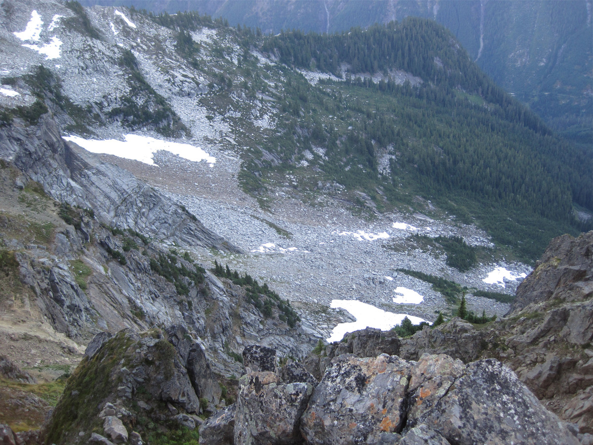
The bulk of the Pocket Glacier lies melting in the basin now, so we felt safe to head up to the bypass.
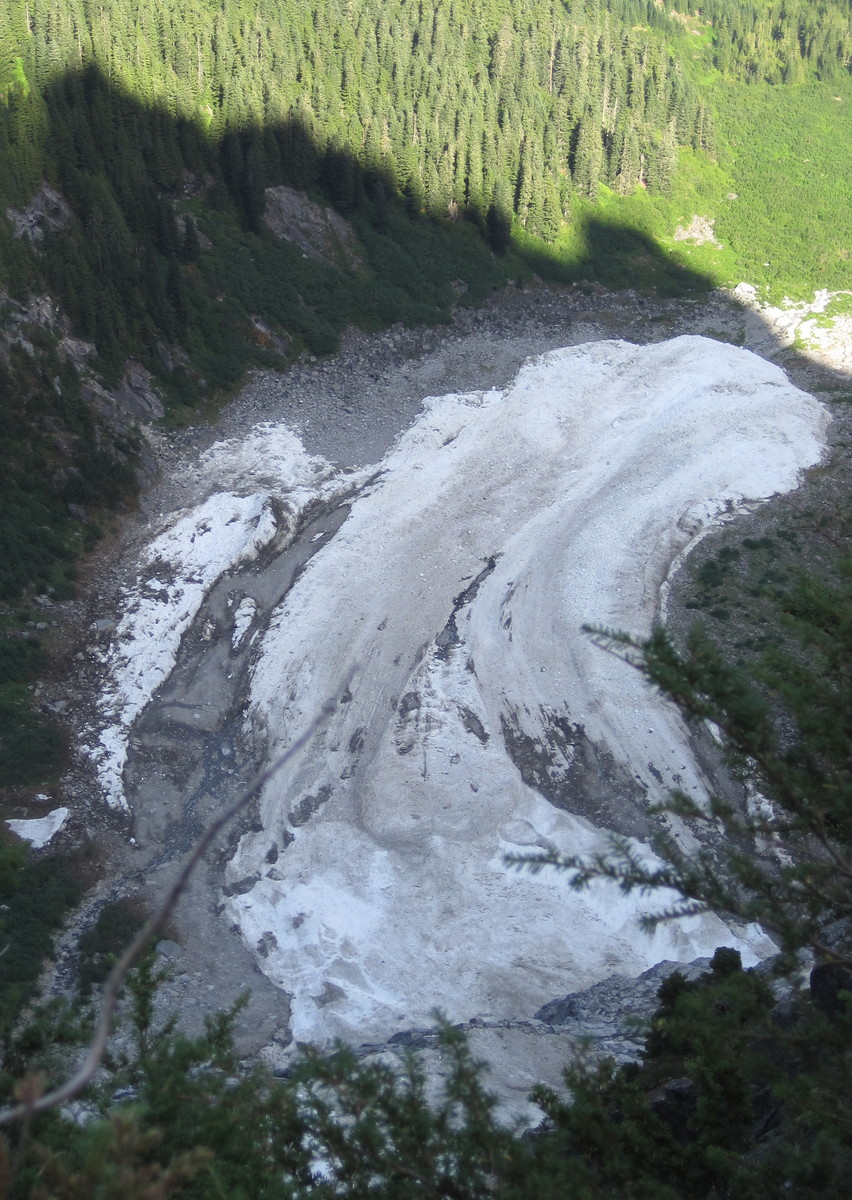
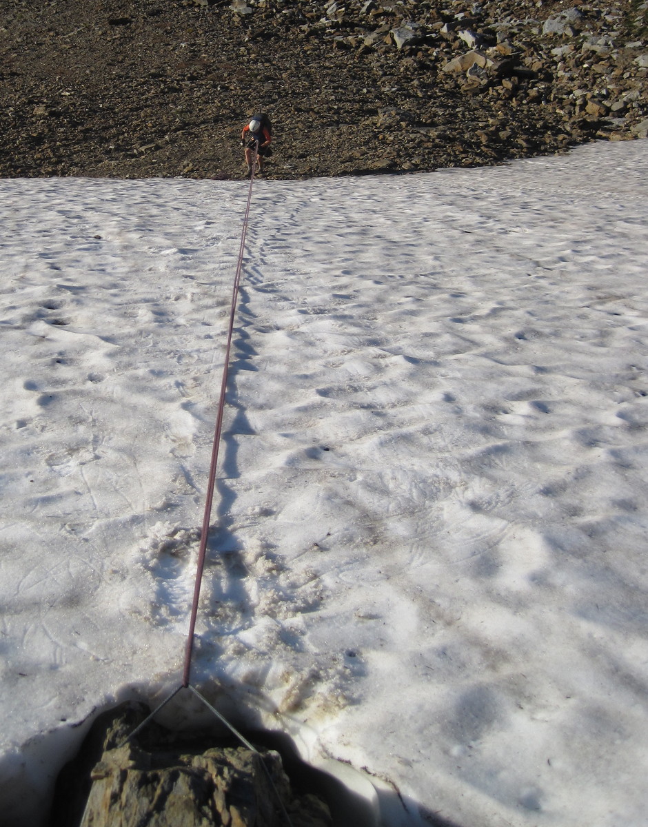
We crossed to the notch, dropped down to the remnants of the Pocket Glacier and prepared to head to the bypass ramp visible at left.
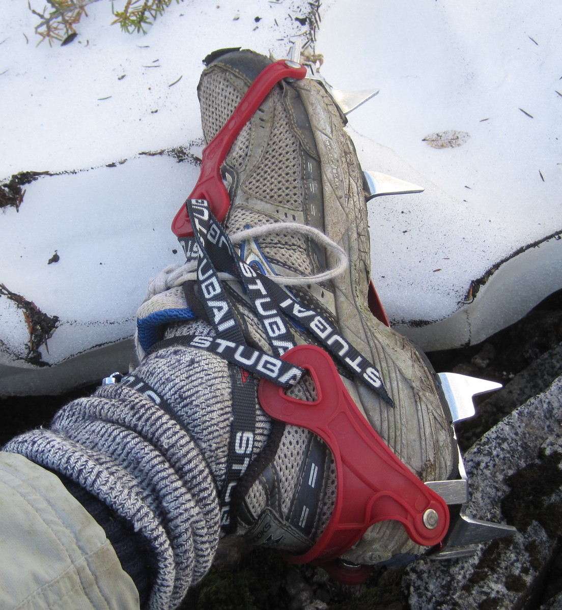
The ice was quite hard and I was glad to have my new crampons.
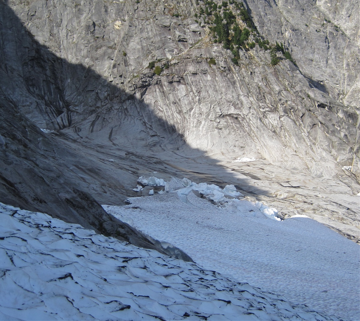
We crossed, removed crampons quickly, and dashed between large blocks
Across and up the open slabs.
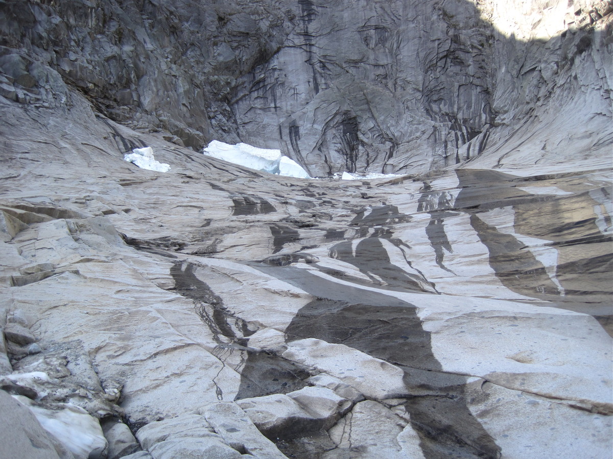
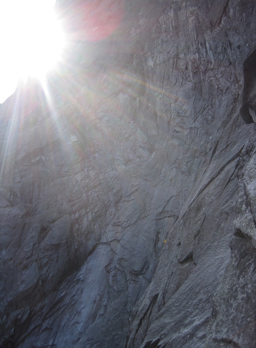
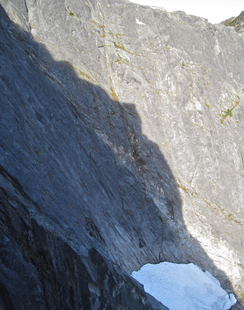
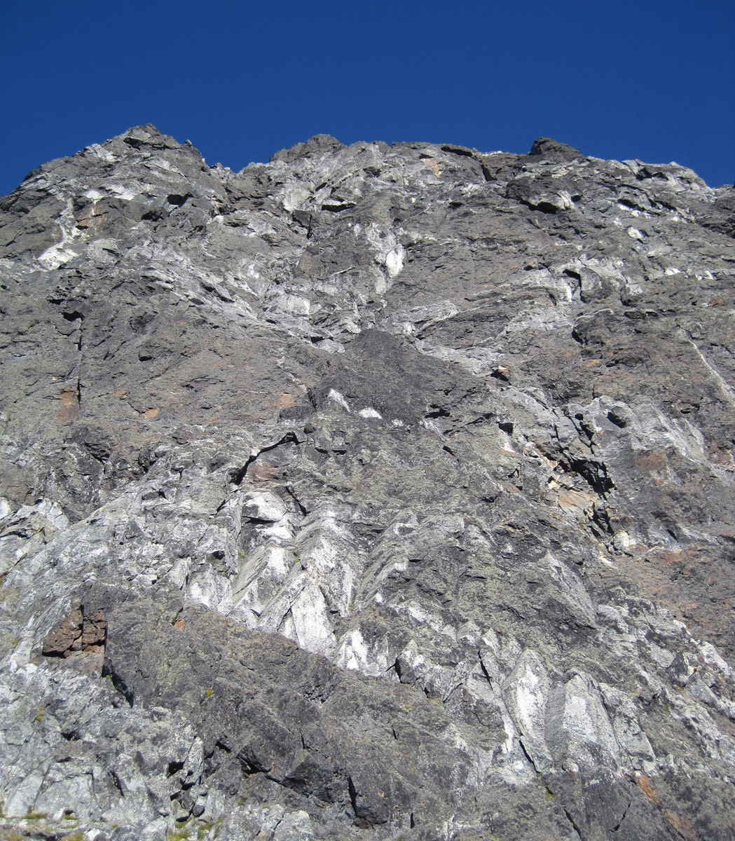
The walls above the Pocket Glacier are gorgeous granite.
We started up the bypass ramp at 11:30, roping up at an exposed grassy step around.
It seems silly to measure the ramp in pitches, as I can't imagine anyone would stop to belay.
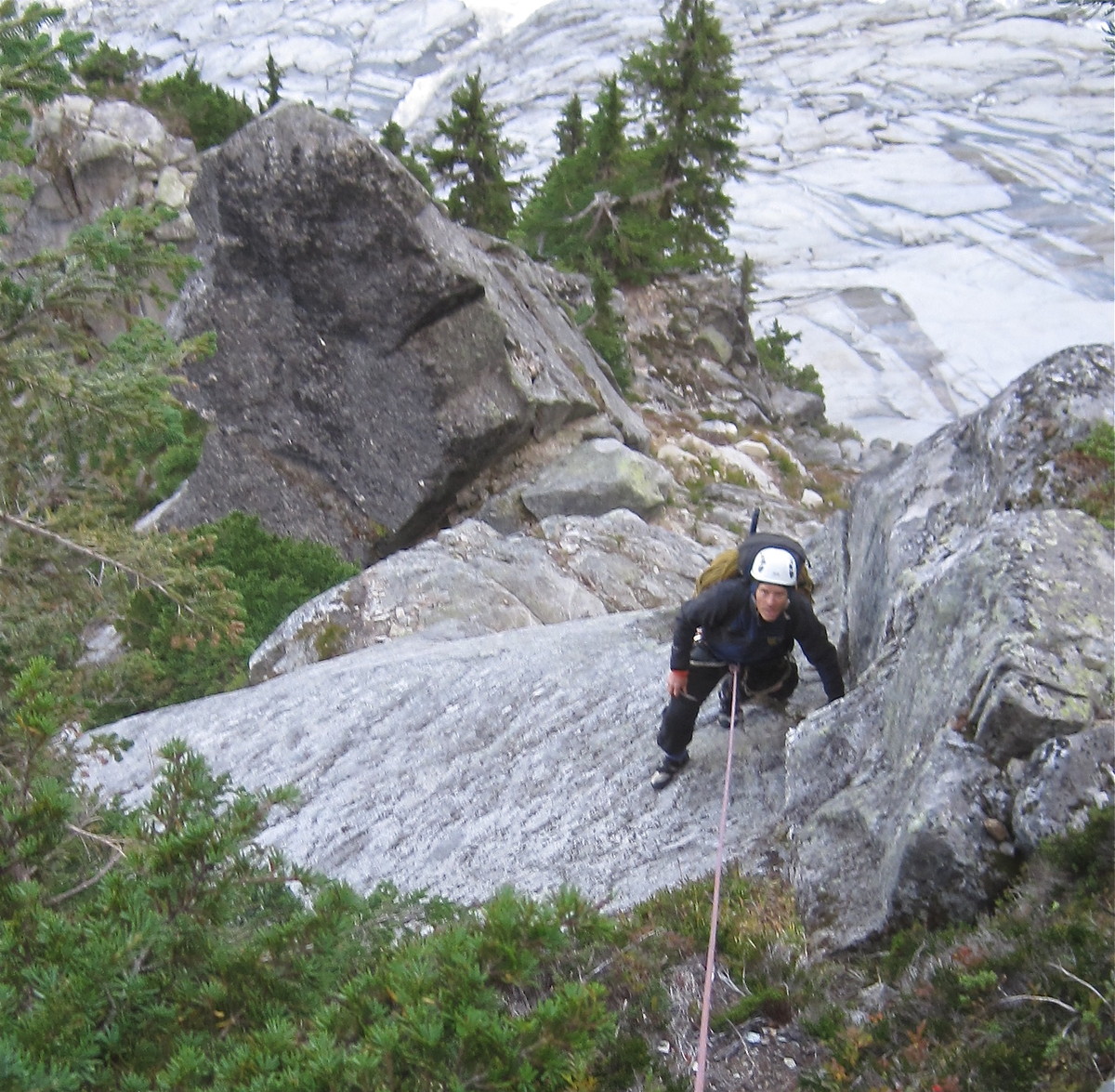
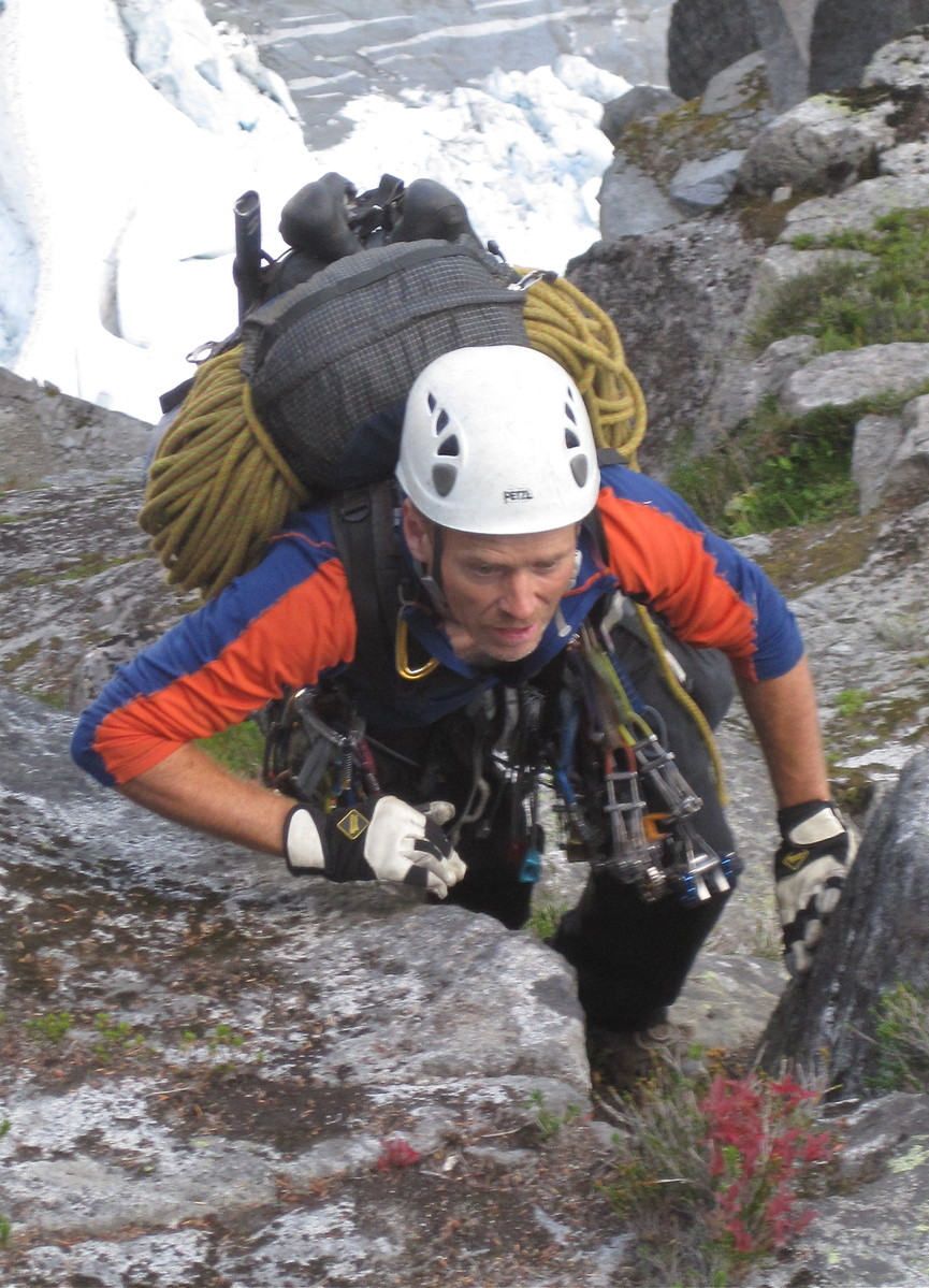
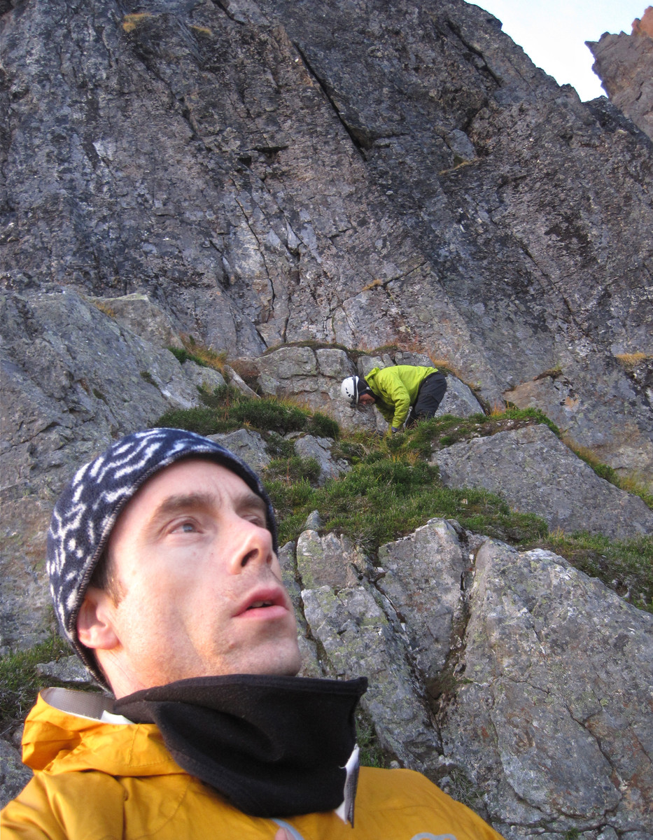
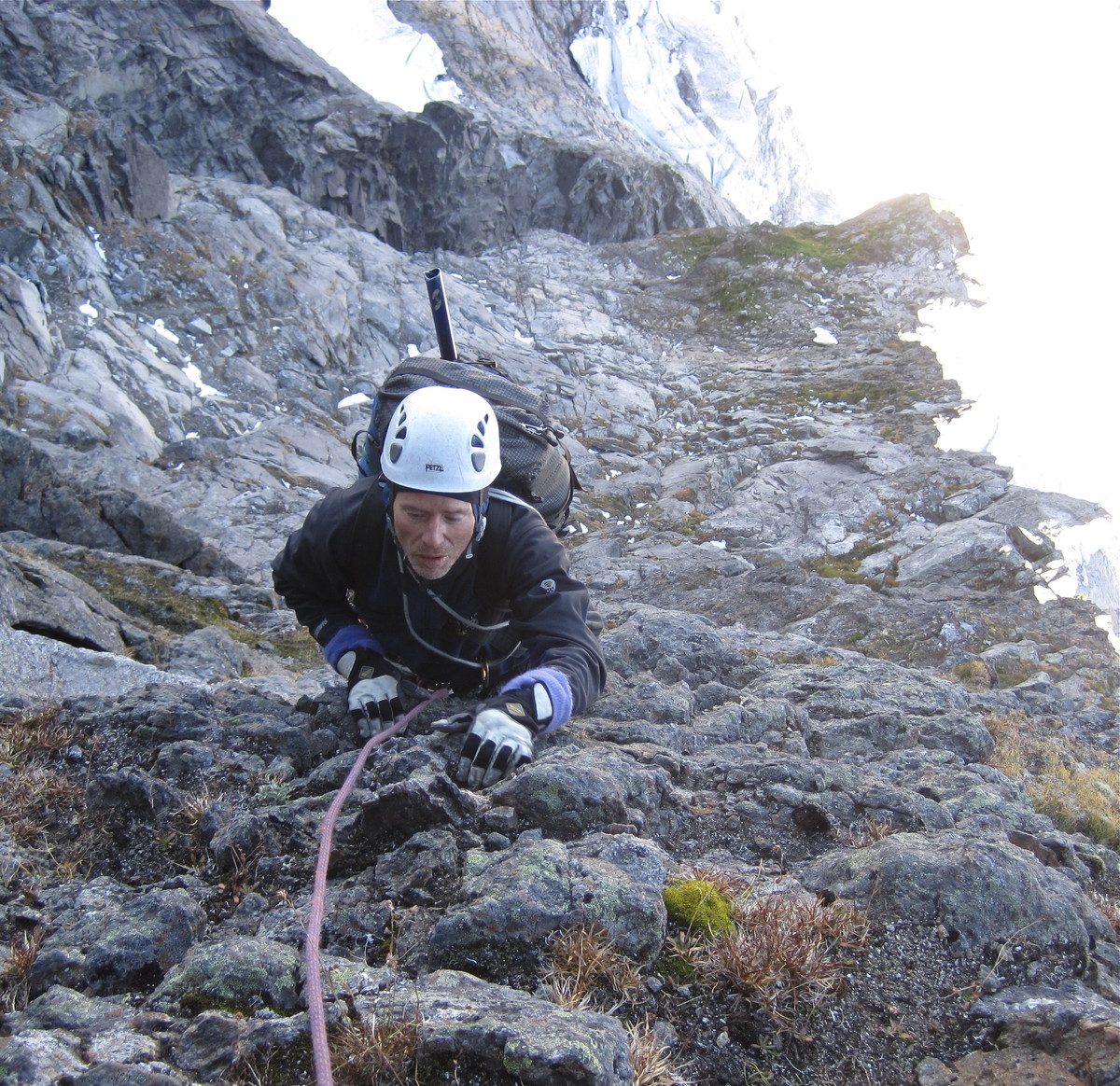
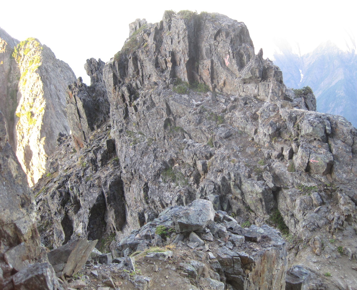
We scrambled to the base of a gendarme, soloed easy terrain to its left, and finally arrived at some real climbing.
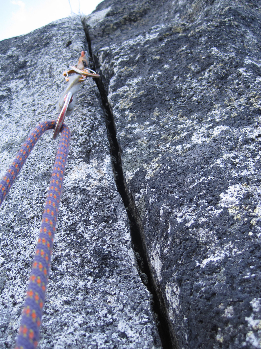
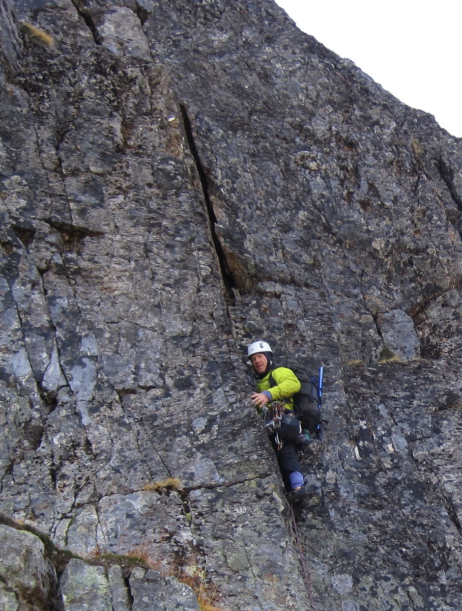
I lead a lovely 5.8 thin crack in a leaning dihedral.
This is the top of that pitch, with the gendarme in the background.
It's worth noting that we brought several route descriptions with us. Each was different and none seemed to match the terrain we encountered. This is a big mountain. You need to trust your instincts and follow what you believe is the correct path. We stayed on the ridge crest when possible.
David led vertical a 5.9 pitch on some very clean rock with wild flakes. Apparently others escape around to the right to bypass this. I don't see why (no pics).
I looked up to see one of the four horsemen of the apocalypse galloping past.
Or was it a samurai on a winged dragon?
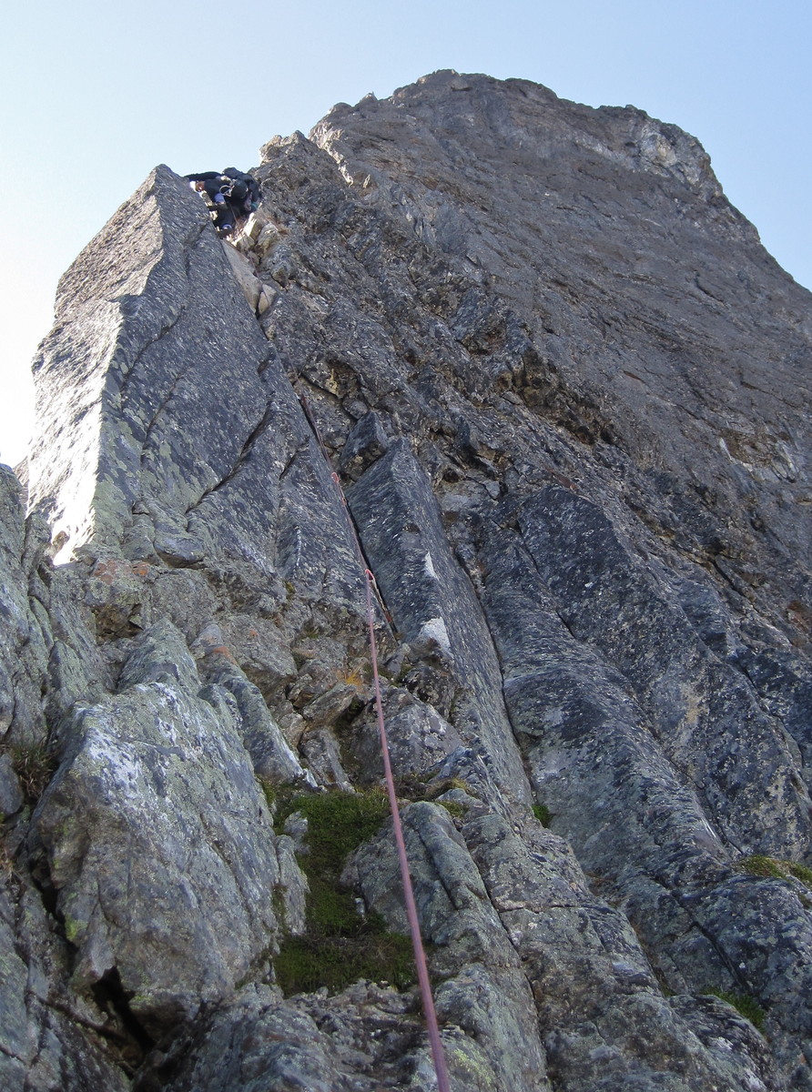
After David's pitch, we scrambled up to the base of the next pitch we might belay.
Looking back, we were glad we hadn't tried to cross the North Slesse Glacier to get to the North Rib. It looked nasty.
I was keen to follow a striking, clean fingercrack just left of the crest. It sure looked well-traveled,
but after 15 feet it was choked in moss. I had to hang on the rope through the steepest parts, digging out moss for hand and gear placements.
Underneath the vegetation, the line was solid 5.10 on great rock with fantastic exposure down the E Face.
David followed cleanly and then led a very nice 5.9 pitch also just left of the crest.
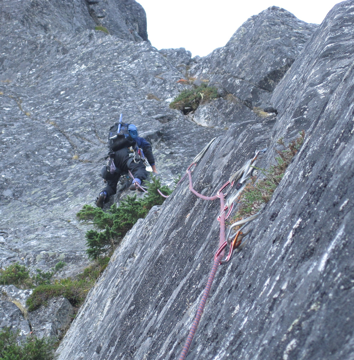
We don't think either of these pitches had been climbed before, but you never know. Route descriptions suggest people scramble up easier ground right of the crest in this section. The two pitches we led are pretty clean now. I would highly recommend them. They're not contrived at all.
David's pitch ended at a semi-hanging belay below the 5.9+/5.10a crux pitch. He was keen to take that pitch and led it in good style.
Sunset, dusk, and twilight settled in while I belayed.
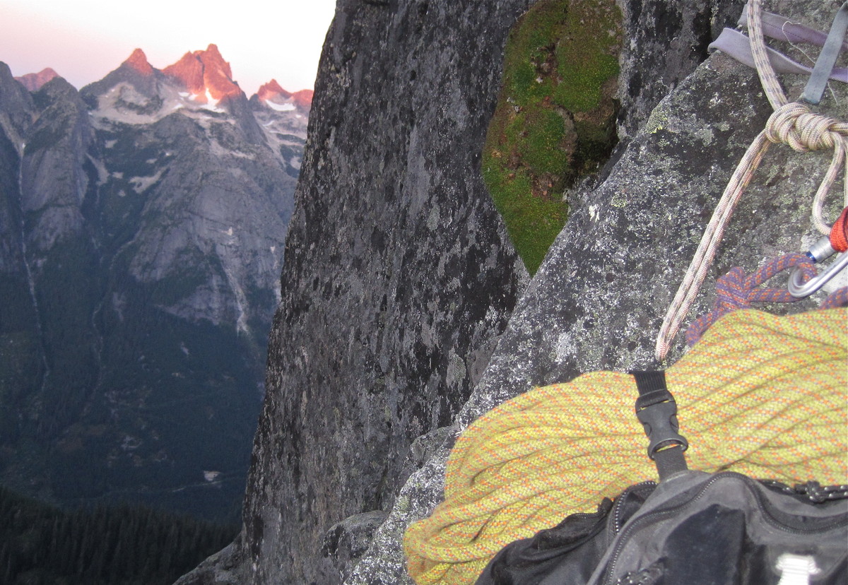
I led a moderate pitch in the dark to reasonably flat terrain, where we decided to bivy.
The weather had been perfect, with cool temps and no wind. Fortunately, the night was pretty warm and calm as well.
I was toasty in my down bag.
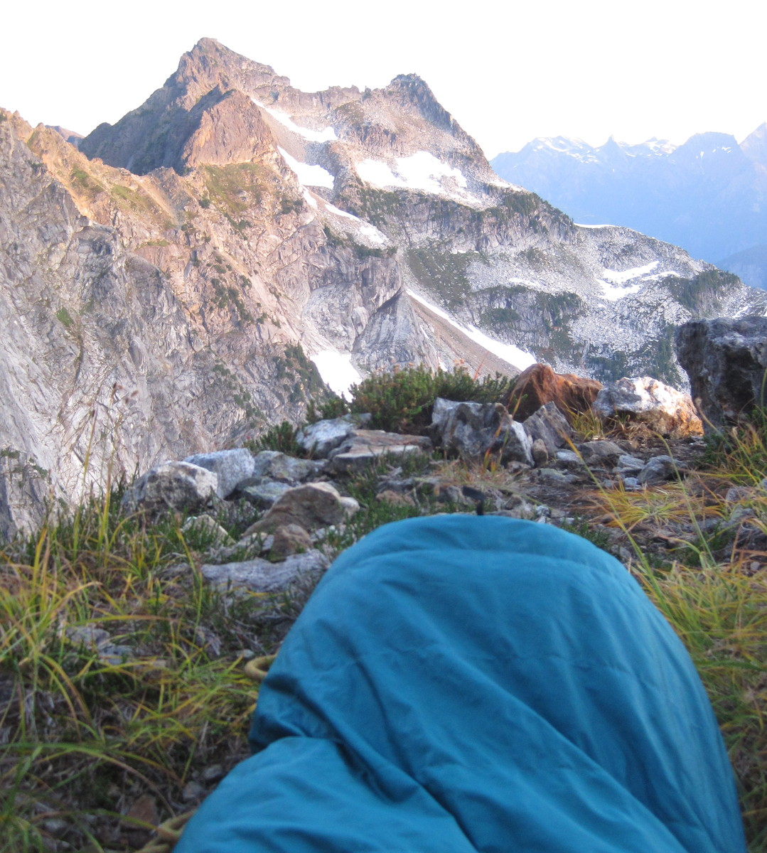
We slept in until sunrise.
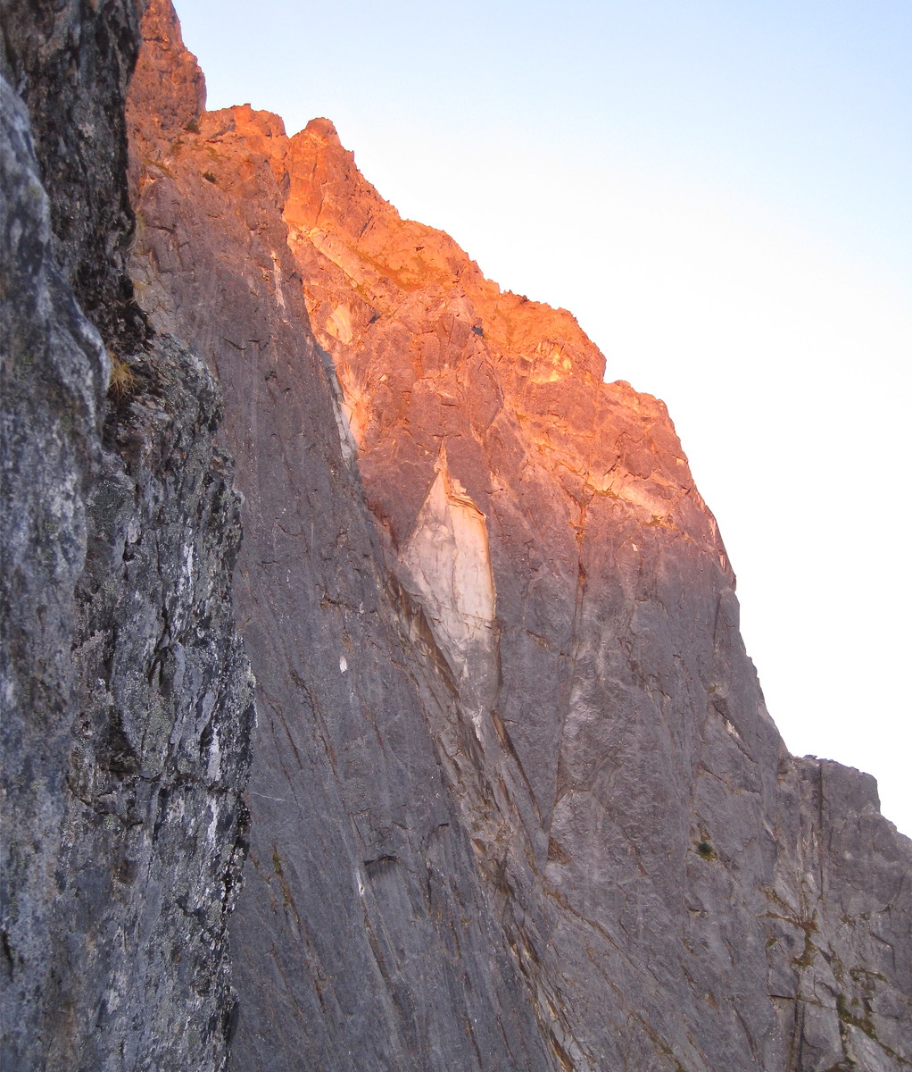
5.7 for breakfast.
I belayed and did some stretching and calisthenics to get the blood moving in the morning light.
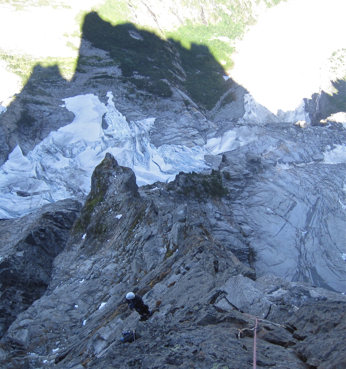
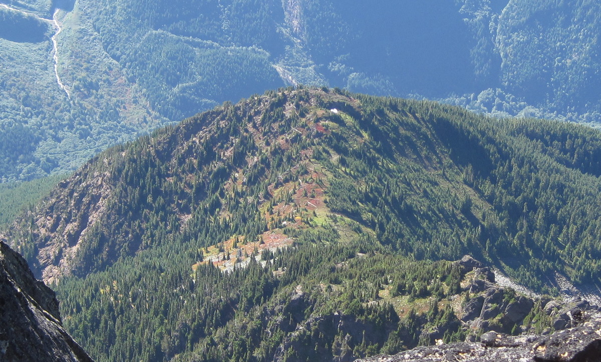
I could see from the shadow of the ridge that we still had a lot of ground to cover. We'd bivied just below the vertical step. The large flat area just above that step is the main bivy site.
Next, I led a simul-climbing block of about 600 feet.
David led a pitch that started on a nice crack and then passed some loose blocks.
I led off on another simul-climbing block and managed to cover the final six hundred feet to the summit.
It was runout and the ropedrag was heinous at the end, but I was in the zone and had summit fever.

The rock on the upper mountain is highly featured, so even steep sections are pretty easy, but there isn't a lot of gear.
At the top, I didn't have any slings or carabiners left, so I tied a loop of rope around a large block and belayed David up.
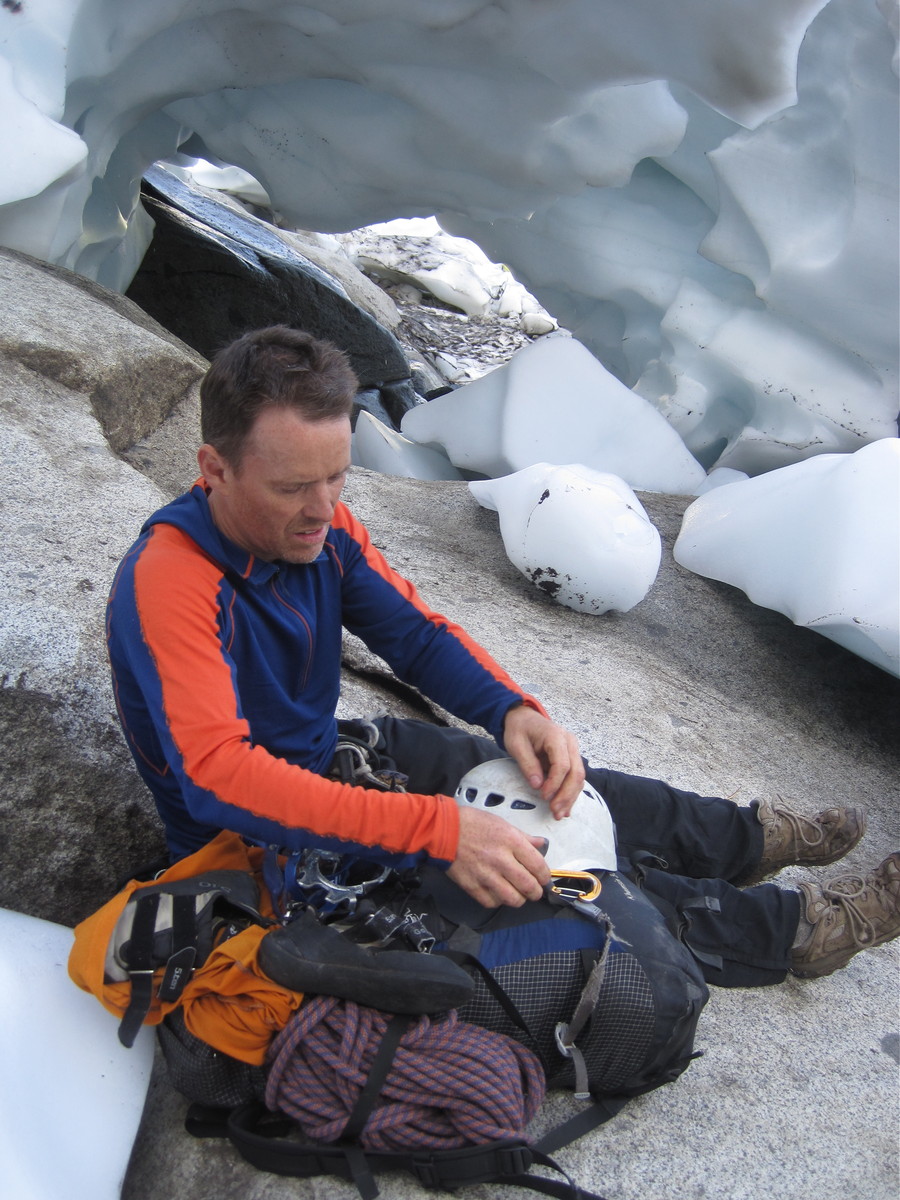
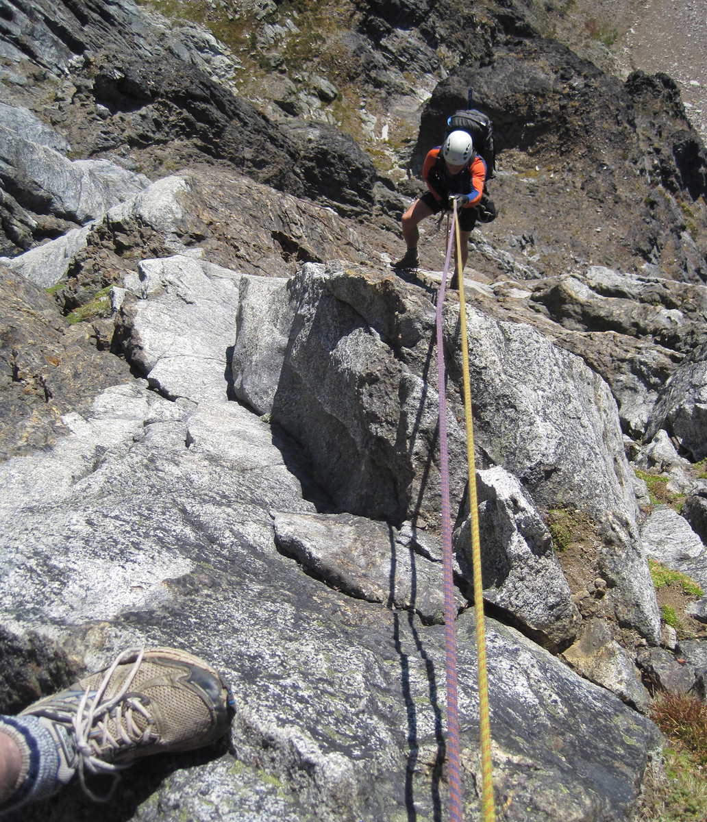
We changed into our tennis shoes, ate and drank, and soaked in the sunshine.
Two guys came up the NW Face while we were there. After chatting briefly, we decided to descend by rapping that route.
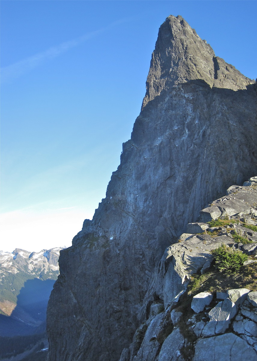
Past a cool looking spire.
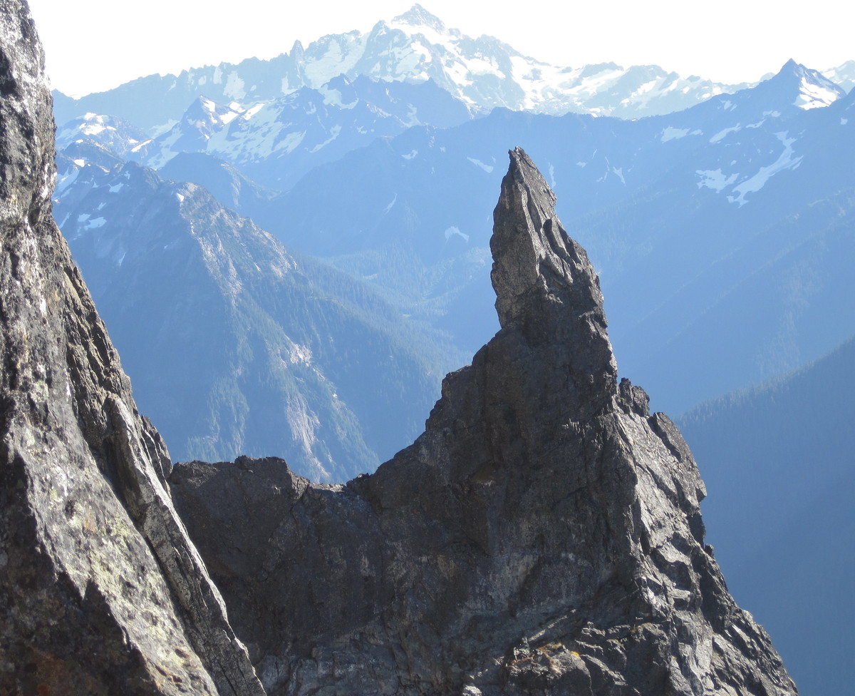
Looking up at the NW face, which unfortunately doesn't have great rock quality.
We got a rope stuck for a few minutes on our last rap, but I was able to free it by scrambling up an adjacent gully and jerking from a different angle.
We never thought seriously about heading down to Slesse Creek, although the guys we met on the summit offered to drive us around to our car.
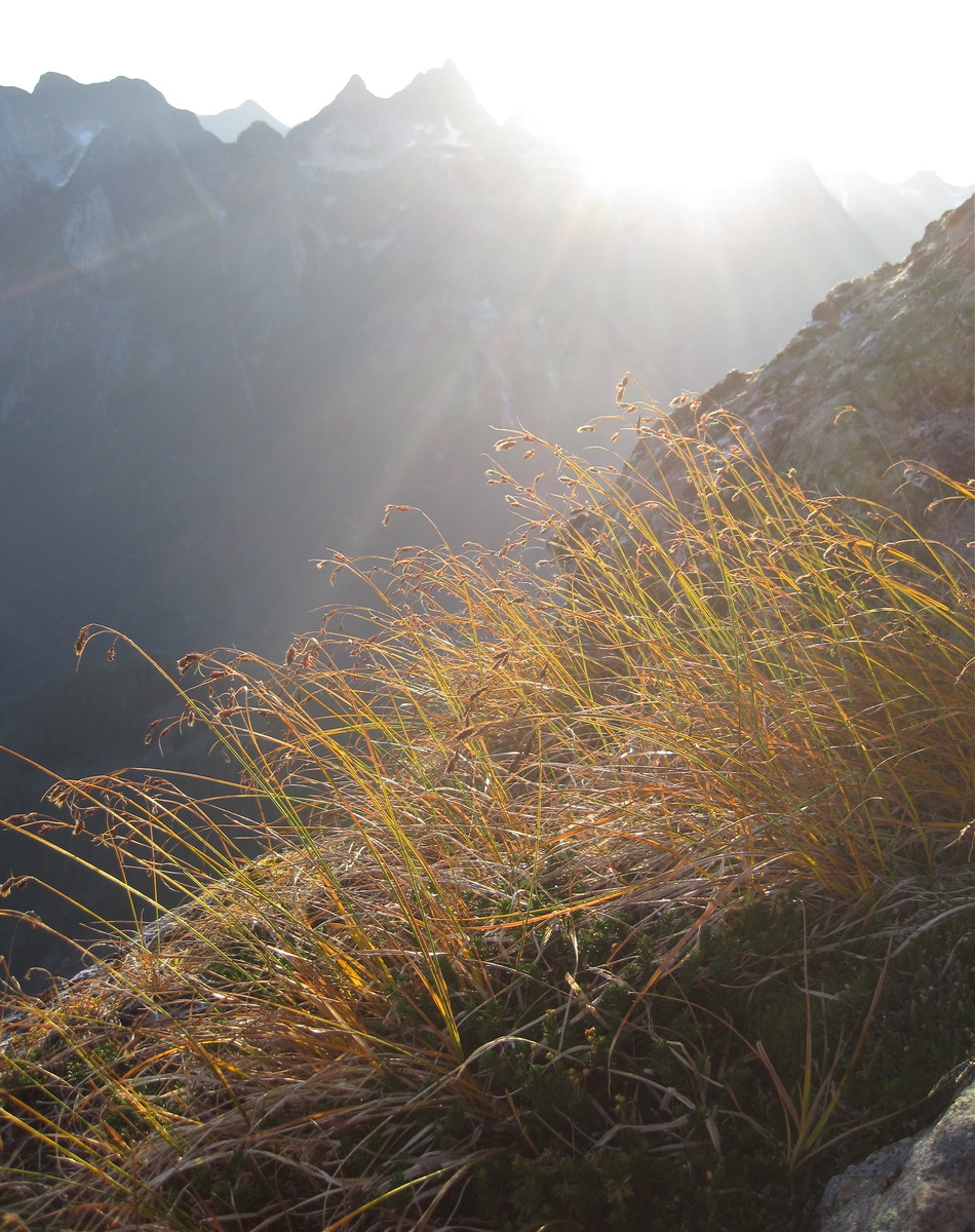
It was a gorgeous afternoon
We'd read about the crossover descent, and looked at it during our ascent,
but the sun was zipping toward the horizon so now we had to bang it out right quick.
I really, REALLY did not want to end out trip the way we started, so our goal was to reach the marked trail before dark.
We hit the first notch, then traveled on the ridge crest or its West side. There are good descriptions out there ( Jeremy Frimers crossover descent map and beta ).
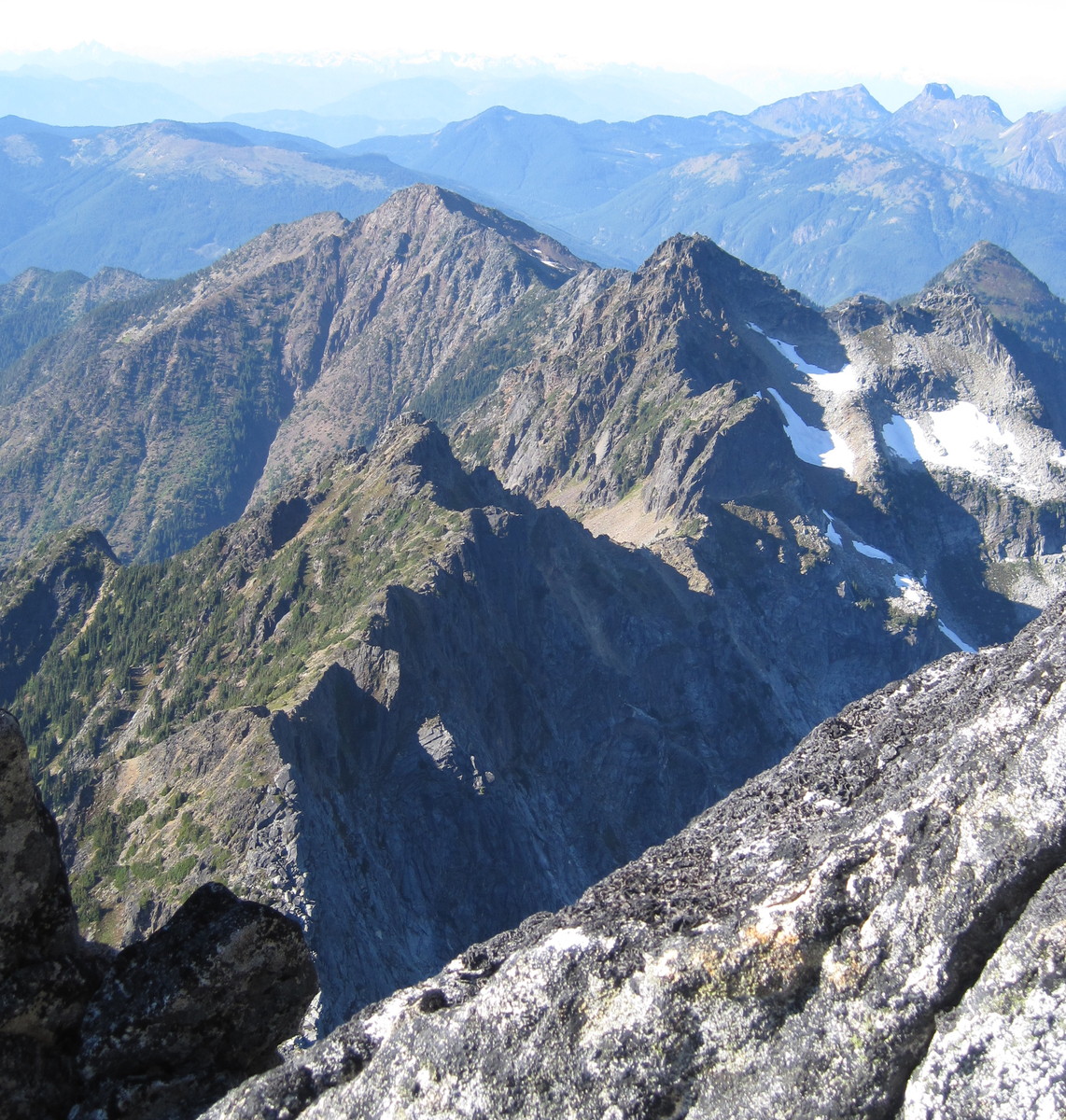
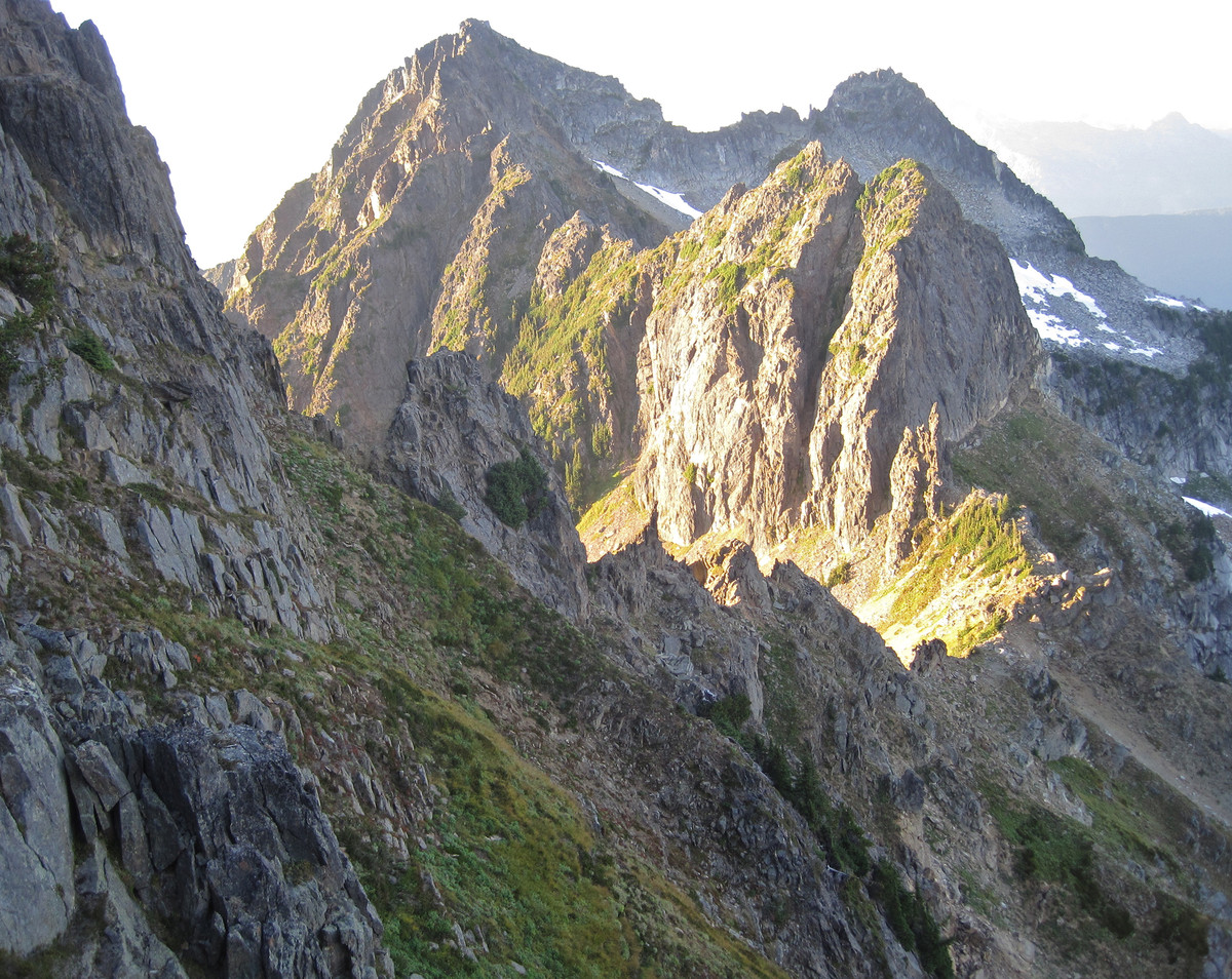
Views back toward the NE Buttress were impressive.
This blowup shows our bivy below the vertical 5.7 pitch, and the main bivy site just above it.
At the second notch, we were able to avoid hard snow
by staying in the moat above it
And then rapping past the steepest section.
We crossed over to the East side of the ridge before Crossover Pass. Stay high.
Curious painted rocks mark a spot where you drop down on the West side again right before crossover pass.
We cruised down talus next to this snow field before climbing back to the aptly named Crossover Pass,
where you cross to the East side for the final time.
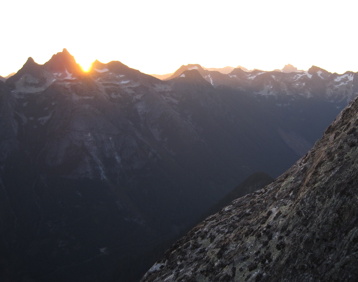
Alpenglow at Crossover Pass
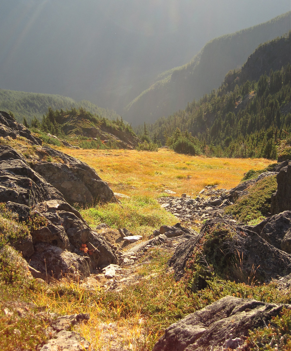
When you enter the final basin, stay way left. I tried boot skiing the long tongue of snow, but my edgeless sneakers didn't work well.
We followed a few cairns left (North) of the end of the snow tongue and then encountered the first flagging on the crossover trail just as twilight faded into night. Perfect!
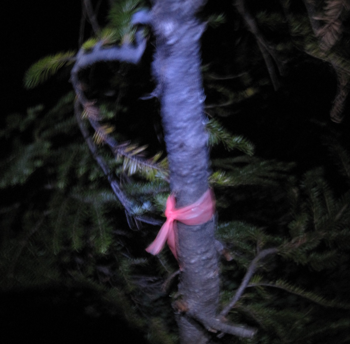
The trail was very faint in a few places, but it was pretty well marked, particularly once we dropped into the forest.
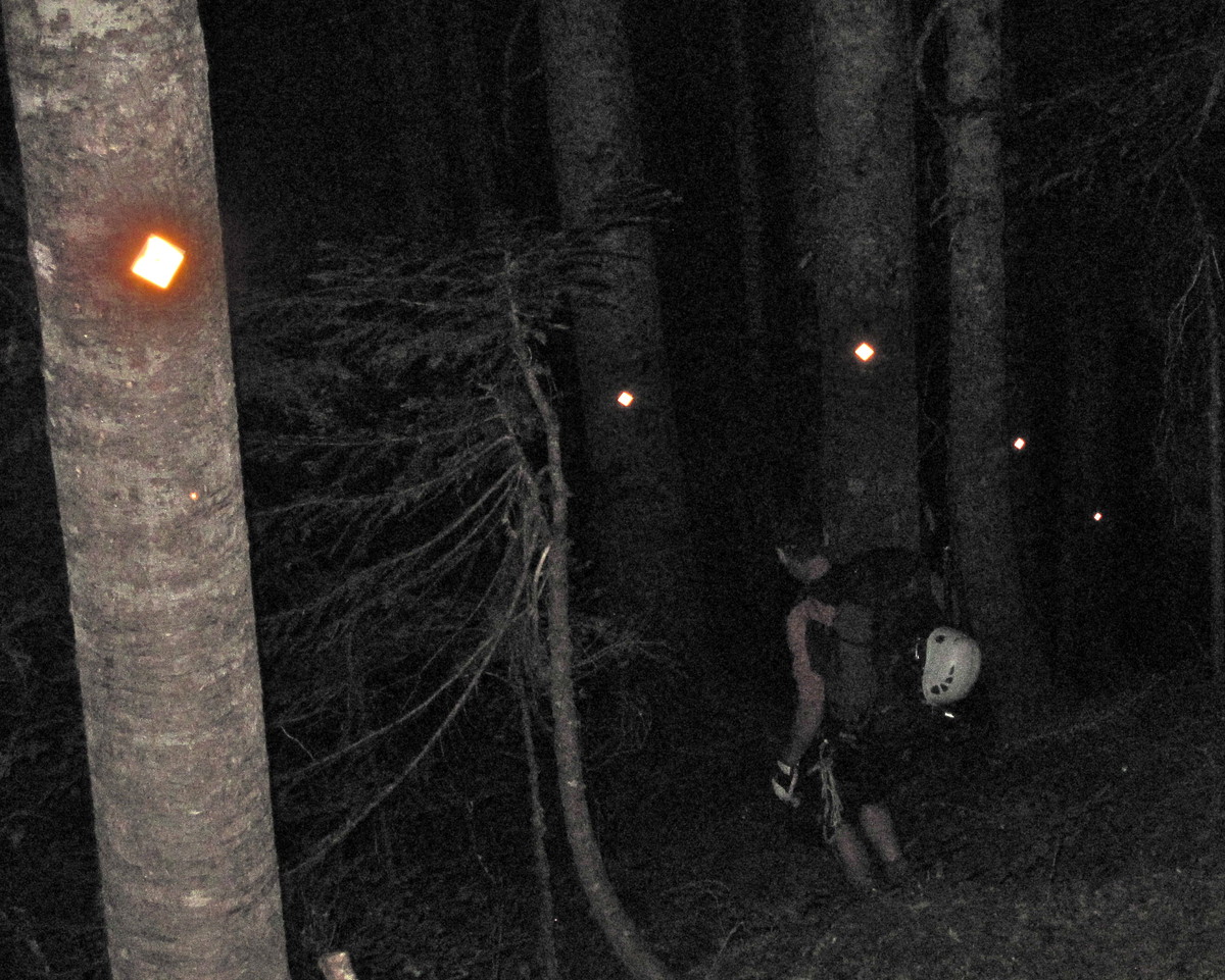
Steep, packed pine needles were quite treacherous, but we were safely on the trail and didn't care.
We crossed the creek and soon found ourselves back at the Memorial sign
The caffeine pill David had given me kicked in and I told stories all the way down to the final (correct) creek crossing.

and then we trotted down the road to the car, arriving around 10pm. We crossed the border and headed for Haggen in Bellingham, but not before one last adventure:
As we pulled up to an intersection, we saw a woman lying face down in a pool of blood in the middle of the road, tangled up in her bicycle. We stopped and got out to help her. David donned latex gloves and started to tend to her. I called 911. In the next few minutes, we learned that she was drunk, had fallen on her face of her own accord, and didn't want anything to do with the police. She crawled, walked, and then biked away as fast as she could. The emergency vehicles showed up seconds later, but their subject had left. She probably woke up with a splitting headache and a mess of crusty blood the next morning, wondering what happened.
We got to Seattle at 3am. I showered, crashed, and headed off to work a few hours later.
Gear Notes:
Double rack to #2 camalot, single #3, crampons, ax.
Approach Notes:
Park at 5.6km per McLane, but then walk about half a mile on the road, take a spur road right (straight - the main road makes a steep switchback if you miss this), continue another half mile or so to a marked trail. Now you're golden.
-
The screamer on the harness sounds odd, but it will increase the stopping time and lengthen the distance over which the stopping force is applied, which reduce the force transmitted to the holding piece. If you have only one screamer, are looking at a series of marginal placements ahead, and don't know where you might fall, this approach might be worth considering. Surely someone must have thought of this before. I bet the main reason people don't consider it is the increased liklihood that you'll rip the screamer and be out the cost to replace it. Climbers will do amazing things to save a few bucks.
-
You could also clip a screamer between yourself and the end of the rope if you expect to be on a series of questionable placements. The cost of replacing it might keep you from falling in the first place!
-
this is basically the same principle as a screamer, isn't it?
Yes, a screamer reduces force on a piece by increasing the stopping time.
-
Edit to add that if your friend's assertion that the rope cannot relax between the first piece failing and the impact on the lower piece is true, then this will act to increase the force on the lower piece because the longer stopping time due to rope stretch has been eliminated. Then you come down to a question of whether the magnitude of this effect is large or small compared with the change in velocity effect as noted above.
Interesting question.
-
From a biologist who took college physics 24 years ago:
If the piece that fails slows you down then it has reduced the force on the lower piece. To see how, consider the simple math of F = MA:
Force = Mass times Acceleration
A = (Ending velocity - starting velocity)/time for change in velocity. Note that force, velocity and acceleration are all vectors, meaning that they have both magnitude and direction.
Mass won't change, so F is directly proportional to A.
Two factors affect A:
1 - Time. Longer stopping times result in lower forces. Milliseconds count. This is the theory behind the design of crumpling bumpers, air bags, and dynamic climbing ropes. It also explains why auto-locking devices create higher forces on gear than belay devices that slip and thus have longer stopping times.
2 - The difference between starting and ending velocities. Lower starting velocities result in lower forces generated. This explains why slab falls, where falling speeds are lower, generate less force on pieces than steeper falls. Final velocity should be zero (if the second piece stops you!). So if the first piece slows you down the force on the second piece is reduced due to the lower change in velocity during its attempt to stop the falling climber.
Another way to look at this is to look at the piece that failed. Ffailure = MA. If you know the breaking force of a piece (e.g. 5kN), and you know the time it will take to stop the climber (virtually impossible to measure), then one could, in theory, calculate the amount the first piece will slow the climber. Again, Ffailure = M x (Vat failure - Vstart)/Time from impact to piece failure. As noted above, if the climber is slowed, the force on the second piece is reduced.
So "psychological" pro may actually have value by reducing the impact force on lower pieces. One danger, though, is that when the rope comes taut on the top crappy piece, it might change the orientation of lower pieces, causing them to pop out or rotate to positions where they will fail at lower forces. Then when the top piece fails the piece below may no longer be bomber (e.g. a cam has rotated into a wider pod or a nut has moved out of a constriction).
Note that I haven't said that if the top piece fails at 5kN then the force on the lower piece is reduced by 5kn. It probably depends on how much velocity you 'recover' after the first piece fails and before the rope comes tight on the second piece.
I'm curious to see what real engineers have to say.
-
I do write line by line descriptions, tied to a detailed route map, when I'm learning a project at my limit. And I have lines for foot movements as well as hand movements. I'm just curious what the standard is because there must be one. With versus w/o feet will change the number of "moves" by a factor of two...
Thanks.
-
I see people describe an 8 move V9, or 16 move V3, but I have no idea what a "move" is. A hand moves to a new hold? Foot moves count? Body shifts (e.g. drop knee, flag). I suppose it doesn't really matter, but it seems like common language these days so I'm curious.
Thx.
-
Maybe you can fire lasers to chop bolts, chip holds, or burn the fingers of would-be FA poachers, all from the comfort of your home PC.
-
The reality is that some injuries are life altering. This is a hard pill to swallow, but once you choke it down you realize the goal is not to come back being stronger than ever before but to be as strong and active as your new body (and pain threshold) will allow. Sometimes that means 100% of pre-injury strength. Sometimes not. Sometimes it means 100% on certain motions but other motions are hazardous and should simply be avoided (my case in certain shoulder movements).
We will all eventually fall apart. The question is how to make the most of what you have for as long as you can.
Edit to add that it's worth doing what we can to prevent life altering injuries and promote maximal healing from the ones we do incur.
-
You turned back in the face of questionable conditions. That doesn't sound like failure to me. That sounds like sound judgment. And yes, that thing looks like an ungodly pile of tottering choss. Is that the route where House had his accident?
big falls on steep snow, running belay
in Climber's Board
Posted
Could be a hard experiment to control as friction plays such a huge role. Soft snow = more friction. Poky climber = more friction. Some self arresting = more friction. Then there are a lot of variables with regard to the placement. Rock is more amenable to these types of analyses, but knock yourself out and let us know what you learn!