


Rad
-
Posts
2925 -
Joined
-
Days Won
25
Content Type
Profiles
Forums
Events
Posts posted by Rad
-
-
Ask Lowell Skoog. He's done a huge amount of work digitizing old images from a variety of formats, including slides.
-
I found it hard to see the last segment of the film because there was a waterfall pouring out of my eyes. Knowing the ending just made it worse.
I thought it was better than Free Solo. Peter Mortimer is a great visual story teller.
-
 1
1
-
-
-
6 hours ago, dberdinka said:
This is stunning and original
It's impressive to get detail in both the deep shadow and the lit subject.
-
1
-
-
You might want to mention what "high altitude" means in the context of your study. In WA, there's only two peaks over 12,000, and only 4 over 10,000. Far more over 14k in CA and CO than in WA. Most of us don't think any peaks in the continental US would count as "high altitude" as they're all under 15k.
-
I thought this was going to be a thread about a different Dan H!!!

-
15 hours ago, olyclimber said:
Damn! But what was the price of this avalanche and rescue?
Pretty sure the NPS doesn't charge for rescues, so medical bills plus lost/broken gear.
-
"Ask me anything" - comments turned off for video. Guess they didn't like the armchair judgers
-
Yes, this is one of the best climbing films I've ever seen. Amazing climbing footage. Excellent interviews and narrations. Masterful story telling. Significant comments from many luminaries of climbing. Enough space to absorb all of it.
-
Just go ahead and contact a reputable AMGA guide, like Martin Volken in North Bend, and see what he has to say.
-
Nice. You make it look like it isn't a pile of loose rubble.
-
14 hours ago, sfuji said:
The photos of the worms that you turned into shrimp broth have me cracking up and gagging at the same time

That was their effect on us too!
-
Any idea when this will get fixed? Thx
-
1
-
-
Thanks for posting. Way to persevere. Your willingness to state and own the errors is what will allow you to learn from them and grow.
This experience will be a benchmark now for what is possible and what you can do under duress. Lots of other outings will seem easy by comparison, even if they would have scared you compared to Hood.
On to the next one!
-
Hats off to the OP for adding a comment on MP. I added one there too. Whoever did this needs to know this is not OK.
-
People don't get to change existing routes without the permission of the FAer(s). That's the ethic in North America as far as I can tell. If it's too scary for you, find another route. I'd say chop away.
-
Gorgeous! An awesome adventure. Thanks for posting.
Such sweet granite in that small area. Too bad the rest of the Pickets isn't that good.
I'm blown away that you were bushwhacking without gloves. It feels so luxurious to have good, light gloves to pull on the shrubbery. Maybe I've just gotten soft.
Can't wait to see what you do next!
-
1
-
-
Thanks for starting the thread. I'm not inclined to carry something bulky but want photos better than my iPhone.
My main concern is about durability, particularly WRT dust. I have found carrying a camera in my pocket the failure mode tends to be the motor to extend/retract the lens. Can you comment on how the Sony and Canon are on this front? Do I just need to change my carrying mode? I sweat and am not excited about a fanny pack. Maybe a small case on a belt?I had some Canon powershot's back before the internet was invented, even a couple of Fuji underwater pocket ones, but no recent history. TIA!
-
4 hours ago, sugiyama_ss said:
Rad, Great trip report! I was in the party of four you met on the way in. Glad to hear that it went for you and David. I'm also happy that we didn't have to resort to melting that snow! Our trip was written up here: Goode Mountain/Northeast Buttress. This climb was a highlight of this summer for me.
Nice. Thanks. Great report.
-
FYI the river gauge I monitored is the Stehekin River:
With a little googling you can find a map that shows other gauges, such as one at Thunder Creek.
-
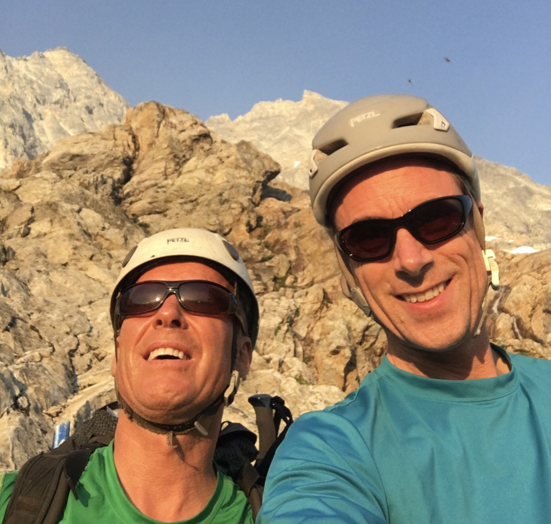
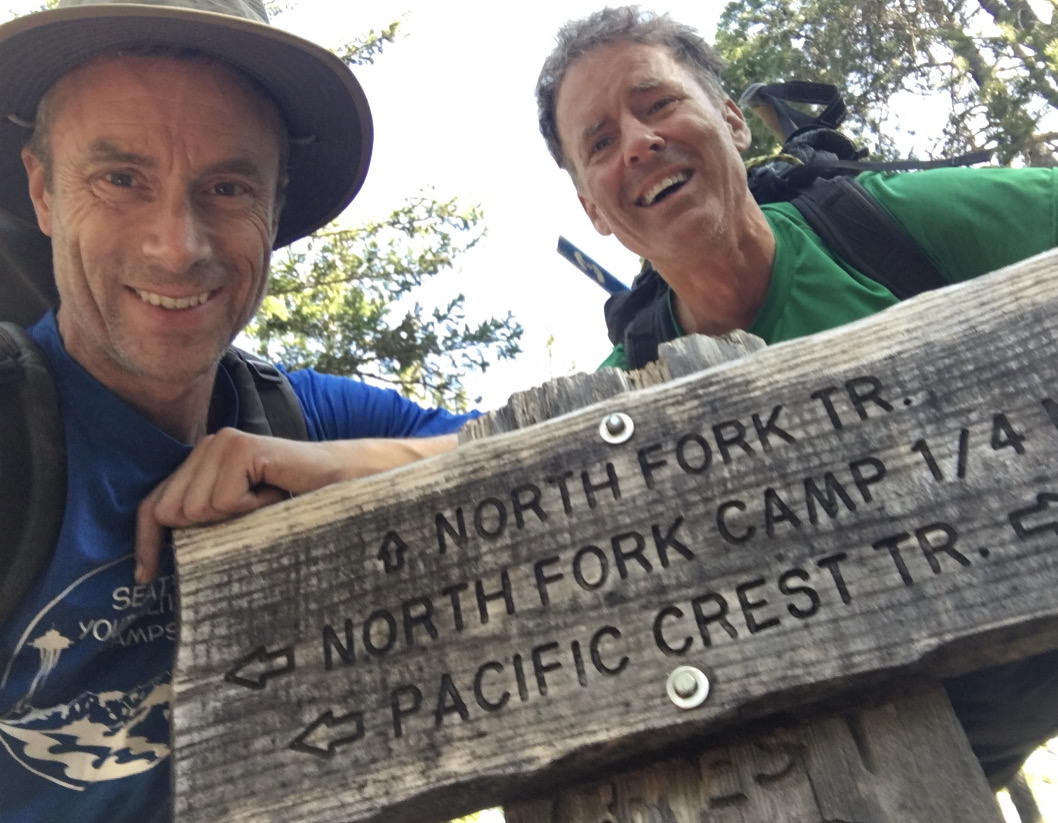
Trip: Mount Goode - Northeast Buttress
Trip Date: 07/11/2021
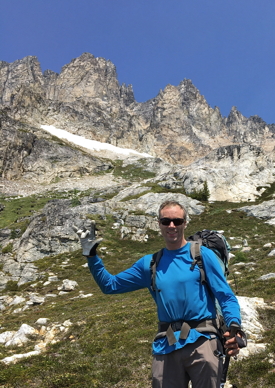
Trip Report:David and I are highly skilled at turning classic, moderate alpine routes into masochistic adventures. You'd think we'd learn, particularly since we have over a century of outdoor experiences between us, but maybe the truth is that we like to suffer.
Like many alpine routes, conditions on the NE Buttress of Goode are everything. Too early and the creek crossings are treacherous. Too late and the moat at the top of the glacier can be hard to cross safely. There's a third factor we didn't realize was important: water sources high on the route. That turned out to be the most memorable part of our trip, as you'll see.
My biggest worry was the crossing of the N Fork of Bridge Creek. A week before our trip, during our record-breaking heat wave, a friend and his girlfriend had found the creek impassable and bushwhacked a mile upstream to find a safe way across, adding two miles of cross country travel to their trip. A day later, another party turned around entirely in the face of a raging torrent. But temps had dropped. Was the crossing better? I remembered there's a flow gauge on the StehekinIn River, downstream of the North Fork. The data were encouraging: the river was at 6500 CFS when multiple parties found the N Fork crossing impassable, and it had dropped to 2500 CFS at the time we were going. We were a go!
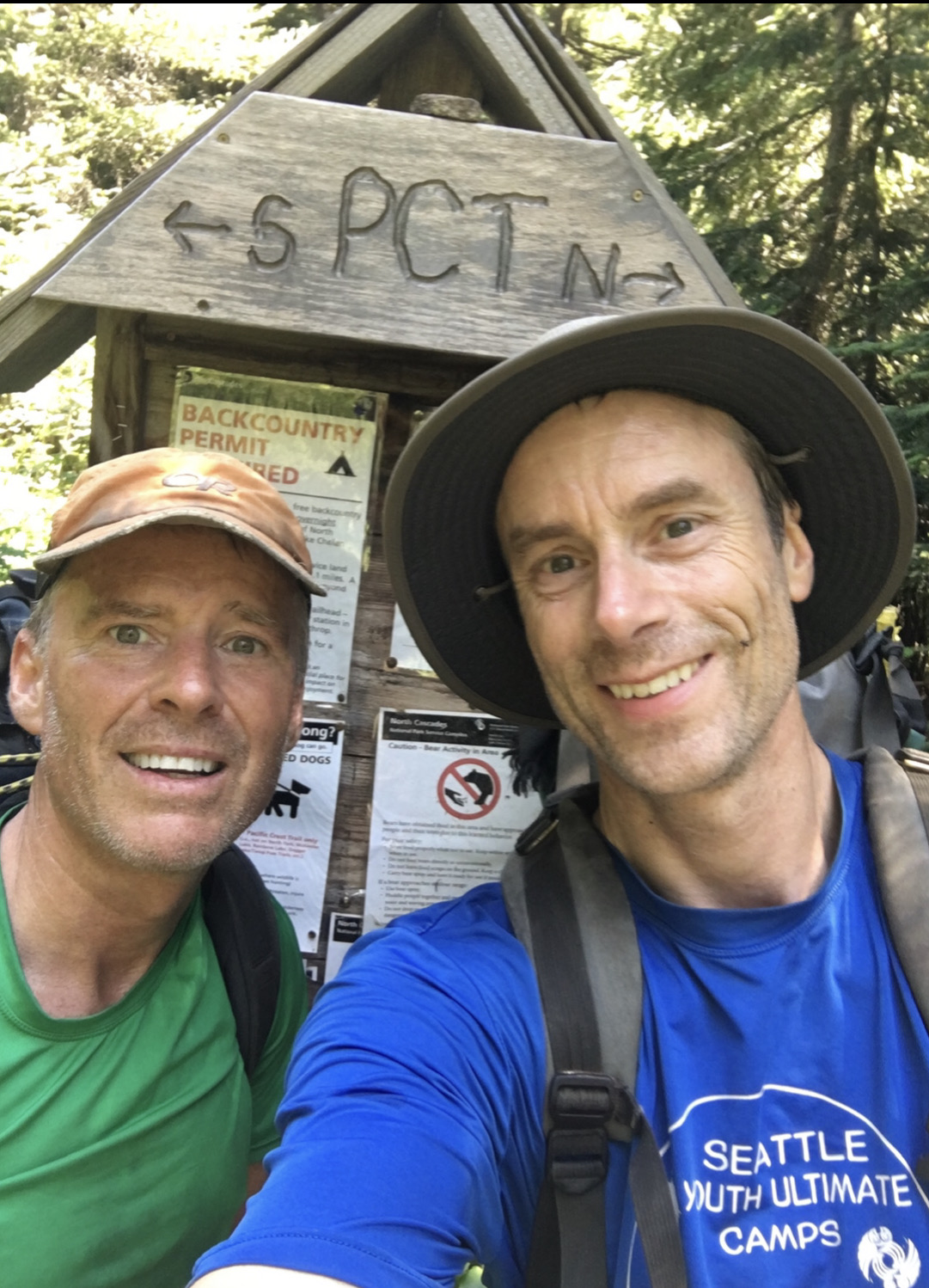
The first ten miles on the Pacific Crest Trail went smoothly. It was fun to chat with PCT thru hikers just starting South on their journey. Just before the North Fork junction, we ran into four friendly climbers who'd just come off of Goode. They allayed my concerns about the crossing and gave us a key piece of beta for the descent.
They gestured at my splinted thumb, which I'd jammed in the gym a couple of weeks earlier: "Can you hand jam with that?" "Should be OK", I said. Starting off the trip with an injury wasn't ideal, but I didn't think it would affect us much.
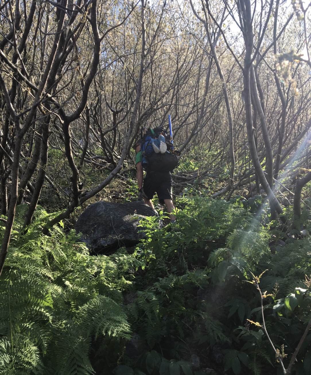
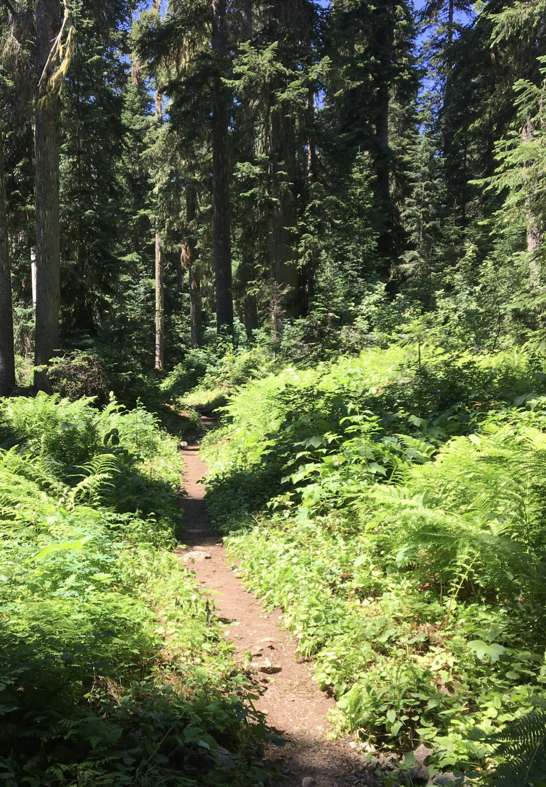
Grizzly Creek was easily crossed on a log, and then the trail got a bit brushy. It was a warm day, but nothing too bad.
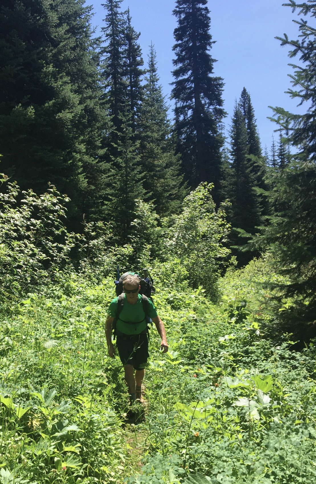
When we emerged from the brush at the traditional crossing point, I was relieved to see that it looked pretty mellow.
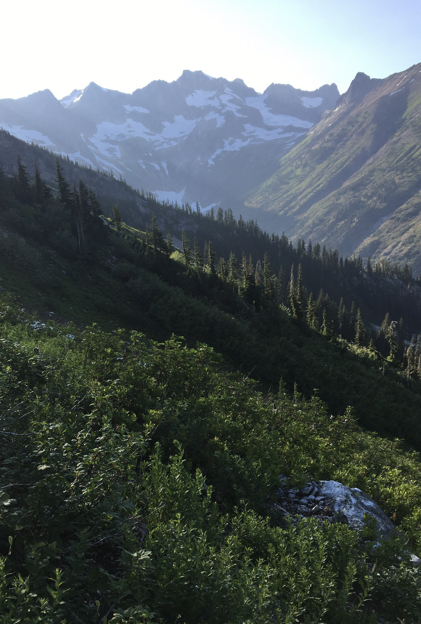
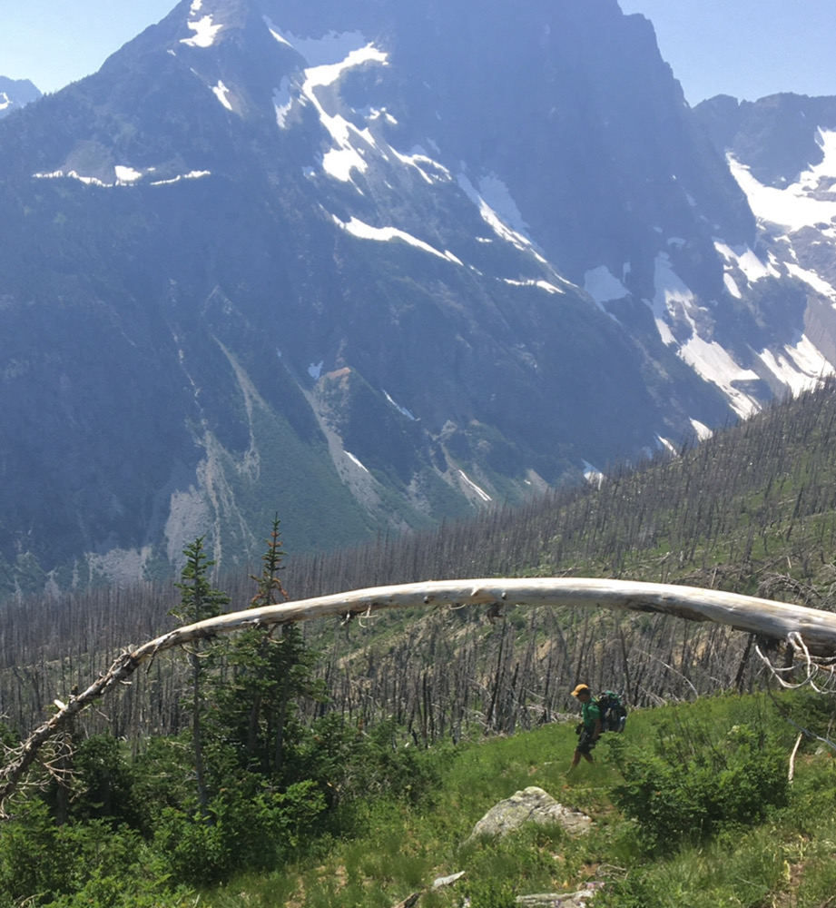
The whole route - 6000 feet from river to summit.- stretched up in front of us.
Skies were clear, most of the seasonal snow had melted, and it was getting hot just in time for our steep ascent to camp.
The river was just over knee deep.

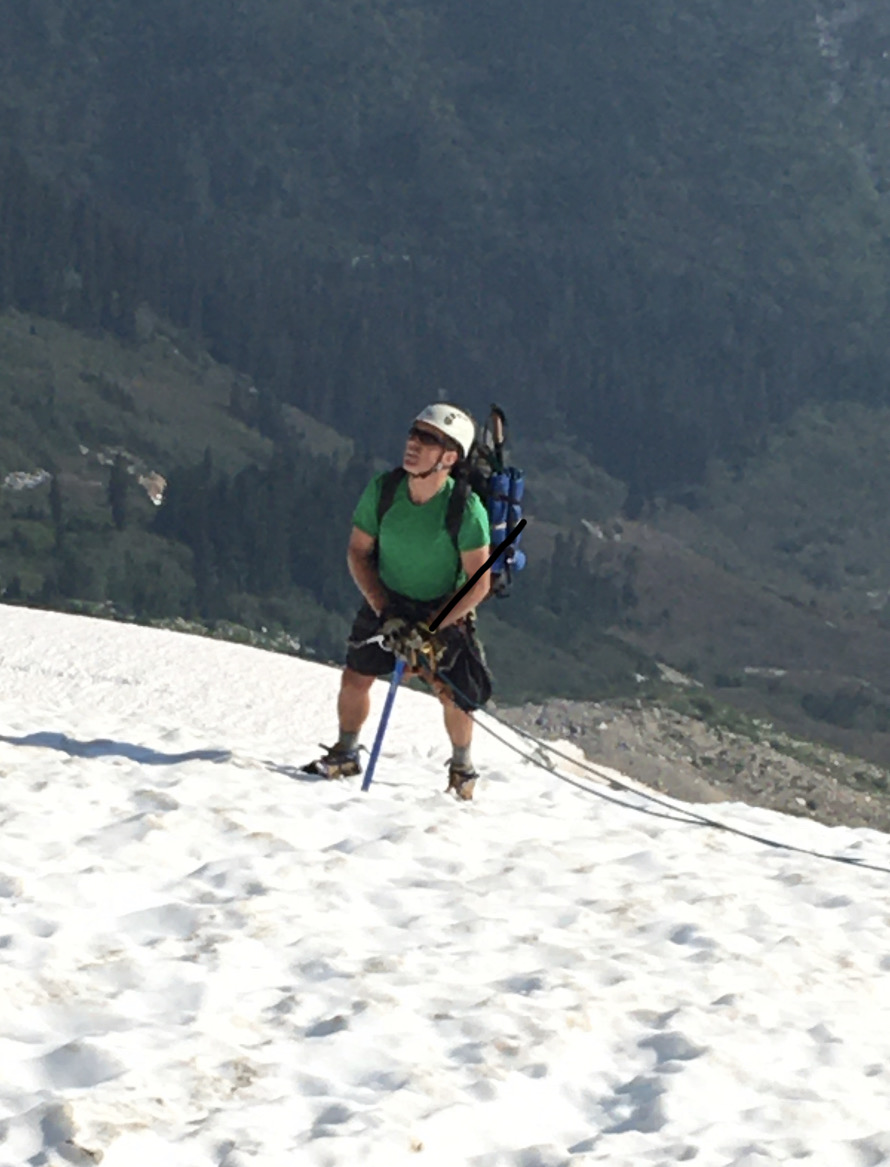
So far so good, but a hidden dragon was about to rear its head. David had spent the previous day on the Snoqualmie River with friends. He'd gotten quite dehydrated and hadn't really recovered. The afternoon heat was taking its toll on him, and his energy was waning just as we were about to start up 2500 feet of fairly steep terrain to our intended camp.
Usually, David carries more shared gear as he's faster than me. Not today. He handed me the rope and we started up.
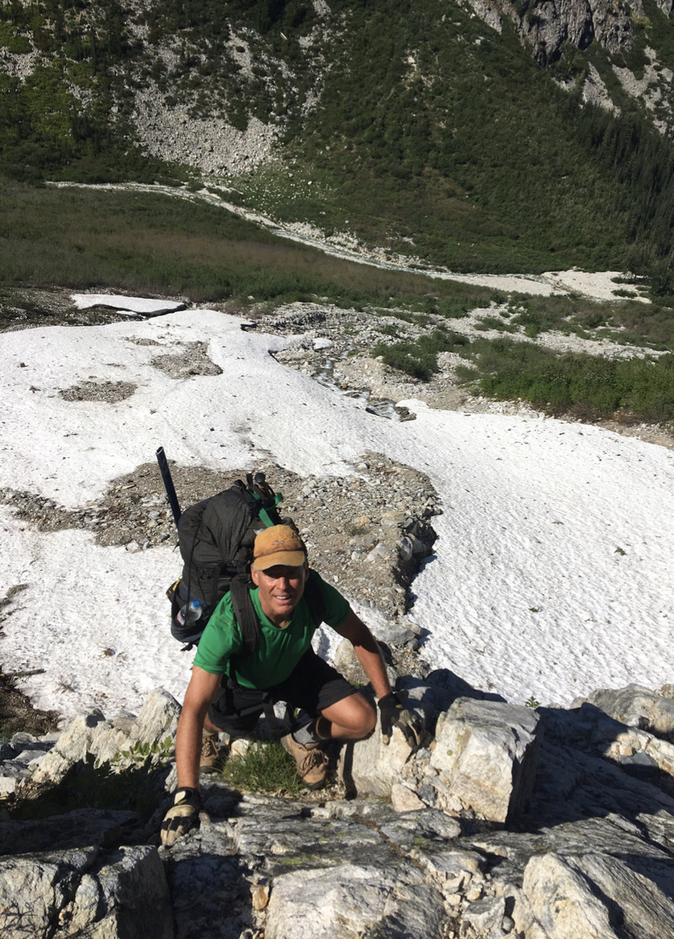
There were a few sections of steep scrambling where a fall would be bad. My tolerance for high consequence terrain has waned in recent years, but this was still just third class.
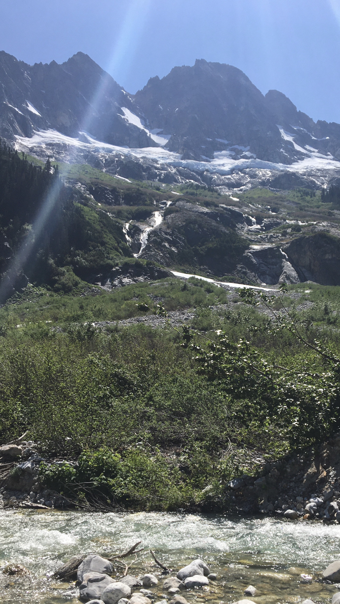
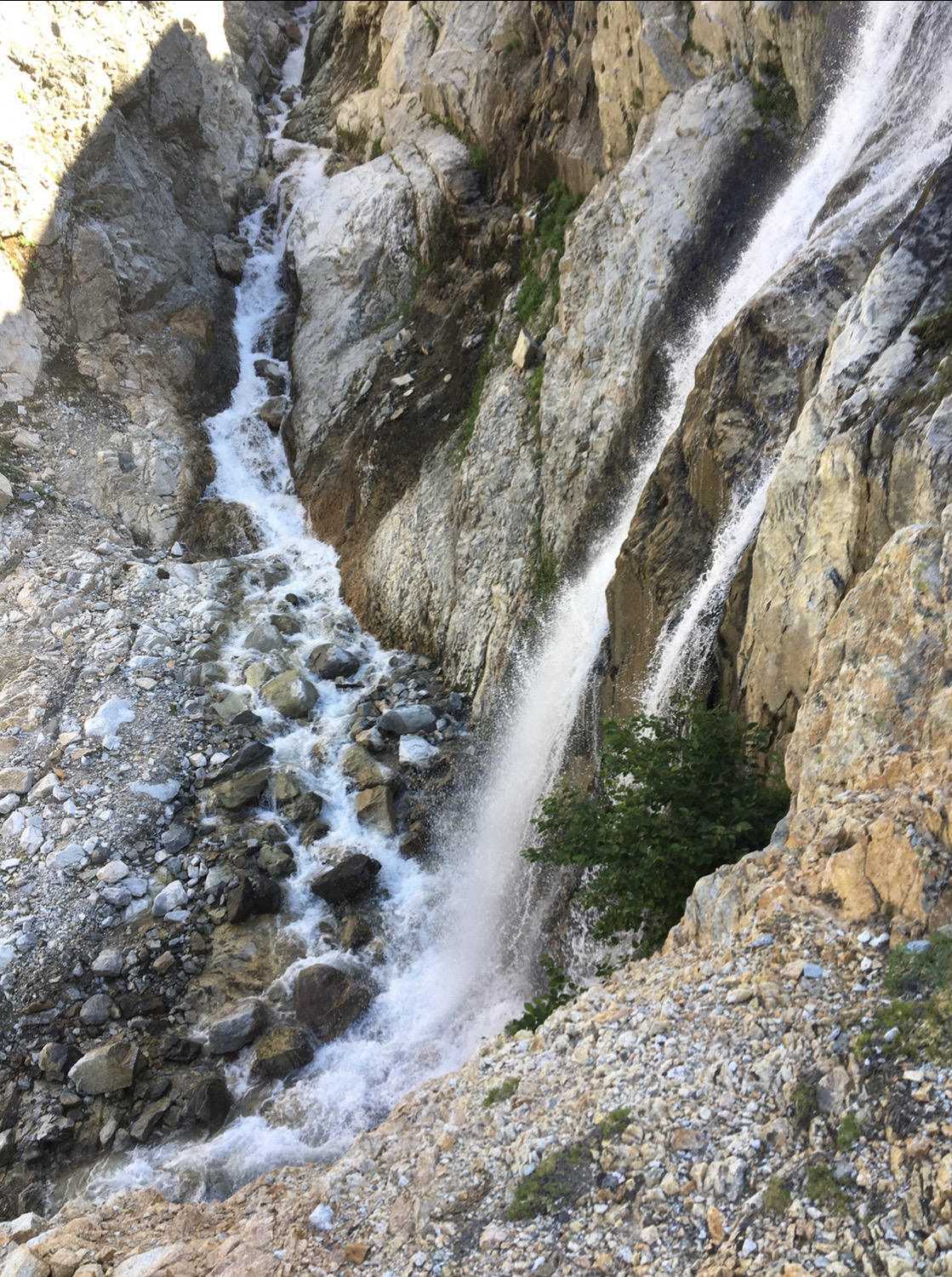
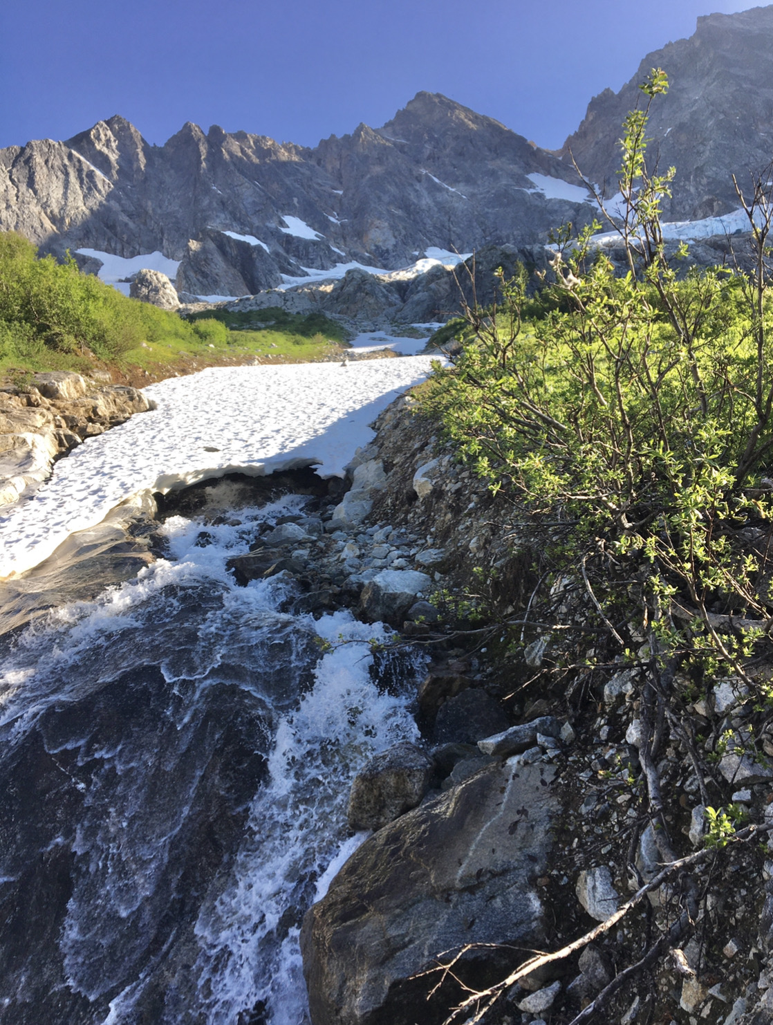
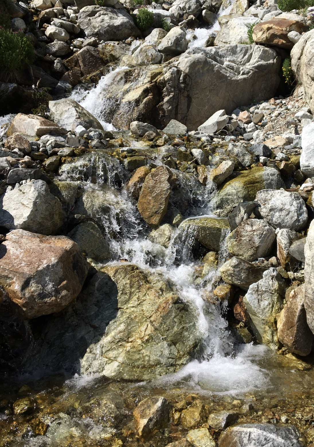
Lots of lovely waterfalls.
Then there were two sections of holdless, licheny fourth class scrambling where a fall would be fatal. Being tired and having a heavy (for me) pack didn't help my confidence. David kindly trailed the rope on the second section and gave me a hip belay.
Then the "Magical alder tunnel" began. The tent caterpillars had eaten almost every leaf in a long section, so there was no canopy to protect us from the afternoon sun.
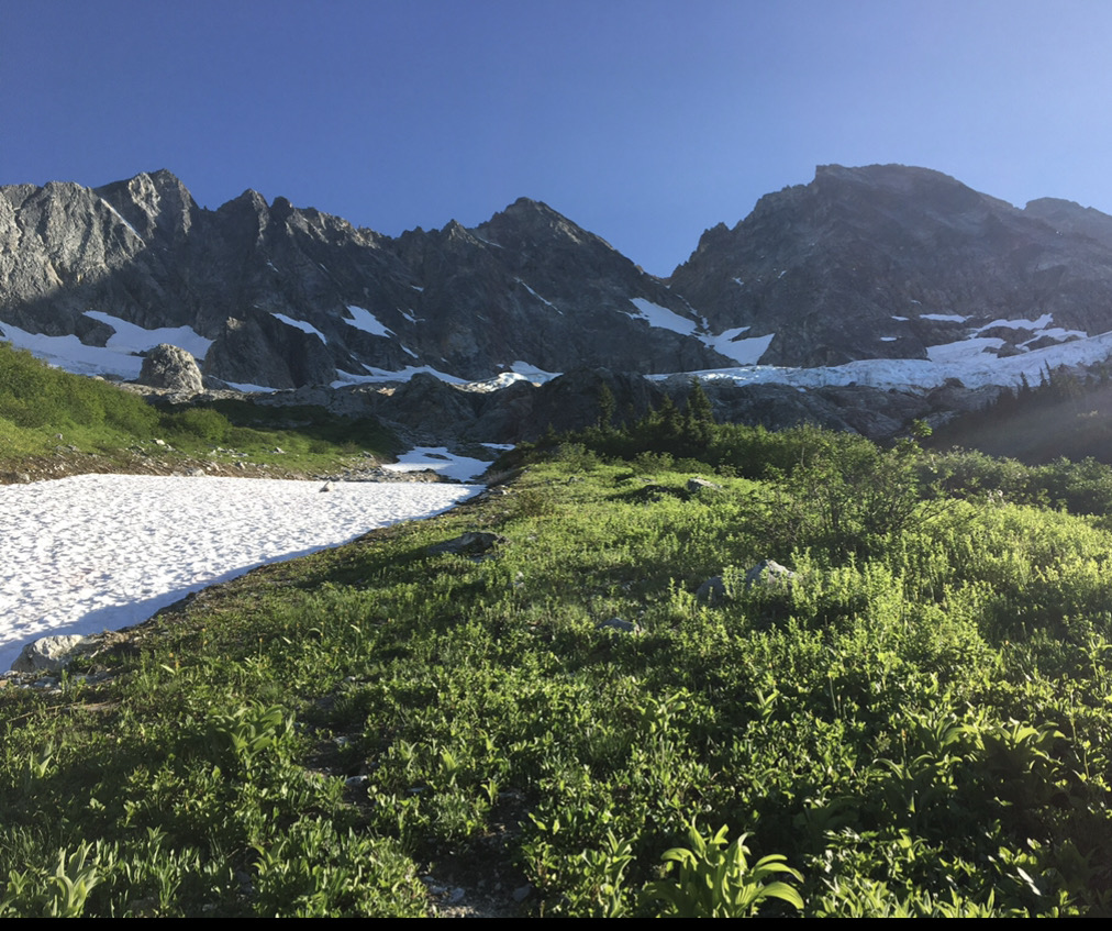
Eventually, we emerged onto a small ridge next to a snowy creek. It looks flat, but it's definitely not.
The skies were mostly blue except for a funny looking cloud to the north...more on that later.
We would head up to the sun/shade line and veer up and left to the 5600 bivy.
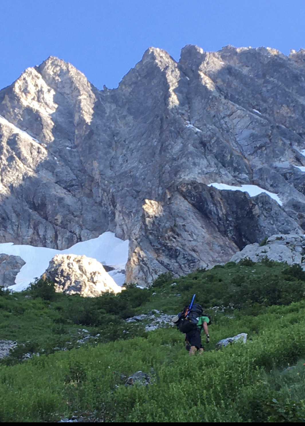
In the hall of giants.
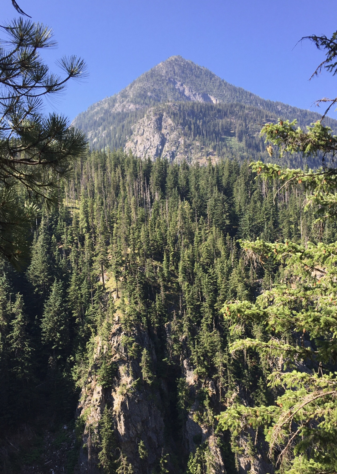
I like to imagine Fred coming up this way on the first ascent in 1966, before North Cascades became a National Park in 1968, before the North Cascades Highway was completed in 1972, and before the Pacific Crest Trail was completed in 1993.
Storm King
David is a master of micro naps. If he gets 15 minutes ahead on the trail I'll find him fast asleep.
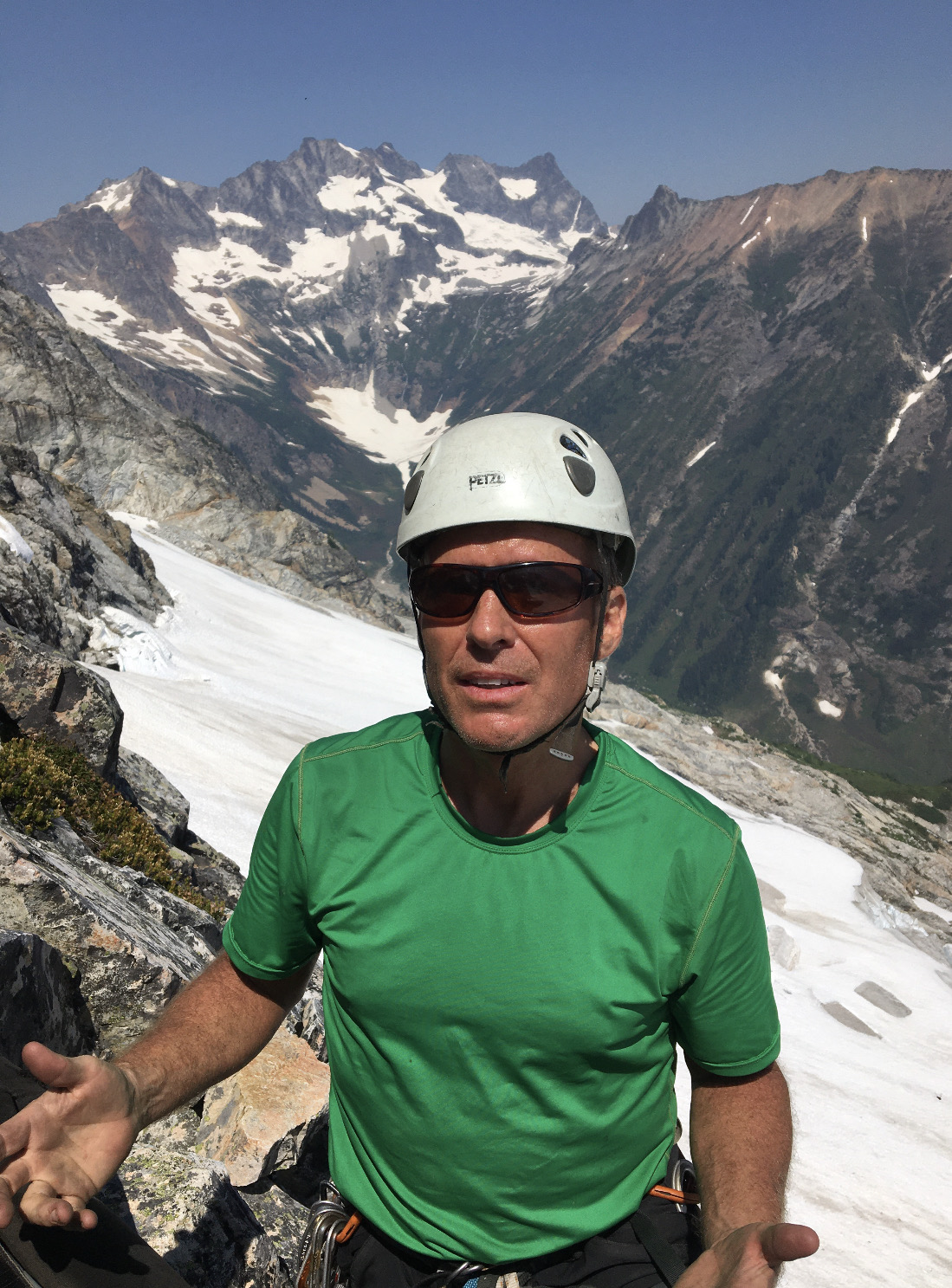
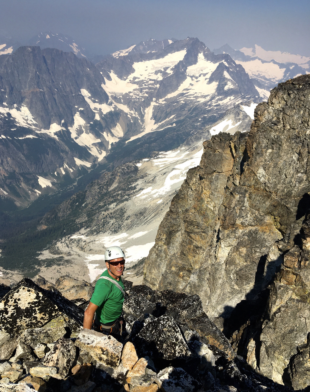
I kept going, with the summit of Goode looming over us.
We reached the bivy, ate, admired the sunset, and settled down for the night. No rodent visitors.
A bright meteor flashed across my dreams. We were lucky.
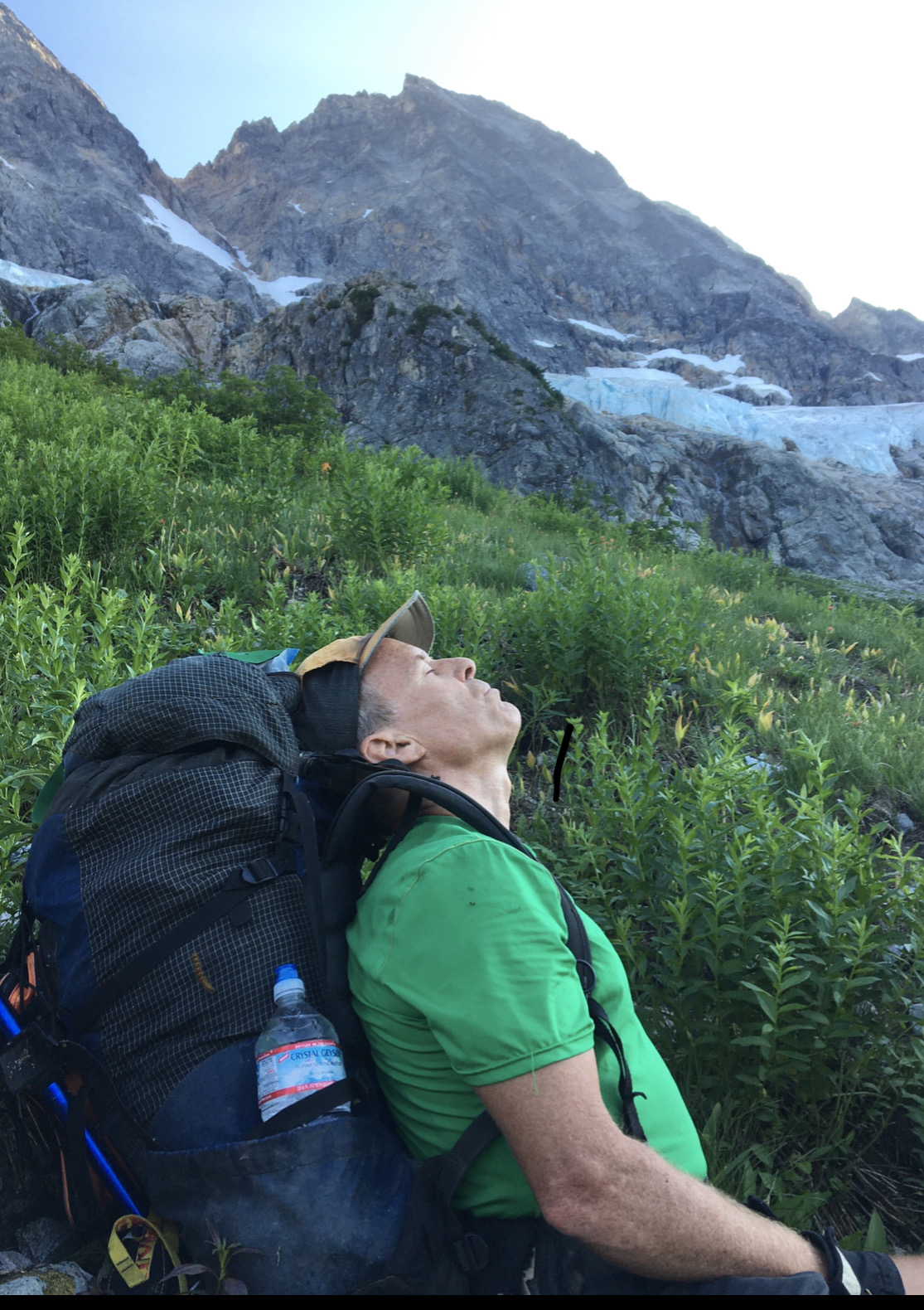
At dawn, it smelled like smoke. That funny cloud was smoke from a fire that would close Highway 20 during our trip. Would our egress be cut off? Who knew? For now, there was only one way to go: up.
Smoky sunrise with a few mosquitoes photo bombing above my head.
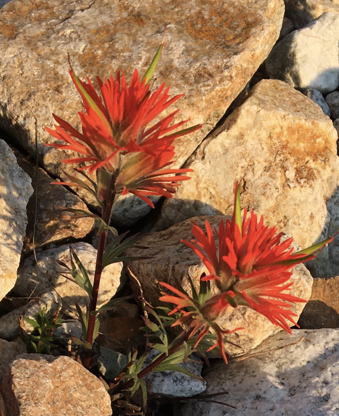
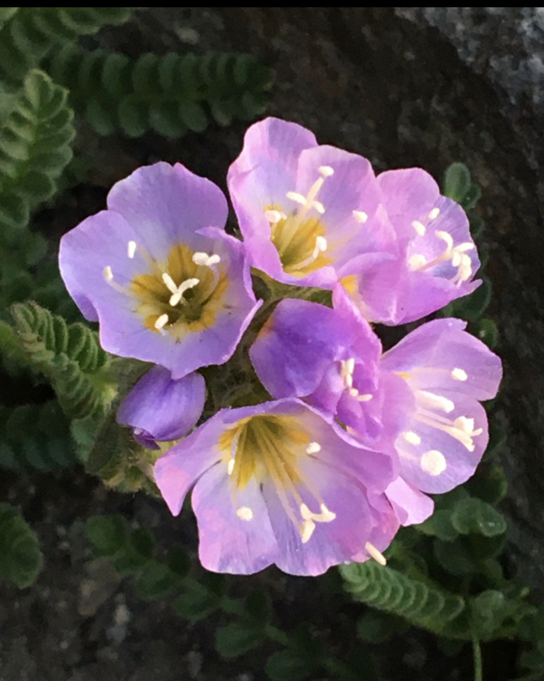
Paintbrush
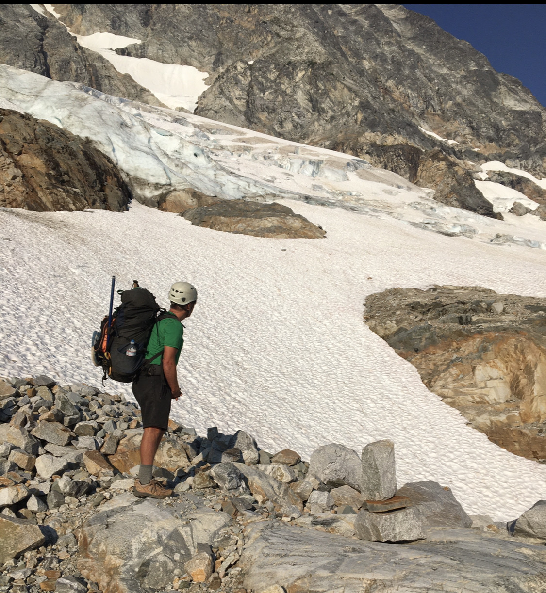
We moved right below a steeper section of glacier.
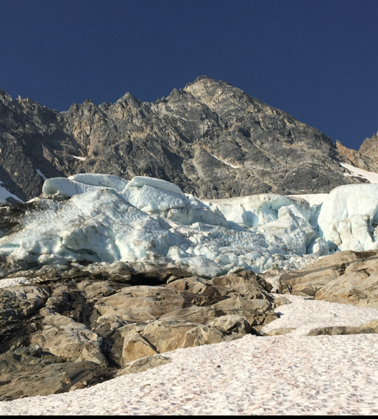
The seasonal snow was mostly gone, and the glacier crossing was trivial.
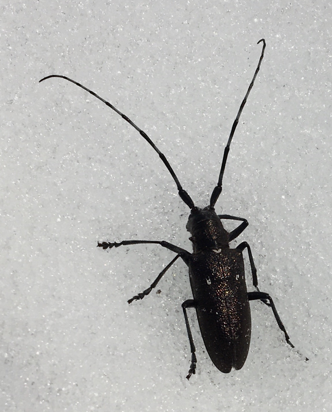
This three inch iridescent beetle was out for a walk, probably looking for tasty critters to eat.
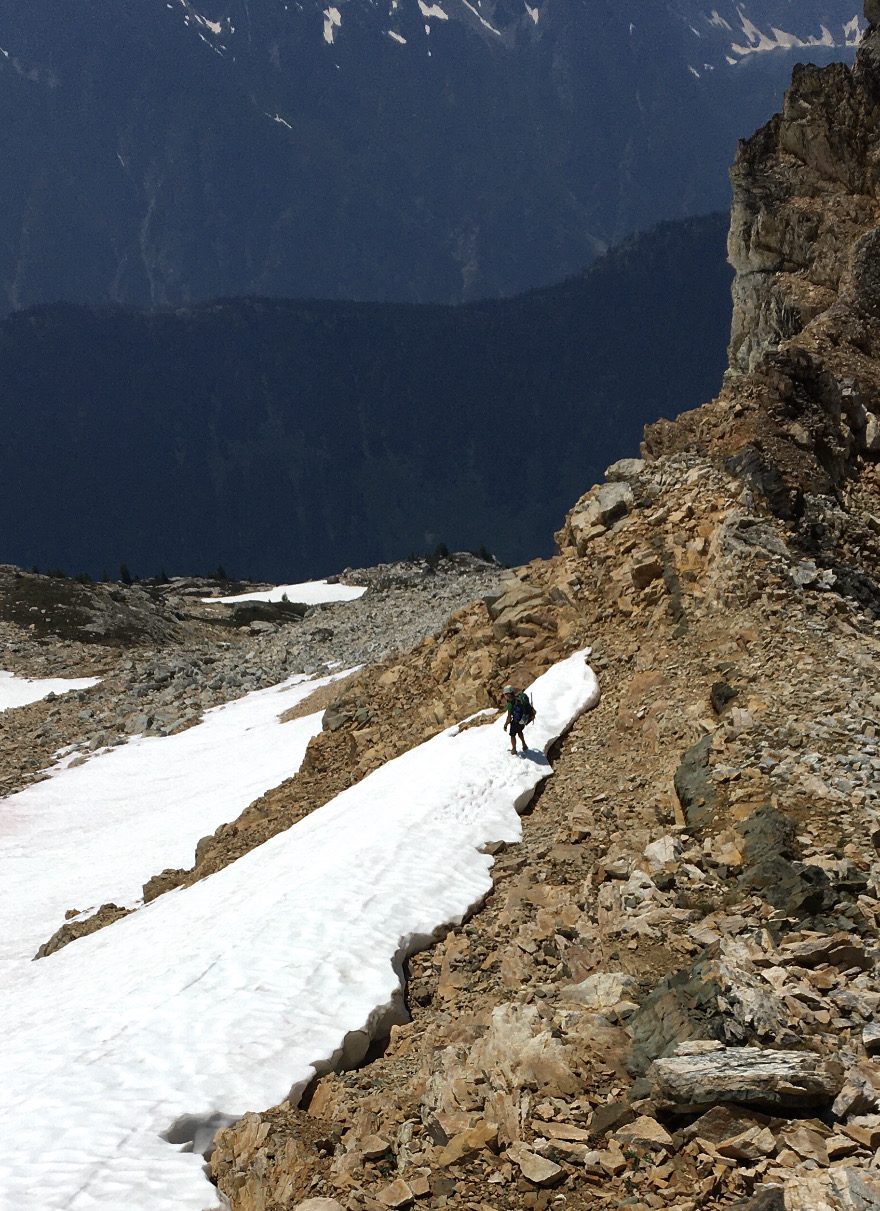
Approaching the toe of the buttress.

l
The moat, which can be treacherous late season, was very straightforward, thank goodness.
Everything was going great...
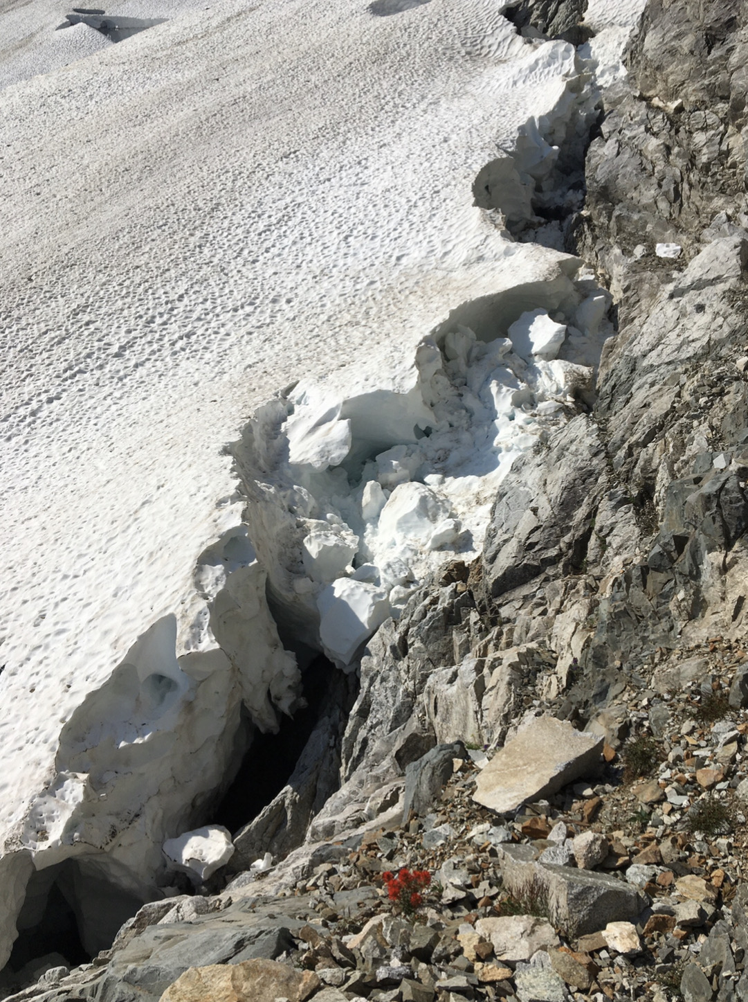
And then we had a kerfuffle trying to get over to the crest of the buttress.
We knew the goal was to angle up and right to the crest, but we were turned back by several steep dead ends with absolutely atrocious rock. We backed off two lines before finally finding one that felt OK. No one else ever mentioned this section as a significant obstacle in the reports we'd read, so there was no beta. Oh well. Just keep trying.
At the final lip, I was mantling over onto the crest, both hands pointed down, feet in the air, when I couldn't move. Something was holding me back. My last gear was 15 feet behind me. A fall would be ugly. Apparently a tricam on the rack dangling from my shoulder had lodged in a crack at the height of my knees. It cammed perfectly and set itself to prevent upward movement. Grrrr. I tried fiddling with it, blindly, with one hand while balancing on the other. No bueno. I had to reverse the mantle, find a stance, use the nut tool to clean it, and complete the mantle to gain the crest. F$%^ing hell! I was beginning to think the mountain was sending us a signal.
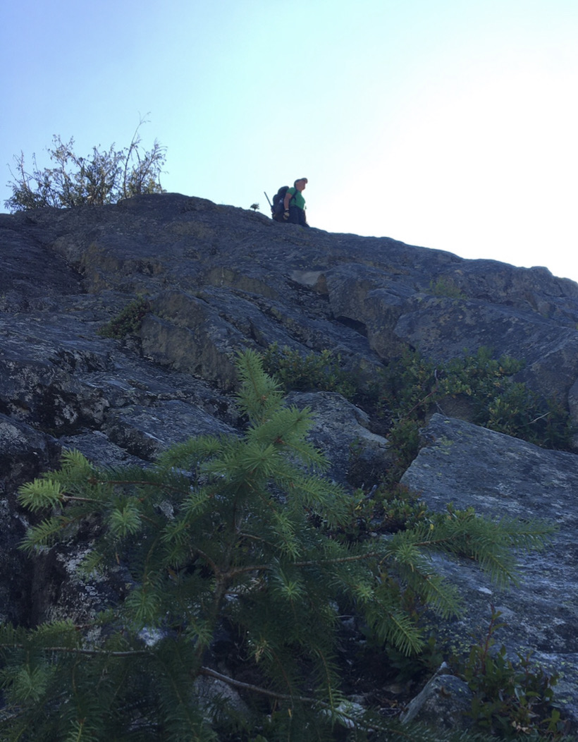
We had finally gained the crest of the buttress after three hours of poking around on the choss in the sun. That certainly wasn't part of our plan.
David and I both are very rational when it comes to sunk costs, and we had both internally come to the same assessment of our situation: Yes, it's a bummer that it's noon instead of 9AM, but we're here, we have plenty of water and gear, retreat would be very unpleasant, and we might as well just climb. So we put three hours of frustration behind us and started climbing.
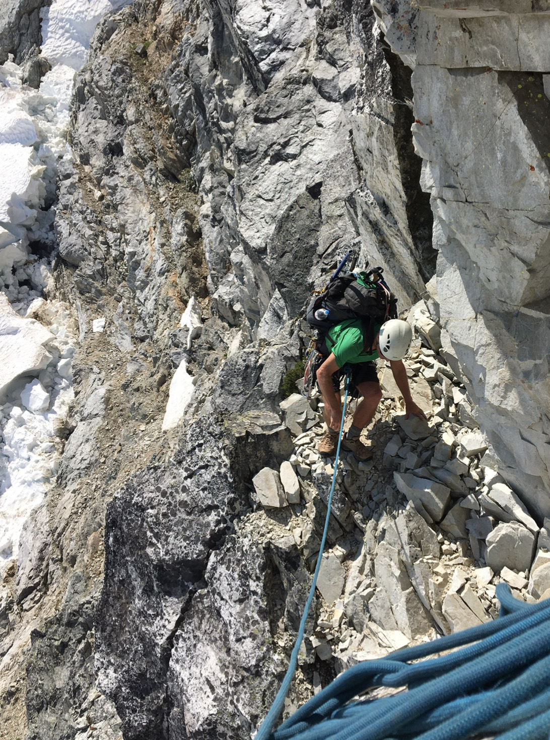
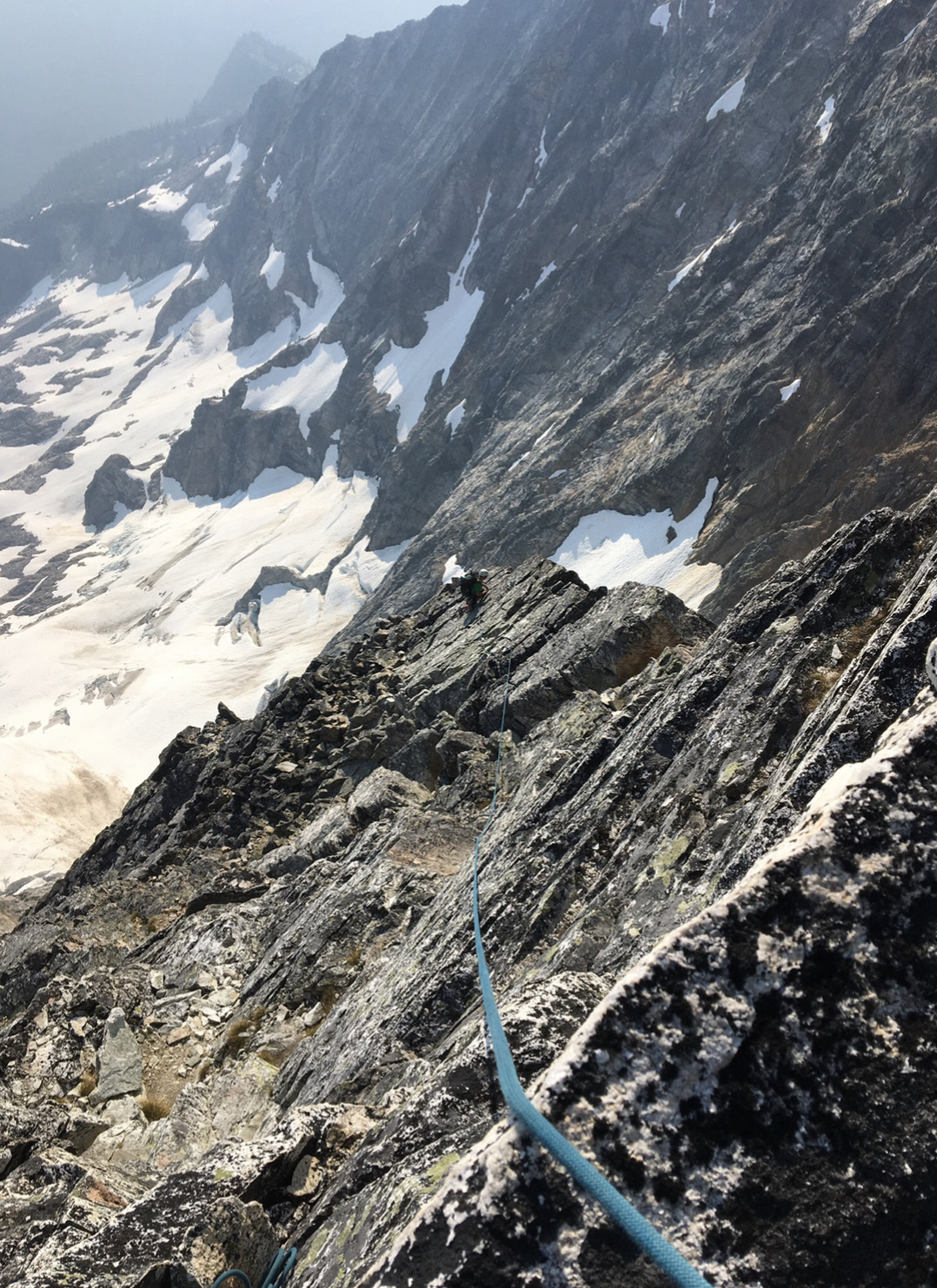
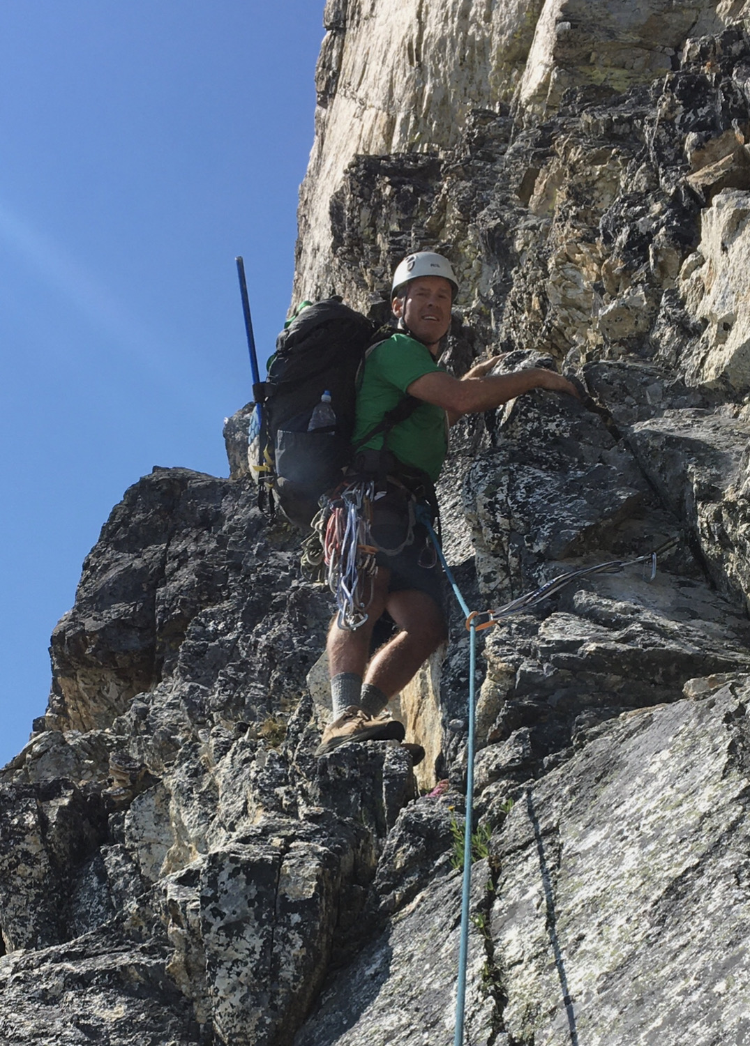
The route flowed pretty smoothly. We simul-climbed most of it, only stopping to belay three fantastic pitches that I got to lead. One was this nice arete feature.
Shortly before the large bivy ledge, I looked down and saw a piton that Fred may have placed on the first ascent in 1966.
We reached the bivy ledges in the late afternoon and decided it was best to stop as we didn't want to climb by headlamp, and we weren't sure if there was snow we could melt near the summit.
As it turned out, there was only one small patch of snow left. It was about six feet long and a foot thick. We would melt most of it, but it wasn't as pure or tasty as we imagined.
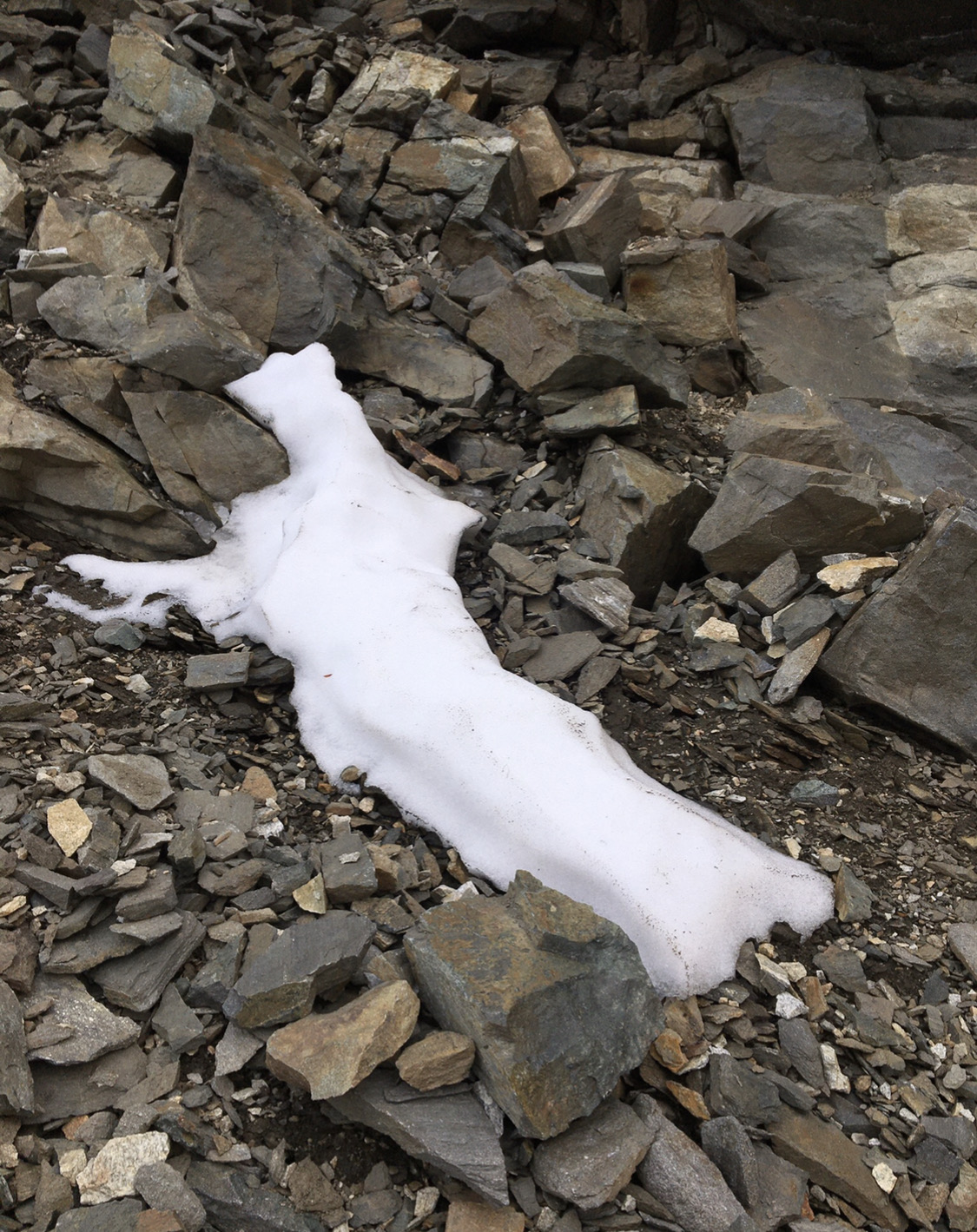
Step 1: bring snow over to our melting pot.
Hey what are those black specks? Probably just lichen or dirt....
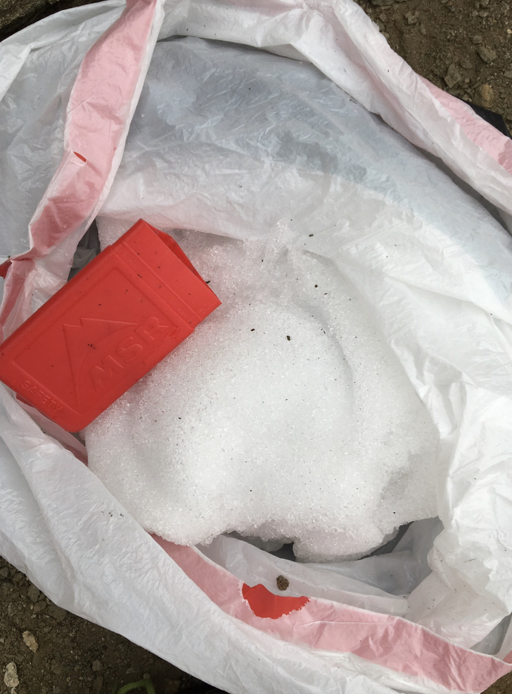
There sure are a lot of those black specks.
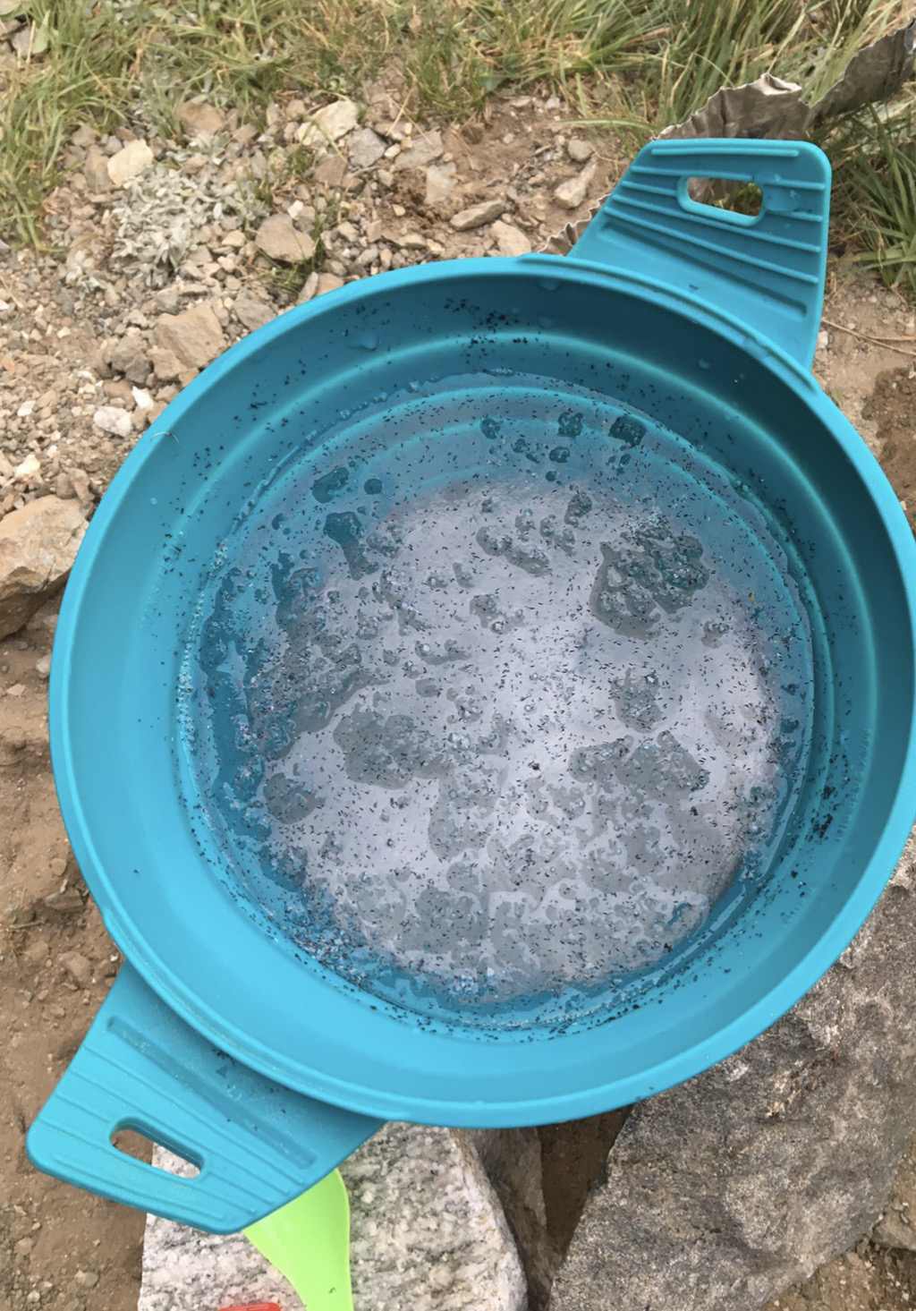
We poured the water into my nalgene and David took a long drink. Hey, those black things look like pine needles - but there are no trees up here. They also kind of look like tiny worms.
David looked down into the nalgene and the black bits swam away from him toward the bottom. AAAGGHHHH!!!! They're alive!
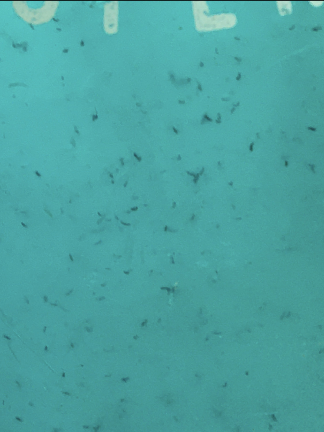
And there sure were a lot of them. It's one thing to drink a pine needle or a piece of dirt. It's quite another to gulp down dozens of tiny, writhing worms eager to burrow into your brain. Actually, we reasoned that if they lived in snow they'd probably die quickly in our guts, but I didn't really want to test out that theory. David was patient zero.
I've seen our local glacier worms. These were shorter. Maybe a larval stage? Or a different organism? My glasses and camera were not powerful enough to reallly see them, and I wasn't sure I wanted a clear picture of these critters anyway given that we'd be drinking this water in any case.
I imagine that as the snow patch got smaller they packed tighter and tighter into the last remaining section.
They seemed to sink. We tried decanting them and then wiping off the sides of the pot with a clean corner of my sock. Not very effective.
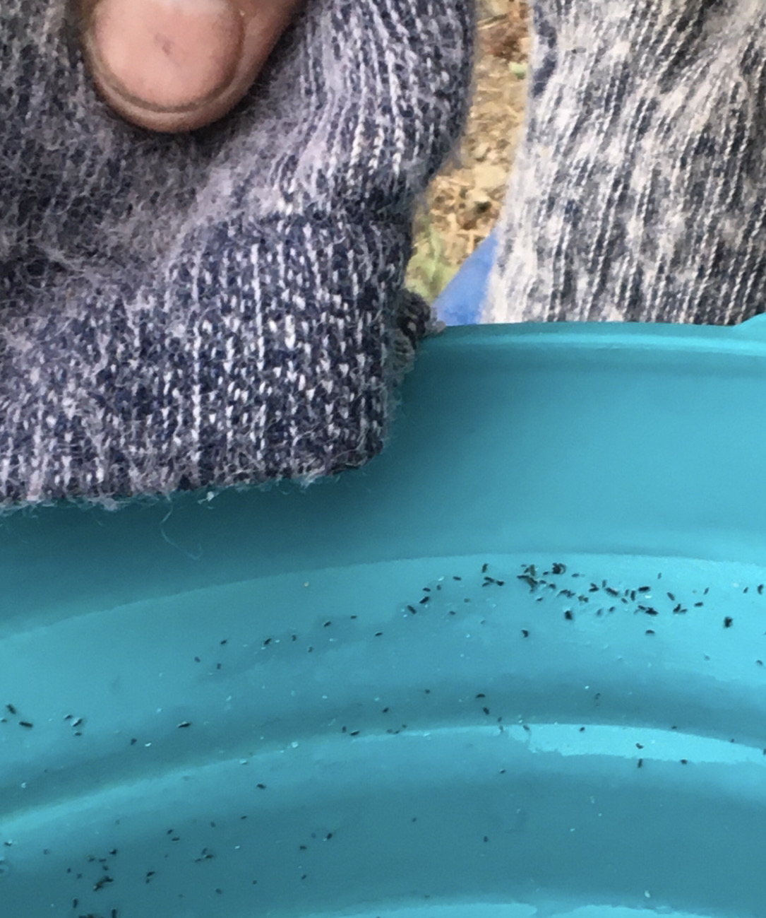
So we filtered the melt water through a clean shirt as best we could.
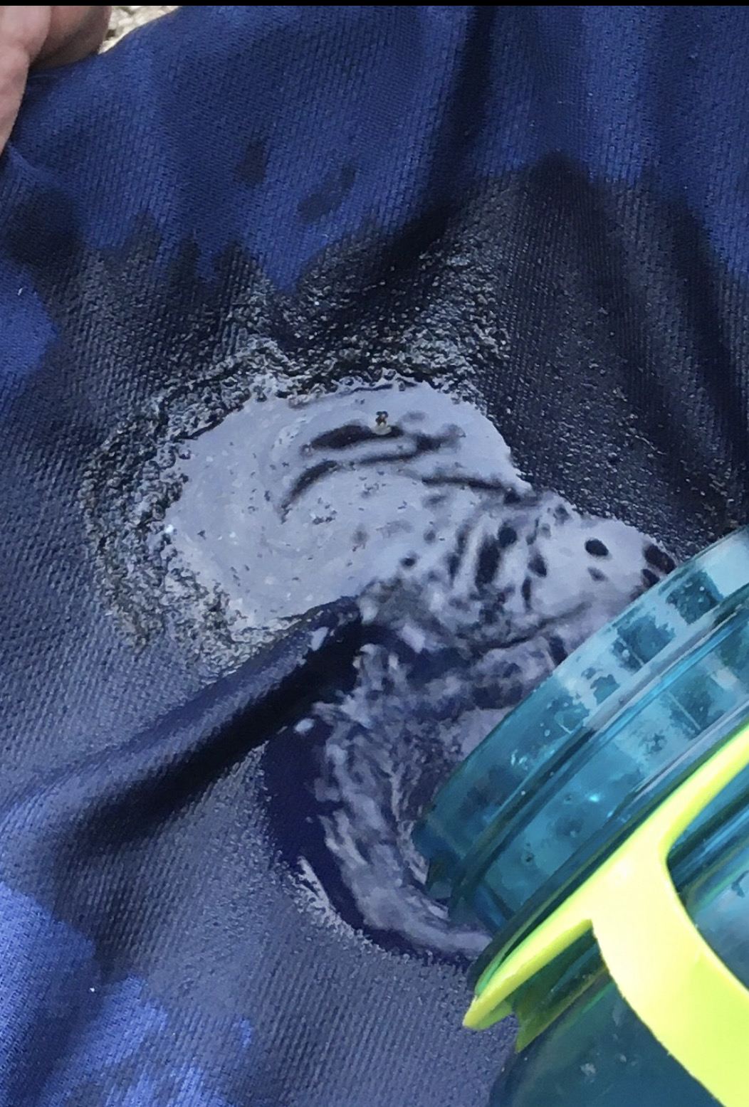 The host of worms that piled up was impressive.
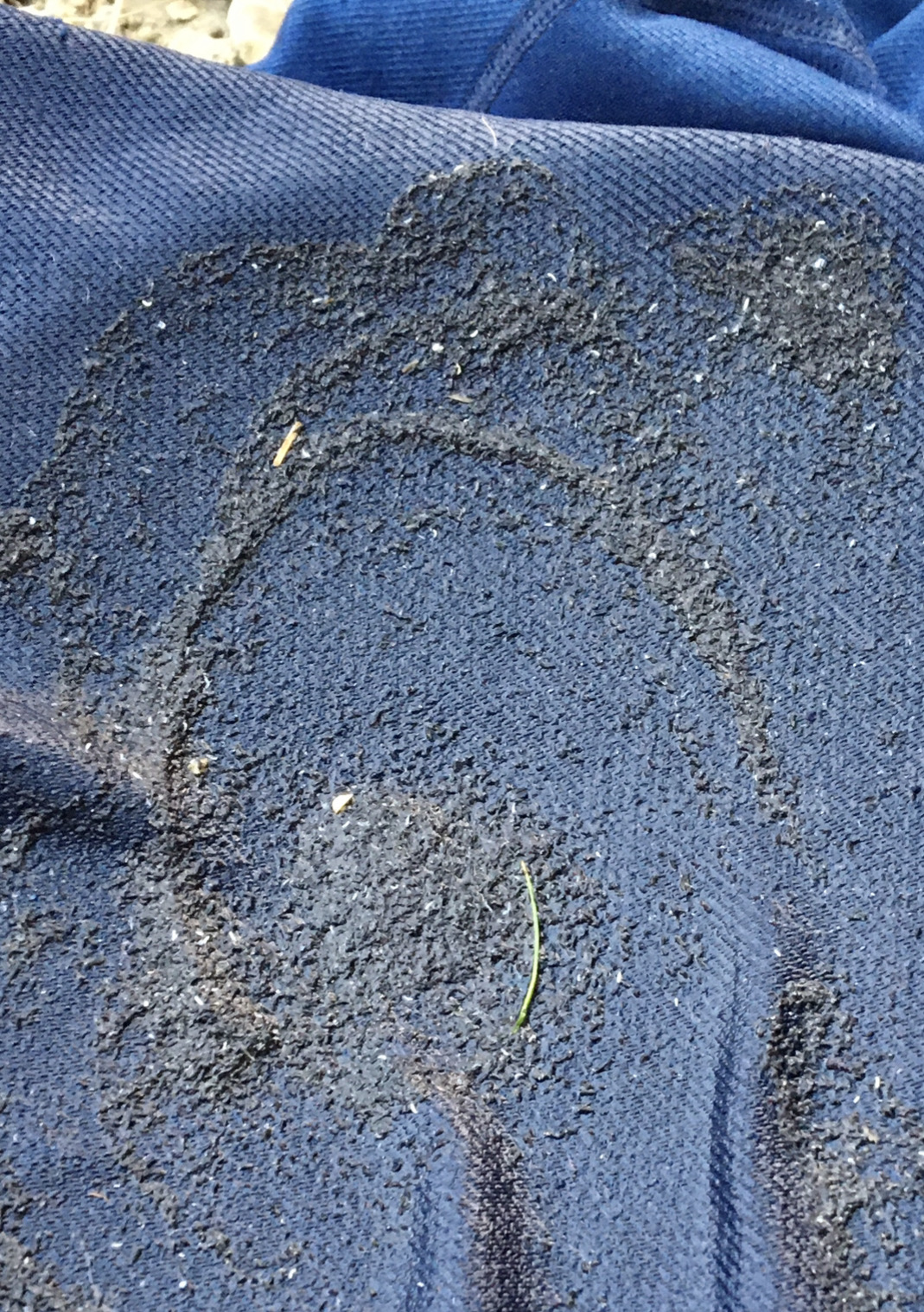
The filtrate was mostly clear, but it tasted like shrimp soup.
I added Nuun and protein powder, but it still tasted absolutely vile. I almost gagged, and I'm not squeamish.
This would be our only water until almost noon the following day.
Drink up!
We could only laugh.
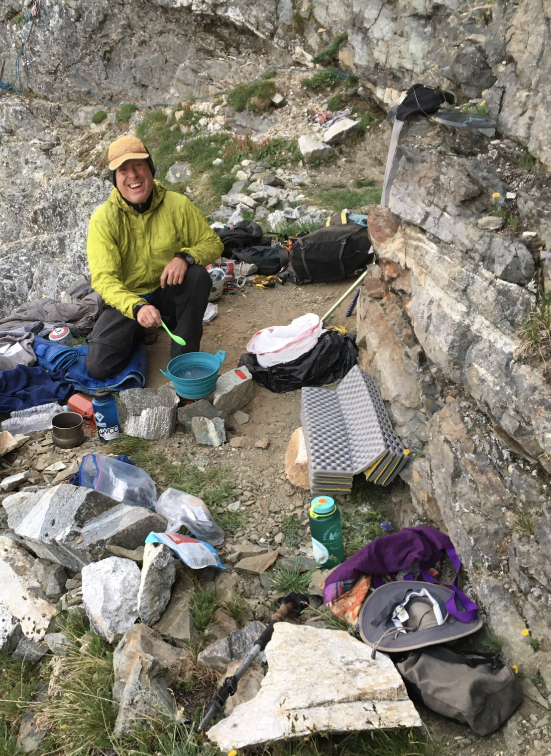
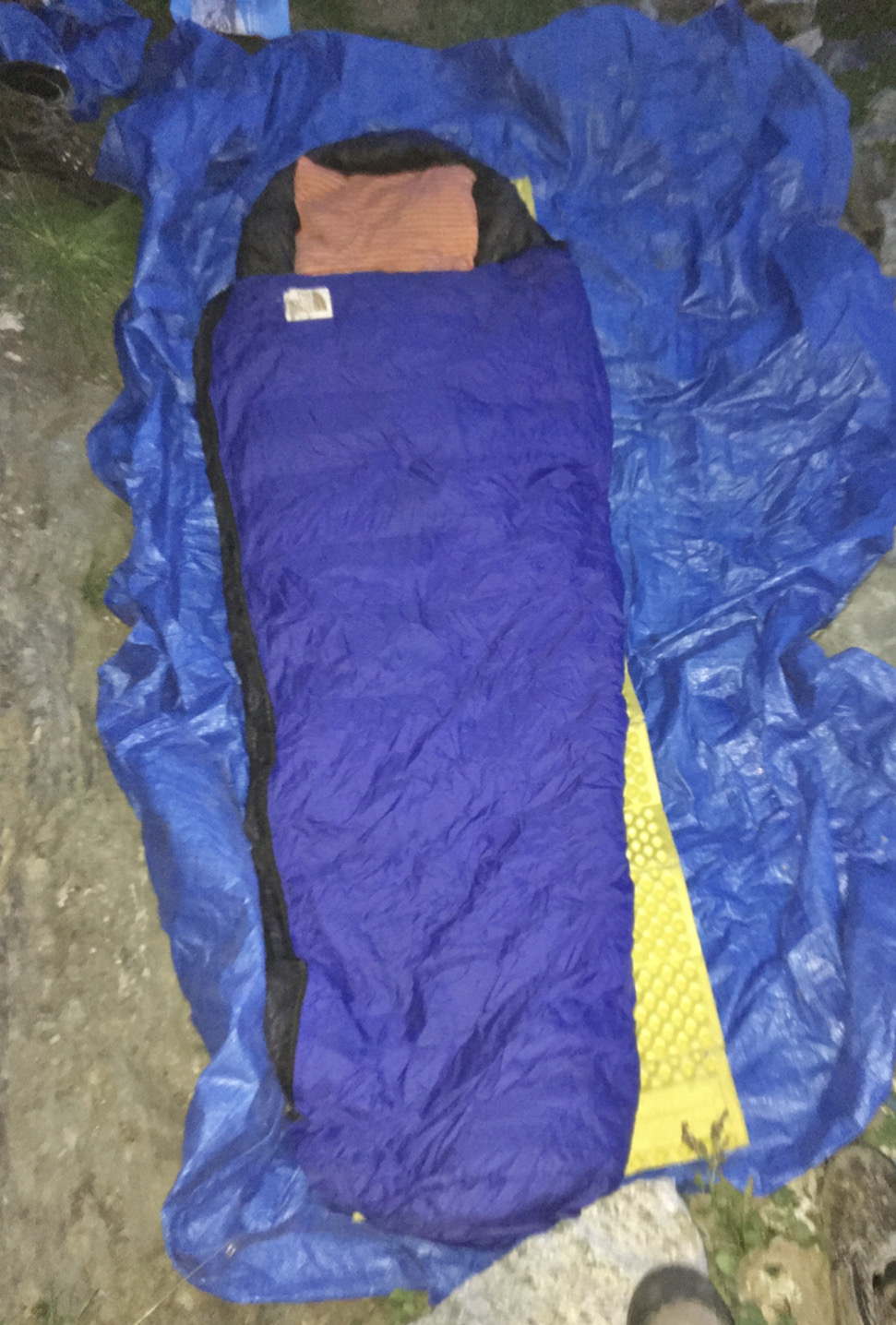
I laid out the rope for a nice nighttime nylon nest.
Added my pad
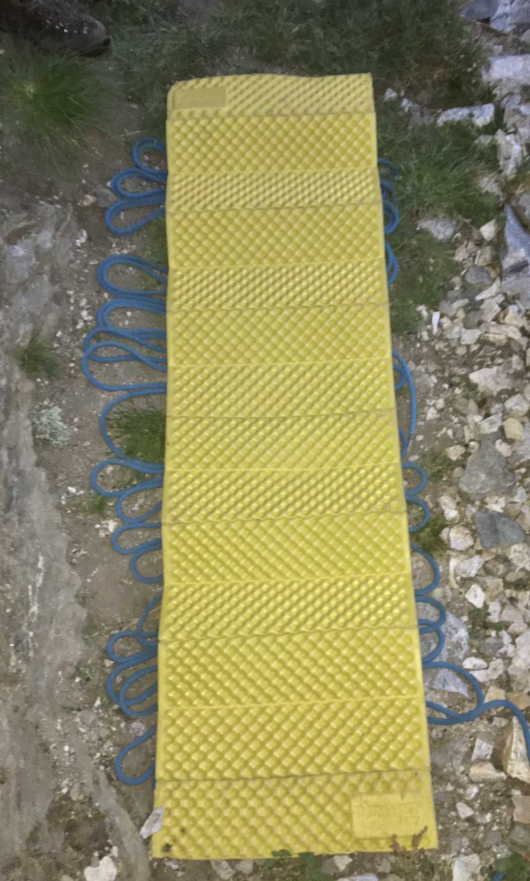
Testing. Testing.
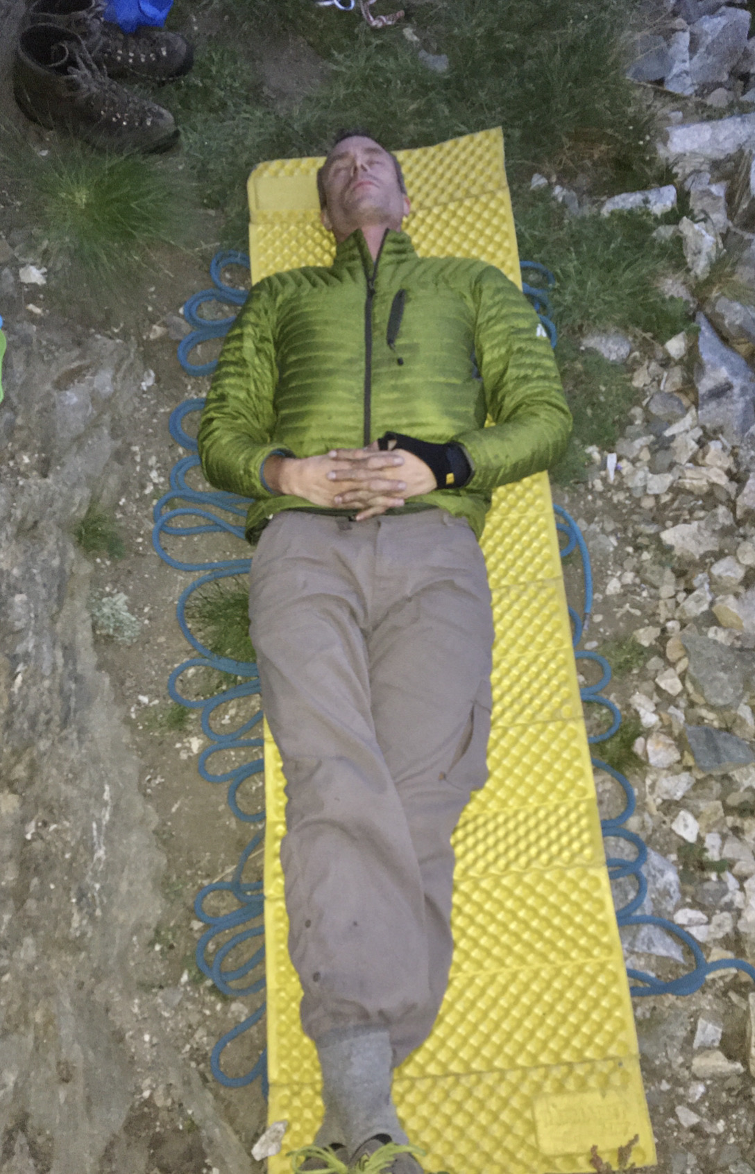
And ready!
I really hoped we wouldn't spend the night fighting off a packrat (aka bushy-tailed woodrat). They are notorious for stealing belay devices, cups, lighters, and anything that might look nice in their midden, which is typically a huge pile of petrified poop and pee build up over decades under a large rock. I saw what looked like the main midden entrance and stacked some blocks in front of it in hopes of distracting the beast.
We never saw hide nor hair of the vermin.
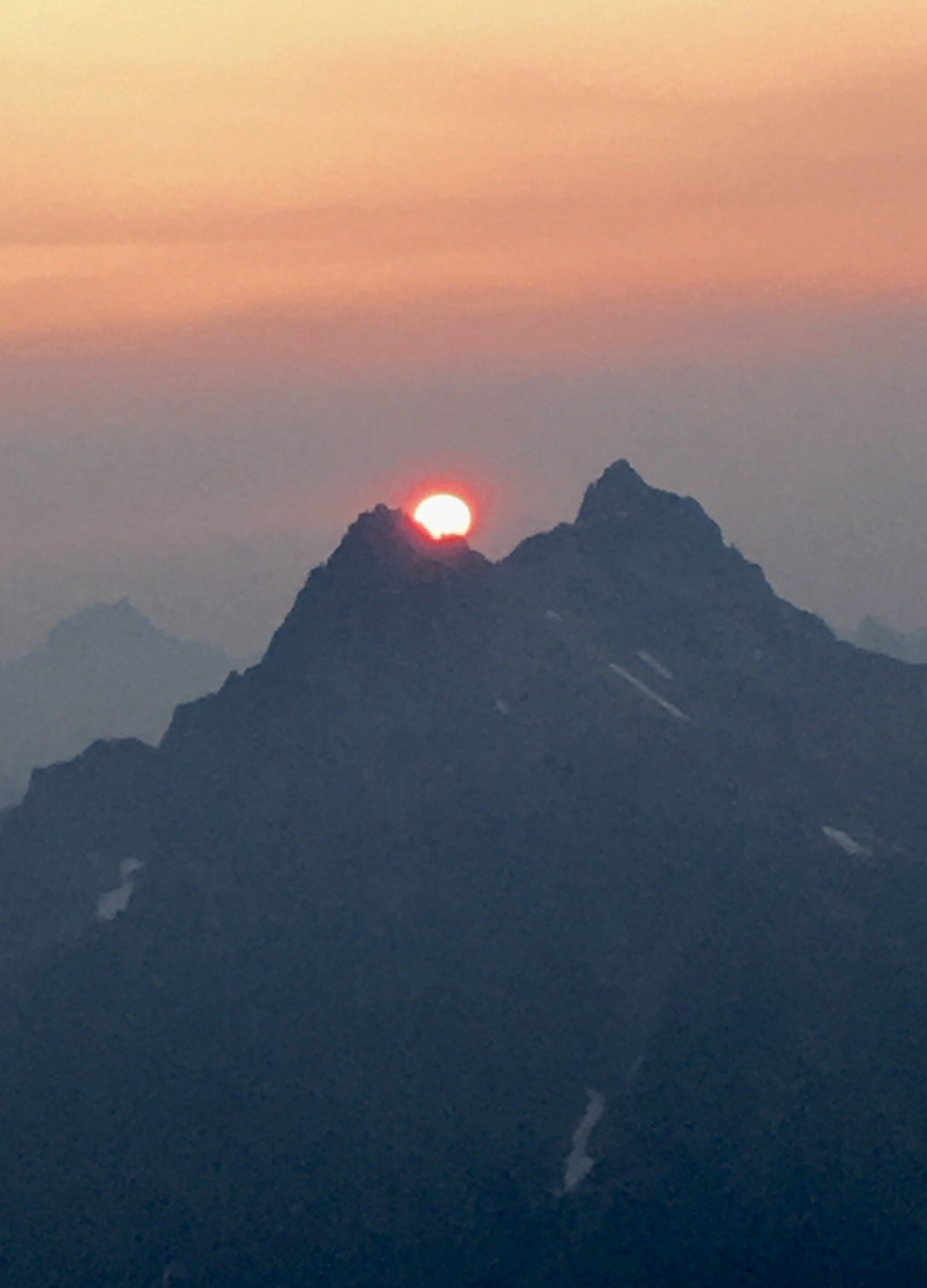
The smoky sunrise was stunning.
And some spectacular flowers caught the light just right.
And then it was time to head for the summit. The last section was steeper than we expected but still quite moderate.
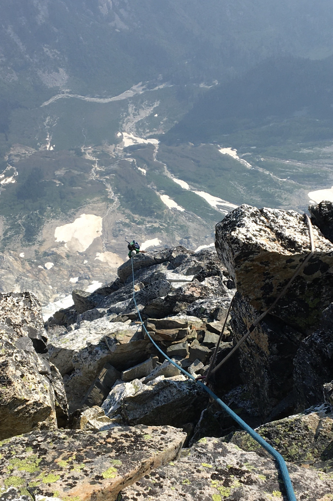
Here is David coming up the last section to the summit, with our river crossing visible 6000 feet below.
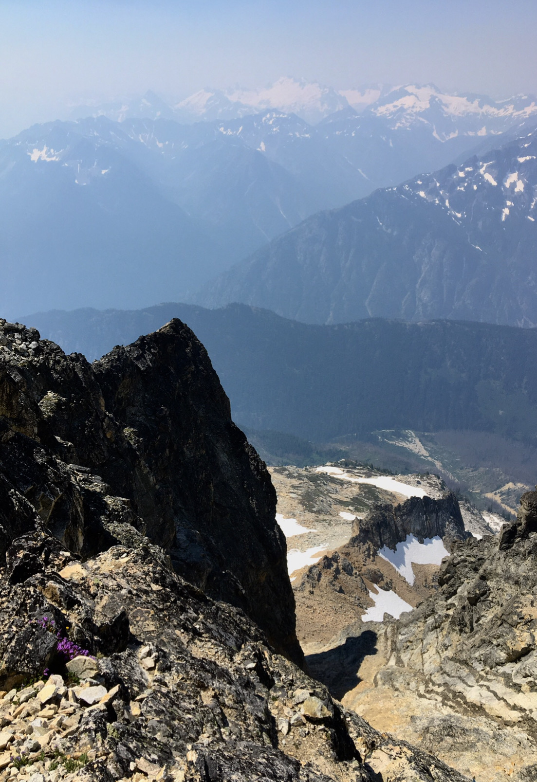
The views were great, except for the pesky smoke. We hoped we were heading away from it rather than toward it, but it was hard to tell.
We'd heard there might be a snow patch in a notch just North of the summit. We found the notch, but it was bone dry. Good thing we stoped at the bivy ledge. It would have been a very thirsty night up on the summit. Wormy water is better than no water.
We rapped down off the summit and belayed a short section of exposed scrambling on the way to Black Tooth notch.
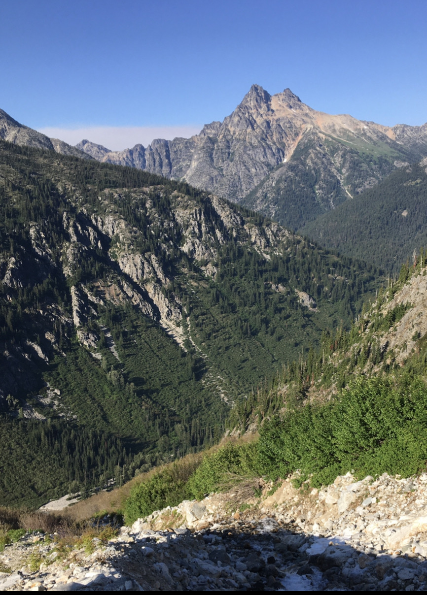
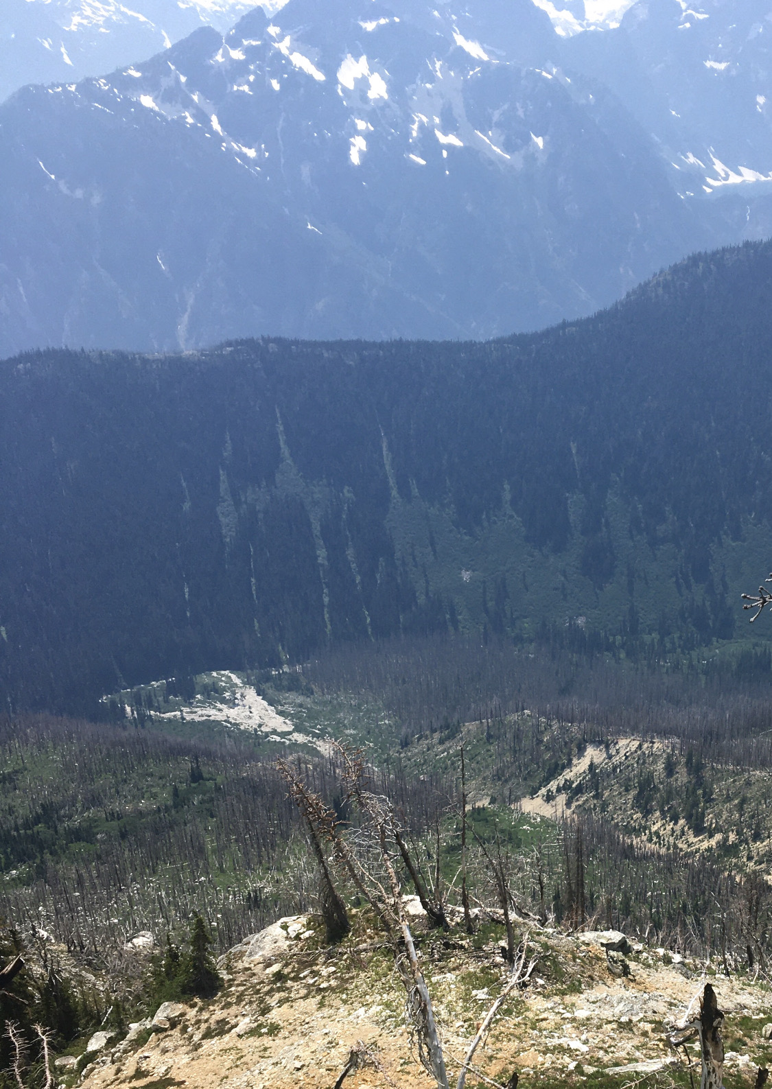
And then we could see our destination far below: Park Creek. Only a vertical mile to go.
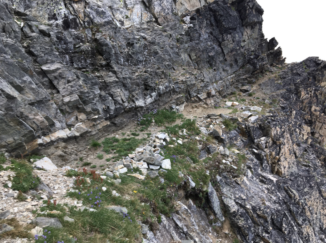
And now the beta the four climbers gave us came in handy: on the second rappel, go straight down a full 30 meters. If you angle skier's left, as the terrain seems to suggest, you then have to pendulum along steep terrain to get to the right spot.
After that it was several hundred feet of choss gully scrambling to a small trail veering out of the gully to the left.
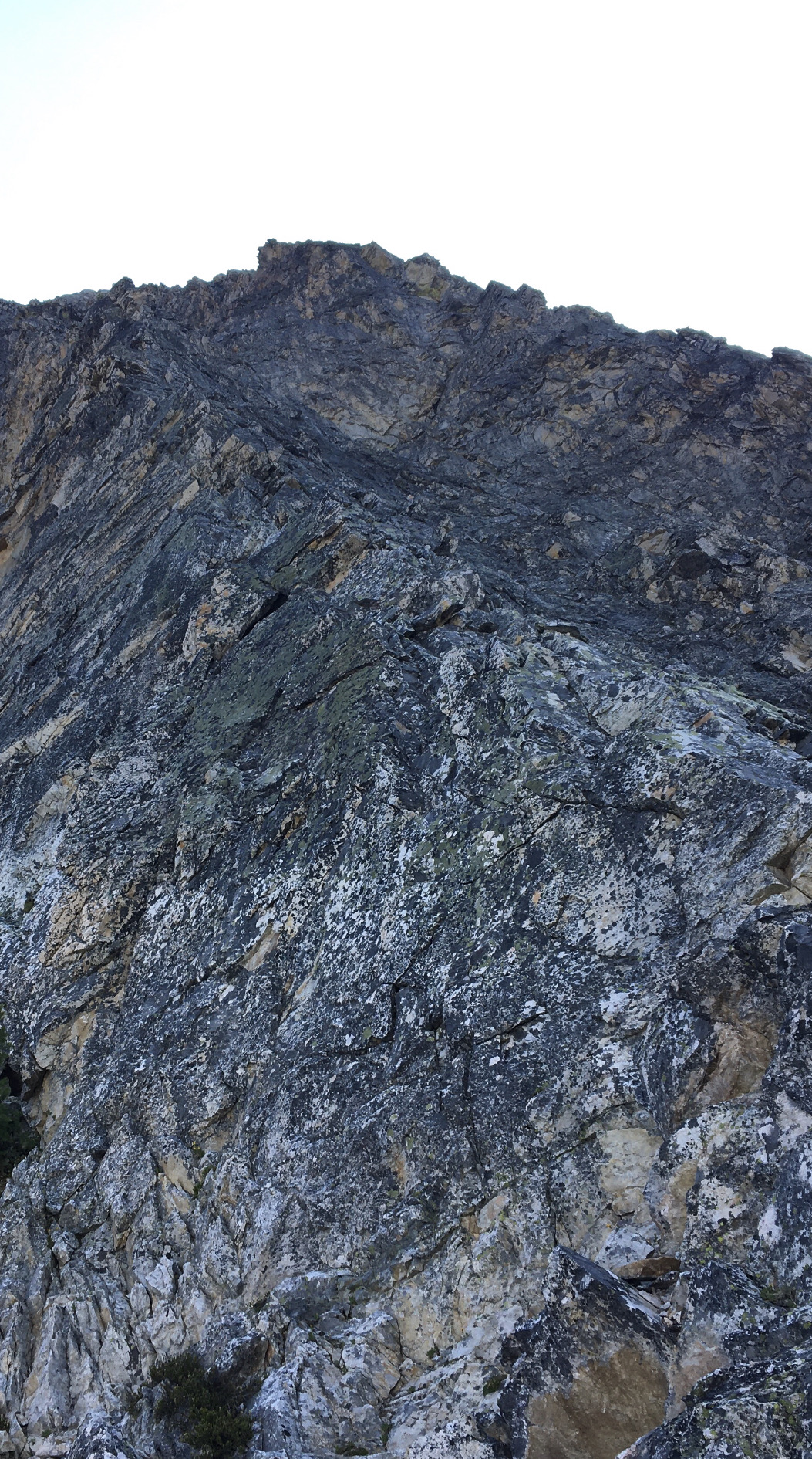
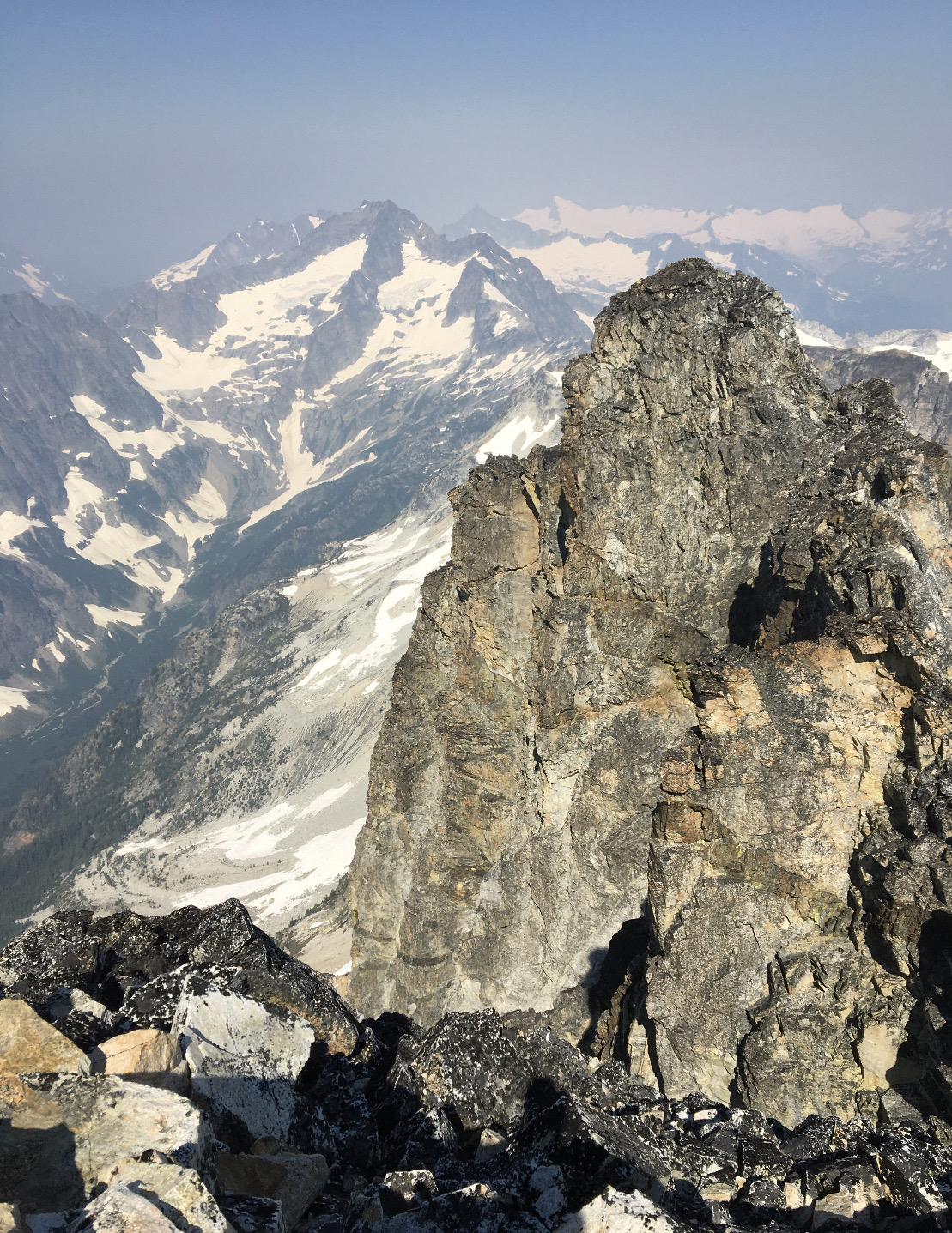
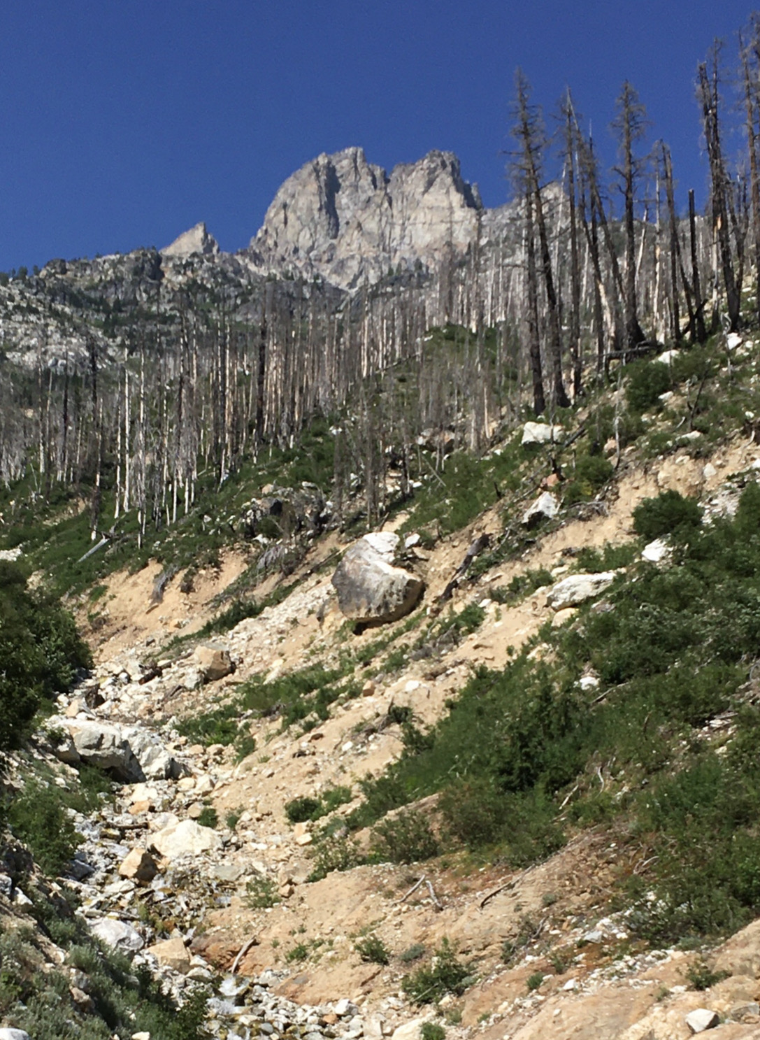
The South Face loomed above us.
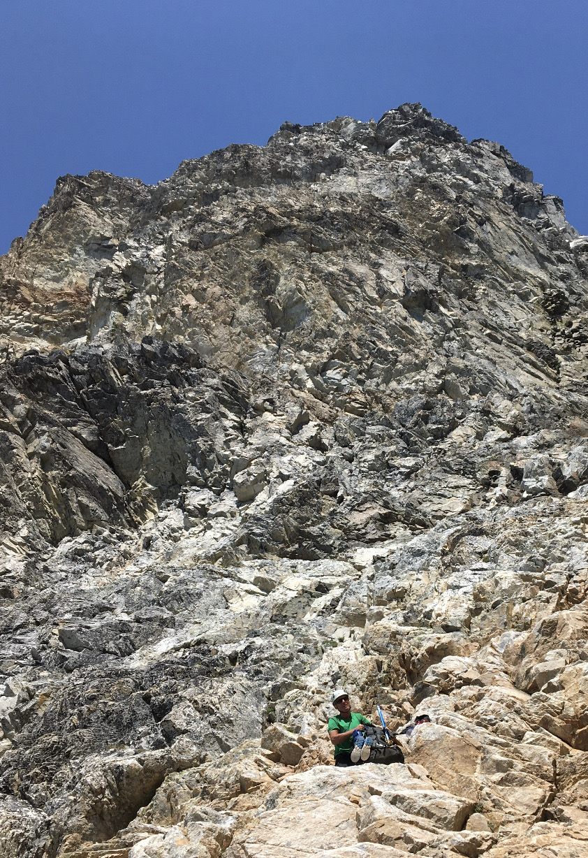
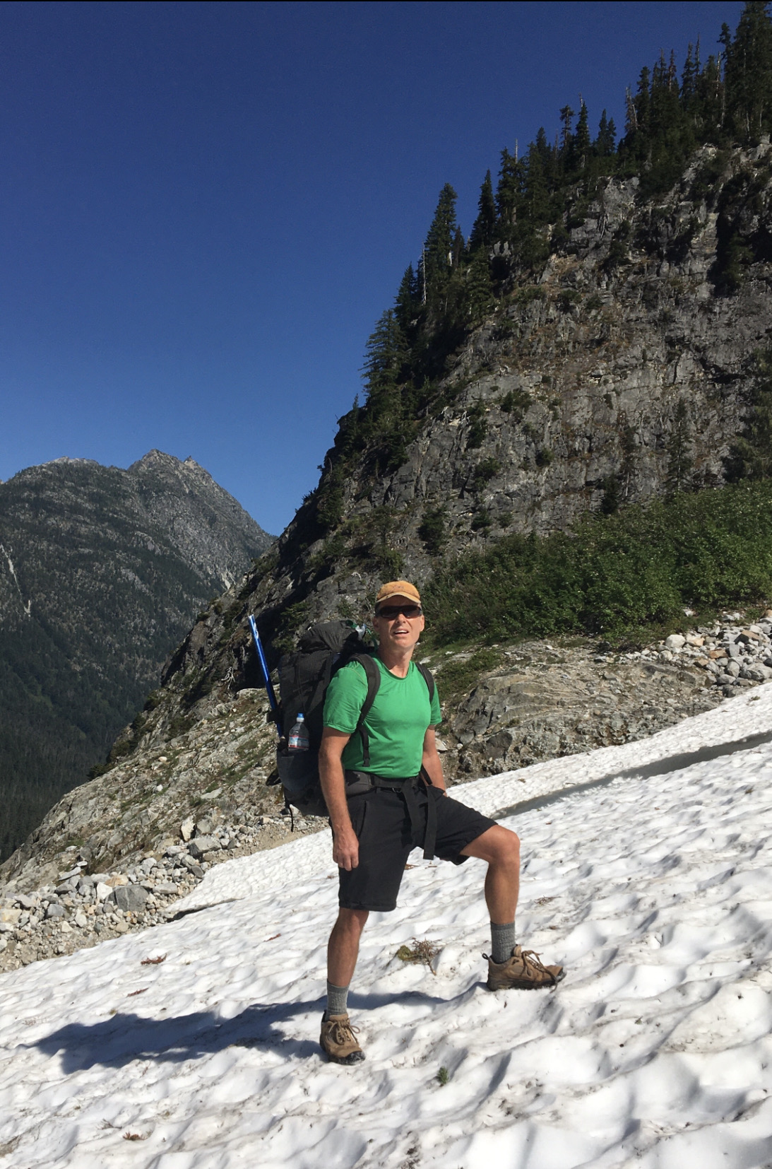
We finally reached snow around 7500 feet. A short bit of boot skiing ensued.
Then we found water that was far, far better than that nasty shrimp soup we'd been drinking.
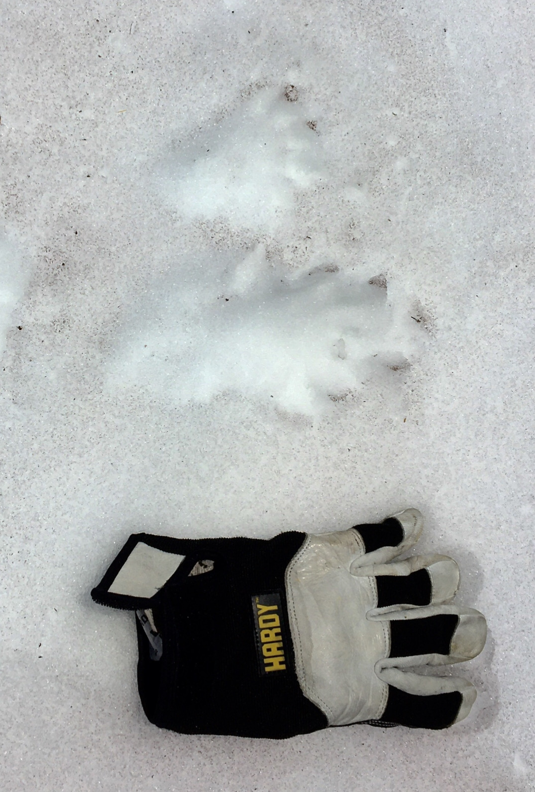
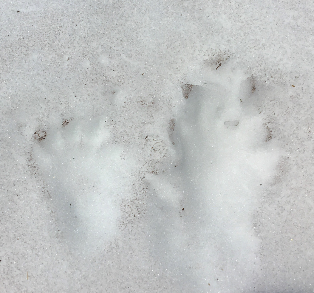
I found some mysterious tracks. Five distinct toes with claws - so not a cat.
Probably too small for wolverine. Probably too big for pine marten. ermine, or mink. Maybe a fisher?
I don't know. You tell me. Here's the North Cascades mammals list: https://irma.nps.gov/NPSpecies/Reports/SpeciesList/Species Checklist/NOCA/1/false
l
Another alpine micronap with the Ptarmigan traverse on the horizon.
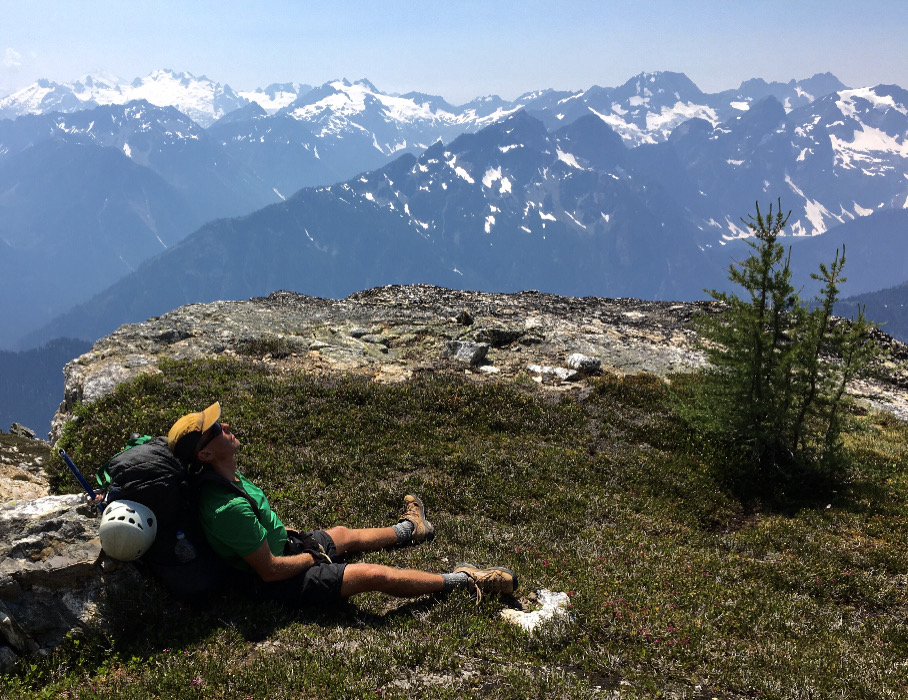
Looking back toward the summit.
Sporadic flower snapshots help fend off the double vision I sometimes get from relentless downhill pounding.
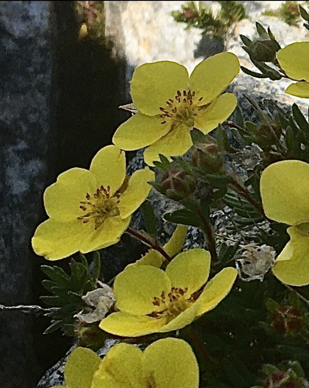
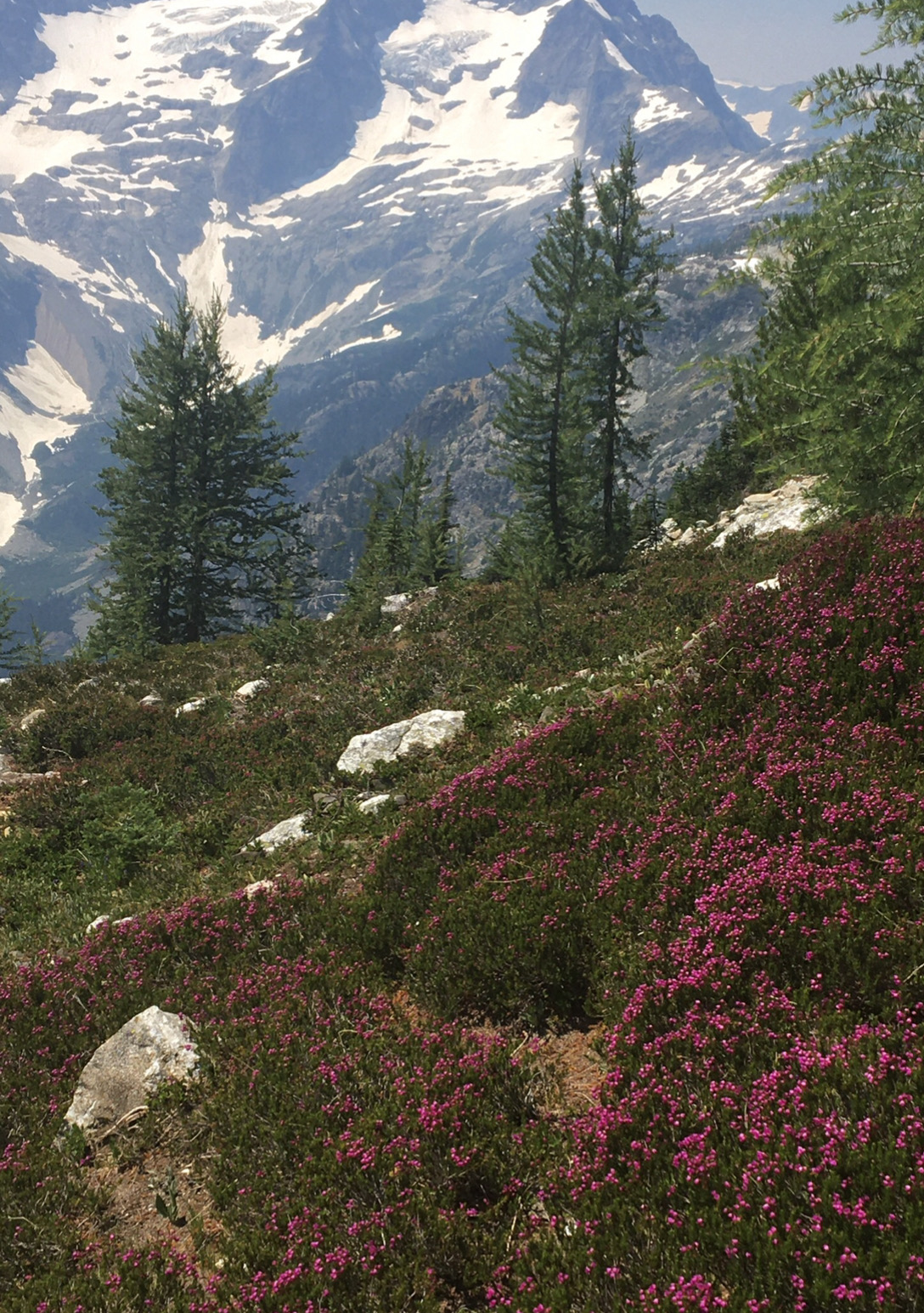
The heather was stunning.
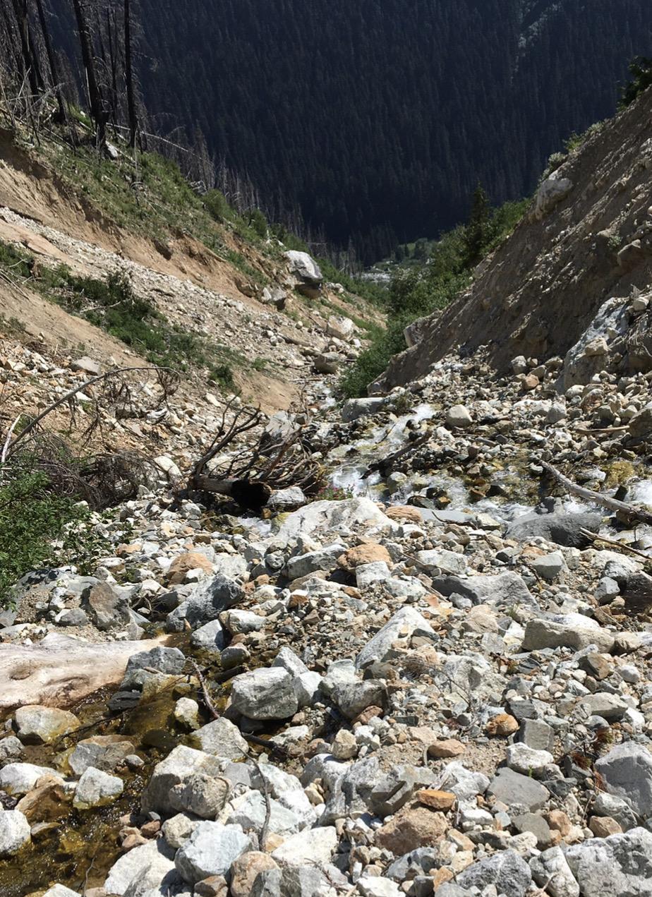
But we were about to enter the dreaded burn zone. We made our way straight down the ridge but never saw a climber's trail.
It got more and more unpleasant as we got lower.
David's dehydration was catching up with him.
By the time we reached a small creek a half mile above Park Creek, David was stumbling nearly every other step. The burn zone and eroding creekbed was the worst terrain he could remember, with rocks moving under him with almost every step. My experience wasn't quite that bad, and I know we've done worse together, so we decided his dehydration was turning into heat stroke, a potentially serious issue.
The trail seemed to move further away as we drew closer, a cruel jest.
Finally, we reached the Park Creek trail. David was spent. We poured a liter and a half of cold water in him, and he took a nap in the shade. That helped. I carried as many heavy things as possible on the last section down toward Stehekin.
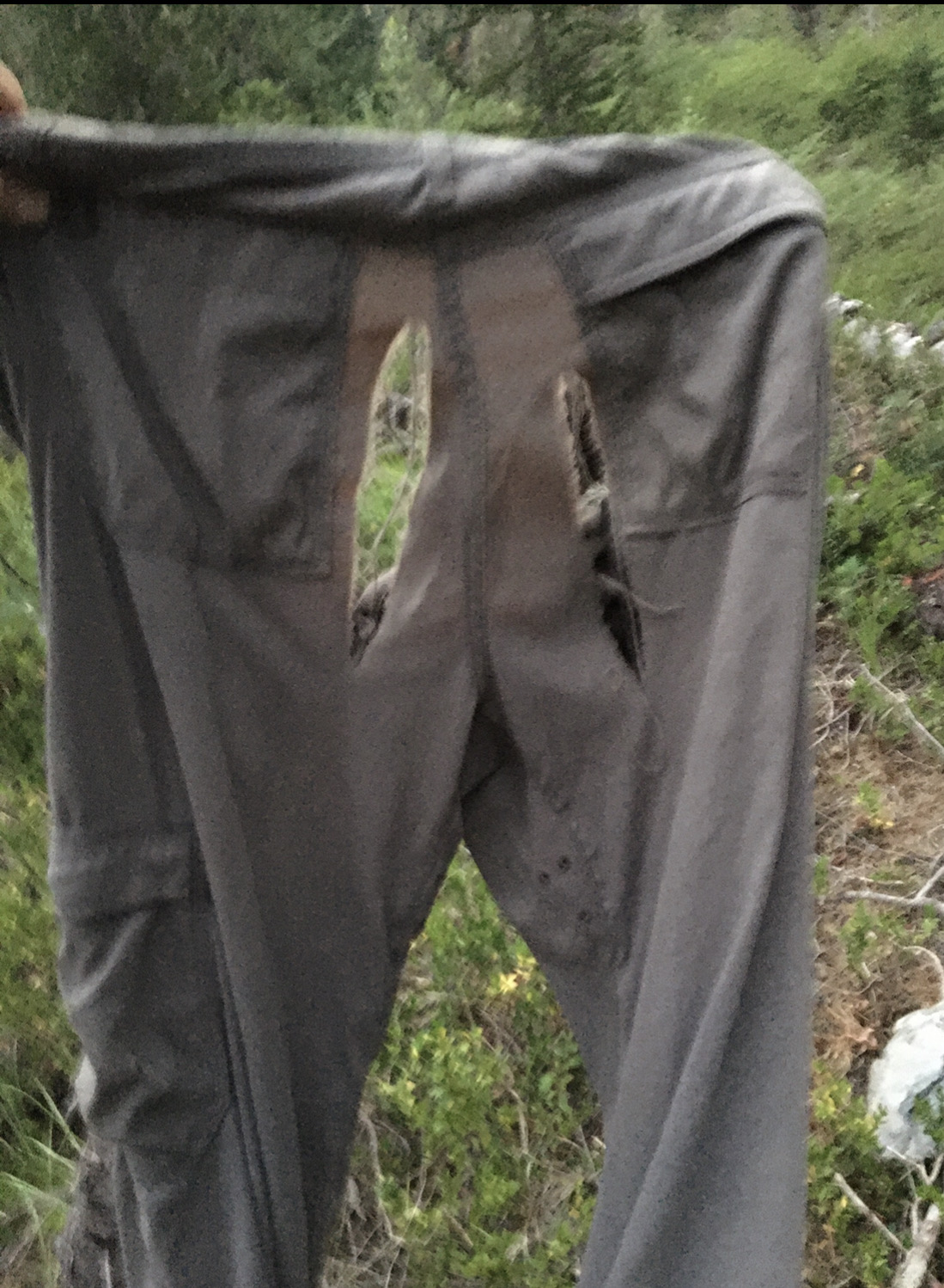
The Park Creek trail had some blow downs that were not fun. Several times I took off my heavy pack and dragged it on the ground while I crawled under a log. Once clear, I'd hoist it onto my back and start walking, only to see the next ball buster log just down the trail. I wasn't dehydrated or suffering from heat stroke, but I was pretty spent, and my lower left leg had some pain with each step. It was starting to swell.
My pants didn't survive the trip.
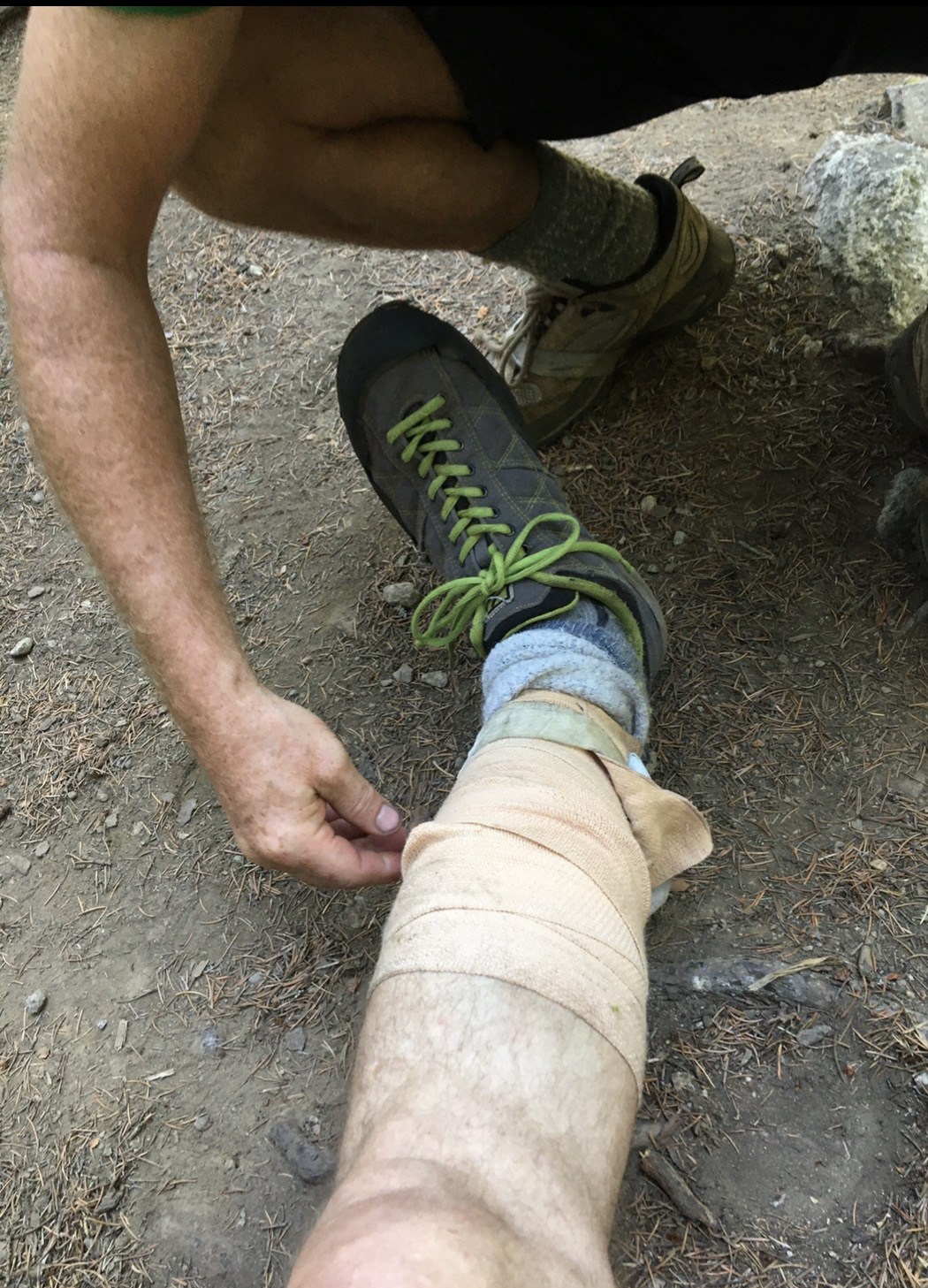
We crashed at the Park Creek campground near the Stehekin River and wrapped my rapidly swelling calf in a compression bandage.
I slept with it elevated up on my pack, hardly notcing the few mosquitoes flying around.
The long but easy march back to the car began at 6AM. Here we are tightening the bandage on my leg for the final few miles.
Side note: on the first trip David and I did together, Slesse, we had some heinous bushwhacking, and I came away with a swollen lower leg. It didn't go down after a week, so my wife, who is a physician, convinced me to have it scanned to see if it was deep vein thrombosis (DVT), which can spin off clots that can bump up to your heart and kill you. It wasn't DVT, but ultrasound showed a three inch laceration inside my leg that was bleeding internally. It would take a month to heal.
I wasn't sure what was up with my leg this time, but I could walk just fine. I made sure to get ahead of the swelling by compressing it during our hike.
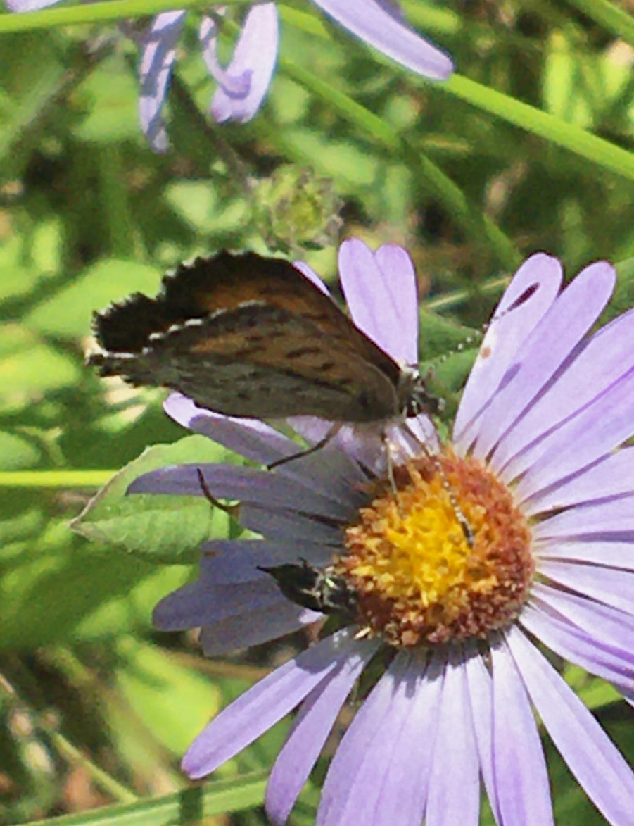
As usual, good conversation made the miles move faster. Flowers, butterflies, and views don't hurt either.
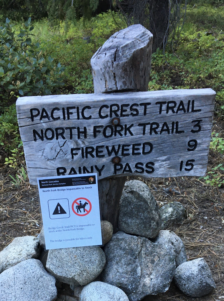
Back at the junction between PCT and North Fork.
The North Cascades in their summer glory.
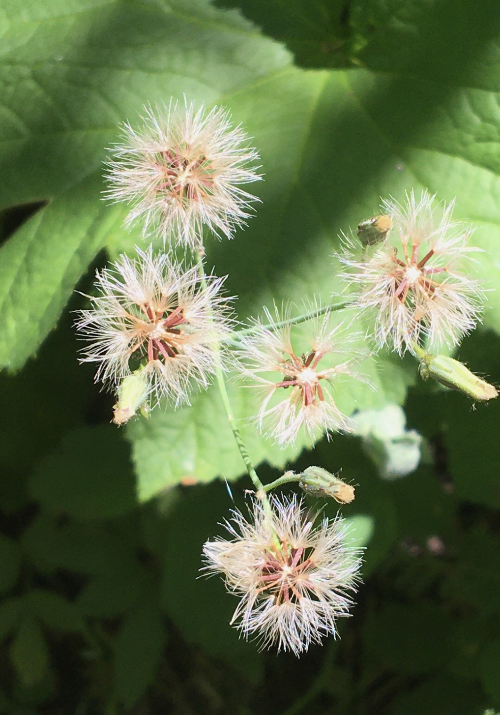
Seeds ready to ride on the wind.
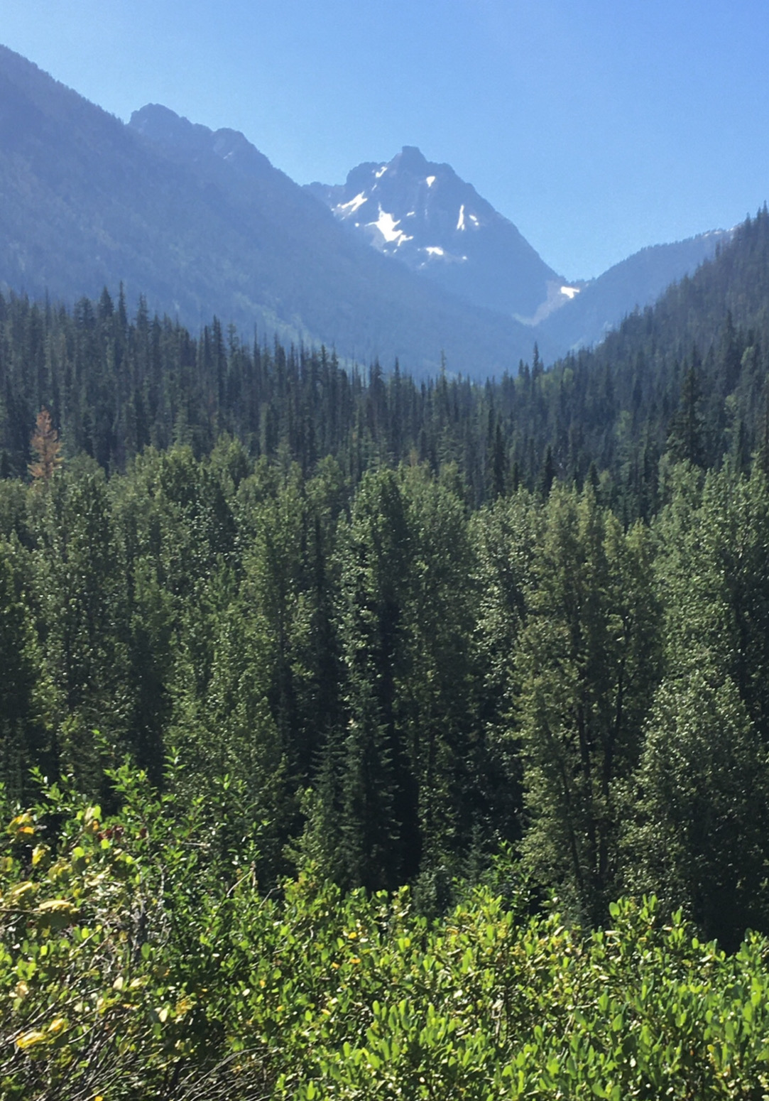
Distant peaks.
The final stretch of trail.
And the end of our adventure.
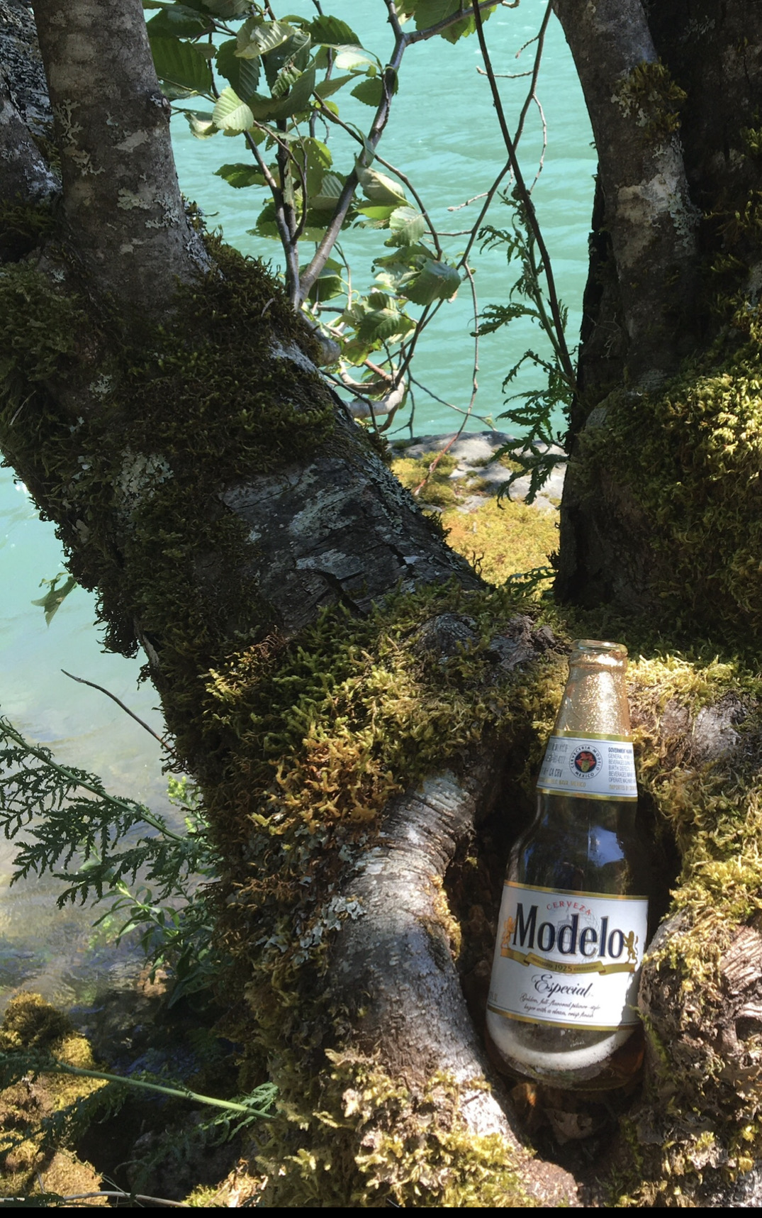
Highway 20 was closed just East of us, but we could drive West.
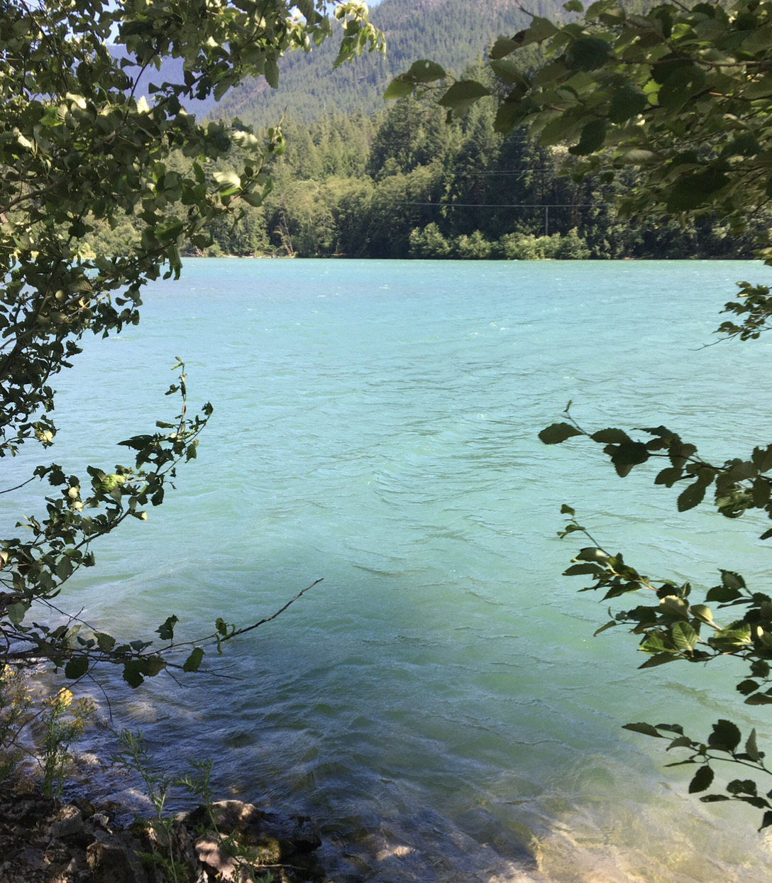
Beers were cooled.
And we swam in the lake.
Another moderate masochistic march in the books.
As sometimes happens on our trips, the hard parts were easy and the easy parts were hard.
My thumb and leg have healed, but I'm still traumatized by the shrimp soup we had to drink.
I'll never again hear "pure as the driven snow" without thinking of those mysterious worms. Gag.
Gear Notes:
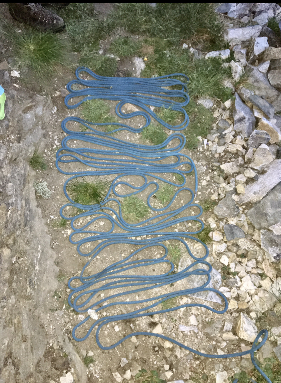
60m rope, rack
Approach Notes:
Hwy 20 via Pacific Crest Trail-
3
-
 1
1
-
 1
1
-
-
I would read it. Don't have much knowledge to contribute
-
 1
1
-
-
I recall the rock above the Imperfect Impasse getting progressively steeper and wet and looking loose when we there there a decade ago. We descended all the way to bottom of it, crossed, and ascended the other side to Perfect Pass. After climbing Challenger, we returned to Hannegan Pass by traversing the slopes of Whatcom, picking up the trail and Whatcom pass, and heading down from there. It was nice to make a loop and the trolley over the river was super fun. You could come in that way, but it may be a good bit further. When we did this, the traverse under Whatcom was an endless, misty, sidehilling snow walk. I understand it's nasty downsloping slabs and debris when melted.
Bottom line: things are very conditions dependent in the Pickets. Terrain that might be trival in early season snow, or when dry, like slabs or steep heather, can be hair-raising when snow-free and wet or icy. It's a good idea to do as much research as you can beforehand about different options for approach/deproach/ascent/descent/escape and be prepared to adapt your plan to the conditions you find on the ground.
-
Sweet! Remember these days.
![Amazon.com: Airwolf ( Air Wolf ) [ NON-USA FORMAT, PAL, Reg.2 Import - United Kingdom ] : Ernest Borgnine, David Hemmings, Jan-Michael Vincent, Alex Cord, Frank Annese, Belinda Bauer, Philip Bruns, John](https://m.media-amazon.com/images/I/71NjPJ4ysvL._SL1500_.jpg)

Bridwell's Last Interview
in Climber's Board
Posted
Yep. That's my favorite moment.