
Leaderboard


Popular Content
Showing content with the highest reputation on 08/19/25 in Posts
-
As if you stepped out of a time machine into the hallroom of the Darrington hardmen of yore.2 points
-
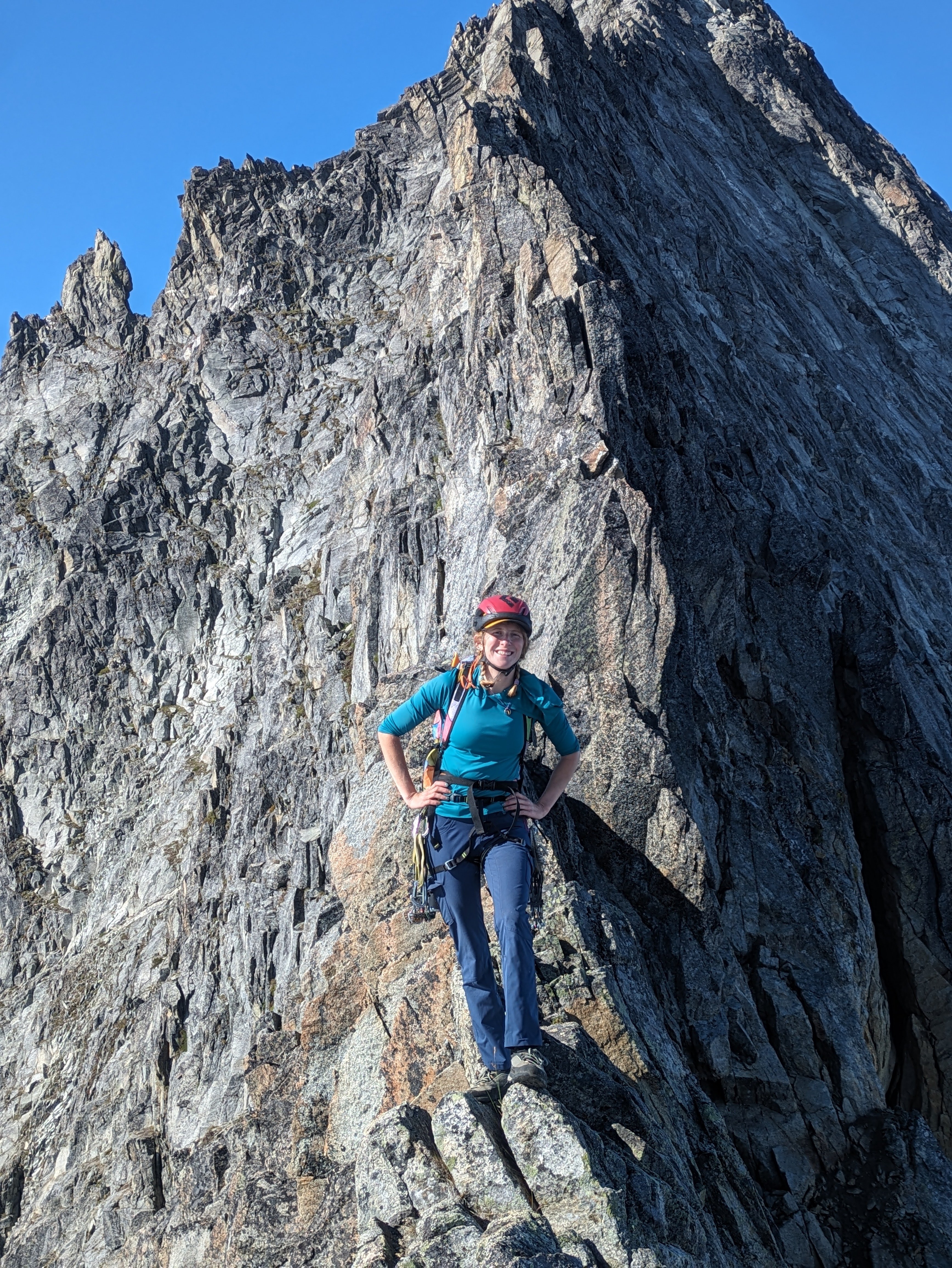
Trip: North Cascades, Arches Peak aka Little J-berg - North Face Central Buttress, 10 pitches plus soloing, ~1,600 vertical feet, 5.6/7ish Trip Date: 08/03/2025 Trip Report: A couple of weeks ago, Rolf Larson and I climbed a probable* new route on this peak. Anyone cresting Easy Pass has been greeted by the big north face of this peak. There is one reported route on the face from the late 1970s; the party climbed the left-hand "Plumb Line Buttress" 2,700' from the valley floor to the summit, which clocks in at 7,945'. They reported loose rock. (See photo of register page in the album linked below, the AAJ, or Beckey guide.) Of three relatively prominent buttresses, our route climbs to the western false summit (circa 200' west of true summit) via the central buttress -- the most prominent one lit up (furthest left) in the photo below. We believe the 1977 line appears in this photo as a nondescript buttress in the shade further off to the left. Our route wends up the gneissly-featured buttress on pretty good, pretty clean Skagit rock--we began climbing behind the third snow-patch from the right on that prominent shelf, directly below the toe of the sunlit buttress. (Also available here: https://photos.app.goo.gl/BV3itCHmqcoo7qL38) We had fun on this route, which thankfully was in shade while we climbed. Didn't take many climbing photos, but snippets of conversation went like this: "How'd you like that section of hand crack?" "I preferred my section of laser-cut finger crack." "Yeah, I went Squamish style and laid it back." Here's Rolf putting in a piece at perhaps mid-height on the face (the rope is out of view, off to the right): The first pitch was probably the steepest and most sustained, fwiw, and had a 5.6 or maybe .7 move. A couple of steep mini-headwalls were also climbed in that range of difficulty, but a person could avoid these if willing to take looser rock. We unroped for a few hundred feet of mellow scrambling after the first pitch or two, but some steeper terrain compelled us to again rope up and resort to pitching and simul-climbing on fourth and low-fifth terrain. The climbing is moderate, but generally solid and fun, with adequate protection. *As you will see in the summit register pics, Roger Jung soloed a route on the north face, but it's hard to say if he took our route -- there is certainly latitude to wander on that big north face. The photo album, which includes some pages from the register: https://photos.app.goo.gl/4JU83LgK6XKFdbSA7 We descended via a walk off to the south and east--no crampons required. The short-ish approach, moderate and generally solid climbing, and straightforward descent (not to mention the blueberries!!) might make this climb more appealing than some of Rolf's and my other routes. I'll wait for Rolf to correct me on any details (which are already fuzzy), downgrade the level of difficulty (as is his crusty wont), etc. etc. Here's an early musing about Arches from the cc.com archives: Gear Notes: Standard rack with emphasis in finger-sized pieces; tri-cams were useful Approach Notes: Via Easy Pass, drop to and cross Fisher Creek, find your way up through the lower cliff bands, wiggle-chimney between moat and rock to the start1 point
-
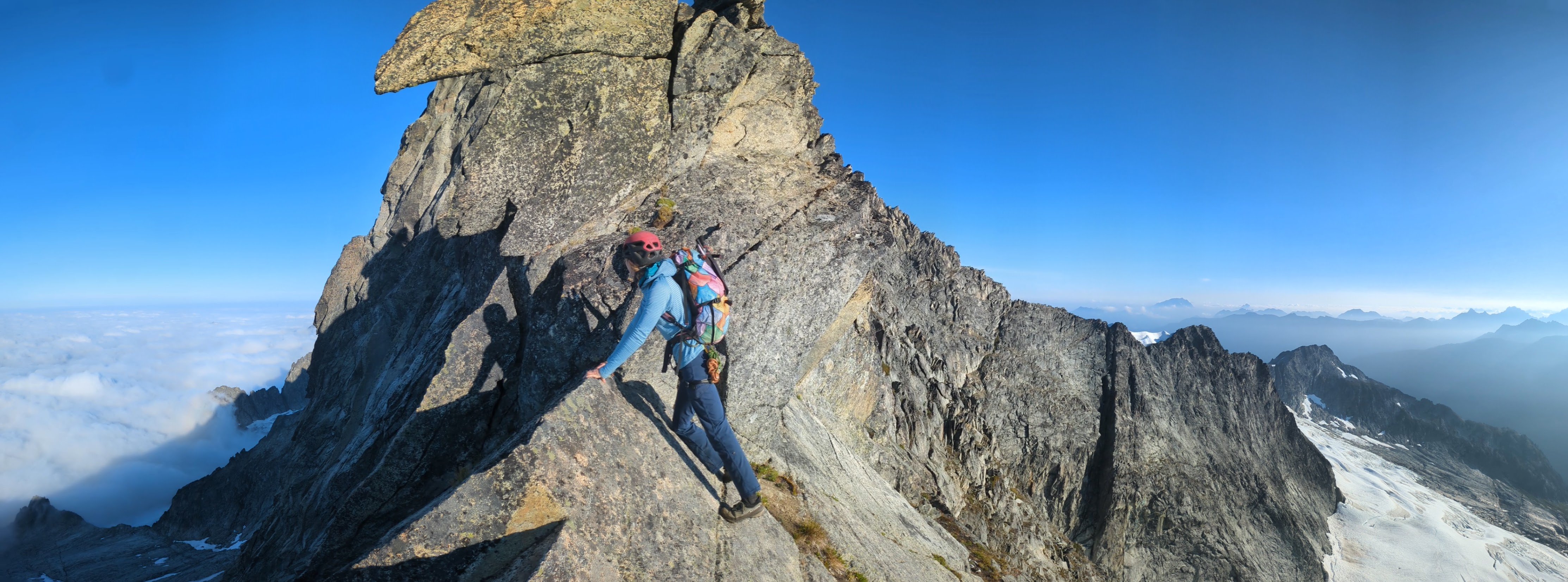
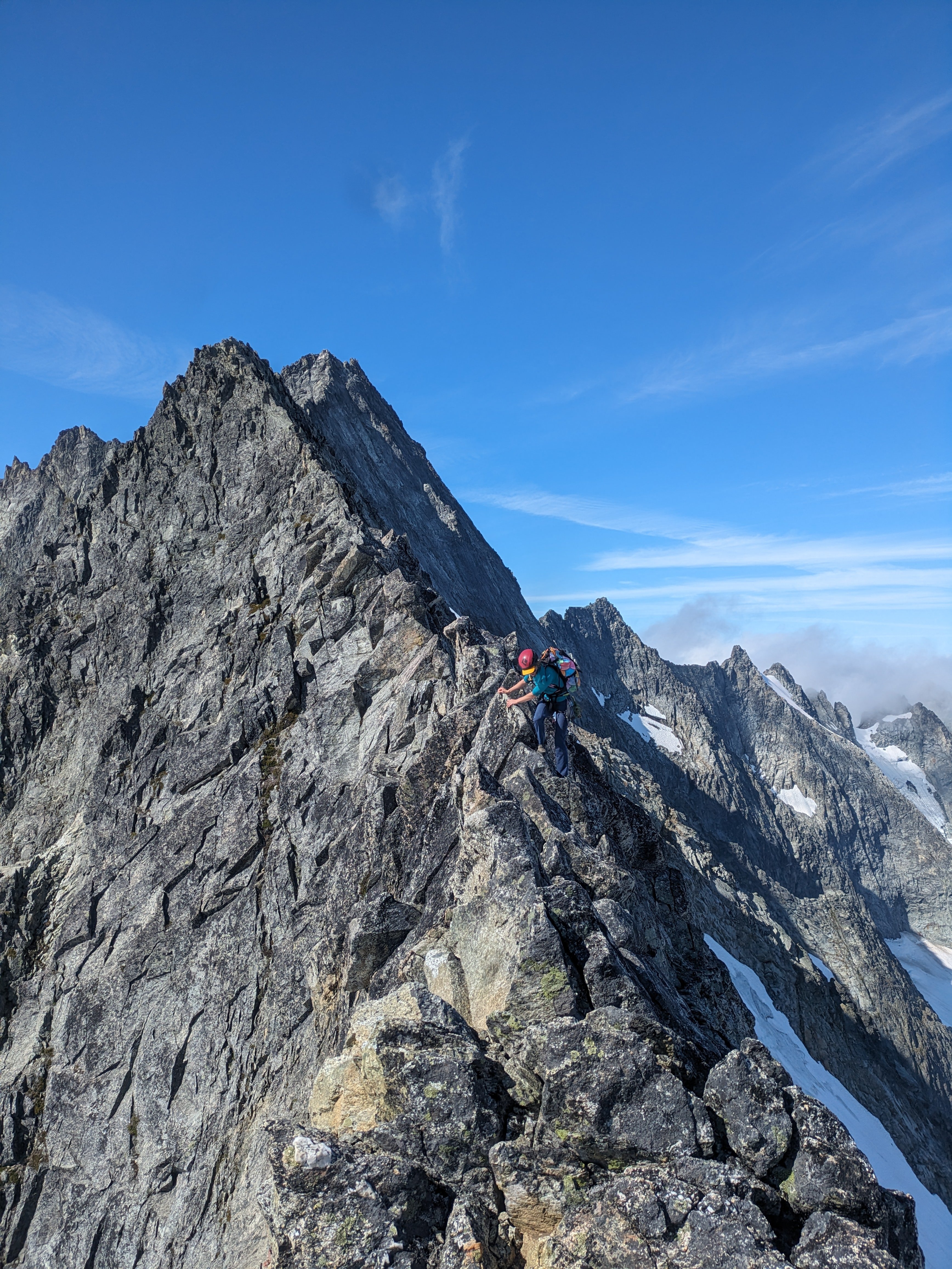
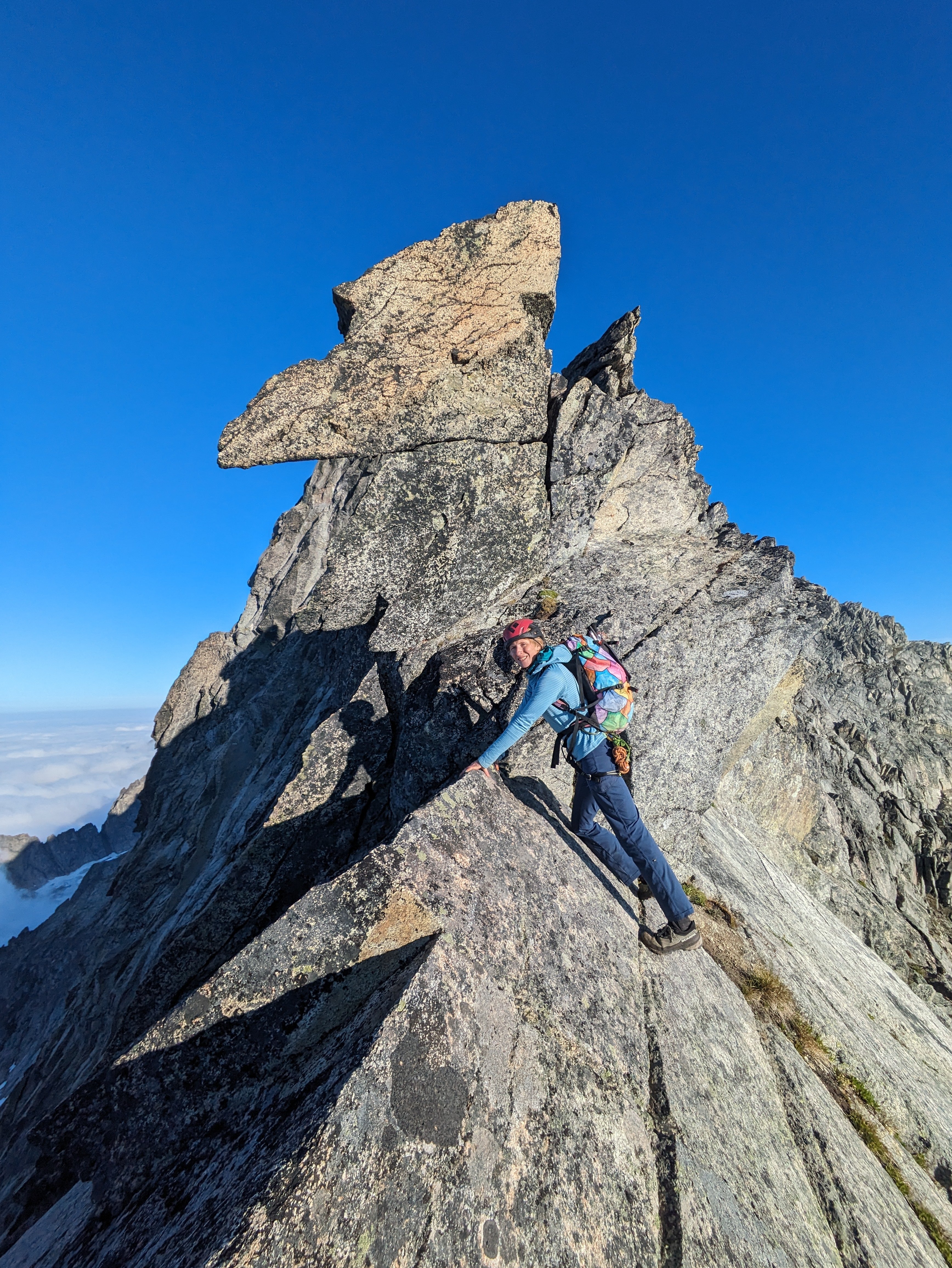
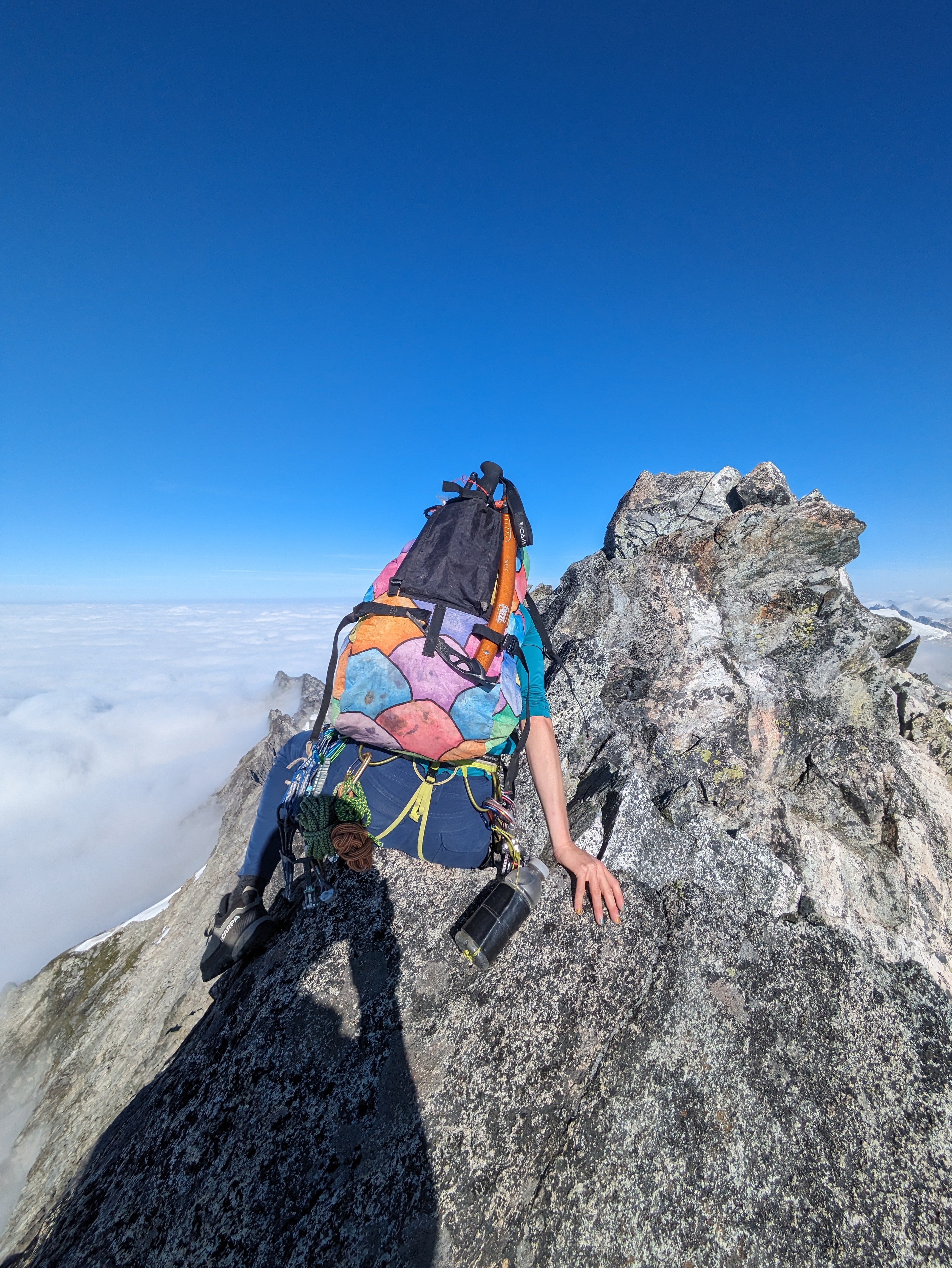
A few days ago Lani and I did a fun link up on forbidden. We climbed the East ridge North Ridge and West Ridge. This is a rad way to move through a lot of scrambling terrain. Uncertain weather before the atmospheric river gave us a pretty narrow window to work with, so we headed up the evening before and bivied at the base of the East ridge. We left the B basin trail around 5pm and set up camp around 8 for an early night. The cloud ceiling quickly raised up, putting us in a thick,misty whiteout for the whole of the night. We woke up to even more whiteout and low confidence, expecting to bail we went back to sleep for a few hours. We ended up leaving the bivy around 8am. We climbed up the East ridge, then down climbed the north ridge. Down climbing the North Ridge was surprisingly mellow, we didn't end up needing to rappel. And the route finding was almost easier on the way down than the way up. There is only one 20' section of 5.5 at the very bottom, otherwise it's all sustained 4th class and secure low fifth. Once at the low bivy of the north ridge, the clouds again threatened us. So we sat and weighed our options. We ended up watching the clouds for an hour before deciding our fate. Our original idea was to traverse the glacier and climb the NW face/rib. But whiteout and impending rain steered our decision to "bail" back up the north ridge. Though the north ridge is such a fun knife edge it's hard to complain. We then down climbed the West Ridge. We hit the base of the West ridge 6 hours after starting up the East ridge and made it to the car just before 5, almost 24hrs after we left. The epic rains to come that night validated our decision to limit our time in the mountains on this one. For those who don't know yet, you no longer need to touch snow to climb either the west or east ridges. The glacier below the cat scratches is more or less completely gone. While sad, it does mean you can do this whole link up in approach shoes without carrying axe/crampons. Starting up the East Ridge Headed down the North Ridge, with clouds threatening to spill in from the west. Headed back up.
 1 point
 -
I climbed this route from the notch lower on the ridge and then met the snow slope where you accessed it. This is actually kind of a cool route...!1 point