Leaderboard


Popular Content
Showing content with the highest reputation on 08/13/25 in Posts
-
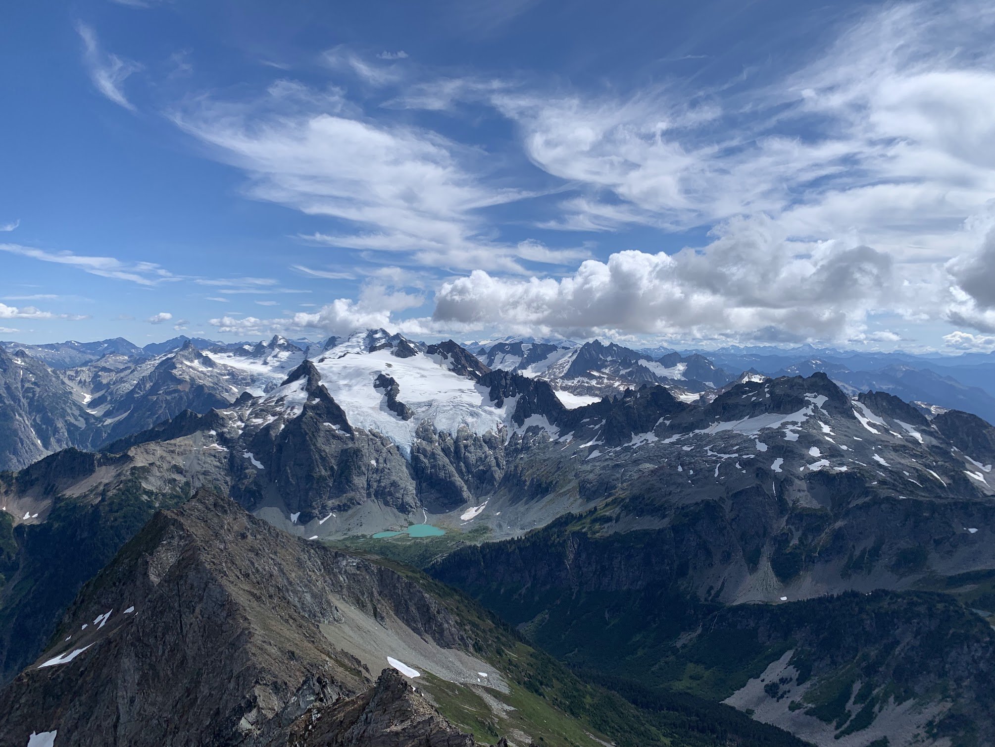
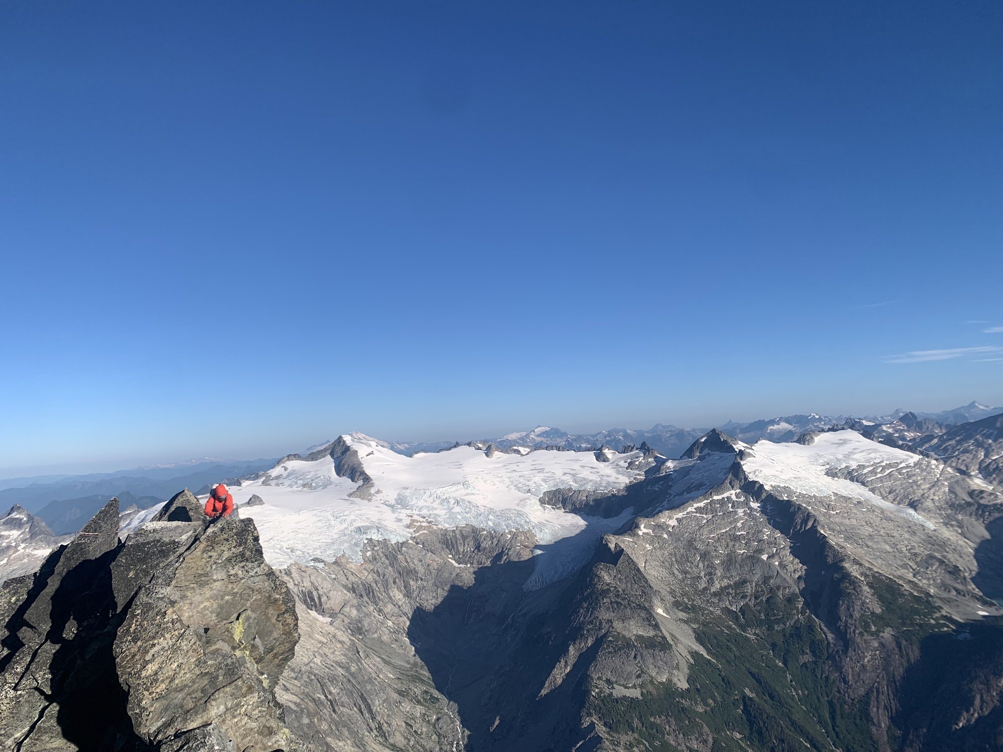
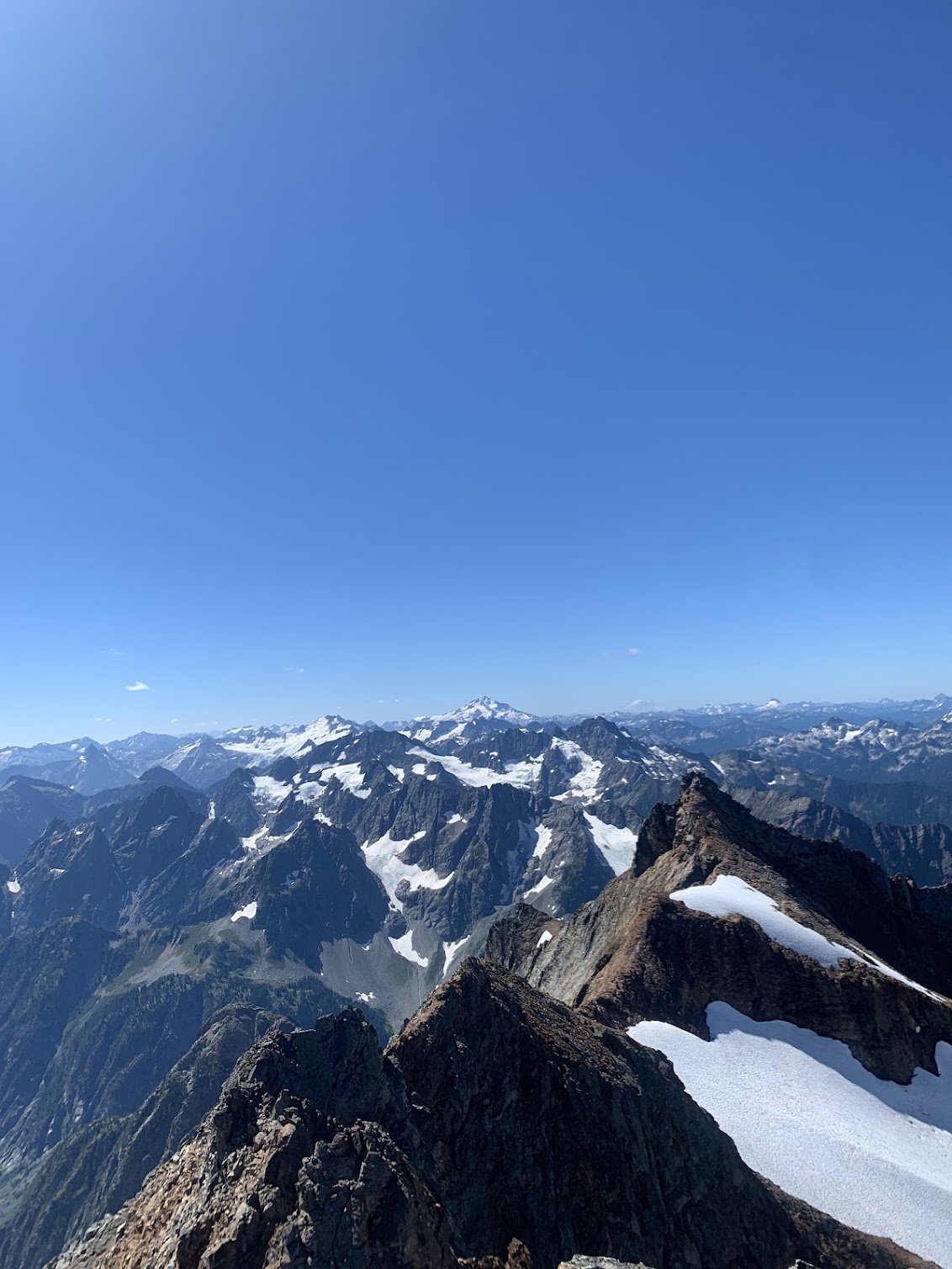
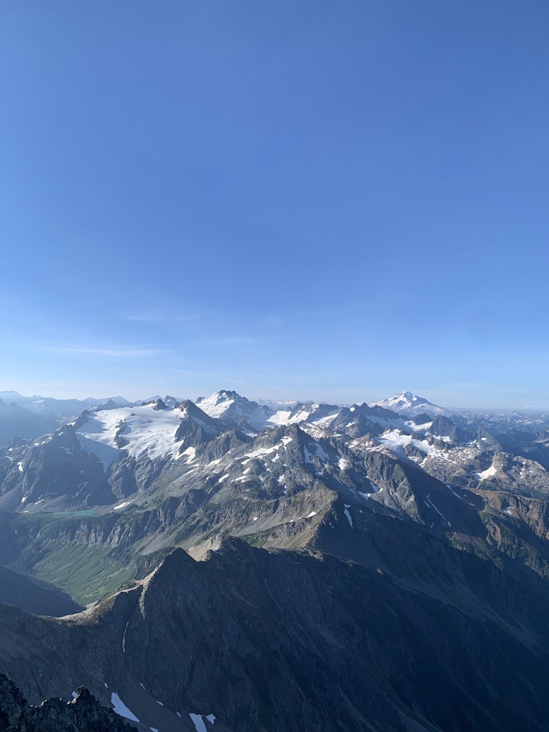
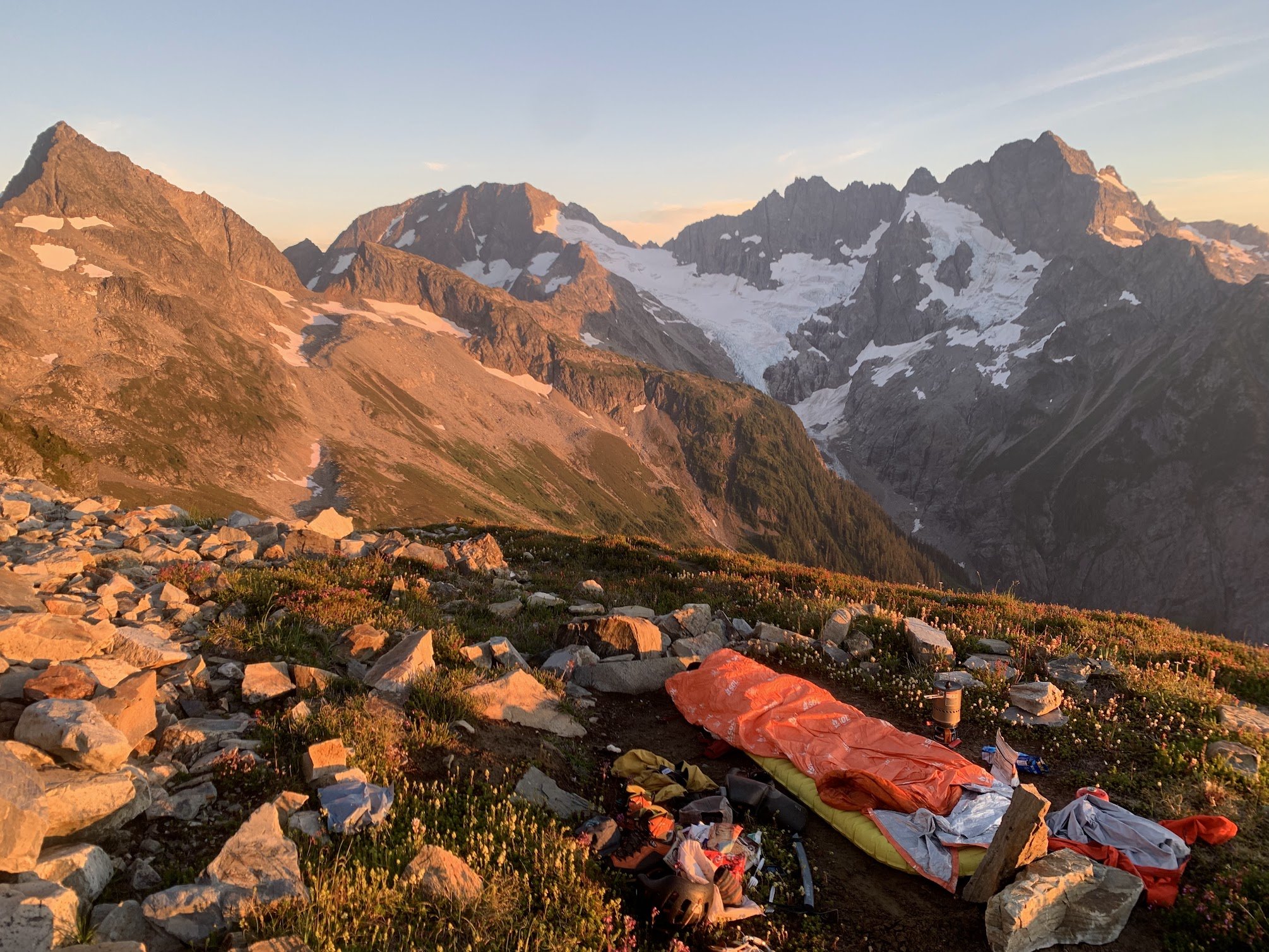
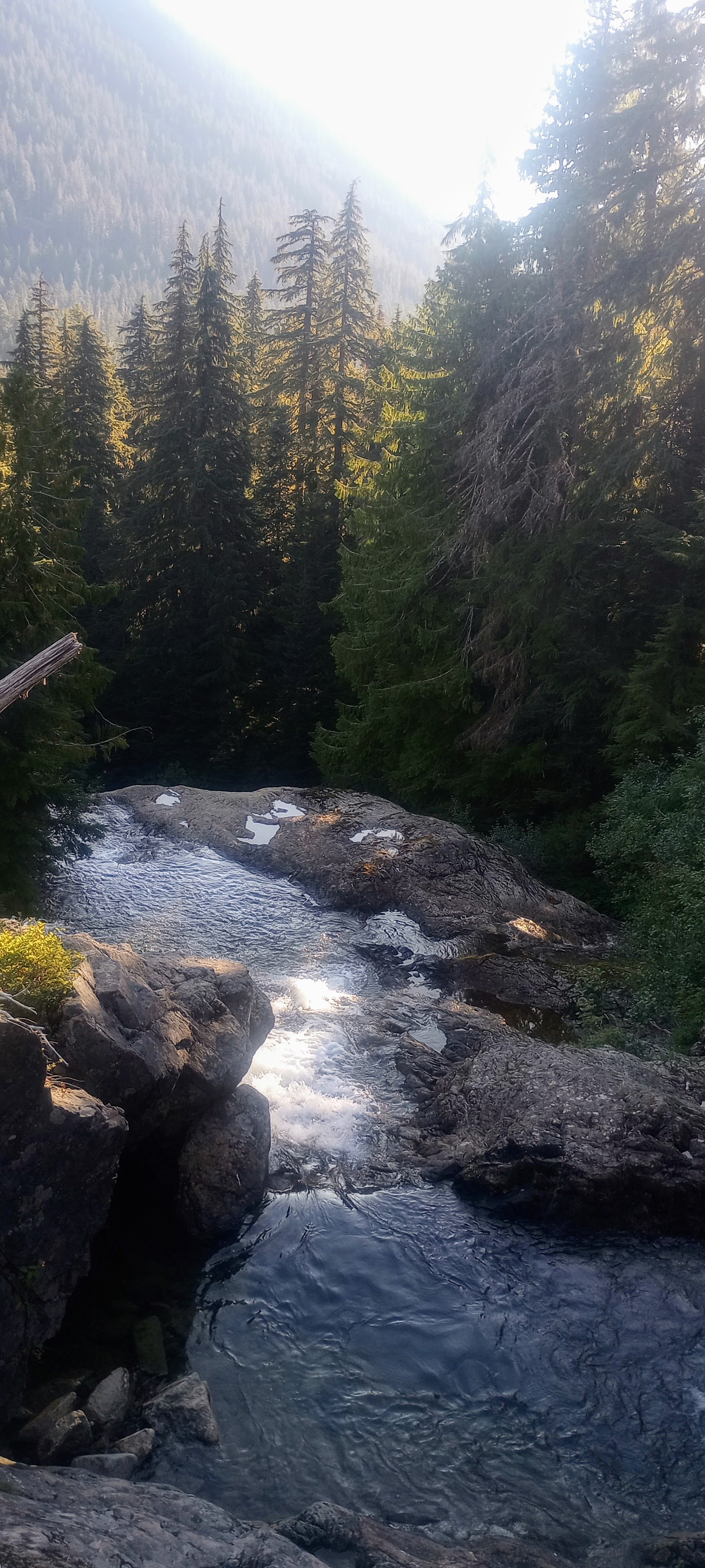
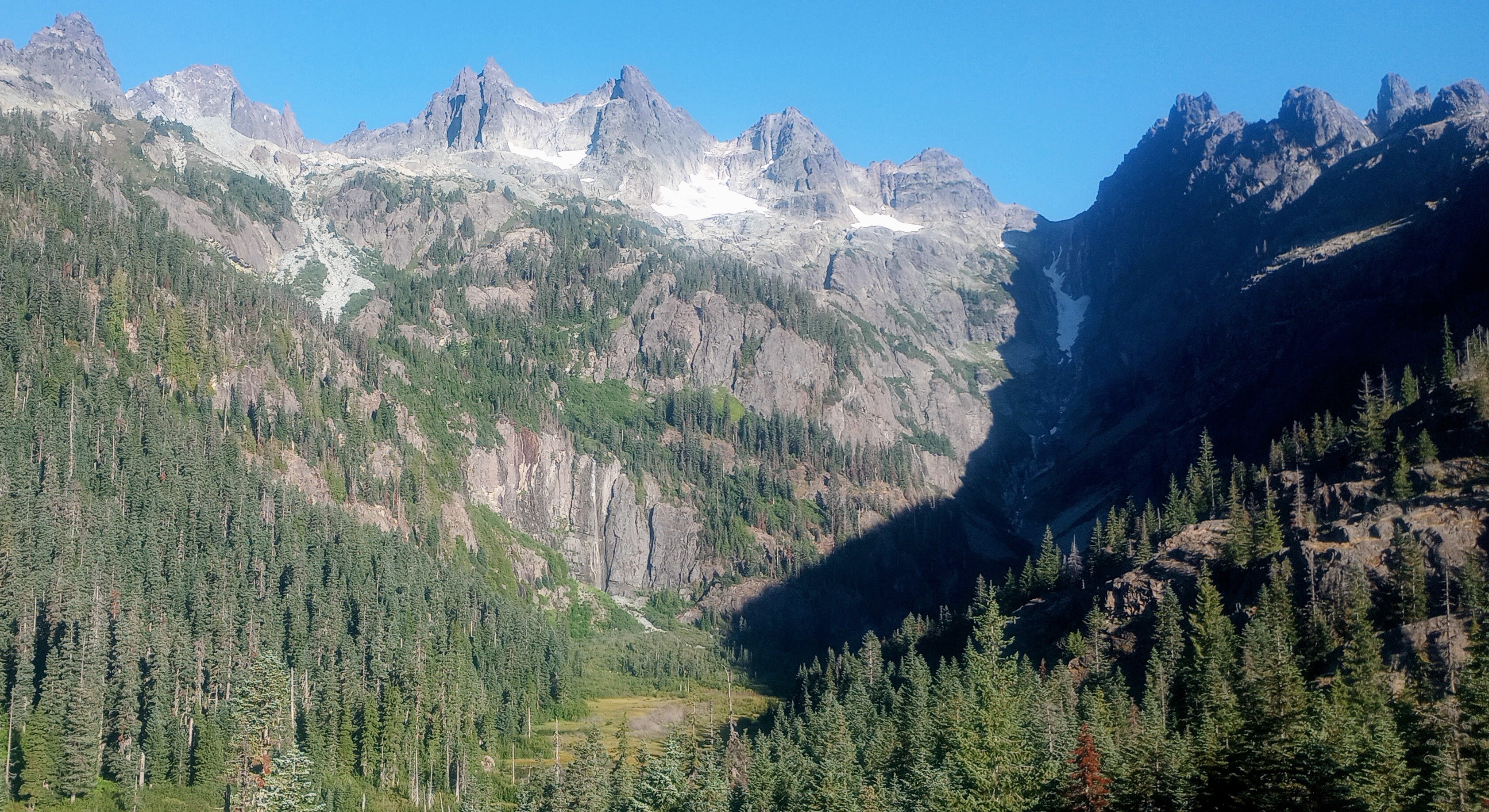
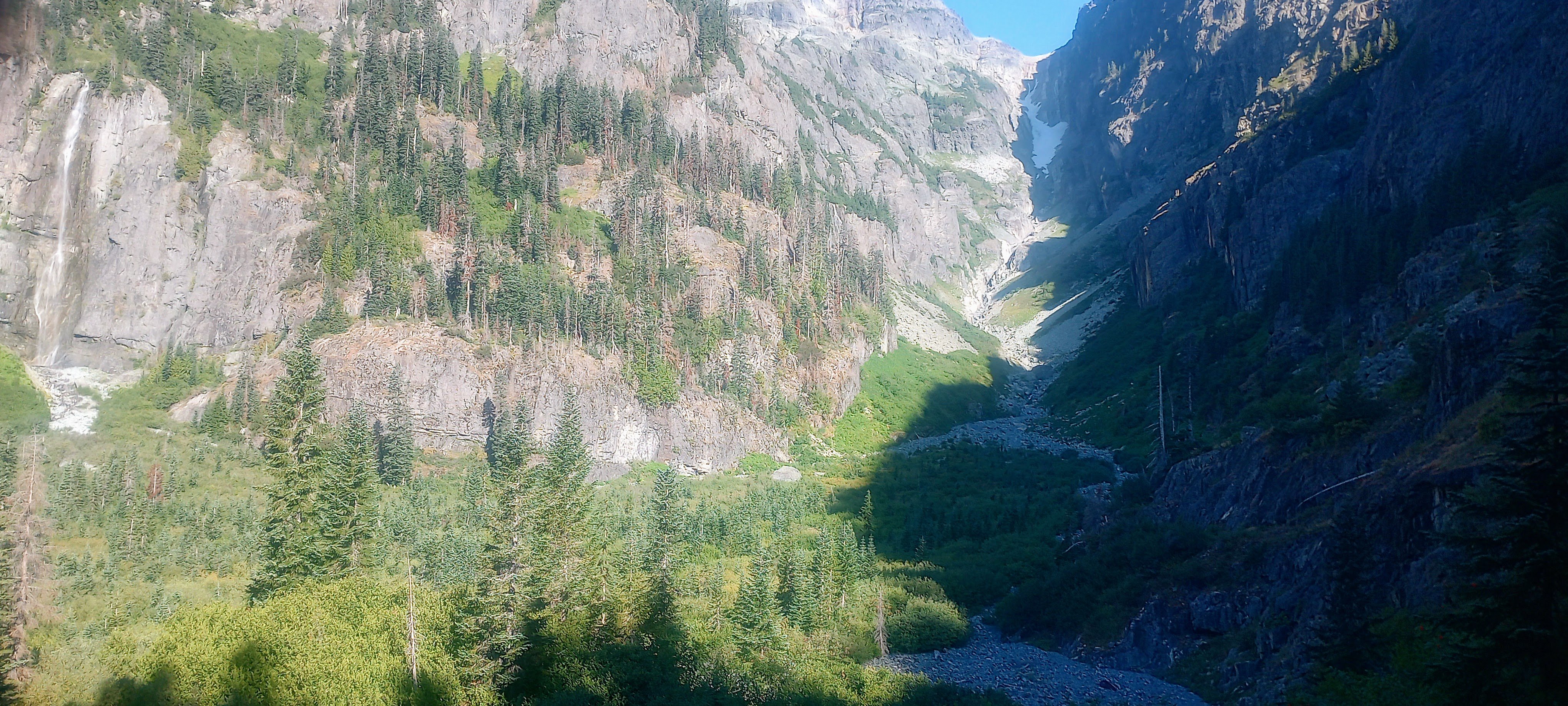
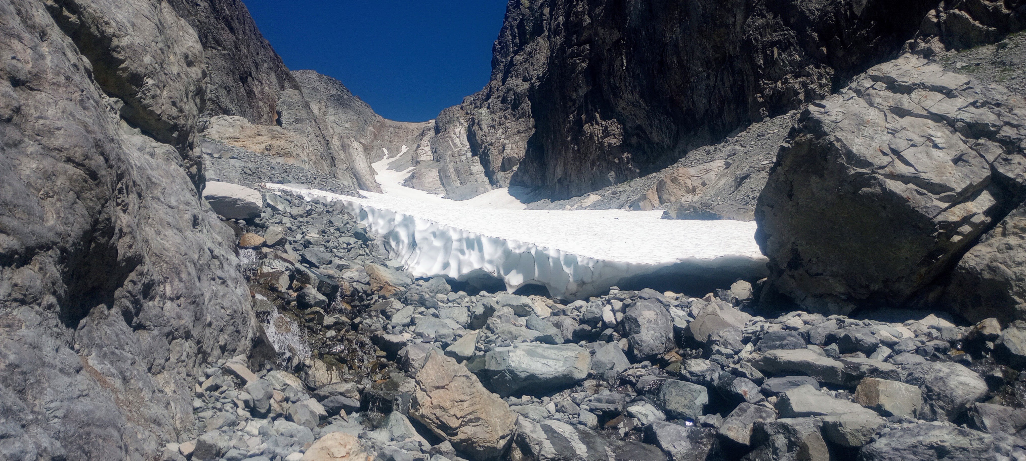
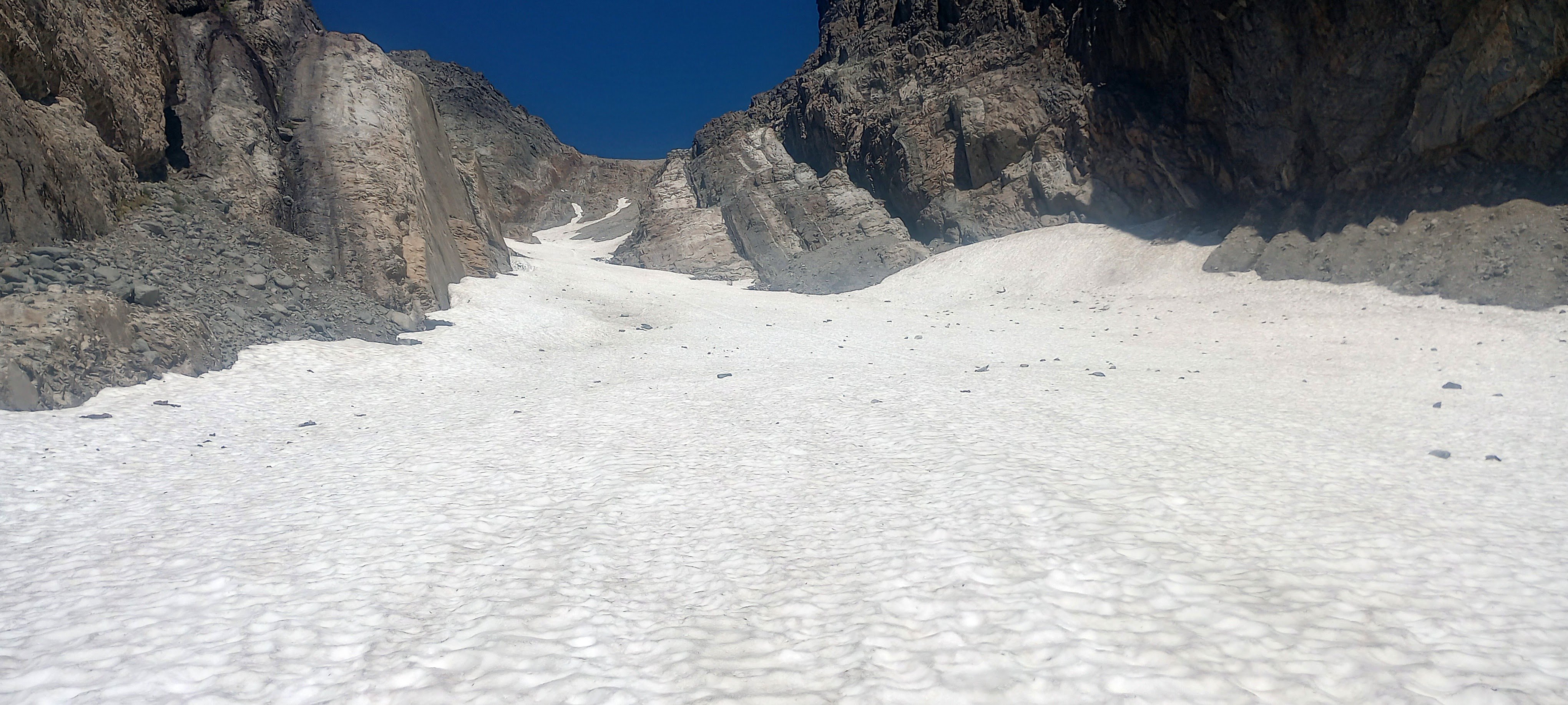
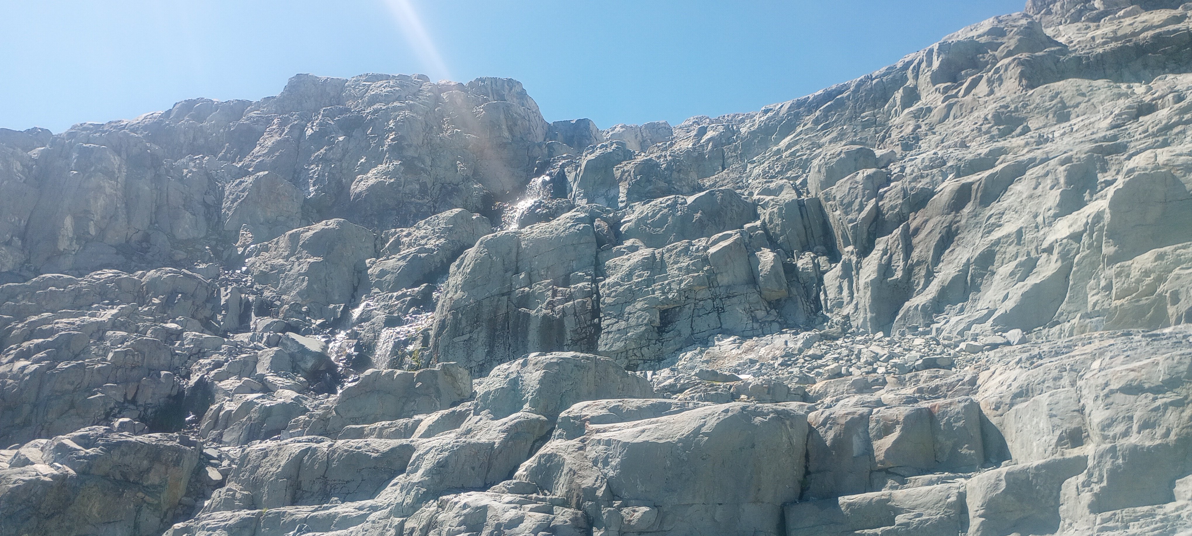
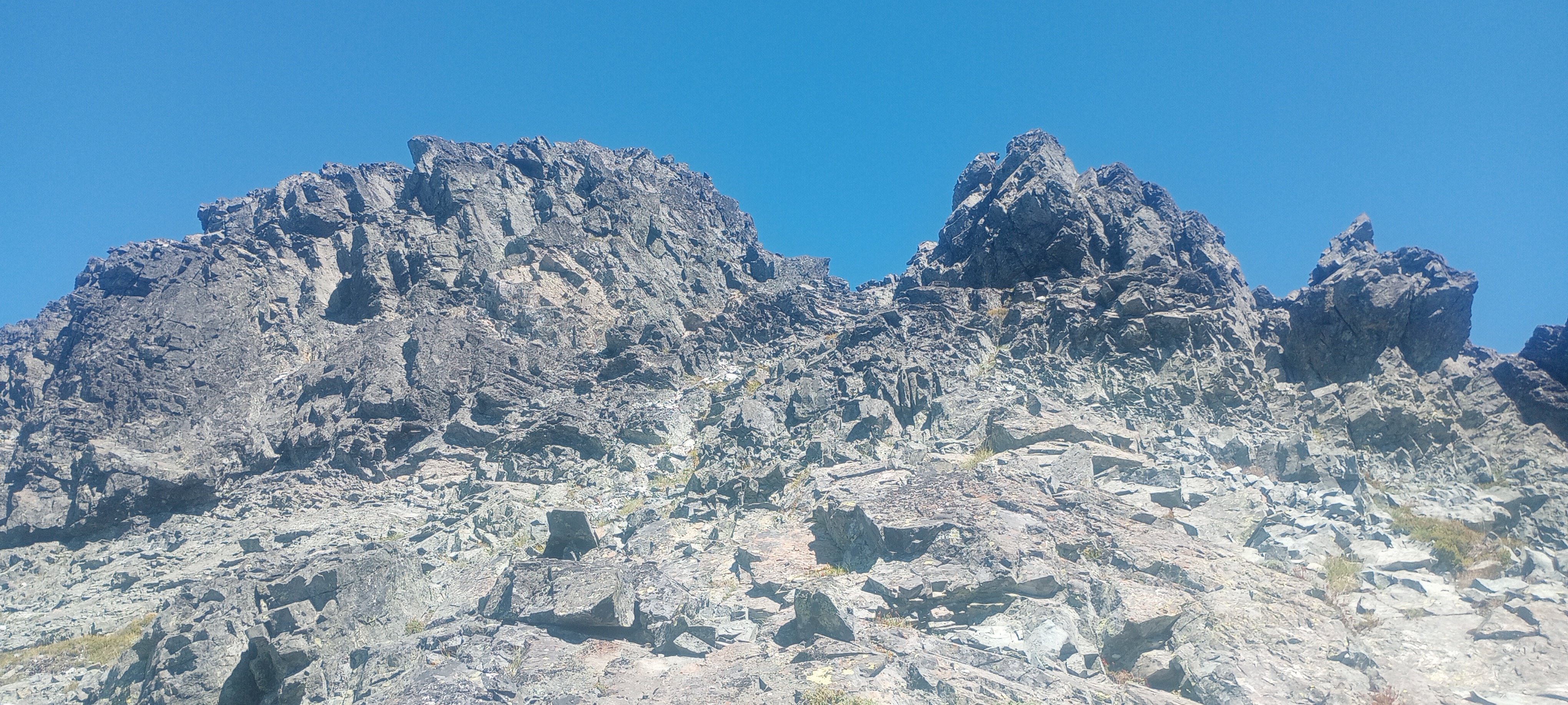
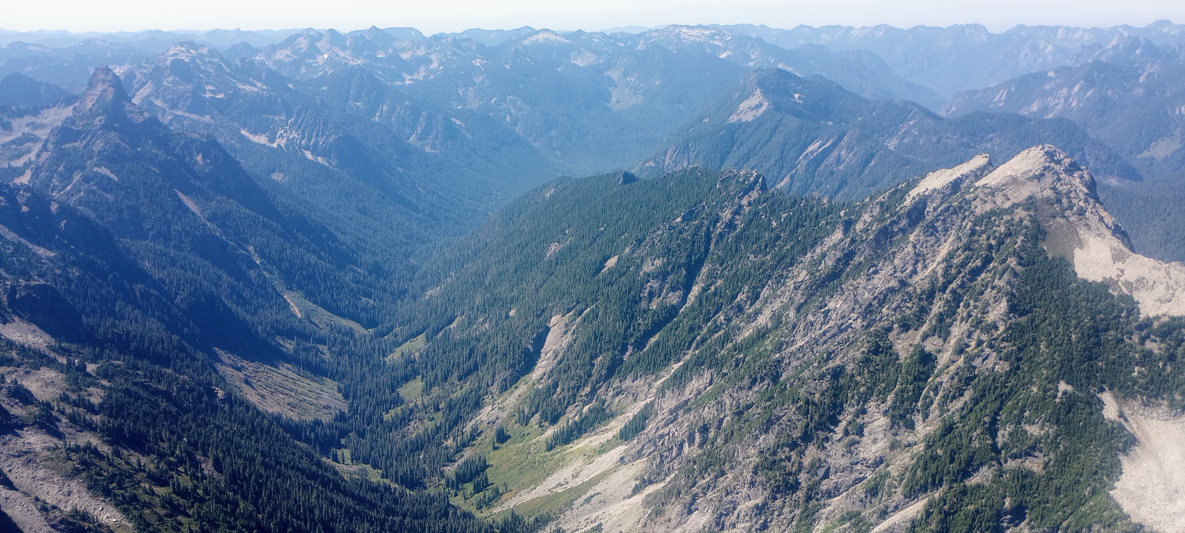
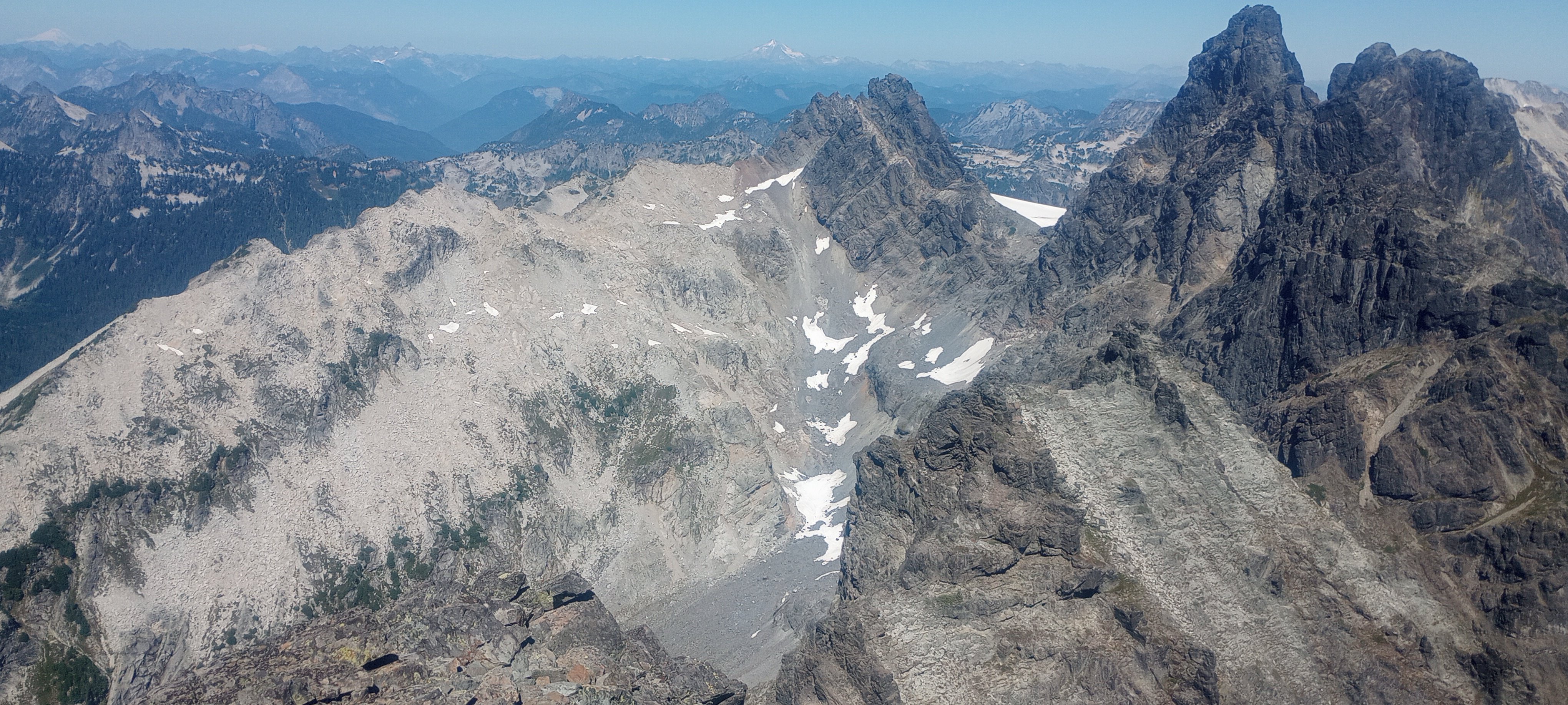
I did this climb a few weeks ago and my friend did a write up that I thought I’d post here (source https://www.peakbagger.com/climber/ascent.aspx?aid=2902617). There wasn’t a ton of information on it, but overall a fun way to get up the mountain. Jack Mountain (East Ridge) & Crater Mountain Team: Damon, Jon, Chris Dates: July 11-13, 2025 Short Version: A successful 3-day trip to the seldom-climbed East Ridge of Jack Mountain with Jon. The three of us climb Crater Mountain on the way out. Jack's East Ridge is a long, serious, and committing route with sustained exposure and multiple pitches of 5th-class climbing. It should not be taken lightly. Crater Mountain provided one of the most spectacular summit panoramas in the state, a perfect reward for the intensity of Jack and a supremely appealing scramble objective by itself. Statistics: Total Mileage: ~25 miles Total Elevation Gain: ~12,500 ft Day 1 (Approach to Jerry Lakes Basin): 9 miles, +5400' / -1400', 7h 30m Day 2 (Jack Mtn): 5.8 miles, +/- 4660', 13h 08m Day 3 (Crater Mtn & Exit): 9.7 miles, +2390' / -6420' Full Report Day 1: The Approach Our trip began at the Canyon Creek Trailhead. A quarter-mile in, we hit the ford of Canyon Creek. I was glad to have brought Crocs, which I cached on the far side. From there, the trail winds its way up and up. We left trail at 6400' to ascend towards the 7200' col. We made steady progress under warm skies. After crossing the pass, we descended snow below the Jerry glacier into the beautiful Jerry Lakes basin. We camped near the outlet of the biggest lake, opting to bivy to enjoy the clear night. The area was scenic but quite buggy. Day 2: Jack Mountain - The East Ridge Jon and I set off for Jack early, moving by 4:30, climbing a goat path to exit the Jerry Lakes basin. As we reached the col, we saw Jack partially shrouded in a high cloud around 8,000 ft. From there, our route involved descending 800 feet into the adjacent basin before beginning the ascent up the SE arm of Jack. We then traversed over to the snowfield below the glacier, which led to a few hundred feet of scrambling to gain the East Ridge proper at 7,200 ft. The East Ridge itself is a magnificent and fiercely serious undertaking. This is not a casual scramble. The route involved three distinct pitches of 5th-class climbing: one up a gully early on, a memorable and wildly exposed 5.0 crux in the middle of the ridge, and another section to gain the summit. Jon, whose extensive experience was essential to our success, led these pitches and found ok placements. The true character of the ridge, however, lies in the terrain between the technical pitches. We spent hours moving together on exposed Class 3 and 4 rock, requiring sustained concentration. The summit, while somewhat cloudy, still offered stellar views of Baker, Shuksan, the Pickets, Ross Lake, Hozomeen, and the massive Nohokomeen Glacier sprawling below. We also took a moment to look down at the upper part of the South Face route; it looked unappealing, reinforcing our choice of the East Ridge. The descent was a mirror of the ascent: a long, mentally taxing exercise in precision. For the 5.0 crux, Jon employed a protected downclimbing system, providing a crucial safety margin. The opening move where I had to blindly face-in downclimb over a bulge to find footholds to enter a solid crack system, with 1000' of air down to snow far below, was totally insane even with a few pieces of protection that Jon placed below me. We made one rappel lower down off an established tat anchor. We were so happy to be off the East Ridge, but proud that we made it work. We tried to stay on snow to cross the glacial basin. As we walked over, a 20-foot snow finger near the glacier toe collapsed in front of us onto the rock. It was a powerful reminder of objective hazards and the unknowable elements of alpinism that defy simple analysis. We turned and went back the scramble way The 13-hour day was a testament to the route's length and complexity. We made it to camp by late afternoon. The East Ridge is a route for self-reliant parties with a deep well of experience in technical rock, rope systems, and managing risk in a remote, high-consequence environment. Day 3: Crater Mountain & The Exit We awoke to a beautiful morning with interesting cloud formations. All three of us made the climb up Crater Mountain. The route involved fun Class 3 scrambling with some light exposure and a single, unexposed Class 4 move. The rock was loose in places, so I was happy to have a helmet. The summit of Crater Mountain is, without exaggeration, one of the finest viewpoints in Washington State—perhaps even better than Jack's. The 360-degree panorama under clear skies was staggering. It offered the same incredible views of the major Cascade peaks, but with the added bonus of a stunning perspective of Jack's massive South Face and the beautiful Jerry Lakes basin below. After soaking in the views for an hour, we descended and began the long hike out. The descent went quickly as we talked about Star Wars and the Matterhorn. The river crossing was downright enjoyable in the heat. A challenging, humbling, and ultimately magnificent trip to a wild corner of the Cascades.2 points
-
Trip: Cascade River Road - Forbidden, Spider, Boston, and many more solo Trip Date: 08/11/2025 Trip Report: Went up to Cascade River Road for the past couple days to take advantage of the good weather. Didn’t have a partner so just decided to mess around for a while. Apparently my adult friends do this thing called work. Who does that! Summits were: Forbidden, Boston, Sahale, Magic, Arts, Formidable, Spider, Little Devil, Devil Benchmark, Teebone Ridge. Thursday 8/7 Dropped my mom off at work before heading north, got there around 11. Pretty cloudy and had big plans for the next few days so I just ran up to little devil peak and copy climber kyle. Bagged Teebone ridge and Devil benchmark along the way. Enjoyed some perfect huckleberries on the way up. Startled a large bear on the way down, only 25 feet from me. The fur was brown but I don’t think there are any grizzlies out there so who knows. Friday 8/8 Arose at sunrise and moving at 6am up to Cascade pass with 3 days of food, went over the cache glacier and saw a black bear on the other side of the col. This time we saw each other and maintained distance. Slogged it over to the other side of the middle cascade glacier where I got to the bottom of that South-facing gully around 1. Went up Spider mountain using the left gully at first before gaining the rib between the two. Got back to the ptarmigan traverse trail around 5 where I worked my way over to the access col to formidable for a nice night. Saturday 8/9 Arose once again at sunrise and climbed formidable in the morning in 4 hours camp to camp. Saw another party coming up as I headed down from the col. Slogged it back up to the middle cascade and felt pretty pooped by the time I got to the red ledges. Dropped the pack and scurried up Art’s Knoll. After that headed over to kool-aid lakes where I stashed a lot of gear before going up Spider. Made it back down around 6 or 7 before more slogging up to cache col for a sweet bivy site. Spilled my pad thai all over myself which I was unhappy about. Sunday 8/10 Another sunrise wakeup got me moving at 6, down to cascade pass, and up to Sahale where I summited around 11:30. Stashed overnight gear on my way up to the arm. Always fun passing people in trailrunning vests. Simply buying an vest and some poles won’t make you kilian jornet, still need cardio. Anyways, over to Boston where I topped out around 12 or 12:15? Explored the summit register before rappelling down. Yes I did carry a 60m purline all that way for 2 rappels. Training weight or something. Cruised it back to the car. Monday 8/11 Had to meet a neighbor in the evening to talk about watering his plants but nothing else going on. Also had a dentist on Tuesday preventing me from staying another day. Soloed up W. ridge Forbidden in 4:15 car to summit. Topped out around 7:15 before heading down at 8 with another soloist from Montana. Rope was nice for rappels. Back at the car by 12:30, home around 3:30. I guess I could’ve waken up later. Don’t see myself becoming some big free-soloist but the route seemed like a good option for it. Sure is nice to not fuss with ropes through easy terrain. Gear Notes: Approach shoes and Crampons would work for everything. I carried boots because I like carrying things I regret carrying later. Rapping boston feels good and a purline doesnt weigh much. Approach Notes: Forbidden can be reached without touching any snow
 1 point
 -
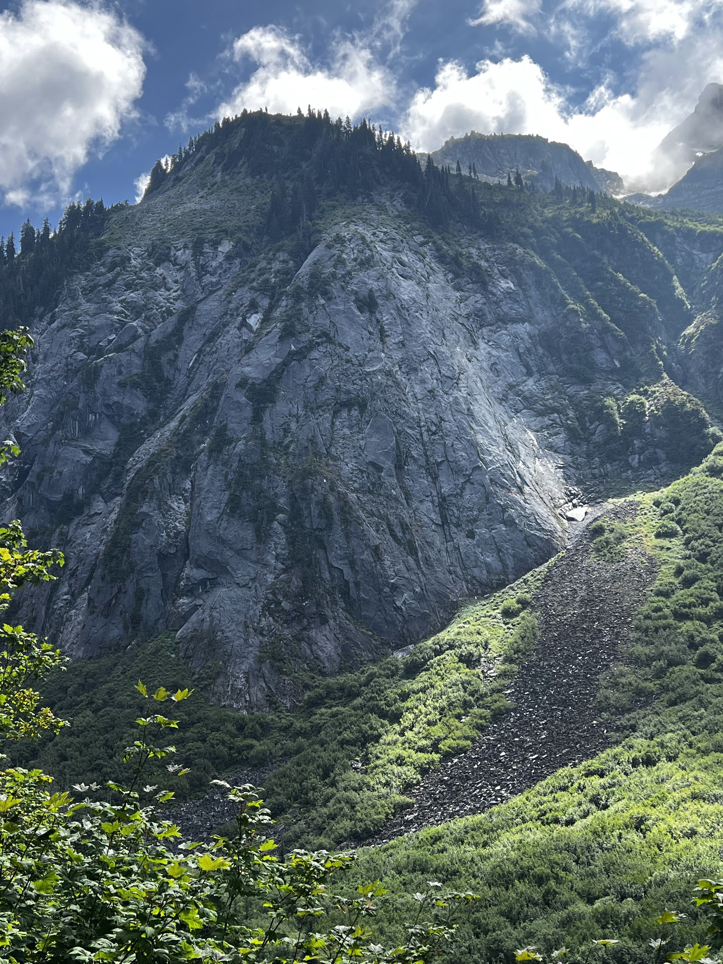
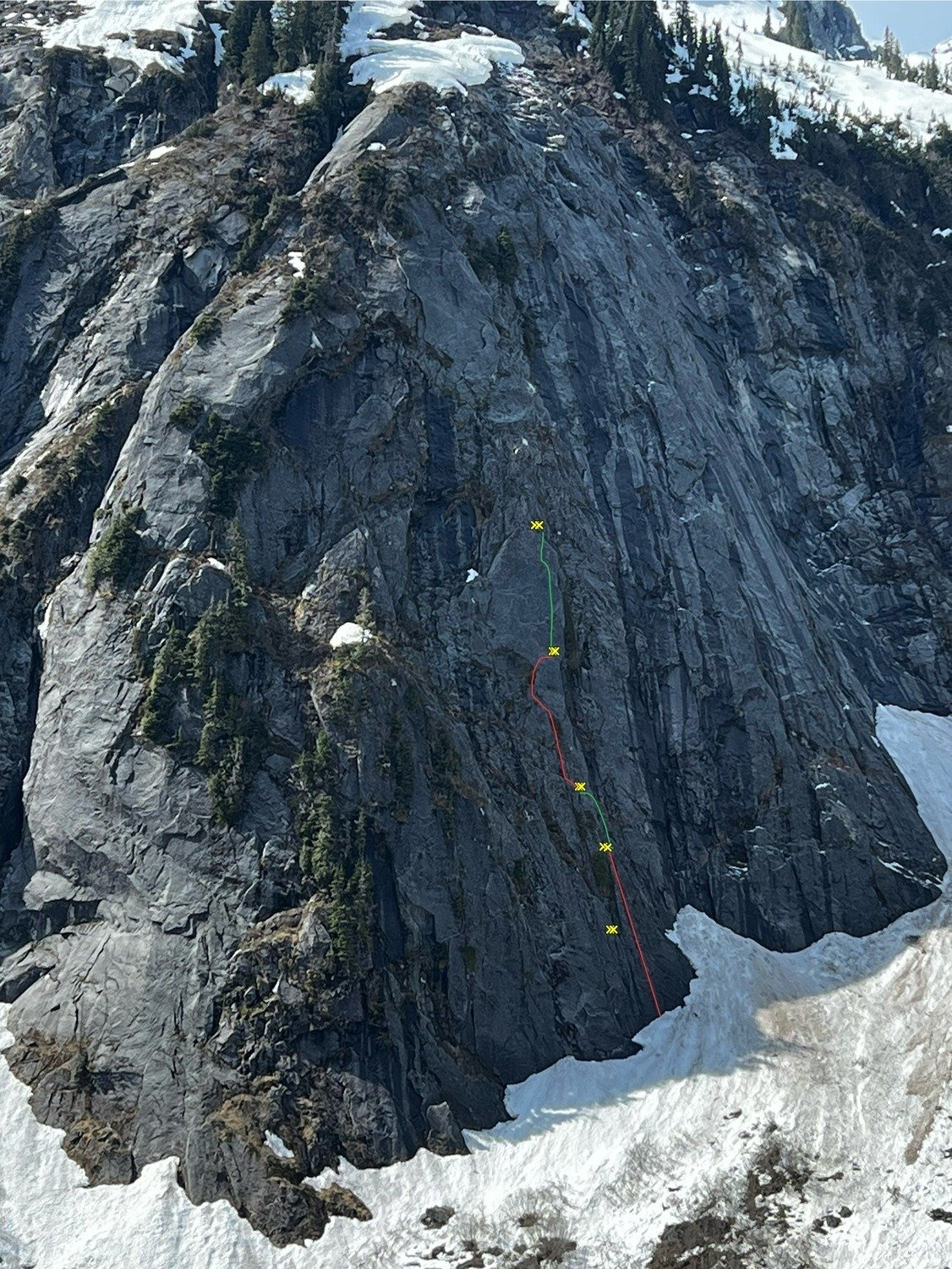
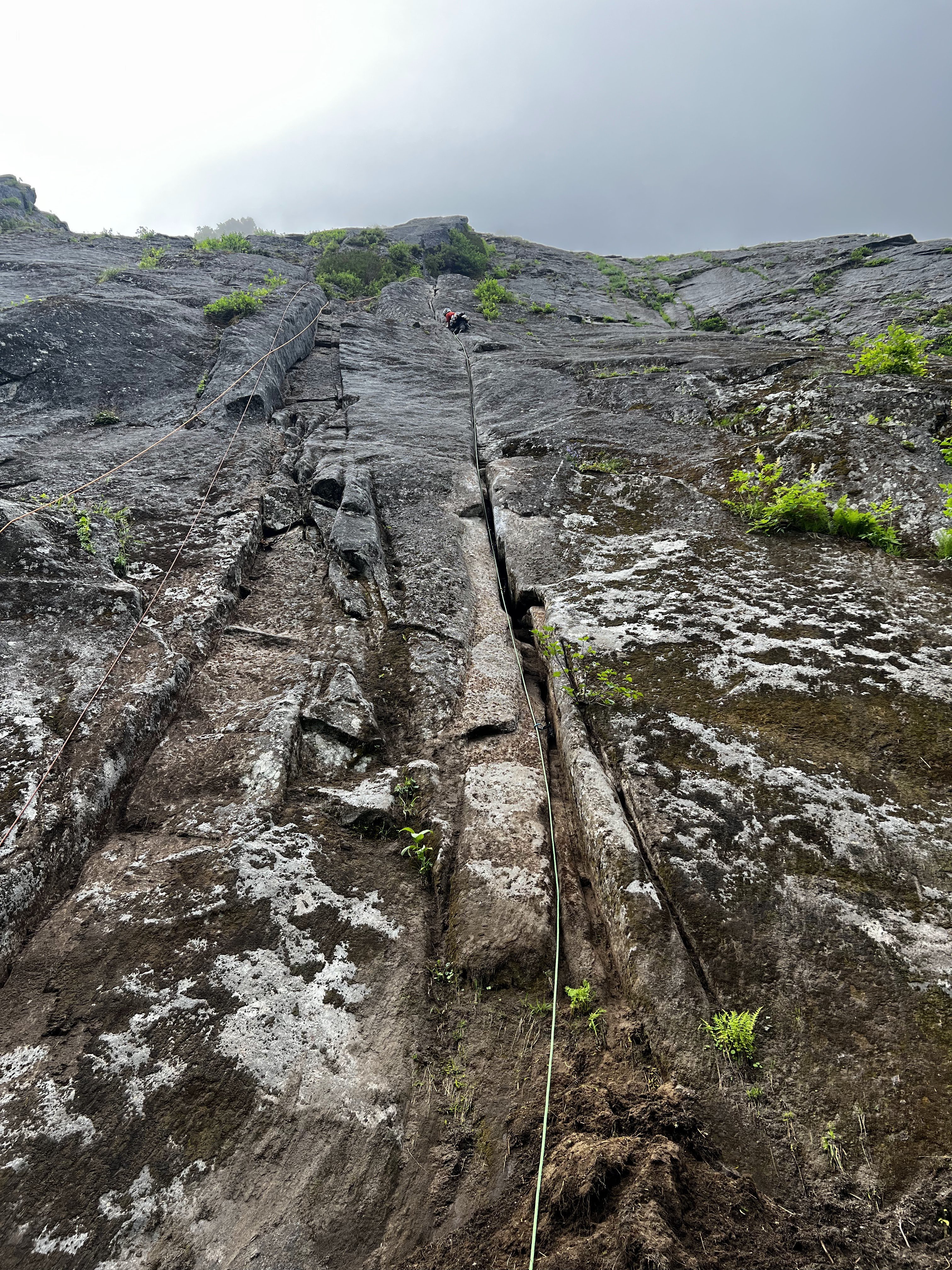
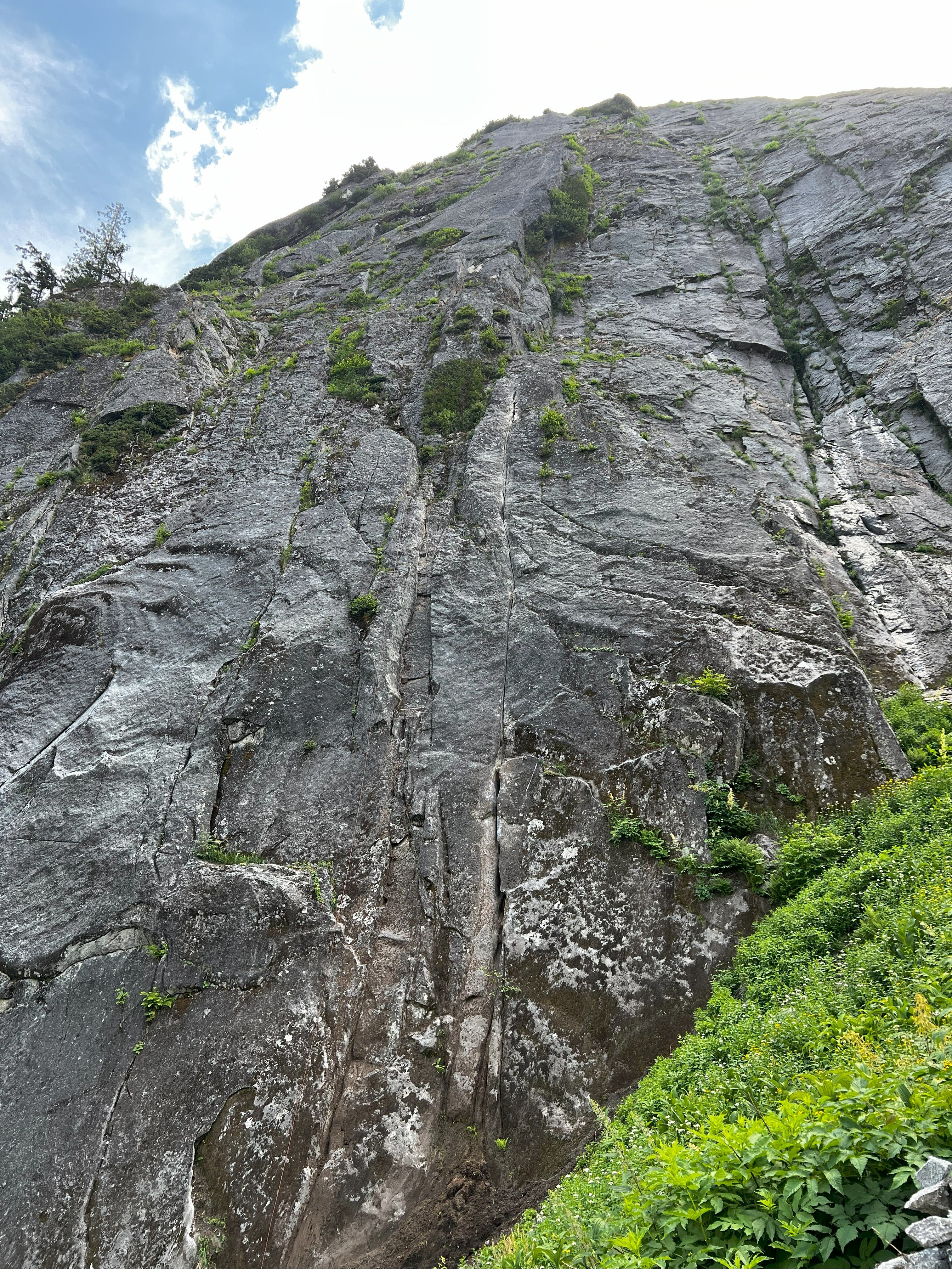
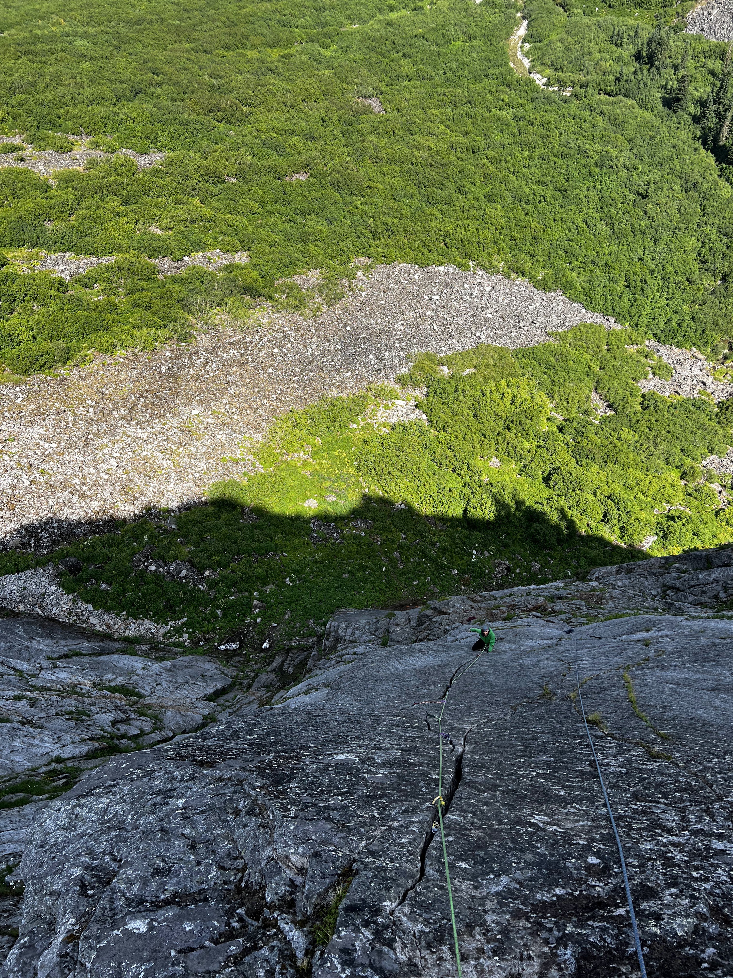
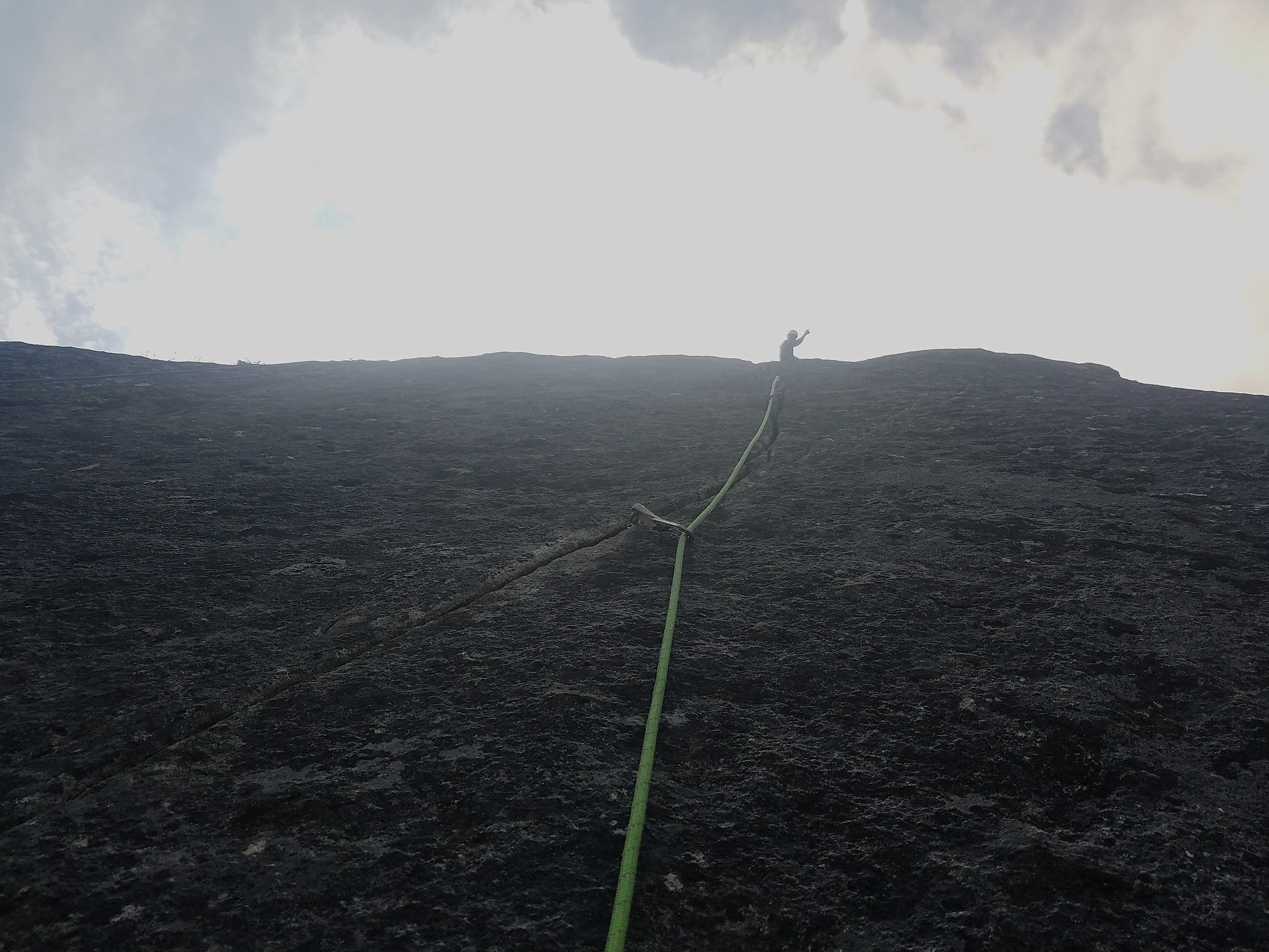
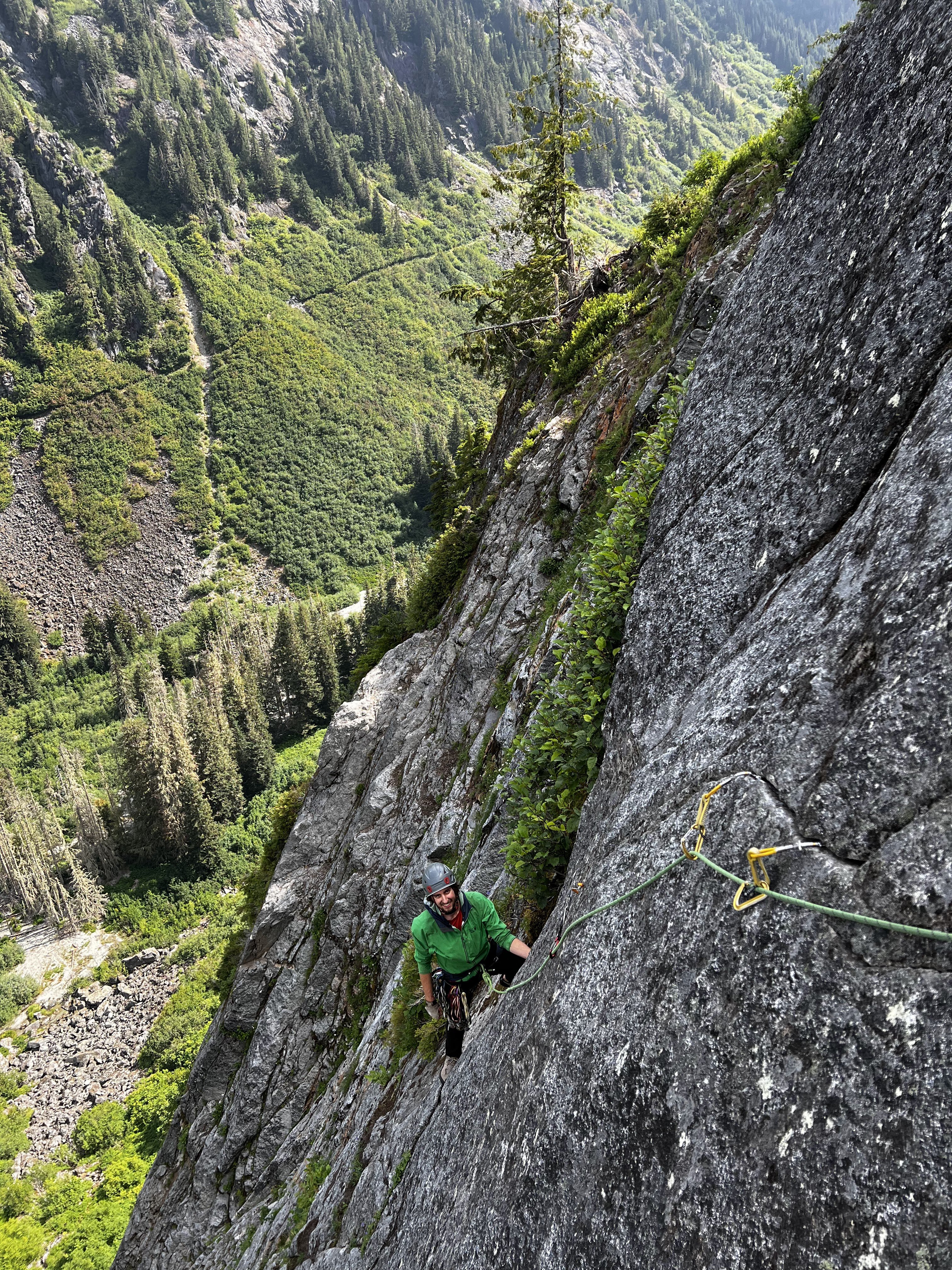
Howdy friends, it's my pleasure to present you all with the newest Washington classic - Negligence located off the Hannegan pass trail. This is a stellar line that links up several crack systems to access a shield about halfway up the large buttress seen across the valley. We spent most of the spring/summer of 2025 developing and cleaning this line and would like nothing more than people to get out there and climb the thing. Approach - From the Hannegan Pass Trailhead, hike Hannegan Pass Trail past the first two switchbacks about halfway to the campsites. Shortly after the second switchback, drop down the open talus field on your right. Continue down the talus almost to the creek, cut right into the woods, then make your way down to the creek from there. Jump from a large log across the first narrow creek band and you’ve found the tunnel through the slide alder. Be bear aware here, we found multiple fresh signs of them (probably due to the golfball sized salmon berries). Follow this until the major creek crossing, then cross the creek. After crossing, head through the trees directly towards the nose of the buttress, hopping another small creek braid before entering into the talus for the final approach. Follow cairns up the talus, then follow the path (likely overgrown) through the underbrush to the base of the wall. The route is located a couple hundred feet to the right of the nose. In total, the approach is around 2 miles, but tends to take around 45 minutes, give or take. Climb - This route takes a series of remarkable crack systems 400 feet up the Hannegan Buttress over four pitches. Protection is traditional, styles vary from off-width to tips, and all anchors are bolted for ease of descent (316SS all around). Each pitch ends at a conferable belay ledge. Pitch 1 - Depending on snowpack, either hop right into the offwidth start, or cross a deep snowfield to dig right into the rest of the pitch. A long continuous crack system varies from tight fingers to the wide stuff, favoring tight hands and good feet. This pitch reminds me of a steeper version of the Apron with lots of flared hands, sustained 5.9 climbing with several good rests. The bottom wide bit is a little dirty and will probably remain so since it gets buried under the snow pack, but it quickly cleans up. This pitch would be a classic all on its own. (5.9+) Pitch 2 - Amble up from the belay towards a notch gully in the leftward wall, clipping in a pin down low, then placing a bit of gear before firing a few fun moves to gain the gully. Make your way up the 4th class to a great ledge to top out this short pitch. (5.8) Pitch 3 - Step left from the belay and begin climbing up a wide box. Tread lightly on the red stone before pulling into the right-facing dihedral towards the alcove. Exit the alcove on thin tips, and continue upwards until bomber hands placements allow you the confidence to trend left in the flake system. Follow the flakes until the roof, then brace yourself for a thin, thoughtful, arching crux protected by small gear as you pull out onto the Shield. Save a .2 and your smallest cam for the business. The crux of this pitch is short and sweet. Its probably easier for folks with thin fingers or long arms and can easily be pulled through on gear. (5.10d) Pitch 4 - This one's in the money for best pitch in all of Washington! Climb the stupendous splitter to the top of the Shield. It is as good as it looks. Some finger crack moves will take you past a loose book size rock (never fear, that thing isn't coming out) to glorious hand jams. It gets a little steeper at the top so be sure to take in the scenery and catch your breath a bit. Top out on a large ledge. (5.10b) Descent: Rap with a single 70m rope. Use the intermediate anchor on the ledge climbers left between the P1 anchor and the ground. Otherwise, just rap the route. Gear - 70m rope Double rack .2 - 3. Singles of 4, .1, and a purple c3 (or equivalent tiny cam, or trango gold ballnut… the best option) to protect the crux. Wires, all sizes. Consider triples in .4 and .5 for the long first pitch and a 5 if offwidths make you shake. Background - The vision and much of the labor for this route came from Nate Fearer with additional help from myself, Neil Miller, Spencer Moore and Alex Pederson. The route name comes from the fact that Nate started this project while on paternity leave and completed it within the first four months of his son's life (he really is a good father and loving husband). The route was established ground up as an aid line, then dug, cleaned, and scrubbed. Then scrubbed, then scrubbed, then scrubbed. Further ascents will clean it even more. Also, we found some evidence of prior development out there including a bolted (2 pitch?) line left of the nose. If anyone has information on this route please let me know.
.jpg.2b582877bdbee4a7e892f3bb36fd185c.jpg)
.jpg.bdabd6c4d8ebc9668d06dd06dc2df6a7.jpg)
 1 point
 -
you give it all you got, weighing in at 19 stone:1 point
-
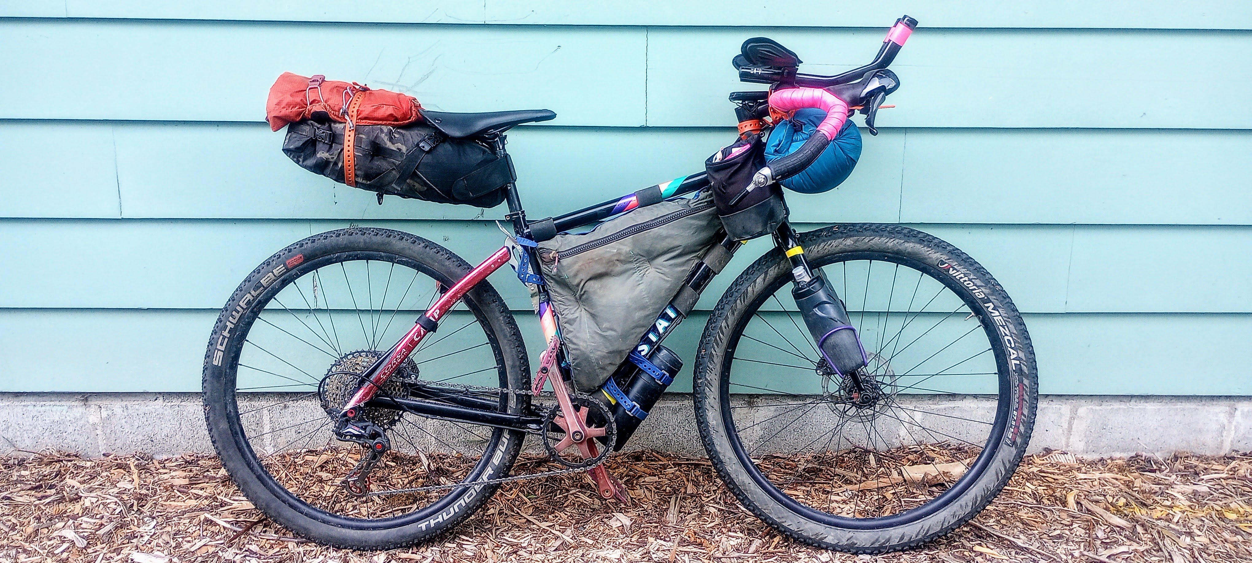
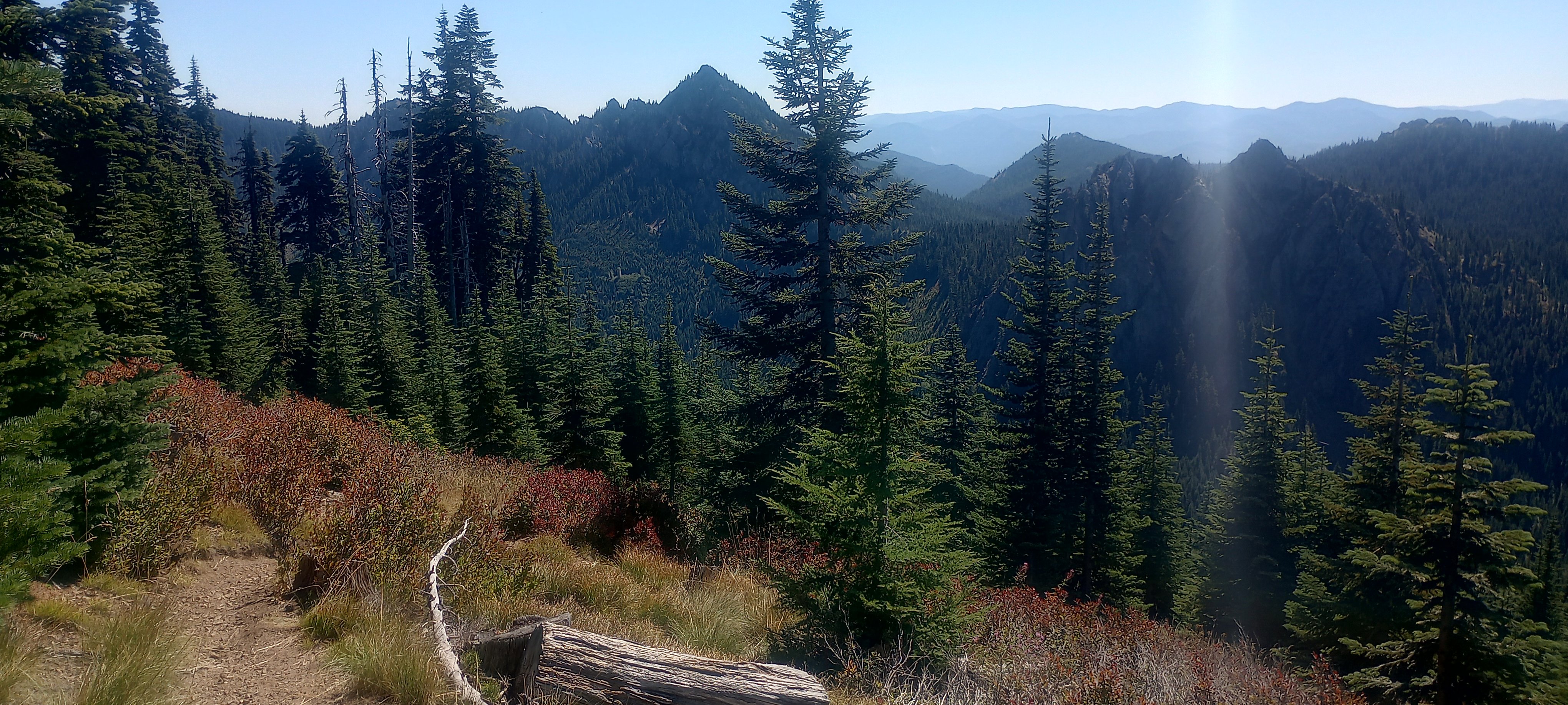
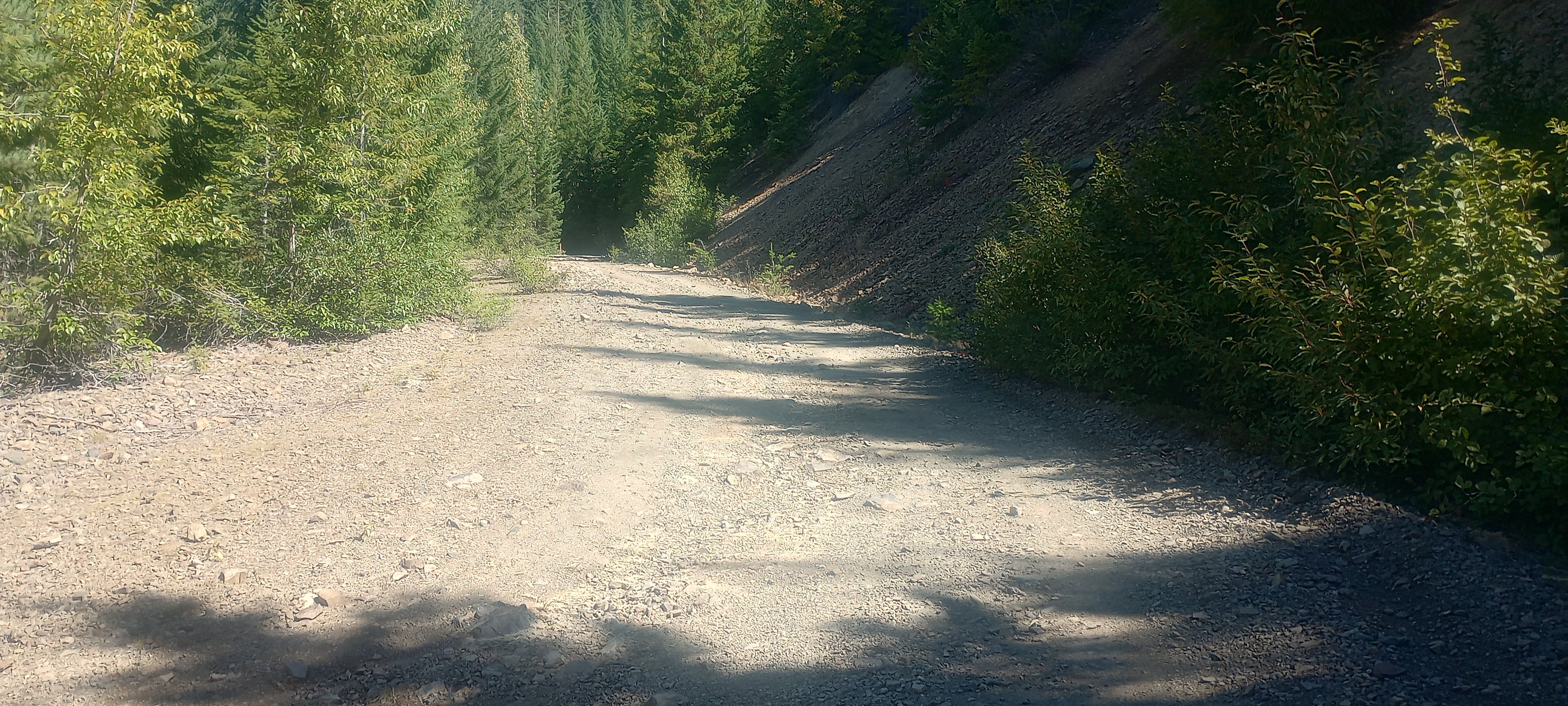
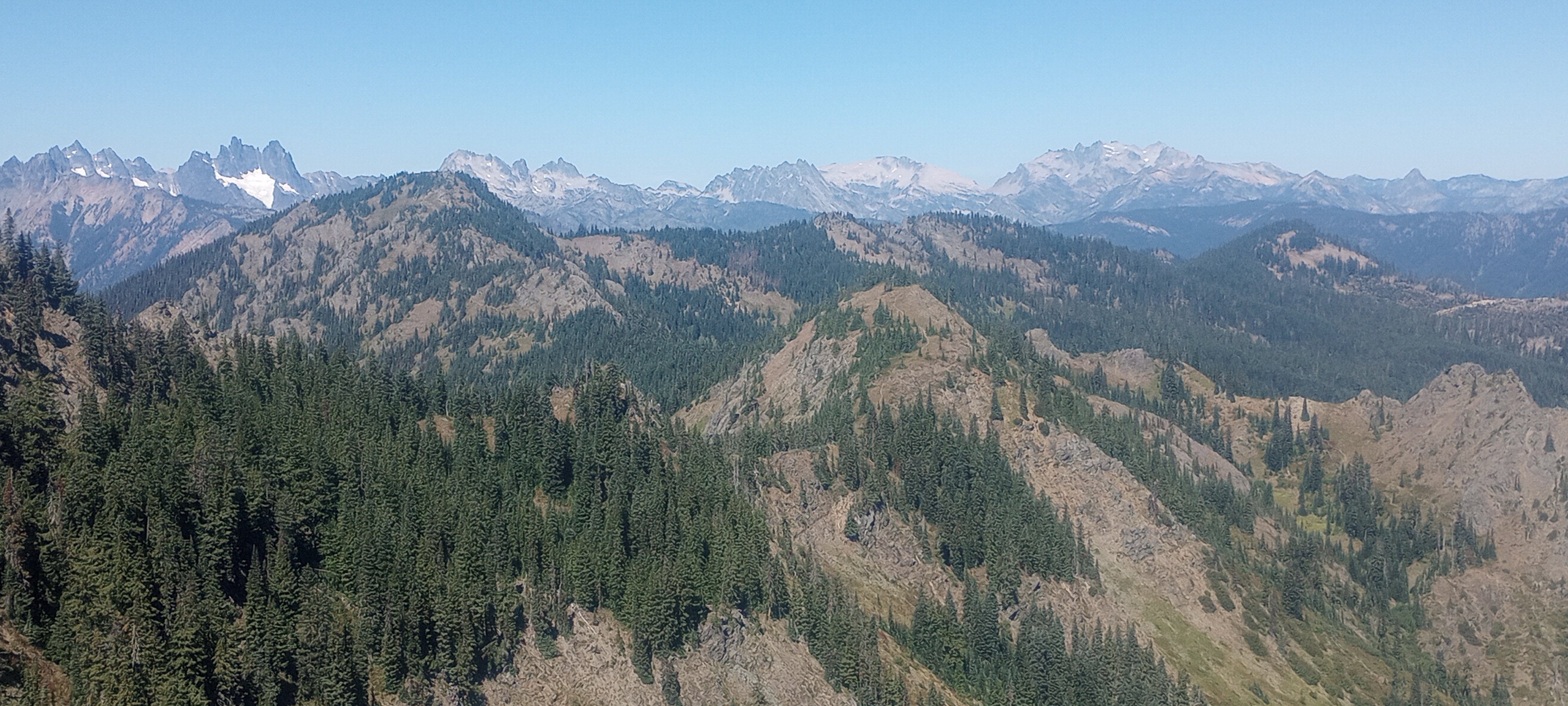
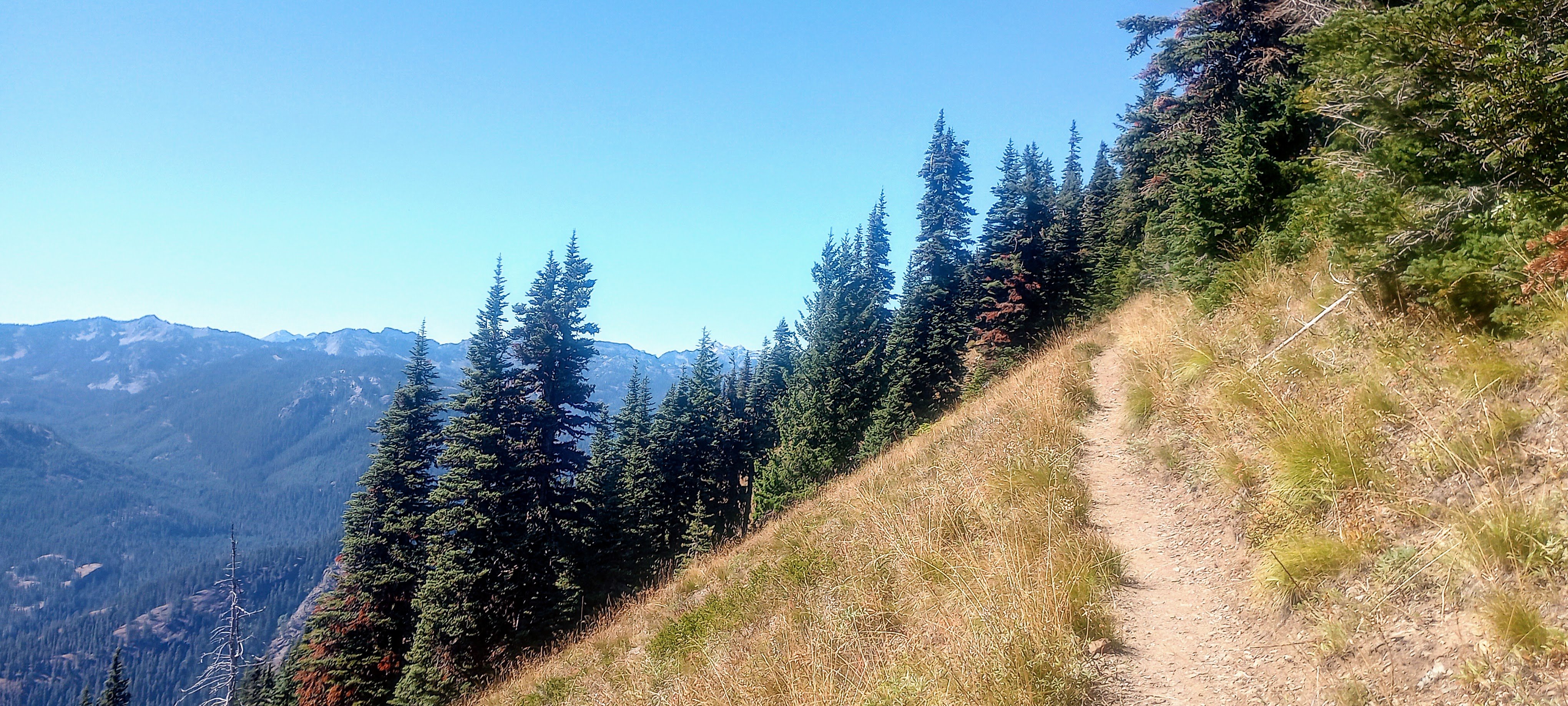
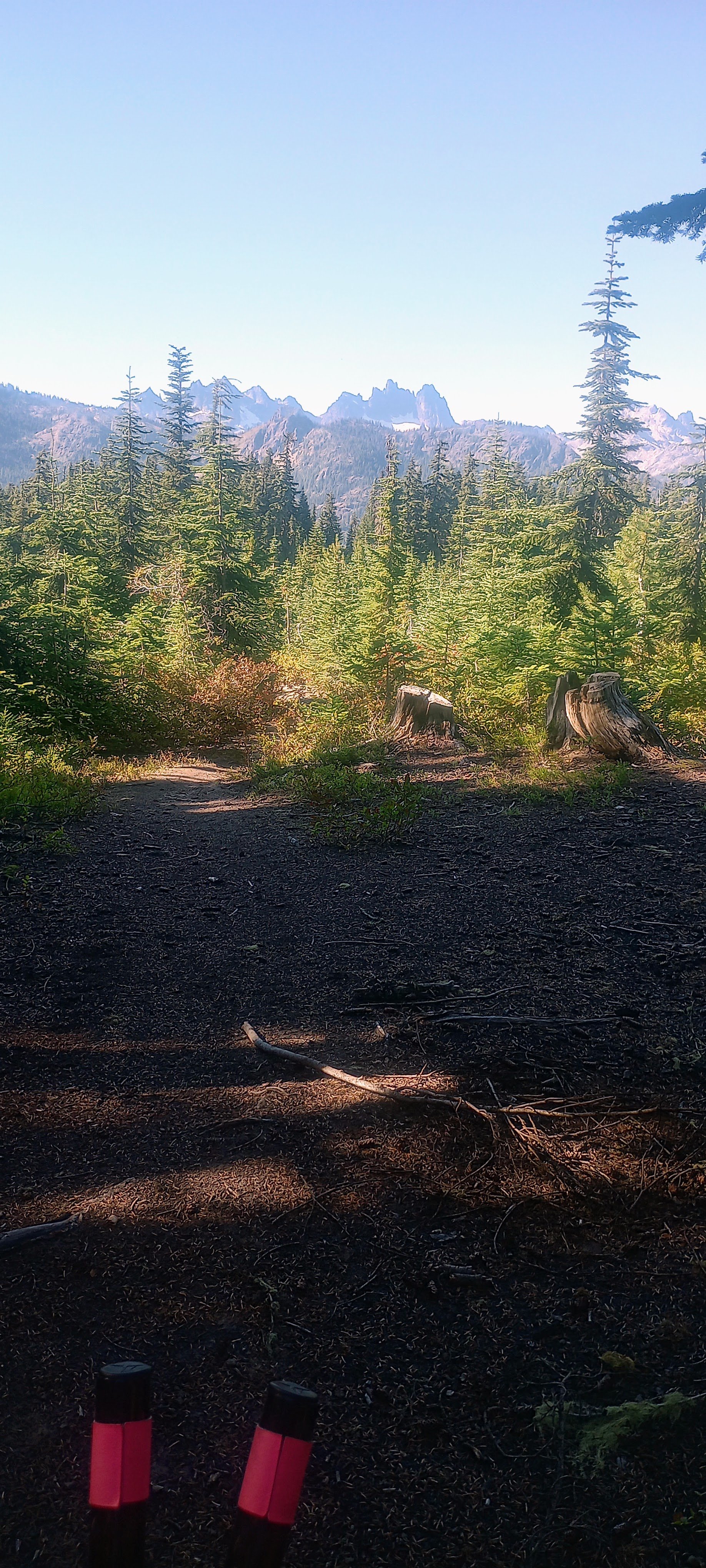
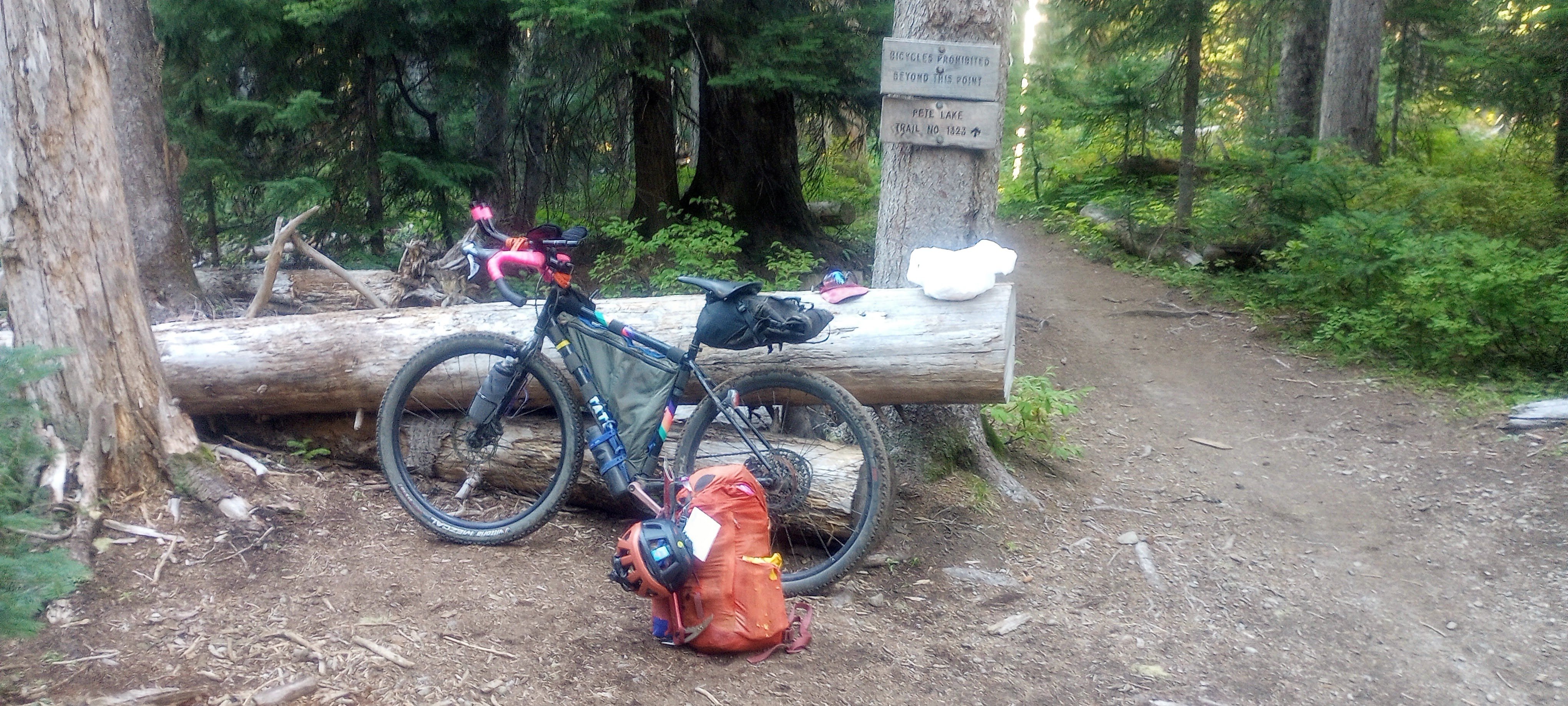
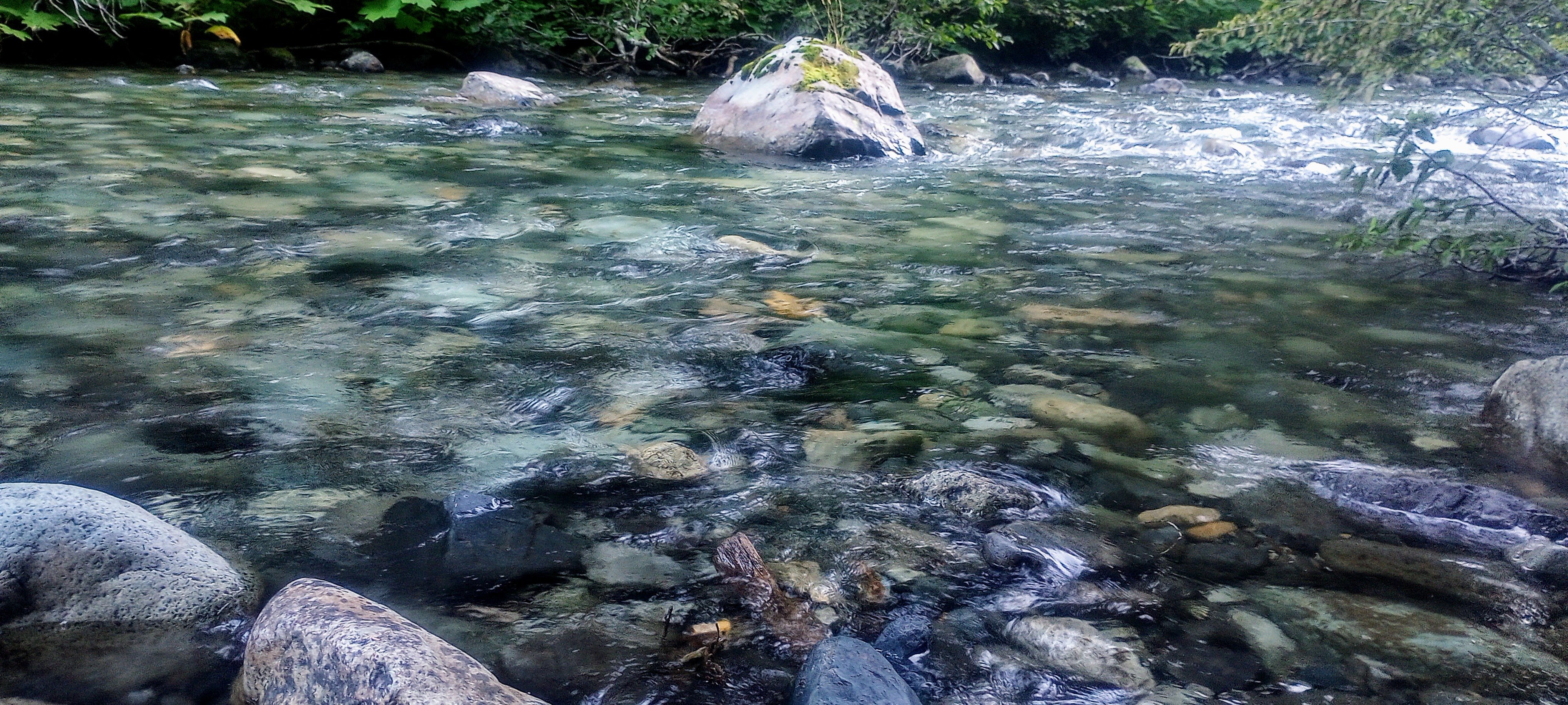
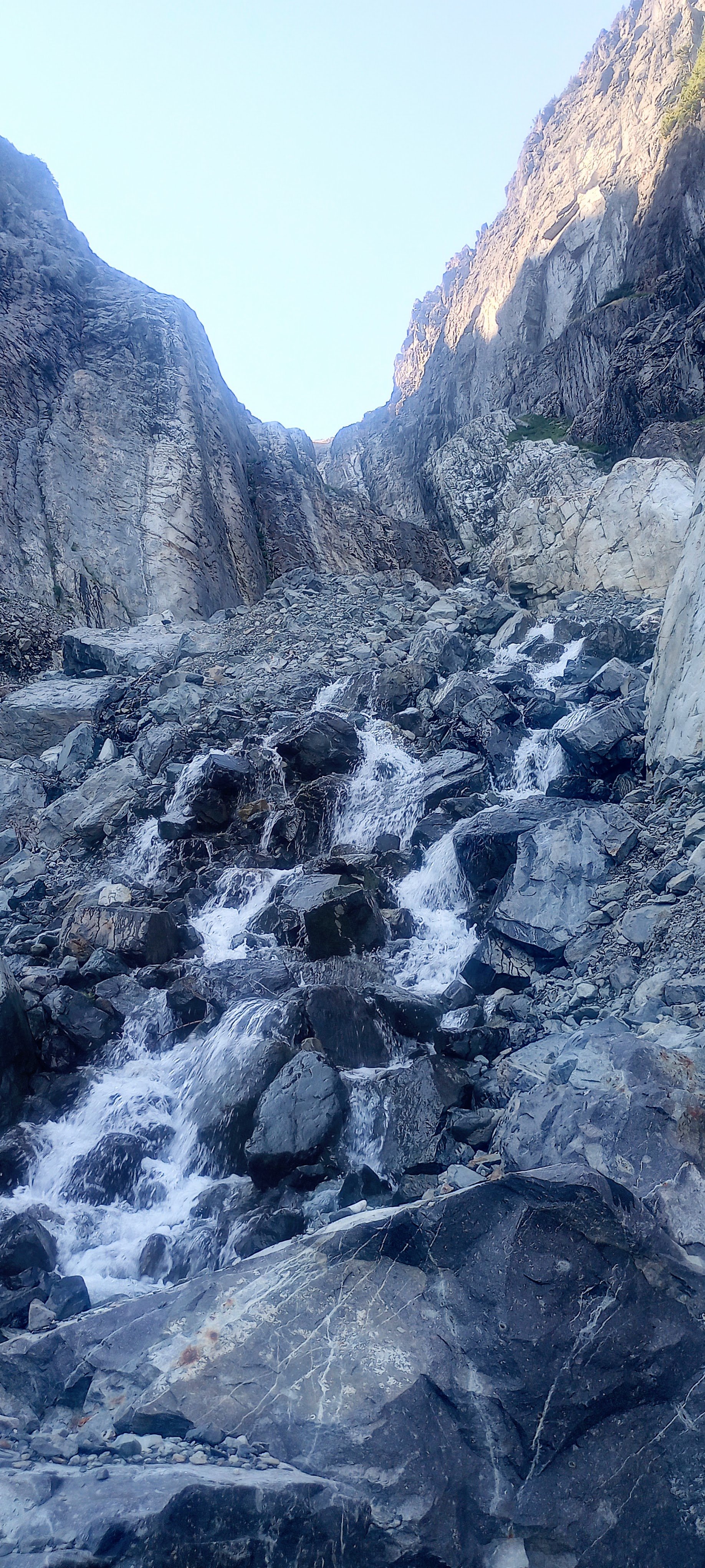
Trip: Lemah Mountain - via Pete Lake (3rd class) (bike approach) Trip Date: 08/31/2024 Trip Report: I used my five-day Labor Day weekend to bike from my house out past the Pete Lake trailhead to climb Lemah and bike home. I really dislike sitting in traffic, and I like riding my bike, so it made a lot of sense! This was a soul-fulfilling trip with lots of time and space to think, not think, observe, and move across the state and up to the top of a really awesome peak! I won’t bore everyone with ALL the bike details, but here’s my VCB (very capable bike) before leaving home. Ready for adventuring! Day 1 - 9:30am - 3:30pm: ~60 miles by bike. Home to Carter Creek camp on the Palouse to Cascades/John Wayne/Iron Horse trail. Started eating a lot of snacks! Talked with fellow bikepacker Craig from Chinook Pass at camp, he looked at my bike and asked what the ice axe was for. He told me about going into the Stuart Range 30+ years ago, “You could camp ANYWHERE back then!” No going back to those days… Day 2 - 6:45am - 7:30pm: ~55 miles by/with bike, ~2.5 miles on foot. Woke up to my brain singing something I hadn’t heard in probably like 25 years: “Are you ready for some FOOTBALL?” – weird stuff! Soon I was pedaling along the trail singing something like, "Heyyyy wild kitties, today's not the day, leave me alone, I don't wanna play.” Stopped when a Douglas squirrel was harassing me from the side of the trail (a common thread throughout the days) and watched it turn a pinecone over and over in its little hands, gnawing and letting the scales fall away, eating the nuts, then discarding the little corn cob. Amazing! Through the Snoqualmie Pass tunnel, turned north in Easton. Had an unexpected cortado at an espresso stand and resupplied at the gas station, then started up the road leading to (kinda chunky, kinda sustained steep, grindy grindy) forest service road. Finally, doing some real elevation gain! Left some mountain bikers in the dust after asking if I could join their bike gang for the climb. Sorry guys! But then I got to the 2.5 miles of black diamond MTB territory heading north. How do people bike up stuff this steep, and narrow?! I hiked my heavy-ass bike about 97% of this, both uphill and downhill. I knew it would be a lot of HAB for this section, but it was steep and dusty and narrow, full value HAB! Happily, there always seemed to be tons of giant delicious shiny mountain huckleberries whenever I really needed the morale boost. After that, things got a little better with four miles on No Name Ridge which is supposedly a blue square trail – maybe old skool, sandbagged blue square? I liked this Trailforks report: “Do you like pushing your bike uphill, nearly, seemingly, endlessly? Then this is the ride for you!” Definitely rode more than 3% of this section, but still – a good amount of HAB. However! Most of this was on the ridge, so stellar views abound! Lemah, Chimney Rock and Overcoat, The Chiefs, Bears Breast, Hinman, Daniel, and Cathedral Rock! (Stu, too, but out of the frame.) And there were actually some really good flowy sections with nice trail. Stopped and watched/listened to a couple of grouse (maybe mom and one juvenile?) traveling along talking to each other. After what felt like a very long time, I reached the end of the climb and the gravel descent down to Cooper River was AWESOME, smooth and fast. Soon I was at the Pete Lake trailhead filling out my little ALW permit and continuing onward on my bike! You can go about 2.5 miles until the ALW boundary where I made the transition to backpacking mode and stashed my bike in the woods. From there I quickly made my way to Pete Lake (about 2 more miles) and found a truly stellar somewhat secret campsite and settled in for the night. Day 3 - 6:30am - 7:45pm: ~13 miles on foot. Lemah! This was an interesting route that included a lot of slab walking, waterfall slabs, tarns and amazing views everywhere. Beautiful start when you start on the climbers’ trail, next to waterfalls and pools of Lemah Creek. I had to do a little extra gain to get this photo, but you can see the route -- along the right side of the marshy area, up the gully, up most of the snow finger, then traverse across, below the second ridge-toe, then the scramble up to ridgeline, along the ridge, and then up the main summit! Whinnimic Falls on the left: The B2 schwack was not that fun, but could have been worse. The gully was Not Fun. It's a cool canyon, memorable feature, but so much churned up, unsettled rock and sand and all the rest. Going earlier in the season seems like a smart and fun snow climb (bring the skis). I took the snow finger up to around 6100’ and then crossed a few some other snowfields (but could have stayed off if I wanted). I was really happy that there were no real issues with the snow – no weird moats, no difficult transitions, no blue ice that I had to go around or anything. I only saw a couple patches of bare ice and a couple of holes, but I didn’t need to go anywhere near them. And none of the snow was very steep and it was all soft enough for the aluminum crampons on my trail runners (glad I had the axe). Lucked out with the freezing levels being so high during this time! Fun slab walkin' (view of Three Queens and Chikamin I think): Lots of solid and enjoyable scrambling in the upper parts of the mountain (lots of options for 4th class if you wanted it): Final scrambly bits to gain the ridge: : Summit views were incredible! Right next to Chimney Rock and Overcoat. Seeing Burnt Boot Peak, Big Snowy, Chikamin, Huckleberry, Thomson, Stuart, Baker, Shuks, Tahoma…Really amazing. Also, lots of flying ants on the summit! Maybe a reproductive swarm of western thatching ants? For the down-scramble, I had Mista Dobalina stuck in my head. I saw a pika pretty close up, then a marmot pretty close up, lots of grasshoppers. On the way down the gully, I was surprised to see a couple coming up. They were planning to do a loop, not climb anything. I said something about “So is this the obvious gully?” and the dude didn’t get it. Awk. Toward the bottom of the creek where things start to level out, saw a couple of those water birds that do the little squat dance (American Dippers or water ouzels). Amazing birds! And lots of huckleberries again, even a few thimbleberries that were still pretty good. I was going to see if I could bypass all of the alder by just wading through the ponds. Unfortunately the water started getting too deep but for a very serene six or seven minutes I was just wading quietly in this really nice clear water up to about my waist and it was awesome, lots of tall reed-like grass around me, I felt like a water creature. If I had had the ability to make my stuff waterproof I would have loved to have traveled by water and bypassed the schwack. The water was cool and refreshing; a really special moment. Later, closer to the actual trail, I ran into another couple of people. Emily and Sky. They were super friendly. Maybe 10 minutes after that I ran into another couple of people! Both parties were trying to camp up on the beautiful domes above the creek. Day 4 and about half of Day 5 were biking home. Pete Lake trail was more fun on the way out, and then there was an amazing paved descent down to the Cle Elum River valley (shirt dip), an experience of culture shock when I rolled into Roslyn’s Sunday farmers/street market (so loud, so many people), super hot riding the trail back westward (another shirt dip in the Yakima). When I stopped in Issaquah to see if I could see any salmon, I saw two making their way up the creek! A great trip! Gear Notes: Light axe, light pons, at least 6 voile straps Approach Notes: https://ridewithgps.com/routes/47332364
.jpg.3fb028d56f567576a3895979ecb8d43c.jpg)
.jpg.c85a7f6102d012fafab9db0c4ff40f46.jpg)
.jpg.e3a2d38bdc4b31f86b1937718d87e060.jpg)
 1 point