
Leaderboard


Popular Content
Showing content with the highest reputation on 08/10/25 in all areas
-
Sperry Peak – NE Ridge On August 3 Gabe and I climbed the NE ridge of Sperry Peak. Due to low clouds, we had about ~100ft of visibility until we reached 5000ft. As a result, we generally stayed near the crest of the ridge, being unable to see if moving left or right would be advantageous. Given that, our experience of the route could be substantially different from prior or future parties. We suspect that some (but not all) of the more unsavory portions of the route we climbed could be avoided with better route finding. The upper half of the route has some of the best ridge scrambling I have done in the cascades, including a spectacular section of knife edge ridge on good rock with great gear. However, on the bottom half of the route, gear is sparse and it is advisable to make an offering to the veggie gods before your ascent as many pitches are vertical bushwhacking requiring the climber to put full faith into a wide array of plant species to make upward progress. On one particularly memorable pitch I took a breather while standing on a curved cedar branch hanging several feet out from the rock before lay backing up the rest of the branch to reach a belay. For the route we climbed, a modern grade of 5.8R seems about right. Car to car we took approximately 16 hours. Overall, the rock was surprisingly solid (when you were touching it) and we didn’t experience any runout hard moves. For climbers interested in getting a bit off the beaten path with a tolerance for schwacking (both horizontally and vertically), I recommend the route. Approach: Following Beckey we took the Sunrise Mine trail to ~3100 feet and then started contouring north. After a too short and pleasant section of fern bashing, we quickly dove into steep dense jungle. Several cliff bands pushed us downhill toward the top of the slabs with the waterfall you see from the trail. Unfortunately this way doesn’t go, so we turned around and followed a cliff band uphill until finding a short class 3-4 gully which allowed passage. Continuing to contour we crossed several steep gullies (requiring a bit of luck to find reasonable scrambles to get into the gullies) with running water and a couple sections of class 3-low 5th slab before accessing the ridge from its east side at ~3500ft. If we attempted this route again late in the summer (so the water levels are low) we would consider approaching directly from the car. From satellite images it looks like it would be possible to follow relatively open stream beds to almost the bottom of the ridge. Of course we haven’t tried this approach so no guarantees! In the below picture I marked our approximate ( I cannot emphasize enough how approximate this is) approach in green and the possible alternative approaches mentioned above in red. The parking lot is for the sunrise mine trail is circled with blue. Climb: Hit the ridge and follow your nose. Many options are possible. Descent: Descend the standard Sperry scramble route. Gear Notes: We brought doubles in .4-1, a single .3, 2,3, and one set of nuts. For slings we brought 12 Singles, 4 Doubles. We used a 60M rope. Bring a nut tool to clean out placements. If we were to do the route again, we would bring 6-8 doubles and fewer singles. Lower down on the ridge the larger cams were surprisingly useful. Two 3’s and a 4 would not go unused, though they are not necessary. Final Thoughts: We found a couple pieces of fixed gear. Any of them yours? I would be stoked to hear about other people’s experiences on the route. Has anyone done the northwest ridge? The upper portion of it looks interesting! Pictures: The Fixed Gear: The access gulley on the approach. Many of lower pitches on the ridge were similar to this: Some pictures on the lower half of the ridge: Unbeknownst to me, I picked up a stick while following a pitch: And now some upper ridge pictures!1 point
-
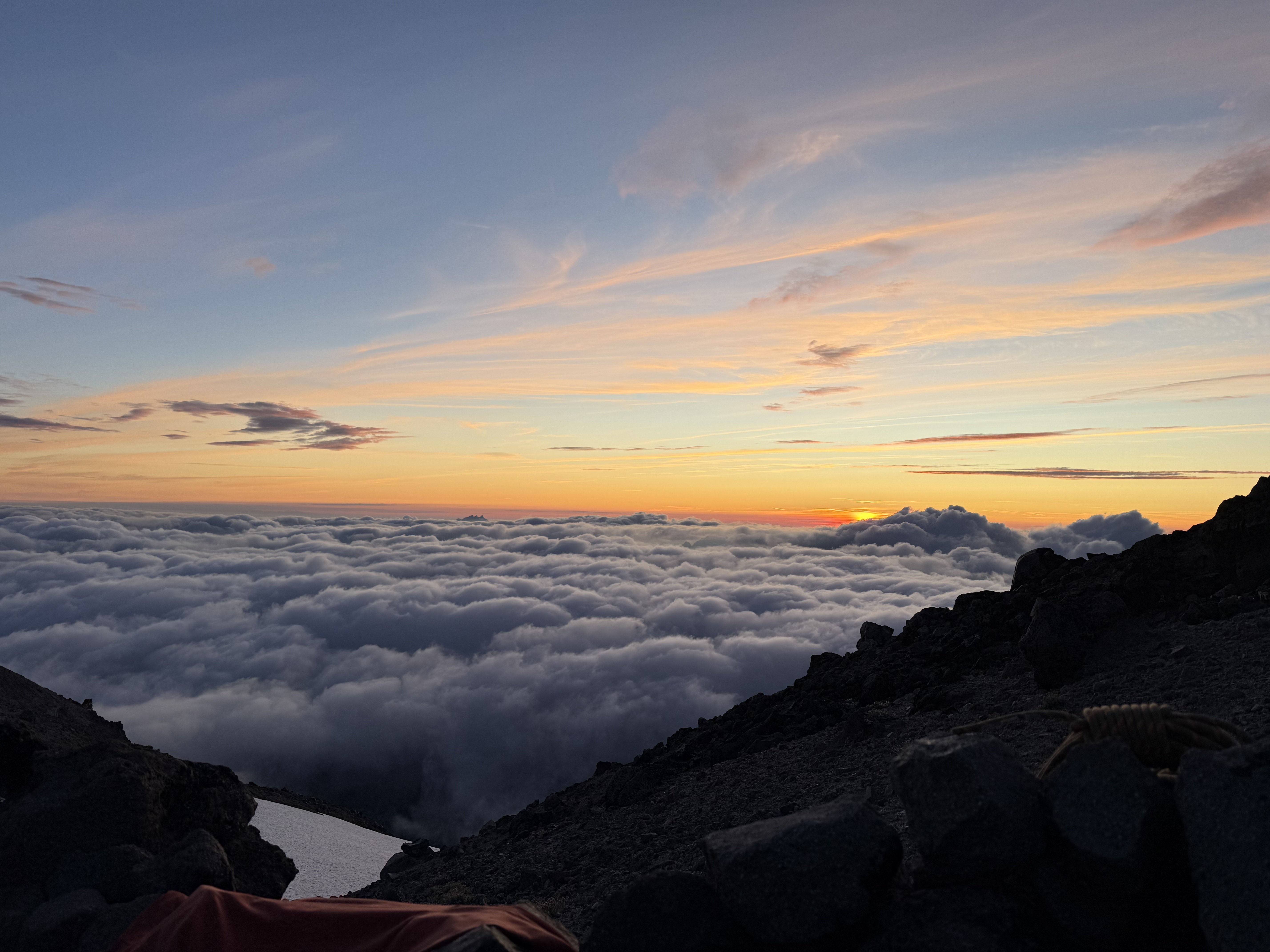
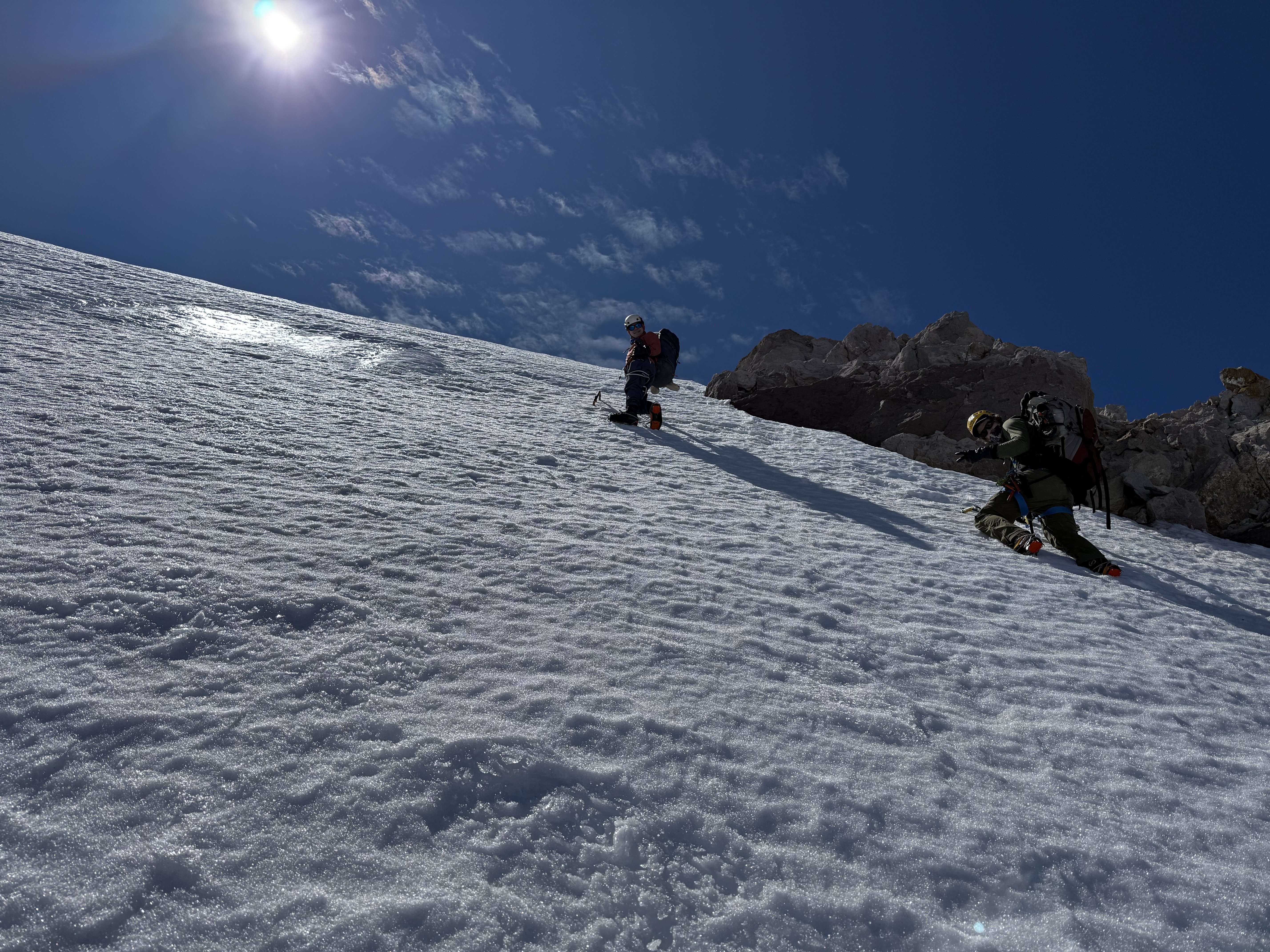
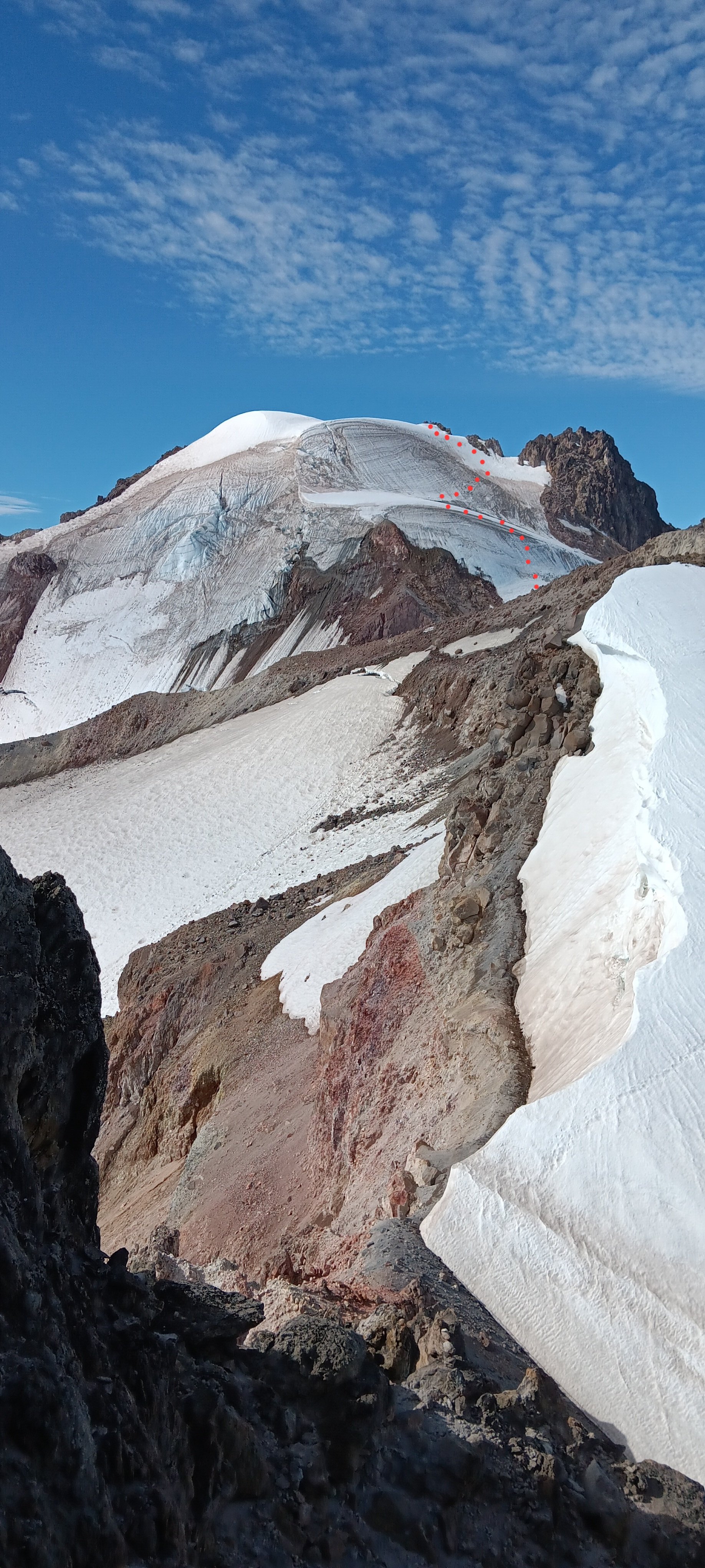
Background: This is a trip report for the frostbite ridge of glacier peak. WHo was there? Me (the slab doctor), the anchorman, and capt. Kirk himself. In yearly tradition we go climb something every summer. Unfortunately the final disciple (Professor Science) was unable to make the trip due to life choices outside of his own comprehension. Day 1: after getting to the North Fork Sauk trailhead somewhat late in the afternoon, the disciples hiked up to the PCT and then down slightly to camp in the large bowl just below the ridge. stats: 11.5 miles and 4.8k gain Day 2: We slept in and hauled butt down to the Kennedy creek crossing. we had heard that you must actually wade to get across this but it was no issue for us to cross on logs. We then started the climb up to glacier creek and left the PCT there. Shortly after leaving the PCT we were at the toe of the kennedy glacier (3:45 pm?). There is a nice bivvy site here. We decided to attempt to make it up to the bivvy at 8.8k. Going up the side of the Kennedy was horrendous work. Large patches of glacial till/mud, exposed blue ice, and loose gravel made for tedious going. We made it to 8.8k camp at 7:30/8pm ish and were all pretty kicked in at this point. The bivvy was one of the best I have had, a beautiful inversion left us above the clouds with stunning views of Baker, Shuksan, and the North Cascades. Unfortunately the anchorman had the piles & was shitting a lot over the last 2 days. There are 2 flat spots for tents at the 8.8k site, but only 1 of them has a substantial rock circle. I would highly recommend not sharing this route with other parties for this reason, and for the significant choss hazards on the ridge that arise late season. stats: 12 miles and 5k gain Day 3: We were going by 7:30/8am up towards the rabbit penis on what I can only describe as some of the worst choss of my life. We were kicking down serious amounts of rockfall, I'm talking 4 or 5 basketball sized rocks at a time that would not stop and continue off the ridge until they were out of sight. Again I would really not want to be behind another party on this route, unless there was significantly more snow. After going tucking around to climbers right the rabbit peen we got on a short section of steep snow and then a cool sidewalk with significant exposure above the upper kennedy. We gained the ridge again after the sidewalk and crossed over to the other side. Here we went almost between the rabbit ears, and after spotting a cairn on the other side of the ridge we down climbed and began the short up and down section before the final ice pitches.IMG_3263.HEIC The ice was pretty trivial and we probably could have soloed all of it but out of an abundance of caution we pitched out the lower section. We then de-roped and simul soloed the final 100 ft of snice / steep snow. If you stay to the right side you will put out exactly below the summit rock jumble. After shmoozing it on the summit with a cool party of climbers from Kerala who offered us whiskey & cigs, we began our mad dash out. Our goal was to make it to the (former) Mackinaw shelter camp site which would leave us with a cool 5 miles to complete monday morning --some of our disciples had work the next day >: ) . We again busted serious ass and were at the shelter by 7pm ish that day?? 15 miles and 3k gain Day 4: an early wake up allowed us to do the 5.5 miles back in about an hour and a half and everyone got to work on time. 5.5 miles and 500ft gain.
 1 point