
Leaderboard


Popular Content
Showing content with the highest reputation on 02/02/25 in Posts
-
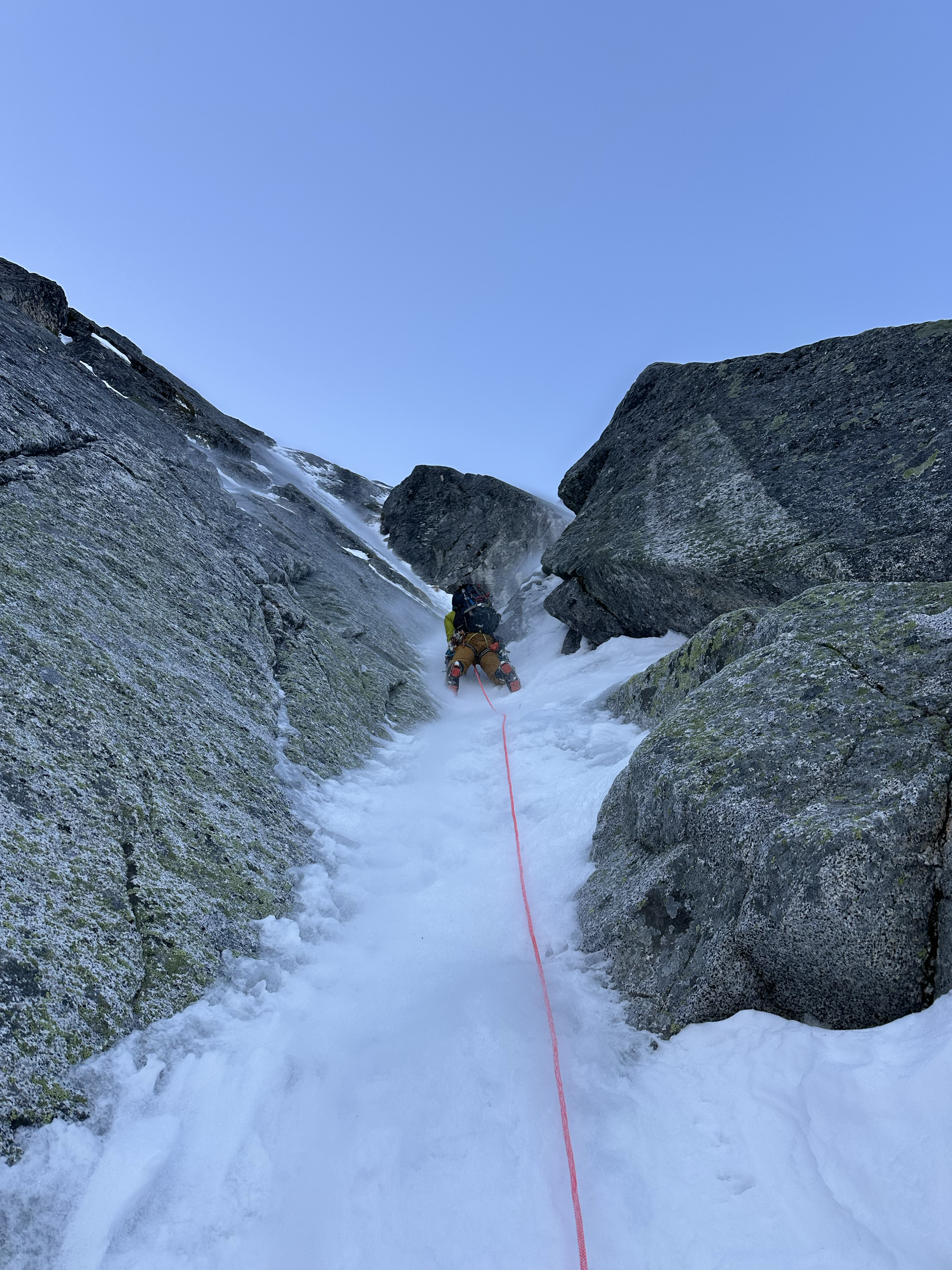
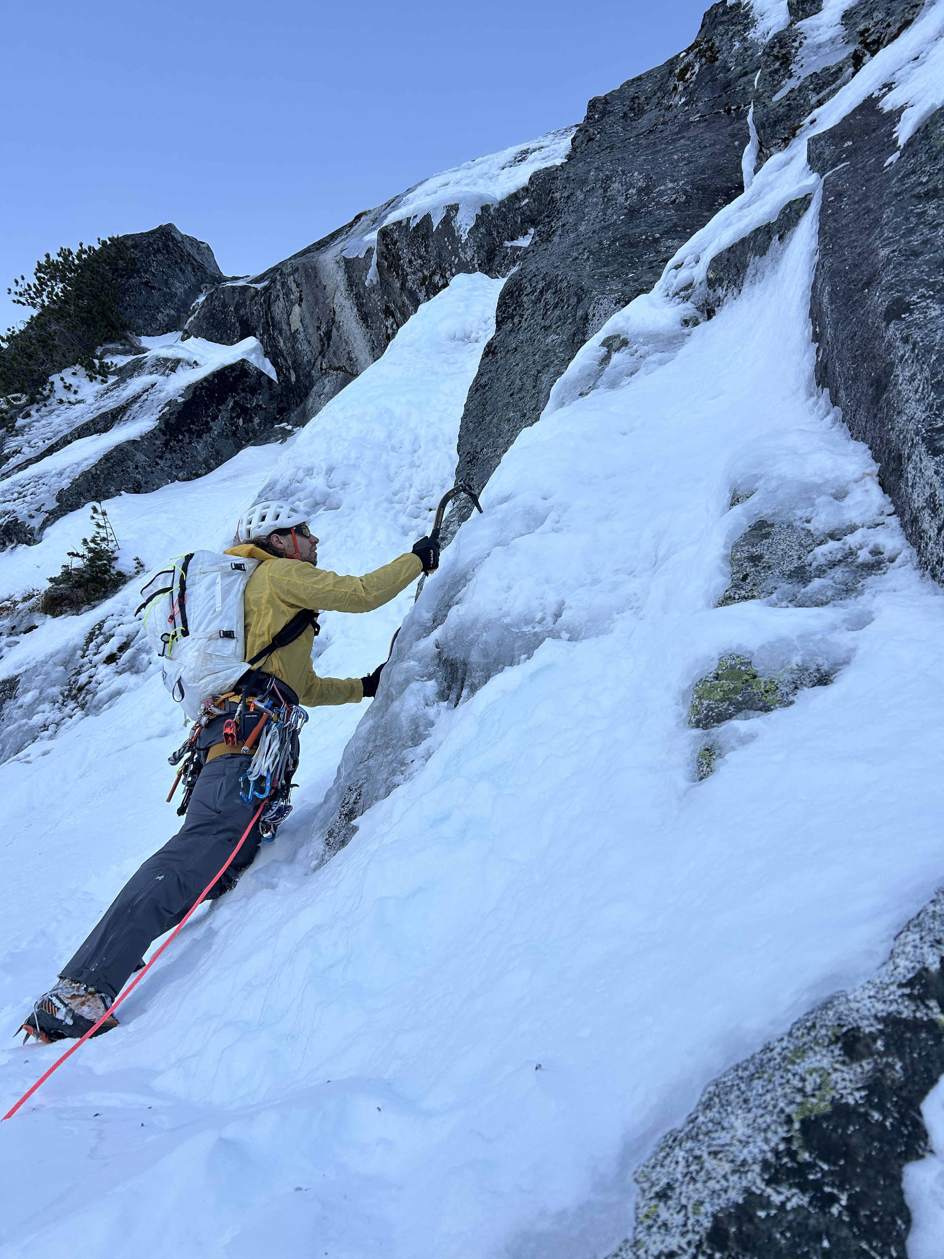
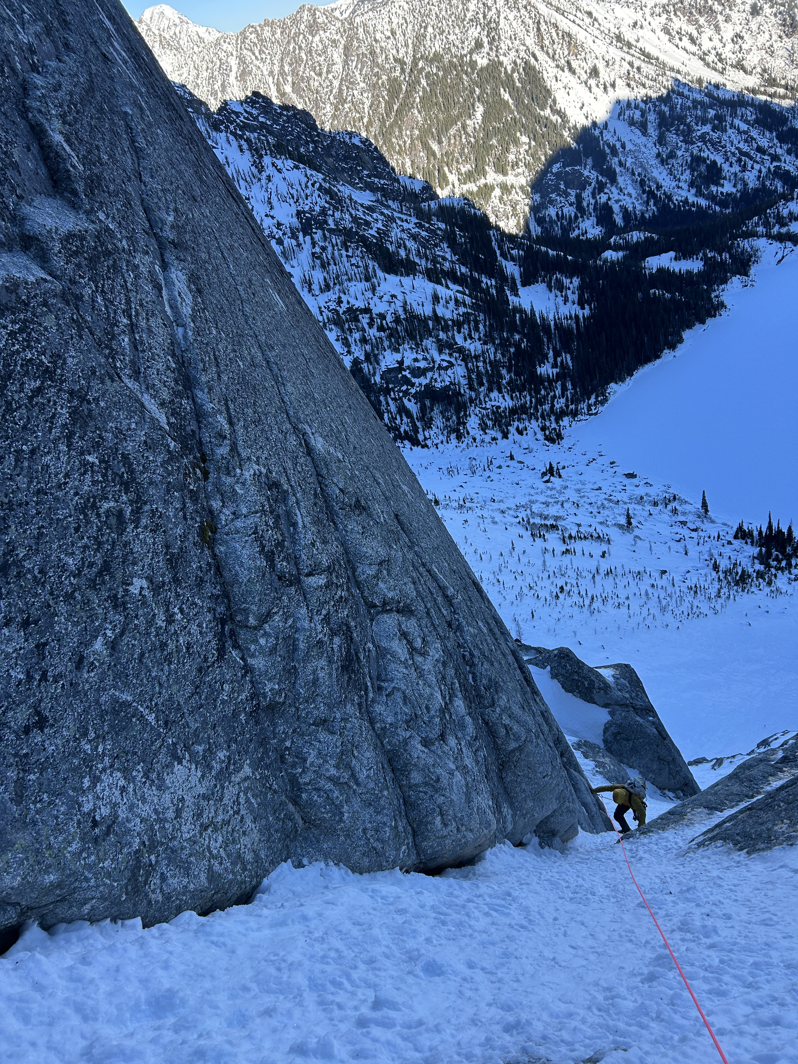
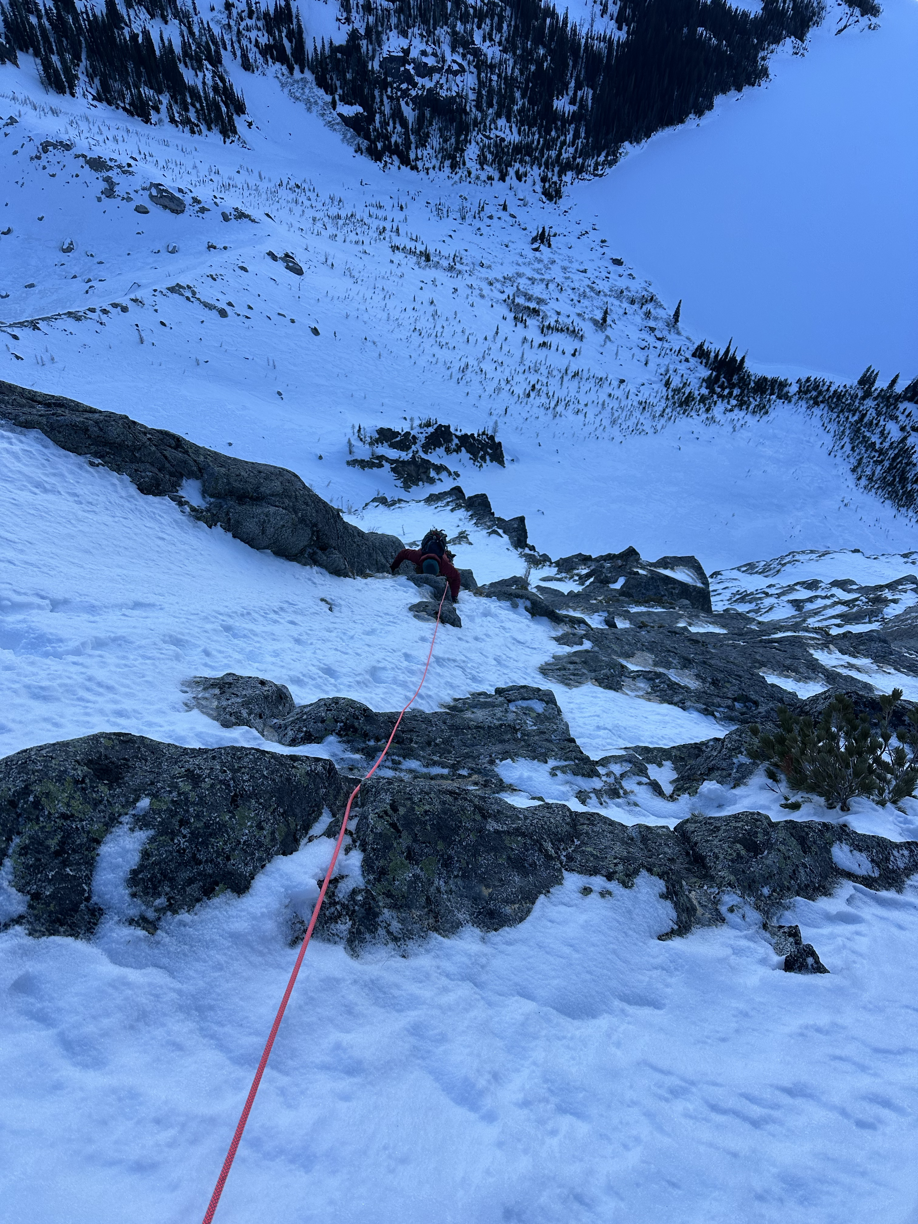
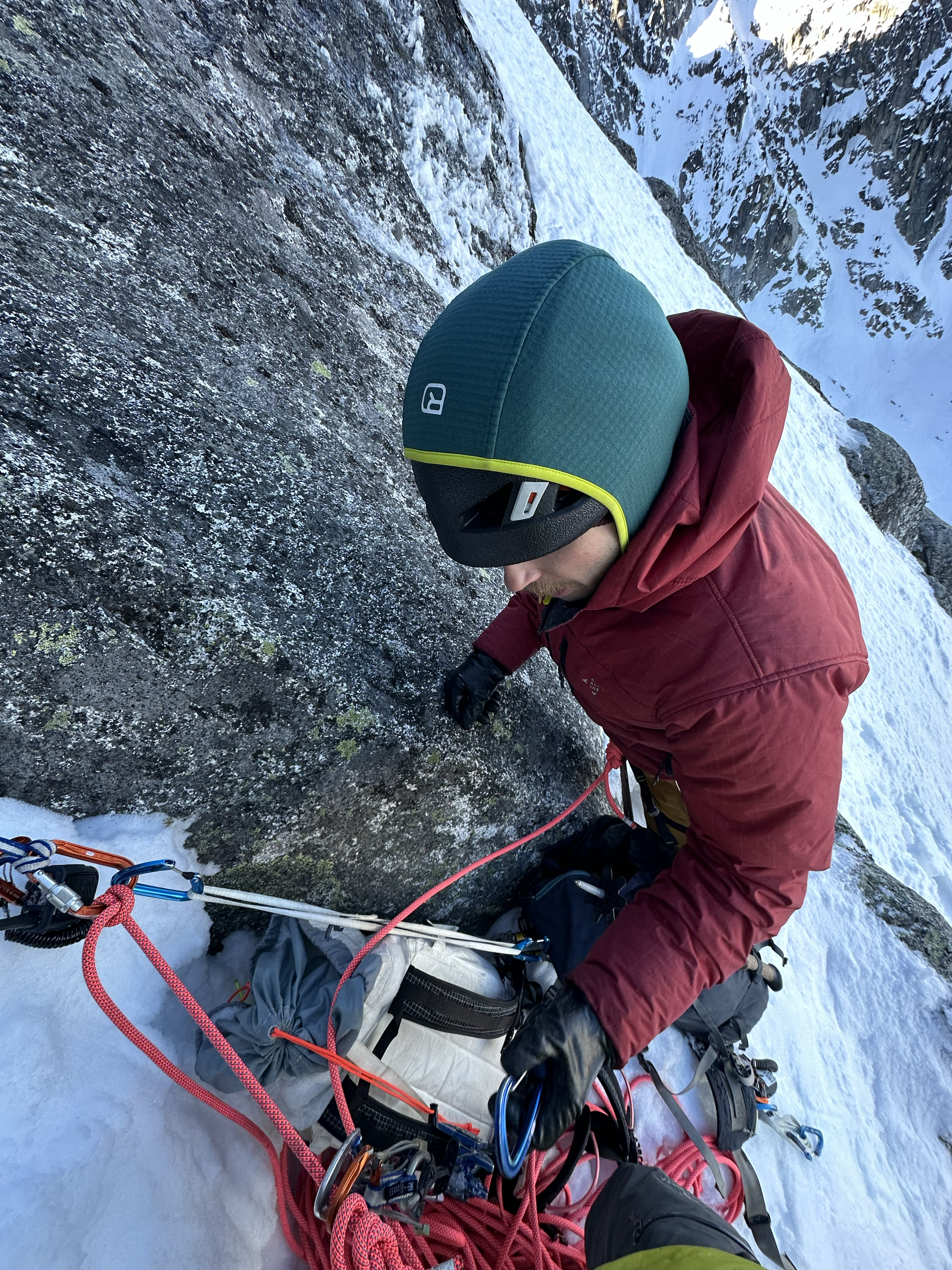
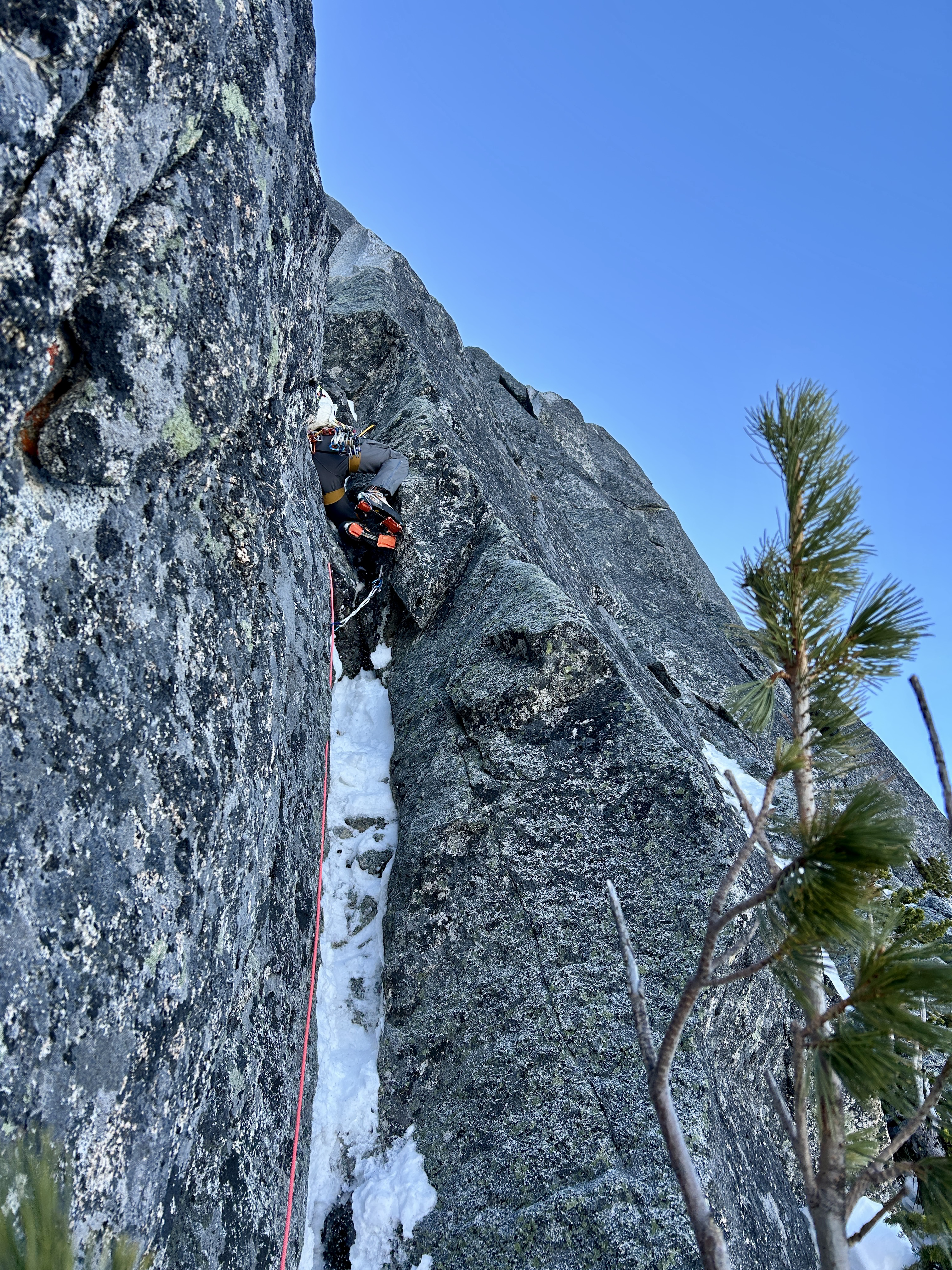
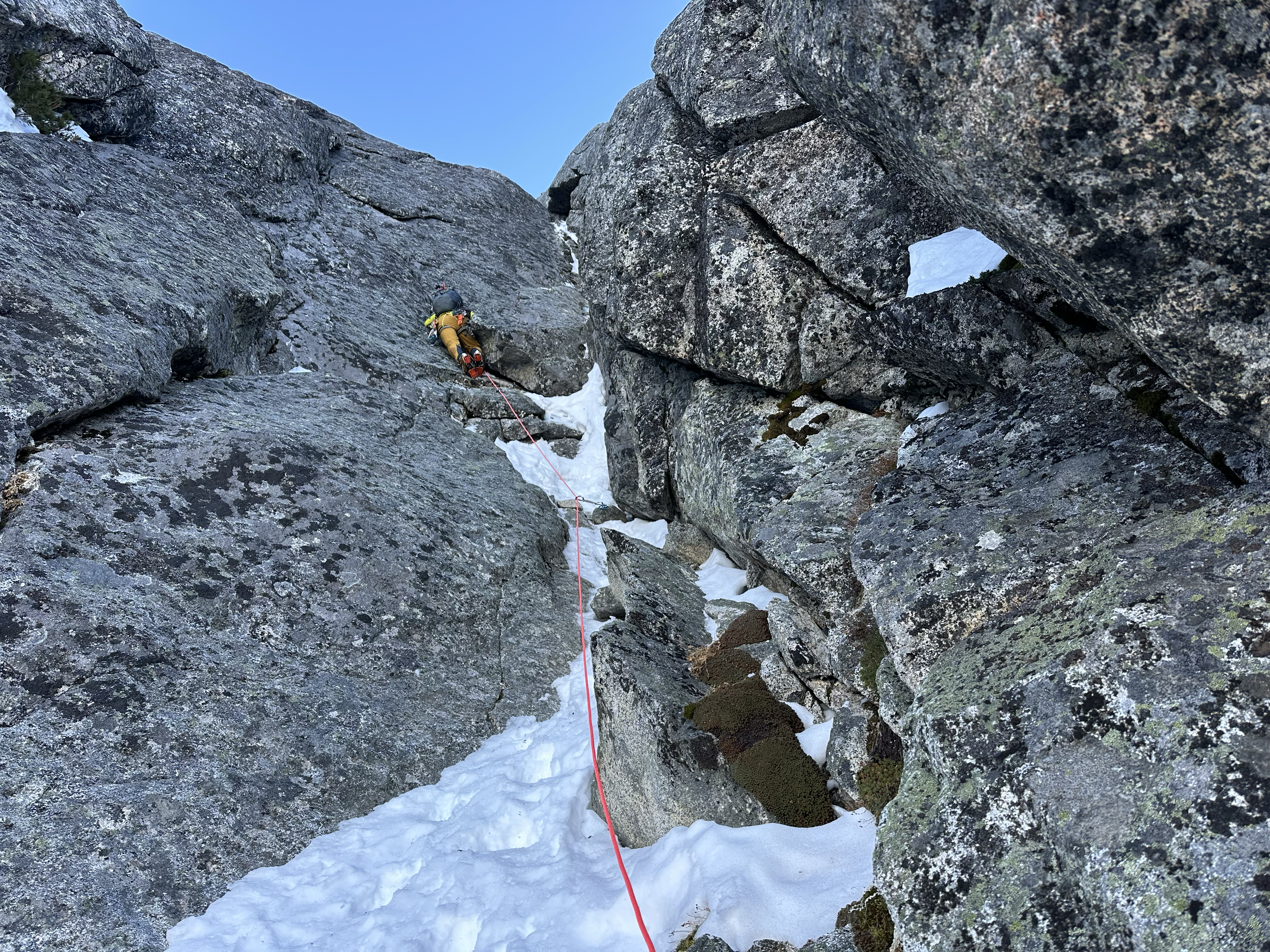
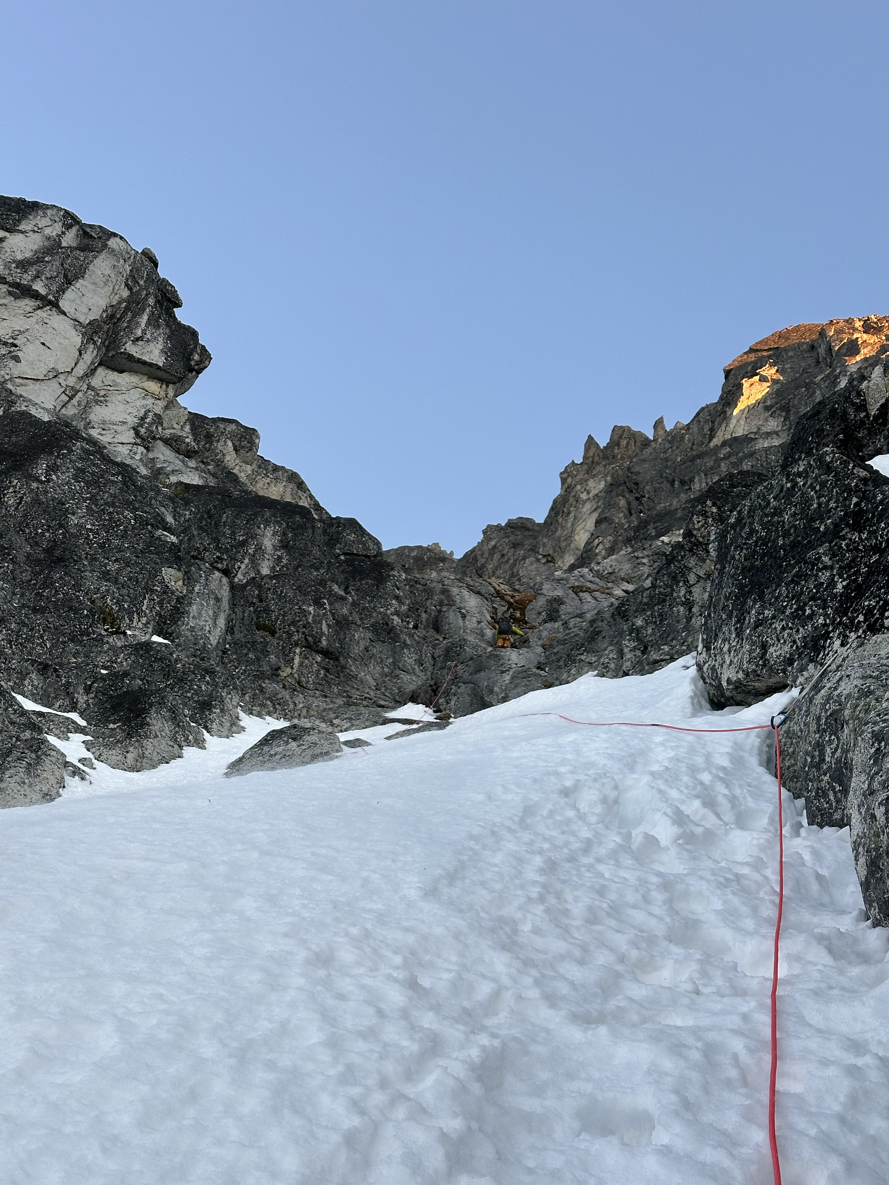
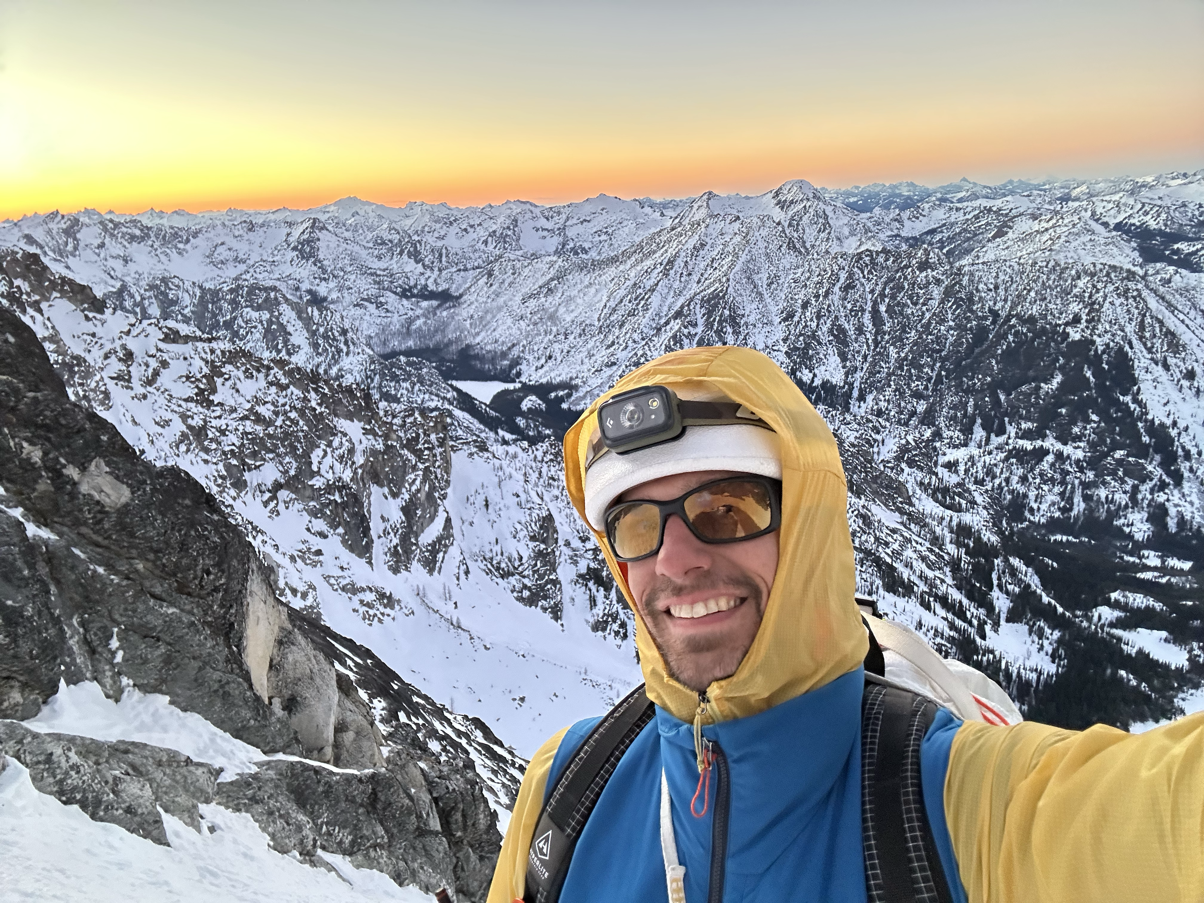
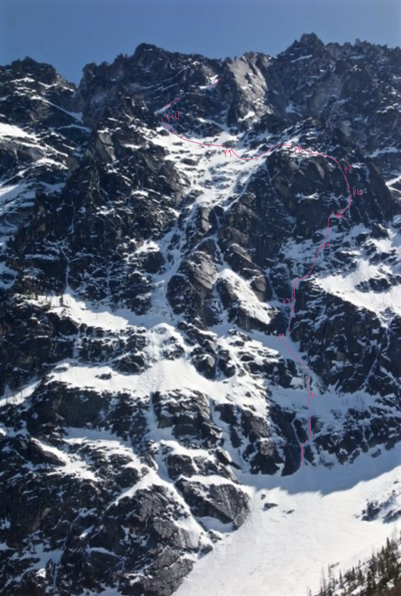
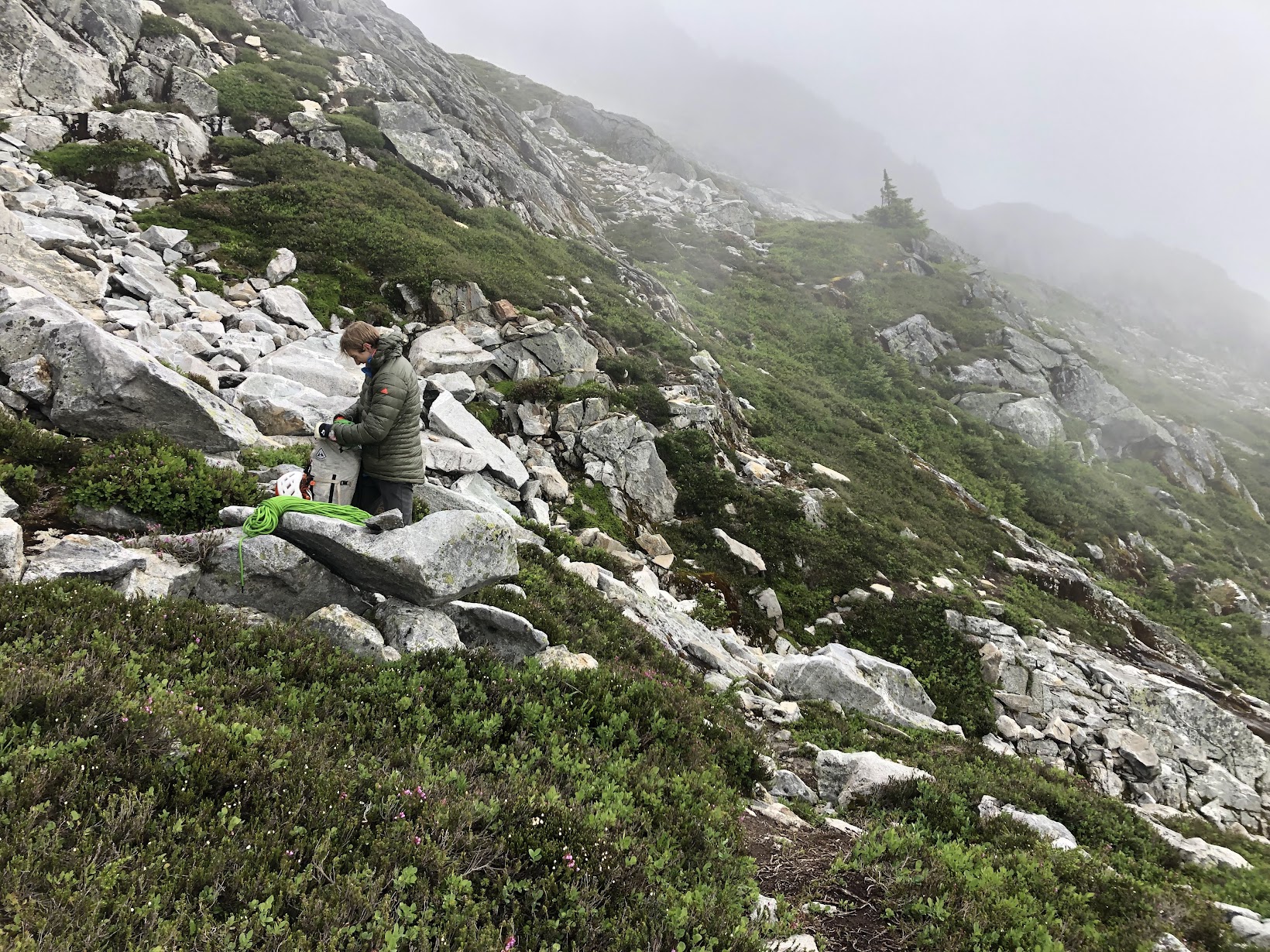
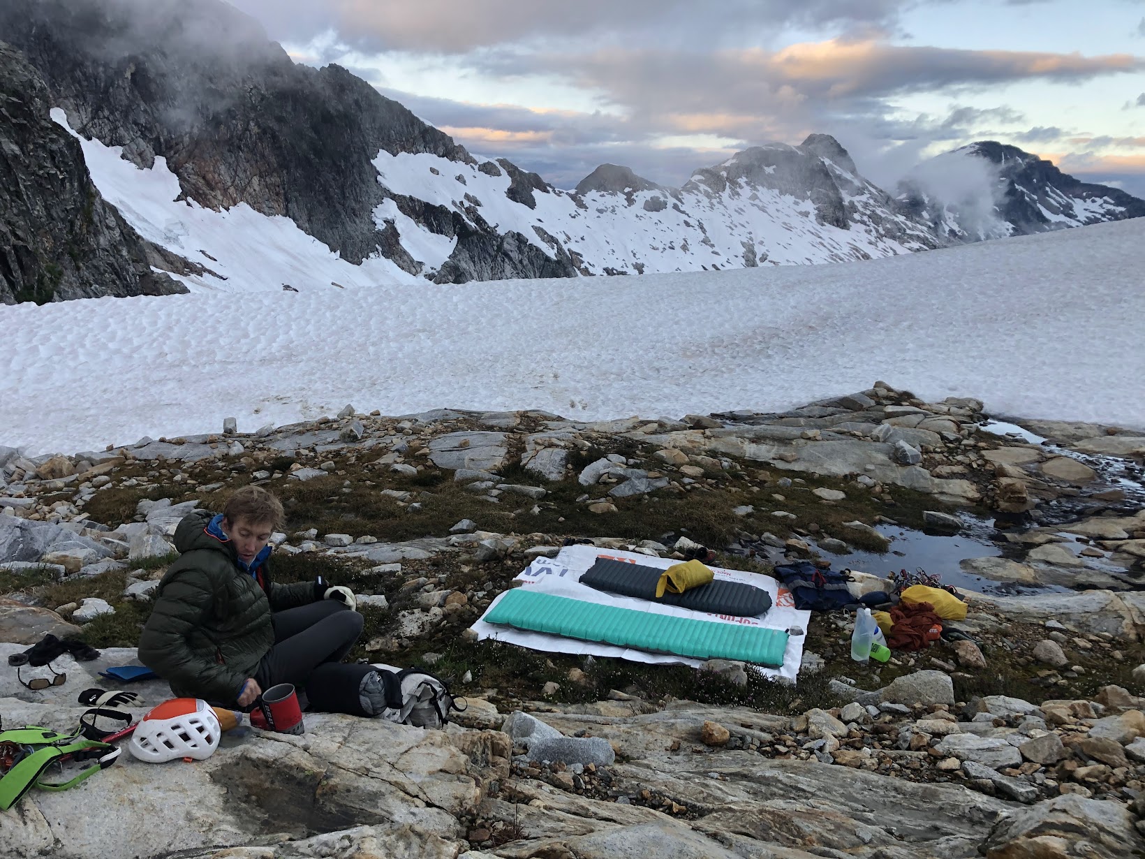
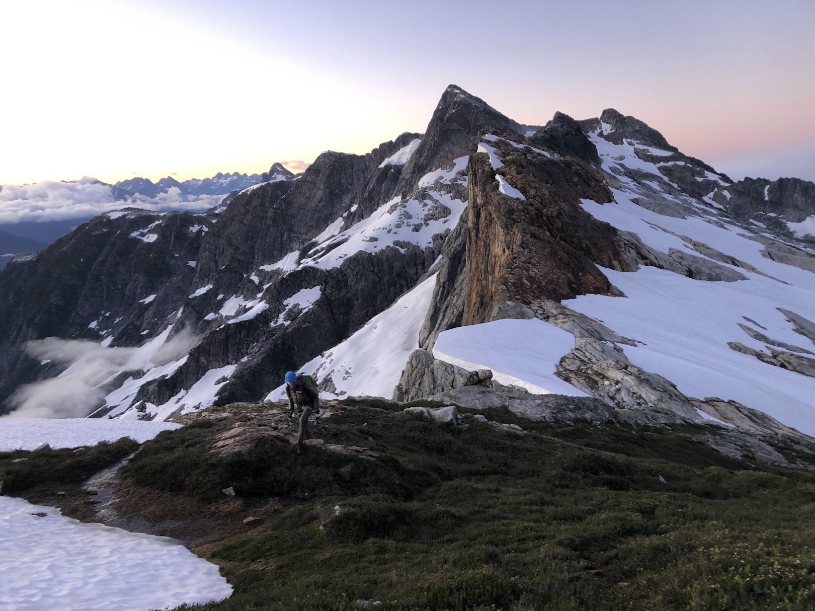
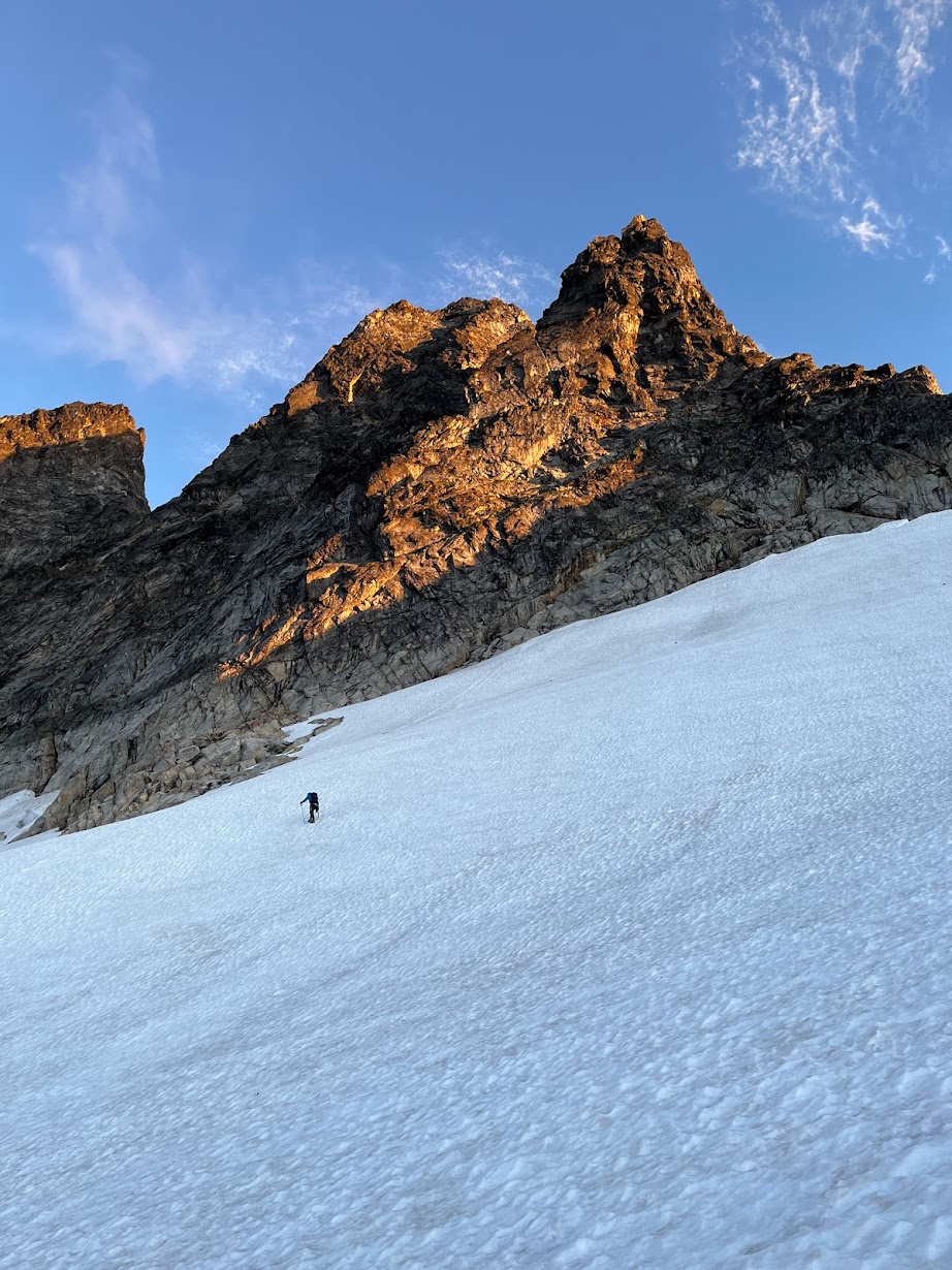
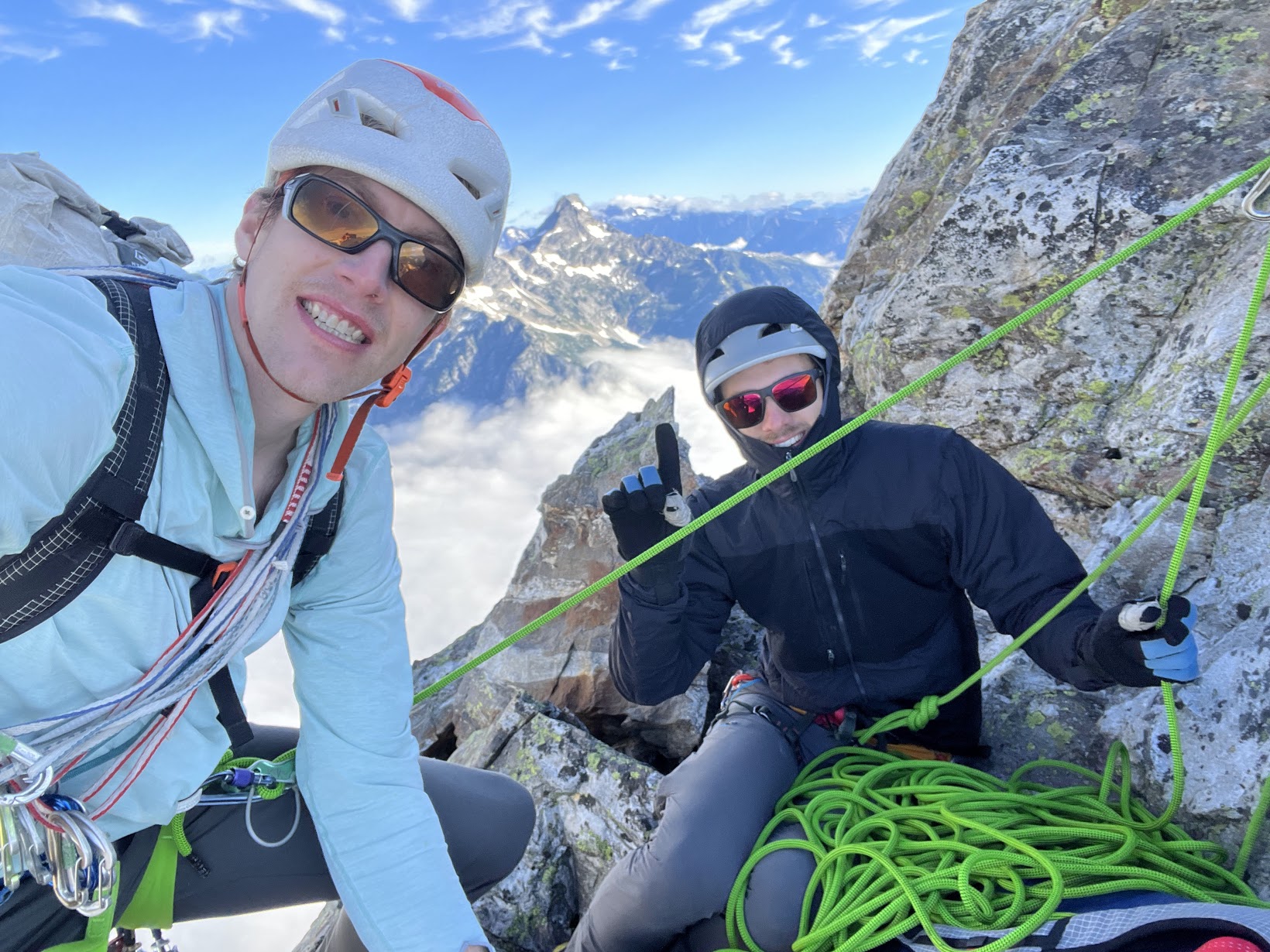
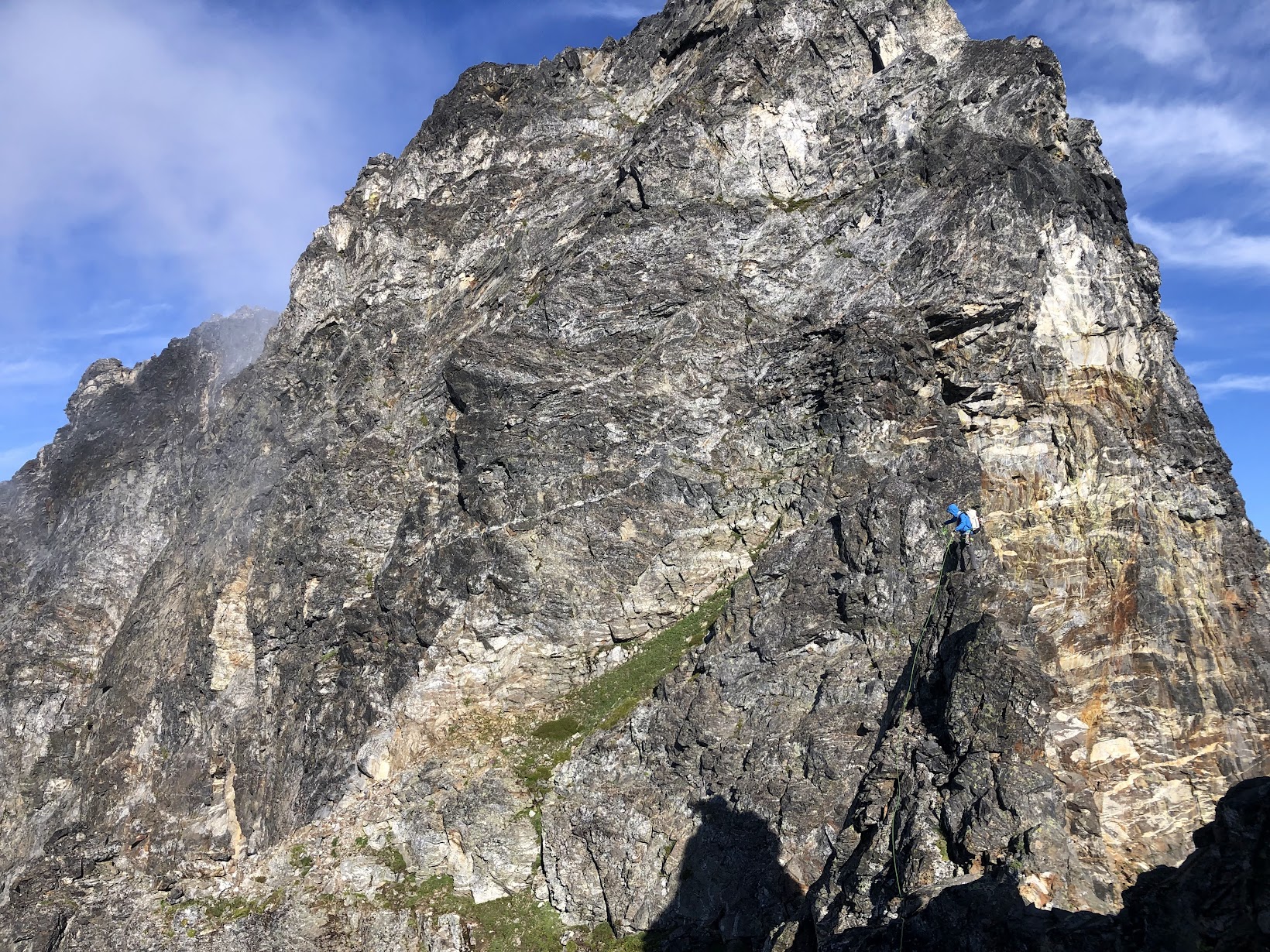
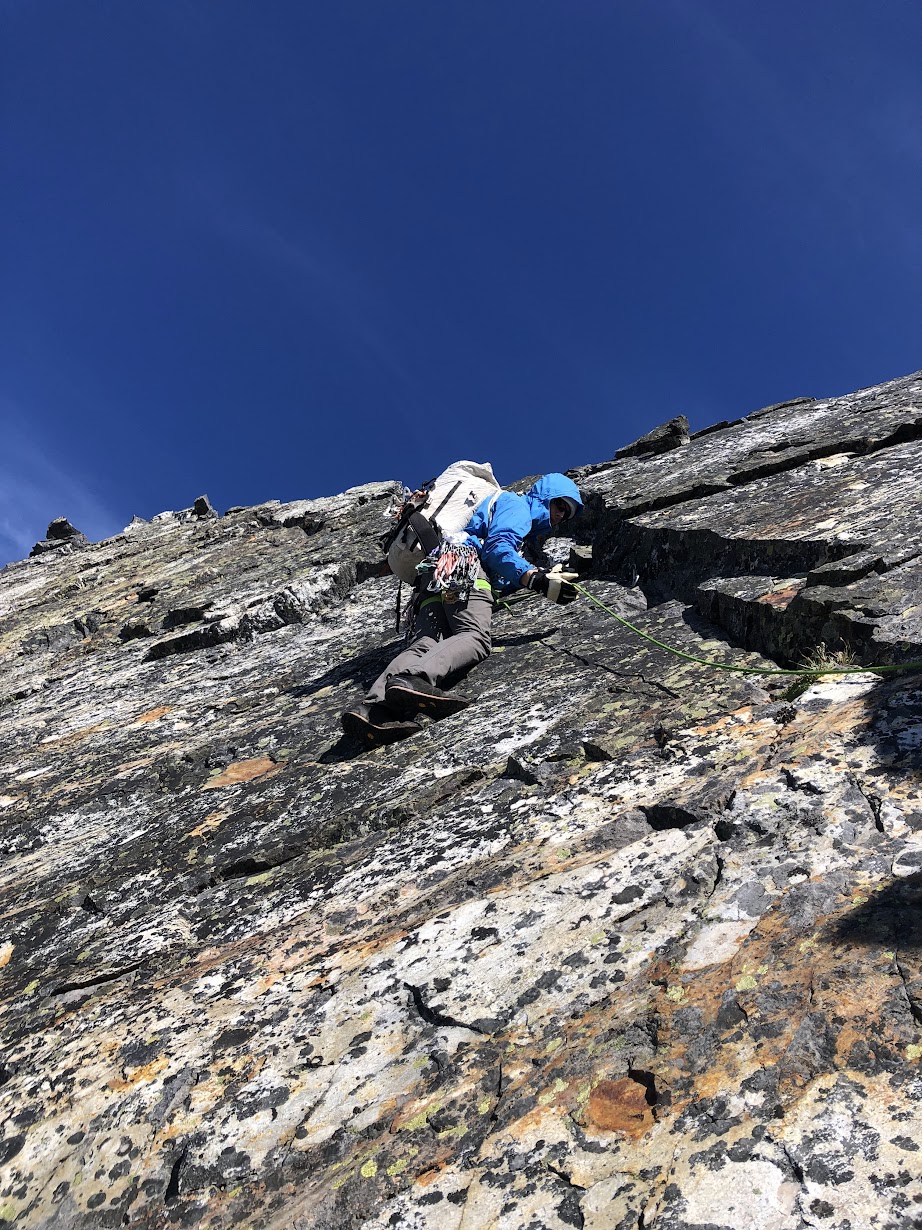
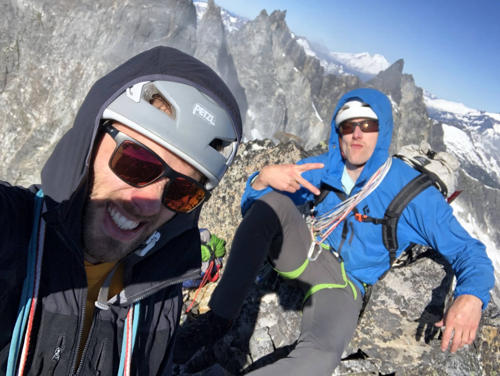
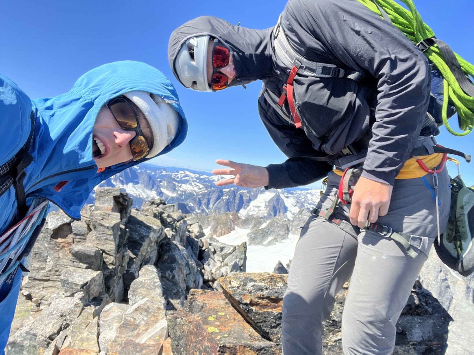
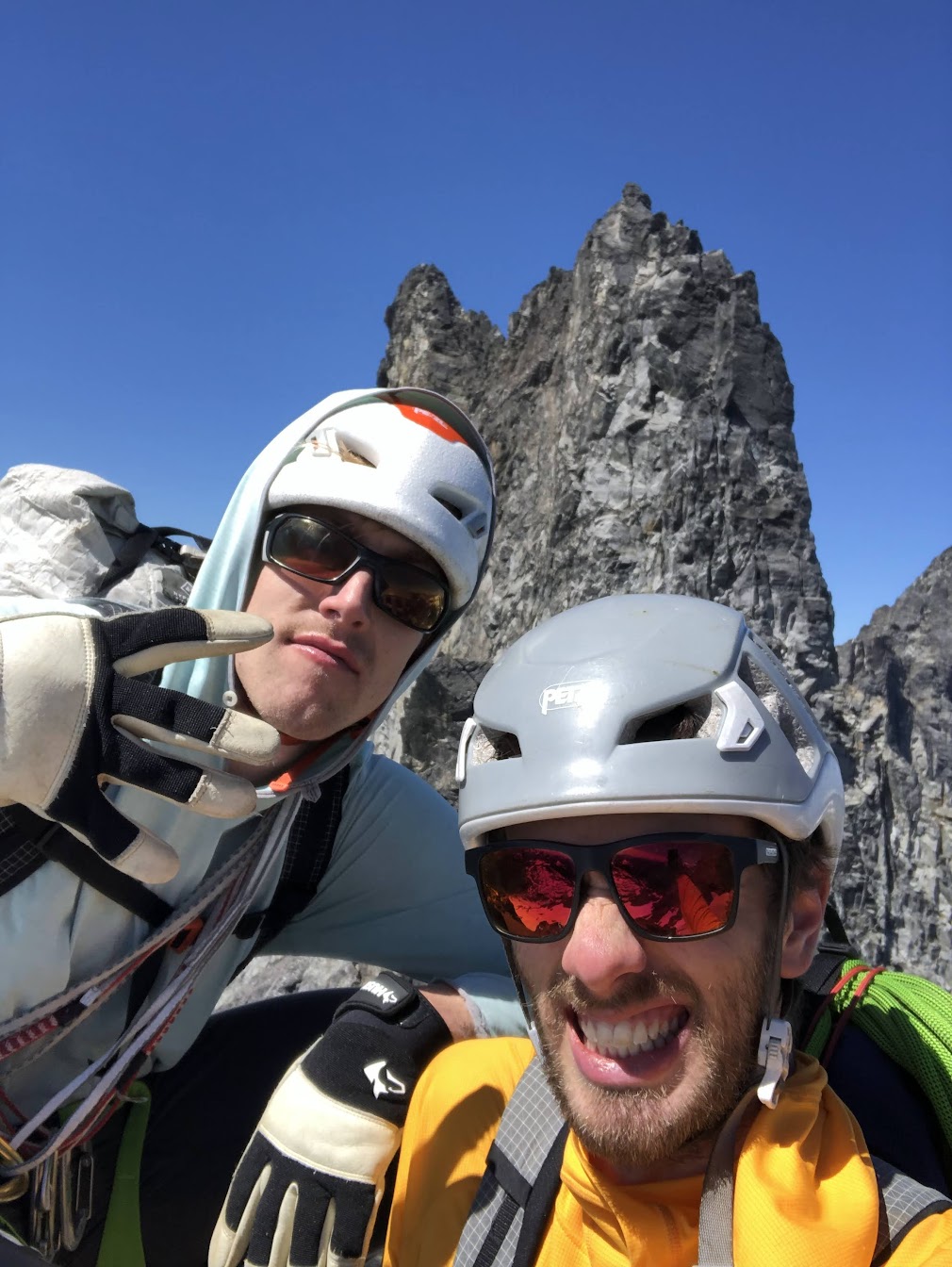
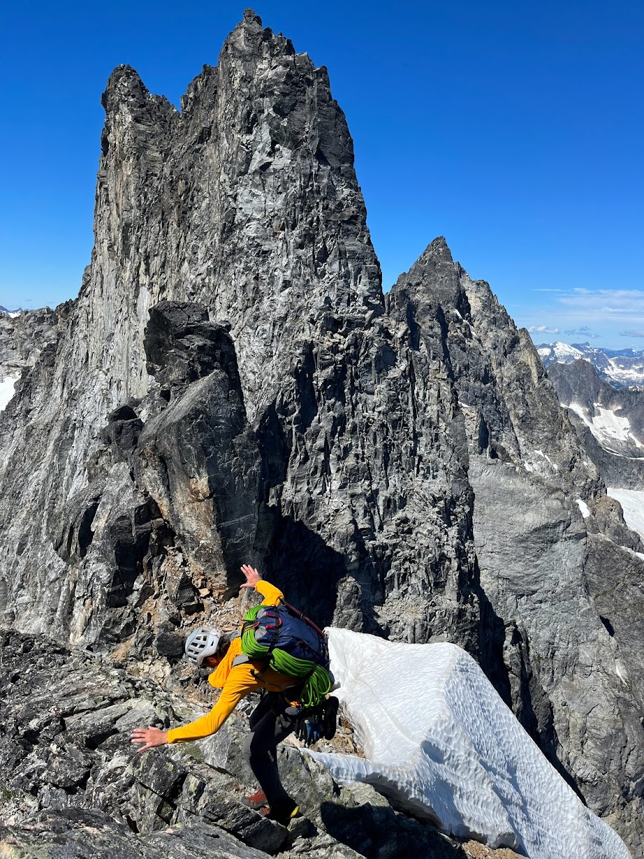
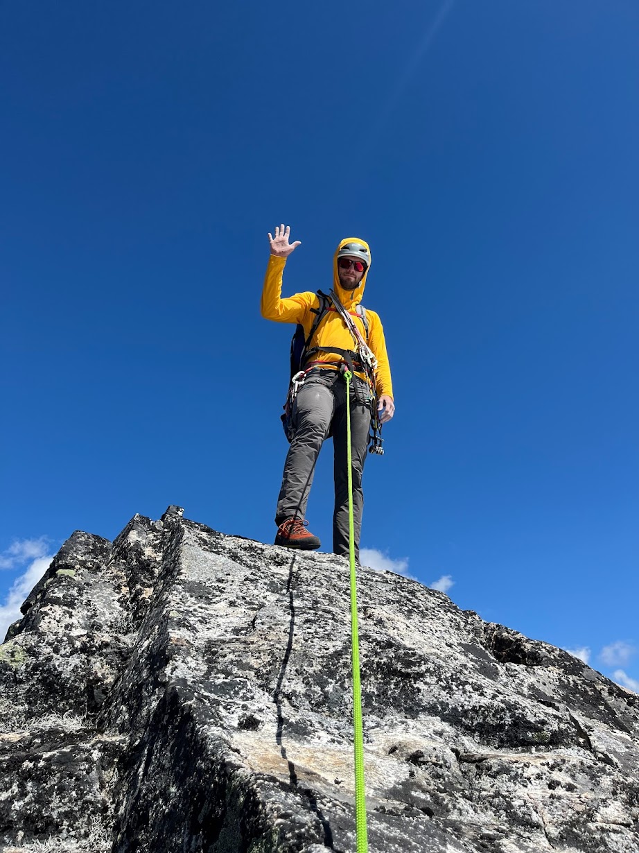
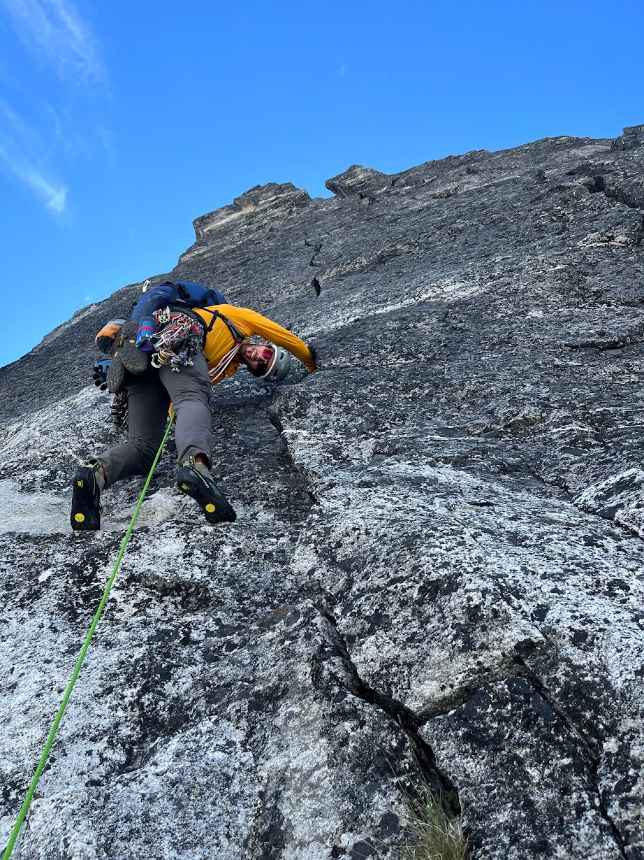
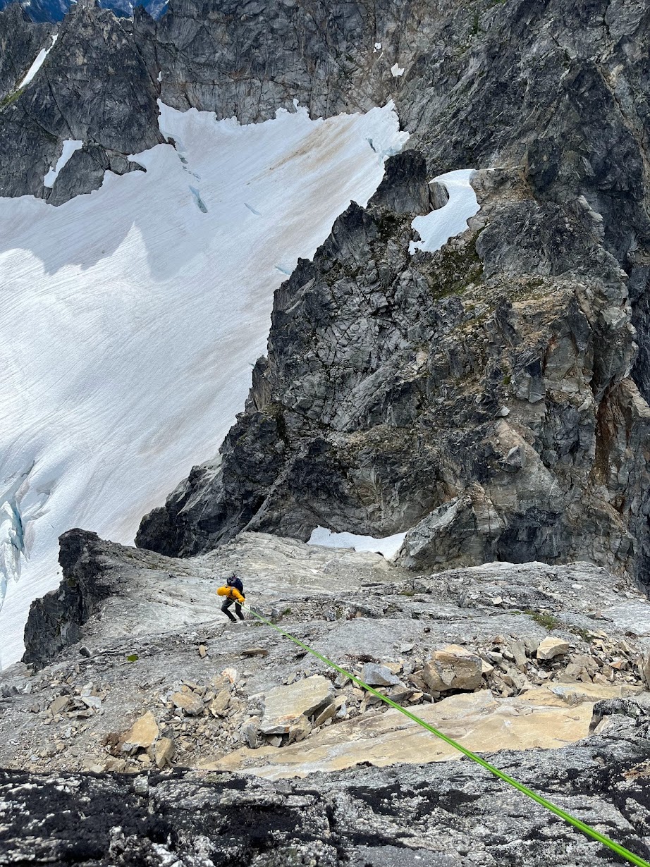
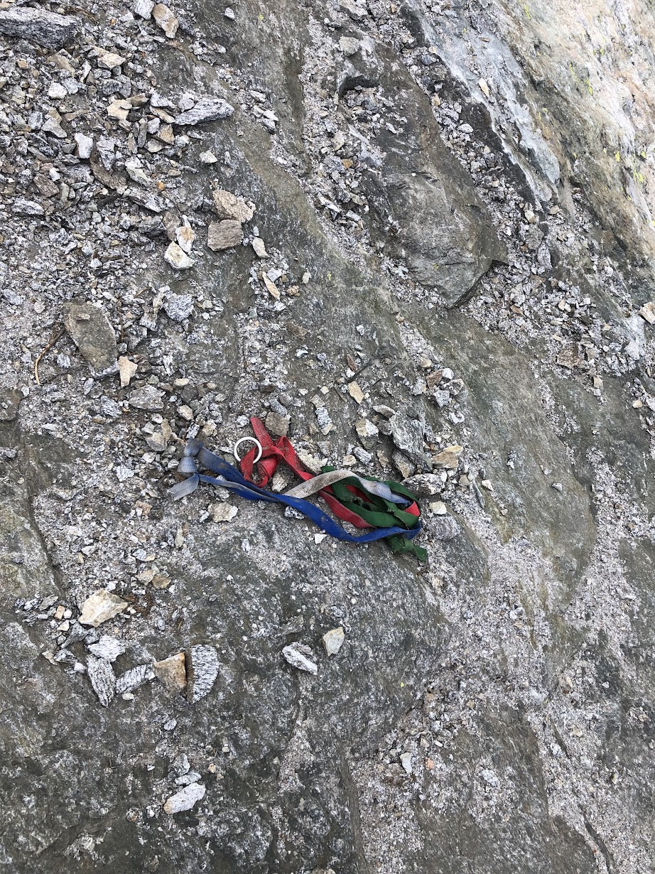
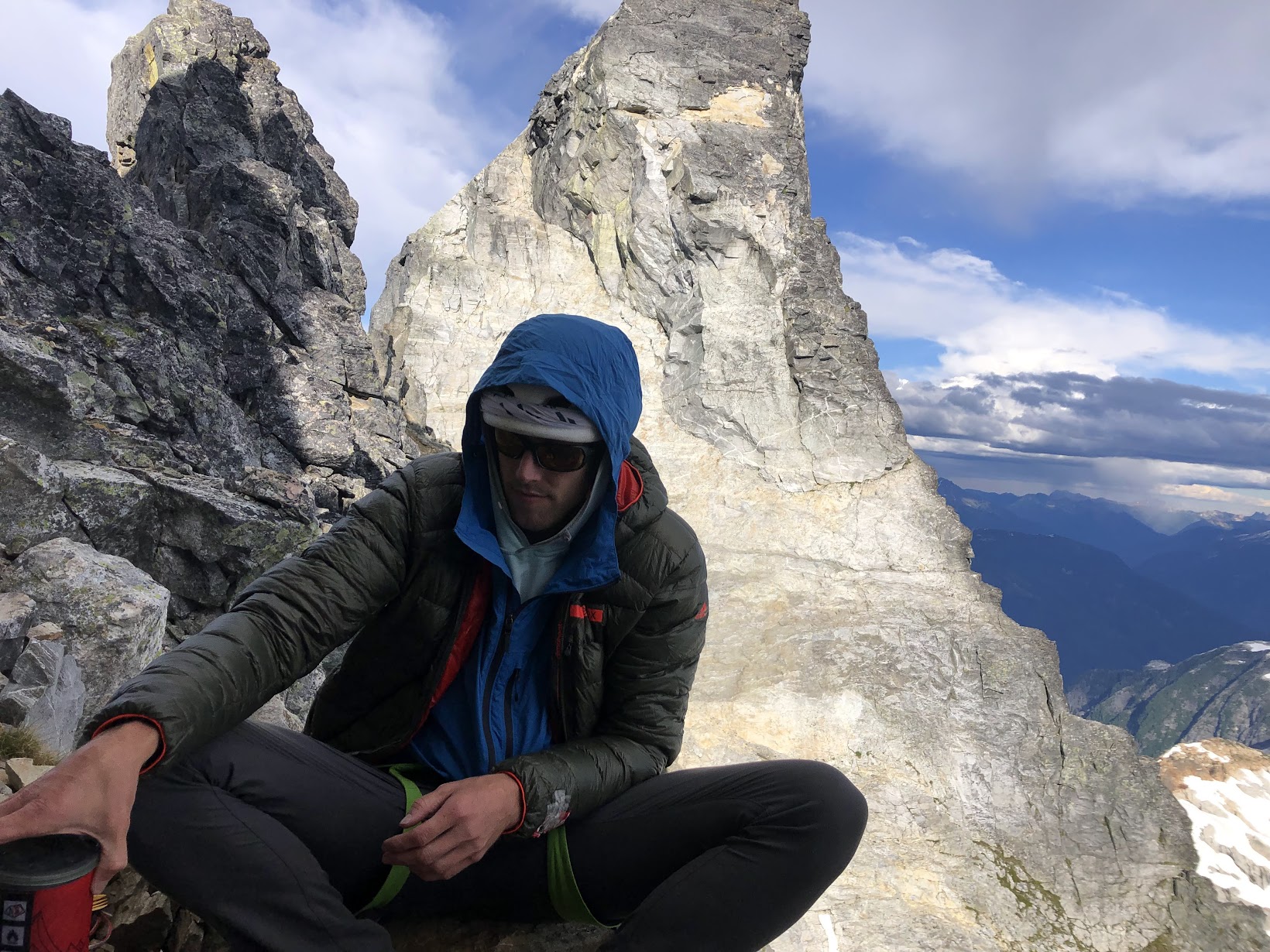
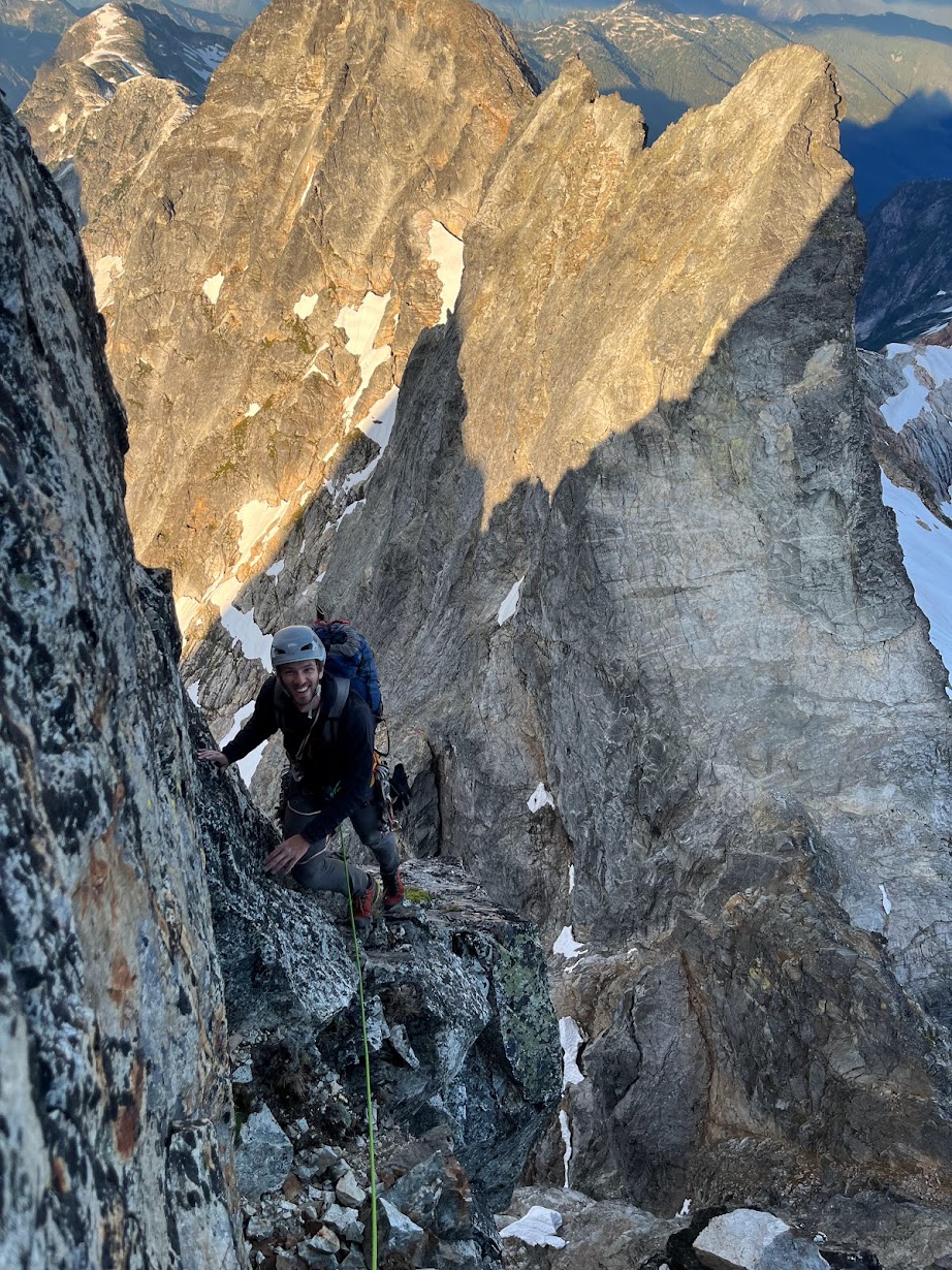
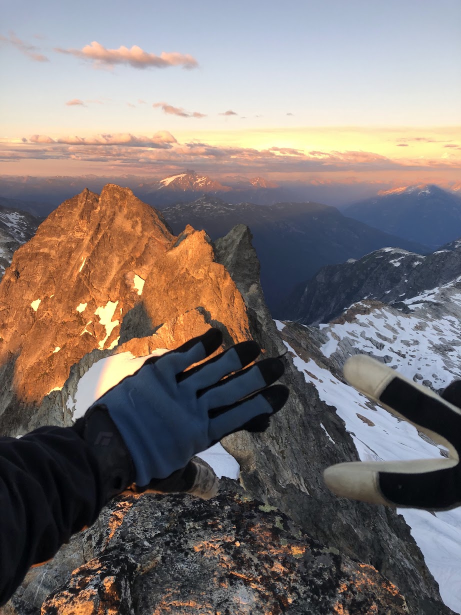
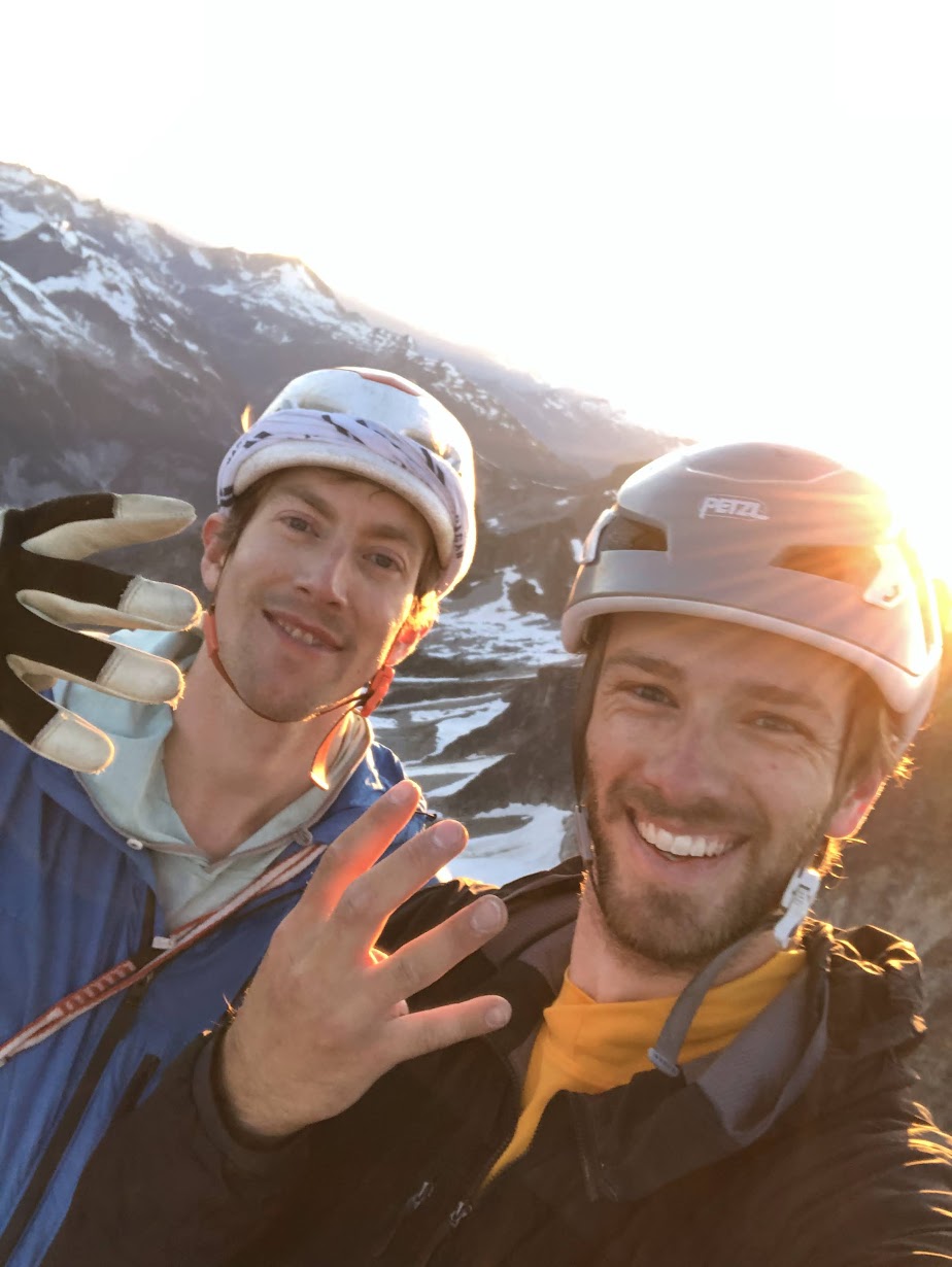
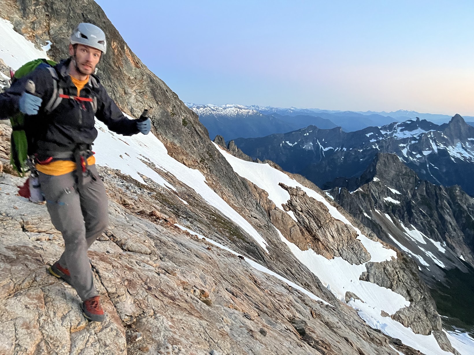
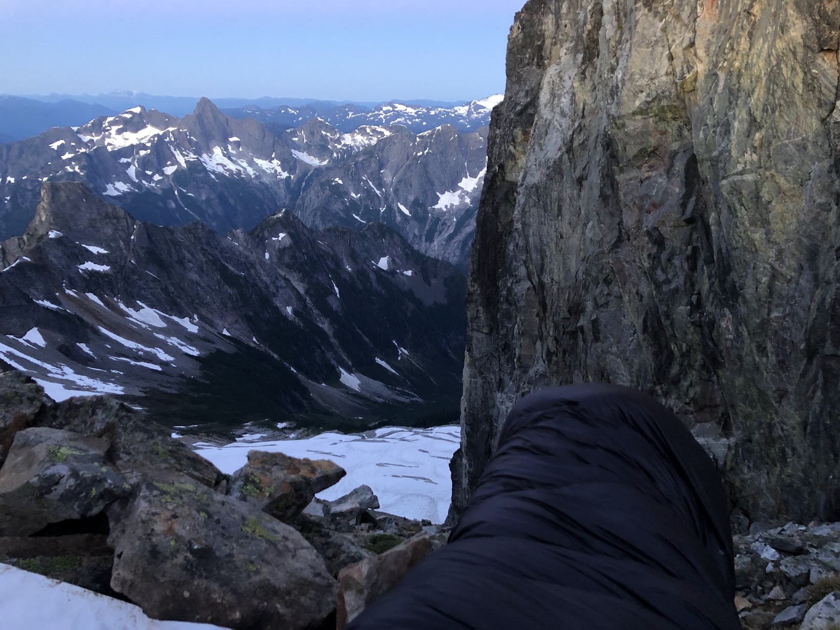
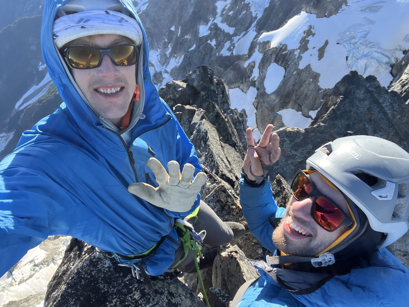
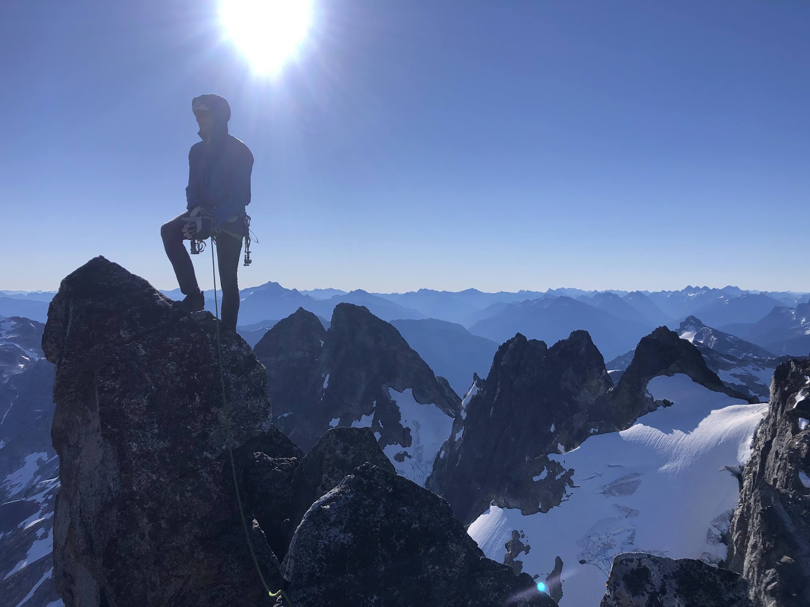
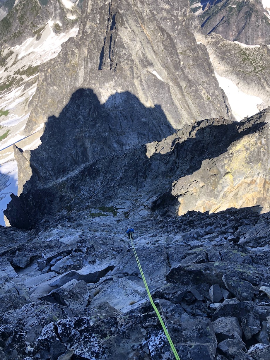
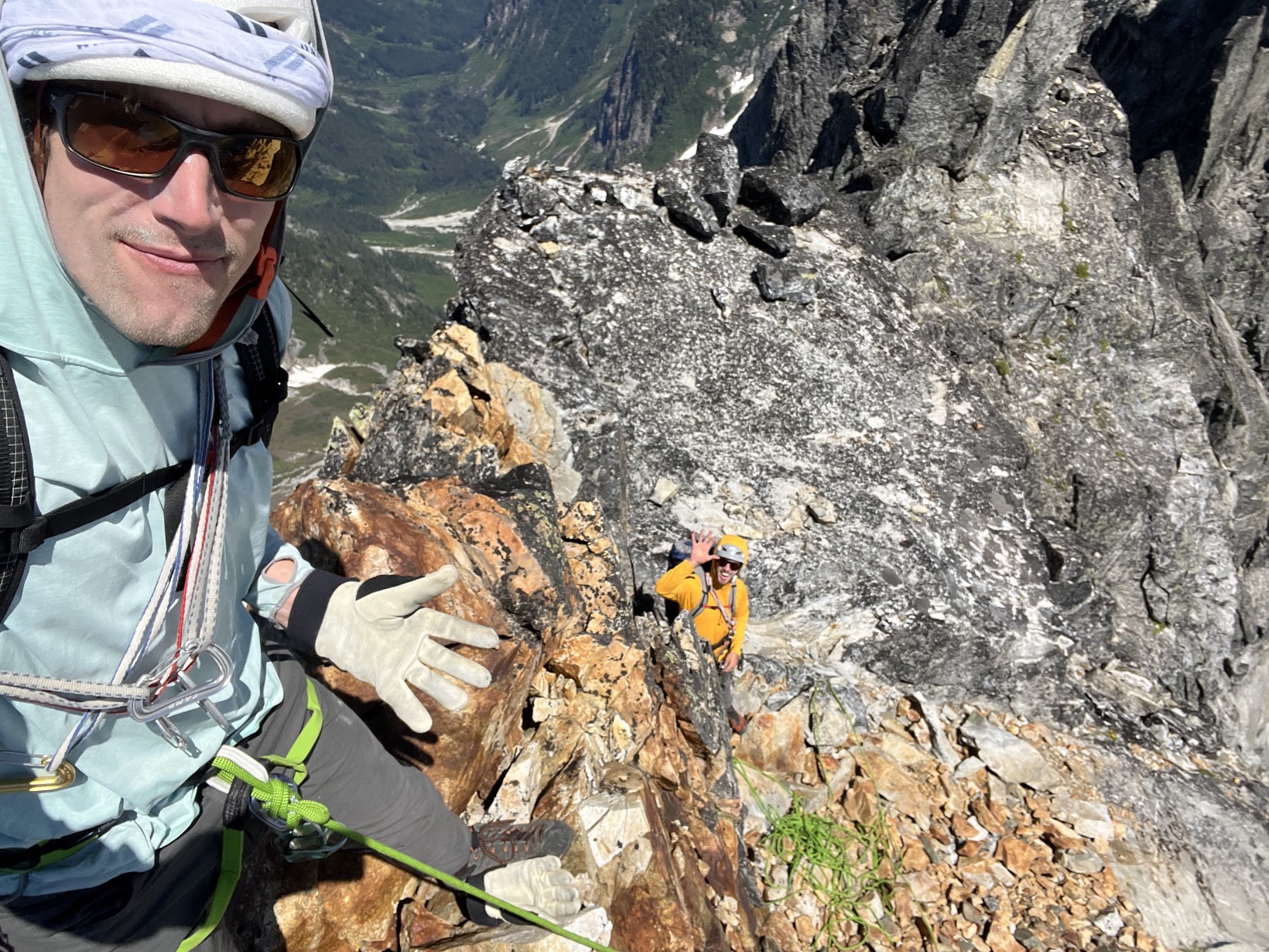
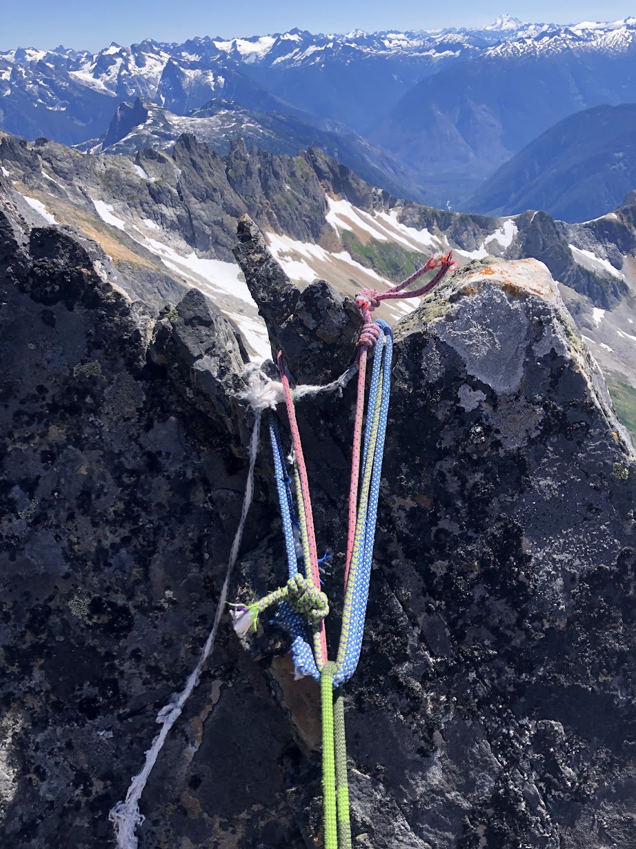
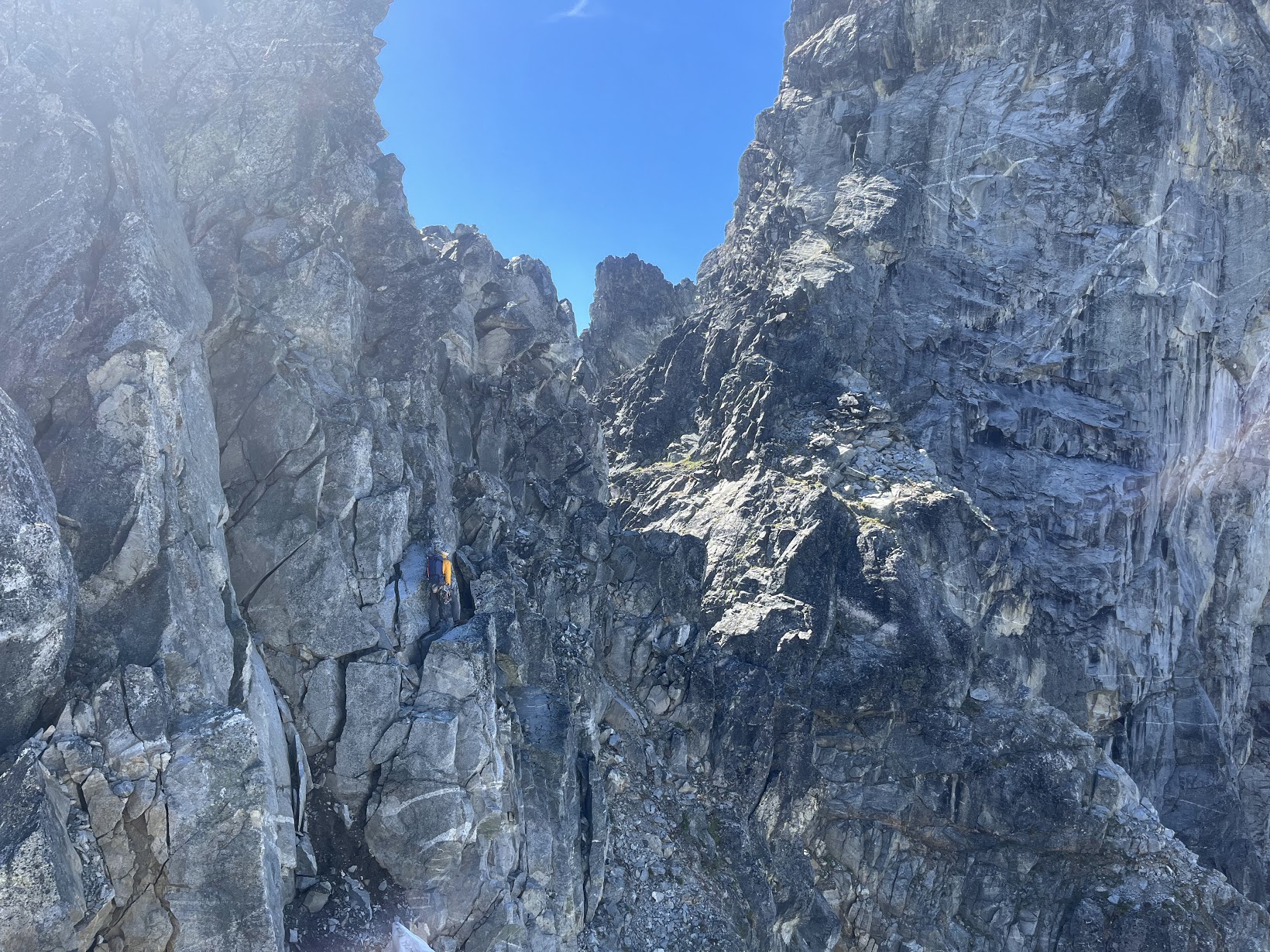
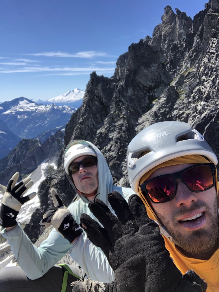
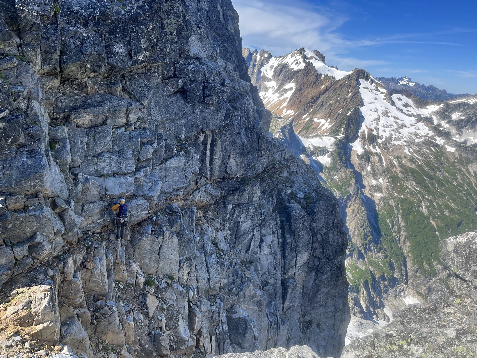
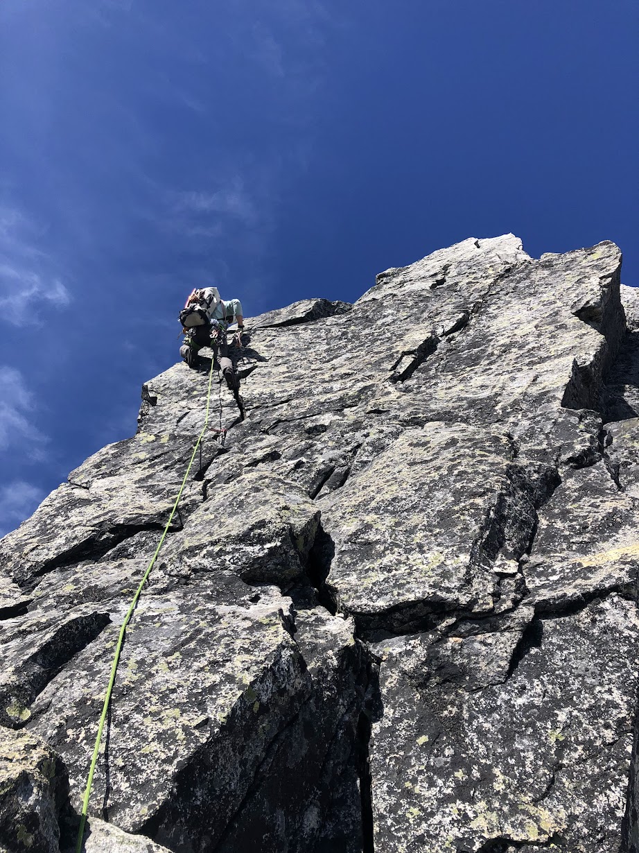
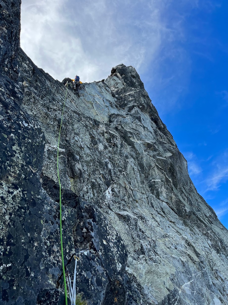
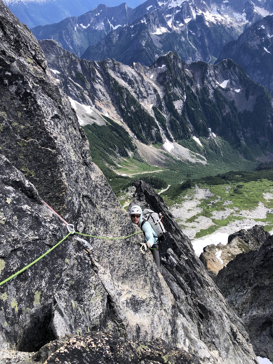
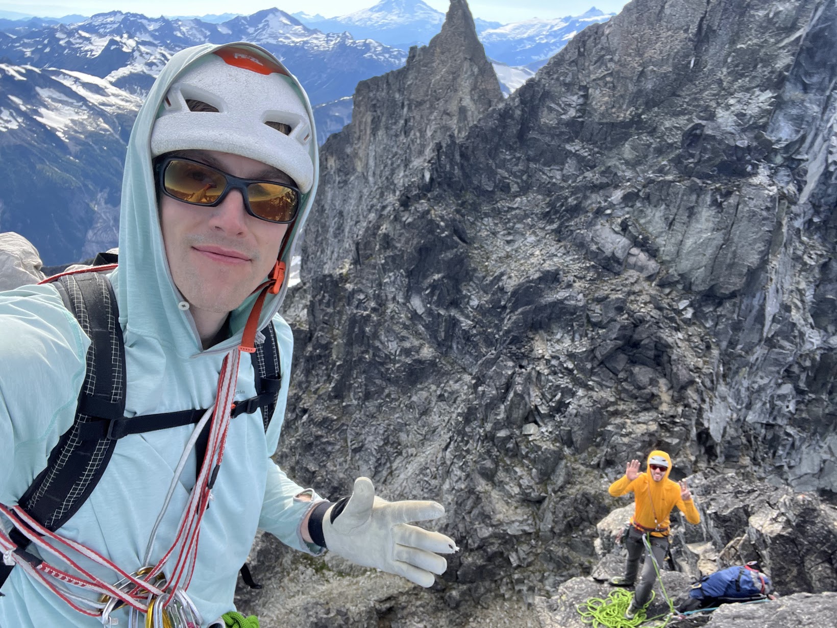
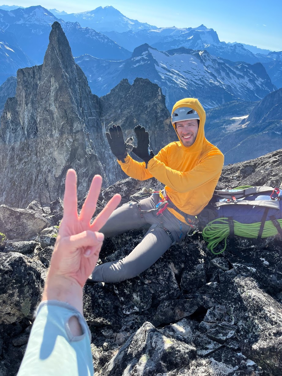
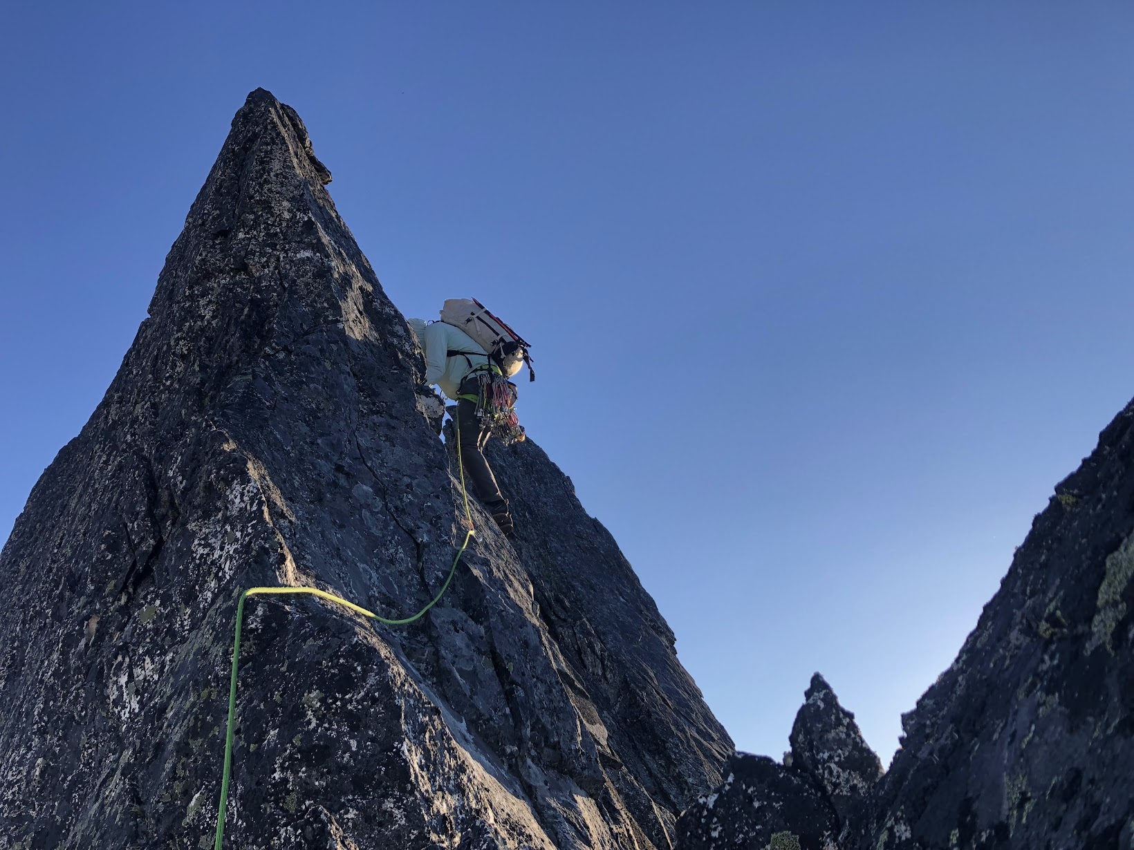
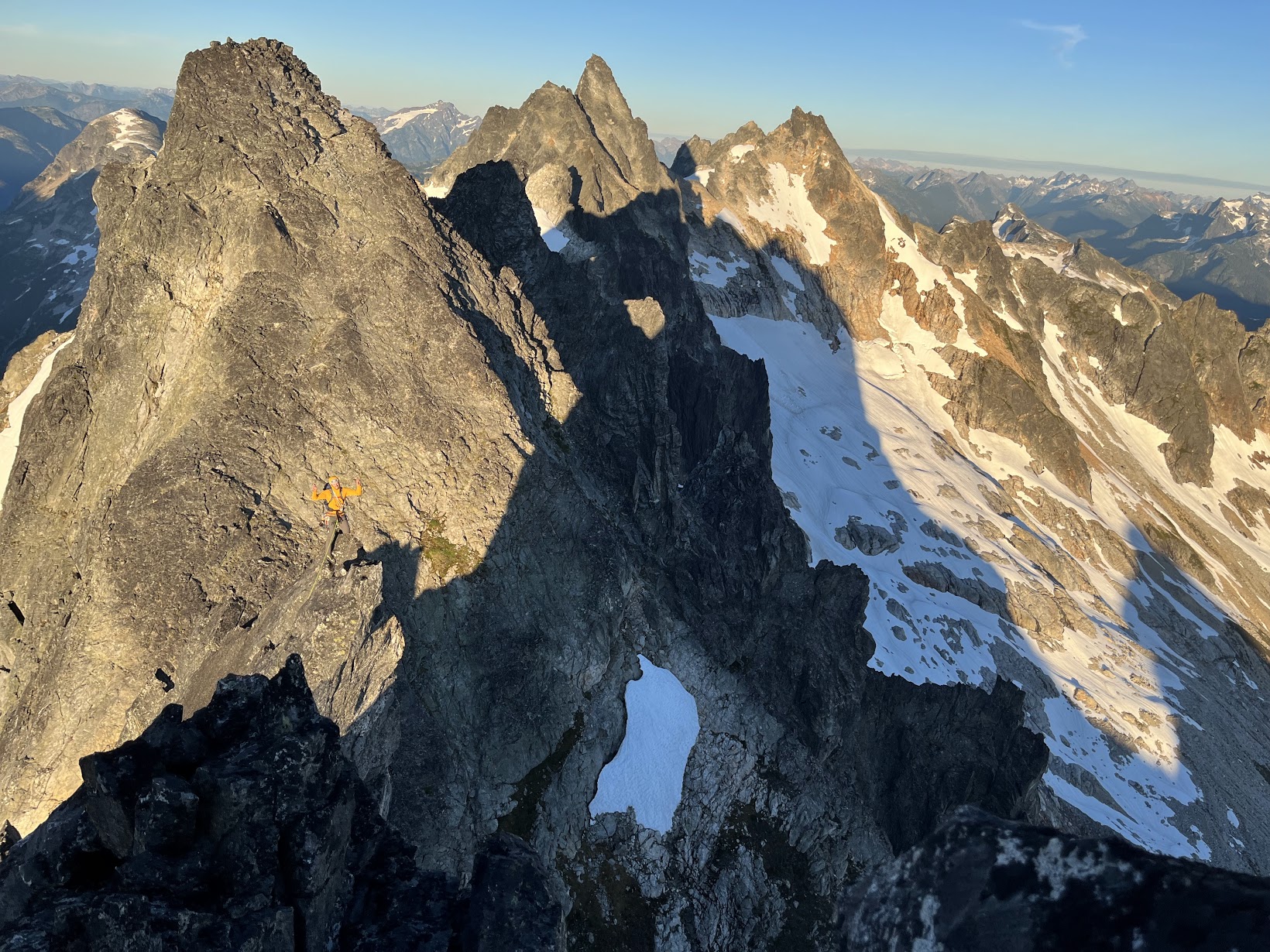
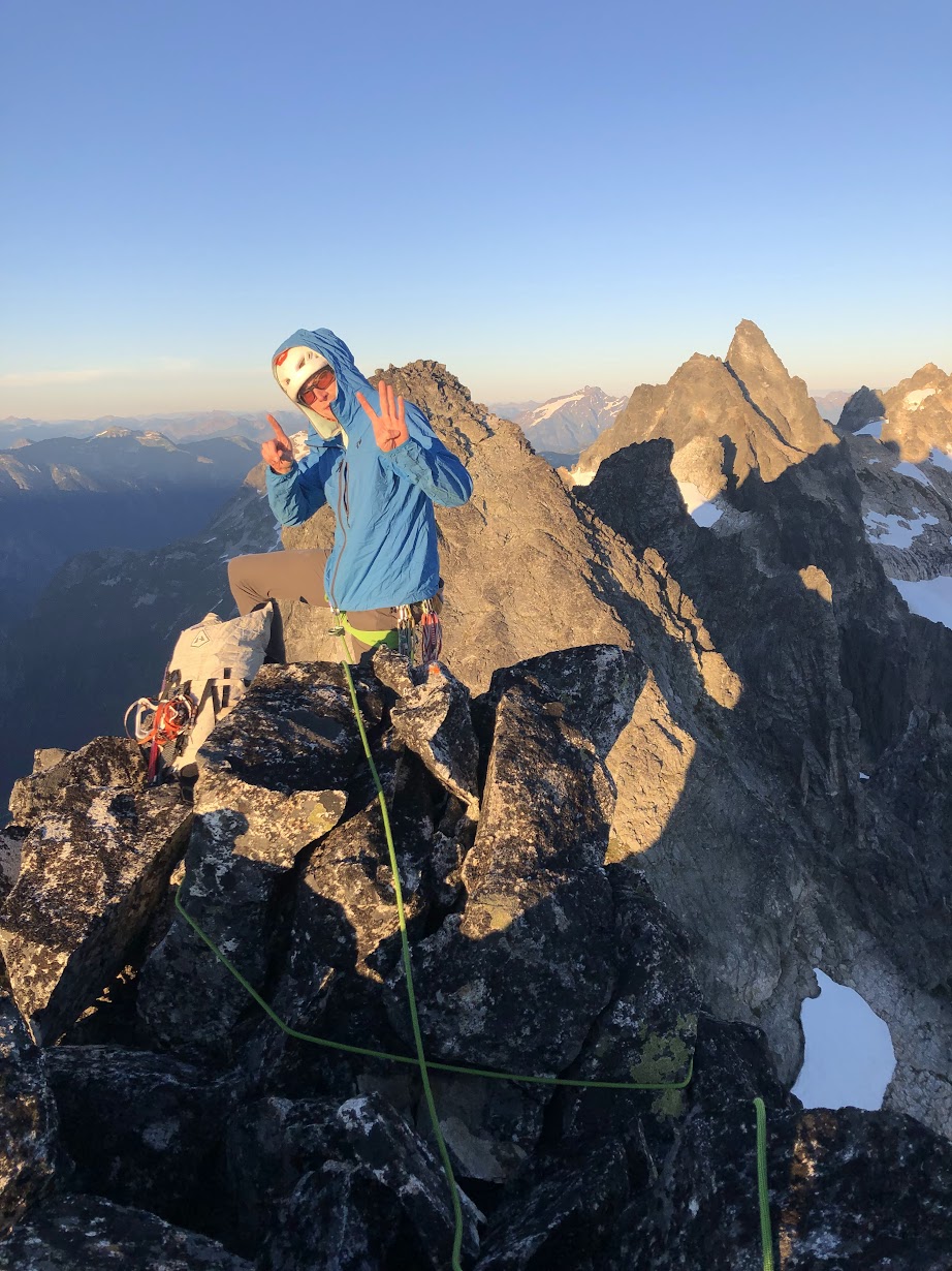
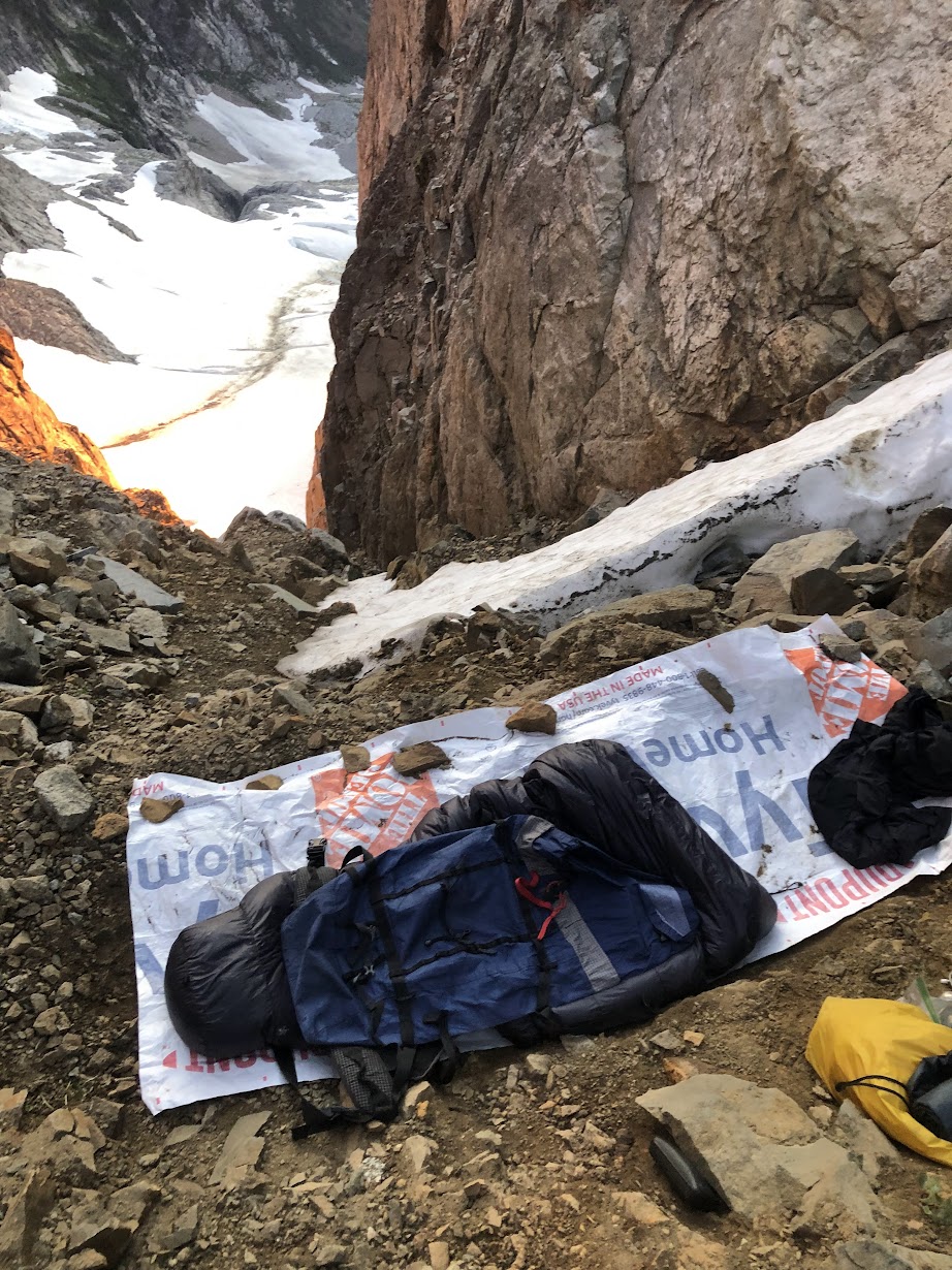
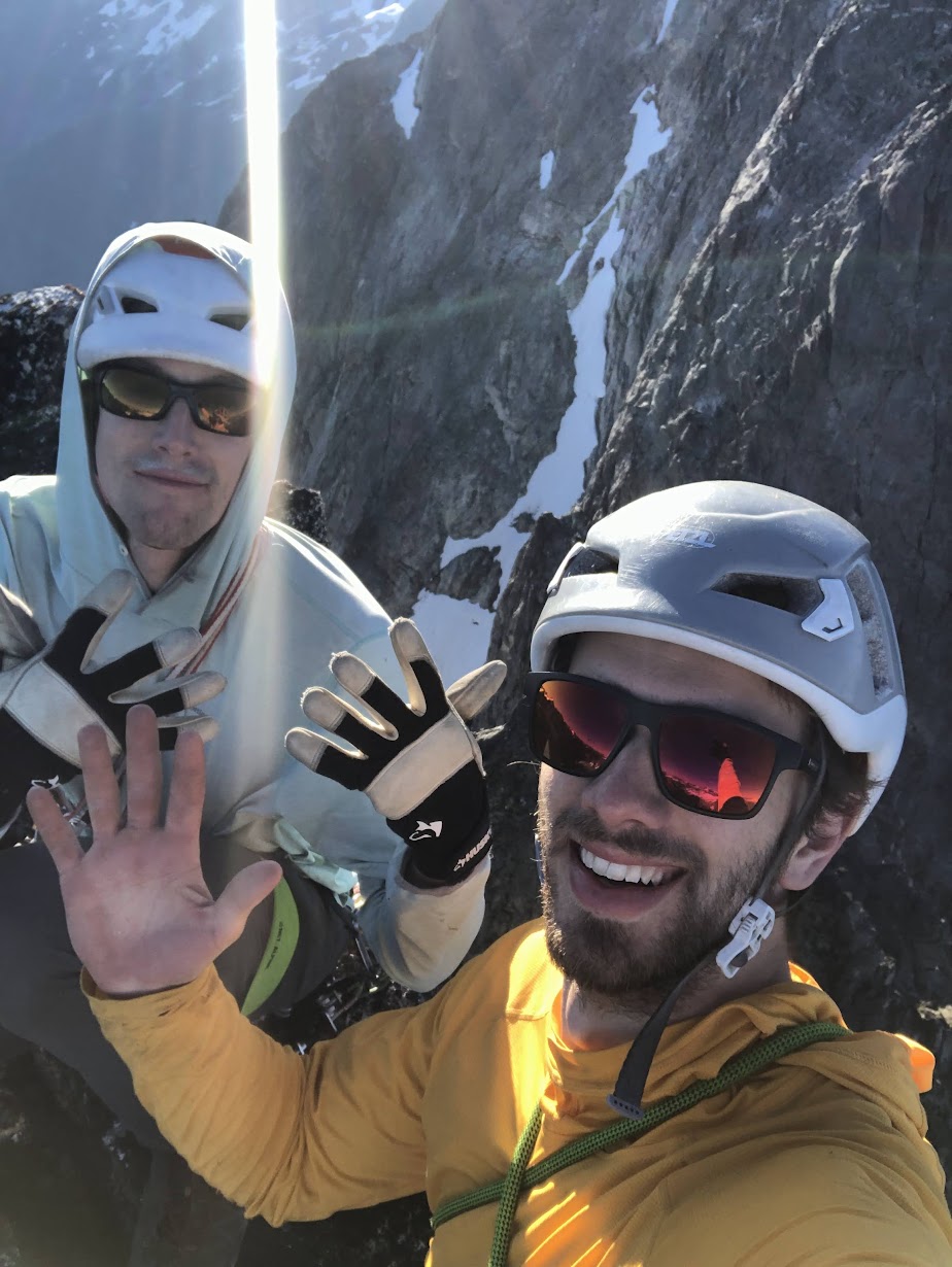
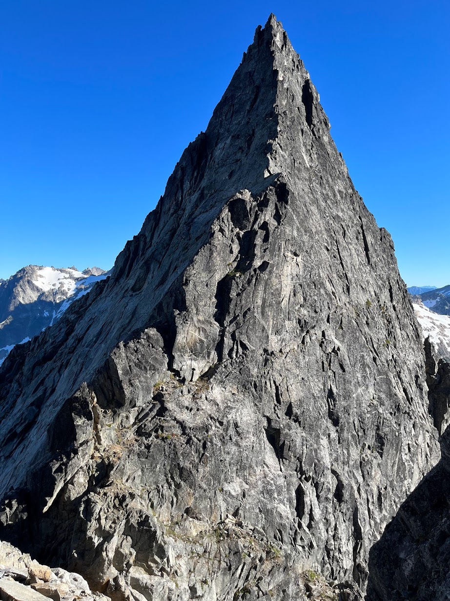
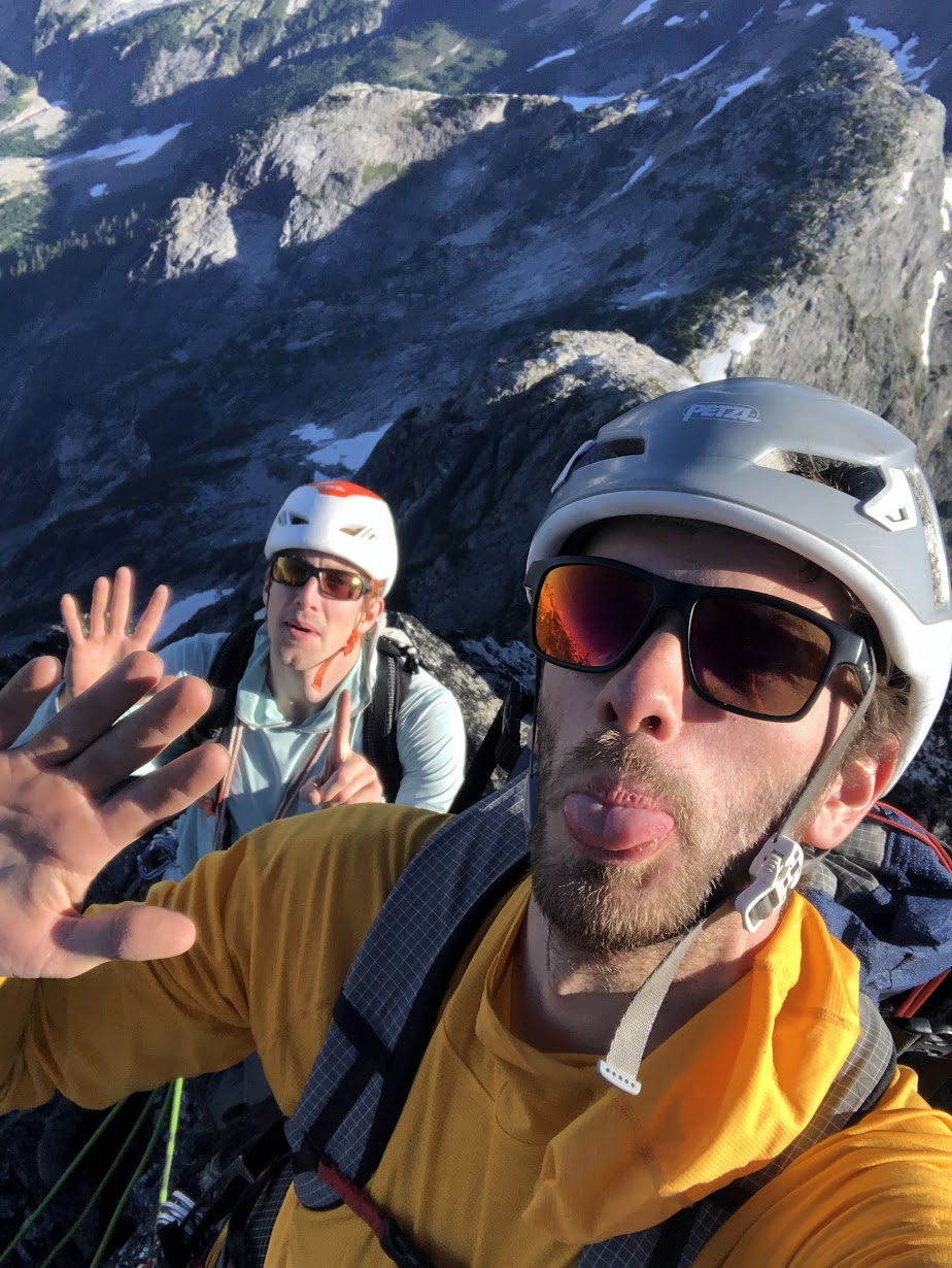
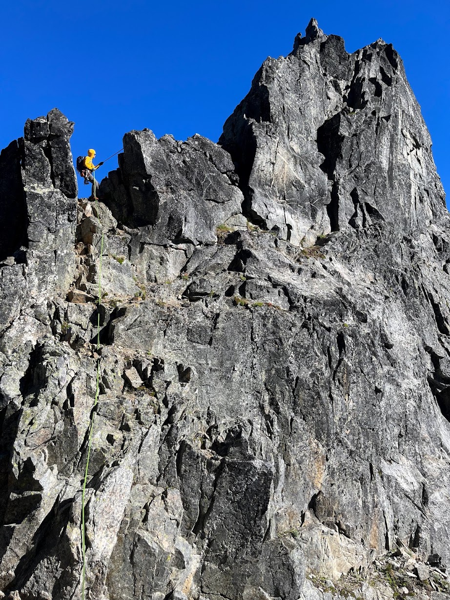
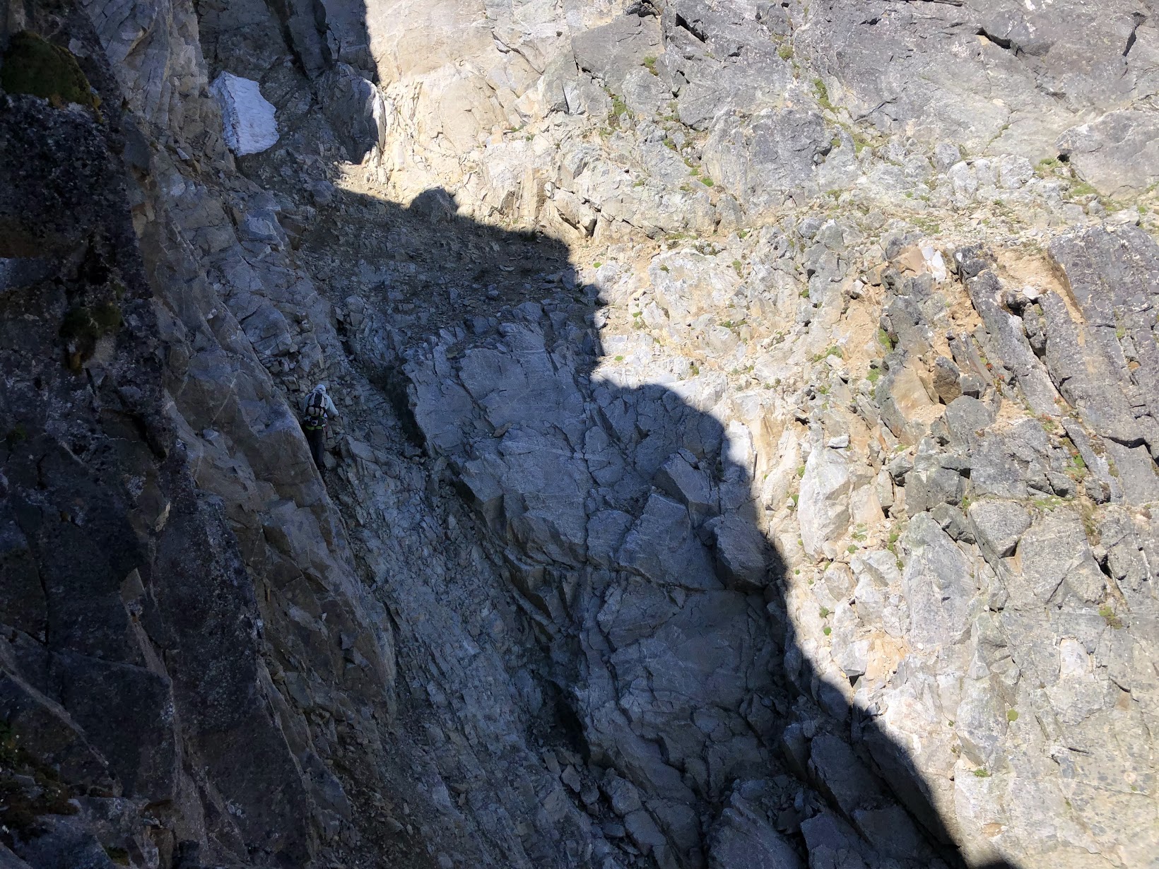
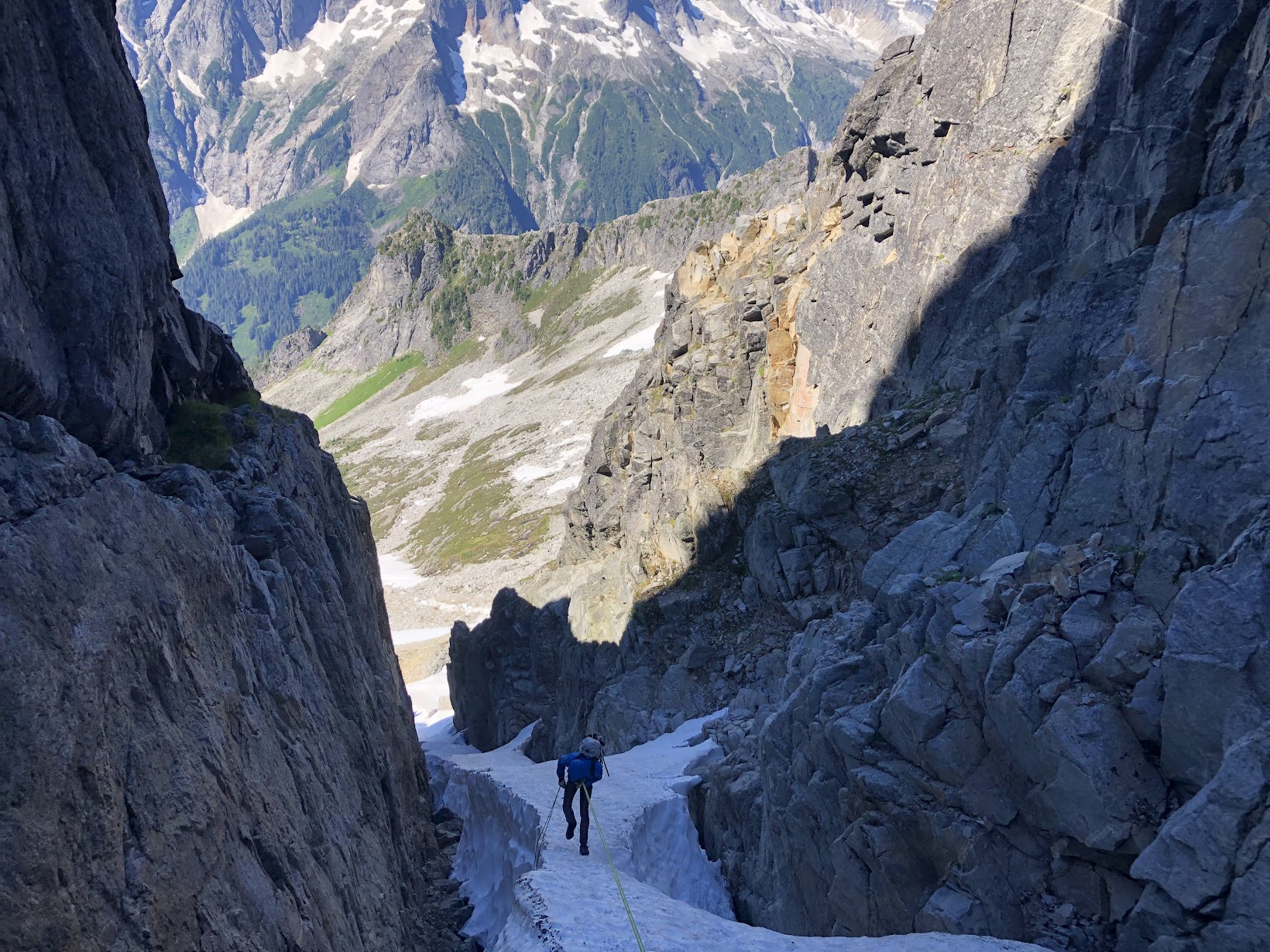
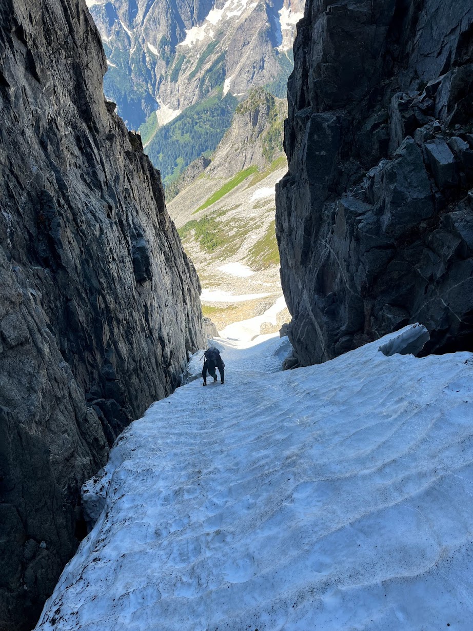
Trip: Serendipity on Dragontail Trip Date: 01/29/2025 Trip Report: In the afternoon of January 28 myself and Koby Yudkin skinned up Eight mile road to the Stuart Lake trailhead. We elected to stash our skis in the bathroom at the trailhead and hoofed it up to Colchuck lake, albeit in good time. We walked across the frozen lake and posted up in the trees near the toe of Dragon tail around 1900, approximately four and a half hours after leaving the car. The temperature inversion that evening made the bivy quite pleasant, and as we set up our tent we joked that we may in fact have come to visit the “colchuck spa” instead of going climbing. Alarms set for 0500, sleep rapidly ensued. We left the tent the following morning at 0640 and arrived at the base of the route about an hour later. Racked up, shortly before 0800 Koby led us off on what we thought was the Cotter-Bebie. It turns out we didn’t boot high enough on the pass, and began up a weakness somewhere in-between the start of Gerber sink and that of Cotter-Bebie. Blissfully unaware, or just excited to be in the ‘pine on a good weather day, the ~1000ft that we climbed before traversing left into the main upper snow field proved to be enjoyable climbing. From the ground, about a rope length links two snice filled corners and continues to a snow field where, at the top, Koby brought me up on a short KB. (P1) Above: Koby leading off on the first pitch. From here, 30 feat in an unconsolidated snow filled corner with smatterings of ice on the side got us to another snow field. No protection on this pitch, but the belay was inspiring; number 1 & 2 BD ultralights. (P2) Above: Nate beginning P2 Next Koby surmounted a collapsing snow moat into a small chimney, and up through a runnel to a good stance. I managed to avoid the chimney on this pitch with some stem moves followed by steep snow/neve to the runnel. (P3) Above: Nate coming up the runnel on P3 From the belay, I lay-backed a left facing corner for a couple moves and traversed left into a right facing Neve filled corner. Following this corner up and out to the right led me to an easy moss/ice filled runnel. We had to simul a bit this pitch to find a stance that protected the belayer from the ground to follow. (P4) Above: Koby topping out the runnel P4 Koby came up, munched a snack, and took off into a steep, rather imposing looking chimney feature about 30 feet from the belay. He managed to shuffle his way up, despite his…large…backpack, slung a tree about another 30 ft above the chimney and brought me up. This pitch was our first crux, which I followed free with hand jams, hooks, torques, scraping and grunting while contorting myself to fit the feature. (P5) Above: Koby snacking and sorting. After joining Koby atop the fifth pitch, I led up another mixed corner, traversed right across a slab and up a snow filled gully to find a protected belay on the right, putting the belayer out the the firing line for pitch seven. (P6) Above: Nate on the start to P6 Koby delicately made his way up through two bulges here. Good pro, mediocre feet, hooks and slots, and some alpine trickery brought him to a 4 piece belay in a large left facing chimney about 40 meters above me. I followed this pitch free at what felt like M6+/M7. (P7) Above: Koby on P7 From here I scraped my way left out of the chimney. A few insecure moves off the belay put me in a good spot where I could stand and make a plan to weave my way up through some slabs. I trended generally up for 15 meters through slab terrain with a good pin for protection, and then 15 more meters up and left where I slung a tree to bring Koby up. From this belay we got our first view of the fin. (P8) When Koby joined me at the top of P8 it was around 1500 and the sun was getting low, and set to dip below the horizon around 1700. We made the decision to traverse the snow field and exit into the bottom of the third couloir of Triple Couloirs in the interest of time. Two rope lengths of traversing up and left through the main snow field brought us to the easy, but difficult to protect, rock bit to gain TC. As Koby made his way up the last bit of mixed climbing, I admired the alpenglow. Once in the couloir we put the rope away and booted to the top. We arrived around 1740, snacked, un-racked and made our way down to the col and out of the building wind. Above: Koby exiting into TC. Above: Nate soaking up the sunset. We stomped back into our camp around 2000, brewed up, packed our things and made our way back across the lake and down to the trail head. After wrestling frozen ski boots back on to swollen feat, we skid Eight mile road back to our car and arrived shortly before midnight. Gear Notes: 70m single, 3 KBs, 2 beaks, set of small brassies, misc. nuts, a black totem, singles in Camelots from 0.3 to #3, 6 alpine draws, 3 quick draws. Approach Notes: Standard approach from the bottom of Eight mile road.
 1 point
 -
Awesome! Hive mind...is this a FA? Either way that is a heck of. climb on a popular rock! Congratulations!1 point
-
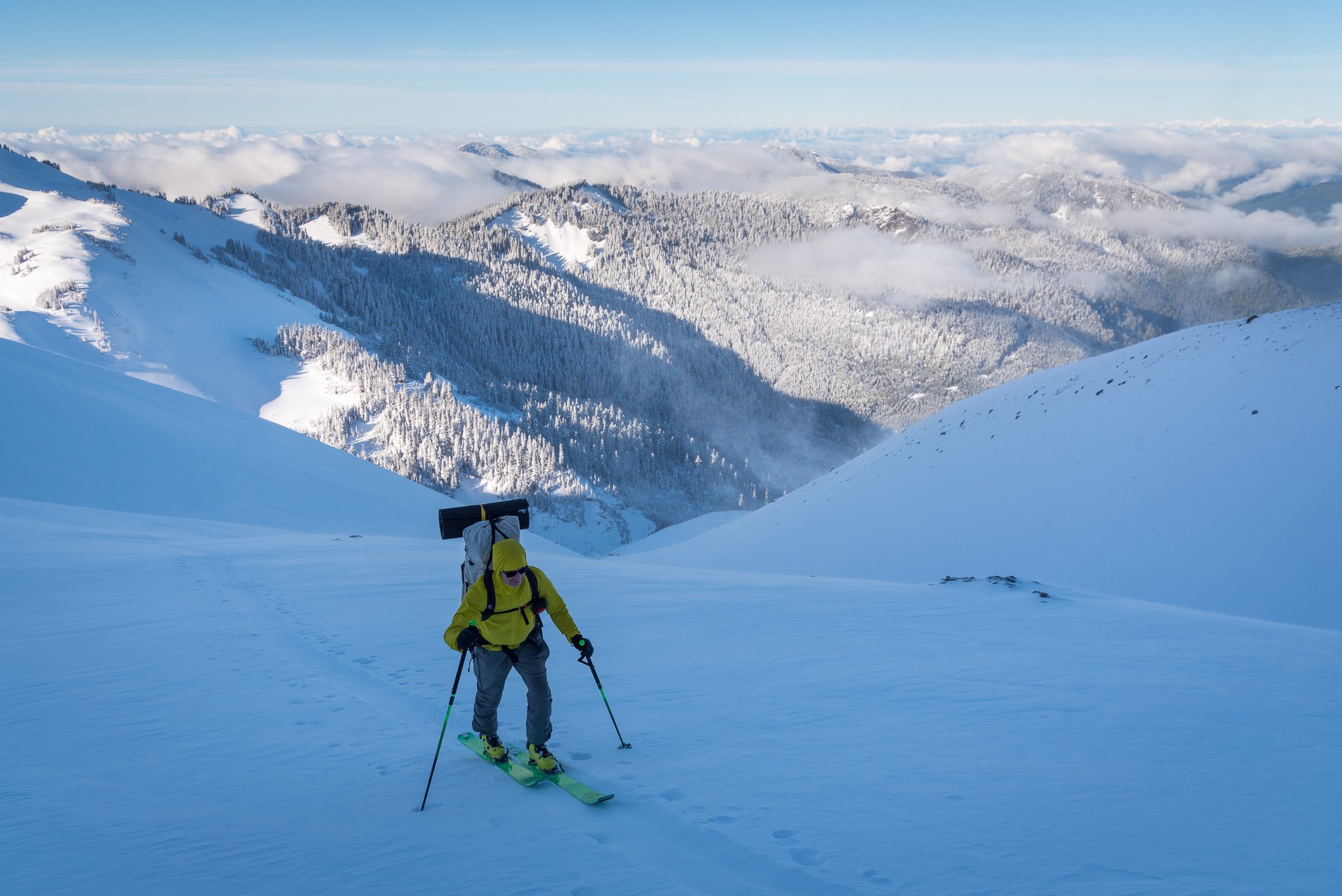
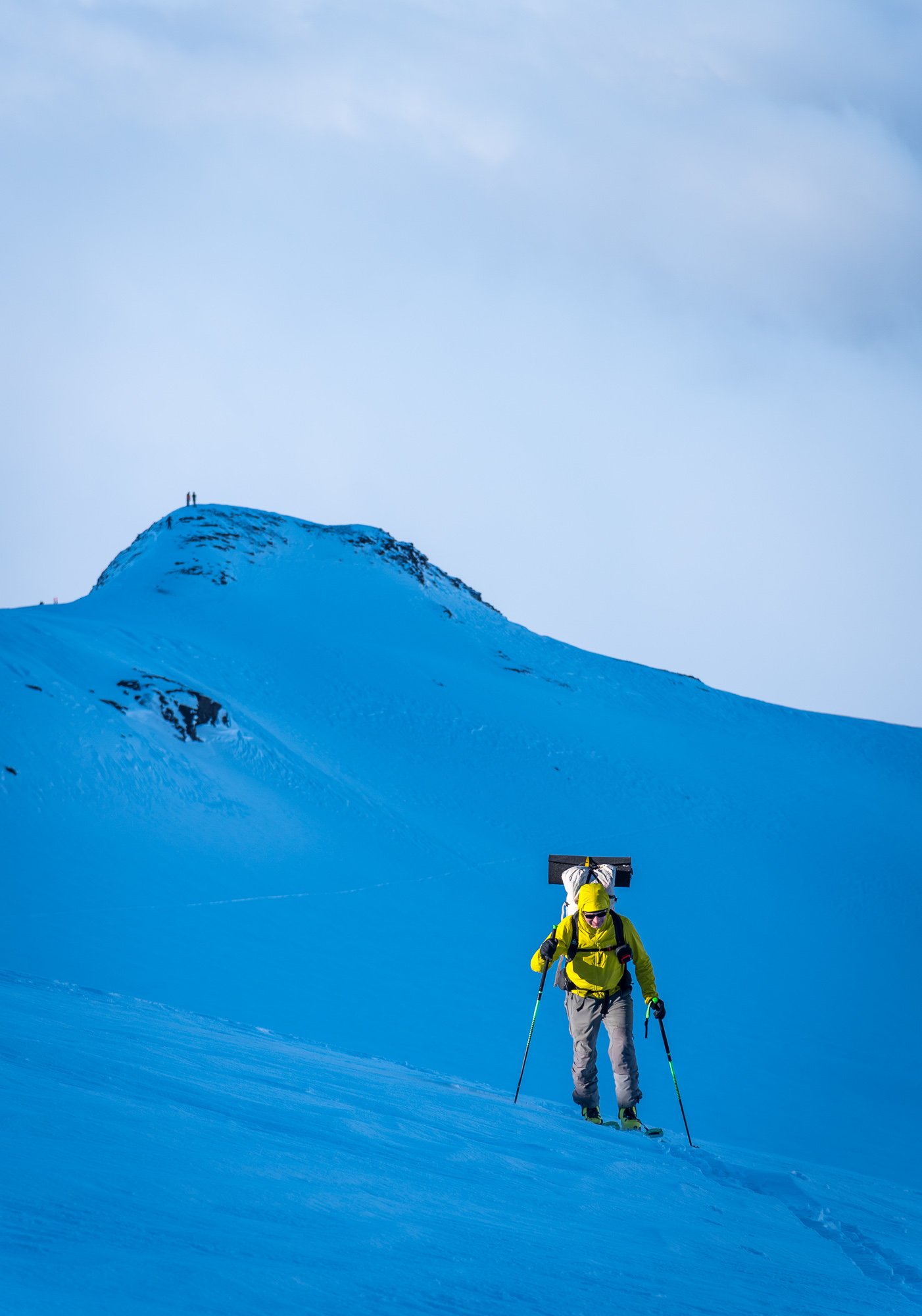
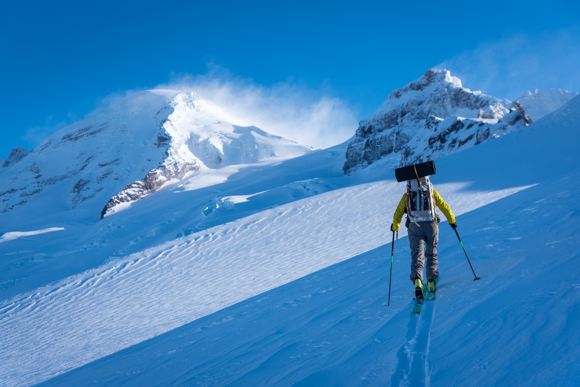
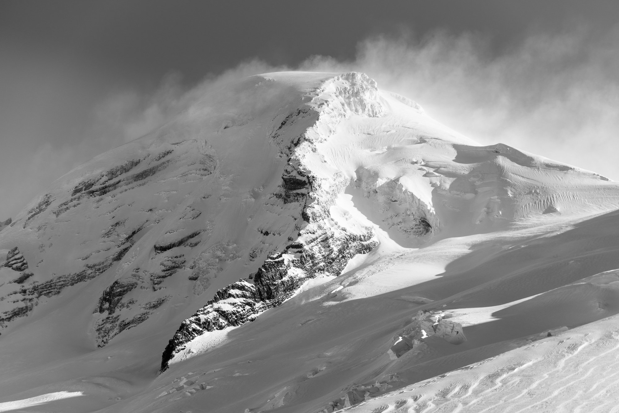
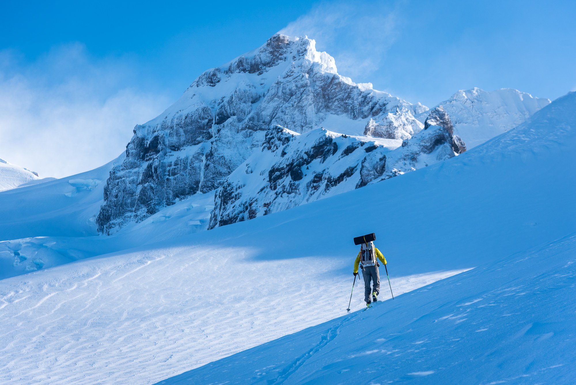
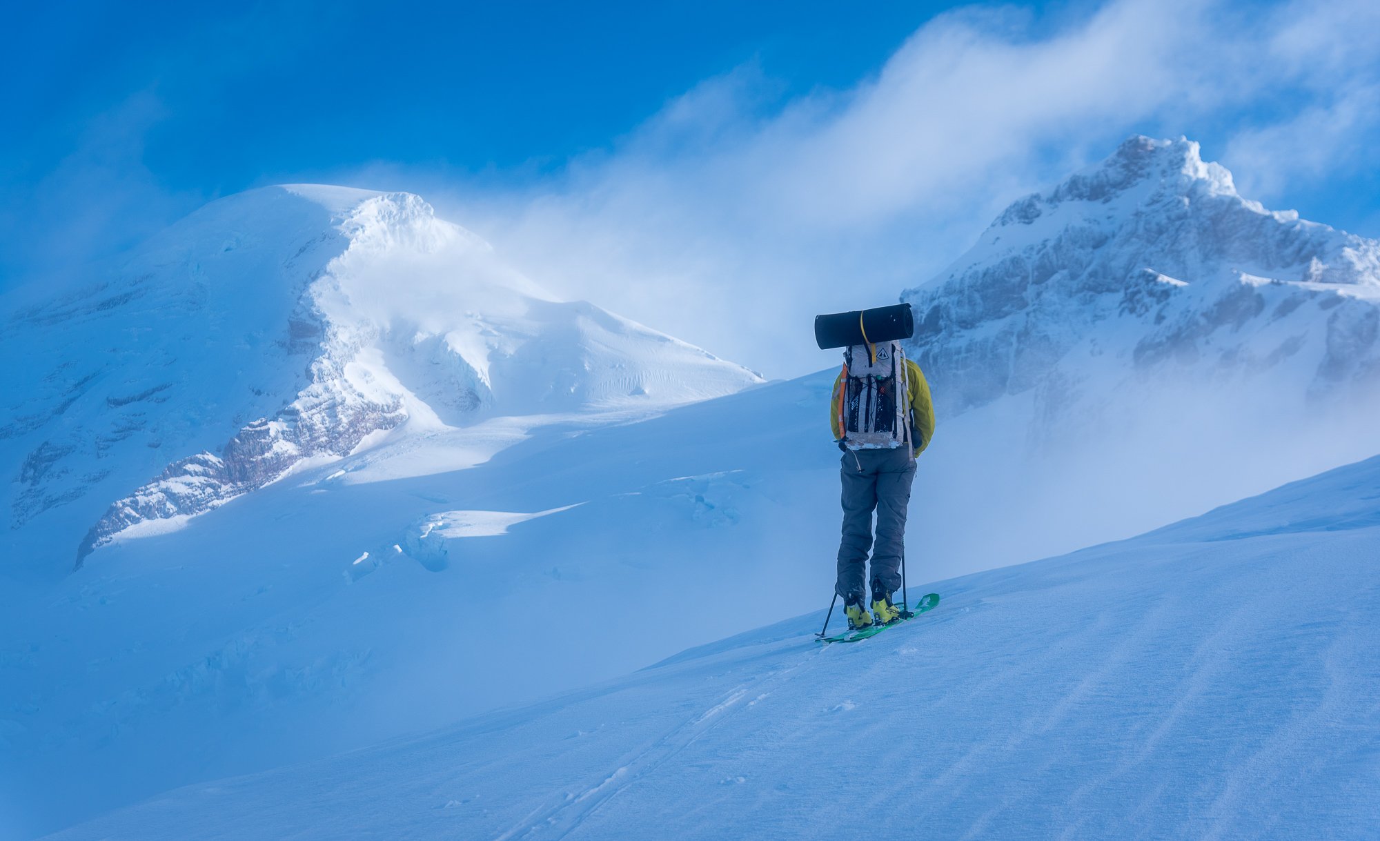
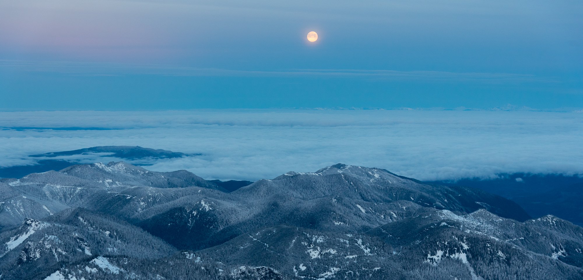
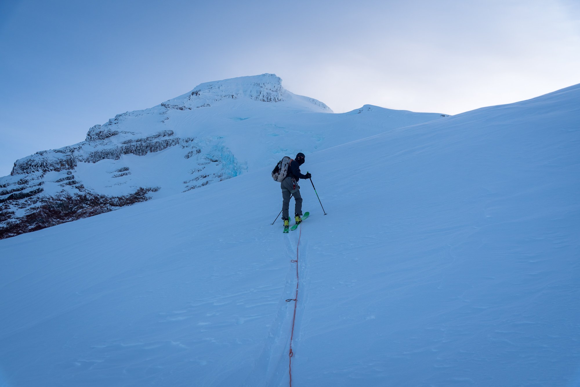
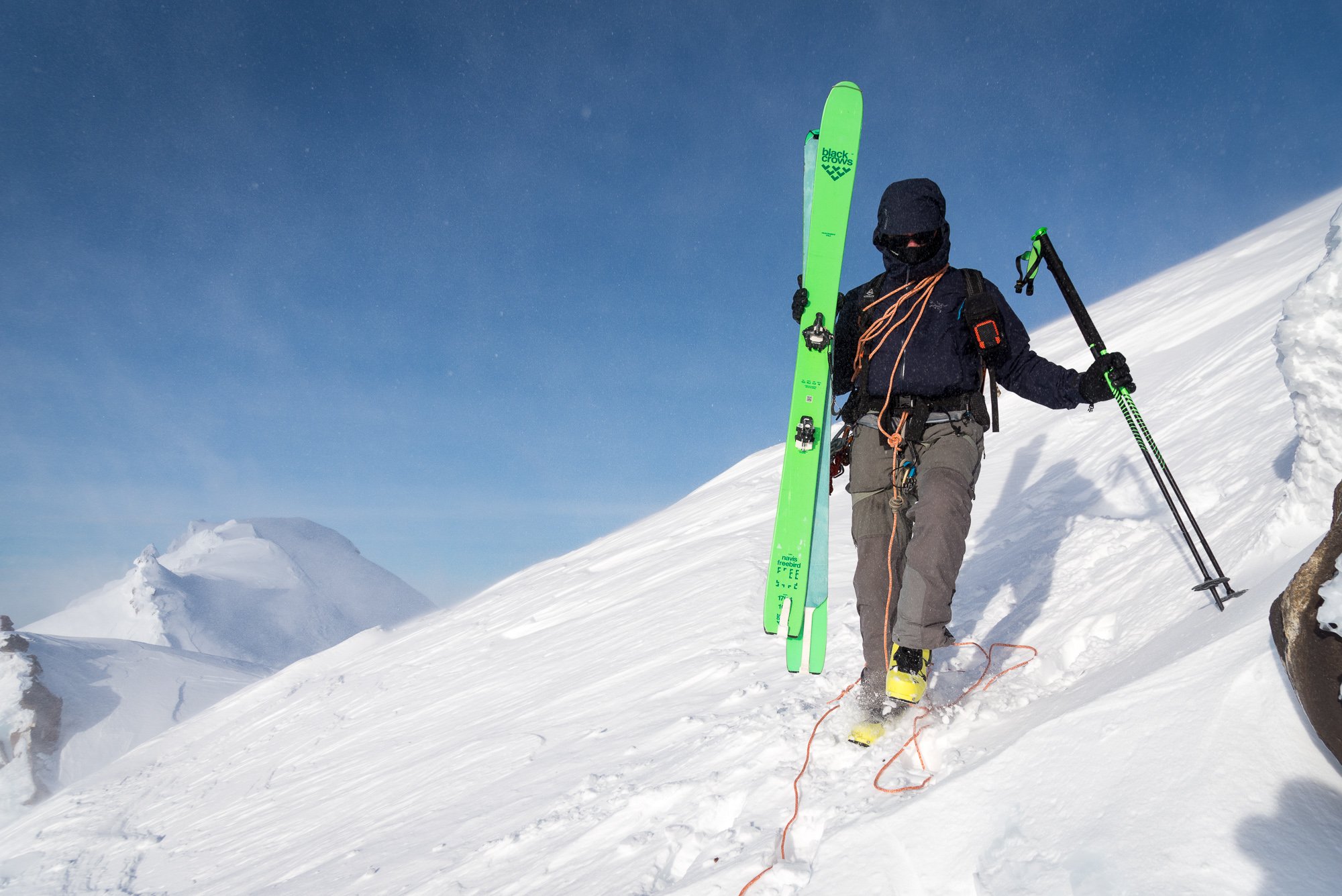
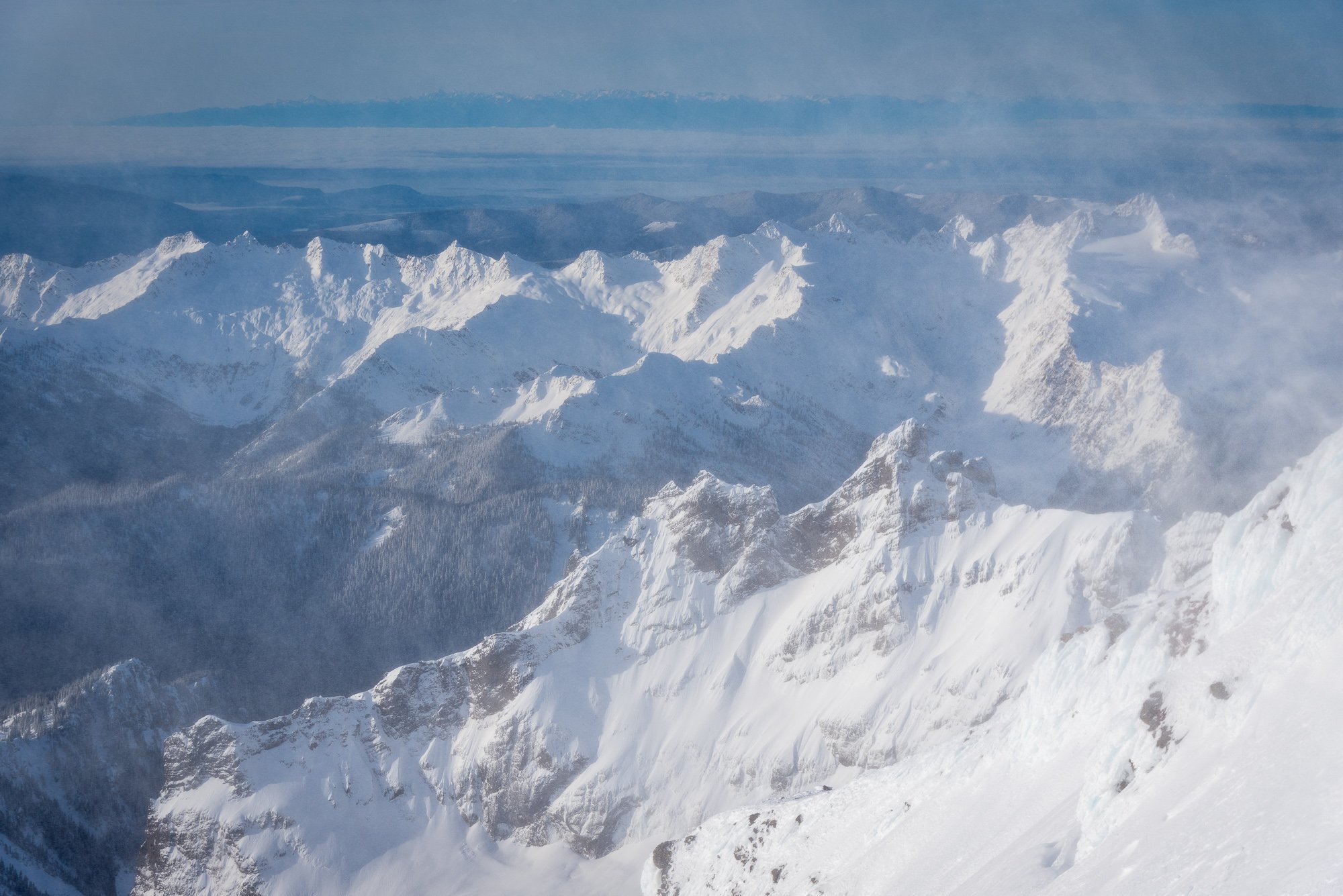
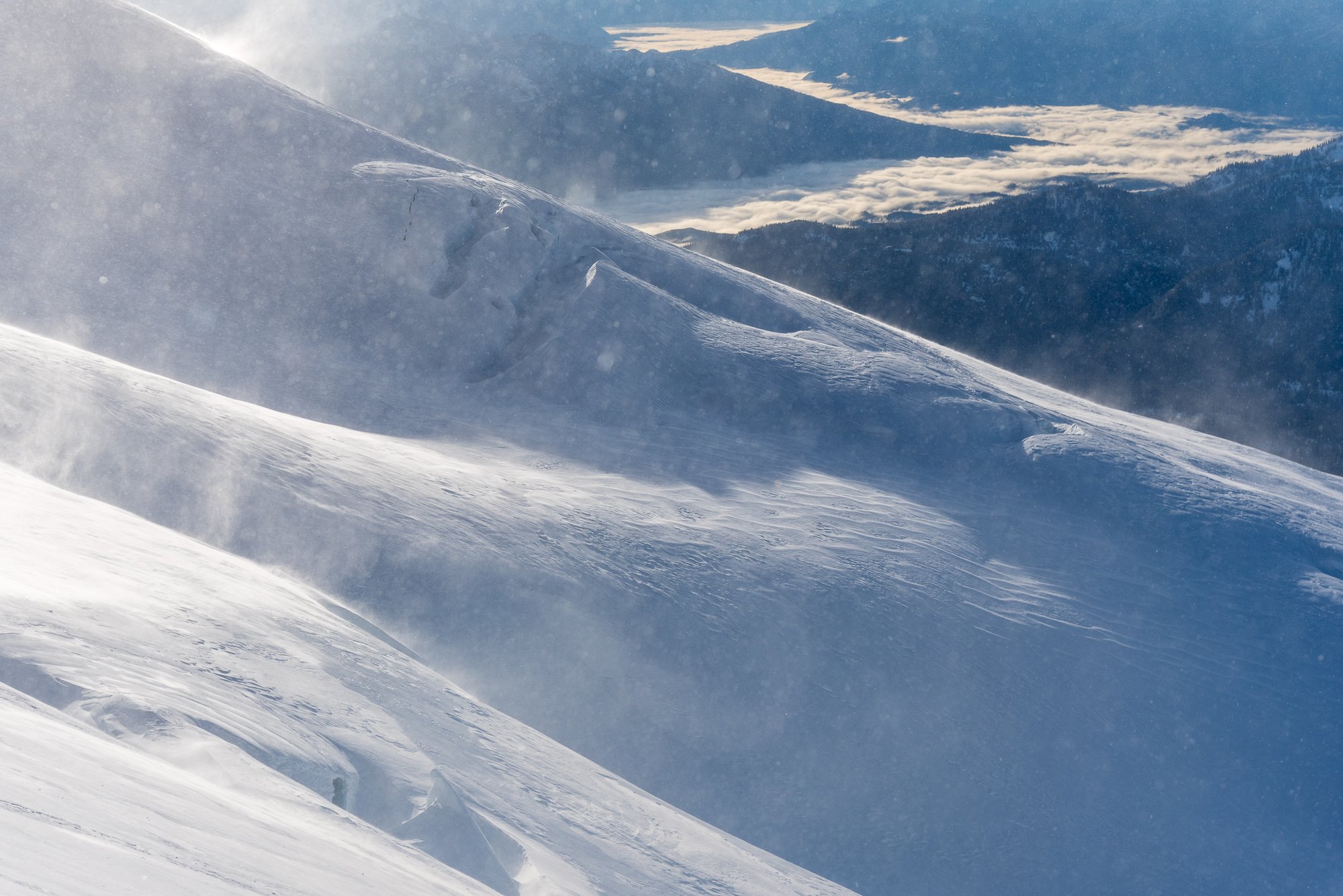
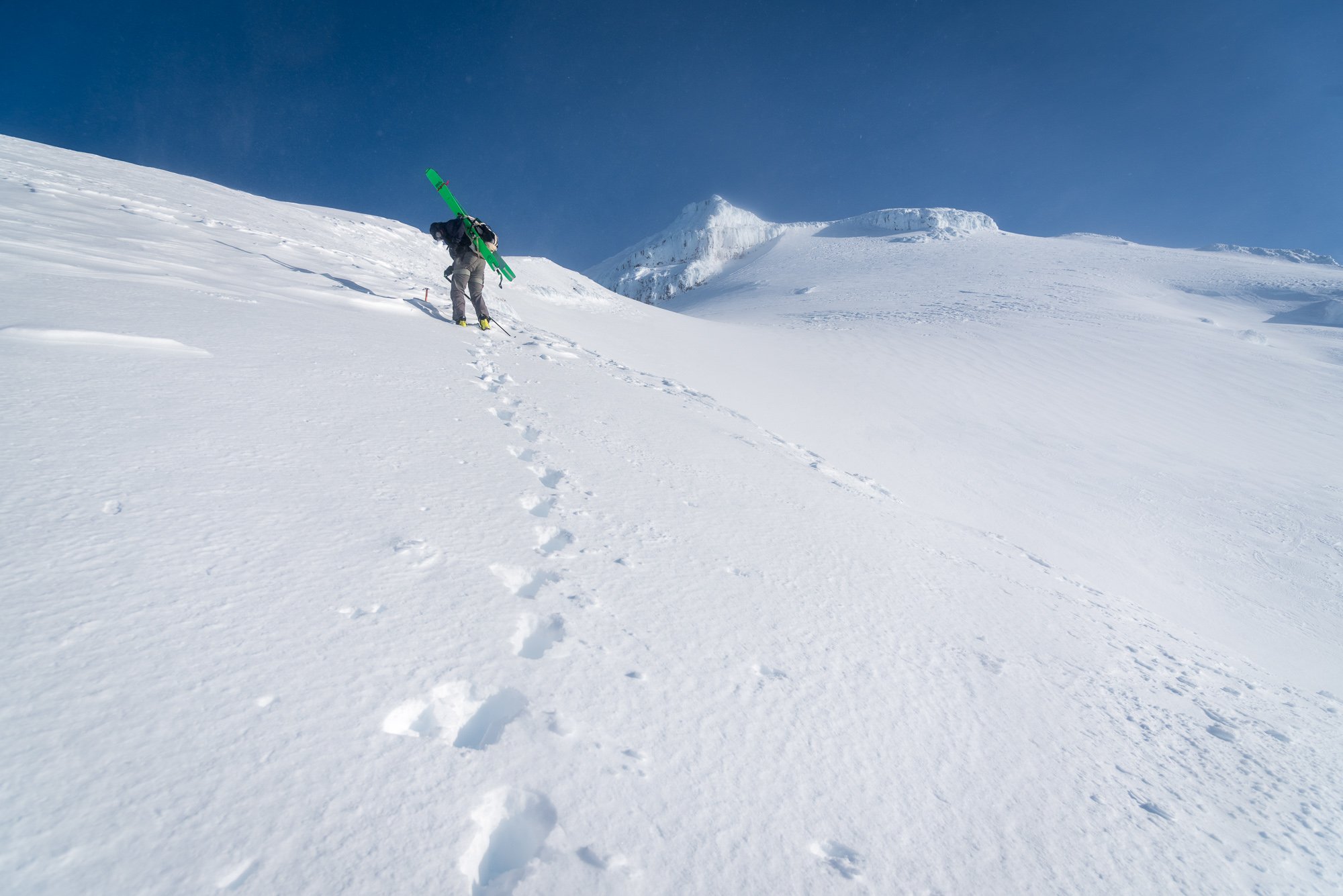
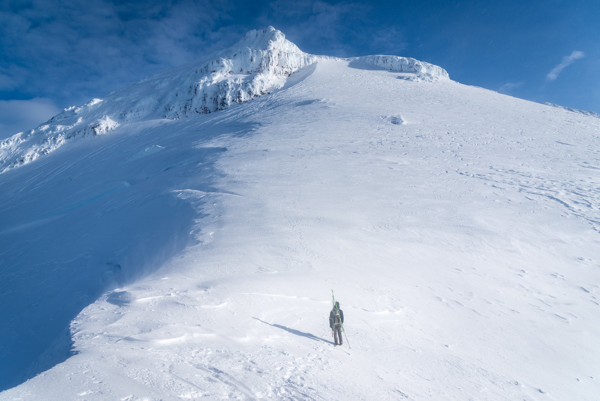
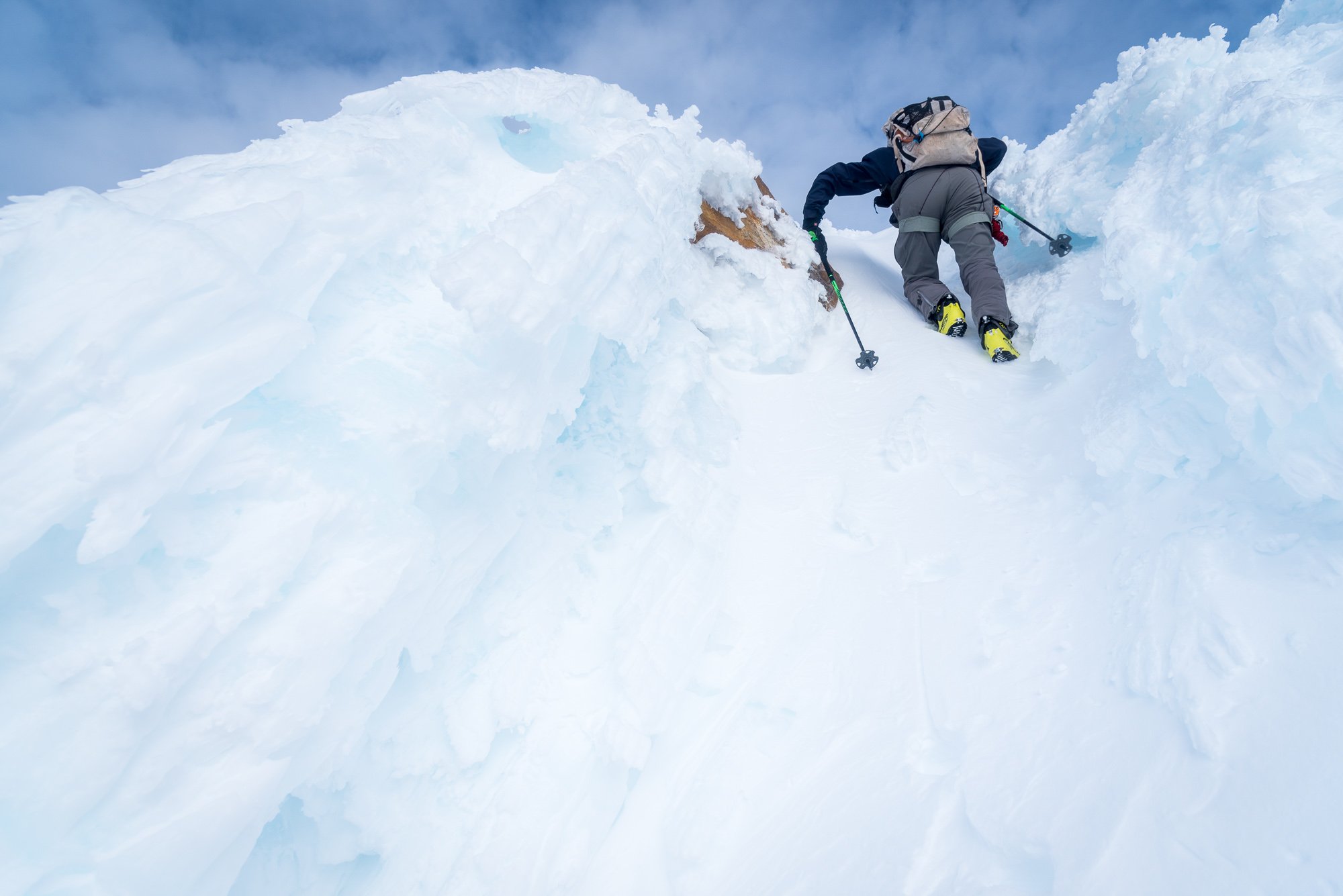
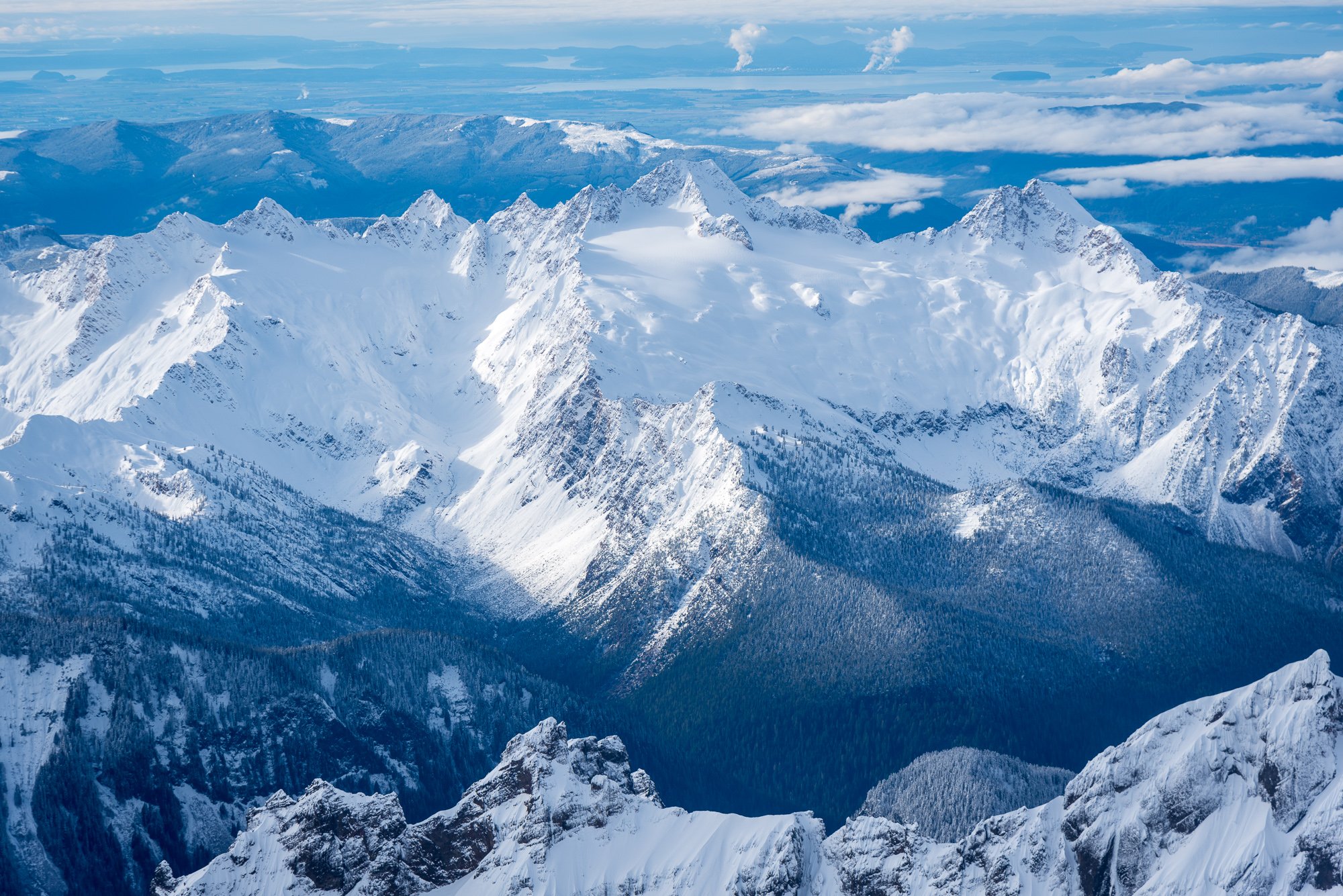
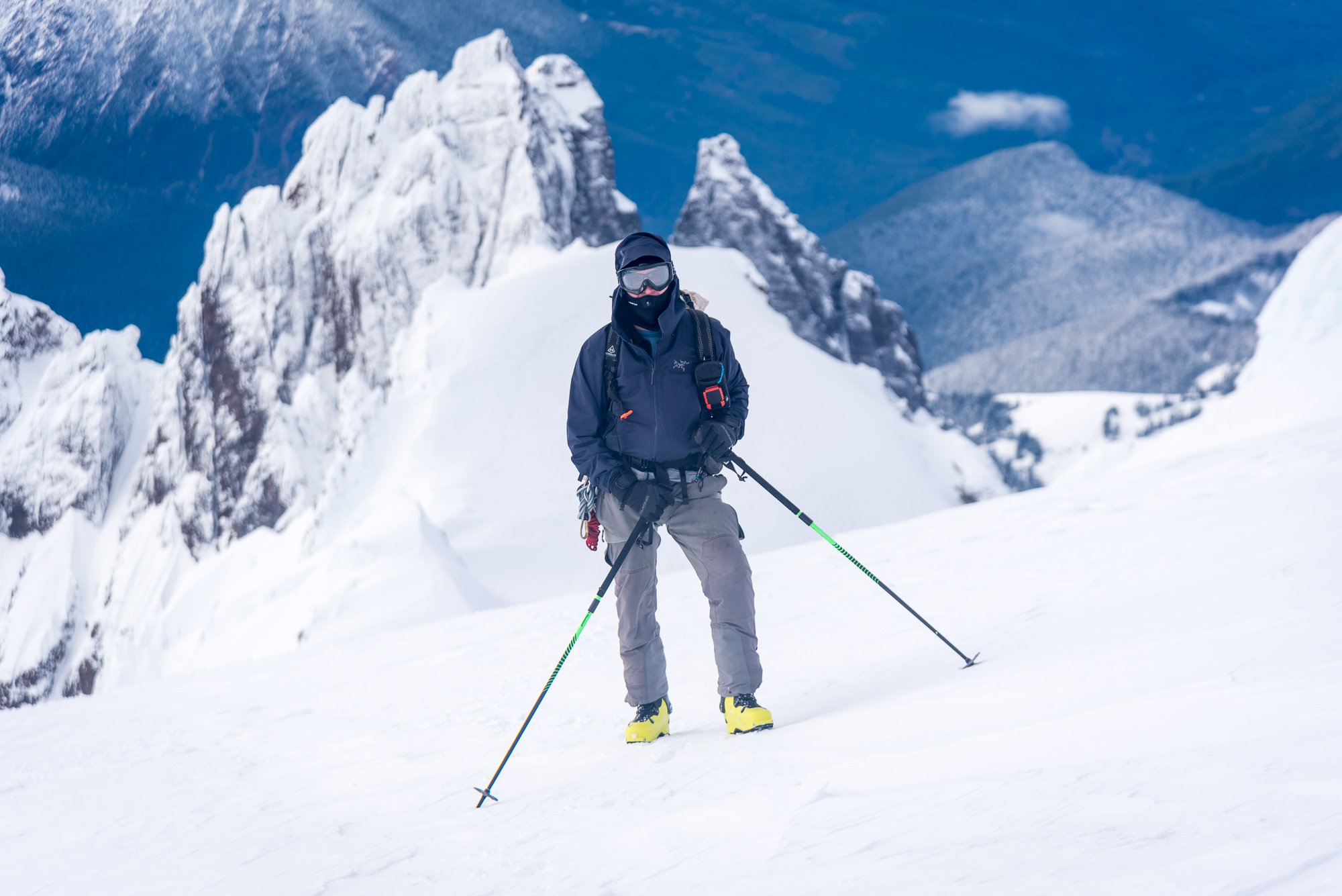
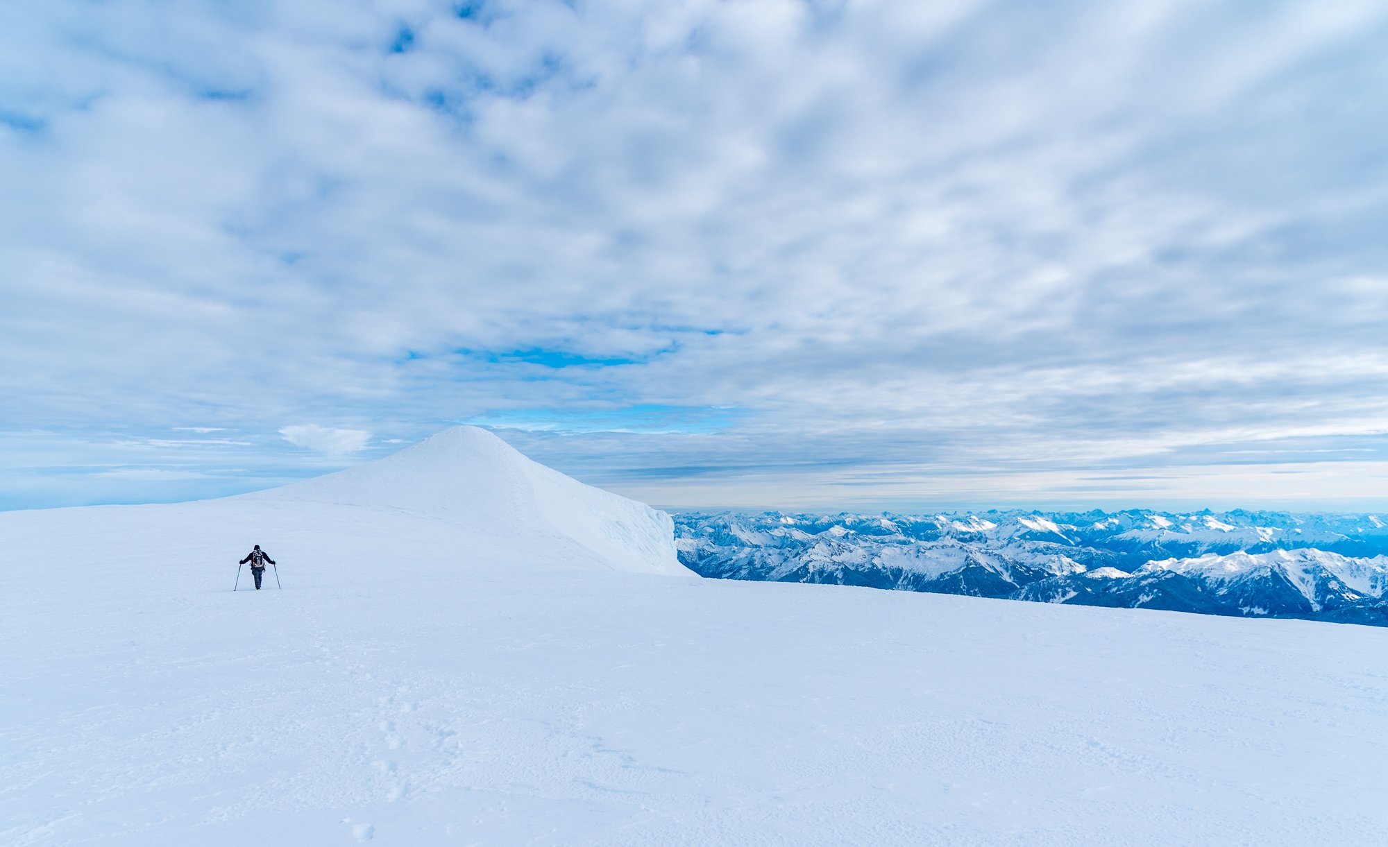
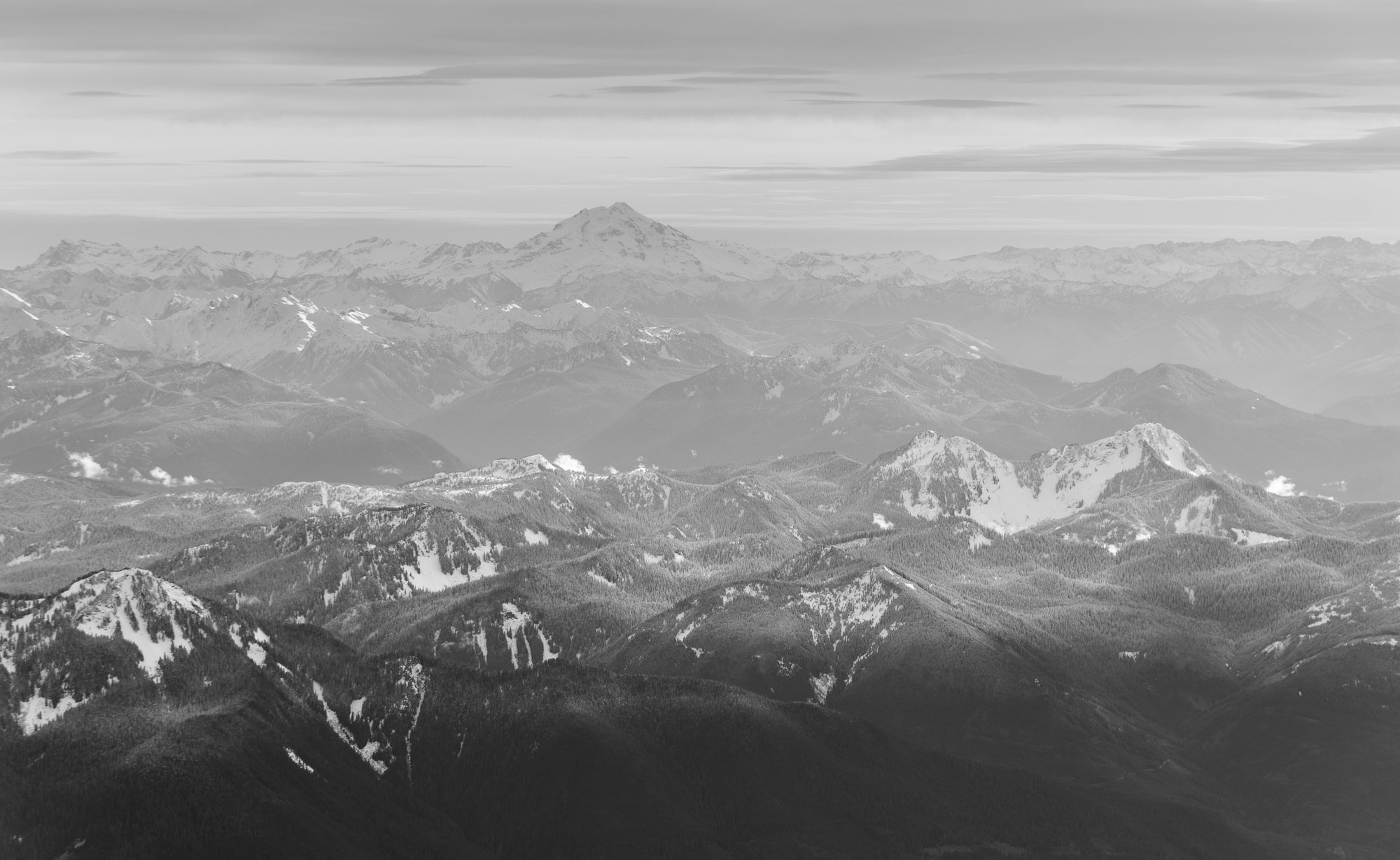
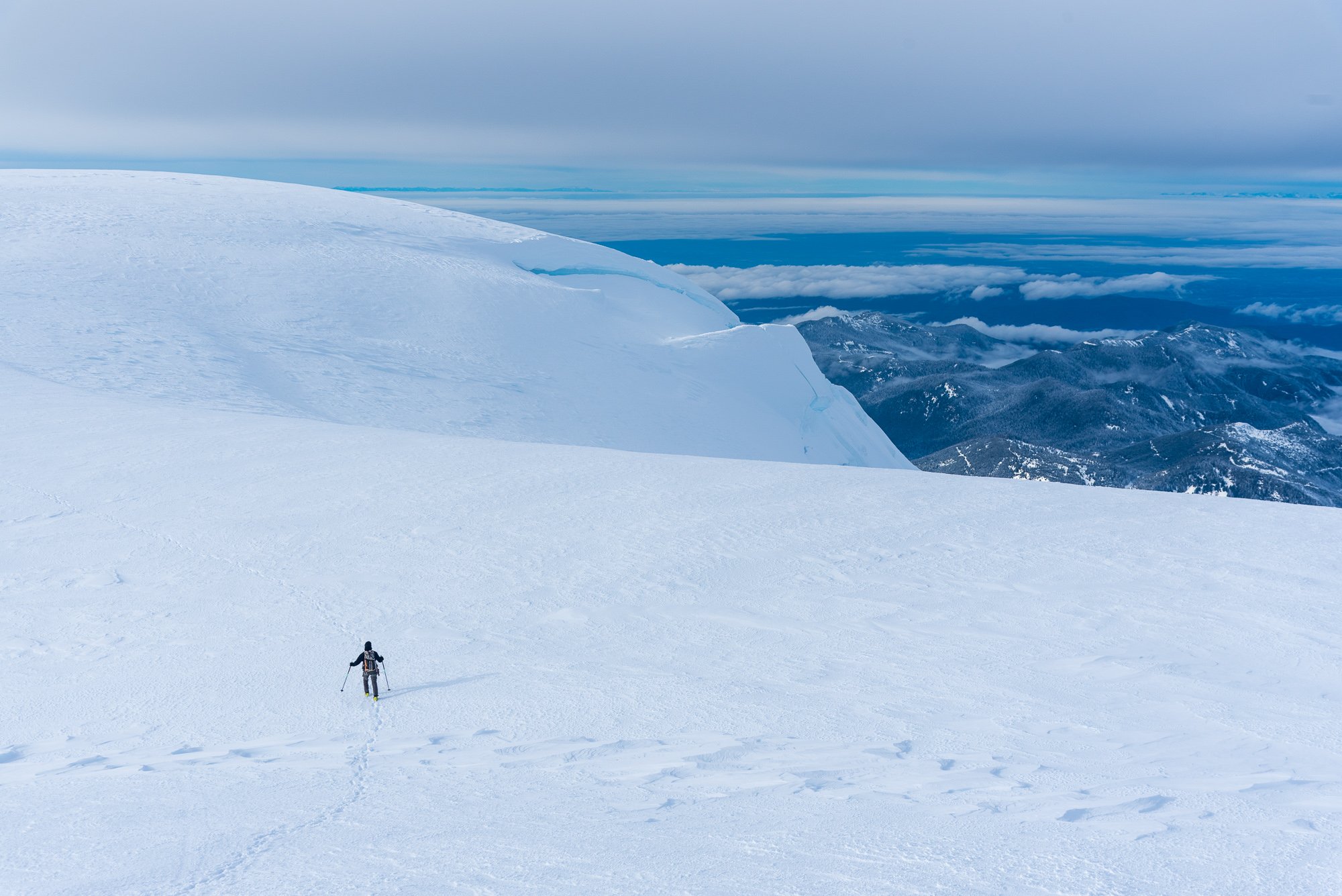
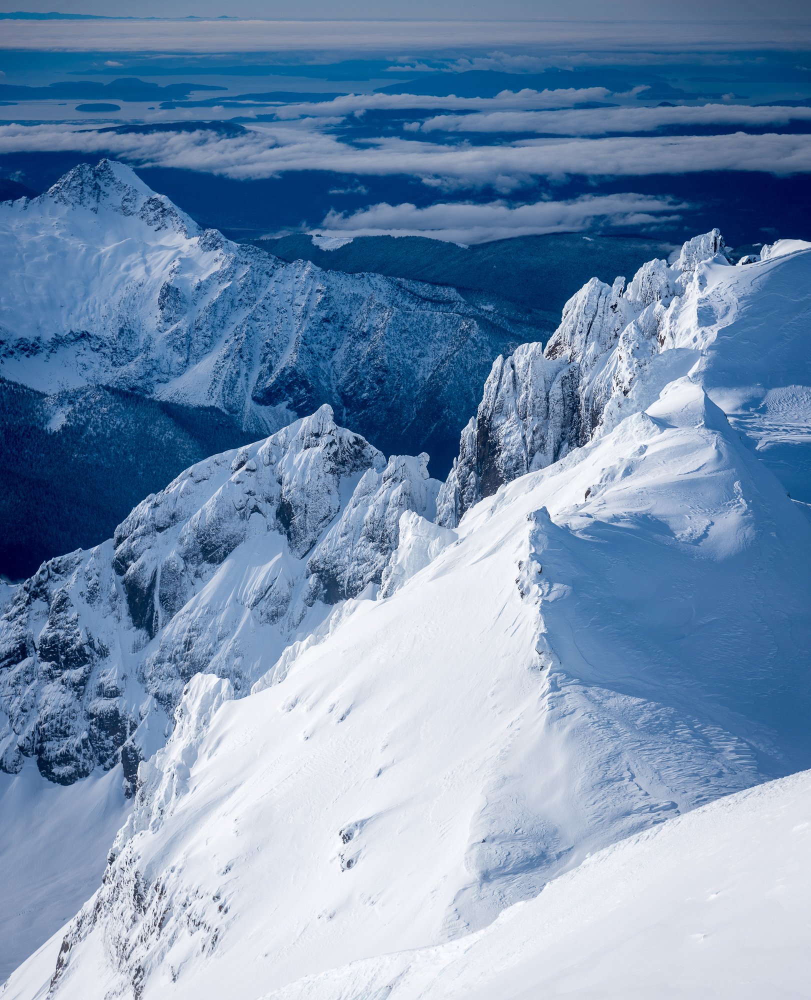
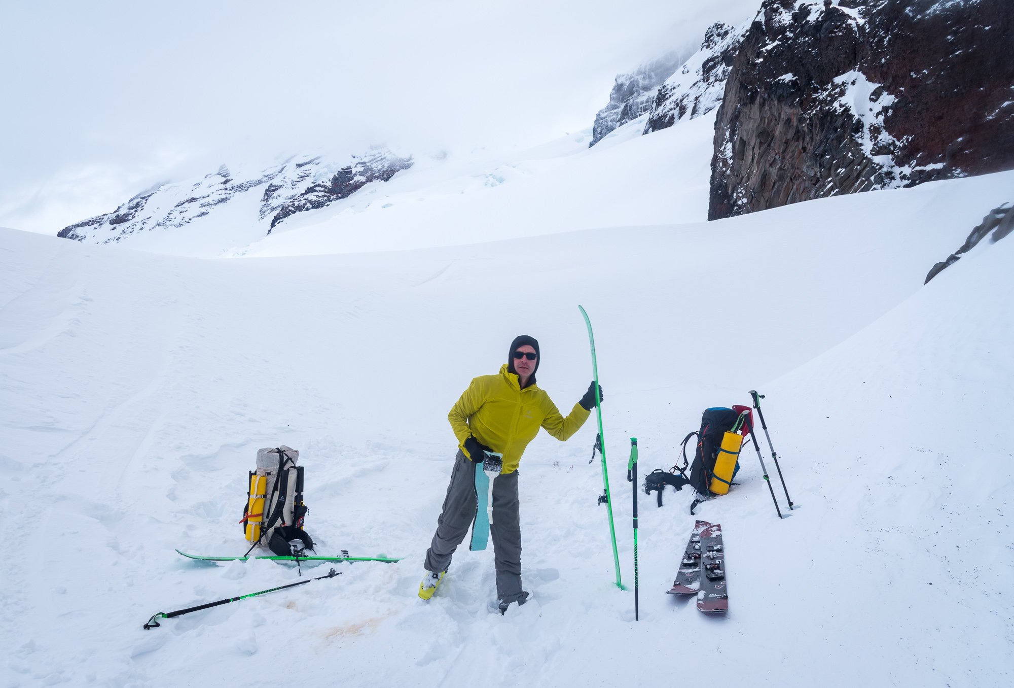
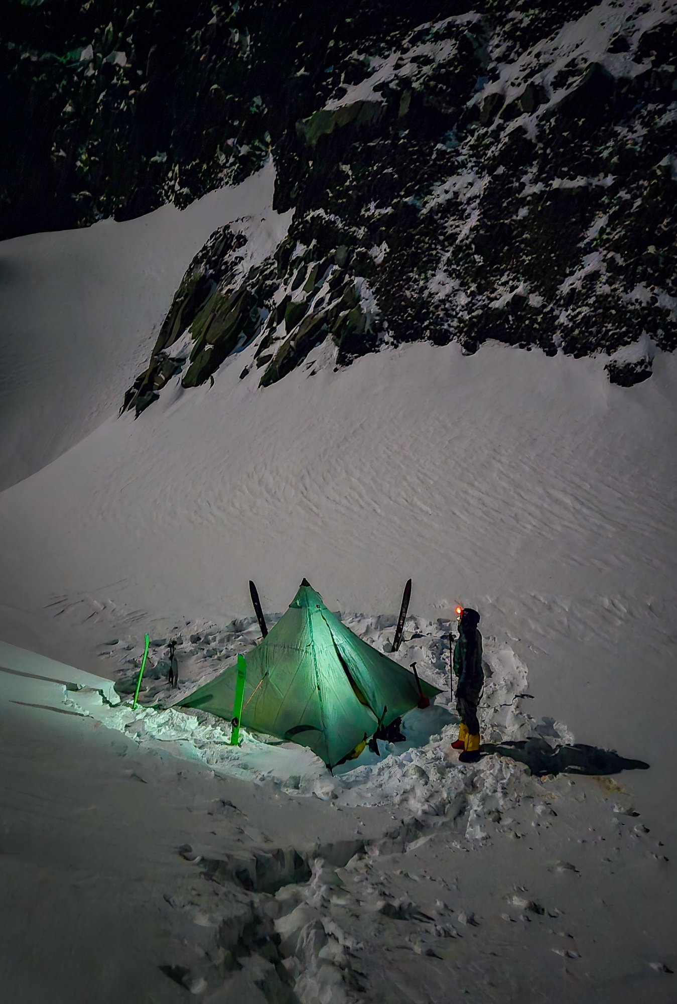
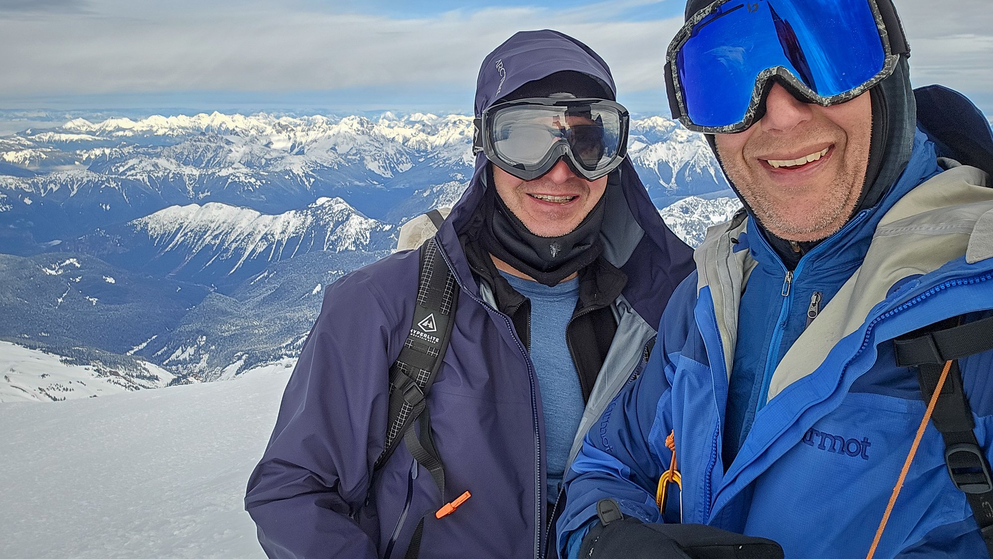
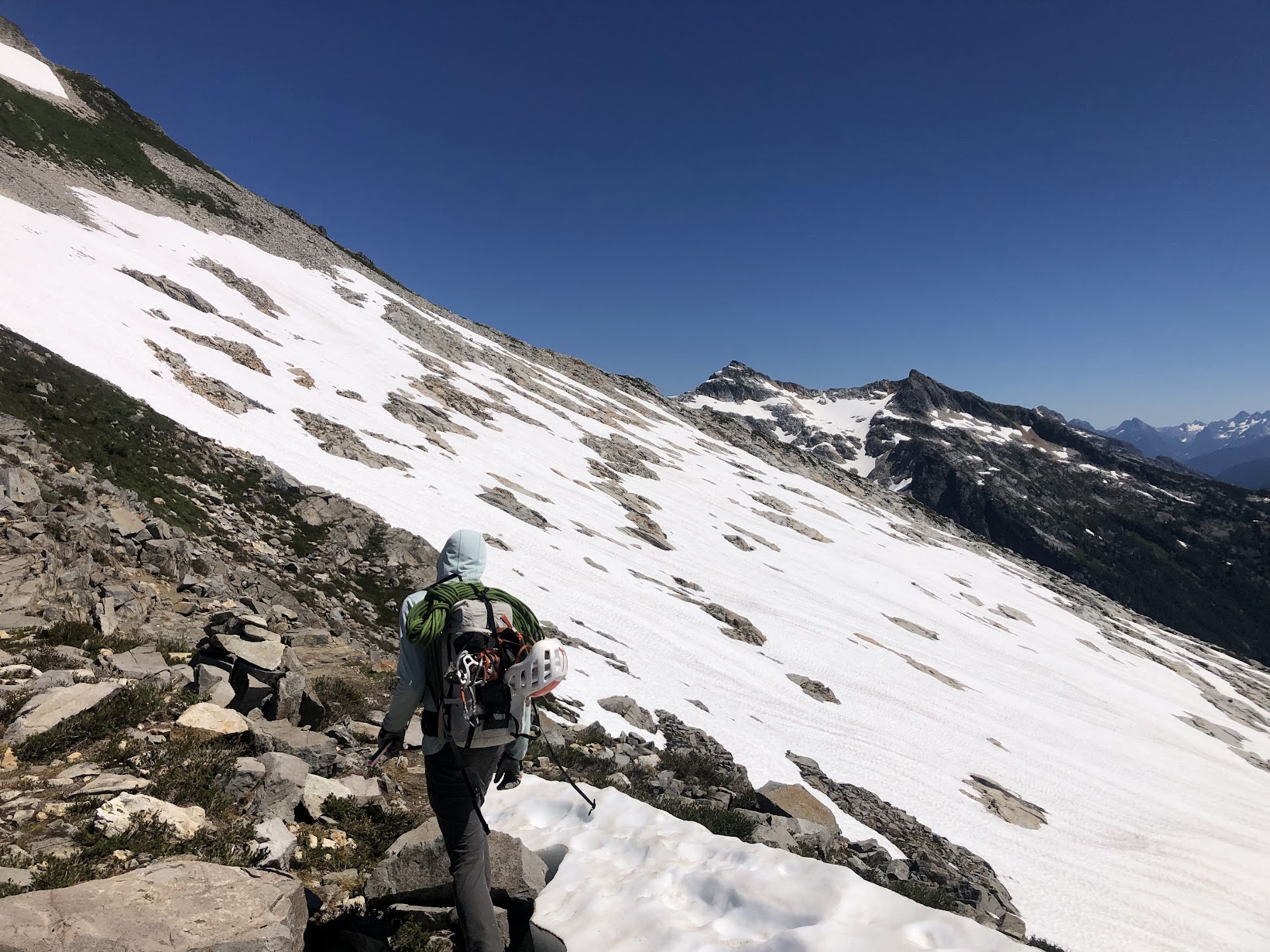
Trip: Mount Baker - Coleman Deming Trip Date: 01/12/2025 Trip Report: @dberdinka and I have been skiing together a bit more than normal this season and a few weeks back I offhandedly mentioned that I would like to climb/ski Baker in the winter sometime. Turns out, Darin had been thwarted a couple of times prior and was still interested in making it happen. It didn't take much convincing to hatch a plan during the first part of this long January drought.....and one Sunday morning we found ourselves driving unusually far up the Glacier Creek road (for midwinter), parking a little less than a half mile from the summer TH. We opted to go up Grouse Creek, figuring that the avy swath would allow for skinning a bit lower than if we followed the summer trail. Not sure if this was true, but it was what we did. The higher we got, with windier it became, with worse snow. But no matter, we weren't here for the skiing and we made good time to camp at 7k in a wind scoop on the glacier. @dberdinka had brought his fancy 'mid and this proved perfect to hunkering down out of the wind while being able to melt snow in relative warmth. Brandy and whiskey didn't hurt either. Nor a lot of insulated clothing. Did I mention the wind? Baker was being stripped of all loose snow right before our eyes and I was a bit apprehensive about our chances if the wind didn't calm down. But in the 'mid, with a lot of food and spirits, the vibes were good- the wind was a problem for another day- and we had 16 hours to kill! A nice sunset and full moon lent a nice touch to the evening. The long night eventually ended, with both Darin and I catching a bit of sleep and staying pretty warm overall. But it was time to poke upwards and into the wind and so we plodded slowly out of camp in the dark at about 0630. As the day began to break a lenticular formed over the summit and then lowered almost to the col. Uh oh, this wasn't in the forecast! The wind continued to howl and we dug a hole in the glacier to wait and discuss our options. I was pretty sure I wanted nothing to do with climbing up into a lenticular (bad experience on Hood 25 years ago), but @dberdinka wisely pointed out that we may as well go until we couldn't safely, and the forecast was favorable. Maybe it would evaporate? We were getting cold after stopping for a long while and so we packed up. And, much to my amazement.... as we stiffly began to plod upwards again, the lenticular vanished! But it remained quite windy- maybe steady 30 with gusts to 45? I was getting cold and scared but @dberdinka seemed to get more optimistic the more unruly it got with wind and spindrift. He was in his element! Sensing that I definitely was not in my element, Darin memorably asked me, "Well, what did you think it was going to be like climbing Baker in the winter?" Right. Upwards we go! But not with skis. We left them about 9800' at the top of the Pumice Ridge when it became obvious ski conditions were bad and not going to get any better. View into the maelstorm: The spindrift got better as we got higher since all the loose snow was already gone, but the wind remained strong. Still, @dberdinka was right, we were going to make it! We just needed to suffer and not lose heart. But what a wild feeling it was being so high on Baker in the wind and cold! It was just the two of us and I paused a few times on the summit plateau to take it all in, grateful that @dberdinka had pushed me to continue through my discomfort. We reached the summit a bit before noon, feeling like we were standing on the moon. A few quick photos and we began the plod back towards our skis and camp. As expected, the skiing back to camp wasn't anything to rave about, but it wasn't horrible either. Much to our surprise, 15 minutes after arriving back at camp, the summit was lost in another lenticular, showing just how narrow the windows of success can be in winter..... Gear Notes: Normal ski mountaineering kit plus much warm clothing! Brandy and whiskey were helpful as well. Approach Notes: Grouse creek. Could drive within half mile of TH, snow was thin down low but got rapidly better, higher. Mostly carried skis until the avy swath.

 1 point
 -
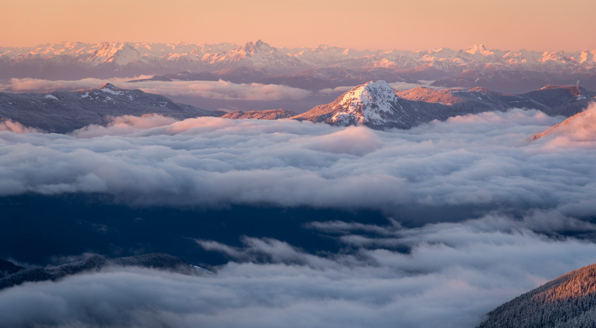
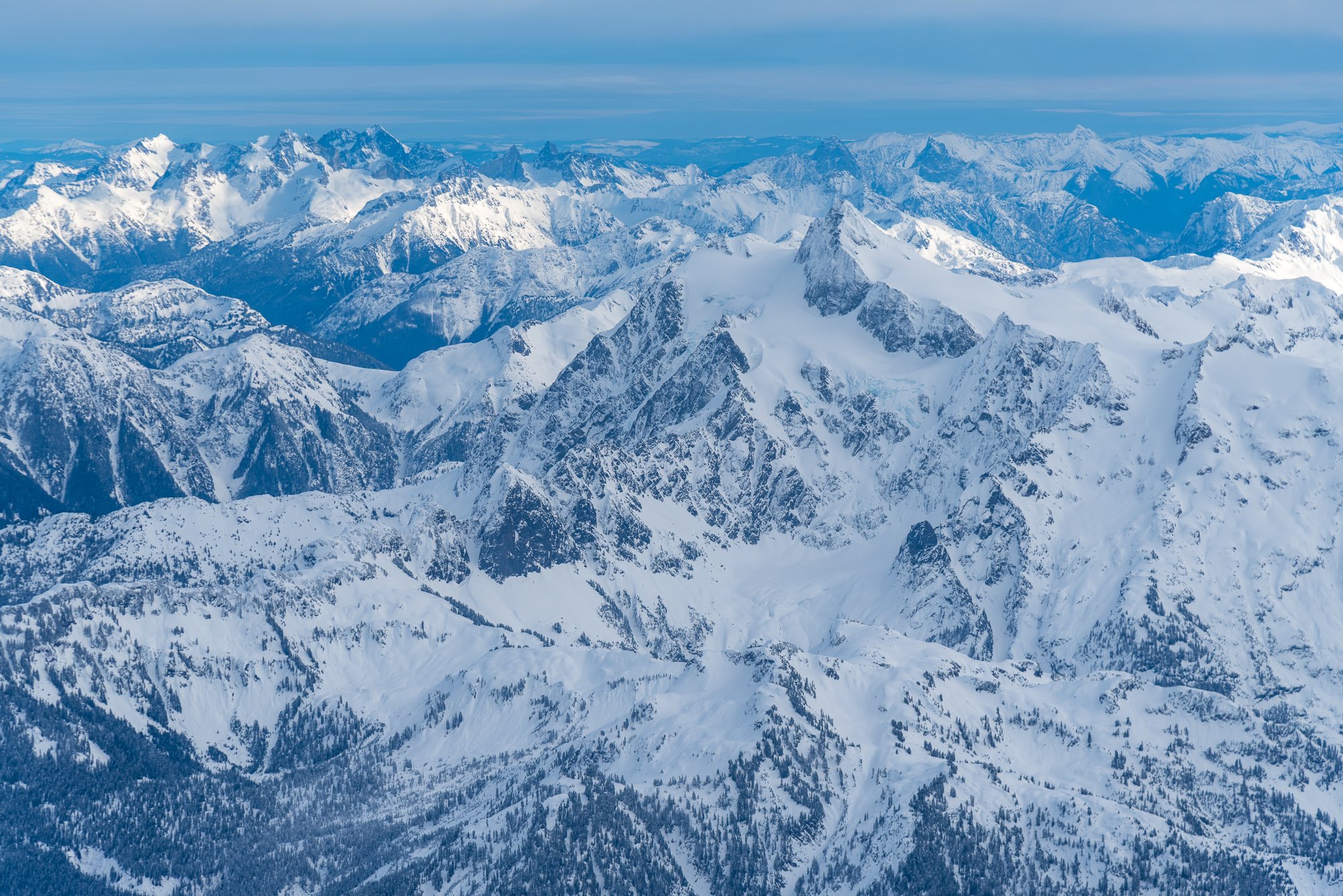
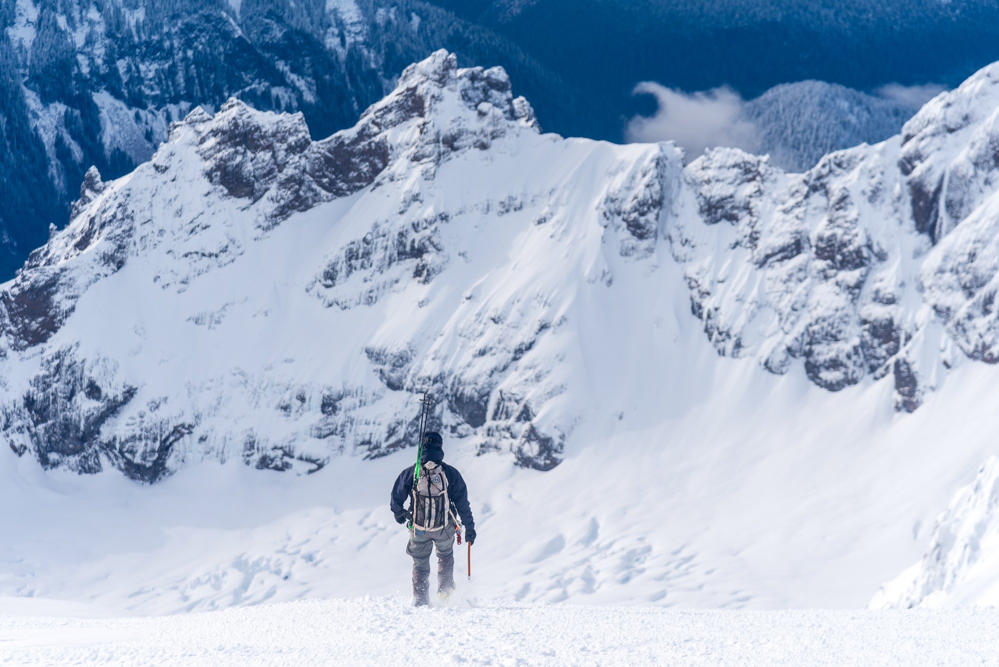
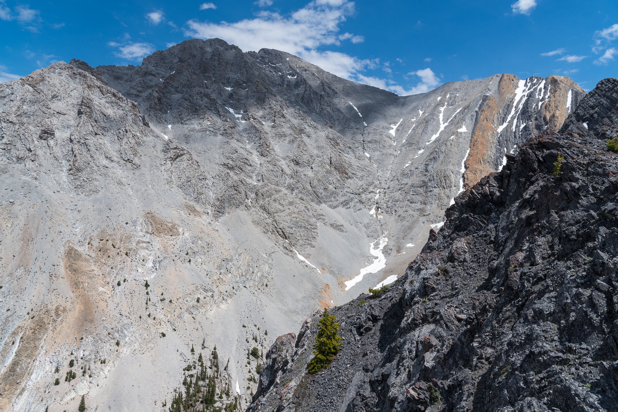
Trip: Colfax Peak - East Ridge Trip Date: 01/18/2025 Trip Report: Me, @Albuquerque Fred, and Mike (the 3 amigos) climbed Colfax Peak on Saturday the 18th. We camped at the trailhead and woke up early enough to be able to get beers and dinner at Graham's in Glacier that afternoon (this alleviating thys of the need to eat and food on route). Which was good since it was so cold none of us really ate or drank anything all day. We were able to drive to maybe .5 miles from the summer TH before we stopped at the snow park berm. Others chose to drive past this but I believe it is bad form, the snowmobilers are our friends, let's play well together. All users of the outdoors share more than they differ. The Grouse Creek approach worked well, booting for a short time through the forest before switching to skinning. The skin to Colfax Saddle was easy on firm wind packed snow; some areas required ski crampons so we just wore them most of the time. The wind at the saddle was brutal, making the already cold air almost unbearable. We left skis at the saddle and cramponed over the false summit to the true summit of Colfax. We spent 30 seconds, then returned to the skis in the lee of a rock at the saddle. The sun and shelter were amazing, but we had to descend some time, so back into the maelstrom we went. The ski was actually excellent... If you are a connoseur of ski mountaineering skiing, not laps. Firm wind pack, but smooth, with patches of re-worked powder, and, lower, dust on crust. The exit was amazing, 3 hours total from Colfax to the car with a nice long break in the lee. We called it the best skiing on a mid-winter ski mountaineering trip. So in short, excellent***. Cosley-Houston is out, Polish looked ok, but I'm not good enough to knowuch about it. The upper ice ribbon was continuous but narrow: Baker from Colfax: Gear Notes: Skis, ski crampons, crampons, axe, helmet, glacier gear. Approach Notes: Grouse Creek in ski boots.1 point
-
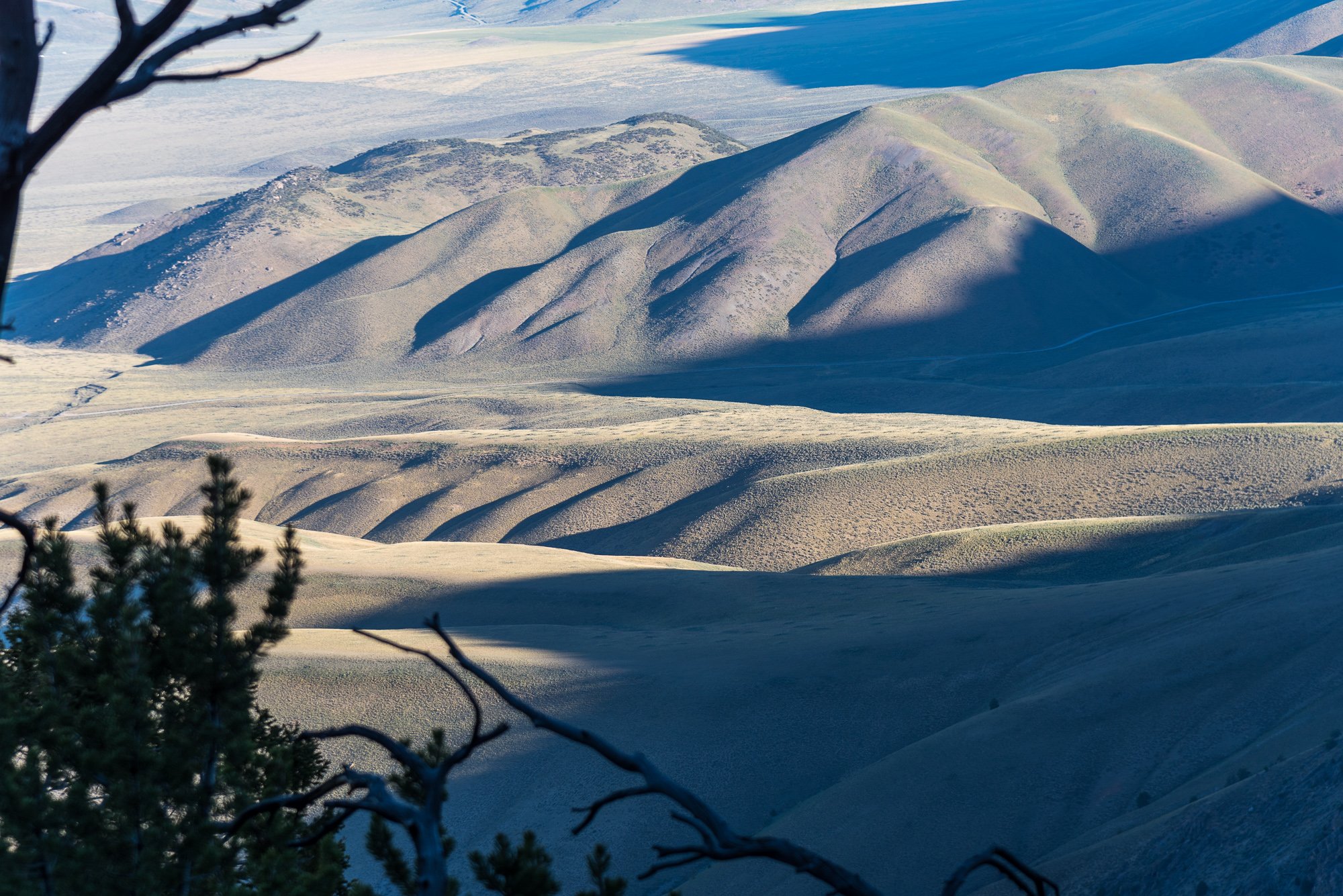
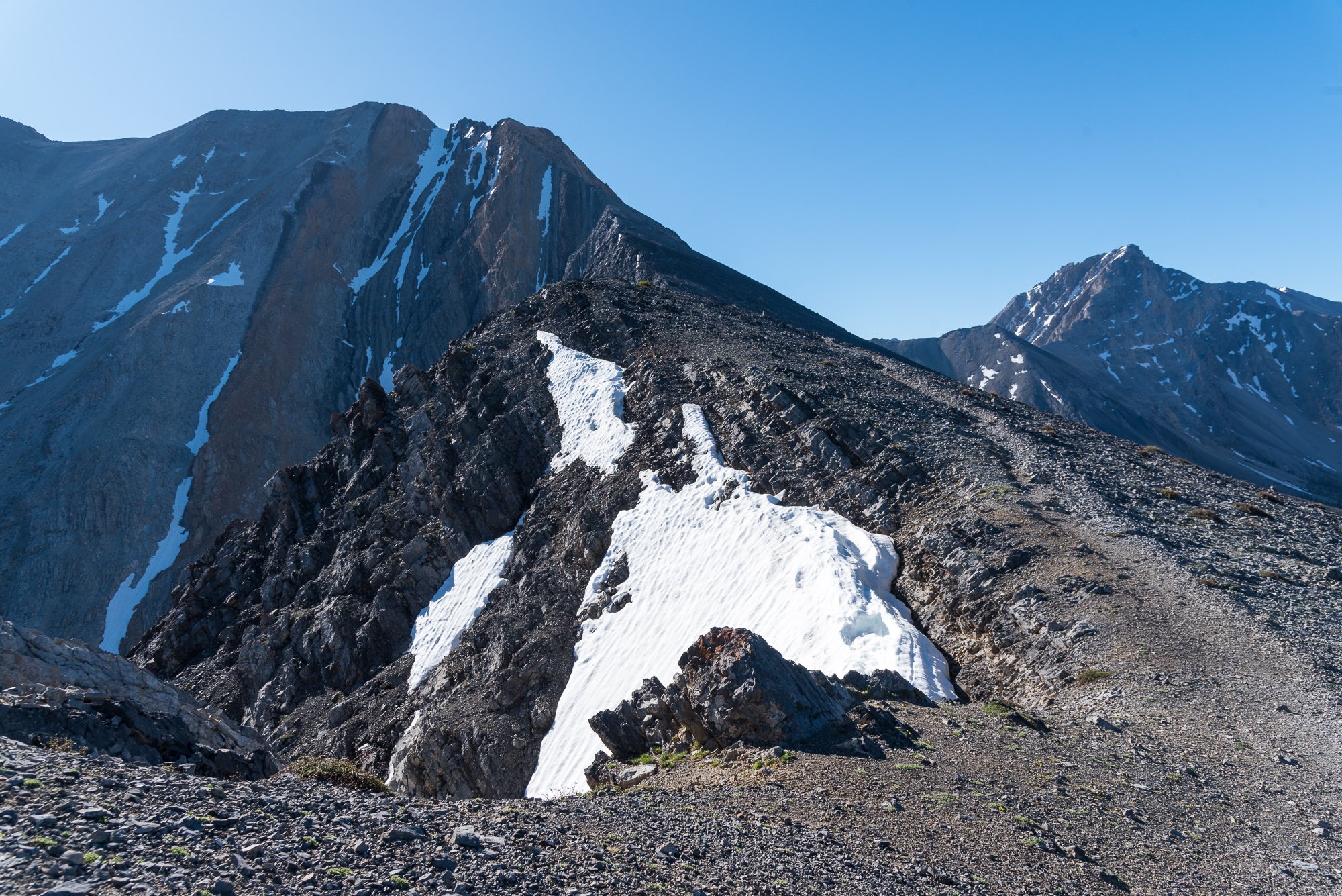
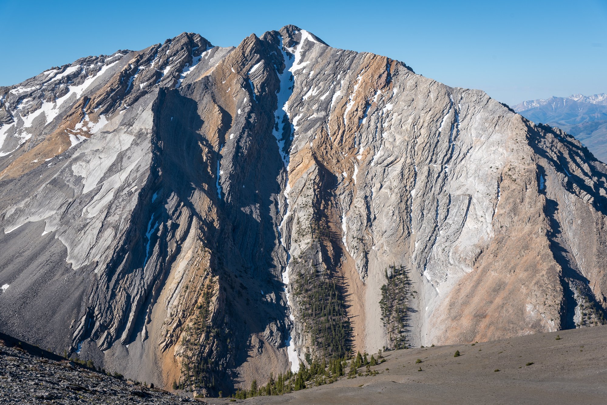
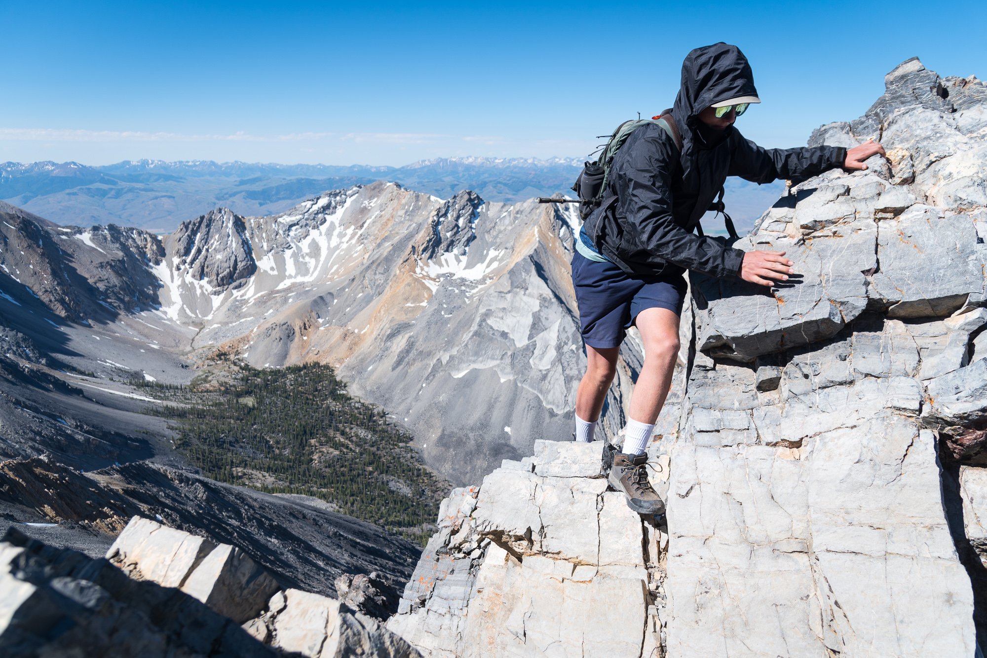
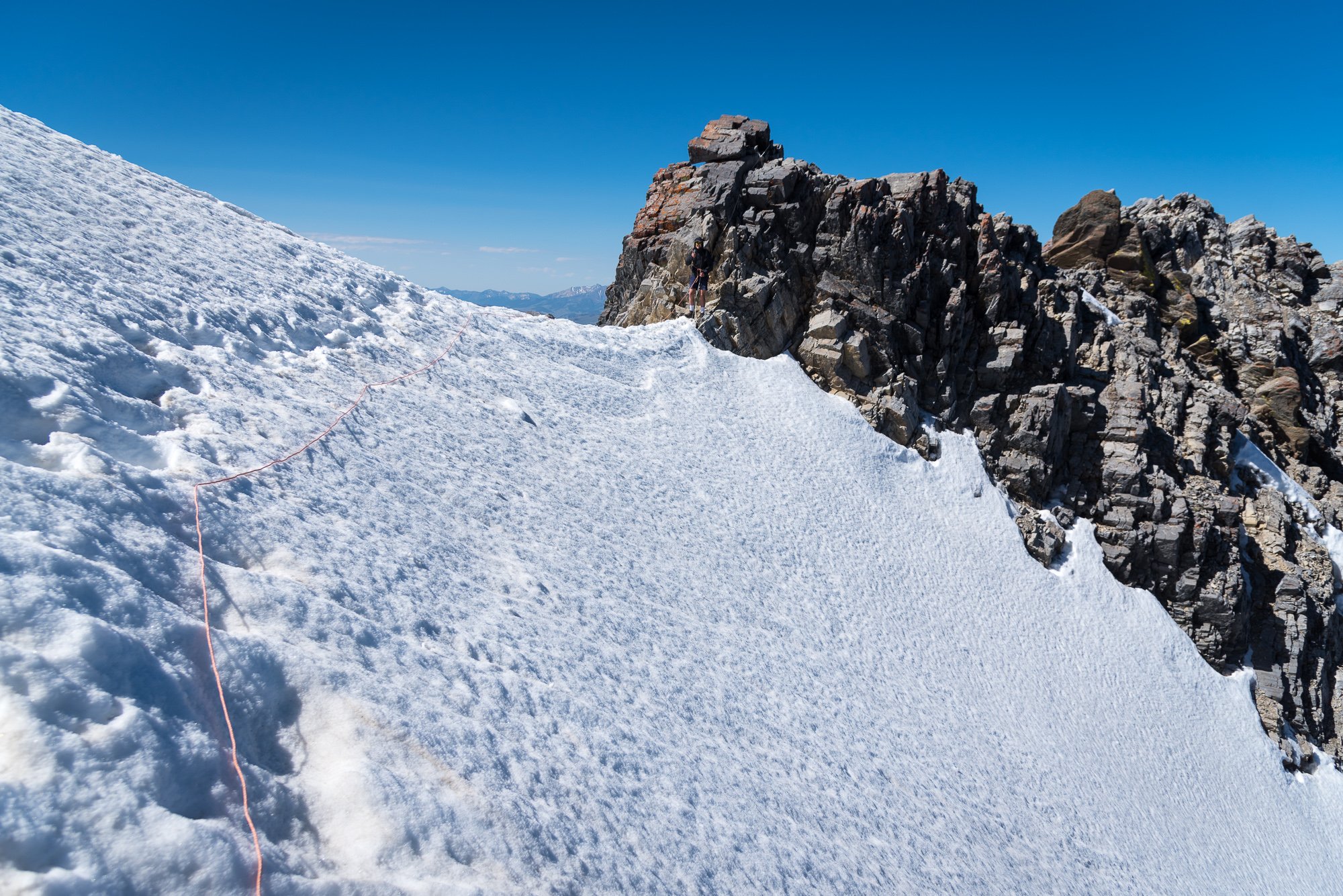
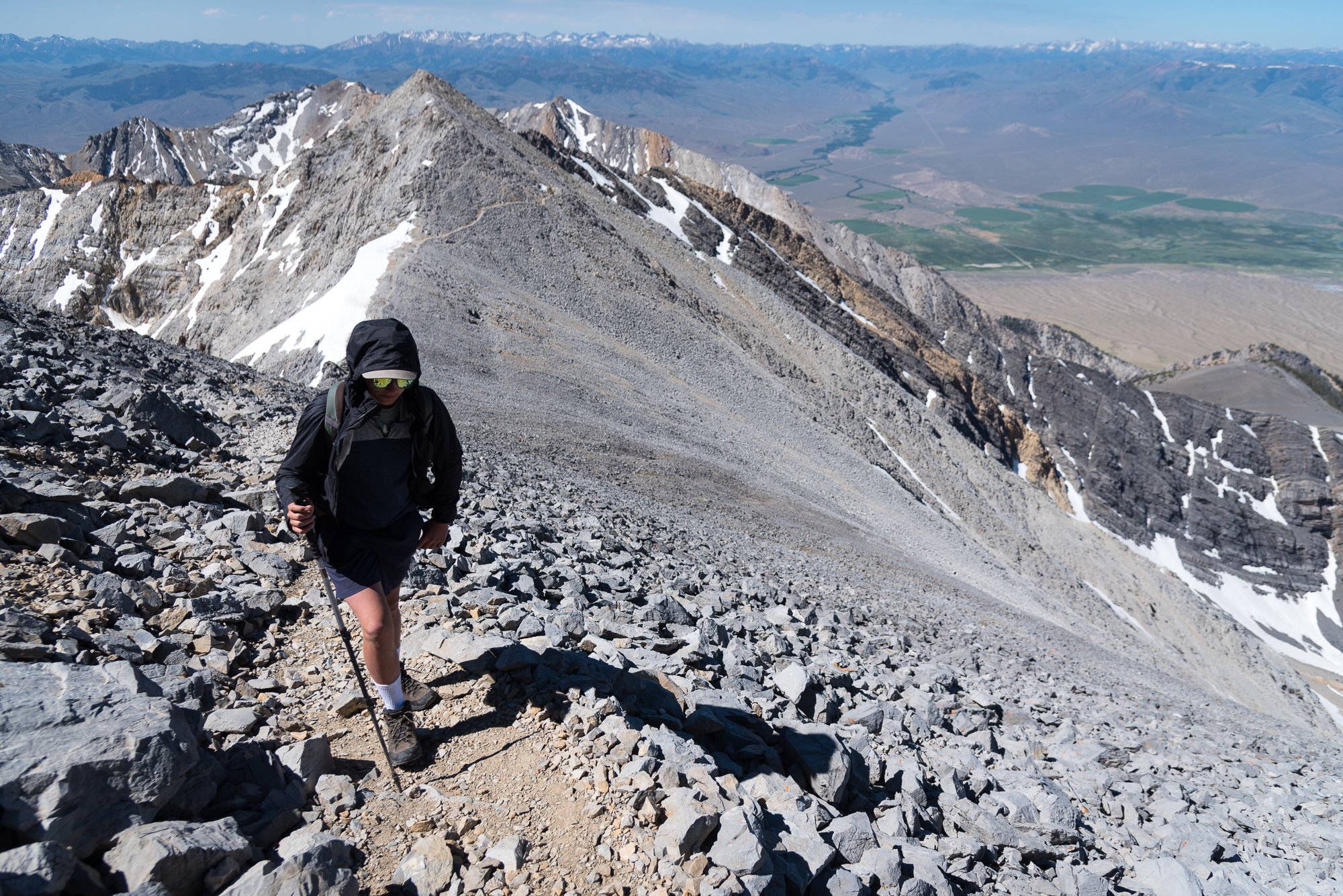
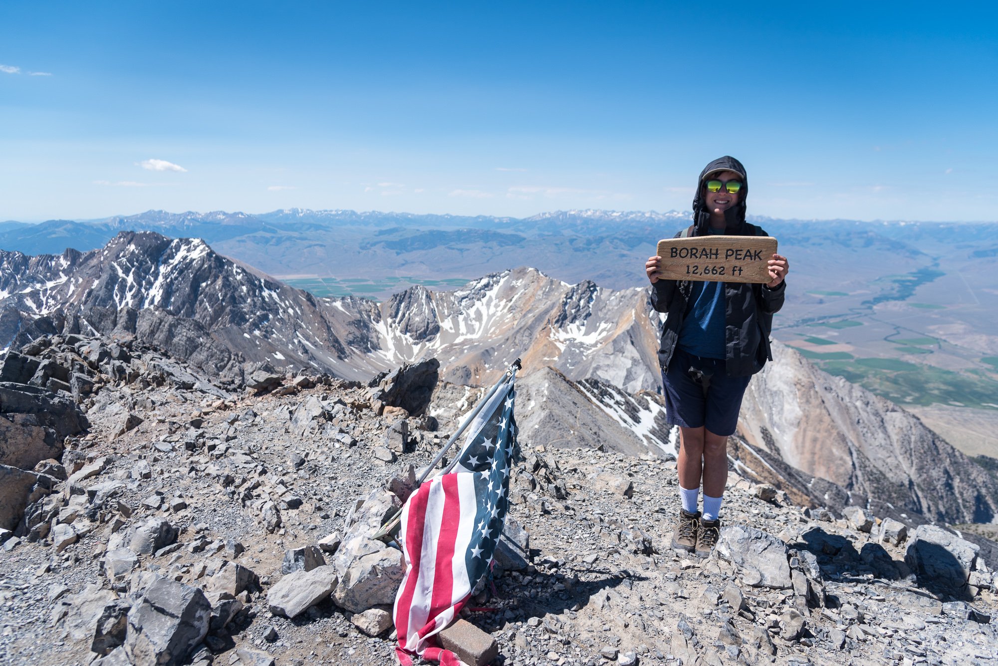
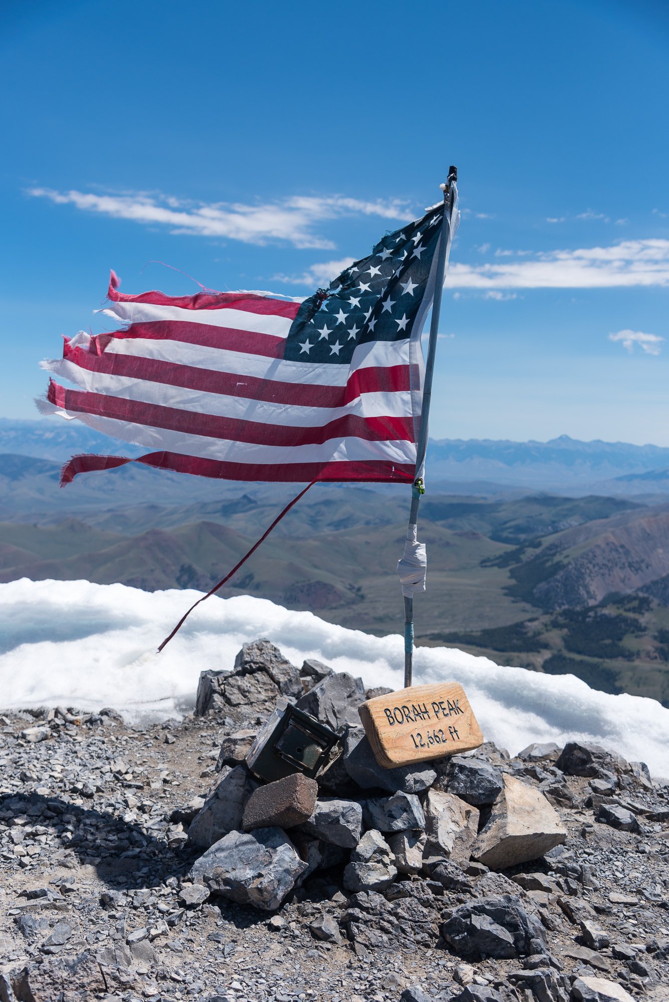
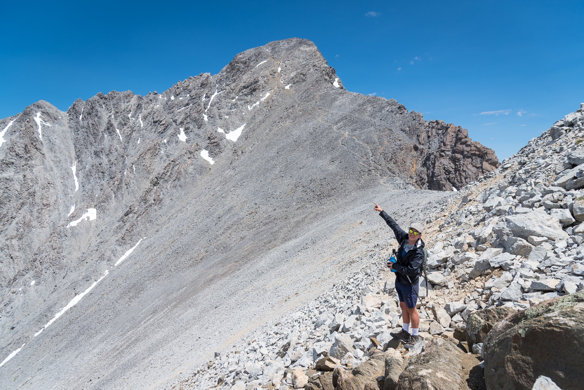
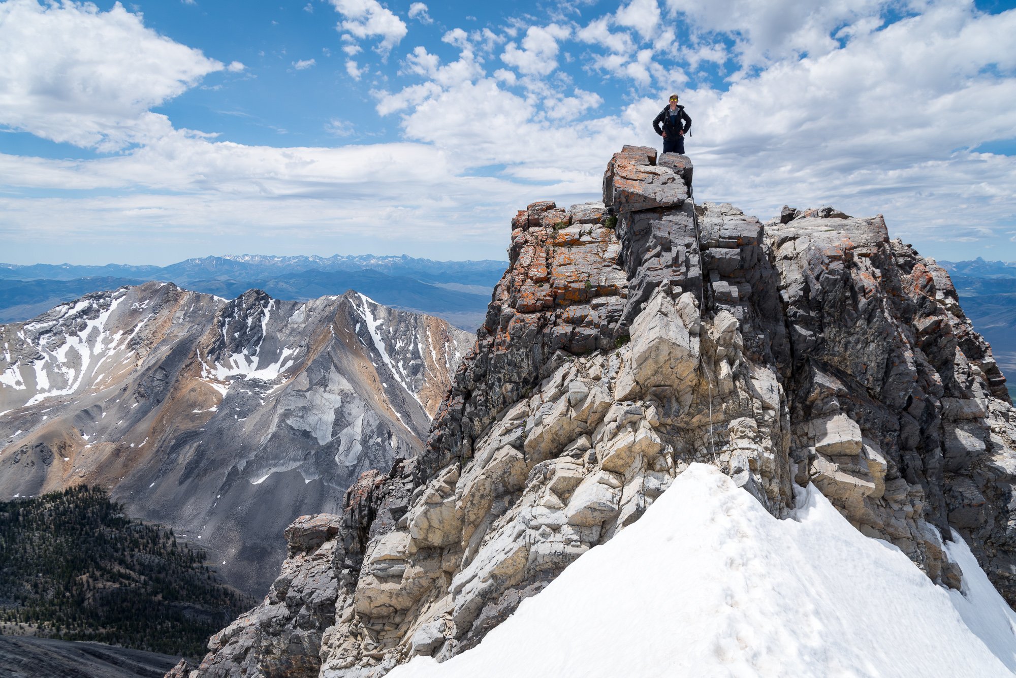
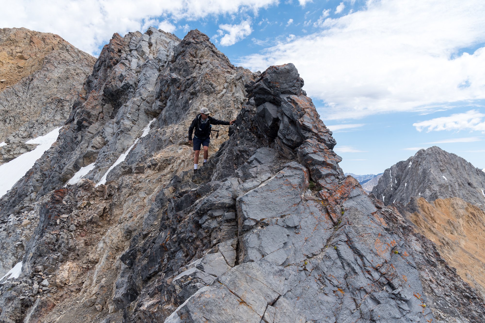
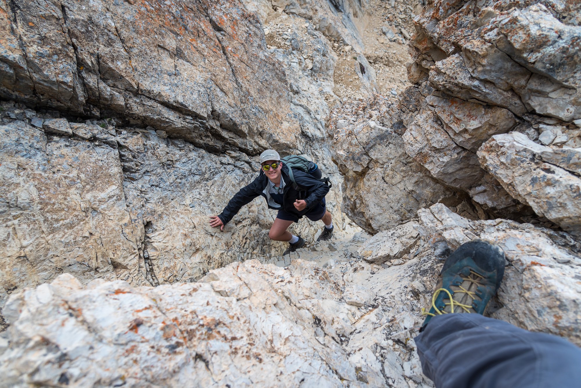
Trip: Borah Peak - Southwest - "Chicken Out"- Ridge Trip Date: 06/29/2024 Trip Report: This past summer I went on a month long, 4300+ mile, road trip with the family all over the West. Mostly we were seeing National Parks that my wife and kids had never been to, but I managed to plan 3 state high points into the itinerary. Borah Peak (12,662') was the first up, coming after a tour through Yellowstone and Grand Teton National Parks. As with all the state high points, Borah has an abundance of beta online so I'll spare you all the nerdy details and mostly share impressions and photos. First, I thought this was a peak worth doing. There is fantastic camping close by at the Joe Fallini Campground, which is cheap and right on a lake with decent swimming and fishing. This campground is about a 30m drive to the trailhead (if you don't blast past it like we did), which puts you in easy striking distance for an alpine start. The views start quickly and expand. There aren't a lot of trees in the Lost River Range and it was fun to see an entirely different range where I basically knew none of the summits. Soon we were up above treeline and the aptly named "Chicken Out" ridge came into view: As did Mt. Morrison: At the base of the knife edge portion of the ridge, my wife and youngest opted to turn back but surprisingly my oldest stuck right on my tail. I had a quick chat with him to make sure he understood that while it wasn't overly difficult (exposed 3rd/4th class), a fall would likely be very, very bad. He said he was fine and was moving calmly and confidently, and so we continued upward. Where the knife edge ends, there was a small snow saddle to cross. Again, not hard, but with a terrible and steep runout. Again, another chat. This time I insisted in tying on a 30m length of 6mm cord I had brought so as to keep my son from a very long ride should he slip out of the steps and not arrest. Of course, he was fine, but I felt better with the added security. And then the real slogging began. We were over 11k with the summit in sight, and surprisingly all by ourselves. My son began to slow way down in the thin air. It was by far the highest he had ever been but appeared to be in good spirits and so we just kept chugging upwards. And then, we made it, finding one other dude up there taking a nap. I think we may have surprised him. We hung around in excellent weather for at least an hour, reading the register, taking in the views, and generally enjoying a perfect day on a high peak. It doesn't get much better! But, of course, all good things must end and so we turned around to begin the 5k+ of downward staggering. Here's a view back at the summit after we had dropped about 1500': And then to reverse Chicken Out Ridge.... of which I was a bit nervous for my son, but he of course thought that it was all just a great adventure: Looking back at the upper mountain from just above treeline: We finished the day back at Joe Fallini Campground, treated to a beautiful sunset as the cattle lowed in the distance. The next day we would begin the trek SE to King's Peak in Utah for a 4th of July Ascent (in the next installment!)... Gear Notes: Poles, helmet (optional), crampons/axe if snowy Approach Notes: The trailhead is located north of Mackay, Idaho along US-93. Look for the signed turn between Mile Markers 129 and 130. Drive to the end of the road where there is camping and an outhouse. It is a bit grungy there, however, and much preferred BLM's Joe Fallini Campground close by.
 1 point
 -
I’ve had little to no motivation for TR writing this last year, but figured I should try and get this story out into the world before I forget some of the fun details. Last April Eli Spitulnik and I flew onto the Ruth Glacier with about five weeks of food. We hoped to stay there until it warmed up, then bump to the Tokositna to do some climbing on Huntington. We got deposited right next to a very cold and dejected Brit and Slovene. The winter cold was still holding on strong, with nightly winds burying our camps regardless of how recently it snowed. Tom and Gasper had been there for about a week already and spun tales of vertical sugar snow and towering snow mushrooms. Their attempts on Blood from the Stone, and the direct start to RGG were valiant, but fruitless. Huge thanks to basecamp gear sponsor Kurt Ross. Chamonix style storm day skiing with Tom and Gasper. Who needs a pack anyways? Scouting. After almost two weeks and various attempts on other routes, we began skiing towards the SE face of Bradley at about 3 in the afternoon. Along for the ride was 3 days of food and a rack suitable for El Cap. Our intended line would start on Vitalogy (Zimmerman/Allen 2010) to gain the hanging snowfield in the middle of the face. Once there, we would climb more or less straight up the center of the face intending to finish in a couloir that would take us to the summit ridge. Day 1.) Following the same night climbing method as Graham and Mark, we hung out below the face as it went into the shade. Watching and listening as it calmed down for the night. Once things fell quiet, we began up the approach ramp. At the end of the ramp was a cave guarded by a 25ft tall overhanging mushroom. Still in simul mode, I fiddled in a small nest of gear and began pulling some steep mixed moves to surpass the overhanging portion of the shroom. From off to the side and around a corner 60m away, Eli heard a faint “watch me!” as I hung my pack off a beak and committed out onto the face of the shroom. Kicking myself for leaving the picket at camp, I beat the mushroom into submission until I was able to flop over and into the cave. Downclimbing from a gear cache on an early "false start". The weather changed and we decided to retrieve our rack the next morning and pivot to a different objective. The start ramp continues out left. Eli mantles onto my pack before stepping out right onto the mushroom. The next few pitches were some of the most brilliant mixed climbing I’ve done outside of a crag setting. A perfectly splitter slightly overhanging #4 crack, and short pendulum took us out towards the lip of the cave, where ice blobs allowed for an easy exit. A pitch of junky slush and a short traverse (dubbed M5R in the Vitalogy topo) took us to the M6 turf flakes pitch. A wonderfully long series of dirt filled grooves and flakes just frozen enough to get good sticks. By the time Eli made it up to the belay it was officially dark. Eli pulled on his rock shoes and took the lead. He took us out right up a well protected corner that gained a pillar, then up and right out into the slabs below the snowfield. Following in my crampons, I scratched my way up to the most heinous hanging belay. Balancing on crystals in my mono points I belayed as Eli swapped back into boots and began a long extremely runout traverse crossing fingers of barely refrozen snow over slab to gain the snowfield. Desperately sliding out of glassy fists. Delicious blobs Glorious turf At one point while readjusting to keep my legs from falling asleep I turned around to see the sky erupting in green and purple stripes. I shouted into the darkness to look at the sky. A distant hoot followed a moment later and I began lowering out the bags. The rest of the night was a blur of unprotected wallowing up crusty sun-baked facets in an attempt to reach the prow bivy before sunrise. Staring at the rope snake off into the darkness I weighed my options of preparing to unclip in the event of a fall, or try and catch a 120m whip. We arrived at the bivy just before sunrise. My perception of time is beginning to slip. Day 2 After a restless few hours festering in the tent listening to wet slides, we began prepping for another night of climbing. This time we would be leaving behind the comfort of previously traveled terrain and entering an unknown world. Bailing from above the snowfield while likely not impossible, would have been a bad time. More sparsely protected snow climbing took us up to a flared and wet crack feature that Eli dispatched fairly easily in his rock shoes. From there a few pitches of engaging mixed climbing took us to what I expected to be the crux of the route. From photos, a large snow plastered double corner system seemed to be the most obvious way, but it would likely involve some gross aid climbing tactics. We arrived below the feature in fading light as night two began. It looked so much worse up close than from afar. In a last-ditch effort to find an alternative, I traversed left looking for anything else. As I swam my way around the corner, a pillar revealed itself with a perfect wide crack and thin seam alongside it. It didn’t entirely look like it went all the way, but it was a good next step. With high hopes I began trying to free climb my way to the top of the pillar. The climbing was wonderful, but as soon as my feet began to skate off the sloping edges, all style went out the window. I took my crampons off and went full aid mode. From the top of the pillar, the seam kept going as the angle lessened. A mixture of direct aiding off of my tools and free moves on massive granite jugs took me to a generous belay stance. We were likely through the hardest pitch, but still had a lot of mountain above us. Some slab climbing in double boots took me to a delaminated slabby smear of ice. I equalized two garbage beaks and put my crampons back on. Despite my best efforts at being gentle, my beyond dull picks threatened to send me, and this detached smear down the mountain as every kick and swing bounced off. The next several pitches were a lesson in route finding as Eli took us up down and around to the main gut of the face above. I still don’t know where the best way to go was, but a diagonal rappel and some faff took us where we wanted to go. The sun began to rise as we entered a massive funnel that was invisible in the pictures we had. Afraid we’d be swept away if we lingered too long, we shifted into gear and made it to a semi protected bivy before anything had a chance to warm up and start falling. The massive snow choked chimney is visible in the background. When in doubt, traverse. Another restless day of napping came and went without any surprises. At this height, the mountain was much quieter and felt less affected by the sun. At some point in the day, Eli was awoken by a loud rumbling from over in the direction of Mt Wake. He mumbled 6/10 and rolled over back to sleep. A shovel would have been nice. Day (night?) 3 We started climbing at about 5:30 with several pitches of quality mixed and neve climbing. At some point I was pounding a pin when the hammer of my tool snapped off and flew into the abyss. Mildly perturbed I shrugged and continued bashing the hopelessly bottomed out beak with the back of my tool. All around the same time, the sun set, the snow began to fall, and the trenching began. Juuuust enough ice. After a long cold belay, I took over the lead and made one of the biggest rookie mistakes. I had just followed the previous pitch in my down parka but was still chilled, so I chose to start leading the next pitch with it still on. It was some of the most awful steep snow climbing I hope to ever experience. As the snowfall picked up, so did the spindrift. It smacked me in the face and dumped down the back of my parka, melting against my back and freezing the down solid. I was in no position to stop and take my pack off, so just suffered until I could get a belay out of the firing line. One block later we made it to a sheltered flat spot and decided to call it a day. We knew the storm was going to be short lived, so opted to wait it out and continue when we had a better idea of where we were on the mountain. Beginning another pitch of trenching Spindrift avalanches lulled us to sleep as they scraped over the top of our tent. After about ten hours, the storm seemed to be subsiding. Slightly worried about our skis getting buried at the base, I texted Tom asking if he could go check on them for us. WET Day 4 Two long simul blocks took us to the summit, where swirling clouds gave us brief glimpses over towards Hunter, Huntington and Denali. In an attempt to investigate how overhung the summit cornice was, I tiptoed my way around on relatively flat ground until I could see the other side. I must have taken one step too far, because the next thing I knew I was in freefall. I came to rest about 25 feet down in soft powder with snow filling my glasses. Unharmed, I frantically clawed my way out of the maw. Once free, I damn near fell back into the thing crossing back over to uphill side. Once in earshot of Eli I shouted over to him that I was okay. He just looked at me with a confused gaze that told me he had no idea I'd just fallen. There was so much slack in the system at that point that he didn’t feel a thing. Now I know that summit crevasses exist. Big D showing off. The "let's get the fuck out of here" thumbs up. After a few celebratory summit photos and facetimes with Eli’s family and my partner, we began down. The descent was supposed to be easy, but we knew of a few parties who had epics getting down. It proved to be mostly walking and easy downclimbing. A few easy rappels got us to, and down from the Bradley-Wake col, where we slogged back to our skis at the base. Where's Waldo? How not to back up a V-thread. Upon arrival at our skis, we were greeted with an unexpected sight. ONLY my skis, poles and one skin were stuck in the snow surrounded by evidence of extensive digging and stomping. A ziplock bag with a few jelly bellies and a twix bar were stuck in between the skis. Mildly strung out despite our long sleep the night before, we theorized what could have possibly happened and messaged Tom. 6/10 While repacking, I stumbled across one additional ski buried under the snow, followed shortly by both of Eli’s poles. It wasn’t going to be easy getting back, but at least it wasn’t going to be awful. We limped back into camp at 11:50pm. Happy and ready to lay down for a while. We named our route "sports" due to the ridiculous grade that the route got. Rock climbing, mixed climbing, ice climbing, aid climbing... snow climbing. All the sports. Not to mention the equally ridiculous song "Sports" by the Viagra Boys that kept making an appearance throughout the trip. 3 days later after plenty of rest, we bid Tom and Gasper a farewell and skied over to search for the missing ski and skin. We found the skin nearly 100m down glacier, the ski itself had been blown almost 30 meters from where we left it. Gear drying Style Eli scavenging for leftover food. The lower face had already melted out considerably in the days since we were on it. I'm guessing our traverse to the snowfield on the first day was likely gone the next. That same evening there was an accident on Mount Johnson. The next morning, we woke to the sound of a helicopter and messages from Kevin explaining the situation. We packed up for a rescue, not knowing what would be needed and began skiing down glacier. Clouds were threatening to thwart the helicopter rescue. By the time we got there, Kevin and Louie were already on their way down. We helped coil ropes, feed them and carry back the other party's gear. During our time before Bradley, we attempted “On the Frozen roads of our incertitude” on London tower. Mildly gripped Bailing We successfully climbed “Freezy nuts” to the summit of London Tower First tunnel of the trip Summit of London tower Attempted “Shaken not Stirred” on the Mooses Tooth in a push from our basecamp below Bradley. We made it one pitch from the col but turned around because of continually horrendous snow conditions. 24hrs camp to camp. Crux pitch. Felt like M7 conditions. Ropes going everywhere you don't want them to. Getting psyched to ski back down into the Ruth. After Bradley we flew to the Kahiltna and made a half assed attempt on the Bibler-Klewin on Hunter. Great conditions if you don't mind having no pro. Climbed “It’s Included” on Radio Control Tower 1.5 times. Digging the tunnel through the P2 cornice that was used for most of the ascents throughout the season. A solid 2 hour lead. Weather became continuously poor at the beginning of May, so we escaped while we still had a chance and became the bunk house locals until we could get a ride back to Anchorage.


 1 point
 -
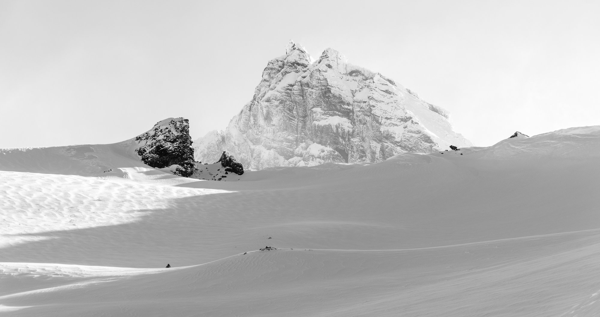
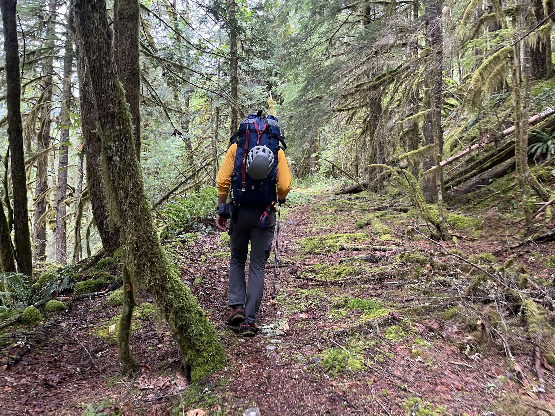
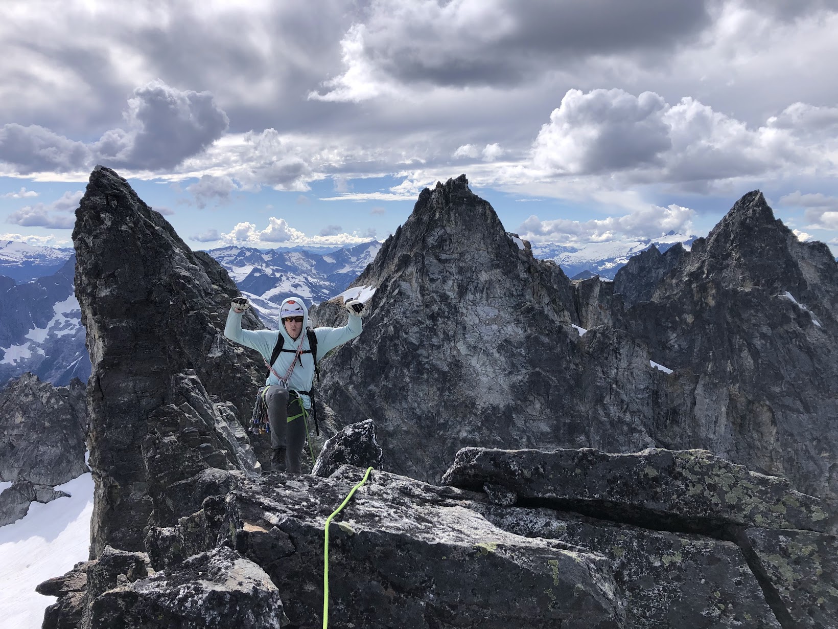
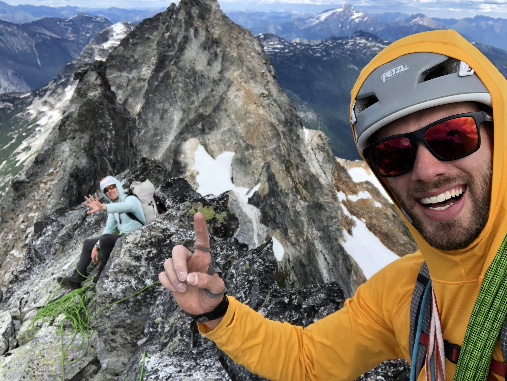
Trip: Picket Range - Southern Pickets Enchainment Trip Date: 8/4-7/2022 Trip Report: It's Pickets season folks! Kurt and I were supposed to be in the Bugaboos last week, but unstable weather encouraged us to stay local and sample a little bit of what the Pickets have to offer. Between weather and work on Monday, we had a pretty tight schedule that was surely going to be a challenge. On Thursday we slept in and got a casual start. AM rain was forecasted, and "all" we had to do was hike in to the base of little Mac spire. As we drove north, the rain poured down. By the time we reached the trailhead there was blue sky poking through, but all the brush was thoroughly soaked. The hike up went on for an eternity, and I was beginning to understand why the Pickets see so little traffic. By the time we made it to the alpine, we were drenched from head to toe, and the cold wind made for some rather uncomfortable slogging up to camp. Thankfully by the time we arrived, we were mostly dried out apart from our feet, which wouldn't fully dry out for another day. Day 2: Little Mac, East Mac, West Mac, Tower 1, Tower 5, Inspiration, Pyramid, Degenhardt. A cold and windy night brought us to a cold and windy morning, but the clouds had finally cleared and we could see our first peak. The brush and soil on little mac was still wet from the day before which made for some pretty unnerving scrambling up the first half of the mountain, but once the sun hit things began to dry out. Little Mac and East Mac went pretty smoothly with mostly scrambling and a couple pitches of roped climbing to the summits. West Mac however provided a little more adventure as Kurt tried to quest up some roofs in the middle of the east face but was thwarted and had to downclimb half a pitch. Thankfully we found the easy way and were off to the races. The East Towers sucked up so much time, and honestly I don't remember what we did to get through them. Huge props to Jeff Wright for remembering all the beta and writing such a detailed trip report. I wish I had that good of a memory.... or maybe I'd rather forget. Surfin' the East Towers Inspiration was Classic! By far the best climbing on route. Super straightforward, fun and engaging crack climbing. A large panel of the west face of Inspiration fell off some time recently, taking one or more of the rap anchors with it. This involved some downclimbing between stations and lots of loose rock on the rappels. At least one new station would be needed to fully rap the face. Rapping through the rock scar "Hey Kurt, I found the anchor!" Low on water, we brewed up below Pyramid and rested for the rest of the climbing ahead. Kurt took the leads up Pyramid and quested us up into some hard 5.10 roofs that ended up bring the crux of the entire traverse. We still have no idea where that 5.8 chimney is. Or where we were for that matter. We forgot to take a picture on top of Pyramid, so here's number 7! Summit 8! Having lost a fair bit of time, we raged up Degenhardt at sunset. Racing the fading light, we traversed along the ridge over to the base of Terror and the supposed "excellent" bivy. We didn't have to climb with headlamps! A cold wind howled up the north side, sending morale plummeting. The only somewhat flat spots were on the frigid windy side of the ridge so after an unsuccessful attempt to rig up my tarp to block the wind, we opted to engineer our own spots to the south. We were both somewhat successful in digging out our own bivys, and went to bed late and exhausted. Day 3: Terror, The Rake, The Blip, East Twin Needle, West Twin Needle, Dusseldorfspitz, Himmelhorn The next morning came too soon and we started with Terror for breakfast. The east ridge went quickly and the mountain most definitely didn't live up to the name. Summit of Terror for the actual ninth summit. The Rake, similar to the East towers sucked up an incredible amount of time. We went too high on the first gendarme and had to downclimb the ridge to get to the 5.7 traverse. The rest was just slow route finding up along over and below the ridge. Low on water and with a lot of climbing still ahead of us. We brewed up again below The Blip, four more towers standing between us and camp, two of which being the 5.10 cruxes of the route. Summit 10! Wonderful rap anchor off The Rake. We cruised over the Blip and up the lower pitches of East Twin Needle. A little intimidated by the 5.10 crux, I took the lead up the spectacular knife edge ridge to where it kicks back to a slight overhang. With my pack feeling heavy, I sized up the moves above me, poked my head around to the left and balanced my way around the corner. Skipping the crux. With that out of the way, we raced down up and over West Twin Needle and over to the base of the intimidating East ridge of Himmelhorn. As the only one who brought rock shoes, I took this crux pitch as well. Pulling around the corner I was greeted by a fixed nut, and wild face climbing on hollow sounding rock. It wasn't all too hard, but by feet and calves were pumping out from the heavy pack and everything we had done up to that point. Thankfully I pulled it off without a hitch, and all the hard climbing was behind us. This pitch is probably only around 10a/b, but I absolutely would have called it 10+ if I had climbed it as an onsight first ascent. The overnight pack certainly doesn't help. Summit 13 and the east ridge of Himmelhorn trying to intimidate us. Dusseldorfspitz! Gipfel 14! Day 4: Ottohorn & Frenzelspitz The next morning at the Himmelhorn-Ottohorn col I woke up to sunlight casting off the mountains around us. I must have turned off my alarm at some point and fallen back asleep without realizing it. Kurt forgot to set one as well. Neither of us were upset by the extra half hour of sleep, but knew we needed to get things moving if we wanted to get out at a reasonable hour. Don't roll over! A quick jaunt up and down Ottohorn started day four. The effort of the last three days weighted on our legs, but the lack of overnight packs made it feel less like a chore. We carried a rope and rack up for the supposed 5.6 summit block, but they never saw any use. Once back down at the col, we scrambled down to the north and around the east face of Ottohorn to reach Frenzelspitz. I don’t think we took the same route as Priti and Jeff, but regardless it got us where we needed to go at loose 4th class with tiny bits of low 5th. Continuing this trend, we scrambled up to the base of the last pitch of Frenzelspitz where Kurt took the sharp end and led us up a short pitch to our final summit. We have a serious problem. This was summit 16. Someone teach us how to count. The descent went pretty much as expected. Lots of knee pain and schwacking took us around Crescent Basin, down stump hollow and out along Goodell creek. Huge thanks to Wayne, Jeff and Priti for all the beta. I can’t imagine how much longer everything would have taken without those detailed topos for every climb and descent. Both Kurt and I were blown away that the FA team of three did it in almost the same timeframe as us, and even tacked on the Chopping Block! Gear Notes: Single rack .1-2 doubles .4-1, One rack "nice" nuts and a half rack leaver nuts, 10 single runners & 4 doubles, 30 feet 5mm cord for rap anchors, 60m 8.5mm rope, Light Axe and Crampons Approach Notes: Over the river and through the woods, then up up up and some more up through more forest until you're finally in the alpine oh god.

 1 point
 -
Trip: Mount Terror - North Face (Stoddard Buttress) Date: 7/27/2013 Trip Report: The name alone is enough to give one pause, but for our party a planned ascent of the North Face of Mount Terror had special significance. Several years ago the mountain had almost claimed Steve's life in a freak rockfall accident, which resulted in a member of his party spending four unplanned nights in the Terror Hilton. For those that would like detail on the accident and aftermath, Steph has a page dedicated to the event on her site. It was only with fast climbing and a lucky cell phone call placed by Steph and Donn, that Steve pulled through. It took a better part of a year after the event for Steve to heal completely from his many injuries, and soon he talked of returning to Terror. For a variety of reasons (were we all still too afraid?) the return ending up taking four years to materialize. While I don't know what Steve and Gord were thinking, the accident still weighed heavy on my mind as we made plans to head up on a focused mission to climb the North Face of Terror over three days. Though none of us expressed any misgivings aloud, I think we all felt that this wasn't going to be an ordinary climb, though hopefully safe. Knowing that we had a strenuous approach ahead of us on day one, we got a decently early start, stopping at the ranger station en route to the new Goodell Creek TH. The old road was in better shape, brush-wise, than I last remembered it, and about 1.5 hours from the car we were embarking on the dreaded Crescent Creek climber's path. Fortunately for us, this "trail" has seen a lot of use in the last five years and was much, much better than I last remembered it. Even still we had to pay attention to stay on it, but really there isn't much bushwhacking to speak of any longer. Still, with 6K of gain to Terror camp, we didn't exactly fly up. I think it was about 7.5 hours to Terror camp (space for two small tents). The next day we got up at 0400 and were away by 0500 towards the Ottohorn-Himmelhorn col. This was the first challenge of the day and it wasn't that easy in the mid season conditions we found. Hard steep snow, 4th class choss, a couple raps, and some moat action later and we were established on the Mustard Gl. and could begin our weave towards the route. The Mustard was already pretty broken, more so that we were expecting, but we were able to find our way over to the route without too much trouble. The first bit off the glacier was mostly 3rd and 4th class and we scrambled to the left edge of a permanent snow patch and roped up. I'm not sure what time this was, but the approach had taken a long time. Steve led the charge up and left to the crest, gaining it a few hundred feet below the accident site. As a team of three, we had one leader just off the middle of the rope and the two followers behind. This forced us to simul probably more than we would have otherwise, hopefully speeding up the large amount of climbing on this route. While the climbing was pretty easy on the lower buttress, it was steep enough with just enough pro to keep us on our toes. Immediately below the accident site, we did a rap off the crest down to easier ledges to get around a particularly steep step in the ridge (Beckey talks about this). On the way to regain the crest, we ran smack into the "Terror Hilton" and the gear left from the accident. We stopped for a break and quietly contemplated the scene. I have to admit that it was spooky and didn't do much to lighten the mood, considering our position on the wild north side of the Southern Pickets. After a bit, Steve and I grabbed some gear (some still remains) and off we started up into the unknown, past the fall site and above. The buttress began to steepen and we made sure to take our time to keep everyone safe, considering the somewhat sparse pro and looseness (though in general the rock is pretty good). Where the original NF route joins the Stoddard buttress we had to scratch our heads for a bit to figure out the right way (I won't ruin it for you), but we continued to find a moderate way through some hard looking sections. This kept the suspense high all the way to the false summit, and I won't lie to say we were all relieved we joined the standard west ridge route in the evening. The wind was rising and mists were swirling as Steve, Gord, and myself dropped off the false summit and climbed on steep 4th class ground to the true summit. What a summit! The whole summit area looks to be ready to fall down the north face, and you are right in the middle of the crazy fence that is the Southern Pickets. The sun made a brief appearance right before sunset and it was one of the more dramatic summits I can ever remember. All the tension of the day was beginning to wash away, then I looked at Steve who had his phone out, checking for a signal. "No Service", Steve said. Ohhhhhhh, right. It ain't over yet, and the sun was fast setting. We didn't waste much time scrambling down the west ridge until we could make a couple 30m raps into the notch. From here a chossy gully, steep snow, overhanging chockstone rap, and more steep snow brought us back to camp, in the dark, about 17 hours after leaving (in the dark). Although we were too tired to really celebrate, the Canadian Hunter went down real easy with our belated dinners and we just sat and savored the twilight, stars, and Milky Way. We had faced the mountain of our fears and came away intact, in every sense. You alpine climbers know the rest of the story- a late start, looking back over your shoulder at the peak on the deproach, the endless road walk, cotton!, food!, BEER!, loved ones, shower, bed, and the rude alarm Monday morning. Steve concentrates on the Terror Creek log crossing. The big cedar of years past is now underwater. Above the worst of it, but still with a long way to go Feeling it, ~6K above the car. Gord checking out Terror for the first time At Terror camp, the team contemplates the day ahead. Rapping into the Mustard Gl. The Stoddard Buttress is the left skyline. Gordo low on the route, Fury behind Gord at the "Terror Hilton". Not a very welcoming spot to spend four nights. Note the rope that caught Steve's fall in the foreground, and water from the NPS that helped sustain Jason in the background. McMillan Spires Steve and Gord at a belay high on the route. Which way? McMillan Cirque is a wild place. McMillan Spires on left, Degenhardt on right, Inspiration in the middle. Nearing the summit, now climbing on the normal route Looking beyond Picket Pass to the Northern Pickets Steve on top of Terror after a very long journey. Looking down into Goodell Creek, past Terror camp, to Despair (L) and Blum ® Mists swirling around the fence Sunset on the Chopping Block and Triumph Gear Notes: 60m half rope, medium rack, Al crampons, helmet, ice axe, tat, rock shoes (if you don't like 5.7/.8 in boots). Approach Notes: The Crescent Creek Climber's path is getting surprisingly well-defined. That said, you need to pay attention to keep on it. Took us about 7.5 hours to Terror Camp1 point
-
Trip: A 5-day rescue operation on Mt. Terror (plus climbs of S Face of Inspiration, West McMillan Spire, Degenhardt, The Pyramid, and Stoddard Buttress of Terror) Date: 7/2-9/2009 Trip Report: By now, I am sure many of you have heard some of the details of the recent 5-day climbing rescue on Mt. Terror in the Southern Pickets. It is heartening when a rescue operation ends well like this one. We were incredibly lucky with the sequence of crucial decisions that were made along the way contributing to the success. Here is the link to the TR on my website which includes the story of the accident and successful rescue as well as several photos: http://sabegg.googlepages.com/terror'>http://sabegg.googlepages.com/terror Here is a small sampling of the photos in my TR: Again, here is the link to the TR on my website which includes the story of the accident and successful rescue as well as several photos: http://sabegg.googlepages.com/terror1 point

