
eeelip
-
Posts
21 -
Joined
-
Last visited
-
Days Won
8
Recent Profile Visitors
1567 profile views


eeelip's Achievements
")


-
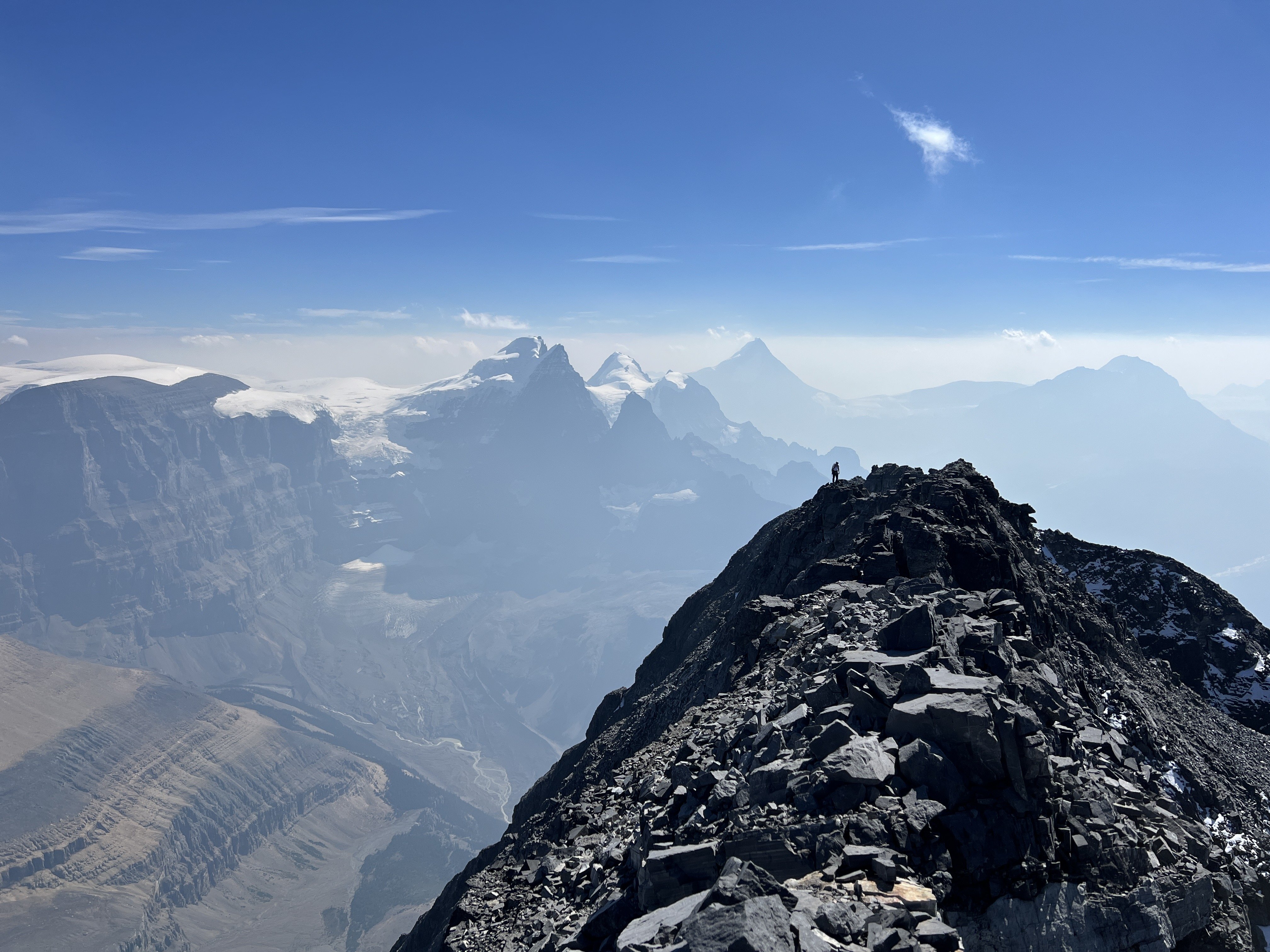
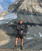
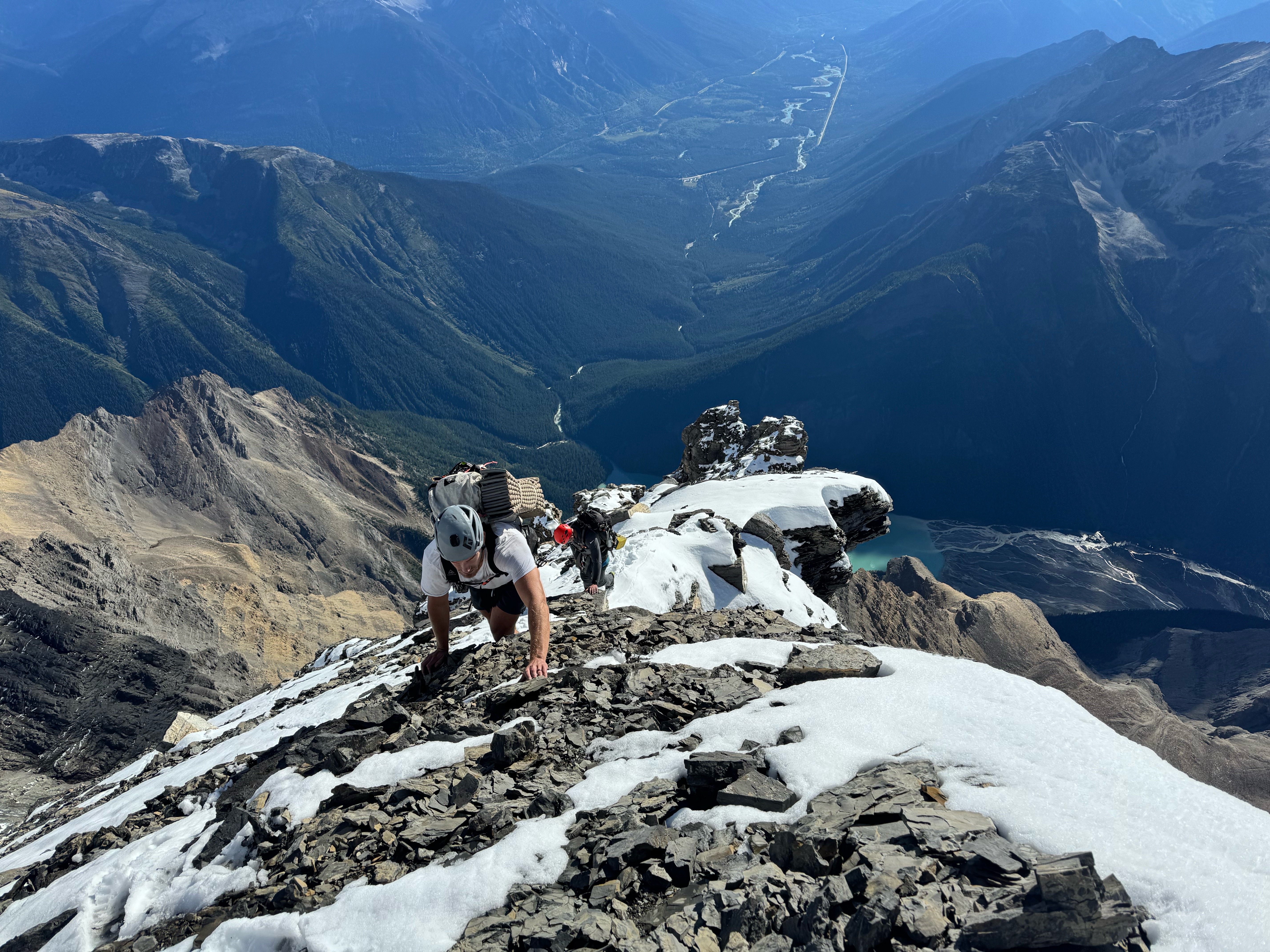
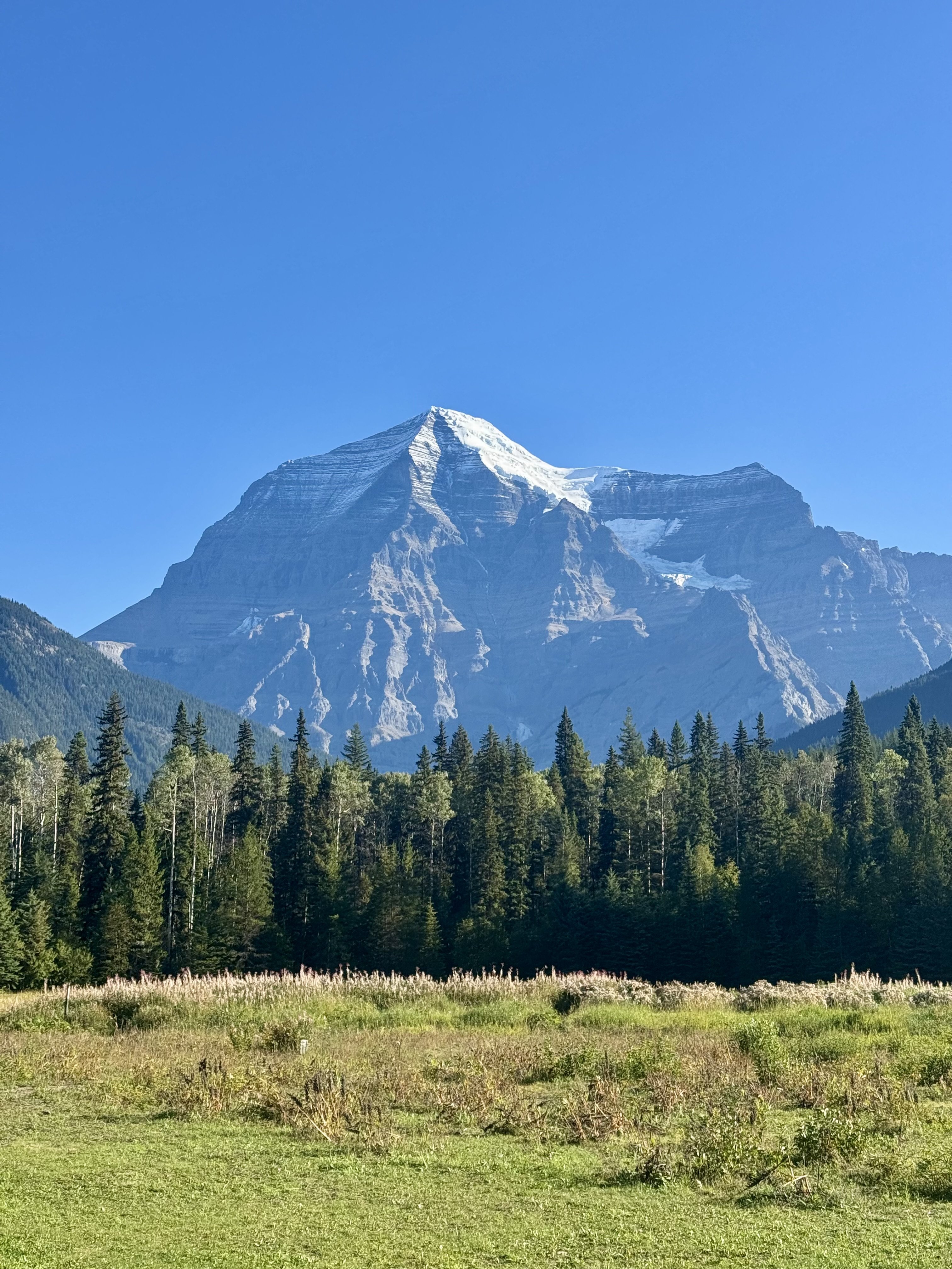
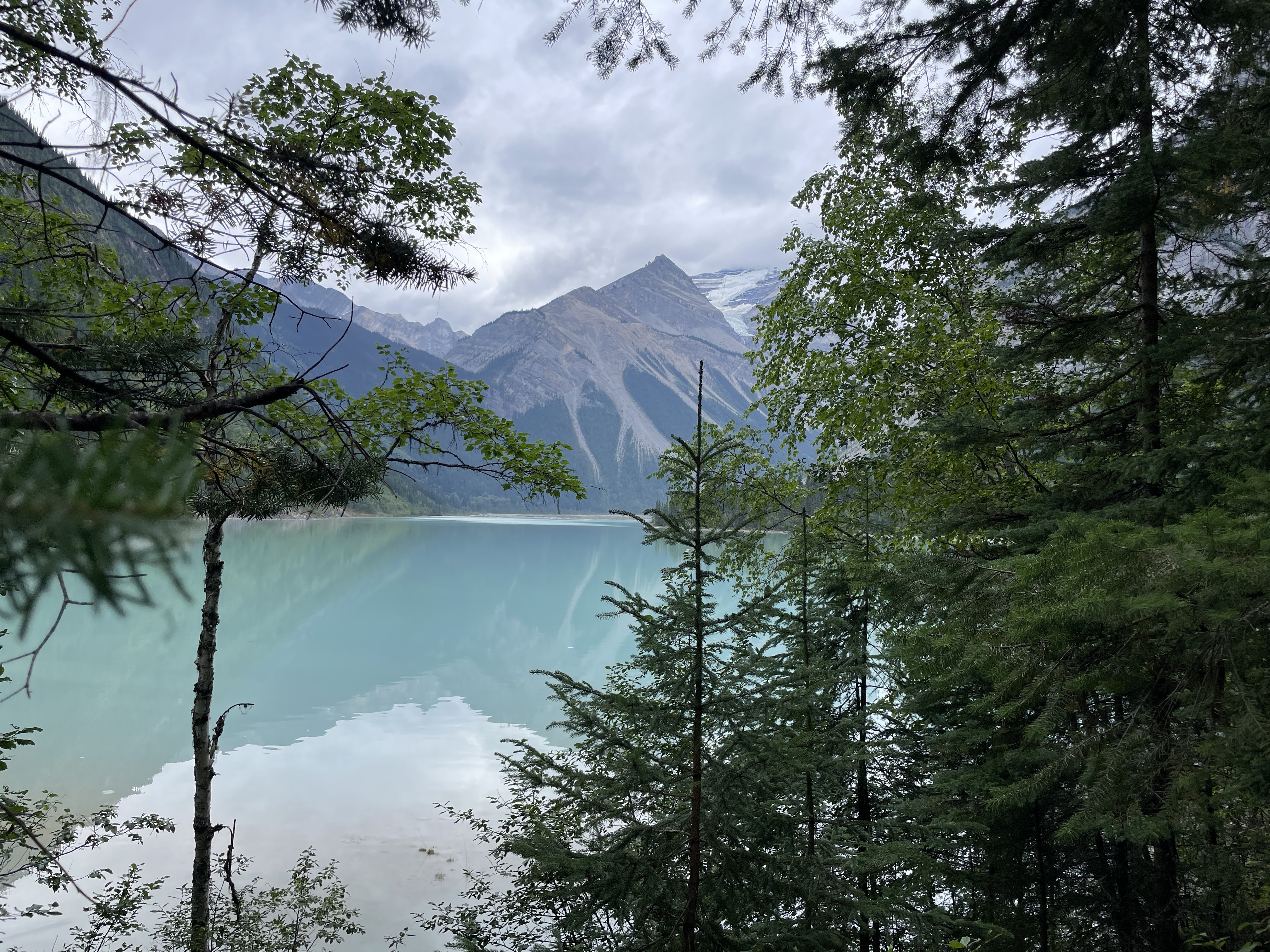
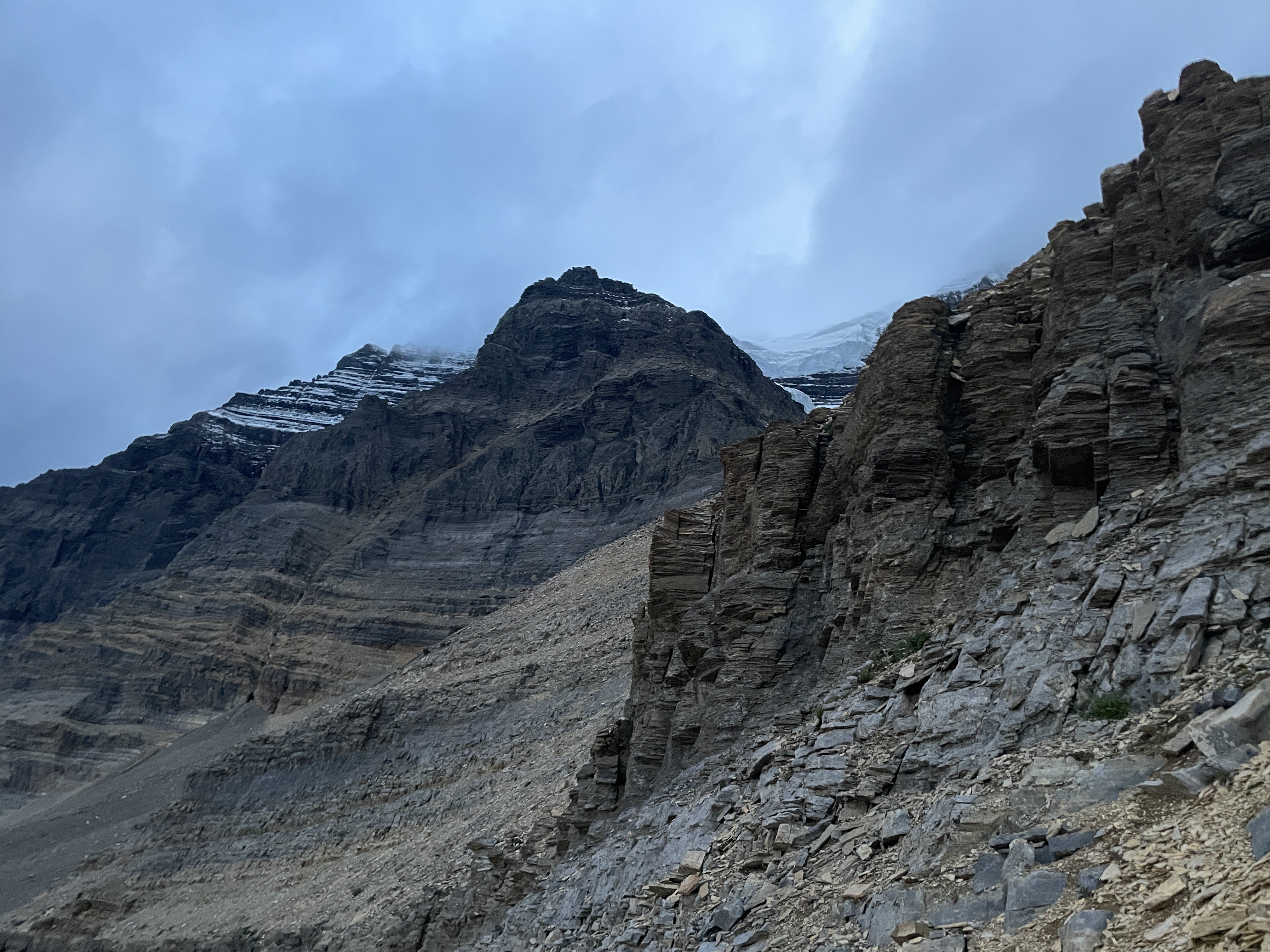
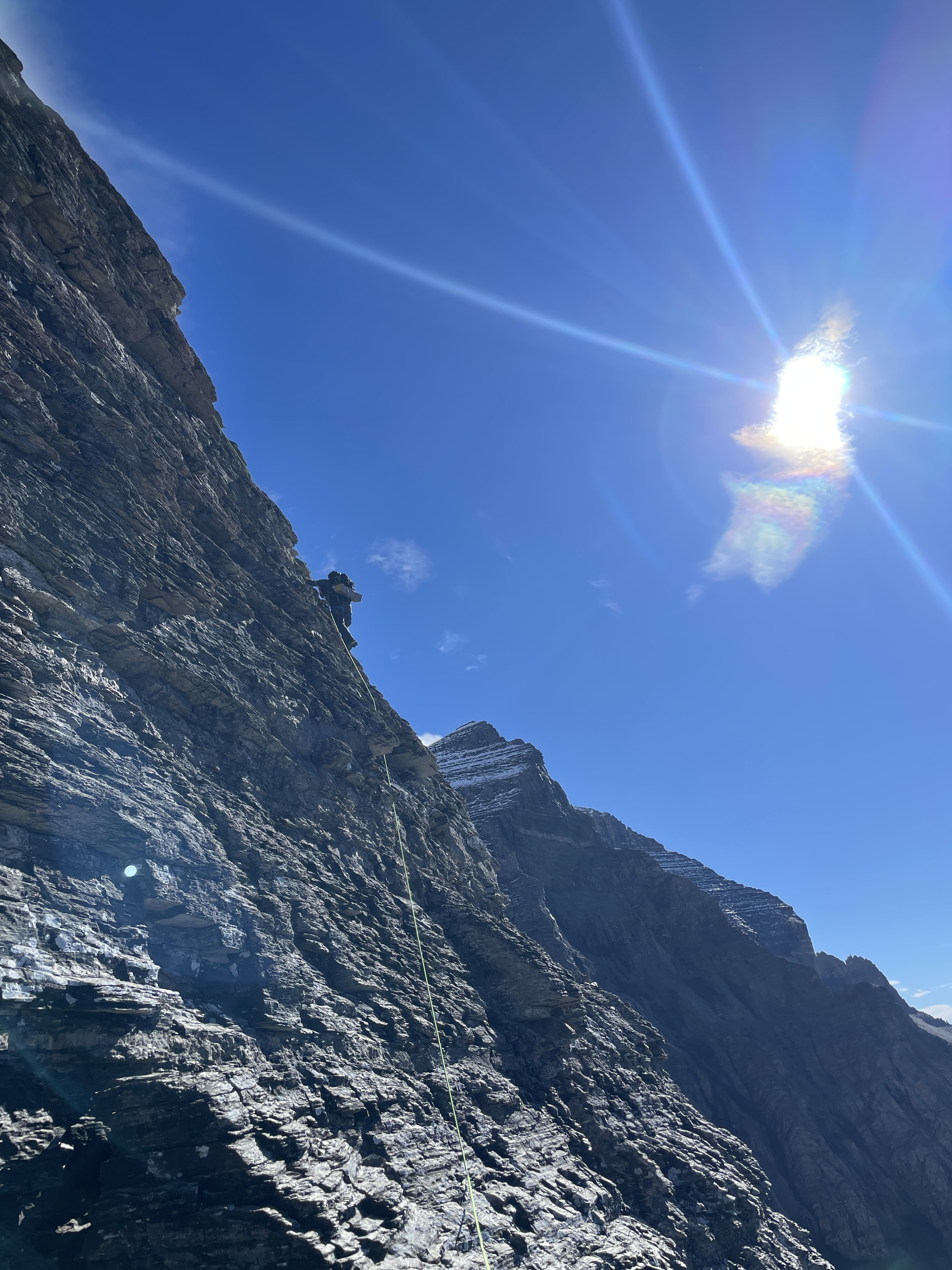
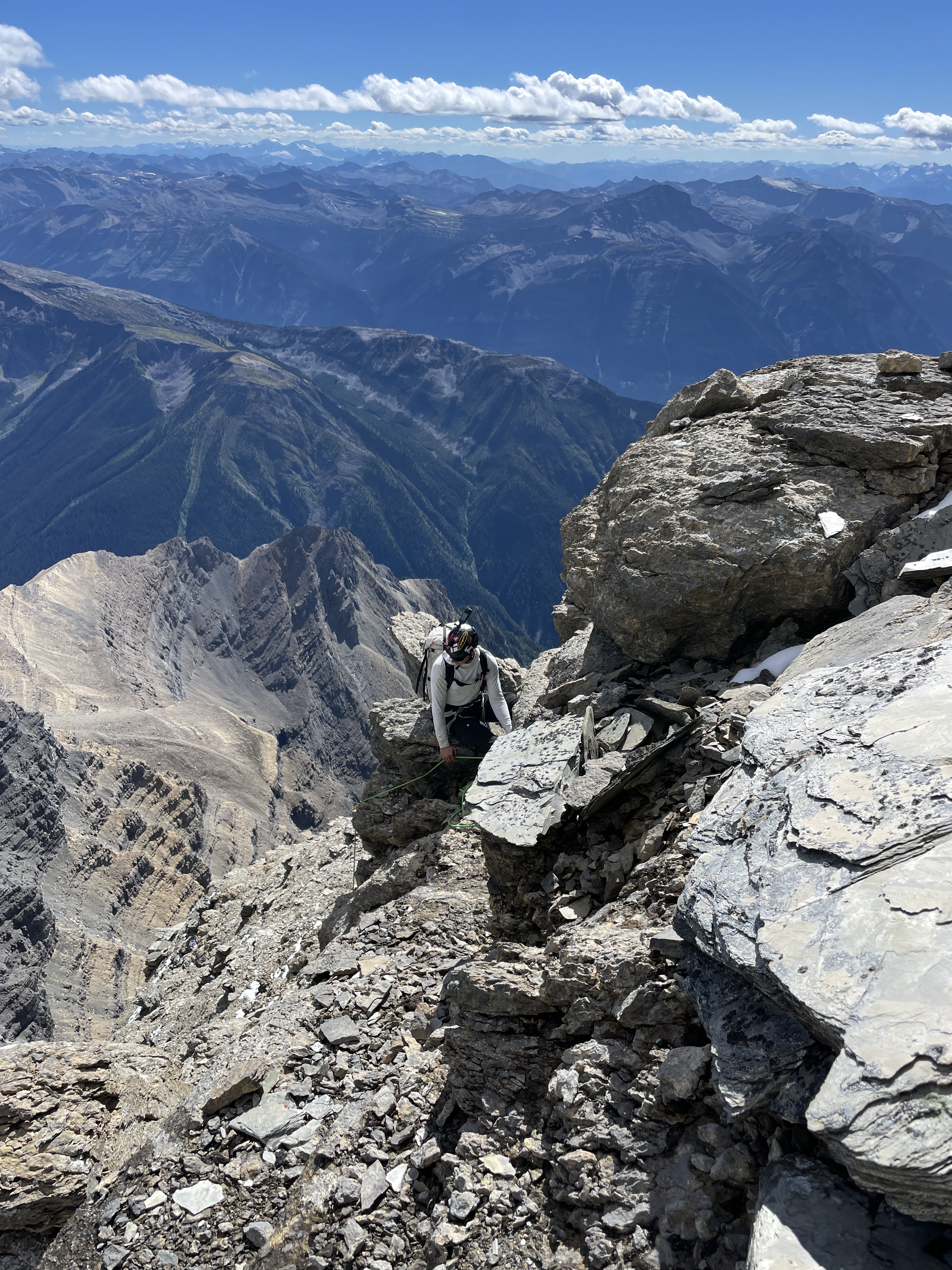
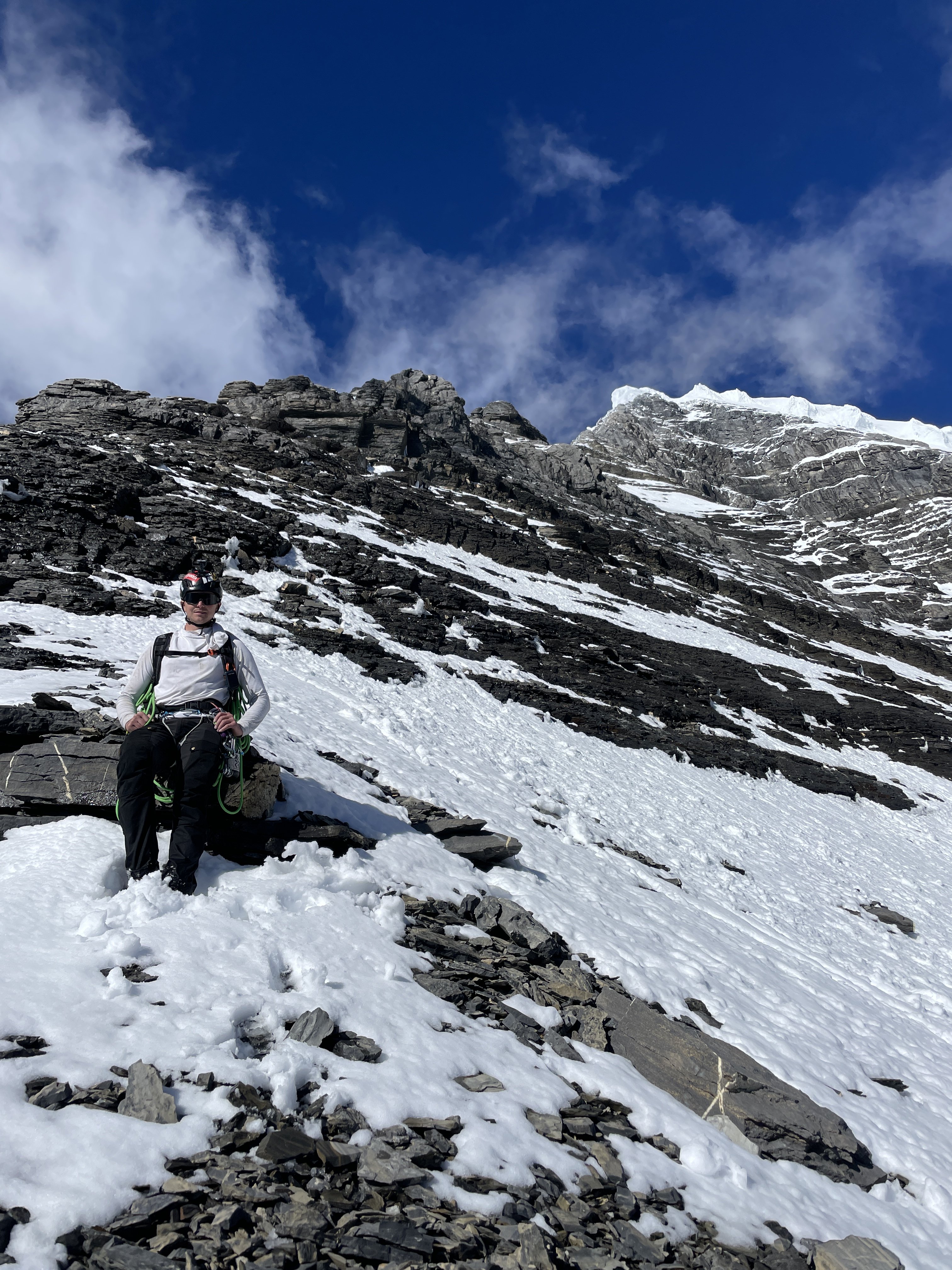
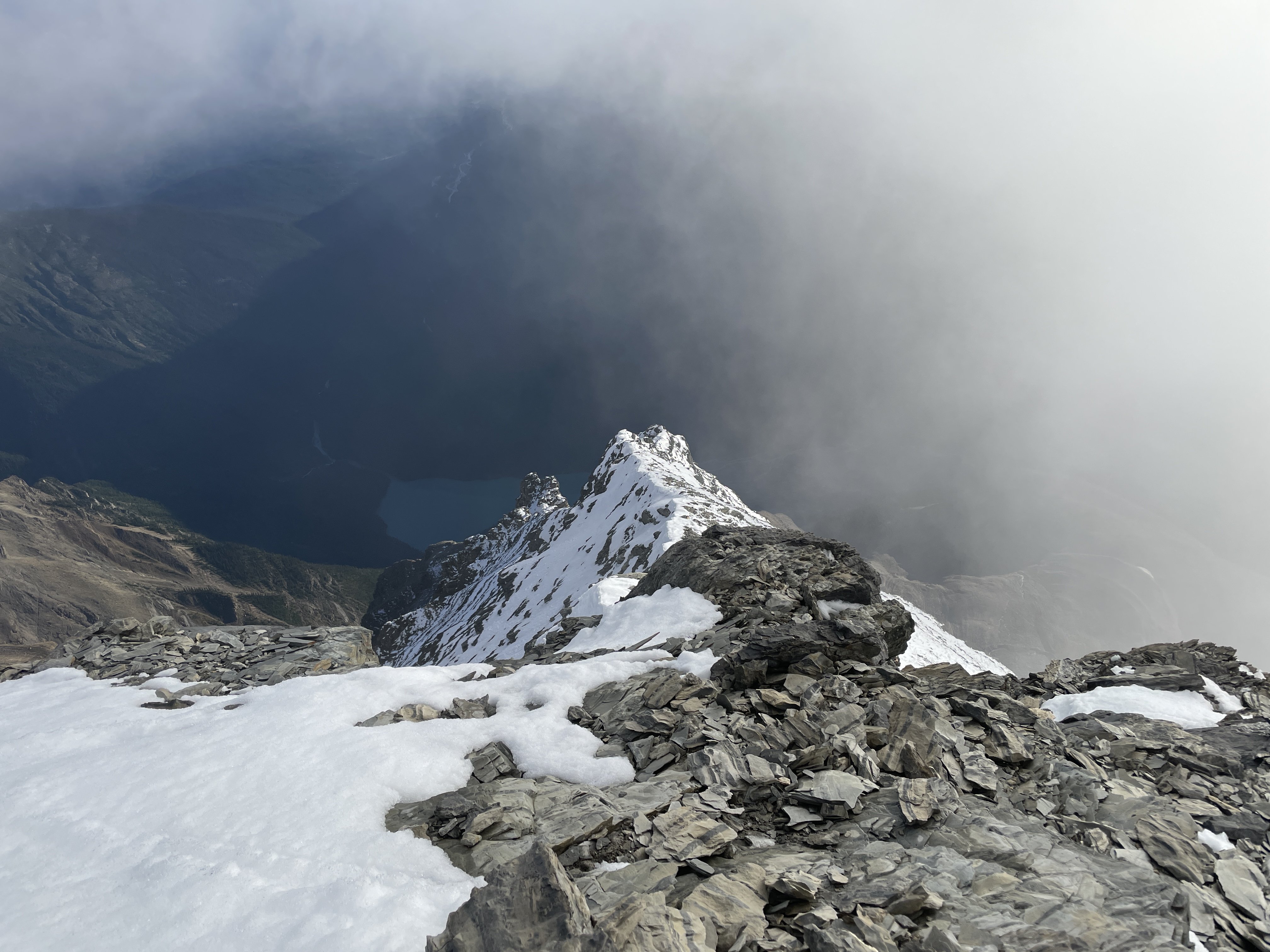
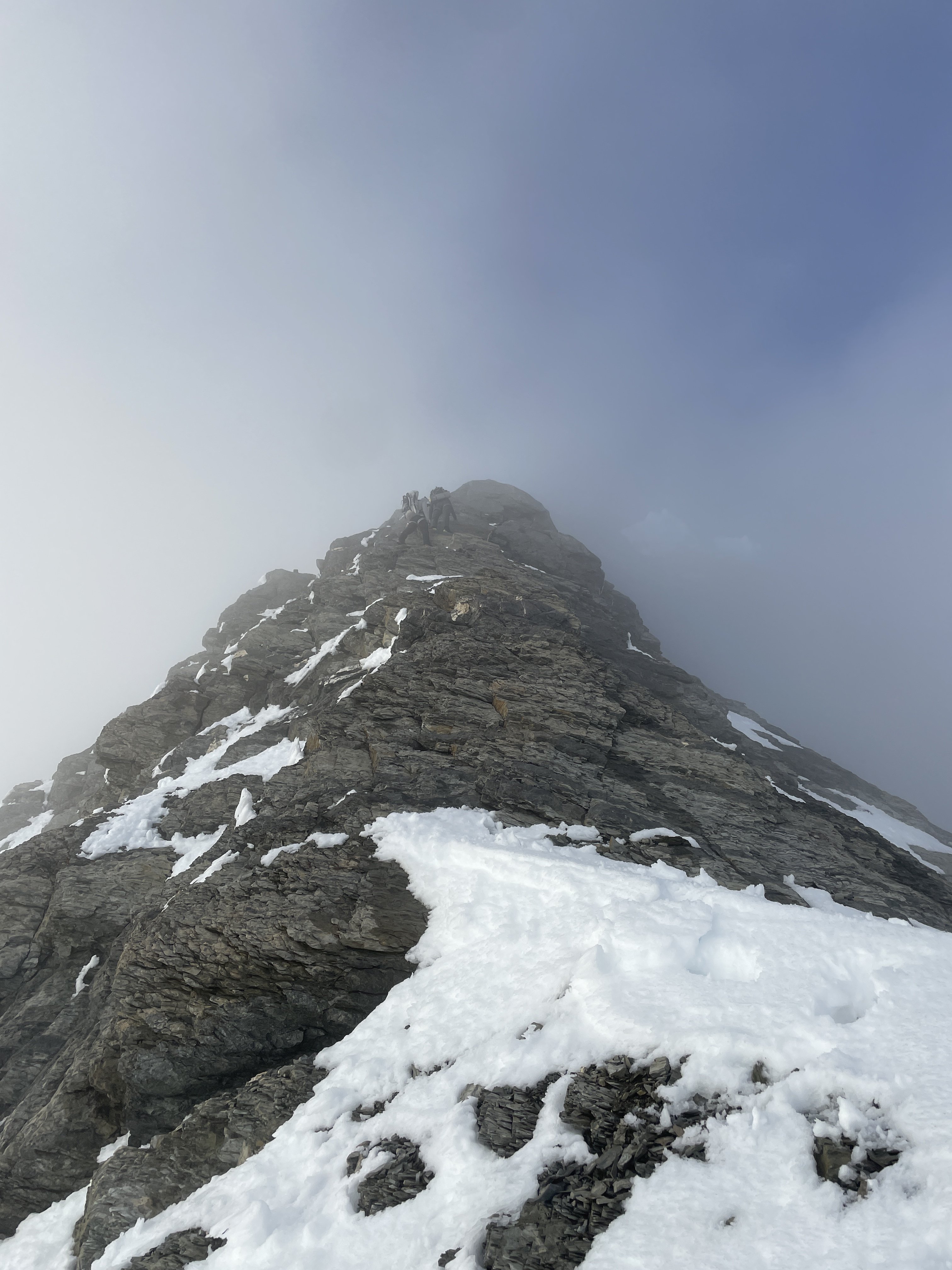
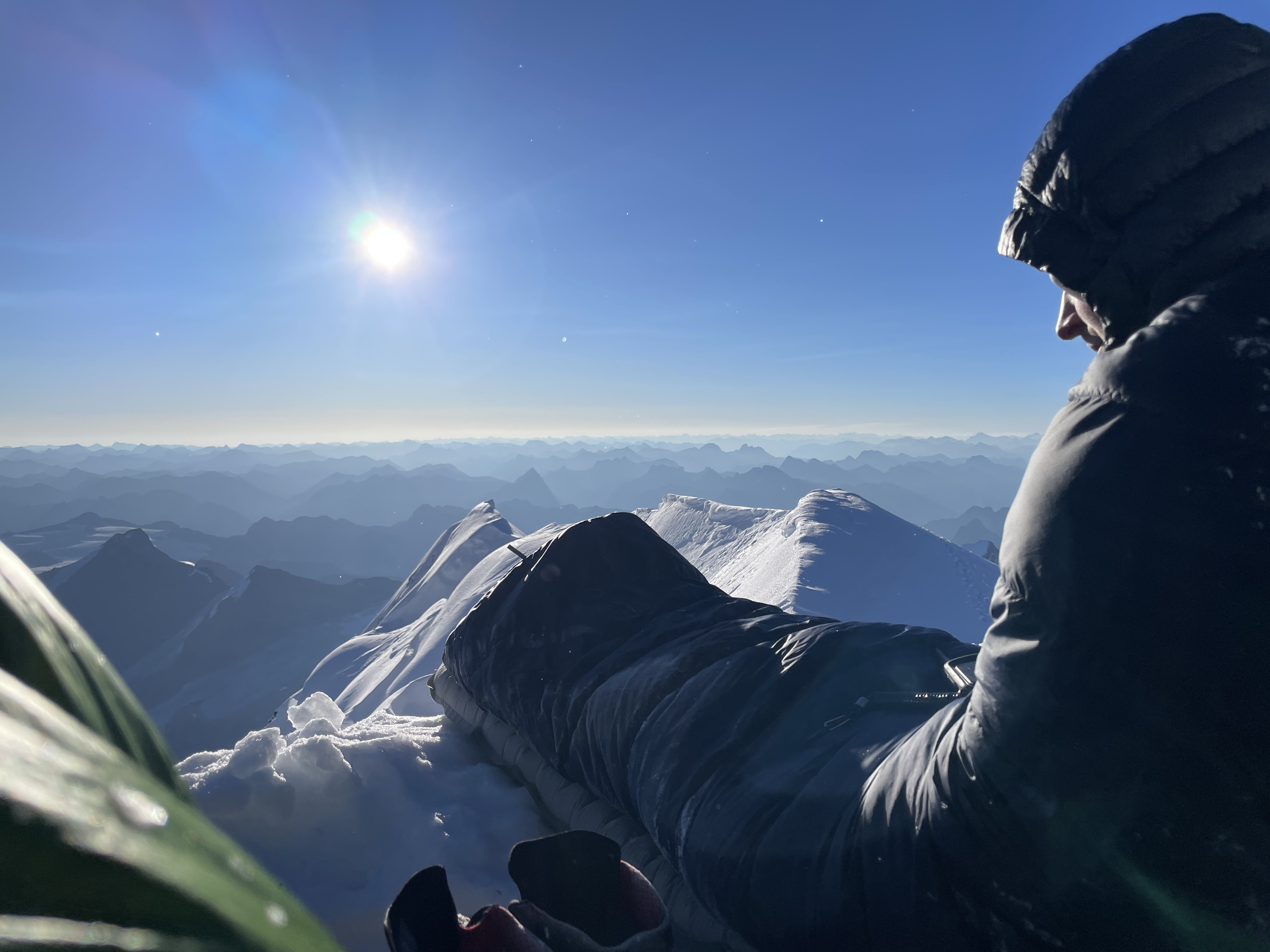
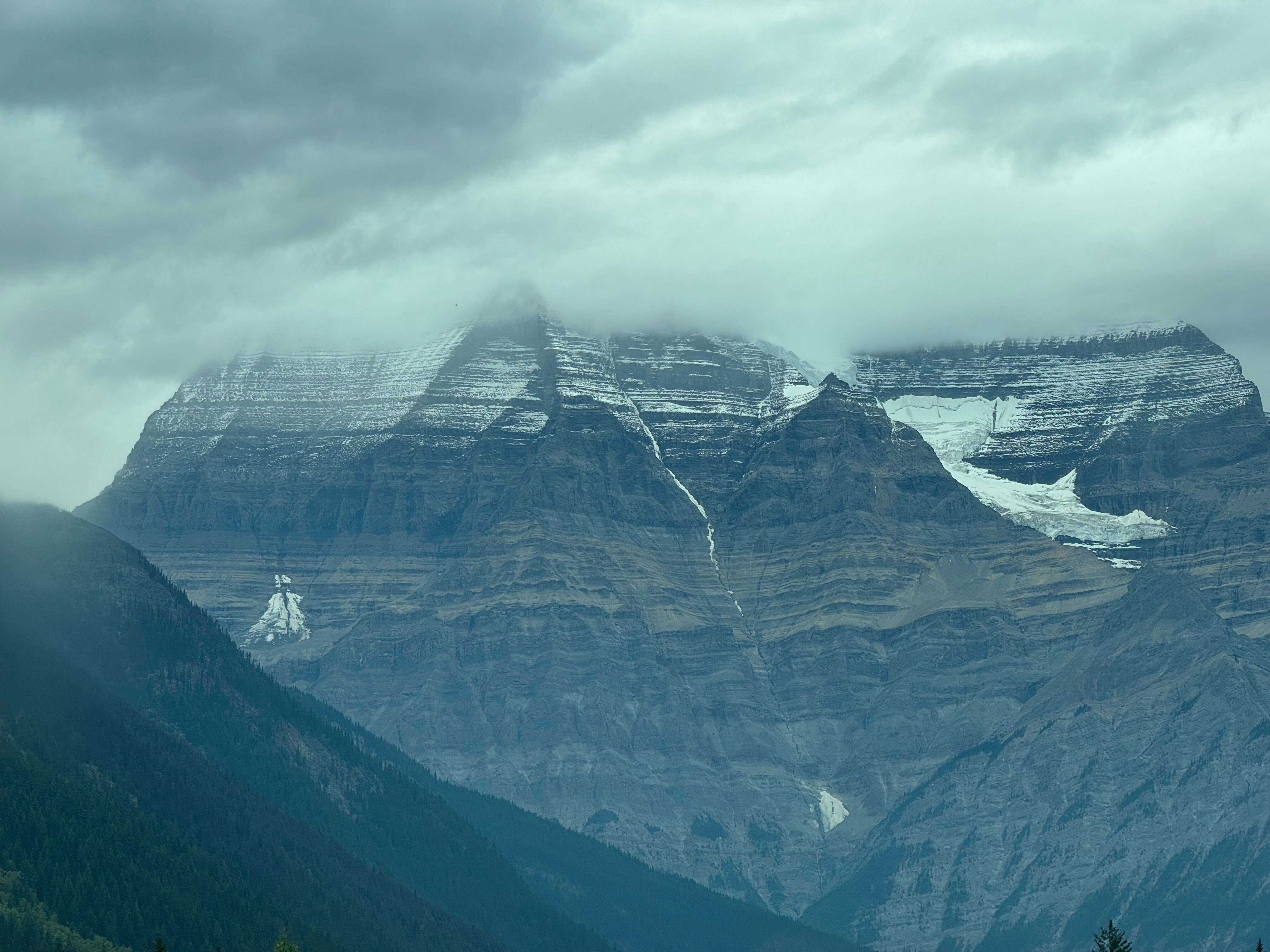
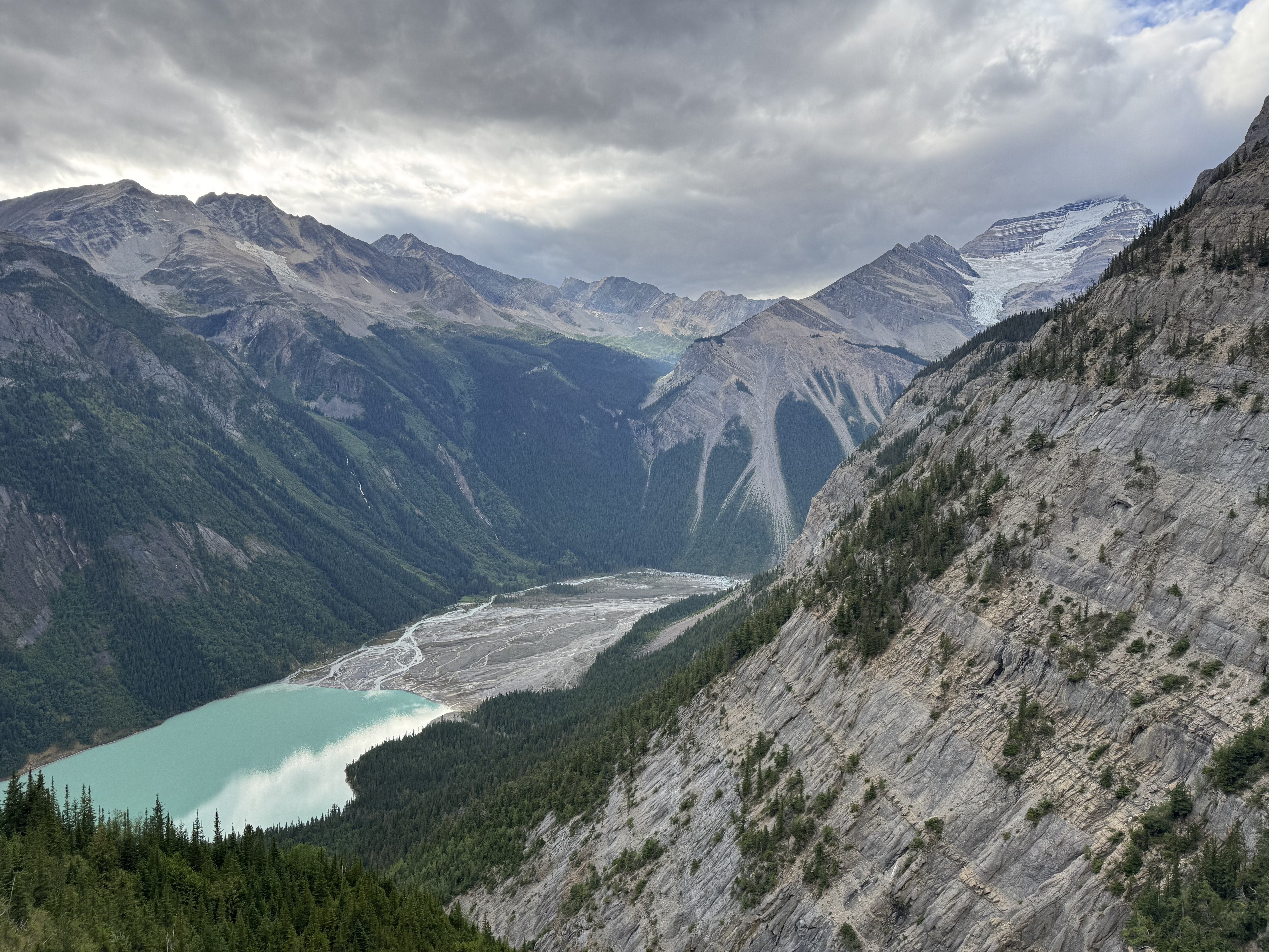
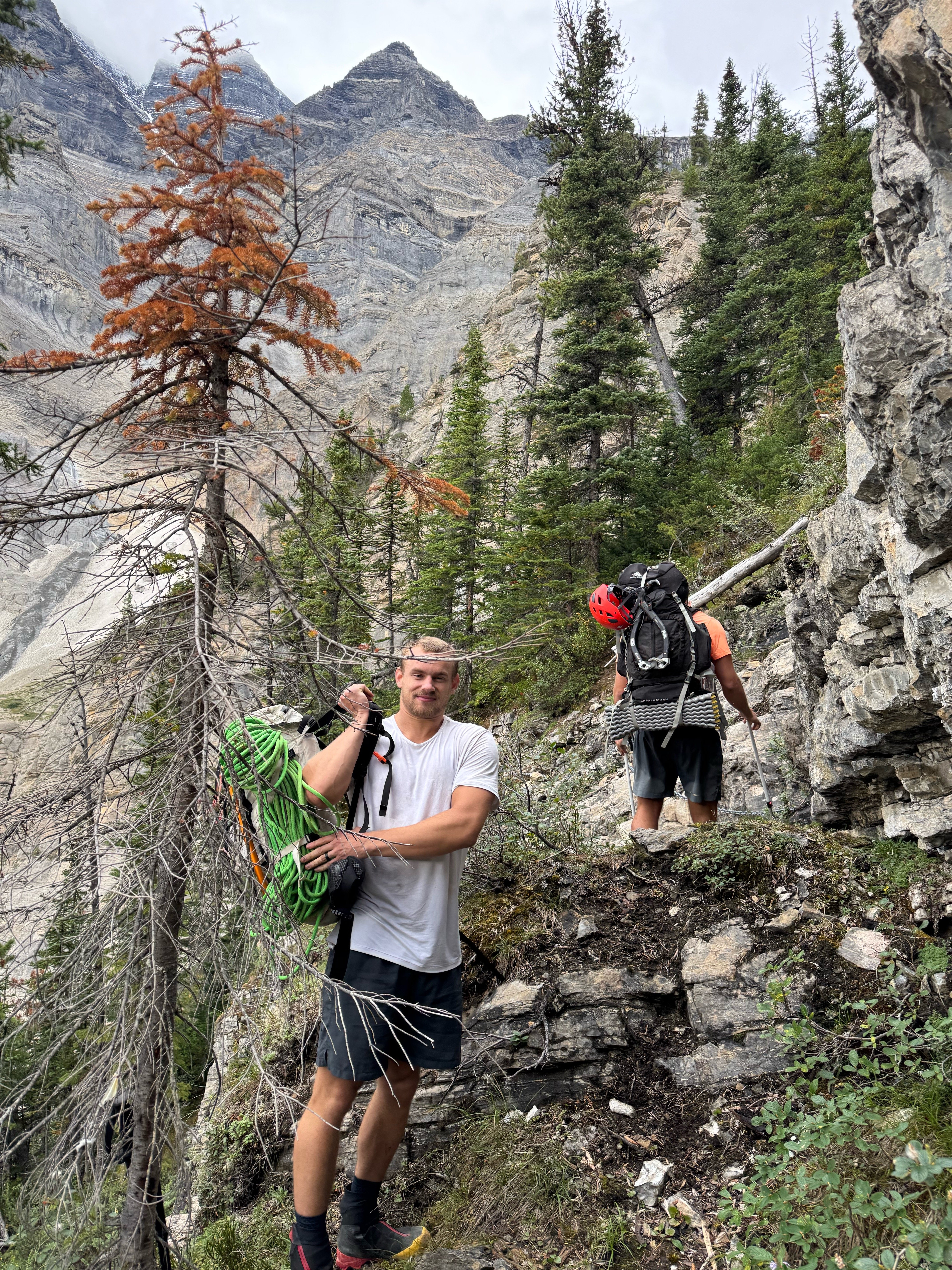
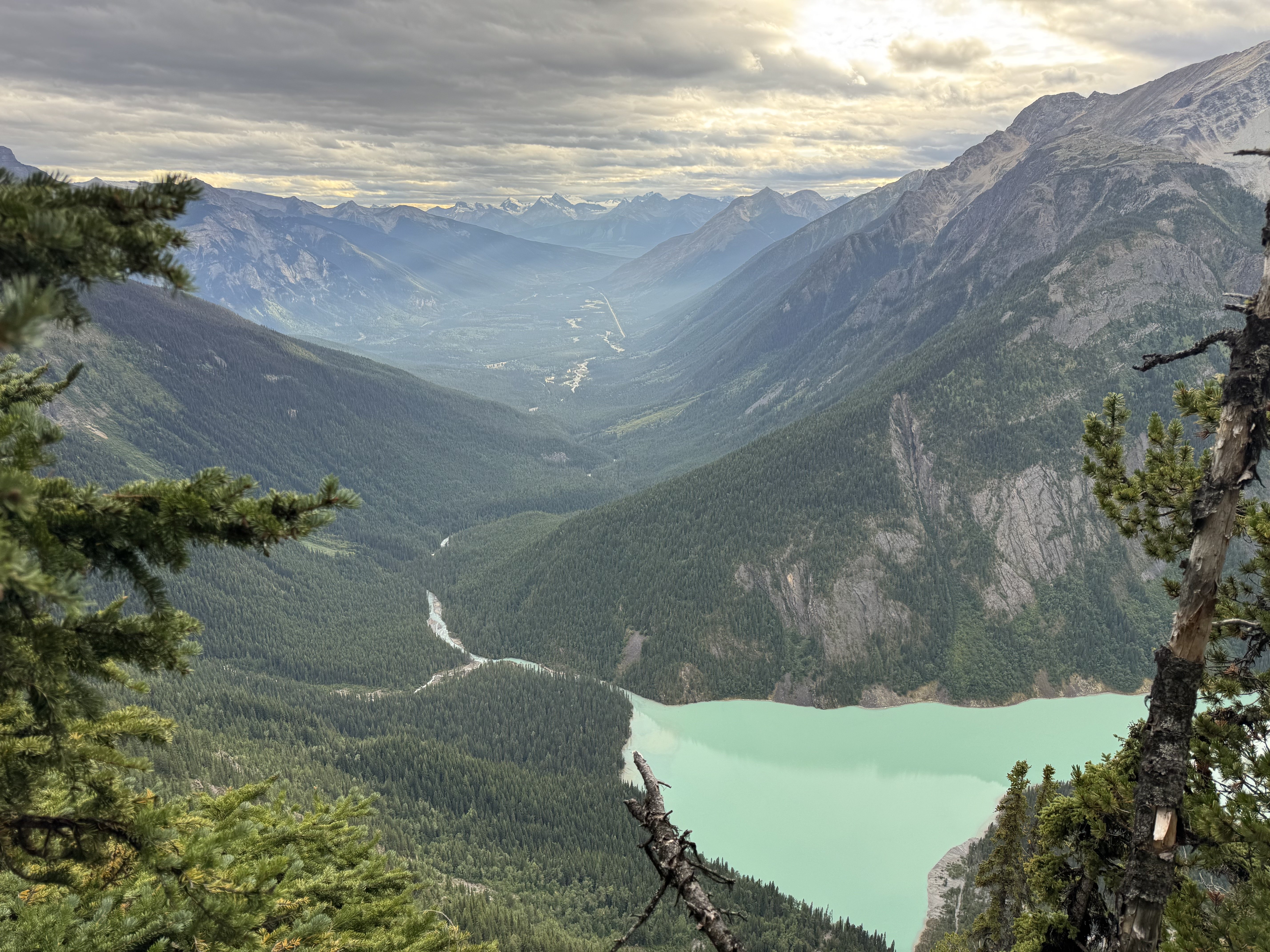
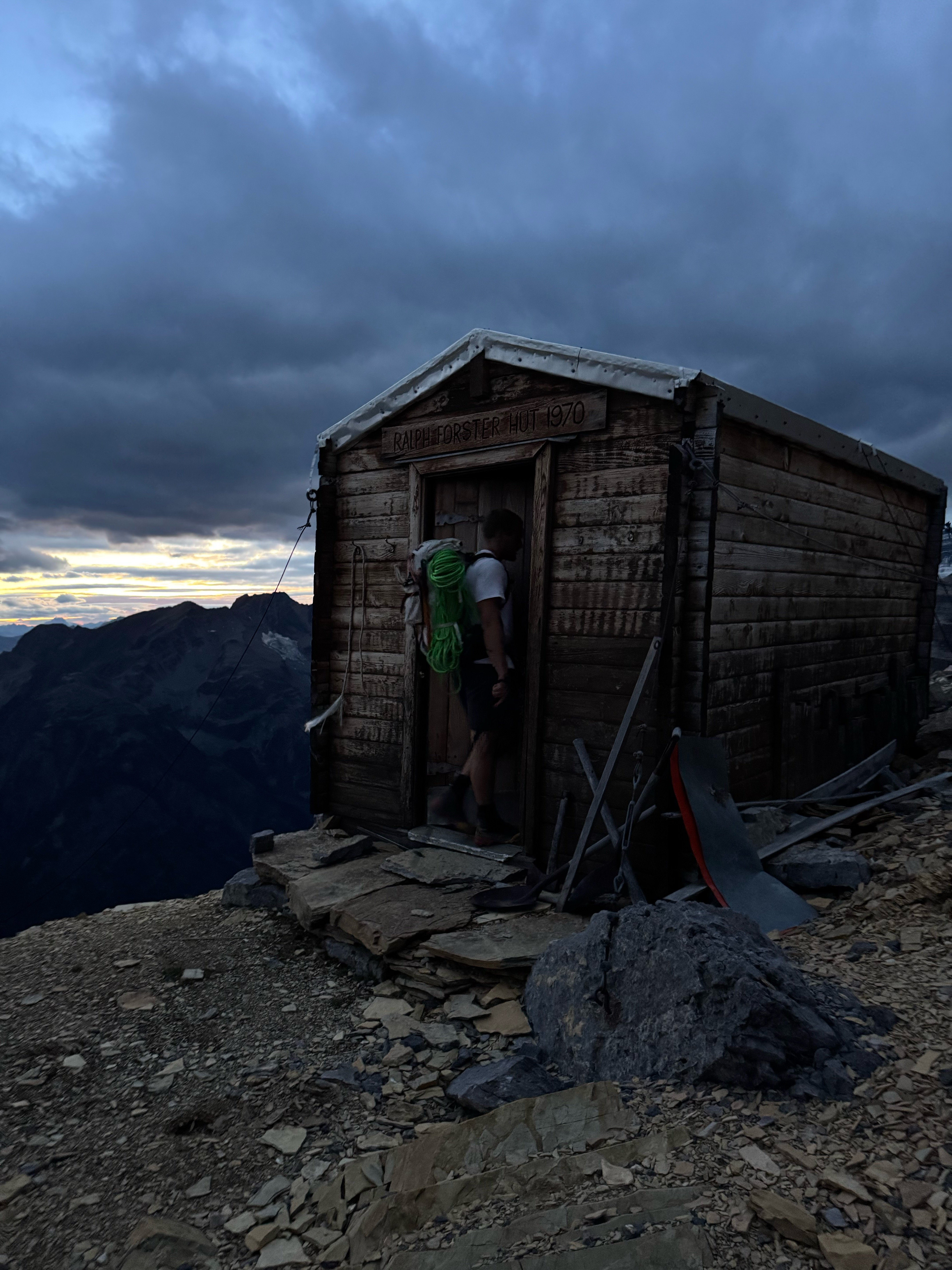
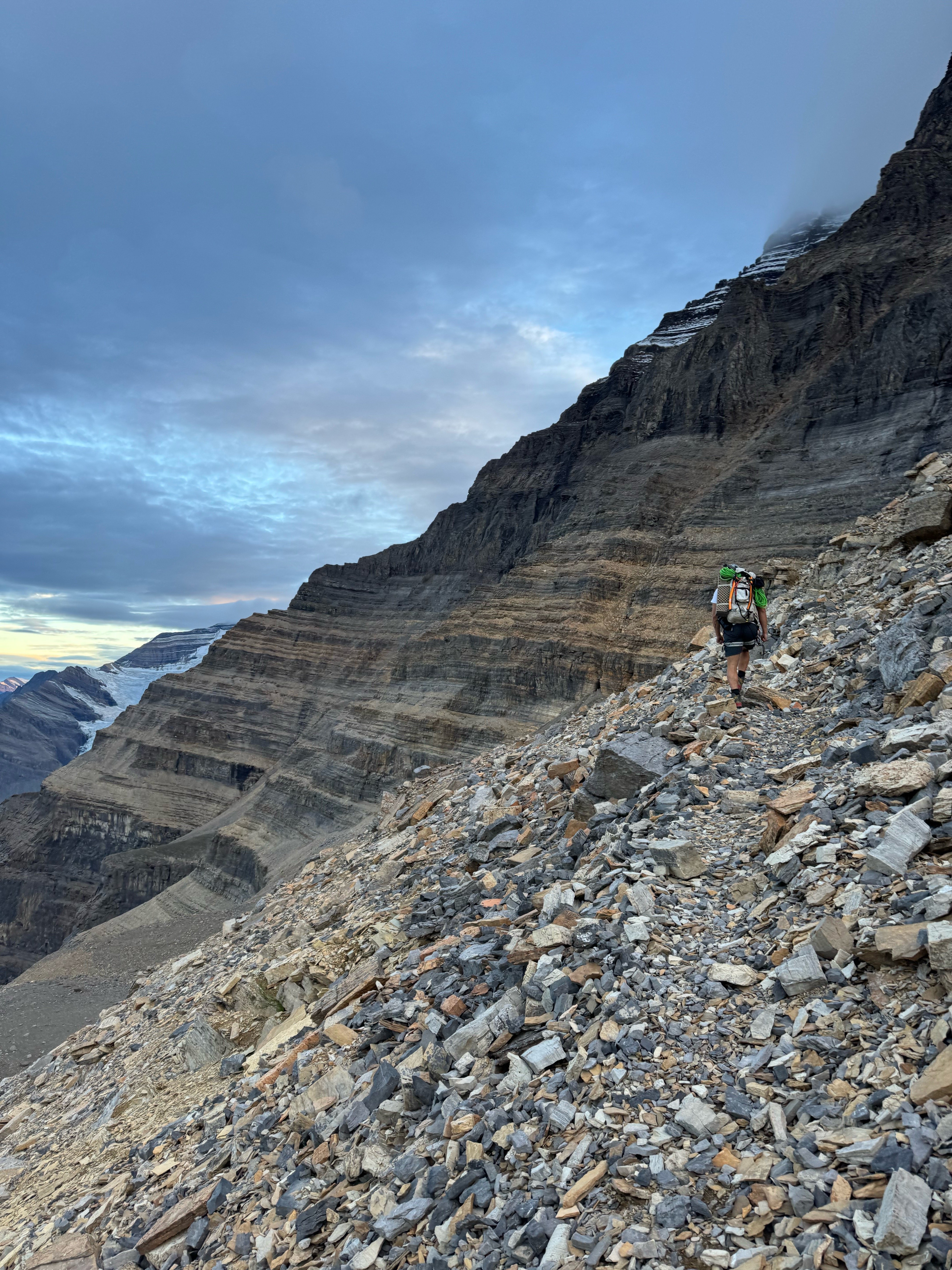
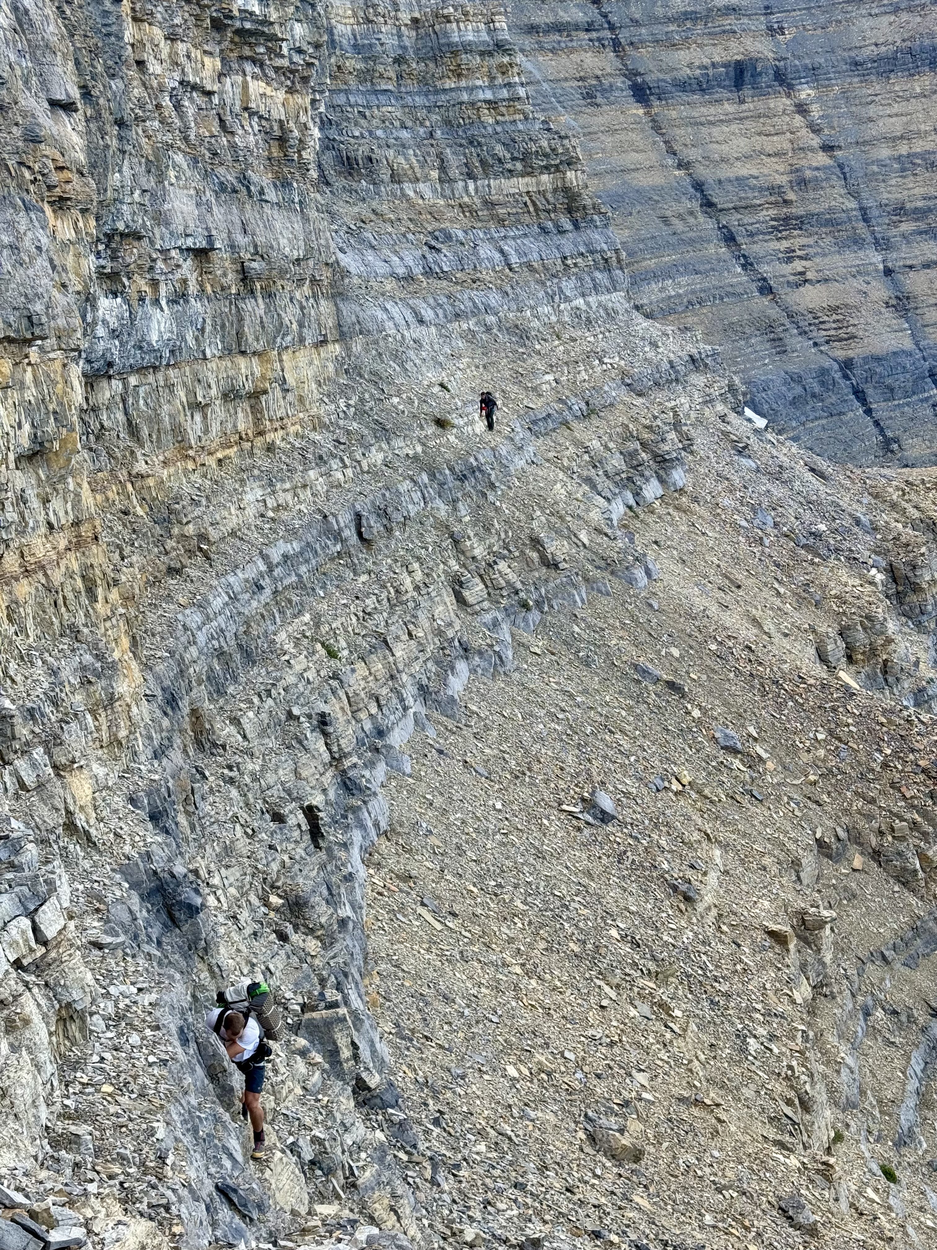
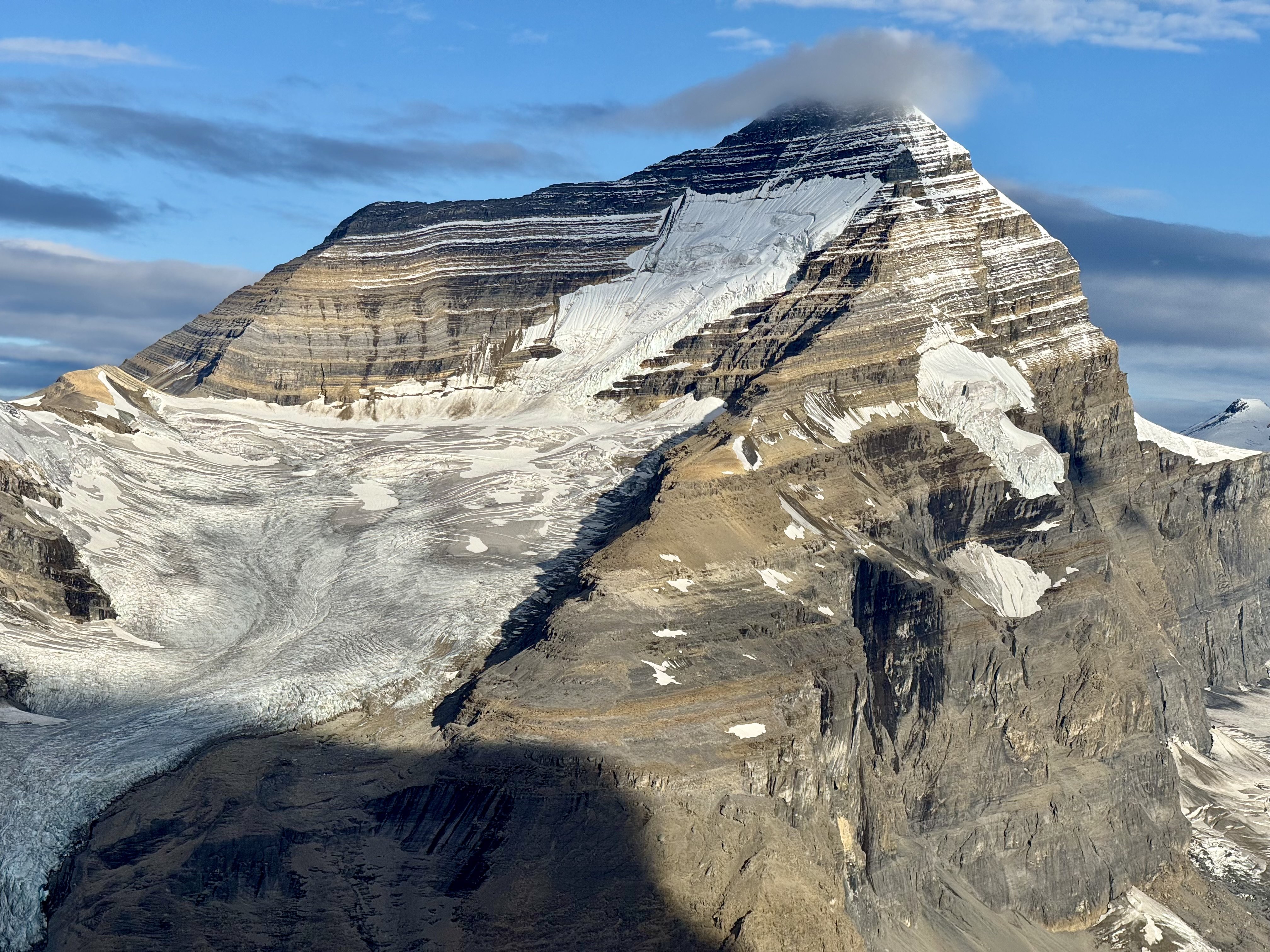
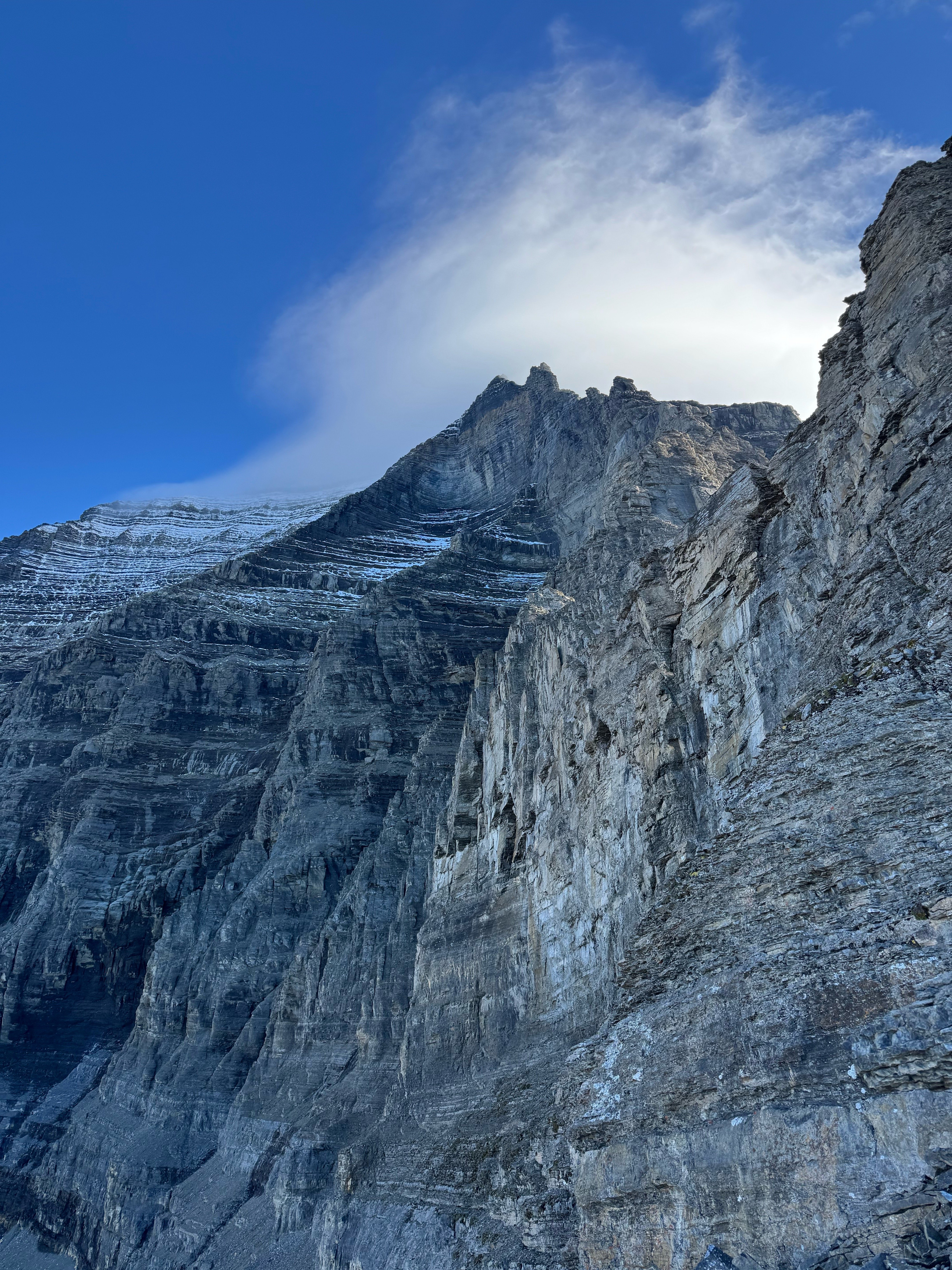
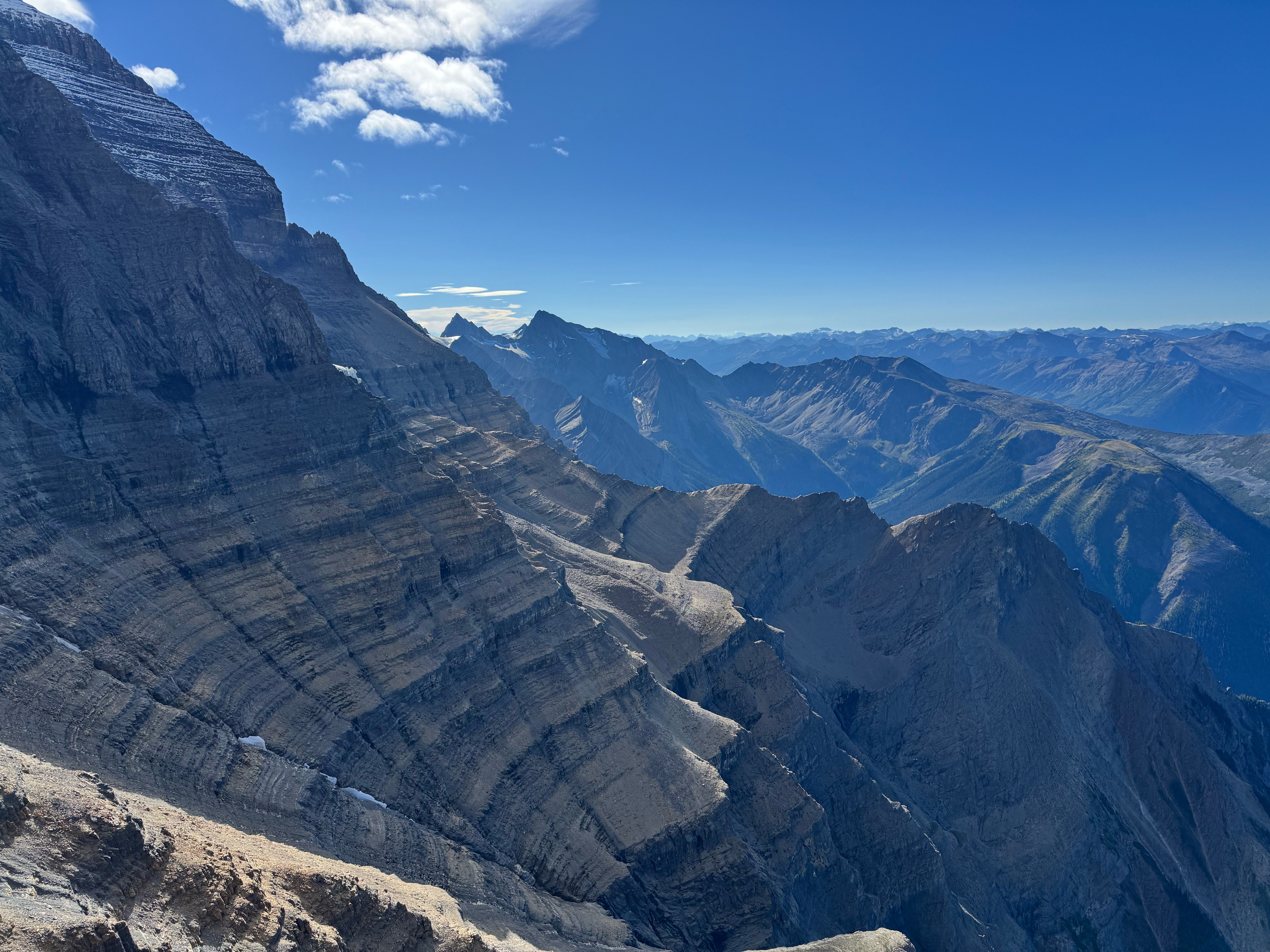
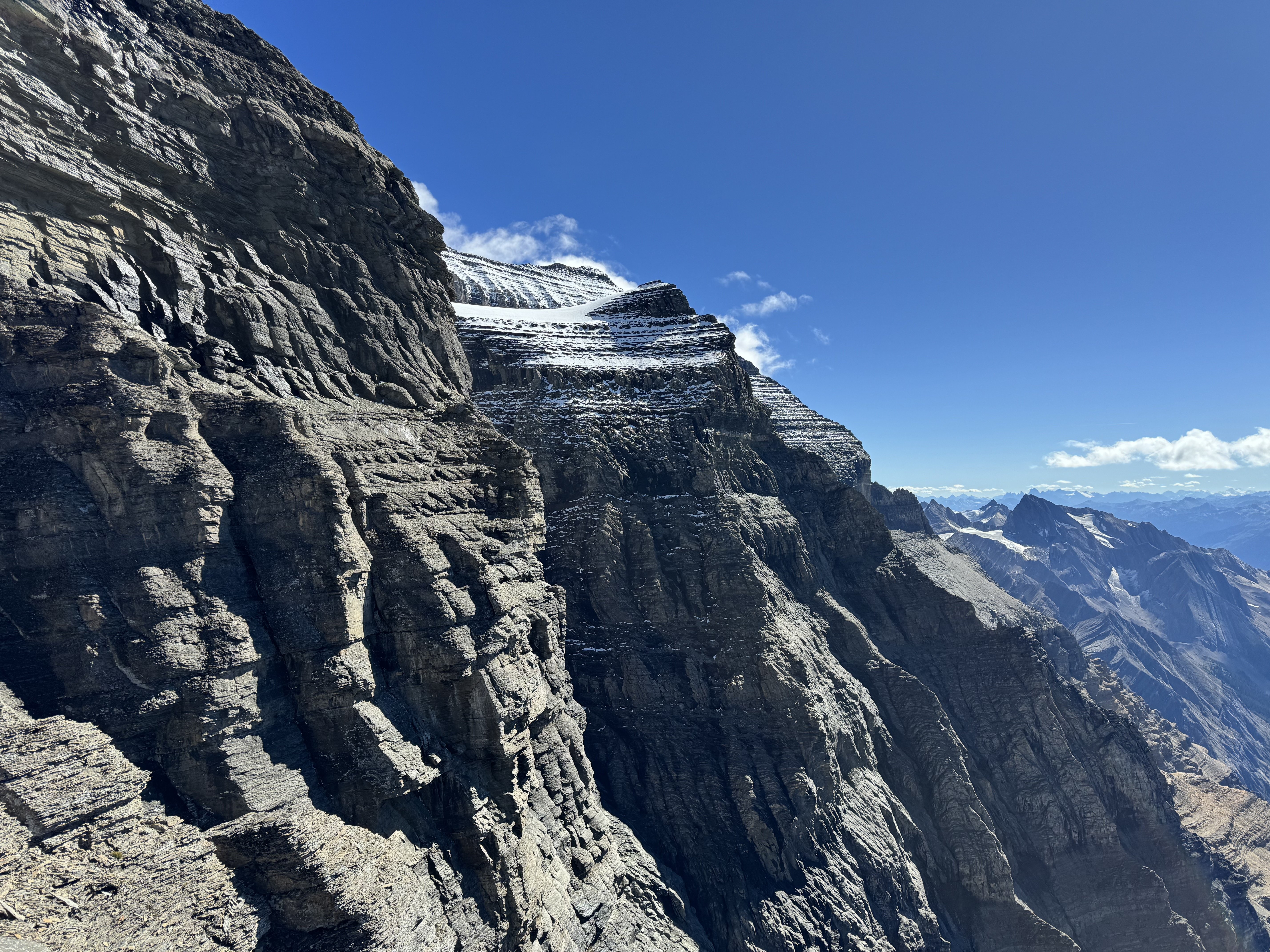
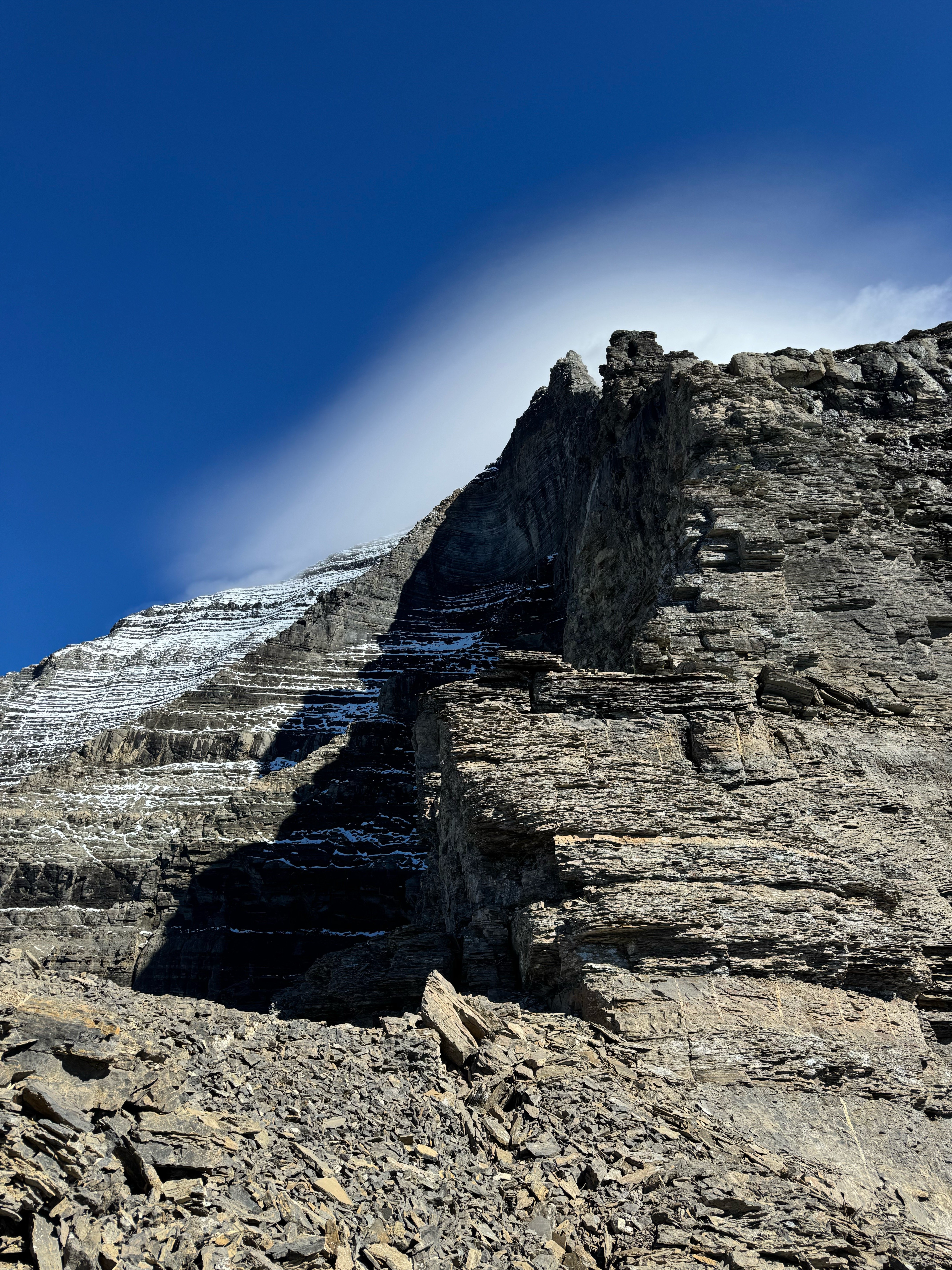
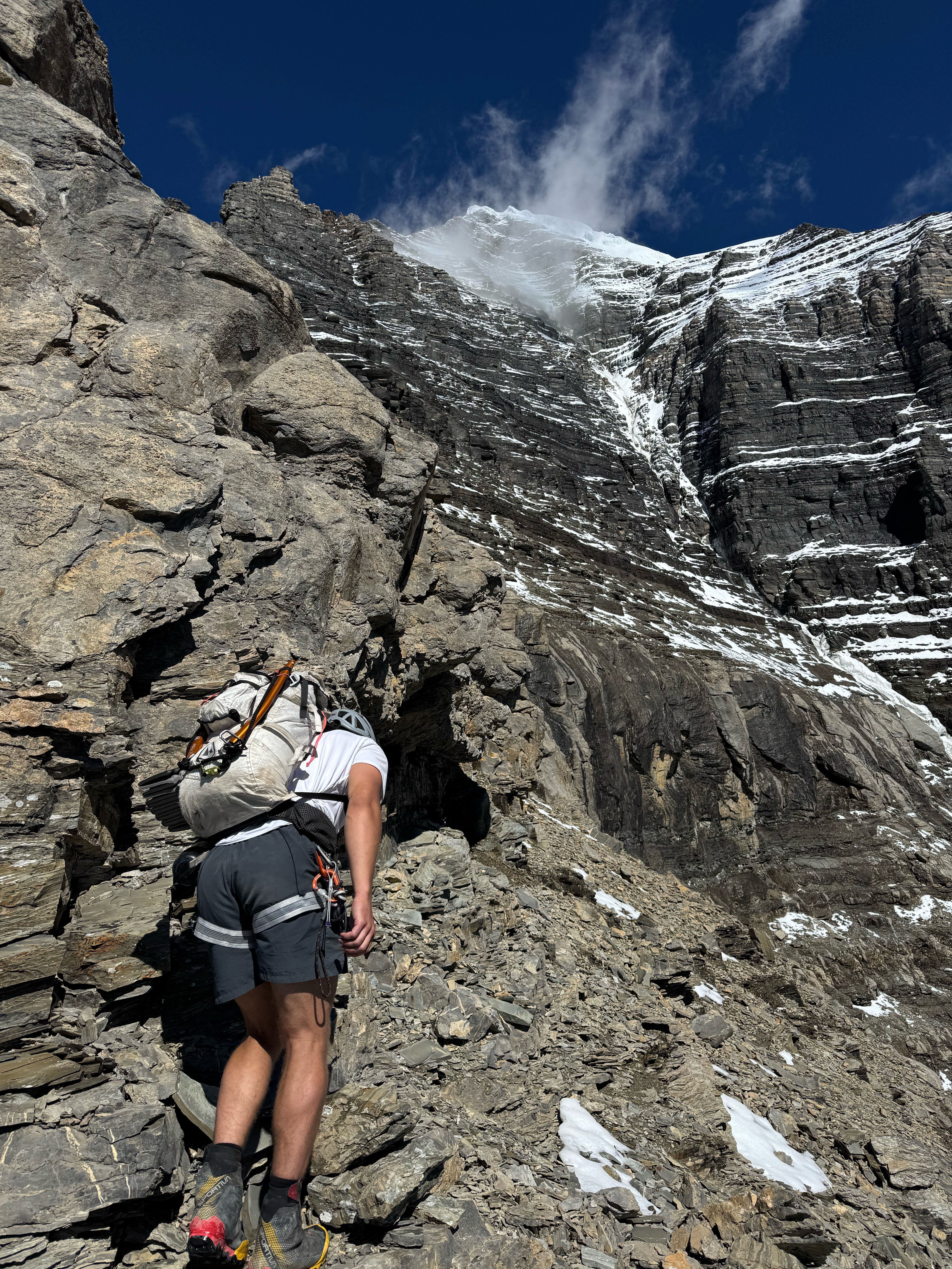
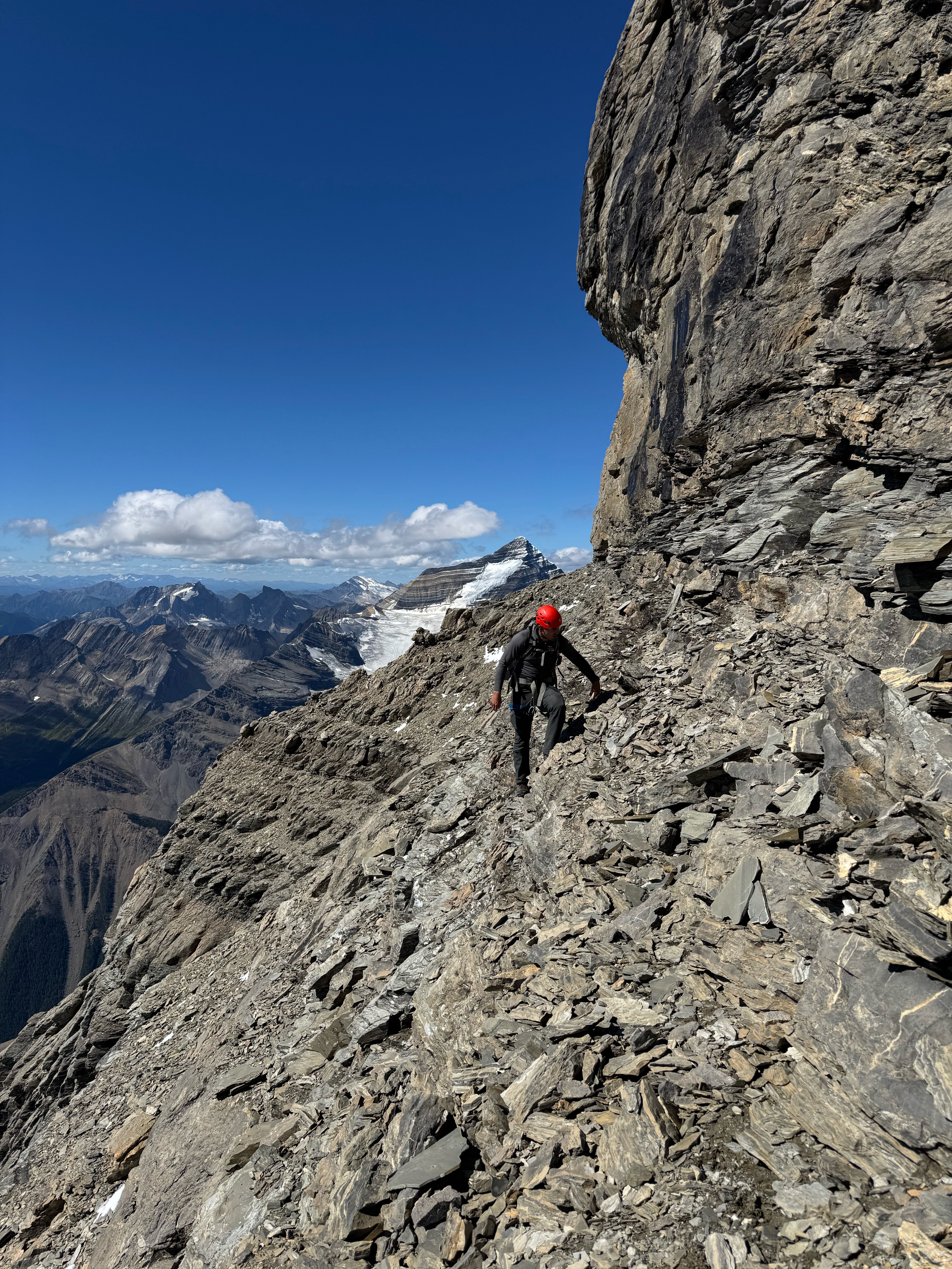
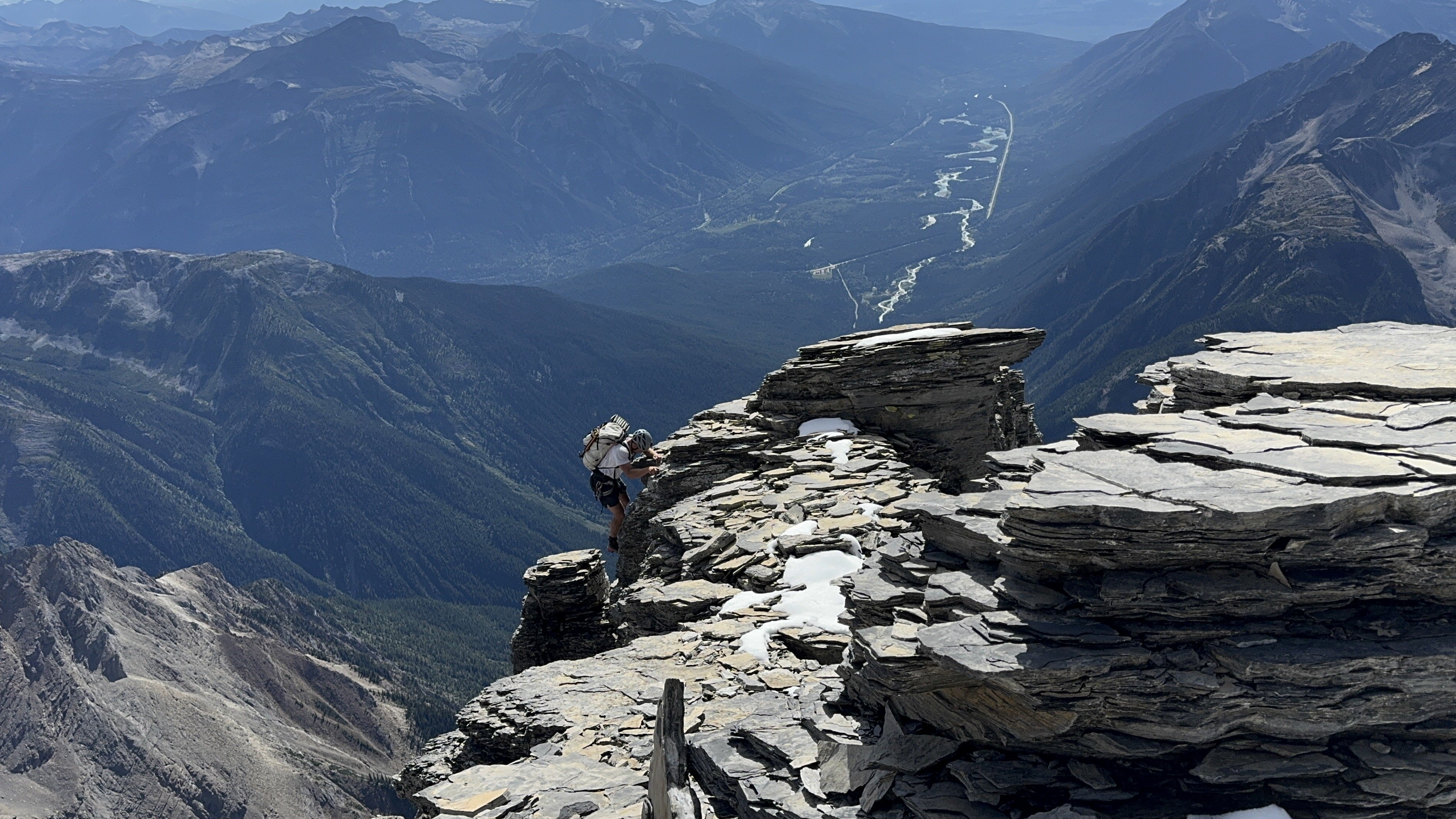
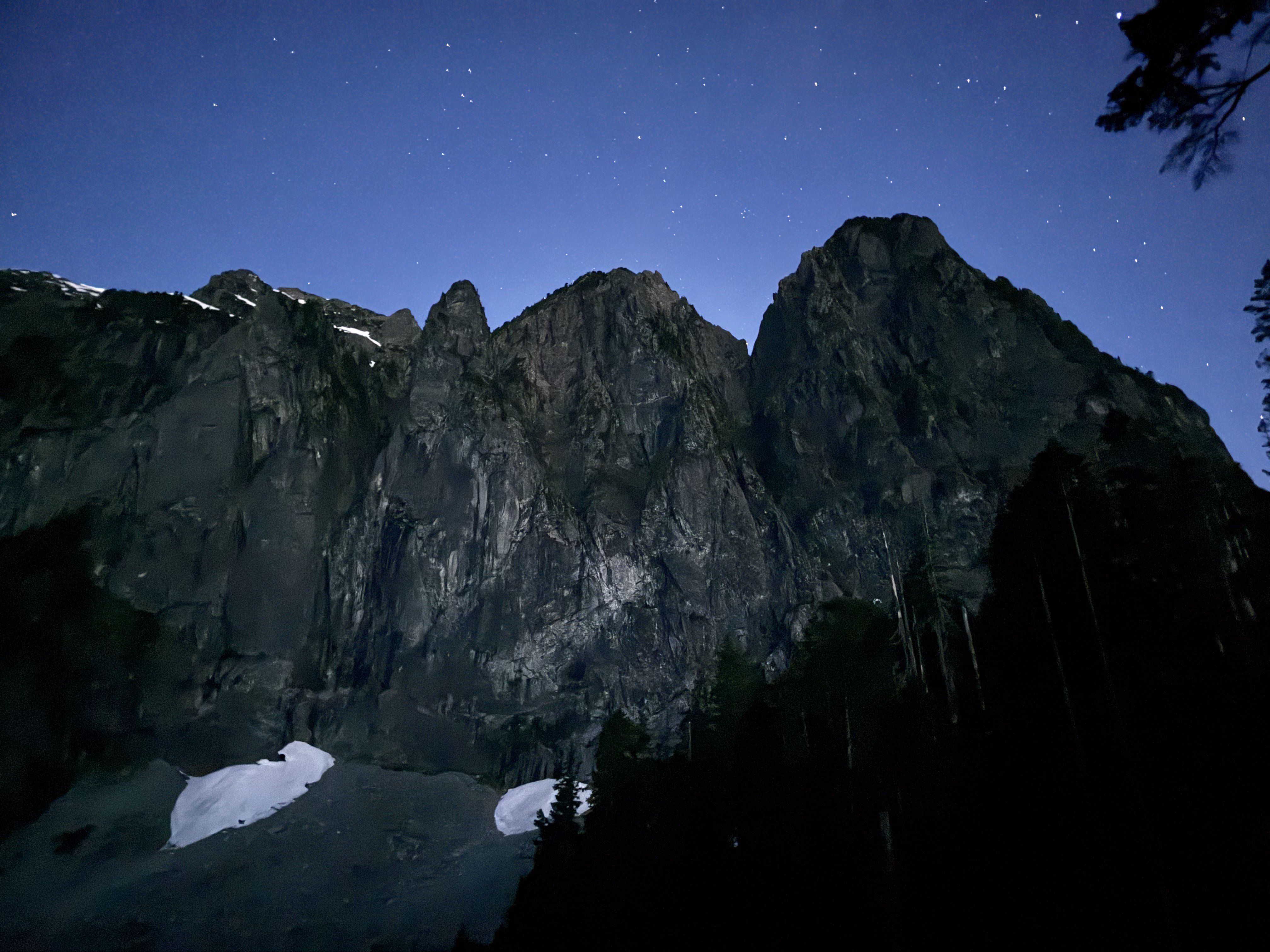
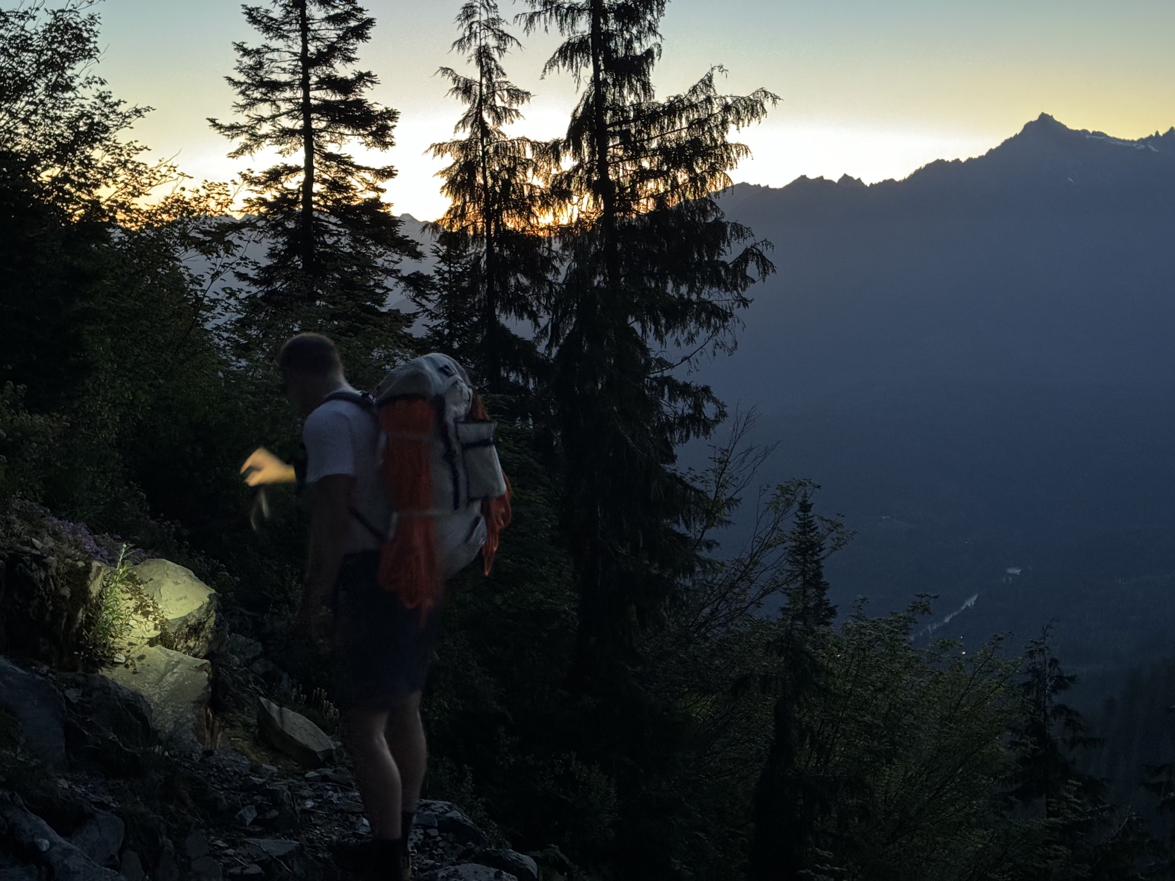
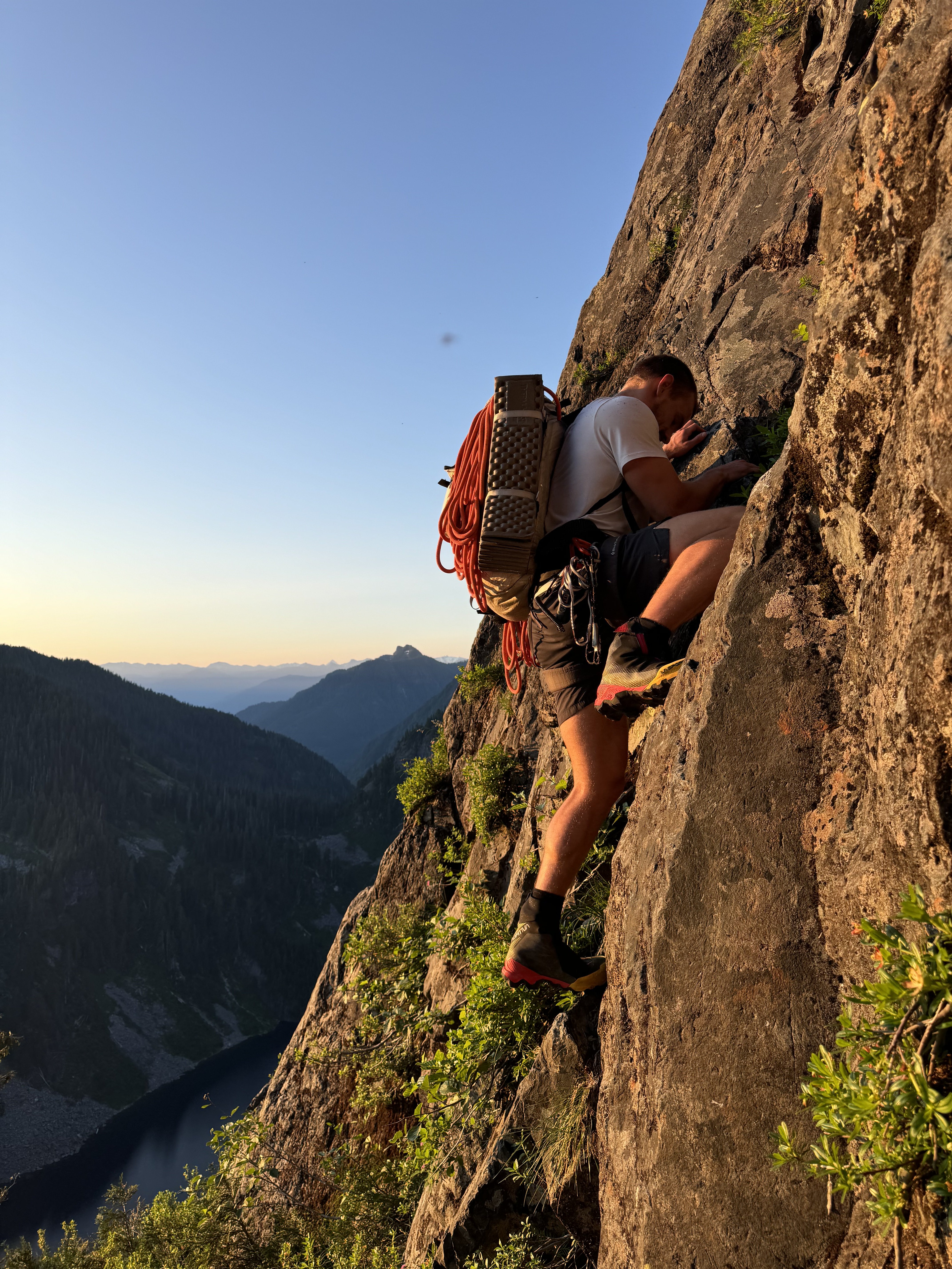
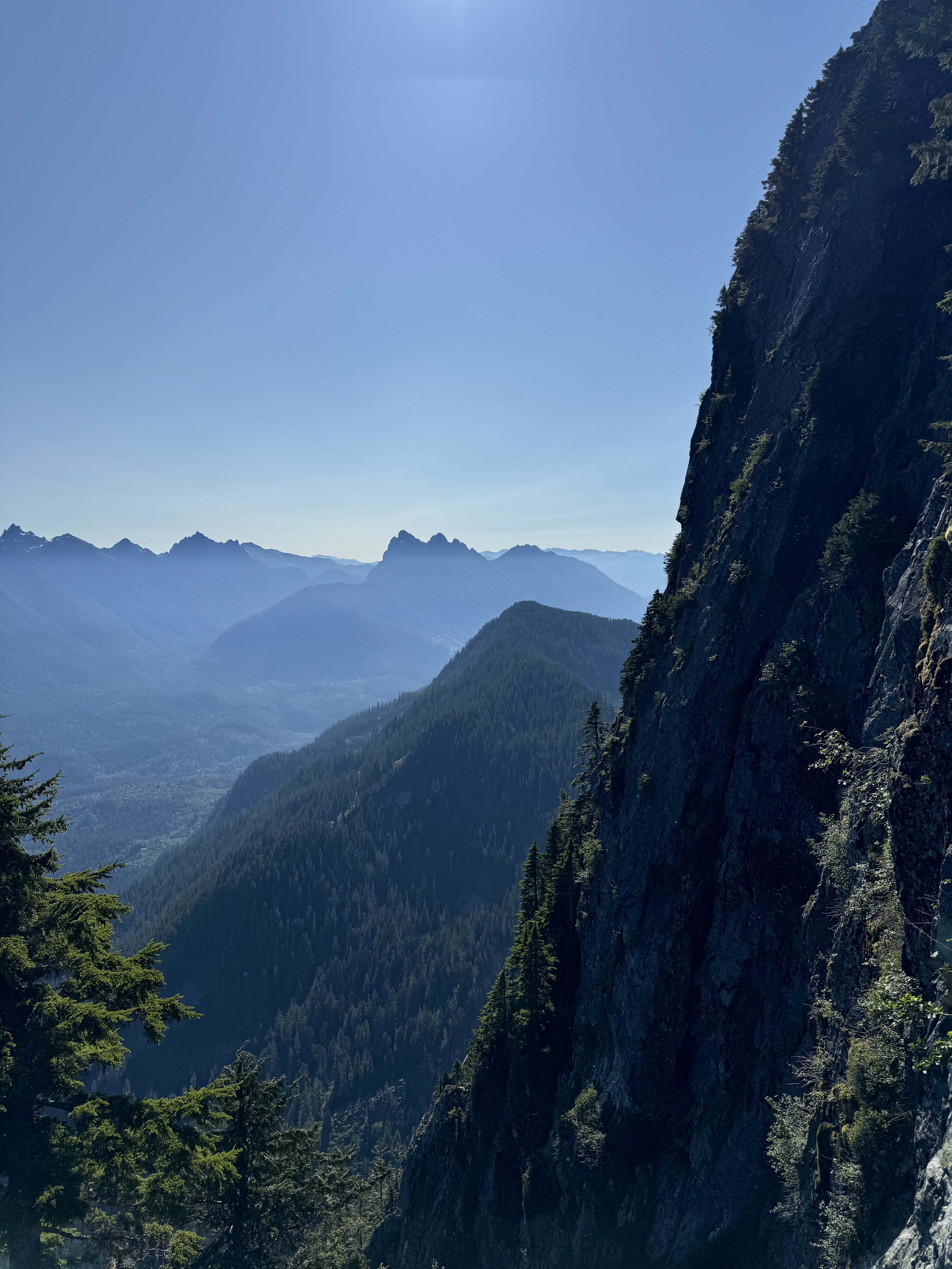
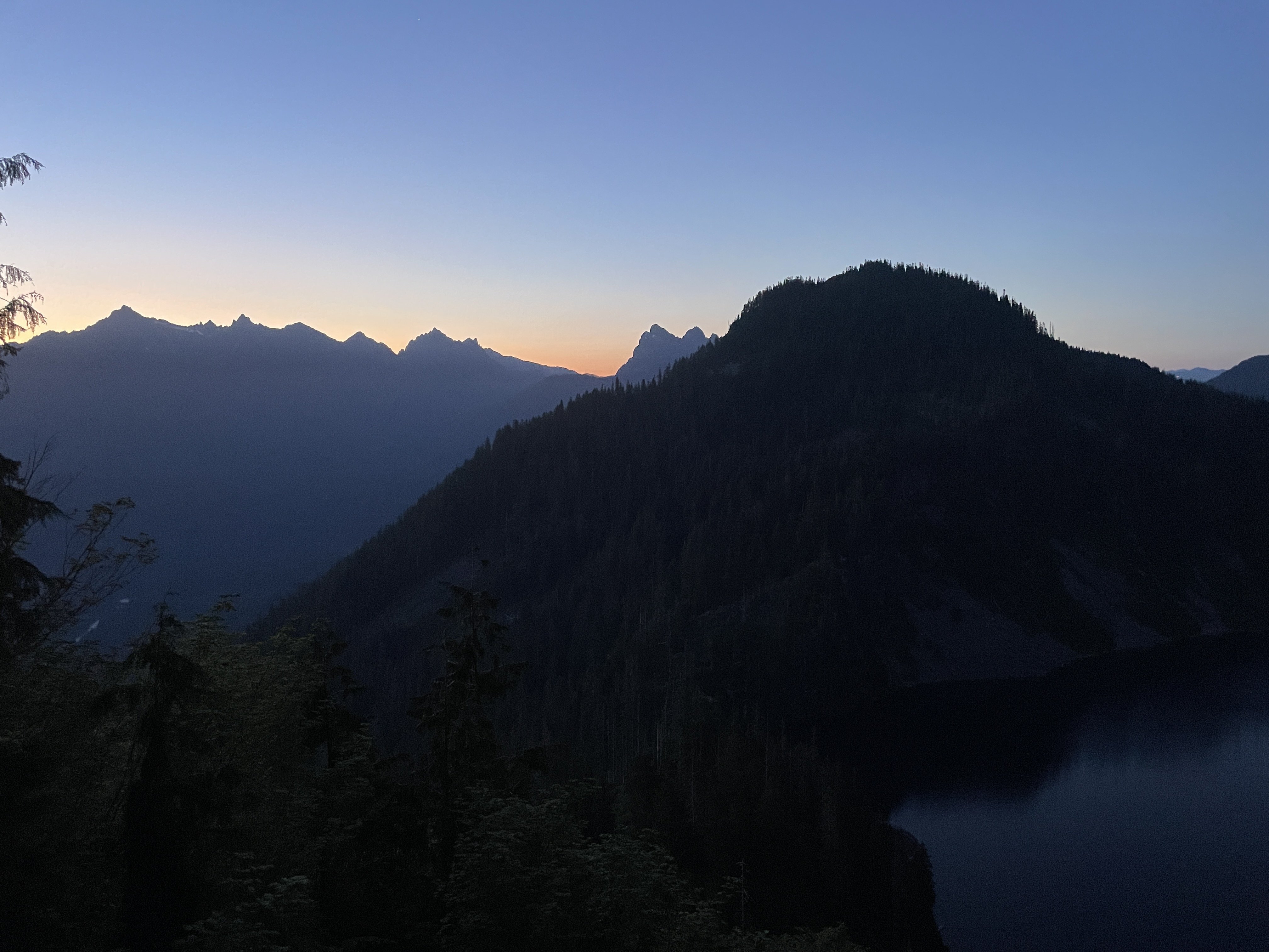
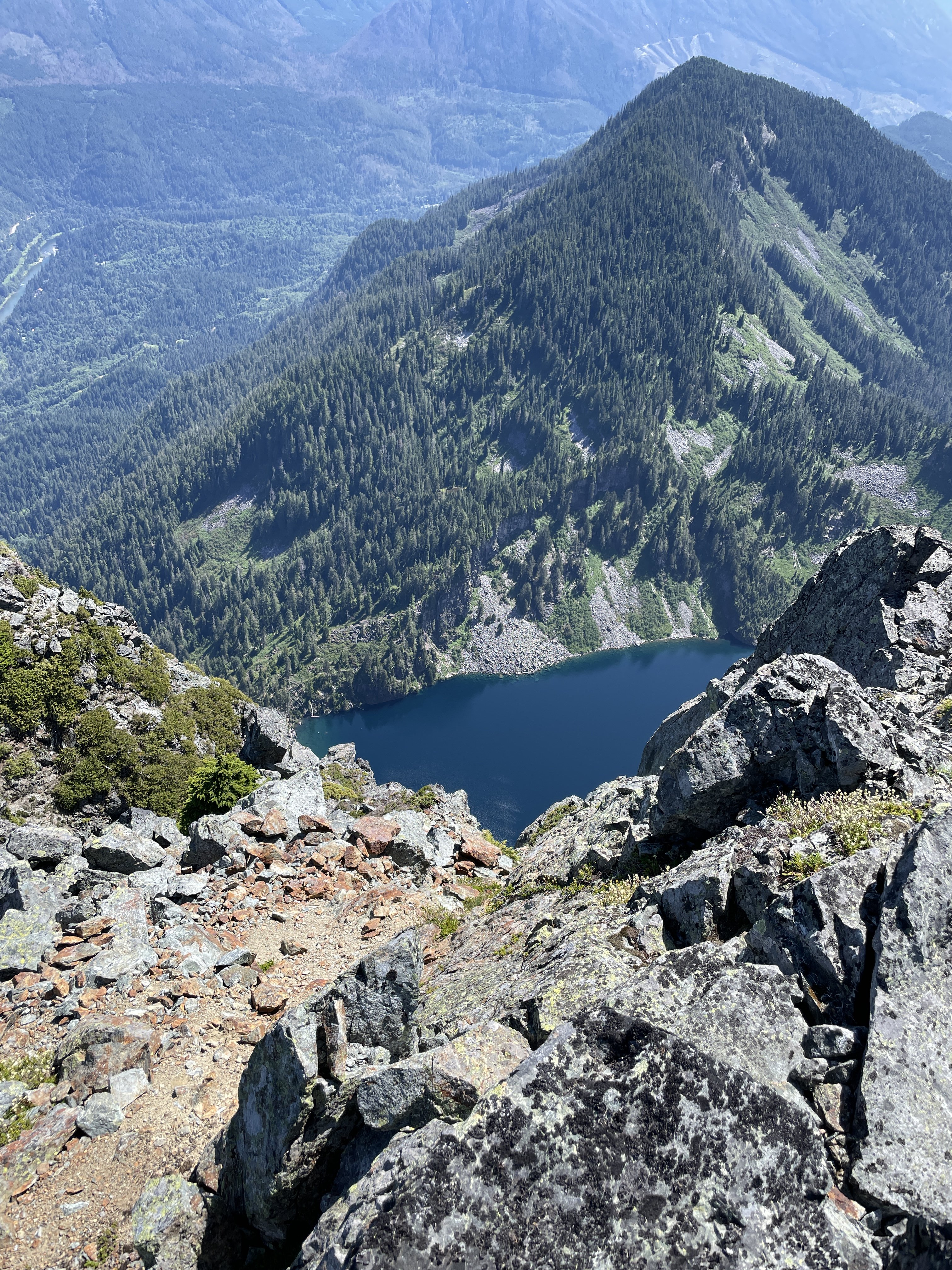
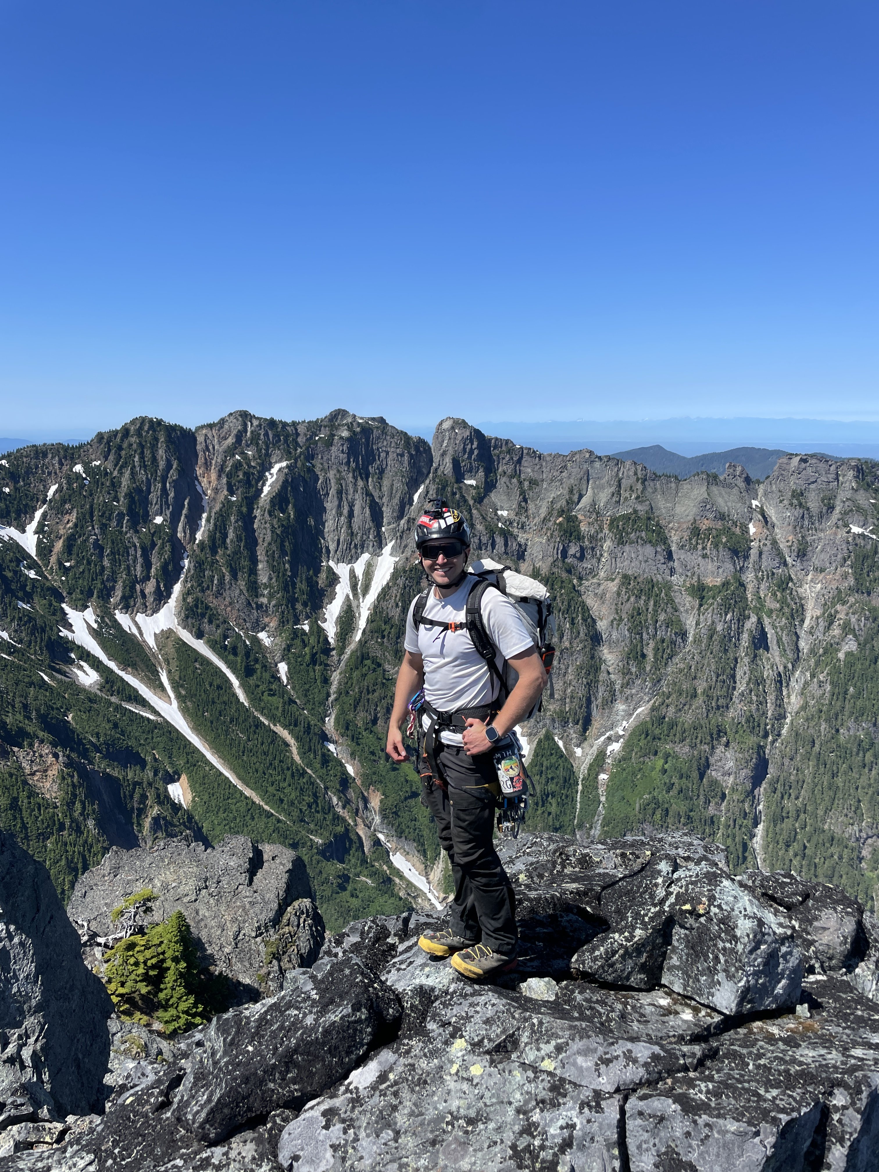
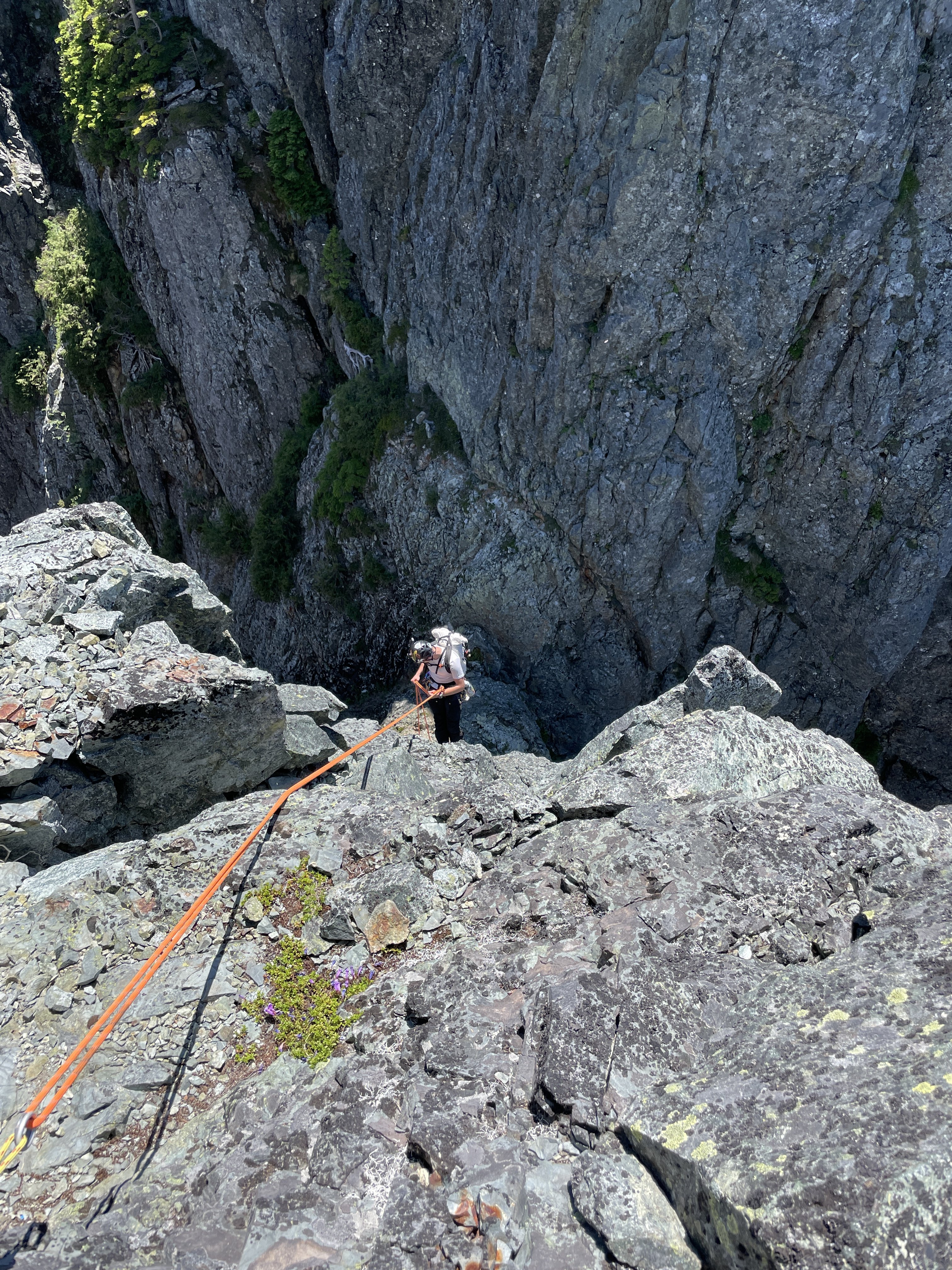
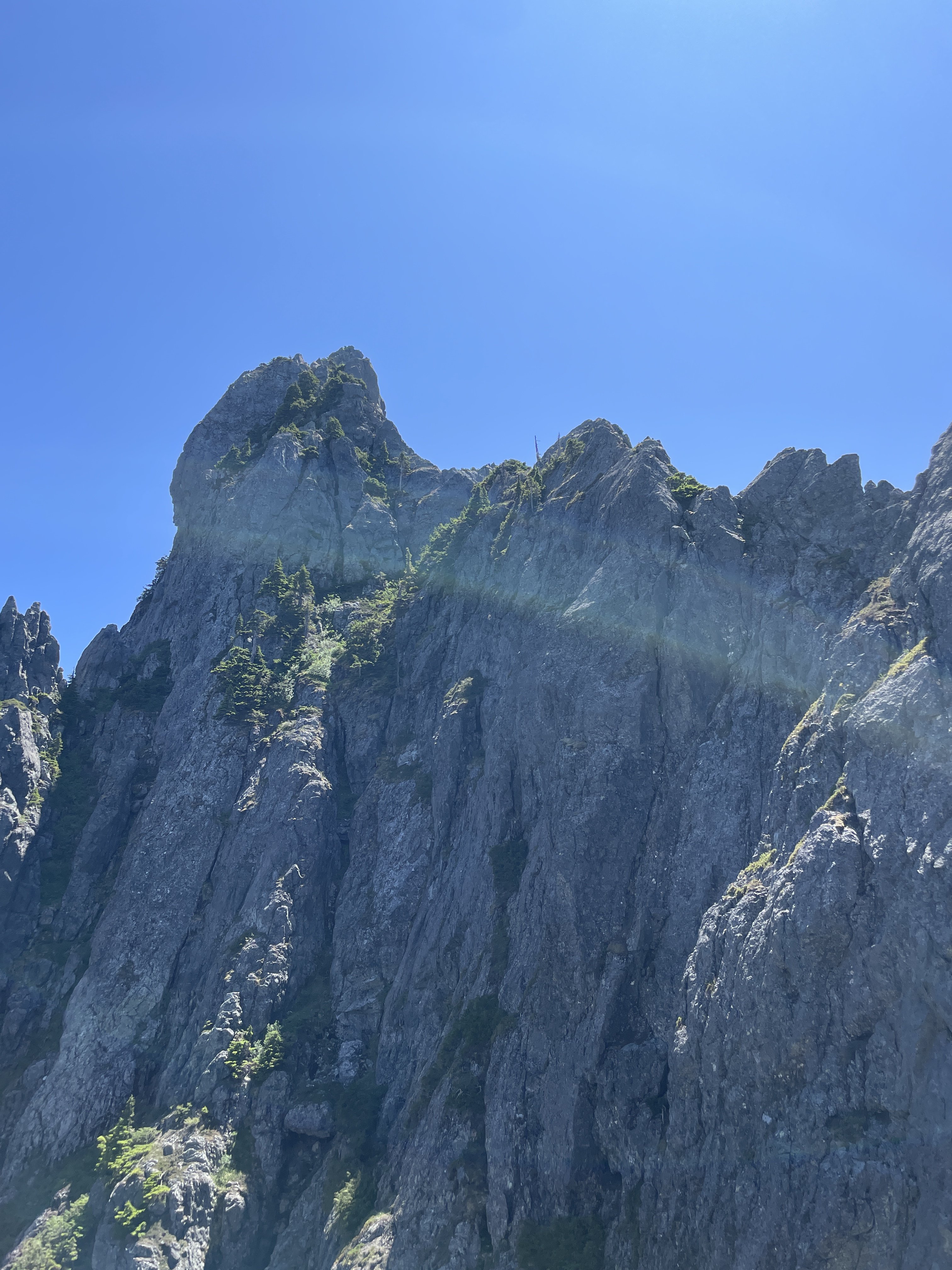
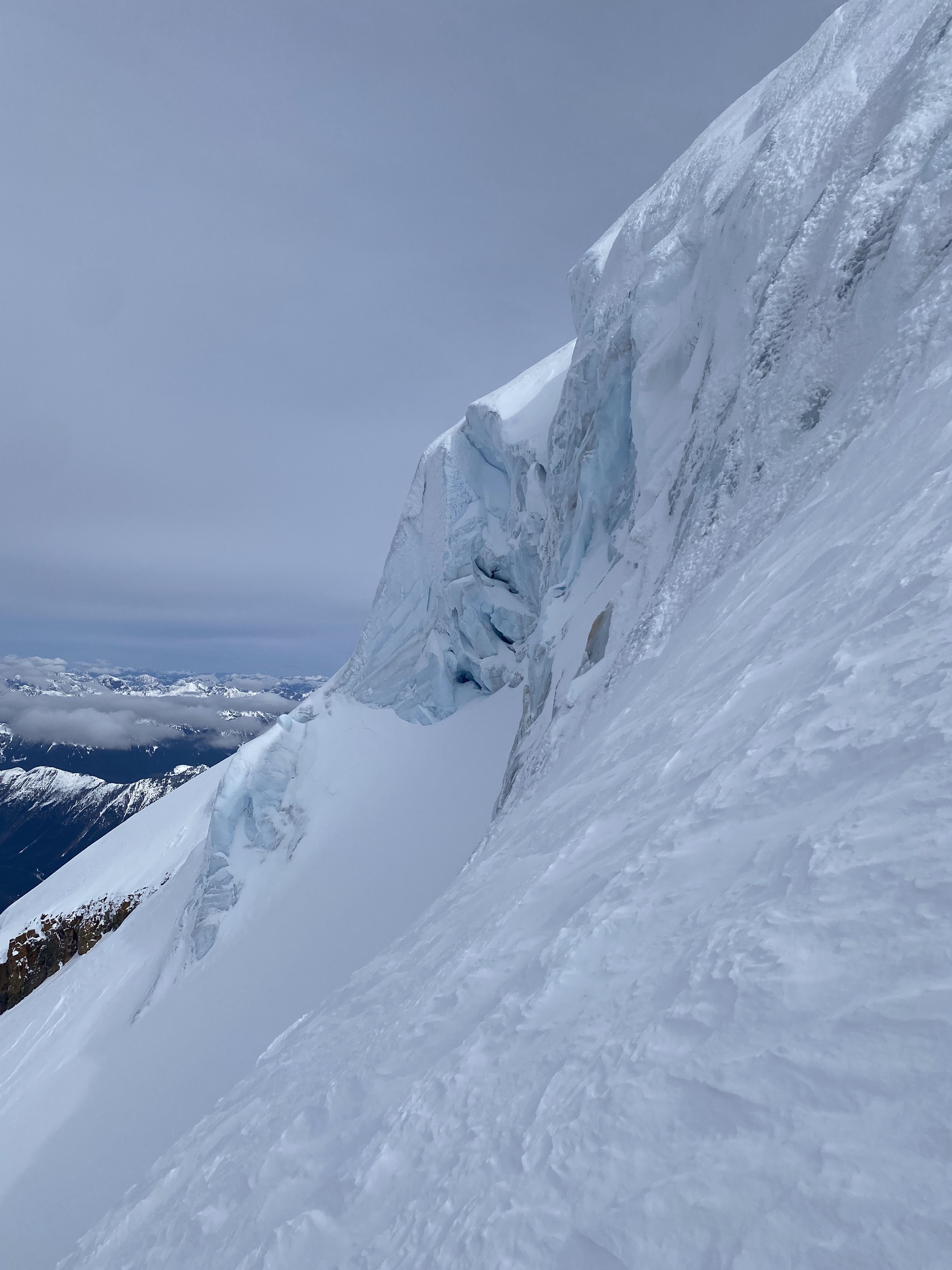
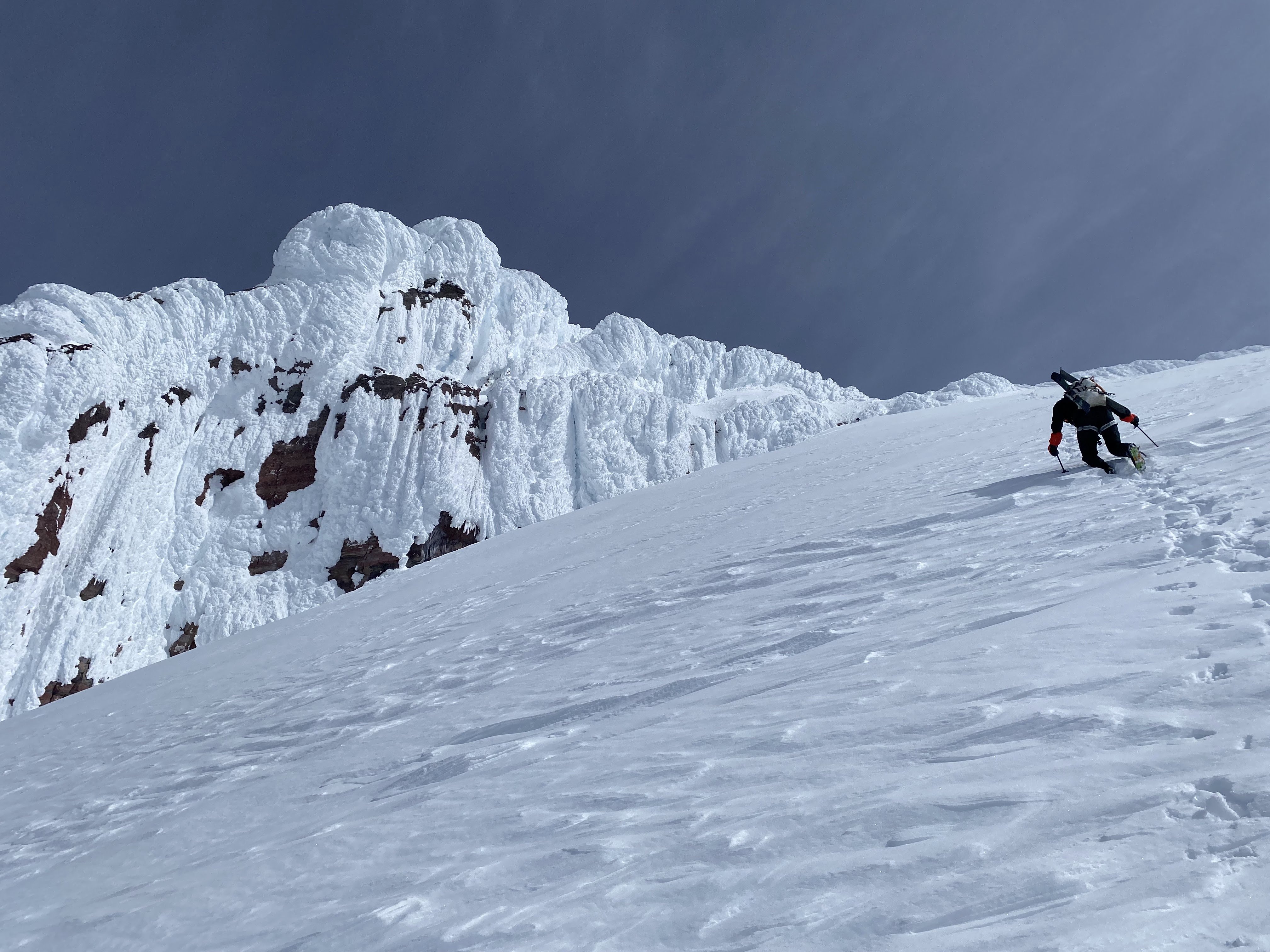
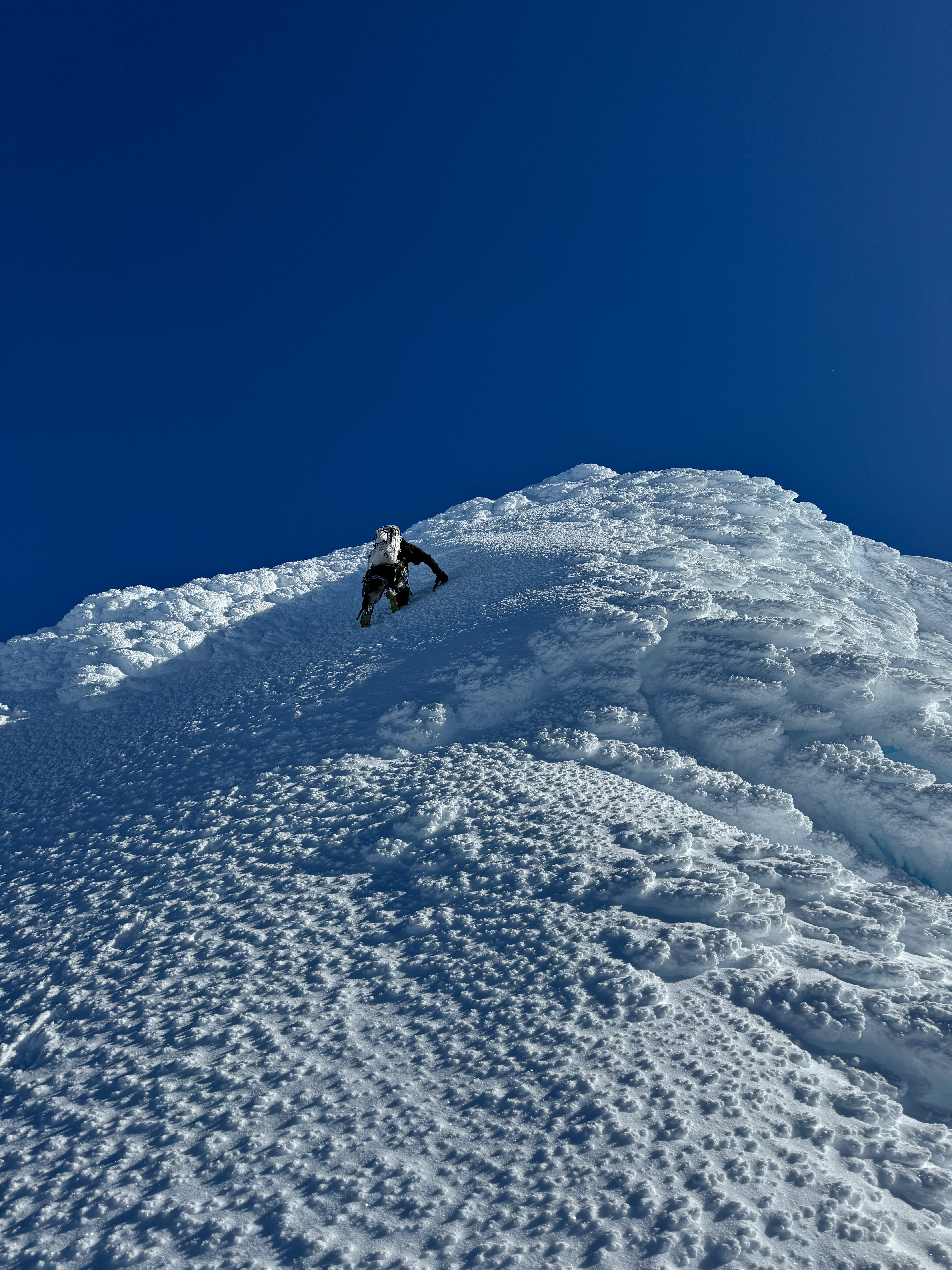
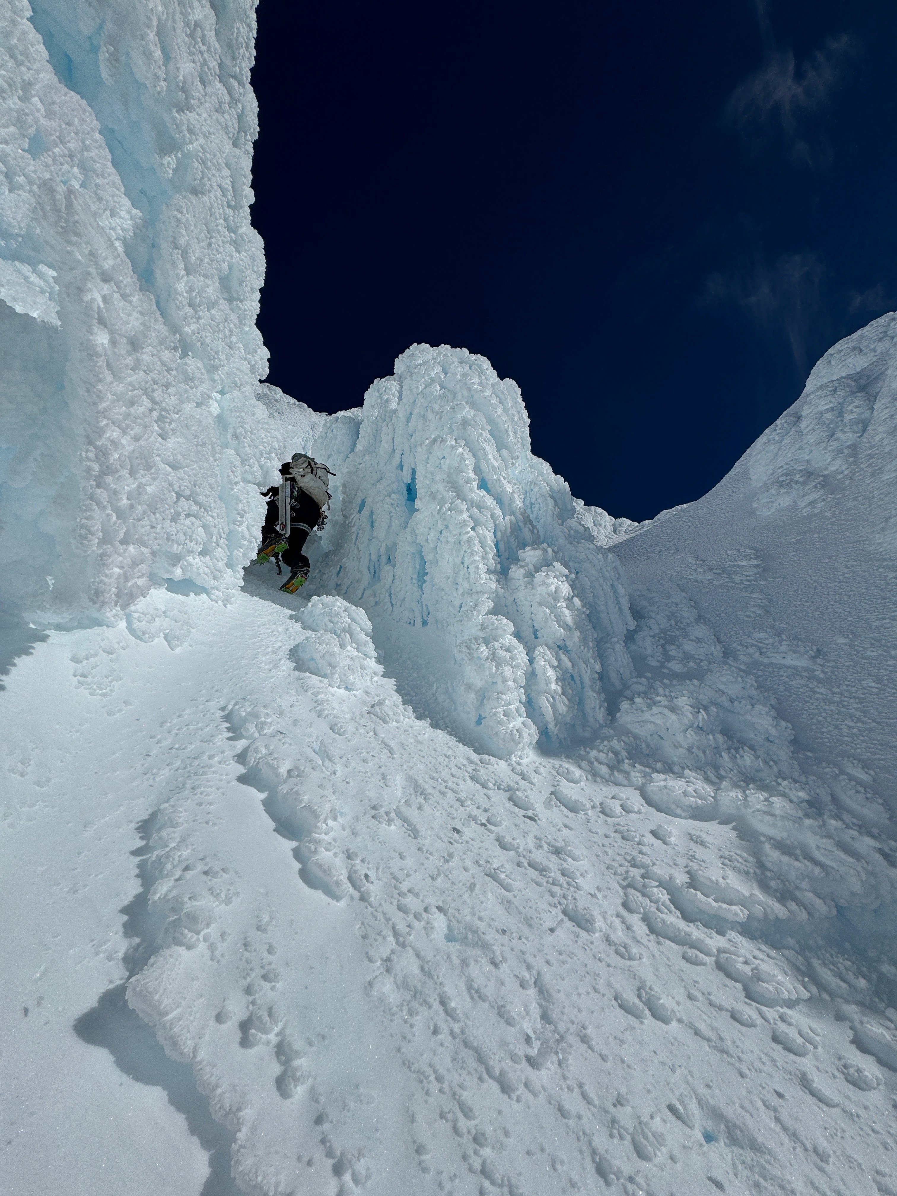
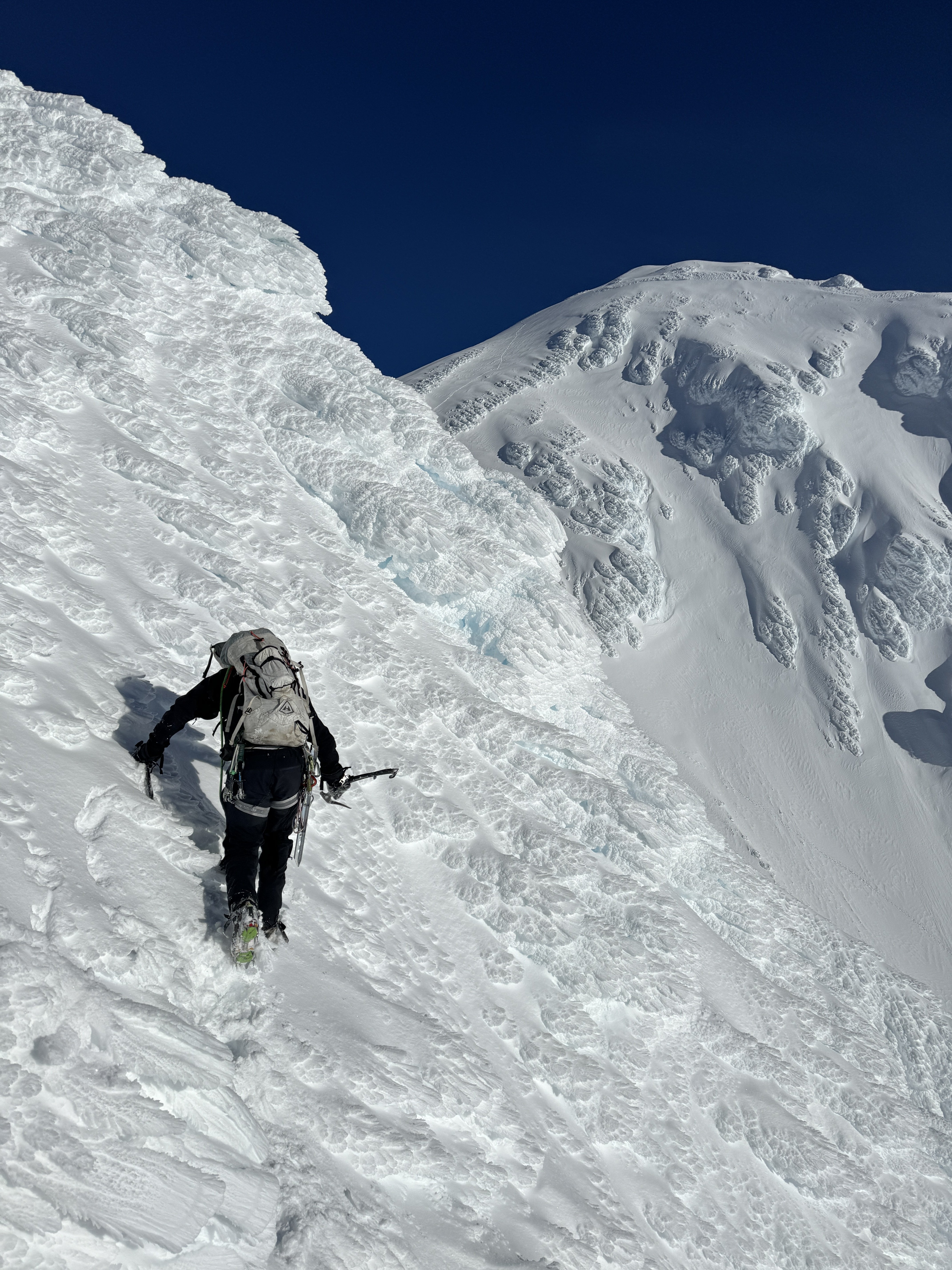
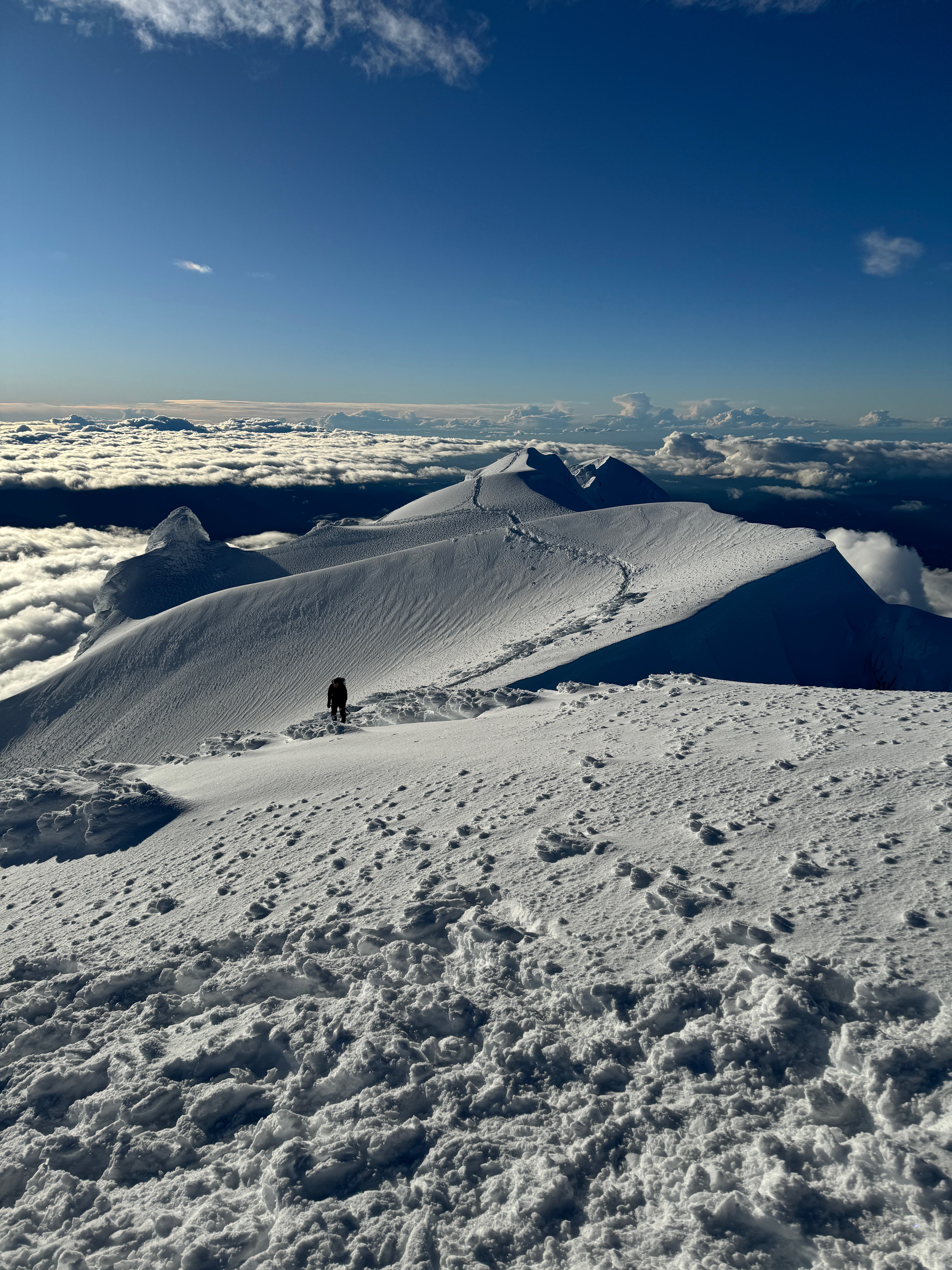
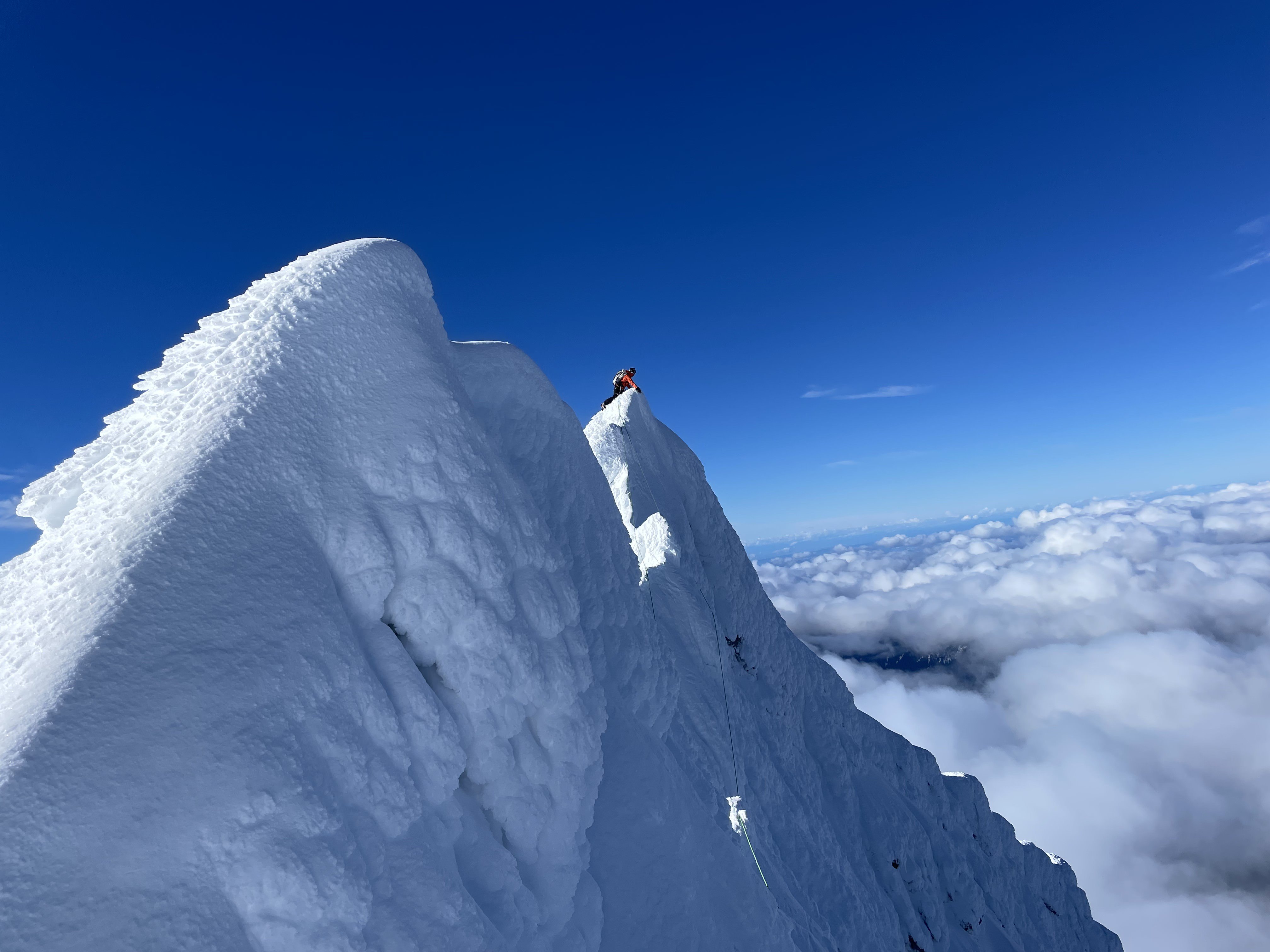
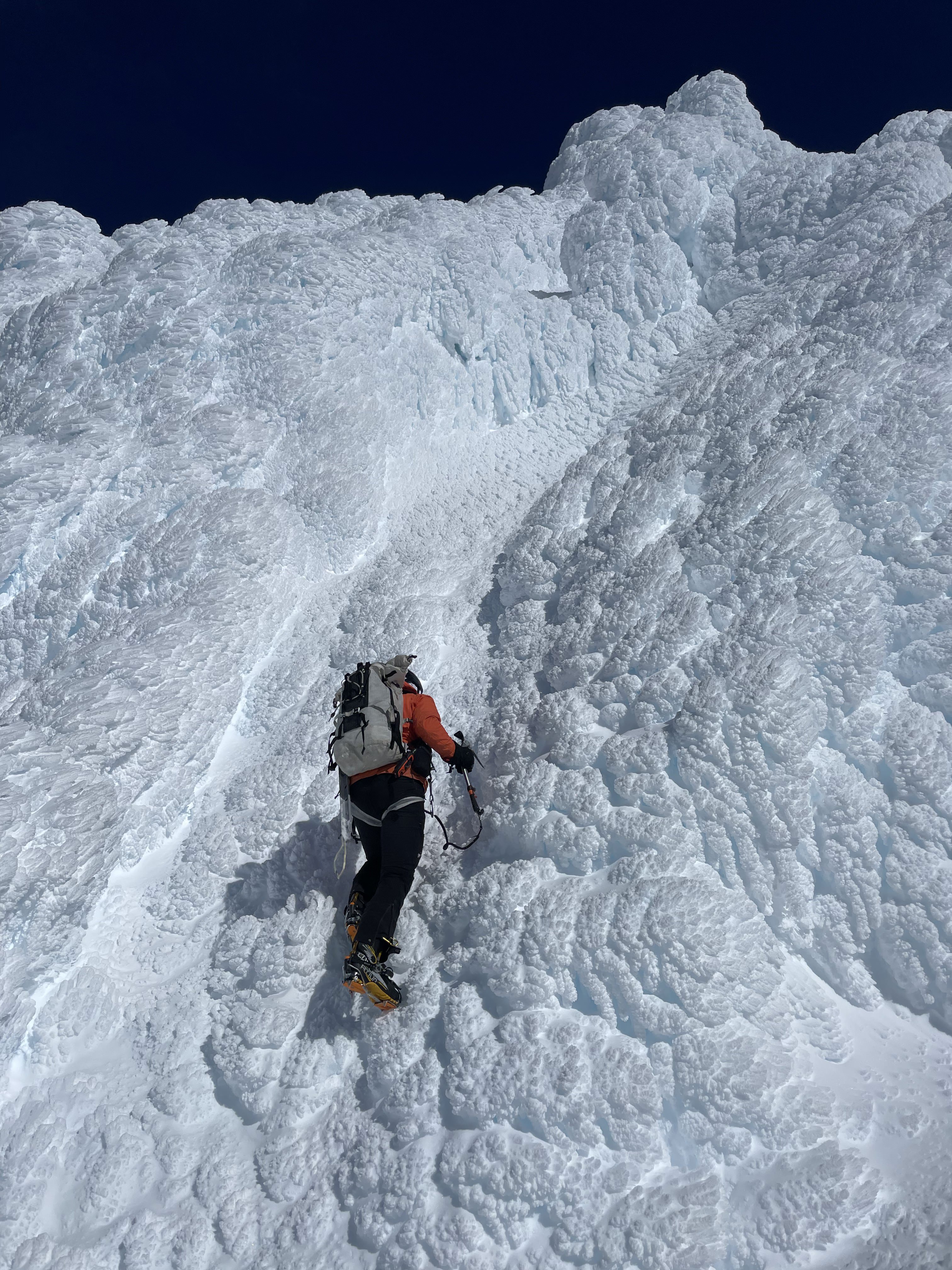
I have been contemplating the value of writing a trip report for this for the last few months. I have landed on publishing this since it may provide some insight and lessons to the climbing community here in WA and beyond. On 8/30/24 around 1am, Ian and myself headed North from Wenatchee determined to conquer the rarely climbed Wishbone Arete on the South face of Mount Robson. We met my brother, Noah, who was coming from Spokane at around 4:30 am at Lake Osooyos. From there we drove 6 more hours North through Valemount before setting eyes on the stunning South Face of Robson. This is one of the most spectacular mountain scenes I have seen in North America, and certainly the greatest from a paved road. Pulling into the parking lot at 3pm MTN time, we were a bit intimidated by the ~11,000' size of the face, but were confident we could make 5,500' up to the hut that night. This was a big objective for Ian and I, and certainly Noah's biggest challenge to date. A bit after 3pm, we set off on bikes along the 3 mile trail to Kinney Lake. Just on the other side of the lake, we ditched the bikes in the brush and started hiking up the steep forested slopes where we thought the trail to the hut might be located. After around 2,000' of thick bushwhacking, we found a clear climbers trail that I wish we would have located much earlier. The hiking is very steep from the beginning. There are a few low 5th class sections with chains bolted to the rock, and there are massive cliffs below to discourage you from falling. Once on the climbers trail, we charged another 1,000' up to the tree line and emerged on the steep scree slopes leading up to the hut. The trail disappears, but the hut was just barely visible so we knew where to aim for. There are a few more steps with low 5th class climbing and some chains to assist. We are not "aid climbers", so we of course avoided said chains. Some of the cliff bands below the hut looked quite formidable until we were right up to the base of them where a weakness suddenly became visible. Noah's sleeping bag was strapped to the outside of his pack, and at around 6,000' it came loose and tumbled down the steep slopes before going over the edge of the massive cliffs below. We trudged on knowing that a night above the hut (if required) would involve sharing Ian and I's sleeping bags three ways. At around 8,000' just as the sun was setting, we emerged on some easier scree slopes and followed the ridgeline up to the hut. Noah and Ian made dinner while I walked down the start of the traverse trail across the South face in the dark to find a waterfall and filter water. We got to bed around 9pm. Ian and I loaned Noah our puffy's to use as a modified sleeping bag, but none of us got much sleep due to the rats scurrying around in the walls and ceiling all night. We woke up at sunrise, packed up the most minimal kit possible, and started across the South face at around 6am. We intended to reach the summit that night at a minimum, which was guarded by 5,500' of steep and unknown terrain. The trail starts out well-defined but eventually fades as the loose scree gets steeper. The South face is huge, and this seemingly short traverse ended up being around a mile of side-hilling on steep loose scree and ledges. Around 8am, we finally reached an access point to the Wishbone Ridge on it's West side and boy does it look intimidating. Huge rock pinnacles on the ridge that would take days to climb over appear to block access. Nevertheless, we put on our big-boy pants and started upwards to feel things out. After some 4th class to 5.4-ish climbing on the loosest most inconsistent rock imaginable, we got out the rope and the climbing kicked back to vertical. Route finding throughout was just following path of seemingly least resistance. Every time there was a difficult obstacle, we were able to find a hidden gully or ledge to the East or West that would take us around the difficulties and put us right back on the ridge crest. The first 5.6 pitch followed a thin, loose traverse on small foot-holds to a less-than vertical valley in the rock. This led up to a small overhanging roof but there were descent (seemingly) solid handholds above to pull ourselves up and over. After two pitches we took the rope off and resumed the 4th class scrambling as the rock quality somehow got even worse. Worse than Mount Alberta. We eventually found our way up to another cliff with no way around, but an actually decent crack and solid rock. Ian led and was able to finally get in some solid protection for once, which made following much less stressful for Noah and I. This was probably the most difficult pitch of the route, but seemed like the easiest part due the occasional availability of rare pro placements. From the top of this pitch, we cut East to avoid a soaking wet cliff band and ended up finding a moderate gully and a view of the summit rime ice towers. It was around 2pm and we had around 1,500' to go. We could hear enormous avalanches thundering down the South face every 30min or so, but they were mostly obscured in the gullies to the East of the Wishbone. Unfortunately, the last 1000' of the ridge or so seemed to be covered in fresh snow, which makes for exceptionally unstable climbing on top of loose shale. This coupled with the lack of any sort of protection or anchors made for very mentally taxing climbing and we were all tired and hungry. There had not been a flat spot to rest or bivy for at least 2,500'. To make matters worse, as we came around to the East side of the ridge, the Serac's of the summit glacier came into view. We realized that the entire 1.2 mile traverse across the South face was seriously threatened by this overhead hazard, and the avalanches would rip 4000' down the face and destroy anything below. For me, this took retreating back to the hut off the table. That would not have been an appealing option anyways due to the amount of dangerous and tedious terrain we had already climbed. We decided to forgo lunch and push on to the summit in hopes of digging a snow cave to wait out the night. We climbed up the wet and loose gully for around 500' and popped out on the ridge within 1,000' of the summit. We continued upward on loose terrain. The snow build up was getting deeper, and the rock was getting slippery. We soon were using ice tools to find purchase and excavate for any sort of solid hold under the snow. We discussed using the rope, but there was no protection placement available of any kind. Even if a crack could be found for a cam or nut, the shale just broke or fell apart as soon as any pressure was applied. At around 12,500' the angle of the climbing got up to about 60 degrees as we were traversing West around a small cliff band. I decided crampons would make for safer travel and kicked in foot placements in the loose slush to transition. Ian was a ways up ahead and Noah was just around 10' above me and to my Left. Knowing we were at the limit of our abilities, I encouraged him to try and retreat back down to my foot placements and put crampons on. Just then, his feet and ice tool placements gave way, and he started sliding on all fours down the mountain. For the first couple seconds he grunted and tried to self arrest, but finding a solid hold in that terrain is nearly impossible. After a few more seconds he tumbled over the cliff band below and out of view. Knowing that the next ledge was many thousands of feet below, we knew right away that Noah was gone. I said a prayer for him in his final moments and then asked God to give me strength to succeed so that I could live out my life with my family. After a few seconds I yelled at Ian that I thought we needed to get the the summit before dark set in. I put on crampons and climbed up a bit further in Noah's footsteps. Ian reached the ridge crest and dropped me the rope. The only protection would be to have each of us on opposite sides of the ridge so that our body weight would hold a fall. Once I joined Ian on the ridge crest we were about 300' short of the summit. We somehow had cell service and I reported our situation to Jasper NP search and rescue. I told them we would be on the summit tonight, and that we would contact them in the morning. From the crest, Ian led upwards on unstable ice. The climbing got steeper and steeper until reaching a bit over 70 degrees at the crux pitch of the route. It was very unstable climbing, with one pick or one crampon placement frequently giving way. Several times I was saved by only one good placement when the other two slid away. Just below the summit there is a huge rime ice formation. We drove in a basically useless picket placement just below the formation and I led out to the East on very steep and soft snow. Once I was off to the side of the formation, a thin gully appeared just wide enough to allow passage. The rope ran out, and I yelled at Ian to pull the picket and start simul-soloing. After around 40' of climbing up the thin gully, I emerged on the exact summit of Mount Robson just as night fell. I walked over to the other side of the summit hump and belayed Ian the rest of the way up. At that point, once the immediate danger was gone, we finally lent some thought to what had just happened. I knew it was horrible but it was difficult to grasp the ramifications of losing my brother like this. Ian and I were both starving and dehydrated, but I quickly switched to my next objective of getting home to let my family know what had happened and grieve with them. I started down a hundred feet or so in complete darkness towards the direction I assumed would lead us to the dreaded South Face descent route. Luckily after about 3 minutes, Ian confidently yelled at me that this was a horrible idea and we needed to stop for the night. I am very thankful for his assertiveness because it felt like I snapped back to reality a bit and realized that he was totally right, and there was no way we would find the correct route and survive the descent in the dark. We climbed back up to the top and dug a small platform for sleeping bags. I put the rope and my pack down first and my thin foam sleeping pad over that. Luckily the night was calm and cold. There was a lot to consider laying there. Huddled in my sleeping bag, I read Psalms 40-50 on my phone and found a few comforting verses there: Psalms 40:1-5 1 I waited patiently for the Lord; he turned to me and heard my cry. 2 He lifted me out of the slimy pit, out of the mud and mire; he set my feet on a rock and gave me a firm place to stand. 3 He put a new song in my mouth, a hymn of praise to our God. Many will see and fear the Lord and put their trust in him. 4 Blessed is the one who trusts in the Lord, who does not look to the proud, to those who turn aside to false gods. Psalm 46: 1-7 1 God is our refuge and strength, an ever-present help in trouble. 2 Therefore we will not fear, though the earth give way and the mountains fall into the heart of the sea, 3 though its waters roar and foam and the mountains quake with their surging. 4 There is a river whose streams make glad the city of God, the holy place where the Most High dwells. 5 God is within her, she will not fall; God will help her at break of day. 6 Nations are in uproar, kingdoms fall; he lifts his voice, the earth melts. 7 The Lord Almighty is with us; the God of Jacob is our fortress. Sometime after midnight, I was able to get a few hours of sleep due to complete exhaustion. We called SAR around 7am to update our location. They asked if they would be able to send a helicopter to retrieve us to which we agreed. Just after 8am, a helicopter buzzed the summit and made an incredible landing in a tiny saddle just 50' or so below us. We loaded our gear in and flew down to the bottom of the mountain in a matter of minutes. I was very thankful to not have had to take the dangerous and tedious descent route back down. We received a police interview at the ranger station, and a kind ranger drove us down the trail in a side-by-side to retrieve the three bikes. This was certainly the most dangerous route Ian and I have ever done, and honestly is the first one I can say that should never be climbed again. There is just no safe way to climb it. There is next to no protection the entire time and due to the rock quality you are basically just rolling the dice on every hold. The slush over the top made it totally unsafe, but there is not really a feasible retreat from that high on the mountain. On top of the completely insecure climbing, there are massive objective hazards throughout. If you are considering climbing Mount Robson, find another route. It is incredibly beautiful, and I would encourage anyone to try maybe Emperor Ridge or the Kain Face as I have heard much more positive reviews of those routes. This will be my last trip report of this scale, as I am stepping away from serious climbing to prioritize family. None of us have experienced the death of a close family member. We are finding that the only joy can be found through God's promise in the bible that those who believe in him will spend eternity in paradise. Romans 10:9: 9 If you declare with your mouth, “Jesus is Lord,” and believe in your heart that God raised him from the dead, you will be saved. I am posting this as some sort of closure to my climbing career and to remember Noah. It is hard to describe the impact Noah had on his family, hometown, and group of friends in Spokane here. Back in September we had a funeral ceremony for him at our local church that is captured on video: There are some profound reflections on death, and how this has impacted our family vs how death is viewed by the majority of secular society. I think it did a great job of honoring the incredible work of Noah's life and the impact he had on the people around him.
-
[TR] Mount Alberta - Japanese Route (5.6) - 9/3/23
eeelip replied to eeelip's topic in British Columbia/Canada
I see. I would bet you probably need a login. The only other way would be to find my profile (@eeelip) and go to my lists or past activities to find the route you are looking for. I know they don't show up in the search because they are not "verified trails". I usually submit a request to verify them, but Alltrails has not approved any of my technical routes for the last few years. Sorry for the frustration. Probably should have converted to another platform a long time ago... -
[TR] Mount Alberta - Japanese Route (5.6) - 9/3/23
eeelip replied to eeelip's topic in British Columbia/Canada
https://www.alltrails.com/explore/recording/mount-alberta-japanese-route-cd61a58?u=i&sh=emzgdu You can try this one, but the old link works for me. Maybe try going to my profile and scrolling down until you find it? It also may be easier on a desktop. -
Looks awesome. Would consider the West Ridge worth doing? My partner and I are right on the cusp of trying some 5.9’s but still wanting to build a little more confidence.
-
Thanks! I had one. It was super hot on this climb so I was not always wearing it, guess it didn’t make the video.
-
Finished the video for this as well:
-
We were basically a 16 and a 10, so not much faster! Huge respect for completing this route. It is a serious test piece.
-
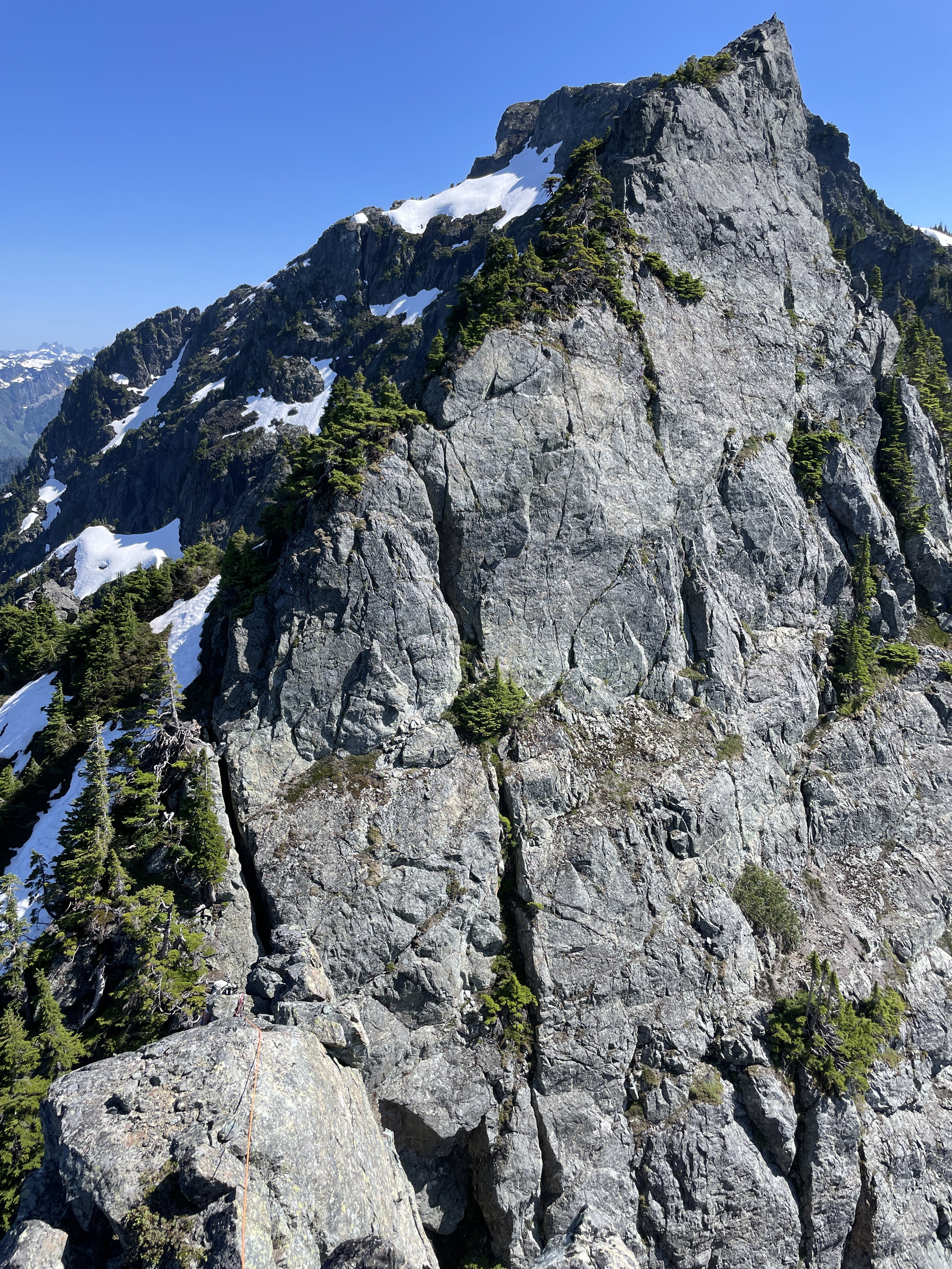
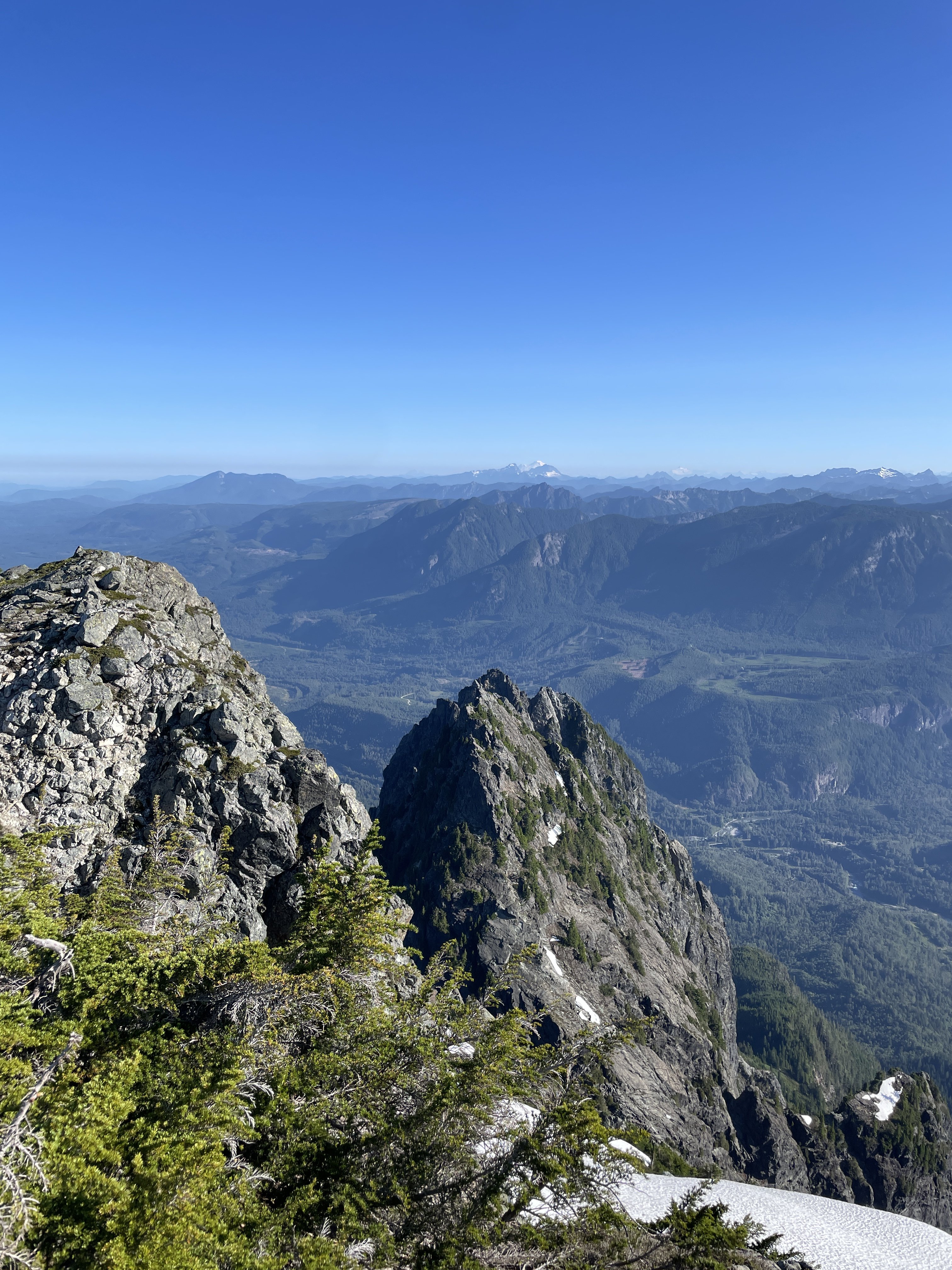
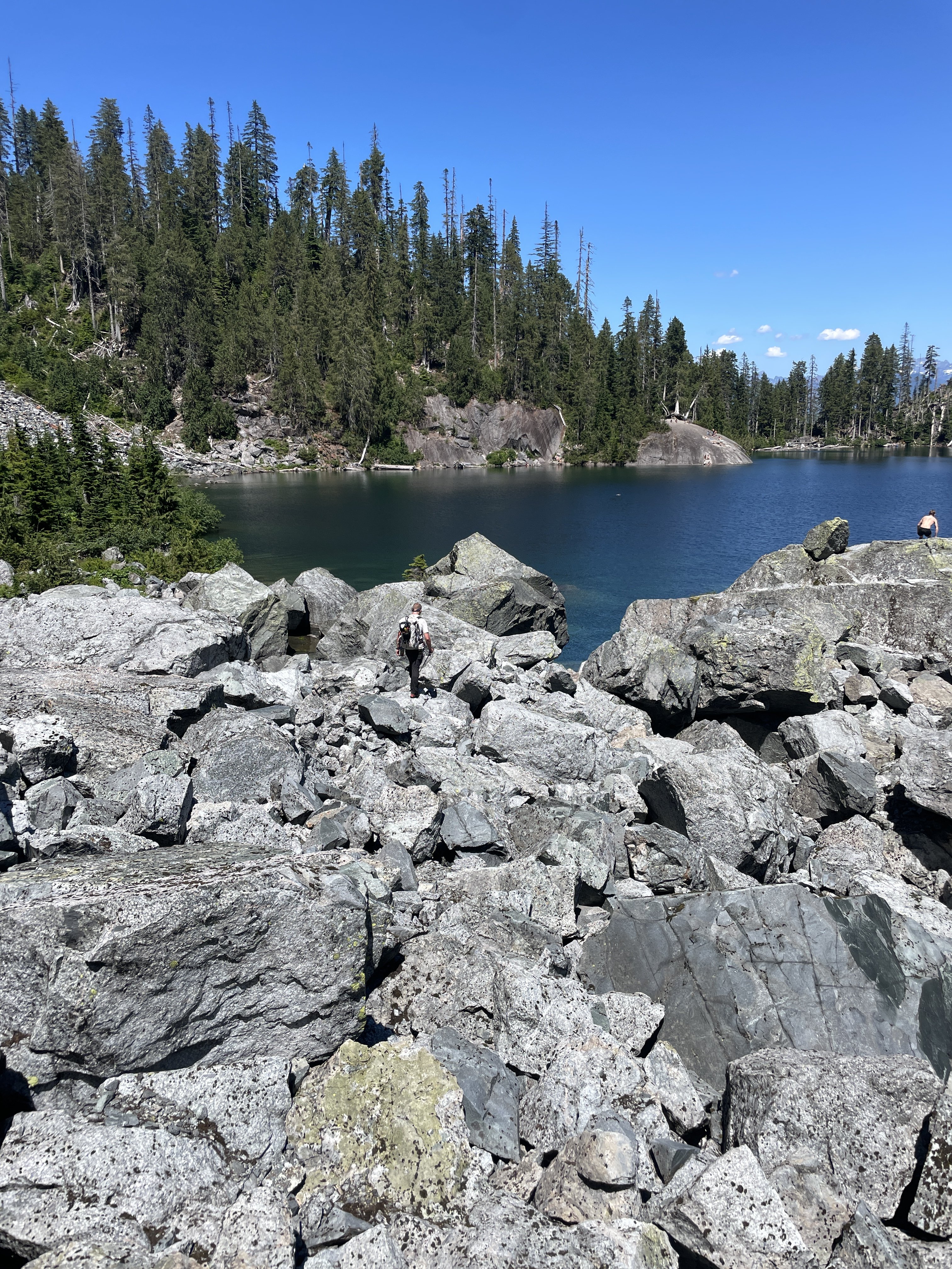
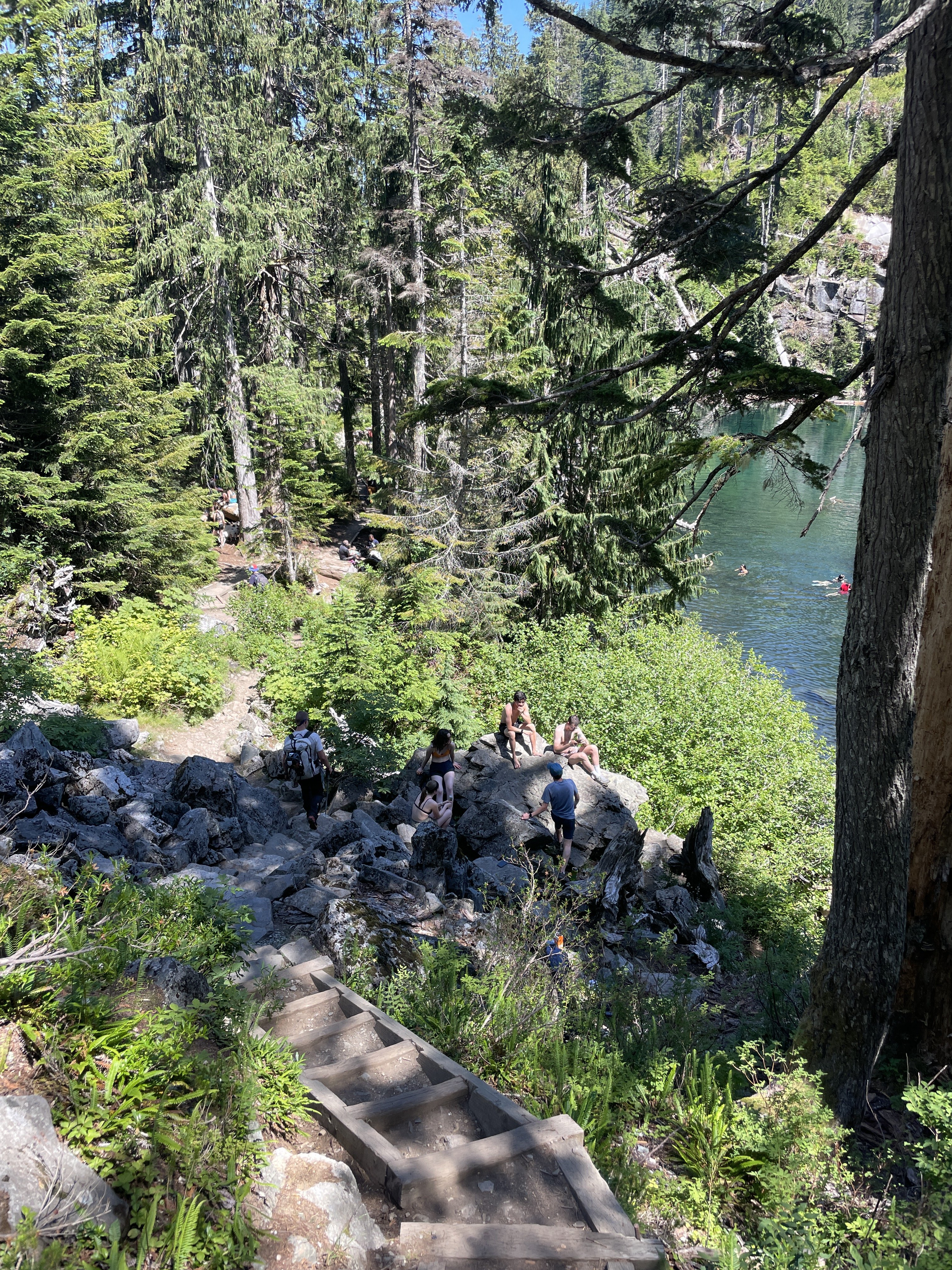
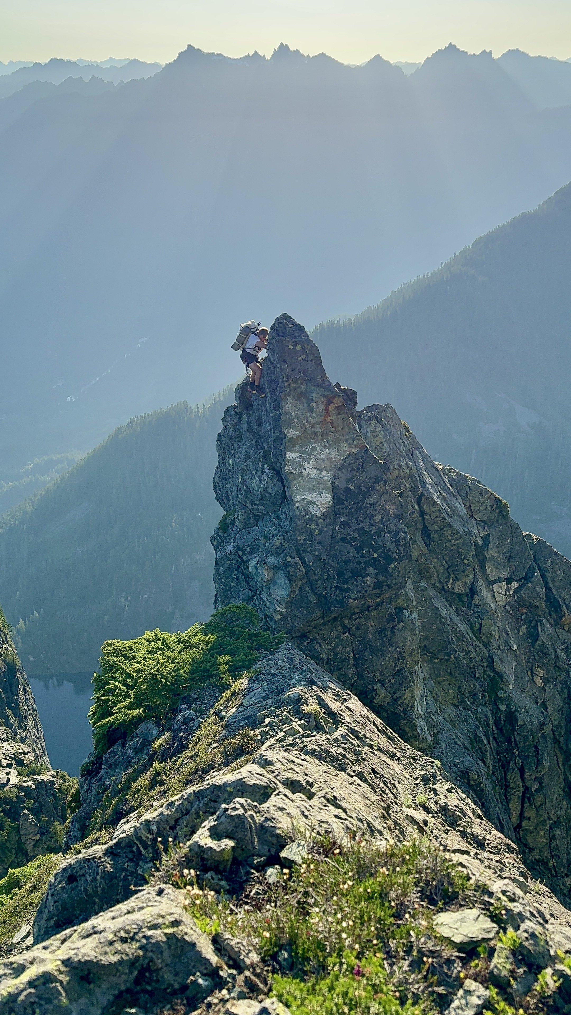
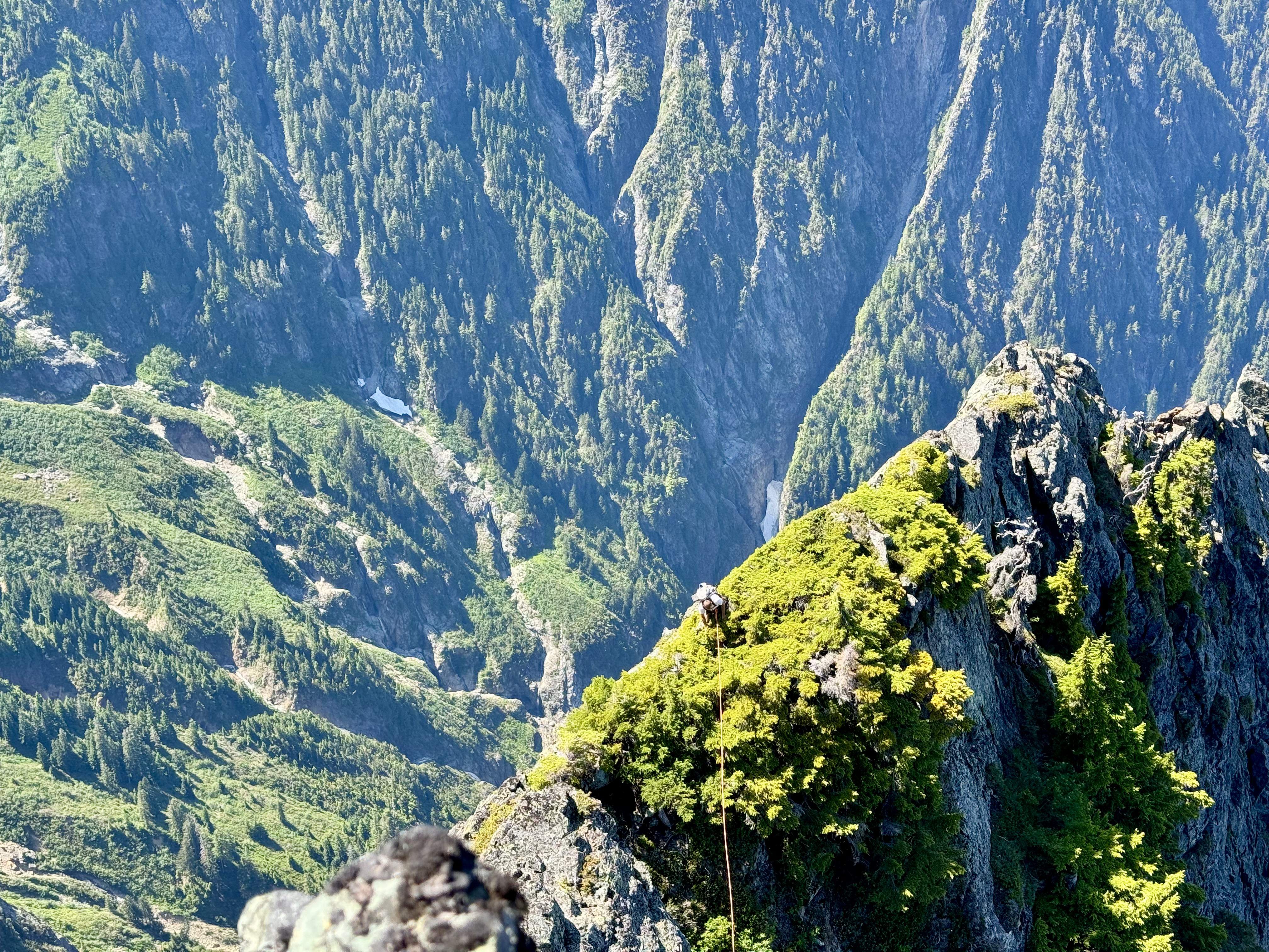
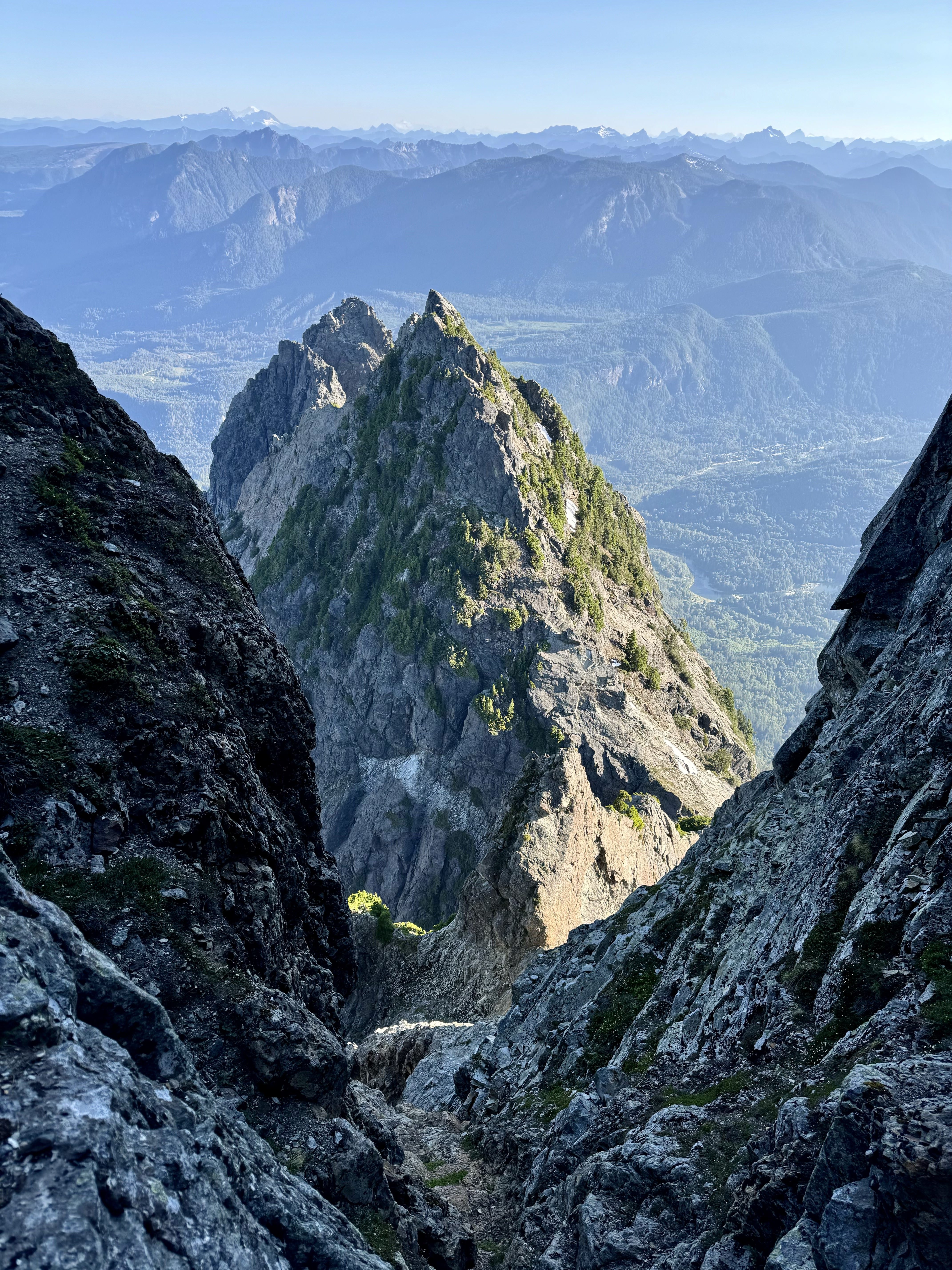
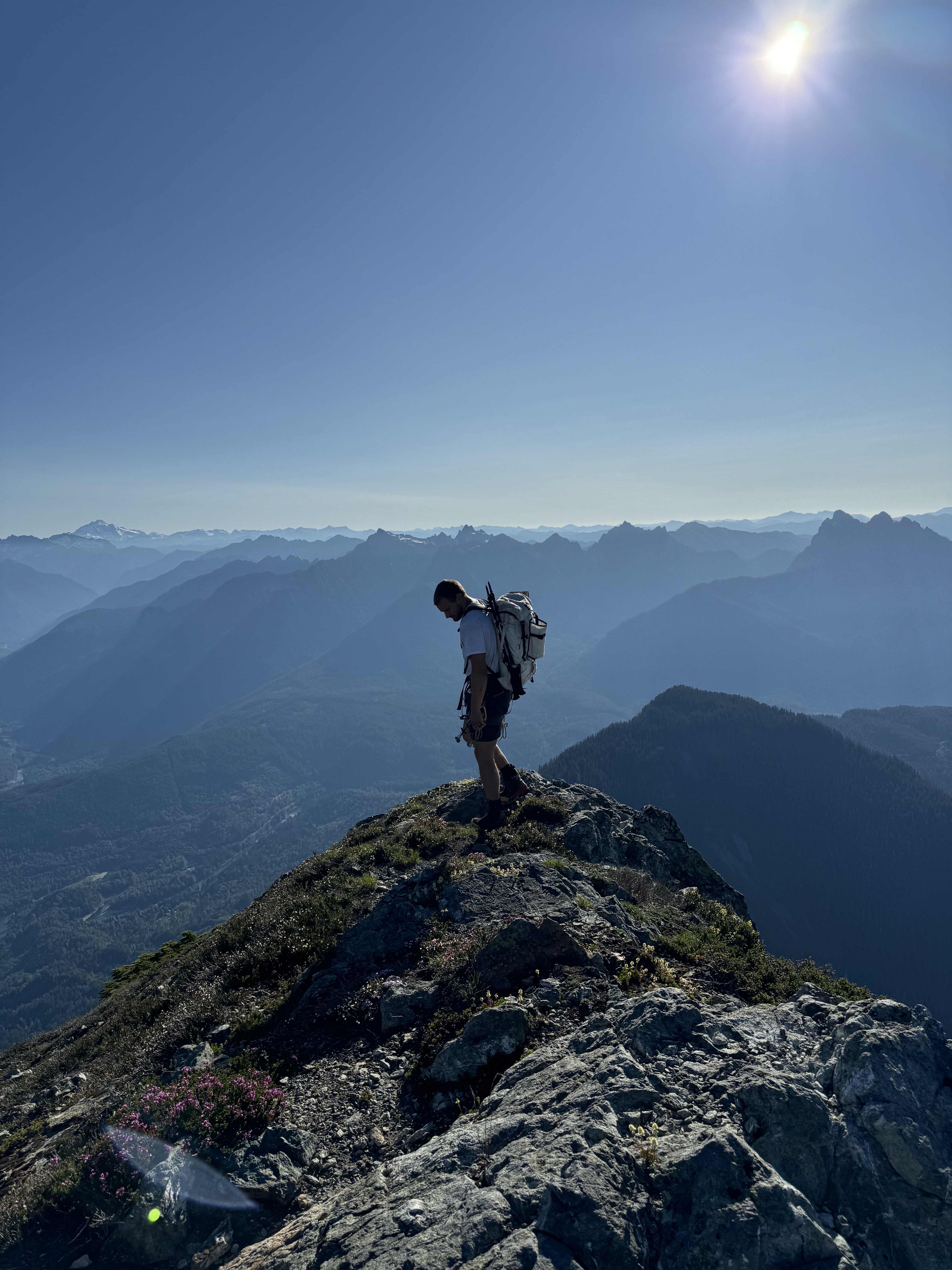
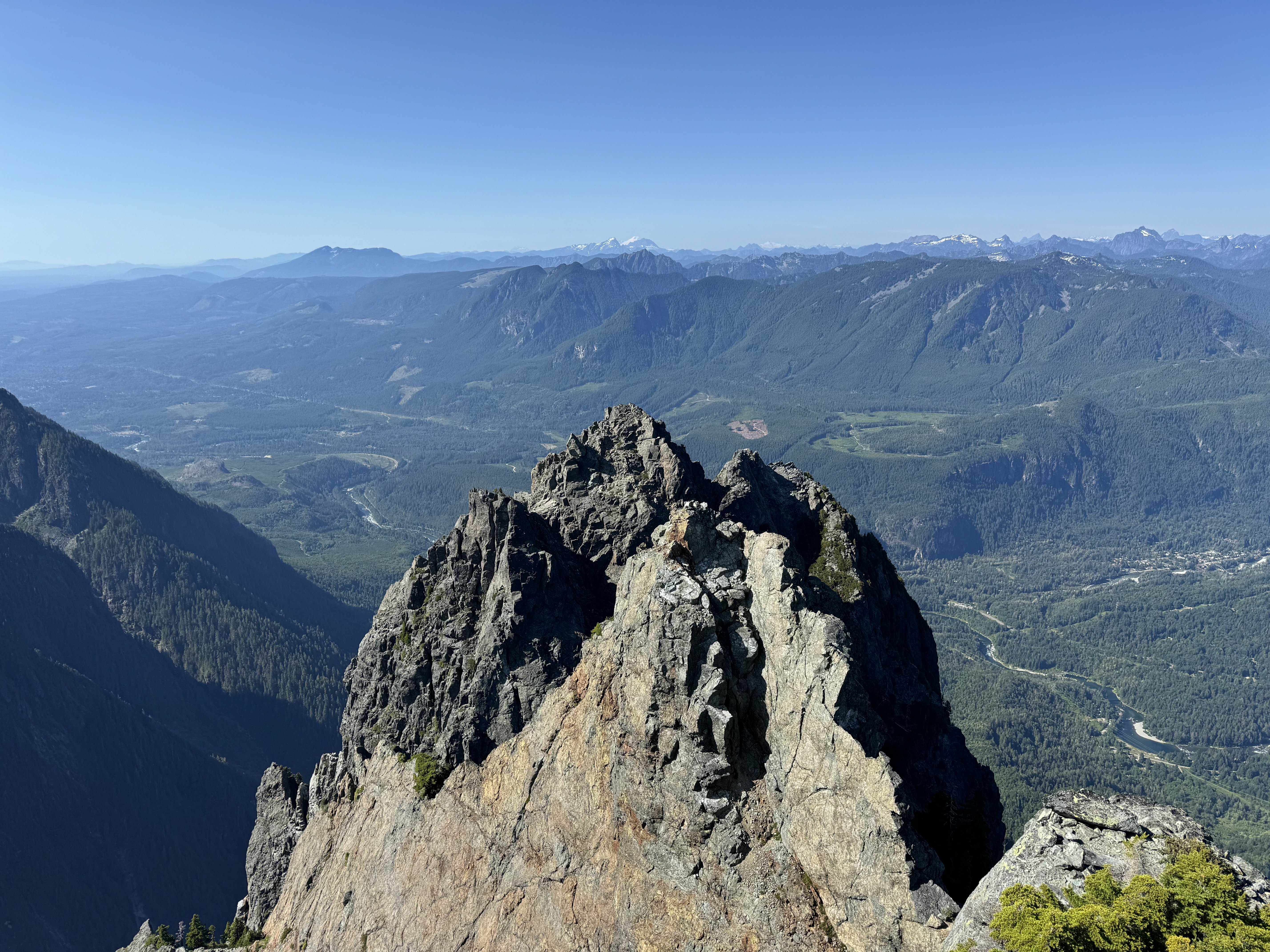
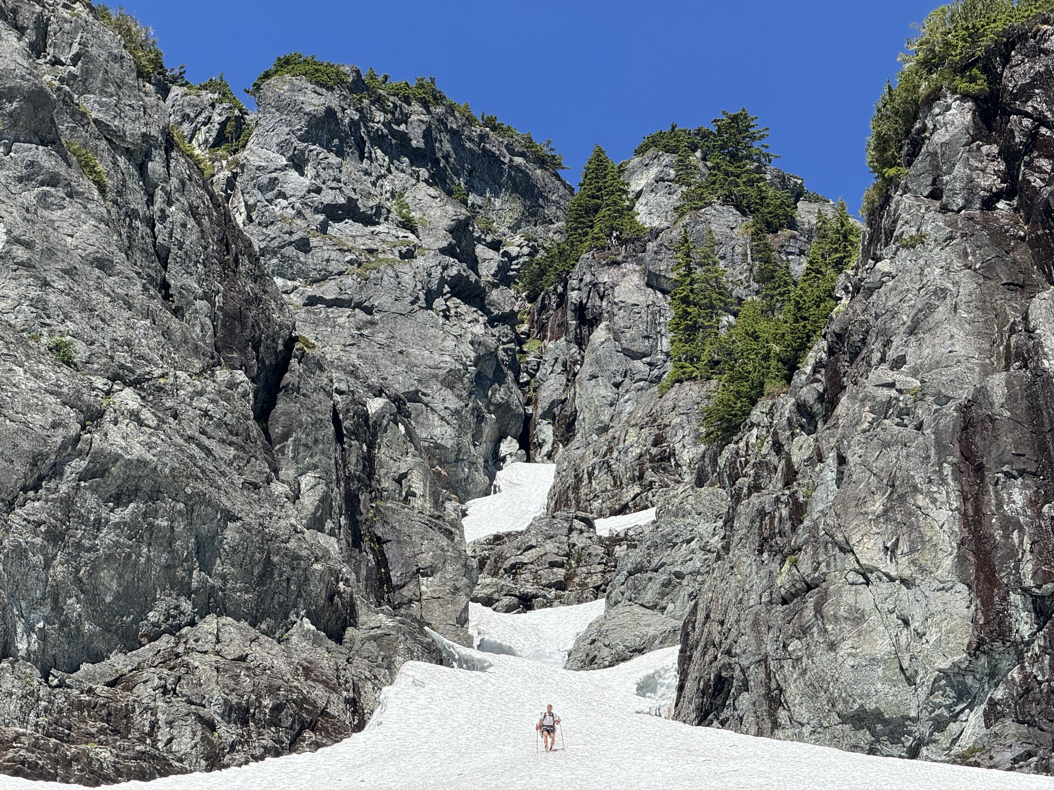
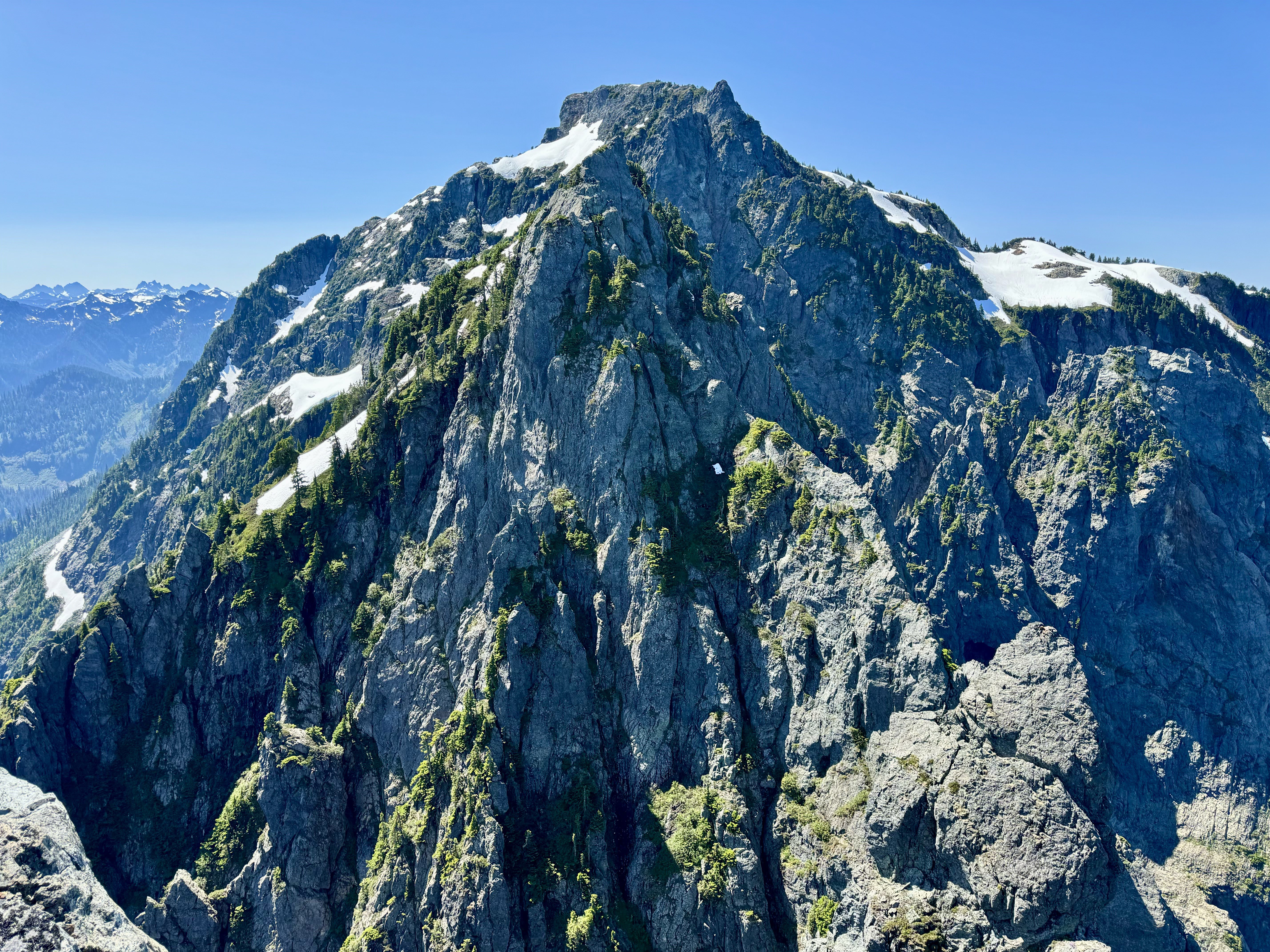
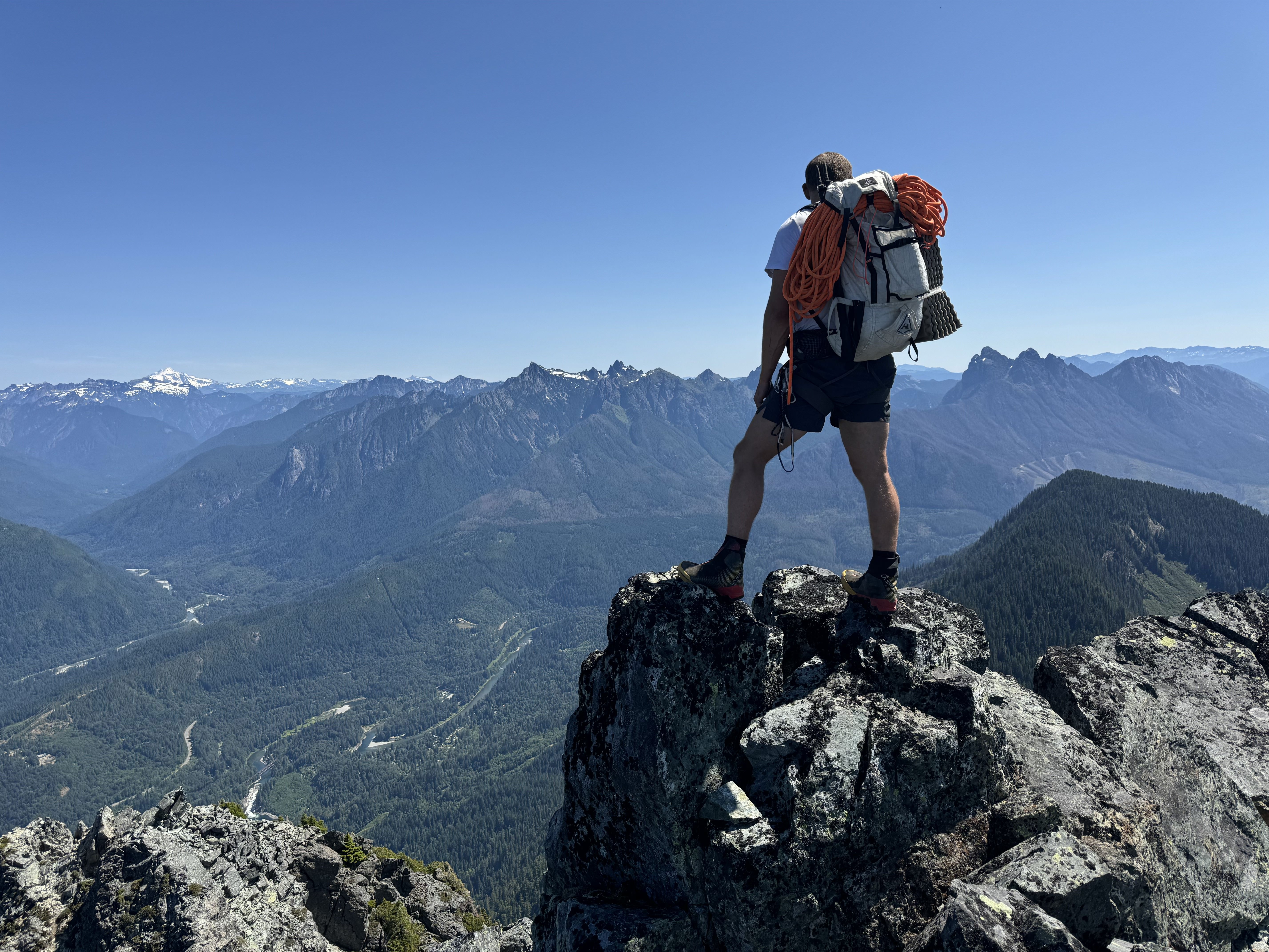
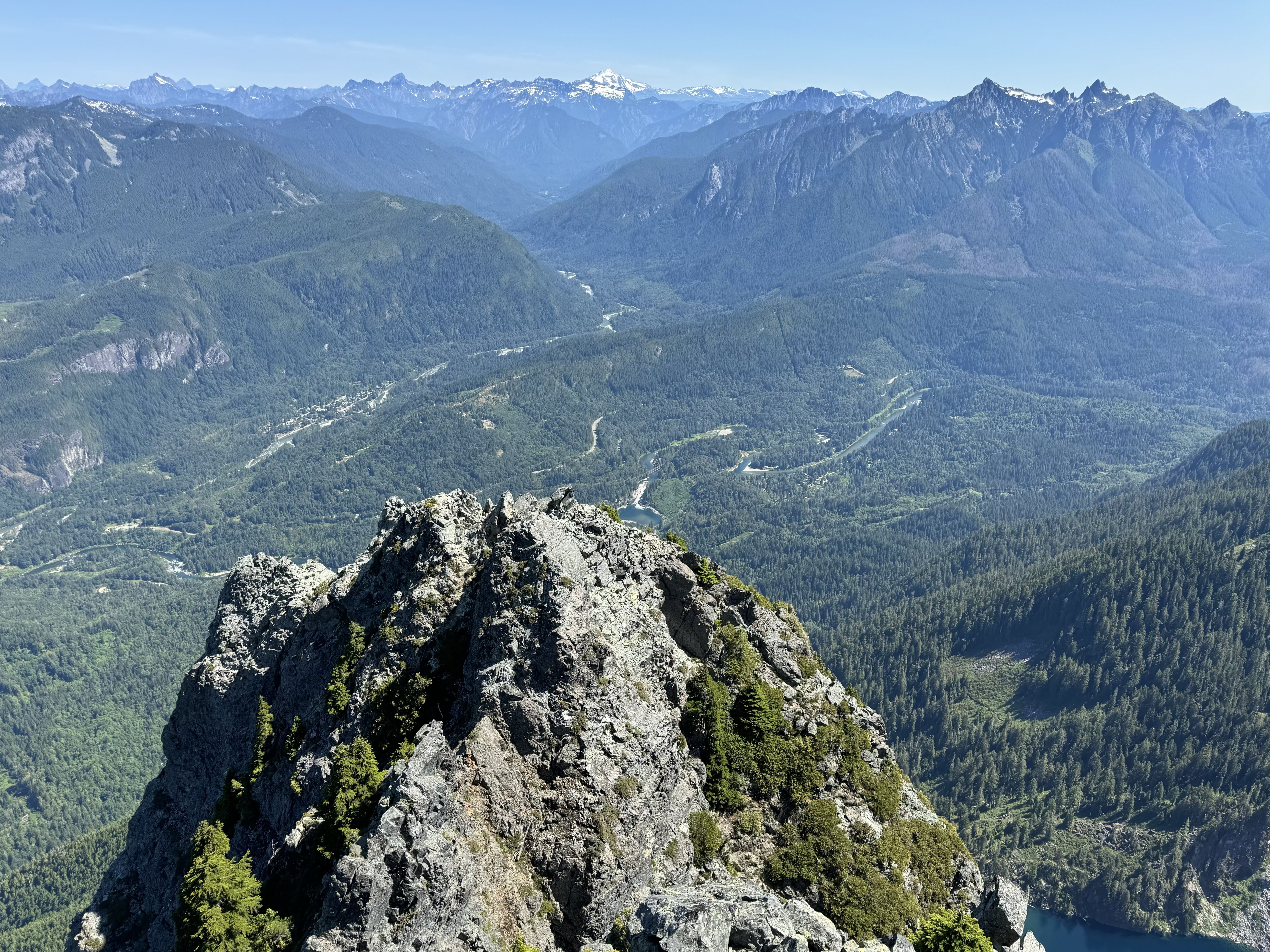
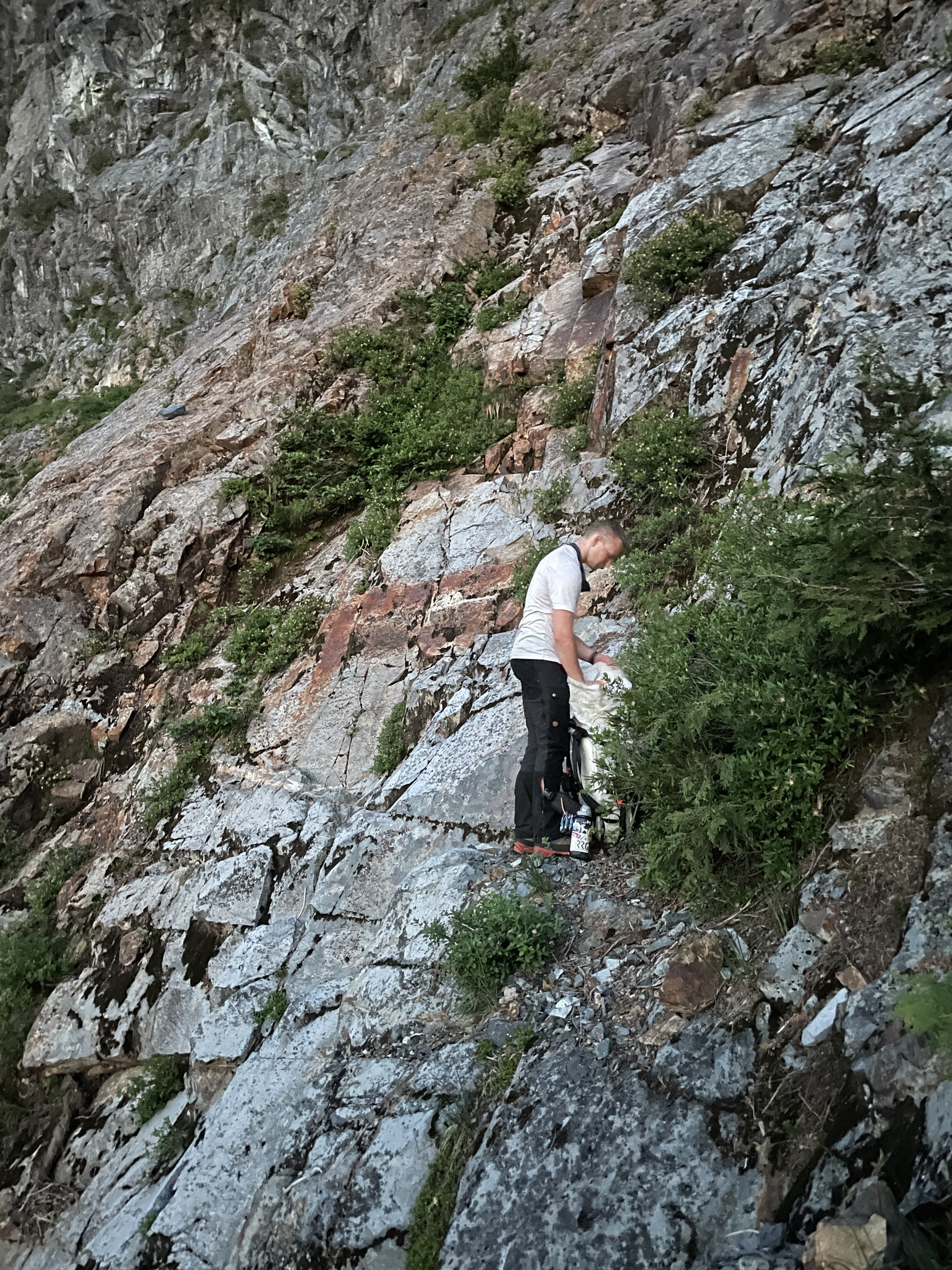
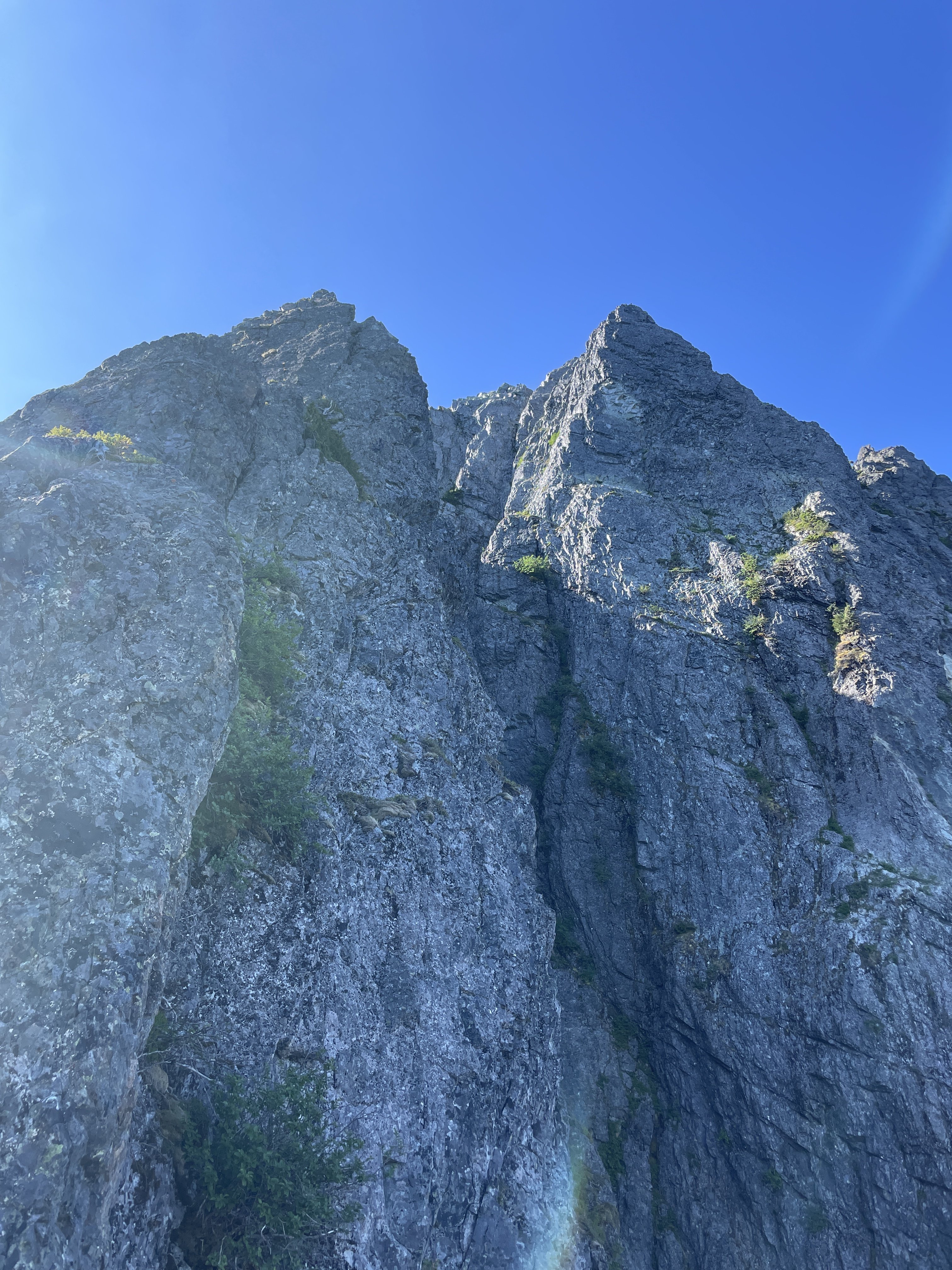
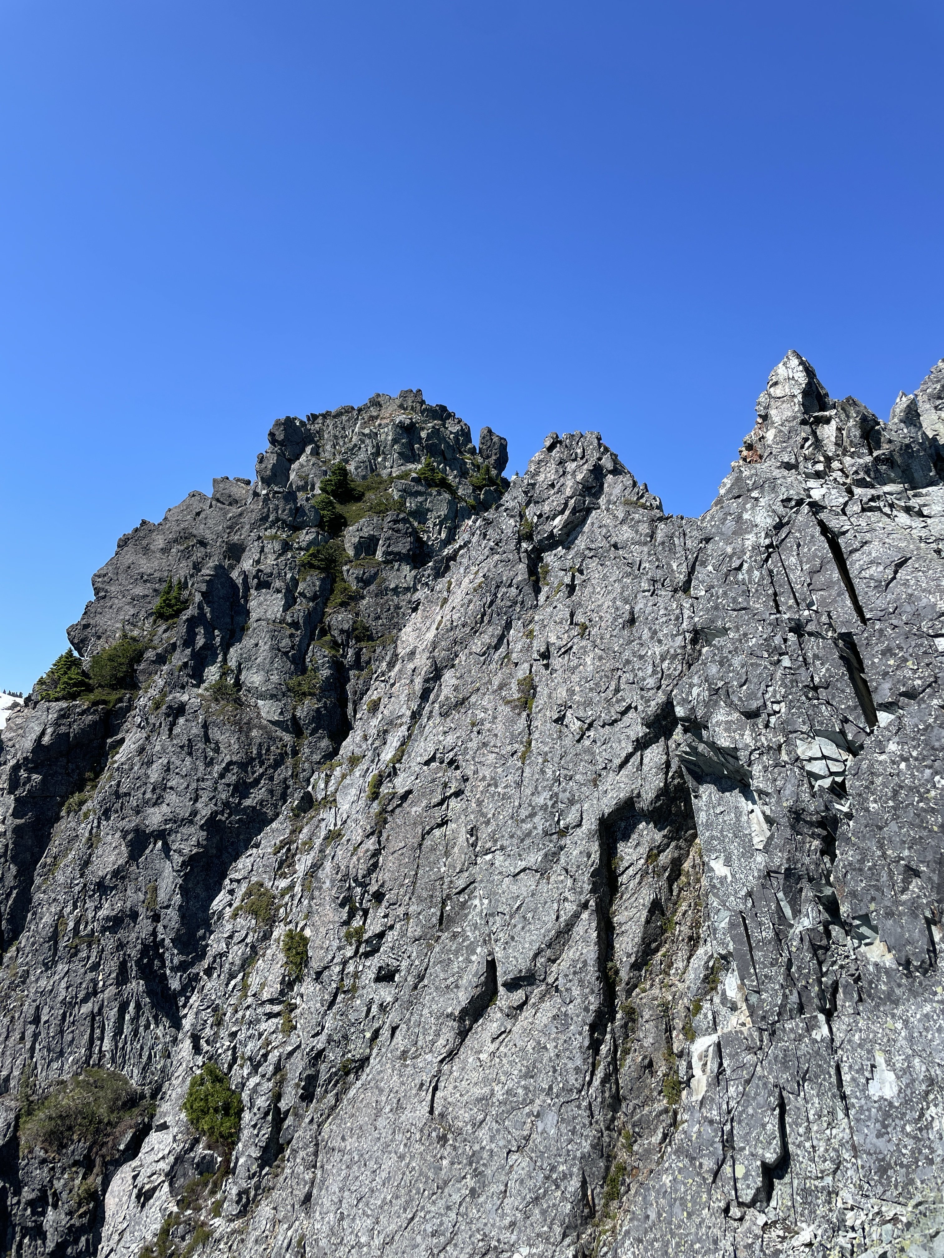
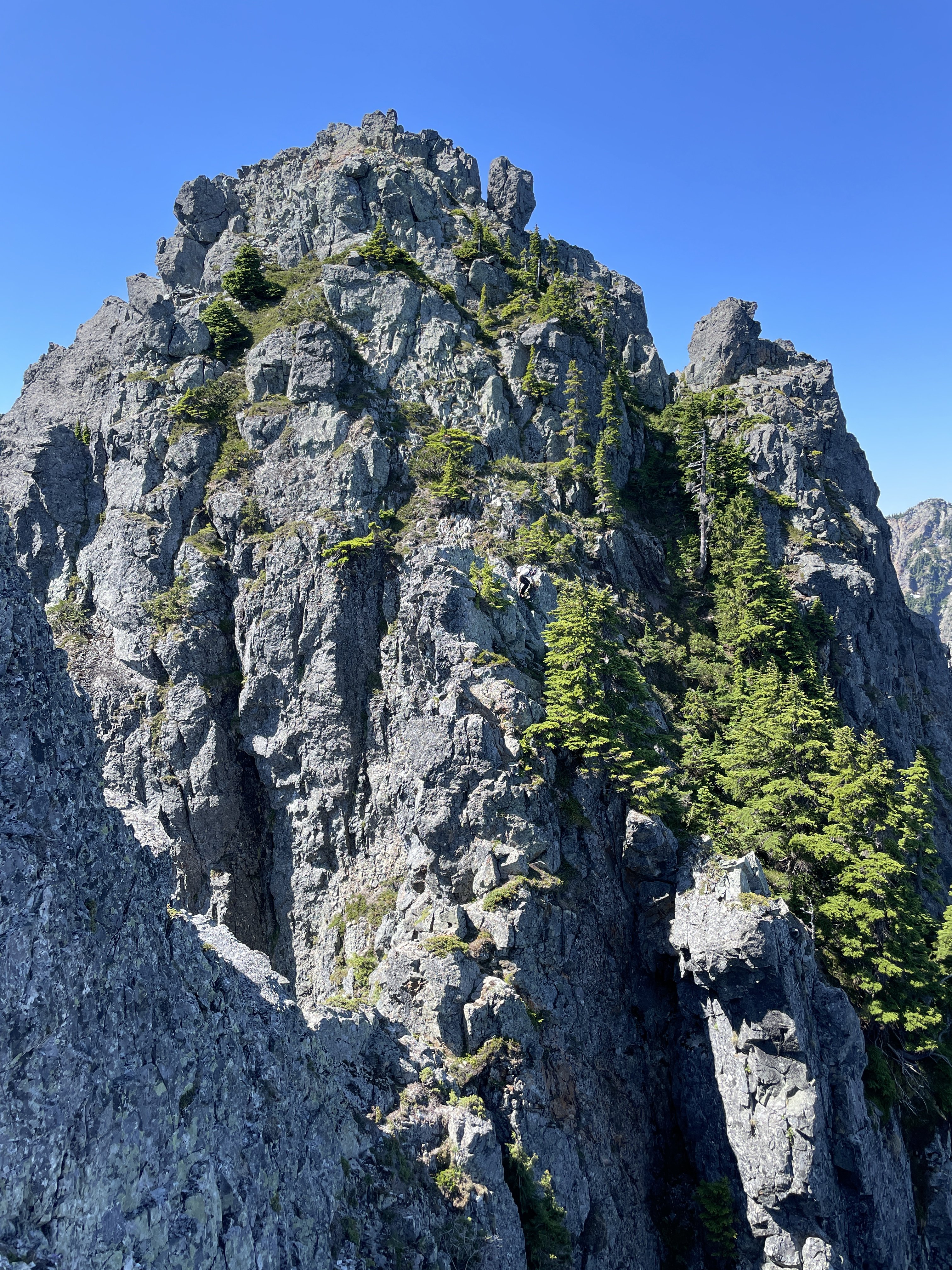
The traverse of Mount Index has been on Ian and I’s radar for over three years. It summits two of WA’s supposed “Difficult 10” peaks in one fell swoop, and has a legendary reputation in the WA climbing community. I first heard of it when I stumbled across the Difficult 10 list online. The climb immediately got my attention, but at the time I did not think I would ever have the skills or the partner to complete it. The exposure and route reports were pretty terrifying and looked so far beyond anything I had done up to that time. The route is very aesthetically pleasing, and can be seen from the highway. There are a few trip reports for the traverse online, most done by blue-collar legends of the WA climbing community. There is also Colin Haley’s report of doing the traverse in 24hrs in winter, which seems super-human to me at this point. Unsure of the technical difficulties that would be involved, we wanted two full days for the climb to increase our chance of success. Ian and I left my house at 1am Sat morning 7/13. We were hiking up towards Lake Serene by 2:30. At the lake, we followed the convoluted trail towards the West rim of the lake, then veered upwards for some bushwhacking until we reached the talus slopes. We followed them up towards the North Face of the North Peak until we reached around 3,300’. At that point we scrambled up easy but unstable red rock until things got bushy. There are rap anchors everywhere on the North Face from so many people bailing, and it is very hard to tell if you are going in the right direction. Ian and I basically foraged upward through very steep brush until we reached the saddle of the huge and distinctive gendarme feature. From there, we realized we were too far East and had skipped most of the easy “open bowl” section. We downclimbed slightly and traversed West into the hidden gully that becomes obvious at the top of the bowl. This easy gully led us straight up to a notch at the start of the North Ridge at 9am. The sun hit and it went from hot to very hot. The forecasts for the summit were in the 70s, but I did not believe it before we left. The rib climbing is super fun as stated in other trip reports and is around 5.5. Ian led the first section then we simuled up to the upper slopes where the brush begins again and a large snow patch is located. We were soaked in sweat and already dehydrated at this point. We melted and ate a meal there, then continued up some very vegetated terrain to the North Peak False Summit. From there it is a short and VERY exposed 4th class scramble to the North Peak. We arrived on top at noon feeling a bit fatigued but confident we could make it to Middle. We both agreed that North Peak by itself is quite a bit steeper, more exposed, and difficult than Johannesburg Mountain, to which it is often compared. After the North Peak summit, the traverse becomes even more exposed. There are massive cliffs on both sides the entire time, and even when the terrain is moderate near the ridge crest, there are still massive cliffs just below those slopes with nothing to catch you from falling. From the North Peak, we followed Riley81’s trip report on CascadeClimbers.com. His is one of the most helpful trip report for any climb that I have come across. Very concise and clear directions that made sense when we were on route. We downclimbed a bit from the summit, then made a rappel, then climbed back up to the East side of the ridge, then back down a long loose gully, then another rappel, this time overhanging, down into the North-Middle notch. A bit complex. At the notch, I finally grasped why the Middle Peak has such an intimidating reputation. Once you make that rappel, the easiest method of rescue is to finish the traverse, which is not easy even from that point. A helicopter rescue would be very difficult as well, and they would have to long-line you out. It feels like you are in a completely different world, with HWY 2 and the busy Lake Serene Trail at your feet. From the notch Ian led the technical crux pitch of the route. A full 60m gully with a few 5.7 moves. Ian led his way up like a champ and I grunted my way up like a chump. At the top of this gully we were on the ridge crest, and we simul-climbed 3 pitches to the false summit of Middle. We were totally out of water at this point and very thirsty. Luckily, we could see a snow patch ahead. We made a very overhanging rappel and made a beeline for the water source. We cruised right by the bivy site without even seeing it. We melted more snow, ate some snacks, then summited Middle via easy heather scrambling. At the top, we both agreed why this is at the top of the Difficult 10 list. The climbing on the peak itself is not terribly hard, it is more due to the amount of effort it takes to get there. I called Maddy to check in from the top around 4pm. Ian and I discussed going to bed, but we still had 6hrs of daylight. We started the complex descent from Main Peak by following the ridge crest and deviating to the East to downclimb a ~200’ long gully. From the bottom of this gully, we climbed up to the ridge crest via another gully and over to the West side. We then descended some easier slopes to a small gendarme where we crossed back to East side of the ridge. More complexities. There are some white colored slabs with snow, and a few vegetated sloping ledges. It was just after 6pm when we reached said ledges, and we were worried about the time/energy to reach Main Peak that day, as well as the availability of bivy sites at the Middle-Main notch (there were none). We brewed up and I spent 6hrs sweating profusely and trying to sleep on an angled 10 degree slope with swarms of mosquitoes targeting my exposed face all night. I somehow drifted off around 2am and awoke to Ian climbing down to my ledge at 4:45. I had overslept our 4am wakeup, and my punishment was skipping breakfast and just eating a Cliff bar. We were on our way by 5am after filtering water. We down-climbed the white slabs which were wet and sketchy, but they led us to a tree with a rap anchor leading down toward the notch. From the bottom of the rap it is a short scramble up and over a hump and down to the Middle-Main notch itself. From the Notch, Ian led again. The pitch was a shallow 5.6 gully, this time only 35m or so. Distinctly easier than the pitch coming out of the North-Middle gully. I quickly followed him and led the way up some steep brushy slopes while Ian flaked the rope. After 30min or so, we popped out on a ridge crest, which is actually the top of the South Norwegian Buttress. We simuled 3 very exposed but easy pitches to the “Wedge Gendarme”. From there we down climbed to a notch between the Gendarme and the North Face of Main Peak. From this notch, the route is actually quite obvious. The route up the face of Main is much easier than it appears at a distance, and we scrambled easy 4th class slopes until we were forced into the long red gully. We climbed in the gully for a few feet before starting the rightward traverse on a grassy ramp. After the ramp, a ledge takes you around to the West side of Main peak and the technicalities are over. It is a short hike up past the false summits of Main Peak to the top. We reached the summit at 8am Sun morning. We then put away the rope, ate a few snacks, and walked east to the top of the Hourglass Gully. At the top of Hourglass, we were about to make a new tree anchor when Ian found a new-ish sling already there. We rappelled down the first waterfall getting a bit wet in the process. We then pulled the soaking wet rope and made a second rappel on our own new tree anchor to the steep snowfields below. We then spent about an hour baking and slowly down-climbing the sketchy snow. Neither of us had an ice axe, and Ian didn’t have crampons. A light axe would probably have been worth the carry. After a short rock section, I found another tree anchor and made a full rappel down another waterfall and got completely soaked. This rap led to another very short rappel onto some less-steep snow. We glissaded down to the bottom of the snowfield, then picked our way down through the trees until we could make the traverse to the East Ridge route. From there, we stayed exactly on the ridge crest and proceeded with the hard-core bushwhacking descent for around 1,000’. My shorts and T-shirt were not very useful and my arms and legs got shredded by the spiky vegetation. Once at the saddle above Lake Serene, we descended towards the lake on boulders staying left to avoid vegetation as much as possible. As soon as we got to the lake I took off my boots and jumped in with my clothes on. My shorts and T-shirt were disgusting and the water felt amazing. After that we filtered water and made meals. Around 1pm we started our way around the lake. Around 2pm we walked past all the crowds of Seattleites at Lunch Rock. We were back to the car by 3:30pm and home by 5pm. My opinion is that this is a very good route. The traverse style, exposure, and amount of work required make it classic, and the proximity to civilization makes it unique. The climbing itself is a lot of work, but that is Ian and I’s specialty. I would recommend this route to any experienced climber in WA looking to test their abilities. It is certainly harder than any other route we have done so far in the state, with the Price Glacier + Noocksack attempt coming to mind as our other long effort. I am very satisfied to have this one done, and from now on my trips over HWY 2 will bring a sense of accomplishment, rather than anxiety. GPX Track: https://www.alltrails.com/explore/recording/afternoon-hike-6ecbdd6-436 Gear List: https://www.packwizard.com/s/Q0Fbxc1


-
We bypassed the serac at 7k actually just to the right, then cut back left to join your route. I think that is where we encountered the only low 5th class climbing on route through a very short rock band. You guys look like you had quite a bit more rock scrambling than we did, so props for that! Also I’m going to send you an email re: gear. No idea how you guys kept your packs down at 40lbs with snowshoes.
-
Nice work Matt! This was a heck of an effort, and I can certainly relate to feeling worked at that 13,500' camp!! Looks like our tracks were the same from 8k up or so. The left side where you started had avalanches/rockfall at least every 15min so we did not risk it. Off the glacier we started to the right of the ridge and stayed on that side for a while.
-
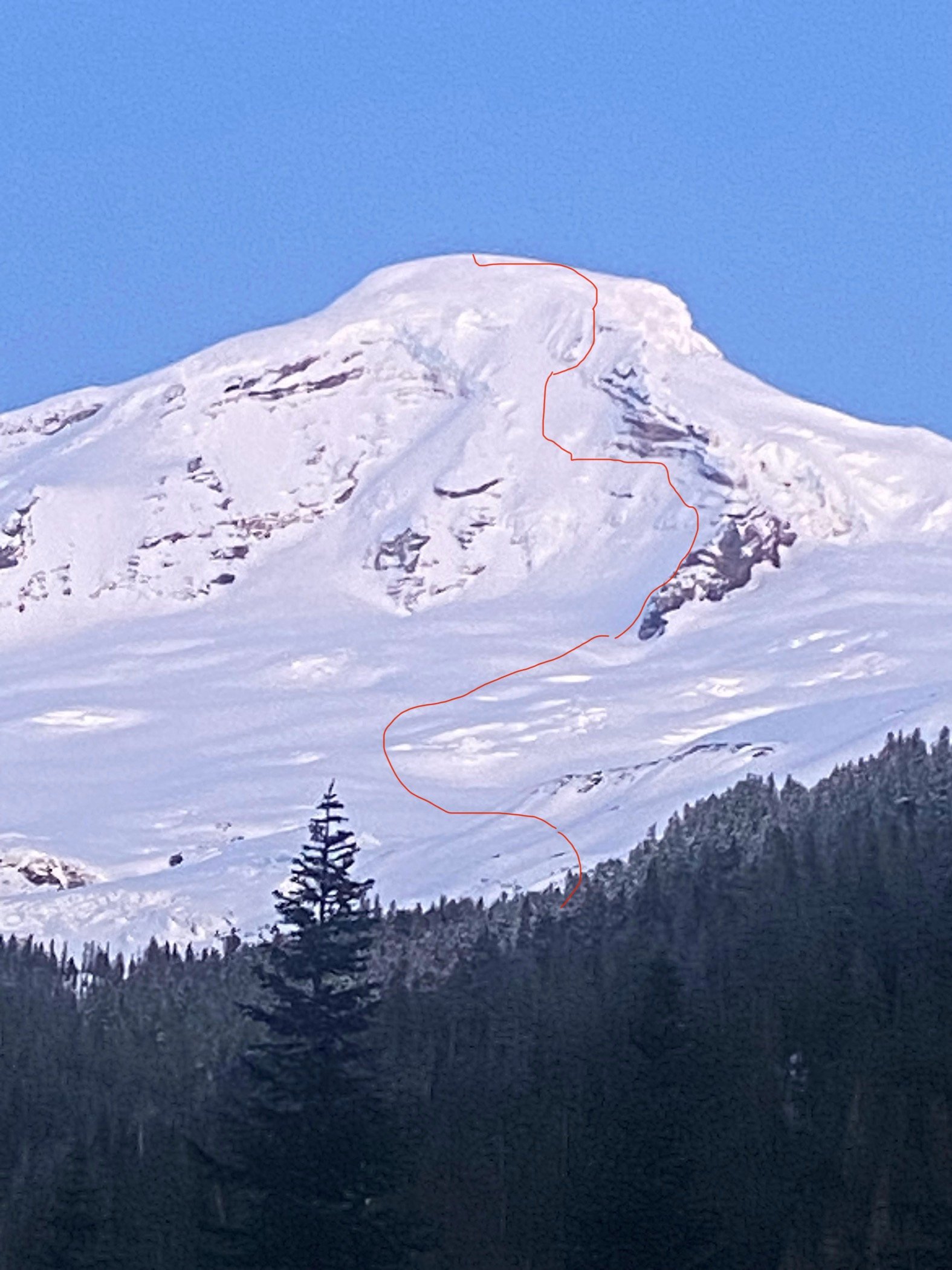
Noah and I left Wenatchee at 2:30pm on Friday with the intention to climb Coleman Headwall. After our bout with the typical Seattle traffic jam, we were walking up the snow covered road about 1.2 miles from the Heliotrope Ridge trail head by 7:30pm. Snow conditions were good, and we reached a flat spot below Gargoyle Rocks ~6,500' at 10:15pm. We passed 3 other tents on the way up. We spent around 45min searching for a sheltered place for camp, but to no avail. We finally settled on an exposed location that had the one good quality of being flat. Once above the tree line, the temperature had dropped seemingly far below what we were expecting, and winds picked up and gusted all night. From my modest experience I would estimate single digits. I had the absolutely genius idea to not bring a tent, only a Tyvek ground cloth to protect us from the elements. Our last few winter trips had been in great weather, and I was tired of packing such frivolous luxuries up into the mountains. Of course, my bluff was called, and we spent one of the more frigid and uncomfortable nights we had experienced anxiously awaiting sunrise. At 6am, I got up and started boiling water. I took a moment to study our intended route, and it looked to be in very fat snow conditions. Wind slabs near the top of the face were a major concern, especially due to the high angle of the face. I returned back to our sleeping spot to contemplate. Keeping the stove's isobutane canister warm with my bare hands was very uncomfortable. After a hot breakfast and water bottle fillings, we started up just before 8am. I briefly discussed conditions with Noah and we decided to take the standard route to the top. Noah just needed a summit to check Baker off his uncompleted WA-Top 10 list. We made great time following the skin tracks of two other groups. Snow pack was good, and crevasse danger was nil. Once we reached the ridge around 9,000', the real winds hit and we were freezing. Noah did not have warm enough gear to be comfortable, so we tried to keep moving constantly to stay warm. At around 9,200' we transitioned into crampons/boots and slogged up to the summit plateau. We switched back to skins/skis and walked up to the true summit by 12:30pm or so. Winds were howling, so we snapped a few pics and skinned back across the crater. In my mind, I was having an internal conflict over skiing the Coleman Headwall to redeem the trip for myself. Snow conditions up high were much more solid than I was expecting, and the angle of the face actually looked to be doable from our side-view on the way up. I said a quick prayer, asking for guidance, and after a moment more of consideration I told Noah that we should go for it. He agreed, and we ripped skins approximately at the entrance point I had mapped out on my phone. Noah, being the far better skier, started down. The face was largely not visible from the top, but we had photos from below to reference. After 100' or so of descending, it started becoming alarmingly steep. I would say 65+ degrees. We were too far skier's left, and we traversed over to the right to terrain with less avalanche hazard. Slopes were around 60 degrees with 12" of powder. We made careful jump turns for around 1k', then started to work our way back to skier's left to avoid the massive ice cliffs shown in our route photo. That worked out well, and we even encountered some more moderate slopes nearing 45-50 degrees. We continued left all the way to the base of the Roman Nose to avoid the bergshrund at the bottom of the route. The skiing was very scary for me, but very fun with just enough powder to slow us down after each turn. The face is certainly the most consistently steep feature I have ever attempted to ski. After crossing onto the glacier, we skied the moderate and enjoyable slopes back to our camp to pick up our gear. This was also where I realized our GPX track had stop-started twice. I'm not sure why, but it's quite annoying and seems to be another one of the many bugs that plague AllTrails. From our camp, it was much icier and firm snow conditions back to the trailhead. My quads were absolutely gone after the steep decent and a long workout on Friday morning before our drive. Noah left me in the dust once we started skiing the trail below the tree line. After the trailhead, it was an easy road ski back to our truck and fresh water bottles. We reached the truck at 4pm and were home by 8:30pm. Overall, this was a cold winter trip, and a ski descent that was beyond my current skill level. For people attempting to ski this route, and especially climb it, I would recommend careful condition assessment. Avalanche risk is real. GPX Track: https://www.alltrails.com/explore/recording/mount-baker-coleman-headwall-2a51262 Gear List: https://www.packwizard.com/s/JM2YQPe Video:
-
[TR] Lincoln Peak - SW Face (Steep Snow) - 5/12/24
eeelip replied to eeelip's topic in North Cascades
Yes I would say the conditions made it easy on us chumps! Maybe a bit slushier than we would have liked on the decent, but that could have been fixed with an earlier start. And yes understood on the drone going forward. I should have checked regulations. -
I have iPhone 12 and Ian has iPhone 15. Most of these are his pictures, they look quite a bit better than mine!
-
I also finished a video of this trip with talk at the end going over details of the climb:
-
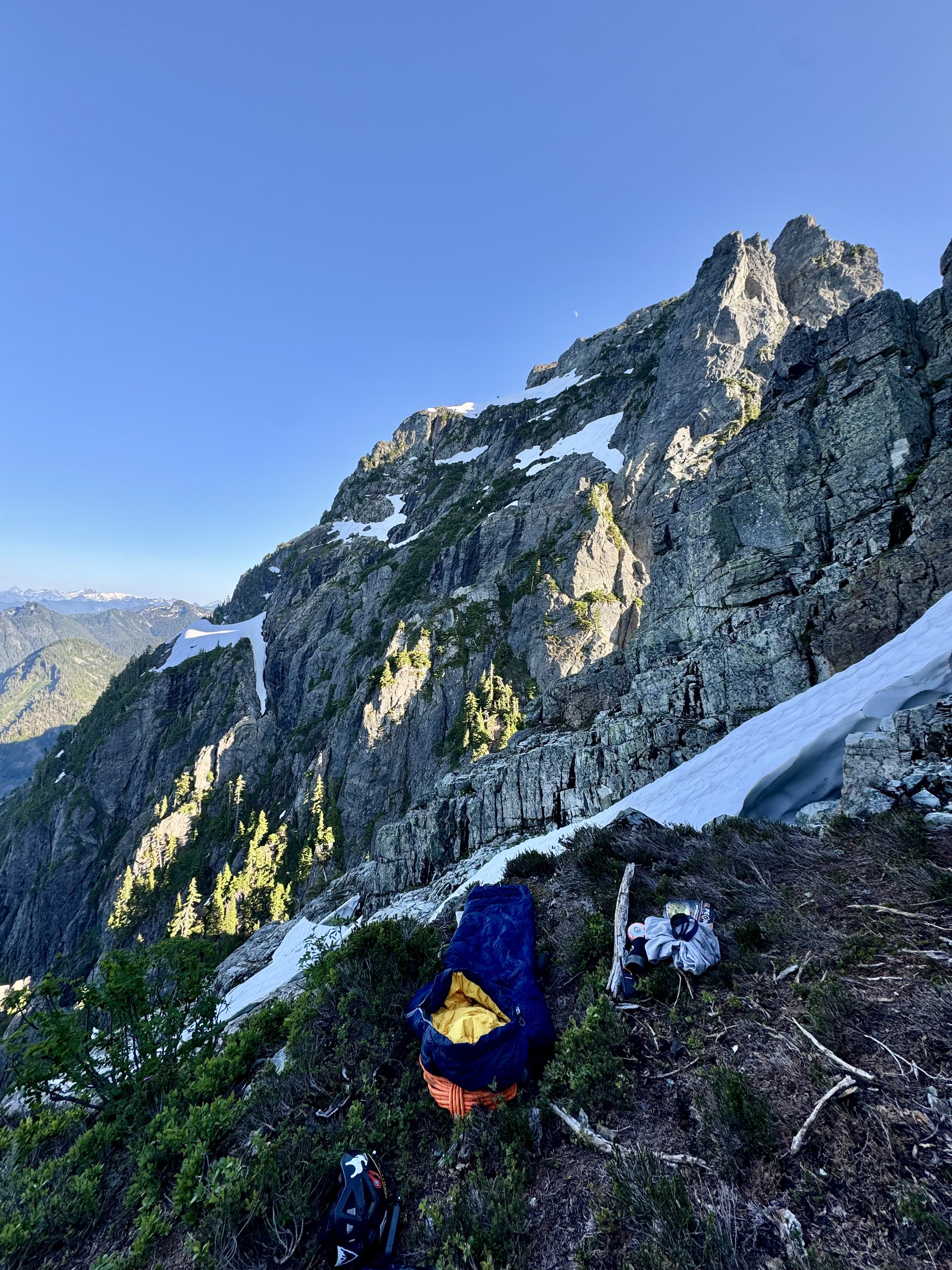
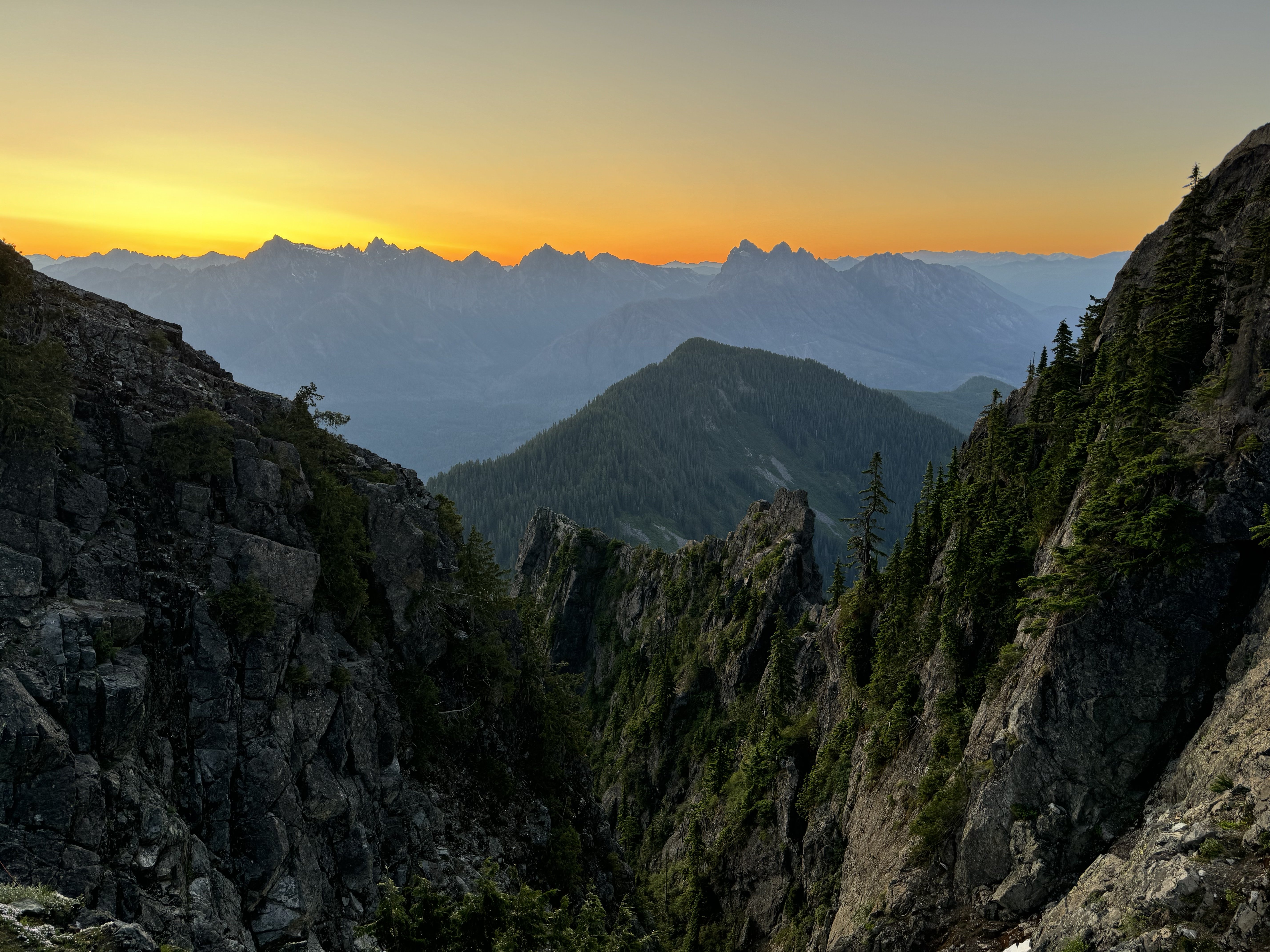
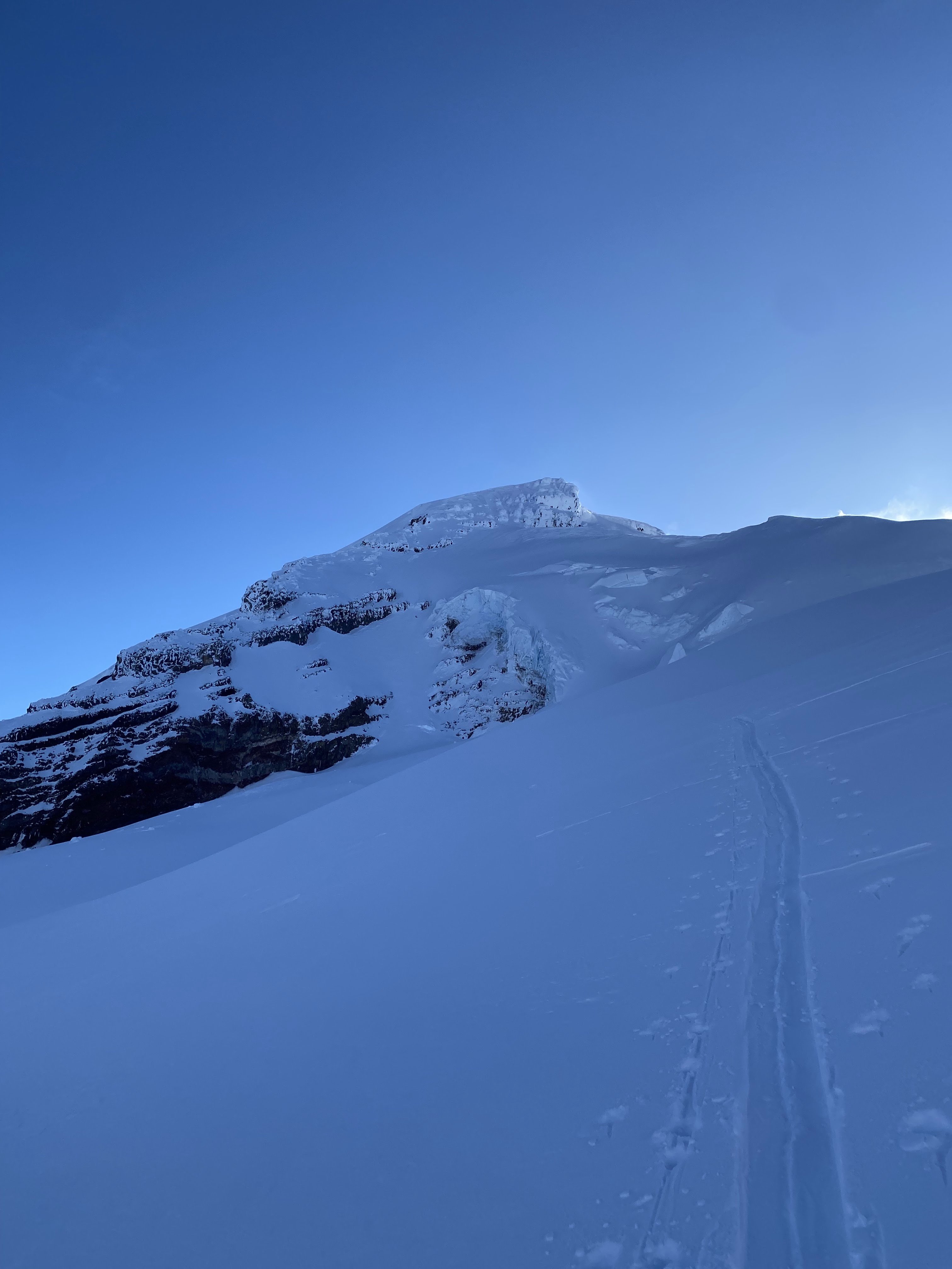
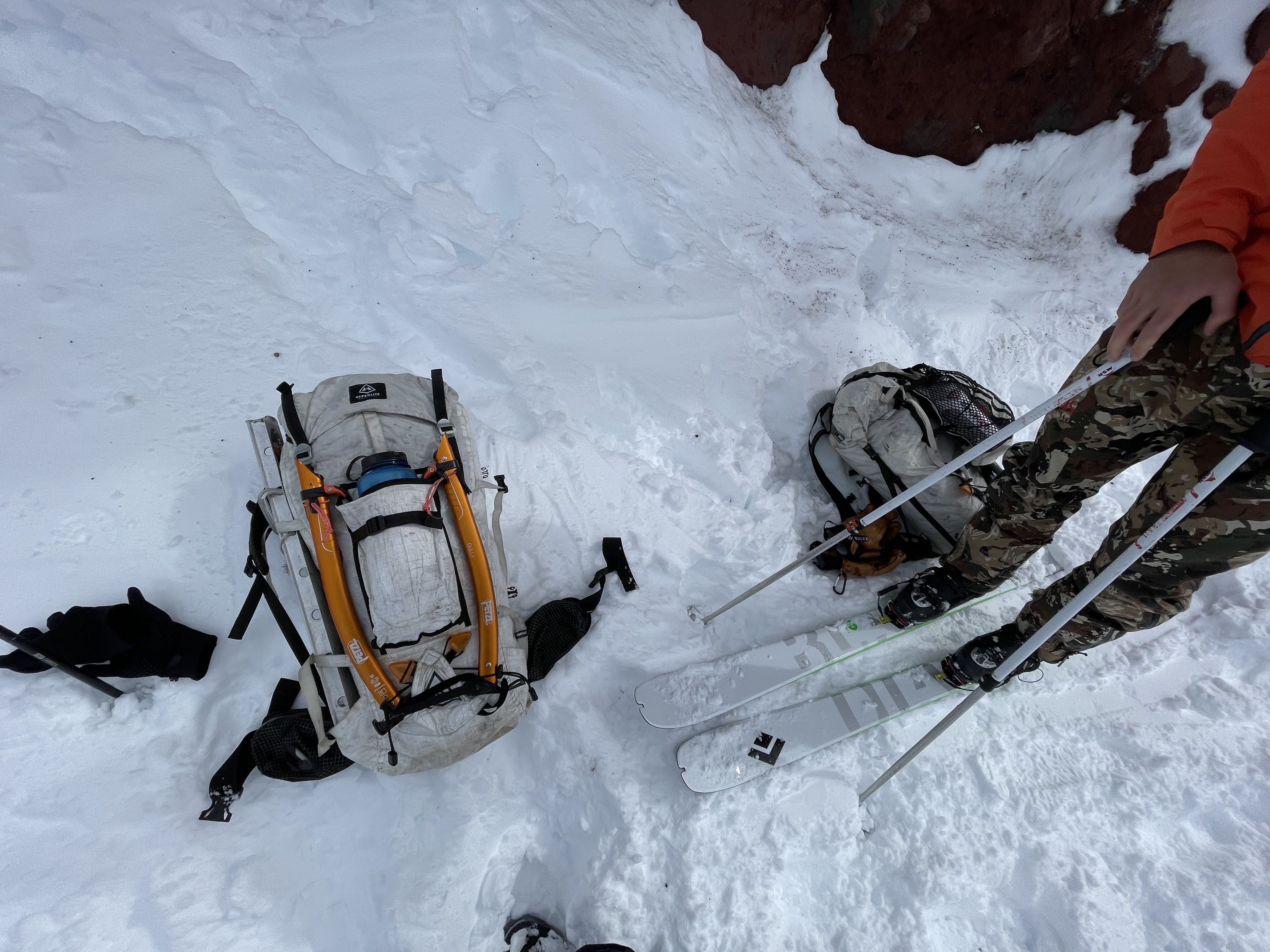
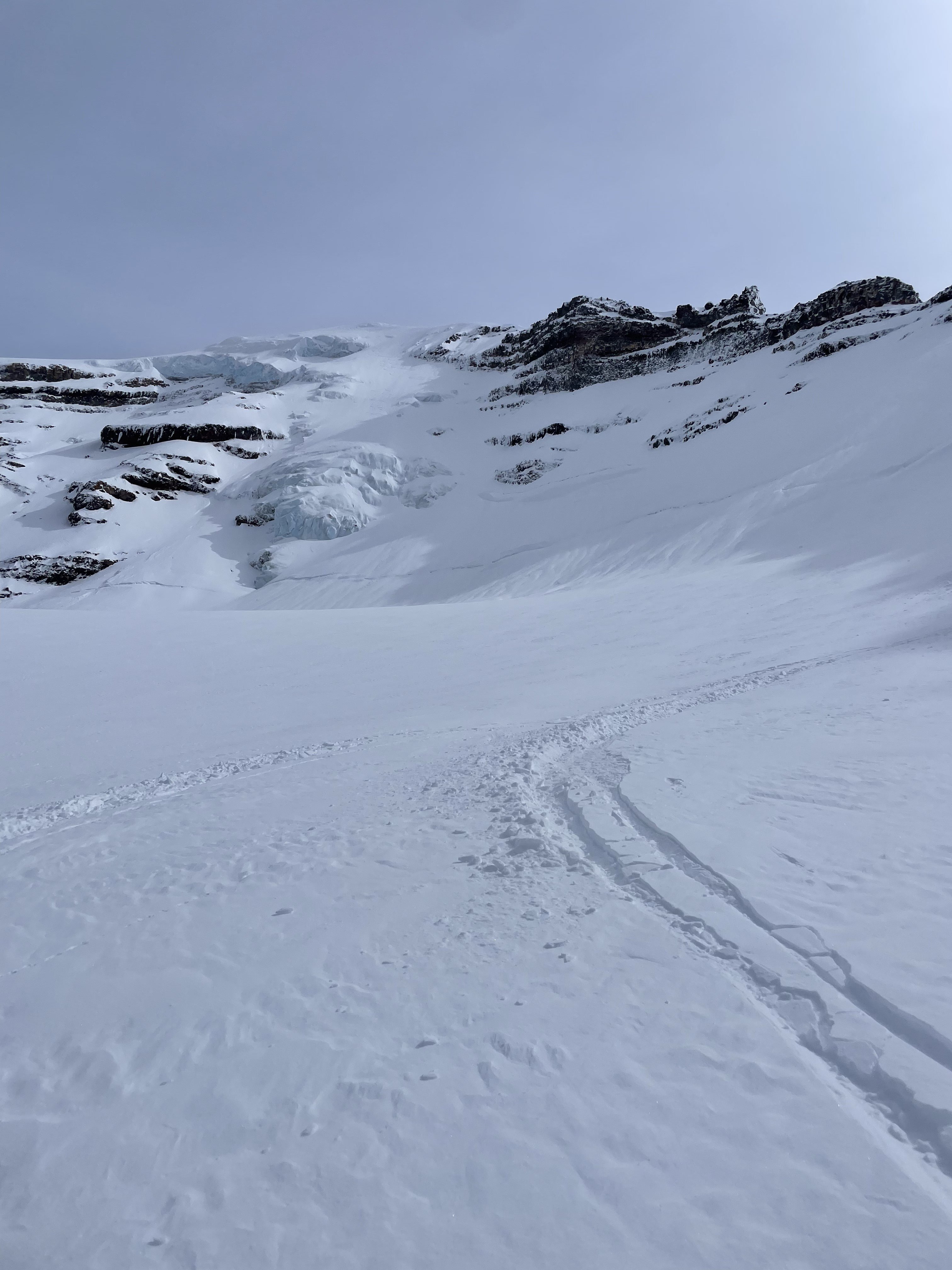
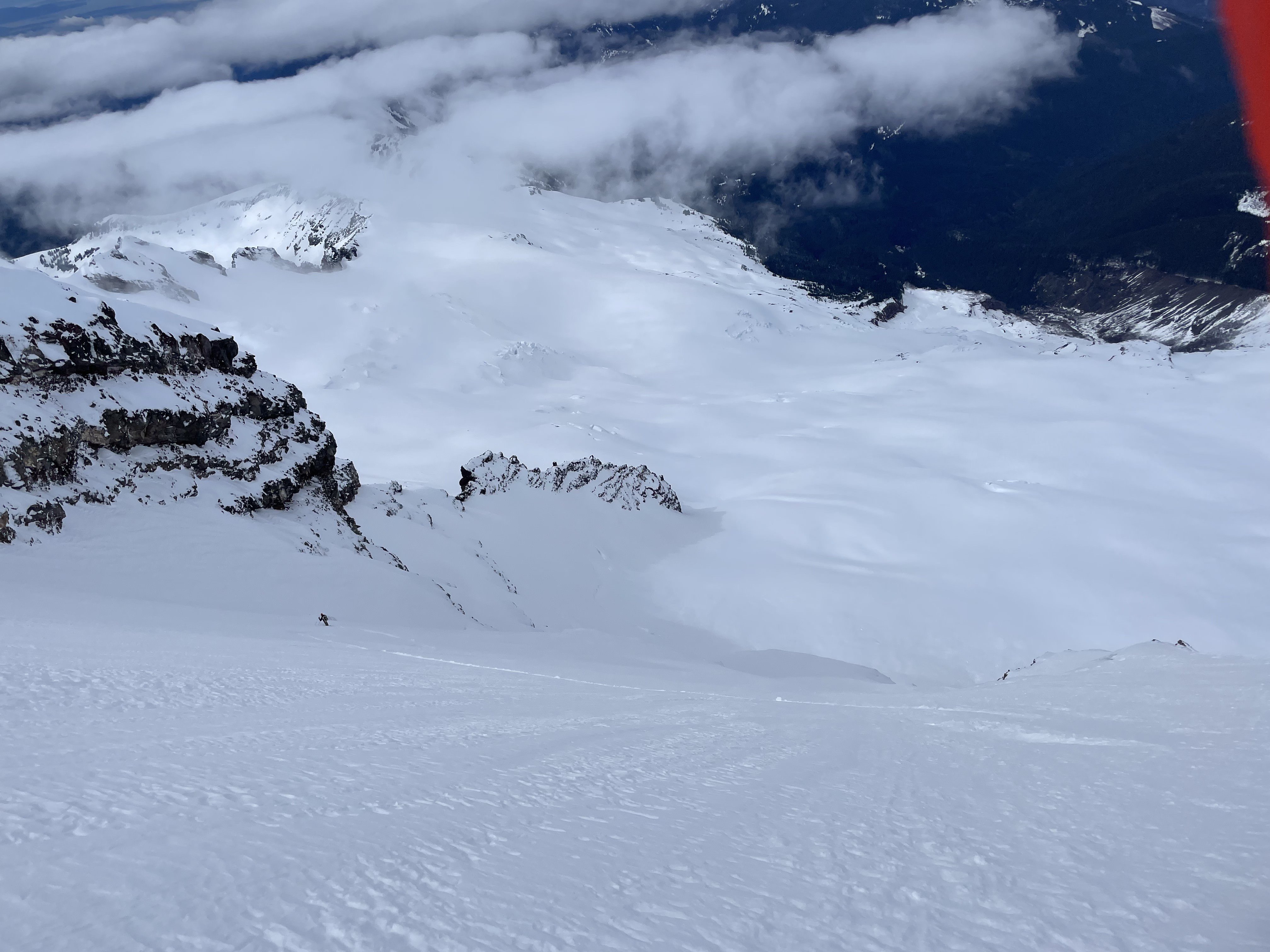
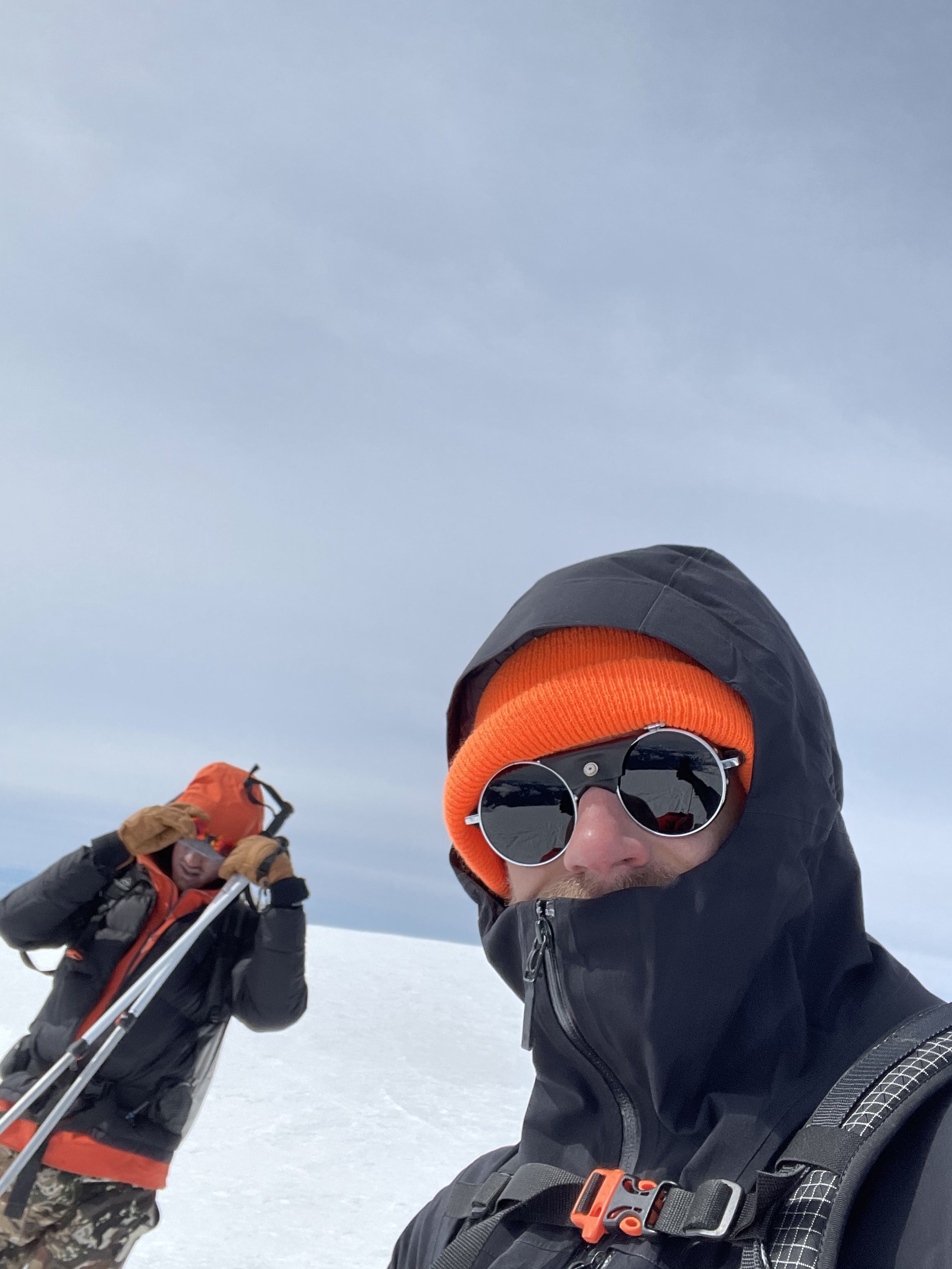
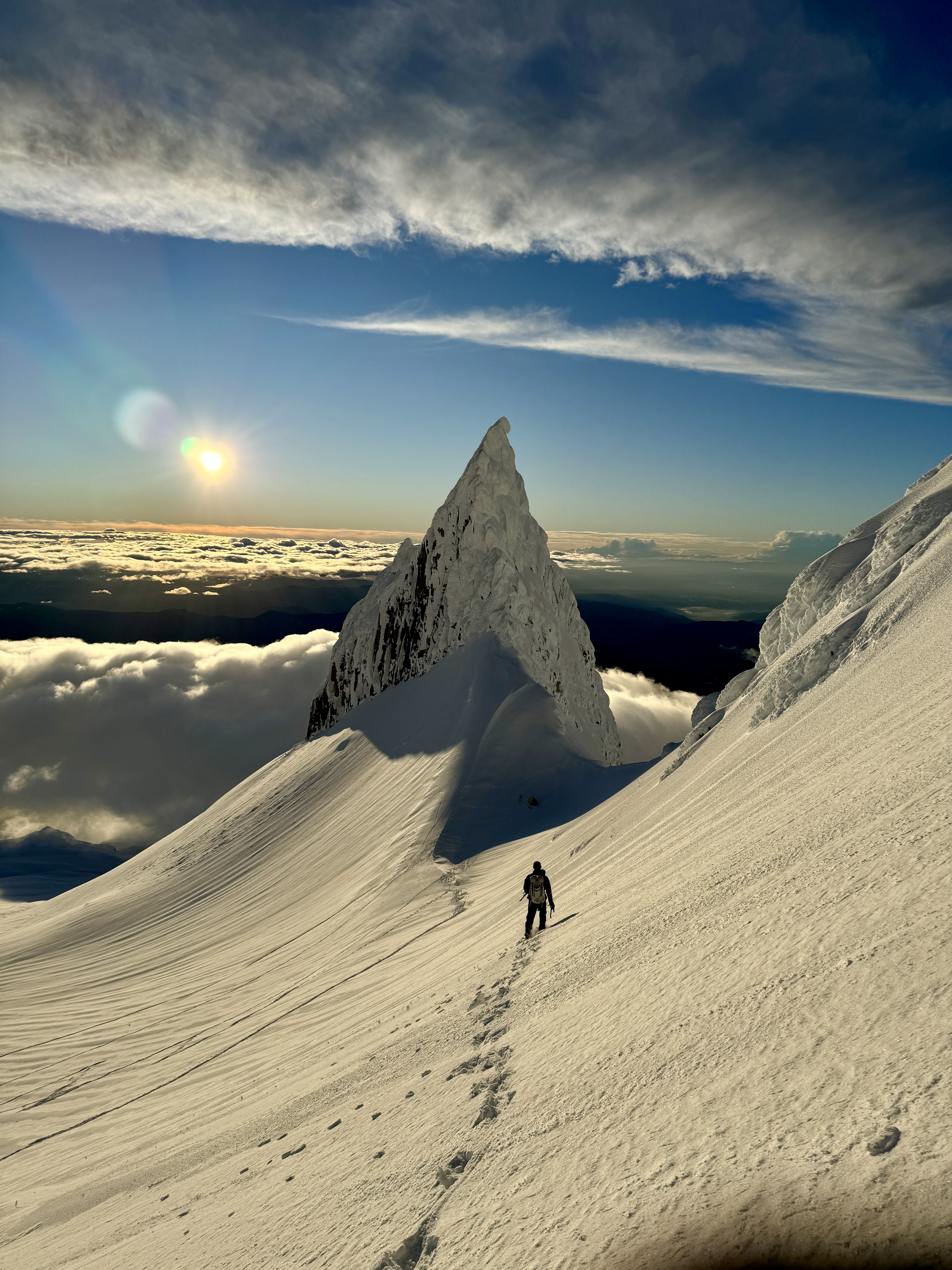
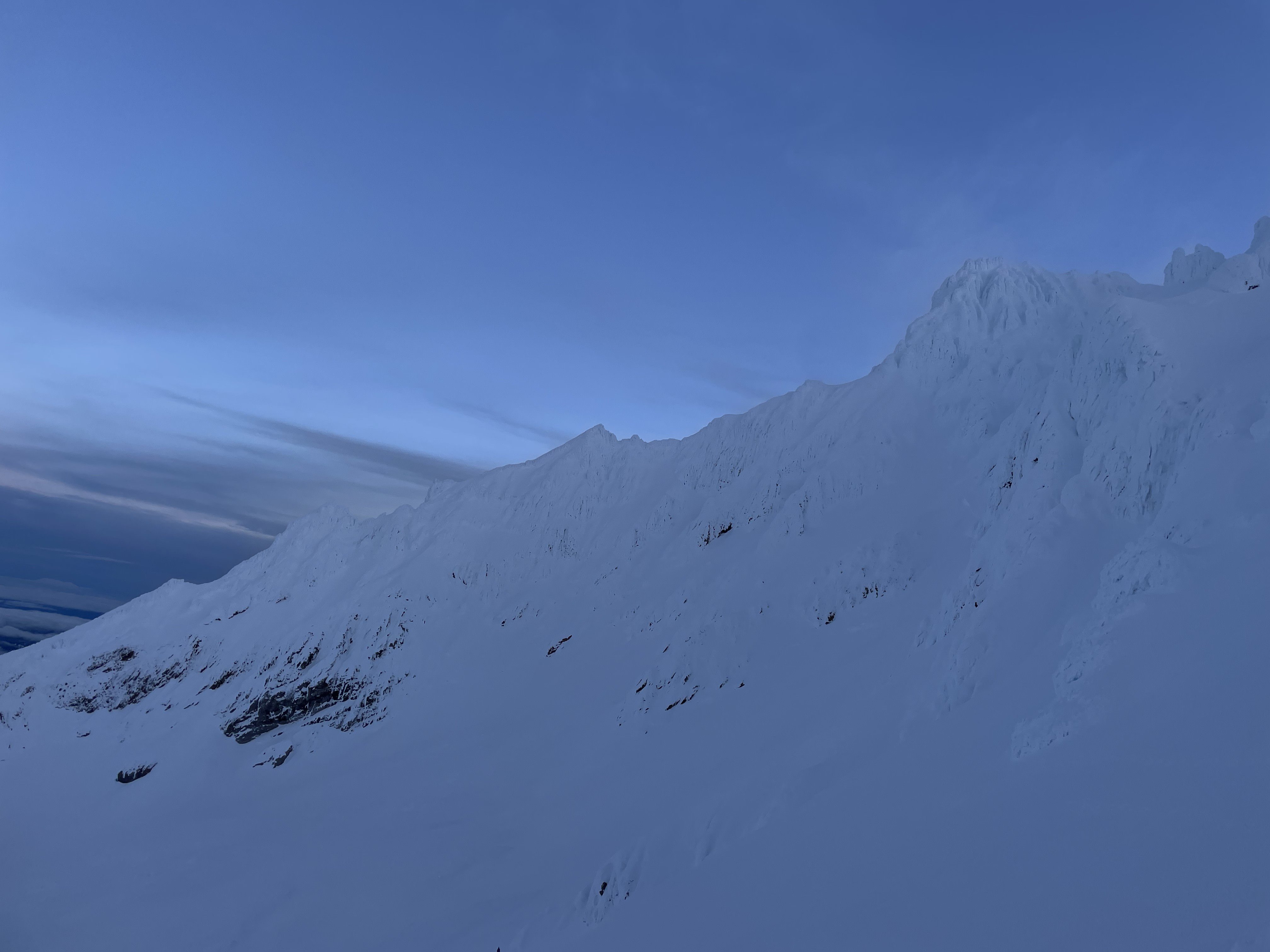
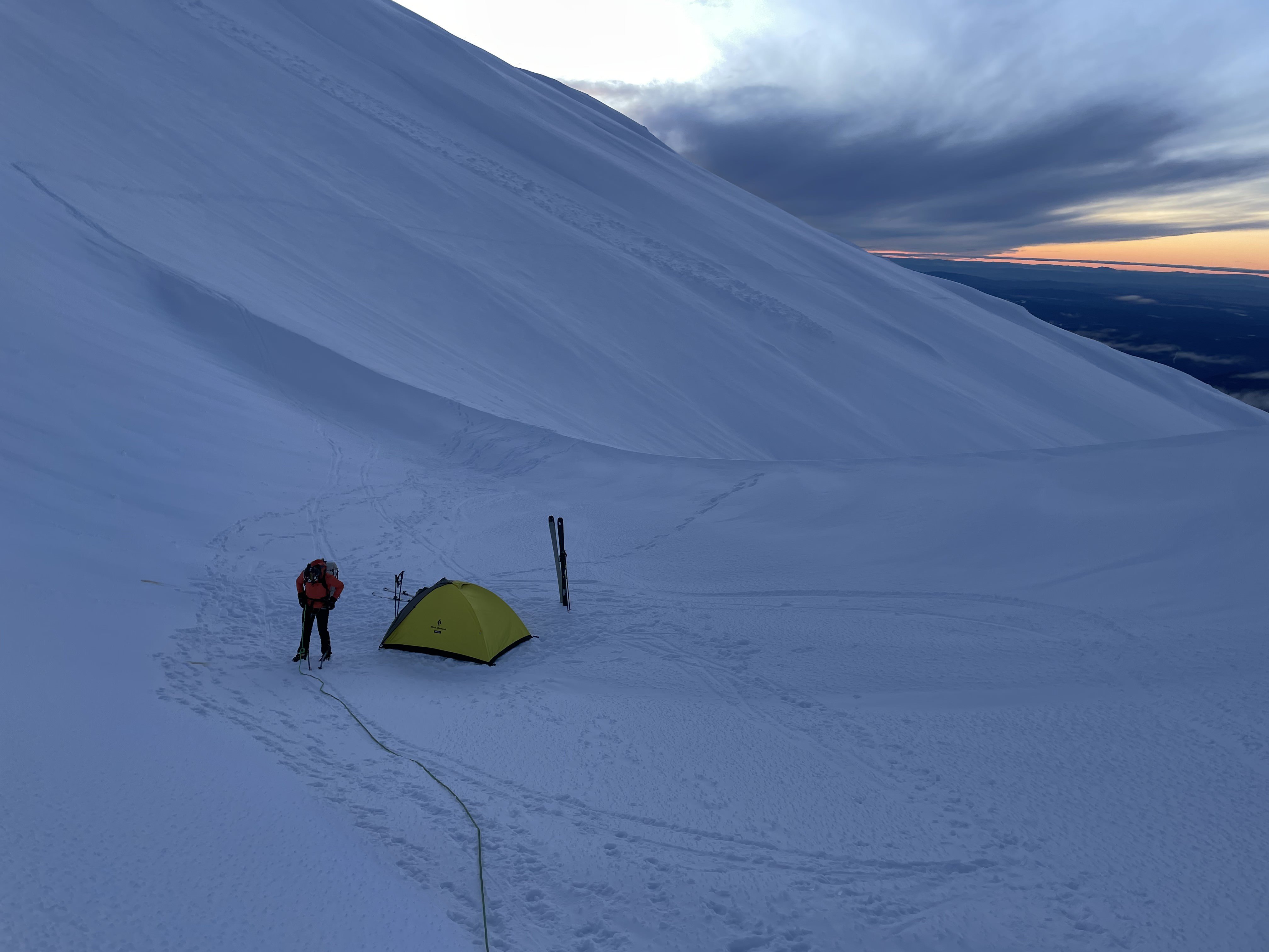
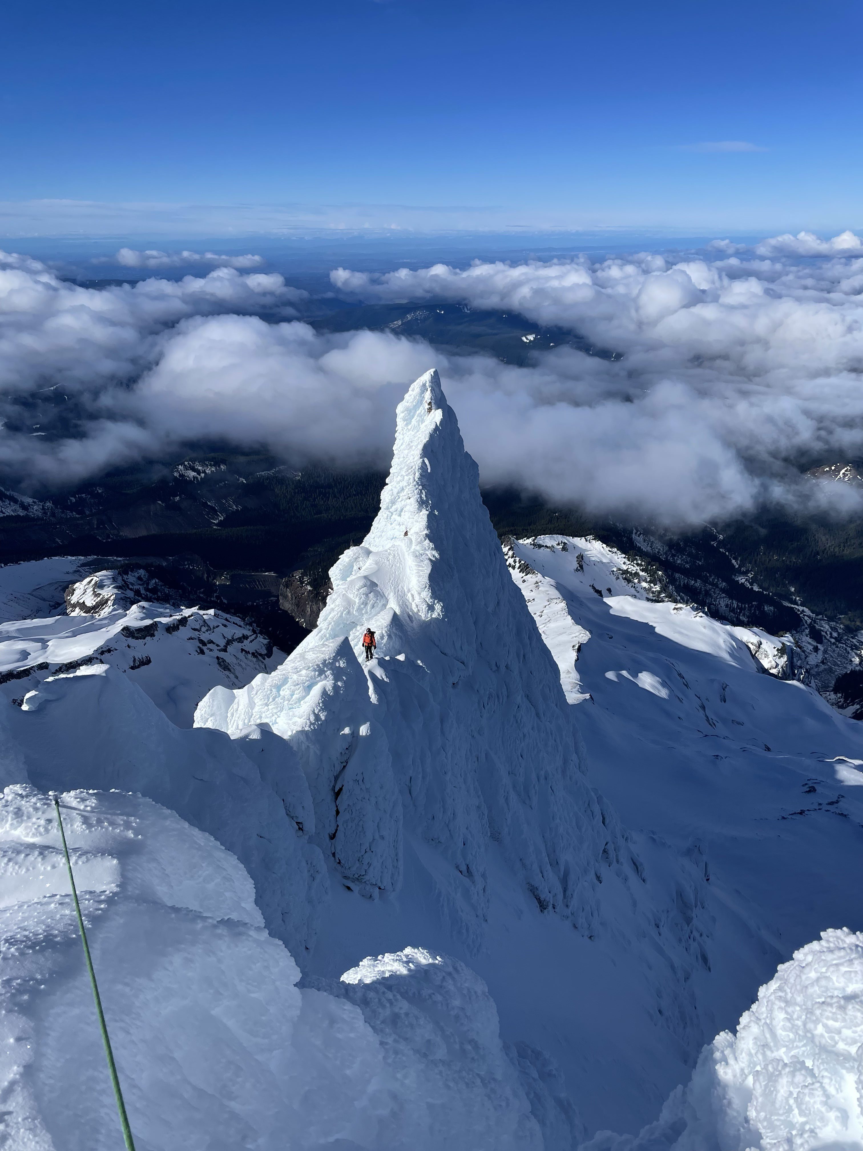
Yocum Ridge was on our objective list for this winter. Initially, I was thinking sometime in March or late Feb would be optimal conditions. On Thurs 2/1, I was perusing Mountain Forecast and noticed that the temperatures on Hood were still quite cold, despite the unseasonable warmth in the rest of the PNW. Wind/visibility for Sat looked excellent. I also found some photos from a couple days prior of the South side, and the rime ice coverage looked quite good. I texted Ian, and he responded right away with a “lets do it”. On Fri he met me at work in Cashmere at 3:45pm and we left for Oregon. At 8:45pm we were skinning up the cat track towards the top of the Palmer chair lift. With Ian carrying our 70m rope, we were able to sustain around 2,600’ of gain to the top of Palmer in around 90min. From there we left the cat track and traversed another 800’ up to Illumination Saddle, arriving at 11pm sharp. We set up the tent, made dinner, and were sleeping by midnight. We awoke at 6am to start the morning routine. I got breakfast and water started while Ian prepped gear. We were on the move by 7:20am, just behind three pairs of climbers on the Leuthold Couloir route. We quickly descended and crossed the Reid Glacier and gained the ridge at 8,800’. The first 700’ of ridge climbing was very fast, and conditions were perfect. Firm snow made for one-swing sticks. At the base of the first gendarme, we set up belay and I lead two short pitches to the top. The rime was still quite solid and easy to climb. Protection was with pickets. We ended up using pickets, a couple cams, and a couple ice screws on route, but mostly pickets. From there, we slung the top of the gendarme and with no way to ease into the rappel, I jumped off the top. The rappel was very awkward and mostly sideways along the ridge. Ian followed, and we traversed a longer section of moderate simul-climbing terrain on the serrated ridge crest. I made it to a ledge shortly after and in the rising sun, I changed into my t-shirt and belayed Ian up. The terrain on this part of the climb is amazing. The rime ice formations are sharp and huge. Coupled with the blue skies and views of the other Cascade volcanoes it makes for a very unique and beautiful setting for the technical climbing. We simul-climbed the ridge crest past the less-remarkable 2nd gendarme on the South side, and up the 3rd gendarme. We then made a similarly awkward traversing rappel from the top. This time I had to take out an ice tool while on rappel to get around an awkward tower and back to the ridge crest. The rope reached just far enough to get past the scary terrain. From there, I called out “off belay”. Ian pulled his backup picket and came down as well. From here, we solo’d up the ridge to the base of the massive upper buttress. I entered a forking gully at the base, and decided to go left. This lead to a nice flat bench, where I re-organized my pack a bit and called my wife. Meanwhile Ian pulled the rope, packed it up, and carried it through the moderate terrain up to the bench. I often like to joke that Ian is basically the guide and I am just a privileged client. He is often willing to do 90% of the work on a route without a single complaint, which sometimes makes me feel guilty. At the bench, we switched the rope to my pack and Ian took a turn leading us up to a very intimidating looking rime-ice headwall. From what I have read, not many people, if any, actually go to the top of this thing. It’s much bigger than the gendarmes, and we attempted two vertical routes to get up it. Ian tried both unsuccessfully. I was feeling good and gave it a shot, only to have the rime beneath my feet, then knees, then ice picks all give out and I took a good 15’ fall. Up until this point, we were making very good time, but we burned over an hour trying to scrape up the headwall. We decided to try the right branch of the gully, and ended up rappelling a full 35m down into a 60 degree gully. I would have liked to try and find a way up the upper buttress, but we were starting to run out of time, and I believe most other parties (if not all) also made the 3rd rap down into the gully like we did. This rappel was the only place that we deviated from the ridge crest on the climb. Once in the gully, we crawled upward until reaching a 15’ vertical step. Ian managed to lead up, build an anchor using a picket, and belay me. From there, we were able to follow the rest of the gully up to the ridge crest again. By then it was 3pm. We could see the top of the Leuthold route, and the last of the groups we left with was just heading up to the false summit. We solo’d around lots of unstable rime formations on the South side of the ridge, and finally reached the end of the technical difficulties. We stopped there at around 10,600’ to melt water and we were both exhausted. That is not the easiest 1,800’ of climbing one can do. We haggardly slogged our way up to summit and reached it at 4:20pm in warm, windless conditions. The views were amazing, and I sat there on my knees for around 10min just resting and enjoying the scenery. After taking photos, we followed the bootpack down the South-side route, past the sulfur vents and back to our tent at Illumination Saddle. We packed up in around an hour as darkness was setting in. Not wanting to ski down in the dark, we forwent dinner and skied decent powder down toward Timberline Lodge as the last rays of sun disappeared. We made it back to the truck in the dark at 6:15pm. We then proceeded to crank the heat up and beeline for the Hood River McDonalds. 4 hours and 4 cheeseburgers later, I made it home to my wife and one-month old baby girl, Navy. GPX Track: https://www.alltrails.com/explore/recording/mount-hood-yocum-ridge-2c8ed85 Gear List: https://www.packwizard.com/packs Video:
.JPG.c4b3d74961b65147bbb363ab165b04a1.JPG)
.JPG.f3b81c6ae294a613f2d16fcecded0de5.JPG)


