
JonParker
-
Posts
123 -
Joined
-
Last visited
-
Days Won
16
Content Type
Profiles
Forums
Events
Posts posted by JonParker
-
-
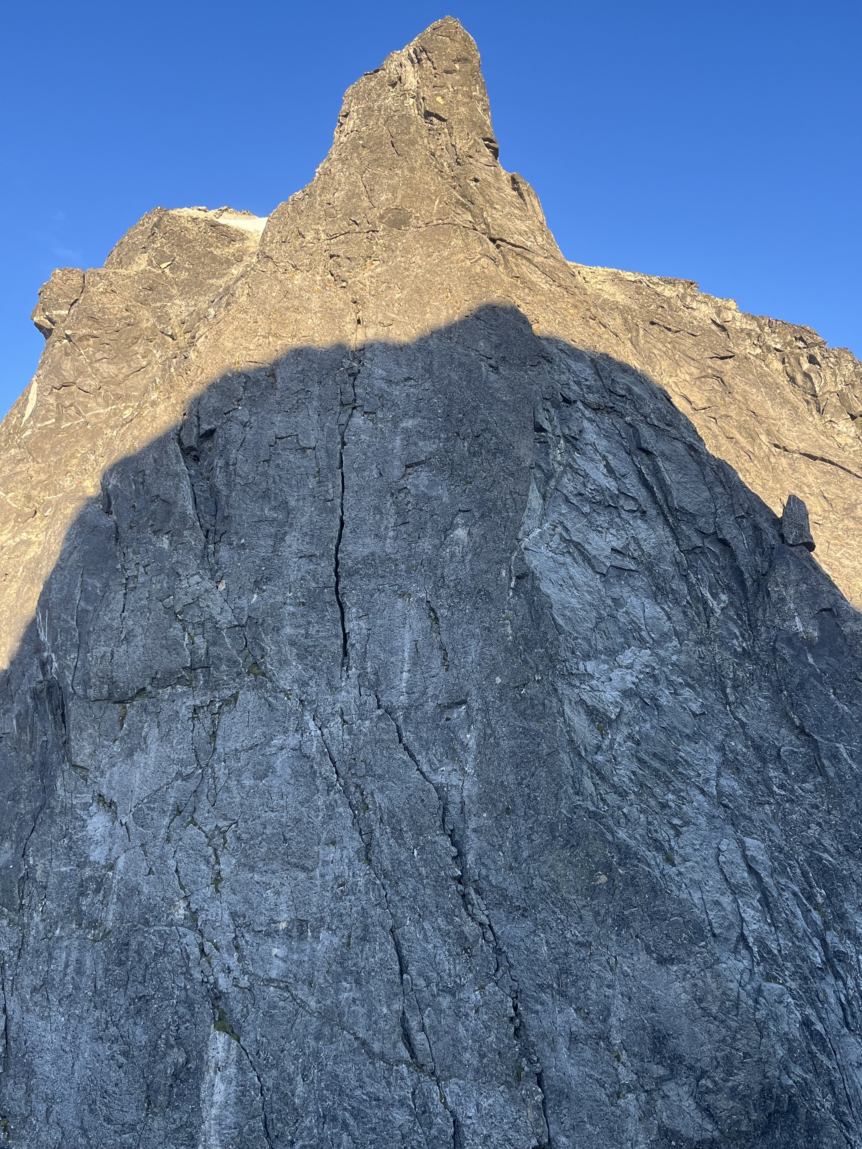
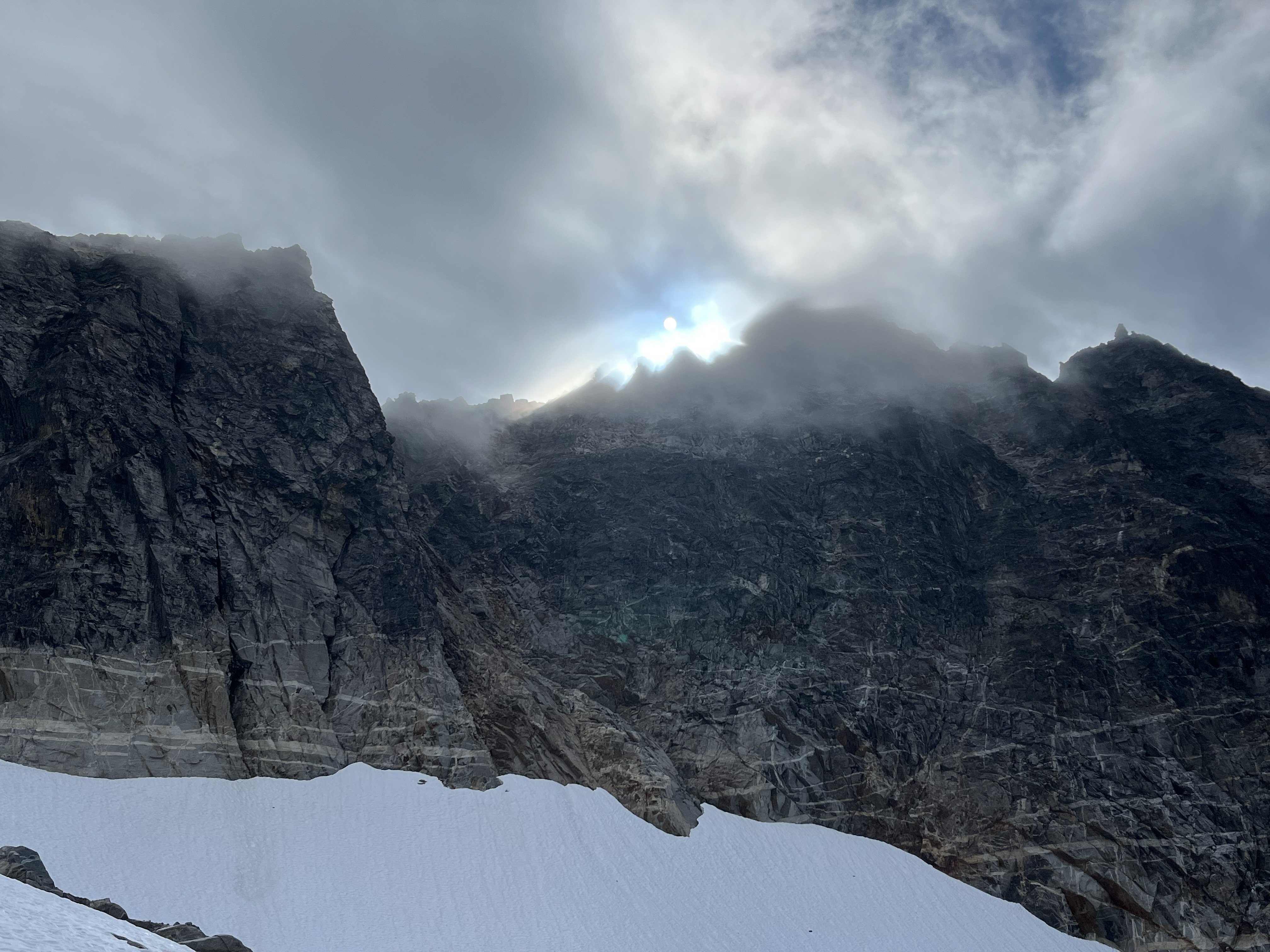
1 hour ago, geosean said:
do you know anything about the north butterss of the Rake?
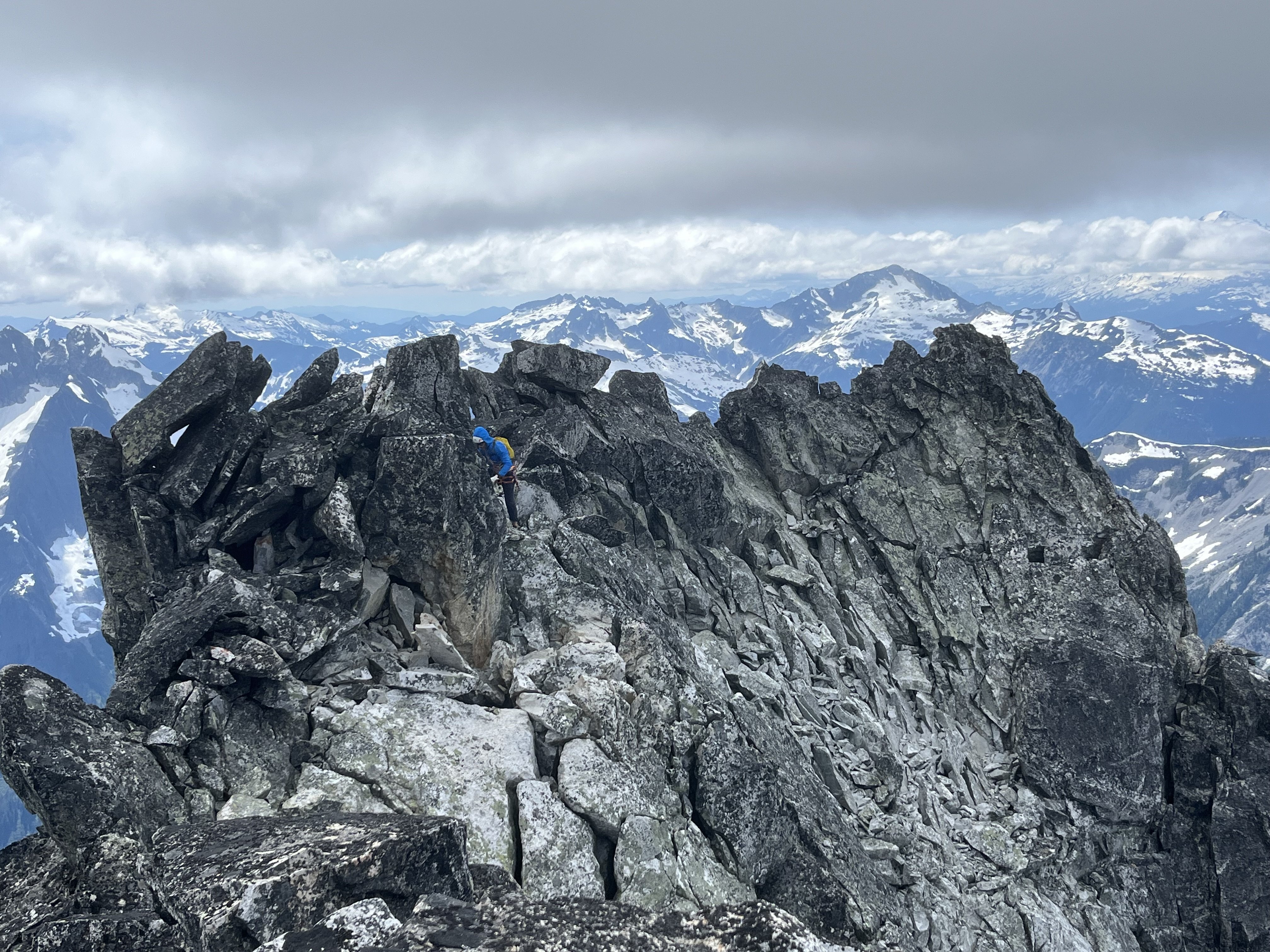
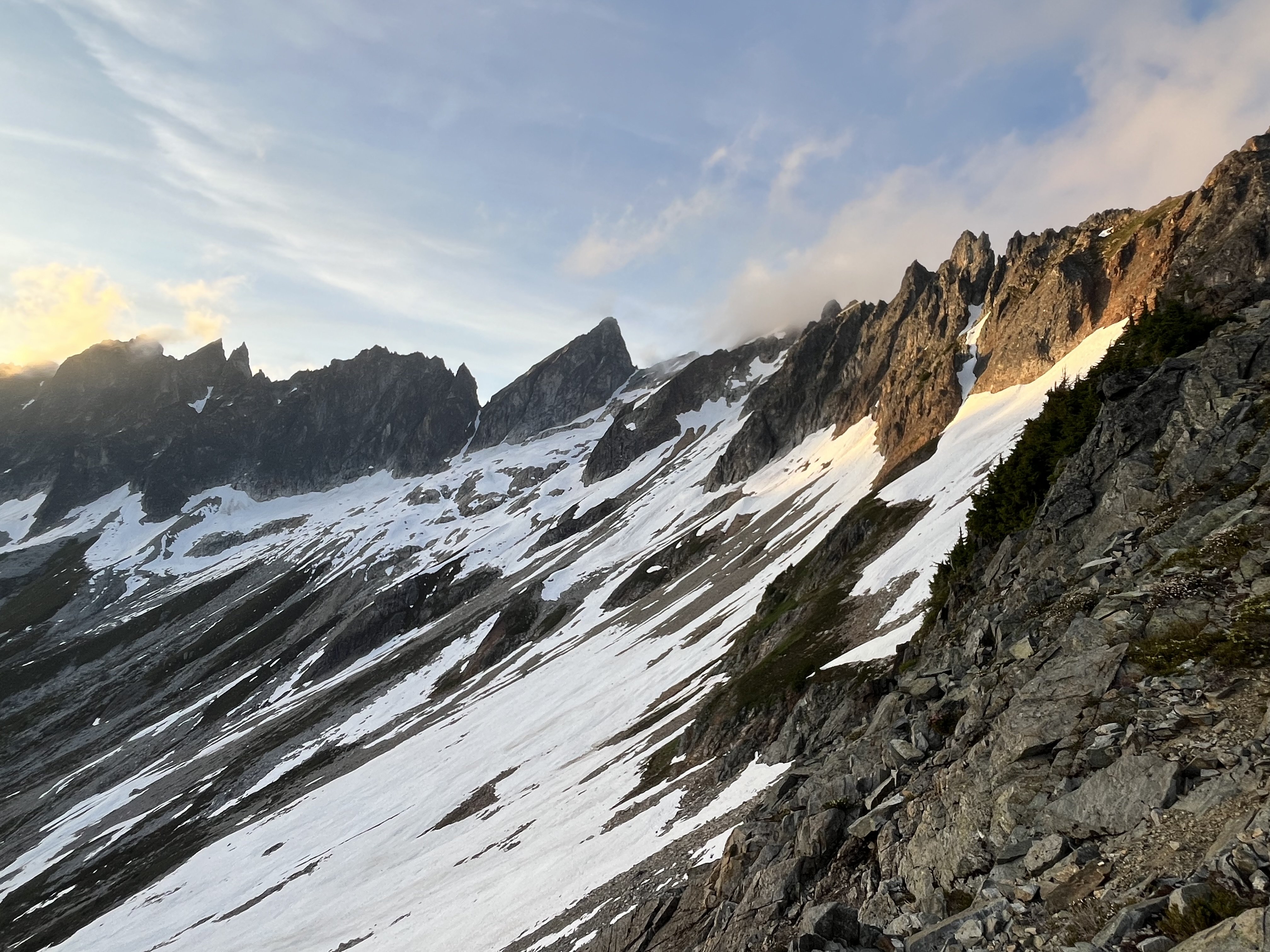
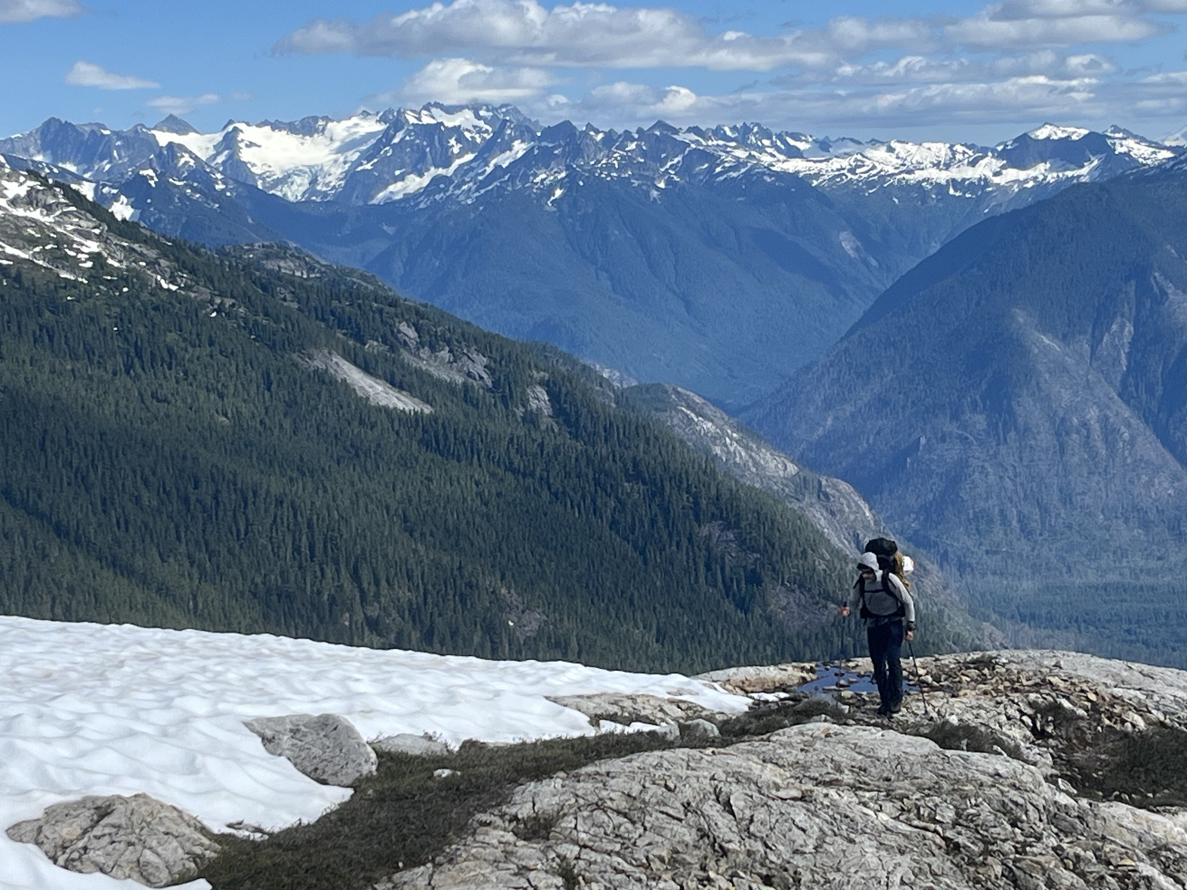
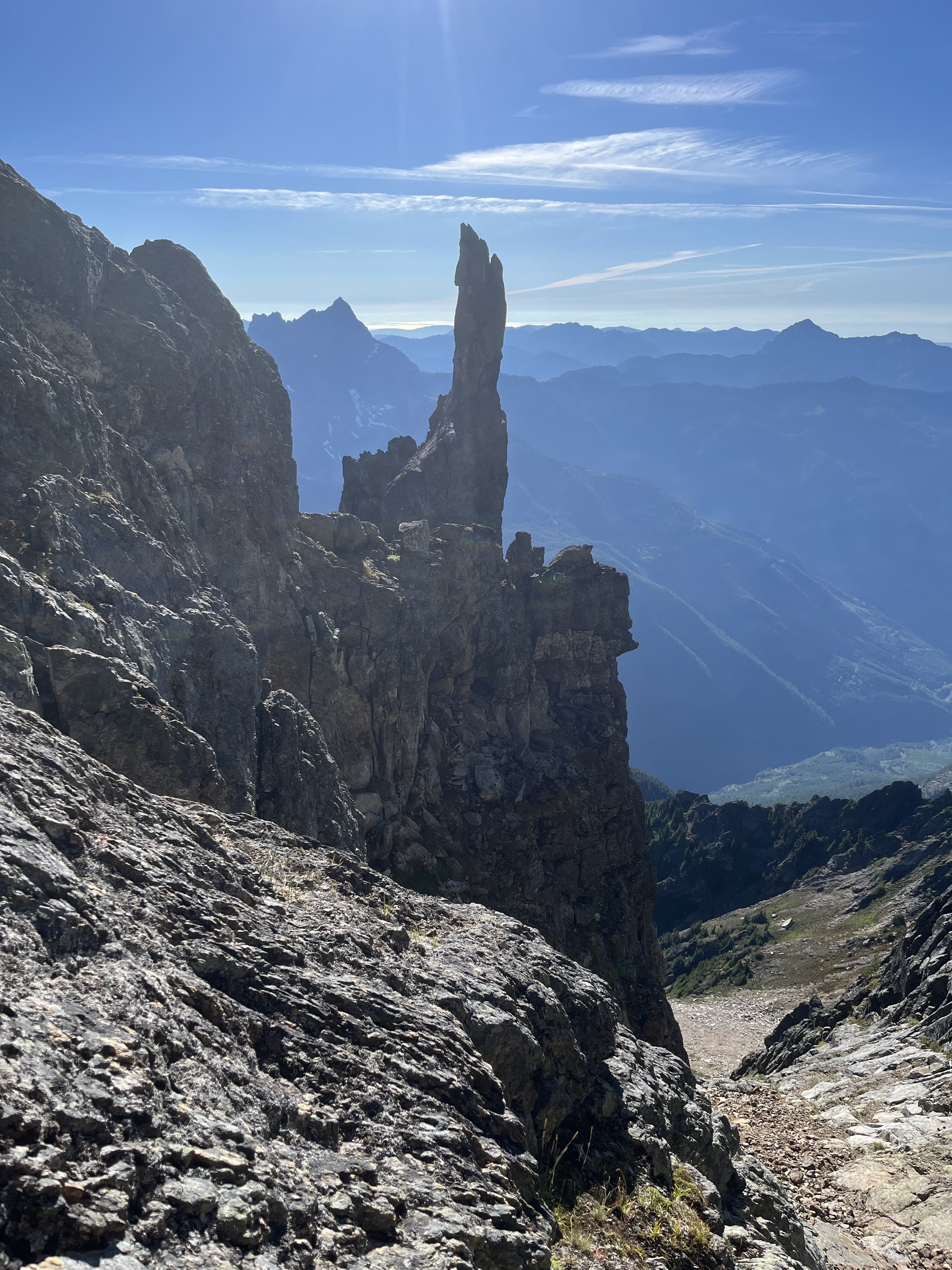
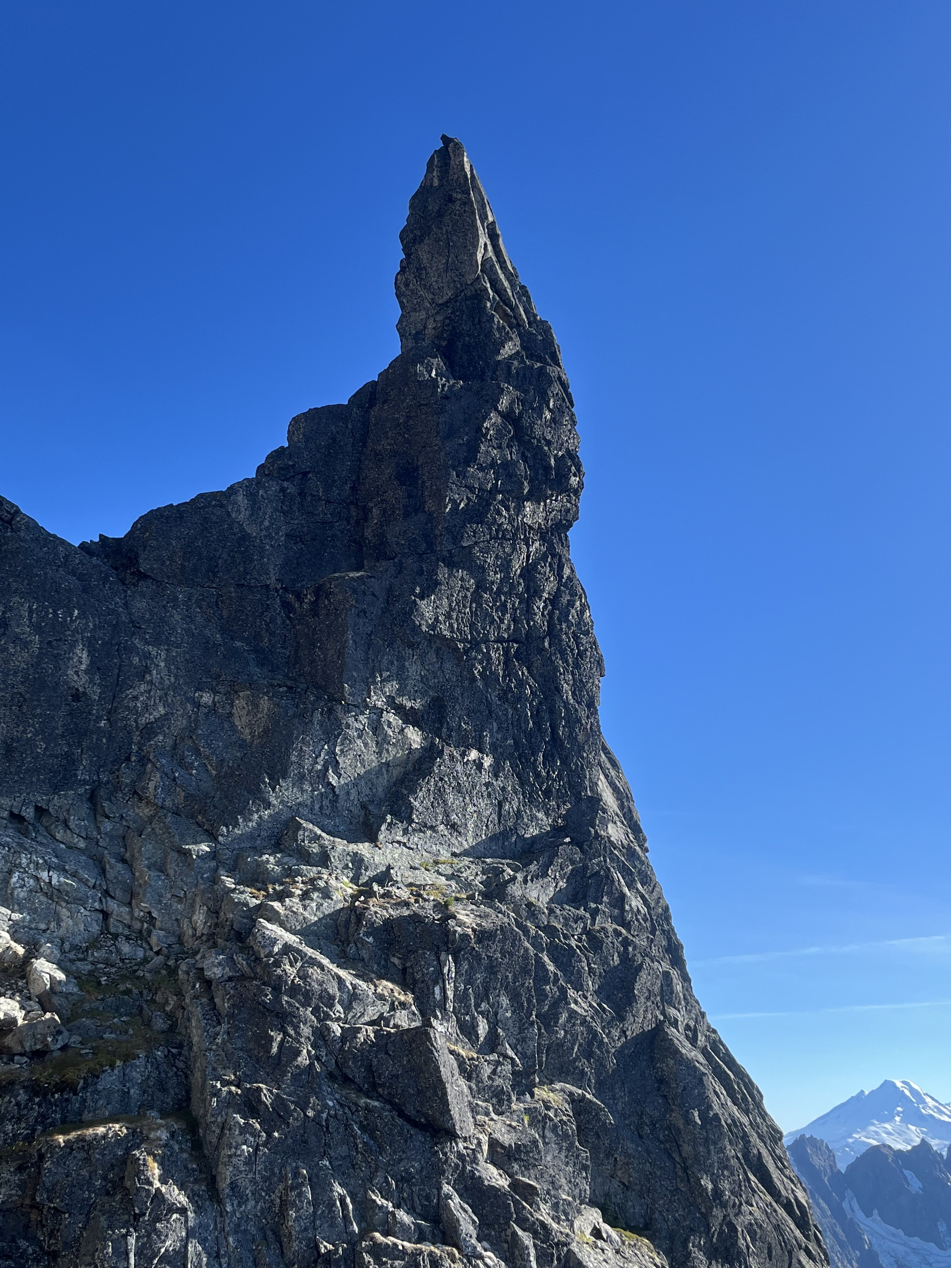
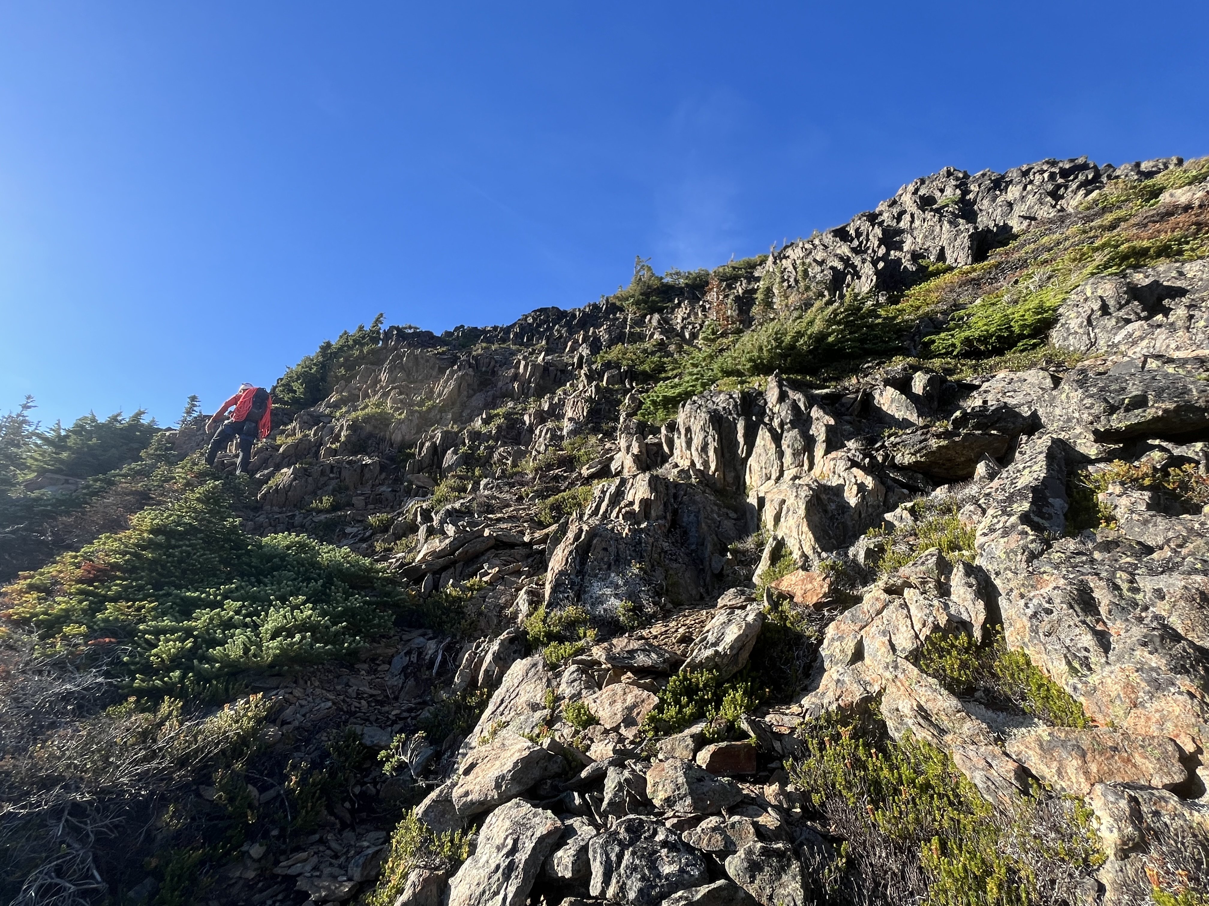
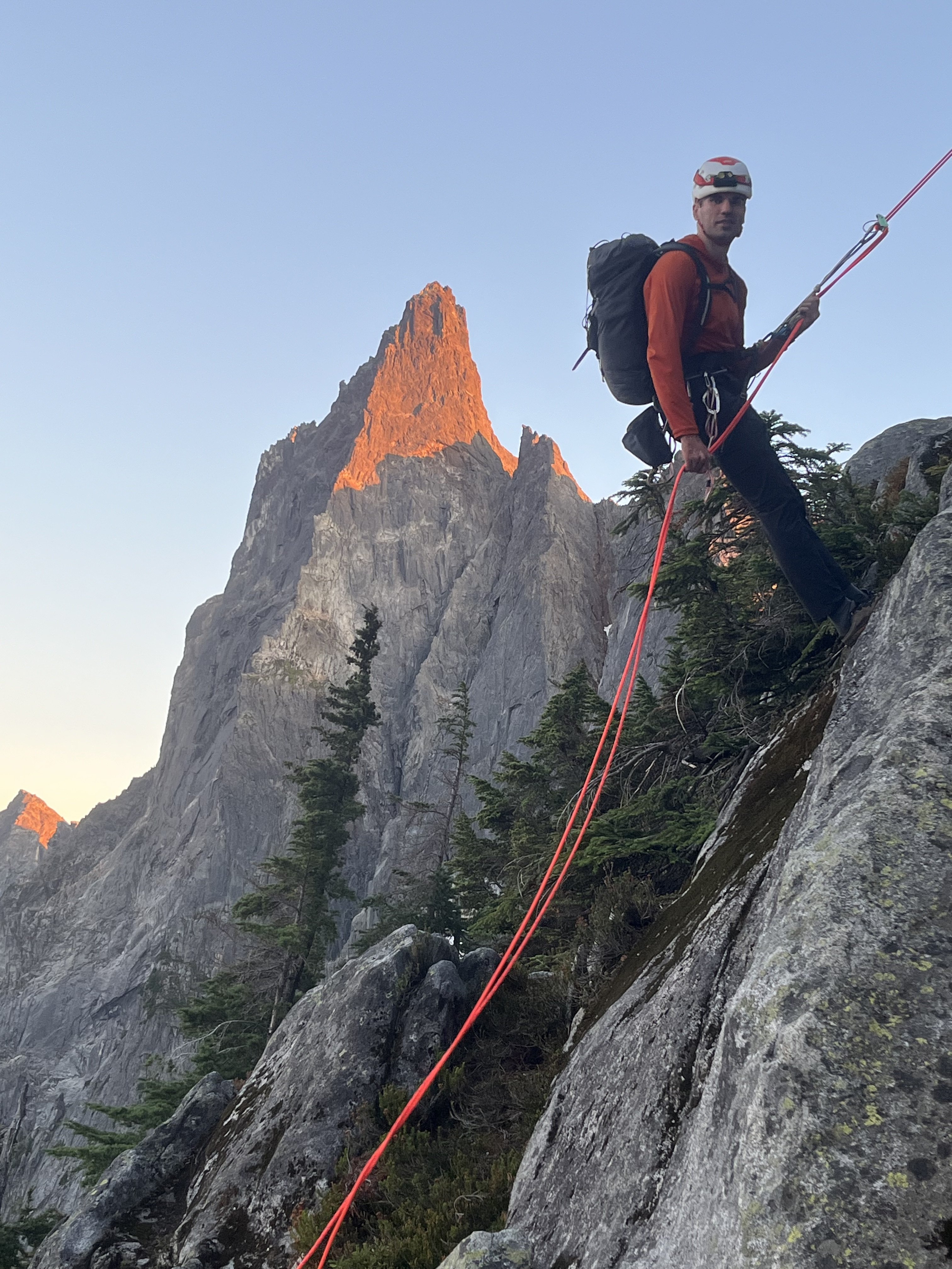
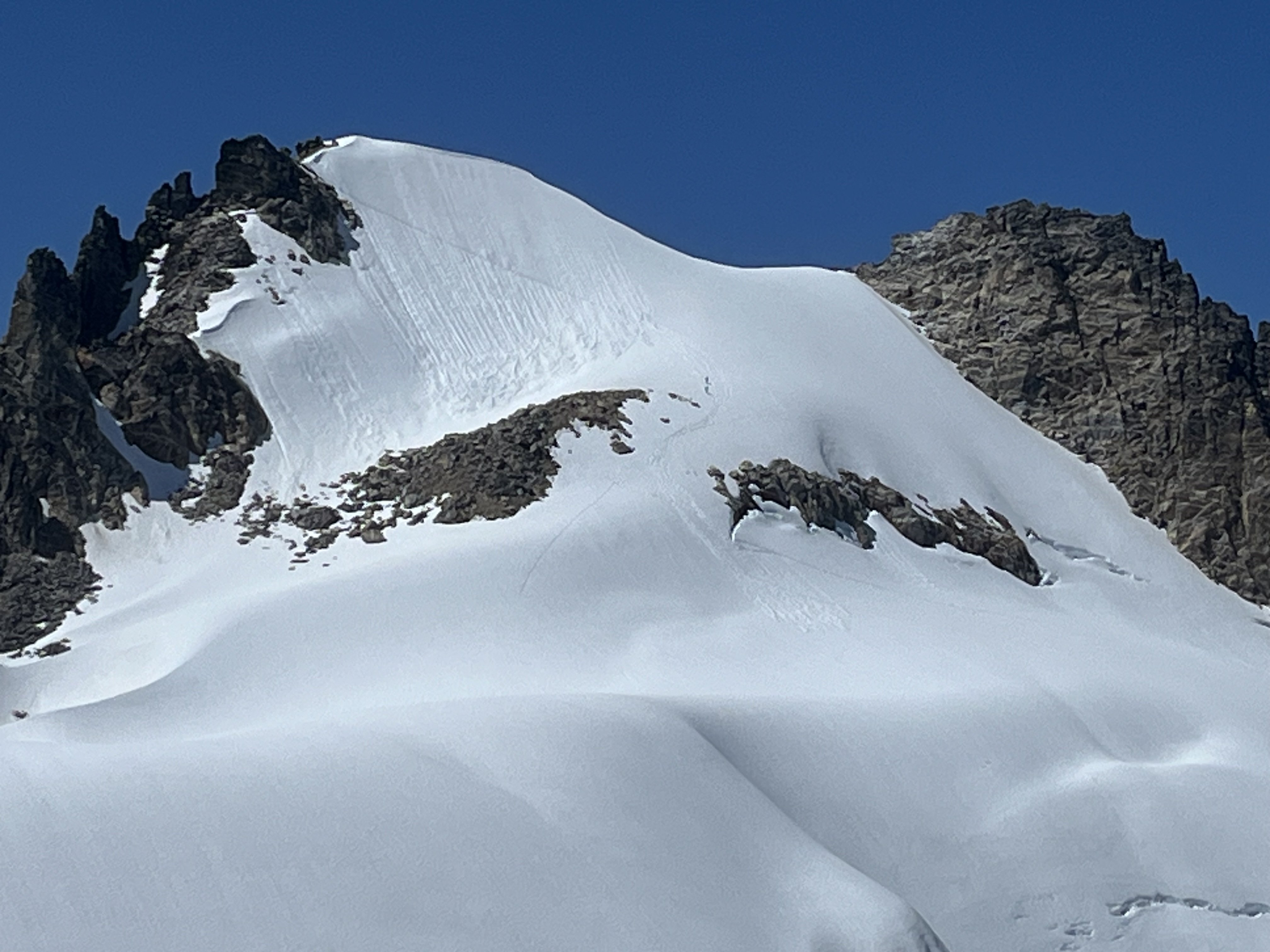
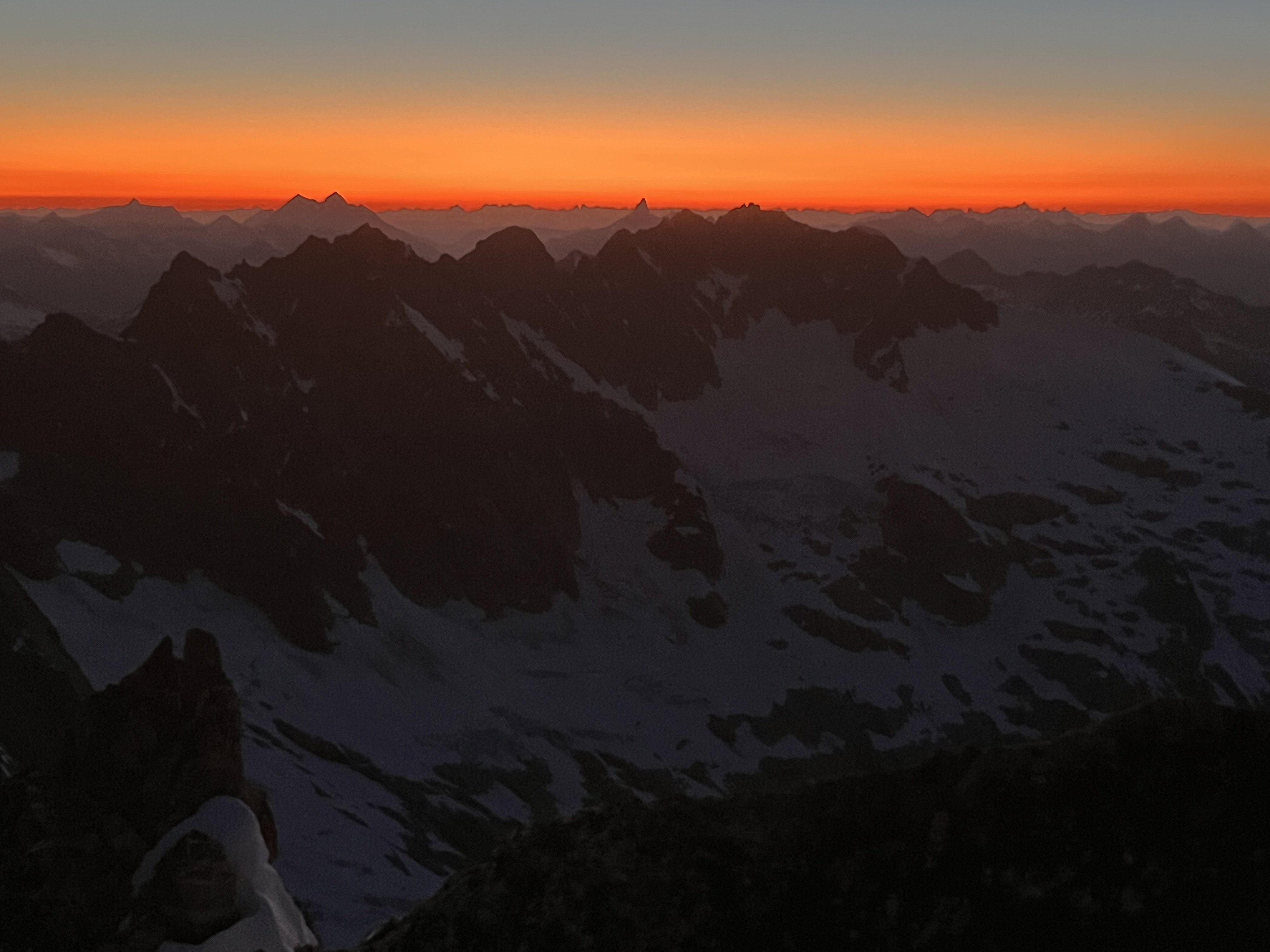
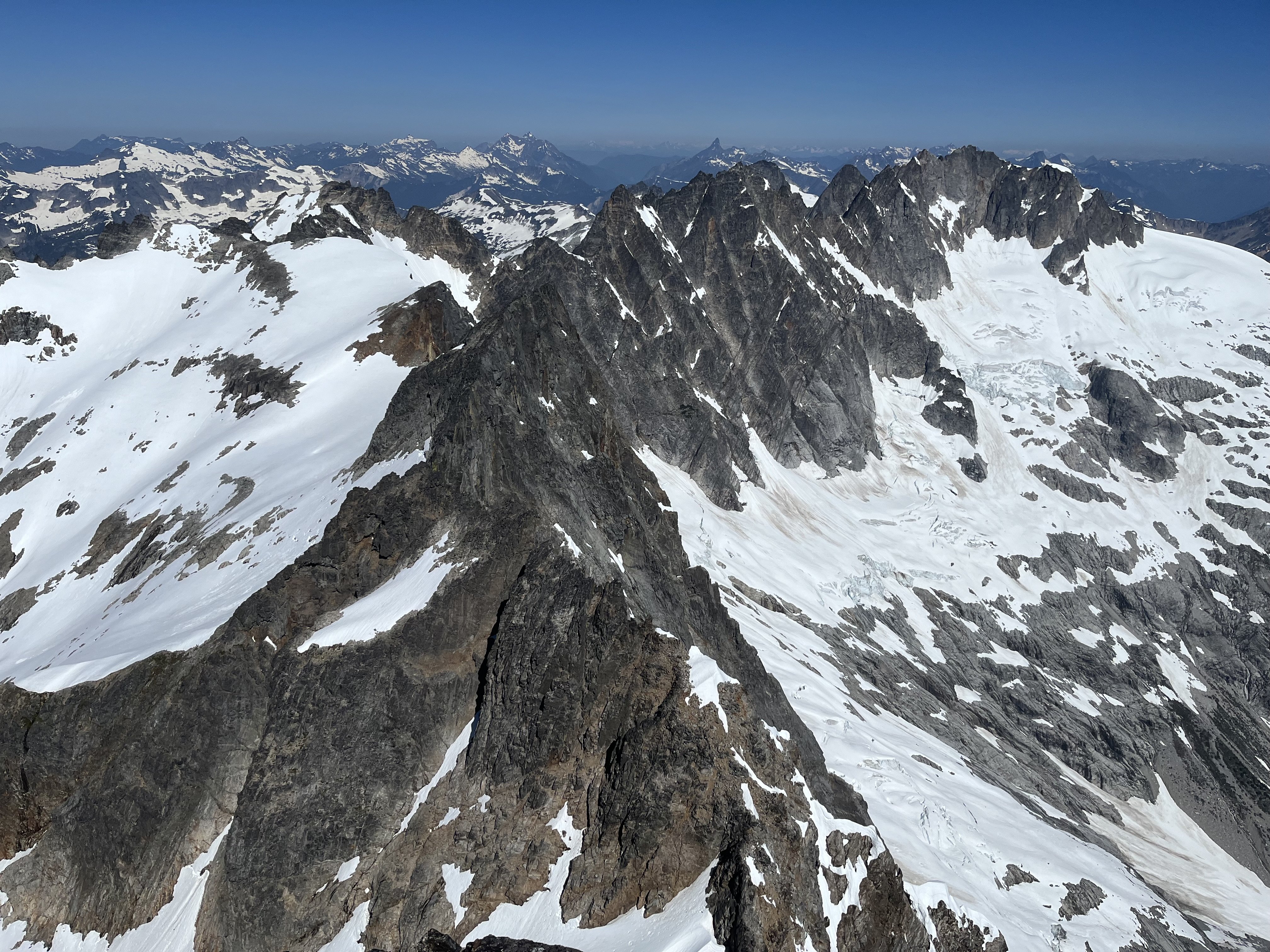
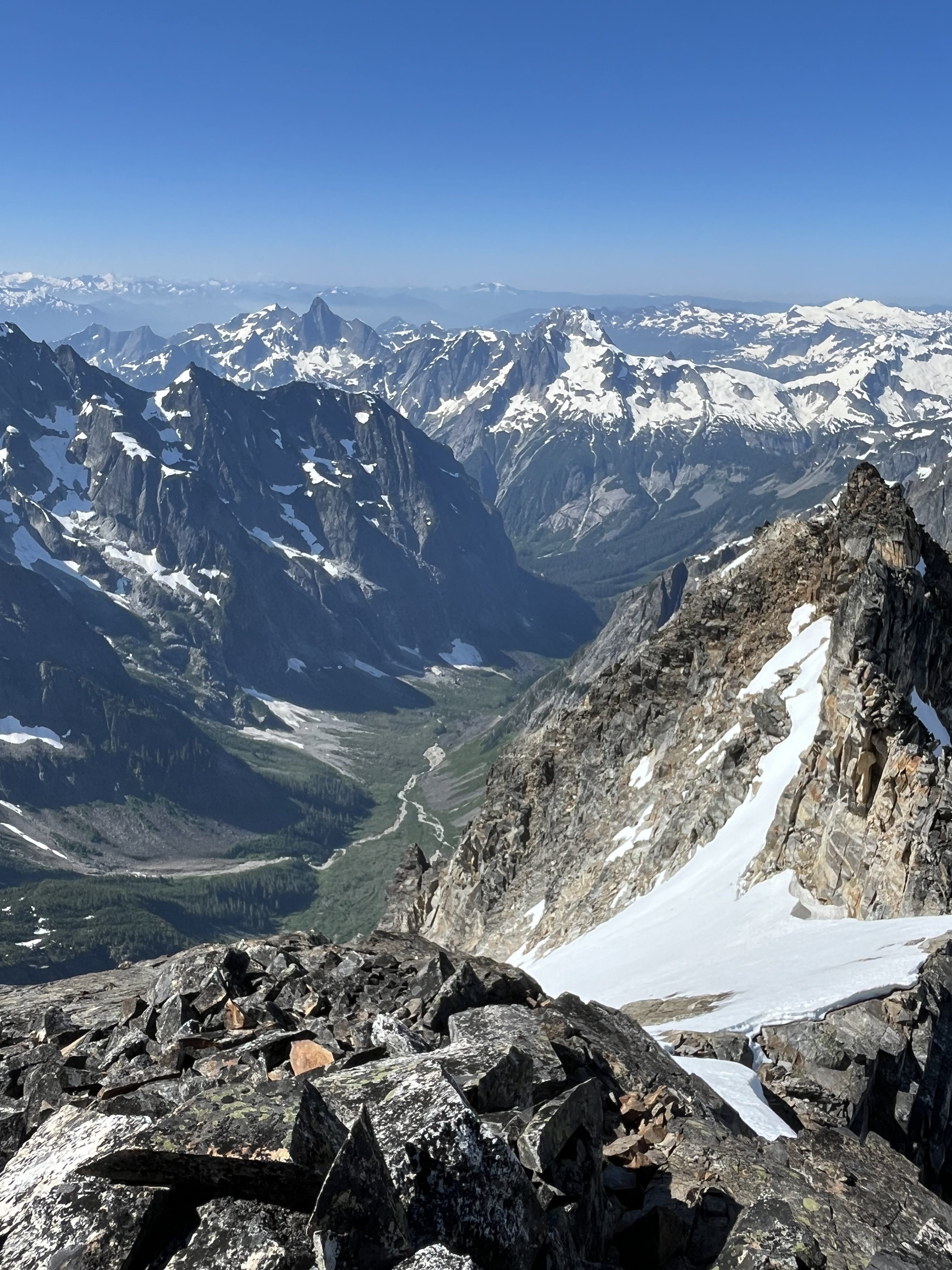
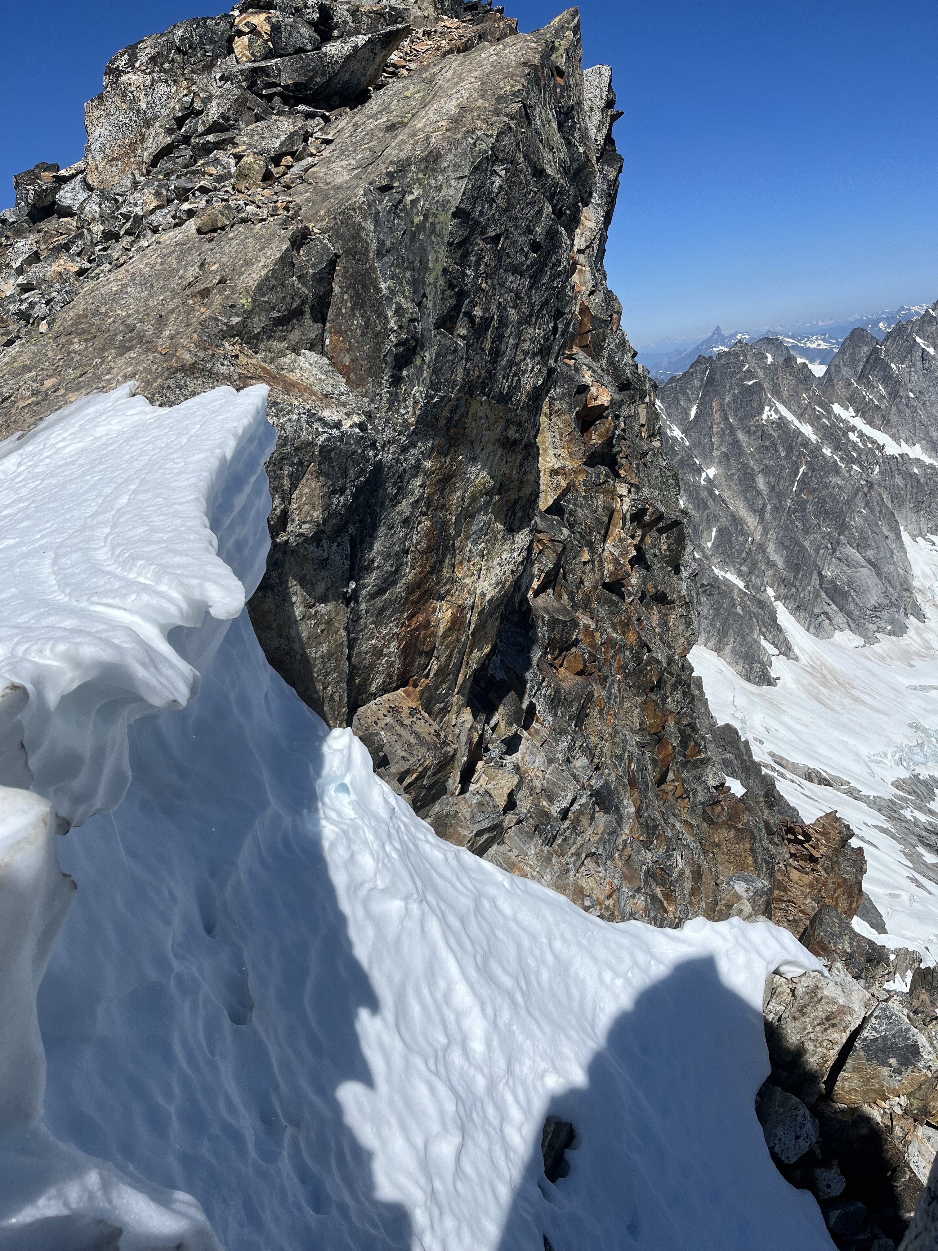
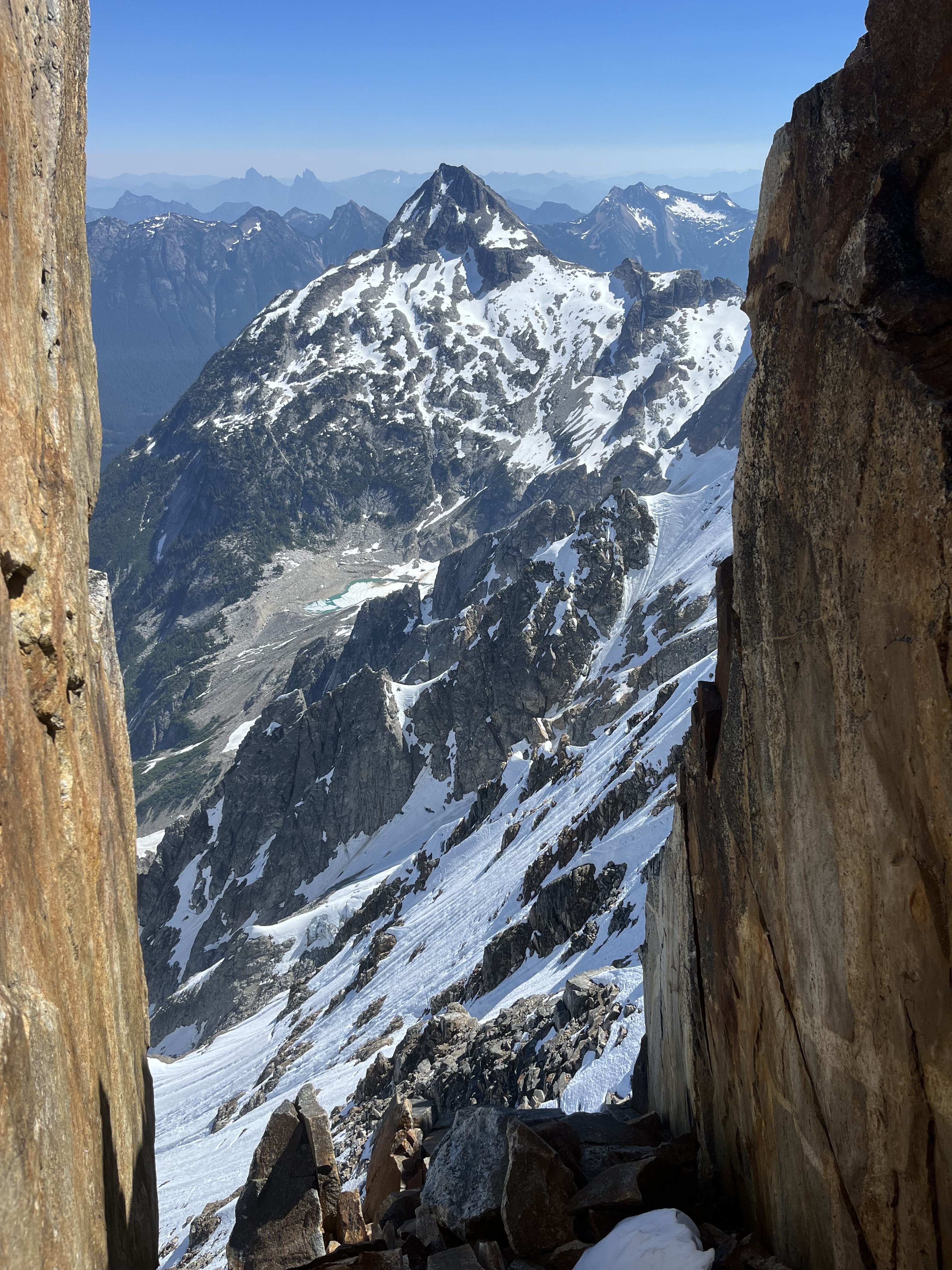
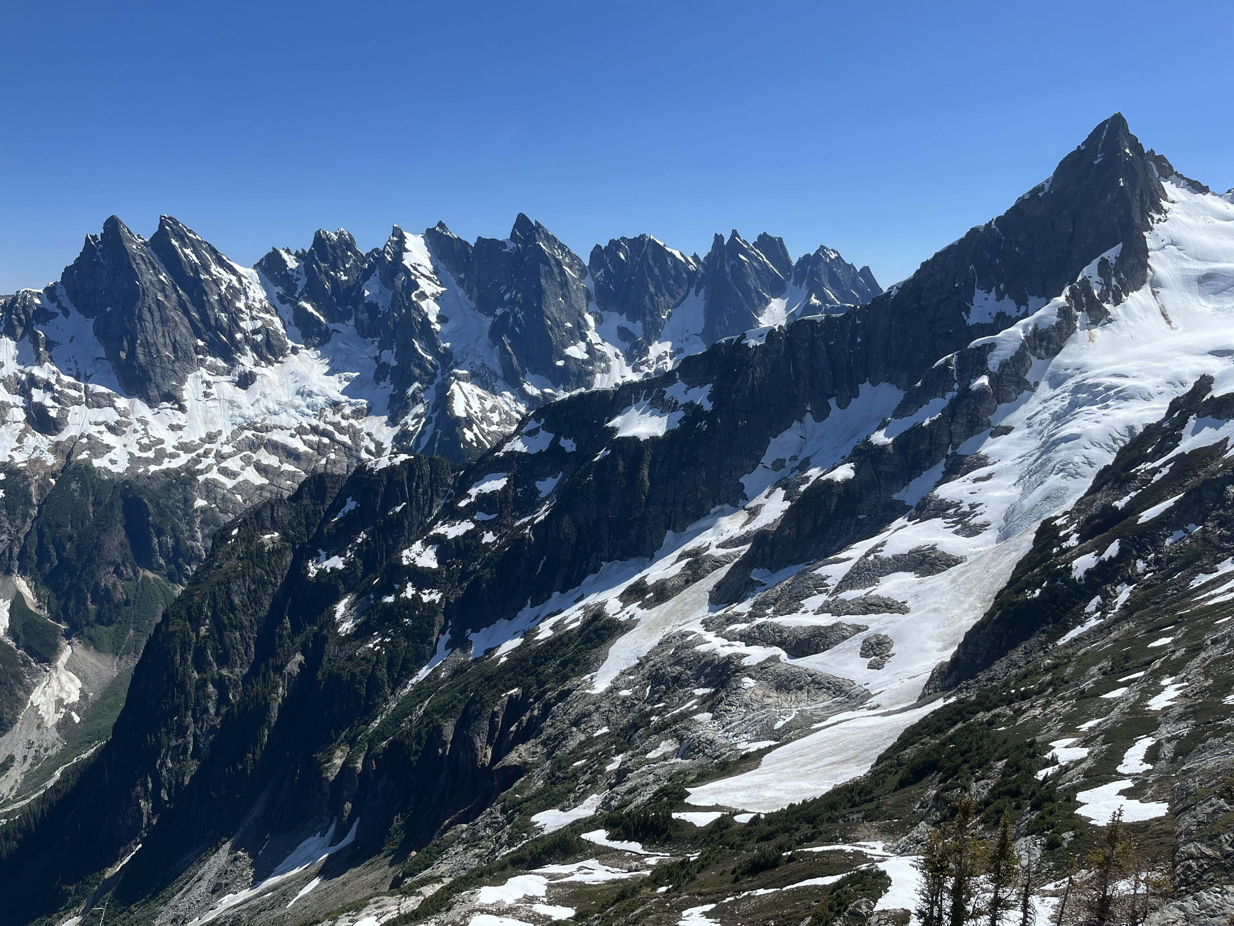
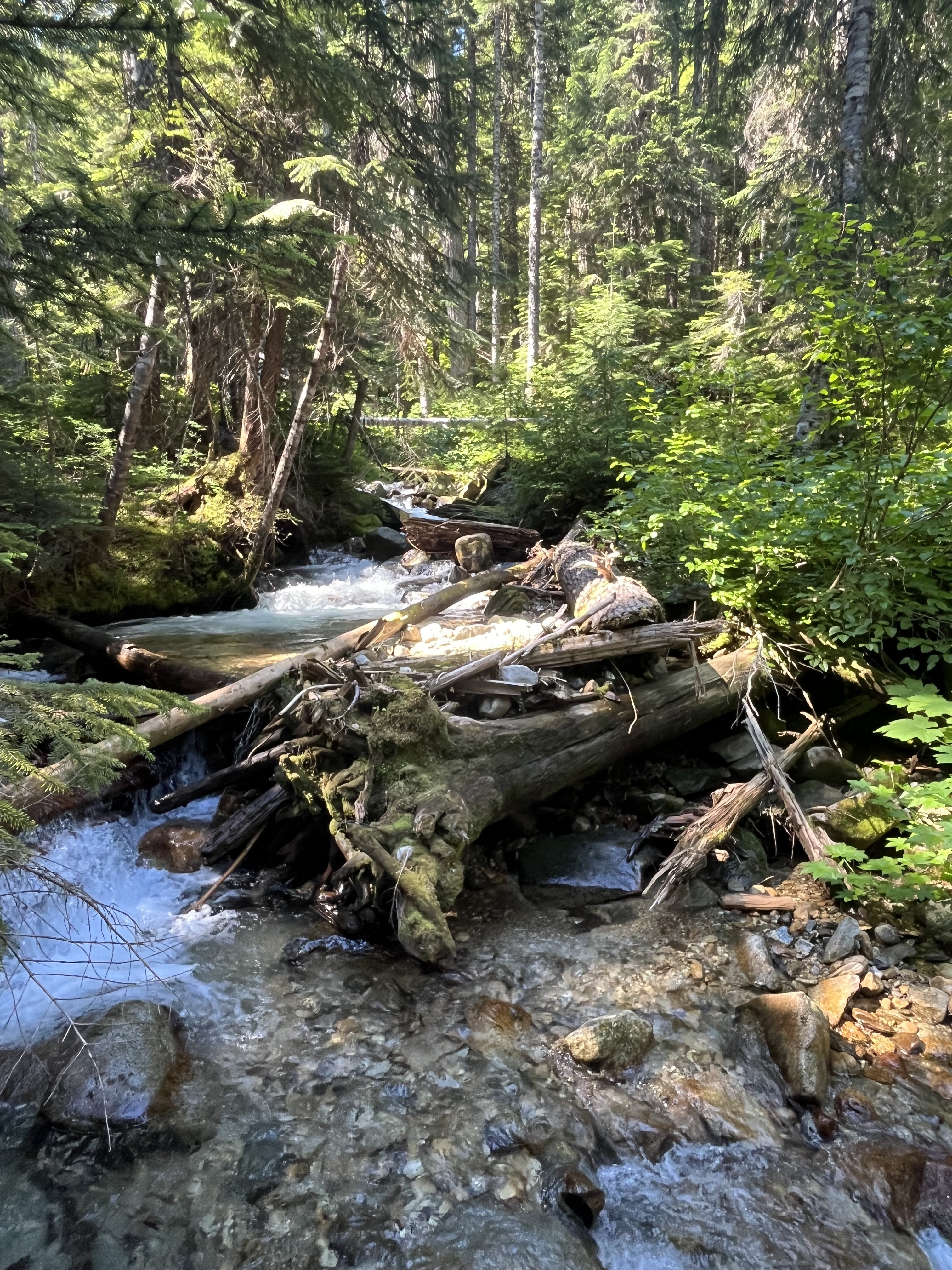
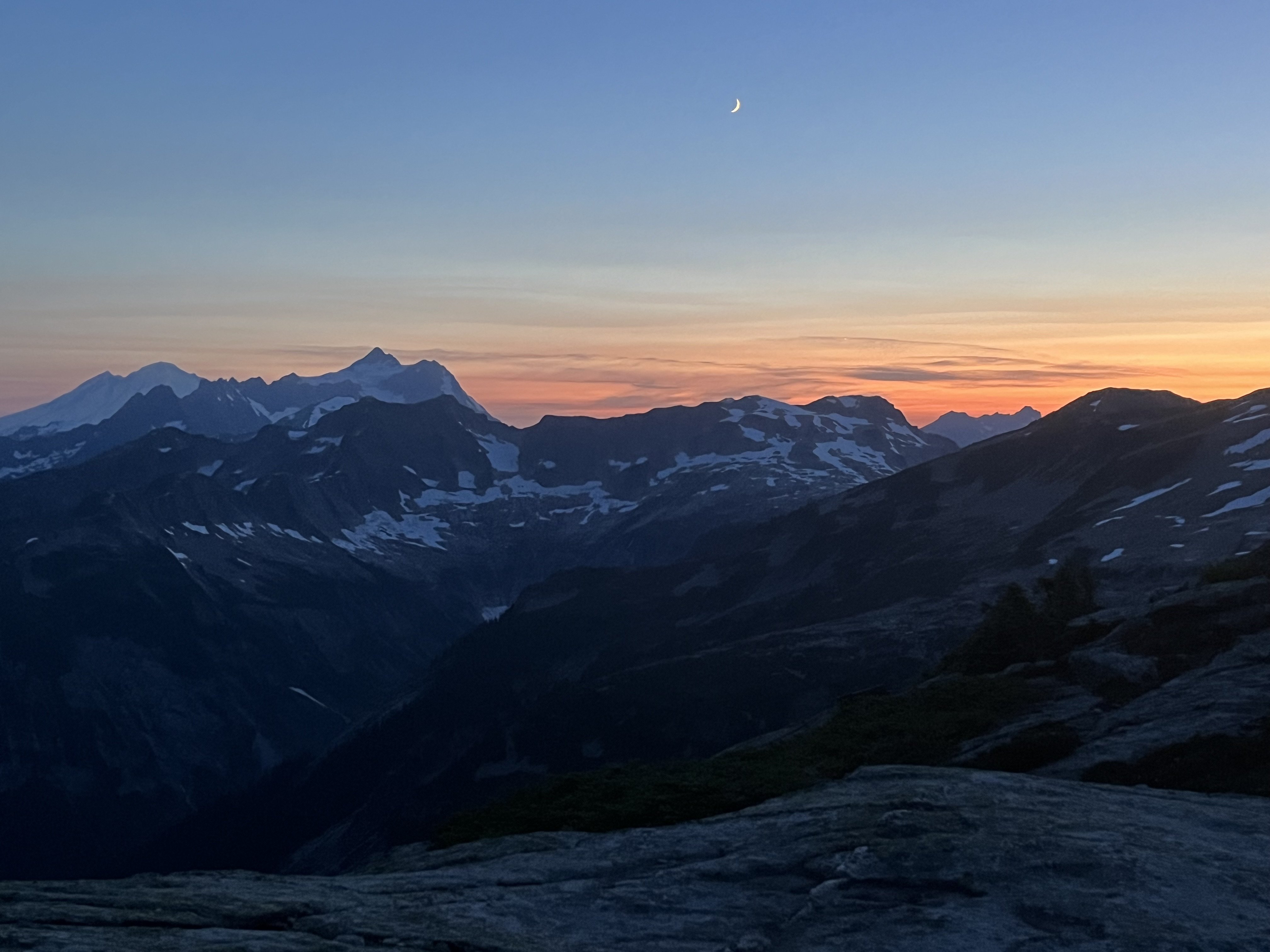
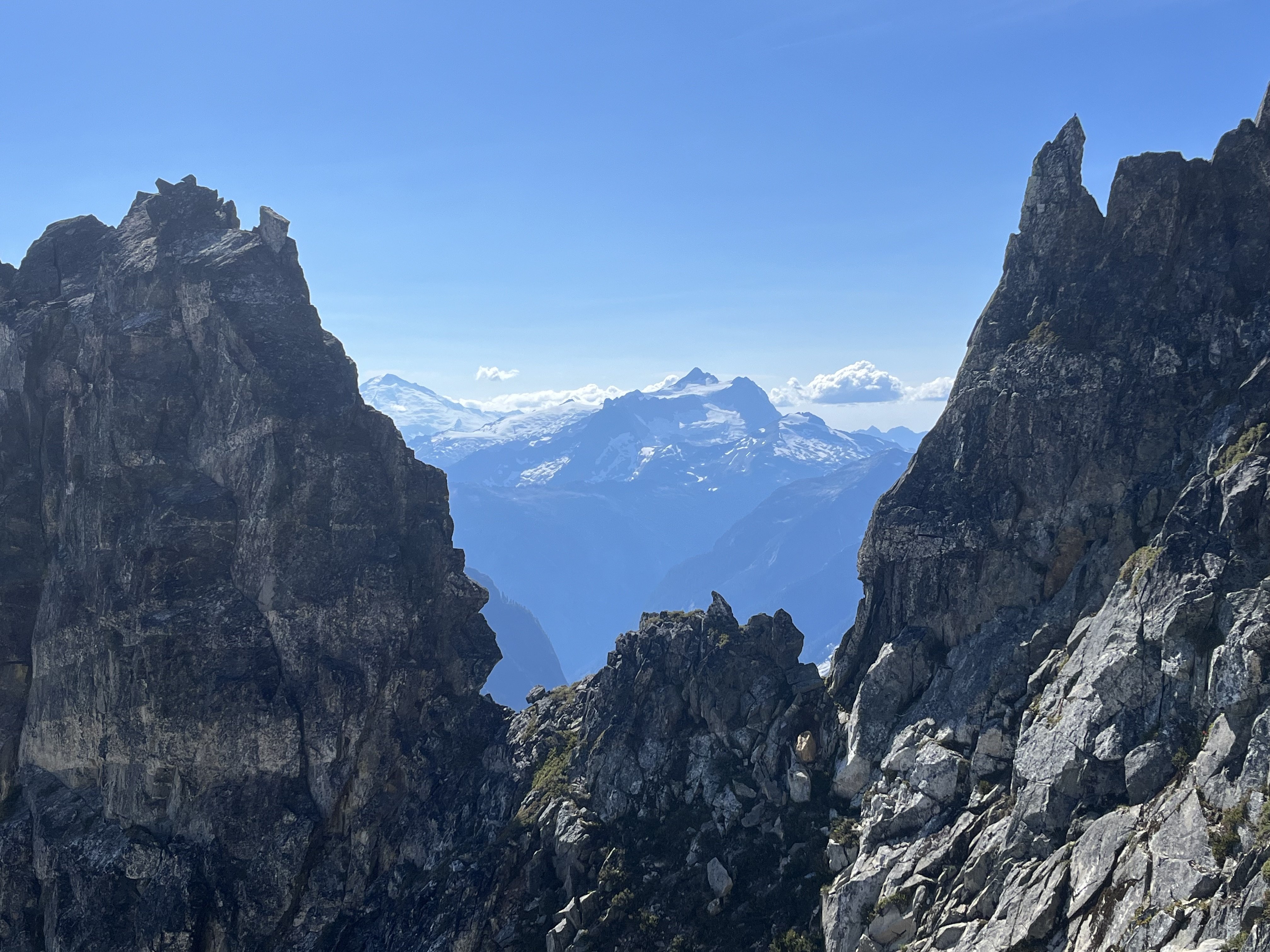
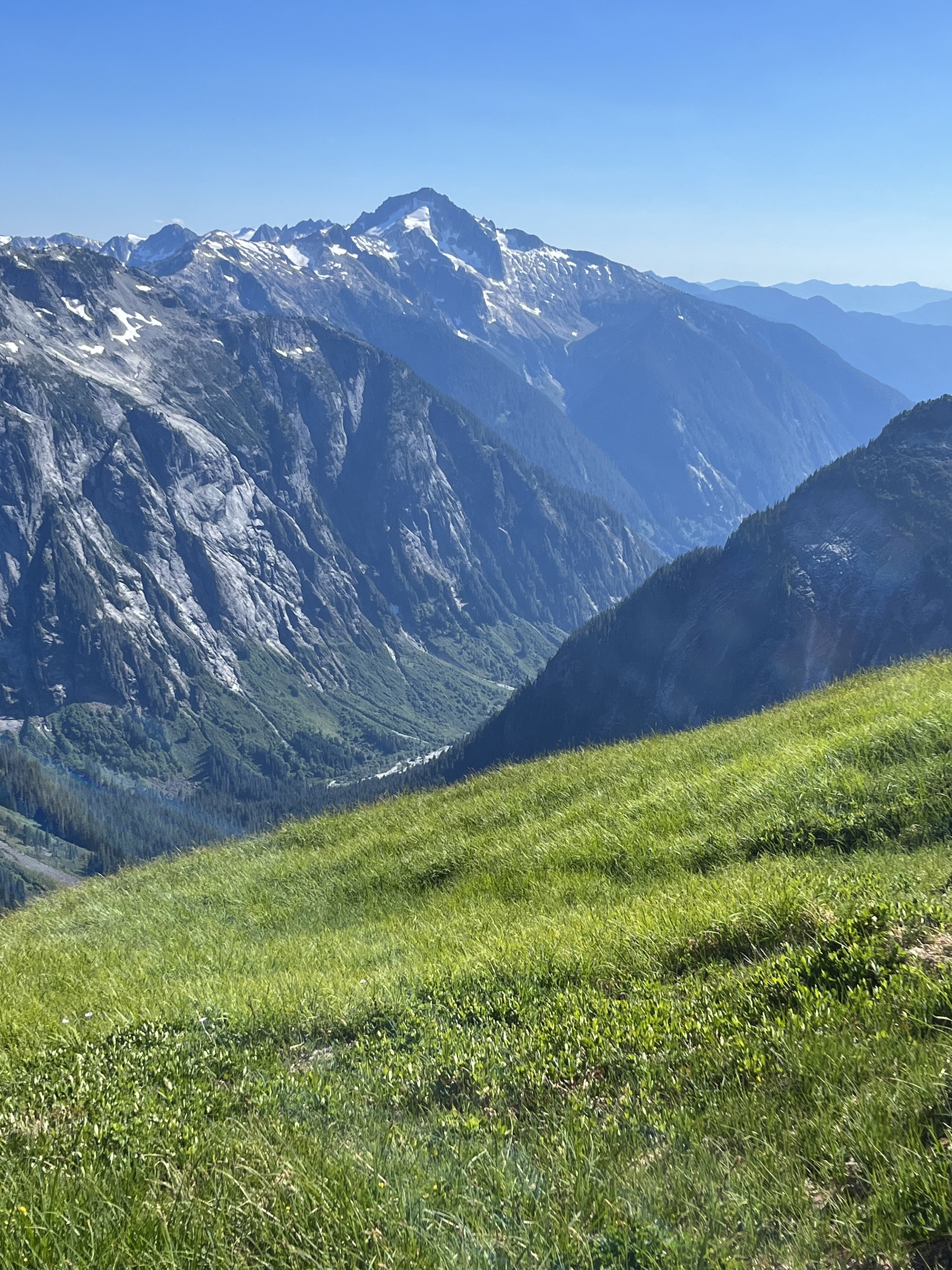
I don’t, I’ve never looked into it. This is the best recent photo I have of the area
-
Trip: Terror - N buttress (attempt), Himmelhorn - Wild hair crack, Degenhardt NW+E route, Pyramid - W route
Trip Date: 07/04/2025
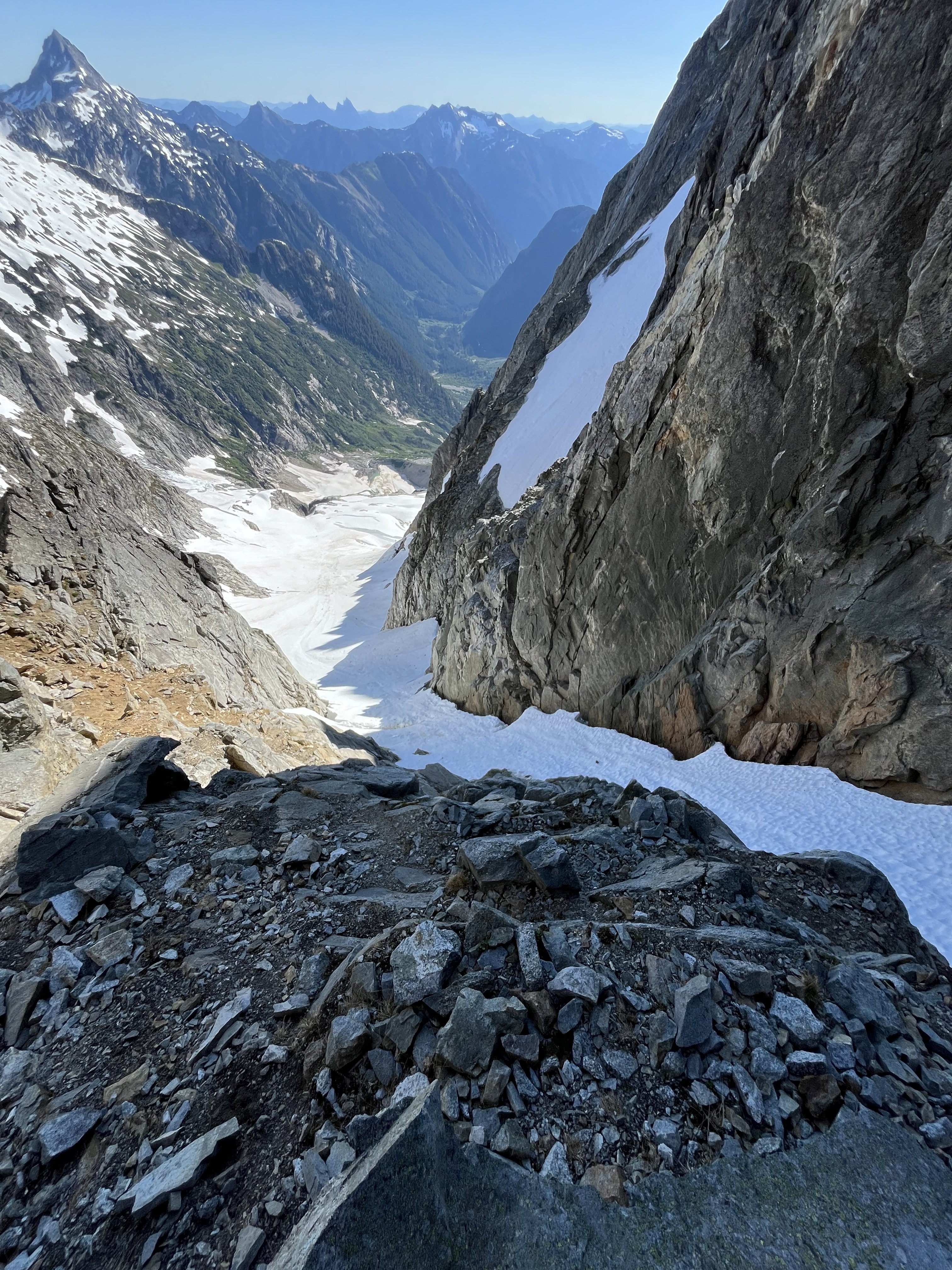
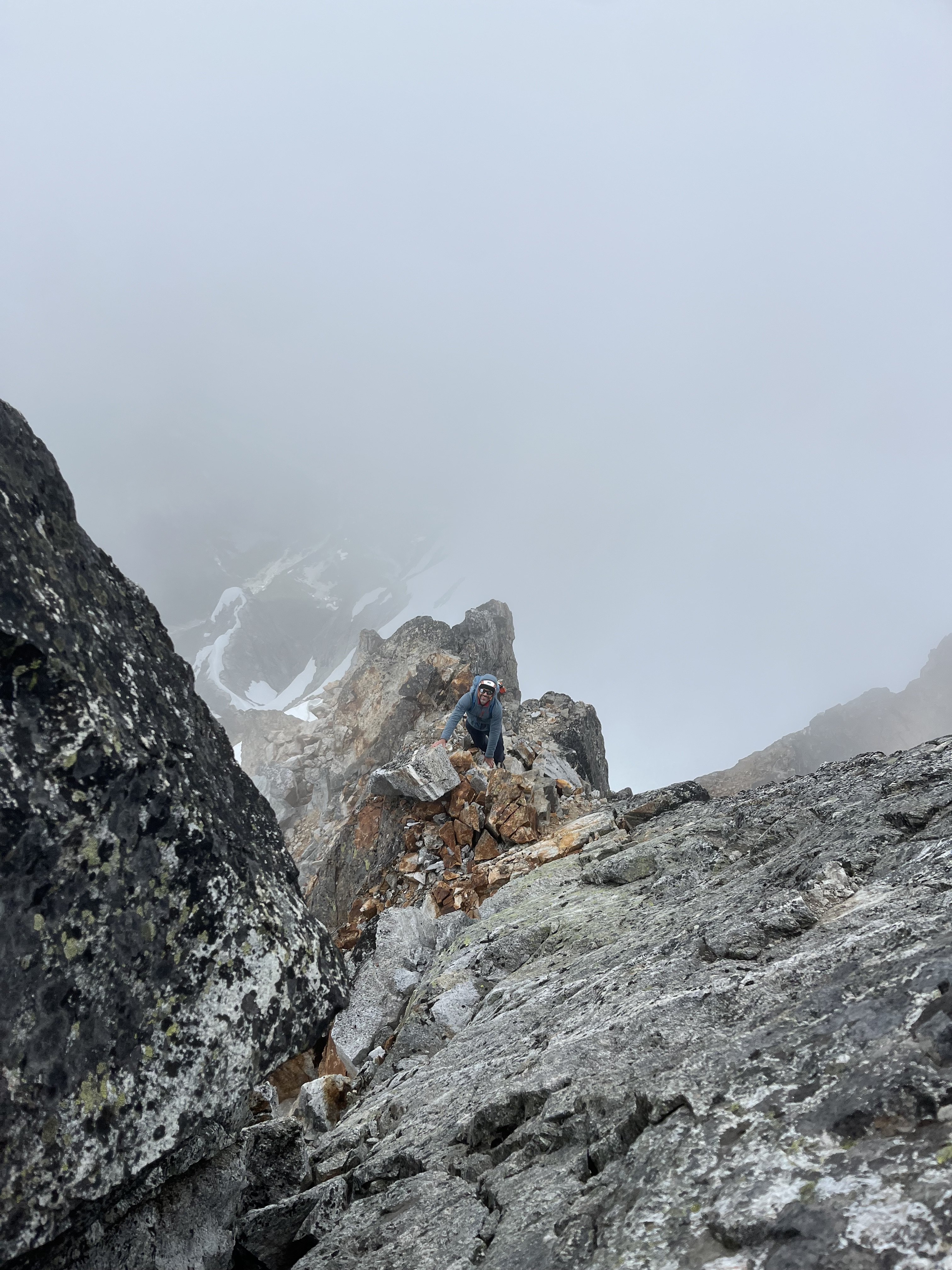
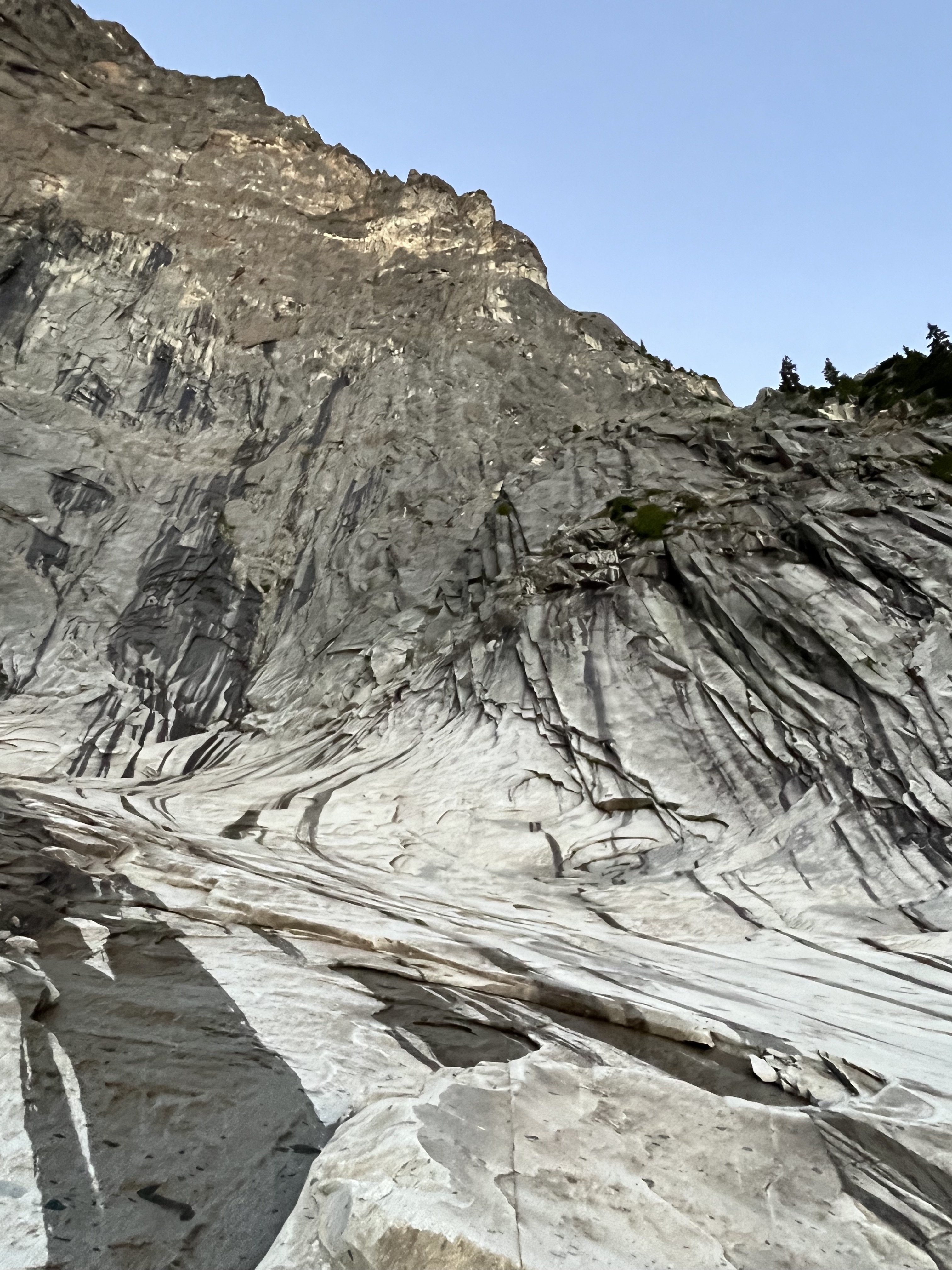
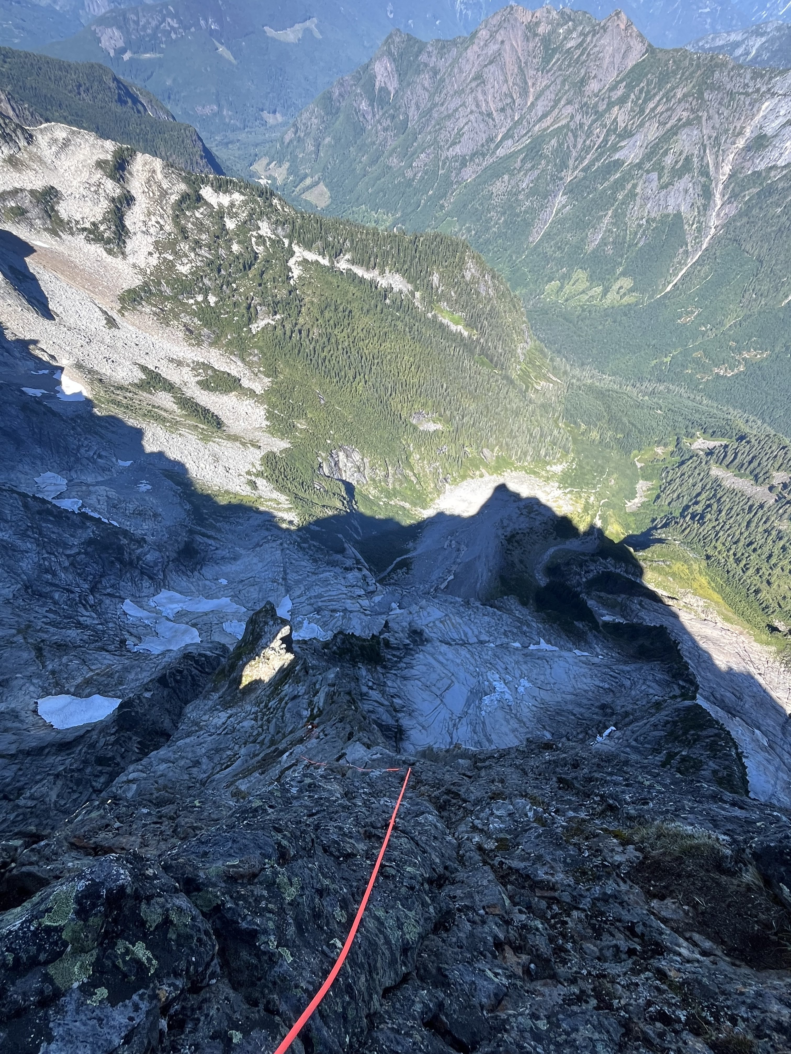
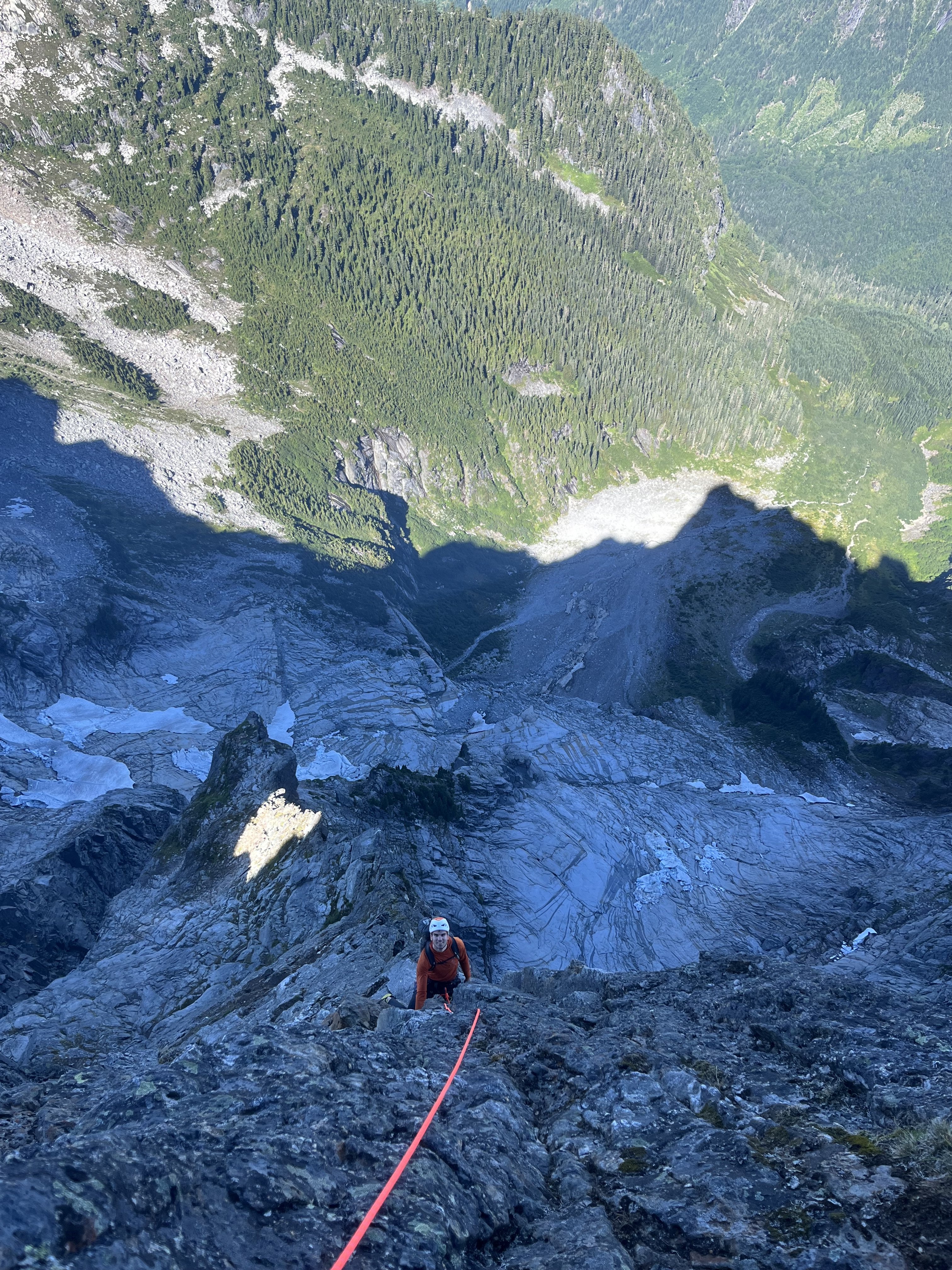
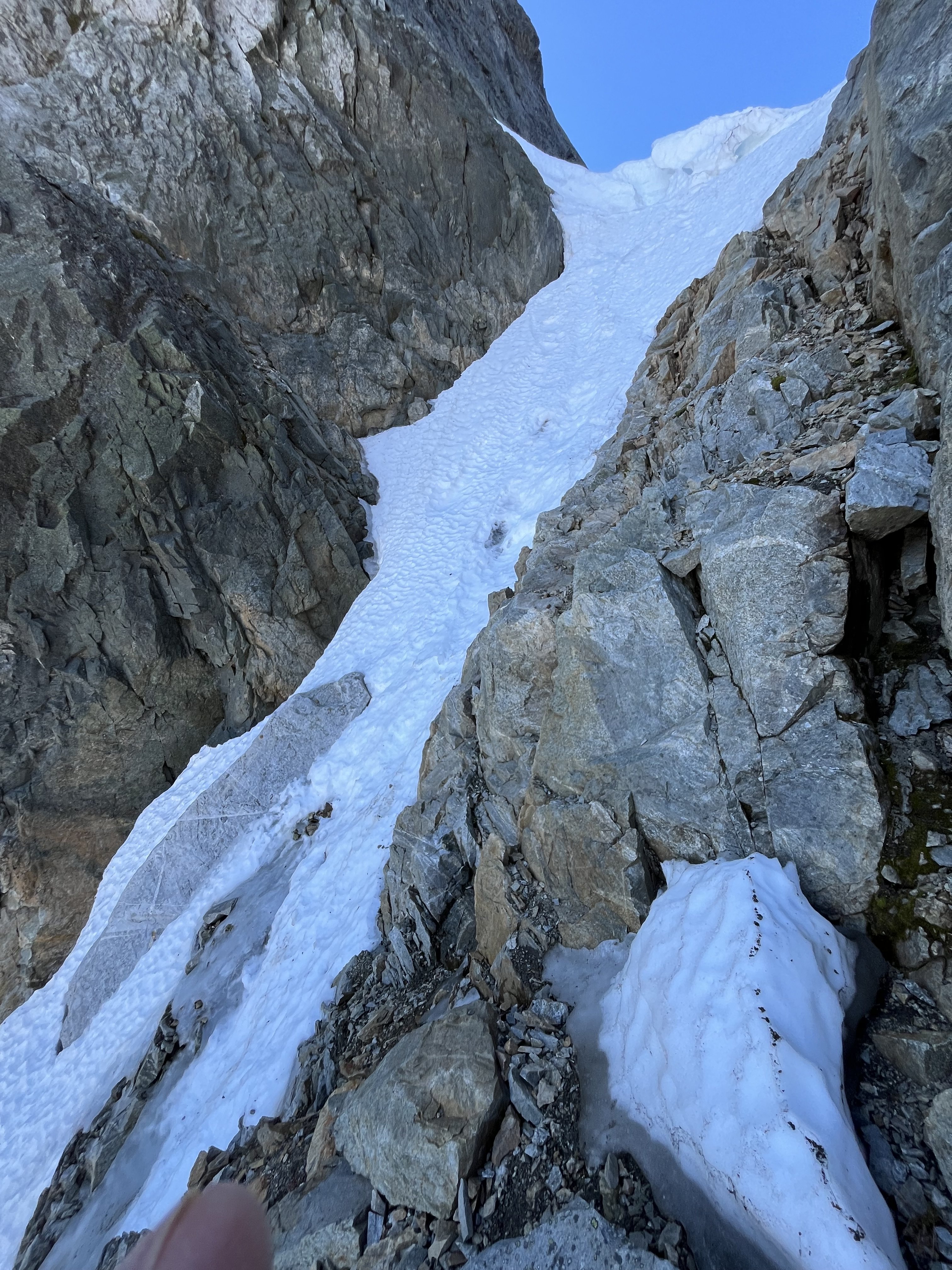
Trip Report:Drawbridged again in the pickets for the second time in a week.
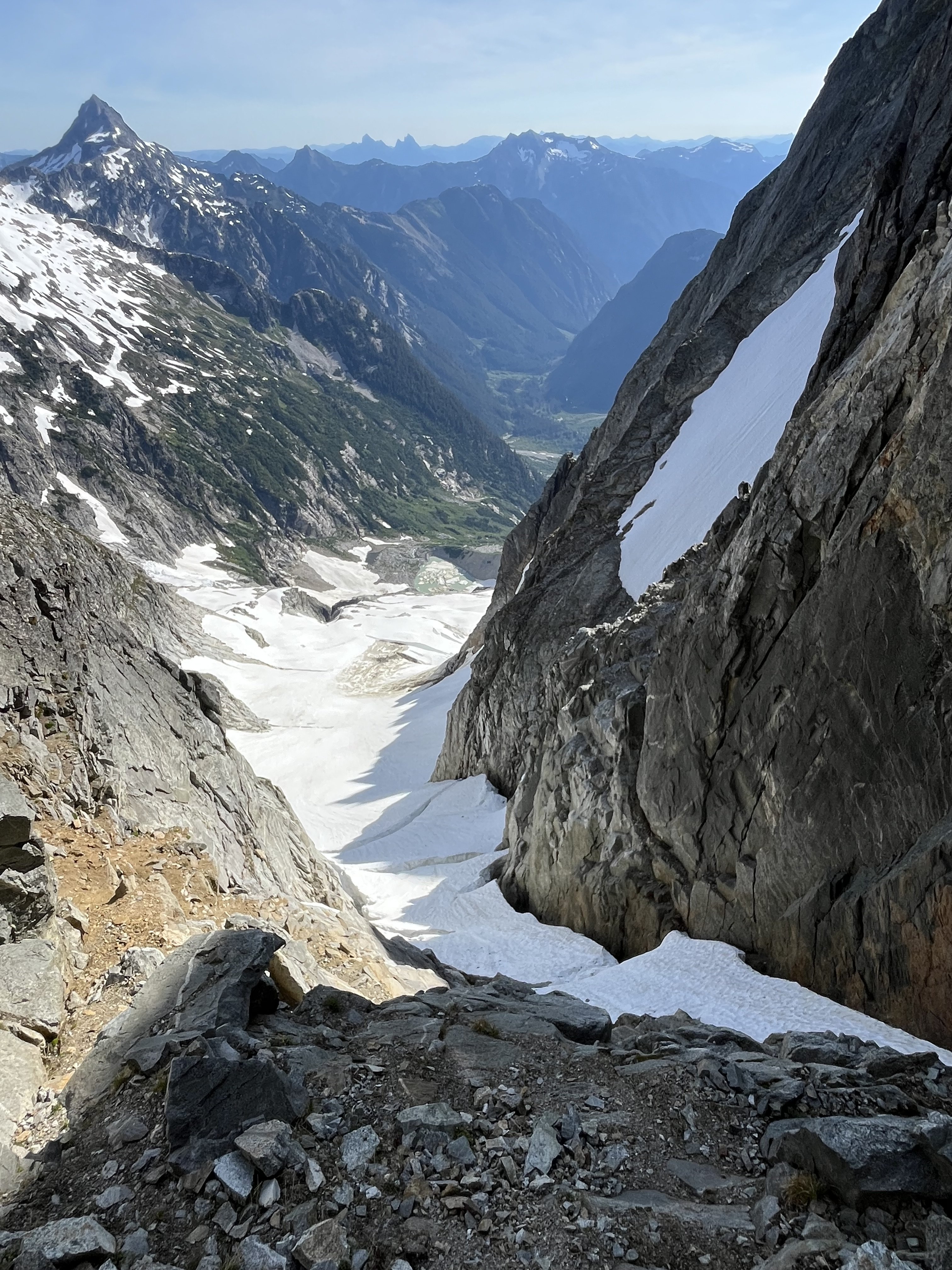
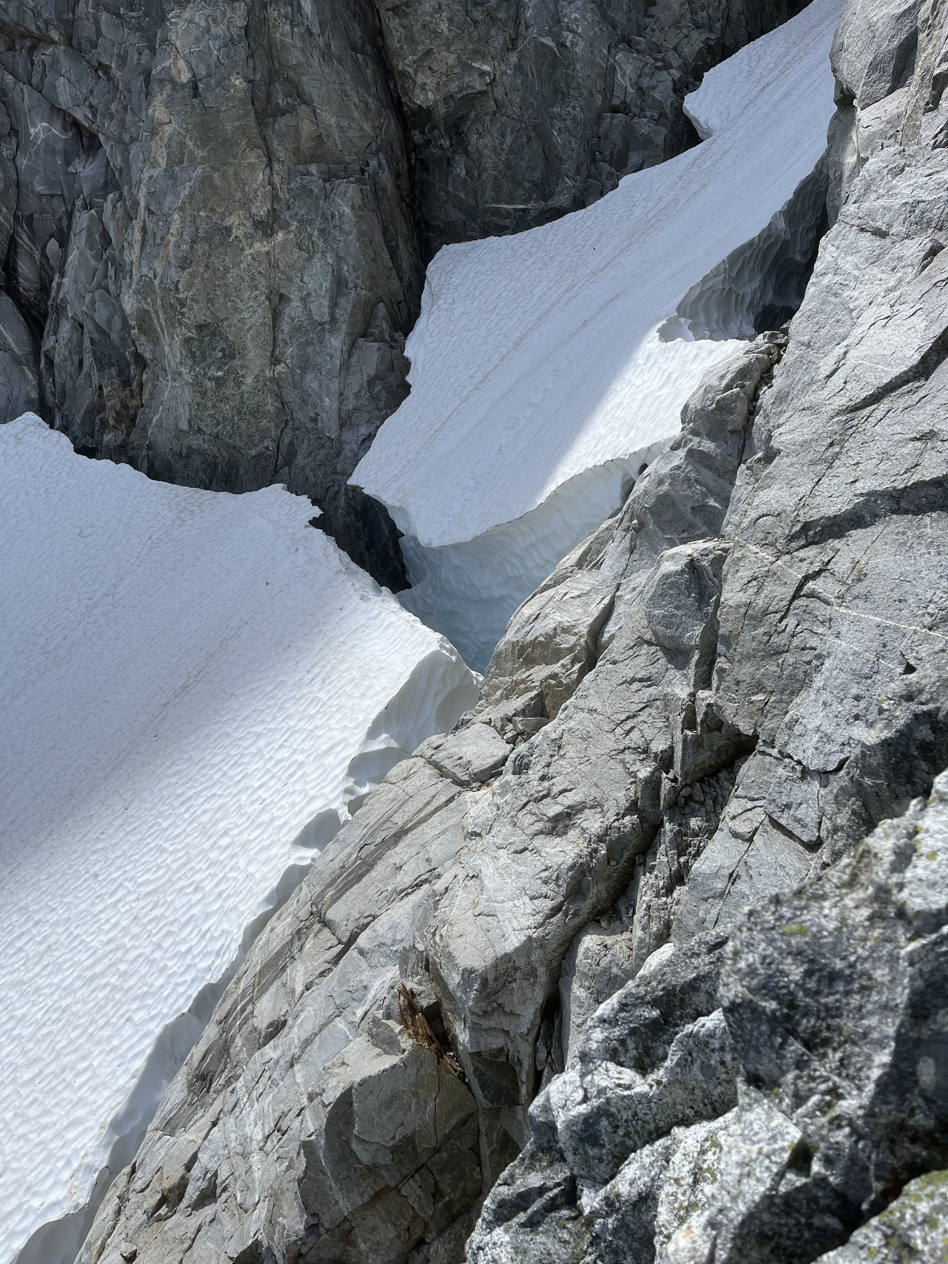
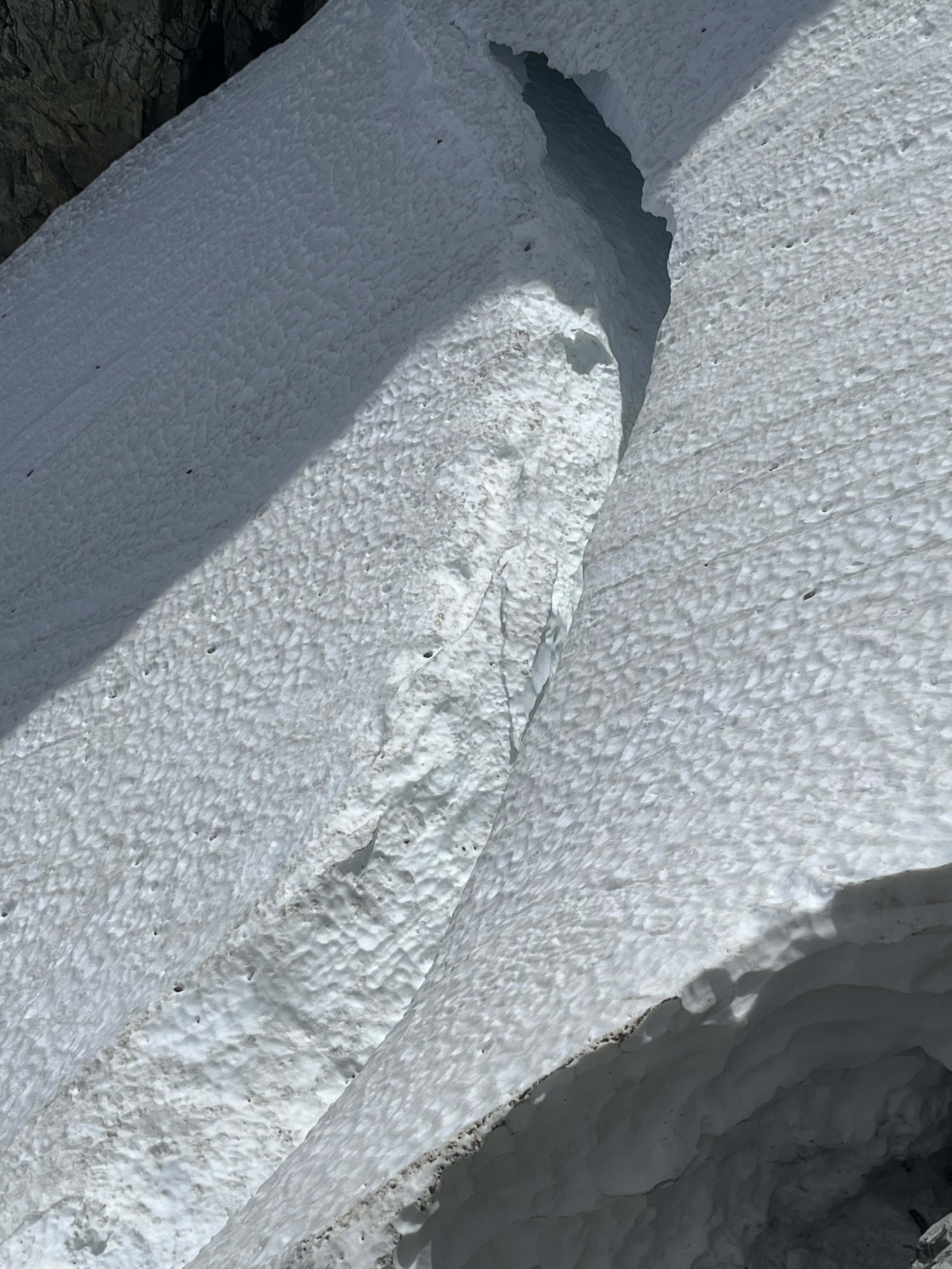
After the standard rap into the couloir north of Otto-Himmel col my partner @aikidjoe encountered a moat that appeared impassable.
He ascended back to the station and I took a look down the next gully skiers left. From lower down I could see it would have been no good to try the moat (which would have required an absurd running leap) because another moat was not far below that one.
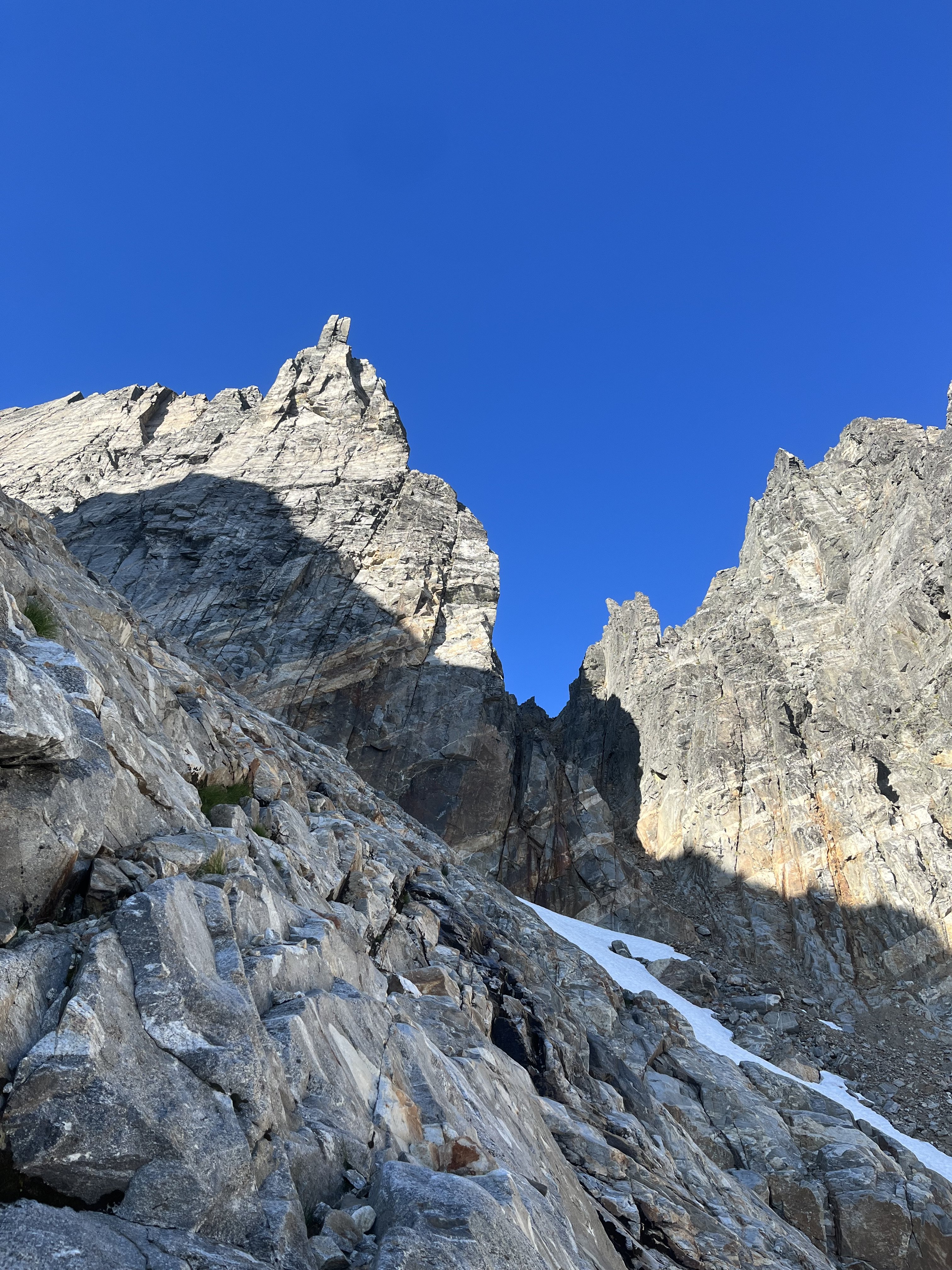
 I kept descending adjacent to the couloir, finding mostly solid, even fun, exposed class 4. There was a short low fifth corner with a lemon cake sized block that kept it secure. I passed a slung block with old webbing.
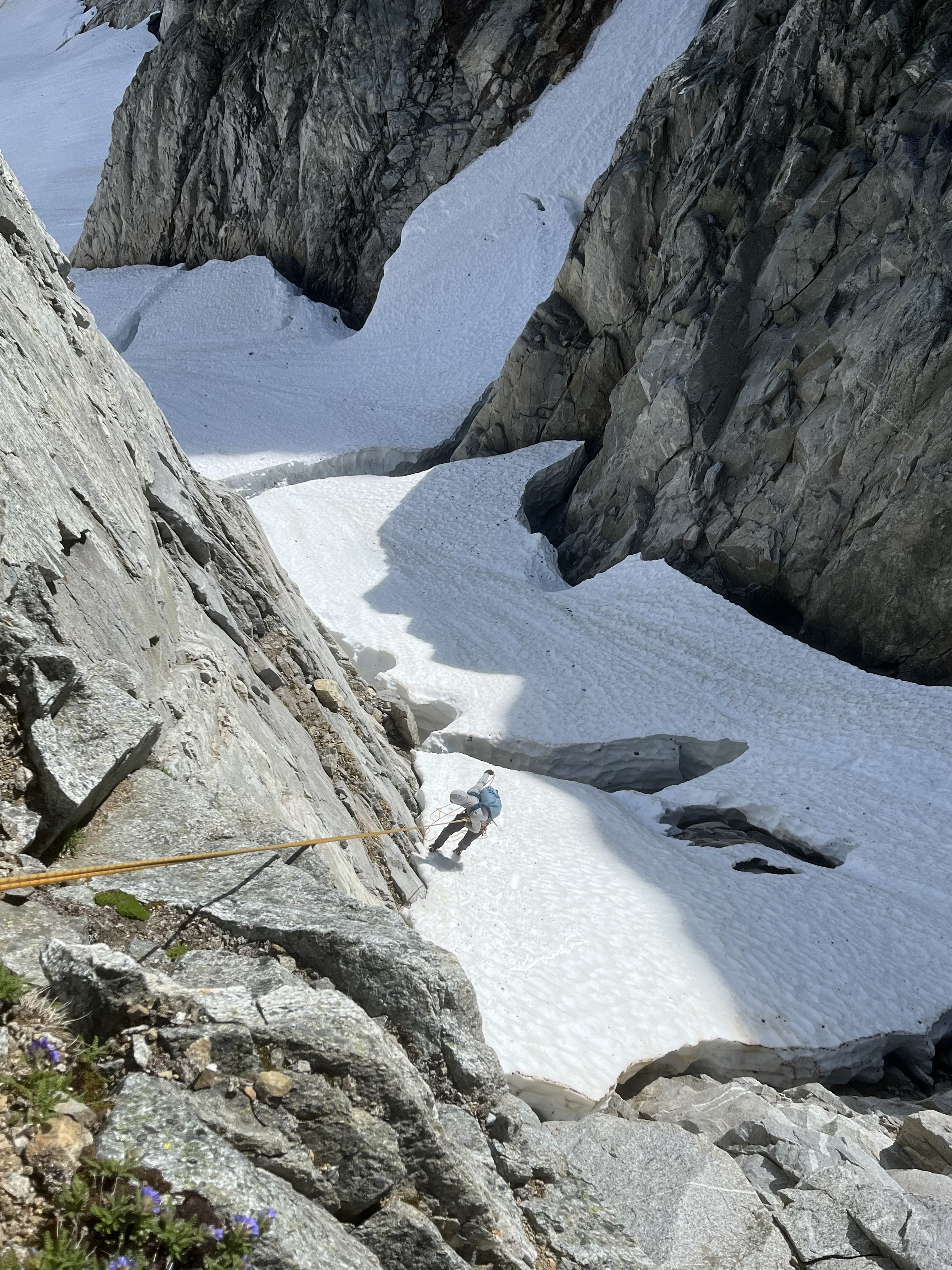
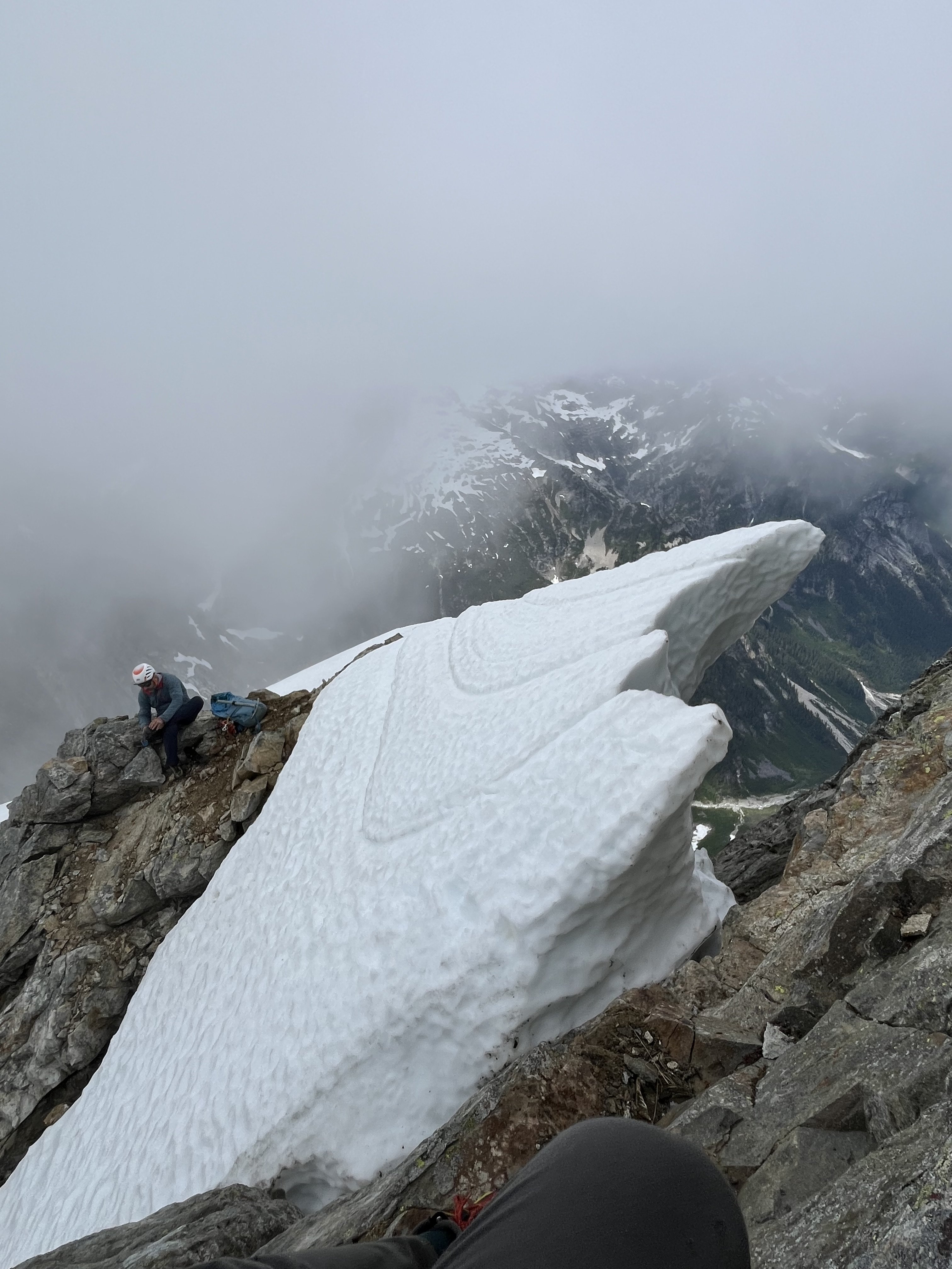
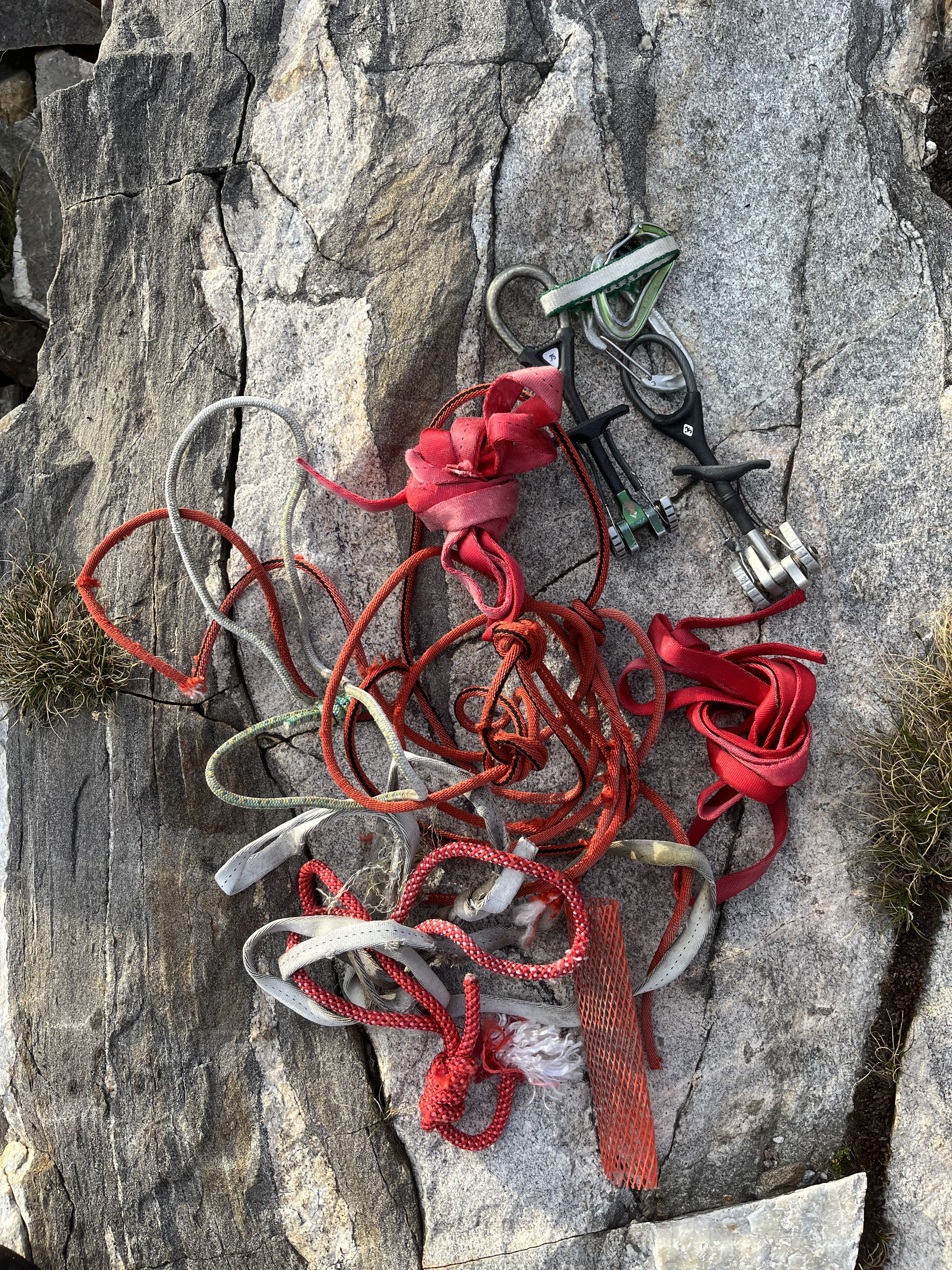
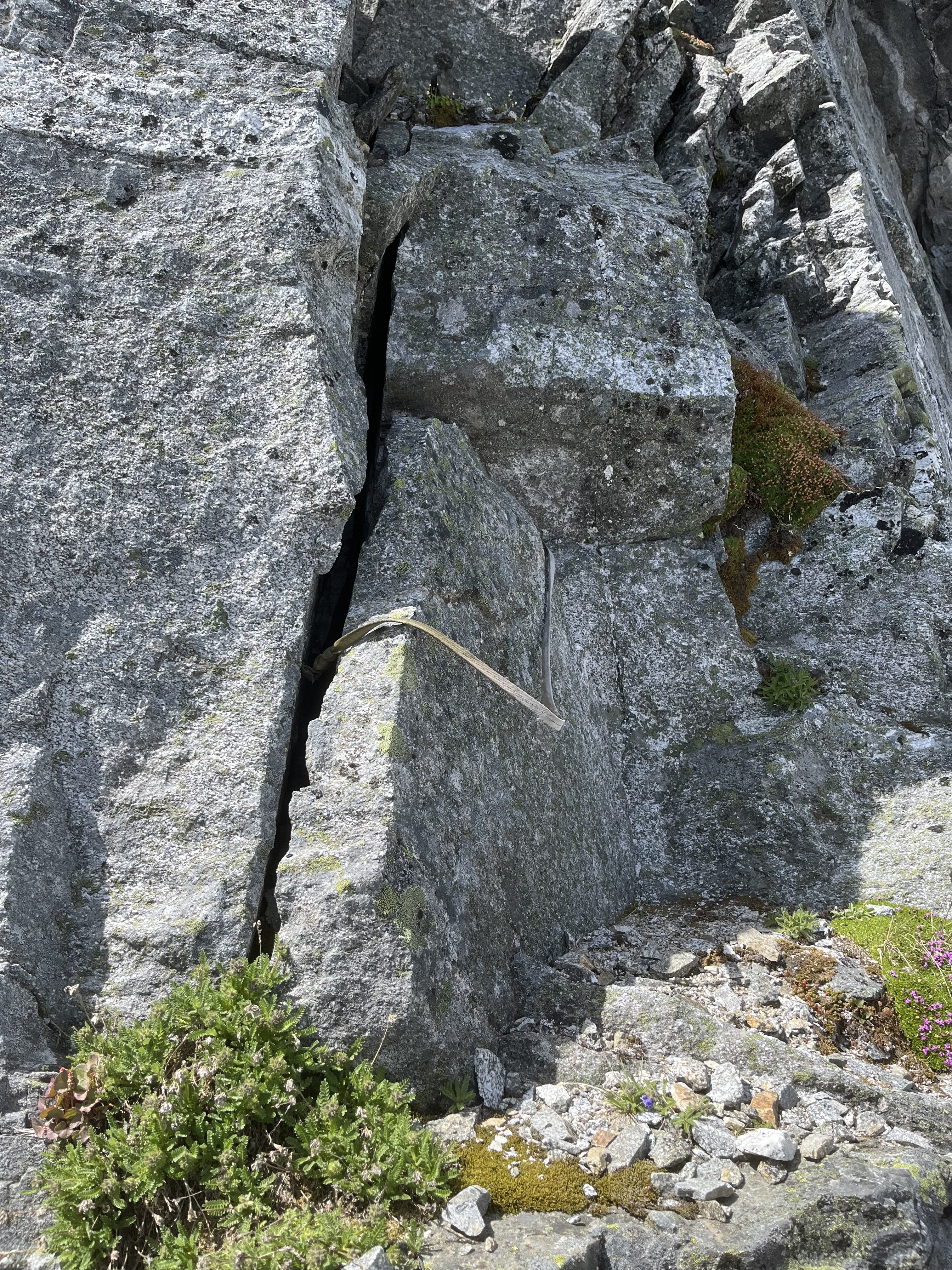 Where things cliffed out I found some good .1-.2 cam sized cracks that could be used for a rap anchor.
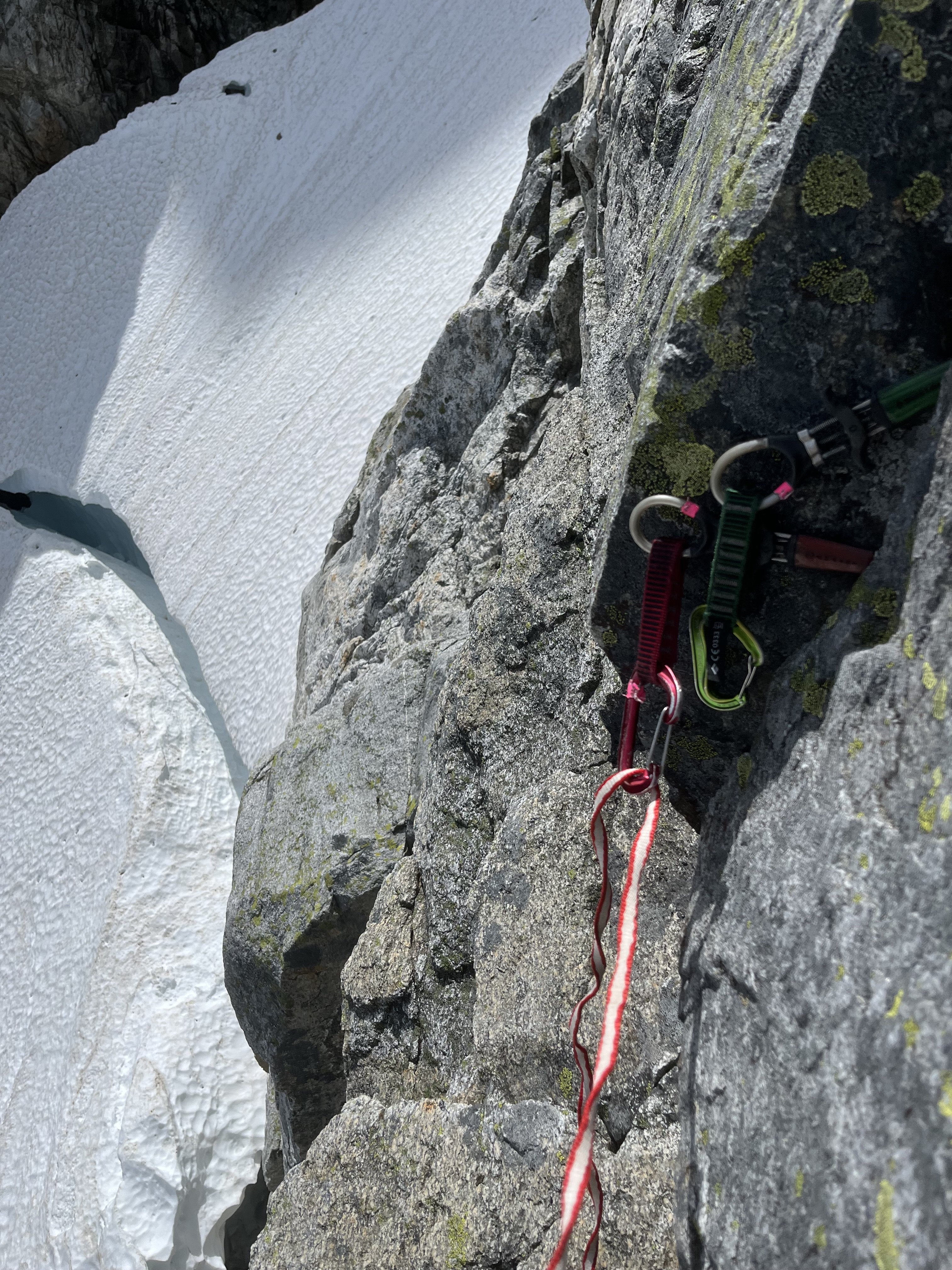 My 60m rope easily reached continuous snow from there (maybe 20m rap).
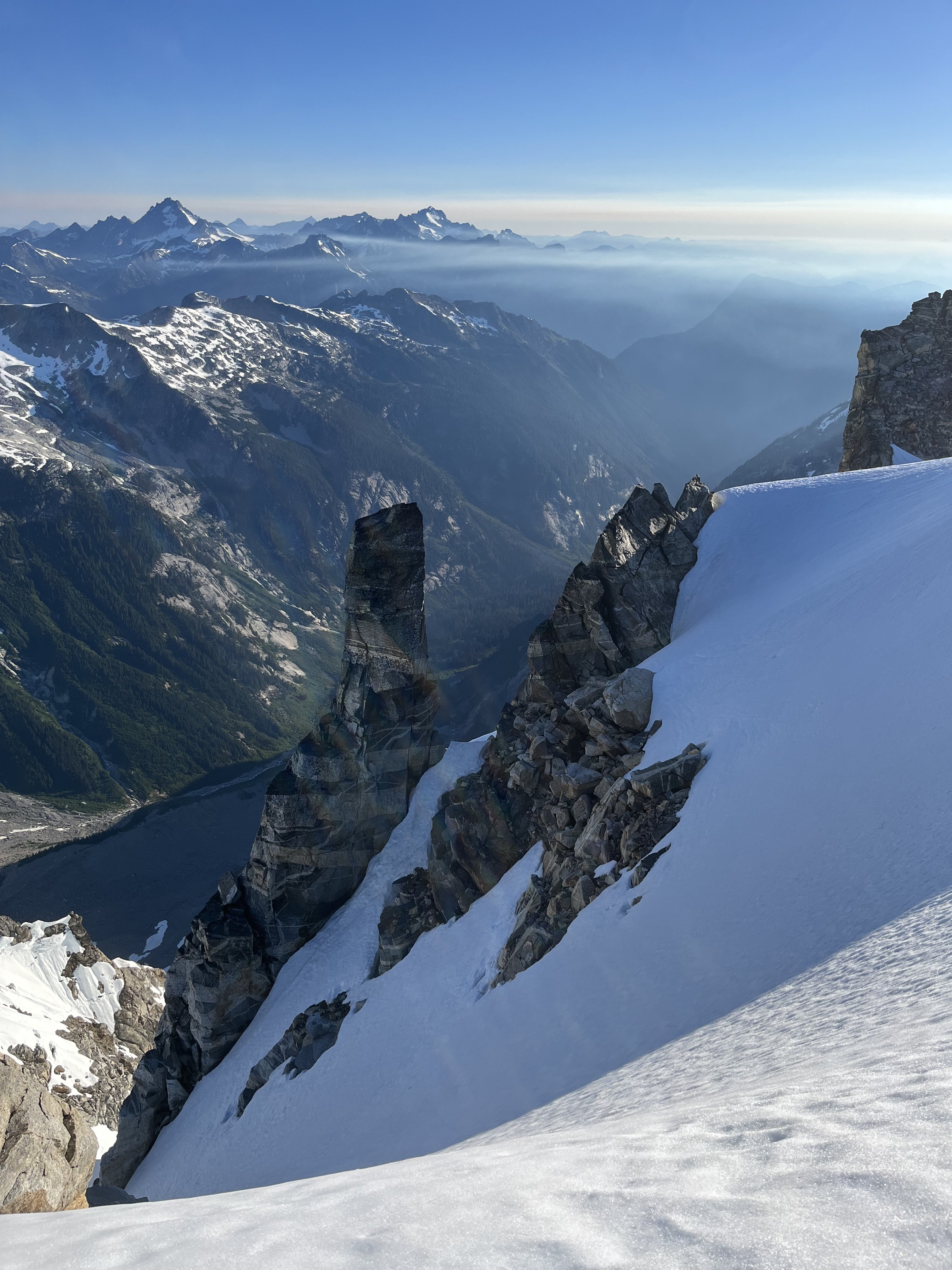
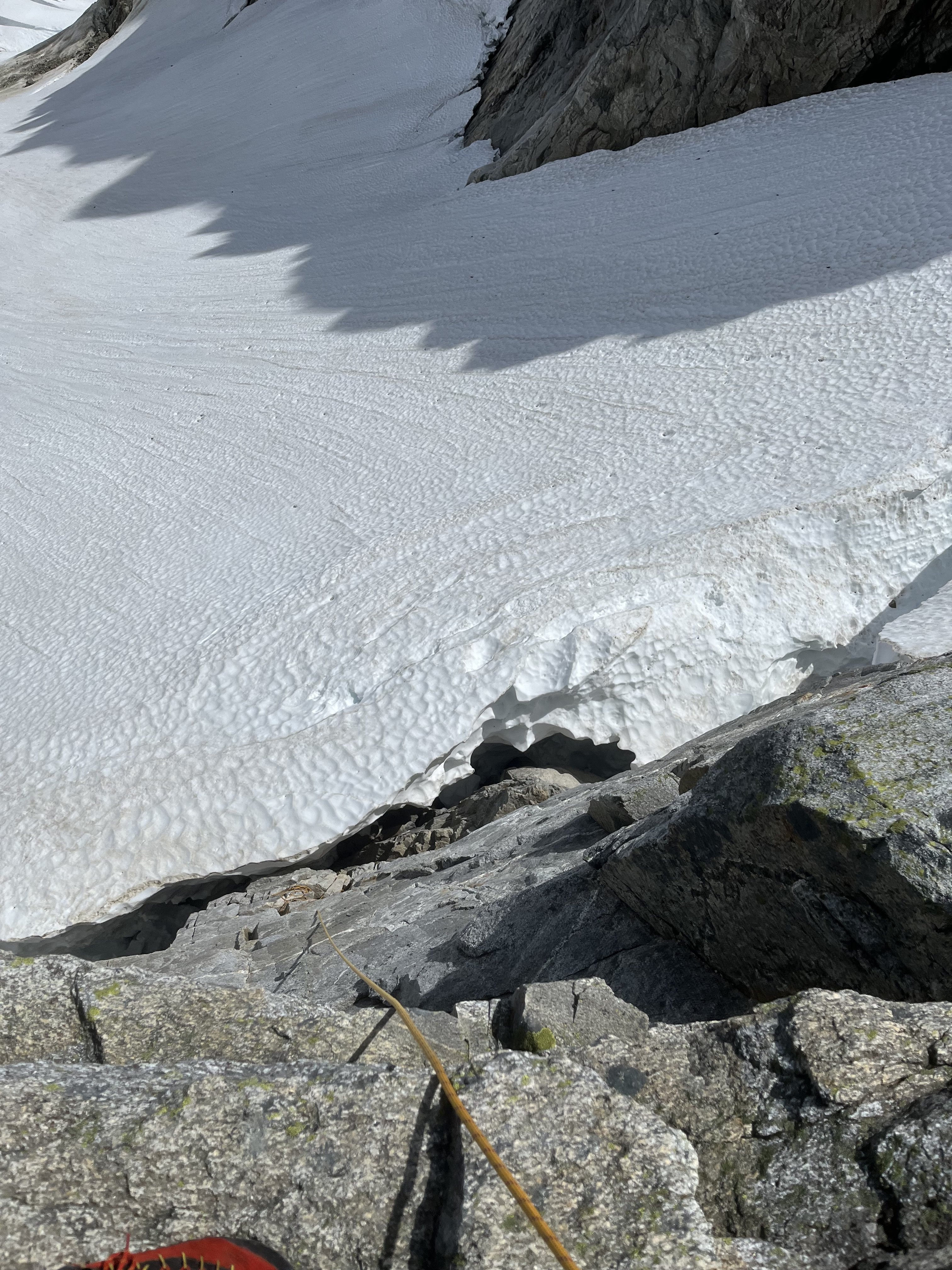 Last year at exactly the same time of year I downclimbed continuous snow down this couloir without even needing the first rap. And last year was a low snow year too. So I was pretty surprised at the state of the couloir. This workaround skiers left seems viable to me. Posting it here in case it helps anyone.
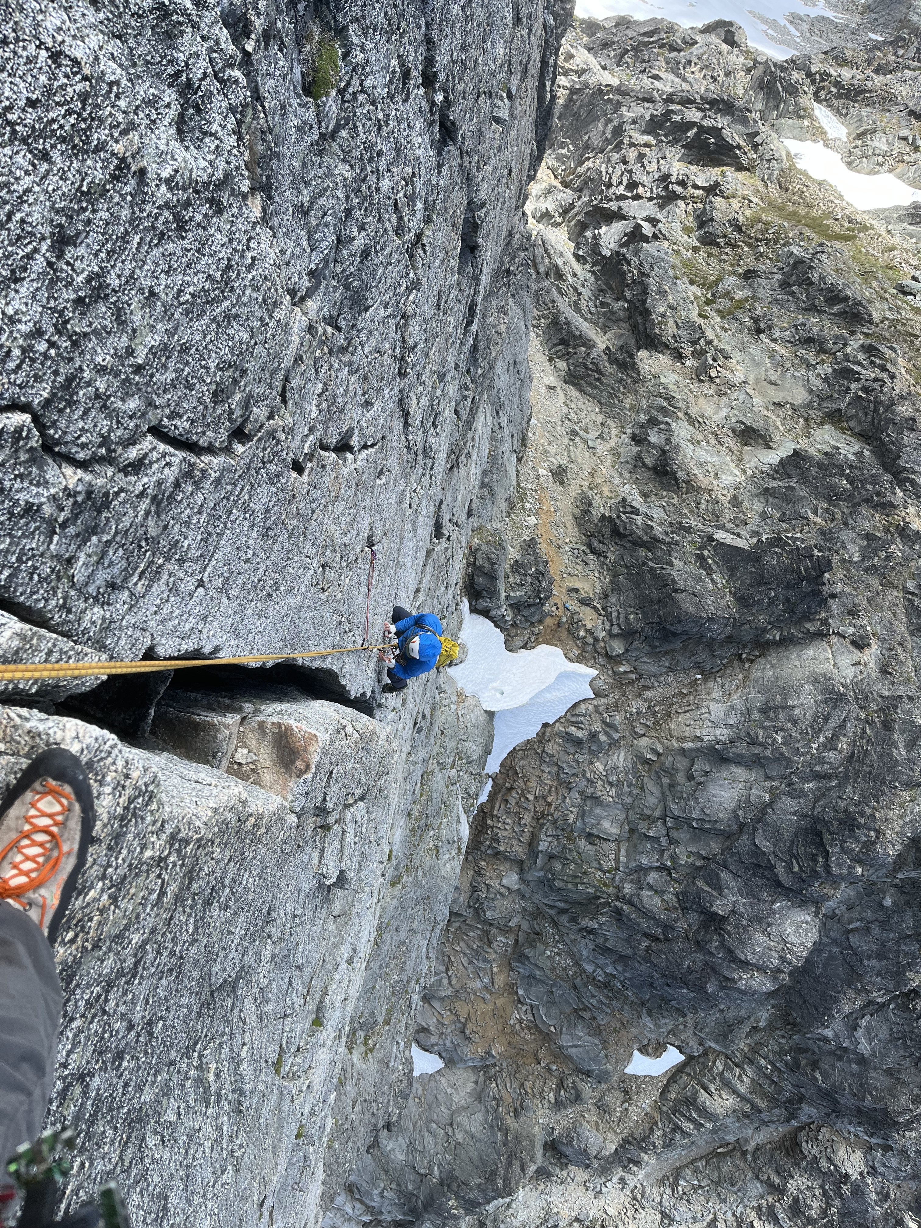
The false start and exploration ate up enough time that we decided to bail on our plans for the Stoddard route and head back up to climb WHC instead. My partner was bemused because he expected a crack climb
")
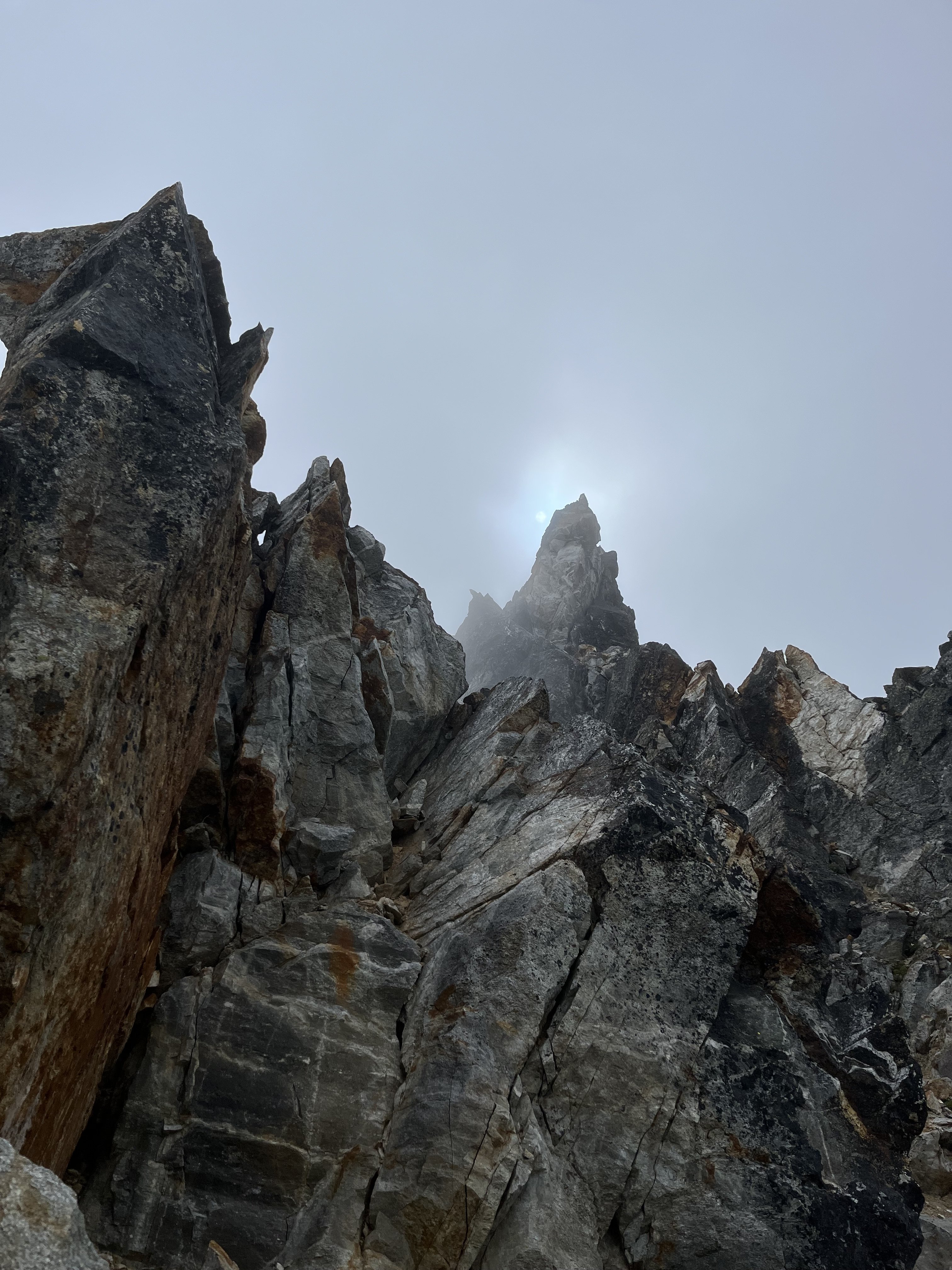
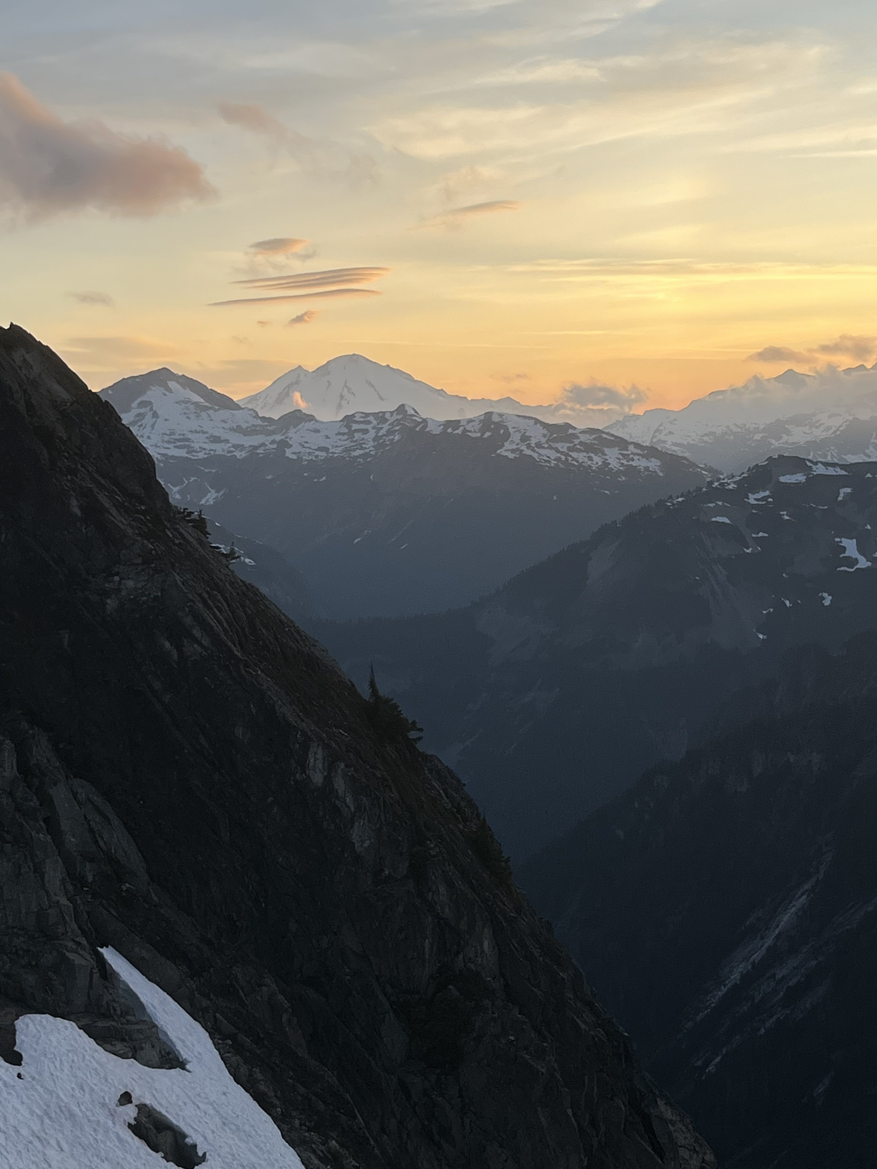
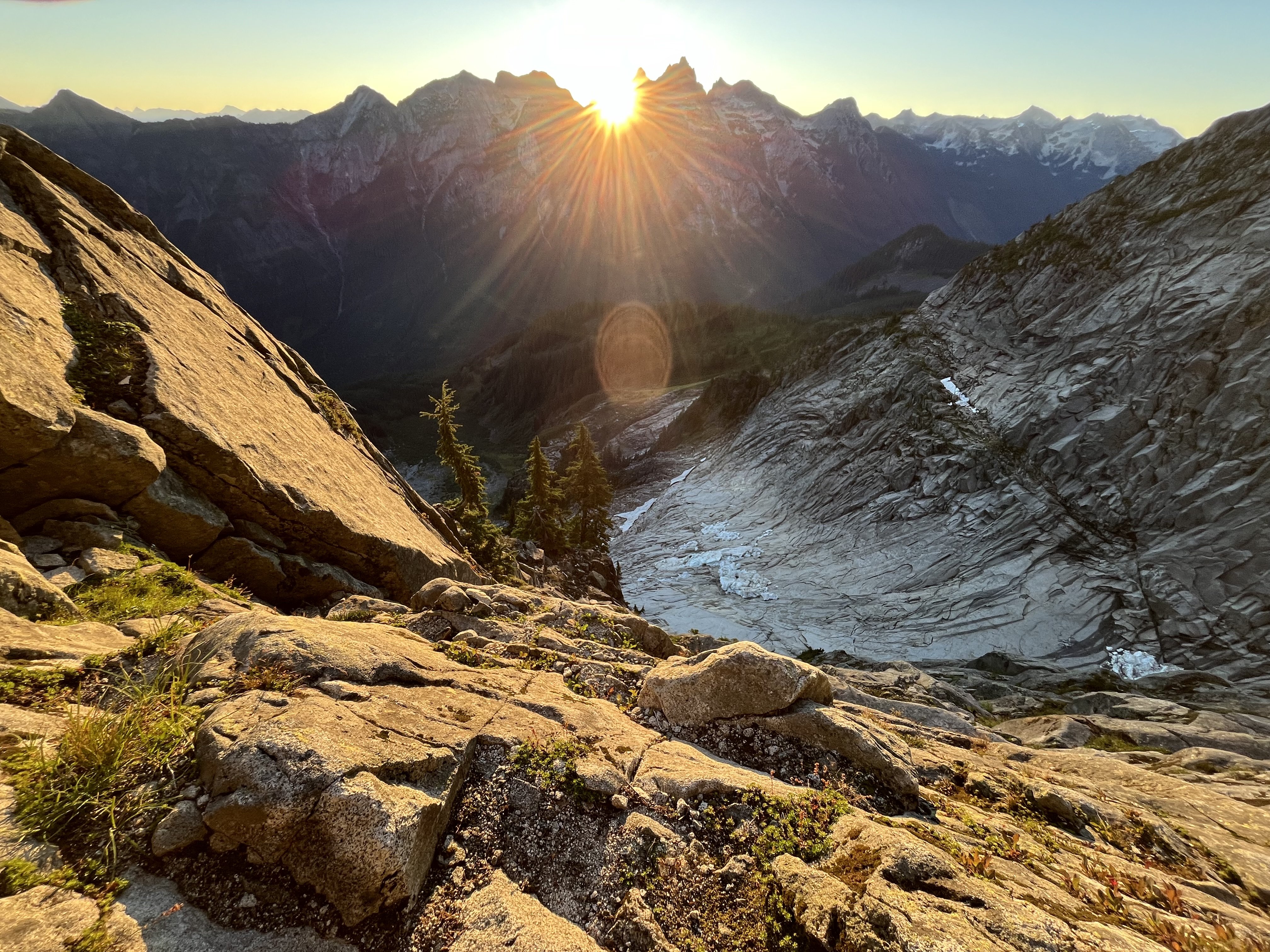
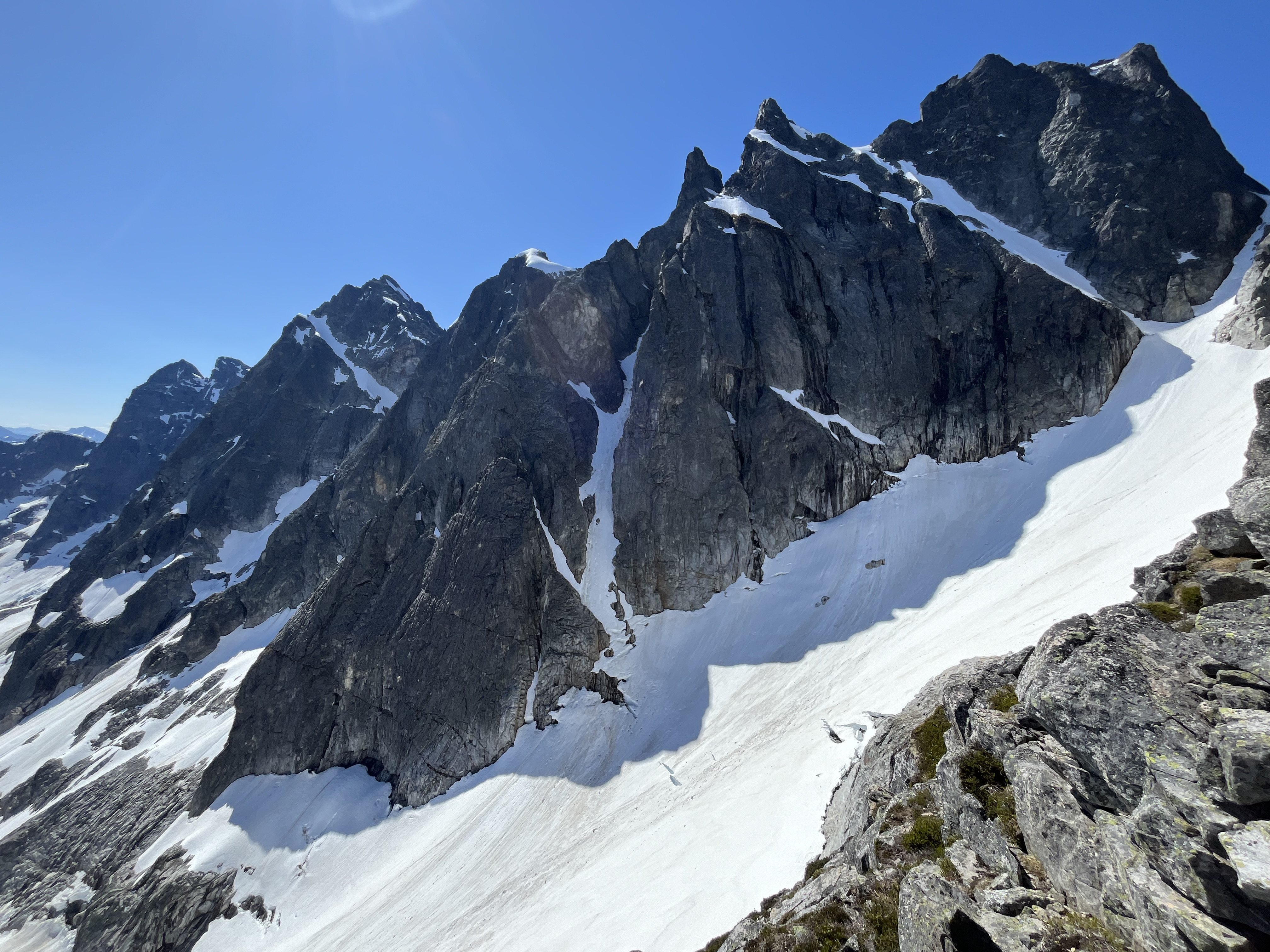
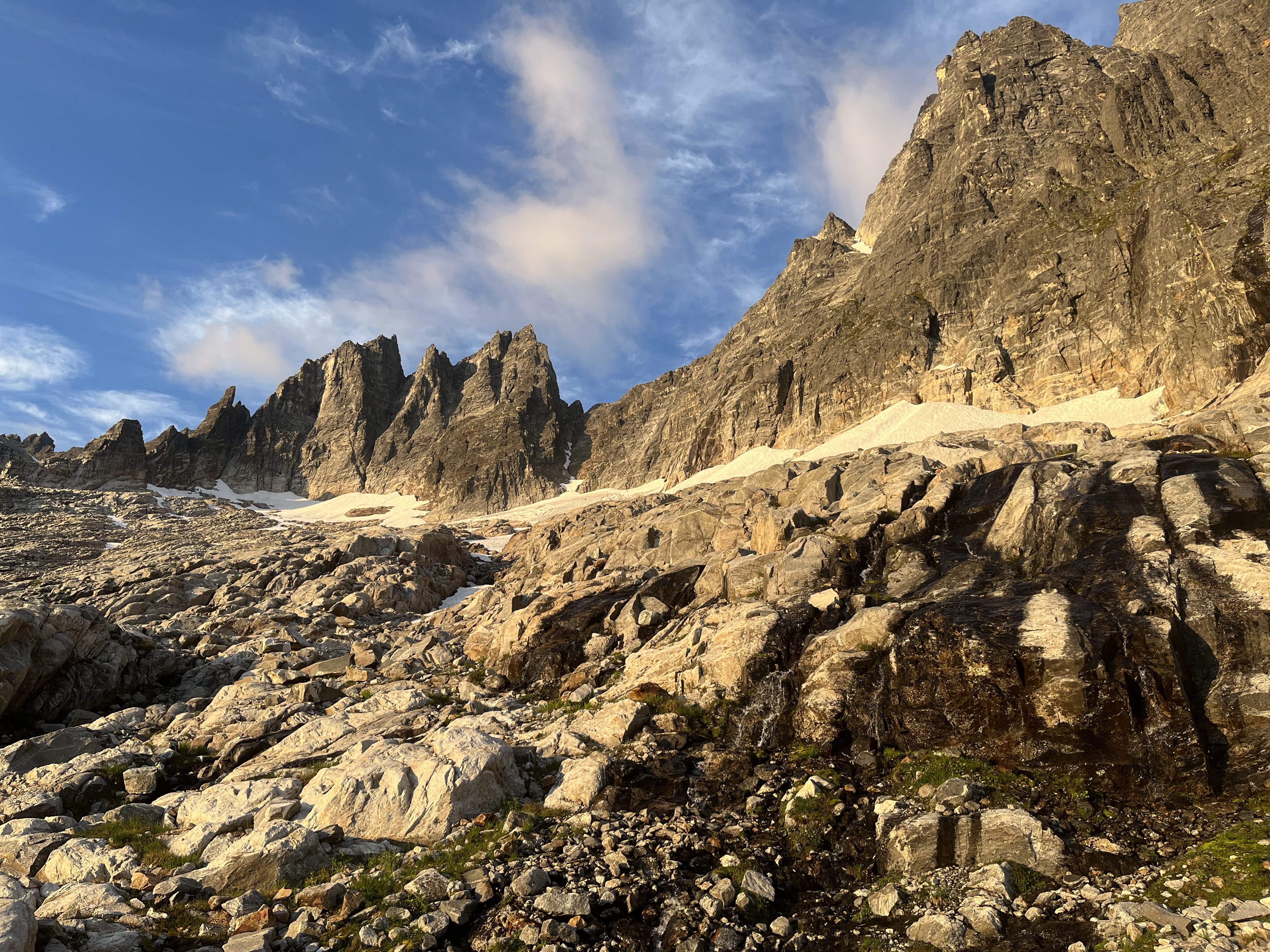
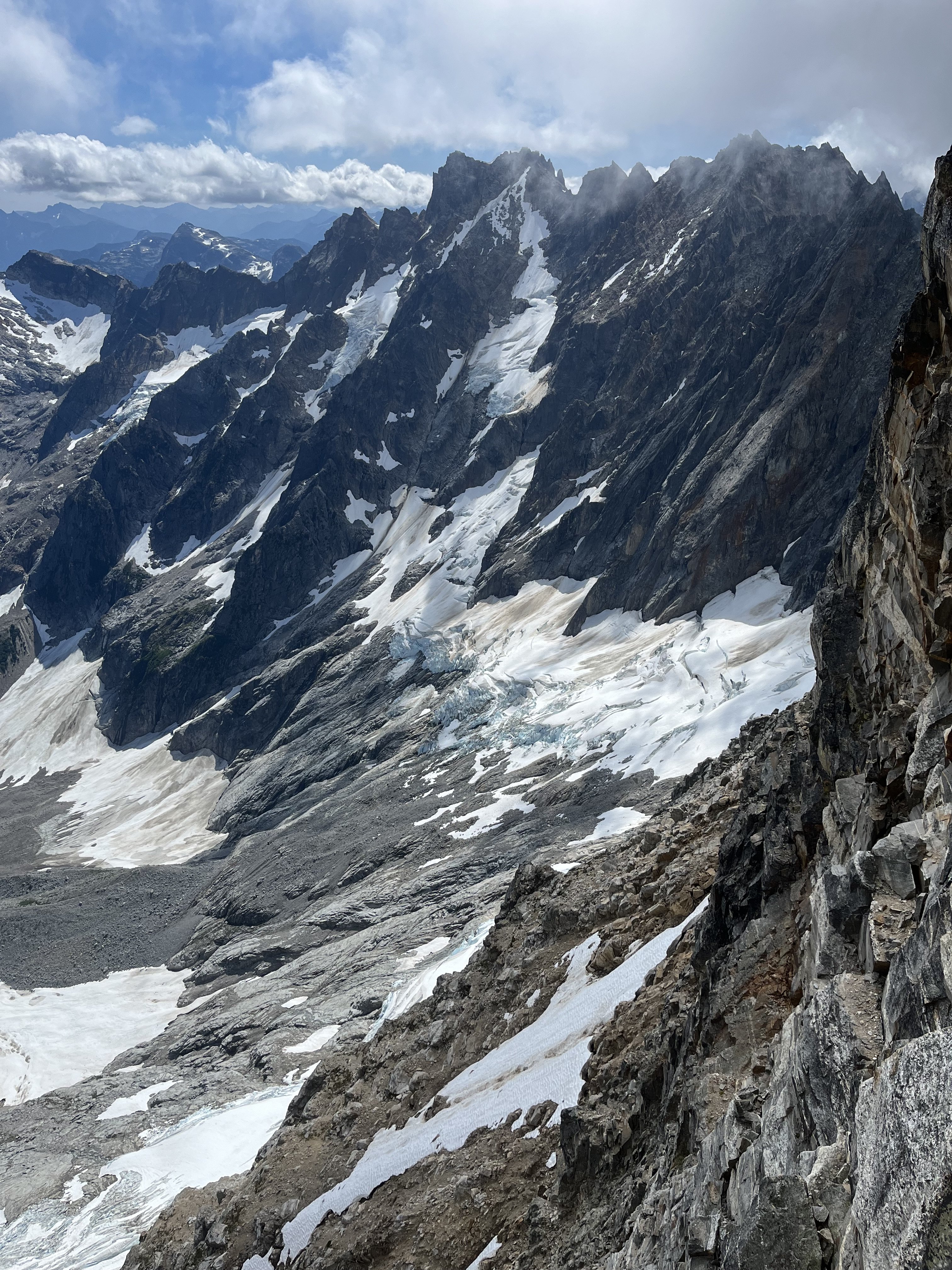
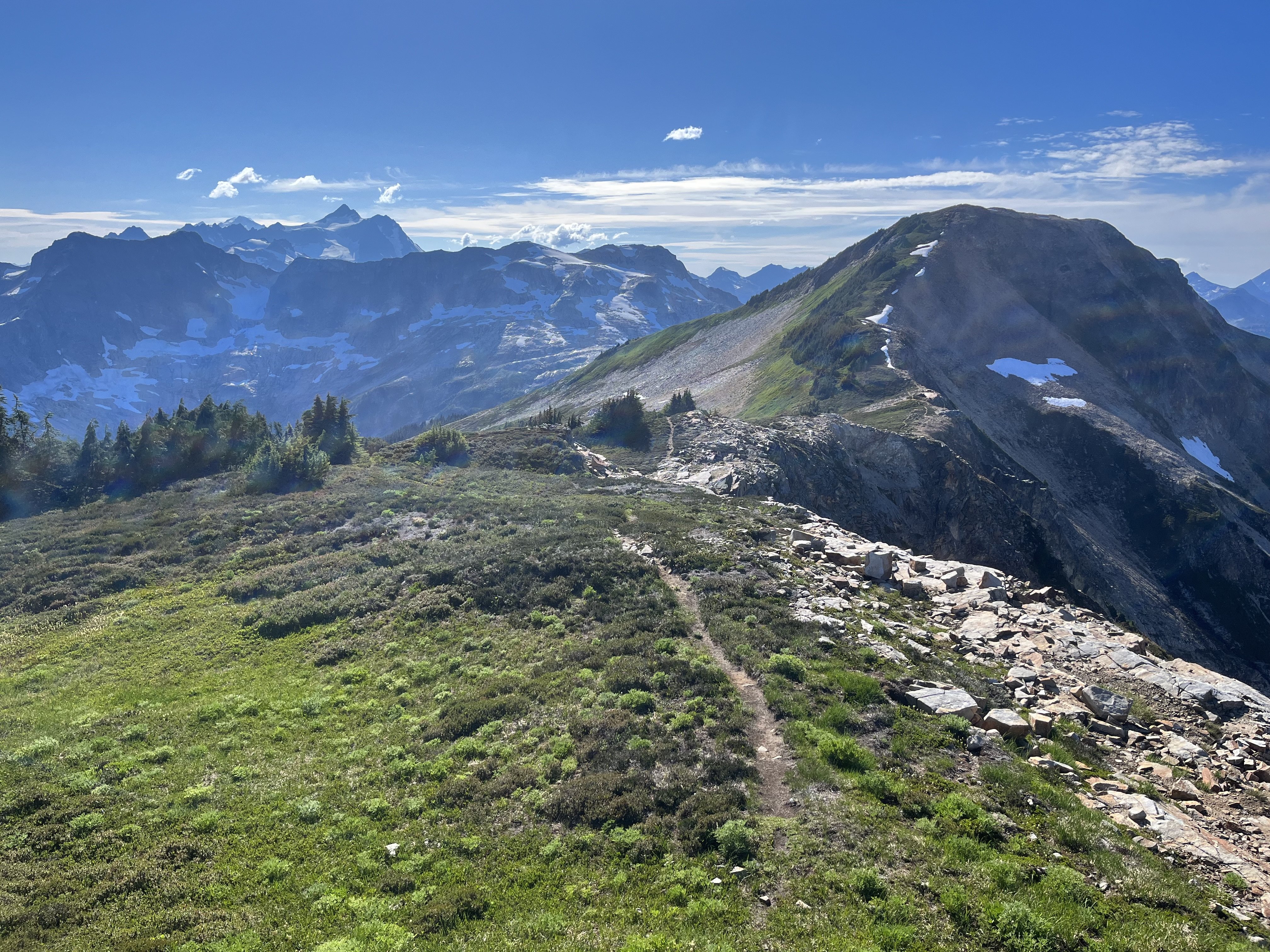
The day had started clear. On our way back down from O-H dark gray clouds moved in to block the ridge. I was glad we weren’t somewhere high on the north buttress of Terror.
Next day was quite socked in. We headed off for Degenhardt, accidentally heading up from the south before correcting course for our intended NW route from near Terror’s east col.
To gain the couloir there was short choke that steepened at the end to maybe 80 degree snow. We underestimated the angle from below. Odd, usually it’s the opposite. We were able to bypass this on slabs on our return.
The foreboding weather and lack of visibility gave the climb a serious feeling. As it gradually cleared on the way back the route started to feel easier.
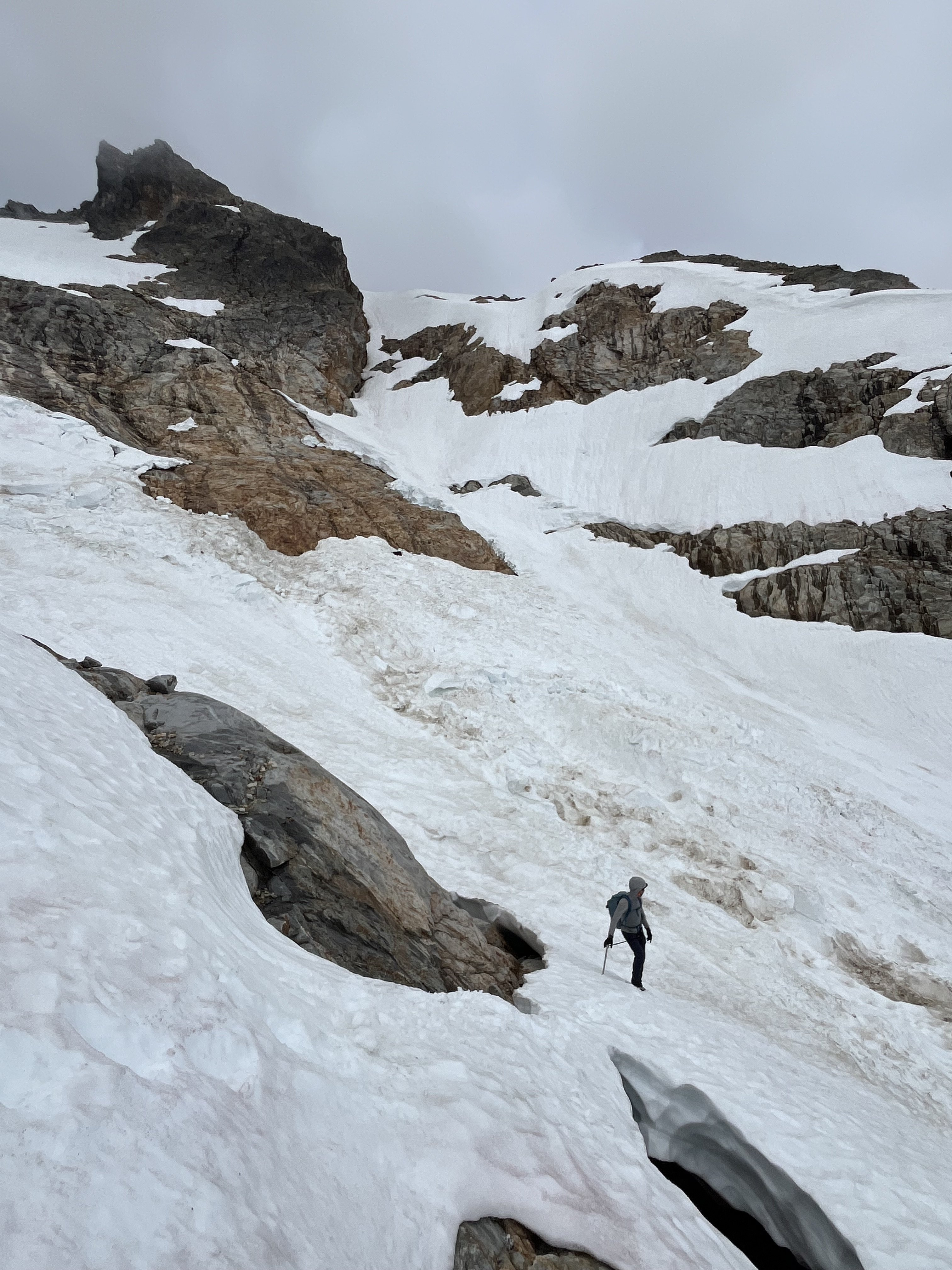
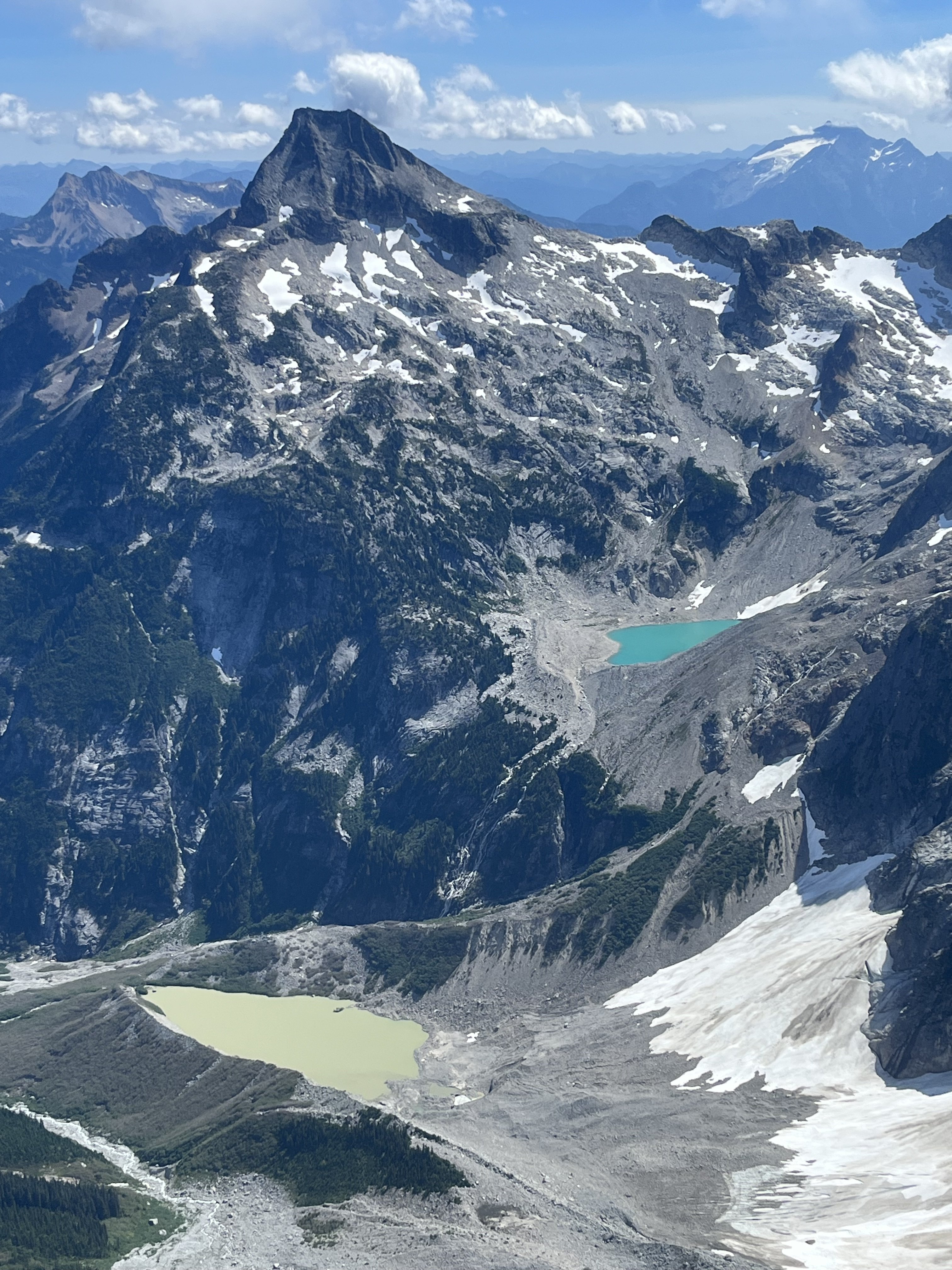
There is plenty of choss on Degenhardt but I recall the scramble being pretty fun. While extracting the summit register I dropped its pencil down some hole. Sorry.
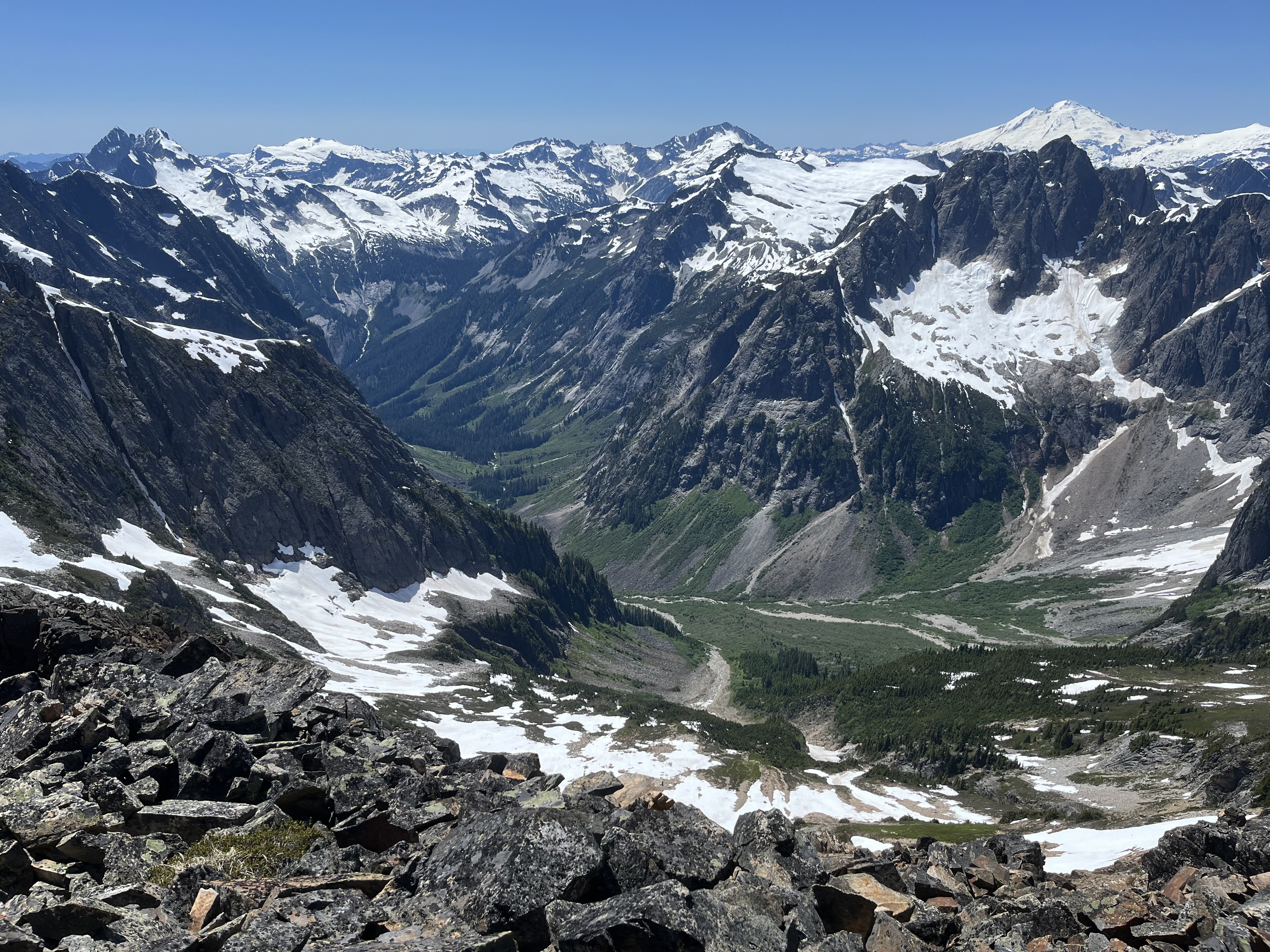
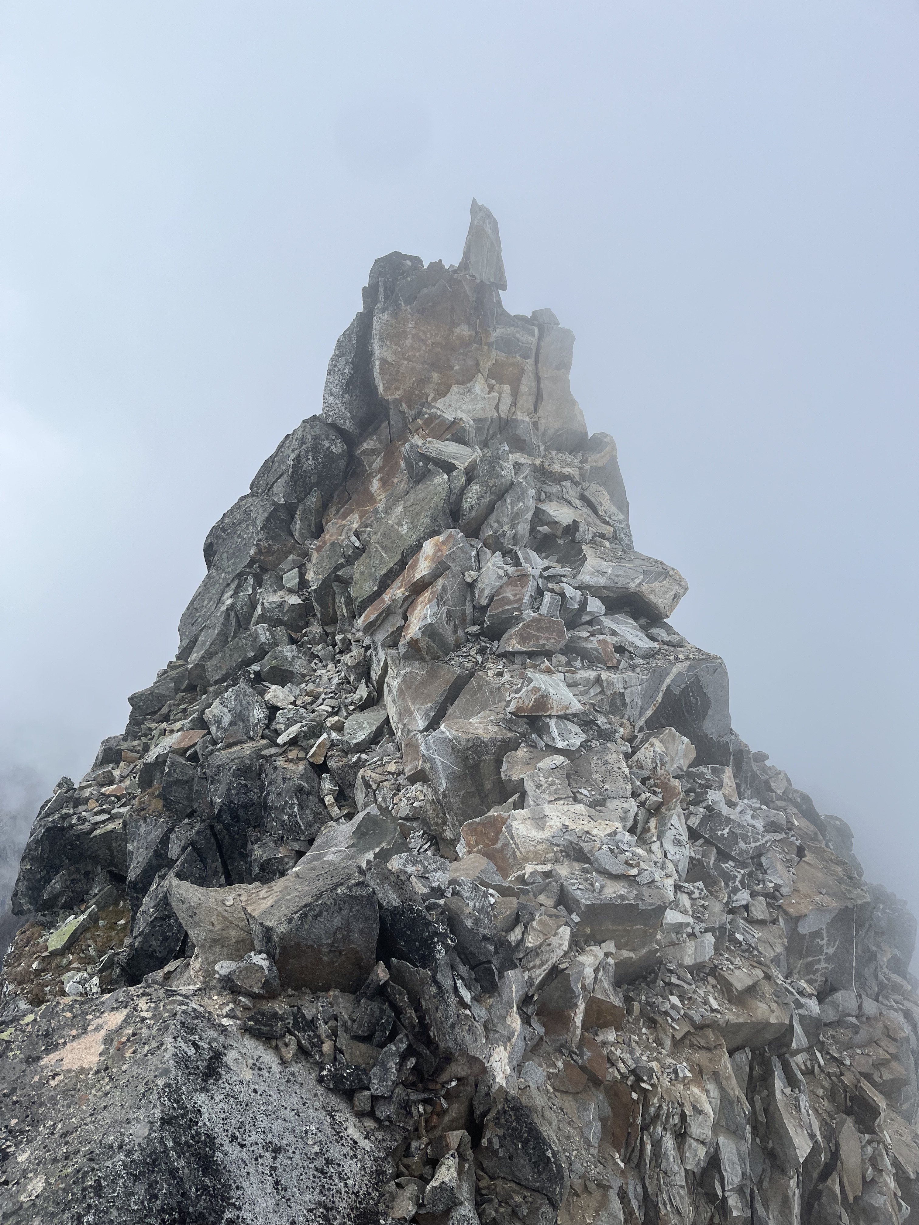
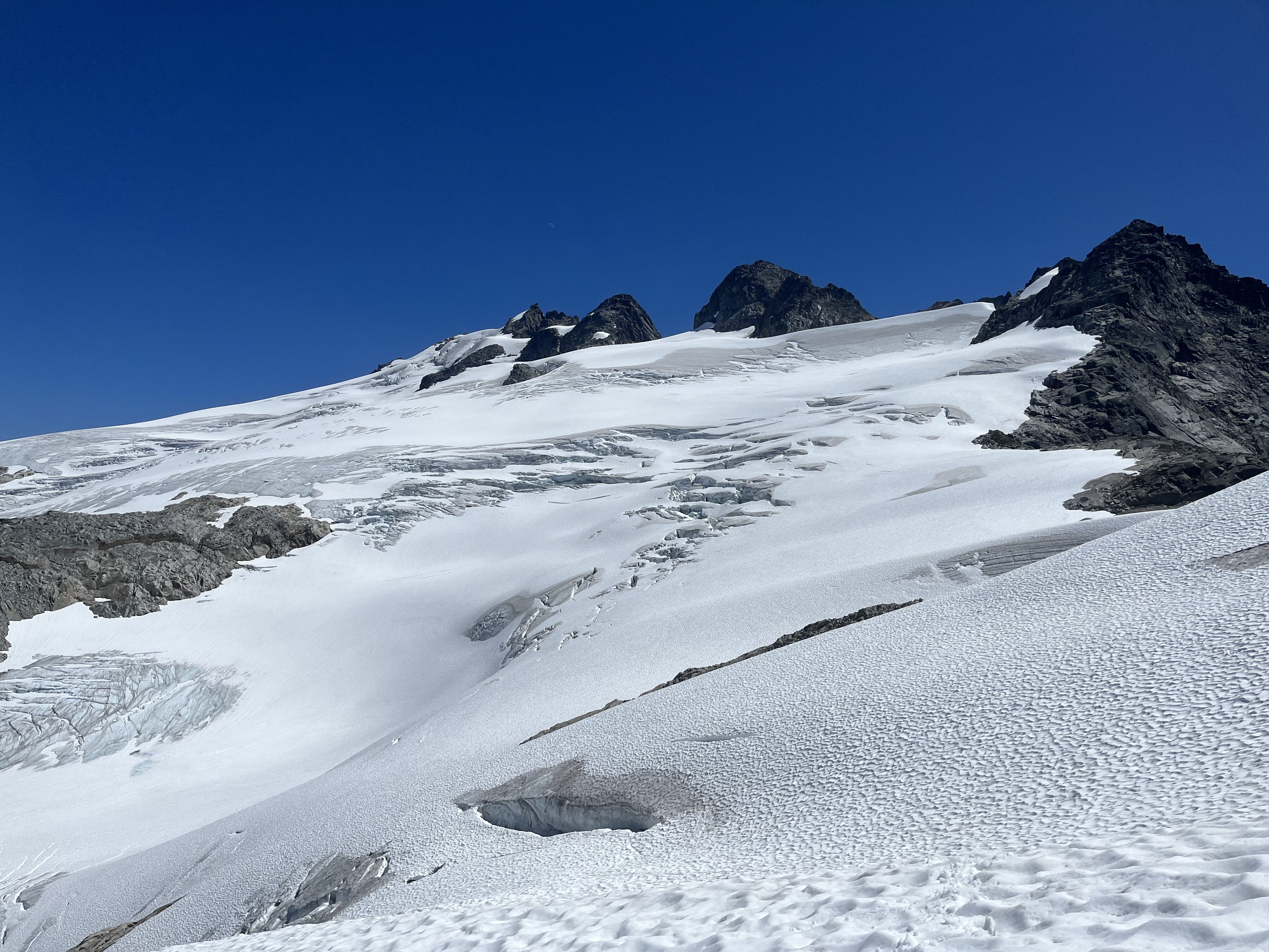
From there we groped our way slowly toward Pyramid. The route finding in the clouds was trickiest near Degenhardt. Was glad to carry ax/whippet all the way due to about ten steps through a narrow and steep snow couloir to get to Pyramid’s rock pyramid. We had peek a boo views into McMillan cirque but could see nothing at all to the east.
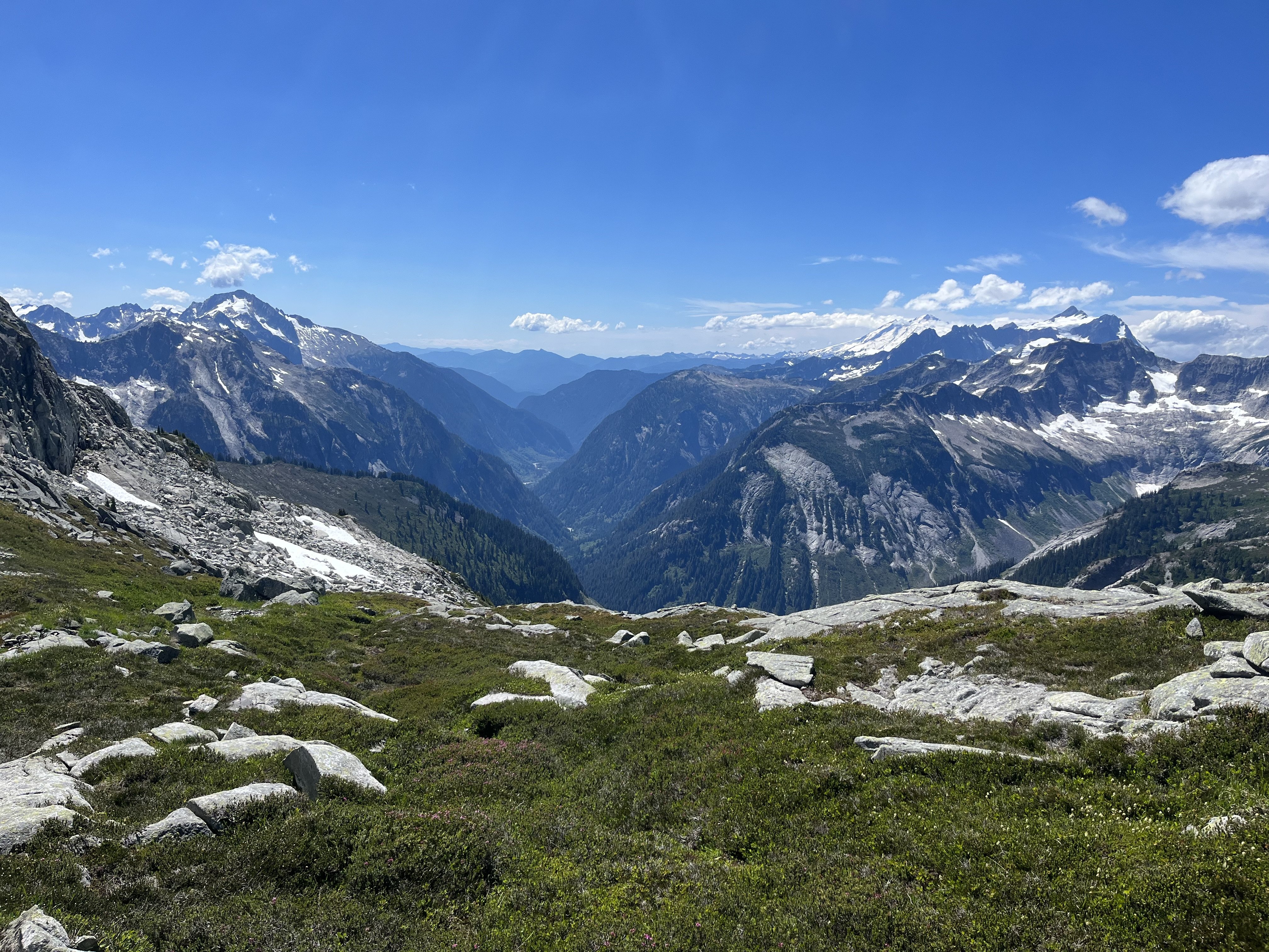
 By the time we passed back west of Degenhardt the clouds were lifting and it was a relief to see where we were going.
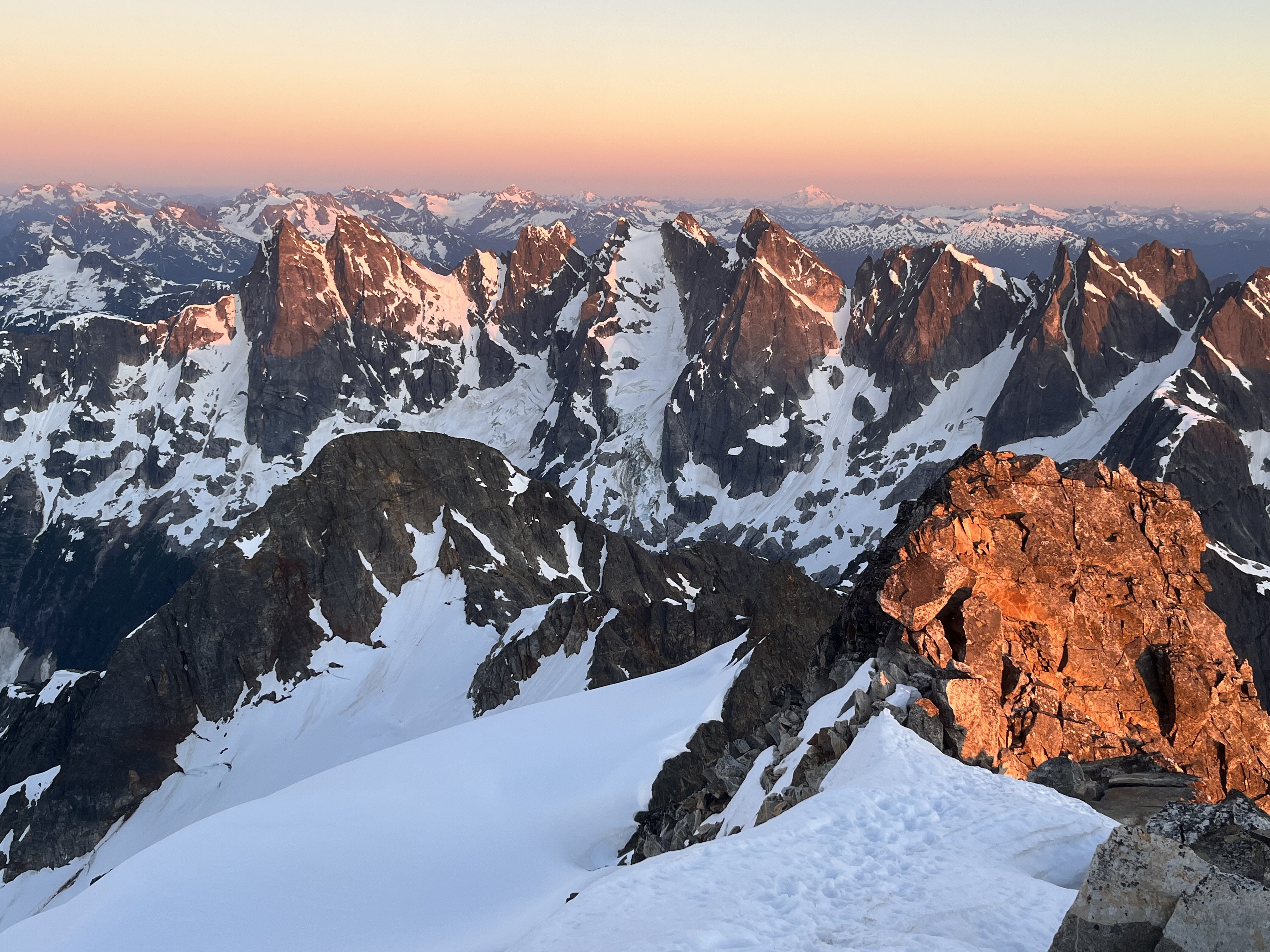
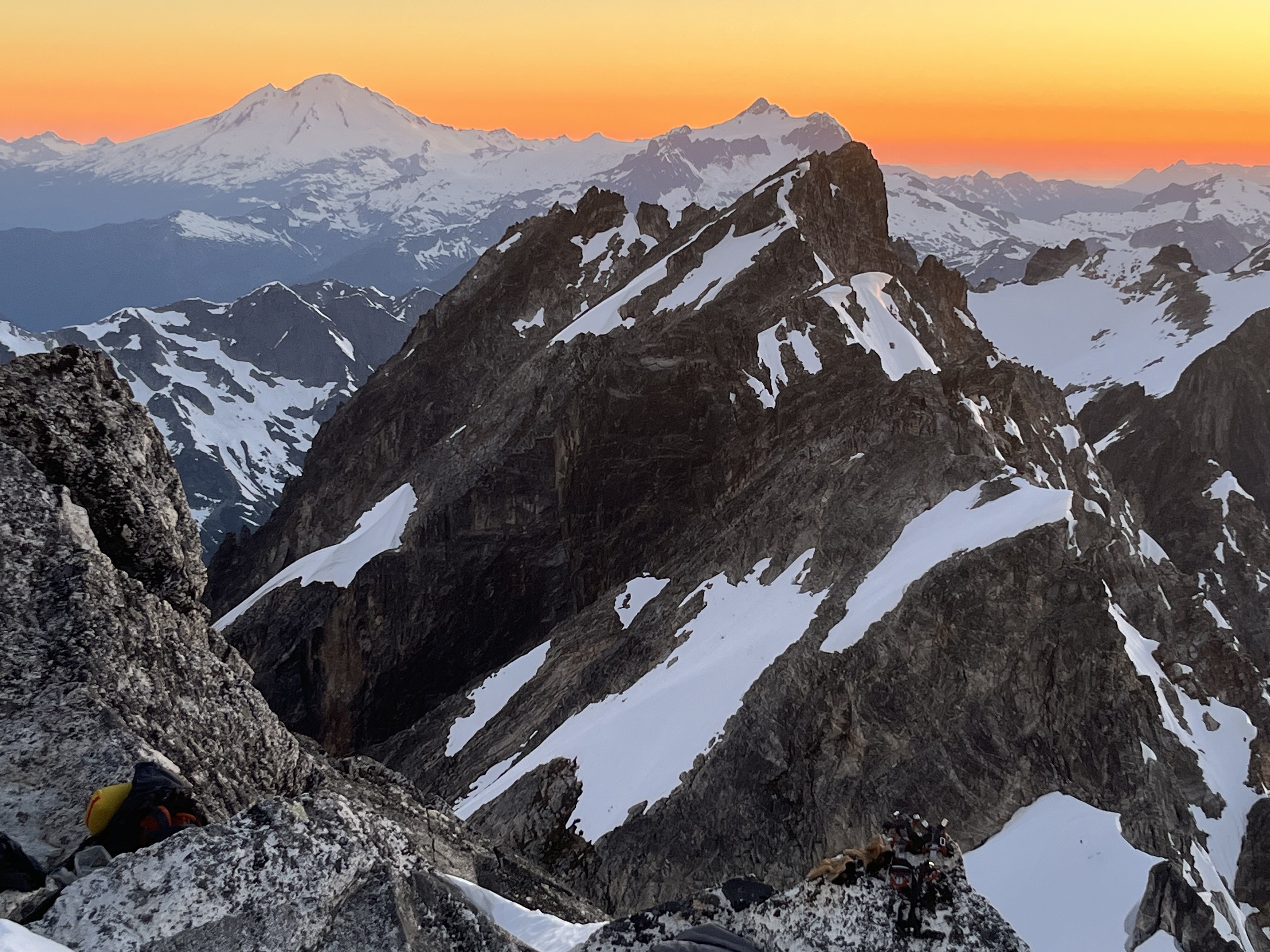
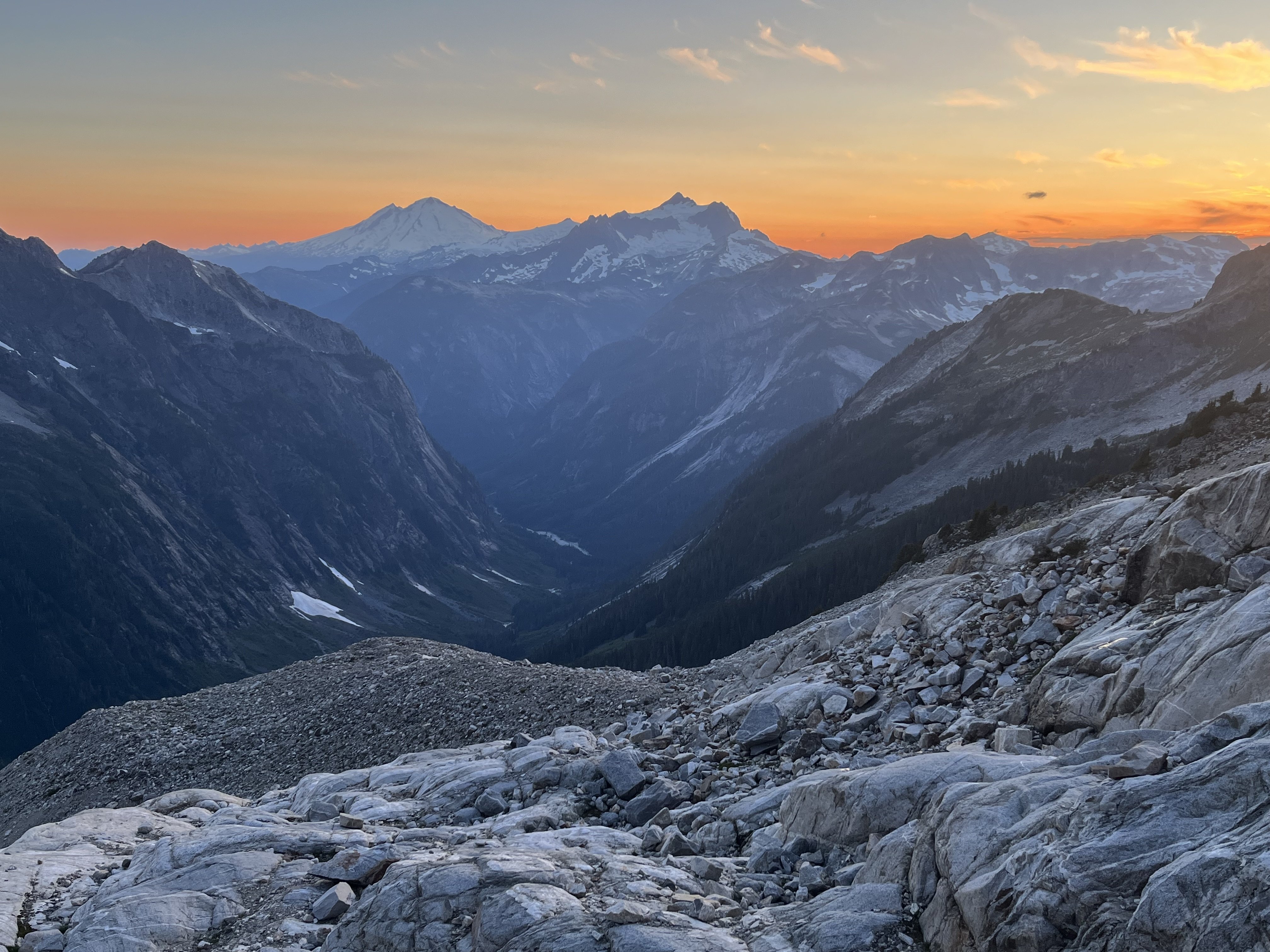
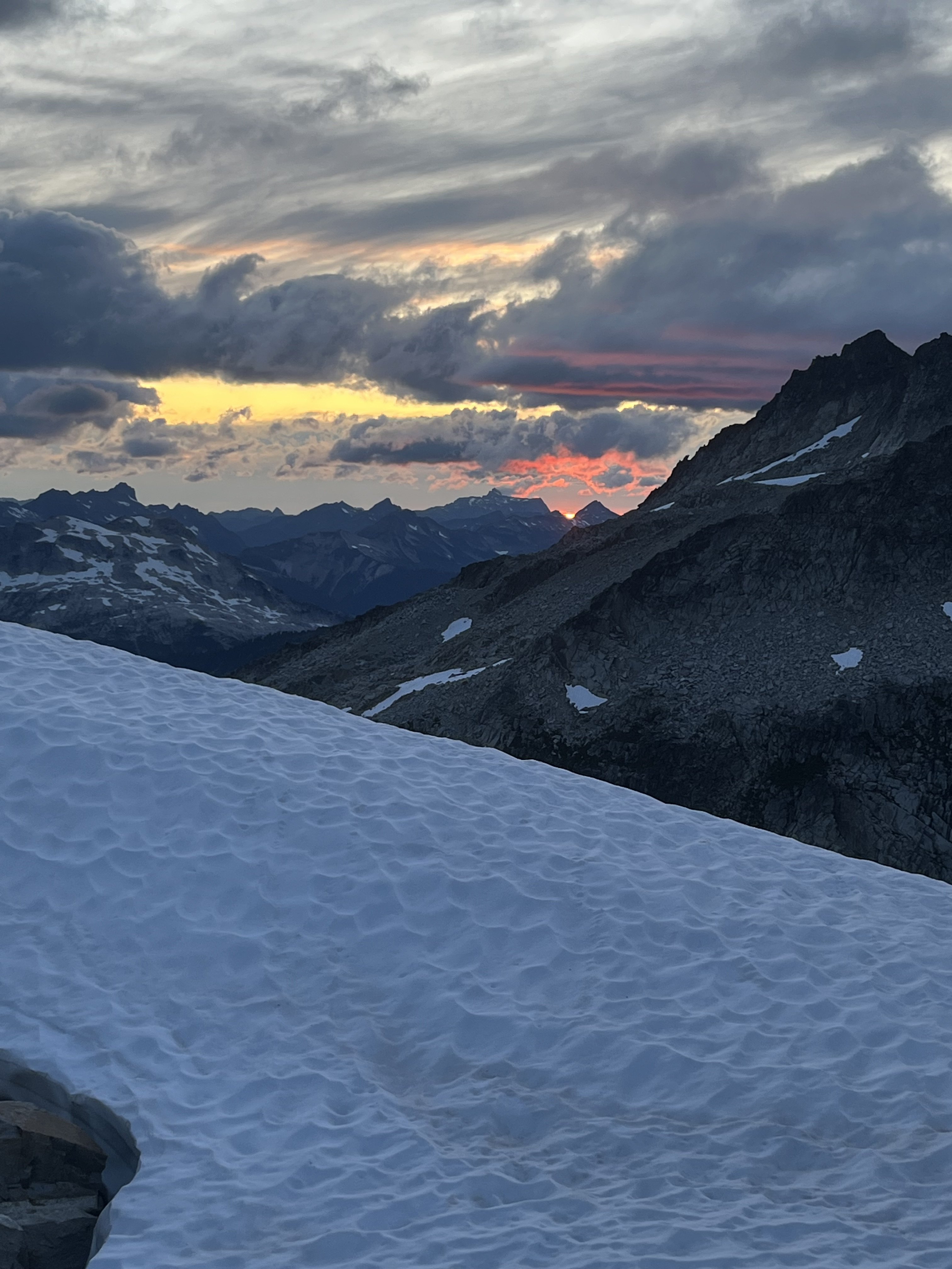
The weather kept improving and the sunset was a real mind melter. UFOs came out in force.
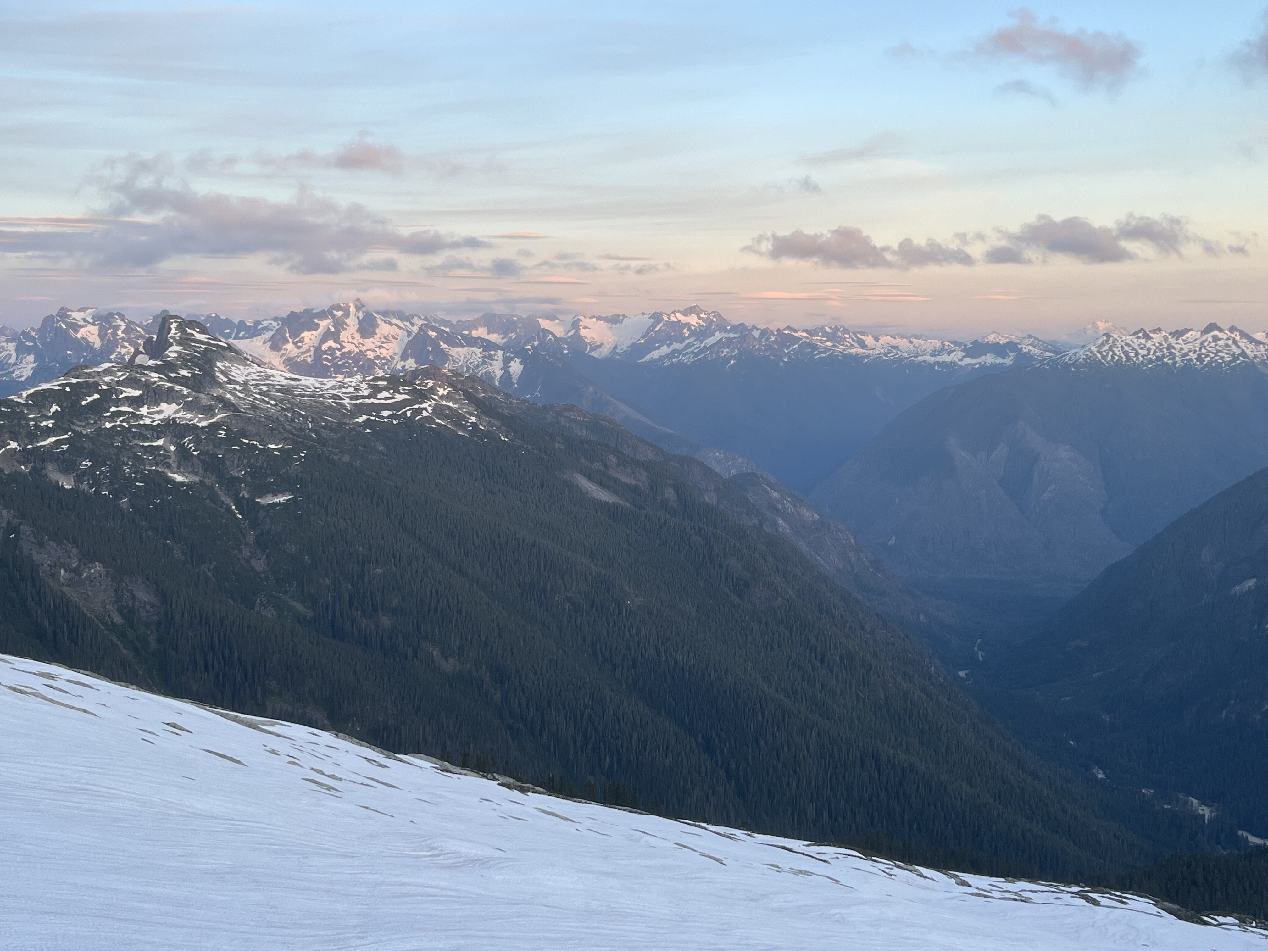
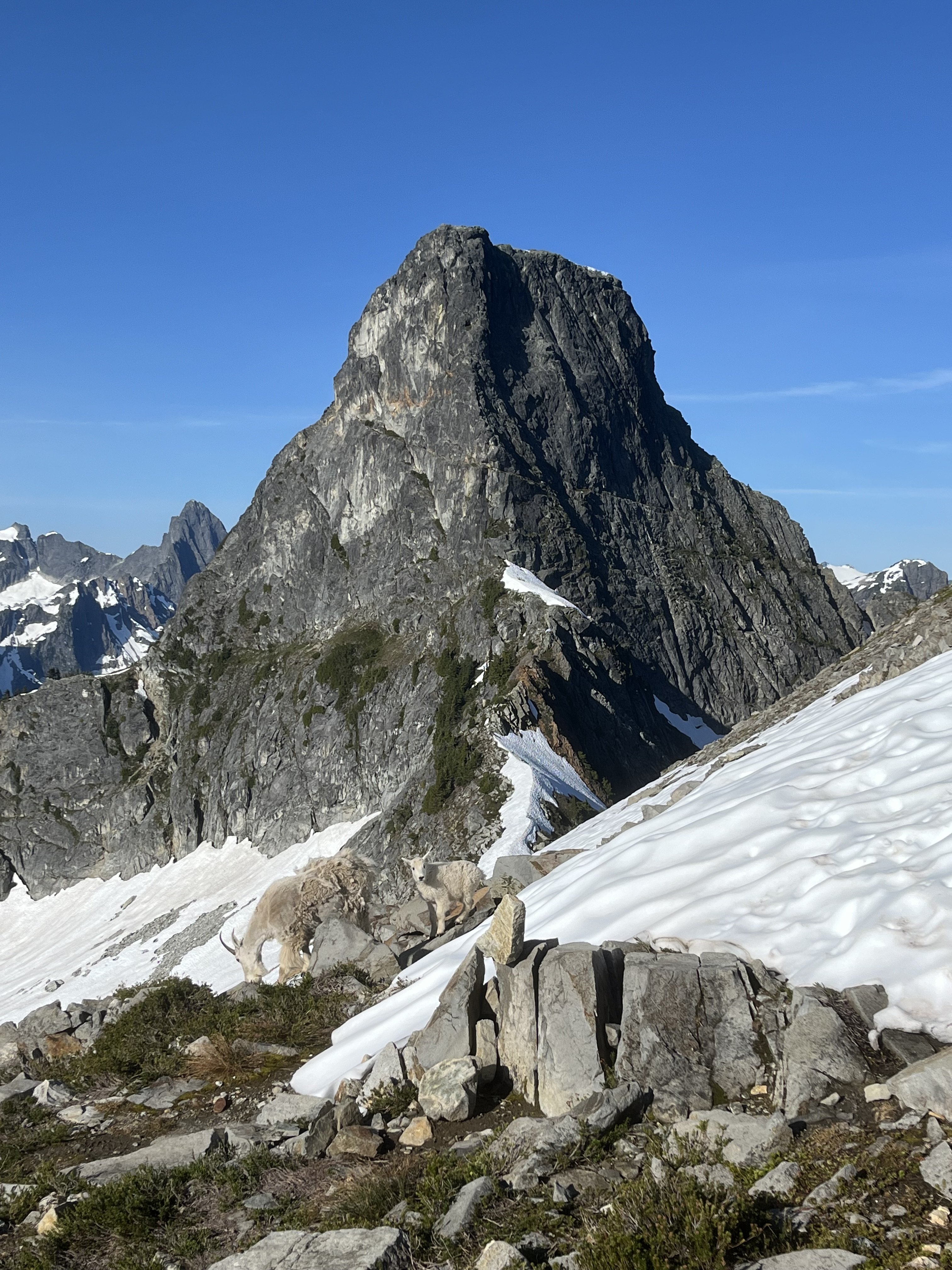
Next morning greeted us with more clear weather but having had our fill we bid adieu to the goats and our impeccable camp. After the bruising descent we enjoyed copious berries south of terror creek.
Gear Notes:
60m rope and light rack, crampons, ax or whippet
Approach Notes:
Goodell-
 3
3
-
 3
3
-
-
On 7/1/2025 at 4:56 PM, JasonG said:
Hmmmm....important distinction....let's see....I think the west side?
Yeah that west side looks real sketch
-
20 minutes ago, JasonG said:
maybe it was the massive/serac rockfall that strafed the approach while we watched
Yikes, yeah that would do it. I’m curious was that on the west or east side of the buttress?
-
Trip: East Fury - North Buttress
Trip Date: 06/29/2025
Trip Report:In the couloir leading to the buttress from its east side, the drawbridge is up.
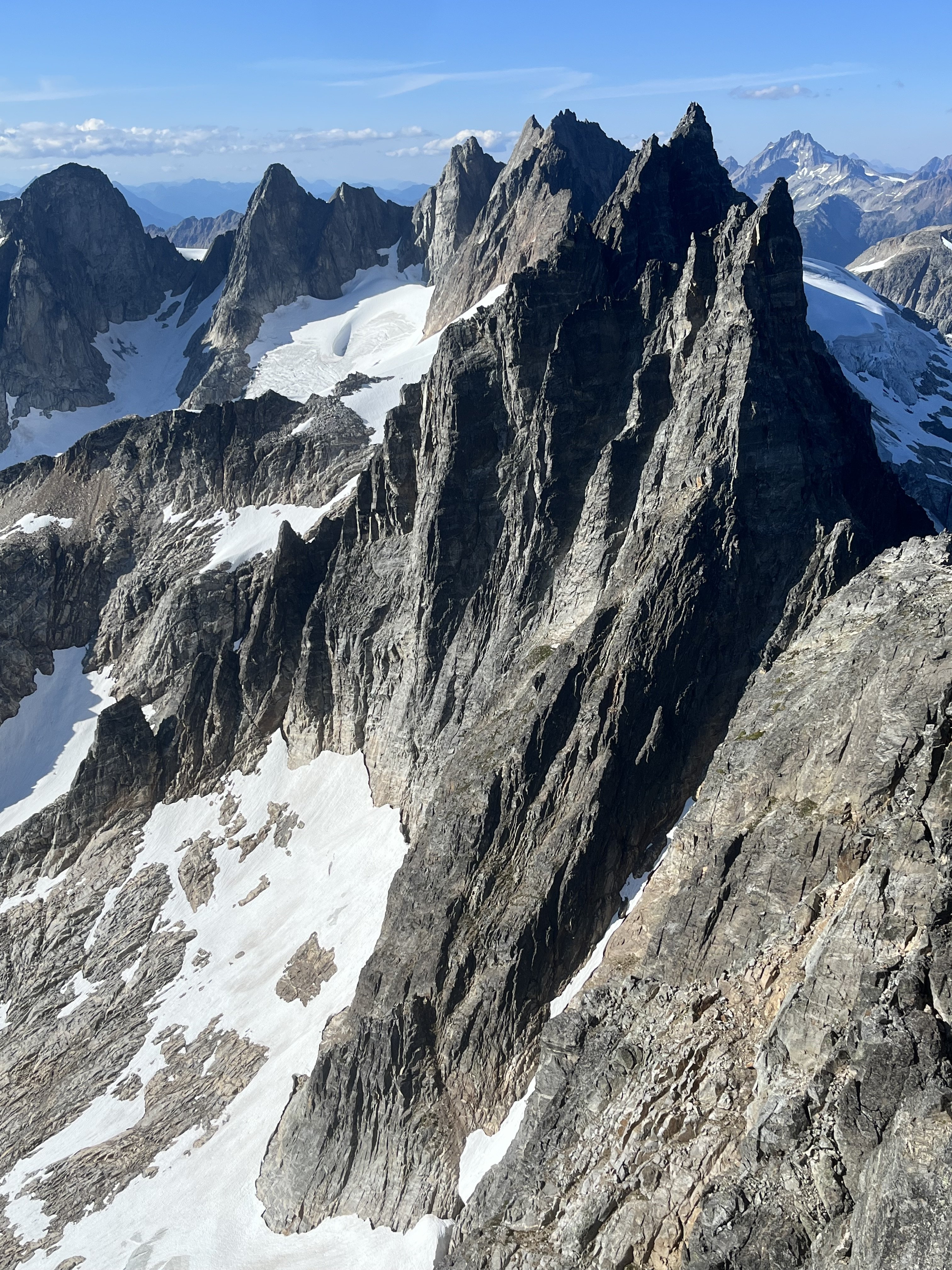
It’s hard to think of a route in the cascades that I haven’t climbed that I was more excited to try. From Luna col the position of upper snow arete looks insane. And the photos in this 2017 report don’t hurt: https://cascadeclimbers.com/forum/topic/100747-tr-mt-fury-north-buttress-6232017/?tab=comments I was lucky to find a partner inspired enough to take a day off and put in the considerable effort to get out there and check it out.

Saturday was a little cloudy and not too hot, which kept things relatively smooth on our way from big beaver to Luna Col. Even though I’d seen it before, the first sight of the northern faces of the southern pickets that rewards the grind up to -6400 was literally breathtaking.

 I let out a little pious whoa. The last mile or so took approximately forever but we arrived well before dark, 11.5 hours after drop off.


A ghost set up our tent.

From the col the couloir didn’t look too promising but wasn’t obviously impossible so we proceeded to go for it the next morning, leaving camp at 5am (4:30 might have been better). As in the trip report from 2017, we trended left on the descent to Luna lake, which worked well.

From the lake we traversed W and SW, bottoming out around 4500’. At this point we could see the snow was not continuous in this first couloir and quite a bit lower, maybe 15-20 feet, than in the 2017 reference photo.

We found a ~5.0 exit onto slabby rock and got up to easier ground.


Continuing up we traversed as quickly as possible across the exposed face to the entrance of the main couloir. From below it still looked worth trying.


But only about 200’ up it we encountered a hidden moat spanning wall to wall, just above where I am in this photo.

It was tall and unnervingly hollowed out. Questing up and left on the rock for a bypass was fruitless. I found steep slabs without much pro. And transitioning from boots and crampons to rock shoes while exiting a tenuous snow location onto a narrow rock stance turns out to be very awkward. At 30m I ran out of rope (folded 60m half), placed a piece and down climbed on top rope back to the snow. We down climbed the steep snow back out the couloir.

 About to down climb to the first couloir.

Looking up on our return to Luna lake I thought, hmm, we came down that? It looks improbably steep but is actually reasonable.

All throughout the cirque there was surprisingly little activity given how warm the day was.

At camp 12 hours after we left the evening was unpleasantly hot and buggy and I impatiently awaited the reprieve of dusk. In the meantime there was some helicopter activity near Outrigger. I hope everyone involved is all right.

The heat was considerable already at 7am the next morning when we began our descent. I used crampons but there really was no hard snow to be found.


We took a long break at the stream by Luna camp and it seemed then that we’d make our 5pm taxi in plenty of time.
One small delay occurred when we saw two bear cubs climbing to the top of a tree right off of the trail. Mama wasn’t making herself seen or heard, so we backed up a little, made a bunch of noise and gave them a few minutes to clear out. We didn’t see the cubs again and did see the mother a little bit off trail, not acting aggressively.
 Checking the time.
As the afternoon miles went by we realized that we were slipping behind and had to really push to get there right at 5pm.
The driver was very nice and encouraged us to take the time to cool off in the lake.
I don’t know if I have it in me to try this route again but if I did it would have to be possibly even earlier in the calendar, and in a year with above average snow pack come June. The west side alternative doesn’t appeal much to me, the photos from Steph Abegg make it look like overhead exposure would last a lot longer than it does while traversing in from the east.
Gear Notes:
Crampons, ax, whippet, 60m half rope, single picket, light rack and some bail gear
Approach Notes:
Big beaver to Luna col to Luna lake-
2
-
 2
2
-
2
-
-
Nice! I had hoped to do these peaks on skis this year but couldn’t get there in time. Was Klawatti already not skiable?
Too bad about the mush and crevasses, that transition between Klawatti and N Klawatti glaciers looks like it must be the crux.
-
When I was there in early July of last year I took #1 from Fury to Luna. It is briefly on the glacier. Crossed a rib at 6600’, bottoming out at 6400’ before reascending to the pass that rejoins the ridge line at 7000’. Was a bit steep and slippery crossing the rib. Think I’ve seen gpx that cross the rib a little lower.
@tanstaafl might be able to comment on route #2
-
Impressive climbing, super impressive logistics, congratulations on completing the crux!
-
2
-
-
-
Wonderful TR! Sounds like a really enjoyable trip.
-
1
-
-
Ooh real purdy.
-
Haven’t seen many TRs here for this route in the last few years, so I’ll chip in.
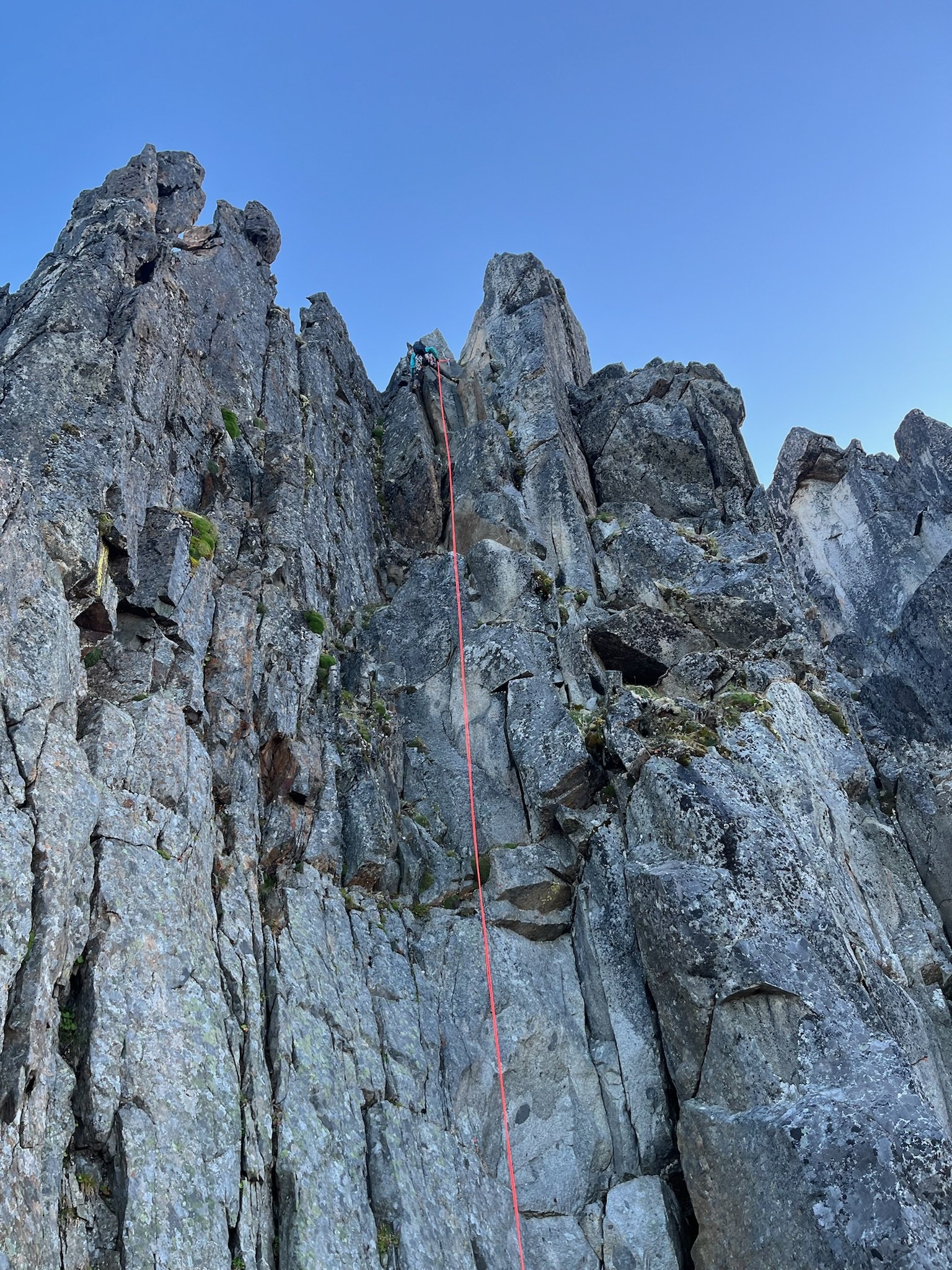
Hitting the trail at 3am worked well for us (after heading down the spur to nowhere for a few minutes before correcting course). This time of year that meant arriving at the propeller cairn just in time for the darkness to begin lifting for the scramble down to the slabs. We filled up before that scramble (4L for my partner, 3.5L for me) but could have done so a little later. There was plenty flowing from ice blocks on the shelf at the end of the slabs right before you gain the ridge. We also ended up finishing the technical part of the day just before dark.
Along with all the water and a little extra food we had enough stuff to ride out a bivy if needed, but intended on a c2c. We planned to simul most of the route but ended up pitching out almost all but the section of 4th above the largest bivy ledge. Including that simul block I think it was 14 pitches for us: 3 to the notch where we opted for the bypass, 3 along the bypass, 1 to gain the bivy ledge, 1 simul on the 4th class stretch, and 6 pitches up the final headwall to the summit. From where we began pitching it out it took 9.5 hours to the summit. It had rained a lot (maybe even snowed according to some forecasts) two day prior. Before the climb I had worried about this but it wasn’t terrible. It was slick enough in spots to discourage us from simuling, especially in the mossy bypass section.
The climbing on this route is super fun. The rock quality is never great, but it’s usually plenty good. Finger locks and hand jams galore, interspersed with interesting face climbing too. In some of the dirtier sections there are little solid rock islands (often polished white) in the choss that lead the way, keeping the difficulty lower than you’d expect from a glance. We each had a couple minor slips on wet sections but no holds broke the entire climb.
We roped up at around 5900’, expecting to simul. But my partner led into a tricky traverse so we pitched this one out to a ledge. From there, slabby moves to the left looked just a little too committing and devoid of pro, and I found a fun blocky way to the right, stopping at a slung tree. From here my partner led us to the junction with the bypass (there might have been a little simuling on that pitch).
After one lead in the mossy damp bypass my partner declared his distaste for it and so I led two more pitches to join back to the crest (the second of which was 4th class, I didn’t bother with pro). At this point our beta mentioned a 5.8 layback, but I didn’t see any reason to climb it that way. It was more like 5.7 with fist on right and stemming and positive holds on left. The only real difficulty was some wet rock, but the feet were secure so it was good.
Almost new moon shot, zoom in. Somewhere in the bypass section.
The big bivy ledge was one of only two times we were in the sun during the ascent, aside from the first couple pitches gaining the ridge. I led up the fun scramble to the next sunny bivy ledge, below the final headwall. It seemed like our pace was reasonable enough to this point, but the summit looked quite a ways off from here.
Just left of the crest a left facing corner fist crack on granite looked like an inviting start but the beta described starting right of the crest so that’s what we did instead.
 Starting up the final headwall.
Rock was generally good going up the headwall, with lots of finger, hand, and face climbing as mentioned earlier. I took the second pitch. My partner led the third pitch (5.9) which was the crux and the best climbing on the route. As an extra bonus, the crux was the wettest spot on the route. Fun traverse right on steep rock that looks harder than it is. I led the fourth pitch, which might have been runner up funnest climbing. There was a delicate traverse through some of the more obviously loose choss on the route near the end of the pitch. The view from the top of this one down the ridge is pretty wild.
Another party was finishing the 4th class section at this time but I didn’t see them again. Climbing on a Thursday worked great. No one else was at the trailhead when we arrived Wednesday night. My partner said there were two parties of 2 behind us. I imagine today (Saturday) it’s a lot more crowded.
From here it was probably 5.6 maybe 5.7 to the summit. We could have simuled but were in the rhythm of swapping so kept that going for two more to the summit. Didn’t check out the final bypass to the left. Staying on the crest was fun and easy, I’d recommend it. The rock suddenly transitioned back to clean granite just before the summit, icing on the cake.
Amid a big insect orgy on the summit we briefly savored the views of Jack’s Nohokomeen, Luna, Challenger and Shuksan. Baker, Larrabee, and the border peaks kept us company as we descended by a crazy prominent tower.
Above a classic obvious gully I saw a trail heading down a slope and mindlessly charged toward it. Fortunately I lost only 200’ vertical before realizing this was the wrong way (carryover). Back up to the correct notch we did more traversing over variable terrain as the climb we just completed came in and out of view.
The descent is really long and I wasn’t up to speed on the rockfall induced changes to the standard descent. Fortunately my partner had paid more attention in his research. After a couple of raps to Crossover pass he corrected me after I blew past the start of the crack of noon descent. There was yellow flagging marking the route, and bolted rap anchors all the way down. Trying to be efficient I down climbed in parallel with my partner rapping, occasionally joining onto the rap for damp and needly sections. Most of the route is less than 5th class.
We touched down and packed up the climbing gear just in time for headlamp hour. I had a random gpx from a decade ago for reference. We headed down blocky talus which was fine enough. Gradually we reached a vegetated area. The track I had made a big diversion here. It was only about 300’ wide so I decided to just follow an approximately straight line here, thrashing as needed. My partner was unimpressed but it really wasn’t very long or so bad, plus there were berries
With the groans, thrashing and berry munching we might have been mistaken in the dark for bears. Finally our reference track popped out on an obvious trail. We could have used a better reference. With all the flagging, blazes, and traffic, there’s got to be a much better way that we just couldn’t see.
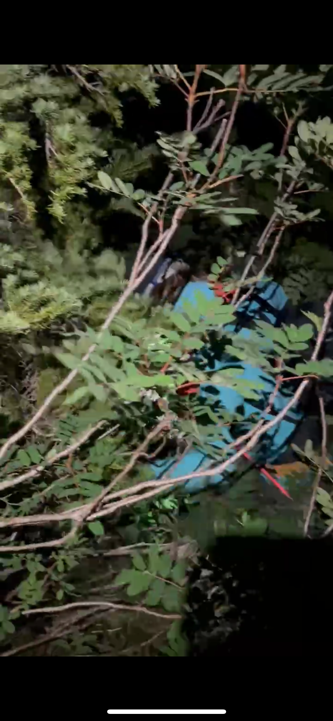
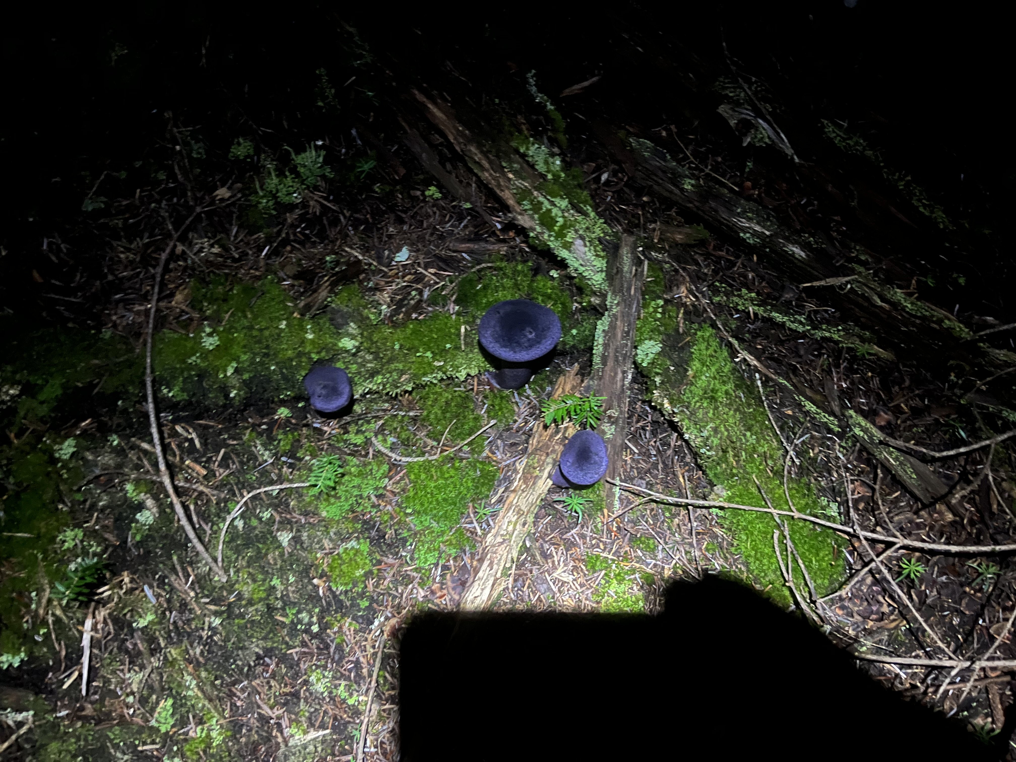
Once on the right trail we sailed down the increasingly dank trail. Saw some of the largest mushrooms I’ve ever encountered, plus some cool deep violet ones.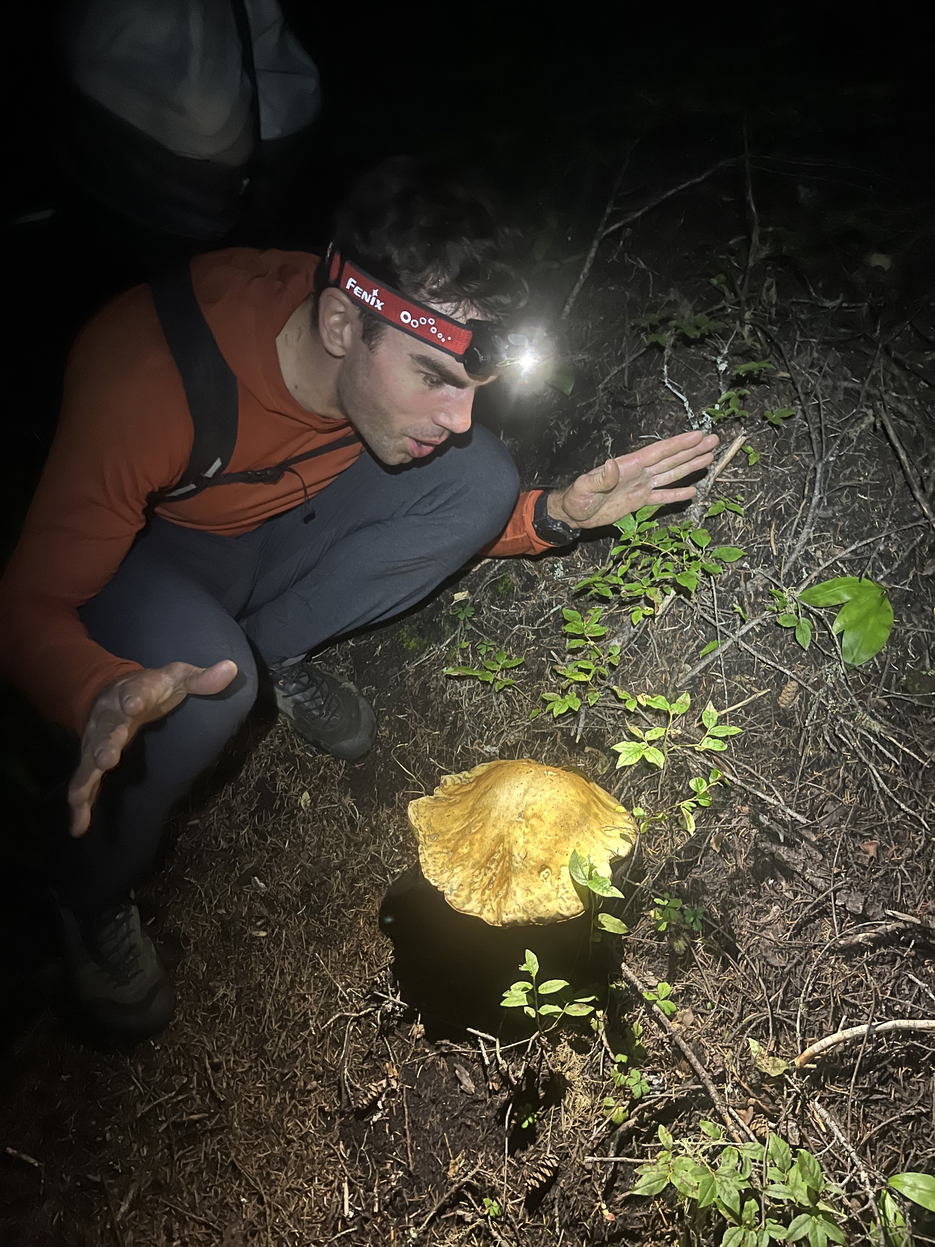
We arrived back at the car a little over 20 hours after we left it. The trailhead still wasn’t crowded. Given the hour we opted to spend another night here.
A couple years ago my partner and I climbed the north ridge of Stuart c2c, which took longer than this one, partly due to waiting out a squall on and after the 3rd pitch. That’s a useful baseline when contemplating long routes - seems long but hey, shorter than N ridge of Stuart, so let’s do it
We agreed that Slesse NEB was a real good time and that we are probably satiated on epic days for the summer, though I might try to squeeze one more in.
-
9
-
1
-
1
-
 1
1
-
-
On 2/18/2024 at 6:26 PM, Hartselle Mountain Hikers said:
Jason,
Do you have more details to share bout this route? I'm planning to go to Prophet this September (via the South ridge), but after reading your post, now way to ignore the Jacob's Ladder!.
Thank you
Not gonna speak for Jason, but I checked this out a couple years ago. It’s pretty straightforward. You’ll want to leave the trail and start uphill about 200-300 feet south of the creek by Luna camp. Avoid minor cliff bands and just stick to the shoulder, which gradually becomes more pronounced as you ascend. On our way up we were initially under a canopy of giant ferns taller than we. This was fun but we found the more efficient path on the way back a little further from the creek.
-
Love it! And thanks for taking such good photos. I’m inspired to get to Luna cirque now.
And the mystery of where the bootpack south of Outrigger came from is solved. I came through there the day after you from Otto-Himmel and had the impression of boot pack dropped in from the sky. Wouldn’t have thought of coming from McMillan cirque
-
 1
1
-
-
Yeah I’d love to see the poem
-
Trip: Pickets, some south, mostly north - Goodell to Big Beaver (abandoned Goodell enchainment attempt)
Trip Date: 07/07/2024
Trip Report:Last weekend was a good time to get high and try to stay high. I set out with hopes of essentially enchaining the Goodell creek watershed. The idea formed gradually over the past few years as I noticed bits of beta here and there. The key pieces of the puzzle for me were a) seano’s solo ropeless descent to the NW from W fury, and b) that descending S from N Despair is apparently not difficult
With this and other reports here and on Steph Abegg’s site I felt like I knew enough to attempt to solo with a bike drop at Thornton lakes TH, and entry at Goodell TH. The plan was to go up to O-H Col, on to Outrigger, to East then West Furies, down towards Pickell pass (visiting Swiss and Spectre along the way). Then Crowder, Pioneer, N Despair, hopefully find a good descent to its south, then regain the ridge and circle back for S despair, then back out Thornton lakes. Since I’d already climbed Triumph and didn’t want to pack a #4 all that way, it wasn’t on the list. But an enchainment including it would be more aesthetic.
I would have enjoyed company but doubted I’d find anyone with the interest and time. At some point I deluded myself into thinking I could do it in 4 days. This wasn’t wildly off the mark but planning on 5 days would have been smarter. Long story short I didn’t complete the loop, and likely won’t repeat the part that I visited just for the sake of a loop. I haven’t seen anyone describe this exact variation of a pickets excursion. Still think it’s a cool idea, hope someone tries it out.
It was at W Fury (just after being inspired by the fresh Mongo ridge entry from the day before) that I decided to instead bail East. This was partly due to falling behind schedule, but what sealed the deal was a cresting wave of snow guarding entry to the chute dropping off the N side of W fury, just east of the summit block. Maybe if I had a belay, but it looked too spooky to engage solo, quite a bit of exposure there. I had wanted to go early to make sure the snow arete on N despair was in good shape, and the bypass gully west of Crowder, in case the NE ridge looked too sketchy. But it seems I was just a little too early.
Back to the beginning, various notes In chronological order - day1: There is currently no bushwhacking on the path of least resistance to Terror creek. The creek looked tricky but wasn’t. There is dry ground at the bivy spot. There was still a good amount of snow in crescent creek basin, but a little hard to say if it was friend or foe. The post holing wasn’t the stuff of nightmares, but was fairly bad. I must have tweaked my knee at some point because it started registering some displeasure quite loudly as the afternoon led to evening. This was my first concern for the loop plan, but ended up being problematic but manageable throughout the trip.
Gully to O-H col was in good shape. It was getting late by the time I got there (theme of the trip). I grabbed my rock shoes and carried them as I wandered around the choss Ikea to get up Ottohorn. The rock scar has the one fun bit of climbing on the route and I guess maybe low 5th due to exposure, but it’s quite easy, didn’t need the shoes. Returned to the Col and had to take much care not to have my mat, bag, or bivy blow off the mountain in that wind tunnel. Not a very comfy place to stay.

Day 2 - Moving slowly on the skiers left of the snow. Feeling the weight of the pack, the exposure, and the slippery dirtiness underfoot. Reached the snow and saw that I could skip the rap, though that could quickly change given the relentless heat. Maybe no longer true as of this writing. Finding my way from the upper Mustard area to the ridge leading to Frenzel camp was surprisingly complex. I encountered a lot of steep, exposed snow with uncertain stages of moat development. I had to stay cautious here. Abeggs photos were eventually helpful but it took a while to reconcile what I was seeing because of my earlier season snow conditions. Had coffee at Frenzel camp, filled up water and headed down. Did one rap at the bottom of that steep section. I started to notice bootpack going in my direction of travel. I’m guessing just one day ahead of me? [edit: turned out to be Kyle and co] Later at Abegg’s “30 ft rap” section (going the other direction) I found the rock looking a little less brittle just around to the right (east) side. Heavy pack clouds my guess, but maybe 5.5-5.6. Not easy with a pack. Outrigger turned out to be more of a mountain than it looks on the map. Descending towards Fury wasn’t too bad, but again surprisingly long.
I saw two figures coming down East Fury. Later on I realized it was likely these guys. I tried taking the ridge up towards East Fury (Abegg quotes someone claiming this can be done) but ended up cliffed out and reversing half of that and rejoining the boot pack on the glacier. I was lucky to have lots of tracks to follow all the way from here to W fury, and beyond Luna. Must have a relatively busy time in this zone.
At the summit of East fury I realized it was too late to continue, I had no realistic chance of getting to Pickell pass before dark, especially if I wanted to climb Swiss and Spectre. It still seemed not impossible to catch up the next day. So I decided to rest and enjoy the absolutely exquisite location. Unlike the O-H Col this time and place was totally calm.

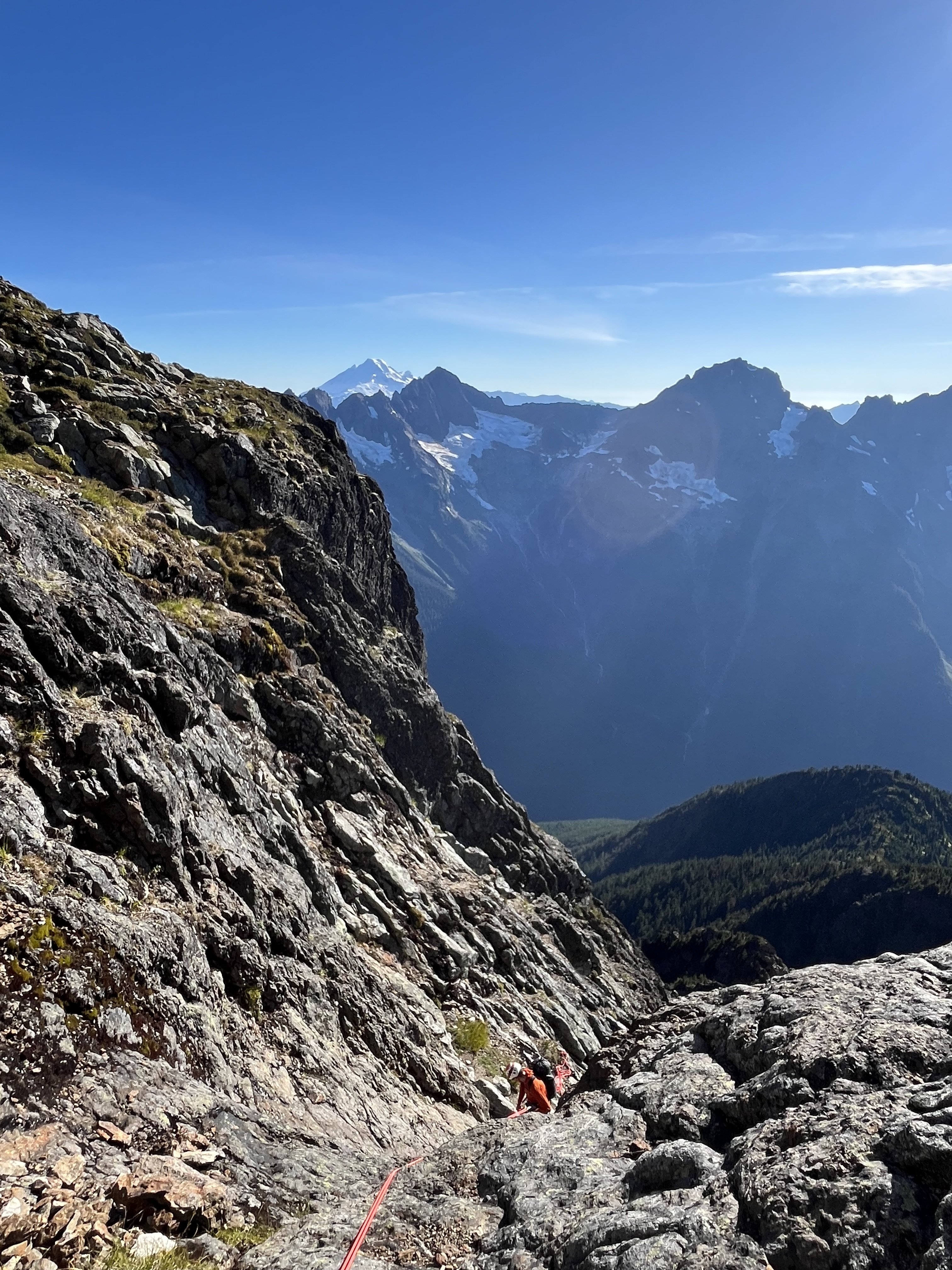
(zoom in for 2 climbers descending between rock bands)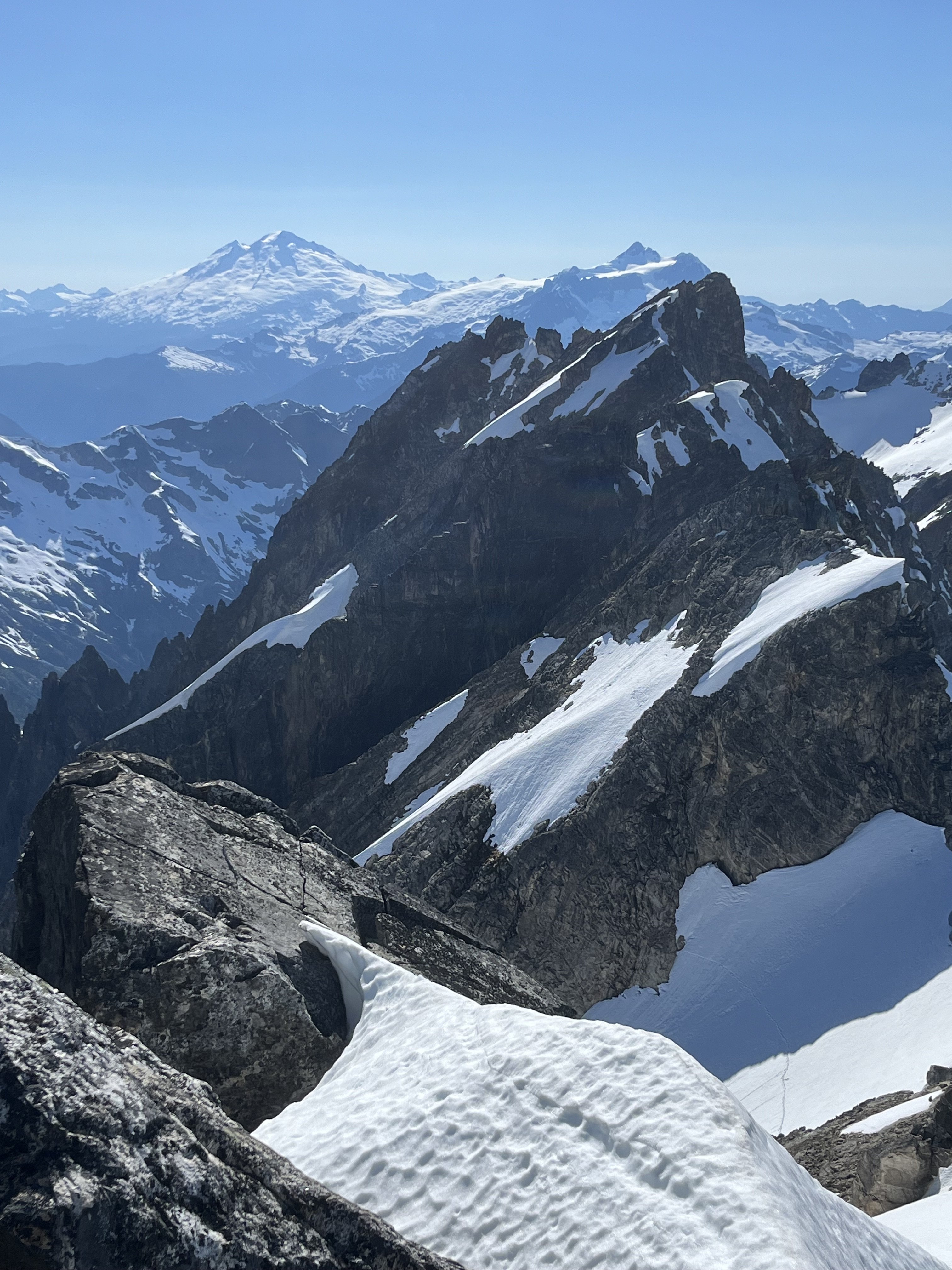
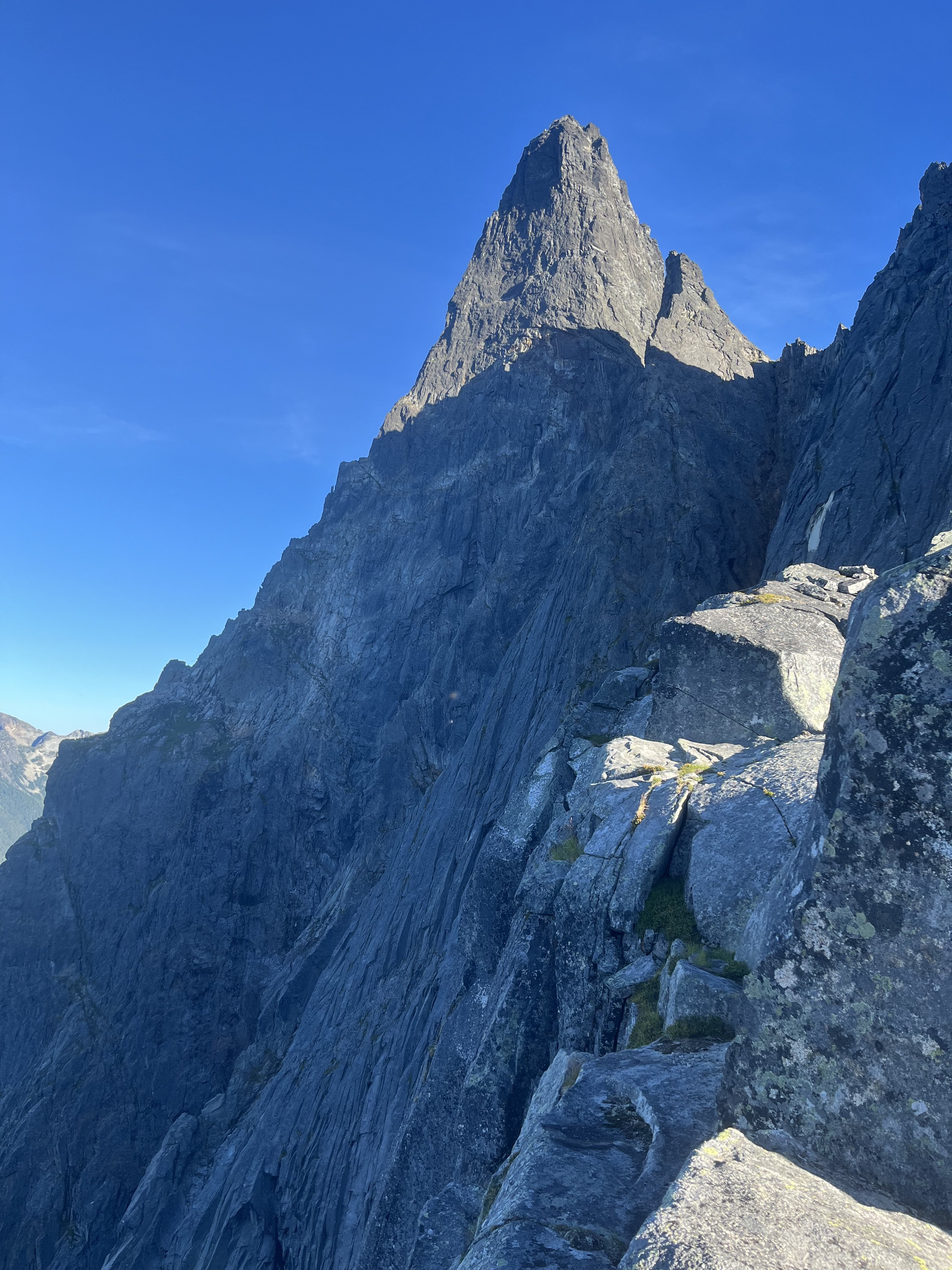
Day 3 - another slower start than intended. The climbing along the way to W fury is generally shitty though not terrible, and occasionally fun. I was glad when it was over and worried that I had already burned a little over 2 hours. I was entertained to see more love in the summit register for W fury in the past few years than in the before times. Choss must be getting sexy. In my haste I skipped reading the poems packed in there, which I now regret. I backtracked to find the chute mentioned by seano. Surveying it for a bit, I realized I was now on plan B. I labored over back to East Fury, somehow taking longer than on the way to West despite no raps. Carrying the 4 day pack back and forth was futile but I don’t regret keeping the dream alive for a few hours longer.
From East I followed boot pack down the glacier, over shoulders, eventually to ledges cut by steams, and a brief uphill to the ridge leading to Luna. As it was plan B I had not as much beta here, and I was pleasantly surprised. Amazing views on both sides, and fun hiking. Also a little bit subtle. I cliffed out again a couple times, just when I wasn’t paying much attention to the gpx I was glad to have.
At Luna Col dismounting my backpack from its perch felt like liberation. In the warm evening I carried almost nothing up Luna. I was vaguely under the impression that it’s a choss pile, which is not untrue. But it’s the good kind, very easy on the feet. No steep dirt gullies or loose chunky talus. And another surprise that I was surprised to have - the narrow ridge traverse between false and true summits was just super fun. I don’t know how I wasn’t aware of this one. After melting face for a bit gazing at Fury, into the cirque, and the S pickets I returned to my burden and continued descending. At a dry knoll the mosquitos formed an personal exoskeleton and motivated me further down. I plunged down snow that was still soft in the warmth of the late evening, then a little bit of ice (worms everywhere) then another gully (where a small stream disappeared underground and reemerged lower down), finally finding flat ground in the sandy bottom east of Luna after dark.
I processed the past few days then. The character of the environment continually changing with elevation is always one of the most attractive things about alpine trips. That aspect was far from new. But the intensity of it was so much here. To be up on Fury and witnessing its elemental austerity give way to water and flowers and choruses of more waters, and so on, really got me. I think it was the impression that In the many faceted character there is also a unity. It’s all just there doing its thing, indifferent to us visitors, and doing it perfectly.
 (scale isn’t obvious here, and the photo is tilted about 15 degrees. This is where I elected to not find out)


Day 4 - some talus and stuff and then a little jungle, but not much alder to contend with if you stick to the easiest path, which is sometimes faint and easy to lose. More schwacky then the approach to Terror creek but far from the worst. As I’m getting lower in elevation the thermal gradient is amazingly sharp near streams. It briefly feels relieving to pop out on a trail again, but the reality of banging out a bunch of miles on fumes in high heat sets in. I’m hoping to get to the dock early enough to maximize my chance of hitching a ride across the lake, and from there hopefully back to the Goodell TH. With perfect luck that’s exactly what happens. I find 2 climbers waiting for their boat scheduled just a half hour after I reached the dock. Veterans of the pickets both, I enjoy hearing of their 6 day outing and pickets traverses 30 years ago. I quote directly regarding the approach to Terror creek: “if there was a trail back then, we didn’t know about it”.
Epilogue: I am so hungry, and my feet look like they’ve been mugged.
Gear Notes:
Whippet, rap line. Shoes, slings, nuts carried but unused.
Approach Notes:
Goodell-
1
-
1
-
2
-
1
-
-
Grinning ear to ear grinning while reading this. I must have seen you coming from East Fury while I was descending from Outrigger. I had no idea what an adventure you’d just had.
12 hours ago, emilio taiveaho pelaez said:as if my climb had already happened.
Right?!
-
1
-
-
On 6/23/2024 at 3:33 PM, Alisse said:
Are these guys awesome or insane?
Yes.
Sorry to hear it turned out too warm and sloppy, but I dig all the positive spin here.
-
1
-
-
Wow looks like a great adventure! I might try to check this out next week if it isn’t too smoky. Do you remember where the highest flowing water was, any in the Kennedy environs?
-
Boxer briefs
gotta stay cool yknow
-
Interesting that it was relatively smooth, I recall hearing almost exclusively bad things about Nooksack. Thanks for the beta!
-
2 hours ago, geosean said:
How was the camp below Crooked Thumb, aside from less than ideal water access?
Nice spot, very convenient for accessing CT, just tricky to get to this year, and in a more erstwhile-normal snow year you might have to hike lower to find water. I’ve seen 7280’ mentioned (https://www.nwhikers.net/forums/viewtopic.php?t=8030117 see how much more snow there is leading up to that shoulder? Crazy!) but I’m not totally sure where that is, route up to ~7400 is what seemed natural to me.
Some features around it helped block the wind but also obscured the views slightly.
-
Trip: Crooked Thumb to Challenger, Phantom, Middle Challenger - Various
Trip Date: 07/20/2023
Trip Report:Just because you can doesn’t mean you should. This thought arose as I was headlamp hiking in my underwear back to the trailhead to wrap up 4 days in the N pickets that were amazing, exhausting, and occasionally nerve wracking. I don’t intend to endorse solo itineraries such as this one, but I’ll share a few notes. Sorry I don’t know how to be more succinct
Will add some photos later.
Day 1 Hannegan Pass TH to Perfect pass. Got to the ranger station before 8am to try to get in and out as quickly as possible given the distance. Pretty smooth sailing except for leaving my pole at the Chilliwack and having to return for it (1/2 hour penalty). There are two logs across so it’s not necessary to wade, but I didn’t notice this until my return trip. That said the crossing is not difficult. The trail is faint near the creek but overall hardly any shwacking required. I found crossing the impass on ledges a bit higher than what I’ve seen in beta to be trivial, so didn’t pay close enough attention, and this would haunt me 3 days later. Got to the pass before dark, and found just enough snowmelt to get by. A new moon sliced its way into the dusk. Nightfall was clear and beautiful and the location outstanding.
Day 2 Ascended Challenger glacier in the morning. No surprise if you’ve been out and about, it’s already late summer conditions out there. A somewhat direct SE line towards Middle and West was still feasible though. Once on the upper glacier I detoured E to scope out a possible descent in the Challenger 2 vicinity (I think that’s the name of the one just to the W of the main summit). It looked involved but plausible. Steep snow, two crevasses, good snow to rock transitions above and below, and rock that looked ok for scrambling.
I then headed back towards Middle and scrambled fun clean rock to the top and back. I wrapped around to Solar pass and glacier and tried to find an easy way down to the bowl SW of Challenger. The way I took ended up having some spicy slabs. On my return on day 4 I would find an easier way that starts at a lower elevation than my crossing this day.
Once in this bowl I saw that the glacier leading up to Crooked Thumb was quite gnarly with snow barely continuous on the presumably normal climber’s right. I made camp on rocks at about 7400’. My only complaint was having to descend 1-200 ft to find running water. I got a little too relaxed and didn’t head towards Phantom until 2pm. Easy snow travel led to lovely ledge/boulder/stream zones. When I passed SW of Ghost I took out binoculars and stared for too long at Ghost. In CAG Beckey succinctly describes a W face route involving gullies. From a distance the first half seemed possible but then seemed to run into roofs and cliffs. @SeanO commended Ghost to Challenger in his mind blowing/ nauseating northern pickets traverse trip report, so I was interested in trying that on day 3. But after much deliberation I decided I didn’t like what I saw and that I’d probably leave Ghost out. This was cemented later in the day after my troubles on Phantom. I would end up in no mood for any extra wandering up gullies.
I got to Phantom arm and took heather and blocks upwards. I understood the SW route to be a scramble, and entered a decent looking gully at about 6800’ on the SW flank. The terrain didn’t align well with the few photos I had screenshots of, but I didn’t worry too much about it. I ditched my pole here (guess where this is going) and headed up. The SW to SE aspect of this mountain turns out to have quite a few gullies that prove to be difficult to cross between. I hit trouble in the 7400-7500’ range. Things were getting steep and I seemed to be blocked from traversing over a rib to try a different way. Upwards seemed like the best option at hand but got more and more tenuous. The sunk cost fallacy had me foolishly exceeding my comfort level for downclimbing, so I got pretty committed. There was an intense section of exposed traversing on edges. Maybe 5.6-5.7, I don’t know. Some scramble. I finally got through it and back on easy terrain. At the summit I saw that the register is open, with the lid or base (don’t remember which) down in some crack. I believe this was the original, so that’s too bad.
For the descent I headed back to the false summit then S on nice staircase ledges reminiscent of Mix-up’s, then a SE aspect towards the main gully separating Phantom from Spectre, and got on snow. This was much easier than what I had climbed but is a S/SE route. I don’t know, didn’t have a lot of beta for this one. The snow passed 500’ below where I had ditched my pole so I got another half hour pole retrieval penalty.
Heading back towards camp I had some regrets for not camping nearer Phantom. Spectre to Crooked thumb jut up ahead, Picket creek plunges steeply below and Baker and Shuksan flank the far end side by side. But it would be an impractical launch pad for my other plans so I had to make do with my 7400’ camp. I arrived after dark, mentally and physically taxed.
Day 3 - Days 1, 2, 4 had clear and calm weather but today, on the climax, the height of my adventure, I’d be treated to some light drama. Very localized weather blew in around the Pickets, providing a thin and constantly shifting layer of clouds pensively twisting around the towers. This made me nervous but it never got menacing. It just made things a little cooler and more exciting.
Having decided not to start from Ghost I instead began with Crooked Thumb via its NW couloir. The snow was totally melted out, but luckily this couloir turns out to be just fine without it. Plenty of loose rock but I’ve seen much worse. Near the top of the gully I veered S to climb the N ridge. There was one notably rotten section on my route but it was just a few moves. Near the summit, blocks and ledges led to cliffs guarding it. But there is a key SE facing low angle wall with useful edges, barely 5th class, that leads back to the ridge and bypasses the cliffs. The rock on top is an amusing feature. I was leaning on it to take photos then thought better not. Saw about 10 parties in the register in the past decade, including Sean’s crazy traverse. I downclimbed the way I came, got a free lesson 10 feet from the gully. From there I headed N.
Other than the rock being fun/good and one possible diversion to the W, from Sean’s report I didn’t know what to expect. At first things went smoothly, with some TFT-style sidewalks. But complex pinnacles soon returned and route finding was generally not easy. I never did make much of a W diversion, though this may have made life more difficult. On the N end of Crooked Thumb I did go W slightly but I recall this ending with a sketchy squirm down a backpack shredding chimney. Not ideal.
In my gpx you can identify route finding episodes where the line goes from straight to scribbles. There are about 10 of those between Crooked Thumb and the true summit of Challenger. I agree with Sean’s description of generally fun and good rock (though in a traverse of that length there’s bound to be a ton of loose stuff and it’s hard to be appropriately paranoid every single time) but I would add that the route finding is far from trivial. Not heinous but I had to think a lot.
When bypasses seemed prudent, they tended to be on the W side of the ridge. I don’t know how many points I went up and over, but there were a lot. These keep the true summit blocked from view most of the time. It was a little demoralizing to so frequently surmount a point and realize I was still so far away. In this light I still can’t wrap my head around Sean’s traverse. Not just the distance but the diligence and patience to handle so much loose rock and route finding uncertainty. It took me nearly 4 hours to get between Crooked Thumb’s and Challenger’s summits, which are less than a mile apart from the air. Not exactly easy.
At what seemed like the final false summit, I considered tackling it head on. It was narrow and very exposed but juggy and mostly solid. But 10’ below it’s crest I hit a crux where there was no feet. After playing with it I decided it was crazy (at least 5.8?) which was too bad because it would have been an awesome way to go. Instead I delicately traversed on the W side to some dirty loose blocks that I gingerly scaled. This was dubious but less exposed.
The summit’s lack of prominence from the S is kind of funny. I saw a slung block and thought I guess this must be it right? Yeah I guess I don’t see anything taller. Downclimbed the summit block (rap line, harness, and rock shoes were just sweet sweet training weight I guess; well that and some peace of mind), bootied a cam that looked somewhat fresh (lmk if it’s yours) and headed down dirt and rock to the glacier where I scored some water from a pool cradled between it and the ridge.
Because I was returning to my bivy near crooked thumb, not perfect pass, I didn’t explore to see if the standard route was blocked by schrund, though I heard a rumor that’s the case. I traversed on rock, passing below Challenger 2 to the area I scoped out the day prior. Exposed face in downclimbing with my light tool and a pointy rock ensued. The snow was in good shape for this, not too slick or punchy. The rock turned out to harbor one little crux at the bottom but it was all right. Good snow bridge got me back on the glacier.
Since I found the solar pass descent harder than expected the day before I decided to try the Middle-West descent. There are slung blocks but the angle looked mellow and there seemed to be plenty of holds. Stemming and smearing worked well (but would have been hard in boots) until it deteriorated to dirt for the last 10-12 feet. Crap, I bet this part is often covered in snow. I got through it one way or another, but learned that I wouldn’t want to ascend this way due to the dirt.
The route I had taken to camp the day before seemed like it may have given its last gasp, at least for a soloist without a lot of gear. The snow was still continuous on the left side, but was steep and passes above cliffs and crevasses. There were also still hidden cracks starting to materialize in the flattish section leading to the left side. For these reasons the right side would be much more preferred (more direct, shorter duration of exposure) but didn’t look so viable anymore. So I carefully went up and around the left side.
This was the most adventurous day of the trip but at <10 hours the shortest and least physically difficult. I relaxed at camp and for some reason didn’t do the math for how long of a day awaited me.
Day 4 - a funny thing about this bivy spot is the W aspect, with tall cliffs above it. Sun didn’t reach me till 8:15 and it was pretty cold before then. I was in no hurry, took a while to pack everything up and didn’t leave till close to 10. This was pretty dumb, I should have started much earlier. And part of the route was still in shade even at 10am, so waiting didn’t help. The snow was pretty frozen and I was glad to have a tool and my steps from the day before stamped in the snow. It was an hour of tedious face-in diagonal downclimbing, swinging my tool and kicking feet for most of that time, to cover 1/4-1/3 of a mile.
When I bottomed out I tried the Solar pass strategy again, but started lower, finding really nice and fun granite. I wrapped around that ridge and followed it a little too high. Because a portion of the glacier between me and the pass had melted down to ice, I had to a slight ascent, traverse W, and descent to access the pass.
On Challenger glacier I had my tracks from 2 days prior for reference, but things seemed significantly different. Probably some combination of noonish instead of morning, down instead of up, and 2 extra days of melting. It was stressful and I regretted being there, could not wait to get off of it. It was quite apparent that the crevasses were deep and wide and snow between them was not confidence inspiring. One of the sketchier looking parts was on the edge of the glacier, only 100 feet from reentry to rock.
I didn’t notice on my way up to perfect pass how non-obvious the route is. Steep and weaving. At the impass I made a nominal effort to locate where I had crossed but got lured too high up the face. From there a horizontal traverse seemed possible but what would it look like on the other side? I had endured so many tenuous traverses in the past few days. Instead i downclimbed and reassessed from below. I tried again, finding an easy ledge but still ended up crossing too high. This ended with a short but slick and featureless slab at the bottom of the chute on the W side of the crest. Not fun!
Rubble on the way to Easy peak was easier on the ascent than it had been coming in. I got to the old lookout, digging the views and checked the time - 5:30. Wait didn’t it take 8 hours to get here on the hike in? Crap!
I ate caffeinated jelly beans and became a reluctant participant in mountain running, slow jogging down easy ridge. Great spot for it. Knees took a beating but handled it surprisingly well. I reached Chilliwack before dark, crossed on logs this time and tried to get stoked for the hike back. I had perfectly natural and reasonable feelings like this sucks and why I am doing this, but I was able to dispel these with counter arguments like hey it’s just walking, walking is no big deal. Maybe this is fun. This worked well until Hannegan pass when I couldn’t ignore that every part of my body ached. I reached the car at 1230, so far all that ass busting it was only an hour faster than on the way in, so maybe not worth it.
Gear Notes:
Approach shoes, steel strap-on crampons, light tool
Approach Notes:
Hannegan-easy-perfect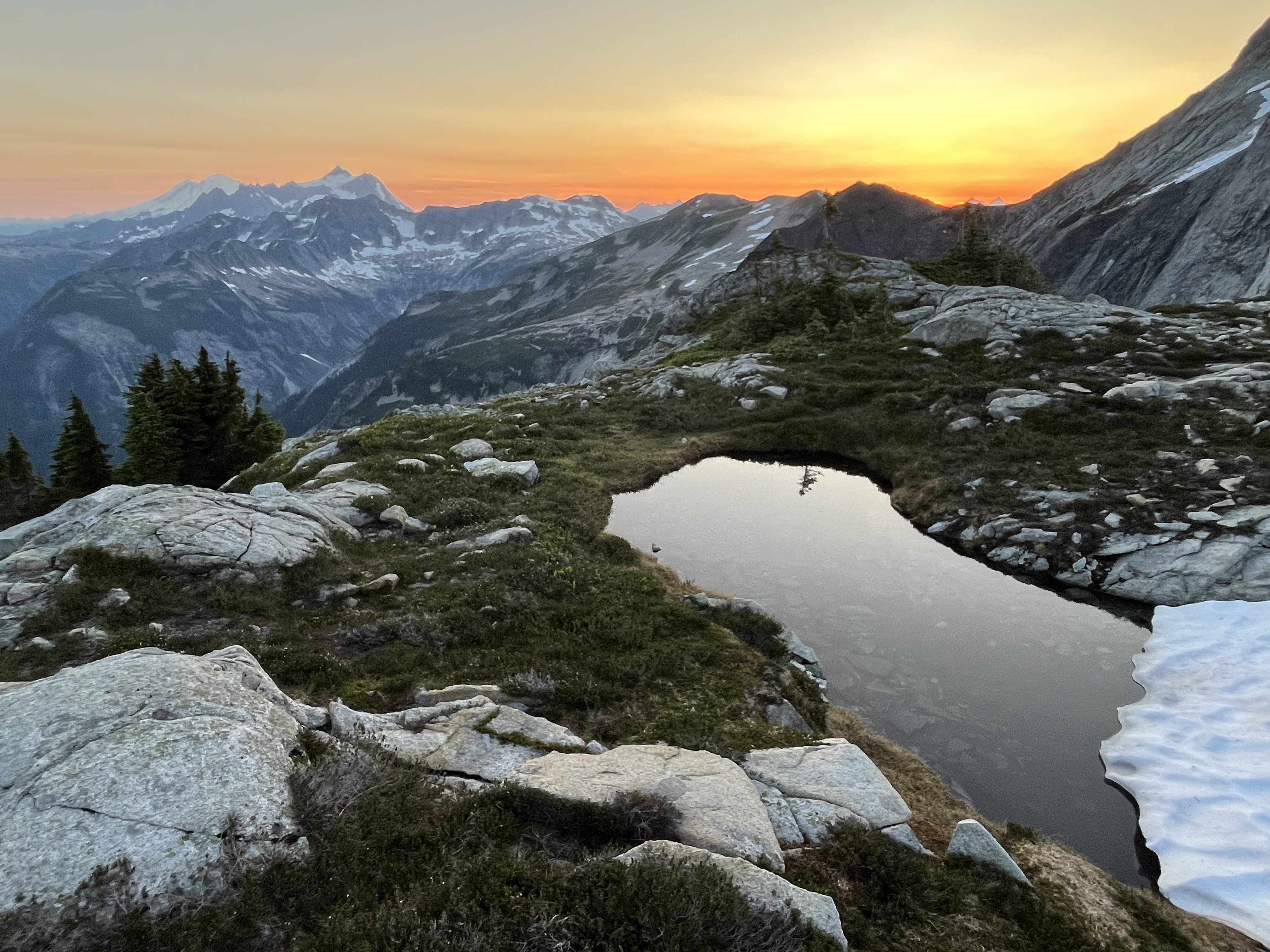
-
2
-
6
-
1
-
-
On 6/27/2023 at 5:48 AM, justuszimmerman said:
Unfortunately July isn't an option--first week in August is when the stars align. Still sticking to rock at that point?
The snow might still go by then, hard to say. Having done the snow traverse, I suspect sticking to rock is more fun, unless you just really like snow.
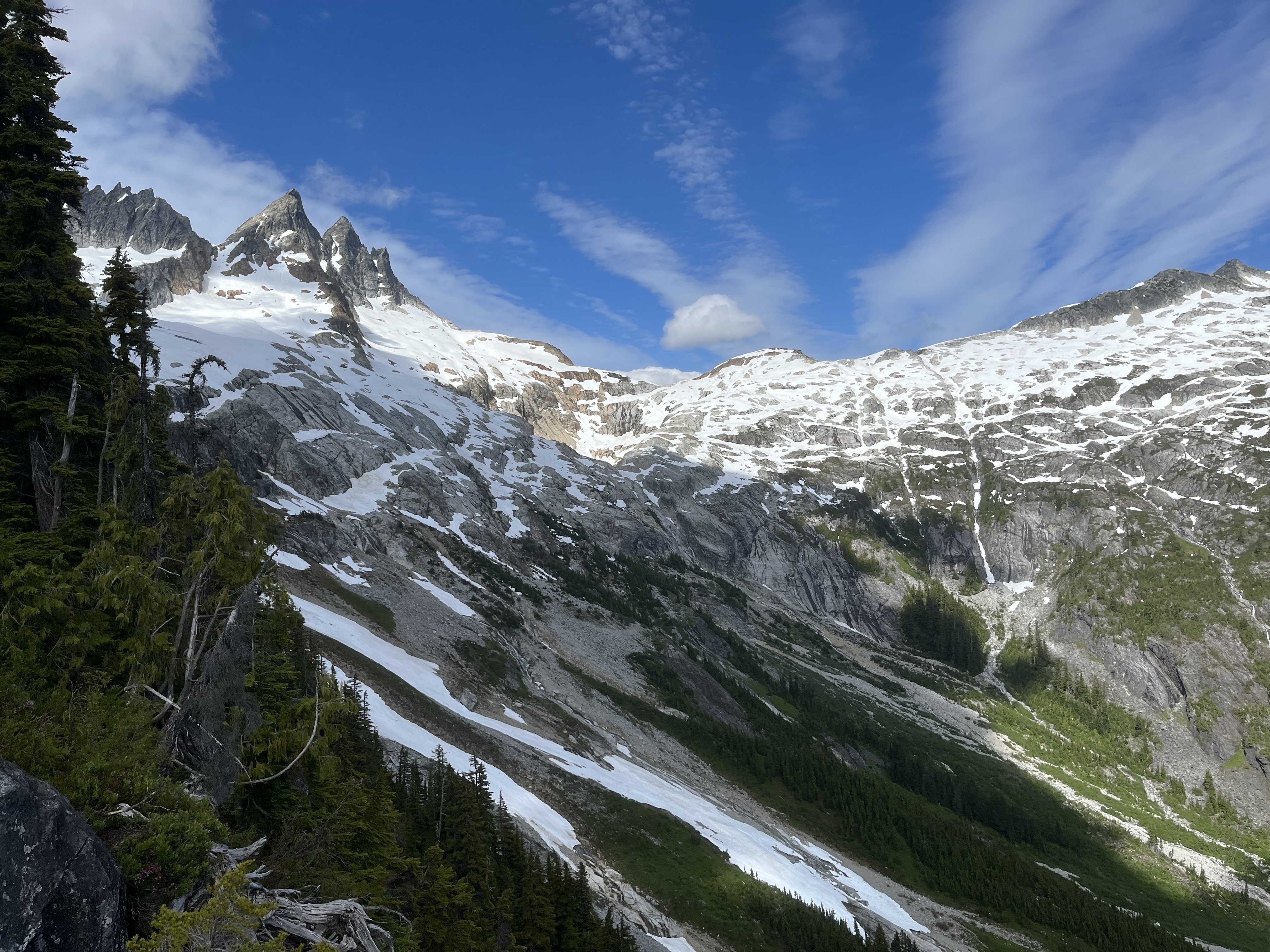
[TR] Terror, Himmelhorn, Degenhardt, Pyramid - N buttress (attempt), Wild hair crack, NW and W routes 07/04/2025
in North Cascades
Posted · Edited by JonParker
For contrast to the double moat encountered on 7/4/25, the 7/6/24 conditions are pictured in the TR linked here. No moats, easy downclimb.