


WaterproofMonk
-
Posts
6 -
Joined
-
Last visited
WaterproofMonk's Achievements
")
Gumby (1/14)
0
Reputation
-
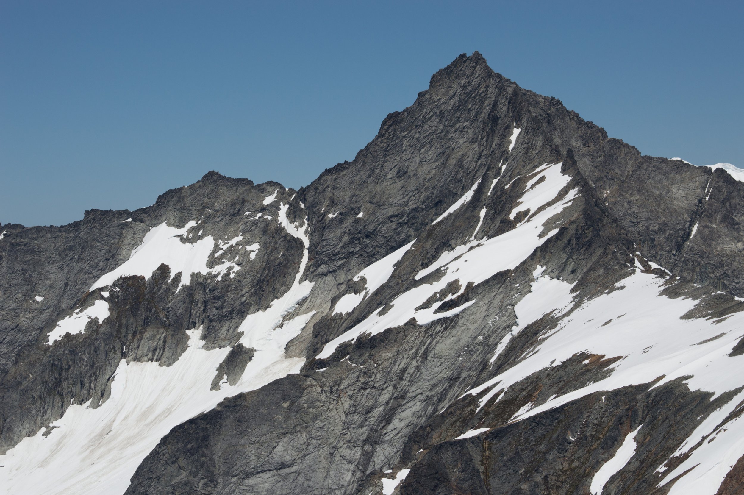
Trip: Forbidden Peak - Beta photo Trip Date: 06/15/2019 Trip Report: Got a decently detailed shot of Forbidden from Sahale Glacier this weekend so I thought I'd share it. Zoom in and you can see the gully is pretty melted out. Nobody visible on the route from this direction at 12:20PM on Saturday. Just three people down on the glacier/snowfield. Gear Notes: N/A Approach Notes: N/A
-
Nice! Interesting that there's a bit of ice there (particularly in your false summit pic) that wasn't there a couple of weeks ago. That was completely dry on the 3rd: http://peakbagger.com/climber/ascent.aspx?aid=810218
-
Showing snow levels as of yesterday, from 30,000ft and ~30 miles away. Not sure how to get full res here, so it's downloadable here.
-
Trip: Ingalls Peak/Headlight Basin - E Ridge + South Face Date: 6/4/2016 Trip Report: Great short weekend out. We did the E Ridge then descended and did the top section of the S Face (the best part!) before descending the rest of the way Approach conditions were snowy, with a tricky moat to get on route for the E Face. We got on the rock at the wrong spot (too far left) and had to climb a little vertical section to get to the ramp. No matter how you do it the moat is gonna be a little hairy. The whole day was very hot and we should have brought more sunscreen for the reflected sunlight. Headlight Basin is still quite snowy though I bet it's melting fast. Others brought crampons/ice axe for the gully and didn't regret bringing them, but I didn't have them (1 hiking pole only) and was OK using steps kicked before us/kicking more in the mostly soft snow. Road 9737 is still closed ~1 mi from the trailhead due to washouts. The right turn on the trail is also at a washout so it's extra easy to miss - the sign is gone! Have some photos: Stoke: beauuutiful rock on Ingalls S Face The washout just before the Esmerelda trailhead would be impassable by most cars, but to make sure nobody makes the situation worse, WSDOT has put a barrier in 1 mile up the road. Easy road hike, keeps out some of the riffraff (but not us unfortunately). Stuart W Ridge ridge is still quite snowy A bit of Aurora Borealis at around 2AM Star and airplane trails. Larger version at 500px.
-
Where's the button to create a new trip report? I can never find it! aaaaa
-
Here's the view from near Sunrise on the 1st of July. The current bootpath is pretty clearly visible.
