


Gaucho Argentino
-
Posts
172 -
Joined
-
Last visited
-
Days Won
1
Content Type
Profiles
Forums
Events
Posts posted by Gaucho Argentino
-
-
IM-humble-O...
Of course we do not have all the facts, but with the info at hand, could this have been the best option: They should have suck it up for one night at least, I do not think they would have died, and would have learn some in the process, then try all morning to get out on their means, and if really there was no way out, well, call for help around noon with more light left?
Trying to get some learning out of any/all epics people have out there, feedback from experienced climbers appreciated :-)
-
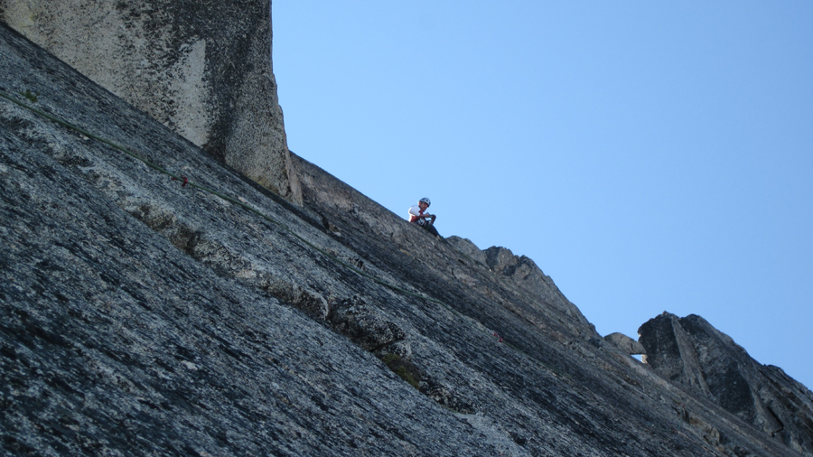
Sweeet, Prusik-like solid granite in the middle of Alaska? Paradise on Earth
 ...
... -
What type / how solid is the rock over there?
And awesome climb, BTW... I was so stoked with my TFT climb, way to raise the bar, Dudes !

-
Hi, Lisa... Saw plenty of your posts, funny you guys are also in the UW (are any of you any close to the J-wing?)...
Great climb, BTW, and holly shenanigans about the more than 1000 miles bike trip. Do bikes come with cotton and silk seats now? Agony!! :-)
-
Who brings stairs up there?
 Rangers?
 I thought it was the guide outfits that maintained the fixed bridges/ropes/pickets.
May be... didn't think about that, makes sense
-
Awesome, Buddies !
Who brings stairs up there?
Rangers? Do you think that without them you can do the route at all? And could you cross the Ingraham, or is out and you have to go down via the DC?Cheers !!

-
Awesome, Dudes!
Did you have any idea of what line you would follow for your FA, or you just went there and decide on the spot? In any case, great climb, Misters...
-
Sweet jobs, Gals!
Did you ladies climb the chimney with packs on or off? I still have all my knees scratched from this section a couple of weeks ago :-)
-
Back from Argentina and enjoying your TR, KK!
Sweet climb, Dudes! There was a good reason SP did not want to go to the top last year, solid granite up there, uh? :-) ...
The "side-hilling" is beautiful, though :-)
-
Nice trip.
Maybe start a thread on suggestions for North Cascades rangers and permits - try to include both good things to keep and things that need to be changed. I or someone else can steer this to the attention of the powers there.
Thanks, Buddy... Thread started in the discussions forum, hoping for people to give their ideas and see if this can be improved (or be left as it is if it happen to be the best possible system), but at least is worth discussing it, I believe...
Cheers,
GA
-
Well, someone mention that if posted and discussed, he/she could make it happen, so here it is. How to get a better system for CLIMBING permits in these two areas (or any other similar ones)? Your ideas might help...
My humble opinion:
-Separate parties that want to hike and camp in designated areas around lakes or vegetation from climbers on particular routes that would bivy on the base of that route on rocks or snow.
-Have a designated number of maximum people per route (example, 2 parties of 2 for the W Ridge of Prusik), but do not block climbers going there because a party of 20 are camping at Vivian Lake (same example for Boston Basin and W Ridge of Forbidden, for example)
-If I can not climb a route because a party got to the Ranger Station before me, well, I'll suck it up. But if I can not climb because a guide block the Boston Basin bringing 12 people from out of state that will just be laying around, pooping and peeing, that's not cool or fair
These are two or three VERY SIMPLE things that would already improve the system A LOT, very much appreciated if implemented, and very welcomed any other ideas/suggestions (even contrary to my ones, may be they are not the best, but at least trying)...
Cheers,
-GA
-
Trip: Torment-Forbidden Traverse / TFT -
Date: 8/24/2011
Trip Report:
TFT – 8/24/11
We took off with Matt last Wed with the ambitious idea of tackling the TFT via Boston Basin on Th/Fri, Sharkfin on Sat on the way to Buckner, and the N Face of Buckner on Sun, coming out via Horseshoe Basin with two cars for shuttle… cool plan … although that a typical permit problem first and an instinct for survival later complotted not to let us fully fulfill it
As mentioned, there were no permits for the Boston Basin on Wed night, but we got them for Th and Friday nights. The only option left was to camp on Wed on the Sahale Arm, cross next morning to Boston, leave our food for Sat/Sun and extra gear on the way to Torment, and climb the TFT.
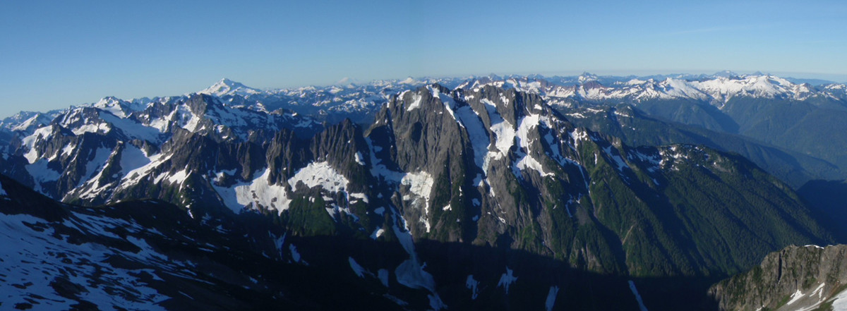
Boston Basin panoramic from the Sahale approach
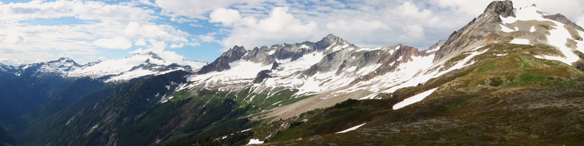
Although weather was supposed to be pristine, we got worried there for a minute when we saw quite a few clouds rolling in in the late afternoon from our bivy on Sahale
Clouds over J-berg…
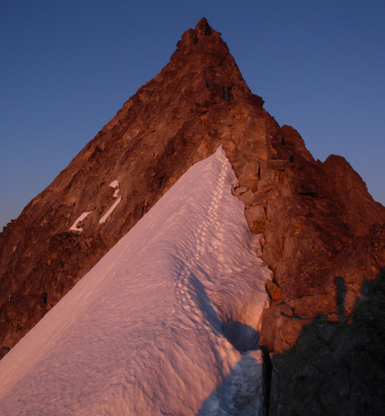
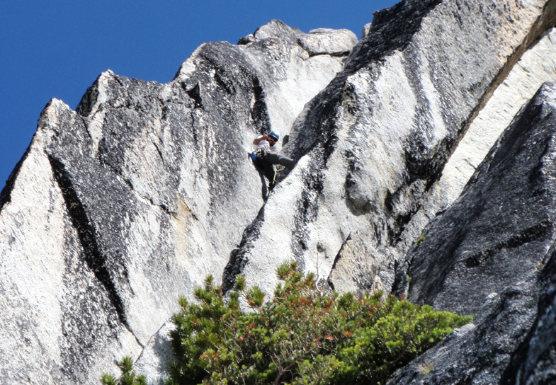
Luckily nothing happened, and after an early start, we were traversing towards Torment at about 7 am, and were at the base of the notch by 11 am (it was already really hot)…
Matt really enjoys climbing loose rock
 , so the Torment part went by pretty easy and fast, and by 4pm we were on the summit
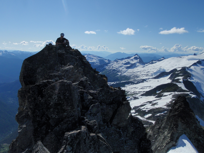
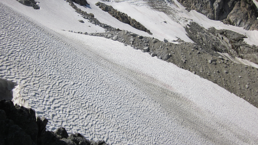
Now, the descent and traverse from the top to the notch to gain the glacier on the N side of the ridge, that stuff is loose like hell, not enjoyable by any means, maybe we were out of route there?
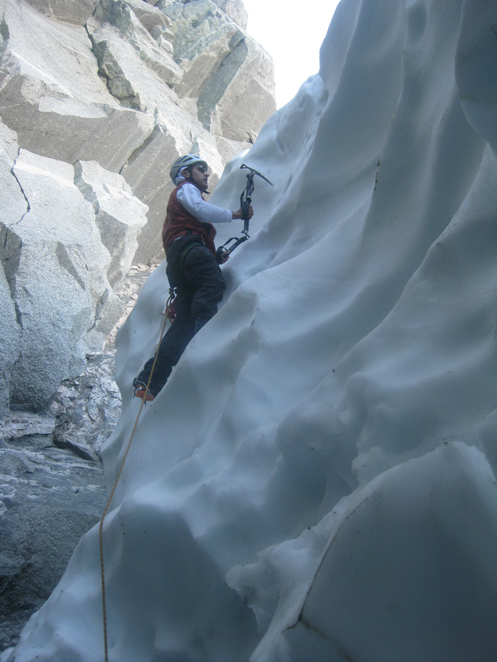
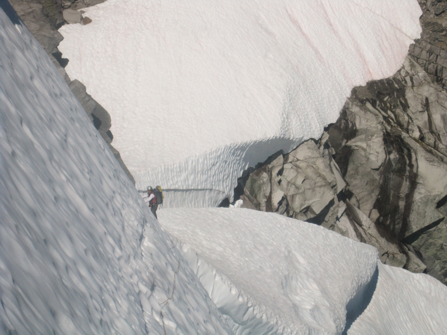
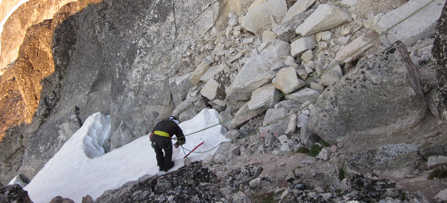
In any case, we made it to the notch, and after an airy awesome rappel into the moat,
we practiced some “steep-snowsoloing” to get out of it
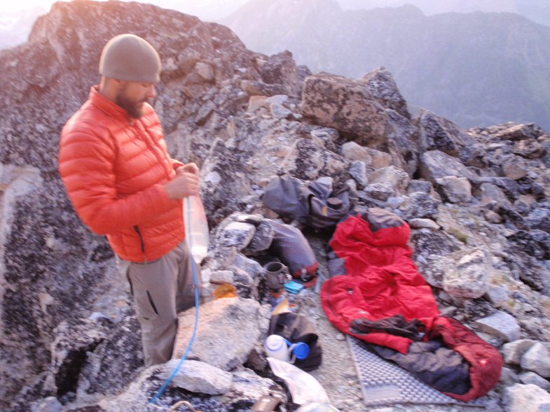
Then we traversed some snow to gain the rock on the other side, continuing pretty much straight on the N side of the ridge until a corner from where you can see the steep snow-ice traverse in full… Ideally we should have done the traverse this day, to be able to finish the climb the next, but with the permits issue and the traversing from Sahale, it was getting late, so we made camp in the rock. Luckily I have a Z-pad that folded perfectly to the Z-Z-Z shape of the rock in my bivy spot (at 38 y/o, my back was not thankful)

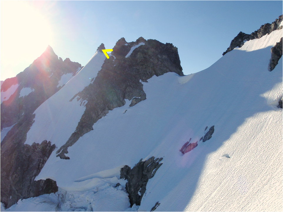
Next morning we went around the corner on and up the rock, and followed the snow (red spots), but clearly an snow bridge has collapsed (yellow arrow) because there was no way to follow the steps we were seeing going on this side of the ridge.
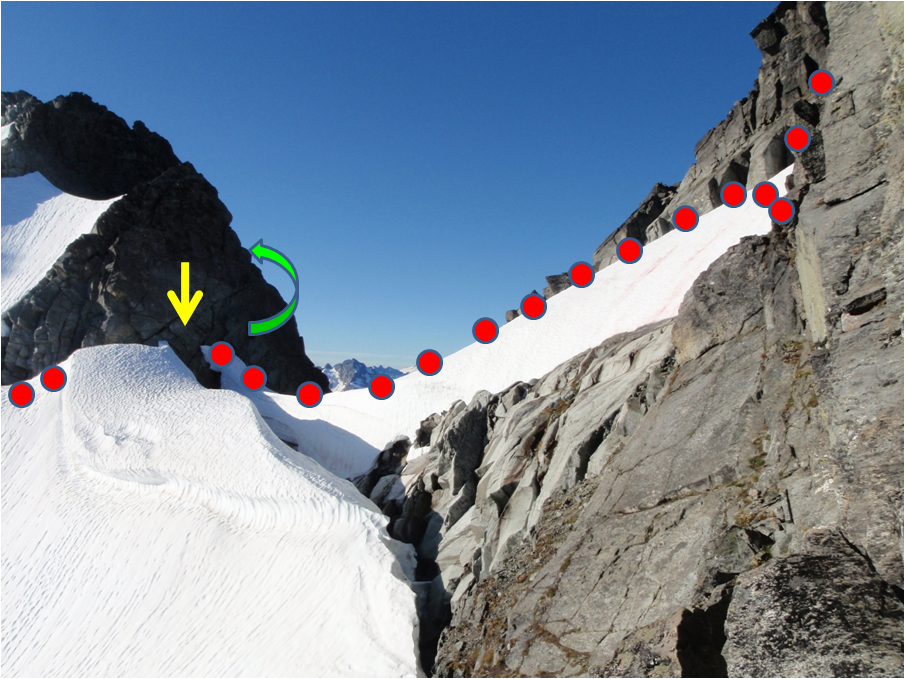
We went instead right and up the rock (green arrow), rappelled on the other side to a gully, and Matt lead over and down the steeeeep snow to regain the traverse below.
For this section we used our four pickets, no ice screw were needed, temps we high and although early, snow was fairly soft. I believe that from the gully you can also climb up the rock, but Matt was looking forward for this section (I would have climbed the rock, screw the steeeeeep snow)

Matt leading...
Me following this part...
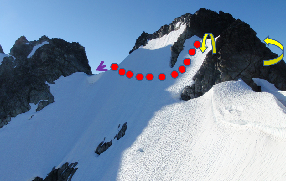
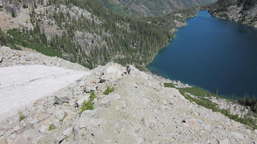
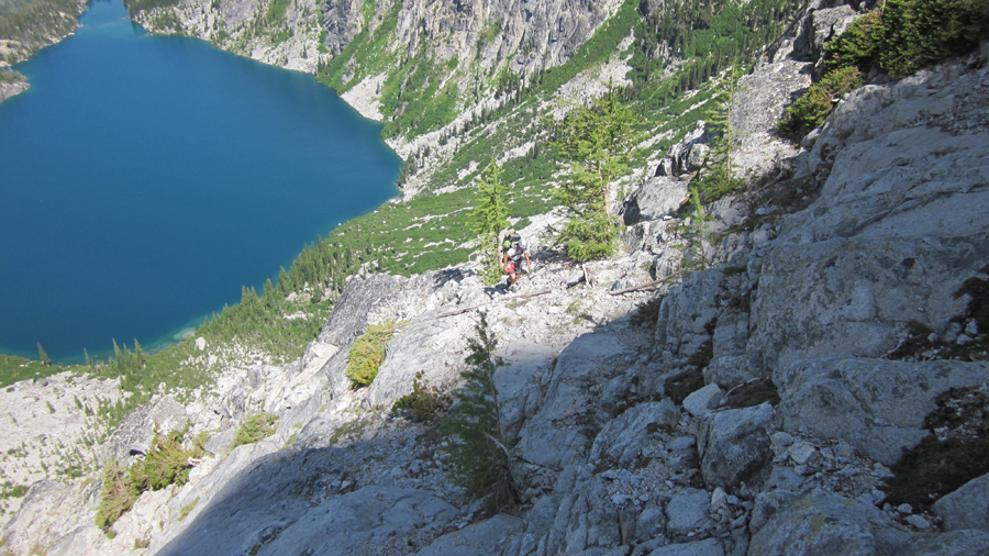
From there you can traverse on the south side until regaining the ridge AFTER the gendarme (according to some reports), but I went up just following a ramp that puts you exactly before the gendarme, what made us traverse a beautifully exposed pitch on the left (N) side of it (yellow arrow)
After the little traverse
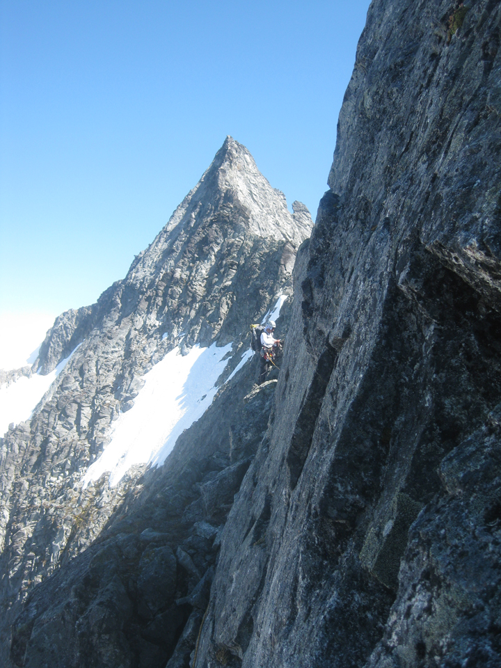
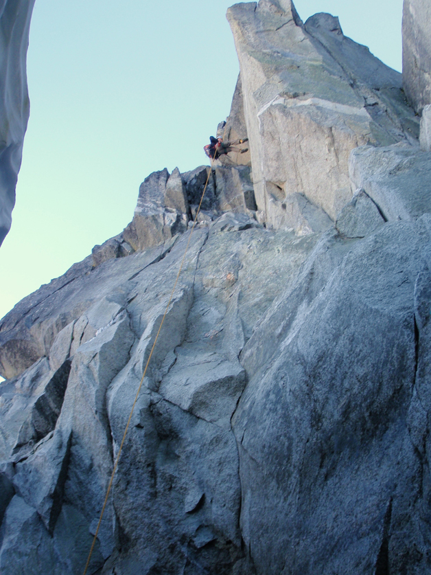
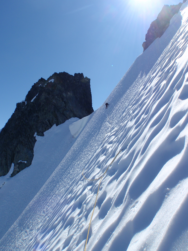
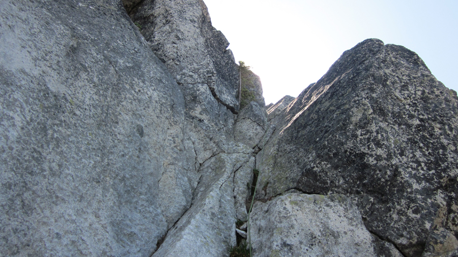
From there on there were not any more weird things like: route finding – sandy loose ledges - boots on – crampons on – boots off – crampons off – rock shoes on – pickets off, and all this time consuming crap, only beautiful easy rock climbing on exposed terrain with solid rock
Matt on the knife edge section…
And we made it to the notch on the W Ridge of Forbidden by 5pm. Time to think.
On the "staying-put" side…
1) We would have three more hours to the top of Forbidden, so descent on the E Ledges would be in the dark… hmmm…
2) There are no bivy sites on Forbidden, and there are some beautiful ones on the base of the W Ridge… hmmm-2
On the "keep going" side
1) We did not have food for another day…
2) We give up daylight hours that we can pay later if weather comes in by any chance...
Well, better hungry than going the ledges in the dark
… so dinner consisted of 6 slices of salami and a handful of trail mix that Matt had left and was very cool to share, and a cup of plain hot water to warm ourselves up (pretty chili when the sun goes down) that happened to be tastier than what I thought…
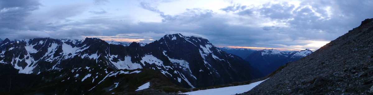
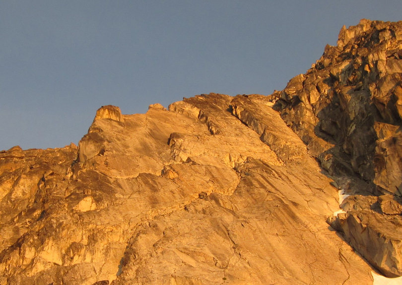
Forbidden under the last sun rays of the day from the bivy. Funny how short the route looks from this perspective
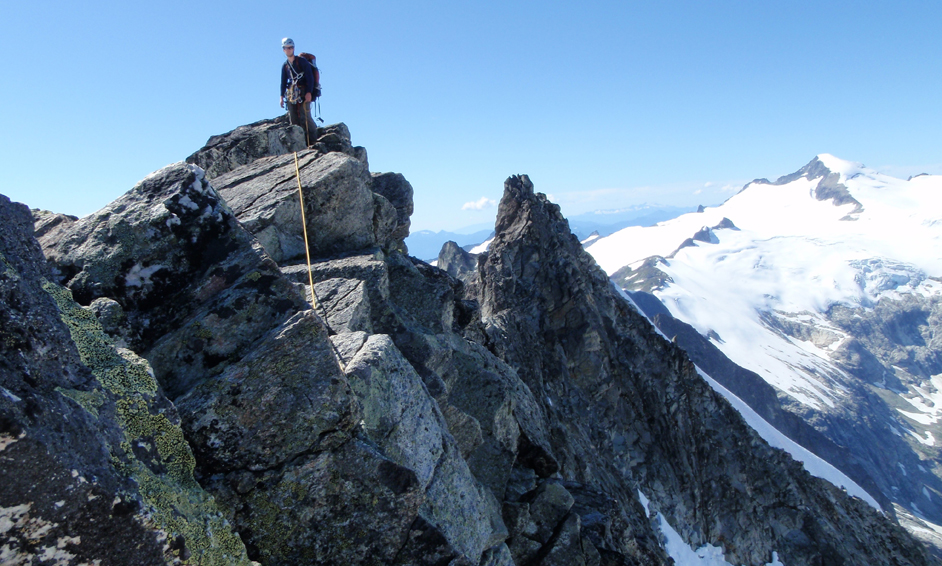
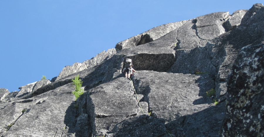
Next morning, after sharing my only and last Via Coffee (time to share and pay back for the food), I took off first and simul-climbed the lower part of the W ridge. We did split the 5.6 part in two so we both had fun, and Matt lead the second simul-c part to the top.
It took us about three hours
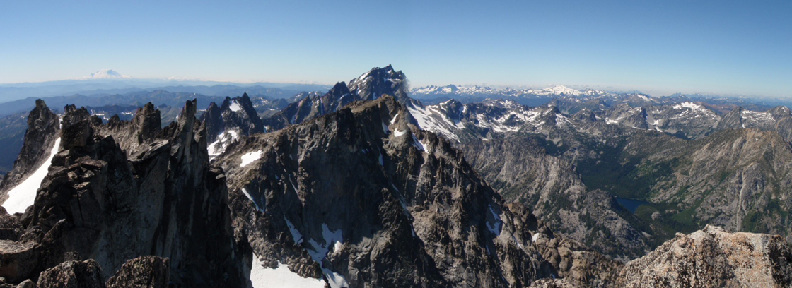
Perfect views of J-berg, Glacier, Rainier and an ocean of other peaks, damn the Cascades are beautiful…
Not bad to have one of the Fifty Classics completely for ourselves, NO ONE on the route (even on the whole two mountains, where are all the people on the permits?
Here is where the instinct of survival kicked in, and a close view of the N Face of Buckner
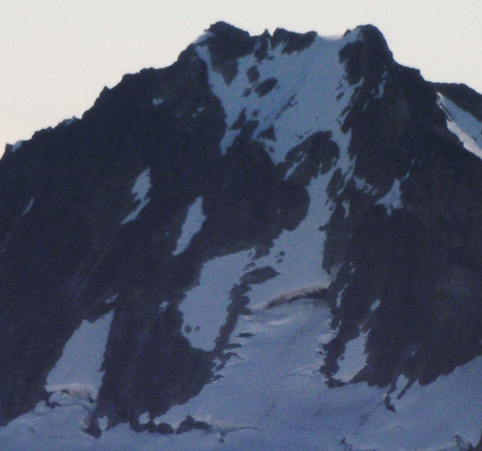
convinced me that the very little snow on the face indicated the climb is not “in” any more (although it might totally go), and that the TFT together with a cold I had since last Sat when trying to climb the CNR of Stuart (that got me losing my lungs for the last 5 days) had me completely wasted.
We decided to go down via the E Ledges (the descent still brought some interesting moments in again loose stuff down the gully), eat as much as we could, and go back to civilization. After some Search and Rescue operation to locate our buried-under-rocks food “right next to that bush, remember?” (now all the bushes looked the same), we found our trekking poles chewed by the freaking marmots, and then our food.
Food was safe, and after oysters, bread, cheese, chocolates and soup (gosh, that was good!!), we retraced our steps all the way to the Sahale Arm and the three trillion switchbacks…
A cool IPA waiting under ice in my cooler and some spicy jalapenos chips was the best reception, ending quite a sweet climb.
NOTE ABOUT PERMITS: knowing from other previous report the Rangers DO READ this TRs, I would like to mention the following: We talked with the Rangers for a while when we found we could not camp in Boston Basin, they were very cool, helped us reorganize the climb, etc, but it clearly does not make sense how the permits are organized.
There are six permits per night, and the party can be from 2 to 12. So AS THE RANGER SAID: “There can be from 12 to 70 people in the basin”… that does not make ANY sense…
-It does not avoid overuse (70 people per day, really !!??)
-It does not provide for a “wild experience” (70 people there, really-again?)
No climbing party is normally more than 4 people. So the “12 people party” thing is clearly for the guided tours.
In our case, we could have bivy-ed right on snow next to the notch on Torment, making our trip safer by cutting one day, cero impact by camping on the snow, and cero impact on other people because we would have been out of anyone’s sight.
The permits should address where people is going to climb (E of Forbidden, W of Forbidden, S of Torment, TFT, etc), allowing may be two/three parties of two (four/six people total/day/route), and guides with clients should not be allowed to reserve permits IN ANY CASE (I’m surprised this is allowed at all over other people that pay taxes as much as they do).
I do not know if this is the best idea, but I bet there has to be a better way of handling things, mine is just one more idea, I hope the Rangers and the Superintendent organize at some point some kind of survey where climbers with experience can give some ideas and we can find the best possible way to avoid having to be always in fear of not “getting a permit to camp in Boston Basin”. This plus TRUE FIRST COME-FIRST SERVE basis for the permits, I think it would do at least the most fair game for all, even reducing the impact of this “mega-10/12-people parties” and making the basin may be even less crowded.
The Ranger said that the way they can improve things is if they see it on writing and they can show it to the Superintendent… well, Buddy, here it is on “paper” now (well, you can print it, right?). Peace…
Back to the climb, the TFT is simply awesome, highly recommended to whoever wants to have a sweet mountaineering experience…
Gear Notes:
4 pickets
2 Alpine Ice Tools each
1 set of C4s, #0.3 to #3, double on #.75 to #2 (could left the doubles behind)
1 set of 10 Metolius nuts
Crampons
Approach Notes:
Loooong via Sahale Arm, and crossing Boston Basin
-
No kidding, kudos to the ranger for "understanding" the difference between those who use the alpine lakes to camp around them and clearly having a direct impact on the area, and those who climb the Mountains there and bivy on the rocks out of sight and without ever affecting vegetation. She even mention that a plan is being discussed to implement climbing permits, looking forward to it.
Back to climbing, the chimney and the last 20-30 feet of the last pitch, holy canoly they are not easy. Thanks, Buddy, for those leads and the patience on the belay, much appreciated !!
BTW, this w/e I'm coming back around there, and as ridiculous as I may look, I'm bringing a mosquito net
, I almost suffocated inside my bivy trying to escape from the horde of freaking flying bastards 
-
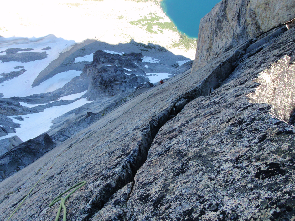
Sweet lines, Daniel, and IMO there seems to be more solid rock there than in D-Tail

-
Great, thanks, looking forward to your answer after the next rev
-
Hi, Buddies. I have a question/idea, wonder what do you think. Did not know exactly on what forum to post it.
Is there a way that in our profile page we can have a link to TRs posted in cc.com by other climber in the party ? For example, my son (10 y/o), and the rest of my family, and friends, live in Argentina, and they frequently check my site to see what I'm doing. But if the climb is posted by my partner, they won't see it unless I tell one by one where the link is.
Or for example, when meeting a climber in the site for the first time, is good for this climber to be able to see all the climbs I did so we can be sure we are in the same page.
I can think of some other reasons, but that is basically the point.
Thanks for your help/feedback, and thanks for the site, is phenomenal...
Nelson (GA)
-
Trip: Dragontail - Backbone - Grade IV+ - 5.9
Date: 8/12/2011
Trip Report:
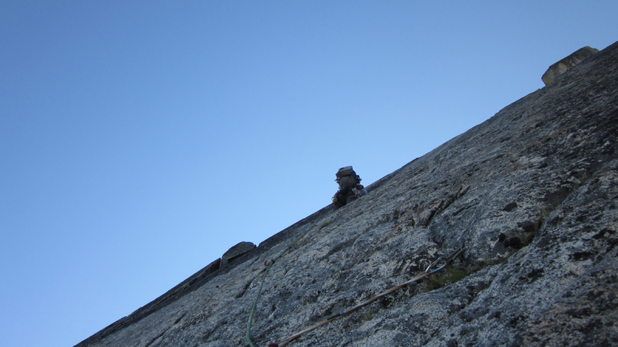
I was looking for a partner for the N Ridge of Stuart, when Riley81 (Daniel) contacted me about climbing the Backbone in Dragontail and the Beckey/Stanley route on Prusik in three days.
We meet on Friday, load the stuff in his car, and took off. We were at the Colchuck TH around 8.30, and started our way up. Because the idea was to carry over Dragontail our packs for three days (Fri-Sat dragontail, Sunday Prusik), we made an effort to pack really light. So, no crampons. Daniel at least brought his mountaineering boots, but I decided to go with Goretex tennis shoes (but brought a superlight ice axe, mostly for the descent from Dragontail).
Well, to get to the base of the climb you hike up to about 50 feet from the top of the ridge-boulder field,
and you’ll be in front of the step where you gain the rock. But then we needed to cross a tongue of the Colchuck glacier that was in the shade until like mid-morning or more.
Of course we did not have pickets. And if you slide there you’ll go like the Pink Panter glissading all the way to Colchuck Lake. And from some reason, even with temps in the 70s at least, the half closer to the rock was solid ice/snow. From a belay on the rocks of the ridge, the rope was not long enough to cross it, so we girth hitcked my double runners and Daniel crossed the damn thing chopping some steps in the icy part. Sp-icy.
Once on the other side, you’ll see the easy ramp going left, then up and right. They look very serious from the approach, but they are class 3-4, although loose and dirty.
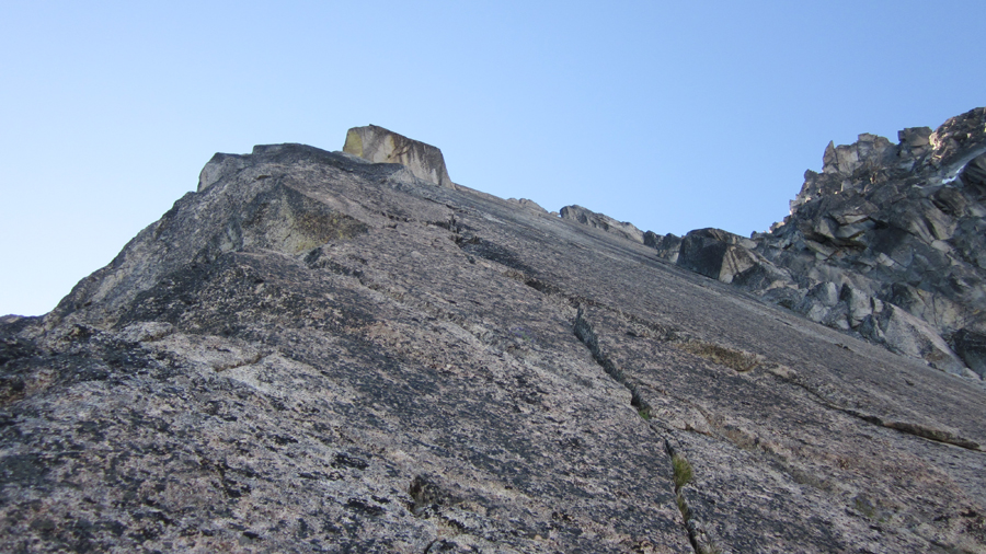
You end up under a little gully that goes up and right,
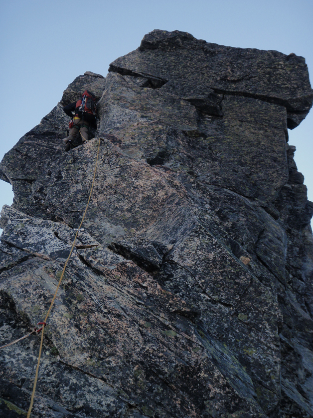
with a tree at the end that has some slings on it. I lead this part and with the last 5 feet of rope go to the right and you’ll make it to a nice spot below the 5.9 wide crack, from where you can enjoy seeing your partner suffering leading it
Daniel took off leading this pitch, left the pack at the base of the crack, and inch by inch went up. He climbed moving a C4 #6 along the crack until he left it about 10 feet from the top, where the climb eases a little.
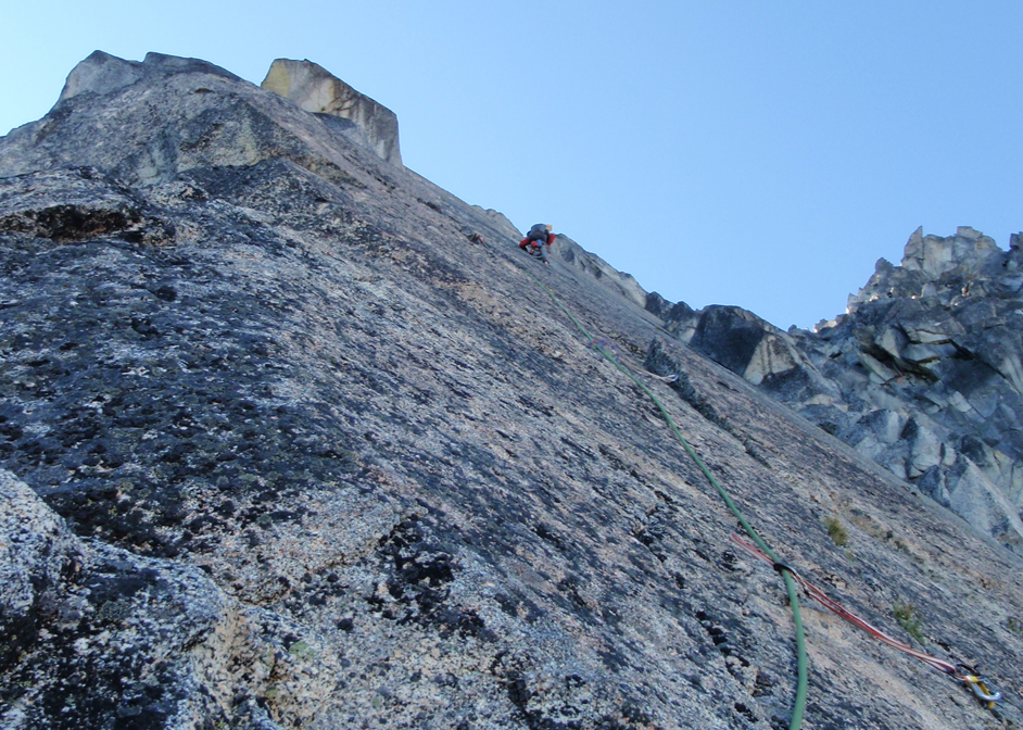
He pulled up his pack, and seeing how it was scratched on the way up, I did not want to do the same with mine. Mistake. I scratched it any way, did not allow me to put my body into the crack, and made going up this damn thing quite the ordeal. But I made it, not without having to take once, so now I need to go back and free this pitch, damn it...
I took the third pitch, a fun 5.8 that I stretched the 200’ of the rope, very nice climb.
Daniel took the second of the 5.8 pitches on the crest of the ridge, again beautiful climb, nice holds, some lay back moves
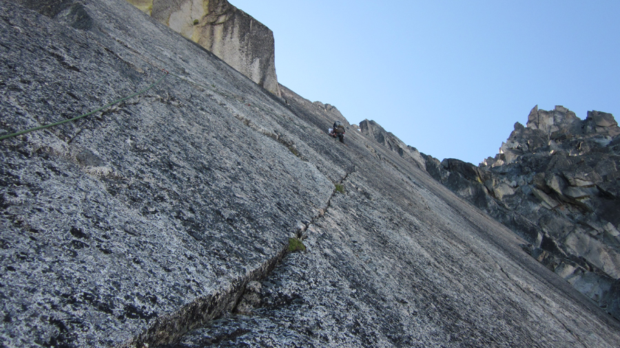
The 5th pitch took me going on the left and up on easier terrain already. By this time (around 5p) we were looking for bivy spots or snow patches, but after another 200’, nothing. We had about a litter of water each, but it did not seem to be much.
Daniel took the 6th, and after 50’ he shouts: “there is a bivy spot right here” … “and there is a second!!” … “and THERE IS SNOW!!!”… Jackpot !!
I had never been to the Hilton or the Sheraton, but the Presidential Suite cannot be better than this. Whoever set up those bivy spots, let me know, I’ll invite you a pitcher
Daniel at home
Me rappelling ~20 feet to get the snow
So you don’t know where The Fin or the summit are? Get located
The Fin
The Summit
And the Tail of the Dragon on fire with the last rays of sun…
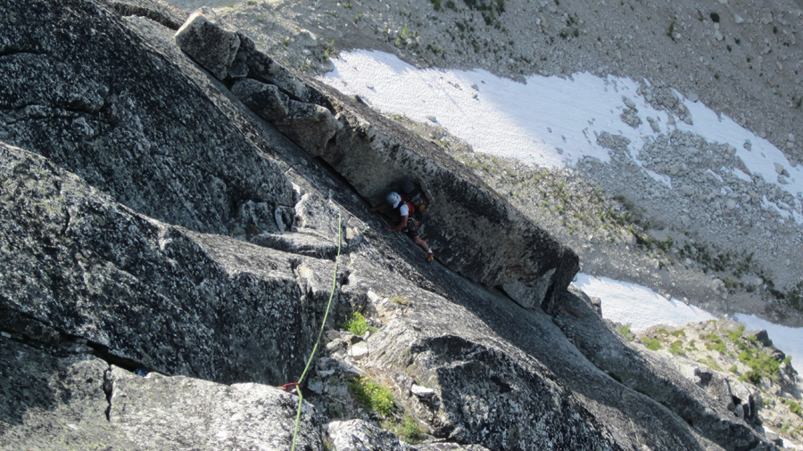
Next morning we simulclimbed-scrambled the 2-3 low class 5 pitches to the base of the fin, where Daniel set up a belay. I got this next 5.9 pitch (#10 in Nelson's book) starting with some face and crack climb for about 20’ until you reach the twin cracks, spectacular…
Daniel lead the second 5.9 in The Fin (#11), a thinner and more vertical crack, to a belay under a notch a few feet away of the 5.7 crack traversing below the “boulder” in the corner
Finally, I lead the 5.7 traversing crack/ledge, balancing without hands at the beginning, but then steepening and with great holds and pro…
Topping the ridge
Daniel ready to follow the last one…
When we thought everything was done, instead of climbing an easy crack going under the gendarme on the face, we did not see it, and went around the back, sketchy loose crap in the gully, the worst part of the climb. Do not go there. We did a couple more pitches in the very loose dirty gully and scrambled to the summit…
The view from there sucks, uhh!!??
It was an amazing climb with a great partner. Many people would say do not go climbing with someone you do not know (and I never meet Daniel before). But if you need a climber partner and want to go to the top safe and fast, join Daniel, you’ll increase your chances of summiting and having a good time on the go. Thanks for the good times, Buddy...
Next we went down towards Prusik-Beckey/Bentley, but that story Daniel will tell…
Gear Notes:
Full rack of C4s up to a #6, double in the smaller size with C3s and for the C4#2. One set of nuts. Plenty enough.
Approach Notes:
There is really a lot of loose stuff all along the route, we kicked more than once big chunks of rock…
-
Val, sweet pic with the two packs !!
I never got the idea of the permits. If it is to reduce impact, climbers are normally bound to a trail and then to the rock, so having 5 or 20 climbers in there, where is the difference?
Anyway, I think it could be a subject of long discussion. Back to the climb, way to persevere and not surrender !!
Cheers!
-
Sweeeeet, Buddy !! Both summits !!
Who were your partners? Is DC one?!
Planning to be up there on the week of the 22nd :-). Was weather OK all the time? Saw some clouds rolling in Monday/Tuesday...
And BTW, what's the spot in the pics? :-))
-
Are you planning on writing a book with all of your epics? I'd buy it, good reading... :-)
-
Thank y'all for the info, Buddies... weight saved :-))
-
Please, does anyone know if Assgard Pass is still snow covered? trying to save some weight on ice axe / crampons...
Thanks!
GA
-
Give me the kind of pad and the color and returned will be :-)
Found it Sat night left behind in the parking lot...
Cheers,
GA
-
By the way, where did you carry food for 8 days !!?? :-)
[TR] A Special Autumn Weekend in the Enchantments - Snow Lake 10/21/2011
in Alpine Lakes
Posted
Damn, Dude, the pics are awesome !! Thanks for posting them, indeed ...