


Gaucho Argentino
-
Posts
172 -
Joined
-
Last visited
-
Days Won
1
Content Type
Profiles
Forums
Events
Posts posted by Gaucho Argentino
-
-
Hi, Riley...
I'd been looking for a partner for the N Ridge of Stuart. Interested? We would not even need a permit :-)
-
Now I don't feel that bad I had to stay in studying chemistry ;-)
Where the heck this mid-weekend MF storm came from? 1 am stars, 5 am soaked in? Damn!
Next time, Buddy, and good try !
-
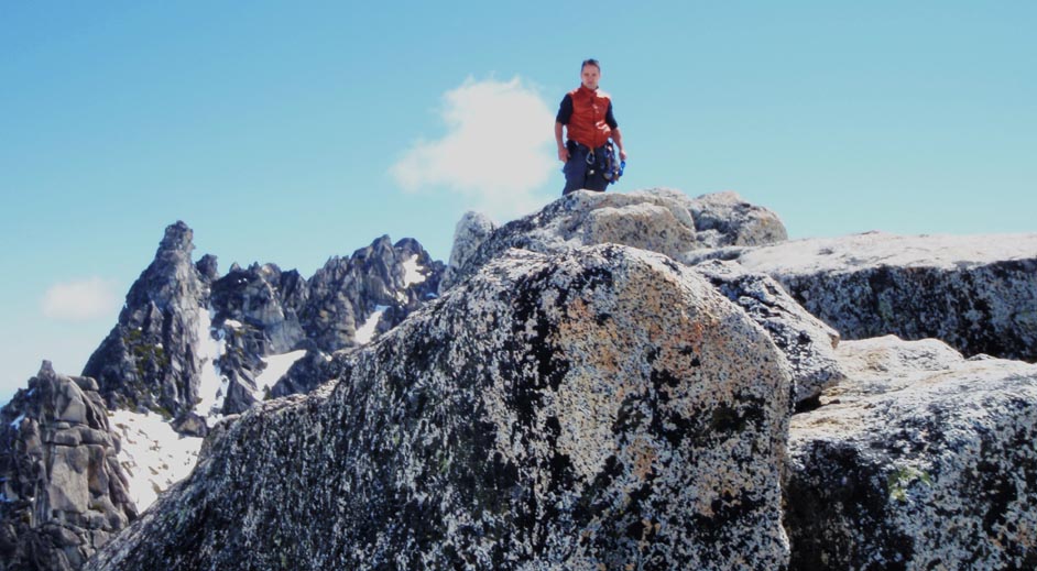
Trip: Forbidden - E Ridge -
Date: 7/24/2011
Trip Report:
We climbed Forbidden with Matt on what it seemed to be a very busy weekend for the W Ridge, but we got the E Ridge almost for ourselves, except for one more party of 2.
There is quite a bit of info about this climb in the site, so briefly:
From the Boston Basin campsites at around 6400' go up snow where you can go up left to the W ridge gully, or right. On the right there are two gullies, go up the second wider one (was pretty hard snow early in the morning).
You'll see the gendarme on your left, go around it and start climbing the ridge. We took a look at the gully to the right of the gendarme thinking on the way back, and it looked nice and dry.
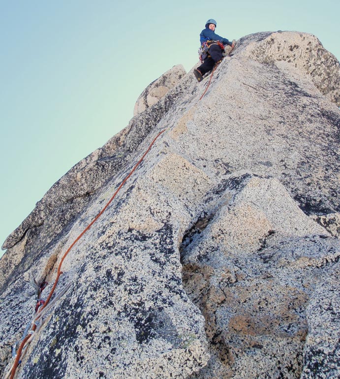
The climb is about 4-5 pitches of easy 5.6 / 5.7, lots of fun, very exposed but never dangerous IMO because of the quality of the rock. There is one spot where the ridge is literally a few inches wide, awesome. The last pitch before the easy 5.2 part to the summit, is a spicy 40-50 feet stretch of 5.8 that made things interesting. Matt lead it in great form in what I believe is his hardest pitch in alpine rock, way to go, Buddy...
Descent: I think here is where the beta can be useful. We read about 4 rappels and then traverse back on ledges that are not the nicest to traverse. We did two rappels exactly from below the summit, on clear rappel stations climbers right to the first rib you would have to cross on the traverse, but there was not a third... We down climbed about 50 feet traversing climbers left to the next rib, where we saw one more set of slings, down we went, but again at the end of this rappel there was not another station.
We set up one, so you'll find some very nice shiny slings there, again traversing while on rappel to the next rib.
From there we traversed the next three ribs with half a rope between us leaving only one piece between us just in case, although actually the rock was fairly solid all the way back to the gully bellow the gendarme. Up we scrambled and down we went to camp for a great day in the mountains...
Some pics proof we were there :-)
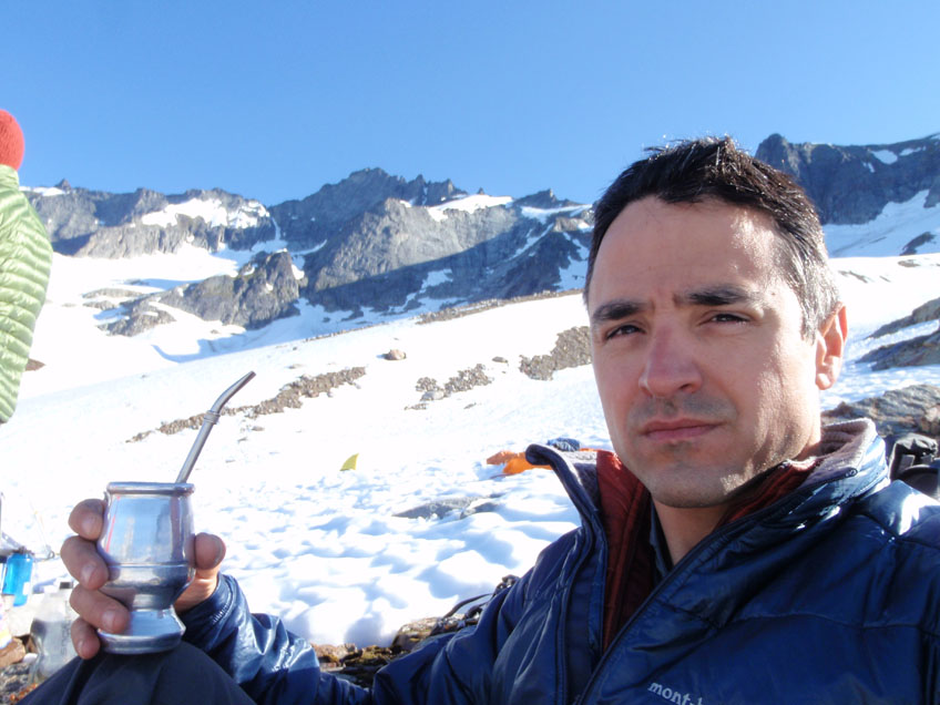
Me drinking Argentinean mate with Forbidden in the background
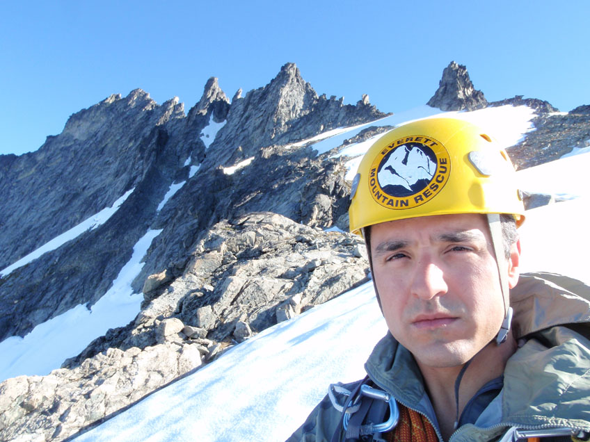
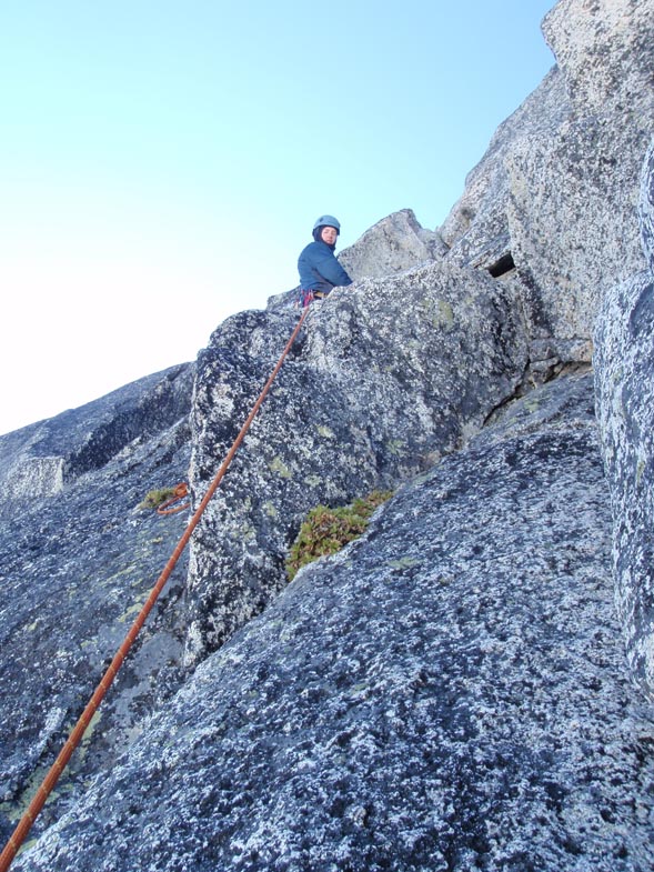
Approaching the ridge, quite a beautiful line (gendarme right on top of my helmet)...
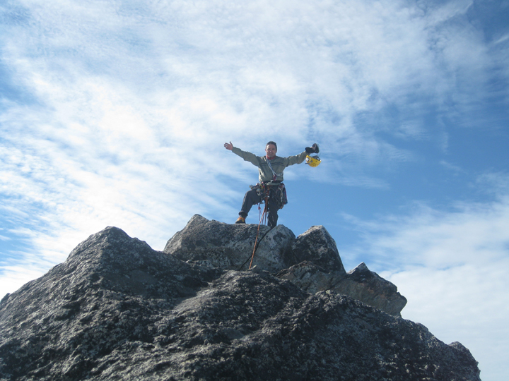
Enjoying the summit...
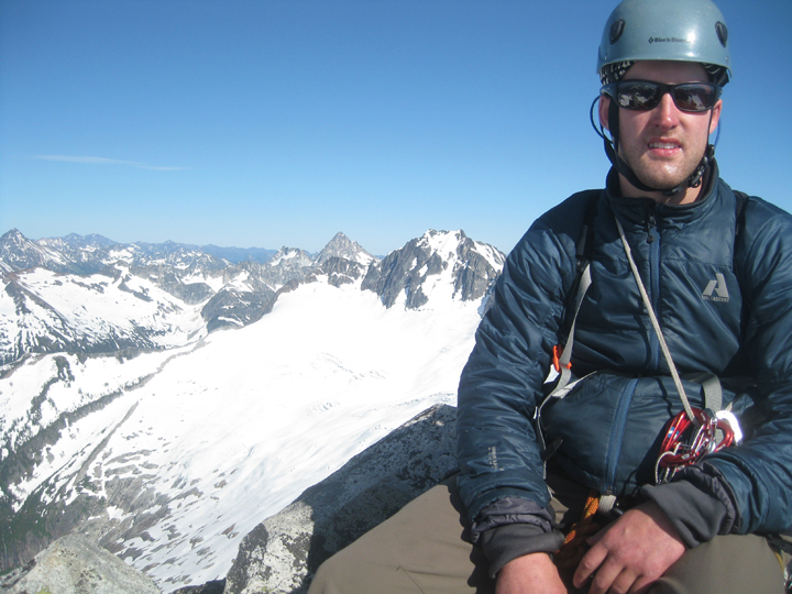
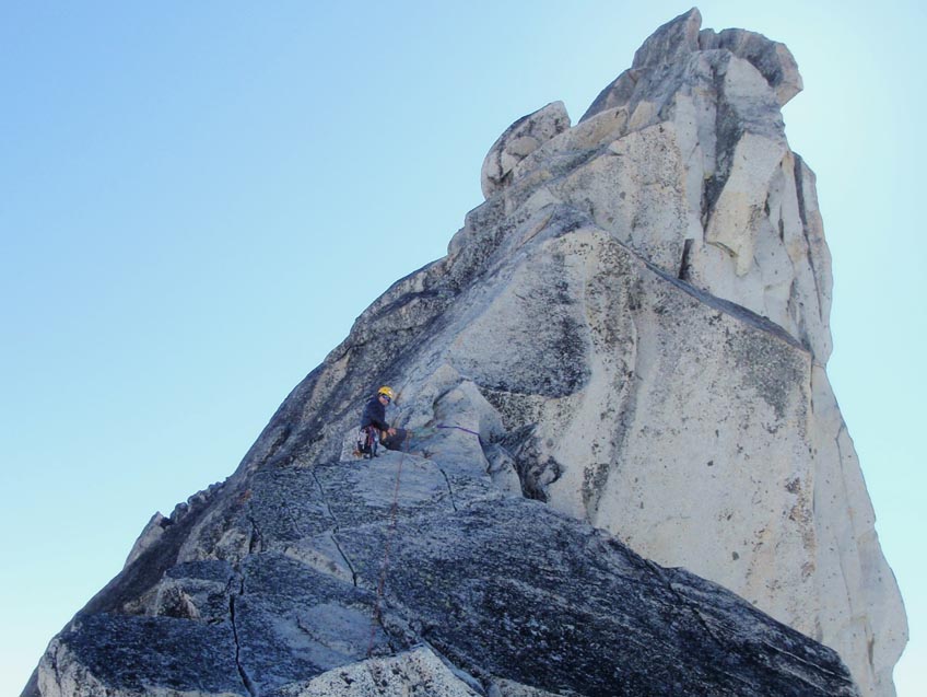
Matt on the top with N face of Buckner on the background
Gear Notes:
Standard rack, one set of nuts, one of cams up to a #2
-
Nice job!
Nice pic of Dragontail, there is still snow on Backbone, damn it !!
-
I do not know Russian so it goes in Spanish: BUENISIMO !!

-
Sweet! How come you can get D to climb and I can not?!
Nice pic of Stuart, you think the N ridge could be already in?
-
Trip: Rainier - Kautz Glacier -
Date: 7/3/2011
Trip Report:
After a planned three days trip to do Tahoma Glacier was severed by an storm coming in on Sat on Rainier, we decided with Eric to go for the Kautz in two days, Sunday-Monday.
On the approach on Sunday we could see nothing, was all map/compass/GPS: clouds, 20-30 mph winds. We found several parties coming down that were on the mountain on Sat, some of them even lost their tents to some 60-70 mph winds, really sorry, guys.
Approach via lower Nisqually, very small crevasses there, Wilson Glacier (almost no crevasses), all the way to Camp Hazard at ~11400'. One lesson here: we pass by perfect camping spots already dug, flat, awesome, to go 500 more up... and then we needed to dig like two tons of snow to put our tents. Next time, 500' more next day, but grab the already ready spot :-)
Home-sweet-home...
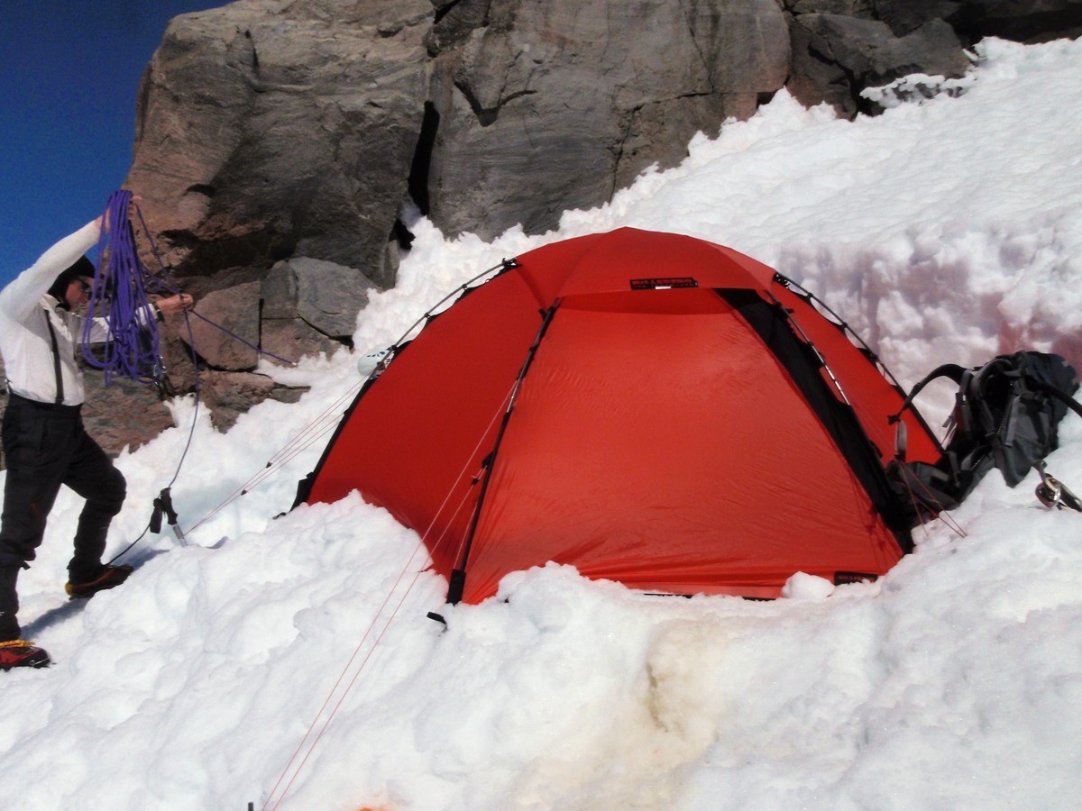
Got up at 1am, climbing at 2.30 am. We went up to the Kautz Icecliff, traversed 300' left to start going up on the Kautz. NOTE: we learnt later from a party near the summit, that 30' from where our tent was, there is a handline that avoids you going up and then down (all the risk of the ice fall) as recommended in some guides. This handline puts you at the base of the climbing line for the Kautz. We use it on the way back, and it was about 30-50 feet from our tent :-(. You can not see it from the approach line, has to search or ask for it...
The Icecliff
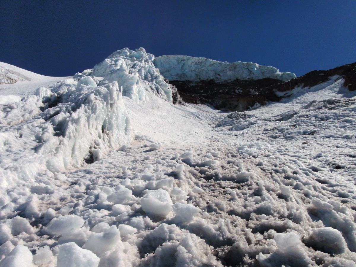
This is how it looks the "first ice pitch" to the left of the Icecliff. Is not ice yet, only hard snow, easy to go up, do not trip, though :-)
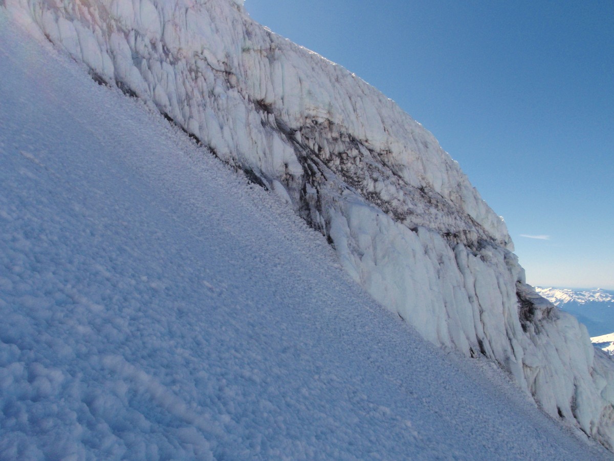
On the Kautz we saw / jumped / walked around a number of crevasses, still doable...
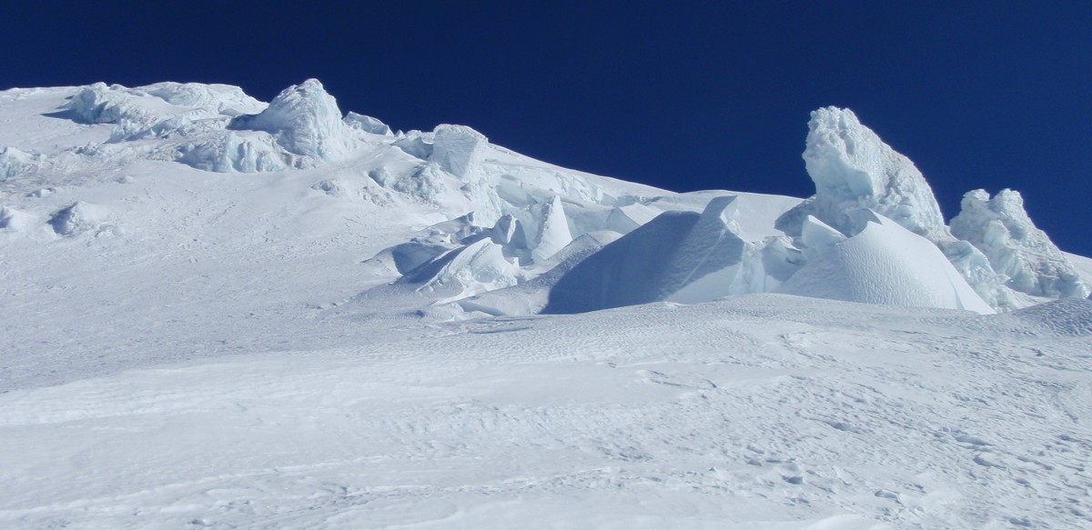
Traverse trough this fantastic field of crevasses and gigantic ice boulders to gain the upper Nisqually, where you'll find a few more crevasses, specially one about two-three feet that we had to jump, way to long to go around...
Kautz to Nisqually, you can almost see the boot path below the upper dome-like ice boulder...
Summit by 7.30 am, perfect views and weather conditions...
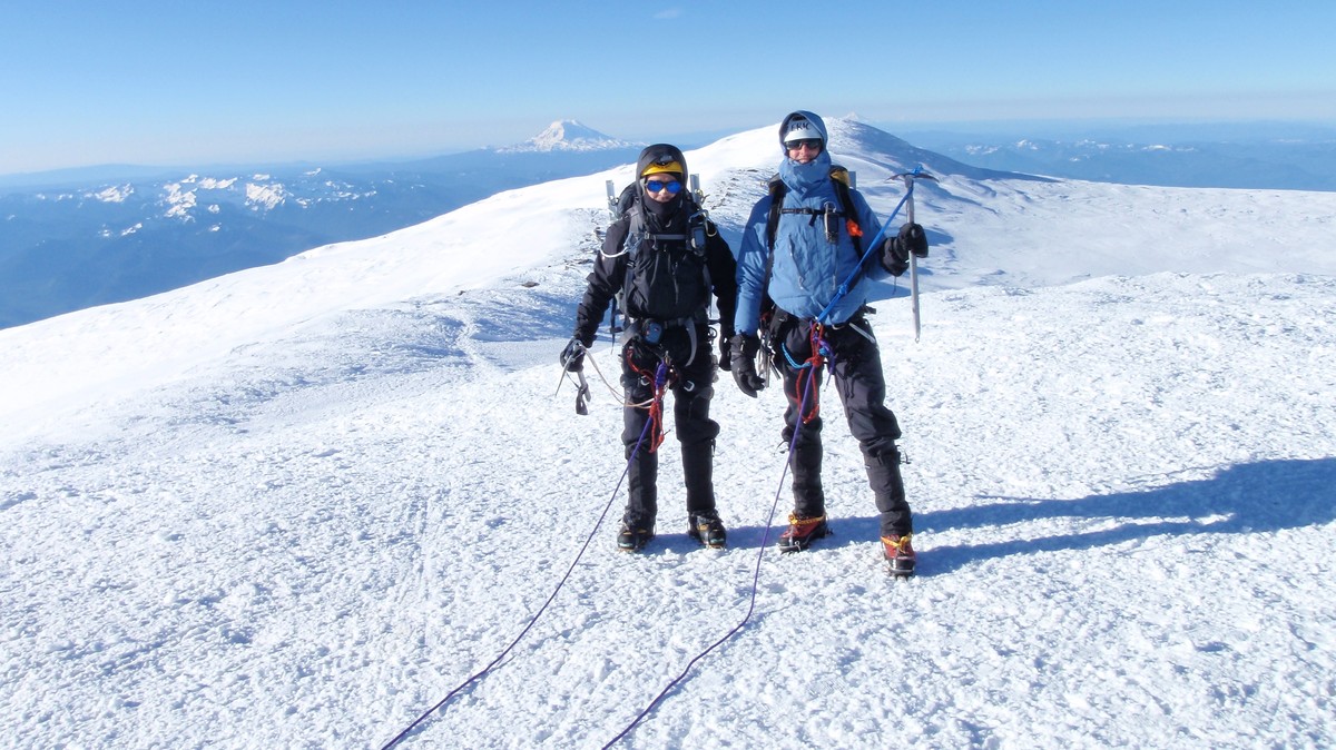
Back to camp by 10am, Paradise at 2pm, burger at 4pm :-)... Very cool time with a new climber friend...
Happy 4th to you all, BTW...
-
 Nice !! Now I have another one in my list and need to wait until next year
GA
PS, Do russian muscles' cramp?

-
Sweet, Buddy!! The route looks rad from Lake Vivian and even more looking down from the top :-)...
-
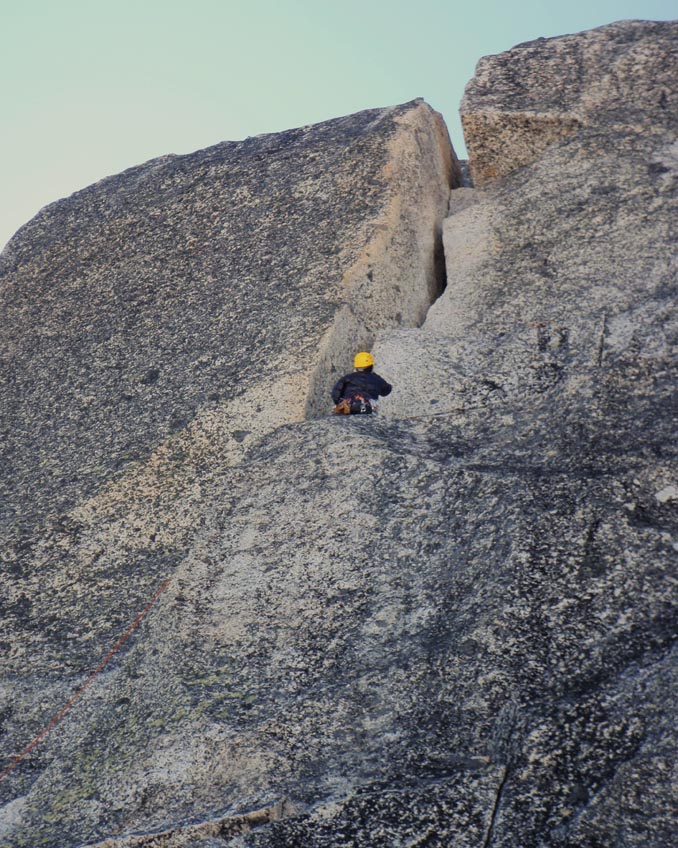
Where I am standing is more like a wide crack, big for a hand jam, small for a fist, fairly smooth, kinda difficult to jam, may be a 5.8? (would be easier if you are 2'' taller :-)...
After that move, the chimney itself is an easy 5.6 IMO...
-
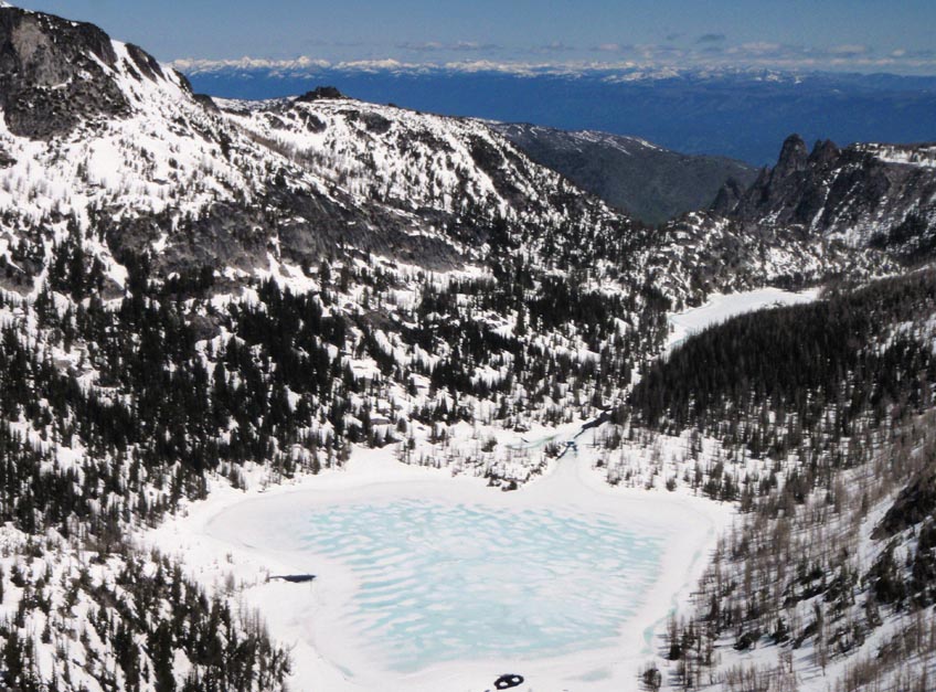
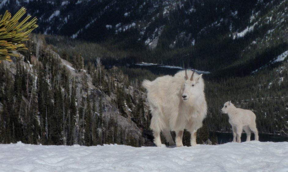
Trip: Prusik Peak / West Ridge -
Date: 6/20/2011
Trip Report:
There is a lot of beta on the W Ridge of Prusik elsewhere, so not too much for the seasoned PNW climber but mostly for those new as me to climb in the alpine lakes area, goes this brief update of conditions, a couple of points I did not find described before, and a few pics I think you’ll enjoy if you like the outdoors.
Approach from Snow Creek Trail: as of now 3 miles of trail, 6 miles of post-holing on soft snow to Prusik pass (gosh, how I hate punching through the holes that form between trees’ roots) and then may be half more a mile to the balancing rock (we saw actually three rocks balancing, the last big mama one being exactly at the base of the climb)
Gear: bring a VERY light rack, we brought much more than needed. Is not the case of “finding the gear for this crack”, but pick up a piece, look around and you’ll find a somewhere to place it, beautiful trad climb…
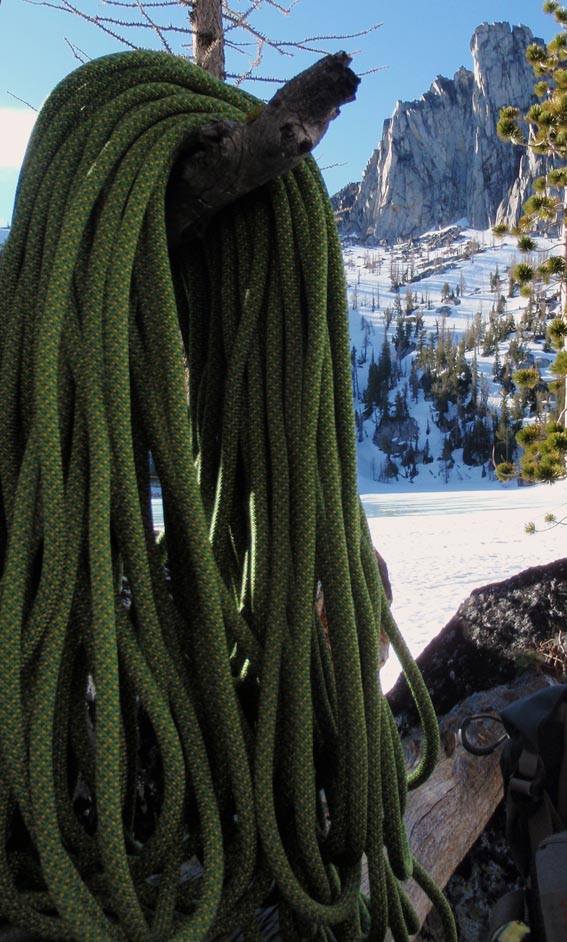
Rope/rappel: page 263 of CAG, picture says first rapel is 150 feet, so we carried two ropes. No need to. With a 60 m you’ll make it to the ledge rapeling from the chimney instead of from the bolt, and from there keep going straight down. There are more rappel stations than beer breweries in Germany.
INTERESTING POINT: If you leave your boots at the beginning of the climb, beware in early season you’ll go down to snow, and then you have to traverse back to your stuff post holing with rock shoes, is not cool (well, it actually is more than cool, is cold, on your feet). Later in the season I guess is not even an issue.
Overall, great enjoyable climbing on great rock and views…
As for pics…
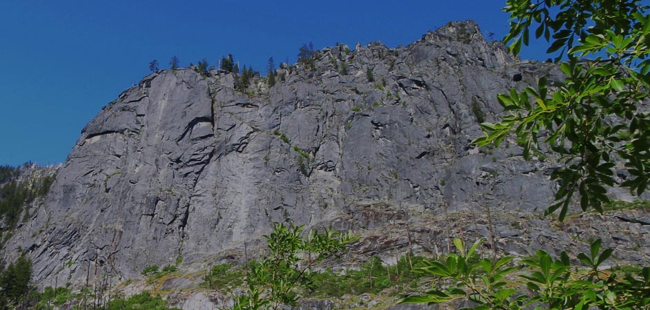
Love Snow Creek Wall
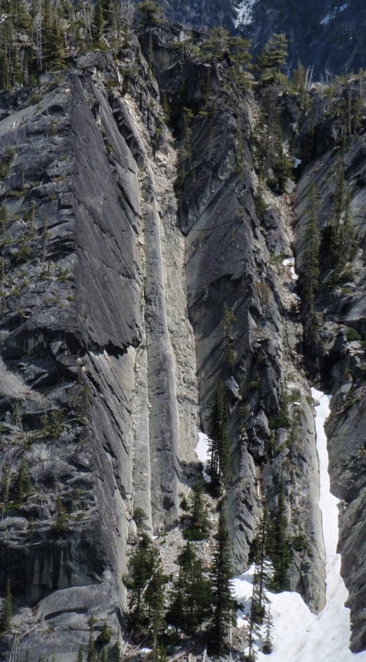
Cool looking cracks on the other side of Nada Lake, any idea is there any climb there? I guess access might be the issue
Nice view of the West Ridge line from bivy spot in lake Viviane
Matt belaying after leading pitch one, just short of the ridge top
Me belaying after leading the second, just until the base of the slabs
Matt on the top of the slabs, leading the third
Fourth and final pitch with one difficult move before gaining the chimney
Sweet summit...
Shield Lake and the mountains to the north
And a couple of friends we meet on the way back
Gear Notes:
See above
Approach Notes:
See above
-
Damn! Looks like quite the experience to tell over a campfire...
Great job on surviving and getting your self out :-)
-
[unfortunately my fat ass plus rack would not fit into the chimney enough for me to work my way above the first constriction]
KK, remember there are no fat asses, only strategically located fat reserves to survive longer in a winter storm :-)
Good times and good climb, Buddies...
-
The snow cave looks great...
-
Bad Ass, Ladies !! (ok, you as well, Juan... :-)
-
I personally agree with the folks that say that each one should mind his/her own business, but one thing I believe is logical: :
If it is at your reach to do something (anything), without anyone needing to tell you (just out of your appreciation and respect for others), that may reduce/avoid the chances in an already dangerous sport of you getting hurt and then OTHER people there needing to take care of you on the spot, OR mountain rescue has to go to help you out (with the potential for them to get hurt), I think it is worth trying to do it. But is your decision...
Thanks,
GA
-
Hi, Jaime, where are you from? I bet you speak Spanish, Buddy :-)
In any case, we can talk and see if we can go climbing together.
I'm in Seattle, Sand Point area...
Cheers,
Nelson
-
Or other option is Rainier easier way up Fri-Sat, Little Tahoma Sunday-Monday... actually, this would be my first choice...
-
Hi, Ivan...
I'm in for something from 27th to 30th. I'd prefer something like any North route on Hood, Adams or Rainier (even if long approach because of closed roads, may be sky down the South way?), but Squamish or Smith Rock could also work... Let me know what you think...
Cheers,
Gaucho
-
Holly-fu#@ing-Molly !!
It is inspiring and demoralizing: inspired to try, demoralized to realize I won't be able to...
Way to go, Dudes...
-
Cool, really cool...
Is every year possible to go to almost the top from the NW, or only this year because of the enormous amount of snow that had fallen?
Thanks for the pics!
-
Awesome, Dude!! There are few feelings like being out there on your own, I wish I can do this kind of stuff soon myself! Just to brake the inertia of the couch and decide to go solo is a triumph...
You did not have time for any pic, I imagine?
And did I miss it or you did not mention what did you use for self-belay?
Thanks for the TR, inspiring...
-
Buddy, where the heck is that tent pitched??!! Freaking awesome!
Do you have any pic from the tent looking down?
Cheers,
GA
-
Sweet line, Buddy, and nice pics, thanks for posting...
And although I did not know Monika, I'm pretty sure she's somewhere happy that you were out there making these turns
 ...
...Cheers,
GA
[TR] North Cascades Redoubt/Spickard Area 7/23-7/30 - Redoubt/Spickard/Custer/Rahm w/ high route finish 7/23/2011
in North Cascades
Posted
Billy, such a cool trip is a pity pics can not be seen.
If you go to edit, click the 4th icon from the left (next to the envelope), slect "insert a non-floating image", and copy-paste the url for your pics in the pop-up window, your pics will show up. You may have to play with the pic size you upload to make them the right size...
Good climb, Buddies!
--GA