

jordansahls
-
Posts
504 -
Joined
-
Last visited
Content Type
Profiles
Forums
Events
Posts posted by jordansahls
-
-
I hope its ok to ask this question here, I don't think it warrents a new thread. Anyone been around banks lake or vantage lately? I'm curious to see how climbs like trotsky's folly and Fugs falls are doing.
-
Which amendment covers a "sick-out"?
what word in the "right of the people peaceably to assemble and petition the government for a redress of grievances" do you need assistance with?

I'm sure some people here would like to see teachers protest only on weekends and holidays.
-
Did anyone get a look at the NE couloir on Dragontail during the descent?
-
Thanks for the good info. for those of you familiar with the climate in the area and the normal season, what are your guesses for mid march (magic 8 ball anyone?)? I'm obviously going to be keeping my eye on conditions from now until then, but I'm trying to decide between a place like Cody/Haylite or Lillooet (which is closer = less driving).
-
pm sent on G14's
-
pm sent on 10cm turbo express
-
YOUR ALL BANNED!
-
I'm looking to take a trip to Lillooet as soon as things get colder (if things get colder). I have never taken a trip to the area in my life, what are some good sources of information? What are the best websites to monitor the weather? Where are some good cheap places to stay? Quickest way to get there? Guide books? recommended climbs? Areas near by? Good place to get a beer? ect.
I'm familiar with the West Coast ice website, but that's about all. The only climbs, besides icy BC, That I am even a little familiar with are synchronicity and honeymoon, which I really would like to try and climb this year provided the season doesn't peater out in a haze of heat and rain.
Any and all information is a great help. Thanks!
-Jordan
-
many man made items (such as clothing) don't assure success or safety. When you climb a bolted route, you know all you have to do is make the next bolt, and the next, and so on. There's no, "oh S, will this go?" factor (or its minimal). Or, "I wonder how to pro is?" question. Sure there are route topos and maps and desriptions, but these hardly take the adventure out of climbing (at least in my expiriences).
I agree that the nature of "aid" is rather subjective. But somehow wearing a new RAB event jacket with arc'teryx pants just isnt the same as rapping down a face, drilling holes, and placing bolts.
-
Be very very careful no matter what you do. The shoulder is the most mobile joint in the human body, which also means that it is the least stable. Be conscious of the pain/discomfort you are feeling when your arm is overhead (as in climbing). Shoulder impingement due to tendonitis and bursitis can be debilitating, and those injuries are always overuse which means they start small and slowly get worse until one day you can barely move your arm (they can and will sneak up on you). Keep on top of it, and take more rest than you think you actually need.
Make sure you are lifting with proper technique. Always perform a 10-15 minute warm up before starting your climbing. Run for 10 minutes, do anything to warm up your muscles. Once you have warmed up stretch your wrists and hands (forearm flexors and extensors). Stretching after you feel pain is like placing gear after you have taken a fall, worthless.
If things get worse use the RICE methode (rest, ice, compress elevate).
Lastly, here is a great blog by Dave MacLeod that has a ton of information regarding climbing/tendon overuse injuries:
-
DONALD TRUMP FOR PRESIDENT!
http://www.cbsnews.com/8301-503544_162-20018405-503544.html
Donald to politicians, "Your Fired!"
-
Sounds like a pretty recent update:
"Gated and closed at mile 20, Eldorado Creek, 3 miles before the end of the road. Road is paved to ~ mile 10, then gravel with some potholes and washboards, but generally drivable for low clearance vehicles. Not suitable for large RVs due to steep and narrow sections and some sharp switchbacks. Please drive SLOWLY, road is narrow. Newly fallen trees may also block the road on occasion. As of Jan 6, rockslide blocks road at ~mile 12 (Hard Creek Bridge)."
Thanks. I really need to remember my govt. websites, Ha.
-
any update on this?
-
I recommend going in via Hook creek. Rat creek is way more of a suck fest. Hook is nice and direct, fairly open with not a lot of deadfall, and you can camp on the mesa if you so choose which is a bad ass spot.
-
The original plan was to hit a few of the peaks, but that didn't happen. However, I think you could get some good turns in coming down hook creek, which is mostly open. At least you would get to ski down a few thousand feet unmolested before entering the shrub shenanigans.
-
We considered it, but the snow was unconsolidated and the slabs up temple canyon were icy and looked less than inviting. But your right, we mostly wanted to make the trip into more of a tour.
-
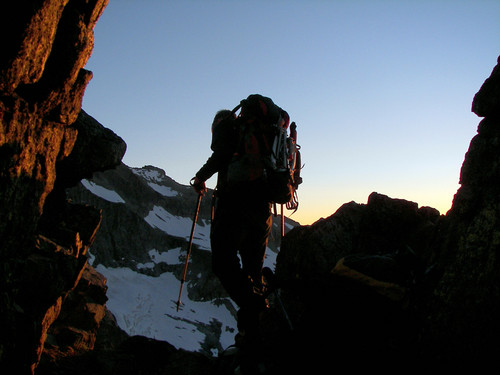
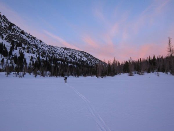
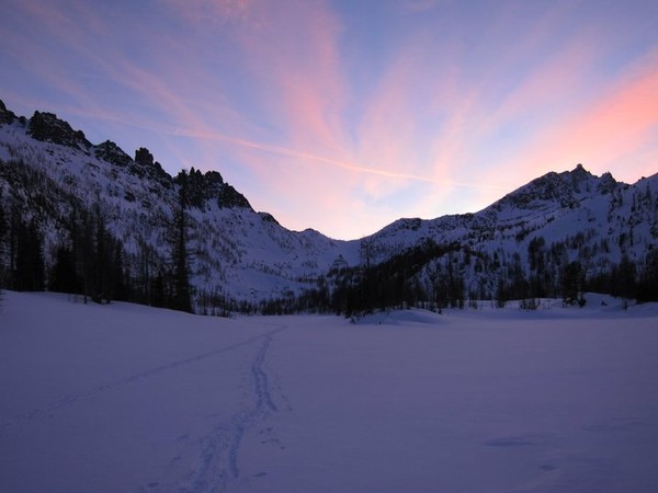
Trip: Enchantments ski tour - snow creek to rat creek
Date: 12/31/2010
Trip Report:
It was with the promise of a glorious forecast that Brian and I headed out on New years eve with the hopes of spending three days touring through the Enchantments.
[if you have no interest in harrowing tales of manliness skip to the bottom for pics]
We spent the first night at Snow lake, which was very very cold. The temp down in Leavenworth was around 0 degrees F, which means it was around -15 to -20 F at the lake. Thank god we brought a fifth of Wild Turkey 101. We spent the many hours of darkness drinking and playing a rather interesting and long game of "would you rather" (I will just say this, Olsen twins or Williams sister).
The next day we got up and started things out by snapping a pole on Brian's tent. We managed to repair the break with a little bit of elbow grease and a lot of foul language. The repair job ate up a fair amount of our already limited daylight. after talking it over, Brian and I decided that our best option was to hit Prusik pass, ski across towards Edward's mesa, and ski out rat creek. It seemed more favorable than spending another night in sub zero temps.
The climb out of snow lake took a little bit of creative navigation, but was fairly uneventful. It was nice to be moving in the sun. The only unpleasant part was trying to battle dehydration. We were in the situation where our only means of getting water was to melt it, but we could not store any in our water bottle because it would freeze in our packs within 15 minutes.
We skied down Prusik pass and stopped at Shield lake to brew up. We spent 45 minutes melting and drinking as much pine needle infested water as was humanly possible, you would think we were battling scurvy. It sure helped with my headache and cotton mouth. Feeling better, we packed up and started moving towards mesa lake.
Everything went smooth up until the point at which we started our decent down the rat creek drainage. Holy shit. I have no words to describe how heinous and truly horrifying the next 7 hours were. Trying to ski down rat bastard creek is like purposely dropping the soap in the penitentiary shower, over and over again. We basically fell our way down every single foot of the over 5000 feet of the drainage. It was truly the worst descent I have ever had the misfortune of making. The original plan was to ski out hook creek (Brian and I had made the approach to climb the Mole in the summer via hook creek). We only skipped on hook creek because it was dark when we got to the base of the mesa and we were too lazy to climb up. Big mistake.
After raging and cursing at every deity known to man we finally made it down to the bridge and icicle road. We were both dizzy with dehydration, It was 11:30pm at this point. Brian and I still had to walk/skin the 2 miles of road back to the car at the snow creek trail head. Our feet were absolutely mangled, so we removed our ski boot shells, dropped our packs and ran the road in our inserts.
The drive back was painful. We managed to get some liquid in us at the rest stop on our way back towards the west side in the form of sprite and coke.
Even with the awful shenanigans, the trip was good. A few main lessons were learned, one being bring a bigger stove to melt water (we had a packet rocket, which got the job done but not in any sort of timely fashion).
Pics (all by Brian):
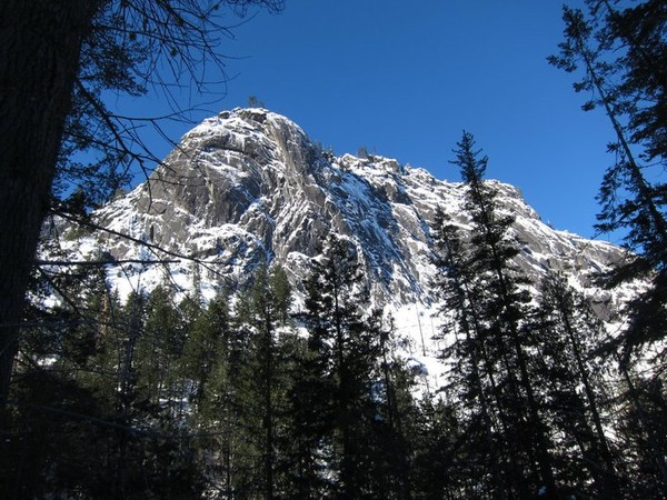
snow creek wall
Nada lake
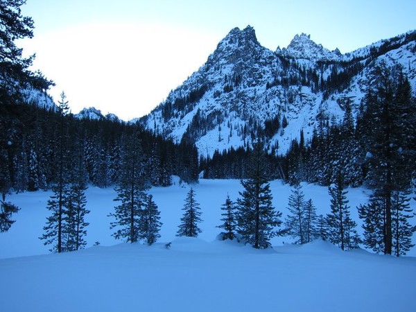
Snow Lake, looking towards Enchantments
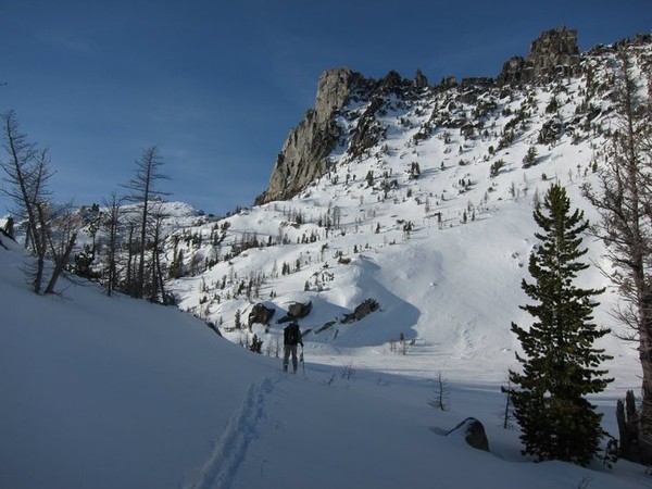
almost to Prusik pass
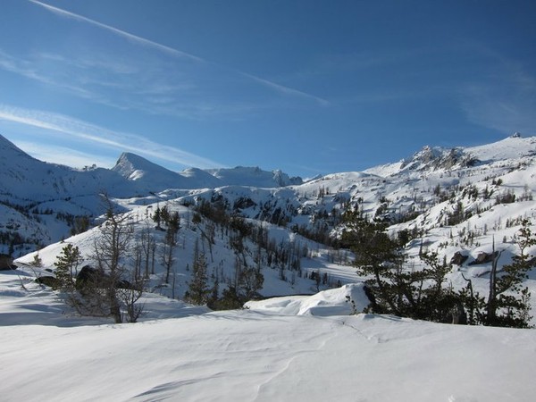
Looking at Little Annapurna
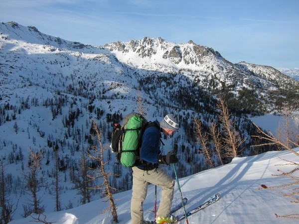
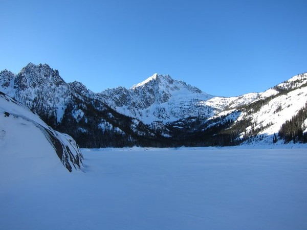
At Prusik pass
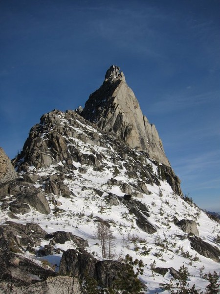
west ridge of Prusik
Shield lake
back towards Prusik pass

The descent down rat creek
Approach Notes:
Snow creek trail
-
I'm looking to spend around 150$ on a pair of used x monster ice tools in decent shape. Price is flexible, so if you have a pair and you want to sell them, let me know.
-
Just got back from up that way, there is a "road closed" sign just after the monogram creek bridge/sign. It seemed like people with property beyond the sign were driving it, but its "closed" to through traffic. Anyway, it may be a while before they finish cleaning the slide debris off the road.
-
Hair of the dog!
-
I agree, I have never seen any women like that in L-town, I would be spending more time there if that was the case. Or maybe I'm not going to the right spots?
-
I think my favorite Shuksan spotting happened about a year ago on the late night show with Conan O'Brian. They were doing a sketch about skiing using Shuksan as their background. It was a bit strange.
-
better get it soon, I was up there today (the 27th) and it was warming up fast with a bit of water running on the formations.
-
"And that," put in the Director sententiously, "that is the secret of happiness and virtue-liking what you've got to do. All conditioning aims at that: making people like their inescapable social destiny."
- Aldous Huxley, Brave New World
Bellingham shoulder orthopedic specialist?
in Fitness and Nutrition Forum
Posted
Hey,
After 5 years of dealing with left shoulder impingement, I have decided to go and see about my surigcal options. Can anyone recommend a good Orthopedic specialist near/in Bellingham with emphasis on shoulder impingement issues and sports medicine? I don't just want to be pain free, I want as much function back as I can get.
Thanks,
Jordan