


KaskadskyjKozak
-
Posts
17274 -
Joined
-
Last visited
-
Days Won
20
Content Type
Profiles
Forums
Events
Posts posted by KaskadskyjKozak
-
-
meanwhile there is a strange orb in the western WA skies... apparently it is scaring folks into posting in spray. An alternative would be to conquer one's fears and appear before this orb and pay homage. I'd suggest a hike, run, or bike ride
-
I just wanted to check in to this thread. I missed so much while in Moab last week.
-
I agree that there is an attack on free speech in America today. But the thread title is a total mismatch for the OPs actual topic.
<THIS MESSAGE TRUNCATED BY AN OMNIPOTENT MODERATOR BENT ON STIFLING FREE SPEECH>
-
-
On 2/15/2021 at 12:09 AM, JayB said:
Descending from Colchuck Lake on a refrozen crust whilst hauling an overnight pack with climbing gear falls into that category. First time I ever used skins on the descent. Still think I'm in the "If you find yourself wanting snowshoes, the entire trip is a mistake..." camp most of the time, though.
The purpose of snowshoes is to carry them on your pack, so you will never use them.
If you leave them at home, you will need them.
-
 1
1
-
-
On 2/5/2021 at 4:01 PM, olyclimber said:
no judging, just forgiveness.
I'll go first. I was walmart puptent guy.
Bless me Porter for I have sinned....
-
 1
1
-
-
1 hour ago, JasonG said:
No, I have Anderson, Carrie, Tamanos, and Alta yet to do. I haven't exactly been putting it very high on my to-do list.
It might take me a few more years at the rate that I'm going!
I have Carrie left too. I'm excited for both Anderson and Carrie (and Clark, Deception). The Olympics always deliver!
-
On 2/5/2021 at 4:56 PM, JasonG said:
EXACTLY

Let me know when you are looking to get out this year @olyclimber. Would be fun to get out! I need Mt. Anderson still.....
#100? woot!
I'm hoping to bag Anderson myself this May-June. Hope you guys get out there too!
-
Never saw Mogg or Schenker while climbing, but definitely enjoyed some classic tunes on my iPod
-
we gave this route a try in october but ran out of time with a mile to go to the summit (we were deep in the scrambling up high). We ended up bailing at sunset. next day we got Old Snowy and Ives, and now I have to go back for Gilbert.
")
-
1
-
-
Thanks for this bump. I'm definitely going to take my son on this route - hopefully this summer once I clean up some unfinished business in the Chilliwacks
-
Great pics! -
R.I.P., Edward!
-
 1
1
-
-
I've done that approach twice for NE buttress of Goode so I'm not sure I'd want a repeat (gawd it's awfully long and you are right about how far you really need to get on the first day). But it's definitely a cool TR - I never thought of even looking for a route from this side, since almost everyone seems to do the S side route (which does have some typical Cascade Choss). I'm actually wondering how the two would compare - the S side involves that long hump from trail to 7K that is pretty rugged and brutal itself....
-
On 9/12/2020 at 11:17 PM, Kuato said:
I was the climber that you meet on the summit of Snowgrass. We chit chatted about your climb up Monte Cristo with the river of water flowing up your sleeve. The NE Ridge route next to the steep ass snow on the NE Face route is pretty nice. Mostly class 3 with some 4 toward the top, some loose rock but overall very enjoyable. Leading up to that the ridge is easy traveling. The runout on that NE Face route would be bad news if one was to slip.
Hey cool! It was nice to meet you. The photo you posted actually makes neither the snow nor the ridge look bad at all!
-
On 9/16/2020 at 7:46 PM, Jim said:
Nice KK - despite the smoke - any port in a storm
Thanks, Jim. TBH, I'm grateful for any day I can get out, especially at my advanced age

-
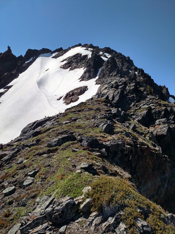
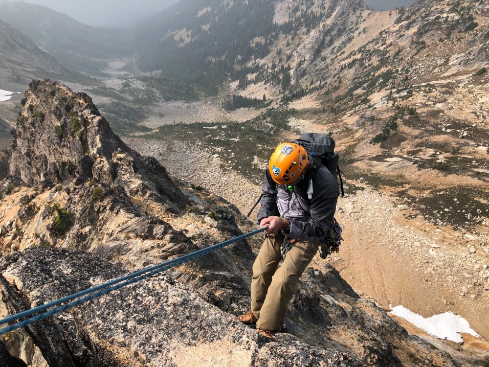
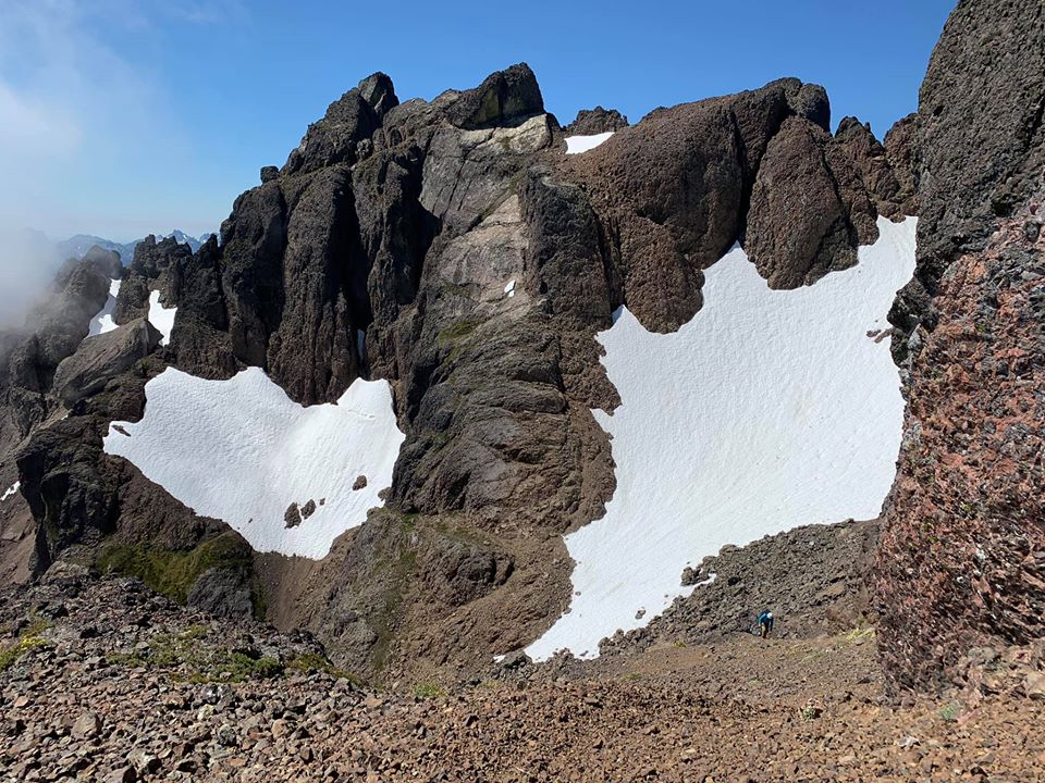
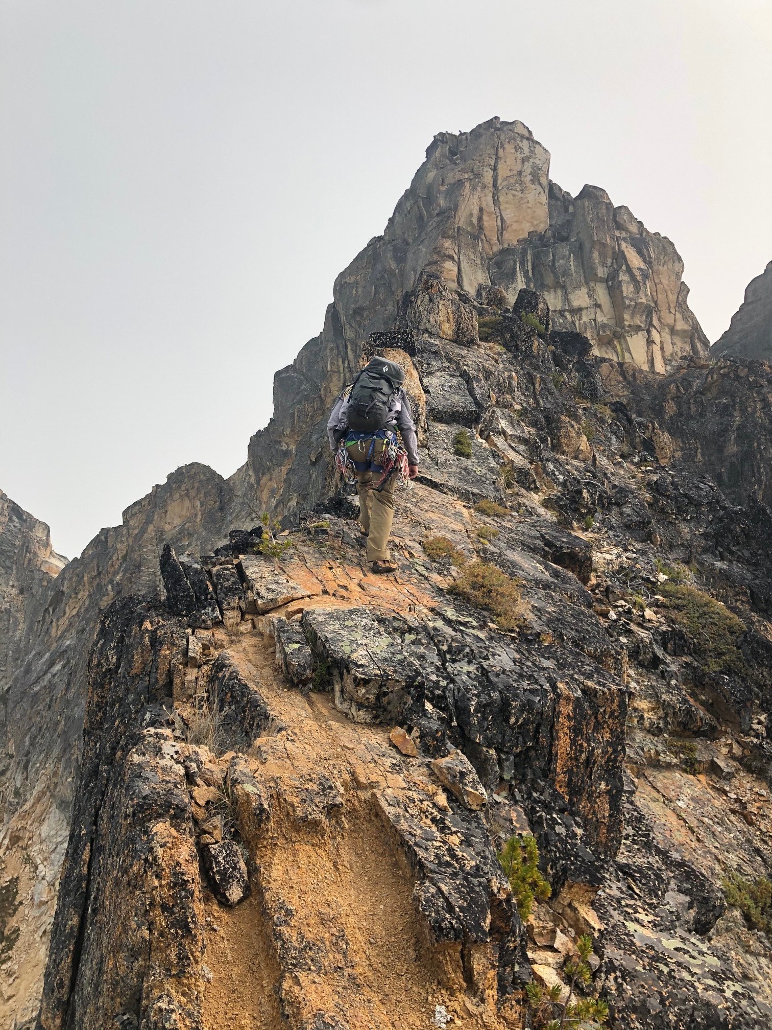
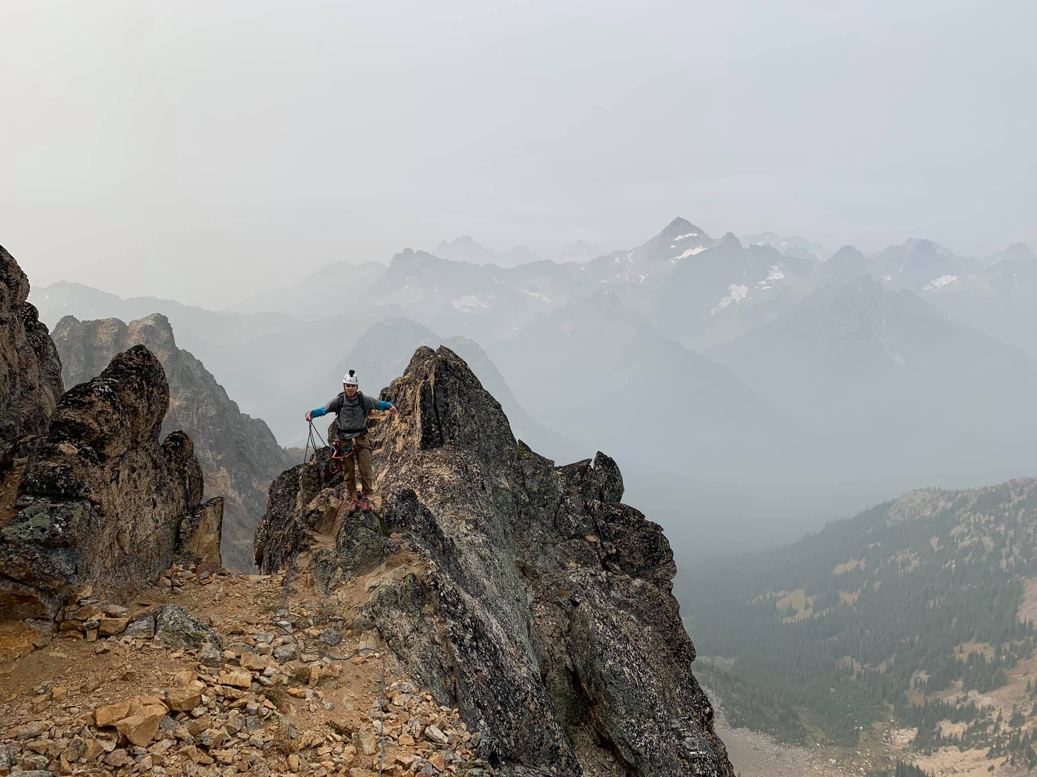
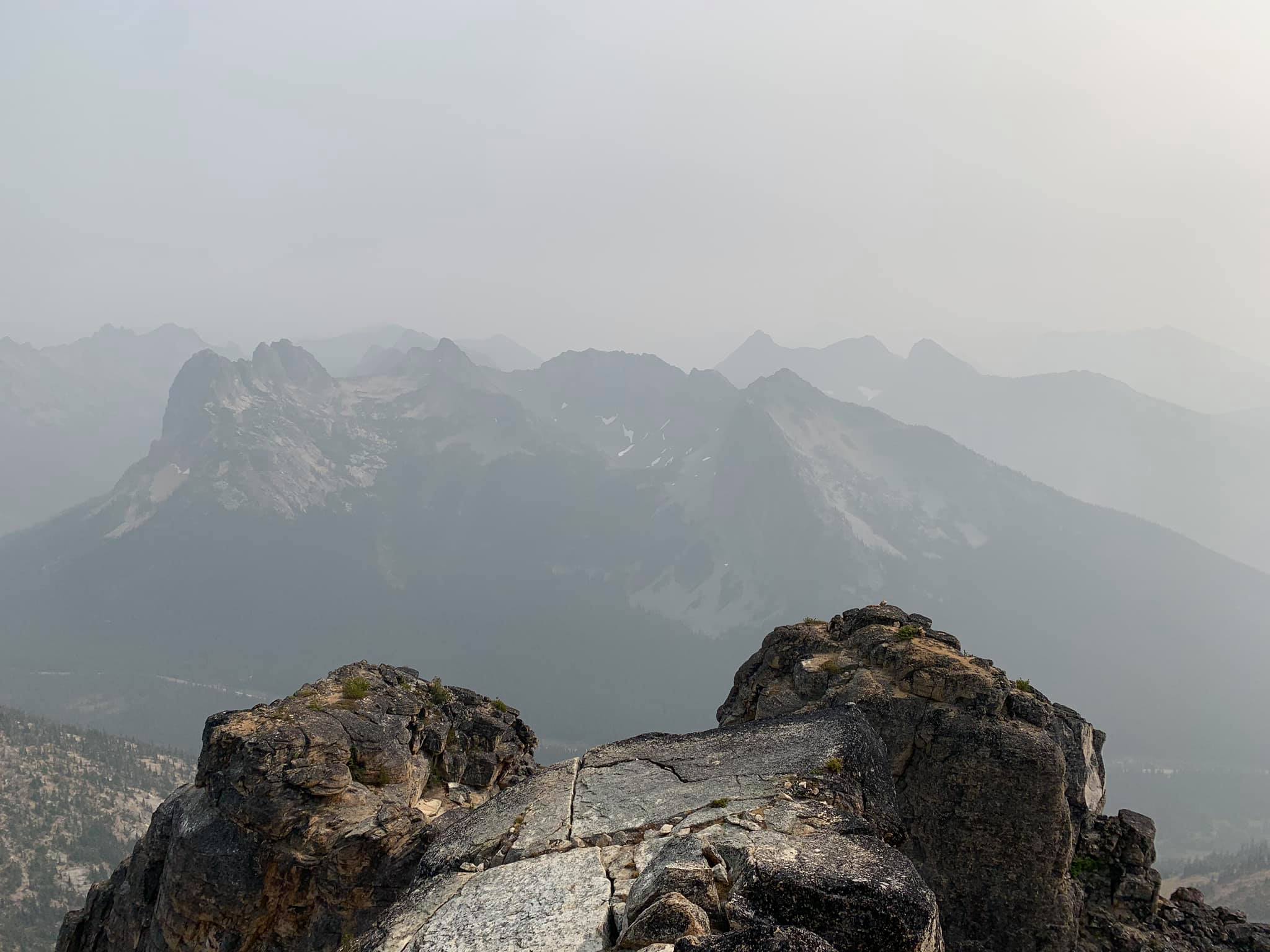
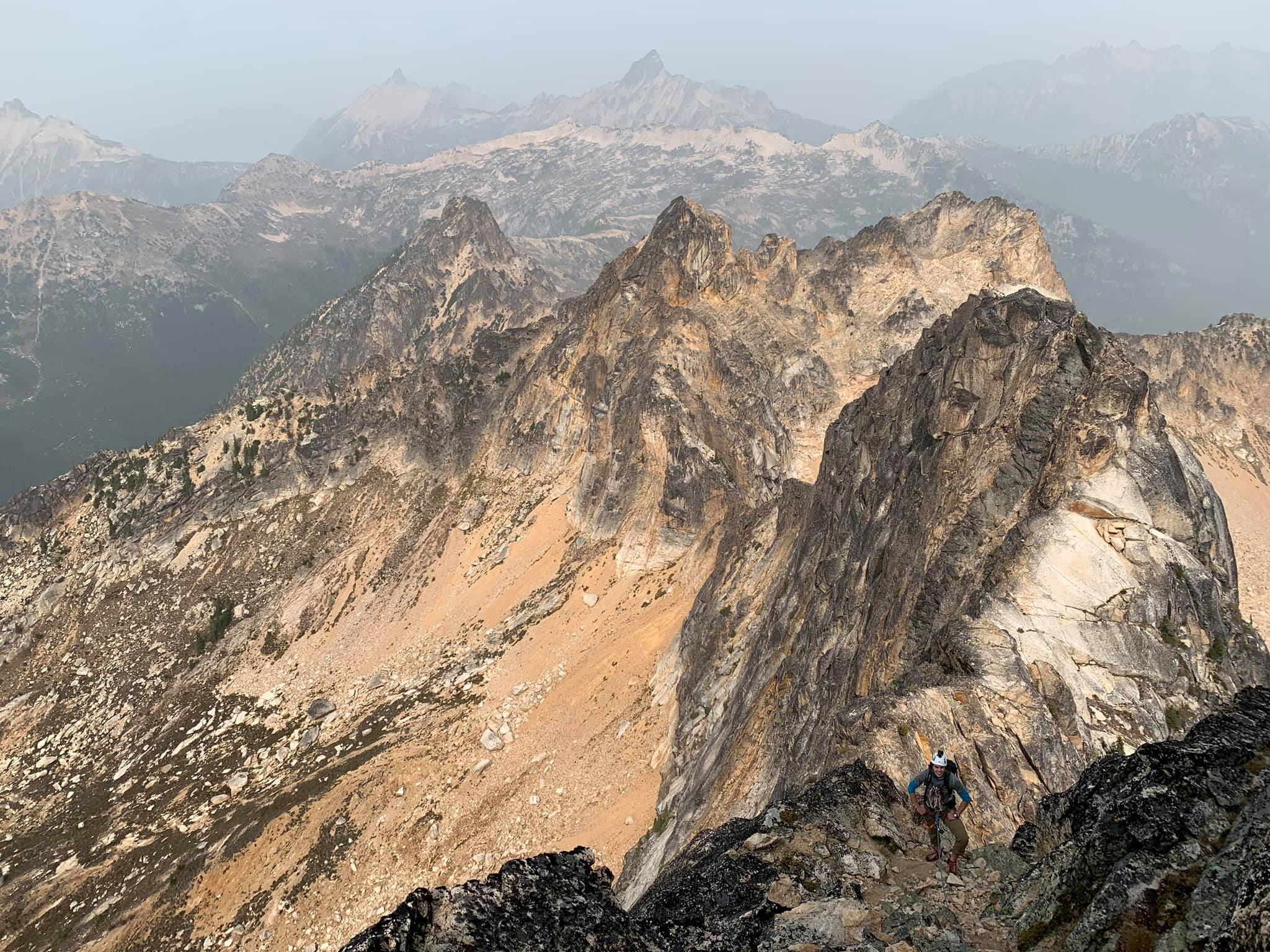
Trip: Cutthroat Peak - West Ridge with North Ridge finish
Trip Date: 09/13/2020
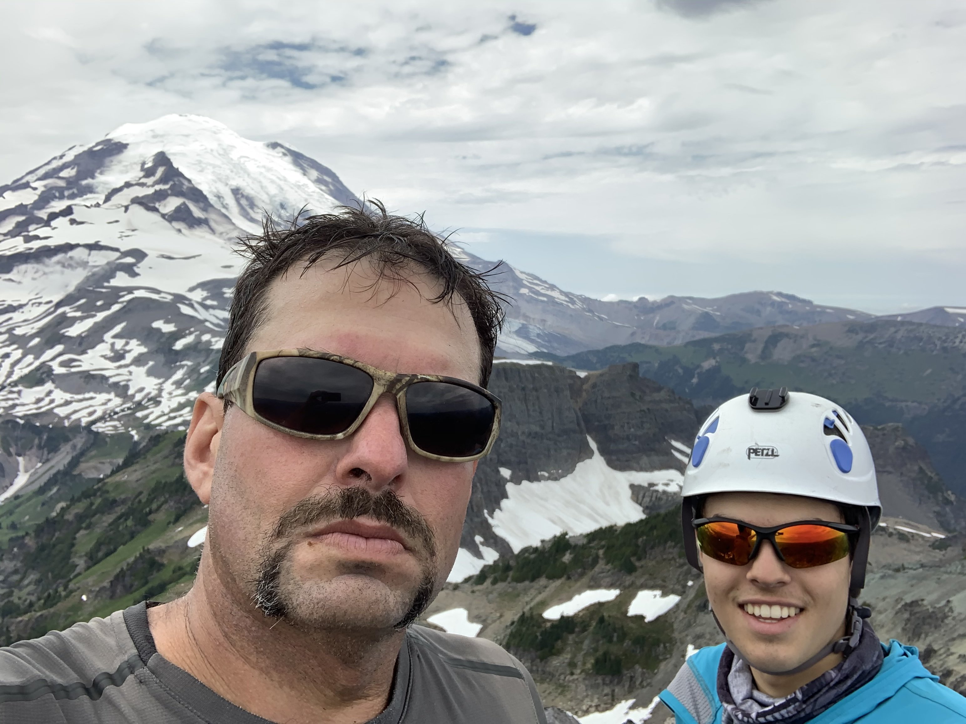
Trip Report:After a couple disappointing attempts into Depot Creek I settled for a rock climb this weekend with my son. The smoke made multiple days seem unappealing but I figured a one day climb would be a reasonable compromise. My son and I headed out to WA pass mid-afternoon on Saturday, stopping in Marblemount to retrieve some items we had stashed in bear lockers on a previous trip that the maintenance crew took. We then proceeded to Lone Fir Campground for a relaxing evening before an early morning start.
Alarms went off at 5:20 (damn it's dark now at that time!), and we drove to the pullout below Cutthroat. The smoke seemed to have worsened from the previous day, despite what we were expecting from reading forecasts. Oh well, we were there.
View up in the morning:
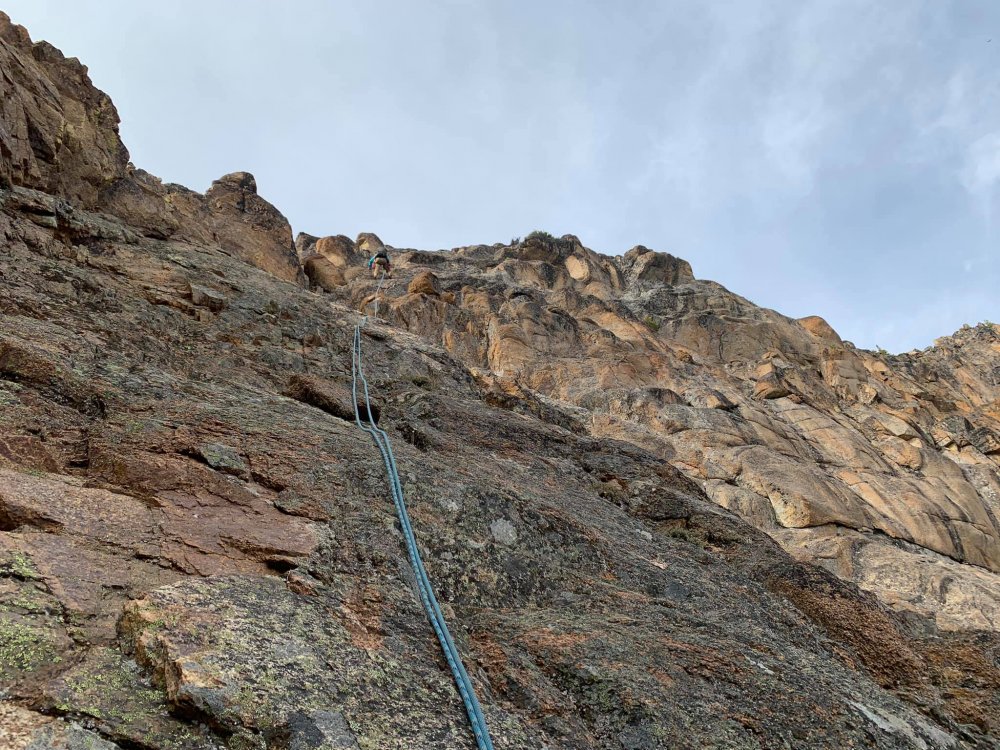
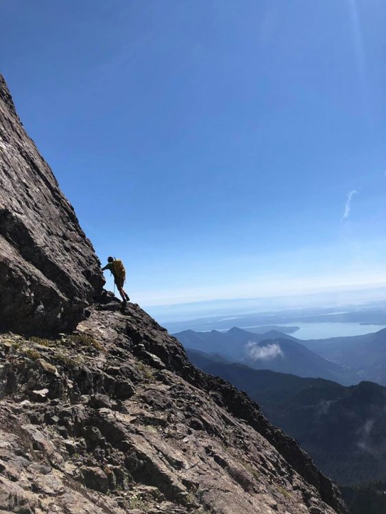
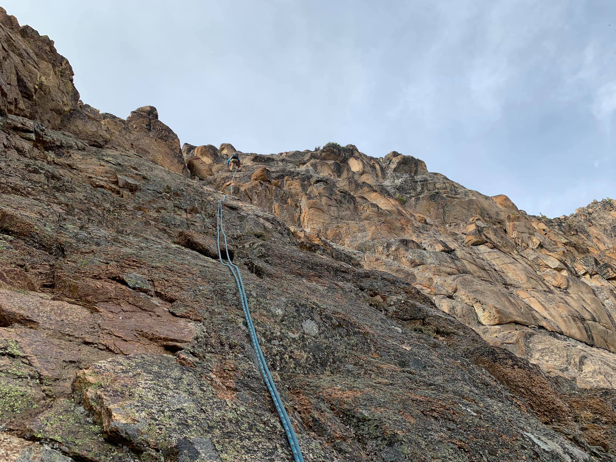
We made quick work of the approach to the base of the route around 7500'. We opted for the start just right of the prominent dihedral (with a wide crack) on the S side. The climbing started at class three then got harder and more exposed. I never saw any fixed pitons (I expected two) and ended up climbing to rap chains in one long 60m pitch. Later we found that this is the middle set of chains for the descent from the ridge crest. From here I led a shorter pitch to the crest and the top chains. This had a few rock moves mixed with scrambling.
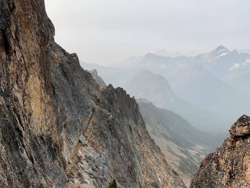
We then unroped and moved the belay as far as we were comfortable. There is one section of the ridge that becomes exposed on both side and requires moves around small micro-gendarmes that we didn't want to solo. So we backed down a few feet, built an anchor and simul-climbed the exposed section to a flat spot.
View to the summit block from the exposed ridge:

My son at the end of the exposed section:

From here we opted to traverse the ledge to a notch in the upper N ridge. We simulclimbed that as well, but realized it didn't really require it (much less exposed than what we had just done).
Ledge leading to the N ridge as seen from the N ridge notch:
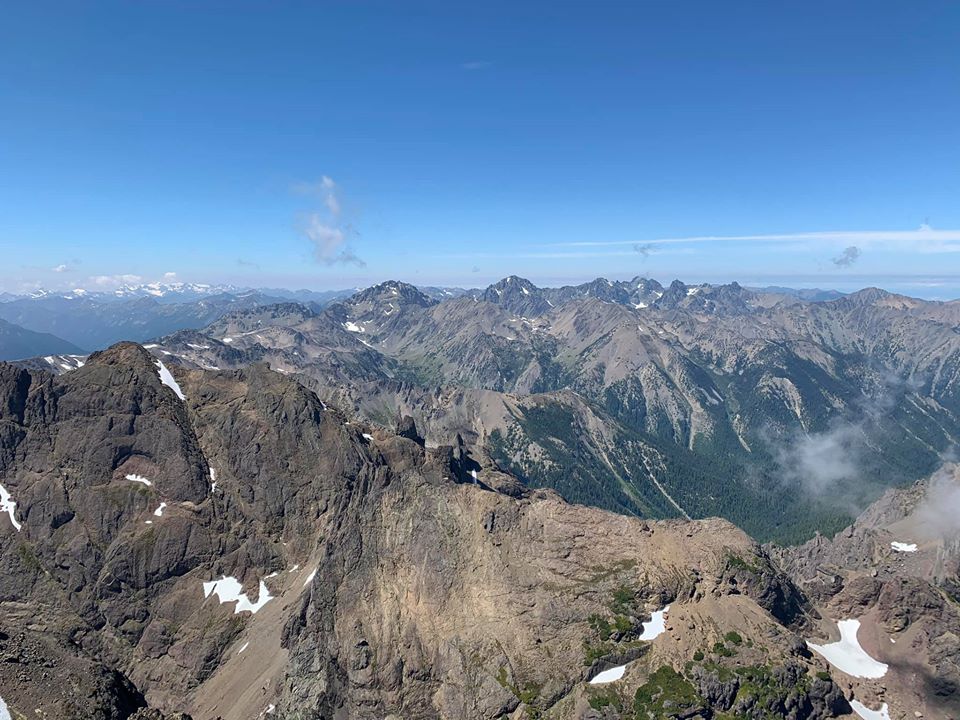
From the notch on the N ridge, I led a fun pitch up 4th and low 5th class rock until the terrain moderated to a scramble that led to the summit.
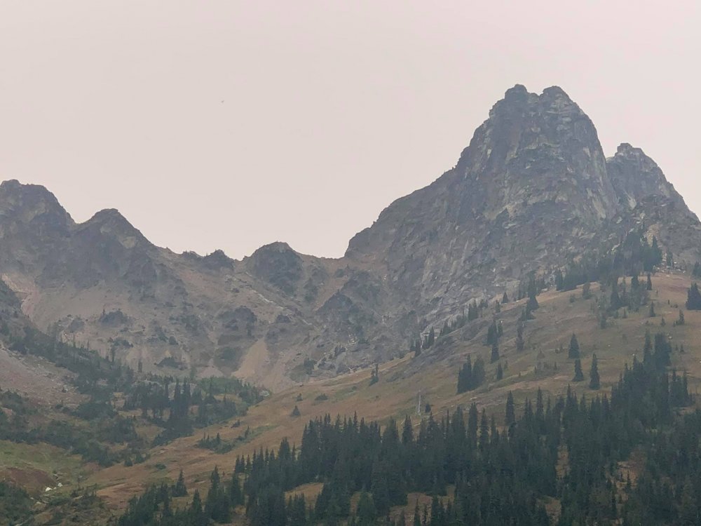
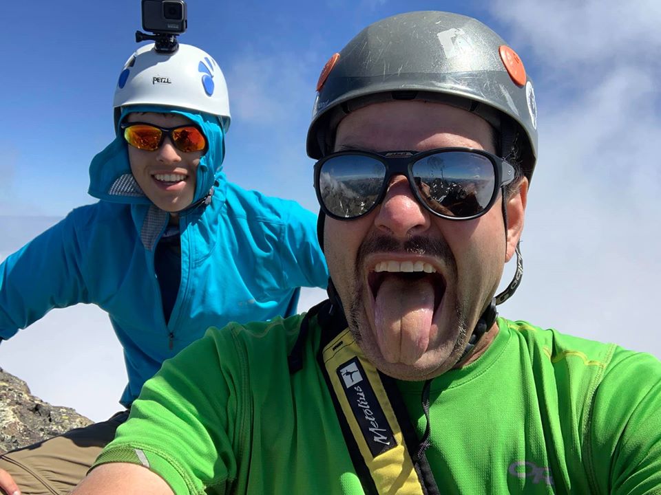
Summit views S (very smoky):
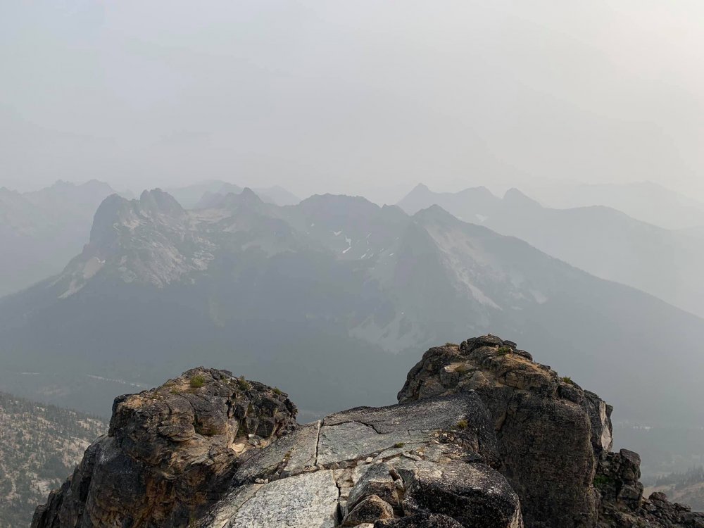
Summit views North (clearing some):

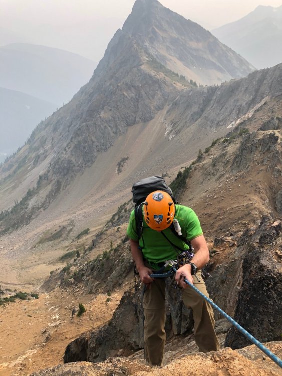
After enjoying the summit for a while and fueling up, we began our raps down to the W ridge. We were expecting two 30m raps off of chains, but the 2nd rap dumped me on sketchy class 4 terrain, so I climbed back to the rope, attached a prusik, and climbed back to a 3rd rappel station (not chains, but quite elaborate set of round webbing/cordelettes).
Me on upper rappel:
We then simul-climbed the short exposed ridge section, downclimbed to the bolt anchors on the lower ridge and did 3 30m raps back to the base.
Lower rappel. Note improved air quality by later afternoon
The hike out was pleasant and we got to the truck just after 6:30, making it a 12 hour day.
Gear Notes:
Alpine rack up to 2"
Approach Notes:
Zero snow. Compared to other trips this summer, not too chossy-
3
-
2
-
-
On 8/21/2020 at 7:27 AM, Off_White said:
You're on the other side of this, aren't you? Probably isn't any easier to approach via Owyhigh Lakes given the work to get around to the start. Out and about to less popular destinations sure seems like a good call this year! Thanks for the report and swell pictures. <Edit> Oh never mind, that's Governor's Ridge, Cowlitz Chimneys are behind me! That's from the only time I've been up in that area about 5 years ago.
Yeah we did a hike this way to Tamanos Mountain - just above and right of the pic above. From there we actually were admiring Cowlitz Chimney and decided we'd try for it some day. I think it can be approached from Owyhigh but is best with snow/in Spring.
-
3 hours ago, cobrak said:
Looks like a great trip! Excellent report!
Do you think crampon would be needed given current snow condition?
Is longboard suitable for the first 5 mile road?
Do you think a 20-meter rope would be suffice for the summit rappel?
Thanks!
WE never used crampons. I think a 30m rope would work and possibly a 20. Folks braver than us would probably just downclimb (exposed side is easier, less exposed part is steep and stiffer)
-
 1
1
-
-
1 hour ago, JasonG said:
No, I climbed the EFD 10 years ago. Can't believe it has been that long. And Mix-up probably 17 years ago now....Yikes. Been doing this for too long!
Yep, time marches on and we get old AF.
-
3 minutes ago, JasonG said:
I think 95? I am so far behind on TRs this summer.....but the rains of November will fix that!
I won't finish this summer. Too many other compelling things to do.
95 is close enough. 2021!
Still got Chimney Rock? That's the hardest one I have left, then, maybe Mixup
-
On 7/8/2019 at 8:27 AM, JasonG said:
92 as of this weekend! I won't finish this year I don't think, but I'm getting closer. And no, we didn't do any bouldering on Shelter Rock, but I can see how that would be a thing. It is pretty impressive!
Where you at now? gotta be close!
I'm hoping to get Anderson and Clark/Deception next spring/early June. Standard routes though. Looks like you like to squeeze in a little more extra than I do
-
Trip: Constance - South Chute
Trip Date: 08/10/2020
Trip Report:With a weird forecast this week my son and I decided to convert our planned five-day trip to the North Cascades to a more modest 2-3 day summit of Constance. We headed over to the peninsula moderately early Sunday morning, arriving at a full road-end parking area with cars backed up the street for maybe 1/4 mile. We found a recently vacated gap for our truck, unloaded the bikes and headed up.
Just over an hour later we arrived at the TH, did a gear adjustment and started uphill. We were amused by the signage warning that the trail is not just a "hike", and by the party of three that started up it only to bail within 5 minutes. We then powered through the worst part (the bottom) only to see that around 4000' it got stiff again. We arrived at camp after 4 hours or so, a bit hot and tired. We had plenty of time to wade in the lake, and enjoy the lack of insects. Most people were gone already except one guy floating on the lake fishing (catch and release)
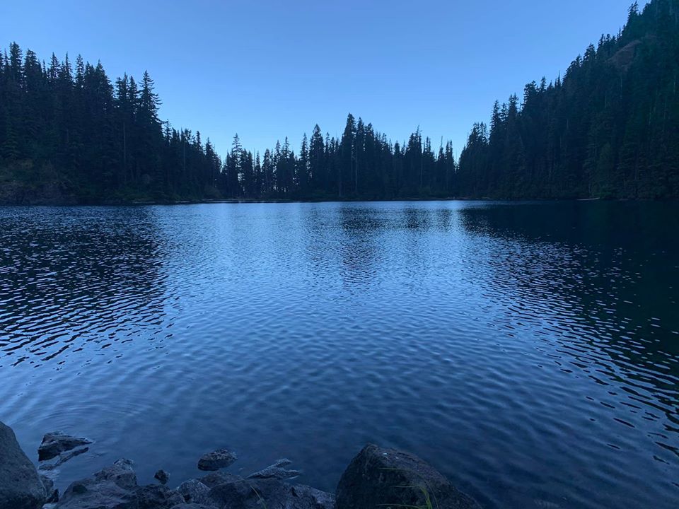
Lake Constance after sunset:
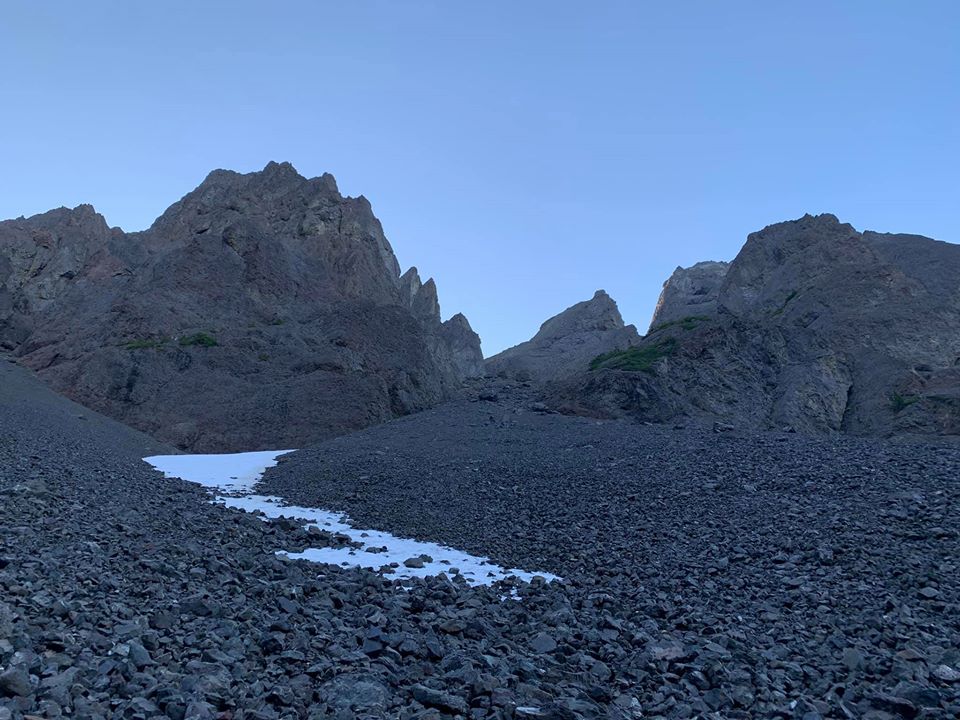
The next day we were up at 4:15 and headed up Avalanche Canyon. There is almost no snow whatsover left there so we suffered through the tedious boulder hopping followed by endless scree up the S chute, down its other side, and up to the notch crossing the E-W trending spur ridge.
All scree and no snow makes the S chute a dull boy:
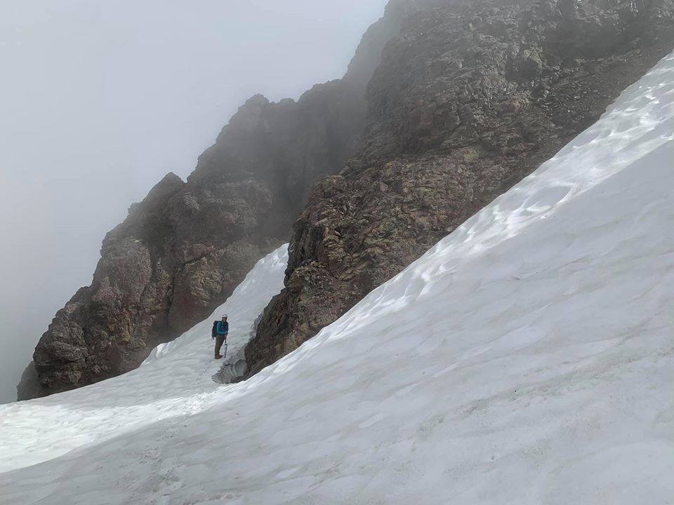
On the far side of the notch there was still a snow patch melted back from each rock wall, and we walked along the one skier's left until it got too moated out, then got onto the snow (now flat with no bad runout), crossed it to rock, and worked our way to the finger traverse. Once there we opted for the bypass on the way in, planning the FT if time and will-power cooperated on the way out.
Moat shenanigans (taken on return to camp):
The FT bypass
After the bypass we scratched our heads a bit about what to do. A really nasty gully led down and we didn't like it, so we traversed a bit, then found a still unsavory, but slightly better gully down to snow, crossed it and then started up the ledge system towards the summit block. The next talus field was also devoid of snow, but not too tedious. Then we were on the summit block and doing a corkscrew to get to the N side of the summit block.
View back to the Terrible Traverse and FT:
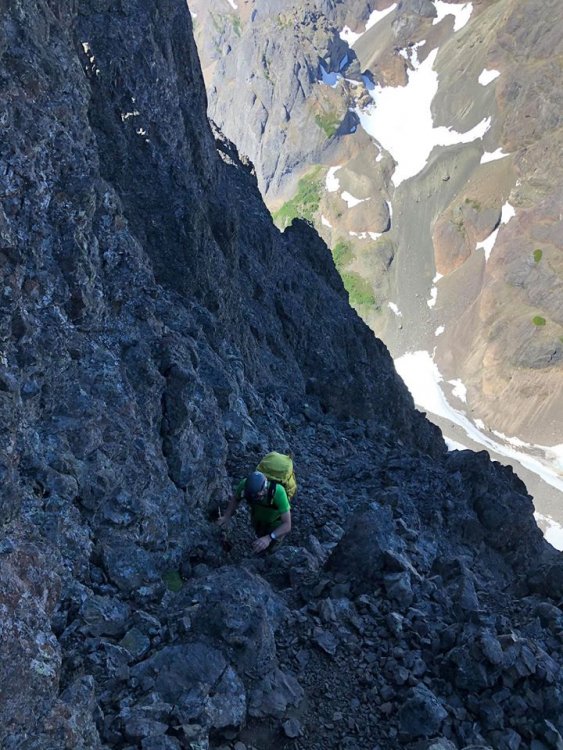
Working the cool ledges on this climb:
The final moves seemed a bit high end to solo for my taste. After looking at a few options, I pulled out the rope to lead it. But I ended up just placing one piece maybe 8 feet off the ledge, then topping out. There was a new summit register dated 7/4/20 with a new rap anchor, but the webbing was shredded and we ended up carrying it down, putting new slings in (which may get devoured by rodents over the next days or weeks as well).
Olympic Mountain p0rn:
Another Smoot in the books!
One short rap led us back to regular scramble terrain and we began retracing our steps down. At this point the fog rolled in. We could see enough to get back to finger traverse. Due to the time we spent getting to the summit, including getting gear out already for a short lead and rappel, we opted to just climb the bypass (super chill) then continued to the col on the E-W trending ridge. The skies cleared for us here and we enjoyed some serious scree-surfing down to the basin below the S chute, topped the col, then did more scree-surfing into Avalanche Canyon. Then and there the fun ended and we proceeded to tedious boulder hopping back to camp. Arriving at 7:15 we decided to stay the 2nd night we had reserved on the permit, and hiked out early Tuesday morning. The steep Lake Constance trail went by quickly thanks to fresh legs and Iron Maiden. And the bike ride was a pure pleasure (about 30 min of coasting).
Retun to lake:
Gear Notes:
Ice axe, helmet, 40m rope, small rack
Approach Notes:
Talus, scree, more scree-
2
-
4
-
-
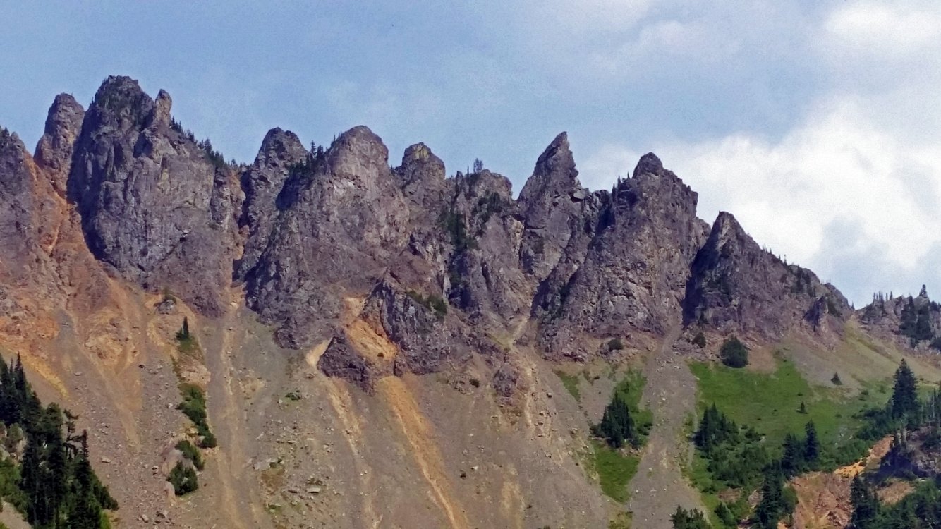
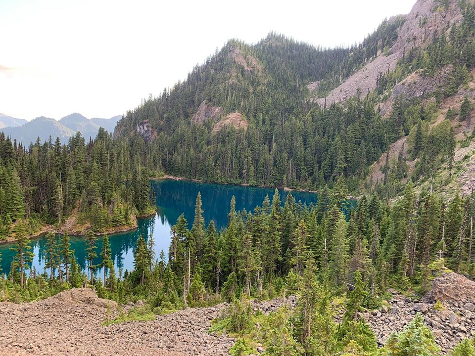
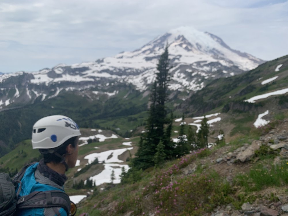
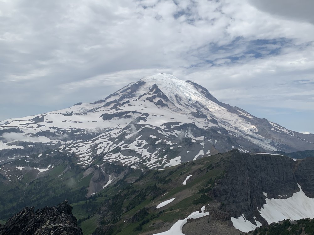
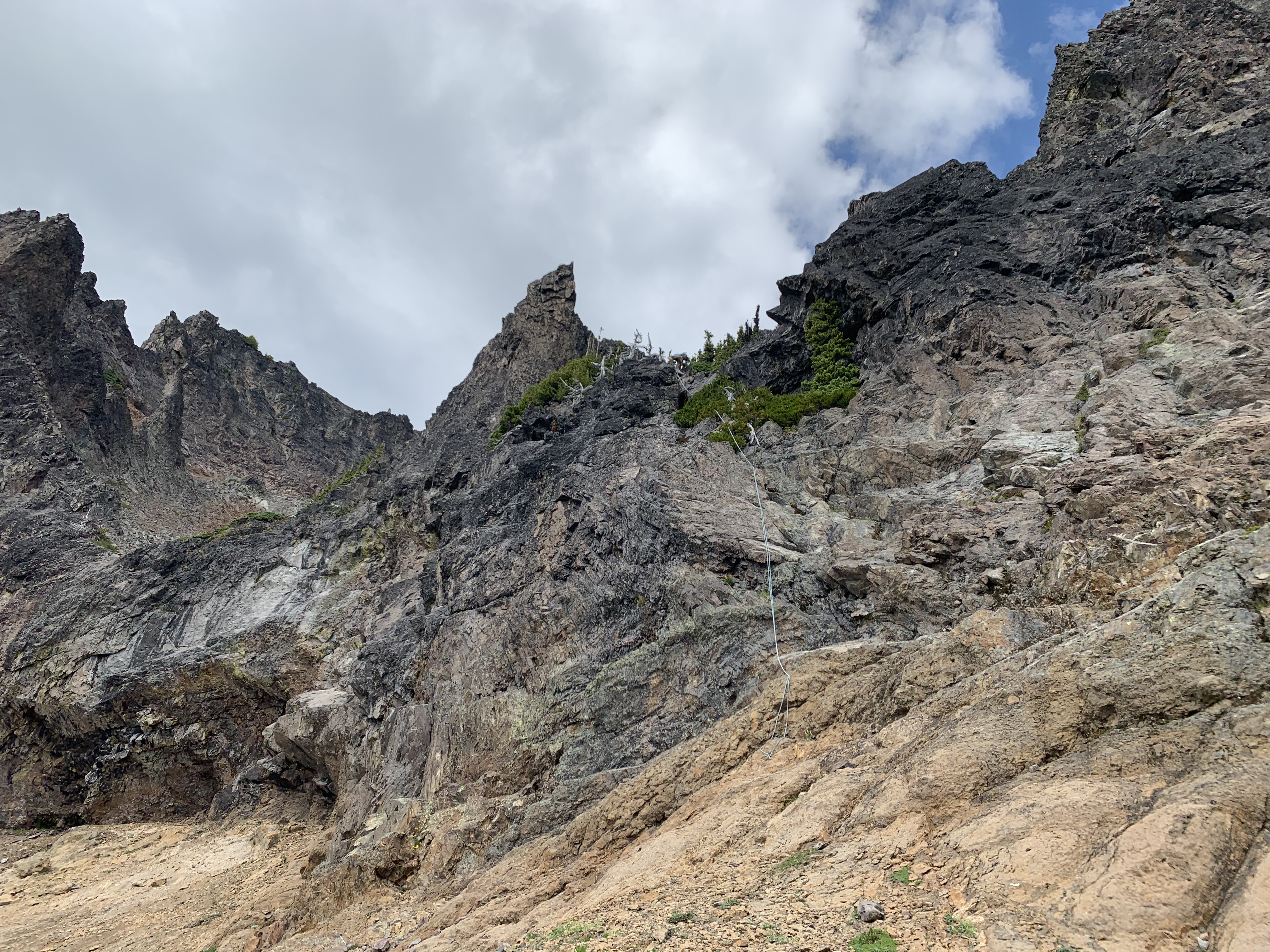
Trip: Cowltiz Chimney - Standard
Trip Date: 08/01/2020
Trip Report:Seems like it's been nothing but a summer of Smootin'. Save a solo trip in the Teanaway, I've strung together a contiguous streak of getting me lots of Smooty (and following in the footsteps of the Choss Dawg Millionaires).
This past weekend I set my sights on Cowlitz Chimney. I attempted this scramble about 5 years ago on a weekend when weather looked "meh" pretty much everywhere that I looked except for MRNP. Unfortunately, despite blue bird skies from the trailhead we hit fog between Summerland and Panhandle Gap - fog that never let up. So, we settled for finding our way up Banshee and Middle Cowlitz Chimney on that trip.
While looking for recent beta I saw a comment that the Summerland TH parking lot was filling up by 6:30 am. So, we timed it to arrive just shy of that time. Despite that plan we arrived to a full lot and parked on the side of the road right across from the lot - the second car to do so. Within 10 min another 5 cars or more followed suit. The mountains are getting way too crowded!
We made good time up to Summerland and I made use of the toilet. There was a ranger there with a shot gun as a last resort to ward off a bear family unit who is apparently frequenting the area. We continued on towards Panhandle Gap and decided to pop over the col just shy of the proper trail. I don't think we saved time doing that, but whatever. Next we crossed glorious meadows with flowers in full bloom and only a few snow patches. Soon we were on the summit of Banshee Peak with views of our objective.
Views from Summerland:
Views en route to Banshee Peak:
The objective:
By this time some fog appeared in surrounding meadows and some clouds looked like rain. WTF? We began dropping into the basin below Main Cowlitz. Right about when we got to our low point, fog came in. Total whiteout. We launched our peakbagger app and downloaded a track just in case we needed it. Fortunately as we completed our traverse and were roughly below the "solitary tree" the fog blew out and we were golden.
We followed this guy's excellent route description: http://ericsbasecamp.net/trips/CowlitzChimney/CowlitzChimney.htm. The trip is 18 years old and evinces the utility of long-lived trip reports. His came up in the first page of Google hits. We found no problem finding the key landmarks: the solitary tree, the fence of trees, the exposed traverse, and the class 4 slot. For the latter two we had brought a rope. I protected the traverse with two cams and plugged a third before topping out on the slot. At the rap station we left our rope and pro and scrambled up. There was scree, there were loose holds. It was a Smoot. We picked the obvious gully near the top which felt like class 4. Definitely not a good place to fall.
Yep, that's a solitary tree. Well, sort of:
Summit views were great! Another Smoot in the books: #83

On the descent we retraced our steps, did a rappel to avoid downclimbing the slot and traverse (60 m rope barely reached), and hiked out. It was super hot by then and we felt the effects of sun. So we slowed down and enjoyed the way out, stopping for one long water break before the final trail back to Panhandle Gap.
On rappel:

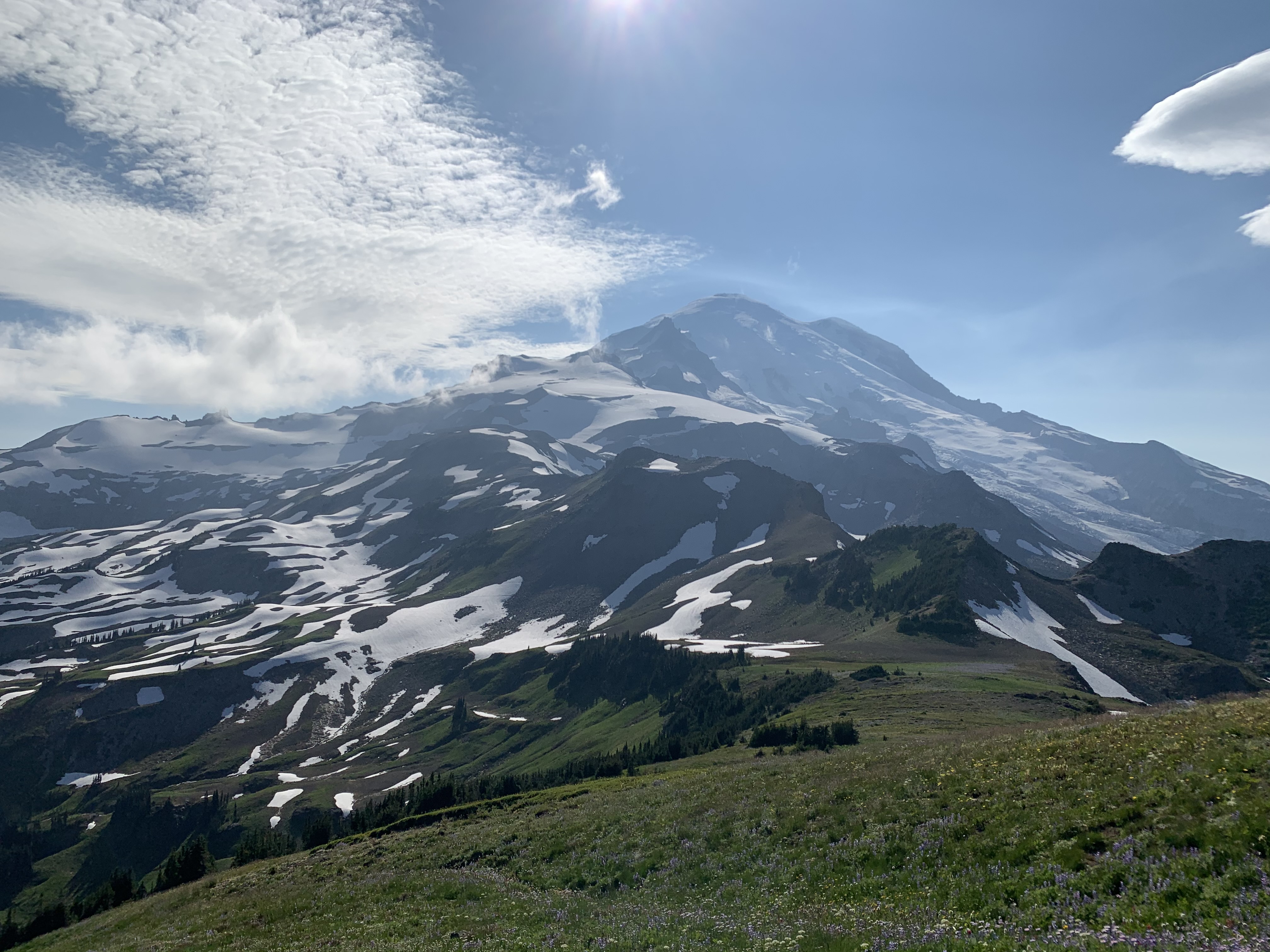
Rainier as majestic as ever:

Gear Notes:
60m rope, helmet, X4s .3 and .4, C4 .5
Approach Notes:
Mostly snow free. Wildflowers in full force.-
1
-
1
-


Ban free speech and you may win the Darwin awards.
in Spray
Posted
more importantly Ivan made an appearance. that's almost as rare as a week of sun in the Seattle skies.