Leaderboard


Popular Content
Showing content with the highest reputation since 04/19/24 in all areas
-
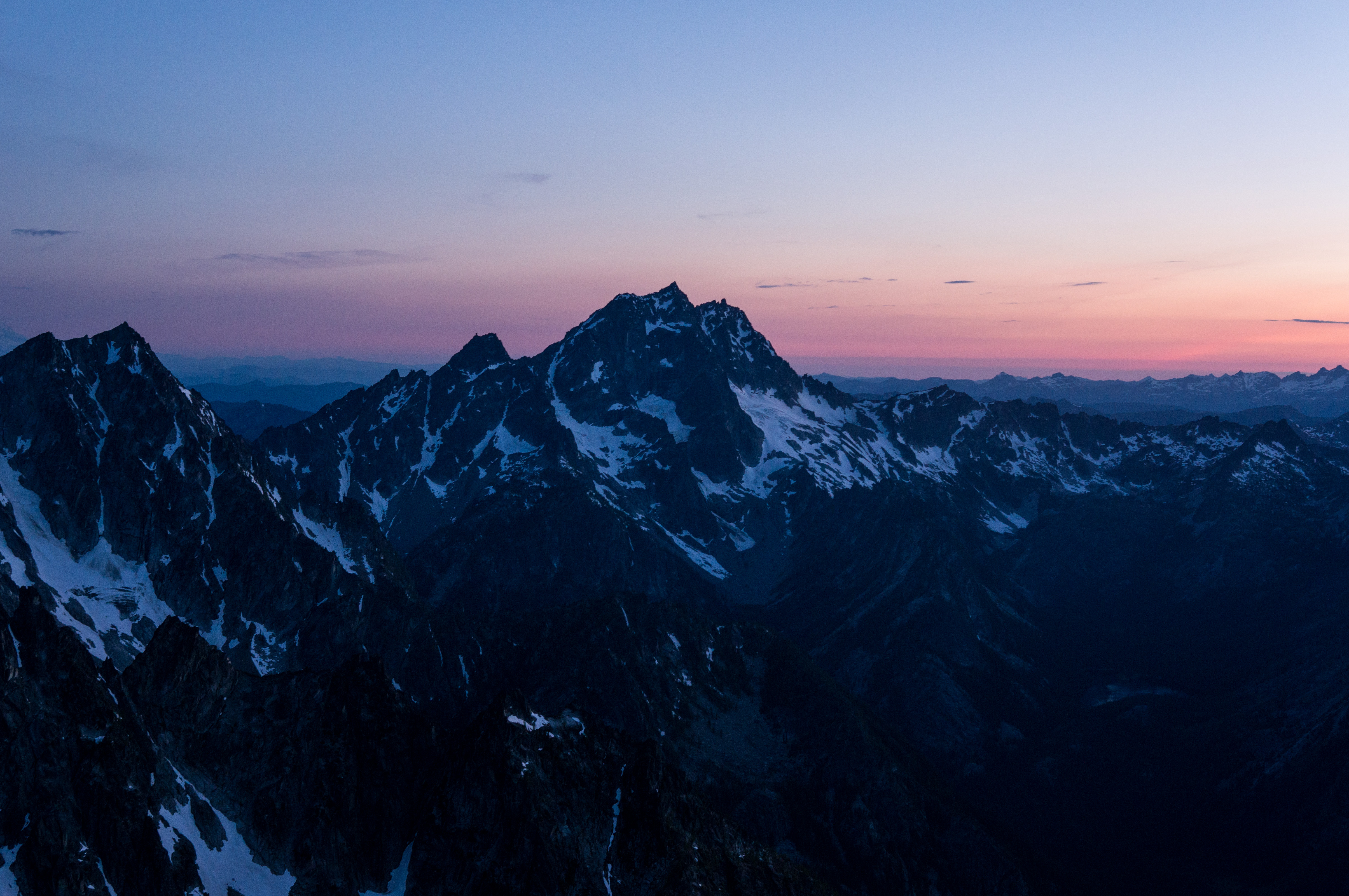
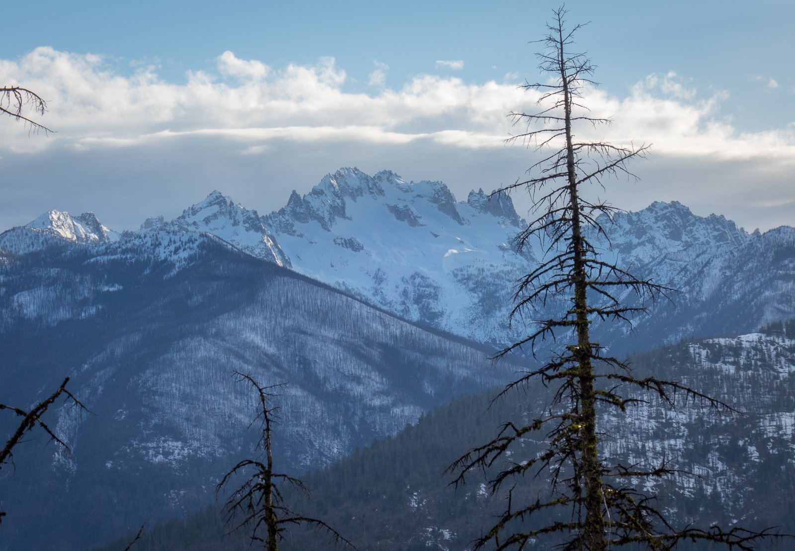
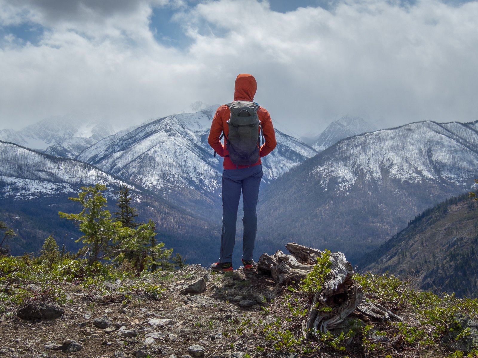
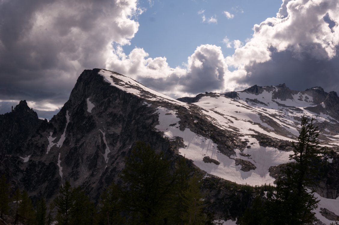
Trip: Williams Peak - Standard Trip Date: 04/13/2024 Trip Report: Over the past year of so I've gotten reacquainted with the Chilliwack Lake environs. It is just as close to my house as many areas of the Cascades and offers some new peaks to ponder and some unfamiliar views of familiar peaks. And, for whatever reason, I've been able to mostly have these mountains to myself on the handful of trips that I've taken up there. Williams Peak was no exception a couple weeks ago - I didn't see a soul after leaving the car. For such a striking peak on a fine spring day, I was a bit surprised. But there was definitely slogging, and that probably explains the solitude. The trail gains almost 3000' in the first mile and a half, and then there are two miles of undulating ridge to slog in snowshoes. But the scenic rewards, as you'll see below, were quite great beyond that. Plus, it did get more entertaining for the final 1000' up the steepening gully to the summit, dodging small wet slides and eyeing the cliffs above me suspiciously. I had read about annoying talus and steep heather once the snow melts off so a spring ascent might be the ticket on this one, even if it is more work. For me, being able to get a good look at the north faces of Rexford and Slesse draped in the think mantle of a late season snowpack more than made up for any discomfort. Williams from the valley bottom. Prepare to work! First glimpse of North side of Slesse: Chilliwack Lake: North side of Rexford with Shuksan in the distance: Slesse with Baker behind: Welch and Foley (gotta get in there next!): Look back at Williams from the slog out the ridge: Gear Notes: Snowshoes, I'm afraid. This wouldn't be a great ski with the up and down and endless forest. Crampons, helmet, and axe in early season- it is steep in the final gully Approach Notes: Chilliwack Lake Road is paved to the TH3 points
-
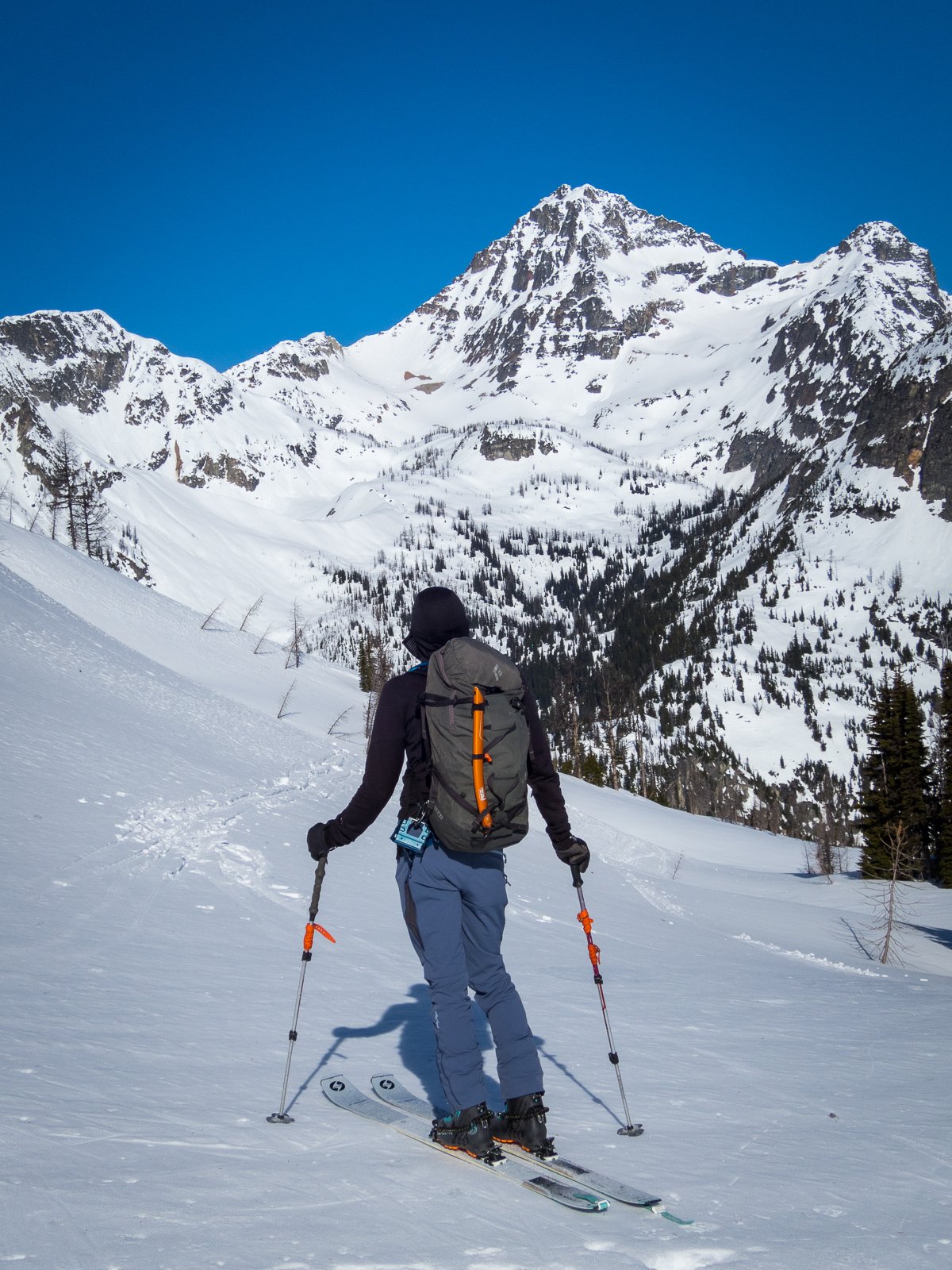
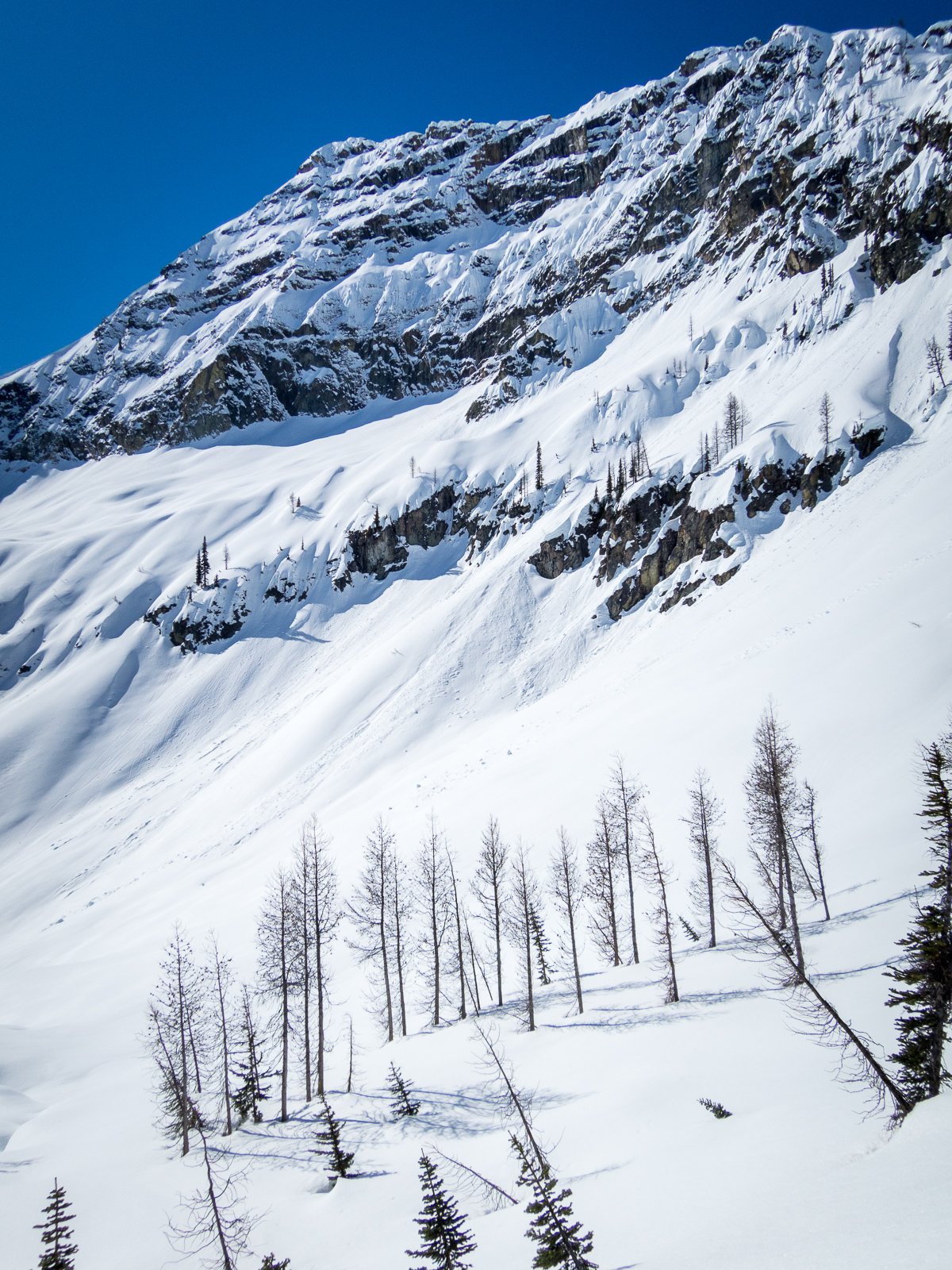
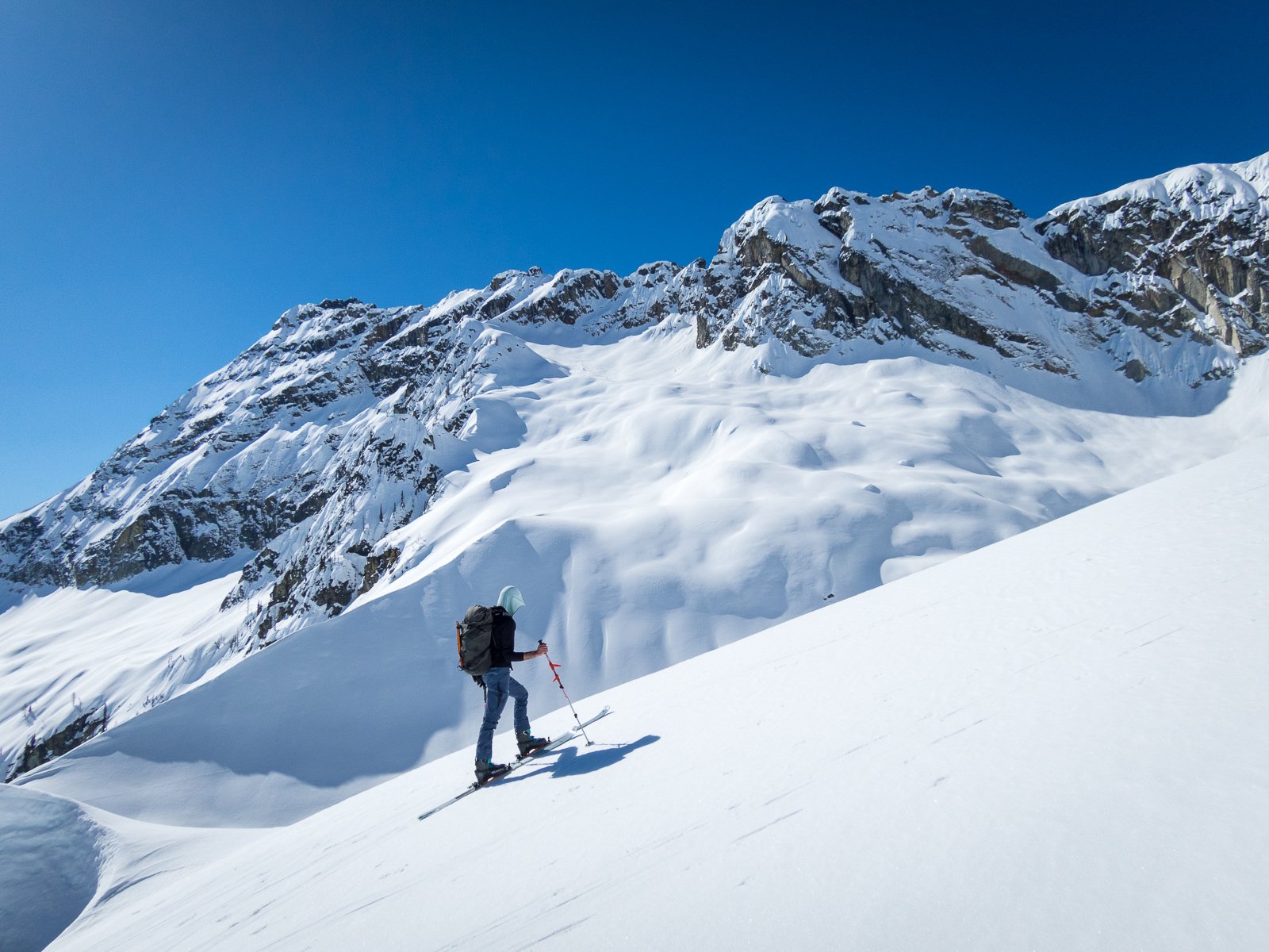
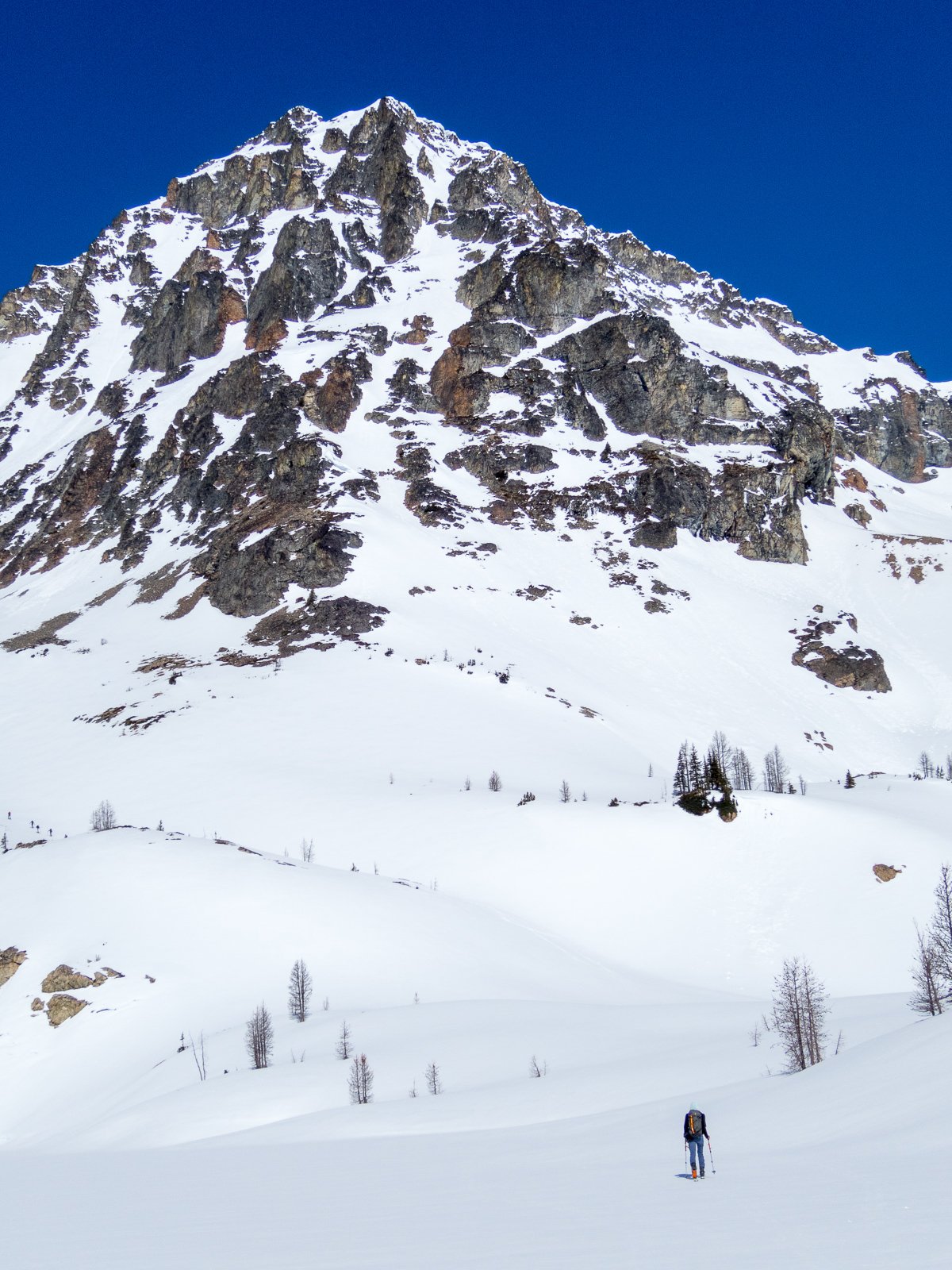
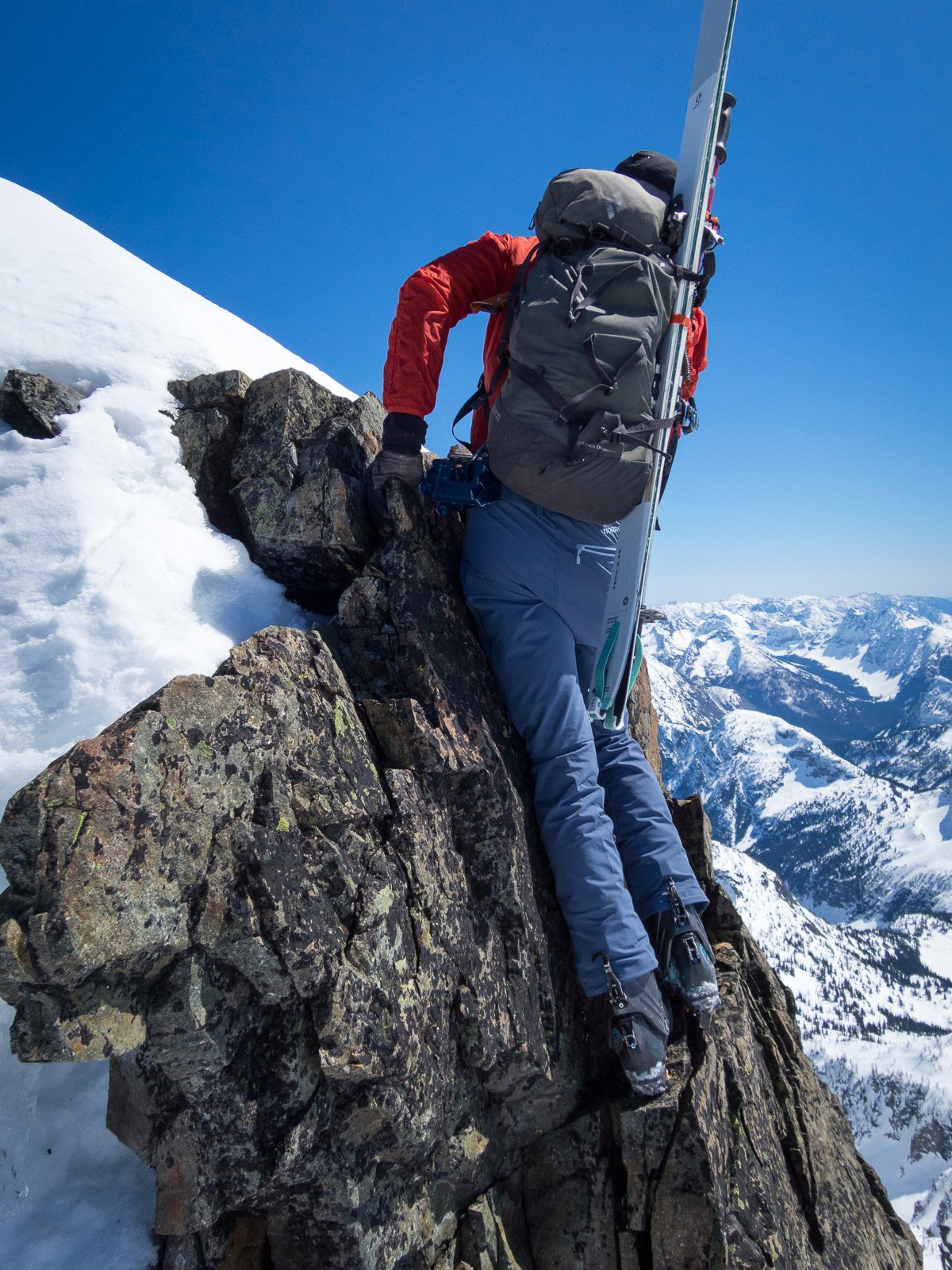
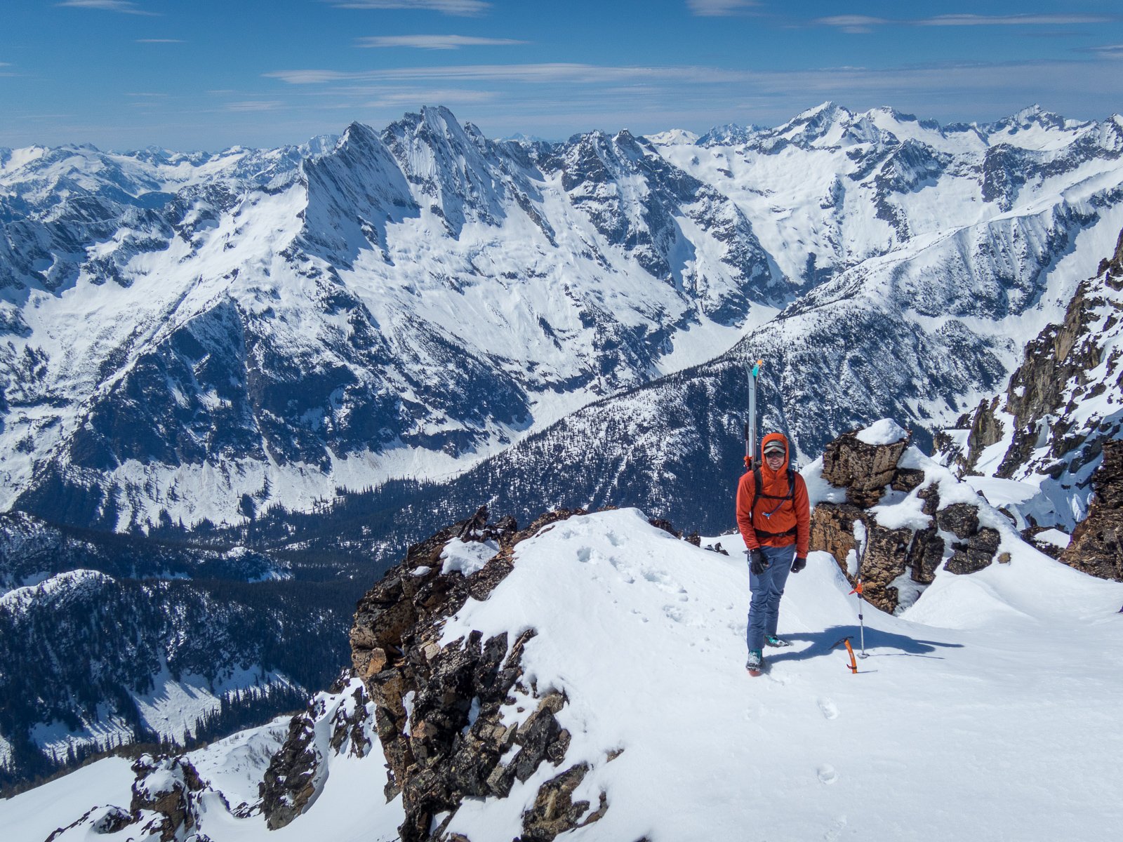
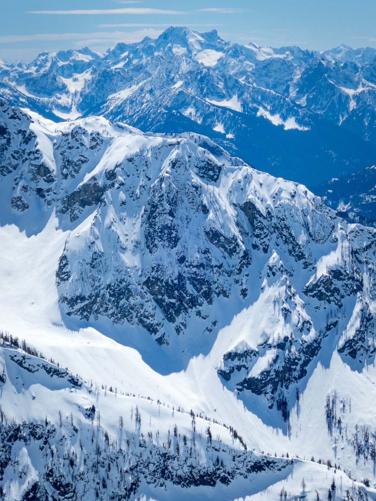
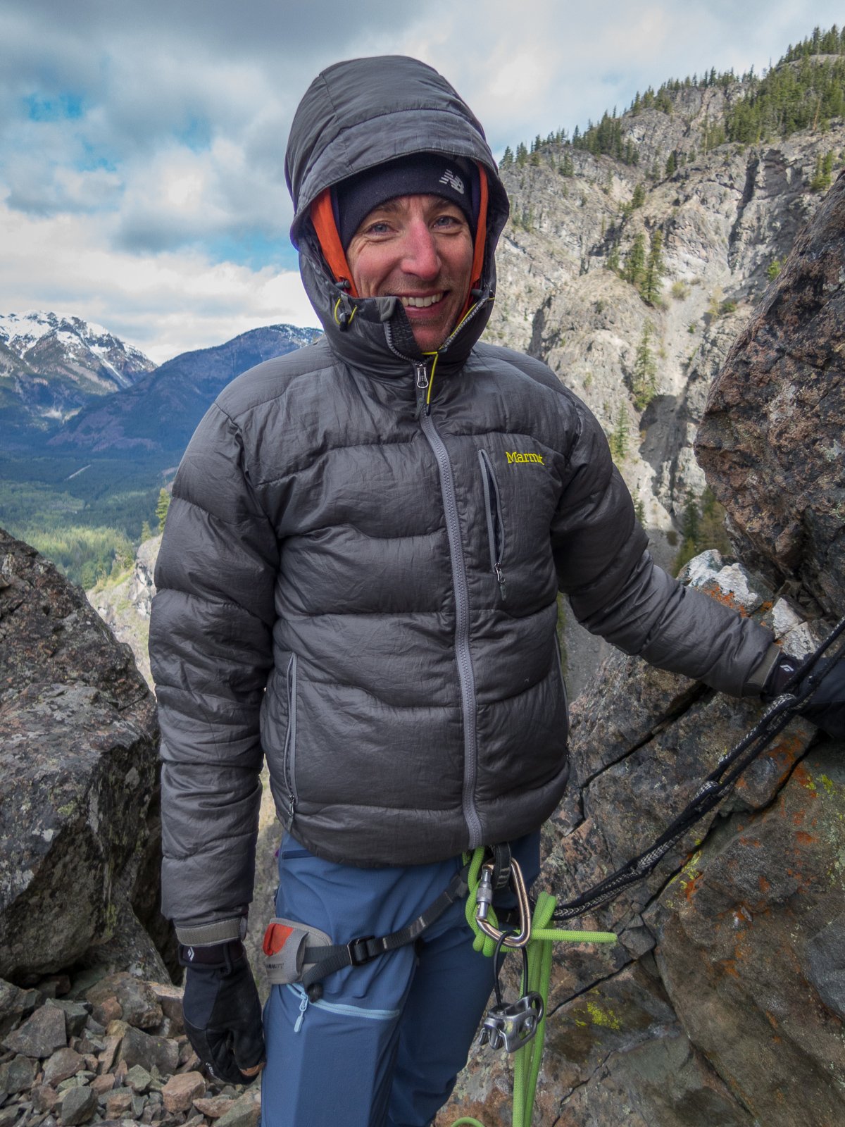
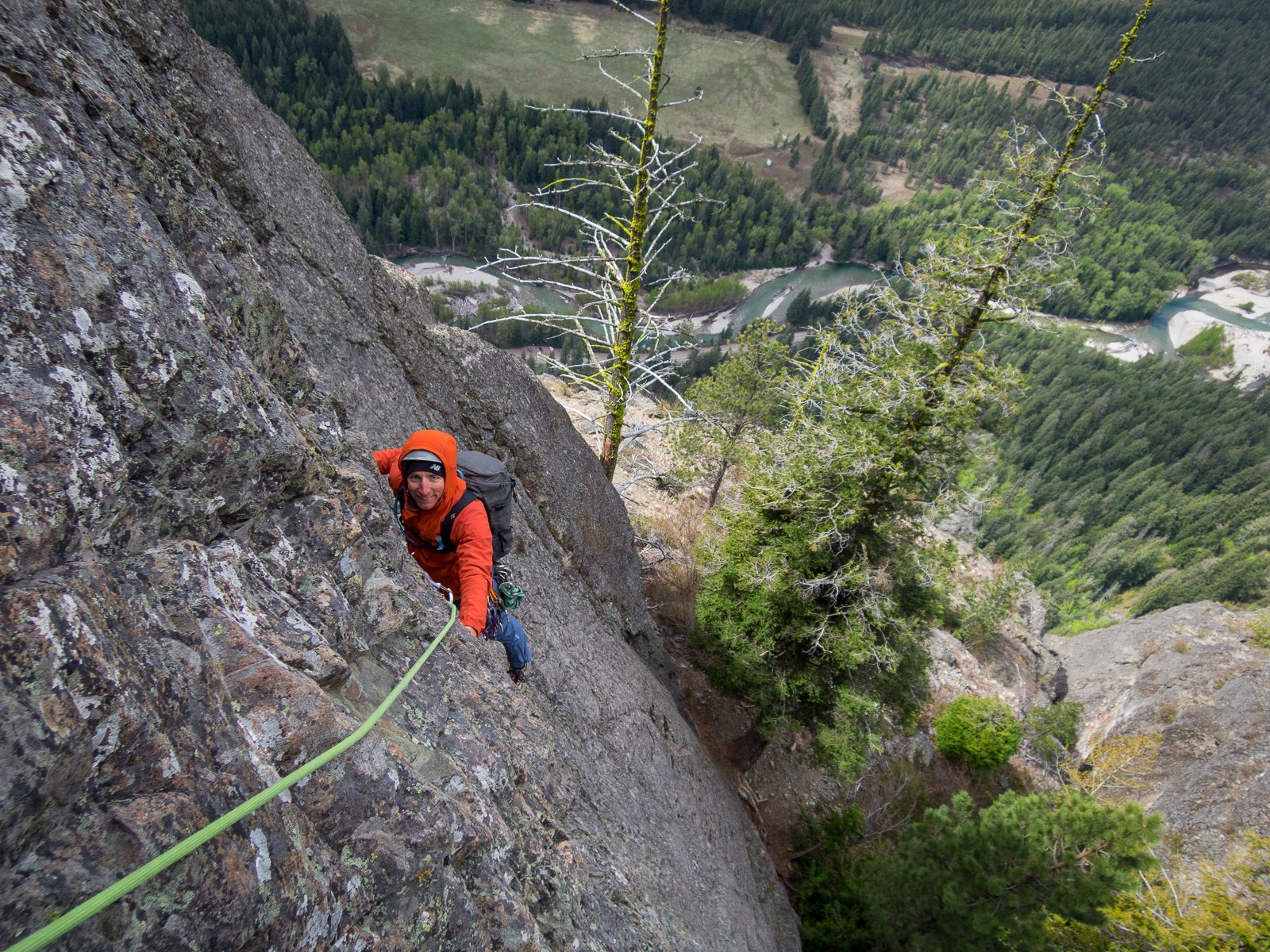
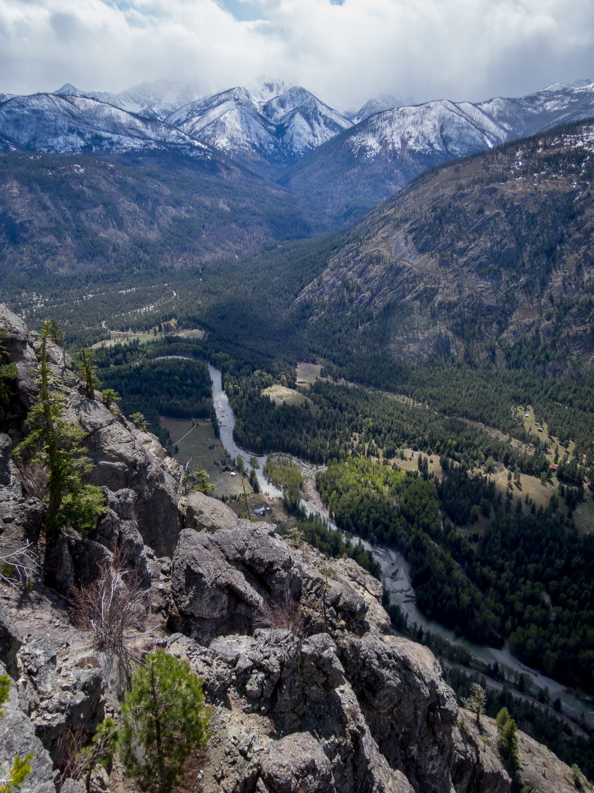
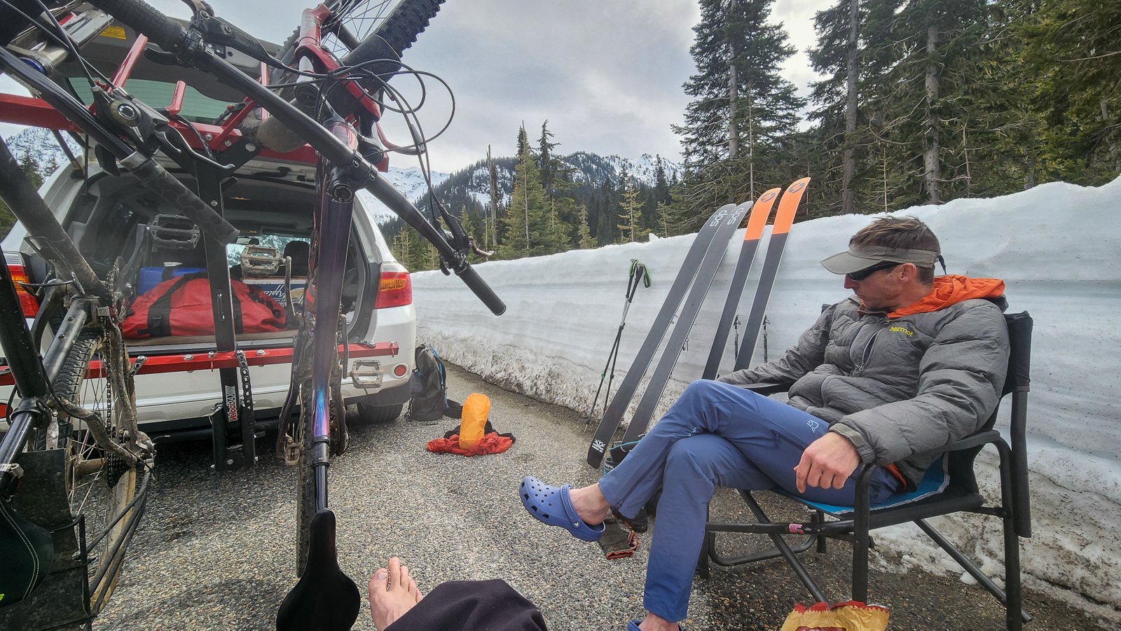
Trip: Black Peak and Prime Rib - #methowmultisport Trip Date: 04/20/2024 Trip Report: For those of us up here in the north sound, it is hard to ignore the gravitational pull when Hwy 20 opens for the year. It is like someone pulls the plug in the backyard pool and we are inexorably pulled east into the vortex of Sprinters and Teslas. But not this past weekend. It was like older, mellower times. Maybe it was the front moving through in the middle of the weekend. Maybe everyone was like my brother and were caught unawares of the opening? Whatever the reason, I'll take it. It was a good thing that the masses weren't up there though. @geosean and I myself weren't terribly original with the plan- a ski of Black on Saturday followed by Prime Rib on Goat wall on Sunday. We even brought bikes to enliven the descent from Goat Wall (this is a good bit more fun than rapping the route). And, mostly it went off without a hitch. And by that I mean we had fun, didn't get hurt, and came home friends. However, we did stop a few feet shy of the true summit of Black due to the typical spring shenanigans of steep snow, exposed rock, and no climbing gear. But, that slight disappointment was soon forgotten amidst the better than average corn skiing down to Lakes Ann and Wing. I think it has been over 20 years since I've been up on Black and I can see that I need to return more frequently. Thankfully the weather on Goat Creek Road was reasonable, though chilly, Saturday night. We started early to beat the crowds the never arrived and shivered in the wind and snow squalls as a result. It felt distinctly alpine, climbing in long johns and belaying in puffys all day. I'm sure it would be good training for something hard and high, if I still cared about those sorts of objectives. Mostly though, I shivered and muttered. But, it had been about 11 years since I had climbed the route, and so Prime Rib felt sort of like a new and interesting experience. This pronounced alpine amnesia is definitely one of the benefits of entering my "mature mountaineer" phase. Maybe I need to climb things all over again. Except Nooksack Tower. @geosean at Heather Pass: @geosean and Black at Wing Lake: I was not having this and turned us around: #methowmultisport: Dispersed camping views of Silverstar from Goat creek road: @geosean living the alpine dream on Goat Wall: The hordes will descend next weekend! Gear Notes: the full kit Approach Notes: Follow the herd
 3 points
 -
Nor should it be. I've been around Grizzly bears nearly my whole life. I've worked in their habitat, I've recreated where they live, I frequently ski and climb in their backyard, etc. The amount of pissing and moaning on this thread is a disappointment. There won't be trails closed, there won't be any significant disturbance to your recreation, and you are not going to be torn to bits. Chances are in the Cascades you will never see one. Even here in the GYE we rarely do and we have somewhere north of 700 around here. In the old days most climbers and lovers of wild lands were, to some degree, conservationists. They supported national parks, public lands, and restoration of those lands. That seems to be less true today. Now it seems many want better trails and access but could care less about the land and ecosystem itself - sounds a bit selfish to me. Any by the way - money for trails does not come out of the same fiscal pot as money to restore bears.1 point
-
1 point
-
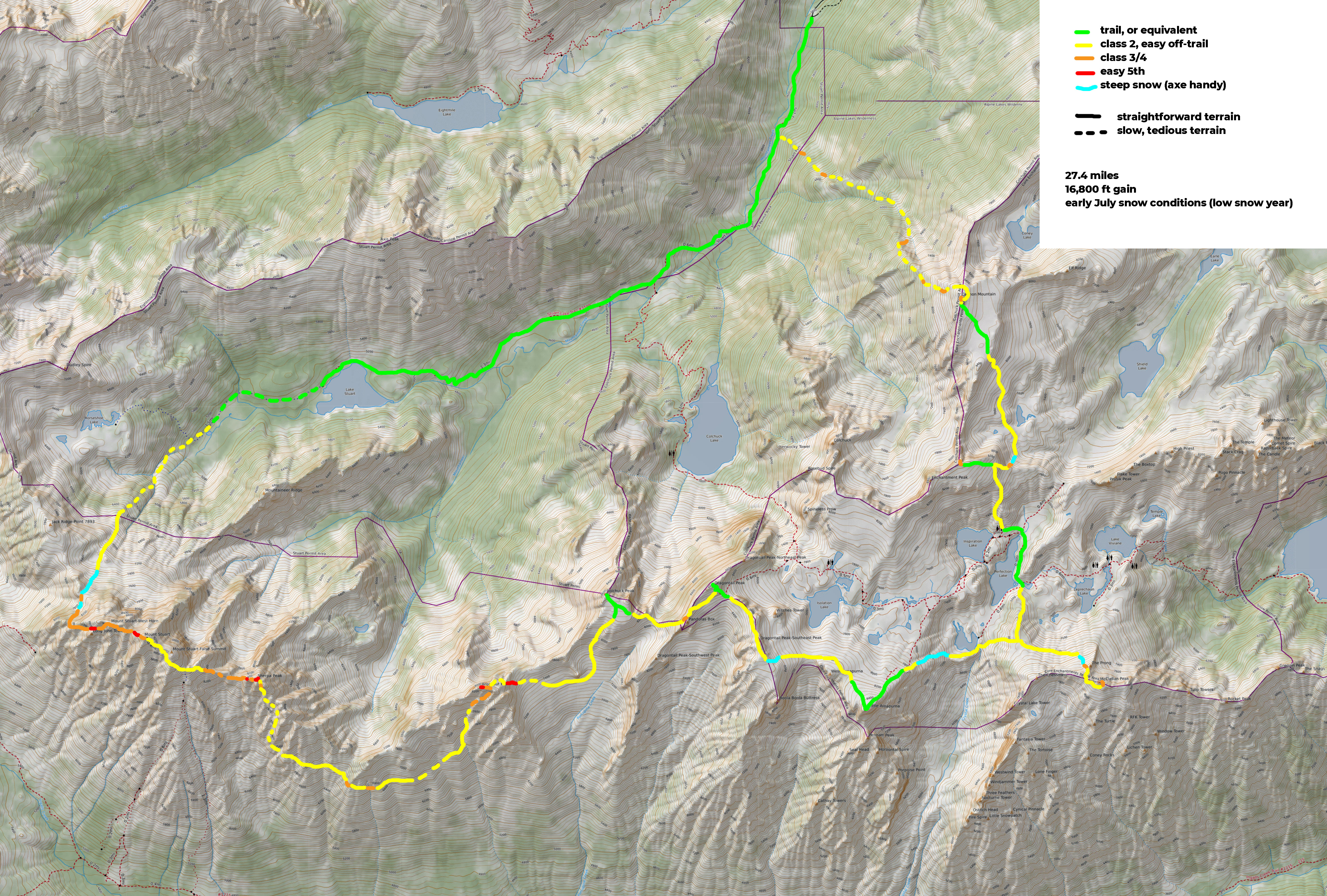
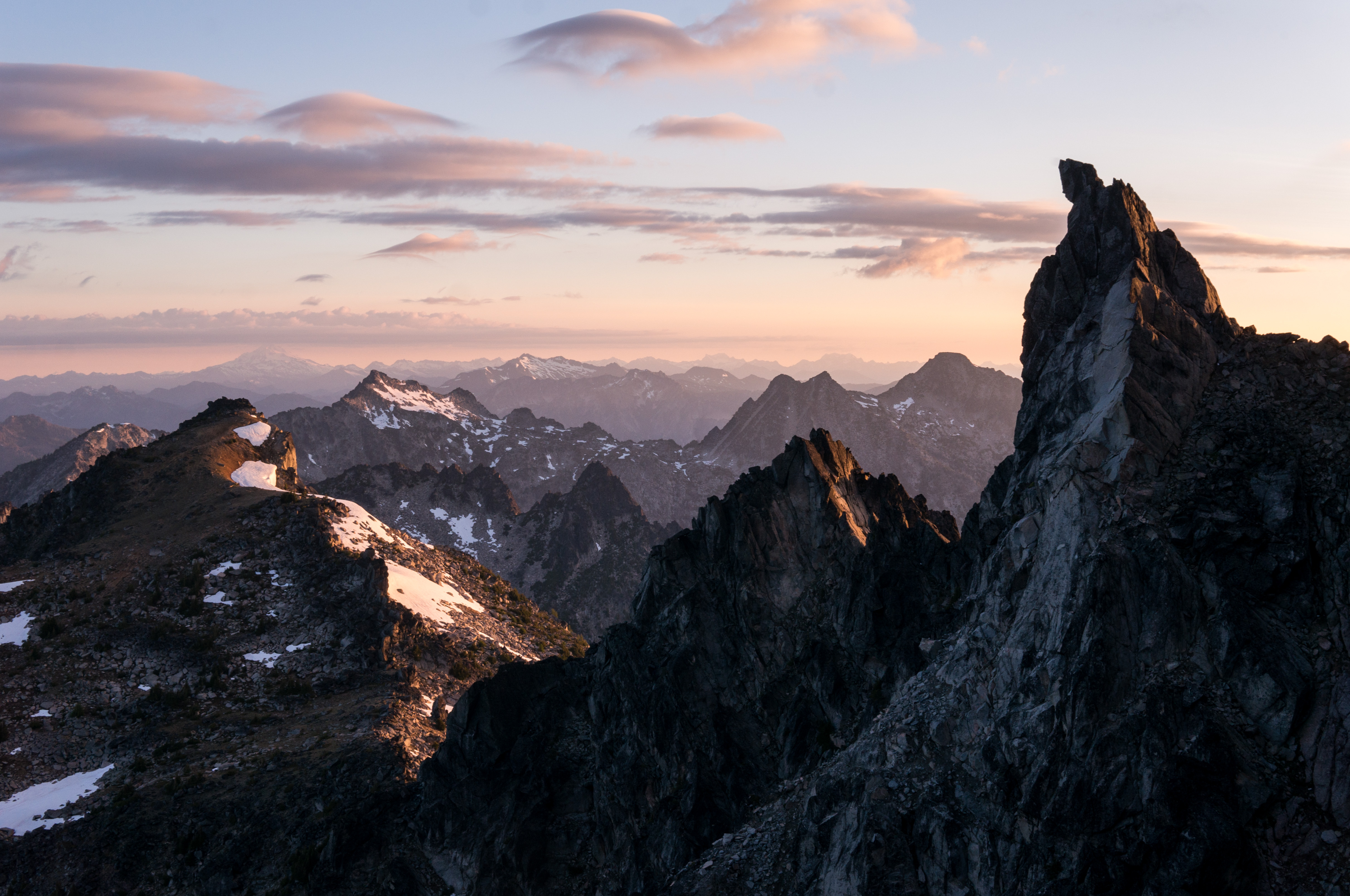
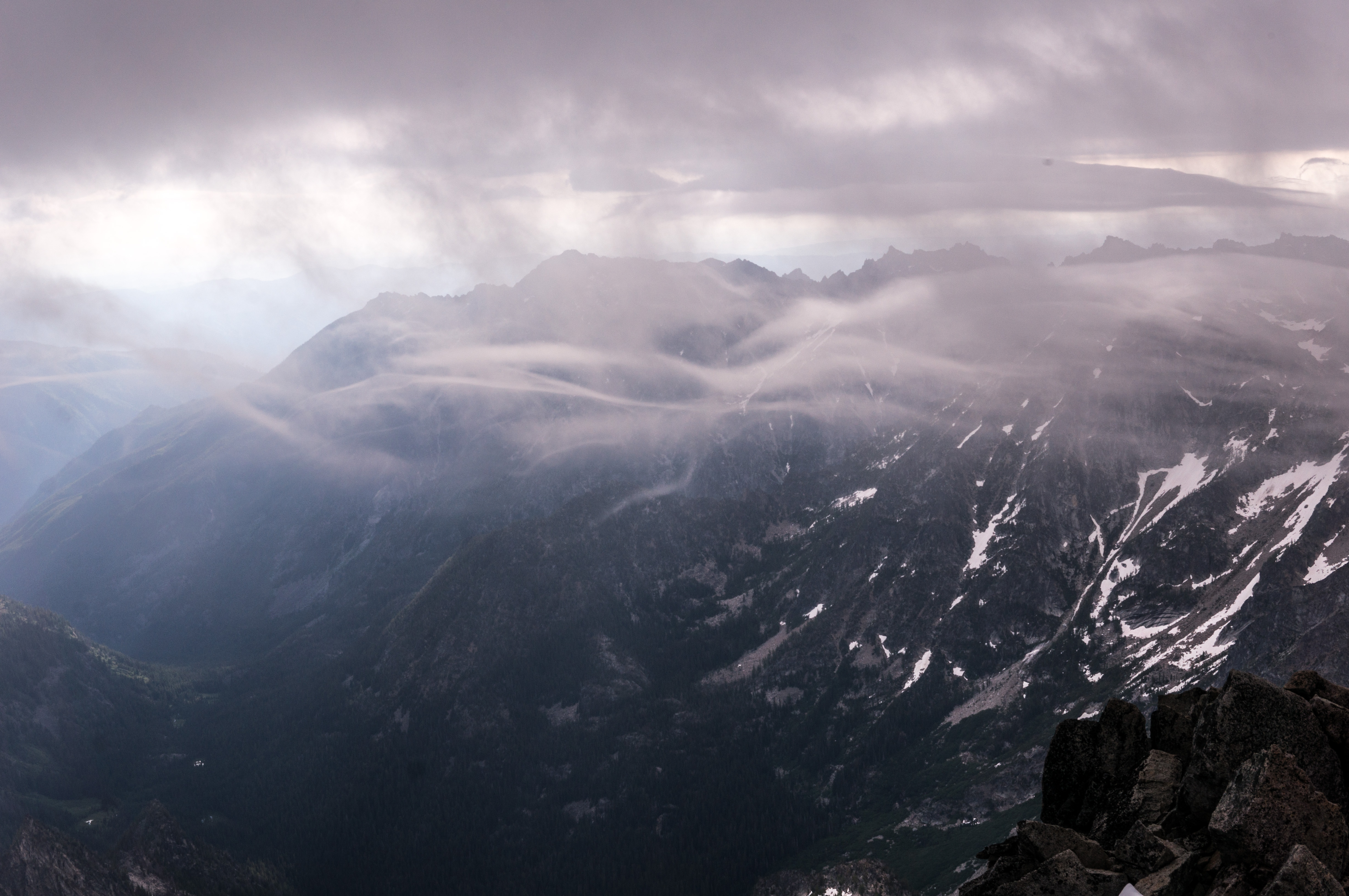
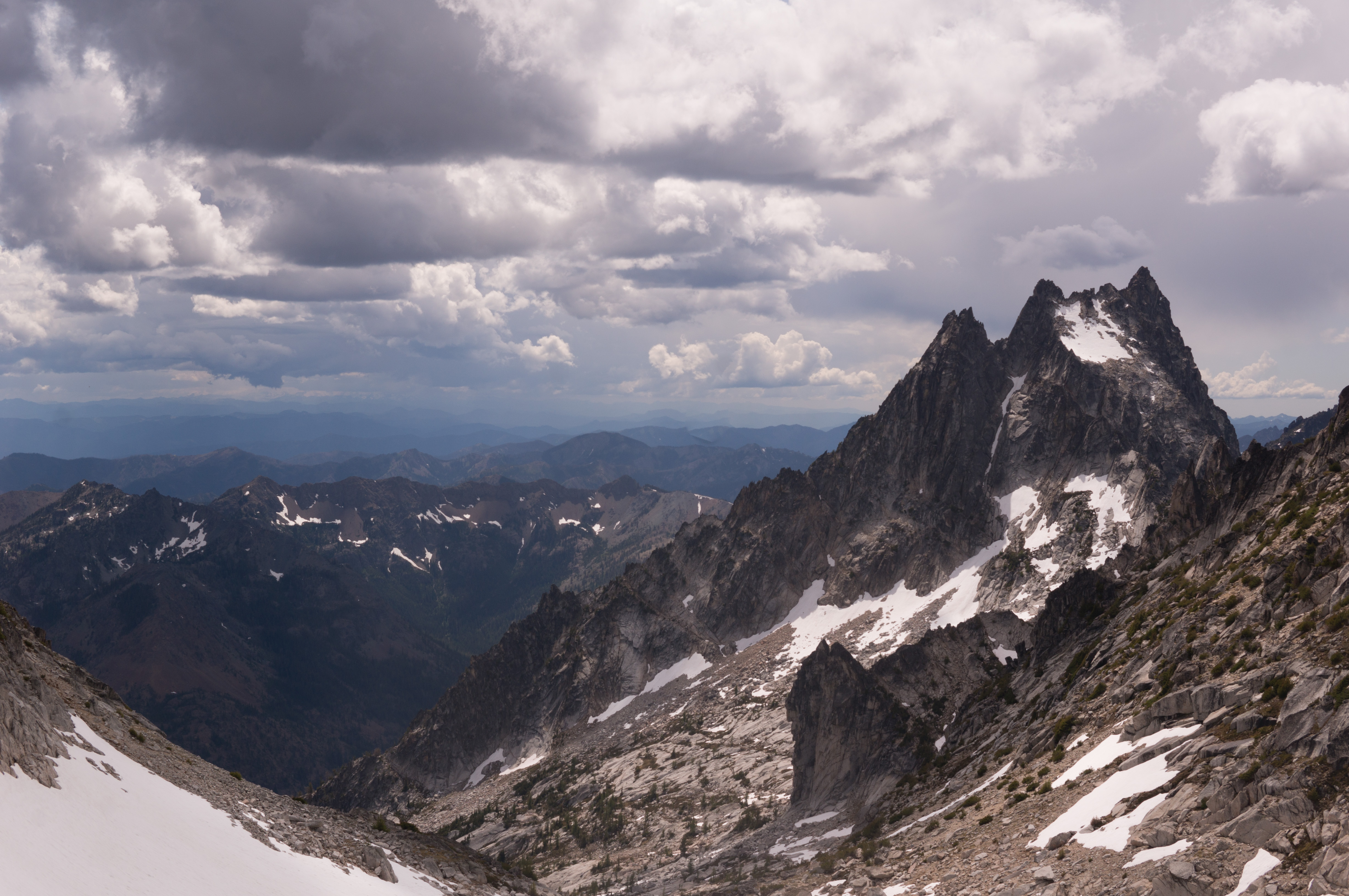
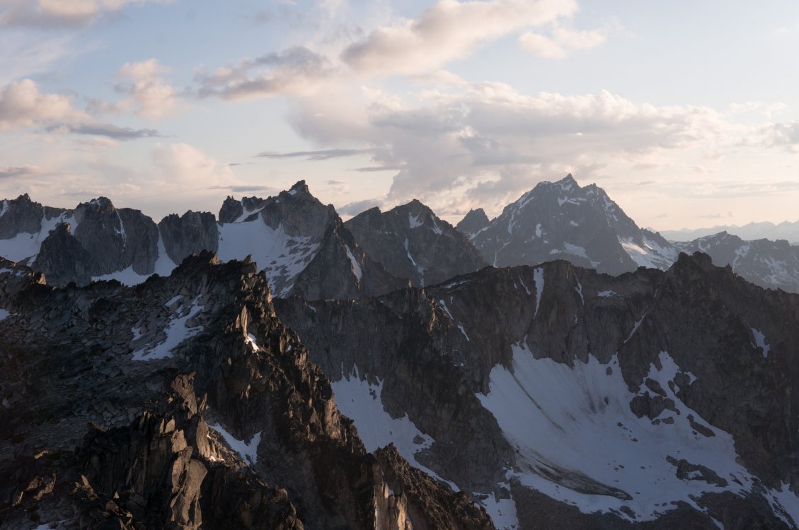
Trip: Stuart/Enchantments - The Enchanted Enchainment Trip Date: 06/30/2019 Trip Report: On Sunday June 30th, I managed to complete a whirlwind tour of the Enchantments' 9 tallest peaks. I think "enchainment" is the right word, since I did not stay true to the ridge crests like a "traverse" would imply. Ever since my route through the Core zone last summer, ticking off the 7 major peaks from Mclellan to Cannon to Argonaut (and also Prusik), I’ve been pondering the feasibility (and stupidity) of adding Stuart to the list. I'm no Peter Croft, so I'd start with Stuart's west ridge. Much route-planning was done. At first I was considering an approach from the south side, to facilitate an easier romp up Stuart, but I think the mileage for that route would be too much for my non-trail-runner legs. So I settled on the Stuart Lake approach and hoped I would be able to find a shortcut to Stuart’s West Ridge (since the West Ridge is almost always approached from the south). Jake Robinson and his buddies did a 3 day trip, ticking the same peaks and provided helpful beta. The ridge from Stuart to Sherpa is fairly straightforward, but I knew from them and others that Sherpa to Argonaut was gnarly. I considered dropping all the way down to the valley trail after Sherpa, but decided I would try a high-ish traverse to save some calf-burn. The only other route-planning decision was to drop straight off Cannon to the car. It is just so friggin alluring!! Cannon is such a slog via the normal route, and the fact that it is geographically so close to the trailhead was too much for me to pass up. Future Tyler be fucked, I suppose. I created an illustrated route overlay of what went down (with actual gpx data), using fancy color-coding and dashed lines to indicate difficulty and tediousness of terrain. (gpx file here). Cause information and maps are fun. I started my pilgrimage at 1:30am, in order to have some light once it got steep on Stuart. I pandered my way through the burned stuff past Stuart Lake and managed to ascend the slopes toward Long Pass without too much difficulty in the dark. I encountered some steep snow to get up to the 7950’ notch on Stuart’s NW face. From the notch I dropped down a bit and traversed some more snow to get to the shortcut gully. The gully had continuous snow, but I was sick of the hard snow in my cramponed approach shoes, so I scrambled up class 3 rock to the right. All in all, shortcutting the west ridge was pretty straightforward and required no technical climbing whatsoever. ^ the view back toward the 7950 notch Everyone and their uncle has posted their version of the west ridge, so I won’t dive into that. I reached el primero cumbre at 7:40am, a bit behind my self-prescribed schedule. From Stuart I meandered down the Cascadian and stepped off toward the Stuart-Sherpa Col. I encountered a short 4th class downclimb, and didn’t reach the col until 8:40am. ^ Fun clouds from the top of Stuart Sherpa’s west ridge was great fun, and I was almost suckered into a beautiful splitter crack before I more responsibly found easier terrain off to the left. I reached Sherpa summit around 9:10am, looked auspiciously at the balanced rock, and decided to save it for another day. The descent off Sherpa was quite straightforward after reading beta on folks descending from the north ridge. A short 4th/5th downclimb followed by trending skier’s left into a scrambly gully until I reached a big-ass vegetated ledge at about 8100 ft, and then more leftward traversing to a broader gully, which I took all the way down to 7200 ft. From here I began the long, much-not-looking-forward-to traverse to Argonaut. In actuality, it was not bad at all, and perhaps even vaguely enjoyable! There are some huge swaths of granite on these high slopes, many of which are littered with fun knobs for easy scrambling. The rest of the terrain was quite straightforward goat-trail meandering. Time-consuming, but not god-awful by any means. I eventually reached Argonaut’s southern gullies and ascended easy terrain until right below the east ridge where I climbed a probably unnecessary section of easy-5th. From there I scampered to the summit (at 12:30pm), with a bit of apprehension as storm clouds began rolling in. From Argonaut, I descended a rap route on the east face, which I had done the summer before. I had found some unused webbing/rings on Sherpa, and used the rings as a nut placement to aid down a somewhat tricky section near the base of Arg (for the next party wondering what the heck is going on there). From here, spirits were high, as I knew I had completed most of the tedious stuff and would be on fairly well-traveled terrain for the rest of the day (not including the hail-mary off Cannon at the end of my route). ^ Looking back at Argonaut A few splits: Colchuck – 2:30pm Dragontail – 3:40pm Little Anna – 4:30pm Mclellan – 6:20pm Enchantment Peak – 8:10pm (I only tagged the NE summit, which may be lower than the SW?) Cannon Peak – 9:40pm ^ Into the core... ^ Stuart & friends from the Enchantment Peaks ^ Stuart & Enchantment Peaks & friends from Cannon Managed to top out on Cannon with a bit of light to admire a hard day’s work (damn Stuart looks so far away!) From Cannon I was feeling pretty good about making it down before my 24 hour goal. After all, the car was only 2 miles away… In the weeks prior, I had done some route-planning using satellite imagery and a topo to figure out the least-bushy way off Cannon. This was helpful but not a perfect solution to the hell-hole that is the 5000 vertical feet of bush, dirt, rock, bush, scree, and bush. Maybe I’m exaggerating, as I was quite delirious at the time and it was dark. The first 3,000 ft were fairly straightforward, with a few cliff-bands to avoid but mostly loose dirt/talus. The next 2,000 ft of vert went from bad to worse. Many cliff-bands were not hinted at by my topo map, and where I had previously plotted a viable line through rocky terrain (while comfortably sipping tea in front of a computer at work), was not actually viable terrain. So into the bushes I went and I didn’t arrive at the trail until around 1:00am. From the trail it was a short, but damn-did-my-feet-hurt, hike to the car. Roundtrip was 23 hours and 35 minutes, 16,865 ft of gain, and 27.4 miles. Frankly, those numbers seem pretty small considering, which I attribute to all the little (and big) shortcuts I connected to make quite an aesthetic loop through some beautiful country. I hope some of this beta is helpful for those looking to enchain some peaks out there or just get some damn good exercise. Gear Notes: Axe, crampons used. Approach Notes: Stuart Lake


 1 point
 -
Trip: Juno Tower - Clean Break Trip Date: 07/30/2018 Trip Report: It seems like Gabe and I have had a track record this season of finding the most marginal weather in the state, then choosing to go for it anyways. From plenty of wet and cold days in vantage last winter to an early season one day climb of prusik in a Blizzard, and a very cold and rainy day in the liberty bell group. This climb was no exception. On Sunday we drove over from Seattle and after cragging a little in the shady icebox canyon we stashed a bike and some Gatorade just off the road at the wine spires pullout. On our drive down to Winthrop for dinner we stopped by the Cutthroat lake rd to chat with the ranger who was stationed there. He informed us that the fire was under control and that it likely wouldn't impact our climb the next day. The next morning we woke up at 3am and left the car at 3:30 in an attempt to get to the base at first light. With a weather forecast of 90 on the summit of Silverstar we knew it was going to be a hot one. It was. Gabe trying to get us un-lost on the approach. The route basking in some nice alpenglow as we cross some slabs below the base. The first pitch is the stellar tight hands splitter on the right side of the blank wall. We got up to the base by scrambling up the chossy gulley to the left of the snow. There was an exciting 5th class mantle at the top that some might want to rope up for. No need for snow gear! I quickly learned on the first pitch that 1.)over 3 liters of water is heavy. 2.)warming up on 10c with a heavy pack is hard. And 3.) it's already damn hot and i'm sweating a lot. Somehow I managed to pull off the OS and was glad to have triples in .5 & .75. The rest of the route went pretty smoothly despite feeling like shit while baking in the sun. Luckily our packs were getting lighter really fast! Gabe styling the 10a roofy slabs. Gabe fighting with a tree on the 5.6/5.8 traverse pitch Pretending to be having fun while trying not to vomit from heat exhaustion. Moments before Gabe threw a hissy fit because our friend Jeff told us we didn't need a 4 for this pitch. The perfect rack would be one 3 and one 3.5. We had 2 3's and the crack gets wider than a 3 at the lip. Gabe didn't like that. Some of the first shade encountered on route. Trying to use the cold rock to cool down. More shade on the big ledge before the simul block to the summit. This was a real life saver though a big time suck. You're apparently supposed to stay right of the ridge crest here for more enjoyable climbing. I think we passed the only spot to get over so were forced to climb the lame sandy gullies to the left. Can't say I recommend them, but they get you to the summit. Summit stoke! We topped out at 1pm for a time of 9:30 C2S. Not too bad for how crappy we were feeling. Looking up Vasiliki ridge. One hell of a traverse! The descent follows the "obvious gully" then traverses left and down A LOT back to bench camp. There is plenty of kitty litter on slab skiing along the way to keep it exciting. Overall Clean Break is a stellar route with high quality rock and not a whole lot of routefinding issues to be had. This makes for a relatively fast 15 pitch 5.10 in a rad location. We really learned our lesson not to climb big routes on such hot weekends, and to bring a filter, not iodine if we end up doing it anyways. Half an hour is far too long to wait when you are that thirsty. Gear Notes: Rack: Doubles .2-3, Triple .5 & .75, A few nuts, 2 microtraxions. Either replace the second 3 with a 3.5, or just bring a 4. We brought 4 liters of water each. We should have brought a filter, chugged water at the base, filled up 3L, then refilled at bench camp. 2 UL poles, no axe Approach Notes: Silverstar creek trail is not super straight forward to follow in the dark so I definitely recommend having a GPS track on your phone to follow, it helps speed things along a bit. Same goes for the descent.1 point
-
And this is why at times I still do. Sorry to overlook the positive comments. As far as the route goes, I believe for fit parties it is under ten hour car to car day. Great idea if you want to climb some moderate but exciting water ice/mixed terrain. You can approach via regular south side or through the glacier bellow, your choice. We had 8 screws. 2 were used in the anchor and 6 for the pitch (50M of ice). Personally, if I had a way to know how this pitch would be before actually doing it, I would bring couple of more screws, but that's just me. I used a Red (1) BD camalot, and Orange ultralight metolious cam as well (yellow metolious was used in one spot for our simul climb above). Belay was set up in the couloir (45-50 degree snow/neve coulor, a lot milder than it seemed from Sunshine) above from two pickets. Did not see any pin scars anywhere, or any opportunities to use pins- Rock is crap. Helmet is required. I actually think this will be repeated, the climbing is great. The setting is awesome. Here in Sierra people would go through hell to climb a mixed pitch like this. PS: If I would do it again I would also bring some rock shoes and climbed up the Cathedral spire up the obvious hand crack (5.9-5.10b judging by the look of it).1 point