AlecE
-
Posts
30 -
Joined
-
Last visited
-
Days Won
4
Everything posted by AlecE
-
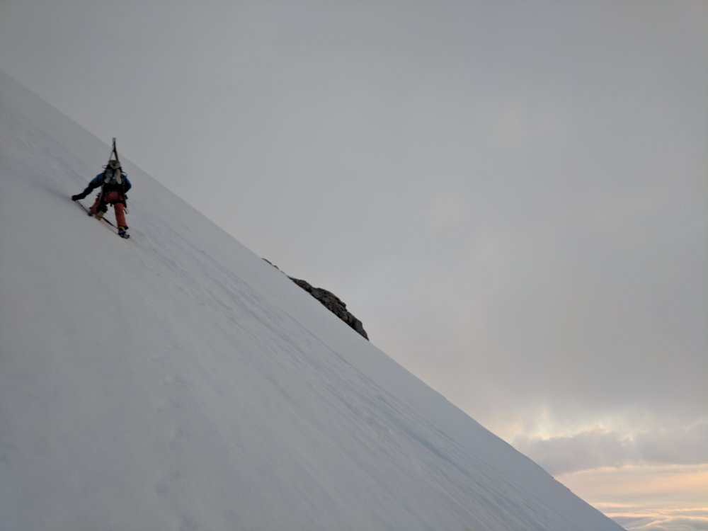
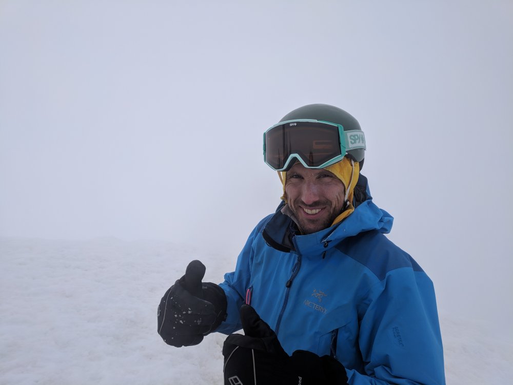
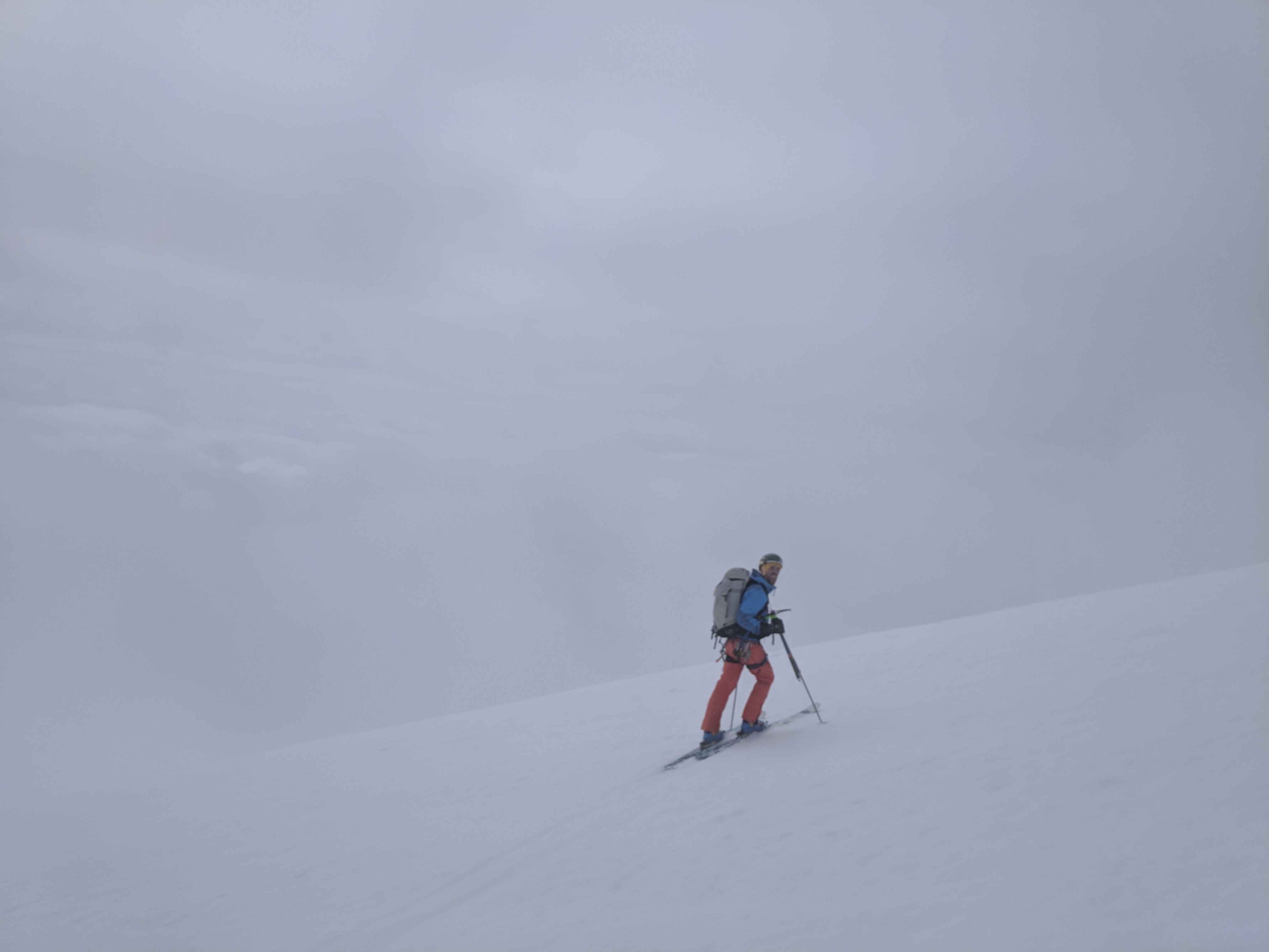
Trip: Wine Spires - Silver Star and Chablis Spire Trip Date: 06/23/2018 Trip Report: My roommate and I had been looking to get into the North Cascades for a while but hadn’t been able to put a trip together. We finally got the chance this last weekend and drove from Portland up to Mazama on Thursday night. We got warmed up on the Liberty Bell and Concord Tower on Friday and decided that we wanted to camp somewhere high and pretty Saturday night. After a lot of back and forth, we decided to camp up near the Wine Spires and climb Chablis Spire. We started around noon on Saturday and make the trek up to the Burgandy Col. It took about three hours from the car to the camp, so we dropped our stuff and went over to Silver Star Mountain. View of the Liberty Bell group Not a bad campsite. There was still snow up on the east side of Burgandy Col, but it was pretty soft and made for easy going over to the Silver Star glacier. We didn’t know too much about the glacier, so we decided to rope up, which probably wasn’t necessary. Made it up to the top of the glacier and had a nice view into the Cascades. Snagtooth Ridge from the Glacier We opted out of the scramble to the true summit and turned around and headed back towards camp. We made some dinner and enjoyed a beautiful sunset and the view. You can see Glacier Peak hanging out in the distance. A few goats also decided that they liked the col campsite, and kept us company throughout the night. Not too early of a start and we headed down to the base of the Chablis Spire. There were a few cracks open on the snowfield below the base, so we roped up again and headed up the snow to the base of the route. The detached block is center left of this photo. The snow was still fairly high, so the “handrail” at the base of the route was still covered, so we started at a hand ramp up to the detached block. After an airy step-around (very awkward) and a cool short finger crack we headed up three pitches of wandering easy climbing. There’s a short unprotectable slab in the middle of the second pitch, to which Carmen managed to find a 5.11 finger crack variation. The last pitch ends at the notch between the bunny ears summits, and we climbed up to the true summit still roped up. It turns out there’s some rap anchors right at the summit, so we were able to rap off the top, which was nice. Looking down from the last pitch. Obligatory awkward summit selfie. 5 wandery 60 m raps brought us back to the snow. We headed up to the col, grabbed our overnight gear, and suffered through the long descent back to the car. After a quick hop in the Methow River and a burger and a beer in town, we made the haul back to Portland. Gear Notes: Single rack to 4, 60m rope, glacier gear Approach Notes: Park at the mile marker 166, find a log to cross the river, and then hike the well worn path to Burgandy Col.
-
- 6
-

-

-

-
What would you do for a week in the North Cascades?
AlecE replied to dawuda's topic in Climber's Board
Haha, fair. I assumed the glacier would still be there, was thinking about the rock. It looks mighty tempting.... -
What would you do for a week in the North Cascades?
AlecE replied to dawuda's topic in Climber's Board
To sorta hijack, what are the odds that Goode is snow free right now? It's been pretty warm, but most of the TRs I've seen are July-Aug. -
[TR] Mt. Torment - Torment-Forbidden Traverse 06/02/2018
AlecE replied to charlie_r's topic in North Cascades
Very cool -
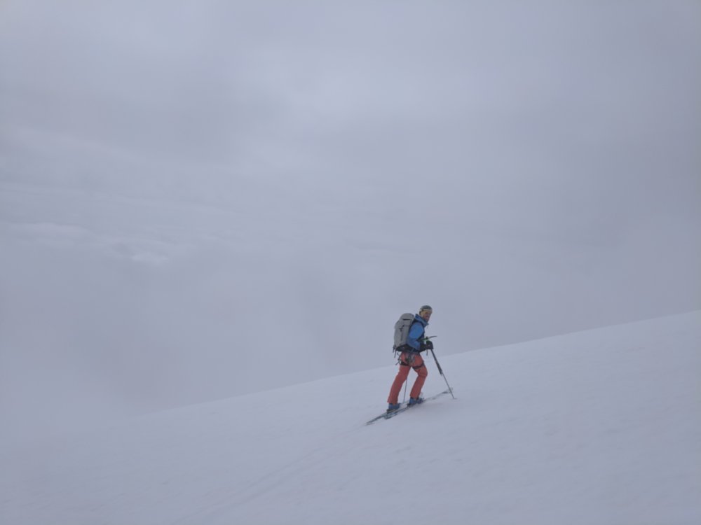
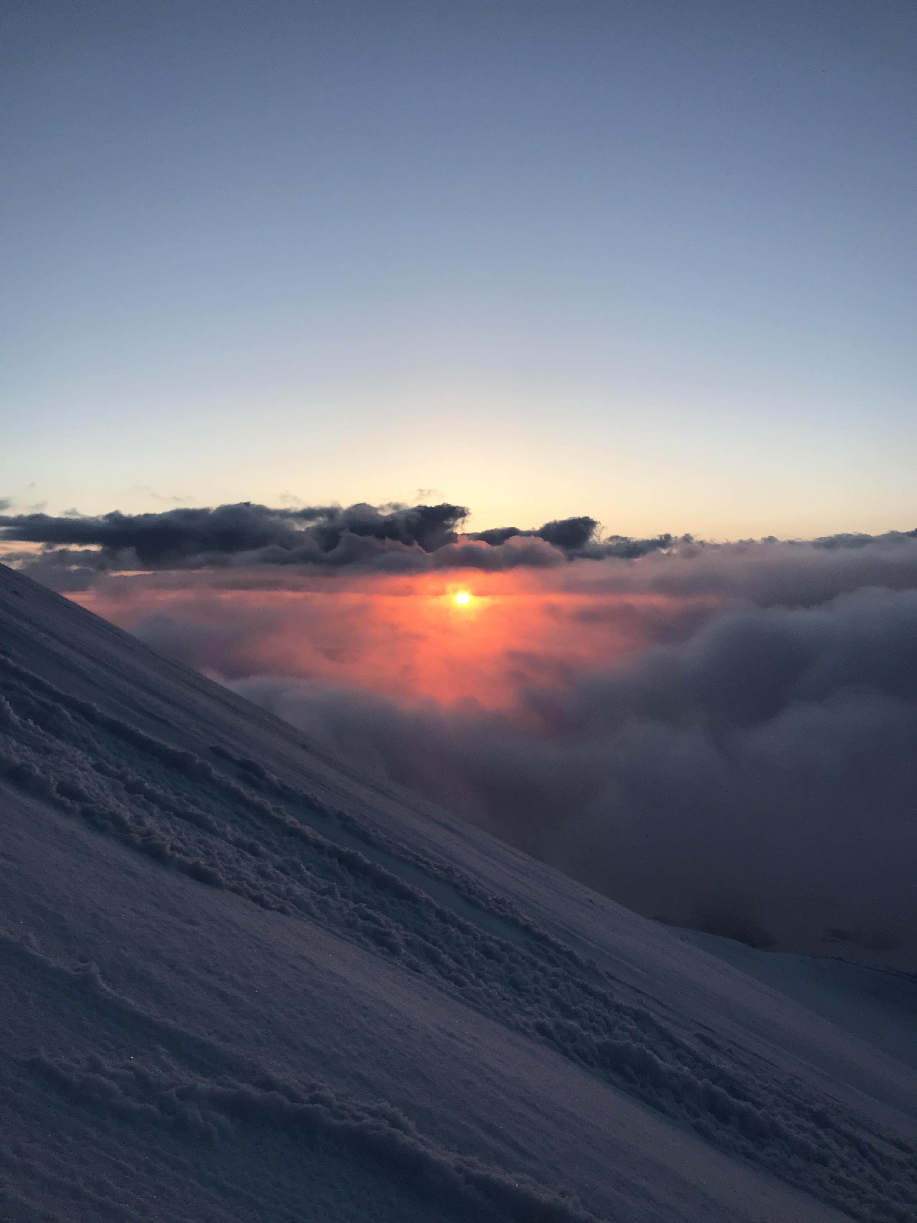
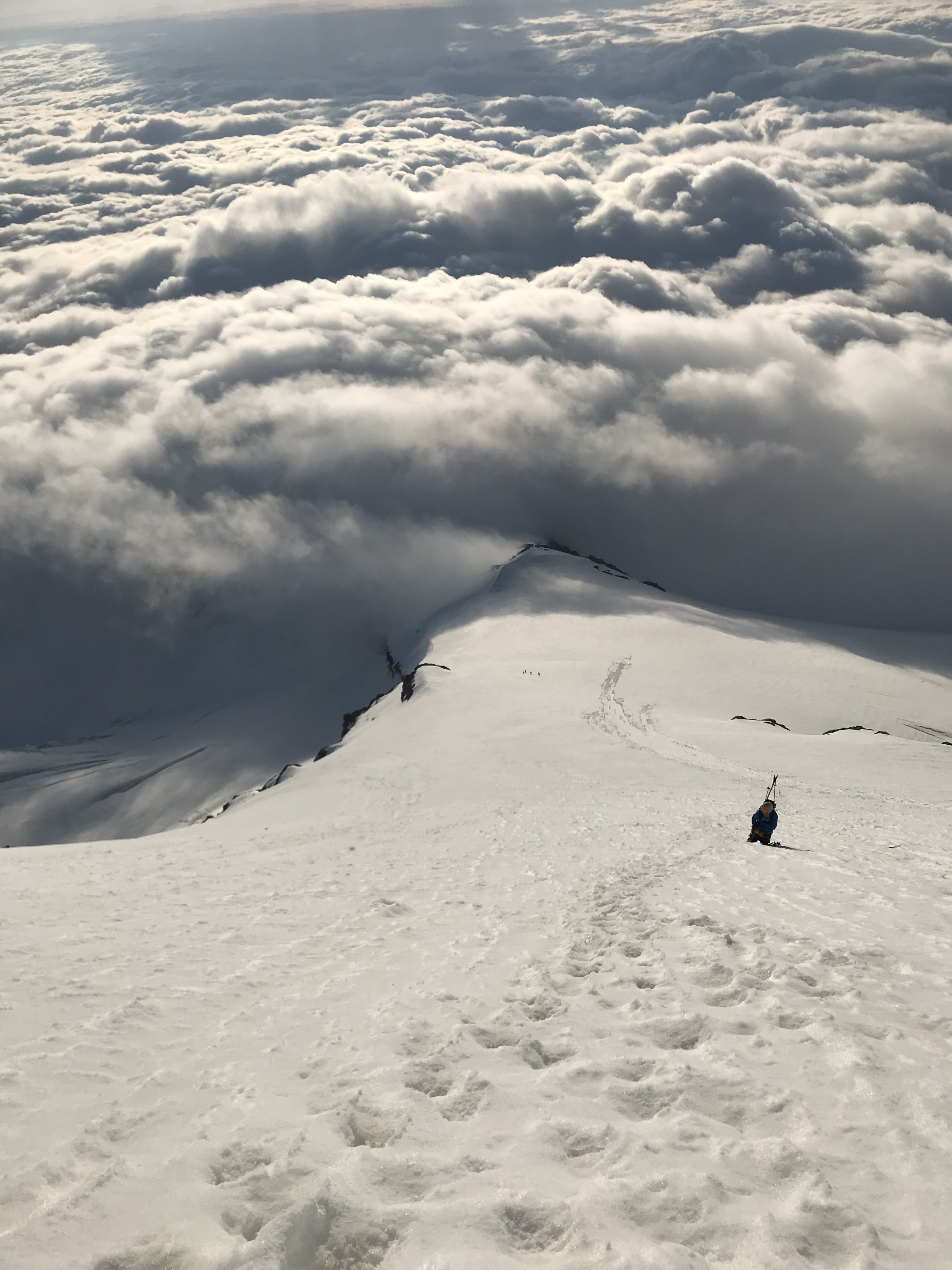
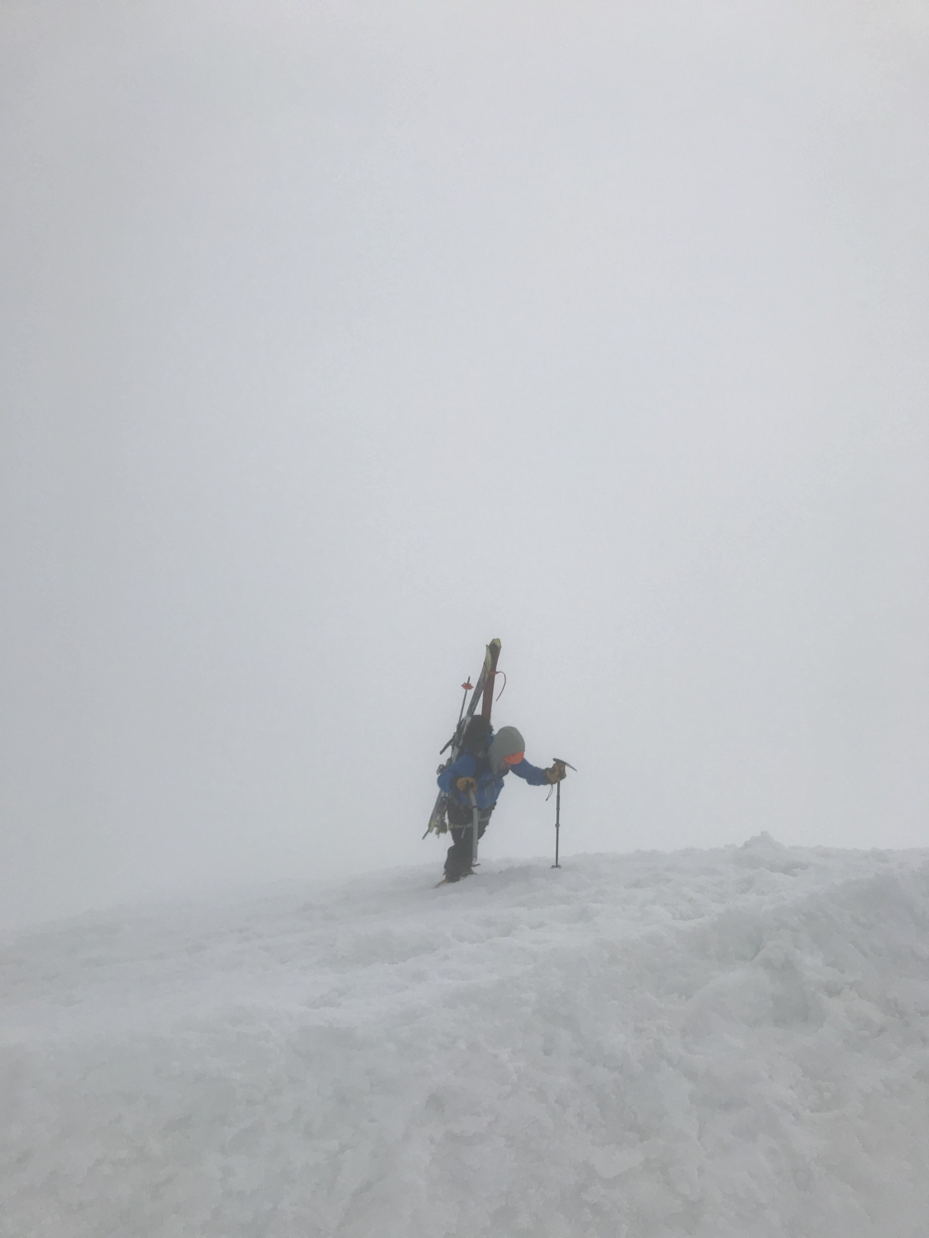
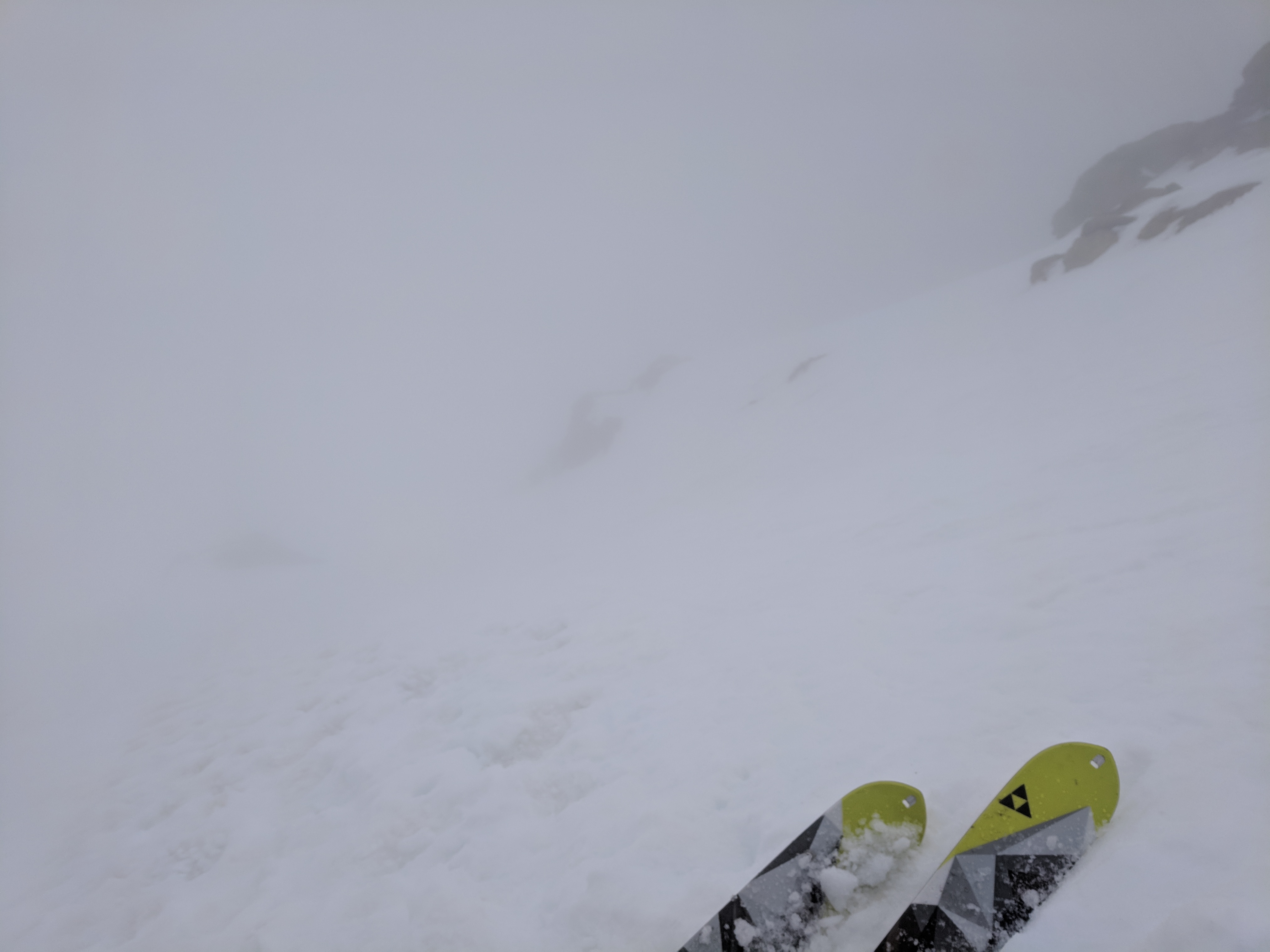
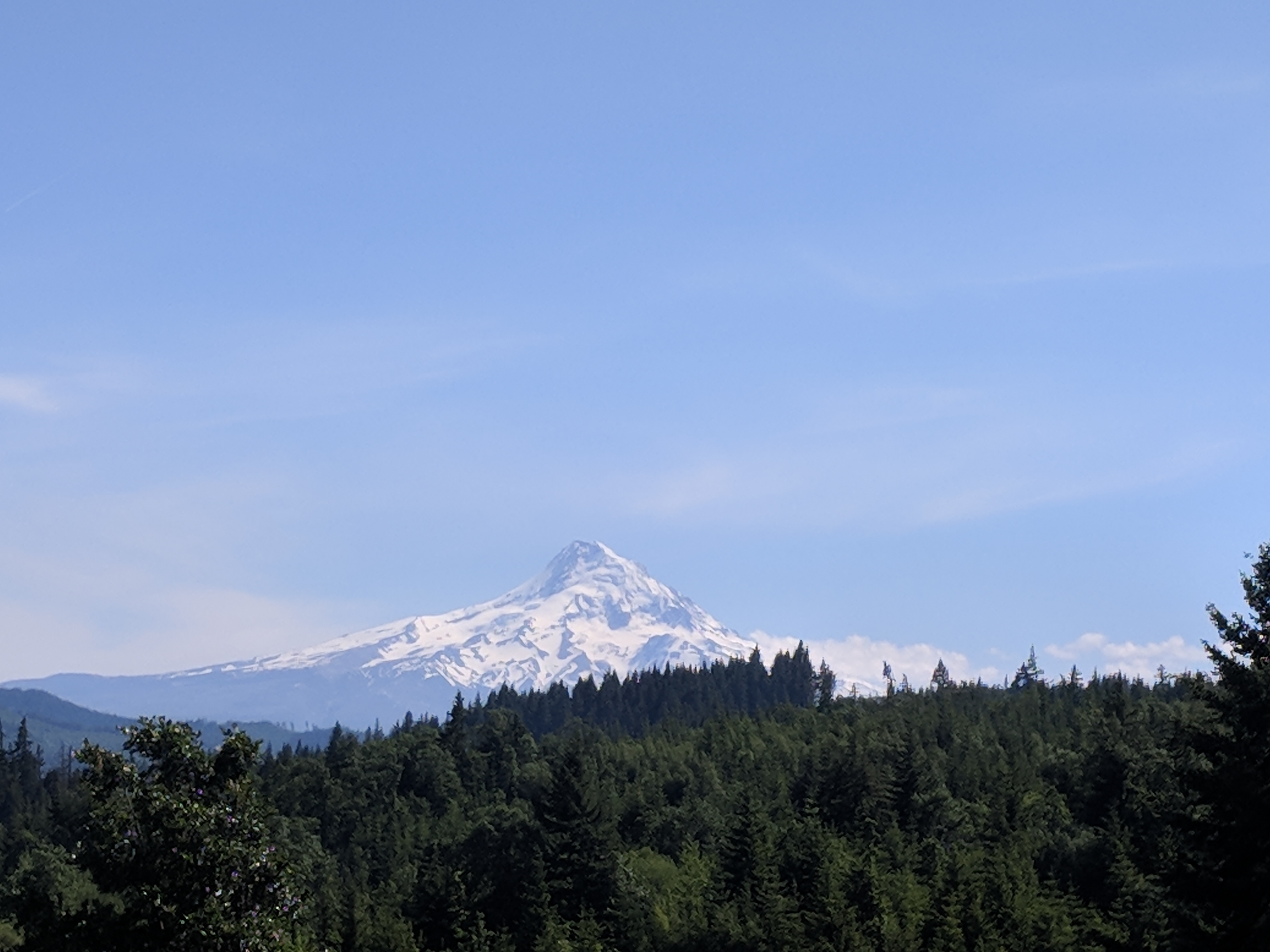
Trip: Mt. Hood - Cooper Spur - Climb and Ski Descent Trip Date: 05/19/2018 Trip Report: I’ve been tossing around the idea of starting to write up trip reports for a while, and finally decided to start. Jake and I had skied together once before, but hadn’t been able to put together a trip for a few months. When the weather and schedules finally aligned, we decided to go for a route we’d been chatting about for a little bit. The forecast looked OK for Saturday AM, but there was another front blowing in later in the day and Sunday was supposed to be worse. We met up for some pre-climb burgers and beer in Government Camp Friday night, and decided to try the approach from Meadows and then crossing the Newton Clark glacier instead of the hike up Tilly Jane. I had been up to ski Wy’east face the weekend before, and figured I couldn’t get lost in the dark since I had my GPS track. We slept at the Meadow’s parking lot, which apparently is closed at night even when the resort is closed. Fortunately, the security guard there let us crash for the night, but not before giving us a radio to use “so that he felt more comfortable”. I think both of us slept with our ice tools nearby. The sky was clear and we were feeling pretty good about our chances with weather the next day. We got a 2:00 AM start and started skinning up the resort. There was still enough coverage that we could skin right from the base, and we made it to the bottom of Cascade in no time. Somewhere after that I decided to take a more “direct” route up instead of hanging a left to go toward Vista ridge. That went well enough until we ended up on a steeper snow slope that quickly became loose boulders mixed with the soft ashy dirt that that makes up Mt. Hood. “I’m pretty sure we’re right near the top of Cascade… somewhere around here”. After some exciting scrambling up the loose dirt and managing to kick down only a few large boulders we got onto vista ridge proper and hiked up to where we were going to cut across the glacier. The snow had frozen pretty well at this elevation, so we decided it would be faster to rope up, put on crampons, and just walk across the glacier. Jake was more than a little excited about his homemade second whippet, AKA a big old ice axe strapped to his second pole with a ski strap. Crevasses have started to open up, but we found a straight line across Newton Clark and stashed the rope and started climbing up onto Cooper Spur proper. By this point it was light enough to see, and clouds were staying pretty low so we had pretty decent visibility. We had great climbing conditions, with firm snow covered in a thin layer of rime. We were feeling pretty good that the snow would soften up enough to ski down in a little while, but would have been comfortable skiing the lower angle part of the route in the current conditions. On the way up, we spotted a group of climbers coming up from the Tilly Jane approach. If you squint you can see them in this photo. By the time we topped out, the weather had fully blown in and the summit was wrapped up in a cloud. We hiked over to the true summit and decided to wait out the weather. We stayed up there for about an hour, and though the sun teased us with little breaks through the clouds we never got the break we were hoping for. Eventually we ran out of optimism for the sun and jokes for other people on the summit (“Wait, this isn’t Rainier?”) and decided to head down. Our plan was to ski Cooper Spur if everything looked good, with a backup plan to ski the south side and cross over the White River glacier. Even though the weather wasn’t great, we decided that worst case we could just downclimb Cooper Spur and that we didn’t really want to do the traverse over the White River glacier. We downclimbed the first three hundred feet or so and took a break in a large platform that had been dug out by some prior party at the steepest part of the whole route. After a bit of discussion if we wanted to downclimb a bit more, Jake responded with, “Well, I’d like to ski some of it at least”. We tested the snow (it hadn’t really softened much, but the rime looked like it would take an edge decently) and decided to go for it. It was a little treacherous transitioning from crampons to skis, but before long we were all locked in and ready to go. The sun still refused to shine, and I got one quick photo before dropping in to the descent. Its always a good idea to have your first turns of the day be the steepest, and so a few slightly puckering jump turns got us warmed up. We picked our way through about 1200 ft of jump turns until the angle cooled down a bit for some more relaxed skiing. We passed the group of climbers from earlier on the way down, who were short-roping their way up with pickets and a running belay. We definitely lost whatever karma points we got for making them a nice booter by raining rime down on them from above. As we passed them one of the climbers asked “Are we through the steep part yet?”, to which the leader of the group gave a chuckle. They were friendly and we let them pass before finishing up the descent. The visibility decreased the lower we got, and we had to ski pretty close together so we didn’t get separated. We skied down off skiiers right of the ridge and tried to find our tracks from earlier. We knew we had some crevasses on this edge of the glacier to navigate around, and our visibility had gotten even worse. Here’s a photo of what it looked like crossing back over the Newton Clark. Fortunately we had our GPS track from the way up, which made it marginally easier to find our way back. Crevasses had a nasty habit of popping up a few yards in front of our skis, which prompted many “Do you remember this one? I think it’s bigger than before”. It took a while, but we eventually found our tracks and found our way to the base of Wy’east face. Of course, once we were out of danger, the weather cleared and we spotted a few skiers coming off Wy’east. Harvested some nice corn on the way through Superbowl and dropped back into the resort through A-zone. Dirty slush back to the car for some Fresh Squeezeds. Overall, great trip. It would have been pretty cool to ski the spur when we could actually see our position, but the snow ended up being decent and we got good turns in. The next day I was biking in Post Canyon and caught a glimpse of Hood. Of course, it was perfectly clear. So it goes. Gear Notes: Crampons, one axe, one tool (didn’t use), one whippet. 30m rope and glacier gear. Approach Notes: kin the resort, cut over the Newton Clark wherever looks best.