-
Posts
2 -
Joined
-
Last visited
-
Days Won
1
charlie_r's Achievements
")
Gumby (1/14)
3
Reputation
-
[TR] Mt. Torment - Torment-Forbidden Traverse 06/02/2018
charlie_r replied to charlie_r's topic in North Cascades
@dave schultz Didn't see anything. The summit register was really unorganized but I didn't see any 2018 entries. There were definitely no steps on the route either. -
charlie_r changed their profile photo
-
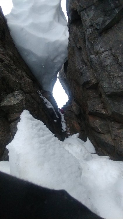
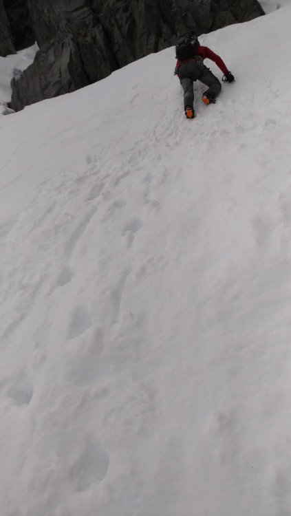
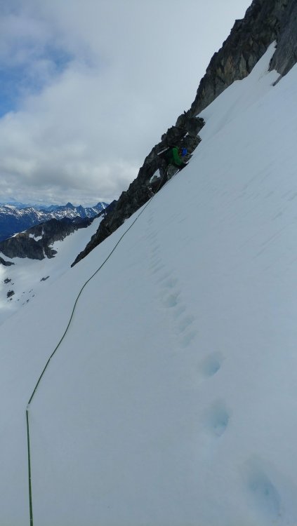
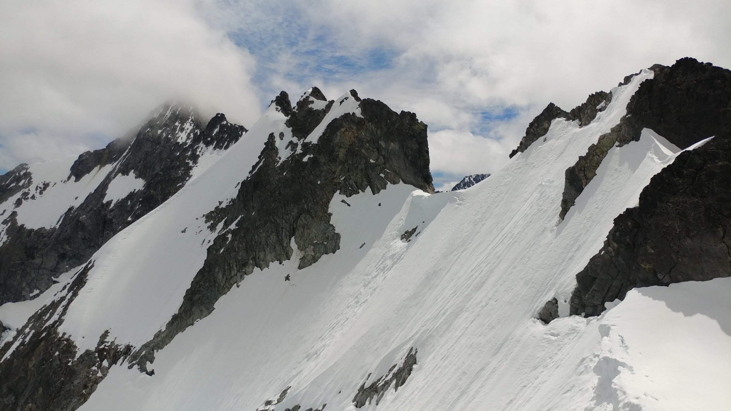
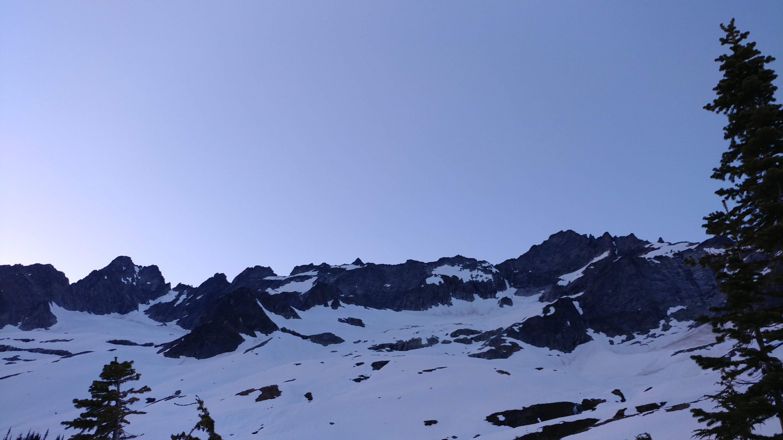
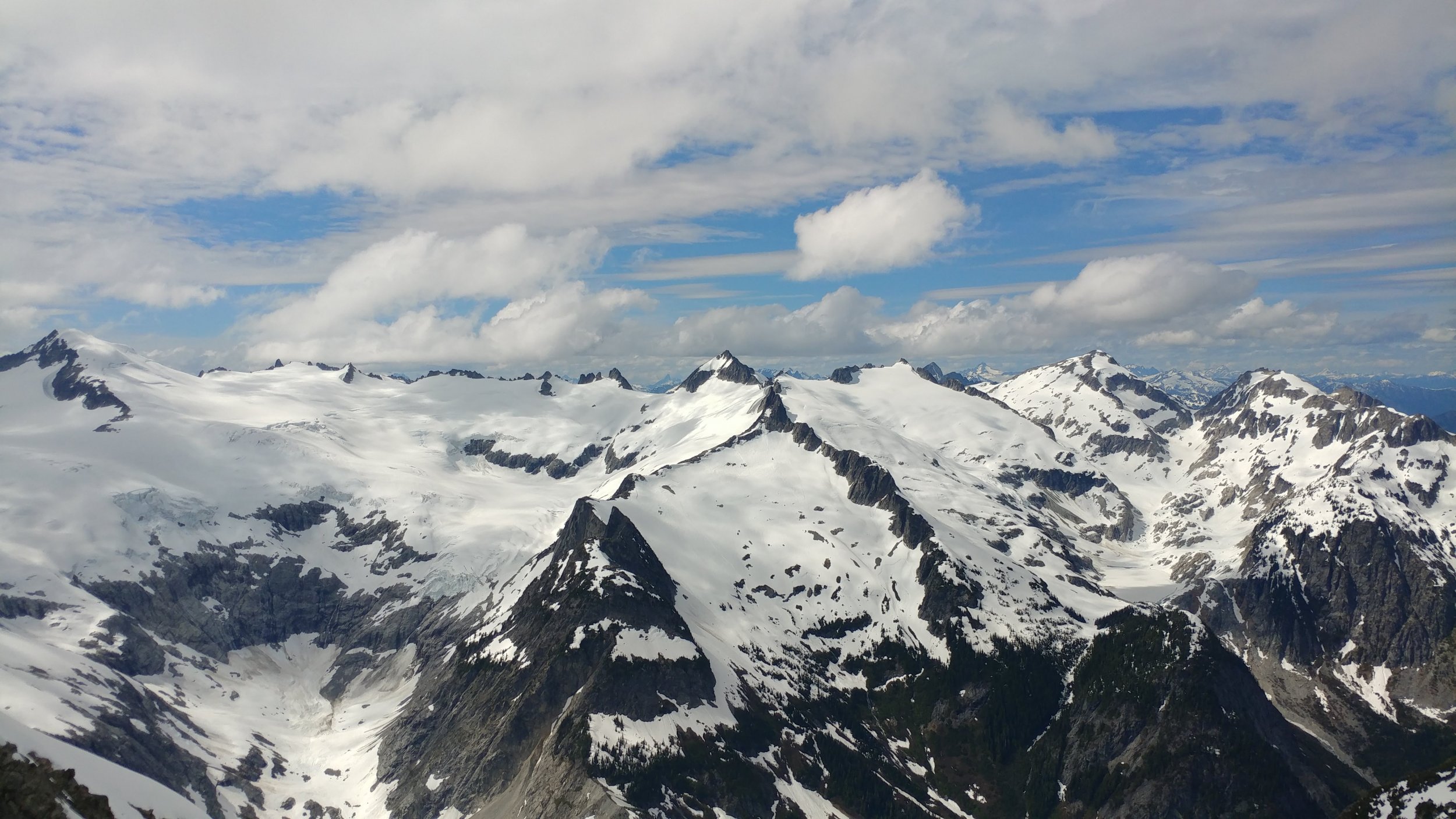
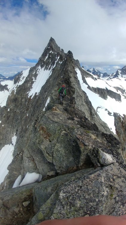
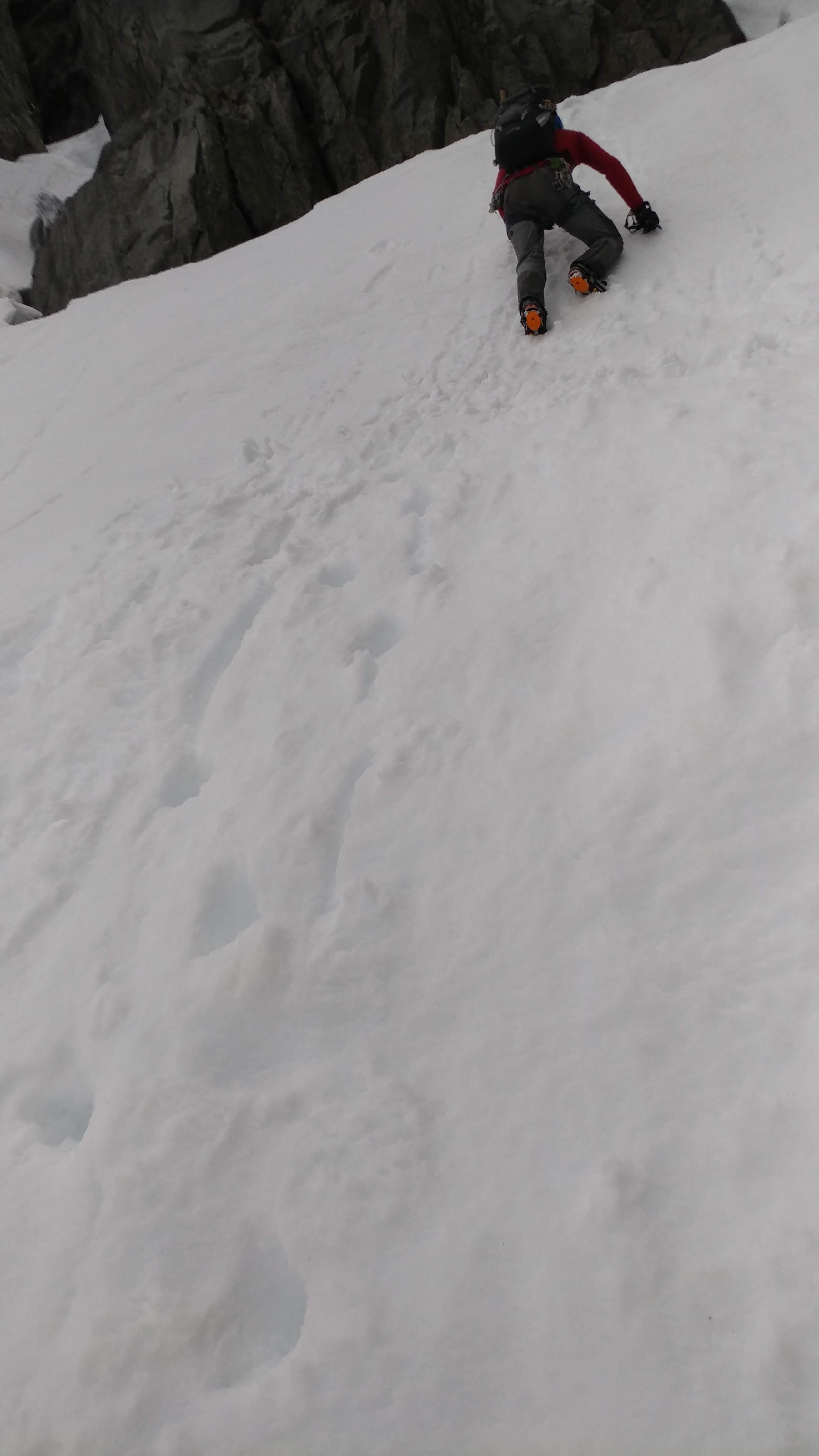
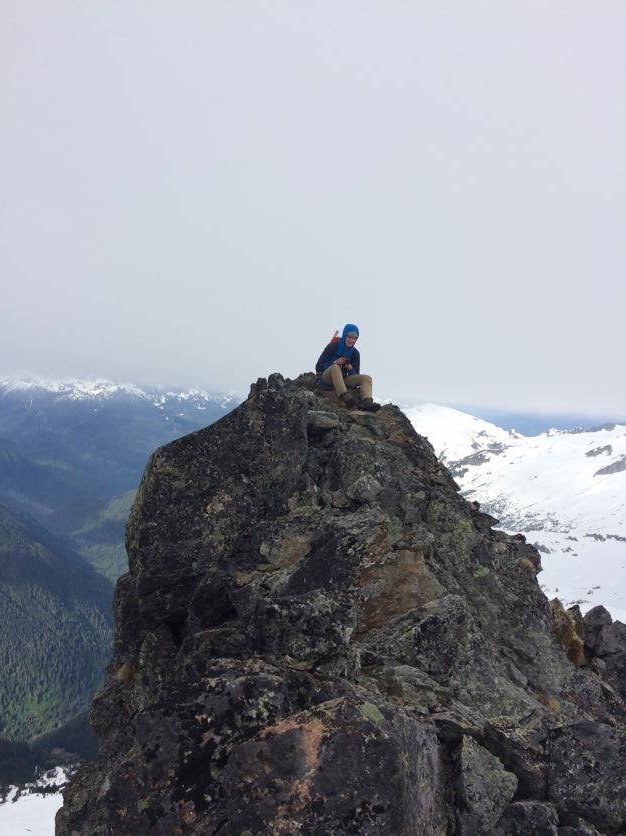
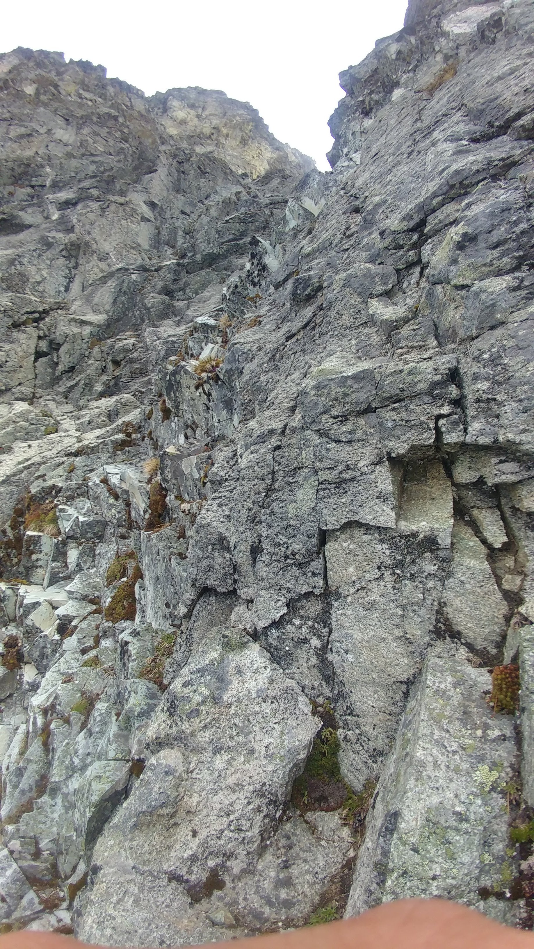
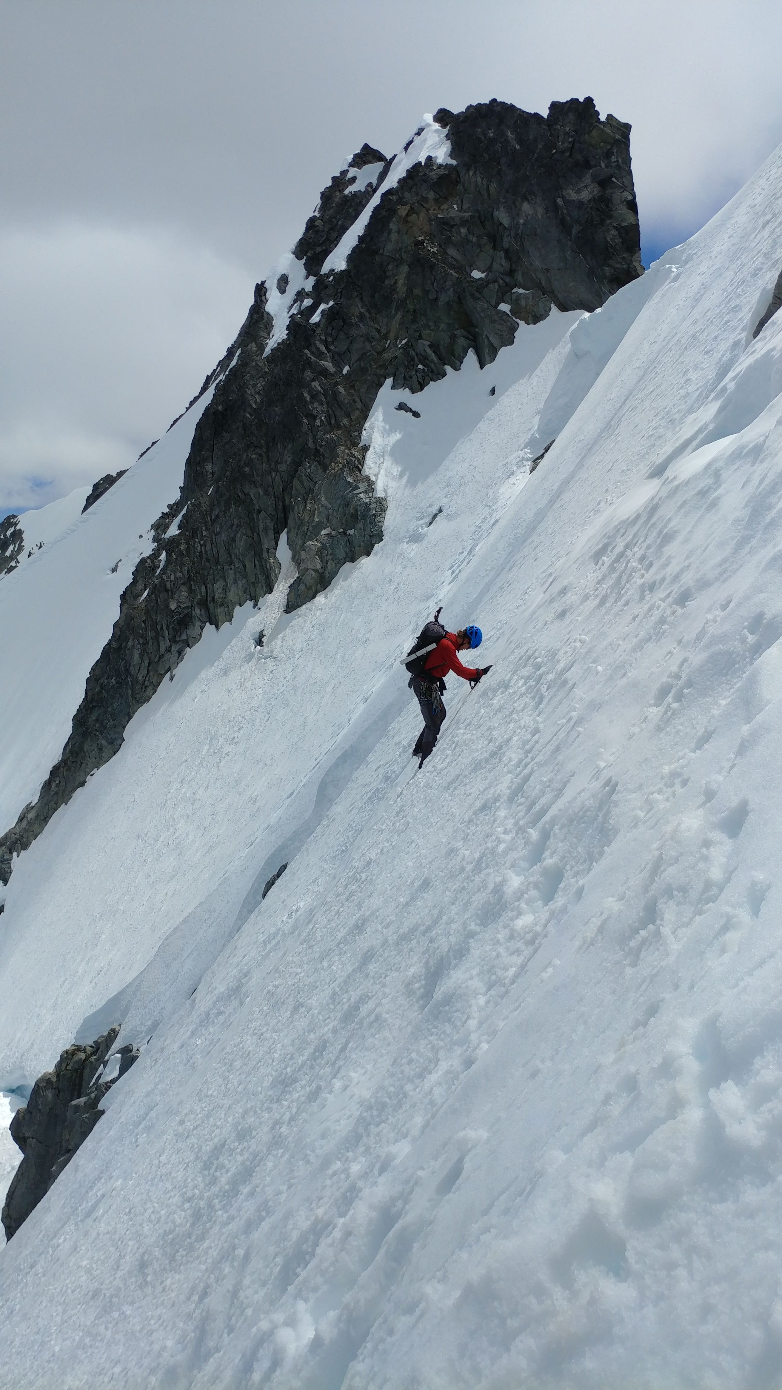
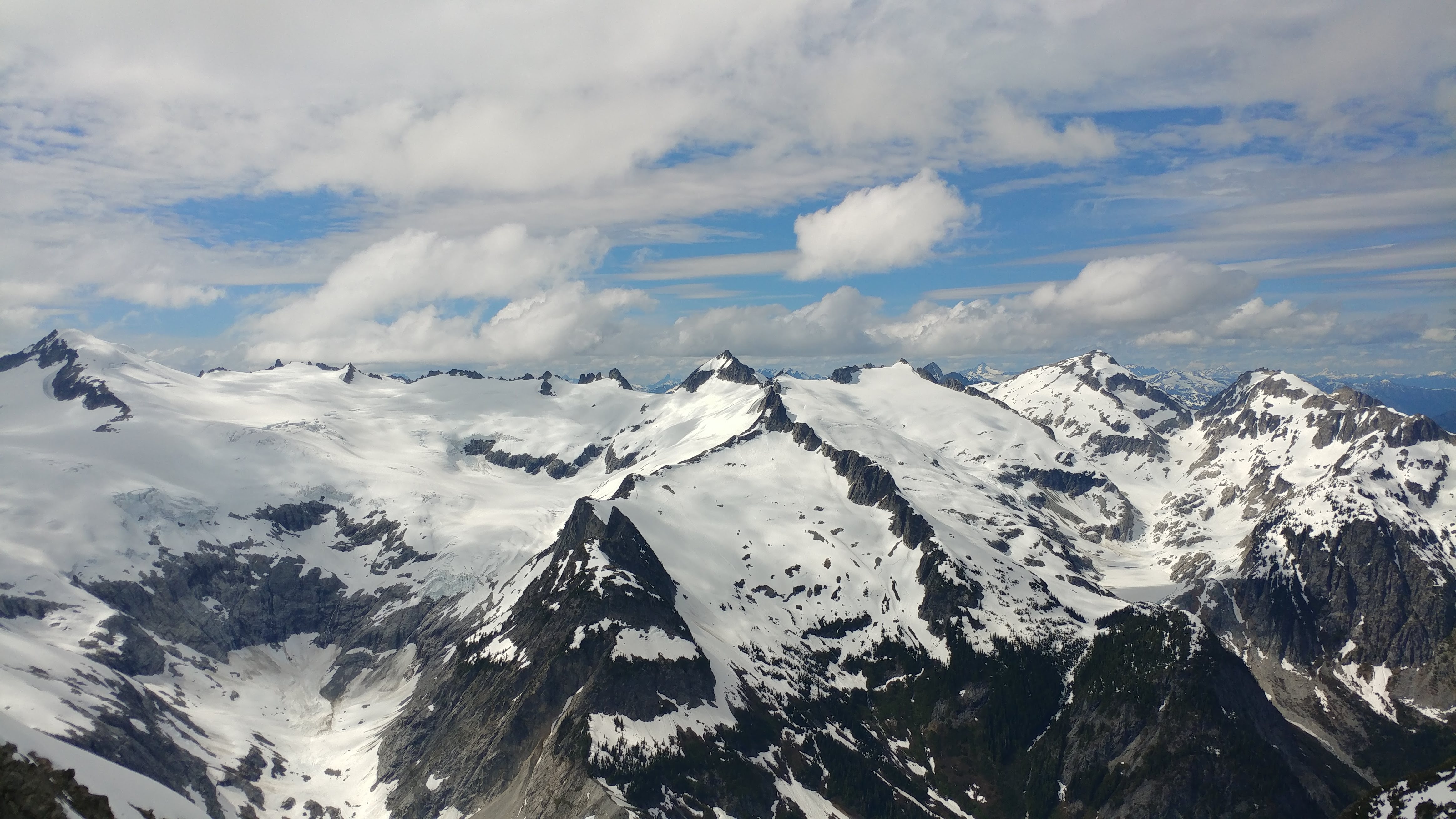
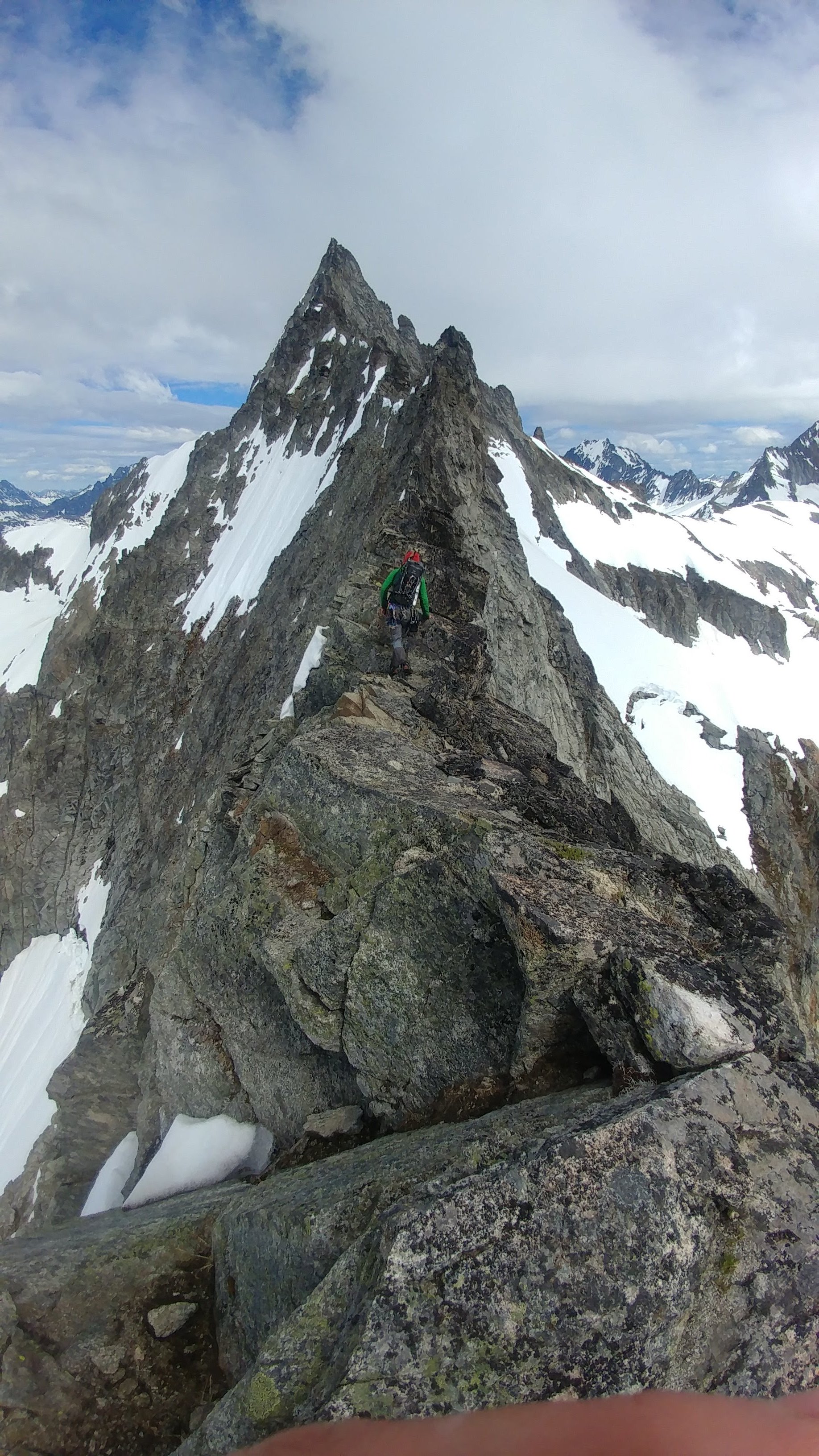
Trip: Mt. Torment - Torment-Forbidden Traverse Trip Date: 06/02/2018 Trip Report: Having just returned from school in Colorado, I was itching for a challenging alpine venture in the North Cascades. I and my equally stoked partner decided on giving the Torment-Forbidden Traverse a go in a single push. We caught the 5 something boat from Bainbridge Island on Friday night, hoping to arrive at the trailhead around 9. Horrible traffic and a couple stops in Seattle delayed that by about 2 hours. After about 1 hour of sleep, we started hiking on the road at about 12:15. The road was gated 1.5 miles from the trailhead probably because of some questionable conditions at the stream crossings. We popped out of the trees about 1.5 hours later, and started heading towards the Taboo Glacier. Good snow conditions, albeit a little soft for the time of night, allowed fast and easy travel. We were at the base of the gully that marks the beginning of the South Ridge route in another 1.5 hours. To our surprise, the Gully was completely filled with snow. A short section of steep climbing and some tricky moves to surmount a moat brought us to the notch. From the notch, we scra mbled up a couple hundred feet of fun class 3 or 4 rock. We closely followed Steph Abegg’s beta and it worked out for us quite well, until we ended up a little too high and had to rappel back down to some grassy ledged that looked much more friendly than where we were. We reached the gully as described by Steph on the north side, which looked quite solid. Our hopes of moving quickly through this terrain quickly diminished upon starting our ascent of the gully. The rock was very loose, and the climbing surprisingly steep. We ended up climbing all the way up to the notch at the top of the gully one at a time because of rockfall concerns. Before reaching the saddle between the two summits, we had to navigate around a large snow finger, which further delayed us. The rest of the climb was straightforward and on better rock. We reached the summit at 8:30, which was far later than we hoped. From the summit, the ridge looked menacing, to say the least. The thought of bailing after our slow summit crossed my mind, however, we were both feeling good and decided to keep going. A free hanging rappel from the second lowest notch on the east ridge brought us directly onto a small glacier. We roped up and traversed at down and east, aiming for a ledge system. There were some open crevasses but thick snow bridges allowed for an easy crossing. The snow was soft and the huge steps that Matias kicked allowed secure crossing of the steep sections. We belayed a short snow section near the end of the traverse because of a tricky looking moat, but it ended up being safe and easily passable. More class 3 to 4 scrambling quickly brought us to the beginning of the infamous snow/ice traverse. After some debate of whether or not to take the rock bypass, we decided on taking the snow traverse because of the heavily favorable conditions. Matias once again lead the traverse and we completed it in in 30 minutes or so. There was perfect soft snow for the whole traverse and no ice. The traverse starts in the bottom right of the photo and tops out just before the cornice at the saddle. From the end of the snow traverse, we dropped down to the south side, hoping for the friendly grassy ledges as described by most of the beta we read. We found the ledges, but there were many snow patches that covered the route, which yielded very slow travel and some scary scrambling on wet rock. The first half of the second half mile of the ridge was slow going. Snow impeded the route numerous times and the scrambling was tedious. The last bit of the ridge, the true knife edge, was spectacular and secure. We had decided that we wouldn’t go for the west ridge if we didn't reach the col at the base by 4:30. We arrived at the “sidewalk” at exactly 4:30, and contemplated our next move. The west ridge looked in, and there were two parties on it. Easy, beautiful climbing on the West Ridge was tempting, but we decided not to go for it. The gully was fat, almost all the way up to the top. Four single rope raps put us at the base of the gully. We took our time on the descent and ended up walking most of the trail by headlamp. Beautiful views of Eldorado and company. We were finally able to see the ridge in full on the descent. 23 hours after leaving, we arrived back at the car, delusionally exhausted. Matias drove us to Marblemount and decided he was too tired to drive safely. He woke me up and I took the wheel until Darrington, at which I made the same decision. We pulled over at some trailhead on Mountain Loop Highway and slept until 6. We caught the 7:55 boat with about 10 minutes to spare. I'm new to writing trip reports, so please ask if you feel like there is anything of importance I left out. Gear Notes: 2 Pickets 60m rope (needed for rappels - 30m+ tagline would be best option) Half rack of rock pro (did not use) Two axes each (tool/axe) Strap on crampons We both decided to wear light boots. I wore my salewa alp trainer mids, which handle rock very well, but the snow we climbed was just about at the limit of what I would do with them. Approach Notes: Road is closed about 30 minutes from TH. All snow after tree line.