


Todd Anderson
-
Posts
60 -
Joined
-
Last visited
Content Type
Profiles
Forums
Events
Posts posted by Todd Anderson
-
-
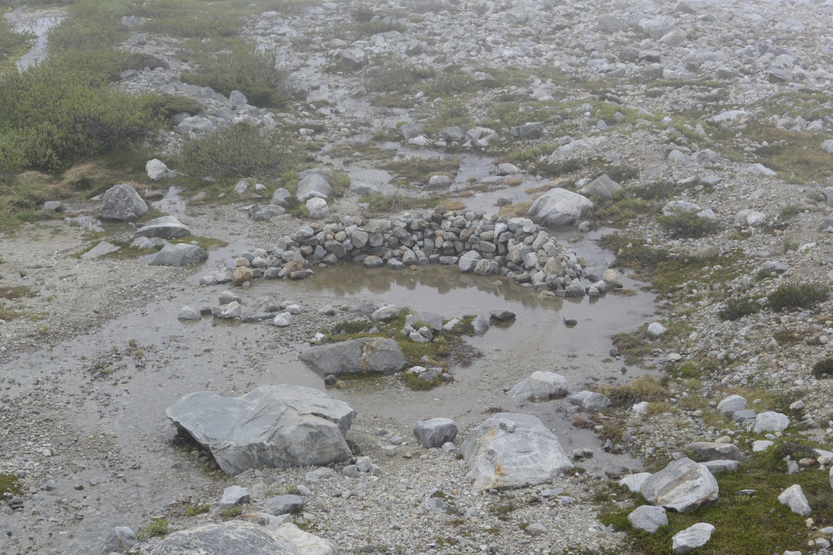
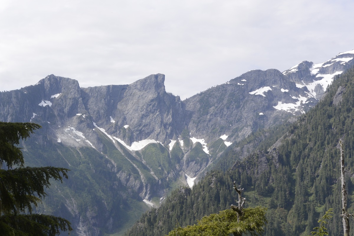
Any update on the pocket glacier? Low temps have been well above freezing for a while now....
-
Interested mainly on Lower Town Wall routes around 10-11, but would be okay doing pretty much anything, including belaying you on City Park (only if I can TR afterwards, though). Have double rack, 70m rope, car, etc. Based in Seattle.
-Todd
andersontodds at gmail
-
Did you ever find a partner? I'm interested.
-
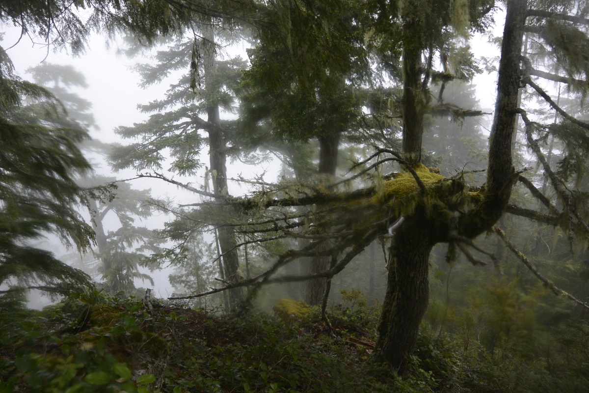
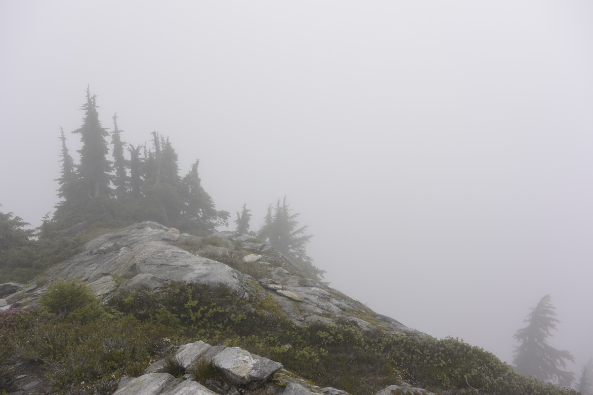
Trip: Terror Basin - via Goodell Creek
Date: 7/16/2016
Trip Report:
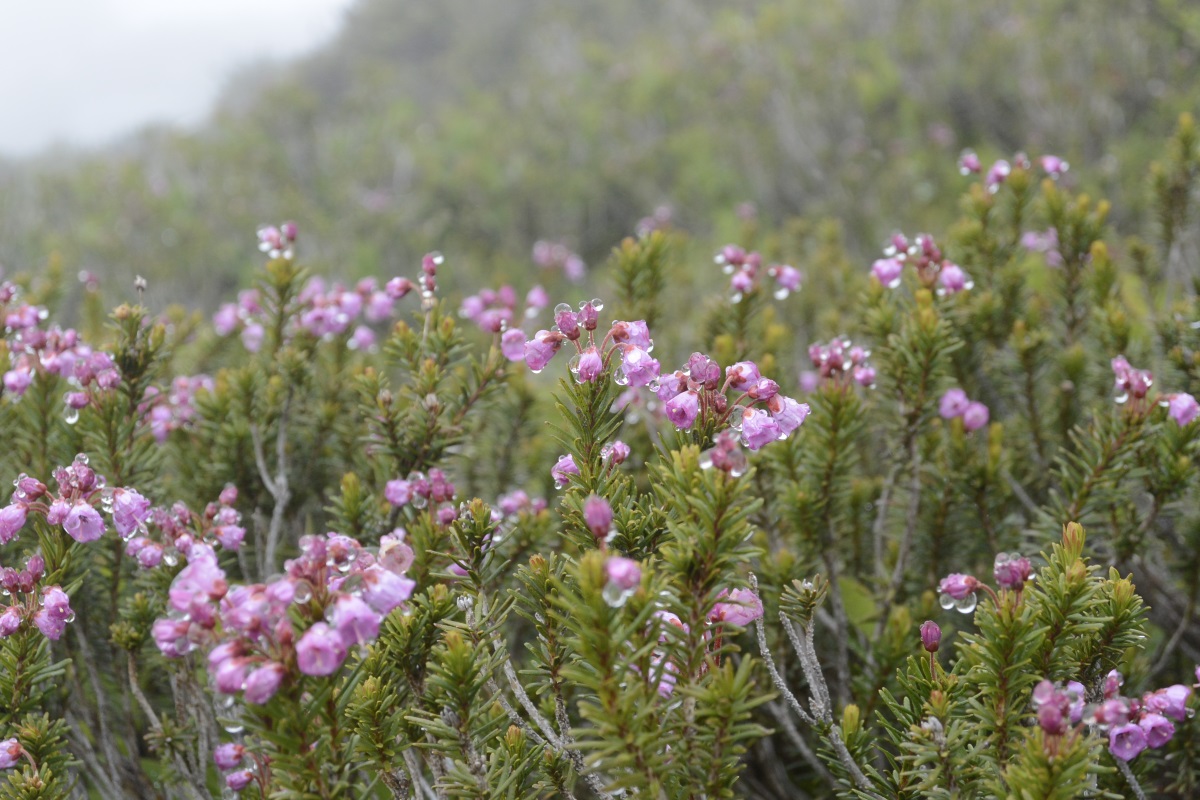
I'll try to keep this short, since there are plenty of TRs for this area of the Southern Pickets, and I didn't actually summit anything. Working on photos now figured it out.
Various weather forecasting sites called for intermittent drizzle Saturday morning, cloudy to clear Saturday afternoon through Sunday noon, and drizzle becoming thunderstorms Sunday afternoon. Sounded like a weather window to me! No potential partners thought it sounded like a weather window, though, so it was a solo trip.
The plan was to leave Seattle at 5 AM, get to the Marblemount ranger station for the permit at when they opened at 7 AM, and be hiking at 8 AM. I got to the ranger station at 7:15 and had to wait in line for 20 minutes; not something I was expecting for a rainy morning in one of the least-visited National Parks.
Anyway, I started hiking at 9 AM. It had been drizzling on and off since at least 6 AM, and the shrub-tunneling sections of the trail left me completely soaked by the time I got to the turn-off up the steep climber's trail (11 AM). It had stopped raining, but I was in a cloud from 3000' all the way to camp, so nothing had a chance to dry out. Fortunately the trail, while rough, was pretty easy to follow. I got off the trail at least half a dozen times on the way up, but was able to retrace my steps and find the trail again without ever losing much time. Above treeline you will often be looking for cairns instead of a beaten path; when you cross a stream and can't find cairns or a path anymore, try looking up the streambed.
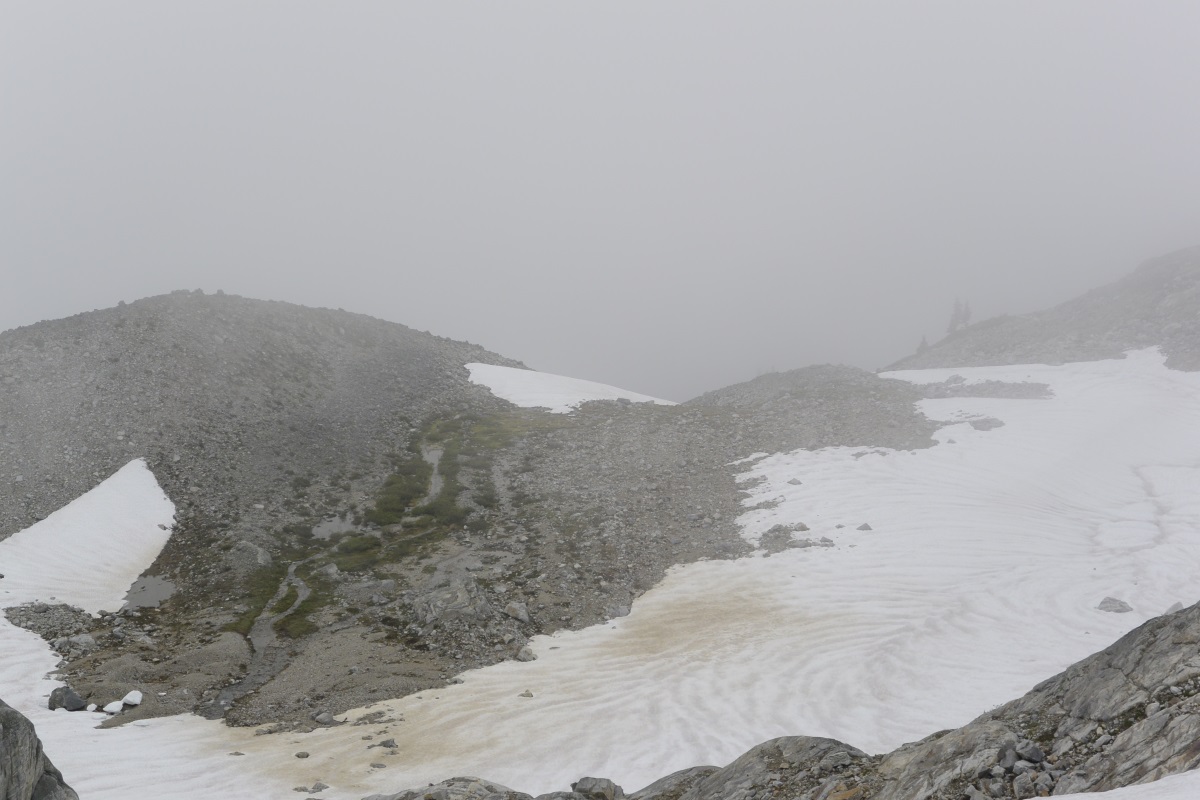
The steep snow descent from the notch at 6200' was pretty exciting. A few steps after I put on my crampons I managed to snag my pant leg and lose my balance, but hung onto a snow bench and did't slide anywhere. The snow was pretty soft and I realized I didn't have the skills to French my way down, but low-dagger and frontpointing worked well until the slope eased off.
The creek through the bivy bench was pretty high; several tent sites were underwater. It looked like there were two sites that were high enough to be usable, although an enterprising party could flatten out a few more. I got the bivy area at 4:30 pm; 7.5 hours after I left the car.
The plan was to climb West McMillan via the West Ridge (class 3) on Sunday morning, but I felt so wrecked when I woke up that I decided to just hike out. After a brief shower right before I left camp at 8 AM, the weather was perfect until I got back to the turn-off at 1700' around 1 PM. Then it got wet again, and when I was driving out (at 3) I saw lightning in a few places.
Anyway, it was a fun trip and I'm excited to go back and actually climb some things. One night is probably not enough; I think I would try two or three next time.
Gear Notes:
Navigation: Gaia GPS app, which could only handle about 2 days on my shite phone (bring an external battery); the approach notes in the Beckey guide were awesome.
Snow travel: A short, light axe was great; longer ones would get horrible hung up on vegetation on the approach. Crampons were very nice; unfortunately I only have full-auto crampons, so had to wear my Nepal Evos. These were very heavy (especially when soaked), and I got some pretty vicious blisters on my heels and big toes. The bit of scrambling I did on the hike in and on some nubbins at the 6300' notch did not inspire confidence. I think mid-height approach shoes with strap-on aluminum crampons would be wonderful for this trip.
Dampness mitigation: I don't think it's possible.
Approach Notes:
From Marblemount, drive east on 20 until you cross Goodell Creek, then take the next left towards the Upper Group Campground. Continue to follow signs for the group campground on dirt roads until you find a sign warning that you're not at a maintained trailhead, along with a small gravel parking area.
-
I'm not going to spend two weekends in a row in Seattle and I feel like I haven't done enough alder-flossing, so I'm headed into Terror Creek basin tomorrow. Hopefully doing West Ridge of West McMillan early Sunday, then getting out before any possible lightning.
Anyone want to come along? Priorities are:
1. don't die
2. have a laugh
3. summit
4. be dry at the end (ha)
Leaving Seattle at 5am on Saturday. Partner needs crampons, axe and food (don't think I have enough for two right now); and all the normal personal camp things you want to bring. Prior experience in the Pickets would also be handy.
Email andersontodds AT gmail
Weather links:
Mountain-Forecast/Mount Terror
NWS/7 miles NNW Newhalem, 5200ft
UW Atmospheric Sciences (looping doesn't work)
-
Leaving Seattle at 5am tomorrow morning to go suffer in the Pickets if you're interested!
-
From my experience, the Pickets make their own weather. You can run into rain there when the rest of the state is clear. I'd hold out for a 100% chance of clear skies if your schedule will allow it. Thrashing through the brush and climbing on shattered rock is hard enough when it's dry. When it's wet it's a whole other animal...
So I've heard, which is why I'm not thinking too hard about anything more difficult than W McMillan. This trip is mostly about getting outside and chasing
the quintessential Pickets experienceand maybe even some nice views and a summit!
-
Good to hear. Hopefully that "thunderstorms also possible after 11am" part goes away.
-
Anyone been up to Terror Creek Basin recently? Thinking about doing the West Ridge of West McMillan this weekend, depending on what the forecast does. From all the photos I've seen it doesn't look like crevasses are an issue until late July/August, but updated conditions (or pure speculation) would be helpful. Thanks!
-
So, did anyone get on Goode last weekend?
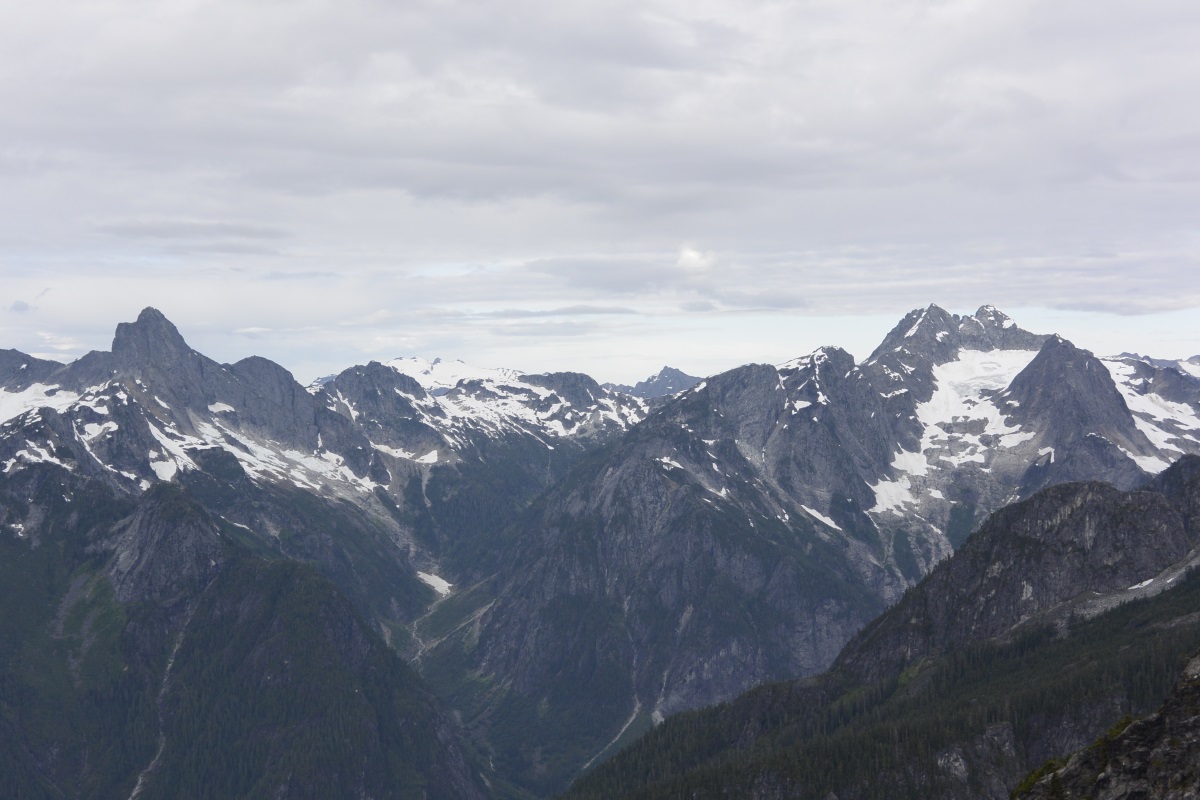
I'm having trouble uploading photos (as usual), so here's a link to one I took from the summit of Liberty Bell on Sunday. Hoping to get on the Megalodon, but not sure if I should try in two weeks or two(ish) months....
I have photos of other angles, but I'm not sure how useful they'd be. I can post if there's any interest.
-
I've never used a down quilt, but I have a Feathered Friends Vireo UL. As you can see if you follow the link, it's an elephant's-foot-like bag with no hood or zipper. The idea is you're bringing a down puffy anyway, so you might as well wear that to bed and bring a lighter sleeping bag. Hence, the torso area is very roomy compared to the footbox. The standard model also has more down in the leg area than the torso area for this reason.
My Vireo has five ounces of overfill in the torso, so it's actually around 20 oz. I used it on Mount Adams at the Lunch Counter camp (around 9400 ft) at the end of May, with Capilene 4 underwear, a light synthetic puffy, and a light wool hat, and inside an eVent bivy, on top of a Therm-a-Rest Z Lite Sol and under a tarp. I guess the low temp was in the low 20s that night. Anyway, it was supremely toasty. My model is the 68" length, and I am 69" tall, so I can really cocoon myself in it. It also had enough girth for two Nalgenes and a fuel canister near my hips and lower back, although you would be hard-pressed to get anything besides your feet in the footbox/lower leg area. I will also say that the Vireo did a good job of venting persperation, apparently, since it was dry but the foot of the bivy had some frozen condensation in the morning.
In summary,
Pros: light, packs small, warm
Cons: feet might get pretty warm in warm weather, no snuggling w/ SO
-
Reportedly could even hold a leader fall in a pinch.
Plenty of static lines can hold leader falls, they just result in extreme damage to the leader. Where did you read/hear this? I read the OGL review and can't find anything about holding leader falls.
-
YES! Bad idea!
Thanks for the input!
-
Based on the conditions you saw, do you think it's insane to do an Enchantments thru-hike this weekend with a group that has (a) very little backpacking experience, and (b) no snow floatation equipment? I know Aasgard Pass would very challenging and probably a no-go for such a group; but that aside, are we going to be postholing the entire way?
-
I'm interested in all of those. I've been ogling a few Index climbs for a while, but would be down for anything. I'm relatively new to the area, so have never climbed at Index and only been to Leavenworth for bouldering. Have done ~175 pitches at Squamish, though.
-
Thanks for the responses. Erik, I've been thinking about Phantom/the Slot and my eventual destination is UW, so it sounds like we're in a similar metaphorical boat. Tuesday and Thursday I don't have anything until 12:30....
-
It seems like the snowpack keeps going to shit over the weekends, then slowly improving during the week. If I have to be at work at 10am, are there good tours I can do before work? Kendall Knob and Snoqualmie Pass as a whole comes to mind, but I'm not too familiar with the Cascades beyond Snoqualmie.
Thanks!
-
Long shot, but: I have a pair of Scarpa Lasers (circa early 2000s) that would be great if they had a stiffer, more progressive tongue. There's a great WildSnow article about stiffening them up here, which I want to try.
Anyone have some flexon tongues like those in the article? Apparently Koflach snowboard boot tongues will require the least modification, but I'm thinking Full Tilt will be more common now.
-
The Black Dike is usually out sometime in March. If it turns out to be a cold rest of the winter, it might be climbable at the end of March. If you try it in above-freezing temperatures be prepared for microwave-to-car-sized blocks to fall on you on the approach and during the climb; in other words, don't do it if it's warm out. I have been to Cannon twice around the end of March/first week of April, and both times we saw huge rockfall in the Black Dike/Whitney G area.
Can't say much about the Adirondacks.
-
For judgements on avy danger in new (to me) areas, I use the forecast provided by the Northwest Avalanche Center combined with the "avalanche danger" description/rating in Martin & Krawarik's Washington Ice book.
For example, WA Ice lists the avalanche danger for Franklin Falls as "moderate on the far left side of the falls, minimal on the right side". Various Alpental areas are given "moderate" to "serious". Then, I'd check the NWAC forecast, which says avalanche danger will be "considerable" tomorrow (since there has been a lot of wet snow and rain recently). In light of these ratings, I wouldn't do a climb with a "serious" WA Ice avalanche danger rating, and I would watch out for potential slide areas, signs of recent avalanches, etc. even in areas of "moderate" avalanche danger. You have to make your own choices about which combinations of avy danger ratings you feel comfortable with.
Not sure if the ice will hold up until Friday, or what the current state of it is in the Alpental areas. NOAA thinks it will be warm (highs above freezing) and potentially rainy between now and Friday.
-
Dre, if conditions improve slightly over the next week I would be interested in going back. The better avy forecast day next weekend might be reserved for some alpine fun; not sure about my partner situation though.
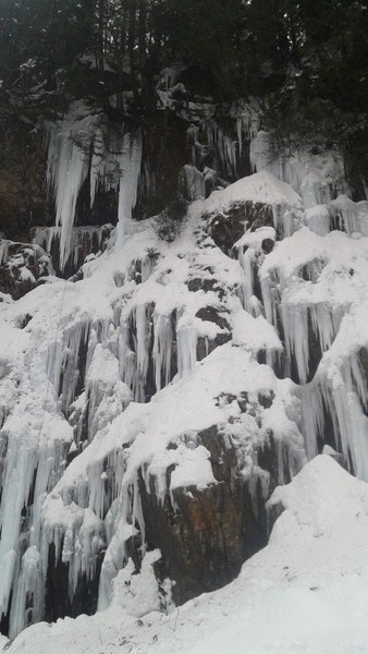
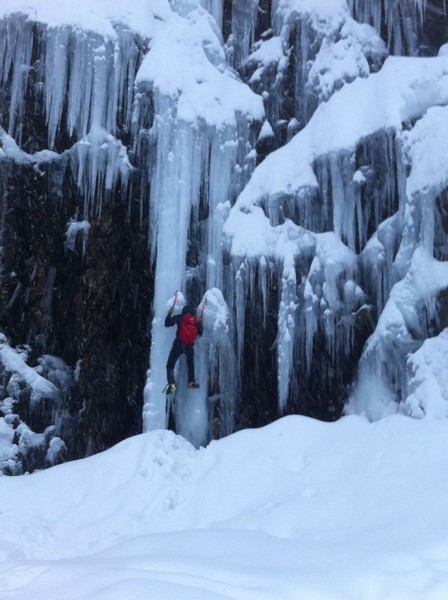
Made it back up to Franklin Falls today. The ice quality has deteriorated significantly since Saturday; it was holding its shape (i.e. not falling down) but very soft. I climbed the leftmost column in the photo below, which touched down just out of frame. Once I got to the cave under the deathcicles I realized I probably couldn't climb them without knocking down some/most/all of the ice, so I rapped back down. If the big hanging icicle on the upper left touches down and it gets a bit colder, it could be a pretty cool line. Maybe WI4? I set my anchor pretty far back from the edge, and had maybe 4m left of my 60m rope at the bottom, so I would guess it's 35 or 40m from the ground to the trees.
There are some other icy steps to the right of my rope line, which might be okay. They would be a lot more fun if the snow on top of the steps consolidated. The snow had the beginnings of crust on top, but was mostly pretty loose. This made for interesting slogging just to the right of the ice lines, which looked a lot more straightforward from the ground....
-
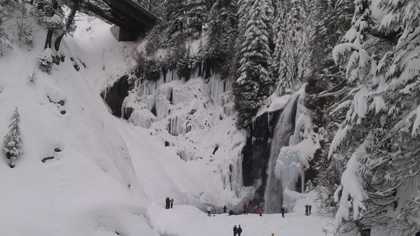
Finally made it to Franklin Falls. There was an interesting line on the right side, which unfortunately didn't make it into the first photo. I was just hiking with friends, so I didn't bother bringing a rope. I'll probably come back Monday to do the whole pitch.
-
Todd Anderson, FYI Franklin Falls is one of the more popular hikes in the Seattle vicinity and trip reports pop up almost daily on the WTA site. Check it out for recent pictures: http://www.wta.org/go-hiking/hikes/franklin-falls
Other good resources for trip reports to common hiking destinations like Franklin falls are NWHikers.net and the WHC FB group. These groups are very active and post a lot of pictures.
Thanks bellows and yikes! This is my first season in the PNW, every bit of beta helps!
-
Thanks hacim, sounds like I should look somewhere else. Strobach, anyone?
Slesse Access FYI
in British Columbia/Canada
Posted
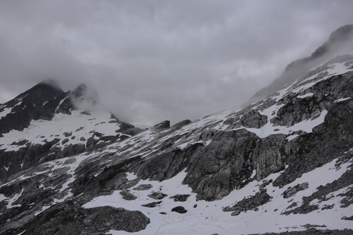
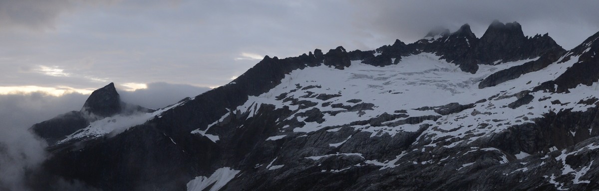
Awesome photo, thanks. I had heard a friend of a friend did Slesse last weekend (solo?) and had a "super chill" glacier crossing, but I wasn't sure if he crossed the pocket glacier or the other one.