

JonParker
-
Posts
140 -
Joined
-
Last visited
-
Days Won
20
JonParker's Achievements
")


-
Lovely photos!
-
"Route 66" V 5.10 AI2 FA on the NE face of Johannesburg
JonParker replied to Sam Boyce's topic in North Cascades
IMG_5782.mov -
[TR] Despair (south peak) - East / SE side 09/12/2025
JonParker replied to JonParker's topic in North Cascades
Yeah it’s not great but not like Cascadian couloir level of tedium. Don’t wanna discourage the interested -
[TR] Despair (south peak) - East / SE side 09/12/2025
JonParker replied to JonParker's topic in North Cascades
I’ve been using https://browser.dataspace.copernicus.eu -
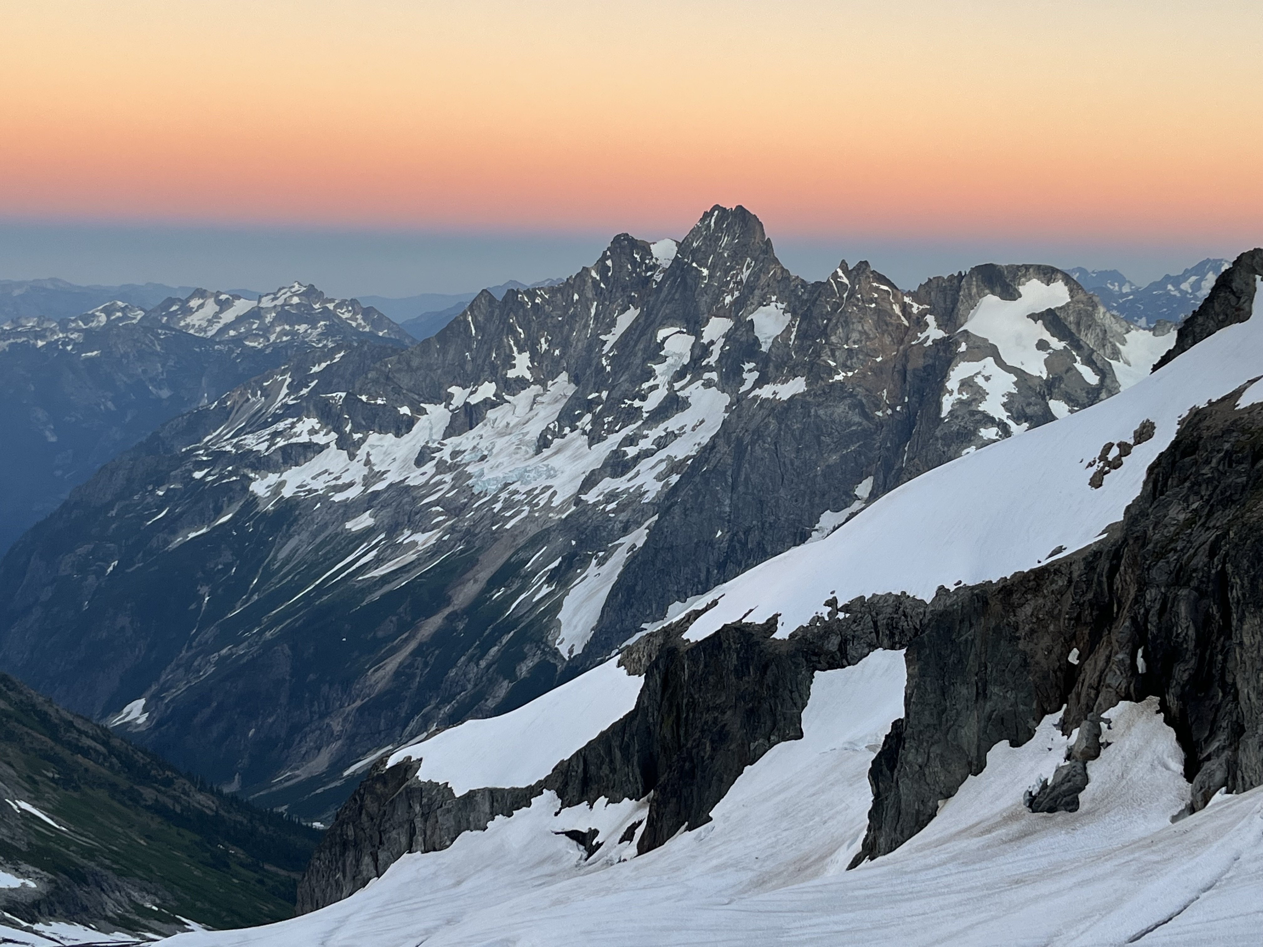
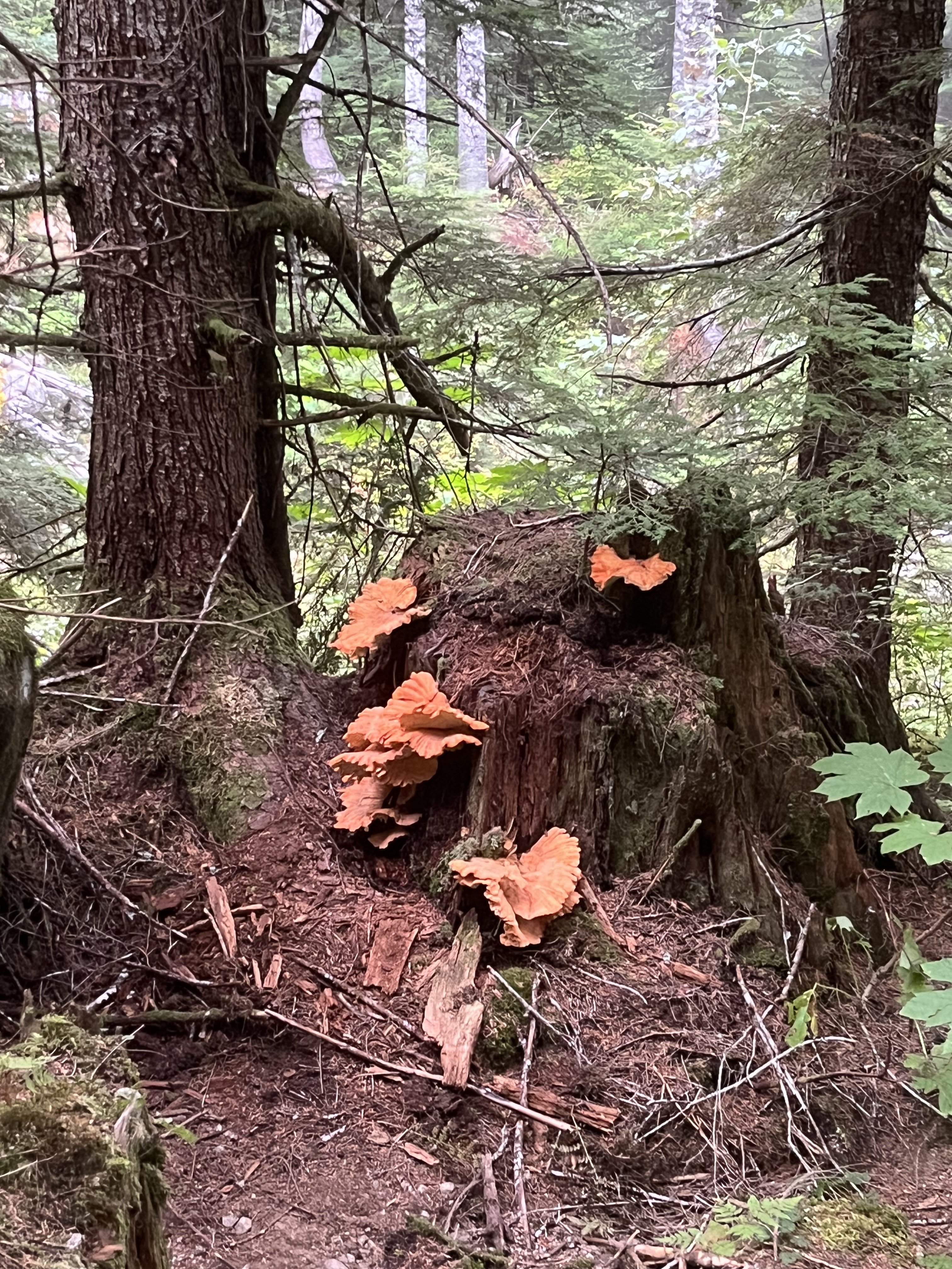
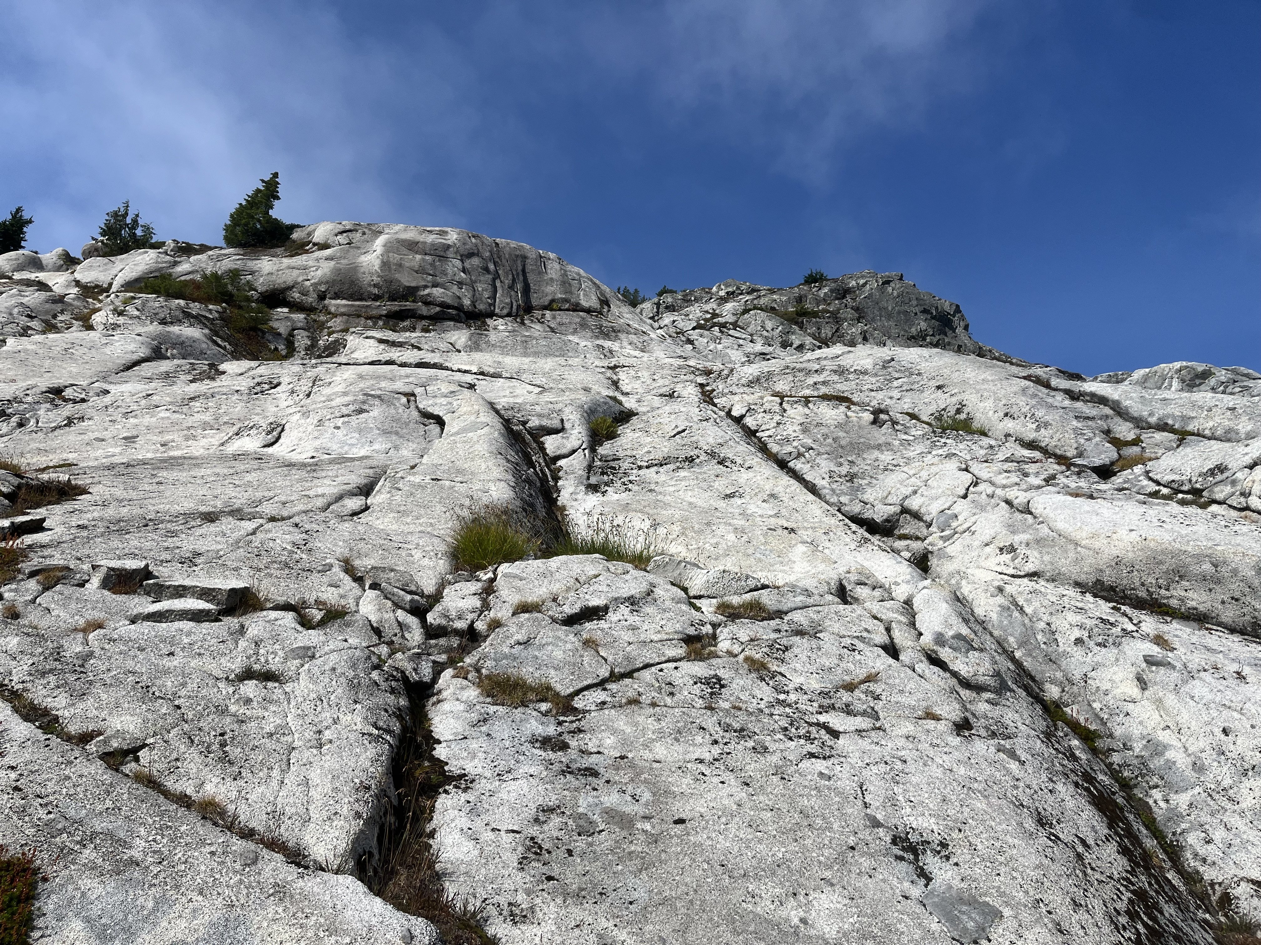
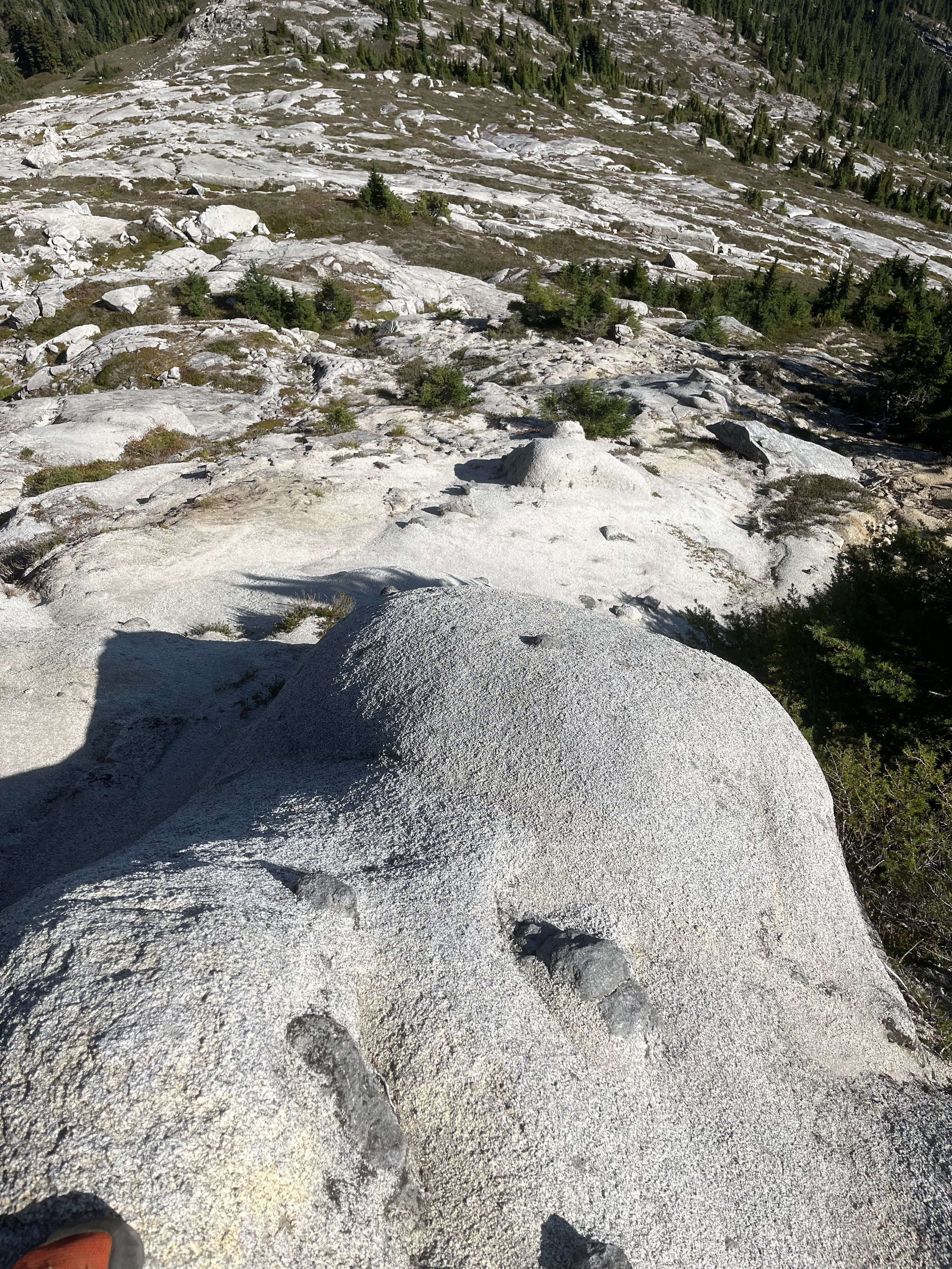
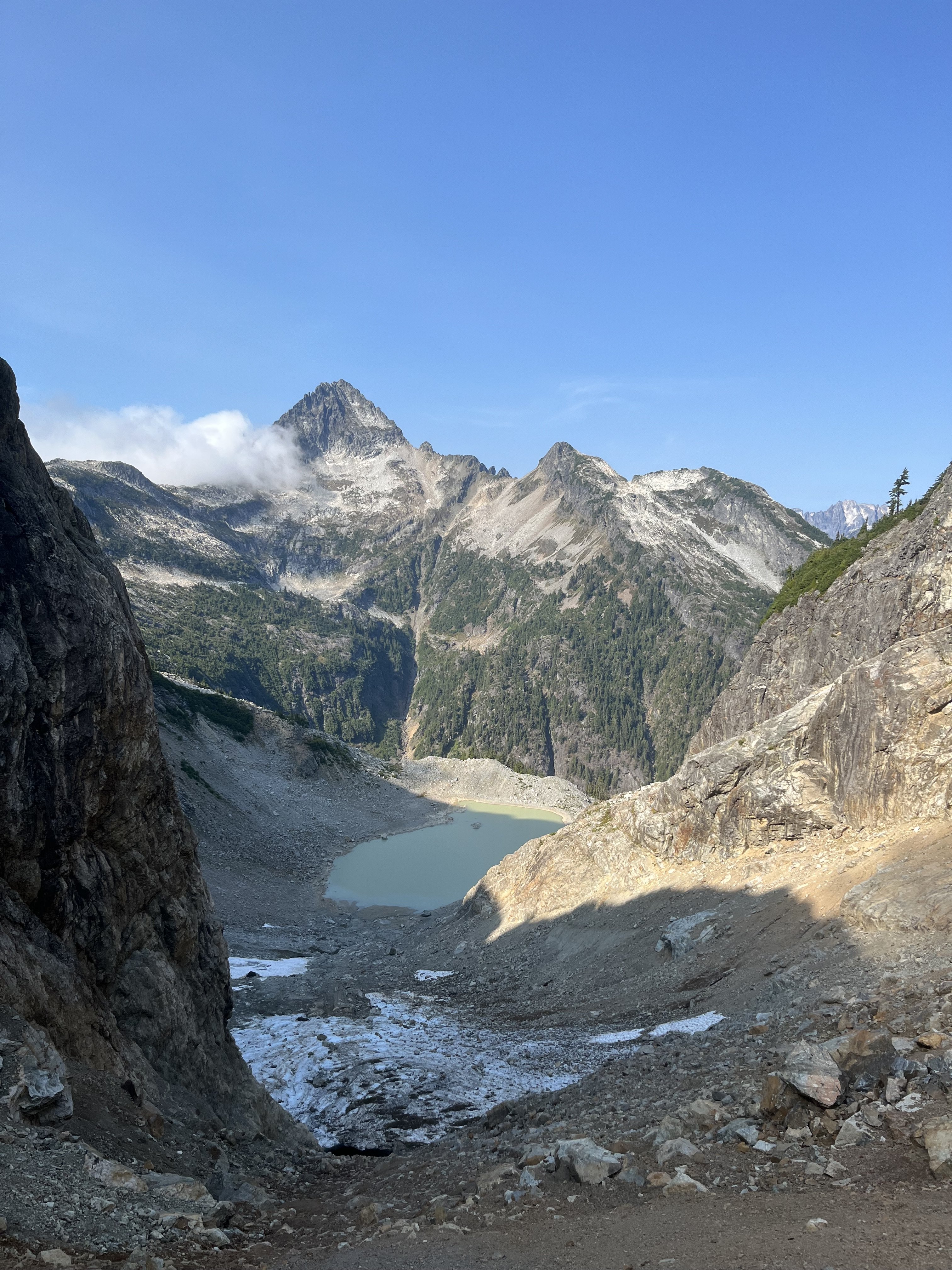
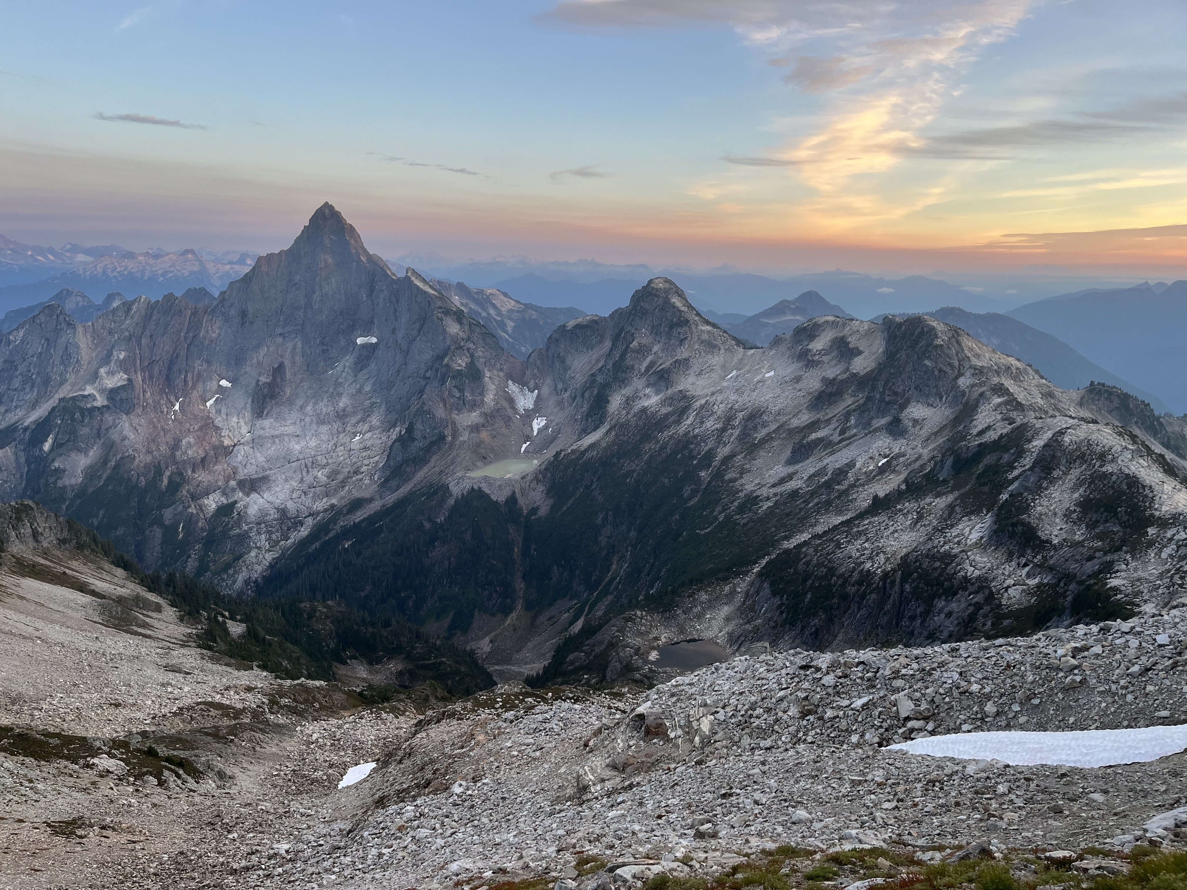
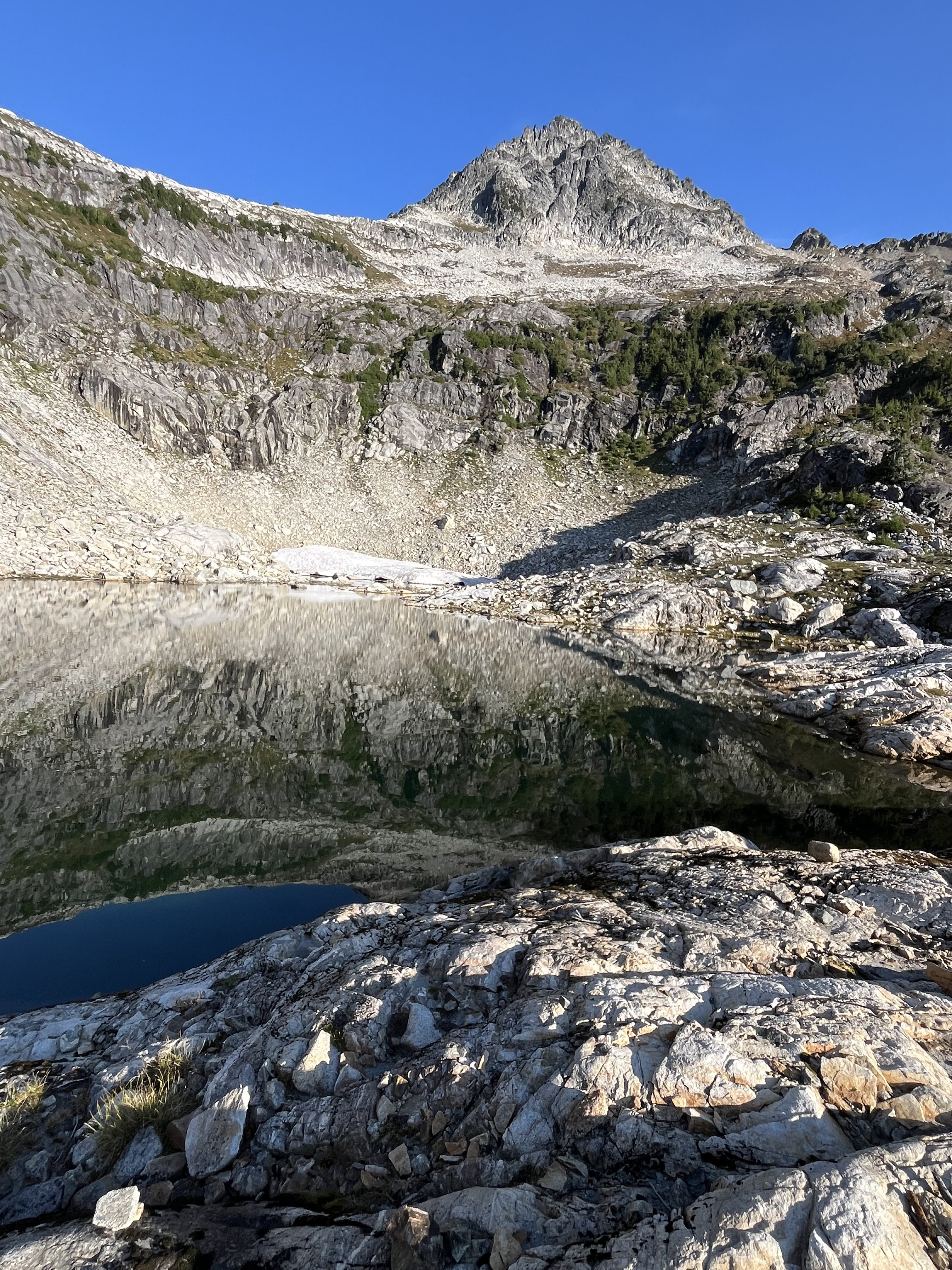
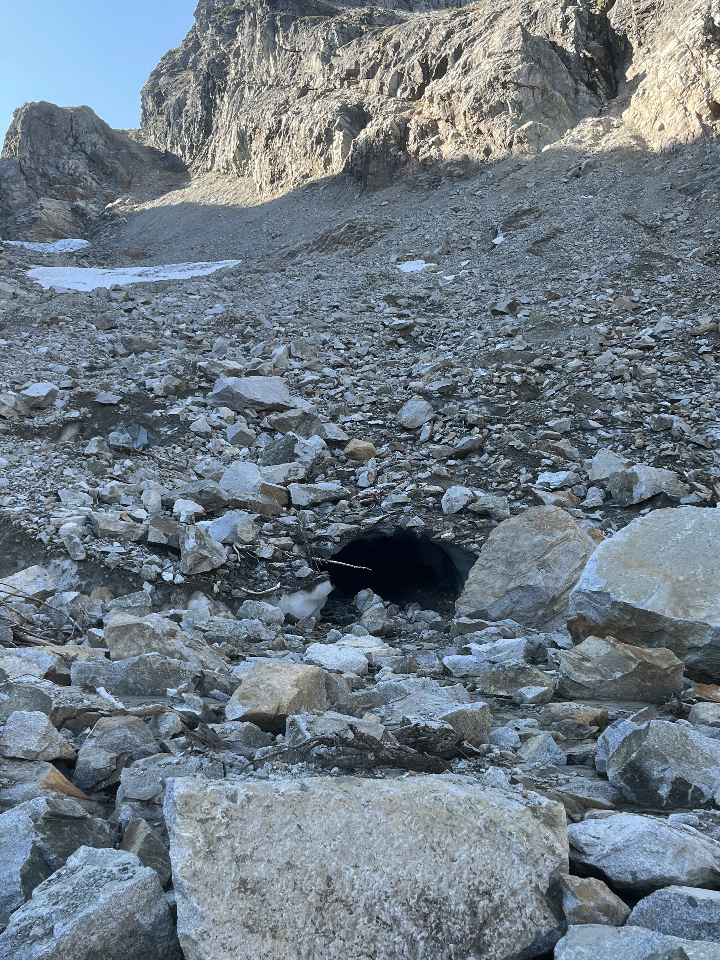
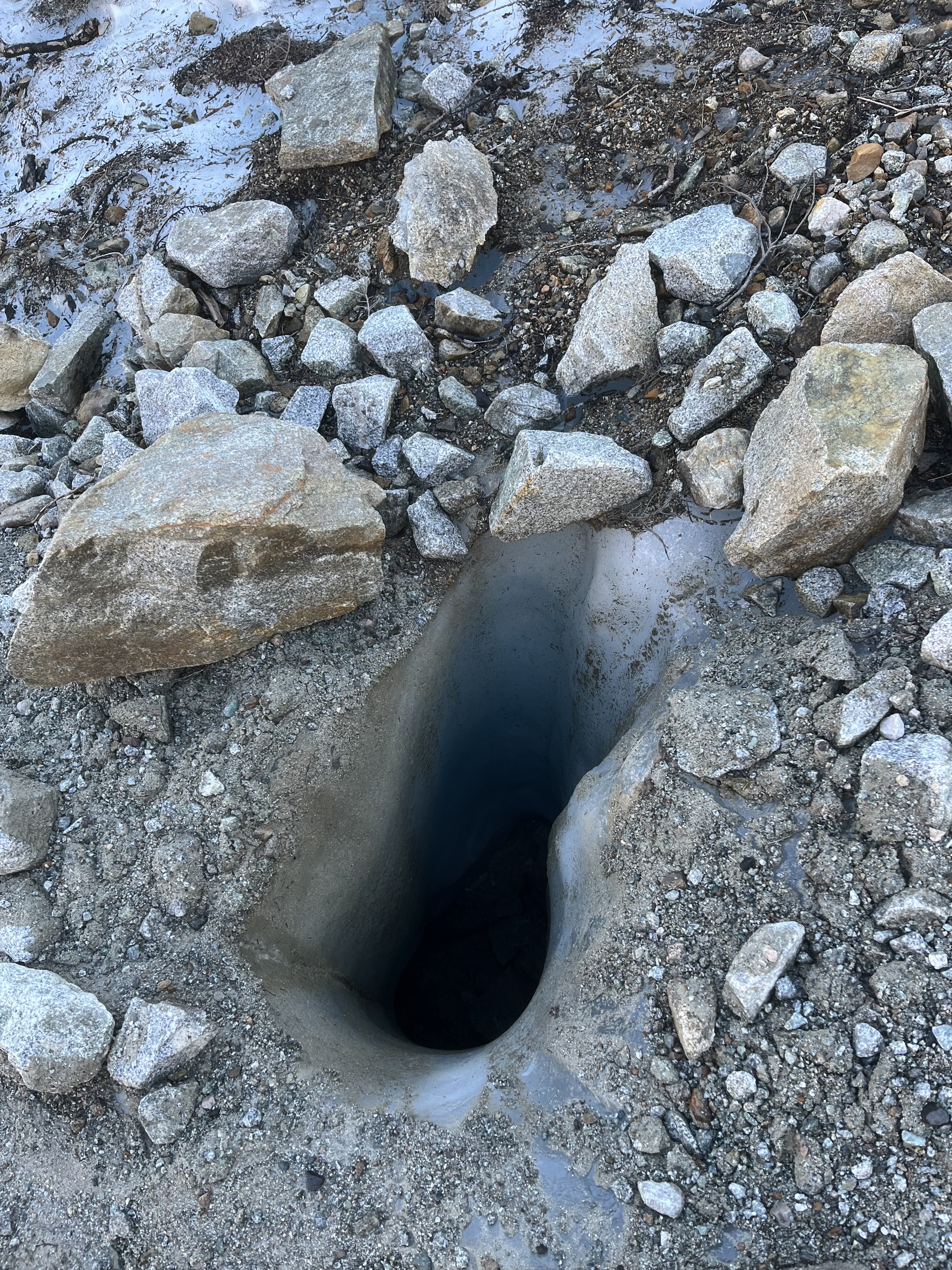
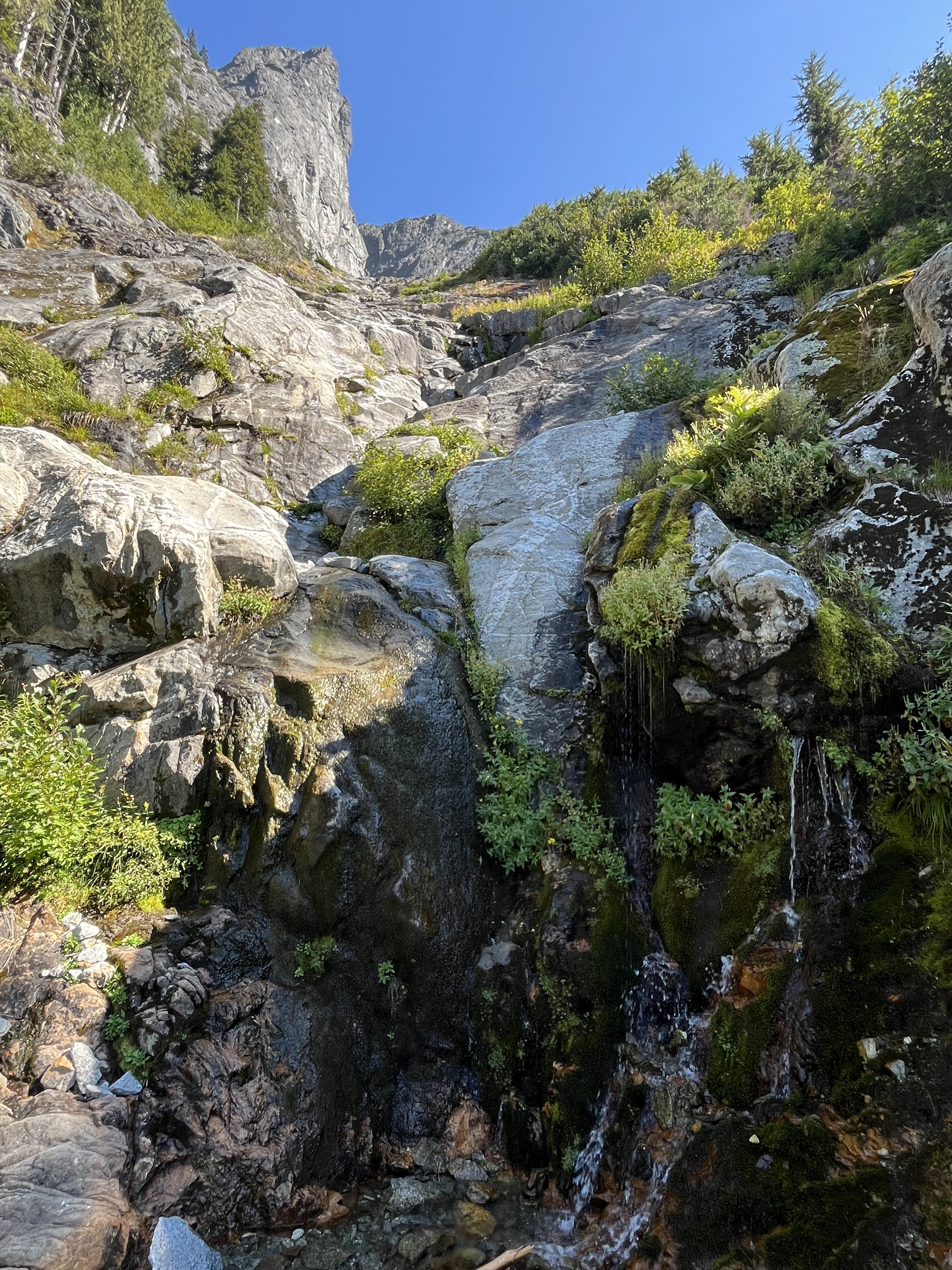
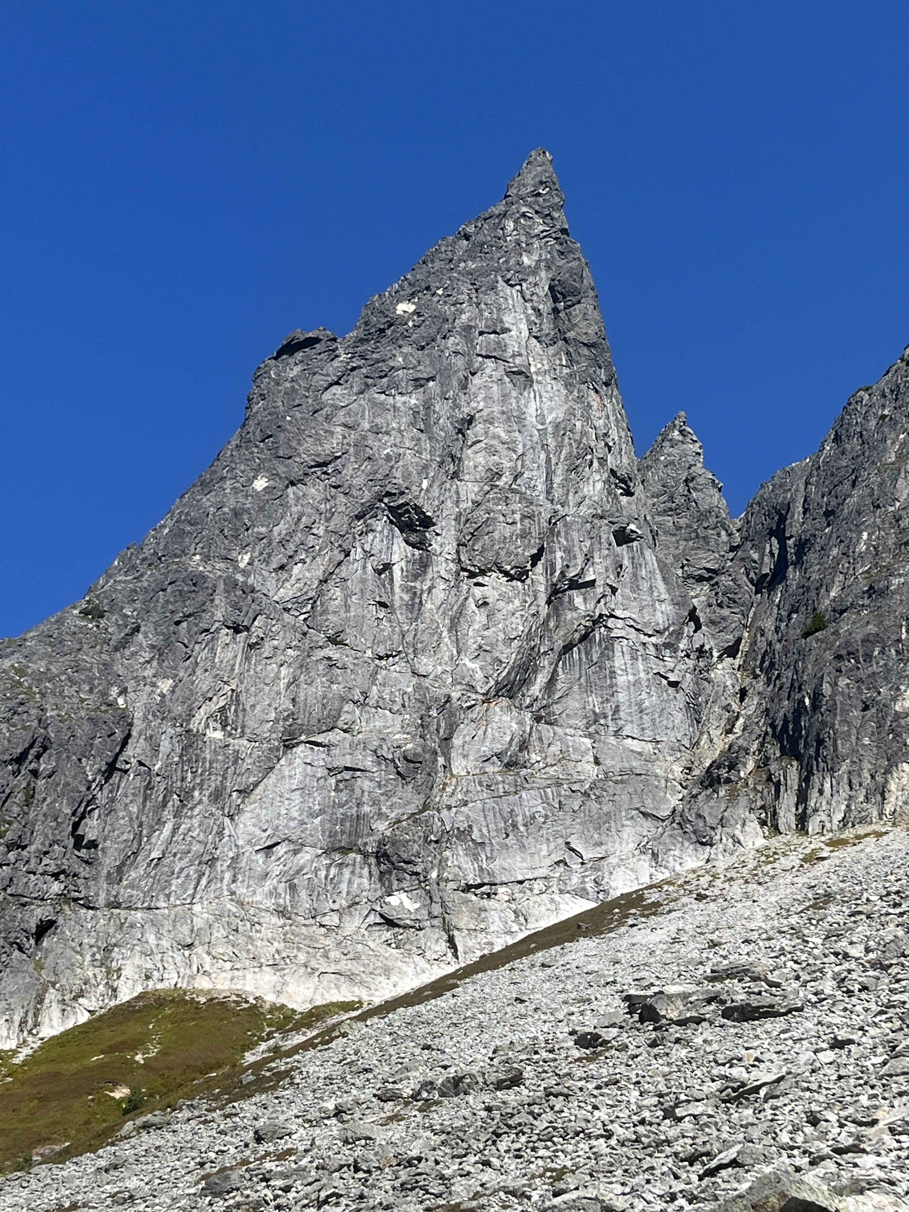
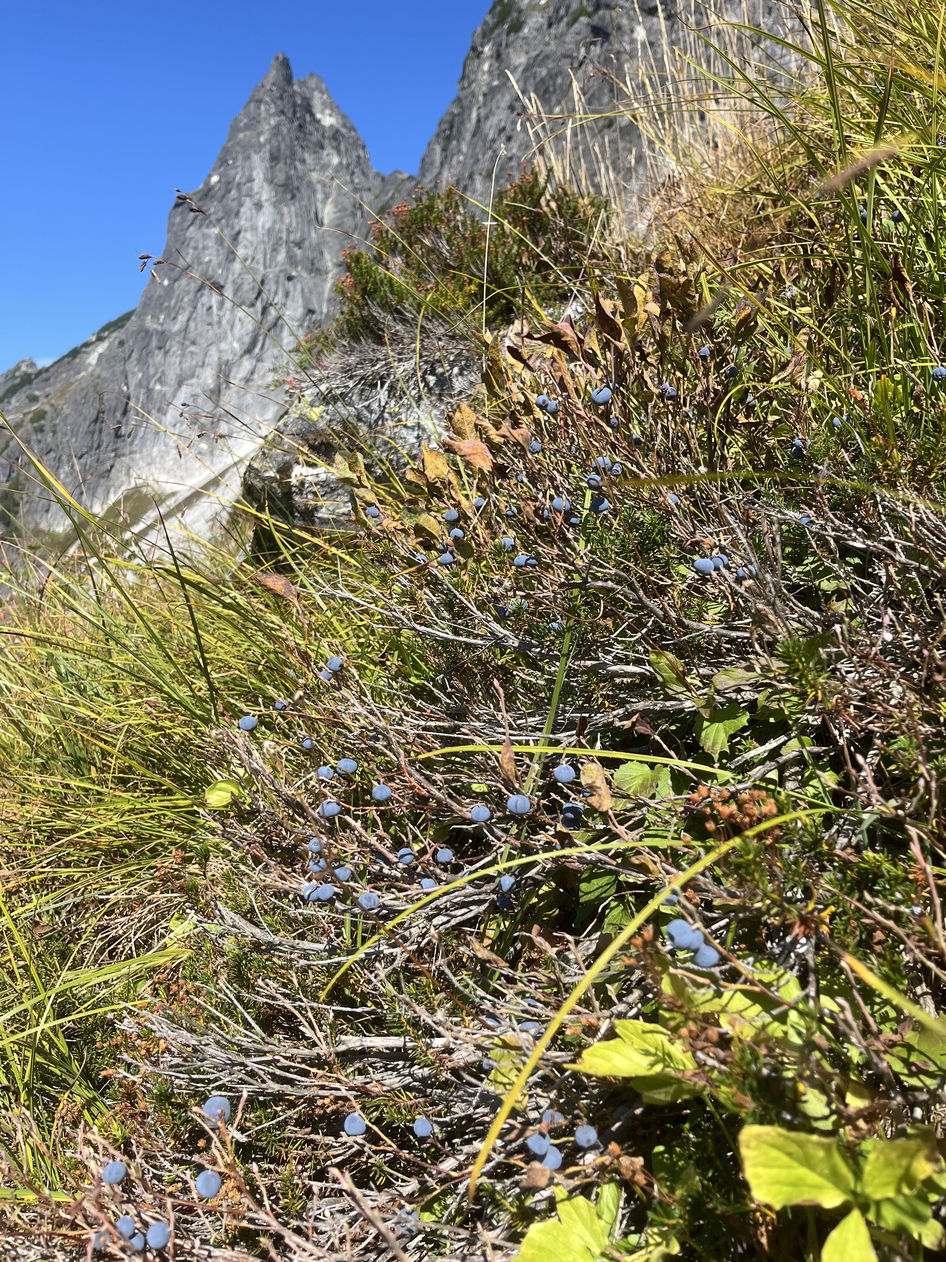
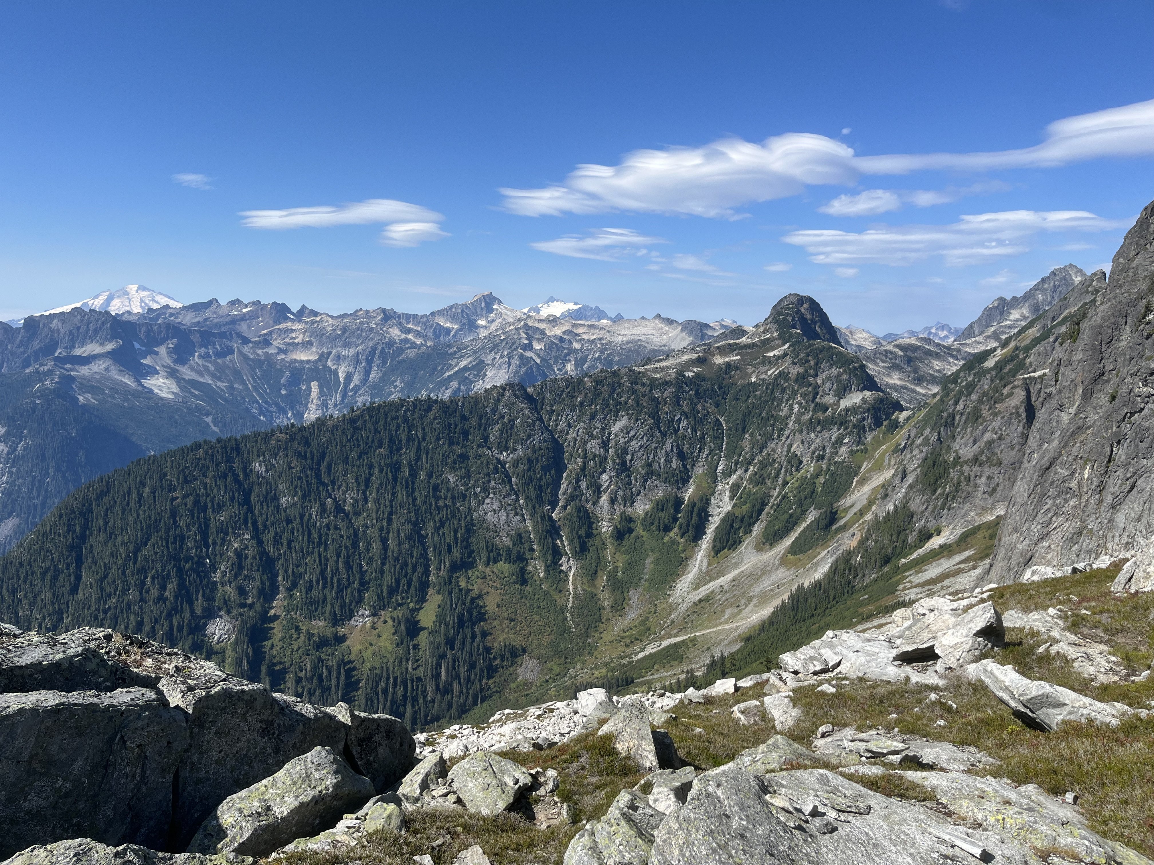
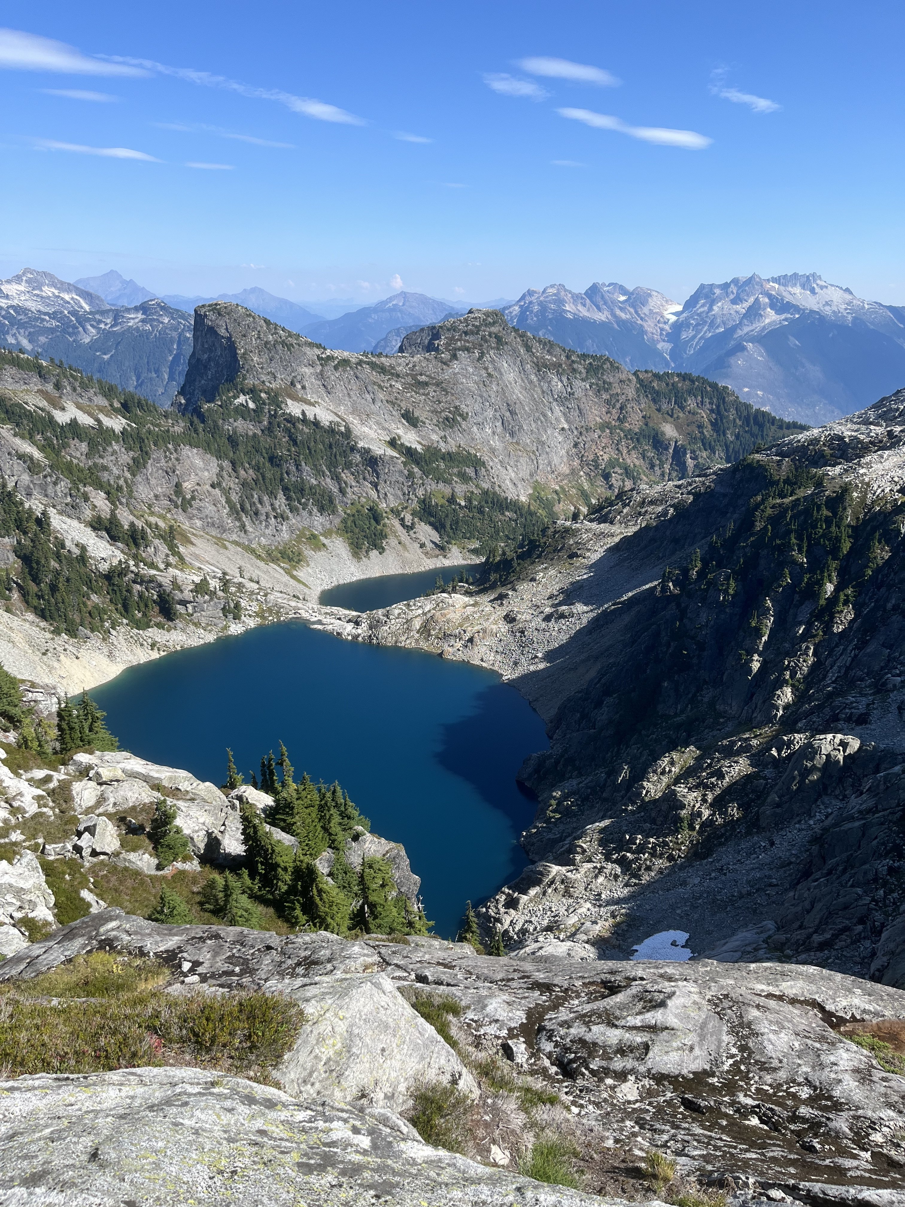
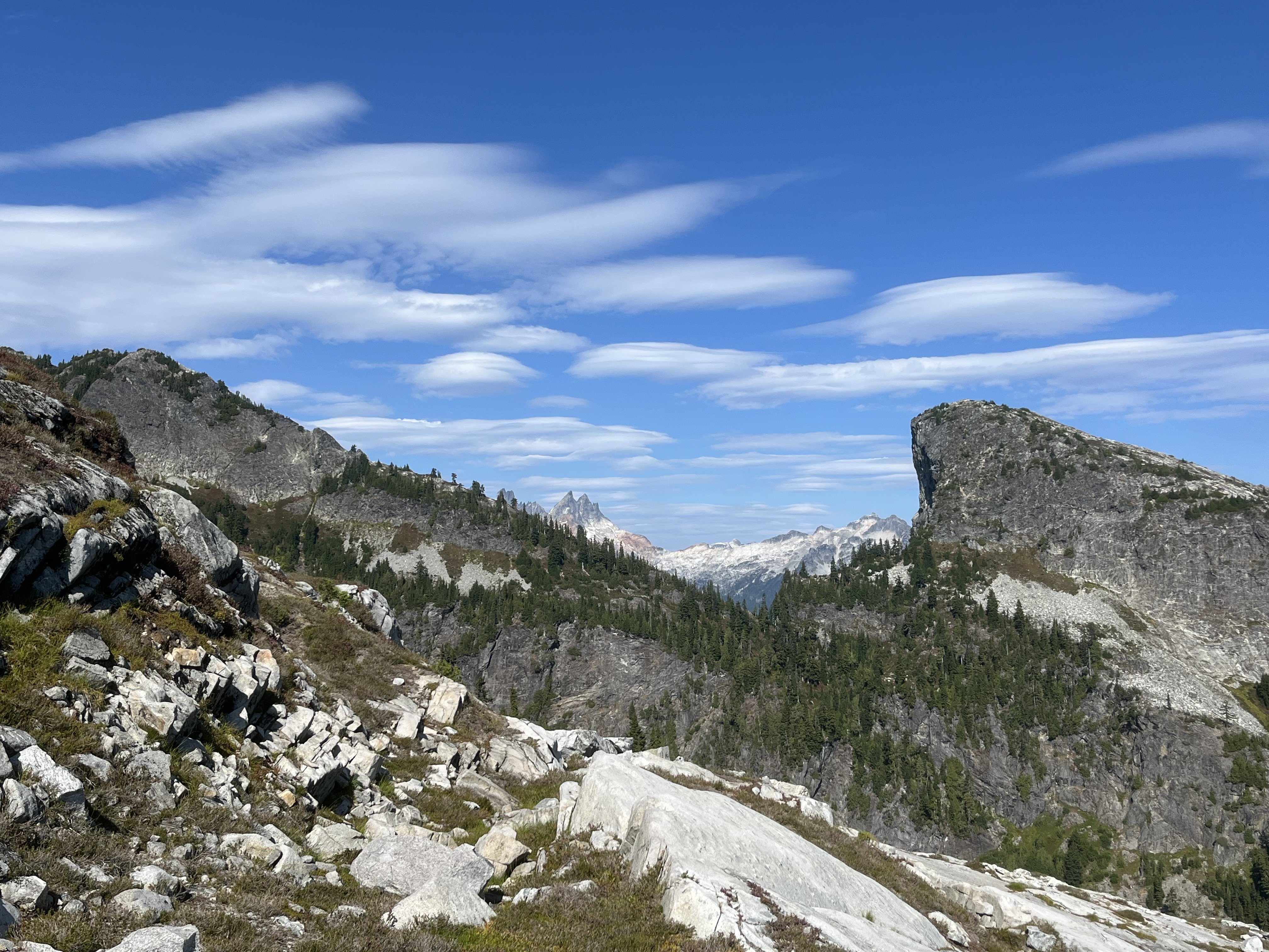
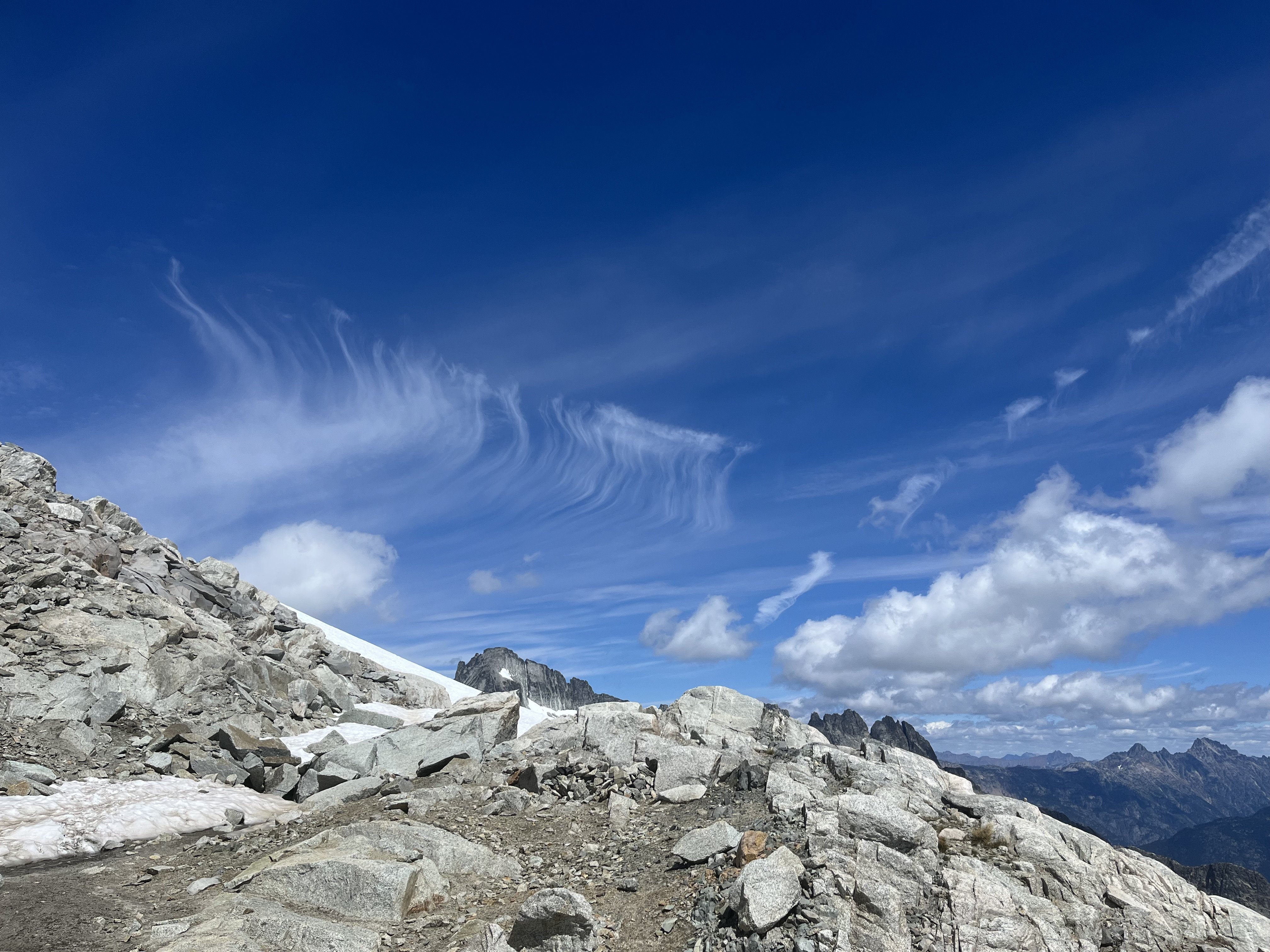
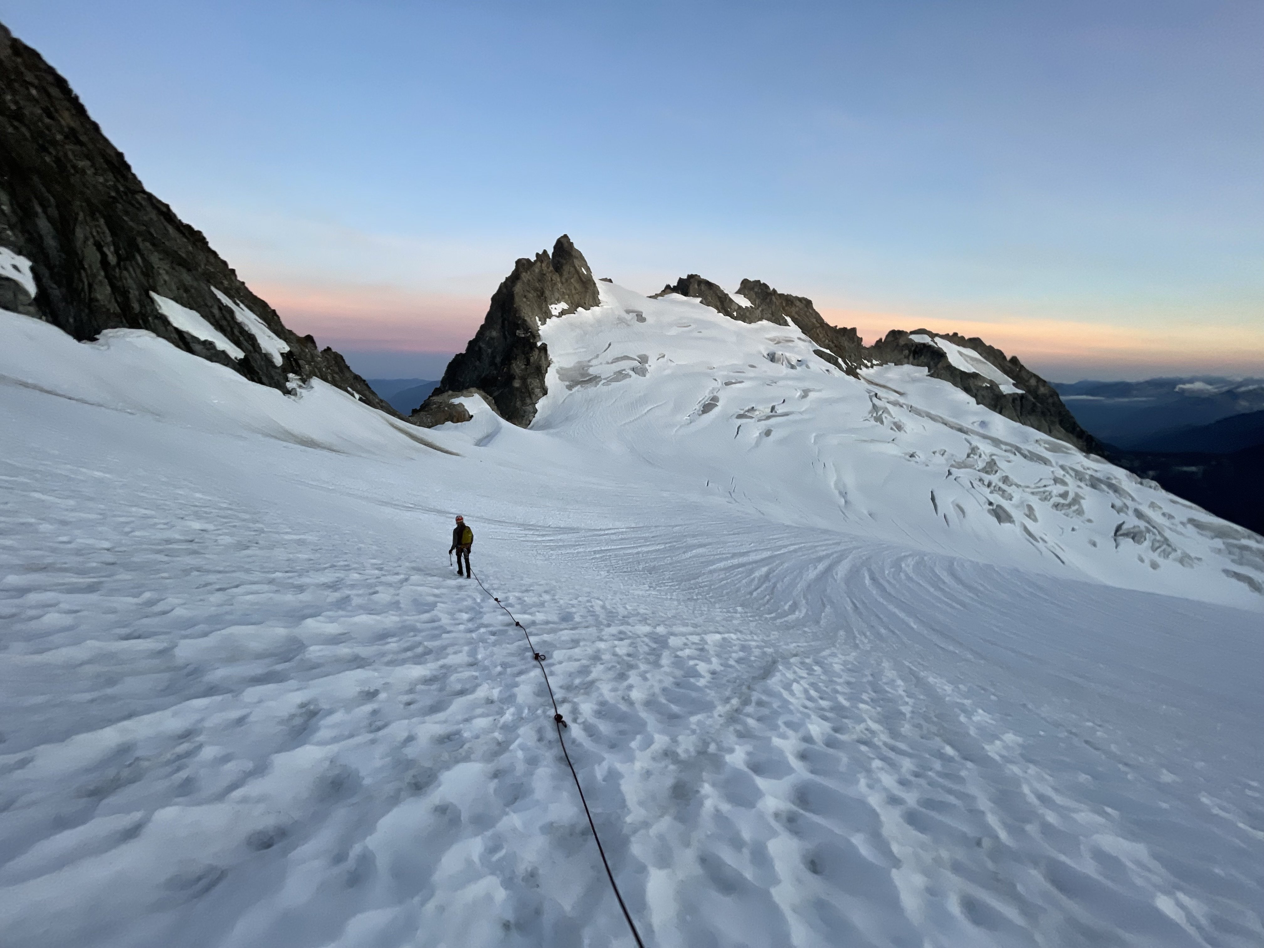
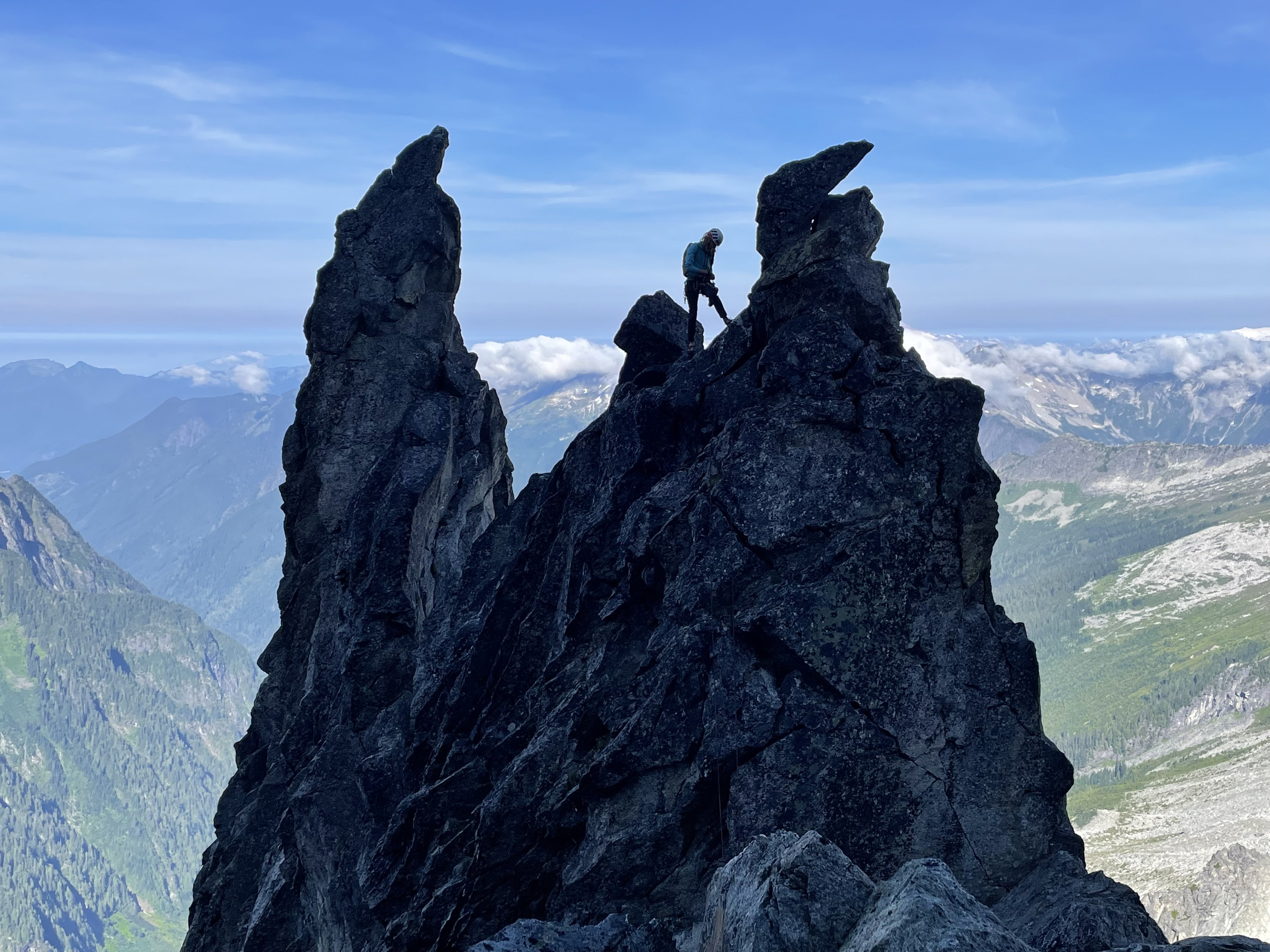
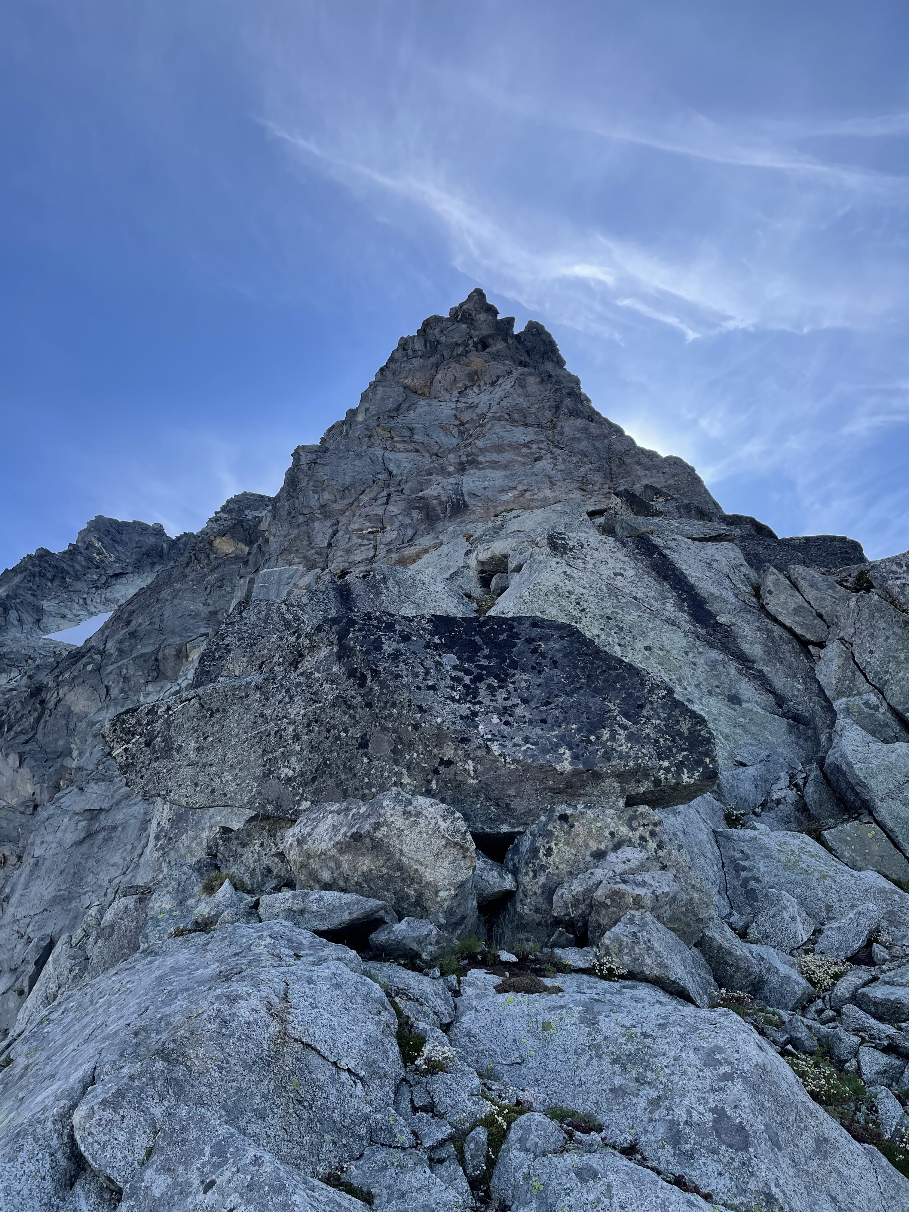
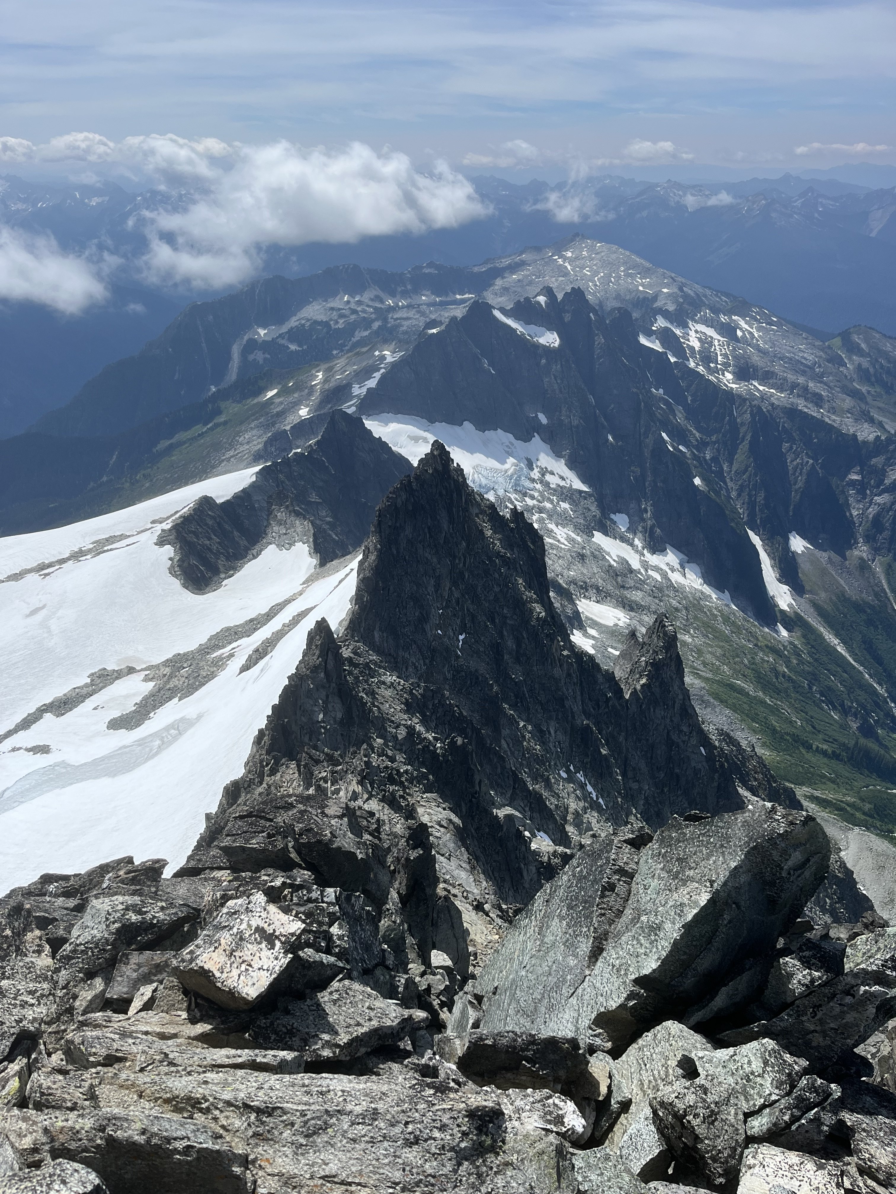
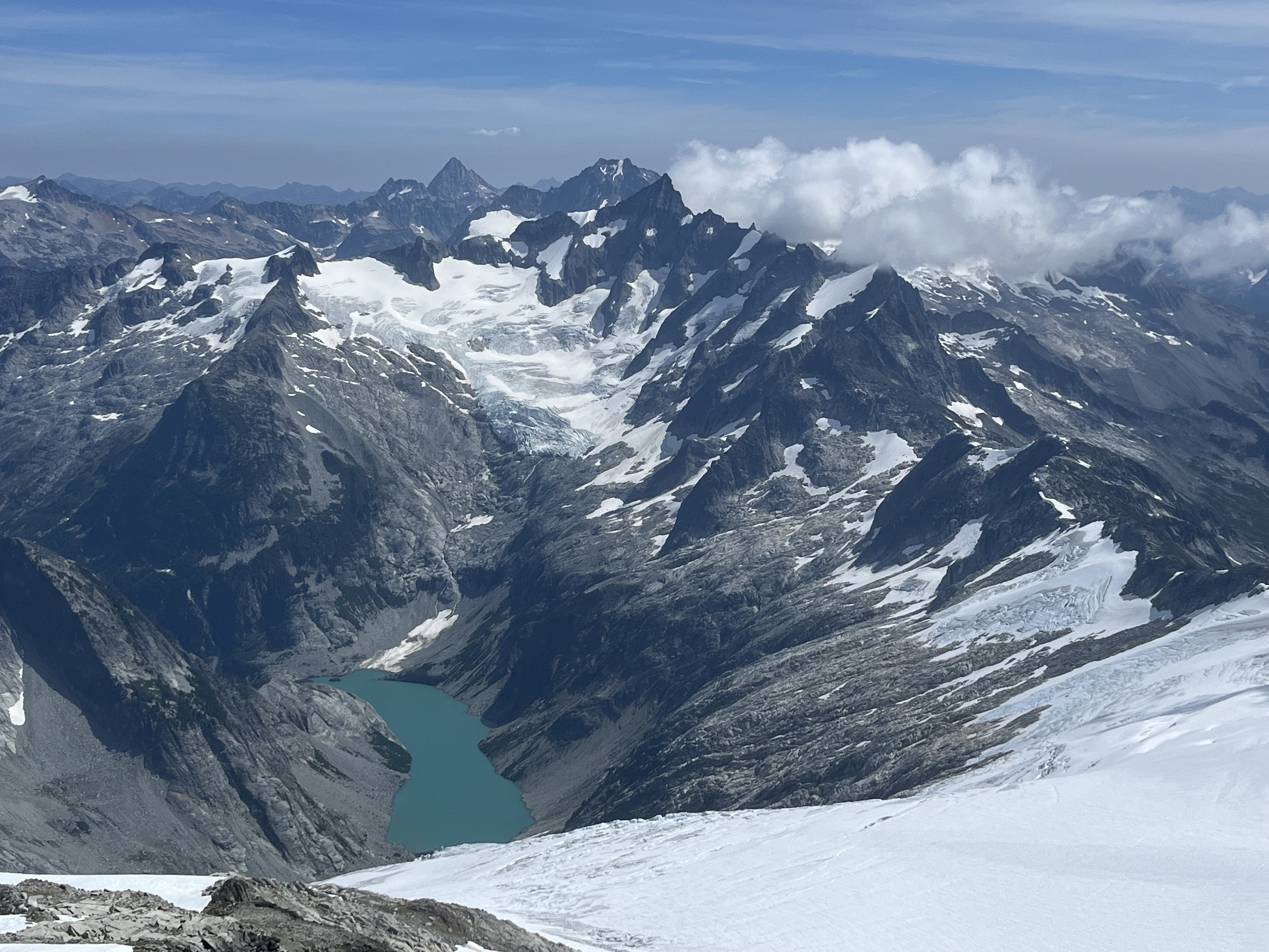
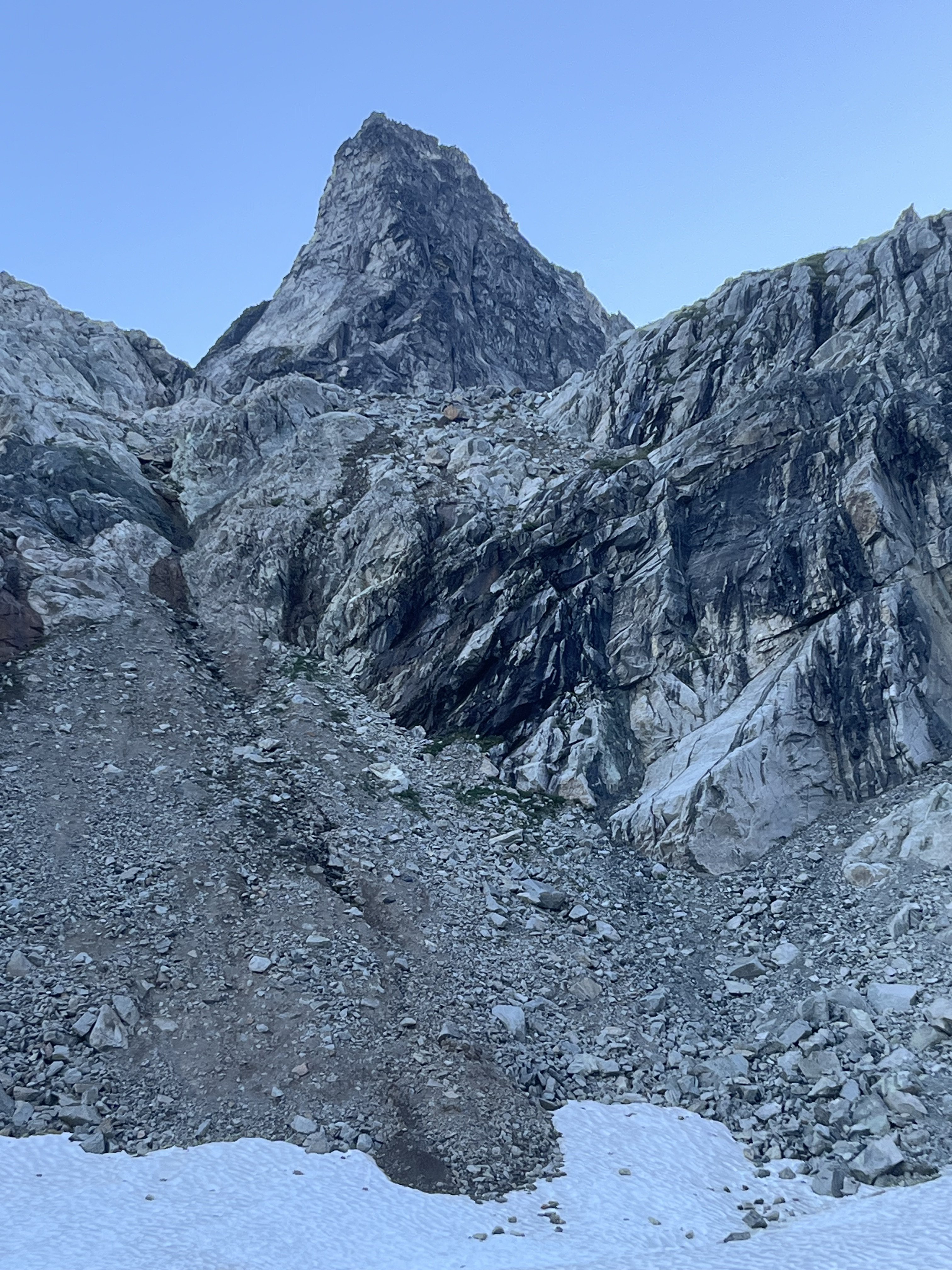
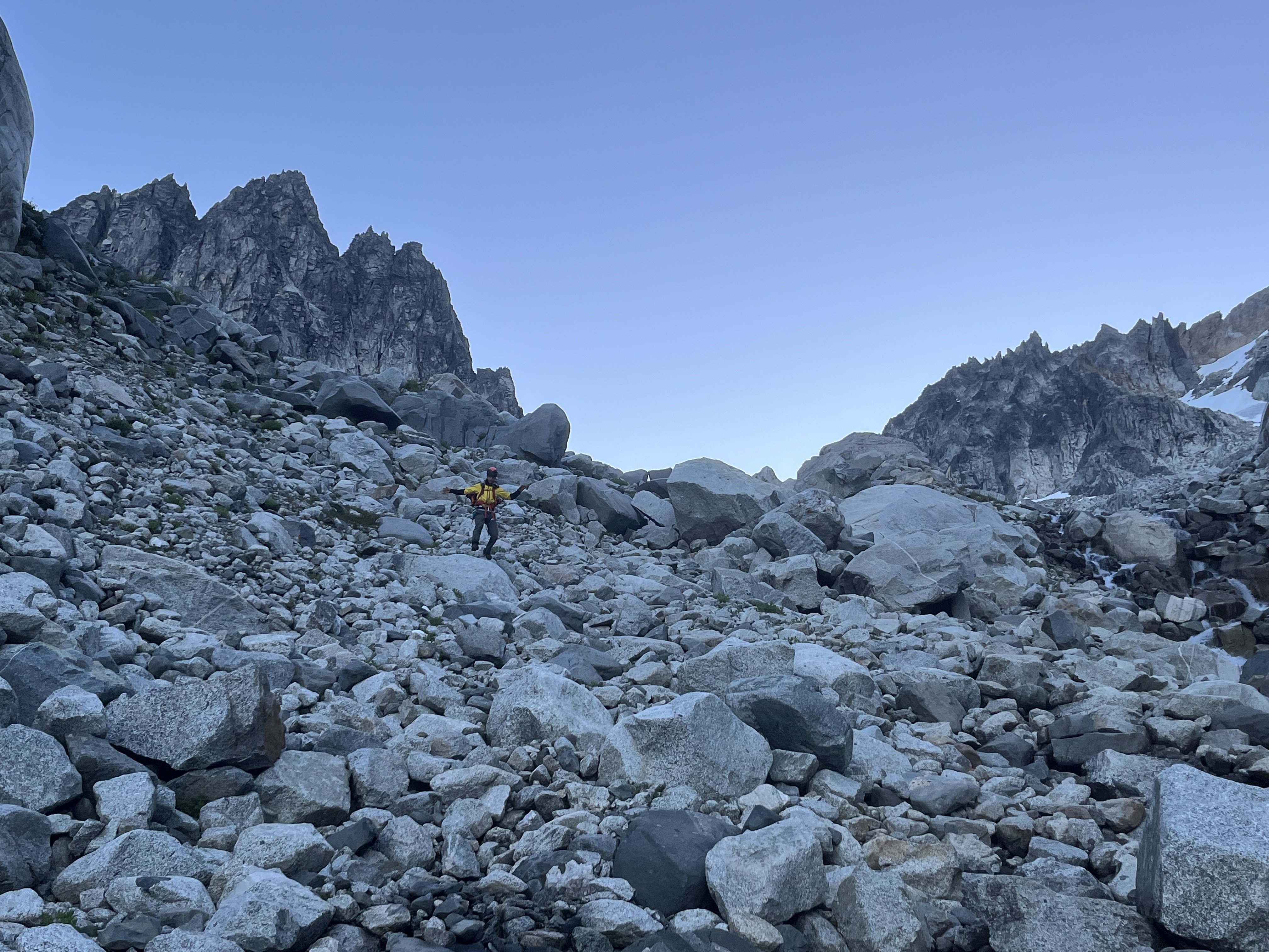
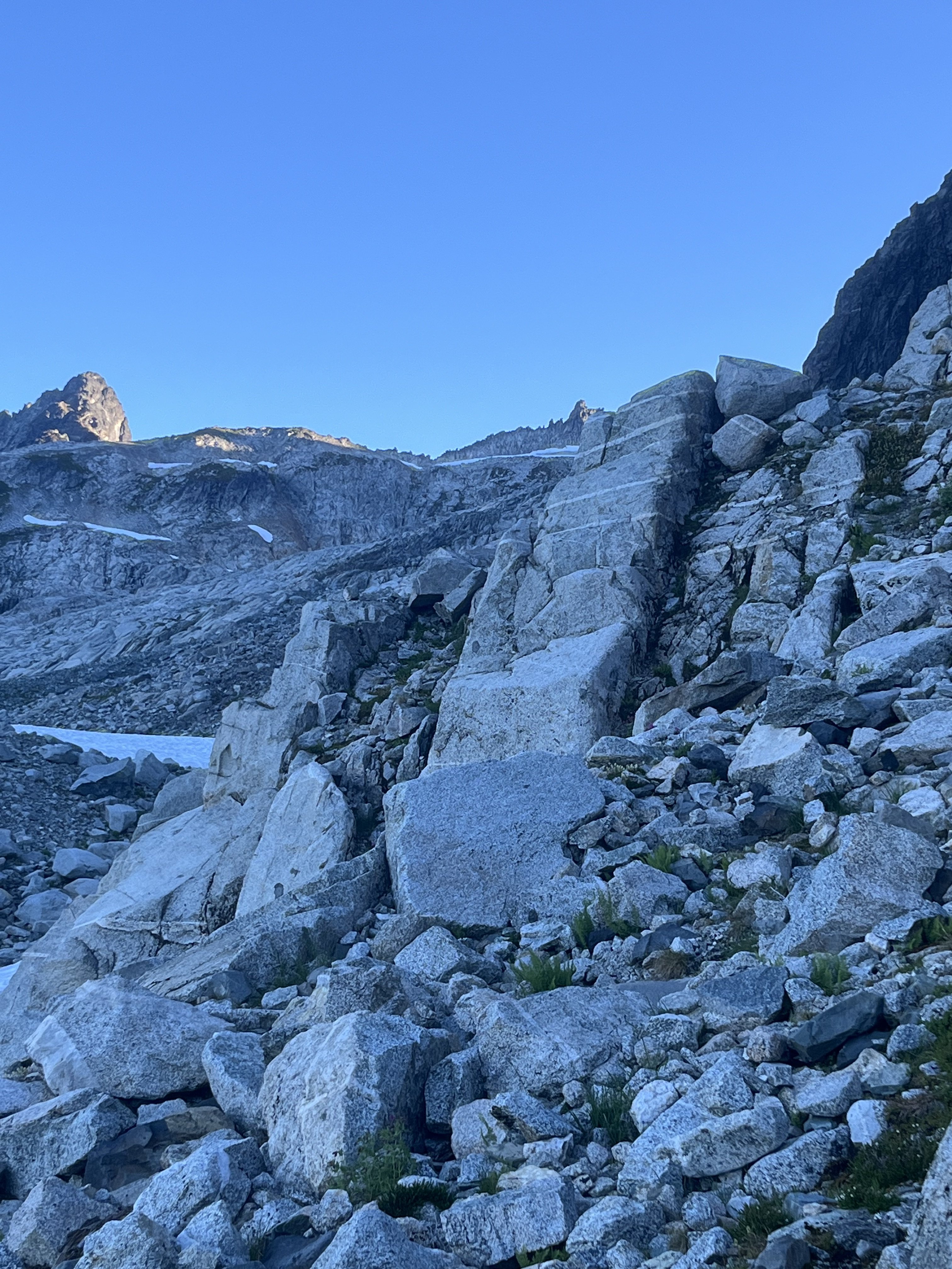
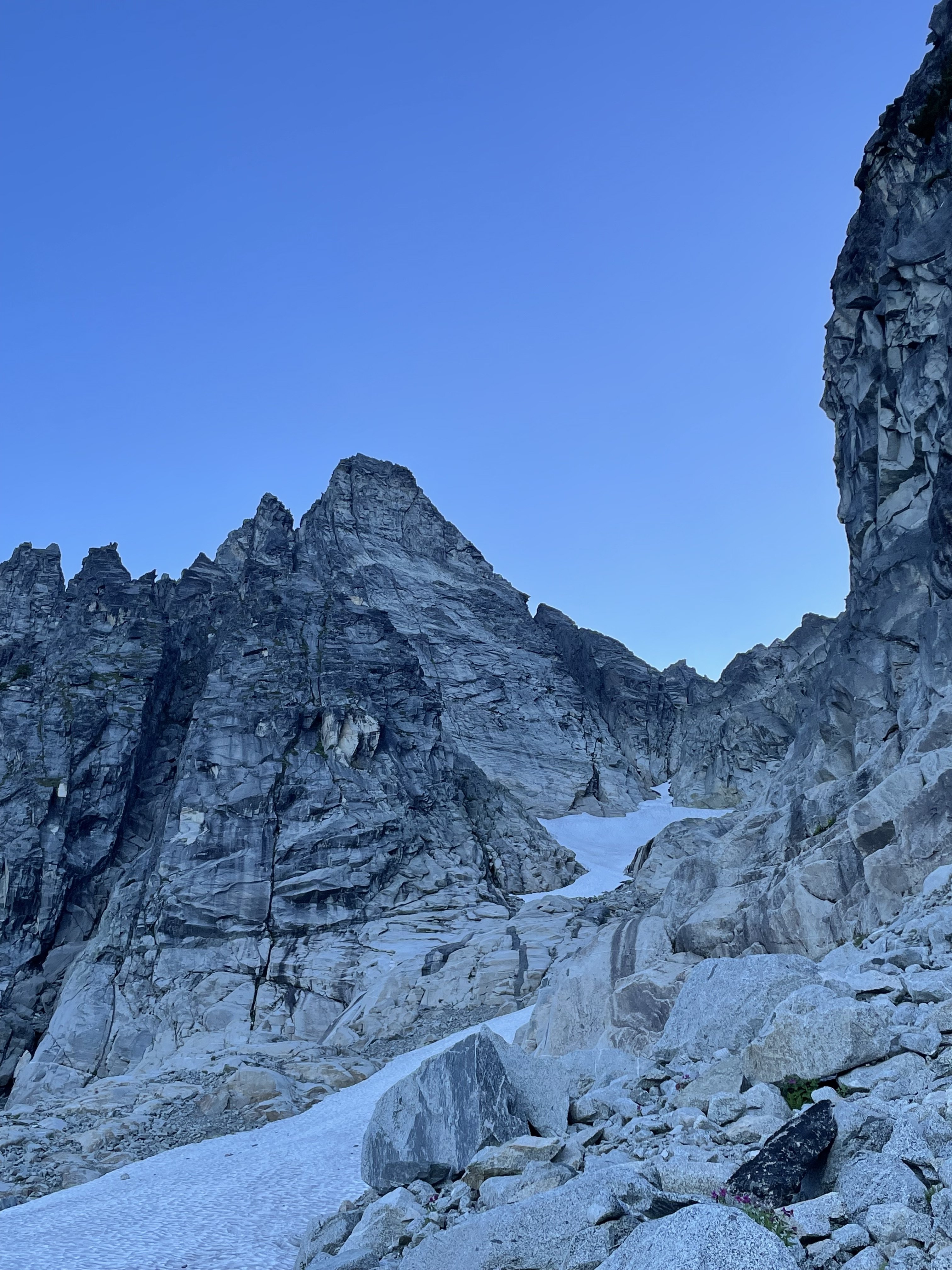
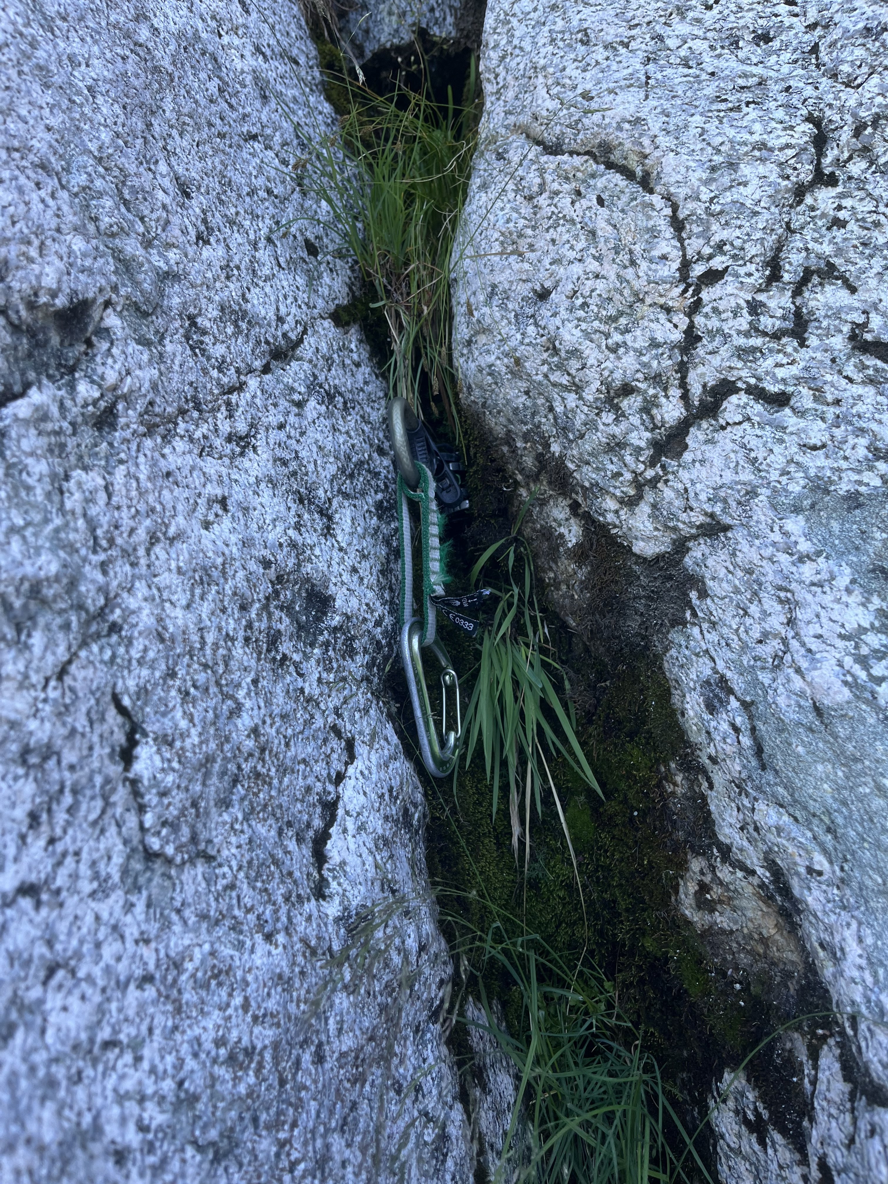
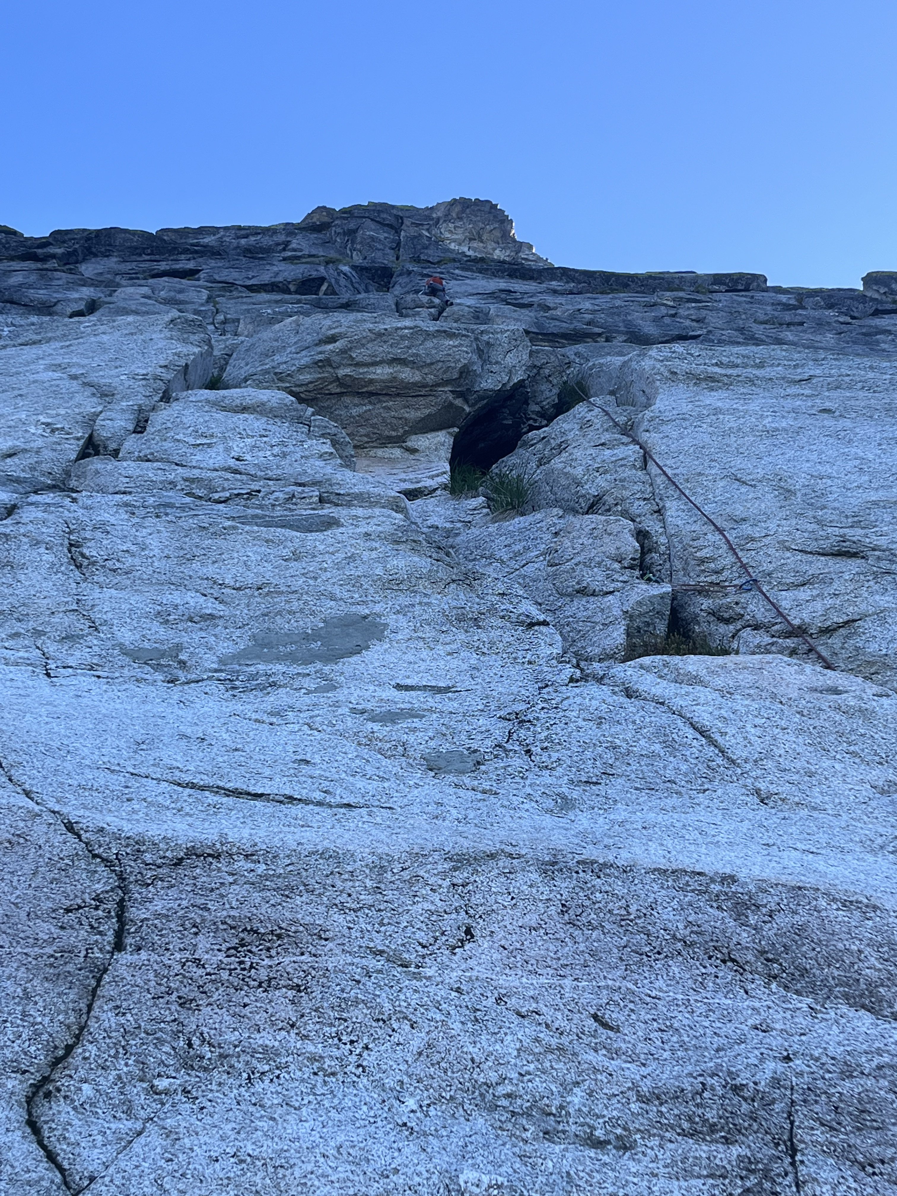
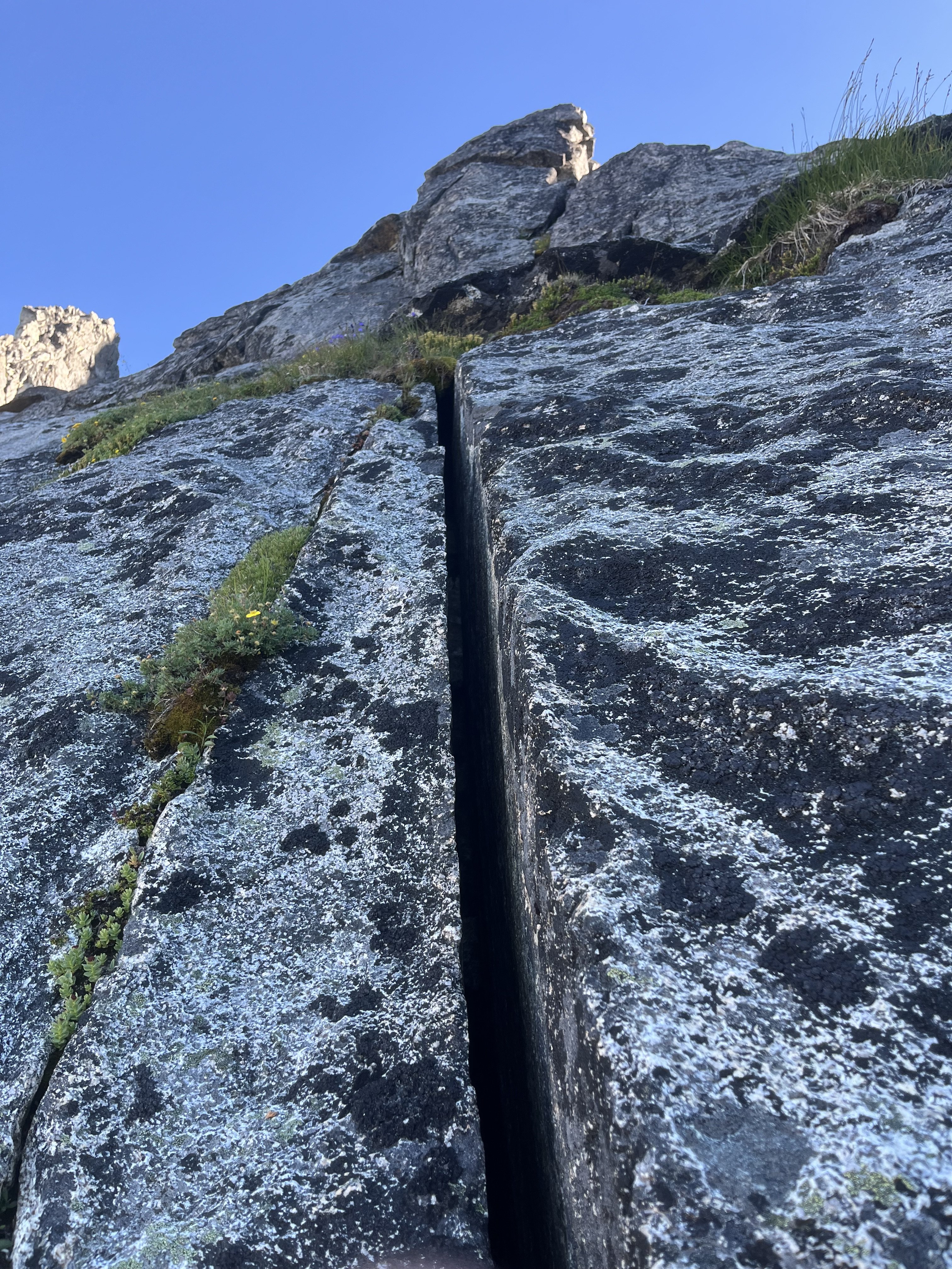
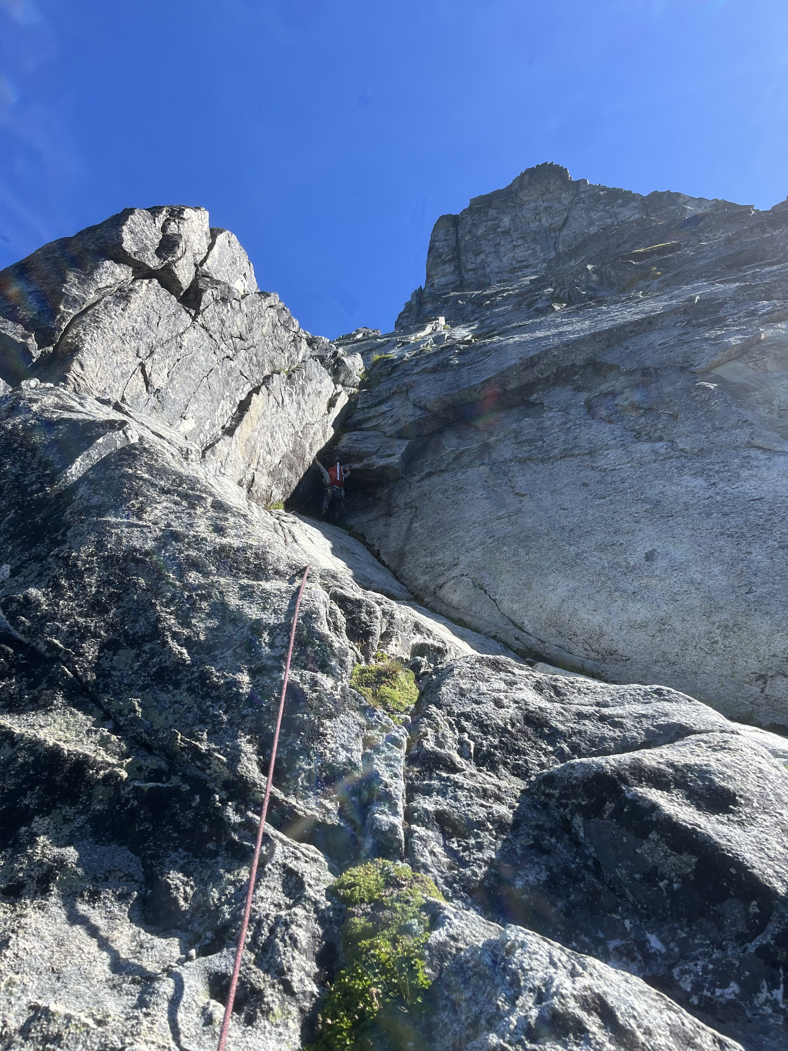
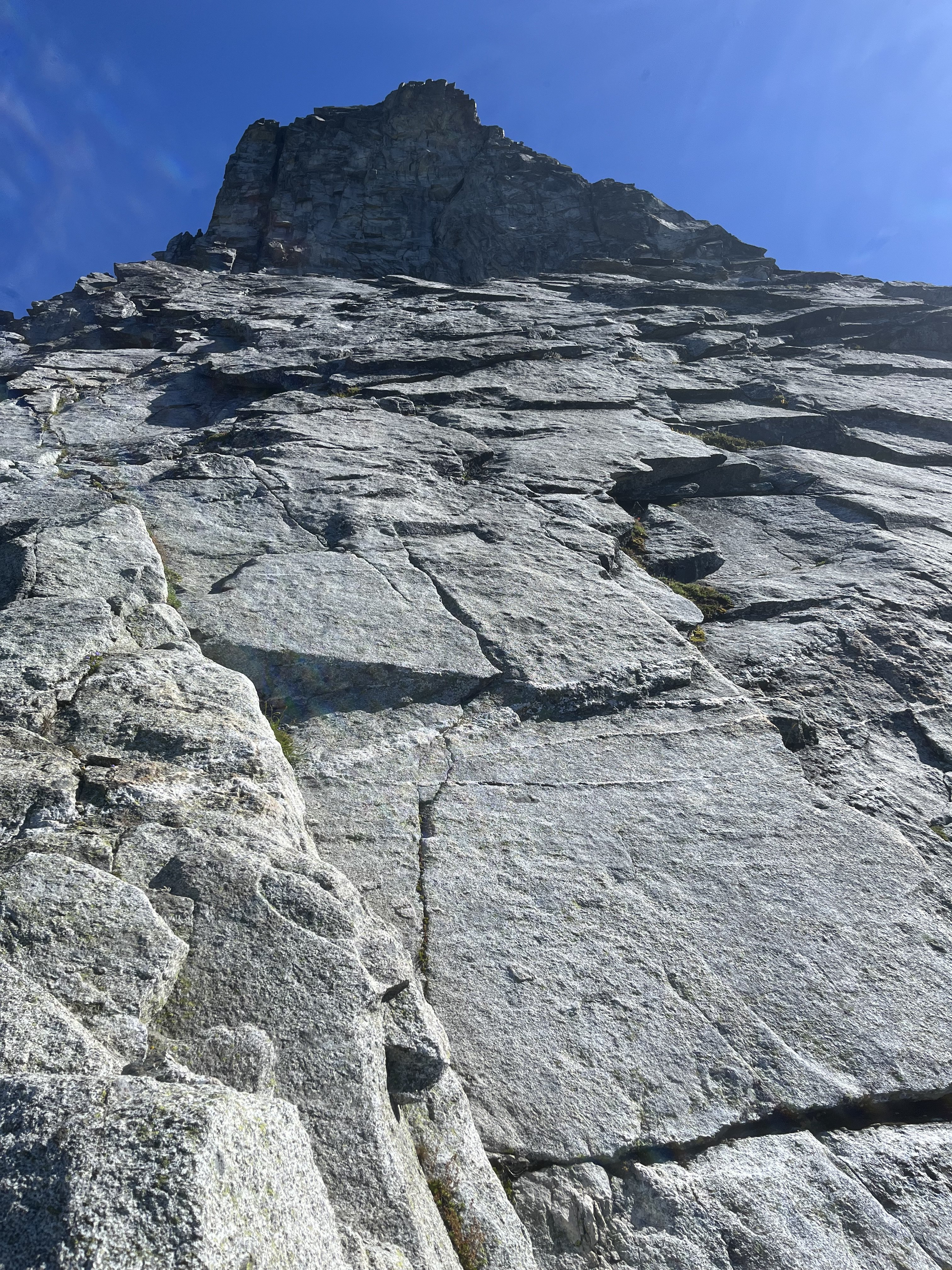
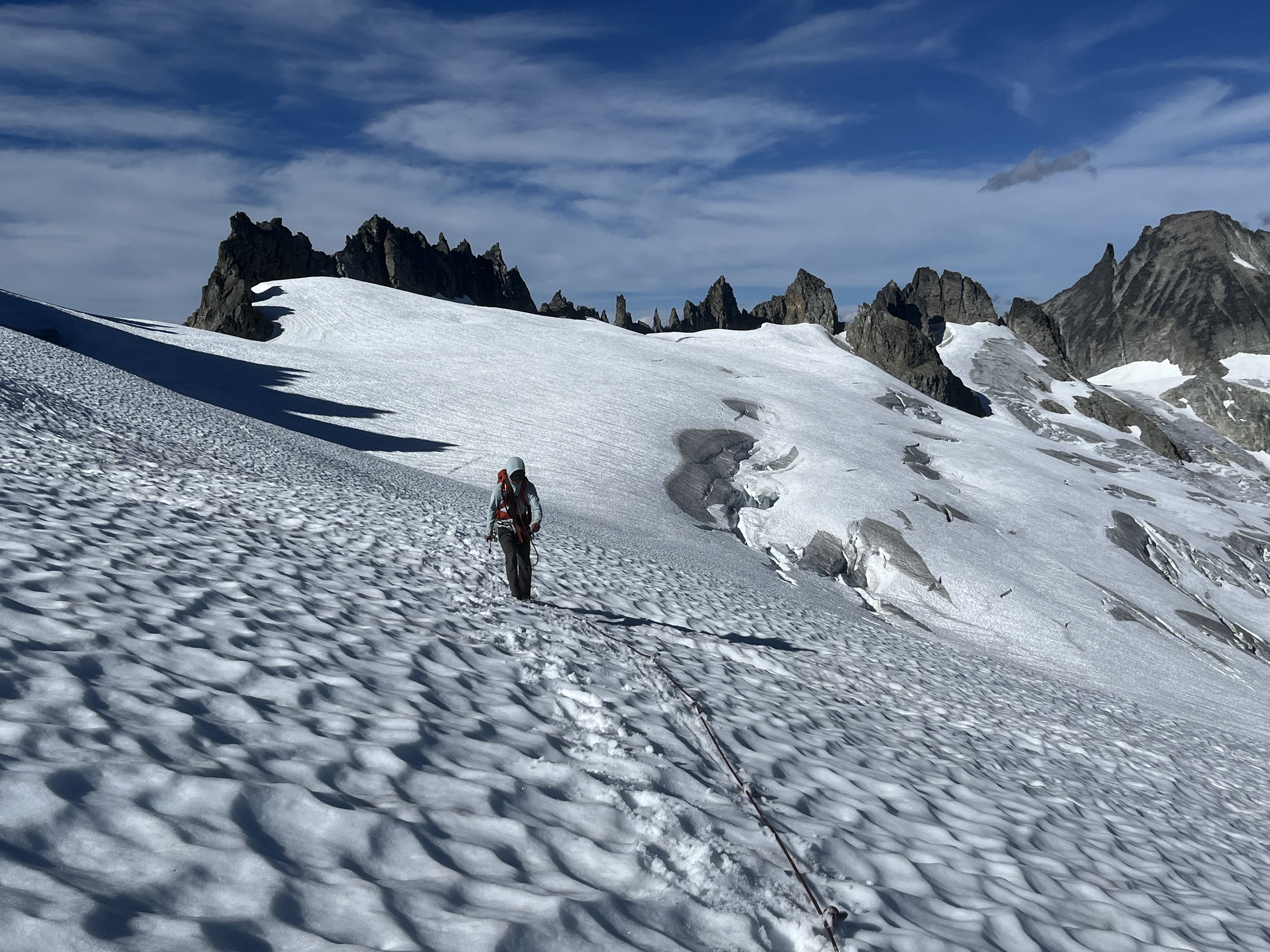
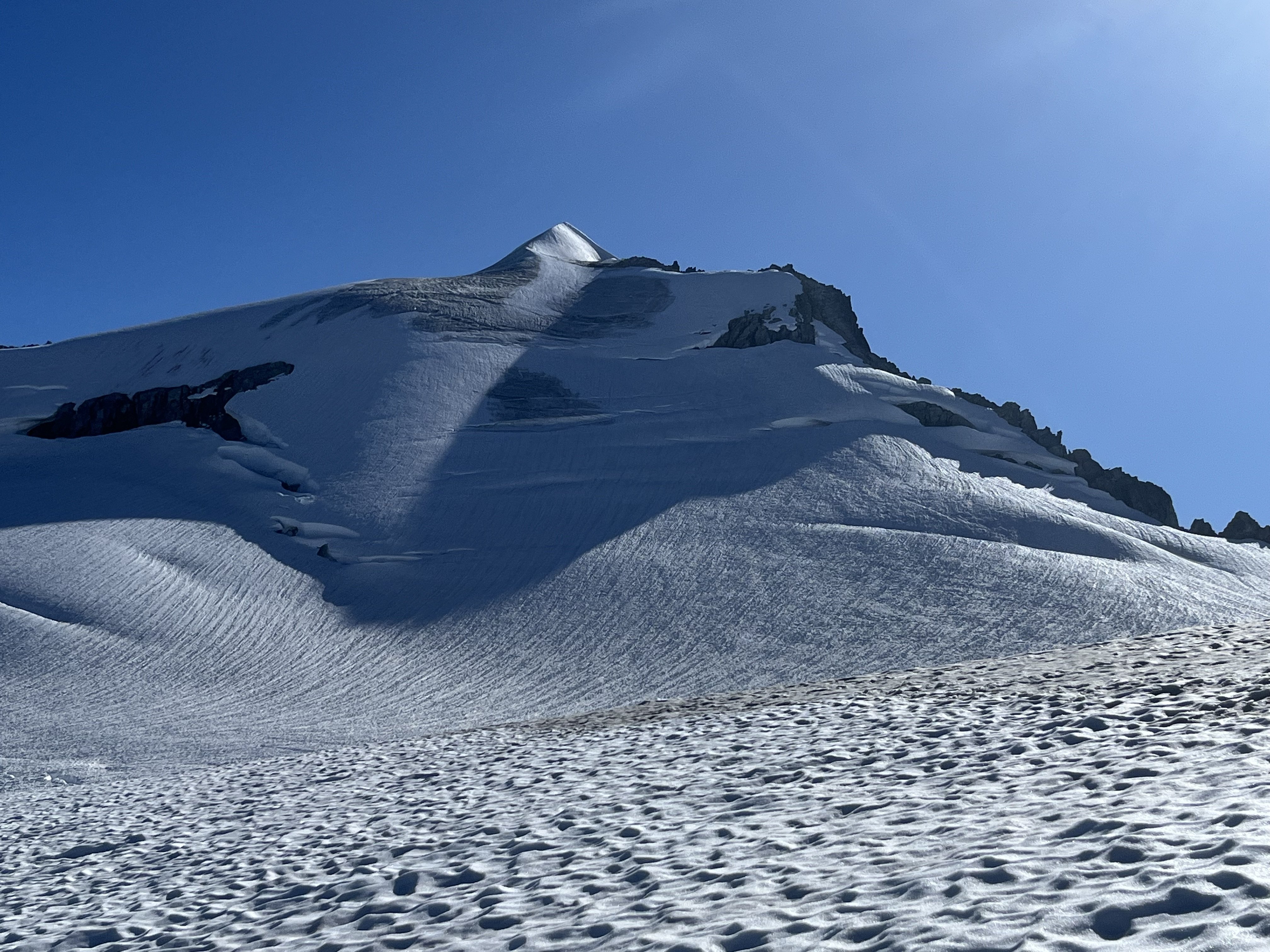
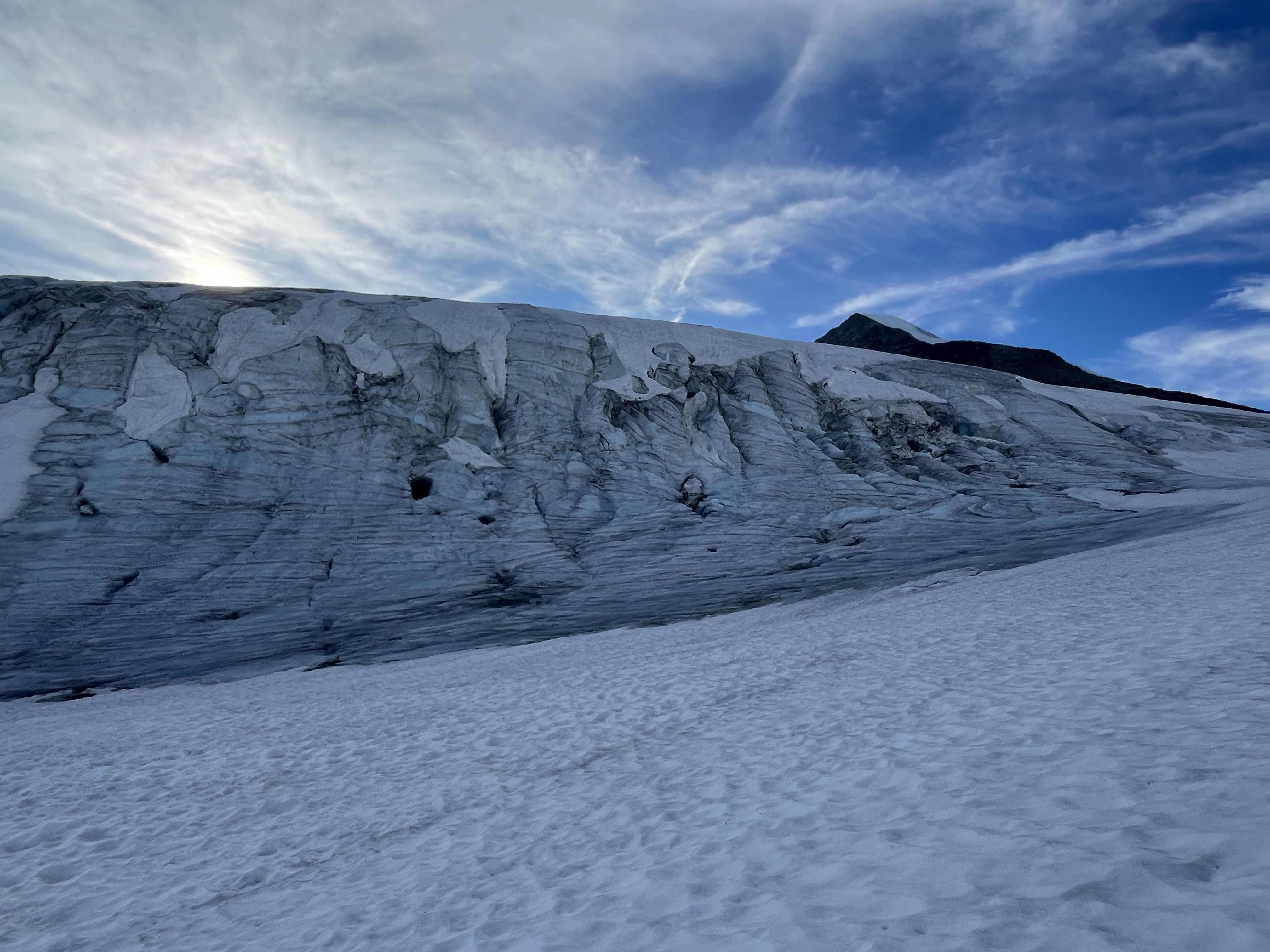
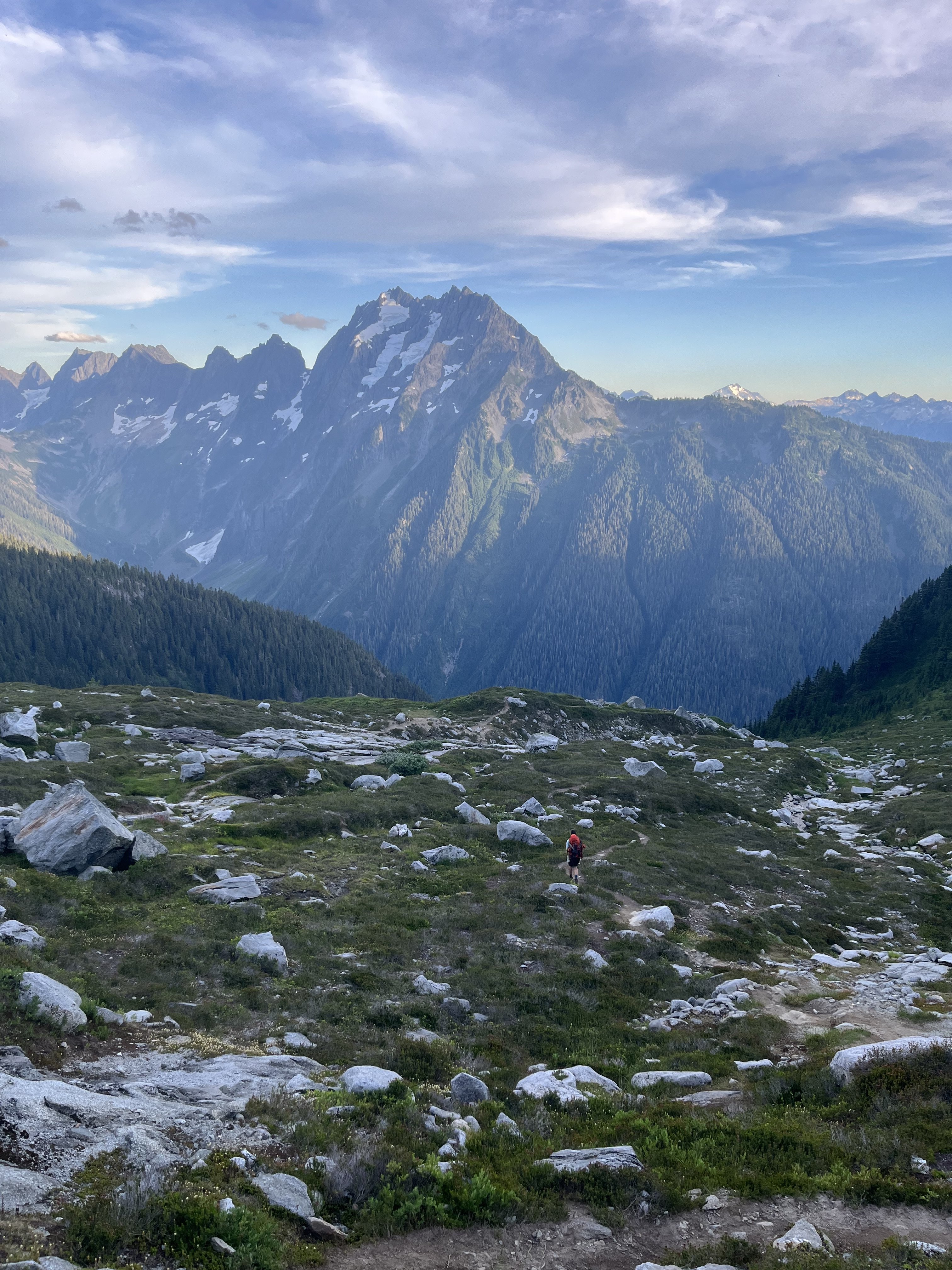
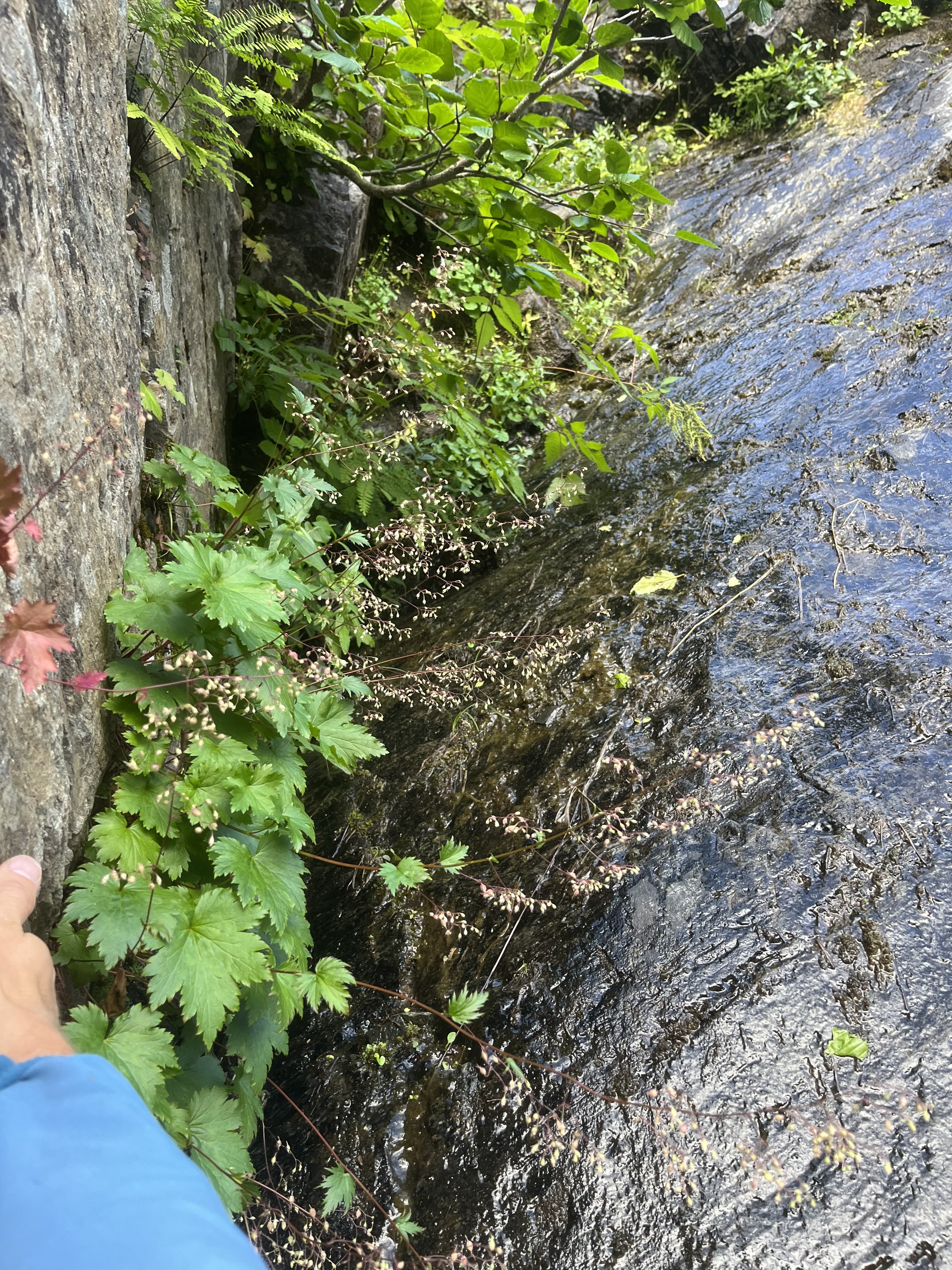
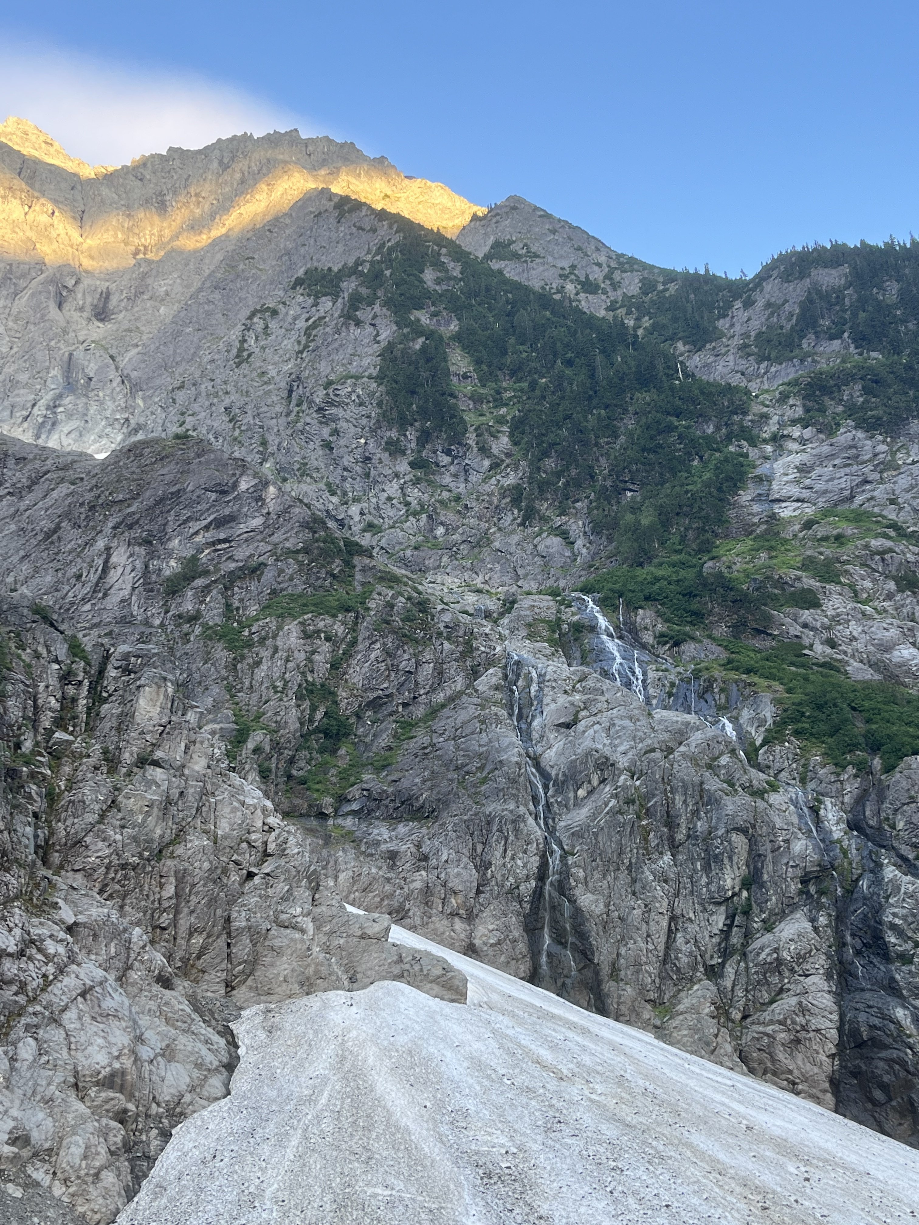
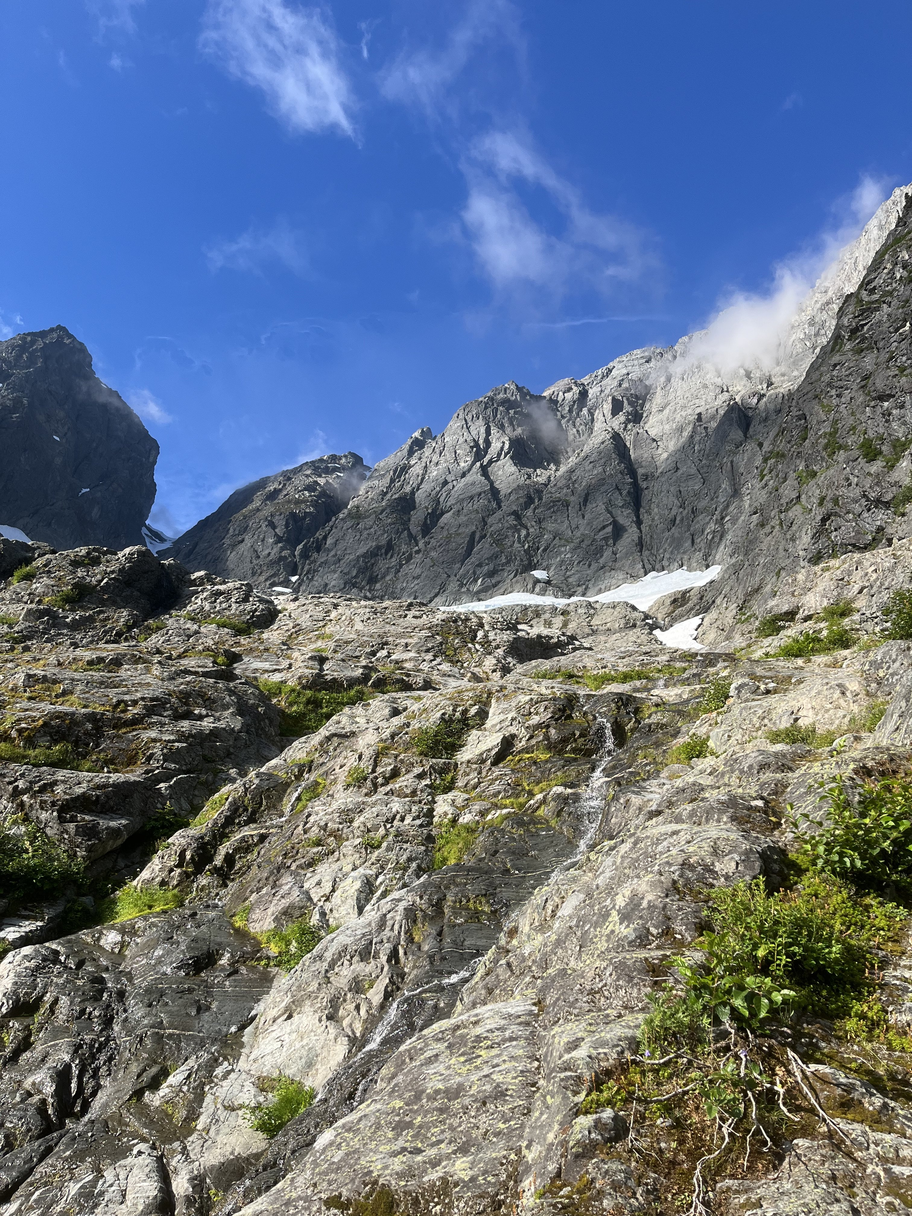
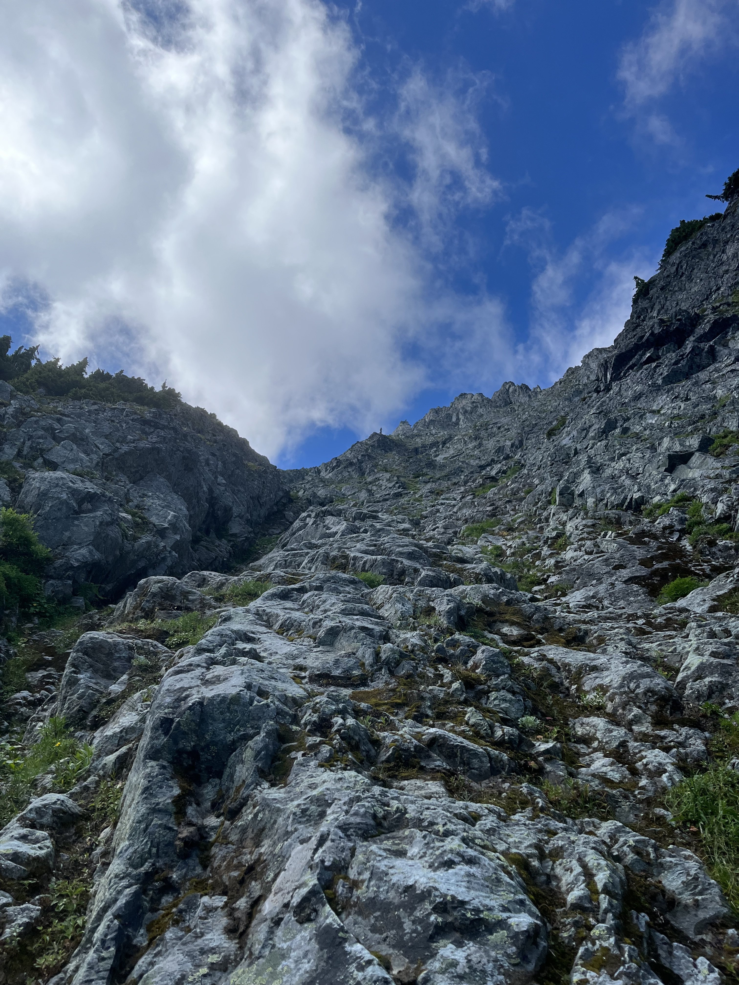
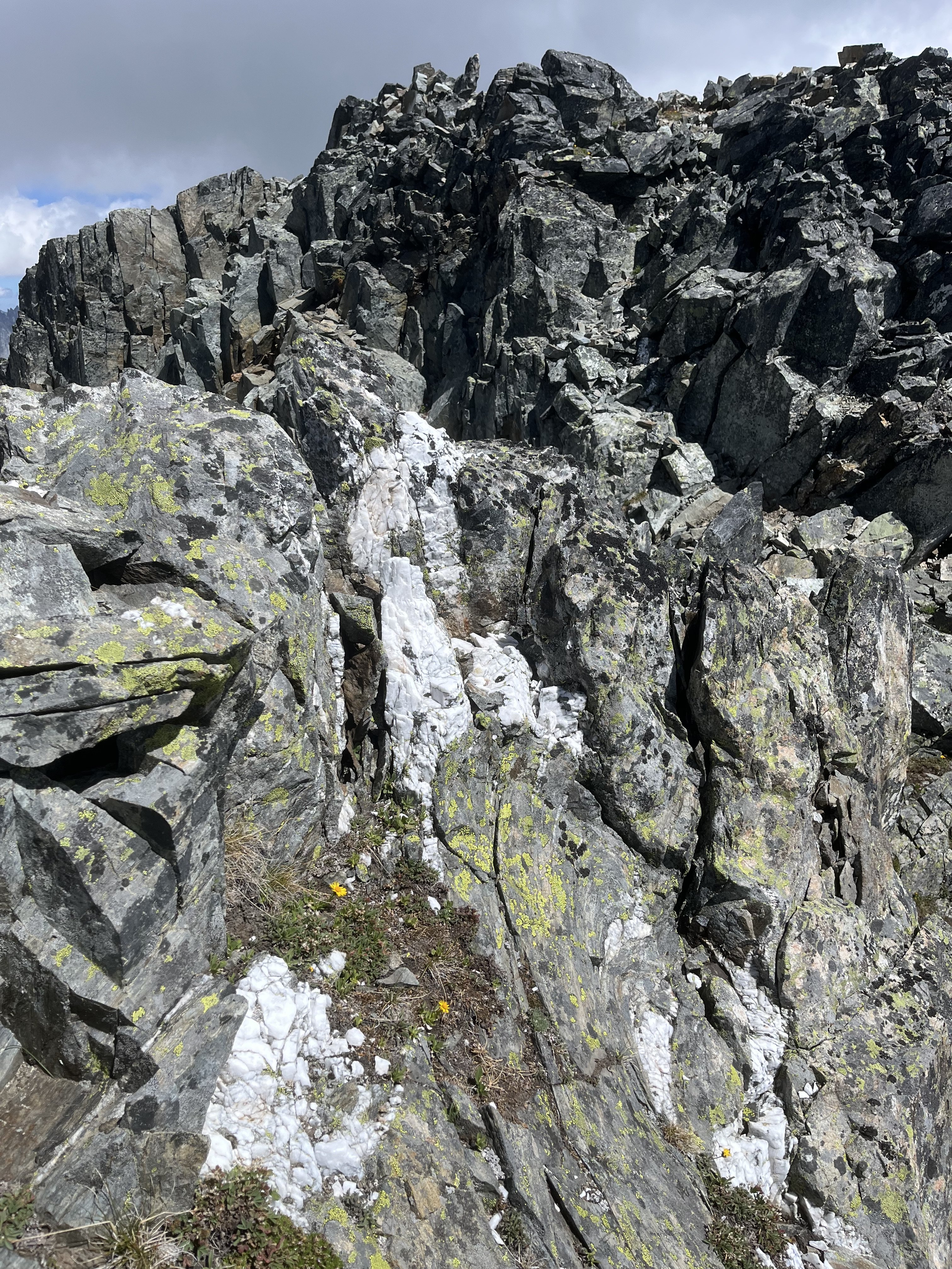
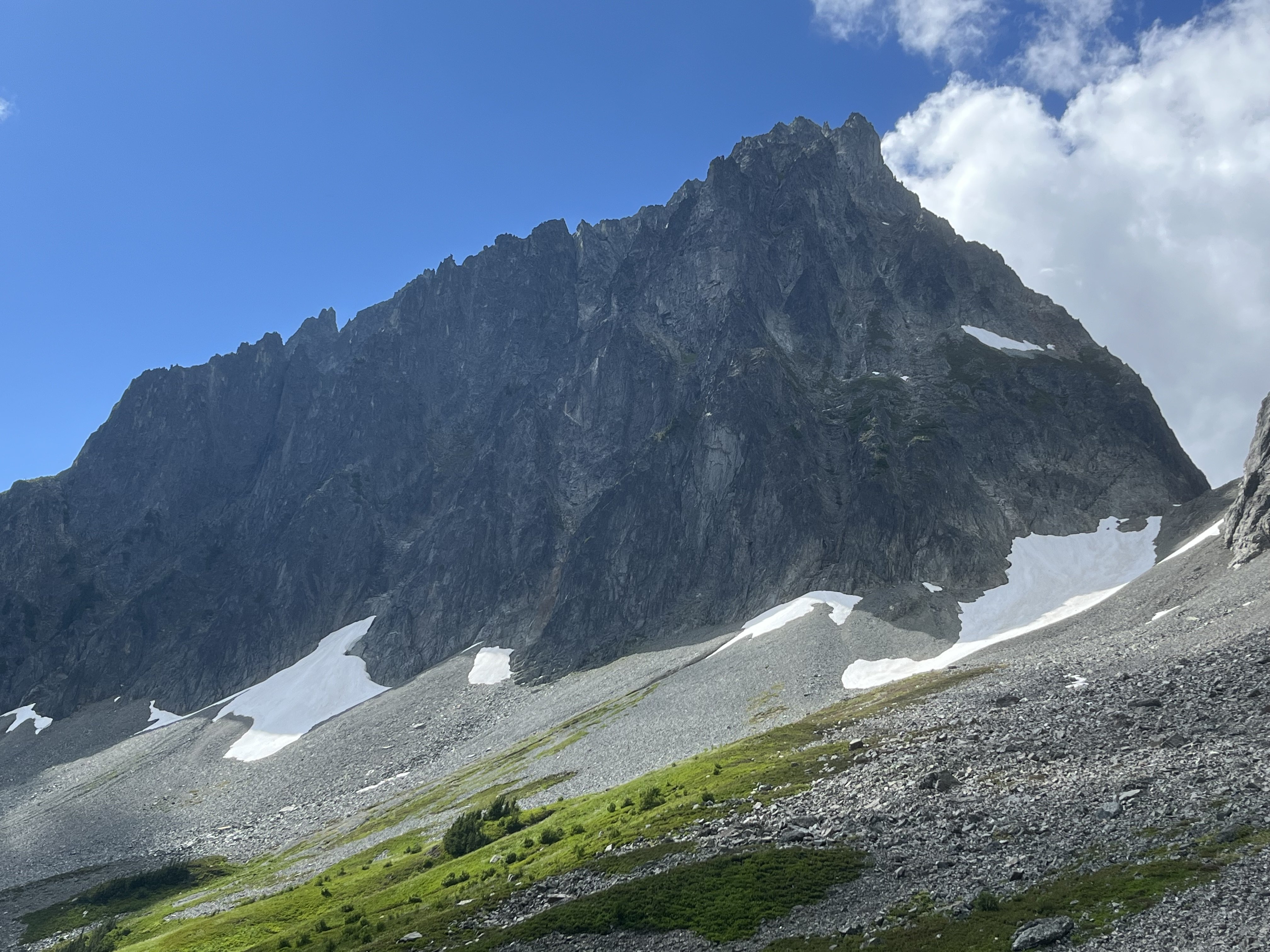
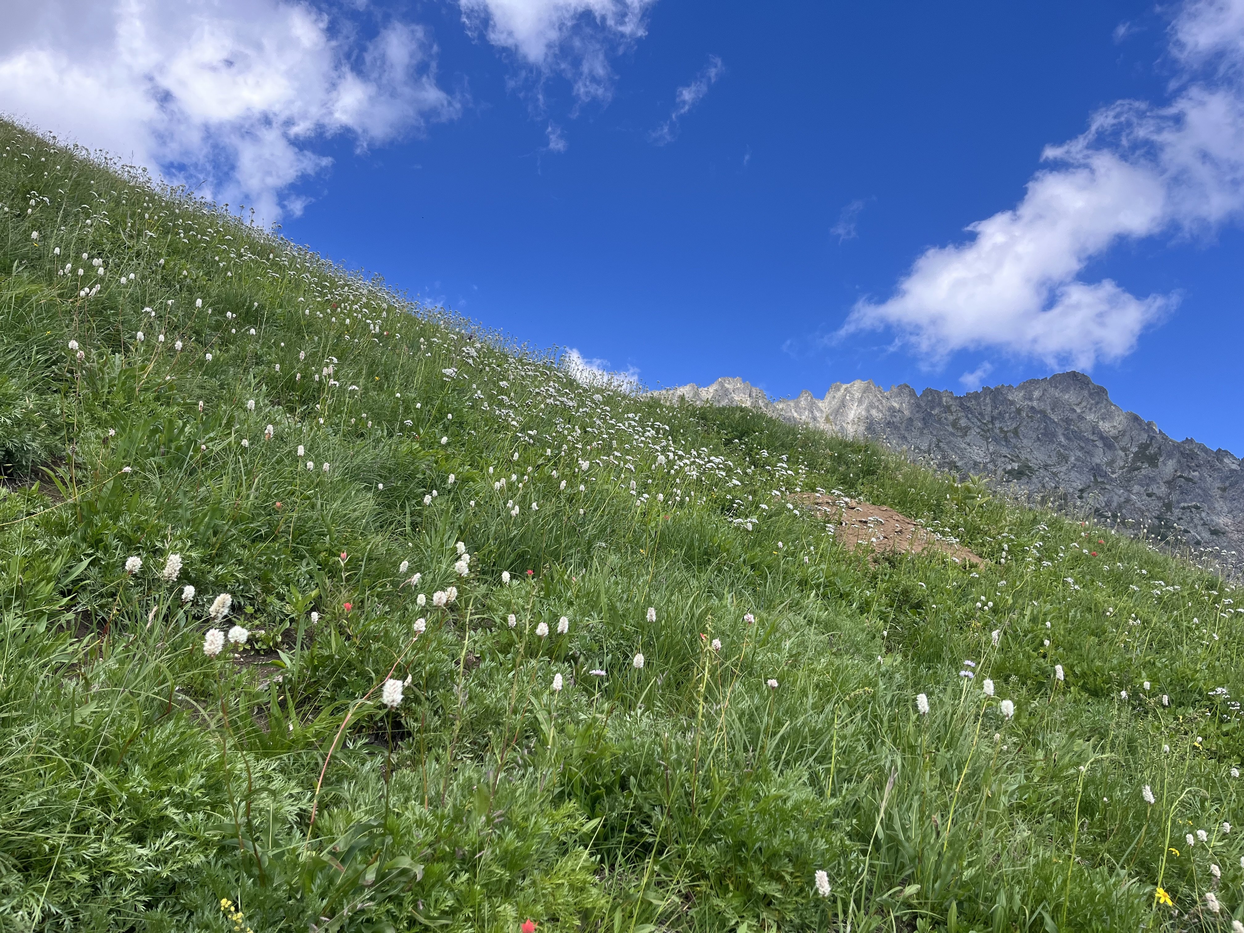
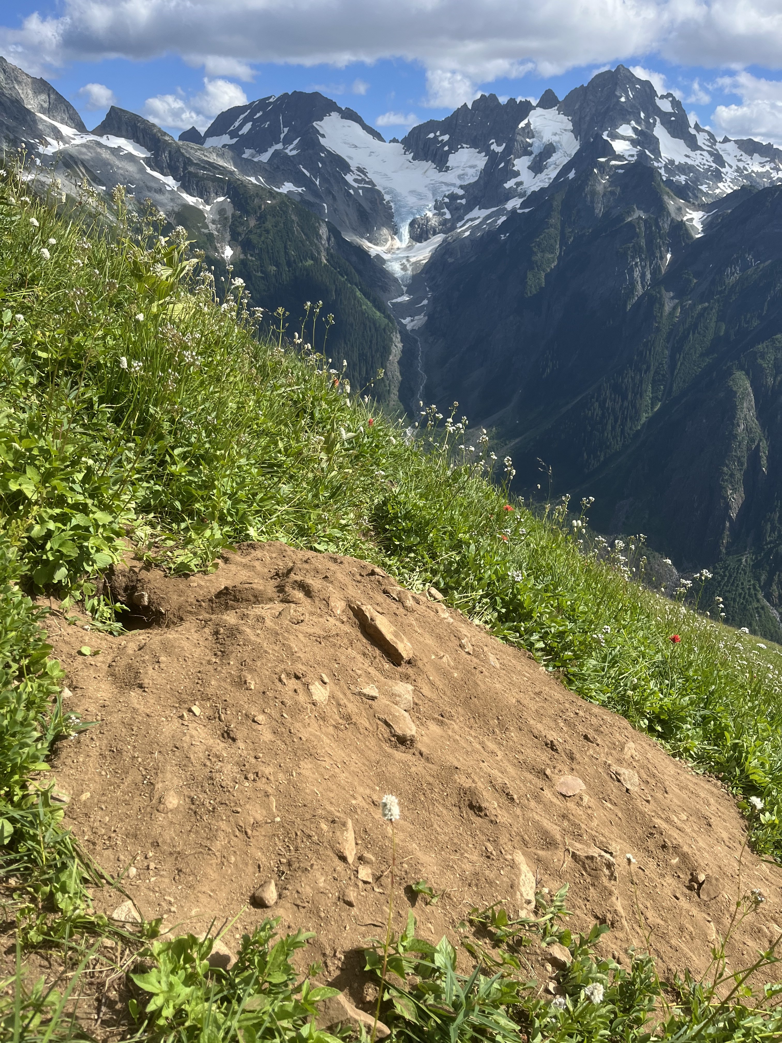
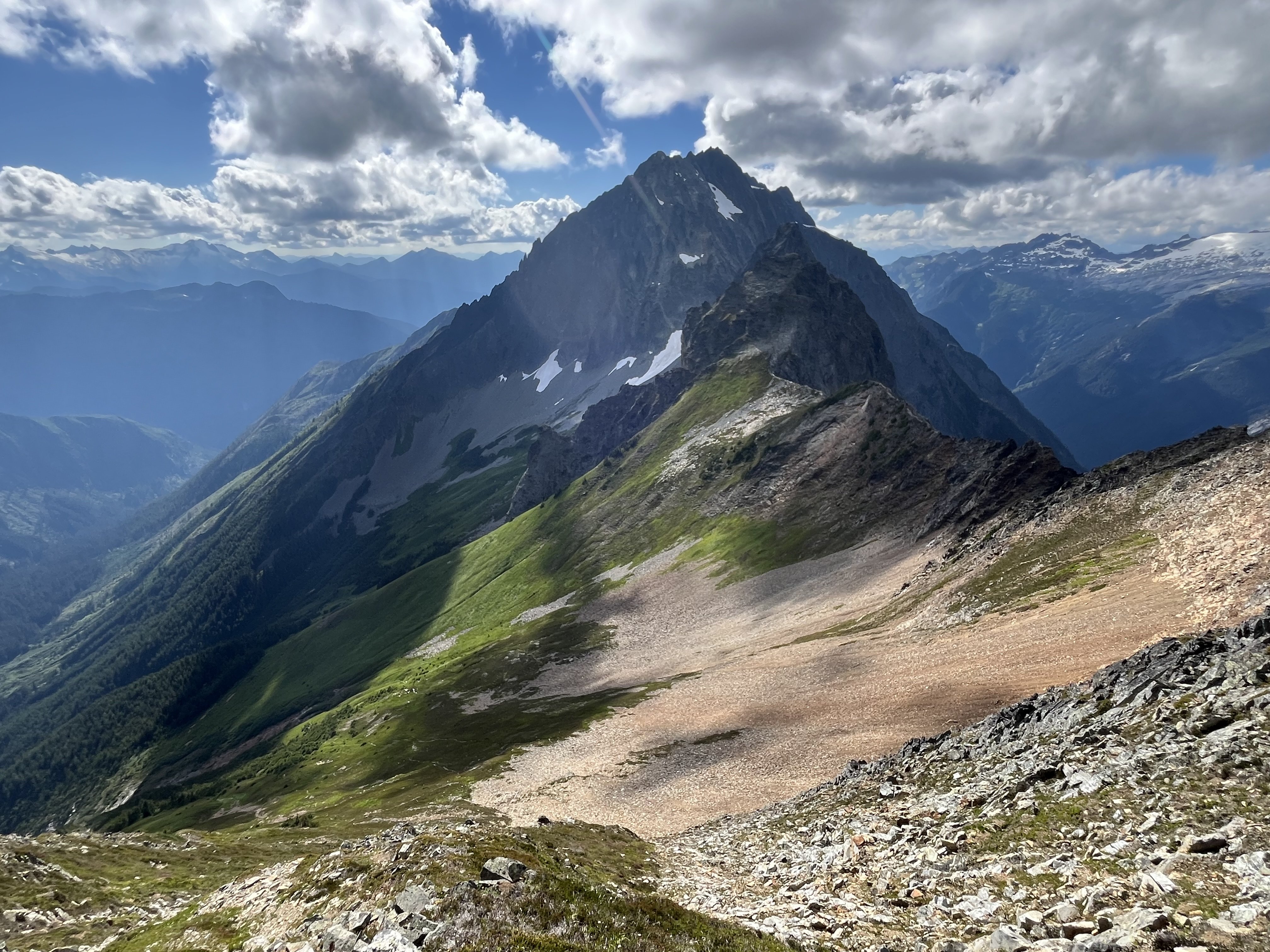
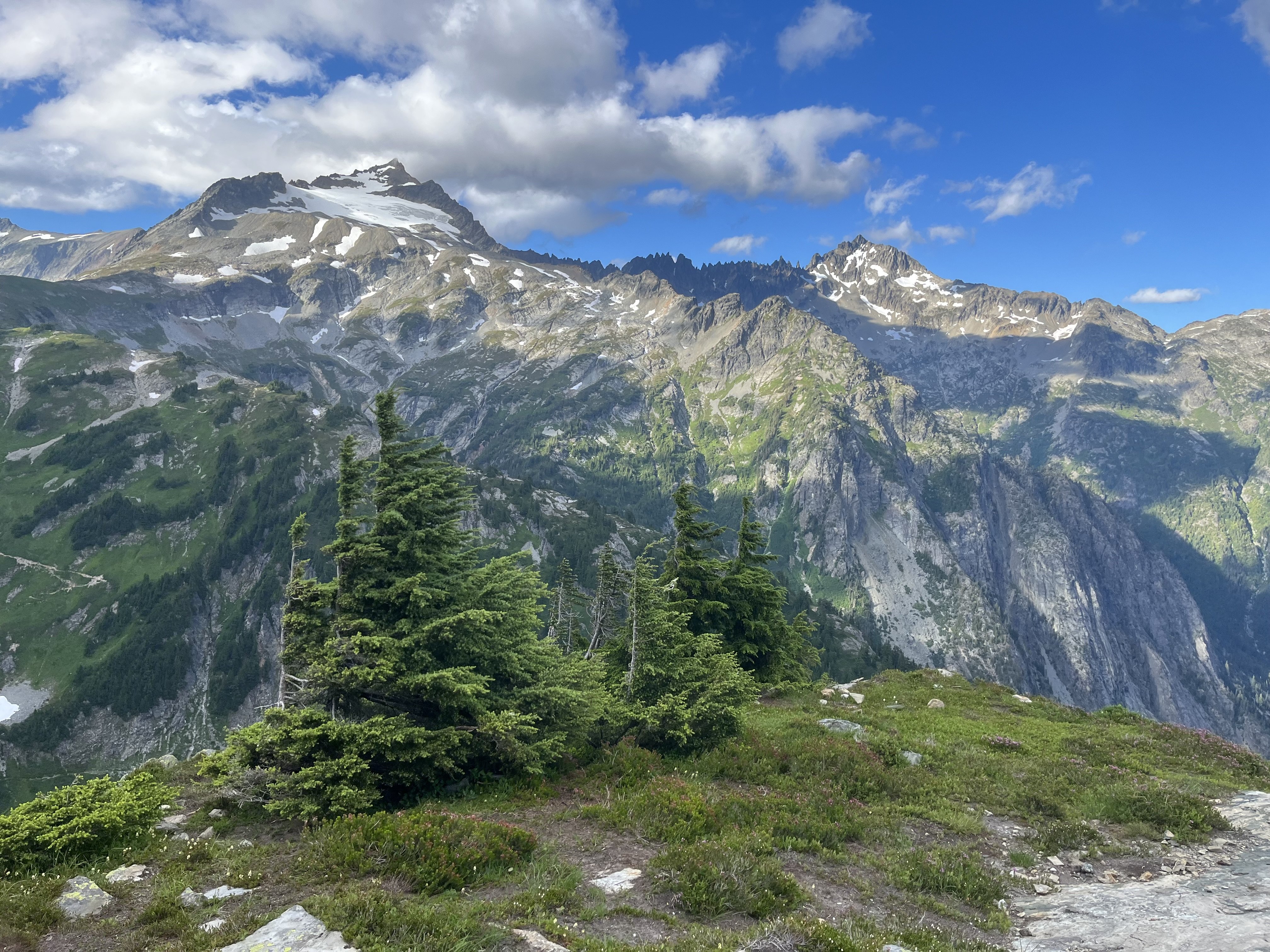
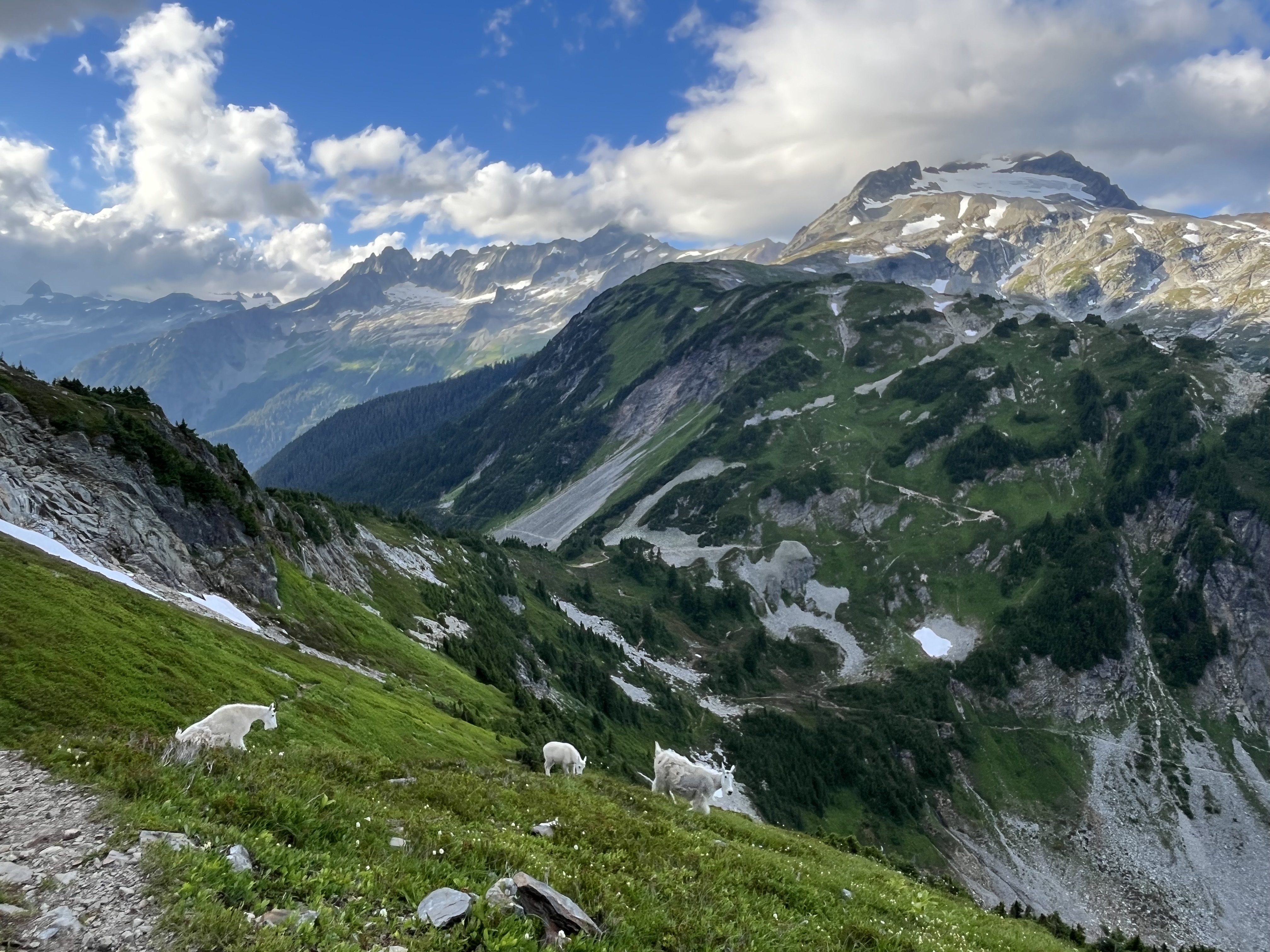
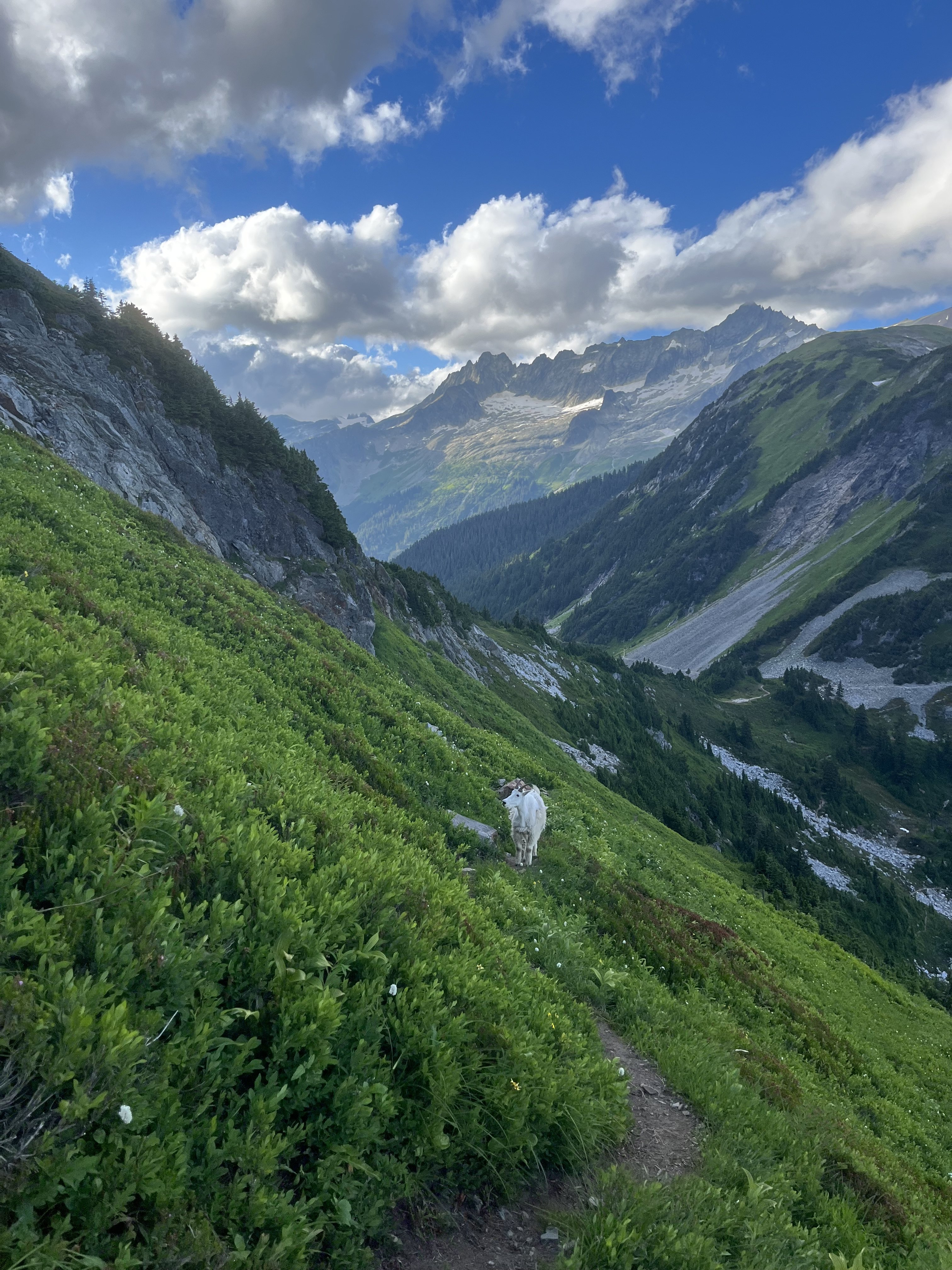
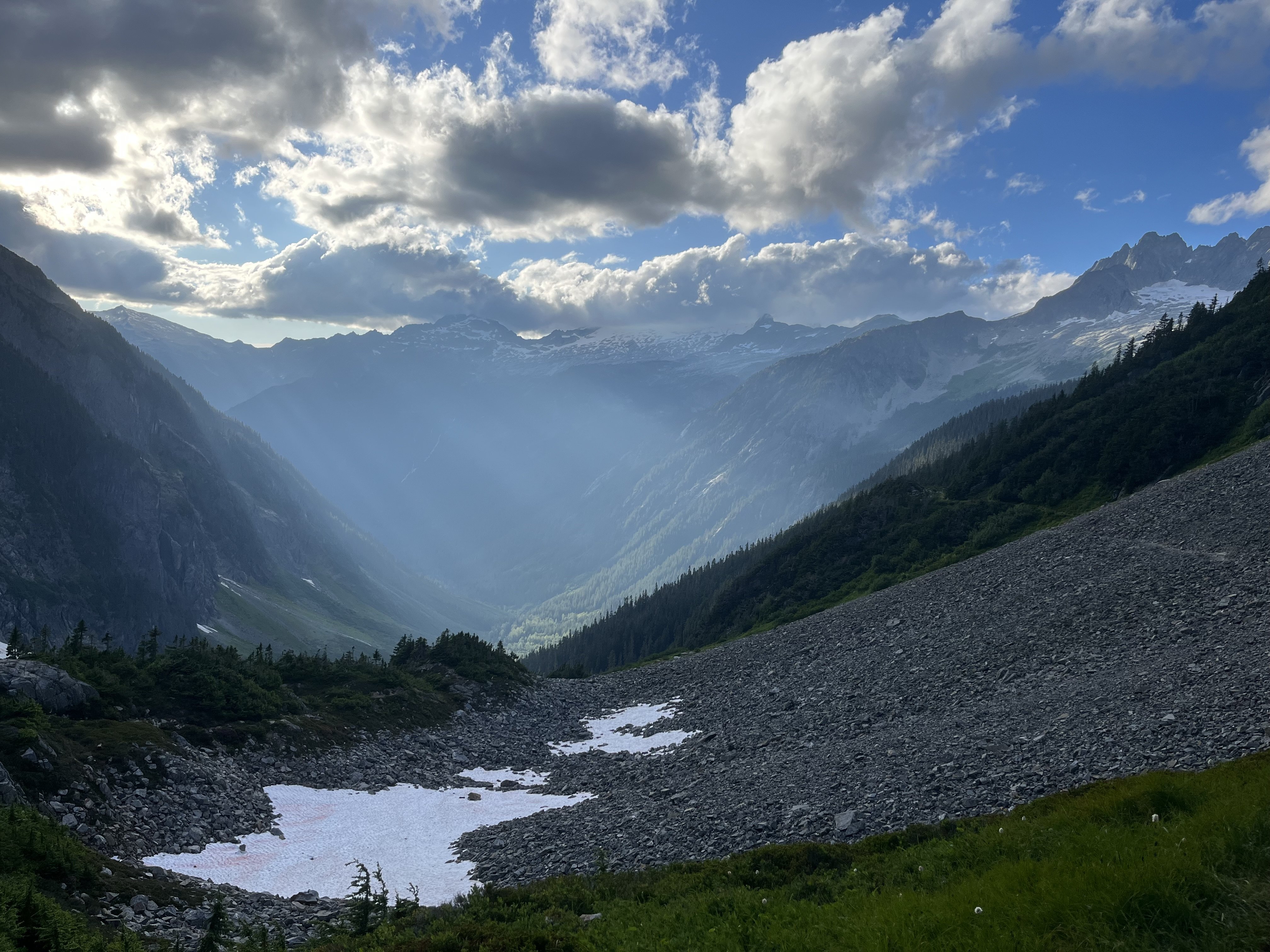
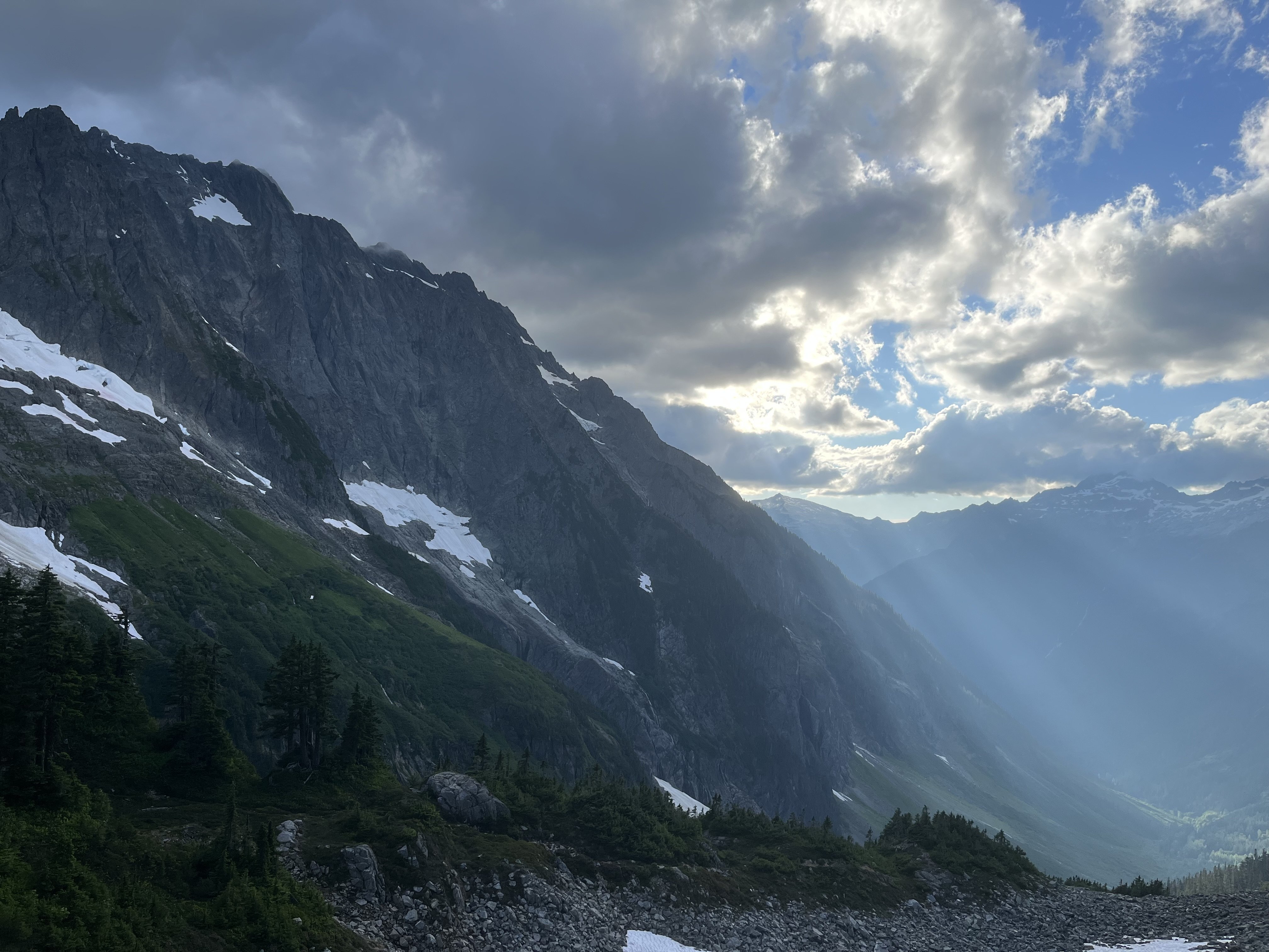
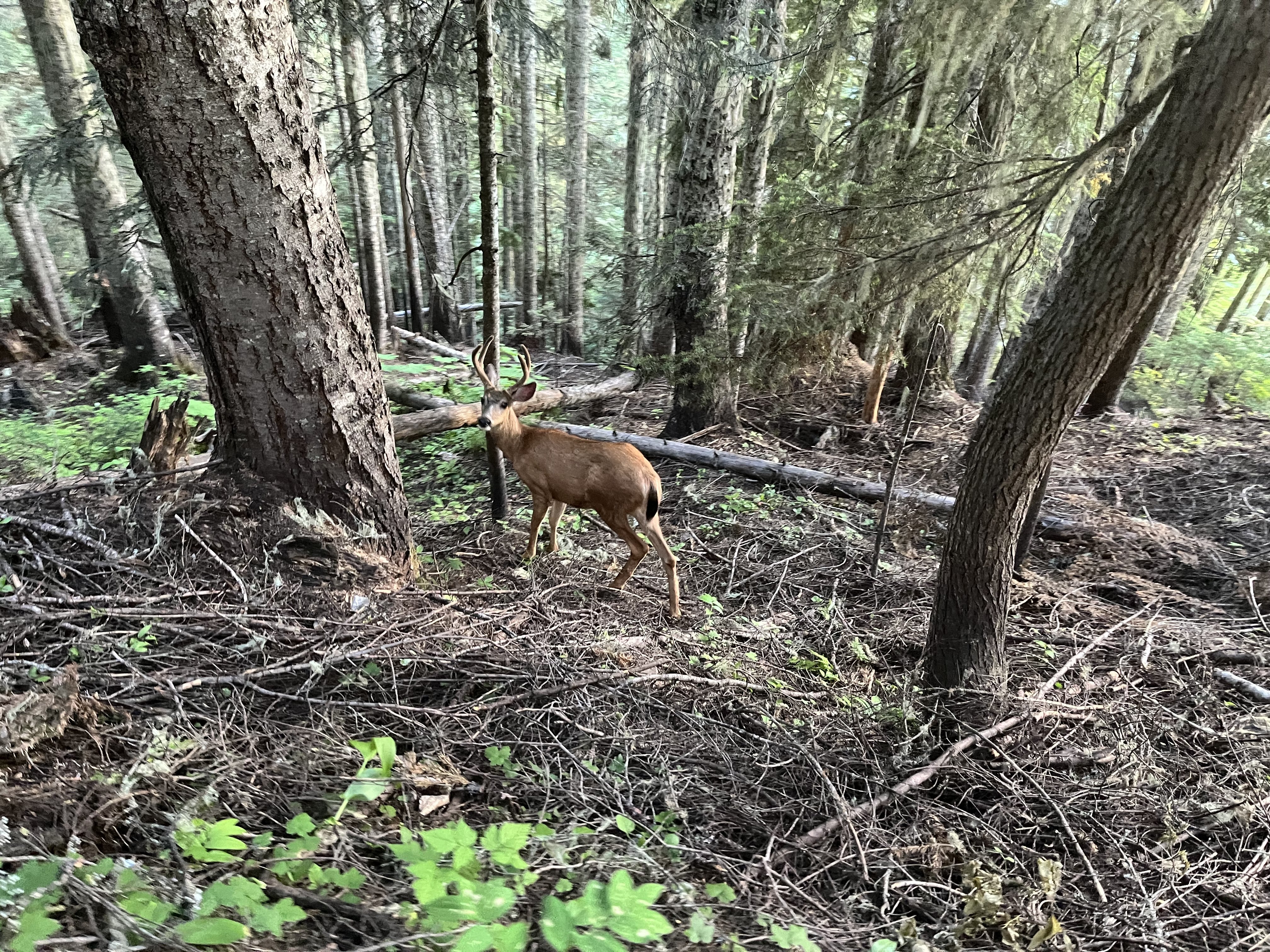
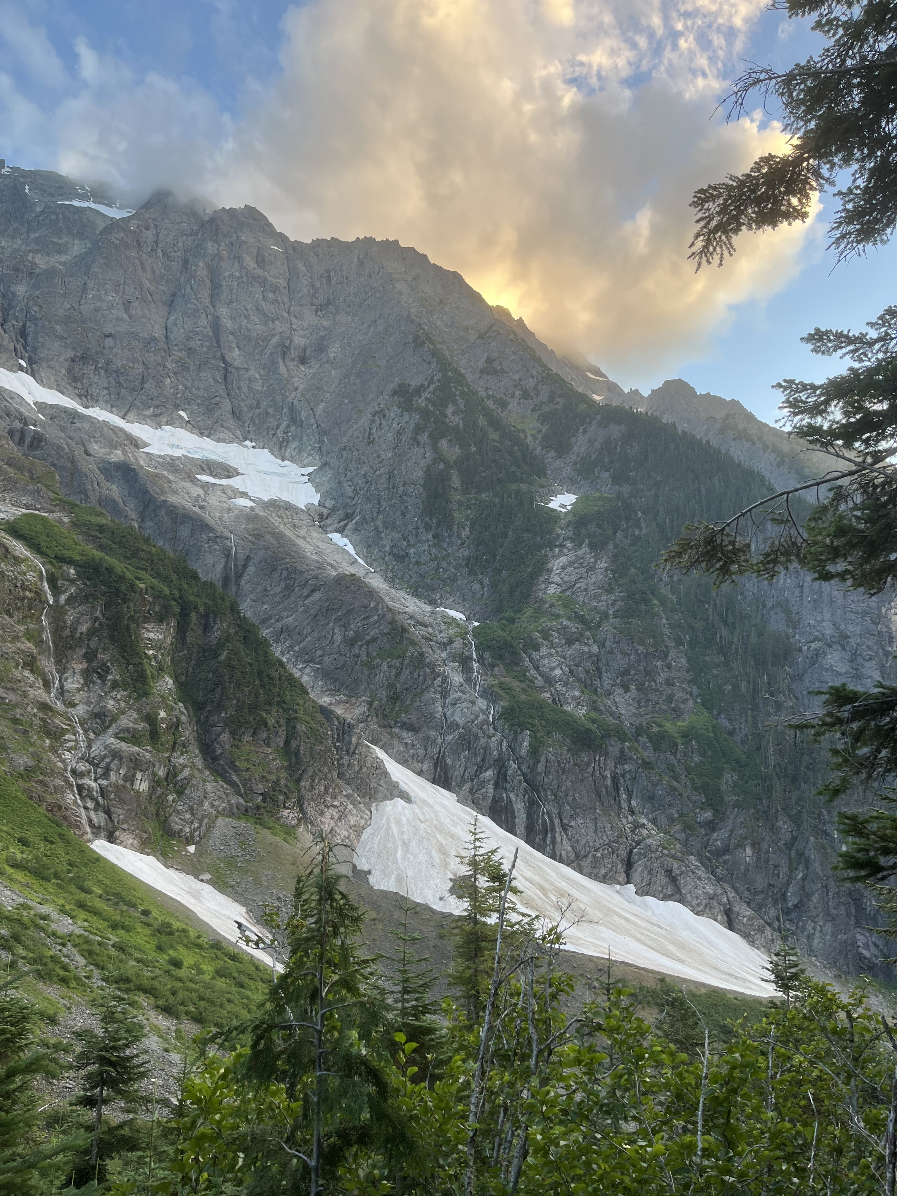
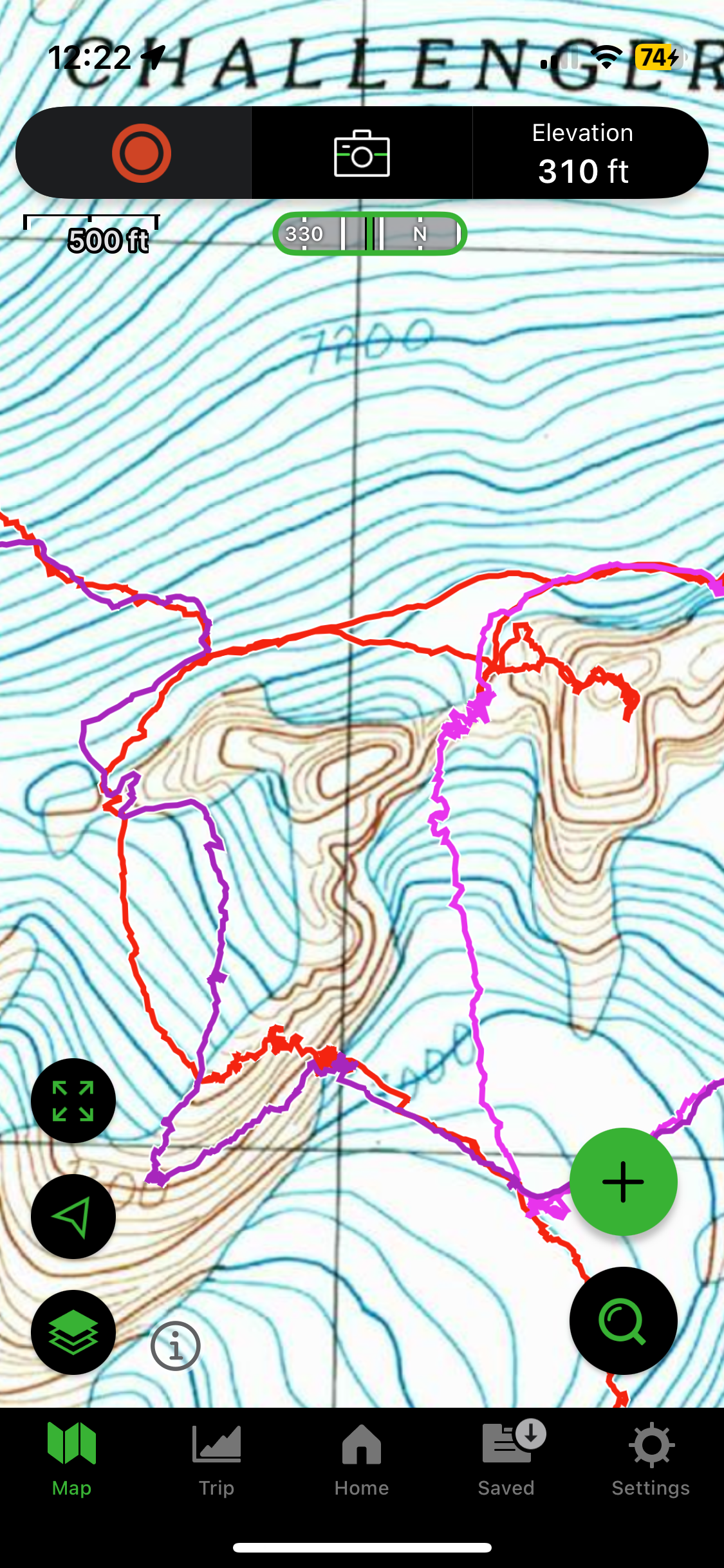
Trip: Despair (south peak) - East / SE side Trip Date: 09/12/2025 Trip Report: Strained pulley + nice forecast -> scramble somewhere new. South peak of Despair was my solution. As a late season climb it works pretty well. Not the most classic of routes though. Has more than its share of loose talus, and it’s a little stingy with views. For all the vertical and time involved, most of it is not very high, and wrapping around tall walls keeps much of the neighbors hidden. Started out dodging cones the squirrels were busily raining down. From Thornton lake it’s not obvious where to start heading up. I think all options would involve a little brush. Nice slabs are not far away. On my return I ended up a little farther skier’s right where there is some weird sandy gritty knobby sloping geology for several hundred feet. From the pass at 6150’ clouds blew in to obscure the way, which was pretty tedious talus side hilling. I did two different variations to and from the steep creek, each involving 300 vertical feet of shwacking, and both fairly bad. Maybe getting into the creek higher up would have been better. I traversed out of it into woods at 4660’. Another series of steep parallel dry stream beds led to Triumph pass. The snow and ice north of Triumph pass was not as easy to avoid as I had guessed from recent satellite imagery. At first I tried to cut though it to get to slabs on the left side. Though low angle it was down to pure slippery ice. Dirt patches initially provided traction but I dead ended when these ran out. Headed back up and off to slabs higher up. These slabs skiers left of the snow are of course dirty and exposed but fortunately featured enough to keep it at about 4th class. After the slabs the easiest way was to cross the steam back to the right, and then left once more at the bottom near the lake. On my return the next day I was able to avoid the exposed ice entirely by climbing the slabs farther past that stuff. In the traverse to the higher lake below Despair I came across two running streams, filled up at the first. Dropped the overnight gear at the lake and headed up to the east end of the peak. Took a pretty direct line near the ridge on the way up, and took easier and cleaner slabs on the SE aspect on the return. The next day I simply had to return to the trailhead without wiping out too hard on any of the loose talus. Hidden tunnel and weird negative column probably 15-20’ deep The steep creek with steep woods to its west and shwacking to its east. Impressive south face of Triumph, I wonder if there are any good routes. Safe to say there were millions of huckleberries in the basin at least. I find it hard to move efficiently in conditions like these. Cool lenticulars this day Gear Notes: One pole Approach Notes: Thornton lake then off trail
-
Home to Dome - 7 day bike to climb on the southern end of the Ptarmy
JonParker replied to Lucas Ng's topic in North Cascades
Wow, what a week! Glad you got graced with a glory too. -
Plan 9 looks great, sign me up!
-
Nice, it made a believer of me. High five!
-
Fixed the photos
-
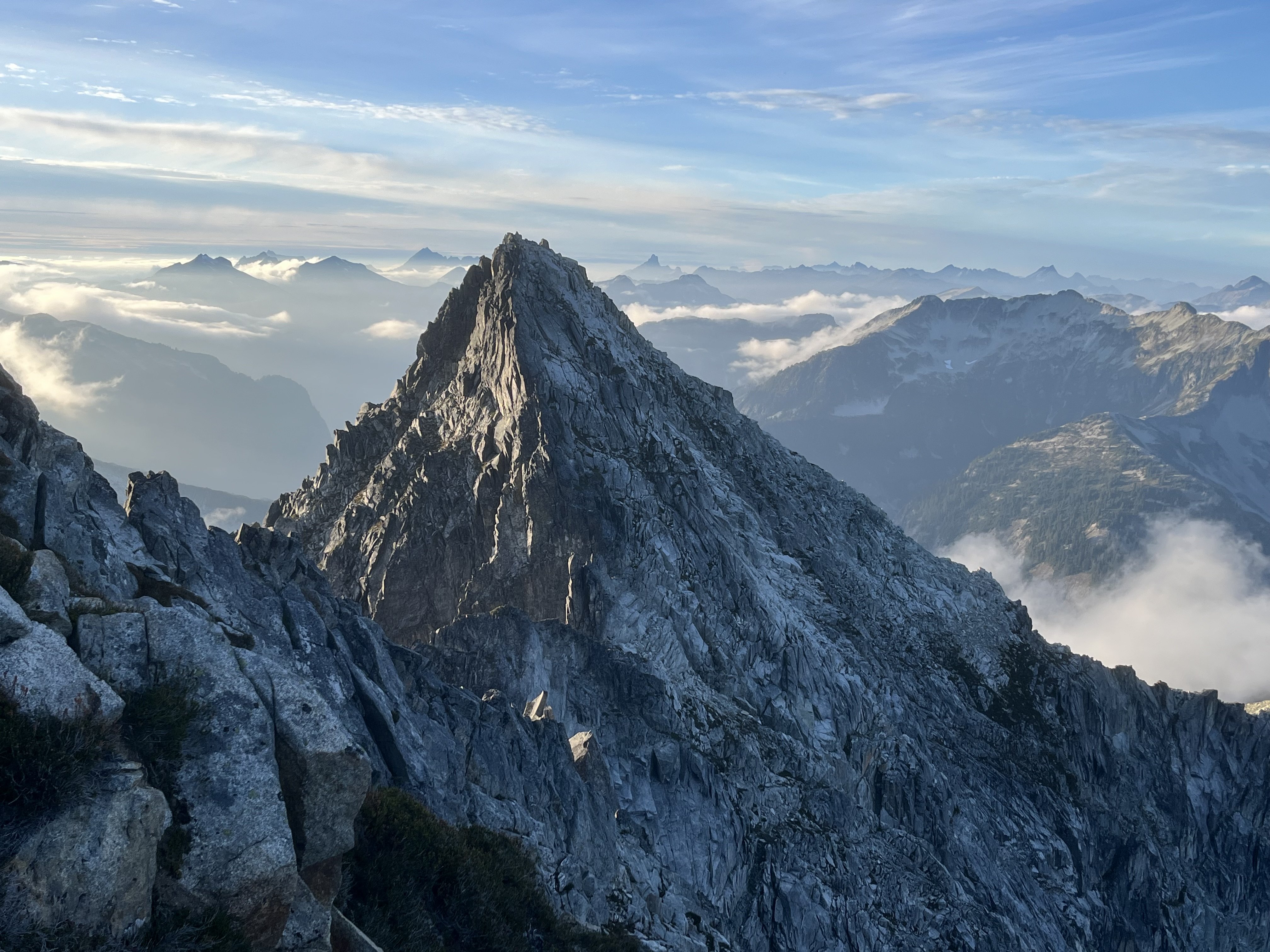
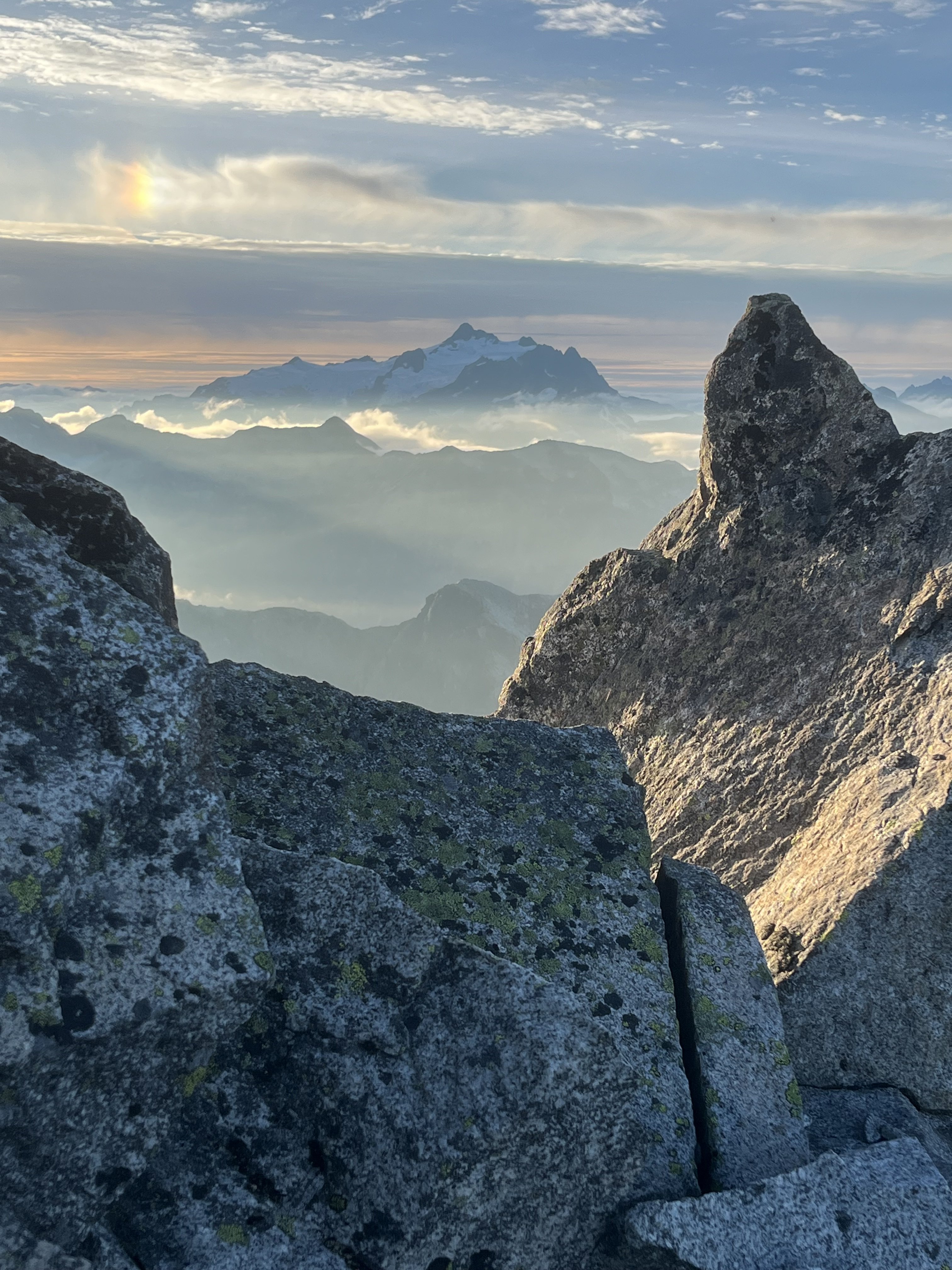
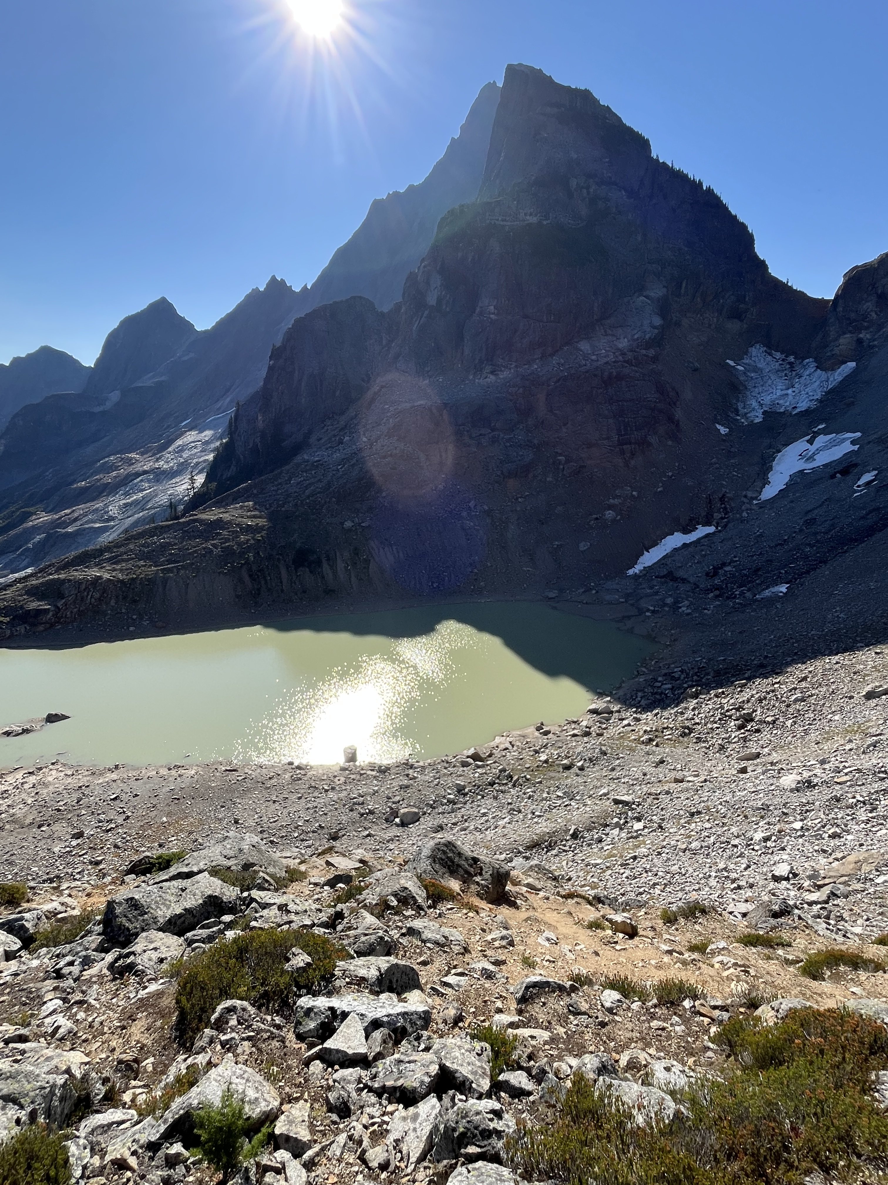
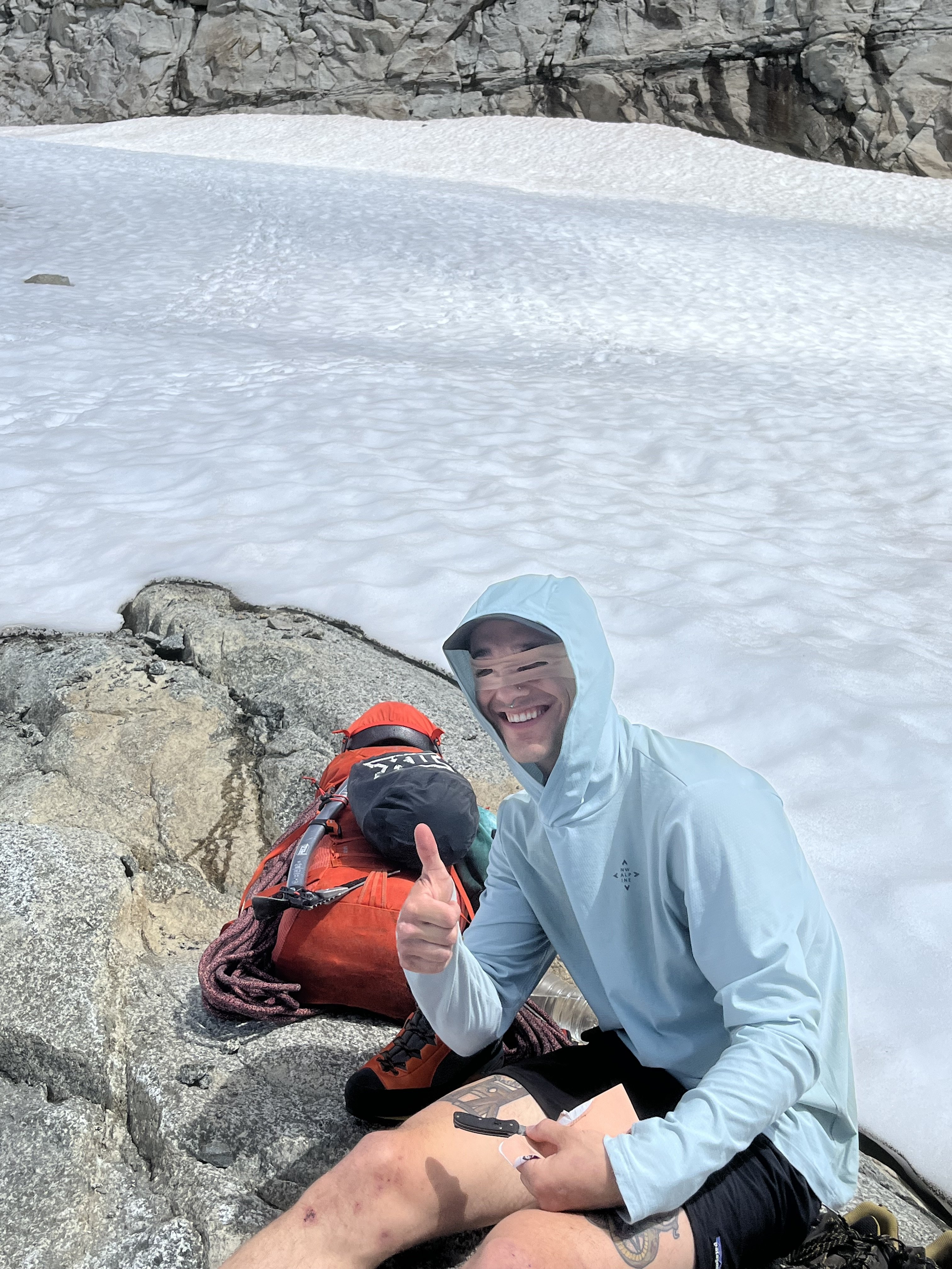
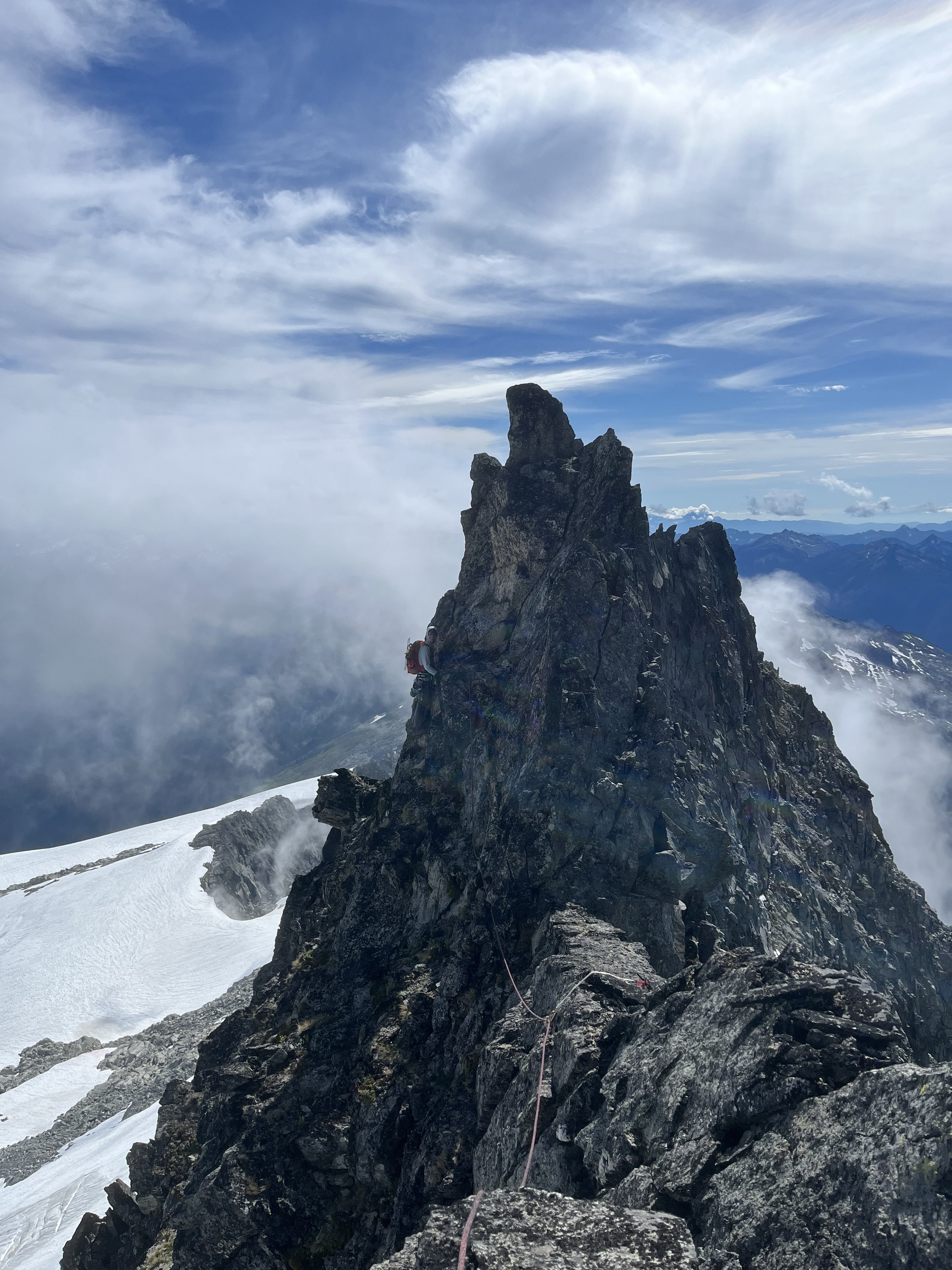
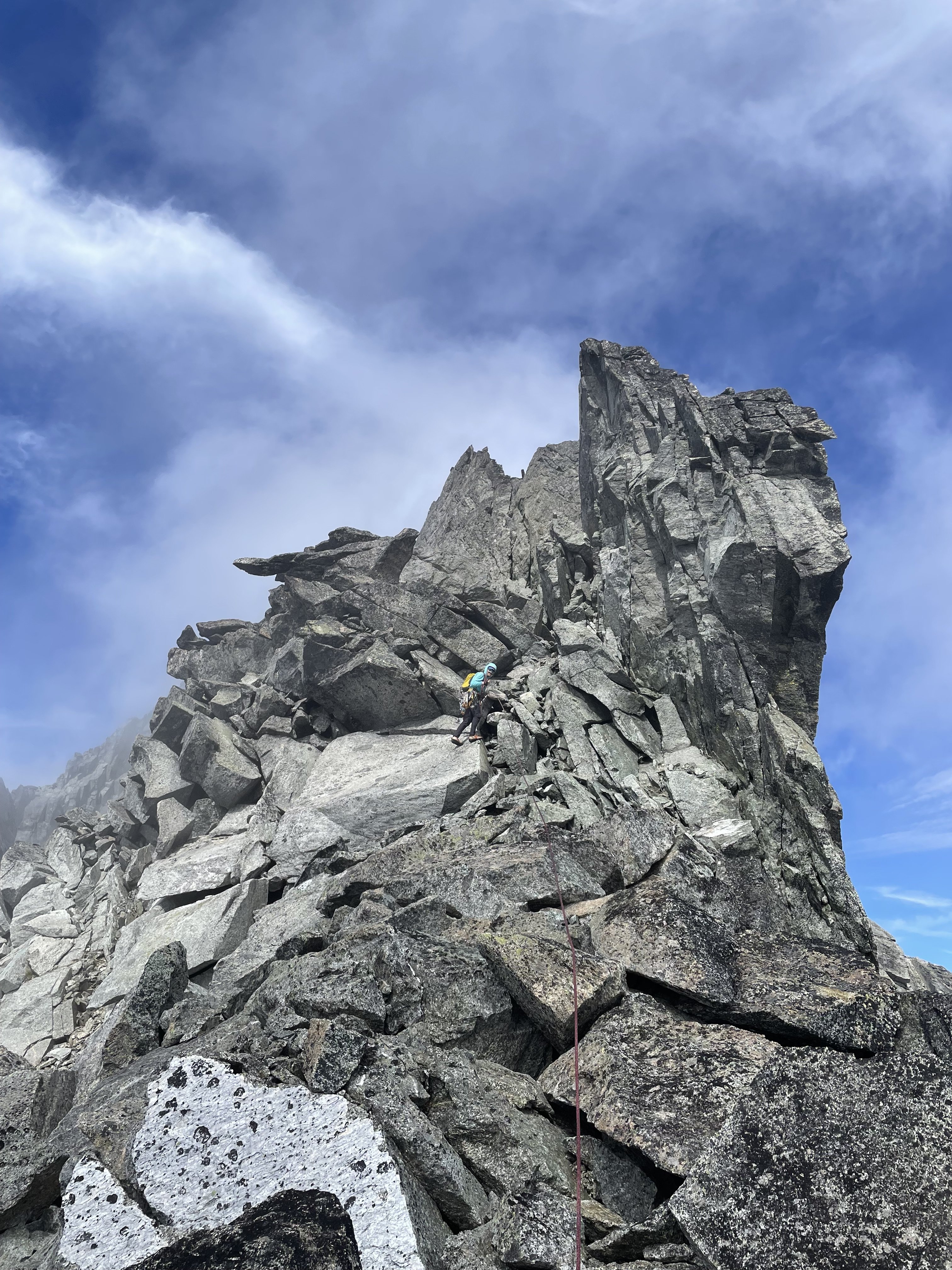
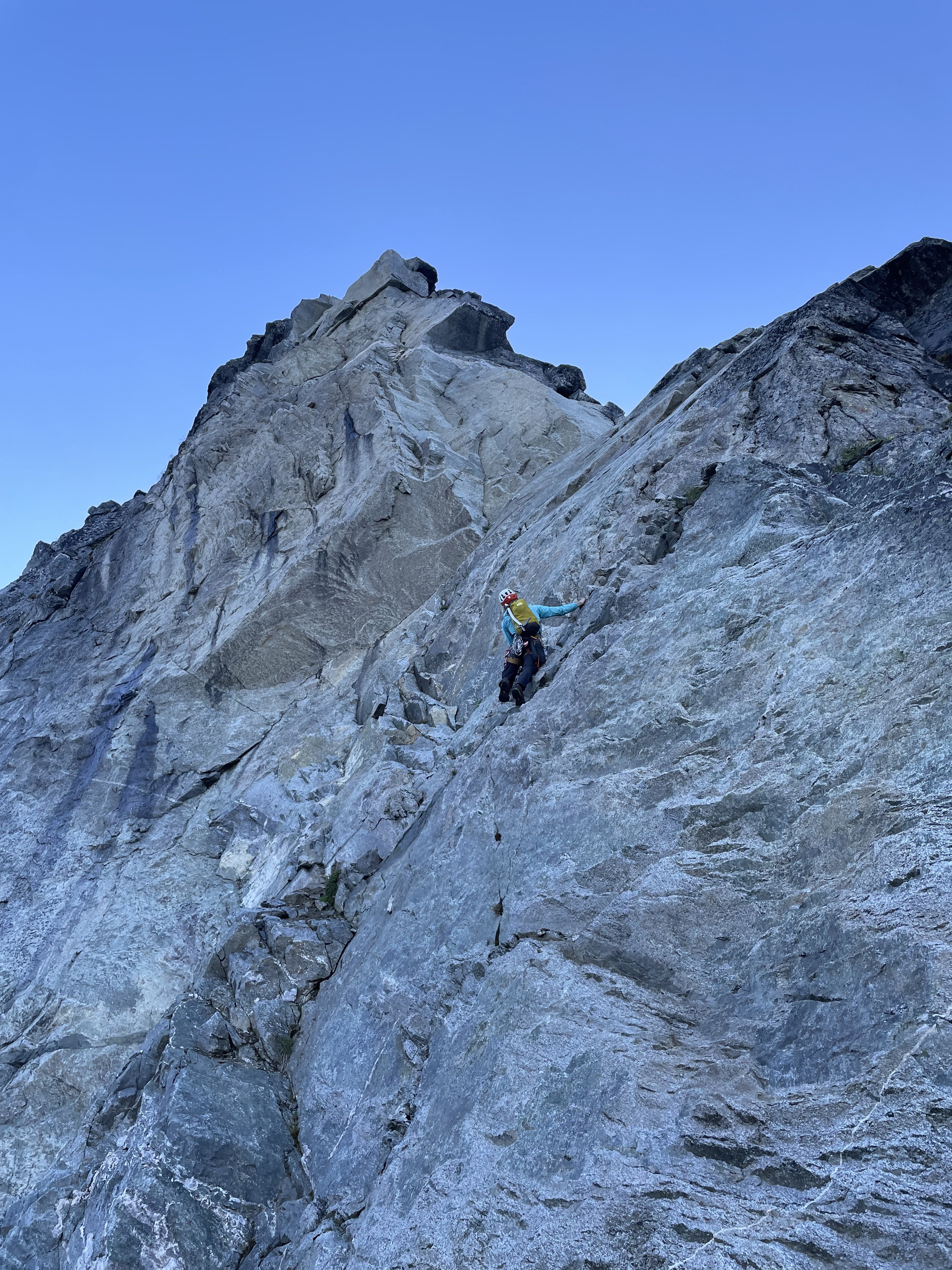
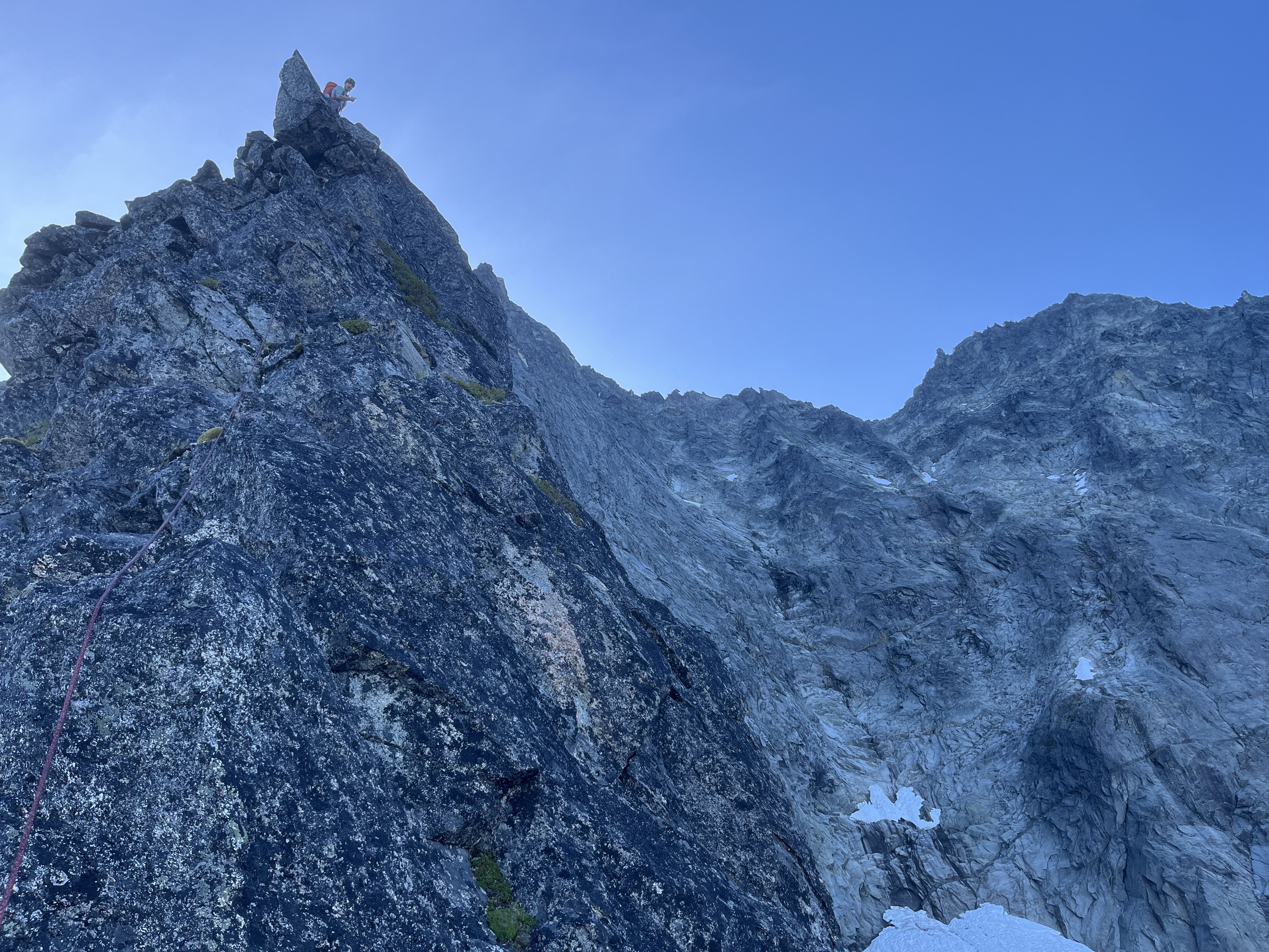
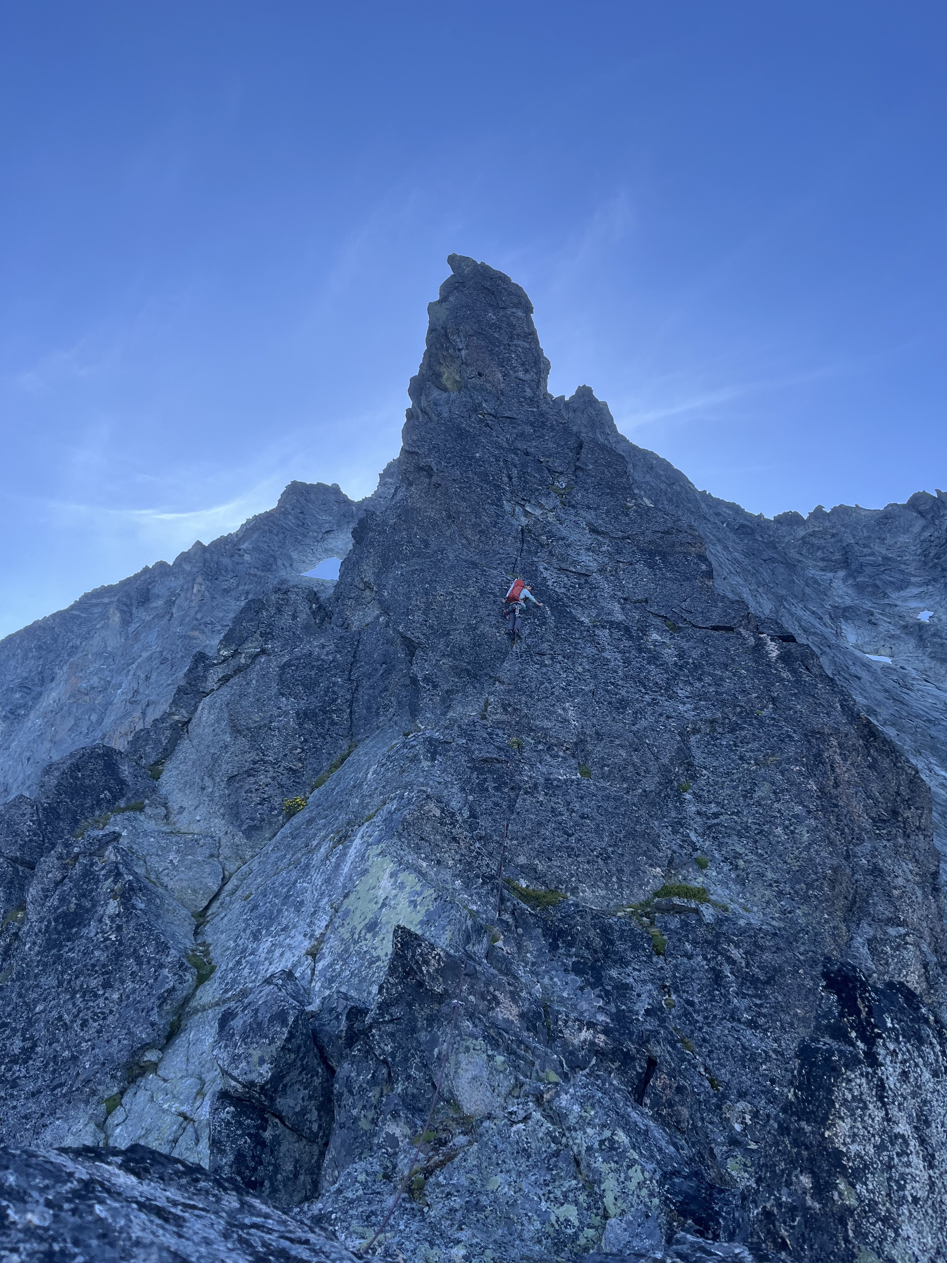
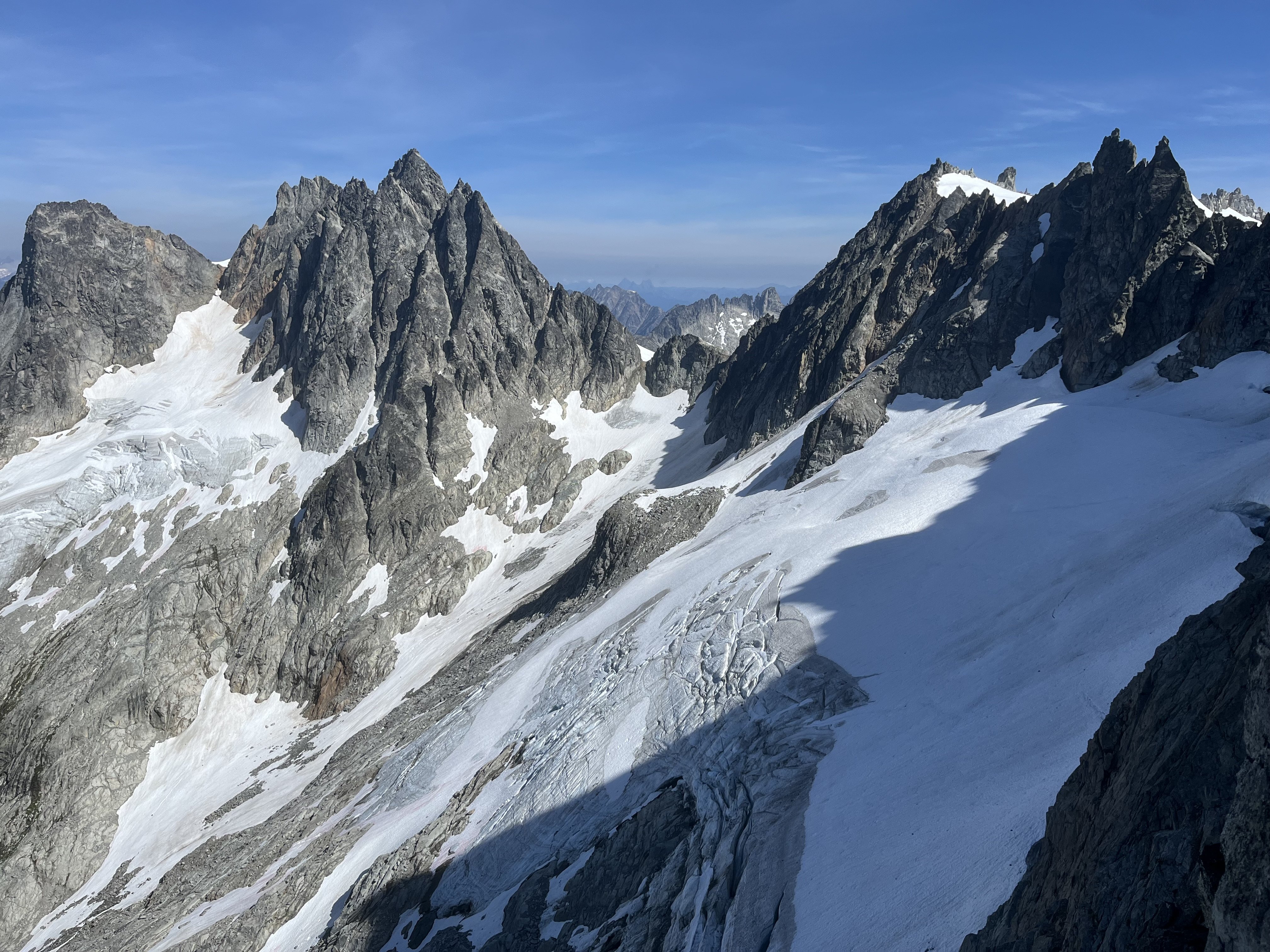
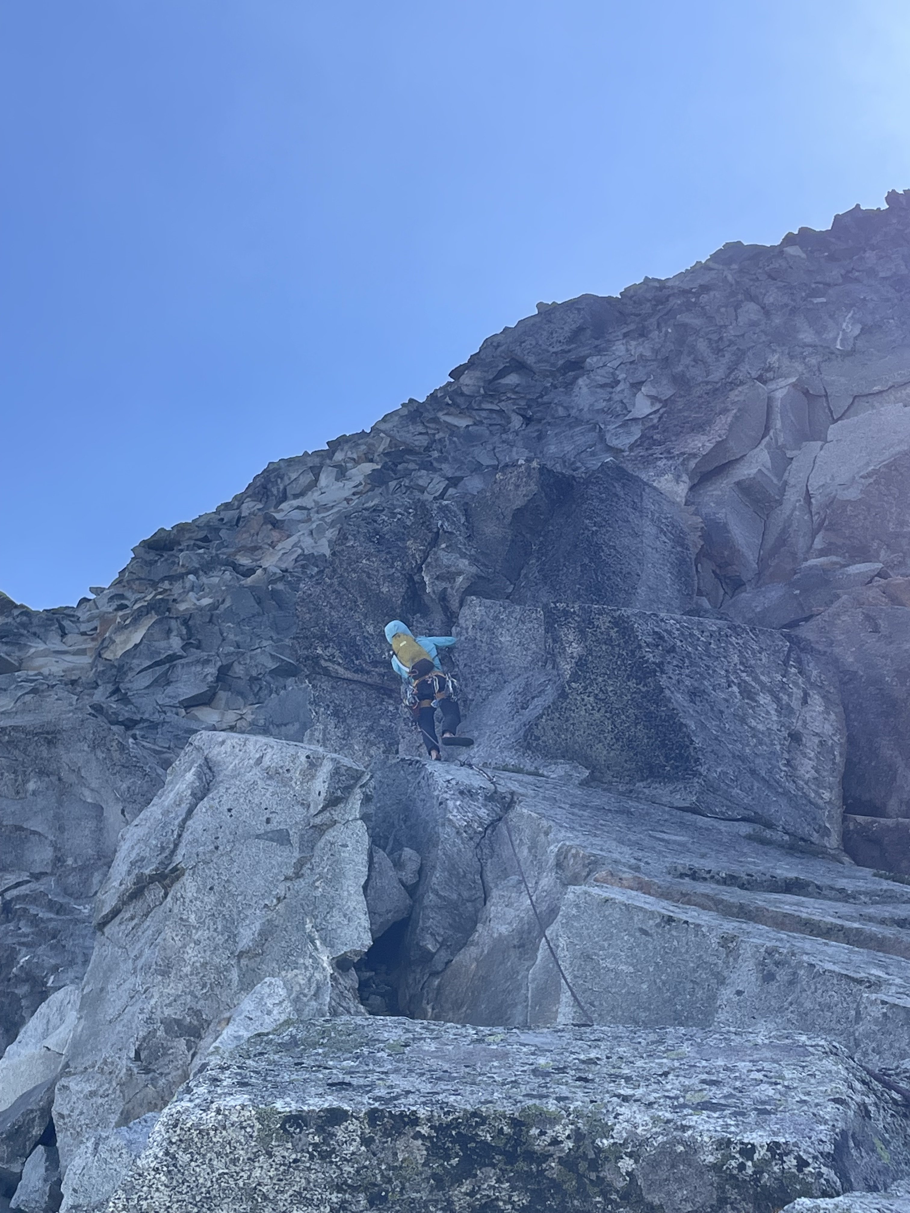
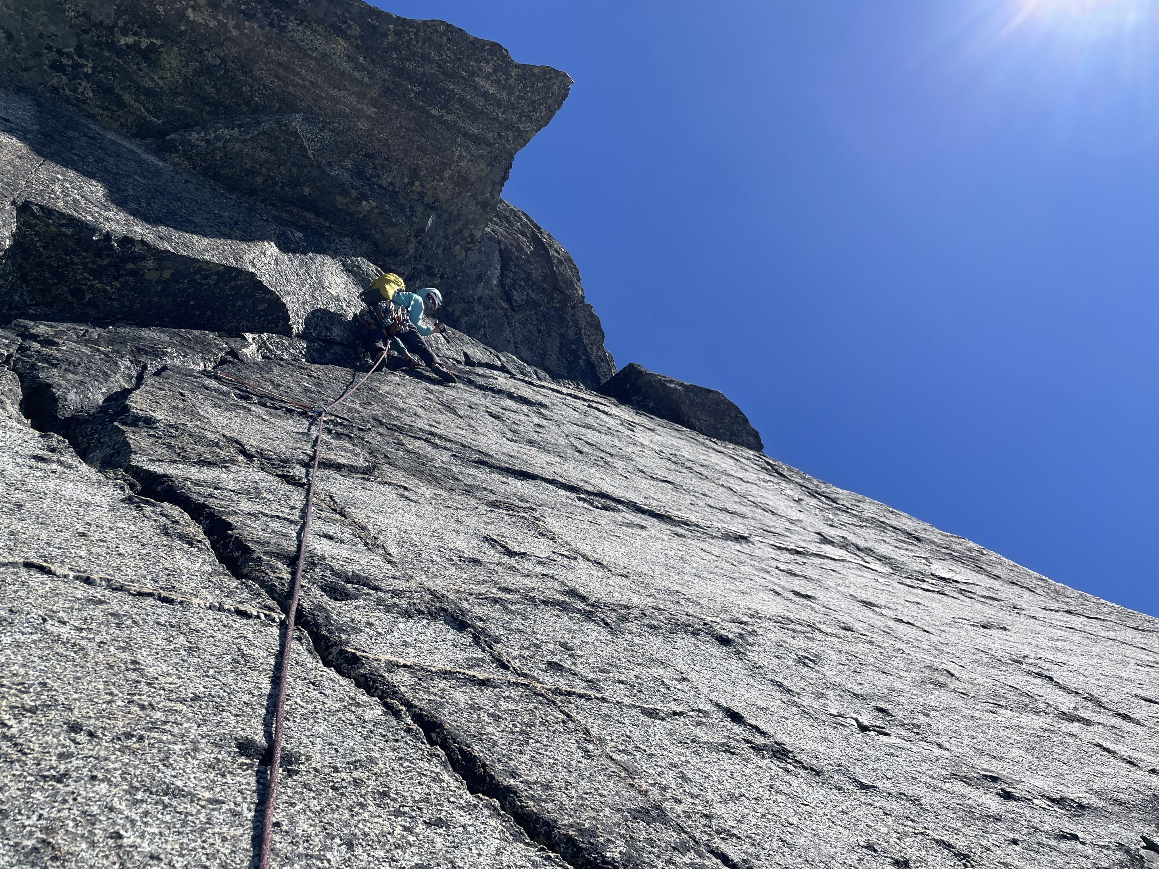
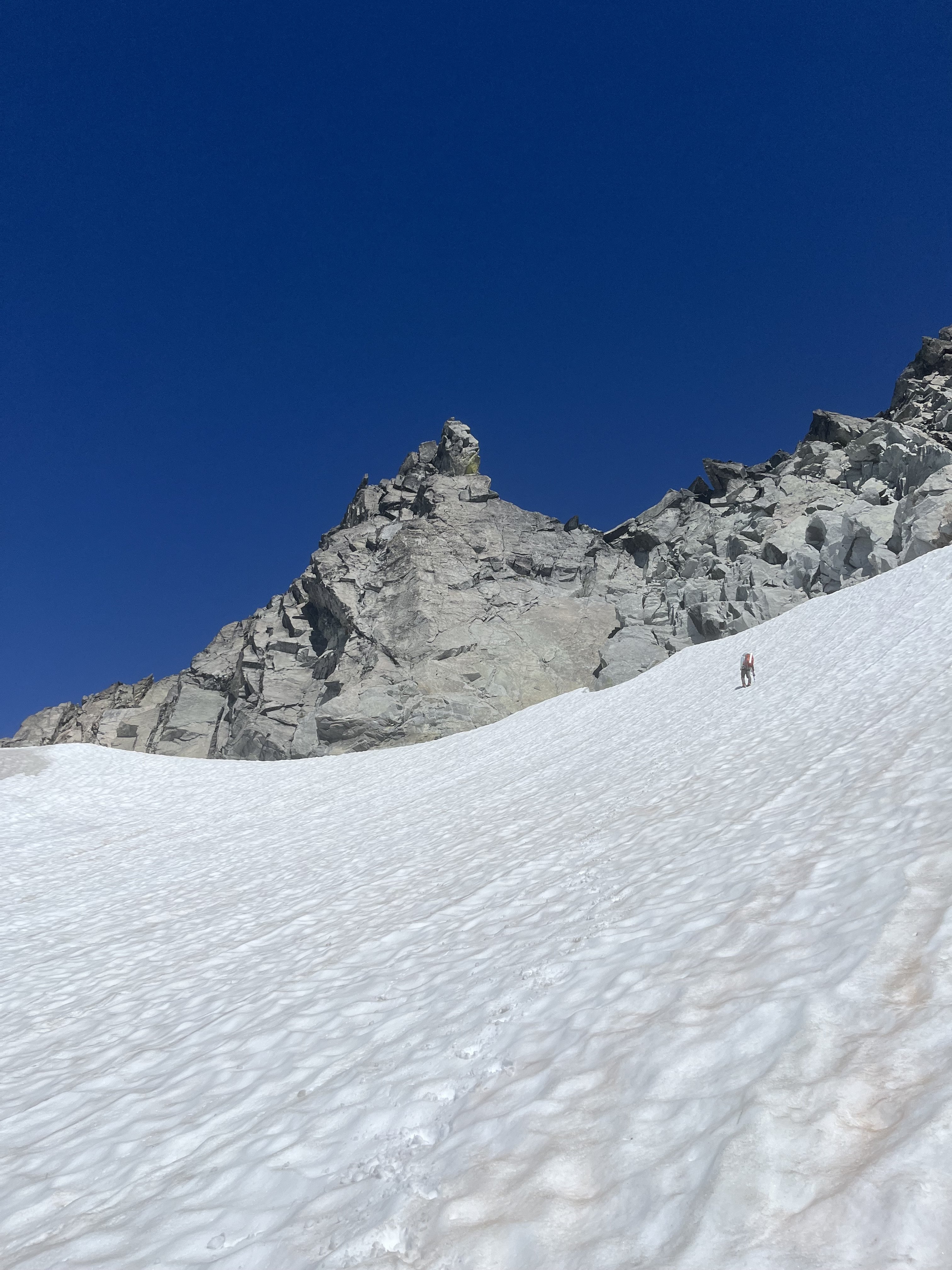
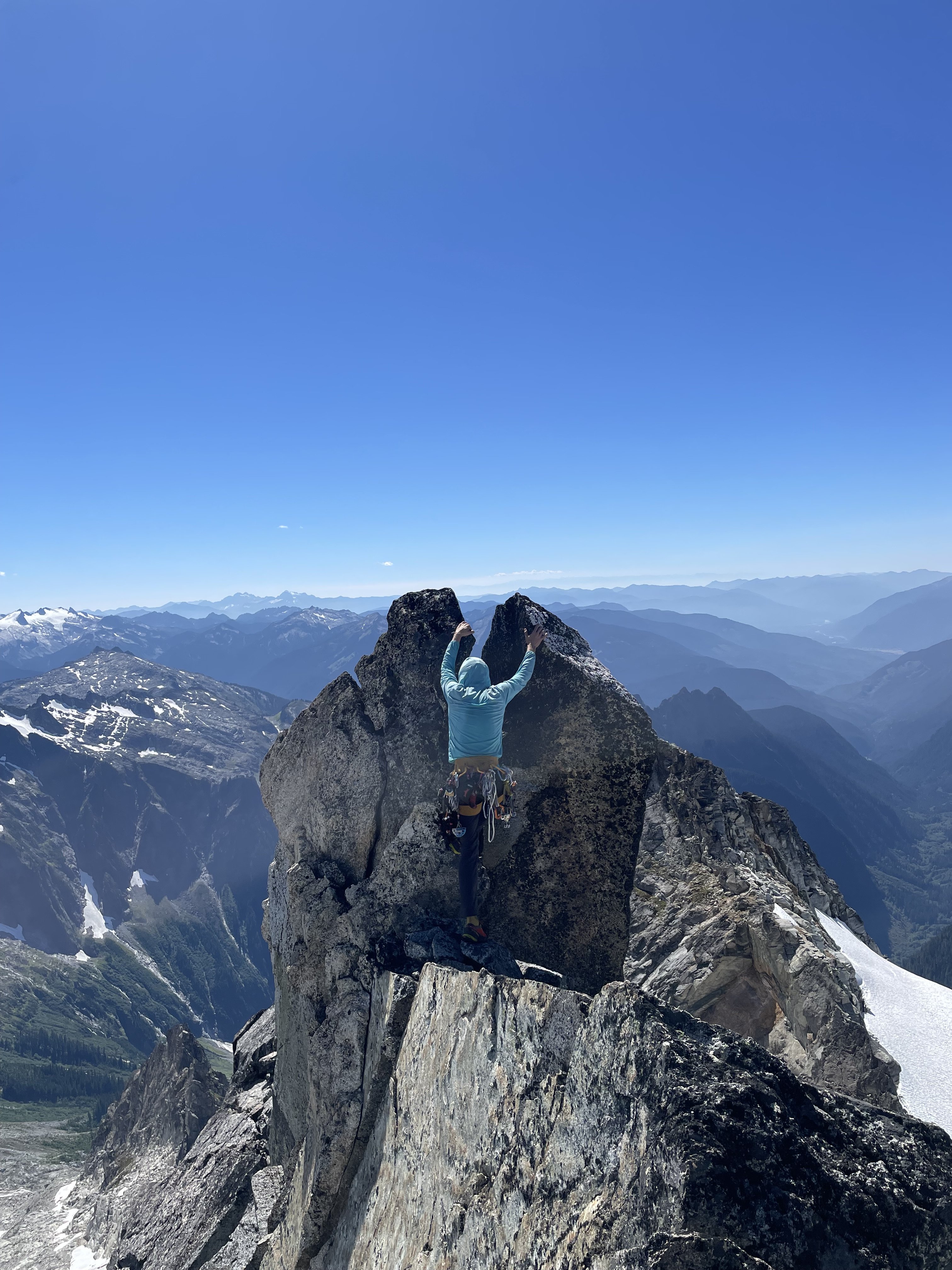
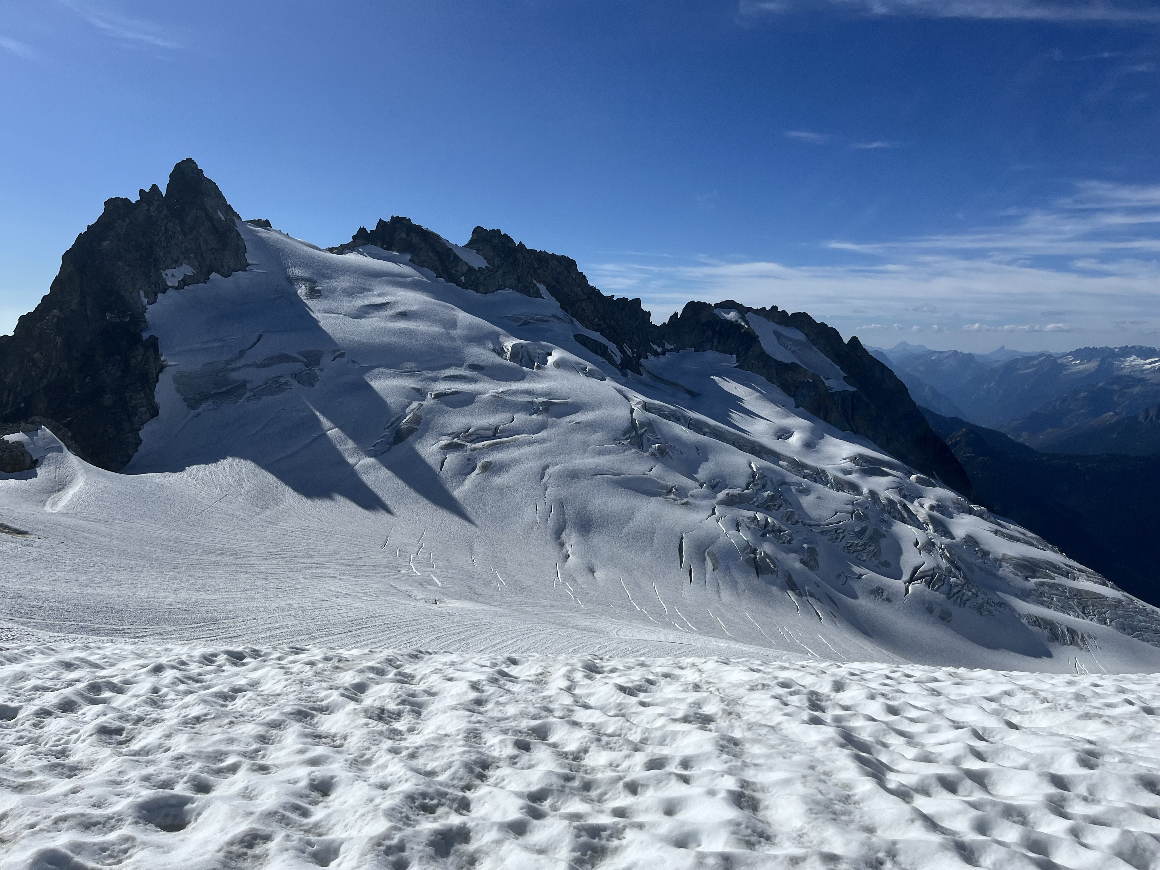
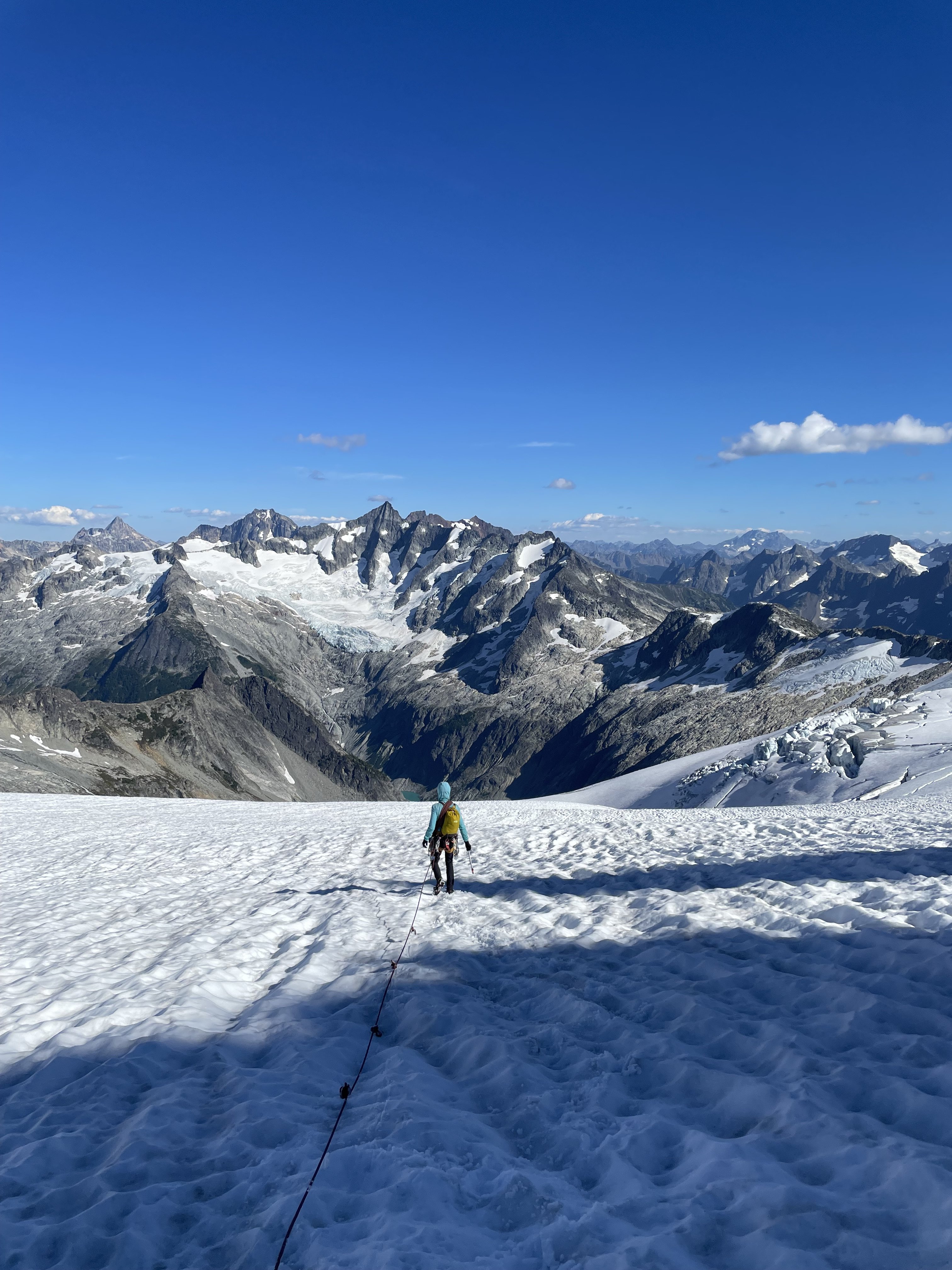
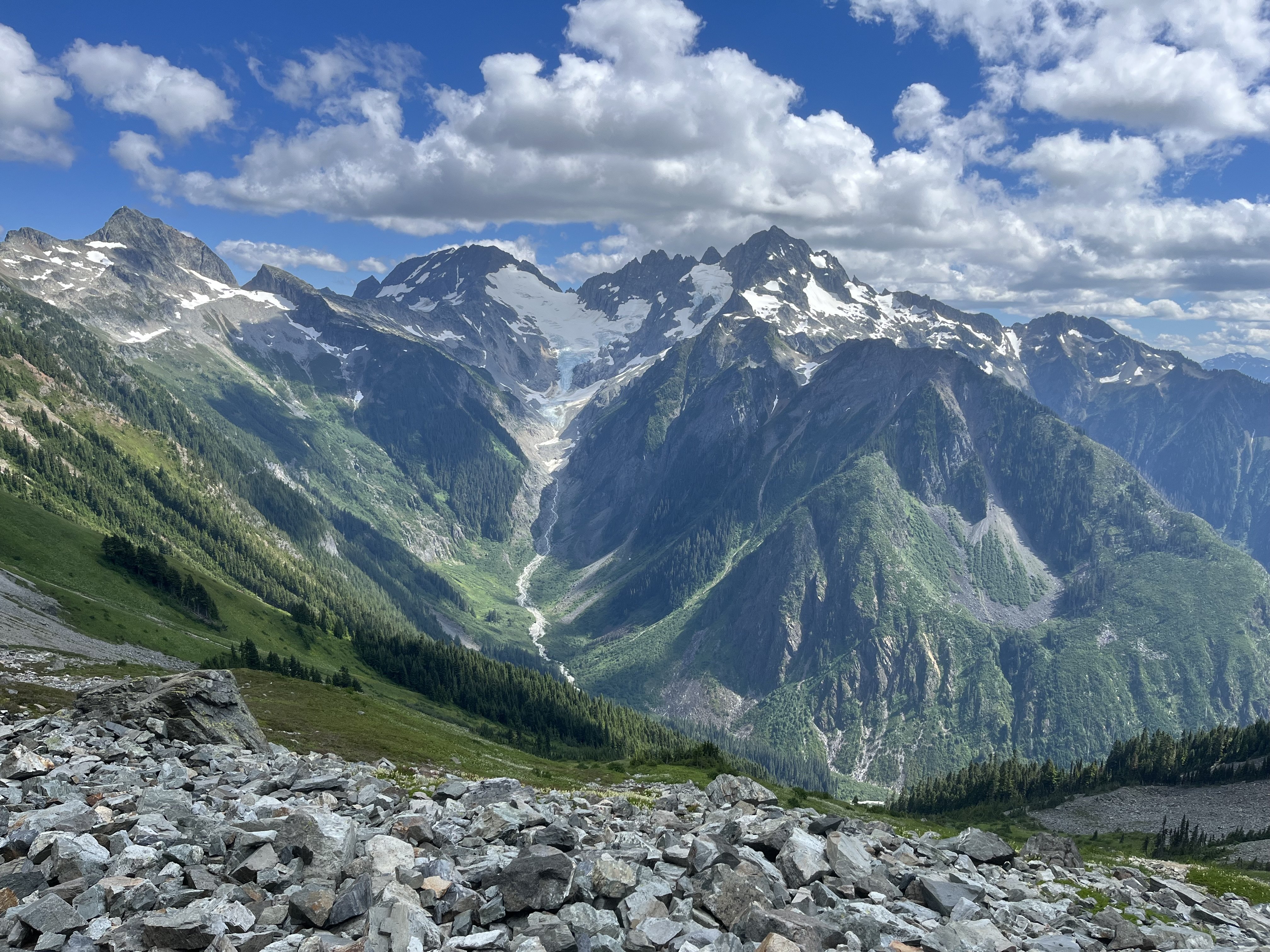
Trip: Eldorado zone tour, with EMS - South and west ridges of Eldorado, SW face of Early Morning Spire Trip Date: 08/08/2025 Trip Report: Got to do some routes in the Eldorado neighborhood from a base camp last weekend. This was another trip I’ve been meaning to do for a long time where the pieces finally fell into place. Climbed with Ben who has learned quickly in the three years since he started climbing. Solid partner, his only real error was leaving glasses back at the car. On the first day this was mitigated with some tmnt Inuit tech. Cowabunga! Luckily at camp there was a climber who elected to stay there while his guided team climbed the E ridge. Heard the guide had extra shades and we arranged to borrow them for the weekend. Sky harp We set off for the south ridge. I love knife edges so found the route just barely in the worth doing once category. If you don’t particularly enjoy knife edges there’s no reason to do this climb. Unincorporated choss county Some fun atmospherics helped make it somewhat enjoyable despite some of the worst quality rock I’ve climbed. We counted it as good mental prep for W arete the next day. At the end of our three hour tour camp to camp we arrived to find the guide-lended glasses waiting for us. Most of the rock climbing in the next two days was in the shade, but this was still quite the score. Got up early the next day for the W arete and kind of raced another party departing camp right after us. There turned out to be a third party on the route that day too (!) Below Dorado Needle col we saw tracks through a snow bench above and left of the tarn, and followed these around to slabs near the sit start of the route. We misjudged the heathery path from below. What looked fine turned out to be dirty, crumbly, overly narrow and exposed, with mostly down sloping rock and dirt. This was a bit of a traverse coming from the NW to the ridge around 6700-6800’. Not at all recommended, there must be a better way, maybe more directly from the west? The other two parties took the considerably higher entrance from snow that bypasses all the green stuff, which seems more appealing in retrospect, though it looks like it has a bit of hazard too (steep, bad runouts). We were glad to be in front. There was one particularly thunderous episode of rock fall accompanied by muffled shouts and we were relieved to eventually see all 5 climbers back at camp that evening. After pulling through some legitimately scary terrain we soloed up briefly sound rock before it got questionable again. Then we started to simul. I think two blocks got us into the gendarmes. We had climbed up a chimney to a piton, but it didn’t look anything like photos of the crux traverse. After some confusion we saw another piton down below and realized we were above that crux. We rapped past it. It looks exciting, kinda wish we climbed it. Unintentionally mimicking the rocks’ posture From there two more blocks got us past the snow into lower angle terrain where we unroped. I found mostly pretty good stuff to the summit. The path of least resistance isn’t always the best path. It was so early I proposed heading back down for the SW buttress of Dorado Needle but we elected to rest up for EMS instead. With the south ridge the day before, the west arete completed the Eldorado compass for me (north and of course east ridges climbed before). South ridge! meh I enjoyed solitude on the summit for a while and left as a large group of sunburned youth neared the top. The hours drifted lazily by. We chatted with various day trippers throughout the afternoon. Next morning another early start had us retracing our steps to Dorado col. Celestial choss, earthly choss This time we passed by the tarn and its outlet stream. One slope looked inviting but it cliffed out on the other side. Proceeding lower we found a nice path through trees to cross the ridge with friendly heather downclimbing. EMS presents quite the striking mien all along the approach. We met someone at camp the night before who had his own route beta for EMS which he shared with us. Compared to Nelson’s it had a direct start, and above that, more of a diversion to the right and back left, rather than straight up. Both of these variations turned out to be good calls. The start was a little tricky in terms of climbing and pro. First piece The climbing quickly got to be really fun. After about 70m I took the lead. After scoping a more direct line I tried the shallow right facing corner diversion to the right, and was pretty delighted with this section. I think this wide low angle splitter was in this pitch. I stopped about 70m later just below the ledge below the crux roof. Ben took over again and dispatched the slightly wet moves and drifted out of sight. This pitch ended up maybe 80m with a little simuling to the slab under to the roof. As I followed pitch 3 the rope hung over some excellent mid 5th friction slabs, where Ben had fortunately not placed pro. I took these optional sections (easier ledges around) to make the pitch even better (out of frame right of this photo). Pitch 4 was another rope stretcher with quality stone and low-mid 5th climbing. Ben took off again and neared the ridge crest. He selected a scruffy 5.10 chimney to get us to the slab and stopped there. I got to lead the finger traverse above this slab, another route highlight. I crossed the crest and continued up it, placing hardly anything, mostly focused on keeping the trailing rope from crossing the abundant choss that now sadly replaced the excellent rock. A seventh rope stretcher got us near to the summit ridge. We did one more short pitch that turned out to be unnecessary, should have unroped after 7. Tempered expectations may have been a factor, but we reveled in how good this route turned out to be. It’s not Stuart range classic quality but I think it’s up there with some three-four star WA pass routes, with an obviously much more engaging approach and return than you can find there. Our descent began with sandy goat ledges on the south side of the ridge. When this cliffed out we crossed back north. It was very exposed here with a deep moat below, but with bomber easy staircase rock leading down. There was one low 5th body length, an awkward long step and then we were at the moat. The gap was significant but absolutely doable. Still got high dive butterflies before finally making the leap. When Ben’s turn came he sprang from both feet, launching far beyond the gap and came skating into me lol. The hypothetical descent to the south had looked atrocious during the approach, and there is at least one epic going that way documented here on cc. We instead followed the advice to climb snow to the choss saddle north of marble peak. At the crest we saw rather steep snow to the east, so followed the snow up and south to get a look around. This passed so close to the summit we thought we might as well tag it. Took rock down here to bypass the steep snow. I scouted south while Ben scouted north. We never found existing anchors, so when a good crack on the north end below the steep snow presented itself we set an anchor and rapped down. 70m easily made it, might have been 25m or so. Next we crossed the McAllister, almost exactly matching my track from 3 years ago (snow levels early August this year look even lower than early September 2022). Having decided to skip our last night out, we zipped over to camp where we packed up, ate dinner, and quickly hiked down, getting past the boulders and close to the bottom before pulling the head lamps out. The dip in the creek at the end was extremely necessary and welcome in a dumbfounding sort of way. Gear Notes: Doubles 0.3 to 1, single 2 and 3. Some C3s and nuts. Ax and crampons. 70m rope. Radios were very useful for our long pitch strategy on EMS. Approach Notes: Counter clockwise
-
[TR] Johannesburg mountain - Northeast buttress ‘51 rib 07/26/2025
JonParker replied to A=A's topic in North Cascades
Wow, sounds like you had time for a second lap that day! -
PM’d
-
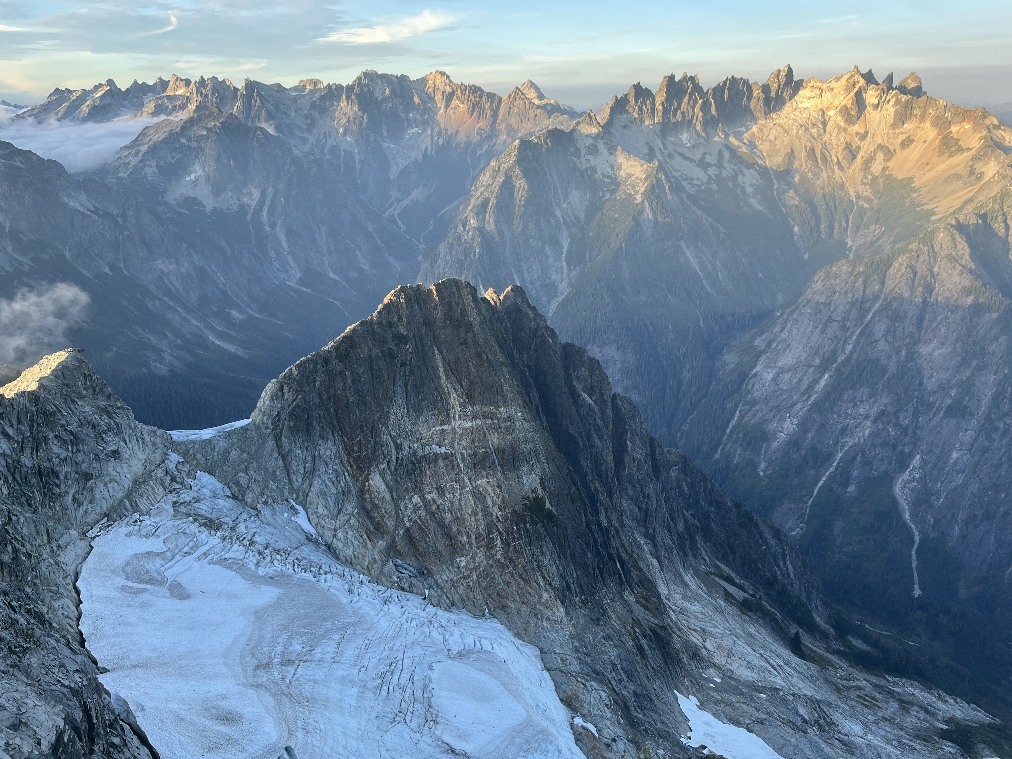
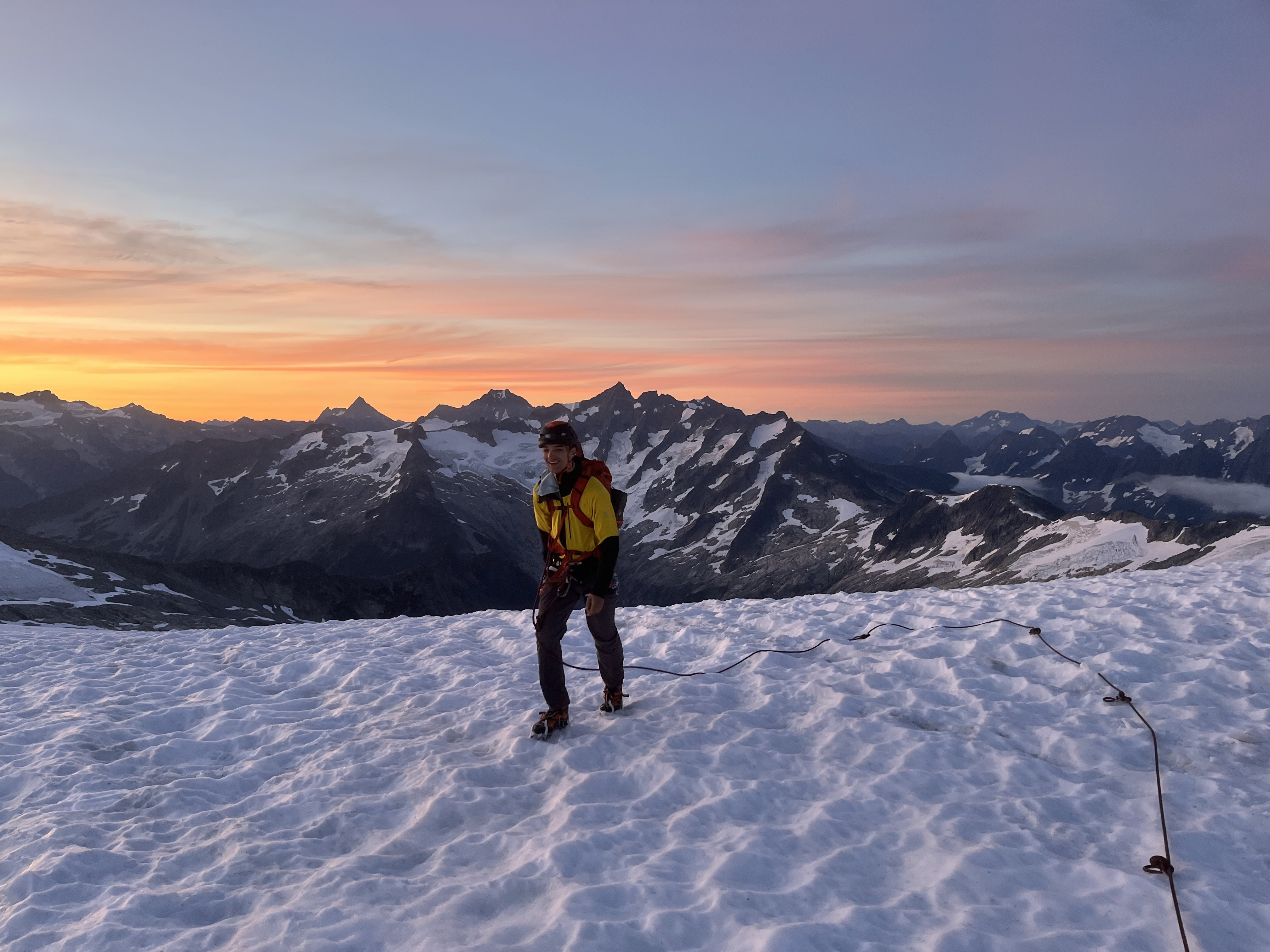
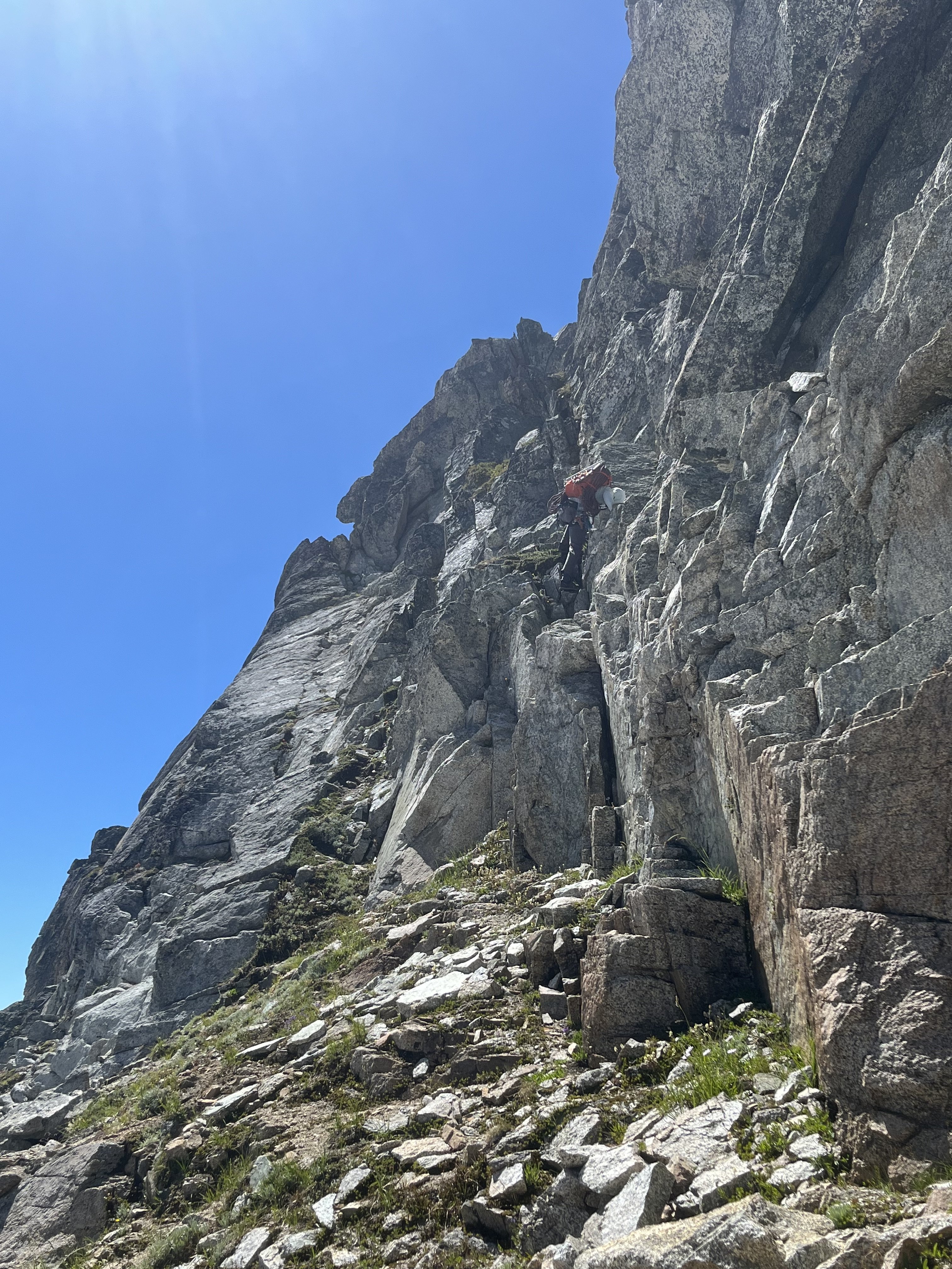
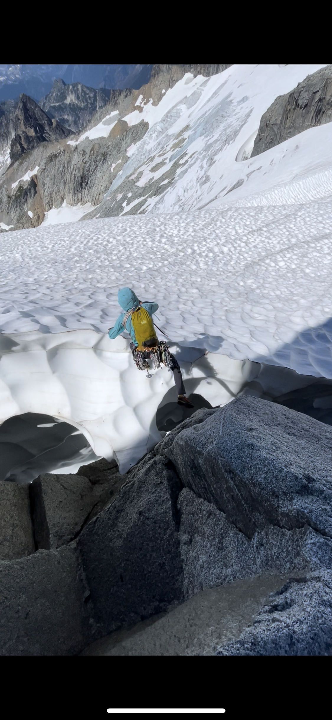
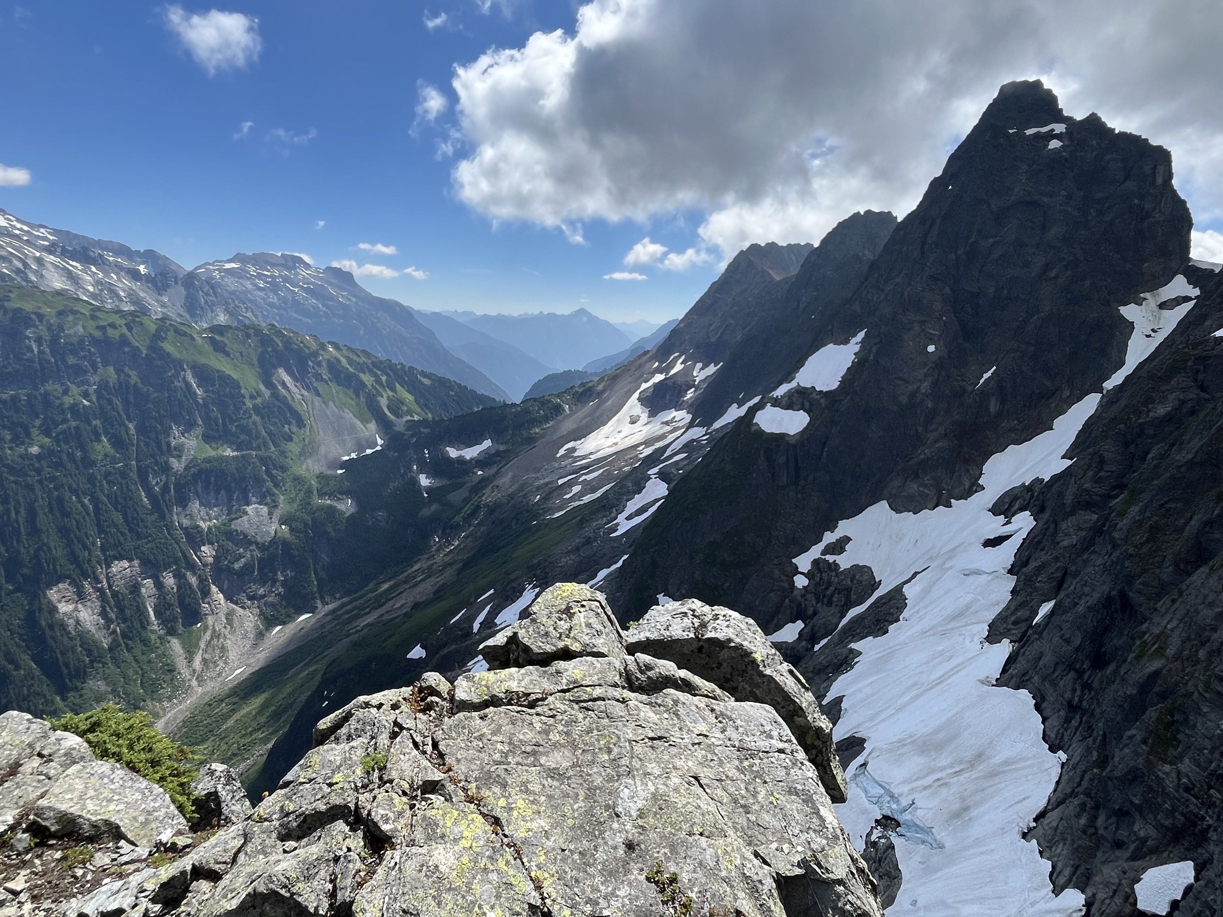
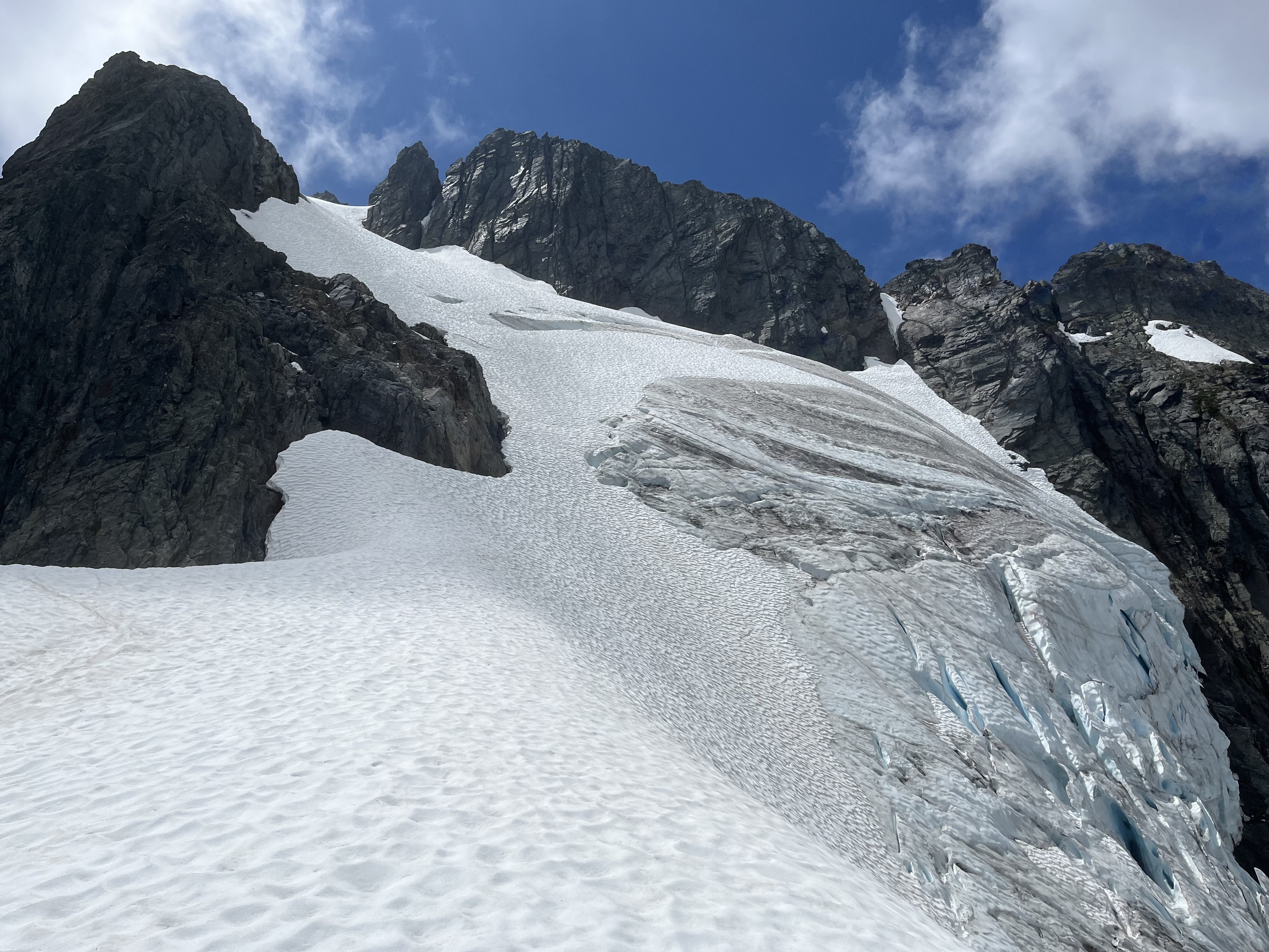
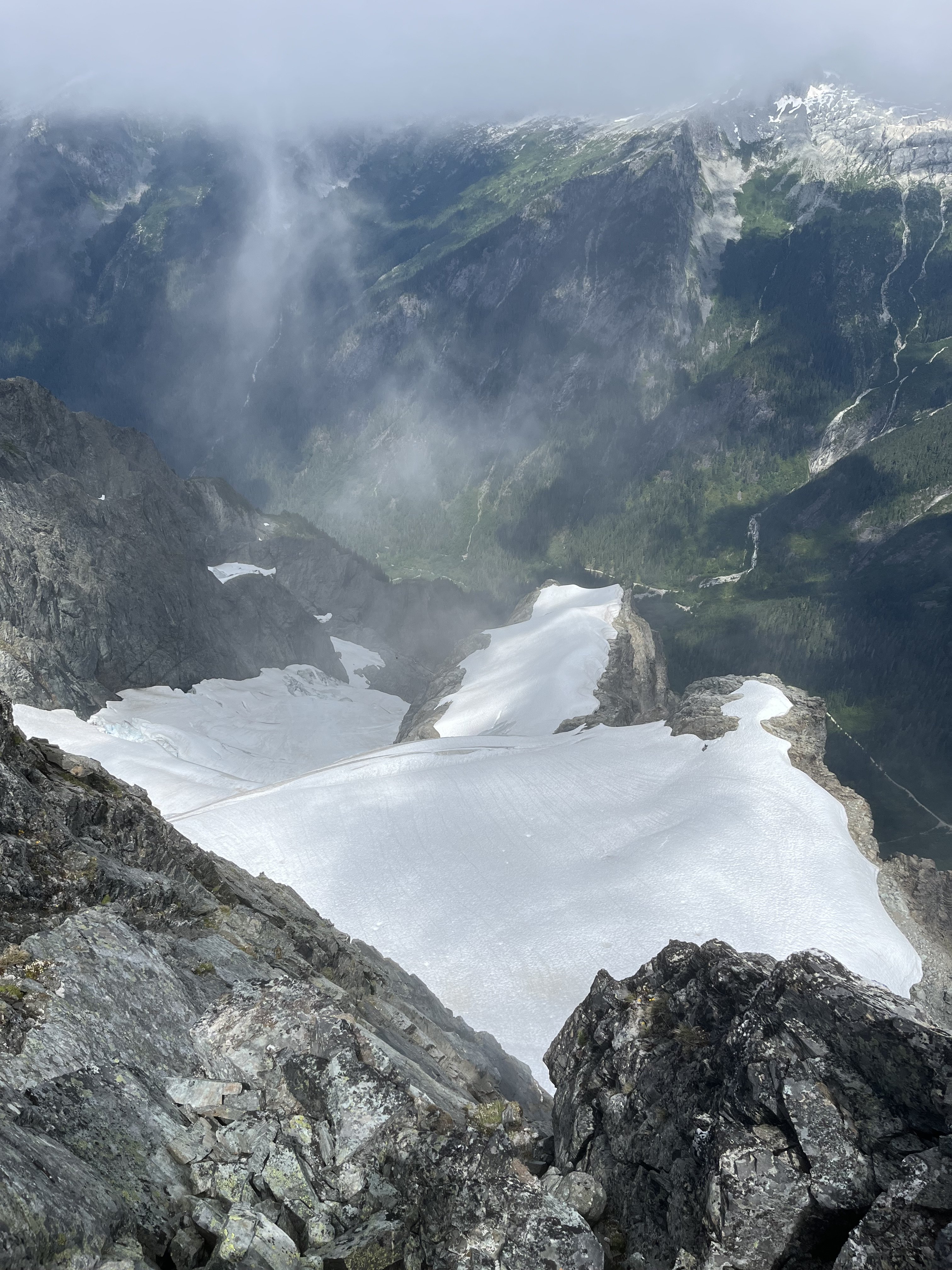
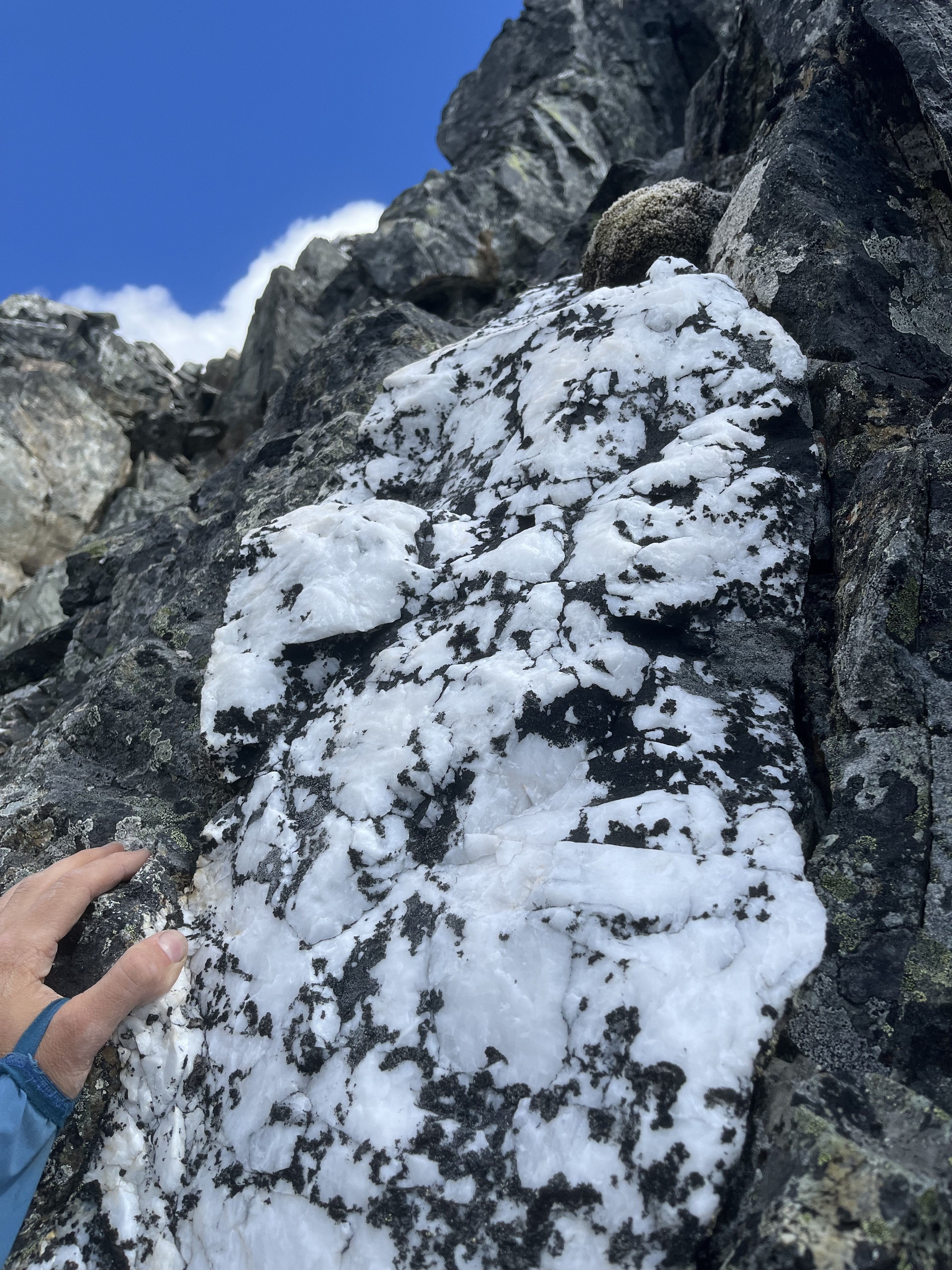
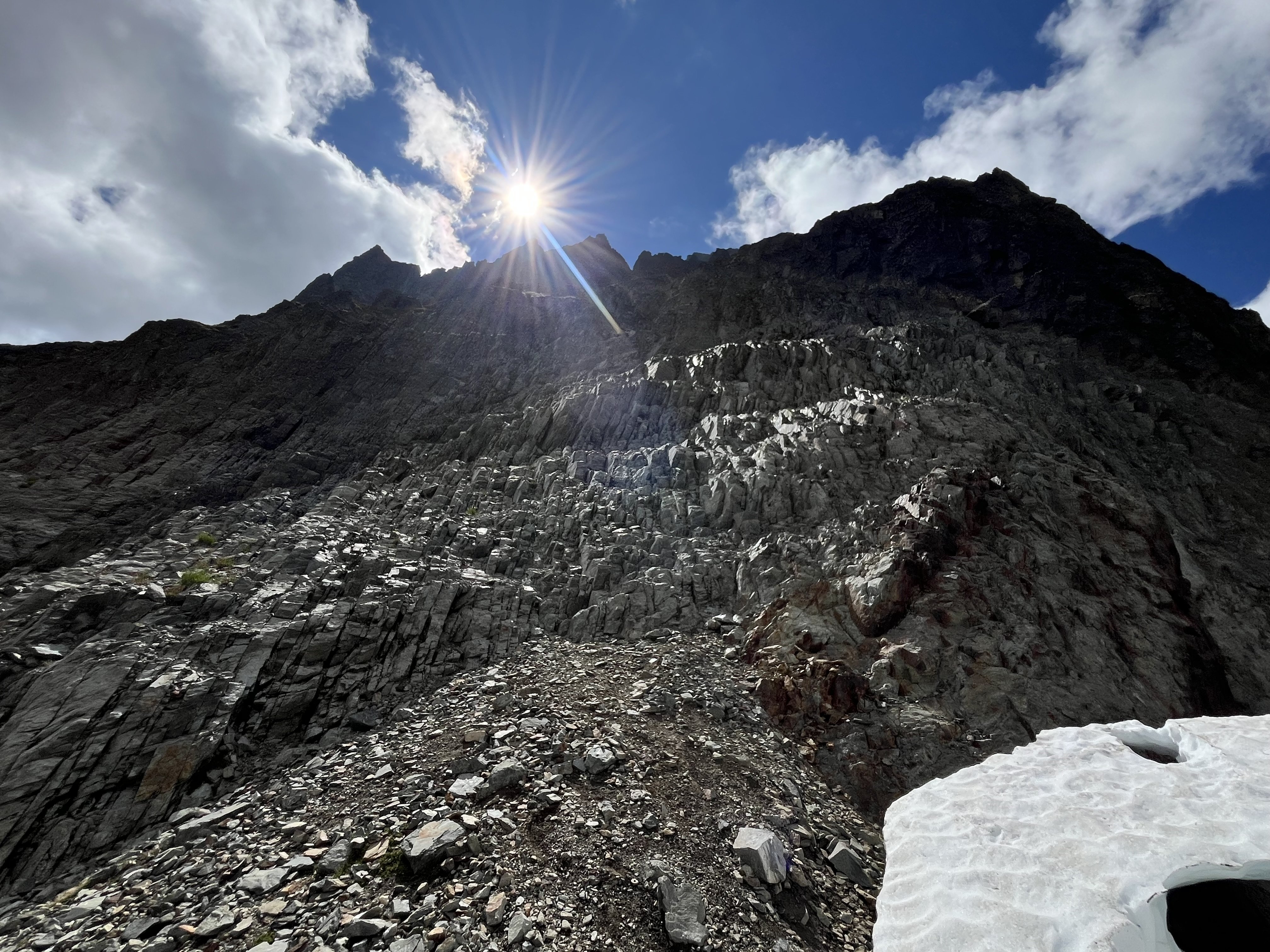
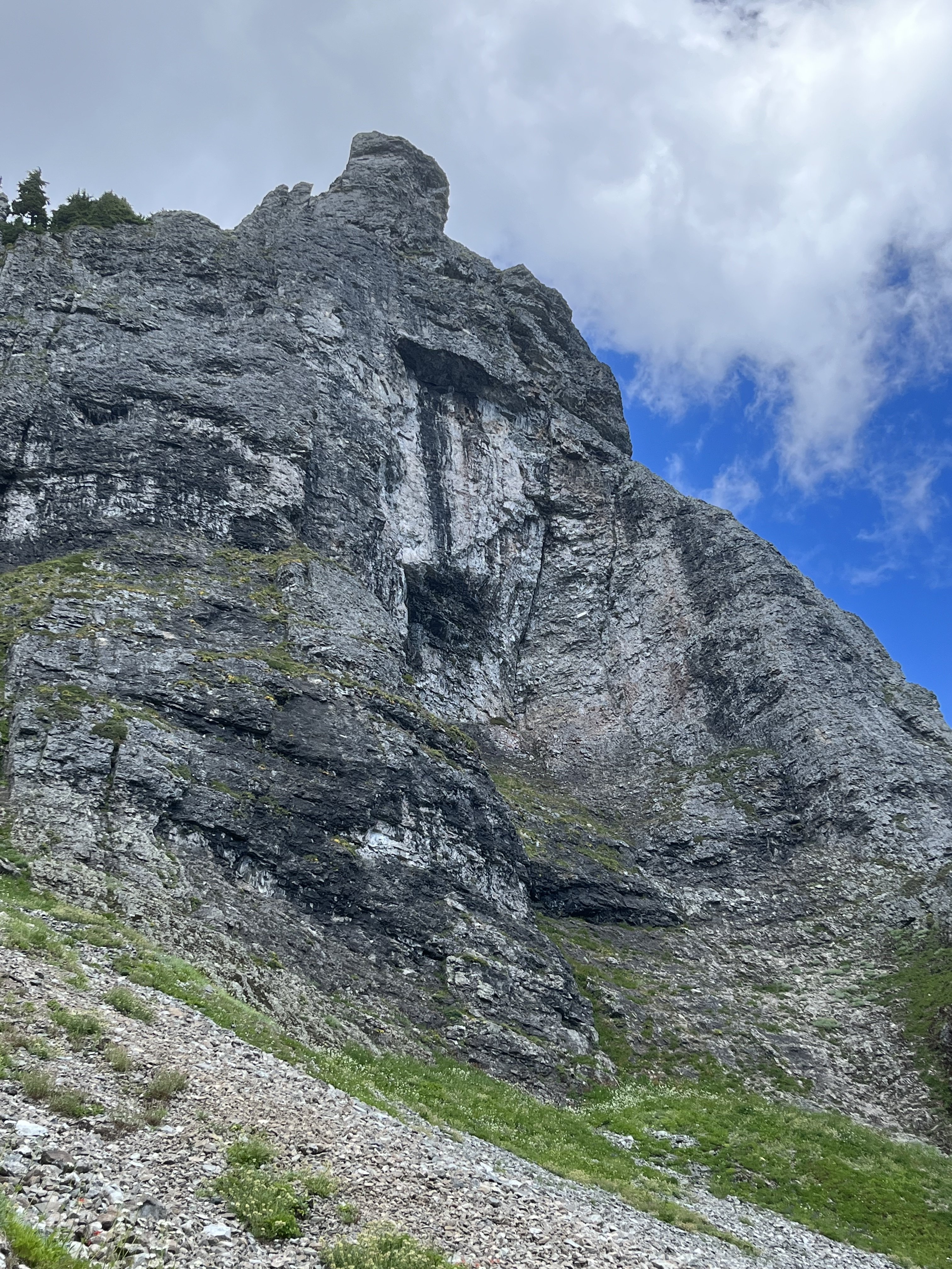
Trip: Johannesburg - NE Rib Trip Date: 07/24/2025 Trip Report: Another Johannesburg NE rib trip report is something the world likely doesn’t need but I’m in a bit of beta happy mood lately. Certain kinds of climbers might find the endless scrambling pretty enjoyable. And with perfect route finding the route doesn’t have to be especially sketchy, though as I found, navigation errors might be punished severely. The steep dirt embankment right off the road is a heads up rude awakening that foreshadows what lies ahead. And for such a short approach the bushwhacking is not insignificant. Steph Abegg has a good photo of the start of the route but the snow fan cuts off the very bottom of the slab and the elevation is wrong. You gain the rock more like 4100’. This confused me back in early June when I came to try the route. I got spooked off the slabs at the start. Thinking I may have missed something due to the “4400’” annotation, I climbed snow higher, but found only sheer cliffs above. On my way back down I saw from Steph’s picture that I had been in the right place after all but it turned out to just be really hard instead of easy class 4. During my second attempt I began by trying to follow blocky terrain on the left side of the slab. It started out good but when it came time to move right, a drip formed an impossibly slimy 10 foot wide barrier to passage. I retreated nearly back to the bottom and instead headed up to a right facing corner left of a roof with a wet slab below it. I went this way on my first attempt before bailing. It starts with a bit of lieback on a jug and a high reach to another jug, after which you can pull up to easier ground. Right after I took this photo my feet blew on slime. It’s a low angle stance, so fortunately I didn’t go far. Humbly I reapplied and was accepted on the second try. This short sequence felt like 5th class though as my fall demonstrated, maybe not exposed enough to count as true 5th. Though I’ve spent more than my fair share of time on that slab by now, I still have no idea where the path of least resistance is. Having failed to find the “easy class 4” I also failed to find the “sketchy 5th”. At the top of the slab next to the waterfall I found good solid rock and was on my way. Worse was yet to come in the jungle section. From the stream below I noticed some tall cedars and guessed that it wouldn’t be too crowded at their bases. This was true, I was able to move between them and the rock buttress without any real entanglement (18L pack with ax and tool covered in socks and just barely stuffed inside). However I was getting further and further west and not gaining enough elevation. Finally I saw something I was hoping to find, a steep, rocky and mostly dry bed. But guarding access was minor cliff band maybe 15’ tall. Overly committed, I explored three fairly terrifying options at 5.forest and managed to get through, relying far more on good fortune than I’d like. The episode left a bitter taste on an otherwise umami day. I definitely prefer my climbs not avoidably harrowing. Above that section I tended to stay in or just to the right of the gully between the two ribs, with a wider diversion to the right just above the last major snowfield. Where the vegetation finally gives way to solid, polished rock beginning around 6K’ was the highlight of the route for me, both because this was the best quality rock for the day, and because of the sense of relief for escaping what was just below. At about 6450’ I found a promontory with a great view of the northeast face. Beyond this point the rock quality declined some (but not terrible) and the route complexity increased. I saw that I needed to move diagonally up and right to get to where the snow was on my map. I found reasonable ramps and ledges cut with interesting quartz bands. There was one more section of minor drama with steep, exposed choss to get around the corner. Then I could see the snow and ice spilling down from Johannesburg’s north face. I gained the snow at 7200’, maybe missing the famous bivy, though I noticed one small one at 7000’ with good but not panoramic views. The snow arete was AWOL. My guess is the high heat has melted it down to a boring broad shape. Passage on the left was a little narrow but in good shape. There were no real difficulties with shrunds and crevasses and no mandatory hard ice. At the upper face especially the snow was steep enough that I was glad to have sharp things on each limb. Unlike my first time here, I couldn’t locate the summit register. Before long I began the descent to the east. It was helpful to have been up and down this way before. I had forgotten how much griffin shit is in this zone. I seemed to take a long time descending. Probably I was mentally fatigued from all the no fall terrain. It was a lovely afternoon as I traversed the basin over to the ridge off of Mixup, pierced with many marmot cries dying off with slow haunting decay. Industrious workers of the underworld, unite! More mental fatigue descending the slabs coming down from that notch, then a long overdue water break below the snow (though somehow I didn’t get dehydrated despite running out shortly after the summit). Pretty straightforward and gratuitously beautiful from there back to the trailhead. It took me slightly less time than going up and down Doug’s direct had, a little under 15 hours. I think I lost at least an hour with the slab and forest cliff navigation fiascos. Many reports say this climb is best done once. I think that’s not untrue but if you really like scrambling this could be a good one, because the scrambling goes on and on hypnotically. That said, it’s a slippery one. Gear Notes: Approach shoes, steel strap-on crampons, one tool, one light ax. Approach Notes: Last hair pin before the Cascade pass trailhead. Don’t fall down the very steep hard dirt.
- 1 reply
-
- 7
-

-

-

-
Love it! And really, the entire report top to bottom. I took two different ways to get back and forth over the Challenger E-W ridge line. The further east one was definitely harder. I think the west one is Solar pass, and wasn’t technical.
-
It’s a matter of personal preference. Chikamin is big and deep, there are some house swallowers there. But I think you’ll find 2 person parties are not rare.
