

LukeShy
-
Posts
74 -
Joined
-
Last visited
Content Type
Profiles
Forums
Events
Posts posted by LukeShy
-
-
Awesome work you two!

Excellent write up and I love you got a photosphere on the summit!!!

 (I got the West Buttress route photosphered, just had to go back for the summit!)
-
 1
1
-
-
I found some gear around the great northern slab area Sunday June 28th.
Message me with details of what you lost.
-
Yes, it was a long day. After going in last year(only go Dome), we knew the best way up Downey Creek, made good time there. After dropping camping gear at Cub Lake we headed to the col and Sinister summit. 16 hr from TH, Sinister summit, and Cub Lake camp round trip.
-
Nice work on climbing Dome, it certainly is a haul in there!
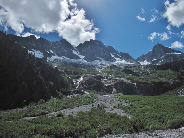
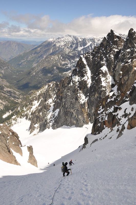
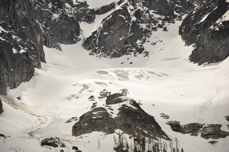
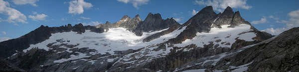
Here's what the schrund looks like to get on the Chickamin Glacier as of June 6th. To the left and right sides were wide open and required a big jump to cross. I heard a team went in the weekend after to climb Sinister as well and went the same way across the schrund.
[img:left]https://farm4.staticflickr.com/3938/18293459263_33dccc067d_b.jpg[/img]
-
Congrats on finishing the Top 100 Tim!
Great photos from the trip, that's a really beautiful area.
-
Definitely mountaineering boots only. Many ledges to stand on between 5th class moves the entire route.
I'll have to add snafflehound to my alpine vocabulary! (Gladly Nips is still alive and didn't die of a snafflehound born disease as we originally feared
 )
) -
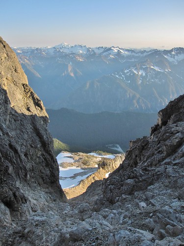
Trip: Mt. Goode / Storm King - NE Buttress / Standard Choss
Date: 7/26/2014
Trip Report:
Lots of beta out there on NEB and SK. So I'll stick to the pictures and current route conditions.
Hike in was uneventful 15 miles. Grizzly Creek required boots off crossing 3x times and the North Fork Bridge Creek was easily crossed at the first clearing. (other party out that day found a log to cross just upstream) Once across we climbed the slabs just right of the left-most waterfall and through the "magical alder tunnel" to the open meadows and bouldery slopes below the glacier to easily find 5,200' camp.
Looking up from the NF Creek Crossing
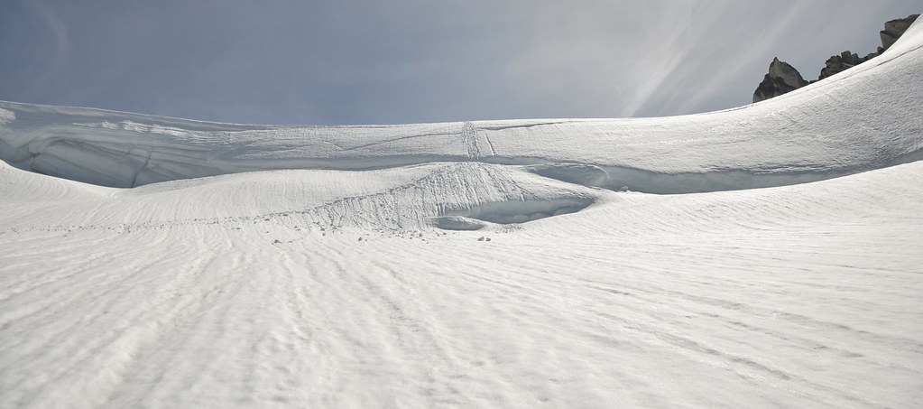
No glacier death blocks were heard falling all night so we were stoked that getting onto the glacier would be feasible.
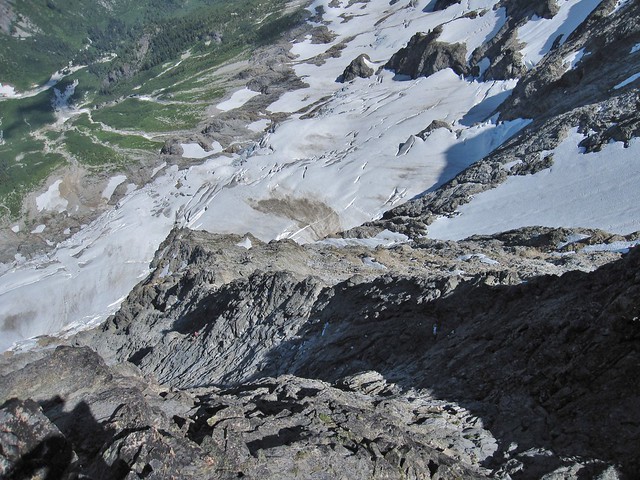
The next day we awoke at 4 AM, packed up, and headed up and left towards the 5,400' bivy. From that bivy we went straight up the slabs to the base of the glacier than did the rightward traverse below the hanging glacier quickly crossing to the snow ramp and safety.
Crossing the DANGER ZONE
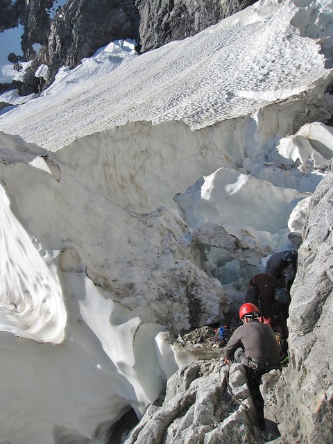
We roped up and did a big 'S' route to get above the crevasses, following a bootpack from the day before (thanks!) to get to the moat. Once there we found the awesome fatty snow ramp that lead right to the base of the route. No moat shenanigans were had.
Easy Moat Crossing via Snow Ramp
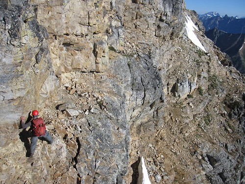
Matt and I headed out first, simuling up and towards the buttress crest. From there we swapped leads, I took over and headed us towards the class 3-4 portion. Our other team took a bit different way, trying to be more direct, it didn't work so we waited a while for them to catch up. Once they did we headed up class 3-4 terrains until the buttress steepened.
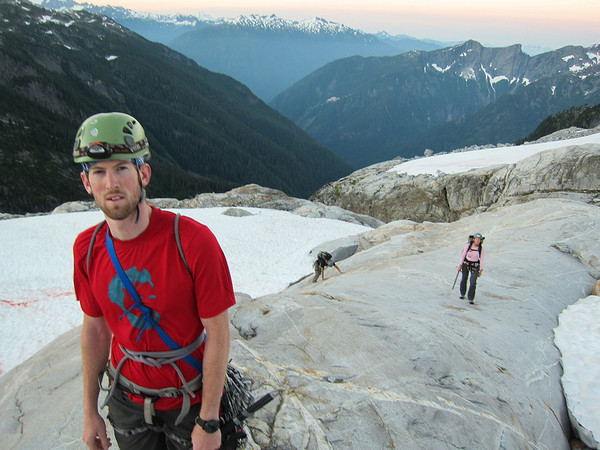
Matt climbing the lower NEB
From there we got back on the crest (clipped an old Beckey piton!) climbed, manteled, climbed, manteled, etc. until we got close to the big bivy ledge (2 simul leads). I traversed up and right into the gully below the ledge to access it. We took a break there allowing our partners to catch up a bit.
Dustin and Nips on route (taken from big bivy ledge)
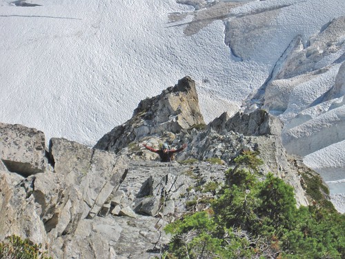
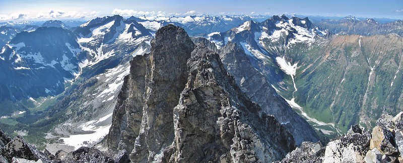
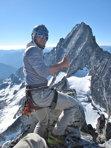
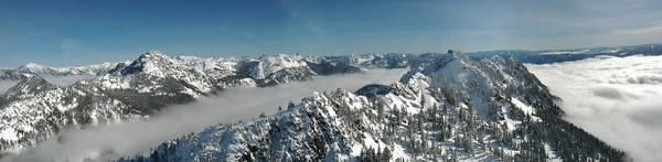
From there it was another couple mid 5th simul pitches to the summit. It felt great to finally get to the top after a ton of climbing. We waited for our other team, snacked, signed the register and enjoyed the amazing weather and views.
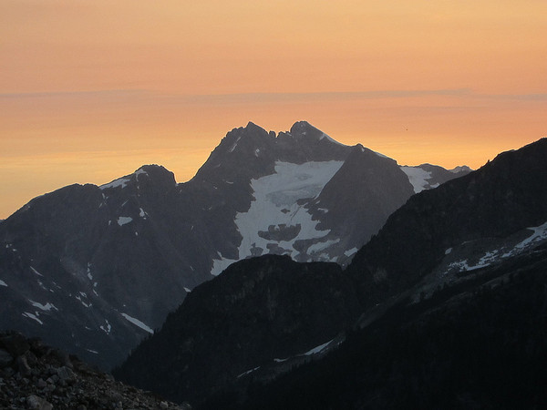
Summit Views
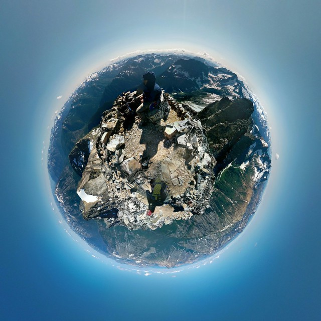
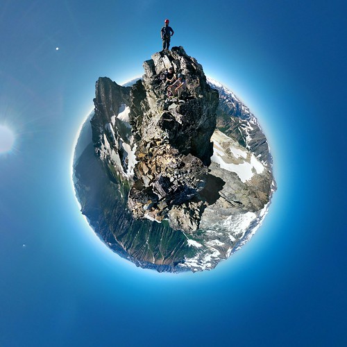
Mt. Goode Summit Tiny Planet and Summit Photosphere
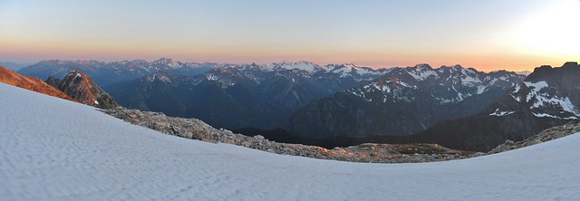
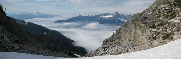
The decent was fairly simple. 2 raps got us to the black tooth notch ledge traverse. Than 2 more down the SW couloir to infinite class 3 choss. It was nearly 8:30 PM by the time we got to great bench at 7,700'. We quickly made dinner, fed faces, and than passed out (after fighting off the rats, apparently they have a taste for human flesh) to get up early to climb Storm King.
SW Couloir Descent - Views very nice! Choss not so much...
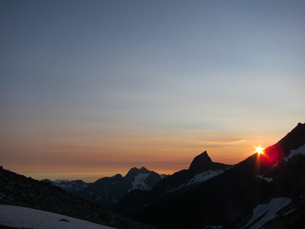
Sunset Pano (Camp was down at the heather bench)
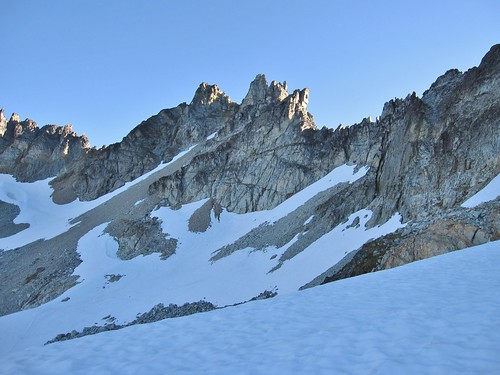
We woke up early and were out by 5:45am heading towards SK along the 7400' traverse. The snow hardened up so we put on 'pons and cruised to the base. We climbed the far right gully to get to the north side and than began the exposed traverse to get to the final scramble.
Storm King-landia Basin
SK Ledge Traverse - we set up a fixed line for the actual 'duck down' move
Dustin - Maximum Stoke
Storm King Tiny Planet and Photosphere
One rap, exposed traverse, down climbed the gully, and the simple backtrack along the ~7400' traverse got us to the base of Goode. WE than headed down the meadows below to find the climbers trail on the right side of the creek. It was 1 PM when we hit the trail, maximum heat, so we began our slog out. It was warm and uneventful until we were almost back to N Fork Camp where we found 2 bears feeding their faces full of blueberries giving 0 craps about us no matter how much noise we made. They finally wondered off the trail and we quickly moved on and hiked to the junction at N Fork Trail where we'd stashed trail shoes. Sadly my bag hanging in a tree was stolen/taken/eaten (WTF!), but Matt's shoes were OK so after a little break we hiked the remaining 10 miles out getting to the TH at 9:30 PM.
Bear feeding face
Nipples is tired of hiking
Amazing trip climbing a classic route (and a choss pile) with some great friends. It was an awesome way to spend my birthday weekend.
Gear Notes:
Alpine Rack
60m rope - worth it for raps (we shortened to 35m to simul)
rock shoes not required - mountaineering boots only for few intermittent 5th class moves.
Approach Notes:
Long hike in via Bridge Creek TH, 4 creek crossings, find the "magic alder tunnel", bivy sites at 5200' or 5400'.
Long hike out via Park Creek Trail to Bridge Creek TH, 18+ mile slog on good trail.
-
Thanks for posting the photos of the fun ice section! Glad you guys had fun too.
I ended up at Muir around 7 pm - a rad way to finish out a day of climbing!
-
Thanks you for the work on this, its great to see all the forecast in one place to see where to chase the sun!
For those looking for an immediate mobile solution to look at NOAA forecasts try Unofficial NOAA for Android.
It pulls the daily forecast, hourly data, discussion, and radar (not the best, but it works) into a fairly easy interface.
You can save any location you select on the map so you can pick anywhere for a localized forecast.
Demo video from the Google Play page:
[video:youtube]https://www.youtube.com/watch?v=qH1ZNIQGIr4
I'm unsure what apps are available for iPhone, I'm sure there's got to be a similar app.
-
I have a used 80 cm BD Raven in decent shape that I could offload. PM me if you're interested.
-
Nice work getting it done as a day climb!
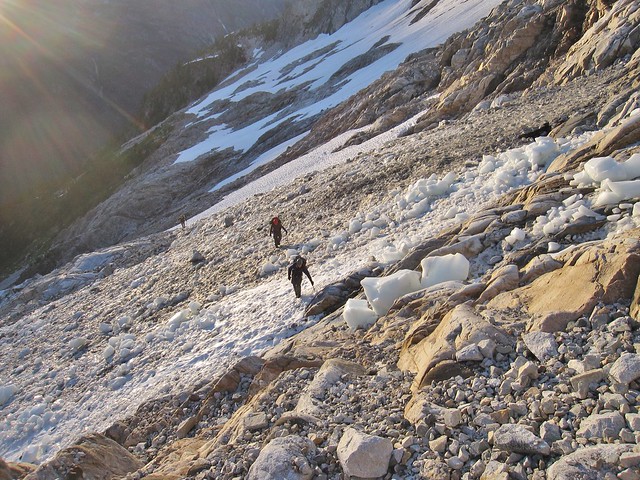
I climbed the Ice Cliff Glacier this past Sunday (Sorry - no time for a TR) and can update on conditions of the Sherpa.
Full of snow and the schrund crossing is mostly filled in.
We crossed on skiers far left as we descended the Sherpa. (RH side of photo)
-
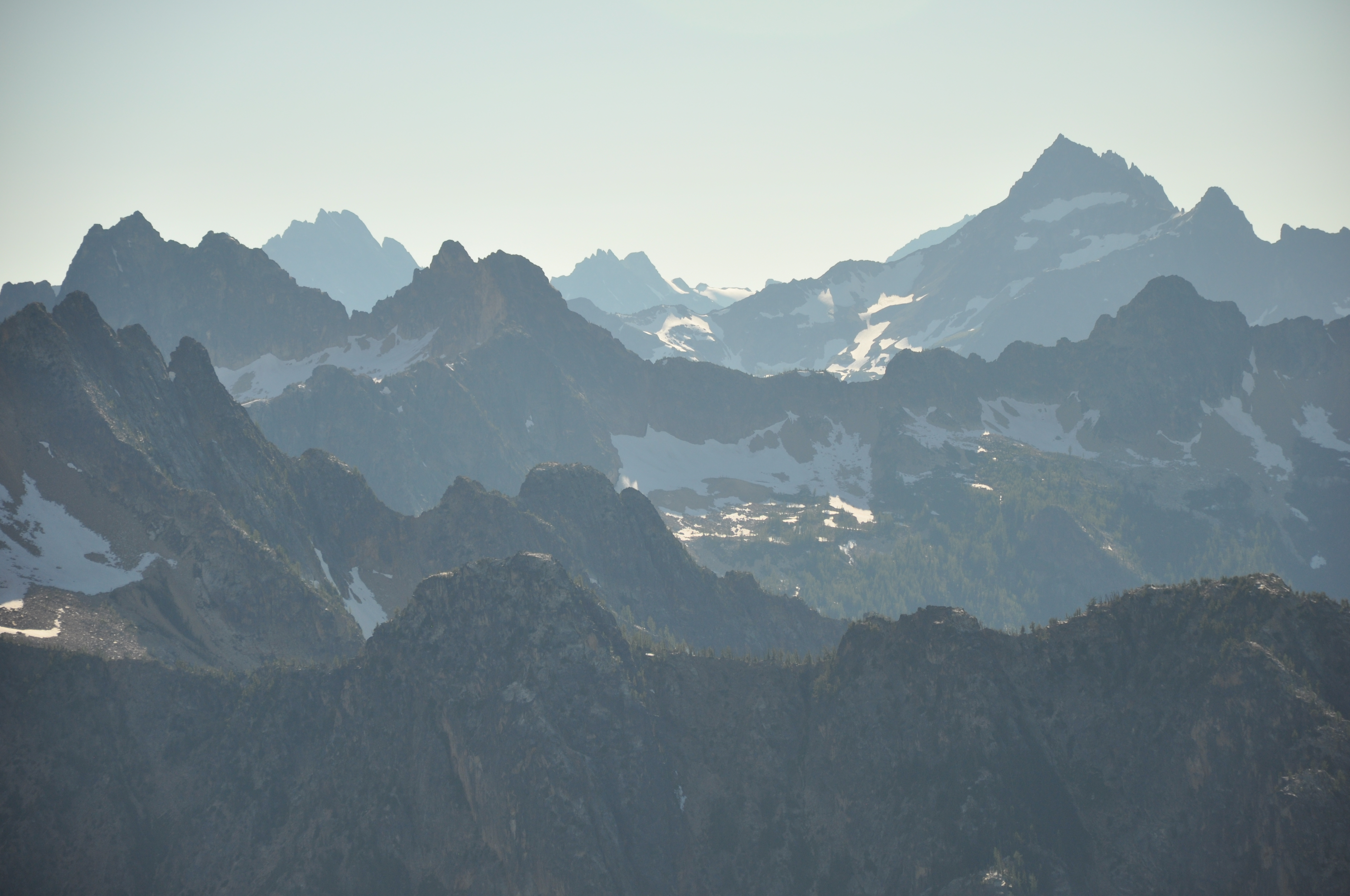
Great photos JasonG! It's amazing to see so much snow up on the Wine Spires.
-
Awesome trip with you Matt! Great TR. Next time we gotta go in with some skis.
The sunset was really amazing
[img:center]http://farm9.staticflickr.com/8265/8608096275_58c76f411c_b.jpg[/img]
Matt working the summit block rime
[img:center]http://farm9.staticflickr.com/8101/8609215586_f0bd335f08_z.jpg[/img]
-
Climbing up to my partner (the dead tree on the right)
That's not a very nice thing to call your partner.
Well... that comment is up to the readers interpretation.

-
Trip: The Tooth - South Face
Date: 2/10/2013
Trip Report:
After getting ourselves in prime climbing condition on Saturday (Long a$$ Rock Mtn. Ski tour for myself and partying at Alpental for my partner) we set off for Pineapple Pass around 8am.
The cat track/trail was nice solid hard pack, which made for some fast travel to Source Lake. The early morning bluebird sky and views of peaks around were a welcome sight as we were hoping some of the route would be melted out to climb.
Source Lake
The snow got soft beyond the lake so we put on the slow-shoes from there and headed up, trying to stay on old ski/board tracks for extra flotation. We made the upper basin in no time and followed the steep boot pack up the gully just right of Pineapple Pass. Thanks to whoever chopped the cornice back at the top.
heading up to the notch
From there we geared up and traversed over to the start of the route, which was looking in good shape.
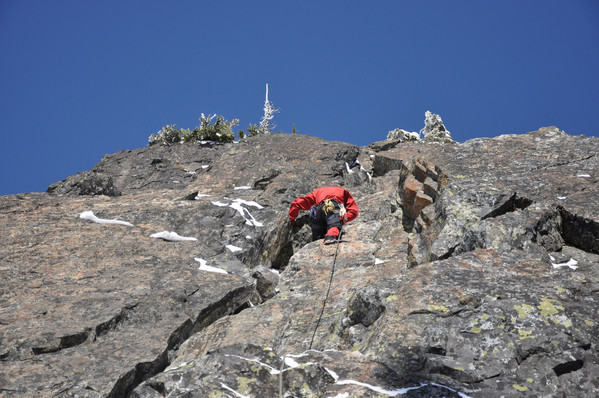
leading first pitch
My partner lead out on the first pitch, working his magic to find the holds buried under the snow. Since neither of us had climbed Das Tooth prior, He ended up climbing past the dead tree stretching the standard P1 and P2 into a perfect 60m go.
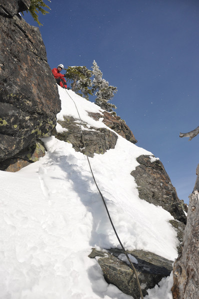
Climbing up to my partner (the dead tree on the right)
I quickly followed behind, realized that some moves were a bit more spicy in the nice snowy/icy/wet conditions, a fine lead from my partner!
I lead the next pitch. Once again combo-ing the standard P3 and P4 into a 60m mixed snow and rock climb to the summit. There were 2 snow patches, one fun exposed snow traverse and plenty of trees and fixed gear to the top. (tragically no booty was acquired.) I used my ice tool a few times, but was mostly nice to have for the snow traverse.
My lead - snow, rock, snow, fixed gear, than rock
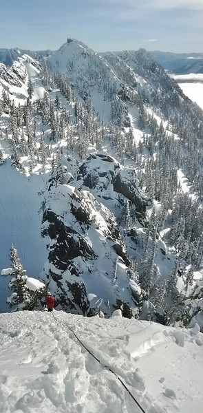
first snow bit
We were unsure of the true summits condition so I belayed out my partner to the top, better safe than sorry.
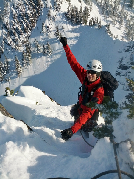
Summit Stoke
We swapped places, I tagged the summit than we began our decent.
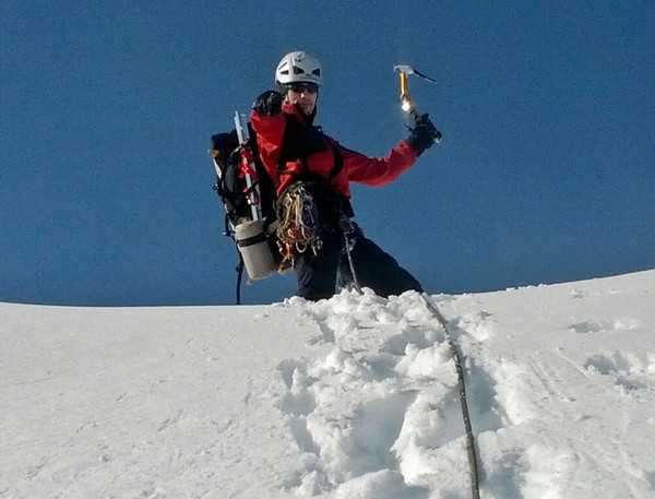
More Stoke
Getting down consisted of “find an exposed tree and dig to the bottom cause you know there’s a sling and at least 3 rap rings on it”. We ended up doing 5 raps, simply because we were uncertain of where all the standard stations were located. No new trees were slinged or rap rings added.
Hike out was uneventful, just wish I’d had my skis, there was still plenty of nice pow to ski.
It was a great winter climb, can’t wait for the next one!
Clouds rolling in from the West
Gear Notes:
Tools and a small alpine rack. Rap rings unnecessary.
Approach Notes:
Means of flotation is nice.
-
I'm the head instructor, please feel free to PM me if you have any questions.
-
Thanks for the TR, looked fun. Yodelin was very nice last Sunday too, coverage was good in the trees.
Ya the parking situation would be good to know. Looking to head up there soon.
-
-
Thanks! Ya the students passed!
Congratulations Brandon and Cody!

-
Trip: Inspiration Peak - East Ridge
Date: 8/18/2012
Trip Report:
Short Version: We climbed the East Ridge of Inspiration Peak in 18 hours camp to camp. Starting off with a simul-climb from the glacier to the ridge, then we pitched out the rest of the climb. We brought one pack per team with the follower carrying the heavy loads/pack hauling on harder pitches. Descent was via the west ridge in 3 double rope rappels, followed by 4 more down the south face.
Detailed Version: This was Brandon and Cody’s BOEALPS ICC grad climb, where they were responsible for all of the logistics and planning for the climb. Lindsey and I were the instructors that they ‘convinced’ to come along to the magical Picket Range.
We started out Friday morning from the very nice trail head just before the Upper Goodell Creek group campsite. The trail is in good shape and the creek crossings mere boulder hopping this late in the season. We arrived at the turn off 4 miles in and found the appropriate way to head uphill. Cody had some issues figuring it out but he eventually got it. He claims it was the heat that got him confused…
Now for the uphill super awesome fun climb! Up, up, up, and more up we went and luckily it wasn’t too hot in the forest as most of the climb is in the shade. Multiple breaks helped cool us down too. We broke out of the main steep part at about 4800’ and once at the main creek crossing (2nd one you’ll pass) we found, after a bit of searching, that the trail goes up the creek bed for a while. Don’t follow the trails directly across the creek, just follow the cairns up and the trail will appear on the left side of the creek.
Approach views
We continued on the trail as it continued up and headed for the 6245’ saddle. Once we arrived we saw the north side was a steep snow slope that surprisingly required crampons to get down.
Steep snow to camp
View from camp
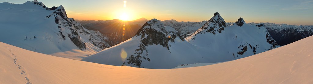
We arrived at camp at 3:30 PM, set up or tents, chilled out/napped, than ate some well deserved dinner. As we scouted the approach and glacier route and discussed what our plan was for the morning we were treated to an amazing sunset over the Pickets. 8:45 PM bed time for the big day ahead of us.
3:30 AM came too early but we were all amped to go and rolled out of camp by 4:20 AM. We made our way down the broad ledges that took us to the outlet gully of the unnamed snow covered lake at ~5400’. We crossed over and worked our way up the slabs/snow to the Terror Glacier.
slabs
We’d picked a conservative line out the day before, hoping for a quicker line to appear once we got closer. Luckily we found one a solid ramp leading up towards the peak.
terror glacier approach
Once we got below the south face we could see the snow moats were huge, but there was a nice ramp that lead down to the start of the route. We picked the right of two green/dirty ramps to start some hot simul-climb action.
start of the route
workin' the moat like a BOSS!
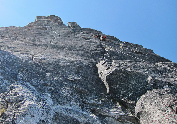
P0: (low 5th + short 5.7 moves) Brandon lead out and we simuled a similar route to what is shown in this picture from Steph Abegg's TR. There was little pro on the start and some loose stuff to contend with. Once we got higher, the route got a bit harder; unfortunately the rock quality stayed the same – loose. Careful climbing is advised for the whole way up. We kept climbing up the ridge left of the left most notch to the base of the 5.8 lieback pitch. I had the pack on following Brandon and with the boots, axes, water it was a bit more awkward. Cody and Lindsey did about the same route, just left our our line to avoid any rockfall.
P1: (5.8, 140’) I took this pitch and it was really fun! (Not awkward IMO) There were lots of great spots for gear, hand jams, and rest spots. The lieback flake part is easy if you’re tall – I stemmed/humped my way up it with style and grace up to the base of the steep wall where P2 starts. I was glad to not have the pack on for this pitch.
P2: (5.9, 110’) Money Pitch time! Brandon chose the right hand crack system and styled up to the top. A few big cams and a few delicate moves got him up in no time. There were a few loose blocks in the crack to contend with, just be ready for them. Cody took the left crack and confirmed its 5.9+/5.10 rating. He got some extra stoke mid pitch from the climbing teams cheering us on from the summit of West Mac, very cool!
Brandon gettin' after it
P3: (5.6, 100’) I lead out on this pitch which basically went up to the ridge crest from the belay and to some nice belay platforms in the shade, just below the false (east) summit.
P4: (5.7, 70’) Brandon lead this airy traverse around on the south side of the false summit and could have been extended out further. The more you go the more rope drag you probably get. Cody and Lindsey chose to go around on the north side and said it was similar in grade and they made their belay at a similar spot.
P5: (low 5th traverse, 200’) I lead out and walked down a ramp on the north side of the ride. After which I traversed along until close to the final summit. We simul-climbed for about 20’ until I found a good boulder to anchor myself to and then belay Brandon in.
P6: (low 5th, 100’) Summit Time! I gave Brandon the final pitch (could have easily simuled to the top) and he lead out to the summit. Got some photos than I came up and headed over to the first rappel station about 50’ west of the true summit.
Lindsey on the summit
Summit Views
Descent: Steph Abegg's decent photo shows it best. We did 3 double rope rappels down to the west ridge. There is one shorter rappel station you can see from the summit, don’t use it, you can rappel to the next one down. From the end of the third full double rope rappel we found the start of the south face raps. The first one is nearly a free rappel and has got a bit of pucker factor to get going. From it, you can see the next rap station, rappelers right and is easy to get to. The third anchor is hidden from sight, but was easy to find. This is where we got messed up. Brandon went to rappelers left from the third rap anchor and found the next station but realized that there was a massive snow moat that was probably impassable. So Lindsey went next, and traversed rappelers right a bit more and found another anchor more towards the start of the south face route, it was a short rap down to it. She could even see a nice snow bridge to cross back onto the glacier, ding! Now we had to get Brandon, who was down at the other rap station back to where the three of us were. Luckily he wanted a bonus pitch to climb in boots and he still had the end of the rope so we belayed him up to us. The final rappel brought us to the big snow bridge and in no time we were headed back down the glacier.
It was 7:45 PM when we started down, which meant we didn’t get back down to the slabs till about dark, this took some time to navigate, but we figured it out. By the time we crossed the outlet gully, found the snow ramps, and headed back to camp it was 10:30 PM. Stoke was still high from such an amazing climb, so we ate dinner and Cody busted out a huge tube of cookie dough (win!) and we proceeded to feed our faces as we watched some distant flashes of lightning north of the pickets as we recalled the days adventure.
We awoke the next day and headed out of camp at 9:30 AM, but before we left we took some group photos and Cody just had to get in a quick snow boulder session.
Climb Stoke
Snow Bouldering Action!
Hike out was uneventful, got back to the car at 3:00 PM, and were cooling off in Goodell Creek by 3:30 PM, beer in hand. It was an amazing climb, with some awesome climbing partners!
Fri:
7:00 Marblemount for permits
8:30 leaving TH
3:30 got to camp
4:30 nap
6:30 dinner
8:45 bed
Sat:
3:30 wake up
4:20 moving
~8:30 base of route
9:00 started climbing
3:00 topped out
3:30 all summited
4:00 begin rappels
7:30 end raps
8:00 back on a rope, glacier time
10:20 camp
Sun:
9:30 leave camp
3:00 cars
3:30 drunk cooling off in Goodell Creek
Gear Notes:
Rack to #3 we brought doubles of #1 and #2, with a surprise 3rd #2 that we accidentally brought too. Lots of double slings as most pitches aren't vertical.
Approach Notes:
New parking area and a proper TH! The trail is in good shape and easy to follow to the notch. We had to use crampons to down-climb from the 6245' notch to camp. Lots of water flowing at camp from the snow patch above.
-
I had though I lost my 70-200 lens the day before and had backtracked searching everywhere. Upon returning to the car a note was on my windshield. Someone from the party of the injured climber (I believe) also named Luke had found my lens on my hitch and took it to the ranger station. A big thank you for doing that, I was a little distraught at losing a $700 lens on that trip. Positive Karma hopefully comes your way in future climbs.
Yep that was me. I saw it on the hitch of your car in the parking lot Saturday morning, 5am. After realizing what it was I put it in a plastic bag to protect it and set it on the roof of your car hoping you would see it (and no one would steal it). After we got back Sunday afternoon it was still there and it was looking like lots of rain so I wrote the note and took it with me to the ranger station. Glad you got it back!
Amazing video, I wish I had stayed up to take some photos myself that night.
-
You're probably right that it didn't break, but just shifted. I'm no doctor so I'll take your word on that oneI doubt a carry would break a collarbone further. It was probably already fully broken and it just became displaced.
Thanks for the advice I will be sure to forward it on so she's getting the proper treatment.
-
Good questions about the "spot" beacon I talked about. I'm not aware of what the actual brand name/model it was because it wasn't owned by anyone in my group. There were some other climbers who offered to send out the message on his literally brand new beacon that would connect via Bluetooth to his phone. Those are the only details of the device I know because he had his phone in camp and I stayed up with the injured.
I'm speculating that its probably this model or something similar:
SPOT connect satellite communicator
or this one too
Delorme Inreach 2 way satellite communicator for Apple iOS and Android
-
I'm really glad that both of our accidents ended in successful rescues. I think that proper training really contributed to both of these being worse than they could have been.
Thanks for the analysis and lessons learned, good to keep in mind while climbing.
[TR] Cerro Torre - Via dei Ragni 02/08/2020
in The rest of the US and International.
Posted