


Steph_Abegg
-
Posts
269 -
Joined
-
Last visited
Content Type
Profiles
Forums
Events
Posts posted by Steph_Abegg
-
-
Trip: Sierras & Tuolumne Classics - Third Pillar, Cathedral Traverse, Matthes Crest, Fairview, Russell, Bear Creek Spire, Merriam, Cardinal, Norman Clyde, Palisade Crest, Incredible Hulk
Date: 6/18-30/2013, 8/18-29/2013, 9/7-13/2013
Trip Report:
This summer (2013) I went down to California three times (in June, August, and September), each time with the Incredible Hulk the main priority. But for one reason or another (time, weather, smoke, winds) it became quite a challenge to actually get past the planning stages for the Hulk. On the third trip, we finally made it happen, climbing both the Red Dihedral (5.10b) and Positive Vibrations (5.11a) routes on the Hulk. These two climbs were indeed incredible. I have posted a separate thread for my Incredible Hulk trip report.
This thread sums up all of the other great climbs my various partners and I did on my three trips to California leading up to the successful climbs on the Hulk. Most of the climbs were Sierra classic routes, located in either the High Sierra or Tuolumne. The rock in this area is so good. I have posted trip reports on my website for all of these climbs (links provided below).
California Climbing Trip I: June 18-30, with Mark Thomas
-
Norman Clyde Firebird Ridge (5.9) LINK TO TR
-
Norman Clyde Twilight Pillar (5.9) LINK TO TR
-
Palisade Crest (IV, 5.8) LINK TO TR
-
Third Pillar of Dana (5.10b) LINK TO TR
-
Cathedral Traverse: Cathedral, Echo Peaks, Cockscomb, Unicorn LINK TO TR
Norman Clyde Peak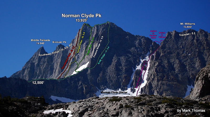
Palisade Crest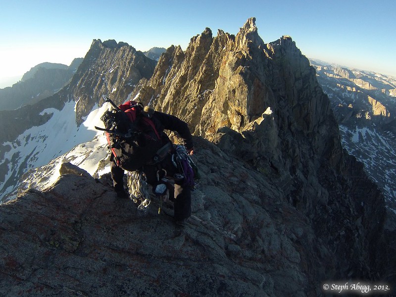
Third Pillar of Dana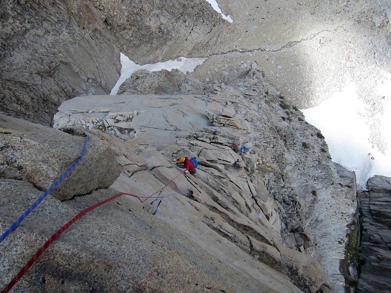
Cathedral Traverse
California Climbing Trip II: August 18-29, with Dan Aylward, Chad Kellogg, and Sarah Hart
-
Fairview Dome Regular Route (5.9) LINK TO TR
-
Mt. Russell Fishhook Arête (5.9) LINK TO TR
-
Bear Creek Spire North Arête (5.8) LINK TO TR
-
"TMC Linkup": Tenaya - Matthes Crest - Cathedral LINK TO TR
Fairview Dome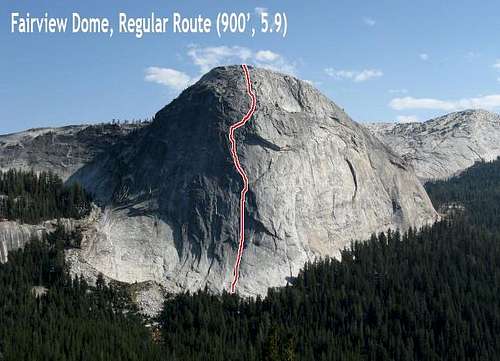
Mt. Russell Fishhook Arête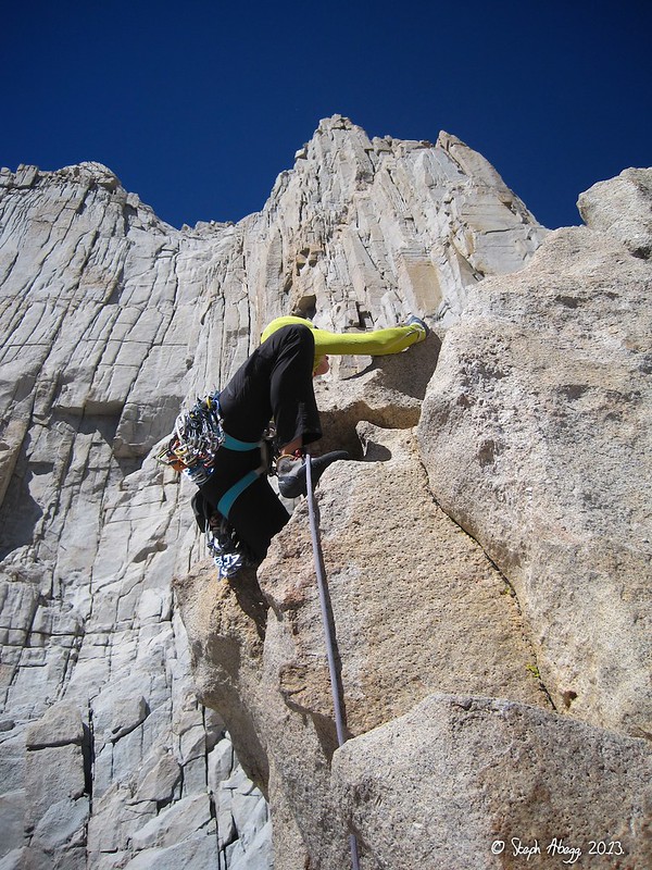
Bear Creek Spire North Arête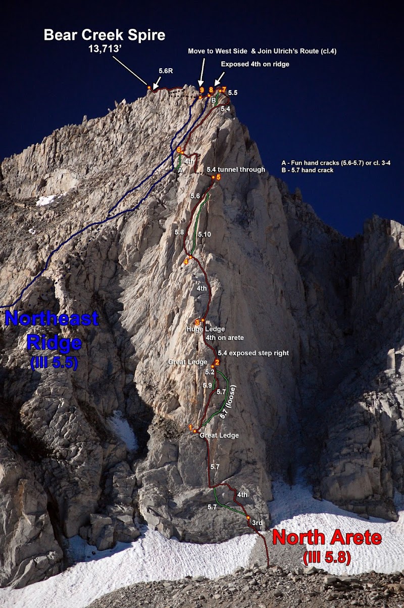
Matthes Crest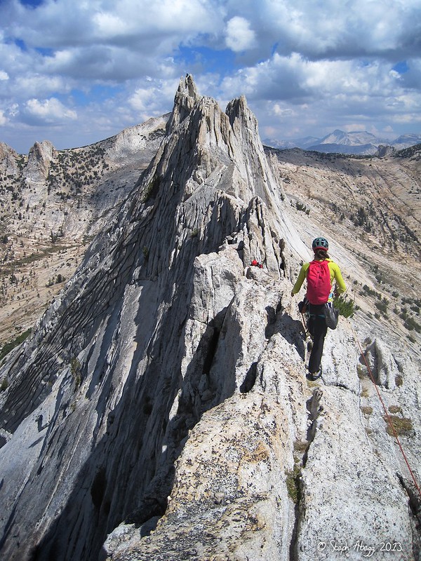
California Climbing Trip III: Sept 7-13, with Mark Thomas and Nic Risser
-
Incredible Hulk Red Dihedral (5.10b) LINK TO TR
-
Incredible Hulk Positive Vibrations (5.11a) LINK TO TR
-
Merriam Peak North Buttress (5.10b) LINK TO TR
-
Cardinal Pinnacle West Face (5.10a) LINK TO TR
Incredible Hulk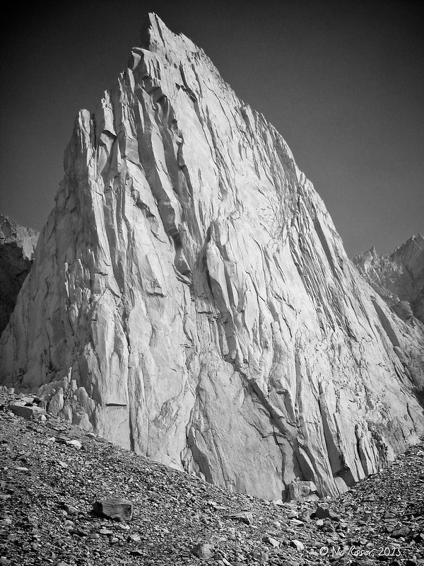
Merriam Peak North Buttress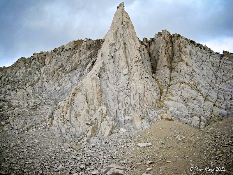
Cardinal Pinnacle West Face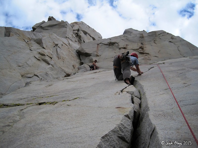
-
Norman Clyde Firebird Ridge (5.9) LINK TO TR
-
Love it! Thanks for sharing this. Ok to post a linky on my FB page for it?
Yes please! If enough people like it, might be good inspiration for Luca and Ephrat to make it into an iPhone app. They've got first dibs.....
-
Very cool! Quickly affirmed my suspicion that the weather sucks everywhere this week.
Not in the Out of State section. Check out Yosemite.... =)
-
Trip: Incredible Hulk - Red Dihedral (5.10b) and Positive Vibrations (5.11a)
Date: 9/7-8/2013
Trip Report:
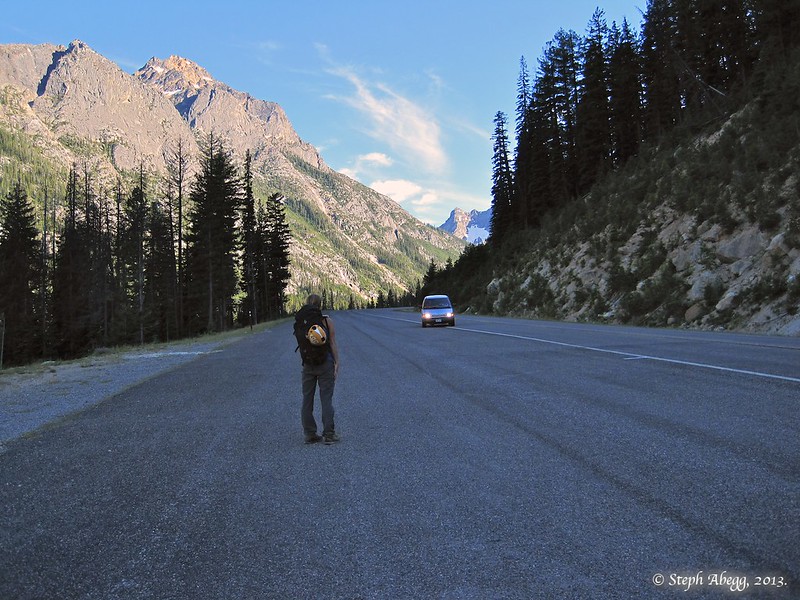
This summer (2013) I became somewhat obsessed with a desire to climb the Incredible Hulk. The Incredible Hulk is known for three things: the best rock in the High Sierra, long routes, and incredibly sustained climbing. I just had to climb it. I think part of my obsession resulted from the challenge of just making it happen. In June, I headed to the High Sierra to do some climbing with my Californian friend Mark, where we planned to climb the Hulk after a week in the Palisades. Our time in the Palisades was a grand adventure, but it left too little time and energy to tackle the Hulk afterward. So I flew home, already scheming of how I could squeeze another trip to the High Sierra into my packed summer. Over the next couple of months, I had several great mountain adventures, but the Incredible Hulk continued to hulk in the back of my mind. In late August I returned to California on a climbing roadtrip with Dan, Chad, and Sarah; the Incredible Hulk was the primary objective. But the Hulk was not going to make it easy on us. First there were thundershowers in the northern Sierra; then the skies were clear but accompanied by 30 mph gusts; then the air was calm but a thick layer of wildfire smoke settled in the valleys east of Yosemite (where the Hulk is). Fortunately there is no shortage of rock to climb in the area, so we still enjoyed a successful week of climbing other Sierra classics. But again I returned home to Washington a tad frustrated that yet again my hands had not touched the steep white granite of the Hulk. Now with only about ten days of summer left before school started up again, the Hulk looked unlikely. But I just couldn't get it out of my mind. Then (on a Wednesday) I got an email from Mark from California, about his weekend plans to climb the Hulk with his friend Nic. Mark mentioned that he himself wanted to climb the popular Red Dihedral route but that Nic was more interested in climbing the less crowded and more challenging Positive Vibrations route. A flurry of emails later, and I was throwing climbing gear into my car. The Incredible Hulk, here I come!
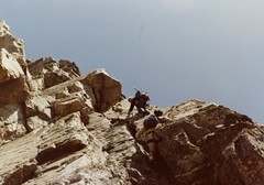
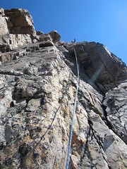
I climbed Red Dihedral (5.10b, 1200') with Mark on Saturday (Sept 7) and Positive Vibrations (5.11a, 1500') on Sunday (Sept 8) with Nic. These are probably the most popular climbs on the Hulk. The RD-PV pairing makes a great full-on two-day trip with over 2500' of truly incredible climbing.
I've posted a full trip report on my website. http://www.stephabegg.com/home/tripreports/california/incrediblehulk
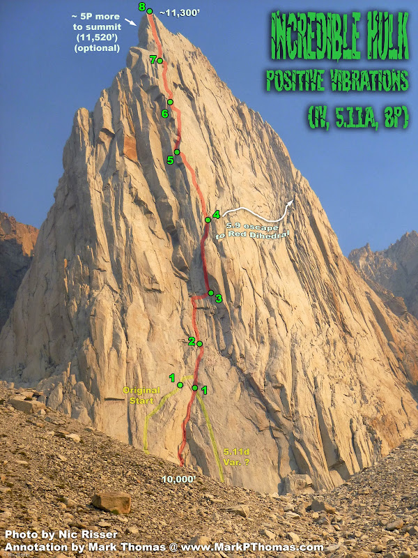
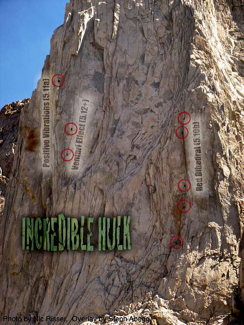
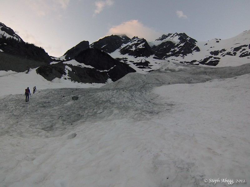
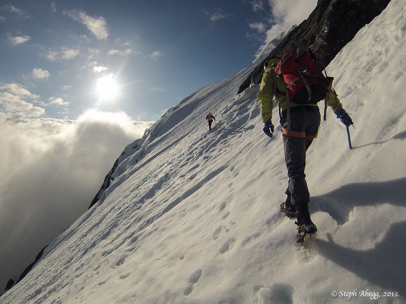
Here are a few route overlays (courtesy of Mark) and photos.
Red Dihedral (5.10b)

Positive Vibrations (5.11a)
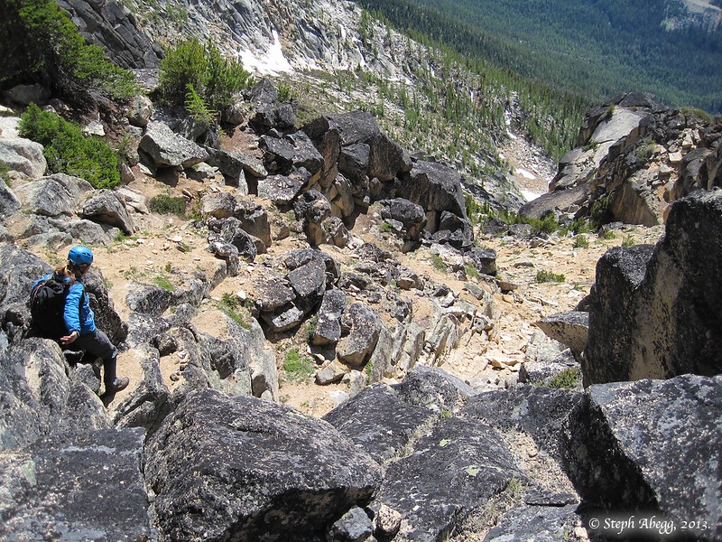
Climbers on the routes.
Looking up at the upper half of Positive Vibrations. Such fun climbing ahead!

For more: http://www.stephabegg.com/home/tripreports/california/incrediblehulk
-
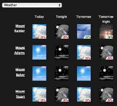
My friends Luca and Ephrat have created a wonderful mountain weather matrix which shows the 5-day NOAA point forecast for various locations in the US. As they are Californians, they mostly have CA locations, HERE. Since I cannot run .php on googlesites, they have generously created a PNW-oriented version, for which I provided the data points for various climbing locations in Washington. This is very handy for seeing multiple weather forecasts all at once to help choose the weekend climbing destination. Gone are the days of obsessive refreshing of a slew of NOAA point forecast tabs!
Click HERE to go to the Washington Climber Weather Forecast weather matrix!
-
My understanding is that a lot of parties on juno get off route after the first 2-4 pitches, Maybe the supertopo has the best idea? Can you weigh in on that Steph? It was nice to run into you again, btw!
On SuperTopo's Pitch 4, we traversed right and then up some 5.6 blocks, as was noted in the SuperTopo topo. I notice that the topo in CAG notes a "left traverse" here which seems to me to be incorrect since the right traverse we took certainly kept us on route and dumped us off at the base of the 5.9 cracks and 5.10a face move above.
So I think SuperTopo has it correct about needing to traverse down and right to stay on route. However, I would say that the SuperTopo topo shows the traverse as being much more of a descent than it actually is. The topo makes it seem as if to make the traverse you need to descend over half the amount of the previous pitch (Pitch 3), which would be over 40 feet. So this is what I did, but when I got down about 40' there was clearly not a feasible route. So I climbed back up and ended up spotting the 5.6ish traverse just about 5 feet down and 15 feet right of the belay at the top of Pitch 3.
-
I wonder how it compares to the DNB of Bear Mtn? I guess I should go climb the DNB to find out.
From my experience on the NB (not DNB) of Bear, I'd say both are quality 5-star alpine routes. But the car-to-car vs. Chilliwack River schwack....
-
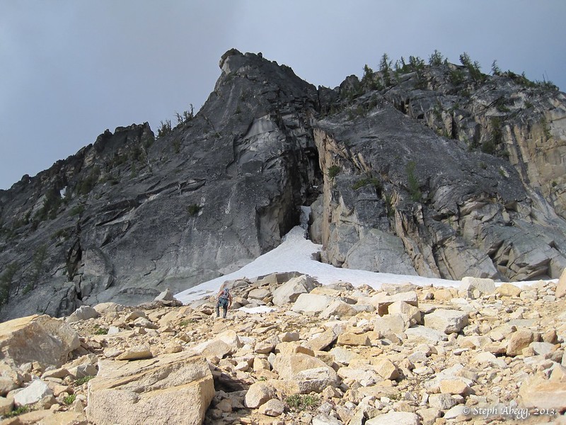
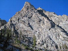
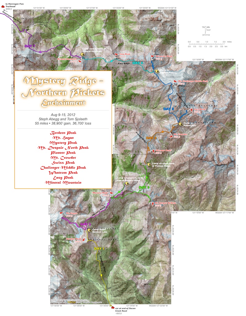
Trip: Juno Tower - Clean Break (IV, 5.10b/c, 1500')
Date: 7/11/2013
Trip Report:
[img:center]http://images.summitpost.org/medium/856388.jpg[/img]
After a couple of days climbing on the spires at Washington Pass, my sister Jenny and I decided to cap off our climbing trip with a route we had both been eyeing for awhile: Clean Break on Juno Tower. From the west-side highway view, Juno Tower is an indistinguishable bump on the ridge just north of the Wine Spires. But the hidden eastern walls of Juno Tower steeply rise 1500' above the Silver Star Creek Valley. Clean Break is on the steep east buttress of Juno Tower. The route is named after the clean 5.10c splitter crack on Pitch 1 and the many splitter cracks that follow. With pitch after pitch of sustained climbing on beautiful clean granite in wild surroundings, Clean Break is a must-do rock climb in the Cascades. Amazingly, this stellar route was not discovered until the mid-1980s.
Jenny and I decided to climb the route car-to-car, approaching via Silver Star Creek and descending to the highway via the west side by intersecting the standard Burgundy Col approach trail. The entire adventure (including the 3.5 mile hitchhike back to our car) took us 13 hours. What a way to spend a summer day!
Overall, we were very impressed with the quality of the climbing on the route. The first 2/3 of this route is possibly one of the best alpine rock climbs I have done in Washington State.
I've posted a full trip report on my website: http://www.stephabegg.com/home/tripreports/washington/northcascades/cleanbreak
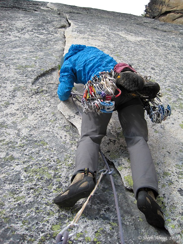
Nearing the base of the route. The splitter 5.10c crack of the first pitch of Clean Brea is just above Jenny's head in the photo.
Jenny bravely led the splitter 5.10c crack of Pitch 1. This lone crack is the route's namesake, and also the crux of the entire 15-pitch route. It is rare to find such good crack climbing on an alpine route in Washington.
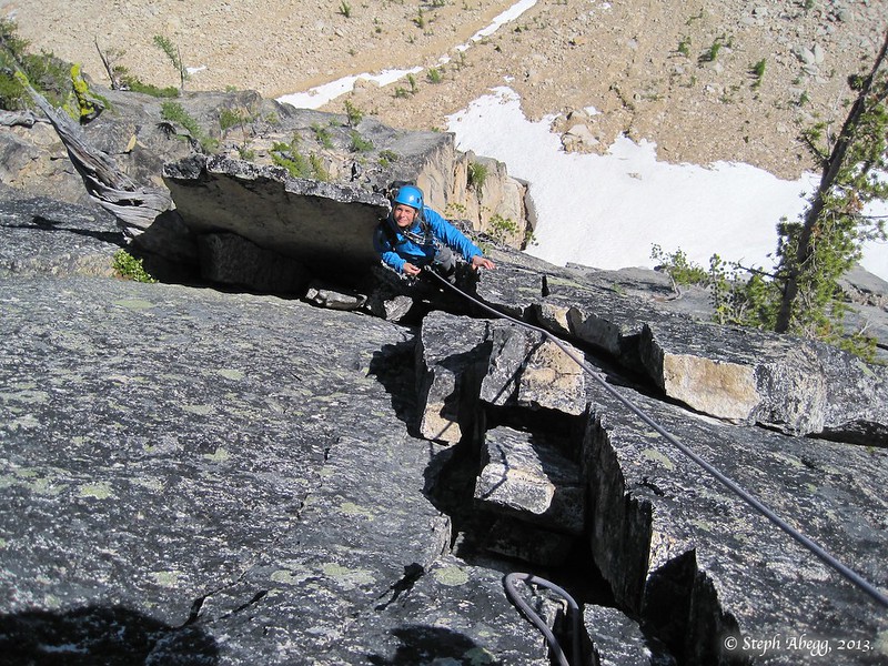
After the first two difficult pitches, kick back and enjoy a few mellow pitches of 5.6-5.7 flakes and blocks. This photo shows Jenny near the top of Pitch 4.
From the top of Juno Tower, there are a couple of descent options. One option is to scramble down the ridge to Sunset Col and then descend back into Silver Star Creek basin and hike out to trailhead from whence you came. The other option is to make a southward descending traverse down the scree to Bench Camp below Burgundy Col and hike out to the highway via the standard Burgundy Col approach, and then hitch a ride (or bike or walk) 3.5 miles to your car. The second descent option sounded like less effort, so that's the way we went (this descent is shown in the photo on the left). From summit to Bench Camp took us an hour, and from Bench Camp to the highway took us another hour.
We ended up on the highway 3.5 miles from our car at the Silver Star Creek pullout. Our plan was to hitch a ride or just walk the downhill 3.5 miles to our car. It took all of 58 seconds from the time we popped up out of the trees onto the highway to the time a van occupied by two friendly road-tripping climbers from Colorado pulled over and offered us a ride (thanks!). Five minutes later and just under thirteen hours since we started that morning, we were back at our car at the Silver Star Creek pullout. What a fun day!
-
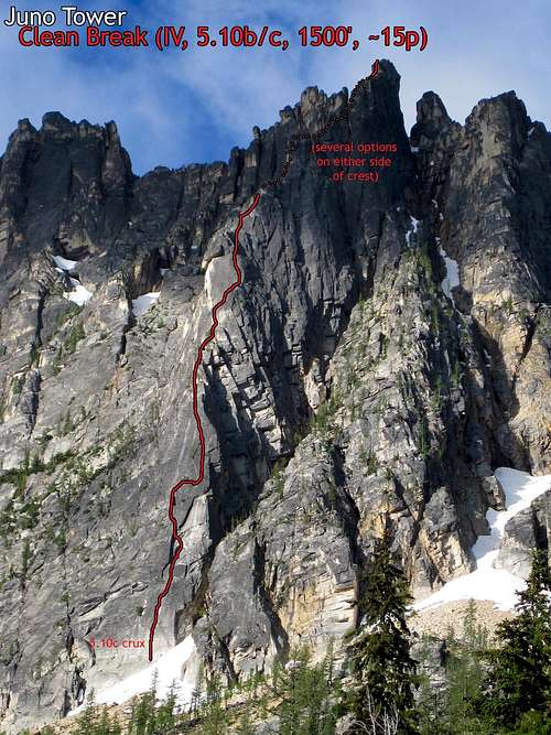
Trip: Mt. Shuksan - North Face (car-to-car)
Date: 6/9/2013
Trip Report:
Yesterday, I joined Dan Aylward and Chad Kellogg on a climb of Mt. Shuksan's dramatic North Face. It was a great 14 hour car-to-car adventure!
Below are some of the key overlays and photos. I've posted a full trip report (overlays, photos, maps, etc) on my website: http://www.stephabegg.com/home/tripreports/washington/northcascades/shuksan2
Route overlay:
[img:center]http://images.summitpost.org/medium/852477.jpg[/img]
An aerial photo of the North Face I took on a flight with John Scurlock three days before our climb (I've posted the full route on my website):
[img:center]http://farm6.static.flickr.com/5348/8982666203_f993c2ae5f_c.jpg[/img]
Video taken while climbing the North Face:
[video:youtube]uprXDxbgQq4
Some photos:
The upper White Salmon Valley. The North Face is on the left skyline above the saddle.
Chad and Dan traversing left across the base of the North Face. Let the fun begin!
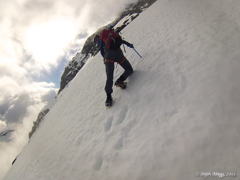
Heading up the North Face. We were surprised to find the entire face lit in the morning sun (we had expected it to be in the shade due to its northern aspect), but since it was still early in the day the snow was firm, and the runnels made for great ascent lines.
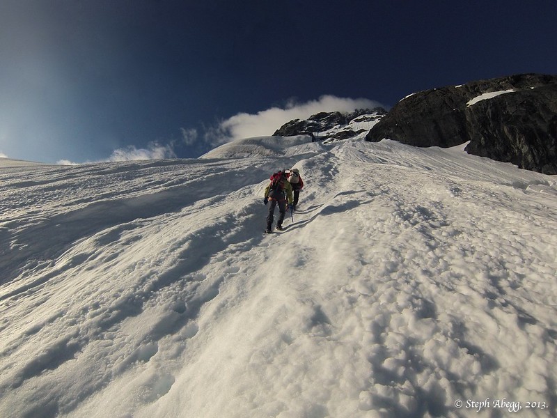
Dan on the North Face. The face is somewhat steep, 40-50°. But the snow was good enough to allow a comfortable unroped ascent. In a couple of more hours it would transition from ideal to dangerous, so we were glad for the early start and encouraged to move quickly. It took us just over two hours to ascend the face from its base to the North Shoulder.
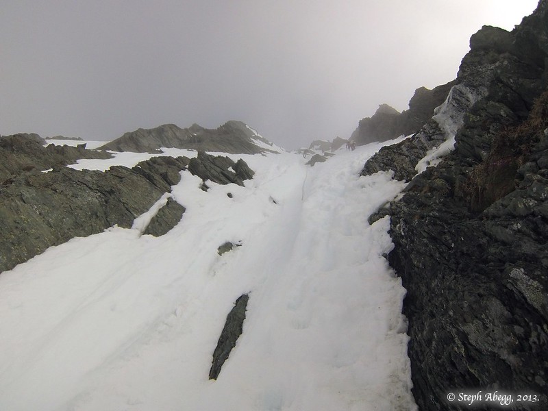
The gully up the south side of the summit pyramid, part of the popular Sulphide Glacier route.
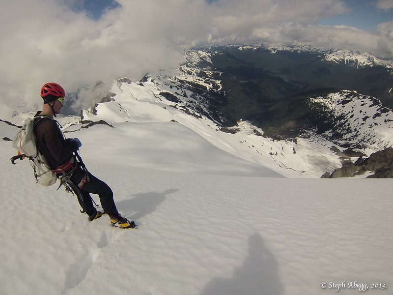
Chad looking down the White Salmon Glacier, our descent route. Chad and Dan were probably bemoaning the fact they had done this climb with a non-skier such as myself!
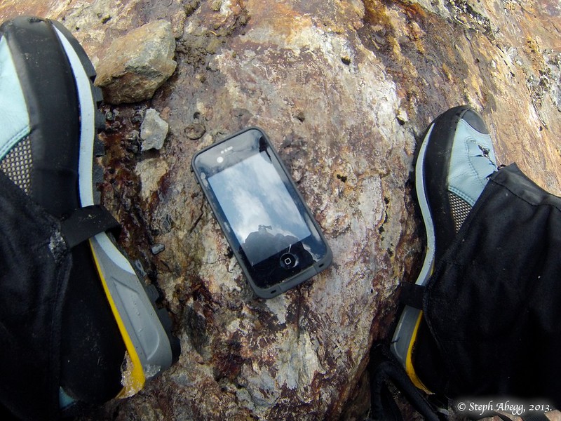
Is this iPhone yours? Found buried in the snow on the slopes below Chair 8. I dried it out and charged it up and it still works!
-
Steph--what body/lens are yuo using?
Canon 7D with a 24-105 lens. John uses the 5D and 24-105 lens. Both great setups.
-
Just yesterday I was twisting the arm of a friend for a Valhalla trip. Fantastic that the weather was so perfect for both the Valhallas and the Selkirks. I've never seen such detailed pics. Thank you so much!
Well this should finalize the arm-twisting. =) I highly recommend the Valhallas, I've climbed there 2x and there's some great alpine rock fun to be had.
-
yesterday there was a slight kerfuffle when they realized "Miss Abegg" was half Canadian. Her Canadian passport fixed things however.
Yes it seemed odd he wanted proof I was Canadian, given we were entering the States.....
-
planes = aid

In that case I suppose tripods = aid too.
-
Trip: Bugaboos in a Day - winter aerial photography adventure w/ John Scurlock
Date: 3/9/2013
Trip Report:
John and I had talked about doing a single day flight to the Bugaboos and back. I didn't think we would pull it off until we actually did it....
Words don't really describe it, so I'll let the photos (and video!) speak for themselves.
[video:youtube]SkDrHJXWf9Y
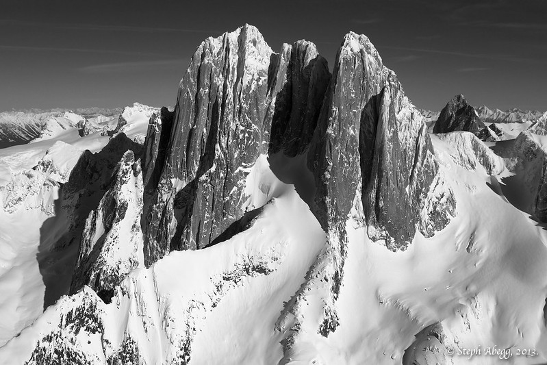
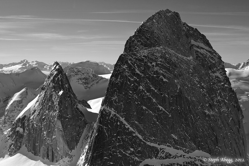
Howser Towers from S:
[img:center]http://farm9.static.flickr.com/8515/8544911662_5b5eec5d51_c.jpg[/img]
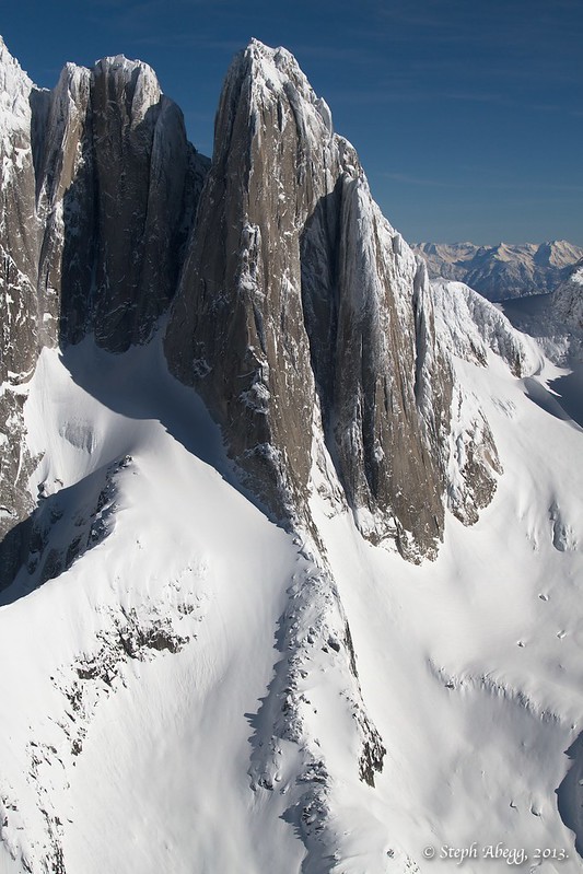
S Howser Tower, Beckey-Chouinard route
[img:center]http://farm9.static.flickr.com/8532/8544911714_82c1464f41_c.jpg[/img]
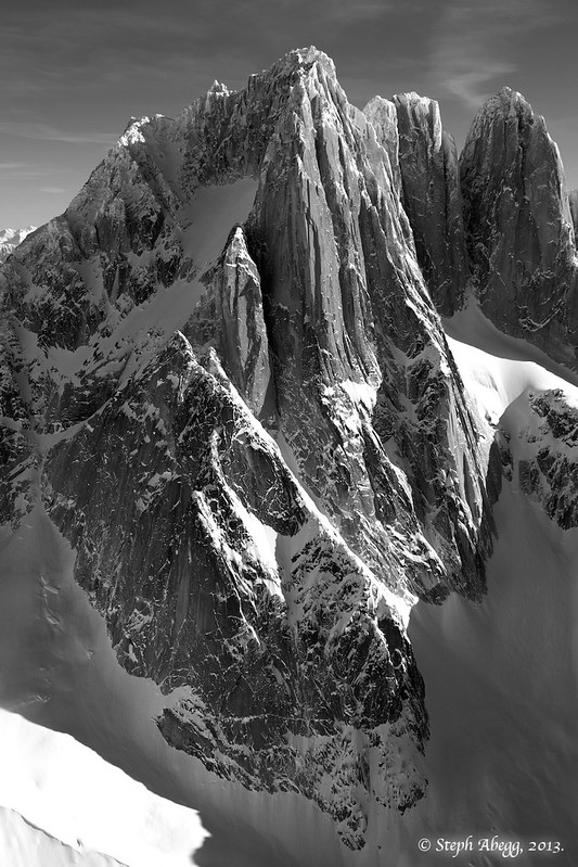
N Howser Tower, W Face
[img:center]http://farm9.static.flickr.com/8526/8543816201_0a03229dd6_c.jpg[/img]
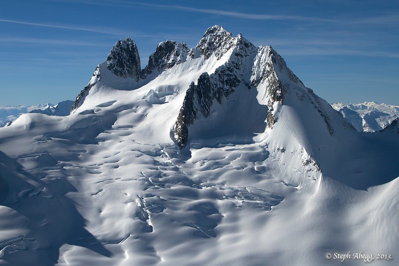
Howser Towers from N:
[img:center]http://farm9.static.flickr.com/8515/8544911888_c82028b754_c.jpg[/img]
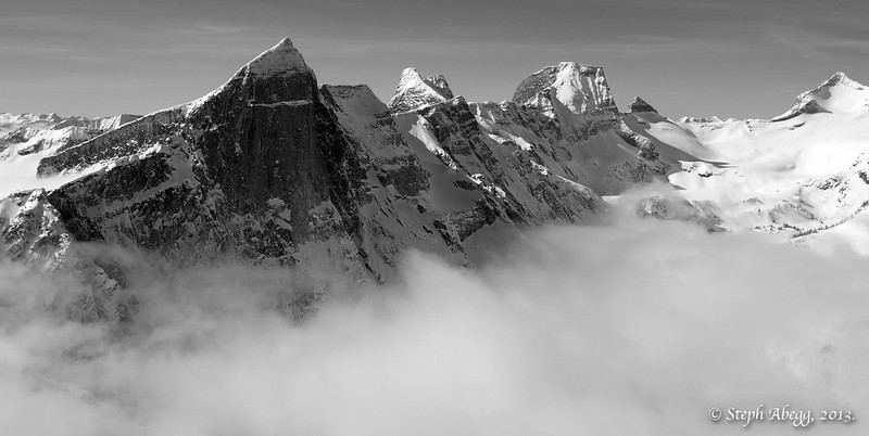
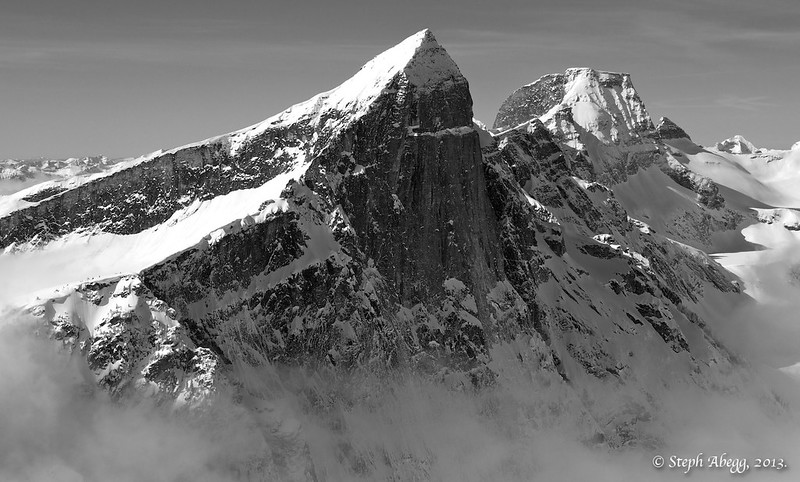
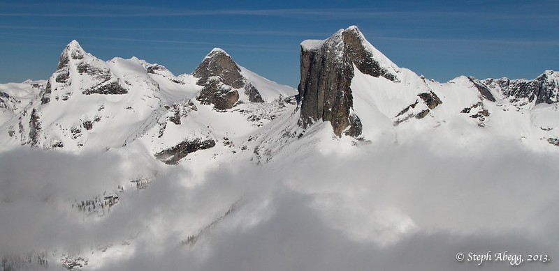
Bugaboo Spire, NE Ridge:
[img:center]http://farm9.static.flickr.com/8381/8544911962_7ecd102e30_c.jpg[/img]
Bugaboos from E:
[img:center]http://farm9.static.flickr.com/8366/8543816677_bc87357703_c.jpg[/img]
Bugaboos from N:
[img:center]http://farm9.static.flickr.com/8507/8544912292_868eafbbce_c.jpg[/img]
Valhallas (Dag, Batwing, Wolf's Ears, Gimli, Niselheim, Midgard):
[img:center]http://farm9.static.flickr.com/8514/8544913102_724795a0f5_c.jpg[/img]
Dag's vertical northern walls:
[img:center]http://farm9.static.flickr.com/8107/8544913254_907992e9ca_c.jpg[/img]
Gimli, classic S Ridge side:
[img:center]http://farm9.static.flickr.com/8505/8543817519_371b9d56c5_c.jpg[/img]
Gimli W side:
[img:center]http://farm9.static.flickr.com/8372/8543817655_d675fc9270_c.jpg[/img]
Gimli from N:
[img:center]http://farm9.static.flickr.com/8108/8543817861_0da4030e23_c.jpg[/img]
More photos on my website TR:
http://www.stephabegg.com/home/tripreports/britishcolumbia/aerialbugaboos
Stats:
6:31 AM : Sunrise
7:22 AM : Take-off from Concrete Airport
8:19 AM : Land in Kelowna, clear customs
8:52 AM : Take off from Kelowna
9:38-10:31 AM : Bugaboos
10:39-11:02 AM : Mt. Farnham, Mt. Peter, Mt. Delphine, Jumbo Mtn, Mt. Earl Grey, Redtop Mtn, others
11:22-11:36 AM : Valhallas
11:52 AM : Land in Nelson, get fuel
3:02 AM : Take-off from Nelson
3:45 PM : Land in Oroville, clear customs
4:08 PM : Take-off from Ororville
4:52 PM : Land at Concrete Airport
6:03 PM : Sunset
Flight distance: 822 miles
Flight time: 5h 24min
Thanks John. What an experience.
-
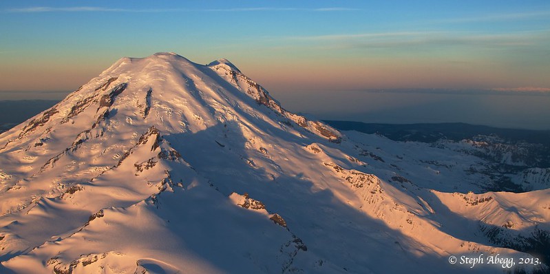
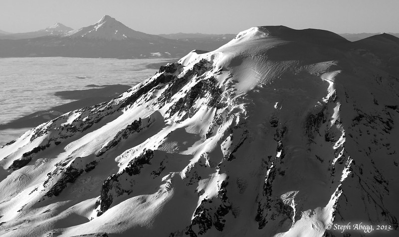
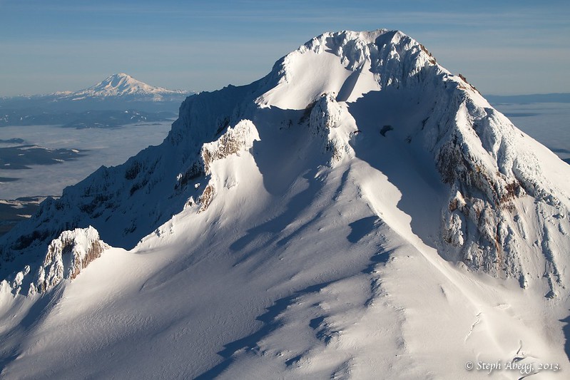
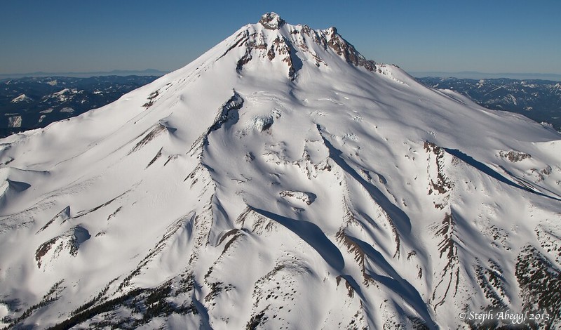
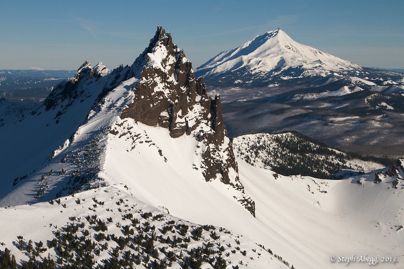
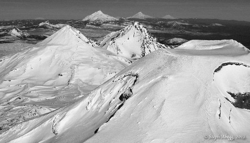
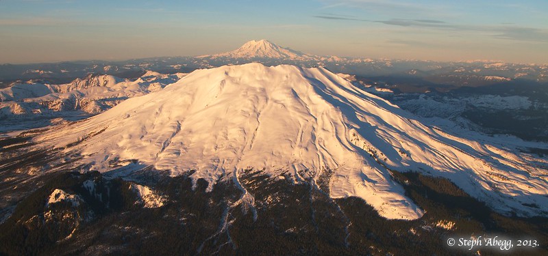
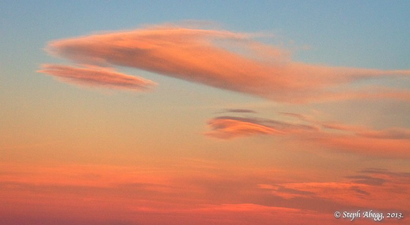
Trip: Cascades Volcanoes Aerial Tour: Rainier-Adams-Hood-Jefferson-Sisters-Shasta-Lassen-Hood-St. Helens-Rainier (and more!)
Date: 1/19/2013
Trip Report:
"Here's what I'd propose: Depart Concrete at dawn and head for Rainier, passing by its east side. Then pass around the east side of Adams and then turn to Hood. Then Jefferson, Three Fingered Jack, and Mt. Washington. Land in Bend for a bit of rest & fuel. Depart Bend for Three Sisters, Broken Top, Mt. Bachelor, Mt. Thielsen, Crater Lake, Mt. McLoughlin, Shasta, and down to Lassen. Then back up to Bend for fuel. Stretch legs, depart back north. Pass by Hood again (sun on west side), then Mt. St. Helens, and finally back to concrete passing by the west side of Rainier. That would be the dream itinerary. This would definitely qualify as The Grand Tour."
-Email from John Scurlock to Steph Abegg, two days before enacting The Grand Cascade Volcanoes Aerial Tour with textbook precision. Baker to Lassen, and back in time for dinner. Wow.
PHOTO TRIP REPORT (Enjoy!):
Rainier:
Adams:
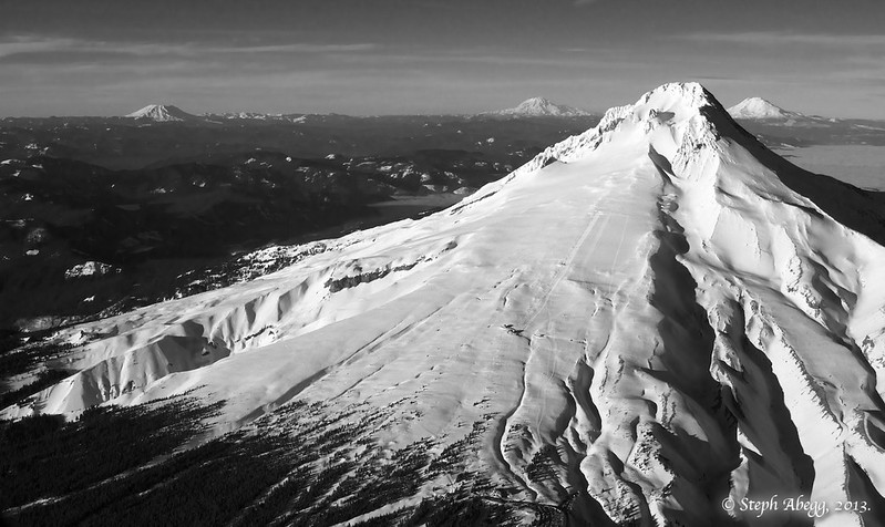
Hood:
Jefferson:
Three Fingered Jack:
Washington:
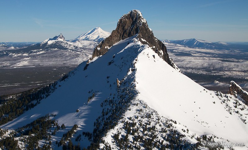
Three Sisters:
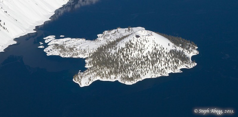
Crater Lake:
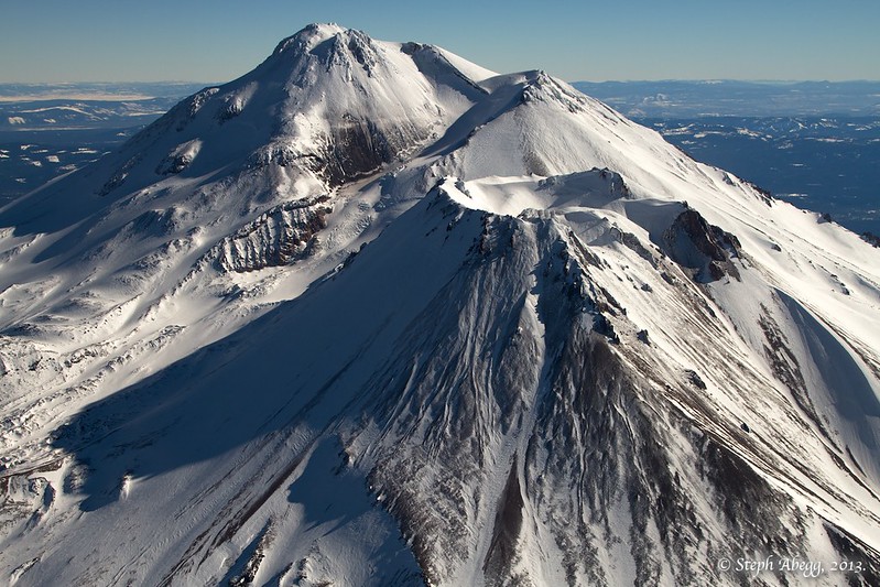
Shasta:
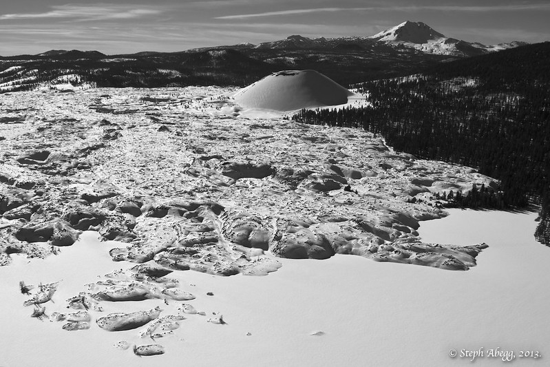
Lassen:
Hood:
St. Helens:
Rainier:
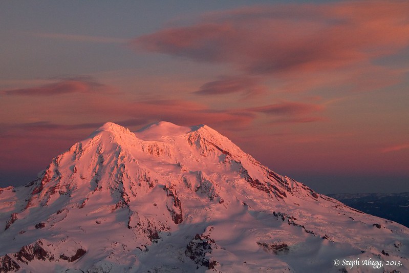
Cool clouds:
Timeline:
7:20 AM : Take-off from Concrete Airport
7:41 AM : Sunrise
8:01 AM : Rainier *
8:23 AM : Adams *
8:50 AM : Hood *
9:13 AM : Jefferson *
9:23 AM : Three Fingered Jack
9:28 AM : Mt. Washington
9:49 AM : Land at Bend Airport
10:45 AM : Take-off from Bend Airport
11:02 AM : Three Sisters *
11:05 AM : Broken Top
11:44 AM : Crater Lake *
12:27 PM : Shasta *
1:09 PM : Lassen *
2:57 PM : Land at Bend Airport
3:28 PM : Take-off from Bend Airport
4:05 PM : Hood *
4:32 PM : St. Helens *
4:54 PM : Rainier *
4:54 PM : Sunset
5:46 PM : Land at Concrete Airport
(*="major" volcano)
Stats:
Flight distance: 1,493 miles!
Flight time: 8h59min!
Map:
Link to map of our adventures.
More photos!
There are lots more photos and a more cohesive trip report on my website:
-
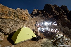
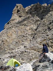
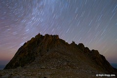
It was Sept 2. We hit Teewinot, Pk 11840, East Prong, then ran into two experienced climbers from SLC who reported it was a bit sketchy on Owen and that there was veraglas heading over to the notch and on the Grandstand? We took their word for it and bailed as it was still a decent push to get up Owen at that time. We ran into ice on the N Ridge of the Middle the next day. Dang, maybe we should've went for it? There'll be a next time..
There was no ice between Owen and the Grandstand, but there was enough ice on the north sides of the Grand and Middle that it would have made a speedy traverse you were looking for difficult. So yep, there'll be a next time, and probably more enjoyable condition anyway!
-
Wow! A stunning week's work. My partner and I were there the same time to attempt the Grand Traverse but were thwarted on Owen after some other climbers reported veraglas up high and all along the West Ledges to the Grandstand. Instead, we descended the Koven to the lower Teton Glacier and attempted to finish the route from the L Saddle. No such luck as we ran into more ice up on the Middle and bailed again. We'll be back. As always, stunning photos and write-up.
When were you on Owen? We saw a party on the summit and then descend Koven when we were camped at the Grandstand (Sept 3)....ice wasn't so bad on Owen (Sept 2) or W Ledges (Sept 3) but there was a fair bit on the NR of The Grand (Sept 4).
-
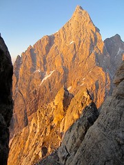
Trip: Teton Grand Slam - Middle Teton NR, Grand Teton Complete Exum, Mt. Owen Serendipity Arête, Grand Teton NR, Teewinot SW Couloir, Symmetry Spire SW Ridge
Date: 8/30-9/7/2012
Trip Report:
I just posted a trip report for a 9-day adventure in the Tetons, which included a strategic multi-day link-up of several Teton classic climbs:
1. Middle Teton North Ridge (II, 5.6)
2. Grand Teton Complete Exum Ridge (III, 5.7)
3. Mt. Owen Serendipity Arete (IV, 5.7/5.9)
4. Grand Teton North Ridge (IV, 5.8)
5. Teewinot Mountain Southwest Couloir (II, 4th)
6. Symmetry Spire Southwest Ridge (II, 5.7)
The trip report is pretty long and involved, so I will just post a link to my website here for those that are interested!
http://www.stephabegg.com/home/tripreports/wyoming/tetonslam
My parents make an appearance in this trip report, since they had done a climbing trip in the Tetons the year before I was born....
My mom climbing on the SW Ridge of Symmetry Spire in 1982
Me waving from near where my mom is in the photo from 1982
My dad on summit of Symmetry Spire in 1982
Me on the summit of Symmetry Spire wearing my mom's old pants and carrying her pack and ice axe.
-
Dave Stutzman and I did the second assent of this route in 1977 as a training climb before we went to Alaska and climbed the North Face of Devils Thumb. We did it in a day and I remember it being realy loose with some 5.10.
Bob Plumb
Thanks for letting us know, it is cool to learn about the climbing history of this route. It's always a challenge to figure out if something has been climbed before the age of online climbing forums... =)
I've added your comment to my TR on my website and adjusted it appropriately.
-
What a fun adventure!
Here is a route overlay for the climb and descent that we made:
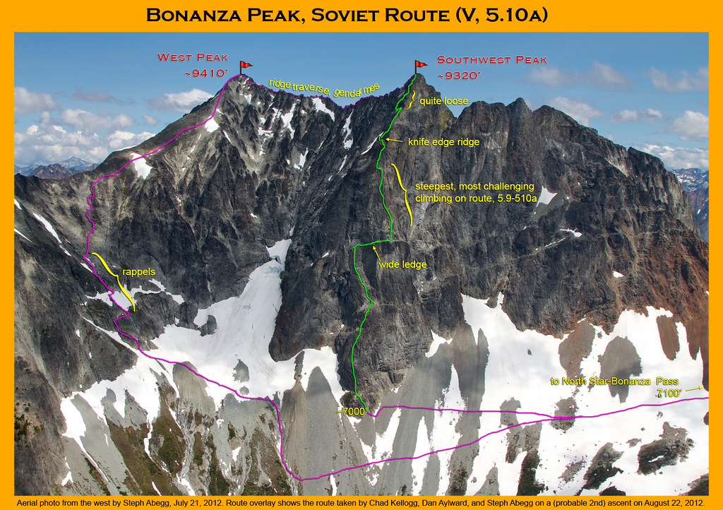
We had a couple of helmet cams with us. Here's a clip of Dan leading one of the steep crux pitches.
[video:youtube]lyGLbbzwpK8
I've posted a full trip report (50 photos, 7 videos, 1 map, 1976 article, commentary) on my website.
http://www.stephabegg.com/home/tripreports/washington/northcascades/bonanza
-
Steph, what lens did you use for your shots? I'm figuring since you were trying to go light as possible, you just brought a 55 mm? Also did you use a hard walled case to protect your camera?
Actually, many of my photos are taken just with a point and shoot. My SLR comes out at camp (yes, I bring 2 cameras always!). I use a 10-22mm wide angle on a crop-frame sensor (so equivalent to a 16-35mm). My camera is a 7D, which is not lightweight since it has a metal body. Altogether, my camera gear weighs 8-10lbs, but it is always worth it.
On this trip my camera gear included:
• Canon 7D SLR
• Canon 10-22mm lens
• Eemote
• 4 SLR batteries
• gorilla pod
• lens cleaning supplies
• camera case for SLR
• Canon Point and Shoot camera
• 2 P&S batteries
• camera case for P&S
• GPS photo tagger
• 3 AAA batteries per day for GPS photo tagger (so 21 on this trip!)
-
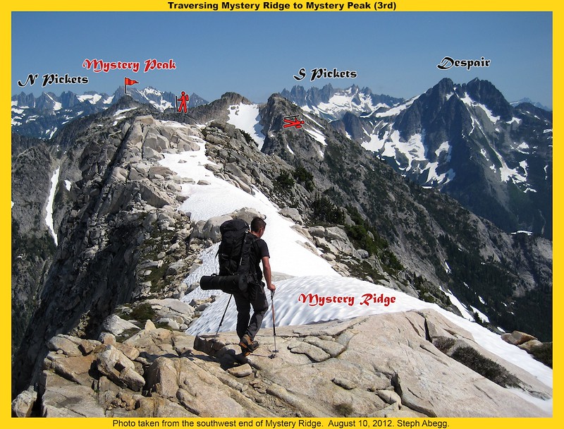
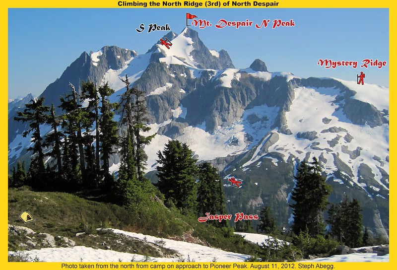
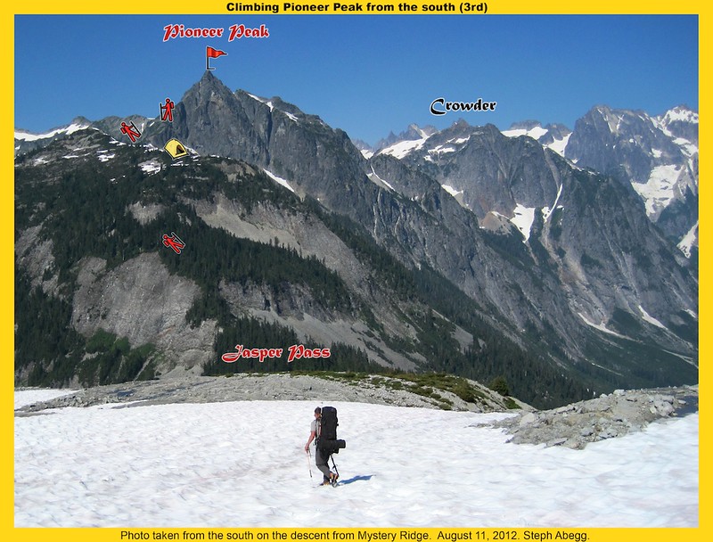
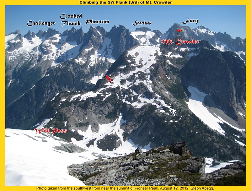
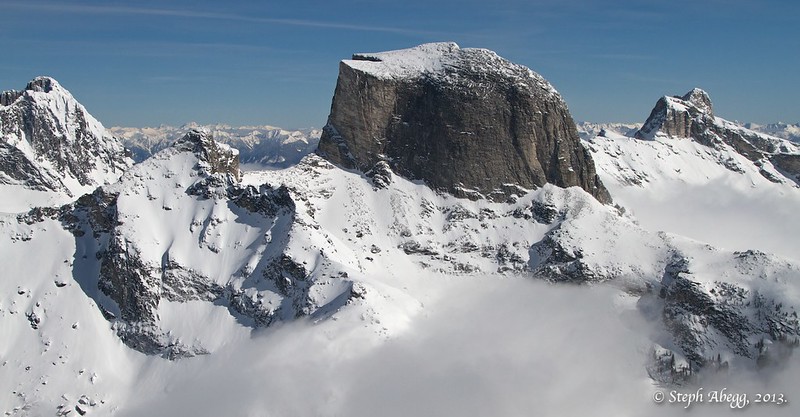
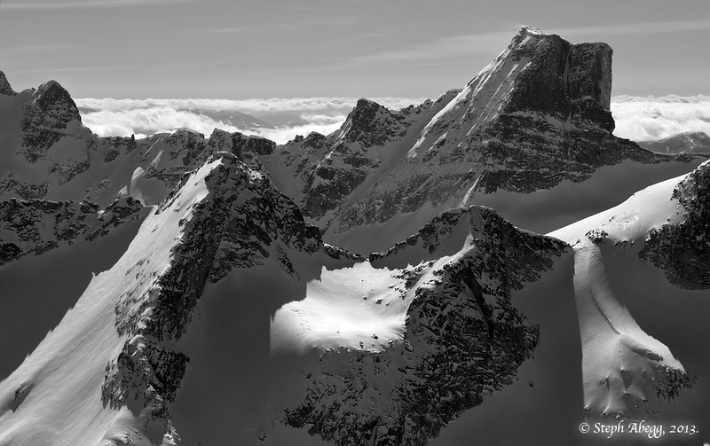
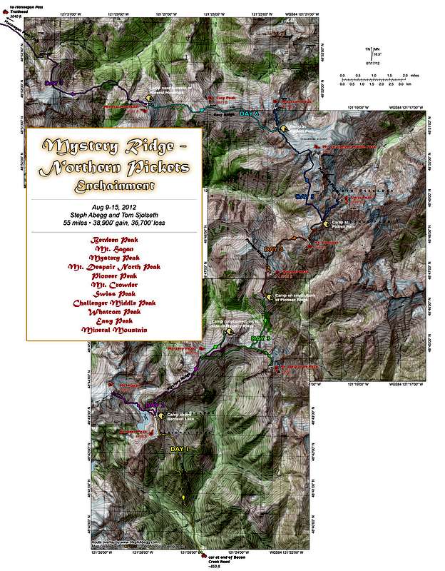
I've posted a full trip report on my website complete with maps, route overlays, and over 100 photos:
http://www.stephabegg.com/home/tripreports/washington/northcascades/mysterypicket
Here's some of the overlays:
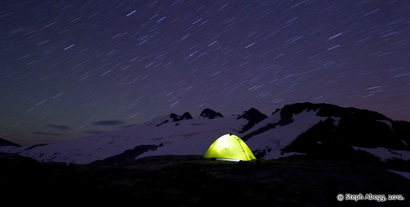
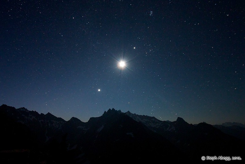
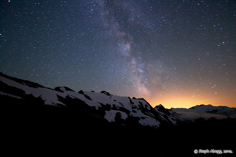
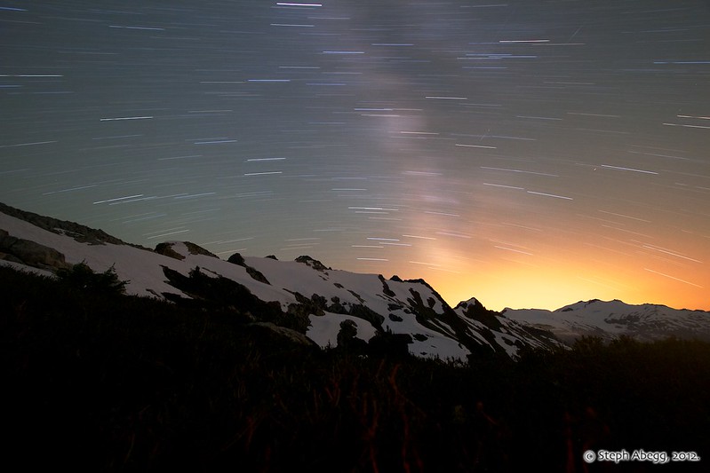
And a sampling of night photos:
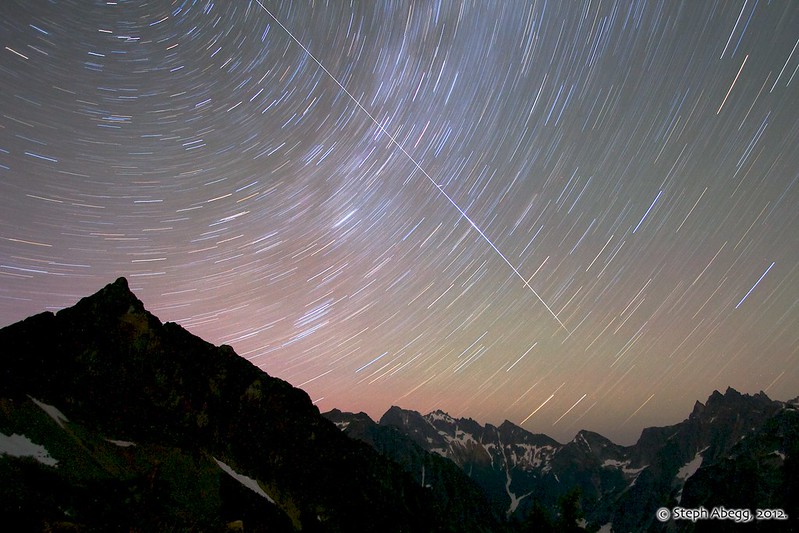
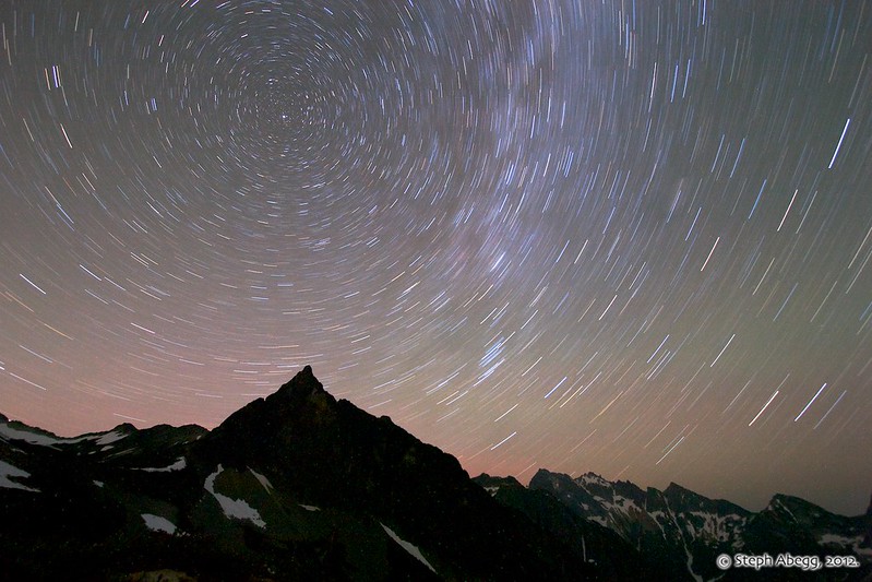
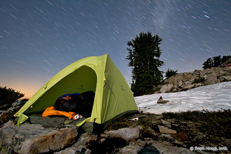
-
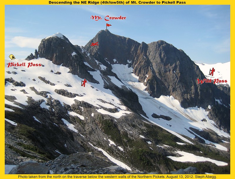
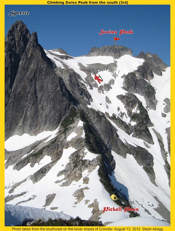
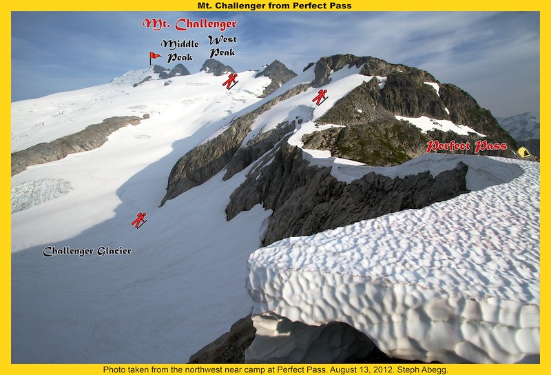
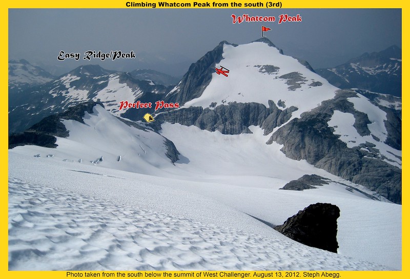
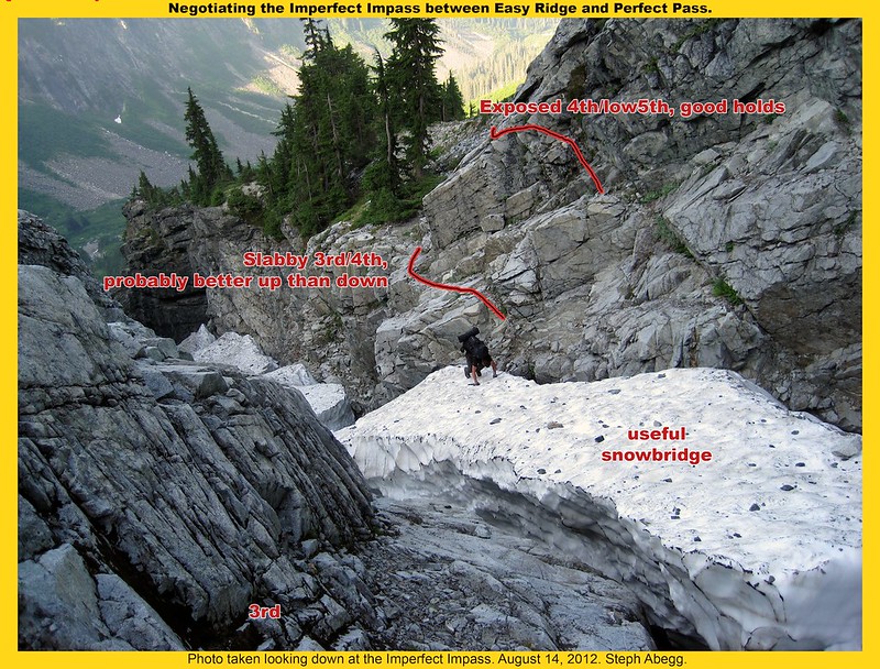
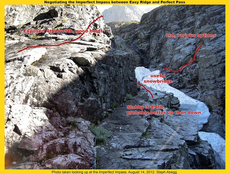
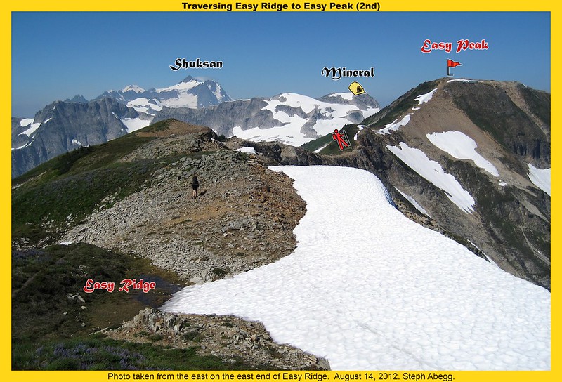
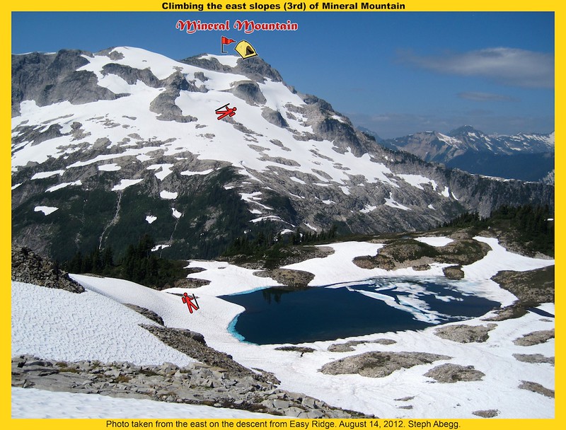
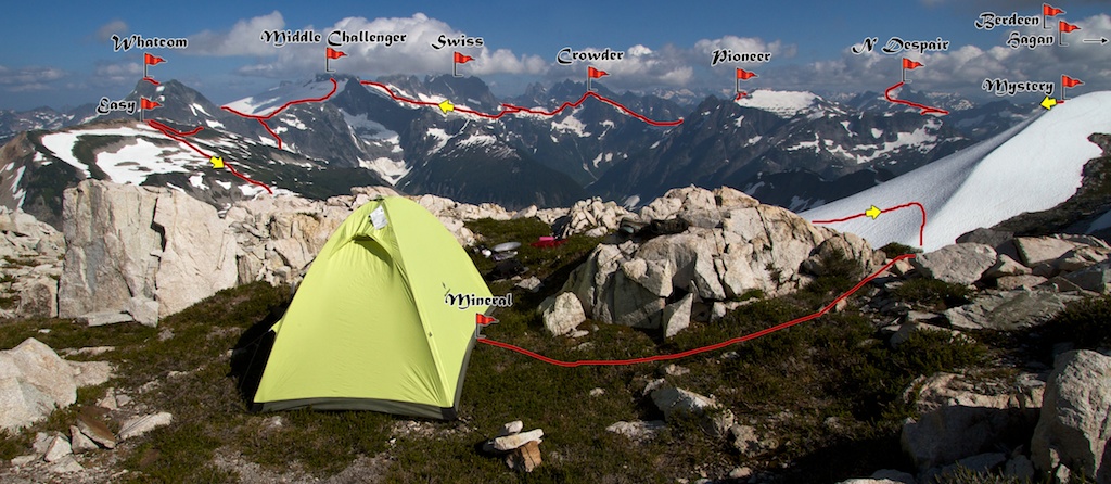
Some route overlays....
Camp near the summit of Mineral Mountain. Can see most of our traverse: Mystery, N Despair, Pioneer, Crowder, Swiss, Middle Challenger, Whatcom, Easy, Mineral.
Map of daily GPS tracks:
Here's a larger version of the map where you can actually read the labels..
-
Were you able to stay on the climber's trail down to Park Creek?
Yes, we just traversed left from the basin below Storm King until we hit it. It follows the rib above a steep drop off into an obvious gully. The gully is directly below Goode. The trail is quite distinct, and we were quickly down on the Park Creek Trail. I think the key is just keep heading left until you find it. Due to the large ravine, it's not really possible to head too far left.
Washington Climber Weather Forecast Weather Matrix
in Climber's Board
Posted · Edited by Steph_Abegg
I've got "cragging" locations which include Leavenworth, Index, Erie, and WA Pass (among others). Check the dropdown box for other locations.
While I have written the code for the page, I have to pass it off to Luca and Ephrat to have it posted. So if anyone has any requests for areas they would like included in the dropdown categories, please let me know in this thread. Then once I accumulate a few more areas of interest I can write the code and pass it off for inclusion all at once. Thanks!