

cheamclimber
-
Posts
464 -
Joined
-
Last visited
Content Type
Profiles
Forums
Events
Posts posted by cheamclimber
-
-
thanks guys...I was just confused on hjow to get to the trailhead because ive never seen a logging road leaving the road after Slesse Creek. Do you take the road before you cross slesse creek and then take a left turn or waht??
-
Hey, I'm planning on doing the NW Face of Slesse next weekend but I cant find any info on how to get to the trailhead and what the trail is like...we're planning on doing it as a day trip I'm assuming that with an early start this isn't too hard, is it?
-
The road past Foley Lk was blocked but someone moved one of the rocks and I managed to drive past them...the road to the trailhead is a bit ugly about 1km from the trailhead but you might be able to drive past it if you have a serious off road vehicle.
-
Thanks, I already did the Yak but not by a ral route. I just scrambled up the slabs and then climbed some gully to the peak, Yak Crack sounds fun. Also Old Settler is pretty close to where I live. If I had a Dirt Bike would that make access to the Chehalis any easier???
-
Hey, I've been getting more into 5th class Alpine climbing and I'm wondering what you guys would suggest for some fun alpine climbs near the Fraser Valley. I'm not looking for anything harder that 5.9 at the moment and the areas I was thinking about were the Chehalis Range and the Illusion Group. I'm already making plans for Rexford and the NW face of Slesse so you don't need to mention those. Thanks for any suggestions!
-
By the way..have any of you other guys done this route?
-
I never got the old book and thanks for the info.
-
HaHa, thats crazy, they were only a few minutes from the top. Unless they had to belay the last pitches in the snow.
-
Oh cool, how did the attempt fail? the gear went as far as the top of the crux, from there it was easy. must have been badly corniced or something.
-
Trip: Foley Peak - Southwest Ridge
Date: 8/23/2007
Trip Report:
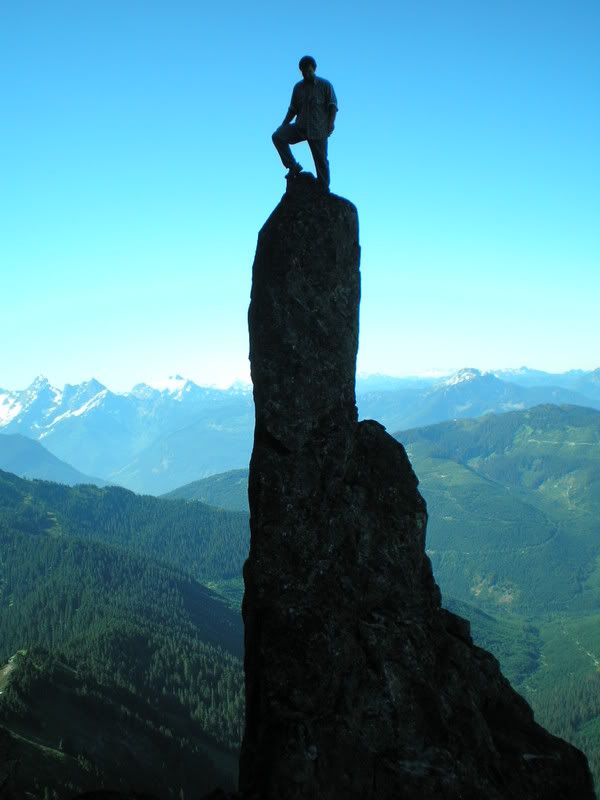
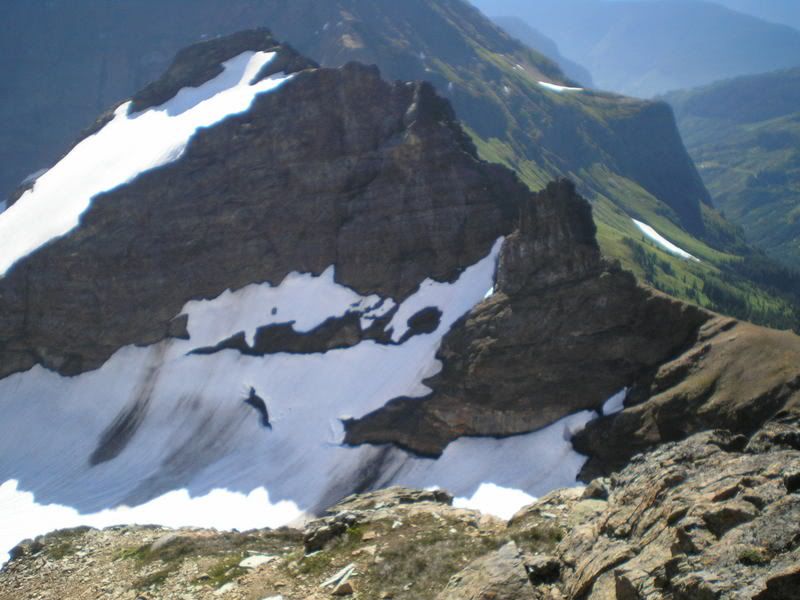
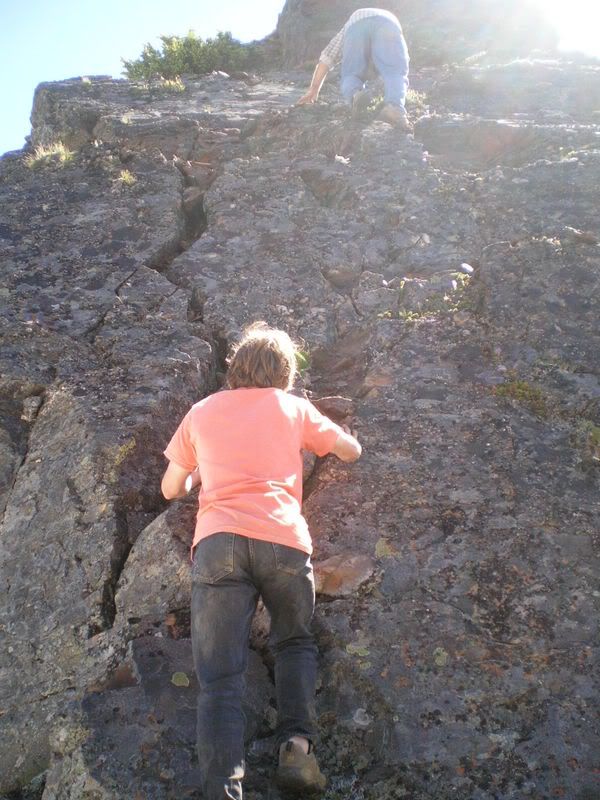
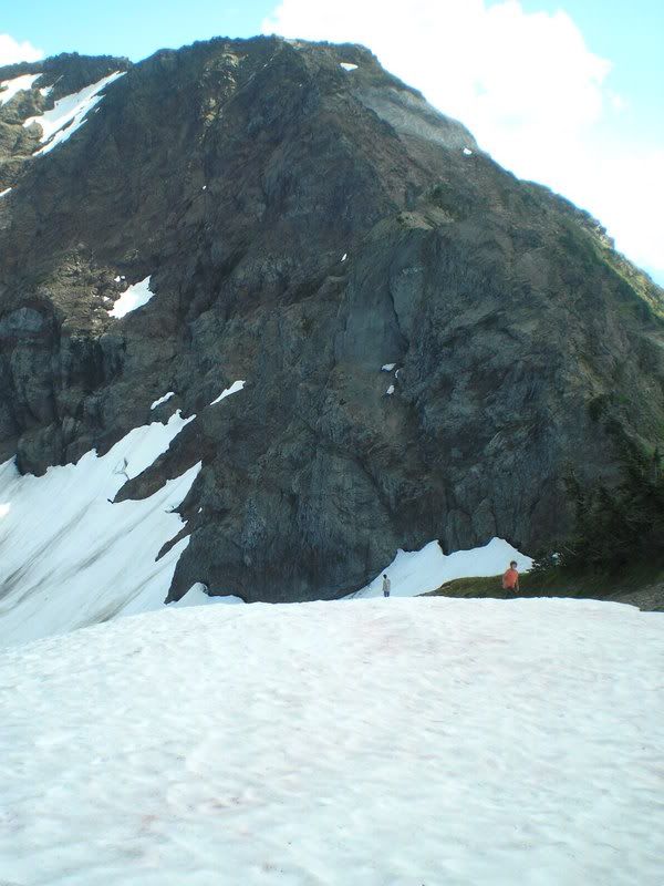
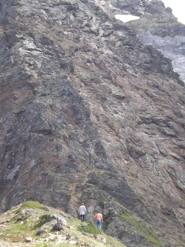
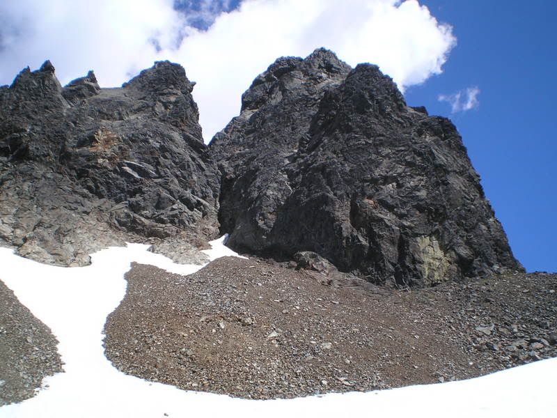
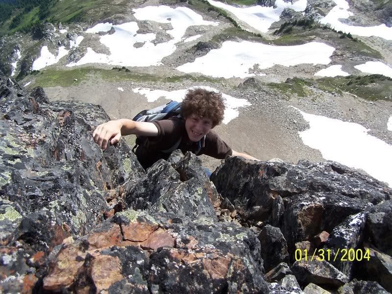
Yesterday me and my friend Lorne decided to try the Southwest Ridge of Foley Peak in the Cheam Range. We left at 7:30 but on the way up the logging road a peice was all strewn with large rocks that would have bottomed out his car, fortunately we only had to hike about 1 KM of road before we reached the parking lot. We made good time up the trail and reached Williamson lake at approx 10:30. I had to re-coil the rope because it was being a pain in the neck but we quickly headed up the gravel slide to the Welch Foley col. Instead of heading for the very obvious pass to the right of the gendarme we took a gulley to the right of the pass in order to make a more direct approach to the mountain, the rock was very loose and slid a lot and was exausting work but at about 11:15 we reached the Col. A quickly phoned my sister and then we started scrambling towards the steep looking SW ridge. About halfway to the Ridge Lorne started feeling sick and said that maybe we should leve the gear and scramble the easy SE Ridge instead. Me being selfish and wanting the climb the SW Ridge told him to rest on a boulder for 15 minutes while I pointlessly scrambled around on the boulders, after the break he was feeling a bit better and I managed to convince him to do the route that we had come to climb. We quickly scrambled to base of the ridge and walked up the first peice of knife-edge ridge unroped. The next pitch involved scrambling around a corner to the left and into a small gully that looked very steep from below so we decided to set a belay. I led the pitch and placed a couple pitons but it was completely pointless because the gully turned out to be an easy climb that we could have saved time on by simul climbing. From the top of the gully we set up a good belay on a boulder and I set up towards the crux 5.5 crack. The pitch started with a short traverse to the right on a scree covered lege. At the end of the ledge I pounded in a piton and headed up the wall to my left, after about 15ft I reached another ledge to the left of the main crack and placed a really sketchy piton that probably would have ripped out like nothing if I fell any more than 6ft on it. I moved to right into the crack and looked for any places that I could place another piton in the next few feet. While I was doing this I spotted some gear left in the crack that I was climbing, I happily clipped into the first chock and hand jammed up the crack, i bypassed a hex that was placed in the crack as the cord on it was in bad shape but I reached a comfortable stance on a big foothold and clipped another chock in the crack. The next moves were incredibly easy and I reached the little gap on the ridge crest between the SW subpeak of Foley and the true peak. I thought a boulder nicely situated on the ridge would make a nice belay but when I gave it a quick push with my foot to test it out it rolled down the North face of the mountain! Looking for another boulder or rock prong to belay from I spotted an old but solid looking piton and clipped into it for a belay. Lorne seconded the pith fairly quickly stopping to remove a couple peices of gear on the way
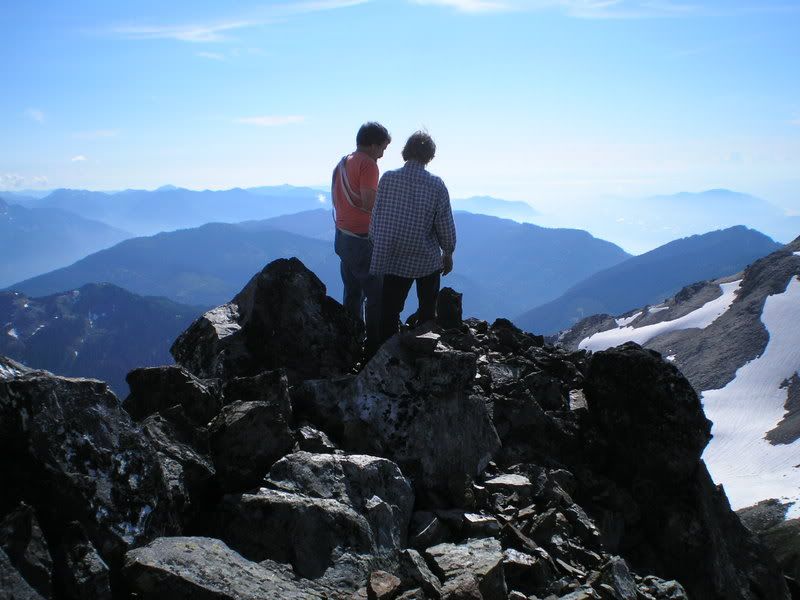
 The rest of the ridge consisted of a short scramble on the left hand side of the ridge and a nice ridge walk to the summit. After not taking any summit pictures because we both forgot our cameras
  we headed down the SE ridge to the glacier and then back to col. WE scrambled back down the scree slope to the lake and descended the trail and road to the car. WE got back to the car at 7:00 and arrived back in Agassiz at 8:30. In all the climb was great and I enjoyed my first real technical climbing outside of the local crags. I was shocked because I can usually on-sight 5.10s easily enough when sport climbing at the crags but in the Alpine and placing my own gear a 5.5 felt more like a 5.8.
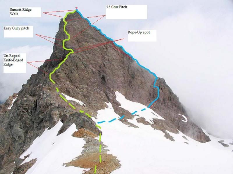
The Green Line is the Line of Ascent and the Blue line is the Descent we took.
I highly reccomend this route up Foley instead of the regular SE Ridge route.
Gear Notes:
I had half a dozen pitons and my 70M Rope. But I reccomend bringing some larger chocks and maybe a size #2 cam for the crux pitch.
-
Hi I'm looking for more climb information for the Harrison Bluffs B.C. I know all the routes right where the trail meets the cliffs but I need info on the upper cliffs, the multi pitch climbs and the routes around to the right (East) side of the cliffs. All useful info will hopefully go towards an updated guidebook for the area now that it is being cleaned again. Thanks.
P.S: To whoever is helping fix up the area...you're doing a great job!
-
thats lame..I guess I'll do something other than Clarke next weekend cuz im too lazy to walk the road
-
I already know about Pnuemonic (5.11a) and critical mass (5.11d) but I want to know the names of the 5.10's over to the right and a couple other routes so that I can finish adding the area to mountainproject.com
-
ya, Mike is kinda scary. I know someone who took off a rusty biner with no spring in the gate from the Chehalis River Gorge and Mike wrote up something about smashing out all his teeth. But do you know anything about the routes?
-
I wa wondering if anybody had any info on the Roadside Attraction ... like route names and stuff. I had the Crapo guide a long time ago but it got eaten by crittes at the crag. Anything would be nice. Thanks.
-
Is it that bad? I went down the face from the peak a little bit and it wasnt awful. The NW ridge was alright too.
-
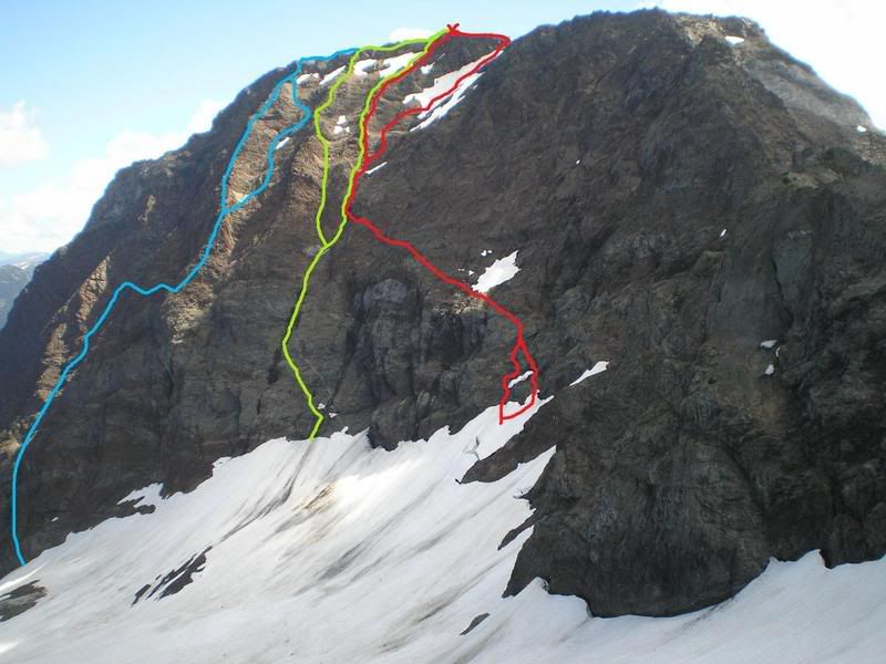
So... recently I've been checking out some FA possibilities on the North Face of Knight. I came up with these lines but I'm only really serious about the Red and Green Routes, the blue one is a bit silly and indirect. I think the Red line looks a bit easier but the green line looks way sicker and a bit more direct. I will most likely bring half a dozen Lost Arrows for protection and the trip may take two days (one to the peak and rest, one half day back to the car) What lines do you guys think looks like a better possibility and do you know if we would actually be making a FA???
-
I uploaded some of the pics ... I will label the mall later cuz I'm tired.
-
And by the way..does anybody know if the North Face of Knight has been climbed before (in the summer) cuz I thought I could see some cool lines up it and it would be cool to have a FA in my name!!
-
I want to do foley and the Still to complete the Cheam Range entirely and in September I'm doing Rexford and the American Border Peak with the BCMC
-
Trip: Lady Peak, Knight Peak, and Baby Munday in a Day -
Date: 8/5/2007
Trip Report:
My friend's dad had been trucking for too long and was complaining that he wasn't getting to go anywhere fun so we decided that it was about time for a good long day trip in the Cheam Range. We decided that we would drive up to the Cheam Peak Trailhead and cross underneath Lady, climb L1 and L2 (smaller peaks beetween Lady and Knight Peaks) then we would take the Northwest Ridge up and over Knight Peak then climb Baby Munday Peak.
We left at about 6:30 AM and arrived at the trailhead around 7:30. It was a beautiful day and the sun was just starting to come up over Lady Peak. We followed the Cheam Trail past spoon Lake and up through the trees but cut up towards Lady Peak at the first long gravel scar running down the mountain, we followed the scar up the mountain for a few hundred feet before turning right towards Knight Peak. We had to cross a gully or two and then climbed right to the base of the Ears of Lady Peak.
We crossed above another gully along the base of the cliffs and then we decided that instead of continuing beneath the cliffs we could ascend Lady Peak and then take the summit Ridge all the way down to the Lady/Knight Col. We climbed up the Ears of Lady until we reached the Summit Ridge and then started following following it down towards L1, L2 and Knight. There were a couple of exposed parts on the ridge but nothing we couldn't figure out fairly easily until we reached a large block protruding from the ridge.
We tried traversing it around the right hand side but it ended in some rather technical (appeared to be around 5.9) down climbing that we weren't comfortable doing with no gear (if it wasn't for that several hundred foot fall it would have been easy!). We then tried the left hand side above the glaciers but the rock was overhanging steeply above a lower ledge and was basically forcing us over the edge of the mountain.
Realizing that we couldn't get around the block without risking our lives very seriously we quickly descended the way we had come up and quickly reached the L1 and L2 peaks between Lady Peak and Knight Peak. L1 was steep and made of rotten rock but we climbed it up and down in about 10 minutes and started to quickly traverse over to L2, L2 looked a bit boring and pointless so we traversed under it until we reached a nasty gully and ascended the small peak until we were above the gully and able to cross.
From there we ran over to Knight Peak along the meadows and snow slopes until we reached the base of the NW ridge. The ridge was an easy class 3 scramble and we progressed up the mountain at a good pace, we traversed over to the NW face and back a couple times and the climbing continued to stay at class 3. Knight Peak wasn't technically difficult in any way but it was a good test of endurance. I, for one, was quite pumped by the time I reached the summit.
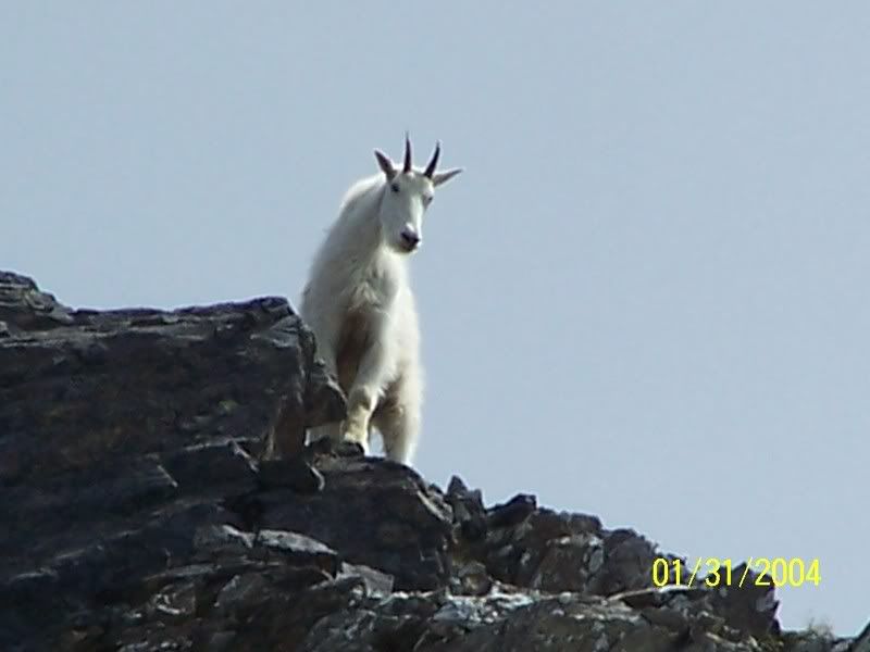
We took a break at the summit to watch as some pshycotic mountain goats ran, with their young baby goats, down the North Face of Knight Peak to get away from us. Those Goats were very irresponsible...I mean they made their babies run down the massive North face of Knight with no ropes or anything!!!!
From the top of Knight we looked at Baby Munday and it looked like the North Couloir would be a good way to the top but after descending Knight and arriving at the base of it we decided that it looked insane as we had no gear with us and traversed around to the, what I think is, the SW ridge. To acquire the Ridge from the base of the Westerly face we took a small gully in the mountain that became a 10 ft chimney ending in a ledge with a large rock jammed in the gully above it. It looked like we could traverse to the right to get around the chockstone but the route ended in a large smooth cliff.
By the time that Lorne and Allan were coming back from checking out the right hand route I was already halfway up an over hanging piece of rock leading around the left hand side. With a little support from Allan I managed to get up and around the top of the cliff up another easy scrambly bit and onto the ridge. Although the overhanging ledges were probably only around a 5.3 it was very exposed and got my heart going a little bit faster. From the Ridge to the summit of Baby Munday was easy and only had a couple of exposed steps when nearing the summit.
After we reached the top we took our photos and descended the ridge, on the ridge I found a nice strap in very good condition just sitting on a rock and since there was nobody else in the area I stole it...he he he.
We descended the East side of the mountain after descending most of the ridge and when we realized we were tired and running out of daylight we ran down the Baby Munday trail and hiked all the way down Airplane Creek FSR to Foley Creek where some campers on their way to Vedder very kindly gave us a ride to Vedder where we were picked up by Allan's wife. He has to go with Lorne and collect his car tomorrow...ha ha.
Altogether we had an awesome trip and all the mountains were class 3 except for that block on Lady's summit ridge and a couple of pieces on Baby Munday...also I don't recommend hiking all the way down Airplane creek FSR amd leaving your car in the Cheam Parking Lot. Pictures coming Soon.
Gear Notes:
we had no gear at all, well... I brought three apple juices but that isn't really gear.
Approach Notes:
Approaching Baby Munday from Cheam is awesome..It is long and tiring but you climb Knight Peak and the views are fantastic!
-
This week I'm climbing the North Face to Northwest ridge route of Cheam..I've looked at it from the bottom of the face in winter and it looks great. Has anybody else here done or tried this??? Well, I'm stoked because I've wanted to climb this for 5 years and I'm finally going to do it. I'll post a TR after too!
-
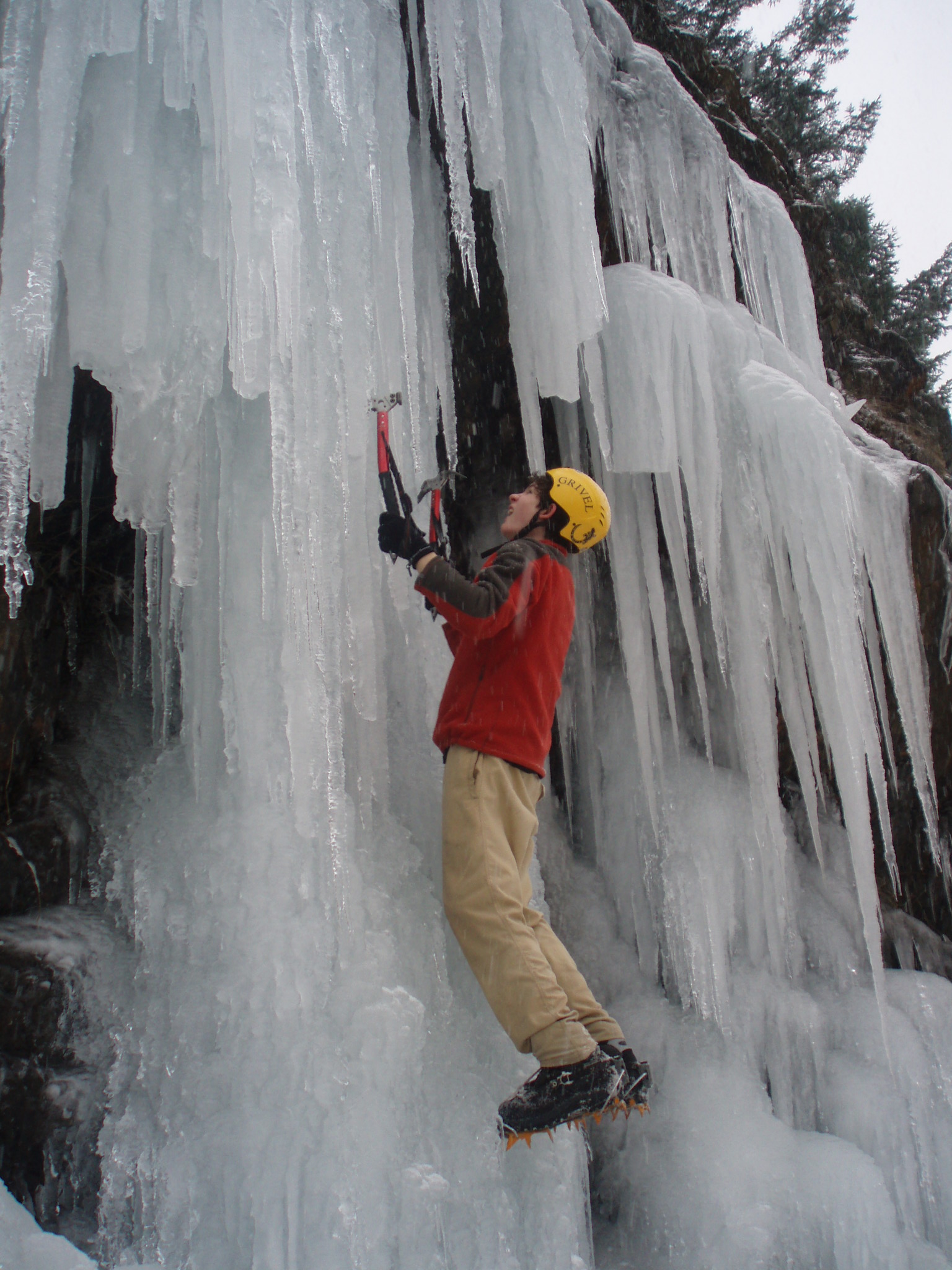
ya, im getting a helmet from MEC some time soon. I'm planning on doing the North face of Cheam in 3 weeks and I want it for that one!!
-
By the way..had anybody else ever done this or thought about trying it
Slesse North West Face Access
in British Columbia/Canada
Posted
oh, okay I'm gonna take a look in the backroad mapbook and see if I can figure it out.