


ryanl
-
Posts
178 -
Joined
-
Last visited
Content Type
Profiles
Forums
Events
Posts posted by ryanl
-
-
Glad you got it Dan. And glad,too, that you got to witness that slide on the north face from the uphill side.
-
Just grabbed a nice photo of the route last weekend and thought I'd include it for reference.
-
Trip: Trick Peak, Garibaldi Provincial Park -
Date: 2/27/2009
Trip Report:
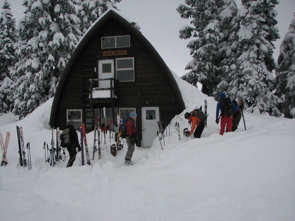
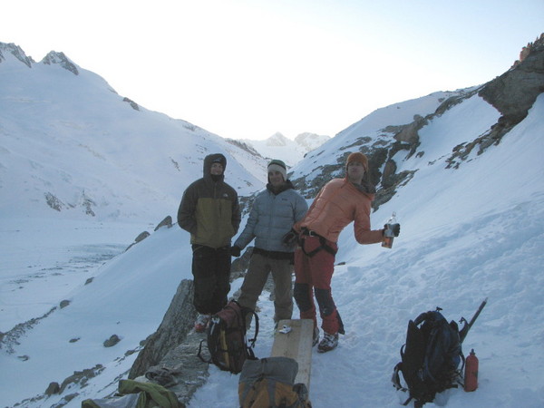
My favorite hater turned 30 on Saturday, and for the previous month had been bating some of us to go north and celebrate with him in his new digs. Emails were sent, plans were made, scrapped, and made again until it was decided that the Elfin hut in Garibaldi Provincial Park would be the place to make the milestone memorable.
12 of us in 4 cars leaving at 4 different times from 4 different locations chinese downhilled to the trail head just north of Sqaumish Thursday evening. The earliest pair made it to the hut around 10 pm, right about the time Red and I left the trailhead. The skin in covered 2500’ and took a little over 3 hours. Skies were overcast and temperatures were cold. We got there just as Lunger, Amar, and Casey were unpacking. The Tacoma/Kirkland/Kenmore crew were our only casualties. They got a late start and had to motel it en route.
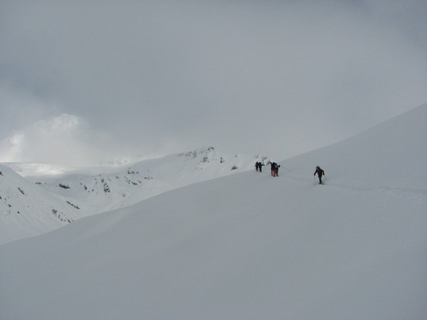
The seven of us who made it were leaving the hut by 8 the next morning. Sky pointed out Trick peak, both visually and on a map. It didn’t look far. I was wrong.
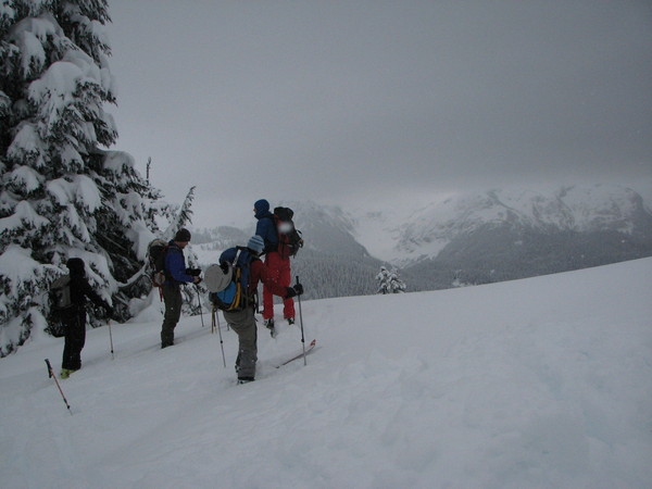
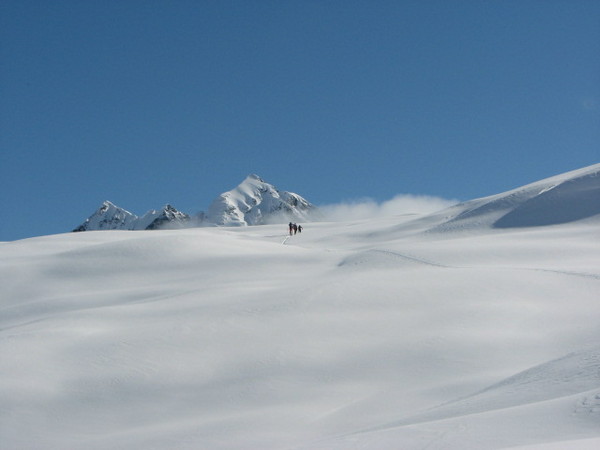
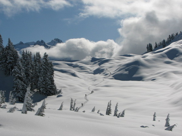
Over the next five hours we traversed beautiful terrain both up and down. Cloudy skies gave way first to broken sun patches
then to full on sunshine:
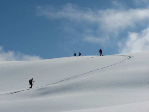
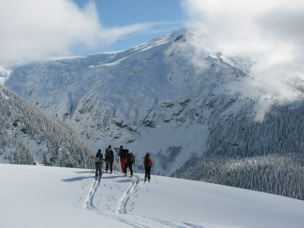
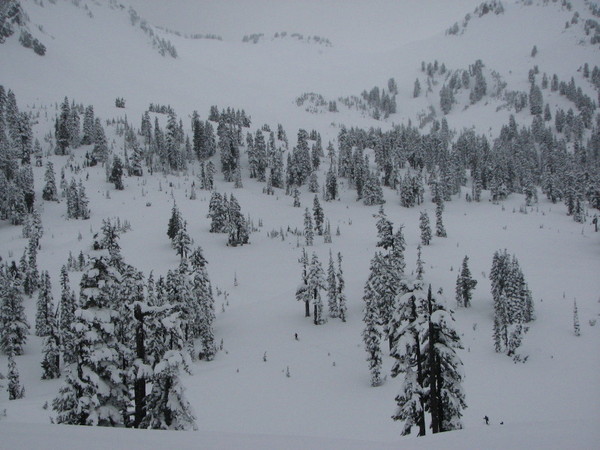
Travel was enjoyable. We would space out, regroup, talk, mock, laugh, trudge, and do what ever else we could to keep our attention focused on what lay ahead (rather than on how far we had to return)
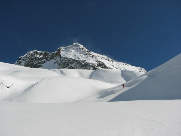
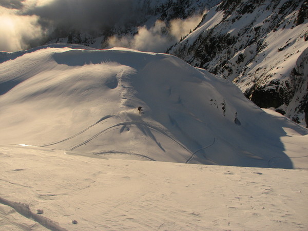
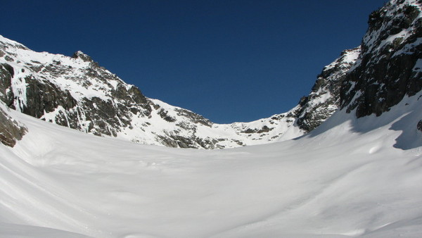
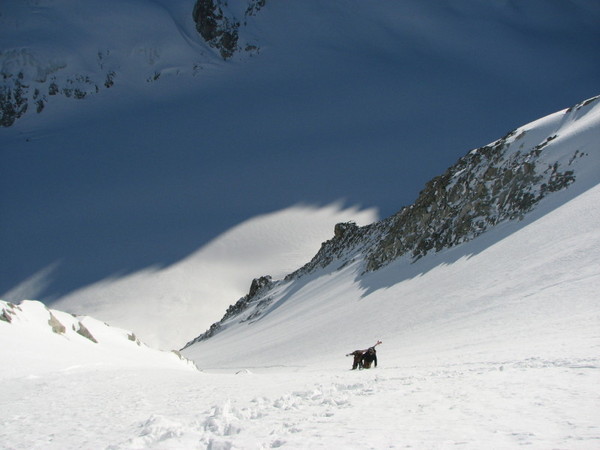
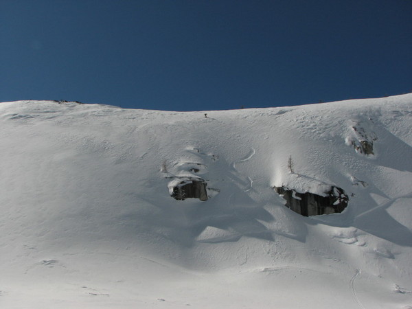
By 12:30 we had reached the base of Trick peak.
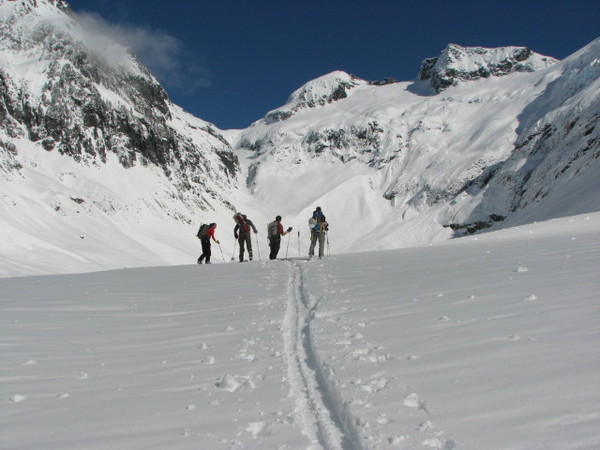
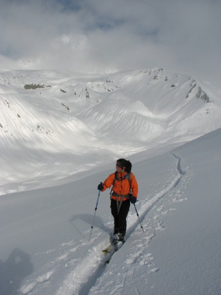
We lounged about for a bit, eating and looking for a way up and down that we all liked. Ice, apparently, is a relative term. From where we sat Trick shot up roughly 4000’. Enough for one in our group to call it a day and offer the kind service of setting a skin track back to the hut. Monika silently whispered that she was going to take lead for a bit. We lions in our pride had it good. Hannah had broken most of the trail early on. Now our other lioness was blazing vert while the rest of us finished stuffing our faces.
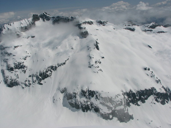
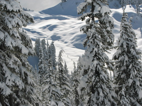
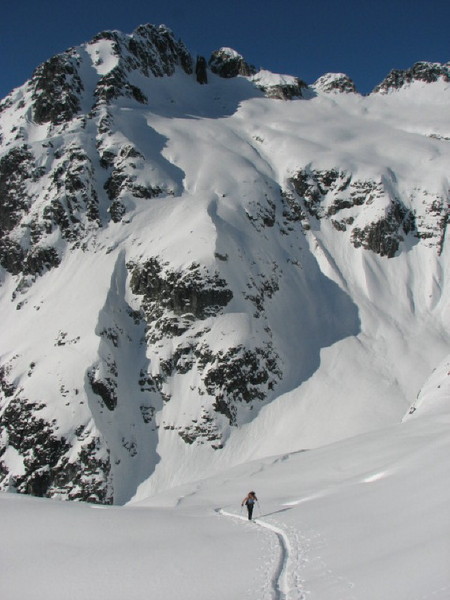
Our route followed a gully to the far climber’s left, then traversed up to the right before joining the main fall line directly beneath the summit. Low lying clouds began to fill the valleys, adding to views the likes of which I’ve only rarely seen.
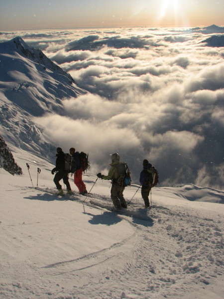
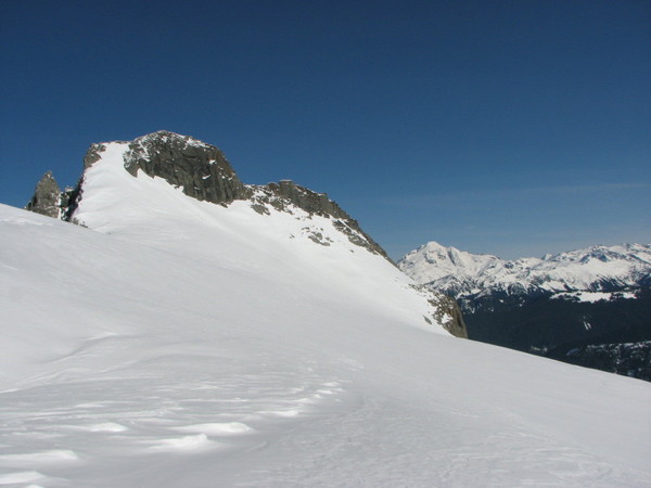
At the col overlooking the Mamaquam Glacier we mistakenly set our sights on the false summit. We realized our mistake upon arrival. It was 4:45. Most if not all of us were content to ski from there. Birthday boy wanted to look around the corner to see if the summit was possible. He did, and it was. Yet another reminder why the hater we all love has such a history with getting up and down things.
We all slackjawed on the summit. Glaciers, ice falls, rock spires, powder, sun, clouds, mountains. Everything mountain lovers love, in every direction. Too bad it was 5:30. I would have liked to have spent hours up there.
I didn’t take many pictures on the way down. Here are the few that I have:
Sky:
Casey:
The two lionesses:
Lunger:
At the base we all ogled our tracks in the alpenglow. Then it was time to don the headlamps for the skin back to the hut. What a great day.
Back at the hut we joined up with the Hummels, Dave, Christy, Ashley, and Corey for much revelry and good times. Great powder all day Saturday, beer and booze, curry and cake Saturday night made for a great weekend. Thanks to everybody who participated-I had a blast.
-
Your trip sounded great Josh. I checked it out once I got back. The Pride looked pretty sweet. I wonder if we climbed the same route to the summit. Did you drop all the way down to the columbia and then head up and to the climber's right to gain the south ridge? Any way, nice trip.
-
Oh, and by the way. REI sucks. Don’t buy their bikes-they’re dangerous.
hows that?
As a hard working emplyee (sometimes) I am always curious what the outsider thinks. Great tr by the way - love the pics!
I got a thing for a redhead who face planted on a sidewalk near pioneer square on account of her REI Navarro bike spontaneously disintegrating while she was riding. I saw a picture of the bike- the frame just sheared off from her fork. Mistakes happen, I guess, but REI hasn't exactly been helpful in covering red's medical expenses.
Sirwoofalot, I think the words are mine, but I can't be certain.
And no, rbw1966, I never plotted my route on a topo.
-
FS 65, out of Skykomish. They hardly ever plow it. I got lucky.
-
G-spotter, you hittin' on me?

-
Trip: Kyes Peak, Monte Cristo Range - SouthWest Face
Date: 2/20/2009
Trip Report:
Last week I rubbed a snowbunny the wrong way and became terribly ill. Symptoms included insomnia, loss of appetite, an inability to focus, and an overwhelmingly acute malaise. After hardly eating for 4 days, feeling fit from the unplanned weight loss, and thinking that exertion might speed the detox process, I hatched a plan to huff it into the Monte Cristo Range in the wee hours Friday morning to sneak a peek at those beautiful peaks.
I left Seattle a little after 2 am and drove to within a couple of miles of the trailhead. It was dark. Stars were out. My truck had been making weird non brake-related squealing noises for the 14 miles since I left highway 2. I wondered whether it would make it back to the highway, but managed to keep myself from descending the “what if” ladder. The night was beautiful. I packed a bowl and savored the uncertainty of the day ahead, thinking to myself that if Phelps could win 8 golds the least I could do was get lost in the woods for a few hours. Then I thought about the amusing way a friend described his final pretrip thoughts before solo skiing Glacier’s Frostbite ridge. I began skinning around 4:30.
A lost compass, a failed attempt at communicating with birds, and roughly three thousand feet of gain had me perched above Virgin lake for sunrise. A deep calm overcame me. I sat there awhile taking in the beauty. I’ve visited the spot where I was sitting often. I’ve seen it in spring, summer, autumn, and now winter. My history with it relaxed me.
I stripped the skins and skied excitedly down to Blanca Lake. One of the appeals for this trip was to see Blanca Lake in winter. It didn’t disappoint.
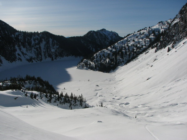
Taken on the way out with better lighting:
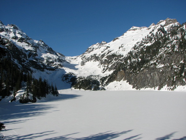
Not a breath of wind. Sun capped snow covered peaks. Stable, untracked snow. Spectacular.I thought about what to ski. Columbia looked great, but there were no immediate weaknesses in the cliff bands that cascade into the lake. I looked at Kyes Peak.
About 7 years ago I tried to climb Kyes Peak via the town of Monte Cristo. The thought of visiting an abandoned mining town excited me enough to ignore the rain and peddle my bike in there anyway. Weather, inexperience, and an unfamiliarity with Becky-speak turned me around a little short of Monte Cristo’s North Col. I spent a fair amount of time exploring the town’s remains, though, finding it hard to believe that such a thing could exist in such a place. The strongest memory I have of that trip is seeing where the hotel used to stand and reading about the tree planted there by James Kyes. For those of you unfamiliar with his story, it’s worth hearing. Kyes was a kid living in the hotel in the early 1900’s. He used to love scrambling the nearby peaks. If I remember correctly, he brought down a young fir from up high somewhere and planted it near the hotel. The plaque attached to the tree in his honor tells the story of his life. Kyes commanded a ship in WWII that was attacked by German subs. As the ship sunk he noticed that a black messboy had no life jacket. Kyes gave the boy his own and eventually went down with the ship. The story made me want to climb Kyes peak someday, if for no other reason than to pay homage to a life well lived.
But I had other reasons to ski Kyes. It looked enjoyable. Plus, it offered the possibility of seeing the Cascades from an unusual vantage point in perfect weather during my favorite time of year. So without knowing exactly where to go I set off across Blanca lake looking for a way to get high on Kyes.
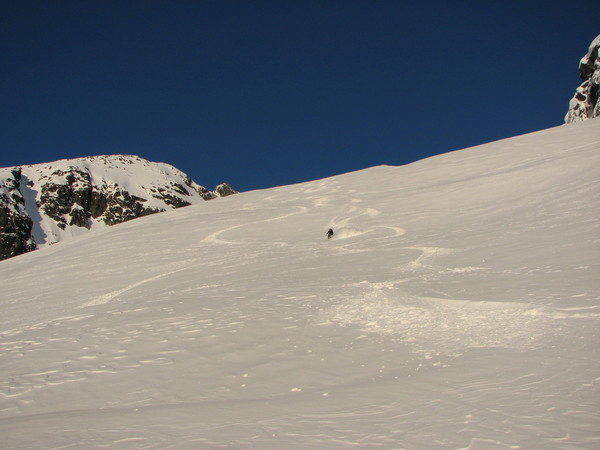
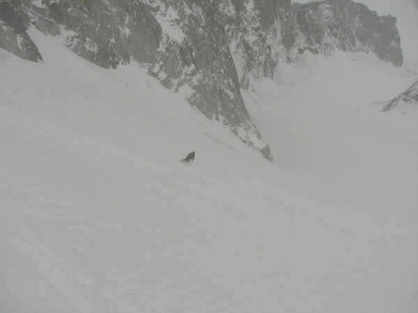
Sure enough, at the head of the valley a northeast facing face seemed to access the slopes beneath Kyes’ South ridge. I skinned up beautiful boot deep consolidated powder. I began to get super excited about the skiing. At the top of the face I crossed over onto a sun exposed face still hard from the night freeze. Powder AND corn? I love Washington.
The rest of the climb was straight forward. Found a breach in the south ridge to boot up, and then followed the ridge along its east side to the final summit pyramid/block. Went as high as I could with skis then traversed to the summit. Mountains usually seen from a distance were now close at hand. I love Washington.
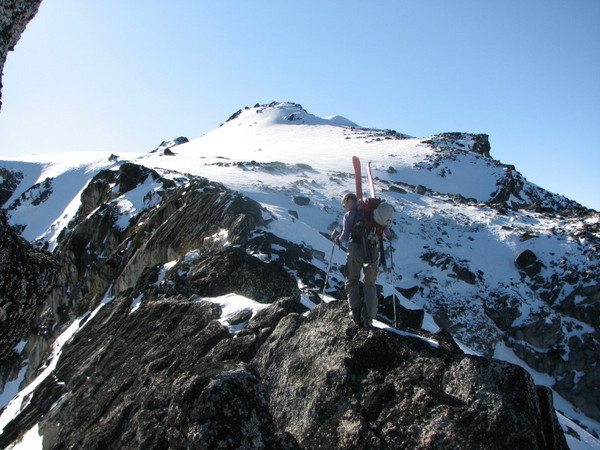
Looking at the summit block after gaining the south ridge:
A small traverse from my skis to the summit
East face of Three Fingers anyone?
I sat on the summit for a good half hour, realizing that I've only ever been able to get past lonliness by embracing solitude.
The ski itself was great. From the notch where I gained the south ridge I skied down about 800’ of perfect corn,
then climbed back up in order to retrace my steps and ski the powdered face that had enticed me.
I didn’t care. It wasn't even 1:00 yet. I had time and energy.
Back on the Columbia glacier I melted snow and dozed in the sun. I had a hard time motivating myself to leave. Why move when you’re happy? The Columbia Glacier was actually one of the skiing highlights- 1200’ of softly undulating corn down to a lake is a nice way to unwind.
I could have done without the hike up to Virgin lake, and about a quarter of the 3000’ of tree’d descent, but after Gold Creek a few weeks ago everything is gravy.
Oh, and by the way. REI sucks. Don’t buy their bikes-they’re dangerous.
-
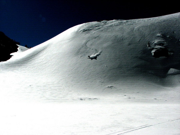
I was looking at that ice on saturday, wondering whether it gets much attention. Looks like a lot of fun. Nice job.
There's a bunch of ice up gold creek these days,especially on the north side of Alta.
-
nice pictures Dan. Glad you had fun.
-
Pretty cool guys- I hope I age as well as you two...
-
Here's what I learned about approaching via Lightning creek....
1) The trail between the turnoff for Boulder Pass and Thunder creek (approx 3 miles) is one step up from terrible. It's there, but is quickly becoming overgrown. Most of it is overgrown from the shin upwards, so you have to trust that your feet are on it, close your eyes, and charge ahead. About a third of it has become a stream so if you don't like to get your feet wet stay away.
2) All three stream crossings are easy and manageable, even in May. For the first two I headed down stream from the trail and found easy logs. For the third, see below.
3) There IS a trail up Lightning creek! I only know how to get to it via a small schwack, and it's very faint and sometimes hard to follow down low, but the higher you get the easier it becomes. Someone actually had a saw back there because there's a steady trail of cut logs to confirm the trail. And a campsite at about 5000'. I hope I'm not spoiling someone's private getaway :-).
Here how I find it. The mouth of lighning creek fans out into many small streams once it exits the upper valley via a water fall. When we hit the first finger of lightning creek we headed up stream and crossed as soon as we found a good log. Then we made a beeline for the water fall. There are some massive amounts of downed timber that make relatively easy walking. As you near the waterfall (and the convergence of several streams) you'll see a prominent ridge to the west of the falls and about a hundred or so feet up. I'd call it a grass arete. That's where you can be sure to find the trail. We crossed to the west side of lightning creek when we could, and schwacked up steep forest (not too bad) until we hit the trail that traverses back to the arete that you can see from below. From there, hang onto the trail like a dog to his bone. Basically, you climb to the west of a creek that drains into Lightning creek until you can cross at (approx) 5500' From there it's super easy travel up to the Honeycomb glacier. Knowing the trail, it took Monika and I seven hours to get from car to camp at 6000' (4 hours trail, three hours up)
-
That was a good time, meeting and hanging with you all. Sweet place too. Already looking forward to next year.
Anybody see a full face bike helmet while unpacking? Can't seem to find it......
-
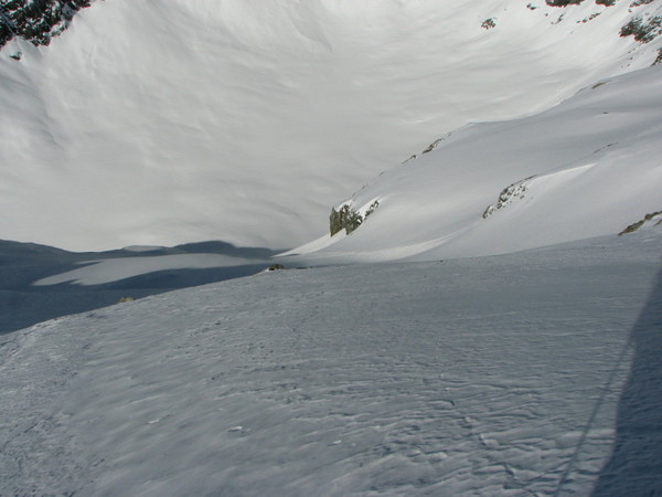
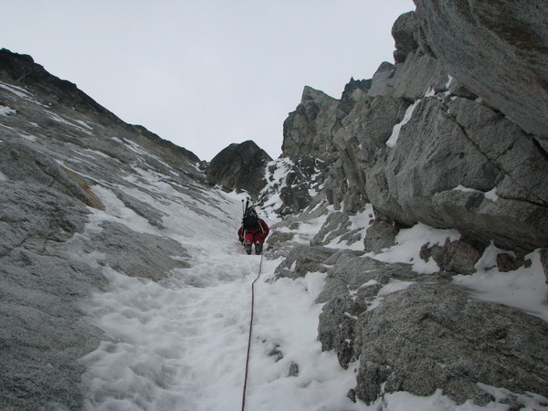
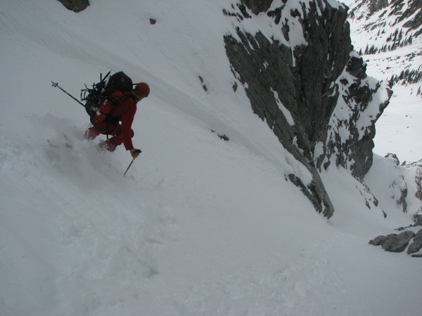
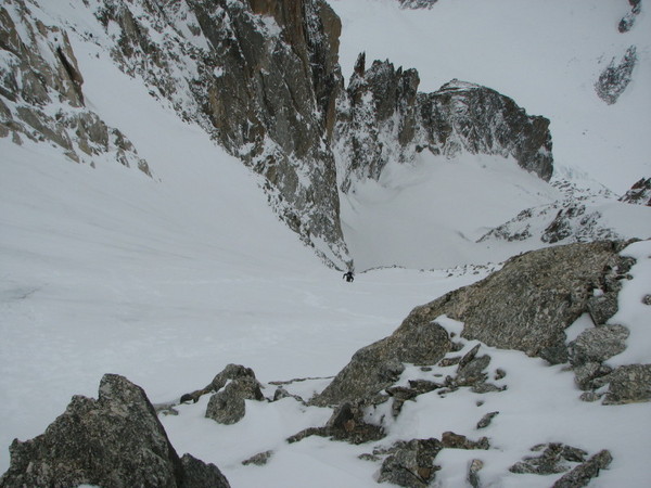
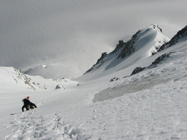
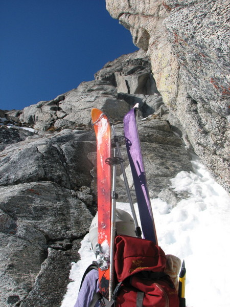
Just a few pics to show conditions.
First runnel pitch:
Our high point between first and second couloir:
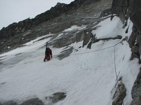
Near the top of the first couloir:
-
looks like a good time....
-
C'est tres cool. Bien fait......
-
That is a PHENOMENAL trip, in my opinion. Really, really cool. Well done.
-
Great Trip Sky. And welcome back.....
-
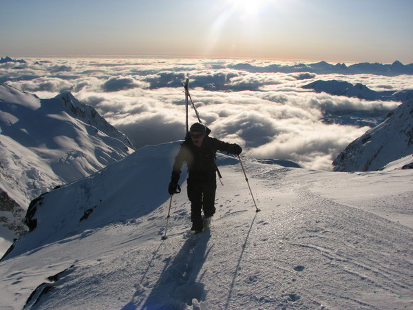
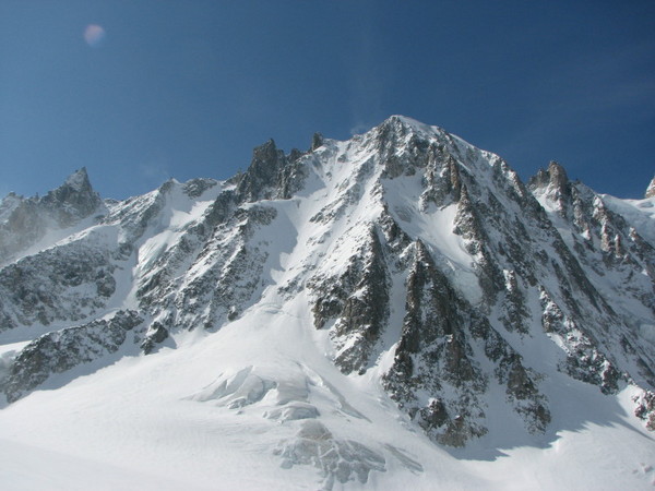
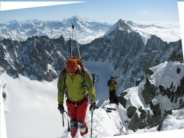
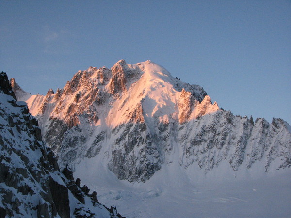
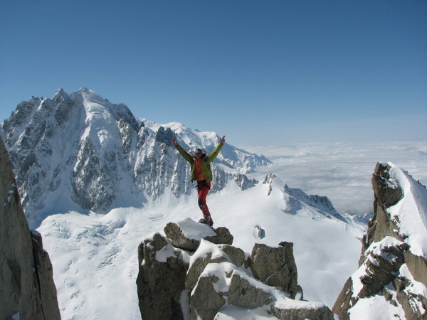
Trip: Argentiere/Chamonix - 4 routes, 6 days
Date: 4/3/2008
Trip Report:
Route 1: Col du Plan
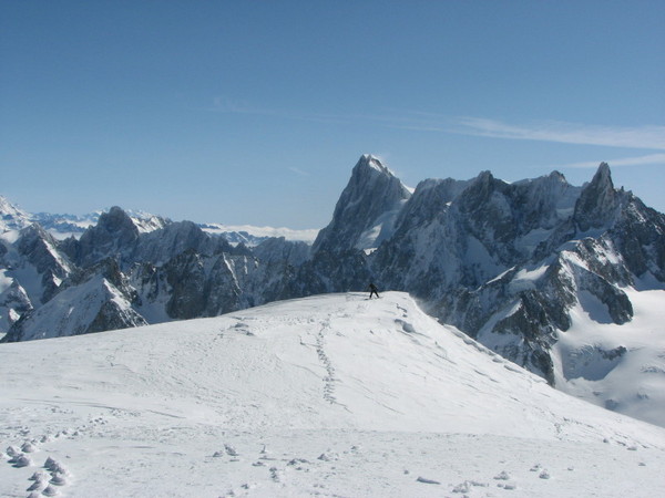
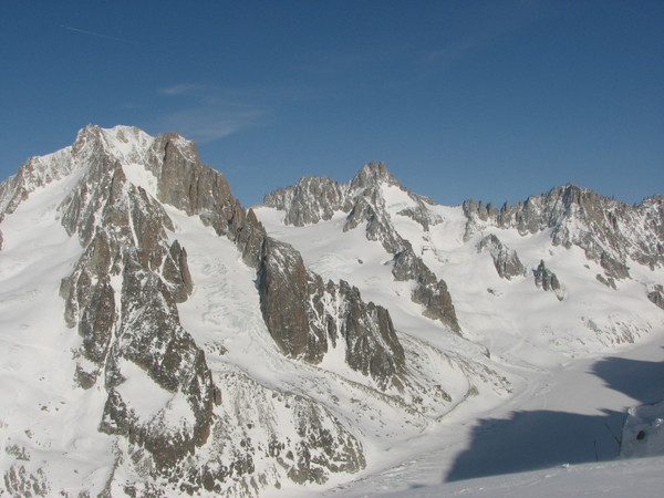
looking up the Glacier de Lescheaux:
On the Mer de Glace:

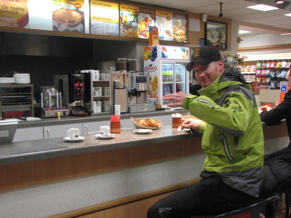
Here's a picture I had to throw in. It was taken at 4:30 in the morning at a gas station en route to pick up Sky from the Geneva train station. Just a wee bit different than the kind of pre-dawn pit stops that we get here in washington (I still love Washington):
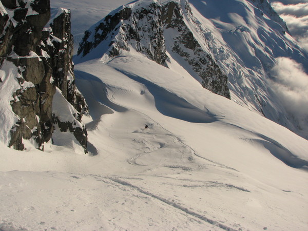
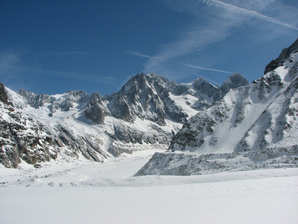
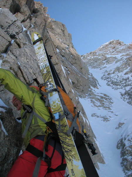
Route 2: Aiguille d'Argentiere
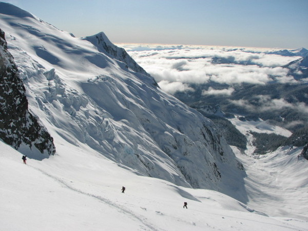
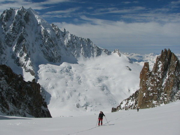
Last Friday, Sky, David, Drew and I set out to ski the Barbey Couloir off the Aig. d'Argentiere. We decided not to use any lifts, something almost sacrilegious in a place like Chamonix. It was a day of pure alpine bliss.
We had a beautiful, long (approx 10000') approach route. We took the Glacier du Milieu, the one second from the left, between the the rock arms
We had great weather and views:
We got to climb some rock:
And we had nice exposure:
Somewhere along the way the following was heard:
"that's not icy- that's f***ing ice. I'm heading over there...."
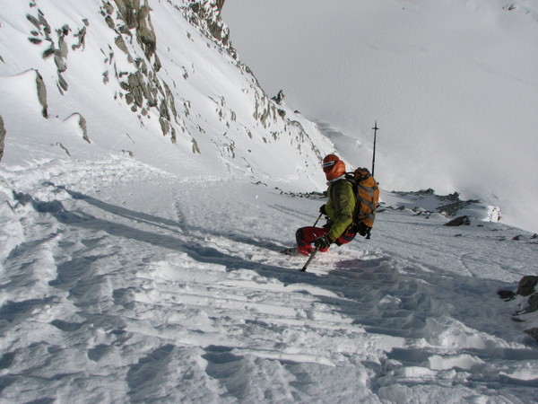
By the time we got to the top, 11 hours after we started,a storm had blown in and persuaded us to abandon skiing the Barbey. So in generally good snow we headed back down the way we came up.
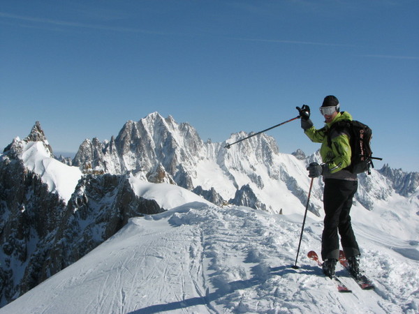
Sky shows how to get it done:
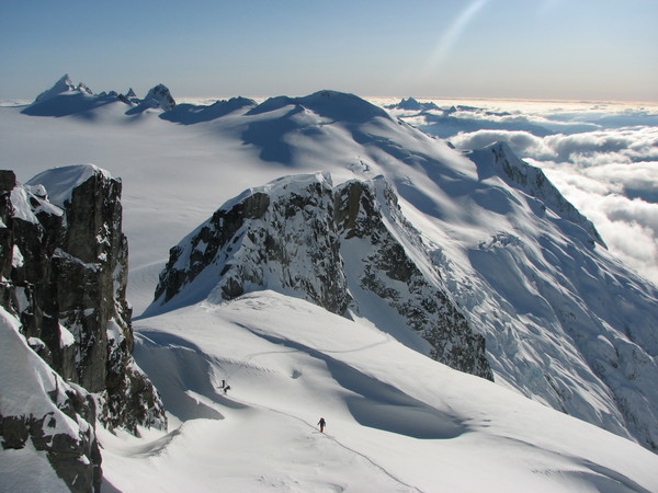
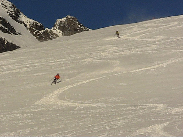
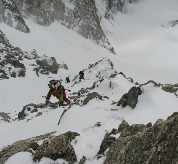
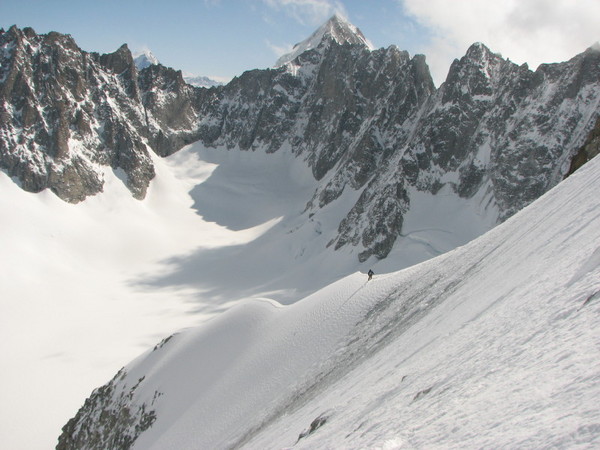
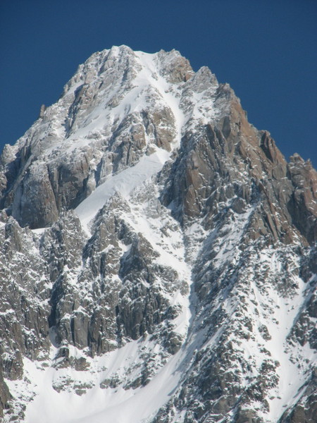
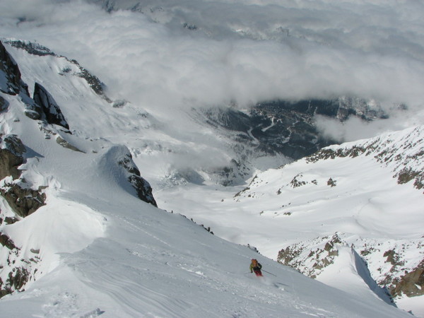
Route 3: NE Face of the Courtes
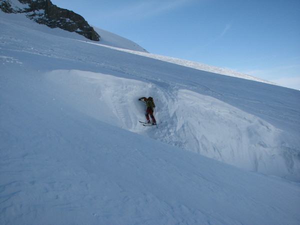
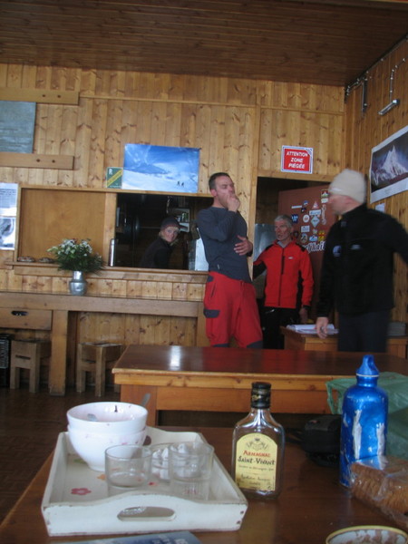
On saturday the four of us set out for the refuge d'Argentiere. The forecast called for good morning weather on Sunday with storms approaching in the afternoon. We thought an early morning start from a refuge would be a good idea. On the way to the refuge we almost lost Sky when he got carried away by the good snow and skied into a crevasse:
Then I almost had to bail when my binding broke just before reaching the hut. Luckily for me Fred, the guardian of the hut, was super nice and let me take the fritschis from his skis and mount them onto my own. After that the good times rolled:
here's Dave trying not to fall off the mountain:
somewhere around here the following was heard: "I wouldn't mind having a second tool for this...."
Route 4: Couloir OUEST du Chardonnet
Having had a full four days, Sky and I were ready to have a rest day on Monday before hitting something moderate in the Aiguilles Rouges on Tuesday when we saw that the forecast called for good weather. So after bidding "au revoir" to Drew and Dave Monday morning, Sky and I left once more for the refuge d'Argentiere monday night.
With new supplies of course:
When the alarm went off at 4, I asked Sky whether he'd managed to sleep. He said he hadn't because he was too stoked. We'd had 4 inches of fresh snow that had fallen in warm temps, followed by clearing and cold. Perfect for where we were headed. "How about you," he asked. I said I hadn't slept much either because I was so friggin' scared. To which Sky replied: "we just interpret our biochemistry differently." As I wrapped my mind around that pearl we heading out the door in below freezing temps and clear skies.
Daybreak on the Verte:
Sky at the Col Adams Reiley:

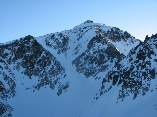
About 250m from the summit we encountered what the guide book describes as a delicate traverse which leads to the summit couloir. The traverse was super exposed and on uncertain snow. Sky tried to put steps in but had difficulty establishing anything with confidence.
After about 10 minutes, I told Sky I didn't want to continue. He agreed. So we sat down for lunch and enjoyed the scenery before heading down.
The green dot is col Adams Reiley; the red dot was our high point:
-
-
Great trip telemarker. I'd never really looked at 8 mile before- thanks. I might have to pay a visit one of these day.....
-
Yeah, I figured you'd be too worked from your trip....
-
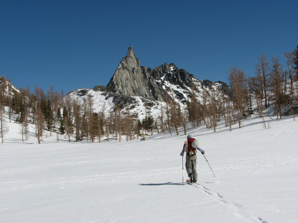
Trip: Cannon Mountain - Northeast face via Asgaard and Prussik Pass
Date: 3/8/2008
Trip Report:
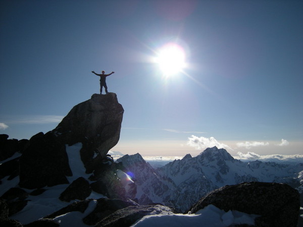
photo by Monika
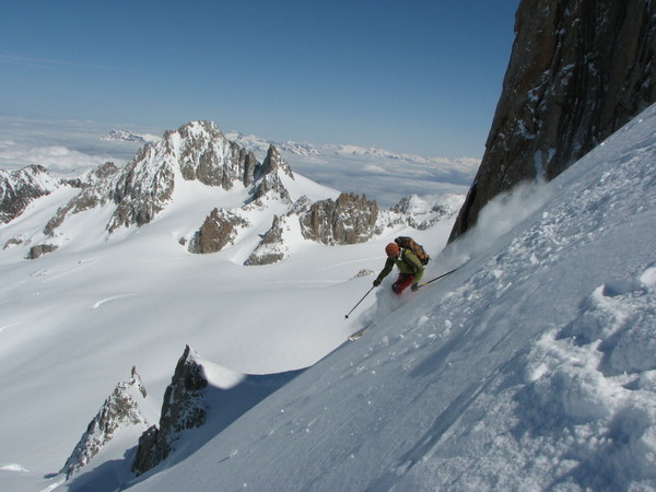
Have I mentioned that I love Washington? Yesterday was yet another perfect day in a ridiculously lucky streak I’ve been having. Great weather, good snow, great views, and even better partners seems to be in the stars for me lately.
The plan: ski over Asgaard Pass, then Prussik Pass, climb Cannon mountain, ski one of it’s north chutes to Coney Lake, gain Cannon’s north shoulder, and ski back to the car more than 5000’ below.
Cannon’s appeal lies in it’s location. At 8638',and only a stone’s throw from the Stuart massif, I imagined the views from its top would be extraordinary. The trick was getting there. Twice before I’d grunted the nearly 5000' straight up from Lake Stuart trailhead to Cannon’s north shoulder to ski the Cannon Mtn Couloir, through blowdown and steep trees. Not the best way to savor beauty. Hence the idea to approach via Asgaard and Prussik Pass. A little longer, but also a more natural traverse through insanely beautiful terrain. I like loops in beautiful places.
I convinced Dave Coleman and the trail breaking machine known as "Monika" that the trip would be worthwhile. Not an easy sale- a 2:45 am seattle departure, a several hour drive, more than 8000’ of gain over somewhere between 15 and 20 miles, all in order to climb/ski something they’d probably never heard of. Dave got us to the end of Icicle creek road in about 2 hours. Thanks Dave. By 5:30 we were on our way. The road was in fast condition. We made it to the trail head in a little over an hour. The pace might have been a little too fast as we all got blisters from the Nordic action in alpine equipment. Dave got the worst of it. A couple more hours got us to Colchuck lake, and by 11:00 am we were sitting pretty on top of Asgaard Pass in BEAUTIFUL weather. The way to Asgaard was over hard snow. Dave and I switched to crampons, while Monika taught me that the ski crampons I have sitting in my closet are actually useful. She smoked us. I’m not kidding- I saw traces of her skin track in places where I was using full French Technique. Very impressive.
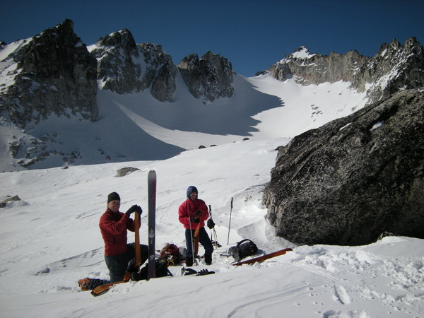
photo by Monika
At the col Dave revealed that his blisters were giving him serious grief. It was too beautiful, and too early, to turn around so the three of us set out for Prussik Pass, finding some good turns along the way towards Inspiration Lake.
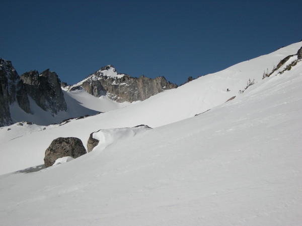
photo by Monika.
Skier: Dave
Dave ripping above Inspiration Lake:
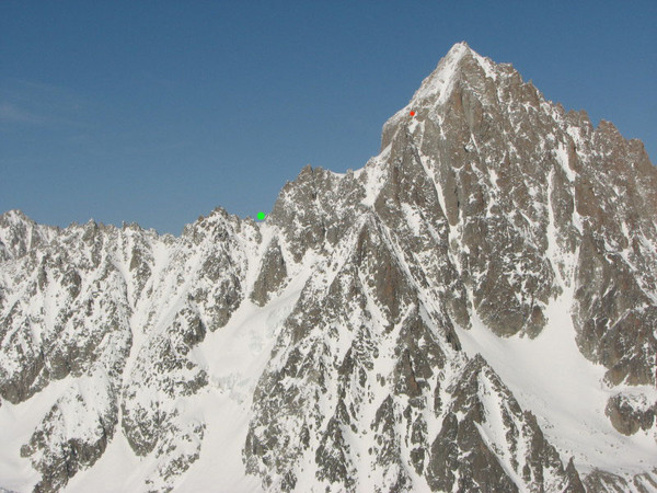
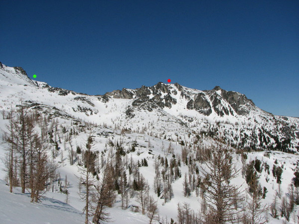
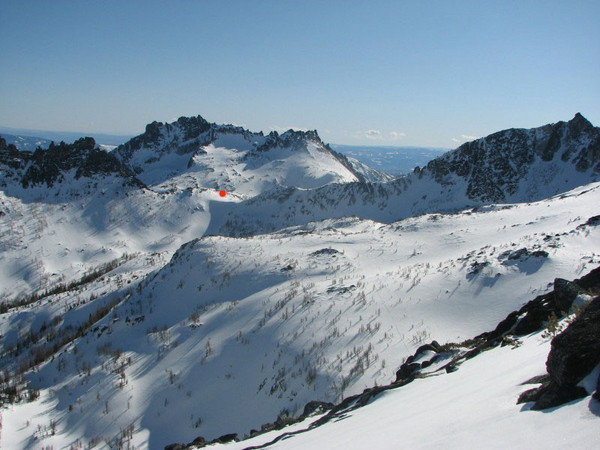
At Prussk Pass we got our first view of the route to Cannon. We imagined that Cannon’s summit lie hidden behind the ridge lining the horizon. We were right. We erred, though, in imaging where along the ridge we should aim our skin track. Who needs a compass when you have imagination? Answer- Dave, Monika, and me.
Red dot = where we went
Green dot = summit of Cannon
So we headed off for what we thought was a direct line to Cannon’s summit but was actually Cannon’s east shoulder. Shortly thereafter Dave decided that he needed to turn around. He was spent, and wasn’t up to facing the unknown steepness of Cannon’s north side. I thought about convincing him otherwise, but decided against it. Dave’s been thru enough adventure to make good decisions, so after making sure we were all OK with it, our party of three became a party of two.
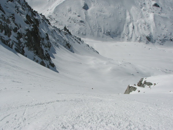
The climb to the east shoulder went smoothly. We abandoned a snow couloir in favor or rocks to avoid the potential of sun slough.
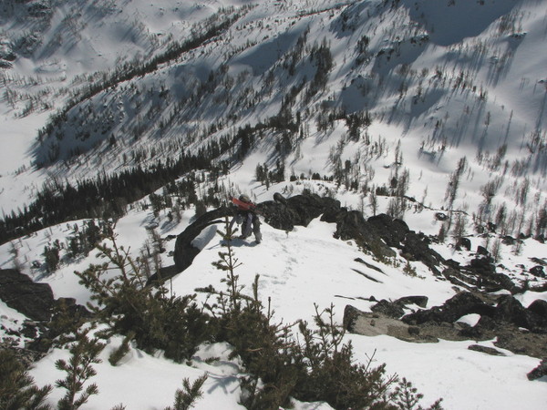
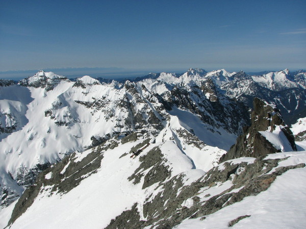
When we topped out we could see where we were, and where we wanted to be. On the bright side, ridge walking always adds flavor to a trip.
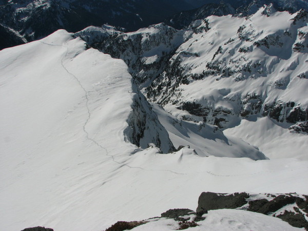
Especially when you cliff out. Rather than retrace our steps—it was getting later in the day— we found a way through the rocks to the snow below. After some careful maneuvering, we were on our way again.
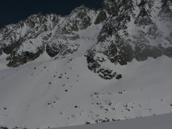
A view towards Prussik Pass. If you look closely you can see our skin track in the lower right center of the photo:
We topped out around 4:00 to the views I’d hoped for. I’ve seen the Stuart range a few times now, yet every time I see it in full form I’m floored. Stunning. I love Washington.

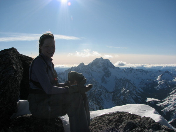
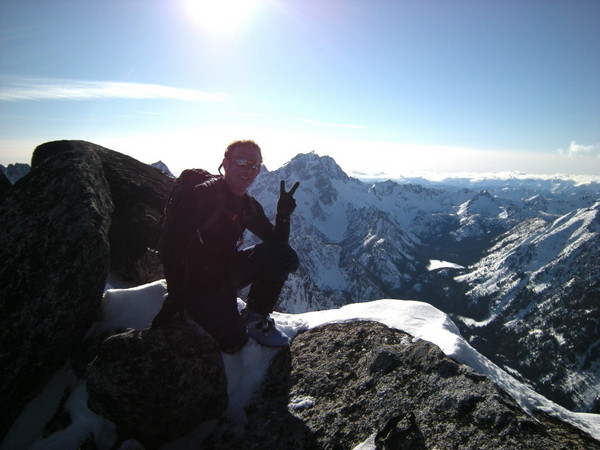
photo by Monika
I remembered Cannon’s north side from my pictures and with little trouble found the entrance into the chute I wanted to ski. The snow was variable powder, styrofoam, and wind slab. Good for linking turns, but too inconsistent to open up.
From Coney lake it was a short boot up to the ridge and more views. We thought about skiing the Cannon Mtn couloir, but the thought of additional traversing and booting turned us off. Instead, we found the gully I skied last year and enjoyed untracked perfect shin deep powder, in the sun no less, for about 2000’. Then some open corn mixed with tree and survival skiing had us popping out at the Lake Stuart trailhead. Not a foot of traversing. Better to be lucky than good.
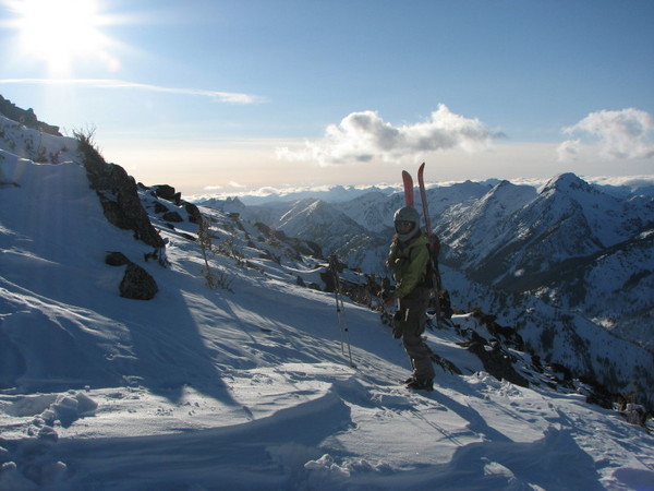
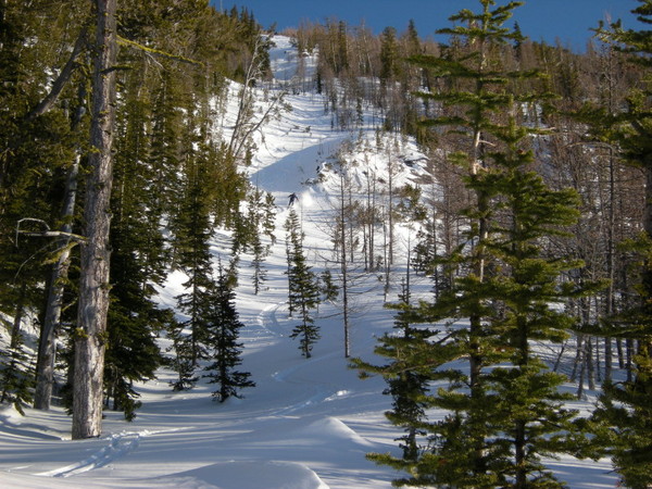
photo by Monika
We skied down the road and arrived at the car a little before 6:30, 13 hours RT, with plenty of daylight to spare. Dave hadn’t returned yet, but we figured it would take him some time to get down from Colchuck lake. Dave had the keys, and we started to get chilled, so when we saw a couple heading into town we asked for a lift. We left Dave a note saying that we’d keep a seat warm for him at Gustavs. He showed up in high spirits just as we were ordering some food. Thanks to both Dave and Monika for a great day....
-
Sounds like a GREAT time on a very pretty mountain. No pictures?
[TR] Hinman and Beyond - may 16-17 5/16/2009
in Alpine Lakes
Posted
Trip: Hinman and Beyond - may 16-17
Date: 5/16/2009
Trip Report:
Just thought I'd post some purdy pictures from last weekend...
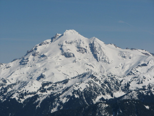
Scott skinning on Lake Ilswoot with some mountain(?) in the background:
Whoops. Scott skinning on Locket Lake towards Mt.Hinman:
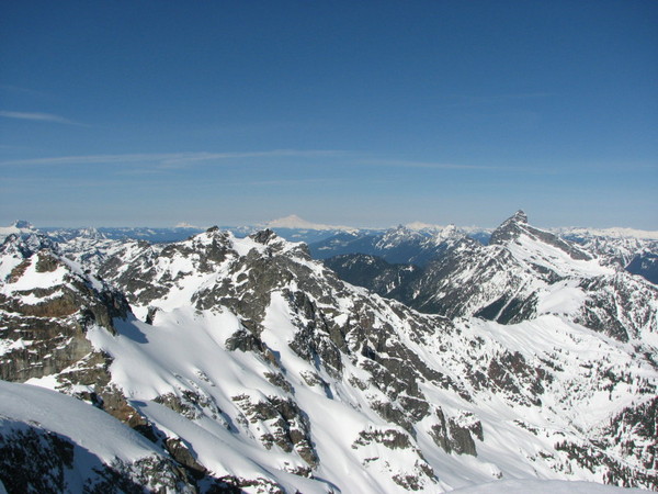
Looking north from La Bohn Gap towards the Necklace Valley:
Looking south towards Bears Breast from La Bohn Gap:
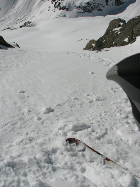
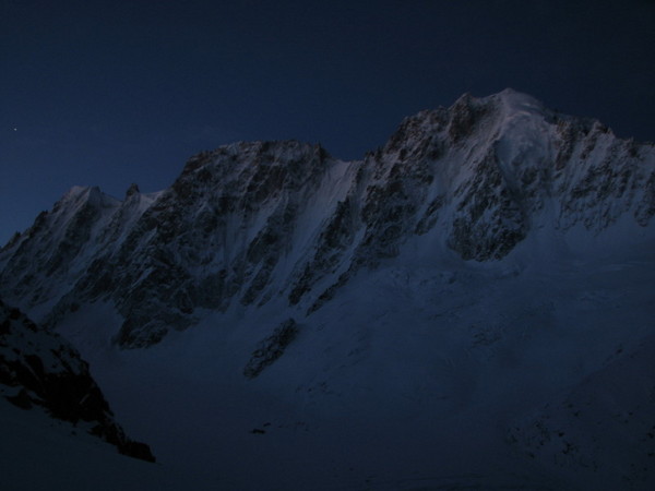
Skinning across Williams Lake towards a bivy beneath Stuart,er, Summit Chief:
Some nighttime shots beneath Summit Chief:
Approaching the Summit Chief Col, looking back towards Hinman and La Bohn Gap:
Trying to get to Chimney Rock- Overcoat Col:
Still trying. Three Queens in the background:
So close:
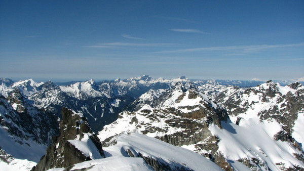
Ok. Change of plans. High on Hinman:
View from atop Hinman, looking south towards the Chimney Rock-Overcoat Col:
Bozo the clown on Hinman:
Parting shot of the ski down from La Bohn: Gap: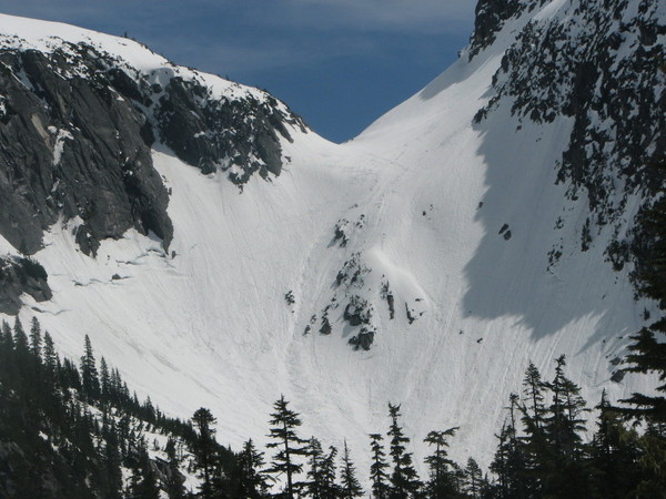
Sure do LOVE Washington.....