


benmurphy
-
Posts
162 -
Joined
-
Last visited
Content Type
Profiles
Forums
Events
Posts posted by benmurphy
-
-
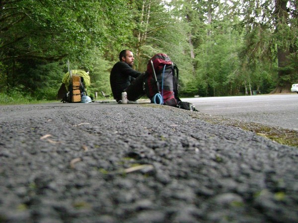
to answer my own question...about 3,800 feet with decent clearance 4x4...probably coulda made it to about 4,500 feet if we'd pushed it.
-
Anyone know how far you can drive up Dan Creek Rd to FS RD 2435 to access the northwest ridge of White Chuck?
Will be in Jeep Wrangler 4x4.
-
I am taking a break from the tune and wax, munching on some pizza and, getting stoked for some turns this weekend!
Baker is opening in Thursday!

hell yeah! i think i'll be headed up that way thursday morning!
-
hehehe...i think they figured i was retarded or something...
-
hell yeah guys, i met ya'll up there at the lookout...
hike down was great!
good times man...
let me know if you're ever looking for someone to climb with out there...
-
hell yeah, now i really gotta get out there soon...
maybe early next week or next weekend, weather permittin'
-
Looks sweet man, great job...I gotta get out there sometime before this season ends!
-
ya know, not really sure who my parents are...just kinda bounced around from orphanage to orphanage as a kid...

-
yeah we climbed the rash, but didn't bring the camera up with us...
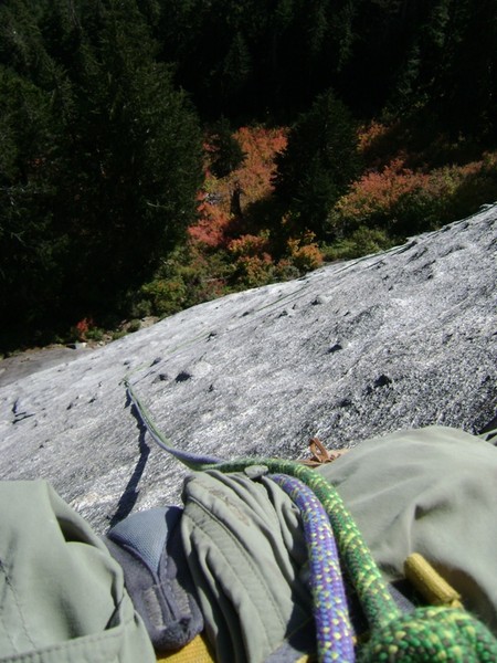
I led the 2nd pitch...that move above the bolt/flake at the top of the rash (before you start out left) was wet and felt harder than 5.8...great climbs for sure!
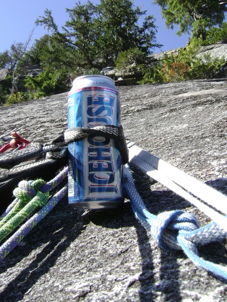
the icehouse was the best (highest alcohol percentage) beer they had in cans at the little gas station we stopped at...better (bottled) beer was waiting patiently for our return...
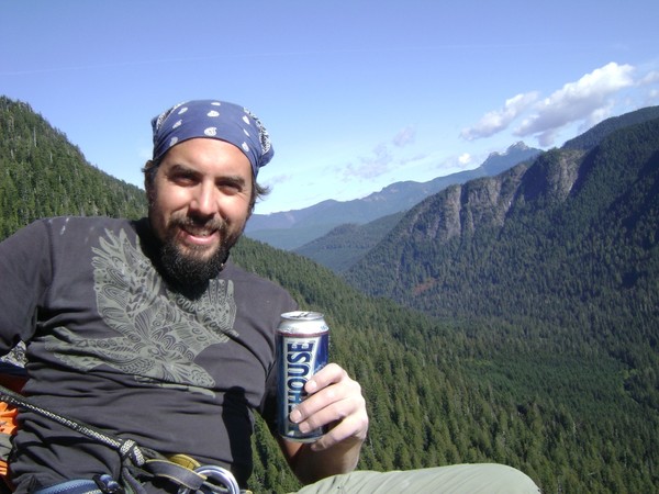
hard to beat a day at darrington, man...
-
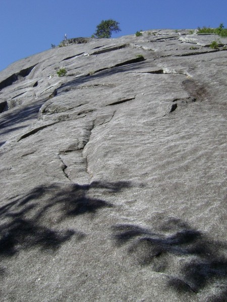
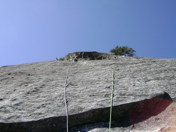
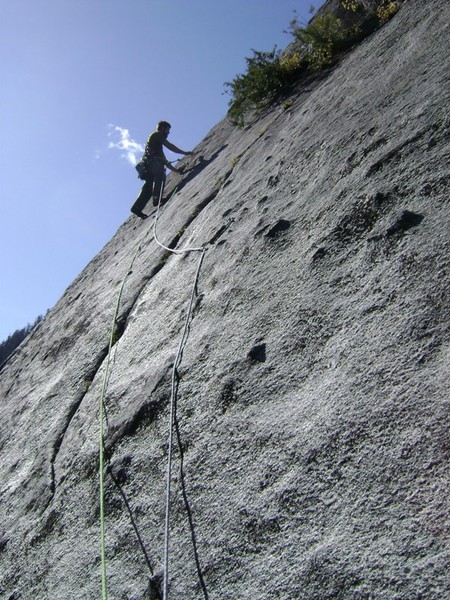
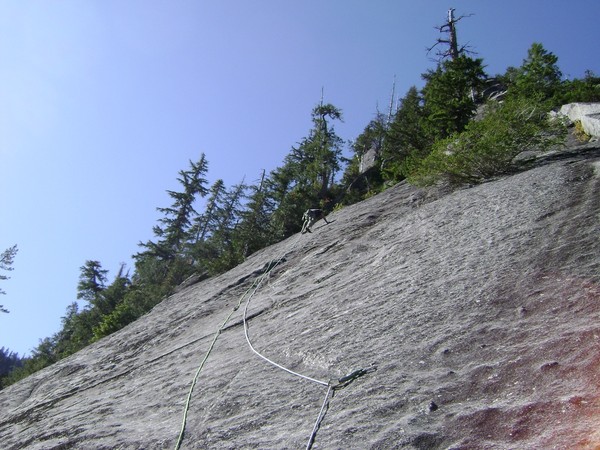
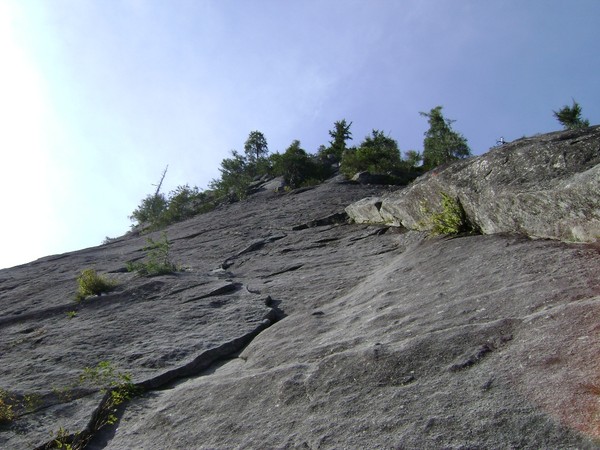
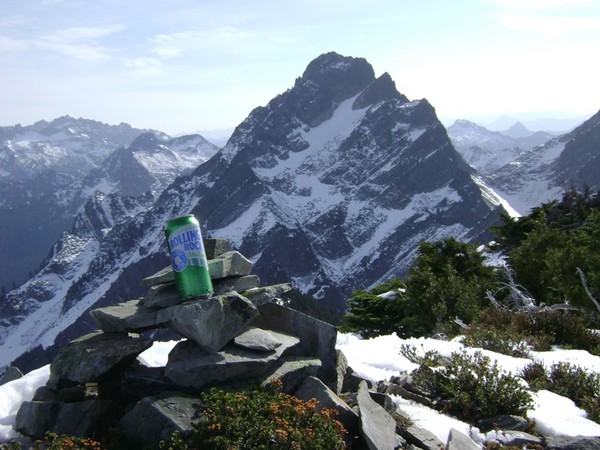
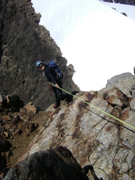
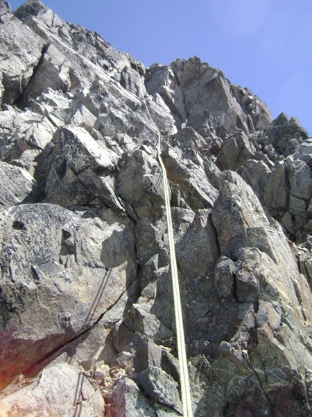
went out to durrington to climb dark rhythm today, but the granite sidewalk was way wet in the morning and the bushwacking was starting to suck...so we made our way over to three o'clock rock and climbed the kone and the rash. perfect day out and didn't see a single other person.
some pics...
Looking up the kone from start:
P2 of the kone:
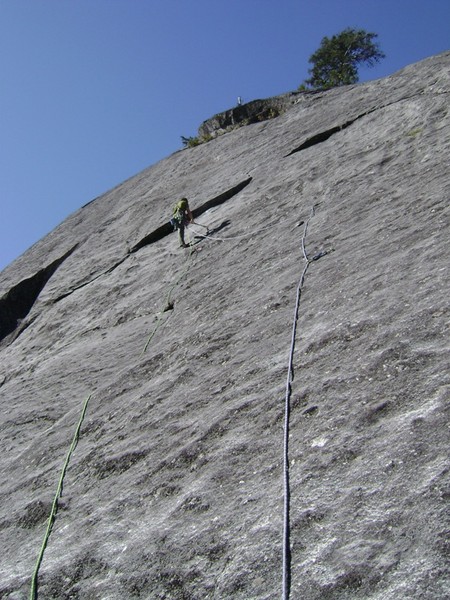
P3 of the kone:
P4 of the kone:
Last pitch of the kone:
knobs:
hanging out at the top of the kone:
pas:
looking up the rash:
-
yeah, i've been out there several times this summer and the fastest we've made it from the car to base of safe sex is about 2.5 hours, and that's with no route-finding issues...
too many downed trees across the "road" to make a bike any faster.
-
Trip: Morning Star Peak - East Route
Date: 10/26/2008
Trip Report:
Background: Tried to climb this one last Sunday with 2 others...ascended the large slab east of the route shown in the Beckey guide then headed up the gully shown in the Beckey guide...turn out this is the wrong gully. We didn't have time to go down and back up the correct gully so we scrambled up the peak east of the true summit...
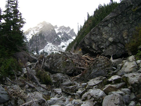
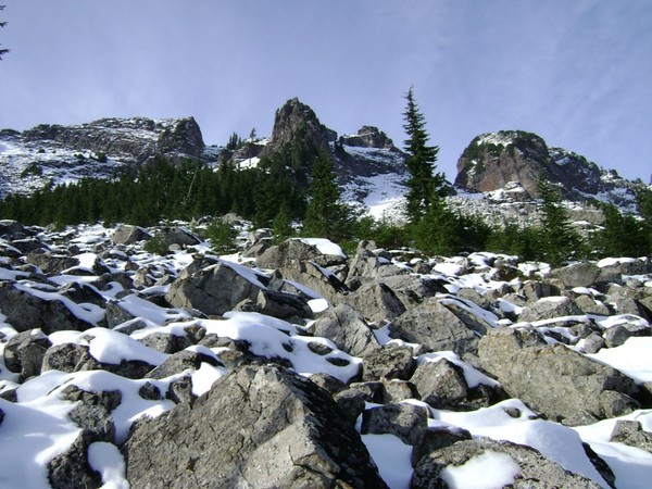
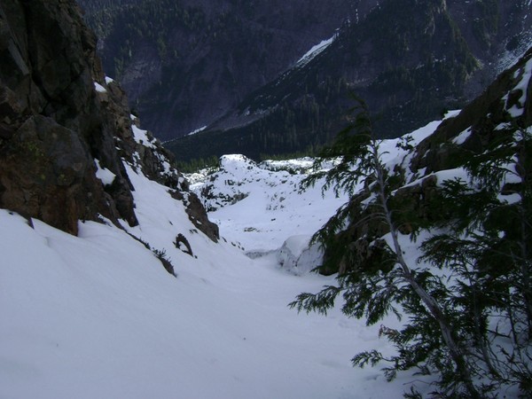
Armed with knowledge of the correct route, I went back this Sunday to tag the true summit...Last week there was no snow, this week there was quite a bit...hence i decided against the slab route...ended up leaving the river basin at about 3,300 feet and ascending brush, wet slab, steep snow gullies, rock, etc. If it weren't for veggie belays (going up and down), I'm not sure I'd of made it...Several safety stops saw me to the summit...Good times...
Point I turned upslope:
Slab with snow:

Looking towards notch (right most):
Looking down route from notch:
obligatory summit shot:
Vesper, Headlee Pass, Sperry:
Monte Cristo Peaks:
Notch from South/East on Descent:
Car to summit - 4 hours
Summit to car - 3 hours
Gear Notes:
rolling rock and vodka
Approach Notes:
wet brush, slide alder, devil's club, slippery frozen trees and boulders...
-
Salvia Divinorum looking really good now...
-
nice pics! looks like a great time.
-
A friend and I climbed this last year about the same time (Sept 7, 2007)...we accessed the rock from inside the moat just after passing through the v-notch...however, it was probably low 5th class climbing to the summit (rock quality gets worse towards summit) and we placed a few pieces of pro on the way up...beautiful area!
-
plenty of water at glacier meadows..
-
I didn't see anywhere that wouldn't require somewhat sketchy downclimbing...although there was a nice rap station and we had the rope, so we weren't looking too hard for anything else...
-
-
yeah, man, weather was perfect and we only passed one other group as we were headed up snow dome area...and we saw a group of 2 on skis while we were on the summit.
I don't think I'd try starting again after a full day of work and travel out to the trailhead...i think we were hallucinating from tiredness on the hike out...that last 12 miles killed...
-
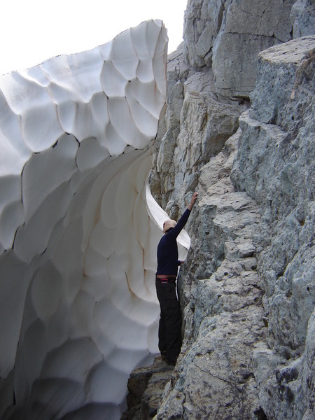
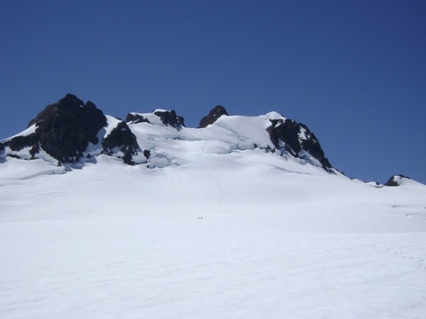
Trip: Mt Olympus - Blue Glacier
Date: 6/28/2008
Trip Report:
Left trailhead at 9:30pm Friday night (June 27)...
Glacier Meadows by 9am...
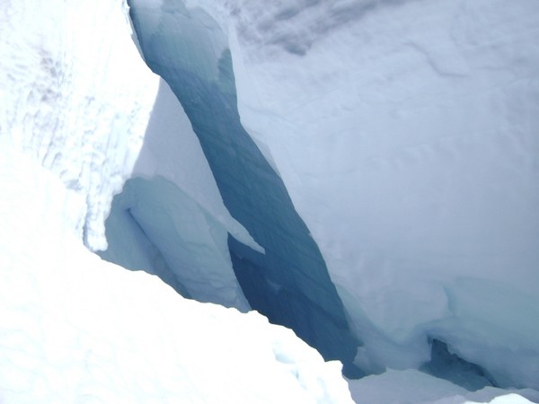
Conditions were great...snow was a bit soft and got softer as the day progressed...never roped up or used crampons...
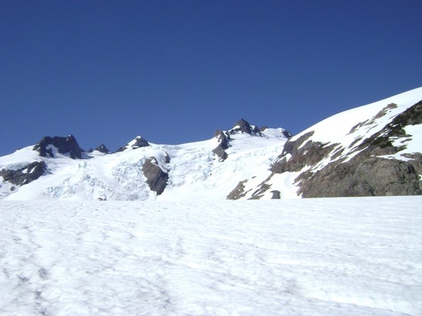
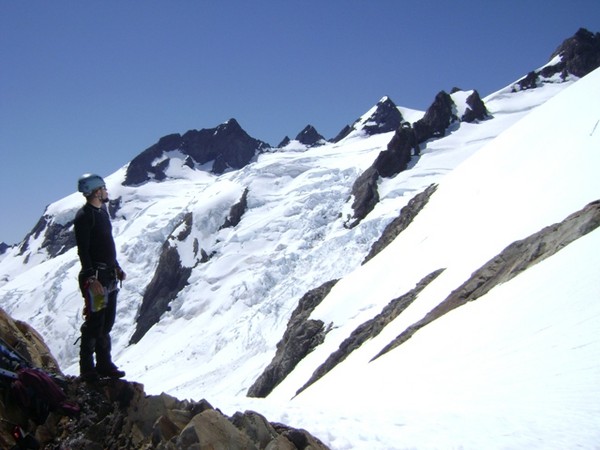
snow dome...
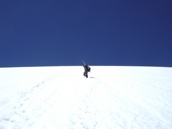
view of summit (note tracks going straight up from snow dome)...we had to traverse around middle summit and up from behind...
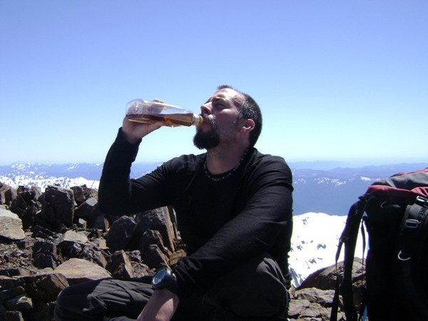
hit the summit about 2pm and re-energized...
and the rappel...
looking up at "scramble" route after rappeling...
view of steep snow to gain summit rocks...

back to car by 7:30am sunday morn where warm beer awaited!
Gear Notes:
rope for rappel from summit
Approach Notes:
lose trail periodically between elk lake and glacier meadows...
after snow dome, traverse under middle peak and go up from south side
-
A friend and I summited on Saturday (June 28). Beautiful weather the whole trip. No avy danger, no problems. We left the trailhead about 9:30pm Friday, summited about 2pm on Saturday and back to the car by 7:30am Sunday...long push. No real problems, we never even roped up, just used the rope to rappel from the summit block...we passed a group who had tried going straight up to summit from Snow Dome which doesn't go due to bergschrund up top...need to traverse around east peak and up from behind. I'll try to post some pics later...
-
i'll bet those things could hold like 50 lbs or something...
-
take the wheel for a sec while i light this...
-
i wish i had peyote...

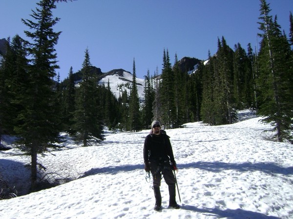
[TR] White Chuck Mountain - Northwest Ridge 12/5/2009
in North Cascades
Posted
Trip: White Chuck Mountain - Northwest Ridge
Date: 12/5/2009
Trip Report:
We drove to about 3,800 feet elevation on the road up before deep, ice hard ruts forced us to park. We started hiking up the road at 6:30 am and followed a nice snowmobile track to the ridge proper. The ridge was fun, easy hiking...the gulley to the saddle between the NW peak and summit was decent...the traverse below the ridge crest was sketchy. We decided not to rope up as there was nothing for good pro and we didn't want a single falling member to take the others along...
We made it to the final saddle about 30-50 feet below the summit after much up and downclimbing to find a route that would go. At this point, thinking I was standing on snow over rock, one leg punched through the snow (over nothing) dangling above the steep chute drop. We decided to forgo the final 50 feet and turned around with hours of sketchy downclimbing ahead...
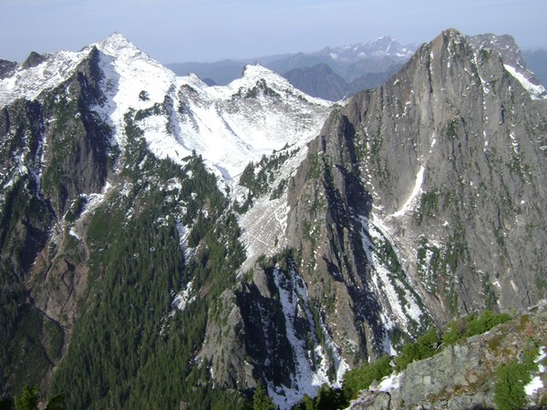
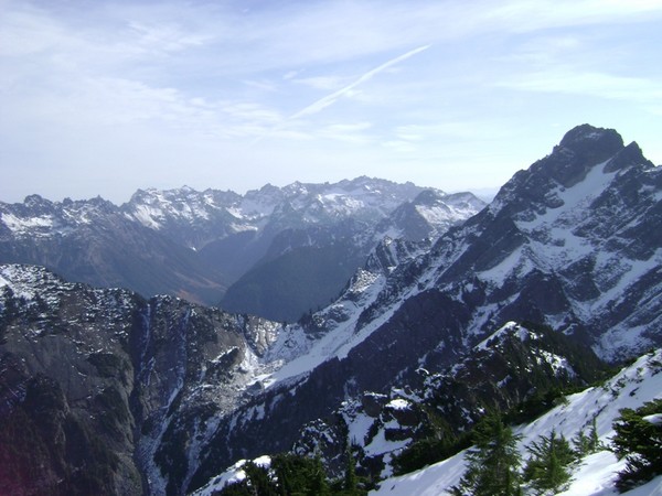
We made it back to the car about 4:30 pm in light snow. Another beautiful day in the Cascades. The views from White Chuck are amazing...Rainier, the Olympics, Pickets, Baker, Shuksan, Glacier Peak, Dome, Pugh, Sloan, Big Four, Vesper, Sperry, Monte Cristo range, Stuart, Ingalls, etc...
Pics...
Hiking in
The Peaks
Starting up gulley
Ascending
More up
Looking down path
Big Four, Vesper, Sperry, Rainier, etc
Olympics, Three Fingers, White Horse
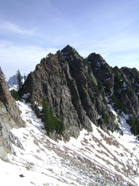
NW Peak of White Chuck
Avalanche to north
Traversing close to rock
Icicles and summit
Traversing
Getting close
Pickets
Pugh, Sloan
Fun
Just below summit
Beginning descent
Traverse descent
White Chuck from SW
Gear Notes:
Ice axe, crampons, yukon jack
Had rope, pickets and pro but didn't use.
Approach Notes:
Snow