


wbk
-
Posts
195 -
Joined
-
Last visited
Content Type
Profiles
Forums
Events
Posts posted by wbk
-
-
Great job guys! It was great to meet you all up there! Congrats on getting all that done up there!
-
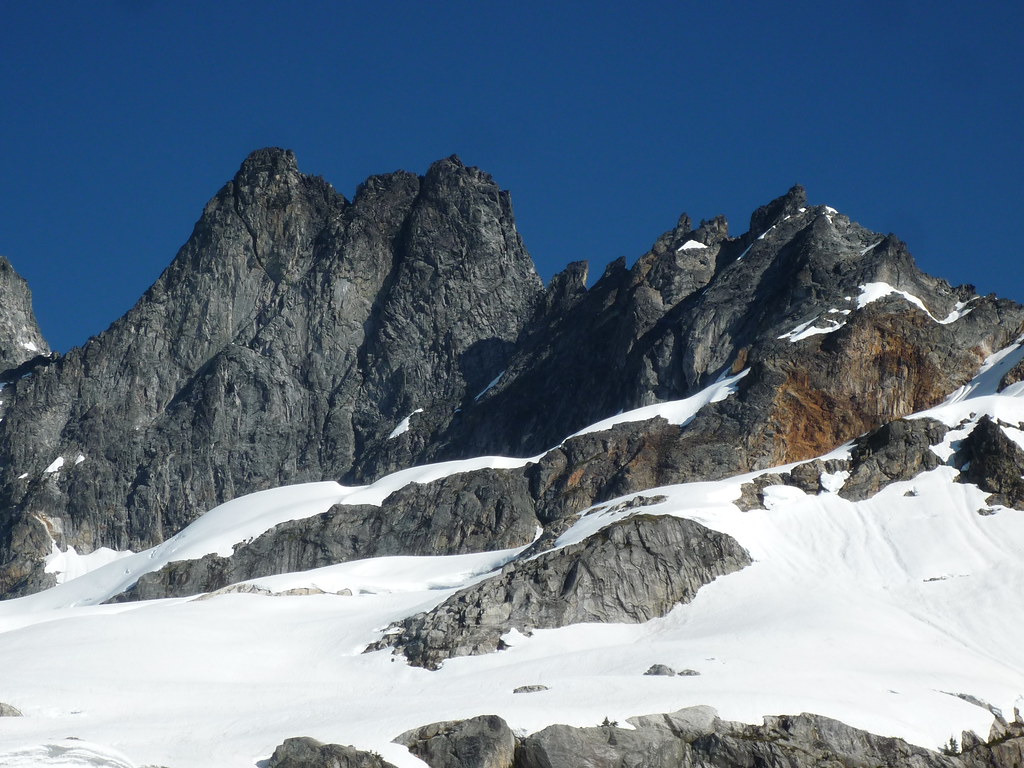
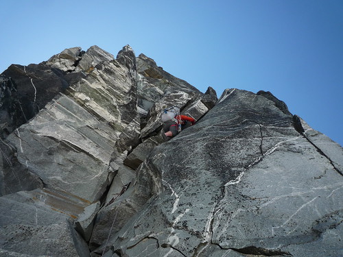
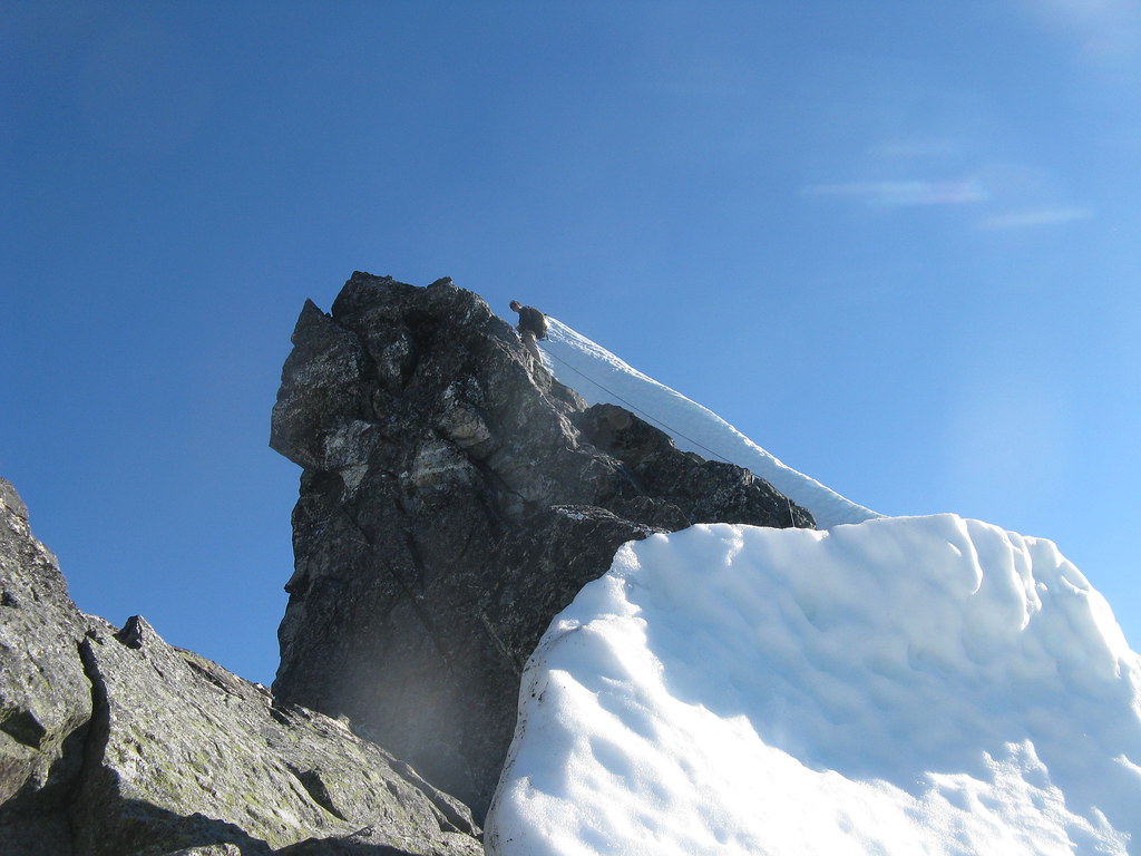
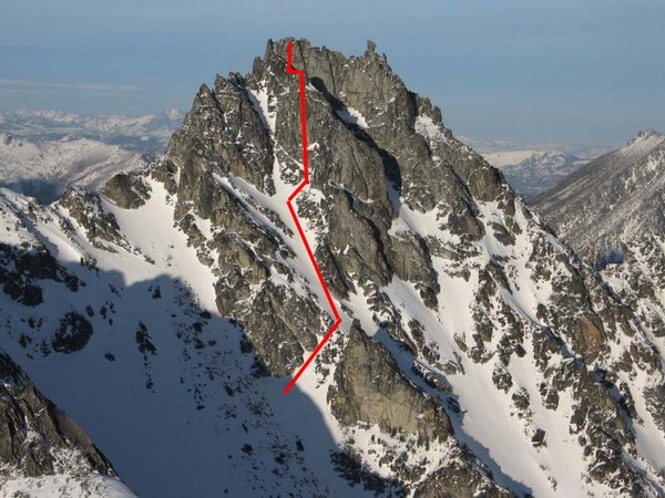
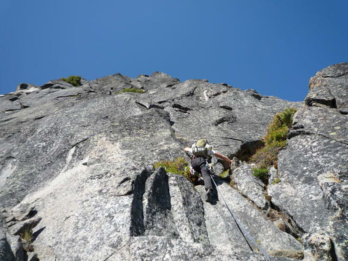
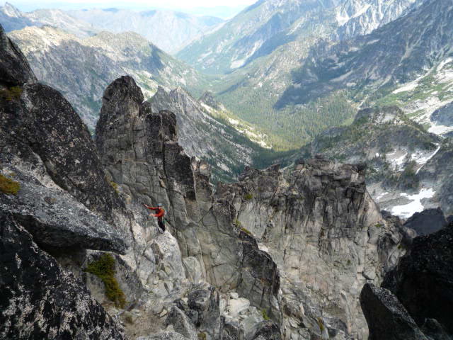
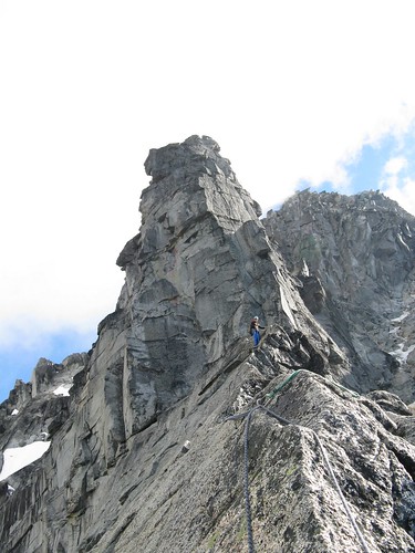
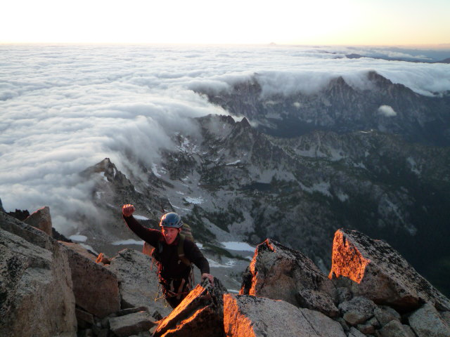
Here's a shot of the gendarme traverse from West Mac col to Inspiration:
-
Trip: Southern Pickets - East Ridge Inspiration and West Ridge MacMillan
Date: 7/7/2010
Trip Report:
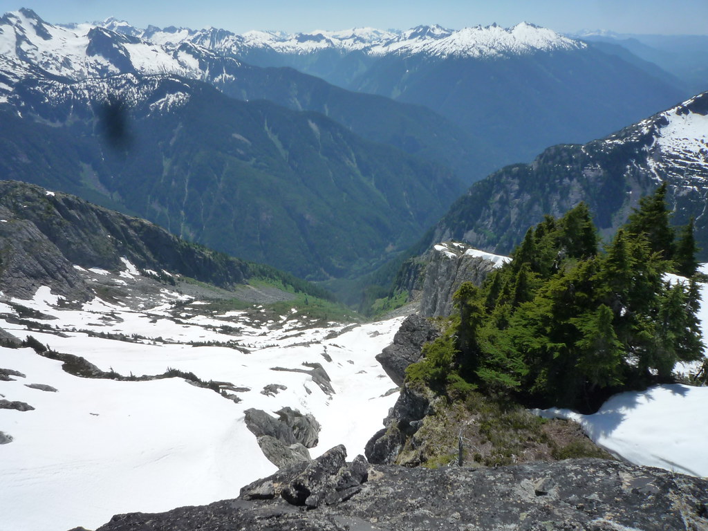
Tim (therunningdog) and I headed into the Southern Pickets for some classic bushwacking fun. A alpine start out of Seattle got us to the trailhead (with permit yo!) at 3pm.
Camp under point 6484 gave views of the rad high pressure that we're still loving. We forgot booze to help us sleep but Tim brought his radio so we tuned into some Cure from Victoria's classic rock station! Couldn't get the world cup news we were looking for tho!
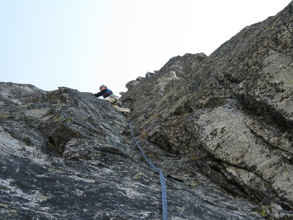
Next day took us over to the creek where we dropped sleeping gear and food and headed off from Inspiration (East Ridge). We planned to do the gendarme traverse from the West Mac col to the base of the East ridge thanks to Mario's (who was in camp!) printoff from Wayne's website. Got to the col in ok time. I hadn't been up West Mac, so I scurried up there while Tim did some classic Jstern alpine napping.
Tim stoked that we're leaving camp so early!
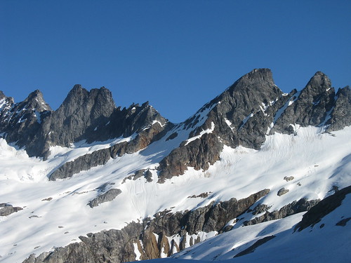
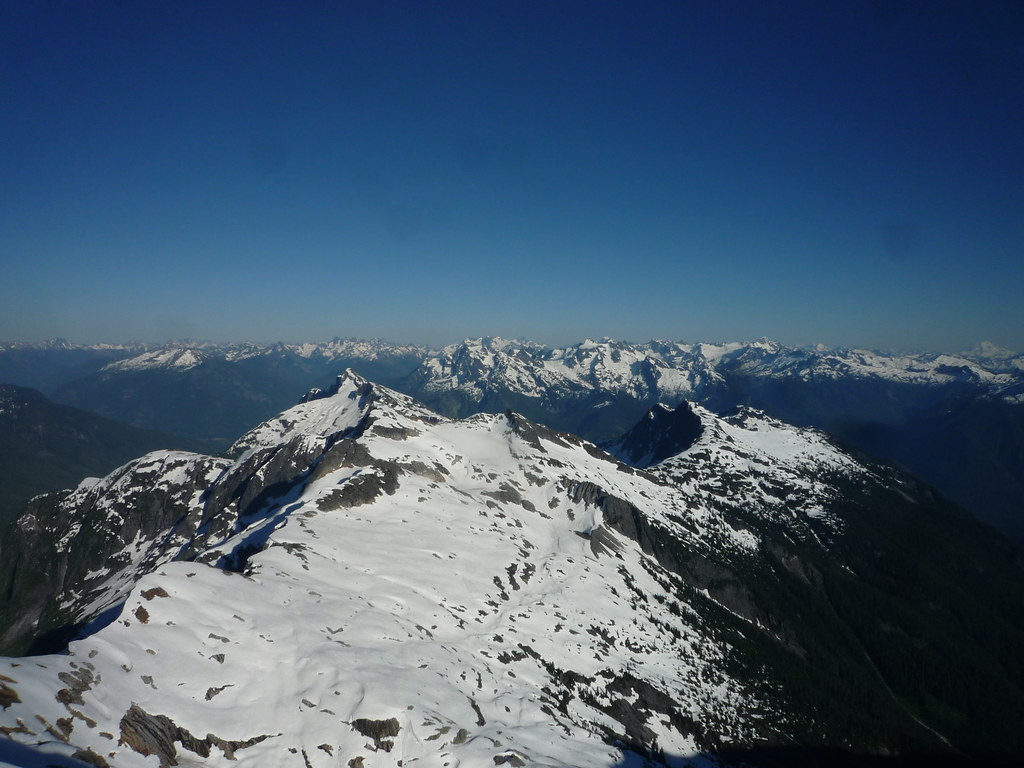
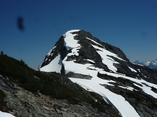
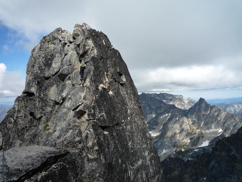
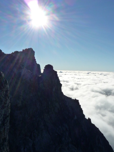
Inspiration and West Mac (and Pyramid)
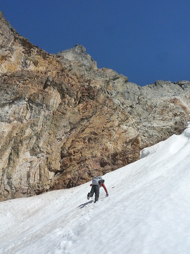
Kicking steps in some fine mushy snow
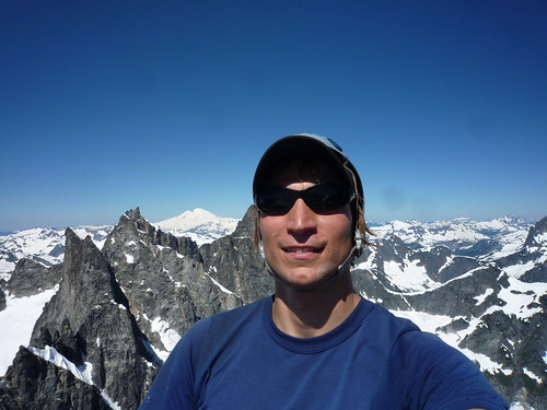
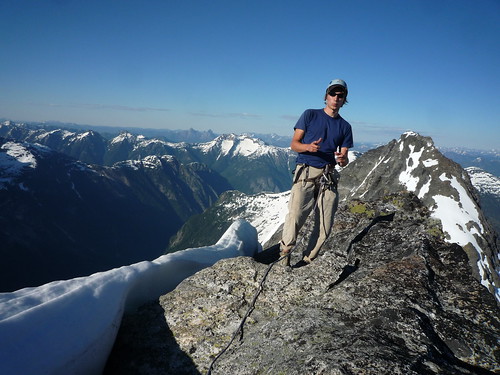
Me on summit of West Mac
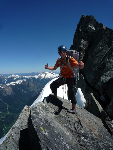
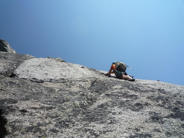
Tim ready to wrestle mid way on the gendarme traverse
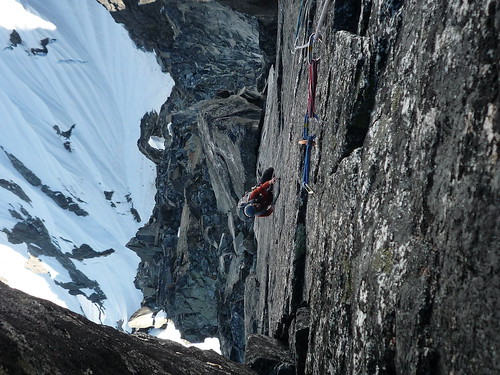
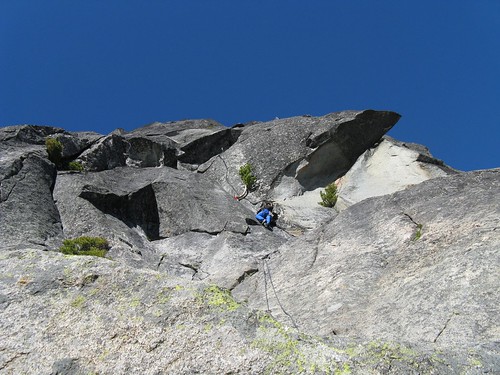
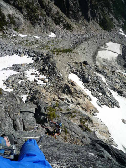
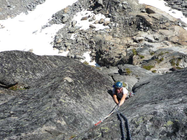
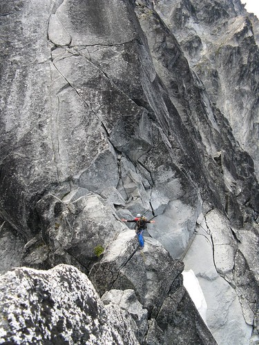
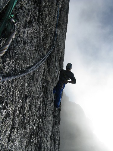
We made it over to the E ridge proper in a few hours (yeah, we had the odd routing finding issue... who would have thunk!). Tim got the layback pitch! Fun, but definitely less fun with heavy packs. Why did we bring crampons?
Tim sending the layback pretty damn efficiently
I took the left crack on the upper crack pitch and without a number 3, I was running it out a wee bit. Regardless, the pitch was great fun and then we were on to the summit and towards to the raps down the West Ridge. BTW - the raps stations are way better than we anticipated. Good webbing, biners or rings!! Thanks to those who keep these in good condition!
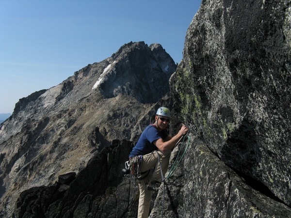
Tim getting his crack on.
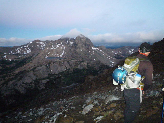
Tim wishing he was down in McMillan Creek instead of way up here
Heading up to the summit
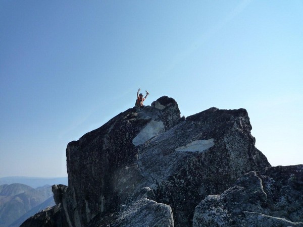
Again, another dorky summit shot for me. Shooter McGavin? Frank the Tank?
We made it back to camp just after Seth and Keith's return from their traverse of all the MacMillan spires! Nice job boys! We were stoked to get into camp and crash.
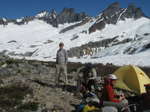
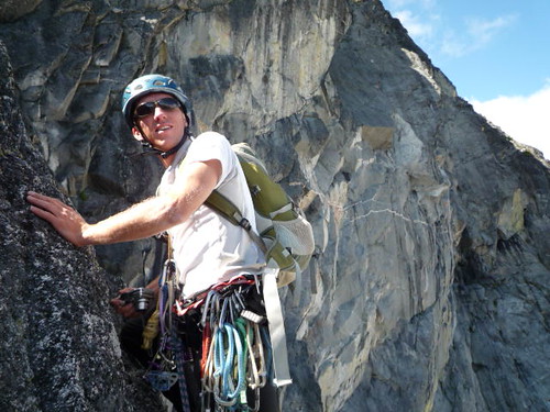
Seth, Mario and Sandy (Keith just out of the shot) in camp. It was great to share stories with this fine group of alpinists! Combined, they've got a ton of Pickets experience!!
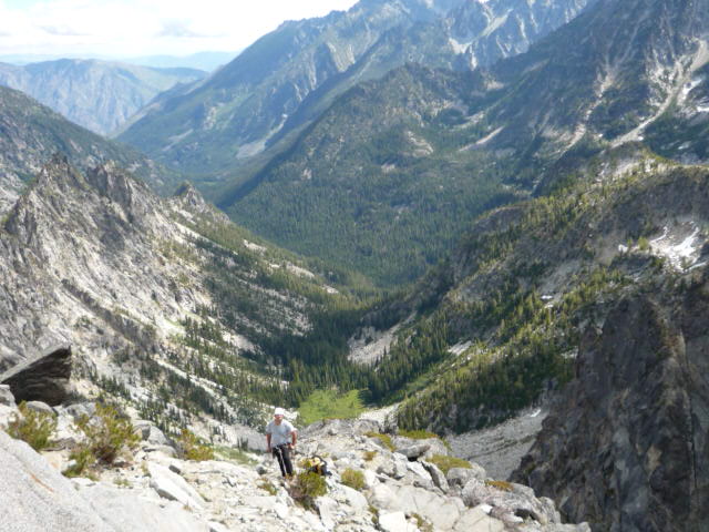
On the way out we planned to "just run over and tag Davis Peak". What a shit show... temps were well into the high 70s or mid 80s and the traverse over to Davis is farther than it looked. In the end, we were cut off by a huge gully from even getting up this bastard. We got some more conditioning in I suppose...
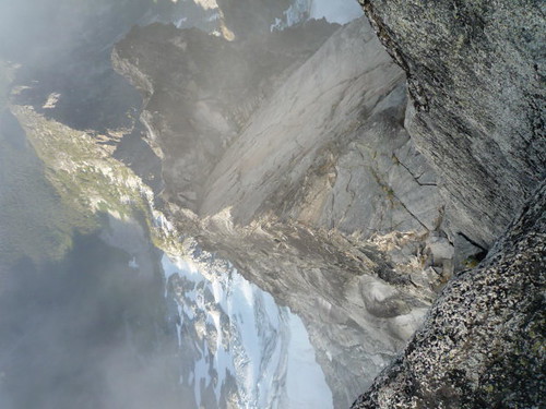
If you know the area, this photo shows the distance to Davis. First, cross those two "little humps" on the ridge ridght of point 6484, then cross plenty of ups and downs on the way over to Davis. A huge gully cuts the final ridge scramble. Is there a way to bypass this gully???
Gully cutting off ridge access to Davis (not the best photo)
We didn't get much closer to Davis than this after all that work in the intense heat and crappy snow conditions
Gear Notes:
Used a single rope for gendarme/E ridge. Rack was doubles of smaller stuff and two of each 1 and 2 Camelot. Could have used a 3 since we did the left crack. Crampons were not needed but happily carried all the way up and down! Good food in Marblemount is open till 9pm... there is a God!!
-
 1
1
-
-
nice work tom. i remember overhearing you talk about your planned trip out to gunsight a few weeks ago at index-nice work on making it happen despite a relatively shitty start to summer!
peace
-
Heading up this way myself. Nice to run into a TR from you Runningdog!
-
Anyone interested in heading to Index this Sunday (5/9)? I've got gear, rope, etc.. May be a bit wet, but I'm sure we can find some climbs to get on!
I lead 5.10, and usually willing to get on a 5.11.
Thanks,
Ben
-
I'm not a very good aid climber and need to practice more. Up for city park or others. Have gear but let's combine and make it more fun/faster.
if it's dry enough, we can free climb too but i doubt it will be.
it's either this or go ski i suppose.
GOING SKI - IGNORE THIS POST -THX
-
Pair of woman’s Koflach plastic boots from the 1990s. Basically never worn. Size 8 womens. Great shape and perfect for volcano climbs in the Cascades. $40
-
Nice work Joe and hella of a good summer for you overall! Keep it up.
-
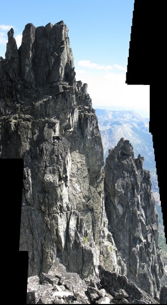
Checked in with Mark Kroese re: 2001 kroese/huster route and after some picture swapping and discussion we are pretty sure our lines are different--at least the bottom three pitches. Mark made a good point in stating that lots of folks have climbed the many of the "south face" cracks that lead to the summit/summit ridge.
These are the "south face" cracks!
-
Also – kudos to Jens and ScottGG for sending the Sherpa Balanced Rock a few years back. That looks sketchy, but fun!
-
We downclimbed to the second rap, rapped into the gully. That gully is easy 3rd class downclimbing to the base of the route so you can easily leave your pack(s) at the base of the climb.
-
Trip: Sherpa Peak - Rilikpa (sw face), FA, 5.7/5.8
Date: 9/16/2008
Trip Report:
How it got started…
“While waiting at a rap station on the convoluted West Ridge route of Sherpa Peak about a month ago, I thought to myself “There has GOT to be a cleaner, direct way to climb this mountain from the south.” As I descended the West Ridge, I noticed a line of cracks, corners and flakes on what could be called the SW face of Sherpa Peak. I thought it looked like a much more aesthetic and enjoyable way up the mountain from the Ingalls Creek drainage. I brought the idea of the climb up with my buddy Ben Kunz (wbk), and he was stoked to give it a try.” – Tim, aka therunningdog
Sherpa at sunrise from Longs Pass
So Tim (therunningdog) and I climbed, what we are pretty sure, is a new line on Sherpa Peak. A relatively diligent study in the Beckey guide and Cascadeclimbers, and the lichen covered rock and cracks, along with a few breaking holds led us to claim this first ascent.
Here’s the line we climbed (excuse the crappy quality of my line wrecking one of Scurlock’s great photos!):
We left the trailhead at 6:10am on Tuesday morning, hauling ass up and down Long’s Pass, crossed Ingalls Creek, and were in the wide basin below Sherpa by 8am. After a quick water break, we started up through scrubby trees and boulders toward the climb.
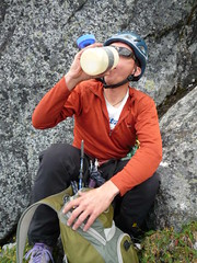
Tim on scoring the last available water on the approach!
The approach is the same as per the WR, except that you take a right turn uphill of the obvious tower to the south of Sherpa.
After the right turn, scramble up 150’ of easy class 3 then take a left turn and head up an easy gully a few hundred feet to the base of the route. We left a small cairn at the spot where we roped up.
Shot from the gully
I’ll summarize the climb for those not interested in the details. Basically, Tim and I both believe that this climb is way more fun than the typically climbed West Ridge. It’s a good, moderate climb on great rock (better than the W. Ridge) that takes you to summit via a ridge scramble or the choice to hit up great crack lines up the upper south face. If bothering to haul a rope up Sherpa and aren’t in a great rush, I’d recommend taking this line to the summit over the W. Ridge ascent.
Another shot of the route
Note that we took a half rope and doubled it over because we wanted to haul less weight up and over Longs Pass, etc.. so these pitches are 100ft or less.
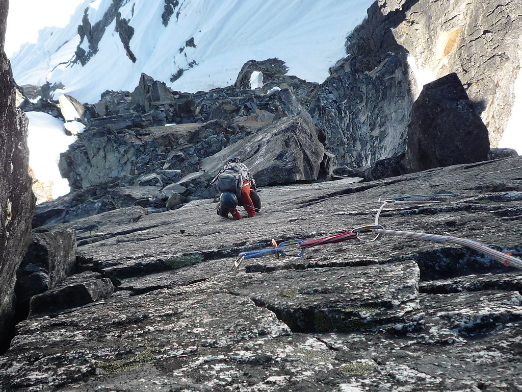
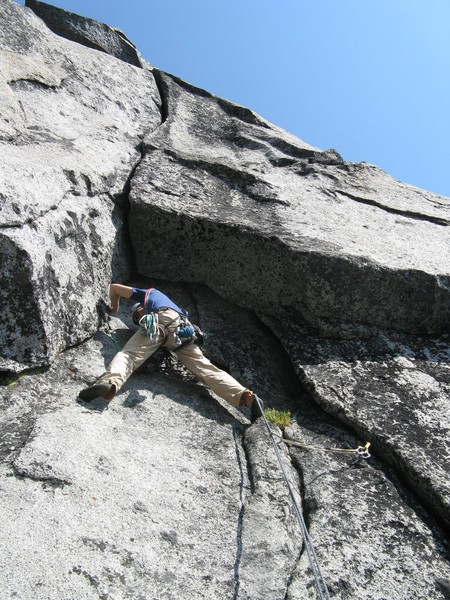
For the first pitch, we simul-climbed up blocky terrain - 4th and easy 5th class to a ledge where the face steepened. I won the game of roe-sham-boe, and so got to head up the first belayed pitch.
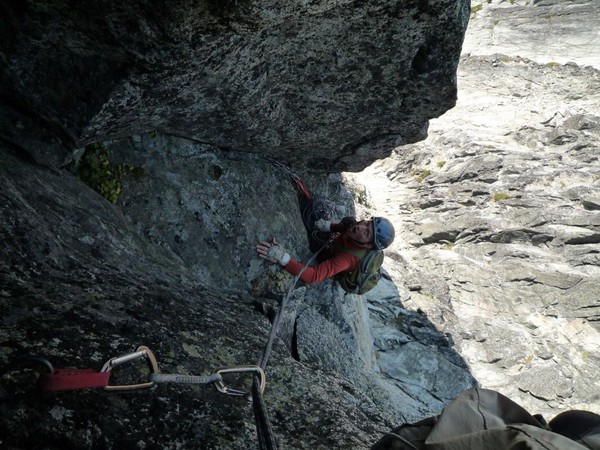
Pitch 2 heads up relatively easy dihedral flanked with flakes mid fifth climbing up to base of the hand sized crack on the SW face. (5.5/5.6) Approx. 85ft.
Pitch 3 goes straight up the crack, up the face for some interesting face moves up and into a small alcove at the base of chimney. This pitch is really fun and with a few ascents (or if Tim or I go back up there to clean it) will be super clean. Right now, there’s tad too much lichen in the crack. (5.7) Approx. 90 ft.
Tim hanging in the alcove
Pitch 4 poses some interesting, fun moves up a chimney past the overhanging chockstones. From there, I took a straight line up face and crack to the top of this tower (sweet finger crack at the top). One could easily climb around the tower once above the chimney, but I wanted more climbing. If one opts for the straight up/more climbing option, you get a sweet top out move onto the top of this tower. (5.7/5.8) Approx. 90ft.
Tim pulling onto the top of the tower, Stuart in the background
A short boulder (not exposed) downclimb puts you onto a ridge that takes you to the summit, but you are looking directly at this:
From the top of the “south tower” there are several options. The easiest is to climb one more pitch, heading north, to the true summit. However, the south face of the true summit is riddled with interesting crack systems that enticed us…and this is where we headed. After a short downclimb from the south tower, Ben headed up a 5.10-ish looking off-width roof type pitch, but backed off when it became apparent that it would be impossible to protect with our #3 camalot (a #4 would have probably been sufficient).
So, we ended up taking a line a bit further east, and headed up 3 more pitches to the summit ridge. The first two of these pitches were awesome 5.8-ish hand cracks, the second of which finished with an airy traverse to a belay. Once on the summit ridge, it was a short drop down to the north side of the mountain and back up to the true summit.
Tim heading up a great hand crack – truly awesome granite!
Me on the airy traverse
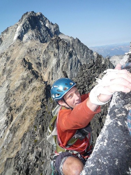
Tim at the summit
Gear Notes:
Medium rack to 3" (4" if you want to do the overhanging wide crack on the upper south face).
-
nice work rob. Was on Forbidden (W Ridge) the same day you were up there and Joburg was calling all day for sure!
-
Sorry if I'm out to lunch and it was clear in your TR, but which descent did take off of Forbidden?
-
Looking for a set of crampons under 600 grams. Please PM.
Thanks
-
OH and one more thing - did you make use of axes or crampons for the approach?
We didn't use axes or crampons. At this time of year, you can skirt under the Stuart Glacier easily as well as bypassing the snowfield under the False summit on the descent (assuming the snow is too hard to boot ski which it was when we were on it).
-
Trip: [TR] C. North Ridge Mt. Stuart -
Date: 8/2/2008
Trip Report:
Tim and I climbed the complete North Ridge of Stuart this Sat. Plan was to go for the car to car (so now bivy gear, but we brought puffy jackets and I brought a 1 by 2’ pad just in case).
Left car at 2am on Sat. morning from the Esmeralda Basin TH, up to Ingalls Lake, over to Stuart Pass, then over Goat Pass and then under the Stuart Glacier to the base of the climb. Took us about 5.5 hours from the car… big thanks to Tim for leading us there—he knew the way well from his climb up the West Ridge from a previous year. We figure we lost about 15-30 mins skirting around the base of the glacier, but otherwise we felt the 5-6 hour timeline to approach the climb we’d heard from sources was very accurate. (Yes, I’m sure there are faster parties, etc.)
Looking back at Ingalls from above Stuart Pass. Bank of clouds obscured views to the West.
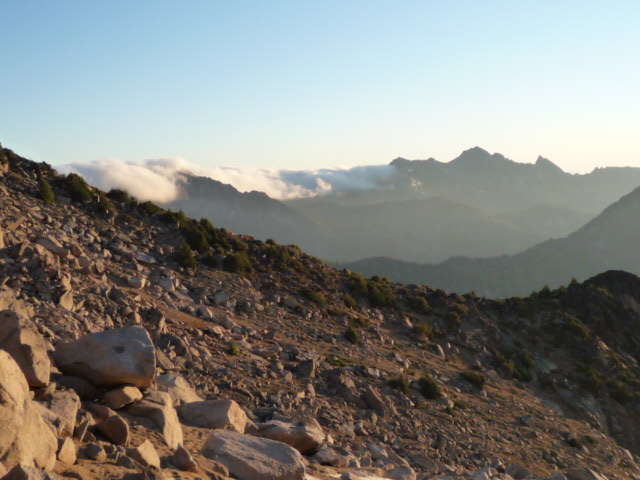
Photo looking North from Goat Pass – finally some sun to warm us from the cool, windy approach
We climbed the first technical pitches rapidly and soon were on the amazing finger to hands crack pitch (Pitch 3?). I had this pitch and was stoked to onsight this baby with my pack on. After this pitch, we headed up and climbers right and continued to pitch out at least three or more 20-30m pitches (we were using a folded over 60m half rope). This took us to a narrow, exposed flat spot after which we simul’d ledges and then up a gully to a fairly open set of ledges.
Me on first pitch
Climbing up the awesome finger to hand crack pitch on the Lower Butress!
Here’s a photo of those sets of ledges. Looks like folks bivy here from time to time.
At this point, Tim was feeling really dizzy and so we took a bit of a break. He asked if I could lead the rest of the pitches which I greedily accepted! That said, we were worried that he couldn’t seem to shake the dizziness with rest, water and food. Apparently the dizziness sort of faded in and out. Tim stayed really focused, while I stayed really focused on leading quickly and safely.
Tim maintaining
We simul’d up right of the ridge proper and then to a bunch of bivy sites and up to a notch where we moved left of the ridge. I think this is where the upper north ridge route gully connects to North Ridge proper, but I’m not entirely sure.
This shot is just after moving from the right side of the ridge through the notch the left side of the ridge. Can anyone recognize this shot and if so, it is just above/beyond the “notch” referred to in Nelson’s book?
At this point, I took us off route which led to a rappel, some backtracking and eventually two technical pitches to bring us back onto the ridge proper. These two pitches were fun climbing but overall this cost us significant time.

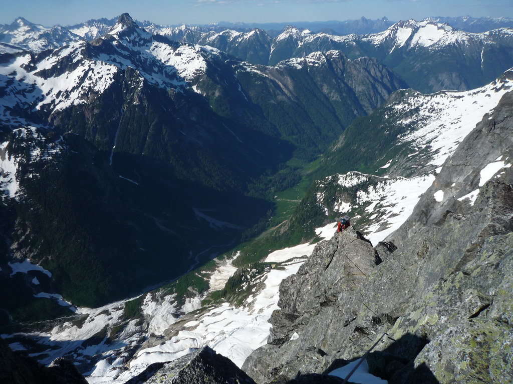
We then simul’d to the slabs and made our way over to the gendarme. The gendarme pitches were spectacular; we hauled our packs for these climbs.
Hit the summit at 8:30pm, significantly later than we’d anticipated, but getting off route and dealing with dizziness have their consequences. Overall, Tim and I were elated. We’d had great weather, the rock is phenomenal and the setting is tough to beat!
We started to race down the Cascadian, but decided that with Tim’s dizziness, it just wasn’t smart. I was super impressed with his ability to focus and keep it together despite his overall dizziness. I could tell he wasn’t himself and I was bigtime in favour of a safe decent the next day at the cost of an unplanned, cold bivy.
And a cold bivy it was. The temps were low (anyone know where to look up historic temps on the summit of Mt Stuart for Aug 2-3
 ) and the wind, albeit light, was enough to keep us from maintaining any warmth. We did various exercises to get warm, then napped until we woke from the cold (usually about 15 mins) and repeated this. We made it through the night and by 4:50am we were back on the move (and at a slow pace).
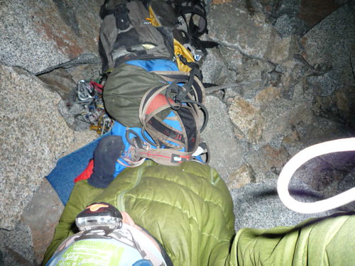
Me in my makeshift bivy (topdown)
The hike out was uneventful. Tim was still dizzy, but better than the night before. We were back at the car at shortly after 9am and chilling back in the city by noon.
I have to really hand it to Tim. He is among the fittest and most experienced mountain partners I’vehad the pleasure of climbing with. He did awesome in making decisions and pulling through despite his dizziness. Tim is now going to take me to the Outback Steakhouse as a reward for leading all the pitches! Yeah, mate… good times, nah… great time!
The route was awesome and in different circumstances, I feel it’s a doable car to car. I also see people’s great points in planning in a bivy. Both ways, this climb is truly phenomenal and I want to go do it again!!
Gear Notes:
Rack of 10 cams, half set of nuts, 1 60m half rope, no crampons or ice axe, lots of slings
Other Notes:
Major cloud cover to the West but didn’t look too threatening. Generally cool temps on the climb and with interspersed sun. Did I mention the clear, cold night?!
-
PM me if you know someone in D-town who has a big 4x4/motorbike who wants to shuttle our gear up the North Fork Sauk TH! This added help would make this trip much more appealing to my gf!
-
Joe - nice work from Redoubt to these climbs! Impressive season you've been having so far!
-
Brand new, never been worn, still in box.
Evolv Bandits
Sz 6.5
Euro Sz 39
$30
Willing to Ship. I'm in Ballard.
-
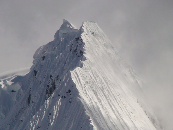
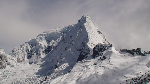
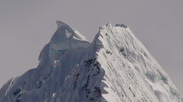
These three photos and your reference to Ishinca make me think this is Tocqallraju (sp?). Could this be?
-
Way to get after it Panos! Impressive!
-
pm sent
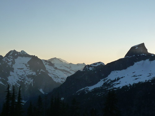
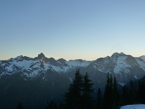
[TR] Shuksan - N Face 7/29/2010
in North Cascades
Posted
Nice TR Jer. Was great climbing with you but even better being dorks in backcountry.
Here are some photos:
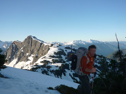
Bushwacking N Cascades style
North Face
Here's what the White Salmon is looking like
Jer crossing a deep runnel low on the route
Mid route - this bench provides a spot to chill (relaxed angle) but we pushed on due to the impending sun
My camera has a tendency not to open
Downclimbing Winnie's Slide
Finishing up the last Fisher Chimney to get back on the snow