


Animal
-
Posts
98 -
Joined
-
Last visited
Content Type
Profiles
Forums
Events
Posts posted by Animal
-
-
Kick ass!
Great trip
-
I am looking for a partner or two to climb Colonial Peak this weekend and maybe some other things in the area. I live in Bremerton, so I plan on leaving Friday night and self registering in Marbelmount. If you live in the Seattle region I have no problem picking you up sometime after work on Friday. I also plan on returning late Sunday to make a weekend out of it. If interested PM me by Thursday at the latest.
Thanks,
Kevin
-
but believe it or not, compared with other peaks in the range it is better than average on this route.
If you are up for a great bush climb and some superb isolation go to the Valhallas. bremerton_john and myself found the rock, sandstone I believe very solid for rock in the Olympics. It was very grippy on the boot. There is still a lot of climbing to explore in that area, but I am sure a lot of loose rock to clear with the side sweep of a rope too.
-
Great trip report! As the Olympic brush monkeys like to say, real climbers chose to climb loose Olympic choss.
 I have also hear that this is one of the more solid climbs in the Olympics. Nice pictures!
-
Looks like an awesome trip! Great job, there is nothing better than a good death march up and over a mountain!
-
What did yall think of the windpacked snow up top? I was getting high quality shears 2" down and 18" down, originally moderate difficulty at High Pass, but then hard difficulty on the glacier.
The snow up the glacier was stable, and nothing sheared away. Where we did locate our tarp on the glacier, I did notice the layers you talked about when building a snow wall.
-
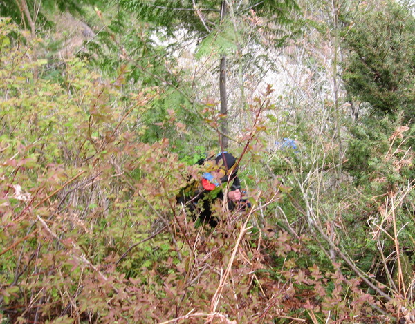
Here's a brush shot:
Is this picture taken on the right side of the lower glacier approach? I saw this on a previous TR, and was wondering?
-
I've often wondered about that main shute and how it would work with a ski/snowboard descent.
I would totally ski what we climbed, and it would be a real adventure getting your skis through the bush, it might even be fun. I think skis would be much better than snowshoes we used. If done earlier there may be more snow down low, but I would expect a more wintry experience.
-
No skis, Animal?

Now we know we should have had skis, down with the heel for George, and free the heel for me. Patrick - get some gear, and next time we will ski!
-
No skis, Animal?
Now we know we should have had skis, down with the heel for George, and free the heel for me. Patrick - get some gear, and next time we will ski!
-
We did Lone Tree Pass on Sat. Summit was socked in. There was a huge group of Mounties up there but all but four turned around. Good going on the direct route. The brush is nasty.
We were wondering who made all the steps. We saw about nine people on Sunday, but I think it was socked in for them too. Somehow we lucked out and got a quick weather window. Sloan looked awesome from up there.
-
pity you didn't take any photos of the green fun down low. Is it already too late for the brush to be covered up?
IT TOOK LIKE TWO HOURS TO MOVE THREE FEET, BELOW IS PROOF
-
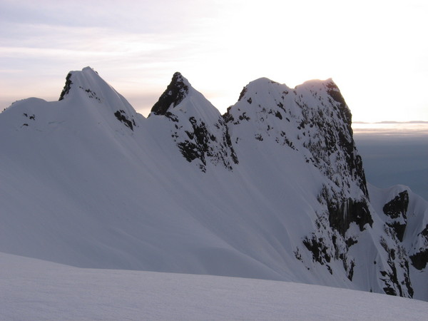
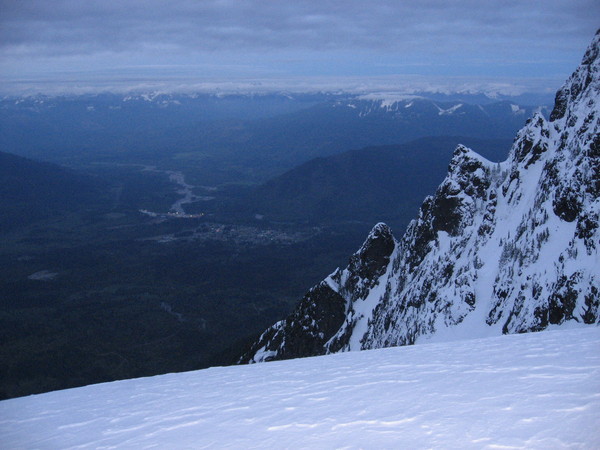
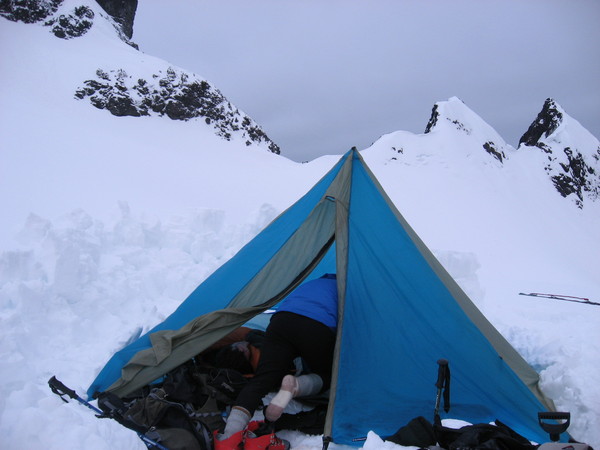
Trip: Whitehorse - North West Glacier
Date: 5/5/2007
Trip Report:
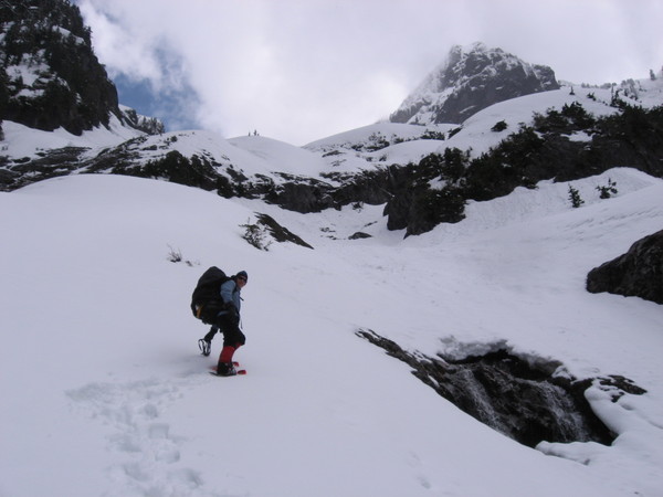
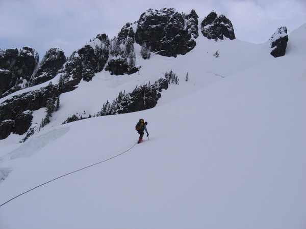
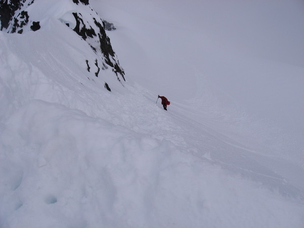
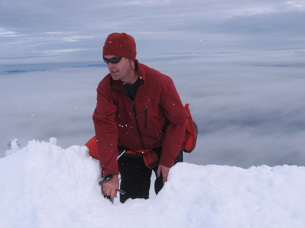
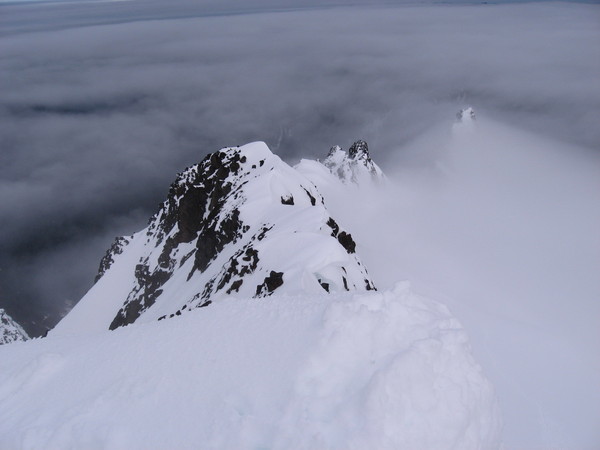
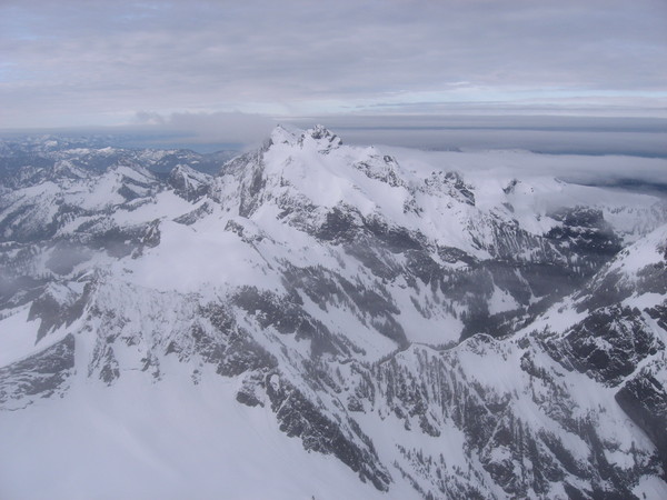
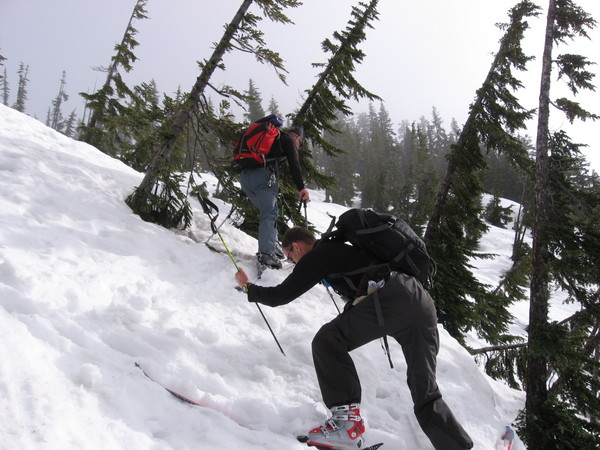
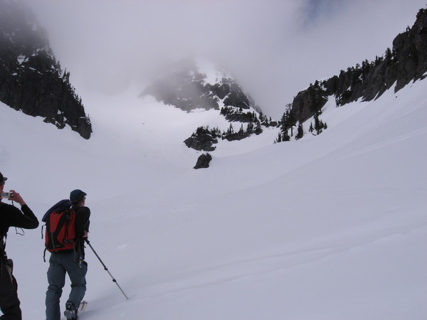
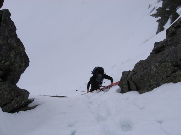
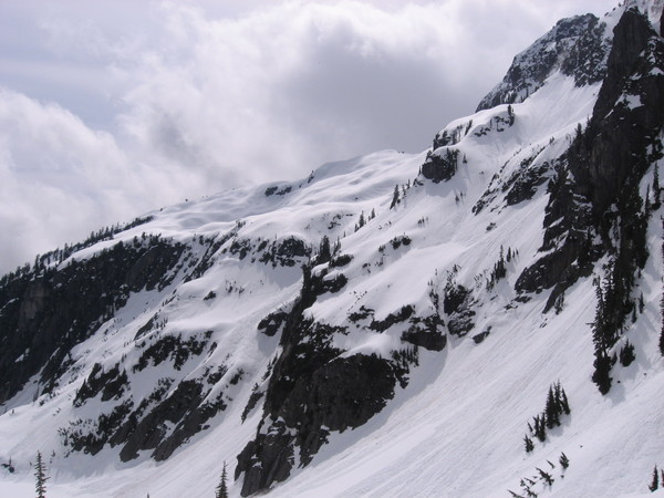
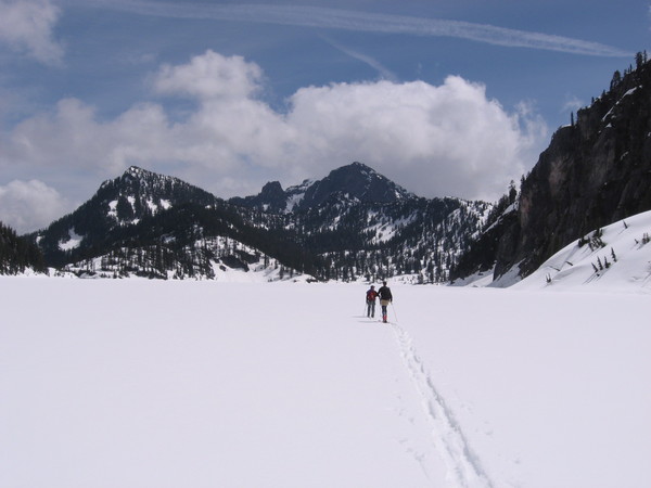
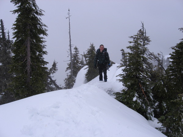
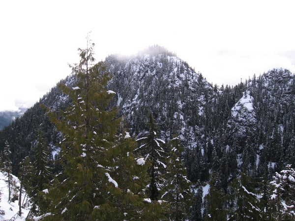
On May 5-6 Patrick, George, and myself climbed Whitehorse via the North West Glacier. When we were looking at the mountain from the road, a local asked "why" we were doing the glacier route because there was a slight bush problem. Well after doing the trip, we all knew "why' because the bushes kicked some butt and Olympic brush monkeys need a good butt kinking in the Cascades once in a while. Actually the glacier route was very fun and scenic. Camping on the upper part of the glacier was a treat. It turns out that several people did the Lone Tree Pass route this weekend, so we had a packed sidewalk and some great glissading on the way out this route.
Below are some picts of the trip -
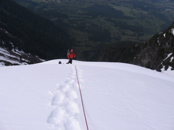

Gear Notes:
40m rope, crevase gear, and snowshoes for the soft snow.
Approach Notes:
Straight up! Remember green belays are your friend in the bush.
-
The slope in question is not East of source lake, but in fact North of the lake, and a bit West, also it isn't exactly a cliff, more of a hill with a very short steep section above it that is cliff like, almost all of which is treed.
All of the travelers we saw that day, skiers, snowshoers, and hikers, made their way up or down that hill just West of us... even those approaching from above that didn't know we were there. Your group was the only one that skied into the trees that far East and South of the route the rest used.
Your description is correct, I guess by not looking at a map I thought we were east of the Lake. Anyhow, sorry about the little avalanche, but due to the sun it was almost impossible not to cause the snow to slide on that day, this is why we turned back from out loop around the mountain.
-
The spring slide was at about 1:30 PM. I wouldn't call the slide "Large", it was large compared to the other sluffs we caused, but it definately caused the group to scramble to the sides as someone told me who was at Source Lake. I think the group might say it was not that large becaus I did not see a large pile of snow in the area. When we finally saw the group, and I realized that my snow slide probalby went throgh them, they were not digging for anyone, in fact they were practicing the use of the ice ax at the time. No one from the group talked to us, and we did not communicate with them.
-
Trip: Around Chair Peak - Ski Around
Date: 4/28/2007
Trip Report:
Today George, Bob and I attempted to ski around Chair Peak in a counter clockwise direction, but the very frequent avalanches finally turned us back after we were just north of Snow Lake. The slides were frequent, and some were big and fast.
Speaking of avalanches, I am sure you all know that it is very common for skiers to climb up from Snow Lake over the ridge and ski back down to Source Lake. Well this is what we did today, and since the hot wet snow on the surface was very easy to release I am sure you all know that there were snow slide and some large ones sliding down ahead of us by the nature of our skiing activity. Well it just so happens that some "Mountaineer" leaders placed about 40 of their students in a bad situation today by teaching an ice ax class below the forested cliffs on the ridge just east of Source Lake where it is common for skiers to be above with out a view below. To make a long story short one of my slides turned into a large slide and went right through this large group of "mountaineer" students. I apologize, I had no clue you were down there, but in my opinion your leaders chose a very stupid spot to be teaching you anything on such a hot day. So if any of you see this post, I wold seriously get on their case. I am glad we didn't have to dig anyone out.
Below are some pictures of the trip.
This is us climbing up in the morning.
More up towards Chair Peak
Reaching the notch below Chair Peak
Awesome ski down
Return across Snow Lake because Avi-danger was too high.
Gear Notes:
Usual ski gear
-
Wow, your trip report was much better than mine. Great job John Once again I managed to screw up my trip report post. Great trip! Now lets climb and ski the peak I added a picture of in my post.
-
Trip:St. Peters Dome -
Date: 4/21/2007
Trip Report:
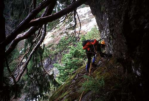
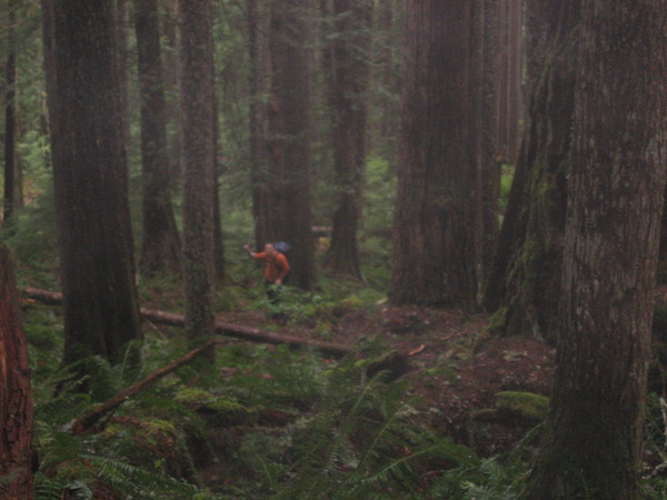
Saturday April 21 & 22 Bremerjohn and I climbed St. Peters Dome on the South side of the Duckabush River. We forded the river after hiking up the trail for 5.5 miles. The river ford was about knee deep. John and I basically did not find any beta on this peak so the climb felt very pure. We basically chose a route that looked doable via the topo maps. The climb entailed climbing up steep thick Olympic forest until we reached a ridge. We then went too far up the ridge and had to back track a little in out route finding. This was a trip where an altimeter would have been nice since the visibility was practically nothing because the snowy weather. We then traveled up and down some lightly forested humps. On one of the humps the clouds faded just a little to allow us to see the peak. This sighting was good because we really had no idea where we were, and my GPS wasn’t working. The short view of the peak indicated that we needed to drop and go back up a gully to reach a saddle on the south west ridge between the peak and a knob on the ridge. We then proceeded to scramble to the summit. Time up from the trailhead was nine hours. We descended back to the saddle and raped down the forested gully mainly because it was very icy, and we also forgot to bring our crampons (oops). We were exhausted, and luck would have it we found a large rock overhanging boulder to spend the night under. In the morning I knew every position possible to spoon with the two large boulders squeezing my hips. I asked John how he slept, and he replied “what sleep”. It snowed all night. The area received about 6” of new snow. We basically followed out same route out. Here are some pictures of the trip. It was very wet on the summit, so we are lacking some good shots. If anyone has ever climbed this peak or know someone who has let us know, because there was definitely no information on the approach we took. John you can chime in with any pictures you may have or any comments!
The above is a summit shot!
The above is St. Peters Dome.
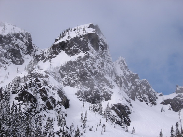

The above is part of the ridge North of the Brothers
-
Sweet! looks Like a great trip!
-
I am looking for someone to climb Whitehorse with on May 5-6 via the glacier on the north side. PM me is interested.
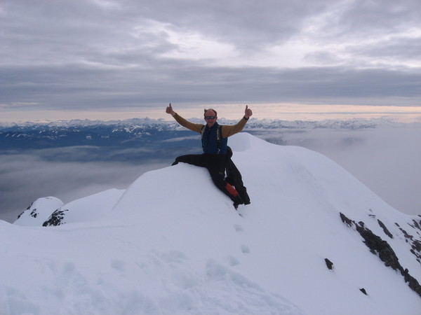
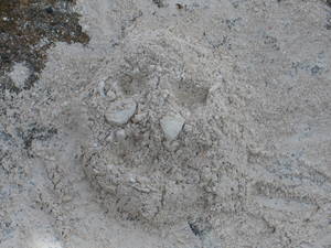
On a side note, can anyone determine who's ashes are smiling to be on top of Mt. Olympus in this picture?
-
I drove up the road on March 31st. I was able to drive past the switch backs where tou would access the South Cascade Galcier, I beliebe this is the South Fork of the Cascade River. I turned around where some locals were cutting apart a tree that was across the road. To this point there was not snow. this was not far from Eldorado Creek. The tree should be gone now!
-
Body glide did not work for me on the CDT.
-
Lets go with Mt Norton 6,319 ft. It is on the Olympic National Park Map you get when you drive in the park, but I have never herd anyone talk about it!
-
Looks like a great trip!
Ultralight shelters
in The Gear Critic
Posted
I hikes the CDT in 2004 using the Cloudburst 2, it is an awesome tarp/tent, I probably use this tent 90 percent of the time. I use a piece of Tyveck for a ground sheet!