


off_the_hook
-
Posts
177 -
Joined
-
Last visited
-
Days Won
1
Content Type
Profiles
Forums
Events
Posts posted by off_the_hook
-
-
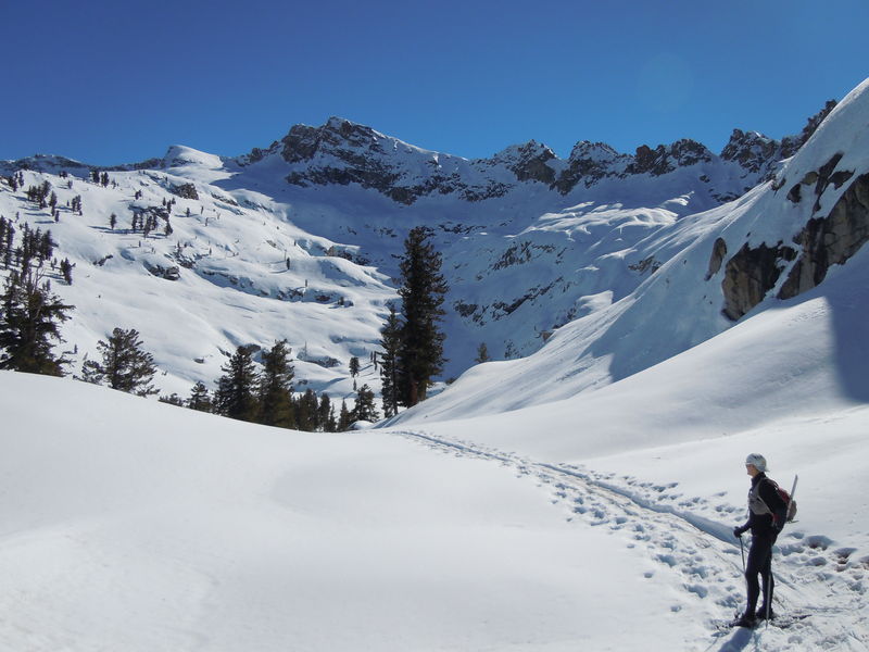
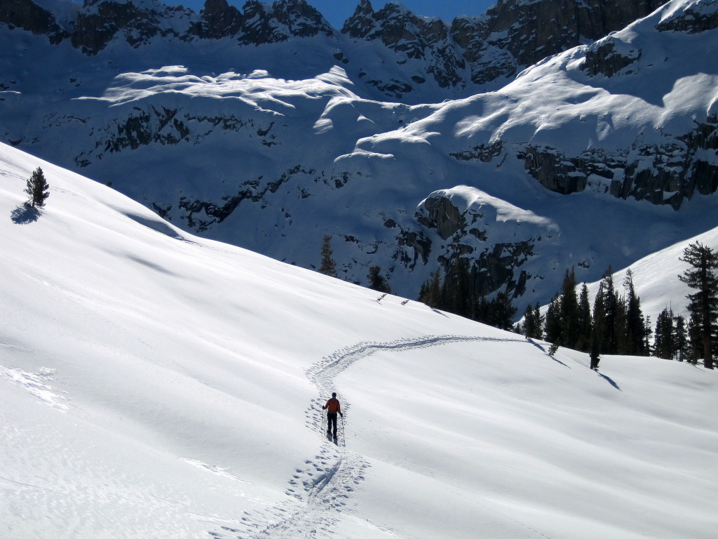
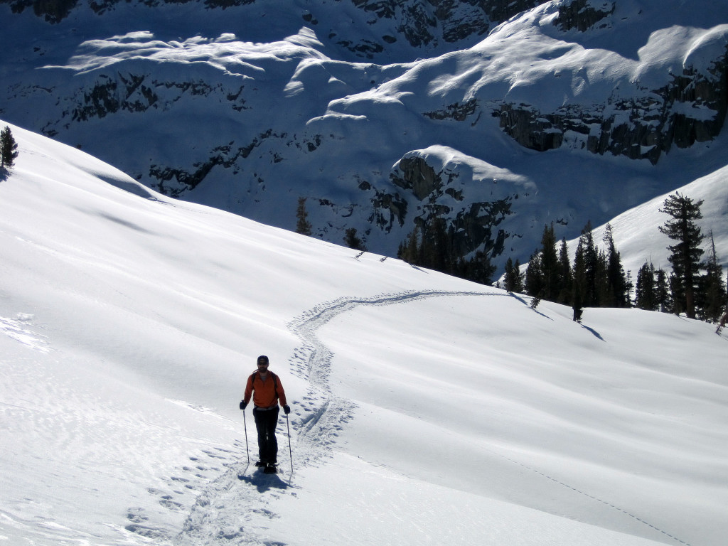
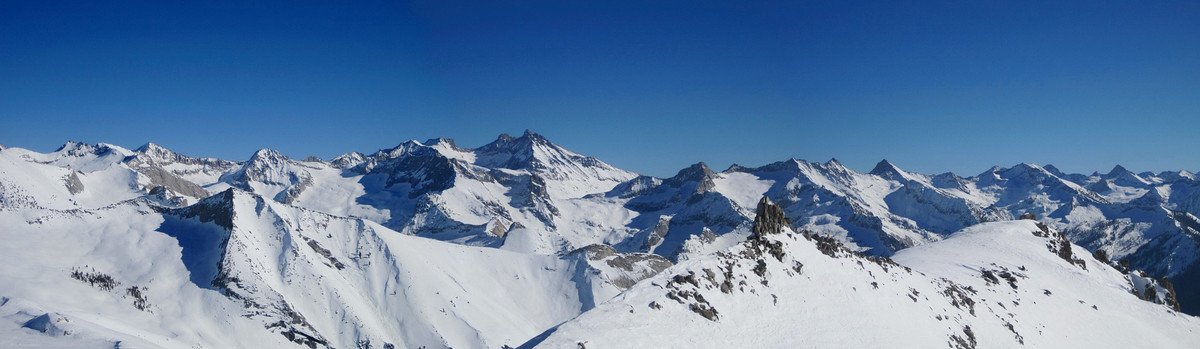
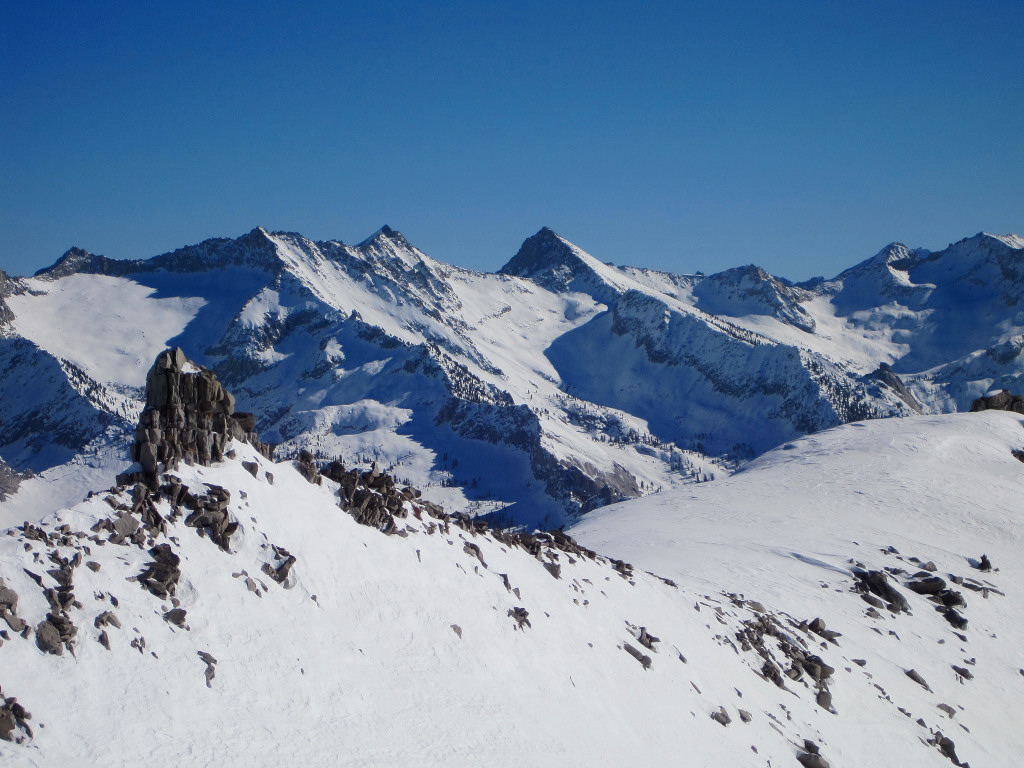
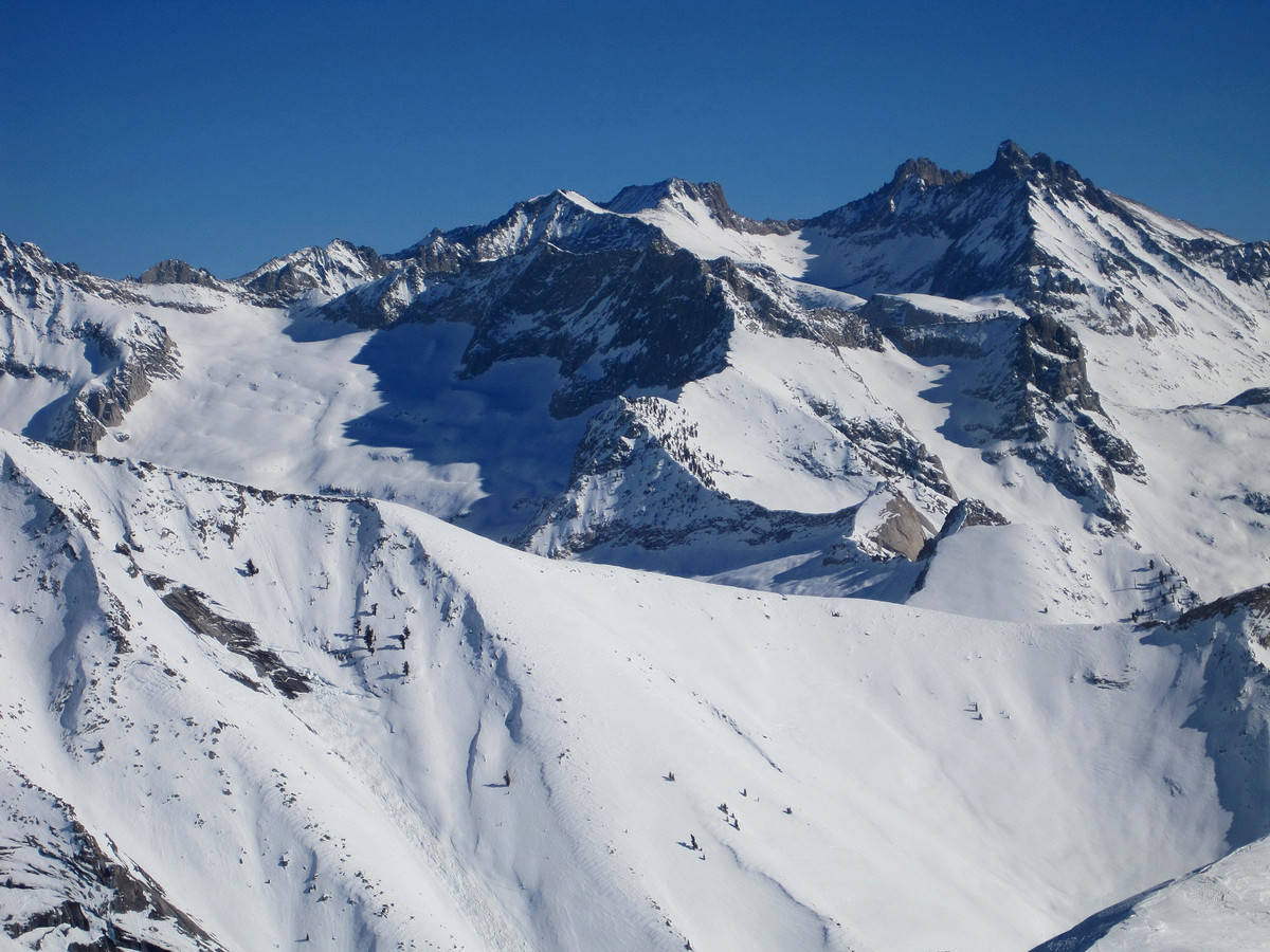
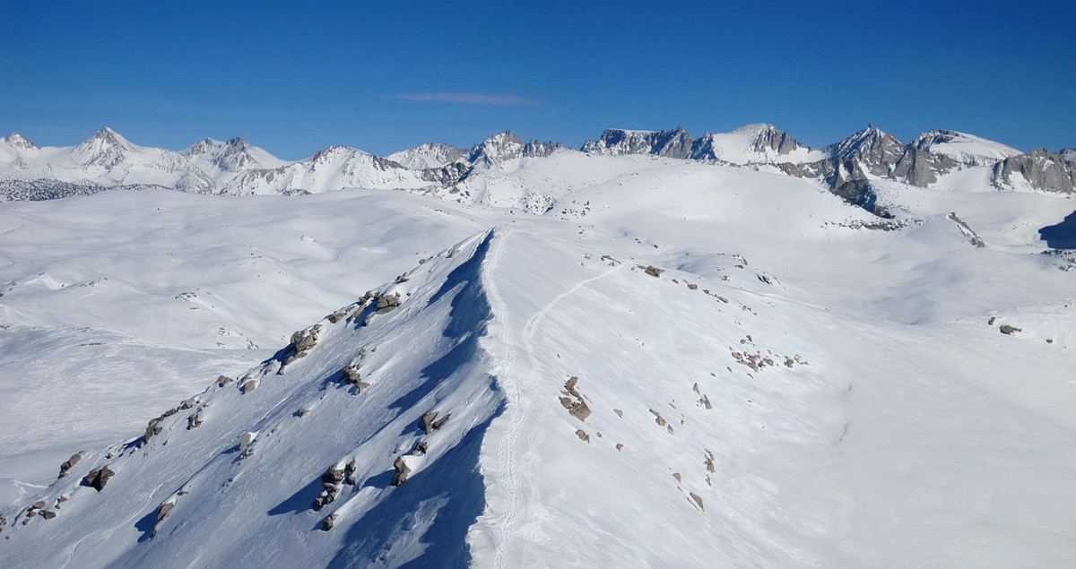
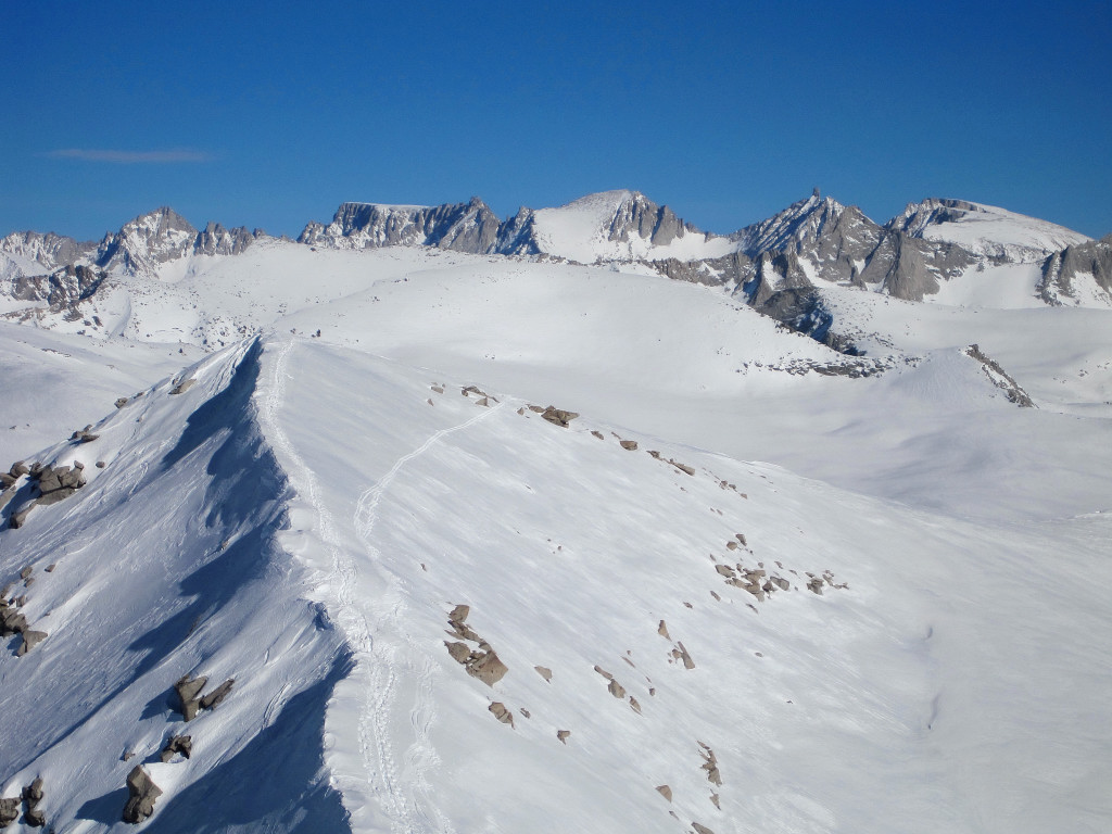
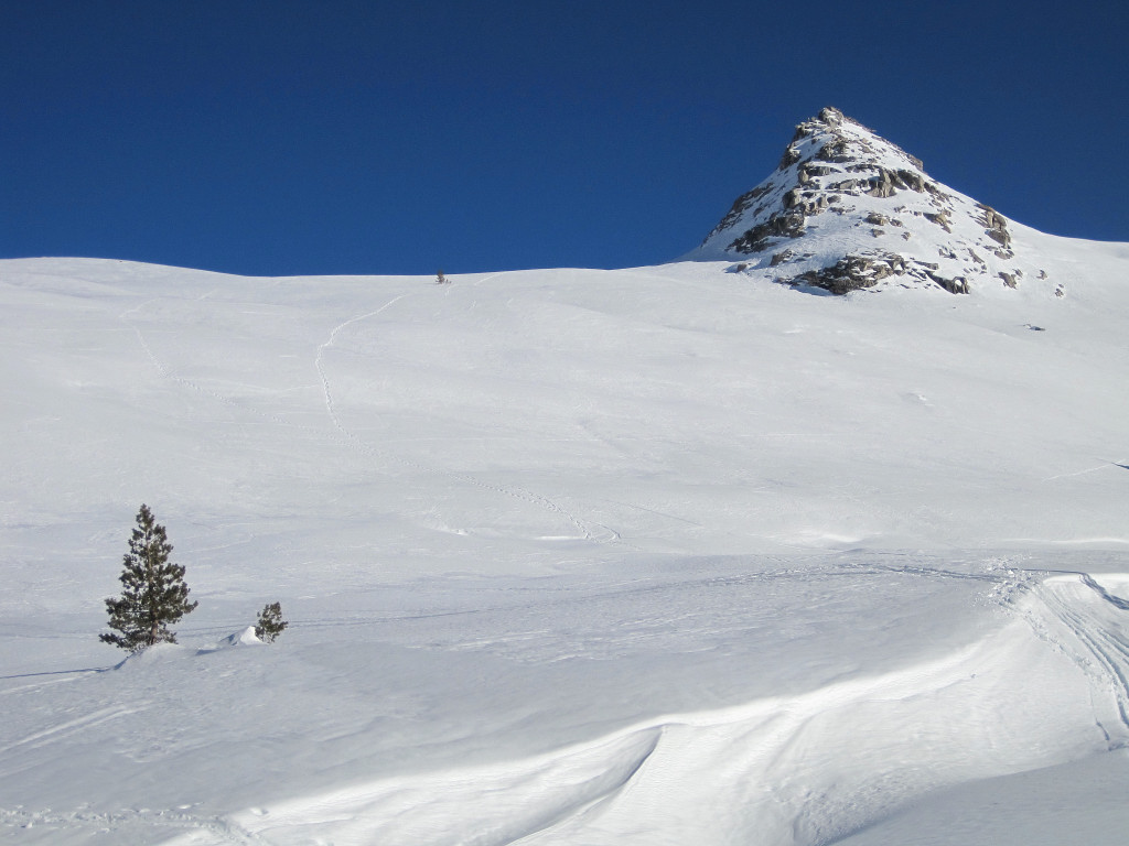
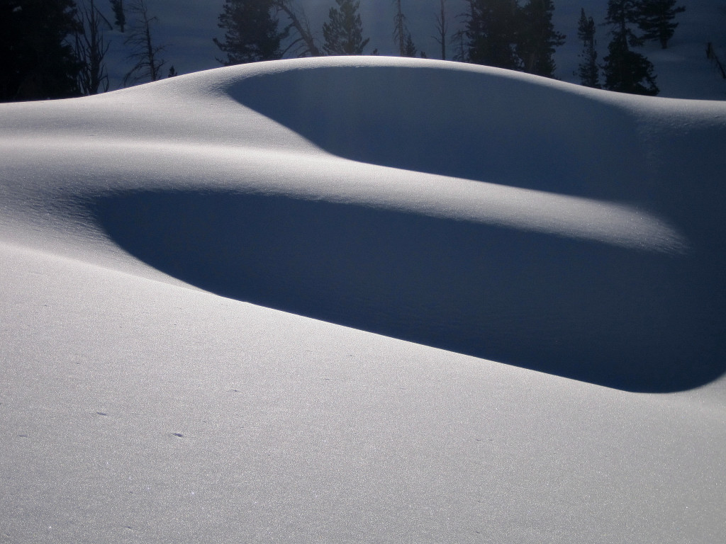
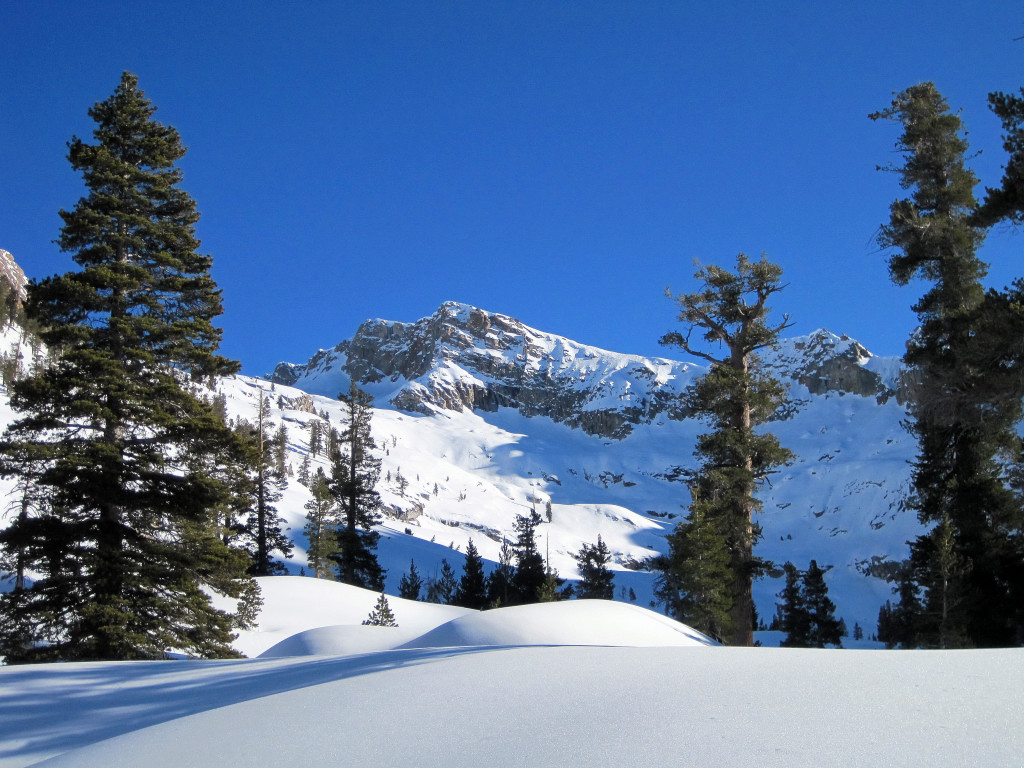
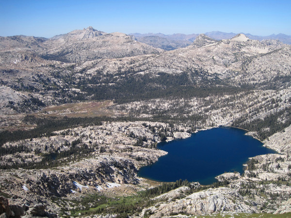
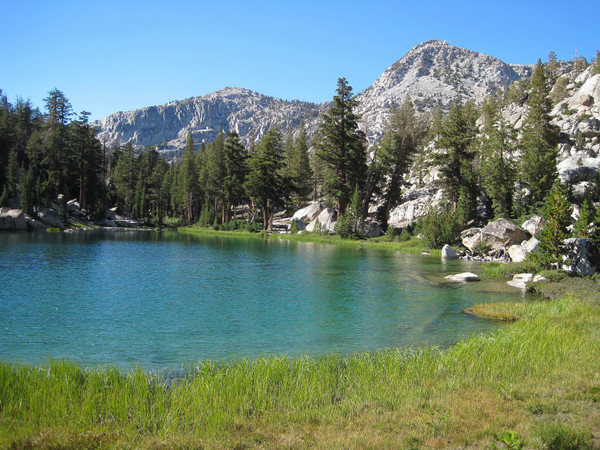
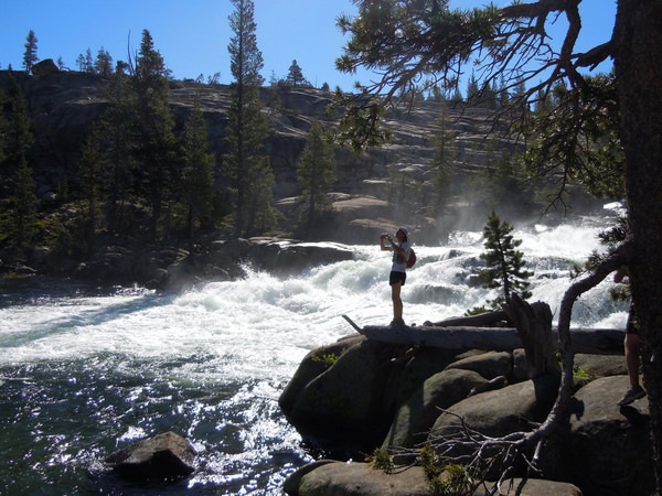
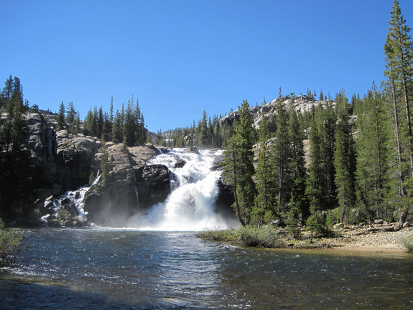
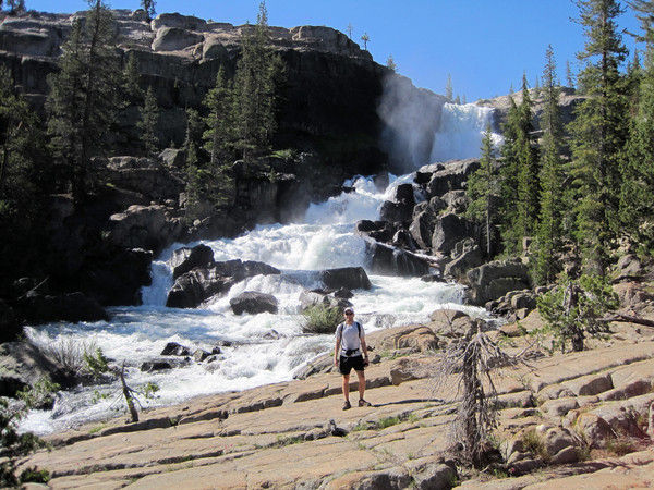
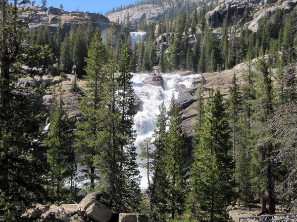
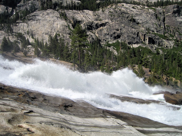
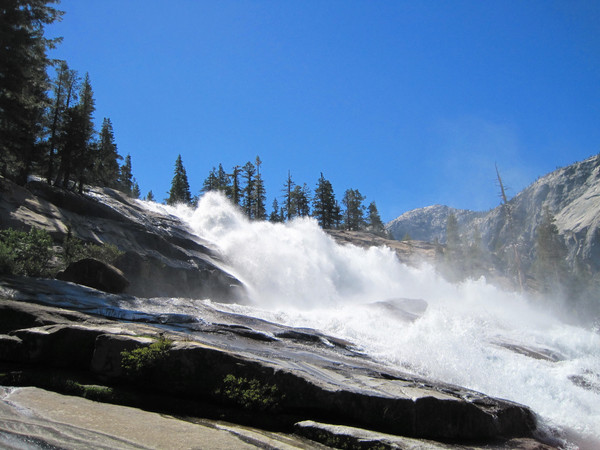
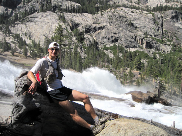
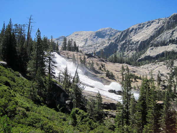
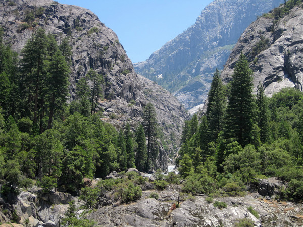
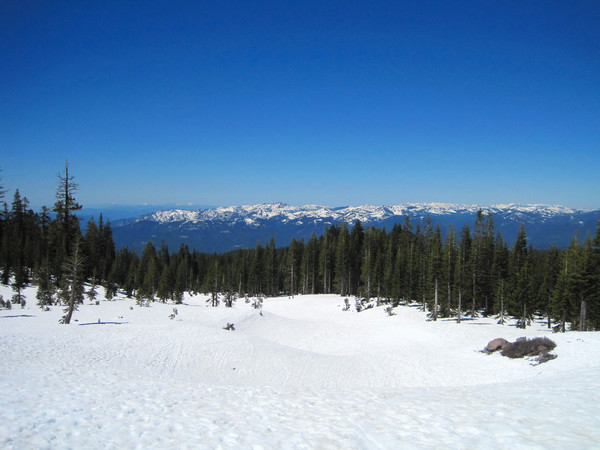
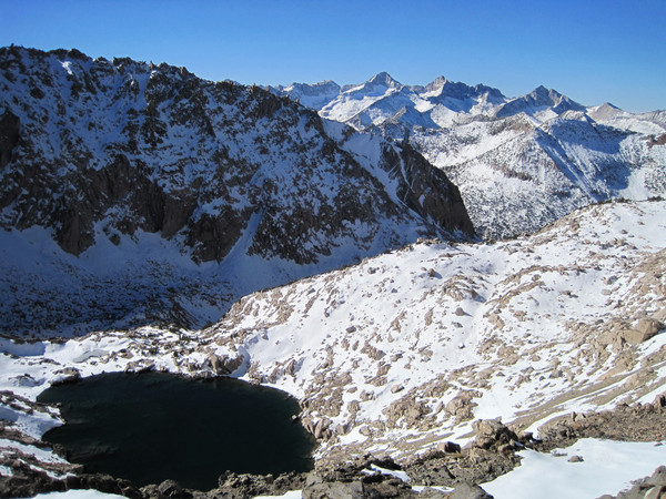
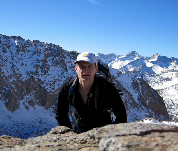
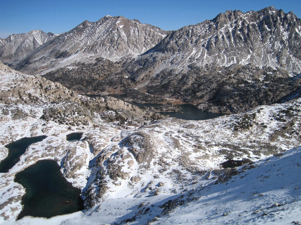
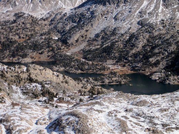
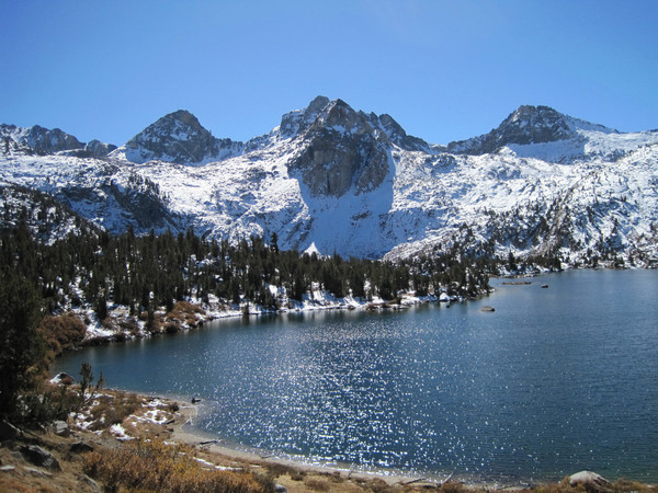
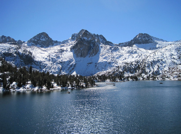
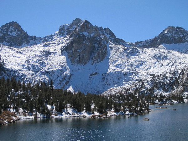
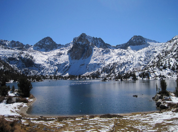
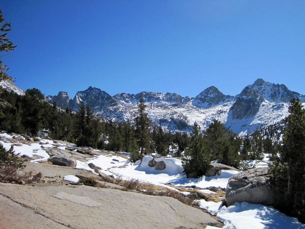
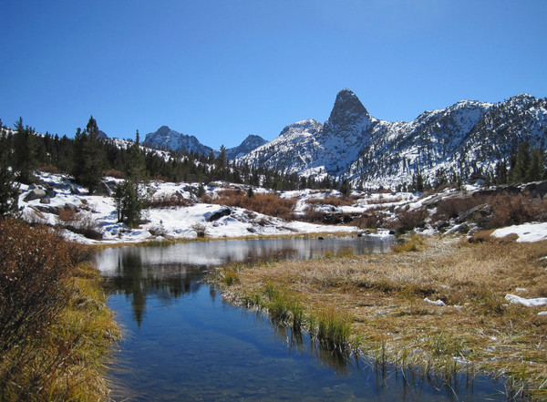
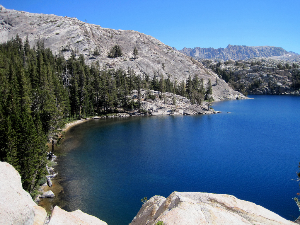
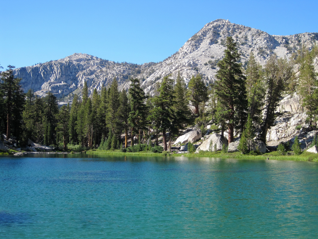
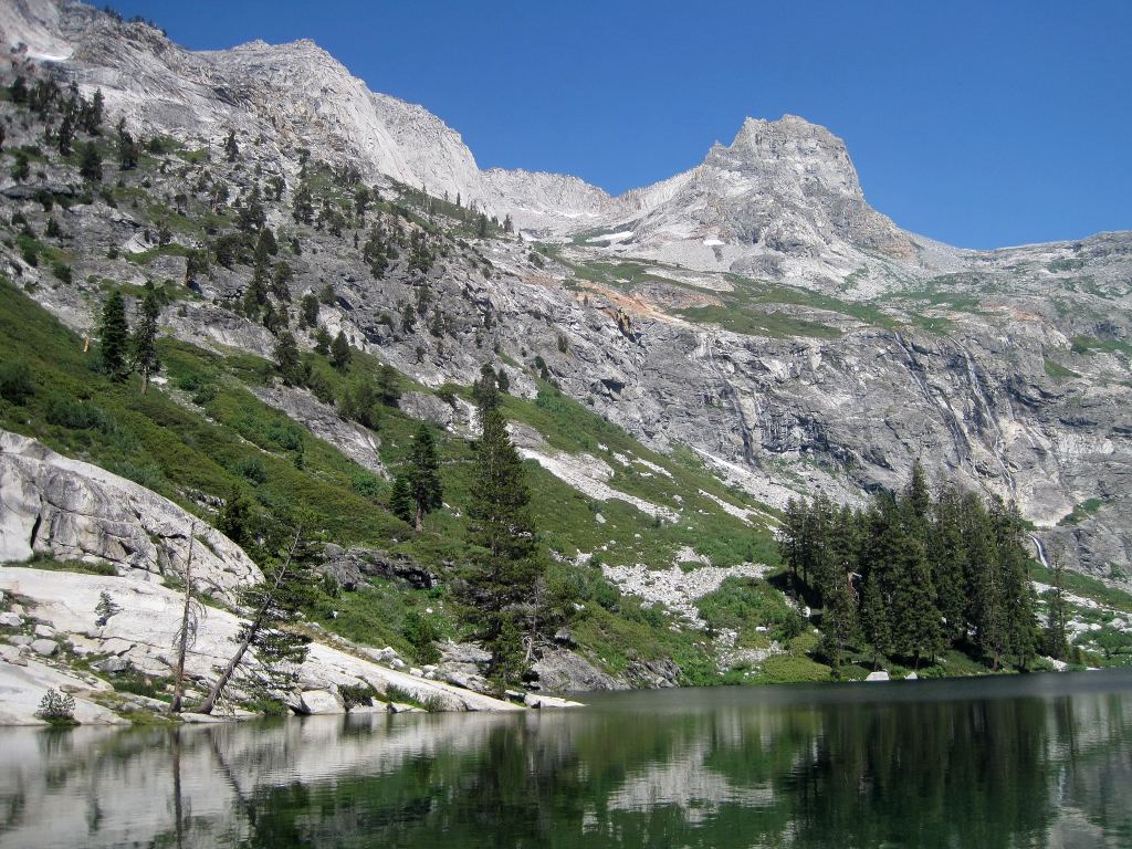
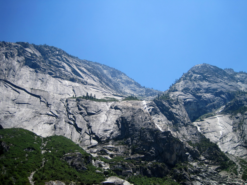
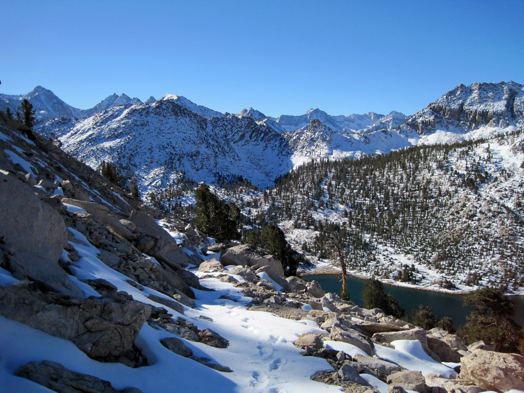
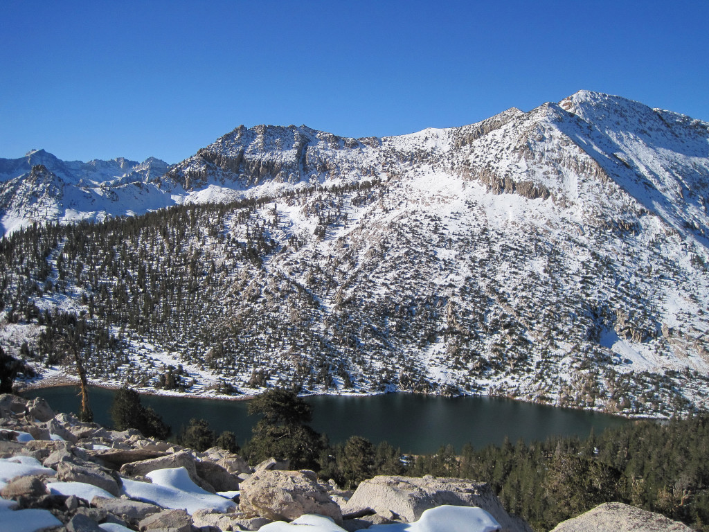
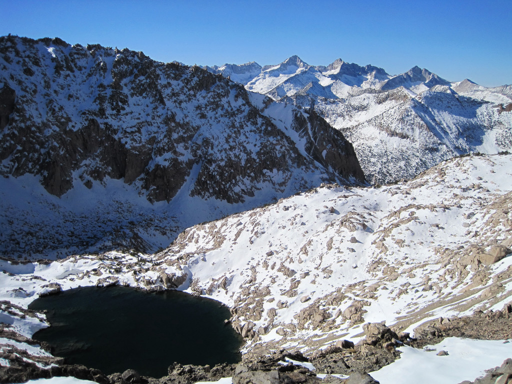
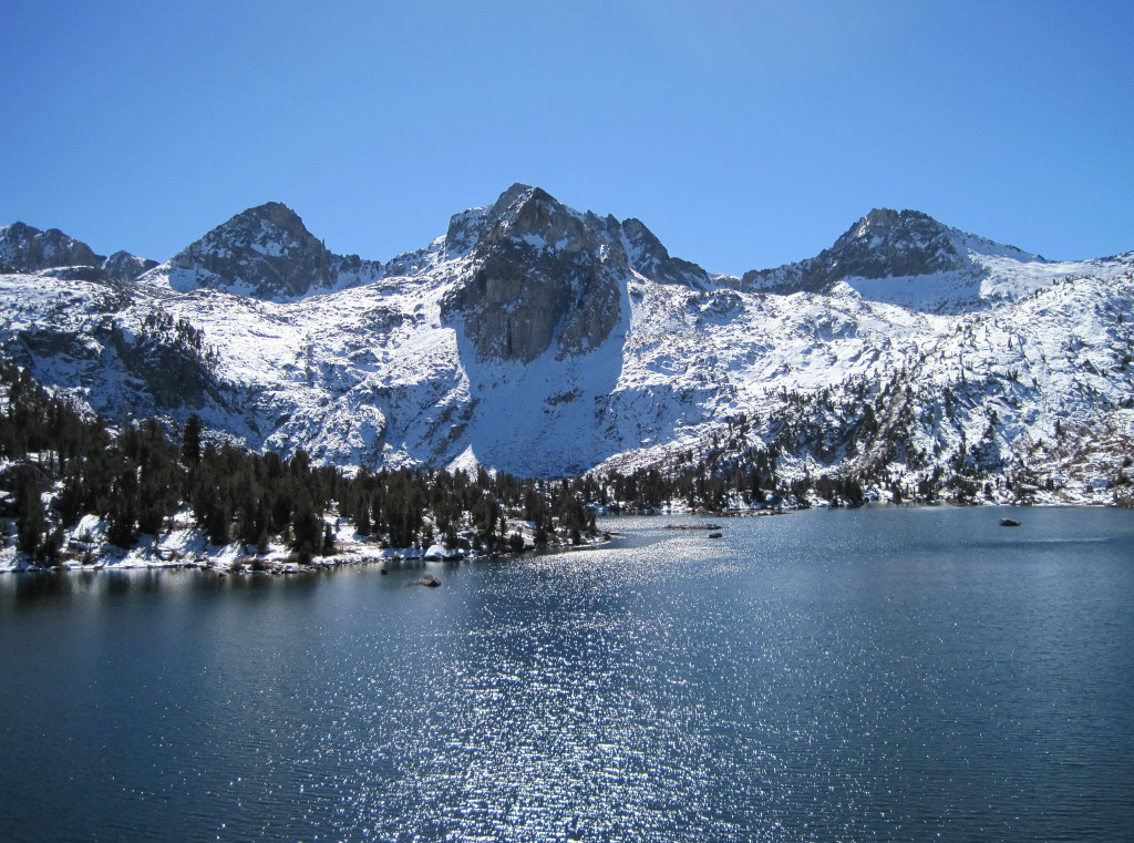
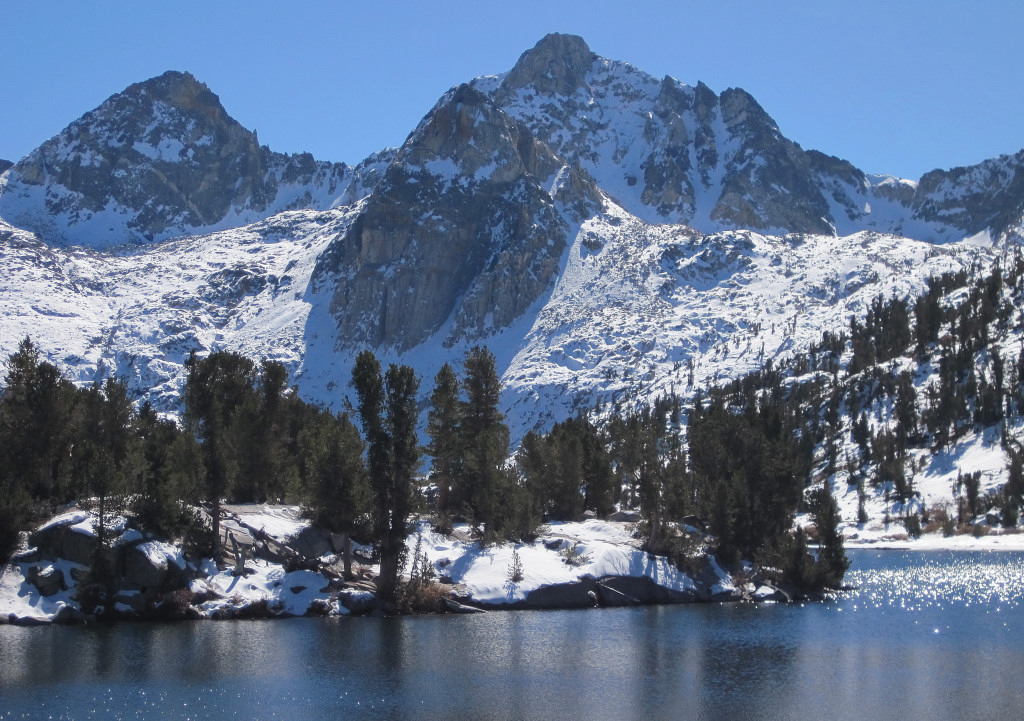
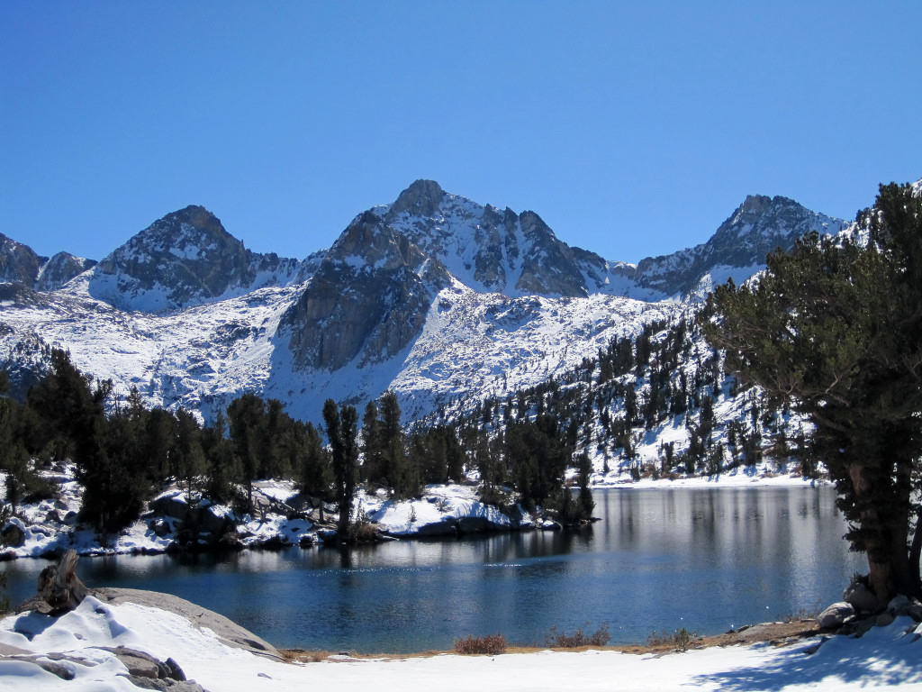
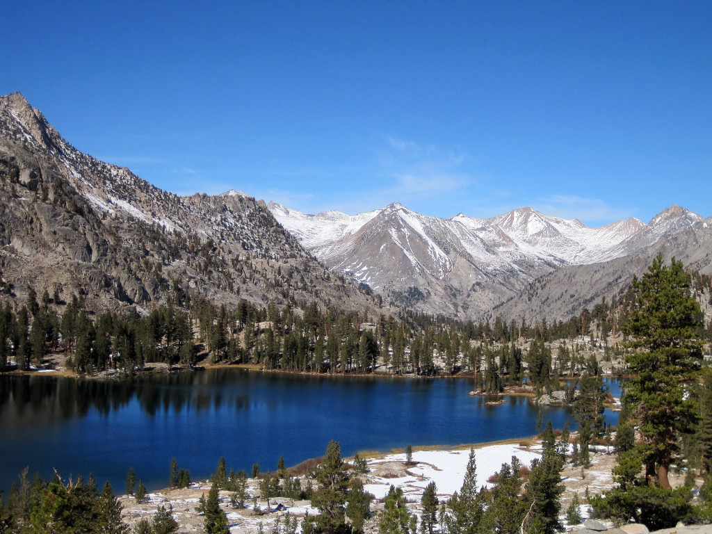
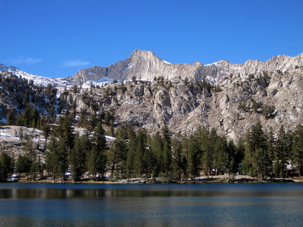
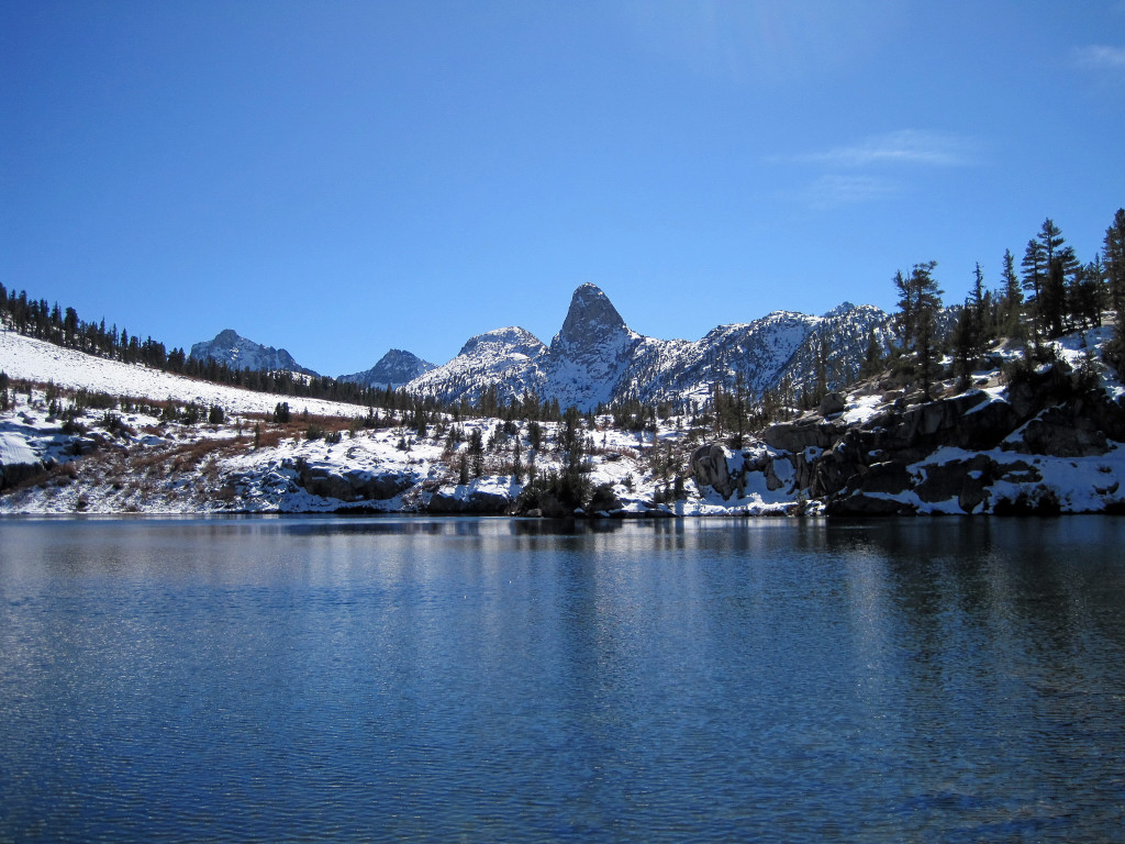
Trip: Winter Alta Peak - Pear Lake
Date: 1/31/2011
Trip Report:

-
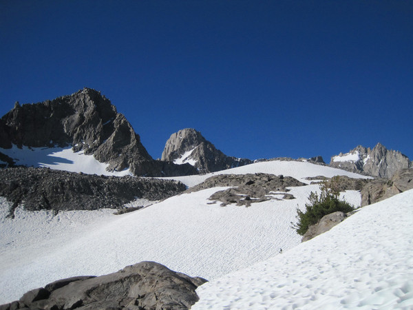
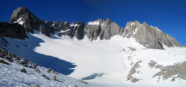
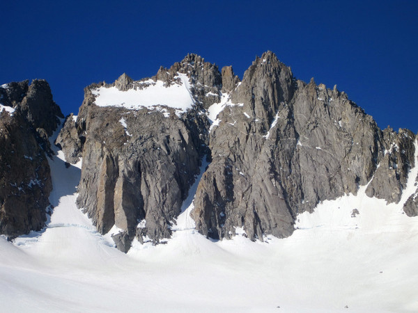
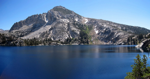
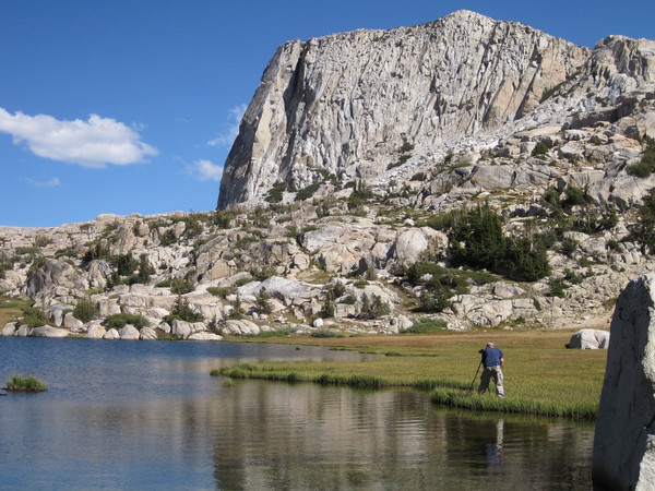
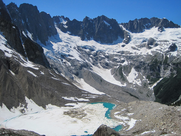
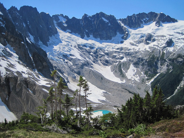
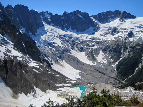
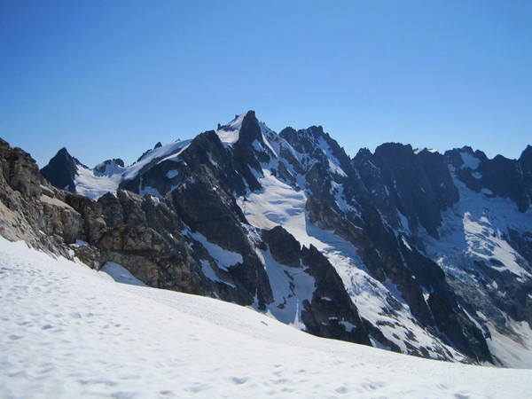
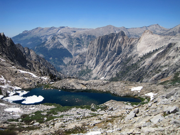
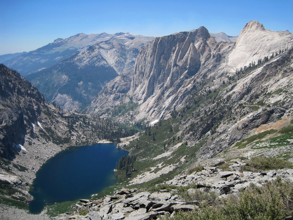
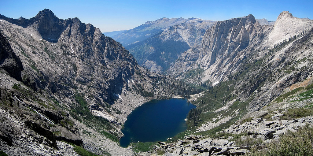
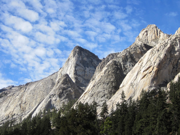
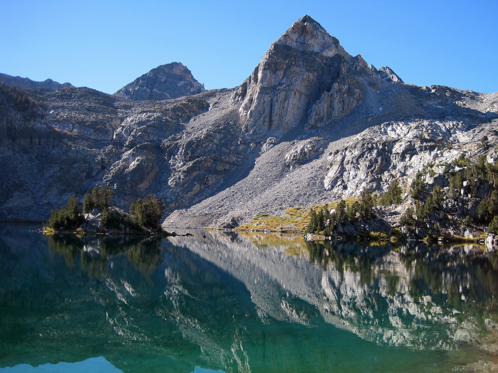
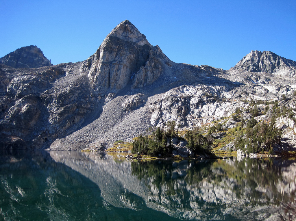
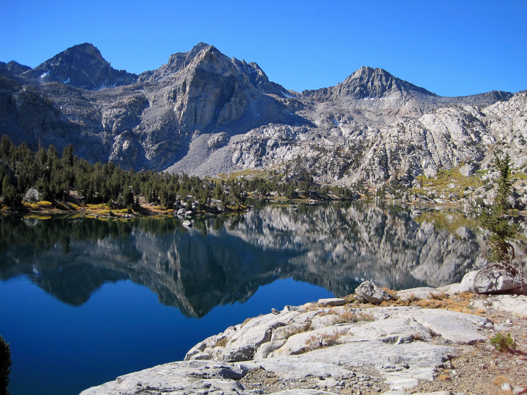
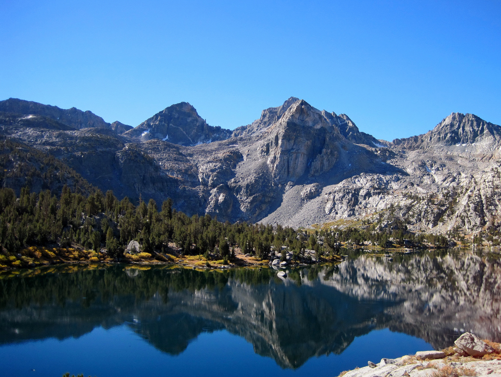
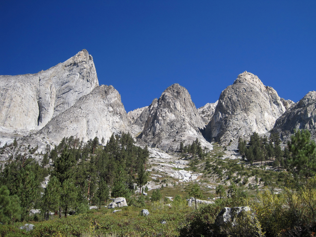
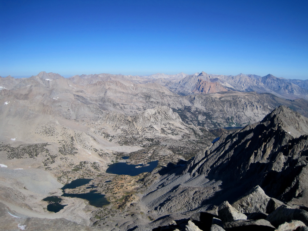
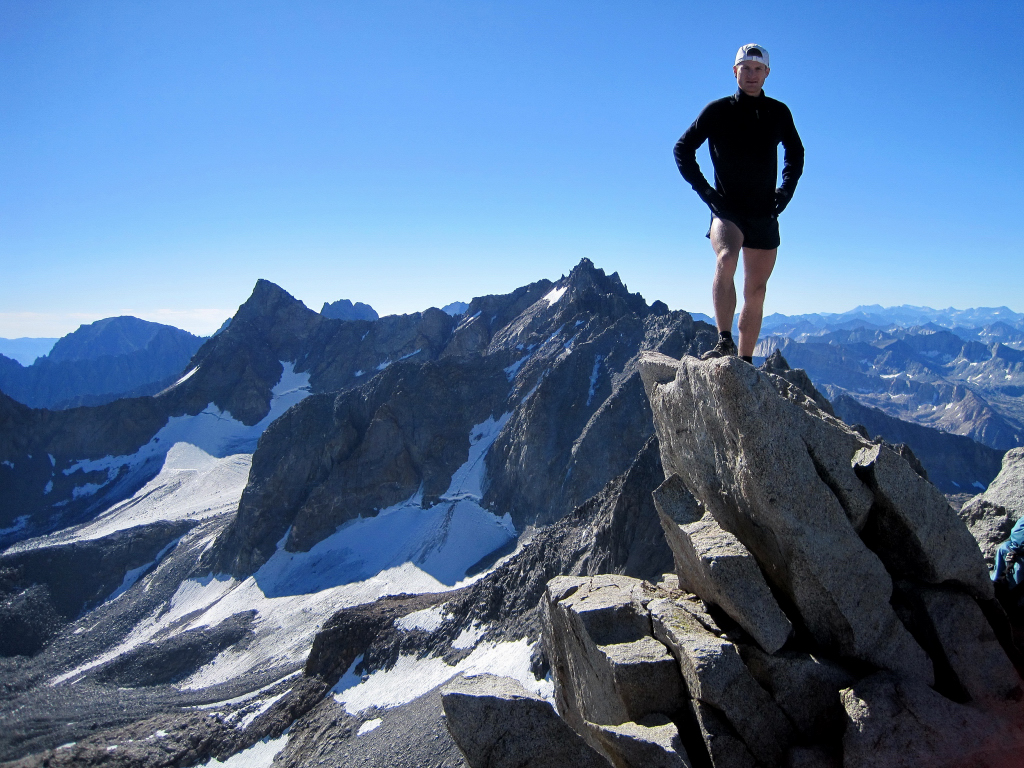
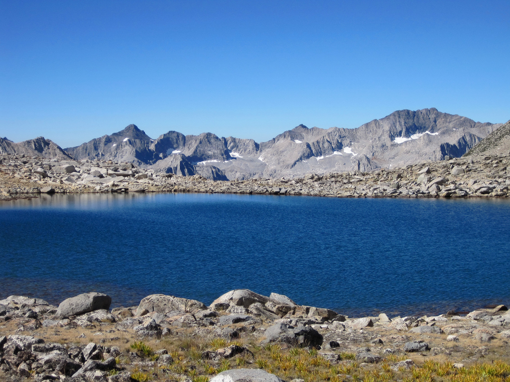
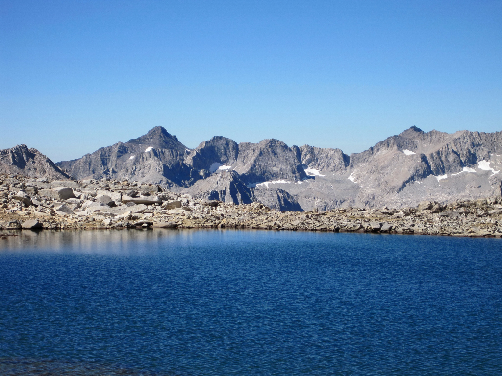
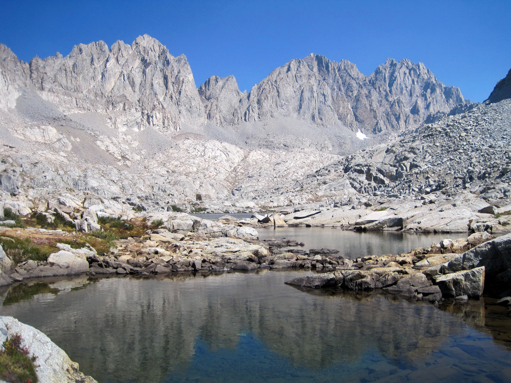
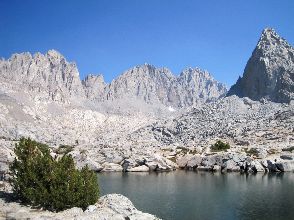
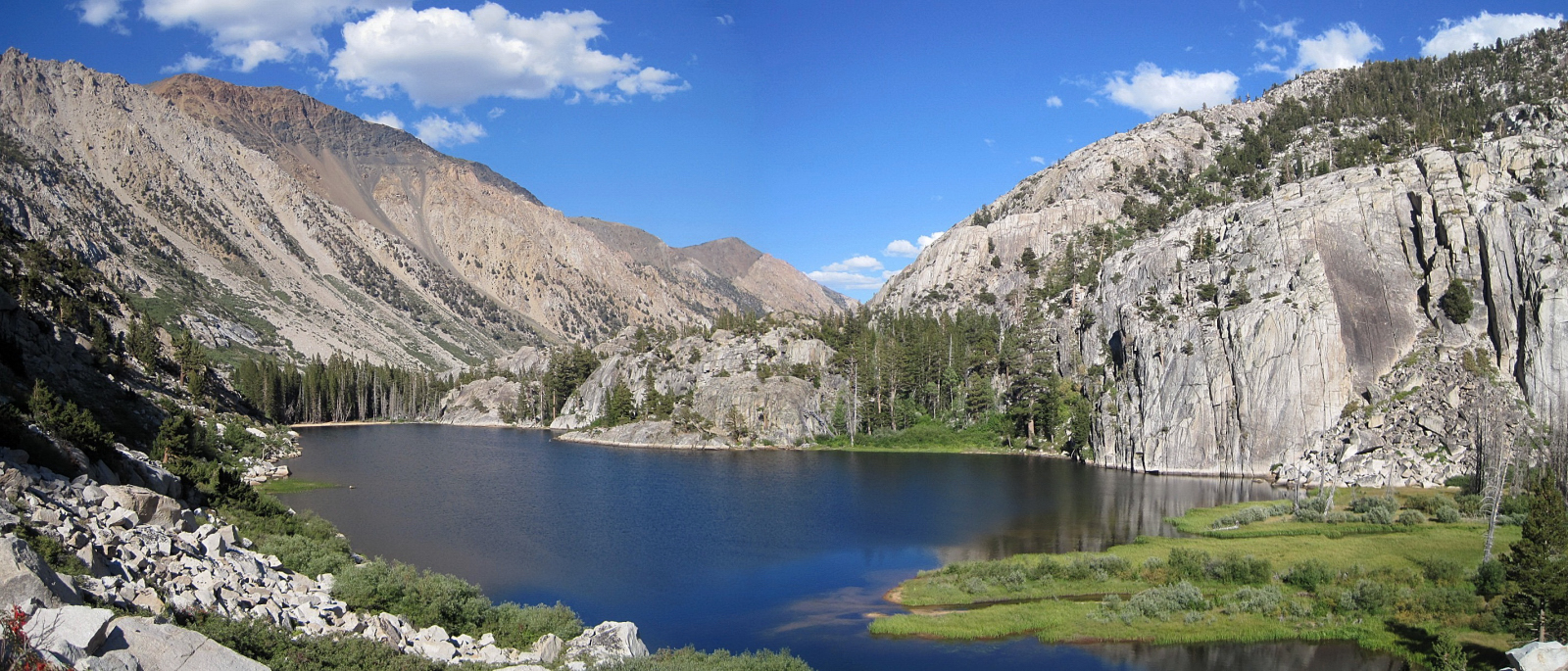
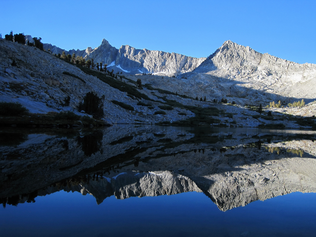
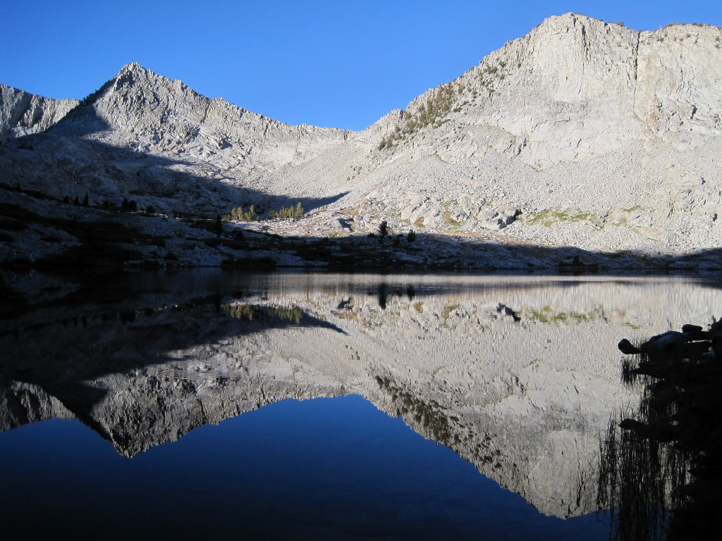
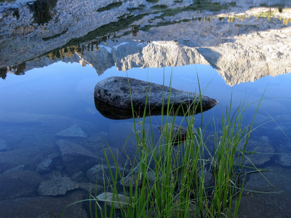
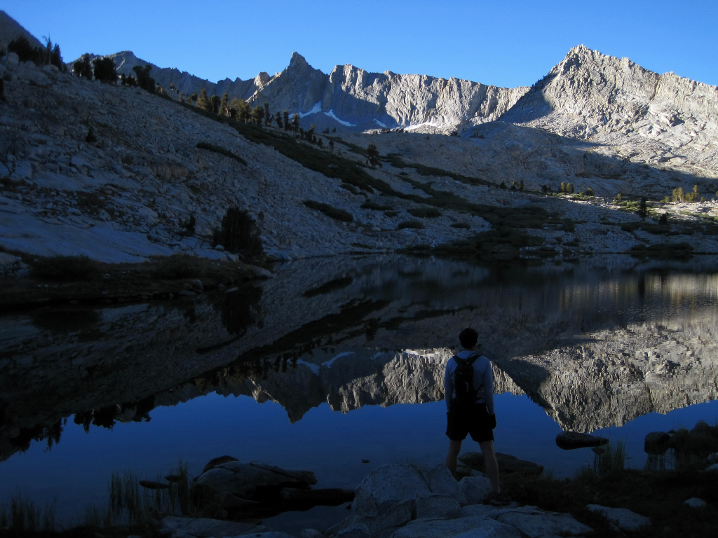
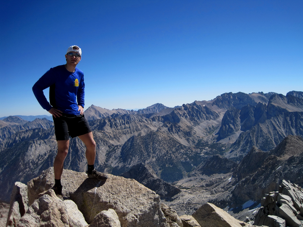
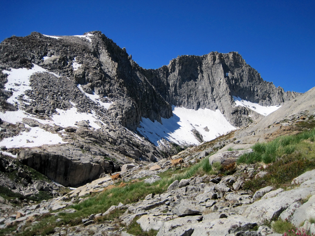
Trip: Mount Sill - North Couloir
Date: 7/3/2011
Trip Report:
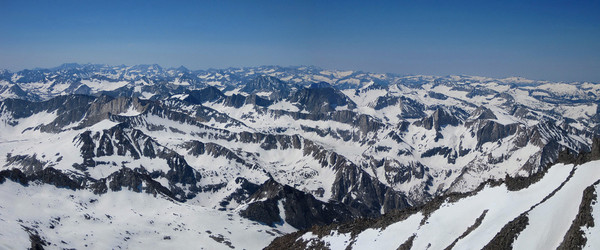
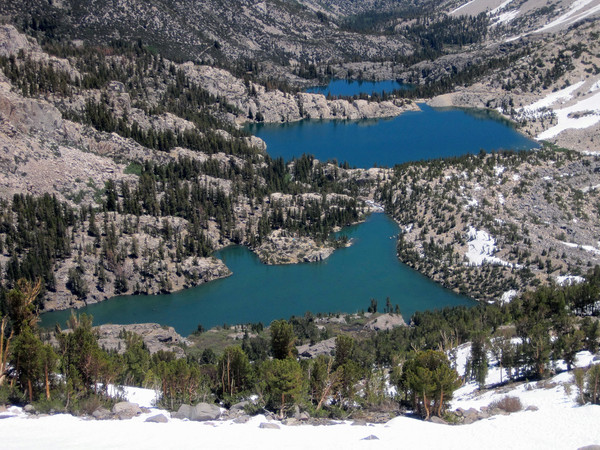
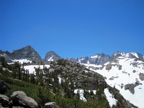
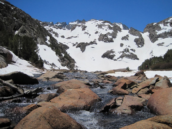
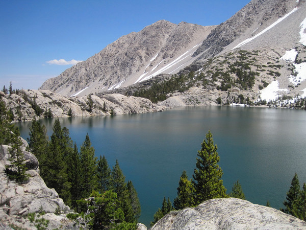
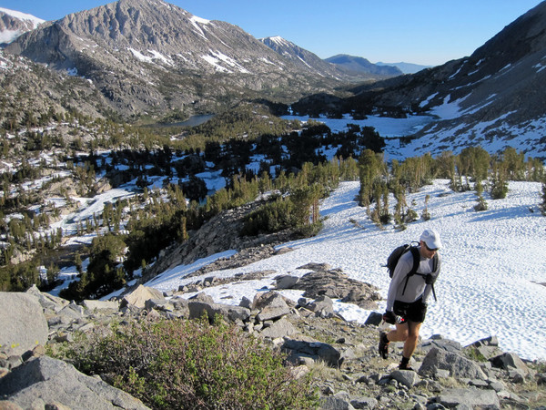
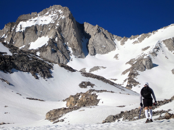
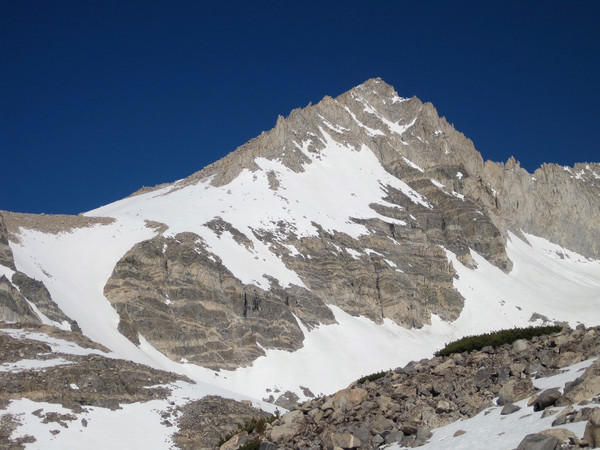
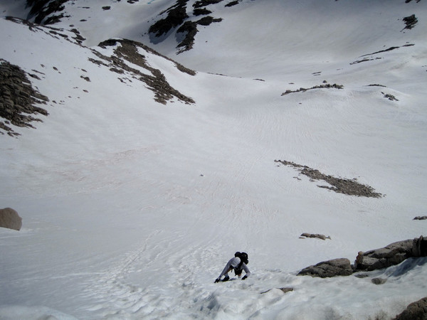
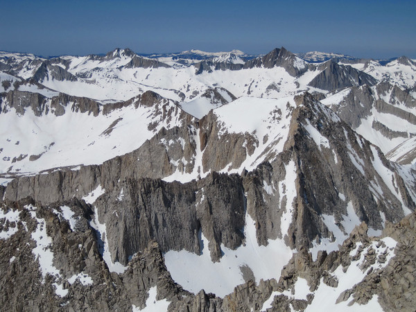
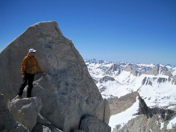
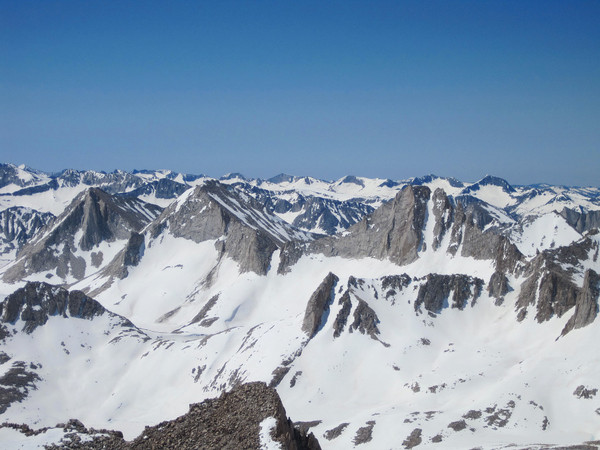
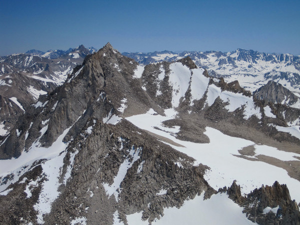
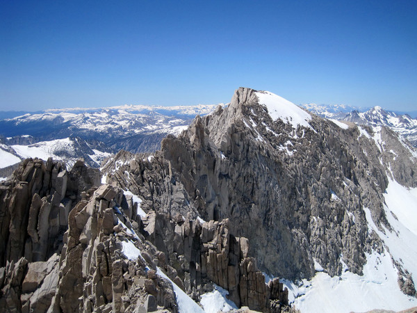
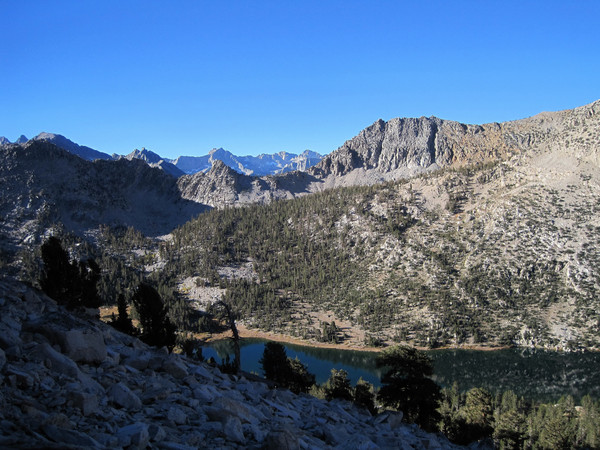
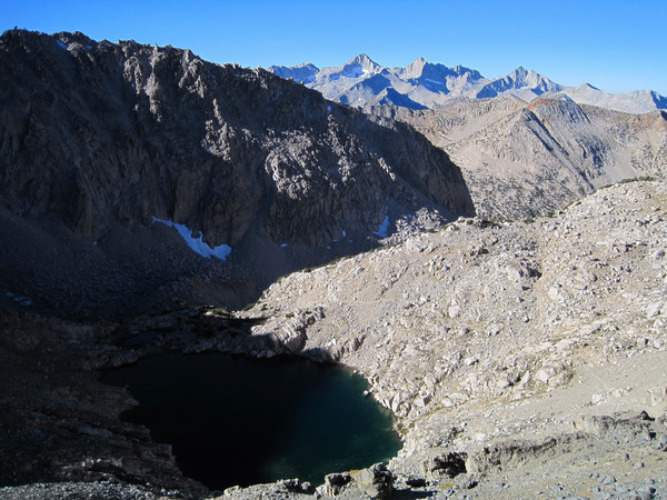
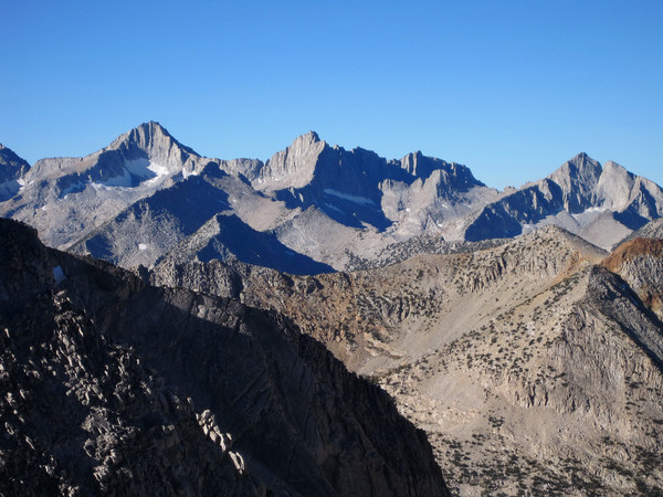
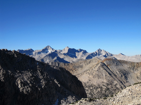
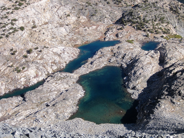
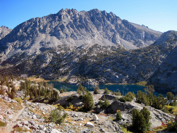
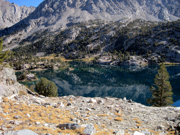
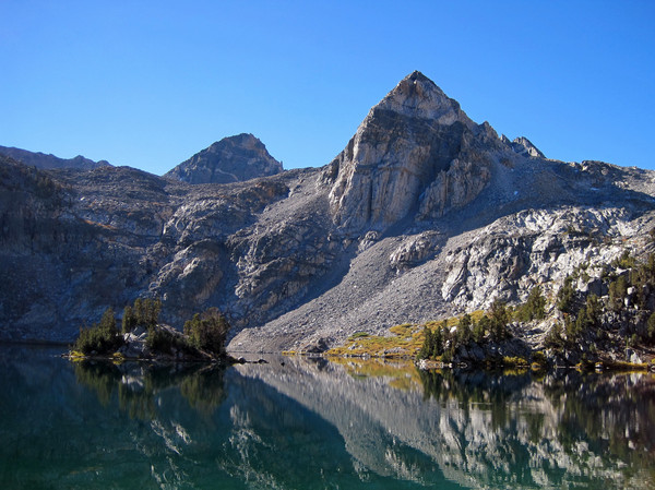
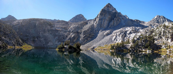
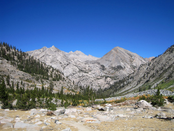
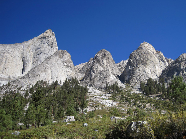
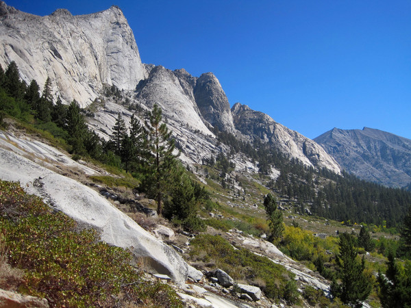
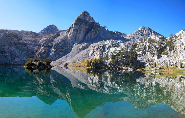
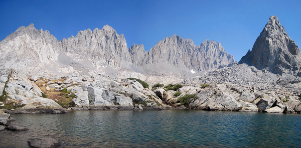
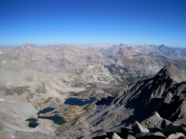
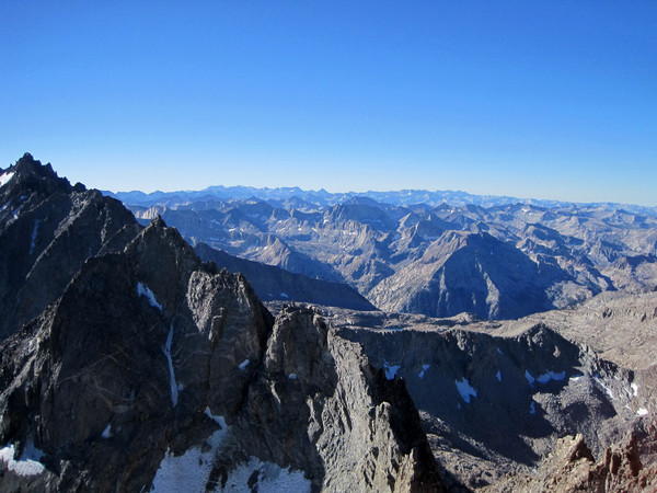
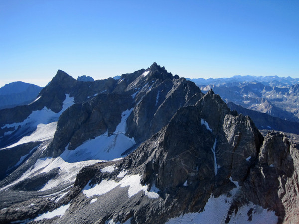
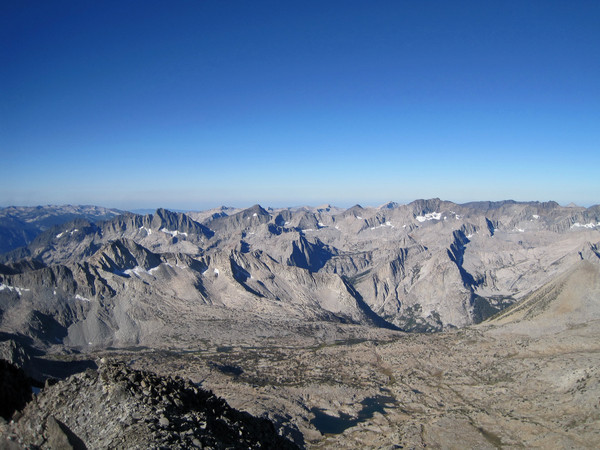
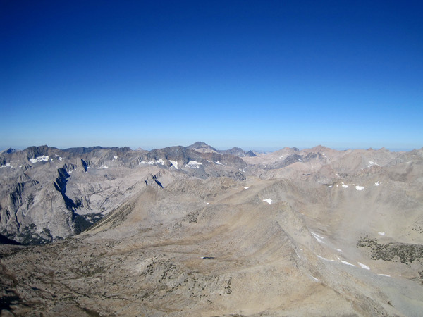
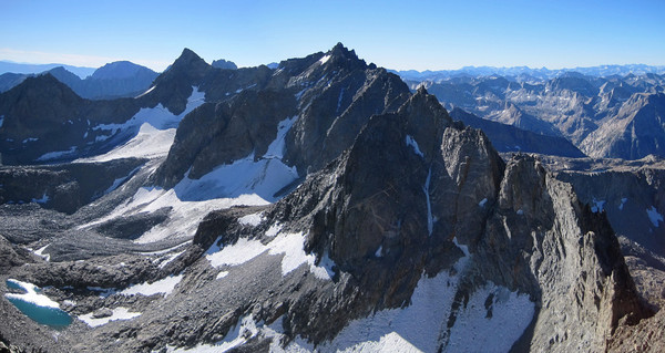
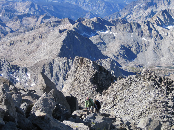
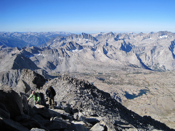
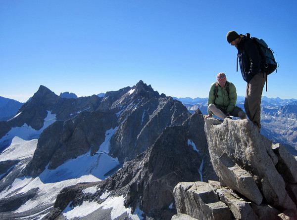
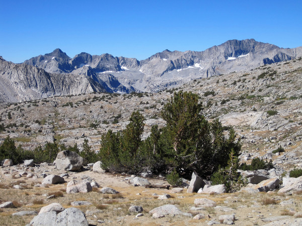
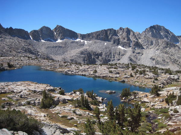
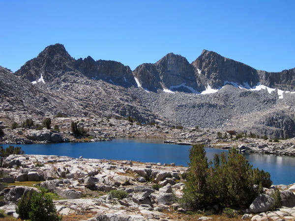
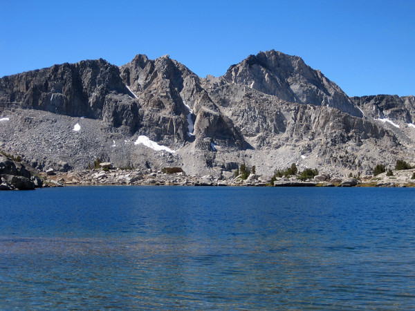
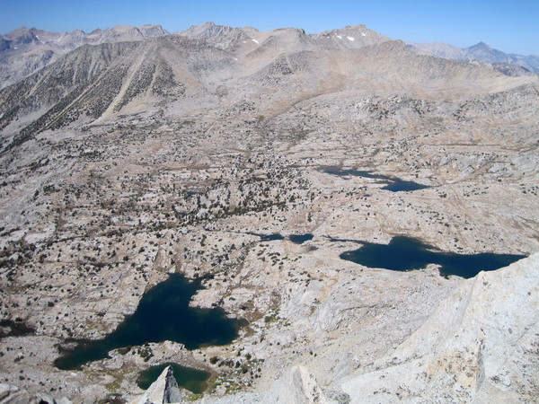
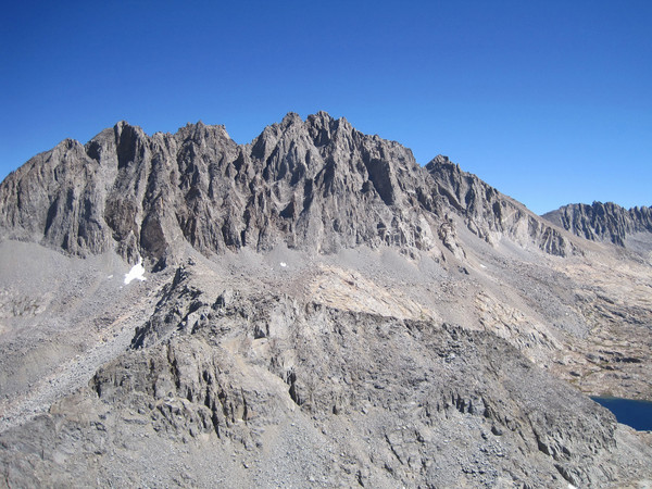
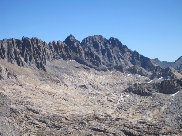
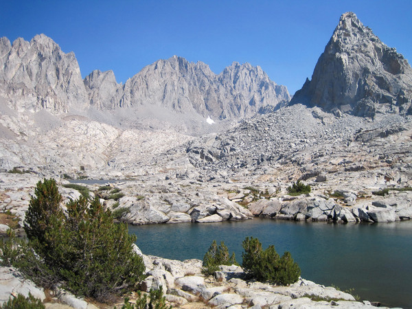
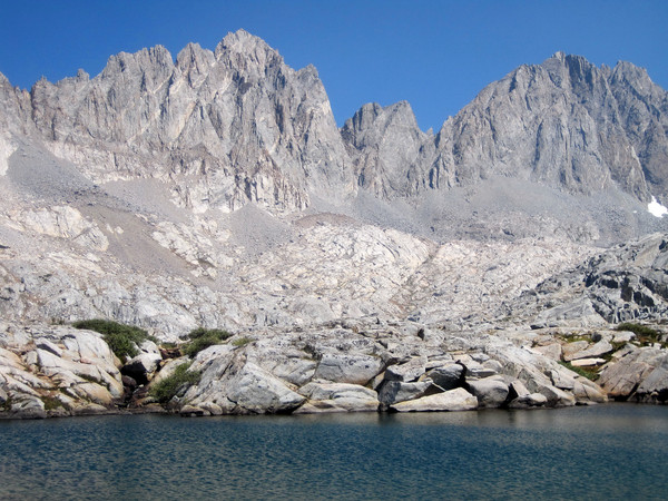
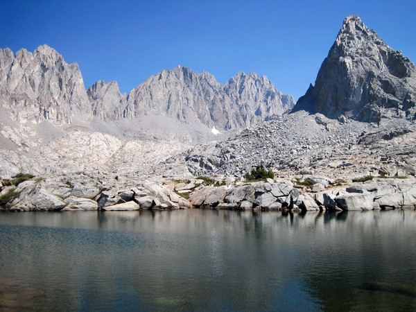
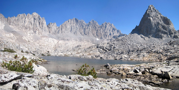
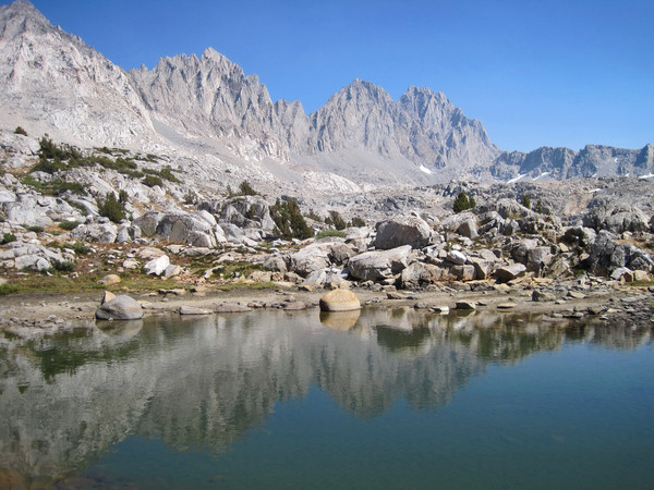
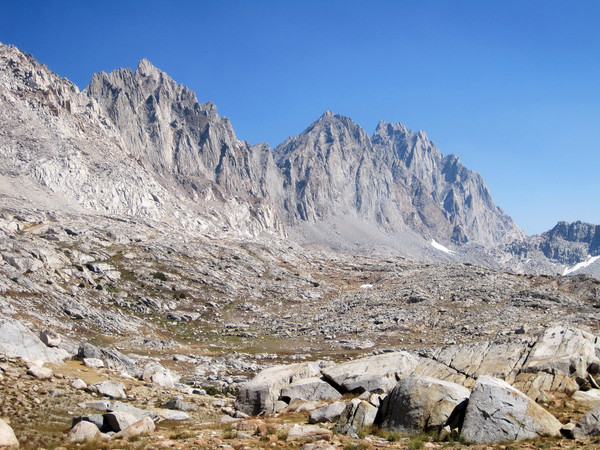
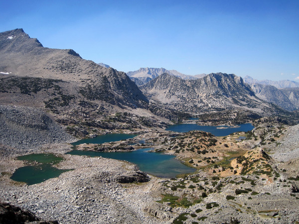
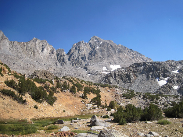
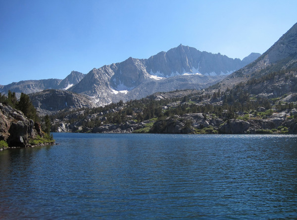
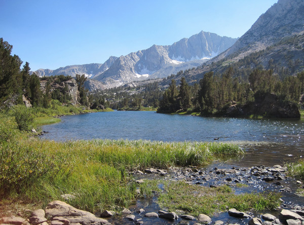
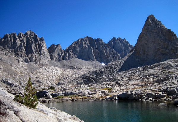
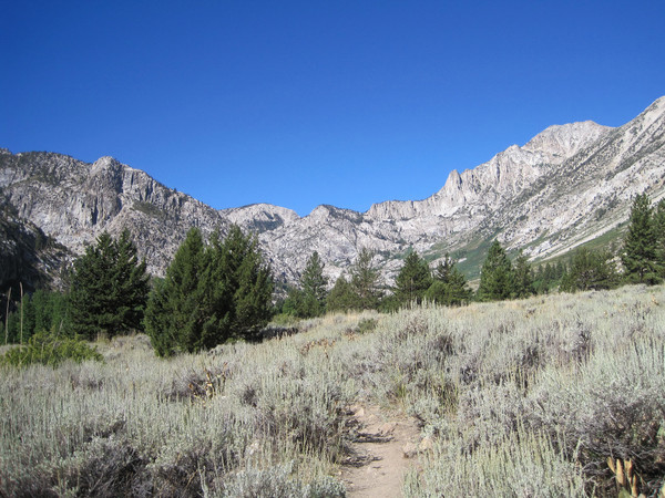
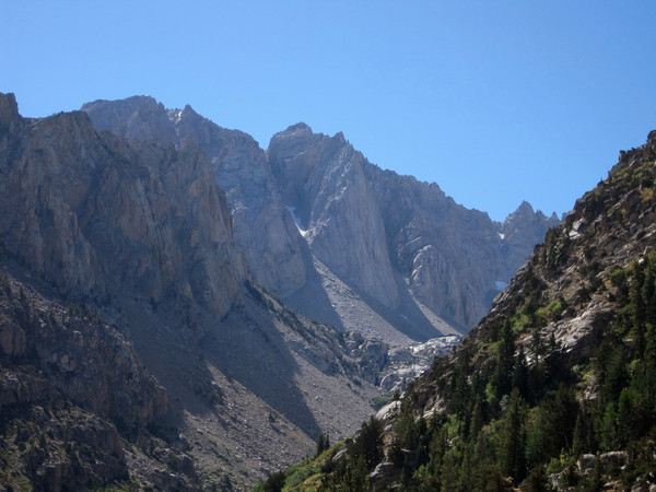
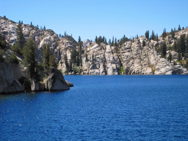
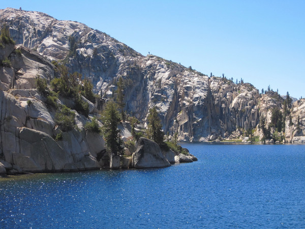
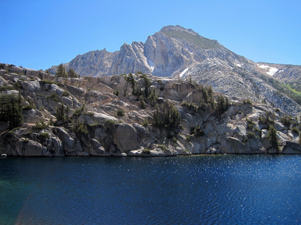
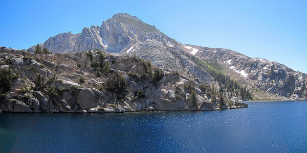
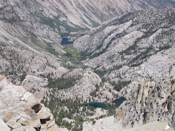
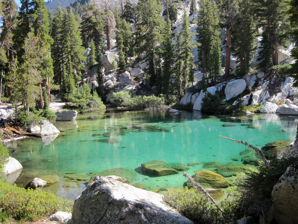
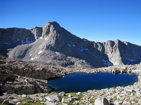
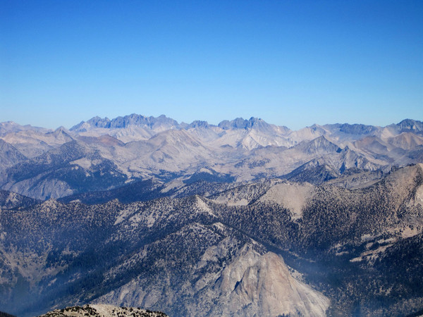
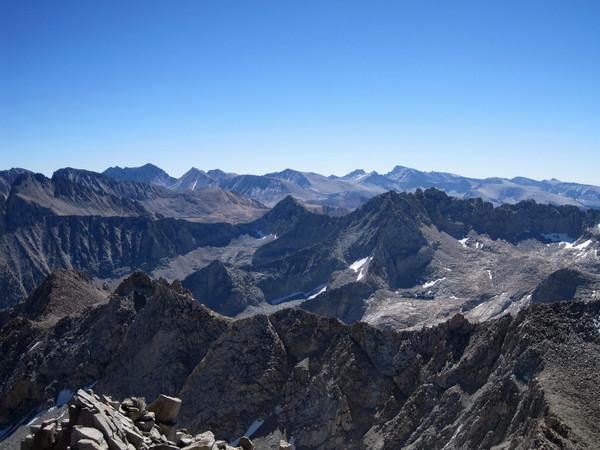
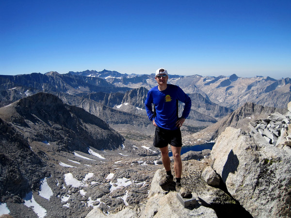
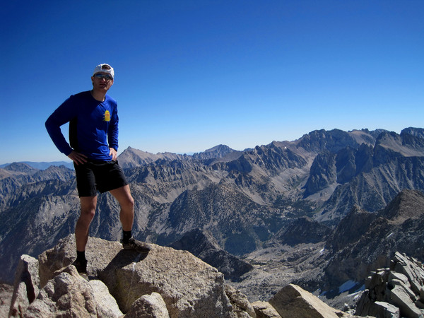
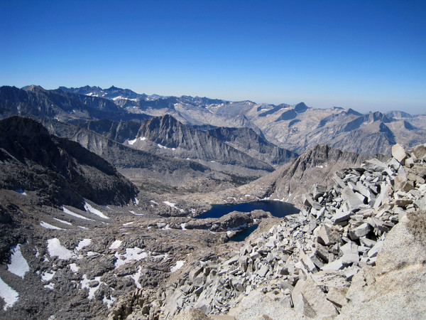
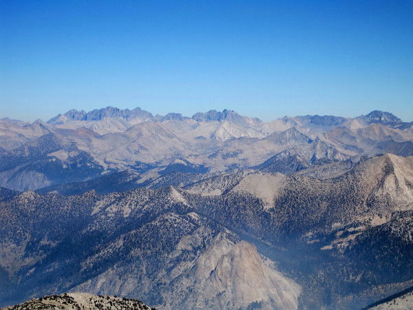
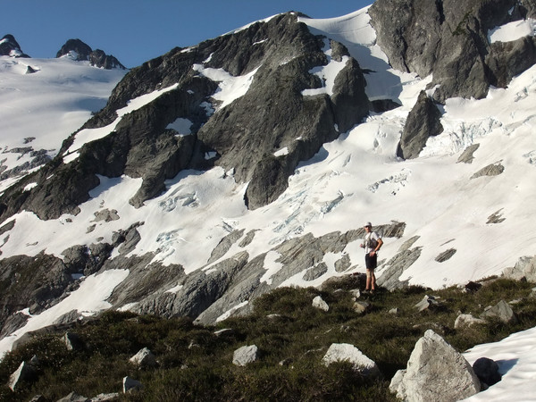
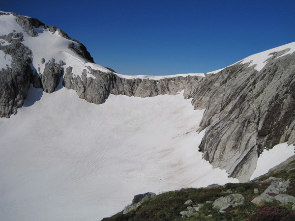
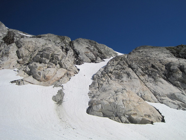
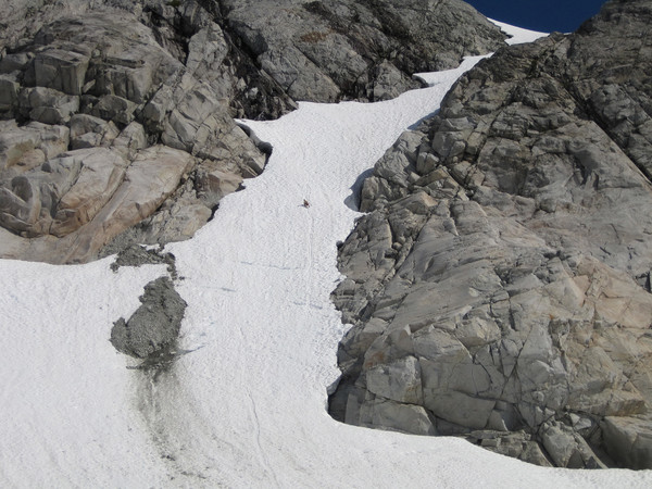
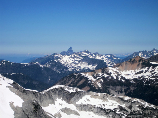
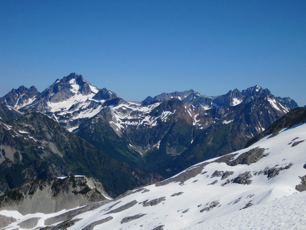
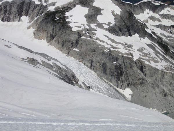
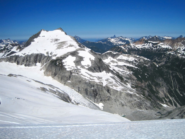
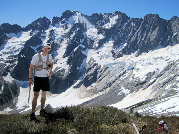
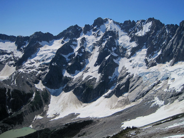
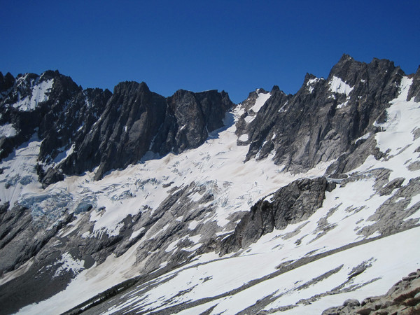
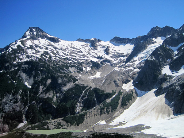
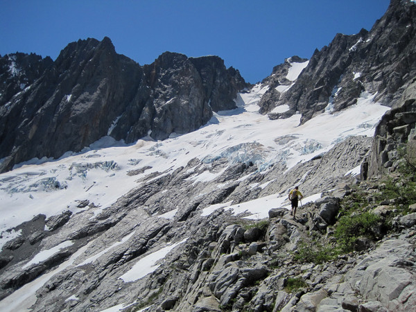
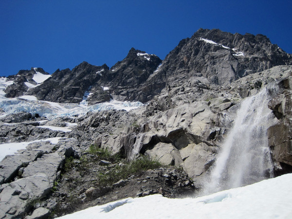
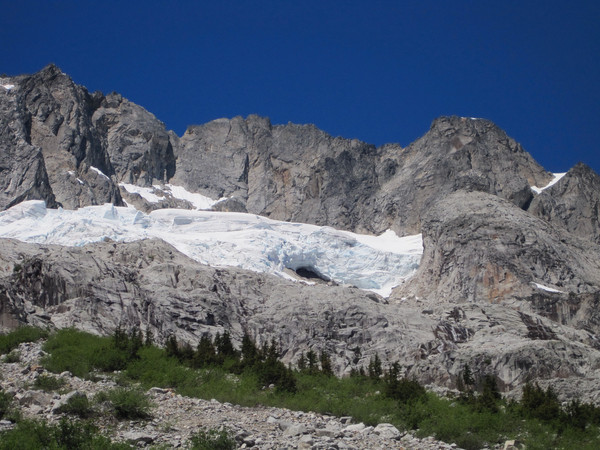
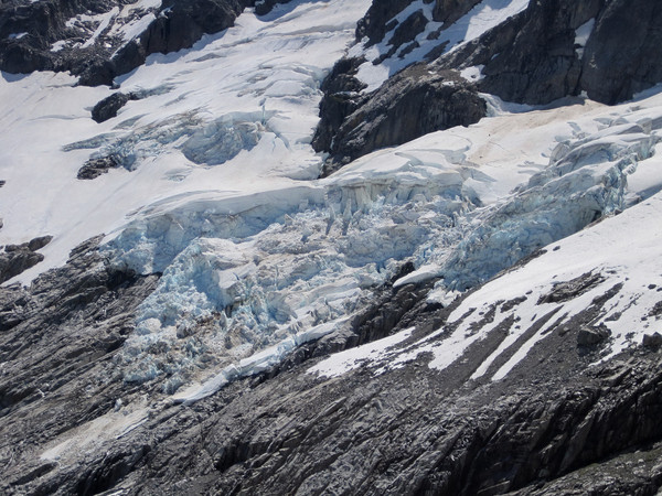
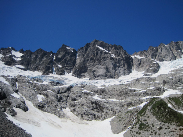
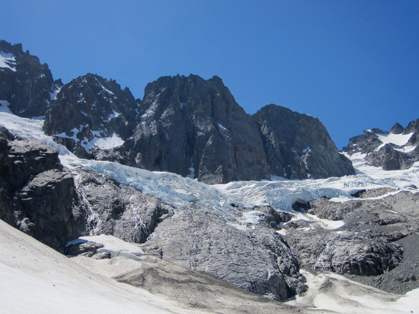
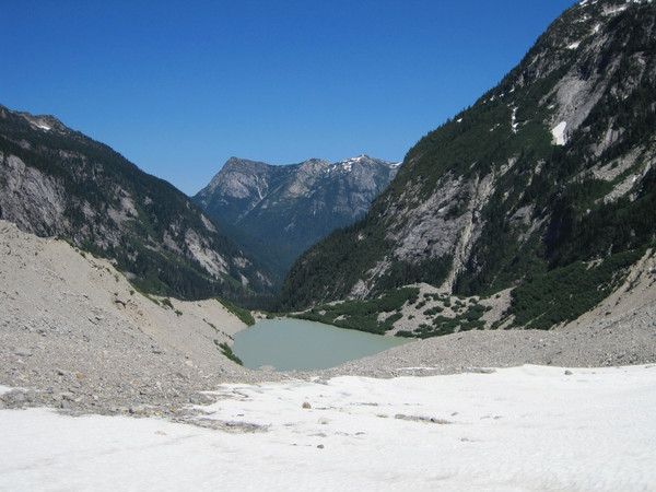
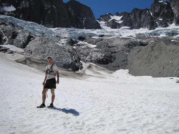
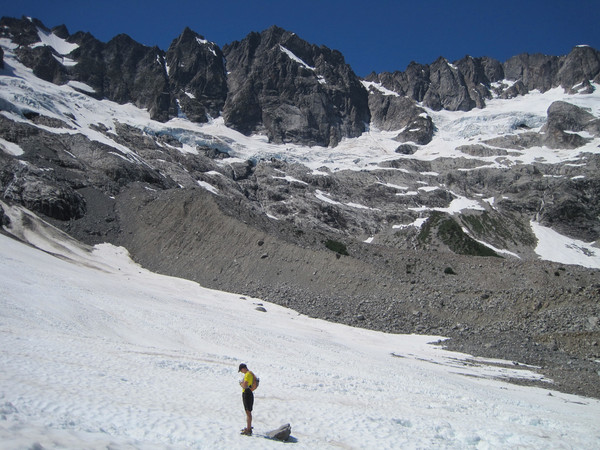
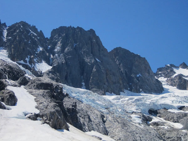
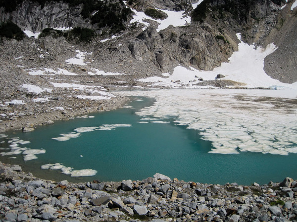
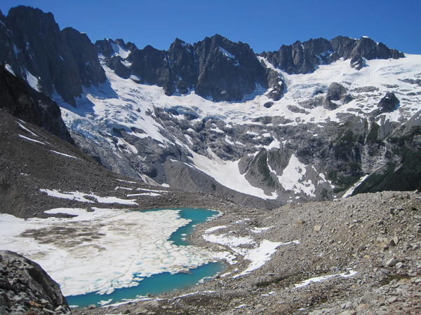
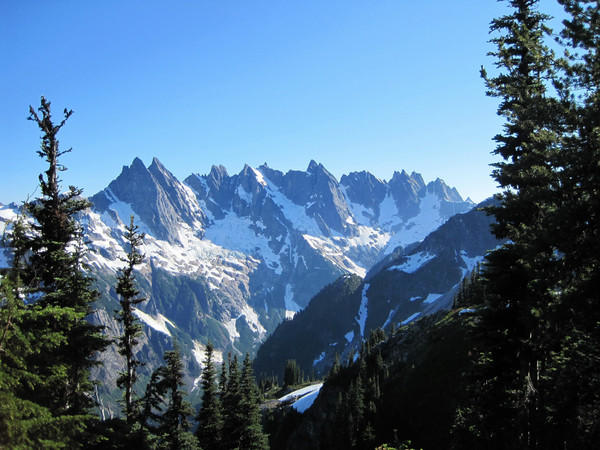
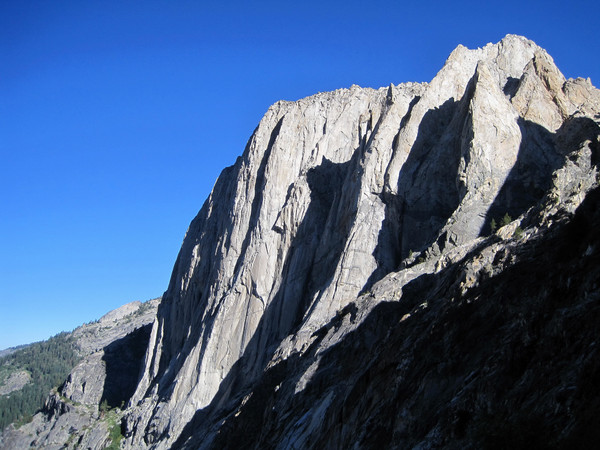
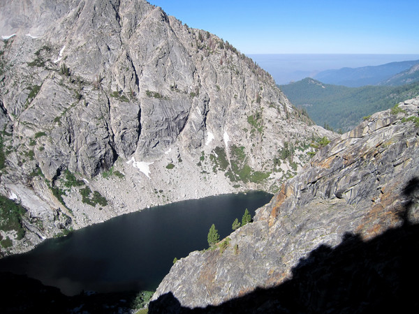
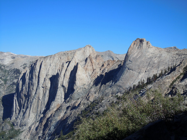
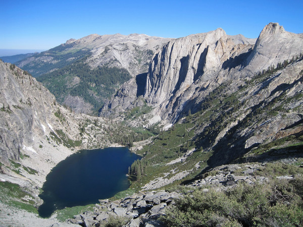
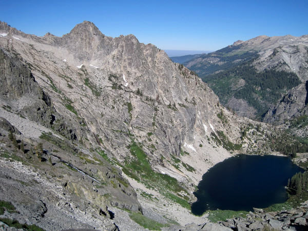
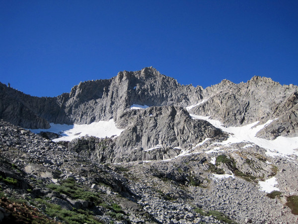
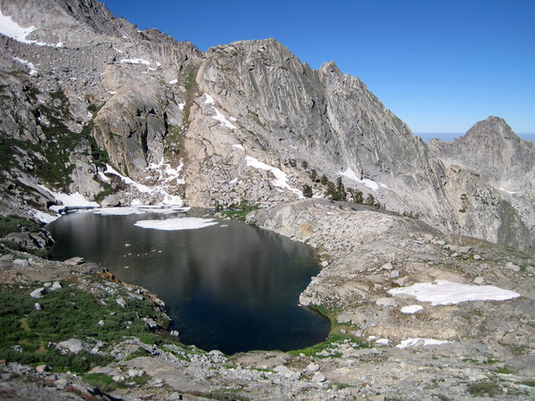
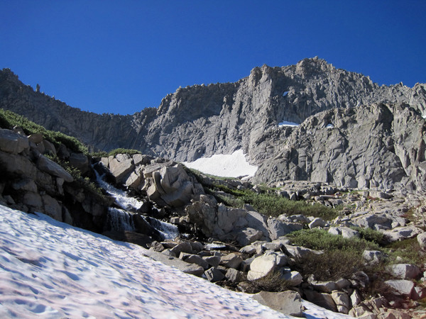
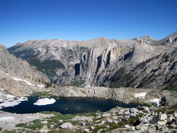
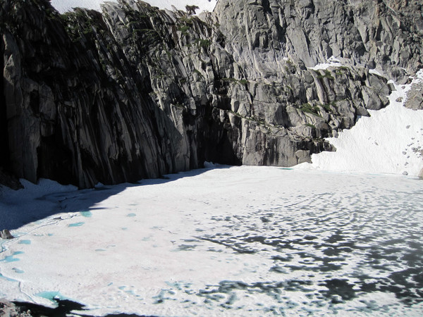
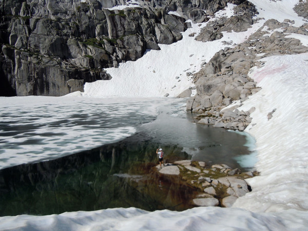
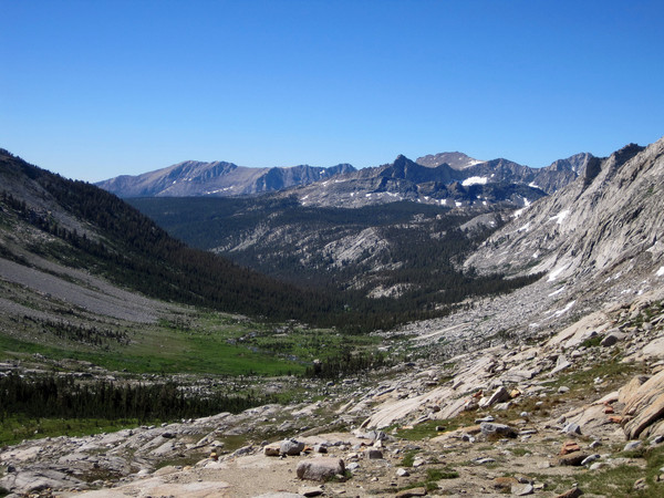
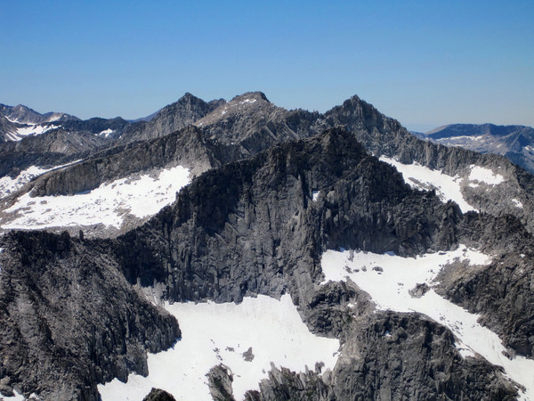
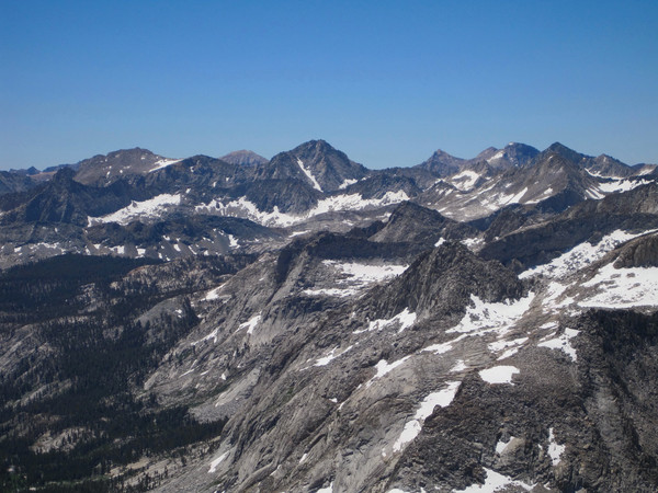
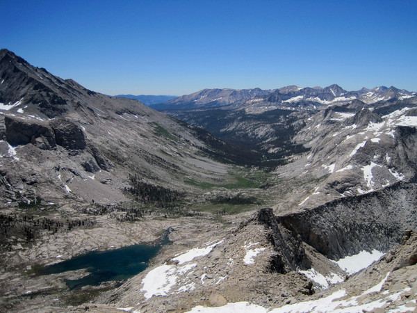
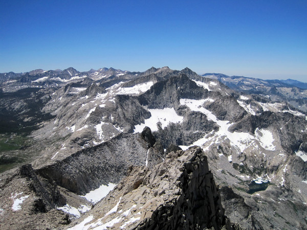
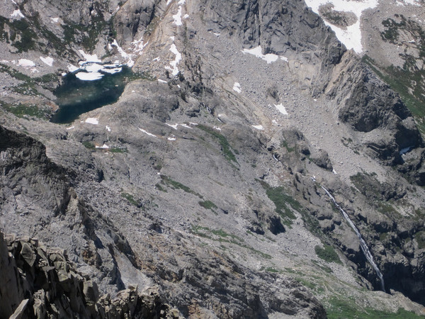
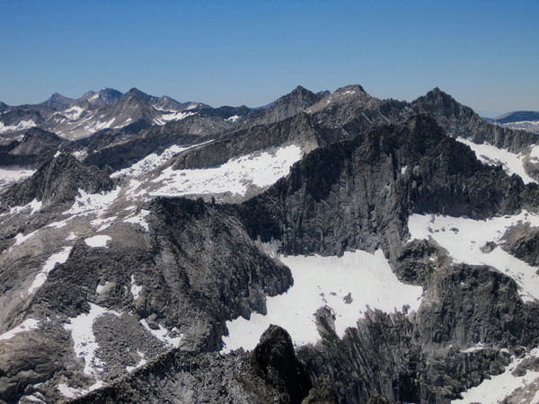
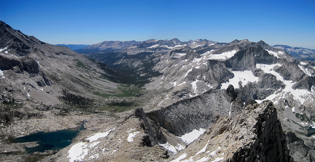
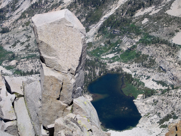
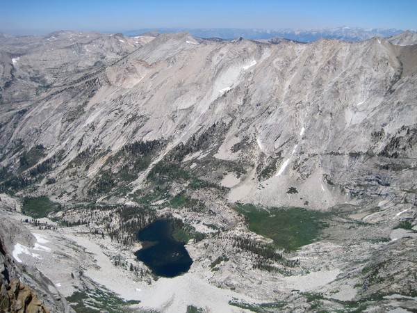
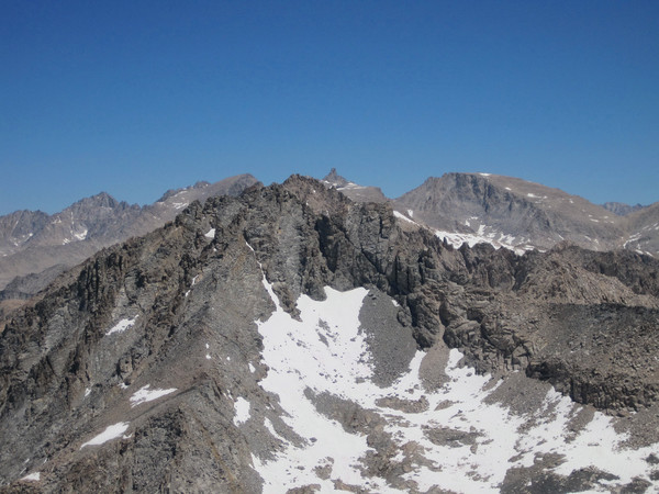
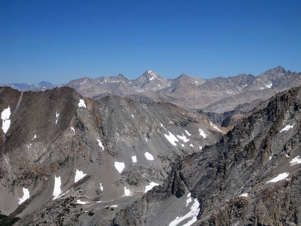
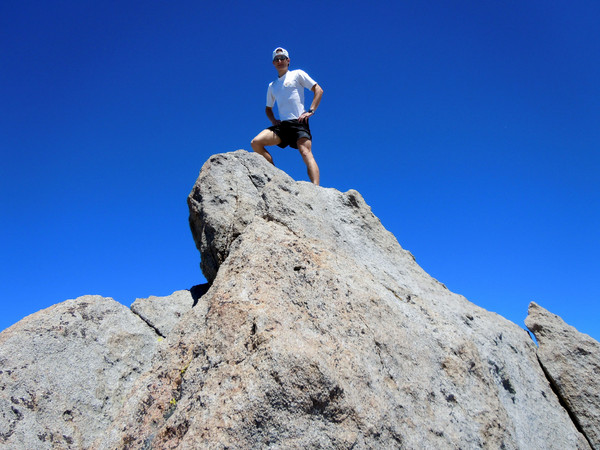
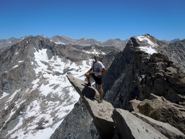
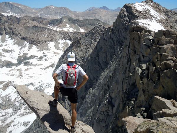
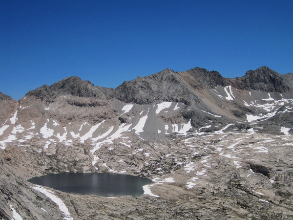
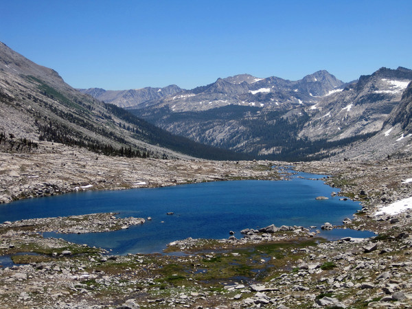
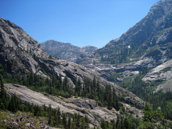
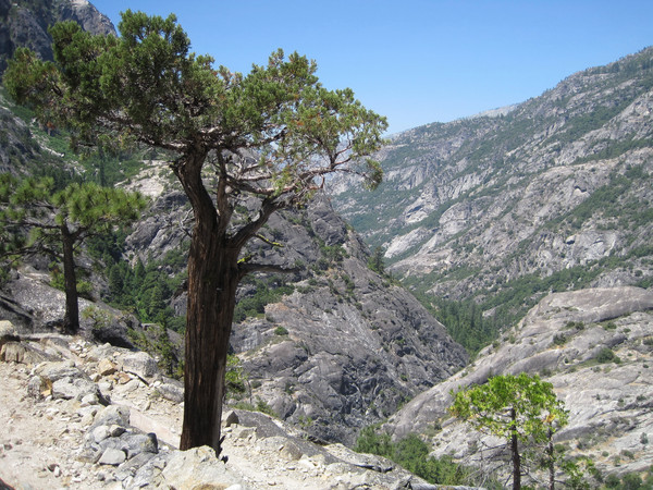
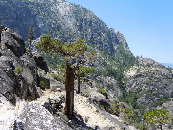
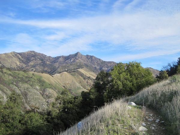
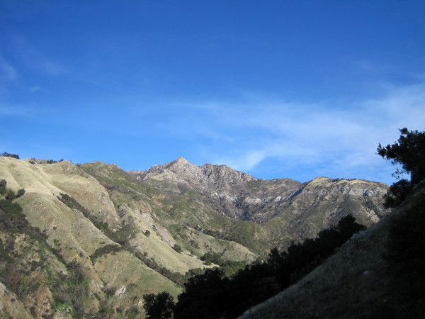
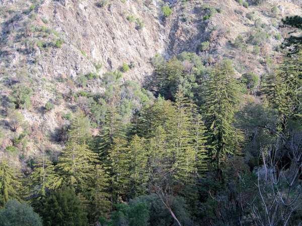
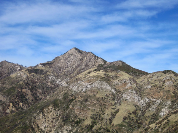
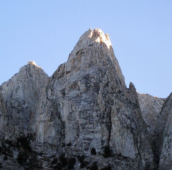
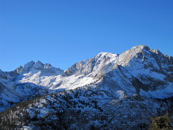
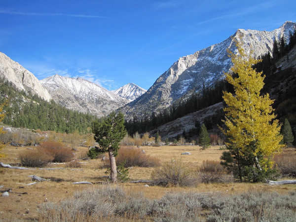
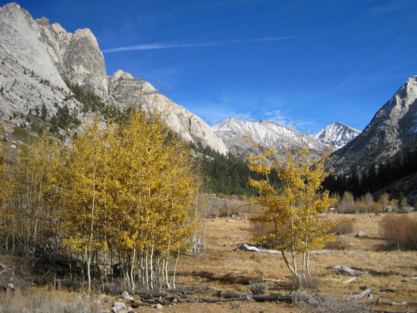
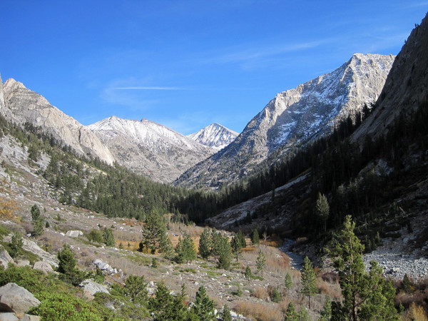
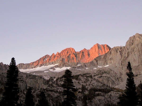
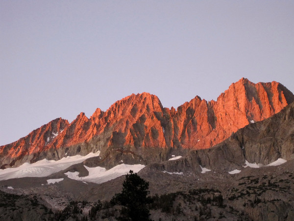
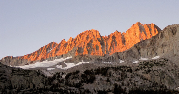
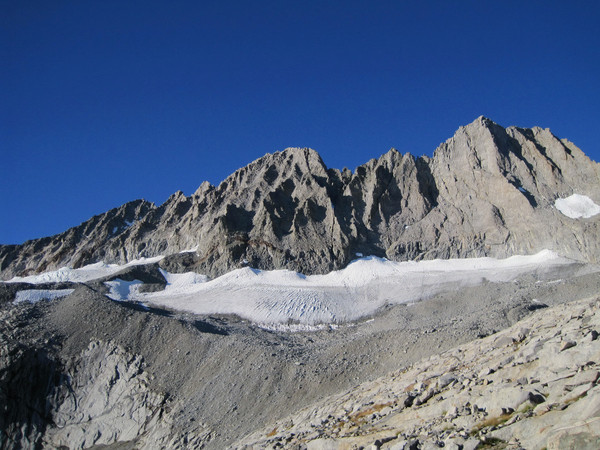
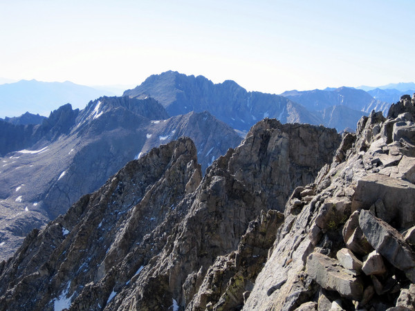
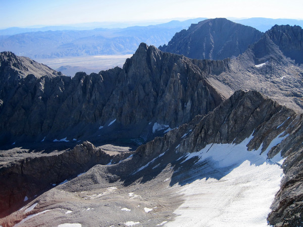
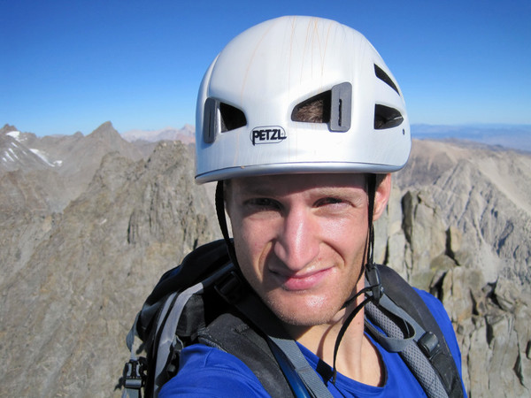
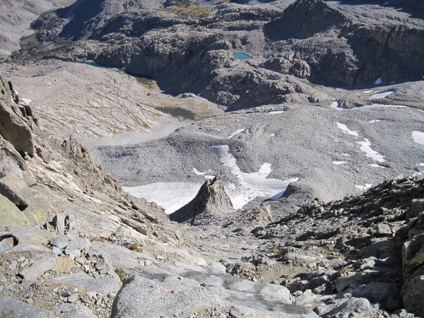
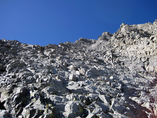
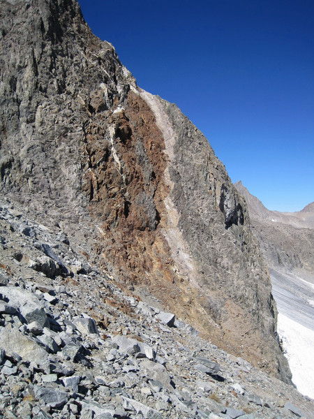
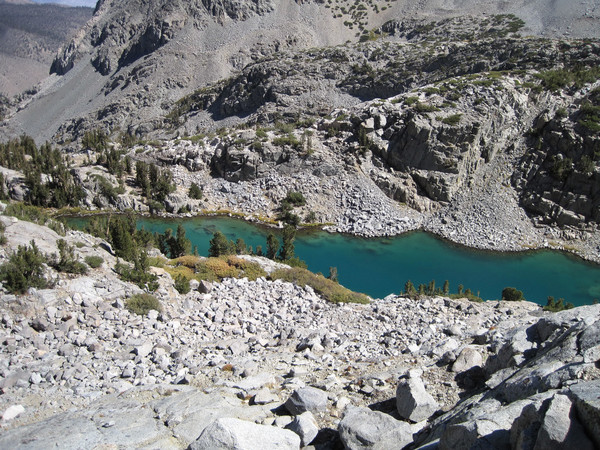
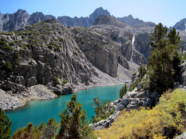
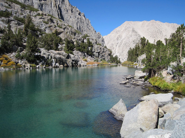
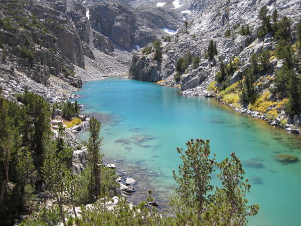
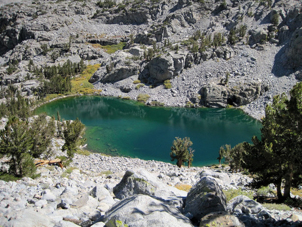
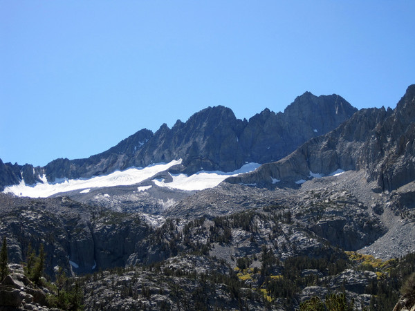
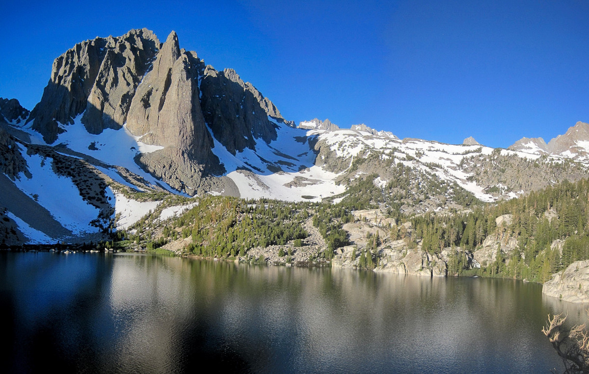
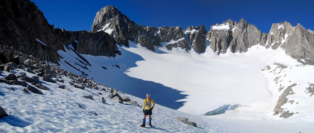
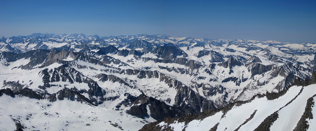
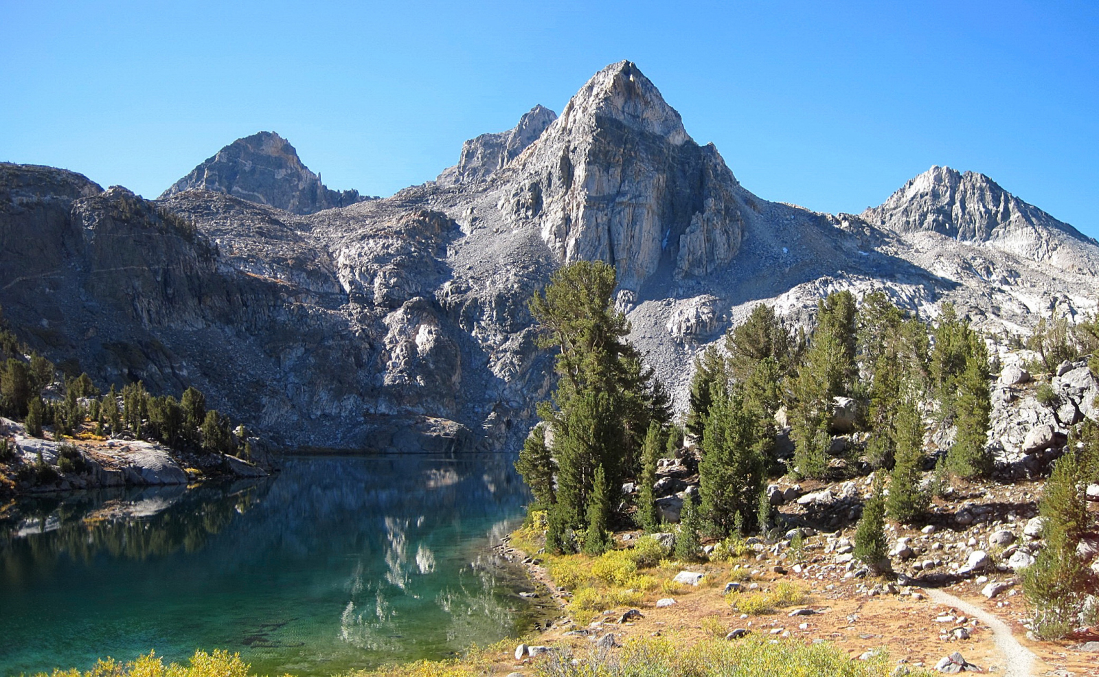
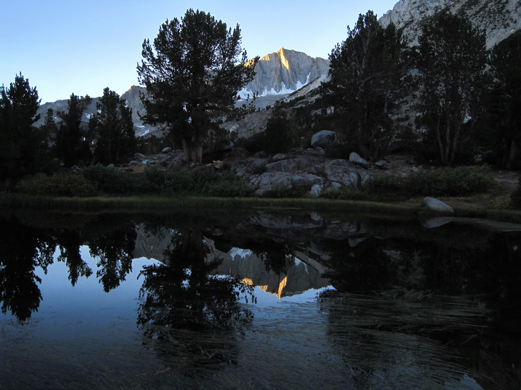
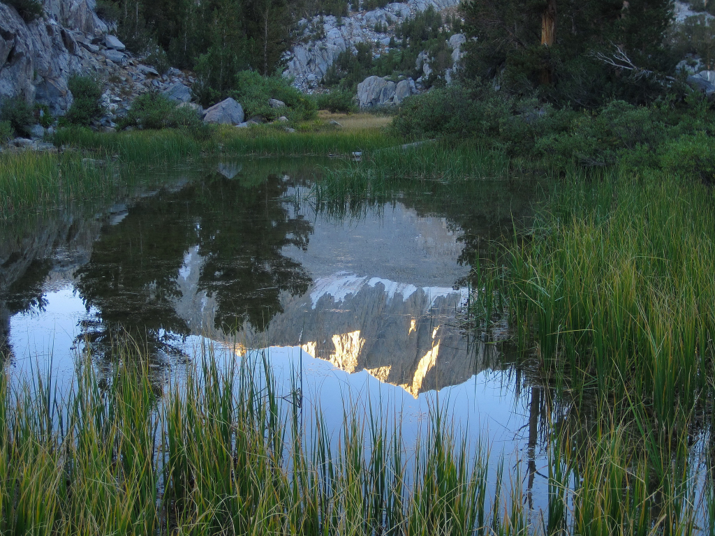
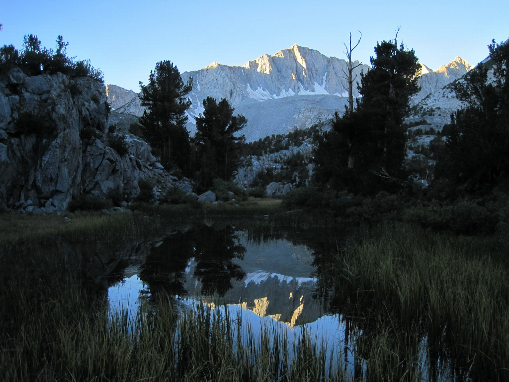
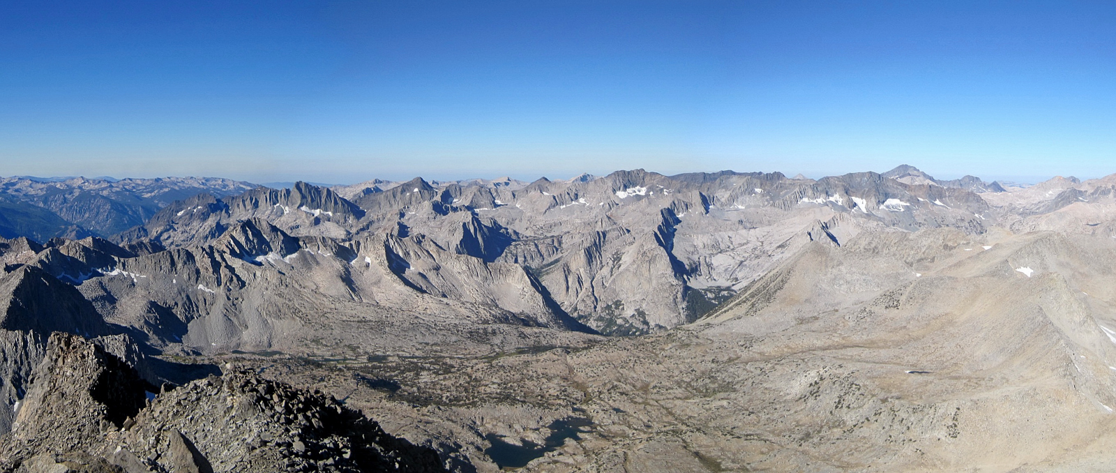
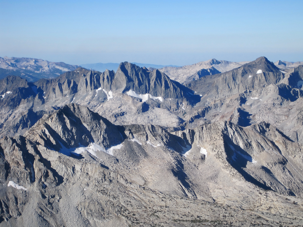
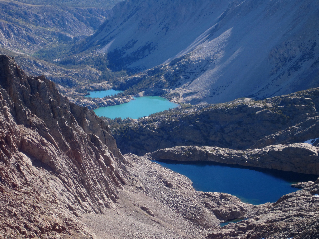
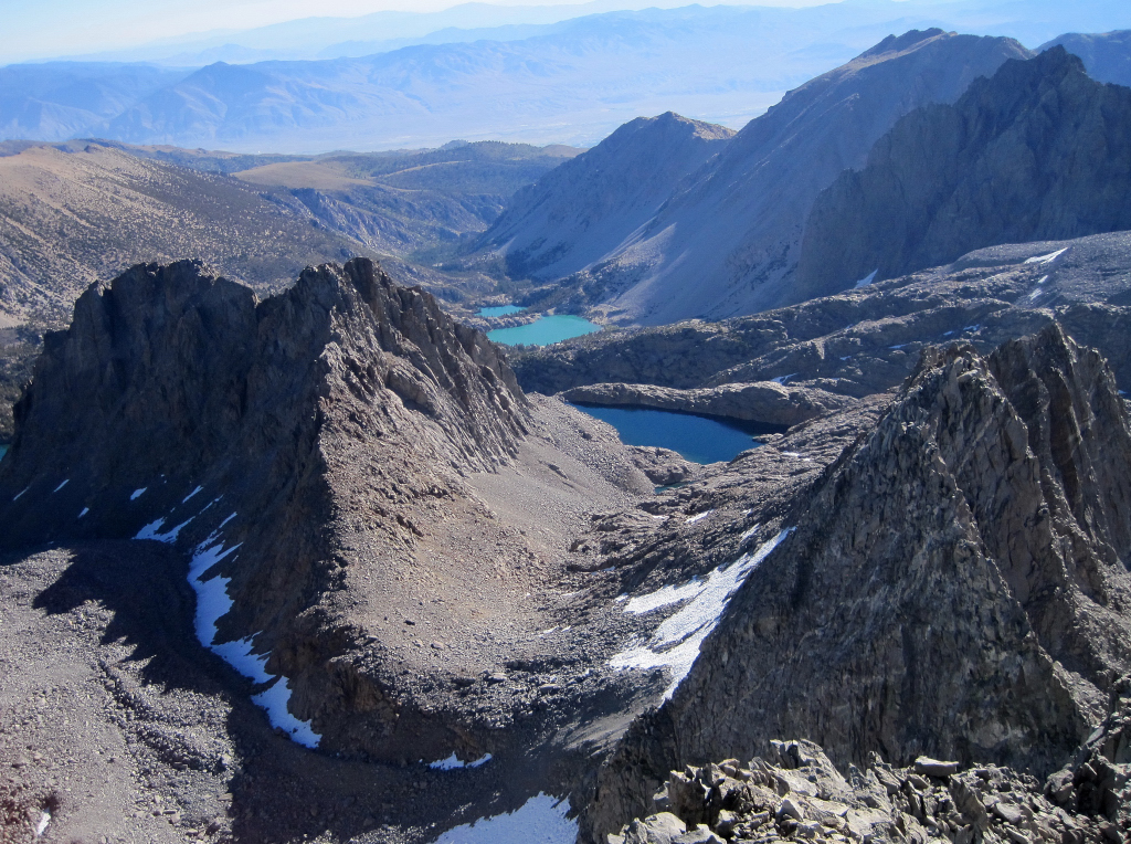
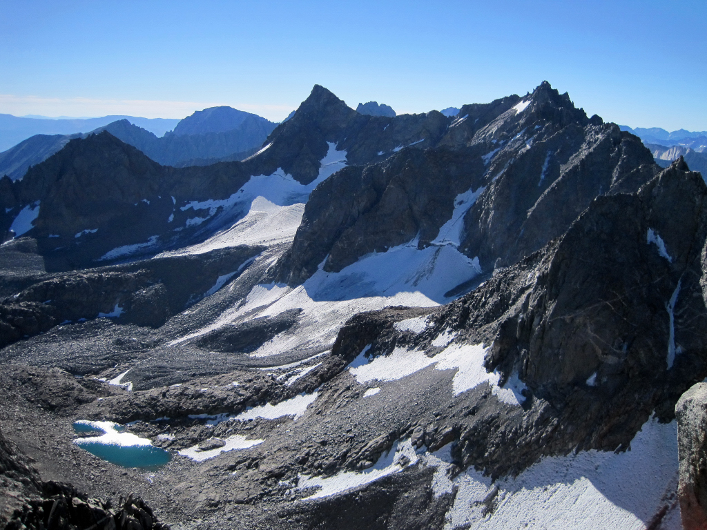
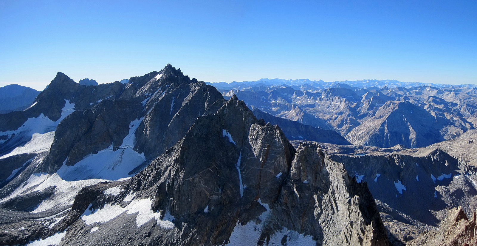
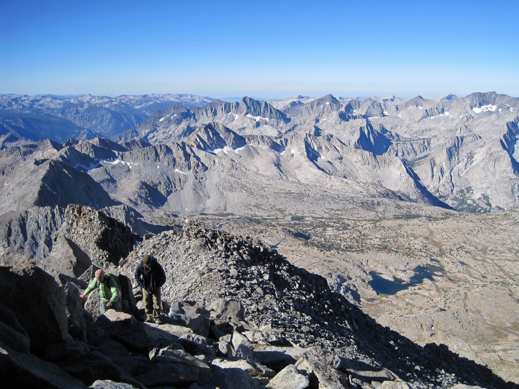
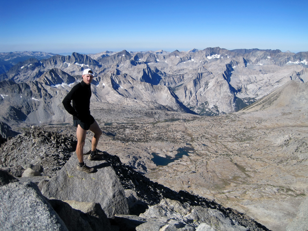
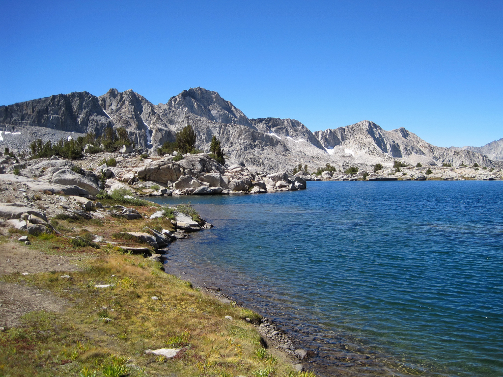
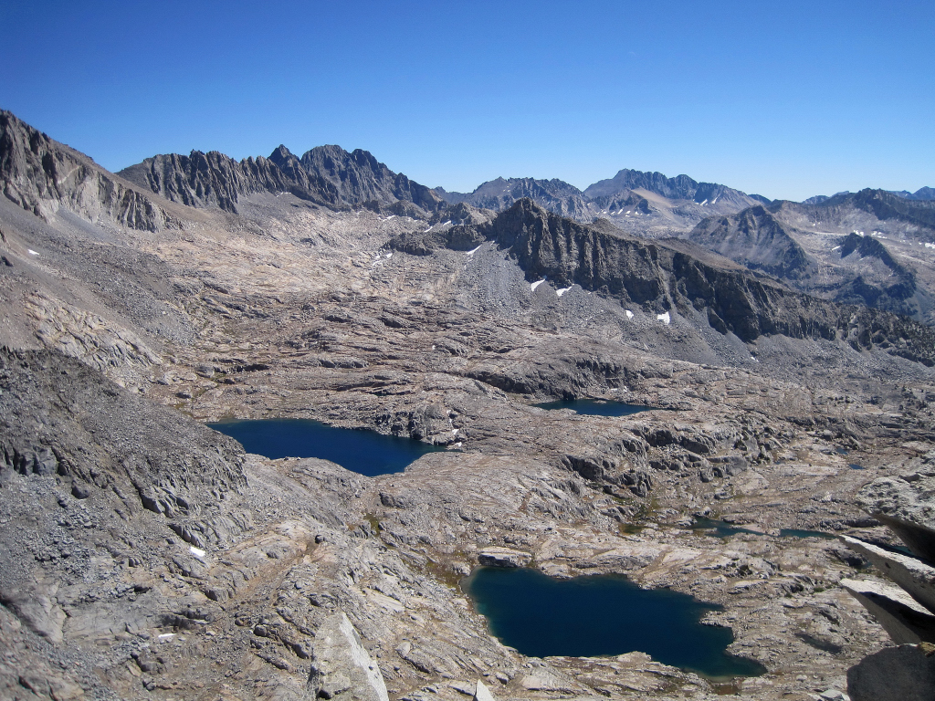
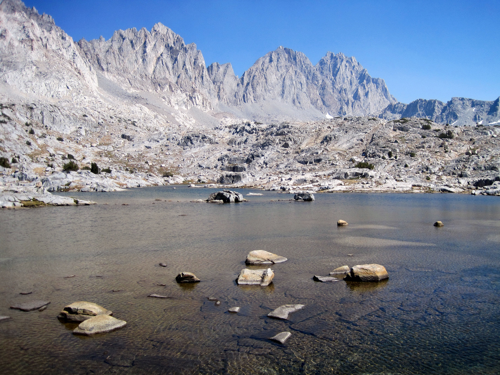
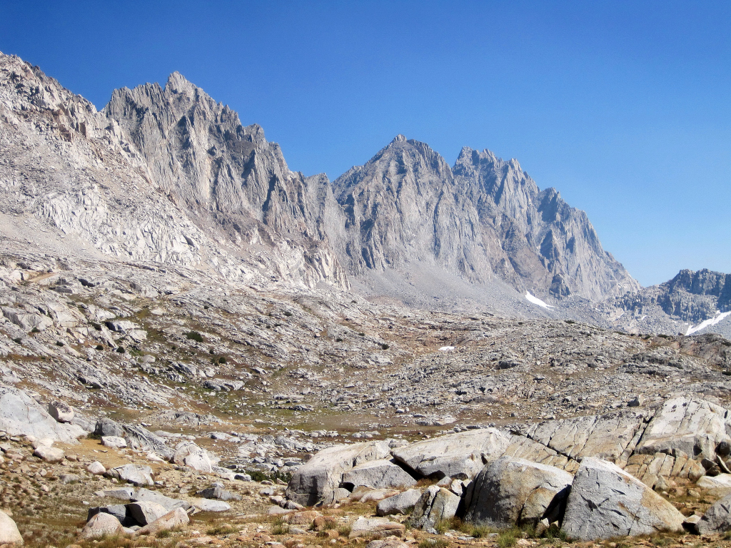
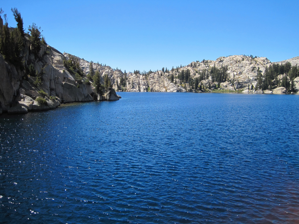
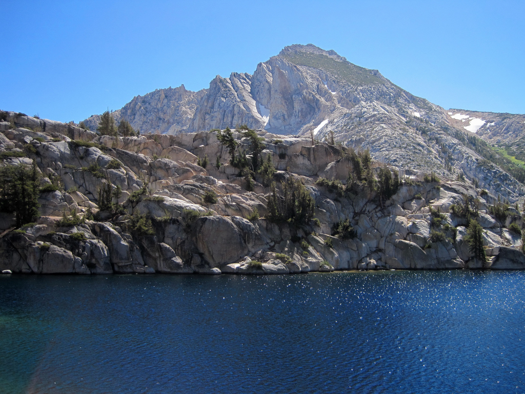
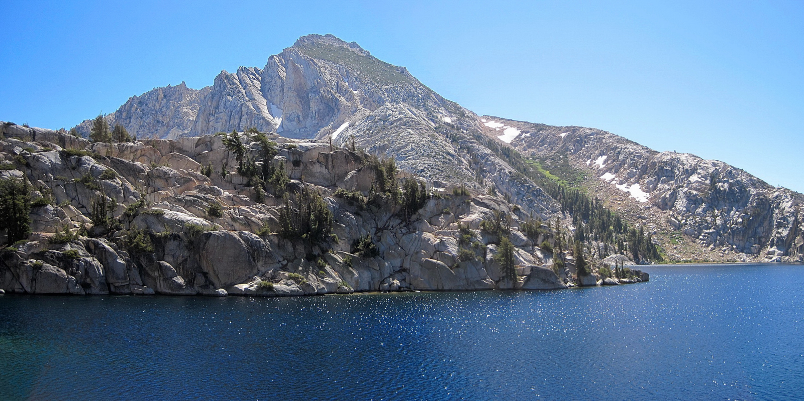
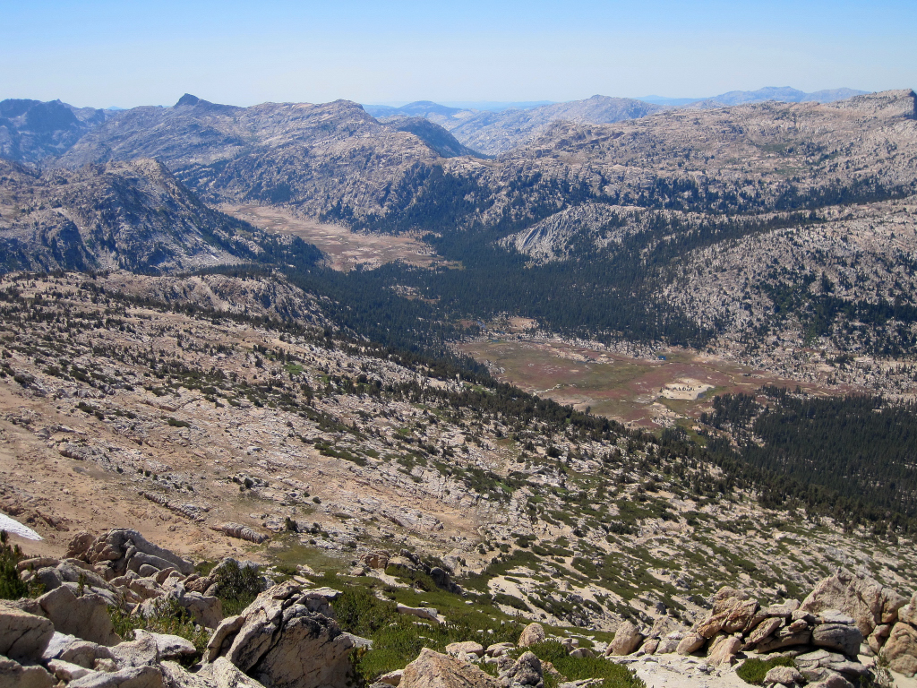
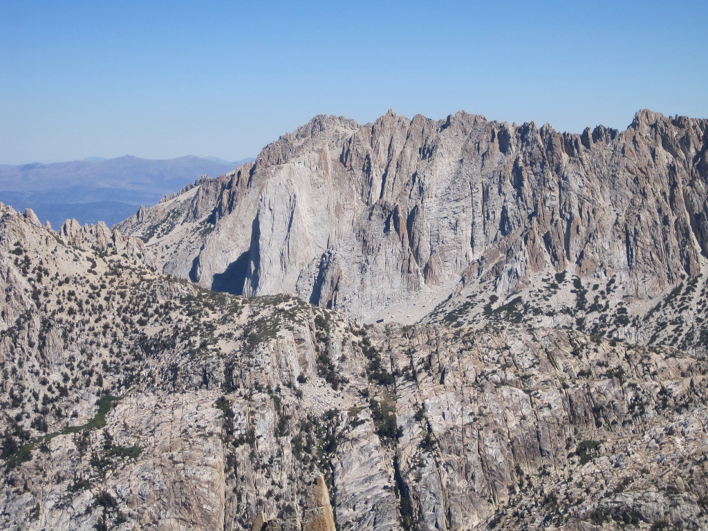
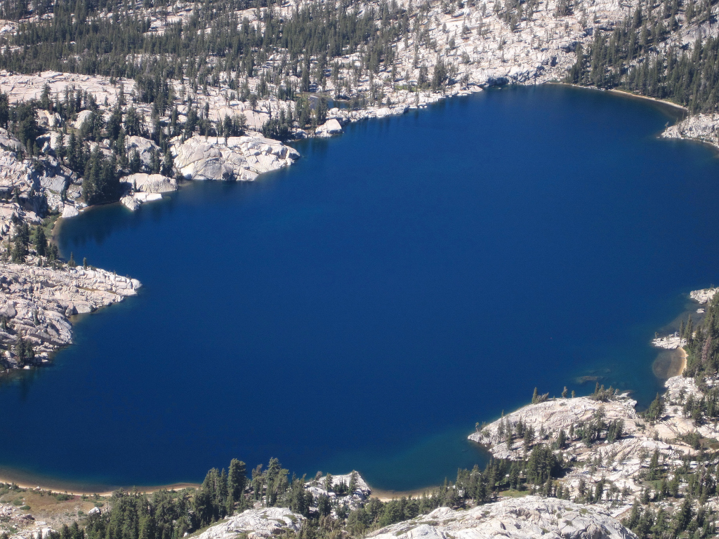
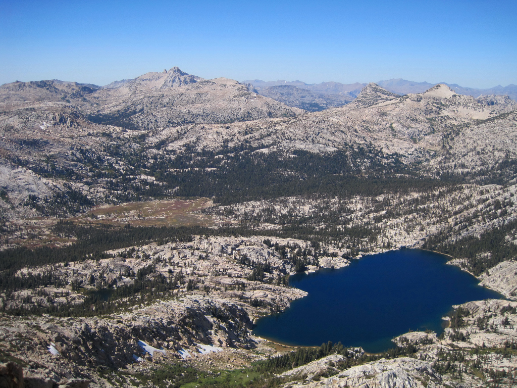
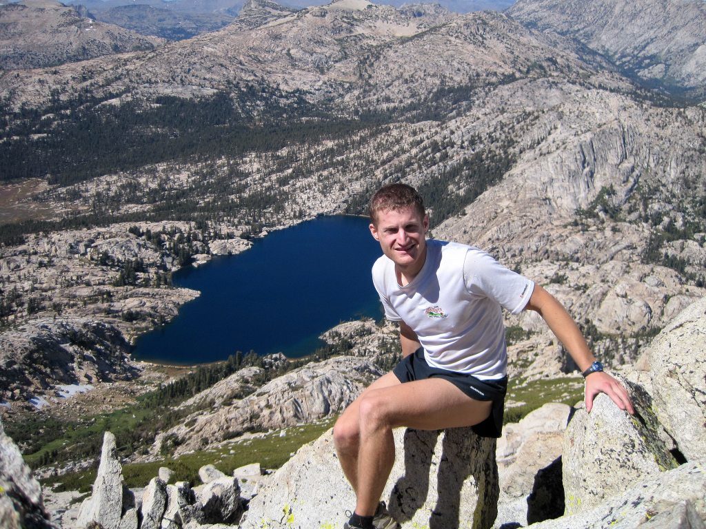
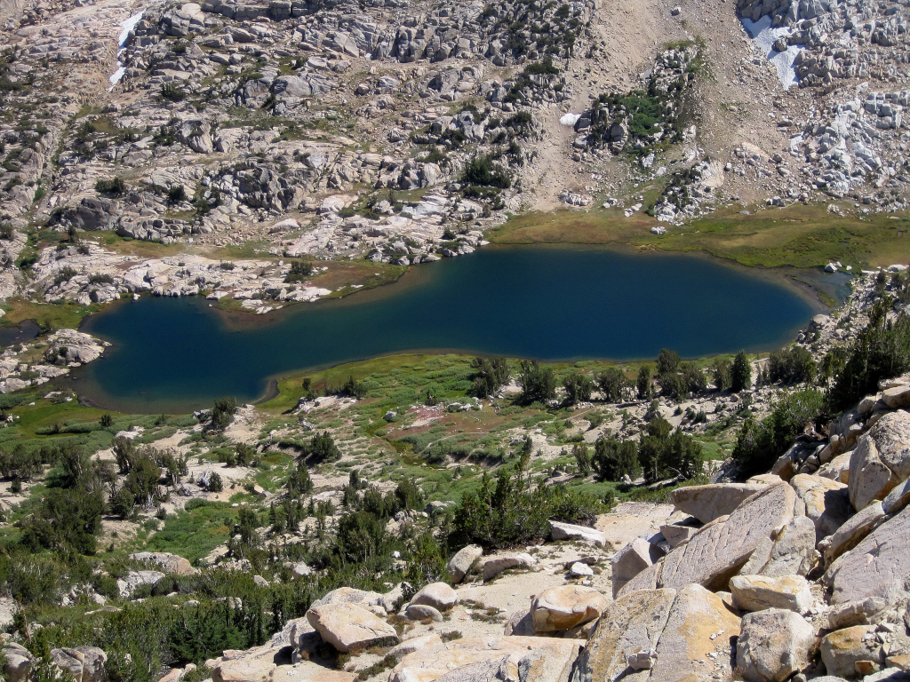
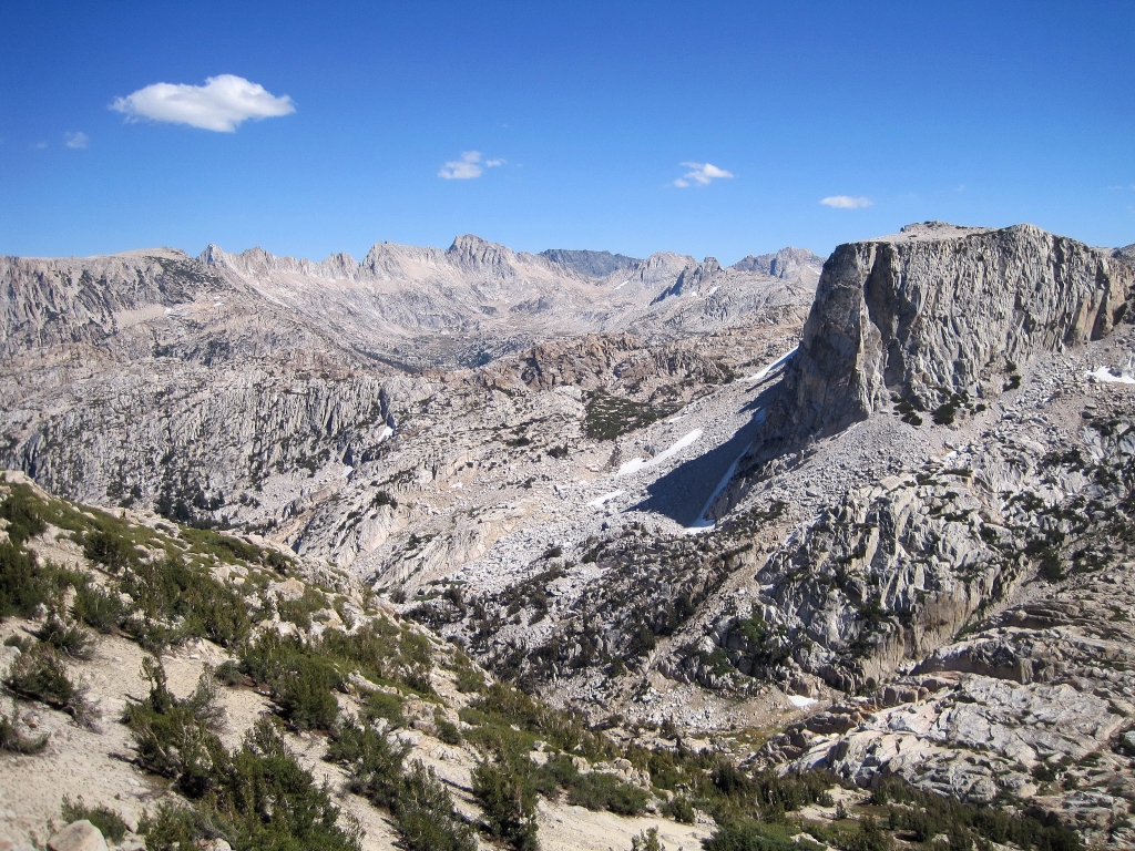
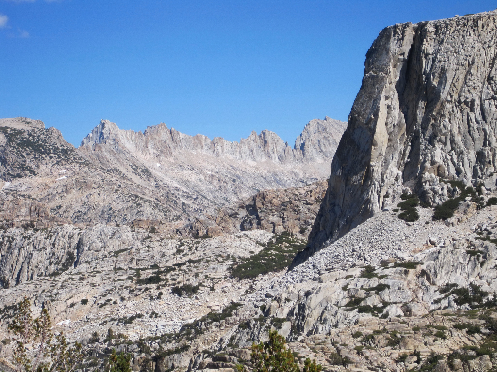
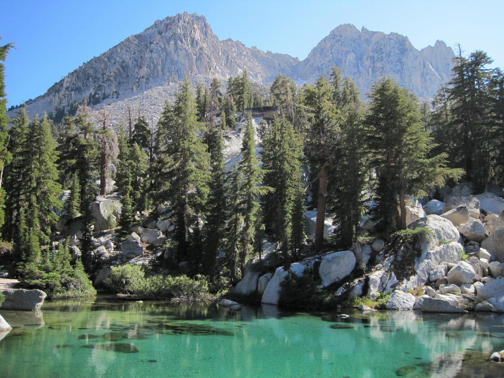
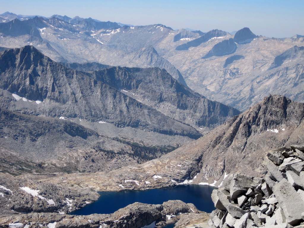
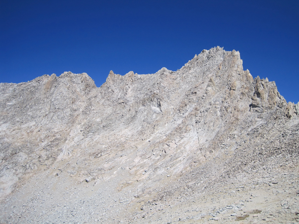
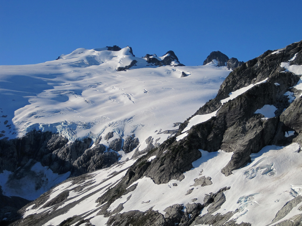
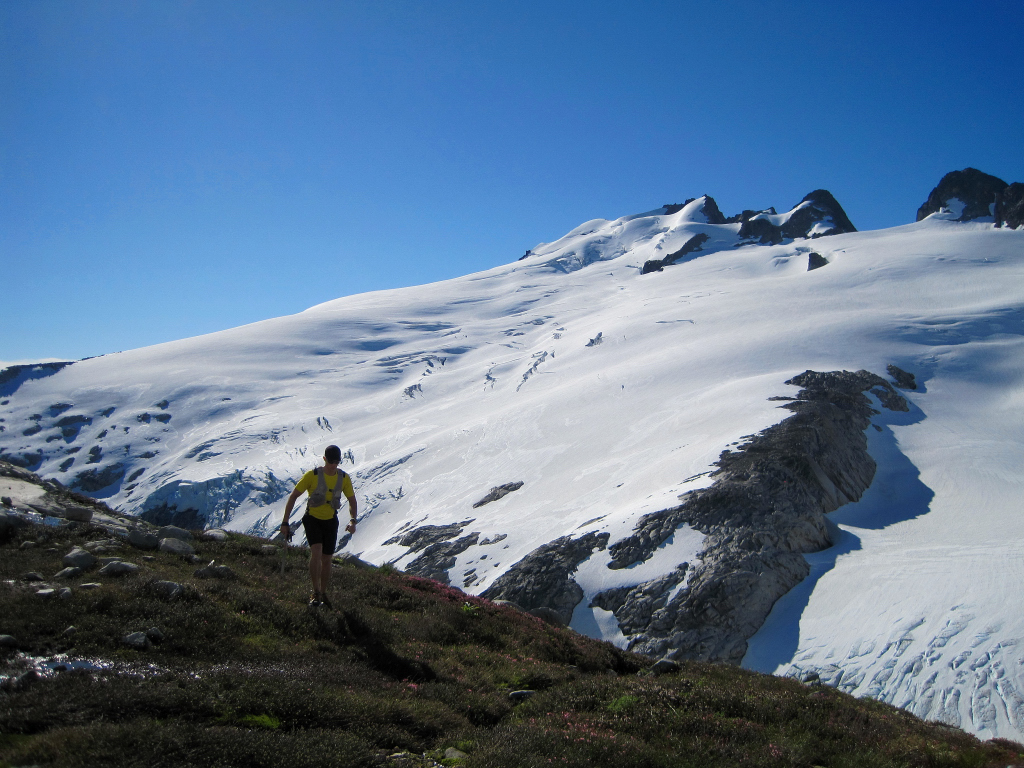
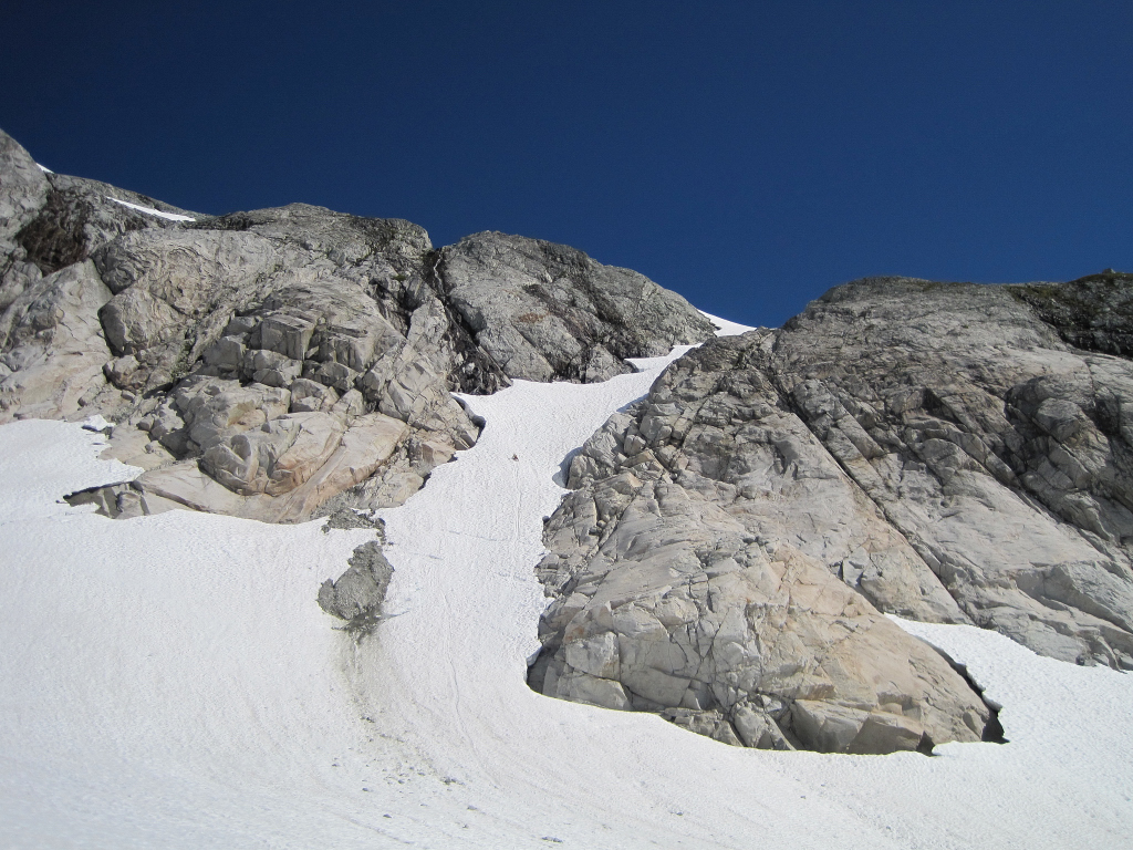
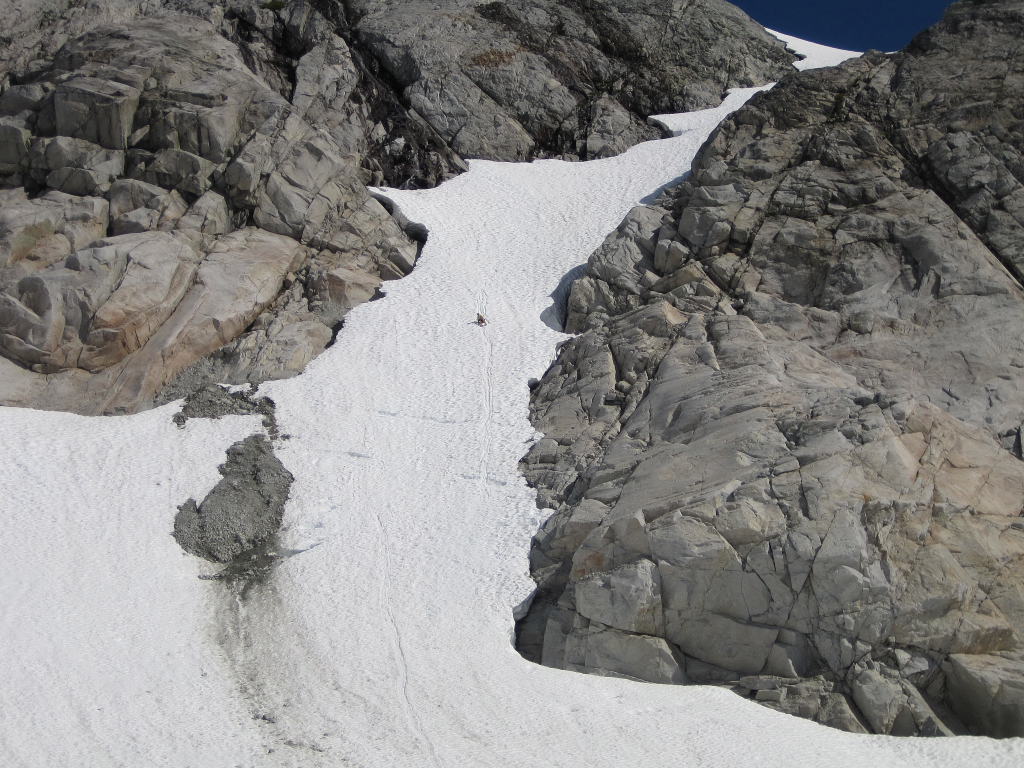
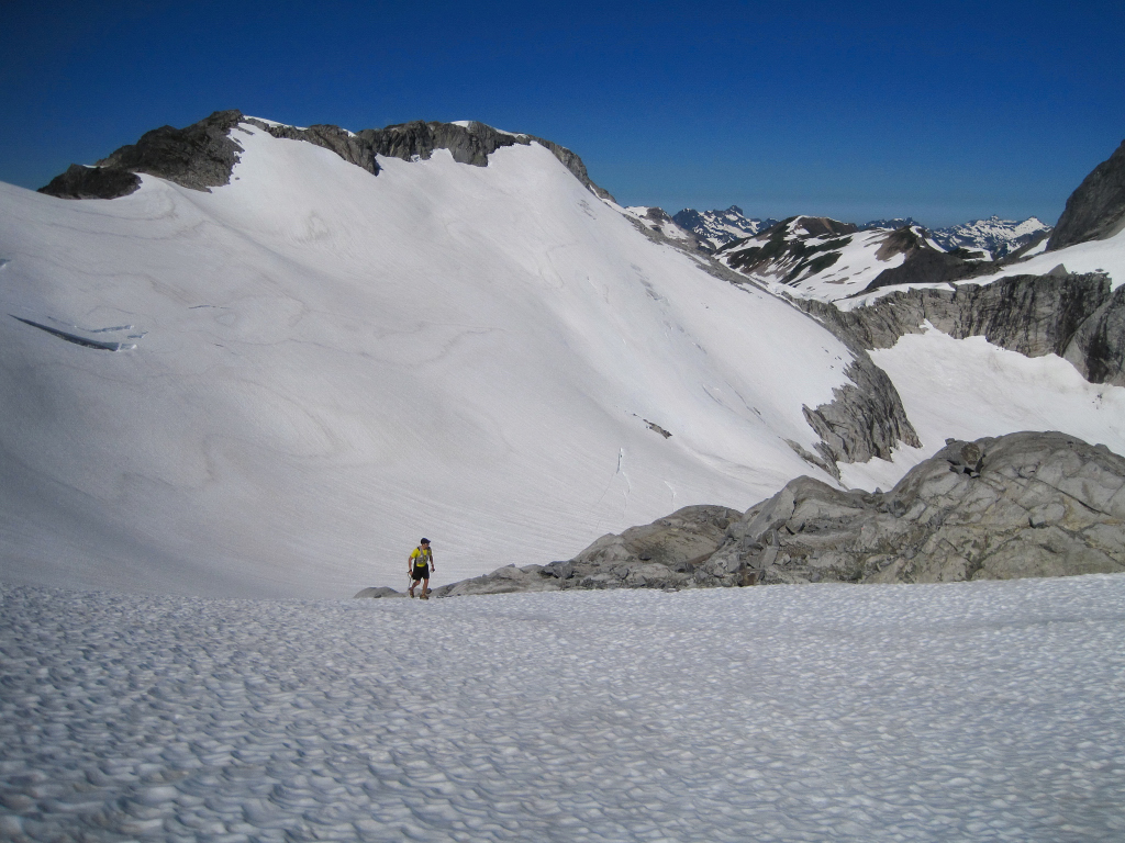
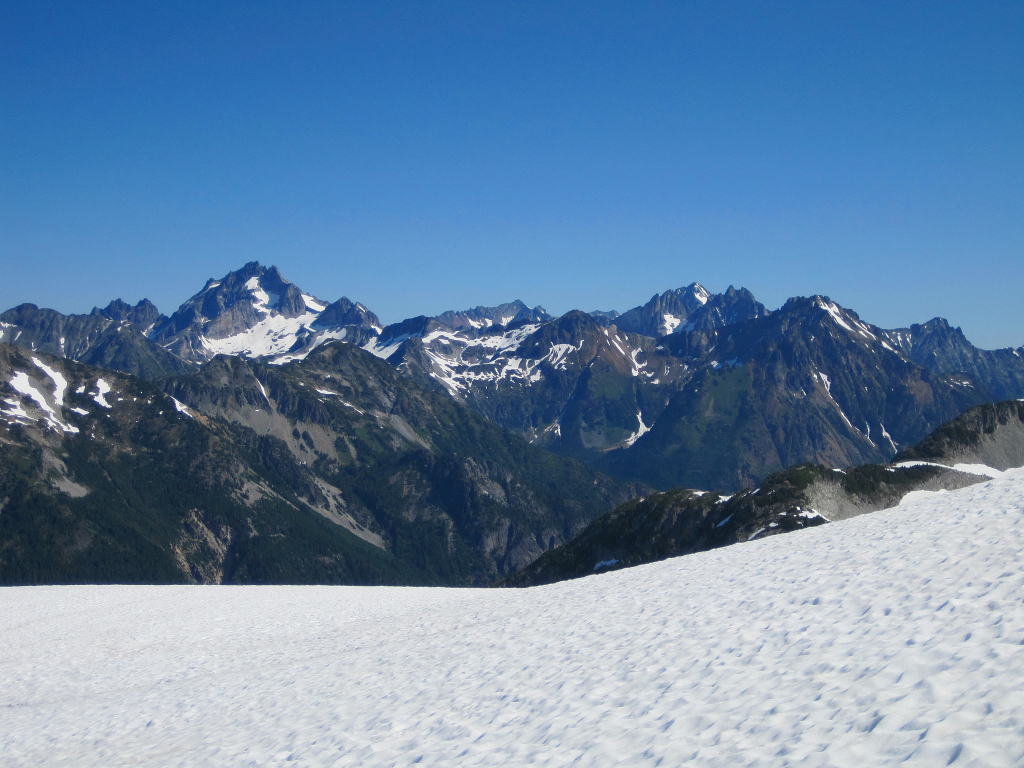
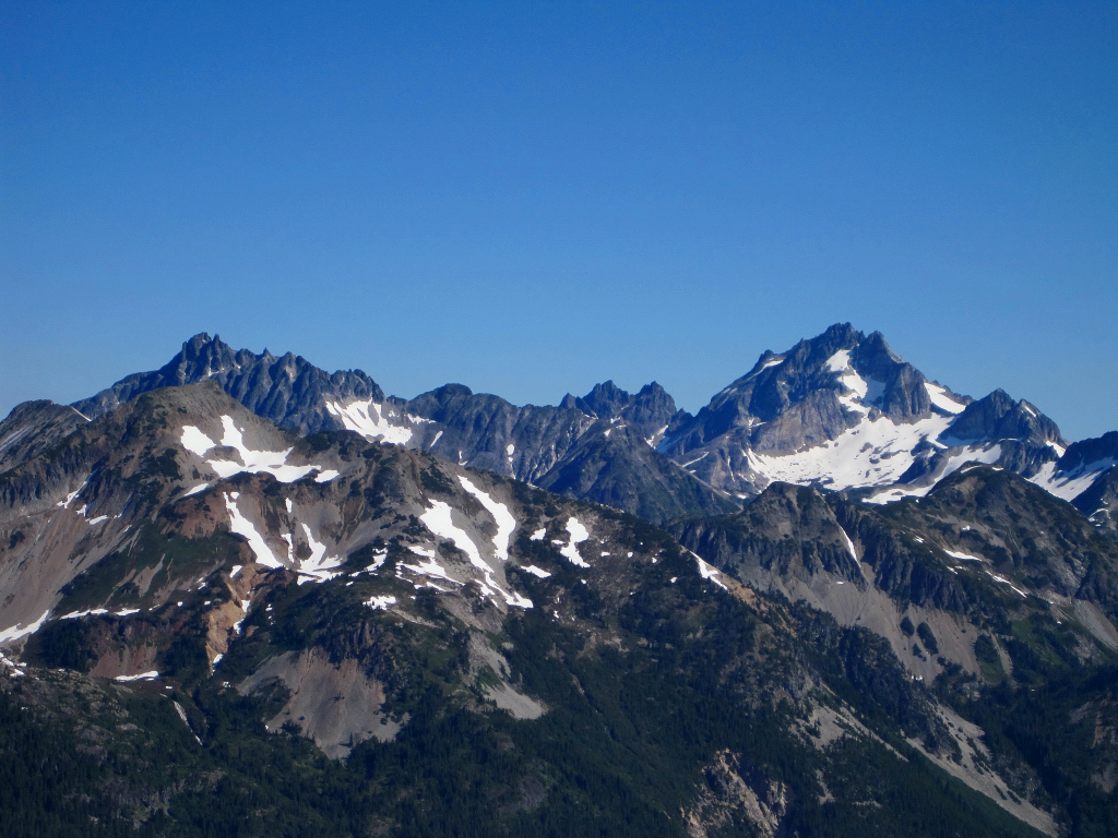
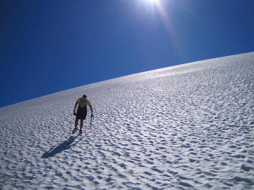
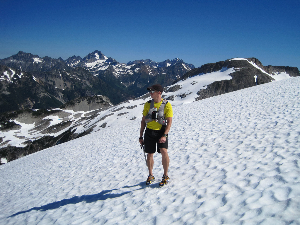
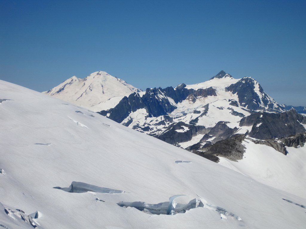
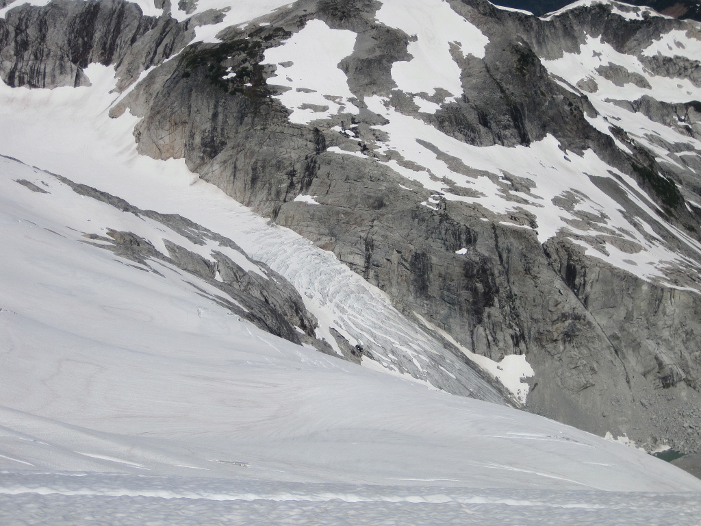
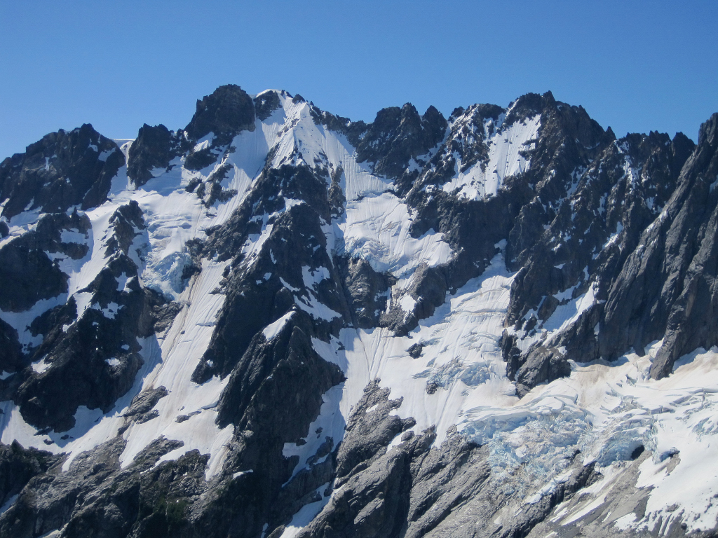
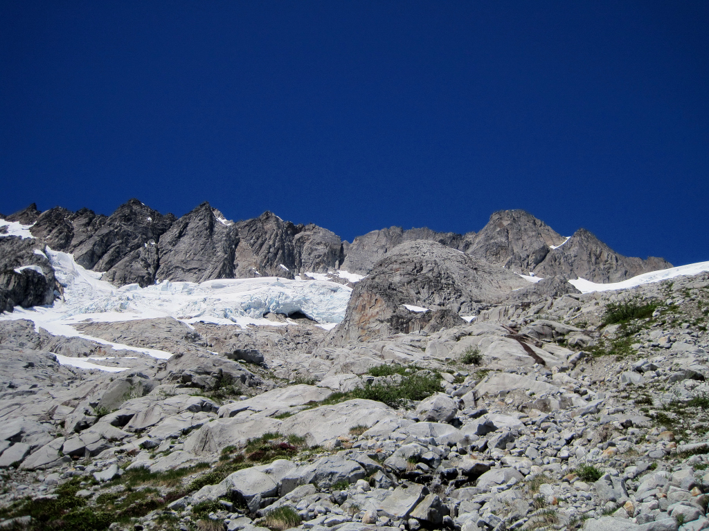
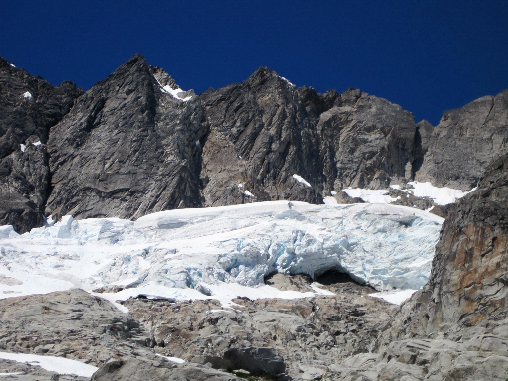
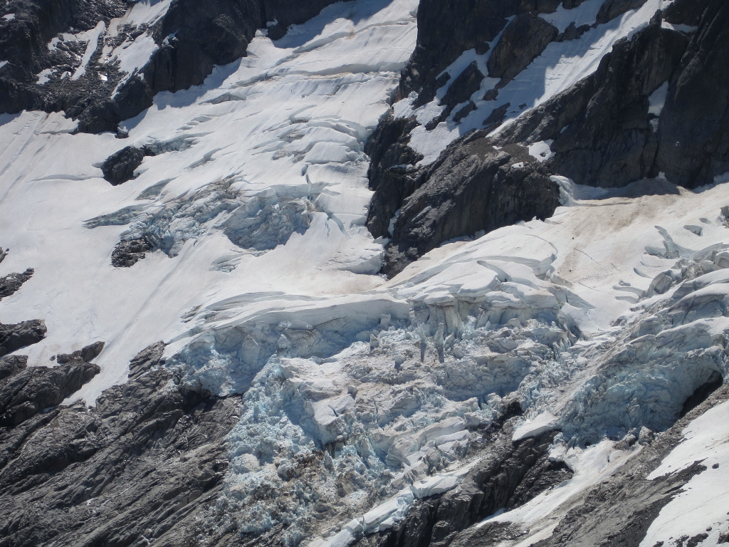
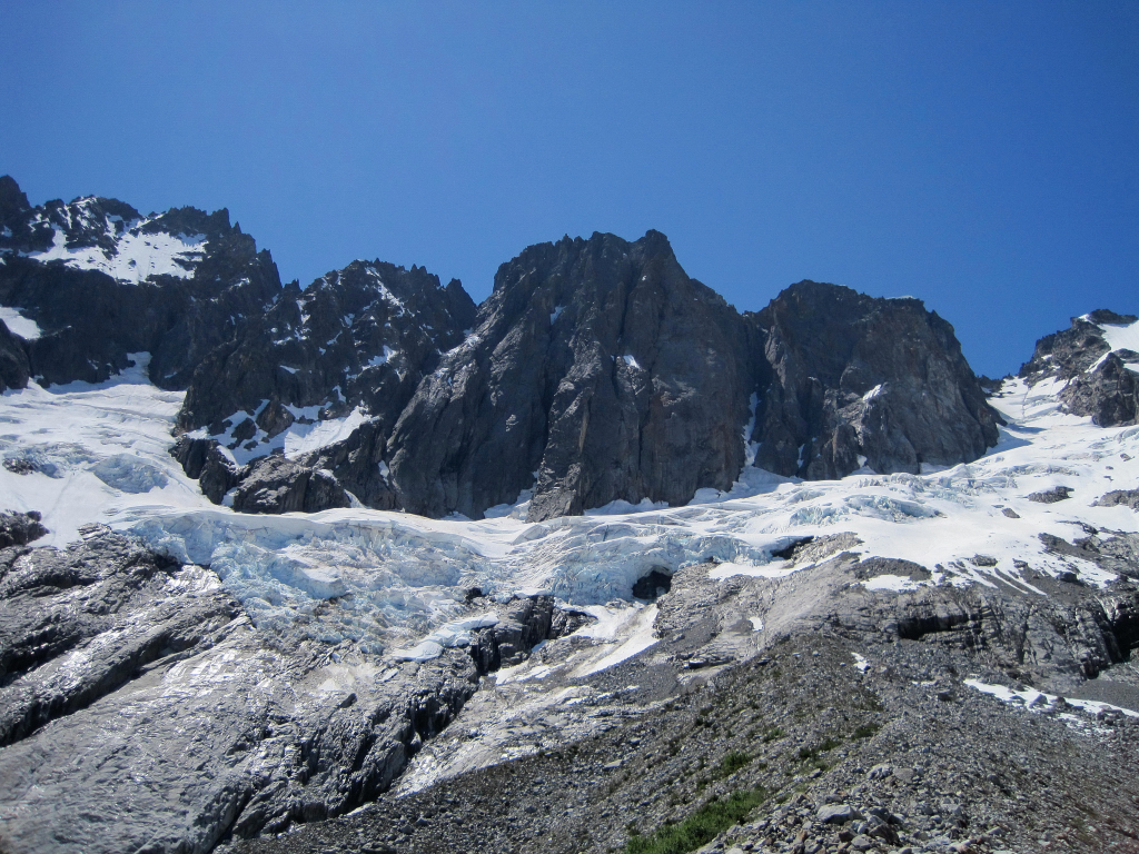
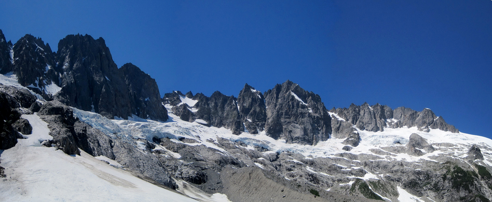
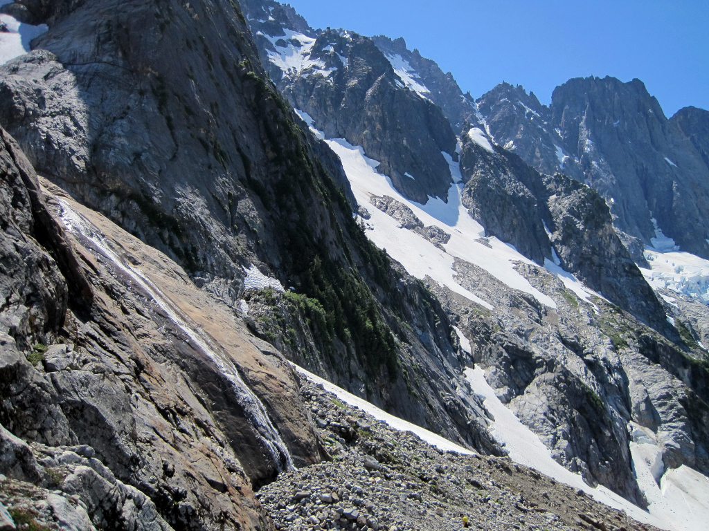
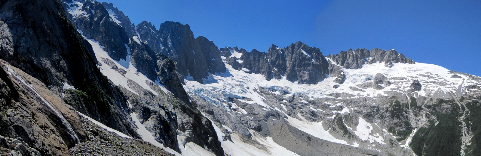
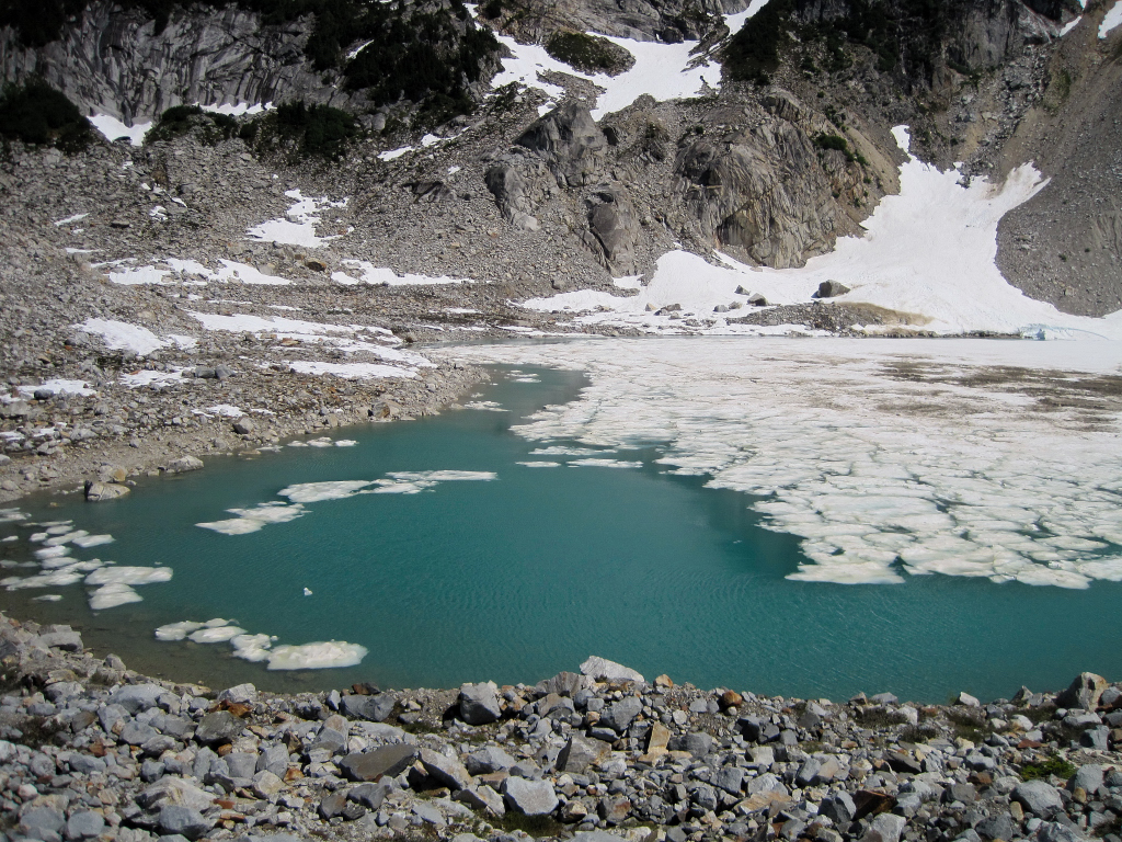
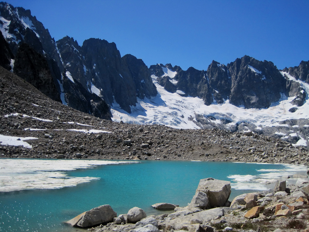
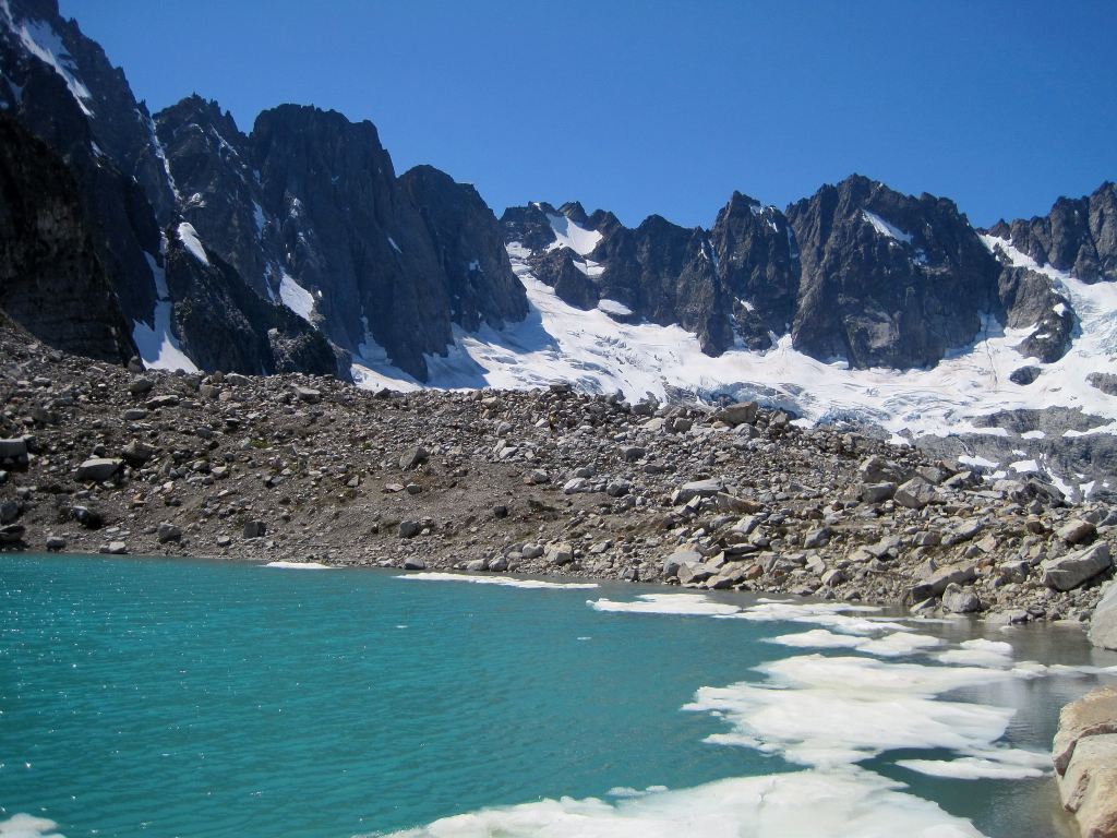
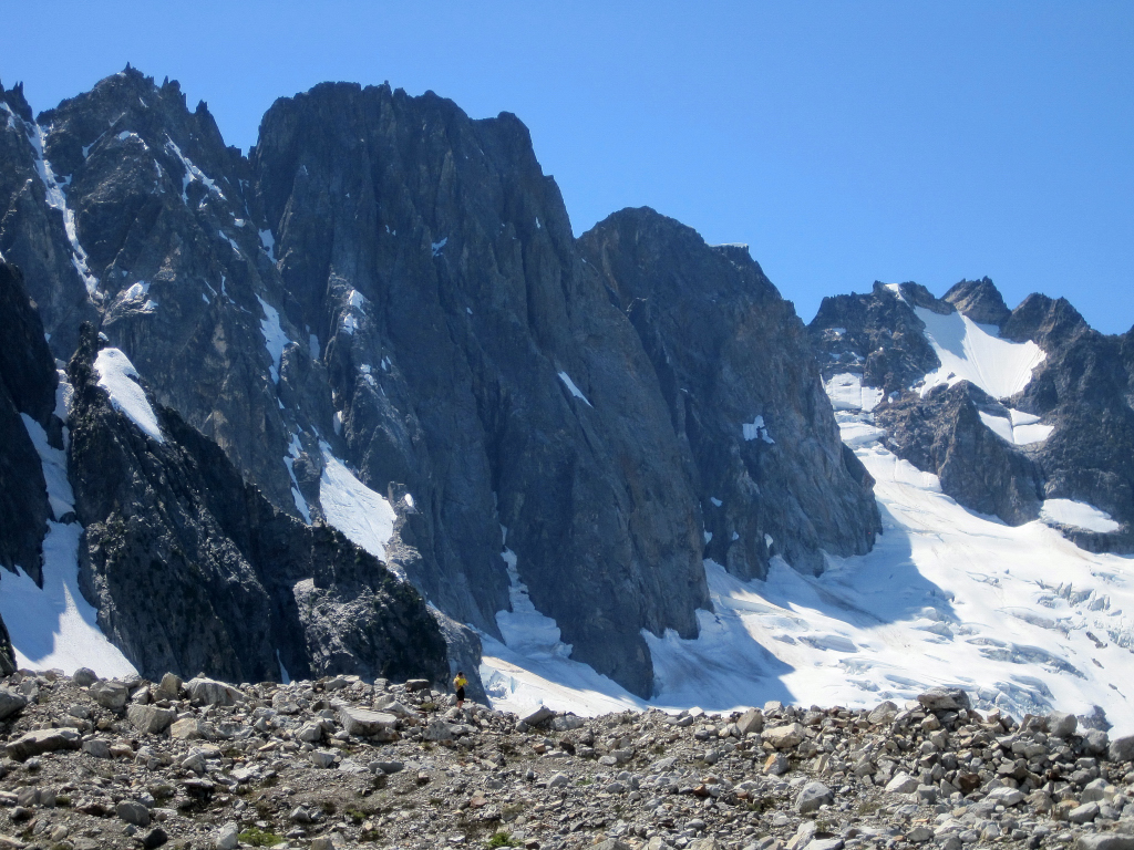
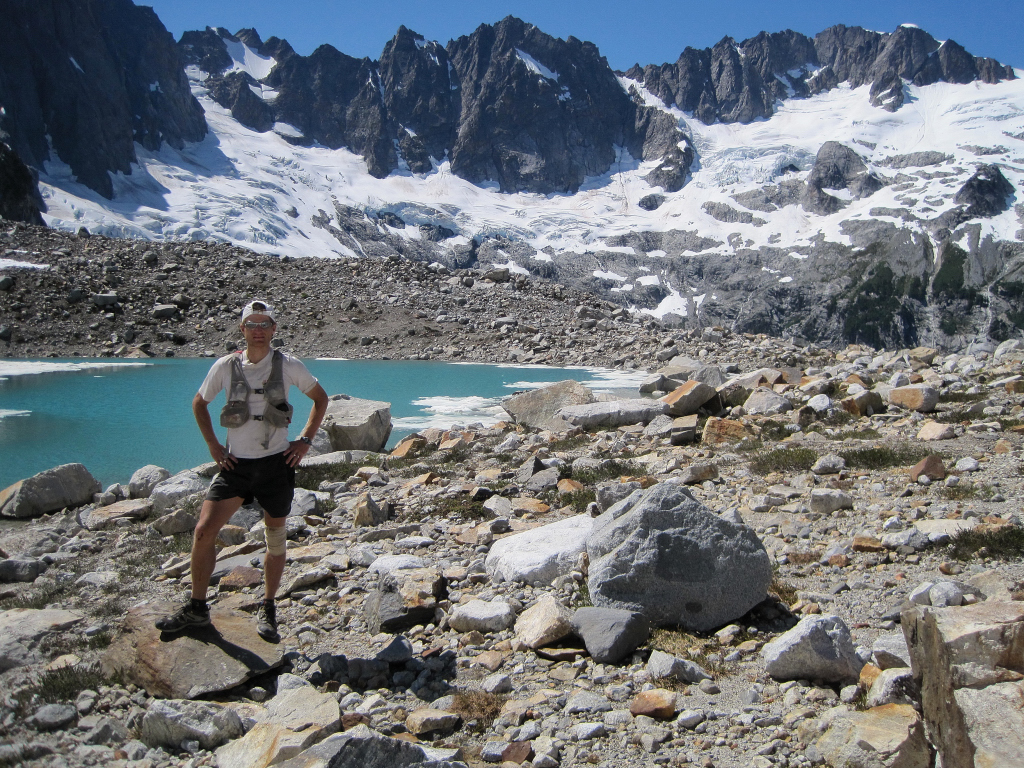
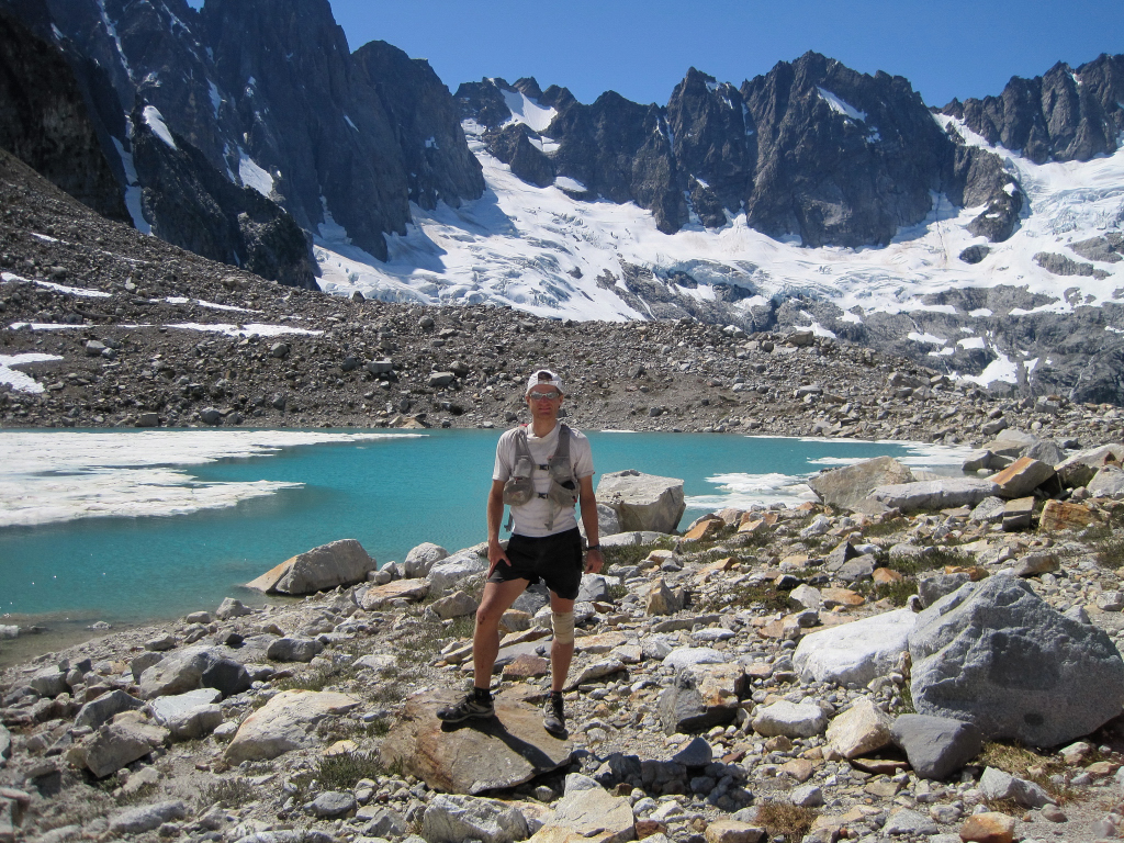
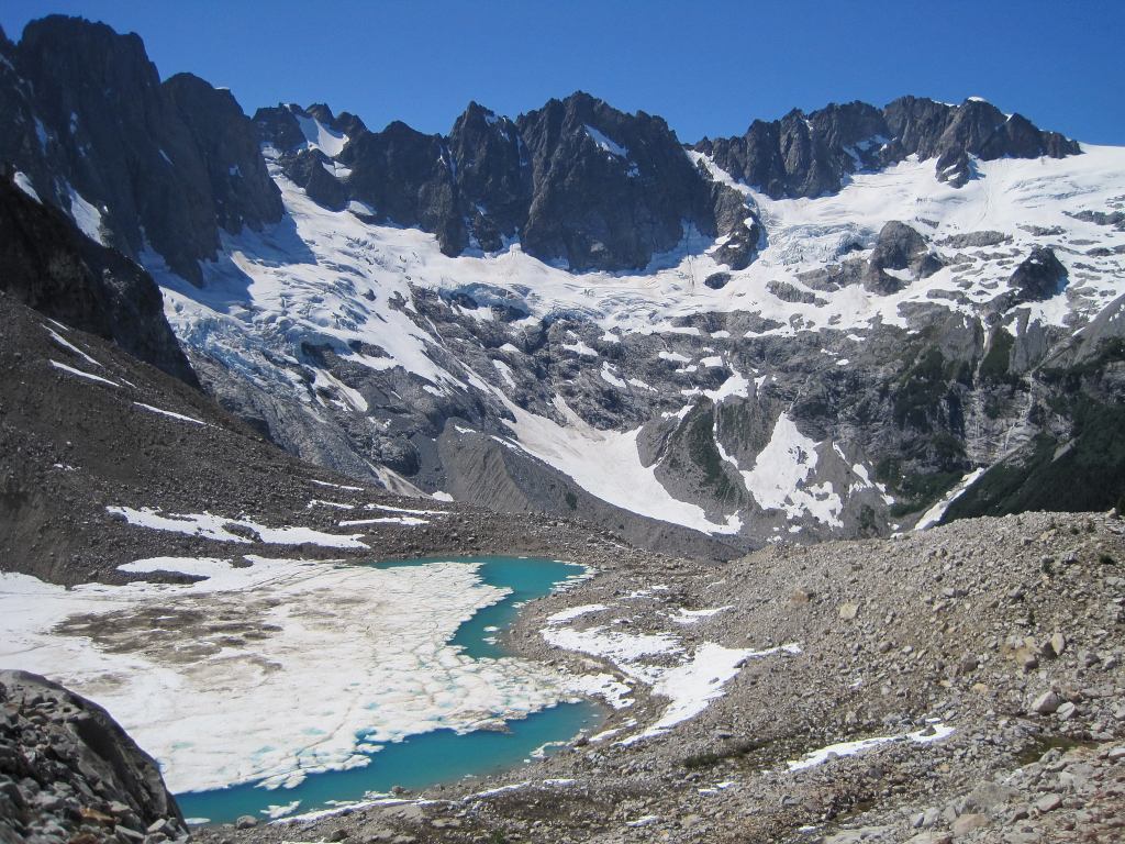
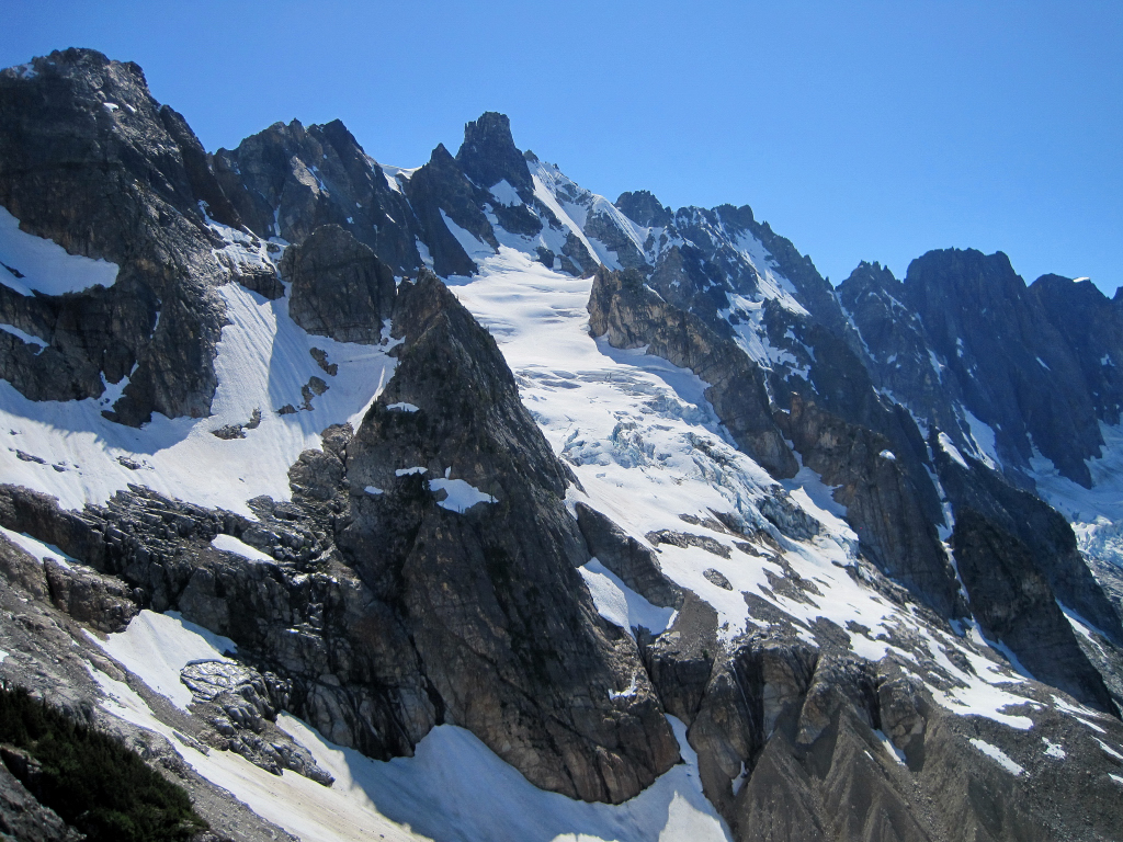
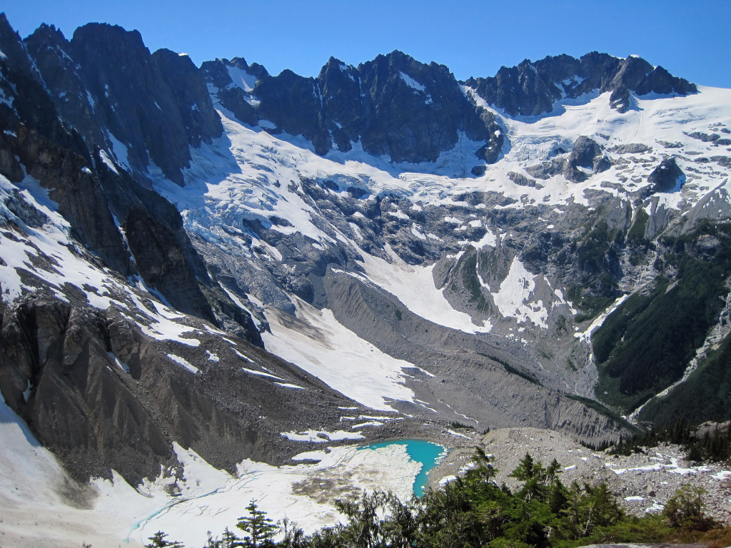
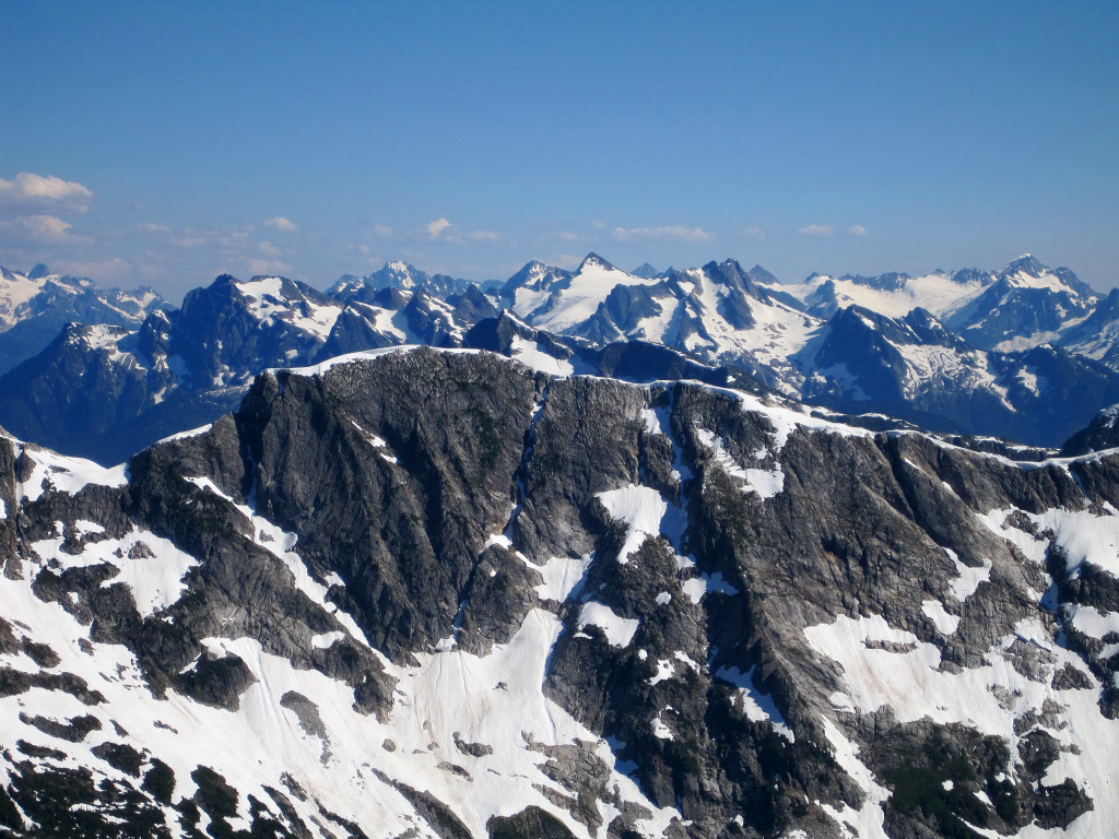
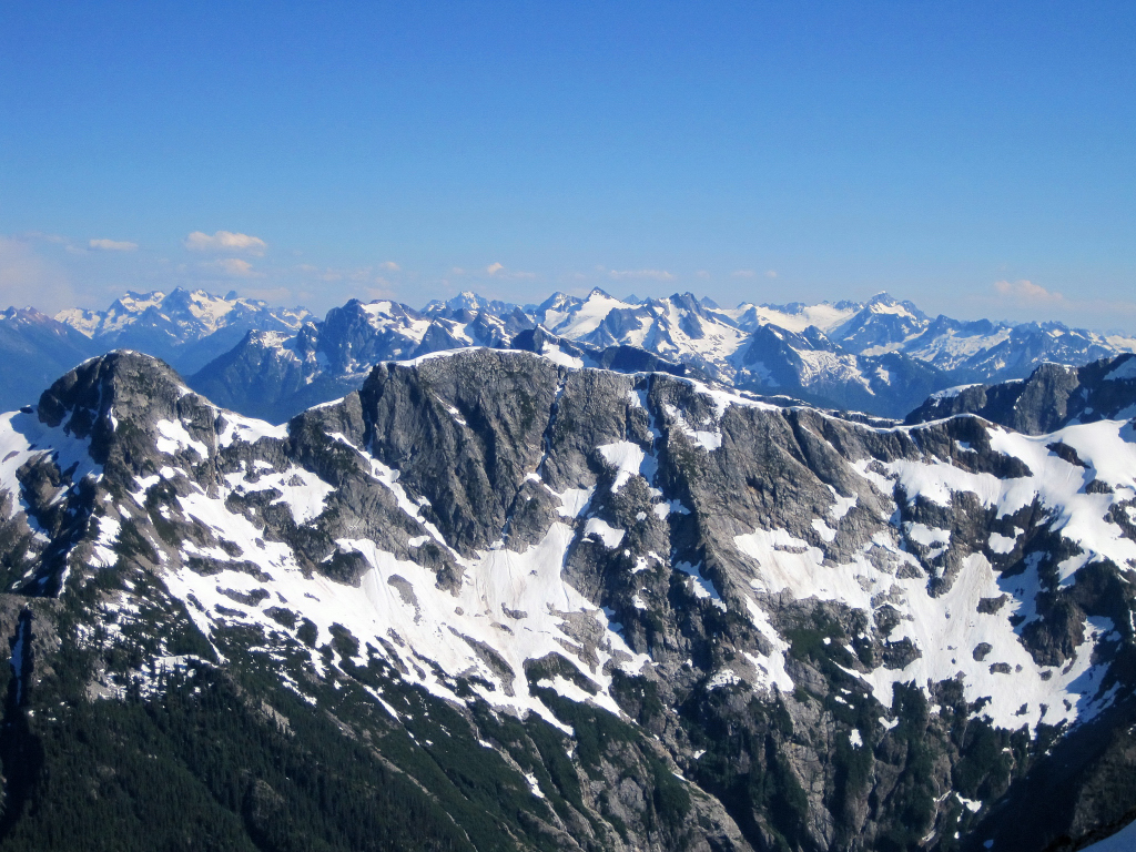
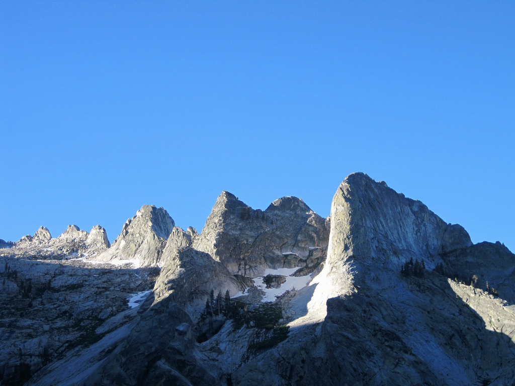
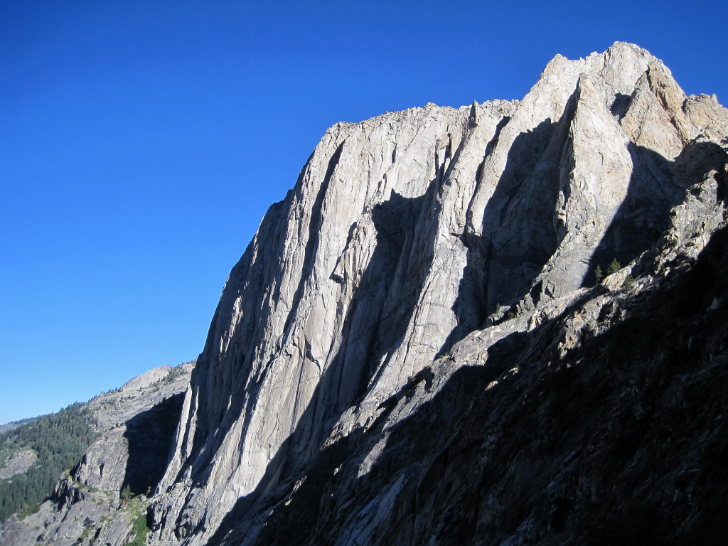
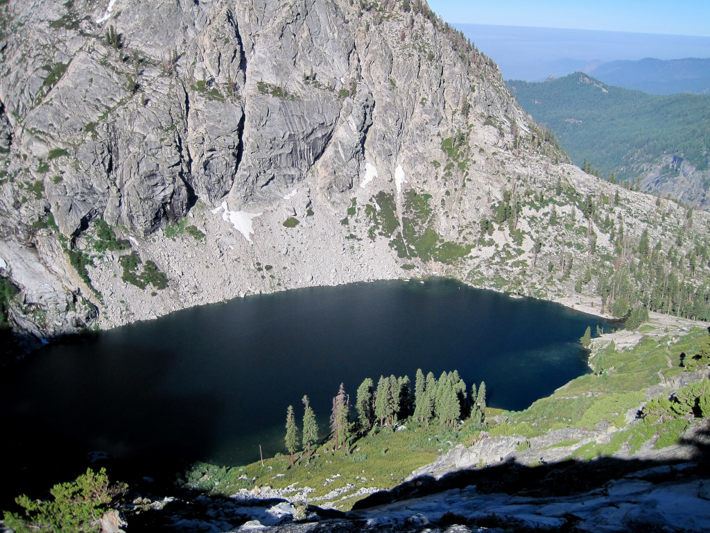
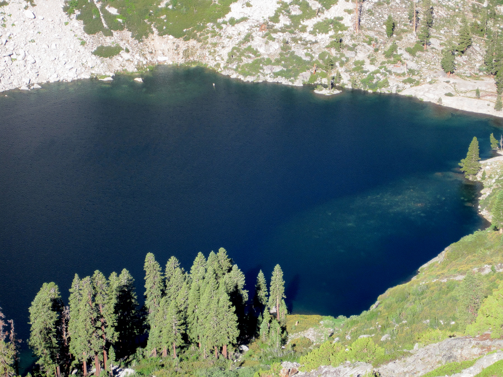
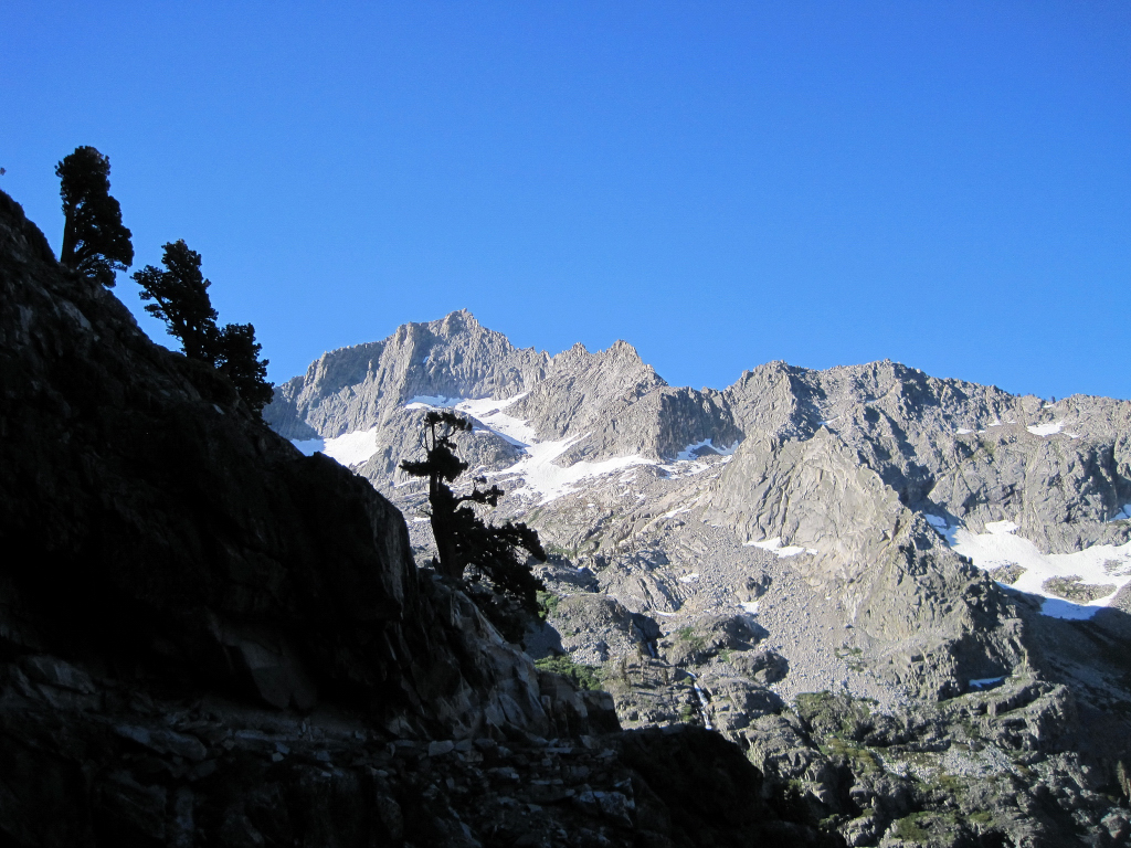
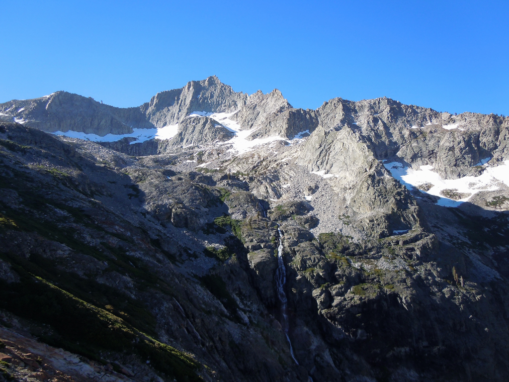
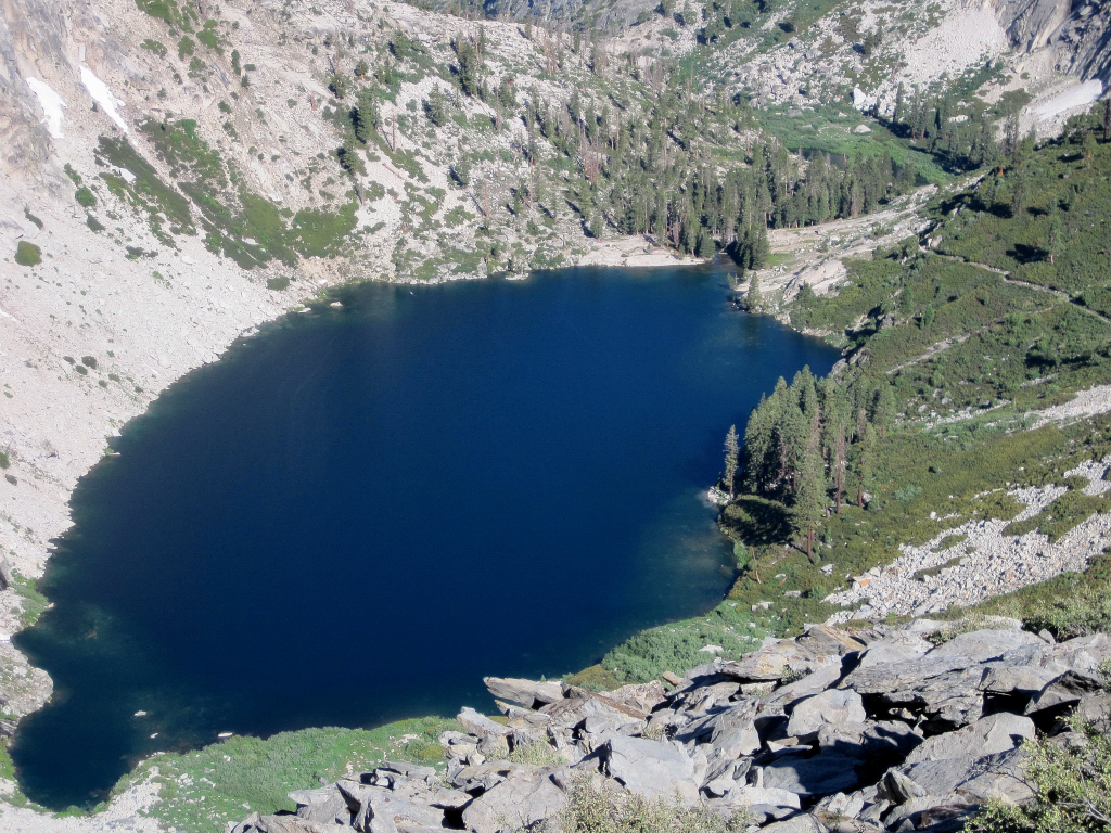
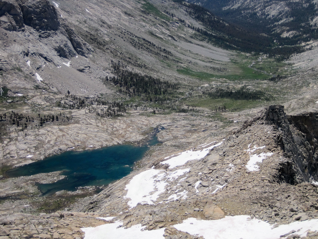
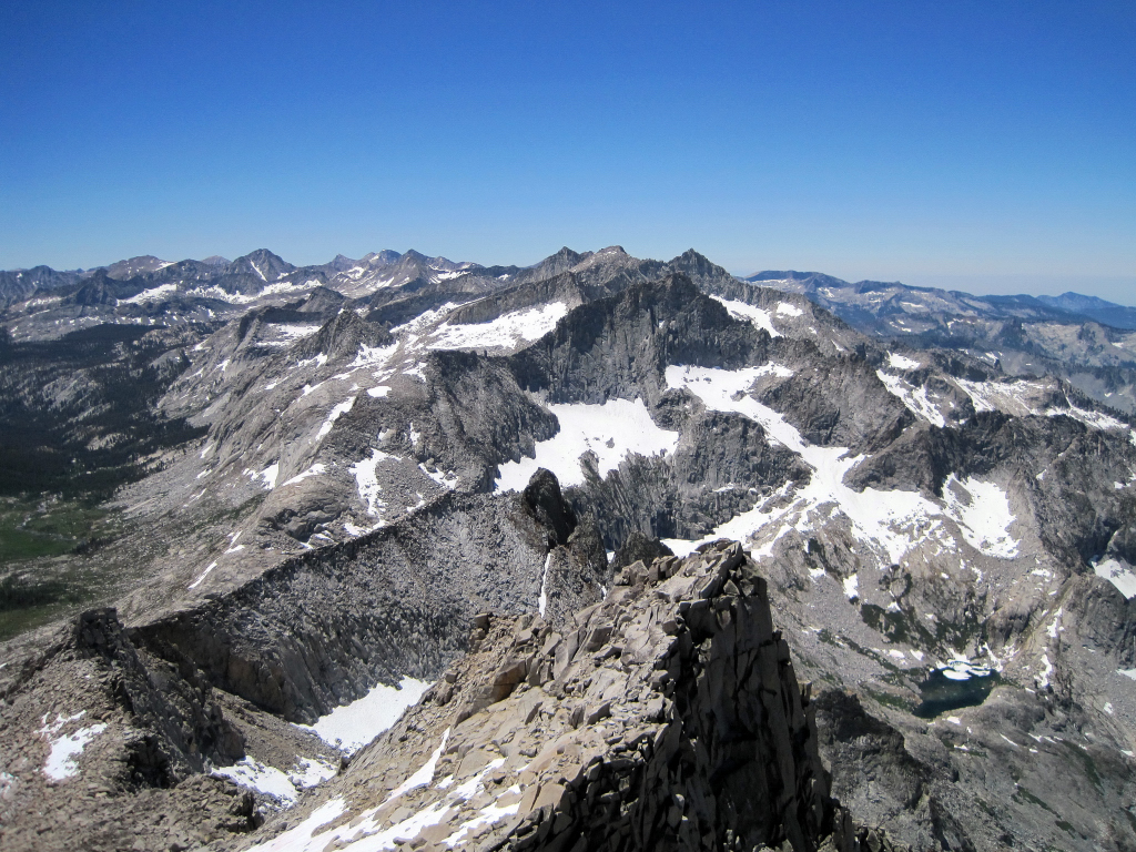
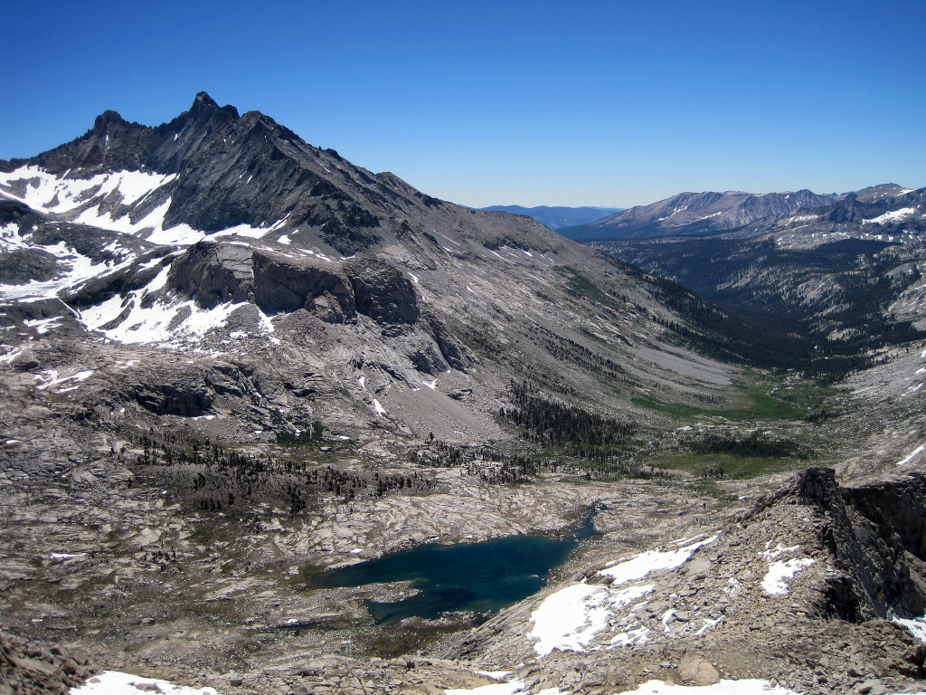
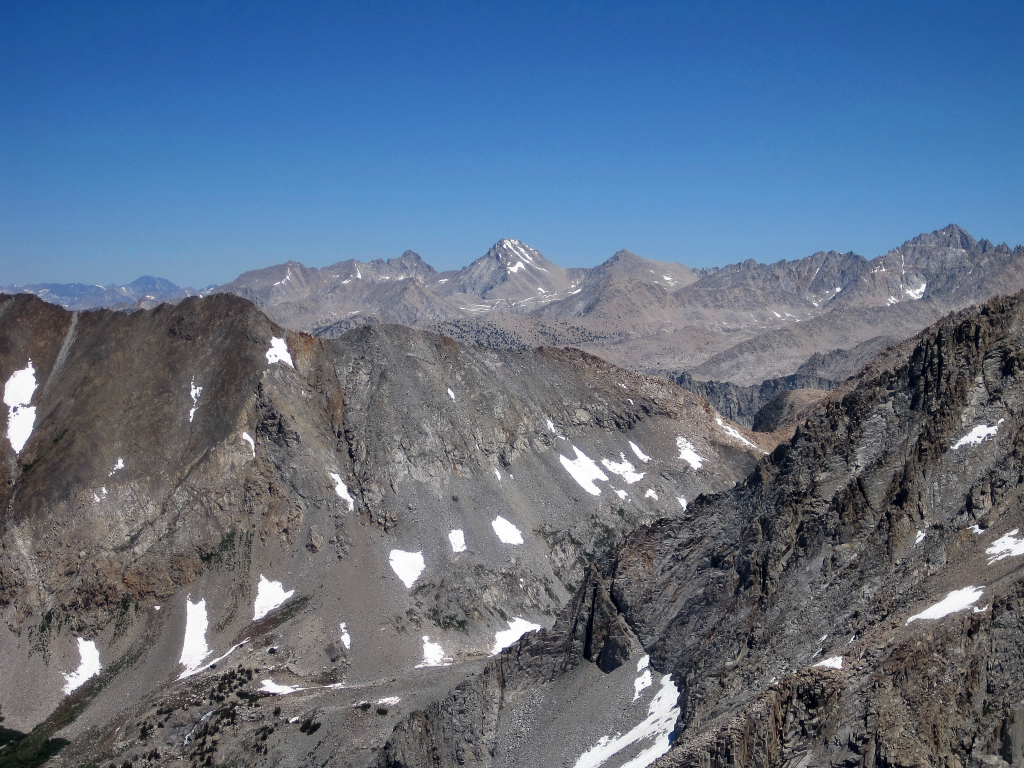
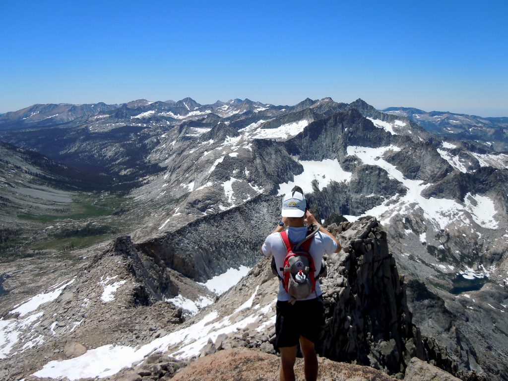
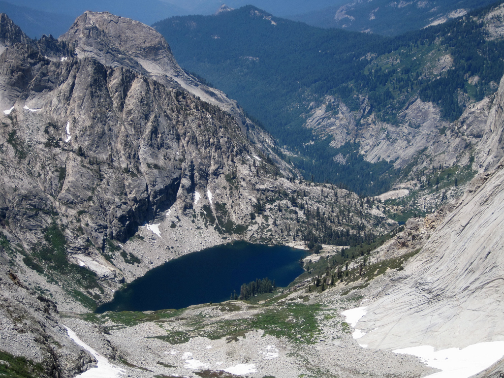
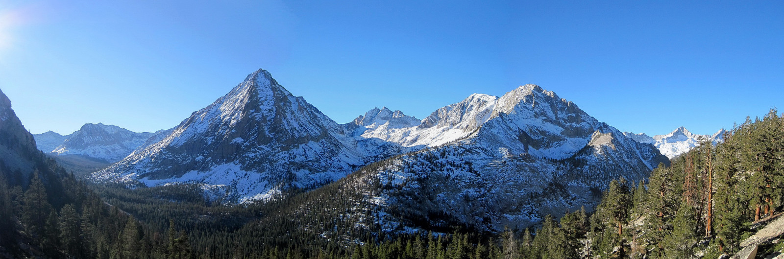
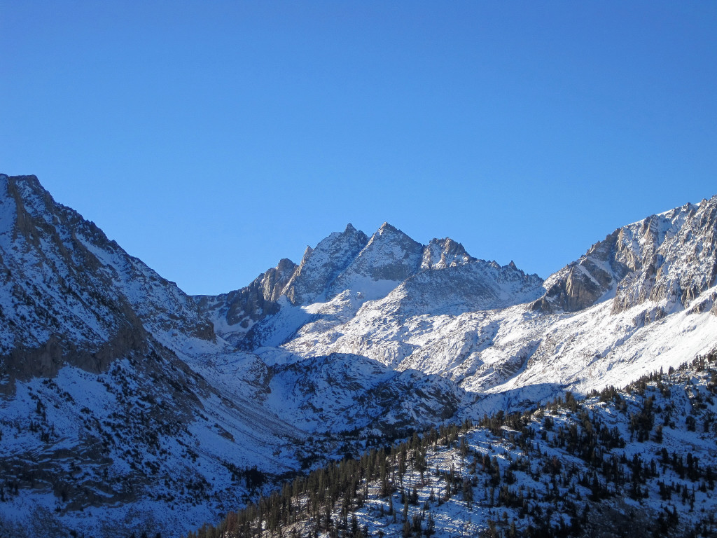
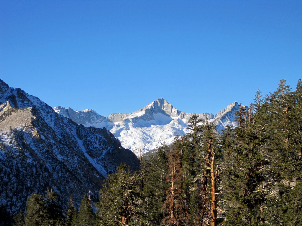
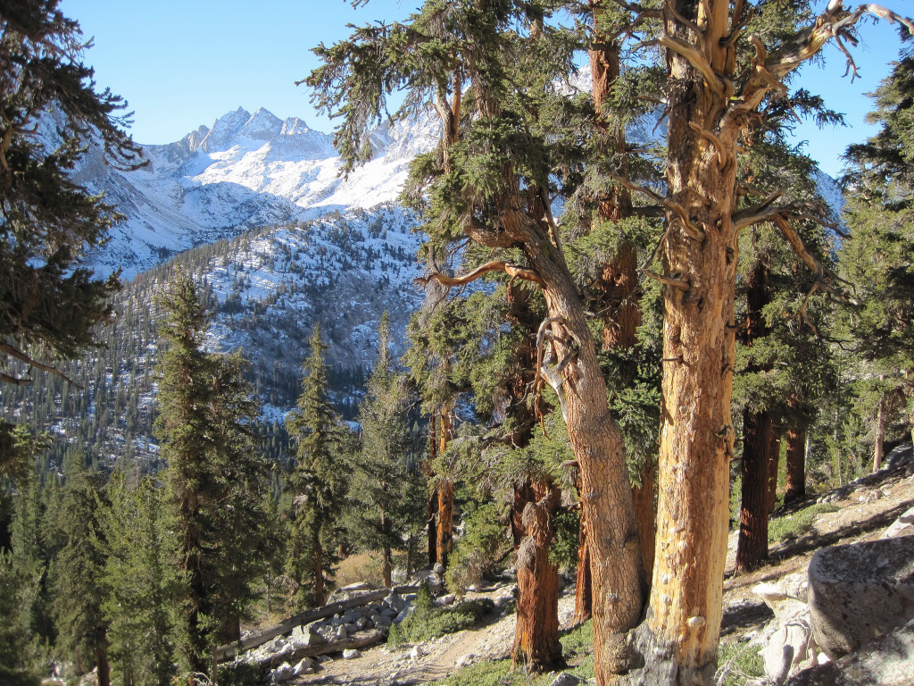
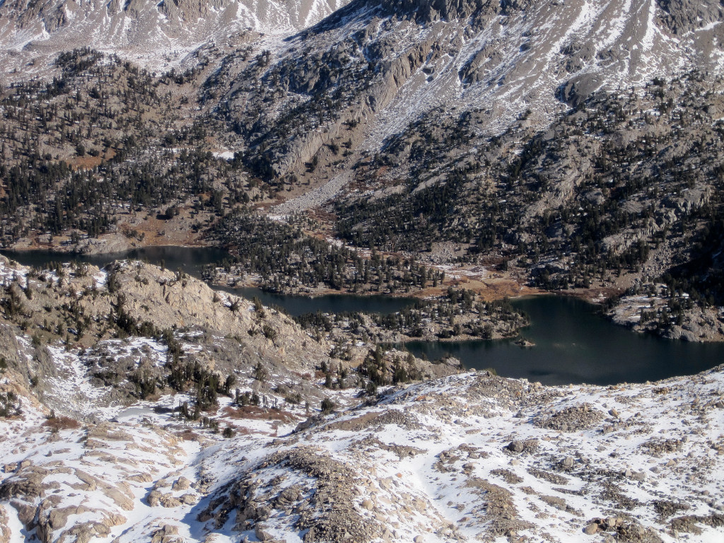
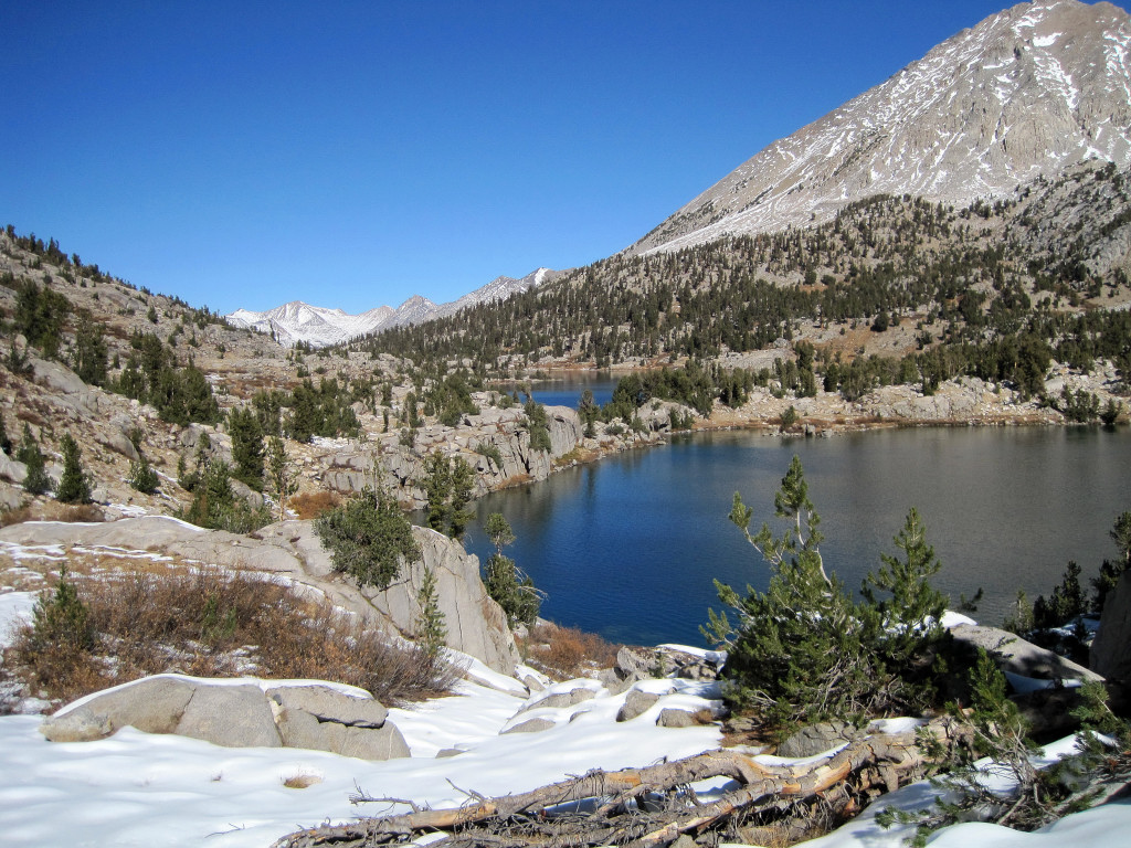
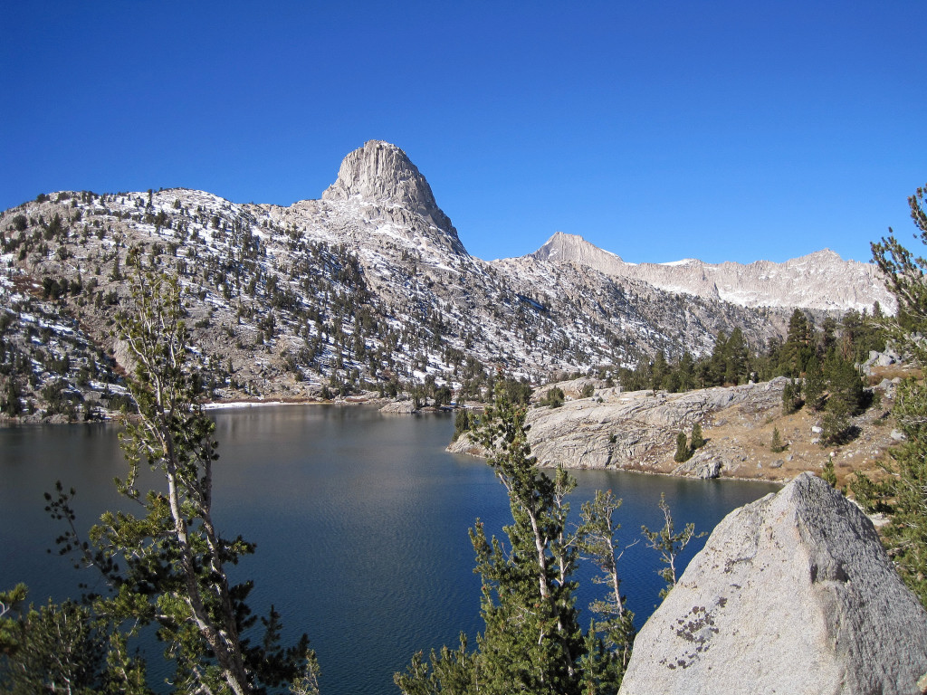
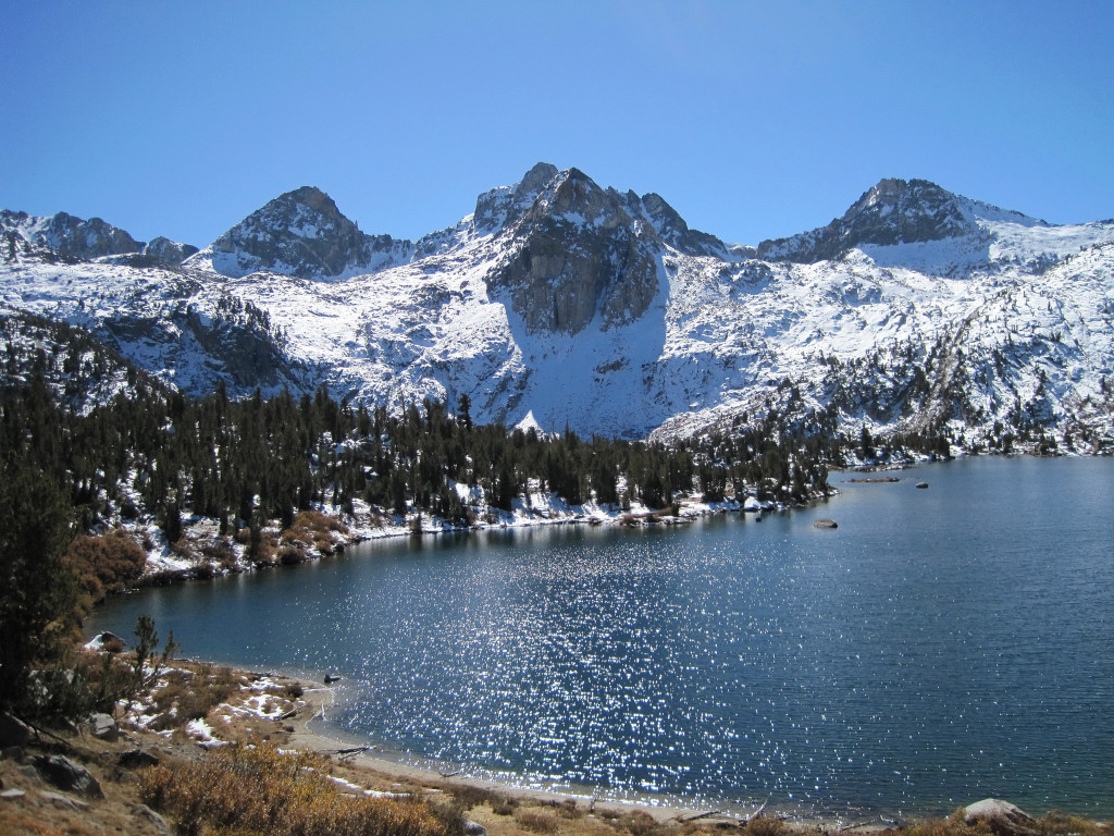
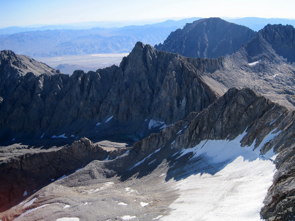
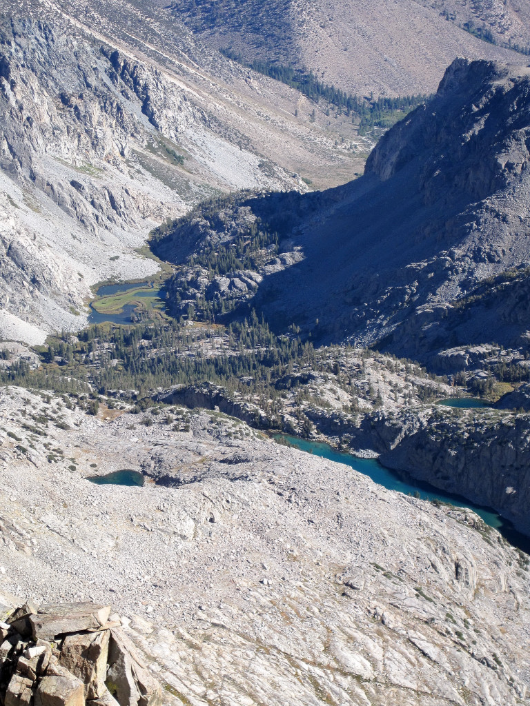
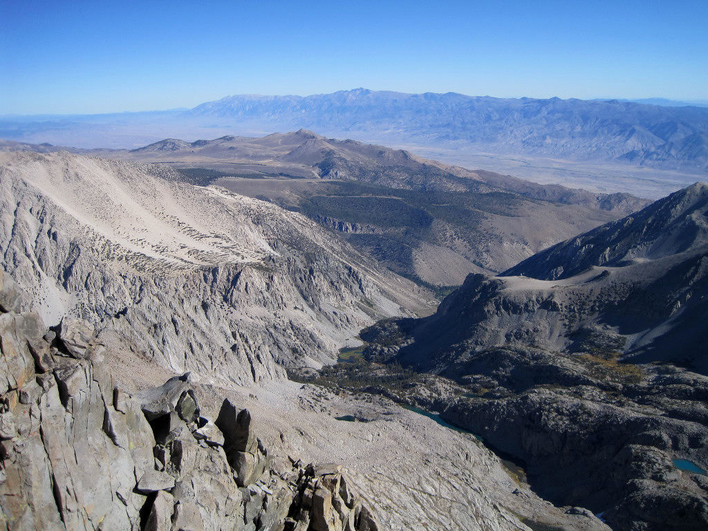
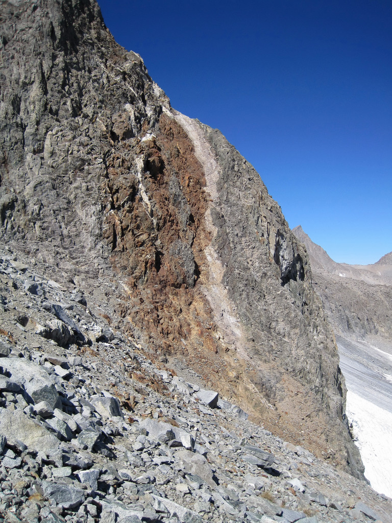
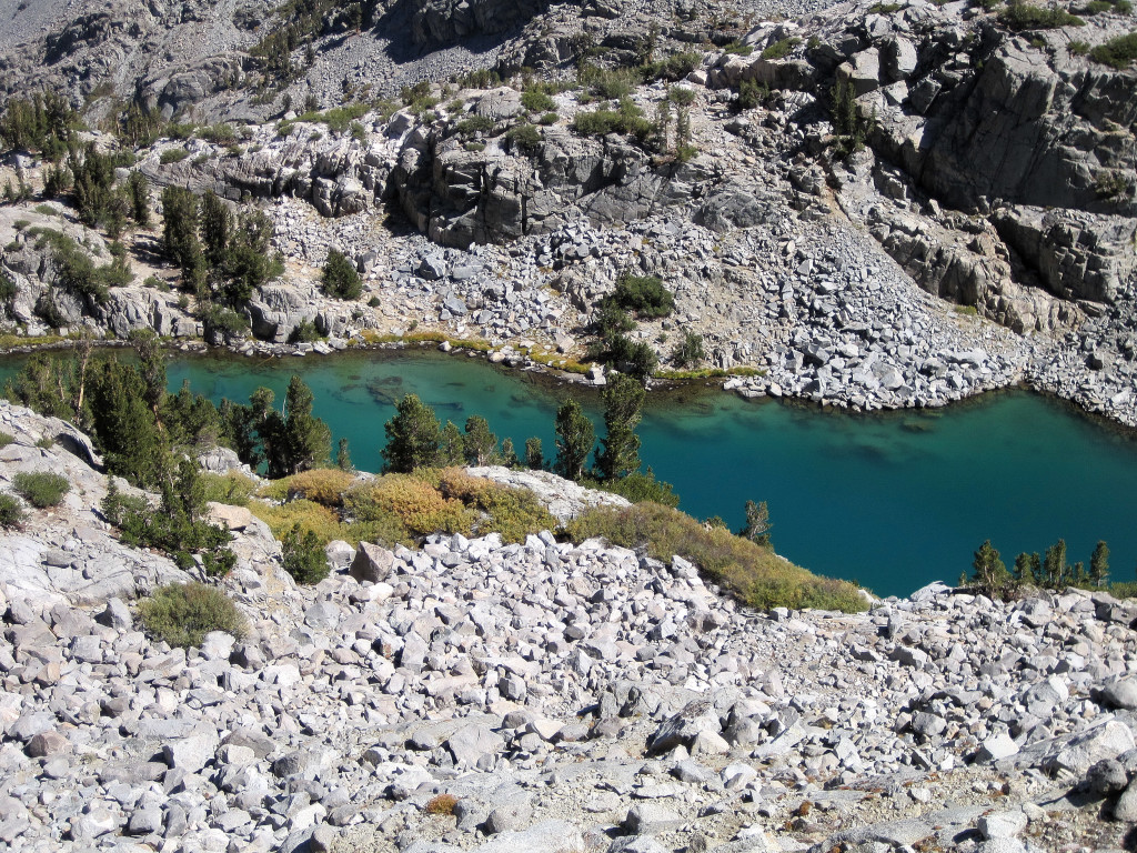
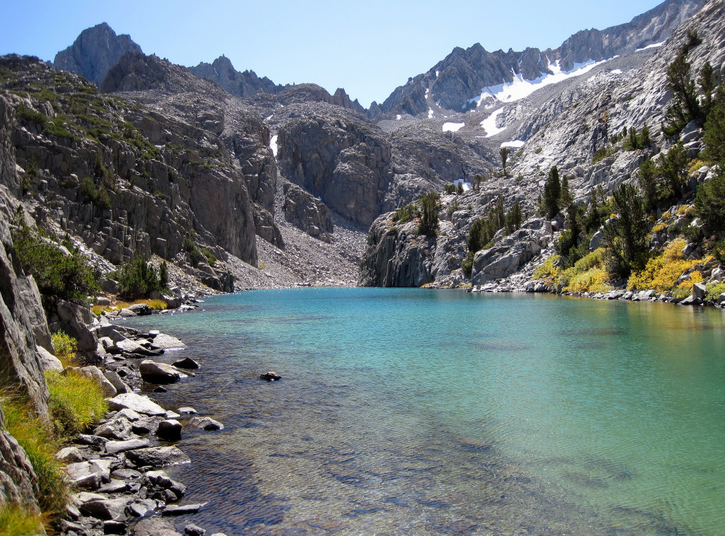
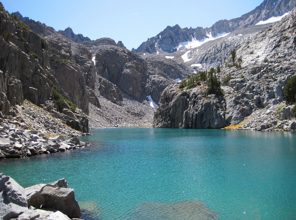
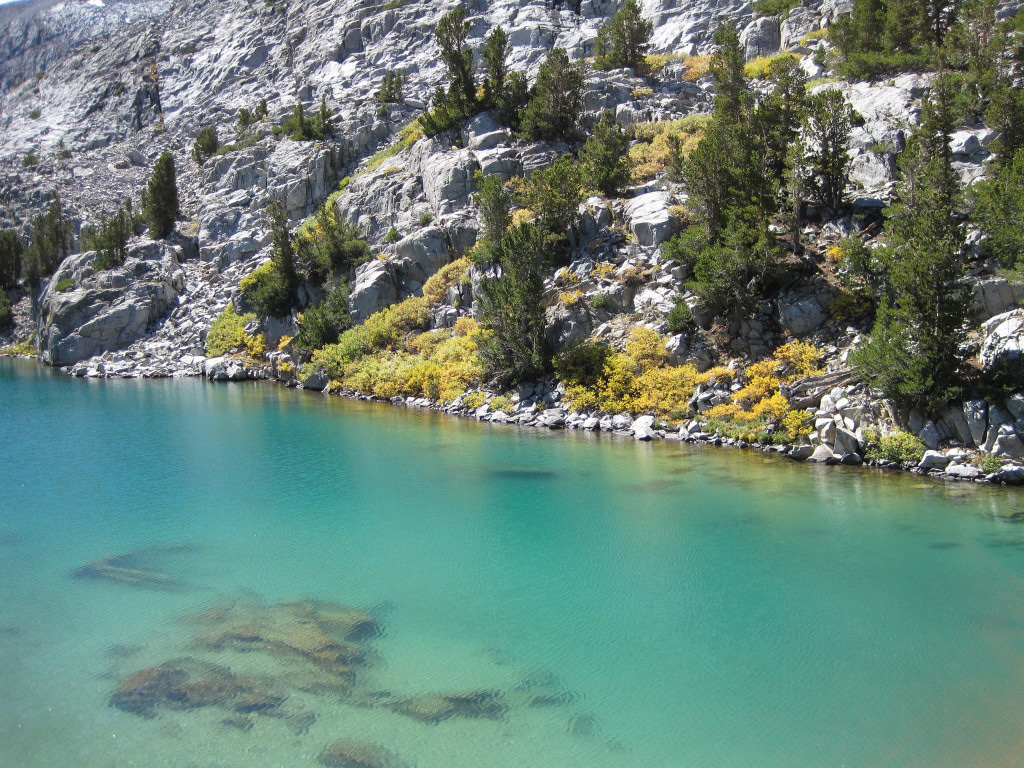
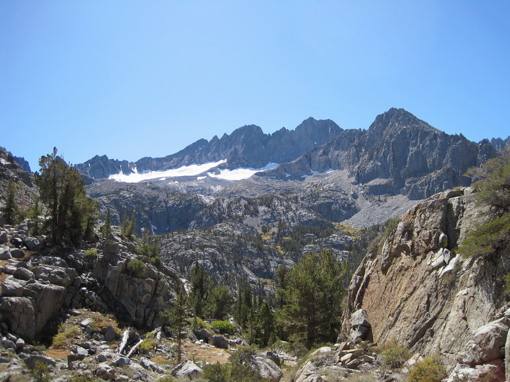
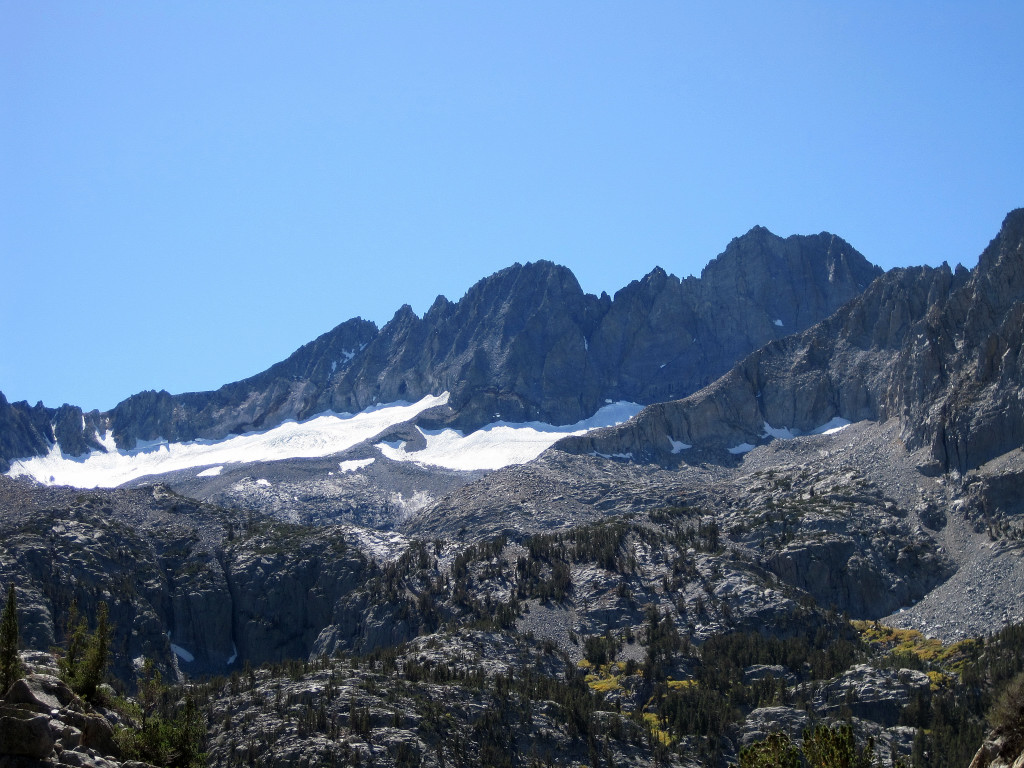
I climbed 14,159 ft Mount Sill on July 9, 2009 and enjoyed the scenery along the route and from the summit so much that it was time to return! The trail approach along the North Fork Big Pine is gorgeous passing through First, Second and Third Lakes with Temple Crag towering above. This year there was quite a bit more snow lower down and the talus moraine near the Palisade Glacier was substantially more covered. Conditions heading up to Glacier Notch were ideal for cramponing in the morning, but the snow in the L-shaped couloir was incredibly soft with thigh deep post-holing in spots for 700 vertical feet. In fact, the snow was so soft that I was unable to glissade on the way down despite the steep angle. On the 4th class section, all snow patches can now be avoided and it's fairly straightforward. The final bit of scrambling along the ridge up to the summit was fun and I enjoyed the spectacular vista from the "best summit view in the Sierras." Starting at 5:15 am, the total roundtrip took 8:45 finishing just before 2 pm. (5:15 up, 3 hours down, 30 minutes on top).

Second Lake

Palisade Glacier, Mount Sill, North Palisade
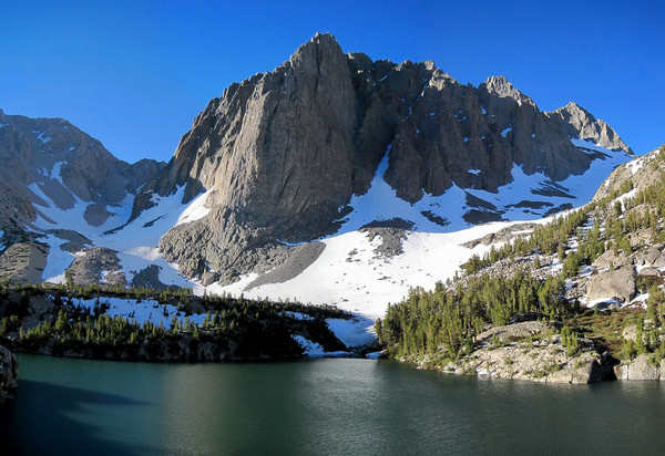
Third Lake
North Palisade

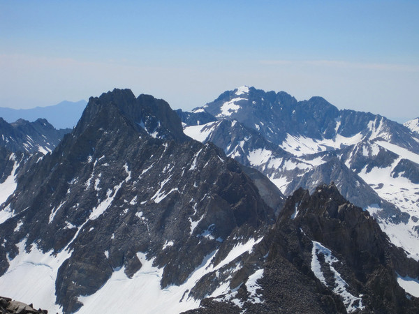
Norman Clyde Peak, Middle Palisade and Split Mountain
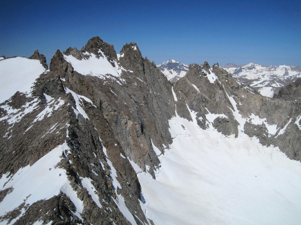
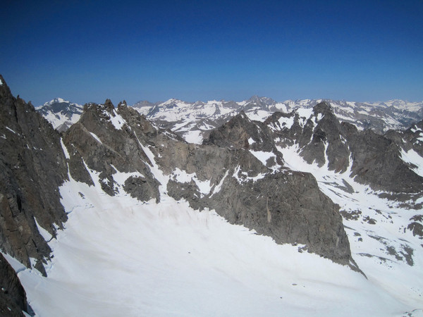
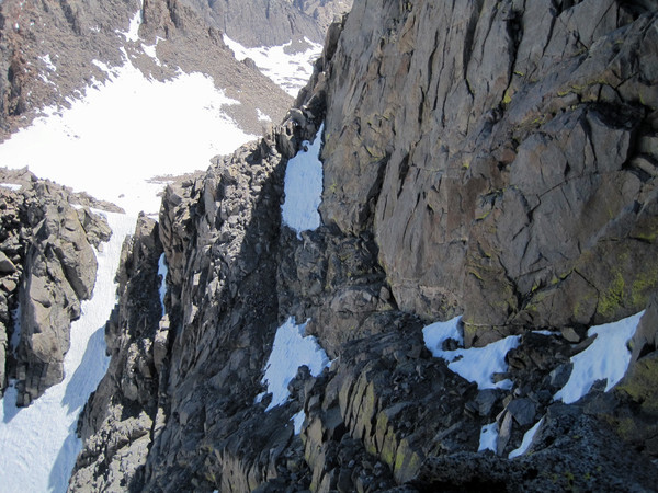
4th Class Traverse
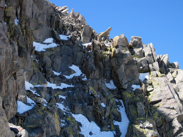
Exposed 4th Class section
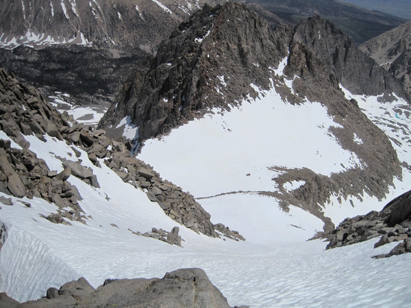
Look down the L-shaped snow couloir
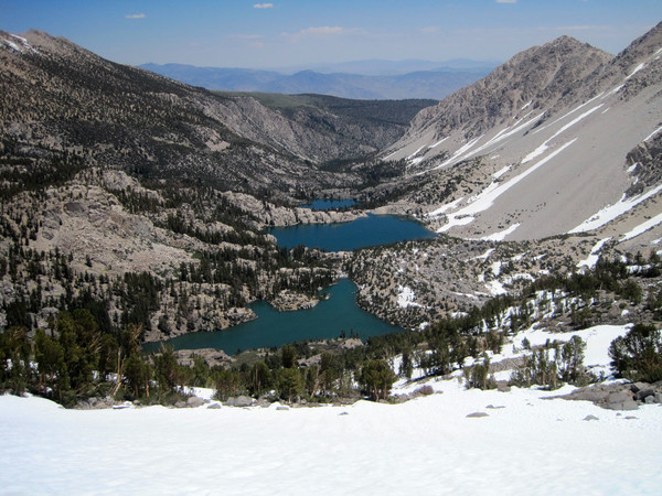
First, Second, Third Lakes
Sam Mack Meadows
Gear:
Black Diamond Neve Strap Crampons, Ice Axe, Ultimate Direction Wasp Pack, La Sportiva Fireblade Trail Runners, First Endurance EFS and Liquid Shots
Approach Notes:
Trail in great shape all the way up to the Glacier Trail junction and then it's mostly snow (melting fast). The snow below glacier notch is very firm in the morning requiring crampons.
-
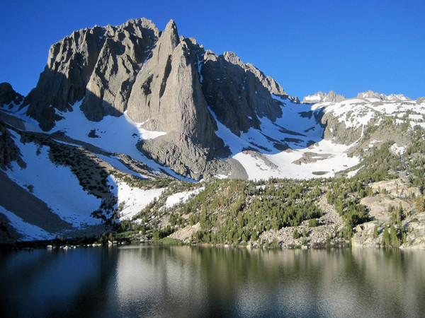
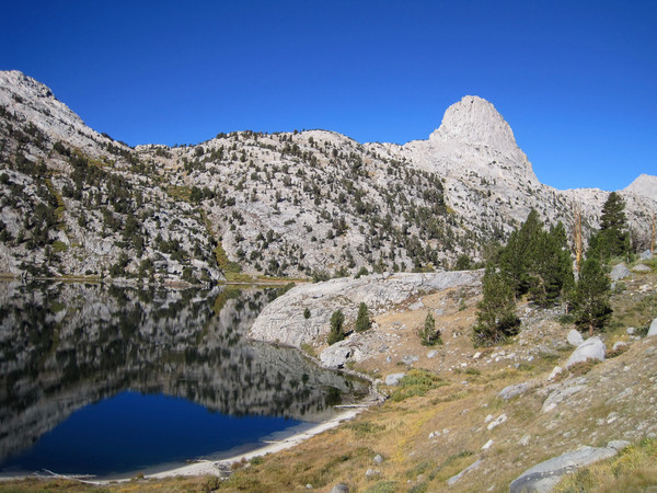
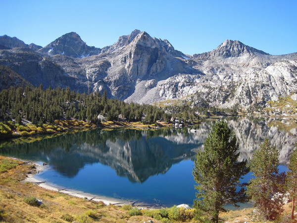
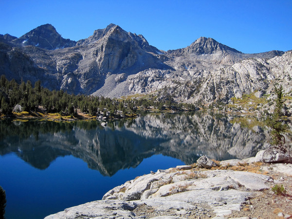
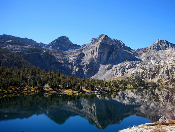
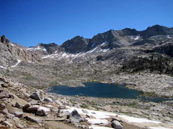
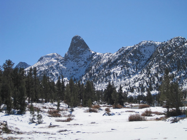
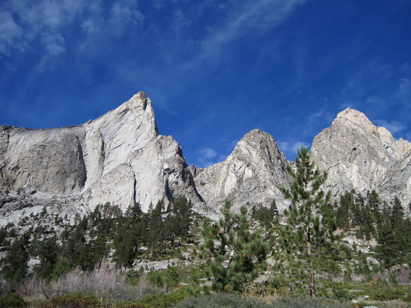
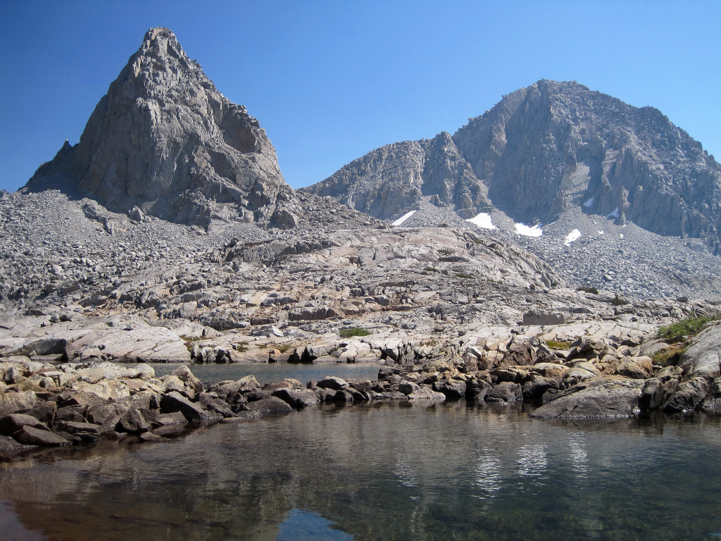
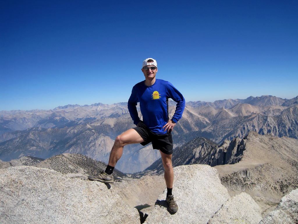
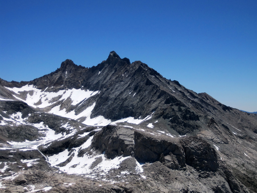
Trip: Bear Creek Spire & Mount Dade - Rock Creek/Little Lakes Valley
Date: 7/2/2011
Trip Report:
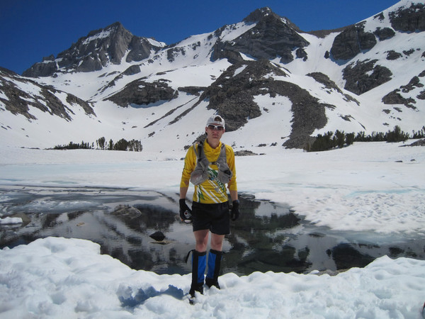
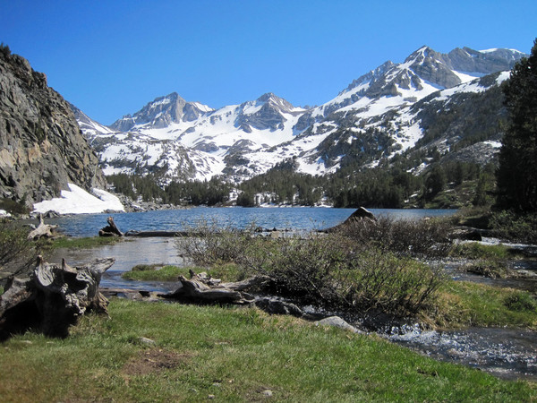
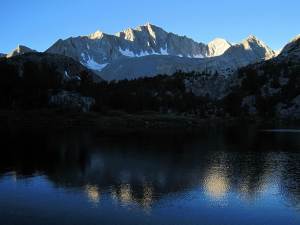
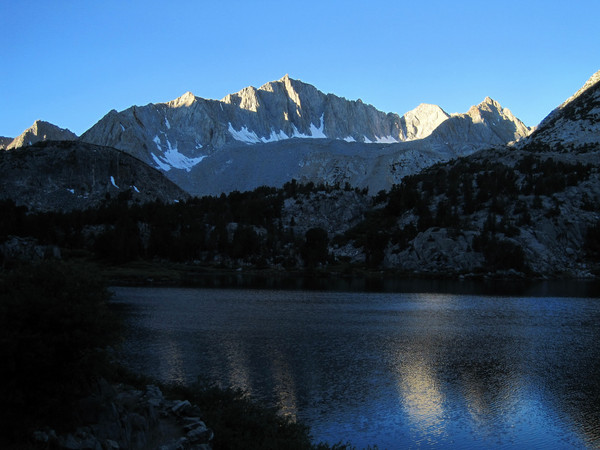
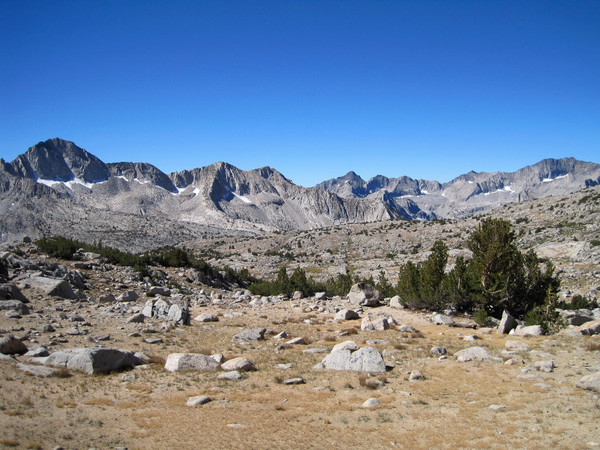
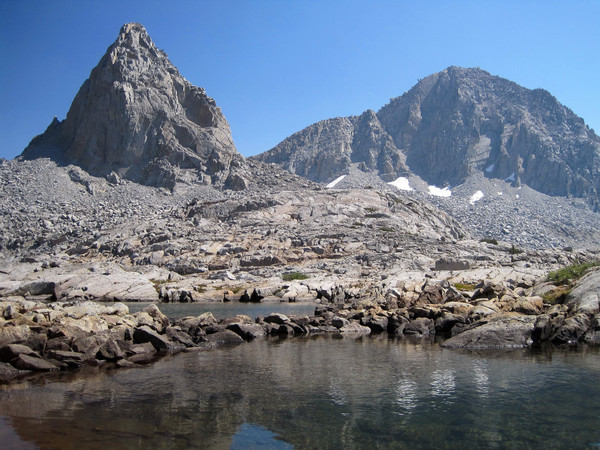
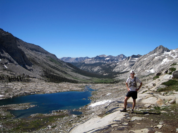
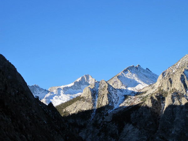
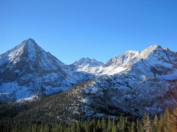
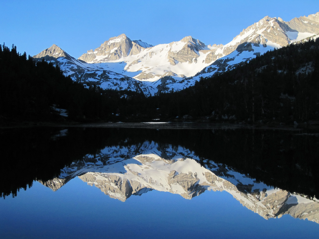
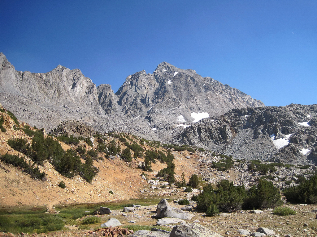
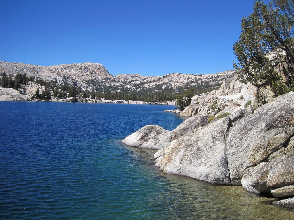
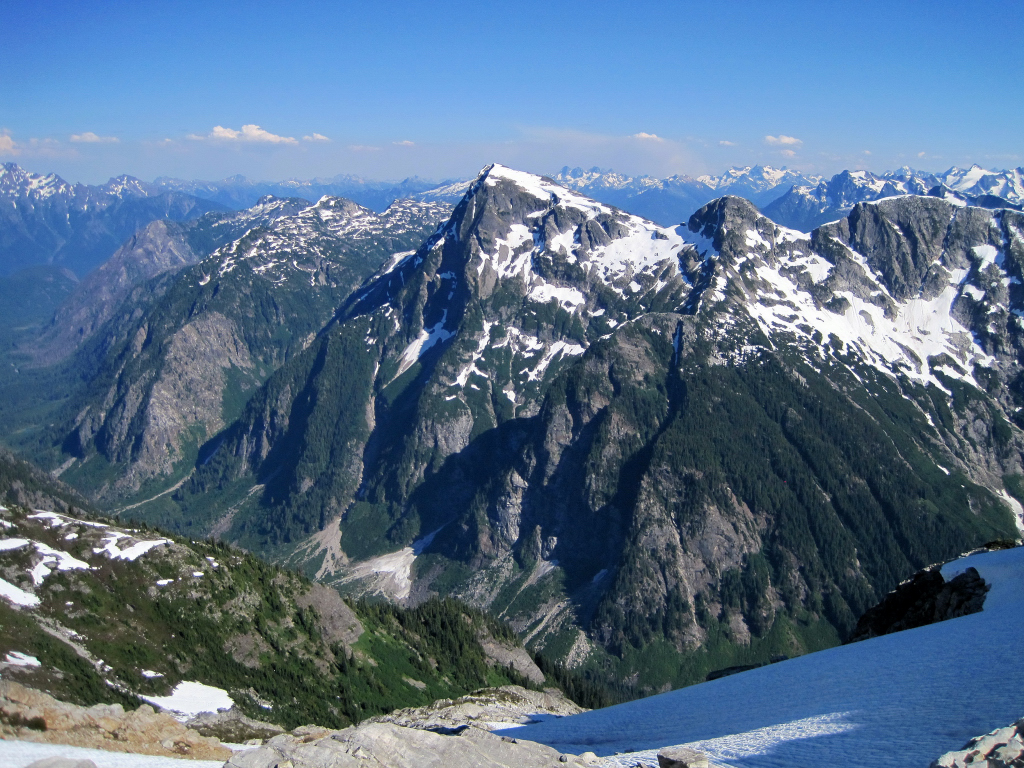
I climbed Bear Creek Spire and Mount Dade out of Rock Creek/Little Lakes Valley in the Eastern Sierra as part of a weekend of adventure running over the holiday weekend. The lakes below 11k were unfrozen while the lakes above 11k remain partly to mostly frozen. With the onset of warm temperatures, snow conditions are changing rapidly. We timed the morning light perfectly with some great reflection shots and then ascended up to the head of the valley where solid snow begins just above Gem Lakes. The snowpack heading up to Cox Col from Dade Lake was nicely consolidated and the steeper slopes were great for cramponing (crampons might not be necessary with boots, but we used trail runners). The view from the summit pinnacle of Bear Creek Spire was as amazing as I had recalled from four years prior. After Bear Creek Spire we traversed along the west side of the crest and found a steep, loose gully to take us into Dade Bowl on the east side of the crest. I ascended to the summit of Mount Dade with some distasteful post-holing on the upper snowfields but the great views and glissade down the Hourglass more than compensated. I soaked in more great views from Treasure Lakes all the way back to the trailhead; 10:15 roundtrip.
Marsh Lake
Long Lake
Mount Dade
Bear Creek Spire summit pinnacle
Bear Creek Spire from the summit of Mount Dade
Mount Abbot
Treasure Lakes

Gear Notes:
Black Diamond Neve Strap Crampons, Ice Axe, Ultimate Direction Wasp Pack, La Sportiva Fireblade Trail Runners, First Endurance EFS and Liquid Shot
-
Trip: Rae Lakes Loop - Adventure Run
Date: 9/26/2010
Trip Report:
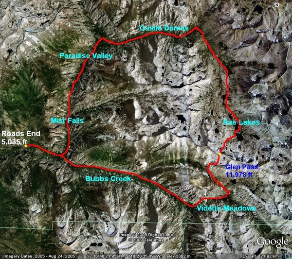
According to the park service, the Rae Lakes Loop is one of the most popular backpacks in Kings Canyon and Sequoia National Parks, if not the entire Sierra. The loop is ~42 miles long and climbs from 5,035 ft at the trailhead to 11,978 ft at Glen Pass. The portion between Vidette Meadows and Woods Creek Crossing is along the John Muir Trail and passes through the Rae Lakes area, a chain of large alpine lakes over 10,500 feet with views of rugged Sierra peaks. The trailhead is at Road’s End in magnificent Kings Canyon and travels along Bubbs Creek and Woods Creek, including Vidette Meadows, Castle Domes, and Paradise Valley. I completed the loop in 7:29:50 which is the fastest known time for the route. The prior FKT of 8:56 was held by Dana Taylor.
After completing the Rae Lakes Loop in challenging late-season conditions last October, I wanted to come back and run the loop for speed. Conditions this time were idyllic with the trails in great shape and warm temperatures. I got into a nice rhythm heading up Bubbs Creek toward Vidette Meadows and knew it would be a good day when I reached the high point at Glen Pass (just under 12,000 ft) in 3.5 hours. Fortunately, smoke impacts from the Sheep Fire were non-existant with beautiful clear skies. While I took less photography than last time, I couldn't resist snapping a few pics as I passed Glen Pass and the lovely Rae Lakes. The park service describes the loop as 46 miles but other reports and my experience place the mileage closer to 42 miles.
Location: Time Elapsed / Split / Real Time
Road’s End (5,035 ft): 0 / 0 / 5:40
Sphinx Junction (6,240 ft): 41:49 / 41:49 / 6:22
Junction Meadow (8,136 ft): 1:49:02 / 1:07:12 / 7:29
Vidette Meadow (9,514 ft): 2:22:16 / 33:14 / 8:02
Glen Pass (11,978 ft): 3:30:10 / 1:07:54 / 9:10
Woods Creek Jct. (8,492 ft): 5:10:41 / 1:40:31 / 10:51
Road’s End (5,035 ft): 7:29:50 / 2:19:09 / 13:10
Comparison 2010 vs. 2009:
Location: 2010 / 2009
Road’s End (5,035 ft): 0 / 0
Sphinx Junction (6,240 ft): 41:49 / 45:03
Junction Meadow (8,136 ft): 1:49:02 / 2:11:59
Vidette Meadow (9,514 ft): 2:22:16 / 3:06:09
Glen Pass (11,978 ft): 3:30:10 / 4:55:49
Woods Creek Jct. (8,492 ft): 5:10:41 / 8:46:16
Road’s End (5,035 ft): 7:29:50 / 12:31:37

Reasons for faster time:
1. Snow: Last year on October 24th there was 1-3 feet of snow from below Charlotte Lake to below Dollar Lake, around 8 miles. There was no evidence of trail for long streches and time consuming post-holing in talus feels descending from Glen Pass. This also tired me out for the running sections along Woods Creek.
2. Less video/photography (but still some!)
3. Better acclimated: I hiked up 11,204 ft Alta Peak the day before.
4. Route Knowledge: Having done the loop, I knew where to run and where to walk
5. Lighter: Warm weather so no need to carry extra layers.


-
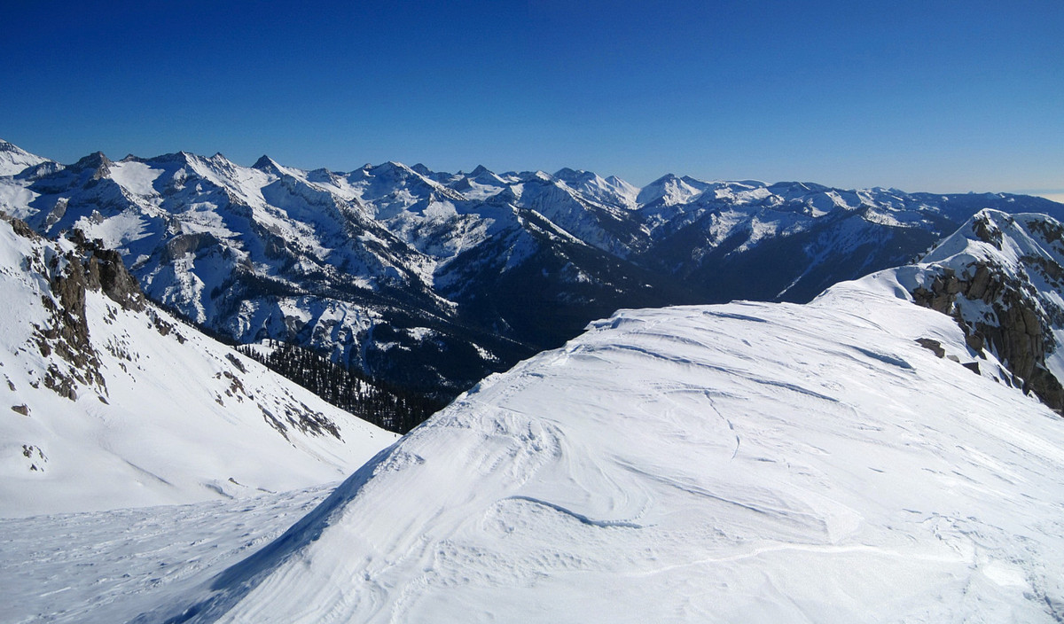
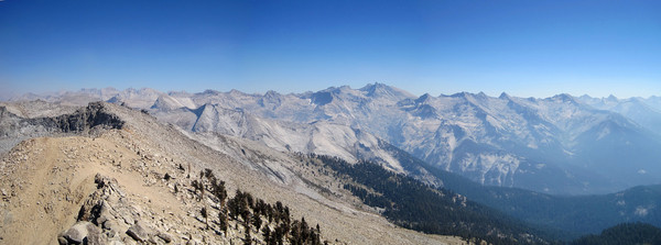
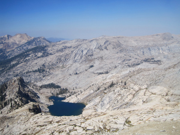
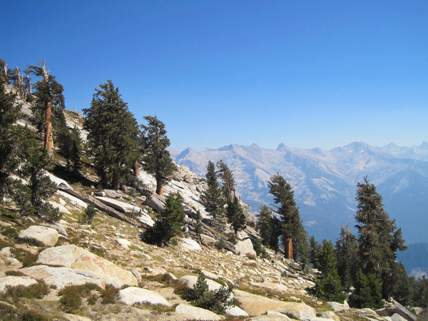
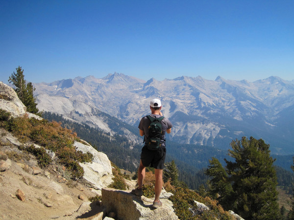
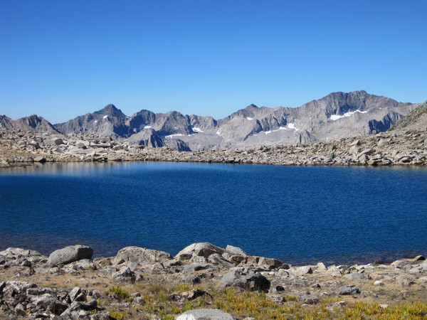
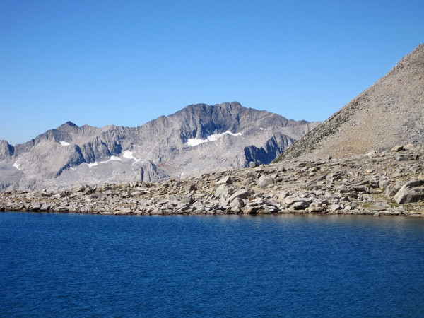
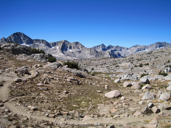
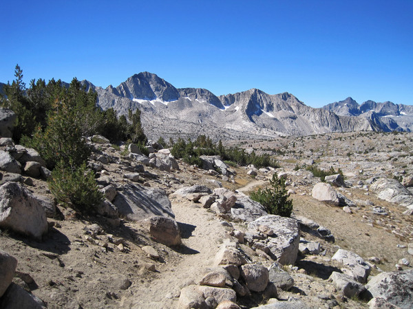
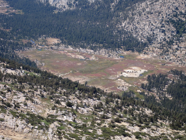
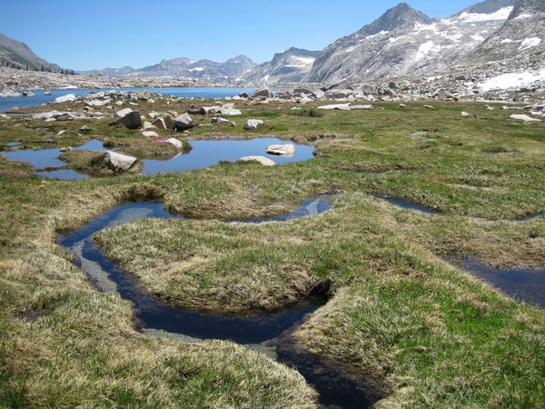
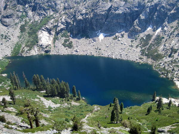
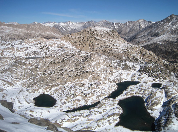
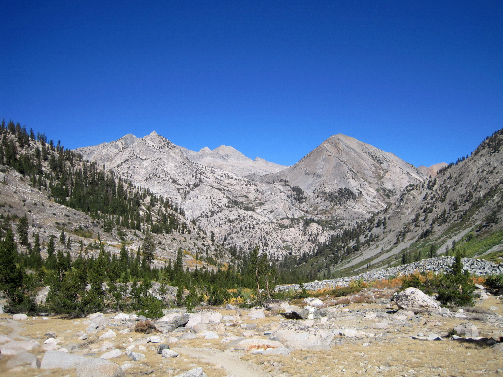
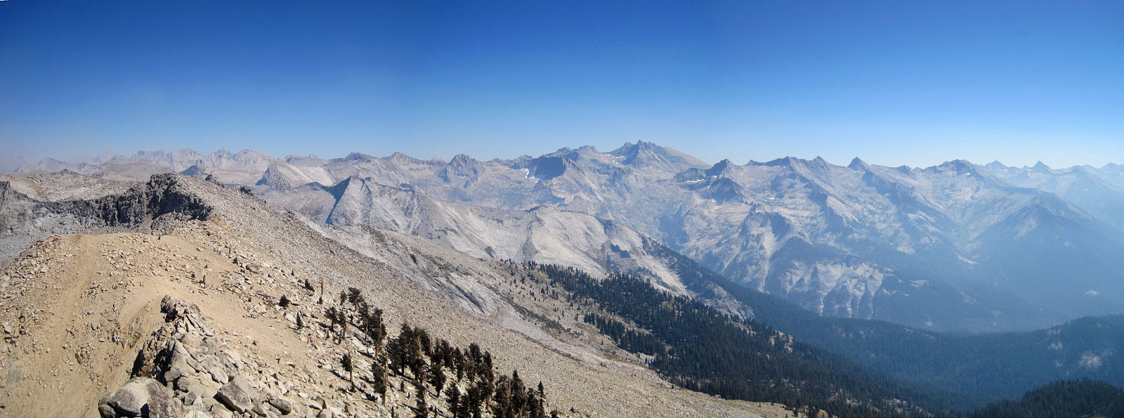
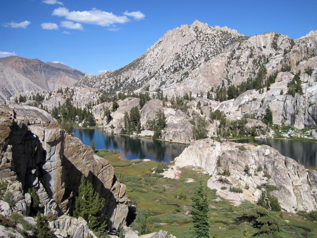
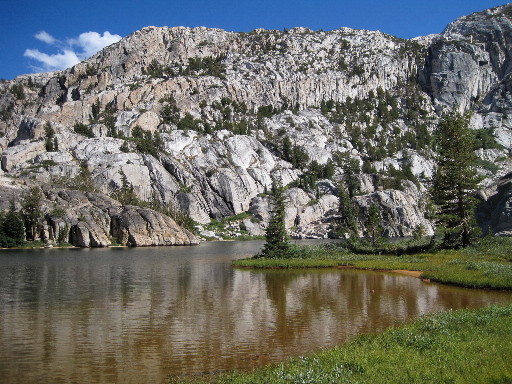
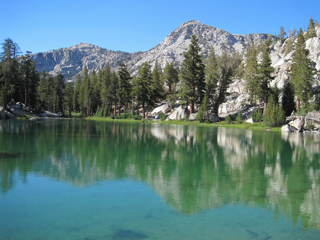
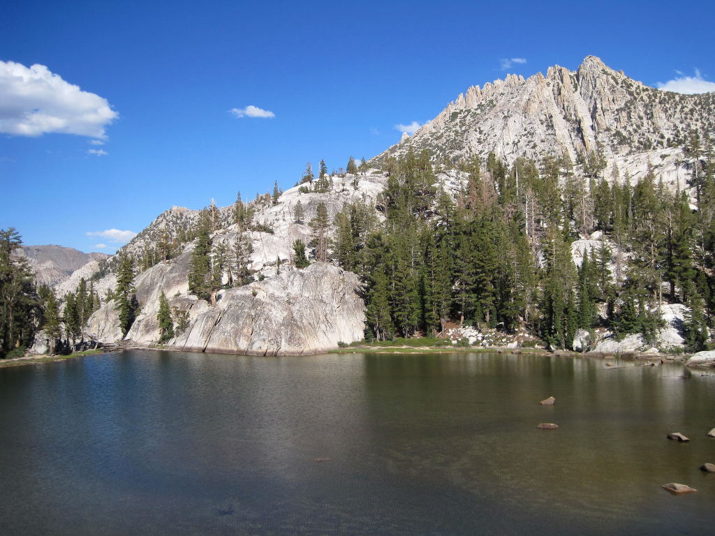
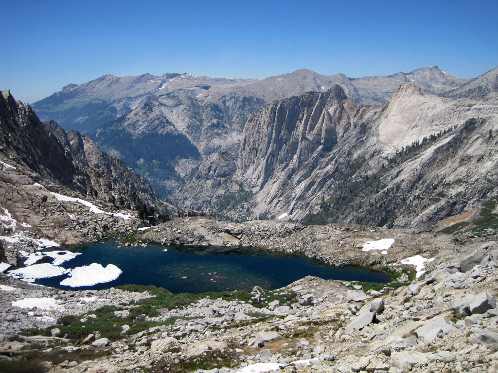
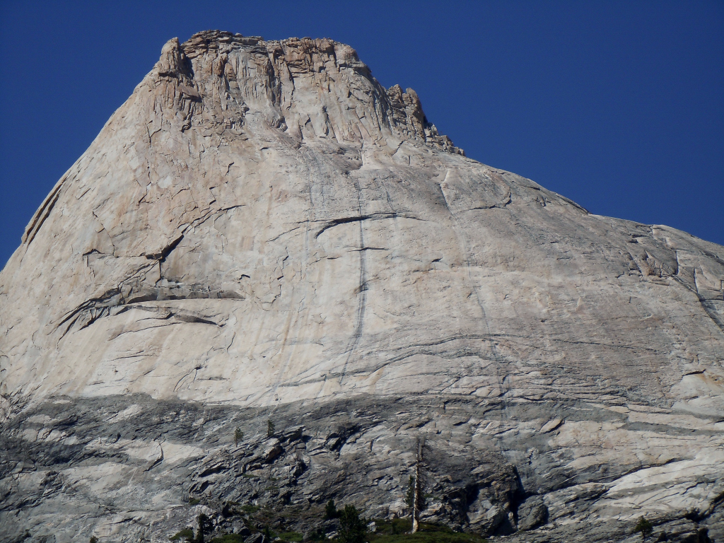
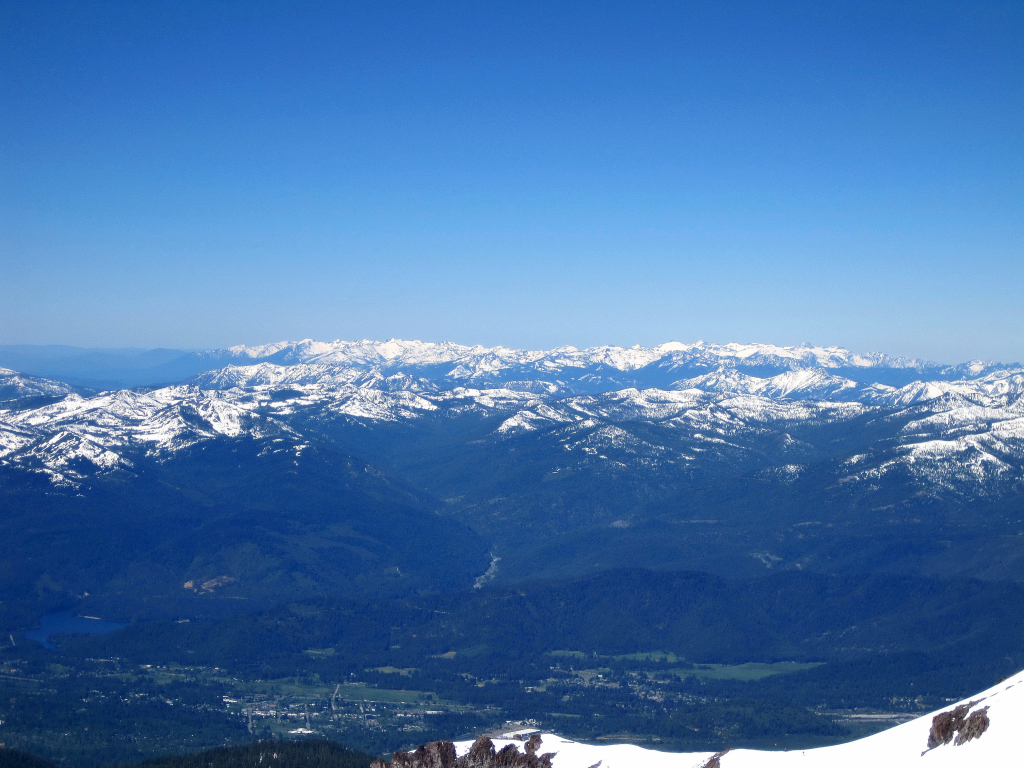
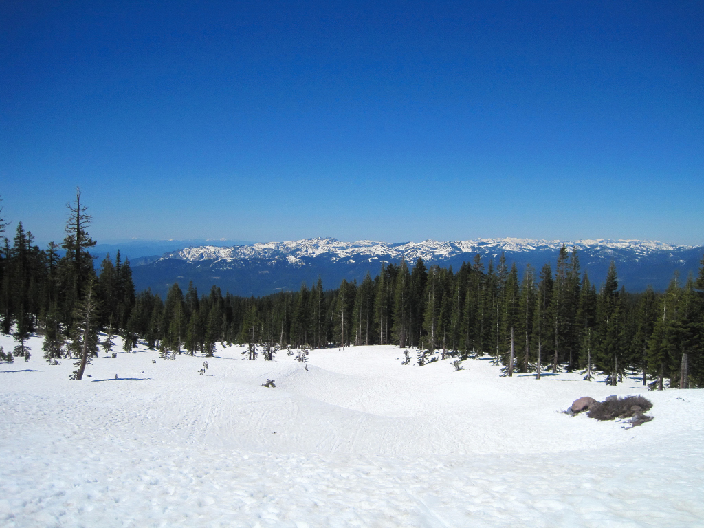
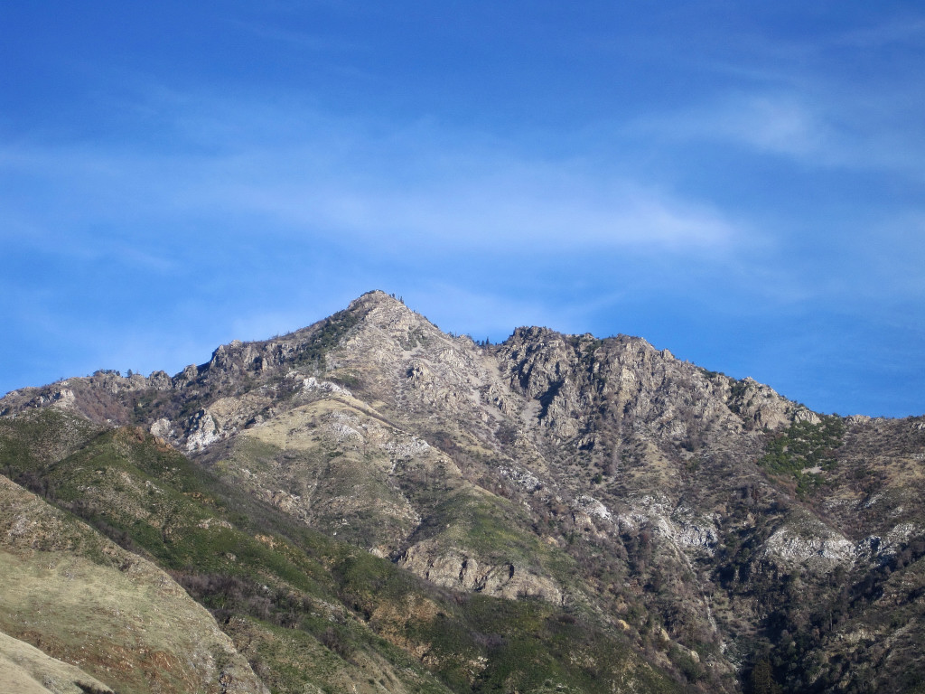
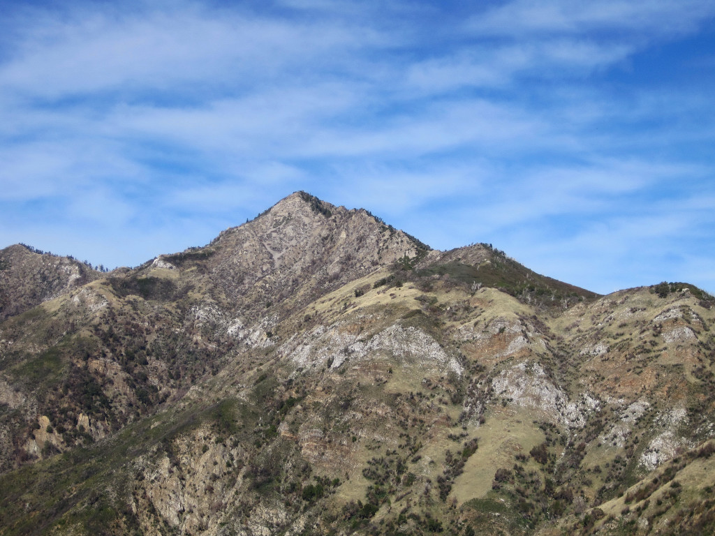
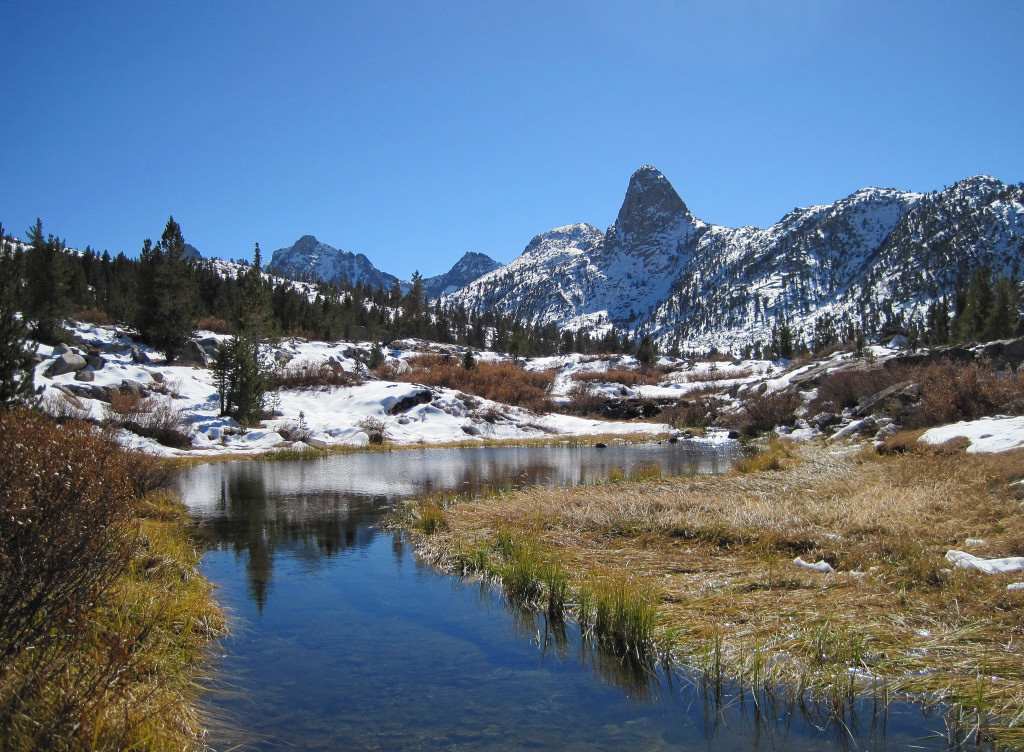
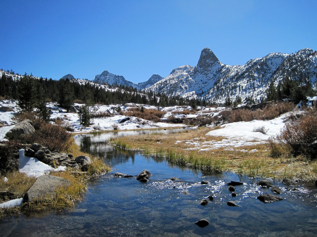
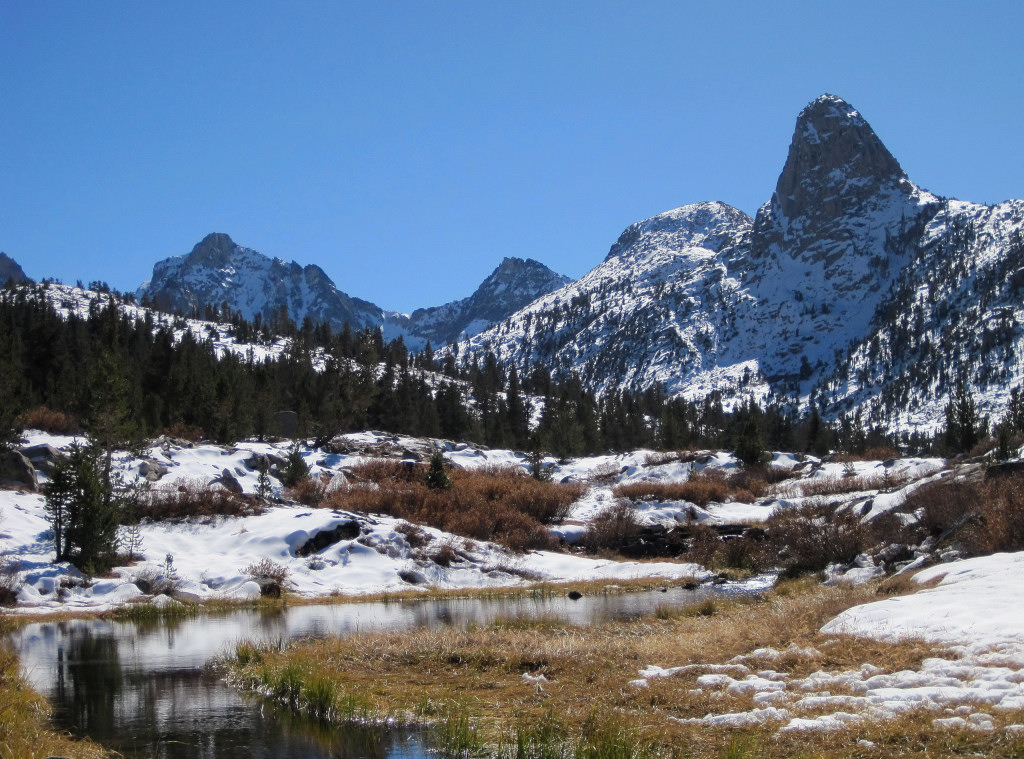
Trip: Alta Peak - Sequoia NP
Date: 9/25/2010
Trip Report:
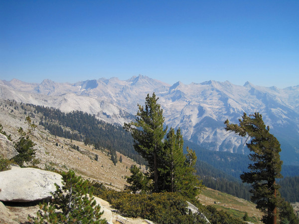
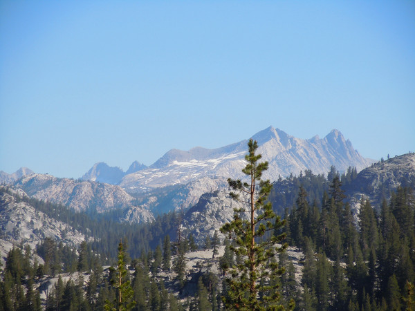
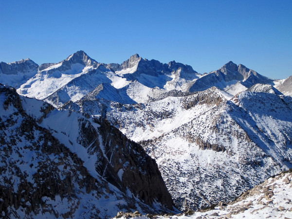
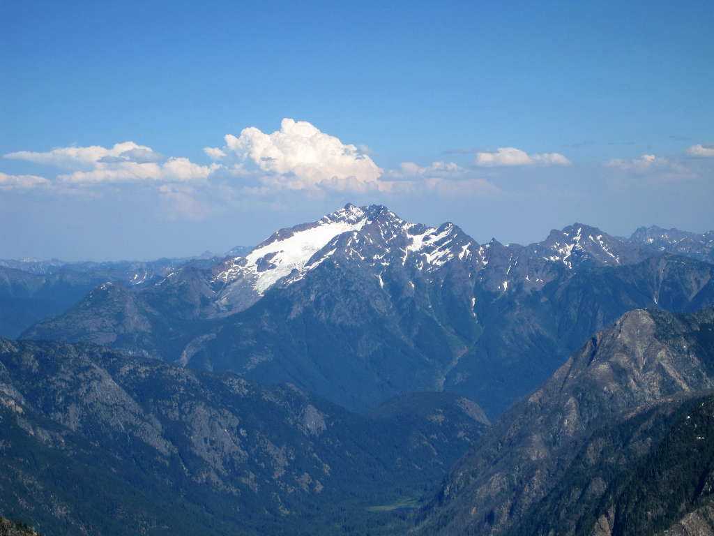
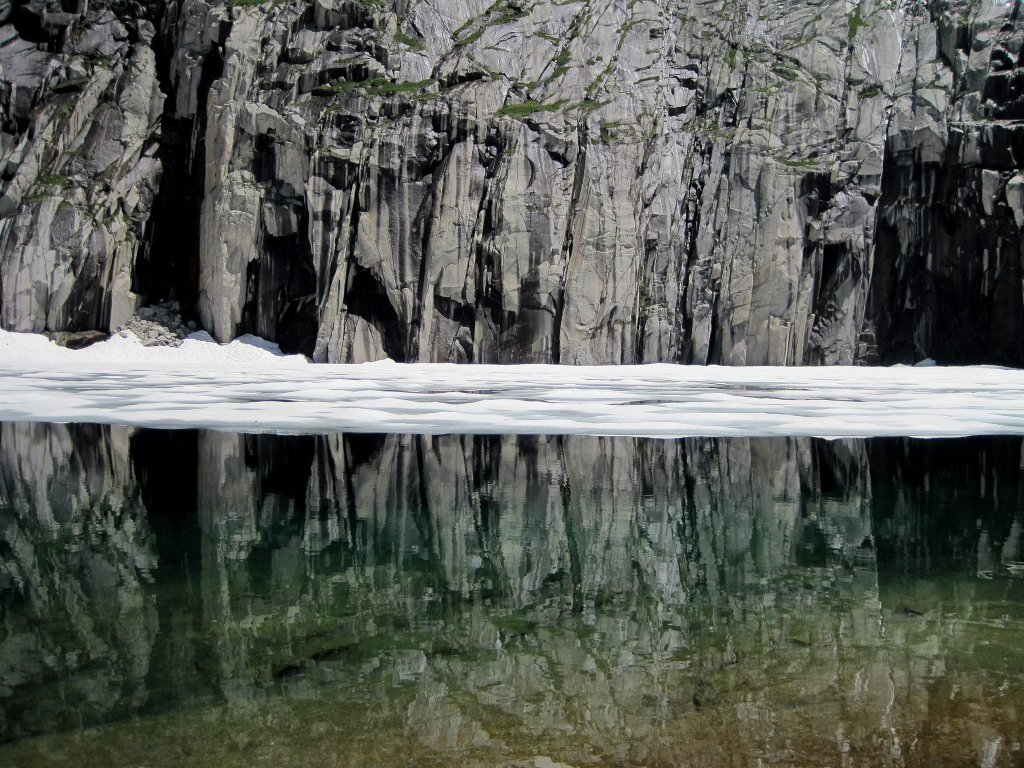
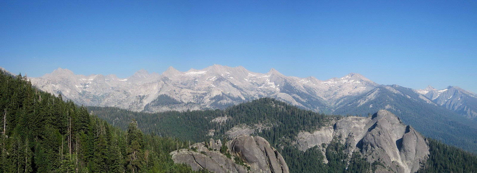
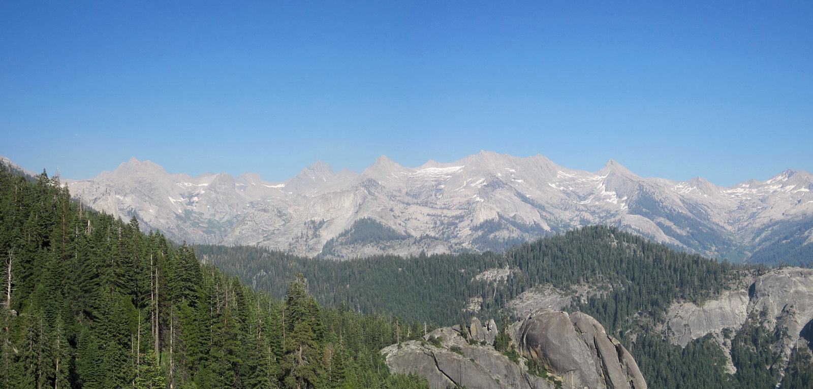
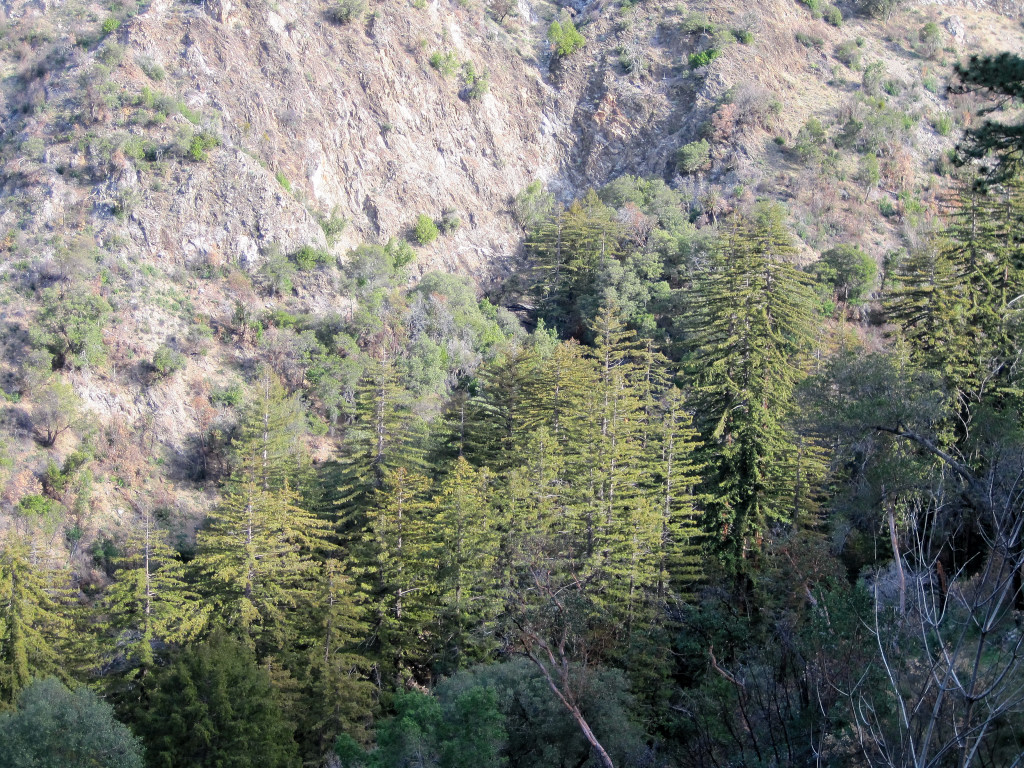
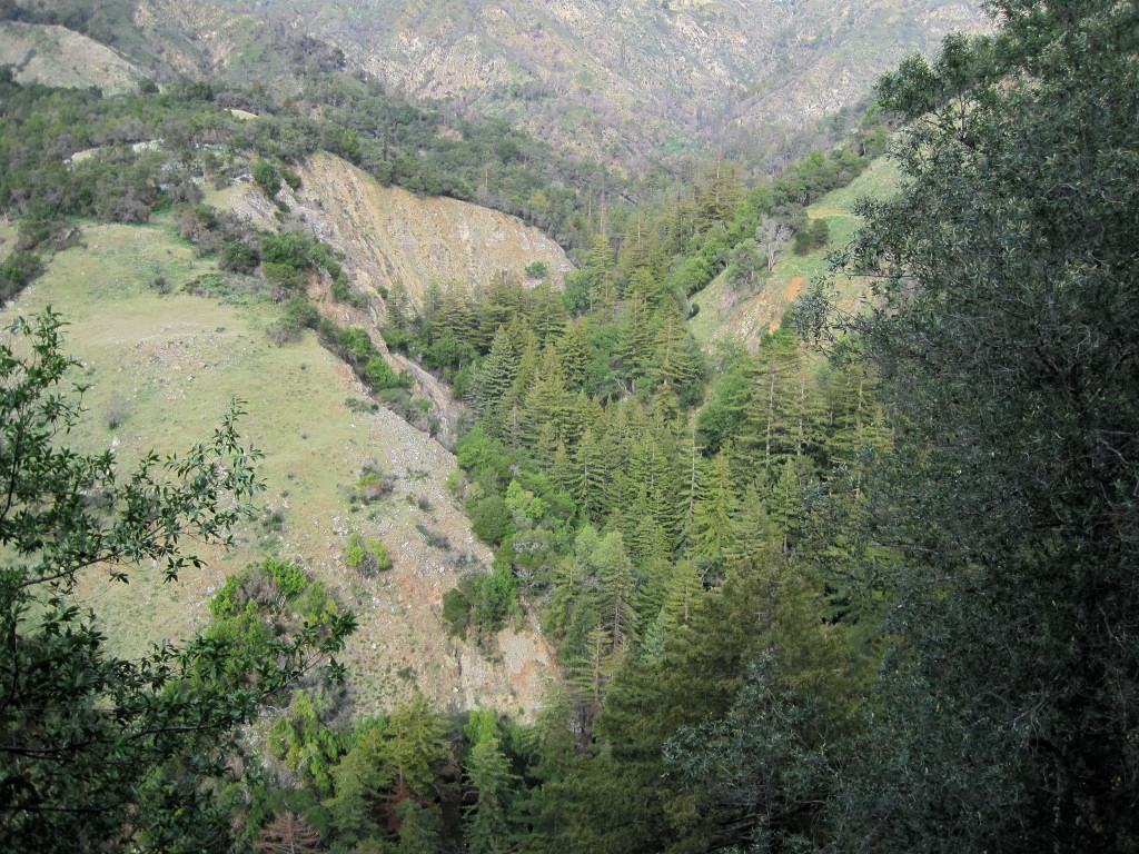
A hike up 11,204 ft Alta Peak in Sequoia National Park to help acclimate for the Rae Lakes Loop adventure run the following day. Alta Peak has a spectacular view of the Great Western Divide which was a bit hazy on this day due to the nearby Sheep Fire which has been burning since mid July. I will definitely return to Alta Peak in the winter and/or spring to soak in the 360 degree view in clear conditions and with a coat of snow over the peaks. The area around Alta Peak is also relatively accessible in the winter for some great backcountry skiing.
From L to R: Thunder Peak, Table Mountain, Midway Mountain, Milestone Mountain, Centennial Peak. Can these five peaks be traversed in one day?
Black Kaweah and the Kaweah Range

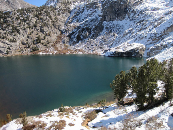
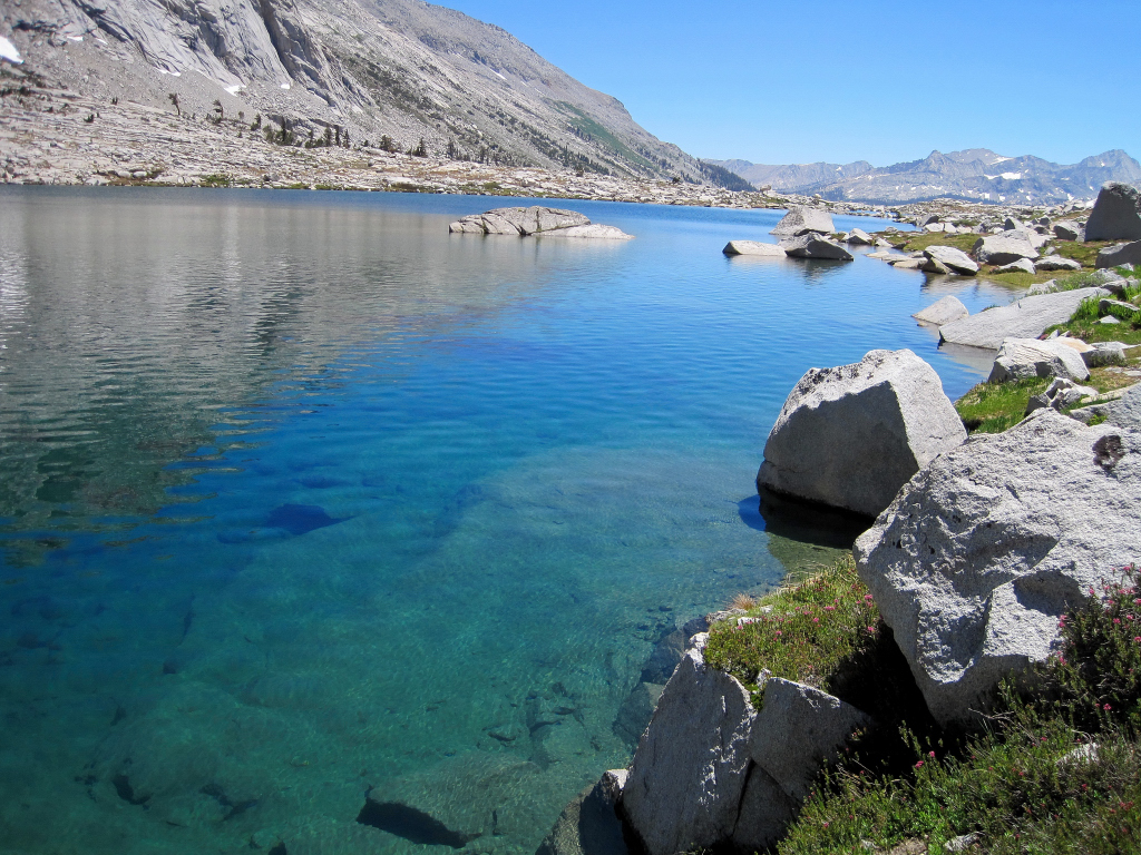
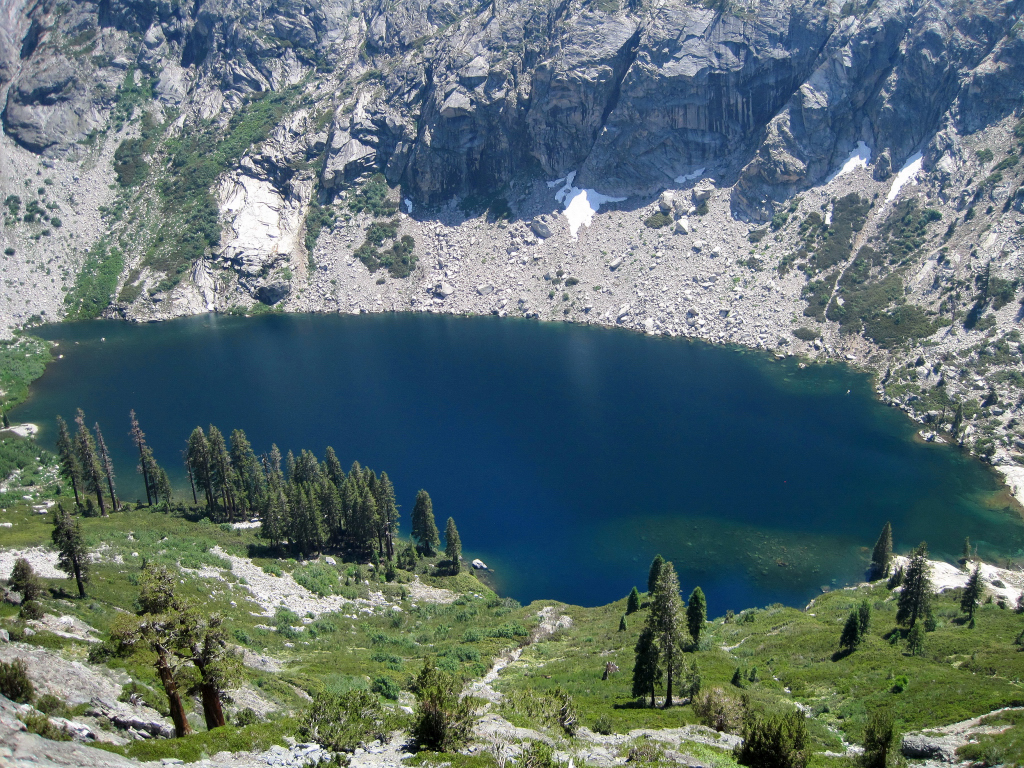
Pear Lake

Pear Lake


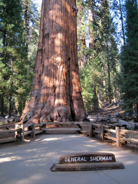
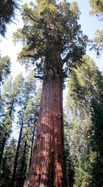
General Sherman Tree... largest tree in the world and between 2,300-2,700 years old.
-
Thanks! I added a short video/photo compilation to the trip report. This is indeed a spectacular area of lakes and granite.
QITNL: Nice to meet you! Your photos are fantastic and it clearly looks like you are using a better camera. Next time I hope to continue down to Benson Lake as part of a much larger loop. I bet those aspens on the way to Barney Lake will have awesome fall color in a couple weeks.
-
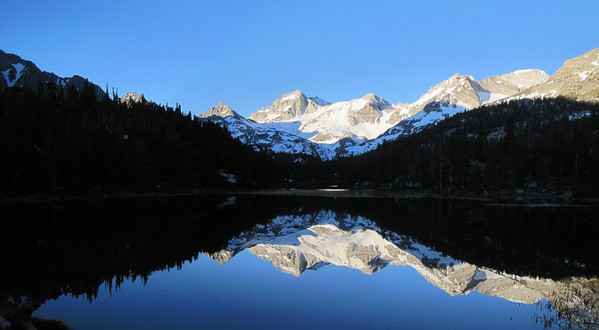
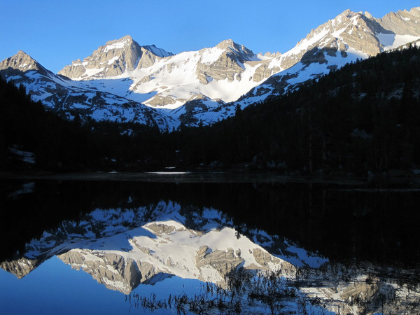
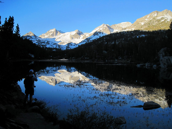
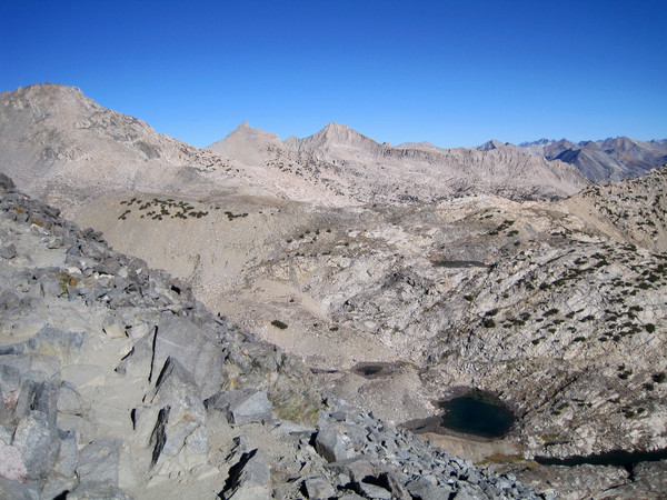
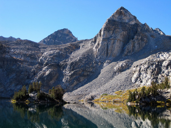
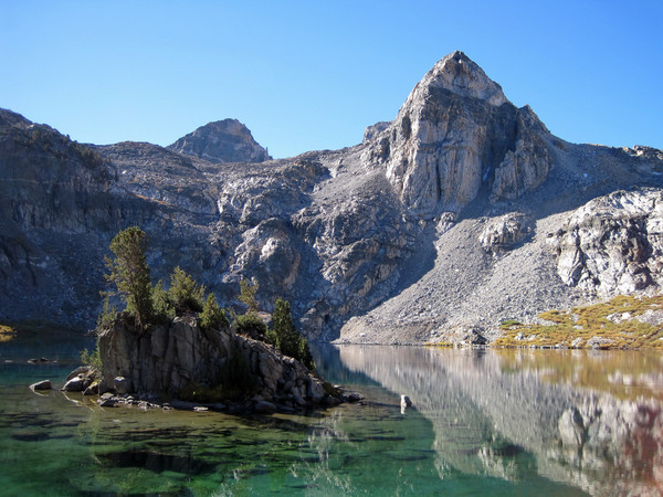
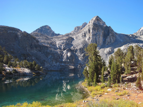
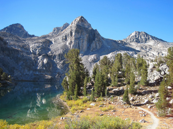
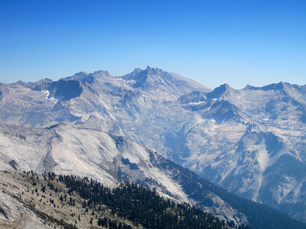
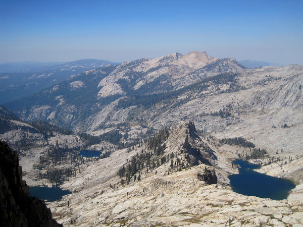
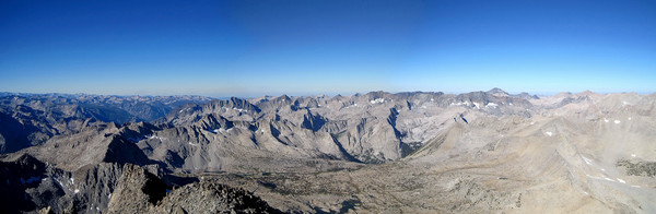
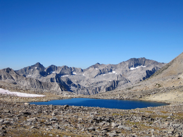
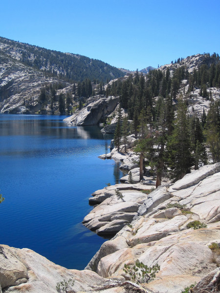
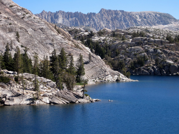
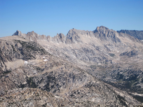
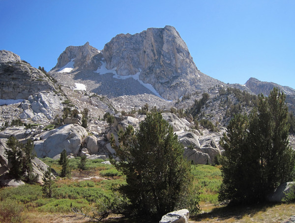
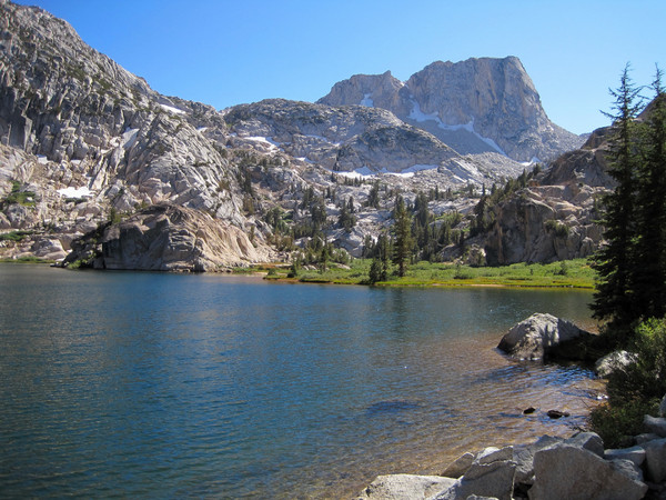
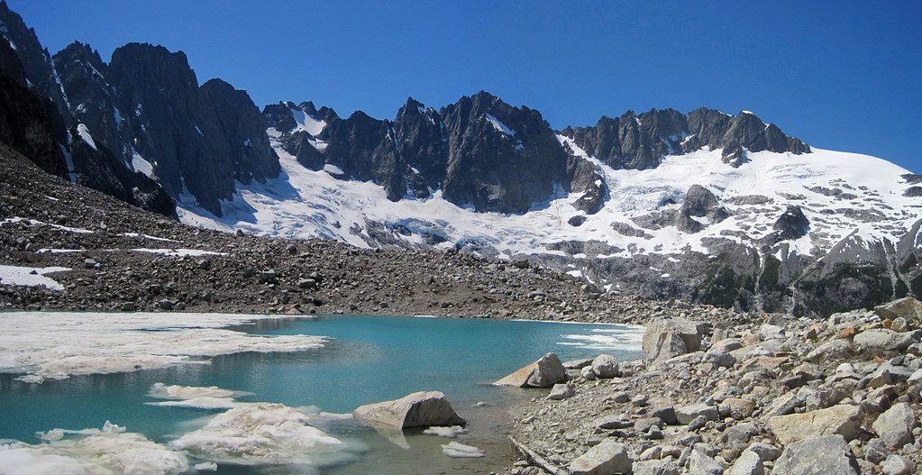
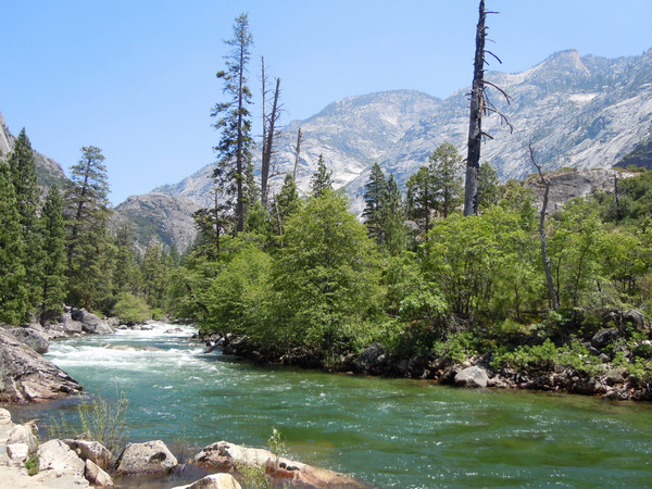
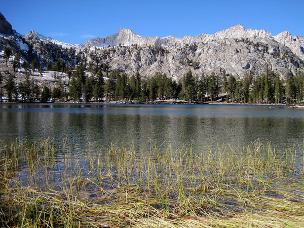
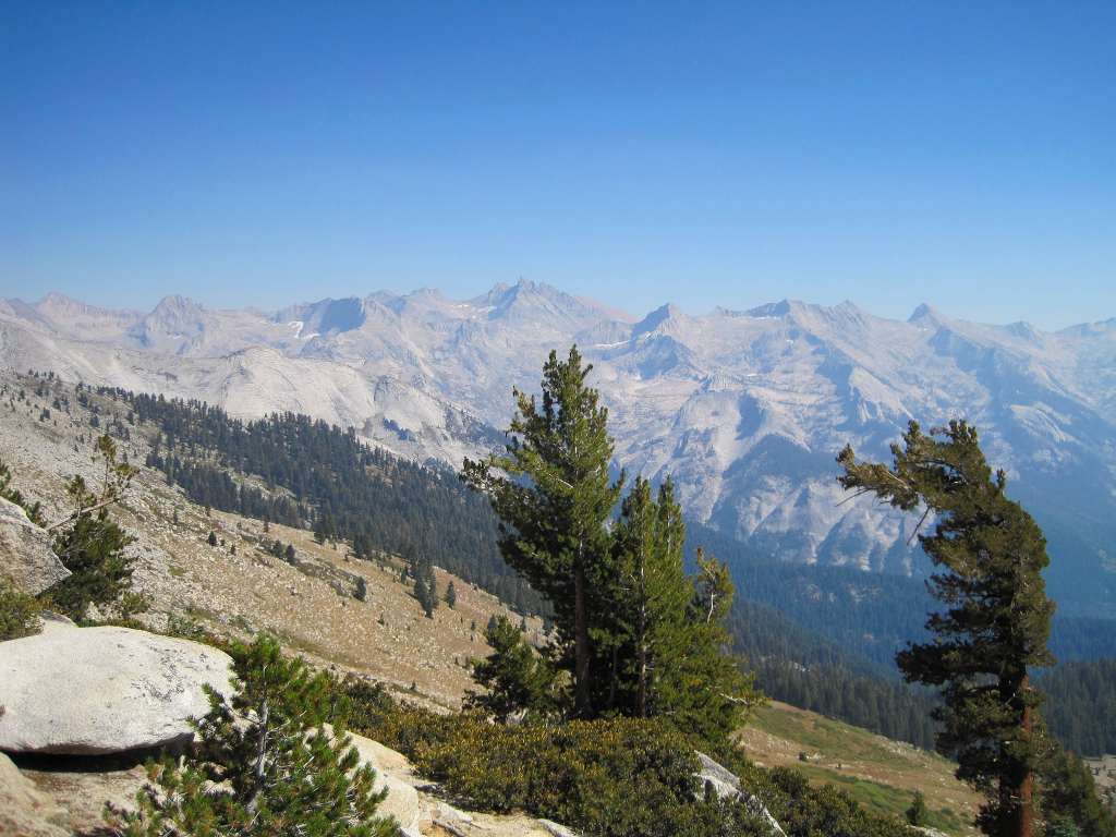
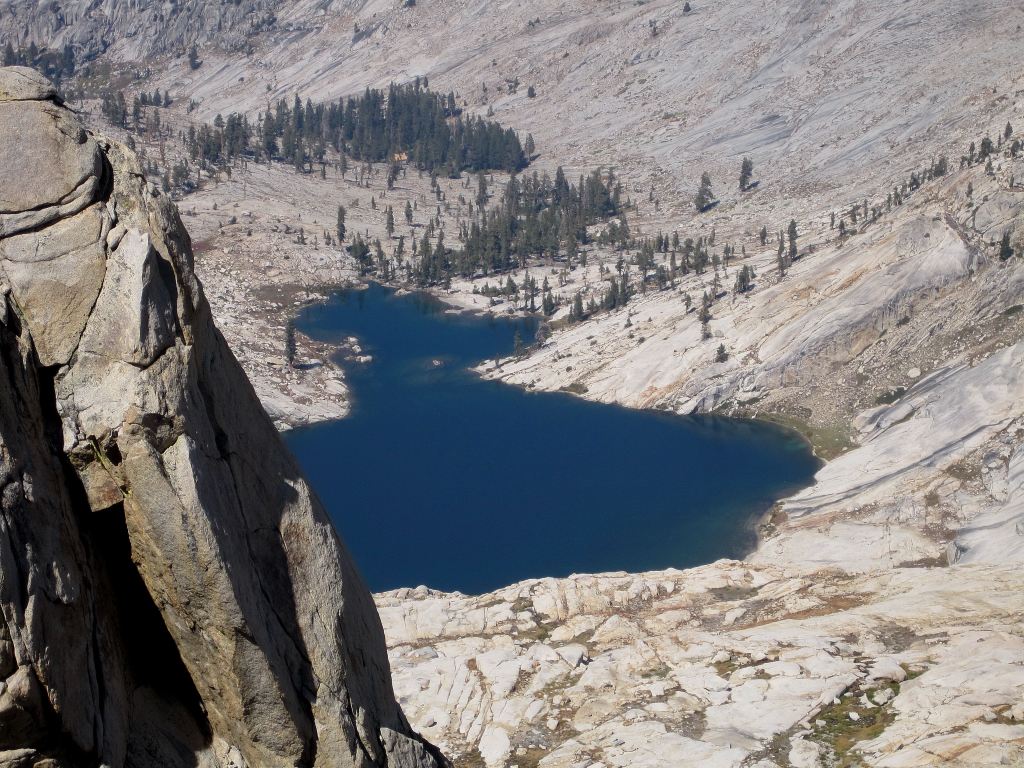
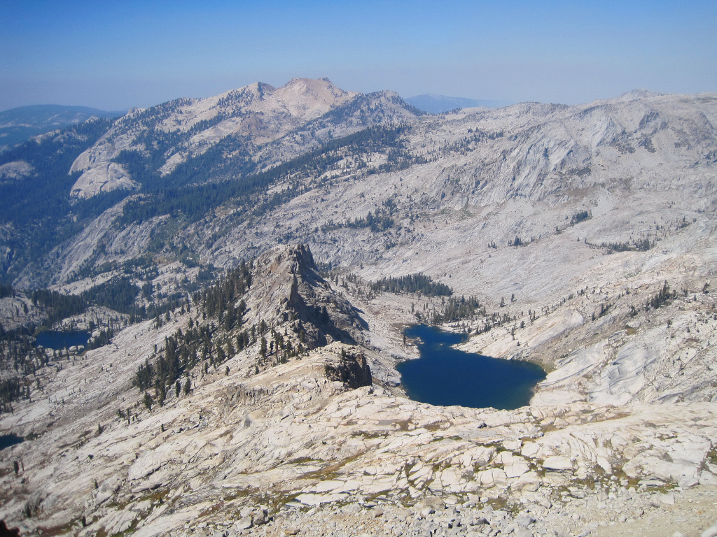
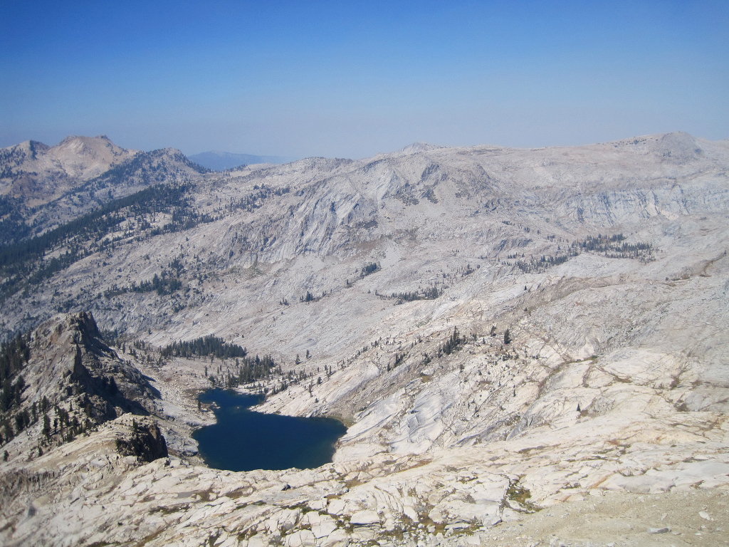
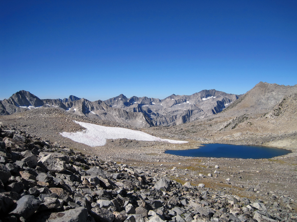
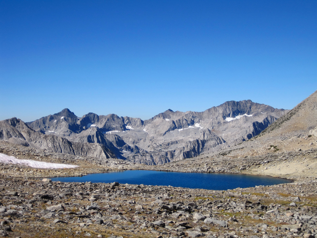
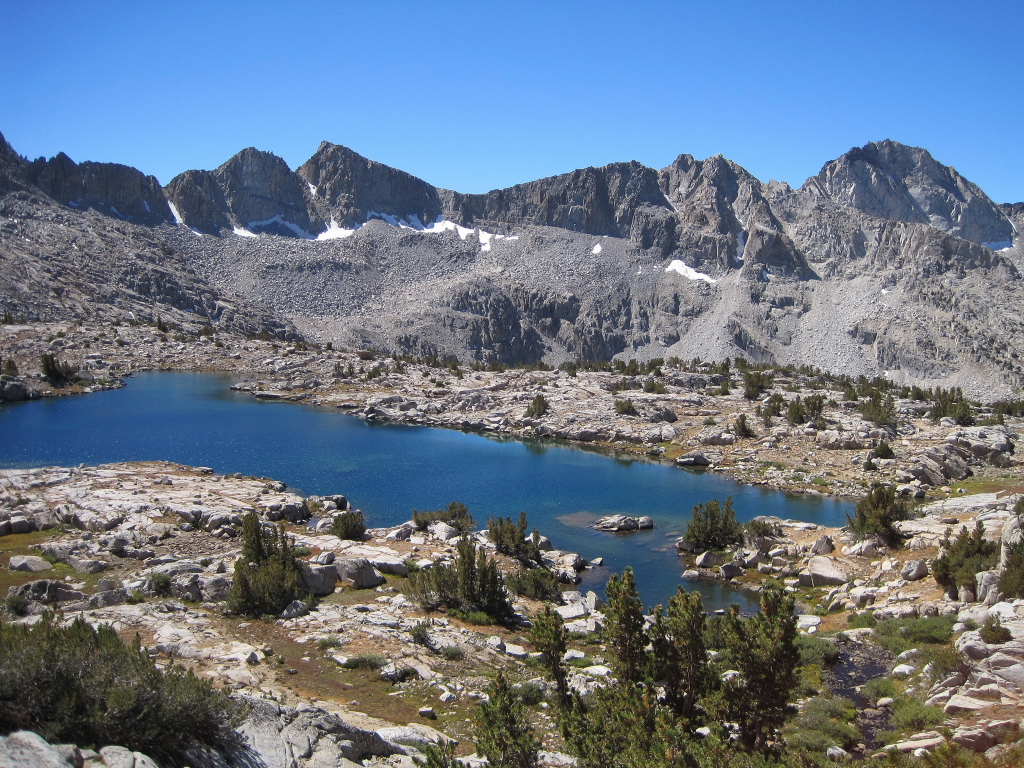
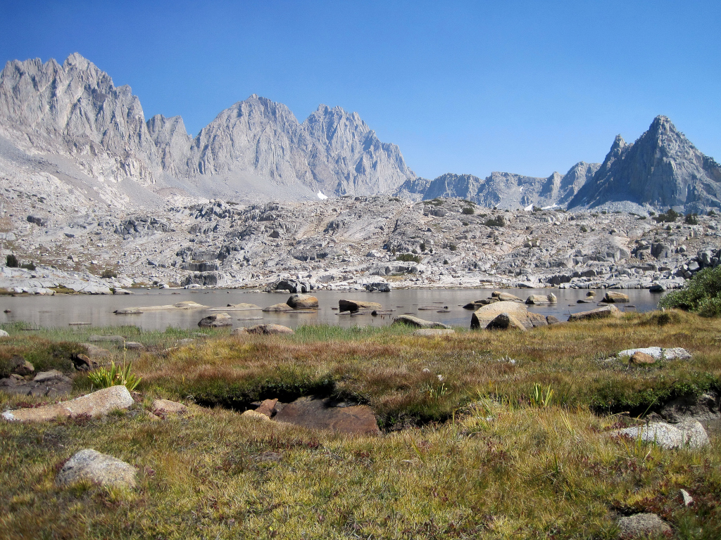
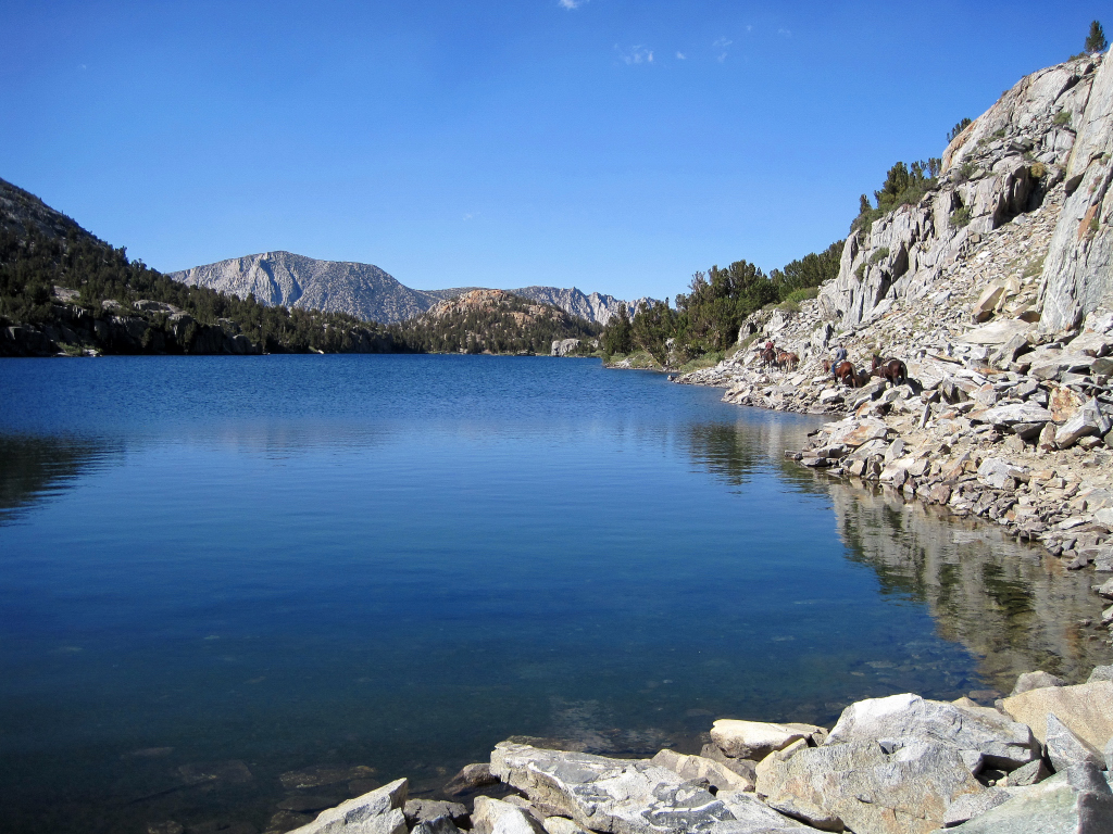
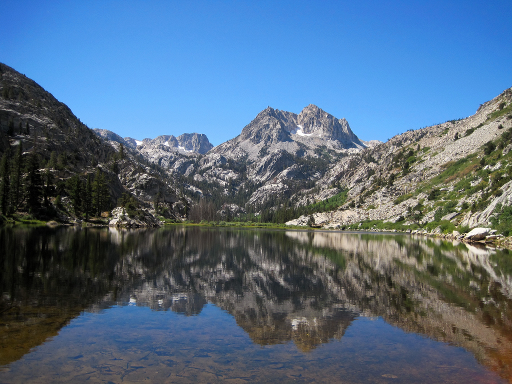
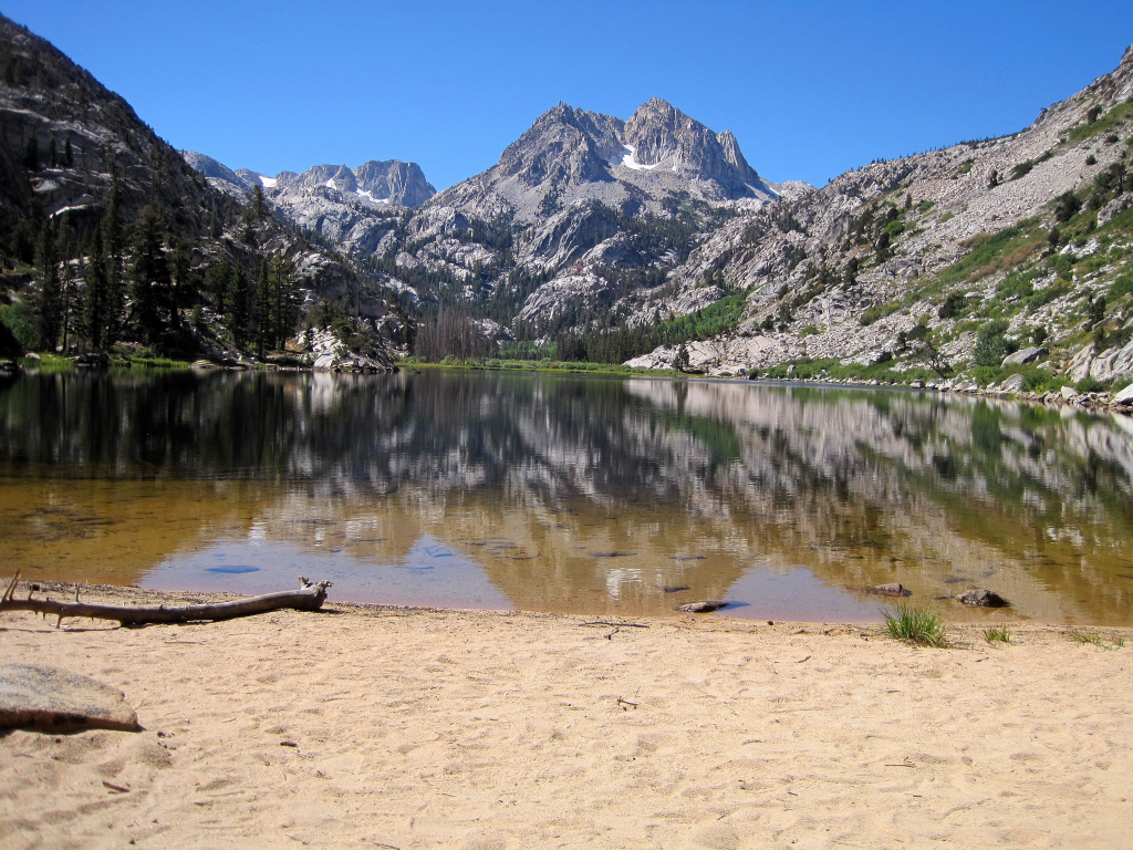
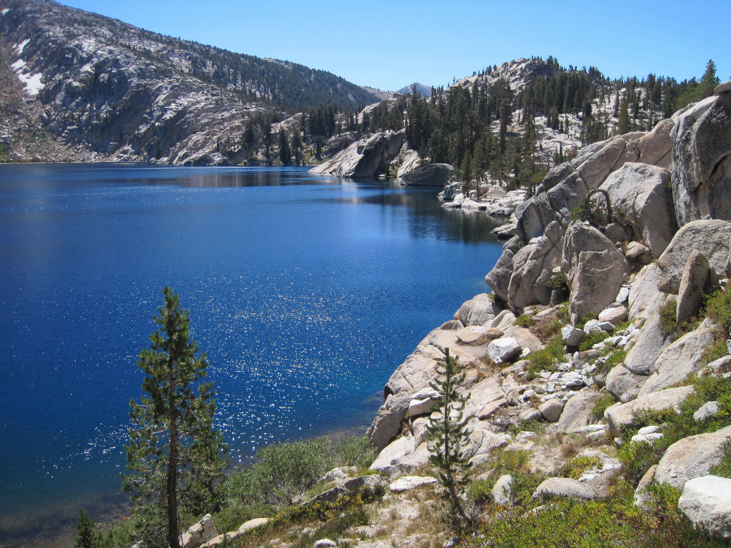
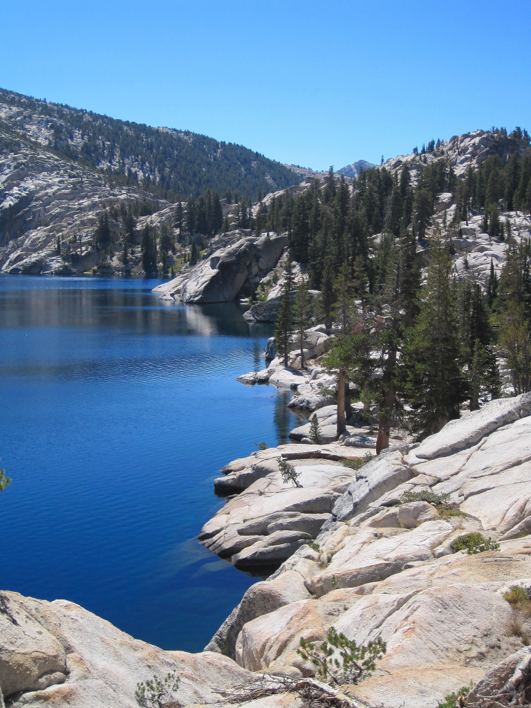
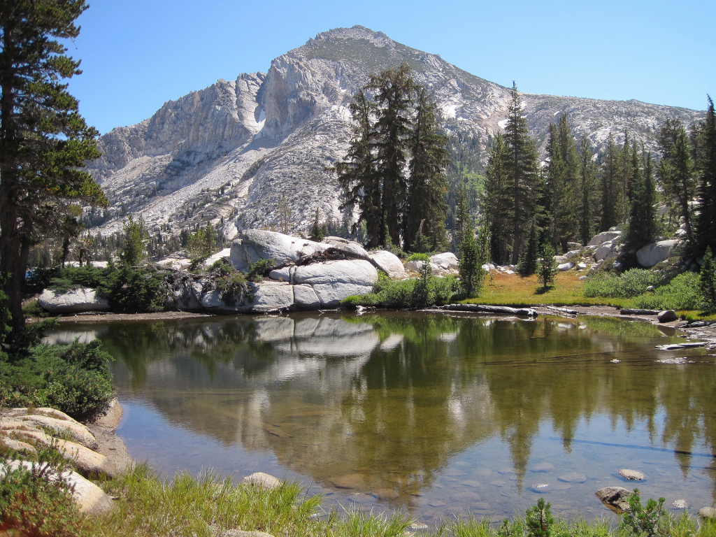
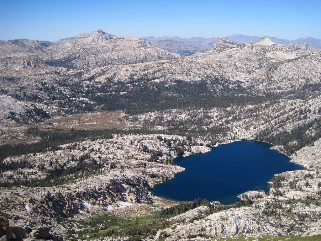
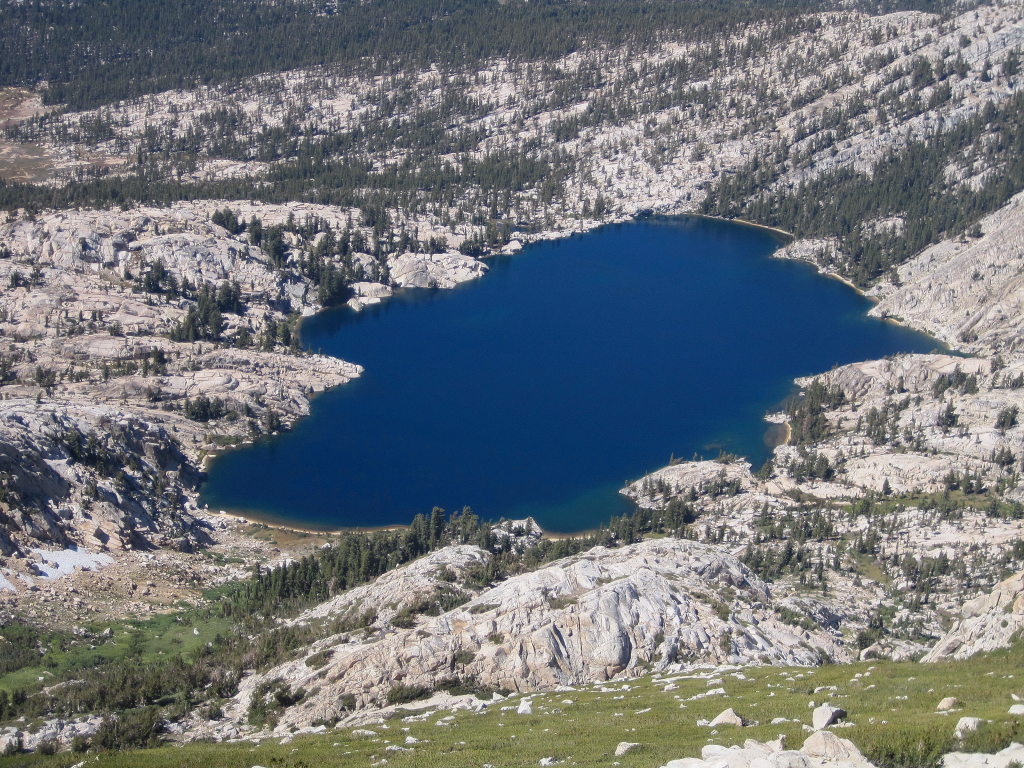
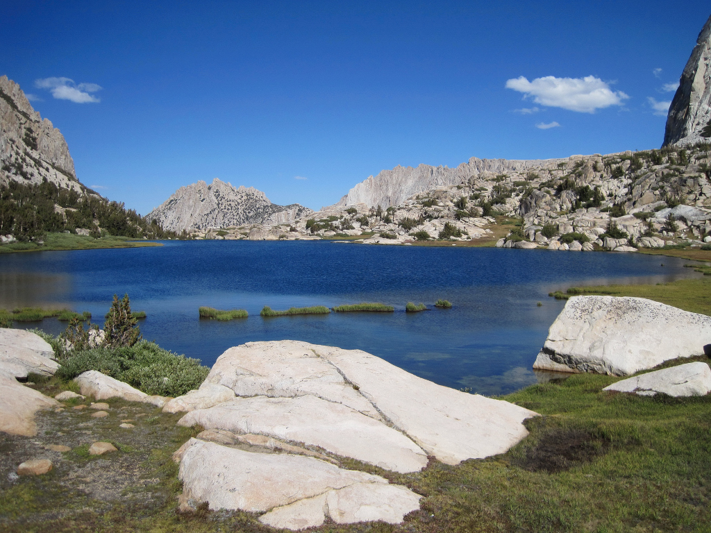
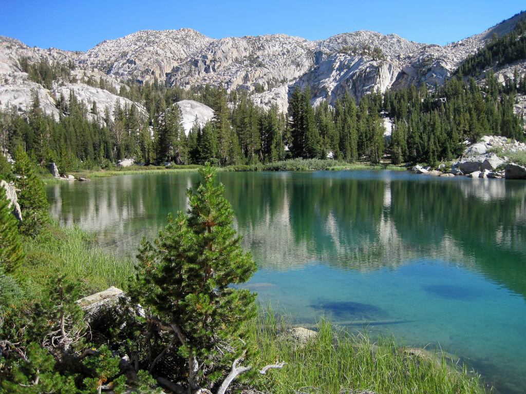
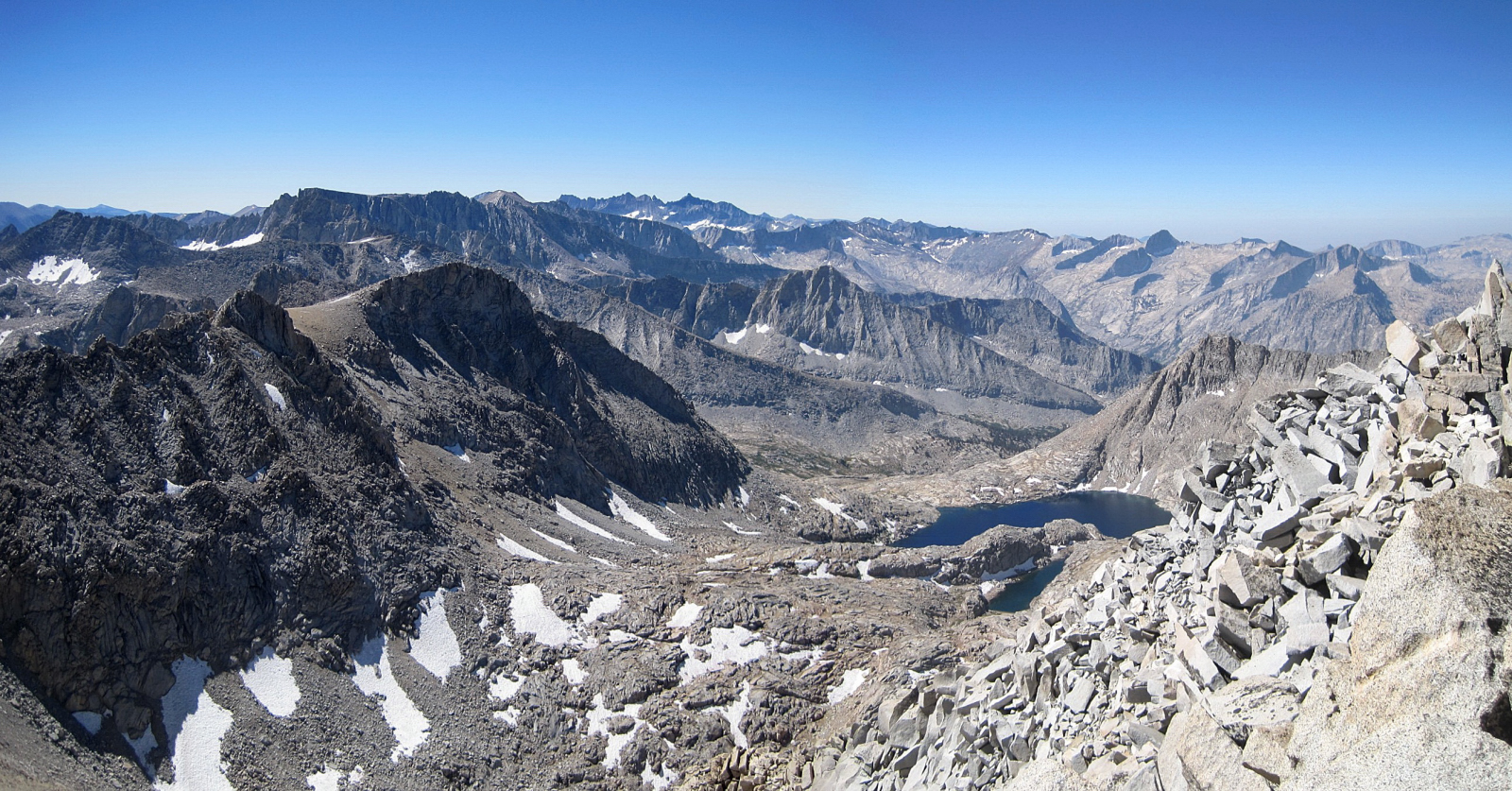
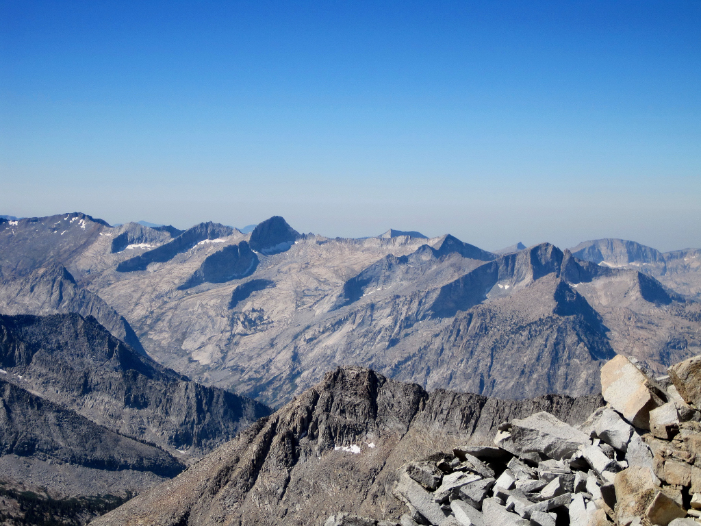
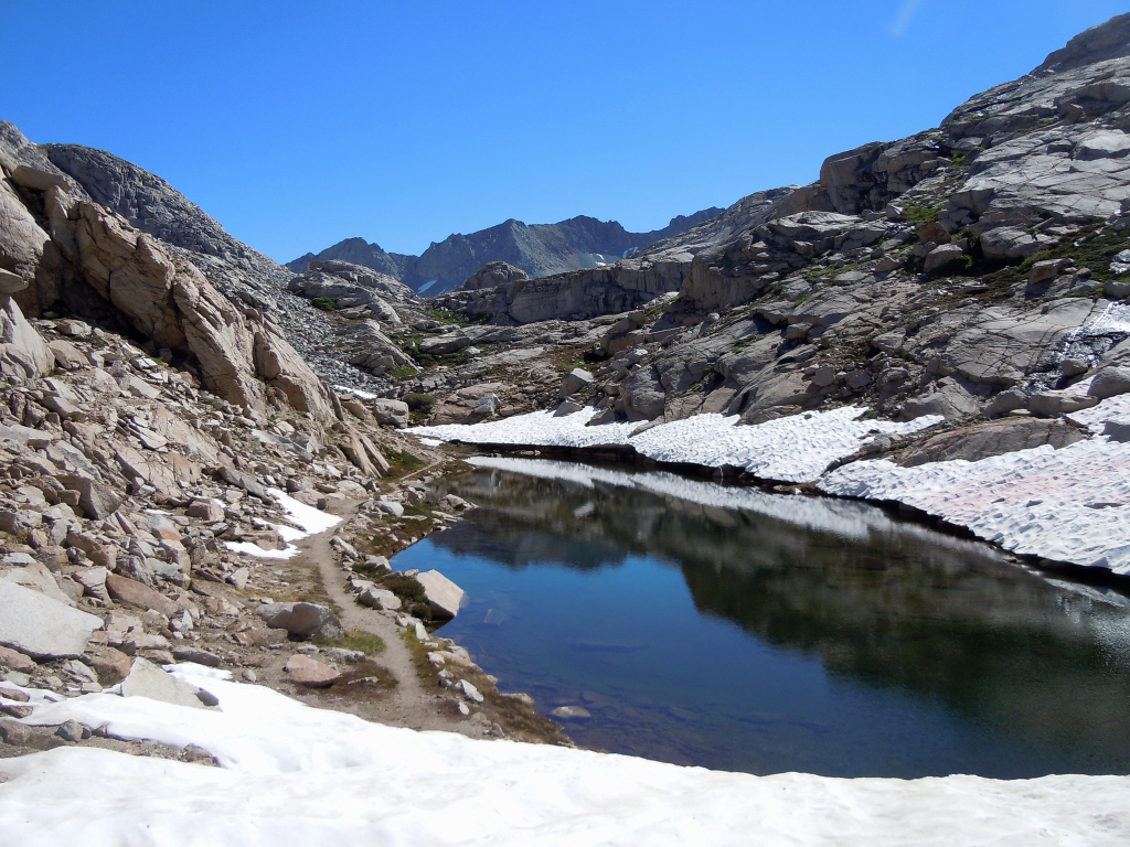
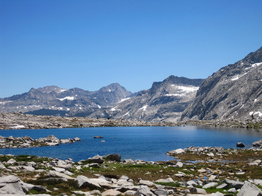
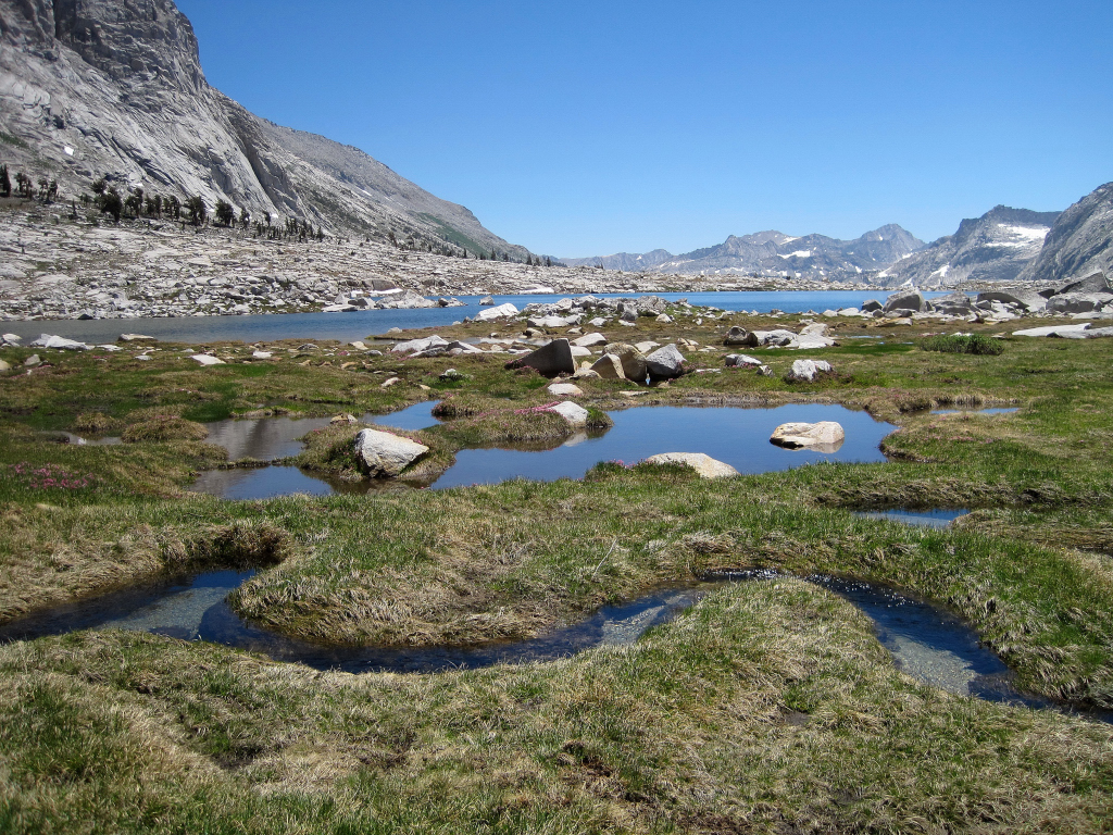
Trip: Mount Agassiz & Columbine Peak - Bishop Pass & Dusy Basin
Date: 9/12/2010
Trip Report:
[video:youtube]
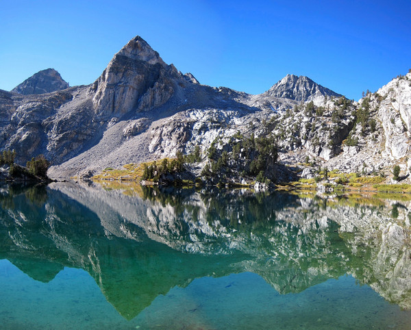
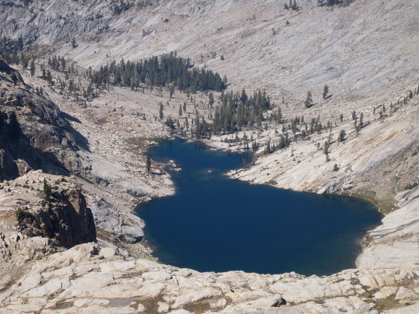
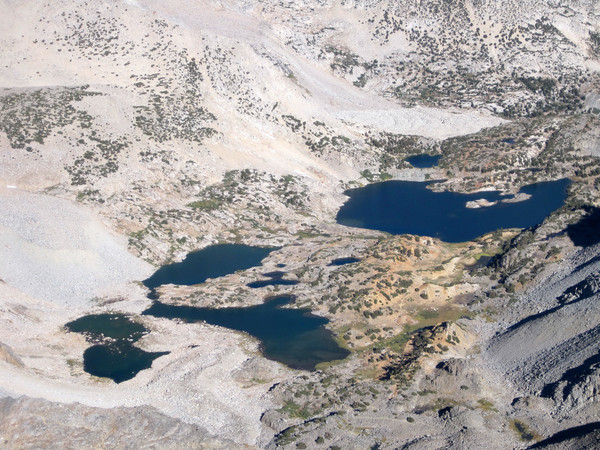
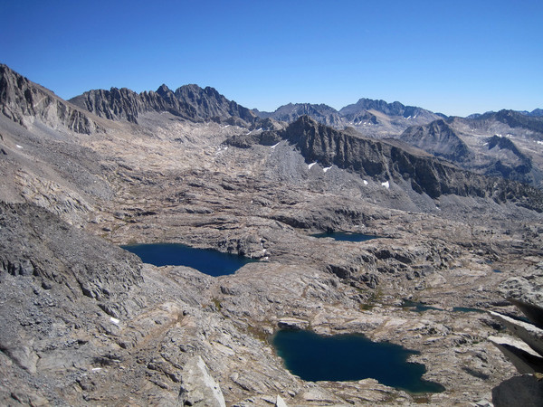
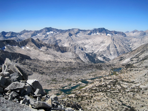
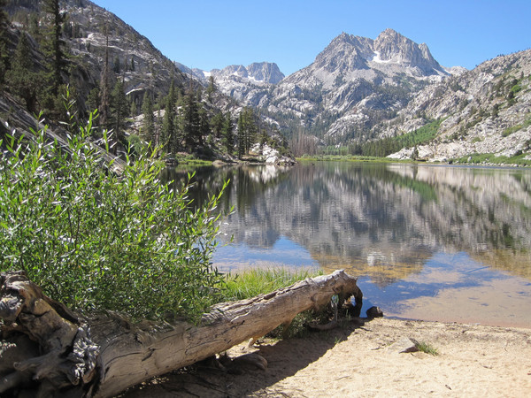
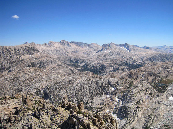
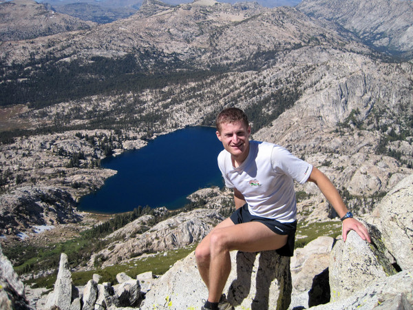
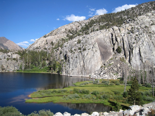
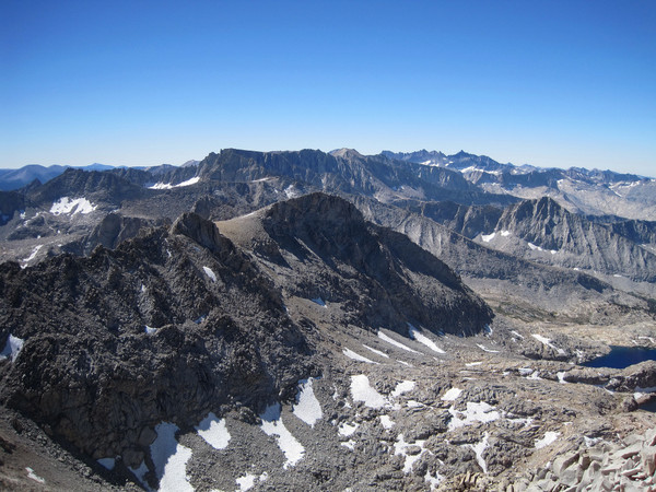
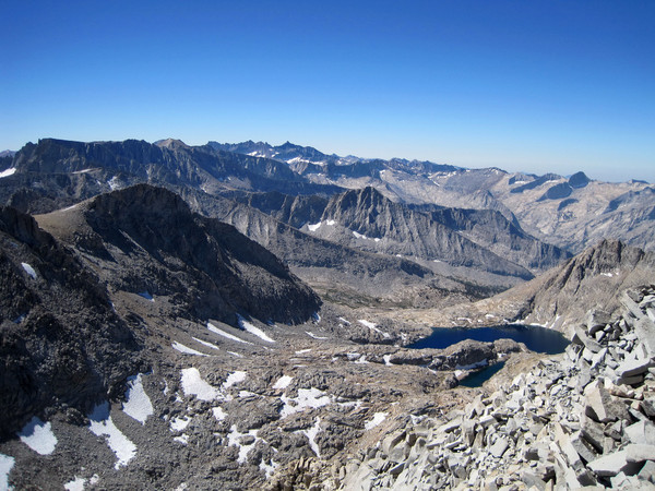
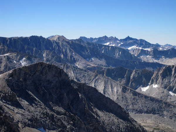
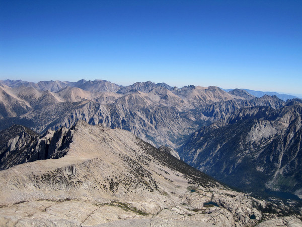
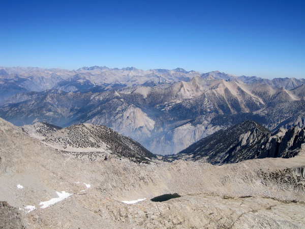
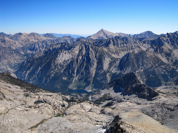
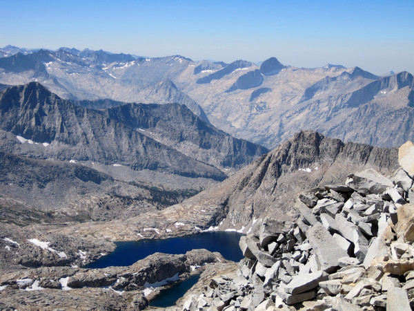
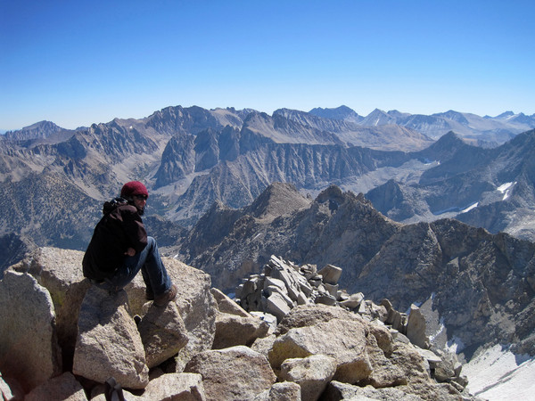
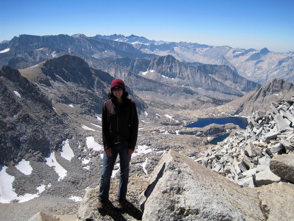
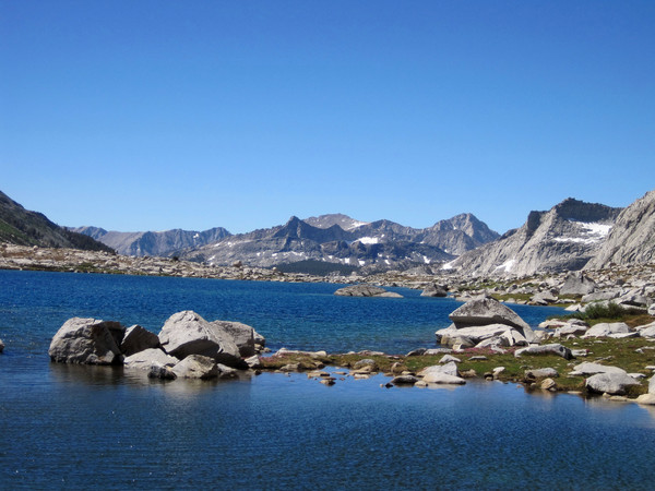
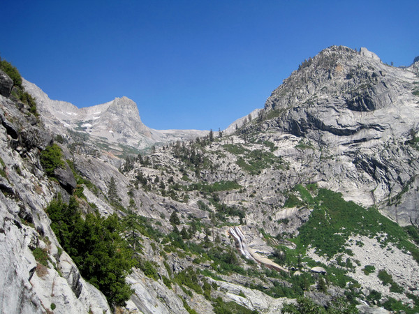
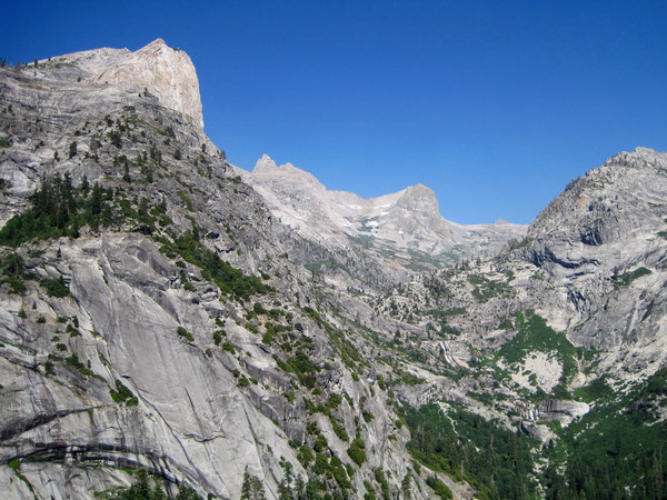
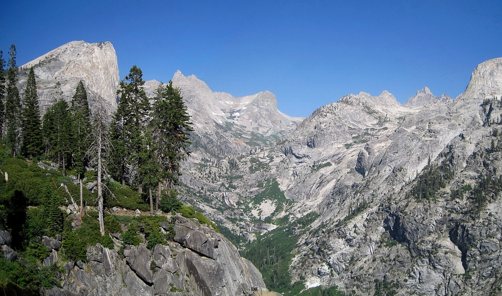
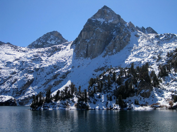
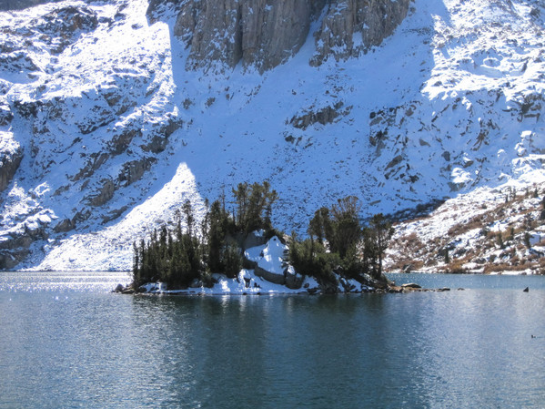
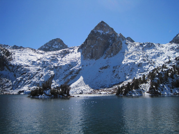
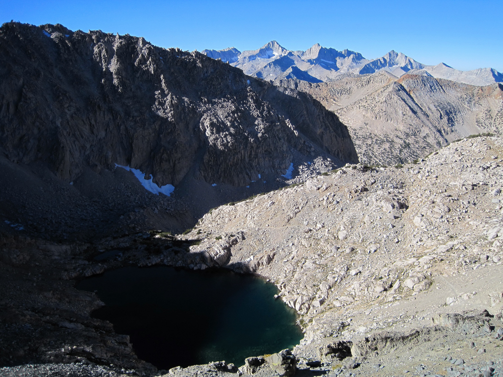
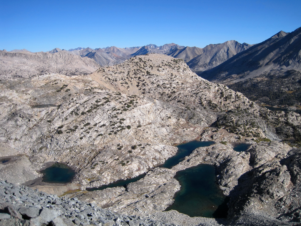
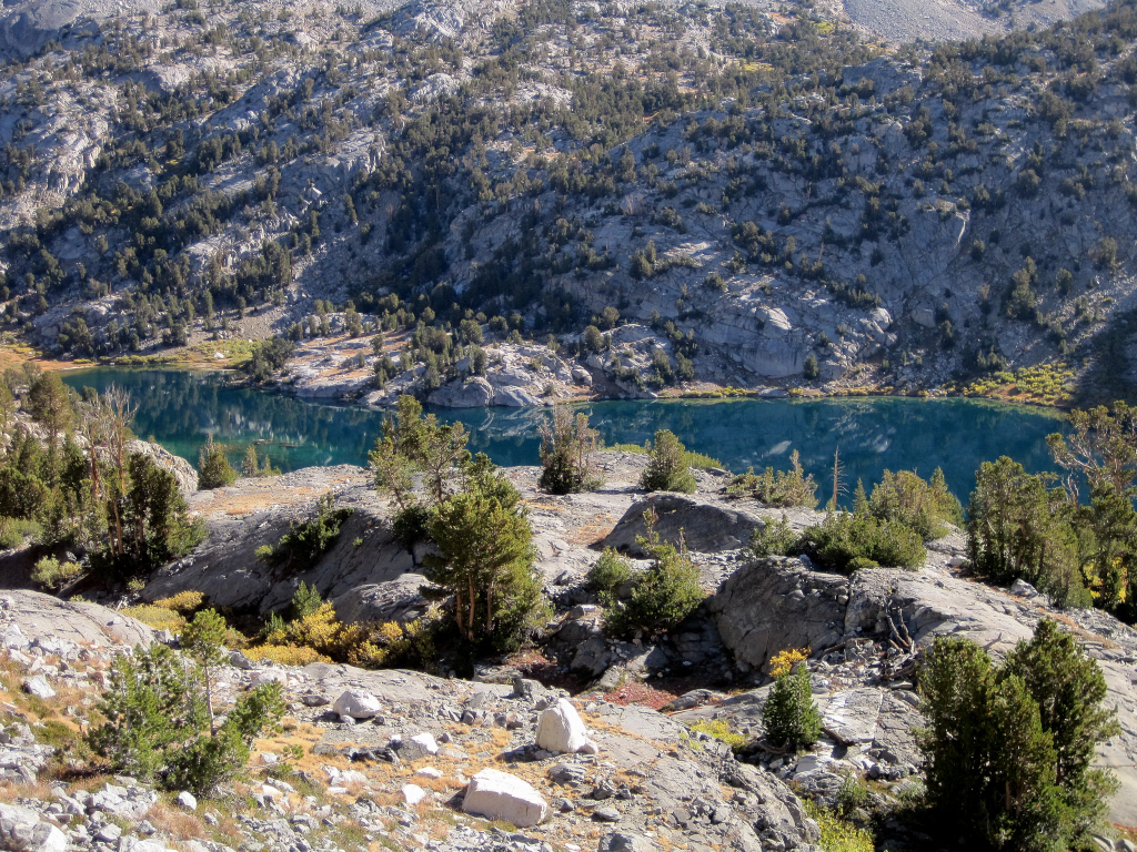
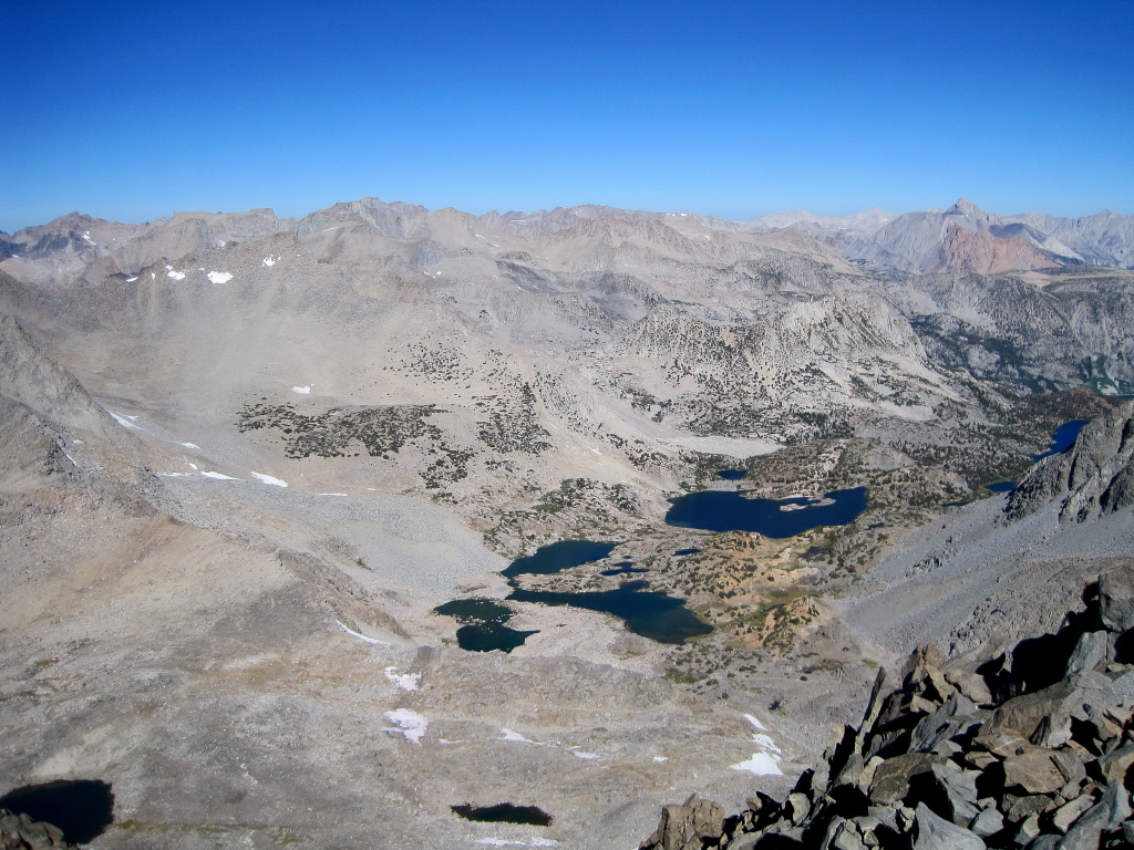
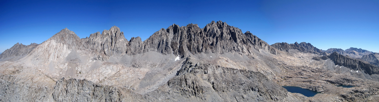
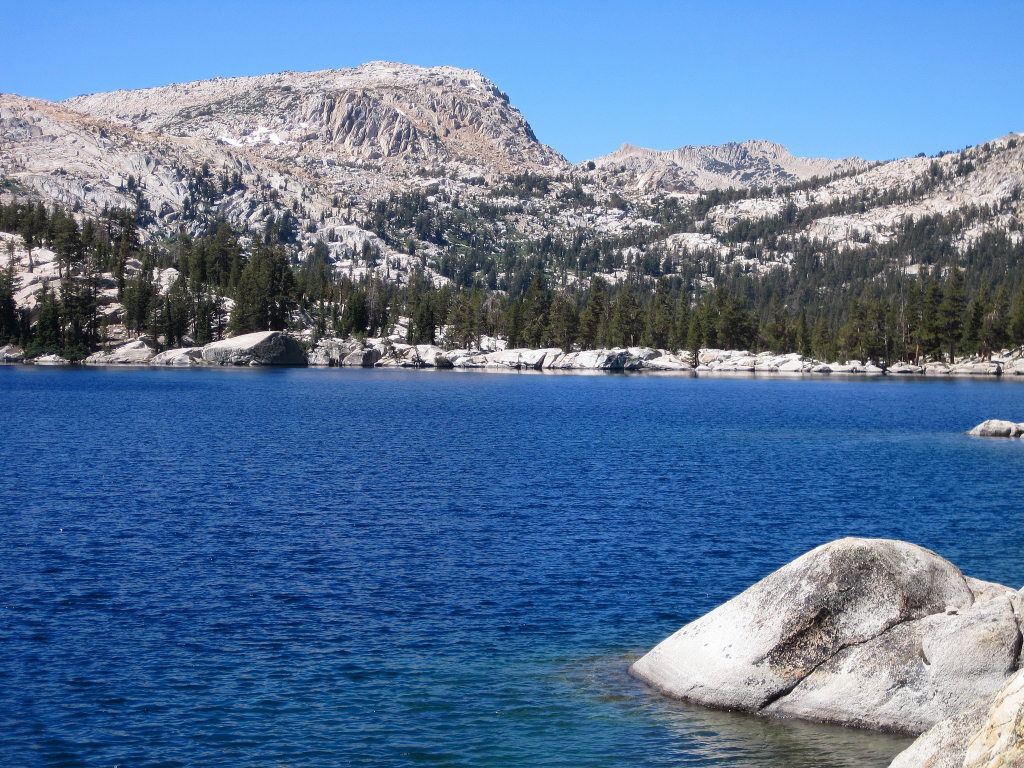
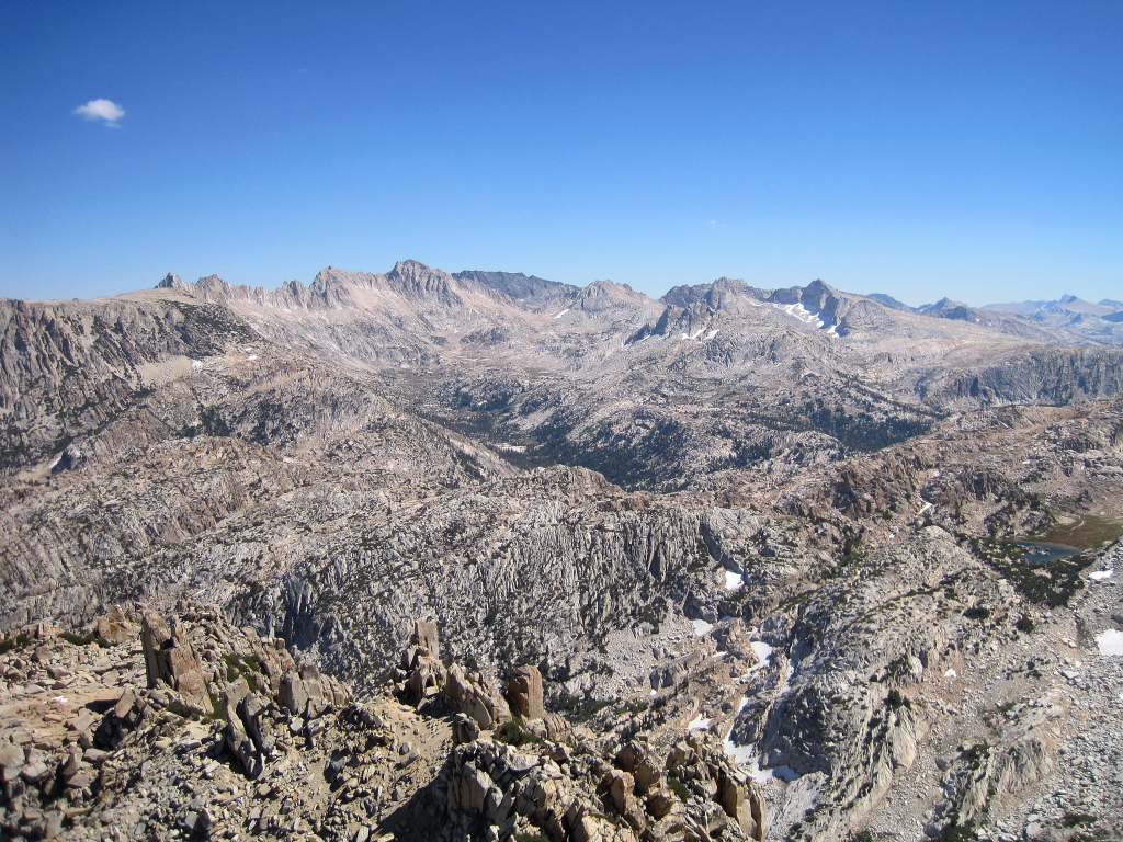
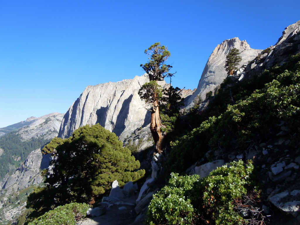
I have been to the Palisades twice before but never via South Lake so I figured this would be a great opportunity to see Bishop Pass and Dusy Basin. I started at around 6:30 am and headed up the nice trail, coming across spectacular reflections in the tarns near Long Lake. I continued up through more lakes and then the final switchbacks up to the pass. From the pass, I headed up the talus slopes to the summit of 13,891 ft Mount Agassiz. The talus was not very loose helping to make relatively fast time up the slope, arriving at the top 2:40 after beginning at South Lake. I spent nearly an hour on the summit snapping photos and chatting with a couple from Bishop who arrived at the summit 30 minutes after me. The views in the morning sunlight were amazing! Eventually, I got going again and made quick time back to Bishop Pass and then into Dusy Basin. Part of the appeal of climbing Columbine Peak is the traverse across Dusy Basin, famous for its alpine lakes with views of the sheer walls of Mount Winchell, Thunderbolt Peak, and North Palisade towering above. I picked a route across the Basin and took many photographs of the lakes near Isosceles Peak which is aptly named. I continued on through boulders and slabs to Knapsack Pass where I began the climb up Columbine Peak. I went up the arete directly from Knapsack Pass which proved to be more difficult than the advertised class 2/3 climbing for a sustained period (almost until the summit). I found out on the descent that the easier route is on the south side of the ridge, but some class three climbing is still unavoidable. To get to the easier route, follow a use path around the base of cliffs towards Barrett Lakes/Palisade Basin from Knapsack Pass. At the point where a gully is crossed begin heading up and the easier route is apparent (gravel and talus). Taking this route on the way down saved some time and energy and I was happy to not have to down climb some of the sections I had done on the ascent. Columbine Peak features the best view of the west side of the Palisades subrange and great views of other surrounding peaks, Palisade Basin, and Dusy Basin. The return trip through Dusy Basin was just as spectacular and I stopped to take many photos. Once atop Bishop Pass I jogged the remainder of the way back to the trailhead at South Lake, arriving 9:26 after beginning. This is a fantastic area and I hope to return soon for more photography, climbs, and adventure runs.

Mount Goode reflecting in tarn


Mount Goode and Long Lake
View Northeast from Mount Agassiz

View Northwest from Mount Agassiz
View Northwest
Mount Sill (left), North Palisade/Thunderbolt (center), and Mount Winchell (right)


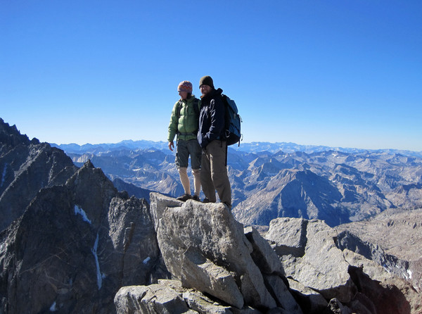


Summit shot

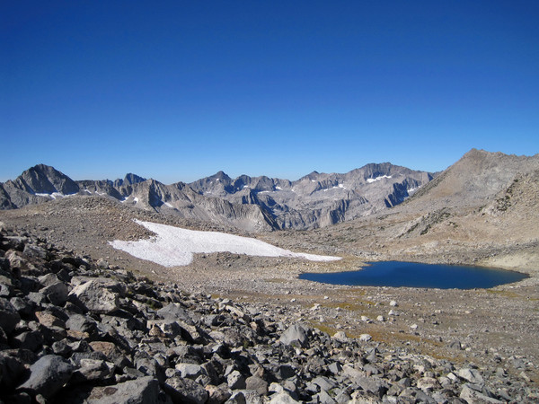
Tarn near Bishop Pass
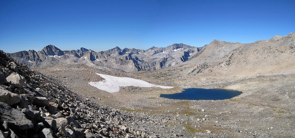
Tarn near Bishop Pass

Descending into Dusy Basin

Spectacular setting in Dusy Basin

View of Dusy Basin from Columbine Peak


Winchell
Thunderbolt and North Palisade
Norman Clyde Peak and Middle Palisade
Palisade Basin and Barett Lakes

Palisades from Columbine Peak

Isosceles Peak (left) and Columbine Peak (right)


Towering Palisades above Dusy Basin
Mount Agassiz

Long Lake
Long Lake and Mount Goode
-
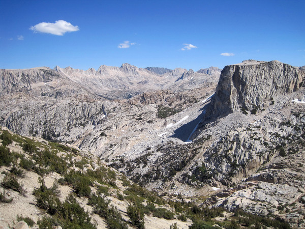
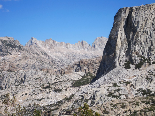
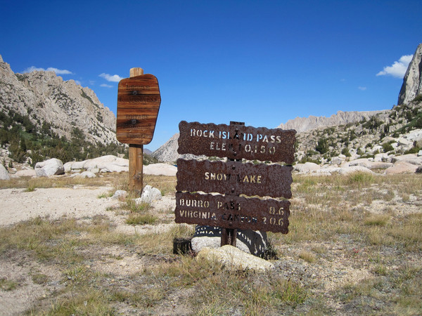
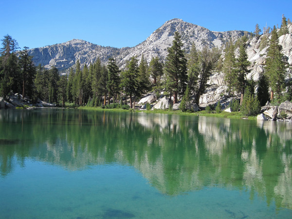
Trip: Crown Point - Peeler Lake & Rock Island Pass
Date: 9/11/2010
Trip Report:

[video:youtube]
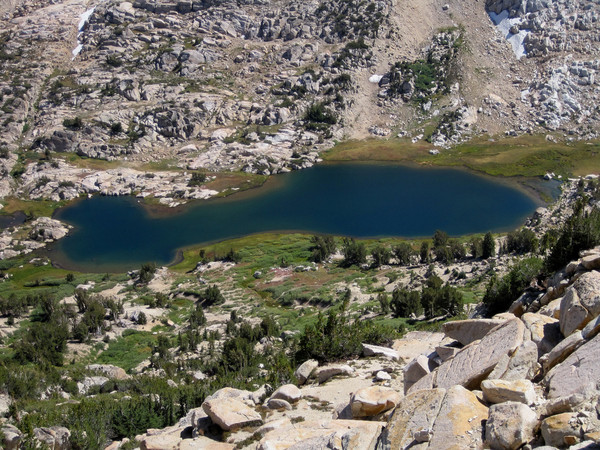
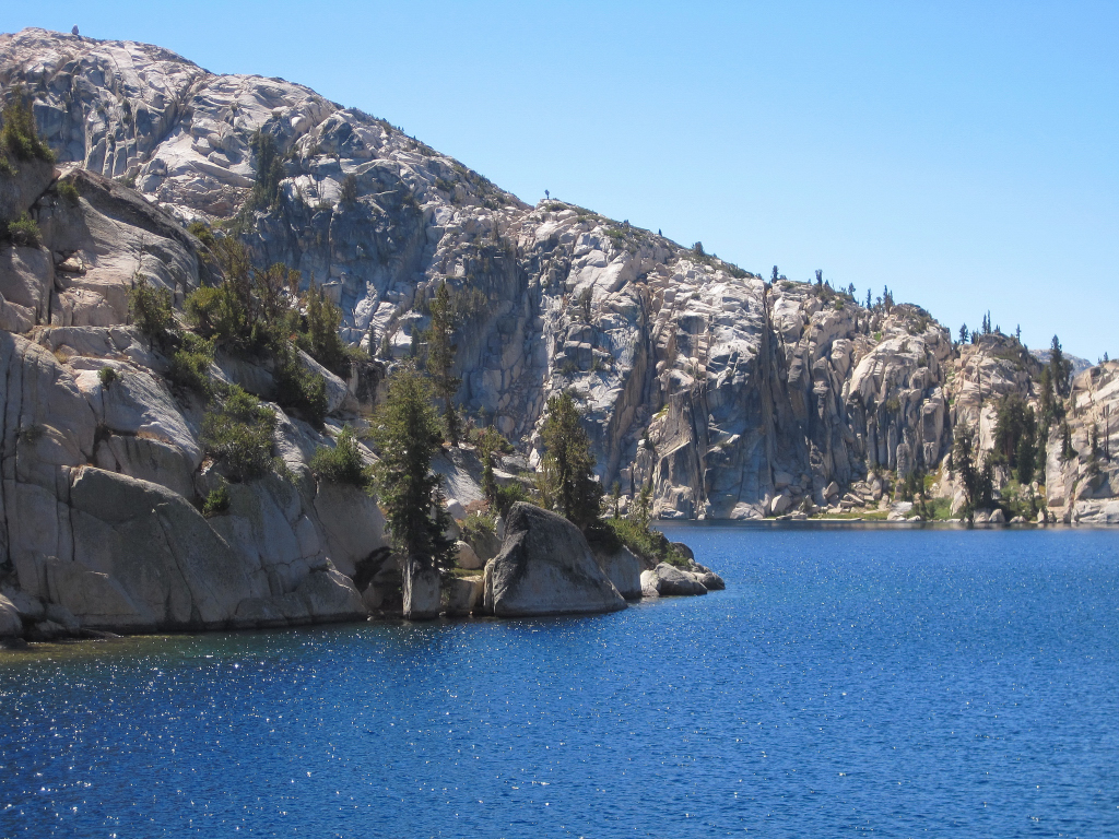
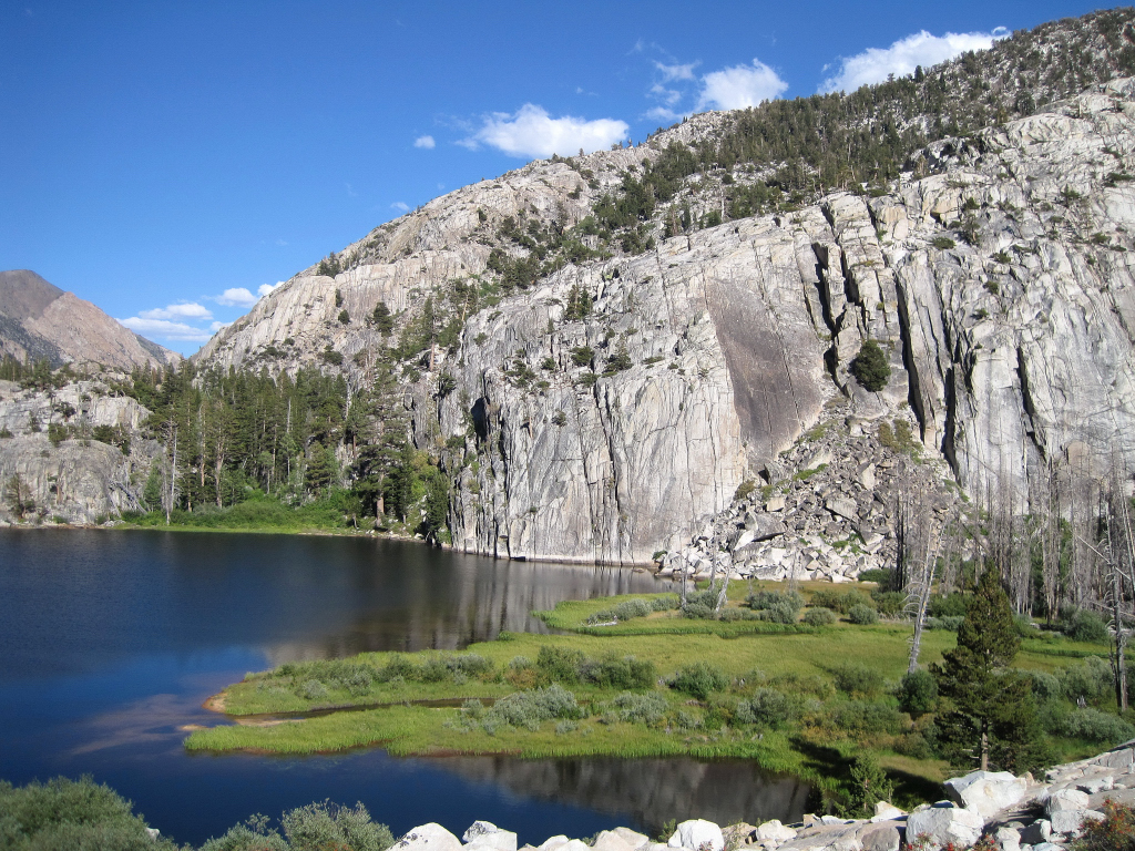
Crown Point (11,346 ft) is located in Northern Yosemite and has a commanding 360 degree view of the surrounding region, including Sawtooth Ridge and Matterhorn Peak. Access is via Twin Lakes and the Hoover Wilderness. There are numerous lovely alpine lakes set amidst Sierra granite. Peeler Lake, with a sapphire blue color, is located on the Sierra Crest with dual outlets on either side - one flowing to the Great Basin and another to the Pacific Ocean via the Tuolumne Watershed/Hetch Hetchy. I took the trail to Peeler Lake and then headed cross country traversing around the granite shores and then ascending the north slopes of Crown Point. Crown Point has great views of Tower Peak, Kerrick Meadows, Sawtooth Ridge, and the deep blue Peeler Lake. From the summit I descended towards Rock Island Pass where I picked up the trail. The Rock Island Pass trail passes through a magical basin of lakes ranging in color from blue to teal. Total mileage was about 21 miles in 6:45.

Incredible Hulk

Barney Lake with Crown Point

Alpine Beach!


Peeler Lake


Crown Point from Peeler Lake


Kerrick Meadows from Crown Point

Sawtooth Ridge


Sapphire blue of Peeler Lake

Snow Lake


Crown Lake


Incredible Hulk
-
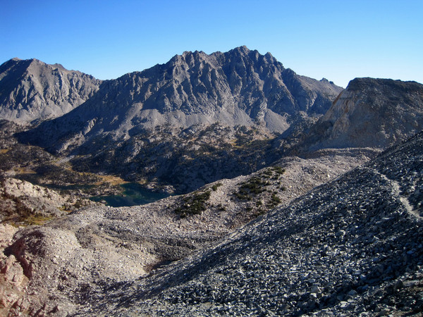
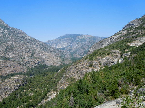
Trip: Mount Brewer - Northwest Slope
Date: 9/5/2010
Trip Report:

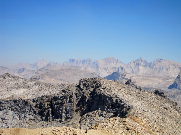
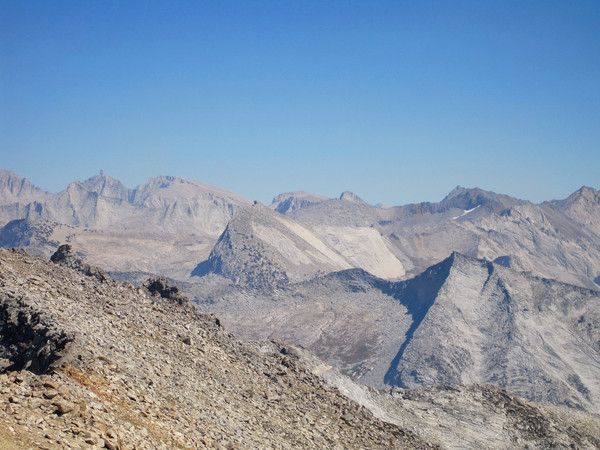
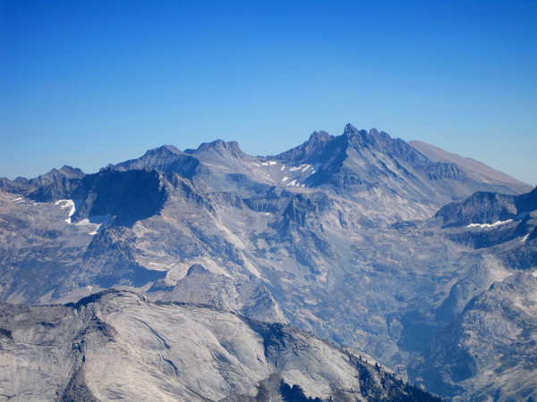
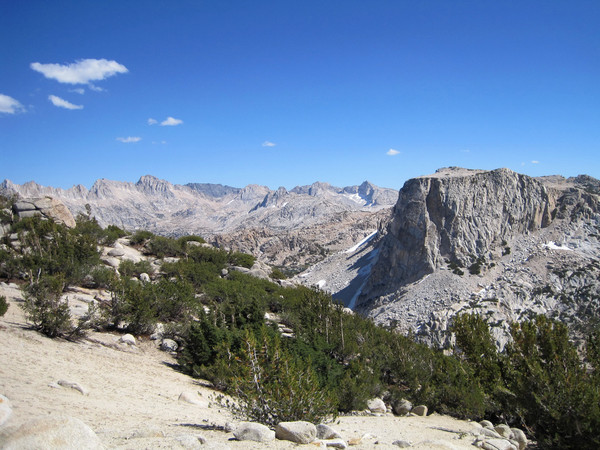
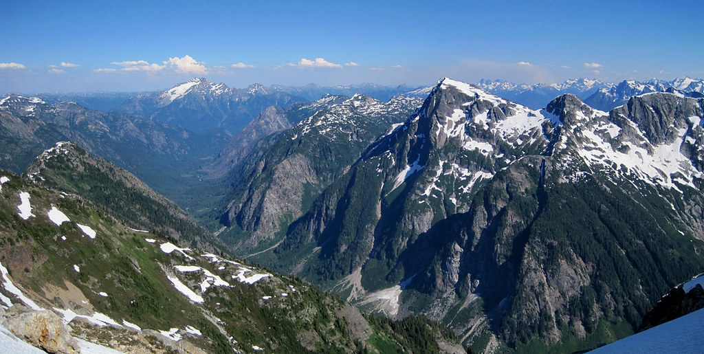
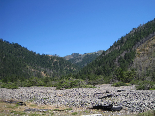
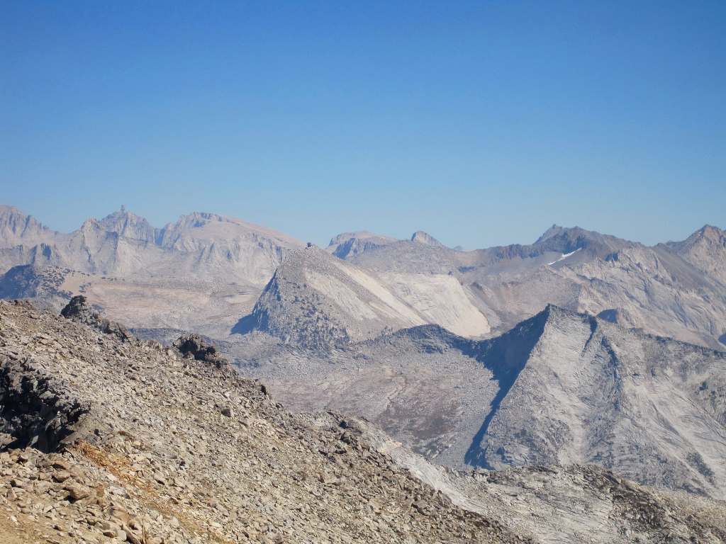
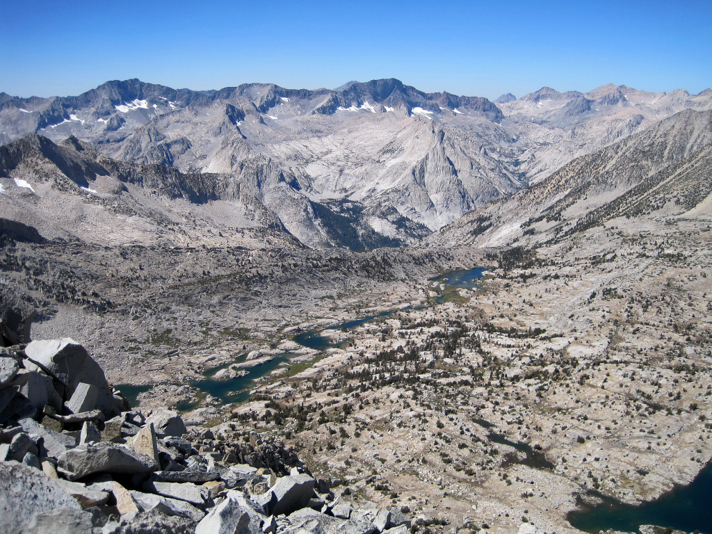
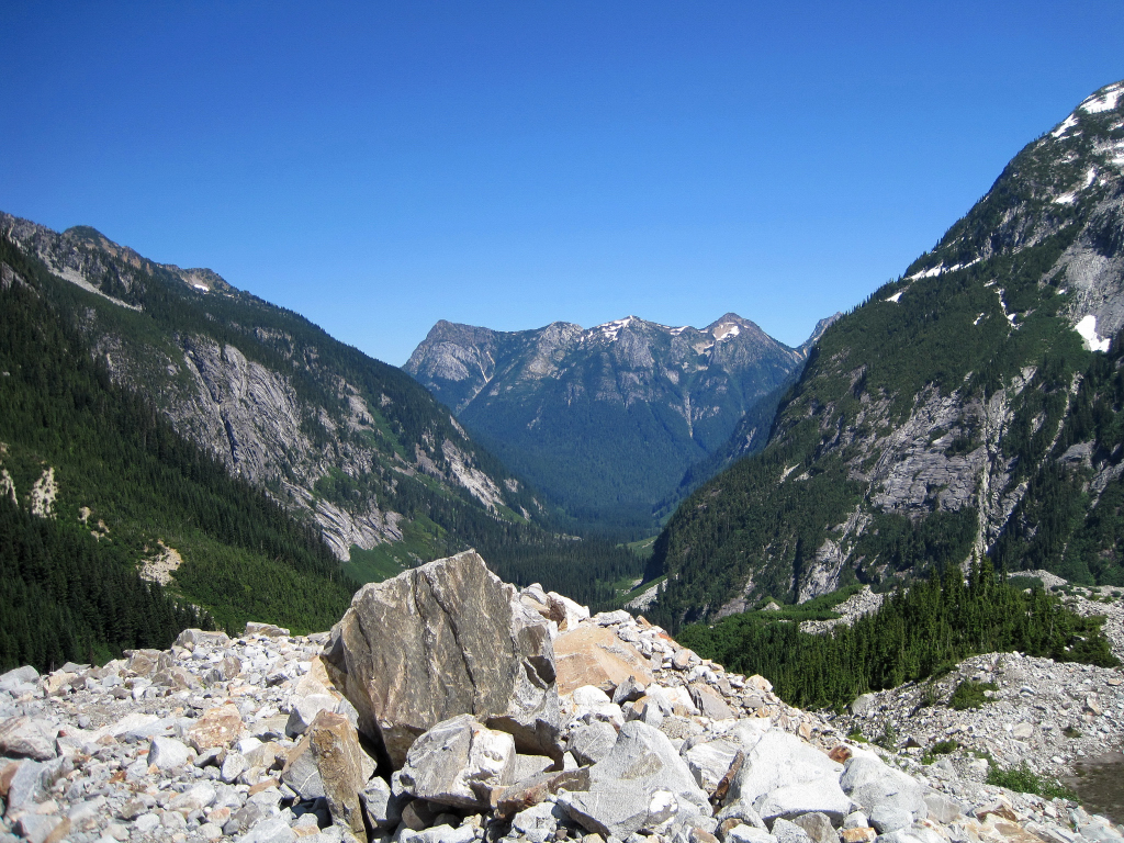
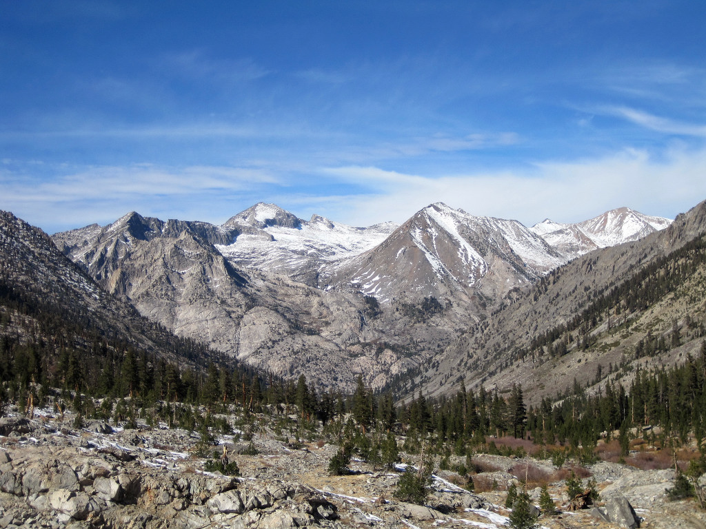
Mount Brewer is an impressive peak located on the Great Western Divide in Sequoia-Kings Canyon National Park. Due to its location west of the crest, the summit provides amazing views of the Southern High Sierra including Mount Whitney, the Palisades, the Kaweahs, the Kings-Kern Divide, and the Great Western Divide. Likewise, its prominent summit is easily recognizable from many points in the region. The elevation gain from the nearest trailhead, Road's End at Cedar Grove in Kings Canyon, is impressive with the starting altitude at 4,600 ft and the summit at 13,570 ft. The climb entails about 7 miles of trail followed by an equal amount of off-trail travel including copious talus hopping. The climb itself is straightforward with mainly class two and three scrambling. The roundtrip took 12:45 with an hour on the summit to enjoy the gorgeous views, which later became hazy as smoke from the Sheep Fire rose out of Kings Canyon.


Approach Notes:
Sphinx Creek Trail in good shape. Cross country through Sphinx Canyon is reasonable through granite slabs, open forest, and boggy meadow areas. Copious talus on the way to the ~12,000 ft col.
-
Big congratulations Colin! Glad you got the enigmatic West Side

Thanks for the fantastic photography, it looks like you had an amazing adventure.
-
Thanks!
Josh: I'm back in Cali, just came up for some runs.
I added to the trip report the fact that we saw literally hundreds of Western Toads on the Big Beaver Trail. Silent, slow, and slithery. I guess I was so tired I forgot about them... temporarily.
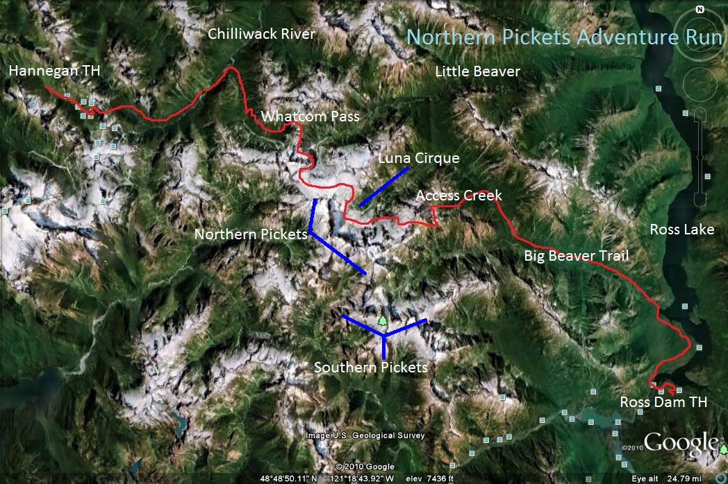
And here is a rudimentary route map I drew on Google Earth.
-
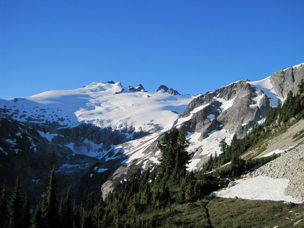
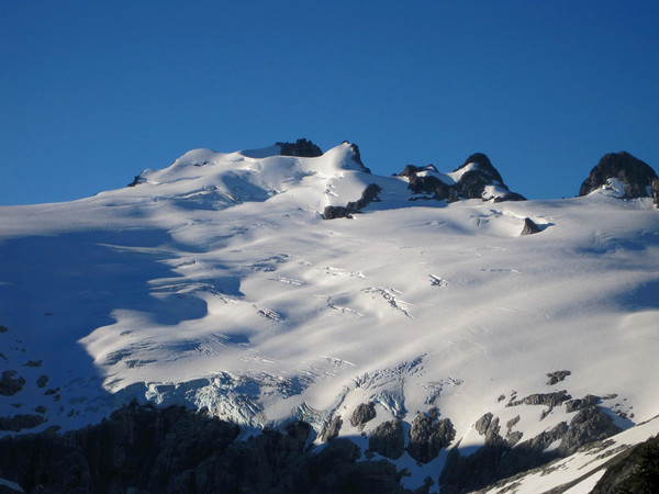
Trip: Northern Pickets Adventure Run - Hannegan to Ross Lake
Date: 7/30/2010
Trip Report:
Colin Abercrombie and I traversed through Luna Cirque in the Northern Pickets in a point-to-point adventure run from Hannegan Pass Trailhead to Ross Dam. Starting at 2:17 am, the trip took us exactly 23 hours to Big Beaver Landing, the typical finish spot. We continued another 7 miles along the Ross Dam Trail to the parking lot for a total distance 47+ miles and nearly 14,000 ft of elevation gain. Colin and I had done this traverse in 4 days in 2005 climbing Whatcom, Challenger, and Luna along the way. In 2008, we did an out-and-back to the summit of Mount Fury via Access Creek. The information we had gathered on these past trips was essential in our attempt to do the entire route in a single day. Weather conditions were idyllic and the timing was great for a trip through Luna Cirque. While travel through the Pickets took longer than expected (doesn't it always?), we did a fantastic job selecting an efficient route and making consistent progress throughout the trip.
We handled the car shuttle logistics Thursday afternoon and got a few hours of rest in the Hannegan Pass Trailhead parking lot. The route began with a 17 mile run and hike to Whatcom Pass (4 hours, 40 minutes) followed by a traverse around the east side of Whatcom Peak. Once on the south side of Whatcom, we utilized a slanting, steep chute to access the Challenger Glacier and then traversed the glacier to Challenger Arm where we enjoyed spectacular views of Luna Cirque. Descending into Luna Cirque was cumbersome in spots, especially crossing deep gullies with traction-less hardpan. Eventually we made it to the bottom of the cirque and began the long climb up to Luna Pass. Utilizing as much snow as possible helped us to reach Luna Pass relatively quickly. Travel through the basin on the south side of Luna was reasonable but we were slowed by steep and hard snow in the gully leading down to Access Creek. This portion was already in the shade making it a challenging downclimb in aluminum crampons, especially my rather flimsy Kahtoola Aluminums (Colin's Grivel Air Tech Lights were better suited for this and they weigh about the same). We eventually made it down to the headwaters of Access Creek and were able to navigate the brush of Access in the daylight, reaching a series of logs upstream of the confluence with Big Beaver Creek just as the last bit of light was fading. As usual, we were too tired to run the entire length of the Big Beaver trail and were resigned to walking the balance of the miles after 39 mile camp. One notable aspect of the walk along Big Beaver was the plethora of Western Toads out and about - we literally saw hundreds of these silent, slow moving toads on the trail or near the trail. Typical Pickets exhaustion at the end (more accurately, after finishing Access), but great memories of one of my most awesome days in the Cascades!
[video:youtube]


Luna Cirque Panorama by Colin Abercrombie


Gear Notes:
Crampons, axe, Ultimate Direction Wasp Packs, La Sportiva Fireblades
Approach Notes:
Long car shuttle. Brushy sections on the Chilliwack Trail before the river crossing and sections of brush on the lower part of the Brush Creek Trail.
-
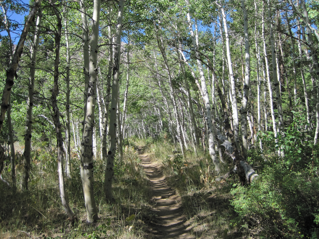
Trip: Mount Stewart - Hamilton Lakes/Kaweah Gap
Date: 7/22/2010
Trip Report:
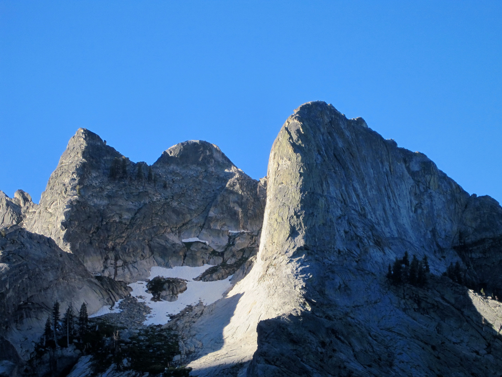
Joel Lanz and I climbed Mount Stewart via the High Sierra Trail, Hamilton Lakes, and Kaweah Gap. 12,205 ft Mount Stewart is located on the rugged Great Western Divide and the region is one of the most remote in the High Sierra requiring 46 miles roundtrip to reach the summit. We started at 4:40 am and finished at 6:50 pm for a 14 hour and 10 minute day. The 21 miles along the High Sierra Trail to Kaweach Gap from the trailhead at Crescent Meadows took about 5 hours each way. From Kaweah Gap we traversed into Nine Lakes Basin and then utilized a broad ramp to scramble to the upper slopes of Mount Stewart, which contained some snow slopes and more scrambling to the third class summit block. The panorama from the summit of Mount Stewart was outstanding with a commanding view of the Great Western Divide, the Big Arroyo River Valley, and Black Kaweah. The Hamilton Lakes amphitheater is one of the most scenic areas I have seen in the High Sierra with the towering granite faces of the Valhallas including the famous Angel Wings rock wall, Mount Stewart, the Hamilton Domes, and Eagle Scout Peak.
[video:youtube]
Joel's footage in HD:
[video:youtube]


-
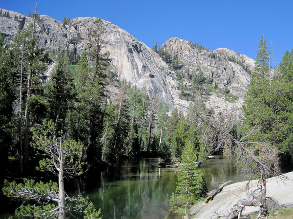
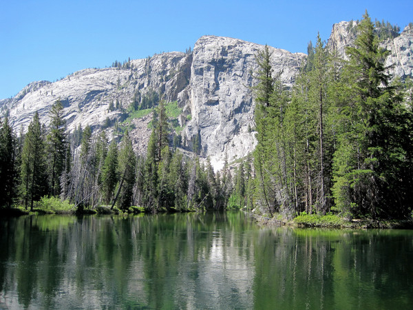
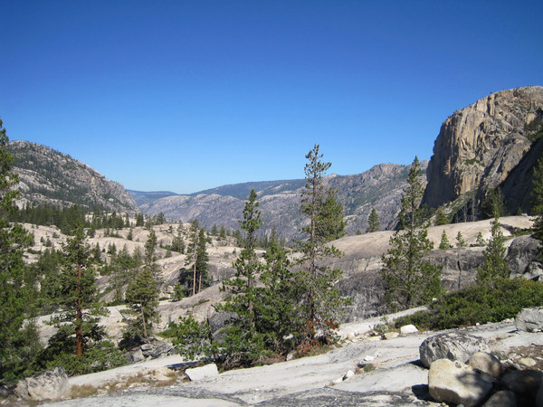
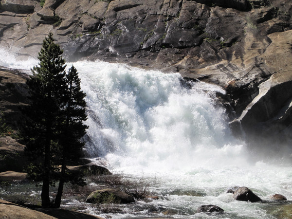
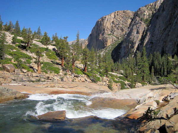
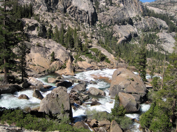
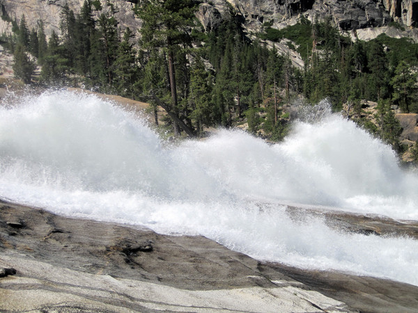
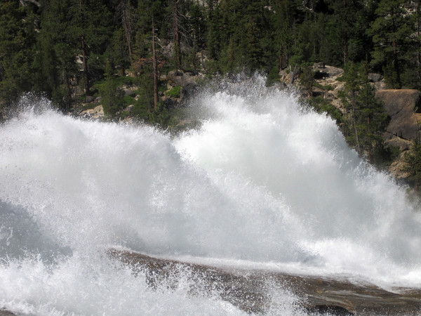
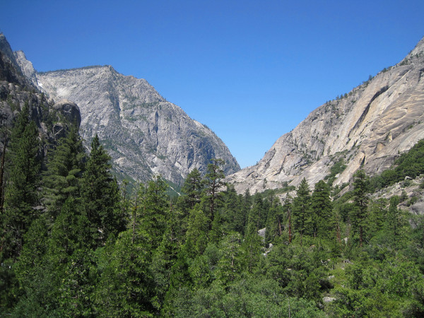
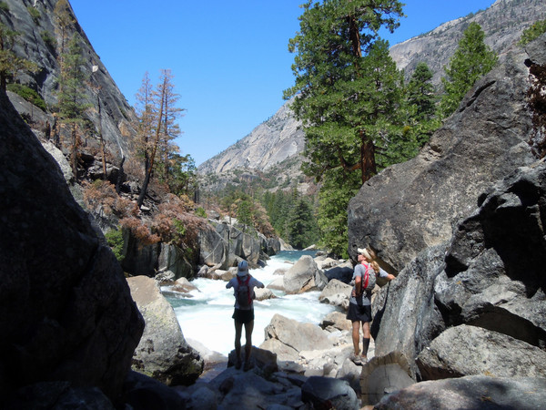
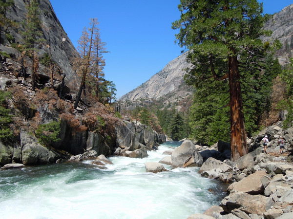
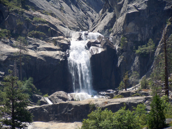
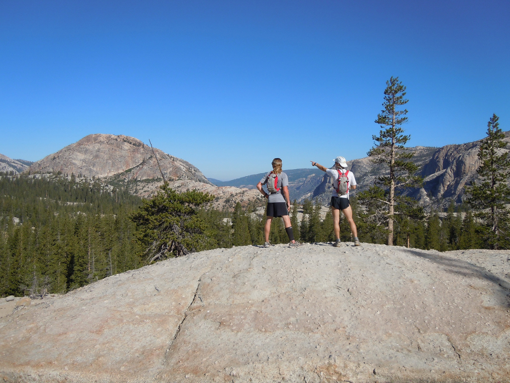
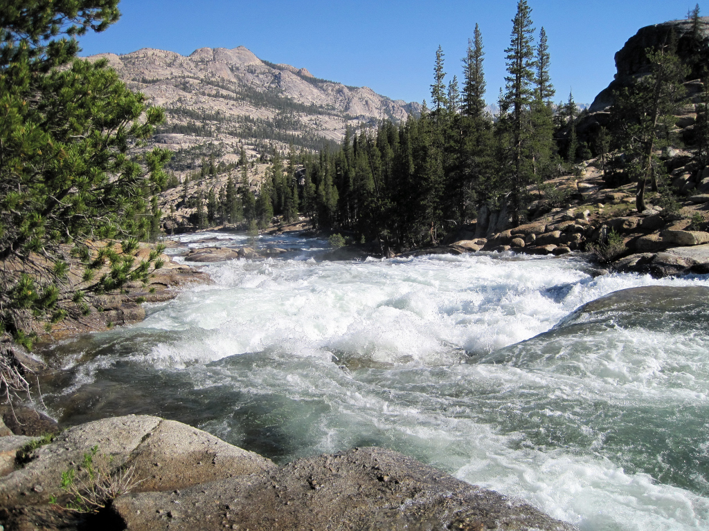
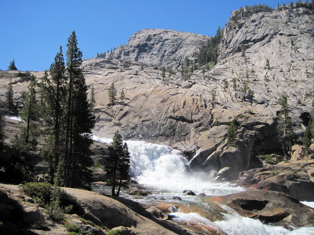
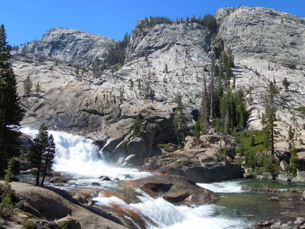
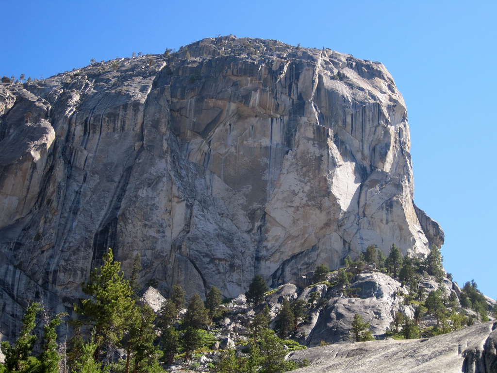
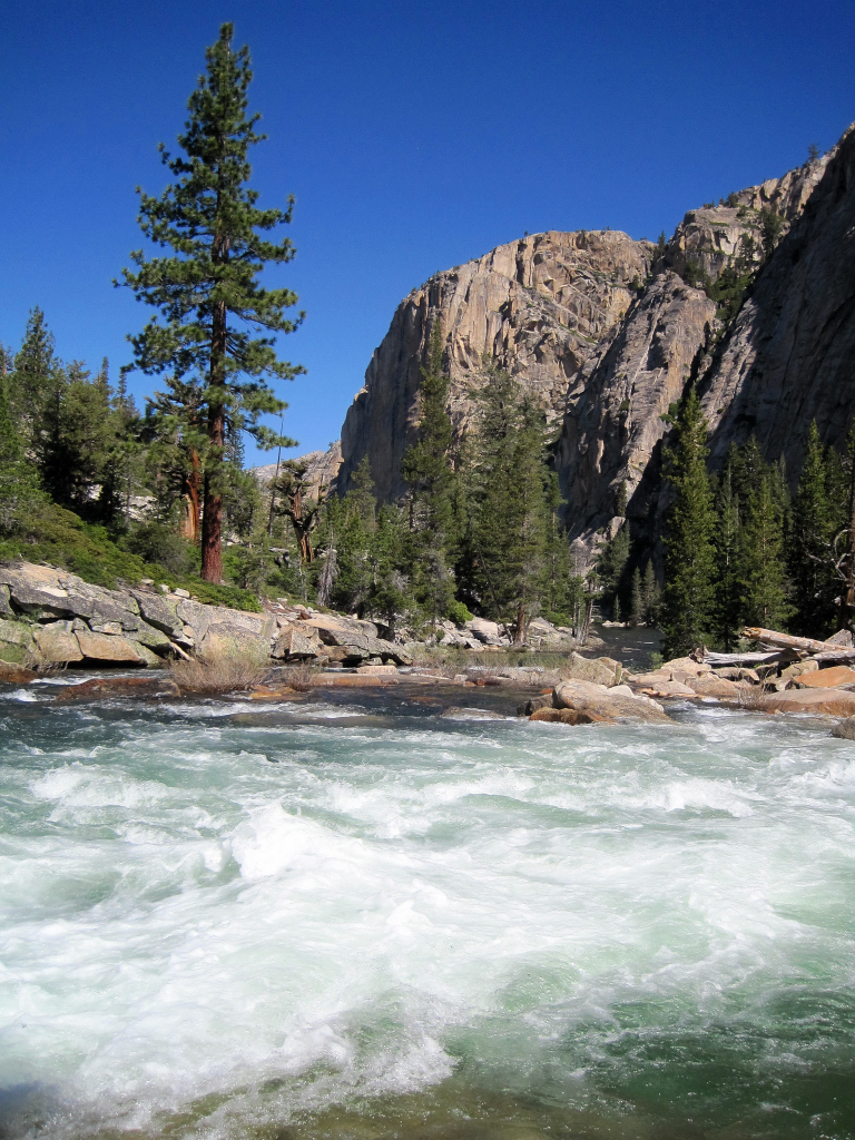
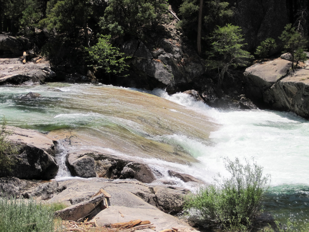
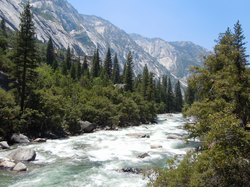
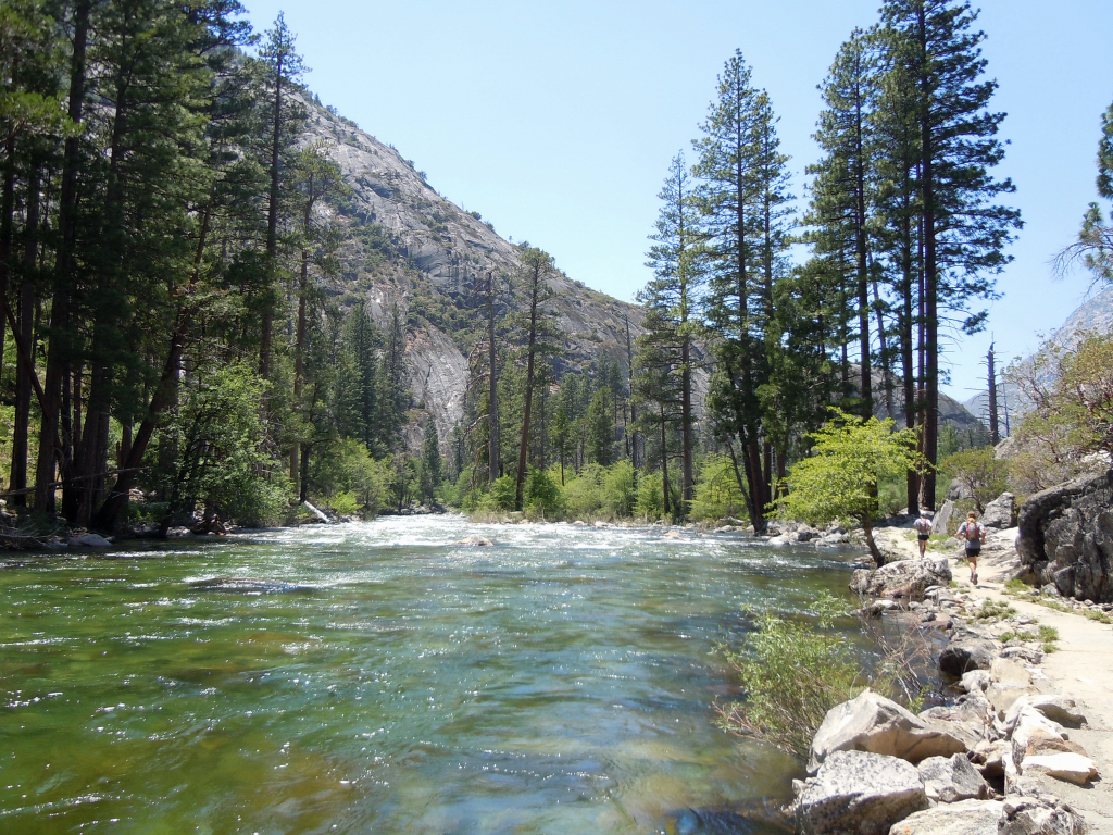
Trip: Grand Canyon of the Tuolumne - Tuolumne Meadows to White Wolf
Date: 7/14/2010
Trip Report:
I joined Joel and Sean for a fantastic 50k (~30 mile) point-to-point adventure run of the Grand Canyon of the Tuolumne from Tuolumne Meadows to White Wolf in Yosemite NP. This area has intrigued me for some time and the scenery surpassed my lofty expectations.
We camped outside the park the night before and were able to hitch a ride from some gracious tourists from Spain almost immediately. The first part of the route is through the upper and lower Tuolumne Meadows to Glen Aulin High Sierra Camp with great views of the Echo Range and domes. Once in the canyon, there is a plethora of waterfalls and rapids along the Tuolumne River with granite everywhere! What makes this route more remote is the fact that there is no outlet from the bottom of the canyon. One must ascend over 4,000+ ft back to the ridge line at White Wolf. This ascend proved grueling in the heat of the day and after having already covered 24 rugged miles.
[video:youtube]
HD video from Joel's footage:
[video:youtube]


Approach Notes:
As a point-to-point, you need to either arrange for a ride from White Wolf to Tuolumne Meadows or walk up to Hwy 120 from White Wolf to hitch a ride to Tuolumne Meadows.
A 46.5 mile loop is possible out of White Wolf utilizing the Ten Lakes area and would make for a challenging adventure run.
-
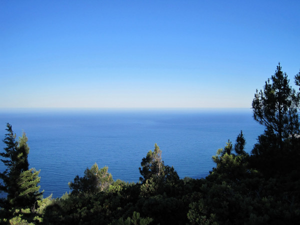
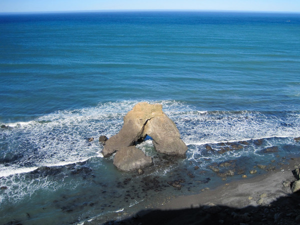
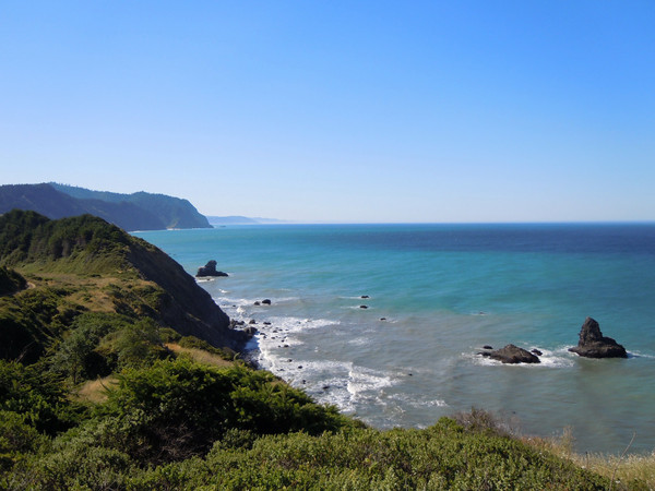
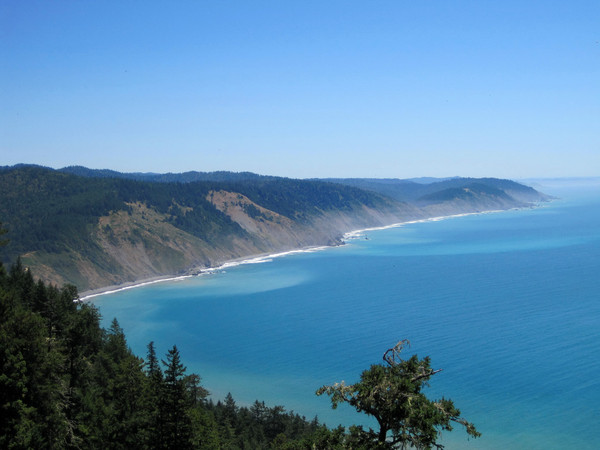
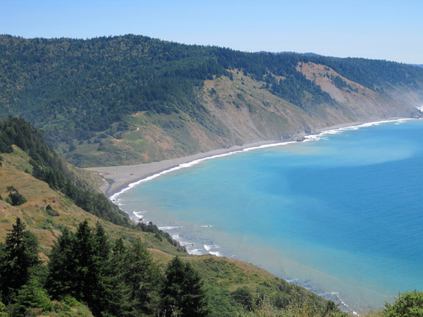
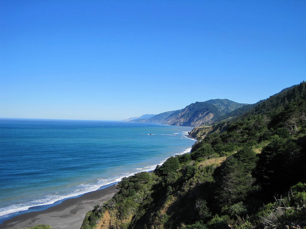
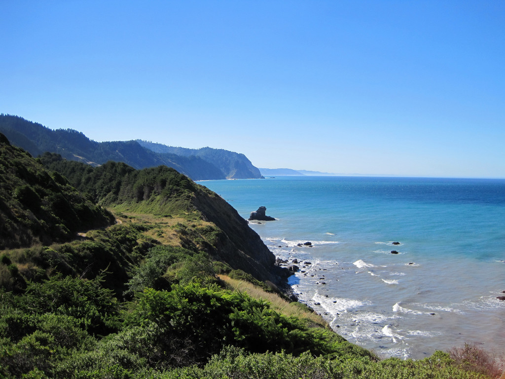
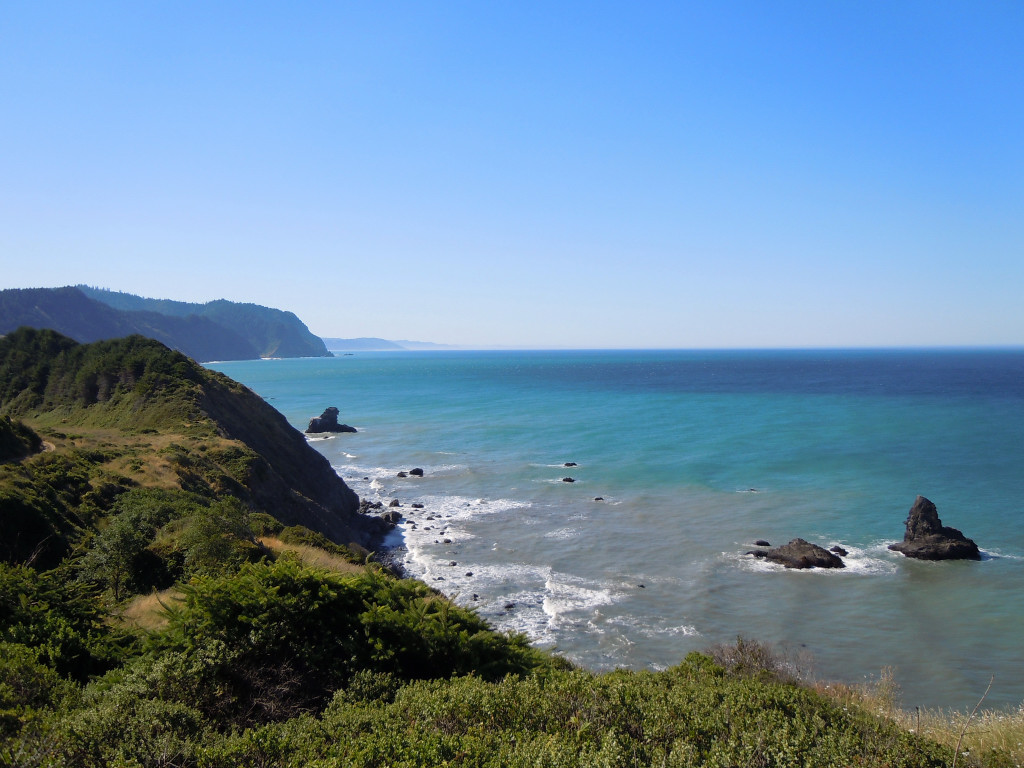
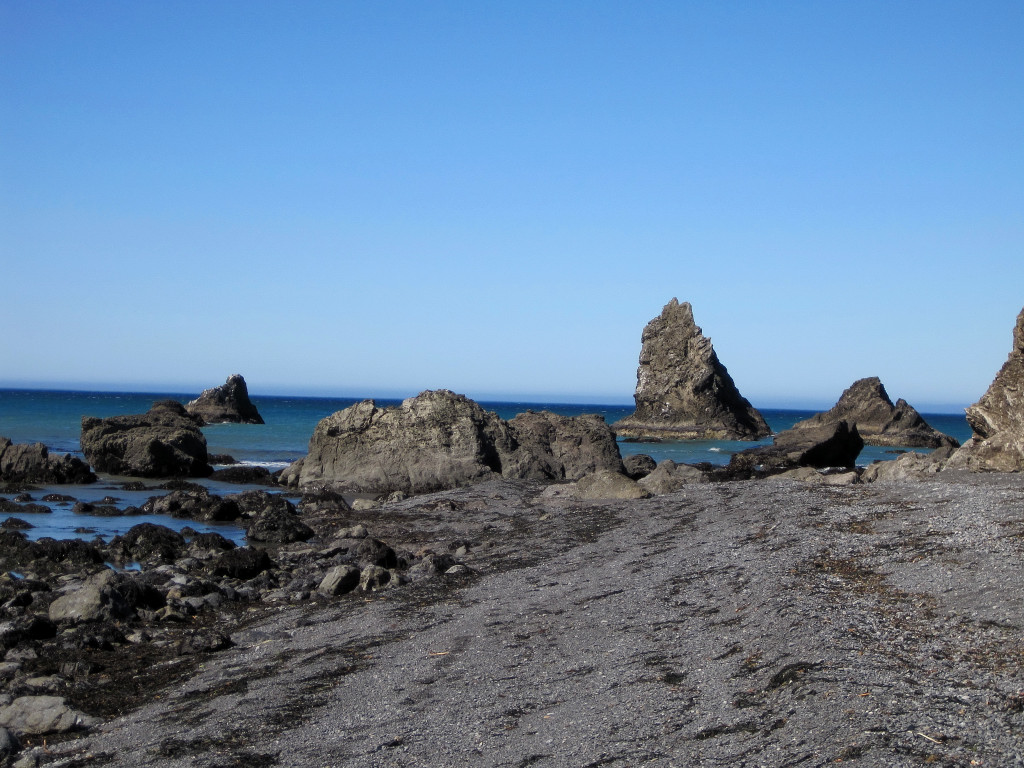
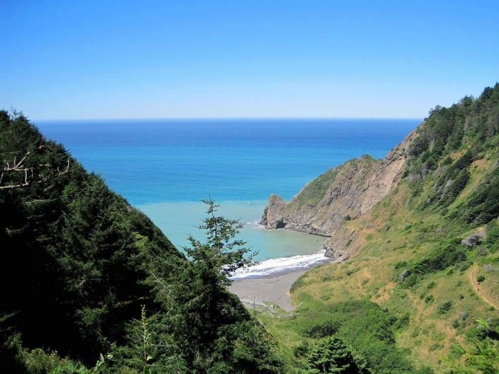
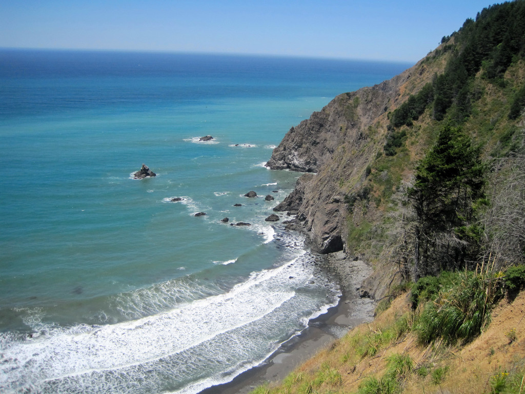
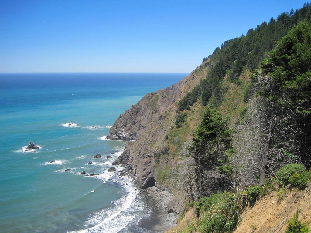
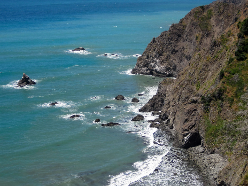
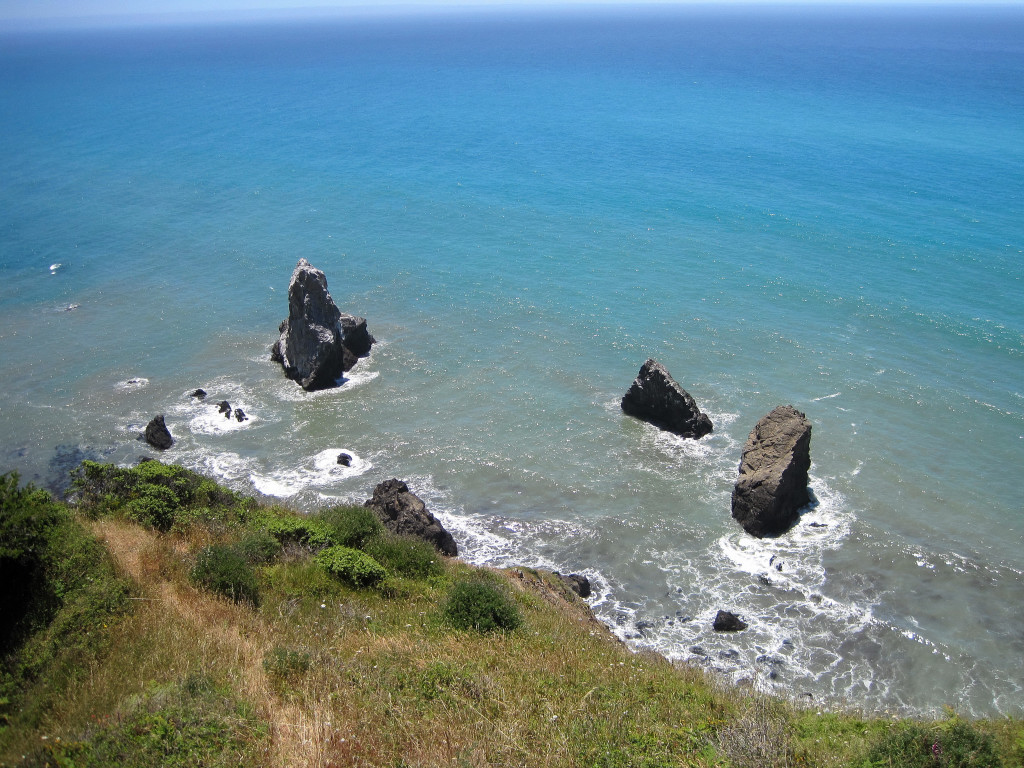
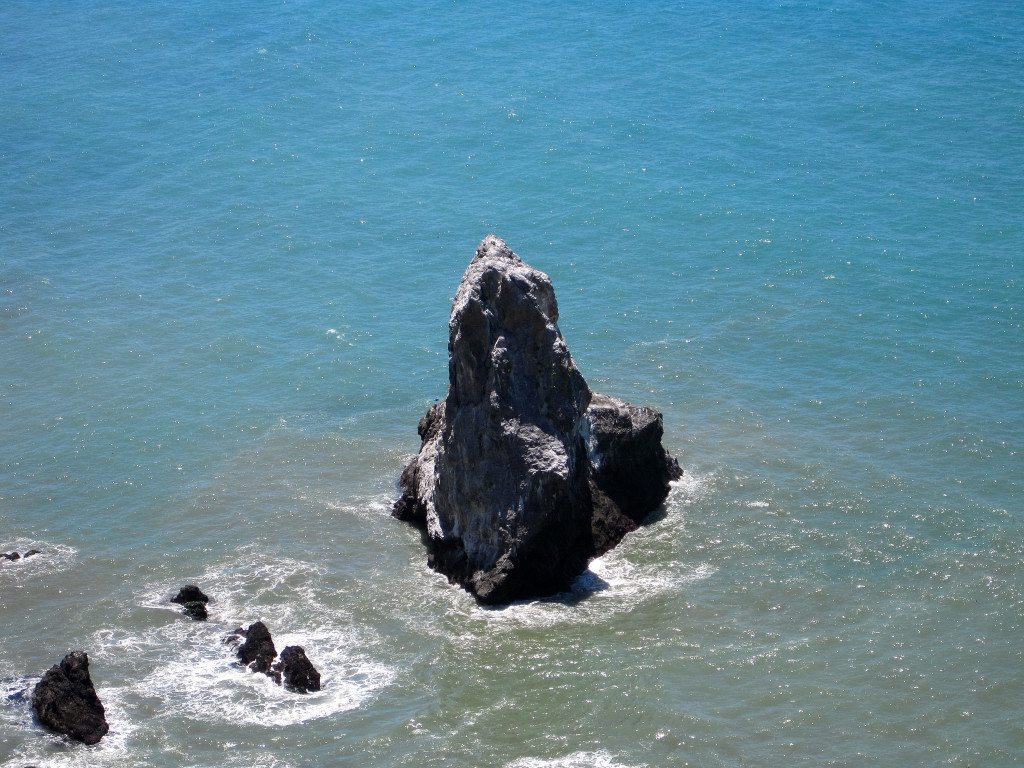
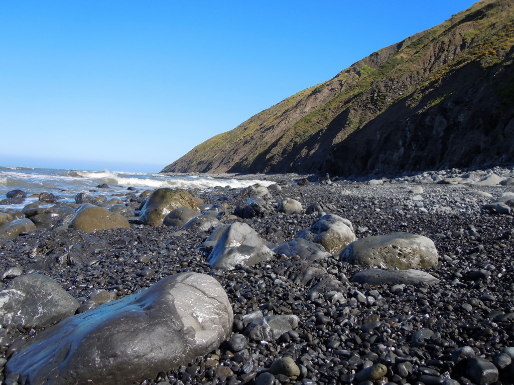
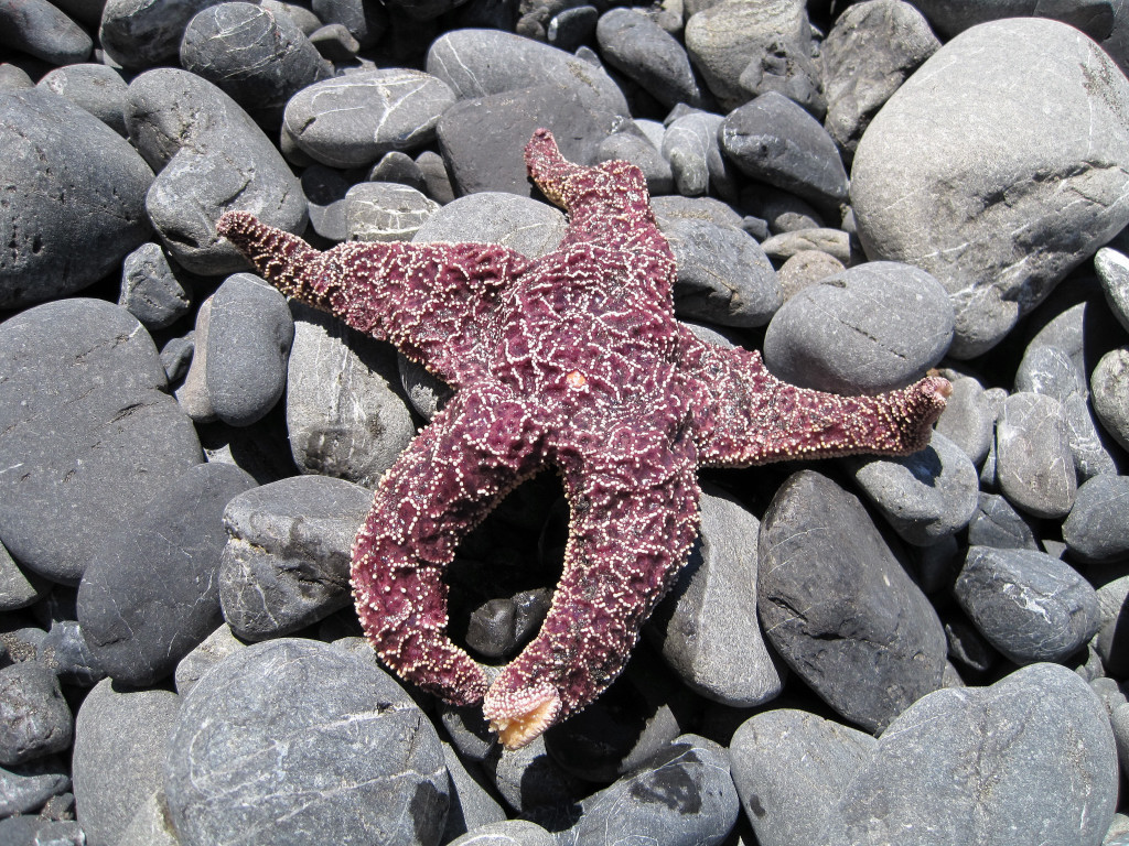
Thanks! The Sinkyone is an underrated destination and is arguably more scenic than the much more popular King Range beach walk.
zoroaster, thanks for the comment and glad the Glacier Peak TR was useful for you!
-
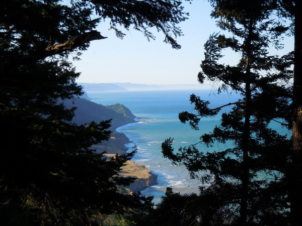
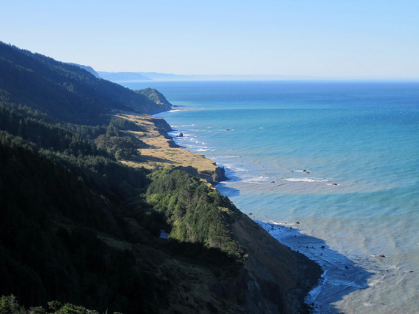
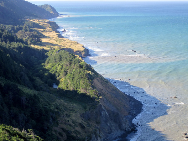
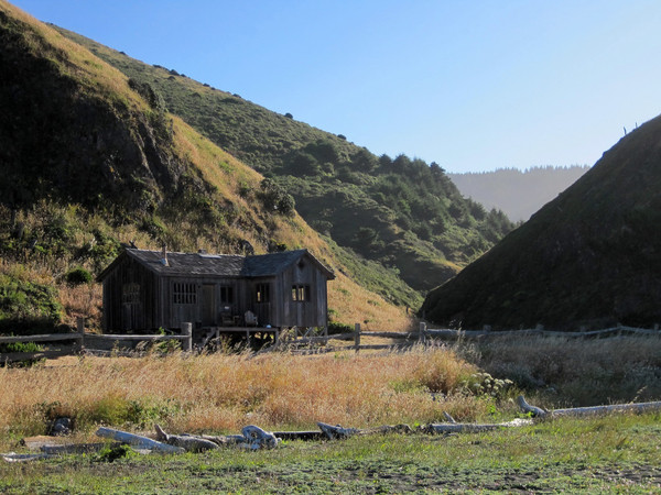
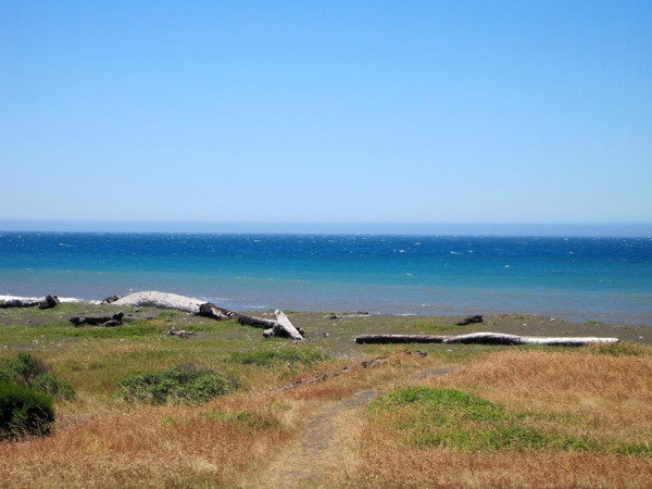
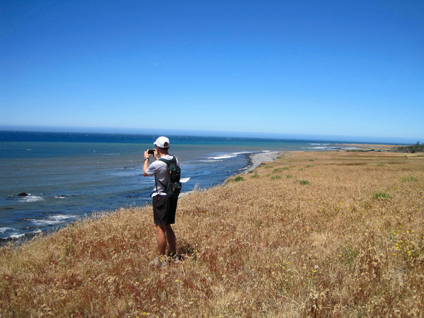
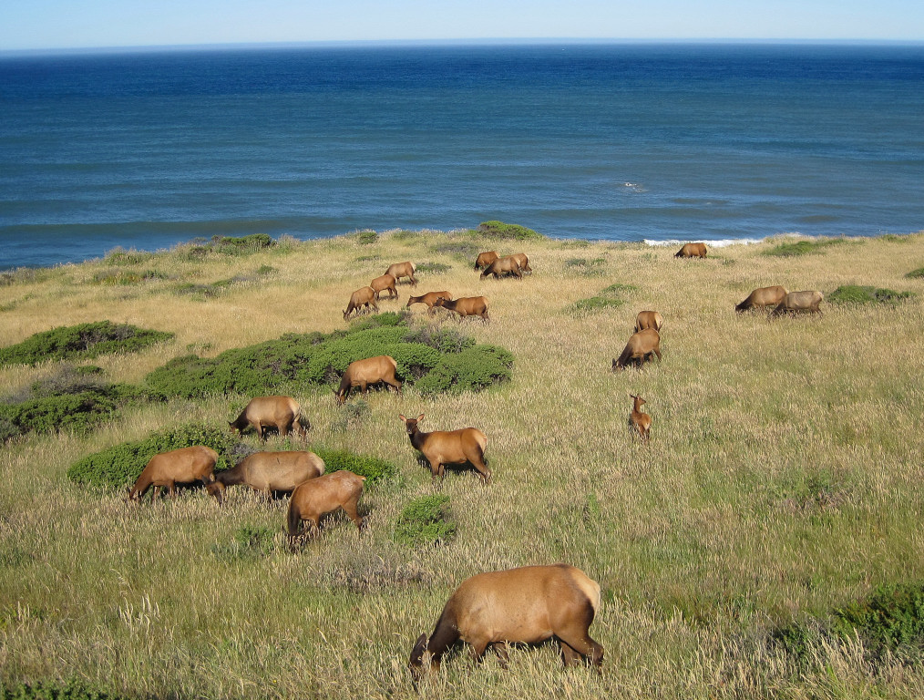
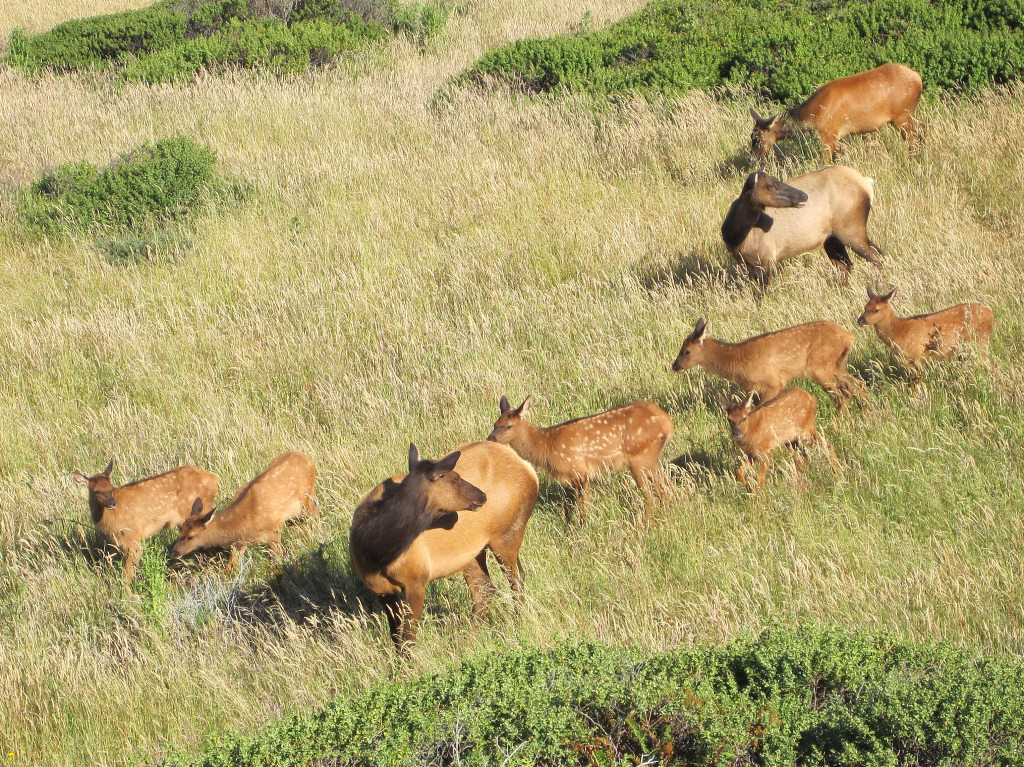
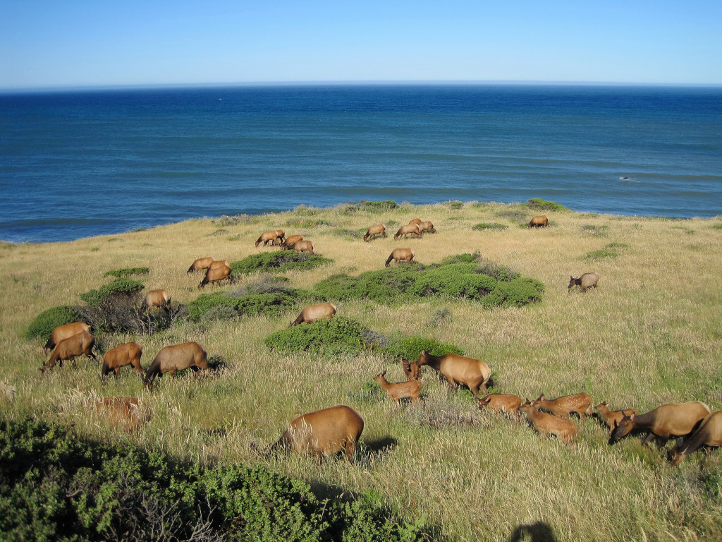
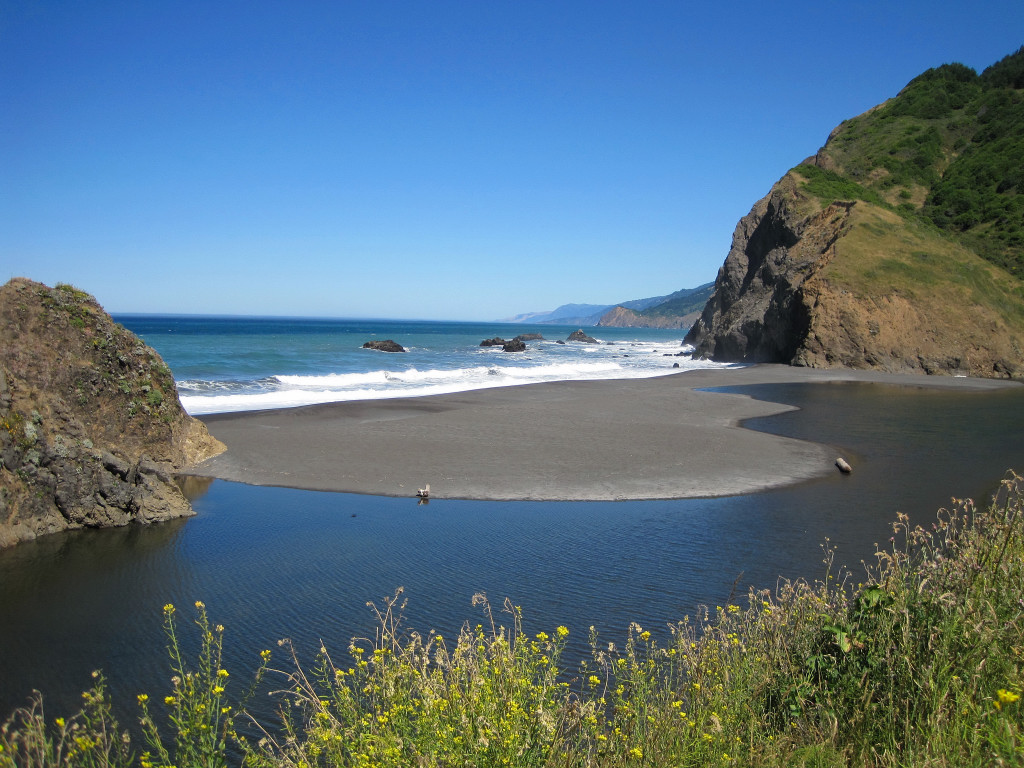
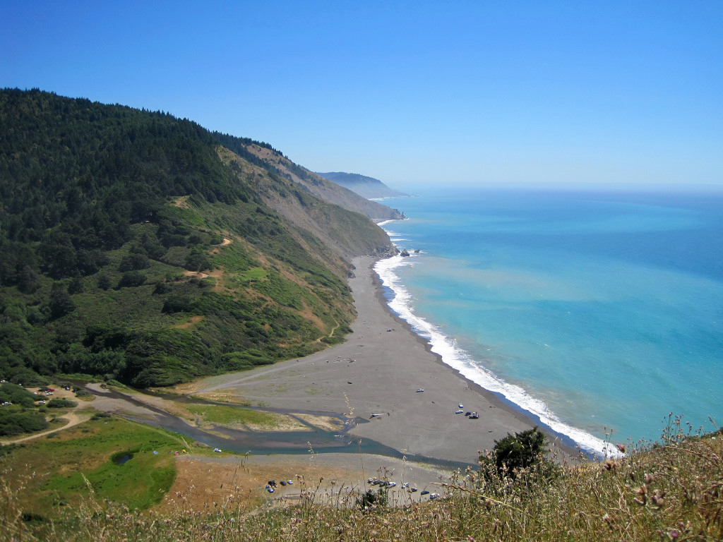
Trip: Lost Coast: Day 2 - Sinkyone Wilderness - Adventure Run
Date: 7/4/2010
Trip Report:

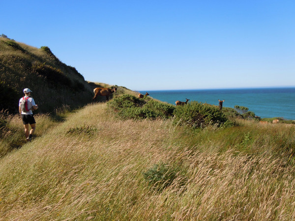
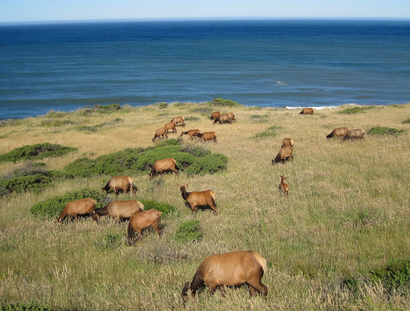
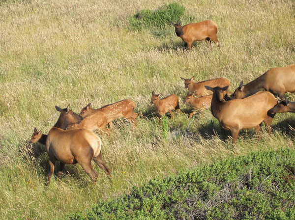
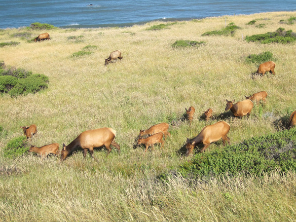
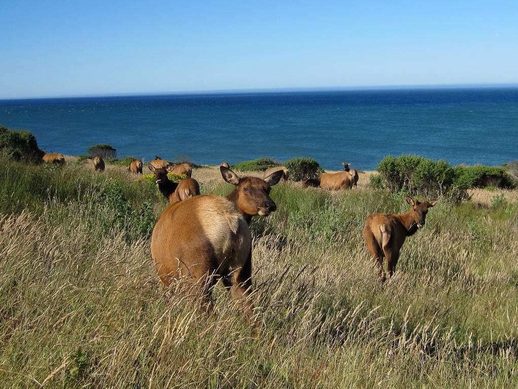
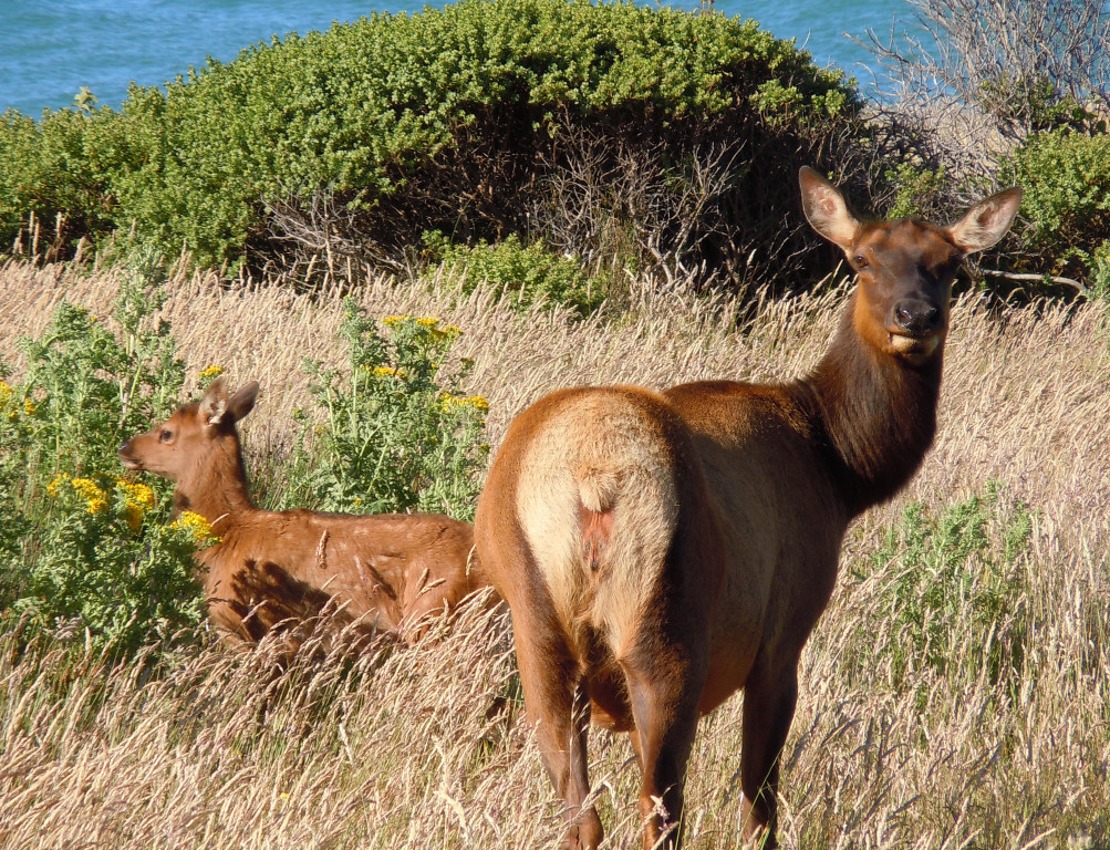
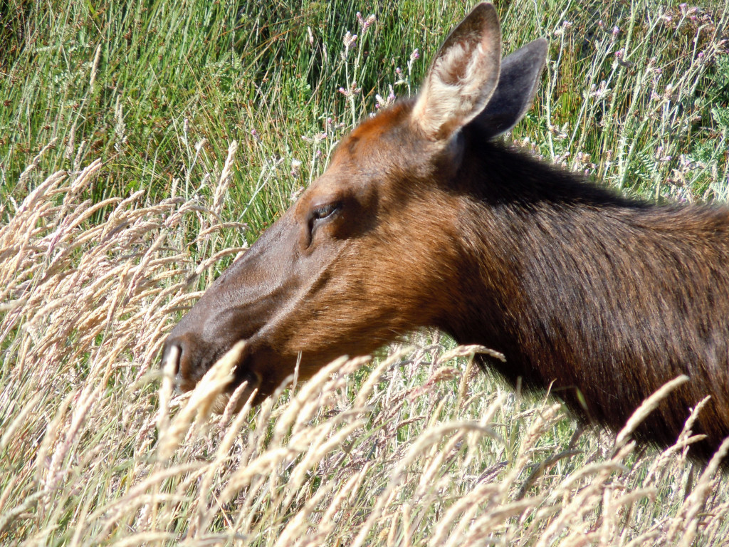
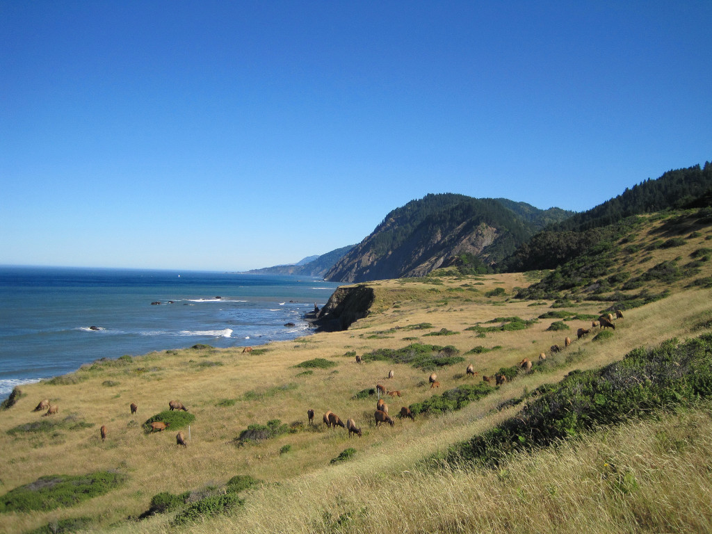
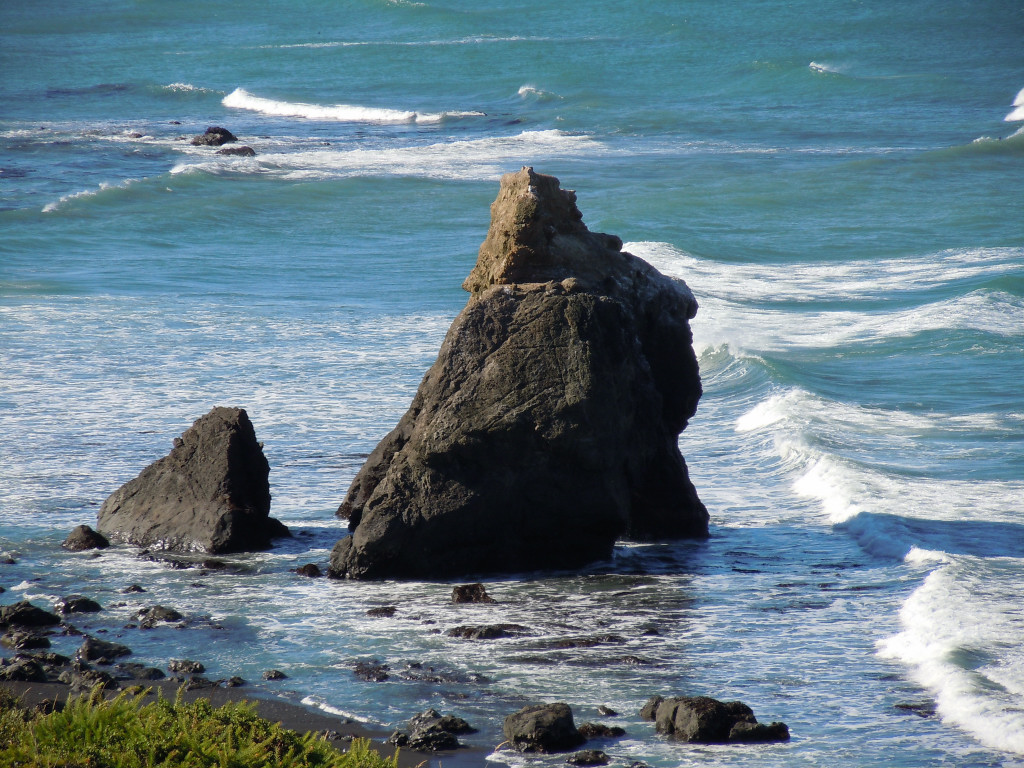
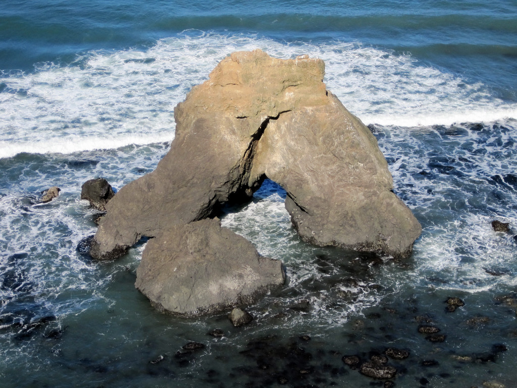
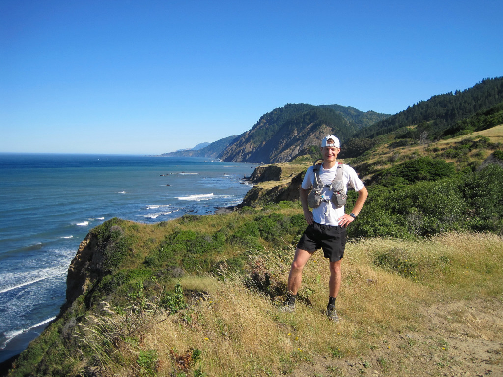
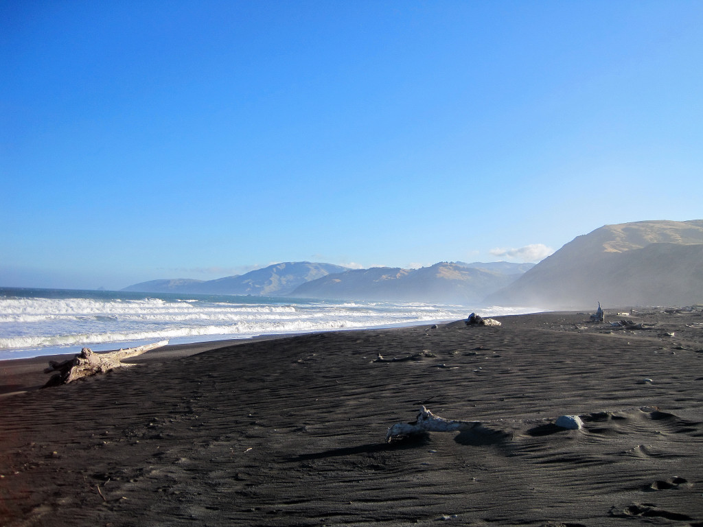
Day two of our tour of the Lost Coast took us from Hidden Valley in the King Range up and over Chemise Mountain and down into the Sinkyone Wilderness continuing all the way to the southern end at Usal Beach for a total distance of 28 miles. The travel was often arduous with significant elevation gain and loss (6,000+ ft) and often on narrow, brushy trails (stinging nettles, poison oak, and other annoying weeds) with poor footing. Sinkyone Wilderness all the way to Usal Beach for a total of 28. Along the way we saw a herd of 50+ elk and enjoyed jaw dropping views and vistas of the rugged and wild coastline. This is not a climb, but some of you might be interested in the photography and visiting this amazing place. For photos and video of day one, the King Range Beach Walk, along with a general description of the Lost Coast, see here.
[video:youtube]


-
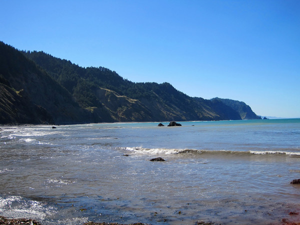
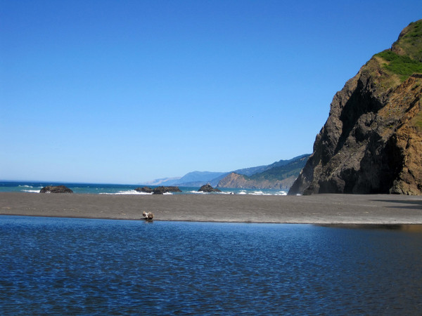
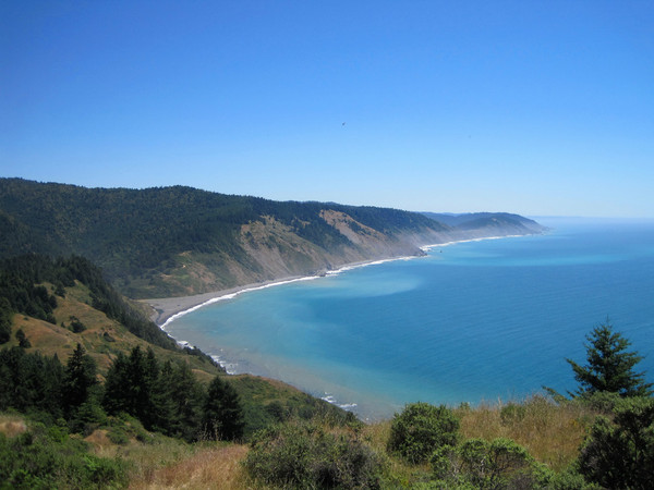
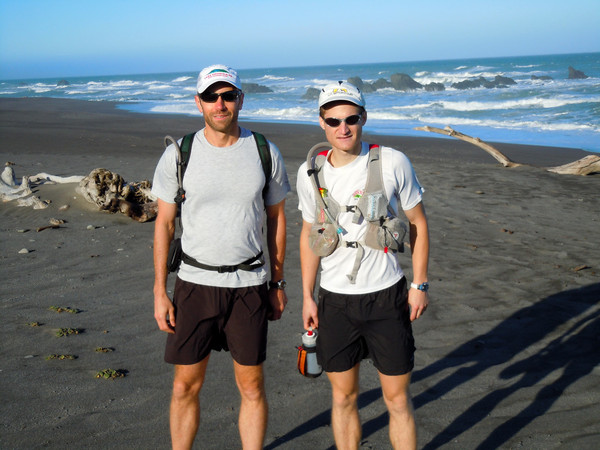
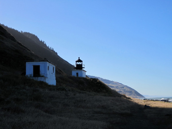
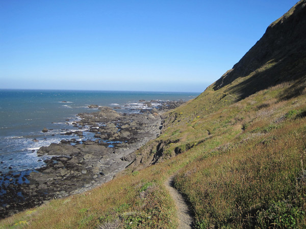
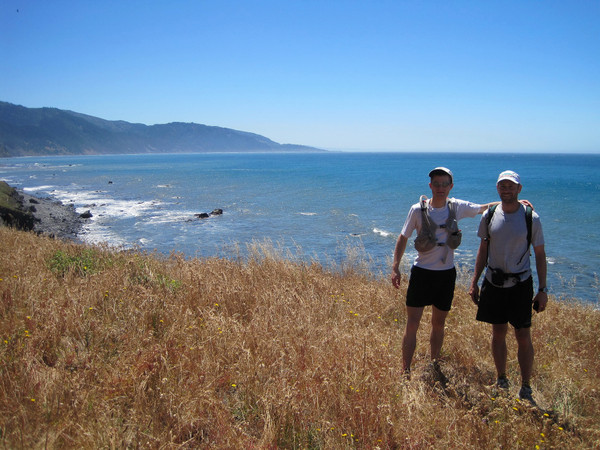
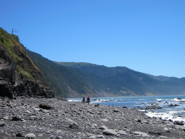
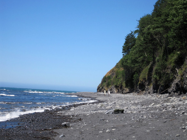
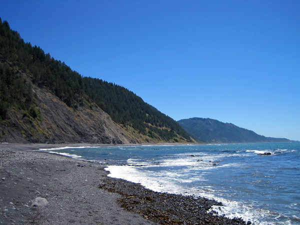
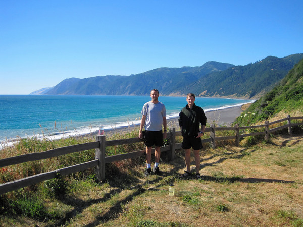
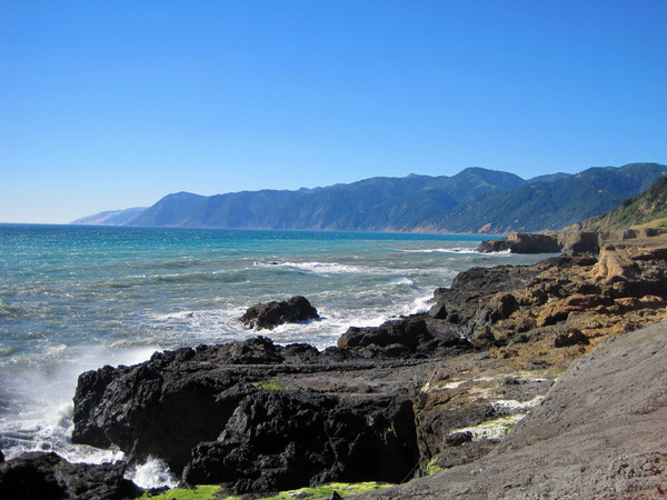
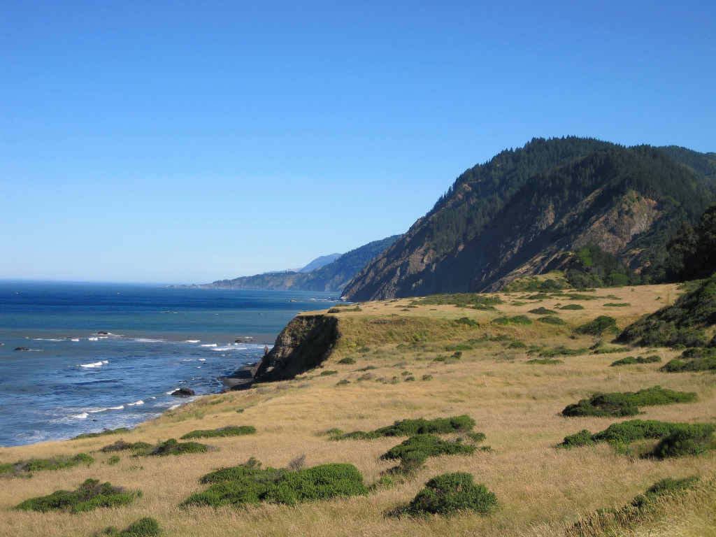
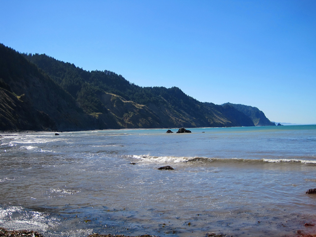
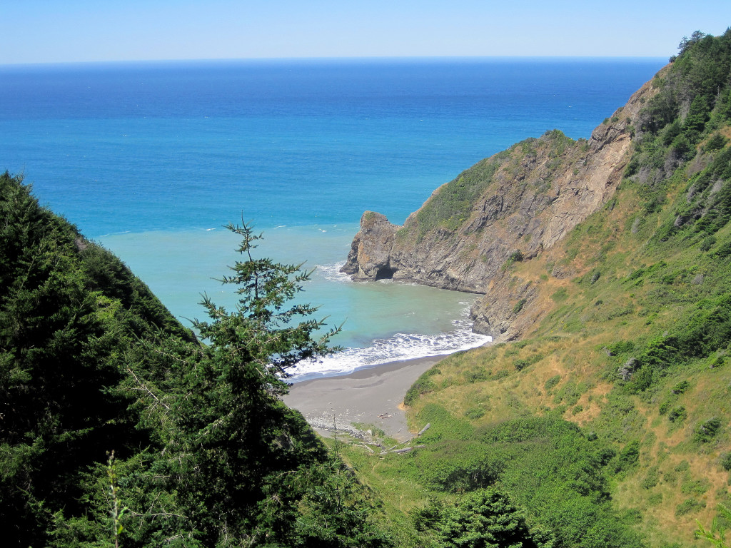
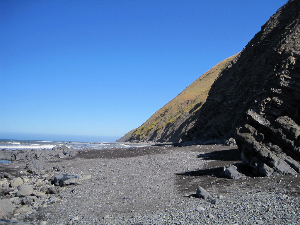
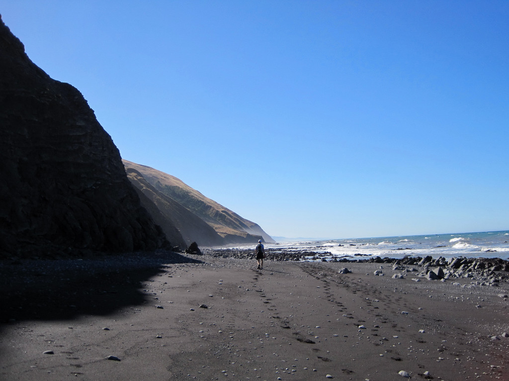
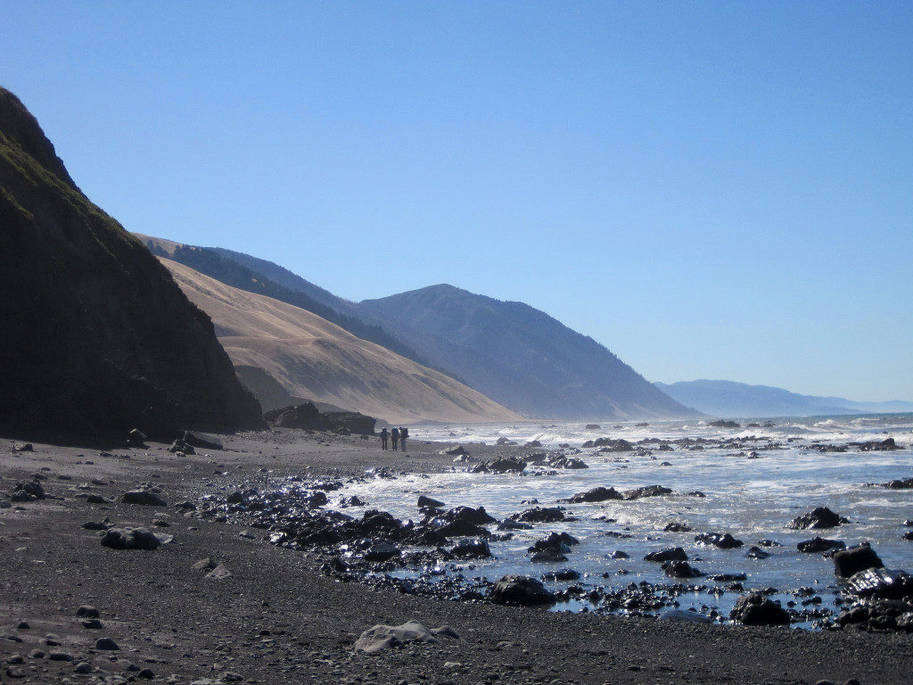
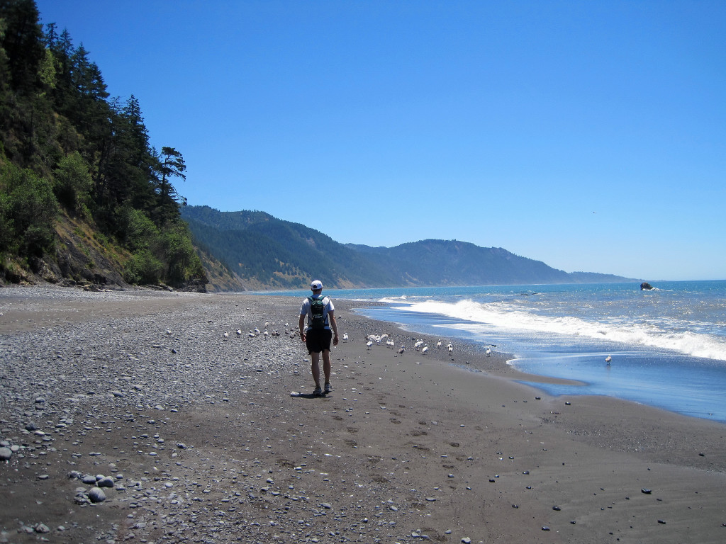
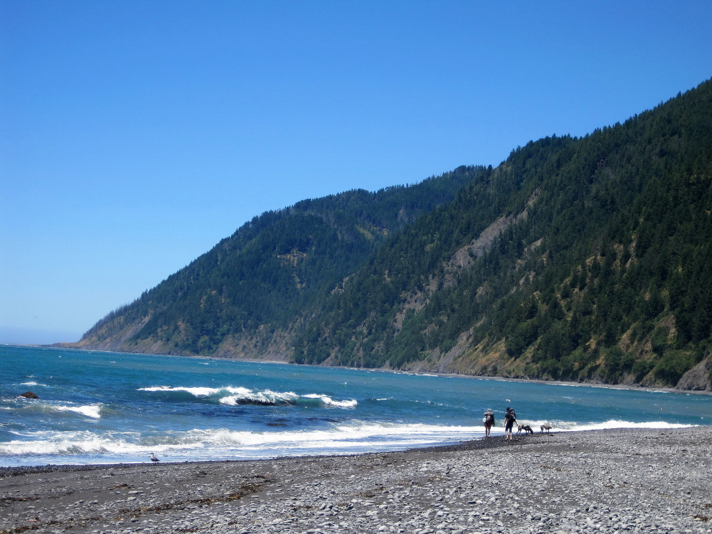
Trip: Lost Coast Day 1 - King Range - Beach Walk
Date: 7/3/2010
Trip Report:
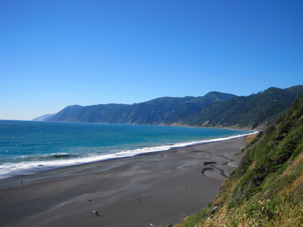
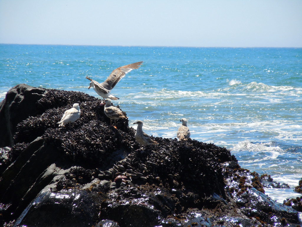
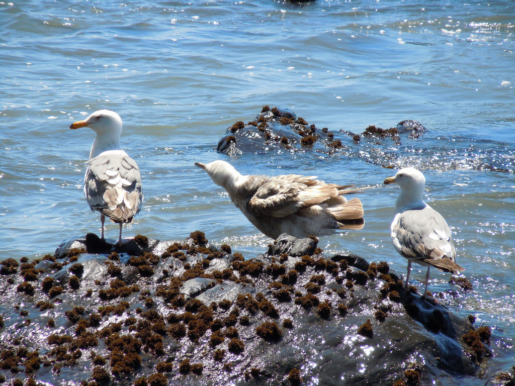
I joined Joel Lanz for a fantastic tour of the entire Lost Coast from the mouth of the Mattole River at the north end to Usal Beach at the south end. This is not a climb, but some of you might be interested in the photography and visiting this amazing place. This post encompasses Day 1; for photos and video of Day 2, the Sinkyone Wilderness Adventure Run, see here.
[video:youtube]
The Lost Coast in HD, video captured by Joel:
[video:youtube]
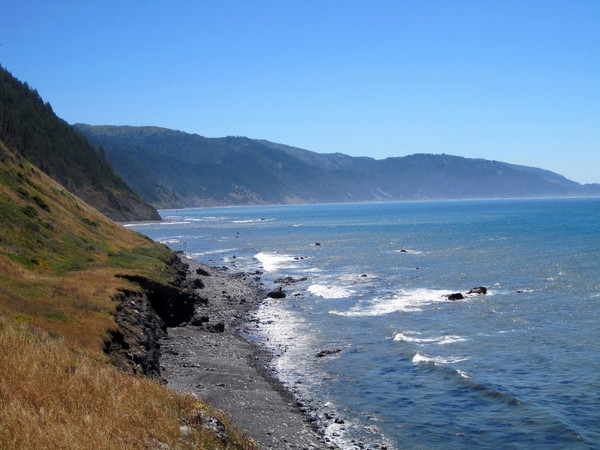
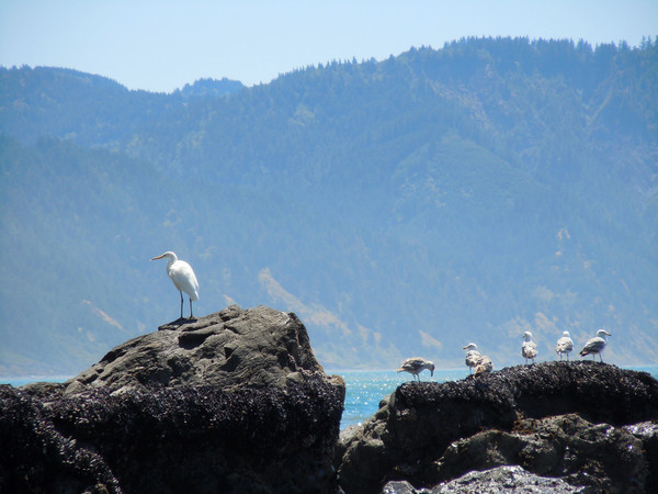
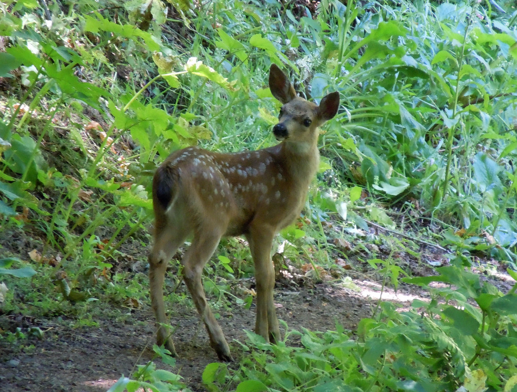
The Lost Coast in northern California is the most undeveloped stretch along the entire West Coast of the United States and is characterized by steep and rugged relief of the coastal mountains right next to the ocean. The northern portion of the Lost Coast is protected in the King Range National Conservation Area and 42,585 acres received Federal Wilderness designation on October 17, 2006. The southern portion is protected in Sinkyone Wilderness State Park, named after the Sinkyone Indians that lived on this part of the coast. The two sections are split by Shelter Cove, a small community of mainly vacation homes, but the parts are completely different in terms of the overall feel and experience. The northern 24.6 mile section in the King Rance NCA from the Mattole River to Black Sands Beach at Shelter Cove is primarily a beach walk with two-thirds of the distance spent on sand, gravel, and rock-hopping and the remaining third on trails just above the beach on the bluffs. The southern 28 mile section from Hidden Valley to Usal Beach in the Sinkyone is entirely on the bluffs above the ocean with arduous climbs and narrow, brushy trails in the forest – a true adventure run with over 6,000 feet of elevation gain. The northern part has sweeping Oceanside views with every step while the southern part has inspiring vistas from atop rugged cliffs. The vegetation transitions from grassy hillsides at the far north end to lush Douglas fir forest further south. There is even a few nice groves of old growth redwoods in the Sinkyone portion. Along the way we saw a plethora of marine wildlife, a herd of 50+ elk, and multitudes of deer. We did not come across many people on either of the days and in particular, the Sinkyone portion appeared infrequently traveled. The first day took us about 7 hours and the second day 7.5 hours.


-
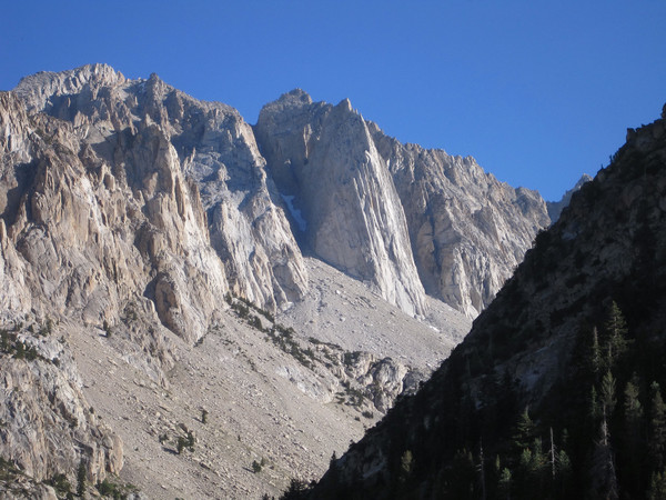
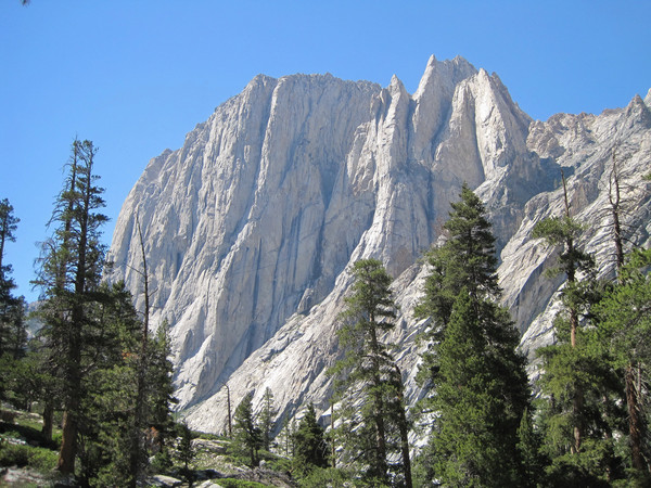
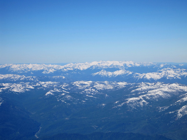
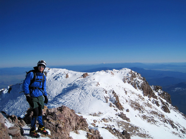
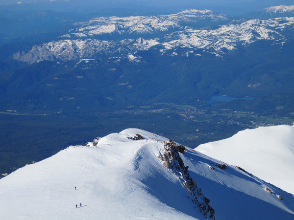
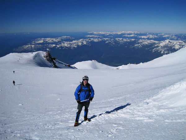
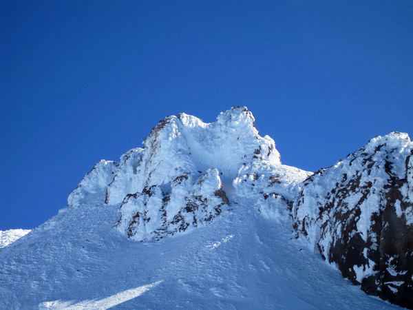
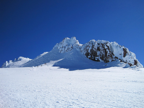
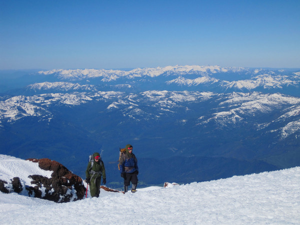
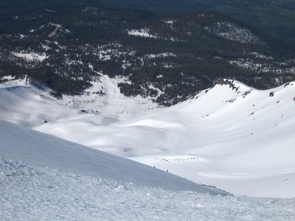
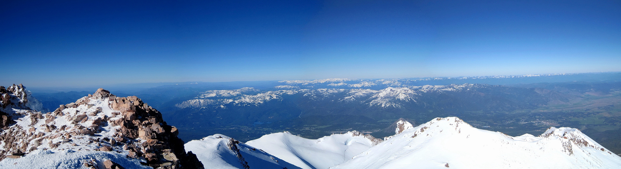
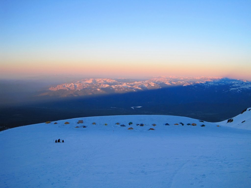
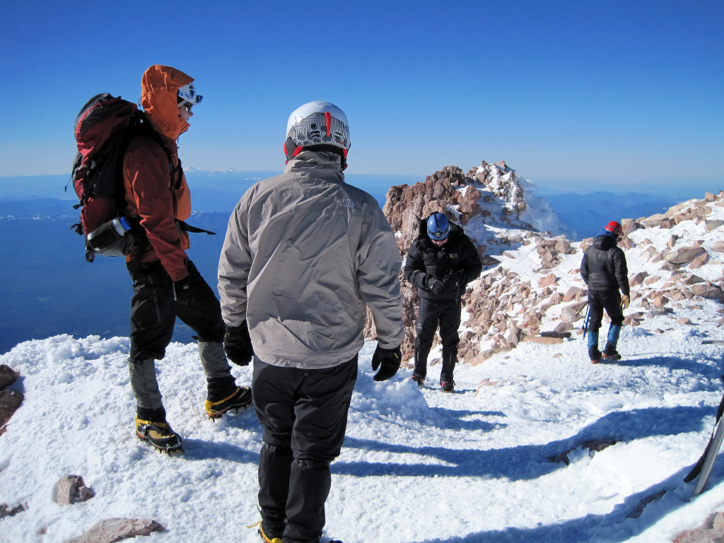
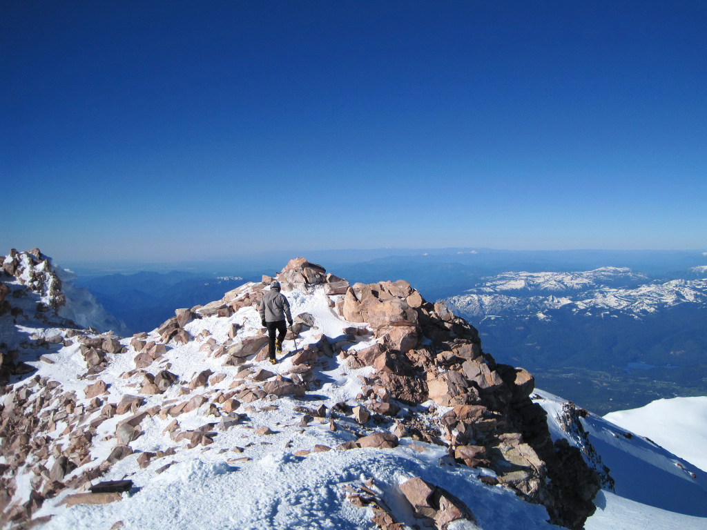
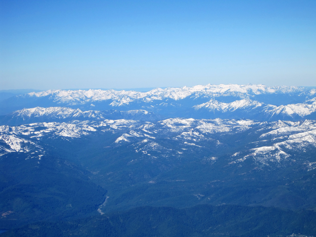
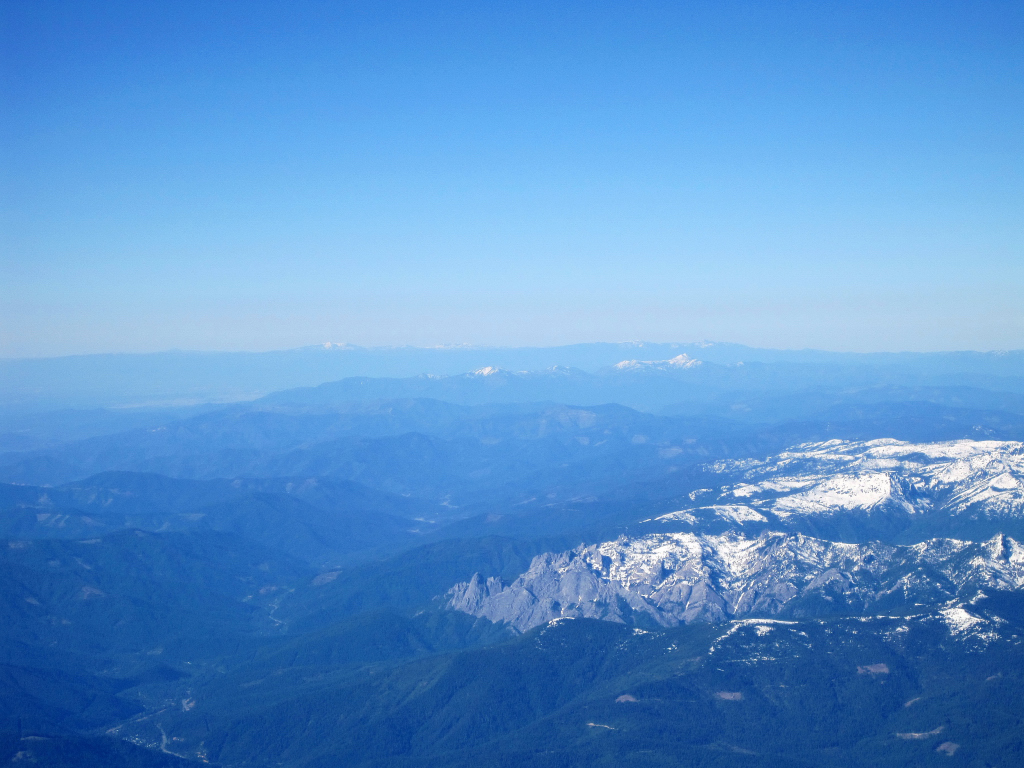
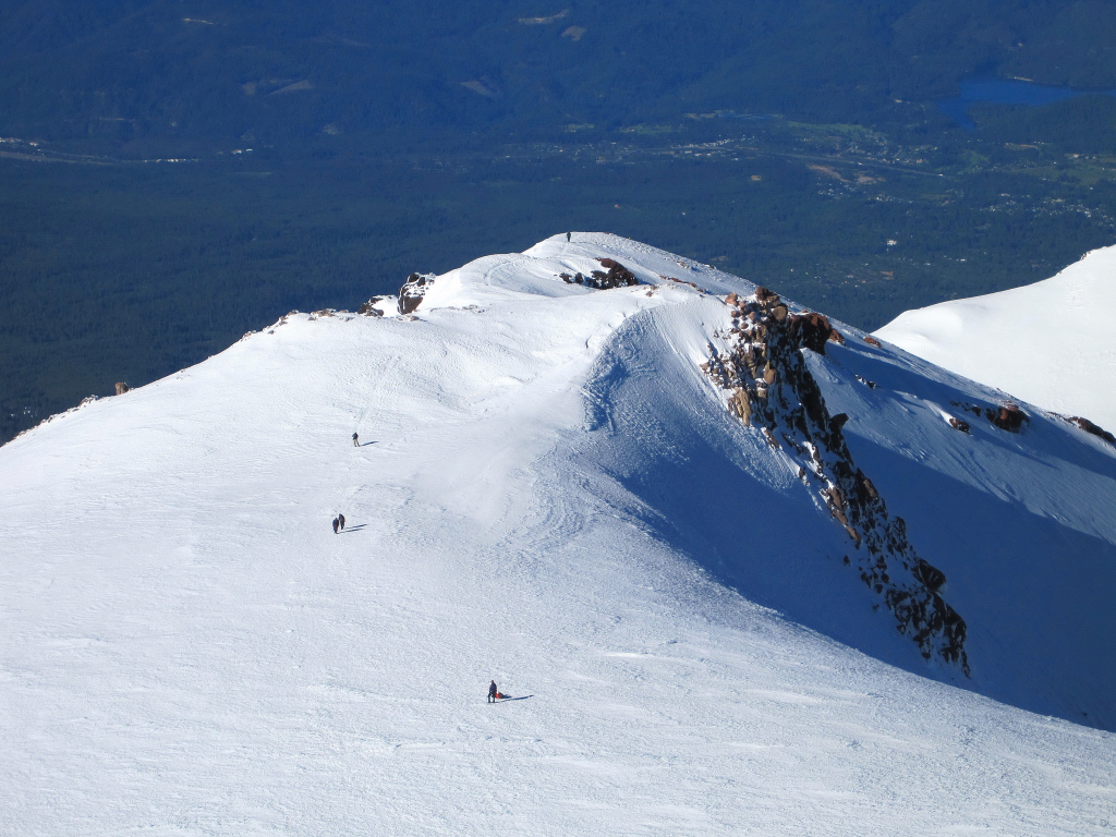
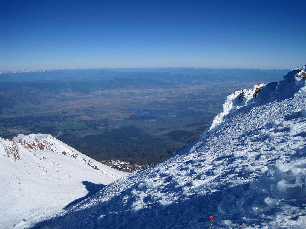
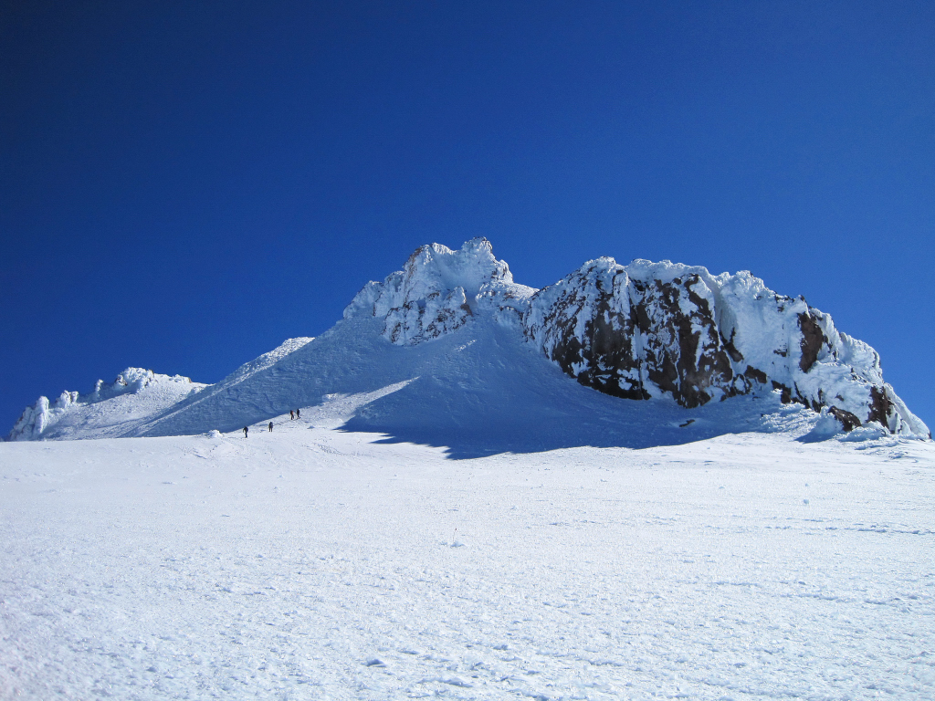
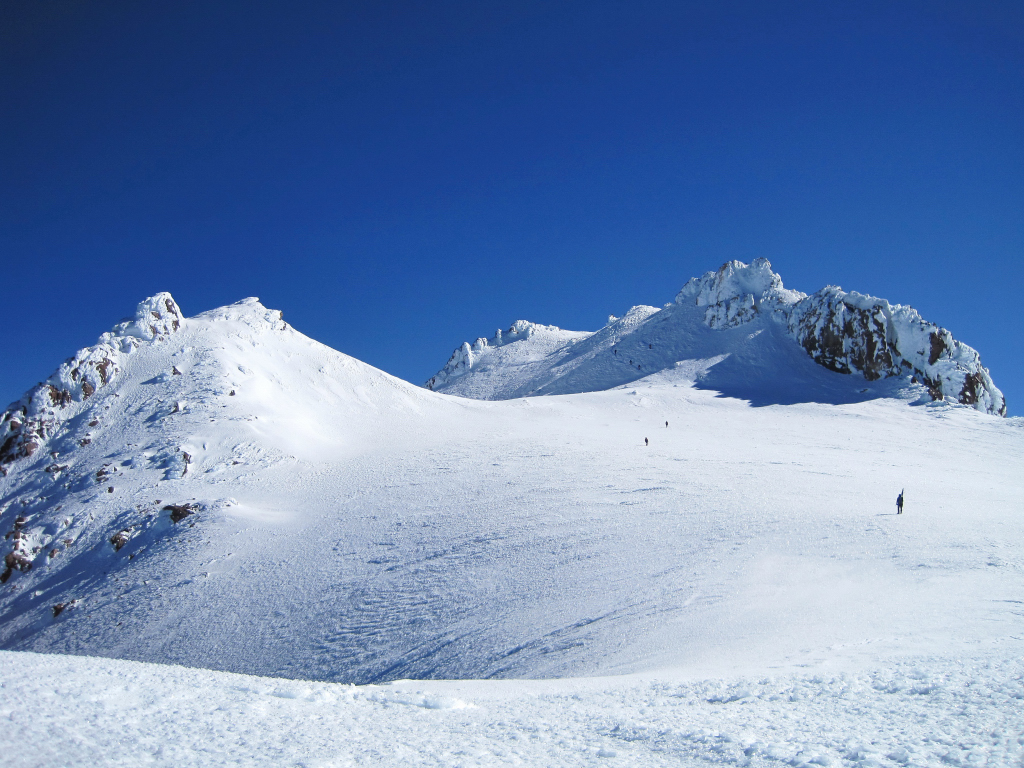
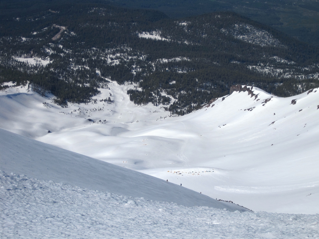
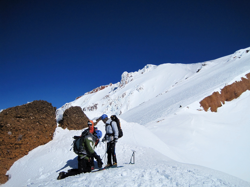
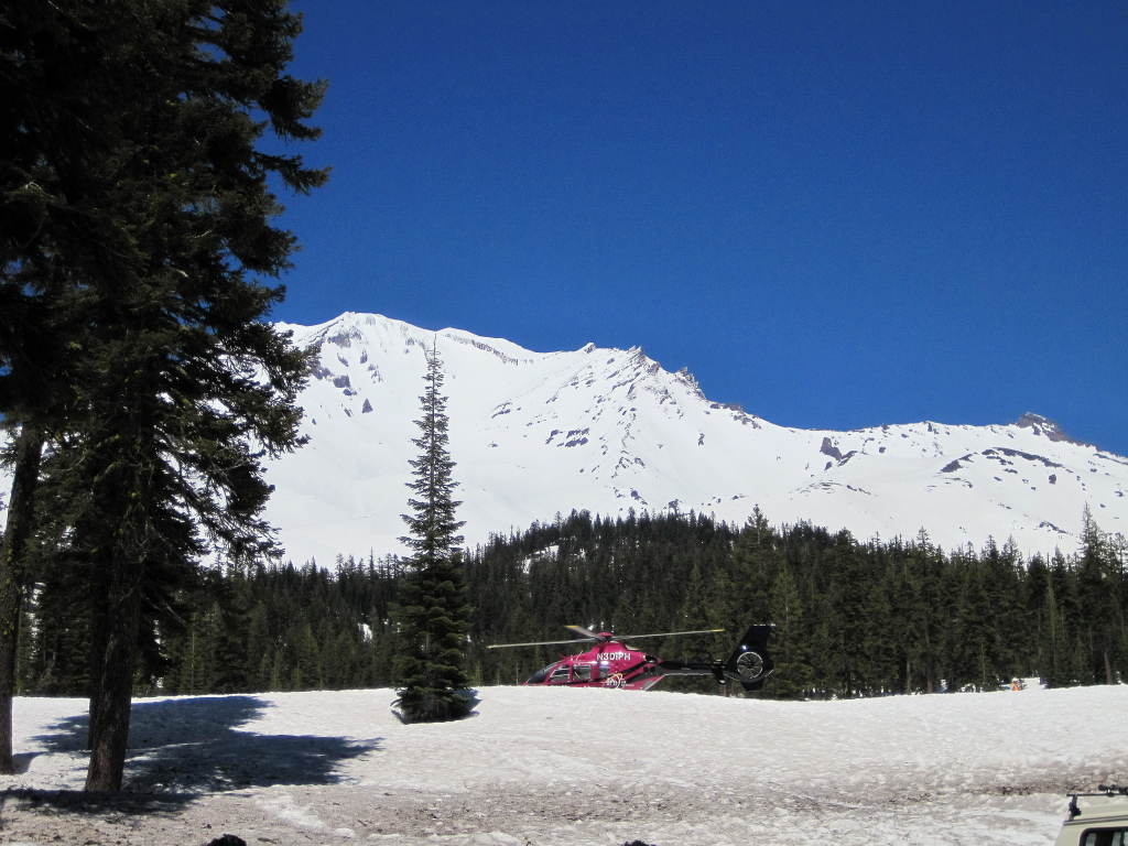
Trip: Mount Shasta - Avalanche Gulch
Date: 6/13/2010
Trip Report:
I climbed Mount Shasta via the standard Avalance Gulch route on Sunday. It was a gorgeous day on the mountain with brilliant sunshine, excellent visibility, and relatively light winds. The main issue was extremely firm/icy snow for 2,000+ vertical feet between Helen Lake and the Red Banks and ice chunks peeling off the rocks. The roundtrip climb from Bunny Flat was 7:45 starting at 3:48 am and finishing at 11:33 am. The ascent was 4:24, 30 minutes on top, and 2:51 down.
Substantial snow remains right from the parking lot at 6,950 ft. The consolidated, firm snow made for a quick trip up to Helen Lake. After Helen Lake the steeper slopes were extremely firm and icy. Warm storms from the previous week caused rain to fall on this portion of the mountain creating icy conditions along with rime ice on the Red Banks rocks. The warmer temperatures over the weekend were causing the rime ice to break off and fly down the icy slopes at fast speeds. A helmet is essential right now and it's a good idea to stay to climber's right to avoid the worst area of funneling. The conditions resulted in an unprecedented nine search and rescue operations along with five helicopter evacuations over the weekend. Climbers either slipped on the icy slopes and couldn't self arrest or lost balance after being hit by the ice chunks. The icy slopes made for a relatively fast ascent but a painstakingly slow descent for a few hundred feet below Red Banks before the snow became slightly softer. The upper portion of the mountain above red banks was in fine condition.
Trinity Alps.
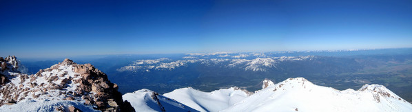
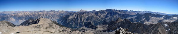
Panorama from summit.

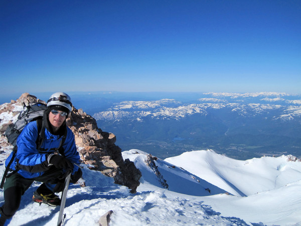
Summit shots.

Mount McLaughlin and Oregon Cascades.


Lassen Peak.

Castle Crags and Coastal Ranges.

Top of Misery Hill.
Impressive relief.
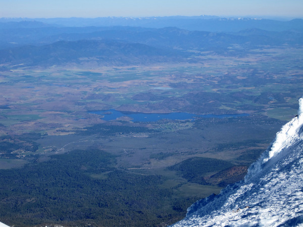

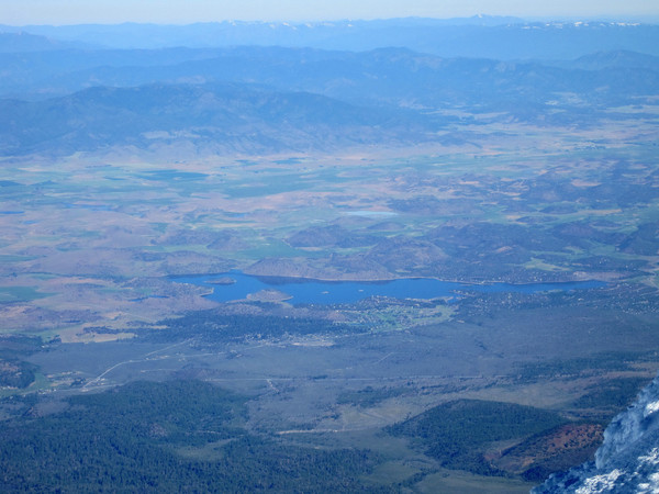
Lake Shastina.
Summit pinnacle.

Looking down Avalanche Gulch.


Top of Red Banks.
Bottom of Avalanche Gulch
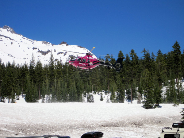
One of several helicopter evacuations.


Gear Notes:
Crampons, ice axe, and helmet are essential right now.
Approach Notes:
Snow from the parking lot.
-
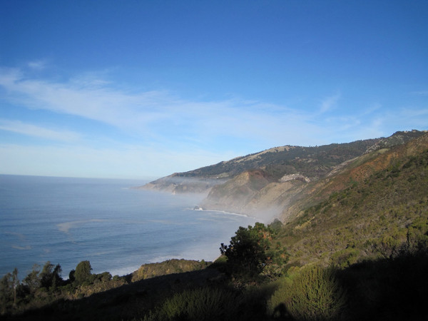
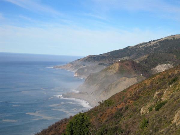
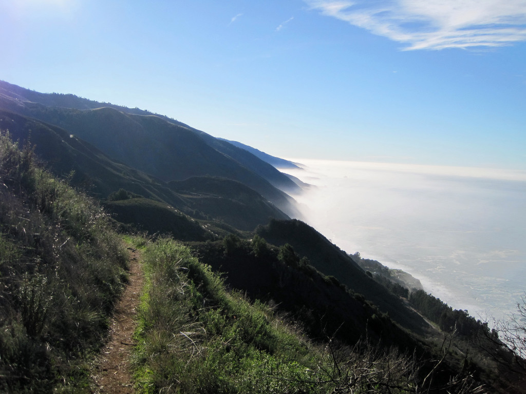
Trip: Cone Peak "Sea to Sky" - Vicente Flat
Date: 1/10/2010
Trip Report:
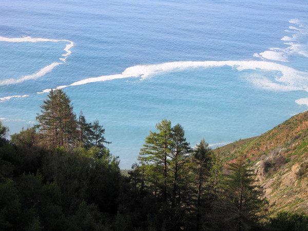
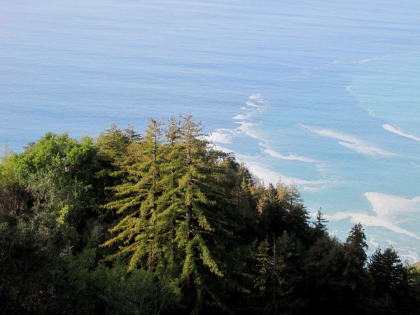
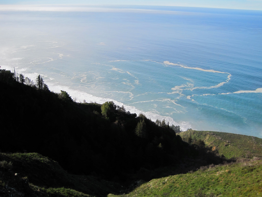
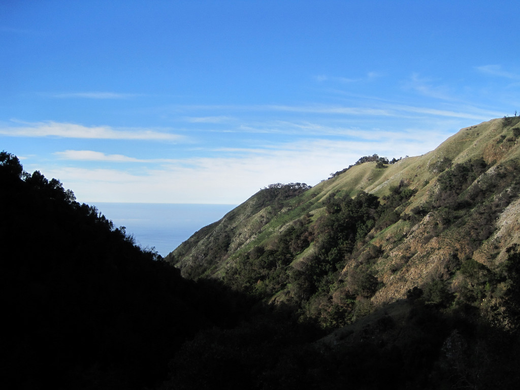
Cone Peak is a spectacular summit along the rugged Big Sur coast. At 5,155 feet, it is the second highest mountain in the Santa Lucia Mountain range, but it’s the highest mountain to offer a view of the ocean. The mountain rises nearly a vertical mile in less than three miles from the coastline as the crow flies. This is one of the steepest gradients from ocean to summit in the contiguous United States, hence the name "Sea to Sky." In fact, the average gradient from sea level to summit is around 33%, which is steeper than the average gradient from Owens Valley to the summit of Mount Whitney. The three canyons that descend from Cone Peak to the ocean are impressively steep with thick stands of redwoods and cascading streams. The ridgelines contain oak woodland and chaparral transitioning to a pine forest higher up and even some firs near the top.
[video:youtube]
Video also available on Vimeo
A rugged dirt road reaches the 3,800 ft level on the mountain leaving a 2.25 mile hike to the summit, but a far more aesthetic approach is to climb the mountain from Hwy 1 near the ocean. There are two possible routes – the Stone Ridge/Gamboa Trail and the Vicente Flat Trail. The Stone Ridge/Gamboa option is the shortest route, but it’s largely unmaintained and entails eroded trail along steep hillsides, brush, bountiful poison oak, ticks, and rattle snakes so it almost certainly takes longer. The Vicente Flat Trail is well maintained all the way up to the Coast Ridge Road and the Cone Peak Trail. The Vicente Flat option is also more scenic with great views of the coastline and passage through Hare Canyon, including redwoods, streams, and views of the canyon. This is the route we chose as an out-and-back. In all, the trip was over 22 miles and included over 6,000 feet of total elevation gain.
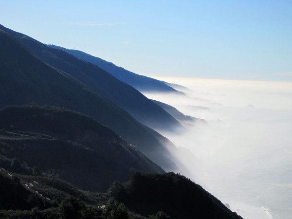
Winter and spring are good times to hike and run Cone Peak, and likewise for almost every other climb in the Ventana Wilderness. The coast is fog-free and the temperatures are pleasant from top to bottom. In the summer, the upper part of the mountain is almost always above the marine layer leaving it brutally hot with swarming black flies. It’s the persistent summer marine layer that allows the canyons to remain cool and sustain a redwood forest. In the winter and spring the streams are also flowing with greater volume, the redwood forest is lush, and wildflowers are in bloom – I was amazed at how many wildflowers were out in January!
Cone Peak from Vicente Flat Trail
This entire area was burned in the fires of 2008 by varying degrees. These fires were largely beneficial and fire suppression had artificially prevented a wide ranging wildfire for many decades. Most of the redwoods survived and rehabilitation is well under way. Other species which can only germinate after a fire are finally getting a chance.
Big Sur Coastline above Kirk Creek Bluff


Hare Canyon


The Ocean is over 5,000 vertical feet below!

View of the Ocean from the summit of Cone Peak
Junipero Serra Peak


Redwood Sorrel
Wildflowers in January!


Back at the Kirk Creek Bluff
-
Thanks!
Through 2008 I used the Nikon Coolpix 5600 and in 2009 the Canon Powershot SD1200 IS. For processing, I use the software that came with the cameras (PictureProject and ZoomBrowser).
-
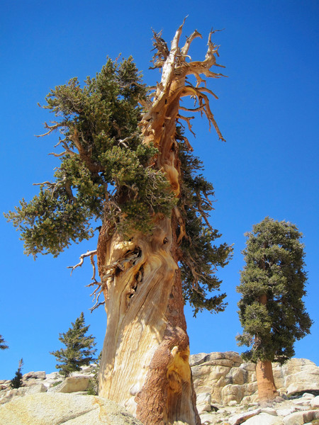
I posted my 2009 Highlights Gallery. Most shots are from the North Cascades and High Sierra.
I also made a Mountain Photography Highlights Slideshow (4:02) of some of my favorite photos from 2005-2009. It's definitely missing a few that I don't have access to high quality versions at the moment; I will add them later.
[video:youtube]
It can also be found on Vimeo.
-
Here is what I took on this trip:
Clothing: I wore running shorts and a long sleeve wool shirt. I brought extra clothing that I didn't use (wind jacket, pants) but I would bring them again considering time of year and duration of the trip.
Backpack: I used the Deuter Futura 25 to carry all the extra clothing I brought. Otherwise, I typically use the Ultimate Direction Wasp on adventure runs.
Food: Powerbars, Gels, ShotBloks, SaltStick electrolyte capsules (The only electrolyte capsule that was formulated to closely resemble the electrolyte profile lost during activity: sodium, potassium, calcium and magnesium.)
Hydration: I had a camelback and an Ultimate Direction Fastdraw Handheld water bottle to fill up water quickly at streams.
Footwear: La Sportiva Fireblade Trail Runners
Headlamp: First time using the Petzl Myo RXP on a trip. While heavier, they provide ample light to run comfortably on rough trails at night.
I brought Kahtoola Microspikes and they turned out to be extremely helpful on the sometimes icy descent from Glen Pass. It would have helped if I brought high gaiters as well, not for keeping snow out of my shoe, but for preventing the crusty snow from cutting my leg as I postholed.
-
Trip: Rae Lakes Loop - Adventure Run
Date: 10/24/2009
Trip Report:
For best viewing use Internet Explorer or Google Chrome (Firefox does not load completely from my experience)
According to the national park service, the Rae Lakes Loop is one of the most popular hikes in Sequoia and Kings Canyon, if not the entire Sierra. I completed the famous loop in 12 hours, 31 minutes, starting at 5:30 am and finishing just after 6 pm. The loop is 46 miles long and climbs from 5,035 ft at the trailhead to 11,978 ft at Glen Pass. The portion between Vidette Meadows (Mile 14) and Woods Creek Crossing (Mile 29) is along the John Muir Trail. The highlight of the loop is the Rae Lakes area, a chain of large alpine lakes over 10,500 feet with views of rugged Sierra peaks. The trailhead is at Road’s End in magnificent Kings Canyon and travels along Bubbs Creek and Woods Creek, including Vidette Meadows, Castle Domes, and Paradise Valley. Most backpackers do the loop clockwise, which makes sense as you gradually gain elevation through the Rae Lakes basin. However, for running it makes more sense to go counterclockwise reaching the highpoint at Glen Pass in 18.5 miles, followed by 27.5 miles of downhill, in theory.
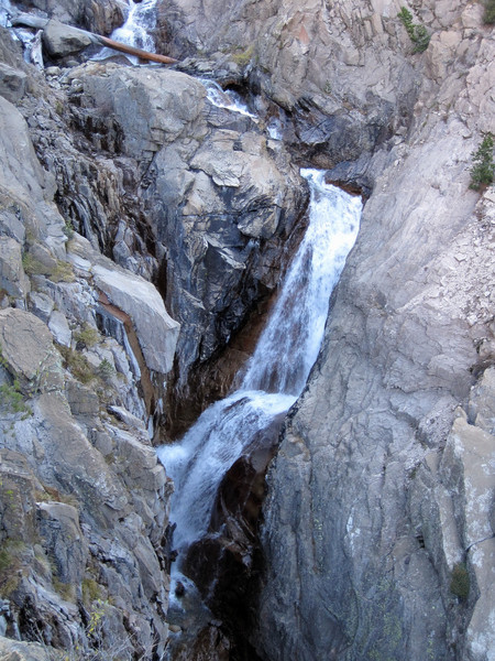
A strong storm on October 13th dropped several feet of snow above 9,000 feet, and a substantial amount of snow remains which made for slow going between Charlotte Lake junction and Dollar Lake (~8 miles). The snow was particularly deep on the north side of Glen Pass with an icy crust layer on top of powdery snow. The result was a lot of postholing and I often could not find where the trail was buried until near the Rae Lakes, but the views of the Sierra with a fresh coat of snow more than compensated. The trails along the loop are generally rocky and rugged precluding a consistent fast pace. I found the section before and after Mist Falls (miles 41 to 43) to be particularly rocky and rough on tired legs at the end of the day.

[video:youtube]
Alternatively, the video can be watched on Vimeo
Location (Elevation): Time Elapsed / Split / Real Time
Mile 0 – Road’s End TH (5,035 ft) : 0 / 0 / 05:30
Mile 2 – Paradise/Bubbs Jct. (5,120 ft) : 14:53 / 14:53 / 05:45
Mile 4 – Sphinx Junction (6,240 ft) : 45:03 / 30:11 / 06:30
Mile 11 – Junction Meadow (8,136 ft+) : 2:11:59 / 1:26:55 / 07:42
Mile 14 – Vidette Meadow (9,514 ft) : 3:06:09 / 54:11 / 08:36
Mile 18.5 – Glen Pass (11,978 ft) : 4:55:49 / 1:49:40 / 10:26
Mile 21 – Rae Lakes (10,564 ft) : 6:20:11 / 1:24:21 / 11:50
Mile 24 – Dollar Lake (10,170 ft) : 7:48:51 / 1:28:40 / 13:19
Mile 29 – Woods Creek Crossing (8,492 ft) : 8:46:16 / 57:25 / 14:16
Mile 34 – Upper Woods Creek (~7,500 ft) : 9:43:18 / 57:02 / 15:13
Mile 42 – Mist Falls (~5,500 ft) : 11:37:00 / 1:53:41 / 17:07
Mile 44 – Paradise/Bubbs Jct. (5,120 ft) : 12:14:12 / 37:12 / 17:44
Mile 46 – Road’s End TH (5,035 ft) : 12:31:37 / 17:25 / 18:01
Mount Bago
Bubbs Creek Falls

Vidette Meadows


Deerhorn Mountain

Mount Brewer


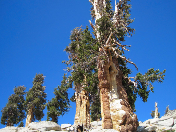
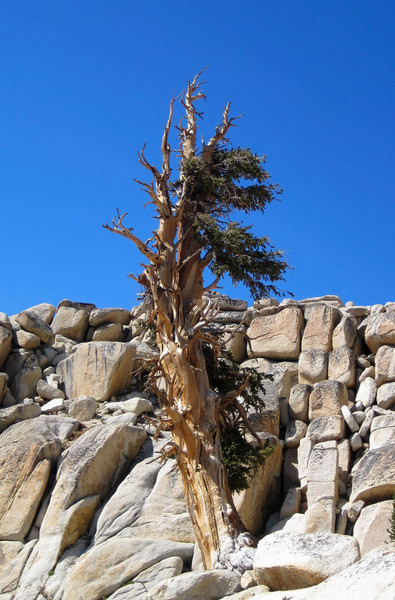
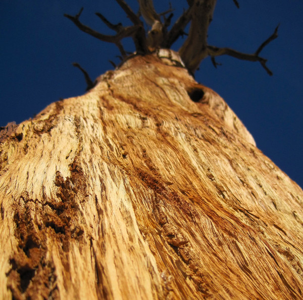
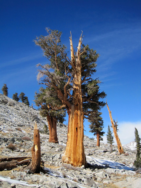
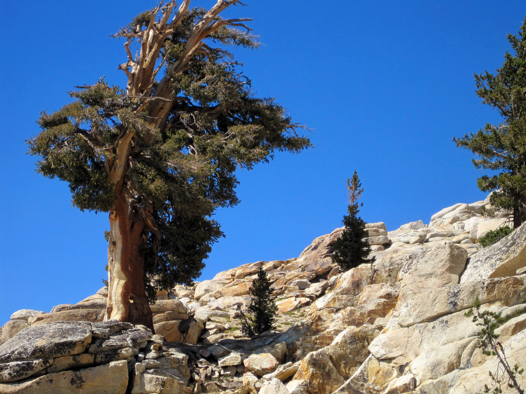
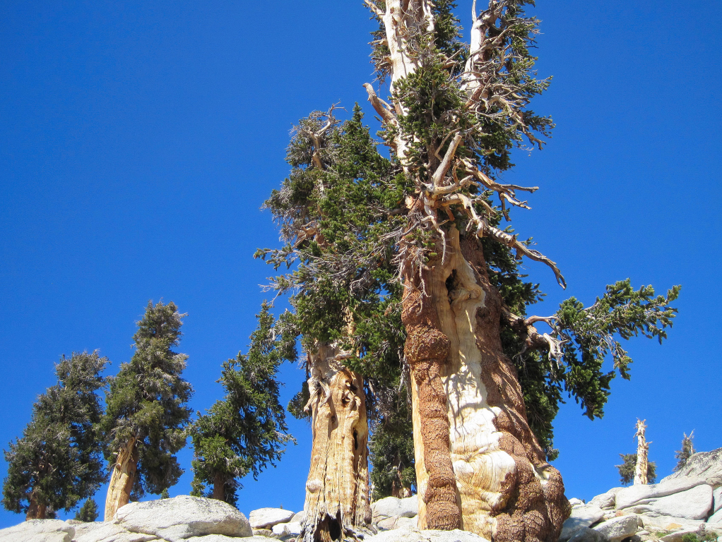
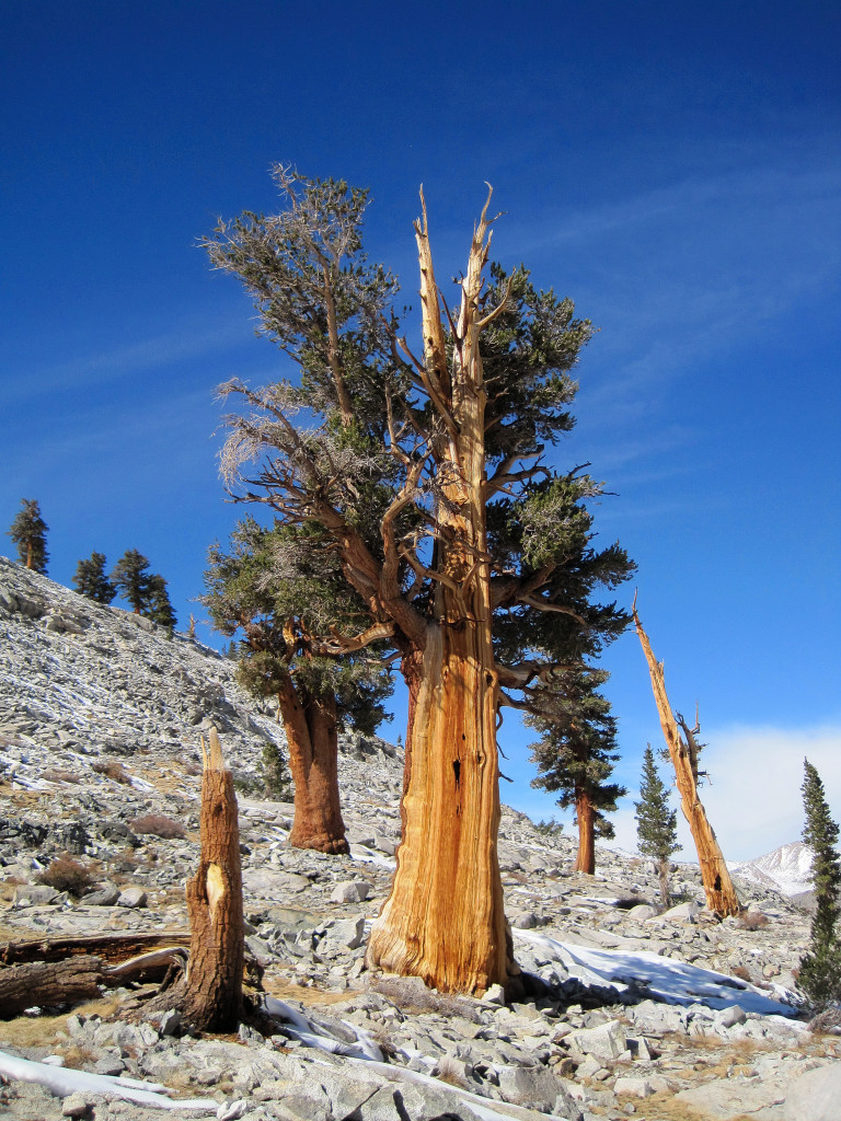
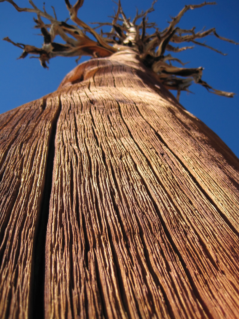
Corkscrew Southern Foxtail Pine


Charlotte Lake
Alpine lake below Glen Pass
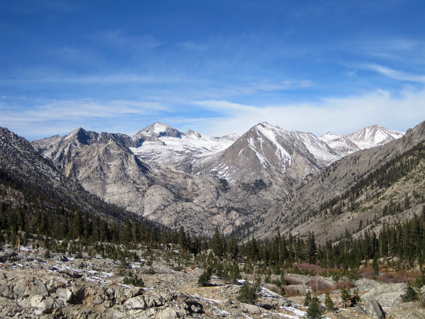
South Guard, Mount Brewer, North Guard, and Mount Francis Farquar
Rae Lakes from Glen Pass
Trail down from Glen Pass buried in snow.
Lots of snow
Upper Rae Lake


Arrowhead Lake


Dollar Lake
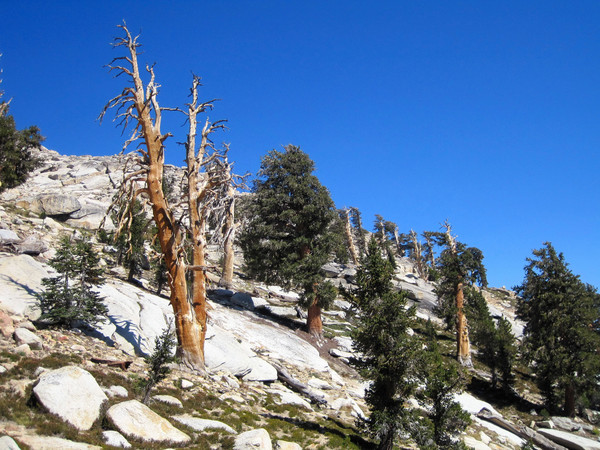
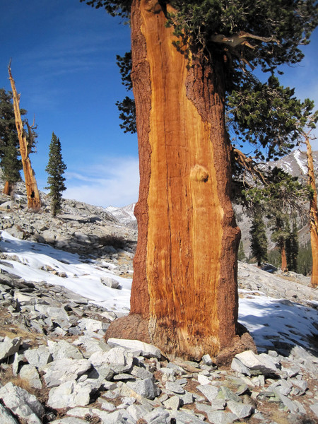
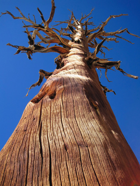
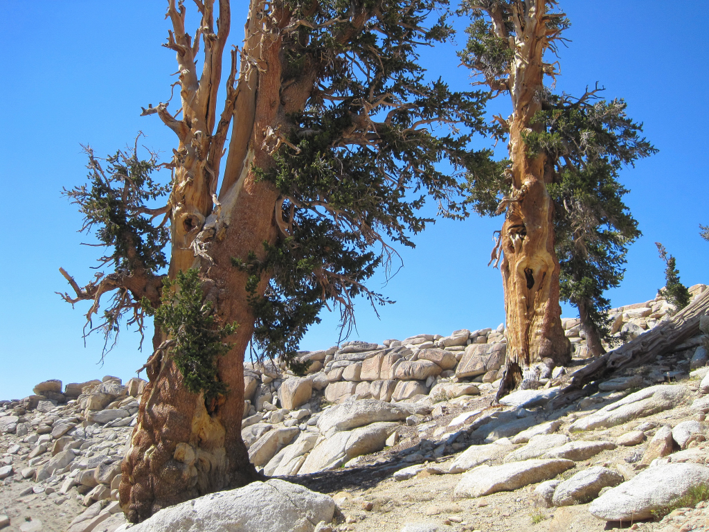
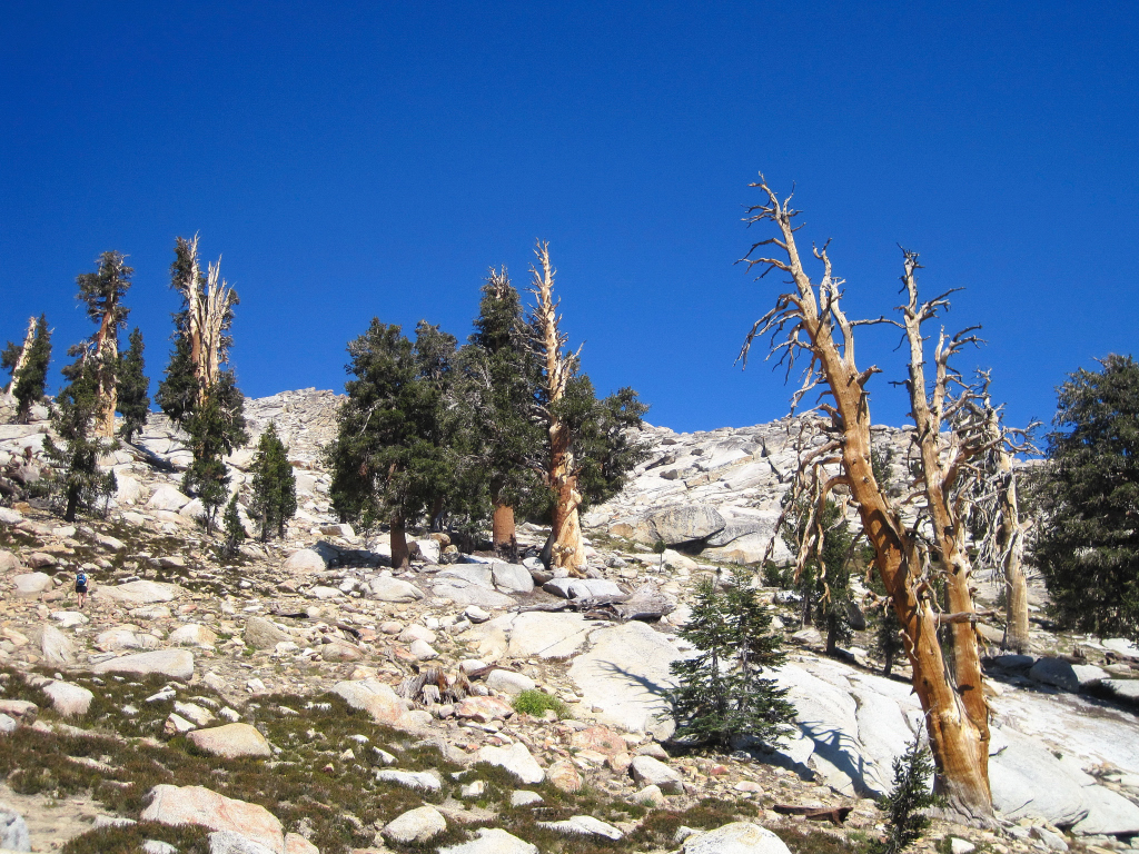
Southern Foxtail Pines

Woods Creek Bridge
Castle Domes


Upper Paradise Valley


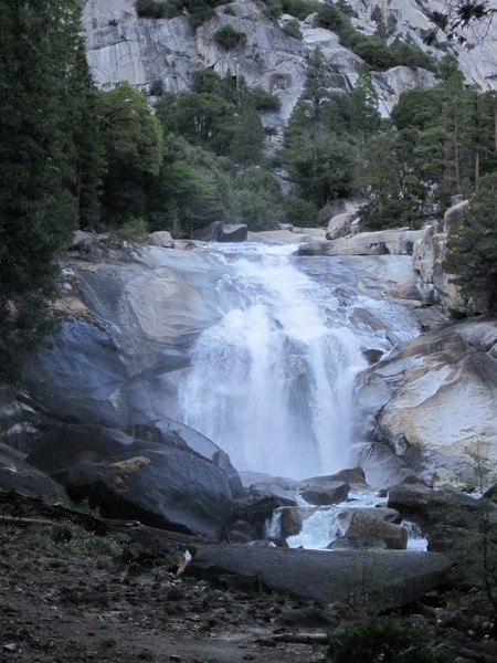
Mist Falls
Approach Notes:
Snow line in the high Sierra is currently between 10-11k depending on the aspect.
-
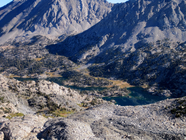
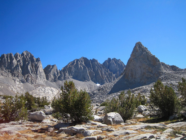
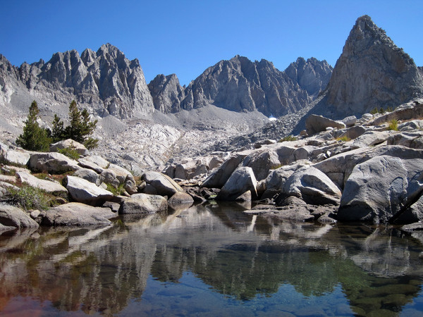
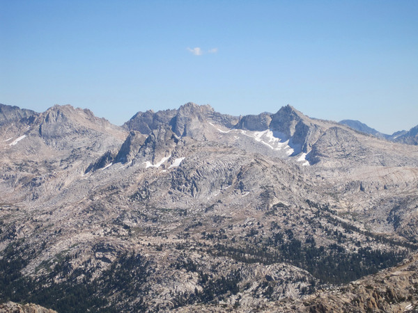
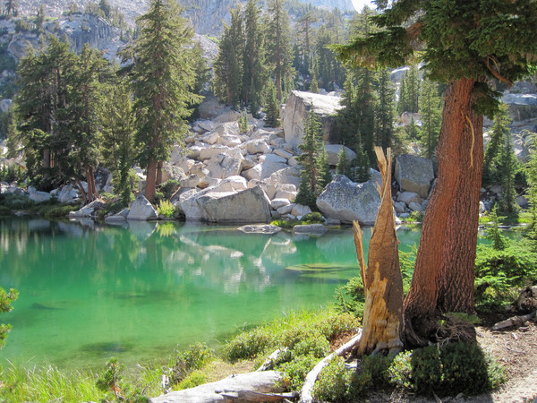
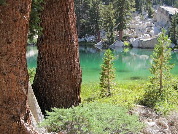
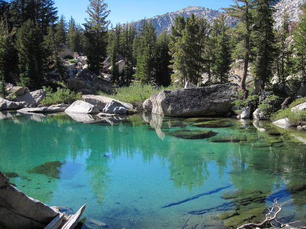
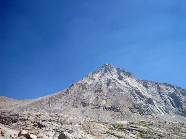
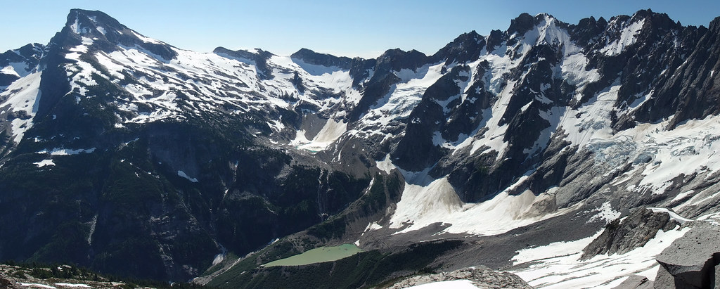
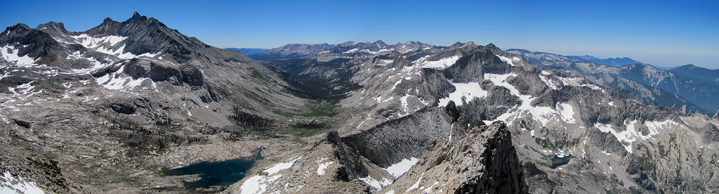
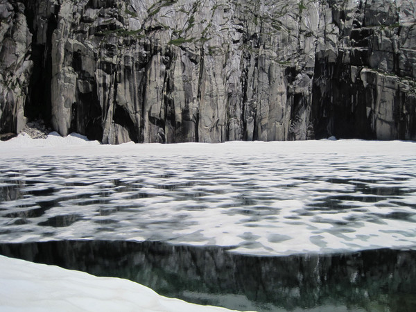
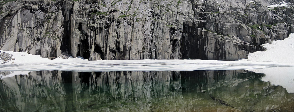
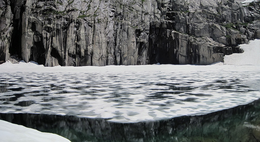
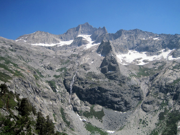
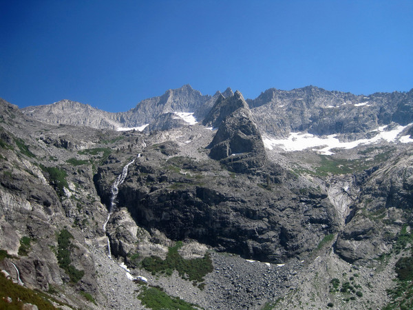
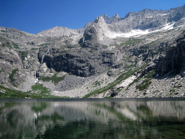
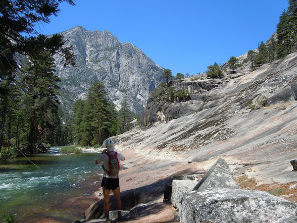
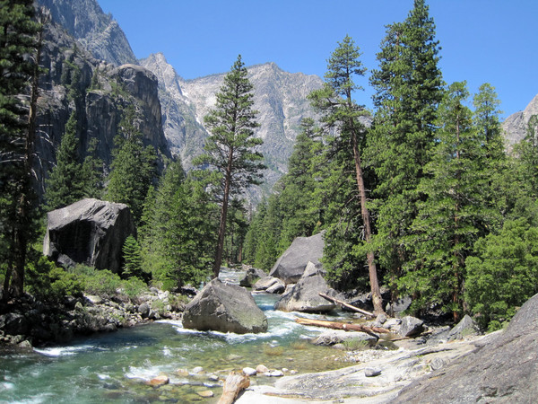
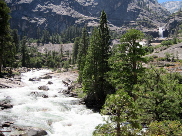
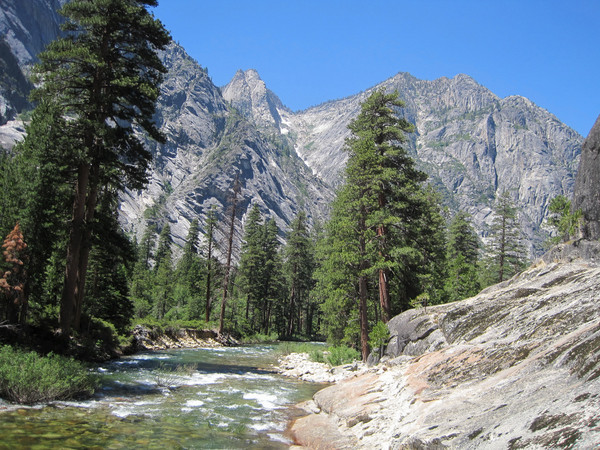
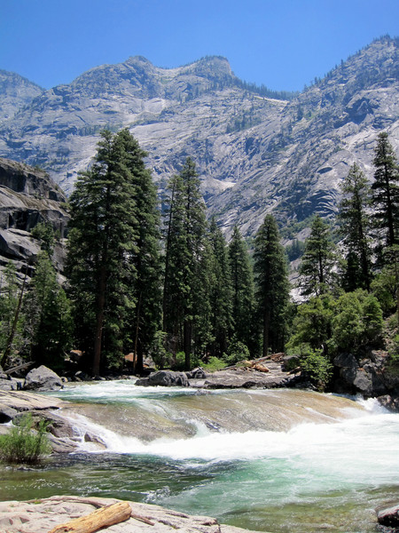
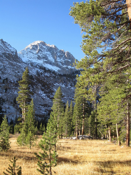
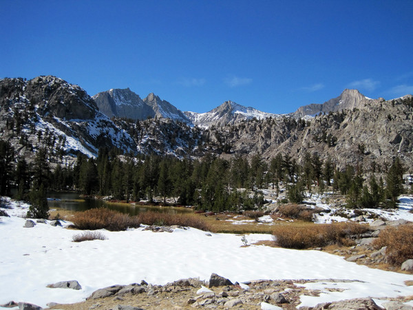
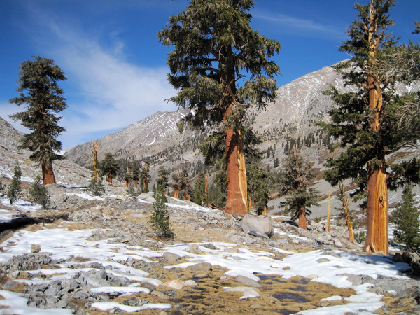
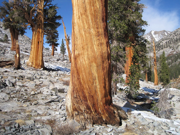
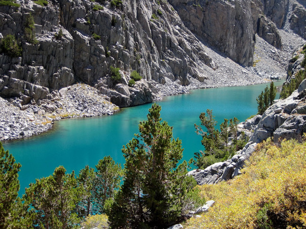
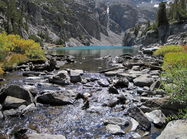
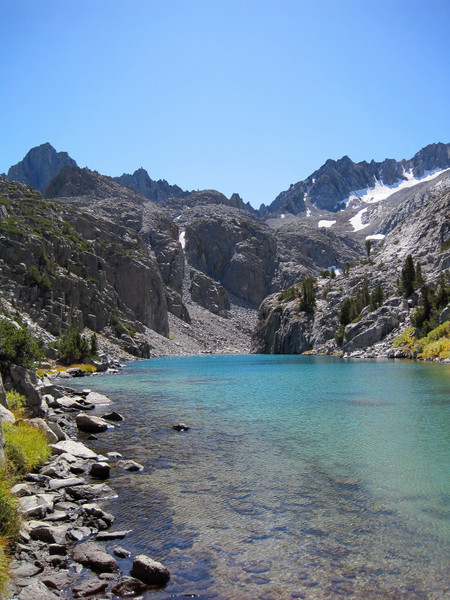
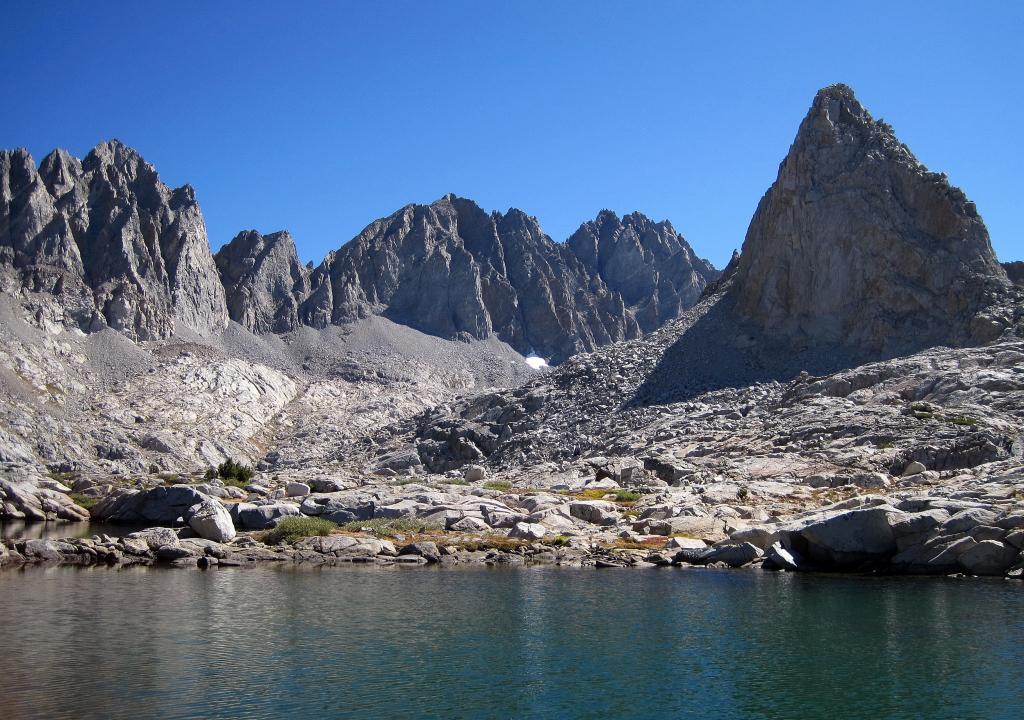
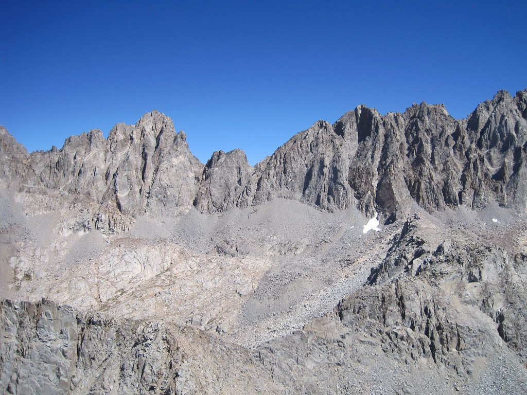
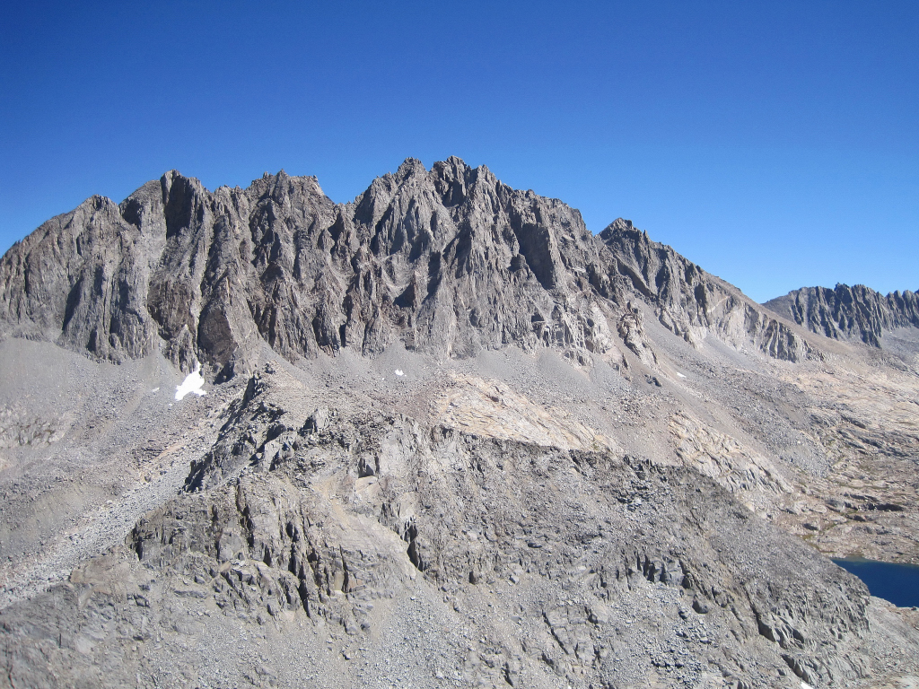
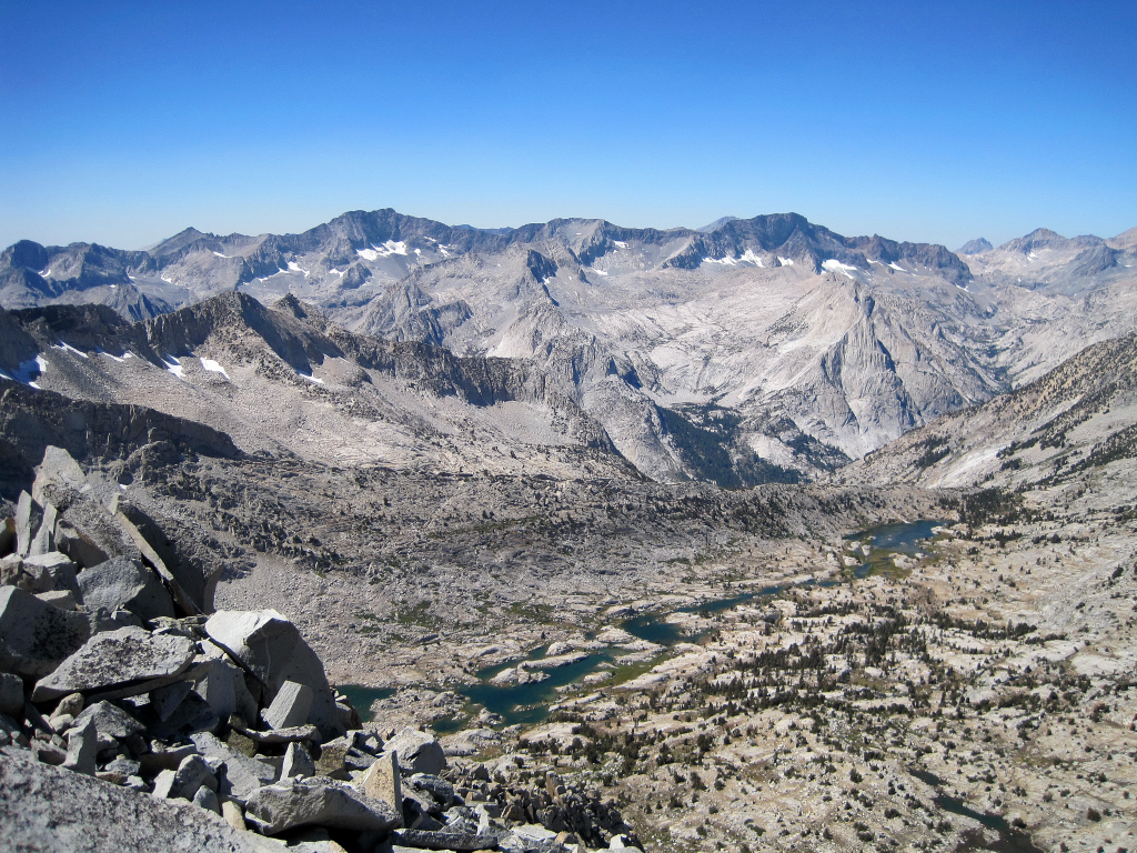
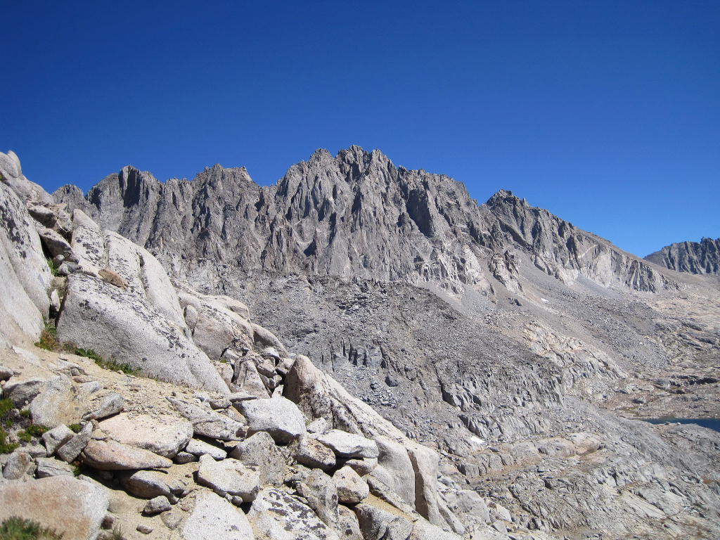
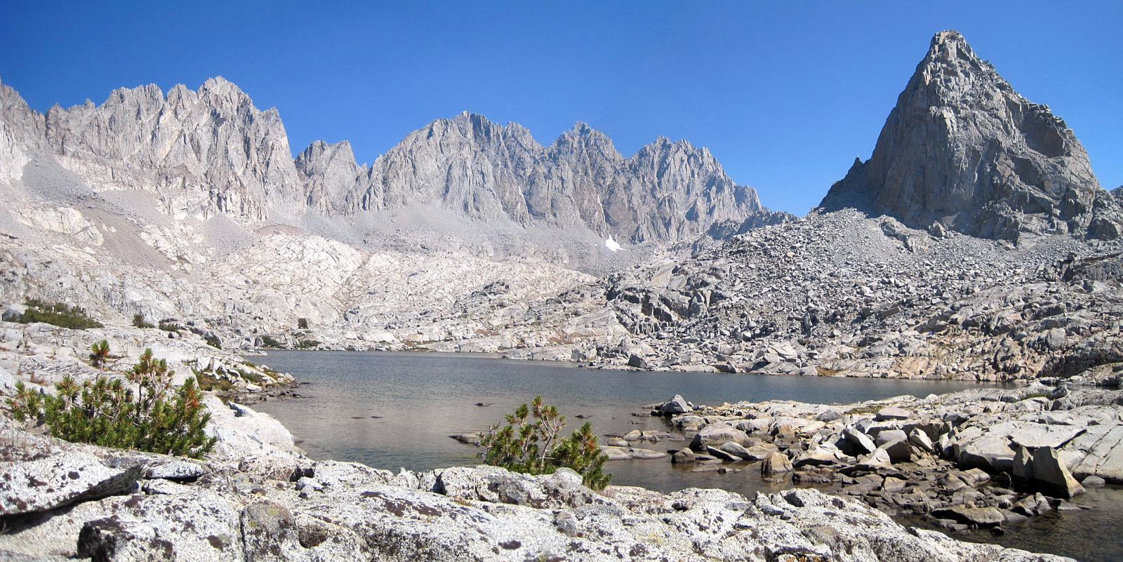
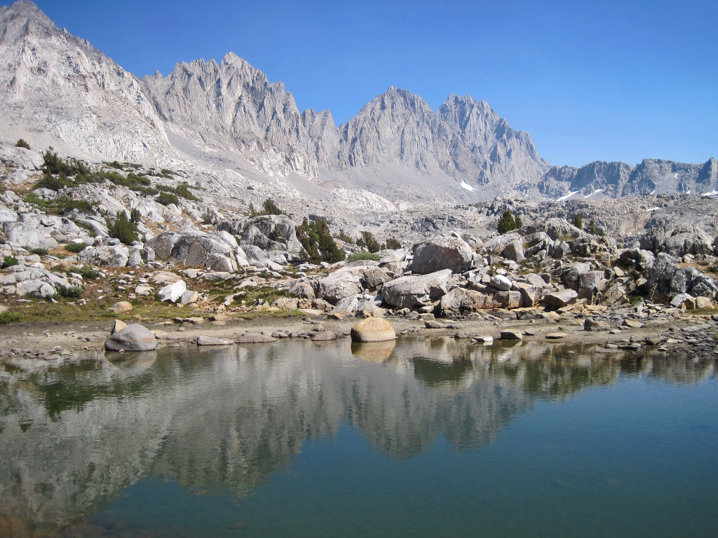
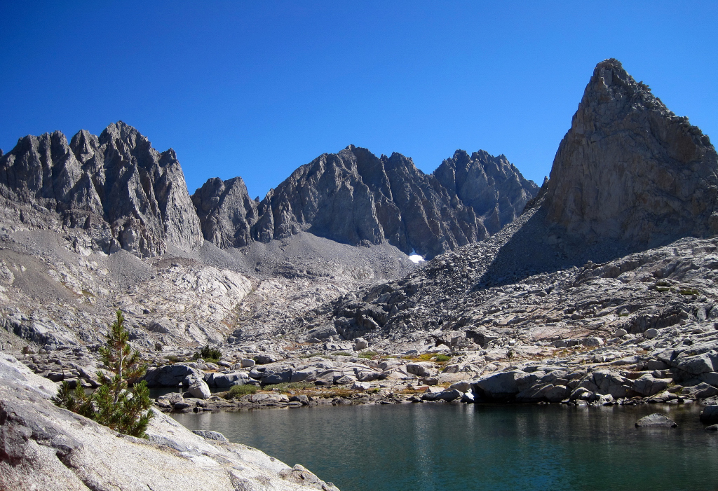
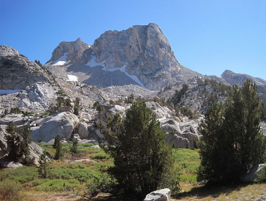
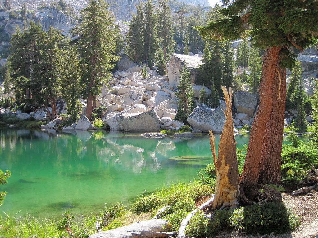
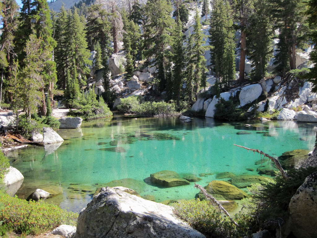
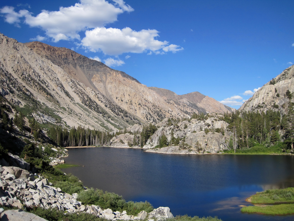
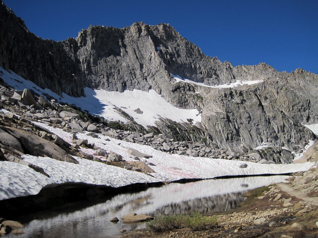
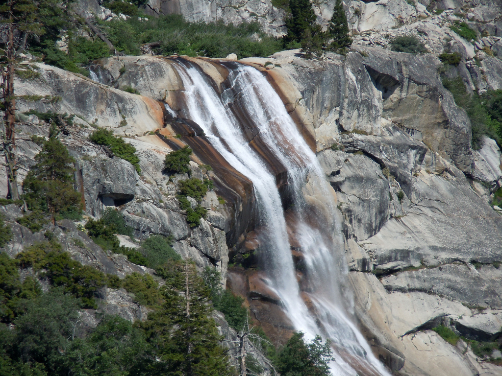
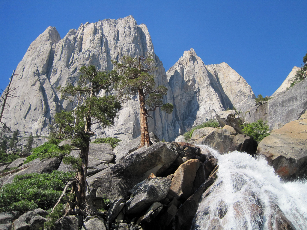
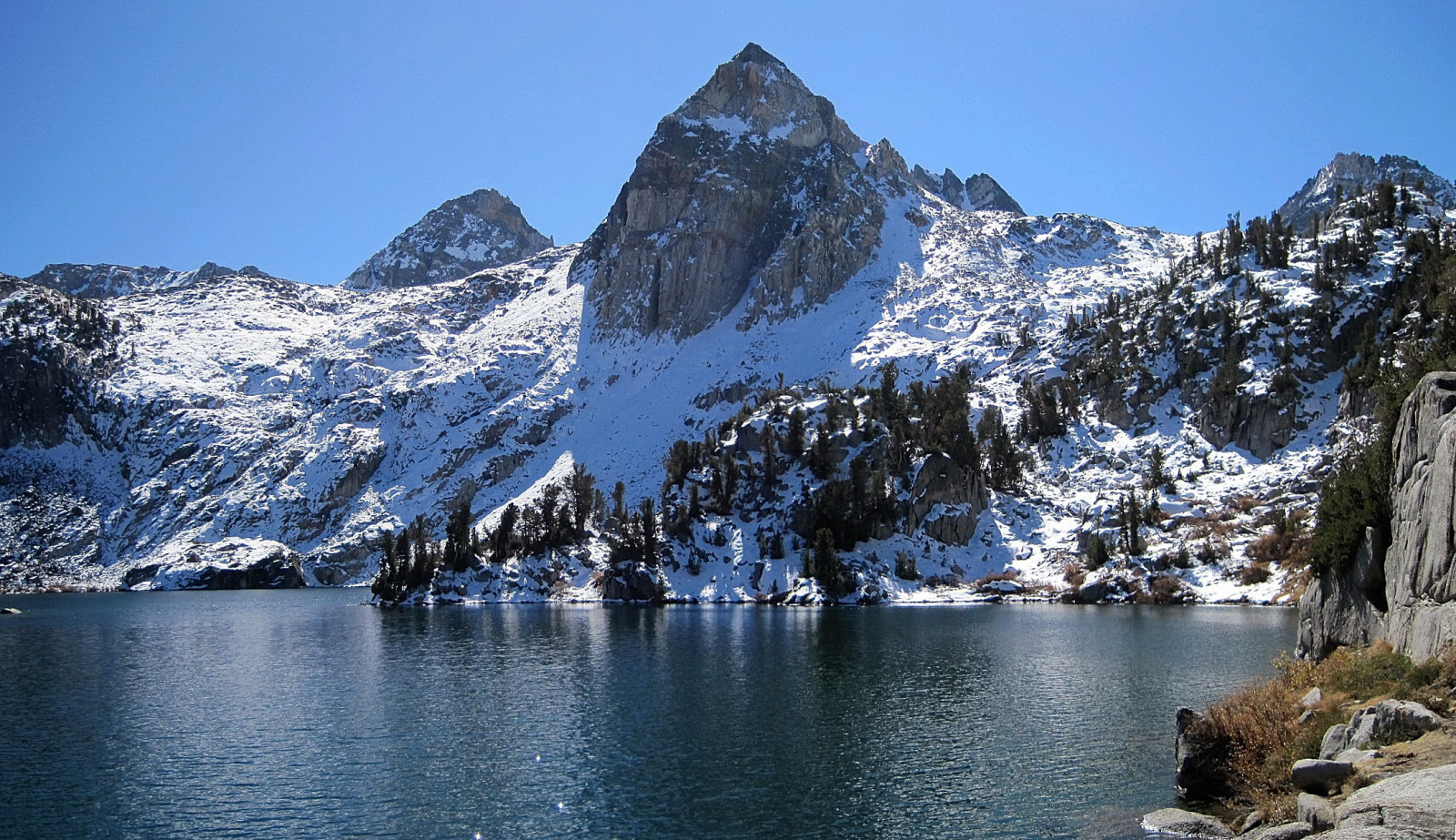
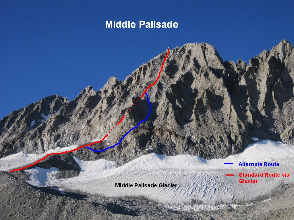
Trip: Middle Palisade - Northeast Face
Date: 9/24/2009
Trip Report:
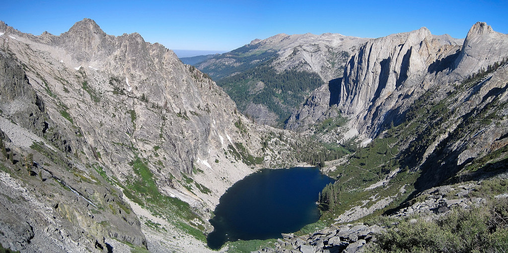
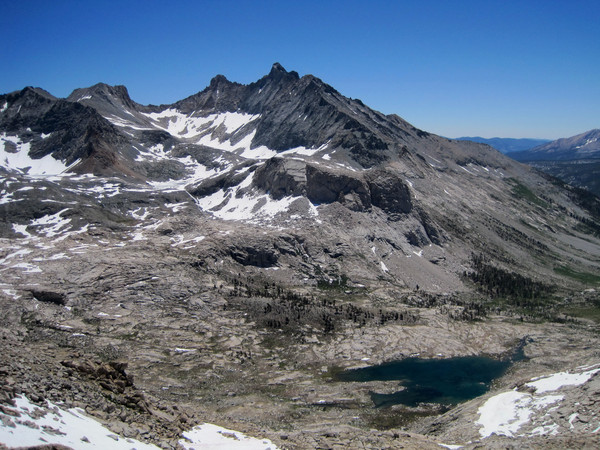
The Northeast Face of Middle Palisade is a classic scramble of a 14er within the rugged Palisades subgroup of peaks. The route takes you past stunning Finger Lake, with its turquoise glacial water and towering granite slabs. The route itself is a fun third class scramble with superb views of the surrounding area. The climb entails about 7,000 feet of vertical gain and 16 miles roundtrip. I completed the route in 7:46 roundtrip, starting at 5:45 am and finishing just after 1:30 pm.
Finger Lake
I was exhausted after completing the Stanford Loop the prior evening and thought I was done. However, after a good dinner and rehydration, I decided to drive up to the Big Pine Trailhead and see how I would feel the next morning. Despite little sleep, my legs felt better by the morning so I decided to give it a go. In addition, the long drive from the Bay Area gave me more incentive to go for it. I had travelled in the North Fork of Big Pine Creek for the climb of Mount Sill in July, but I had never been to the South Fork of Big Pine Creek. The lower part of the South Fork is a dry environment with even some cactus sprinkled in. Once the trail switchbacks up to the top of a large headwall, you enter into a different world of granite, large pine trees, and lushness. My hike was timed perfectly so that I was watching alpenglow over Mount Sill, Norman Clyde Peak, and Middle Palisade right as I crested the headwall but before I entered the pine forest. I continued on to near Brainerd Lake and left the trail for Finger Lake, climbing slabs and talus. The slabs and talus continued all the way from Finger Lake to the Middle Palisade Glacier moraine and the start of the route.
[video:youtube]
Alternatively, the video can be watched on Vimeo.
On the way up, I took the standard route which entails a short walk on the glacier. Sometimes, the glacier can be icy necessitating crampons and ice axe, but this time the sun cups were so big that no gear was necessary. I ascended up to the access point for the ramp heading into the scrambling chute and found that the bergschrund had opened a bit since prior reports. It is still passable, but slipping would not be a good thing here. Once on the Northeast face, the sustained third class scrambling is fun. There is some looseness, but it is never too exposed. The most difficult moves are right up near the summit blocks where there is a large boulder to climb over. Views from the summit are spectacular and enjoyed the calm and warm conditions. Heading down, I decided to check out the alternate route which avoids the glacier all together. The most difficult part of this route is the final reddish/white gully that is loose and crumbly. The best policy here is to use handholds on the more solid rock walls alongside the gully. My conclusion is that both of these routes work – the standard route involves the glacier which can be icy and the alternate route is a bit more loose - you can chose either or do both!
Continuing down I spent a half an hour at gorgeous Finger Lake which had excellent lighting for photography. I have posted many of my shots from Finger Lake below. After the photoshoot it was a quick 75 minutes back to the trailhead. I imagine that without the fatigue from the Stanford Loop and knowledge of the route, Middle Palisade can be done in around 6 hours.
Location (Elevation): Time Elapsed / Split / Real Time
Big Pine Creek TH (7,677 ft) : 0 / 0 / 05:45
Finger Lake (10,800 ft) : 1:45:38 / 1:45:39 / 07:30
Arrive Summit (14,040 ft) : 3:50:45 / 2:05:06 / 09:35
Depart Summit (14,040 ft) : 4:08:21 / 0:17:36 / 09:53
Finger Lake (10,800 ft) : 6:03:45 / 1:55:23 / 11:48
Big Pine Creek TH (7,677 ft) : 7:46:15 / 1:42:30 / 13:31
Alpenglow on Middle Palisade (left) and Norman Clyde Peak (right)
Alpenglow on Mount Sill
Sunrise over Middle Palisade and Norman Clyde Peak
Middle Palisade and Norman Clyde
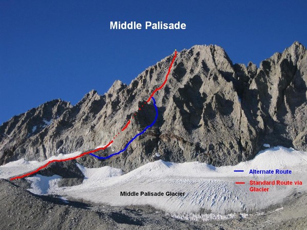
Route up the Northeast Face of Middle Palisade. Red line is the standard route via the Glacier and the Blue line is the alternate route that avoids the glacier.
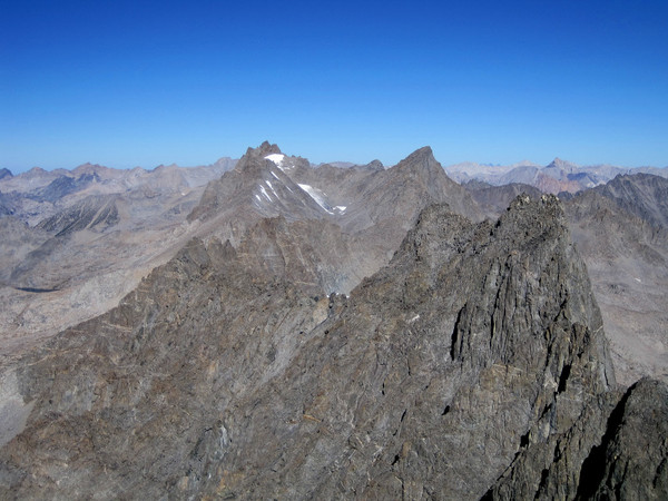
View to Norman Clyde Peak, Mount Sill, and North Palisade

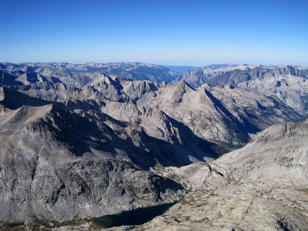
View down LeConte Canyon


Looking down the South Fork Big Pine Creek drainage

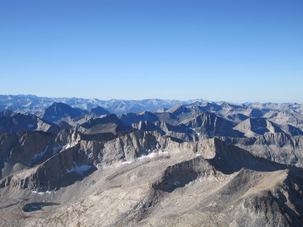
View to Owens Valley
Looking up the Northeast Face of Middle Palisade
The white/red streaks indicate the loose third class gully that is used to start the alternate route.
Finger Lake from above

Finger Lake outlet


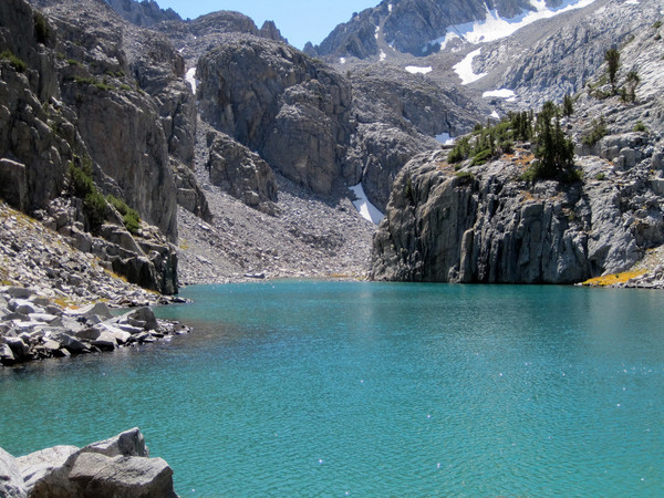
View of Middle Palisade towering above Finger Lake

Brainerd Lake

Brainerd Lake Shoreline


Mount Sill

A look back at Middle Palisade and Norman Clyde Peak
Gear Notes:
La Sportiva Fireblades, Helmet for the scramble in case there are other climbers on the route.
Approach Notes:
South Fork Big Pine Trail in good shape. You can either take the use path from Brainerd Lake to Finger Lake or take a more direct line to Finger Lake by leaving the trail before Brainerd Lake. All things considered, I think both take about the same time and energy.


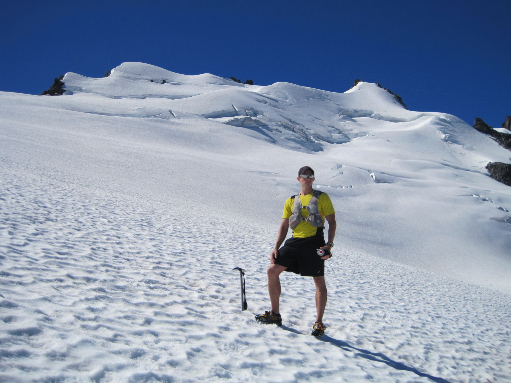
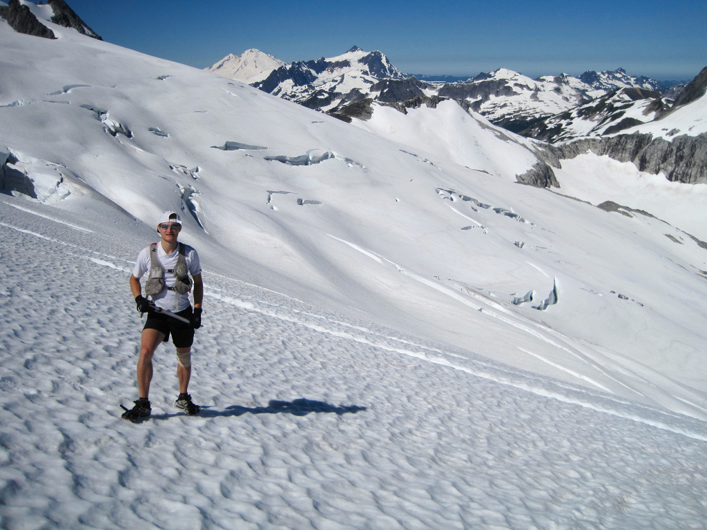
[TR] Mount Lyell & Mount Maclure - Lyell Glacier 7/9/2011
in California
Posted
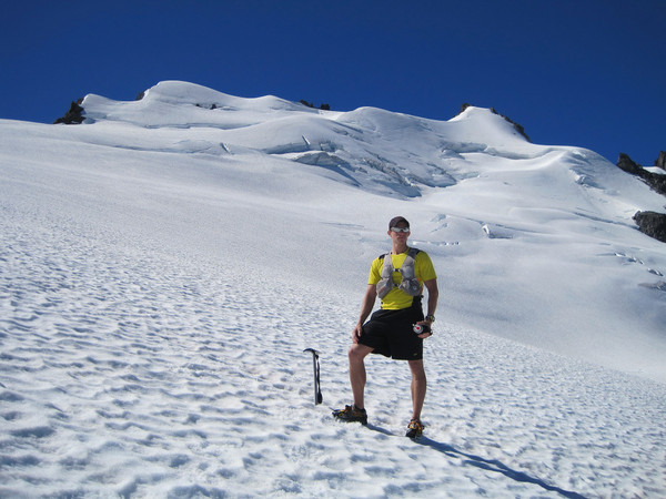
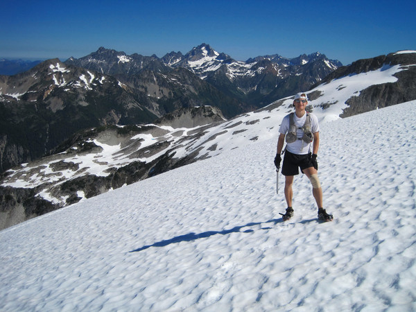
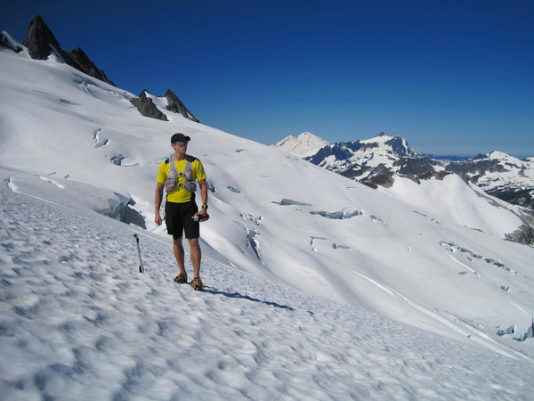
Trip: Mount Lyell & Mount Maclure - Lyell Glacier
Date: 7/9/2011
Trip Report:
"The Roof of Yosemite"
A climb of Mount Lyell (13,120 ft), the highest point in Yosemite National Park, and nearby Mount Maclure (12,960 ft) via Lyell Canyon and Lyell Glacier. The trip entailed about ~30 miles (22 miles along the JMT and the remainder on snow and rock). The trip took 8:50 RT, which was 65 minutes faster than I climbed these two peaks last time in 2007.
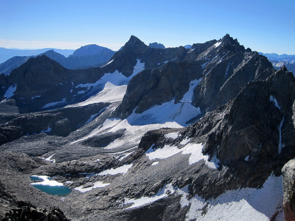
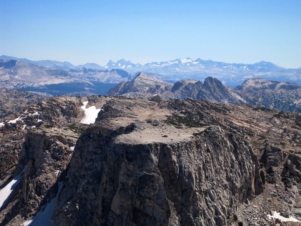
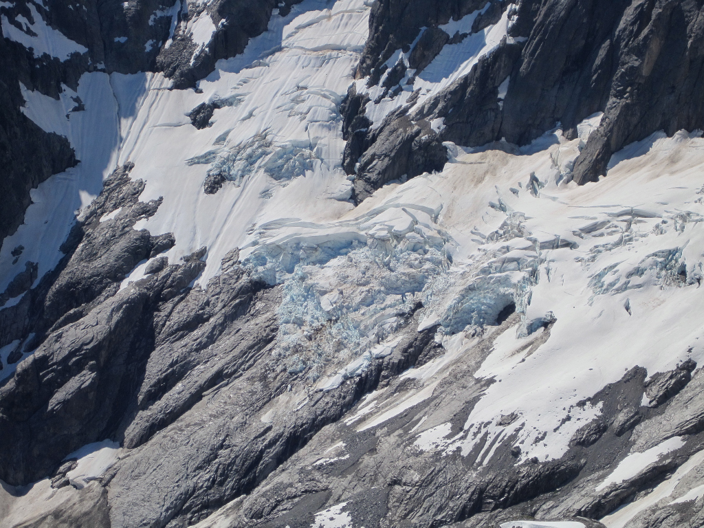
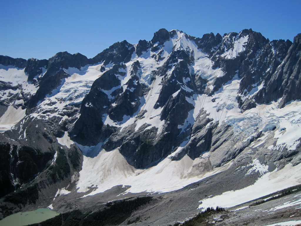
There has been substantial snow melt recently, but still a lot above 10,000 feet. At first I thought I could take the firm snow to nearly the summit of Lyell, but the slope became progressively icier and steeper and despite only being a couple hundred vertical feet from the summit I had to retreat to the East Arete, which turned out to be a fun scramble. On the way down I took the central chute to a snow finger that entailed a section of downclimbing on rock. The standard route via Lyell-Maclure col appears to be more difficult at the moment with the aforementioned steep and icy snow covering what would normally be the class 3/4 rock scramble. Mount Maclure was a straightforward snow climb and then class 3 scramble along the ridgeline. The views from both Lyell and Maclure were spectacular, and included the Lyell Canyon 4,000+ ft below, the rugged Ritter/Banner area, the Clark Range, Nothern Yosemite, and even Half Dome and the Yosemite Valley. There was excellent clarity and bluebird skies.
Lyell Canyon was not as soggy as I had anticipated, but it still had plenty of wet and muddy sections. Once I gave up trying to keep my feet dry it wasn't so bad. I met several Pacific Crest Trail thru hikers on the 11 miles of trail through Lyell Canyon to near Donohue Pass. They all reported copious snow on their journey through the Southern High Sierra and I was not surprised considering the prodigious winter snowpack.
Mount Lyell (left) and Mount Maclure (right) tower 4,000+ feet above the head of Lyell Canyon
From L to R: Banner Peak, Mount Ritter, Rodgers Peak
Ritter and Rodgers
Waugh Lake (foreground) and Gem Lake (background)
Lyell Canyon
Mount Maclure from Mount Lyell
Some technical downclimbing
Florence Peak, Half Dome and Yosemite Valley
Northern Yosemite Peaks
The Clark Range
The Clark Range
Clark Range, Florence Peak, Half Dome, and Yosemite Valley
Mount Lyell, Mount Ritter and Rodgers Peak from Mount Maclure
Mount Lyell, Mount Ritter and Rodgers Peak from Mount Maclure
Lyell Canyon
Lyell Canyon
Last look at Lyell and Maclure from the head of Lyell Canyon
Gear Notes:
Black Diamond Neve strap crampons, ice axe, Ultimate Direction Wasp Pack, First Endurance EFS drink mix and liquid shot
Approach Notes:
Muddy and flooded sections in Lyell Canyon, solid snow above 10k.