


off_the_hook
-
Posts
177 -
Joined
-
Last visited
-
Days Won
1
Content Type
Profiles
Forums
Events
Posts posted by off_the_hook
-
-
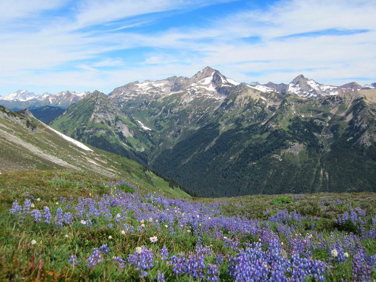
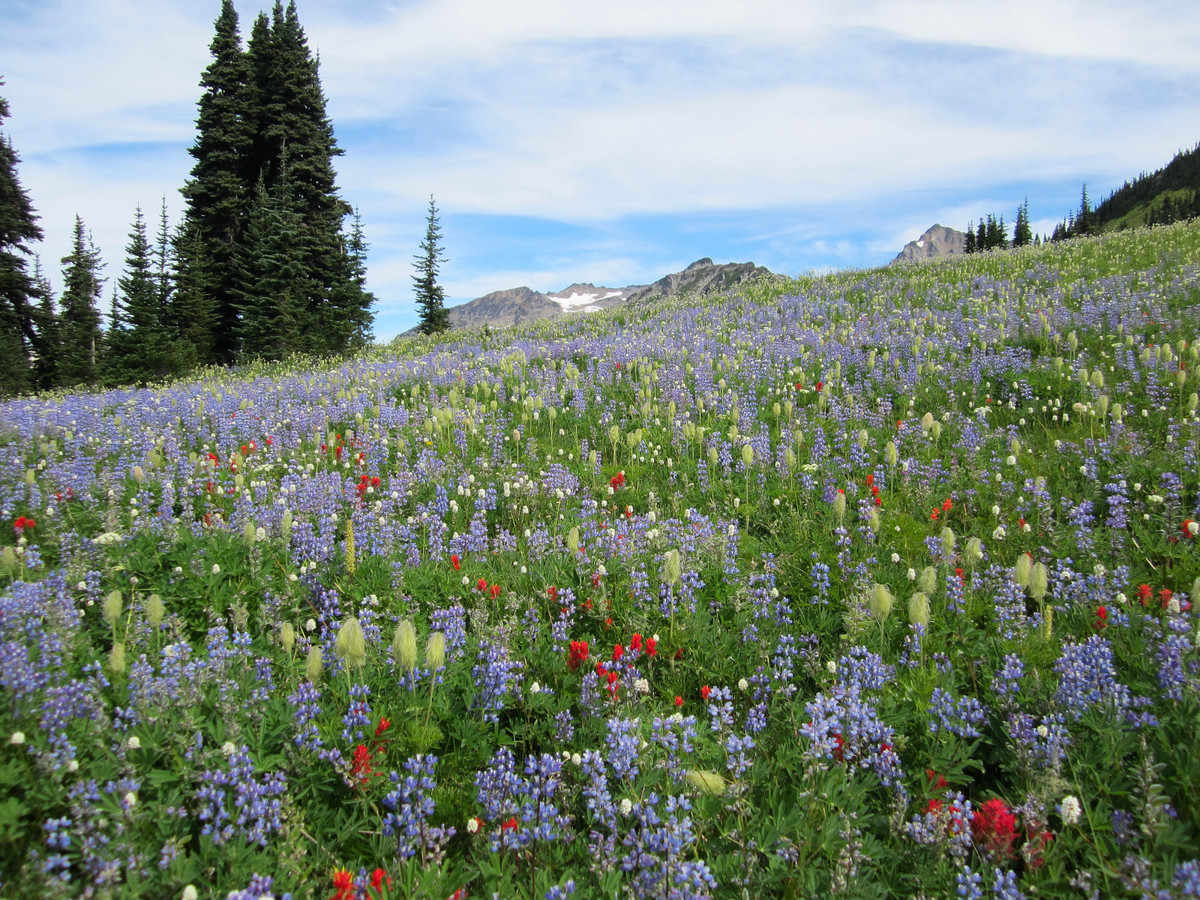
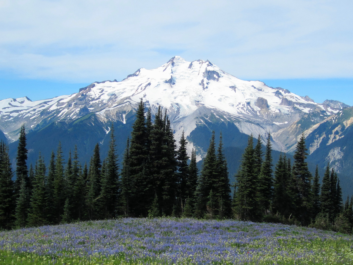
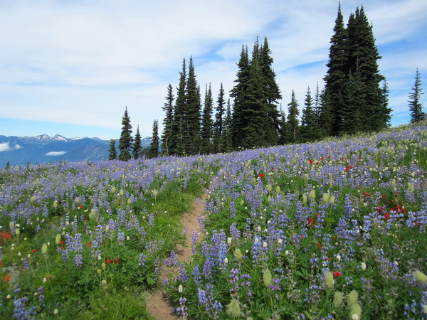
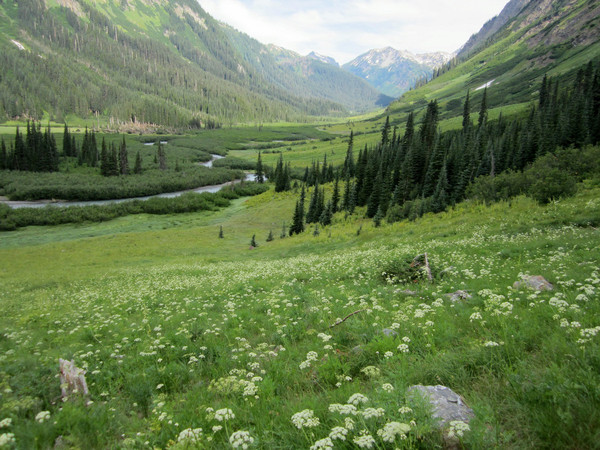
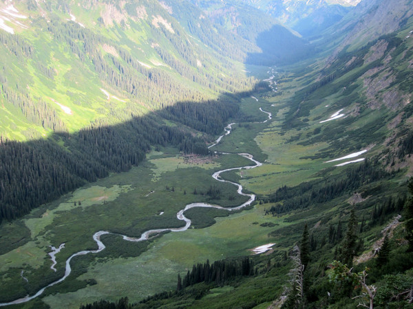
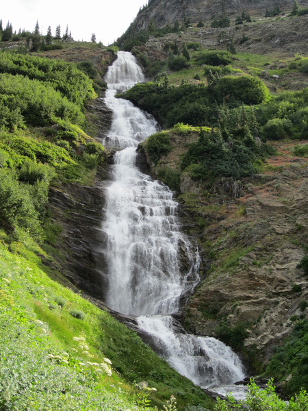
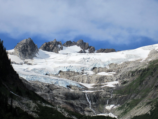
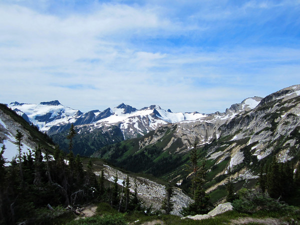
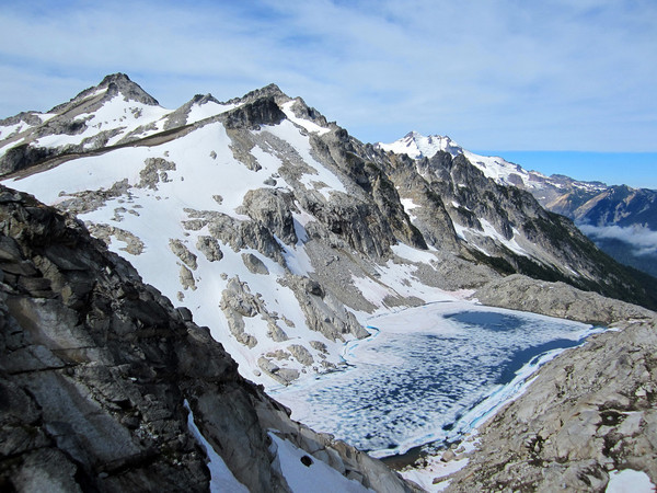
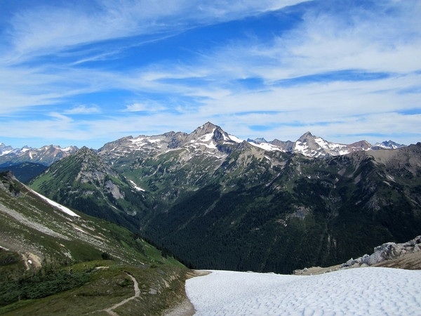
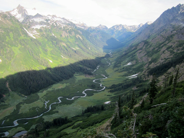
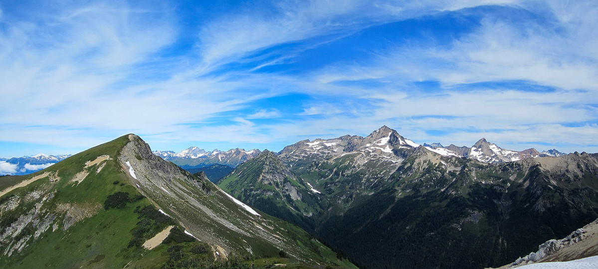
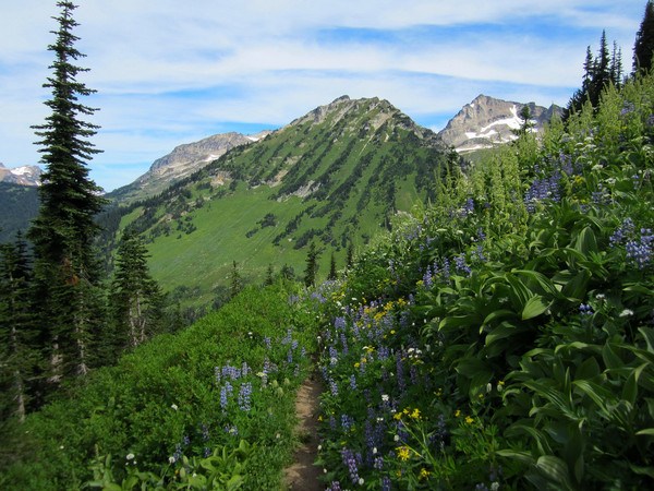
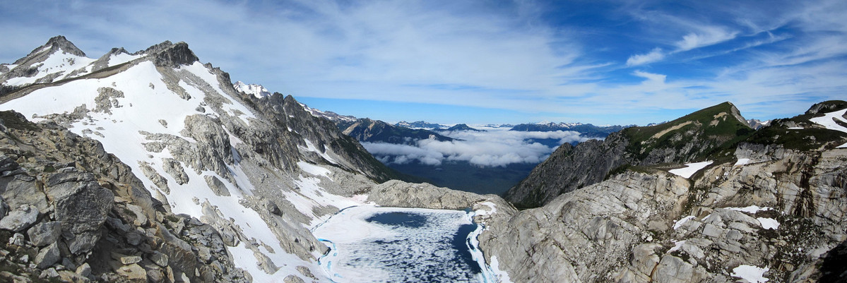
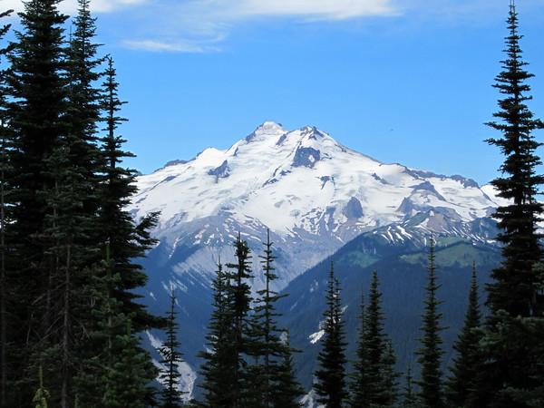
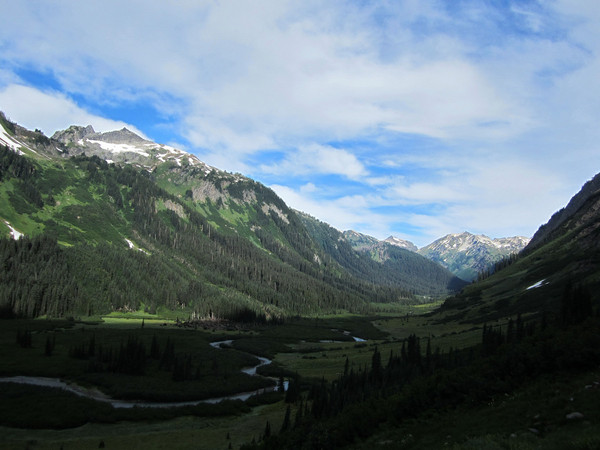
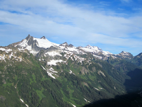
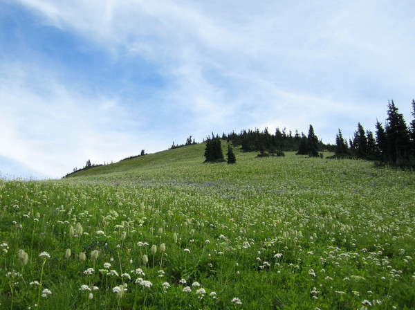
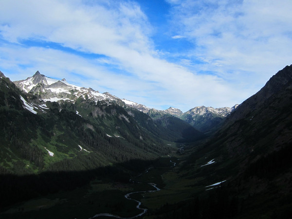
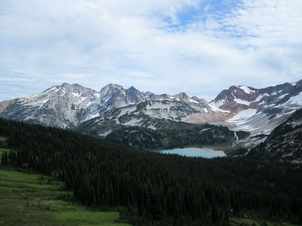
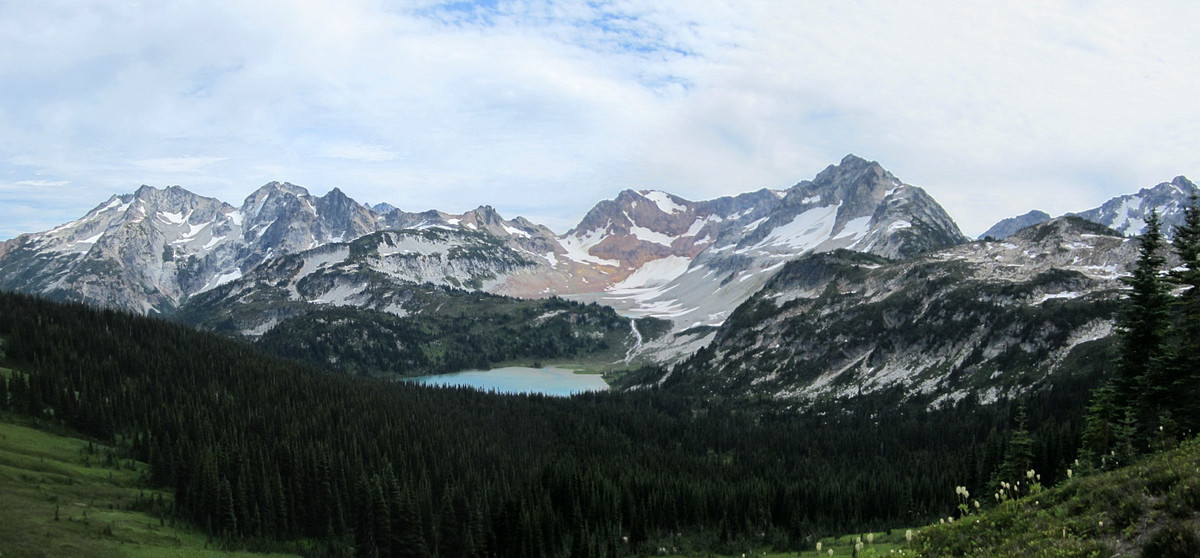
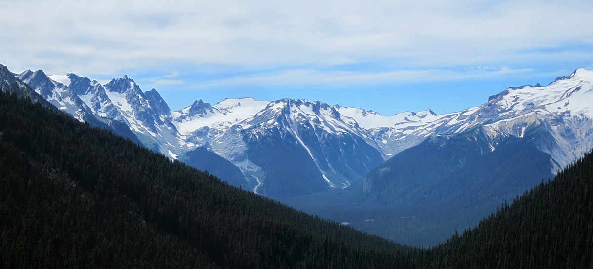
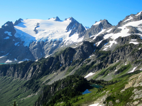
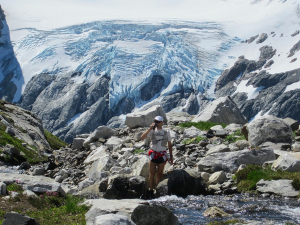
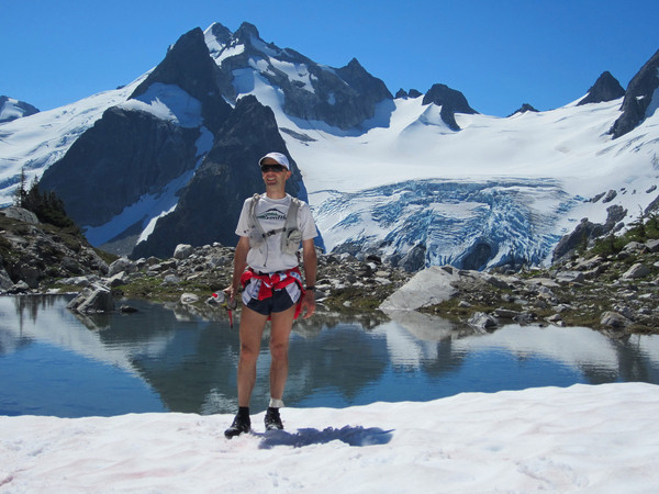
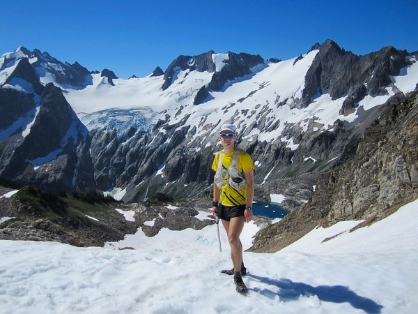
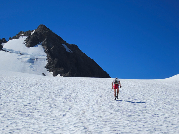
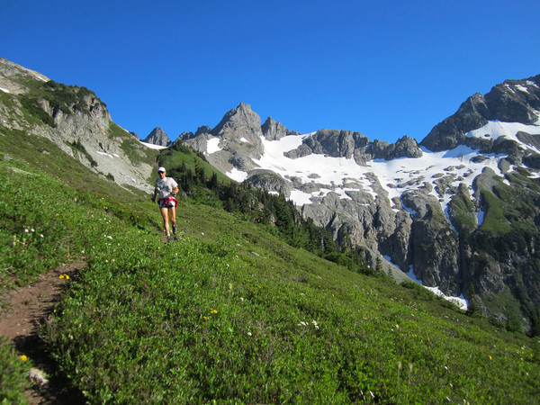
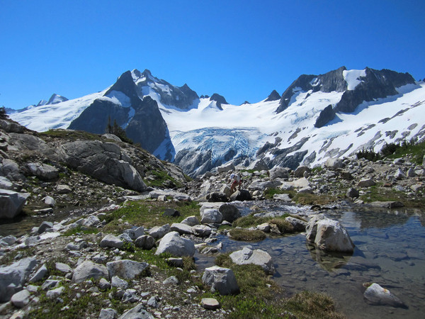
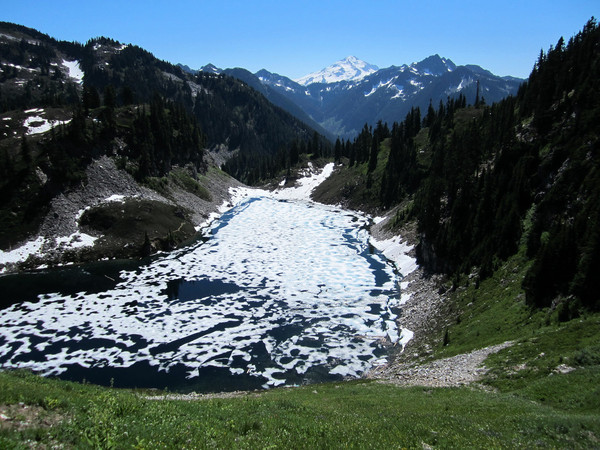
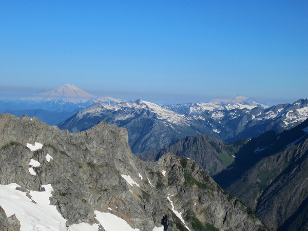
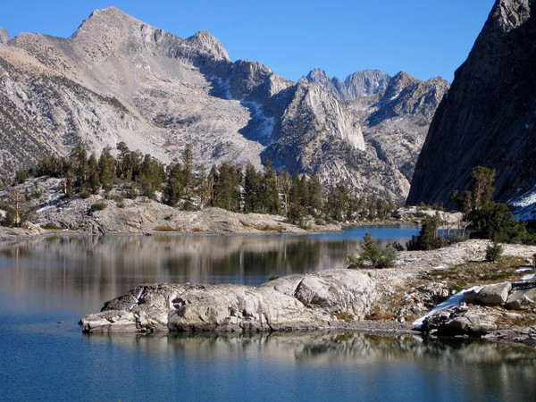
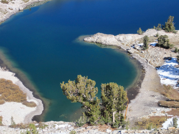
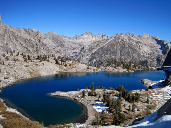
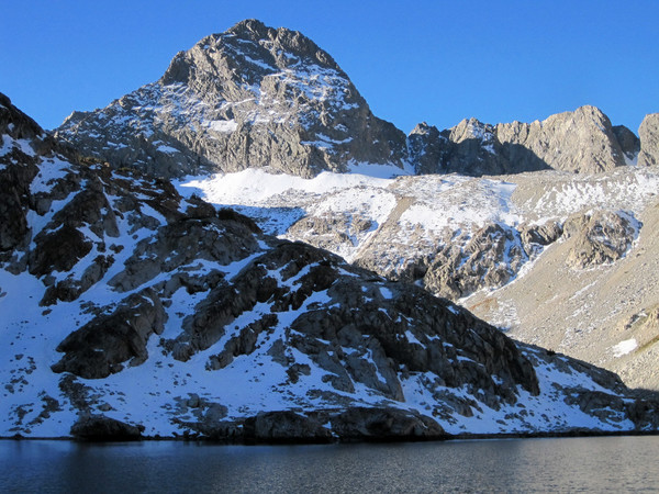
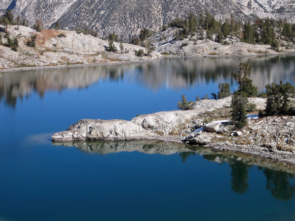
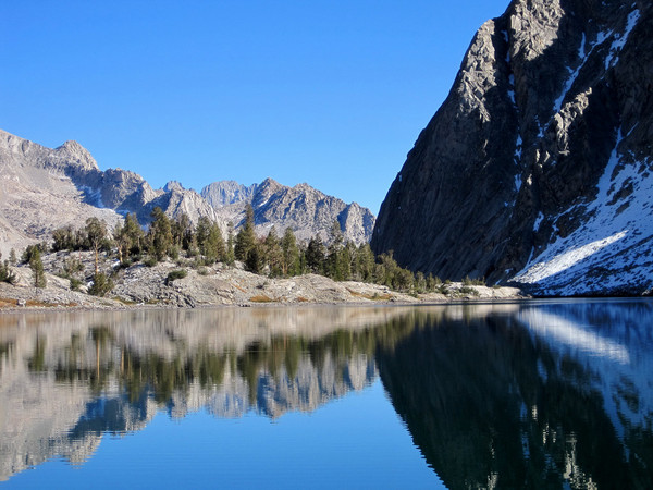
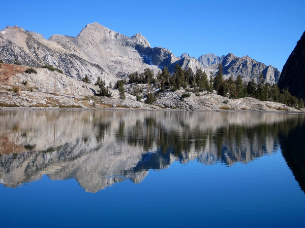
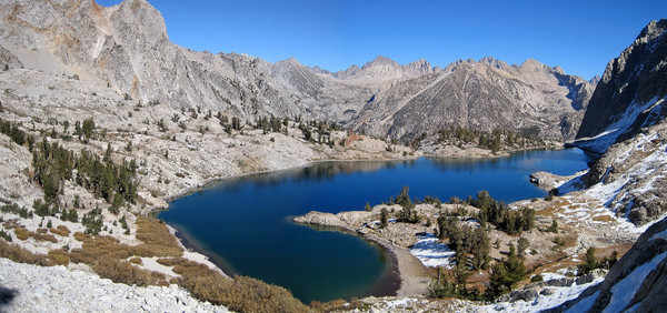
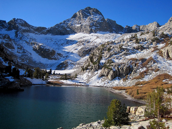
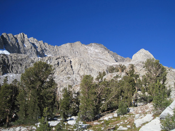
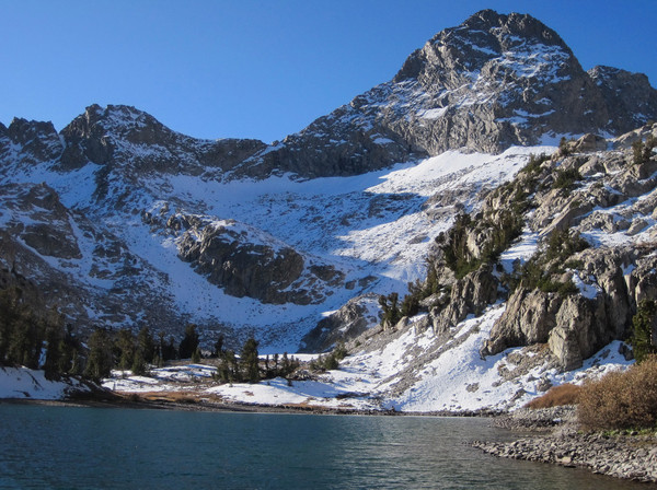
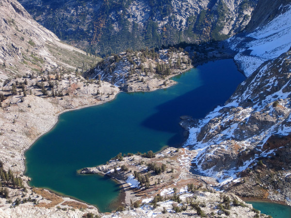
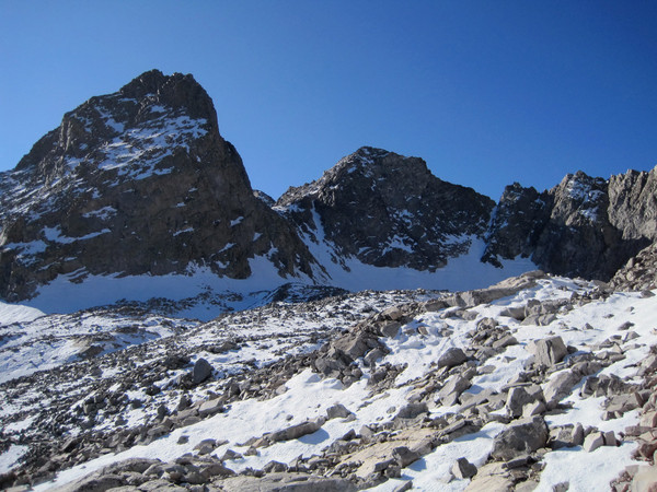
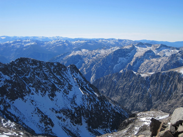
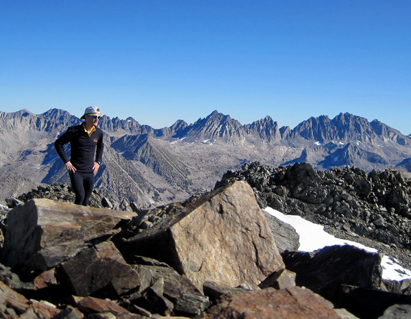
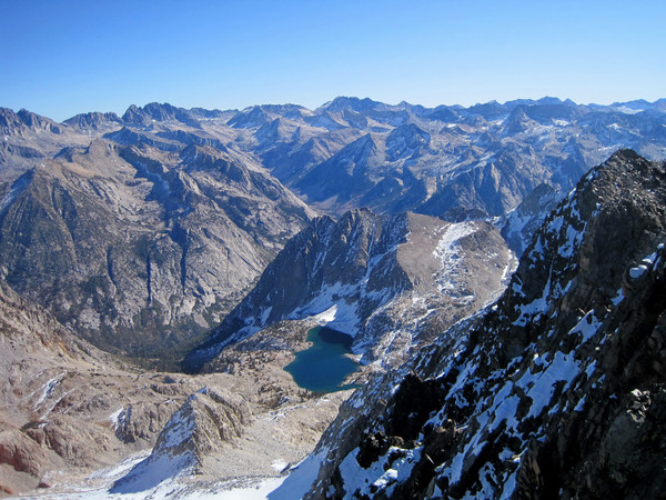
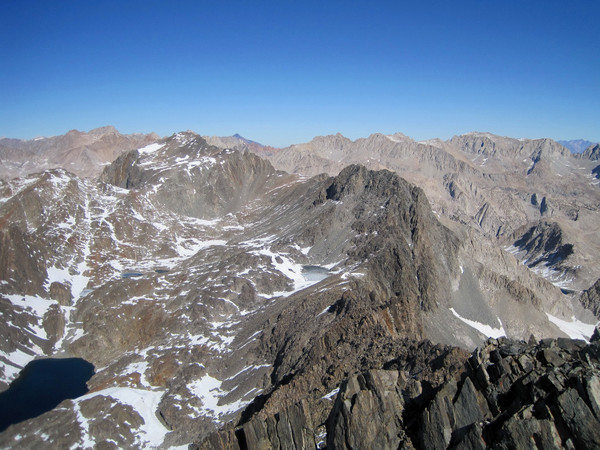
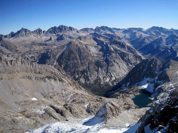
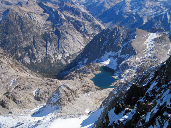
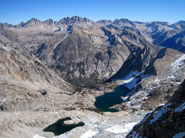
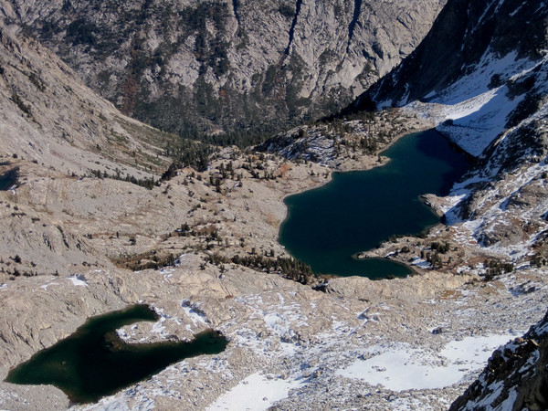
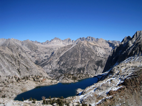
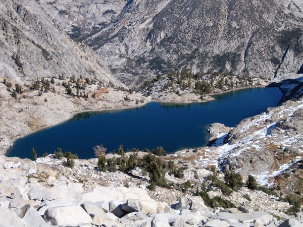
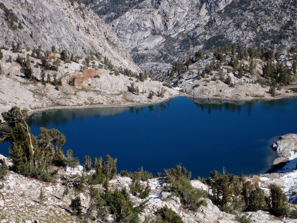
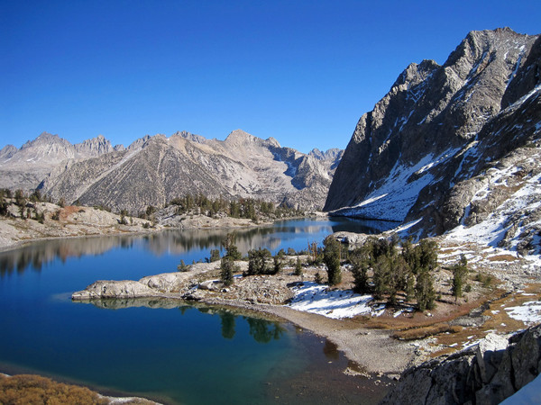
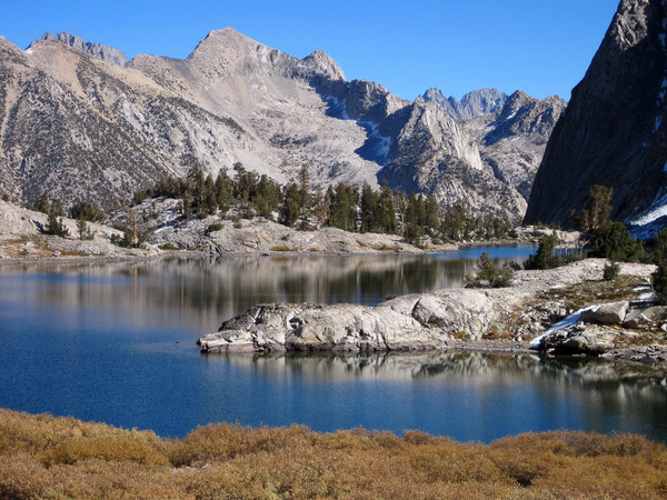
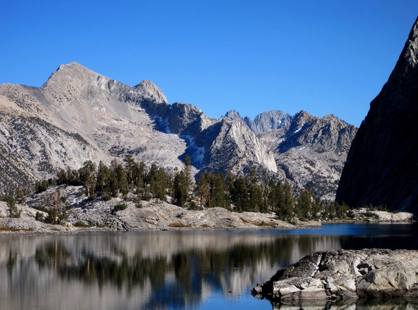
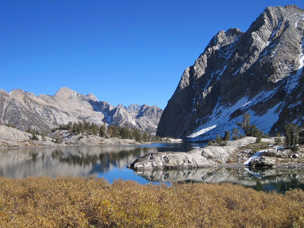
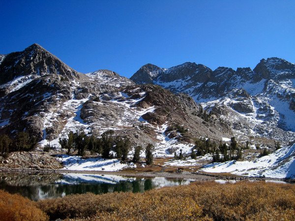
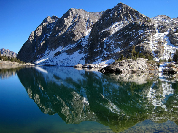
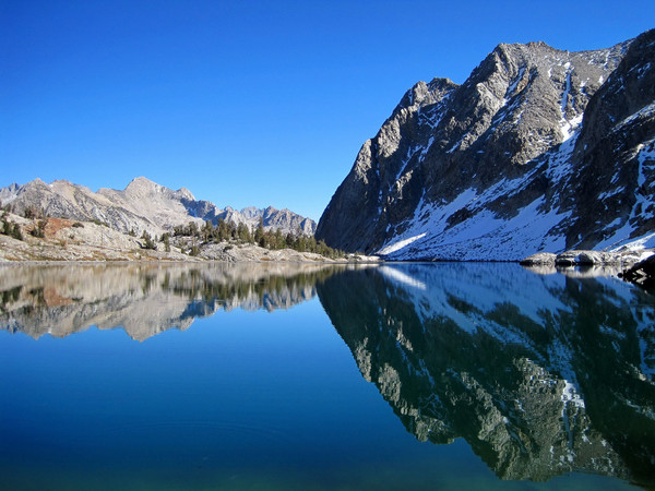
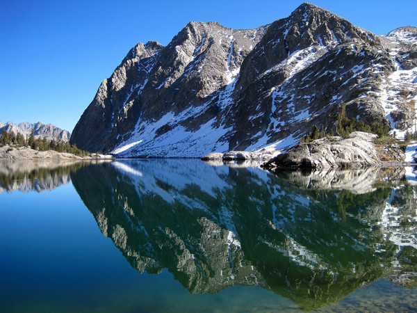
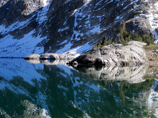
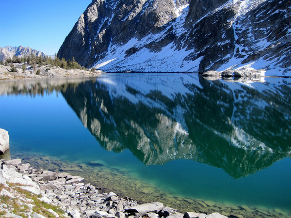
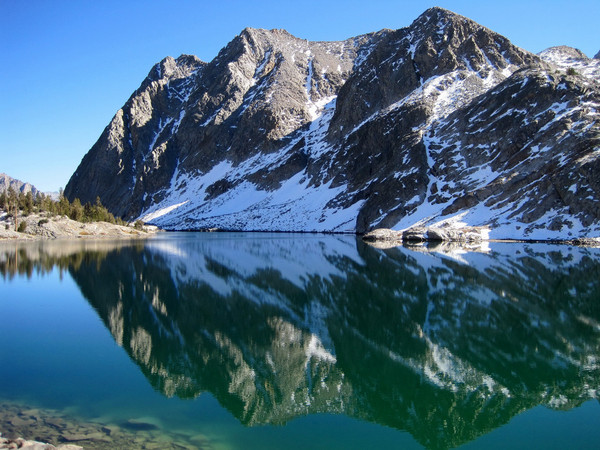
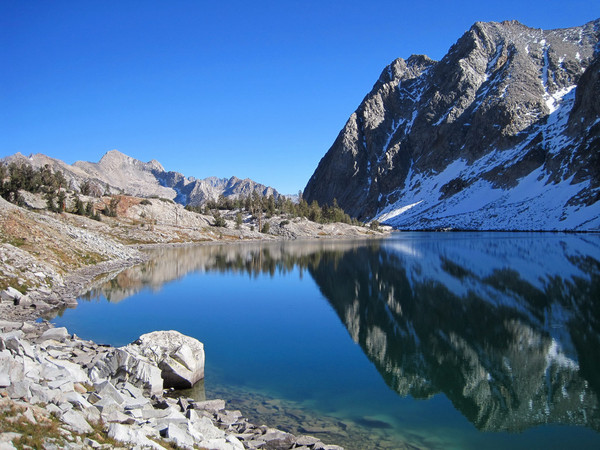
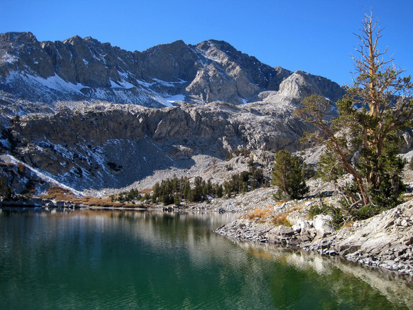
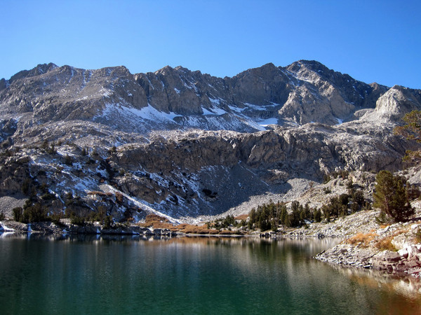
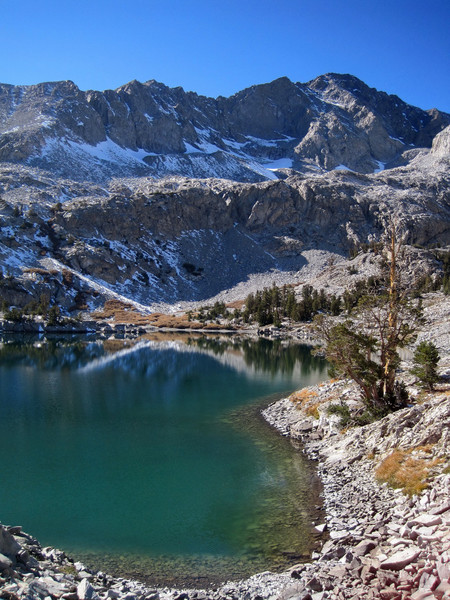
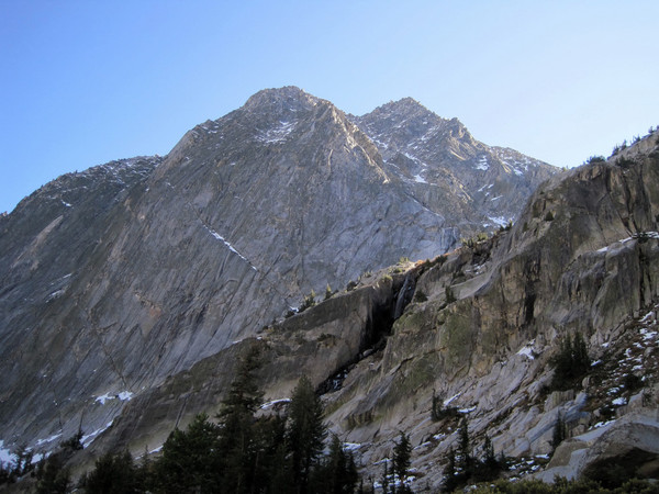
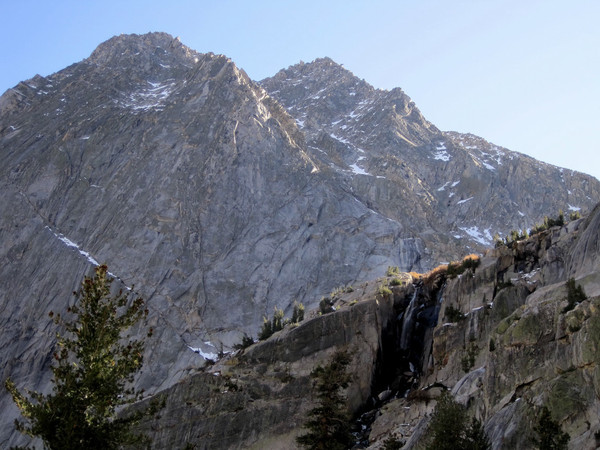
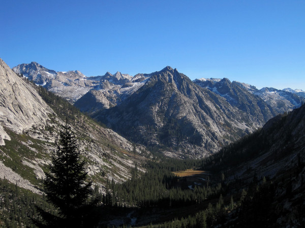
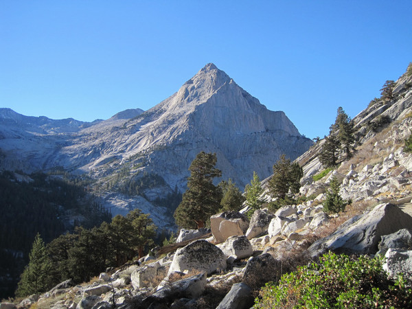
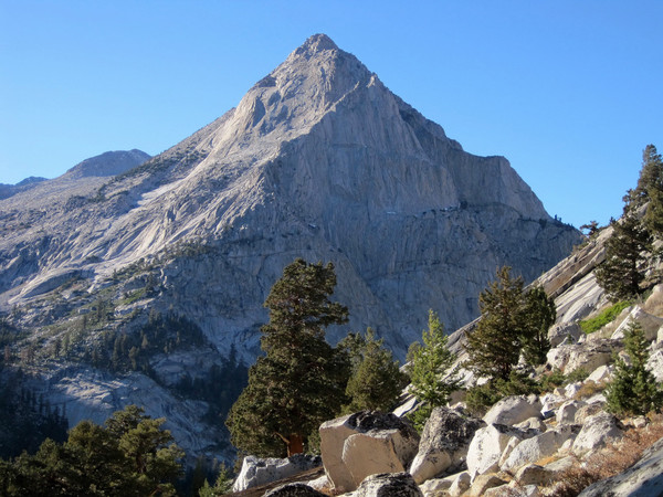
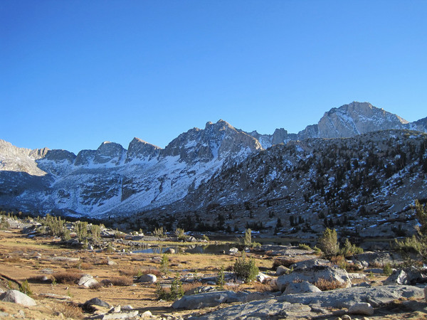
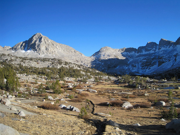
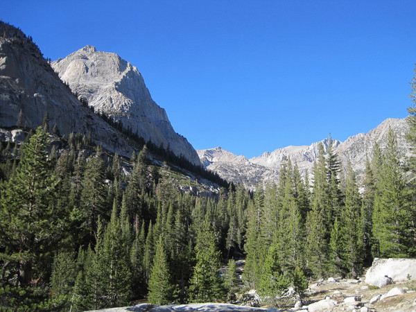
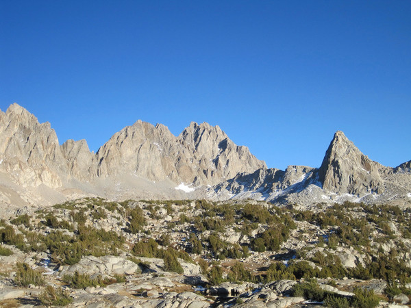
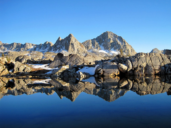
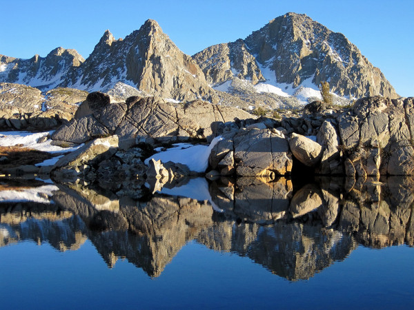
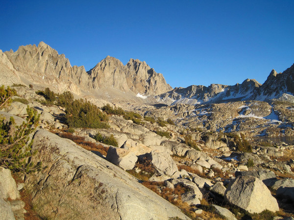
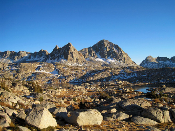
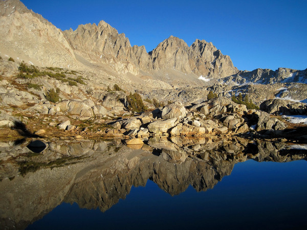
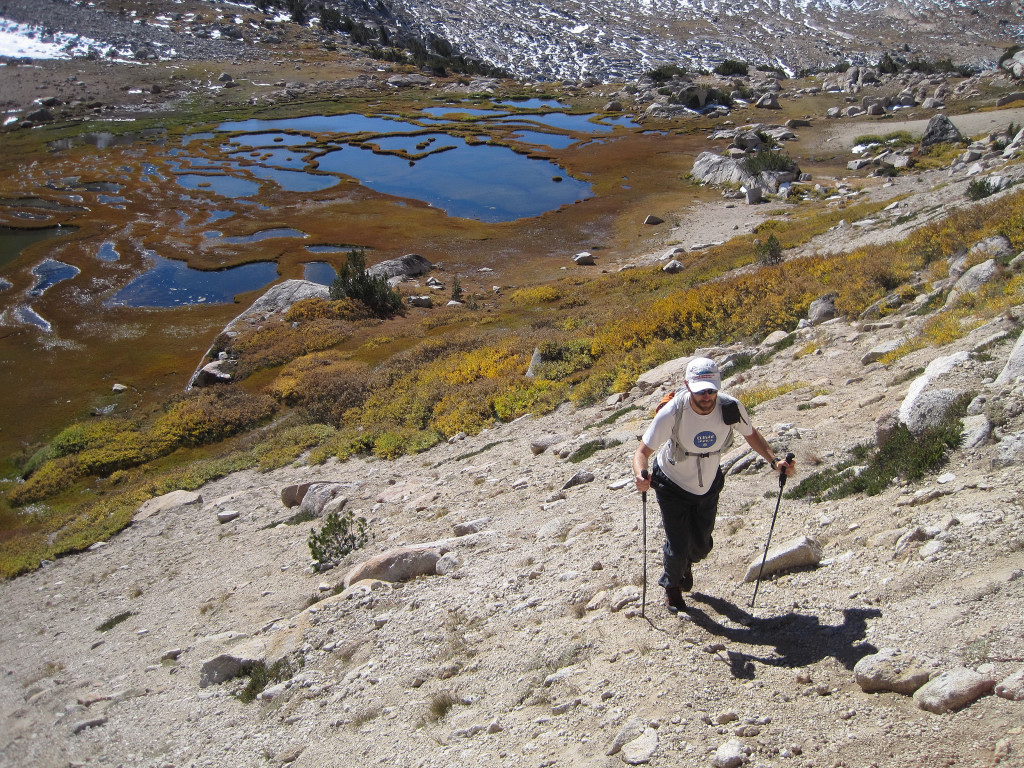
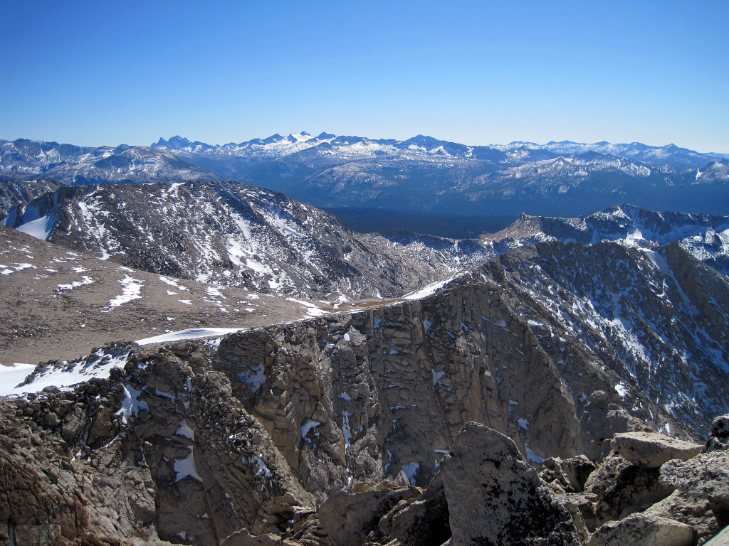
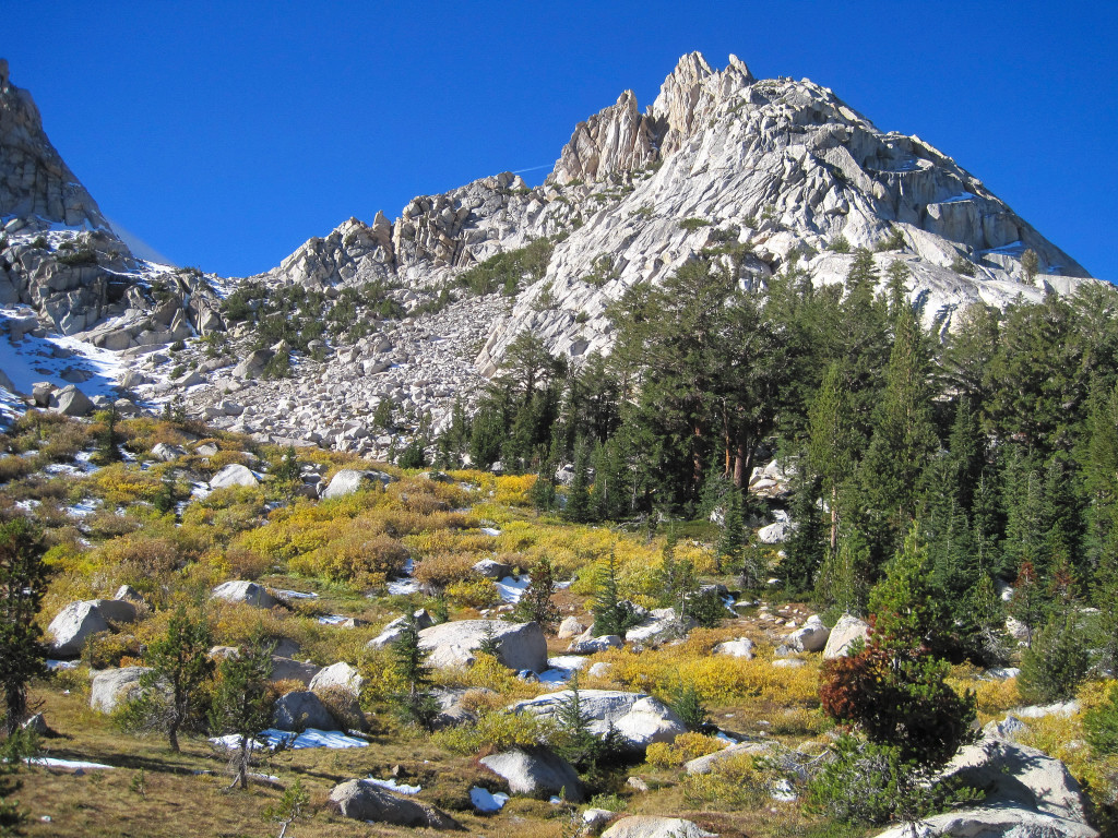
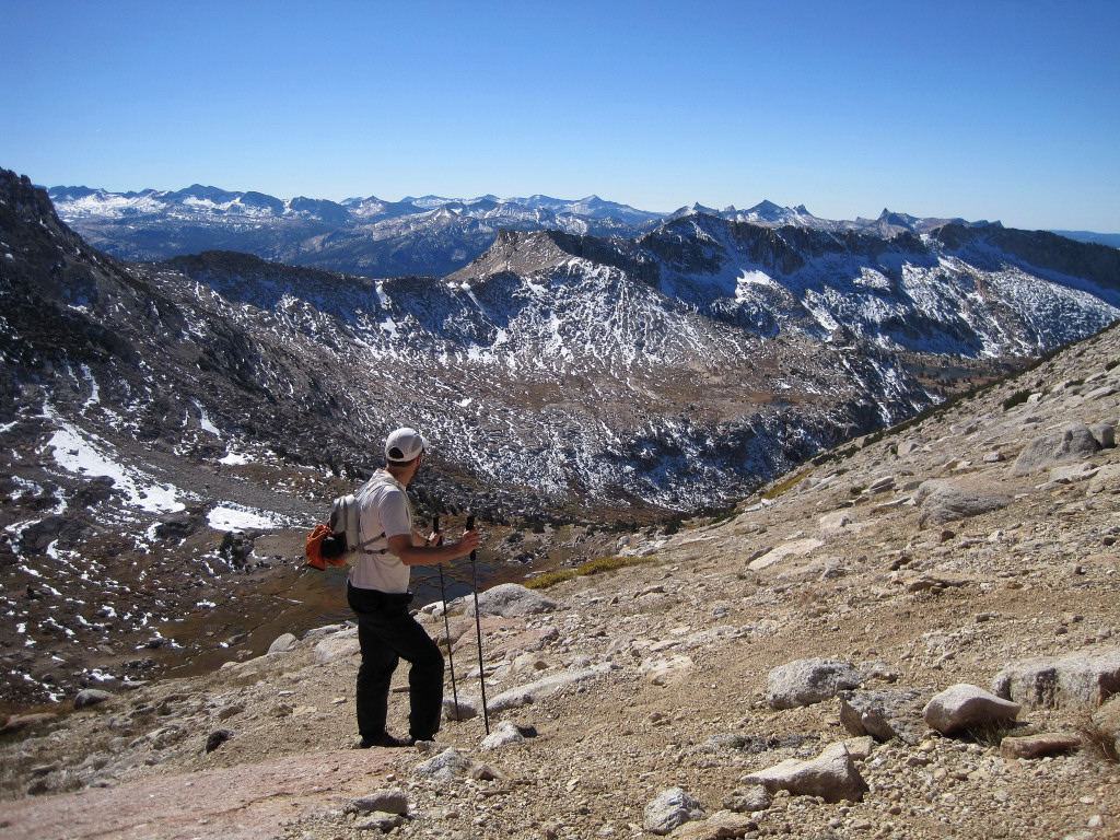
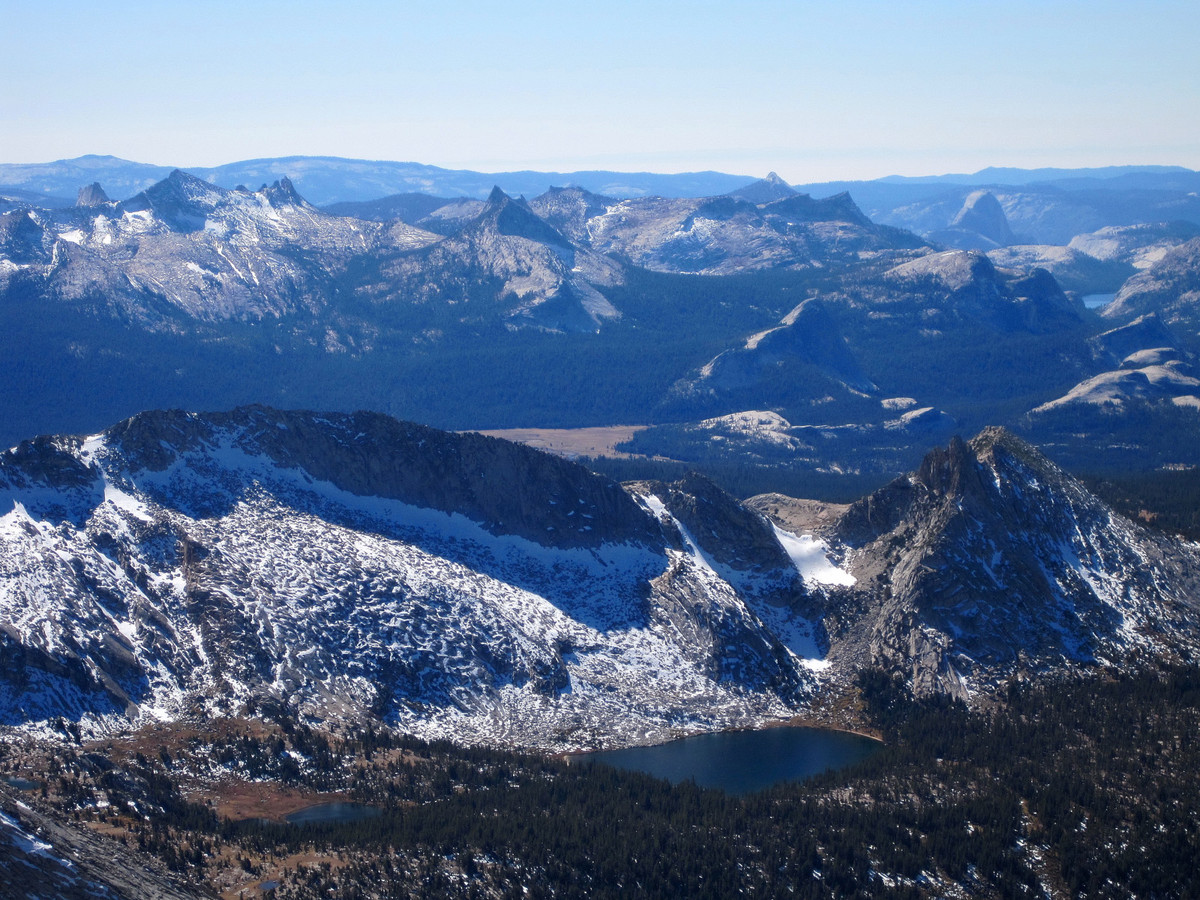
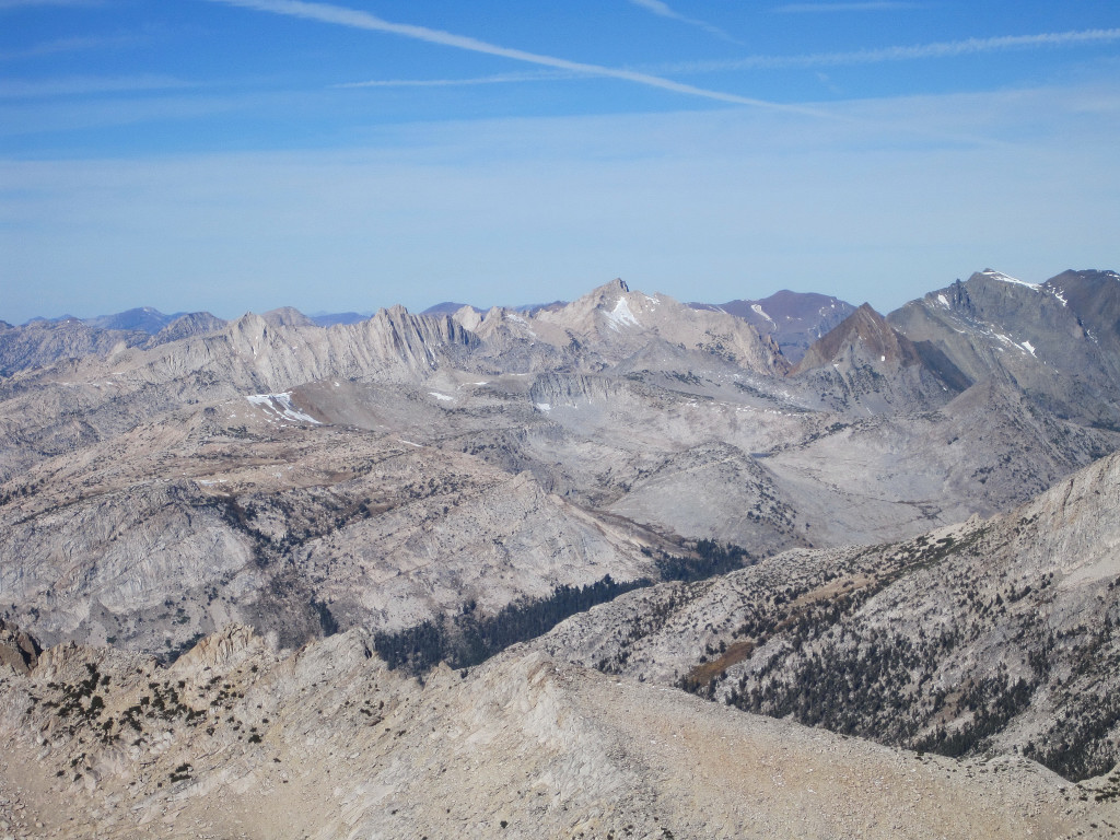
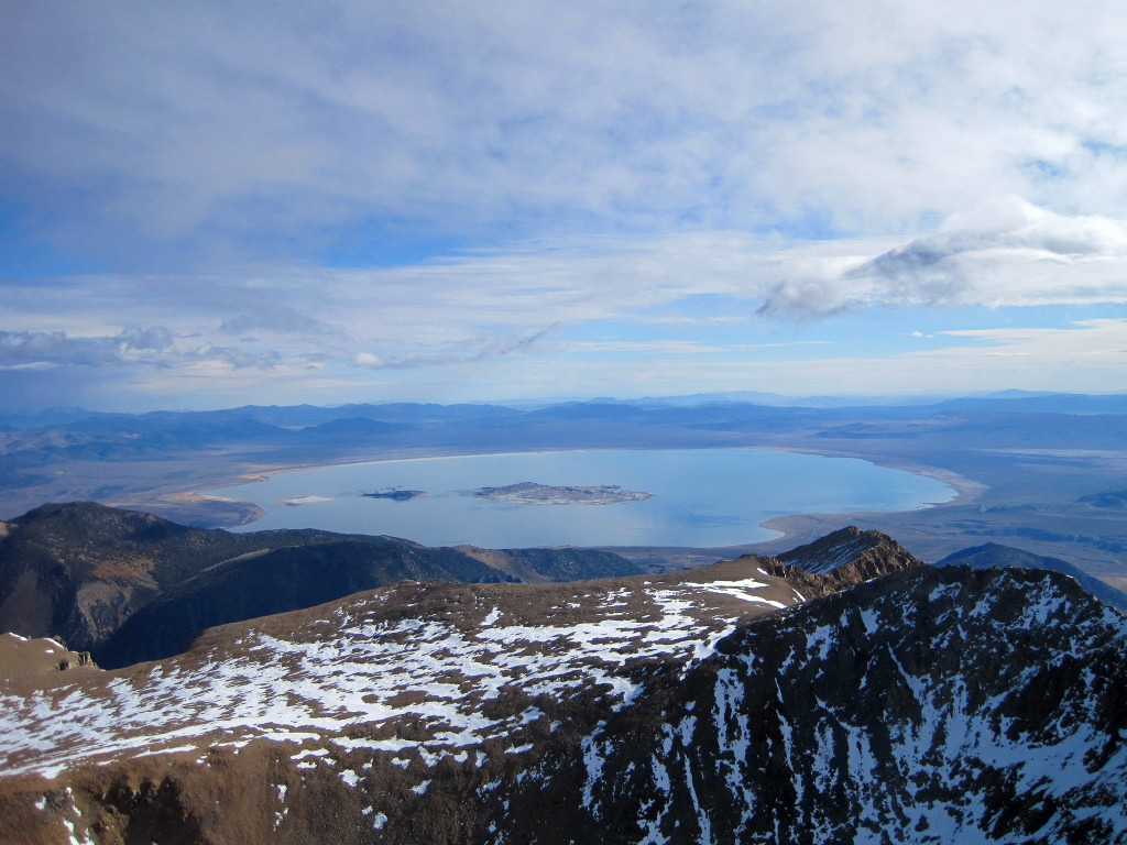
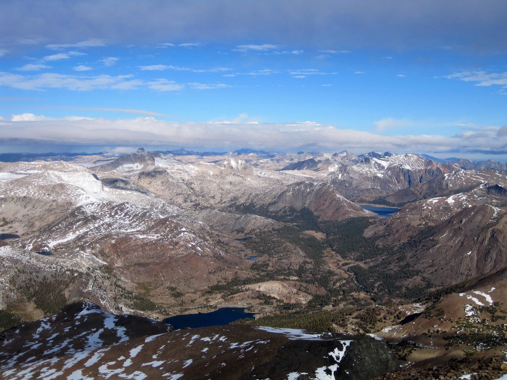
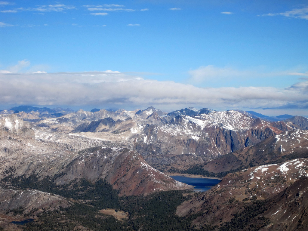
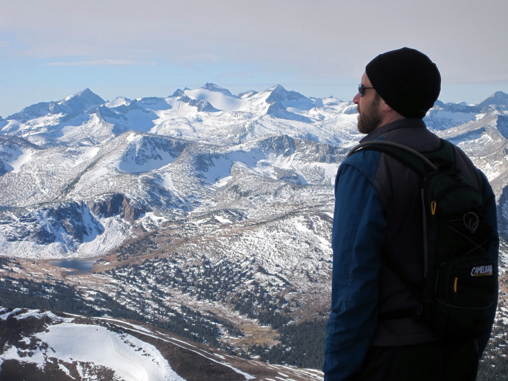
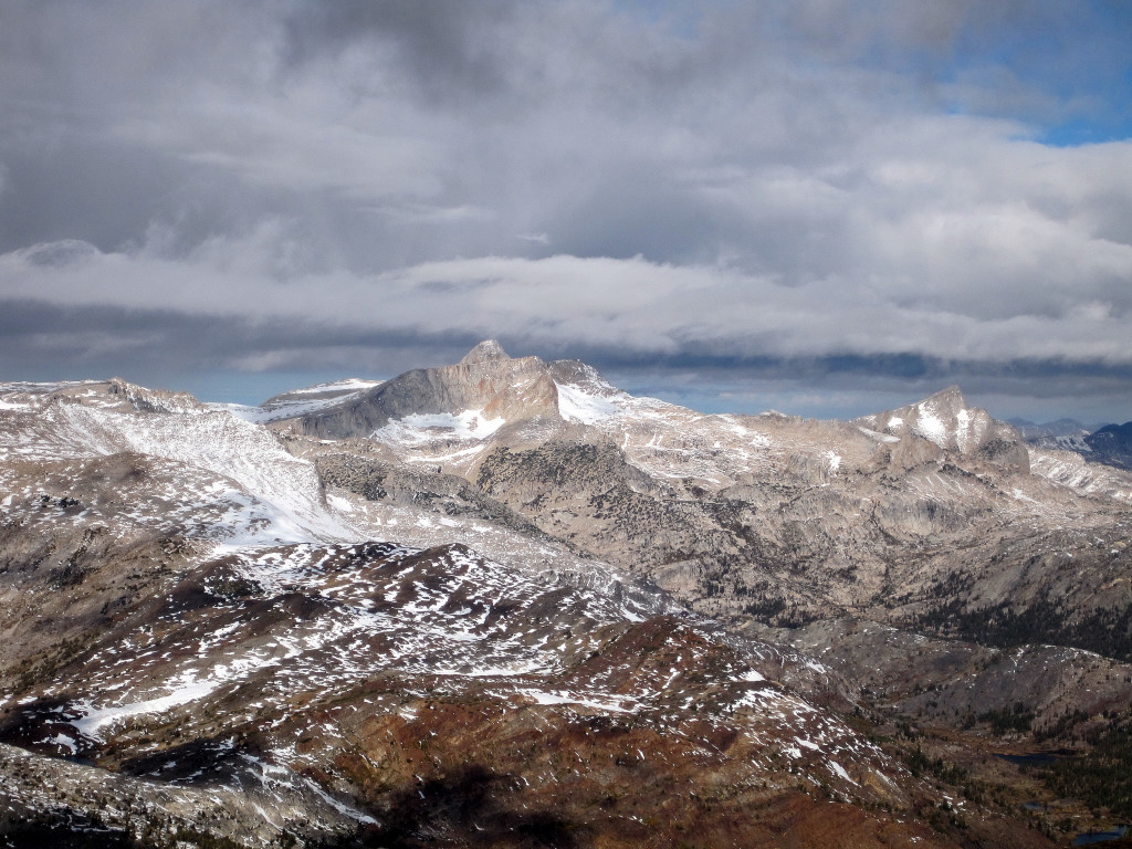
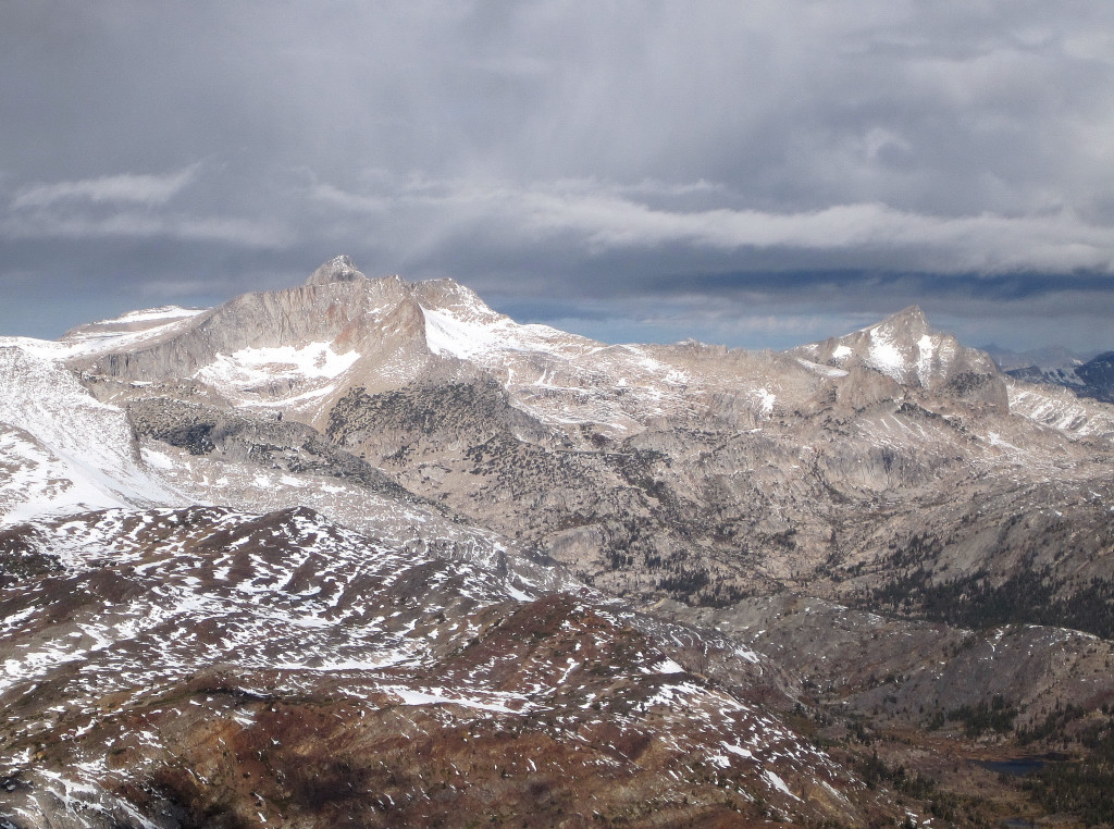
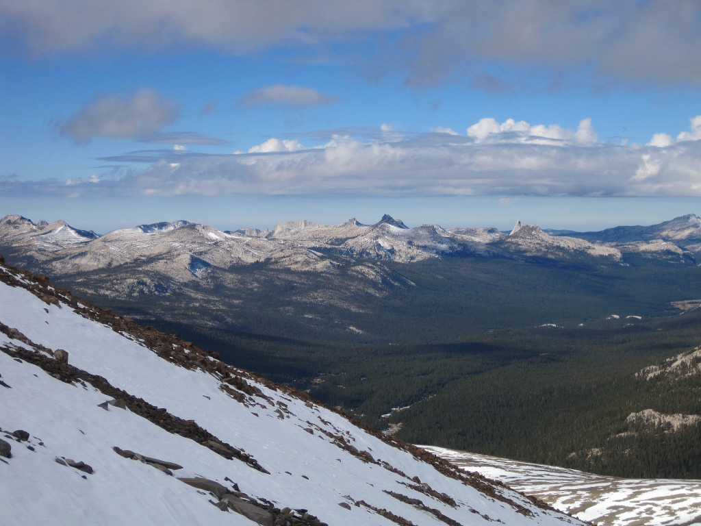
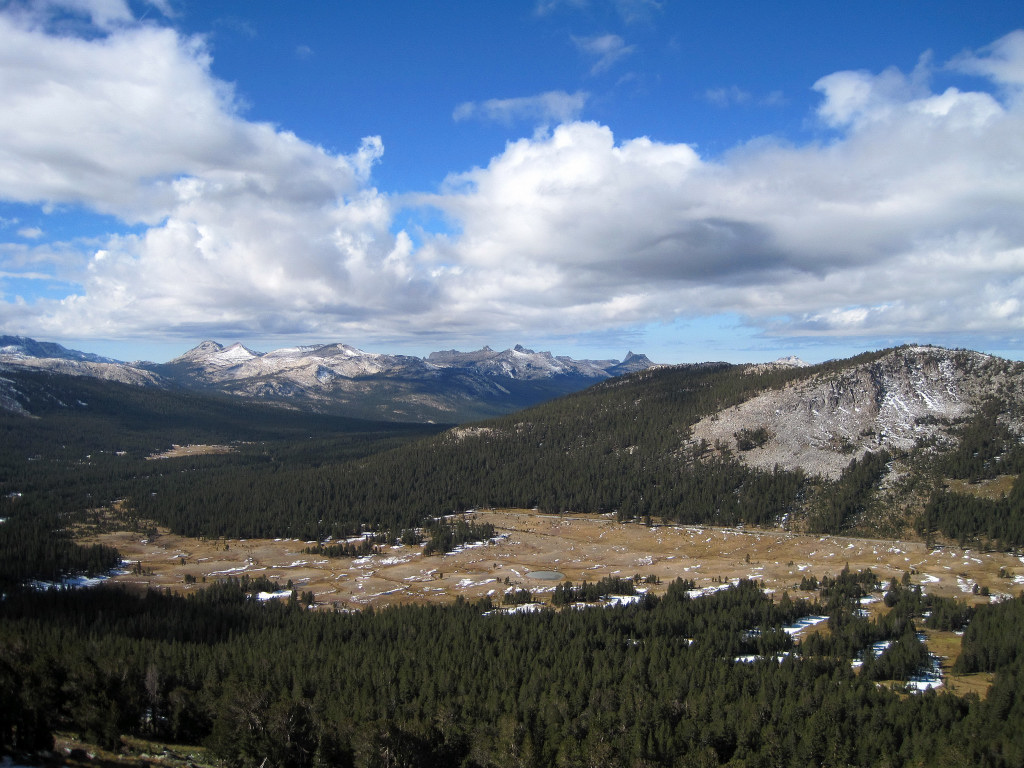
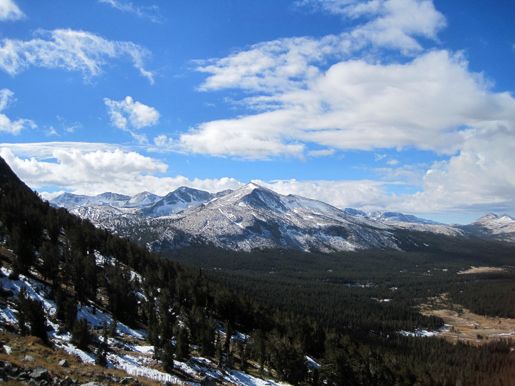
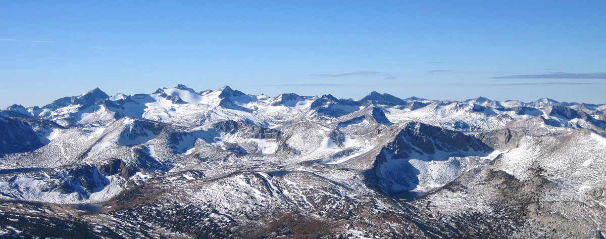
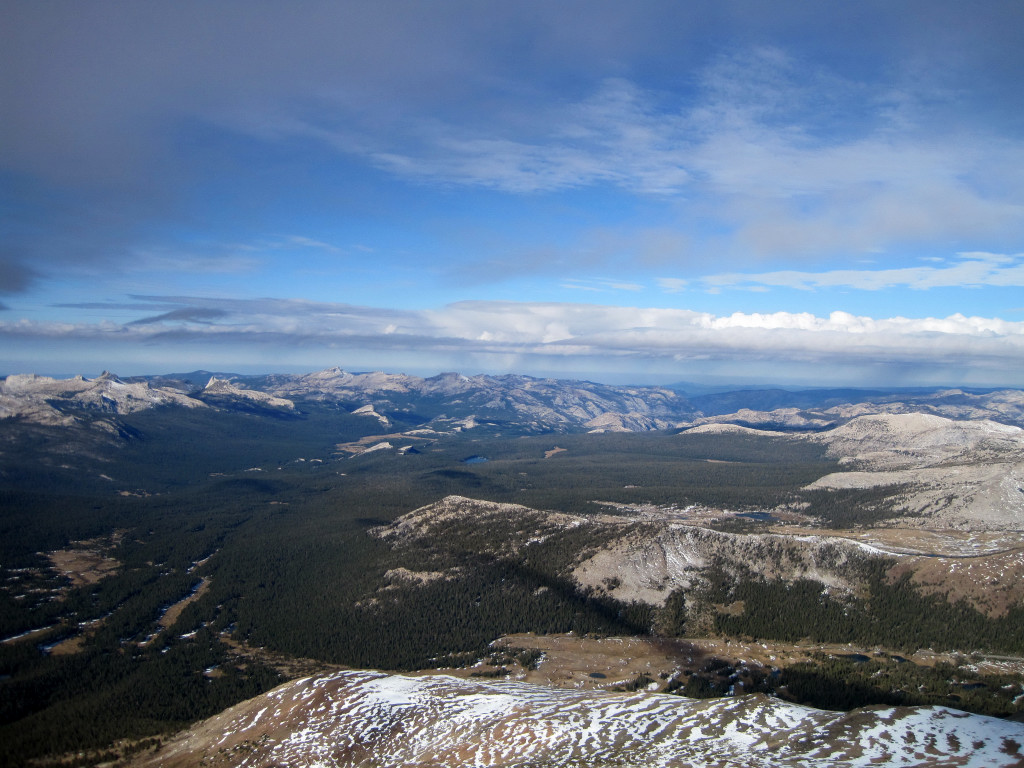
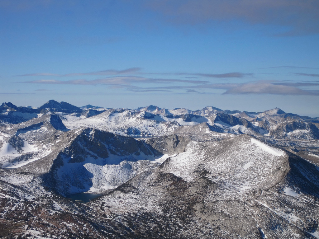
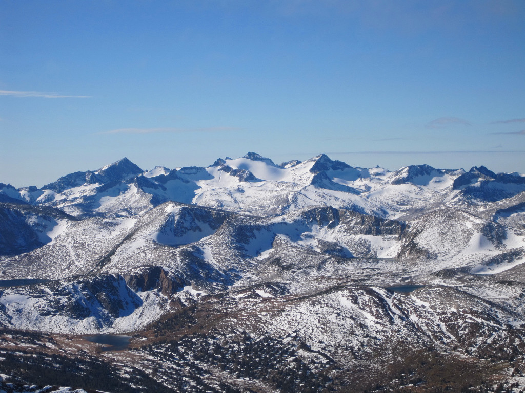
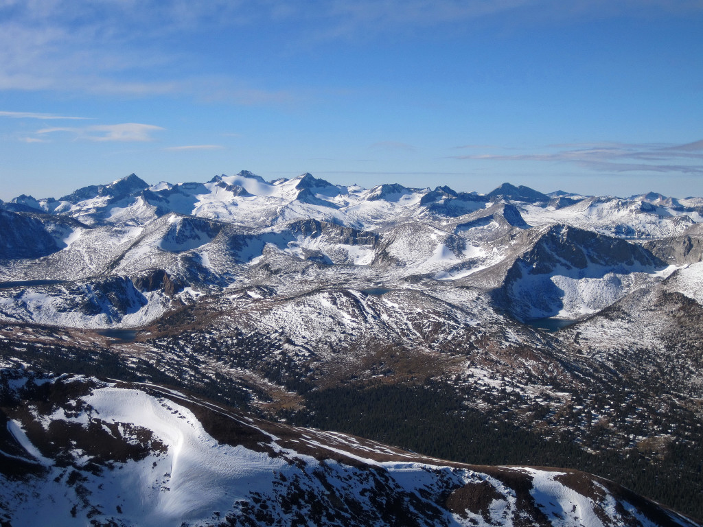
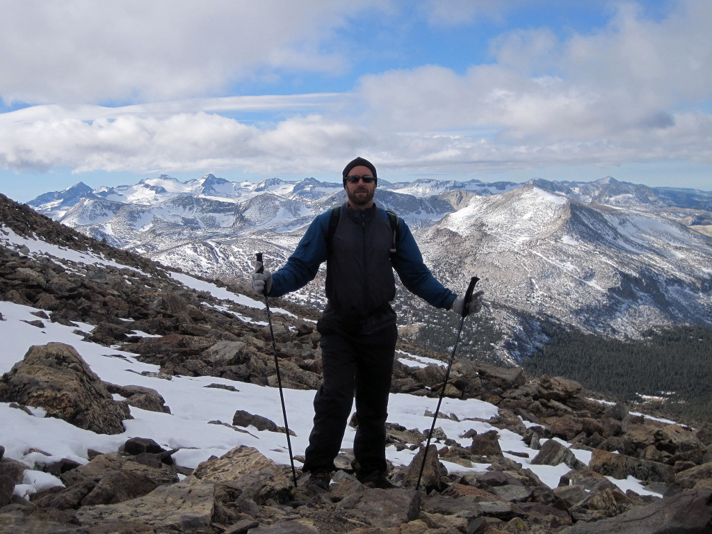
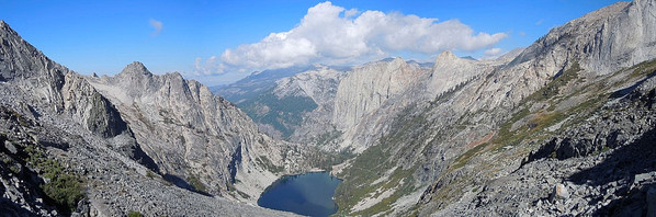
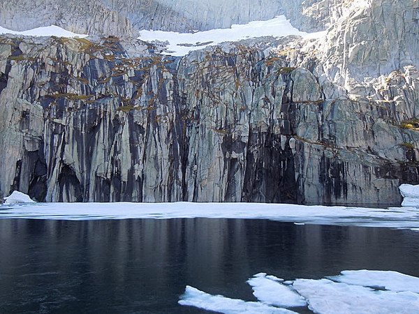
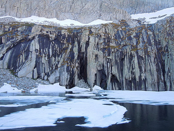
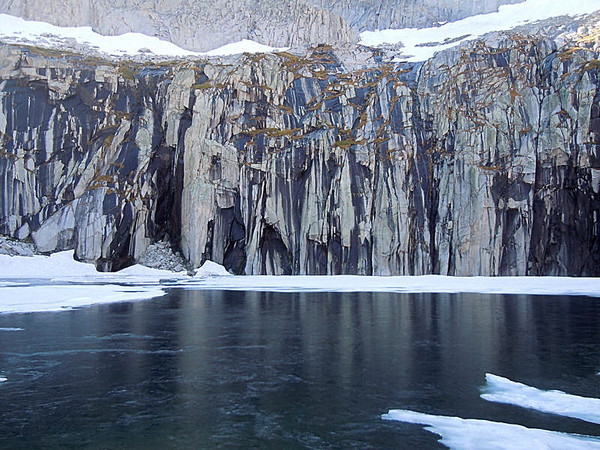
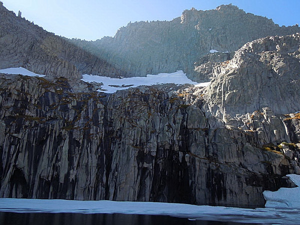
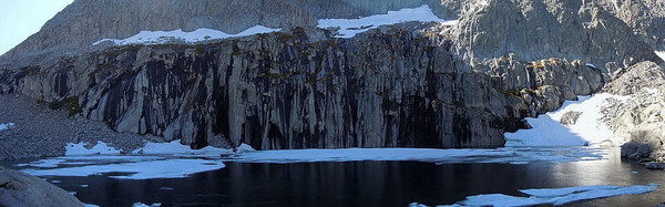
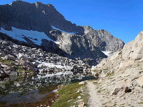
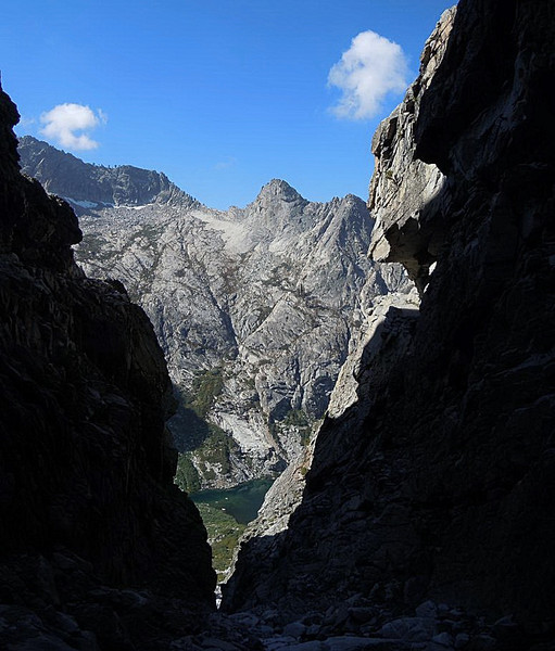
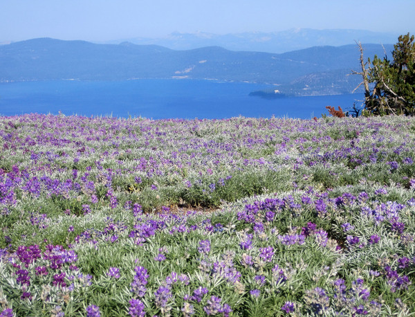
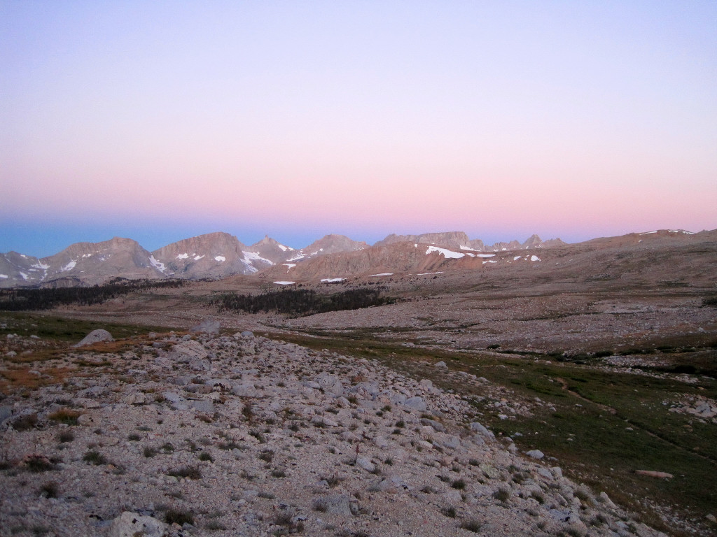
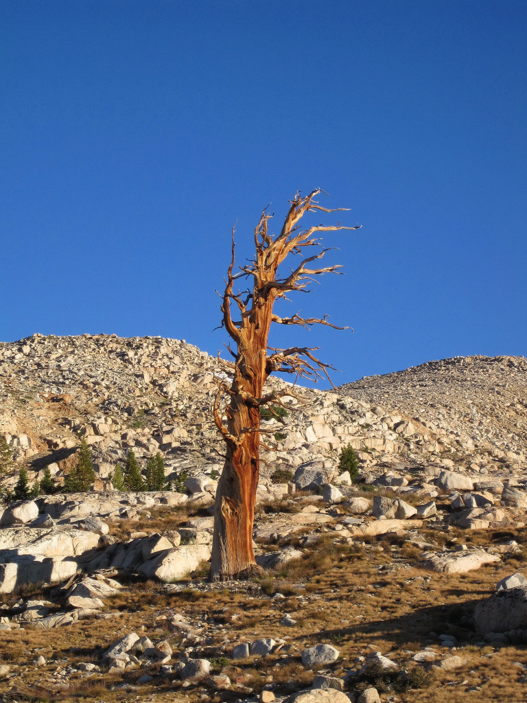
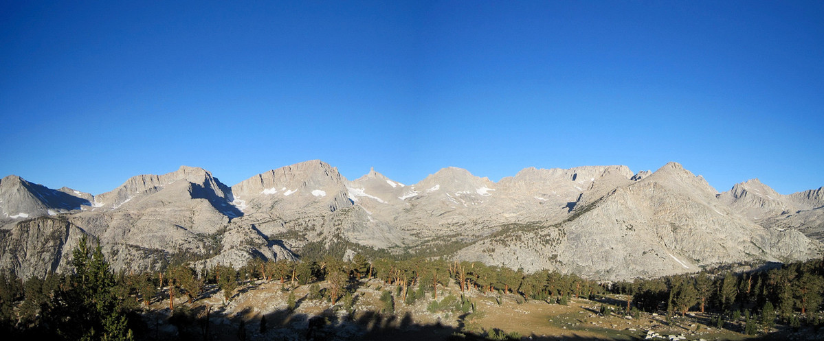
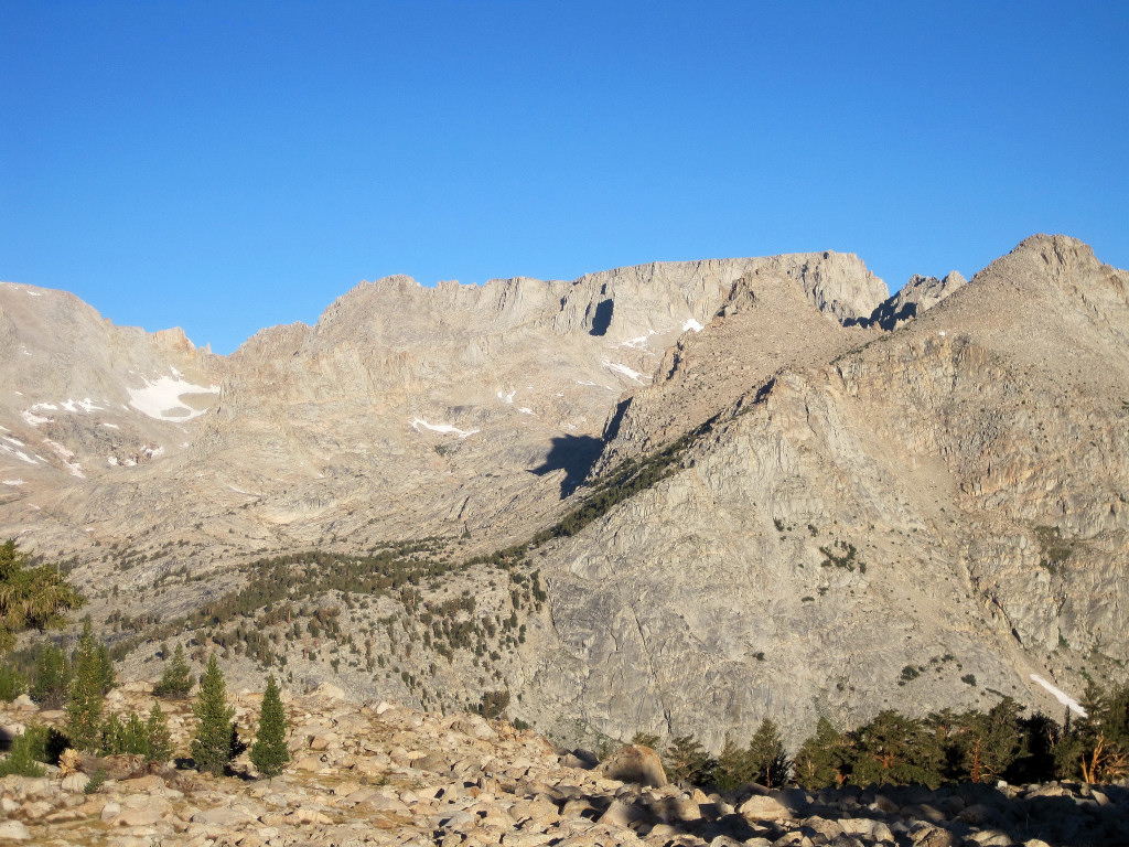
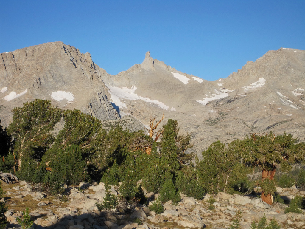
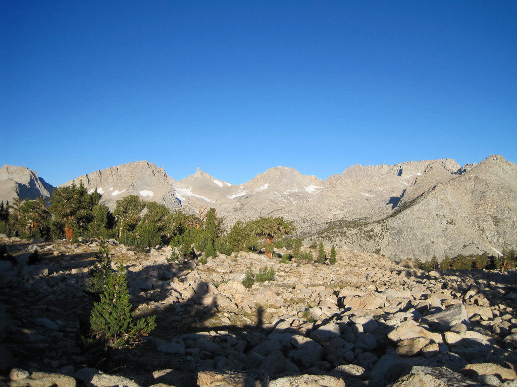
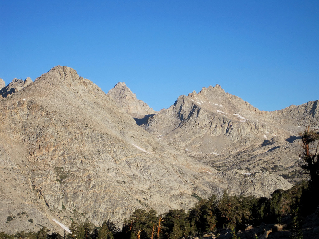
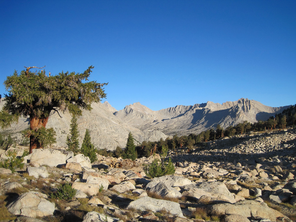
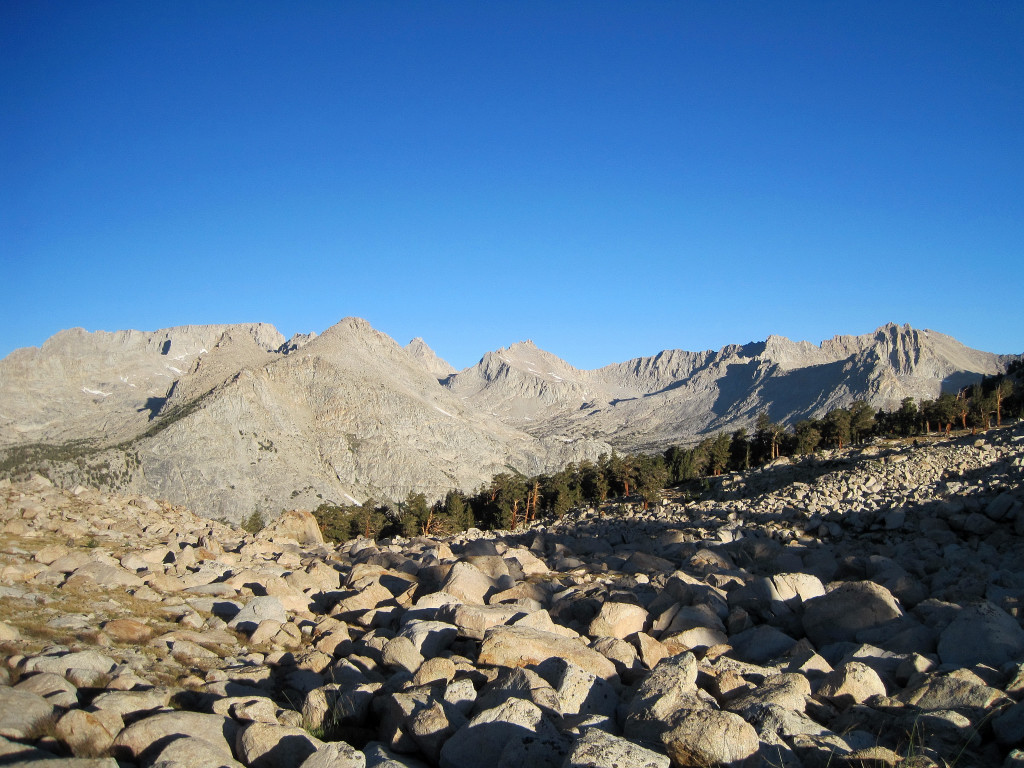
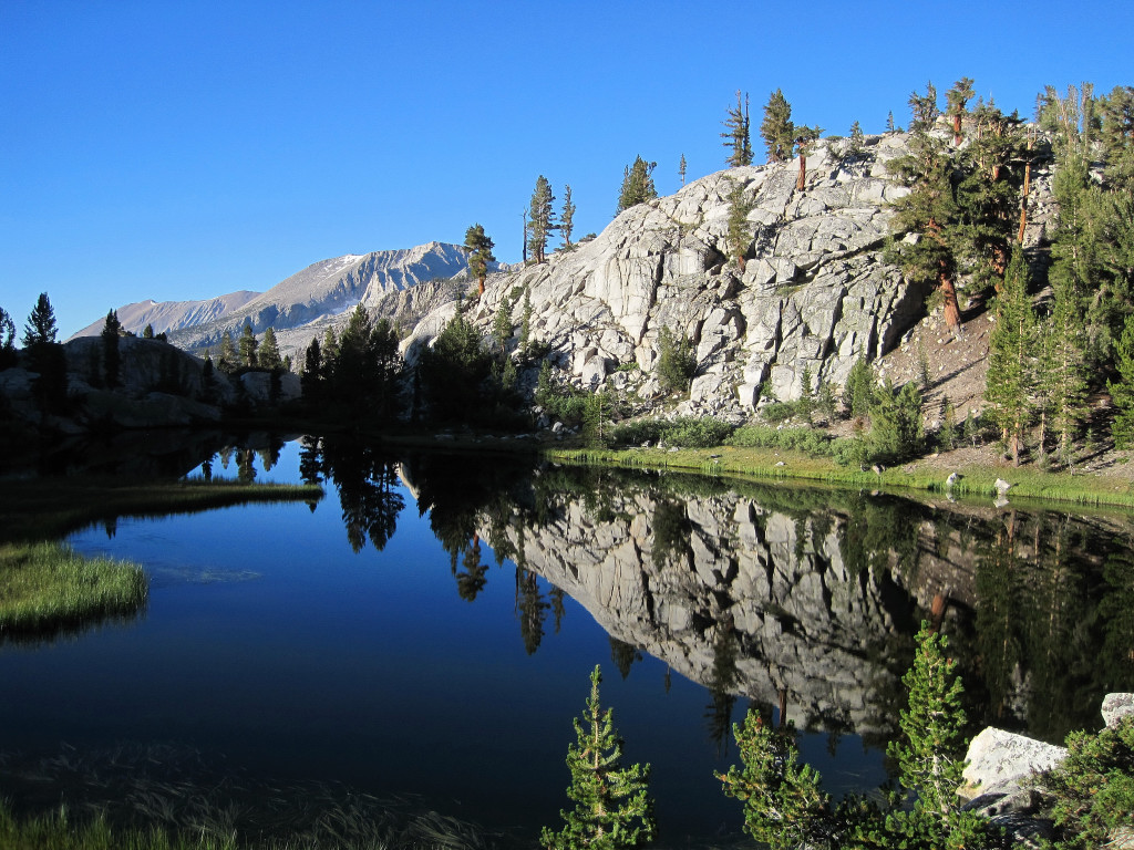
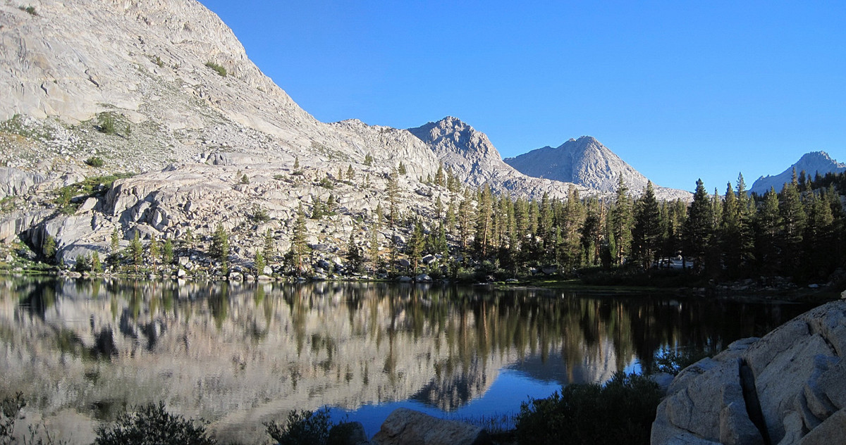
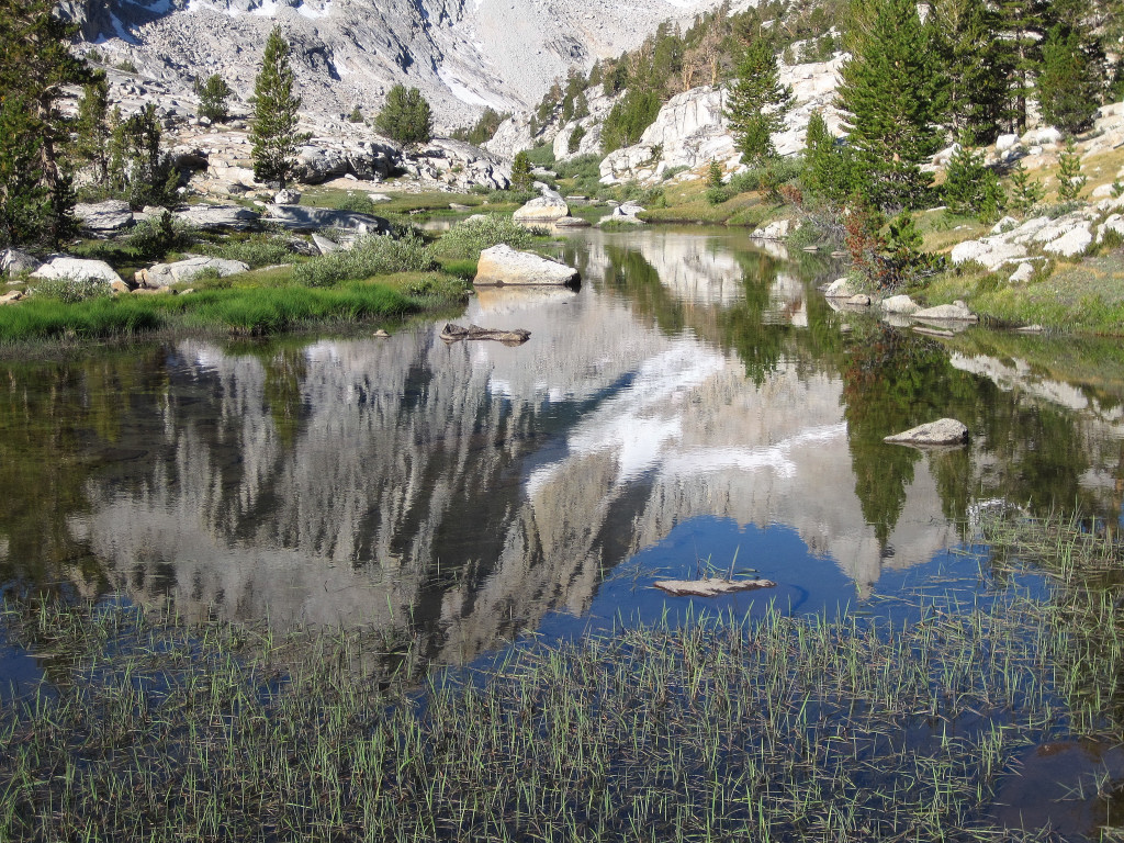
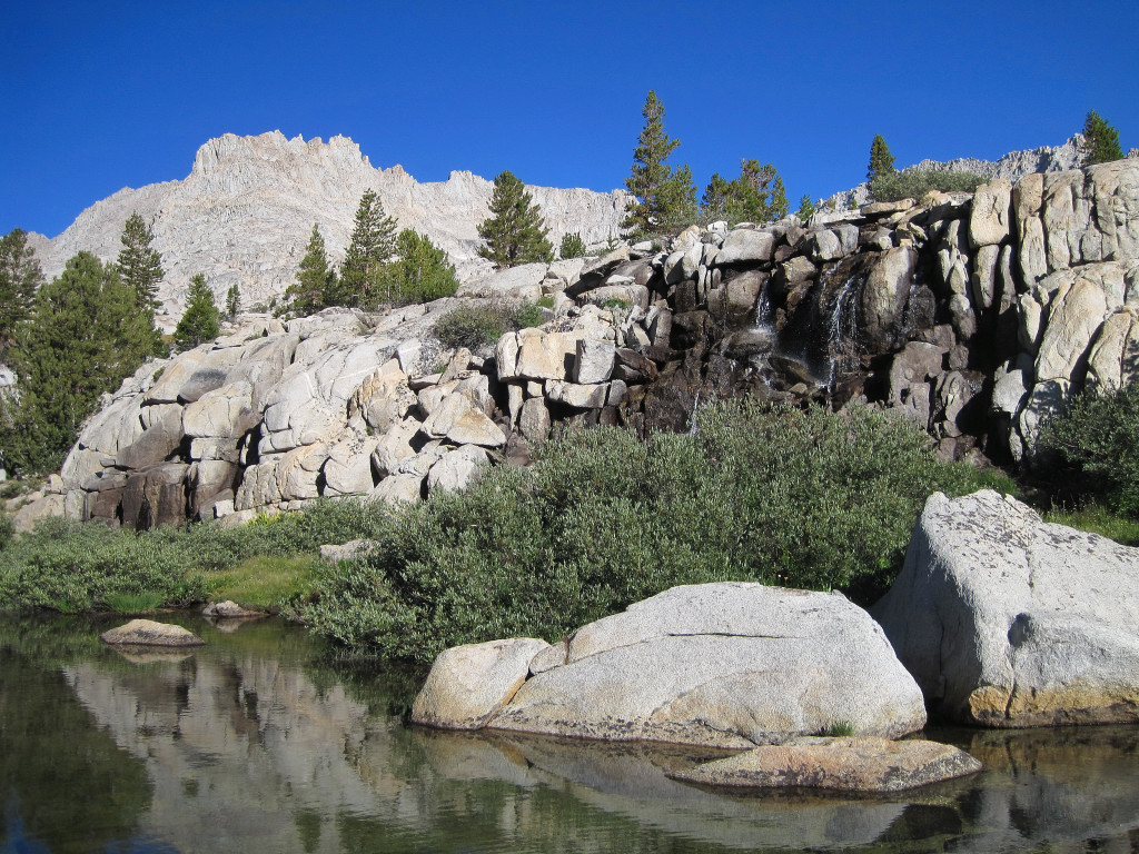
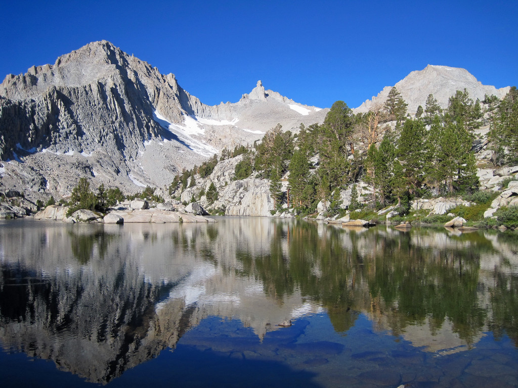
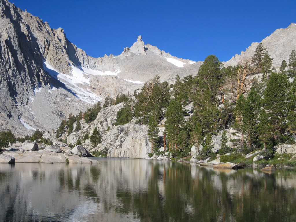
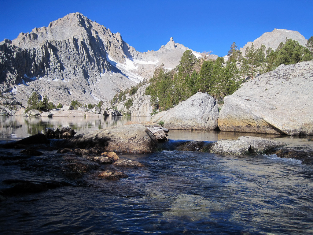
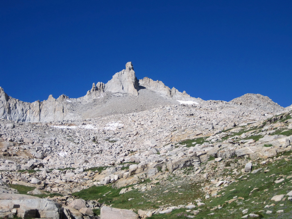
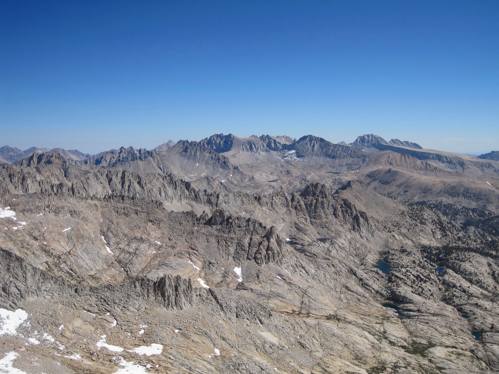
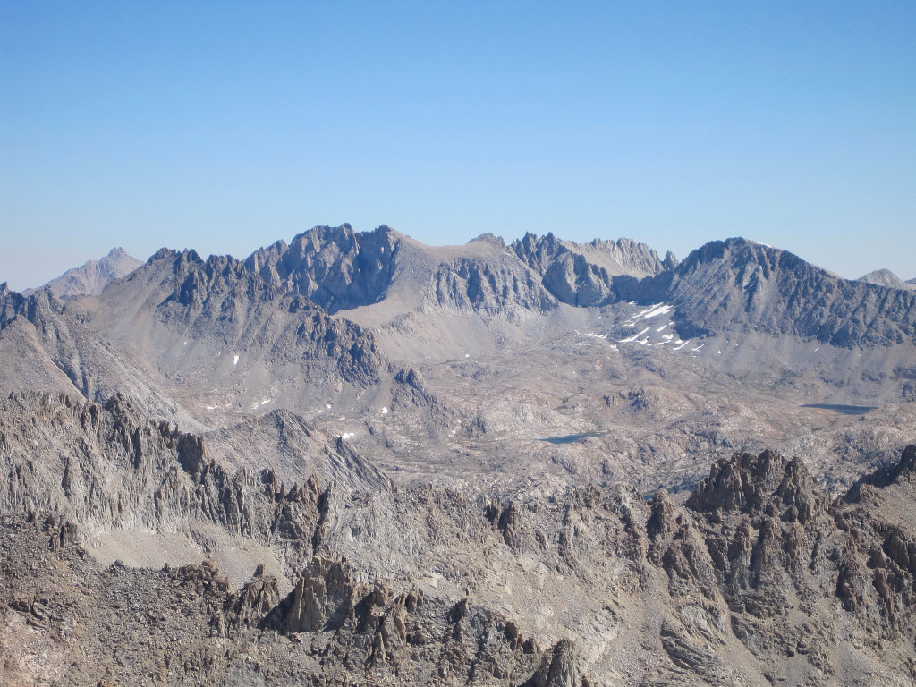
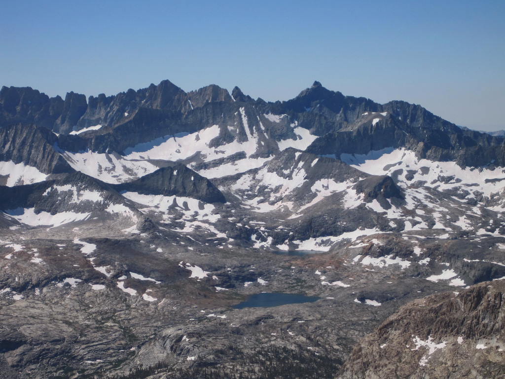
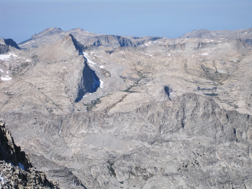
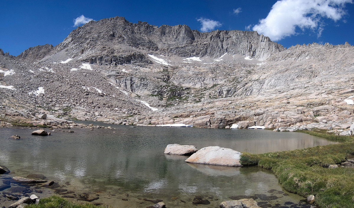
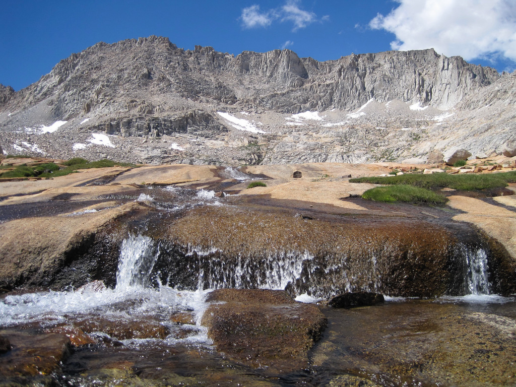
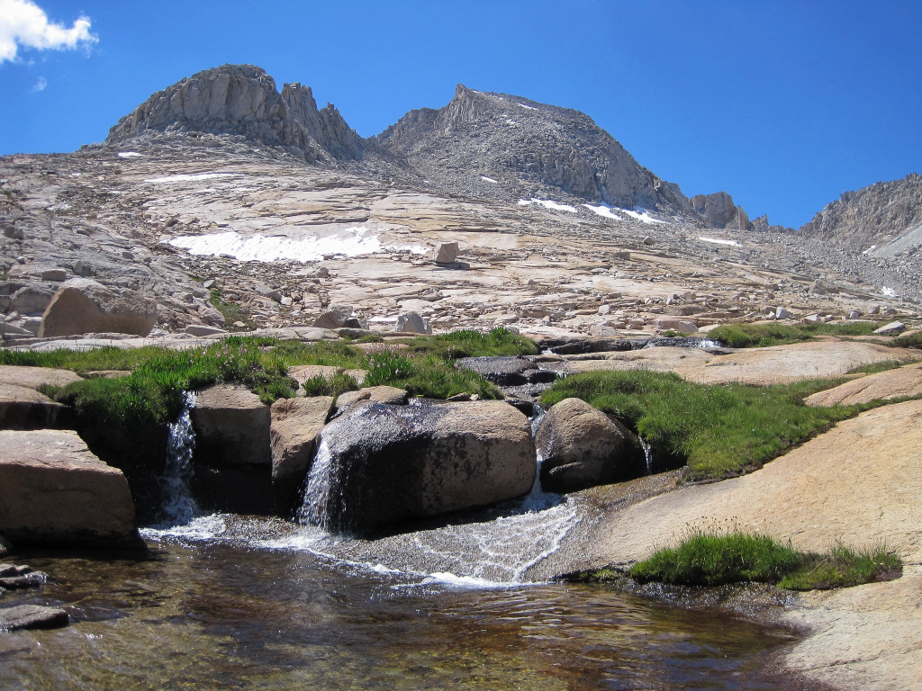
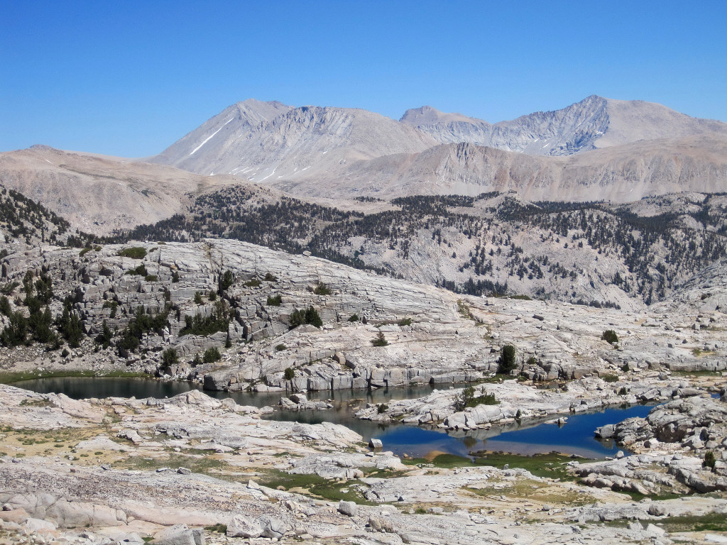
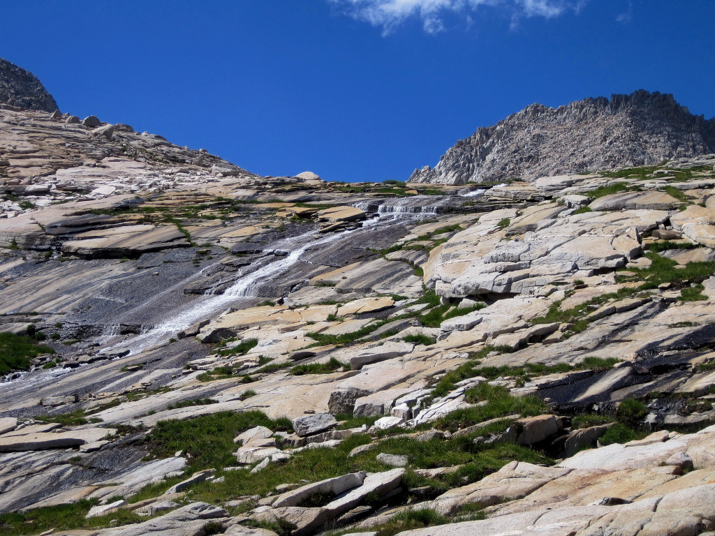
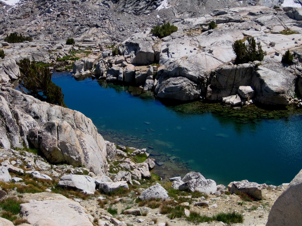
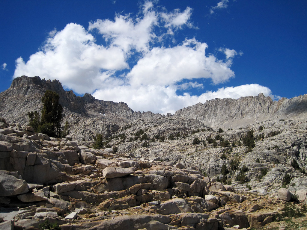
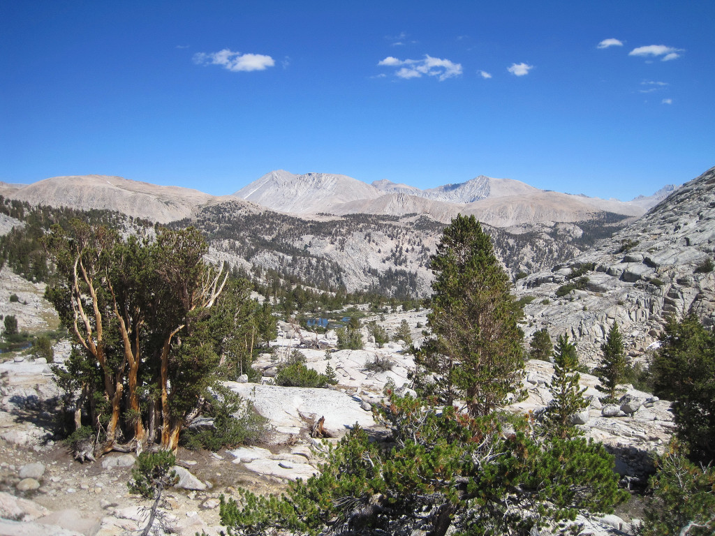
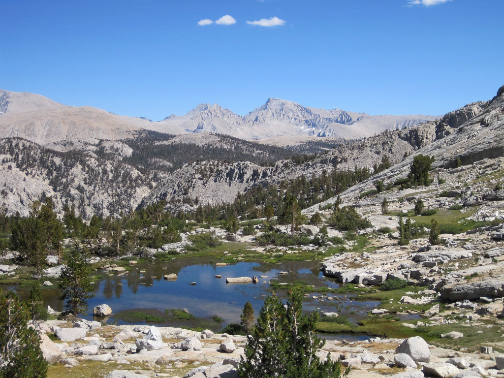
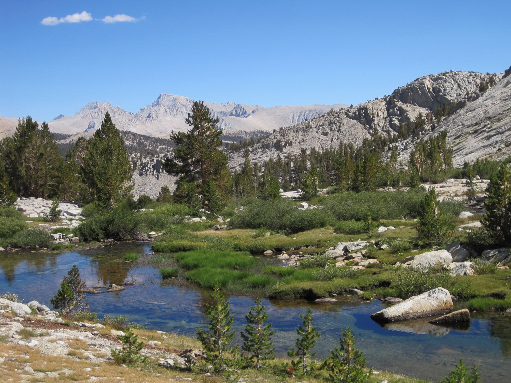
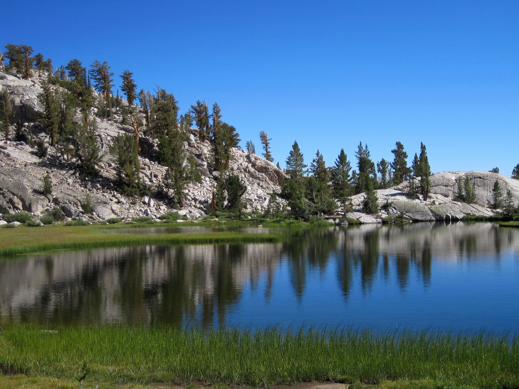
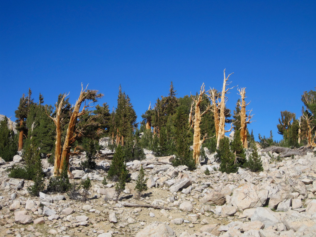
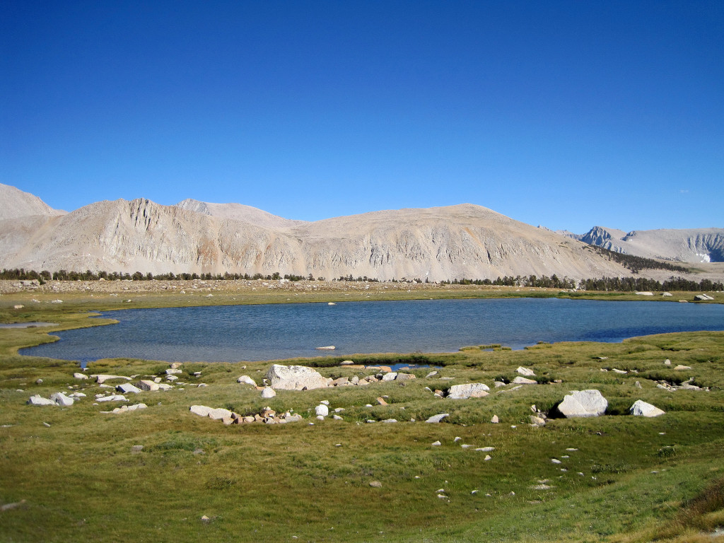
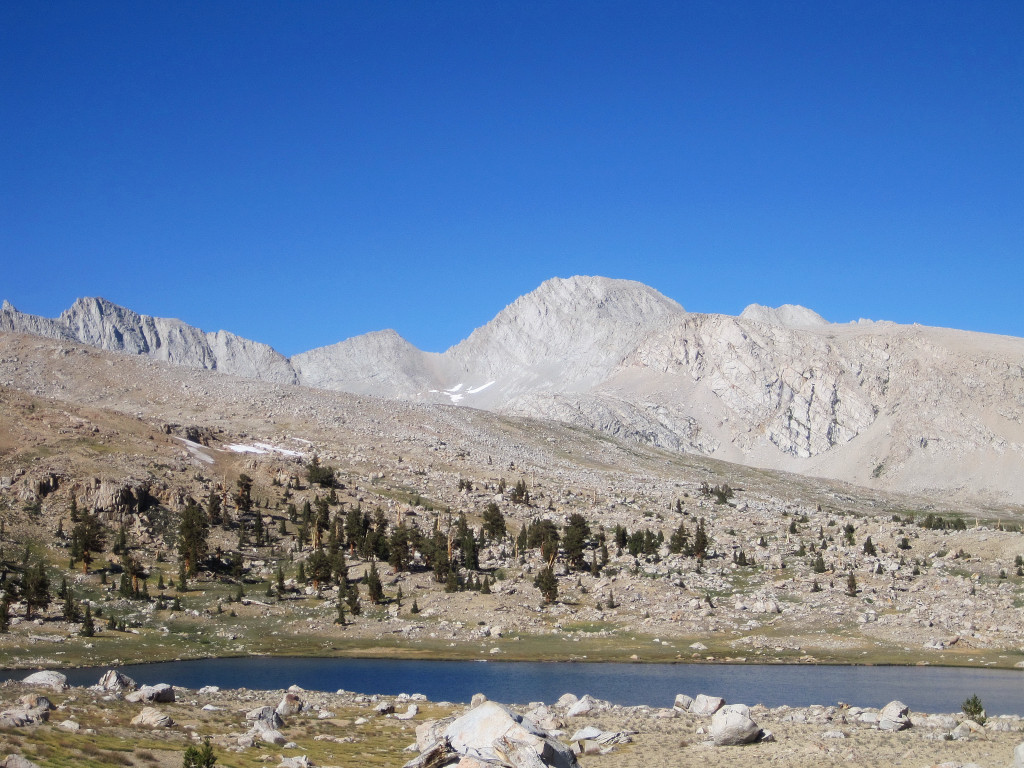
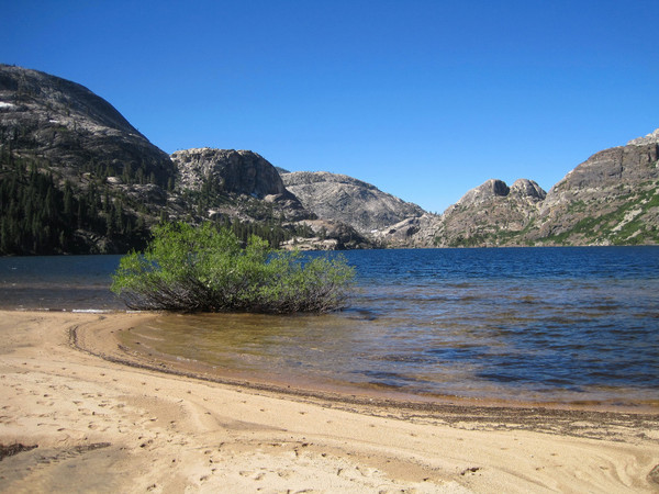
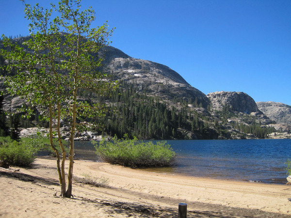
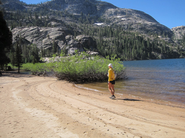
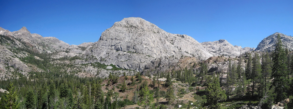
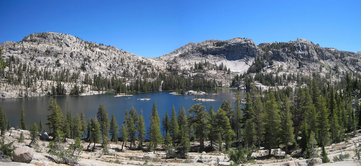
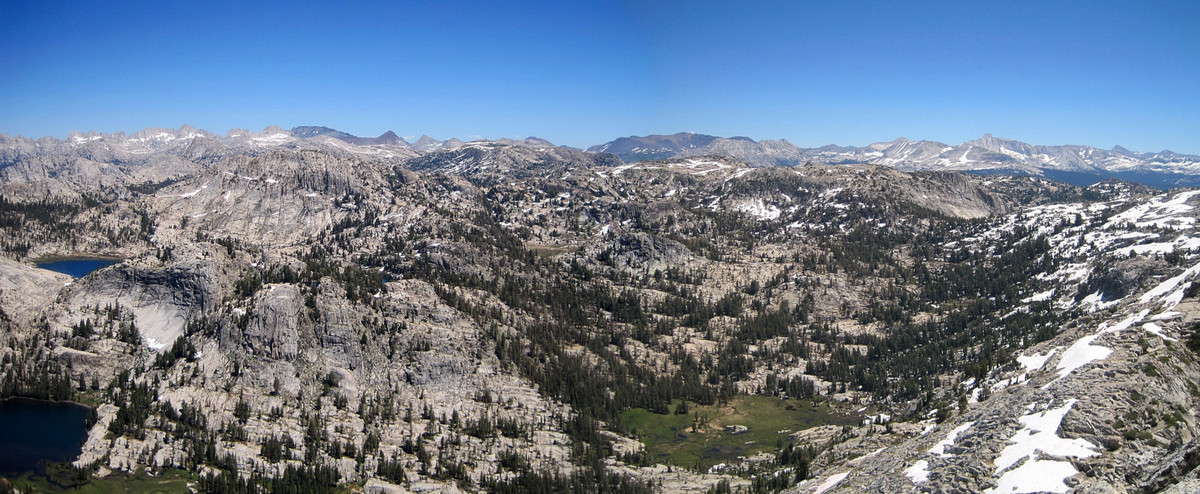
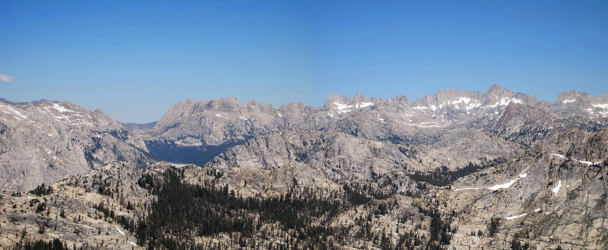
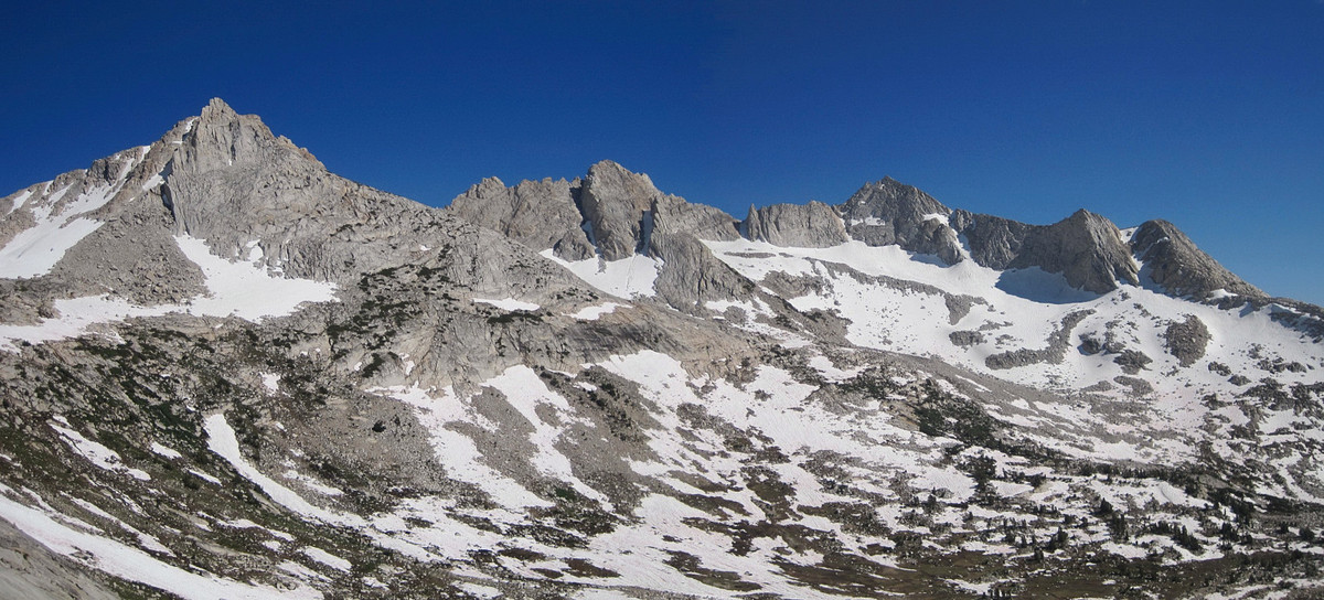
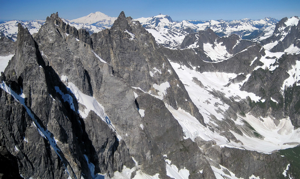
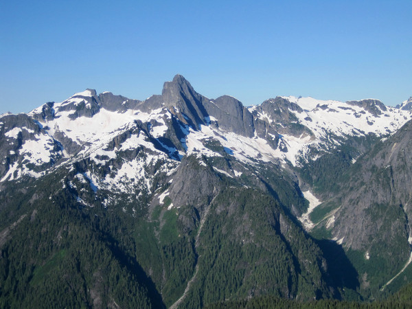
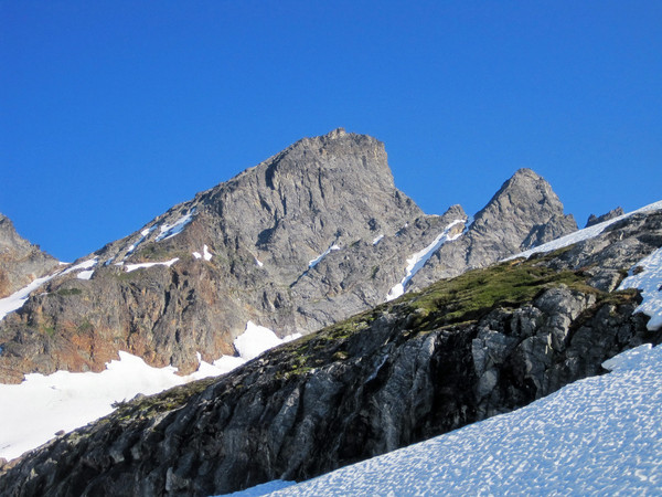
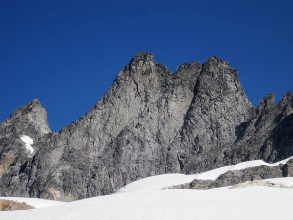
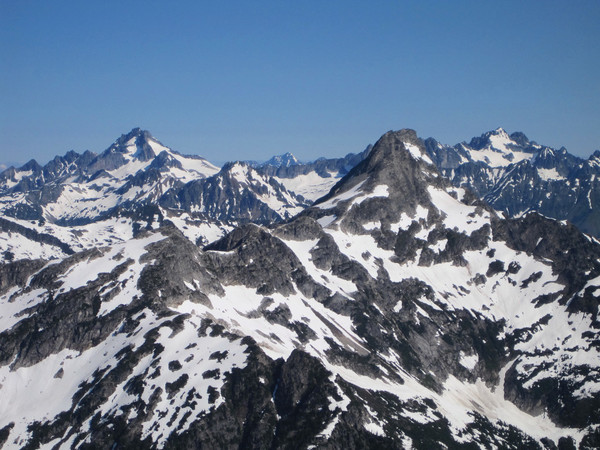
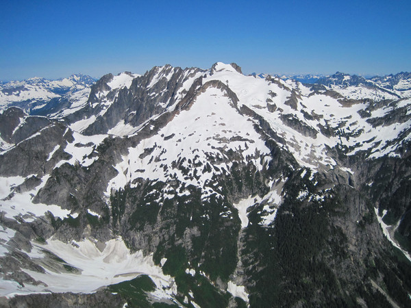
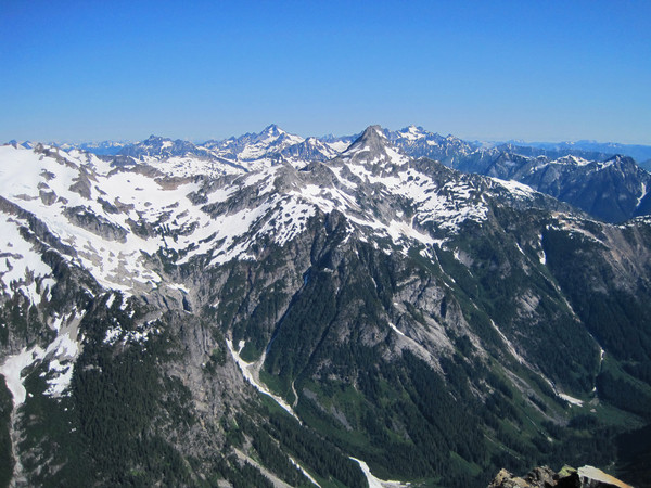
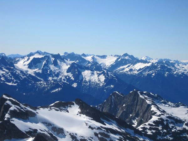
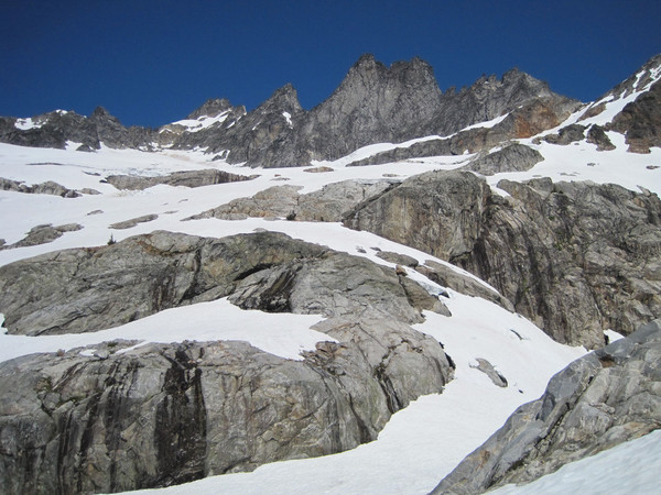
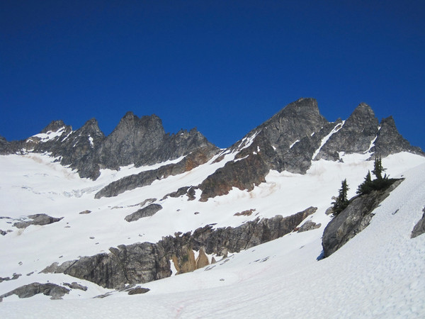
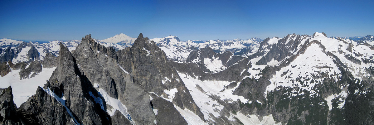
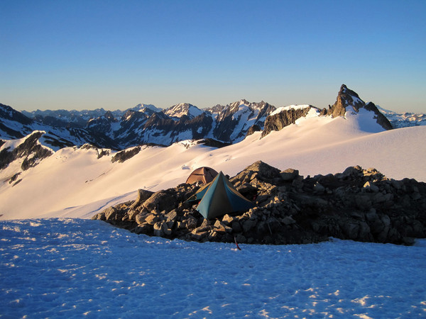
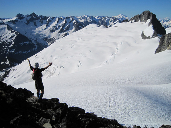
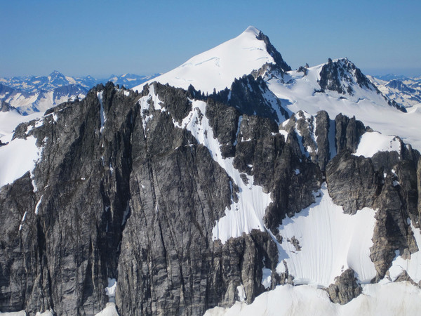
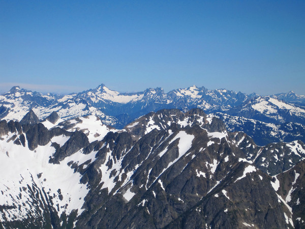
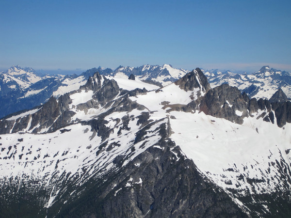
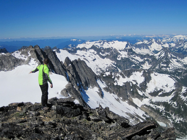
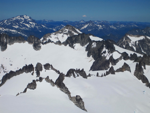
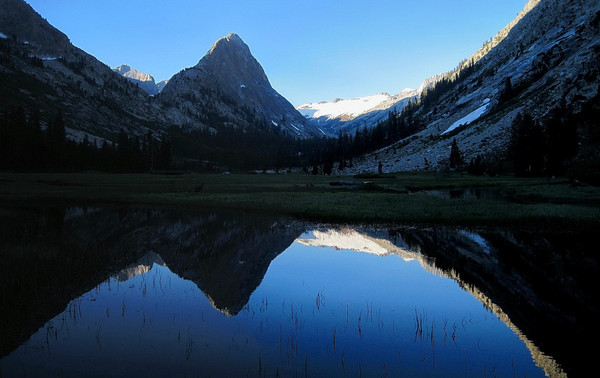
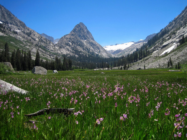
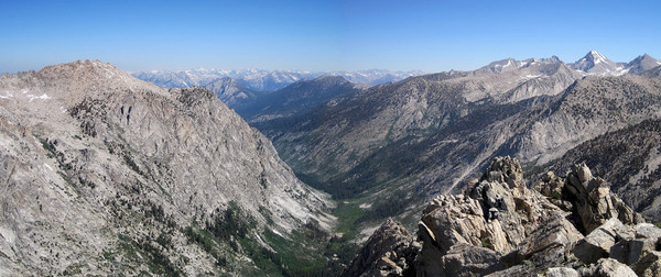
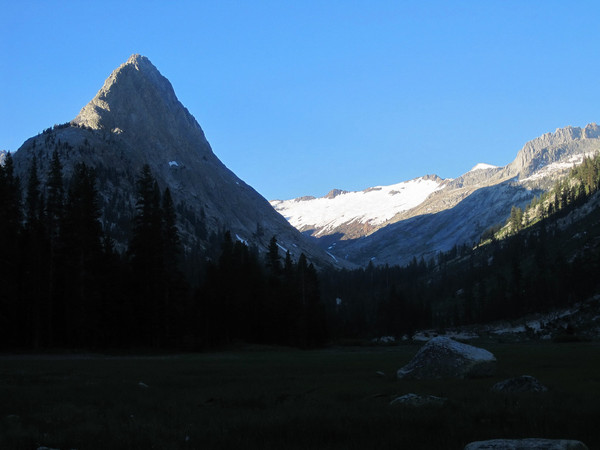
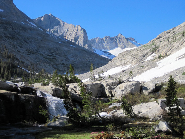
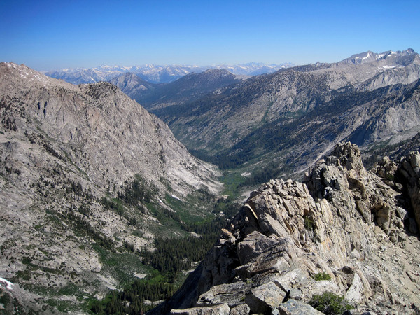
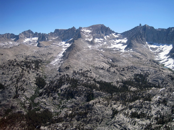
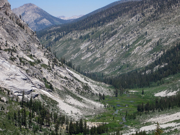
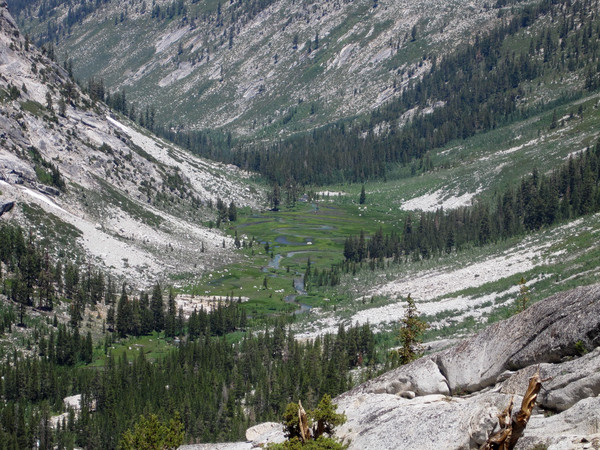
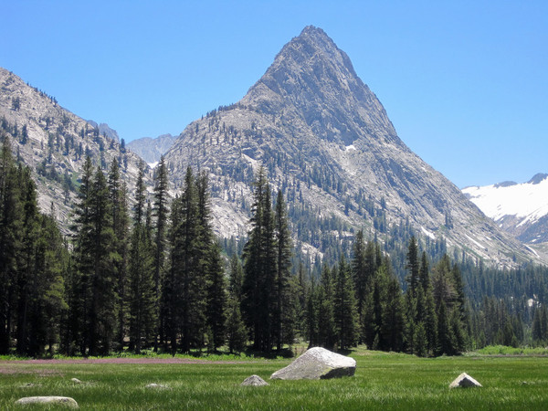
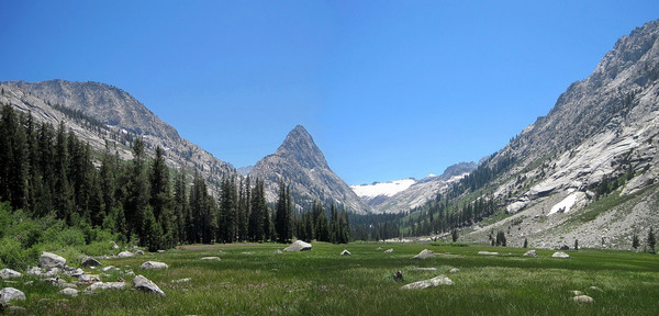
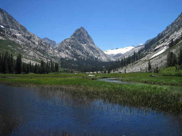
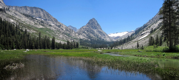
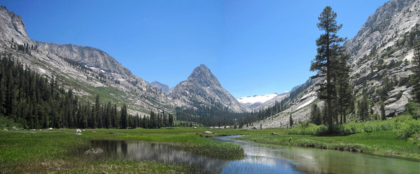
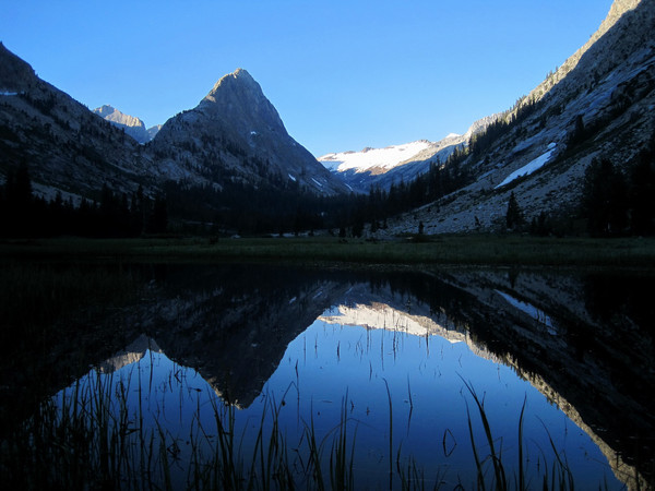
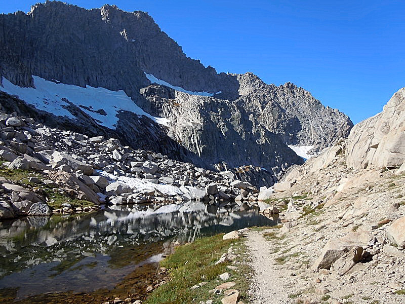
Piggybacking off my post from three years ago, I did the same "Suiattle Crest 50 Mile" adventure run last week in 11h44m (1h53m faster) starting from Little Giant TH. While no summits were climbed, this complete loop covers most of the highlights in this region of the Glacier Peak Wilderness including a breathtaking view from Little Giant Pass, a tour through wild Napeequa Valley, 360 vistas from the High Pass area, verdant wildflower meadows, stunning Lyman Lakes, and Spider Gap. It's quintessential cascades scenery - well worth a revisit after three years. With GPS, I found that total elevation gain is actually higher (near 14,000 ft), but distance is a couple miles short of 50 miles. The route/trails are in essentially the same condition as three years ago: Napeequa valley is still quite brushy (and wet in the morning) and the climb up to High Pass is nicely hidden - the use path starts at the far end of the meadow near the cascading stream and it's worth spending the time to find it since the slide alder is unsavory in this area.
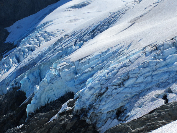
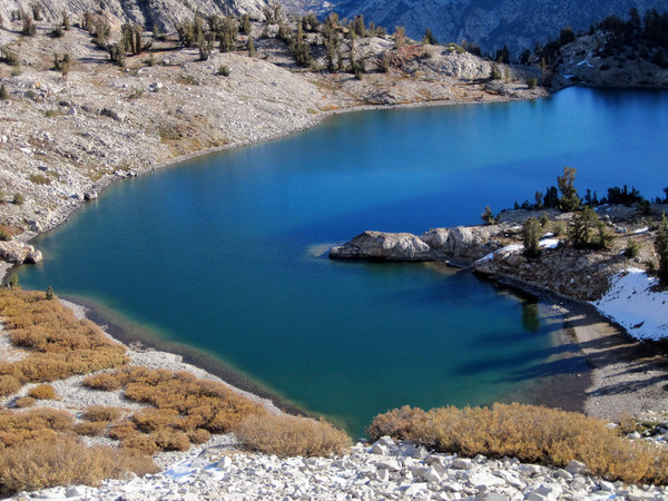
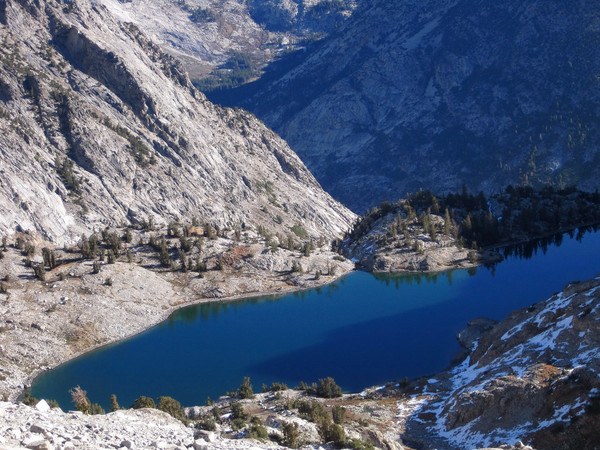
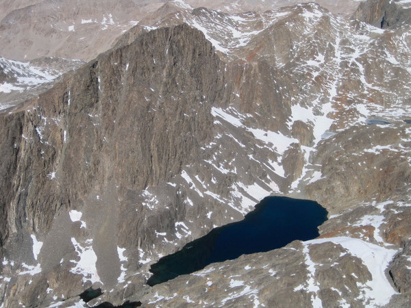
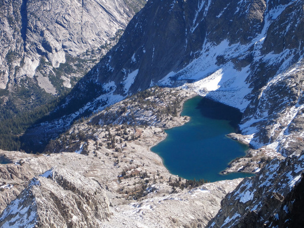
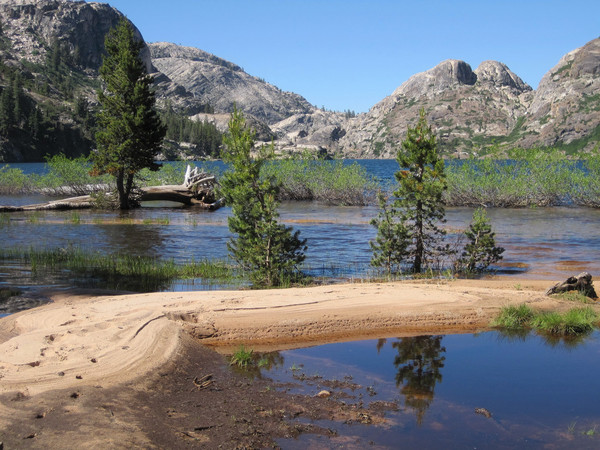
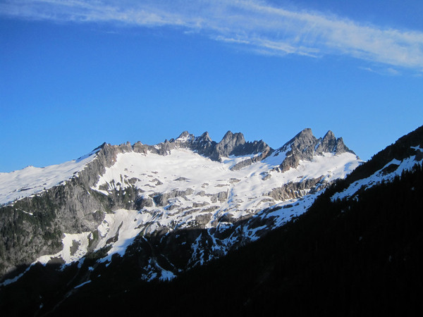
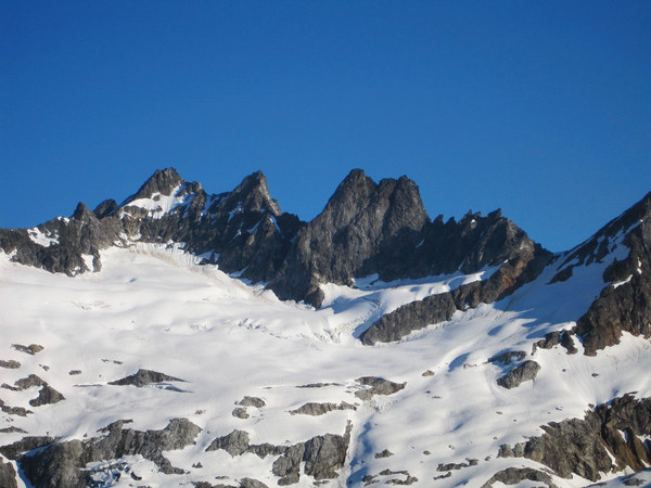
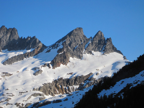
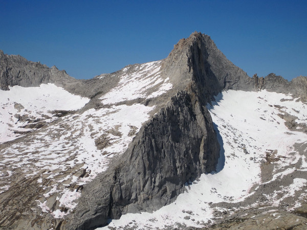
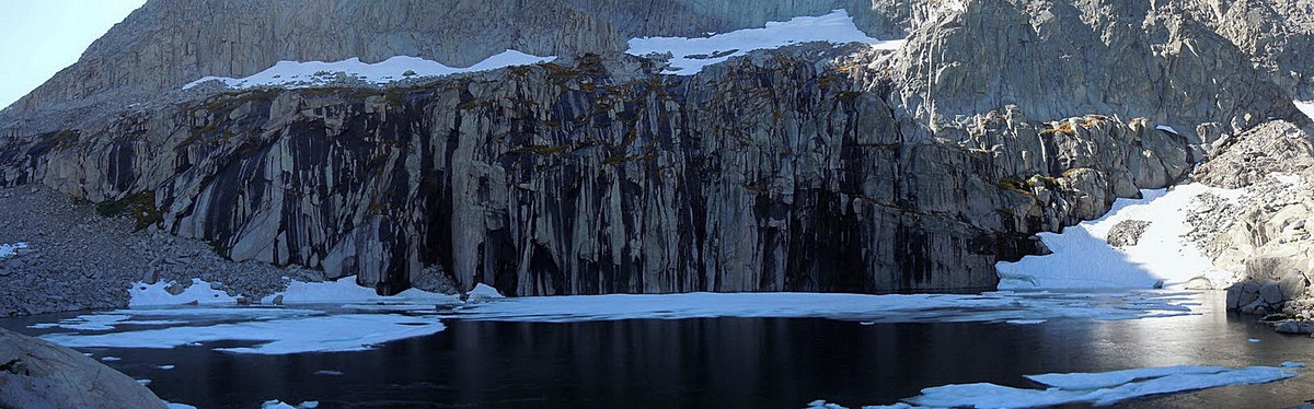
It’s sad to note the recession of the Lyman Glacier, which is essentially now a remnant ice patch. Despite relatively healthy snowpacks the last couple years, the glacier has continued to lose thickness appearing noticeably smaller than my visit in 2009 with the terminus even starting to recede from the last glacial lake. It seems only a matter of time before Lyman's permanent ice vanishes entirely. This is one stark example of how global warming is changing the North Cascades. For those who are interested, some video, photos, and time splits from the August 2012 version of the adventure run are located below.
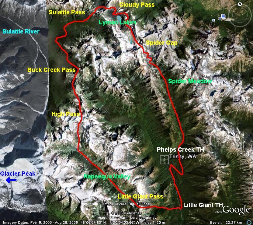
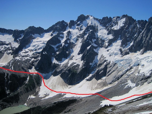
Simplified route on aerial image
[video:youtube]
Location (Elevation): Time Elapsed / Split / Real Time (difference 2012 vs. 2009)
Little Giant TH (2,600 ft) : 0 / 0 / 06:40
Little Giant Pass (6,409 ft) : 1:18:36 / 1:18:36 / 07:59 (-17)
High Pass (6,876 ft) : 4:30:18 / 3:11:41 / 11:10 (-1:05)
Buck Creek Pass (5,796 ft) : 5:39:01 / 1:08:46 / 12:19 (-1:04)
Cloudy Pass (6,420 ft) : 8:10:20 / 2:31:19 / 14:50 (-1:08)
Spider Gap (7,040 ft) : 9:32:11 / 1:21:50 / 16:12 (-1:28)
Phelps Creek TH (3,500 ft) : 11:01:50 / 1:29:38 / 17:42 (-1:41)
Little Giant TH (2,600 ft) : 11:44:19 / 42:29 / 18:24 (-1:53)


-
ha, I'm glad I'm not the only guy wearing these things.
So do you bring *any* kind of first aid? I'd think even some gauze and a foil blanket or something...you guys are really hanging it out there, I like it
Rob, I do bring some first aid provisions... scrapes and cuts happen.
The Injinji toesocks take some getting used to, but once you do they are fantastic - dry, cool, comfortable, and most importantly, prevent hot spots around the toes.
Thanks Verticolorful!
-
Thanks all!
John, Uli mentioned you and that climb of Mt. Daniel. His list of running accomplishments speaks for itself. His versatility is astounding and it was an honor to do the traverse with him.
I have enjoyed many summits in the North Cascades, but in my opinion, summiting something is not always a prerequisite to having a fulfilling climbing experience in the mountains. The Ptarmigan is one such example.
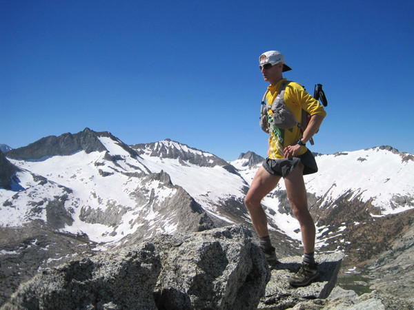
Nater, Uli rolls with shorties so we had to match! That said, they allow for unencumbered strides... my preferred running garment.
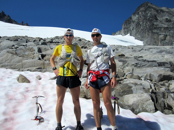
Rob, here is what I carried:
- Ultimate Direction Wasp Pack
- Ultimate Direction Fastdraw Plus Hand Hold Water Bottle
- Petzl Snow Racer Ice Axe
- Black Diamond Neve Crampons
- Injinji performance socks
- First Endurance EFS Drink Mix and Liquid Shot
- Assortment of bars and gels
- Camera
- Rudy Project Sunglasses
- Sunscreen/Chapstick
-
This ski is "known", but (1) skiing is not compared to travel on foot and (2) the ski route is substantially different in sections (i.e. direct to Cascade Pass, cut across from Spire Col to Bachelor Creek).
-
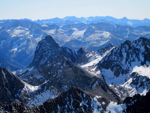
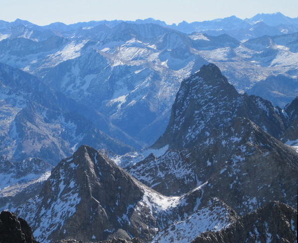
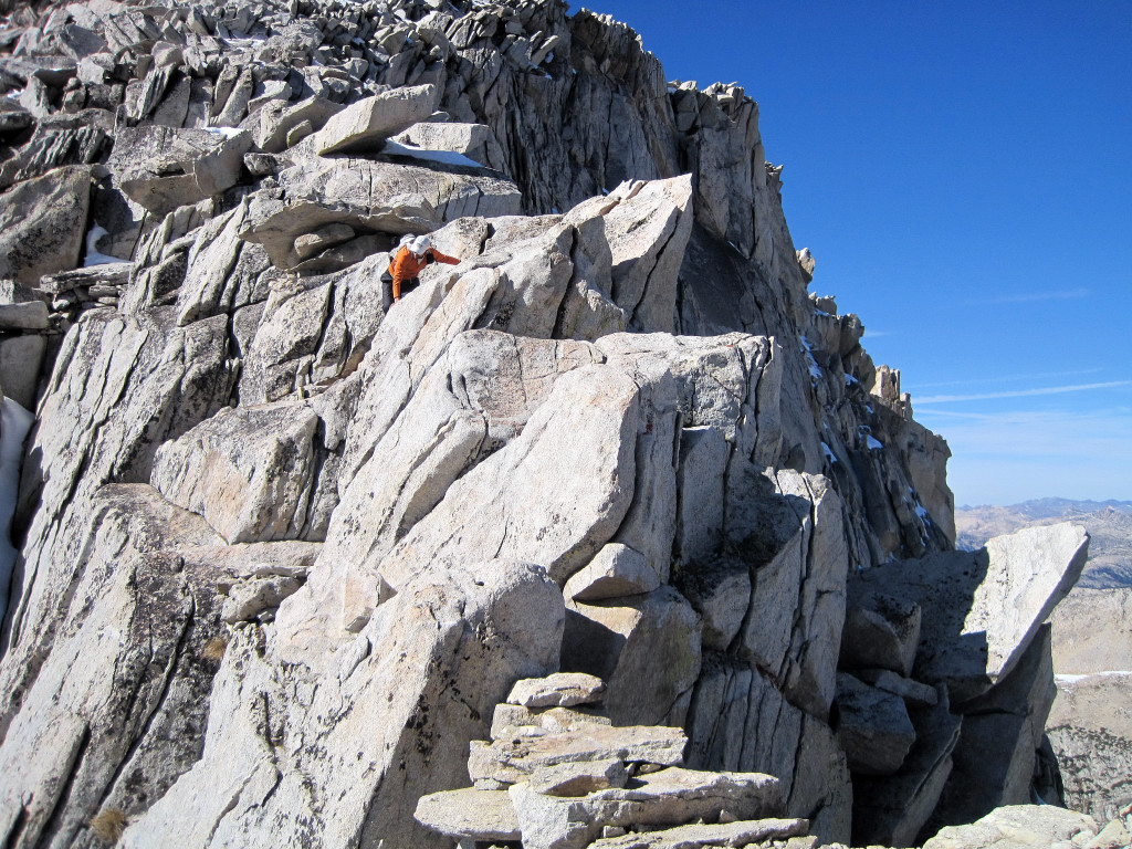
Trip: Ptarmigan Traverse FKT -
Date: 8/16/2012
Trip Report:
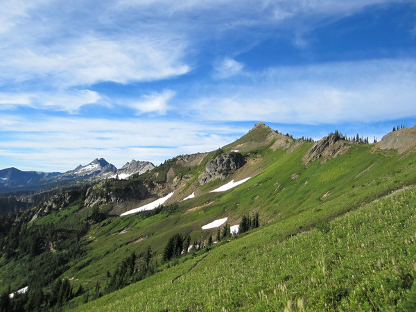
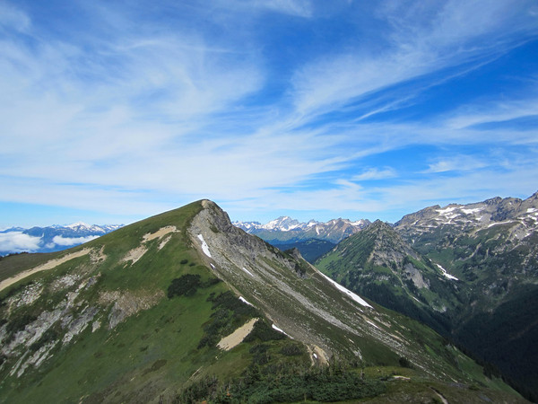
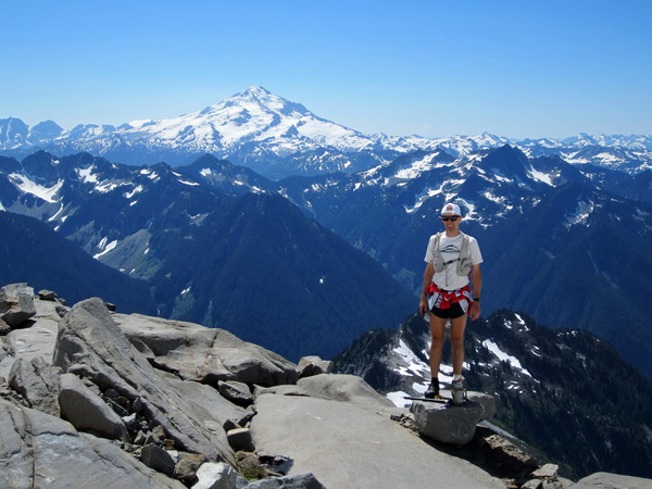
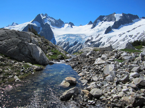
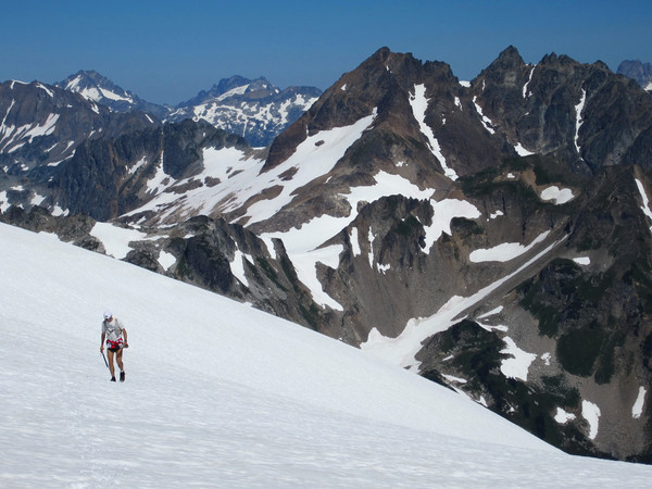
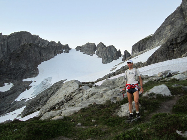
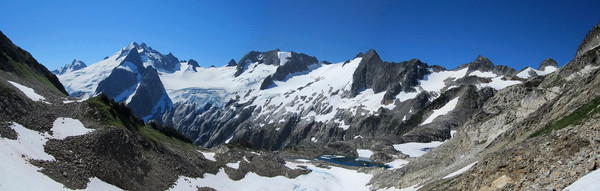
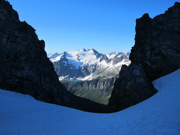
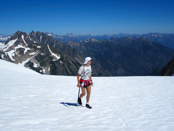
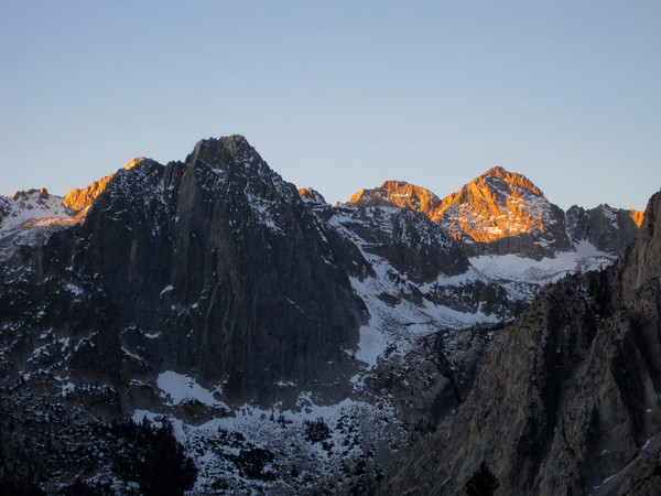
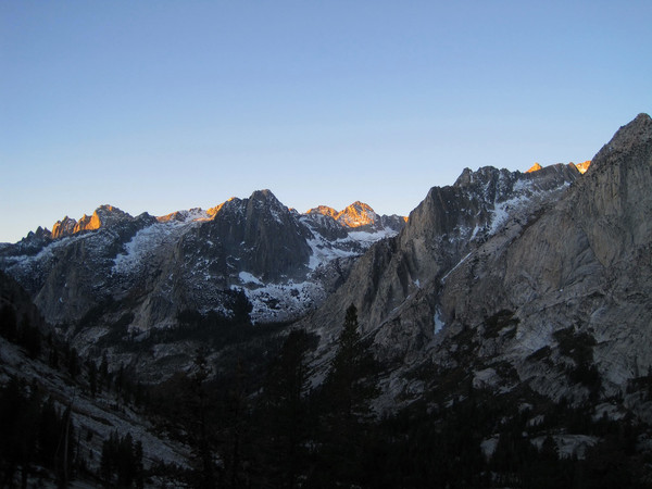
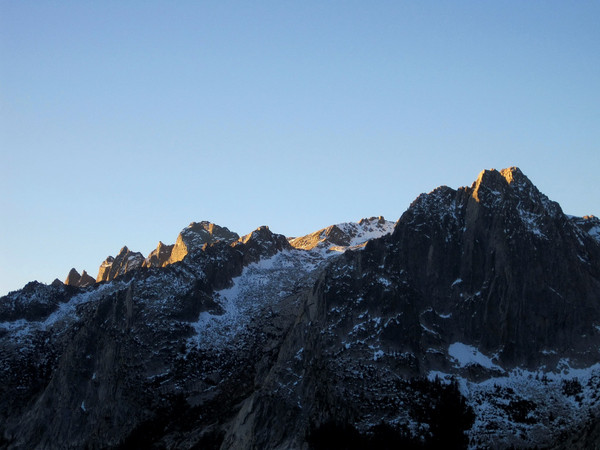
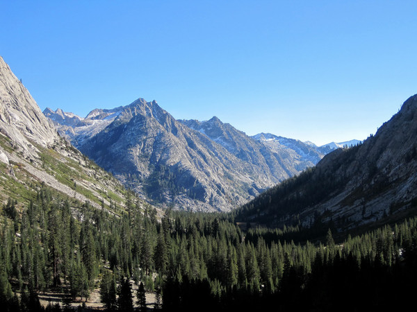
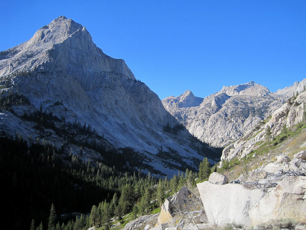
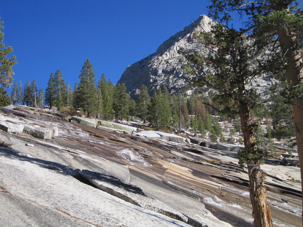
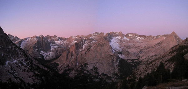
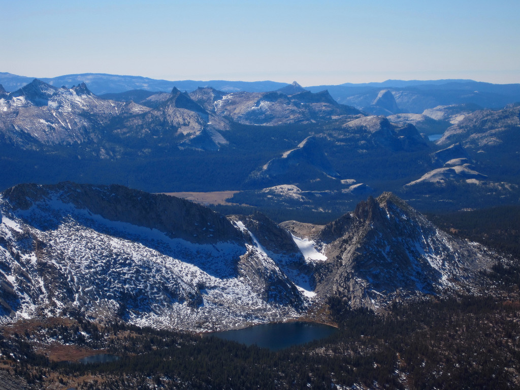
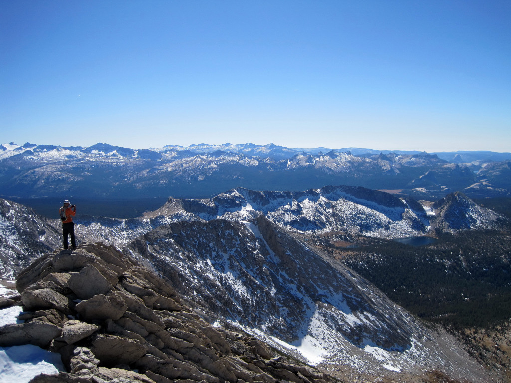
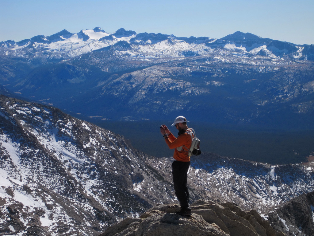
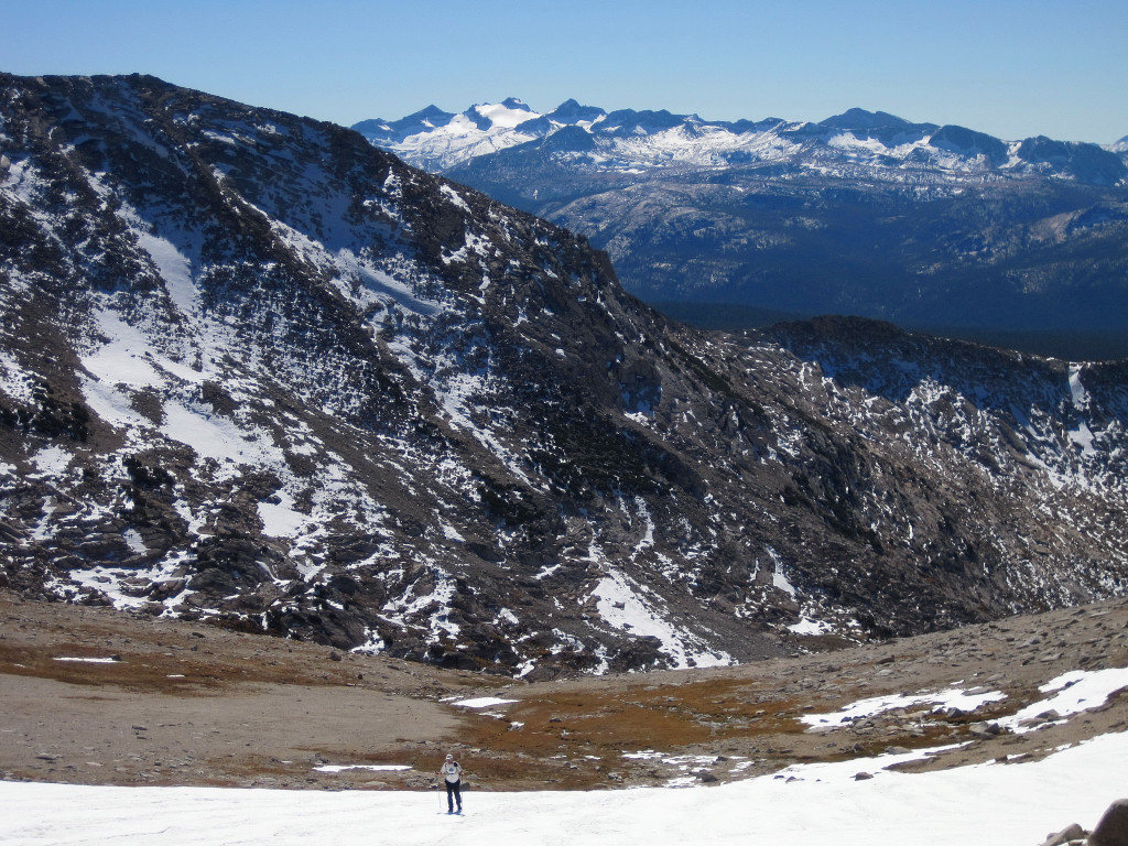
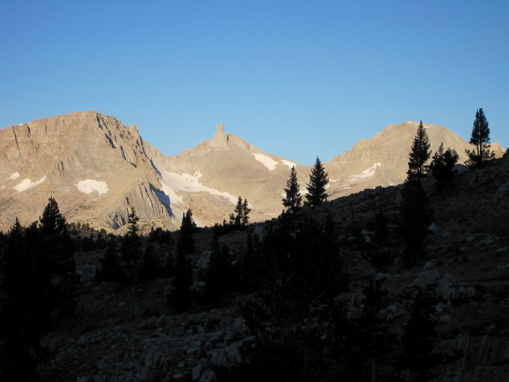
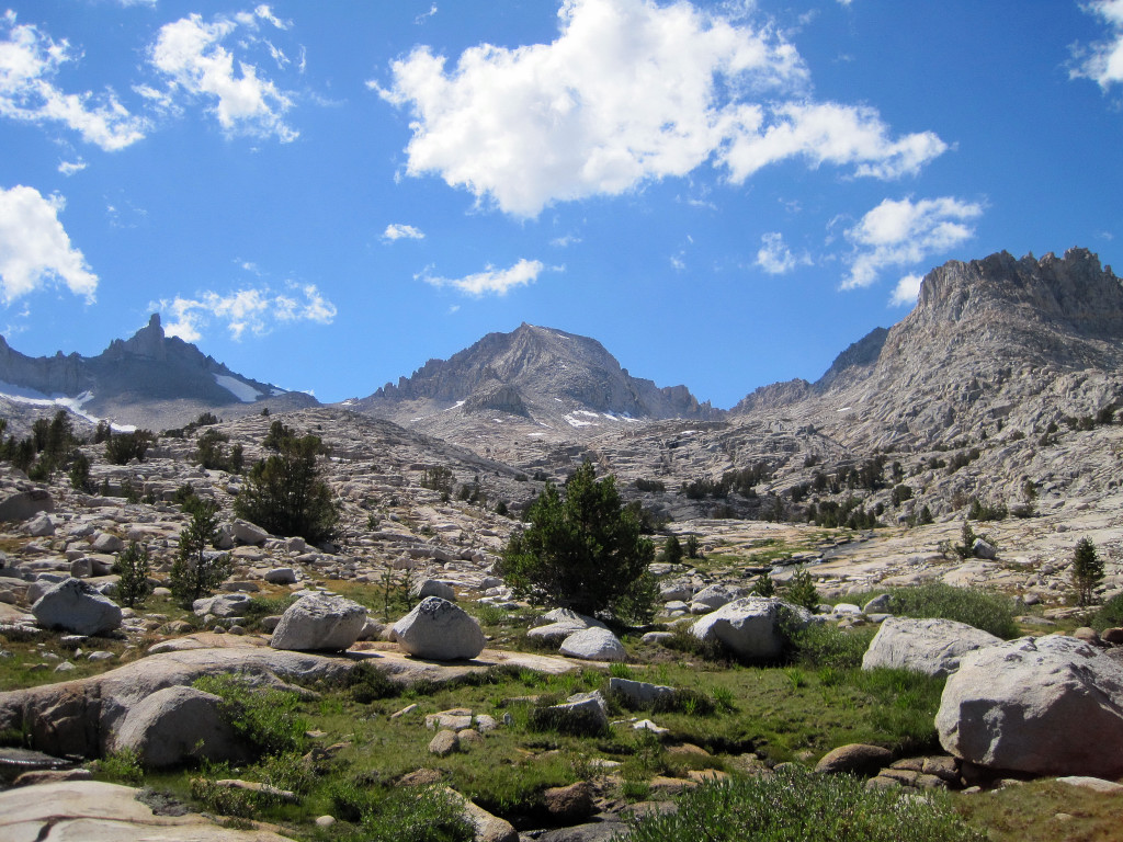
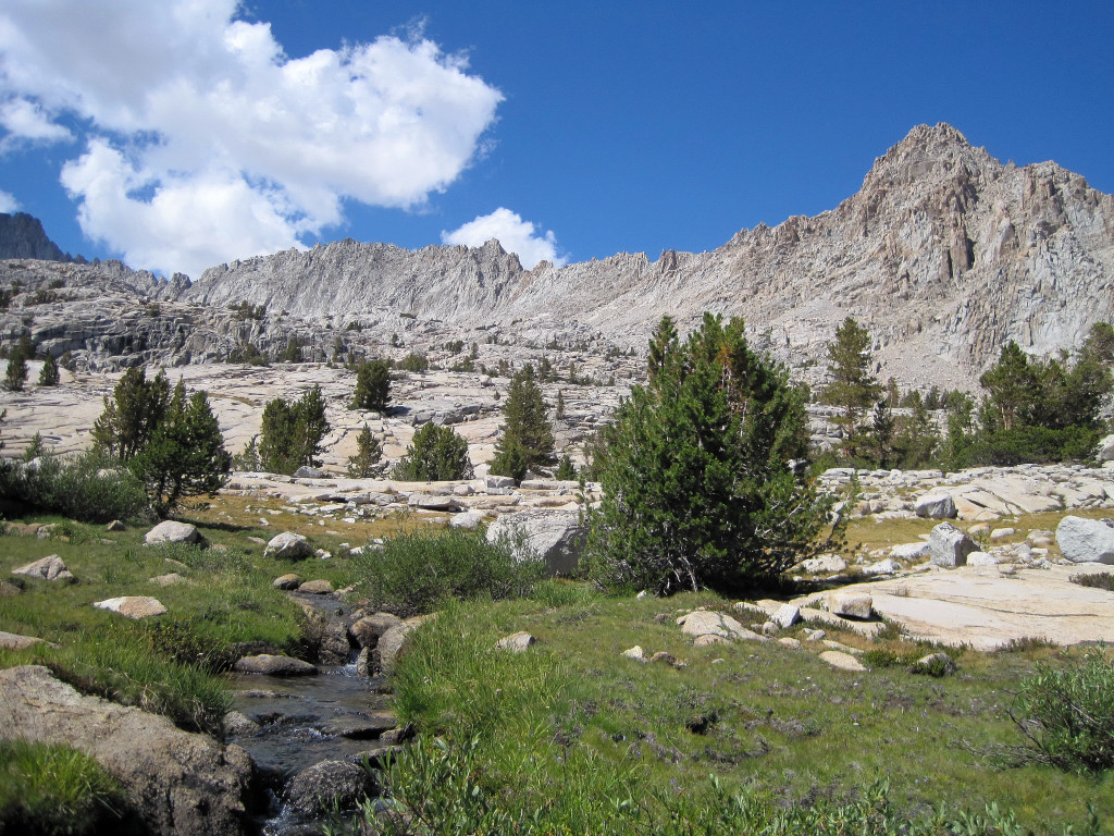
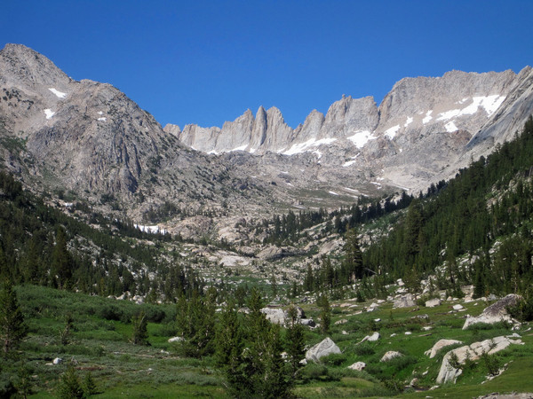
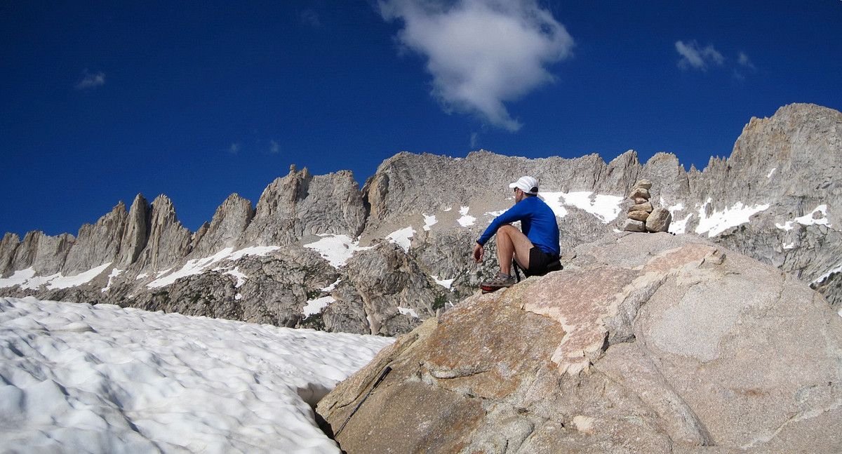
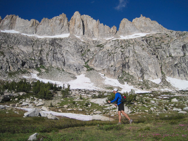
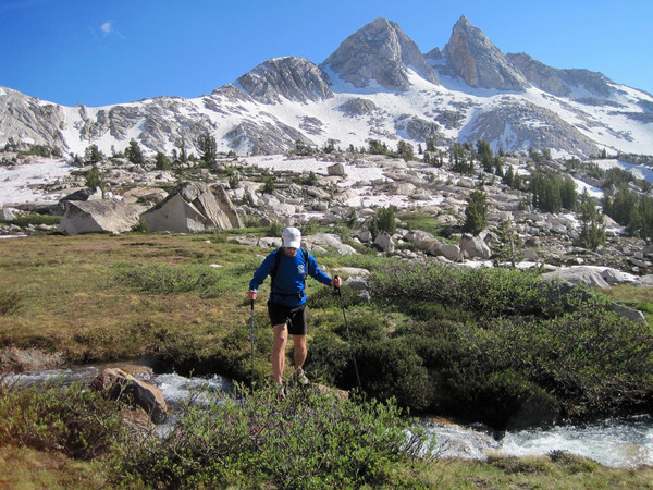
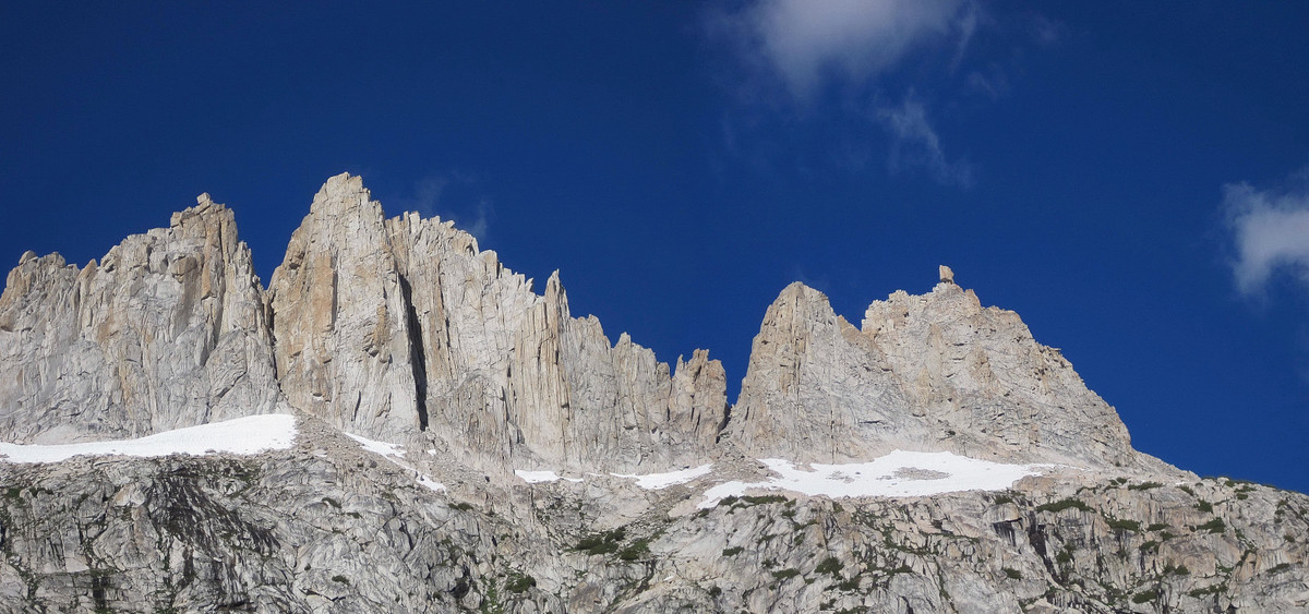
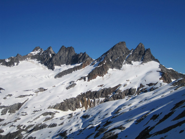
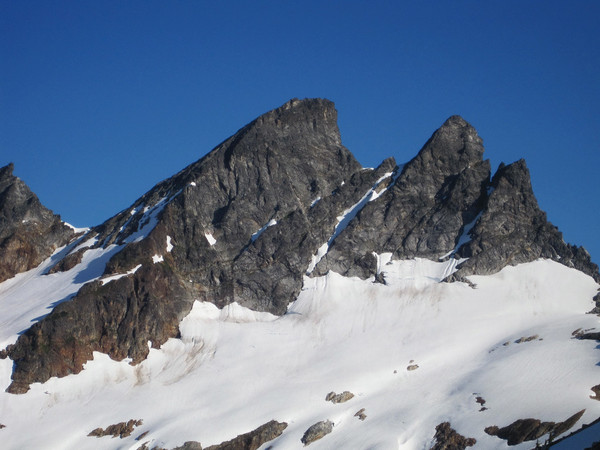
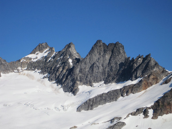
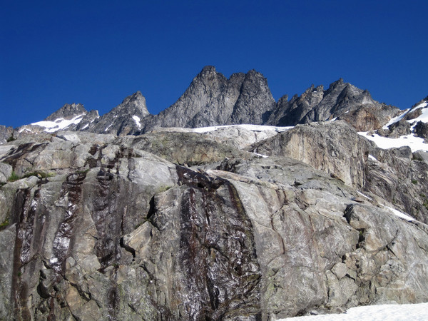
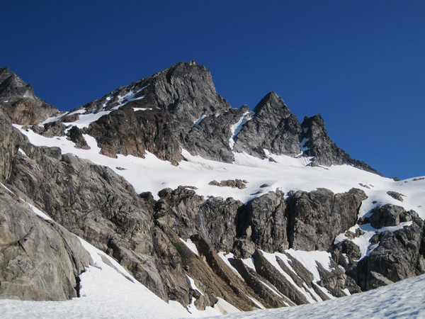
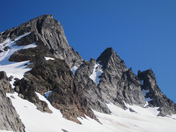
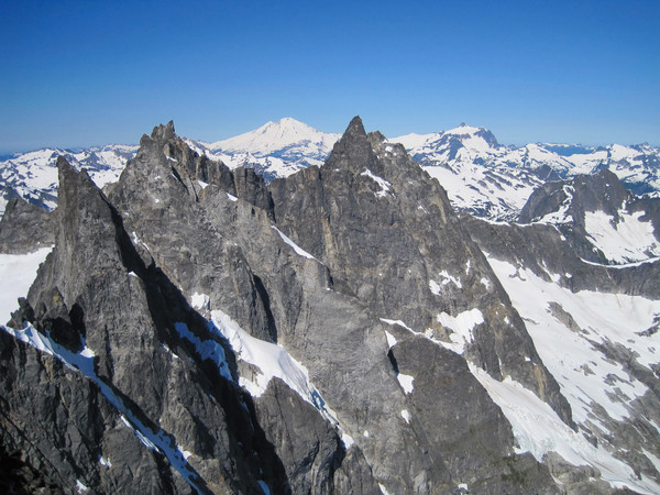
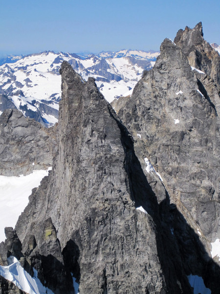
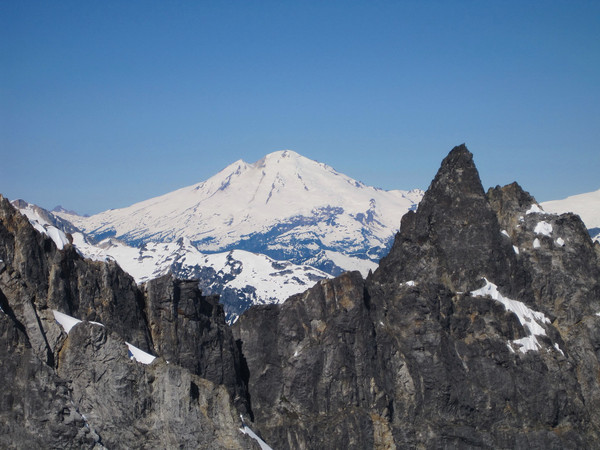
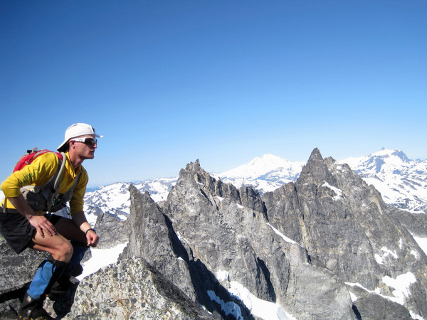
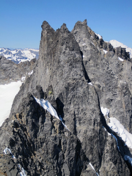
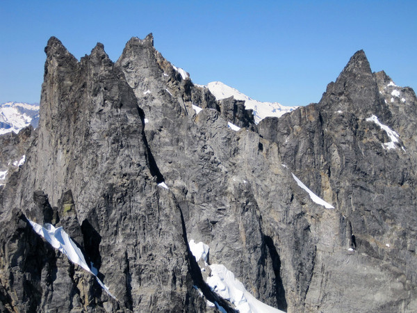
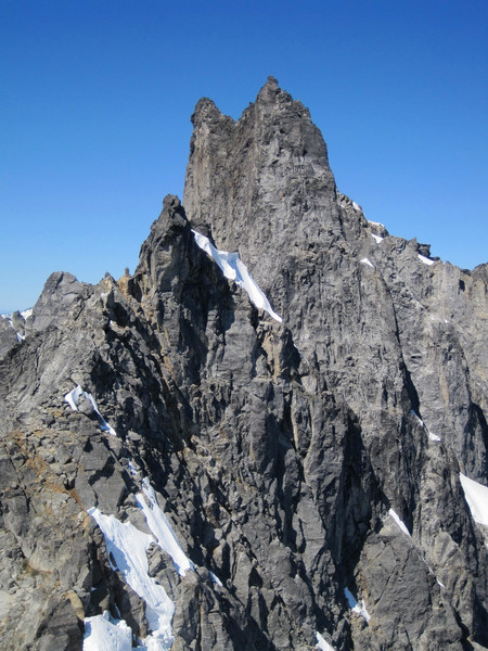
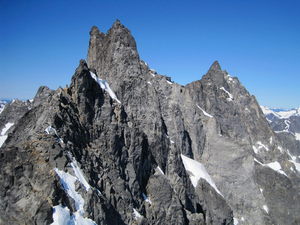
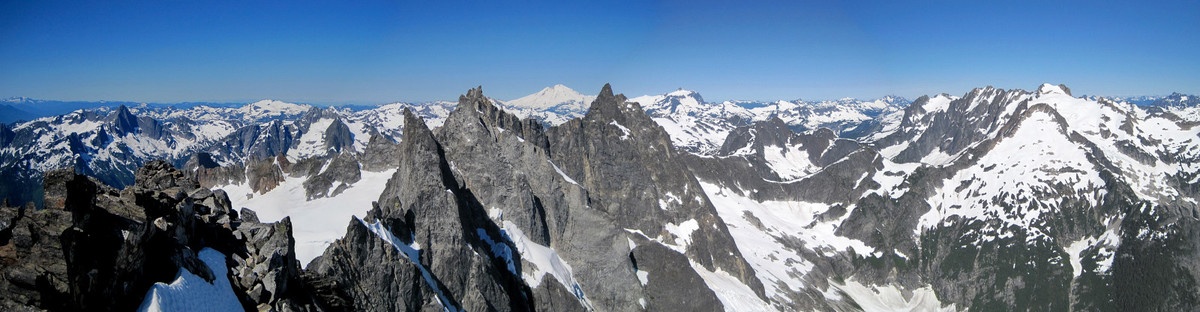
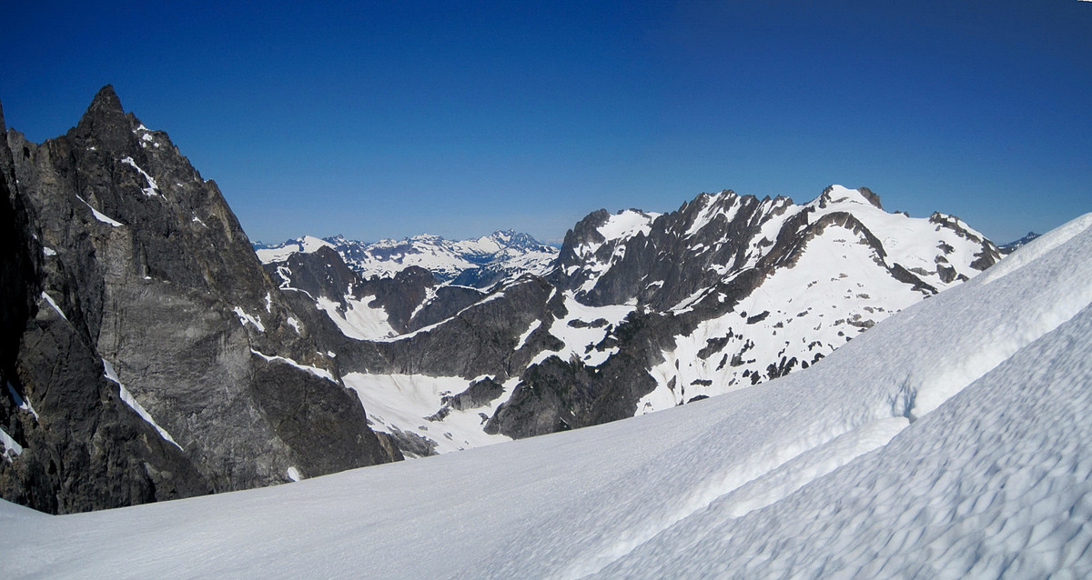
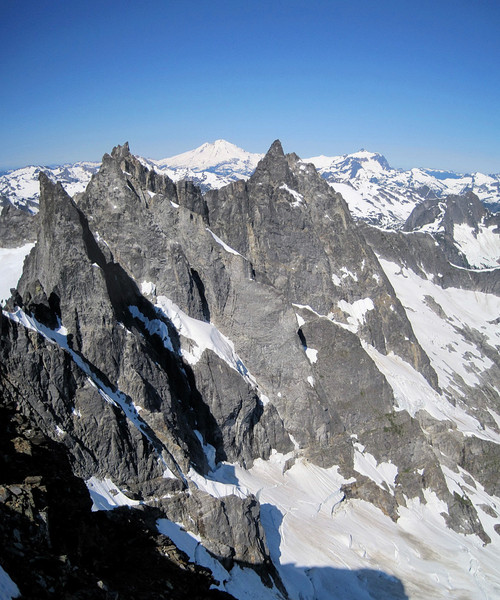
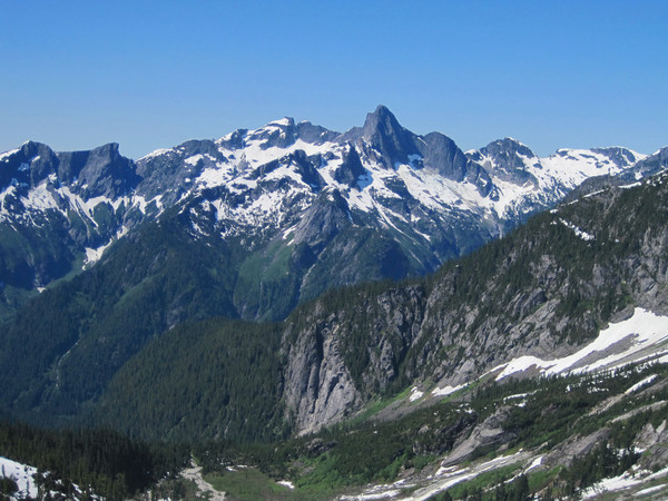
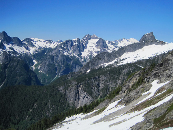
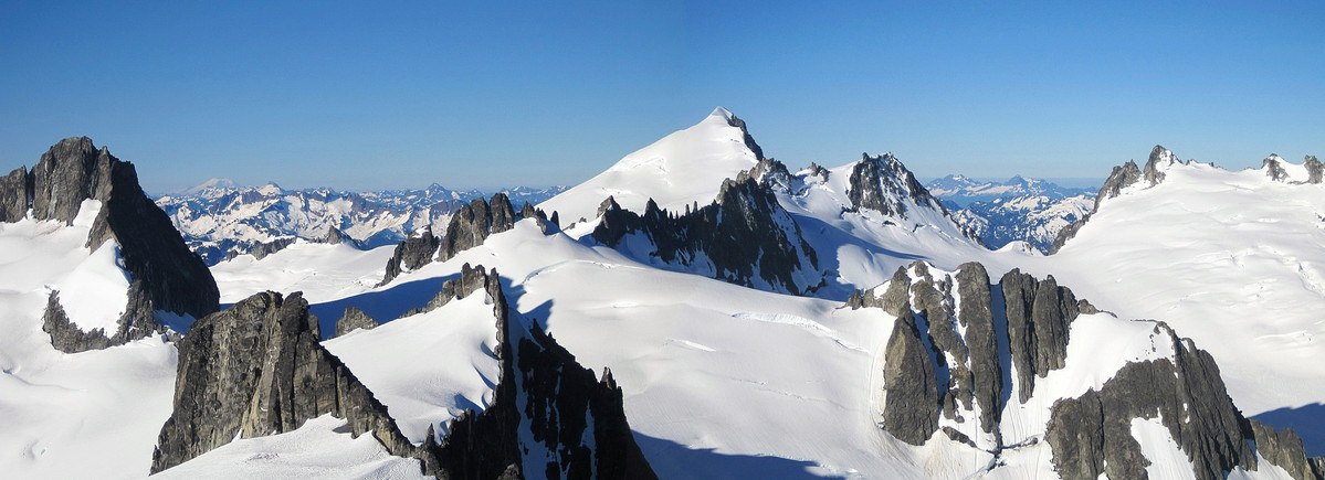
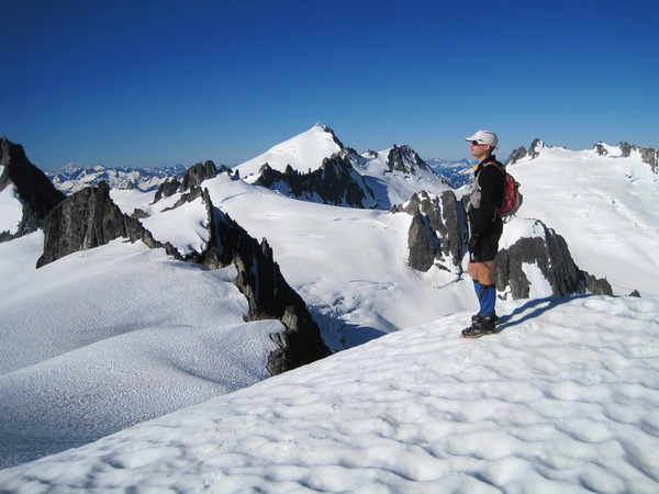
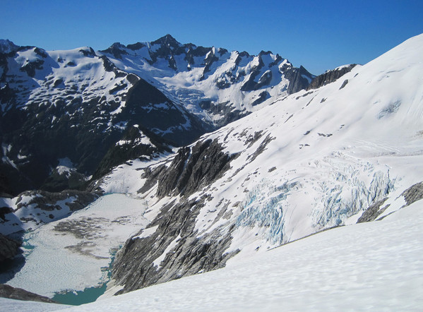
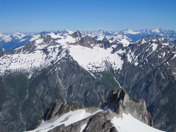
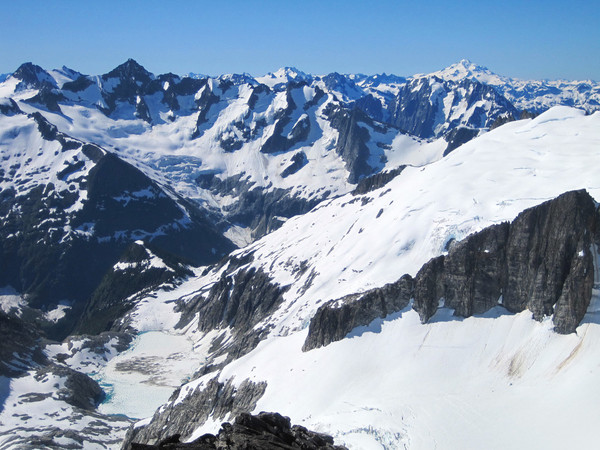
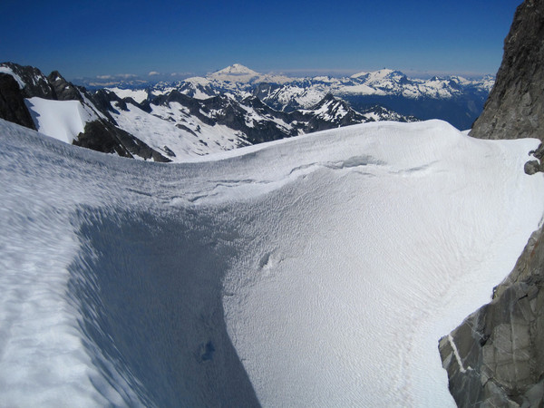
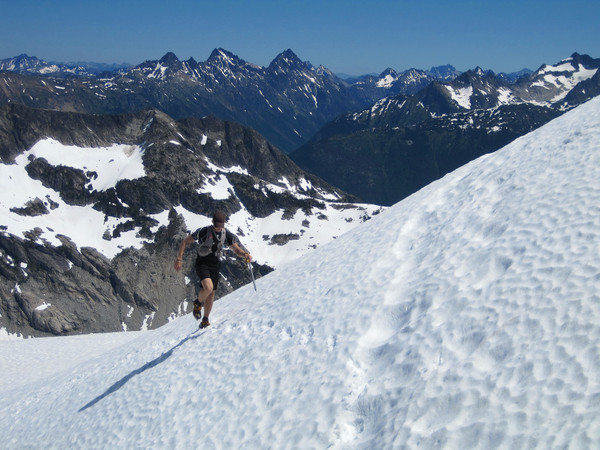
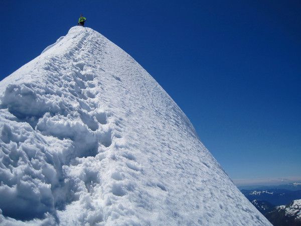
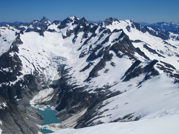
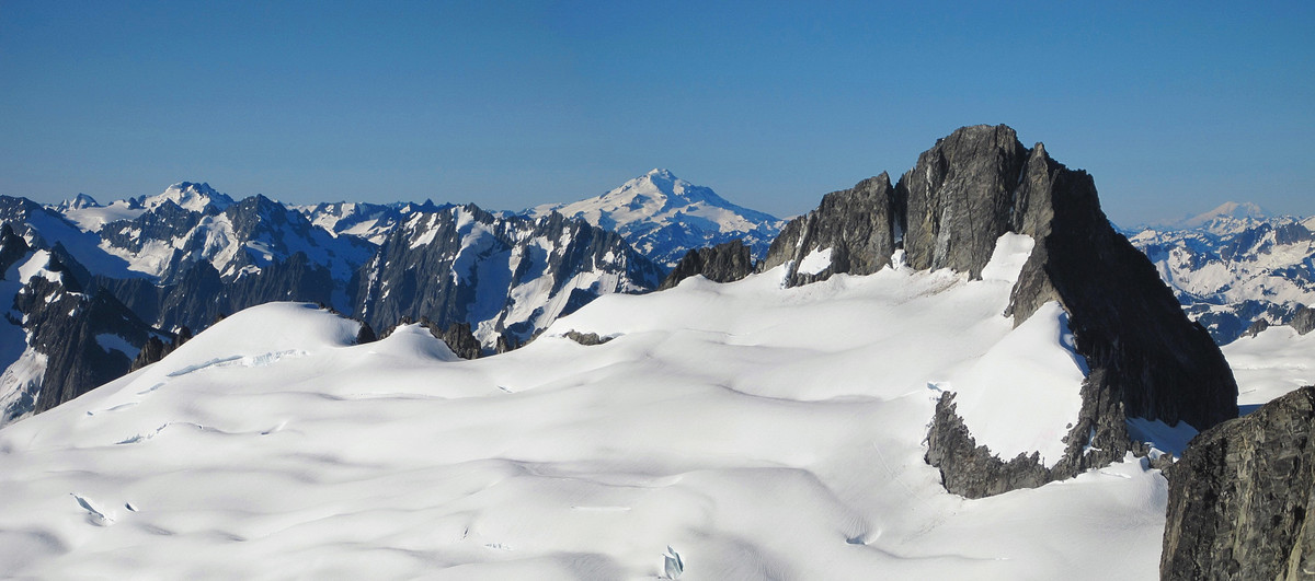
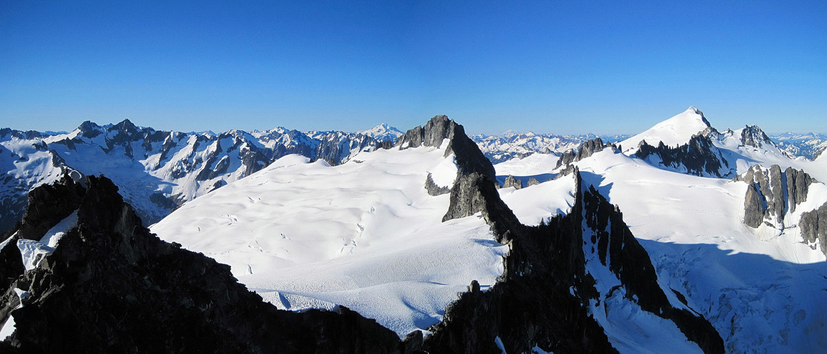
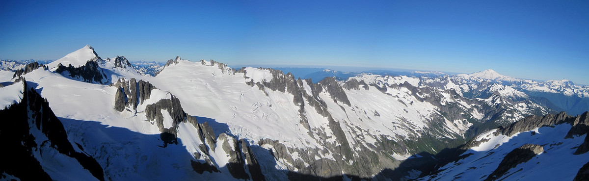
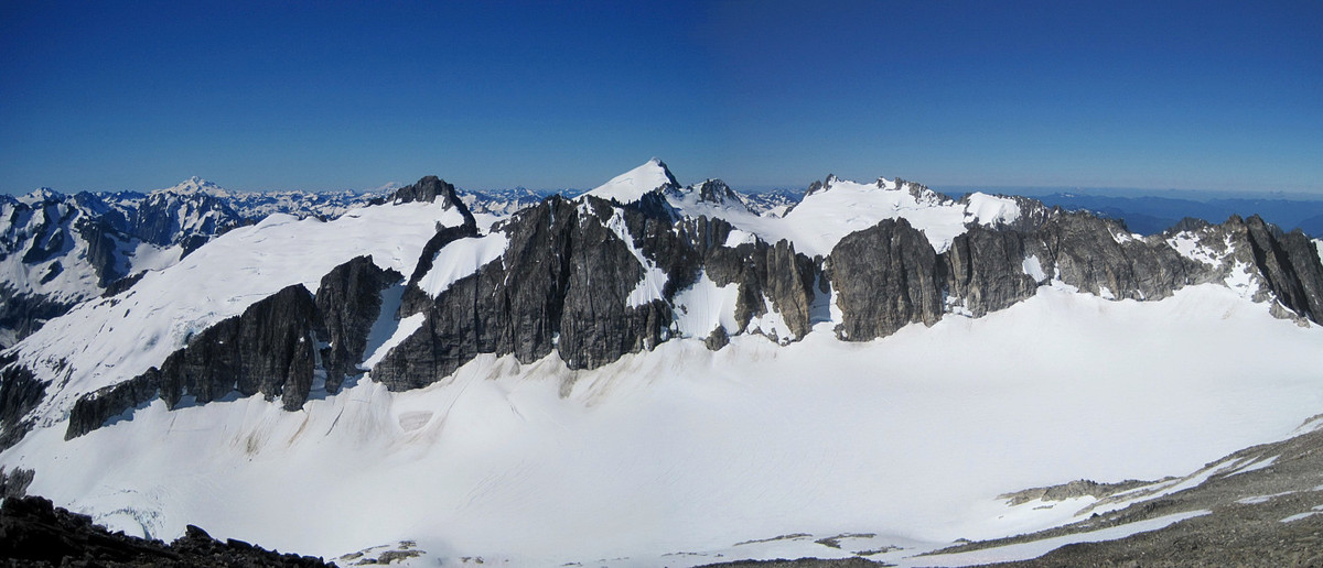
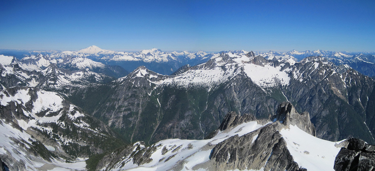
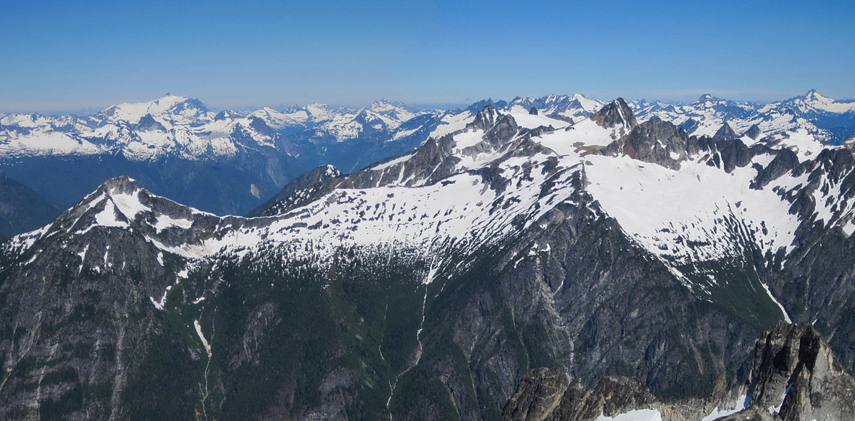
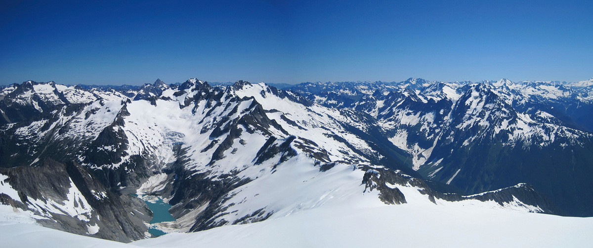
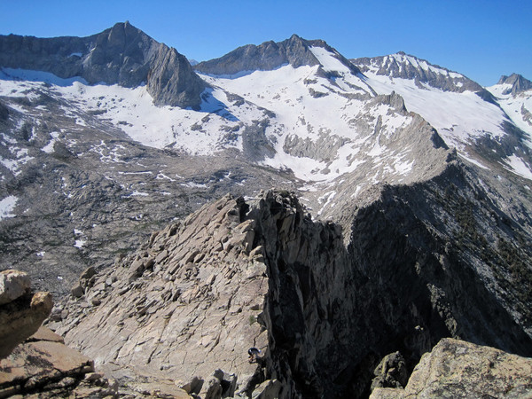
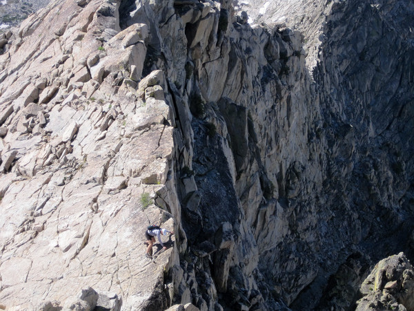
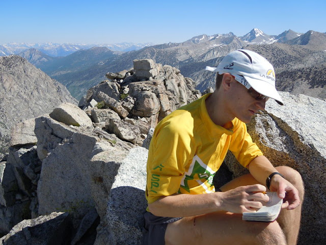
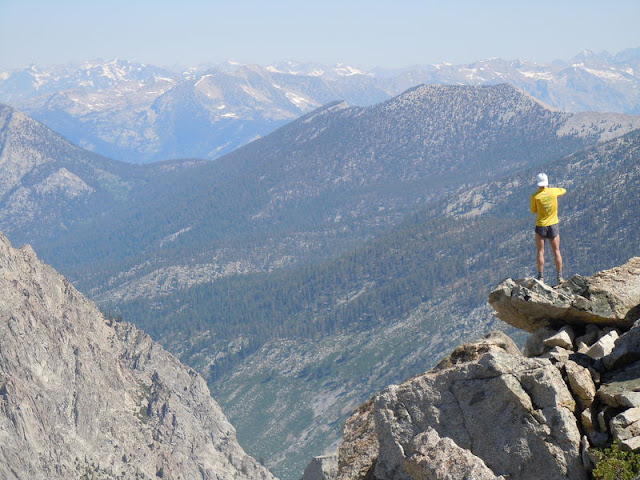
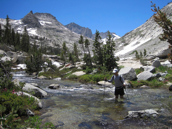
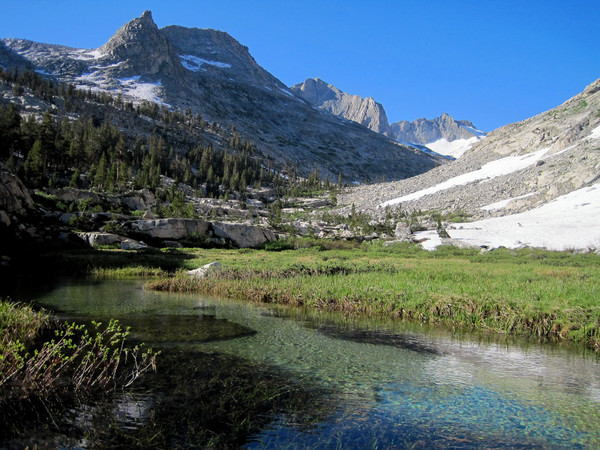
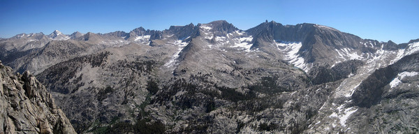
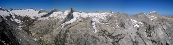
Uli Steidl and I completed the Ptarmigan Traverse in 12:17, a new FKT (fastest known time). It has been three years since I last enjoyed the Ptarmigan Traverse so it was time to come back to see some of the most beautiful scenery in the Cascades and refresh the prior FKT, which was set by Colin Abercrombie and me on July 28, 2009 (14:36) . This time I was joined by distance running legend Uli Steidl who has innumerable running victories and accolades to his name from road marathons to mountain running to ultras. Conditions were very similar to 2009 with nearly identical weather (hottest days of the summer). Prior to this run I figured somewhere in the 12 hour range was possible and we were able to hit that target finishing the traverse in 12:17. We started at the Cascade Pass trailhead at 4:49 am and finished at Downey Creek Bridge at 5:06 pm.
Overall, the 2 hr, 19 min improvement from the 2009 time was due to a consistently faster effort throughout the traverse (see comparison below). I attribute this to more route experience and dialing in on nutrition and hydration, which helped keep energy levels high especially in the second half of the traverse. Bachlor Creek was as lovely (brushy) as ever although we avoided making any time consuming errors in the brush and the Downey Creek Trail felt as long as I had remembered. The 8.5 mile jog along the Suiattle River Road seemed especially needless because there were five forest service vehicles parked at the Downey Creek Bridge. In fact, the closed portion of the road is in better shape than the open part! It seemed like they were prepping the road, perhaps for opening?
[video:youtube]
Comparison: 2012 vs. 2009 vs. 2008 (difference 2012 to 2009)
Cascade Pass TH (3,600 ft) : 0 / 0 / 0
Cascade Pass (5,392 ft) : 43 / 48 / 55 (- 5)
Cache Col (6,920 ft) : 1:39 / 1:50 / 2:13 (- 11)
Spider-Formidable Col (7,320 ft+) : 3:26 / 3:40 / 5:00 (- 14)
Yang Yang Lakes (5,830 ft) : 4:10 / 4:26 / 6:20 (- 16)
White Rock Lakes (6,194 ft) : 6:25 / 7:11 / 9:51 (- 46)
Spire Col (7,760 ft+) : 7:52 / 8:54 / 11:55 (- 1:02)
Cub Pass (6,000 ft+) : 8:55 / 10:16 / 13:42 (- 1:21)
Bottom of Bachelor Creek (2,440 ft) : 10:51 / 12:48 / 16:30 (- 1:57)
Downey Creek TH (1,415 ft) : 12:17 / 14:36 / 18:10 (- 2:19)
Location (Elevation): Time Elapsed / Split / Real Time
Cascade Pass TH (3,600 ft) : 0 / 0 / 04:49
Cascade Pass (5,392 ft) : 43:10 / 43:10 / 05:32
Cache Col (6,920 ft) : 1:38:34 / 55:24 / 06:27
Spider-Formidable Col (7,320 ft+) : 3:25:37 / 1:47:02 / 08:14
Yang Yang Lakes (5,830 ft) : 4:10:17 / 44:40 / 08:59
White Rock Lakes (6,194 ft) : 6:24:54 / 2:14:36 / 11:14
Spire Col (7,760 ft+) : 7:52:01 / 1:27:07 / 12:41
Cub Pass (6,000 ft+) : 8:54:49 / 1:02:47 / 13:44
Bottom of Bachelor Creek (2,440 ft) : 10:51:23 / 1:56:34 / 15:40
Downey Creek TH (1,415 ft) : 12:17:15 / 1:25:51 / 17:06


Gear Notes:
Axe and crampons
Footwear: La Sportiva
Nutrition: First Endurance EFS and Ultragen, energy bars
Approach Notes:
Typical Bachelor Creek brush
-
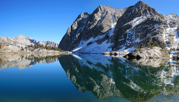
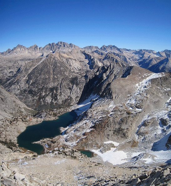
Trip: Mount McDuffie - via Ladder Lake & Bishop Pass
Date: 10/30/2011
Trip Report:
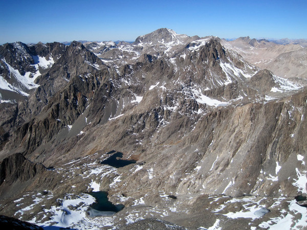
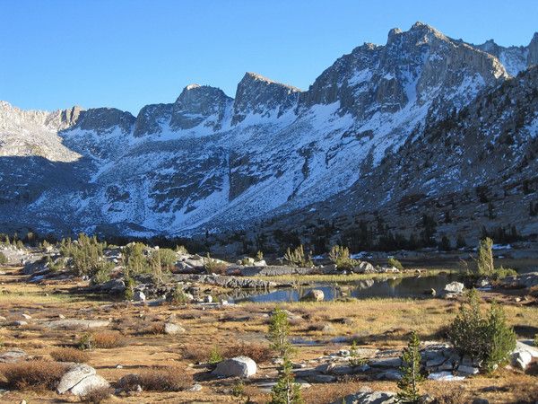
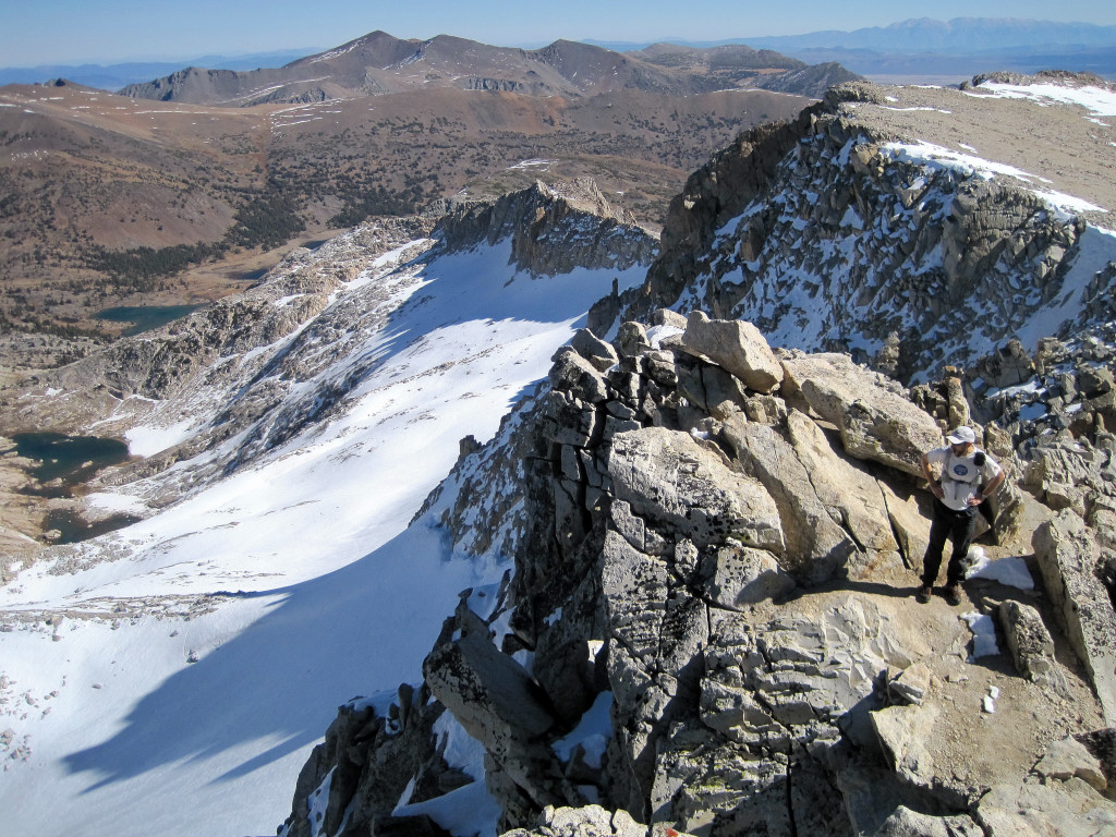
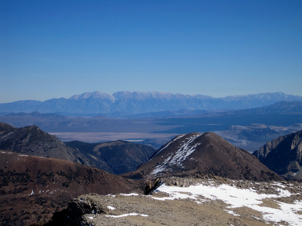
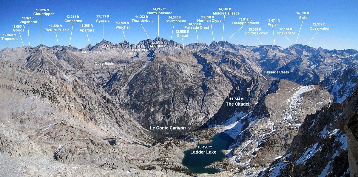
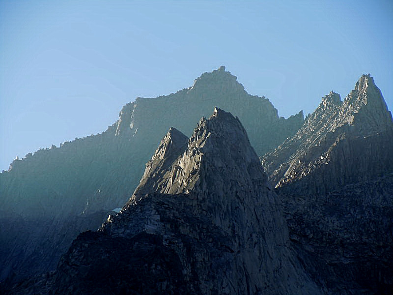
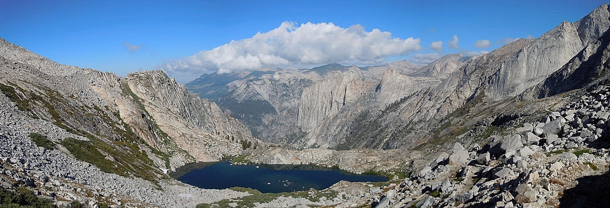
With an impending change in the weather pattern to more winter-like conditions, I decided to take full advantage of the remaining nice days with an adventure run deep into Kings Canyon NP along the Black Divide. The objective was Mount McDuffie via Ladder Lake, a route that entails around 35 miles roundtrip and nearly 11,000 ft of vertical gain, with 5,000+ ft of that climbing off-trail and often arduous. None of the route is very technical, but the traverse along the crest of the Black Divide to the summit to McDuffie features much loose rock on steep slopes requiring caution and a painstaking amount of time. Ladder Lake along the way is one of the most rugged and wild corners of the High Sierra I have seen. A rarely visited cirque with breathtaking scenery makes this spot a real gem. While the ascent of Mount McDuffie might not be the most aesthetic, the summit provides a commanding vantage of most of the Palisades, the Ionian Basin, and Le Conte Canyon. Total roundtrip time out of the South Lake Trailhead (outside Bishop) was just over 14.5 hrs starting at 4:40 am and finishing at 7:15 pm. I reached the summit in 6:37 and enjoyed the view for nearly 30 minutes. On the way back I spent quite a bit of time at Ladder Lake for photography and to take in the amazing setting as much as possible considering how short the days are this time of year. Many more photos coming soon, but here are some of my favorites!

Click for larger annotated image!


 -
- 


-
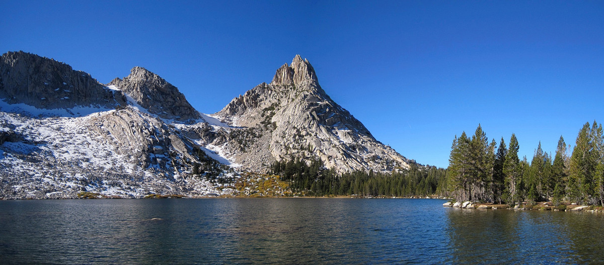
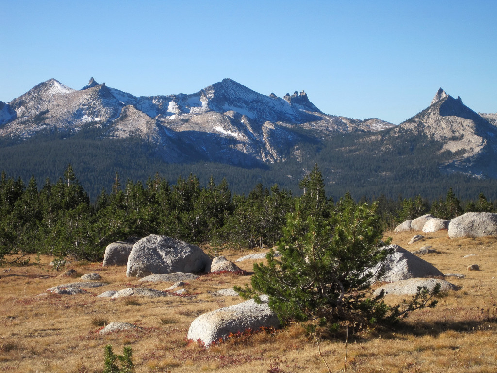
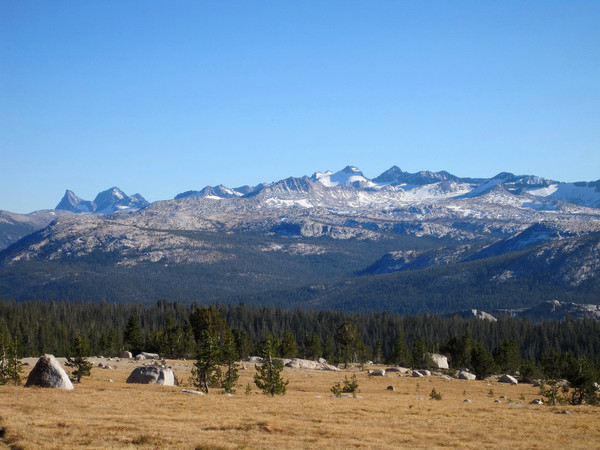
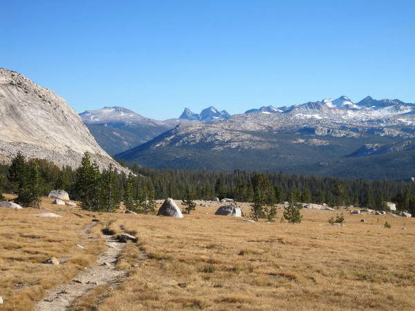
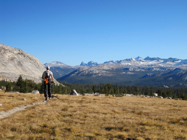
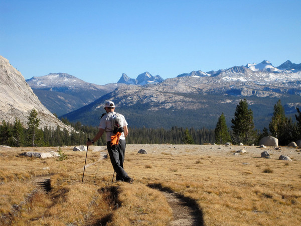
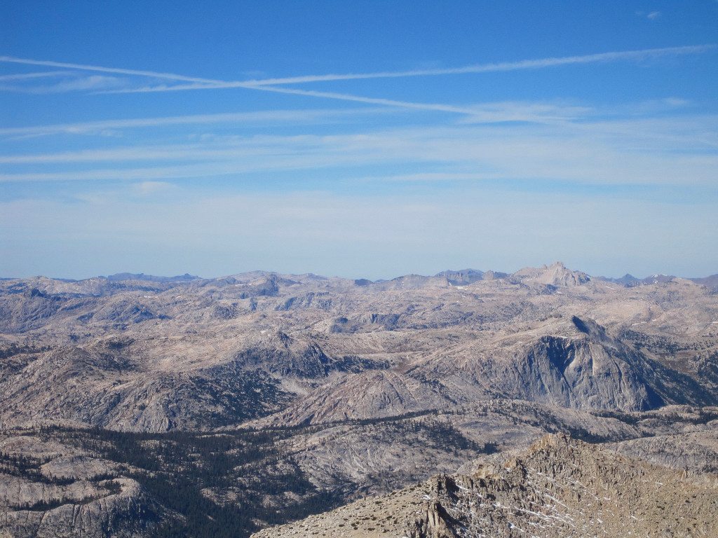
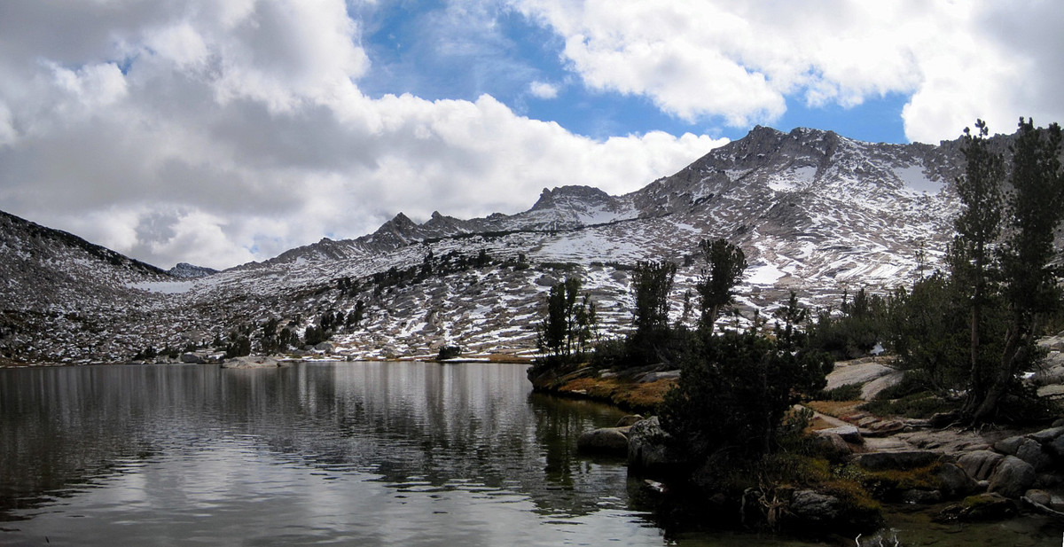
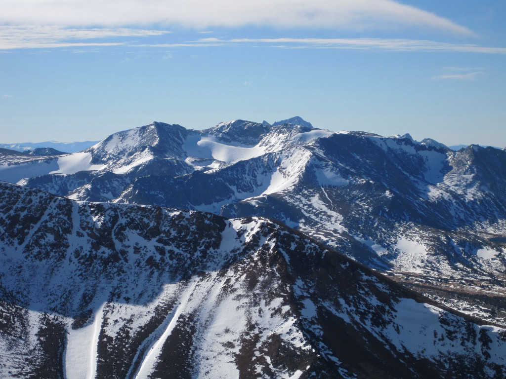
Trip: Mount Conness - via Young Lakes
Date: 10/23/2011
Trip Report:
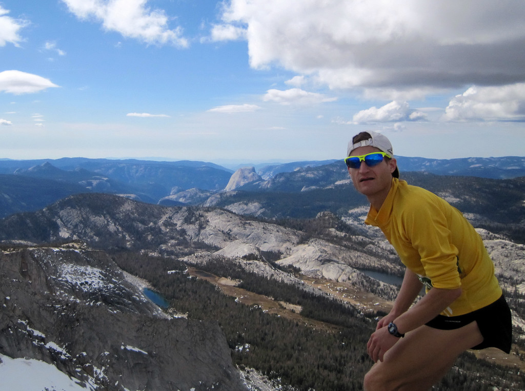
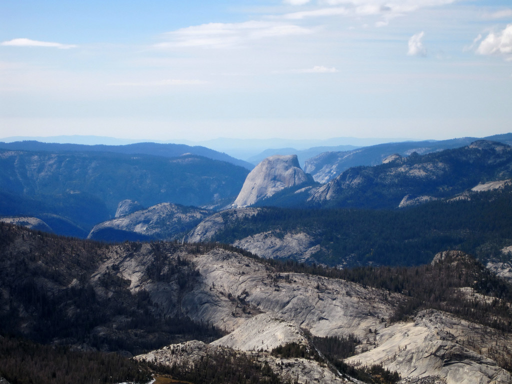
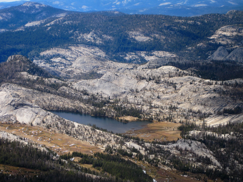
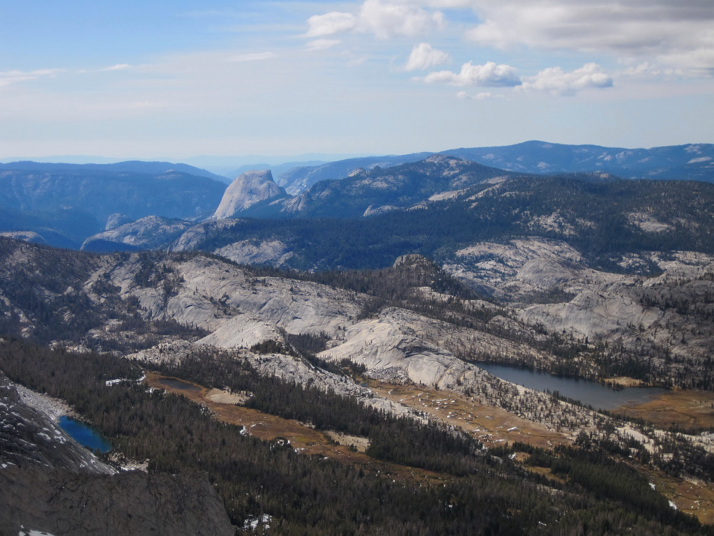
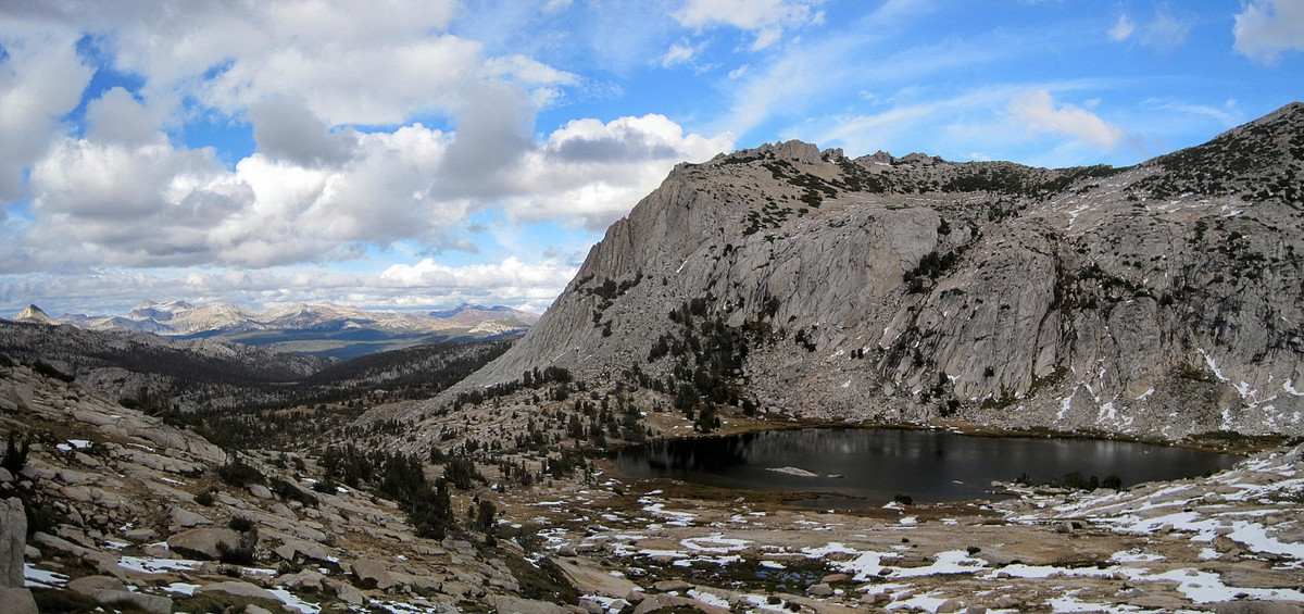
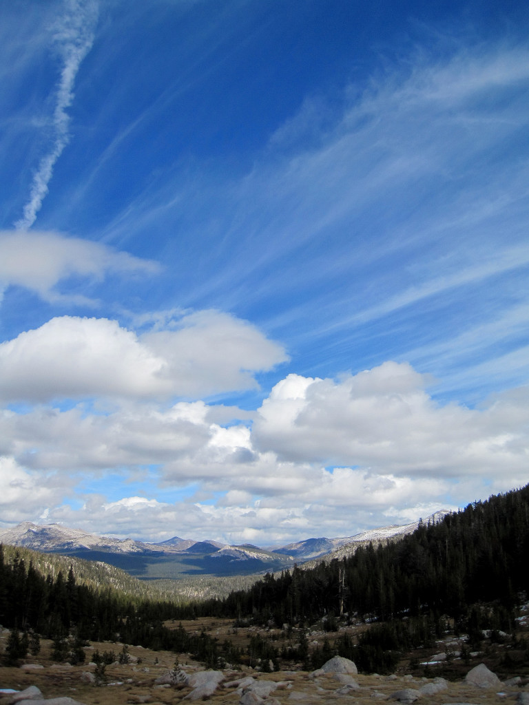
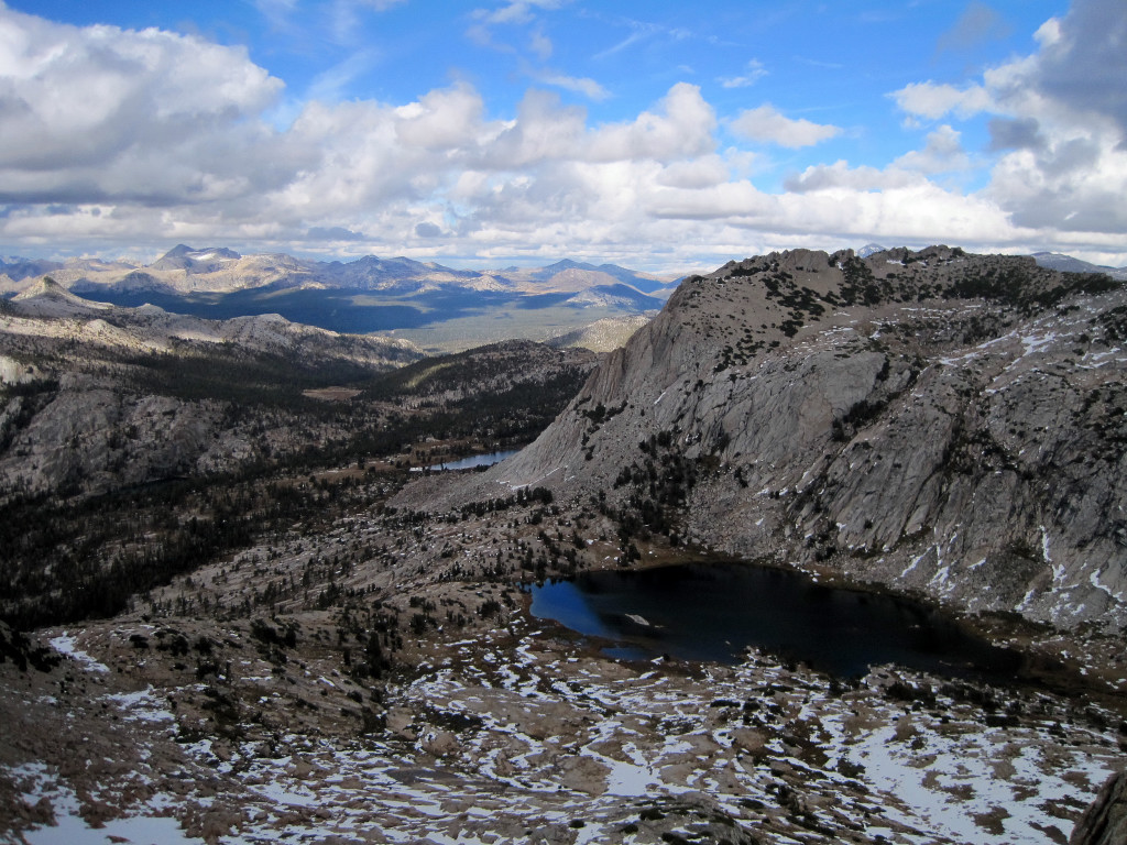
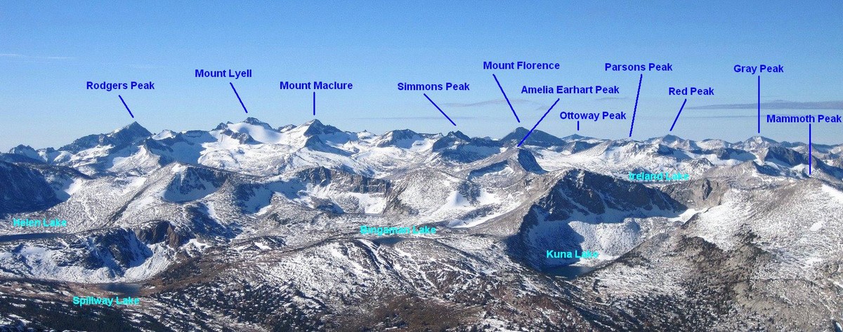
October 23rd was another spectacular fall day in the Sierras with an extremely scenic and pleasant climb of Mount Conness via Young Lakes. The route we took is one of the longer approaches to the mountain, but the views of Tuolumne Meadows and gorgeous Young Lakes along the way more than compensated. I did not have any expectations for Young Lakes but they turned out to be one of the highlights of the day and we spent considerable time at the main lower lake both on the trek in and on the way out. New snow on the surrounding cliffs of the Young Lakes cirque added to the beauty and this is a place I will definitely be returning to explore. Mount Conness provides a commanding view of virtually all of the Yosemite high country including a great overlook of Half Dome and Tenaya Lake. My favorite angle from the summit was looking up Lyell Canyon to Mount Lyell and Mount Maclure.


Gear Notes:
Camera!
Approach Notes:
Trail to Young Lakes via Lembert Dome parking at Tuolumne Meadows.
-
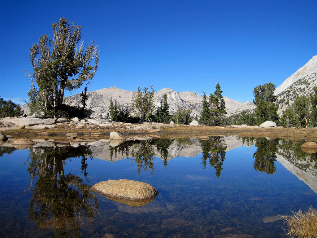
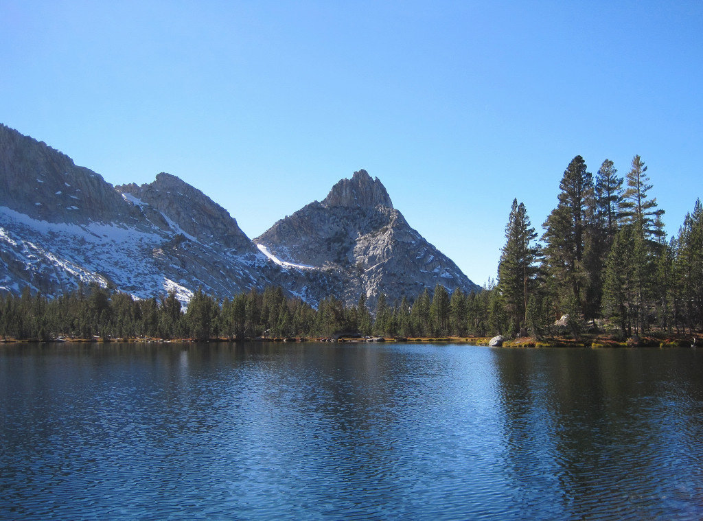
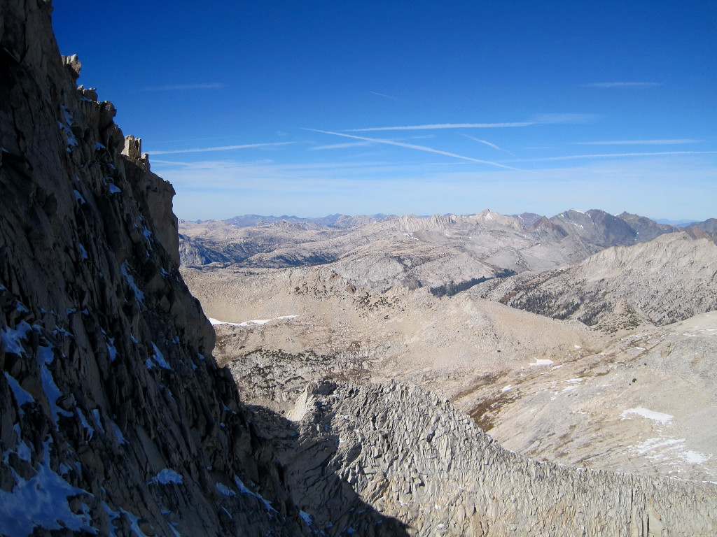
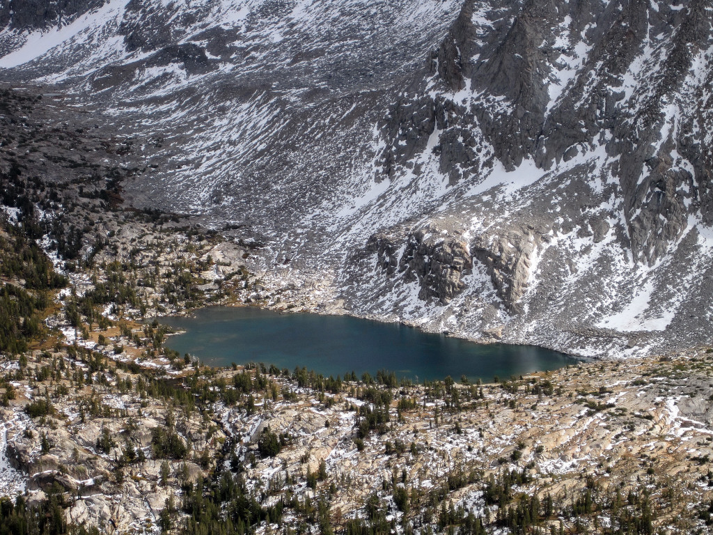
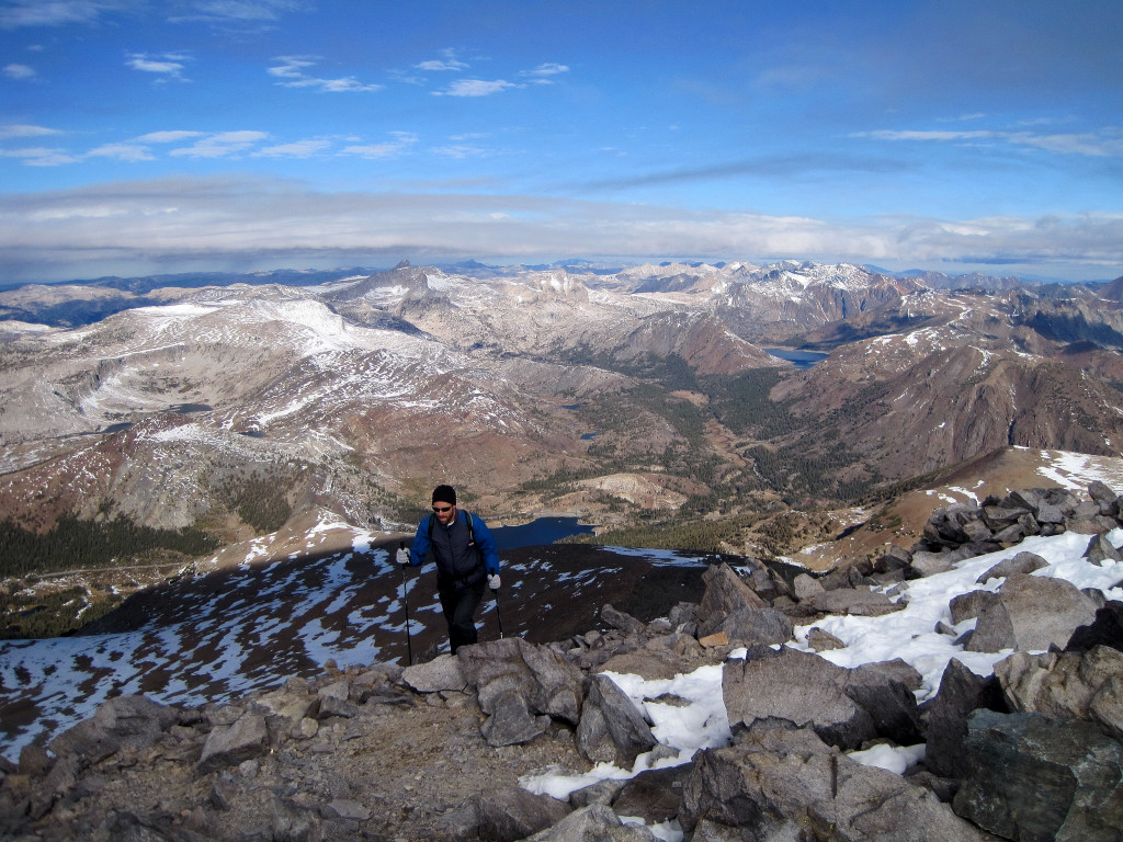
Trip: Vogelsang Peak - via Vogelsang Lake
Date: 10/16/2011
Trip Report:
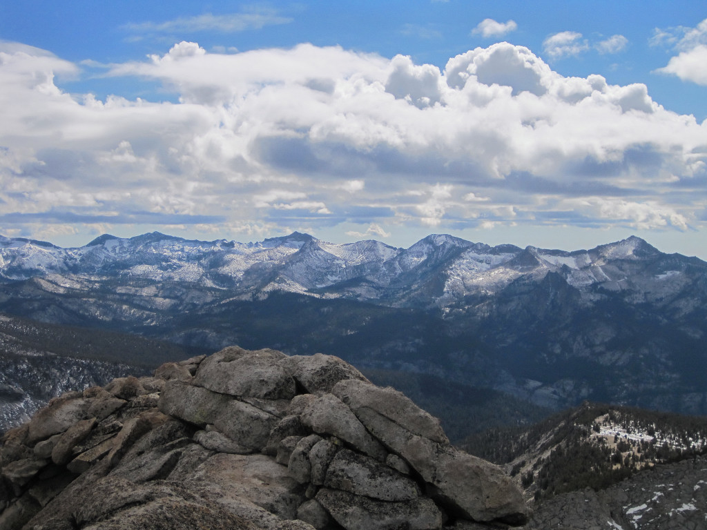
After climbing Mount Dana in the morning, we drove to Tuolumne Meadows and set out for Vogelsang Peak. It was a gorgeous afternoon with beautiful cloud formations and comfortable temperatures for running. The trail up to Tuolumne Pass is great for running with few impediments and a gradual ascent. From Tuolumne Pass we encountered some snow along the trail up to the Vogelsang High Sierra Camp which was closed for the season although a ranger was still present. From the High Sierra Camp we continued up over slabs to picturesque Vogelsang Lake. Just above the lake the off-trail portion of the climb to the summit of Vogelsang Peak commences. This climb is typically very straightforward but considerable snow from the storm a couple weeks ago made some sections more interesting. Vogelsang is in a unique position to the west of the Cathedral Range crest so there is a great view of Mount Maclure, Mount Lyell, and Florence Peak. In addition, the Clark Range to the southwest can viewed in its entirety and Half Dome looms large to the northwest. Round trip was just over 5 hours.


Approach Notes:
About 7.5 miles to Vogelsang Lake and then scrambling up slabs and talus to the summit.
-
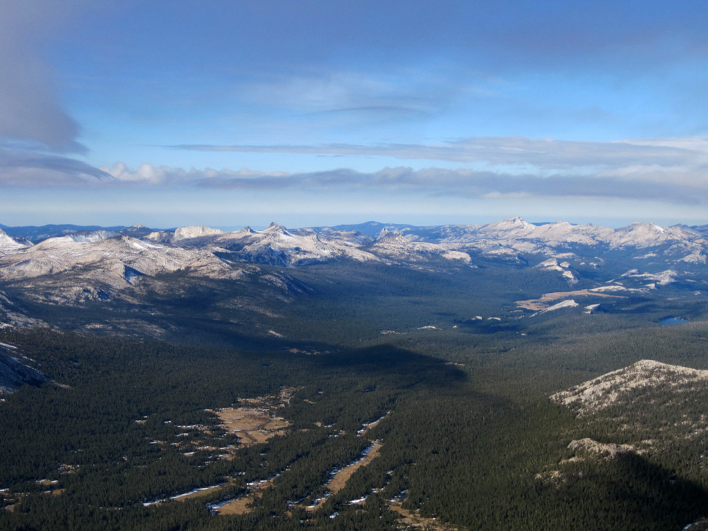
Trip: Mount Dana - via Tioga Pass
Date: 10/16/2011
Trip Report:
Joel and I climbed Mount Dana with the intent to view early morning light from the summit with the high country of Yosemite coasted in fresh snow. A chilly breeze at Tioga Pass caused us to take the prudent course of action and dress in several layers right from the parking lot. It turns out all the layers were needed as subfreezing temperatures coupled with a stiff wind produced frigid conditions. However, the brisk weather produced magnificent clarity with phenomenal photography of the Cathederal Range in the early morning light. We made the roundtrip trek in a little over 2.5 hours and drove down from Tioga Pass to Toulumne Meadows where we would begin the adventure run to Vogelsang Lake and Peak in the afternoon.

 \
\

Gear Notes:
Warm clothing for the cold temps and wind.
Approach Notes:
Use trail via Tioga Pass
-
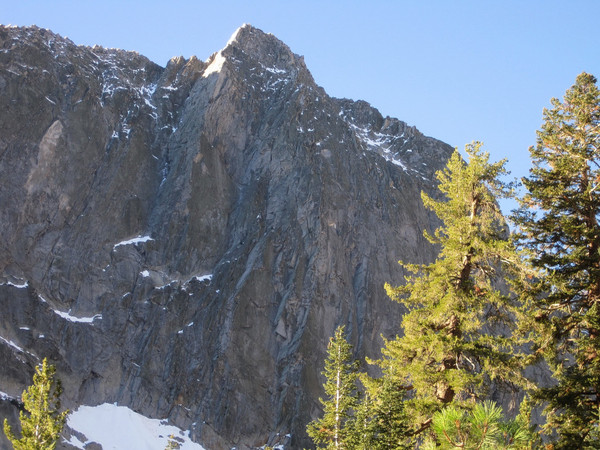
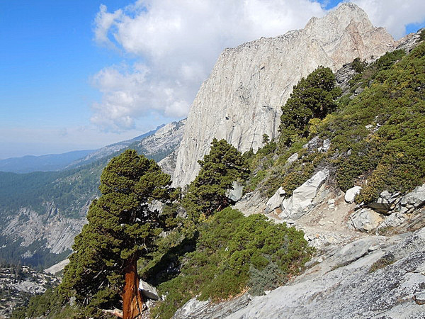
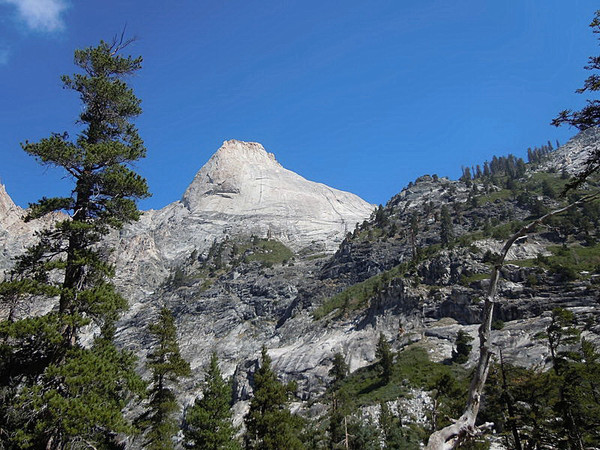
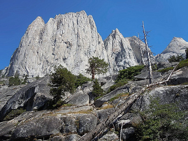
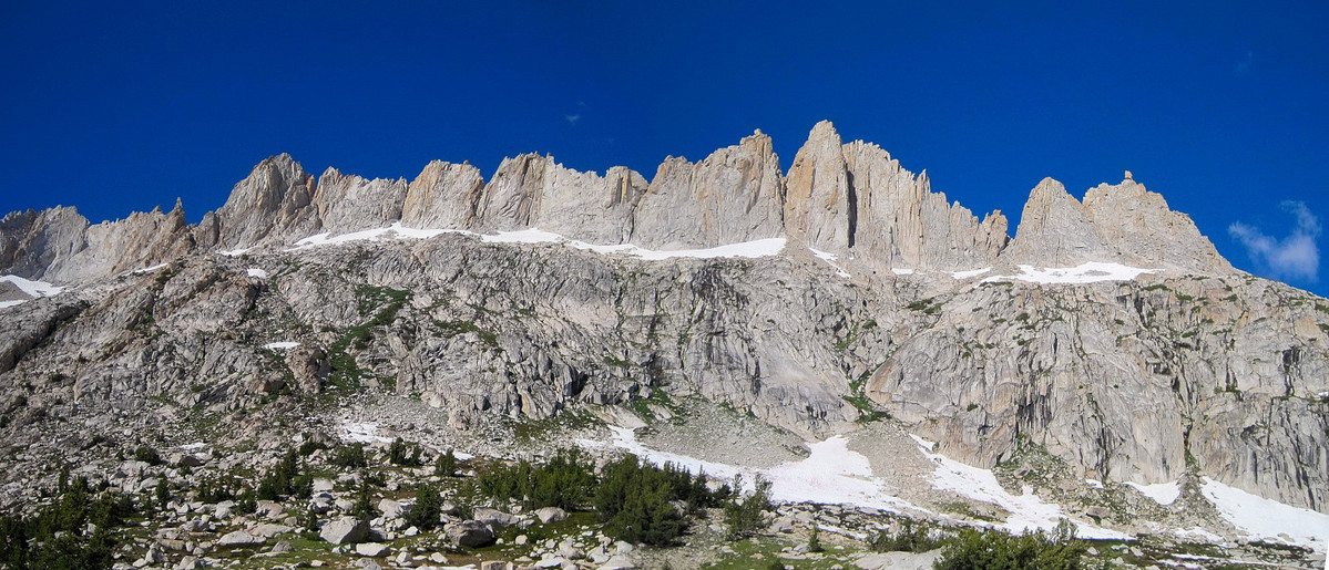
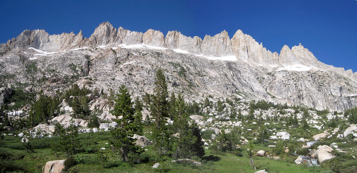
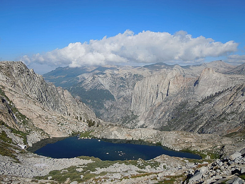
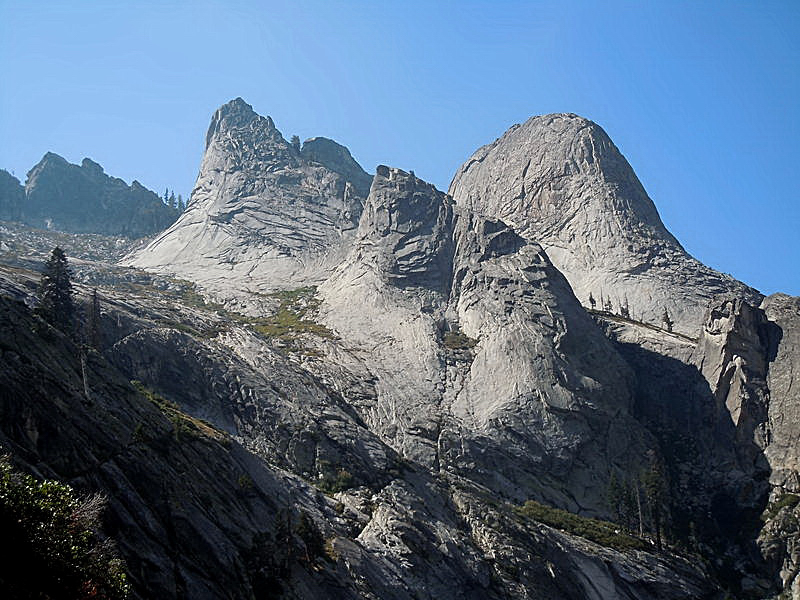
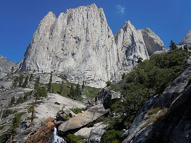
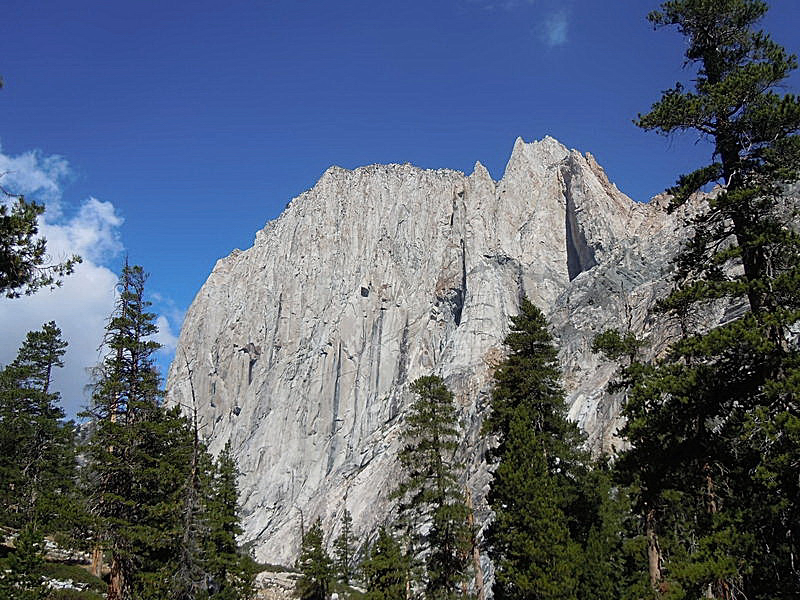
That is Angel Wings, an 1,800+ foot granite wall at the entrance to the Valhalla Cirque, which has impressive granite domes and faces everywhere. Galen Rowell called Angel Wings an "an alpine El Capitan" and the sheer south face pictured above is the biggest rock wall in Sequoia National Park. There are several routes on the face with lots of potential for new routes, but it's 16 miles from the trailhead so it sees few ascents.
-
Trip: Eagle Scout Peak - Hamilton Lakes/Kaweah Gap
Date: 9/25/2011
Trip Report:
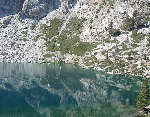
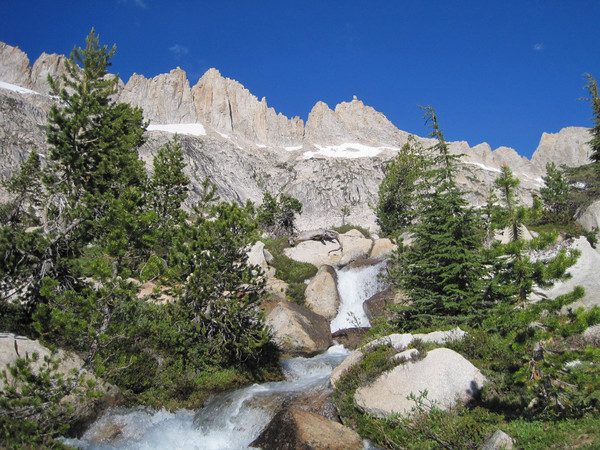
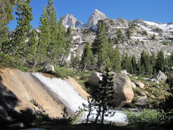
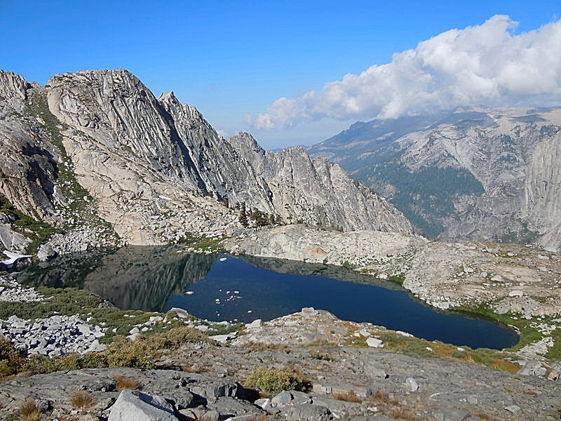
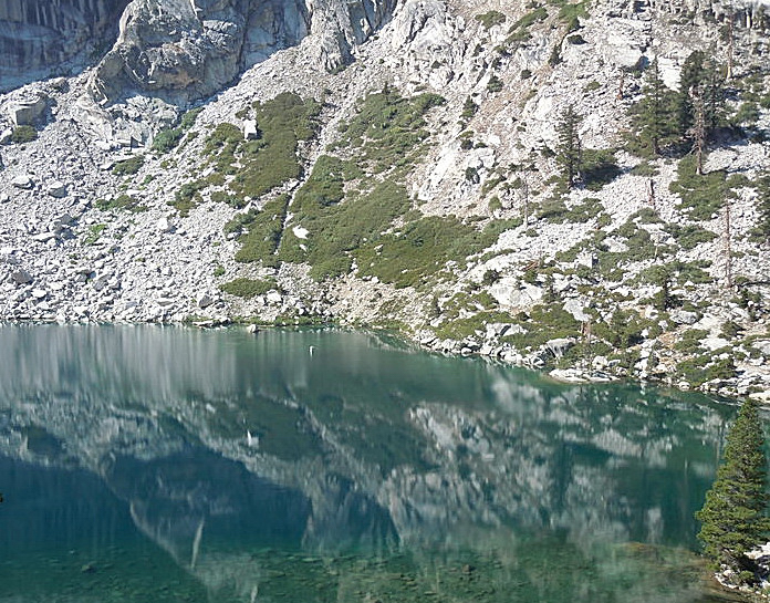
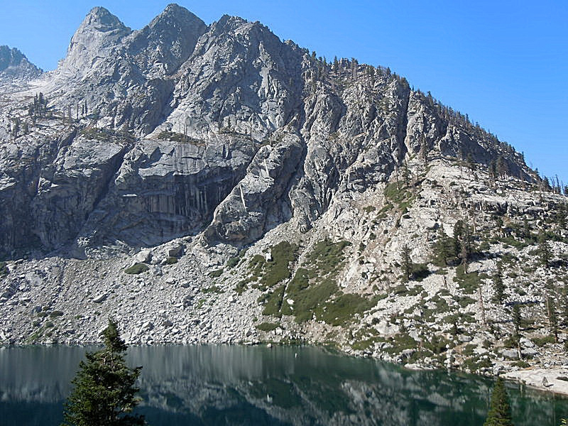
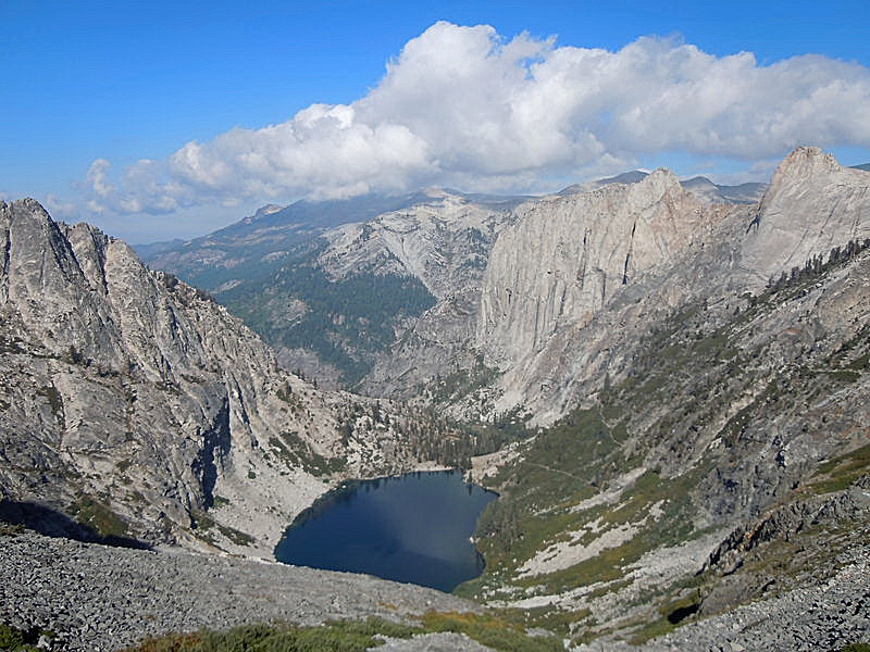
An adventure run to Eagle Scout Peak via Kaweah Gap in 9:38 roundtrip from Crescent Meadows. Eagle Scout Peak is located just south of Kaweah Gap along the Great Western Divide in a remote region of Sequoia National Park. The climb of the 12,000 ft peak entails over 45 miles roundtrip and 8,000+ ft of elevation gain. While it's a long way just to Kaweah Gap along the High Sierra Trail (21 miles from Crescent Meadow), the scenery is phenomenal and well worth the effort. The sapphire blue of Hamilton Lakes and the towering granite walls of Angel Wings and the Valhallas are truly magnificent.
Last year on the same weekend I pursued a speed objective on the Rae Lakes Loop, and having already experienced the spectacular scenery of the High Sierra Trail to Kaweah Gap on a climb of Mount Stewart in July 2010, I figured this would be a great one to do for time this year.
I was hoping to go around 11 hours roundtrip and started at 4:20 a.m. from Crescent Meadows with Joel, whose objective was Kaweah Gap. The High Sierra Trail is an excellent trail for running all the way to the crossing of Lone Pine Creek (~13 miles in). It was perfect weather for a night run with temperatures in the mid 40s. I felt good reaching Kaweah Gap in just over 4 hours. It took nearly 2 hours to complete the roundtrip from Kaweah Gap to the summit of Eagle Scout Peak. The climb itself is straightforward with a nice perspective on the Hamilton Lakes area and Precipice Lake directly below. The run down to Hamilton Lakes from the Gap was gorgeous and at that point I knew sub 10 hours would be possible. The anomalously cool weather on Sunday helped on the return trip along the trail (which is typically hot on the exposed south slopes) and I was able to complete the adventure run in 9:38 finishing up just before 2 pm.
Time details for those who are interested:
Location: Real Time / Elapsed Time / Split
Start Crescent Meadow: 4:20 / 0 / 0
Junction with Seven Mile Hill Trail (6 miles): 5:19 / 58:33 / 58:33
Bearpaw Meadows (11.3 miles): 6:15 / 1:55:05 / 56:32
Big Hamilton Lake (16.5 miles): 7:09 / 2:49:28 / 54:23
Kaweah Gap (21 miles): 8:23 / 4:03:28 / 1:14:00
Arrive summit of Eagle Scout Peak: 9:17 / 4:56:44 / 53:16
Depart summit of Eagle Scout Peak: 9:32 / 5:11:43 / 14:59
Kaweah Gap (24 miles): 10:19 / 5:58:37 / 46:54
Big Hamilton Lake (28.5 miles): 11:10 / 6:50:14 / 51:37
Bearpaw Meadows (33.7 miles): 12:00 / 7:40:08 / 49:54
Junction with Seven Mile Hill Trail (39 mile): 12:56 / 8:36:09 / 56:01
Finish Crescent Meadow (45 miles): 13:58 / 9:38:35 / 1:02:25
All photos below are by Joel Lanz:


Gear Notes:
La Sportiva Fireblade, First Endurance EFS drink mix, First Endurance Ultragen, Ultimate Direction Wasp Pack
Approach Notes:
High Sierra Trail from Crescent Meadows to the east side of Kaweah Gap (21 miles). Cross country travel over boulders to the east slope of the mountain.
-
Sweet!! The Pickets deliver awesome terrain and the Himmelhorn looks wicked! Congrats and I hope to see the complete S to N come to fruition next year.
-
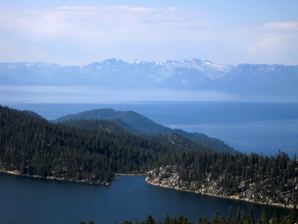
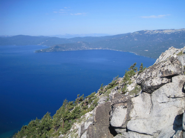
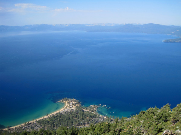
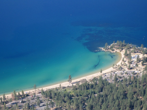
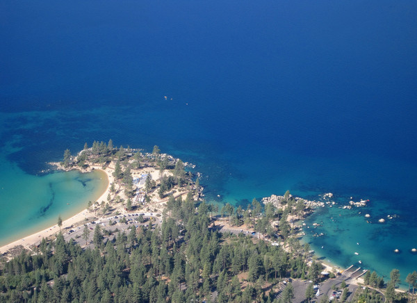
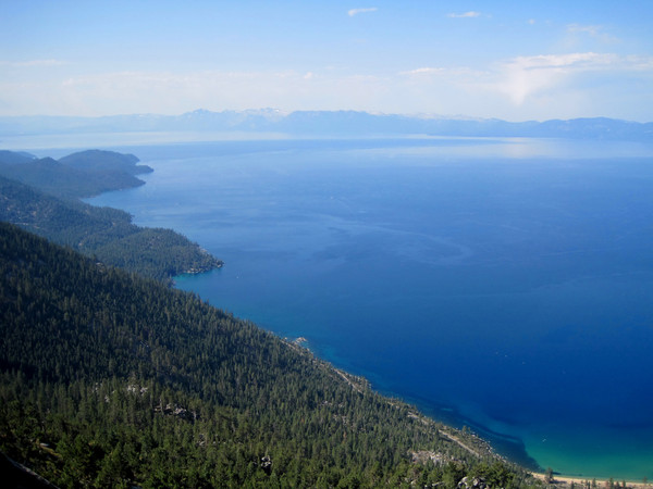
Trip: TRT-Flume 27 Mile Loop - Run via Spooner Summit
Date: 9/10/2011
Trip Report:
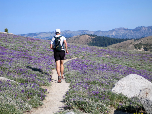
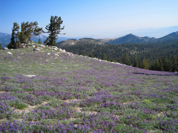
This is not a climb, but there are some nice photos to share in a filmstrip format. The original plan was to climb in the High Sierra, but the entire range to the south was enveloped in numerous thunderstorms all weekend (even some snow at the highest peaks). That provided a great opportunity to check out this 27+ mile loop on the east shore of Lake Tahoe on Saturday morning. Highlights include Snow Valley Peak, Marlette Peak, Christopher's Loop vista point, and the famous Flume Trail. I was impressed by sizable snow patches (none on trail) remaining on the high ridge near Snow Valley Peak. More photos coming soon...


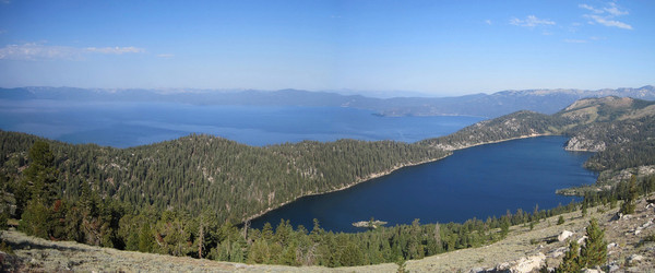
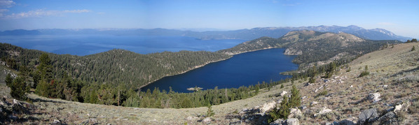
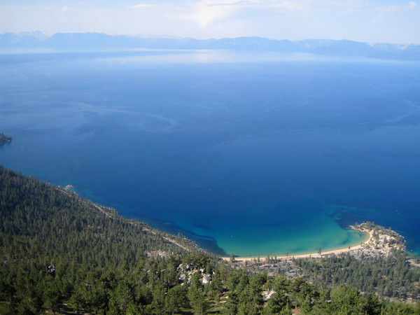
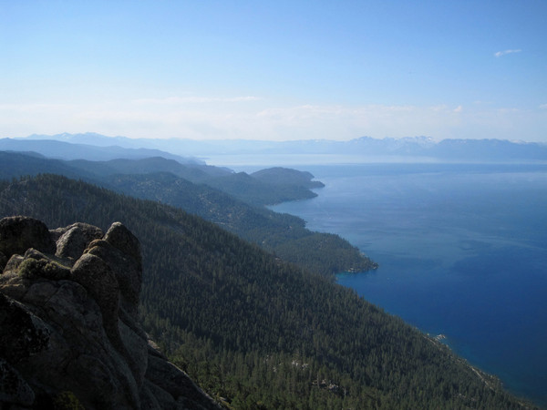
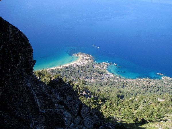
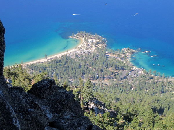
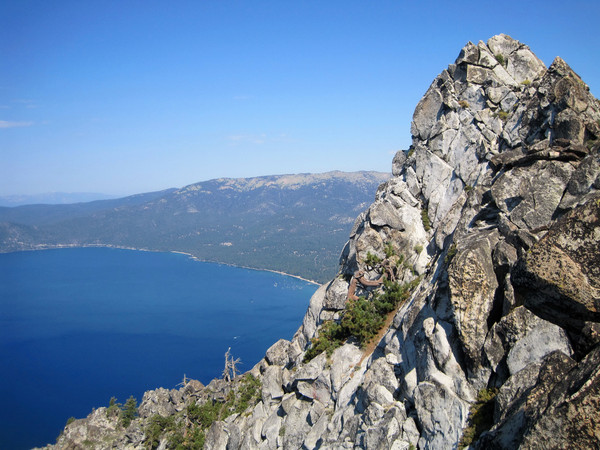
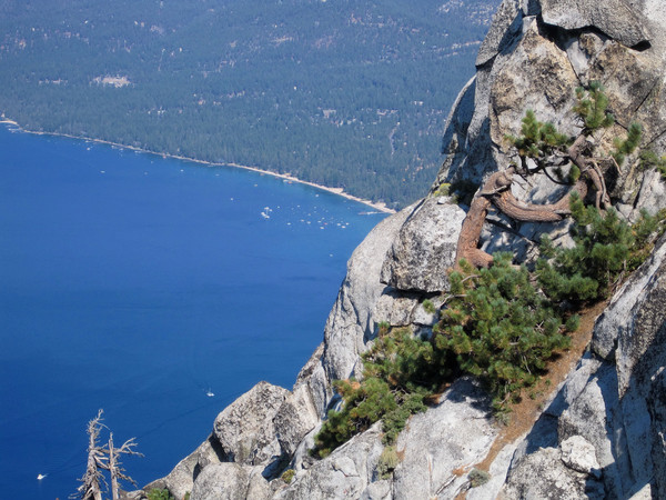
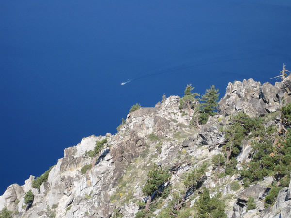
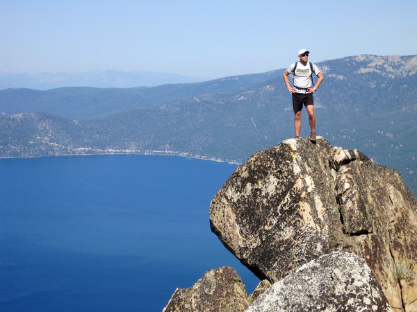
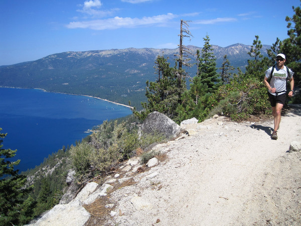

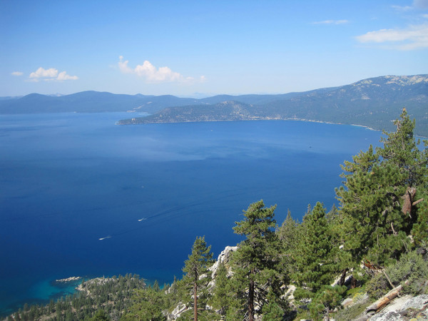
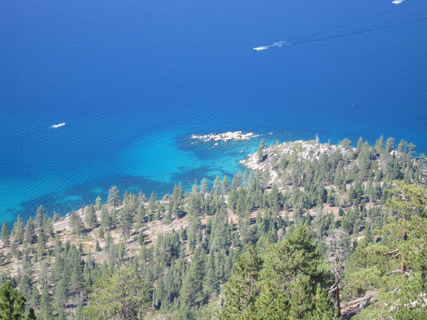
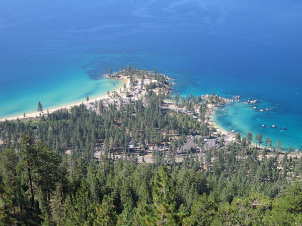


Approach Notes:
Tahoe Rim Trail out and Flume Trail/North Canyon return to Spooner Lake and Spooner Summit.
-
Since when has driving been a component of my adventure runs? It's all about aesthetics for me, even with the trail races I select to run.
-
Trip: Milestone Mountain & Midway Mountain - via Shepherd Pass
Date: 9/3/2011
Trip Report:
An adventure run to climb Milestone Mountain (13,641 ft) and Midway Mountain (13,666 ft) along the Great Western Divide, two of the most remote points in the High Sierra. The run entailed over 40 miles and the duration was just over 17 hours, starting at 2:50 am and finishing up just before 8 pm. Milestone Creek and Basin are exceptionally scenic with lovely alpine lakes and tarns, polished granite, and the towering peaks of the Great Western Divide.
Shepherd Pass is known as one of the most grueling approaches in the Eastern Sierra with over 6,000 feet of elevation gain in 10+ miles. The trail also includes a 600 ft descent that becomes an nice slow ascent on the way back after a long day! I reached the pass about 3 hours and 20 minutes after beginning. The next few miles down Tyndall Creek had some great running with the gentle downhill slope, relatively smooth trail, and inspiring alpenglow over the Great Western Divide. I even ran with (startled) several groups of deer through the meadows. Progress on the trail connecting the John Muir Trail to the Kern River was slower partially due to the photography stops at small alpine lakes and the breathtaking views of the Great Western Divide and Kings-Kern Divide. The summit pinnacle of Milestone Mountain was the centerpiece of the view although it still looked far, even after traveling 17+ miles to reach this point. I was also intrigued by the jagged summit of Thunder Mountain peeking in the distance.
Once on the Kern River trail, I descended a little too far into the canyon losing some time and energy, but after recovering from my error it was a quick trip up Milestone Creek to Milestone Basin. There is a faint abandoned trail in the beginning portion that is helpful. Milestone Basin is another Sierra paradise with spectacular scenery - extremely picturesque and photogenic (and I took many photos!). I continued up above tree line where the vegetation transitioned into seemingly interminable boulder fields leading to the pinnacle of Milestone Mountain. The boulders became looser and steeper as I approached the final scramble and at this point I also felt the altitude slowing me down after having come directly from sea level.
I eventually made it up to the notch north of Milestone's pinnacle and continued up the rock scramble to the summit where I was treated to stupendous 360 degree views with my favorite the angle across Milestone Bowl to the Kaweah Range. It was quite chilly on the summit with a breeze so I put on all the warmth I brought. After 30 minutes on top I retraced my route down the scramble and headed for Midway Mountain.
It took a little under 2 hours to reach the summit of Midway with more great views. On the descent from Midway, I headed to a lake below Table Mountain, descending boulders and then friendly granite slabs. Table Mountain forms a gorgeous amphitheater around this small lake and the stream emanating from the lake meanders through grassy meadows and polished slabs - quintessential Sierra sweetness! More great scenery continued as I made the descent down to Milestone Creek with views across the Kern Canyon to the Mount Whitney area.
The trail portion back through Upper Kern to Tyndall Creek and Shepherd Pass was more laborious with tired legs, but the views continued to motivate. I took a break at Shepherd Pass and enjoyed the evening sunshine before the descent into the shade on the east side of the pass for the remainder of the adventure run. I jogged most of the way back along the trail save for the 600 ft ascent out of Shepherd Creek that seemed to take forever! Alpenglow over Mount Williamson was the prize when I reached the crest of this last ascent. I made it back to the car just before 8 pm as the last light faded.


Gear Notes:
Black Diamond Distance Poles, La Sportiva Fireblades, Ultimate Direction Wasp Pack
Approach Notes:
Over Shepherd Pass, down Tyndall Creek and across to the upper Kern Canyon and up Milestone Creek.
-
Fact!
We encountered very few people (<30 the entire trip including occupied tents we saw early in the morning) and most were between Seavey Pass and Smedberg Lake along the Pacific Crest Trail.
The relative solitude and remoteness of this region sharply contrasts with the popular areas of Yosemite, but it's a huge park with more to see than the Valley and Tuolumne Meadows!
-
I have always wanted to tour the space between Clark and Kololo. Fantastic photos and great information, thanks!
-
It varies depending on the elevation gain, ice/snow, trail vs. off trail, etc. On this particular trip, a bit under half the total time was running and the other half was fast hiking/photography stops. In contrast, I ran most of the Rae Lakes Loop but only around 1/4 of the time was running on the Northern Pickets Traverse.
-
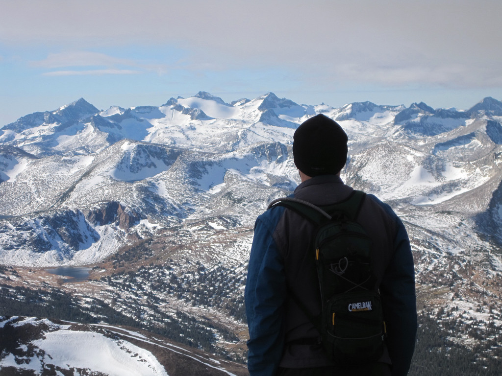
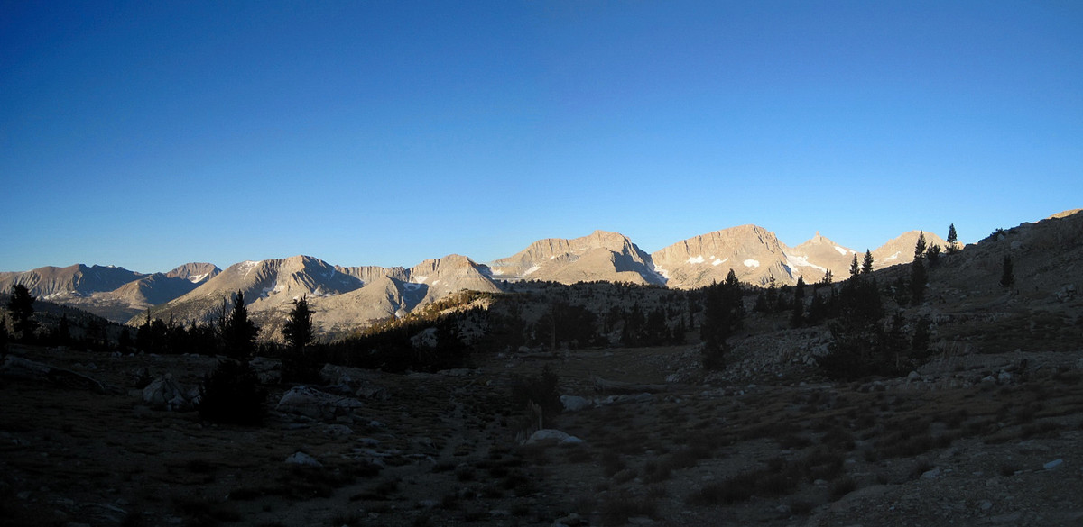
Trip: Volunteer Peak - Northern Yosemite 50 Mile Loop
Date: 8/6/2011
Trip Report:
An "instant classic" adventure run of a 50+ mile loop in the remote Northern Yosemite region beginning at Twin Lakes, including five passes, the Benson Lake riviera and a summit of Volunteer Peak. Total elevation gain was over 11,000 feet and the trip time was 15:28 starting at 5:10 am and finishing up at 8:38 pm as light was fading.
This is a fantastic loop with excellent variety of scenery throughout including Peeler Lake, Kerrick Meadows, the tarns of Seavey Pass, Benson Lake's sandy beach, granite-lined Smedberg Lake, Matterhorn Canyon, and the rugged Sawtooth Ridge. I also climbed Volunteer Peak which rises above Smedberg Lake. Volunteer Peak is one of the more remote summits in Yosemite, but the climb itself is straightforward. The panoramic views from the top include much of Northern Yosemite and its many granite ridges. Specifically, the summit afforded views of Mount Conness, Smedberg Lake, Benson Lake, Tower Peak, Sawtooth Ridge, Matterhon Peak, among other notable points.
We encountered generally good trail conditions except a substantial amount of snow remains on the north side of Burro Pass and on both sides of Mule Pass. The snow approaching Mule Pass was becoming hard in the evening and took some time to negotiate with the trail running footwear and no axe/crampons. We saw very few people the entire day and there is a real feeling of solitude and wilderness in this region of the park, which sharply contrasts to the more accessible parts of Yosemite like the Valley or Tuolumne Meadows. I will surely be returning to run this amazing loop again.

[video:youtube]


Elevations (high and low points):
Start (Twin lakes): 7,092 ft
Peeler Lake/Pass: 9,489 ft
Depart Kerrick Canyon: ~8,900 ft
Seavey Pass: ~9,150 ft
Benson Lake: 7,581 ft
Smedberg Lake: 9,219 ft
Volunteer Peak: 10,481 ft
Benson Pass: ~10,100
Matterhorn Canyon: ~8,400 ft
Burro Pass: 10,650 ft
Piute Canyon Lowpoint: ~9,400 ft
Mule Pass: 10,460 ft
Finish: 7,092 ft
Total Elevation Gain (including Volunteer Peak): ~11,000+ ft
Gear Notes:
Ultimate Direction Wasp Pack; First Endurance EFS and Ultragen; La Sportiva Fireblade; Black Diamond Ultra Distance Z-Poles
Approach Notes:
Trails are in good shape. Extensive snow remains over Mule Pass and the north side of Burro Pass. There is a wet stream crossing in lower Kerrick Meadows and several wet crossings through Matterhorn Canyon.
-
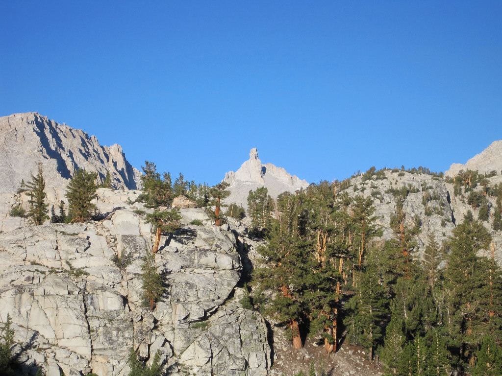
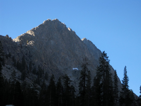
Trip: West McMillan Spire Speed Climb - West Ridge
Date: 8/1/2011
Trip Report:
Having thoroughly enjoyed the climb of West McMillan Spire in 2007, I figured it was time to return. With route knowledge and generally good conditions I was able to better the 2007 time by just over 3 hours to 8:14 roundtrip.
Location (Elevation): Time Elapsed / Real Time
Goodell Creek Trailhead (600 ft) : 0 / 05:45
Climbers Path Turnoff (1,600 ft) : 45:28 / 06:30
Heather Bench [top of hill climb] (5,200 ft) : 1:50:30 / 07:35
Arrive West McMillan Summit (8,000 ft) : 4:20:19 / 10:05
Depart West McMillan Summit (8,000 ft) : 4:41:01 / 10:26
Heather Bench [top of hill climb] (5,200 ft) : 6:46:08 / 12:31
Climbers Path Turnoff (1,600 ft) : 7:40:40 / 13:26
Goodell Creek Trailhead (600 ft) : 8:14:12 / 14:00
[video:youtube]
Thanks Val Zephyr for the route conditions. The climbers path from Goodell Creek to the heather benches at 5,200 ft is a masterpiece of elevation gain. One major difference from the prior trip report were the snow conditions, which were firm and even icy in spots. This generally allowed for fast travel on the traverse from the heather benches to the Terror Glacier. However, the short descent from the 6,300+ ft notch and the final steeper snow slope up to the West Ridge required some attention. Maybe it was the rain the previous day or simply a factor of travelling on a chilly morning. On the descent the snow conditions were already getting slightly softer.


Gear Notes:
Black Diamond Neve Strap Crampons; Ultimate Direction Wasp Pack, First Endurance EFS and Ultragen; La Sportiva Raptors
Approach Notes:
A couple brushy sections on the Goodell Creek Trail. The climbers path is generally easy to follow, but if you lose it, retrace your steps and find it.
-
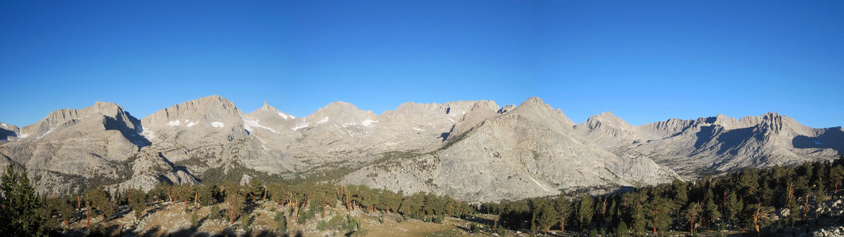
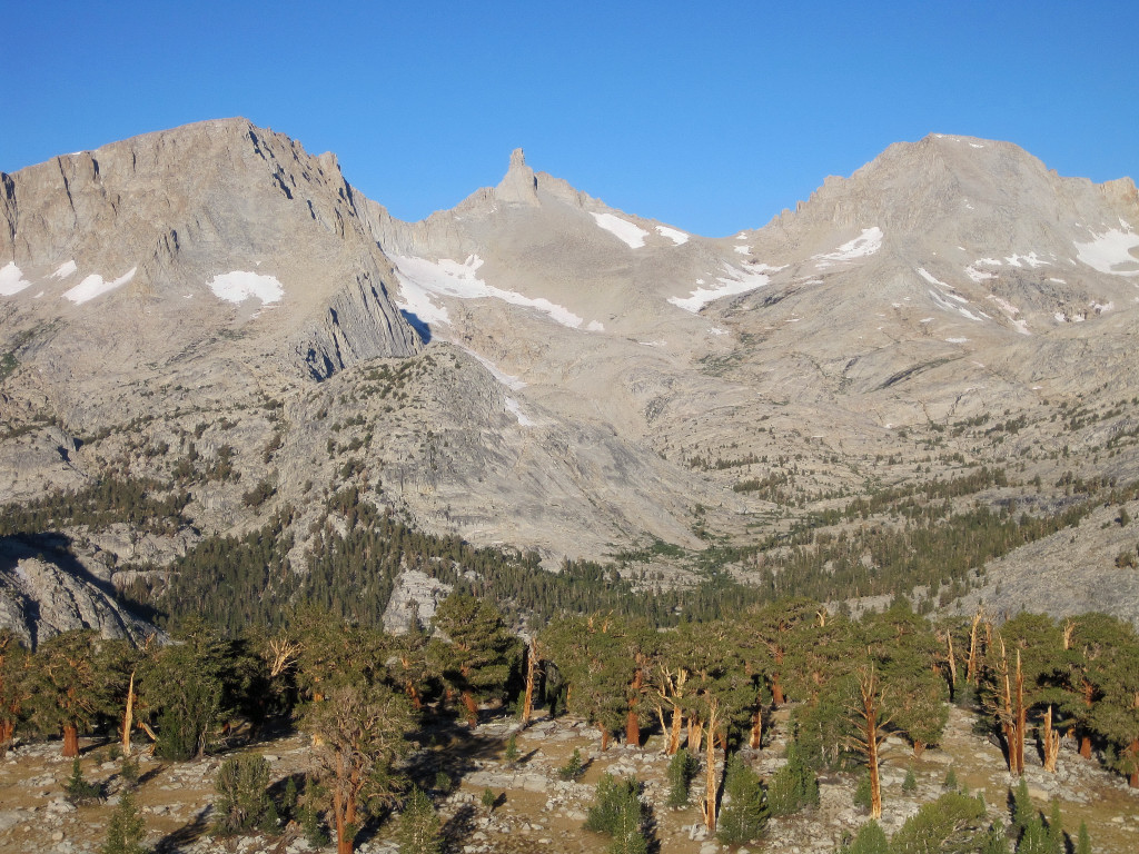
Trip: Primus, Austera & Eldorado - Eldorado Ice Cap
Date: 7/30/2011
Trip Report:
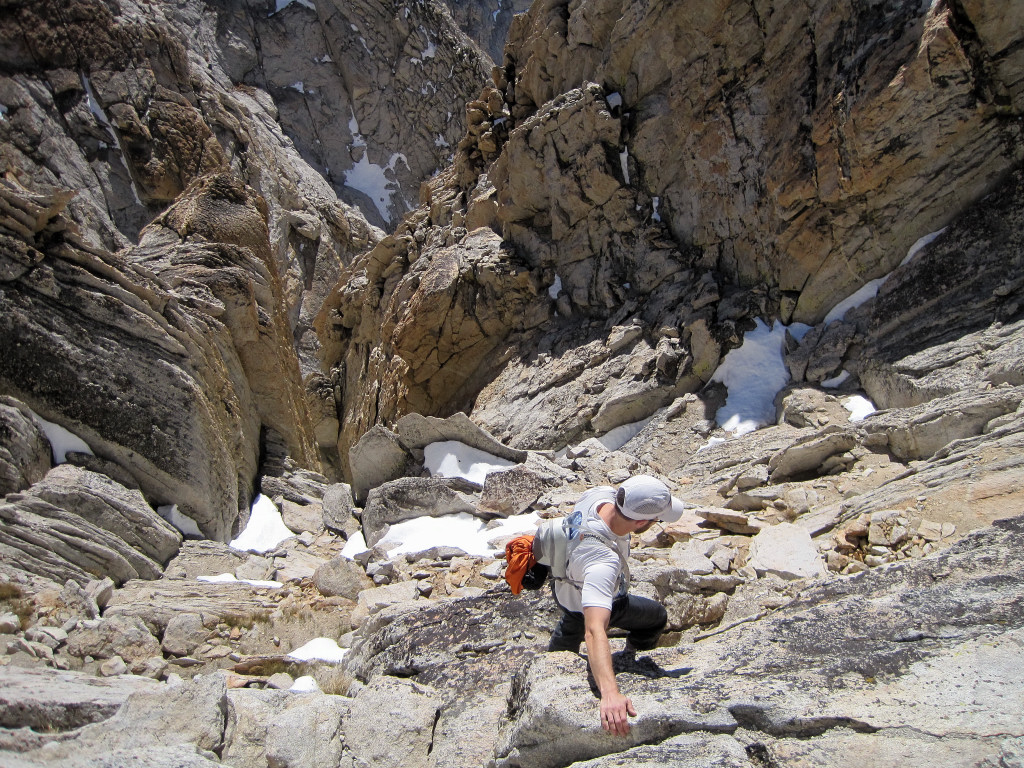
Colin Abercrombie and I toured the Eldroado Ice Cap climbing Primus Peak, Austera Peak and Eldorado along the way. We started at 2 am and finished at 5:40 pm for a 15:40 day. It has been since 2005 that we explored the ice cap towards Austera so it was nice to return to this scenically stellar region and explore a new area beyond Austera to the North Klawatti Glacier and Primus Peak. We didn't see anybody beyond the East Ridge of Eldorado Peak.
We reached the Inspiration flats in time for sunrise and enjoyed firm snow conditions as we traversed the Inspiration Glacier to Klawatti-Austera col. As expected, the views from Austera were sublime in the morning light. Looking back at the 2005 photos from mid-July (a dry year), it's amazing to see just how much more snow there is this year with the glaciers almost entirely snow filled. The traverse down the Klawatti Glacier and around the buttress to the North Klawatti was straightforward. Primus Peak is essentially a walk up with a broad summit but the views and ample lounging space on top more than compensate for the slog to get there. On the way back we tagged Eldroado with some nice afternoon light over Forbidden and the Cascade Pass area. A few more photos and panoramas coming shortly...
[video:youtube]


Alpine Ascents Group Camp

Alpine Ascents Group on Eldorado
Aesthetic campers on at the base of the East Ridge of Eldorado

Photo by Colin Abercrombie
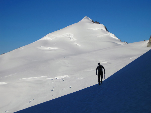
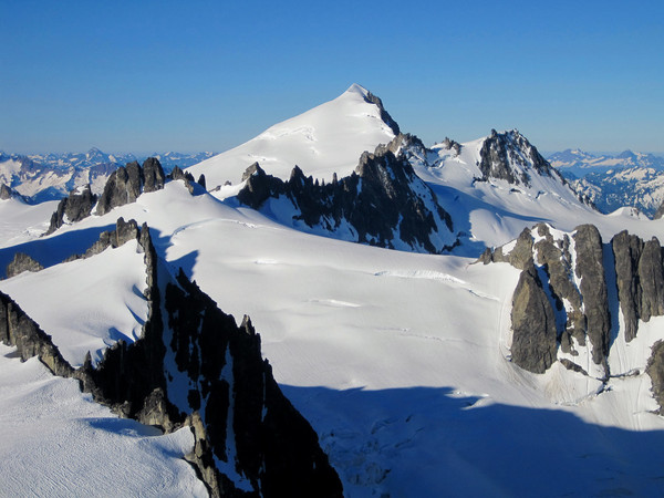
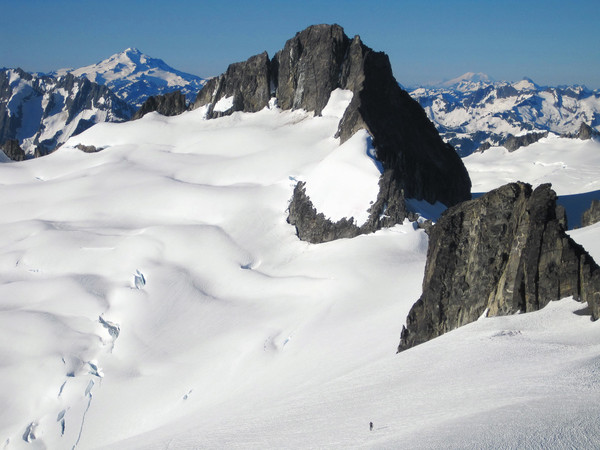
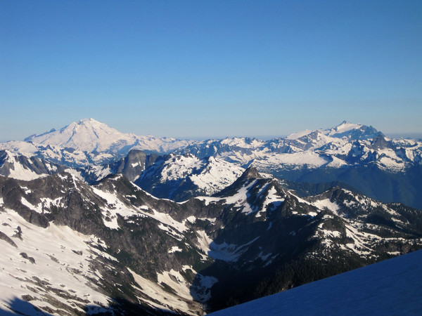
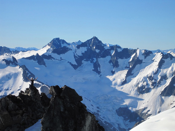
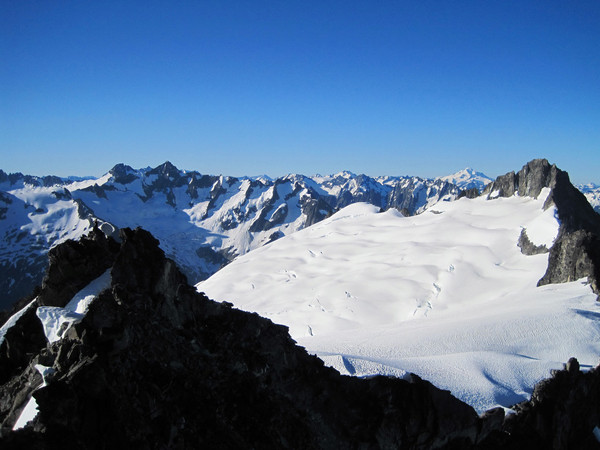

Photo by Colin Abercrombie

Photo by Colin Abercrombie

Photo by Colin Abercrombie


Gear Notes:
Black Diamond Neve Strap Crampons; Ultimate Direction Wasp Pack; La Sportiva Fireblade Trail Runners; First Endurance EFS Drink Mix and First Endurance Cappuccino Ultragen at the end!
Approach Notes:
Snow starts at the top of the boulder fields. Glaciers are in great condition.
-
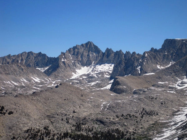
Trip: Whaleback - East Face via Cloud Canyon
Date: 7/23/2011
Trip Report:
A 50 mile adventure run up Cloud Canyon and Big Wet Meadows to climb Whaleback, one of the most remote spots in the High Sierra. We started at 2:35 am and reached the summit just before 10 am. After 45 minutes on the summit, the return trip took virtually the same amount of time, finishing at 6:05 pm for a 15:30 roundtrip.
Weather and trail conditions were pleasant for a night run and we made good time to Big Wet Meadows arriving around 6:50 am. Trail crews had logged out over 95 trees large trees along the way - thanks! The reflection of Whaleback in the meadows was spectacular. The meadows were largely flooded with several wet crossings creating cold feet in the morning. The trail up towards Colby Lake was snow-free and we departed cross-country once the small canyon flattened out and the trail turned up toward the lake. The climb up the East Face of Whaleback was more complex than I had imagined with several small cliff bands to navigate through to keep it third class. The general idea was to go climbers left at first and then make a rising rightward traverse to the ridge crest of Whaleback. Once on the ridge crest a short scramble brought us to the summit with fantastic views including Cloud Canyon, the Great Western Divide, Triple Divide Peak, and Glacier Ridge. On the way down we made several stops to photograph the gorgeous scenery. After Big Wet Meadows, it's basically a 22 mile slog back to the TH. From an endurance standpoint this was a challenging outing due to the 2,500 climb out of Sugarloaf back to Marvin Pass, most of which coming from miles 44 through 47 of the 50 mile roundtrip.
Morning reflections at Big Wet Meadow
View from Big Wet Meadow
View of Cloud Canyon from the summit of Whaleback

Many stream crossings
Early light on Whaleback

Glacier Ridge summit
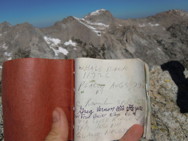
Less than 50 people have signed the summit register placed in 1979.
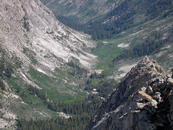
Big Wet Meadow from Whaleback

From L to R: North Guard, Mount Brewer, South Guard
Thunder Mountain
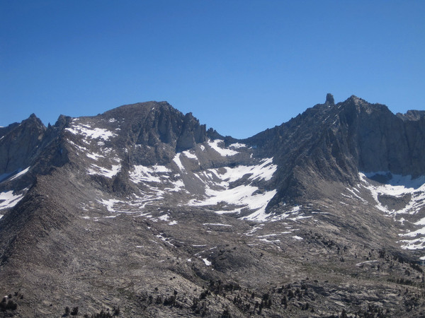
Midway Mountain and Milestone Mountain
Great Western Divide

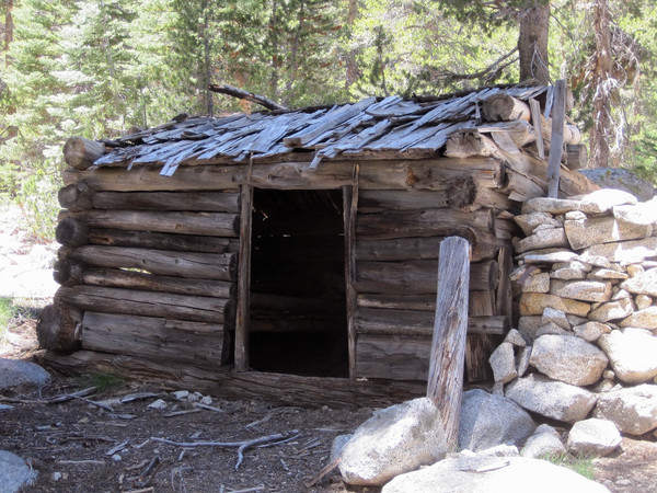
Shorty's Cabin: Part of a series of cabins built by fur trapper Joseph Walter ("Shorty") Lovelace between 1910 & 1940. He was the first Caucasian to reside in upper Kings Canyon region on a long-term, year-round basis.

Great Western Divide Panorama
Glacier Ridge Panorama
Gear Notes:
Black Diamond Ultra Distance Z-Poles (amazingly lightweight and foldable poles); Ultimate Direction Wasp Pack; First Endurance EFS drink mix and liquid shots; First Endurance Ultragen for recovery
Approach Notes:
Start at Marvin Pass TH; 22 miles to Big Wet Meadows and another 2.5 miles toward Colby Lake before turning off for the climb
-
Lousy Lake in lower left.
-
QITNL - Fantastic photography and excellent lighting! What a great view of the peaks surrounding the Palisade Glacier from Cloudripper. Next time we cross paths make sure to stop me for a chat!


[TR] High Sierra Trail FKT - Whitney Portal to Crescent Meadows 9/2/2012
in California
Posted
Trip: High Sierra Trail FKT - Whitney Portal to Crescent Meadows
Date: 9/2/2012
Trip Report:
Last Sunday I ran the 72 mile High Sierra Trail from Whitney Portal to Crescent Meadow in 15h46m starting at 3:19 am and finishing at 7:05 pm, a new FKT (previous mark was 18h39m). It was a great experience on an immensely scenic region of the High Sierra. A special thanks goes to Joel Lanz who helped with the car shuttle and made the whole adventure possible.
The High Sierra Trail is a masterpiece of Sequoia National Park traveling from the iconic giant sequoias to the highest point in the lower 48, passing through some of the most stunning scenery in the Sierra Nevada Mountains en route. The trail stretches 61 miles from Crescent Meadows to the summit of Mount Whitney. As a practical matter, the trail is 72 miles since it takes another 11 miles to reach the Whitney Portal trailhead from the summit. The High Sierra Trail shares the same trail as the John Muir Trail from Wallace Creek to the summit of Mount Whitney leading some to speculate that the High Sierra Trail ends at the Wallace Creek junction, but the summit plaque on Whitney and the High Sierra Trail sign at Crescent Meadows prove that the High Sierra Trail indeed ends at Whitney's summit. While the trail is traditionally done from west to east, for adventure running, the preferred direction is east to west due to a net loss of around 1,600 feet, and more importantly, the biggest climb of the day up Mount Whitney (6,200ft+ elevation gain) is completed first thing on fresh legs.
I was lucky to snag two day use permits for the Whitney zone on Friday afternoon so on Saturday Joel and I drove down to Lone Pine and picked them up. In the afternoon we did a short hike to the Cottonwood Lakes (~11,000 ft) below Mount Langley for helpful (albeit brief) acclimatization. It was gorgeous up there and I look forward to returning to explore more of the lakes and summit Mt. Langley. Sunday I woke up at 2:35 a.m. and departed Whitney Portal at 3:19 a.m. I got into a decent rhythm working the switchbacks all the way to Trail Crest. I reached the summit at 6:20 a.m. just as the sun was rising and it was amazing to watch the peaks and cliffs illuminate in orange - Sierra light at its best.
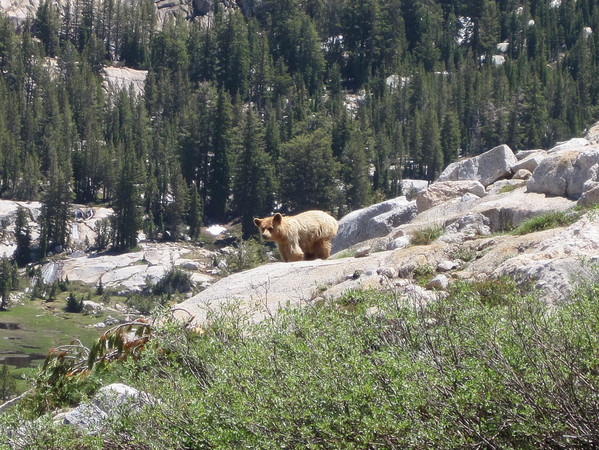
After a few photos and congratulating a couple who had just become engaged, I descended the slopes back to the junction. Oddly, I felt the altitude much more on the descent to Crabtree meadow, but the spectacular scenery was a good distraction. Fortunately, on the stretch between Crabtree and Wallace Creek I was able dial into my nutrition and hydration plan so I started feeling better. I got into a nice rhythm descending into Kern Canyon and then running the 9.5 miles of awesome rolling single track down the canyon. I saw several bears in the canyon, including a mother bear and two cubs that literally jumped right in front of me. This caused momentary panic, especially when momma bear gave me a little grunt and stare, but I made some noise and she calmly directed her cubs up the hill away from the trail.
The steepest part of the route, and the crux in my opinion, is the long climb out of lower Kern Canyon to the Chagoopa Plateau below the Kaweah Range. All told, this climb entails nearly 4,500 ft of cumulative elevation gain and the first part is quite steep on a hot south facing slope. The black diamond ultra light z-poles were extremely helpful on this section and I soon found myself on the plateau with a pleasant breeze. Most of Chagoopa is uninteresting terrain with open forest and no views. It is only until one essentially reaches the top of the plateau does the Great Western Divide and Kaweahs come into view. The scenery becomes more impressive and inspiring on the descent into the Big Arroyo Valley.
Upper Big Arroyo is amazing with a wide open tundra setting in the valley juxtaposed with sharp granite cliffs and peaks in the background. I met Jim Castleberry on this stretch and he was kind enough to take the photo of me immediately below. After Jim's trip, he sent me a message: "This past Sunday I was hiking on the High Sierra Trail and took your picture on the east side of Kaweah Gap. Because of the remote location, when I heard the sound of feet running on the gravel surface behind me, it was a true WTF? moment. I was too shocked at the time to give you proper encouragement. Hope the rest of your run went well. You seemed to be in good condition when I saw you."
The panoramic views continue up to 10,700 ft Kaweah Gap, the top of the last major climb of the route. I soaked in the views from Kaweah Gap and then continued down familiar territory to stunning Precipice Lake and Hamilton Lakes. This section is also one of the most scenic in the entire High Sierra and I couldn't resist making several stops to take photos. While taking over 100 photos certainly cost me some time, photography is a big part of my enjoyment both during and after the adventure run. I felt there was no need to run "head down" the whole way at this stage of the trail's FKT evolution.
I heard that legendary rock climber Peter Croft was staying at Hamilton Lakes to scope out a new route on the Angel Wings, the biggest rock wall in Sequoia National Park. As I passed by his party's campsite, they asked me where I was coming from and gave words of encouragement. I wish I got his autograph! While the last 16 miles of the route is not without some climbing, there is also a lot of runnable terrain. I felt decent and was able to run a good chunk of the way from Kaweah Gap covering the last 20 miles in about 3:45 minutes. This was my first run over 50 miles ever and all things considered I felt good at the finish. It was great to see Joel at Crescent Meadows and give the High Sierra Trail sign a hug!
Splits:
Whitney Portal 0:00:00 (3:19 a.m.)
Outpost Camp 0:53:06
Trail Crest 2:21:54
Whitney Summit 3:01:15
Depart Summit 3:06:23
Crabtree Meadow 4:45:58
Wallace Creek 5:36:57
Junction Meadow 6:18:50
Kern Hot Springs 7:33:08
Lower Kern Canyon 7:56:42
Junction in Arroyo 10:53:22
Kaweah Gap 11:45:53
Bearpaw Meadow 13:41:30
Crescent Meadows 15:46:22 (7:05 pm)
Nutrition:
Pre-run: 680 calories (2x bars, 1 banana)
En route: 3,200 calories (7x150cal First Endurance EFS drink mix, bars, shot bloks, gels)
Post-run: First Endurance Ultragen cappuccino
Gear Notes:
La Sportiva C-Lite 2.0
Ultimate Direction Wasp pack and Fastdraw plus hand holder
Black Diamond Ultra Distance pole
Petzl Tikka XP 2 headlamp
Rudy Project Rydon II Sunglasses
North Face Better Than Naked jacket
Injinji socks
Canon Powershot elph 100 hs