


DonnV
-
Posts
128 -
Joined
-
Last visited
Content Type
Profiles
Forums
Events
Posts posted by DonnV
-
-
I'll be interested in your take on the conditions. We left the truck at 2:15 and slogged through freezing rain and poor visibility to the top of the ski slope. Didn't look like it was planning on improving so we turned back.
Spotly, I think you left right behind us. We were two in a minivan that left a few minutes after 2. I think timing was key on Sunday. We had to bail on our plans, too, and I'm guessing you would have broken into the clear just a bit above the Palmer. We were off to do the Sandy and had perfect starry skies at the start. A large cloud bank started rising up just to the west and seemed to settle in against the southwest side of the mountain. We started losing sight of I-Rock as we approached it, and by the time we found the saddle we couldn't see a thing and were starting to get wet from mist. We sat in an old snow cave for about 20 minutes, but it just got worse and we just got colder. We ended up heading up into the fog to the left of Crater Rock and topped out via the West Crater variation. Of course, about 500 feet above I-Saddle things started to clear everywhere. Two guys on their way to Yocum had arrived at the saddle just as we were bailing, and were going to wait themselves in the cave and hope for improvement. My guess is that they were able to go ahead with their climb. Once that cloud cleared, about 4:30 or so, conditions were great up high. And snow conditions were great all the way.
-
Blake, I just got some Quarks but was really down to a coin toss between those and Takoons. I've never climbed with Takoons, but I just PM'd you with some responses I got from some Takoon owners on neice.com, plus I ran across lots of other discussion about them in various places. Some other random thoughts I had and comments I ran across: I found the pinkie rest (the Horn) to be too tight even with a thin glove and I know some folks have cut them off a bit and turned them into more of just a platform. They're some kind of plastic, so I was going to try heating them up and bending them out a bit, otherwise I would have shortened them, too. The Horn covers up any spike hole that would allow you to clip in keeper slings or to clip into the spike as part of an anchor. The Mixte pick is the burly one and was originally made to be unbreakable for mixed climbing, but it was apparently so bad on technical ice that Grivel thinned it out a bit and it now climbs ice much better. The Cascade pick is still the better pick for ice, but I saw some complaints about its durability. The hole in the head isn't really big enough to clip for harnessing the tool, but the hole in the pick seems to work fine for that. The grip is the most comfortable of any tool I tried.
I assume you've been able to swing some in a shop. If not, and if you're still down south, they have some at both Climbmax and US Outdoor right now. Like I said, I came down to Quarks or Takoons, and a price of $120 would have made that choice easy.
Donn
-
Check here for an older thread on this, and check out Lowell Skoog's reference on the last post. You might also PM Lowell for more specific info on his own traverse.
-
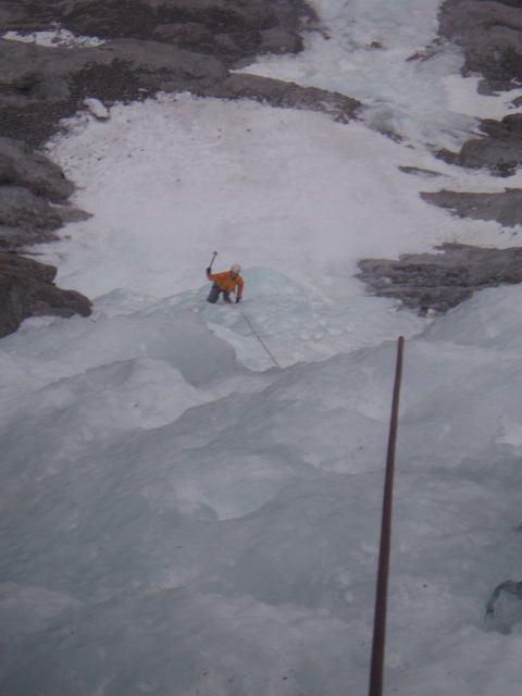
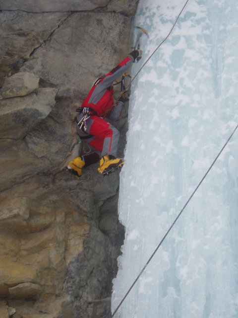
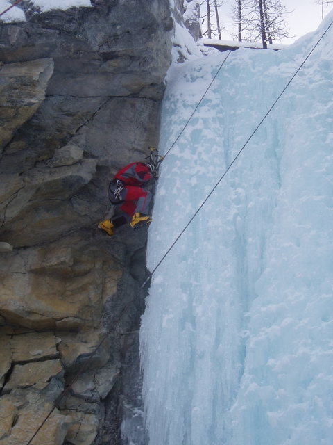
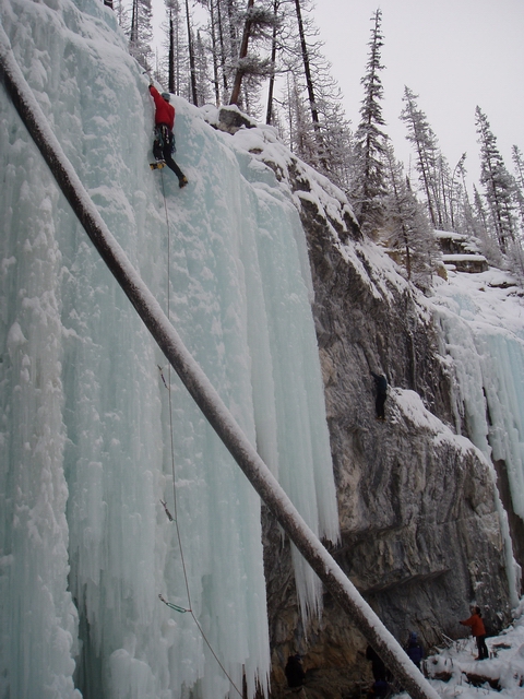
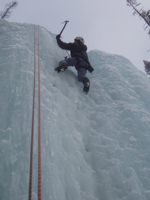
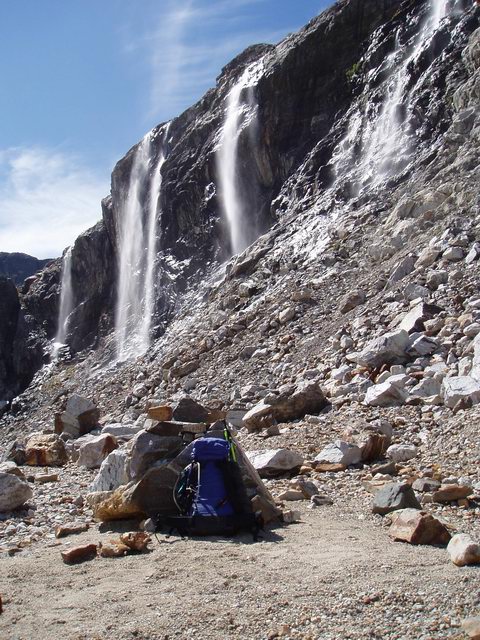
A few more pics. Thanks to all these guys for a great trip, and especially to ckouba for his ironman stint behind the wheel. And thanks for the beta and suggestions, Kurt. Cascade was a kick!
Rodney coming up the WI3 pitch on Cascade Falls
Doing laps on TR at Haffner
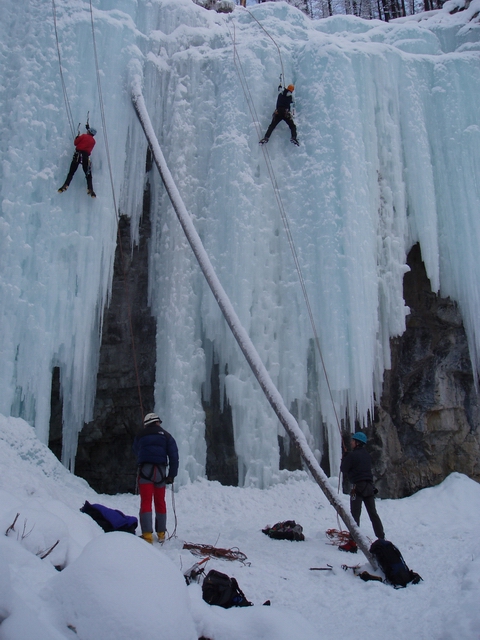
More ice and mixed and DT lines at Haffner
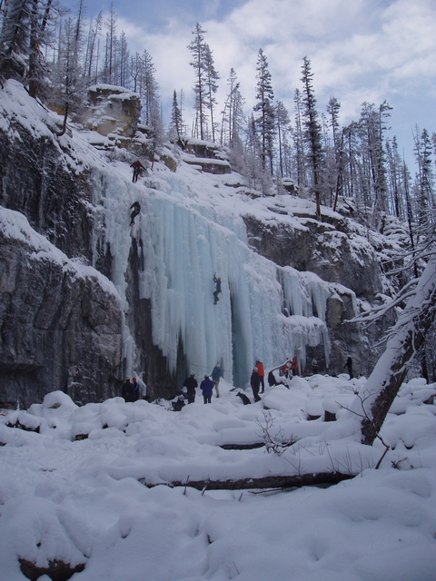
ckouba on some mixed stuff at Haffner
vw4ever leading and TR'ing at Haffner

Rodney TR'ing at Haffner
-
An interesting pro-leashless article (at least 3 years old, I think) from the guiding website of Vince Anderson, who just did the new route on the Rupal Face with Steve House.
http://www.skywardmountaineering.com/tipsLeashless.html
Another version of the above, with a drawing or two, from Climbing mag:
-
Oleg, I've been Crossfitting for just over a year now, am completely addicted to it, and over that time I've turned my barn into a pretty decent Crossfit home gym. All the advice above is right on. You're welcome to come out anytime and I can show you what gear you need and what the movements and workouts look like. I can even give you a set of homemade PVC rings - they take about 10 minutes to make. Any other PDX'ers interested in Crossfit are more than welcome. Shoot me a PM. Even if you don't want to adhere strictly to the 3 on/1 off workouts posted on the website, it's easy to incorporate CF into whatever other training you do once you understand the basic framework and approach.
-
It's from the summit of Black. I took the same shot from there this summer.
-
David, yes, that is Mist Falls.We were at the wide ampitheater underneath an imposing (and constantly spitting) roof that was pictured in vw4ever's post. Is that Mist Falls? -
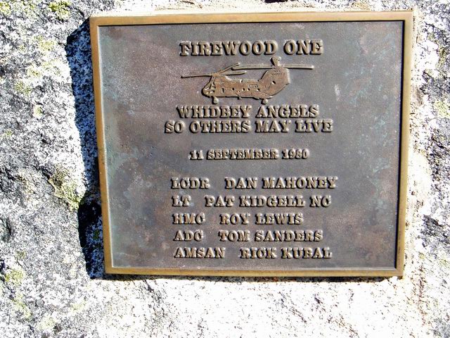
I don't really know anything about the crash, but I did see this plaque on a Pickets trip this past August. This is cemented onto a rock on the heathery ridge that rises south of Perfect Pass. In the second photo, Perfect Pass is lower left, and the plaque was roughly where the heather ridge leaves the photo middle left.
-
Nice TR and pics. Good read.
I'm a big fan of summit bivies, too, but Dan's is carrying what has to be the largest "bivy" pack I've ever seen in my life.
-
Lowell, I did see those catacombs and also picked my way slowly through that area. Coming up from below, I felt I had a very good idea of where to go and where not to. But I was aware that I wouldn't have the same visibility coming down and stopped a while to make sure I could retrace my path the next day. As it happens, I decided to climb Colonial on the way down and so went back via the next notch/pass to the east, which puts you right on top of the east lobe of the Colonial Glacier. From there it is an easy descent down to the toe of the glacier. If anyone wanted to avoid any danger near the Colonial-Neve Col, they could use that route both up and down. A bit more elevation to gain and lose, but very straightforward and easy access to the Neve Glacier. I was off of snow for only about 100 feet, but for most of the season you could stay on snow all the way. And, I might add, plenty of flat ground and running water for camping up there.
Colonial-Neve Col is the low notch in the center. The alternate route is the snowier notch to the right. This is from the summit of Snowfield looking to the northwest.
Interesting comment on the aluminum crampons. There was a lot of ice on the route, but nothing too steep, and I felt very secure. The thought did occur to me out there, crossing some narrow bridge on the Neve, that I was glad I had recently sharpened them a bit. I find myself using my aluminums more and more.
Good job on your traverse. You guys signed in at Marblemount just before I did, so I knew you guys were out there. After having now seen that area from the north, I have to put that trip on my list!
-
That is a great TR, and I haven't even seen the pictures yet! Really sounds like a monster from start to finish. Very impressed with the approach, the climb, the descent, and very impressed with the partnership you two shared. Well done!

Edit: Now that you've linked to photos, I'm even more impressed.
That, along with your description of the approach, should have that place jam-packed next season!The other parts of the East face have way less cracks and more bulging sections, and substantial aid climbing far exceeding our ability await. It would be a monestrous task getting extra aid gear and the inevitable extra amount of food for a much longer stay on the wall. There are few, if any, ledges to bivy on.
-
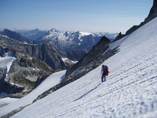
Climb: Snowfield Peak-Neve Glacier
Date of Climb: 9/1/2005
Trip Report:
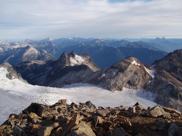
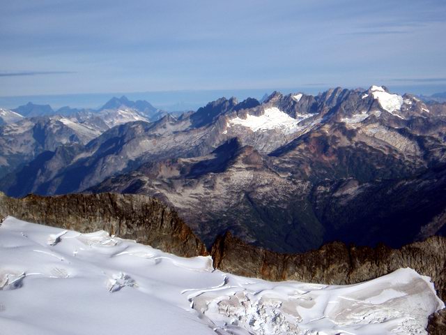
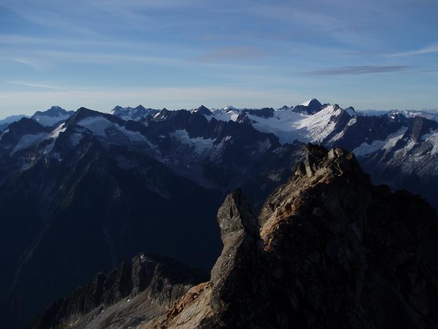
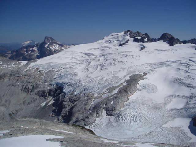
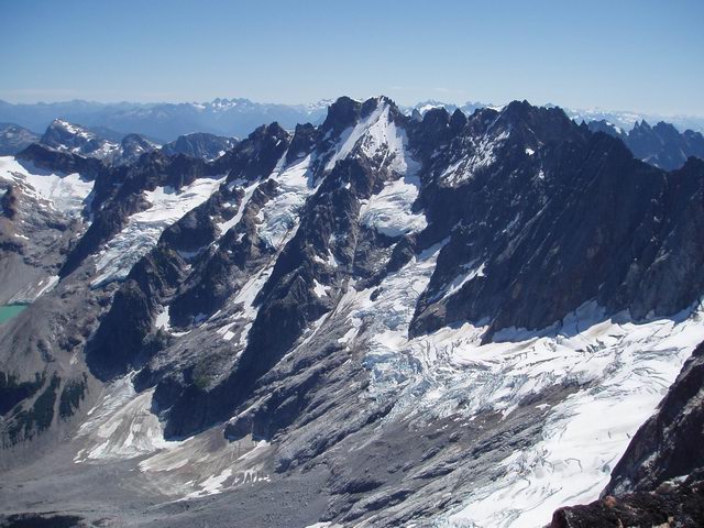
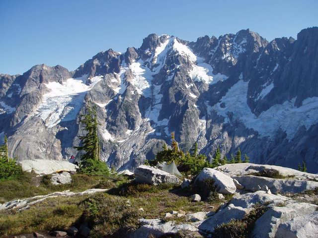
There are several other reports on Snowfield Peak in the TR index, but I thought a few glacier pics of this time of year might be interesting. After reading Juan's recent post and recommendation for this trip, and since I'd never been there, I went up Wednesday and Thursday in search of great views, huckleberries, and maybe even Juan's bear. I never did see the bear, but both the huckleberries and the views are among the best I've ever seen in the Cascades. The summit of Snowfield is worth every bit of the work of getting there. It's really one of the best Cascade viewpoints I've been on.
Looking northwest from Snowfield Pk toward the Southern Pickets
Looking south toward Buckner, Boston Basin peaks, Austera, Klawatti, Eldorado, etal.
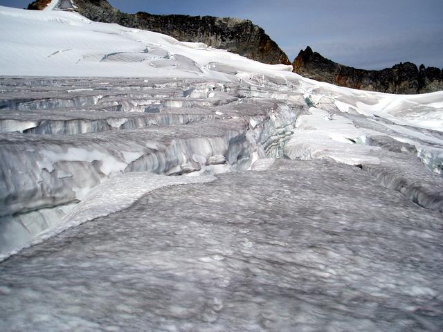
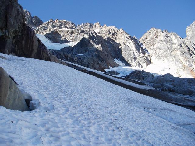
Right now the Neve Glacier is still passable but is incredibly time-consuming. I've really never felt quite so much like a rat in a maze. Hopping around on the ablated areas of the glacier was both fun and irritating. There were a few places where I reluctantly moved onto some snow-covered areas where things were just too open to find a way through otherwise. That was just a touch nerve-wracking, and once any significant snow falls it'll be a lot harder to know what's under your feet. Right now I'd say it's still a pretty safe solo, but definitely not a fast one due to all the weaving back and forth looking for bridges.
Snowfield Peak and the broken Neve Glacier from near the Colonial-Neve col
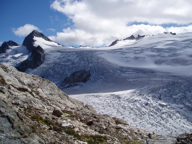
Crevasses on the Neve Glacier
I started out with a summit bivy in mind, but ended up spending the night at about 7900' at the base of the final talus ridge. The summit looked rocky, with no snow or water nearby, it kept getting engulfed by clouds rolling through, and there was a great site on the ridge with great views both north and south. I melted snow, but running water was no more than 5 easy minutes to the south. After a windy night, I scrambled to the top and spent about an hour there spotting peaks before heading down.
Evening clouds rolling over The Horseman, on the ridge west of Snowfield Pk.
Hozomeen and Jack Mtn at sunrise from bivy below Snowfield. Colonial in foreground.
On the way out I spent about an hour at the camp at the base of the Colonial Glacier just watching the waterfalls there. Very nice spot, and a good place to soak up the scenery before starting the descent. This is a great non-technical trip. A steep and dry approach, but good camping options, easy glacier travel, and unbeatable views. And, for those so inclined, I think this would make a great car-to-car.
The awesome waterfalls at the 5900' moraine camp at the base of the Colonial Glacier
Looking north to Hozomeen from the 5900' camp
Gear Notes:
Axe and aluminum crampons.
Approach Notes:
Trail is steep and dry but pretty easy to follow. Brush not bad at all right now.
-
Down below I've pasted in some info from yet another option, Hammer Endurolytes, which are basically salt capsules that are taken orally instead of mixing with water. I know some climbers who use these and claim the advantage that they can adjust their salt intake depending on exertion level and independent of their fluid intake. Not sure of the cost, but you could also buy your own gelatin capsules and make a salt-only imitation for cheap.
I've been messing around a lot lately with my own drink mixes. The salts clearly help me avoid cramping and probably also with recovery, but I don't like carrying around all the sugar in the usual brands. Right now I'm using Crystal Light or Wyler's or Kool Aid sugar free mixes and adding my own salt. Between Morton Salt (600+ mg sodium and no potassium), Morton Salt Substitute (all potassium and no sodium) and Morton Lite Salt (roughly 50/50), you can come up with whatever ratio you think works for pennies. I take other vitamins anyway, so don't worry about them in the drink mix. Warning: If you add plenty of salt to a Lemon-Lime or Lemonade drink mix, you will get an immediate craving for tequila.
Hammer Endurloytes Data
Ingredients:
Sodium Chloride - 100 mg.
Calcium (Chelate) - 50 mg.
Magnesium (Chelate) - 25 mg.
Potassium (Chelate) - 25 mg.
Vitamin B-6 (Pyrodoxine HCL) - 6.6 mg.
Manganese (Chelate) - 1.6 mg.
L-Tyrosine - 50 mg.
Endurolytes Usage Instructions
DOSAGE:Take 2-3 capsules one hour prior to training sessions or races.
When training or racing for periods beyond one hour, consume 1-6 capsules of Endurolytes per hour of exercise. As a general rule, the hotter/more humid the weather, the higher your intake will be.
-
I never climbed with Bill, but met him briefly. He climbed a lot with a mutual friend from back in the day, Paul Hickenbottom. Fryberger and Ball did a new variation on the NW Buttress of Goode, and he and another guy did the FA of the couloir just left of the NE Buttress of Goode. Among other things, I'm sure.
-
Started browsing through it and ended up reading the whole thing! Really awesome stuff. Many thanks to everyone who puts this together.
-
I remember it well.Ahh but DonnV you did happen to see this blonde on the West Ridge of Forbidden. She and her partner were glowing like newlyweds. But I distinctly remember that, as attractive and as welcome a sight as she was, she was dressed head to toe in climbing clothes and was definitely not sunbathing!
I simply think that Oleg's TR could be enhanced considerably by one or two pictures from this part of their climb.....
-
Good job on the climb and nice TR! Your variation definitely sounds worth doing, but you gotta go back and do the direct gendarme finish sometime! With a rope, though. I don't know if I'd vomit watching someone solo it, but I'd vomit if I thought too long about soloing it myself.
I feel a bit shortchanged, though. I've done the NR several times, and never once have I seen a beautiful blonde sunbathing anywhere along the way. Nice bonus!
-
Climb: Northern Pickets-Old Guys On Vacation
Date of Climb: 8/3-10/2005
Trip Report:
This TR got a bit long (hey, it was a long trip), so here's the short version for those that aren't interested in the novel below. An old climbing partner and I just got back from 8 days in the Northern Pickets. We went up Little Beaver trail to Whatcom Pass, over Whatcom Peak to Perfect Pass, across the Challenger Glacier and up Challenger, down around into Luna Cirque, up the North Buttress of Fury, down and across to Luna Col, up Luna, and finally down Access Creek to Big Beaver and to Ross Lake. Awesome trip in every respect! We just couldn't have had a better time. Details, nostalgic ramblings and photos follow.
My longtime partner Mike and I did our first climb together, the NR of Stuart, back in '77, when we were 29 and 27, respectively. I'd been climbing for several years by then. It was Mike's first climb. Since then, we've done a ton of alpine climbs together, but somehow never got into the Pickets. In particular, we never got to Fury. I've had the North Buttress on my list for (literally) decades. And even though I plan on climbing for many more years, once you're well into your fifties you have to start to realize that there are some climbs on that tick list that you better get to soon if you're going to get to them at all. Something like the NB of Fury is going to eventually become not only too difficult as a climb, but also just too damn hard to get to!
For various reasons, Mike hadn't done much climbing at all since 1999, but he always stays in shape, his rock skills have stayed intact, and he was up for a big trip into an area he'd never been. We actually went in to do Fury's NB last year, but I took care of that attempt by busting up my ankle on the second day (some details here). The trip immediately got put onto the schedule for this year. We were all set to go in on July 6. I was packed and had driven up to Seattle the day before. But the deteriorating weather forecast finally hit rock bottom, so we bailed. A good thing, since the forecast held and it rained a lot that week. We would have been miserable. Mike's next window was August 3-10, so we rescheduled for then. My original thinking was to schedule 8 days for a trip that should take us about 6 solid climbing days, giving ourselves 2 days to either sit out weather or tackle some extra objectives. Maybe Crooked Thumb, and maybe a traverse to Fury's west summit. Or, we could blow through it in 6 days and come out early. As departure day arrived, though, it was apparent that we would probably not have any bad weather days. We were definitely in shape to make this a 6-day trip but, as Mike reminded me a few times, we were Old Guys on Vacation and should concentrate less on trying to accomplish everything in sight and more on enjoying the adventure. So we decided to ease up our pace, drop any thoughts of adding other peaks, and just take all 8 days to do Whatcom, Challenger, Fury and Luna. Definitely a big enough job in itself. So that's exactly what we did and it turned out to be the right choice. Every day was completely manageable, we never got beat up, we typically started our days late and finished early, slept 8 or 9 hours every night, stayed well hydrated, and had plenty of time to relax and read and just enjoy where we were.
We paid the extra bucks for the boat ride to Little Beaver trail, both to save a few trail miles and because we'd never hiked that trail. We both started the 8 days with packs at just over 40 pounds w/o water. We spent our first night 14 miles in at Twin Rocks camp. The next day started with the grind up to Whatcom Pass, where we headed up the north side of Whatcom. We were only headed as far as Perfect Pass, so we spent an hour or so on top of Whatcom before running the 15 minutes down the snow to the pass.
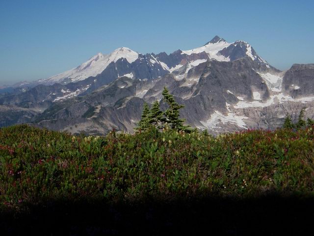
Challenger Glacier from summit of Whatcom Peak
Baker and Shuksan from our camp at Perfect Pass
The next morning we decided to head up the ridge a ways before getting onto the Challenger Glacier. I was curious about what was up there for future camping possibilities (plenty of flat ground and great views if you can find water) and, while dropping directly onto the glacier from the pass would still go, the lower glacier is getting pretty broken up. We eventually got onto the glacier near 7000' and made a more or less level traverse, with no crevasse issues, to Challenger Arm. We dropped our packs there and ran up to the top, again spending an hour or so on the summit. We eventually headed back down, grabbed our gear, and moved down the eastern end of the glacier and just around the corner to a knoll at 6000' overlooking Luna Cirque. Great camping, water nearby, and wonderful views of Fury. A great place to obsess about the North Buttress and worry about just how bad the lower section would be.
The North Buttress of Fury from the summit of Challenger
The North Buttress of Fury from campsite at 6000' knoll below Challenger Glacier
Day 4 was by far our easiest. Even though I'd read that dropping into the cirque from here was pretty straightforward, you almost have to do it to believe it since it looks incredibly imposing from across the way at Luna Col. It was, in fact, no problem at all, and in under 3 hours at an easy pace we were down at a huge flat sandy area that makes a great campsite. I took a hike over onto the rock-covered glacier and up to the base of the North Buttress, just to get a better idea of what we were up against the next day. Mike found water about 10 minutes away. It was very early in the day, so we headed over to the stream with water containers, books, and all of our sweaty, dirty clothes. We had a very relaxing afternoon, reading, rehydrating, and rinsing out all of our clothes and drying them on the rocks in the sun. Oddly, our shirts still smelled really bad afterwards. Go figure.
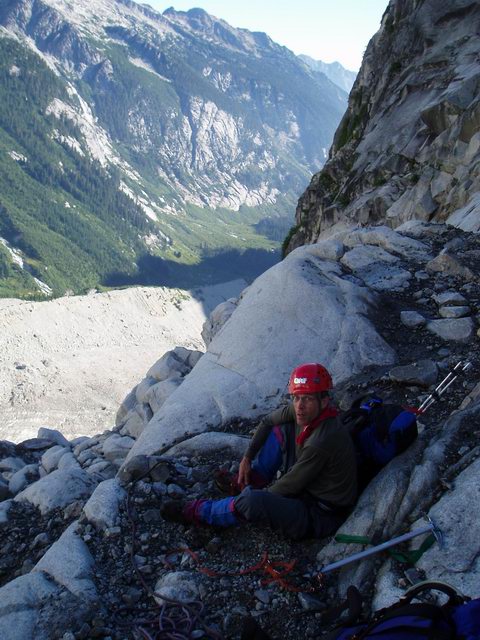
The next day was really why we were here. Last year we came in via Access Creek and, before I trashed my ankle, our plan was to do the NB as a day trip from a camp at Luna Lake, then continue across to do Challenger before heading out Wiley Ridge. This year we decided to come in from the north and do the climb with full packs. I was really inspired by the trip last year done by the trio of mvs, Der_Wanderer and highclimb. Definitely one of the most impressive trips I've seen written up on this board (TR here). I had a copy of their photo of their right (west) side approach to the buttress (found here on mvs's website) and we totally adopted their very apt terminology of key points on the route. The Ramp, the Swan, the Mudslide, etc. (my mantra for the scary lower section was that everything will be just fine once we reach New Zealand). Their experience on that approach was very helpful for our routefinding. Thanks guys! [While I'm at it, I know I've PM'd iain, wayne w, colin, mvs and I think a few others for info on this route. Thanks to all for the beta!]
The morning of the Fury climb was the only time we even pretended to get an early start. Although we'd be carrying full packs and were planning on camping on Fury's summit, we still wanted to get underway fairly early. We slept fairly well, even though we were hearing lots of stuff coming down the walls of the cirque. Kinda disconcerting when you're heading up one of those walls the next day. We were up by 5:15 and moving in just under an hour. After grabbing water along the way (we started with 3 liters each and, of course, found we could have tanked up much higher on the route) and gearing up at the base of the route, we were climbing by a bit after 7. We were well rested, well fed, well hydrated, and had that spring in our step that only comes from sporting freshly laundered underwear. With clean clothes, we were lookin' damn spiffy and we knew it!
I just re-read The Trio's TR thread and we clearly had very similar feelings about the lower section you have to climb before reaching the ridge crest. It's scary and has some real objective danger. You just have to hope you aren't in the wrong place when the peak decides to unload a random fusillade of rock or ice. It's enough of a crapshoot to have you asking what level of objective danger you're willing to accept. I'm sure it's safer at other times in other conditions. On our day it wasn't necessarily an easy call, but the risk level seemed acceptable and we felt we could stay out of the firing line most of the way. We followed pretty much the same line The Trio did, with a few changes. There was less snow, so we exited the lower Ramp earlier and climbed more directly up to the base of the next Snowfinger. We climbed easy rock on the left side of the Snowfinger, both because the snow was discontinuous, and because staying farther left kept us farther away from any rockfall from above. It was between the Ramp and the Snowfinger that we witnessed our only bad rockfall, as several volleyball-size missiles sailed past us on the right at a velocity that was absolutely chilling. It was one of those times you realize that, if you're in the wrong place, it wouldn't matter in the slightest that you were wearing a helmet.
We moved up in relative safety, hugging the left side as much as possible, until we were at a last protected nook and had to move out right, much more into the danger zone, and deal with the Mudslide. Again, there was less snow for us than in mvs's photo, so we had to more or less climb a couple hundred feet of the Mudslide itself. The Mudslide is a lovely streak of hard remnant ice that is totally infused with black coarse sand. Maybe 35-40 degrees. Very hard and very dirty and very much exposed to rock and ice from above. After very carefully discussing and analyzing all the variables of rockfall, icefall, temperature, slope gradient, snowcover, etc., we decided that our best option would be to use the next few hundred feet as an opportunity to get a feel for our VO2 Max and probe the limits of our anaerobic threshold. In other words, we felt we should run like hell. So off we went at top speed onto the black grit highway. I could just feel my aluminum pons dulling with every step. We moved as fast as we could and soon arrived, gasping, at a slightly protected spot just left of the top of the highest snow. We just seemed to have black wet sand all over us. We took off our filthy crampons with our filthy hands and stowed our filthy axes. Did I mention we had rinsed out all of our clothes the day before? We weren't looking so spiffy anymore. We quickly moved up and left on fairly easy rock, moving further out of danger, and were soon at New Zealand. As I had been assuring myself, everything was indeed just fine now that we were here. New Zealand is a pair of snow patches that kinda mark the place where you are out of serious danger, above the Mudslide, and ready to actually get on with climbing the buttress proper. I liked New Zealand a lot.
This is on our last clean snow. That dark streak ahead is The Mudslide.
Mike de-cramponing after the sprint up the Mudslide
We kept moving up and left through a fair amount of loose rock and soon arrived at the crest. This was probably exactly where The Trio hit the crest. They reported a 5.8 pitch here. I'd almost be tempted to bump it up to 5.9, but maybe that's my pack and boots talking (we didn't bring rock shoes). Above that we simulclimbed at a pretty good clip until we arrived at a comfortable, sunny flat spot at about 7000', just before you either do a short rap or downclimb to a notch. At this point we were clearly looking great for time and would summit fairly early in the day, so we quit trying to hurry at all. We took a long break here, eating and enjoying the sun and the views. Mike took the lead for a couple pitches, we did a lot more simulclimbing, and we eventually found ourselves at the final snow arete to the summit ridge. What a great way to finish this climb!
Mike coming around a very cool and exposed blind corner pitch about mid-buttress. I remember this same pic from The Trio's slide show.
Mike on the final snow arete below summit of Fury. Pure fun climbing this with the summit now so close.
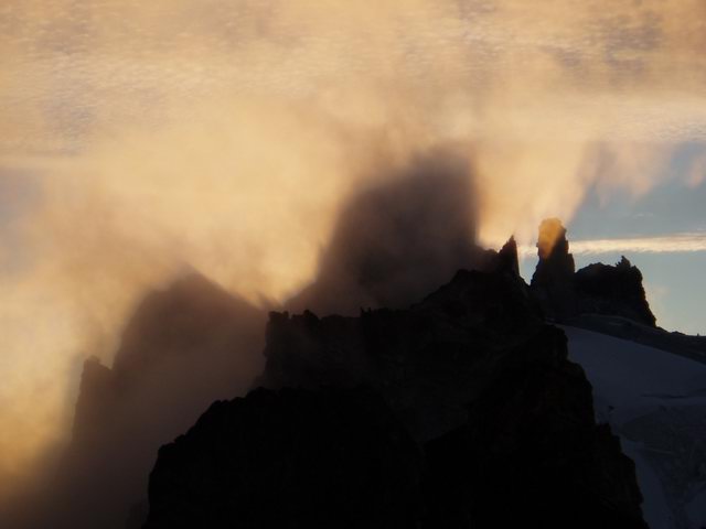
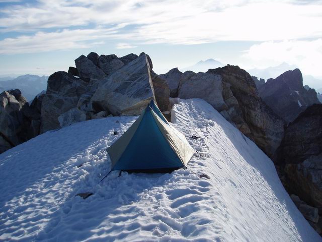
We arrived at the summit at about 3:30, 9 1/2 hours after leaving camp and about 8 1/2 hours from the bottom of the buttress. Carrying full packs up a big route like this is definitely a chore, but it was great to arrive at such a cool summit, after all that work, and not have to think at all about leaving. A few clouds were moving in and it was definitely cooler than it had been. Nothing threatening. Just some marine stuff moving through to enhance the view a bit. We set up our tent on the highest snow, just a few feet from the summit rocks, melted snow, had dinner and enjoyed a great sunset.
Our camp on Fury's summit. Any middle-of-the-night excursions were done carefully. The fall to the left is a couple hundred feet to rocks. The fall to the right is about 4000 feet down the NE Face to the base of the buttress.
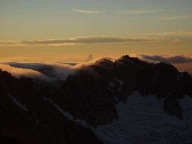
Sunset from Fury with clouds rolling over the Luna Cirque crest. Slesse in the distance.
The next day we got an aggressive alpine start of 11:15 AM and started the trek across to Luna Col, our destination for the day. I had done the SE route before and we had no descent issues. We took our time, as usual drinking tons of water at every opportunity. We found far less snow at Luna Col itself than the last 2 years, but water was only 2 minutes down the west side. We spent the rest of yet another lazy afternoon and evening reading and relaxing and enjoying looking back into the cirque.
The next morning we actually got up early enough to start hiking up Luna at about 6:30 AM. We settled for the false summit, since we had a ways to go today, and since we wanted to continue our very rewarding habit of just doing nothing on the summit for about an hour. We eventually headed back down, packed up, and were headed down by about 10. We had a permit for 39 Mile camp, which gave us about 5 miles of trail to cover once down Access Creek. We again weren't in a big hurry. We'd both been down Access Creek before. All I can say about the trip down is that the upper basin was a nice place to stop and soak our feet before the brushfest, and the huckleberries are great right now. At Big Beaver we didn't take even a second to look for a log, being quite happy to grab another opportunity to get our feet wet. We traded boots for Aquasocks and easily forded the stream. Four miles later we were setting up for our last night at 39 Mile camp. This day was actually a pretty long one, and we were asleep pretty quickly.
The next morning we had only 5 miles to the boat dock and it was a really pleasant cruise with what were by now very light packs. I arrived at the dock with not one ounce of food left and a pack down to 33 pounds. When I was thinking about how this trip would go if everything fell into place, there were 4 moments in particular I was looking forward to and that I knew would be especially satisfying. One was sitting on top of Fury with the NB a done deal and not having to go anywhere right away. Then there was sitting at Luna Col, the Fury descent out of the way, on our last night up high, looking back at most of our recent few days of travel. Third was the pleasure of hitting the Big Beaver trail after getting down Access Creek. And, the last moment I was really looking forward to was this:
Our boat was scheduled for 11:30. We arrived at just after 10 to find 4 hikers from Hannegan trailhead waiting for a boat they said was on its way. We'd been thinking about swimming for too long to miss it, so off went the boots and in went we. We probably only lost the slightest fraction of the accumulated sweat and bug juice and sunscreen, but it felt great and allowed us to drive home feeling something less than totally gross. The boat was there within 10 minutes, had room for us, and since we had prepaid, the other party gave us $15 cash to cover half the fare. The trip was wrapping up just great! We hit the store at Newhalem positively craving some instant ramen and Clif Bars, but somehow walked out with beer and potato chips instead. Signed out at the ranger station, grabbed burgers at Good Food, and hit the road for home.
We felt incredibly lucky to have an 8 day trip into the Pickets turn out so well. The weather was perfect. Every day went just as planned. We accomplished everything we were after. It was hard to not smile all the way from the top of Fury (well, okay, the smile went away for a while coming down Access Creek). It was our first serious climbing adventure together in several years, but all the alpine teamwork clicked like it always had. Taking the extra time allowed us to stay energetic the whole time and to really avoid ever feeling trashed. We covered lots of new terrain for both of us, managed to do a long sought after route on Fury, and simply had fun every day. I didn't even break my ankle this time. It was a really gratifying trip with a great partner and old friend. Good times!
Old guys on vacation.
Gear Notes:
Rack of 11 pieces - A few pieces more than enough. Kinda depends on how often you want to stop and rerack. No ice or snow pro and none needed.
30m single rope - This worked really well for us. I had a 50m that I just wasn't using, so I chopped it to save weight on this trip. Fine for glacier travel, and long enough by at least 20' for the Challenger rappel. On Fury it was fine for the 2-3 short sections that we pitched out, and better than a longer rope for all of the simulclimbing.
Betalight with betabug - Just bringing groundsheets for under the Betalite would have been at least a pound lighter, but bringing the bug insert was worth the extra weight. We spent most nights with just the bug net up, and there were enough flies and mosquitoes that it made it far easier for us to get in our critical 9 hours of slumber each night.
Boots - i.e. no rock shoes. There was only the one 5.8ish pitch early on the crest of Fury where it would have been nice to have rock shoes. For everything else on the route, I was much happier in boots.
Ice Axe - no second tool needed
Crampons - Aluminums worked great for me.
Fuel - We took 2 large MSR canisters for my GigaPower. We boiled about 4 cups each of 7 evenings, and about 3-4 cups for 5 mornings, and melted about 5-6 liters worth on top of Fury. We came out with about 1/2 ounce left in one of the canisters.
Cell phone - I tossed this in after reading about others getting cell reception up high in the Pickets, and I got a good signal a week before from West MacMillan Spire. We checked and got a signal on Challenger, Fury and a great signal on Luna. If we had this last year, Mike would have had to only hike from Luna Lake to Luna summit instead of all the way out to Ross Lake when I got injured. We did use ours to change our boat pickup and to make sure we'd find room at 39 Mile camp.
Ibuprofen - The staff of life.
Approach Notes:
Little Beaver trail had a few easy to follow detours and some minor brush. No complaints at all. The whole area is very dry up there. Water was always somewhere, but I'm sure less available than in normal years. The SE Glacier route on Fury is far drier than it was in late August 2 years ago, as is Luna Col and the route down to Access Creek. The stream at 39 Mile camp which was raging at the end of July last year is now dry.
We saw no one at all from just below Whatcom Pass on the Little Beaver Trail the morning of day 2, until we reached Luna Camp on the Big Beaver Trail the afternoon of day 7.
-
Hey, nice job, TLG! Your TR is a good read. You obviously appreciated the experience on several different levels. Soloing definitely contributes to that. Congrats!
-
Nice TR and great pics (I really like the reflection shot of Whatcom). We're heading in this week, and I appreciate the beta and hearing about conditions. Thanks for posting.
-
Well, they're not John Scurlock quality, but I've been meaning to post some of these photos for about a year now. Last July, dropping from Luna Col to Luna Lake, I either stepped in a hole, or on a rock that moved (never did really know) and turned my ankle a direction it's never turned before, badly tearing a ligament and also breaking my fibula. First ever climbing injury of any consequence. End of climbing trip, end of climbing season, and three months in a cast ahead of me. It wasn't an emergency, but I couldn't walk out. I had Vicodin, I had a week's worth of bourbon (don't listen to the warnings - they mix together just fine), the weather was perfect, and I had an iceberg-laden lake to soak my leg. My partner Mike hiked out in a day, called Marblemount, and was just in time for Kelly Bush and a pilot and an EMT to come in by helicopter about 7:30 PM (thankyou again, Kelly and crew, thankyou, thankyou, thankyou). On the way out to Marblemount, we circled up out of Luna Cirque right next to Fury, flew pretty much directly over Picket Pass, VERY closely west of the Southern Pickets, and, to top it off, right past Triumph. For my first helicopter ride, it was pretty stunning. Not worth 3 months in a cast, but pretty stunning nonetheless. Anyway, I shot as many photos as I could and figured there are plenty of Pickets junkies here who would appreciate seeing them. These are roughly in the order I took them.

MacMillan Spires
Good look at Terror's north side
Just about directly over Picket Pass here
Just about to pass from north side to south side of the group
Looking back at the south side of the Crescent Creek Spires
The Chopping Block
Approaching Mt Triumph
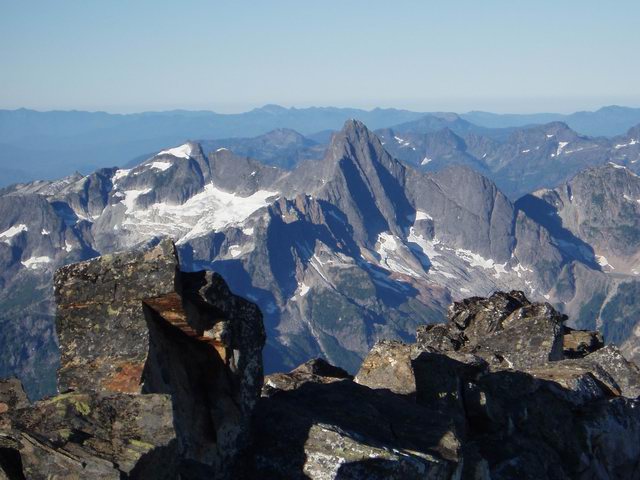
And finally a couple closeups of Triumph
-
Josh - Thanks. I love summit bivies and have done a ton of them, but have trouble thinking of one so scenic. It was one of the most enjoyable trips I've done in a while.
Gr8 shots, Donn. BTW: the "two young studs" who did the earlier 6 1/2-hr climb are:Erick Johnson - 34 years old, and
John Cain [zoroastr] - 47 years old.
--If we happen to meet on the trail, you'll know me by the gray hair and the faint aroma of Ben Gay and pipe tobacco...

Now I'm really impressed! But you're still "young studs." Damn near everyone is to me these days. I turned 55 a couple months ago, and I was thinking up there that I might be able to get up there in under 8 hours with a light pack. But it would probably take me just as long to get down. Good on you for staying in that kind of shape. I know it's not that easy!
-
Climb: West MacMillan Spire-West Ridge and summit bivy
Date of Climb: 7/26/2005
Trip Report:
After reading about zoroastr and EJohnson's day climb of West MacMillan Spire, and the comment that it would have been nice to spend more time in the area, I thought it would make for a great summit bivy. I had never been into the Southern Pickets, and this seemed like a good opportunity to get in there for a look. I left the car just before 8:30 Tuesday morning, figuring that if two young studs could get to the summit in 6 1/2 hours carrying a few pounds each, and old guy carrying about 30 pounds should be able to get there in 12 or so, in time to enjoy the sunset. I cleverly lightened my load a bit by forgetting a couple pounds of food in the cooler in the car. I was 2 hours in when I realized that and not about to go back, although it did help me later decide to cut my trip from 3 nights to 2.
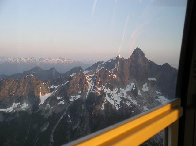
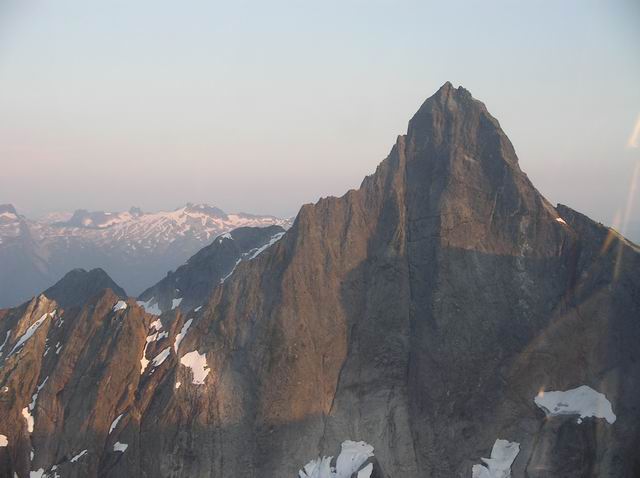
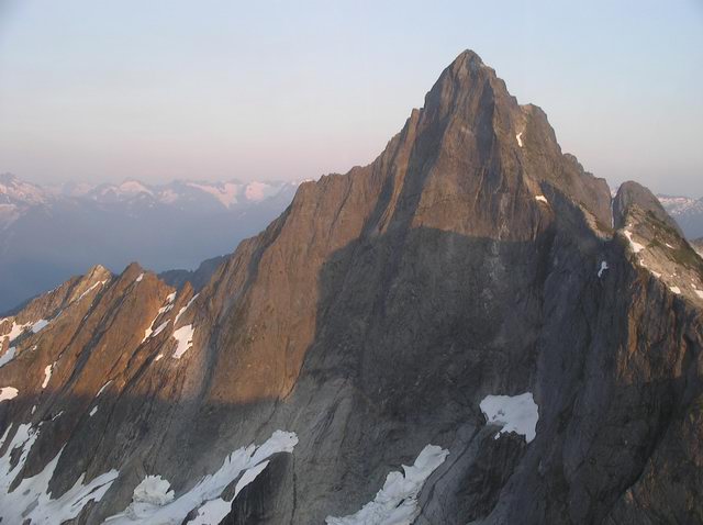
I hiked steadily, but wasn't rushing it, and actually enjoyed the approach. The trail was much better than I expected. I hit the notch above Terror Basin in 6 hours, and knew I was good for time, so took it very easy from there on, concentrating on stopping and guzzling water at every chance before heading up onto the glacier. The snow approach was straightforward, although the top of the snow near the ridge notch is melting away pretty fast. The steps from the two speed guys exited left over what is now a precariously thin bridge. I went right and had 100 feet or so of some loose gully grunge to get to the crest. I hit the summit exactly 10 1/2 hours from the car, just before 7, plenty of time to enjoy a great evening. I tossed down my gear in one of two previously used bivy sites, and spent the next few hours mostly being amazed at the views, shooting dozens of pictures, reading the summit register, and spreading out my huge map of the NCNP to identify as many peaks as I could. Weather was perfect, no bugs anywhere, I had water, food, bourbon and cigars and pretty much felt like a kid in a candy store looking at what was around me. After a great sunset, I eventually hit the sack, waking in time to start shooting dozens more sunrise pictures. Really an amazing place to spend the night. Worth carrying a few extra pounds up there and highly recommended!
After plenty more lounging on top, I headed down to where I had stashed my stove and some food at the bottom of the glacier. I had planned on maybe checking out the crossing of the Barrier, but decided to let that wait for another trip when I wasn't solo. Besides, about a day's worth of my food was sitting back at the car, I was near the end of my book, I was dangerously low on cigars, and I had foolishly drunk all my bourbon on the summit. So, deciding I'd spend one more night over on the gravel bars on the other side of Terror Basin, I just stayed there a while at the edge of the glacier, guzzled water, cooked some breakfast, read my book and napped in the sun. I eventually sauntered on across the basin and spent a leisurely afternoon finishing my book, food and cigars (what was I thinking not bringing more bourbon?). I really enjoyed my instant mashed potatoes, but they would have been so much better with some parmesan (did I mention I left some food in the car?). I was on my way just after 7 AM and had an easy unhurried hike out. The three guys I met coming up the trail in the woods were the only people I saw the entire time. I reached the car (where, by the way, there was plenty of food) just before 1 PM. Great trip! I'll be in the Northern Pickets next week and, having spent an evening and morning staring at Fury and Luna, it will be that much more enjoyable looking back south from there.
Here are a few of the zillion shots I took from the summit.
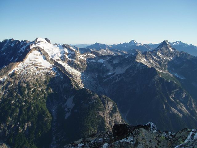
Baker and Shuksan at sunset, with Inspiration, Degenhardt and Terror in foreground
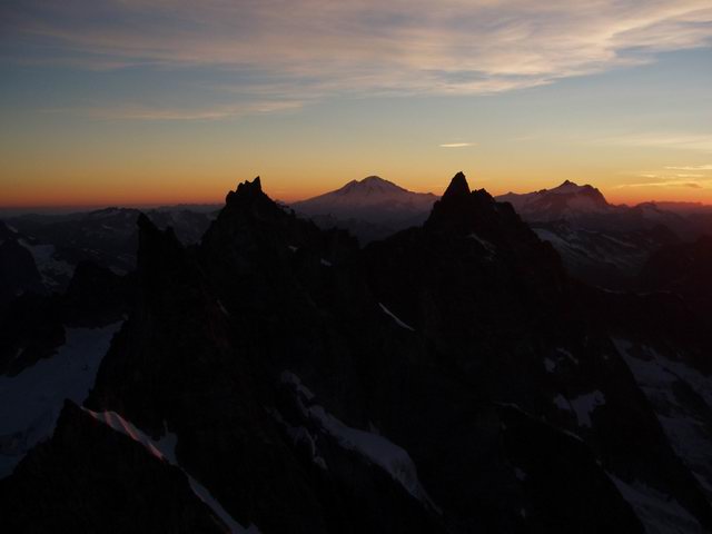
Same shot a bit more to the north
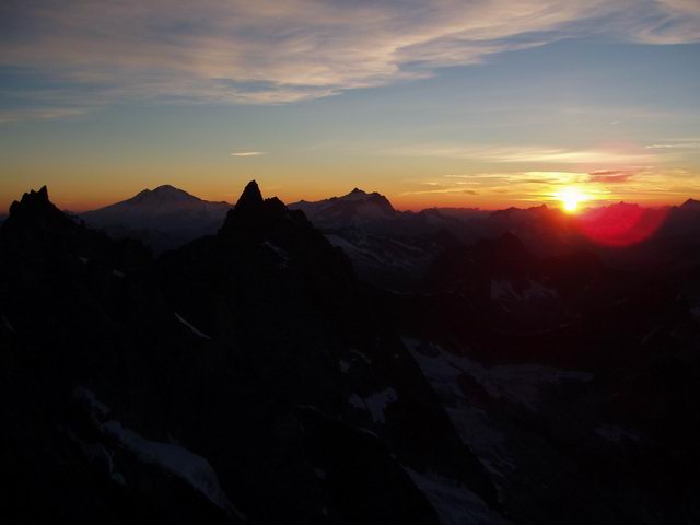
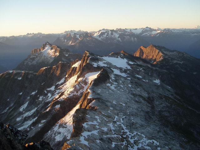
North beyond Picket Pass at sunset
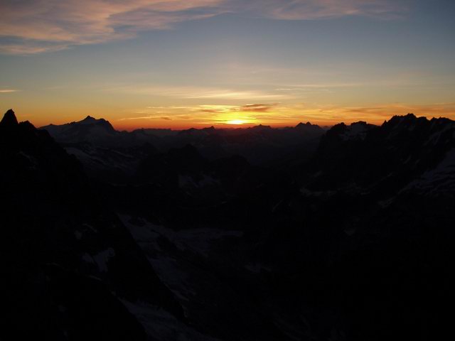
View toward Baker at sunrise
North beyond Picket Pass at sunrise
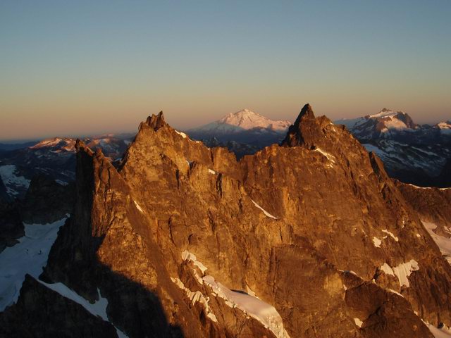
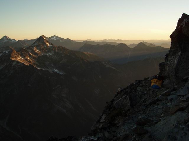
Fury and Luna at sunrise. Redoubt off in the distance.
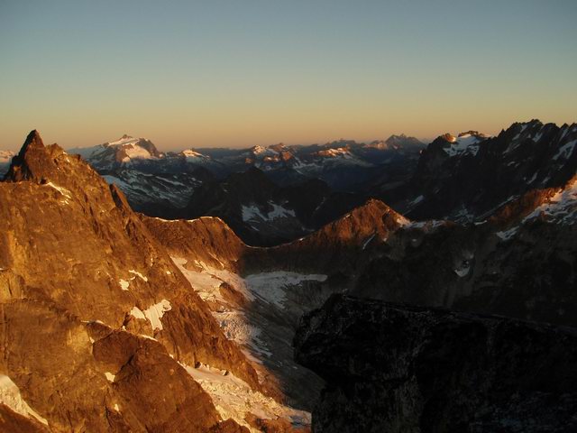
Looking back down into Terror Basin at sunrise
Luna Peak and my bivy site at sunrise
Jack Mountain at sunrise
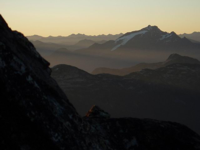
Hozomeen peaks at sunrise
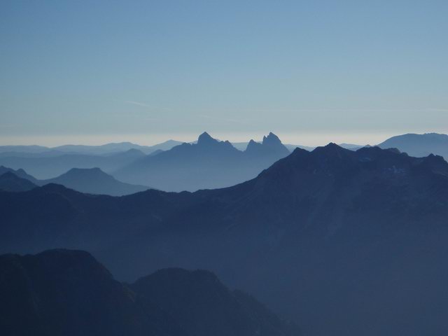
Mt Triumph at sunrise
Gear Notes:
Ice Axe
Aluminum crampons - used on my morning descent, but could have made do without, and probably wouldn't have used later in the day.
Approach Notes:
At my pace, there was water accessible at about 50 minutes where the trail touches Goodell Creek, then at about 1:35 at the stream just before the old road ends and the trail heads uphill. At the second large dry creek crossing up above timberline (5200?), there was water if you went up the streambed 2-3 minutes, which is the best way to go anyway. There was still barely running water and pools where the trail continues off to the left. For me, this was about 2 3/4 hours from the last water. There were a few minor flows from there to the notch above Terror Basin. After that you have water everywhere all the way to the edge of the glacier.
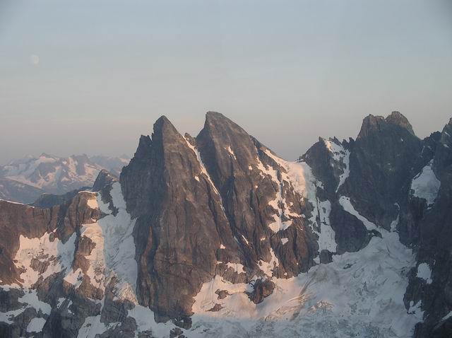
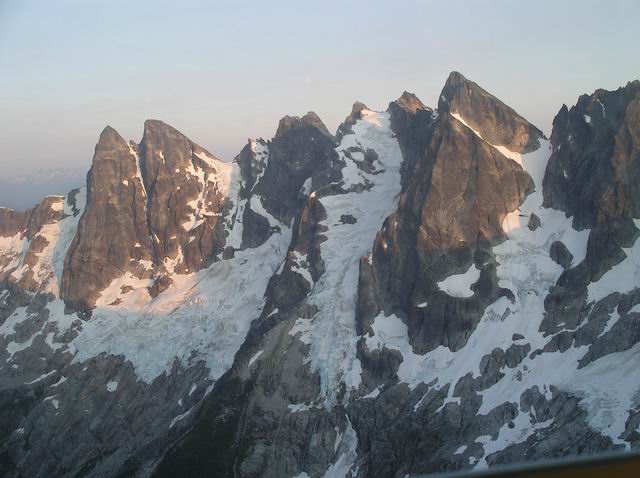
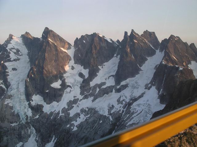
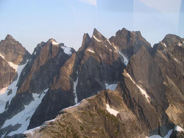
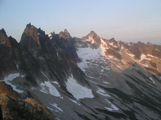
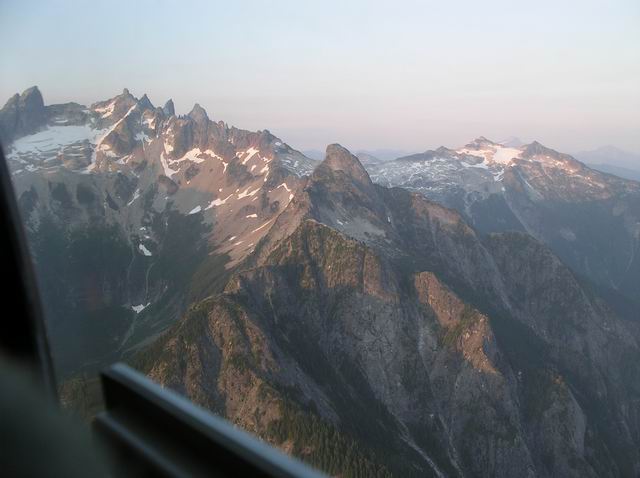
Photos of North Cascades from flight on Sunday
in North Cascades
Posted
Awesome, Marshall. Thanks so much for posting!