

Bronco
-
Posts
3889 -
Joined
-
Last visited
-
Days Won
23
Content Type
Profiles
Forums
Events
Posts posted by Bronco
-
-
maybe they toked out and then got all paranoid and forgot weed was legal and that Larry the Tool was on to them mid-climb. that the most likely scenario.
Still not legal on federal lands. Maybe Larry was closing in and they had to ditch the evidence of their terrible crime spree!

-
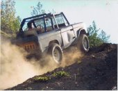
Looks pretty sweet and doable in a day for desk jockeys.
-
Dudes in sports bras are aid.
-
So to be frank....
[img:center]https://www.madman.com.au/news/wp-content/uploads/2014/05/frank-mask.jpg[/img]
-
Is there some beta for Park Ranger? I'm interested.
Never mind, I got off my lazy rear end and found it. Still pretty burly for 5.9, no huge surprise at Index.
https://www.facebook.com/photo.php?fbid=10101364913998460&set=pcb.862444070499186&type=1&theater
-
I doubt it, there wasn't any lightning when it started. Probably human related cause. Dirty hippies...


-
Upper Town Wall fire closure update:
https://www.facebook.com/pages/Washington-Climbers-Coalition/166875886759468
-
Fun read, I spent a four days in Zermatt last July waiting for a weather window that never materialized. Rode the cable car to Schwarzsee with a load of Japanese tourists who I should've charged for photos, they were sure I was a swiss guide based on my touristy Switzerland hat and red goretex coat. Your summary precisely describes my observations as well, especially the $$$ and food.
-
The only thing I would add is that you might want to treat your water near the base of the NR or when you are melting snow at the notch. I didn't and came down with Giardia a couple weeks later when I was in the Bugaboos (though iron gut Trent did not). Not recommended.
That sucks but is somewhat ironically humorous that Trent didn't get sick. Nice work otherwise!

-
I'm surprised it took him that long. http://www.skintrack.com/skimo-racing/reports-results/2015-mondole-world-cup-report/
-
-
It'll be interesting to see how it started. Any speculation?
-
or one of these:
Terrible outfit, sailor top with red sweatpants? No wonder the bear is so angry.
-
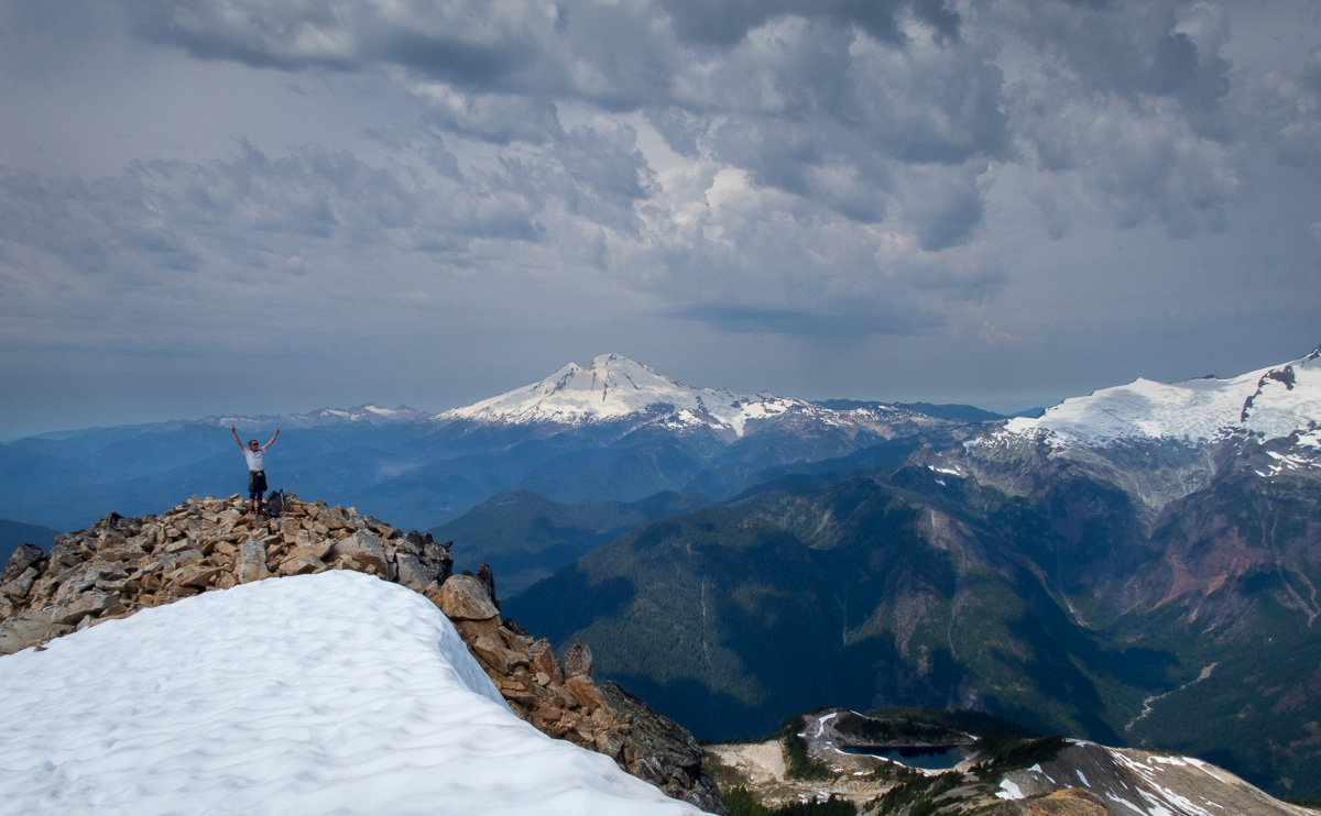
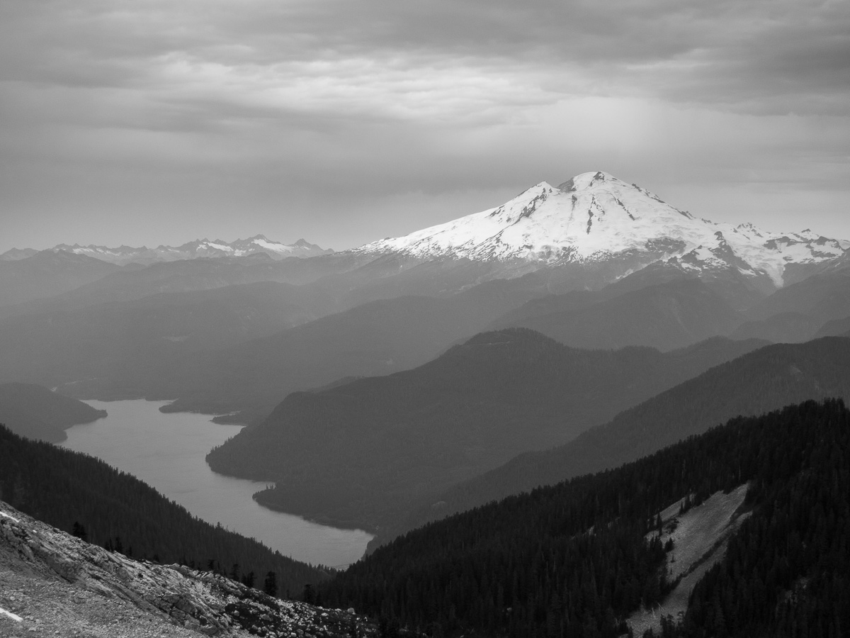
Nice work chossdawgs. Not to sound like a complete imbecile, but is that Mt. Baker in these two photos? Different angle than I'm used to seeing I guess.
-
Nice! How about some photos?
-
Yes, the grid bolt comment was intended to be humorous. I agree, it's a short enough walk to the NW Peak from the parking lot and certainly would be a viable crag if developed a bit. Maybe there's already been some and just not publicized.
-
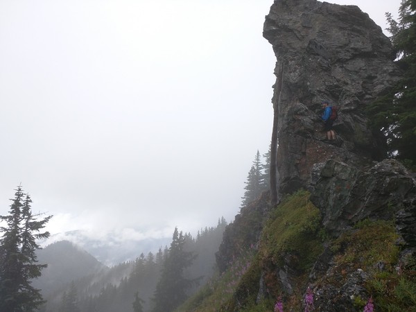
Trip: White Chuck - NW Ridge
Date: 7/11/2015
Trip Report:
The brush on Saturday soaked us from the waist down within 30 seconds of leaving the parking lot. Intermittent rain and 100 yards of visibility most of the day were sort of discouraging but Dave, being on his first "climb" was ecstatic the entire 5 hour round trip. I was pleasantly surprised how grippy the rock remained when wet. There are cairns right where you want them, but not too many.
Fun day in the mountains and makes me curious about the other mid- fifth ridge routes on the mountain. Anyone have the scoop on those? Scary? Good Pro?
Summit shot, look at that view!
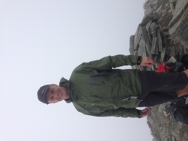
Dave negotiating the "crux", we didn't expect it to be so overhanging.

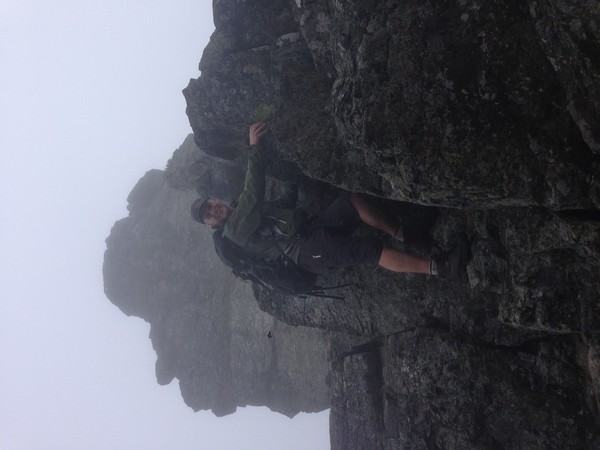
One moment of visibility, checking out the grid bolting possibilities.
Gear Notes:
Took a rope and didn't use it. YMMV.
Approach Notes:
Driving Directions from summitpost.com (these are pretty accurate). Subie Forester was perfect for this road, full size trucks would probably get pretty scraped up by vegetation and the clearance was helpful in a few rougher places.
State Route 530 leads into the center of Darrington. Turn left (north) in front of the convenience store.
After ~0.2 miles turn right on Sauk Prairie Road.
After ~1.5 miles turn right onto Dan Creek FSR #24 and follow this for 8 miles keeping left at the fork at 4.3 miles. The road switchbacks several times then begins a long traverse into the head waters of Dan Creek.
After ~8 miles on FSR #24, the road reaches a T-intersection. Turn left onto FSR #2430
Shortly thereafter stay right at a minor junction onto FSR #2435.
From here-on follow FSR #2435 for 5.3 miles as it winds it way into the headwaters of Decline Creek. It eventually reaches the ridge-crest, switchbacks some more, and comes to a fork.
At this last fork, stay to the right and follow to the end of the road at just over 4800' elevation. This is where the trail starts.
-
Really great photos and well written story.
Your partner looks like he could use the meat.

-
Josh, are you or one of your partners a roofer who was working in Snohomish last week by any chance?
Great photos, glad to see the arete and upper glacier are in good shape despite the hot wedder.
-
Great photos and quick climb. Personally, I can't imagine how messed up my feet would be after a day like that in those "approach" shoes. You are some tough mofos.
-
Great story, not sure what the connection is. Is there one?
-
It looks out to me due to more frequent rockfall as the snow and ice continue to melt out. With the hot temperatures forecast for this weekend, it'll only get worse. I climbed it in 2003 during a hot spell in early June and experience several close calls with rocks zinging down the ridge despite it being a "normal" snow year.
Personally, I'd wait for next May/June. Typically this route is best done immediately after the White River Trailhead is opened for the season. I believe it's been open since April. Is there any current info on the Mt. Rainier Climbing Ranger blog?
-
Sounds burly, should probably add it to the "to do" list. Nice job!
-
I'm wondering if the accident occurred on the Chickamin Glacier. I'd be really surprised if there is anywhere on the Dome Glacier where a 1,200' fall into a crevasse is even possible.
Glad to hear your friends are safe and were able to help the fallen climber.
Rainier, Liberty Ridge this October
in Climbing Partners
Posted
First Ascent of Liberty Ridge was late September 1935. What do you guys think of that?