leora Posted June 29, 2009 Share Posted June 29, 2009 (edited) Trip: Mt. Hood - Sunshine Date: 6/28/2009 Trip Report: We started out, Saturday, at the TImberline climber's register, where there were no climber registration forms, nor wilderness passes, nor blue bags. Please bring your own. . . We'd intended to do a traverse from Timberline around to the north side, and stay the night on the Snow Dome, however, looking at the traverse, there just wasn't enough snow for our liking, and so we did a shuttle to the Tilly Jane trailhead at about 3800ft, near the Cooper Spur Ski area, where there were also no wilderness permit forms. . . The trail was in amazingly good shape, given the fire that ran through there, with only about 5 to 10 trees down, now, most with well defined paths around them. The lupine were out on both sides of the trail. For a good deal of the trail, there was about a 20ft to sometimes about 50 ft wide swath of greenery, surrounding the trail, and charred wood everywhere else. Above the Tilly Jane cabin, there was snow obliterating much of the trail, but sticking to the ridge made it possible to see it, where-ever the snow had melted. Since the Snow Dome was our destination, we skipped going to Cloud Cap, and headed over to the Cooper Spur ridge, and then down the trail that leads to the Eliot Glacier. The only easily accessible running water that we found was at the rocks on the left side of a then obvious foot path up the tongue of the Eliot. We filled up all of our containers, and headed on up to the Snow Dome. We got up a little later than intended on Sunday, and didn't start up until 6:30am. We already had our crampons on, since our camp was quite slick when we got up. We were able to easily skirt the bergschrund at the base of Anderson Rock, by going a little to the right. For the bergschrund at the base of Horseshoe rock, we found a snow bridge to the far right, just beyond where the rock loomed above. Traversing under Horseshoe rock showed us that there was a lot of stuff already coming down (ice and rock). We roped up at this point. The snow bridge rose up and back toward Horseshoe rock. It looked as though there might have been a really simple step onto the upper lip of the bergschrund if I kept going towards the rock, but I didn't want us to have so much exposure to the rock above, so I took the first available step up, which I should have protected with an ice screw, as the upper lip had crusty ice sheet covering solid ice, but instead put in a picket part way, deciding to put in a solid picket before any of my rope team got near the step. Sure enough, the ice didn't last long, and I was able to place a picket. After getting above this bergschrund, the wind made it pretty impossible to communicate with each other. I headed up and right, ultimately attaining the top of Cathedral ridge at about 8:30am, where we unroped, and headed up on the broad snow slope. There was still snow, and a deep trench, on most of the knife edge ridge, although some of the ridge is now exposed. Some of the summit is now exposed, too. We probably hit the summit close to 9:30am. We headed down the old chute, attempting to stay far left of any climbers in the Chute. The only stuff coming down there were ice chunks dislodged by climbers clinging to the ice structures around the rock. Fortunately, I saw one such coming, and was able to take it with my backpack. I was once again impressed with how much bare rock here is on the south side below Crater Rock and above the Palmer. Photo of the route: Gear Notes: Pickets, screws, rope. Approach Notes: As many are aware, the road to Cloud Cap campground is closed, so have to traverse around the mountain, or take the Tilly Jane trail which is at the end of a road across from the Cooper Spur ski area. Spending the night at the Snow Dome allowed us to get a good night's sleep, and still hit the summit at a reasonable time. Edited June 29, 2009 by leora Quote Link to comment Share on other sites More sharing options...
Bill D. Posted June 30, 2009 Share Posted June 30, 2009 Leora: We are looking a doing Sunshine route this weekend. Saw your previous post and had the same question: Was the road open only to the gate at Cooper Spur (at around 1050ft) or was it open all the way to the Tilly Jane trailhead (at around 3800ft)? I just called the ranger station and they said 'no', but it looks like 'yes' from your trip report. I'm hoping for the latter. Thanks, Bill D. Quote Link to comment Share on other sites More sharing options...
leora Posted July 1, 2009 Author Share Posted July 1, 2009 When I called the Forest Service, that's where I got the info that I could only go to 1050ft, and when I called the Mt. Hood Ranger Station, I heard to Tilly Jane Trailhead. If you're coming from Timberline, you would take Hwy 26 East, then Hwy 35, and then take a left at the first place where there is a sign that says "Cooper Spur". Then when you see the Cooper Spur Ski area on the right, you'll make another left as soon as you can. You go to the end of that road, and that's where the Tilly Jane Trailhead is, and yes, it's around 3800ft. You'll have a blast! leora Quote Link to comment Share on other sites More sharing options...
Bill D. Posted July 1, 2009 Share Posted July 1, 2009 Good News! Thanks Leora. Cheers, Bill Quote Link to comment Share on other sites More sharing options...
ptownclimber Posted July 2, 2009 Share Posted July 2, 2009 Hey your photo is not showing up - can you re-post? Quote Link to comment Share on other sites More sharing options...
Frikadeller Posted July 2, 2009 Share Posted July 2, 2009 where are the pictures? Quote Link to comment Share on other sites More sharing options...
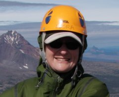
leora Posted July 3, 2009 Author Share Posted July 3, 2009 The following picture shows the green path filled with lupines with the charred trees on either side (and one of my climbing partners): The following picture shows some of the blowdown that was evident, particularly above the Tilly Jane cabin: The following shows our route (sorry that it's so faint), it does show it all the way to the summit. There is a blue circle around the rocks where we found the free-flowing water: And here is little closer view of the crux of the climb: Here is at the start of the snow bridge over the bergschrund (see black arrow - route goes up and to the left, behind this overhanging chunk) underneath Horseshoe Rock. Unfortunately, I didn't take a photo of the top part, where the step up was, but, well, stuff WAS coming down, so I didn't think it wise to linger. . .: And, Finally, here is the view from the western part of the "summit" - just before the knife edge of the north part of the crater rim that you have to cross to get to the true summit with those dot-like people on it, in the distance: I think that the pictures are showing this time!!!! (Oh, and thanks for being interested!) leora Quote Link to comment Share on other sites More sharing options...
leora Posted July 3, 2009 Author Share Posted July 3, 2009 Ok, I finally figured out that if you go to Home >> Member Galleries >> leora, you can blow up the photos, above, which is particularly useful for the 3rd picture, above, where the route shows so very faintly in the smaller version that is displayed in the post. leora Quote Link to comment Share on other sites More sharing options...
billbob Posted July 3, 2009 Share Posted July 3, 2009 There is (usually) a lot less stuff coming down in the early morning hours, although as we saw recently on the Sandy HW route there is always a chance of being hit. At least with an early start the snow bridge is stronger. Quote Link to comment Share on other sites More sharing options...


Recommended Posts
Join the conversation
You can post now and register later. If you have an account, sign in now to post with your account.