Sela
-
Posts
1 -
Joined
-
Last visited
Everything posted by Sela
-
[TR] Mount Despair - southeast face/east ridge 08/14/2021
Sela replied to peter_mcb's topic in North Cascades
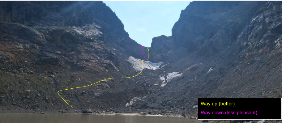
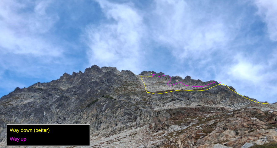
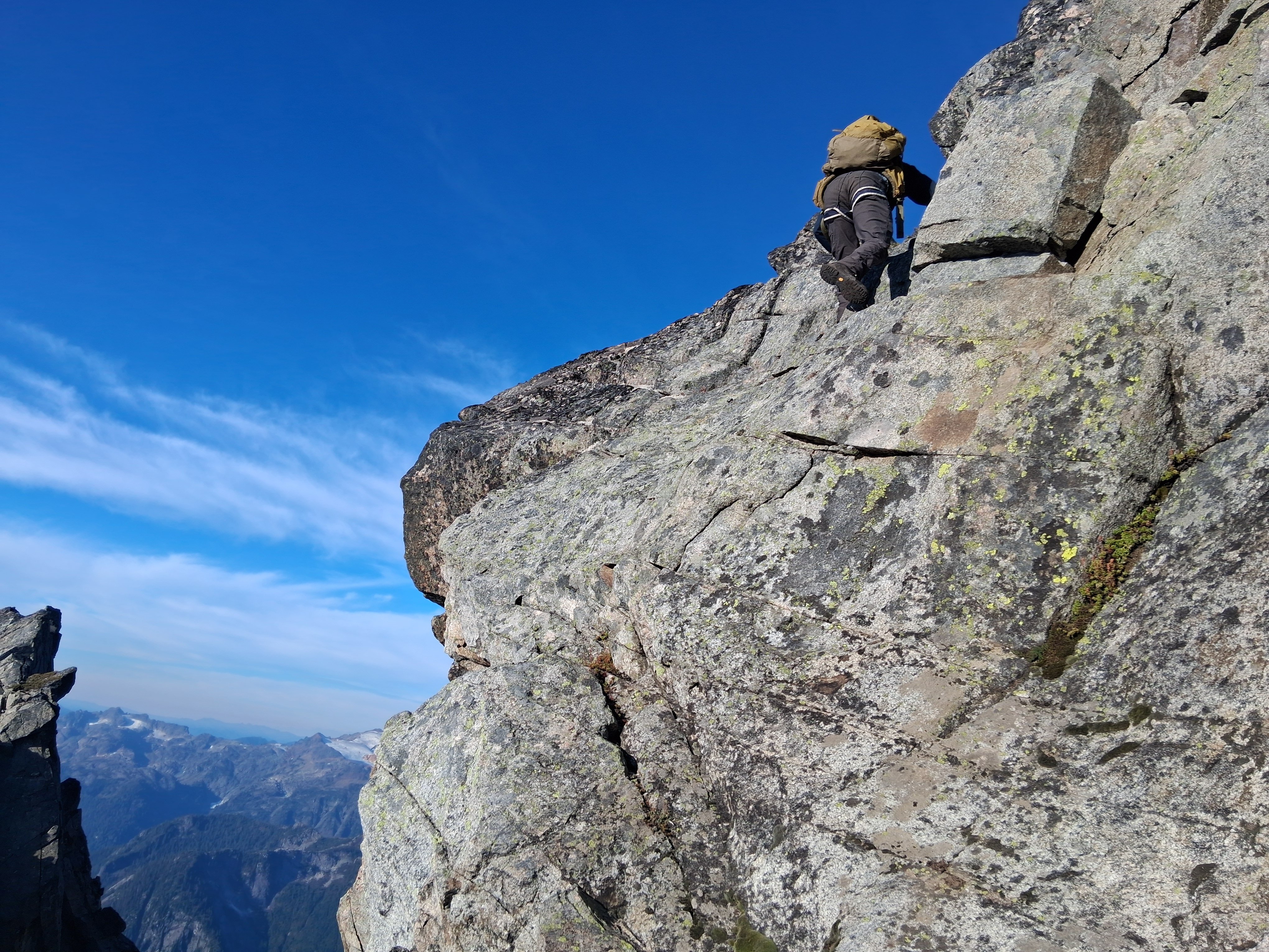
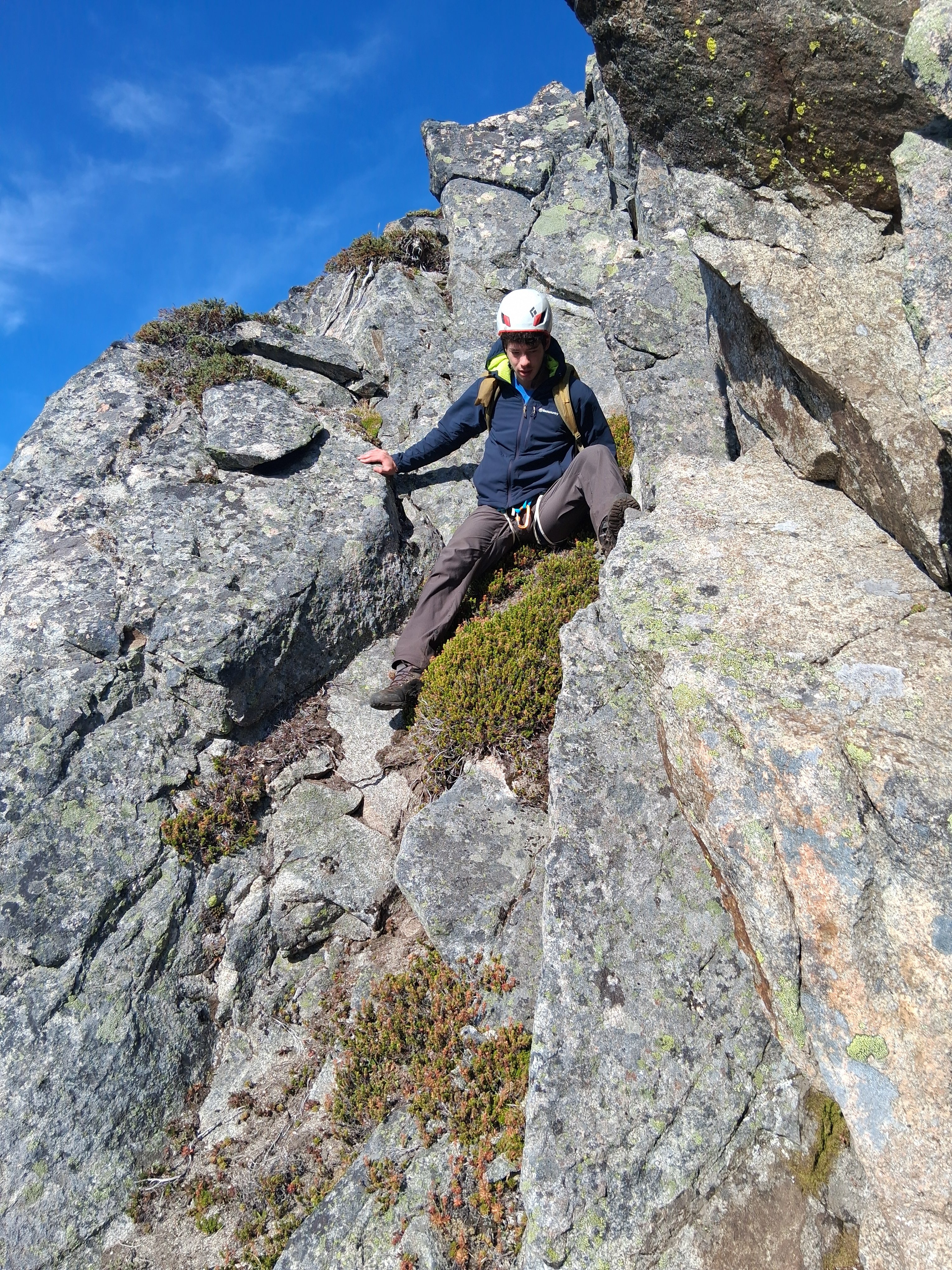
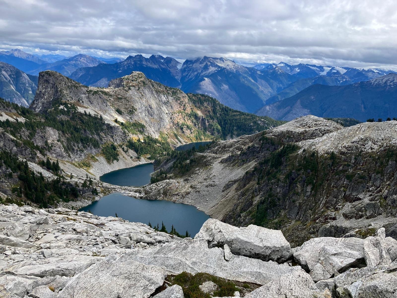
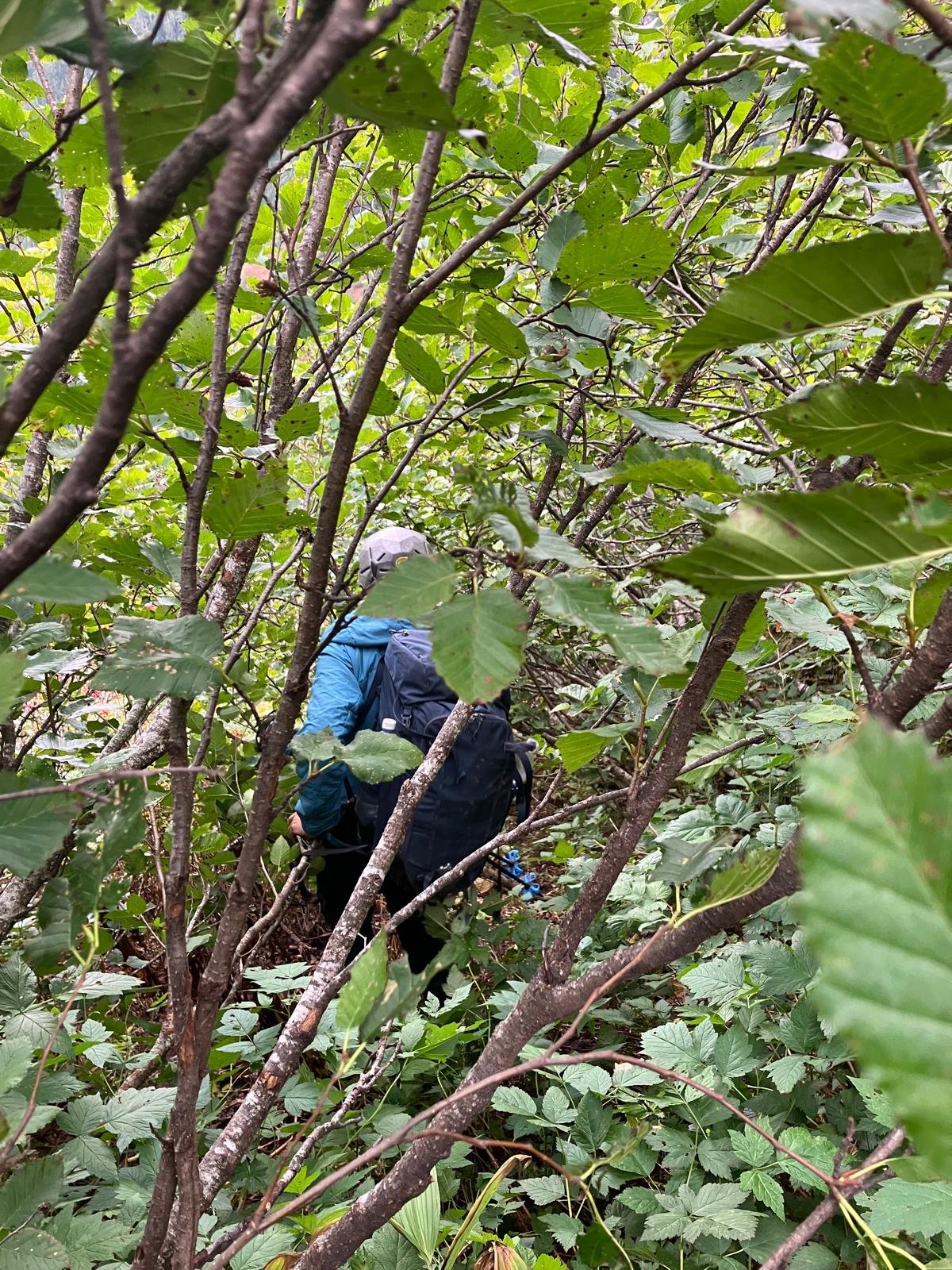
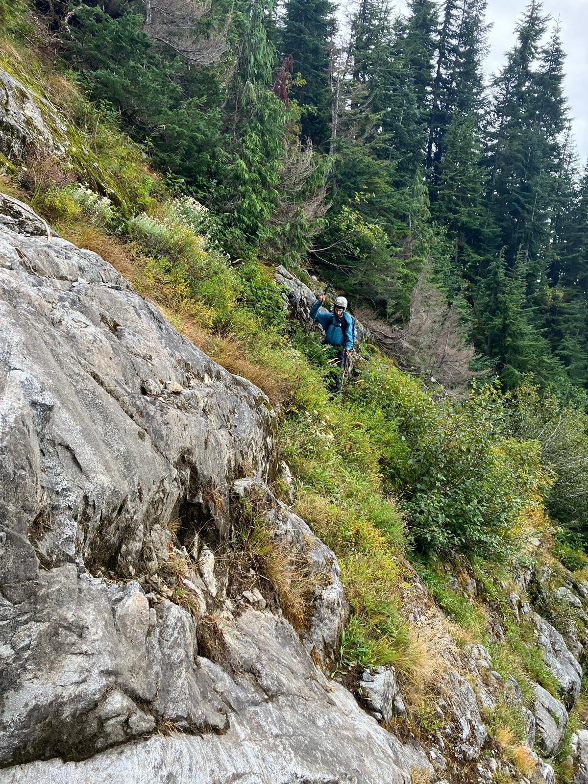
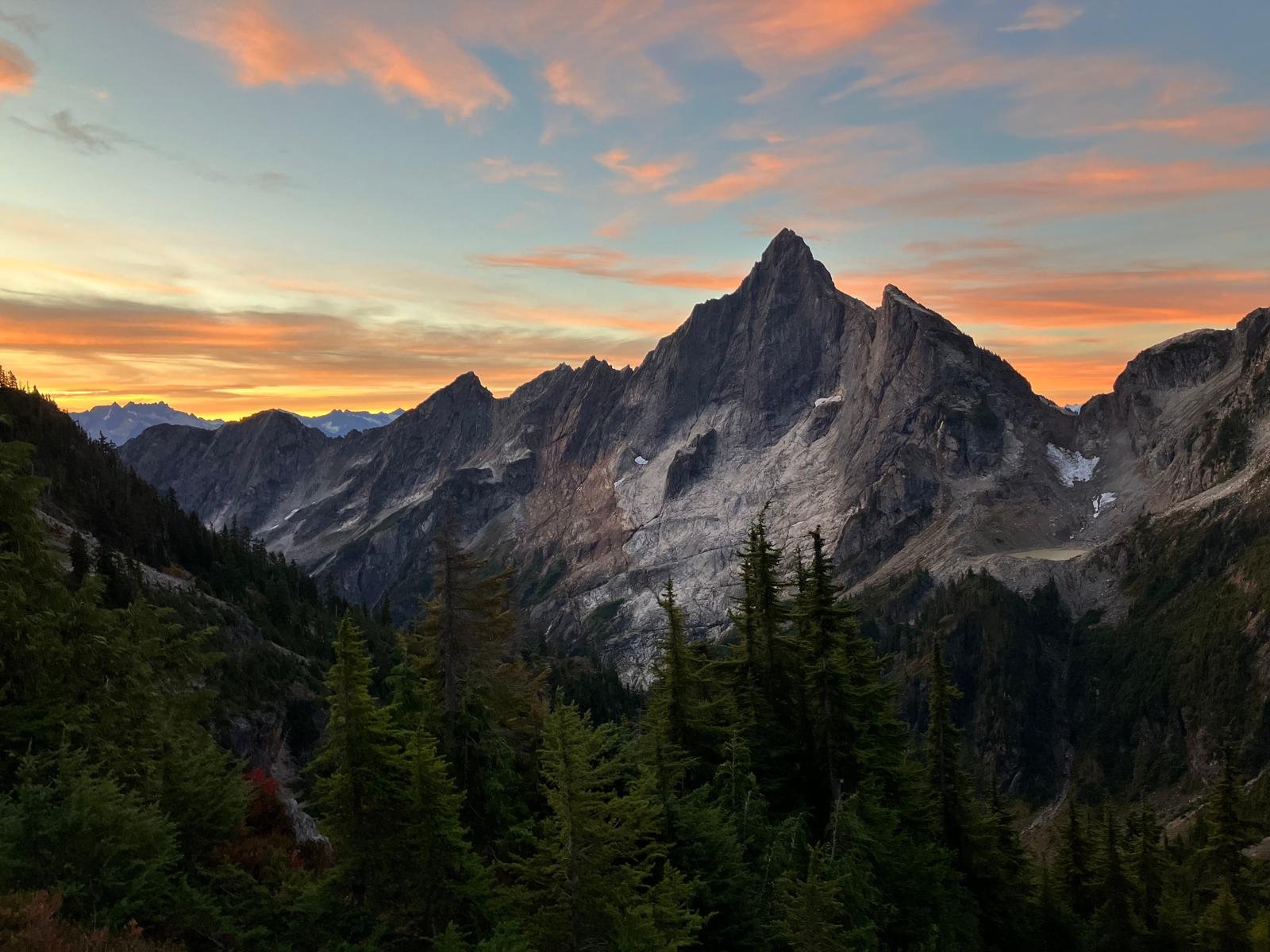
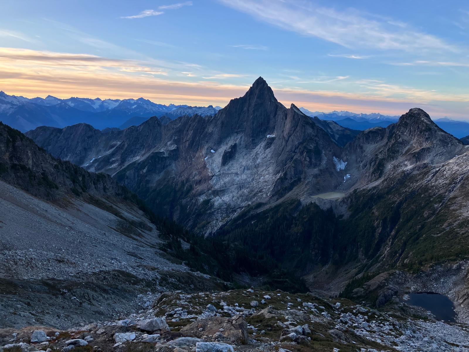
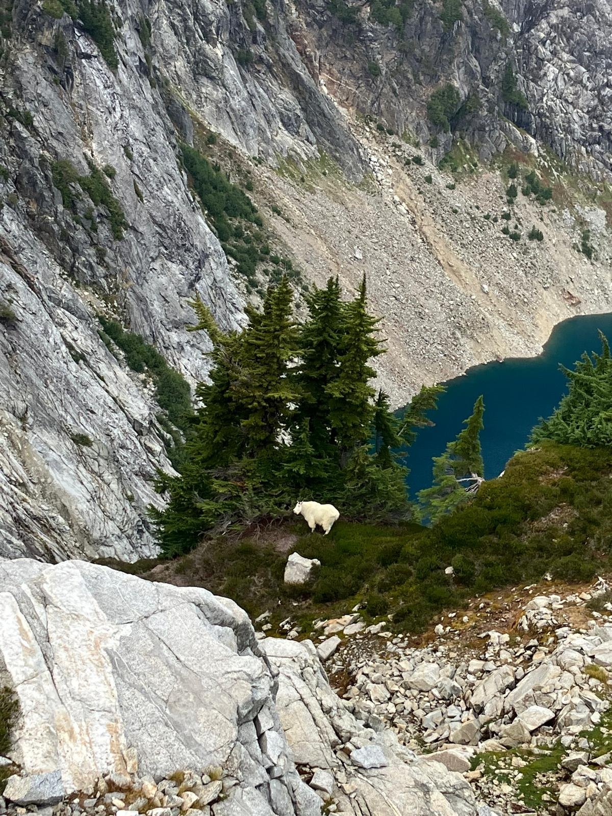
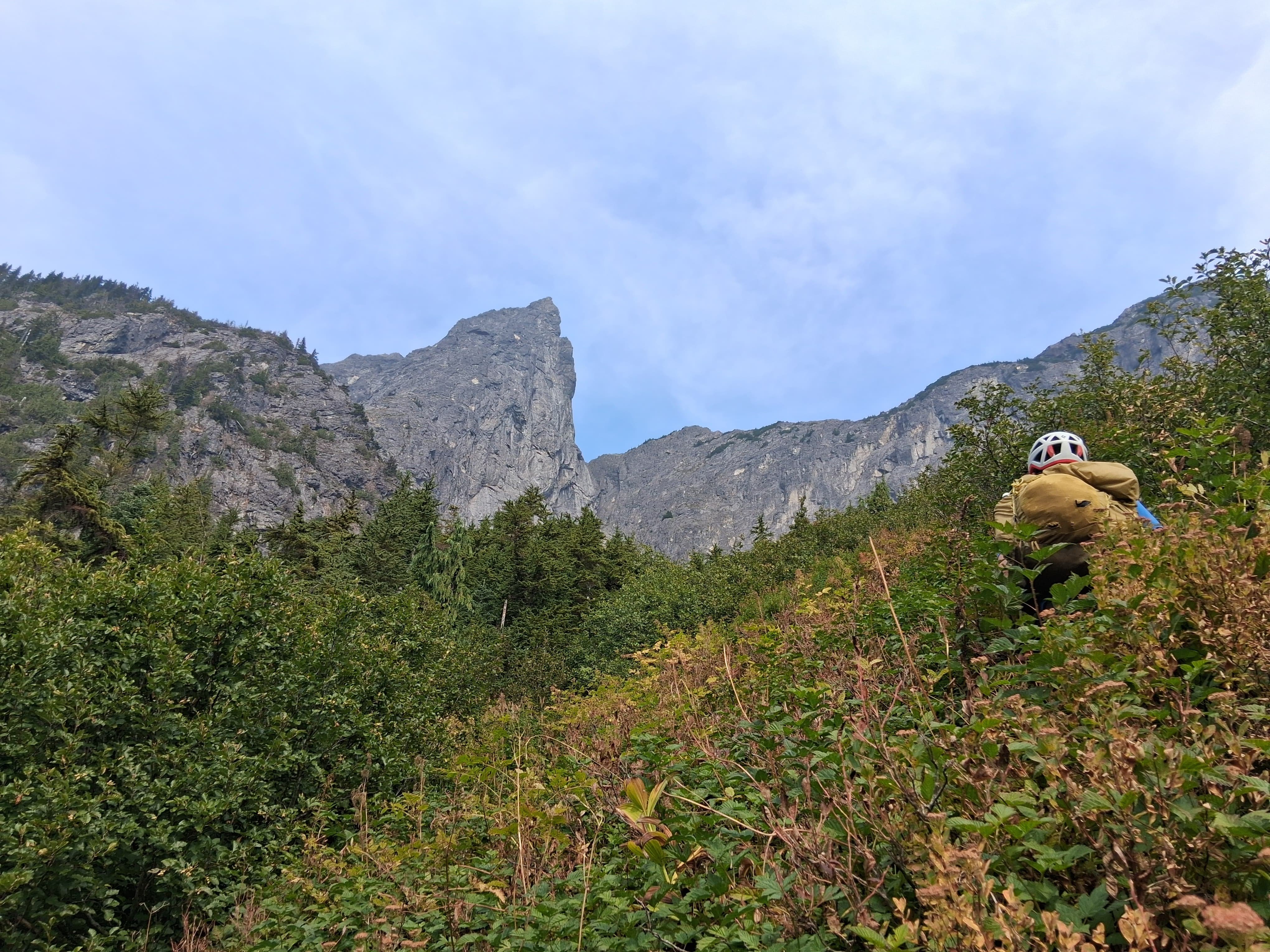
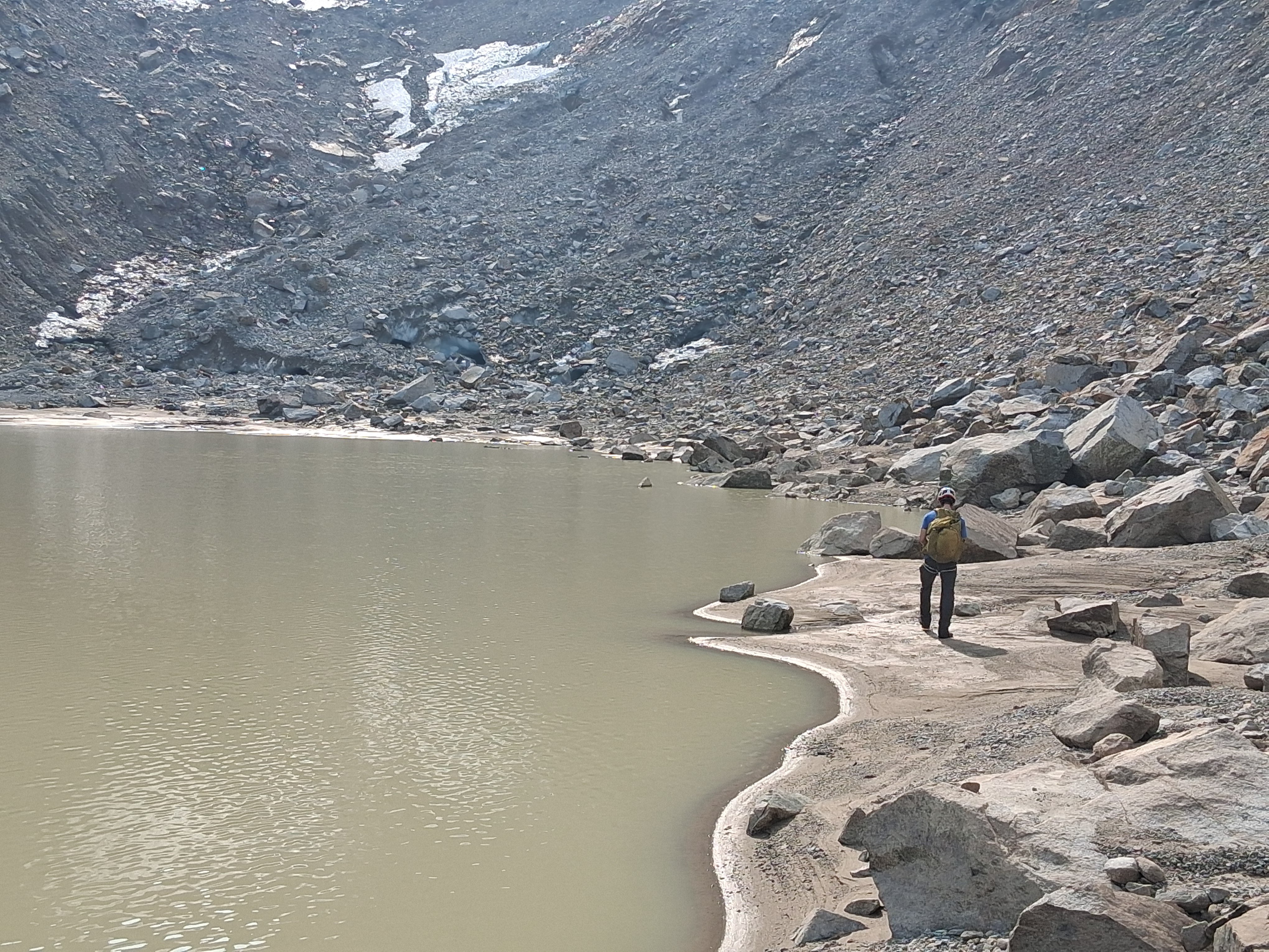
Trip Report: September 27-28, 2025 Climbed this route with my brother, Neta. I rarely write trip reports, but some additional beta for this climb might be useful. Peter's trip report is very accurate, and we followed the yellow lines closely for most of the way. Our description builds off of it, rather than being stand-alone. Beta: There is a climber's path from the lower Thornton Lake to above tree line, and from there it is pleasant travel to the saddle just South of Thornton Peak (48.69136, -121.35286). The traversing descent from there to Triumph Pass matched Peter's description. We found the steep side-slope, followed by a brief slide alder crossing, followed by a steep and cliffy forest to a bit miserable (or should I say, despairing?). This section was one of the cruxes of the route, made worse by the knowledge we have to do it in the harder direction on the way back. However, following the yellow line from Peter's photos worked well. Micro-spikes were very helpful in the side-slopes and in the steep forest. Attached are some GPS points that we recorded to help navigate the steeper portion on the way back. (Note that we did not record the slide alder crossing, which was just SE of the first point, or the steep traverses before that). TriumphBasin.gpx The descent from Triumph Pass towards lake below has deteriorated since August 2021. The glacier receded a lot, and the descent now involves loose scree. As expected from recently glaciated area, the rocks seemed to want to roll downhill at the slightest trigger, and getting through this section would have been challenging in a large group. Being only two of us, we went one at a time in the descent (where we rolled dozens of rocks), and on the way up we stayed very close together (and picked a better route with slightly less rockfall). The traverse from the lake below to the pocket lake below Mount Despair was uneventful (albeit tiring with more side-slopes), and it brought us to our camp as it was getting dark. The next morning we left camp at first light (around 6:30 this time a year) and headed towards the summit. We followed Peter's yellow route to the bottom of the Summit pyramid, to a beautiful saddle (~6600') with a great view. From there, we followed ledges and gullies through steep terrain, dry thorny heather, and loose blocks to reach the summit. On the way up we roughly followed the E ridge with some excursions to the SE Face. Unlike Peter's party we never crossed the ridge to the NE Face, which seemed very intimidating whenever we set eyes on it. The last hundred or so vertical feet below the summit were the most exposed, involving a steep gully and an exposed slab. Overall the climb involved sustained class three terrain where falling would be ill-advised, with a couple class four moves. Not finding a rappel anchor to our liking (did we mention that a lot of the blocks were loose?), we down-climbed the most exposed section, and walked to a saddle South of the summit, taking a better descent path than our ascent route. While the better descent part did not bypass the most exposed section, it meant bypassed some of the 3 gullies via slightly easier terrain, making for a less stressful descent. Below is a rough estimate of our routes, along with photos of Neta on the most exposed slab, and in one of the many gullies. From the bottom of the summit pyramid we retraced our steps, making use of the GPS points we recorded to get through the steep section in Triumph basin. While there may have been a better way then the way we took to get there, we had no desire to waste time route-finding with darkness on our tails. Our only mishap was taking a wrong fork on the climber's path above the middle Thornton lakes that lead us to the outlet of the middle lake, which we did not get to on the way up. It would have made for a nice side trip had we not been so tired. However, as it was, we retraced our steps up to the climber path that we came on (Peter's yellow line). Continuing down the creek to the inlet of the lower lake and connecting to the climber's path from there might have also worked, but we preferred to retrace our steps over an additional adventure. Times: Left the car Saturday slightly after 9am, and reached camp at Lake Despair (is it what it's called? 48.72737, -121.37365) around 7:30pm, as it got dark. On the second day we left camp at 6:40am at first light, summited, and got back to camp at 10:50am. We left camp soon after, and reached the trail at the lower Thornton lake just before 7, happy to avoid off-trail travel in the dark. Back to the car by 9pm. Additional Photos Thornton Lakes, lined up from the saddle: Through the Triumph Creek basin: Mount Triumph, from a flattering angle. To it's right is the scree we had to descend, with the remnant of a glacier. And the loooong way back: Is this as classic as it gets for a North Cascades trip? Bushwhacking with Triumph towering over our head: A goat, with Upper Thornton Lake in the background: