-
Posts
1 -
Joined
-
Last visited
Matt Skorina's Achievements
")
Gumby (1/14)
1
Reputation
-
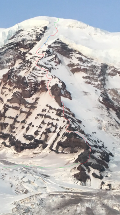
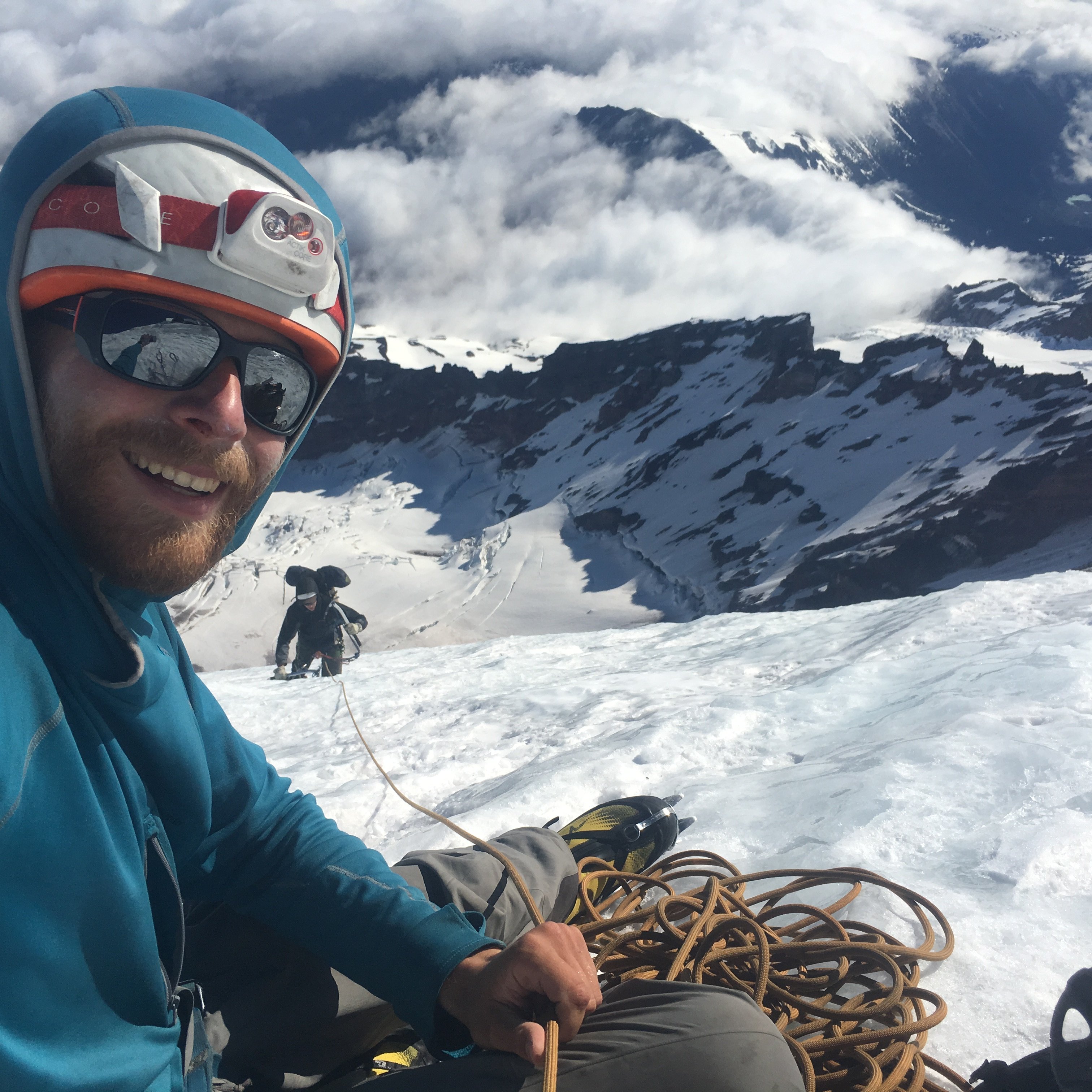
Trip: Mt Rainer - Liberty Ridge Trip Date: 05/26/2018 Trip Report: Sam and I completed Liberty Ridge this weekend. We had fabulous weather and a great time. I hope some of this info helps anyone. Stay safe and have fun. Day 1 - Thursday 5/24 Left car at 9:30a, warm sunny day Post-holing from snow by glacier basin to Elmo’s Pass, would recommend taking the summer trail as long as possible Winthrop Glacier straightforward except for far (western) side where there were crevasses next to piles of frozen dirt We camped on dirt at 7420ft on Curtis Ridge, good overlook onto Carbon Glacier and view of Liberty Ridge. Room for maybe 5 tents Day 2 - Friday 5/25 Left camp at 6:30a, also warm and sunny, freezing level was at around 10,500ft the night before Walked down the ridge to first obvious weakness at about 7200ft, looking up after doing this we saw a good place to go down about 100ft higher. There was a single tent platform on dirt at about 7180ft just before you get on the snow Lower Carbon Glacier was firm and easy to navigate, even though it looked intimidating from Curtis Ridge We were aiming to get onto the ridge low on the left (east) side and were able to go pretty much straight for it. There were a couple of sketchy snow bridges just after the first steep section at around 8200ft We got on the ridge at 8820ft with about a 60ft section of steep, loose rock. We both soloed this and it was pretty scary. We also kicked off a lot of rock onto both sides of the ridge crest, the party behind gave us a good bit of room. We went on both sides of the ridge near the crest until Thumb Rock, sometimes on rock, sometimes on snow. We did two more steep, loose rock steps. There was a little firm snow in the shade and lots of knee to waist post-holing. We should have gotten an earlier start on this day so the steep snow would have been a little firmer. Thumb Rock camp at 10,500ft. Got there at 1:15p. Camped on snow but had a nice rock perch to sit and cook. Plenty of room for us and the six other people behind us on route. If I were to do this again under the same conditions I would attempt to gain the ridge from the right side and go up the snow slope entirely on the right side to Thumb Rock. This would avoid the loose rock sections on the ridge proper at the cost of more crevasse navigation on the upper Carbon Glacier and maybe a bergschrund to deal with. I can’t confirm that it goes that way though, and the two parties behind us followed our lead up the left side. Sam didn’t mind the loose rock as much as I did however... Day 3 - Saturday 5/26 Left camp at 3:15am, clear night, freezing level at 9500ft Nice firm snow going up left from Thumb Rock, the ice pitch we read about was not in There was about a 15ft 35deg dirt covered ice traverse near 11,800ft (I think), this might be avoided by climbing down under it We roped up to the right of the big tongue of ice visible from camp. We climbed one 50m snow pitch with ice steps, 3 50m ice pitches (the first of which was the steepest and most sustained, maybe up to 50deg), then one more snow pitch with ice steps. It might have been possible to traverse further right to the top of the black pyramid below where we roped up to avoid much of the ice. Not sure what the conditions are that way, there was a lot of ice just beneath the snow in this area so even if it looks like snow it might climb like ice. We had six ice screws, two for the anchor, one 20ft up, another at half a rope length, and two more for the next anchor. I took both our technical tools for the lead and my partner followed with two hybrid axes. This worked good for us. We walked the obvious snow bridges through the bergschrund, then cut right at the first choice. This took us up about a 15ft section of maybe 70deg snow to a snow bridge crossing (which we belayed) of a crevasse and onto mellower ground We ended up soloing all of the ridge except the 250m of ice and the bergschrund up top Easy walking to the summit of Liberty Cap, then down and up to the summit of Columbia Crest at 2:40p Straightforward following the boot pack down the Emmons Glacier to Camp Schurman. It was windy and overcast for us at this point so all the way down the mountain until 7000ft was breakable crust. No glissading down the interglacier Gear Notes: 55m rope 6 screws 3 pickets (only used to anchor tent) 2 technical tools (Cassin All-Mtn) 2 hybrid axes (BD Venom) Stove / tent / sleep system / etc. Approach Notes: See trip report This picture was taken from Curtis Ridge Friday 5/25 morning. It shows our approximate route up the ridge. Green is roped together for crevasse risk, Red was unroped, and blue is pitched out ice climbing. Climbing the ice